Embed Size (px)
Citation preview
Emergency response and Disaster risk management based on Remote
sensing and Multi-source data fusion China Transport Telecomunications & Information Center,
Ministry of Transport of the People’s Republic of China
September,2019
Content
Ⅱ.
Ⅲ.
Ⅳ. Conclusion
Limitations
Applications
Ⅰ. Requirements
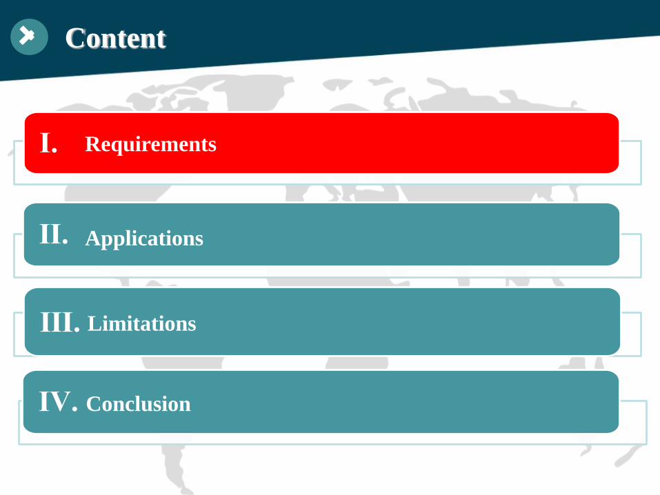
Total length of highway network: 4.84 millionkilometers expressway: 142,600 kilometers rural road: 4.03 million kilometers
Transport infrastructure in China
railways: 131,000 kilometers inland waterways: 127,100 kilometers berths: 23,919
By the end of 2018
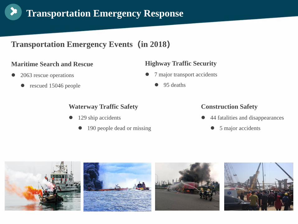
Transportation Emergency Events(in 2018)
Transportation Emergency Response
Construction Safety 44 fatalities and disappearances
5 major accidents
Maritime Search and Rescue 2063 rescue operations
rescued 15046 people
Waterway Traffic Safety 129 ship accidents
190 people dead or missing
Highway Traffic Security 7 major transport accidents
95 deaths
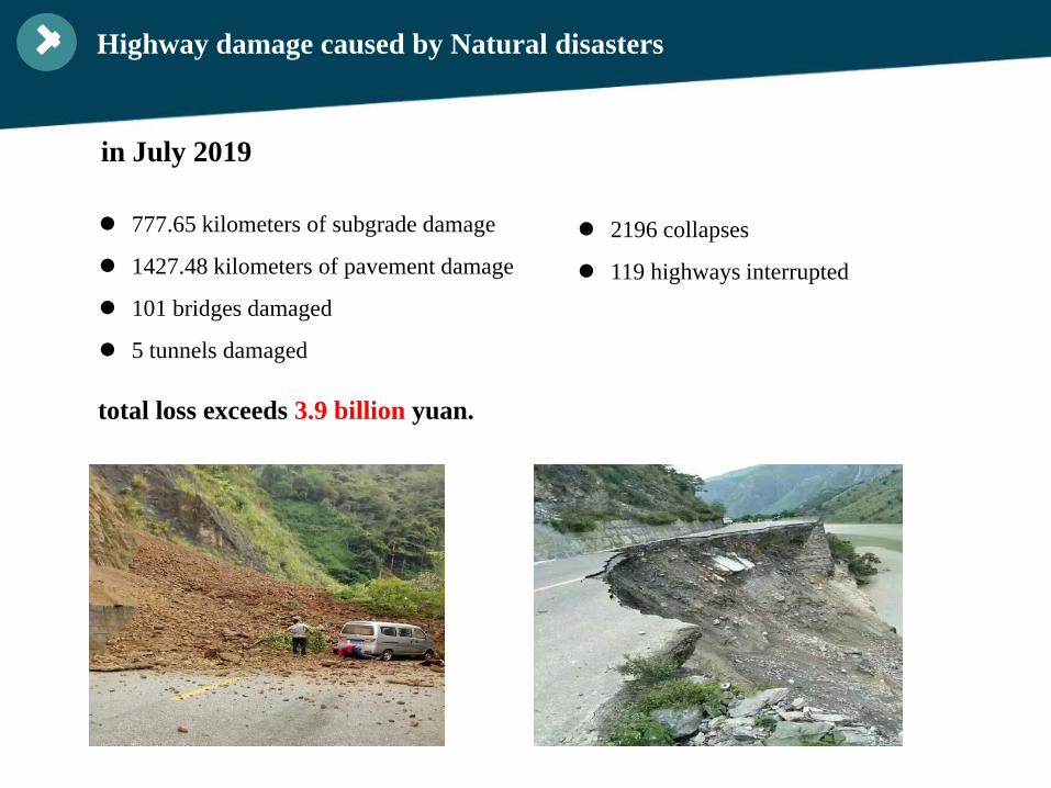
777.65 kilometers of subgrade damage
1427.48 kilometers of pavement damage
101 bridges damaged
5 tunnels damaged
Highway damage caused by Natural disasters
2196 collapses
119 highways interrupted
in July 2019
total loss exceeds 3.9 billion yuan.
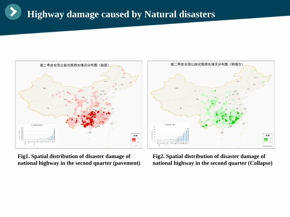
Highway damage caused by Natural disasters
Fig1. Spatial distribution of disaster damage of national highway in the second quarter (pavement)
Fig2. Spatial distribution of disaster damage of national highway in the second quarter (Collapse)
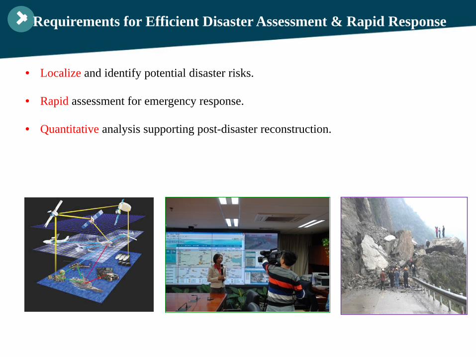
• Localize and identify potential disaster risks.
• Rapid assessment for emergency response.
• Quantitative analysis supporting post-disaster reconstruction.
Requirements for Efficient Disaster Assessment & Rapid Response
Content
Ⅱ.
Ⅲ.
Ⅳ. Conclusion
Limitations
Applications
Ⅰ. Requirements
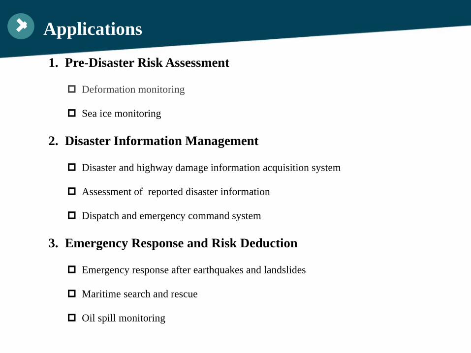
Applications
1. Pre-Disaster Risk Assessment
Deformation monitoring
Sea ice monitoring
2. Disaster Information Management
Disaster and highway damage information acquisition system
Assessment of reported disaster information
Dispatch and emergency command system
3. Emergency Response and Risk Deduction
Emergency response after earthquakes and landslides
Maritime search and rescue
Oil spill monitoring
Pre-Disaster Risk Assessment
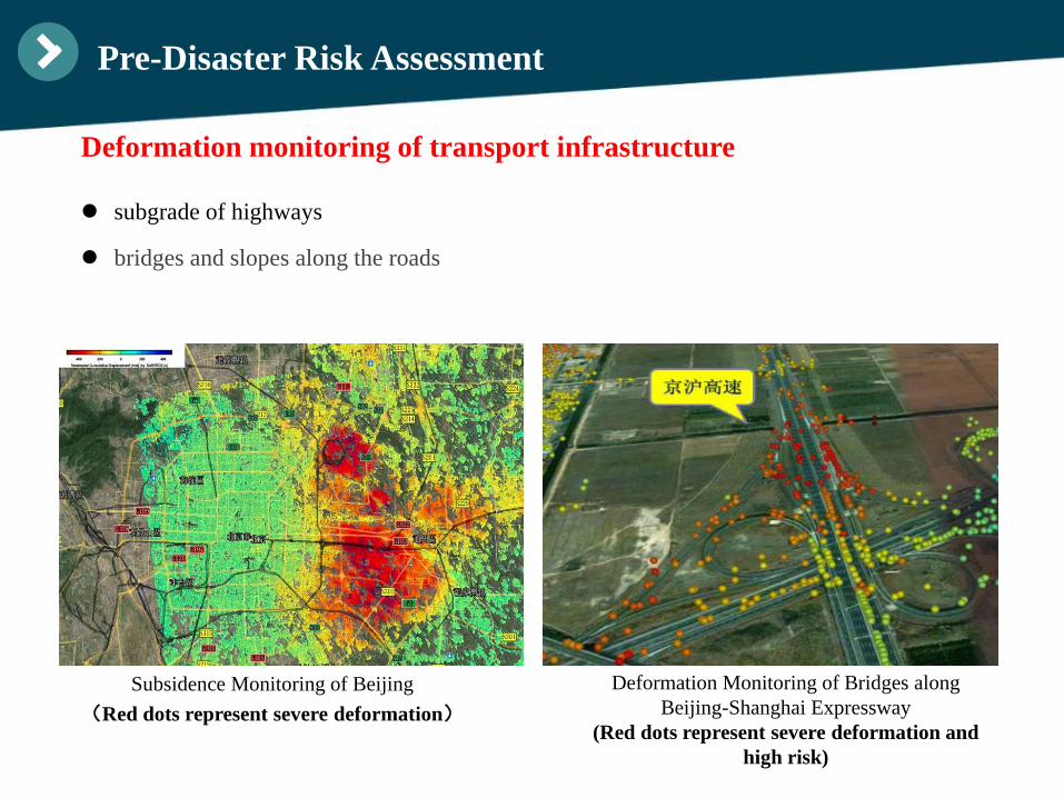
subgrade of highways
bridges and slopes along the roads
Subsidence Monitoring of Beijing(Red dots represent severe deformation)
Deformation Monitoring of Bridges along Beijing-Shanghai Expressway
(Red dots represent severe deformation and high risk)
Pre-Disaster Risk Assessment
Deformation monitoring of transport infrastructure
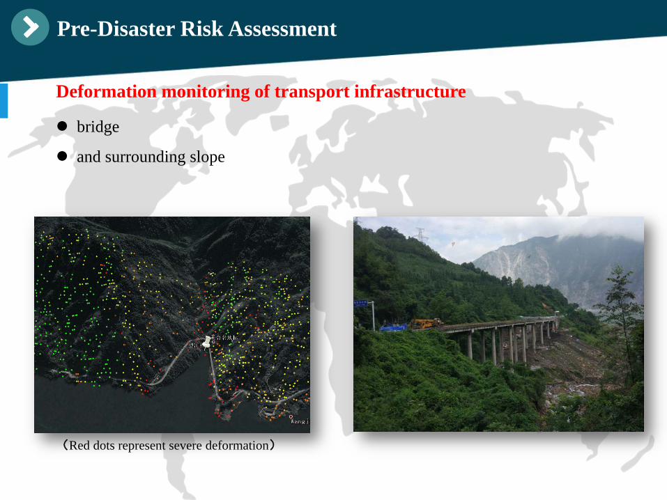
bridge
and surrounding slope
Pre-Disaster Risk Assessment
Deformation monitoring of transport infrastructure
(Red dots represent severe deformation)
Pre-Disaster Risk Assessment
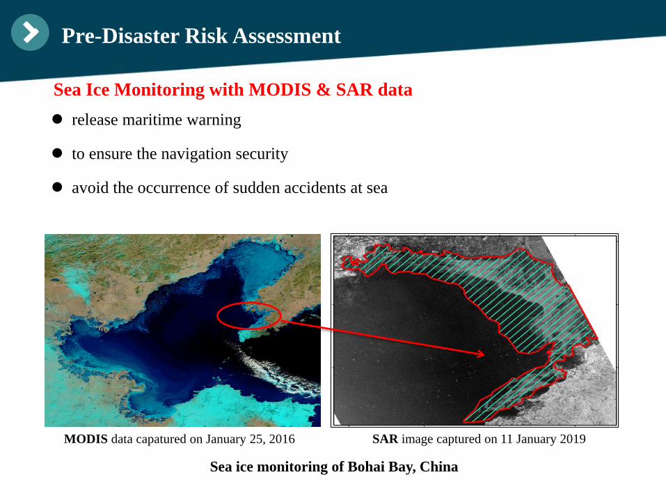
release maritime warning
to ensure the navigation security
avoid the occurrence of sudden accidents at sea
MODIS data capatured on January 25, 2016 SAR image captured on 11 January 2019
Sea Ice Monitoring with MODIS & SAR data
Sea ice monitoring of Bohai Bay, China
Disaster Information Management
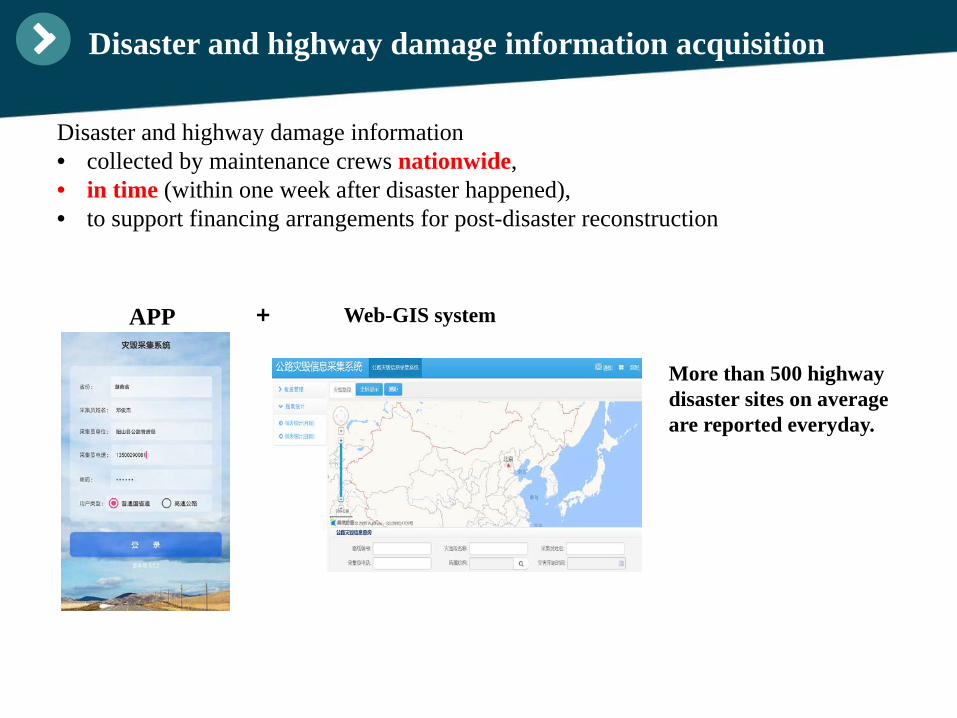
Disaster and highway damage information acquisition
More than 500 highway disaster sites on averageare reported everyday.
APP + Web-GIS system
Disaster and highway damage information• collected by maintenance crews nationwide,• in time (within one week after disaster happened),• to support financing arrangements for post-disaster reconstruction
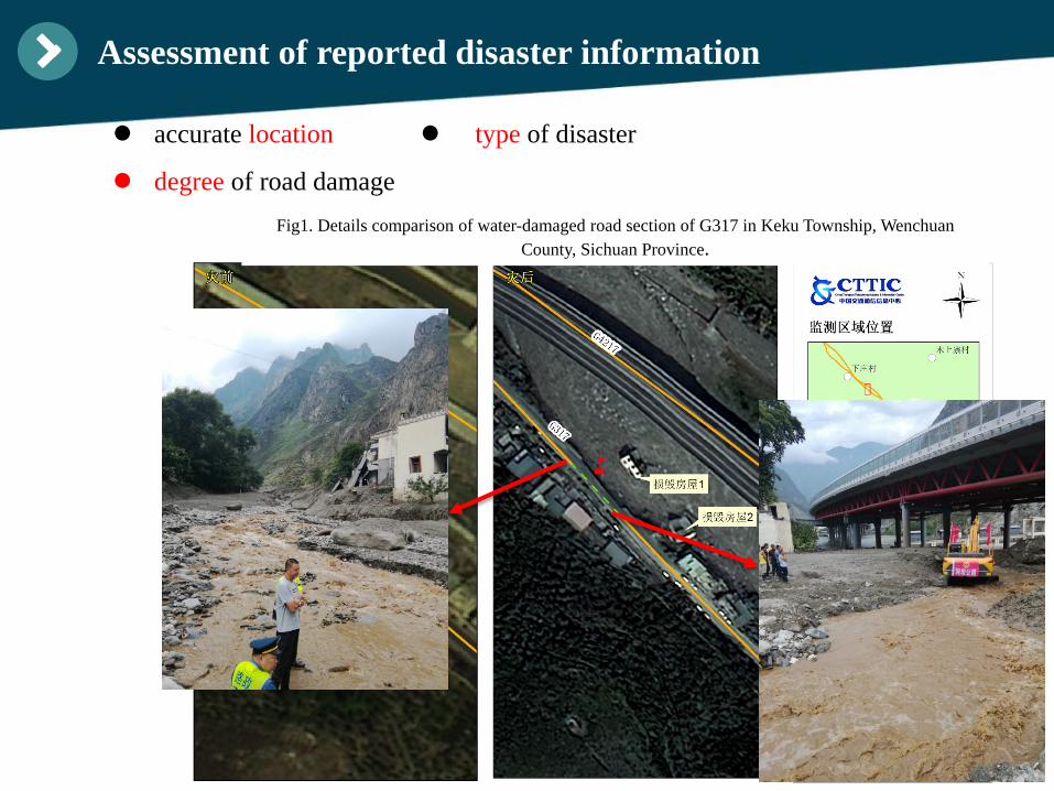
Assessment of reported disaster information
Fig1. Details comparison of water-damaged road section of G317 in Keku Township, WenchuanCounty, Sichuan Province.
accurate location
degree of road damage
type of disaster
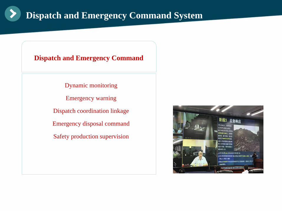
Dynamic monitoring
Emergency warning
Dispatch coordination linkage
Emergency disposal command
Safety production supervision
Dispatch and Emergency Command
Dispatch and Emergency Command System
Emergency Response and Risk Deduction
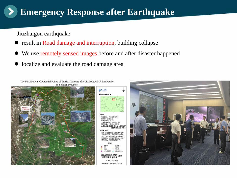
result in Road damage and interruption, building collapse
We use remotely sensed images before and after disaster happened
localize and evaluate the road damage area
Emergency Response after Earthquake
The Distribution of Potential Points of Traffic Disasters after Jiuzhaigou M7 Earthquake in Sichuan Province
Jiuzhaigou earthquake:
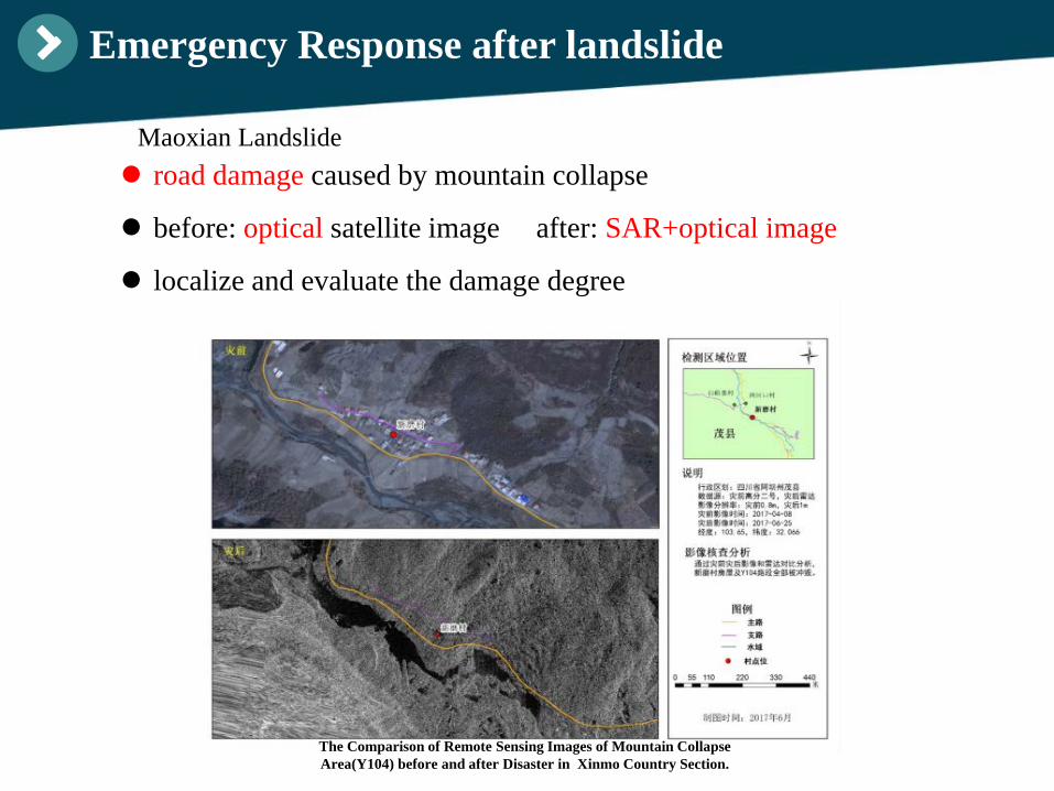
road damage caused by mountain collapse
before: optical satellite image after: SAR+optical image
localize and evaluate the damage degree
Emergency Response after landslide
The Comparison of Remote Sensing Images of Mountain Collapse Area(Y104) before and after Disaster in Xinmo Country Section.
Maoxian Landslide
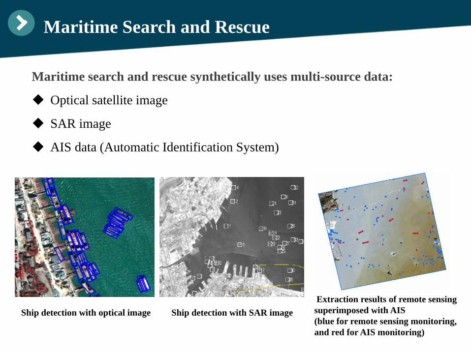
Maritime Search and Rescue
Maritime search and rescue synthetically uses multi-source data:
Optical satellite image
SAR image
AIS data (Automatic Identification System)
Ship detection with optical image Ship detection with SAR imageExtraction results of remote sensing superimposed with AIS(blue for remote sensing monitoring,and red for AIS monitoring)
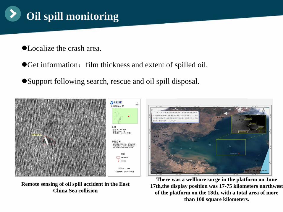
Oil spill monitoring
Localize the crash area.
Get information:film thickness and extent of spilled oil.
Support following search, rescue and oil spill disposal.
There was a wellbore surge in the platform on June 17th,the display position was 17-75 kilometers northwest
of the platform on the 18th, with a total area of more than 100 square kilometers.
Remote sensing of oil spill accident in the East China Sea collision
Content
Ⅰ.
Ⅲ.
Ⅳ. Conclusion
Requirements
ApplicationsⅡ.
Limitations
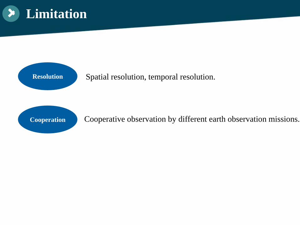
Limitation
Resolution Spatial resolution, temporal resolution.
Cooperation Cooperative observation by different earth observation missions.
Content
Ⅳ. Conclusion
RequirementsⅠ.
ApplicationsⅡ.
Limitations Ⅲ.
Conclusion
I. Importance. Remote sensing technology has played an important role in
transportation emergency response and risk management;
II. Trend. Single-source remote sensing has limitations and should be
combined with other data analysis mothods;
III. Suggestion. More technical cooperation and communications on
emergency response topics.

4.3 国内外的交通遥感合作—国内
国内方面,我中心已经与军方、科研院所、高校及大型的卫星遥感企业建立了长
期的合作关系,进一步推动遥感技术在交通领域的应用。
中国交通通信信息心中心联合航天有关卫星和传感器研制单位,以及中科院遥感所等科研单位,开展了p波段雷达在交通行业的应用及算法研究。主要围绕亚地表冻土层分布,林下道路识别,边坡土壤湿度反演,河道泥沙淤积等方面。
林下道路
Thank you!