Embed Size (px)
Citation preview
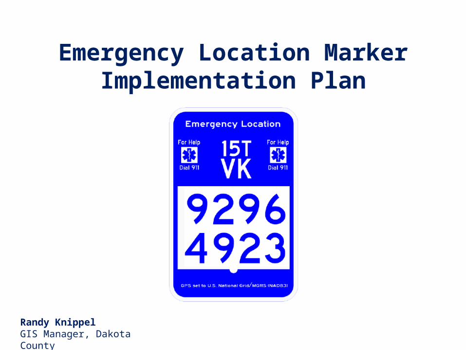
Emergency Location Marker Implementation Plan
Randy KnippelGIS Manager, Dakota County

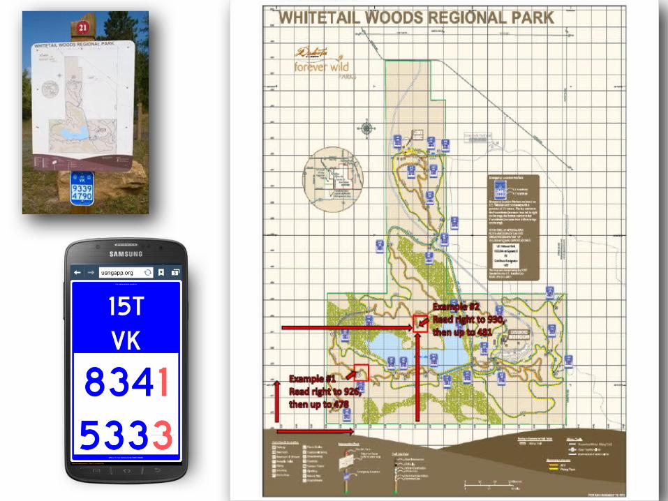
Whitetail Woods Regional Park
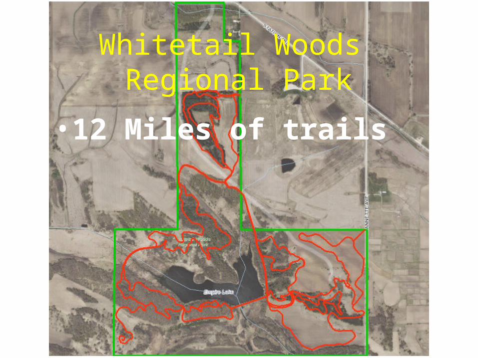
Whitetail Woods Regional Park
• 12 Miles of trails
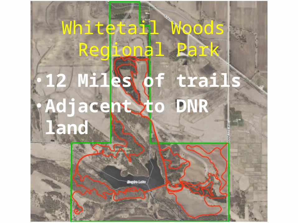
Whitetail Woods Regional Park
• 12 Miles of trails• Adjacent to DNR land


SupportingMaterials

Lebanon HillsRegional Park
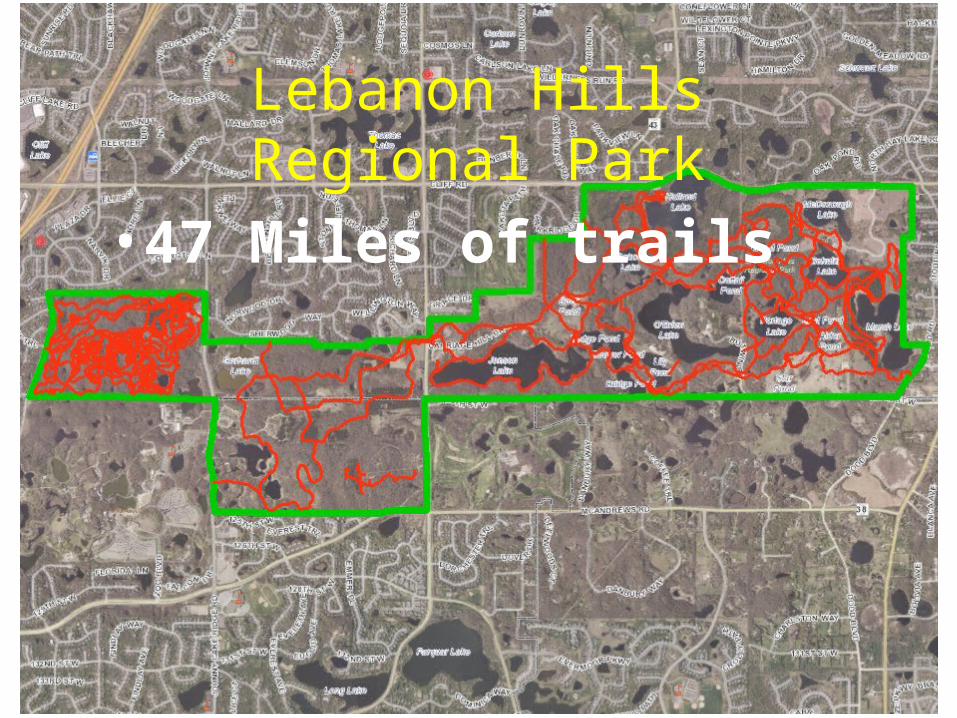
• 47 Miles of trails
Lebanon HillsRegional Park
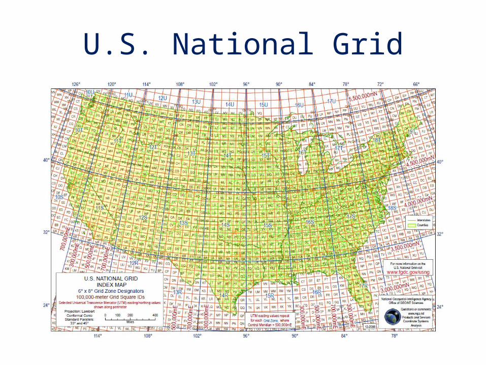
U.S. National Grid
U.S. National Grid
• National standard since 2001• Adopted by federal agencies
– FEMA, DHS, NGA, USGS• Adopted by several states
– Florida, Missouri, North Carolina, others– Minnesota (March 25, 2009)
• Military Grid Referencing System (MGRS)– National Guard– All NATO forces
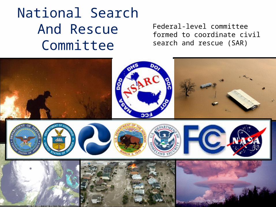
National Search And Rescue Committee
Federal-level committee formed to coordinate civil search and rescue (SAR)

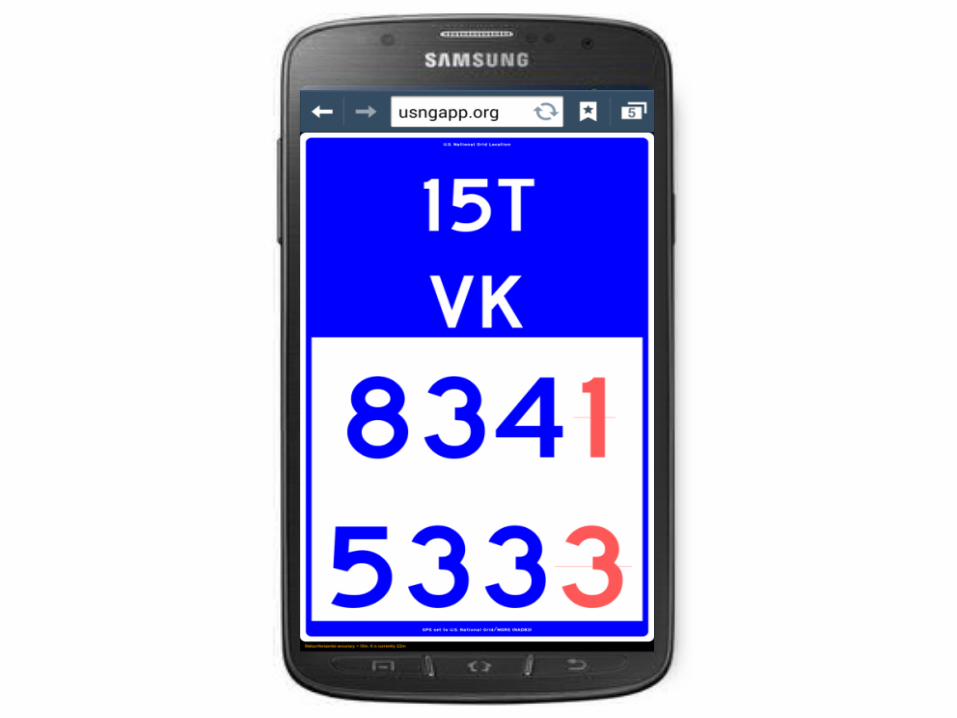
GeoCam
GridNavMyMGRS
Mobile Apps

Implementation PlanStrategy
• Identify and engage key stakeholders– Park administration– First responders– Dispatchers– General public– GIS technical support
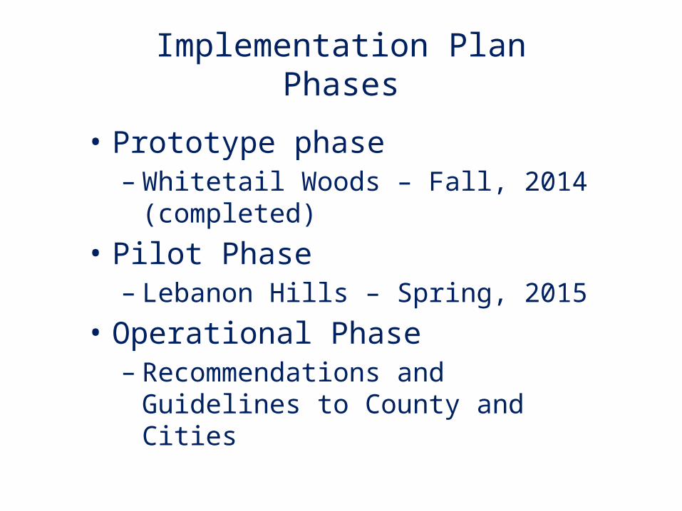
Implementation PlanPhases
• Prototype phase– Whitetail Woods – Fall, 2014 (completed)
• Pilot Phase– Lebanon Hills – Spring, 2015
• Operational Phase– Recommendations and Guidelines to
County and Cities
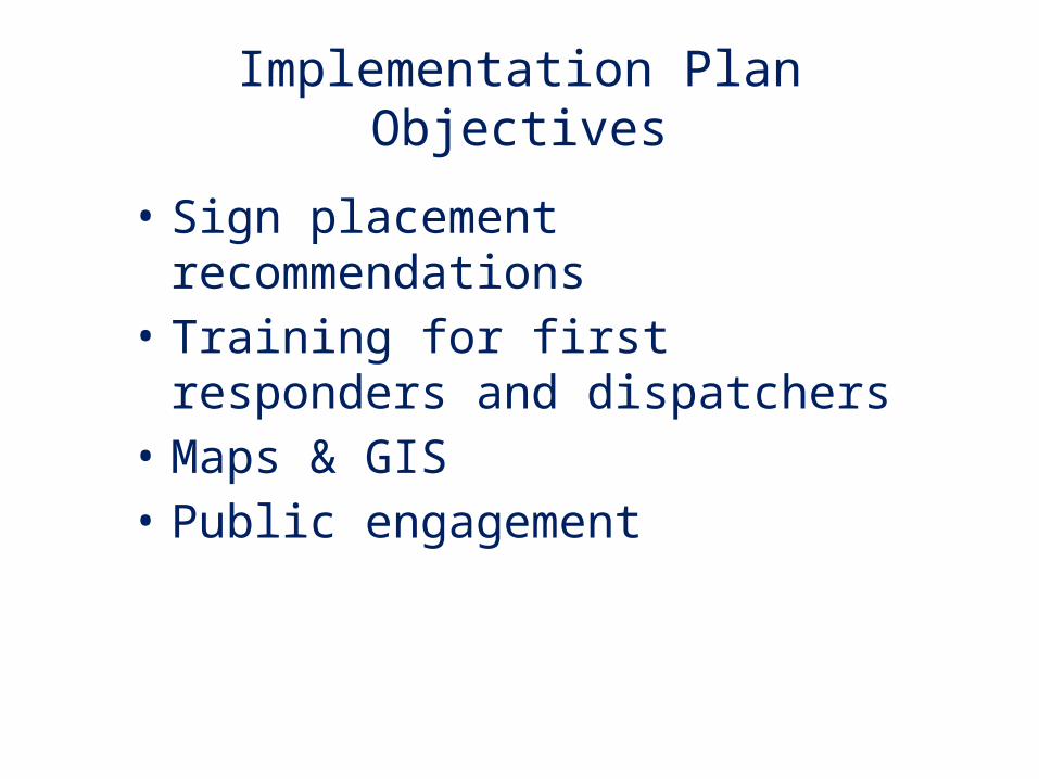
Implementation PlanObjectives
• Sign placement recommendations• Training for first responders and
dispatchers• Maps & GIS• Public engagement
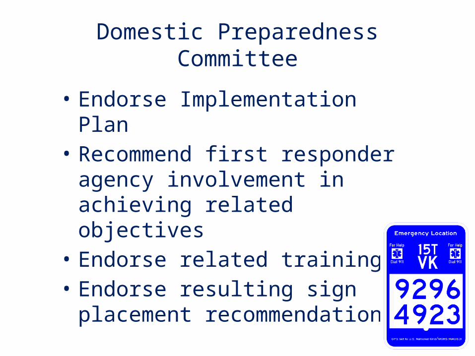
Domestic Preparedness Committee
• Endorse Implementation Plan• Recommend first responder agency
involvement in achieving related objectives
• Endorse related training• Endorse resulting sign placement
recommendations