Embed Size (px)
Citation preview
Geodesy and DatumsEllipsoid and Geoid
Geographic Coordinate system
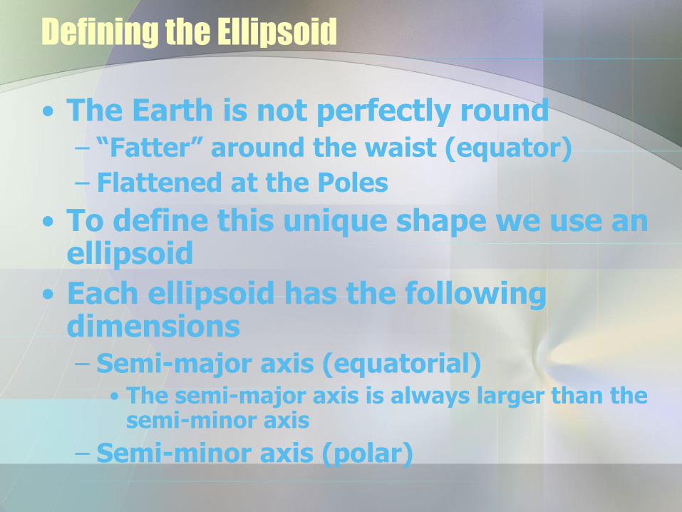
Defining the Ellipsoid
• The Earth is not perfectly round– “Fatter” around the waist (equator)
– Flattened at the Poles
• To define this unique shape we use an ellipsoid
• Each ellipsoid has the following dimensions– Semi-major axis (equatorial)
• The semi-major axis is always larger than the semi-minor axis
– Semi-minor axis (polar)
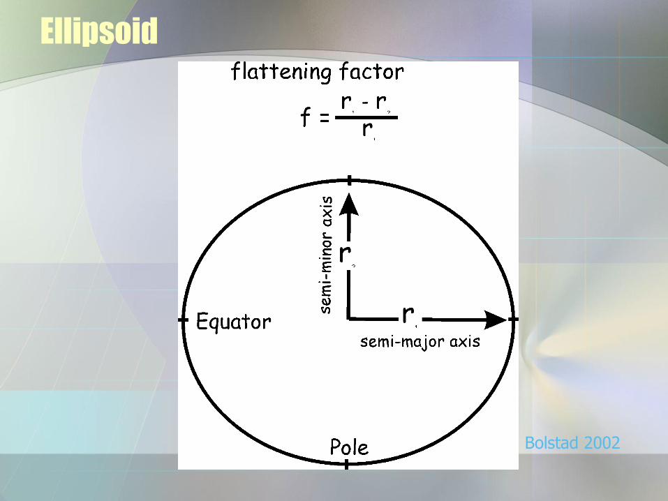
Ellipsoid
Bolstad 2002
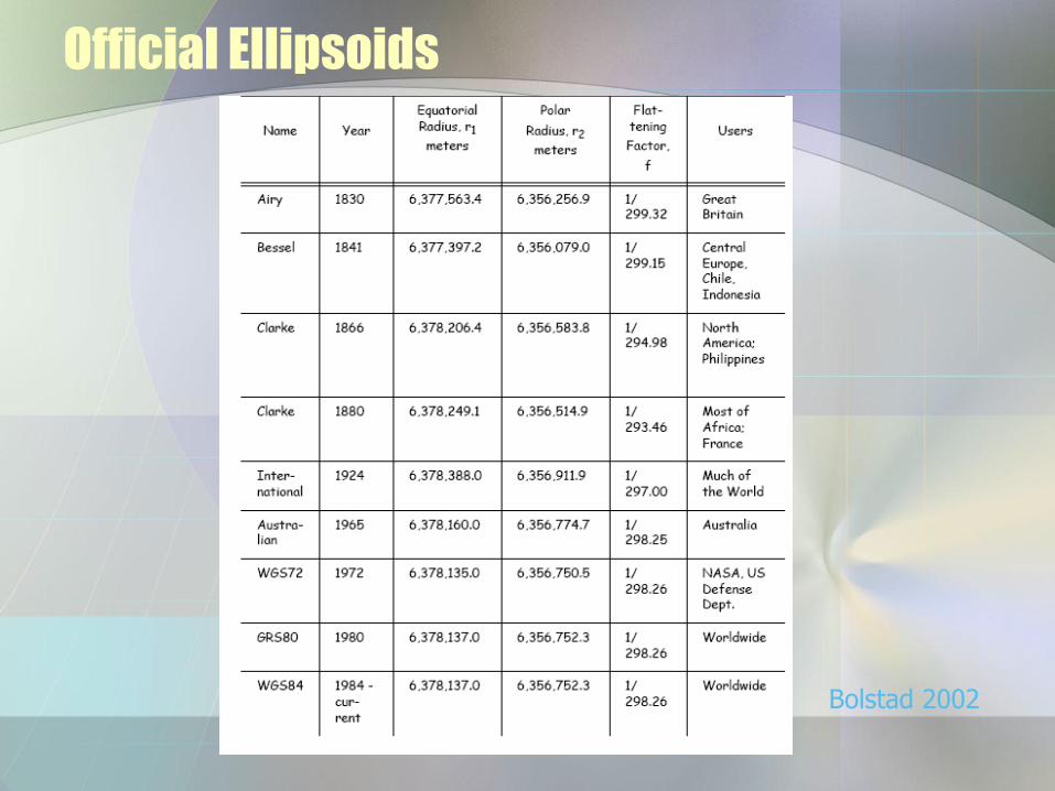
Official Ellipsoids
Bolstad 2002
Datums
• A datum provides the coordinates of an initial point that can be precisely located in the field
• A datum requires two components:
– Specification of an ellipsoid
– Points and lines which have been meticulously surveyed
Copyright © 2006 by Maribeth H. Price 3-6
Datums
• Different geographic coordinate systems may be defined and used
– Defined based on the shape of the earth with adjustments for best accuracy
• Differ in accuracy (older versus newer)
• Differ in purpose (for small or large areas)
• Customized for smallest error in specific locales
Copyright © 2006 by Maribeth H. Price 3-7
Datum definition
• A datum definition includes
– The particular spheroid used based on a determination of the earth’s major and minor axis
• Clarke 1866 vs GRS80
• Estimate has varied in accuracy
• New satellite determinations are most accurate
– The adjustment or fit (translation of center)
• Together these define the GCS
Copyright © 2006 by Maribeth H. Price 3-8
Note for GPS Users
• GPS units may be set to collect points in more than one datum and projection– Often UTM or long-lat units may be
specified• UTM NAD 1983• UTM NAD 1927• Lat-Lon NAD 1983… etc
• You MUST know and record the datum in order to use the data correctly later!!!!!!– Be careful—the default datum setting might
not be the one you want

Copyright © 2006 by Maribeth H. Price 3-9
Datum transformations
• Projections are exact mathematical formulas– Projection conversions can be
accomplished very accurately
• Converting one datum to another requires specialized fitting– Not exact; errors may accumulate
with repeated transformations
– Several methods available• Some better than others for particular
changes
• Not all methods work for all transformations
Converting datums should be done only when necessary, and care should be taken in choosing the best method
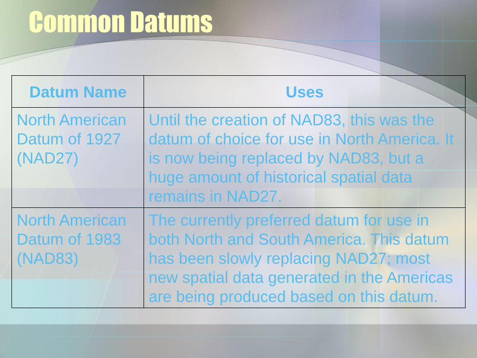
Common Datums
Datum Name Uses
North American
Datum of 1927
(NAD27)
Until the creation of NAD83, this was the
datum of choice for use in North America. It
is now being replaced by NAD83, but a
huge amount of historical spatial data
remains in NAD27.
North American
Datum of 1983
(NAD83)
The currently preferred datum for use in
both North and South America. This datum
has been slowly replacing NAD27; most
new spatial data generated in the Americas
are being produced based on this datum.
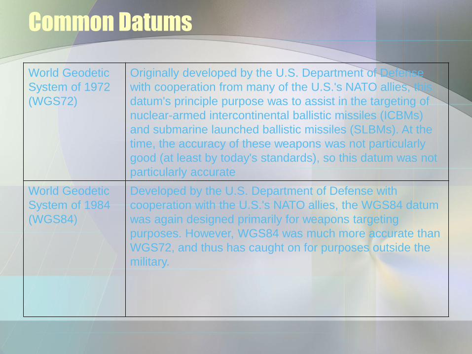
Common Datums
World Geodetic
System of 1972
(WGS72)
Originally developed by the U.S. Department of Defense
with cooperation from many of the U.S.'s NATO allies, this
datum's principle purpose was to assist in the targeting of
nuclear-armed intercontinental ballistic missiles (ICBMs)
and submarine launched ballistic missiles (SLBMs). At the
time, the accuracy of these weapons was not particularly
good (at least by today's standards), so this datum was not
particularly accurate
World Geodetic
System of 1984
(WGS84)
Developed by the U.S. Department of Defense with
cooperation with the U.S.'s NATO allies, the WGS84 datum
was again designed primarily for weapons targeting
purposes. However, WGS84 was much more accurate than
WGS72, and thus has caught on for purposes outside the
military.
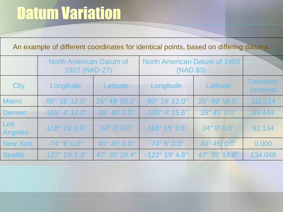
Datum Variation
An example of different coordinates for identical points, based on differing datums.
North American Datum of
1927 (NAD 27)
North American Datum of 1983
(NAD 83)
City Longitude Latitude Longitude Latitude Deviation
(meters)
Miami -80° 16' 12.0" 25° 49' 55.2" -80° 16' 12.0" 25° 49' 58.8" 111.124
Denver -105° 4' 12.0" 39° 45' 0.0" -105° 4' 15.6" 39° 45' 0.0" 85.444
Los
Angeles -118° 15' 0.0" 34° 0' 0.0" -118° 15' 3.6" 34° 0' 0.0" 92.134
New York -74° 6' 0.0" 40° 45' 0.0" -74° 6' 0.0" 40° 45' 0.0" 0.000
Seattle -122° 19' 1.2" 47° 35' 20.4" -122° 19' 4.8" 47° 35' 16.8" 134.048
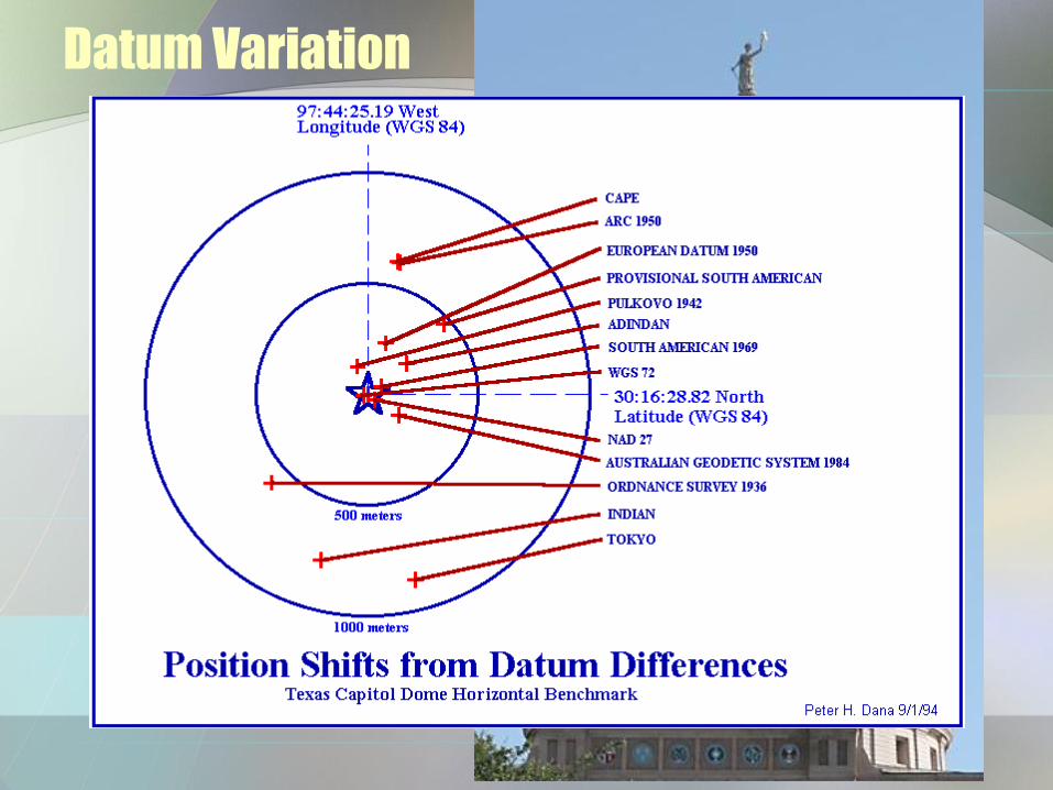
Datum Variation
Copyright © 2006 by Maribeth H. Price 3-14
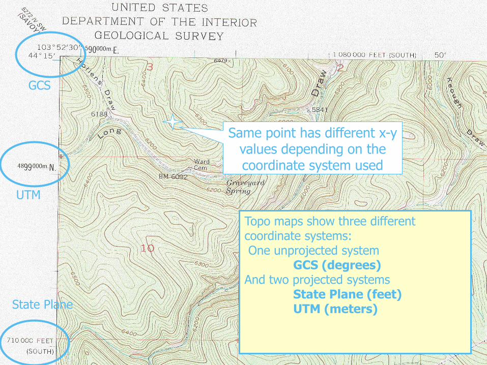
Topo maps show three different coordinate systems:One unprojected system
GCS (degrees)And two projected systems
State Plane (feet)UTM (meters)
Same point has different x-y values depending on the coordinate system used
GCS
UTM
State Plane
Copyright © 2006 by Maribeth H. Price 3-15
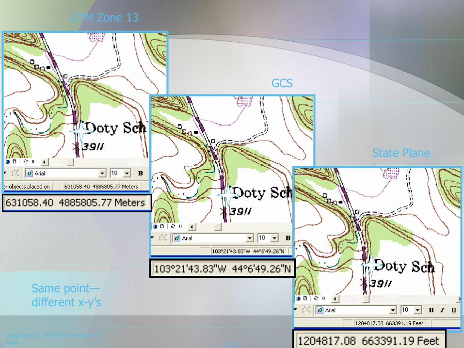
UTM Zone 13
GCS
State Plane
Same point—different x-y’s
Copyright © 2006 by Maribeth H. Price 3-16
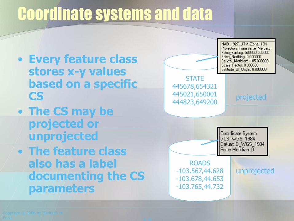
Coordinate systems and data
• Every feature class stores x-y values based on a specific CS
• The CS may be projected or unprojected
• The feature class also has a label documenting the CS parameters
ROADS-103.567,44.628-103.678,44.653-103.765,44.732
STATE445678,654321445021,650001444823,649200
unprojected
projected
Copyright © 2006 by Maribeth H. Price
3-17
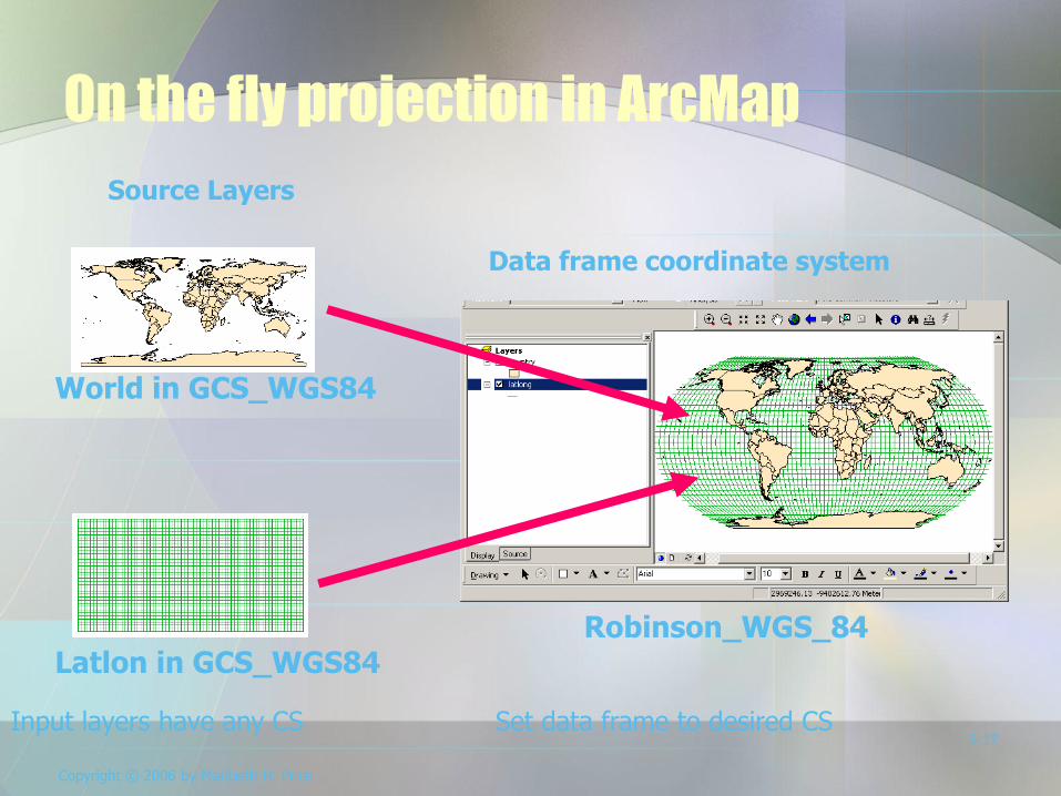
On the fly projection in ArcMap
World in GCS_WGS84
Latlon in GCS_WGS84
Source Layers
Data frame coordinate system
Robinson_WGS_84
Input layers have any CS Set data frame to desired CS
Copyright © 2006 by Maribeth H. Price 3-18
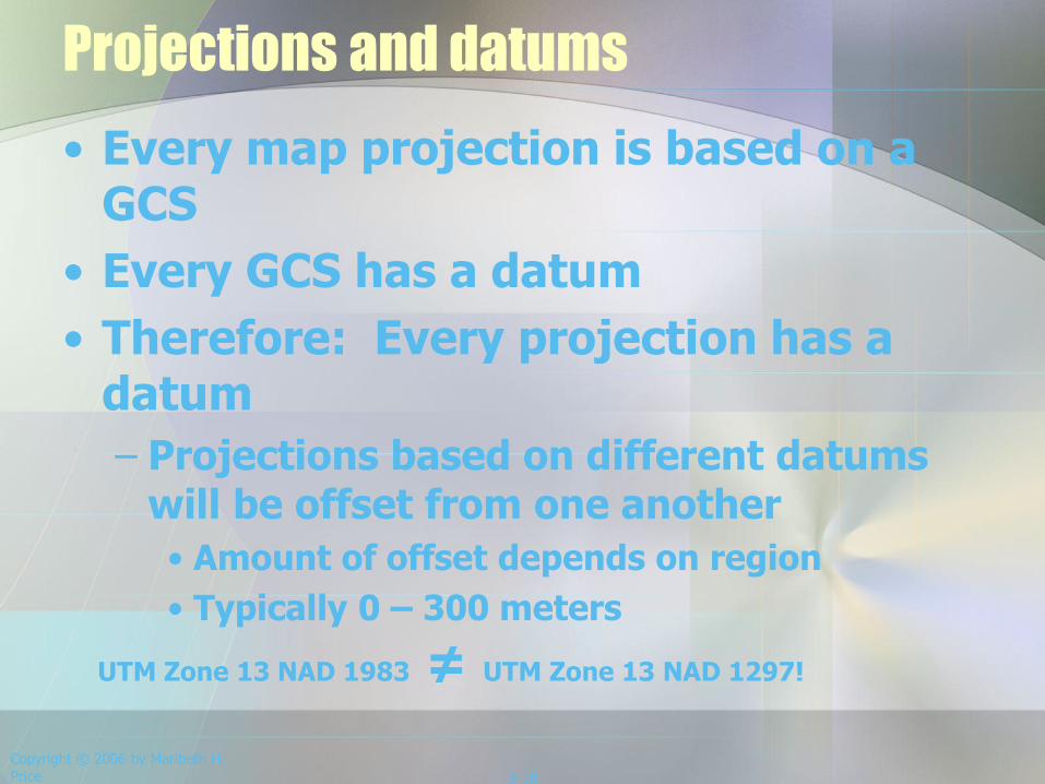
Projections and datums
• Every map projection is based on a GCS
• Every GCS has a datum
• Therefore: Every projection has a datum
– Projections based on different datums will be offset from one another
• Amount of offset depends on region
• Typically 0 – 300 meters
UTM Zone 13 NAD 1983 ≠ UTM Zone 13 NAD 1297!
Review
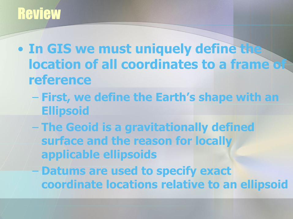
• In GIS we must uniquely define the location of all coordinates to a frame of reference
– First, we define the Earth’s shape with an Ellipsoid
– The Geoid is a gravitationally defined surface and the reason for locally applicable ellipsoids
– Datums are used to specify exact coordinate locations relative to an ellipsoid