Embed Size (px)
Citation preview
Lecture 1
Course Overview
Introduction to GIS Applications
Principles of Project Design
EEOS 381 - Spatial Databases and
GIS Applications
EEOS 381 - Spatial Databases and
GIS Applications
EEOS 381 - Spring 2015: Lecture 1 2
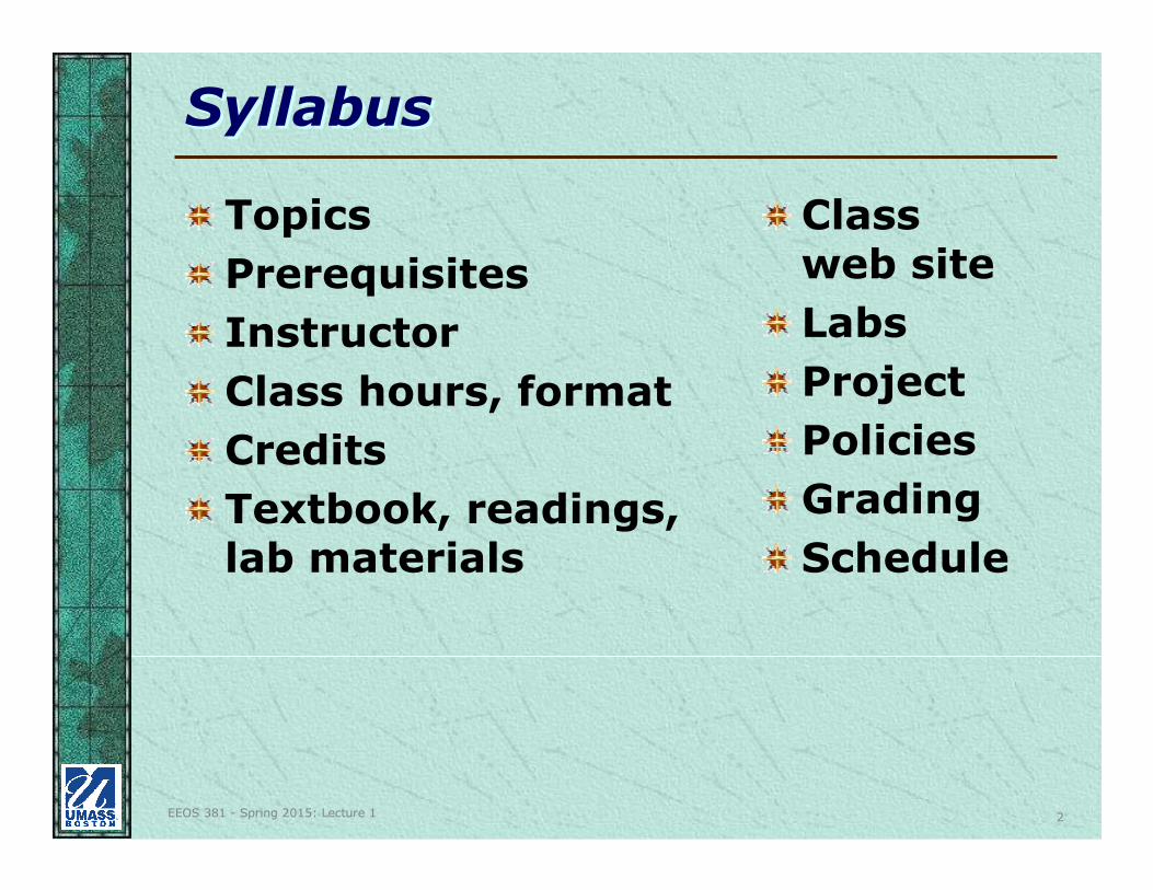
SyllabusSyllabus
Topics
Prerequisites
Instructor
Class hours, format
Credits
Textbook, readings, lab materials
Classweb site
Labs
Project
Policies
Grading
Schedule
EEOS 381 - Spring 2015: Lecture 1 3
Lab BasicsLab Basics
Student Accounts
–Each student will receive an account (username/password) to log into the network
• Use for PCs
• Don’t change password
• Previous accounts still active
–Additional Oracle account will be issued for use with ArcSDE
EEOS 381 - Spring 2015: Lecture 1 4
Lab BasicsLab Basics
Logging On–Windows 7 PCs -- At the login textbox
be sure that the domain is set to COMPSERVDOM
Logging Off–Start button > Shut Down, and
then choose Log off <username>
• Or, hit keys CTRL-ALT-DEL and click on the Logoff… button
EEOS 381 - Spring 2015: Lecture 1 5
Lab BasicsLab Basics
It is extremely important that you log off! Otherwise whoever uses the computer next will have complete access to your files!
You don’t need to shut down the PCs, just log off
EEOS 381 - Spring 2015: Lecture 1 6
Lab BasicsLab Basics
File storage:–Save work in your home directory on
the server (H:) and on at least one memory stick and/or portable hard drive; PCs have CD/DVD writers.
THE LAB IS NOT RESPONSIBLE FOR BACKING UP YOUR FILES!
*** Keep at least two copies of any files that are important to you. ***
*** Keep at least two copies of any files that are important to you. ***
EEOS 381 - Spring 2015: Lecture 1 7
Lab Basics: The ComputersLab Basics: The Computers
PCs
– Microsoft Windows XP Professional
Network drives (on st-helens.geogsvr.umb.edu)
– H: ”USER NAME” – your home directory
– S: ”classes”
– T: temp area/lab submission
– X: database (images, tutorial data)
– LASSEN-PEA (ArcSDE Windows server, with Oracle 11g
and ArcSDE 10)
EEOS 381 - Spring 2015: Lecture 1 8
Lab Basics: The ComputersLab Basics: The Computers
A user is limited to 2GB of files, owned by that user across all shares.
– Once a quota has been reached, the user will not be able to save or update files, including ESRI documents and maps (save to USB stick and clean out network share).
EEOS 381 - Spring 2015: Lecture 1 9
Lab Basics: PrintingLab Basics: Printing
There are two laser printers in entry room (Rm. 22)
There are two laser printers in Room 34
See note on printing quotas when you log in
But assignments will be turned in as digital files
EEOS 381 - Spring 2015: Lecture 1 10
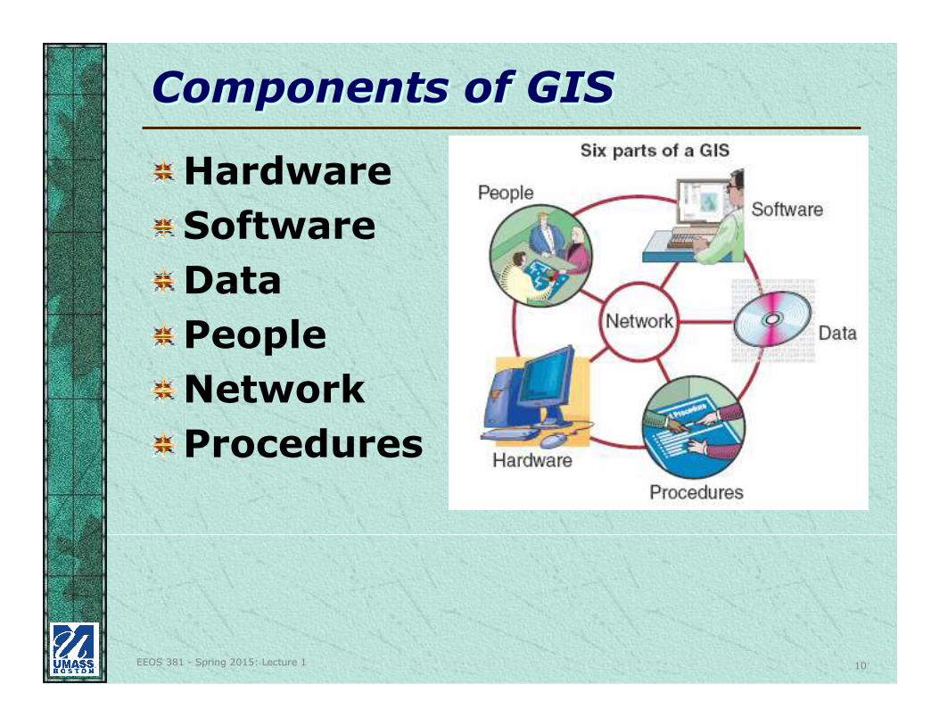
Components of GISComponents of GIS
Hardware
Software
Data
People
Network
Procedures
EEOS 381 - Spring 2015: Lecture 1 11
Definitions of GISDefinitions of GIS
An integrated collection of computer hardware and software, people, and data used to collect, store, manage and analyze objects and phenomena where geographic location is an important characteristic of or critical to analysis or problem-solving.
EEOS 381 - Spring 2015: Lecture 1 12
Definitions of GIS (cont.)Definitions of GIS (cont.)
From Table 1.3 (p. 16) in GIS&S:
–Maps in digital form (general public)
–Computerized tool for solving geographic problems (decision-makers, planners)
–Spatial decision support system(management scientists, operations researchers)
EEOS 381 - Spring 2015: Lecture 1 13
Definitions of GIS (cont.)Definitions of GIS (cont.)
– Mechanized inventory of geographically distributed features and facilities (utility managers, transportation officials, resource managers)
– Tool for revealing what is otherwise invisible in geographic information (scientists, investigators)
– Tool for performing operations (and analysis) on geographic data (resources managers, planners, cartographers, GIS Analysts and technicians)
EEOS 381 - Spring 2015: Lecture 1 14
Definitions of GIS (cont.)Definitions of GIS (cont.)
Bottom line - there are many definitions, depending on whom you ask, and depending on their application
What is your definition of GIS?
EEOS 381 - Spring 2015: Lecture 1 15
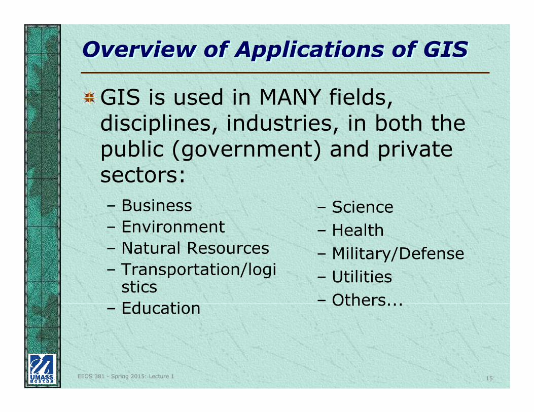
Overview of Applications of GISOverview of Applications of GIS
– Business
– Environment
– Natural Resources
– Transportation/logistics
– Education
– Science
– Health
– Military/Defense
– Utilities
– Others...
GIS is used in MANY fields, disciplines, industries, in both the public (government) and private sectors:
EEOS 381 - Spring 2015: Lecture 1 16
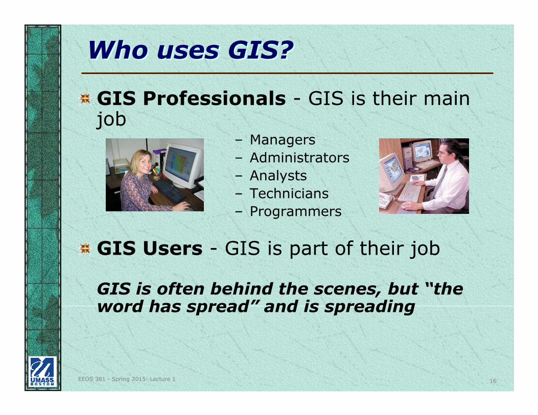
Who uses GIS?Who uses GIS?
GIS Professionals - GIS is their main job
– Managers
– Administrators
– Analysts
– Technicians
– Programmers
GIS Users - GIS is part of their job
GIS is often behind the scenes, but “the word has spread” and is spreading
EEOS 381 - Spring 2015: Lecture 1 17
Why GIS?Why GIS?
Solving real-world problems, many of which fundamentally have a spatial component or geographic dimension
Easier to use, more powerful “off-the-shelf” / “out of the box”software
Better, cheaper data (lots for free)
Cheaper hardware (including GPS)
EEOS 381 - Spring 2015: Lecture 1 18
Why GIS?Why GIS?
Networks (and Internet) now in place to support GIS
Linkage to non-GIS software (RDBMS)
Ability of maps to tell the story
Greater awareness of real applications and proven cost/benefit cases
EEOS 381 - Spring 2015: Lecture 1 19
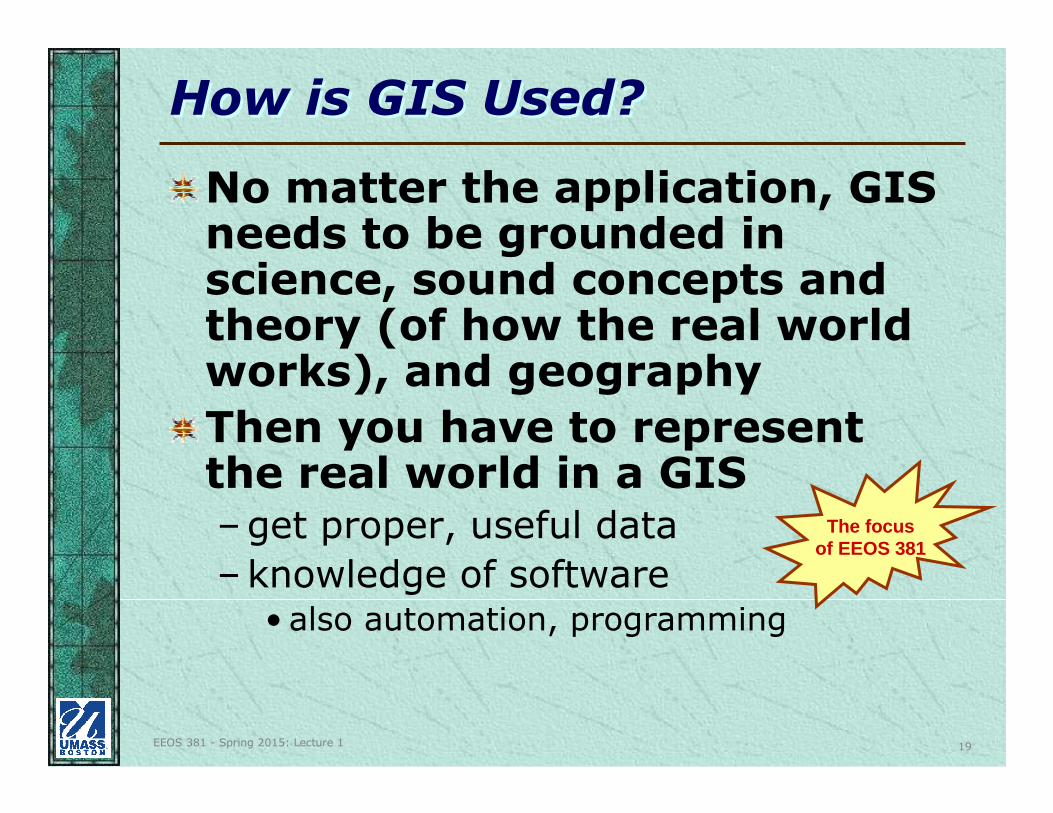
How is GIS Used?How is GIS Used?
No matter the application, GIS needs to be grounded in science, sound concepts and theory (of how the real world works), and geography
Then you have to represent the real world in a GIS–get proper, useful data
–knowledge of software• also automation, programming
The focusof EEOS 381
EEOS 381 - Spring 2015: Lecture 1 20
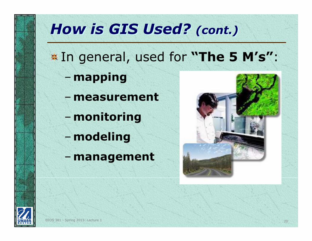
How is GIS Used? (cont.)How is GIS Used? (cont.)
In general, used for “The 5 M’s”:
–mapping
–measurement
–monitoring
–modeling
–management
EEOS 381 - Spring 2015: Lecture 1 21
How is GIS Used? (cont.)How is GIS Used? (cont.)
To answer questions:
–What is at …? (location)
–Where is …? (condition)
–What has changed since …? (trends)
–What spatial patterns exist? (patterns)
–What if …? (modeling)
To solve problems
EEOS 381 - Spring 2015: Lecture 1 22
How is GIS Used? (cont.)How is GIS Used? (cont.)
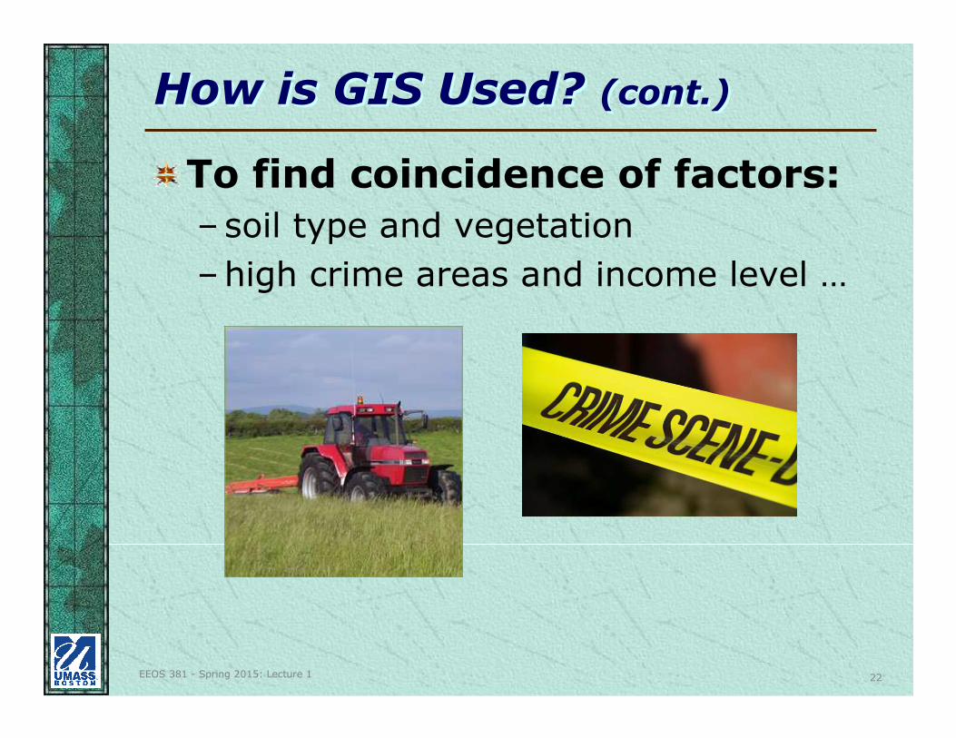
To find coincidence of factors:
–soil type and vegetation
–high crime areas and income level …
EEOS 381 - Spring 2015: Lecture 1 23
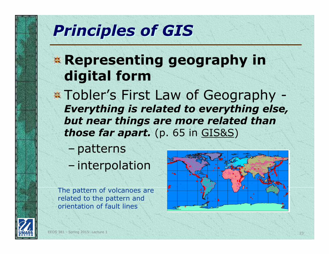
Principles of GISPrinciples of GIS
Representing geography in digital form
Tobler’s First Law of Geography -Everything is related to everything else, but near things are more related than those far apart. (p. 65 in GIS&S)
–patterns
– interpolation
The pattern of volcanoes are related to the pattern and orientation of fault lines
EEOS 381 - Spring 2015: Lecture 1 24
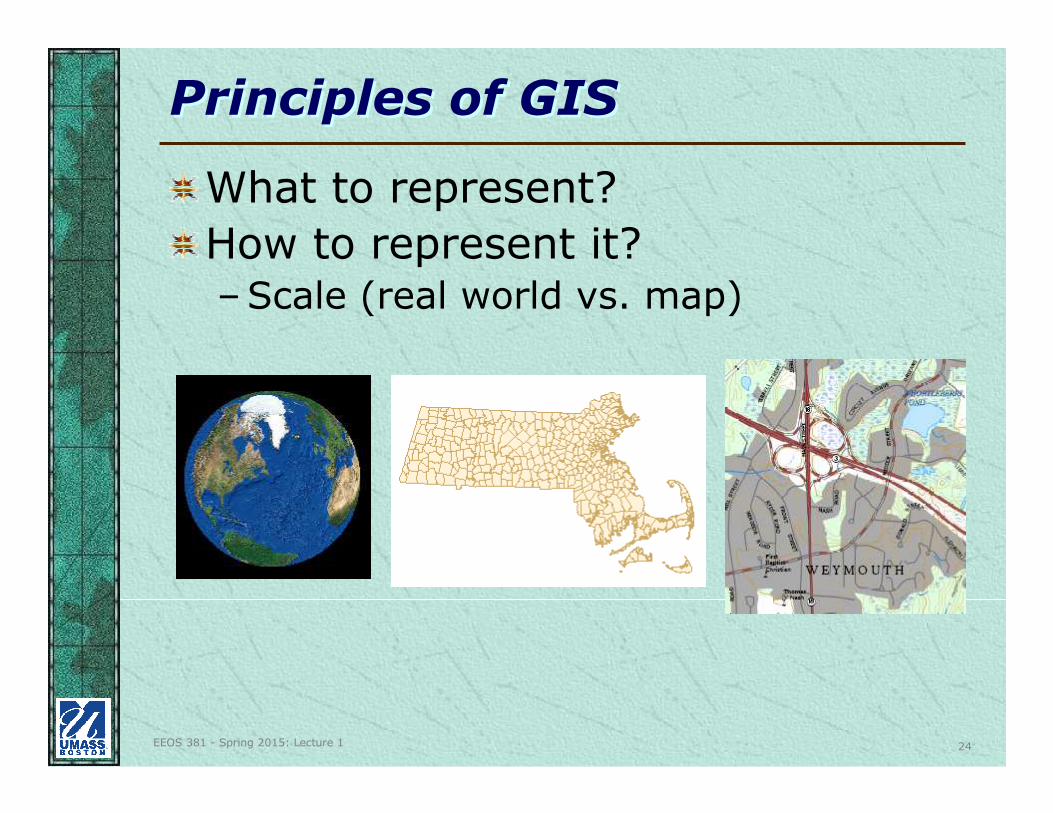
Principles of GISPrinciples of GIS
What to represent?
How to represent it?–Scale (real world vs. map)
EEOS 381 - Spring 2015: Lecture 1 25
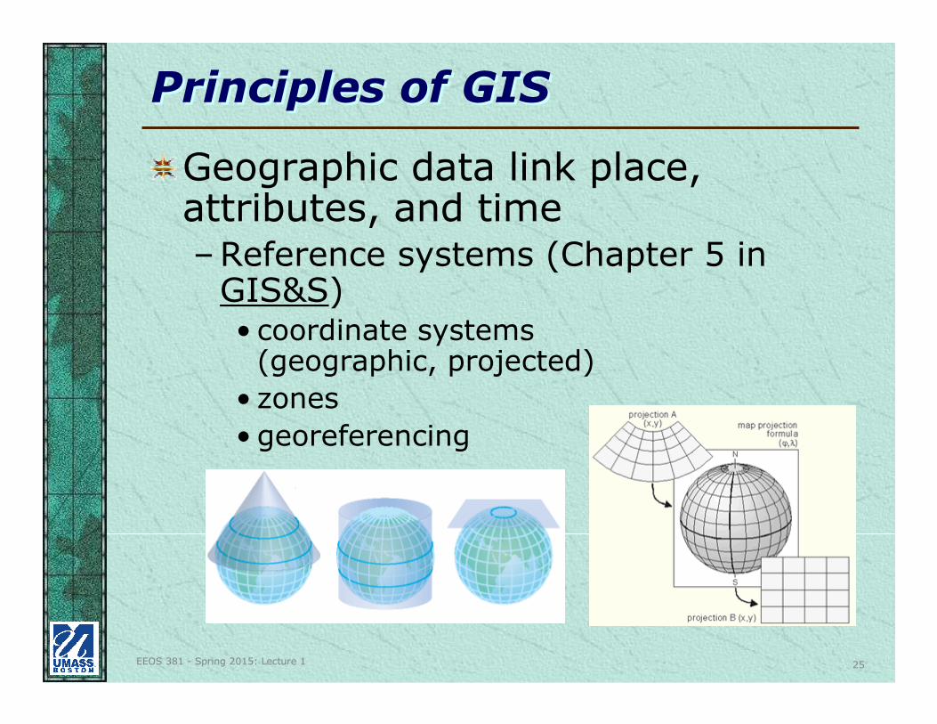
Principles of GISPrinciples of GIS
Geographic data link place, attributes, and time–Reference systems (Chapter 5 in
GIS&S)• coordinate systems
(geographic, projected)
• zones
• georeferencing
EEOS 381 - Spring 2015: Lecture 1 26
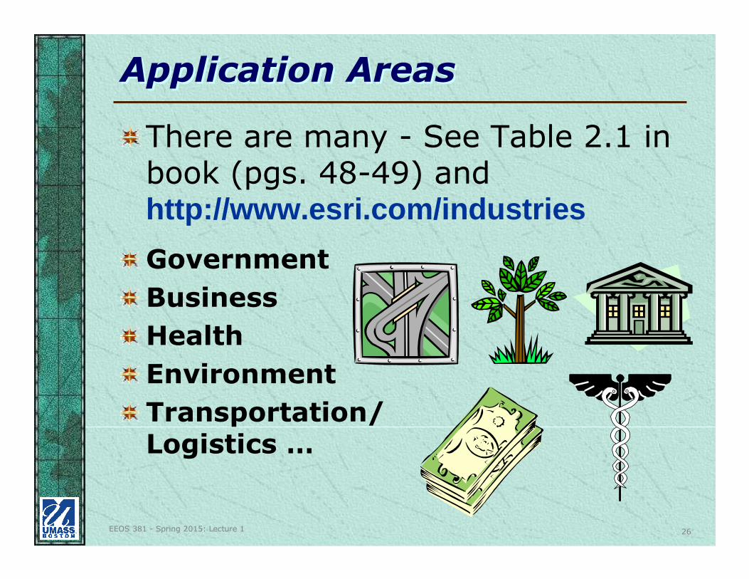
Application AreasApplication Areas
There are many - See Table 2.1 in book (pgs. 48-49) and http://www.esri.com/industries
Government
Business
Health
Environment
Transportation/Logistics …
EEOS 381 - Spring 2015: Lecture 1 27
GovernmentGovernment
Categories
– Inventory applications
– Policy Analysis applications
– Management/Policy-Making applications (which may affect allocation of funds)
EEOS 381 - Spring 2015: Lecture 1 28
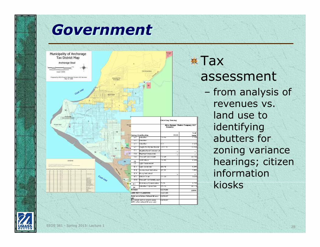
GovernmentGovernment
Tax assessment– from analysis of
revenues vs. land use to identifying abutters for zoning variance hearings; citizen information kiosks
EEOS 381 - Spring 2015: Lecture 1 29
GovernmentGovernment
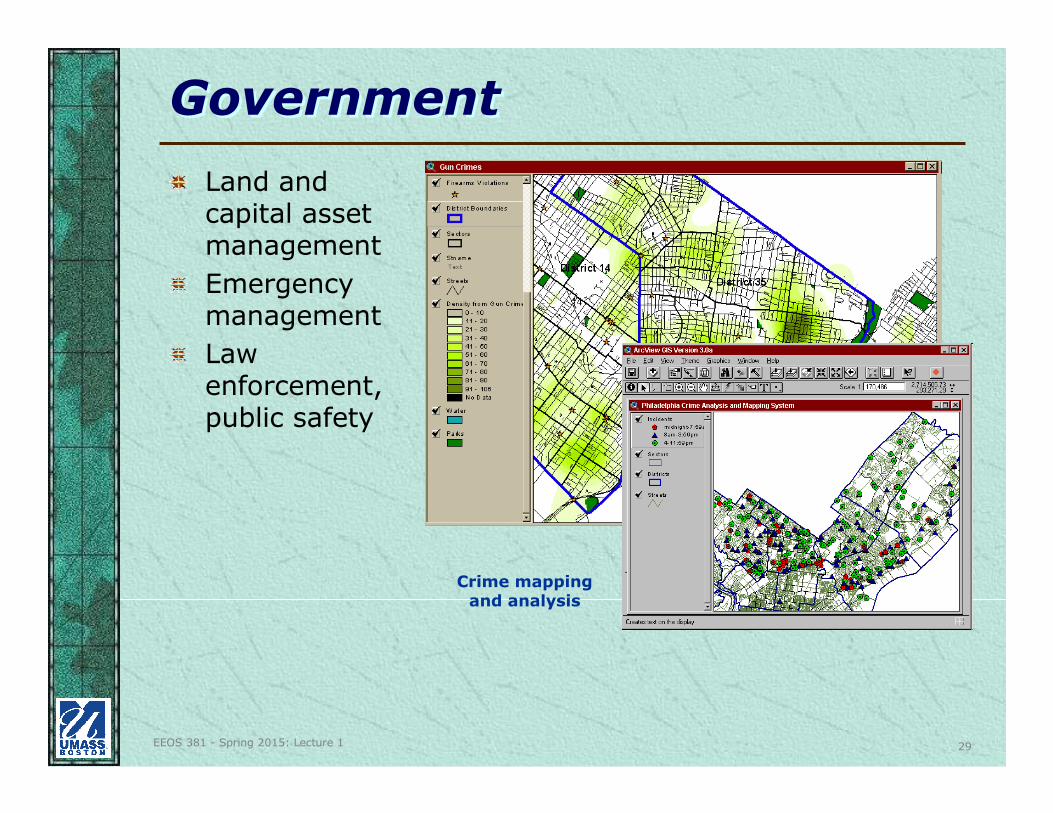
Land and capital asset management
Emergency management
Law enforcement, public safety
Crime mapping and analysis
EEOS 381 - Spring 2015: Lecture 1 30
GovernmentGovernment
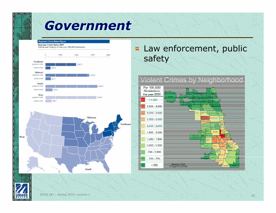
Law enforcement, public safety
EEOS 381 - Spring 2015: Lecture 1 31
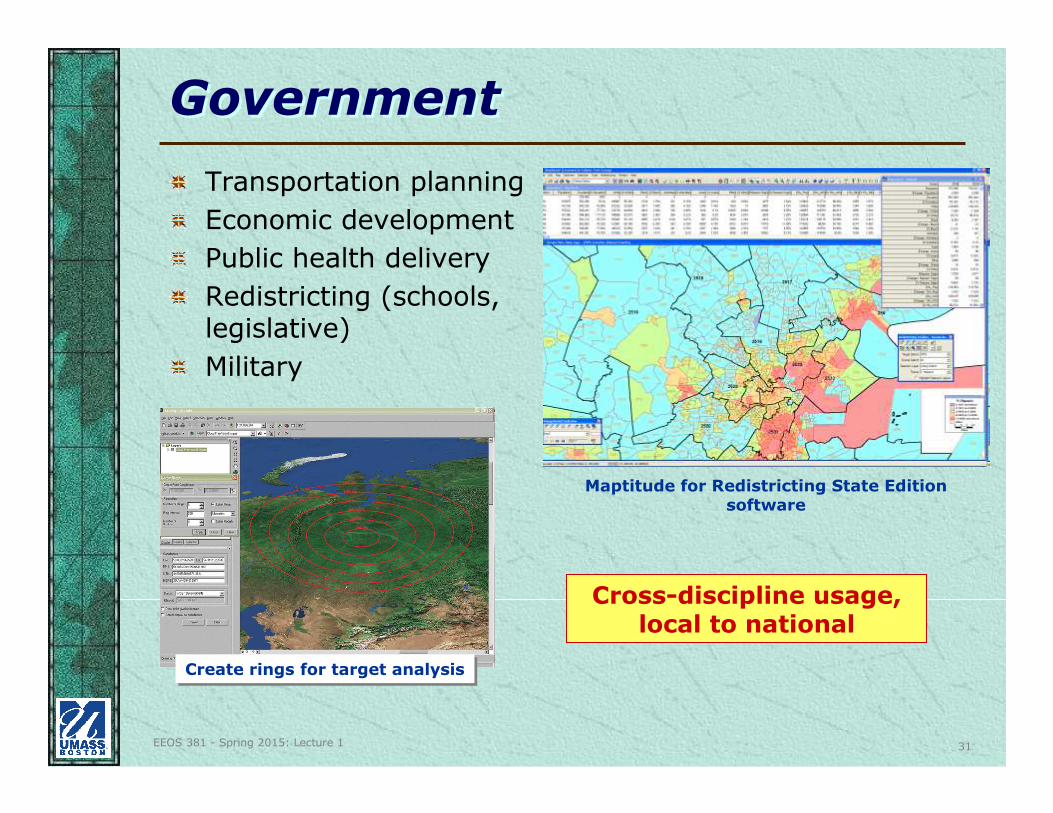
GovernmentGovernment
Transportation planning
Economic development
Public health delivery
Redistricting (schools, legislative)
Military
Maptitude for Redistricting State Edition software
Cross-discipline usage, local to national
Create rings for target analysisCreate rings for target analysis
EEOS 381 - Spring 2015: Lecture 1 32
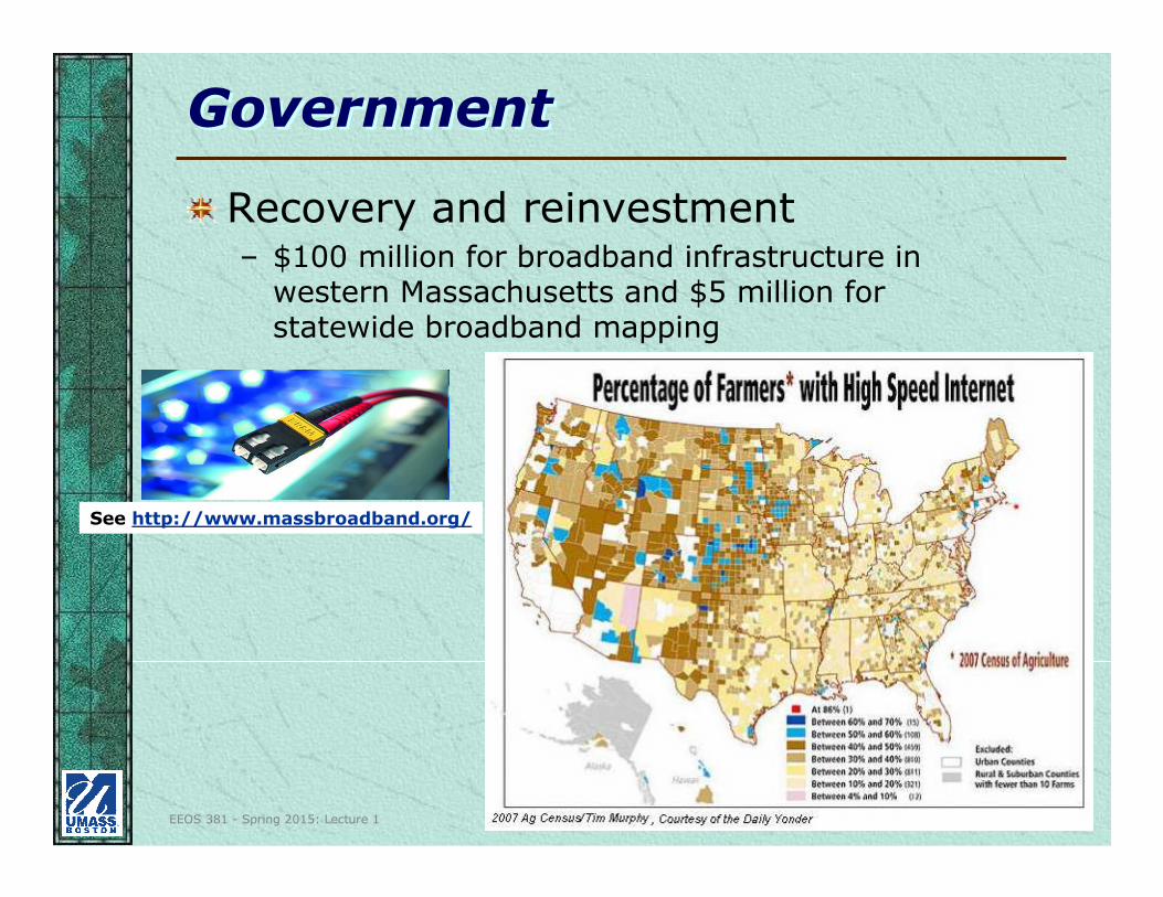
GovernmentGovernment
Recovery and reinvestment– $100 million for broadband infrastructure in
western Massachusetts and $5 million for statewide broadband mapping
See http://www.massbroadband.org/
EEOS 381 - Spring 2015: Lecture 1 33
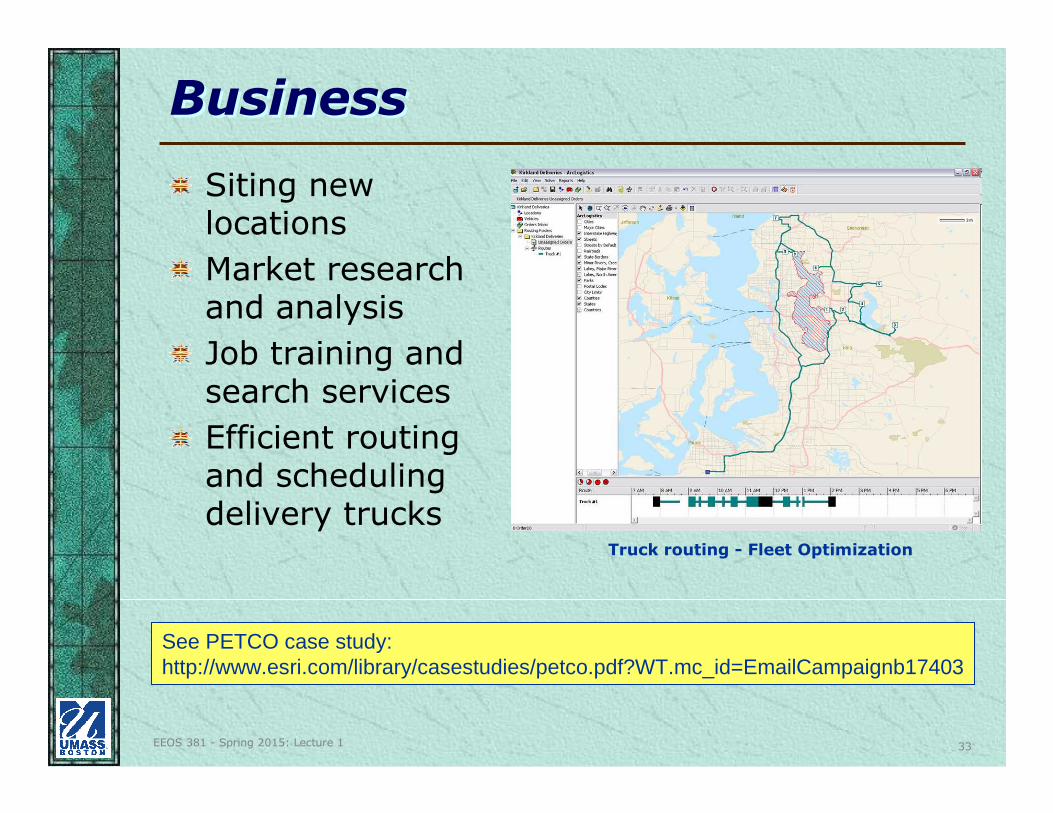
BusinessBusiness
Siting new locations
Market research and analysis
Job training and search services
Efficient routing and scheduling delivery trucks
Truck routing - Fleet Optimization
See PETCO case study:http://www.esri.com/library/casestudies/petco.pdf?WT.mc_id=EmailCampaignb17403
EEOS 381 - Spring 2015: Lecture 1 34
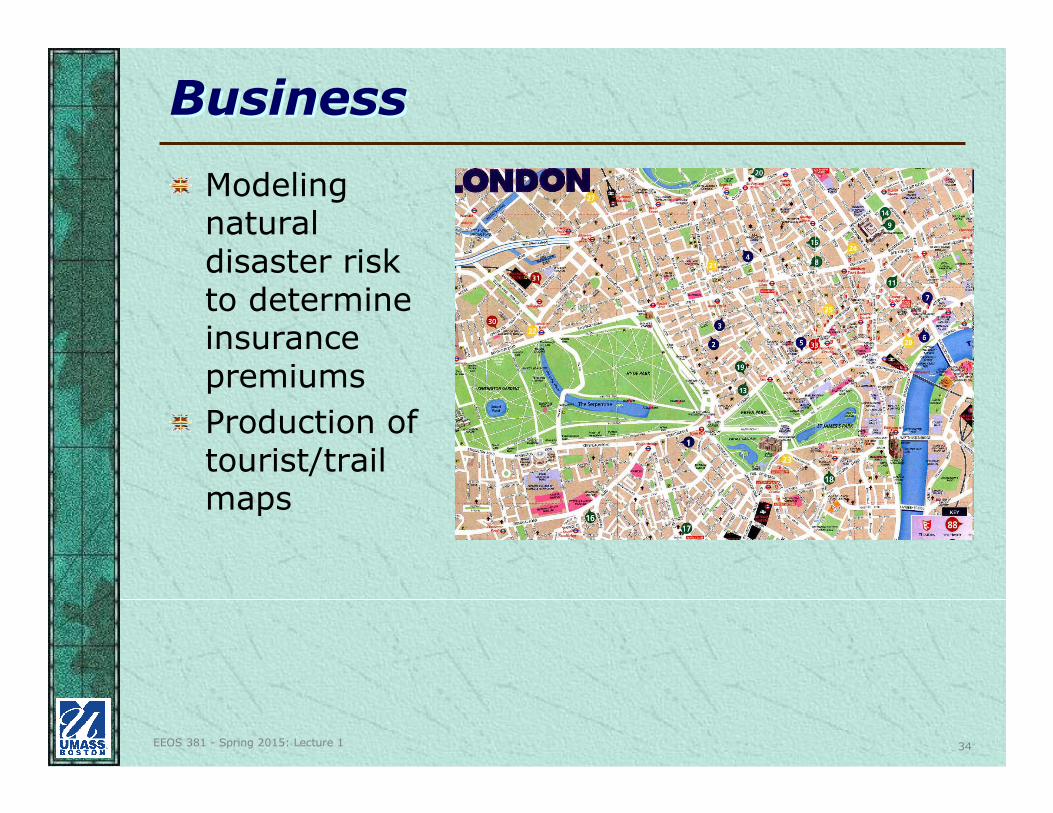
BusinessBusiness
Modeling natural disaster risk to determine insurance premiums
Production of tourist/trail maps
EEOS 381 - Spring 2015: Lecture 1 35
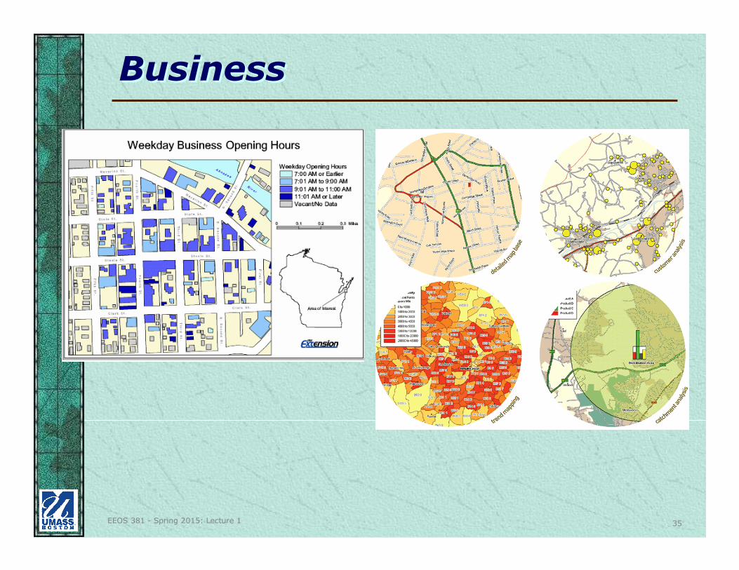
BusinessBusiness
EEOS 381 - Spring 2015: Lecture 1 36
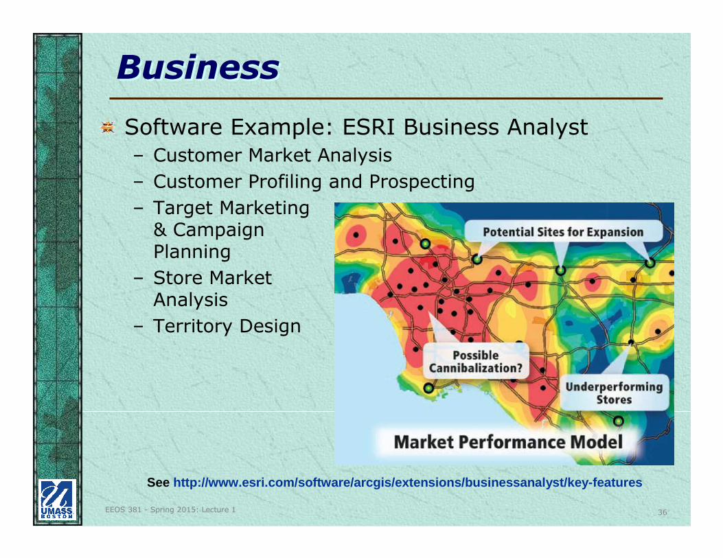
BusinessBusiness
Software Example: ESRI Business Analyst
– Customer Market Analysis
– Customer Profiling and Prospecting
– Target Marketing & Campaign Planning
– Store Market Analysis
– Territory Design
See http://www.esri.com/software/arcgis/extensions/businessanalyst/key-features
EEOS 381 - Spring 2015: Lecture 1 37
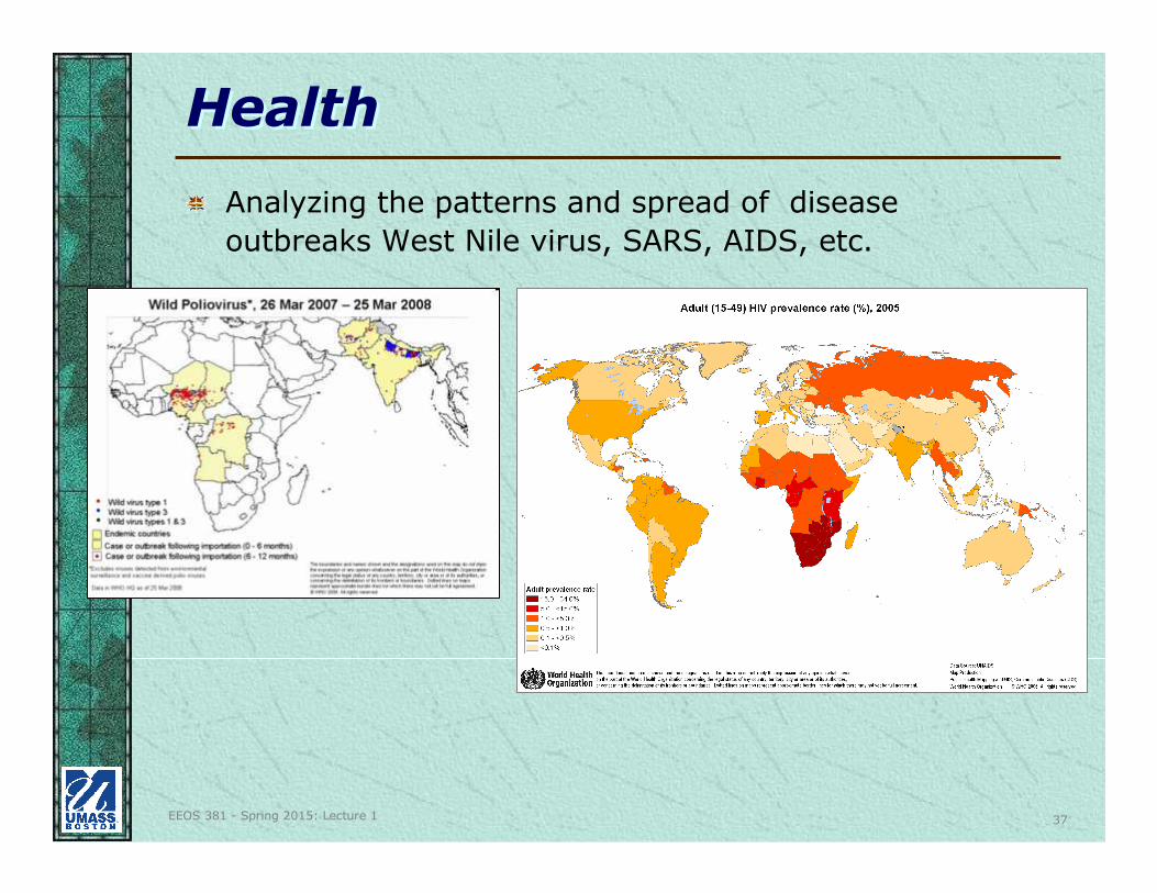
HealthHealth
Analyzing the patterns and spread of disease
outbreaks West Nile virus, SARS, AIDS, etc.
EEOS 381 - Spring 2015: Lecture 1 38
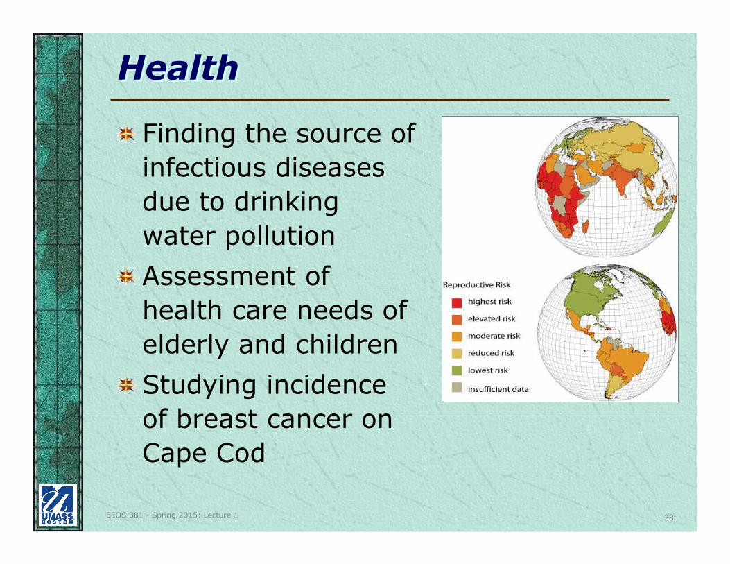
HealthHealth
Finding the source of
infectious diseases
due to drinking
water pollution
Assessment of
health care needs of
elderly and children
Studying incidence
of breast cancer on
Cape Cod
EEOS 381 - Spring 2015: Lecture 1 39
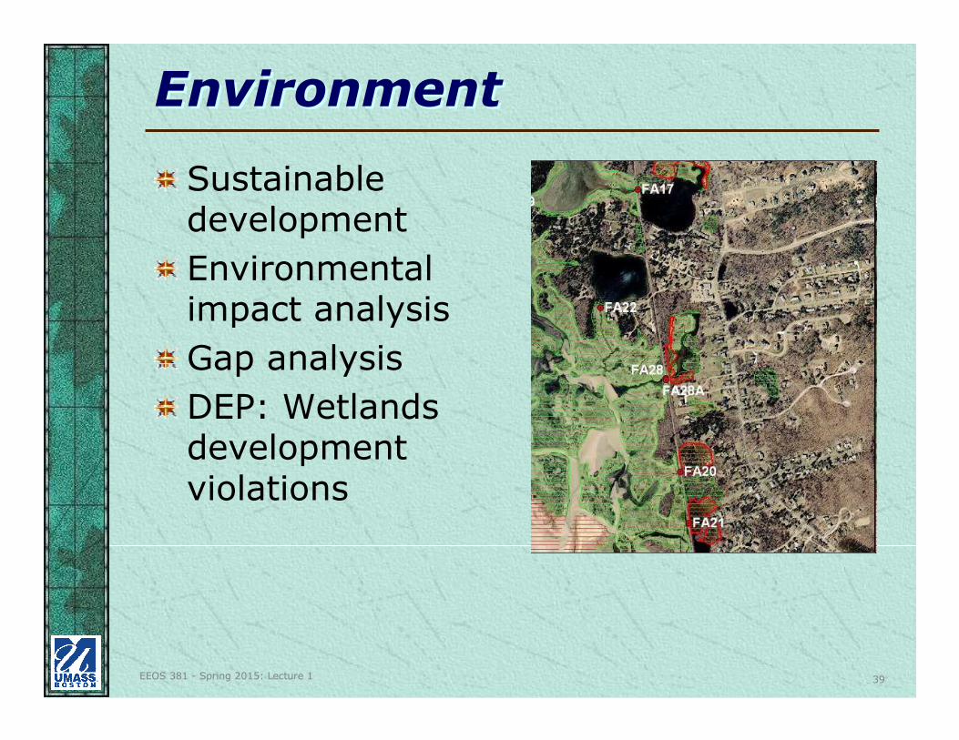
EnvironmentEnvironment
Sustainable development
Environmental impact analysis
Gap analysis
DEP: Wetlands development violations
EEOS 381 - Spring 2015: Lecture 1 40
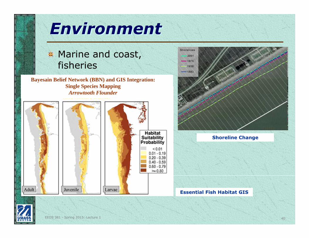
EnvironmentEnvironment
Marine and coast, fisheries
Essential Fish Habitat GIS
Shoreline Change
Bayesain Belief Network (BBN) and GIS Integration:Single Species Mapping
Arrowtooth Flounder
EEOS 381 - Spring 2015: Lecture 1 41
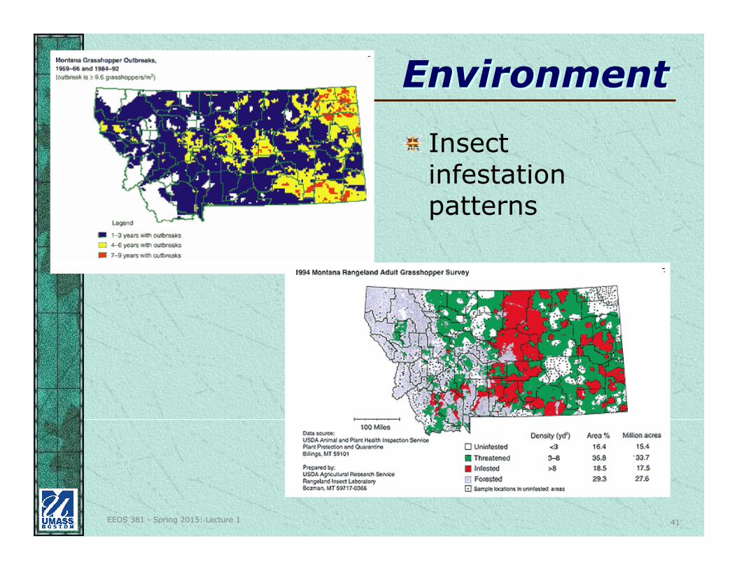
EnvironmentEnvironment
Insect infestation patterns
EEOS 381 - Spring 2015: Lecture 1 42
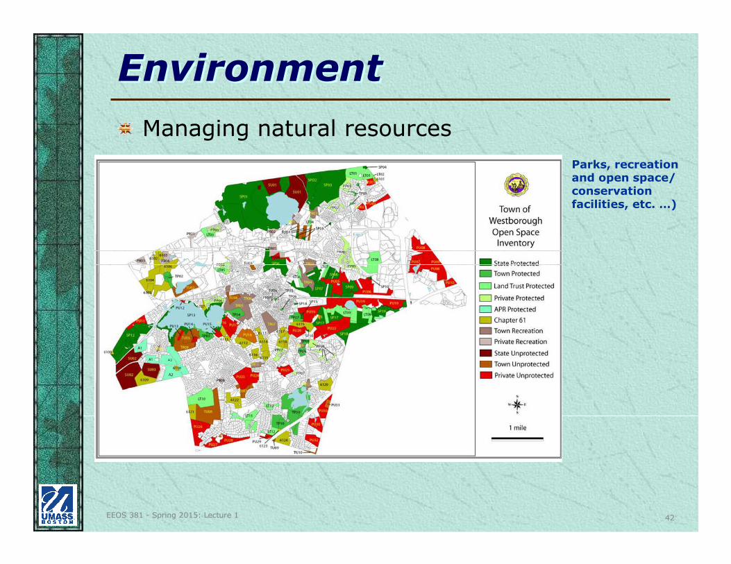
EnvironmentEnvironment
Managing natural resources
Parks, recreation and open space/ conservation facilities, etc. …)
EEOS 381 - Spring 2015: Lecture 1 43
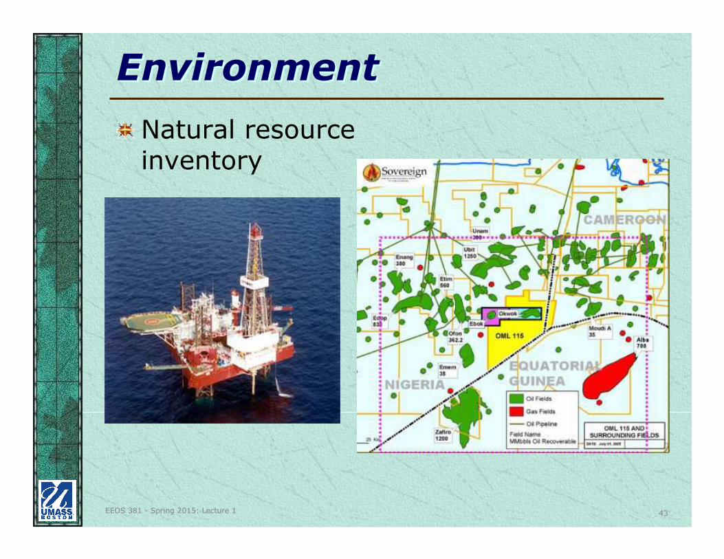
EnvironmentEnvironment
Natural resource inventory
EEOS 381 - Spring 2015: Lecture 1 44
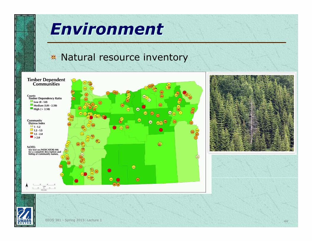
EnvironmentEnvironment
Natural resource inventory
EEOS 381 - Spring 2015: Lecture 1 45
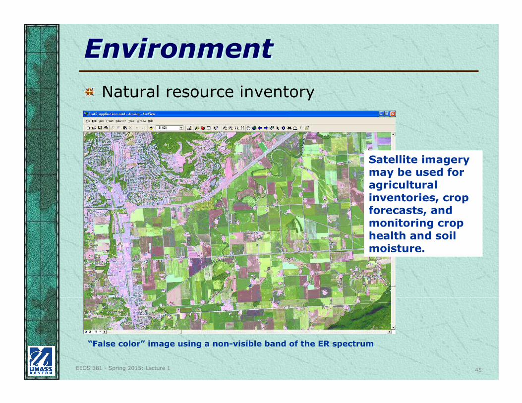
EnvironmentEnvironment
Natural resource inventory
Satellite imagery may be used for agricultural inventories, crop forecasts, and monitoring crop health and soil moisture.
“False color” image using a non-visible band of the ER spectrum
EEOS 381 - Spring 2015: Lecture 1 46
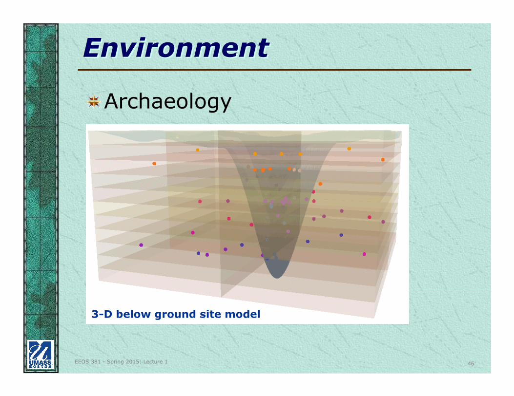
EnvironmentEnvironment
Archaeology
3-D below ground site model
EEOS 381 - Spring 2015: Lecture 1 47
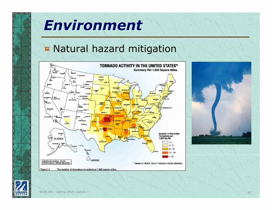
EnvironmentEnvironment
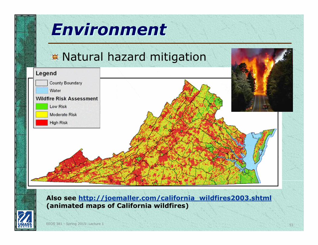
Natural hazard mitigation
EEOS 381 - Spring 2015: Lecture 1 48
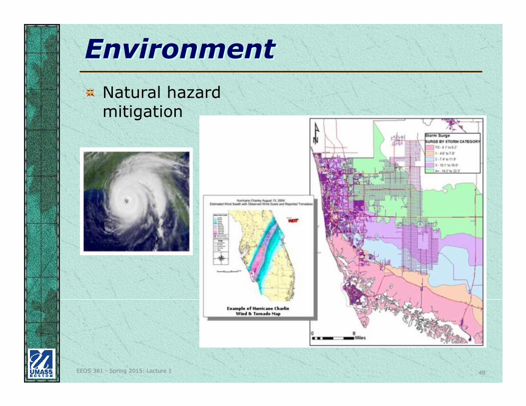
EnvironmentEnvironment
Natural hazard mitigation
EEOS 381 - Spring 2015: Lecture 1 49
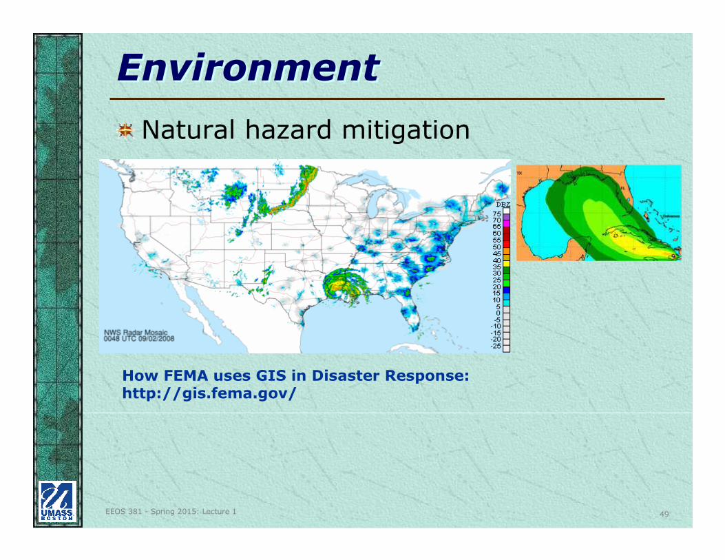
EnvironmentEnvironment
How FEMA uses GIS in Disaster Response:http://gis.fema.gov/
Natural hazard mitigation
EEOS 381 - Spring 2015: Lecture 1 50
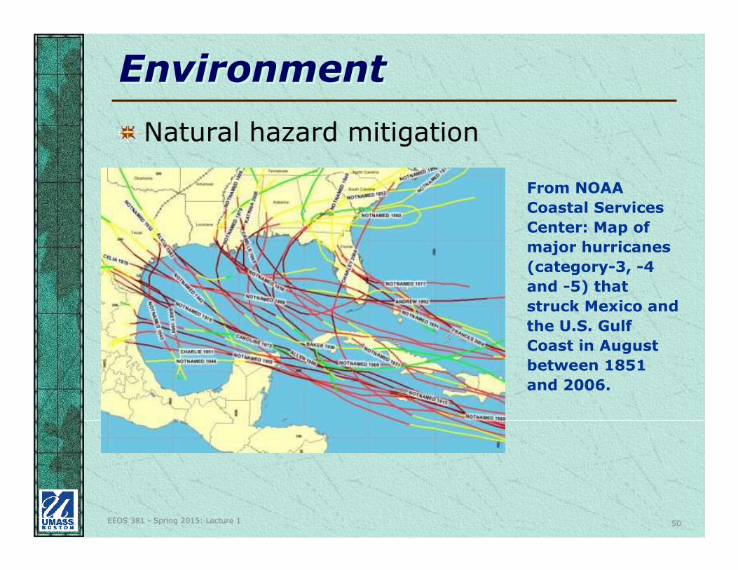
EnvironmentEnvironment
From NOAA
Coastal Services
Center: Map of
major hurricanes
(category-3, -4
and -5) that
struck Mexico and
the U.S. Gulf
Coast in August
between 1851
and 2006.
Natural hazard mitigation
EEOS 381 - Spring 2015: Lecture 1 51
EnvironmentEnvironment
Natural hazard mitigation
Also see http://joemaller.com/california_wildfires2003.shtml(animated maps of California wildfires)
EEOS 381 - Spring 2015: Lecture 1 52
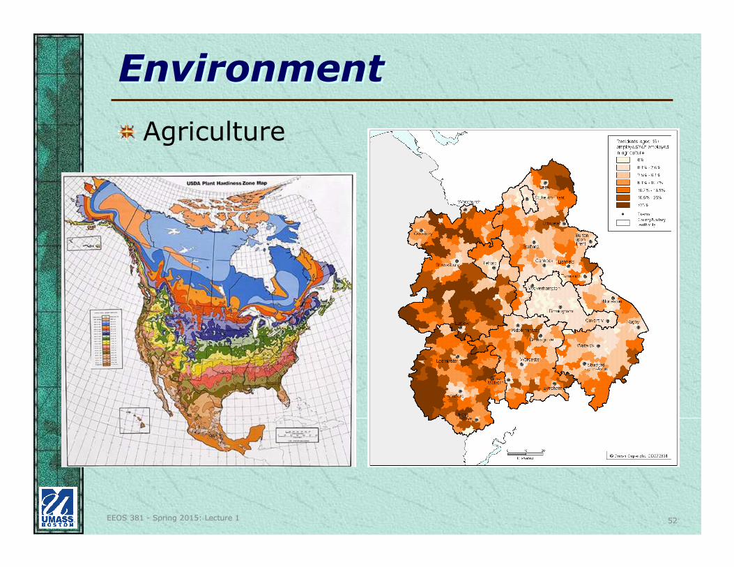
EnvironmentEnvironment
Agriculture
EEOS 381 - Spring 2015: Lecture 1 53
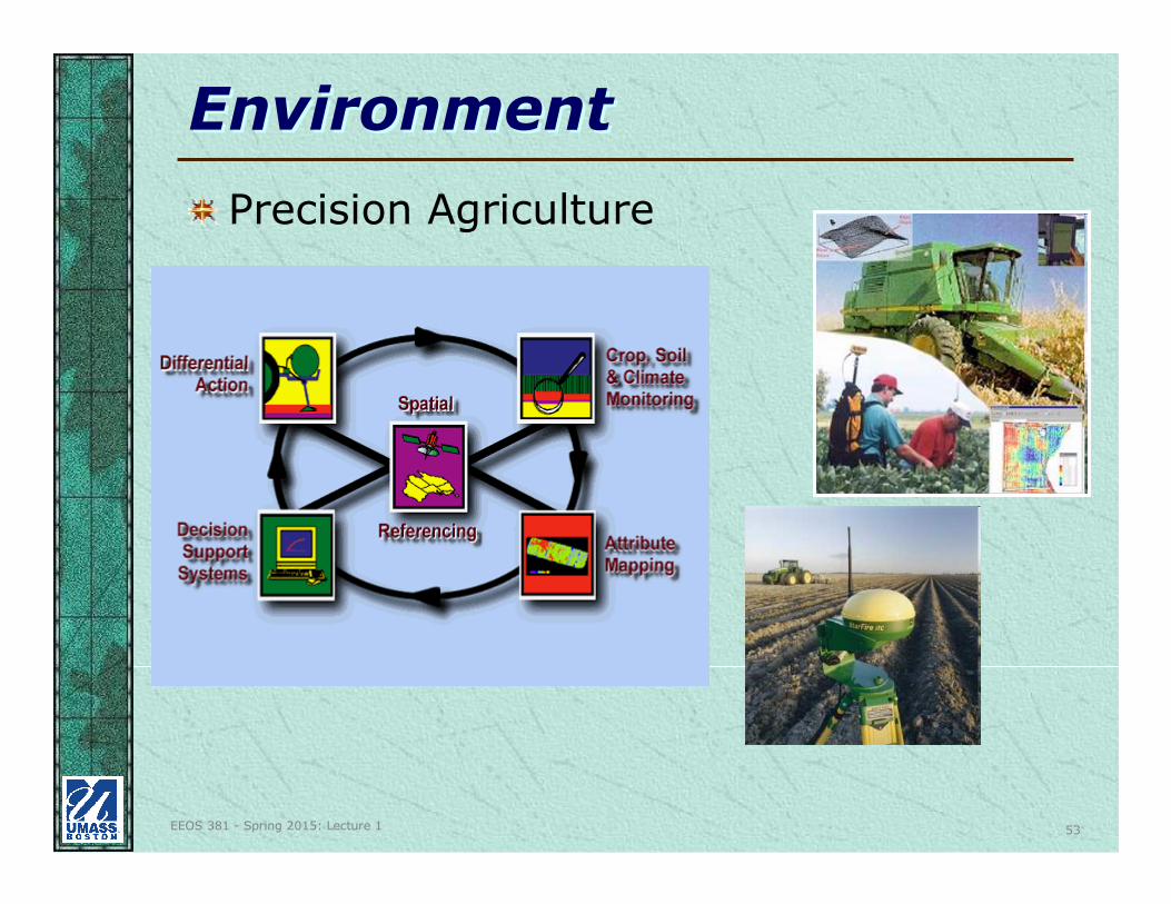
EnvironmentEnvironment
Precision Agriculture
EEOS 381 - Spring 2015: Lecture 1 54
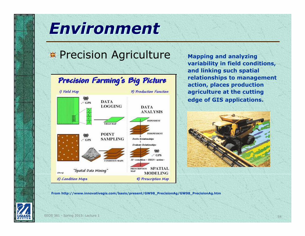
EnvironmentEnvironment
Precision Agriculture Mapping and analyzing
variability in field conditions,
and linking such spatial
relationships to management
action, places production
agriculture at the cutting
edge of GIS applications.
From http://www.innovativegis.com/basis/present/GW98_PrecisionAg/GW98_PrecisionAg.htm
EEOS 381 - Spring 2015: Lecture 1 55
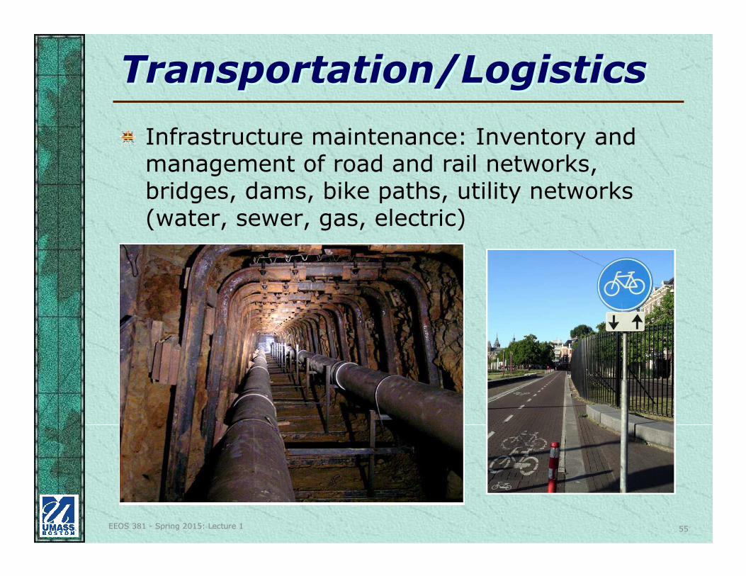
Transportation/LogisticsTransportation/Logistics
Infrastructure maintenance: Inventory and management of road and rail networks, bridges, dams, bike paths, utility networks (water, sewer, gas, electric)

EEOS 381 - Spring 2015: Lecture 1 56
Transportation/LogisticsTransportation/Logistics
Planning flight paths and airports, noise
abatement
EEOS 381 - Spring 2015: Lecture 1 57
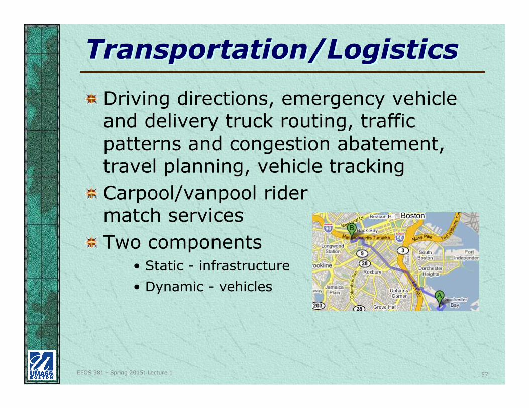
Transportation/LogisticsTransportation/Logistics
Driving directions, emergency vehicle and delivery truck routing, traffic patterns and congestion abatement, travel planning, vehicle tracking
Carpool/vanpool rider match services
Two components• Static - infrastructure
• Dynamic - vehicles
EEOS 381 - Spring 2015: Lecture 1 58
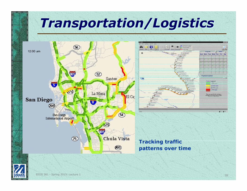
Transportation/LogisticsTransportation/Logistics
Tracking traffic
patterns over time
EEOS 381 - Spring 2015: Lecture 1 59
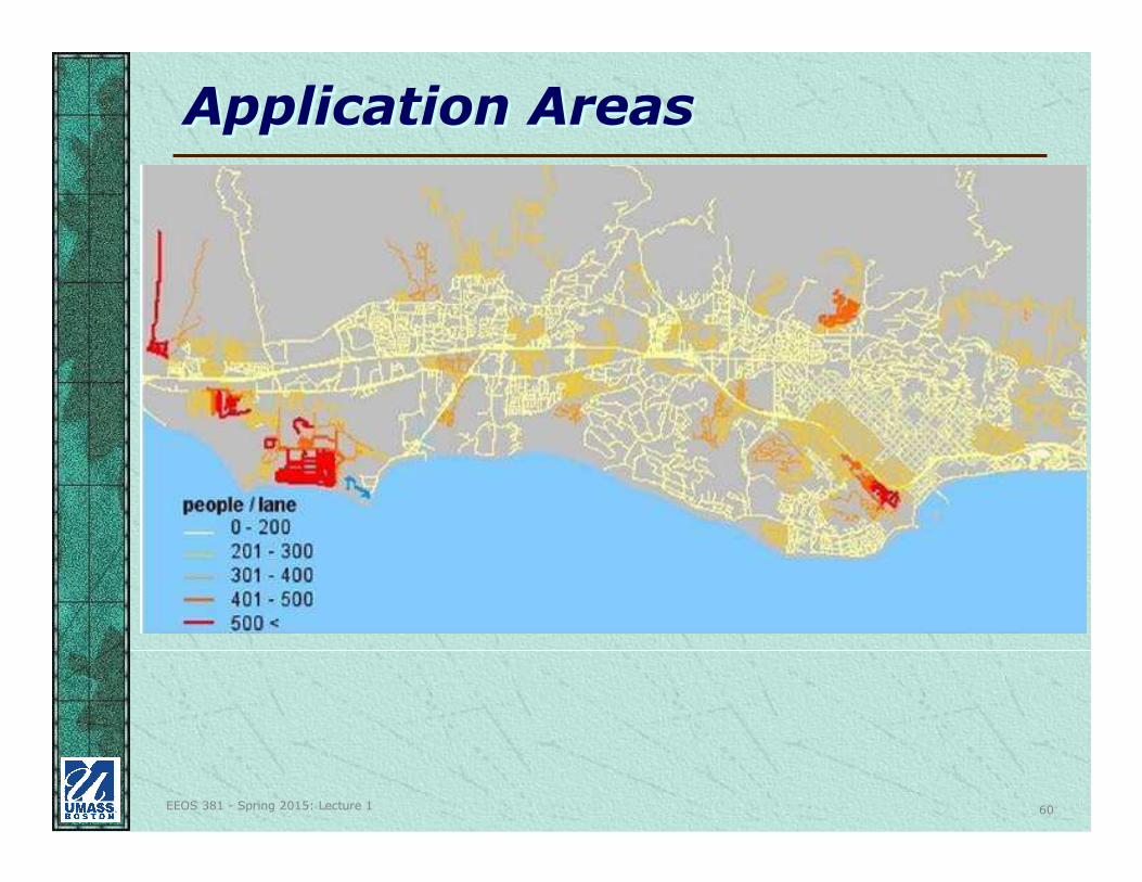
Application AreasApplication Areas
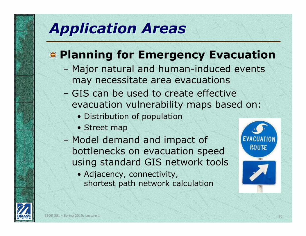
Planning for Emergency Evacuation
– Major natural and human-induced events may necessitate area evacuations
– GIS can be used to create effective evacuation vulnerability maps based on:
• Distribution of population
• Street map
– Model demand and impact of bottlenecks on evacuation speed using standard GIS network tools
• Adjacency, connectivity, shortest path network calculation
EEOS 381 - Spring 2015: Lecture 1 60
Application AreasApplication Areas
EEOS 381 - Spring 2015: Lecture 1 61
Application AreasApplication Areas
Mass. Towns with online web apps:- http://www.mass.gov/anf/research-and-tech/it-serv-and-
support/application-serv/office-of-geographic-information-massgis/municipal-gis/assessors-and-gis/municipalities-gis-web-sites.html
See this web site for more examples:- http://www.wiley.com/legacy/wileychi/longley/case_studies.html
EEOS 381 - Spring 2015: Lecture 1 62
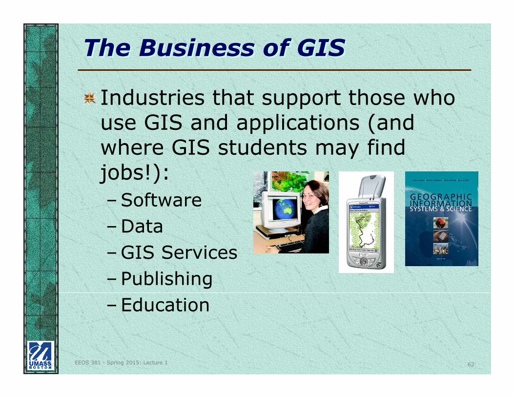
The Business of GISThe Business of GIS
Industries that support those who use GIS and applications (and where GIS students may find jobs!):
–Software
–Data
–GIS Services
–Publishing
–Education
EEOS 381 - Spring 2015: Lecture 1 63
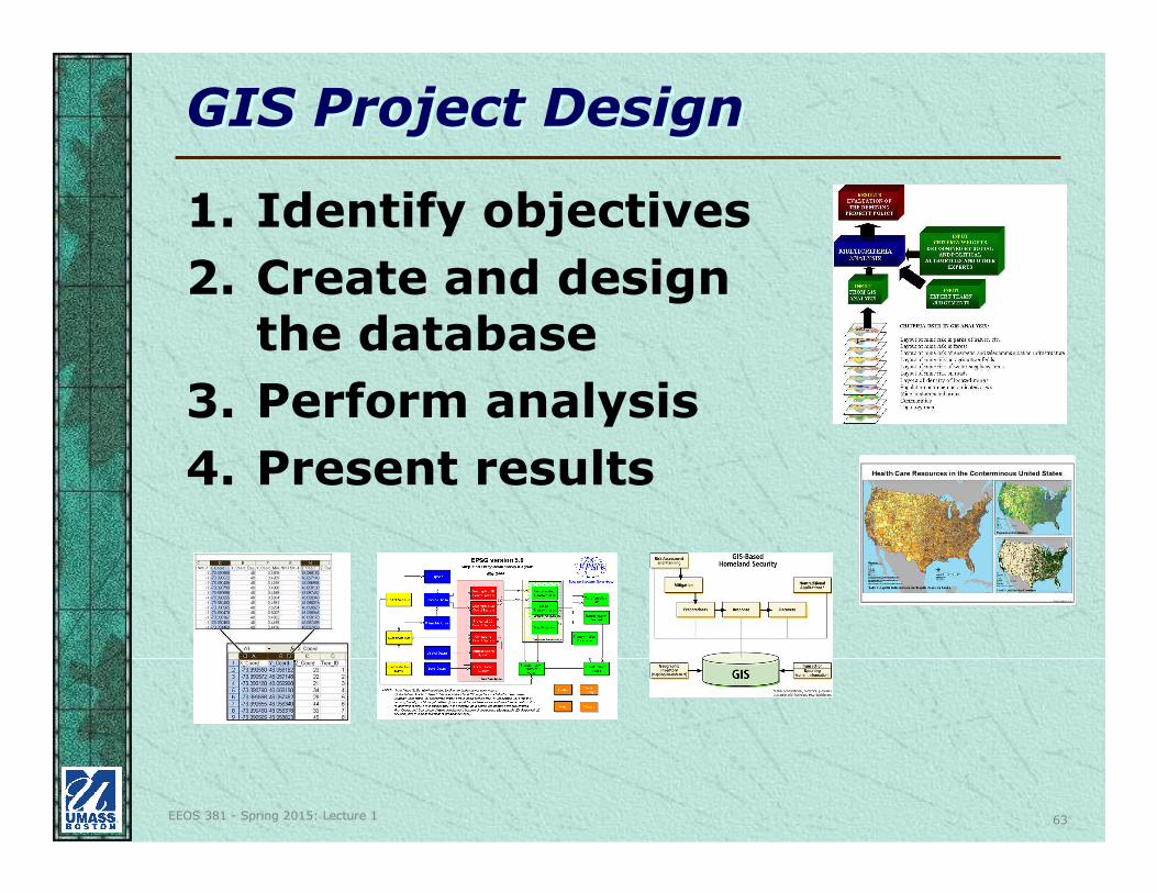
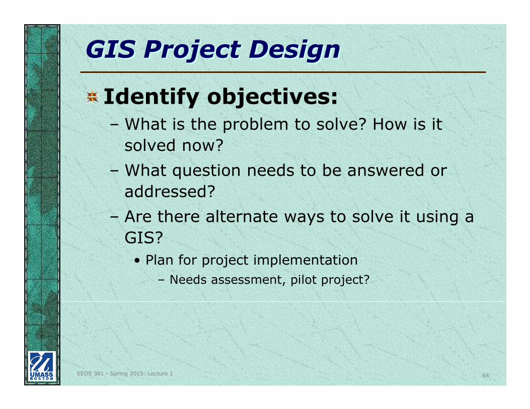
GIS Project DesignGIS Project Design
1. Identify objectives
2. Create and design the database
3. Perform analysis
4. Present results
EEOS 381 - Spring 2015: Lecture 1 64
GIS Project DesignGIS Project Design
Identify objectives:– What is the problem to solve? How is it
solved now?
– What question needs to be answered or
addressed?
– Are there alternate ways to solve it using a
GIS?
• Plan for project implementation
– Needs assessment, pilot project?
EEOS 381 - Spring 2015: Lecture 1 65
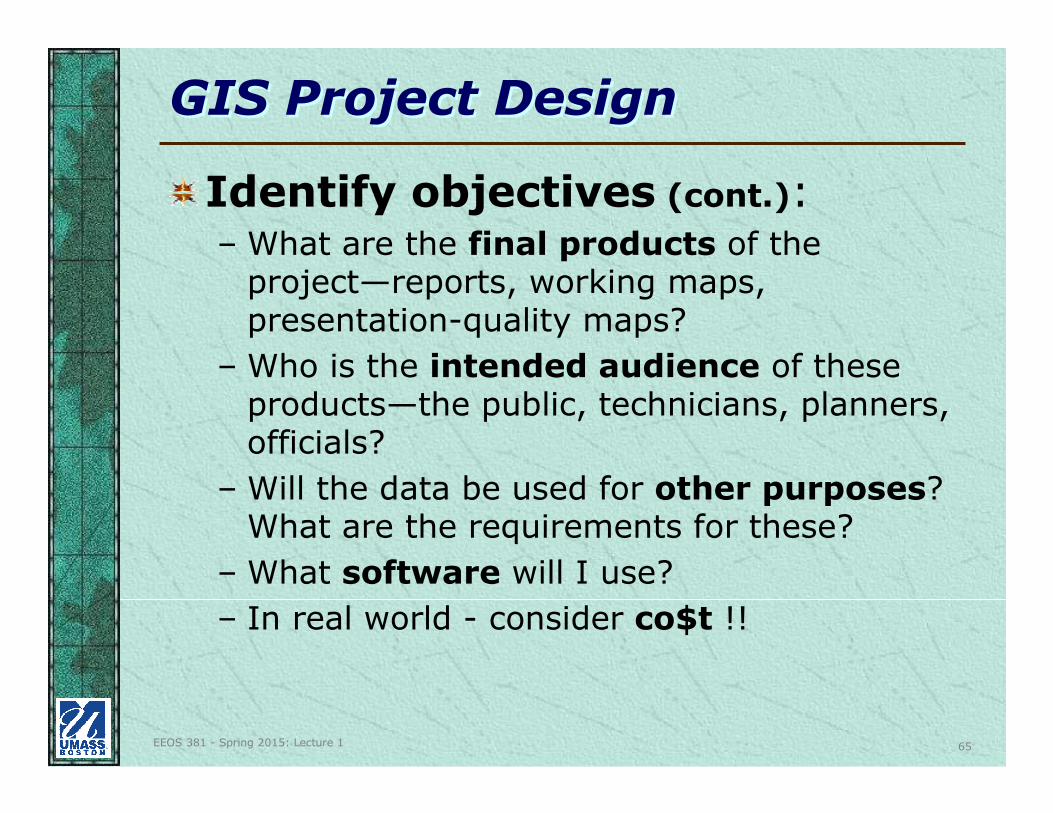
GIS Project DesignGIS Project Design
Identify objectives (cont.):– What are the final products of the
project—reports, working maps, presentation-quality maps?
– Who is the intended audience of these products—the public, technicians, planners, officials?
– Will the data be used for other purposes? What are the requirements for these?
– What software will I use?
– In real world - consider co$t !!
EEOS 381 - Spring 2015: Lecture 1 66
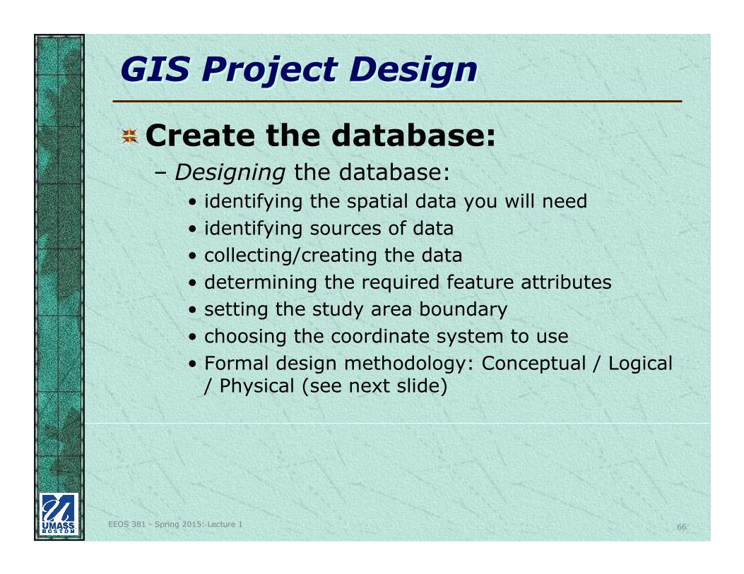
GIS Project DesignGIS Project Design
Create the database:– Designing the database:
• identifying the spatial data you will need
• identifying sources of data
• collecting/creating the data
• determining the required feature attributes
• setting the study area boundary
• choosing the coordinate system to use
• Formal design methodology: Conceptual / Logical / Physical (see next slide)
EEOS 381 - Spring 2015: Lecture 1 67
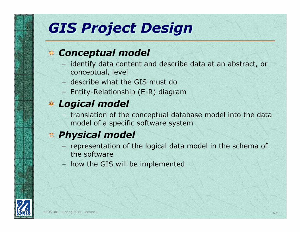
GIS Project DesignGIS Project Design
Conceptual model– identify data content and describe data at an abstract, or
conceptual, level
– describe what the GIS must do
– Entity-Relationship (E-R) diagram
Logical model – translation of the conceptual database model into the data
model of a specific software system
Physical model– representation of the logical data model in the schema of
the software
– how the GIS will be implemented
EEOS 381 - Spring 2015: Lecture 1 68
GIS Project DesignGIS Project Design
Create the database (cont.):– Automating the data:
• digitizing or converting data from other systems and formats into a usable format
• verifying the data and correcting errors (QA/QC)
– Managing the database:
• joining adjacent layers
• updates
• system integration
– work with system administrator for disk space, backups
– staff training
– data distribution
EEOS 381 - Spring 2015: Lecture 1 69
GIS Project DesignGIS Project Design
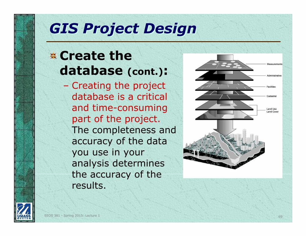
Create the database (cont.):– Creating the project
database is a critical and time-consuming part of the project.The completeness and accuracy of the data you use in your analysis determines the accuracy of the results.
EEOS 381 - Spring 2015: Lecture 1 70
GIS Project DesignGIS Project Design
Perform analysis:– simple mapping
– measuring
– calculating
– complex modeling• coincidence
• overlays
• buffering
• adjacency
• routing
• redistricting
Possible use of software extensions, multiple software products
EEOS 381 - Spring 2015: Lecture 1 71
GIS Project DesignGIS Project Design
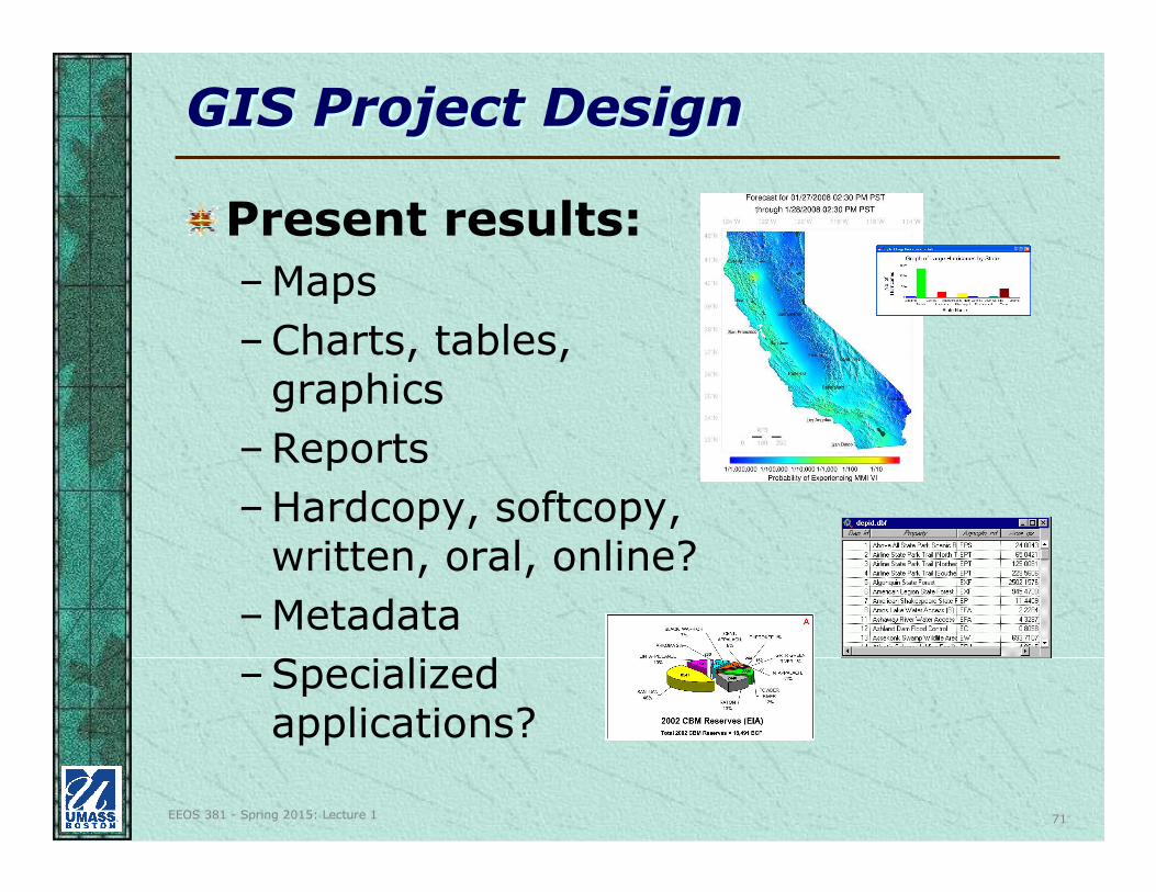
Present results:
–Maps
–Charts, tables, graphics
–Reports
–Hardcopy, softcopy, written, oral, online?
–Metadata
–Specialized applications?
EEOS 381 - Spring 2015: Lecture 1 72
Past Student Project TopicsPast Student Project Topics
Finding a location for a new commuter train station to relieve traffic in northern MA/southern NH
Determining the shortest and most accessible routes in downtown Boston for persons with disabilities
Analyzing Logan Airport noise
Recommending which parcels of open space to purchase with CPA funds
EEOS 381 - Spring 2015: Lecture 1 73
Past Student Project TopicsPast Student Project Topics
Studying impervious surface and potential for “green roofs” in the Muddy River watershed in Boston
Mapping and analyzing patterns of tornados in Texas
Determining which Brownfield in New
Bedford to redevelop
EEOS 381 - Spring 2015: Lecture 1 74
Past Student Project TopicsPast Student Project Topics
Locating new or extending existing bike trails in Boston
Where to place vaccine distribution centers in Boston
Finding the best place to live in Davis, CA
Finding the best site for an IKEA store in eastern Mass.
Calculating rainfall runoff
EEOS 381 - Spring 2015: Lecture 1 75
Past Student Project TopicsPast Student Project Topics
Locating a new cemetery in a small
town
Deciding which land to protect as open
space in a small town
Finding the best site for a new Dunkin
Donuts; a new thrift shop; an ethnic
farmers market; wind turbines
Locating a new skate park in Boston
EEOS 381 - Spring 2015: Lecture 1 76
Past Student Project TopicsPast Student Project Topics
Analyzing distribution of fire hydrants
in a town in Massachusetts
Analyzing the correlation of invasive
species and human development
Analyzing pedestrian accidents in
Boston
Apartment hunting in the city of Boston
(if you don’t have a car and are a
recent college graduate)
EEOS 381 - Spring 2015: Lecture 1 77
Past Student Project TopicsPast Student Project Topics
Evacuation routes during coastal storms
Crime analysis
UFO’s – analyze locations of sightings and Air Force bases, and demographics
Assessing potential earthquake damage
Siting a hydroelectricity generating plant
Expanding the MBTA subway system
Smart growth
Inventory of New England’s 100 highest mountain peaks
EEOS 381 - Spring 2015: Lecture 1 78
Past Student Project TopicsPast Student Project Topics
Potential wildlife crossings
Drowning frequency in Eastern Massachusetts
Bird sightings across Mass.
Minimizing the Cost of Commuting & Living Outside Boston
Creating an network of trails in Wompatuck State Park
Assessing commuting in metropolitan Atlanta
EEOS 381 - Spring 2015: Lecture 1 79
Past Student Project TopicsPast Student Project Topics
Which town in Mass. has the best weather?
Analyzing the Blizzard of ’78 to predict risk of large storm impact on the New England coast
Analyzing spatial trends in black bear-human conflict data in Colorado, in order to predict areas of risk and spread awareness
Determining sites to install solar panels in Boston
EEOS 381 - Spring 2015: Lecture 1 80
Past Student Project TopicsPast Student Project Topics
Environmental Justice and waste disposal facilities
Enabling elevation in a road network
UMass Boston community programs and partnerships
Locating a new senior center in Marlborough
EEOS 381 - Spring 2015: Lecture 1 81
Past Student Project TopicsPast Student Project Topics
Tracking offshore bird sightings
Ham radio use at the Boston Marathon
Neponset Watershed sampling stations
Where was Wheeler’s Surprise?
Gym and recreation opportunities in Boston