Embed Size (px)
Citation preview
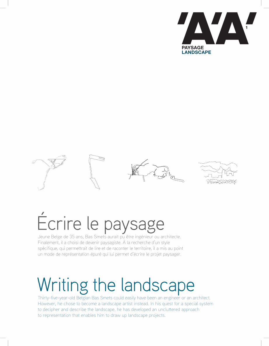
PAYSAGELANDSCAPE
1
Thirty-five-year-old Belgian Bas Smets could easily have been an engineer or an architect. However, he chose to become a landscape artist instead. In his quest for a special system to decipher and describe the landscape, he has developed an uncluttered approach to representation that enables him to draw up landscape projects.
Jeune Belge de 35 ans, Bas Smets aurait pu être ingénieur ou architecte. Finalement, il a choisi de devenir paysagiste. À la recherche d’un style spécifique, qui permettrait de lire et de raconter le territoire, il a mis au point un mode de représentation épuré qui lui permet d’écrire le projet paysager.
Écrire le paysage
Writing the landscape
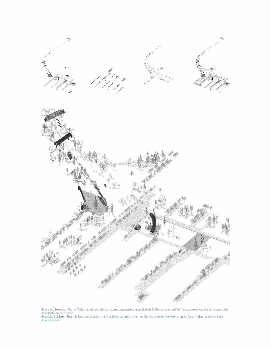
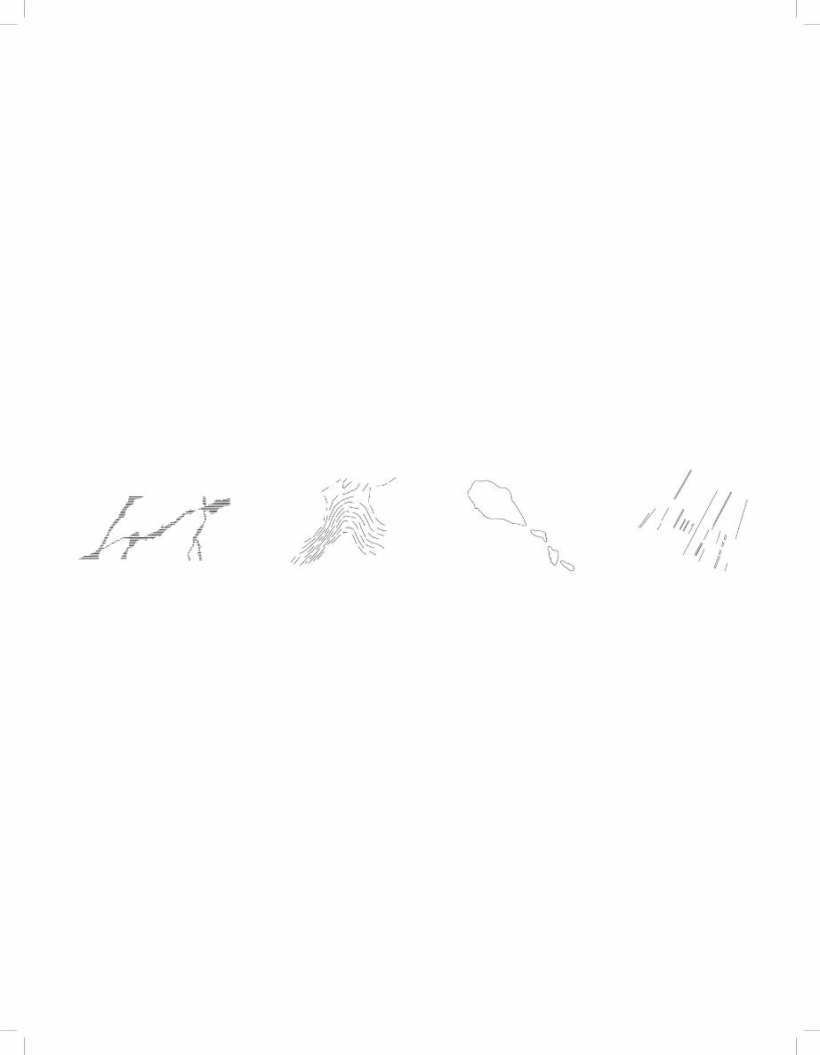
Bruxelles, Belgique - Tour & Taxis. Introduction des structures paysagères de la vallée de la Senne, pour qualifier l’espace extérieur d’une reconversion industrielle en parc public. Brussels, Belgium - Thurn & Taxis. Introduction of the valley structures of the river Senne, to define the exterior space for an industrial reconversion as a public parc.
Écritures de paysagesTout a commencé lorsque j’ai compris que la réalité physique qui nous entourait avait été entièrement inventée par l’homme. Les bâtiments, les rues, les trottoirs, l’éclairage, même les plantations ont d’abord été conçus puis construits. Rien n’est plus naturel ou dans son état initial. Ce qui veut dire que tout ce que l’on voit aurait pu être différent. C’était devenu un jeu de m’imaginer que tel bâtiment aurait pu avoir un autre revêtement, que telle rue aurait pu être plantée avec un type d’arbre différent. Et s’il y avait un es-pace public au lieu de cet immeuble ? Cet exercice intellectuel m’a amené à la question suivante : si sa construction physique est le résultat de notre conception, existe-t-il une qualité invariable d’une ville ?
Référent paysagerJe suis convaincu que la qualité d’un endroit dépend de son interaction avec le territoire. Cette interaction n’est jamais due au hasard ; elle est toujours construite. Le vieux Rome était organisé autour de sept collines. Les boulevards de Paris révèlent la topographie de la vallée de la Seine. Venise est une ville artificielle édifiée entre des îles. Amsterdam s’est développé autour d’une série de canaux concentriques. Même les gratte-ciel de New York sont une réponse à la position géographique de Manhattan, une péninsule entourée d’eau. Chacune de ces villes donne des repères qui parlent à l’instinct animal de l’homme désireux de se « positionner » dans le territoire. L’ancrage territorial offre ce « référent paysager » qui va ensuite déterminer la façon de percevoir et d’appréhender une ville.
Pays et paysage« Les choses sont parce que nous les voyons, et la réceptivité aussi bien que la forme de notre vision dépendent des arts qui nous ont influencés. De nos jours, les gens voient les brouillards, non parce qu’il y a des brouillards, mais parce que peintres et poètes leur ont appris le charme mystérieux de tels effets. Sans doute y eut-il à Londres des brouillards depuis des siècles. C’est infiniment probable, mais personne ne les voyait, de sorte que nous n’en savions rien. Ils n’eurent pas d’existence tant que l’art ne les eut pas inventés. » Dans Le Déclin du mensonge, Oscar Wilde parle de l’impressionniste Turner qui a peint et donc « inventé » les brumes de la Tamise.Dans son Court Traité du paysage, Alain Roger définit cette opération comme « artialisa-tion ». « La nature est indéterminée et ne reçoit ses déterminations que de l’art. Le pays, c’est, en quelque sorte, le degré zéro du paysage, ce qui précède son artialisation. » Celle-ci se fait à travers une intervention sur l’objet naturel selon deux modalités : l’une est indi-recte, in visu, par la médiation du regard, l’autre est directe, in situ, sur le terrain.
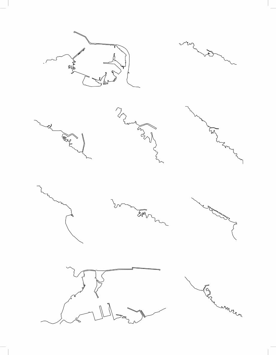
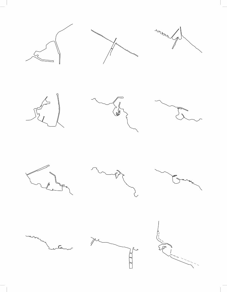
Révéler l’existantNos projets interviennent sur le territoire de ces deux façons. Tout d’abord, le territoire est redessiné pour le comprendre autrement (artialisation in visu). Le point de départ est toujours l’existant. La lecture se fait à partir d’une écriture précise. Thème par thème, les composants du paysage sont (imaginés et) redessinés. Il ne s’agit point de copier l’exis-tant. La main pose des questions au cerveau et offre des dessins à l’œil. La complexité de la réalité physique est ainsi réécrite par une série de cartes montrant un seul thème à la fois, noir sur blanc. Ces cartes décontextualisées nous permettent d’explorer les relations entre les thèmes, à la recherche des combinaisons qui se renforcent et qui ont la capacité de révéler la qualité d’un territoire. Ensuite, le territoire est modifié pour réaliser le projet (artialisation in situ) qui rend visible l’ancrage territorial désiré.
L’écriture comme projetÉcrire le territoire consiste à révéler l’existant pour lui donner une forme forte et recon-naissable. Dans certains projets, il suffit d’enlever des éléments, dans d’autres il s’agit d’en rajouter. Par cette double artialisation, in visu puis in situ, les dessins et les cartes ne sont plus la simple représentation d’un projet qui reste à réaliser. La représentation devient projet, et son exécution devient paysage.
Bas Smets est spécialisé dans la conception de stratégies paysagères et la réalisation d’espaces publics. Son agence opère actuellement sur plus de 30 projets dans 7 pays. Parmi ces projets, l’espace public de la reconversion du site industriel de Tour & Taxis à Bruxelles, le nouveau parc public du Musée national d’Estonie conçu par DGT Architectes et l’aménagement d’un parc de 10 hectares accueillant 30 tours de logements conçues par les architectes new-yorkais REX à Songdo, en Corée du Sud.
Bas Smets a été retenu pour le schéma directeur du Parc des Ateliers à Arles, en collaboration avec Frank Gehry, qui y conçoit une cité des images consacrée à la photographie.
Né en 1975, Bas Smets est titulaire d’un master en architecture et génie civil de l’université de Louvain ainsi que d’un master en paysage de l’université de Genève. Il enseigne à l’École d’architecture de La Cambre, à Bruxelles, et il est lauréat des Nouveaux Albums des jeunes architectes et des paysagistes, session 2007-2008.www.bassmets.be
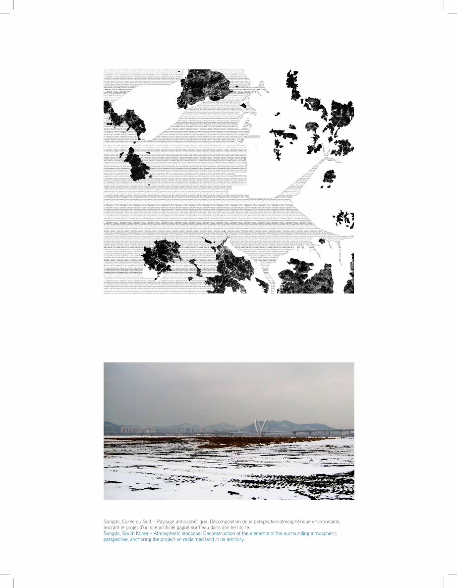
Songdo, Corée du Sud – Paysage atmosphérique. Décomposition de la perspective atmosphérique environnante, ancrant le projet d’un site artificiel gagné sur l’eau dans son territoire.Songdo, South Korea – Atmospheric landcape. Deconstruction of the elements of the surrounding atmospheric perspective, anchoring the project on reclaimed land in its territory.
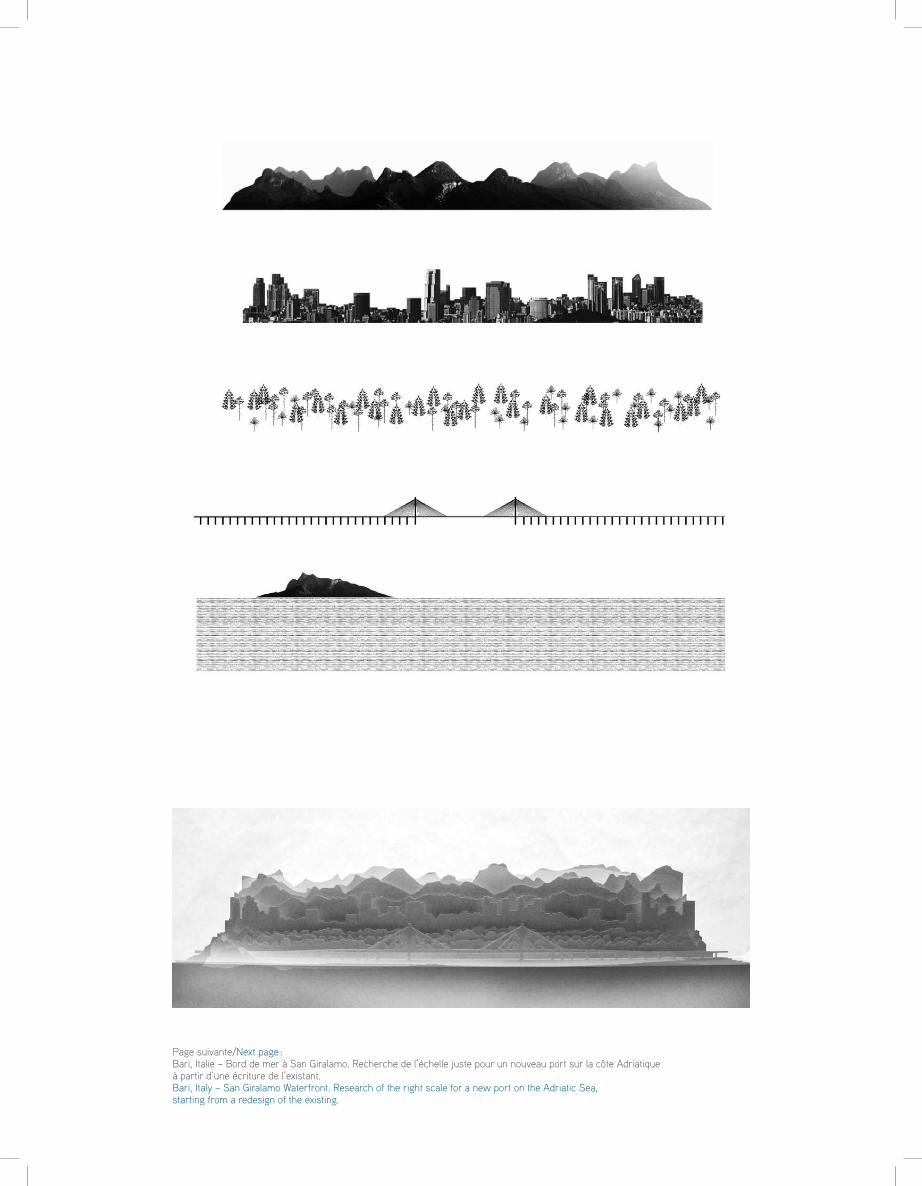
Page suivante/Next page : Bari, Italie – Bord de mer à San Giralamo. Recherche de l’échelle juste pour un nouveau port sur la côte Adriatique à partir d’une écriture de l’existant. Bari, Italy – San Giralamo Waterfront. Research of the right scale for a new port on the Adriatic Sea, starting from a redesign of the existing.
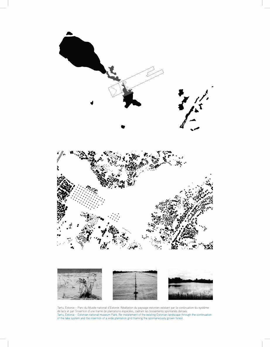
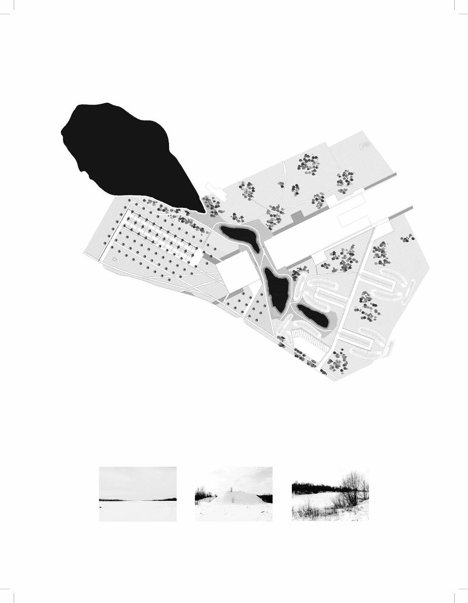
Tartu, Estonie – Parc du Musée national d’Estonie. Révélation du paysage estonien existant par la continuation du système de lacs et par l’insertion d’une trame de plantations espacées, cadrant les boisements spontanés denses.Tartu, Estonia – Estonian national museum Park. Re-instatement of the existing Estonian landscape through the continuation of the lake system and the insertion of a wide plantation grid framing the spontaneously grown forest.
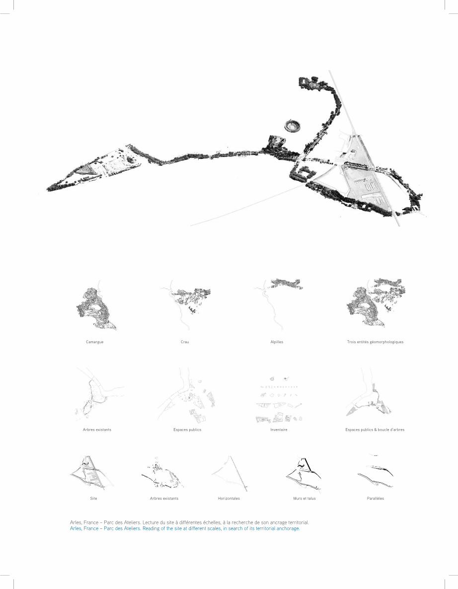
Espaces publicsArbres existants Espaces publics & boucle d’arbres Inventaire
Site Arbres existants Murs et talusHorizontales Parallèles
Trois entités géomorphologiquesCamargue AlpillesCrau
Arles, France – Parc des Ateliers. Lecture du site à différentes échelles, à la recherche de son ancrage territorial.Arles, France – Parc des Ateliers. Reading of the site at different scales, in search of its territorial anchorage.
Landscape designsIt all began when I realised that the physical reality around us is entirely manmade. Build-ings, roads, pavements, lighting, even flowerbeds are first designed and then built. Nothing is natural or in its original state any more. Consequently, everything we see could have been different.It became a game for me to imagine how a certain building might appear with different cladding, or to picture a particular road lined with another type of tree. I would wonder how a public space might look in place of a given building. This mental exercise led me to the following question: does a town have an invariable quality if its physical structure is a result of our design?
Landscape references I am convinced that the quality of a place depends on how it interacts with the land. This interaction is never a chance occurrence, it is always constructed. Ancient Rome was ar-ranged around seven hills. The boulevards of Paris fit the topography of the Seine valley. Venice is an artificial city nestled between islands. Amsterdam has developed around a series of concentric canals. Even the skyscrapers of New York reflect Manhattan’s geo-graphic position as a peninsula surrounded by water. Each of these cities serves as a marker, arousing man’s animal instinct to “establish his position” on the land. Territorial anchorage gives rise to these “landscape references” which subsequently determine the way in which a city is perceived.
Land and landscape“Things are because we see them, and what we see, and how we see it, depends on the arts that have influenced us. At present, people see fogs, not because there are fogs, but because poets and painters have taught them the mysterious loveliness of such effects. There may have been fogs for centuries in London. I dare say there were. But no one saw them, and so we do not know anything about them. They did not exist till Art had invented them.” In The Decay of Lying, Oscar Wilde speaks of the impressionist artist Turner who painted and therefore “invented” the fogs on the Thames.In his work Court traité du paysage, Alain Roger defines this process as “artialisation”. “Nature is indeterminate and only receives its various determinations through art. The land is, in some way, the zero degrees of the landscape and is what precedes its artialisation.” This artialisation occurs by interacting with the natural entity in two ways. One is indirect, in visu, from the viewpoint of the beholder, the other is direct, in situ, on the land.
Revealing what existsOur projects interact with the land in these two ways. First, the land is reproduced so as to gain a different view point (artialisation in visu), always taking what exists as a start-ing point. Interpretation takes place through accurate expression. Subject by subject, the components of the landscape are (imagined and) redrawn. It is not a question of copying what already exists. The hand questions the brain and provides drawings for the eye. In this way, the complexity of physical reality is recreated in a series of maps, plotting a single theme at a time in black and white. These decontextualised maps enable us to explore how themes are related and discover powerful combinations that are capable of revealing the quality of a land. The land is then modified to implement a project (artialisation in situ) and the desired territorial anchorage becomes apparent.
Representation as projectRepresenting the land consists of showing what exists in order to endow it with a strong, recognisable shape. Some projects call for elements to be removed, while others call for them to be added. By means of this double artialisation, in visu then in situ, drawings and maps no longer simply represent a project yet to be undertaken. The representation be-comes the project. Its realisation becomes the landscape.
Bas Smets specialises in landscape strategy and the development of public spaces. His agency is currently collaborating in over 30 projects across 7 countries. These projects include the redevelopment into public space of the Tour and Taxis industrial site in Brussels, the creation of a new Public Park at the Estonian National Museum designed by DGT architects and the building of a 10-hectare park housing 30 dwelling towers designed by New York architects REX in Songdo, South Korea.
Bas Smets was selected to create the master plan for the Parc des Ateliers in Arles, in collaboration with Frank Gehry, who designed the centre for images dedicated to photography.
Born in 1975, Bas Smets obtained a master’s degree in Architecture and Civil Engineering at the University of Louvain, as well as postgraduate qualification in Landscape Architecture from the University of Geneva. He teaches at the La Cambre School of Architecture in Brussels and was recently awarded the French prize for young architects, Nouveaux Albums des Jeunes Architectes et des Paysagistes 2007-2008.www.bassmets.be