Embed Size (px)
Citation preview
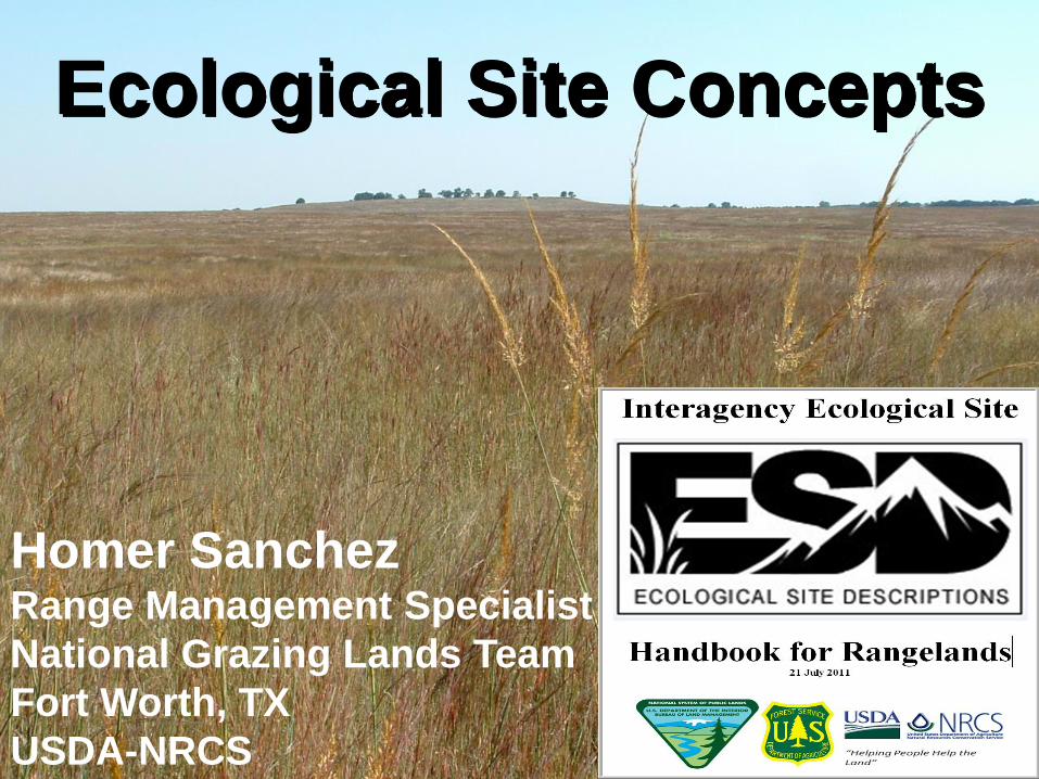
Ecological Site Concepts
Homer Sanchez Range Management Specialist
National Grazing Lands Team
Fort Worth, TX
USDA-NRCS
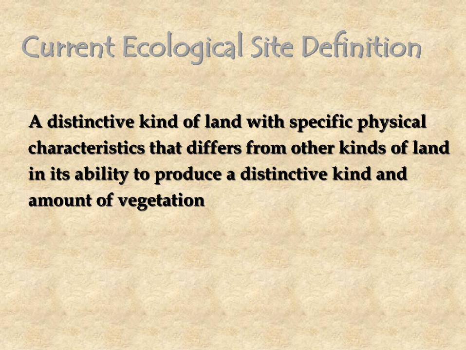
A distinctive kind of land with specific physical
characteristics that differs from other kinds of land
in its ability to produce a distinctive kind and
amount of vegetation
Current Ecological Site Definition

New Interagency Definition
An Ecological Site (ES) is a conceptual division of the
landscape that is defined as a distinctive kind of land based
on recurring soil, landform, geological, and climate
characteristics that differs from other kinds of land in its ability
to produce distinctive kinds and amounts of vegetation and in
its ability to respond similarly to management actions and
natural disturbances.

Each Ecological Site is the product of all the
Environmental Factors responsible for its development.
Soils Geomorphology Climate
These abiotic factors interact to govern how plant species are distributed along environmental gradients, and how they respond to
other factors such as disturbances and management:
Fire Herbivory Drought

Defining the Site Concept
• The composition, structure, and
function of plant communities are
governed by energy, moisture, and
nutrient gradients, as well as
disturbance regimes.
• In decreasing order of scale, these
gradients vary due to differences in
macroclimate, geology, lithology,
topography (elevation, slope, aspect,
and landform position), and soil
physical and chemical characteristics.
• The ecological site concept is defined based on reference
conditions representing natural states, with state changes
and transitions subsequently estimated based on our
understanding of succession and ecological thresholds.
• Reference states and their component community phases
represent the historical range of variability due to
successional dynamics following disturbances. Within this
natural, historical, or reference state, the community phase
used to define an ecological site is termed the reference
community phase.
• The reference community phase is identified as that
community phase which exhibits the characteristics of the
reference state, and contains the full complement of plant
species that historically occupied the site (Bestelmeyer et al.
2010, Briske et al. 2008).
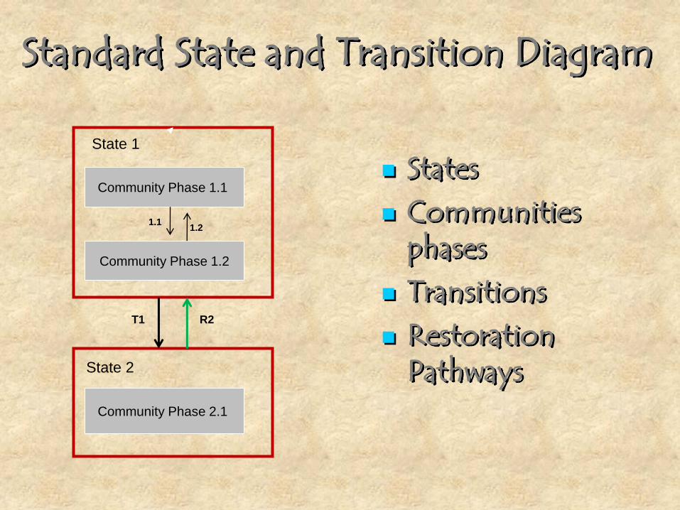
Community Phase 1.1
Community Phase 1.2
State 1
State 2
Community Phase 2.1
1.1 1.2
T1 R2
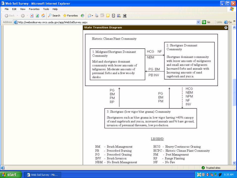
Standard State and Transition Diagram
States Communities
phases Transitions Restoration
Pathways

Ecological Sites
Bailey, R.G., 1996 Ecosystem Geography
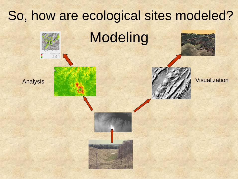
Modeling
Analysis Visualization
So, how are ecological sites modeled?


• Ecological sites are
characterized and
ESDs are developed
utilizing the NRCS
Land Resource
Hierarchical System
• ESD – developed at
the soil component
level

Land resource regions (LRR) are geographically associated groups of major land
resource areas and consist mainly of areas that have very broadly related
patterns of soil, climate, water resources, and land use.
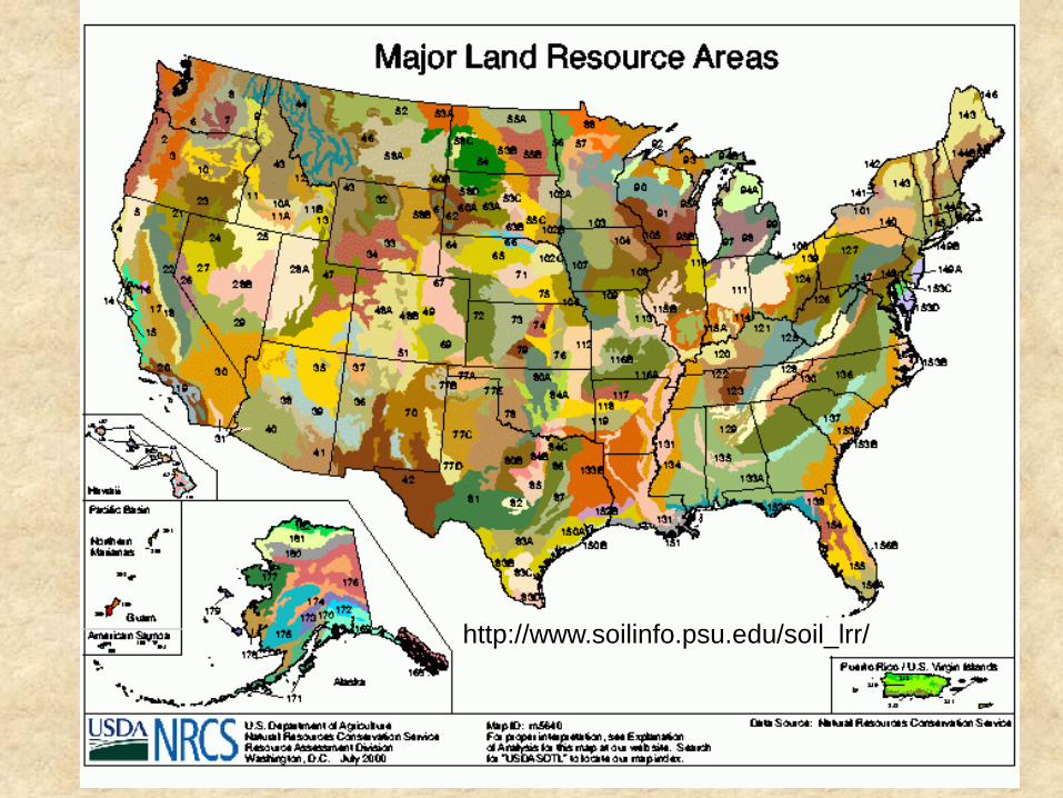
http://www.soilinfo.psu.edu/soil_lrr/
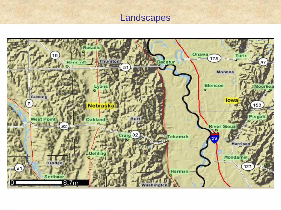
Landscapes

Spatial Data Structure • Landscape
• Map Unit
• Component
Landscape contains Multiple Landforms
Single Map Unit delineation
contains Single or Multiple
Components
Landform units delineated as soil map unit

1) Landform
2) Parent Materials
3) Root Restriction
4) Base Saturation
5) Drainage
6) Texture
7) Flooding
8) Ponding
Utilize the National Cooperative Soil
Survey/NASIS as the framework
A good soil survey complements the site concept effort
Soil properties effectively explain significant variations in vegetation.
Select the most essential soil properties that have significant
influence on vegetation. For Example; O
A
R
C
B
A MONUMENTAL
EFFORT!
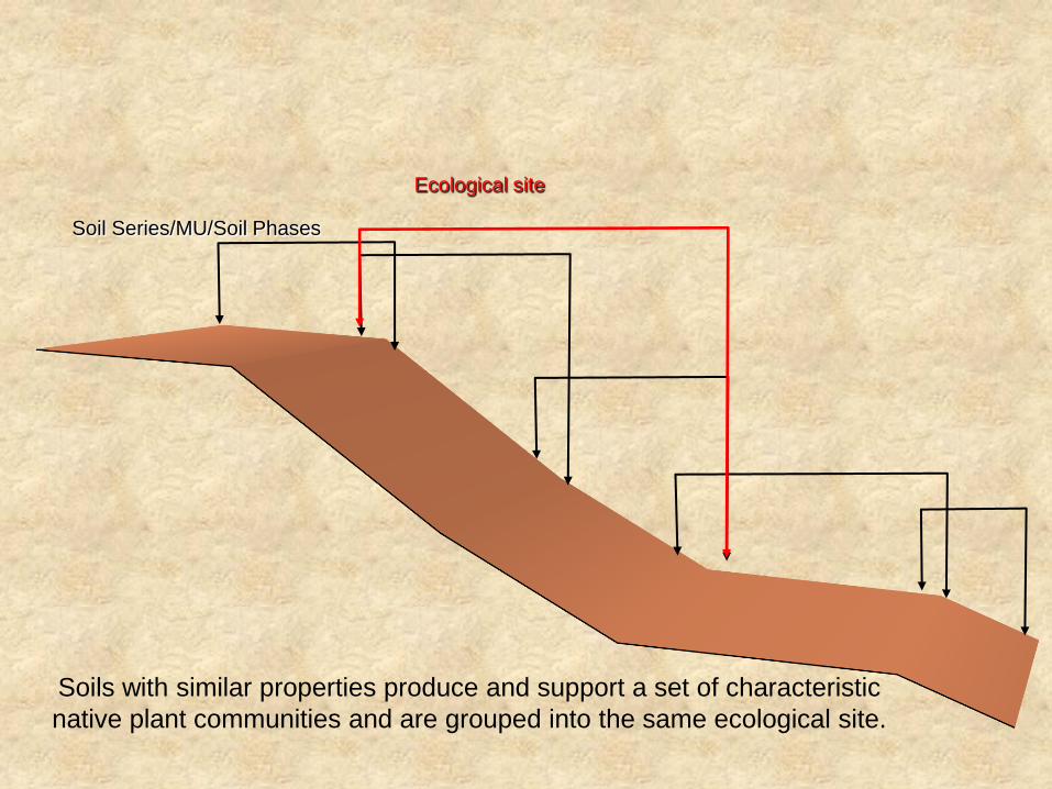
Soil Series/MU/Soil Phases
Ecological site
Soils with similar properties produce and support a set of characteristic
native plant communities and are grouped into the same ecological site.
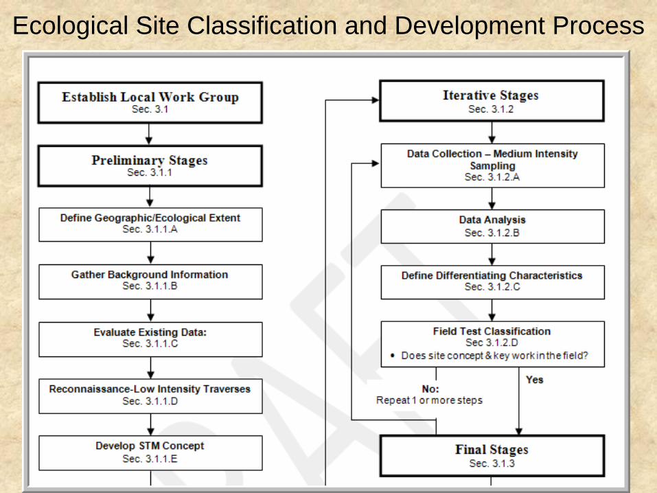
Ecological Site Classification and Development Process
Establishing the preliminary principles for
ecological sites based on;
• Referenced Literature – Historical Records
– University Press
– Scientific Journals
• Vegetation Classification Systems and Floristic Assessment Methods and review point or plot data from sources such as – Nature Conservancy
– Department of Natural Resources
– Forest Service, BLM
– Nature Conservancy - NatureServe
– State Department of Natural Resources
– Forest Service, BLM
– NRCS

1. Coordinate ESD efforts through locally-lead
workshops involving all partners.
2. Create the initial Ecological Site concepts
based on literature reviews, and existing
data.
3. Sort soils based on key soil and
physiographic features and/or develop a
spatial hierarchy for sampling
4. Conduct extensive, low intensity traverses
(Tier 1) to refine initial concepts and to plan
inventory procedures

(Tier 1) Conduct extensive, low intensity
traverses to refine initial concepts and to
plan inventory procedures
• Review existing GIS layers where possible
• Target relic areas, potential reference areas
• Dig shallow soil pits, classify the soil pedon
• Take digital Photos, GPS, do ocular estimates
• Concept is to cover broad areas within the MLRA
• Sampling occurs across the extent of the area
• Confirm and validate
(Tier 2). Medium intensity transects across
broad extents with large number of samples
• Designed to investigate interrelationships of ecological sites, states and communities
• Data provides the bulk of quantitative data used to test the concepts for the site and state differentiation, as well as defining the mapping unit,
• Simple soil pedon descriptions distinguish key characteristics (e.g., soil horizons, soil structure, rock fragments)
• Should be conducted by soils and vegetation specialist

• At the local scale, soil temperature, moisture, and
nutrient regimes are characterized based on key soil
physical and chemical properties that are used as
differentiating criteria in defining an ecological site.
Key soil properties are
identified using direct
measures of edaphic
conditions including soil
morphology, depth, texture,
water holding capacity, pH,
and so forth.
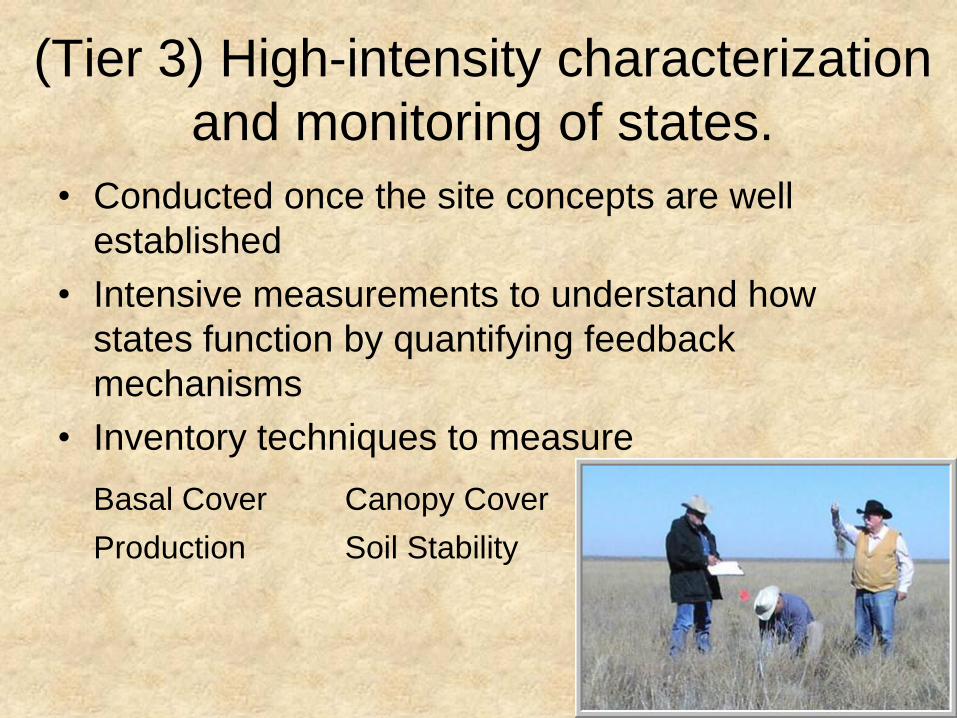
(Tier 3) High-intensity characterization
and monitoring of states.
• Conducted once the site concepts are well
established
• Intensive measurements to understand how
states function by quantifying feedback
mechanisms
• Inventory techniques to measure
Basal Cover Canopy Cover
Production Soil Stability

What are the Benifits? Hands-on Training Workshops by MLRA/eco-region
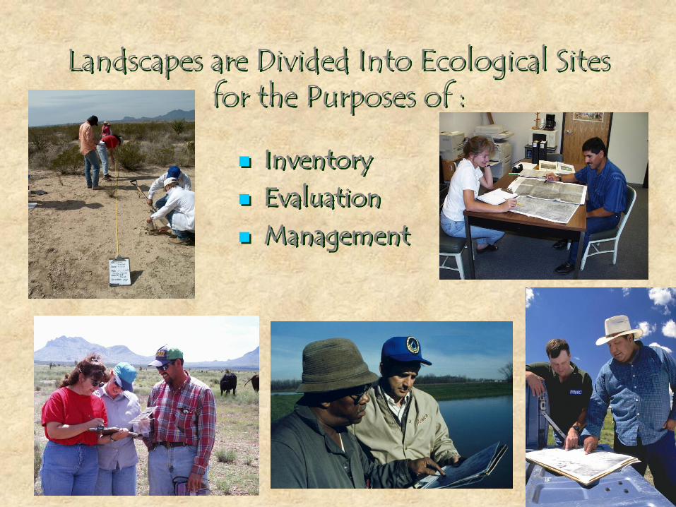
Landscapes are Divided Into Ecological Sites for the Purposes of :
Inventory Evaluation Management
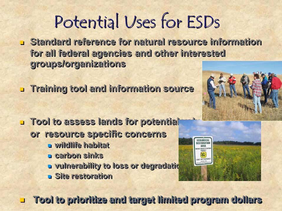
Potential Uses for ESDs Standard reference for natural resource information
for all federal agencies and other interested groups/organizations
Training tool and information source
Tool to assess lands for potential values
or resource specific concerns wildlife habitat
carbon sinks
vulnerability to loss or degradation
Site restoration
Tool to prioritize and target limited program dollars

1. Ecological Site Descriptions
What are the Products?
2. Web Soil Survey Mapping with hyperlinks to ELT/ESD
Description

The characteristics differentiating ecological sites
and their abiotic and biotic features are
documented in ecological site descriptions (ESD).
An ESD provides interpretations about the land uses and
ecosystem services that a particular ecological site can
support and management alternatives for achieving land
management objectives.
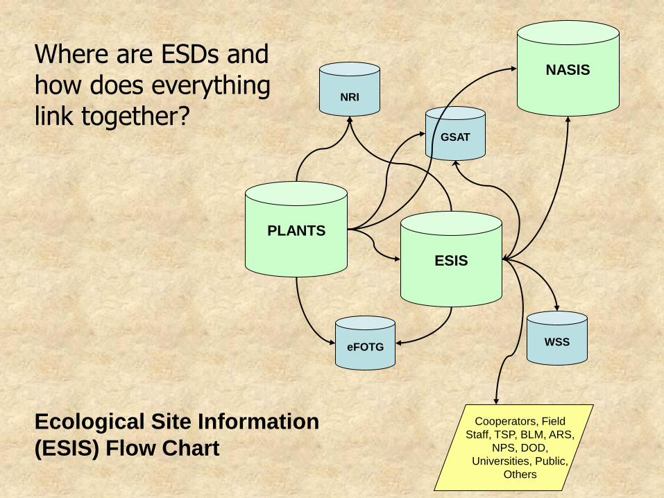
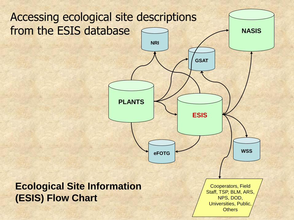
PLANTS
GSAT
eFOTG
ESIS
Cooperators, Field
Staff, TSP, BLM, ARS,
NPS, DOD,
Universities, Public,
Others
WSS
NASIS
NRI
Ecological Site Information
(ESIS) Flow Chart
Where are ESDs and how does everything link together?
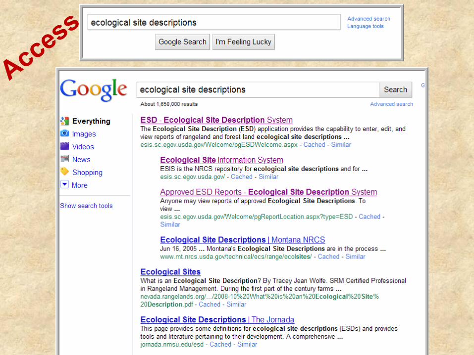

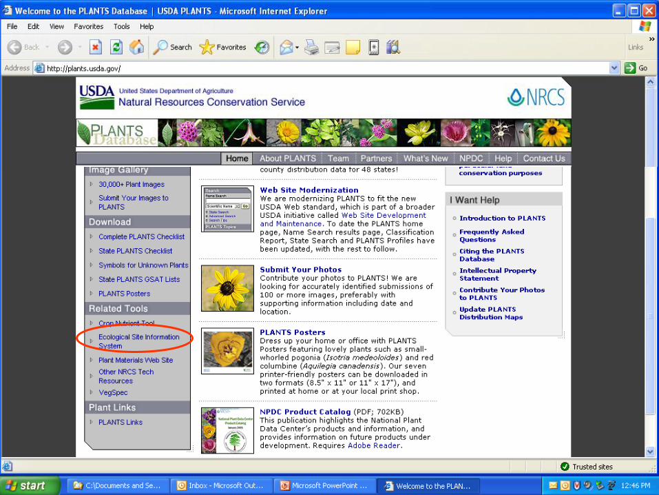

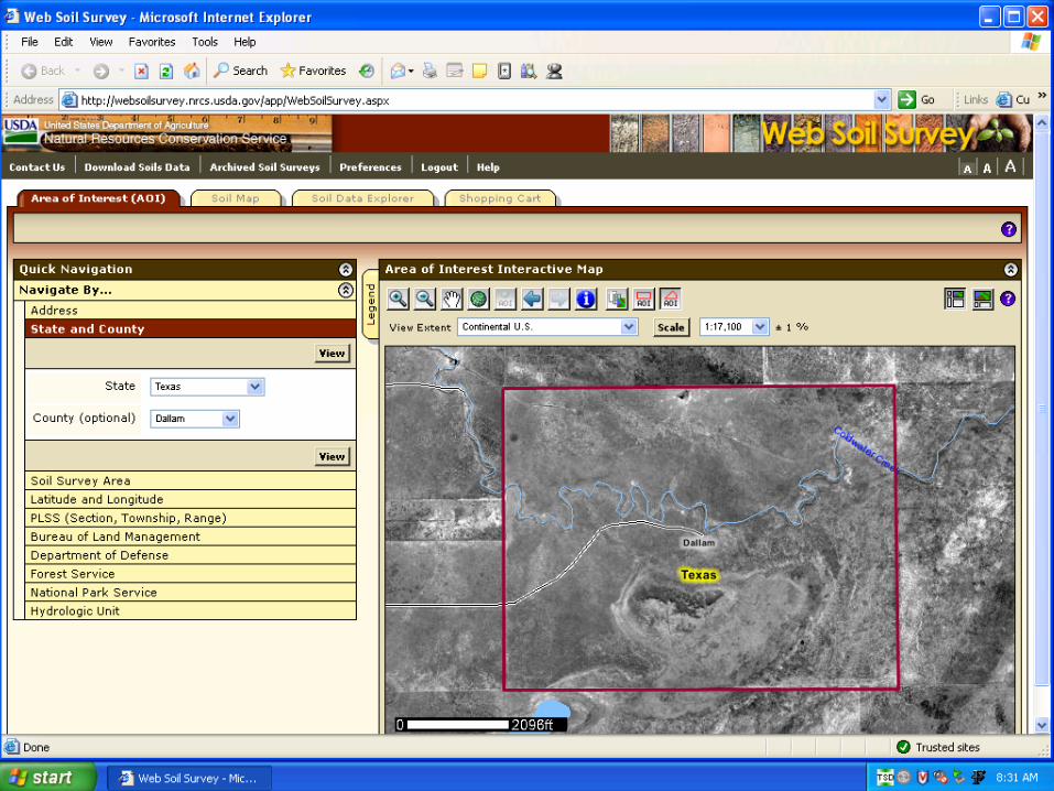
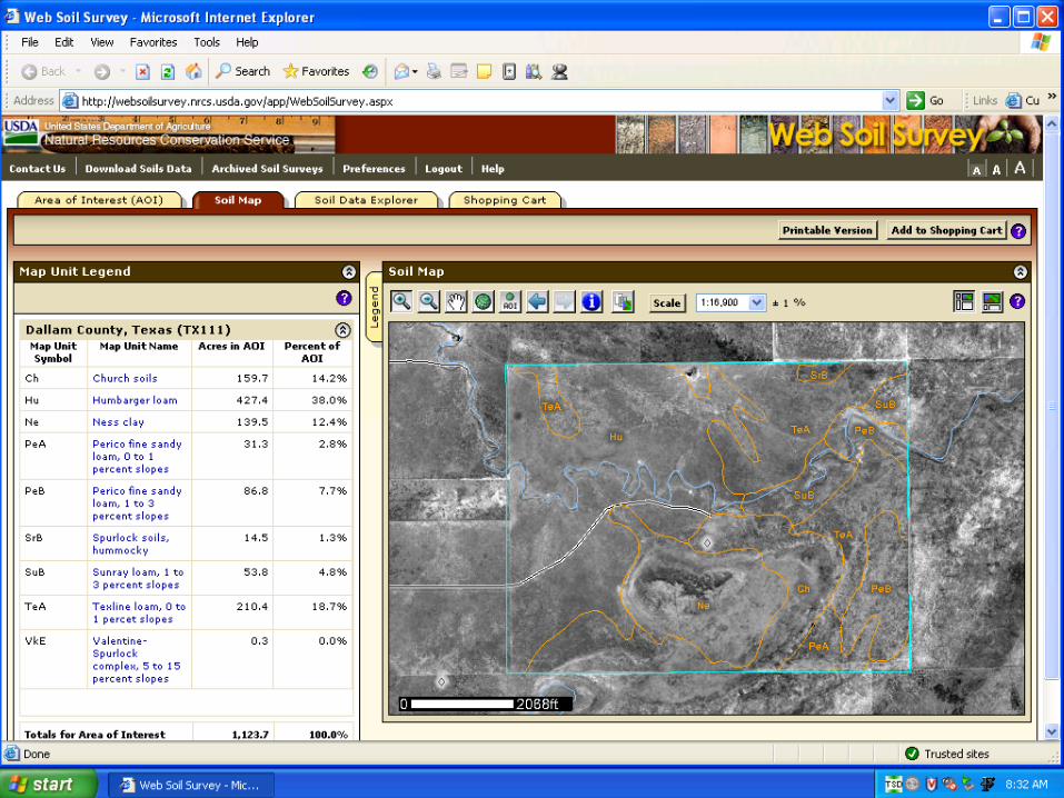
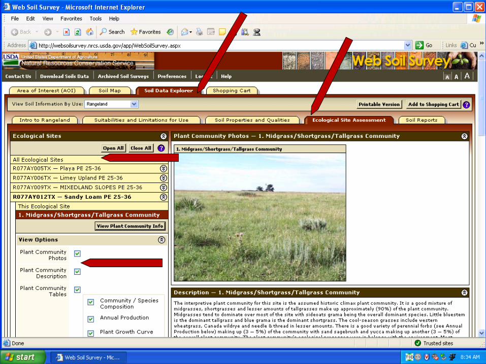
Accessing ecological sites through WSS
Ecological Site
Information System (ESIS)
Web Soil Survey
Soil Data Mart


PLANTS
GSAT
eFOTG
ESIS
Cooperators, Field
Staff, TSP, BLM, ARS,
NPS, DOD,
Universities, Public,
Others
WSS
NASIS
NRI
Ecological Site Information
(ESIS) Flow Chart
Accessing ecological site descriptions from the ESIS database
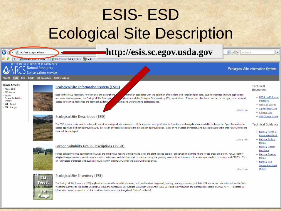
ESIS- ESD
Ecological Site Description
http://esis.sc.egov.usda.gov
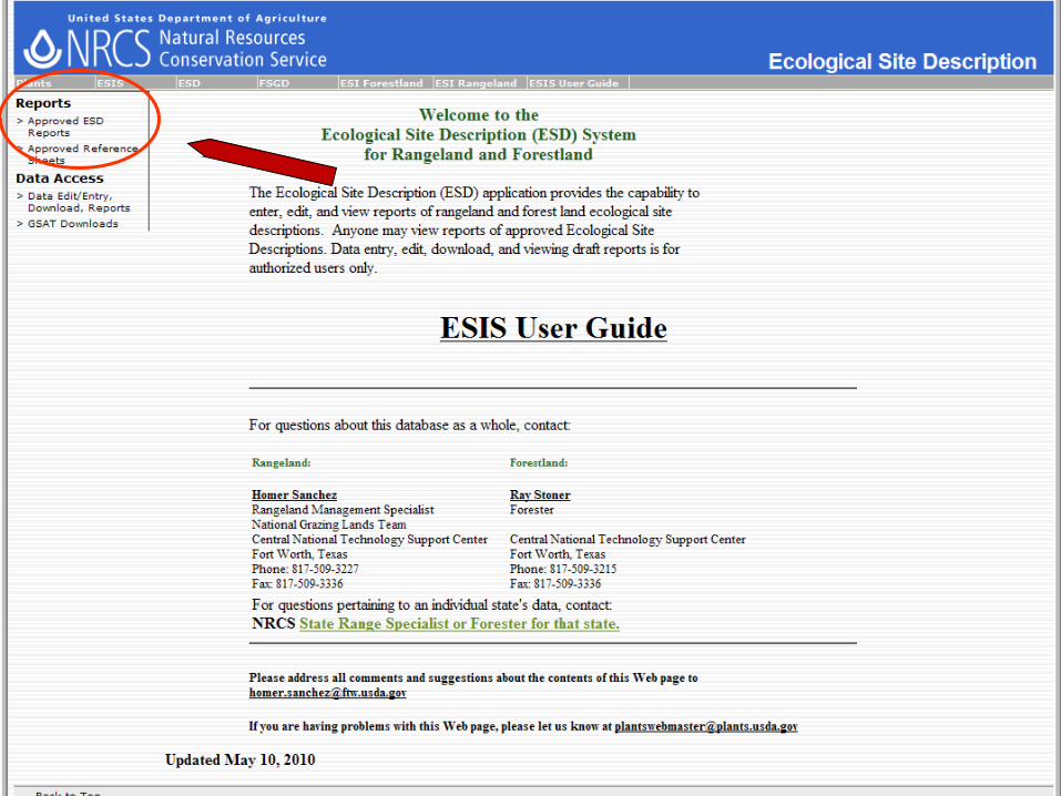


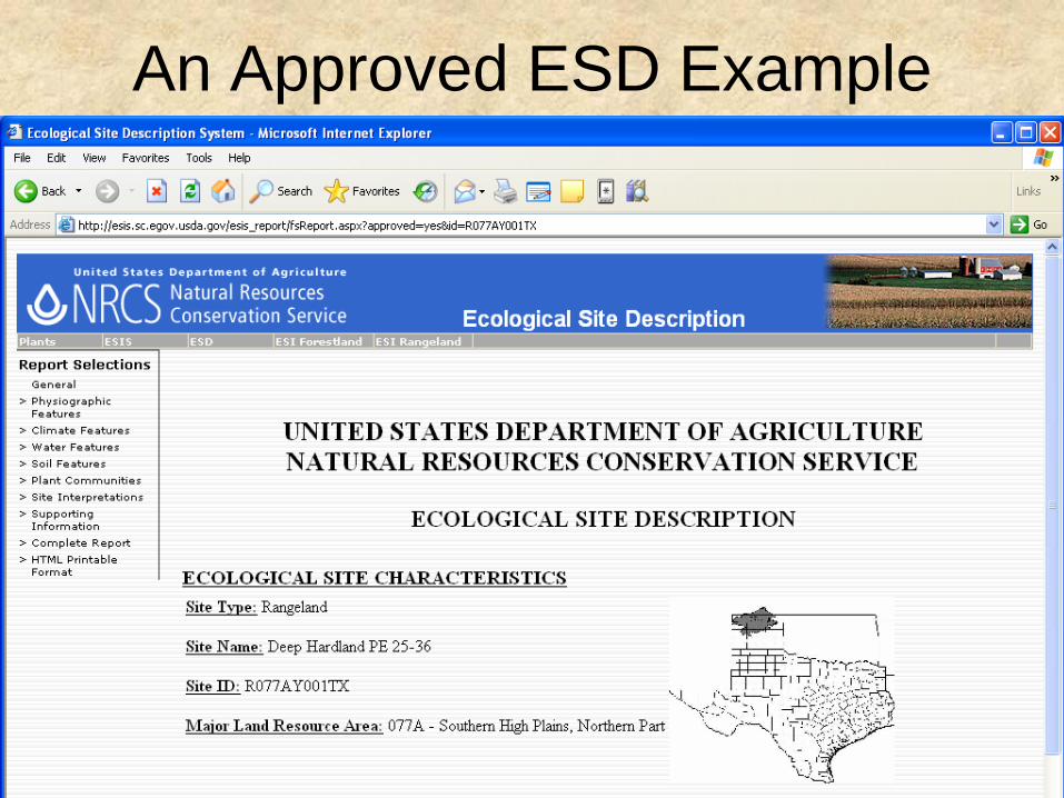
An Approved ESD Example
Questions, Comments, ..Thank you
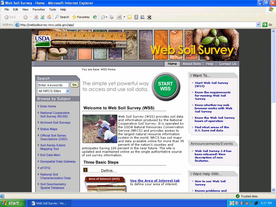
• The Web Soil Survey:
http://websoilsurvey.nrcs.usda.gov/app/
• The Ecological Site Information System (ESIS):
http://esis.sc.egov.usda.gov/

I’m done here…thanks