Embed Size (px)
Citation preview
East Cambridgeshire Local Plan
April 2015
East CambridgeshireDistrict Council
East Cambridgeshire Local Plan Adopted April 2015
1
This East Cambridgeshire Local Plan Development Plan Document was adopted at a full meeting of East Cambridgeshire District Council on 21 April 2015
1 Introduction ........................................................................................................................... 9
1.1 What is the Local Plan? ................................................................................................................. 9
1.2 Preparation of the Local Plan ........................................................................................................ 9
1.3 Working with neighbouring authorities and key stakeholders ..................................................... 10
1.4 Neighbourhood Plans .................................................................................................................. 11
1.5 Further information ...................................................................................................................... 11
2 A strategic vision for East Cambridgeshire ...................................................................... 12
2.1 Introduction .................................................................................................................................. 12
2.2 Description of East Cambridgeshire ............................................................................................ 12
2.3 Key issues and challenges .......................................................................................................... 13
2.4 Spatial vision ................................................................................................................................ 15
2.5 Strategic objectives...................................................................................................................... 16
2.6 Monitoring and review.................................................................................................................. 17
PART 1 – Spatial strategy and policies ..................................................................................... 18
3 Delivery of sustainable growth........................................................................................... 19
3.1 Introduction .................................................................................................................................. 19
3.2 Level of growth ............................................................................................................................ 19
3.3 Locational strategy....................................................................................................................... 23
3.4 Infrastructure needs ..................................................................................................................... 26
3.5 Delivery of growth ........................................................................................................................ 30
3.6 Presumption in favour of sustainable development ..................................................................... 39
3.7 Community-led development ....................................................................................................... 40
4 Housing ................................................................................................................................ 42
4.1 Introduction .................................................................................................................................. 42
4.2 Housing mix and type .................................................................................................................. 42
4.3 Housing density ........................................................................................................................... 44
4.4 Affordable housing on open market sites .................................................................................... 44
4.5 Affordable housing exception sites .............................................................................................. 47
4.6 Dwellings for rural workers .......................................................................................................... 48
4.7 Residential care accommodation ................................................................................................ 50
4.8 Mobile homes and residential caravan parks .............................................................................. 51
4.9 Extension and replacement of dwellings in the countryside ........................................................ 52
4.10 Gypsies and Travellers and Travelling Showpeople accommodation ......................................... 52
5 Employment......................................................................................................................... 55
5.1 Introduction .................................................................................................................................. 55
5.2 Retention of existing employment sites and allocations .............................................................. 55
5.3 Extensions to existing businesses in the countryside ................................................................. 56
5.4 New employment development in the countryside ...................................................................... 57
East Cambridgeshire Local Plan Adopted April 2015
2
5.5 Re-use and replacement of existing buildings in the countryside ............................................... 57
5.6 Equine development .................................................................................................................... 59
5.7 Development affecting the horse racing industry ........................................................................ 60
5.8 Tourist facilities and visitor attractions ......................................................................................... 60
5.9 Tourist accommodation ............................................................................................................... 61
5.10 Holiday and seasonal occupancy conditions ............................................................................... 63
6 Environment and climate change ...................................................................................... 65
6.1 Introduction .................................................................................................................................. 65
6.2 Landscape and settlement character .......................................................................................... 65
6.3 Design .......................................................................................................................................... 67
6.4 Shop fronts and advertisements .................................................................................................. 70
6.5 Energy and water efficiency and renewable energy in construction ........................................... 71
6.6 Carbon offset ............................................................................................................................... 73
6.7 Renewable energy development ................................................................................................. 74
6.8 Biodiversity and geology .............................................................................................................. 75
6.9 Flood risk ..................................................................................................................................... 77
6.10 Pollution ....................................................................................................................................... 79
6.11 Green Belt .................................................................................................................................... 81
6.12 Historic environment .................................................................................................................... 83
6.13 Conservation Areas ..................................................................................................................... 83
6.14 Listed Buildings ............................................................................................................................ 84
6.15 Local Register of Buildings and Structures ................................................................................. 86
6.16 Archaeological sites and monuments .......................................................................................... 87
6.17 Historic parks and gardens .......................................................................................................... 88
6.18 Enabling development associated with heritage assets .............................................................. 88
7 Community services and infrastructure ............................................................................ 90
7.1 Introduction .................................................................................................................................. 90
7.2 Retail and town centre development ........................................................................................... 90
7.3 Retail uses in town centres .......................................................................................................... 92
7.4 Retaining community facilities ..................................................................................................... 98
7.5 New community facilities ............................................................................................................. 99
7.6 Strategic green infrastructure .................................................................................................... 100
7.7 Telecommunications .................................................................................................................. 102
7.8 Transport impact ........................................................................................................................ 103
7.9 Parking provision ....................................................................................................................... 104
PART 2 ....................................................................................................................................... 109
8 Village and Town Visions ................................................................................................. 109
8.1 Aldreth ....................................................................................................................................... 110
8.2 Ashley ........................................................................................................................................ 111
8.3 Barway ....................................................................................................................................... 114
8.4 Black Horse Drove ..................................................................................................................... 117
8.5 Bottisham ................................................................................................................................... 119
8.6 Brinkley ...................................................................................................................................... 125
8.7 Burrough Green ......................................................................................................................... 127
8.8 Burwell ....................................................................................................................................... 129
East Cambridgeshire Local Plan Adopted April 2015
3
8.9 Chettisham ................................................................................................................................. 139
8.10 Cheveley .................................................................................................................................... 141
8.11 Chippenham .............................................................................................................................. 145
8.12 Coveney ..................................................................................................................................... 148
8.13 Dullingham ................................................................................................................................. 150
8.14 Ely .............................................................................................................................................. 153
8.15 Fordham .................................................................................................................................... 181
8.16 Haddenham ............................................................................................................................... 194
8.17 Isleham ...................................................................................................................................... 199
8.18 Kennett ...................................................................................................................................... 206
8.19 Kirtling & Upend ......................................................................................................................... 208
8.20 Little Downham .......................................................................................................................... 211
8.21 Little Thetford ............................................................................................................................. 215
8.22 Littleport ..................................................................................................................................... 217
8.23 Lode and Long Meadow ............................................................................................................ 232
8.24 Mepal ......................................................................................................................................... 235
8.25 Newmarket Fringe ..................................................................................................................... 236
8.26 Prickwillow ................................................................................................................................. 240
8.27 Pymoor ...................................................................................................................................... 243
8.28 Queen Adelaide ......................................................................................................................... 247
8.29 Reach ........................................................................................................................................ 249
8.30 Snailwell ..................................................................................................................................... 252
8.31 Soham ....................................................................................................................................... 254
8.32 Stetchworth ................................................................................................................................ 288
8.33 Stretham .................................................................................................................................... 291
8.34 Stuntney ..................................................................................................................................... 294
8.35 Sutton ........................................................................................................................................ 296
8.36 Swaffham Bulbeck ..................................................................................................................... 302
8.37 Swaffham Prior .......................................................................................................................... 305
8.38 Upware ...................................................................................................................................... 309
8.39 Wardy Hill .................................................................................................................................. 311
8.40 Wentworth .................................................................................................................................. 313
8.41 Westley Waterless ..................................................................................................................... 316
8.42 Wicken ....................................................................................................................................... 318
8.43 Wilburton .................................................................................................................................... 321
8.44 Witcham ..................................................................................................................................... 324
8.45 Witchford .................................................................................................................................... 327
8.46 Woodditton and Saxon Street .................................................................................................... 330
Appendices
1. Superseded policies
2. Designated wildlife/historical sites
3. Glossary
4. Diagram of Strategic Green Infrastructure
East Cambridgeshire Local Plan Adopted April 2015
4
List of Policies
Policy GROWTH 1: Levels of housing, employment and retail growth .......................................... 23
Policy GROWTH 2: Locational strategy ........................................................................................ 25
Policy GROWTH 3: Infrastructure requirements ............................................................................ 28
Policy GROWTH 4: Delivery of growth .......................................................................................... 36
Policy GROWTH 5: Presumption in favour of sustainable development ........................................ 40
Policy GROWTH 6: Community-led development ......................................................................... 41
Policy HOU 1: Housing mix ........................................................................................................... 43
Policy HOU 2: Housing density ..................................................................................................... 44
Policy HOU 3: Affordable housing provision .................................................................................. 46
Policy HOU 4: Affordable housing exception sites ......................................................................... 48
Policy HOU 5: Dwellings for rural workers ..................................................................................... 49
Policy HOU 6: Residential care accommodation ........................................................................... 50
Policy HOU 7: Mobile homes and residential caravan parks ......................................................... 51
Policy HOU 8: Extension and replacement of dwellings in the countryside ................................... 52
Policy HOU 9: Gypsies, Travellers and Travelling Showpeople sites ............................................ 54
Policy EMP 1: Retention of existing employment sites and allocations .......................................... 56
Policy EMP 2: Extensions to existing businesses in the countryside ............................................. 57
Policy EMP 3: New employment development in the countryside ................................................. 57
Policy EMP 4: Re-use and replacement of existing buildings in the countryside ........................... 58
Policy EMP 5: Equine development .............................................................................................. 60
Policy EMP 6: Development affecting the horse racing industry .................................................... 60
Policy EMP 7: Tourist facilities and visitor attractions .................................................................... 61
Policy EMP 8: Tourist accommodation .......................................................................................... 62
Policy EMP 9: Holiday and seasonal occupancy conditions .......................................................... 63
Policy ENV 1: Landscape and settlement character ...................................................................... 66
Policy ENV 2: Design .................................................................................................................... 68
Policy ENV 3: Shop fronts and advertisements ............................................................................. 71
East Cambridgeshire Local Plan Adopted April 2015
5
Policy ENV 4: Energy and water efficiency and renewable energy in construction ........................ 73
Policy ENV 5: Carbon offsetting .................................................................................................... 73
Policy ENV 6: Renewable energy development ............................................................................ 74
Policy ENV 7: Biodiversity and geology ......................................................................................... 76
Policy ENV 8: Flood risk ................................................................................................................ 79
Policy ENV 9: Pollution ................................................................................................................. 81
Policy ENV 10: Green Belt ............................................................................................................ 82
Policy ENV 11: Conservation Areas .............................................................................................. 84
Policy ENV 12: Listed Buildings .................................................................................................... 85
Policy ENV 13: Local Register of Buildings and Structures ........................................................... 86
Policy ENV 14: Sites of archaeological interest ............................................................................. 87
Policy ENV 15: Historic parks and gardens ................................................................................... 88
Policy ENV 16: Enabling development associated with heritage assets ........................................ 88
Policy COM 1: Location of retail and town centre uses ................................................................. 91
Policy COM 2: Retail uses in town centres .................................................................................... 93
Policy COM 3: Retaining community facilities ............................................................................... 99
Policy COM 4: New community facilities ..................................................................................... 100
Policy COM 5: Strategic green infrastructure .............................................................................. 101
Policy COM 6: Telecommunications............................................................................................ 102
Policy COM 7: Transport impact ................................................................................................. 104
Policy COM 8: Parking provision ................................................................................................. 105
Policy BAR 1: Housing allocation, land east of The Barn, Randalls Farm ................................... 115
Policy BAR 2: Housing allocation, land east of 5 Barway Road ................................................... 115
Policy BOT 1: Housing allocation, land east of Bell Road ............................................................ 121
Policy BOT 2: Employment allocation, extension to Tunbridge Lane Business Park ................... 122
Policy BUR 1: Housing allocation, land off Newmarket Road ...................................................... 132
Policy BUR 2: Employment allocation, land at Reach Road ........................................................ 134
Policy BUR 3: Employment allocation, former DS Smith site, Reach Road ................................. 135
East Cambridgeshire Local Plan Adopted April 2015
6
Policy BUR 4: Burwell Village Centre .......................................................................................... 136
Policy BUR 5: The Weirs/Riverside ............................................................................................. 137
Policy CHV 1: Housing allocation, land rear of Star and Garter Lane .......................................... 142
Policy CHV 2: Housing allocation, land between 199-209 High Street ........................................ 143
Policy ELY 1: Housing-led sustainable urban extension, North Ely ............................................. 160
Policy ELY 2: Retail-led / mixed use allocation, The Grange, Nutholt Lane ................................. 164
Policy ELY 3: A Vision for Paradise area .................................................................................... 166
Policy ELY 4: A Vision for the Waitrose carpark area .................................................................. 167
Policy ELY 5: A Vision for land north of Nutholt Lane .................................................................. 167
Policy ELY 6: Ely Market Square ................................................................................................ 168
Policy ELY 7: Employment-led / mixed-use allocation, Station Gateway ..................................... 169
Policy ELY 8: Station Gateway visions by area ........................................................................... 170
Policy ELY 9: A Vision for Octagon Business Park ...................................................................... 171
Policy ELY 10: Leisure allocation, land at Downham Road ......................................................... 173
Policy ELY 11: Employment allocation, Lancaster Way............................................................... 174
Policy ELY 12: Employment allocation, Ely Road and Rail Distribution Centre ............................ 175
Policy ELY 13: Ely Riverside area ............................................................................................... 175
Policy FRD 1: Housing allocation, land east of 24 Mildenhall Road ............................................. 183
Policy FRD 2: Housing allocation, land between 37 and 55 Mildenhall Road .............................. 183
Policy FRD 3: Housing allocation, land east of 67 Mildenhall Road ............................................. 184
Policy FRD 4: Employment allocation, land south of Snailwell Road ........................................... 186
Policy FRD 5: Employment allocation, land north of Snailwell Road............................................ 188
Policy FRD 6: Employment allocation, land at Horse Racing Forensic Laboratories ................... 189
Policy FRD 7: Employment allocation, land north of Turners ....................................................... 190
Policy FRD 8: Employment allocation, land south of Landwade Road......................................... 191
Policy HAD 1: Housing allocation, land off Rowan Close ............................................................ 195
Policy HAD 2: Housing allocation, land at New Road .................................................................. 196
Policy HAD 3: Employment allocation, land at Haddenham Business Park, Station Road ........... 197
East Cambridgeshire Local Plan Adopted April 2015
7
Policy ISL 1: Housing allocation, land south and west of Lady Frances Court ............................. 200
Policy ISL 2: Housing allocation, land at 5a Fordham Road ........................................................ 201
Policy ISL 3: Housing allocation, land west of Hall Barn Road .................................................... 201
Policy ISL 4: Housing allocation, land west of Pound Lane ......................................................... 203
Policy ISL 5: Housing allocation, land at Church Lane ................................................................ 204
Policy ISL 6: Employment allocation, land adjacent to Hall Barn Road Industrial Estate ............. 204
Policy LTD 1: Housing allocation, land west of Ely Road............................................................. 212
Policy LIT 1: Housing/employment allocation, west of Woodfen Road ........................................ 221
Policy LIT 2: Housing allocation, land west of Highfields ............................................................. 223
Policy LIT 3: Employment allocation, land west of 150 Wisbech Road ........................................ 225
Policy LIT 4: Employment allocation, land north of Wisbech Road .............................................. 226
Policy LIT 5: Strategy for Littleport Town Centre ......................................................................... 228
Policy LIT 6: School allocation, land west of Camel Road ........................................................... 231
Policy PRK 1: Housing allocation, land adjacent to Putney Hill Road .......................................... 241
Policy PYM 1: Housing allocation, land north-east of 9 Straight Furlong ..................................... 245
Policy SOH 1: Housing allocation, land off Brook Street.............................................................. 258
Policy SOH 2: Housing-led / mixed use allocation, land off Station Road .................................... 260
Policy SOH 3: Housing-led / mixed use allocation, Eastern Gateway area .................................. 263
Policy SOH 4: Housing allocation, land off Fordham Road............................................................265
Policy SOH 5: Housing allocation, land south of Blackberry Lane................................................267
Policy SOH 6: Housing allocation, land north of Blackberry Lane.................................................268
Policy SOH 7: Housing allocation, land adjacent to the cemetery.................................................270
Policy SOH 8: Housing allocation, land east of The Shade ...........................................................271
Policy SOH 9: Employment/mixed use allocation, land east of The Shade.................................. 274
Policy SOH 10: Employment allocation, land west of The Shade ................................................ 275
Policy SOH 11: Employment allocation, land east of the A142 bypass ........................................ 277
Policy SOH 12: Town centre opportunity site, Budgens site ........................................................ 279
Policy SOH13: Town centre opportunity site, Church hall area ................................................... 280
East Cambridgeshire Local Plan Adopted April 2015
8
Policy SOH14: Town centre opportunity site, Cooperative store area ......................................... 282
Policy SOH15: Town centre opportunity site, Fountain Lane recreation ground and car park ..... 283
Policy SOH16: Green Lanes and Commons ............................................................................... 284
Policy SUT 1: Housing allocation, land north of The Brook ......................................................... 298
Policy SWP 1: Housing allocation, land off Rogers Road ............................................................ 306
Policy SWP 2: Employment allocation, land east of Goodwin Farm, Heath Road ....................... 307
Policy WEN 1: Housing allocation, land opposite the old Red Lion, Main Street ......................... 314
Policy WEN 2: Housing allocation, land east of 1 Main Street ..................................................... 314
Policy WIC 1: Housing allocation, land north-west of The Crescent ............................................ 319
Policy WIC 2: Housing allocation, land south of Church Road .................................................... 319
East Cambridgeshire Local Plan Adopted April 2015
Introduction and strategic vision
9
1 Introduction
1.1 What is the Local Plan?
1.1.1 This Local Plan sets out a blueprint for the future growth of East Cambridgeshire. It looks at how much, where and when development should take place. It seeks to ensure that development in the district is ‘sustainable’ and meets the needs of the local area.
1.1.2 The Local Plan covers the period up to 2031. But it is likely that the Plan will be reviewed well before then, in response to changes in local needs and circumstances, or national policy. For further details, see section 2.6 below on monitoring and review. The Local Plan replaces the ‘East Cambridgeshire Core Strategy’ (2009).
1.1.3 The Local Plan will be the main basis for making decisions on planning applications. When adopted, planning decisions should be in accordance with the Local Plan, unless material considerations indicate otherwise. The Local Plan sits alongside the Government’s National Planning Policy Framework (NPPF), which must also be taken into account when deciding planning applications, and preparing Local Plans.
1.1.4 This Local Plan is split into 2 key parts, as follows:
Part 1: Spatial strategy and policies This section sets out a strategic vision for future growth, and a series of detailed policies to guide development. Part 2: Village and Town Visions This section sets out how each settlement should change and improve, and identifies sites for development.
1.2 Preparation of the Local Plan
1.2.1 The Local Plan has been prepared in accordance with relevant legislation and guidance, including the Town and Country Planning (Local Planning) (England) Regulations 2012, and the National Planning Policy Framework (2012).
1.2.2 The preparation of the Local Plan involved a number of key stages which are discussed below:
Stage 1: Evidence base
1.2.3 The preparation of the Plan has been informed by extensive background research and information. This includes research on a range of topics, including housing delivery and supply, transport needs, infrastructure requirements, and economic development. It also includes production of a ‘Sustainability Appraisal’ which looks at the economic, environmental and social impacts of the Local Plan. It has also involved taking account of the plans and strategies of other organisations. The full range of background documents can be viewed on the Council’s website at www.eastcambs.gov.uk.
East Cambridgeshire Local Plan Adopted April 2015
Introduction and strategic vision
10
Stage 2: Issues and options
1.2.4 This stage involved identifying the key issues affecting the district and villages/towns, and exploring different options for future development.
Strategic development: A district-wide consultation was carried out to gather views on key strategic issues facing the whole of East Cambridgeshire.
Village/town visions: An innovative ‘bottom-up’ approach to development planning was adopted to produce a ‘Vision’ for each village and town in East Cambridgeshire (as set out in Part 2 of this Plan). This involved the District Council working in close partnership with Parish/Town Councils to organise public consultations with every local community in order to explore their local needs and priorities. It built on the production of the Ely, Soham, Littleport and Burwell Masterplans (non-statutory Council vision documents, produced between 2009 and 2013. As such, local people were offered a chance to influence the future of their communities, and become more involved in the planning process. Full details of this innovative approach are set out in the ‘Consultation Statement’ background document on the Council’s website.
Stage 3: Publication of the draft Local Plan 1.2.5 The draft Local Plan was published in February 2013, for a six week period of public
consultation. About 500 people/organisations made responses during this period. The draft Local Plan was formally submitted to Government on 29th August 2013. Stage 4: Examination
1.2.6 The Local Plan was subject to examination between 29th August 2013 and 9th March 2015. Stage 5: Adoption
1.2.7 This Plan was adopted on 21st April 2015.
1.3 Working with neighbouring authorities and key stakeholders
1.3.1 The District Council is expected to work together with other local authorities and public bodies across administrative boundaries, to plan for the housing, transport and infrastructure that local people need. This is known as the ‘duty to cooperate’.
1.3.2 To help facilitate this process in Cambridgeshire and Peterborough, a Joint Members Group and ‘Joint Strategic Planning Unit’ have been established. This has helped to facilitate the production of an agreed Joint Spatial Planning Statement1, coordination between authorities, and joint work on the evidence base. A non-statutory ‘Strategic Spatial Priorities’ document has also been jointly produced by the local authorities2. Full details of the process of co-operation and joint working is set out in the ‘Duty to Cooperate Evidence Report’ which accompanies this Local Plan.
1 Joint Statement on the Development Strategy for Cambridgeshire and Peterborough by the Local Authorities (July 2012). 2 ‘Strategic Spatial Priorities: addressing the duty to co-operate across Cambridgeshire and Peterborough’ (Jan. 2014).
East Cambridgeshire Local Plan Adopted April 2015
Introduction and strategic vision
11
1.4 Neighbourhood Plans
1.4.1 As referred to above, the District Council has worked extensively with Parish/Town Councils and local communities to identify local needs and priorities which are reflected in the Visions in Part 2 of this Local Plan. Although the Visions capture the current aspirations of each community, it is recognised that circumstances change, and other local priorities may arise. A review of the Local Plan would be one way of addressing the need for changes to the Village/Town Visions. However, the Government has also introduced a number of new planning tools for local communities through the Localism Act, including the ability to produce ‘Neighbourhood Development Plans.’
1.4.2 Neighbourhood Plans can be produced by Parish Councils, and can identify how an area (i.e. a settlement, area or street) should grow and change. The Neighbourhood Plan process provides another opportunity for local people to influence what is built in their area – although it should be noted that Neighbourhood Development Plans need to be in conformity with the Local Plan and can only provide for equal or additional growth. A Neighbourhood Development Plan becomes part of the statutory plan for East Cambridgeshire, and its policies will sit alongside, or replace those in the Local Plan where they overlap. Communities who wish to produce a Neighbourhood Plan are advised to contact the Council’s Forward Planning team for further advice.
1.4.3 The District Council recognises the importance of community-led initiatives, and has also included a policy in this Local Plan which supports ‘community-led development’ on the edge of villages. This provides an alternative to the production of a Neighbourhood Plan, and means the Plan is flexible enough to help meet community needs as they arise without the need to carry out a review. Further details are set out in Policy GROWTH 6 below.
1.5 Further information
1.5.1 If you have any questions or queries about the Local Plan, please call the Strategic Planning team on 01353 665555 or email [email protected].
1.5.2 Further information (including technical background documents and Supplementary Planning Documents) can be viewed on the Council’s website at:
www.eastcambs.gov.uk/local-development-framework
East Cambridgeshire Local Plan Adopted April 2015
Introduction and strategic vision
12
Fenland
East Cambridgeshire
Huntingdonshire
South Cambridgeshire
Cambridge City
Peterborough
Newmarket
Norfolk
Suffolk
2 A strategic vision for East Cambridgeshire
2.1 Introduction
2.1.1 This chapter sets the overall strategic vision for development in East Cambridgeshire up until 2031, taking account of current issues, attributes and potential. The vision is supported by a set of strategic objectives.
2.1.2 The chapter includes:
A brief description of East Cambridgeshire (section 2.2) An overview of the key issues and challenges facing the district (section 2.3) A vision of how the district should be in 2031 (section 2.4) A set of strategic objectives which should help to deliver the vision and guide
development in the district to 2031 (section 2.5) Information on how the plan will be monitored and reviewed (section 2.6)
2.2 Description of East Cambridgeshire
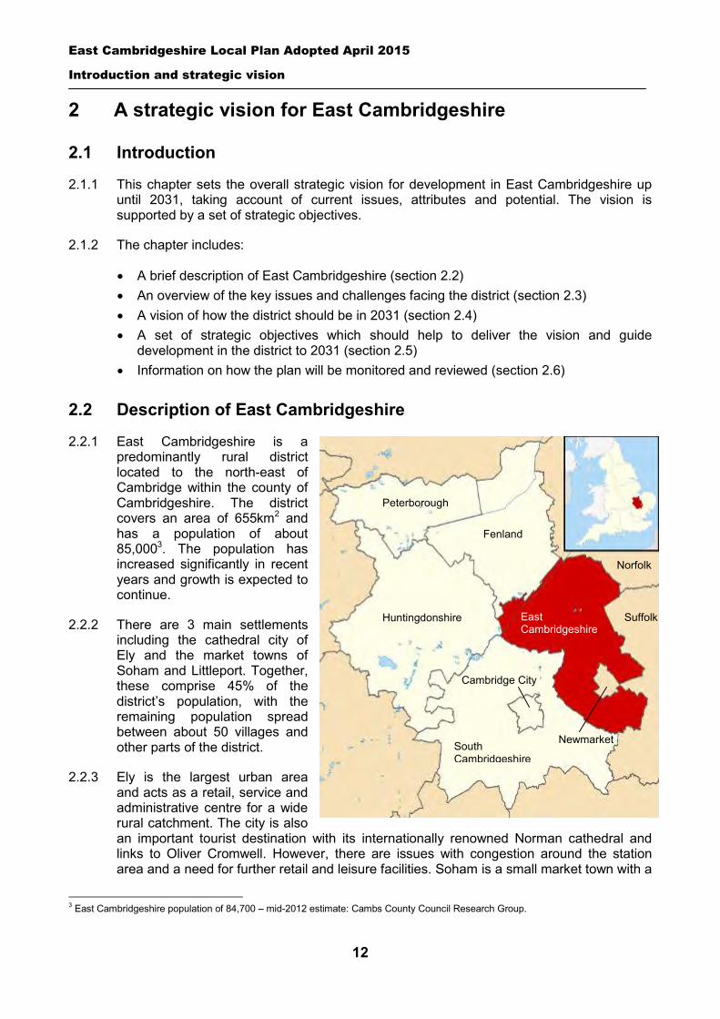
2.2.1 East Cambridgeshire is a predominantly rural district located to the north-east of Cambridge within the county of Cambridgeshire. The district covers an area of 655km2 and has a population of about 85,0003. The population has increased significantly in recent years and growth is expected to continue.
2.2.2 There are 3 main settlements including the cathedral city of Ely and the market towns of Soham and Littleport. Together, these comprise 45% of the district’s population, with the remaining population spread between about 50 villages and other parts of the district.
2.2.3 Ely is the largest urban area and acts as a retail, service and administrative centre for a wide rural catchment. The city is also an important tourist destination with its internationally renowned Norman cathedral and links to Oliver Cromwell. However, there are issues with congestion around the station area and a need for further retail and leisure facilities. Soham is a small market town with a
3 East Cambridgeshire population of 84,700 – mid-2012 estimate: Cambs County Council Research Group.
East Cambridgeshire Local Plan Adopted April 2015
Introduction and strategic vision
13
range of shops, catering for day-to-day needs, but the elongated town centre has suffered decline in recent years. Littleport is a small fenland town with a very localised service catchment due to its proximity to Ely, and the town centre is also suffering decline. The villages of Bottisham, Burwell, Haddenham and Sutton play a key service role for their rural hinterlands.
2.2.4 Once an agricultural focused area, the district is now a favoured business location in its own right. Employment rates are higher than the national average, with key sectors including construction, agriculture, and professional/technical services. Despite increases in the number of jobs in the district over the last decade, there are high levels of out-commuting to jobs in the Cambridgeshire area. A very high proportion of local businesses employ fewer than 10 people.
2.2.5 The landscape and economy of East Cambridgeshire can be broadly defined into two sub-areas. The northern part of the district is predominantly intensively farmed fenland, with many settlements located on higher ground on the old ‘islands’ in the fen. Flood risk is a key issue, with much of the land at or below sea-level. The area contains the three market towns of Ely, Soham and Littleport, and a range of scattered villages and hamlets. Here incomes are lower and deprivation is more marked than the southern part of the district. The south of the district consists of elevated chalk and heath land and contains a range of attractive villages and hamlets. The local economy and landscape is dominated by the horseracing industry with large areas of farmland converted to stud use. Residents mainly look to Newmarket and Cambridge for services and facilities.
2.2.6 The district contains many special landscape, natural and built heritage features, including:
1,910 hectares of land within the Cambridge Green Belt, around the villages of Bottisham, Lode and Swaffham Bulbeck
3 internationally important wildlife sites: Wicken Fen, Chippenham Fen, and the Ouse Washes
20 Sites of Special Scientific Interest. 80 County Wildlife Sites. Over 950 Listed Buildings and 27 Conservation Areas.
2.2.7 According to a 2012 survey4, East Cambridgeshire’s residents have the best quality of life of any rural area in Great Britain. In particular, health and life expectancy are amongst the highest of rural areas. However, as noted above, there are variations across the district, and pockets of deprivation exist.
2.3 Key issues and challenges
2.3.1 The district benefits from an attractive rural environment, and has a good level of overall prosperity. However, a number of specific issues need to be addressed. These are mainly related to the challenges of managing high levels of growth and the effects of population increase. In recent years, East Cambridgeshire has experienced considerable population and housing growth due to its location within a growth area. In particular, the success of the Cambridge economy has had a profound effect as the relative affordability of housing, compared to Cambridge, has stimulated rapid population growth in East Cambridgeshire. This has meant a significant increase in the level of out-commuting and pressures on local
4 Halifax Rural Areas Quality of Life Survey 2012.
East Cambridgeshire Local Plan Adopted April 2015
Introduction and strategic vision
14
house prices. The pace of growth has slowed but the district remains the fastest growing in Cambridgeshire. An overview of the key issues is set out below:
Delivering local jobs – The district has one of the highest levels of out-commuting in the region (49% of the working population5), with many higher skilled workers commuting to Cambridge and elsewhere. It is likely that the level of out-commuting has increased over the last decade as the pace of economic growth has not matched that of housing growth. New economic development needs to focus on the provision of higher skilled jobs and opportunities for homeworking to tackle the increasing levels of out-commuting and its associated congestion and pollution. This should also help to increase the jobs density ratio6, and help to create more sustainable self contained communities.
Enhancing the retail offer of market towns – The three market town centres of Ely, Soham and Littleport form the core of East Cambridgeshire’s retail offer and their vitality and viability are critical to the success of the local economy. Each faces particular challenges – Ely city centre is constrained by its historic heritage and has limited retail floorspace, whilst Soham and Littleport are smaller and more vulnerable and have experienced decline in recent years.
Infrastructure provision – Recent high levels of growth have placed pressure on local services and facilities including health, education and leisure. The provision of a good broadband service is also critical to support business growth, especially in the rural areas where the current service can be poor. The challenge is to ensure that services and facilities are delivered alongside growth.
Out-commuting and congestion – East Cambridgeshire is well served by rail, with Ely providing links with Cambridge, Peterborough, Norwich, Stansted Airport and London. However, use of the lines running through Ely for transporting freight is increasing, causing congestion on the A142 as the rail crossing is frequently closed to large vehicles. The A10 and other key roads also experience significant congestion, with a high proportion of residents commuting to Cambridge and elsewhere for work. The challenge is to lower the level of out-commuting and tackle these capacity issues with investment in transport infrastructure.
Housing affordability – There is a high level of affordable housing need in the district and continuing concerns about housing affordability, with average house prices out of reach for many on lower to middle incomes.
Sustainable travel – The district is predominantly rural with a dispersed population, which creates challenges in providing a comprehensive public transport network. Many local communities are reliant on the car as their only transport option. This impacts on carbon dioxide emissions, air quality, noise, public safety and the quality of the environment in towns and villages. The challenge is to ensure that development is directed to sustainable locations and that sustainable modes of transport are encouraged to reduce reliance on the car.
Rural services – The retention of local services is a key issue, particularly for rural communities. The challenge is to resist the loss of important facilities and support the delivery of new ones. This will be especially important in the context of the district’s ageing population, and the dispersed rural nature of the district.
Retaining distinctiveness and character – There is a need to ensure that the character and appearance of the built environment is protected and enhanced, especially within areas of historic importance. It will also be important to ensure that all
5 2001 Census. 6 Number of jobs per resident population age 16 to 64 years. See section 3.2 for more details.
East Cambridgeshire Local Plan Adopted April 2015
Introduction and strategic vision
15
new development is well designed and locally distinctive. Enhancing the character and distinctiveness of the district will help to benefit tourism.
Climate change and green infrastructure – The district is particularly vulnerable to the impacts of climate change such as flooding and drought, because many areas are low lying and within areas of water stress. The provision of green infrastructure is recognised as a desirable 'win-win' approach to combating climate change, since it can deliver other social, economic and environmental benefits. Maximising the creation of new green infrastructure will help to deliver a sustainable ‘green living landscape’.
Quality of life – Although the district has a good quality of life overall, there are areas for improvement, many of which are discussed above. There are also opportunities to improve and enhance certain parts of the district, including riverside areas and town centres. Part 2 of this Plan details these site-specific proposals.
2.4 Spatial vision
2.4.1 This spatial vision describes the proposed future development of the district until 2031. It goes beyond what can be achieved purely through the planning process, describing overall objectives which can be realised through a variety of delivery means. However the vision is founded on realistic, achievable goals developed through public consultation. Individual spatial vision statements for the market towns and Burwell are provided in Part 2 of this document.
A spatial vision for East Cambridgeshire
In 2031, East Cambridgeshire will have maintained a high quality of life and retained its distinct identity as a predominantly rural area of villages and market towns, whilst accommodating the development of new homes and jobs. The district will have taken advantage of the economic vitality of the Cambridge sub-region, and have a diverse and thriving economy, with vibrant and attractive towns and villages which act as employment and service centres for their surrounding rural areas. More residents will have a high quality of life, with increased access to affordable housing, a wider range of local better skilled jobs, and good quality services and facilities.
The market towns of Ely, Soham and Littleport will be the focus for development. Ely, as the main centre in the district, will accommodate the most growth. More employment opportunities will be available, reducing out-commuting, increasing the jobs density ratio, and creating more balanced communities with a better level of self-containment. A mix of residential development will be delivered to meet local needs (including affordable housing), whilst ensuring necessary infrastructure and community facilities/services are in place to support growth. In the wider countryside, appropriate small-scale development7 will be allowed where this meets local needs and supports the long-term sustainability of a settlement. The small part of the district which forms a suburb of Newmarket will support the overall development of Newmarket – as identified in the Forest Heath LDF.
Wherever new housing is provided, it will respond to local needs and requirements as far as possible in terms of type, size and tenure. In addition, large developments will be of exemplar quality8, and all new housing will be of high quality and well designed, ensuring that the distinctive character of the district’s towns and villages is maintained and enhanced.
7 Such as small scale and affordable housing, recreation, tourism, community facilities, small scale employment and farm diversification. 8 See Glossary for details.
East Cambridgeshire Local Plan Adopted April 2015
Introduction and strategic vision
16
Communities will have improved social, recreational, health and educational facilities. The needs of elderly, young and lower-paid people will receive special attention. Existing vital community services will be retained9 and new infrastructure and services required to support growth will be delivered on time to meet the needs of new residents. The levels of crime and the fear of crime will have been further reduced.
Transport deficiencies will be tackled and accessibility improved. Priority will be given to major improvements to the A142 between Angel Drove and the Stuntney Causeway. Public bus services between market towns and villages will be improved (including to settlements in neighbouring areas), and the A10 will be developed as a high quality public transport corridor. Better cycling and pedestrian facilities and links will be provided, including segregated cycle routes along key routes linking towns and villages. Other infrastructure improvement projects required to support growth will also be delivered.
The overall diversity and quality of East Cambridgeshire’s countryside and natural environment will have improved and the historic environment conserved and enhanced. There will be better access to the countryside and green spaces for local communities which helps to improve people’s quality of life. The challenges presented by climate change will have been embraced, with new development being located and designed to minimise resource and energy use and reduce the risk of flooding. Renewable energy production will have increased, and a proportion of all energy will be created from local renewable sources such as bio-fuels, biomass, and wind power.
2.5 Strategic objectives
2.5.1 The following strategic objectives will help to deliver the spatial vision and guide development in the district up to 2031.
1. Support the local economy and help create more jobs in the district, which meet local employment needs, reduces out-commuting, and helps to increase the sustainability and self-containment of communities in East Cambridgeshire.
2. Provide a range of new housing in appropriate locations, which meets local housing needs as far as possible.
3. Support and enhance the vitality and viability of town and village centres, as places for shopping, leisure and community activities.
4. Ensure that new development is of high quality and sustainable design which reflects local character and distinctiveness, provides attractive and safe environments, and is supported by appropriate facilities and services.
5. Protect and enhance the quality, local distinctiveness and diversity of the natural, historic and built environment.
6. Protect the open countryside and land within the Green Belt against insensitive and sporadic development.
7. Reduce the environmental impact of development and vulnerability to the impacts of climate change by reducing pollution and waste, maximising water and energy efficiency, dealing with flood risk and surface water management, and promoting the use of renewable energy sources and sustainable construction methods.
9 For example, community halls, local shops and pubs, and health facilities.
East Cambridgeshire Local Plan Adopted April 2015
Introduction and strategic vision
17
8. Provide greater opportunities to reduce car use, by locating most development where there is good access to jobs, services and facilities, and supporting improvements in public transport and walking/cycling networks.
9. Ensure a high quality of life by maintaining and delivering strategic and local infrastructure and facilities needed to support local communities.
10. Support the expansion of the tourist economy and the ability of the district to act as a tourist destination which attracts high numbers of visitors for longer stays.
2.6 Monitoring and review
2.6.1 The Local Plan covers the period up to 2031, but it is likely that it will be reviewed well in advance of this date, in order to respond to changing local circumstances and/or changes in national policy. In particular it will be important that there is a sufficient supply of housing and employment land in the district to deliver identified needs.
2.6.2 The Council will regularly monitor the supply of suitable land and the effectiveness and implementation of other policies through the Annual Monitoring Report. The report will set out appropriate indicators and targets, and be produced in January each year. If there is an insufficient supply of land, or other targets are not being met, it may be necessary to carry out a review or a partial review of the Local Plan. On a lesser level, it may be necessary to produce additional Supplementary Planning Documents to give guidance on the implementation of a particular policy.
2.6.3 The Council is committed to responding to the needs of its communities, and intends to maintain on-going dialogue with Parish Councils about local needs and priorities. The Council will monitor the outcomes of these on-going discussions to ensure that the Village and Town Visions remain up to date, and that the needs of communities are being met. If there are significant changes needed it may be necessary to carry out a partial review or full review of the Local Plan. Alternatively, Parish Councils may wish to produce Neighbourhood Plans of their own to deal with particular issues or deliver specific sites (see section 1.4 for further details).
2.6.4 The Council will co-operate positively with neighbouring planning authorities and with the joint planning arrangements in Cambridgeshire and Peterborough. The Council may need to review the Local Plan as a consequence of any future non-statutory spatial framework for Cambridgeshire and Peterborough (see section 1.3 above), or to respond to other sub-regional needs and requirements.
East Cambridgeshire Local Plan Adopted April 2015
Part One: Spatial strategy and policies
18
PART 1 – Spatial strategy and policies
East Cambridgeshire Local Plan Adopted April 2015
Part One: Spatial strategy and policies
19
3 Delivery of sustainable growth
3.1 Introduction
3.1.1 This chapter sets out the Council’s strategy for delivering growth in East Cambridgeshire over the Plan period up to 2031. It looks at the amount of new development that will be delivered, and where it should be located across the district. It also identifies the need for new allocations to deliver this strategy, and what new infrastructure and services may be required.
3.1.2 The strategy seeks to deliver the vision and objectives in Chapter 2, and ensure that growth in East Cambridgeshire is ‘sustainable.’ Sustainable development is defined as ‘development which meets the need of the present without compromising the ability of future generations to meet their own needs.10’ In essence it means trying to provide growth which meets the needs of local people, whilst minimising adverse social, environmental and economic impacts (now and in the future). The amount and location of growth is important. It is also critical to ensure that growth is accompanied by improvements in infrastructure and services in order to support the quality of people’s lives.
3.1.3 The chapter also sets out details of how local people can facilitate the delivery of growth themselves, and influence their local area – through community-led development. The Coalition Government’s localism agenda (including the Localism Act) has raised the profile and importance of community involvement in planning. The District Council is supportive of this approach, as demonstrated through the Village/Town Vision work in this Local Plan.
3.2 Level of growth
3.2.1 This section looks at the amount of housing, employment and retail growth that the District Council will seek to facilitate over the Plan period. The District Council is required by national policy to identify a supply of deliverable sites or broad locations for housing growth for at least a 15-year period. This Local Plan looks at a slightly longer period, up to 2031. The additional years should give some flexibility with regards to land supply.
3.2.2 Other types of growth or development will also be needed in the district over the Plan period, including infrastructure and community facilities. These requirements are explored further in section 3.4 below.
Level of housing growth
3.2.3 Following the abolition of Regional Spatial Strategies, the District Council is responsible for identifying a housing ‘target’ in the Local Plan. The right level of housing can help to support economic growth, meet local housing needs, and facilitate the delivery of infrastructure. Having a housing target also allows a local authority to work with service providers and other organisations to ensure suitable infrastructure is provided to meet the needs of new development.
3.2.4 The housing requirement for East Cambridgeshire needs to be justified and based on an objective assessment of need (paragraph 47 in National Planning Policy Framework). This involves looking at housing needs and demands (including demographic evidence,
10 United Nations General Assembly Resolution 24/187 – as set out in the NPPF page 2.
East Cambridgeshire Local Plan Adopted April 2015
Part One: Spatial strategy and policies
20
affordability levels, jobs growth) – but also taking account of supply, delivery and strategic matters which may have an impact (including land availability, infrastructure capacity and market deliverability). It also involves co-ordination with the strategy of neighbouring authorities, and working together to ensure the needs of the housing market area are met. The District’s Council’s housing requirement has been informed by the following key evidence documents:
‘Technical Report on Population, Housing and Employment’ (May 2013) -commissioned jointly by Cambridgeshire authorities and Peterborough and undertaken by Cambridgeshire County Council.
A new ‘All Homes’ chapter in the Strategic Housing Market Assessment (SHMA) (May 2013) – looking at objectively assessed need across the Cambridge Housing Market Area. The work was jointly commissioned by the Housing Board and the Strategic Planning Unit for Cambridgeshire and Peterborough.
3.2.5 The SHMA identifies a need for 13,000 dwellings in East Cambridgeshire between 2011 and 2031. However, under the ‘duty to cooperate’ the District Council has reached agreement with other Cambridgeshire authorities and Peterborough Council to deliver a total of 11,500 dwellings between 2011 and 2031. This agreement, involving a redistribution of housing between some of the authorities, is set out in the ‘Memorandum of Cooperation between Cambridgeshire and Peterborough authorities’ (May 2013). The Memorandum concludes that the target for East Cambridgeshire should be lower than 13,000 dwellings as the Council has ‘made considerable progress to date with [its] local plan reviews, and therefore have established a good understanding of their areas’ development opportunities and constraints. They have also taken account of the July 2012 joint statement by Peterborough and Cambridgeshire authorities which confirmed that the strategy is to secure sustainable development by locating new homes in and close to Cambridge and Peterborough, and to other main centres of employment, whilst avoiding dispersed development.’ The agreed target of 11,500 dwellings for East Cambridgeshire represents an annual rate of 575 dwellings per year. This rate is more than the previous Regional Strategy target for the district (430 per year) and is suitably challenging given the recent economic downturn and altered market conditions. Details regarding delivery are set out in Policy GROWTH 4 below. In summary, the evidence indicates that this level of housing growth:
Will be sufficient to meet East Cambridgeshire’s own housing needs, and is a coherent strategy in the context of neighbouring local authorities emerging Plans.
Is a sustainable level of housing which should help to support the Council’s strategic aim to provide a better balance between housing and employment and reduce levels of out-commuting.
Will support the predicted growth in the local economy up to 2031. Can be accommodated on sufficient, suitable available sites within the district. Is deliverable, in terms of market supply and capacity. Will help to deliver the Council’s
strategic aims of regenerating and expanding the district’s market towns, and supporting the maintenance and sustainability of villages (in the context of a declining and ageing population).
Is consistent with the strategy for the Cambridge Sub-region (as set out in the Joint Planning Statement).
Will be supported by appropriate levels of new infrastructure and services; and, Will help to facilitate the delivery of appropriate levels of affordable housing to meet
local needs over the Plan period.
East Cambridgeshire Local Plan Adopted April 2015
Part One: Spatial strategy and policies
21
Level of economic growth
3.2.6 The district has seen a large increase in overall employee jobs between 2000 and 2010 and despite the uncertain short term outlook, it is likely that the district will attract significant numbers of jobs again in the future as part of its recent transformation from a post-agricultural economy and the continued success of the Cambridge economy. However, despite this growth, the number of employee jobs has failed to keep pace with the increase in resident population resulting in a low job density ratio11 (0.54) and it is the aim of this Plan to improve on these overall figures over the Plan period. Of particular concern is the recent trend for very high levels of out-commuting from new housing estates in Ely (as evidenced in recent surveys12).
3.2.7 Future employment needs have been identified and assessed as part of the Council’s ‘Jobs Growth Strategy’ (2012) which acts as a technical background document to this Plan. This strategy sets out a minimum requirement of 9,200 new jobs in the district between 2011 and 2031 or approximately 460 per annum. This would bring the East Cambridgeshire jobs density ratio closer to the Cambridgeshire average of 0.75. This is an ambitious target when compared to historical growth rates but one that the Council believes is achievable in light of the growth agenda for the district and through a partnership approach with both the public and private sectors.
3.2.8 Of the 24,100 employee jobs within the district in 2010, a large proportion of these were in manufacturing (3,100), retail (2,400), business administration and support services (2,200) education (2,200) and health (1,900). This Plan seeks to encourage growth in all sectors but a key strategy is to ensure sufficient provision of land and premises for industrial, office and warehousing uses (B1, B2, B8 use classes) in sustainable locations which meets the needs of local businesses.
3.2.9 A previous study by SQW in 2008 (‘East Cambs Employment and Labour Market Study Update’ 2008) suggested that jobs growth in office, light industrial and warehousing/distribution sectors would require approximately 1 hectare for every 134 jobs created. Using this formula, a target of 9,200 jobs would require a minimum of 70 hectares of land. The Council intends to make provision for a greater amount of B1/B2/B8 employment land than may be required in East Cambridgeshire over the Plan period however, and proposes that at least 69.62 hectares of new land will be identified. When combined with outstanding planning commitments and unused sites identified in the Council’s Core Strategy, it is estimated that a total of 179.71 hectares is available for employment use (further details of the breakdown are provided in section 3.5 below). This amount is considered necessary for the following reasons:
The need to provide choice and quality and cater for specific known demands. The Council wishes to provide a diverse stock of employment land and premises to support a broad based economy and sustainable economic growth, which maximises opportunities for local people. This requires a good supply of land in a choice of locations to make the district as attractive as possible to a wide range of potential employers. The district is also likely to see considerable growth in office provision in the future, particularly in Ely in order to cater for demand from professional and technical services occupations. Additional employment land has also been identified in the
11 Number of jobs per resident population age 16 to 64 years. Jobs source – ONS 2009. Population source – County Council’s mid-year population estimates 2010. 12 Ely New Estates Surveys 2002 and 2007.
East Cambridgeshire Local Plan Adopted April 2015
Part One: Spatial strategy and policies
22
Fordham area as this has seen the largest growth in floorspace and jobs over the last decade, and is well placed strategically given its proximity to the A14/A11 transport corridor.
Historically, a number of employment allocations have failed to be delivered across the district due to the significant cost of providing supporting infrastructure which has made certain sites unviable. Approximately 1/3 of employment allocations have been brought forward over the last 10 years and it is hoped that by matching sites to where commercial demand is strongest this ratio can be improved in the future. It would seem a prudent strategy, however, for the District Council to set aside more land than required to cater for sites not being brought forward.
The need to reduce out-commuting. As previously shown over half of East Cambridgeshire workers leave the district to work, and most travel by car. Most of the district’s commuting takes place in finance and business services, public administration and education, manufacturing and distribution, hotels and catering. If the District Council is to be successful in helping to claw back some of these commuters, a wide variety of sites and premises will be required with particular emphasis on high quality office provision for the finance, business services, public administration and education sectors in close proximity to the rail network.
The need for flexibility in employment land provision, and to recognise that employment densities can vary widely. Predicting the amount of floorspace required by different businesses in the future is difficult. The amount of land predicted has been based on the employment projections included in the Council’s Jobs Growth Strategy. However, it is difficult to assess how accurate these projections are as they cover such long time frames and macro-economic factors can have significant impacts at the local level.
The need to provide an effective spatial distribution across the district, to achieve a better balance between jobs and homes in a range of settlements.
3.2.10 Section 3.4 below sets out details of proposed employment allocations, which will form a key part of the strategy in delivering jobs growth in the district. In addition to allocation sites for purely employment uses (B1, B2, B8), there are a number of mixed use allocations which include employment uses. This is seen as a critical new element of the Council’s strategy to increase the number of jobs in the district and improve the jobs density ratio. By linking employment development to uses with a higher land value, it is anticipated this will help facilitate employment growth (see section 3.5.13 for further details).
Level of retail growth
3.2.11 As the population grows, additional retail development will be required to provide shopping opportunities at a local level. The Council’s Retail Assessment (2012) assesses qualitative issues and quantitative requirements for additional retail floorspace to meet future needs. The Study concludes that there will be a need over the Plan period between 2012 and 2031 for:
Convenience (food) retail – An additional 3,000m2 (net) of new floorspace. Based on the proposed location of the housing growth, it is recommended that the total additional space is split between Ely (50%), Soham (30%) and Littleport (20%).
Comparison (non-food retail) – An additional 10,000m2 (net) of new floorspace. Ely is recommended as the main the focus for this provision.
3.2.12 These floorspace requirements represent minimum levels needed to cater for the
increased population of the district. There may be scope for additional retail floorspace
East Cambridgeshire Local Plan Adopted April 2015
Part One: Spatial strategy and policies
23
above these levels where this can deliver increased retention rates of comparison or convenience spending within East Cambridgeshire, whilst maintaining or enhancing the vitality and viability of town centres. This would help the Council achieve its objective of strengthening the retail offer in Ely, Soham and Littleport. All applications for retail development will be assessed against Policy COM 1. Further information on how retail growth will be delivered in the district is set out in section 3.5 below.
Policy GROWTH 1: Levels of housing, employment and retail growth
In the period 2011 to 2031, the District Council will:
Make provision for the delivery of 11,500 dwellings in East Cambridgeshire. Maximise opportunities for jobs growth in the district, with the aim of achieving a minimum of
9,200 additional jobs in East Cambridgeshire. Part of this strategy will involve making provision for a deliverable supply of at least 179 ha of employment land for B1/B2/B8 uses, and providing for home working. In the period 2012 to 2031, the District Council will:
Make provision for at least an additional 3,000m2 (net) of convenience and 10,000m2 (net) of comparison retail floorspace in the district.
3.3 Locational strategy
3.3.1 This section sets out the Council’s proposed broad overall strategy for the distribution of growth across the district. It looks at where growth should be focused, and where it should be restricted. The aim is to ensure that growth takes place in the best locations in the district, e.g. where it is needed, where it is deliverable, and where it is ‘sustainable’. This means having regard to local economic and needs, infrastructure capacity/needs, and the potential impacts and benefits of growth in different types of locations.
3.3.2 The Local Plan can help to ensure that growth is sustainable, by ensuring that the majority of new development is focused on the market towns of Ely, Soham and Littleport. The market towns have a wide range of jobs, services and facilities, and locating development here can reduce out-commuting, the need to travel, carbon emissions and energy use. It can also contribute to the quality of people’s lives. This strategic approach should help to deliver Local Plan strategic objectives as set out in Chapter 2.
3.3.3 However, there is also a need to support the villages within the district, particularly given that the population of East Cambridgeshire is ageing and average household sizes are likely to decrease over the Plan period - meaning that the population of villages will decline without additional housing growth. Some limited housing growth in villages can help to support local services and community activities, and is proposed in the strategy below. Small-scale new employment development in or on the edge of villages can also help to reduce out-commuting levels and provide vital local employment opportunities. There will also be a need to ensure that new and improved community facilities and services are provided in rural communities, which meet local needs.
3.3.4 Part of this strategy also involves trying to ensure that as much development as possible takes place within the built-up areas of the market towns and villages, rather than the open countryside. In some cases, new housing and/or employment development will need to take place on the edge or close to settlements, as there are insufficient opportunities in the
East Cambridgeshire Local Plan Adopted April 2015
Part One: Spatial strategy and policies
24
built-up parts of settlements to meet identified needs. This includes proposed allocations (see section 3.5 below) as well as appropriate windfall sites (as assessed by other policies in this Plan). However, the overall aim is to focus development within or on the edge of towns and villages, and to minimise unnecessary development of open fields and countryside areas of the district. This strategy is in accordance with the Government’s National Planning Policy Framework (NPPF), which states that local authorities should protect the intrinsic character of the countryside for its own sake. Development envelopes have therefore been drawn around the main built-up areas of the market towns and villages, in order to prevent sprawl into the open countryside, and protect the character and setting of settlements. Development envelopes provide certainty to local people and developers and were supported by a high proportion of the community in consultation on the Local Plan (66%). A more compact form of development is also more sustainable, as it promotes easier access to jobs and services.
3.3.5 The development envelopes are shown on the settlement Inset Maps of the Policies Map. They are similar to those in the Core Strategy (2009), but with two key changes. Firstly, the development envelopes have been re-drawn to include new allocations on the edge of towns and villages and also current employment areas on the edge of settlements – where these form part of the main built-up framework of a settlement. Secondly, a comprehensive review has taken place of detailed boundaries to remove anomalies and update boundaries in light of changes. It should be noted that the development envelopes do not necessarily include all areas of built development. For example, there are numerous single dwellings or small groups of houses in the countryside, plus a number of small hamlets which do not have a development envelope. These are considered to be part of the open countryside, due to their small size and open structure/lack of compact built-form. There are also a number of employment areas and allocations which have been excluded as they are in the open countryside or are divided from the main built-up framework of a settlement by fields, roads or other clear boundaries.
3.3.6 Within the identified development envelopes, housing, employment and other types of development to meet the needs of the local community will generally be appropriate (provided there is no adverse effect on the character of the locality and that all other material planning considerations are satisfied). Applications will be determined on their merits against the policies in the Local Plan. This will apply to all sizes of sites within the development envelope. It should be noted that there are two key exceptions to this approach. Firstly, the Council is keen to retain land or premises used for employment purposes (B1/B2/B8 development). Therefore proposals involving change of use of employment sites and allocations will only be permitted as an exception – in accordance with Policy EMP 1. Secondly, the Council is keen to retain community facilities such as local shops, pubs, community meeting places, schools and open spaces. Therefore proposals involving their loss will only be permitted as an exception – in accordance with Policy COM 3.
3.3.7 Outside the development envelopes there will be a strict policy of control over development. However, exceptions may be allowed for certain types of development in the countryside – for example, development which requires a rural location, which supports the rural economy, meets local housing needs, or provides essential services and infrastructure. The main types of exceptions are listed in the policy below. Applications for these uses will need to accord with other policies in this Local Plan which relate to the different types of development (for example, Policy HOU 4 relating to affordable housing, and Policy EMP 3 relating to new employment development in the countryside).
East Cambridgeshire Local Plan Adopted April 2015
Part One: Spatial strategy and policies
25
3.3.8 Retail and leisure development in the district will reflect the locational strategy outlined above. Ely is the main town centre in the district, and will be a focus for major retail and leisure development in East Cambridgeshire. The Council also wishes to strengthen the retail offer in Soham and Littleport to match their growth predictions. Village centres in the district play an important role in providing for day-to-day convenience and local needs, and the Local Plan will seek to protect this role. In the countryside, development will be strictly controlled. Retail and other ‘town centre uses’13 will only be permitted in exceptional circumstances in the countryside, as assessed against Policy COM 1. One type of exception may include small-scale farm shops linked to farm diversification schemes.
3.3.9 Within the market towns, new retail, leisure and other town centre uses should be focused in the town centre wherever possible. Or if no suitable sites are available, in edge of centre locations first, then out of centre locations - in accordance with the sequential test outlined in Policy COM 1 in Chapter 7. A number of specific allocations and opportunity sites are identified in Part 2 of this Local Plan. The town centre boundaries for Ely, Soham and Littleport are shown in Chapter 7. It is important that these centres are vibrant and attractive environments, and offer a range of retail, leisure and other ‘town centre uses’ which meet the needs of the community and visitors. Successful centres can help to improve the quality of people’s lives, boost the local economy, and reduce the need to travel by concentrating development in accessible locations.
Policy GROWTH 2: Locational strategy
The majority of development will be focused on the market towns of Ely, Soham and Littleport. Ely is the most significant service and population centre in the district, and will be a key focus for housing, employment and retail growth.
More limited development will take place in villages which have a defined development envelope, thereby helping to support local services, shops and community needs.
Within the defined development envelopes housing, employment and other development to meet local needs will normally be permitted – provided there is no significant adverse effect on the character and appearance of the area and that all other material planning considerations are satisfied. Two key exceptions to this will apply in the case of proposals involving the loss of employment land or community facilities – which will be assessed against Policies EMP 1 and COM 3 respectively. Retail development should be focused where possible within the town centres of Ely, Soham and Littleport – or alternatively, if there are no suitable sites available, on edge of centre sites, then out of centre sites, in accordance with Policy COM 1 and other policies in Part 2 of this Local Plan.
Outside defined development envelopes, development will be strictly controlled, having regard to the need to protect the countryside and the setting of towns and villages. Development will be restricted to the main categories listed below, and may be permitted as an exception, providing there is no significant adverse impact on the character of the countryside and that other Local Plan policies are satisfied.
Community-based development (see Policy GROWTH 6), which may include uses such as affordable housing, small business units and renewable energy schemes.
13 The NPPF defines the types of development which are considered to be ‘main town centre uses’, and includes retail development (including warehouse clubs and factory outlet centres); leisure, entertainment facilities, the more intensive sport and recreation uses (including cinemas, restaurants, drive-through restaurants, bars and pubs, night-clubs, casinos, health and fitness centres, indoor bowling centres, and bingo halls); offices; and arts, culture and tourism development (including theatres, museums, galleries and concert halls, hotels and conference facilities).
East Cambridgeshire Local Plan Adopted April 2015
Part One: Spatial strategy and policies
26
Affordable housing exception schemes (see Policy HOU 4). Dwellings for essential rural workers (see Policy HOU 5). Residential care homes (see Policy HOU 6). Extension and replacement of dwellings in the countryside (see Policy HOU 8). Gypsy and Traveller and Travelling Showpeople sites (see Policy HOU 9). Extensions to existing businesses (see Policy EMP 2). Small-scale employment development (see Policy EMP 3). Re-use and replacement of buildings in the countryside (see Policy EMP 4). Horse racing and equestrian development (see Policy EMP 5). Tourism development (see Policies EMP 7 and EMP 8). Renewable energy development (see Policy ENV 6). Enabling development associated with heritage assets (see Policy ENV 16). Farm shops (see Policy COM 1). Outdoor recreation and leisure facilities (see Policies COM 4 and COM 5). Telecommunications (see Policy COM 6). Agriculture, horticulture and forestry. Utility infrastructure and flood protection schemes. Specific allocations in the Local Plan (see Policy GROWTH 4 and policies in Part 2 of the Local
Plan).
3.4 Infrastructure needs
3.4.1 When development takes places it makes additional demands on infrastructure, including water and energy supply, wastewater disposal, sustainable transport infrastructure, roads, education and health care as well as open space, and green infrastructure. Therefore it is important to ensure that appropriate levels of infrastructure are provided to support growth and meet the objectives of the Local Plan.
3.4.2 Policy GROWTH 3 summarises key infrastructure requirements that are likely to be needed over the Plan period to support the levels of growth envisaged in Policy GROWTH 1. This list has been informed by the Council’s ‘Infrastructure Investment Plan’ (2013) which uses future population estimates to anticpate likely requirements in relation to education, open space, sports facilities, health facilities, community facilities, and transport infrastructure. The list has also been informed by discussions with key infrastructure providers, including EDF Energy and Anglian Water. It should be noted that the list is not exhaustive, and does not include site-specific infrastructure which may be required in connection with individual development sites to mitigate their impact. For example, the need for a new access to a site, or a pedestrian crossing point, which cannot be anticipated in all instances.
3.4.3 The policy also looks at how infrastructure requirements can be delivered. The process of identifying infrastructure needs is an essential starting point, and the Council plays an important role in coordinating a range of agencies and bodies who deliver infrastructure in East Cambridgeshire, to ensure delivery alongside growth. Infrastructure providers include the County Council (education and transport), the National Health Service (healthcare), Parish Councils (allotments and play areas) and utility companies (as well as the District Council itself).
East Cambridgeshire Local Plan Adopted April 2015
Part One: Spatial strategy and policies
27
3.4.4 The planning system can be used in a number of other ways, including securing the provision of infrastructure or contributions towards infrastructure from developers. A Community Infrastructure Levy (CIL) has been adopted by the Council, and most residential and retail development is required to pay a CIL charge (for further details, see the Council’s adopted CIL Charging Schedule). In some cases, it will also be necessary for development to make provision for site-specific infrastructure needed in relation to a particular scheme. This may be provided on-site (secured through planning conditions or Section 106 agreements), or through financial contributions from developers secured through Section 106 agreements. Section 106 agreements will need to meet tests set out in Regulations, and may be sought for a variety of infrastructure and benefits, including:
Community facilities including library and public health services. Education facilities including primary, secondary and special schools. Sport, leisure, open space and recreation facilities. Transport infrastructure. Flood mitigation and improvement measures; and Environmental improvements.
Further details are set out in the Council’s Supplementary Planning Document on Developer Contributions.
3.4.5 All types of infrastructure are important to ensure the quality of people’s lives, but there are
certain key essential types of infrastructure which developers need to have particular regard to. This includes water supply, sewage treatment capacity and energy supply. These are briefly explored below.
3.4.6 The District Council commissioned a Water Cycle Strategy14 in 2011 to assess the potential constraints to water supply and wastewater treatment within the district. The report concludes that there is an adequate water supply within East Cambridgeshire to accommodate additional growth. However the study identified a need for the existing Wastewater Treatment Works at Littleport and Soham to be expanded to enable further development, and that there may be a need to upgrade a number of other works to accommodate the levels of growth proposed in the Local Plan. Anglian Water will explore potential opportunities to make efficient use of existing wastewater infrastructure to accommodate additional housing development before determining whether there is a need for these other works to be upgraded. All upgrades to Waste Water Treatment Works (WWTW) will be managed by the statutory sewerage undertaker and the timing of development will be subject to the delivery of sufficient capacity at the receiving sewage treatment works. Table 3.1 summarises Anglian Water’s position on the capacity of WWTWs within East Cambridgeshire.
3.4.7 It should be noted that Anglian Water has confirmed that the existing Wastewater Treatment Works at Ely can accommodate the expected level of growth outlined in the Local Plan, and that they have no operational requirement to provide a new sewage treatment works on a site to the north of Ely (to replace the existing facility located on Creswells Lane). This position is different to that stated in the Cambridgeshire and Peterborough Minerals and Waste Development Plan (2012), which identifies an area of search for a new WWTW to the north of Ely.
14 East Cambridgeshire District Council Water Cycle Study Detailed Study Stage 2 Report (September 2011).
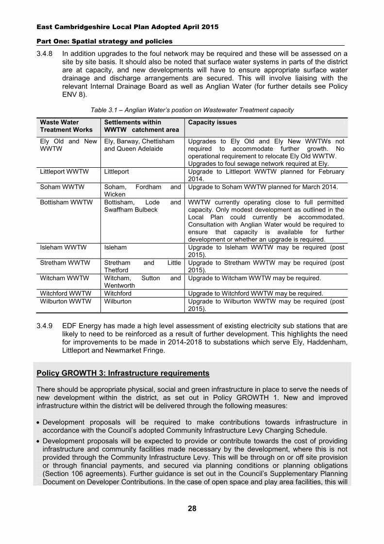
East Cambridgeshire Local Plan Adopted April 2015
Part One: Spatial strategy and policies
28
3.4.8 In addition upgrades to the foul network may be required and these will be assessed on a site by site basis. It should also be noted that surface water systems in parts of the district are at capacity, and new developments will have to ensure appropriate surface water drainage and discharge arrangements are secured. This will involve liaising with the relevant Internal Drainage Board as well as Anglian Water (for further details see Policy ENV 8).
Table 3.1 – Anglian Water’s postion on Wastewater Treatment capacity
Waste Water Treatment Works
Settlements within WWTW catchment area
Capacity issues
Ely Old and New WWTW
Ely, Barway, Chettisham and Queen Adelaide
Upgrades to Ely Old and Ely New WWTWs not required to accommodate further growth. No operational requirement to relocate Ely Old WWTW. Upgrades to foul sewage network required at Ely.
Littleport WWTW Littleport Upgrade to Littleport WWTW planned for February 2014.
Soham WWTW Soham, Fordham and Wicken
Upgrade to Soham WWTW planned for March 2014.
Bottisham WWTW Bottisham, Lode and Swaffham Bulbeck
WWTW currently operating close to full permitted capacity. Only modest development as outlined in the Local Plan could currently be accommodated. Consultation with Anglian Water would be required to ensure that capacity is available for further development or whether an upgrade is required.
Isleham WWTW Isleham Upgrade to Isleham WWTW may be required (post 2015).
Stretham WWTW Stretham and Little Thetford
Upgrade to Stretham WWTW may be required (post 2015).
Witcham WWTW Witcham, Sutton and Wentworth
Upgrade to Witcham WWTW may be required.
Witchford WWTW Witchford Upgrade to Witchford WWTW may be required. Wilburton WWTW Wilburton Upgrade to Wilburton WWTW may be required (post
2015). 3.4.9 EDF Energy has made a high level assessment of existing electricity sub stations that are
likely to need to be reinforced as a result of further development. This highlights the need for improvements to be made in 2014-2018 to substations which serve Ely, Haddenham, Littleport and Newmarket Fringe.
Policy GROWTH 3: Infrastructure requirements
There should be appropriate physical, social and green infrastructure in place to serve the needs of new development within the district, as set out in Policy GROWTH 1. New and improved infrastructure within the district will be delivered through the following measures:
Development proposals will be required to make contributions towards infrastructure in accordance with the Council’s adopted Community Infrastructure Levy Charging Schedule.
Development proposals will be expected to provide or contribute towards the cost of providing infrastructure and community facilities made necessary by the development, where this is not provided through the Community Infrastructure Levy. This will be through on or off site provision or through financial payments, and secured via planning conditions or planning obligations (Section 106 agreements). Further guidance is set out in the Council’s Supplementary Planning Document on Developer Contributions. In the case of open space and play area facilities, this will
East Cambridgeshire Local Plan Adopted April 2015
Part One: Spatial strategy and policies
29
only be sought from schemes of 20 or more dwellings. The District Council will work closely with infrastructure providers at the earliest possible stage to
ensure inclusion of infrastructure schemes within their programmes, plans and strategies, and delivery of specific infrastructure requirements in conjunction with individual development schemes and the expected timing of development coming forward.
Land will be identified in the Local Plan for the provision of new infrastructure (see Part 2). The protection of existing infrastructure and facilities as outlined in Policy COM 3. Key infrastructure requirements relevant to growth within the district include the following (this list is not exhaustive and is taken from the Council’s Infrastructure Investment Plan):
Education
New pre-school facilities at Burwell, Ely, Littleport and Soham, and expansion of pre-school facilities elsewhere within the district.
New Early Years (nursery) facilities at Burwell, Ely, Soham and Littleport and expansion of existing facilities elsewhere.
2 new primary schools in Ely, 1 in Littleport and 1 in Soham, and expansion elsewhere in the district.
A new secondary school at Littleport, and expansion of existing facilities elsewhere. New Area Special School in Littleport.
Green infrastructure, leisure and open space
Strategic green infrastructure improvements as outlined in the Cambridgeshire Green Infrastructure Strategy, including the provision of Ely Country Park and Block Fen nature reserve, improvements to Soham Town Commons and the Ouse Corridor, and the Wicken Fen Vision.
New Leisure Centre at Downham Road, Ely. Improvements to open space, sports facility and play area provision throughout the district (with
the aim of meeting Natural England’s Accessible Natural Greenspace Standards (ANGSt).
Health facilities
New primary healthcare facility (Doctors) at Princess of Wales Hospital, Ely. Expanded primary healthcare provision at Burwell, Littleport, Soham and Ely city centre. Redevelopment and enhancement of facilities at Princess of Wales Hospital, Ely.
Transport
Highway and sustainable transport infrastructure improvements associated with the development of North Ely, including pedestrian and cycle routes to the station and the town centre.
Major improvements to the A142 between Angel Drove and Stuntney Causeway. Dualling of the A10 between A142 Witchford Road and A142 Angel Drove. Improvements to Queen Adelaide Way. Improvements to the junctions of the A14/A142 and A14/A10. Capacity and junction improvements to the A10. Development of Soham Railway Station. Improvements to Ely Railway Station (passenger transport interchange, improved pedestrian
and segregated cycle access and increased car and cycle parking) and Littleport Railway Station
East Cambridgeshire Local Plan Adopted April 2015
Part One: Spatial strategy and policies
30
(increased car and cycle parking). Improved rail and bus services. Improvements to pedestrian and cycle networks within settlements and between settlements
(including segregated cycle routes with appropriate crossings at key points where possible).
Other infrastructure
Upgrading of existing Waste Water Treatment Works where required. Upgrading to electricity infrastructure, as required. Providing and/or upgrading telecommunications infrastructure.
3.5 Delivery of growth
3.5.1 This section looks at how the identified levels of housing, employment and retail growth (as set out in section 3.1 above) will be delivered in East Cambridgeshire over the Plan period. It analyses the various sources of land supply, and identifies the amount of new land and sites which will be needed to facilitate required levels of development. The Annual Monitoring Report will be used to monitor delivery and maintain a sufficient supply of sites.
3.5.2 Some development in the district is already committed and will come forward on sites which have planning permission. It is also known that some supply will continue to come forward on small ‘windfall’ sites over the Plan period. Allocating new land or noting broad locations to meet the remaining shortfall can ensure that appropriate levels of growth are delivered.
3.5.3 The policy below focuses on the new allocations, and includes a list of specific sites. The Local Plan has an important role to play in ensuring that sites are suitable and deliverable, and in the best locations to meet local needs. Further details on the search for appropriate and sustainable sites can be viewed in the accompanying technical paper ‘Site Assessment Results (February 2013) and Assessment of Deliverability in Market Towns (July 2014)’ and in the Council’s Sustainability Appraisal documents. The proposed distribution of allocation sites takes account of a range of issues, including:
The locational strategy in Policy GROWTH 2 above. The benefits of concentrating most development in locations which offer access to jobs,
services and other facilities. The need to focus retail and town centre uses in or adjoining town centres, in order to
support their vitality and viability. The needs, size and role of settlements, taking into account any current imbalances. Infrastructure requirements, capacity and deliverability. Availability of land. Suitability and deliverability of sites, including access, environmental constraints and
viability. Strategic economic requirements for particular employment locations. Community aspirations for development, as expressed through community and Parish
Council engagement during Local Plan preparation (see the Council’s Consultation Statement for details). The District Council has given significant weight to this factor, given the Government’s localism agenda and the importance of involving local people in shaping their areas.
East Cambridgeshire Local Plan Adopted April 2015
Part One: Spatial strategy and policies
31
3.5.4 The allocations are not solely limited to housing, employment and retail uses. A number of the allocations also include or relate to new community facilities and infrastructure – linked to identified local and/or strategic needs. The list of sites in the policy below should be read alongside the site-specific policies in Part 2 of this Local Plan, which provide further information on delivery and requirements.
Housing delivery
3.5.5 Housing will be delivered in the district from a range of potential sources, including:
Outstanding commitments (including sites with planning permission, and outstanding allocations from the 2000 Local Plan15).
Large potential sites within settlements – as identified in the Council’s Strategic Housing Land Availability Assessment (Review 2014). The next review of the Plan may provide an opportunity to explore whether to allocate this source of supply in order to provide greater certainty over future delivery.
Small windfall sites (within settlements and outside) – an estimated rate is included, based on historical evidence of completions and taking account of likely future changes in supply.
Rural exception sites – large specific sites identified in the Council’s Strategic Housing Land Availability Assessment (Review 2014).
New allocations on the edge of settlements – as identified in Policy GROWTH 4 and Part 2 of the Local Plan.
Broad locations on the edge of key settlements – as identified in the key diagrams below. Specific sites will be identified through the future Local Plan review.
3.5.6 Table 3.2 summarises how and where housing is likely to be delivered in East
Cambridgeshire over the Plan period. It identifies there will be sufficient overall supply of land to meet the district’s housing requirement of 11,500 dwellings, as set out in Policy GROWTH 1. The latest projections (as at September 2014) indicate that an estimated 12,000 additional dwellings could come forward between 2011 and 2031. It is estimated that approximately 6,500 of these dwellings will be on new allocations, mainly on the edge of existing towns and villages. The table also includes reference to ‘broad locations’, which are identified in the key diagrams below. The diagrams are indicative only and identify broad areas on the edge of Soham and Littleport which were identified as ‘phase 2’ sites in the Soham and Littleport Masterplans, and could be developed in the future. The supply from this source is not anticipated to be required in strategic terms until the later part of the Plan period. Therefore the locations are broadly identified at this stage – and it is intended that the specific site boundaries will be identified through the next Local Plan review. There is sufficient identified capacity on the edge of Soham and Littleport to enable this source of supply to be realised. The table also shows that the distribution of development accords with the locational strategy in Policy GROWTH 2, with significant new land allocations proposed on the edge of Ely, Soham and Littleport, and smaller amounts on the edge of villages where this is supported by the local community. A full list of allocation sites is set out in Policy GROWTH 4 (with site-specific policies contained in Part 2 of this Local Plan).
15 East Cambridgeshire District Local Plan (2000).
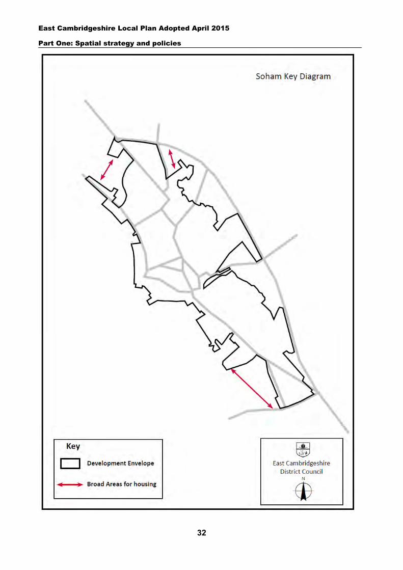
East Cambridgeshire Local Plan Adopted April 2015
Part One: Spatial strategy and policies
32
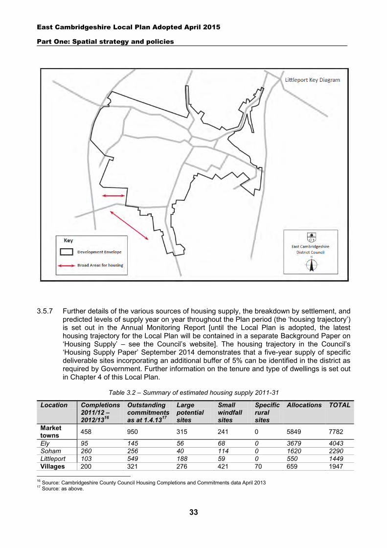
East Cambridgeshire Local Plan Adopted April 2015
Part One: Spatial strategy and policies
33
3.5.7 Further details of the various sources of housing supply, the breakdown by settlement, and predicted levels of supply year on year throughout the Plan period (the ‘housing trajectory’) is set out in the Annual Monitoring Report [until the Local Plan is adopted, the latest housing trajectory for the Local Plan will be contained in a separate Background Paper on ‘Housing Supply’ – see the Council’s website]. The housing trajectory in the Council’s ‘Housing Supply Paper’ September 2014 demonstrates that a five-year supply of specific deliverable sites incorporating an additional buffer of 5% can be identified in the district as required by Government. Further information on the tenure and type of dwellings is set out in Chapter 4 of this Local Plan.
Table 3.2 – Summary of estimated housing supply 2011-31
Location Completions 2011/12 – 2012/1316
Outstanding commitments as at 1.4.1317
Large potential sites
Small windfall sites
Specific rural sites
Allocations TOTAL
Market towns 458 950 315 241 0 5849 7782
Ely 95 145 56 68 0 3679 4043 Soham 260 256 40 114 0 1620 2290 Littleport 103 549 188 59 0 550 1449 Villages 200 321 276 421 70 659 1947
16 Source: Cambridgeshire County Council Housing Completions and Commitments data April 2013 17 Source: as above.
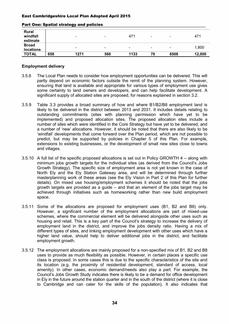
East Cambridgeshire Local Plan Adopted April 2015
Part One: Spatial strategy and policies
34
Rural windfall estimate
- - 471 - - 471
Broad locations - - - - - 1,800
TOTAL 658 1271 560 1133 70 6508 12,000
Employment delivery
3.5.8 The Local Plan needs to consider how employment opportunities can be delivered. This will partly depend on economic factors outside the remit of the planning system. However, ensuring that land is available and appropriate for various types of employment use gives some certainty to land owners and developers, and can help facilitate development. A significant supply of allocated sites are proposed, for reasons explained in section 3.2.
3.5.9 Table 3.3 provides a broad summary of how and where B1/B2/B8 employment land is likely to be delivered in the district between 2013 and 2031. It includes details relating to outstanding commitments (sites with planning permission which have yet to be implemented) and proposed allocation sites. The proposed allocation sites include a number of sites which were identified in the Core Strategy but have yet to be delivered, and a number of ‘new’ allocations. However, it should be noted that there are also likely to be ‘windfall’ developments that come forward over the Plan period, which are not possible to predict, but may be supported by policies in Chapter 5 of this Plan. For example, extensions to existing businesses, or the development of small new sites close to towns and villages.
3.5.10 A full list of the specific proposed allocations is set out in Policy GROWTH 4 – along with minimum jobs growth targets for the individual sites (as derived from the Council’s Jobs Growth Strategy). The specific size of employment area is not yet known in the case of North Ely and the Ely Station Gateway area, and will be determined through further masterplanning work of these areas (see the Ely Vision in Part 2 of this Plan for further details). On mixed use housing/employment schemes it should be noted that the jobs growth targets are provided as a guide – and that an element of the jobs target may be achieved through initiatives such as homeworking rather than new build employment space.
3.5.11 Some of the allocations are proposed for employment uses (B1, B2 and B8) only. However, a significant number of the employment allocations are part of mixed-use schemes, where the commercial element will be delivered alongside other uses such as housing and retail. This is a key part of the Council’s strategy to increase the delivery of employment land in the district, and improve the jobs density ratio. Having a mix of different types of sites, and linking employment development with other uses which have a higher land value, should help to deliver additional jobs in the district, and facilitate employment growth.
3.5.12 The employment allocations are mainly proposed for a non-specified mix of B1, B2 and B8 uses to provide as much flexibility as possible. However, in certain places a specific use class is proposed. In some cases this is due to the specific characteristics of the site and its location (e.g. the proximity of residential development, standard of access, local amenity). In other cases, economic demand/needs also play a part. For example, the Council’s Jobs Growth Study indicates there is likely to be a demand for office development in Ely in the future around the station quarter and in the south of the district (where it is close to Cambridge and can cater for the skills of the population). It also indicates that
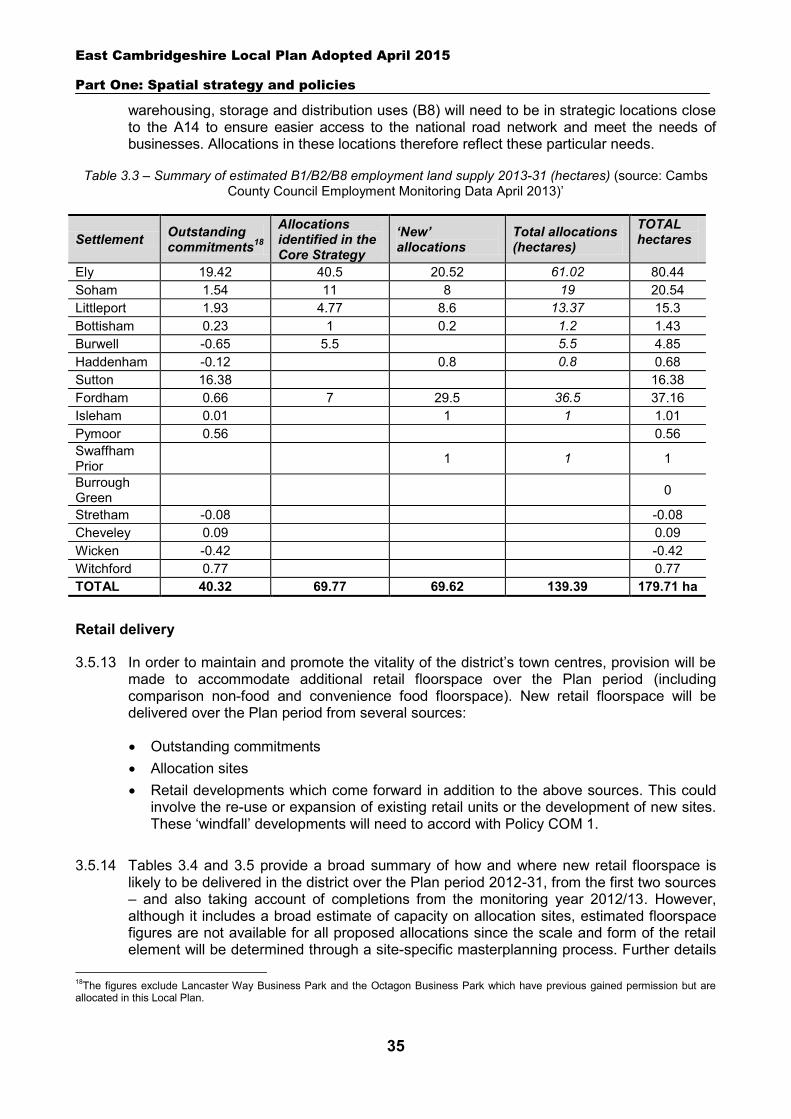
East Cambridgeshire Local Plan Adopted April 2015
Part One: Spatial strategy and policies
35
warehousing, storage and distribution uses (B8) will need to be in strategic locations close to the A14 to ensure easier access to the national road network and meet the needs of businesses. Allocations in these locations therefore reflect these particular needs.
Table 3.3 – Summary of estimated B1/B2/B8 employment land supply 2013-31 (hectares) (source: Cambs County Council Employment Monitoring Data April 2013)’
Retail delivery
3.5.13 In order to maintain and promote the vitality of the district’s town centres, provision will be made to accommodate additional retail floorspace over the Plan period (including comparison non-food and convenience food floorspace). New retail floorspace will be delivered over the Plan period from several sources:
Outstanding commitments Allocation sites Retail developments which come forward in addition to the above sources. This could
involve the re-use or expansion of existing retail units or the development of new sites. These ‘windfall’ developments will need to accord with Policy COM 1.
3.5.14 Tables 3.4 and 3.5 provide a broad summary of how and where new retail floorspace is likely to be delivered in the district over the Plan period 2012-31, from the first two sources – and also taking account of completions from the monitoring year 2012/13. However, although it includes a broad estimate of capacity on allocation sites, estimated floorspace figures are not available for all proposed allocations since the scale and form of the retail element will be determined through a site-specific masterplanning process. Further details
18The figures exclude Lancaster Way Business Park and the Octagon Business Park which have previous gained permission but are allocated in this Local Plan.
Settlement Outstanding commitments18
Allocations identified in the Core Strategy
‘New’ allocations
Total allocations (hectares)
TOTAL hectares
Ely 19.42 40.5 20.52 61.02 80.44 Soham 1.54 11 8 19 20.54 Littleport 1.93 4.77 8.6 13.37 15.3 Bottisham 0.23 1 0.2 1.2 1.43 Burwell -0.65 5.5 5.5 4.85 Haddenham -0.12 0.8 0.8 0.68 Sutton 16.38 16.38 Fordham 0.66 7 29.5 36.5 37.16 Isleham 0.01 1 1 1.01 Pymoor 0.56 0.56 Swaffham Prior 1 1 1
Burrough Green 0
Stretham -0.08 -0.08 Cheveley 0.09 0.09 Wicken -0.42 -0.42 Witchford 0.77 0.77 TOTAL 40.32 69.77 69.62 139.39 179.71 ha
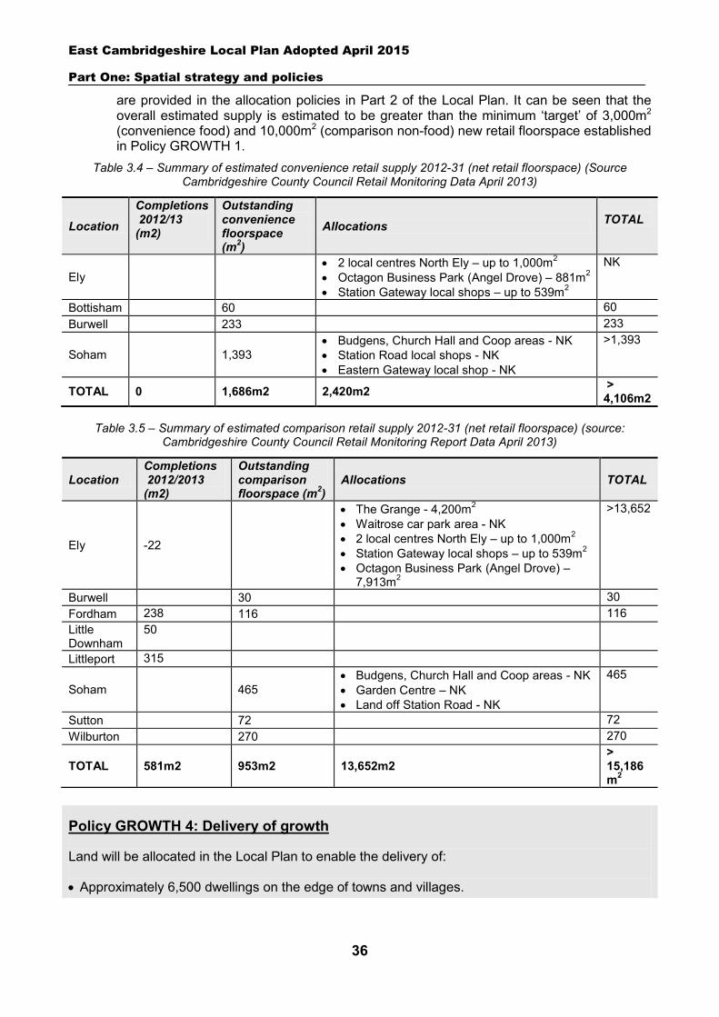
East Cambridgeshire Local Plan Adopted April 2015
Part One: Spatial strategy and policies
36
are provided in the allocation policies in Part 2 of the Local Plan. It can be seen that the overall estimated supply is estimated to be greater than the minimum ‘target’ of 3,000m2 (convenience food) and 10,000m2 (comparison non-food) new retail floorspace established in Policy GROWTH 1.
Table 3.4 – Summary of estimated convenience retail supply 2012-31 (net retail floorspace) (Source Cambridgeshire County Council Retail Monitoring Data April 2013)
Table 3.5 – Summary of estimated comparison retail supply 2012-31 (net retail floorspace) (source:
Cambridgeshire County Council Retail Monitoring Report Data April 2013)
Policy GROWTH 4: Delivery of growth
Land will be allocated in the Local Plan to enable the delivery of:
Approximately 6,500 dwellings on the edge of towns and villages.
Location
Completions 2012/13 (m2)
Outstanding convenience floorspace (m2)
Allocations
TOTAL
Ely 2 local centres North Ely – up to 1,000m2 Octagon Business Park (Angel Drove) – 881m2 Station Gateway local shops – up to 539m2
NK
Bottisham 60 60 Burwell 233 233
Soham 1,393 Budgens, Church Hall and Coop areas - NK Station Road local shops - NK Eastern Gateway local shop - NK
>1,393
TOTAL 0 1,686m2 2,420m2 > 4,106m2
Location Completions 2012/2013 (m2)
Outstanding comparison floorspace (m2)
Allocations TOTAL
Ely -22
The Grange - 4,200m2 Waitrose car park area - NK 2 local centres North Ely – up to 1,000m2 Station Gateway local shops – up to 539m2 Octagon Business Park (Angel Drove) –
7,913m2
>13,652
Burwell 30 30 Fordham 238 116 116 Little Downham
50
Littleport 315
Soham
465 Budgens, Church Hall and Coop areas - NK Garden Centre – NK Land off Station Road - NK
465
Sutton 72 72 Wilburton 270 270
TOTAL 581m2 953m2 13,652m2 > 15,186m2
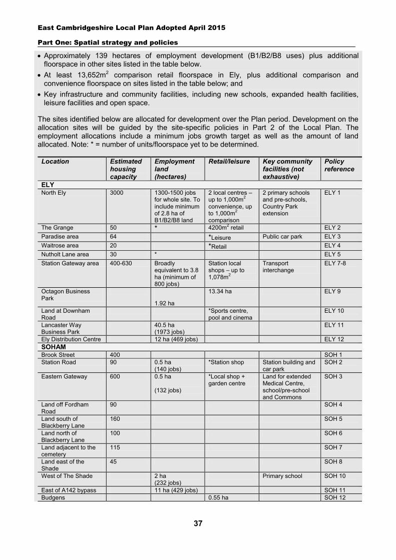
East Cambridgeshire Local Plan Adopted April 2015
Part One: Spatial strategy and policies
37
Approximately 139 hectares of employment development (B1/B2/B8 uses) plus additional floorspace in other sites listed in the table below.
At least 13,652m2 comparison retail floorspace in Ely, plus additional comparison and convenience floorspace on sites listed in the table below; and
Key infrastructure and community facilities, including new schools, expanded health facilities, leisure facilities and open space.
The sites identified below are allocated for development over the Plan period. Development on the allocation sites will be guided by the site-specific policies in Part 2 of the Local Plan. The employment allocations include a minimum jobs growth target as well as the amount of land allocated. Note: * = number of units/floorspace yet to be determined.
Location Estimated housing capacity
Employment land (hectares)
Retail/leisure Key community facilities (not exhaustive)
Policy reference
ELY North Ely 3000 1300-1500 jobs
for whole site. To include minimum of 2.8 ha of B1/B2/B8 land
2 local centres – up to 1,000m2 convenience, up to 1,000m2
comparison
2 primary schools and pre-schools, Country Park extension
ELY 1
The Grange 50 * 4200m2 retail ELY 2 Paradise area 64 *Leisure Public car park ELY 3 Waitrose area 20 *Retail ELY 4 Nutholt Lane area 30 * ELY 5 Station Gateway area 400-630 Broadly
equivalent to 3.8 ha (minimum of 800 jobs)
Station local shops – up to 1,078m2
Transport interchange
ELY 7-8
Octagon Business Park
1.92 ha
13.34 ha ELY 9
Land at Downham Road
*Sports centre, pool and cinema
ELY 10
Lancaster Way Business Park
40.5 ha (1973 jobs)
ELY 11
Ely Distribution Centre 12 ha (469 jobs) ELY 12 SOHAM Brook Street 400 SOH 1 Station Road 90 0.5 ha
(140 jobs) *Station shop Station building and
car park SOH 2
Eastern Gateway 600 0.5 ha (132 jobs)
*Local shop + garden centre
Land for extended Medical Centre, school/pre-school and Commons
SOH 3
Land off Fordham Road
90 SOH 4
Land south of Blackberry Lane
160 SOH 5
Land north of Blackberry Lane
100 SOH 6
Land adjacent to the cemetery
115 SOH 7
Land east of the Shade
45 SOH 8
West of The Shade 2 ha (232 jobs)
Primary school SOH 10
East of A142 bypass 11 ha (429 jobs) SOH 11 Budgens 0.55 ha SOH 12
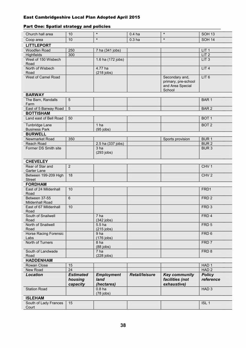
East Cambridgeshire Local Plan Adopted April 2015
Part One: Spatial strategy and policies
38
Church hall area 10 * 0.4 ha * SOH 13 Coop area 10 * 0.3 ha * SOH 14 LITTLEPORT Woodfen Road 250 7 ha (341 jobs) LIT 1 Highfields 300 LIT 2 West of 150 Wisbech Road
1.6 ha (172 jobs) LIT 3
North of Wisbech Road
4.77 ha (218 jobs)
LIT 4
West of Camel Road Secondary and, primary, pre-school and Area Special School
LIT 6
BARWAY The Barn, Randalls Farm
5 BAR 1
East of 5 Barway Road 5 BAR 2 BOTTISHAM Land east of Bell Road 50 BOT 1
Tunbridge Lane Business Park
1 ha (95 jobs)
BOT 2
BURWELL Newmarket Road 350 Sports provision BUR 1 Reach Road 2.5 ha (337 jobs) BUR 2 Former DS Smith site 3 ha
(293 jobs) BUR 3
CHEVELEY Rear of Star and Garter Lane
2 CHV 1
Between 199-209 High Street
18 CHV 2
FORDHAM East of 24 Mildenhall Road
10 FRD1
Between 37-55 Mildenhall Road
6 FRD 2
East of 67 Mildenhall Road
10 FRD 3
South of Snailwell Road
7 ha (342 jobs)
FRD 4
North of Snailwell Road
5.5 ha (215 jobs)
FRD 5
Horse Racing Forensic Labs
9 ha (176 jobs)
FRD 6
North of Turners 8 ha (88 jobs)
FRD 7
South of Landwade Road
7 ha (228 jobs)
FRD 8
HADDENHAM Rowan Close 15 HAD 1 New Road 24 HAD 2 Location Estimated
housing capacity
Employment land (hectares)
Retail/leisure Key community facilities (not exhaustive)
Policy reference
Station Road 0.8 ha (78 jobs)
HAD 3
ISLEHAM South of Lady Frances Court
15 ISL 1
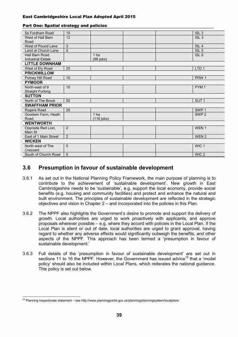
East Cambridgeshire Local Plan Adopted April 2015
Part One: Spatial strategy and policies
39
5a Fordham Road 10 ISL 2 West of Hall Barn Road
12 ISL 3
West of Pound Lane 3 ISL 4 Land at Church Lane 5 ISL 5 Hall Barn Road Industrial Estate
1 ha (98 jobs)
ISL 6
LITTLE DOWNHAM West of Ely Road 25 LTD 1 PRICKWILLOW Putney Hill Road 10 PRW 1 PYMOOR North-east of 9 Straight Furlong
10 PYM 1
SUTTON North of The Brook 50 SUT 1 SWAFFHAM PRIOR Rogers Road 20 SWP 1 Goodwin Farm, Heath Road
1 ha (116 jobs)
SWP 2
WENTWORTH Opposite Red Lion, Main St
2 WEN 1
East of 1 Main Street 2 WEN 2 WICKEN North-west of The Crescent
5 WIC 1
South of Church Road 5 WIC 2
3.6 Presumption in favour of sustainable development
3.6.1 As set out in the National Planning Policy Framework, the main purpose of planning is to contribute to the achievement of ‘sustainable development’. New growth in East Cambridgeshire needs to be ‘sustainable’, e.g. support the local economy, provide social benefits (e.g. housing and community facilities) and protect and enhance the natural and built environment. The principles of sustainable development are reflected in the strategic objectives and vision in Chapter 2 – and incorporated into the policies in this Plan.
3.6.2 The NPPF also highlights the Government’s desire to promote and support the delivery of growth. Local authorities are urged to work proactively with applicants, and approve proposals wherever possible – e.g. where they accord with policies in the Local Plan. If the Local Plan is silent or out of date, local authorities are urged to grant approval, having regard to whether any adverse effects would significantly outweigh the benefits, and other aspects of the NPPF. This approach has been termed a ‘presumption in favour of sustainable development.’
3.6.3 Full details of the ‘presumption in favour of sustainable development’ are set out in sections 11 to 16 the NPPF. However, the Government has issued advice19 that a ‘model policy’ should also be included within Local Plans, which reiterates the national guidance. This policy is set out below.
19 Planning Inspectorate statement – see http://www.planningportal.gov.uk/planning/planningsystem/localplans
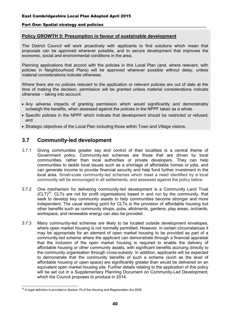
East Cambridgeshire Local Plan Adopted April 2015
Part One: Spatial strategy and policies
40
Policy GROWTH 5: Presumption in favour of sustainable development
The District Council will work proactively with applicants to find solutions which mean that proposals can be approved wherever possible, and to secure development that improves the economic, social and environmental conditions in the area.
Planning applications that accord with the policies in this Local Plan (and, where relevant, with policies in Neighbourhood Plans) will be approved wherever possible without delay, unless material considerations indicate otherwise.
Where there are no policies relevant to the application or relevant policies are out of date at the time of making the decision, permission will be granted unless material considerations indicate otherwise – taking into account:
Any adverse impacts of granting permission which would significantly and demonstrably outweigh the benefits, when assessed against the policies in the NPPF taken as a whole.
Specific policies in the NPPF which indicate that development should be restricted or refused; and
Strategic objectives of the Local Plan including those within Town and Village visions.
3.7 Community-led development
3.7.1 Giving communities greater say and control of their localities is a central theme of Government policy. Community-led schemes are those that are driven by local communities, rather than local authorities or private developers. They can help communities to tackle local issues such as a shortage of affordable homes or jobs, and can generate income to provide financial security and help fund further investment in the local area. Small-scale community-led schemes which meet a need identified by a local community will be encouraged in all settlements, and assessed against the policy below.
3.7.2 One mechanism for delivering community-led development is a Community Land Trust (CLT)20. CLTs are not for profit organisations based in and run by the community, that seek to develop key community assets to help communities become stronger and more independent. The usual starting point for CLTs is the provision of affordable housing but other benefits such as community shops, pubs, allotments, gardens, play areas, orchards, workspace, and renewable energy can also be provided.
3.7.3 Many community-led schemes are likely to be located outside development envelopes, where open market housing is not normally permitted. However, in certain circumstances it may be appropriate for an element of open market housing to be provided as part of a community-led scheme where the applicant can demonstrate through a financial appraisal that the inclusion of the open market housing is required to enable the delivery of affordable housing or other community assets, with significant benefits accruing directly to the community organisation through cross-subsidy. In addition, applicants will be expected to demonstrate that the community benefits of such a scheme (such as the level of affordable housing or open space) are significantly greater than would be delivered on an equivalent open market housing site. Further details relating to the application of this policy will be set out in a Supplementary Planning Document on Community-Led Development, which the Council proposes to produce in 2014.
20 A legal definition is provided in Section 79 of the Housing and Regeneration Act 2008.
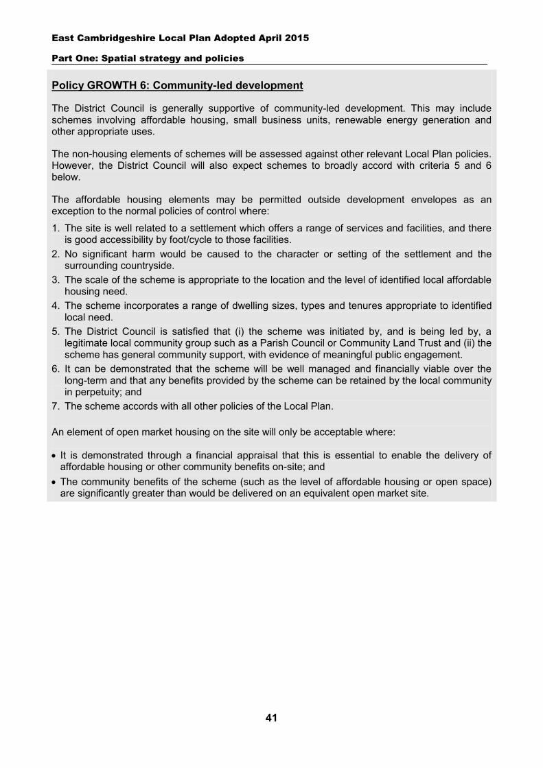
East Cambridgeshire Local Plan Adopted April 2015
Part One: Spatial strategy and policies
41
Policy GROWTH 6: Community-led development
The District Council is generally supportive of community-led development. This may include schemes involving affordable housing, small business units, renewable energy generation and other appropriate uses.
The non-housing elements of schemes will be assessed against other relevant Local Plan policies. However, the District Council will also expect schemes to broadly accord with criteria 5 and 6 below.
The affordable housing elements may be permitted outside development envelopes as an exception to the normal policies of control where:
1. The site is well related to a settlement which offers a range of services and facilities, and there is good accessibility by foot/cycle to those facilities.
2. No significant harm would be caused to the character or setting of the settlement and the surrounding countryside.
3. The scale of the scheme is appropriate to the location and the level of identified local affordable housing need.
4. The scheme incorporates a range of dwelling sizes, types and tenures appropriate to identified local need.
5. The District Council is satisfied that (i) the scheme was initiated by, and is being led by, a legitimate local community group such as a Parish Council or Community Land Trust and (ii) the scheme has general community support, with evidence of meaningful public engagement.
6. It can be demonstrated that the scheme will be well managed and financially viable over the long-term and that any benefits provided by the scheme can be retained by the local community in perpetuity; and
7. The scheme accords with all other policies of the Local Plan. An element of open market housing on the site will only be acceptable where:
It is demonstrated through a financial appraisal that this is essential to enable the delivery of affordable housing or other community benefits on-site; and
The community benefits of the scheme (such as the level of affordable housing or open space) are significantly greater than would be delivered on an equivalent open market site.
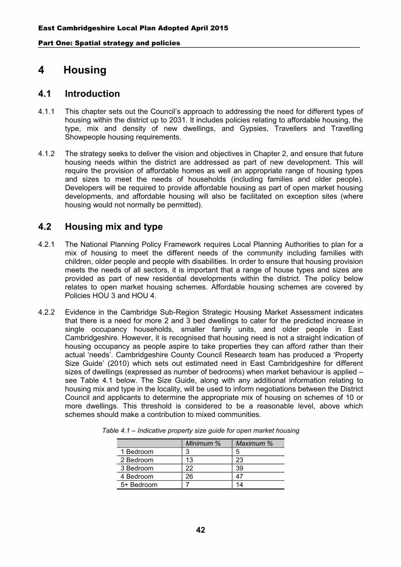
East Cambridgeshire Local Plan Adopted April 2015
Part One: Spatial strategy and policies
42
4 Housing
4.1 Introduction
4.1.1 This chapter sets out the Council’s approach to addressing the need for different types of housing within the district up to 2031. It includes policies relating to affordable housing, the type, mix and density of new dwellings, and Gypsies, Travellers and Travelling Showpeople housing requirements.
4.1.2 The strategy seeks to deliver the vision and objectives in Chapter 2, and ensure that future housing needs within the district are addressed as part of new development. This will require the provision of affordable homes as well an appropriate range of housing types and sizes to meet the needs of households (including families and older people). Developers will be required to provide affordable housing as part of open market housing developments, and affordable housing will also be facilitated on exception sites (where housing would not normally be permitted).
4.2 Housing mix and type
4.2.1 The National Planning Policy Framework requires Local Planning Authorities to plan for a mix of housing to meet the different needs of the community including families with children, older people and people with disabilities. In order to ensure that housing provision meets the needs of all sectors, it is important that a range of house types and sizes are provided as part of new residential developments within the district. The policy below relates to open market housing schemes. Affordable housing schemes are covered by Policies HOU 3 and HOU 4.
4.2.2 Evidence in the Cambridge Sub-Region Strategic Housing Market Assessment indicates that there is a need for more 2 and 3 bed dwellings to cater for the predicted increase in single occupancy households, smaller family units, and older people in East Cambridgeshire. However, it is recognised that housing need is not a straight indication of housing occupancy as people aspire to take properties they can afford rather than their actual ‘needs’. Cambridgeshire County Council Research team has produced a ‘Property Size Guide’ (2010) which sets out estimated need in East Cambridgeshire for different sizes of dwellings (expressed as number of bedrooms) when market behaviour is applied – see Table 4.1 below. The Size Guide, along with any additional information relating to housing mix and type in the locality, will be used to inform negotiations between the District Council and applicants to determine the appropriate mix of housing on schemes of 10 or more dwellings. This threshold is considered to be a reasonable level, above which schemes should make a contribution to mixed communities.
Table 4.1 – Indicative property size guide for open market housing
Minimum % Maximum % 1 Bedroom 3 5 2 Bedroom 13 23 3 Bedroom 22 39 4 Bedroom 26 47 5+ Bedroom 7 14
East Cambridgeshire Local Plan Adopted April 2015
Part One: Spatial strategy and policies
43
4.2.3 There is also a need for specialist types of housing for the elderly, disabled and other groups, including sheltered housing, retirement schemes and extra care housing21. It is acknowledged that applications for this type of accommodation will contain mainly one-bed and two bed homes. Rather than the Size Guide, the final mix of housing on such schemes will therefore be determined on a site by site basis according to identified needs in the locality (in consultation with the Council’s Housing team). Further information on this type of specialist housing is set out in Policy HOU 6.
4.2.4 The district also faces a major challenge in increasing the provision of housing for potentially vulnerable elderly and single person households. The Council will therefore aim to ensure that a proportion of new housing built as part of major housing developments is suitable, or easily adaptable for occupation by the elderly or people with disabilities (Lifetime Homes Standard or equivalent). The precise amount of open market housing which will be required to meet all or some of aspects of Lifetime Home Standards will be determined following negotiation with the applicant as part of the planning application process. This will take into account the need for this type of housing within the locality and the financial viability of individual housing developments. Further guidance on this issue will be set out in the Council’s Design Guide SPD. The Government has announced in early 2014 that changes will be made to the existing Building Regulations which will introduce two new optional accessibility standards. These will include criteria to provide age friendly, accessible and adaptable housing (which is similar to Lifetime Home Standards) and to meet the specific needs of wheelchair users. Open market developments should continue to provide an element of housing which meets Lifetime Home Standards until the new accessibility standards come into effect.
4.2.5 The development of self-build properties by individuals or community groups (including Community Land Trusts) can also contribute to meeting the need for additional housing within the district, and provide a more diverse housing stock. The policy below proposes that larger housing schemes should include an element of self build plots, to facilitate this diversity. Where this policy would result in the requirement relating to part of a dwelling the calculation will be rounded upwards to ensure that at least the minimum requirement is met.
4.2.6 The final mix of housing/types will be subject to negotiation with the applicant. Applicants will be expected to provide robust evidence relating to the identified level of housing need, financial viability or deliverability to support their proposals.
Policy HOU 1: Housing mix
Housing developments of 10 or more dwellings (or allocations where specified) should provide an appropriate mix of dwelling types and sizes that contribute to current and future housing needs as identified in the most recent available evidence relating to the locality.
Developments of 50 or more dwellings will be expected to provide a proportion of dwellings that are suitable or easily adaptable for occupation by the elderly or people with disabilities (Lifetime Homes standard or equivalent).
Developments of 100 or more dwellings will be expected to provide a minimum of 5% self build properties. The inclusion of self build properties on smaller sites will also be encouraged.
21 Housing which enables older people with longer term health conditions to live independently in self contained accommodation as an alternative to residential care.
East Cambridgeshire Local Plan Adopted April 2015
Part One: Spatial strategy and policies
44
The final mix of dwelling types and sizes will be subject to negotiation with the applicant. Applicants will be required to provide sufficient evidence to support their proposals.
4.3 Housing density
4.3.1 The density of housing development varies across the district, and between different sites, as the design and layout of schemes needs to be in harmony with the local character of the area. Other factors affecting density include on-site constraints, the type of development proposed and the level of transport accessibility. Whilst higher densities may be appropriate in major developments or town centre locations where public transport is good and urban form is dense, lower densities may be appropriate in established suburban areas, in villages, in areas with an open character or on the edge of settlements.
4.3.2 The Council will expect all housing schemes to propose densities which are sensitive to the character of the local area, and take account of on-site constraints and the level of local transport accessibility. At the same time, applicants should also have regard to making efficient use of land, as this can help to reduce the amount of building that needs to take place on greenfield sites. Major schemes should include a range of different housing density areas, to ensure varied character and appearance, in accordance with agreed Masterplans.
Policy HOU 2: Housing density
The appropriate density of a scheme will be judged on a site-by-site basis taking account of:
The existing character of the locality and the settlement, and housing densities within the surrounding area.
The need to make efficient use of land. The biodiversity of the site and its surroundings and any heritage assets within or adjoining the
site. The need to accommodate other uses and residential amenities such as open space and parking
areas. Levels of accessibility, particularly by public transport, walking and cycling; and The need to ensure that the residential amenity of new and existing dwellings is protected.
Major development schemes will be expected to provide a range of housing densities as part of the development in accordance with an agreed Masterplan.
4.4 Affordable housing on open market sites
4.4.1 The National Planning Policy Framework defines affordable housing as ‘social rented, affordable rented and intermediate housing, provided to eligible households whose needs are not met by the market.’ Affordable housing in East Cambridgeshire is normally owned and managed by Registered Social Landlords (RSLs). Intermediate housing is provided at a cost below market levels, and can take the form of rented properties or shared ownership/shared equity schemes. Affordable housing should also include provision to remain at an affordable price for future eligible households.
East Cambridgeshire Local Plan Adopted April 2015
Part One: Spatial strategy and policies
45
4.4.2 There is a significant need for additional affordable housing within East Cambridgeshire, as set out in the current Strategic Housing Market Assessment (SHMA)22.
4.4.3 The District Council secures the majority of affordable housing that is built in the district by requiring developers to provide affordable dwellings as part of open market housing developments (through Section 106 agreements). Affordable housing is also delivered on ‘exception sites’ as set out in Policy HOU 4 in the next section.
4.4.4 Affordable housing on development sites are an importance source of supply and can help meet a proportion of this need. Policy HOU 3 sets out the proportion of affordable housing that the Council will seek to secure on development schemes – 40% in the south of the district, and 30% in the north. These percentages have been informed by a realistic assessment of the viability of general market housing schemes - as set out in the Council’s ‘Community Infrastructure Levy Viability Assessment’ (December 2011) and Addendum (April 2012).
4.4.5 The Council recognises that in some cases there may be exceptional development costs, which need to be recognised, and that the policy is a starting point for negotiation. Applicants seeking to justify a lower proportion of affordable housing will be required to demonstrate why it is not economically viable to make the minimum level of provision in Policy HOU 3. The financial viability assessment should be prepared by the applicant and provided to the Council for its consideration. Where agreement is not reached external consultants will be appointed to undertake a further independent viability assessment. The applicant will be required to meet the costs of the assessment being prepared.
4.4.6 Policy HOU 3 states that affordable housing contributions will be sought on developments of more than 10 dwellings. It is considered that this is a realistic threshold, which will enable the delivery of affordable housing and not prevent the delivery of smaller sites for housing within the district.
4.4.7 Where the affordable housing policy would result in the requirement relating to part of a dwelling the calculation will be rounded upwards for 0.5+ and downwards for less than 0.5. Where development involves the demolition of existing properties the amount of affordable housing will be calculated on the gross number of dwellings.
4.4.8 The policy indicates that the size mix and tenure of affordable dwellings should reflect identified needs at the time of the proposal and in the locality. The SHMA provides a starting point for identifying these needs. Housing developments should also ensure that sufficient provision is made to meet the needs of an ageing population and disabled people as highlighted in the Government’s Housing Strategy and the SHMA. Affordable housing within the district will be expected to meet the Homes and Communities Agency’s Design and Quality Standards (or successor document). These standards include some requirements which enable properties to be suitable or adaptable or accessible by elderly or people with disabilities – but are not as extensive as Lifetime Home requirements. Therefore, as with open market housing (see Policy HOU 1) an element of affordable housing should be provided to meet Lifetime Homes Standards or equivalent. The precise amount of affordable housing which will be required to meet all or some of aspects of Lifetime Home Standards will be determined following negotiation with the applicant as part of the planning application process with details in the Council’s Design Guide SPD. The Government has recently announced that changes will be made to the existing Building Regulations which will introduce two new optional accessibility standards. These will include criteria to provide age friendly, accessible and adaptable housing (which is
22 Cambridge Housing Sub Region Market Assessment 2012
East Cambridgeshire Local Plan Adopted April 2015
Part One: Spatial strategy and policies
46
similar to Lifetime Home Standards) and to meet the specific needs of wheelchair users. Affordable housing developments should continue to provide housing which meets Lifetime Home Standards until the new accessibility standards come into effect. Applicants are advised to contact the Council’s Housing team at an early stage in the application process, for guidance on the latest evidence of need for different tenures and size dwellings in a particular locality.
4.4.9 In general, affordable housing should be provided on the application site as part of well designed, mixed tenure schemes, as this ensures the best prospect of securing mixed, inclusive communities. Off-site provision or financial contributions in lieu will only be acceptable in exceptional circmsutances where agreed with the District Council. For example, on smaller sites it may be more practical or desirable, particularly where there is an alternative scheme in the locality which could benefit. Applicants proposing off-site provision or financial contributions in lieu in connection with any schemes will be expected to provide justification as part of a planning application.
4.4.10 There are no agreed ideal method(s) for ensuring the physical integration of affordable and open market housing. However developers will be expected to demonstrate that they have considered this issue as part of the overall design of the development.
4.4.11 The Council will ensure that any planning permission granted is subject to appropriate conditions and/or planning obligations to secure affordability in perpetuity. Further details of the Council’s approach to affordable housing including details of how financial contributions in lieu of on-site provision are to be calculated is set out in the Council’s Supplementary Planning Document on Developer Contributions.
Policy HOU 3: Affordable housing provision
All new open market housing developments which incorporate more than 10 dwellings will be required to make appropriate provision for an element of affordable housing, as follows:
A minimum of 40% of the total number of dwellings to be provided will be sought in the south of the district (i).
A minimum of 30% of the total number of dwellings to be provided will be sought in the north of the district (ii).
The proportion and type of affordable housing will be the subject of negotiation with applicants. As part of this, consideration will be given to the financial viability of the development including any exceptional costs (e.g. site remediation and infrastructure provision).
Applicants seeking to justify a lower level of affordable housing will be required to provide a financial viability assessment as part of the planning application.
The precise mix in terms of tenure and house sizes of affordable housing within a scheme will be determined by local circumstances at the time of planning permission, including housing need, development costs and the availability of subsidy.
Affordable housing should normally be provided on-site, apart from in exceptional circumstances where agreed with the District Council. Applicants will be required to provide justification as part of the planning application setting out the need for off-site provision or financial contributions in lieu to be made.
The affordable properties will be made available to eligible households at an affordable cost for the life of the property.
The allocation of affordable housing should give priority to people in local housing need in accordance with the District Council’s allocation policy (except where alternative mechanisms
East Cambridgeshire Local Plan Adopted April 2015
Part One: Spatial strategy and policies
47
involving local connections criteria are proposed for specific sites, as set out in Part 2 of the Local Plan).
On larger schemes the affordable housing will be provided in phases, as set out in an agreed masterplan or approved planning application.
The affordable housing shall be physically integrated into the open market housing development by using appropriate design methods.
Affordable housing intended specifically for elderly occupants should be focused on public transport routes.
In order to meet identified local needs, a proportion of dwellings should be provided that are suitable or easily adaptable for occupation by the elderly or people with disabilities (Lifetimes Homes or equivalent).
(i) The south of the district comprises the parishes of Ashley, Bottisham, Brinkley, Burrough Green, Burwell, Cheveley, Chippenham, Dullingham, Fordham, Kennett, Kirtling, Lode, Reach, Snailwell, Stetchworth, Swaffham Bulbeck, Swaffham Prior, Westley Waterless and Woodditton.
(ii) The north of the district comprises the parishes of Coveney, Ely, Haddenham, Isleham, Little Downham, Littleport, Little Thetford, Mepal, Soham, Stretham, Sutton, Wentworth, Wicken, Wilburton, Witcham, Witchford.
4.5 Affordable housing exception sites
4.5.1 In East Cambridgeshire there is significant need for additional affordable housing, as demonstrated in the Strategic Housing Market Assessment (SHMA). However, land values are high, and Registered Social Landlords find it difficult to afford to purchase sites within settlements for the development of affordable housing schemes. The NPPF recognises these issues, and allows small affordable housing schemes to be developed as 'exception sites’ where open market housing would not normally be permitted. In East Cambridgeshire, this is typically on small sites on the edge of villages and towns, outside development envelopes.
4.5.2 Policy HOU 2 sets out the circumstances in which exception sites may be considered appropriate. In assessing such proposals the housing needs of the local community will be carefully considered, and schemes should be designed to include a range of dwelling sizes, types and tenures, appropriate to local need (as demonstrated for example by a local housing need survey). To ensure priority for the affordable housing is given to people in local housing need, the Council will require the affordable housing provider to enter into a nomination agreement with cascade provisions, under which applicants with a connection to the village (through residence, employment or close family) are given first priority for newly created housing, followed by those with a connection to neighbouring villages, and then those in the wider locality.
4.5.3 The Council will ensure that any planning permission granted is subject to appropriate conditions and/or planning obligations to secure its affordability in perpetuity.
4.5.4 Exception sites should ideally be solely for the provision of affordable housing but this may not always be possible where there is a lack of housing grant. Therefore in certain circumstances an element of market housing may be permitted on exception sites where the applicant can demonstrate to the satisfaction of the District Council that the inclusion of open market housing:
is required to enable the site to be developed primarily for affordable housing, and
East Cambridgeshire Local Plan Adopted April 2015
Part One: Spatial strategy and policies
48
does not significantly increase the land value above that which would be payable if sufficient grant were available to provide 100% affordable housing.
4.5.5 Applicants proposing an element of open market housing as part of a scheme should be prepared to submit viability appraisal evidence to the District Council at an early stage as part of pre-application discussions – and as a minimum, as part of a planning application. Where agreement is not reached external consultants will be appointed to undertake a further independent viability assessment. The applicant will be required to meet the costs of the assessment being prepared.
Policy HOU 4: Affordable housing exception sites
Affordable housing development on exception sites can make an important contribution to meeting local housing needs, and schemes may be permitted on sites outside settlement boundaries where:
There is an identified local need which cannot be met on available sites within the development envelope (including allocation sites), or sites which are part of community-led development.
The site is well related to a village which offers a range of services and facilities, and there is good accessibility by foot/cycle to those facilities.
No significant harm would be caused to the character or setting of the settlement and the surrounding countryside.
The scale of the scheme is appropriate to the location and to the level of identified local affordable housing need.
The scheme incorporates a range of dwelling sizes, types and tenures appropriate to the identified local need; and
The affordable housing provided is made available to people in local housing need at an affordable cost for the life of the property.
An element of open market housing will only be acceptable where there is insufficient grant available, and it is demonstrated through financial appraisal that the open market housing is essential to enable delivery of the site for primarily affordable housing, and does not significantly increase the land value above that which would be payable if sufficient grant were available to provide 100% affordable housing.
4.6 Dwellings for rural workers
4.6.1 The accommodation needs of rural workers employed full-time in agriculture, horticulture, stud and other rural businesses can usually be met in existing properties either on the site or in nearby settlements. Occasionally it is essential for a worker to be in close proximity to the business and there is no suitable accommodation available nearby – for example, where animal or agricultural processes require essential care at short notice, or where there is a need to deal with emergencies that could otherwise cause serious loss of crops or produce. These special circumstances may justify the potential construction of new dwellings in the countryside to meet these needs, providing the financial and functional criteria in Policy HOU 5 below are satisfied. It must be stressed that genuine essential need, rather than business convenience, must be justified.
4.6.2 Applications will be assessed taking account of the history of the enterprise, in order to establish whether existing dwellings within the site/holding or nearby could fulfill the need,
East Cambridgeshire Local Plan Adopted April 2015
Part One: Spatial strategy and policies
49
or whether any dwellings or buildings suitable for conversion have been sold on the open housing market. Such a sale is likely to constitute lack of evidence of essential need.
4.6.3 New permanent dwellings can only be justified if the enterprise to which they relate is economically viable. For this reason, details of the financial situation of the business will be required. This information will also inform the scale of dwelling which the enterprise can sustain. The scale should be demonstrated to be appropriate to the needs of the business, rather than those of the owner or occupier.
4.6.4 Where planning permission is granted for a new dwelling on this basis, suitable occupancy conditions will be imposed to ensure the dwelling remains available to meet that particular need. Proposals to remove an occupancy condition will be considered on the basis of whether a need remains for the accommodation for other rural workers. This will involve marketing the property for a period of at least 12 months at a realistic price to reflect the occupancy restriction. Applicants will also need to demonstrate a lack of general need in an area. As part of this approach, applicants will need to demonstrate that the dwelling has been made available to a minimum of three Registered Social Landlords operating locally on terms which would prioritise its occupation by a rural worker as an affordable dwelling - and that option has been refused.
Policy HOU 5: Dwellings for rural workers
Proposals for permanent dwellings in the countryside for full-time workers in agriculture, horticulture, forestry, stud and other rural activities will be permitted as an exception to the normal policies of control where:
It can be demonstrated that the dwelling is essential to the needs of the business (i.e. there is a need for one or more workers to be readily available at most times).
It can be demonstrated that the enterprise has been established for at least three years and is, and should remain financially viable.
There is no other accommodation within the site/holding or nearby which is currently suitable and available, or could be made available.
A dwelling or building suitable for conversion to a dwelling within the site/holding has not been sold on the open housing market without an agricultural or other occupancy conditions in the last five years.
The proposed dwelling is no larger than that required to meet the functional needs of the enterprise, nor would it be unusually expensive to construct in relation to the income that the enterprise could sustain.
The proposed dwelling is sensitively designed and in keeping with its rural surroundings and will not adversely affect the setting of any heritage asset.
The proposed dwelling will have satisfactory access. The proposed dwelling is well landscaped, is sited to minimise visual intrusion and is in close
proximity to existing buildings to meet the functional need of the business; and Where the proposal involves a new business that cannot yet demonstrate financial soundness, a
temporary dwelling (in the form of a caravan, mobile home or wooden structure that can easily be dismantled and removed from the site) may be acceptable provided all the other criteria are met.
Where a new dwelling is permitted, the occupancy will be restricted by condition to ensure that it is occupied by a person, or persons currently or last employed in local agriculture, horticulture, forestry, stud and other rural activities, or their surviving partner or dependant(s). Applications for
East Cambridgeshire Local Plan Adopted April 2015
Part One: Spatial strategy and policies
50
the removal of an occupancy condition related to rural workers will only be permitted where it can be demonstrated that:
There is no longer a need for accommodation on the holding/business and in the local area. The property has been marketed for a reasonable period (at least 1 year) and at a price which
reflects the existence of the occupancy condition; and The dwelling has been made available to a minimum of three Registered Social Landlords
operating locally on terms which would prioritise its occupation by a rural worker as an affordable dwelling - and that option has been refused.
4.7 Residential care accommodation
4.7.1 There is a need in the district to provide care accommodation for various groups of people for rehabilitation and out of hospital care, including the elderly, people with disabilities and vulnerable people.
4.7.2 The forecast change in population by broad age groups for the period 2011-2031 predicts significant growth in the over 60 age group. The proportion of people aged 75+ years will rise by 93% and those aged 85+ years will grow by 144%23. This is a dramatic increase in potentially vulnerable elderly couples and single elderly person households.
4.7.3 Accommodation for the elderly and others in need of care is moving towards more flexible forms of living and support which seek to maintain their independence and control of their lives. There are several options where residents can enjoy their own self-contained home within a site offering extra facilities. These include retirement homes/villages, and ‘extra care’ housing, where varying levels of care and support are provided in the home. These models often include a restaurant or dining room, health & fitness facilities and hobby rooms on site. Other forms of accommodation include care or nursing homes, which comprise single rooms within a residential setting where residents receive varying levels of care. Care can range from primarily personal care to nursing care for those who are bedridden, very frail or have a medical condition or illness.
4.7.4 Residential care accommodation should normally be located within settlements where there is easy access to a range of services e.g. shops, healthcare and social facilities. This should enable non-car access to local facilities for residents and staff, and ensure the facility is accessible for staff and visitors. However, as an exception, approval may be granted for care or nursing homes adjoining or close to a settlement – recognising that current provision of nursing/care homes within the district are at the lowest level per population in Cambridgeshire (Guidance Note: Adult Social Care and Planning Policies for Housing Developments – CCC 2013). Nevertheless, all applicants will need to demonstrate localised need for provision, having regard to the Cambridge Sub-Region Strategic Housing Market Assessment (SHMA) and other County strategies.
Policy HOU 6: Residential care accommodation
Residential care accommodation should be located within a settlement that offers a range of services and social facilities. The design and scale of schemes should be appropriate to its setting and have no adverse impact on the character of the locality or residential amenity. Applicants will be expected to provide evidence of need for the provision.
23 Source: ONS population projections (May 2010).
East Cambridgeshire Local Plan Adopted April 2015
Part One: Spatial strategy and policies
51
As an exception, proposals for care or nursing homes may be acceptable on sites outside development envelopes where:
The site is located adjoining or in close proximity to a settlement which offers a range of services; and facilities, and there is good accessibility by foot/cycle to those facilities.
The proposal would not cause harm to the character or setting of a settlement or the surrounding countryside; and
There is an identified need for such provision that is unlikely to be met within the built-up area.
4.8 Mobile homes and residential caravan parks
4.8.1 There are a number of mobile home/residential caravan parks in the district, both within settlements and in the open countryside close to settlements. They play an important role in providing low-cost market housing for local people. These properties are particularly popular with the semi-retired, retired and the elderly, and are sometimes referred to as ‘park homes’. Properties are usually owned by the occupier, but a rent is also payable to the site owner that includes costs towards maintenance of the communal areas. All sites are licensed by the District Council.
4.8.2 The Council is keen to retain existing mobile home and residential caravan parks in the district. Proposals involving the loss of all or any part of these existing parks will be resisted, unless applicants can demonstrate a lack of viability or business demand (e.g. by marketing the business at an appropriate price for at least 12 months).
4.8.3 The development of new, or the extension of existing mobile homes/residential caravan parks will not normally be appropriate outside development envelopes. New mobile homes and caravans should be located within existing settlements, where permanent dwellings would be acceptable. However, the intensification of sites in the countryside within the current development footprint may be appropriate, providing there is no adverse impact on the character and appearance of the locality and amenity of nearby residents, and on the local highway network.
4.8.4 Where new provision is appropriate, planning conditions will be used to control the colour, massing and materials used, and the careful use of landscaping and layout of pitches, to reduce the environmental impact of mobile homes and caravans.
Policy HOU 7: Mobile homes and residential caravan parks
Proposals involving the loss of all or part of key identified mobile home or residential caravan parks will be resisted, unless it can be demonstrated that the operation is no longer viable and there is no business demand.
The development of new, or the extension of existing mobile home and residential caravan parks will not normally be appropriate outside development envelopes. As an exception, intensification of existing sites in the countryside may be appropriate within the footprint of the current developed area of the site.
All proposals for development or intensification must:
Have no adverse impact on the character and appearance of the locality or amenity of nearby residents.
East Cambridgeshire Local Plan Adopted April 2015
Part One: Spatial strategy and policies
52
Have no significant adverse impact in terms of the scale and nature of traffic generated. Have careful regard to the colour, massing and materials used, and incorporate appropriate
landscaping. Ensure that there is no unacceptable risk of flooding; and Adhere to the Model Standards 2008 for Caravan Sites in England (or subsequent update).
4.9 Extension and replacement of dwellings in the countryside
4.9.1 There are a number of dwellings in the countryside and these are an important part of the housing stock in the district. It is recognised that there is some need for the replacement or extension of existing dwellings and this is a form of development in the countryside that may be allowed as an exception to normal policies of control.
4.9.2 It will be important to ensure that extensions and replacement dwellings are sensitively designed and do not adversely affect the character of the countryside. The design of proposals will be important to reduce any adverse impact on the landscape, and should correspond with the principles set out in Policy ENV 2 on design and the Council’s Design Guide Supplementary Planning Document.
4.9.3 For the purpose of this policy, the ‘existing dwelling’ refers to a dwelling house that has an existing lawful use as a domicile (i.e. not abandoned), as it exists on the date of the adoption of this document; or any new dwelling permitted after this date.
Policy HOU 8: Extension and replacement of dwellings in the countryside
Proposals which seek to extend or replace an existing dwelling in the countryside will only be supported where:
The extension to an existing dwelling is in keeping with the height, scale and character of the original dwelling and does not adversely affect the character and appearance of the locality or its countryside setting.
The replacement dwelling is of a scale and design which is sensitive to its countryside setting, with its height being similar to that of the original dwelling. If an alternative height is proposed, the applicant will be expected to demonstrate that the scheme exhibits exceptionally high quality of design and enhances the character and appearance of the locality.
The proposal is within the existing curtilage. The residential use of the dwelling has not been abandoned. Proposals accord with Policy ENV 2 on design and other relevant Local Plan policies; and Proposals have regard to maximising carbon neutrality (see Policy ENV 4 in Chapter 6).
4.10 Gypsies and Travellers and Travelling Showpeople accommodation
4.10.1 The Gypsy and Traveller community in East Cambridgeshire is long established, and comprises about 90 or so families living on a mix of private sites and Council sites, plus other families in permanent dwellings (as at 2013). Local Authorities are required to consider and plan for the accommodation needs of Gypsies, Travellers and Travelling Showpeople as set out in the Housing Act 2004. The Government’s guidance on ‘Planning
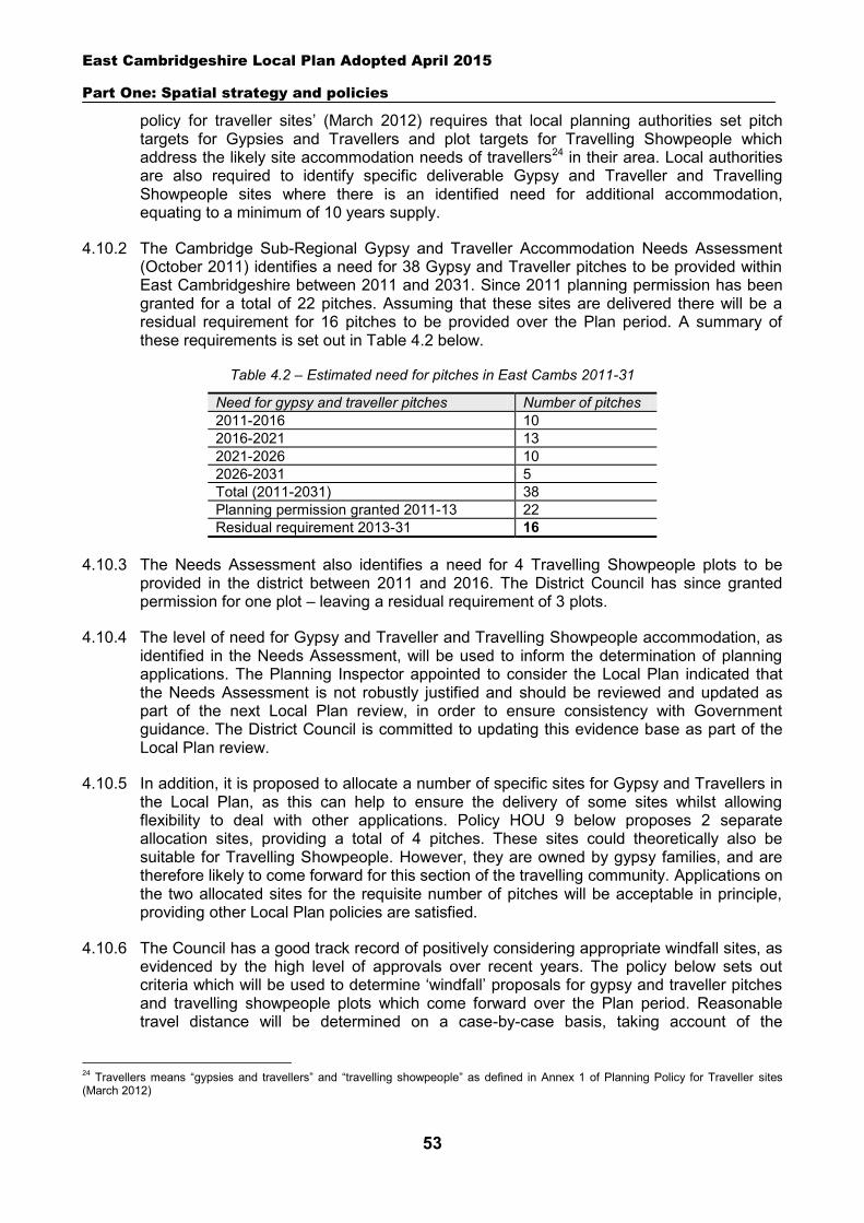
East Cambridgeshire Local Plan Adopted April 2015
Part One: Spatial strategy and policies
53
policy for traveller sites’ (March 2012) requires that local planning authorities set pitch targets for Gypsies and Travellers and plot targets for Travelling Showpeople which address the likely site accommodation needs of travellers24 in their area. Local authorities are also required to identify specific deliverable Gypsy and Traveller and Travelling Showpeople sites where there is an identified need for additional accommodation, equating to a minimum of 10 years supply.
4.10.2 The Cambridge Sub-Regional Gypsy and Traveller Accommodation Needs Assessment (October 2011) identifies a need for 38 Gypsy and Traveller pitches to be provided within East Cambridgeshire between 2011 and 2031. Since 2011 planning permission has been granted for a total of 22 pitches. Assuming that these sites are delivered there will be a residual requirement for 16 pitches to be provided over the Plan period. A summary of these requirements is set out in Table 4.2 below.
Table 4.2 – Estimated need for pitches in East Cambs 2011-31
Need for gypsy and traveller pitches Number of pitches 2011-2016 10 2016-2021 13 2021-2026 10 2026-2031 5 Total (2011-2031) 38 Planning permission granted 2011-13 22 Residual requirement 2013-31 16
4.10.3 The Needs Assessment also identifies a need for 4 Travelling Showpeople plots to be provided in the district between 2011 and 2016. The District Council has since granted permission for one plot – leaving a residual requirement of 3 plots.
4.10.4 The level of need for Gypsy and Traveller and Travelling Showpeople accommodation, as identified in the Needs Assessment, will be used to inform the determination of planning applications. The Planning Inspector appointed to consider the Local Plan indicated that the Needs Assessment is not robustly justified and should be reviewed and updated as part of the next Local Plan review, in order to ensure consistency with Government guidance. The District Council is committed to updating this evidence base as part of the Local Plan review.
4.10.5 In addition, it is proposed to allocate a number of specific sites for Gypsy and Travellers in the Local Plan, as this can help to ensure the delivery of some sites whilst allowing flexibility to deal with other applications. Policy HOU 9 below proposes 2 separate allocation sites, providing a total of 4 pitches. These sites could theoretically also be suitable for Travelling Showpeople. However, they are owned by gypsy families, and are therefore likely to come forward for this section of the travelling community. Applications on the two allocated sites for the requisite number of pitches will be acceptable in principle, providing other Local Plan policies are satisfied.
4.10.6 The Council has a good track record of positively considering appropriate windfall sites, as evidenced by the high level of approvals over recent years. The policy below sets out criteria which will be used to determine ‘windfall’ proposals for gypsy and traveller pitches and travelling showpeople plots which come forward over the Plan period. Reasonable travel distance will be determined on a case-by-case basis, taking account of the
24 Travellers means “gypsies and travellers” and “travelling showpeople” as defined in Annex 1 of Planning Policy for Traveller sites (March 2012)
East Cambridgeshire Local Plan Adopted April 2015
Part One: Spatial strategy and policies
54
availability of public transport services, the suitability of the route for walking and cycling, and any other relevant factors.
Policy HOU 9: Gypsies, Travellers and Travelling Showpeople sites
The District Council will make provision for Gypsy, Traveller and Travelling Showpeople sites to meet identified needs. Provision should be made for at least 38 permanent Gypsy and Traveller pitches between 2011 and 2031, and at least 4 plots for Travelling Showpeople between 2011 and 2016.
The following sites are allocated as Gypsy and Traveller sites (see Inset Maps 4.1 and 4.2). Applications for the requisite number of pitches will be suitable in principle on these sites, provided other Local Plan policies are satisfied:
Land at Muckdungle Corner, Newmarket Road, Bottisham (2 pitches). Land at Pony Lodge, Grunty Fen Road, Witchford (2 pitches).
Proposals elsewhere for Gypsy, Traveller and Travelling Showpeople accommodation should meet the following criteria:
Adequate schools, shops and other community facilities are within reasonable travelling distance.
There is no significant adverse impact on the character and appearance of the countryside and the setting of settlements.
The site would not lead to the loss of or adverse impact on important historic and natural environment assets as defined in Policies ENV 7 and ENV 11-15.
There is no significant risk of land contamination. There is no unacceptable risk of flooding. The scale of the proposal is not disproportionate to the size of the nearest settlement and the
availability of community facilities and infrastructure. The site provides a suitable level of residential amenity for the proposed residents and there is
no significant adverse impact on the amenity of nearby residents. Safe and convenient vehicular access to the local highway network can be provided together
with adequate space to allow for the movement and parking of vehicles. Essential services (water, electricity and foul drainage) are available on site or can be made
available; and Plots for Travelling Showpeople should also be of a sufficient size to enable the storage, repair
and maintenance of equipment.
The sub-division of authorised Gypsy, Traveller and Travelling Showpeople sites will also be permitted provided that:
The residential amenity of residents on the proposed site and neighbouring land is protected. Sites are of a suitable size to enable the creation of additional pitches or plots. There is no significant loss of soft and hard landscaping and amenity provision within the existing
site, particularly where conditioned by previous consent; and There is no adverse impact in terms of highways access and movement.
East Cambridgeshire Local Plan Adopted April 2015
Part One: Spatial strategy and policies
55
5 Employment
5.1 Introduction
5.1.1 Employment development is a priority for the District Council. This chapter builds on the strategic policies in Chapter 2, and sets out a series of detailed policies which will be used to assess planning applications for employment uses. It includes policies which seek to retain sufficient stock of employment land and premises (B1, B2 and B8 uses) to support the expansion of the local economy, and policies which seek to ensure that development is of an appropriate scale and type to its location.
5.1.2 Most of the chapter focuses on business uses (B1, B2 and B8 uses) but also includes policies relating to other specific employment sectors, including horse racing and tourism.
5.2 Retention of existing employment sites and allocations
5.2.1 Future economic growth in the district can only be successfully delivered if there is sufficient land in the right locations for these uses. As demonstrated in the Council’s Jobs Growth Strategy, existing employment sites (B1, B2 and B8 uses) play an important role in this process and retaining existing employment sites is key to underpinning future economic growth. The availability of local employment opportunities is particularly important given the high levels of out-commuting from the district. Existing sites are serviced and add to the variety of stock. The loss of business land can harm local firms, who may find it difficult to find suitable replacement sites.
5.2.2 The policy below seeks to retain sites currently or last in employment use, whilst allowing some flexibility to take account of sites that may no longer be suitable or appropriate for employment use. For example, where the use of the site gives rise to unacceptable environmental/amenity problems that cannot be overcome, or is no longer viable. In relation to environmental/amenity issues, applicants will need to provide clear and robust evidence of problems, and demonstrate that they cannot be mitigated. Where the continued viability of a site for B1, B2 or B8 use is in question, applicants will be required to demonstrate that the site has been actively marketed with a commercial agent and placed on the District Council’s business website at a realistic price for a continuous period of at least 12 months. If these conditions are met, redevelopment may be permitted, providing it involves a mixed-use scheme which includes a proportion of employment development (B1/B2/B8 uses). Applicants proposing the loss of all business uses on the site will be expected to demonstrate clear viability or other evidence as to why it is not possible to provide any employment uses on the site.
5.2.3 The policy applies to all employment sites or premises, currently or last used for employment purposes (B1, B2, B8) The Council does not propose to set a limit on the size of site to be retained, as small sites can make a significant contribution to local employment opportunities, and are a key type of stock, particularly for start-up businesses.
5.2.4 In order to help meet anticipated future employment demand, the Local Plan also identifies a number of new employment allocations, and mixed-use sites which include an element of employment uses (as set out in Part 2). These employment allocations are considered to be essential to the Council’s strategy of delivering 9,200 new jobs over the Plan period, and meeting the identified future needs of the local economy (as set out in the Jobs Growth Strategy). These strategic sites will be expected to be retained for employment uses. However, proposals for redevelopment/development for other purposes will be
East Cambridgeshire Local Plan Adopted April 2015
Part One: Spatial strategy and policies
56
assessed on their merits, taking account of viability and environmental matters, and other policies in the Local Plan, particularly those relating to development in the countryside (Policy GROWTH 2) and impact on local character (Policy ENV 1).
5.2.5 There are some changes of use from office or business use (B1) that are permitted development under the General Permitted Development Order 1995 (as amended). These do not require an application for planning permission to be made to this Council; however, they may require an application to be made to this Council for a determination as to whether prior approval is required for specified matters.
Policy EMP 1: Retention of existing employment sites and allocations
The Council will seek to retain land or premises currently or last used for employment purposes (B1, B2 and B8 uses). As an exception, planning applications for mixed-use re-development involving an element of employment uses may be permitted, where it can be demonstrated that:
a. Continued use of the site for 100% employment purposes is no longer viable, taking into account the site’s characteristics, quality of buildings, and existing or potential market demand; or
b. The redevelopment of the site would bring significant environmental or community benefits which outweigh the partial loss of employment uses.
Applicants will need to provide clear and robust evidence relating to criteria a or b alongside a planning application. Planning applications for re-development which propose the loss of all employment uses will need to be accompanied by clear viability or other evidence as to why it is not possible to deliver employment as part of the scheme.
The Council will seek to retain employment allocations for their designated B1/B2/B8 uses. However planning applications for redevelopment/development for other purposes will be assessed on their merits, taking account of criteria a and b above, and other policies in the Plan (particularly those relating to development in the countryside and impact on local character).
5.3 Extensions to existing businesses in the countryside
5.3.1 One of the key aims of the Council’s Jobs Growth Strategy and the Local Plan is to encourage business growth, particularly indigenous businesses. In many cases this will involve expansion or intensification within an existing site, rather than relocation - and many of these sites will be in countryside locations. Wherever possible the Council will aim to assist businesses in their proposals to extend on site, providing the proposal is in scale with the location – particularly in relation to the amount and nature of traffic generated. Extensions should be of an appropriate design in terms of height, scale, massing and materials, and not have an adverse effect on the character of the locality or residential amenity. Extensions should also be for the purpose of the existing business. Justification for the expansion, including the submission of a business case, will be need to be submitted with any planning application.
East Cambridgeshire Local Plan Adopted April 2015
Part One: Spatial strategy and policies
57
Policy EMP 2: Extensions to existing businesses in the countryside
Proposals to expand existing businesses in the countryside will be permitted where:
The proposal does not harm the character and appearance of any existing buildings or the locality.
The proposal is in scale with the location, and would not (by itself or cumulatively) have a significant adverse impact in terms of the amount or nature of traffic generated.
The extension is for the purpose of the existing business; and Any intensification of use will not detract from residential amenity. Full justification for the proposals should be submitted with a planning application.
5.4 New employment development in the countryside
5.4.1 The Council encourages the development of small businesses. It is known that there is a shortage of small business units throughout the district to cater for current and predicted demand. Some local business needs are likely to be met through the re-use of existing buildings in the countryside as detailed in Policy EMP 4. However, in cases where there are no suitable sites within settlements for business development or opportunities for re-use of buildings, new buildings to accommodate small business developments may be appropriate on the edges of settlements. This is particularly likely to be the case in relation to villages, rather than the market towns where there is a greater choice of land and buildings. The scale of development acceptable in these circumstances will depend on the type of business, the nature of the settlement and the character of the area, but is likely to involve the provision of up to 500m² of business floorspace. Any such development will only be permitted where it would not adversely affect its surroundings and is easily accessed by foot or cycle from the settlement centre along clear links.
Policy EMP 3: New employment development in the countryside
New development for small scale businesses (B1, B2 and B8 uses) will be permitted on small sites closely related to the built framework of a settlement where:
There is a lack of suitable buildings and sites within the settlement. There is a lack of suitable buildings to re-use or replace in the countryside close to the settlement
(in accordance with Policy EMP 4). The proposal would not have an adverse impact on the character and appearance of the area,
the amenity of neighbouring occupiers, or result in a significant increase in traffic; and The site can be easily accessed by foot or cycle from the settlement.
5.5 Re-use and replacement of existing buildings in the countryside
5.5.1 This policy relates to the re-use and replacement of non-residential buildings in the countryside, such as barns and other agricultural buildings. The replacement of existing rural dwellings (and their extension) is covered by Policy HOU 8.
East Cambridgeshire Local Plan Adopted April 2015
Part One: Spatial strategy and policies
58
5.5.2 The re-use of existing rural buildings that are no longer needed for their original purpose provides an opportunity for development without the impact that new buildings have on the landscape. There are some changes of use from agricultural buildings that are permitted development under the General Permitted Development Order 1995 (as amended). These do not require an application for planning permission to be made to this Council; however, they may require an application to be made to this Council for a determination as to whether prior approval is required for specified matters. Not all buildings in the countryside are suitable for conversion or adaptation to new uses, as they may be of insubstantial construction, of poor design, or not in keeping with their surroundings. Proposals for re-use will also need to demonstrate there is capacity on the local road network to deal with any increase in traffic flows, and no significant adverse impact (alone or cumulatively) in terms of the amount or nature of traffic generated.
5.5.3 The re-use of rural buildings will generally be supported over the replacement of buildings. However, the replacement of rural buildings may be appropriate where it would result in a more acceptable and sustainable development than would be achieved through conversion. For example, the replacement would bring environmental improvement in terms of impact on the surroundings and landscape. As for re-use, proposals for replacement will also only be appropriate where the existing buildings are of permanent and substantial construction. The replacement of attractive existing rural buildings of visual or historic interest will be resisted.
5.5.4 Where planning applications are required, the re-use or replacement of existing rural buildings will primarily be supported for business (B1, B2, B8), tourism, outdoor recreation or community-related uses. This includes rural worker dwellings associated with local businesses (in accordance with Policy HOU 5), and farm shops (in accordance with Policy COM 1). Other retail uses will not normally be appropriate development in the countryside. Proposals for tourism uses will also need to accord with Policies EMP 7 to 9. Where planning applications are required, the re-use of rural buildings for holiday cottages may be appropriate in certain circumstances, but not replacement – as it is considered important to minimise the impact of development on the countryside.
5.5.5 Proposals for other types of residential re-use (e.g. open market housing) requiring a planning application will only be permitted where applicants can demonstrate that a range of other opportunities have been explored, and are not deliverable due to lack of demand or viability issues. As part of this applicants will need to explore options for business re-use and to provide evidence that the building has been marketed for sale or let for business use with a commercial agent and the District Council’s business website at an appropriate price for at least 12 months. The replacement of rural buildings for residential use will not normally be considered appropriate, in order to minimise impact on the character of the countryside.
Policy EMP 4: Re-use and replacement of existing buildings in the countryside
Proposals for the re-use of existing buildings in the countryside for business (B1, B2, B8), tourism, outdoor recreation or community-related uses which require a planning application will be permitted where:
It can be demonstrated that the building is of permanent and substantial construction. The form, bulk and design of the building is of visual merit, architectural merit or historical
significance, and is in general keeping with its surroundings. The proposal does not harm the character and appearance of the building or the locality.
East Cambridgeshire Local Plan Adopted April 2015
Part One: Spatial strategy and policies
59
The proposal would not (by itself or cumulatively) have a significant adverse impact in terms of the amount or nature of traffic generated; and
Other Local Plan policies relating to specific uses are met. The replacement of existing buildings in the countryside (for the same uses) will only be permitted where it would result in a more acceptable and sustainable development than would be achieved through conversion. In addition, bullets 1 and 5 above should also be satisfied. Proposals for replacement involving change of use to holiday cottages will not be permitted.
Proposals for the residential re-use of rural buildings which require a planning application will only be appropriate where the above criteria are satisfied, and applicants can demonstrate that business use is not viable or deliverable.
Proposals for the replacement of non-residential rural buildings for residential use will not normally be considered appropriate.
5.6 Equine development
5.6.1 Horse racing and other equestrian-related activities are popular forms of recreation and economic development in the countryside, particularly in the south of the district around Newmarket. These uses, including stud farming, training establishments, riding schools and stables, can fit in well with agricultural activities and help to diversify the rural economy. The Council will support equine development that maintains environmental quality and the character of the countryside.
5.6.2 In some circumstances, the erection of stables or loose boxes within the curtilage of a dwellinghouse for the domestic needs or enjoyment of the occupants of the dwelling may not require planning permission. Applicants are encouraged to seek advice from the Council.
5.6.3 Whilst equestrian development can be appropriate in the open countryside, the cumulative impact of horse-related activities and associated buildings can have an adverse impact on the character and appearance of rural areas. Wherever possible, existing buildings should be re-used. New buildings for horse-related activities including stables, field shelters and tack rooms should be no larger than is essential.
5.6.4 In most cases, isolated developments will be unacceptable. Small-scale domestic stables should be well related to dwellings whilst larger scale facilities should be well related to existing development. Commercial equestrian facilities should be well related to existing public bridleways or gallops to minimise the need to exercise horses on the highway.
5.6.5 All equestrian development, whether domestic or commercial, should be of an appropriate scale and design and careful attention should be given to siting, materials and landscaping details to avoid an adverse impact on the countryside. Particular care will be needed where floodlighting is proposed in order to avoid an unacceptable impact on residential amenity. Adequate pasture may be necessary depending on the feeding and grazing regime. The British Horse Society recommends 0.4-0.6ha per horse.
5.6.6 Proposals for dwellings as part of equine development schemes will be assessed against Policy HOU 5.
East Cambridgeshire Local Plan Adopted April 2015
Part One: Spatial strategy and policies
60
Policy EMP 5: Equine development
Proposals for horse racing or equestrian development, whether domestic or commercial, will be permitted when the following criteria are met:
The proposal is not sited in a prominent or isolated location away from existing buildings. Where new buildings are proposed, applicants have demonstrated that existing structures cannot
be adapted or re-used. The siting, scale and design of the proposal is in keeping with the character of the area, with
adequate pasture to support the horses where necessary. Particular regard will be had to the cumulative effect of proposals.
Proposals for larger scale private or commercial enterprises have access to the public bridleway network or have sufficient space for exercising horses on-site. Such proposals will require a Transport Statement to demonstrate that there are no unacceptable impacts on highway safety.
The amenity of nearby residential properties is not adversely affected, for example, in relation to floodlighting, changes in levels or noise and disturbance.
The proposal would not (by itself or cumulatively) have a significant adverse impact in terms of the nature and amount of traffic generated; and
Schemes proposing dwellings for rural workers will need to accord with Policy HOU 5.
5.7 Development affecting the horse racing industry
5.7.1 Given the historical association of the Newmarket area with horse racing, and its importance to the local economy, it is important that development does not have an adverse impact on the industry. Development which harms the long-term viability of operational studs and other racing facilities, or the racing industry as a whole, will be resisted.
Policy EMP 6: Development affecting the horse racing industry
Any development which is likely to have an adverse impact on the operational use of an existing site within the horse racing industry, or which would threaten the long term viability of the horse racing industry as a whole, will not be permitted.
5.8 Tourist facilities and visitor attractions
5.8.1 East Cambridgeshire is an attractive rural district with a range of tourist attractions including Ely Cathedral, Wicken Fen, Anglesey Abbey and Oliver Cromwell’s House. The Council is keen to support proposals which sustain and enhance the district’s tourism and visitor economy.
5.8.2 Tourist facilities and visitor attractions are usually considered to be a ‘main town centre use’ (see paragraph 3.3.8) but they can also play an important role in rural diversification. Certain tourism development may be appropriate in the countryside, for example to support the expansion of existing tourist facilities and attractions, or to create a new attraction from a specific feature.
East Cambridgeshire Local Plan Adopted April 2015
Part One: Spatial strategy and policies
61
5.8.3 Where a new or extended tourist facility or visitor attraction is proposed, applicants will be expected to submit evidence of genuine need to support the case for the proposal. This should include an analysis of market supply and demand (including evidence of similar establishments in the locality and their visitor numbers) and a business plan.
5.8.4 All proposals will be encouraged to reuse existing buildings where possible (in accordance with Policy EMP 4). Where new buildings are proposed, these should be in scale with their surroundings and sensitively designed and located to minimise potential impact on the landscape and local area. New tourist development should not adversely affect nature or wildlife habitats, which can be tourist attractions in their own right. Applicants should also demonstrate that opportunities for sustainable travel arrangements have been explored and suitable proposals incorporated into schemes, for example, provision of enhanced cycling and walking links or enhanced public transport.
Policy EMP 7: Tourist facilities and visitor attractions
Proposals for new or extended tourist facilities or attractions will be supported where it can be demonstrated that:
There is an identified need to create new facilities or to expand or improve existing visitor attractions and facilities to ensure their continued viability.
The proposal is of an appropriate scale and nature relative to its location, and would not (by itself or cumulatively) have a significant adverse impact in terms of the amount and nature of traffic generated.
The character & appearance of the area and natural assets would be maintained and enhanced. The proposal maximises opportunities for sustainable travel including walking, cycling and public
transport; and
Opportunities to reuse existing buildings have been explored.
5.9 Tourist accommodation
5.9.1 The district’s proximity to Cambridge, Newmarket, King’s Lynn and Norwich make it an attractive destination for day visits and an increasingly popular destination for overnight stays. There is a need for additional tourist accommodation, particularly within the hotel, caravan and camping sectors. Additionally, on-going improvements to the navigable waterways, including the Fens Waterways Link, mean that East Cambridgeshire is ideally placed to capitalise on growth within the leisure marine and boating holiday market.
5.9.2 Hotel development is defined as a ‘main town centre use’, which can enhance the vitality and viability of town centres. Concentrating hotel development in sustainable town centre locations close to shops, services and public transport can help to reduce the need to travel and benefit the environment. Other locations which provide good accessibility may also be appropriate, such as sites close to railway stations. Proposals for new hotel development or extensions to hotels will also be assessed against Policy COM 1 which relates to town centre uses, and seeks to ensure a sequential approach is generally applied.
5.9.3 It will also be important to retain existing hotel stock. Facilities such as the Lamb Hotel in Ely help to meet business and tourist demand in the city and hence enhance the vitality and viability of the city centre. The Council will only permit the loss of hotel accommodation
East Cambridgeshire Local Plan Adopted April 2015
Part One: Spatial strategy and policies
62
to other uses where it can be demonstrated that the continued use as a hotel would not be economically viable. In assessing viability, evidence will be required of occupancy rates and other relevant factors such as business plans, locational factors and ease of access for visitors by a variety of transport routes. Applicants will also need to submit evidence that the site has been marketed for sale or let at a reasonable price for a period of at least 12 months.
5.9.4 All tourist accommodation should be located within settlements wherever possible. However, for caravan/camping/marinas/moorings it is recognised that locations on the edge of settlements may also be appropriate – and also where schemes are proposed as part of the expansion of existing accommodation (providing that they are in scale with the location, and accord with other criteria in the policy).
5.9.5 Proposals for other unserviced holiday accommodation (e.g. holiday cottages) will only be appropriate in the countryside where they involve the re-use of existing rural buildings, in accordance with Policy EMP 4. In order to minimise the impact on the countryside, schemes should be limited to 1 or 2 holiday cottages only, and will not be appropriate where they involve new buildings. Where any type of unserviced accommodation is permitted, occupation will be restricted to short term holiday lets, in accordance with Policy EMP 9.
5.9.6 Where new or expanded tourist accommodation is proposed, applicants will need to submit evidence of genuine need to support the case for the proposal. This should include an analysis of market supply and demand (including evidence of similar establishments in the locality and their visitor numbers) and a business plan.
Policy EMP 8: Tourist accommodation
Proposals for new hotel development or extensions to hotels will be assessed against the terms of Policy COM 1. Proposals resulting in the loss of sites currently, or last used, for hotel accommodation will only be permitted where it can be demonstrated that the continued use of a site for hotel accommodation is no longer economically viable, nor has the potential to become viable, and that all reasonable efforts have been made to sell or let the property at a reasonable price for a period of at least 12 months.
Proposals for new or extended caravan, caravan-lodge, camping sites, marinas and moorings will be supported where:
The need for the additional accommodation can be justified. Proposals are located within, or well related to, an existing settlement boundary, or on sites
where existing service providers require additional space to expand. There is no significant adverse impact on the character and appearance of the area or natural
assets. The proposal is of an appropriate scale and nature relative to its location, and would not (by itself
or cumulatively) have a significant adverse impact in terms of the amount and nature of traffic generated; and
In the case of marinas and moorings, development would not impede navigation or lead to hazardous boat movements, harm the quality of the fisheries, or conflict with traditional river uses such as fishing, sailing and rowing.
East Cambridgeshire Local Plan Adopted April 2015
Part One: Spatial strategy and policies
63
Proposals for holiday cottage accommodation will be supported where:
The need for the additional accommodation can be justified. Schemes are located within, or well related to, an existing settlement boundary; and
In the case of schemes in the countryside, they involve the re-use of an existing building in the countryside for a maximum of 2 dwellings (and accord with criteria in Policy EMP 4), and do not involve new build accommodation.
5.10 Holiday and seasonal occupancy conditions
5.10.1 There is demand for self-catering holiday accommodation across the district, particularly in the touring caravan, static caravan, caravan-lodge and boat sectors. Unserviced holiday accommodation can bring benefits to the rural economy, particularly where under-used buildings are brought back into productive use, or where development forms part of a rural diversification scheme. However, development pressures for housing and high land prices in East Cambridgeshire means that there is a potential risk that such units, once permitted, may be used as permanent residential accommodation.
5.10.2 The intention of this policy is to create a clear distinction between residential accommodation (which may or may not be used as second homes) and accommodation that is used as commercial holiday lets and therefore brings economic benefit to the area. Commercial holiday lets can support the rural economy through visitor spend at local shops, attractions and facilities, whilst placing much less pressure on local services such as doctors and schools, than permanent residential occupancy.
5.10.3 Conditions will therefore be placed on new unserviced holiday accommodation to ensure availability as short-term commercial holiday lets for a substantial part of the year. This approach is in accordance with the Valuation Office definition of self-catering accommodation that states accommodation must be available for short periods totalling 140 days a year. The Valuation Office also advises that letting for ‘short periods’ means letting for periods of a month or less, to different individuals on each occasion.25
5.10.4 Additionally, in some cases holiday accommodation, whether by the character of its construction, design or location, will also be unsuitable for continuous occupation. In such instances, the Council may restrict occupation to certain months of the year. Seasonal occupancy may also be appropriate to protect the local environment, for example, from visual intrusion or disturbance, impact upon nature conservation and habitats, or physical erosion within the site or its surroundings that occupation during certain times of the year may cause.
Policy EMP 9: Holiday and seasonal occupancy conditions
Holiday occupancy conditions will be placed on new unserviced holiday accommodation requiring that:
The accommodation is occupied for holiday purposes only and shall not be occupied as any person’s sole or main residence.
It shall be available for commercial holiday lets for at least 140 days a year and no let must exceed 28 days.
25 Valuation Office Rating Manual 5 – Section 480: Holiday Homes (self catering)
East Cambridgeshire Local Plan Adopted April 2015
Part One: Spatial strategy and policies
64
The owners/operators of the site shall maintain an up-to-date register of lettings/occupation, including the names of all owners/occupiers, their home addresses, where they are registered for Council tax and electoral purposes, and showing arrival and departure dates; and
The owner/operator shall undertake a monthly management check of the register, and be prepared to make the register available at all reasonable times to the Local Planning Authority.
A seasonal occupancy condition will be attached where accommodation is not suitable for year-round occupation by nature of its construction, location or design, or proximity to a habitat that needs extra protection at certain times of the year.
East Cambridgeshire Local Plan Adopted April 2015
Part One: Spatial strategy and policies
65
6 Environment and climate change
6.1 Introduction
6.1.1 Achieving a high quality built and natural environment is a key theme of this Plan. This chapter sets out a series of policies which will be used to ensure that development proposals protect and promote the special qualities of the district and minimise impact on the environment. The chapter includes policies which seek to:
Sustain and create landscapes and townscapes with a strong sense of place and local identity (section 6.2)
Create well-designed, safe and attractive new developments (sections 6.3 and 6.4) Increase energy efficiency and the use of renewable and low-carbon energy (sections
6.5-6.7) Retain, protect and enhance features of biological or geological interest (section 6.8) Protect people and property from the risks of flooding (section 6.9) Minimise and reduce all forms of pollution, including light and noise pollution, and
ensure no deterioration in air and water quality (section 6.10) Protect the Green Belt from inappropriate development (section 6.11) Protect and enhance the historic environment (sections 6.12-6.18)
6.2 Landscape and settlement character
6.2.1 Attractive and distinctive local landscapes help to raise both the overall quality of the environment and the quality of people’s lives. A high priority is therefore given to the protection, conservation and enhancement of traditional landscape character. New development that is well designed and helps to sustain and create landscapes and townscapes with a strong sense of place and local identity is important to achieving this objective. The importance of planning for the protection and enhancement of landscape character is endorsed strongly by the NPPF.
6.2.2 The countryside in East Cambridgeshire is characterised by three distinctive and contrasting landscape types which are consistent with the qualities defined in the national Landscape Character Assessment: Fens – these cover the northern part of the district and are characterised by large
open, flat and low lying fields under wide skies, crossed by numerous waterways and drainage channels. There are fine long distance views of buildings and settlements, and most settlements are located on old ‘islands’.
Chalk hills – these extend between Cambridge and Newmarket, and are a broad scale landscape of large fields, low hedges and relatively few trees. Villages are mainly nuclear in form.
Clay hills – these lie to the south-east, and are an undulating landscape of gently rolling hills and scattered woodland. A number of small hamlets and villages have developed in sheltered locations, often originally built to take advantage of the natural springs.
6.2.3 The character areas are described in more detail in the County Council’s ‘Cambridgeshire Landscape Guidelines’ (1991), which remains the baseline evaluation of landscape in the County. The Guidelines stress the need to pay special attention to the design of edges of towns and villages and their integration with and relationship to the wider landscape. This
East Cambridgeshire Local Plan Adopted April 2015
Part One: Spatial strategy and policies
66
requires the location, scale and height of development, views into and out of the settlement and the detailed edge treatment to be considered carefully. These matters are particularly important given the predominantly flat landscape of the district. A clear distinction between countryside and developed areas, including that between gardens and farmland, should be maintained and ad hoc changes damaging this relationship will not be permitted.
6.2.4 The Council's ‘Ely Environmental Capacity Study’ provides a detailed assessment of the landscape character of Ely and its environs, including an analysis of the distant and near views of Ely Cathedral. This study is due to be updated in 2015, and will be adopted as a Supplementary Planning Document to the Local Plan. Other studies that contribute to the evidence base about landscape and the character of settlements in the district include Conservation Area Appraisals for various town and villages (adopted as Supplementary Planning Documents). This information should be used by developers to ensure that proposals reflect the distinctive character, qualities and sensitivities of the area. More information on Conservation Areas is contained in Policy ENV 11.
6.2.5 The flatness of the fens and southern rolling hills, interspersed with small low lying villages, results in broad open skies, which are a key part of the distinctive landscape character. At night the rural nature of the area means that only urban areas are brightly lit, islands of light in a dark and tranquil sea. It is important that these qualities are protected from inappropriate development, especially from increased light pollution from street lighting, floodlighting and domestic lighting, and that new development retains the openness and tranquility of the area and protects wildlife.
6.2.6 In protecting landscape and settlement character the Council will expect: important existing views into and out of settlements to be maintained and enhanced and new ones to be created; important open spaces to be retained; and wildlife features to be undisturbed, as detailed in other policies within this Plan.
Policy ENV 1: Landscape and settlement character
Proposals for development should be informed by, be sympathetic to, and respect the capacity of the distinctive character areas defined in the Cambridgeshire Landscape Guidelines.
Development proposals should demonstrate that their location, scale, form, design, materials, colour, edge treatment and structural landscaping will create positive, complementary relationships with existing development and will protect, conserve, and where possible enhance:
The pattern of distinctive historic and traditional landscape features, such as watercourses, characteristic vegetation, individual and woodland trees, field patterns, hedgerows and walls, and their function as ecological corridors for wildlife dispersal.
The settlement edge, space between settlements, and their wider landscape setting. Visually sensitive natural and man-made skylines, hillsides and geological features. Key views into and out of settlements; this includes quintessential views of Ely Cathedral and the
setting of the City as a historic ‘isle’ settlement close to the fen edge and the valley of the River Great Ouse.
The unspoilt nature and tranquility of the area. Public amenity and access; and Nocturnal character of rural areas free from light pollution. Suitable compensatory provision must be made in the event of significant harm where necessary.
East Cambridgeshire Local Plan Adopted April 2015
Part One: Spatial strategy and policies
67
6.3 Design
6.3.1 Well-designed, safe and attractive new development which respects its surroundings can help to raise the quality of towns and villages and have a significant impact on everyday life. Good design is a key element in sustainable development and the Council believes strongly in raising the standard of design in all proposals. The NPPF stresses the importance of good design in sound planning and allows for local planning authorities to resist poor design.
6.3.2 The importance of creating distinctive, safe and accessible new developments is established in the strategic objectives of the Local Plan. Development needs to be of an appropriate scale, design and materials for its location and conform to the design principles set out in the policy below. All new buildings and spaces must enhance and respect their surroundings and contribute towards local identity, whilst securing and maintaining a high level of movement, quality in the public realm and general amenity for residents and workers. The particular importance of design in areas of historic conservation is detailed in Policy ENV 11. However, seeking to respect tradition should not inhibit innovation and good modern design that contributes positively to the character of towns and villages through new developments and urban extensions.
6.3.3 The Local Plan objectives also address the impacts of development on climate change. Good design can reduce energy consumption and improve sustainability through mitigation. The Council will actively promote development incorporating new technology that promotes energy and water conservation, and landscaping that mitigates climate change effects. Further details are set out in Policy ENV 4 on sustainable design and construction.
6.3.4 Development proposals also need to be designed to facilitate sustainable waste management, e.g. make provision for waste storage, collection and recycling. The County Council’s RECAP Waste Management Design Guide Supplementary Planning Document (2012) provides further advice on design and provision or waste management infrastructure on residential and commercial schemes, and will be applied by the District Council to development within East Cambridgeshire.
6.3.5 Enabling the delivery of superfast broadband and other advanced communication technologies throughout the district is vital to supporting the economic and sustainability aims of the Local Plan. The Council expects high quality communications infrastructure to be incorporated into the design of all new housing and commercial development in the district, ensuring the future proofing of telecommunications, enabling them to be easily provided and/or upgraded in the future. Retrofitting of communications networks are costly and reduce the financial viability for investment by the private sector in the future. The Council will therefore expect developers to explore the option of providing on-site infrastructure, including ducting to industry standards in any new residential, employment or commercial development for efficient connection to existing networks. If such measures cannot be delivered, the developer will need to submit evidence to justify the reasons why this is the case, whether it be for viability or technical reasons.
6.3.6 For development in key areas, the Council will prepare and adopt development frameworks to guide development and ensure that potential benefits are maximised. Developers of these sites will be expected to build on these frameworks and produce detailed site Masterplans for submission alongside outline planning applications. The Council will also require Masterplans to be prepared for other large and more sensitive sites in the district, to be submitted alongside outline planning applications. Typically, a
East Cambridgeshire Local Plan Adopted April 2015
Part One: Spatial strategy and policies
68
masterplan should establish the broad location of land uses, roads, services, open space and landscaping, and look at principles such as access and movement, built form and phasing. Masterplans should also demonstrate how the site will deliver the key aims of any relevant site-specific policy, and how a high standard of comprehensive planning can be achieved. Developers will be expected to involve the local community in the production of a masterplan. In some cases, design codes will also need to be submitted for approval between outline and reserved matters application stages. Developers are advised to contact the District Council at an early stage in preparing an application, to determine what level of design planning may be required. Where outline applications are proposed in locations which are deemed to be sensitive by virtue of the special character and value of the historic and natural environment in or in the vicinity of the site, they should be accompanied by sufficient information so that the impact of the proposed development can be properly assessed.
6.3.7 The Council will expect all development sites to be brought forward in as a comprehensive way as possible, avoiding piecemeal development, or development which would prevent adjacent land or other nearby sites from coming forward (for example, by impeding future access).
6.3.8 The East Cambridgeshire Design Guide Supplementary Planning Document contains detailed guidance on how design should compliment landscape, setting, local architectural traditions, and how sustainable construction techniques can be incorporated. Guidance on the appropriate design of shopfronts and advertisements is set out in the Shop Fronts Supplementary Planning Document. Other detailed local context information can be found in Conservation Area Appraisals, the Ely Environmental Capacity Study and the Cambridgeshire Landscape Guidelines, which should be taken into account. Reviews of these documents will occur during the lifetime of the Local Plan and the most up to date material should be used.
6.3.9 The Government requires Design and Access Statements to be submitted with most planning applications. These Statements are intended to demonstrate how a proposal is functional, attractive and accessible to all. Comprehensive guidance on the format and content of a Statement is provided on the Council’s website. The Council will establish design review arrangements, in line with the requirement of the NPPF, to assist in raising the quality of architectural and urban design across the district.
Policy ENV 2: Design
All development will be designed to a high quality, enhancing and complementing local distinctiveness and public amenity by relating well to existing features and introducing appropriate new designs.
Design which fails to have regard to local context including architectural traditions and does not take advantage of opportunities to preserve, enhance or enrich the character, appearance and quality of an area will not be acceptable and planning applications will be refused.
The Council will prepare and adopt development frameworks to guide the development of key sites. Developers will be required to prepare detailed Masterplans for these sites, and for other large-scale developments and developments in sensitive areas, and submit these alongside an outline or initial application. In addition to key design principles, masterplans should include details on infrastructure delivery and phasing. Design codes will be required for certain proposals and should be submitted for approval between outline and reserved matters application stages.
East Cambridgeshire Local Plan Adopted April 2015
Part One: Spatial strategy and policies
69
Large scale or significant schemes may be expected to go through a formal design review process, which may need to be financed by the developer.
The Council will encourage innovative, creative good modern architectural design that complies with the principles set out below. Schemes should be founded on an understanding of the architectural traditions of an area, even if there are no direct references to them in the final design. All new development proposals, including new buildings and structures and extensions and alterations to existing buildings and structures will be expected to:
Make efficient use of land while respecting the density, urban and village character, public spaces, landscape and biodiversity of the surrounding area.
Be developed in a comprehensive way, avoiding uncoordinated piecemeal development, to create a strong and attractive sense of place and local distinctiveness.
Where appropriate, contain a variety and mix of, uses, heights and types of buildings, public spaces paths and routes, and landscaping, and provide variety and visual richness.
Retain existing important landscaping and natural and historic features, and include landscape enhancement schemes.
Ensure that the location, layout, scale, form, massing, materials and colour of buildings relate sympathetically to the surrounding area and each other, as well as creating quality new schemes in their own right.
Protect important views into and out of settlements and key views of landmark buildings, especially ensuring that there is no detrimental effect on the appreciation of Ely as an historic cathedral city in the quality of the approaches and the quality of distant and close up views of the cathedral.
Ensure there is no significantly detrimental effect on the residential amenity of nearby occupiers, and that occupiers and users of new buildings, especially dwellings, enjoy high standards of amenity.
Provide structure and legibility to navigate through developments by making use of existing views, vistas, landmarks and built and natural landscapes and creating new ones.
Provide enclosure to streets and spaces through the grouping, positioning and height of buildings and landscape features, and road layouts.
Make a clear distinction between public and private spaces, and enhance the public realm, including maximising opportunities to provide public art where appropriate.
Incorporate the sustainable construction principles and methods contained in Policy ENV 4. Comply with the RECAP Waste Management Design Guide Supplementary Planning Document
- the Council will encourage innovative solutions to minimising and handing waste and recycling on development sites.
Demonstrate that opportunities have been explored to provide on-site infrastructure, including ducting to industry standards in any new residential, employment or commercial development to accommodate future communications infrastructure and other utility needs.
Incorporate the highway and access principles contained in Policy COM 7 into designs to ensure: o The conflict between motor vehicles and pedestrians and cyclists is minimised, and where
appropriate establishing home zones. o Safe and convenient access is provided for people with disabilities. o Good access to public transport services. o That networks of pedestrian and cycle routes (linking to existing routes where opportunities
exist) give easy access and permeability within developments and to adjacent areas; and o Protection of rights of way.
East Cambridgeshire Local Plan Adopted April 2015
Part One: Spatial strategy and policies
70
Ensure that car parking is discrete, accessible, supports permeable environments and integrated, so it does not dominate existing and proposed new places, and is provided in accordance with Policy COM 8.
Ensure that places and buildings are accessible to all, including the elderly and those with impaired mobility, and consider the life time use of developments, especially housing.
Create safe environments addressing crime prevention and community safety. Integrate Sustainable Urban Drainage Schemes (SuDS) into developments so they provide wider
green infrastructure benefits (in accordance with Policy ENV 8); and Have regard to the East Cambridgeshire Design Guide Supplementary Planning Document.
6.4 Shop fronts and advertisements
6.4.1 Shop fronts form an important element in the street scene, both individually and in terms of their collective impact. Therefore, when designing a new or replacement shop front, it is important to consider the visual impact upon both the building and the overall character of the area. Proposals will be assessed against the Shop Front Design Guide Supplementary Planning Document (2010 or as amended), Policies ENV2 and ENV3, and historic environment policies as appropriate.
6.4.2 The installation of new shop fronts can have a significant impact on the character of traditional buildings and streets across the district. When designing a new shop front or planning to alter or replace an existing one, it is important to consider the visual impact it will have upon the building and wider streetscape. A shop front and building must be considered separate elements of the same building.
6.4.3 The Local Planning Authority will give priority to the retention of architecturally or historically interesting traditional shop fronts. Adapting new shop fronts to modern needs can be brought about by sensitive design. Where replacement is allowed, the design should respect not only the building but the overall character of the area.
6.4.4 The Council recognises the importance that first floor accommodation can play in promoting economic vitality and creating active town centres. Upper floors provide a unique opportunity for enhanced security and surveillance as well as additional residential and office accommodation.
6.4.5 Advertisements play an important role in creating a sense of character and place. Some signs may be erected without the need for consent26. However, where consent is required the Council will seek to ensure that the form and design of signs and advertisements does not adversely impact the character of the area.
6.4.6 Sensitively designed signs incorporating individually illuminated mounted letters on a suitable background may be acceptable in certain areas where the scale, colour, design and intensity of the illumination would not detract from the character or appearance of the area.
6.4.7 It is important to protect the quality of design of shops and discourage inappropriate development. The installation of shutters, blinds and canopies if unregulated can have a detrimental impact on the character and visual amenity of the street scene. Any proposals should form part of the comprehensive design process and be incorporated into the shop front design.
26 Town and Country Planning (Control of Advertisements) Regulations
East Cambridgeshire Local Plan Adopted April 2015
Part One: Spatial strategy and policies
71
6.4.8 Careful attention has to be given to security in order to prevent poorly designed shutters and grills being installed that would detract from the appearance and attractiveness of buildings and areas.
Policy ENV 3: Shop fronts and advertisements
The Council will support applications for new shop fronts or alterations to existing shop fronts where:
The design is consistent with the architectural style, materials and form of the building(s) to which it would form part, except in cases where the building itself is architecturally incompatible with the character of the area; and
The shop front is an appropriate scale, in terms of the building on which it is located, and the locality. Where a shop front occupies more than one building, the division between each should be identifiable and the shop front should relate to the original units.
Where possible existing traditional shop fronts and features should be retained and restored. The removal of a traditional shop front will not be permitted if it is appropriate to the building or is of architectural or historic significance in its own right. The replacement of traditional shop fronts in Listed Buildings or in Conservation Areas will only be granted where the existing shop front is inappropriate to the building or area and its replacement will be of a high quality and improve the character of the buildings or area.
The Council will support proposals that provide independent access to upper floor accommodation and seek to encourage the use of vacant upper floors.
Consent for the display of advertisements or signs will only be permitted where:
The size, design, colour and number of any advertisements or signs respects the character, scale, design and location of the building and shop front on which is being displayed, as well as the street scene.
The advertisement or sign relates to and is integrated to the shop front which it serves; and The advertisement or sign is not internally illuminated. Where unacceptable advertisements already exist the Council will, where appropriate, take discontinuance action to secure their removal.
The Council will not support the provision of external roller shutters, metal roller shutters and shutter boxes on commercial/retail premises within the district, with special reference to Listed Buildings and Conservation Areas.
Shutters, sun blinds and canopies must be sympathetic in style, colour and materials to the building on which they are attached and their architectural style.
6.5 Energy and water efficiency and renewable energy in construction
6.5.1 Maximising energy efficiency and reducing resource consumption in new development can help to reduce CO2 emissions and thereby the contribution to climate change effects. This policy seeks to ensure that all development schemes achieve greater efficiency in the use
East Cambridgeshire Local Plan Adopted April 2015
Part One: Spatial strategy and policies
72
of natural resources, including measures to minimise energy use, improve water efficiency and promote waste minimisation and recycling. This will involve consideration of building design, layout and orientation, the use of sustainable (including re-used) materials, and planning a scheme’s resilience in terms of the future implications of climate change. New technologies for handling waste/recycling should be considered for inclusion in large developments. Developments should minimise construction waste and encourage reuse and recycling wherever possible. Incorporation of these measures will also help to reduce the running costs of buildings and create attractive and healthy places for people to live and work by use of natural light and ventilation. Further guidance on design for sustainable construction is set out in the Council’s Design Guide Supplementary Planning Document.
6.5.2 While there is significant new development planned for the district, the vast majority of buildings will be those built in earlier times when standards, e.g. of heat insulation, were much lower than at present. The Council will work with property owners to improve the efficiency of these buildings through initiatives that may be developed centrally or locally. Improvements in the efficiency of existing buildings will, where possible, be sought through conditions where changes requiring planning consent are proposed and/or through a retrofit programme supported with developer contributions. The Council will seek to ensure that efficiency improvements do not compromise the essential qualities of historic buildings and Conservation Areas. English Heritage guidance relating to energy efficiency and historic buildings is available at the following address: www.helm.org.uk/guidance-library.
6.5.3 The Code for Sustainable Homes (CSH) measures the sustainability of a new home against nine categories of sustainable design including energy and CO2 emissions reduction. The Government’s future target is for all new homes to be ‘zero carbon’ (Code Level 6), and intermediate step changes are proposed for Building Regulations Part L. The 2012 minimum national standard in energy efficiency is equivalent to Code Level 3, and the Council will expect developments to make all reasonable endeavours to maximise their performance against all sustainability aspects of the Code. Developments of 5 or more homes shall achieve at least Code Level 4, providing improved levels of energy efficiency, CO2 reduction and wider sustainability benefits.
6.5.4 However, in August 2013 the Government carried out consultation on a Housing Standards Review, and indicated that they were minded to require that carbon and energy targets for housing would only be set in national Building Regulations, pending implementation of a zero carbon homes requirement. The Government has since confirmed that the Code for Sustainable Homes requirements including those relating energy and carbon emissions will be incorporated into Building Regulations (Ministerial Statement on Building Regulations – March 2014). Policy ENV 4 therefore contains reference to these forthcoming replacement standards.
6.5.5 The Government proposes that non-domestic buildings will be zero carbon from 2019, and the Council requires proposals to demonstrate how energy efficiency and CO2 reduction is being addressed. The Council expects all non-domestic developments over 1000m2 to achieve BREEAM Very Good, or equivalent though an alternative environmental rating scheme. This will demonstrate good levels of energy efficiency and sustainable design.
6.5.6 The zero carbon buildings concept comprises three parts: energy efficiency, carbon compliance and allowable solutions. The foundation for any zero carbon home is ensuring good energy efficiency to minimise energy demand (e.g. ensuring that homes are sufficiently well insulated and adequately air-tight). The overall on-site contribution to zero carbon (including energy efficiency) is called carbon compliance. This includes on-site low and zero carbon energy such as solar panels and heat pumps and connected heat such as
East Cambridgeshire Local Plan Adopted April 2015
Part One: Spatial strategy and policies
73
a community heating network. The remaining emission reductions can be achieved via allowable solutions (see section 6.6 and Policy ENV 5), although at present, there is uncertainty about exactly what these might be and how much they might cost.
Policy ENV 4: Energy and water efficiency and renewable energy in construction
All proposals for new development should aim for reduced or zero carbon development in accordance with the zero carbon hierarchy: first maximising energy efficiency and then incorporating renewable or low carbon energy sources on-site as far as practicable.
Applicants will be required to demonstrate how they have considered maximising all aspects of sustainable design and construction, as set out in the Code for Sustainable Homes (or its successor). Developments of 5 or more homes are required to achieve Code for Sustainable Homes Level 4 (or its replacement pending implementation of the zero carbon homes requirement). All non-domestic developments of 1000m2 or more are required to meet BREEAM Very Good standard or equivalent.
The Council will negotiate with applicants over the most appropriate solutions for historic buildings and Conservation Areas.
6.6 Carbon offset
6.6.1 Of the three elements of the zero carbon hierarchy, allowable solutions has the most potential to achieve community-wide carbon savings, create green wealth for local communities, and contribute to social change and the rebalancing of the local economy.
6.6.2 As outlined in paragraph 6.5.4, the Government has yet to publish the final Allowable Solutions Framework. One option for carbon offsetting could involve the establishment of a local Community Energy Fund (CEF), which invests in energy efficiency and renewable and low carbon energy projects in Cambridgeshire, with an emphasis on community benefits. Work is ongoing to investigate the potential of developing a Cambridgeshire CEF, linked to the national Allowable Solutions Framework. Such a fund would require agreement across all Cambridgeshire local authorities with robust governance arrangements, building on the Cambridgeshire Renewable Infrastructure Framework (CRIF) Report and the Community Energy Fund (CEF) Report.
Policy ENV 5: Carbon offsetting
Where allowable solutions are required for a development scheme, the Council will be prepared to accept alternative provision in line with the national Allowable Solutions Framework.
Where a local Community Energy Fund exists, developers will be expected to provide financial contributions to this Fund to offset the difference. The contribution will be used to finance specific renewable energy projects within the local area. Financial contributions will be required into CEF where developments do not achieve the CO2 reductions required under Policy ENV 4.
East Cambridgeshire Local Plan Adopted April 2015
Part One: Spatial strategy and policies
74
6.7 Renewable energy development
6.7.1 Opportunities for renewable energy generation in the district includes solar radiation, wind power, anaerobic digestion, biomass, ground heat sources and other technologies. Combined heat and power systems may also be used to provide efficient energy to larger developments. Commercial schemes for renewable energy generation are likely to come forward over the Plan period, but there will also be smaller schemes, including renewable energy development on individual buildings. There are also likely to be opportunities for community-led initiatives for renewable and low carbon energy in towns and villages.
6.7.2 Current large-scale generation in operation in the district includes the straw burning plant at Sutton and the solar farm at Wilburton.
6.7.3 Proposals for renewable energy schemes will be supported wherever possible. The wider environmental, social and economic benefits will be given significant weight in planning decisions. However when assessing proposals, consideration will also be given to potential impacts on the local environment and amenity, including key views (in particular of Ely Cathedral), important wildlife sites, protected species and residential amenity, and significant adverse effects will be avoided. A landscape assessment will be a key part of this evaluation. Various types of technology will give rise to different impacts, and Policy ENV 6 sets out the broad criteria against which any scheme for renewable energy will be assessed. The Council will expect developments for energy generation to remediate potential adverse impacts, especially in relation to visual impact, through careful location, design and landscaping following the design principles set out in this Plan.
Policy ENV 6: Renewable energy development
Proposals for renewable energy and associated infrastructure will be supported, unless their wider environmental, social and economic benefits would be outweighed by significant adverse effects that cannot be remediated and made acceptable in relation to:
The local environment and visual landscape impact. Impact on the character and appearance of the streetscape/buildings. Key views, in particular those of Ely Cathedral. Protected species. Residential amenity. Safeguarding areas for nearby airfields; and Heritage assets. Renewable energy proposals which affect sites of international, national and local nature importance or other irreplaceable habitats will be determined against the relevant sections of Policy ENV 7.
The visual and amenity impacts of proposed structures will be assessed on their merits, both individually and cumulatively.
Provision should be made for the removal of facilities and reinstatement of the site, should they cease to operate.
East Cambridgeshire Local Plan Adopted April 2015
Part One: Spatial strategy and policies
75
6.8 Biodiversity and geology
6.8.1 Biodiversity can be described as ‘the wealth of wildlife around us’ and contributes significantly to our quality of life. It includes flora and fauna – but also features and environments such as trees, wetlands, hedgerows, woodlands and ponds which provide habitats, corridors and links for wildlife, and are part of an essential network for the survival and diversity of species. Geological conservation is also important as such environments are irreplaceable.
6.8.2 Biodiversity and environmental features occur on many sites throughout the district. The District Council will expect all applicants to consider potential biodiversity of sites at the outset, and how harm can be prevented or minimised (the favoured course of action) – and in some cases, compensated or mitigated (with this being the least favoured course of action). Development proposals should be accompanied by sufficient information to enable effects to be assessed, such as a Phase 1 habitat survey or other appropriate ecological report. The Natural Environment and Rural Communities Act 2006 imposes a legal duty on local authorities to protect and enhance biodiversity.
6.8.3 Whilst the biodiversity value of all sites is important, certain species, habitats and individual sites have been identified as being of particular importance to protect and enhance. The UK Biodiversity Action Plan (BAP) considers the conservation of all aspects of biodiversity within the natural environment and identifies habitats and species in special need of protection. On a local level, the Cambridgeshire Biodiversity Action Plan identifies habitats (e.g. fens) and species (e.g. great crested newts) in the county where action is needed to enhance and protect biodiversity. A number of species are also protected in their own right by national and European legislation – including bats, barn owls and badgers. A number of trees and woodlands in the district are also designated for their amenity or landscape value and have ‘Tree Preservation Orders’ or afforded protection if within Conservation Areas. Similarly, hedgerows considered important for their landscape or wildlife value may be protected against removal within the scope of the Hedgerow Regulation Notices 1997. Some specific sites in East Cambridgeshire are also designated for their local, national or international biodiversity value, and their protection and enhancement is a priority for the Council. The different catergories of site designation are listed in the table below, and the individual sites are shown in the Policies Map.
Table 6.1 – Categories of designated sites in East Cambridgeshire
Category of site Level Description/number of sites Special Protection Area International Ouse Washes
Special Conservation Area International Ouse Washes, Chippenham Fen and Wicken Fen
RAMSAR site International Ouse Washes National Nature Reserve National Chippenham Fen and Wicken Fen Site of Special Scientific Interest (SSSI) National 19 sites (including one designated partly for its
geological value) as listed in Appendix 2
County Wildlife Site Local 81 sites as listed in Appendix 2 (also see Supplementary Planning Document for site details)
Local Nature Reserve Local Sites in Isleham and Little Downham Protected Roadside Verge Local 12 sites as listed in Appendix 2 Ancient Woodland Local 24 sites as listed in Appendix 2
East Cambridgeshire Local Plan Adopted April 2015
Part One: Spatial strategy and policies
76
6.8.4 Applicants should have particular regard to designated or important species, and habitats. In the case of protected species, applicants are advised to consult Natural England’s standing advice. International sites have statutory protection and development proposals trigger specific legal procedures under the Conservation of Habitats and Species Regulations (2010). The specific international, national and local designated sites in East Cambridgeshire are listed in Appendix 2. Further information on County Wildlife Sites is contained in the Council’s ‘County Wildlife Sites’ Supplementary Planning Document (2010).
6.8.5 The Cambridgeshire and Peterborough Biological Records Centre can provide general species distribution data for development sites and further information is available from the local Wildlife Trust and the Greater Cambridgeshire Local Nature Partnership. Where there is reason to suspect the presence of protected species or trees and woodland, the Council will require applications for development to be accompanied by an appropriate survey or impact assessment by professional consultants, assessing their presence and if present, details of how the proposal is sensitive to, and makes provision for their needs. The measures used must accord with the relevant protecting legislation. In all proposals where there is thought to be an impact on biodiversity or geodiversity, the Council will seek guidance from appropriate experts, such as the local Wildlife Trust.
6.8.6 Whilst it is important to conserve existing habitats and species, the integration of biodiversity and open space into new developments can aid both the environmental sustainability of schemes and make them more financially viable as they are more attractive places in which to live and work. Biodiversity measures may include the provision of open watercourse drainage systems, the planting of dense native hedgerows, trees and woodland, and the provision of bat or owl boxes and underpasses for mammals. Development proposals should explore opportunities to enhance biodiversity, and seek to create and improve habitat wherever appropriate.
Policy ENV 7: Biodiversity and geology
All development proposals will be required to:
Protect the biodiversity and geological value of land and buildings and minimise harm to or loss of environmental features, such as trees, hedgerows, woodland, wetland and ponds.
Provide appropriate mitigation measures, reinstatement or replacement of features and/or compensatory work that will enhance or recreate habitats on or off site where harm to environmental features and habitat is unavoidable; and
Maximise opportunities for creation, restoration, enhancement and connection of natural habitats as an integral part of development proposals.
Development proposals where the main aim is to conserve biodiversity will be permitted; and opportunities to incorporate biodiversity into new development will be supported.
All applications for development that may affect biodiversity and geology interests must be accompanied by sufficient information to be determined by the Local Planning Authority, including an ecological report, to allow potential impacts and possible mitigation measures to be assessed fully.Where there is reason to suspect the presence of protected species, trees and woodland, applications must be accompanied by a survey carried out by a qualified individual assessing their presence and, if present, the proposal must be sensitive to, and make provision for, their needs, in accordance with the relevant protecting legislation.Where appropriate, there will be a requirement for the effective management of designated sites and other features, controlled through the
East Cambridgeshire Local Plan Adopted April 2015
Part One: Spatial strategy and policies
77
imposition of conditions or Section 106 agreements.
Proposals which have an adverse impact on a site of international importance will not normally be permitted unless there are exceptional overriding reasons of public interest (human health, public safety or environmental benefit).
Proposals which have an adverse impact on a site of national importance will not normally be permitted unless the benefits of development at the site significantly outweigh the impacts.
Proposals which would cause harm to County Wildlife Sites, Ancient Woodland, aged and veteran trees, Local Nature Reserves, Protected Roadside Verges, any other irreplaceable habitats, and green corridors or important species27 will not be permitted unless the need for, and benefits of development in that location outweigh the potential harm to nature conservation interests.
6.9 Flood risk
6.9.1 Flood risk is an important issue for the district, particularly given the topography of the area and the context of climate change with related sea-level rises and increased incidents of heavy rainfall. Areas close to the major rivers (the Great Ouse, the Cam and the New and Old Bedford rivers) have been subject to periodic flooding in the past, as have several of the smaller river valleys in the south of the district. Flooding causes significant damage to properties, infrastructure and agricultural land, potential pollution and, in serious cases, is a threat to human life. It is therefore essential that development does not add to these dangers.
6.9.2 The NPPF is clear on the importance of flood risk as an issue to be taken into account in planning, and is accompanied by the ‘Technical Guidance to the National Planning Policy Framework’ (March 2012), which gives detailed guidance on flood risk. The tidal reaches of the Old Bedford River mean the Council is expected to collaborate with the Marine Management Organisation to ensure that policies across the land/sea boundary are integrated, and to have regard to the Marine Policy Statement and relevant license arrangements. The East Inshore Marine Plan was adopted in April 2014. As part of the district is at or below sea level there is the potential for it to be highly influenced by marine processes especially those relating to coastal flooding. Reference should also be had to the Environment Agency’s Tidal River Strategy (2009) and other similar strategic documents.
6.9.3 Flooding can arise anywhere from rapid run-off from impermeable or waterlogged land. However, there is a specific risk from the overtopping or breach of watercourses in the district. The Environment Agency has identified specific zones of flood risk in East Cambridgeshire, and these are shown on flood risk maps on the Agency’s website. The maps indicate 4 different zones which are defined as Zone 1 (low probability of flooding), Zone 2 (medium probability), Zone 3a (high probability) and Zone 3b (functional floodplain). As required by Government guidance, the Council has carried out work to refine the flood zone maps, and produced a ‘Level 1 Strategic Flood Risk Assessment’ (SFRA) in 2011 (which can be viewed on the Council’s website). The Environment Agency maps, the SFRA and Surface Water Management Plans where relevant will be used to inform decisions on planning applications. The District Council will also work closely with
27 Those included in the UK and Cambridgeshire Biodiversity Action Plans
East Cambridgeshire Local Plan Adopted April 2015
Part One: Spatial strategy and policies
78
Cambridgeshire County Council as Lead Local Flood Authority and other relevant organisations to develop a Floods and Water Management Supplementary Planning Document following adoption of the Local Plan. However, in some cases there will be a need for applicants to submit site-specific Flood Risk Assessments (FRAs) to ensure that flood risk and surface water run-off issues are comprehensively considered and addressed. The NPPF details situations where site specific FRAs are required.
6.9.4 The NPPF says Local Plans should apply a sequential, risk-based approach to the location of development based on the zones above, to avoid wherever possible flood risk to people and property and manage any residual risk, i.e. development should always be in the lowest possible risk zone. However, in certain circumstances vulnerable development in areas of flood risk may permitted where an ‘exceptions test’ is passed. Development schemes need to:
Demonstrate that the development provides wider sustainability benefits to the community that outweigh flood risk; and
Demonstrate via a site-specific flood risk assessment that the development will be safe over its lifetime taking into account the vulnerability of users, without increasing flood risk elsewhere, and, where possible, will reduce flood risk overall.
6.9.5 Applicants will need to demonstrate that development proposals accord with both NPPF and Local Plan policies in relation to flood risk. Developers should contact the Environment Agency, Lead Local Flood Authority and Internal Drainage Boards at an early stage to obtain further information relating to potential flood risks including flood risk zones and surface water for individual sites. Detailed Standing Advice is available from the Environment Agency at www.environment-agency.gov.uk/research/plannning/82584.aspx All proposals with drainage and flooding implications should have regard to the guidance and byelaws of the relevant Internal Drainage Boards (IDBs).
6.9.6 Policy ENV 8 seeks to ensure that development schemes provide appropriate measures for dealing with surface water run-off. Sustainable Drainage Systems (SuDS) can provide the best method of minimising flood risk whilst benefiting biodiversity. Design and layout measures and the effective use of features such as permeable surfaces, soakaways and water storage areas should be incorporated in all new developments where technically possible. Systems that mimic natural drainage processes such as retention ponds, swales and wetlands/reed beds will be particularly encouraged. Water recycling on site will also be encouraged, as described in the Council’s Design Guide Supplementary Planning Document.
6.9.7 The Council’s Water Cycle Study (2011) indicates that the southern half of the district is suitable for infiltration SuDS. In these areas, developers should provide SuDS that return as much clean runoff as possible to ground. However, the northern area of the district will generally be reliant on surface attenuation and runoff restriction – requiring land provision within development sites. A risk assessment in line with national guidance will be important in informing the design of surface water systems on some brownfield sites. The design should address the issue of ownership and maintenance of SuDS. The Floods and Water Management Act 2010 requires the County Council to act as the Sustainable Drainage Systems Approving Body, which must approve drainage systems in new developments and re-developments before construction begins.
East Cambridgeshire Local Plan Adopted April 2015
Part One: Spatial strategy and policies
79
Policy ENV 8: Flood risk
All developments and re-developments should contribute to an overall flood risk reduction.
The sequential test and exception test will be strictly applied across the district, and new development should normally be located in Flood Risk Zone 1. The modelled flood risk zones as identified in the SFRA and the Environment Agency Flood Maps will inform the application of the sequential test. Development will not be permitted where:
It would intensify the risk of flooding during the lifetime of the development taking into account climate change allowances, unless suitable flood management and mitigation measures can be agreed and implemented.
It would increase the risk of flooding of properties elsewhere during the lifetime of the development, taking into account climate change allowances, by additional surface water run-off or by impeding the flow or storage of flood water.
It would have a detrimental effect on existing flood defences or inhibit flood control and maintenance work.
The risk of flooding would cause an unacceptable risk to safety; or Safe access is not achievable from/to the development during times of flooding, taking into
account climate change allowance.
A site-specific Flood Risk Assessment, endorsed by the Environment Agency, appropriate to the scale and nature of the development and the risks involved, and which takes account of future climate change, will be required for:
Major and non-minor development proposals in Flood Zones 2 and 3 and ‘Modelled Zone 3’; and Major and non-minor development proposals in Flood Zone 1, on sites of 1 hectare or greater, or
where there is evidence of historic flooding set out in the SFRA and/or a Surface Water Management Plan.
All applications for new development must demonstrate that appropriate surface water drainage arrangements for dealing with surface water run-off can be accommodated within the site, and that issues of ownership and maintenance are addressed.
The use of Sustainable Drainage Systems will be required for new developments in accordance with the Cambridgeshire SuDs Design and Adoption Handbook (or successor document) unless, following an assessment of character and context, soil conditions and/or engineering feasibility dictate otherwise. SuDS may be incorporated within the Flood Risk Assessment.
6.10 Pollution
6.10.1 Some development schemes can result in pollution to air, water or land or all three; many will generate waste in some form. The NPPF indicates that pollution from existing and new development should be addressed; and the aim should be to minimise pollution and other adverse effects on the environment.
6.10.2 Air quality in the district is generally good, and there are no designated National Air Quality Management Areas (AQMA). The Council carries out monitoring at roadside sites for nitrogen dioxide, and also monitors for particulates, and all show levels within the national
East Cambridgeshire Local Plan Adopted April 2015
Part One: Spatial strategy and policies
80
targets. There are concerns about levels in parts of Ely, e.g. the Station Gateway, and the impacts of further development will have to be scrutinised very carefully.
6.10.3 Water quality is particularly important in the district as many watercourses have international or national environmental designations. New development must ensure that increases in run-off and sewage effluent discharge can be achieved without adverse impact on water quality. Policy GROWTH 3 on infrastructure describes the constraints related to Sewage Treatment Works capacity. The Council places a high priority on protecting surface and groundwater from pollution arising from development, and will support initiatives that result in an improvement to water quality. Regard should also be had to the Water Framework Directive and the objectives of the Anglian River Basin Management Plan.
6.10.4 Lighting and noise pollution arising from new development can individually and cumulatively have a significantly damaging impact on the countryside, on peoples’ living environments, and on wildlife. Whilst lighting is desirable for safety, recreation and the enhancement of some buildings, inappropriate lighting can cause sky glow, glare, light-spill and represents energy waste.
6.10.5 Land contamination in East Cambridgeshire arises most frequently from former industrial and agricultural uses, but can also result from accidents, spillages or be caused by elevated levels of naturally occurring substances. Land contamination is a key consideration as it causes harm to the environment, has the potential to affect adversely public health and safety, and unless dealt with appropriately, can inhibit the re-use of otherwise suitable brownfield sites. It is important that potential contamination is identified at the earliest stage in the development process to ensure that appropriate remediation measures are identified and addressed early in the preparation of proposals for a site. Remediation should remove unacceptable risk and make the site suitable for its new use. In addition to the NPPF, contamination is subject to pollution control legislation. Additional advice for developers on the process for assessing contaminated sites and information on remediation works is set out in the Council’s Supplementary Planning Document (SPD), ‘Guidance on submitting planning applications on land that may be contaminated’ (2010). It is intended to update this SPD following adoption of the Local Plan.
6.10.6 Low levels of naturally occurring radon are present in certain parts of the district, and properties in these areas may require special basic protection. Further information on areas affected, and control measures for new development are contained in BR211 Radon: Guidance on Protective Measures for New Dwellings (BRE), and Part C of the Building Regulations 2000.
6.10.7 Policy ENV 9 sets out the criteria against which developments with potential pollution, contamination and waste implications will be considered. The Council will seek to ensure that levels of all are kept to a minimum and are acceptable to human health and safety, the environment and the amenity of adjacent or nearby land users. Environmental Health legislation regulates many forms of pollution, but it is clearly preferable to prevent conflict from new development arising in the first place. The weight given to each criterion will depend on the particular circumstances and relevant control authorities will be consulted as necessary. Careful consideration will be required where development is likely to, on its own or cumulatively, result in harmful levels of pollution, or where developments are located within safety consultation zones (for example, areas around pipelines, airports, railways and sewage treatment plants). The Council therefore encourages pre-application discussions with applicants involving bodies responsible for pollution control or drainage where pollution is an issue. In some cases this may involve an Environmental Statement,
East Cambridgeshire Local Plan Adopted April 2015
Part One: Spatial strategy and policies
81
prepared as part of an Environmental Impact Assessment (EIA) to ensure the environmental impacts of a significant development proposal are comprehensively considered.
Policy ENV 9: Pollution
All development proposals should minimise, and where possible, reduce all emissions and other forms of pollution, including light and noise pollution, and ensure no deterioration in air and water quality. All applications for development where pollution is suspected must contain sufficient information to enable the Council to make a full assessment of potential hazards and impacts.
Proposals will be refused where, individually or cumulatively, there are unacceptable impacts arising from the development on:
The natural environment, general amenity and the tranquility of the wider rural area, including noise and light pollution.
Health and safety of the public. Air quality. Surface and groundwater quality. Land quality and condition; or Compliance with statutory environmental quality standards. In exceptional cases, development proposals may be permitted where it can be clearly demonstrated that the environmental benefits of the development and the wider social and economic need for the development substantially outweigh any adverse impact in terms of pollution. In such cases, where pollution is unavoidable, mitigation measures to reduce pollution levels will be required in order to meet acceptable standards.
New development will not be permitted where there is a potential to conflict with existing developments that require particular conditions for their operation, or that are authorised or licensed under pollution control or hazardous substances legislation, where it would be likely to impose significant restrictions on the activities of the existing use in the future.
Development proposals on contaminated land (or where there is reason to suspect contamination) must include an assessment of the extent of the contamination and any possible risks. Proposals will only be permitted where the land is, or can be made, suitable for the proposed use. Development proposals where there is a risk of pollution should include a Pollution Management Plan which includes details of the identified risks and the proposed control measures.
Conditions may be attached to any planning permission, or Section 106 agreements used, to ensure adequate reduction and management of impacts.
6.11 Green Belt
6.11.1 Green Belts are primarily designed to control the spread of development and the coalescence of towns by keeping land permanently open. The NPPF attaches great importance to Green Belts in preventing urban sprawl and keeping land permanently open. Strict control of development should ensure their open and rural character is not eroded.
East Cambridgeshire Local Plan Adopted April 2015
Part One: Spatial strategy and policies
82
6.11.2 The Cambridge Green Belt was established formally in 1965, and includes approximately 1,910 hectares of East Cambridgeshire around the villages of Bottisham, Lode and Swaffham Bulbeck. The purposes of the Cambridge Green Belt are to:
Preserve the unique character of Cambridge as a compact, dynamic city with a thriving historic centre.
Maintain and enhance the quality of its setting; and Prevent communities in the environs of Cambridge from merging into one another and
with the city.
6.11.3 The boundaries of the Green Belt in East Cambridgeshire were subject to minor changes in the Core Strategy (2009) to remove anomalies, as informed by the Council’s Green Belt Assessment (2005). Only one major change is proposed in this Local Plan, involving the release of a small area of land for residential development on the edge of Bottisham. For further details, see the Bottisham Village Vision in Part 2.
6.11.4 Development proposals which come forward in the Green Belt will be assessed against Government policy in the NPPF and other policies in this Local Plan. Development will be strictly controlled, and generally linked to those uses which require a rural setting and preserve the openness of the Green Belt. The NPPF sets out clear guidance on the types of buildings and development that may exceptionally be permitted in Green Belt areas, as listed below. Please note that this is a summary, and applicants should refer to the NPPF for further guidance (as well as other policies in this Plan for further requirements relating to these uses or proposals).
Extensions or alterations to buildings, where not disproportionate additions compared to the size of the original building.
Re-use of buildings, provided they are of permanent and substantial construction. Replacement of a building, provided it is in the same use and not materially larger. Development on brownfield land where there is no greater impact on openness of
Green Belt than the existing development. Affordable housing. Development brought forward under a Community Right to Build Order. Buildings for agriculture or forestry. Facilities for outdoor sport, outdoor recreation and cemeteries. Mineral extraction and engineering operations. Local transport infrastructure.
Policy ENV 10: Green Belt
Development in the Green Belt will be strictly controlled, and limited to certain exceptions as prescribed in the NPPF. Development proposals for exceptions will also need to accord with other policies in the Local Plan.
Where development is permitted within the Green Belt it must be:
Located and designed so that it does not have an adverse effect on the rural character and openness of the Green Belt; and
Subject to landscaping conditions, together with a requirement that any planting is adequately maintained to ensure that any impact on the Green Belt is mitigated.
East Cambridgeshire Local Plan Adopted April 2015
Part One: Spatial strategy and policies
83
Where development is permitted adjacent to the Green Belt account will be taken of any adverse impact on the purposes of the Green Belt. Development on the edges of settlements that are surrounded by the Green Belt must include high quality landscape and design in order to protect the purposes of the Green Belt.
6.12 Historic environment
6.12.1 The role of the historic environment in achieving sustainable development is set out in national policy. All development should aim to conserve heritage assets in a manner appropriate to their significance and provide a positive response to the historic character and local distinctiveness of the district. The significance of heritage assets lies in how they are valued in terms of their special historic, archaeological, architectural or artistic qualities. The contribution of the setting of heritage assets to the appreciation of these qualities will be carefully considered, alongside other more direct impacts of development proposals.
6.12.2 The district contains a great wealth and variety of buildings and structures that are important to the character and appearance of towns and villages. Within the district, there are 26 designated Conservation Areas, approximately 930 Listed Buildings and 41 sites designated as Scheduled Ancient Monuments. Ely Cathedral is one of England’s great monuments, and is of national and international significance, as well as having resonance as a local landmark and symbol of the fens.
6.12.3 The Council will pro-actively seek opportunities to enhance or better reveal the significance of heritage assets through all appropriate means, applying the historic environment evidence base as part of a strategy for achieving positive outcomes for the historic environment. This will apply to investigating how heritage assets at risk, or potentially at risk, can be restored and brought back into beneficial use.
6.13 Conservation Areas
6.13.1 The Council has designated a number of Conservation Areas in the district. These are listed in Appendix 2 and the boundaries are shown in the maps in Part 2 of this Plan. These areas have been designated due to their particular architectural or historic interest, taking account of the overall quality of the area, mix and style of buildings, quality of open spaces, and other features which contribute to the overall character.
6.13.2 The Council is undertaking a programme of Conservation Area reviews and has adopted several Conservation Area Appraisals as Supplementary Planning Documents. These appraisal documents examine boundaries, character and general condition. In addition the programme also includes the designation of new Conservation Areas. The Conservation Area Appraisals for both the revised and new Conservation Areas will be adopted as Supplementary Planning Documents to the Local Plan.
6.13.3 Designation emphasises the special care that must be taken over the design, layout and materials of development proposals to ensure the character and appearance of these areas is preserved and enhanced. Traditional features and local characteristics should be recognised and reflected in development proposals. However, new development does not always have to mimic the past, and high quality schemes that provide a successful visual contrast with their surroundings may also be appropriate.
East Cambridgeshire Local Plan Adopted April 2015
Part One: Spatial strategy and policies
84
6.13.4 Demolition of buildings in Conservation Areas will be resisted, except in very exceptional cases where it can be satisfactorily demonstrated that the building is structurally unsound or of little or no importance to the character and appearance of the area. In all circumstances, demolition will only be allowed if planning permission has already been obtained for the redevelopment of the site, to ensure no adverse impact on the character or appearance of the area.
6.13.5 Where necessary, the Council will use Section 215 notices and Article 4 Directions to maintain and enhance the quality of Conservation Areas.
Policy ENV 11: Conservation Areas
Development proposals, within, or affecting a Conservation Area should:
Be of a particularly high standard of design and materials in order to preserve or enhance the character or appearance of the area.
Seek to retain attractive traditional materials and features such as original doors, windows, chimneys and boundary walls; and
Only involve the demolition of buildings where: o They are structurally unsound (for reasons other than deliberate damage or neglect), beyond
reasonable repair, and measures to sustain the existing use or find an alternative use/user have been exhausted; and in all cases
o They have little or no architectural, historic or visual significance or have a negative impact on the Conservation Area; and in all cases
o Comprehensive proposals for reconstruction or redevelopment have been submitted and have received planning permission.
Where there is an adopted Conservation Area Appraisal SPD, developers will be expected to show how this has informed their proposals.
6.14 Listed Buildings
6.14.1 Buildings are listed by the Secretary of State in recognition of their special architectural or historic interest, and any works which affect the character of a Listed Building require Listed Building Consent. Within the district there are almost 930 Listed Buildings, about 100 of which are Grade I or Grade II*. The high ratio of Grade I and II* is due in part to Anglesey Abbey and the Ely Cathedral complex. The main aim of listing is to prevent alterations that are detrimental to the special character of the building or structure, including the interior.
6.14.2 The setting of a Listed Building is also important, and proposals that detract from the setting will be resisted. Similarly, where a Listed Building has landscape value, contributing to the wider setting of a settlement or the countryside, it will be necessary to demonstrate that development proposals do not adversely affect character or views.
6.14.3 There is a strong presumption in favour of the retention and preservation of Listed Buildings. Demolition, in full or in part, will be approved only in the most exceptional circumstances as set out in Policy ENV 12, after applicants have demonstrated that every effort has been made to keep the building. If demolition is permitted, the Council is likely to require an appropriate archive of the features and fabric that would be lost. The best way of preserving a Listed Building is by securing an active, economically viable use, and sympathetic consideration will be given to proposals that help to secure the long-term future
East Cambridgeshire Local Plan Adopted April 2015
Part One: Spatial strategy and policies
85
of the building. Such proposals will only be acceptable where there is no detriment to the structure, character, appearance or setting of the building.
6.14.4 Applicants proposing the alteration, extension or change of use of a Listed Building will be required to provide sufficient information to demonstrate how the proposals would contribute to the building’s conservation, whilst preserving or enhancing its architectural or historic significance.
6.14.5 Setting and contribution to the wider environment need to be fully considered and respected when proposing extensions, alterations or new buildings. Planning permission will be refused for any form of development that would adversely affect the setting of a Listed Building or a group of Listed Buildings.
6.14.6 Investing in historic buildings can have a direct impact on the quality of life of residents. Many buildings at risk have a rich historic legacy and contribute to local identity. The repair and refurbishment of declining and/or derelict historic buildings can often be a catalyst in encouraging confidence and investment in an area.
Policy ENV 12: Listed Buildings
Proposals that affect a Listed Building will not be permitted where it would have a detrimental impact on the visual, architectural or historic significance of the asset.
Proposals to extend, alter or change the use of a Listed Building will only be permitted where they would:
Preserve or enhance the significance of the building and not involve substantial or total loss of historic fabric.
Be compatible with the character, architectural integrity and setting of the Listed Building; and Facilitate the long-term preservation of the building.
Proposals that affect the setting of a Listed Building will only be permitted where they would:
Preserve or enhance those elements that make a positive contribution to or better reveal the significance of the heritage asset.
Not materially harm the immediate or wider setting of the Listed Building. This setting may extend well beyond the immediate building curtilage and may include an extensive street scene or a wider urban design context, especially when the proposal is within a Conservation Area; and
Facilitate the long-term preservation of the building.
Proposals to demolish all or part of a Listed Building will not be permitted other than in wholly exceptional cases where:
All possible measures to sustain the existing use or find an alternative use have been exhausted, including active and genuine marketing28 of the asset.
Reasonable endeavours have been taken to secure a public or charitable organisation to take on the asset and failed.
The building is structurally unsound (for reasons other than deliberate damage or neglect) beyond all reasonable repair and its redevelopment would bring wider public benefits; and in all cases
28 Applicants should provide evidence that the building has been marketed for a period of no less than 12 months, at a price that reflects its condition.
East Cambridgeshire Local Plan Adopted April 2015
Part One: Spatial strategy and policies
86
Comprehensive proposals for reconstruction or redevelopment have been submitted and have received planning permission.
The Council will monitor Heritage at Risk within the district and will pro-actively engage with key stakeholders in order to secure and improve those heritage assets deemed to be most at risk. The Council will use its statutory powers to enforce the repair of heritage assets where appropriate.
6.15 Local Register of Buildings and Structures
6.15.1 The Council, in conjunction with local amenity groups, will prepare a local register of buildings which make a valuable contribution to the local scene, local distinctiveness and/or or local history, but which do not merit inclusion on the national list. These will be given additional protection and their status will be a material consideration, but they will not have the full protection of statutory listing.
6.15.2 Proposals for the change of use of a building or structure on the Local Register will be required to demonstrate how this would contribute to its conservation whilst preserving or enhancing its architectural or historic significance.
6.15.3 Applications proposing full or partial demolition will be required to demonstrate that the viability of continued beneficial use, restoration or conversion has been exhausted and its redevelopment would bring wider public benefits.
6.15.4 In cases where demolition is acceptable, the Council will seek to ensure that provision is made for an appropriate level of building recording to take place.
Policy ENV 13: Local Register of Buildings and Structures
Proposals that affect a building or structure on the Local Register will not be permitted where it would have a detrimental impact on the visual, architectural or historic significance of the asset.
The Council will resist development that will: Involve the demolition or part demolition of buildings or structures on the Local Register; and Involve the inappropriate alteration or extension to buildings or structures on the Local Register. Proposals to demolish all or part of a building or structure on the Local Register will not be permitted other than in wholly exceptional circumstances where:
All possible measures to sustain the existing use or to find an alternative use have been exhausted, including active and genuine marketing of the asset29.
The building is structurally unsound (for reasons other than deliberate damage or neglect), beyond all reasonable repair and its redevelopment would bring wider public benefits; and in all cases
Comprehensive proposals for reconstruction or redevelopment have been submitted and have received planning permission.
29 Applicants should provide evidence that the building has been marketed for a period of no less than 12 months, at a price that reflects its condition.
East Cambridgeshire Local Plan Adopted April 2015
Part One: Spatial strategy and policies
87
6.16 Archaeological sites and monuments
6.16.1 East Cambridgeshire has a rich and varied archaeological heritage. In the north of the district, settlement from the early pre-historic period focused on the dry land of the Isle of Ely and surrounding fen margins, although well preserved artefacts and organic remains may occur in the areas of fen. Extensive evidence of Roman activity survives throughout the district, and in addition to the historic city of Ely, numerous medieval villages and towns survive to the present day.
6.16.2 Archaeological remains are finite and non-renewable. As well as having historic value in their own right, they are important for education, leisure and tourism and contribute to the character of the district. The Council will make every effort to safeguard the local archaeological heritage which is vulnerable to the impacts of development. Designated Assets of national importance are listed in Appendix 2. These and other ‘undesignated’ assets of local, regional and national significance are listed in the Cambridgeshire Historic Environment Record which is maintained by Cambridgeshire County Council, to which more assets are routinely added.
6.16.3 As most archaeological remains are yet to be discovered it is crucial that sites of potential interest are appropriately assessed. Development that harms the significance of any heritage asset of known or identified national importance will be resisted, and the impact of development on all types of remains should be appropriately assessed as part of the application process.
6.16.4 Where permission for development is granted that would harm assets of archaeological interest, a programme of conservation appropriate to their significance should be undertaken. Their in-situ preservation is preferred, but where this is not feasible, provision should be made for a programme of archaeological excavation, recording and public presentation (where appropriate) to take place before development commences. The analysis, reporting and publication of the evidence should take place thereafter. This will be secured by a planning condition, the discharge of which will be agreed in conjunction with the County Council Historic Environment Team. All works will be guided by national planning policy, government advice and that issued by English Heritage.
6.16.5 Archaeological assessments are expected to define the location, extent, character, condition, quality and significance of any archaeological remains in order to establish the potential impacts of the development and to enable any preservation or mitigation strategies to be developed.
Policy ENV 14: Sites of archaeological interest
Development proposals at or affecting all sites of known or potential archaeological interest will:
Have regard to their impacts upon the historic environment and protect, enhance and where appropriate, conserve nationally designated and undesignated archaeological remains, heritage assets and their settings.
Require the submission of an appropriate archaeological evaluation/assessment of significance by a suitably qualified person. This initial work may be required prior to the submission of a planning application; and
Not be permitted where the proposals would cause substantial harm to new or known nationally important sites, including Scheduled Ancient Monuments and their settings.

East Cambridgeshire Local Plan Adopted April 2015
Part One: Spatial strategy and policies
88
6.17 Historic parks and gardens
6.17.1 English Heritage has compiled a ‘Register of Parks and Gardens of Special Historic Interest’ which includes 4 sites within East Cambridgeshire. The aim of this register is to draw attention to important historic parklands, pleasure grounds and gardens laid out before 1939 and which are considered to be an essential part of the nation’s heritage. The County Council has also identified 6 other historic landscapes as being of local significance. All of these sites are listed in Appendix 2. Any development must have careful regard to the important landscape architecture of the site, and the setting of these heritage assets. When considering proposals for enabling development, the Council will utilize best practice guidance where available in order to help inform the decision making process. Developers are encouraged to enter into pre-application discussions with the Council at an early stage when considering a proposal for enabling development. The Council will expect sufficient information to be submitted with any application that affects a historic park or garden listed in Appendix 2, to enable the impact of development to be properly assessed.
Policy ENV 15: Historic parks and gardens
Proposals that affect the significance of a Historic Park or Garden will not be permitted where they would have a detrimental impact on its character, amenity or setting.
As part of any permission, the Council may seek the agreement of a management plan to secure the long-term preservation of the asset promote good land management and encourage best use of resources.
6.18 Enabling development associated with heritage assets
6.18.1 Enabling development is a development proposal that is contrary to established planning policy and in its own right would not be permitted. Such a proposal may however be allowed where it would secure a proposal for the long-term future of a heritage asset.
6.18.2 At the heart of enabling development is an ‘exchange’ whereby the community accepts some disbenefit, as a result of permission being granted for development which would otherwise be unacceptable, in return for the long-term conservation of the heritage asset.
6.18.3 The policy will only be used where the public benefit of securing the future of a significant heritage asset through enabling development decisively outweighs the disadvantages of breaching normal policy presumptions. In considering enabling development proposals, developers are encouraged to enter into pre-application discussions with the Council.
Policy ENV 16: Enabling development associated with heritage assets
Enabling development will only be permitted when all of the following conditions are met:
The enabling development takes the opportunity to enhance the heritage asset and its setting and will not materially harm the heritage value of the asset or its setting.
The public benefit of the survival or enhancement of the heritage asset outweighs the disbenefits of providing the enabling development.
The impacts of the enabling development are precisely defined at the outset. The proposal avoids detrimental fragmentation of management of the heritage asset and where
East Cambridgeshire Local Plan Adopted April 2015
Part One: Spatial strategy and policies
89
applicable, its continued use for a sympathetic purpose. The scale of the enabling development is the minimum necessary to secure the future of the
heritage asset and all aspects of design and layout minimise disbenefits. The heritage objective can be securely linked to the enabling development through a planning
agreement. Financial assistance to secure the long-term future of the heritage asset is not available from any
other source. It is necessary to resolve problems arising from the inherent needs of the heritage asset rather
than the circumstances of the present owner or the purchase price paid. The heritage asset will be repaired or enhanced to an agreed standard at an agreed stage in the
course of the enabling development, preferably at the outset and certainly before completion; and
There will be no adverse impact on sites of biodiversity or geological importance (see Policy ENV 7).
East Cambridgeshire Local Plan Adopted April 2015
Part One: Spatial strategy and policies
90
7 Community services and infrastructure
7.1 Introduction
7.1.1 In order for communities to be successful, it is vital that they are well served by a full range of services and infrastructure which are appropriate to people’s needs, affordable, and accessible to all.
7.1.2 Community services and facilities include schools and other education provision, social services, libraries, shops, pubs, open space, sports facilities, healthcare, places of worship, parish and village halls, police and emergency services, transport, public utilities and other infrastructure. Services and facilities are particularly important in rural areas. Many communities have experienced losses of important local services such as shops, post offices and primary schools in recent years. Support will be given to community-based initiatives that result in improvements to the local service and facility delivery and make those settlements more sustainable.
7.2 Retail and town centre development
7.2.1 Town and village centres are at the heart of our community, and provide a focus for retail and other town centre uses, including, leisure, commercial, office, tourism, cultural and community facilities. The Government is committed to sustaining and enhancing the vitality and viability of these centres, and making town centres a particular focus for development.
7.2.2 The policy approach seeks to focus main town centre uses within the identified town centres in the district, wherever possible. The town centre boundaries are shown in the maps below. Edge of centre and out of centre locations may be appropriate in exceptional circumstances, according to the sequential approach and other tests in the NPPF and referred to in Policy COM 1. The sequential approach involves looking at sites in the town centre first, then edge of centre locations – and only considering out of centre locations where suitable sites are not available in more central locations.
7.2.3 A Retail Impact Assessment will be required for retail schemes outside town centres which propose 280m2 or more of net retail floorspace. Impact assessments can help to establish if retail development proposals will have an adverse effect or not on town centres. Developers planning schemes which incorporate 280m2 or more of net floorspace will need to agree the scope of any impact assessment with the Council in advance of submitting a planning application. As a minimum, all retail assessments should include information on the following:
Appropriate data and catchment (including assumptions made). Sequential approach. Qualitative and quantitative need for the proposed development. Turnover of proposed store/centre (based on net floorspace and an appropriate
turnover ratio). Turnover of competing stores/centres. Direct or cumulative impact/trade diversion from each competing store/centre to the
proposed development (including sensitivity testing of best and worst case scenarios). Impact on committed or emerging development proposals.
East Cambridgeshire Local Plan Adopted April 2015
Part One: Spatial strategy and policies
91
Impact on local linked trips, town centre objectives and the vitality and viability of town centres.
Impact of any proposed mitigation proposals; and
Scale and accessibility. 7.2.4 It is recognised that small-scale local facilities such as corner shops, food and drink outlets
or localised leisure/community facilities are vital for the sustainability of many rural communities within the district, and neighbourhood areas within towns. As such, Policy COM 1 supports the development of such uses. It is also recognised that farm shops may be appropriate, where these accord with the criteria in Policy COM 1.
7.2.5 In addition, although many tourist facilities and attractions (particularly those attracting significant numbers of people) should be located within settlements, there may be circumstances where tourist facilities/attractions require a rural location (for example, picnic sites, or wildlife centres), or where expansion is proposed in connection with existing tourist facilities or attractions in the countryside. Proposals will need to accord with the policy below and with Policy EMP 7.
Policy COM 1: Location of retail and town centre uses
Within the defined town centres, proposals for retail and other ‘town centre uses’ will be supported where:
The scale and type of development is directly related to the role and function of the centre, in accordance with the hierarchy identified in Policy GROWTH 2.
There would be no adverse effect on the vitality and viability of the centre, or on any other centres.
The development would enhance the character and attractiveness of the centre and its locality, and not adversely affect residential amenity.
The local transport system is capable of accommodating the potential traffic implications, and necessary mitigation measures are provided to make the development viable in transport terms; and
Proposals on allocation sites accord with relevant site policies in Part 2 of the Local Plan.
Outside the town centres of Ely, Soham and Littleport, proposals for retail and ‘town centre uses’ may be permitted under the following circumstances:
The sequential approach has been followed and there are no suitable sequentially preferable sites available.
The site is suitable for the proposed use and the building form and design is appropriate in the local context.
The scale and type of development is directly related to the role and function of the centre or its locality, in accordance with the hierarchy in Policy GROWTH 2.
For retail developments of 280m2 net floorspace or larger, there would be no adverse effect on the vitality and viability of the nearest town centre, or on any other centres, as demonstrated in a Retail Impact Assessment.
The development would enhance the character and attractiveness of the centre and its locality, and not adversely affect residential amenity; and
The development would be accessible by a choice of means of transport (including public
East Cambridgeshire Local Plan Adopted April 2015
Part One: Spatial strategy and policies
92
transport, walking and cycling), and the local transport system is capable of accommodating the potential traffic implications.
As an exception to this approach, support may be given to:
The provision of small-scale localised facilities in villages and neighbourhoods outside town centres (such as corner shops, food and drink outlets and small-scale leisure facilities), where it can be demonstrated that: o The development would meet a clear localised neighbourhood need. o The development is not of a scale and type which should be located within identified town
centres; and o Other relevant criteria in this policy are met.
Farm shops, where these are of an appropriate scale and would not detract from the character and appearance of the area, and it can be demonstrated they would make an on-going contribution to sustaining the agricultural enterprise as a whole.
Proposals for tourist facilities and attractions which require a rural location, or are associated with the expansion of existing tourist facilities/attractions in the countryside – and which accord with criteria in Policy EMP 7; and
Proposals for hotel development in the Station Gateway area of Ely.
7.3 Retail uses in town centres
7.3.1 The health, vitality and viability of town centres depends upon their accessibility, attractiveness and ability to retain and develop a wide range of facilities and attract continued investment. The Council intends to develop key local indicators relating to the vitality and viability of the district’s town centres – this data will then be reported in the Annual Monitoring Report. Retaining a significant proportion of A1 retail units in town centres is key in achieving this vision. Non-retail uses such as financial services, cafés, restaurants and public houses can also play a role in the viability of town centres and may be appropriate complementary uses, provided that the retail function of the centre is not undermined..
7.3.2 The town centres of Ely, Soham and Littleport are key areas for shopping, leisure and business activity in the district. The boundaries of the town centres are shown in the maps below. A ‘primary shopping frontage’ (as well as ‘secondary shopping frontage’) has been defined for the larger centre of Ely, where the retail shops are concentrated. The extent of the town centre boundaries and the primary shopping frontage may be subject to change over the Plan period, and the Council will review this through regular town centre ‘health check’ surveys.
Ely
7.3.3 New areas of primary shopping frontage have been designated in Ely city centre, recognising the importance of existing links between key retail areas and the opportunity to create a more extensive retail circuit. Policy COM 2 is designed to maintain a predominance of retailing within the primary shopping frontage area. The Council will resist the loss of A1 shop units within these areas but allow a more flexible approach within the secondary shopping frontages. Over time, it is hoped that this approach will strengthen the function of the core shopping area and allow non-A1 uses to relocate towards the more peripheral areas.
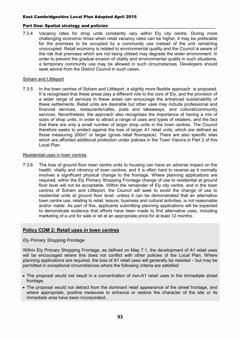
East Cambridgeshire Local Plan Adopted April 2015
Part One: Spatial strategy and policies
93
7.3.4 Vacancy rates for shop units constantly vary within Ely city centre. During more challenging economic times when retail vacancy rates can be higher, it may be preferable for the premises to be occupied by a community use instead of the unit remaining unoccupied. Retail economy is related to environmental quality and the Council is aware of the risk that premises which are not being utilised may degrade the wider environment. In order to prevent the gradual erosion of vitality and environmental quality in such situations, a temporary community use may be allowed in such circumstances. Developers should seek advice from the District Council in such cases.
Soham and Littleport
7.3.5 In the town centres of Soham and Littleport, a slightly more flexible approach is proposed. It is recognised that these areas play a different role to the core of Ely, and the provision of a wider range of services in these areas can encourage the enhanced sustainability of these settlements. Retail units are desirable but other uses may include professional and financial services, restaurants/cafés, pubs and takeaways, and cultural/community services. Nevertheless, the approach also recognises the importance of having a mix of sizes of shop units, in order to attract a range of uses and types of retailers, and the fact that there are only a small number of larger shop units in the town centres. The Council therefore seeks to protect against the loss of larger A1 retail units, which are defined as those measuring 200m2 or larger (gross retail floorspace). There are also specific sites which are afforded additional protection under policies in the Town Visions in Part 2 of this Local Plan.
Residential uses in town centres
7.3.6 The loss of ground floor town centre units to housing can have an adverse impact on the health, vitality and vibrancy of town centres, and it is often hard to reverse as it normally involves a significant physical change to the frontage. Where planning applications are required, within the Ely Primary Shopping Frontage change of use to residential at ground floor level will not be acceptable. Within the remainder of Ely city centre, and in the town centres of Soham and Littleport, the Council will seek to avoid the change of use to residential units at ground floor level, unless it can be demonstrated that an alternative town centre use, relating to retail, leisure, business and cultural activities, is not reasonable and/or viable. As part of this, applicants submitting planning applications will be expected to demonstrate evidence that efforts have been made to find alternative uses, including marketing of a unit for sale or let at an appropriate price for at least 12 months.
Policy COM 2: Retail uses in town centres
Ely Primary Shopping Frontage
Within Ely Primary Shopping Frontage, as defined on Map 7.1, the development of A1 retail uses will be encouraged where this does not conflict with other policies of the Local Plan. Where planning applications are required, the loss of A1 retail uses will generally be resisted – but may be permitted in exceptional circumstances where the following criteria are satisfied:
The proposal would not result in a concentration of non-A1 retail uses in the immediate street frontage.
The proposal would not detract from the dominant retail appearance of the street frontage, and where appropriate, positive measures to enhance or restore the character of the site or its immediate area have been incorporated.
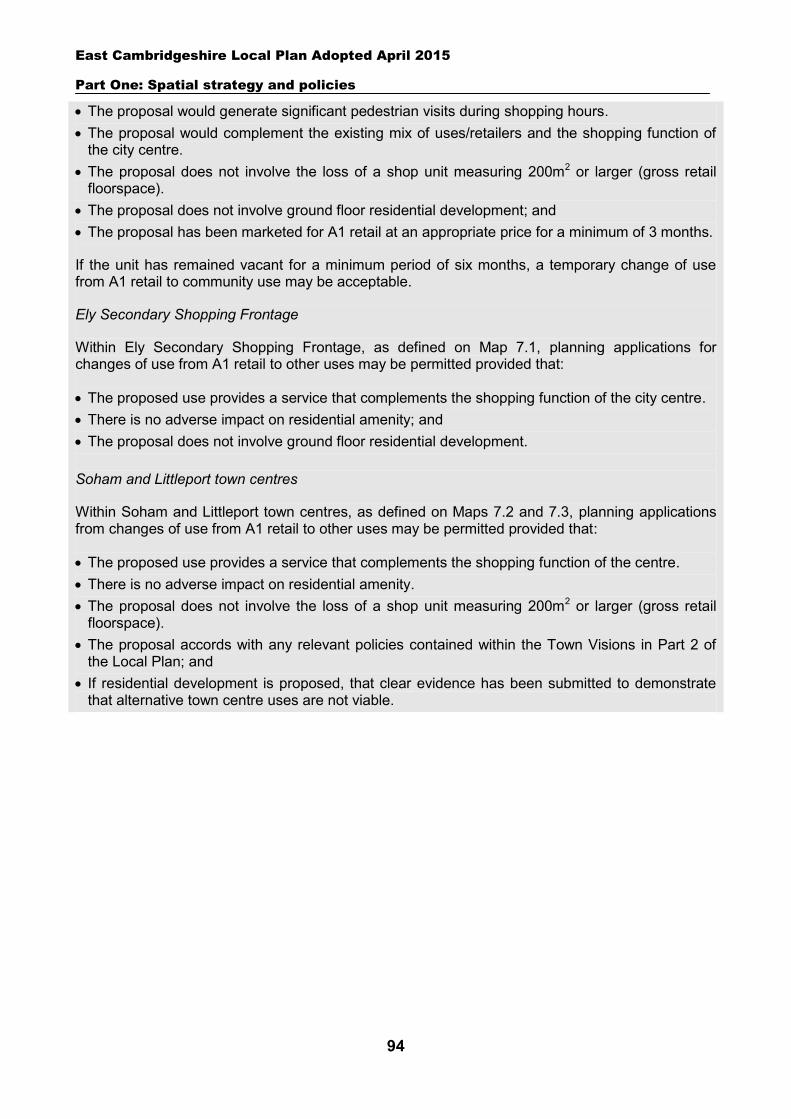
East Cambridgeshire Local Plan Adopted April 2015
Part One: Spatial strategy and policies
94
The proposal would generate significant pedestrian visits during shopping hours. The proposal would complement the existing mix of uses/retailers and the shopping function of
the city centre. The proposal does not involve the loss of a shop unit measuring 200m2 or larger (gross retail
floorspace). The proposal does not involve ground floor residential development; and The proposal has been marketed for A1 retail at an appropriate price for a minimum of 3 months.
If the unit has remained vacant for a minimum period of six months, a temporary change of use from A1 retail to community use may be acceptable.
Ely Secondary Shopping Frontage
Within Ely Secondary Shopping Frontage, as defined on Map 7.1, planning applications for changes of use from A1 retail to other uses may be permitted provided that:
The proposed use provides a service that complements the shopping function of the city centre. There is no adverse impact on residential amenity; and The proposal does not involve ground floor residential development. Soham and Littleport town centres
Within Soham and Littleport town centres, as defined on Maps 7.2 and 7.3, planning applications from changes of use from A1 retail to other uses may be permitted provided that:
The proposed use provides a service that complements the shopping function of the centre. There is no adverse impact on residential amenity. The proposal does not involve the loss of a shop unit measuring 200m2 or larger (gross retail
floorspace). The proposal accords with any relevant policies contained within the Town Visions in Part 2 of
the Local Plan; and If residential development is proposed, that clear evidence has been submitted to demonstrate
that alternative town centre uses are not viable.
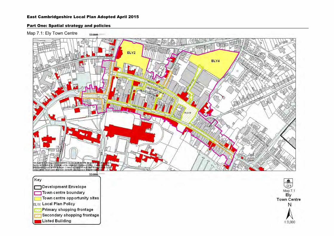
East Cambridgeshire Local Plan Adopted April 2015
Part One: Spatial strategy and policies
95
Map 7.1: Ely Town Centre
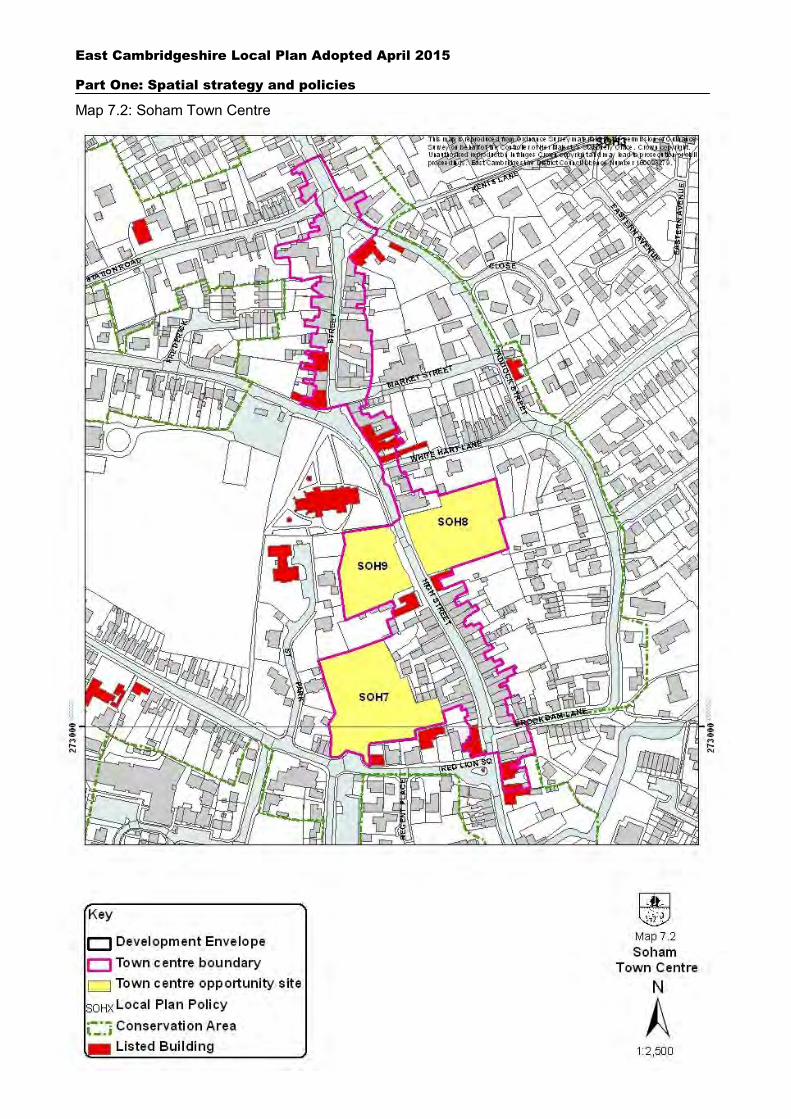
East Cambridgeshire Local Plan Adopted April 2015
Part One: Spatial strategy and policies
96
Map 7.2: Soham Town Centre
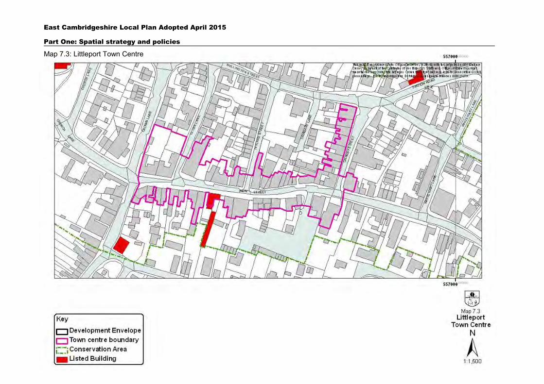
East Cambridgeshire Local Plan Adopted April 2015
Part One: Spatial strategy and policies
97
Map 7.3: Littleport Town Centre
East Cambridgeshire Local Plan Adopted April 2015
Part One: Spatial strategy and policies
98
7.4 Retaining community facilities
7.4.1 The provision of community facilities is vital to maintaining the quality of life in local centres and boosting the social and economic vitality of the community as a whole. Community facilities include local shops, Post Offices, pubs, community meeting places, schools, health care facilities, open spaces, allotments, cultural facilities and sport and recreational facilities. The NPPF sees good community facilities as important, and presses strongly for the retention of existing open space, sports and recreational buildings and land, including playing fields.
7.4.2 Looking at recent trends and the issues facing the economy and the public sector over the Plan period, a concern for the district will be the loss of existing facilities. Although any loss of community facilities is more likely to be an issue in the villages (where there is a limited range of shops and services), the loss of facilities in market towns can also have an adverse effect on the local community, even where the facility is not the last one in the settlement. The impact on people without access to a car and in areas served poorly by public transport can be particularly acute. In support of the strategic policies, the Plan seeks to prevent the loss of services and facilities unless there are exceptional reasons to justify it.
7.4.3 In the case of commercial community facilities such as shops and pubs, permission may be granted for change of use to residential or other non-community use if the applicant can demonstrate the facility is neither viable nor likely to become viable for that use or an alternative community use. Applicants will need to provide evidence that premises have been marketed locally and nationally for 12 months for the current use or an alternative local commercial or community facility, free of ties and restrictive covenants, at a price agreed with the Council following an independent professional valuation - and that there has been no interest in continued use as a community facility. Applicants should also provide evidence that all reasonable efforts have been made to preserve the facility including all diversification options.
7.4.4 In the case of non-commercial community facilities such as community halls, open spaces and healthcare facilities, where market testing may not be applicable, permission involving loss may be granted if the applicant can demonstrate there is no community need for the facility, and that the site is not needed for an alternative community facility. The local community should also be consulted regarding the relative importance of the facility in terms of its social role, and the need for other community facilities. This should take the form of proper documented evidence and should be agreed with the Council prior to the submission of a formal application for alternative development. In the case of open space and recreational facilities (including parks, village greens, other amenity areas, allotments, play areas, playing fields), the Council will also require applicants to demonstrate that the land affected does not make an important contribution to biodiversity, the landscape and visual qualities of the area. Where proposals result in the loss of open space provision, the relevant community and statutory stakeholders (including Sport England) will need to be consulted.
7.4.5 The loss of a community facility (commercial or non-commercial) may also exceptionally be justified where it involves a proposal to make alternative provision to that facility, which is of equal or greater quality, and in an equally or more accessible location to the original. Or alternatively where a different community facility is to be provided which brings demonstrable greater benefits for the local community. However, it should be noted that proposals involving the provision of different community facilities will not be appropriate in
East Cambridgeshire Local Plan Adopted April 2015
Part One: Spatial strategy and policies
99
relation to open space and recreational facilities. As set out in paragraph 74 of the National Planning Policy Framework it is important to retain existing open spaces, sport and recreational facilities for these particular uses.
7.4.6 In all cases, applicants are advised to have regard to the local list of Assets of Community Value, which local authorities are required to maintain under the Localism Act. When listed assets are to be sold or change ownership, community groups have the opportunity to submit a ‘first’ bid for the asset when it comes on the open market.
Policy COM 3: Retaining community facilities
Commercial community facilities
Proposals that would lead to the loss of commercial community facilities (existing sites or sites last used for this purpose) will only be permitted if:
It can be demonstrated that the current use or an alternative community use is not financially viable and that all reasonable efforts have been made to sell or let the property for community purposes at a realistic price for at least twelve months; or
Development would involve the provision of an equivalent or better replacement community facility (either on-site or in an appropriately accessible alternative location); or
Development would involve the the provision of an alternative community facility which brings demonstrable greater benefits to the settlement or neighbourhood - except in the case of open space, sports and recreational facilities which should be retained where possible in accordance with paragraph 74 of the National Planning Policy Framework.
Non-commercial community facilities
Proposals that would lead to the loss of non-commercial community facilities (existing sites or sites last used for this purpose) will only be permitted if:
It can be demonstrated there is a lack of community need for the facility, and that the building or site is not needed for any alternative community use – and in the case of open space, that the site does not make an important contribution in amenity, visual or nature conservation terms; or
Development would involve the provision of an equivalent or better replacement community facility (either on-site or in an appropriately accessible alternative location); or
Development would involve the provision of an alternative community facility which brings demonstrable greater benefits to the settlement or neighbourhood - except in the case of open space, sports and recreational facilities which should be retained where possible in accordance with paragraph 74 of the National Planning Policy Framework.
7.5 New community facilities
7.5.1 Community facilities are essential to the social well-being of communities, and there is likely to be a need for new facilities over the Plan period as the population expands. The Council will support improvements to existing facilities and the development of new ones where there is a local need. Such facilities will be directed towards existing town and village centres, depending on their scale and the area served, and to new residential developments. New facilities in the countryside will require special justification, but may be justified where there is lack of suitable land within a settlement, or where a rural location is required (for example, a Country Park). Such developments should be well related to
East Cambridgeshire Local Plan Adopted April 2015
Part One: Spatial strategy and policies
100
existing settlements in order to minimise impact on the countryside and provide good accessibility for local users (particularly by foot or cycle). Where new buildings are proposed, applicants will be expected to demonstrate that options to re-use existing rural buildings in the area have been explored (in line with Policy EMP 4).
7.5.2 The design of new facilities should have regard to the desirability of having shared usage, and allowing easy future adaptation to alternative community uses. Multi-functional buildings make economic sense, but can also help increase social interaction between different community groups.
7.5.3 New and/or improved community facilities will need to be provided as part of major residential development, and will also be facilitated through developer contributions in connection with other schemes. Policy GROWTH 3 deals with the role of developer contributions in providing and supporting services.
Policy COM 4: New community facilities
Proposals for new or improved community facilities should be located within settlement boundaries wherever possible. In exceptional circumstances facilities may be permitted in the countryside, where there is a lack of suitable and available land within settlements, or where a rural location is required.
Proposals for all new or improved community facilities should:
Be well located and accessible to its catchment population (including by foot and cycle). Not have a significant adverse impact (itself or cumulatively) in terms of the scale or nature of
traffic generated. Not have a significant adverse impact on the character of the locality, or the amenity of nearby
properties. Demonstrate that opportunities to maximise shared use have been explored; and Be designed to facilitate future adaptation for alternative community uses or shared use.
7.6 Strategic green infrastructure
7.6.1 The NPPF requires local planning authorities to plan positively for the creation, protection, enhancement and management of ‘networks of biodiversity and green infrastructure’. Whilst Policies COM 3 and 4 cover more localised types of open space (such as allotments, parks and village greens), this policy focuses on strategic networks and sites of a strategic nature. Such areas offer opportunities for extensive walking, cycling and other forms of recreation, but are also important in terms of their landscape and biodiversity value (including the provision of ecological networks) and in helping to mitigate the effects of climate change. The cross boundary nature of many of these projects means that the District Council will need to work closely with neighbouring authorities to bring forward these schemes.
7.6.2 The Cambridgeshire Green Infrastructure Strategy (2011) provides a valuable framework for considering strategic green infrastructure in East Cambridgeshire. A map showing strategic green infrastructure is included as Appendix 4 in this Local Plan. The Strategy identifies a number of key strategic area projects, including:
East Cambridgeshire Local Plan Adopted April 2015
Part One: Spatial strategy and policies
101
Ely Country Park Ely Ouse corridor Soham Town Commons Littleport Urban Greenway Ouse Washes improvement and habitat creation Wicken Fen Vision Green Fen Way (Fens Adventurers Partnership) Fens Waterways Link Block Fen Nature Reserve
7.6.3 Development proposals which harm these and other strategic sites and networks will be resisted. Permission will only be granted in exceptional circumstances, where it can be demonstrated that the need for and benefits of development outweigh adverse impacts. Development proposals relating to the creation or enhancement of strategic sites/networks will generally be supported, providing they are consistent with the objectives of the Cambridgeshire Green Infrastructure Study, help to achieve Natural Englands Accessible Natural Greenspace Standards (ANGSt)30, and do not have significant adverse impacts in terms of landscape character or traffic generation.
Policy COM 5: Strategic green infrastructure
Proposals which would cause loss of or harm to existing strategic green infrastructure will not be permitted, unless the need for and benefits of the development demonstrably and substantially outweigh any adverse impacts on the green infrastructure.
The Council will support proposals for new and improved strategic green infrastructure where these:
Are consistent with the objectives of the Cambridgeshire Green Infrastructure Strategy (2011). Provide increased public access for quiet recreation and/or increased provision for biodiversity. Do not harm the character and appearance of any existing buildings or the locality. Will have no adverse effects on any existing designated sites of conservation or biological
importance and impacts will be monitored to ensure the effectiveness of alternative provision away from more sensitive sites.
Would not (by itself or cumulatively) have a significant adverse impact in terms of the amount or nature of traffic generated.
Will not detract from residential amenity; and Will aim to achieve Natural Englands Accessible Natural Greenspace Standards (ANGSt)
through improving accessibility, naturalness and connectivity of greenspaces, which are appropriate in scale and location to the needs of the local community.
New development will be expected to contribute towards the establishment, enhancement and on-going management of strategic green infrastructure by contributing to the development of strategic green infrastructure network within the district, in accordance with Policy GROWTH 3.
30 ‘Nature Nearby – Accessible Natural Greenspace Guidance’ Natural England (2010)
East Cambridgeshire Local Plan Adopted April 2015
Part One: Spatial strategy and policies
102
7.7 Telecommunications
7.7.1 Telecommunications is the general term for the transfer of information over varying distances through an array of technologies such as telephone, television, mobile phones and the Internet. High quality communications infrastructure includes the recent advances in broadband and wireless technologies. Broadband networks are being developed with the Coalition Government’s vision for the UK to have the best superfast broadband network in Europe by 2015. The mobile phone industry has also rapidly progressed in recent years, with the use of 3G (3rd Generation) technology. Technology relating to 4G is due to be rolled out across the UK over the next few years.
7.7.2 High quality telecommunications are becoming increasingly important for economic growth, attracting new business and allowing existing businesses to remain competitive. Telecommunications also have social benefits, increasing social inclusion through better access to services that are web-based. Advanced infrastructure such as superfast broadband can also encourage homeworking and reduce car journeys.
7.7.3 The Council supports the expansion and provision of high-speed broadband technology in all parts of the district. ‘Connecting Cambridgeshire’ was launched in 2012 with the aim of providing access to superfast broadband to at least 90% of homes and businesses across Cambridgeshire and Peterborough, and better broadband connections for all other premises, by 2015. To enable this, it will be important for all new residential, employment and commercial developments to be future proofed by providing on-site infrastructure for broadband and other utility needs. This can be facilitated by providing ducting. For further details see Policy ENV 2 on design.
7.7.4 The Council supports the development and provision of telecommunication infrastructures throughout the district. At the same time the Council is keen to minimise any adverse impact on the character of the locality and the environment. Applicants will need to have regard to issues of design and siting, and demonstrate that opportunities to share existing telecom sites or existing buildings have been fully explored. Proposals must comply with the criteria in Policy COM 6 below.
7.7.5 As directed by Government, the planning system is not the place for determining health safeguards. If a proposal regarding a new or existing mast or base station meets ICNIRP (International Commission on Non-Ionizing Radiation Protection) guidelines for public exposure then the planning authority should not need to consider the health aspects or any related concerns.
Policy COM 6: Telecommunications
The Council will permit the development of new telecommunications equipment, provided that:
The applicant has demonstrated that alternatives have been investigated to share existing telecommunication facilities or site equipment on or within existing structures or buildings.
Proposed development will not cause significant or irremediable interference with other electronic equipment, air traffic services or instrumentation operated in the national interest.
Proposals are sited and designed to minimise impact on the character and appearance of the area, using innovative design and/or camouflaging where necessary.
The proposal will not have an unacceptable impact on the appearance of the locality, sites protected for nature conservation or heritage assets.
East Cambridgeshire Local Plan Adopted April 2015
Part One: Spatial strategy and policies
103
If approved, provision is made for the removal of the facilities and reinstatement of the site to its former condition should it cease to be operational; and
The application is accompanied by necessary evidence to support the proposal, including the outcome of consultation with key organisations, and a statement that ICNIRP guidelines on non-ionising radiation protection will be met.
It is important for new development to have ease of access for future installation, maintenance and updating of technology. Conditions will also be applied to permissions requiring the removal of any mast/apparatus and reinstatement of the site to its former condition if the equipment becomes redundant.
7.8 Transport impact
7.8.1 The transport impact of new development is a key planning issue, which needs to be fully assessed in order to ensure that development proposals are safe, well connected and do not damage residential amenity. The NPPF supports the need to avoid adverse impacts through development and to mitigate them where they may occur. However, it requires the response to be proportionate and says that development should be refused on transport grounds only where the residual cumulative impacts are severe.
7.8.2 The planning and design process should ensure access to a site is safe and convenient, and the needs of all users, including pedestrians, cyclists, bus and rail passengers, people with disabilities and occupants of vehicles, are taken into account. This should include provision of routes for walking and cycling in order to encourage sustainable forms of movement as an alternative to the car. Further guidance in terms of travel routes and vehicular access is set out in Policy ENV 2, and in more detail in the Council’s Design Guide Supplementary Planning Document.
7.8.3 The volume and type of traffic generated by a development is a key consideration and the Council needs to ensure that road safety is not jeopardised by allowing proposals that would generate levels of traffic beyond the capacity of the surrounding road network. Traffic generation can also impact on the quality of people’s lives, the character of an area and the environment. Particular attention should be paid to proposals that generate a large net increase in trips, involve heavy lorry movements, or result in high levels of on-street parking nearby. This policy approach should be read in conjunction with Policy COM 8 on parking provision.
7.8.4 Planning applications need to address the transport implications of the proposed development. Many schemes will need to include the submission of a Transport Statement, setting out potential trip levels and any local transport issues. This will depend principally on size and location and will be required for all major applications. Schemes which create significant transport implications will require the submission of a detailed Transport Assessment with the planning application. This should set out in full the impacts and potential mitigation measures, to illustrate how the volume of trips generated will be accommodated and how accessibility to the site by all modes of transport will be achieved. Construction traffic should be considered in the Assessment. Developers should seek advice from the District Council and County Council prior to submission of an application as to whether a Transport Statement or Transport Assessment will be required. Applicants are advised to discuss the content of Transport Assessments with the County Council to ensure that they are agreed to the satisfaction of the Council as Highway Authority.
East Cambridgeshire Local Plan Adopted April 2015
Part One: Spatial strategy and policies
104
7.8.5 Proposals that are likely to have significant transport implications also need to be accompanied by a Travel Plan.31 Applicants should seek advice from the Council prior to submission of an application as to whether a Travel Plan will be required, and if so, to agree its scope.
Policy COM 7: Transport impact
Development should be designed to reduce the need to travel, particularly by car, and should promote sustainable forms of transport appropriate to its particular location. Opportunities should be maximised for increased permeability and connectivity to existing networks.
Development proposals shall:
a. Provide safe and convenient access to the highway network. b. Provide a comprehensive network of routes giving priority for walking and cycling. c. Protect existing rights of way or allow for agreed diversions in exceptional circumstances. d. Consider the travel and transport needs of people with disabilities. e. Accommodate the efficient delivery of goods, supplies and services. f. Be capable of accommodating the level/type of traffic generated without detriment to the local
highway network and the amenity, character or appearance of the locality. g. Be accompanied by a Transport Statement where appropriate; or if the proposals are likely to
result in significant transport implications, be accompanied by a Transport Assessment. The coverage and detail of this should reflect the scale of development and the extent of the transport implications.
h. Be accompanied by a Travel Plan for residential and non-residential developments that are likely to generate significant amounts of traffic; and
i. Within (g) and (h) indicate any steps to mitigate impacts relating to noise, pollution, amenity, health, safety and traffic.
7.9 Parking provision
7.9.1 East Cambridgeshire is a mainly rural area, with limited public transport, and car parking has a role in improving access to local services and facilities. The under-provision of parking on-site in new developments may lead to on-street parking, creating potential problems of highway safety and efficiency as well as unsightly street environments. It is therefore considered that development schemes should generally meet the car and cycle parking standards set out below. However, some flexibility is also required to take account of different circumstances, such as the accessibility of the site or the historic nature of the site or streetscape. In relation to accessibility, applicants proposing lower standards will need to demonstrate the existence of sustainable high quality and frequent public transport services and high quality pedestrian and cycle links. In relation to the historic environment/streetscape, there may be some circumstances where lower levels of parking provision would help to protect/enhance local character. Applicants will be required to submit justification for proposed parking levels as part of the planning application.
31 Travel Plans enable options for sustainable travel and reductions in car use to be explored.
East Cambridgeshire Local Plan Adopted April 2015
Part One: Spatial strategy and policies
105
7.9.2 The Council will encourage business and mixed use development schemes to provide shared car parking facilities as this can help to reduce the overall number of parking spaces required and make better use of land. This may involve visitor parking, shared public car parking spaces, or provision for grouped private car parking within commercial schemes. Where large developments are proposed (residential and non-residential) consideration should be given to the allocation of spaces for car clubs.
7.9.3 Good cycle parking will be required within residential and non-residential development to encourage the use of more sustainable forms of transport. Standards are set out below. These are set as a minimum, as the availability of secure cycle parking is a key factor in determining whether people choose to cycle or not. Cycle parking for employees should, wherever practicable, be covered in a convenient and secure location. Individual secure covered cycle storage should be provided for dwellings.
7.9.4 Consideration also needs to be given to motorcycle, moped and scooter parking. This should be negotiated on a case-by-case basis depending on the results of the Transport Statement and Transport Assessment.
7.9.5 Car parking should be sensitively designed in order to not be obstrusive or damaging to the character of an area. This may involve incorporating landscaping, concealing or breaking up parking areas in order to reduce their impact. Garages should be large enough for comfortable and convenient use by modern cars and bicycles (where storage provision is not provided separately); and car parking areas should be well designed and contribute to an attractive environment. Consideration should be given to providing charging points for electric vehicles in public and private parking areas. Further advice on parking is included in the Council’s Design Guide Supplementary Planning Document.
Policy COM 8: Parking provision
Development proposals should provide adequate levels of car and cycle parking, and make provision for parking broadly in accordance with the Council’s parking standards (including parking for people with impaired mobility).
In appropriate circumstances, parking standards may be relaxed in order to reflect accessibility of by non-car modes, and/or if lower levels of provision would protect or enhance the character of Conservation Areas or other sensitive locations.
Car free development may be considered acceptable where there is clear justification having regard to the location and the current and proposed availability of alternative transport modes.
Where opportunities arise, for example, on large single business use and mixed-use sites, shared use parking and car sharing will be encouraged as part of an agreed Travel Plan to minimise provision where the location and patterns of use allow.
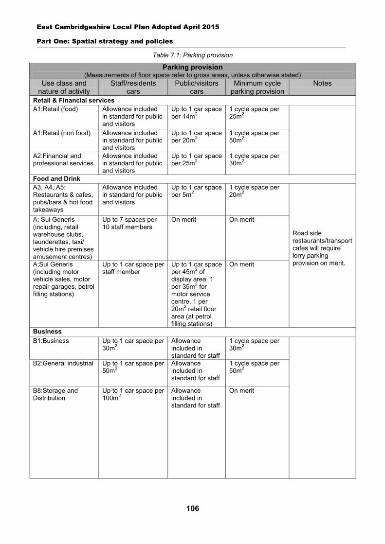
East Cambridgeshire Local Plan Adopted April 2015
Part One: Spatial strategy and policies
106
Table 7.1: Parking provision
Parking provision (Measurements of floor space refer to gross areas, unless otherwise stated)
Use class and nature of activity
Staff/residents cars
Public/visitors cars
Minimum cycle parking provision
Notes
Retail & Financial services A1:Retail (food) Allowance included
in standard for public and visitors
Up to 1 car space per 14m2
1 cycle space per 25m2
A1:Retail (non food)
Allowance included in standard for public and visitors
Up to 1 car space per 20m2
1 cycle space per 50m2
A2:Financial and professional services
Allowance included in standard for public and visitors
Up to 1 car space per 25m2
1 cycle space per 30m2
Food and Drink A3, A4, A5: Restaurants & cafes, pubs/bars & hot food takeaways
Allowance included in standard for public and visitors
Up to 1 car space per 5m2
1 cycle space per 20m2
Road side restaurants/transport cafes will require lorry parking provision on merit.
A: Sui Generis (including, retail warehouse clubs, launderettes, taxi/ vehicle hire premises amusement centres)
Up to 7 spaces per 10 staff members
On merit
On merit
A;Sui Generis (including motor vehicle sales, motor repair garages, petrol filling stations)
Up to 1 car space per staff member
Up to 1 car space per 45m2 of display area, 1 per 35m2 for motor service centre, 1 per 20m2 retail floor area (at petrol filling stations)
On merit
Business B1:Business Up to 1 car space per
30m2 Allowance included in standard for staff
1 cycle space per 30m2
B2:General industrial Up to 1 car space per 50m2
Allowance included in standard for staff
1 cycle space per 50m2
B8:Storage and Distribution
Up to 1 car space per 100m2
Allowance included in standard for staff
On merit
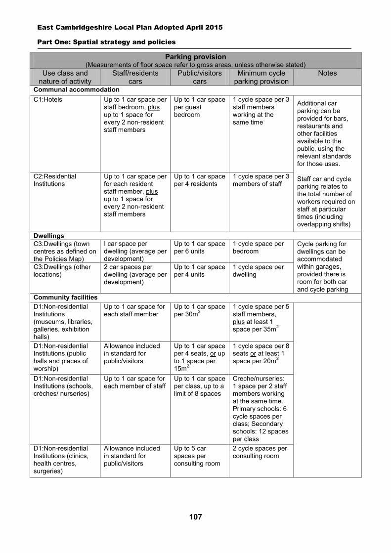
East Cambridgeshire Local Plan Adopted April 2015
Part One: Spatial strategy and policies
107
Parking provision (Measurements of floor space refer to gross areas, unless otherwise stated)
Use class and nature of activity
Staff/residents cars
Public/visitors cars
Minimum cycle parking provision
Notes
Communal accommodation C1:Hotels
Up to 1 car space per staff bedroom, plus up to 1 space for every 2 non-resident staff members
Up to 1 car space per guest bedroom
1 cycle space per 3 staff members working at the same time
Additional car parking can be provided for bars, restaurants and other facilities available to the public, using the relevant standards for those uses. Staff car and cycle parking relates to the total number of workers required on staff at particular times (including overlapping shifts)
C2:Residential Institutions
Up to 1 car space per for each resident staff member, plus up to 1 space for every 2 non-resident staff members
Up to 1 car space per 4 residents
1 cycle space per 3 members of staff
Dwellings C3:Dwellings (town centres as defined on the Policies Map)
I car space per dwelling (average per development)
Up to 1 car space per 6 units
1 cycle space per bedroom
Cycle parking for dwellings can be accommodated within garages, provided there is room for both car and cycle parking
C3:Dwellings (other locations)
2 car spaces per dwelling (average per development)
Up to 1 car space per 4 units
1 cycle space per dwelling
Community facilities D1:Non-residential Institutions (museums, libraries, galleries, exhibition halls)
Up to 1 car space for each staff member
Up to 1 car space per 30m2
1 cycle space per 5 staff members, plus at least 1 space per 35m2
D1:Non-residential Institutions (public halls and places of worship)
Allowance included in standard for public/visitors
Up to 1 car space per 4 seats, or up to 1 space per 15m2
1 cycle space per 8 seats or at least 1 space per 20m2
D1:Non-residential Institutions (schools, crèches/ nurseries)
Up to 1 car space for each member of staff
Up to 1 car space per class, up to a limit of 8 spaces
Creche/nurseries: 1 space per 2 staff members working at the same time. Primary schools: 6 cycle spaces per class; Secondary schools: 12 spaces per class
D1:Non-residential Institutions (clinics, health centres, surgeries)
Allowance included in standard for public/visitors
Up to 5 car spaces per consulting room
2 cycle spaces per consulting room
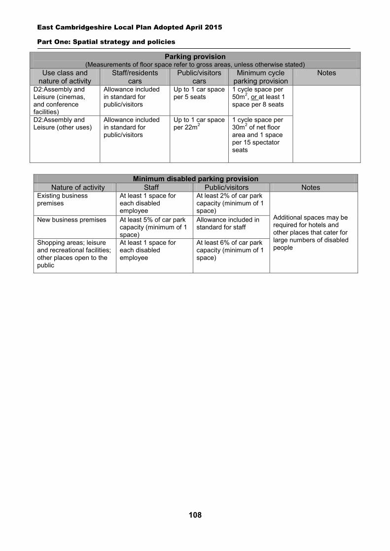
East Cambridgeshire Local Plan Adopted April 2015
Part One: Spatial strategy and policies
108
Parking provision (Measurements of floor space refer to gross areas, unless otherwise stated)
Use class and nature of activity
Staff/residents cars
Public/visitors cars
Minimum cycle parking provision
Notes
D2:Assembly and Leisure (cinemas, and conference facilities)
Allowance included in standard for public/visitors
Up to 1 car space per 5 seats
1 cycle space per 50m2, or at least 1 space per 8 seats
D2:Assembly and Leisure (other uses)
Allowance included in standard for public/visitors
Up to 1 car space per 22m2
1 cycle space per 30m2 of net floor area and 1 space per 15 spectator seats
Minimum disabled parking provision Nature of activity Staff Public/visitors Notes Existing business premises
At least 1 space for each disabled employee
At least 2% of car park capacity (minimum of 1 space)
Additional spaces may be required for hotels and other places that cater for large numbers of disabled people
New business premises
At least 5% of car park capacity (minimum of 1 space)
Allowance included in standard for staff
Shopping areas; leisure and recreational facilities; other places open to the public
At least 1 space for each disabled employee
At least 6% of car park capacity (minimum of 1 space)
East Cambridgeshire Local Plan Adopted April 2015
Part Two: Village/Town Visions
109
PART 2
8 Village and Town Visions
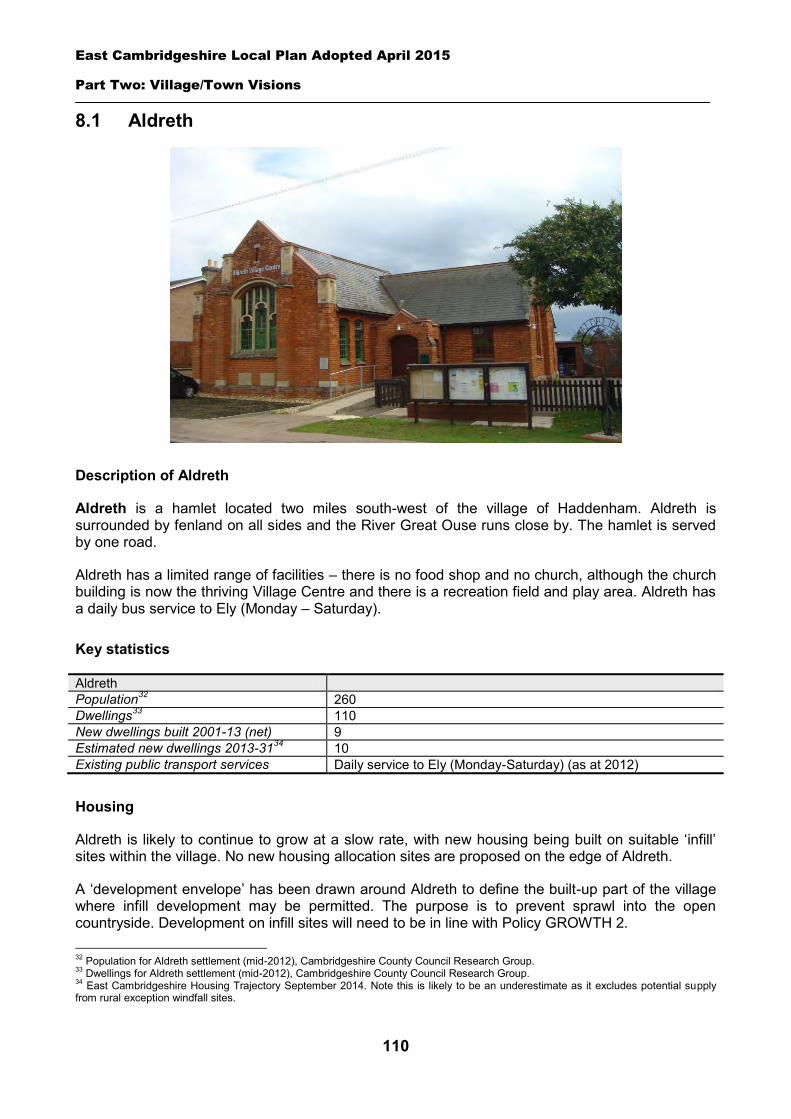
East Cambridgeshire Local Plan Adopted April 2015
Part Two: Village/Town Visions
110
8.1 Aldreth
Description of Aldreth
Aldreth is a hamlet located two miles south-west of the village of Haddenham. Aldreth is surrounded by fenland on all sides and the River Great Ouse runs close by. The hamlet is served by one road.
Aldreth has a limited range of facilities – there is no food shop and no church, although the church building is now the thriving Village Centre and there is a recreation field and play area. Aldreth has a daily bus service to Ely (Monday – Saturday).
Key statistics
Aldreth Population32 260 Dwellings33 110 New dwellings built 2001-13 (net) 9 Estimated new dwellings 2013-3134 10 Existing public transport services Daily service to Ely (Monday-Saturday) (as at 2012)
Housing
Aldreth is likely to continue to grow at a slow rate, with new housing being built on suitable ‘infill’ sites within the village. No new housing allocation sites are proposed on the edge of Aldreth.
A ‘development envelope’ has been drawn around Aldreth to define the built-up part of the village where infill development may be permitted. The purpose is to prevent sprawl into the open countryside. Development on infill sites will need to be in line with Policy GROWTH 2. 32 Population for Aldreth settlement (mid-2012), Cambridgeshire County Council Research Group. 33 Dwellings for Aldreth settlement (mid-2012), Cambridgeshire County Council Research Group. 34 East Cambridgeshire Housing Trajectory September 2014. Note this is likely to be an underestimate as it excludes potential supply from rural exception windfall sites.
East Cambridgeshire Local Plan Adopted April 2015
Part Two: Village/Town Visions
111
Outside the development envelope, housing will not normally be permitted – unless there are exceptional circumstances, such as essential dwellings for rural workers, or affordable housing. Housing schemes outside the development envelope will be assessed against Policy GROWTH 2 and other Local Plan policies as appropriate.
Employment
There are several businesses in Aldreth including Artes Mundi Fair Trade Gifts, Black Pearl book keeping and David Harrison Handling Solutions Ltd. The District Council is keen to retain the stock of business land and premises in order to support local economic growth. Proposals to re-use employment sites for other purposes will only be permitted in certain circumstances (see Policy EMP 1).
No new employment allocation sites are proposed on the edge of Aldreth. However, suitable new employment proposals within or on the edge of the village will be supported in principle, subject to Policies EMP 2, EMP 3 and EMP 4.
Infrastructure and community facilities
Residents in Aldreth have indicated a desire for improvements to infrastructure and facilities in the hamlet. A list of priorities is set out in the table below.
Priority Suggestions 1 Improvements to and upkeep of
Village Centre General maintenance of building.
2 Improvements to Broadband The District Council is working in partnership with the County Council to seek improvements to the Broadband service across the district.
3 Improvements to pedestrian/cycle routes
Improved cycle/footpath between Aldreth & Haddenham.
4 Improved transport links/public transport services
More frequent bus services to Ely and outlying villages.
5 More support for home working and businesses operating from home
Improvements to Broadband/telephony service.
The top priority is for improvements the Village Centre. This will enable local groups to continue to use the facility. The second priority, a better Broadband service, is an issue that the District Council is already working with County Council to address across the district through the Connecting Cambridgeshire project. The third priority is improvements to pedestrian/cycle links. In particular the existing path to Haddenham is in need of resurfacing. The District Council will also work in partnership to try to retain existing public transport levels, and encourage self-sufficient transport services, such as community transport.
The current community facilities in Aldreth (including the Village Centre, recreation field and play area) contribute to the quality of people’s lives. The loss of community facilities will be resisted under Policy COM 3. Proposals for new community development that benefits the village will be supported in principle, subject to Policy COM 4.
Spatial strategy for Aldreth (see Inset Map 8.1)
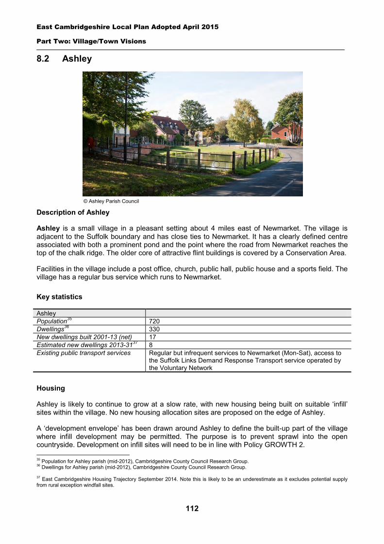
East Cambridgeshire Local Plan Adopted April 2015
Part Two: Village/Town Visions
112
8.2 Ashley
Description of Ashley
Ashley is a small village in a pleasant setting about 4 miles east of Newmarket. The village is adjacent to the Suffolk boundary and has close ties to Newmarket. It has a clearly defined centre associated with both a prominent pond and the point where the road from Newmarket reaches the top of the chalk ridge. The older core of attractive flint buildings is covered by a Conservation Area.
Facilities in the village include a post office, church, public hall, public house and a sports field. The village has a regular bus service which runs to Newmarket.
Key statistics
Ashley Population35 720 Dwellings36 330 New dwellings built 2001-13 (net) 17 Estimated new dwellings 2013-3137 8 Existing public transport services Regular but infrequent services to Newmarket (Mon-Sat), access to
the Suffolk Links Demand Response Transport service operated by the Voluntary Network
Housing
Ashley is likely to continue to grow at a slow rate, with new housing being built on suitable ‘infill’ sites within the village. No new housing allocation sites are proposed on the edge of Ashley.
A ‘development envelope’ has been drawn around Ashley to define the built-up part of the village where infill development may be permitted. The purpose is to prevent sprawl into the open countryside. Development on infill sites will need to be in line with Policy GROWTH 2. 35 Population for Ashley parish (mid-2012), Cambridgeshire County Council Research Group. 36 Dwellings for Ashley parish (mid-2012), Cambridgeshire County Council Research Group. 37 East Cambridgeshire Housing Trajectory September 2014. Note this is likely to be an underestimate as it excludes potential supply from rural exception windfall sites.
© Ashley Parish Council
East Cambridgeshire Local Plan Adopted April 2015
Part Two: Village/Town Visions
113
Outside the development envelope, housing will not normally be permitted – unless there are exceptional circumstances, such as essential dwellings for rural workers, or affordable housing. Housing schemes outside the development envelope will be assessed against Policy GROWTH 2 and other Local Plan policies as appropriate.
Employment
There are a number of current businesses in the village, including the Crown Pub, Plough Restaurant, Ashley Stores and the Hascombe, Darley and Dukes Studs. The District Council is keen to retain the stock of business land and premises in order to support local economic growth. Proposals to re-use employment sites for other purposes will only be permitted in certain circumstances (see Policy EMP 1).
No new employment allocation sites are proposed on the edge of Ashley. However, suitable new employment proposals within or on the edge of the village will be supported in principle, subject to Policies EMP 2, EMP 3 and EMP 4.
Infrastructure and community facilities
Residents in Ashley have indicated a desire for better road/transport infrastructure and improved community facilities in the village. A list of priorities is set out in the table below.
Priority Suggestions 1 A road improvement scheme Possible road safety reviews of bend near village pub and corner at
entrance to High Street. Better street lighting into the village from Gazeley Road.
2 Improvements to pedestrian/cycle routes
More footpaths and cycle routes.
3 Improved transport links/public transport services
An improved bus service to Newmarket and a direct service to Bury St Edmunds.
4 Improvements to the community/village hall
Provision of a larger village hall.
5 Traffic calming/speed reduction Speed bumps at the end of High Street/Newmarket Road.
The top priority is for a road improvement scheme. The second and third priorities are also transport-related, involving improvements to pedestrian/cycle links, and public transport services. The District Council will work with the Parish Council and County Council to explore options and secure funding for road and transport schemes in Ashley. The District Council will also work in partnership to try to retain existing public transport levels, and encourage self-sufficient transport services, such as community transport.
The current community facilities in Ashley (including the shop, pub, restaurant, public hall, church and sports field) contribute to the quality of people’s lives. The District Council will work with the County Council and Parish Council to secure funding, including developer contributions, to improve facilities wherever possible. The loss of community facilities will be resisted under Policy COM 3. Proposals for new community development that benefits the village will be supported in principle, subject to Policy COM 4.
Spatial strategy for Ashley (see Inset Map 8.2)
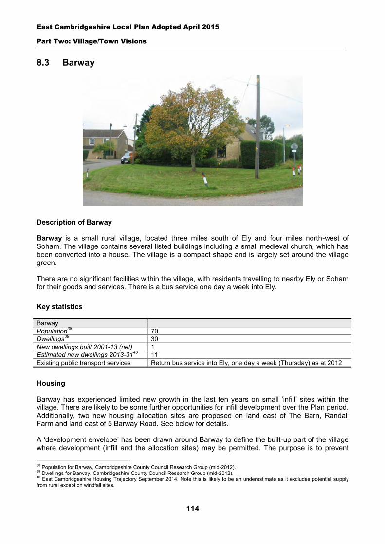
East Cambridgeshire Local Plan Adopted April 2015
Part Two: Village/Town Visions
114
8.3 Barway
Description of Barway
Barway is a small rural village, located three miles south of Ely and four miles north-west of Soham. The village contains several listed buildings including a small medieval church, which has been converted into a house. The village is a compact shape and is largely set around the village green.
There are no significant facilities within the village, with residents travelling to nearby Ely or Soham for their goods and services. There is a bus service one day a week into Ely.
Key statistics
Barway Population38 70 Dwellings39 30 New dwellings built 2001-13 (net) 1 Estimated new dwellings 2013-3140 11 Existing public transport services Return bus service into Ely, one day a week (Thursday) as at 2012
Housing
Barway has experienced limited new growth in the last ten years on small ‘infill’ sites within the village. There are likely to be some further opportunities for infill development over the Plan period. Additionally, two new housing allocation sites are proposed on land east of The Barn, Randall Farm and land east of 5 Barway Road. See below for details.
A ‘development envelope’ has been drawn around Barway to define the built-up part of the village where development (infill and the allocation sites) may be permitted. The purpose is to prevent
38 Population for Barway, Cambridgeshire County Council Research Group (mid-2012). 39 Dwellings for Barway, Cambridgeshire County Council Research Group (mid-2012). 40 East Cambridgeshire Housing Trajectory September 2014. Note this is likely to be an underestimate as it excludes potential supply from rural exception windfall sites.
East Cambridgeshire Local Plan Adopted April 2015
Part Two: Village/Town Visions
115
sprawl into the open countryside. Development on infill sites will need to be in line with Policy GROWTH 2. Development on the allocation sites will need to be in line with Policy BAR 1 and BAR 2.
Outside the development envelope, housing will not normally be permitted – unless there are exceptional circumstances, such as essential dwellings for rural workers, or affordable housing. Housing schemes outside the development envelope will be assessed against Policy GROWTH 2 and other Local Plan policies as appropriate.
Policy BAR 1: Housing allocation, land east of The Barn, Randalls Farm
0.3 hectares of land is allocated for residential development for approximately 5 dwellings.
Development proposals will be expected to:
Provide an element of affordable housing (currently 30%) as required under Policy HOU 3, with priority being given to people in local housing need.
Provide a mix of dwelling types and sizes to reflect housing need within Barway. Have particular regard to the layout and the scale, height, design and massing of buildings, and
landscaping, in order to minimise amenity impact on adjoining properties and to provide an attractive development.
Make provision for the road across the frontage to be widened to 5 metres. Ensure new dwellings are connected to the foul sewerage and drainage network; and Comply with the other policies of the Local Plan.
Policy BAR 2: Housing allocation, land east of 5 Barway Road
0.3 hectares of land is allocated for residential development for approximately 5 dwellings.
Development proposals will be expected to:
Provide an element of affordable housing (currently 30%) as required under Policy HOU 3, with priority being given to people in local housing need.
Provide a mix of dwelling types and sizes to reflect housing need current within Barway. Have particular regard to the layout and the scale, height, design and massing of buildings, and
landscaping, in order to minimise amenity impact on adjoining properties and to provide an attractive development.
The design layout should consider the proximity of the foul pumping station and allow for a distance of 15 metres from the boundary of the curtilage of the dwellings to reduce the risk of nuisance/loss of amenity associated with the operation of the pumping station.
Make provision for the road across the frontage to be widened to 5 metres, and extend the 30 mph speed limit across the frontage.
Provide landscaping along the boundary with the agricultural land to the north and east. Ensure that new dwellings are connected to the foul sewerage and drainage network; and Comply with the other policies of the Local Plan.
East Cambridgeshire Local Plan Adopted April 2015
Part Two: Village/Town Visions
116
Employment
There are several small businesses within the village, including a coach firm and laundry. Additionally there is a large agricultural firm on the edge of the village that employs a high number of people. The District Council is keen to retain the stock of business land and premises in order to support local economic growth. Proposals to re-use employment sites for other purposes will only be permitted in certain circumstances (see Policy EMP 1). Other suitable new employment proposals within, and on the edge of the village, will be supported in principle, subject to Policies EMP 2, EMP 3 and EMP 4.
Infrastructure and community facilities
Residents in Barway have identified a number of infrastructure and community improvements. A list of priorities is set out in the table below:
Priority Suggestions 1 Improvements to
pedestrian/cycle routes Provision of a picnic/rest area for cyclists using the NCN cycle route. District and County Council to ensure access remains possible to existing
Rights of Ways. Work with District and County Council to ensure better maintenance of
footpaths/cyclepaths and improved footpath/cyclepath surfacing. 2 Traffic calming/highway
improvements District and Town Council to work with County Council to explore and seek funding for the following improvements: Widening of road on entrance to the village. Provision of traffic lights and improved signage on the A142 junction. Extension of 30 mph speed limit to Goose Fen Drove turning, before the
first five houses in the village. 3 New play area/
improvements to open space
The former Village Hall site should be redeveloped for community use, to provide community woodlands with play area and seating. Developer contributions could help to realise this objective.
The top priority is for improvements to pedestrian/cycle routes, followed by the provision of traffic calming/highway improvements and the need for a new play area and open space in the village. The District Council will work with the Town Council and County Council to explore options and secure funding for such schemes.
The community’s vision to establish a woodland and play area on the site of the former Village Hall will help to provide a vital new community facility in Barway. The development of new housing in the village should help to provide a source of funding and enable the community to realise its objective. This will be through Community Infrastructure Levy payments.
Spatial strategy for Barway (see Inset Map 8.3)
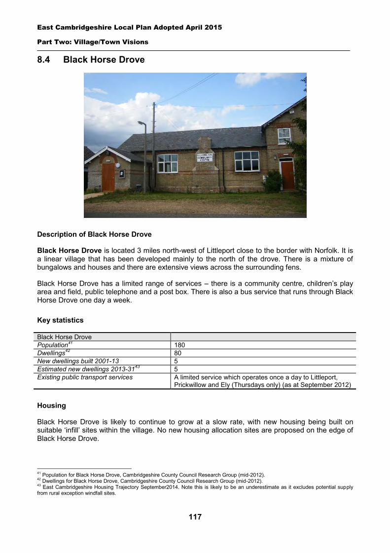
East Cambridgeshire Local Plan Adopted April 2015
Part Two: Village/Town Visions
117
8.4 Black Horse Drove
Description of Black Horse Drove
Black Horse Drove is located 3 miles north-west of Littleport close to the border with Norfolk. It is a linear village that has been developed mainly to the north of the drove. There is a mixture of bungalows and houses and there are extensive views across the surrounding fens.
Black Horse Drove has a limited range of services – there is a community centre, children’s play area and field, public telephone and a post box. There is also a bus service that runs through Black Horse Drove one day a week.
Key statistics
Black Horse Drove Population41 180 Dwellings42 80 New dwellings built 2001-13 5 Estimated new dwellings 2013-3143 5 Existing public transport services A limited service which operates once a day to Littleport,
Prickwillow and Ely (Thursdays only) (as at September 2012)
Housing
Black Horse Drove is likely to continue to grow at a slow rate, with new housing being built on suitable ‘infill’ sites within the village. No new housing allocation sites are proposed on the edge of Black Horse Drove.
41 Population for Black Horse Drove, Cambridgeshire County Council Research Group (mid-2012). 42 Dwellings for Black Horse Drove, Cambridgeshire County Council Research Group (mid-2012). 43 East Cambridgeshire Housing Trajectory September2014. Note this is likely to be an underestimate as it excludes potential supply from rural exception windfall sites.
East Cambridgeshire Local Plan Adopted April 2015
Part Two: Village/Town Visions
118
A ‘development envelope’ has been drawn around Black Horse Drove to define the built-up part of the village where infill development may be permitted. The purpose is to prevent sprawl into the open countryside. Development on infill sites will need to be in line with Policy GROWTH 2.
Outside the development envelope, housing will not normally be permitted – unless there are exceptional circumstances, such as essential dwellings for rural workers, or affordable housing. Housing schemes outside the development envelope will be assessed against Policy GROWTH 2 and other Local Plan policies as appropriate.
Employment
No new employment allocation sites are proposed on the edge of Black Horse Drove. However, suitable new employment proposals within or on the edge of the village will be supported in principle, subject to Policies EMP 2, EMP 3 and EMP 4.
Infrastructure and Community Facilities
Residents in Black Horse Drove have identified a number of infrastructure and community improvements. A list of priorities is set out in the table below:
Priority 1 Improvements to pedestrian/cycle routes 2 Improvements to play area and field
The first priority are improvements to pedestrian/cycle routes with the second being improvements to the play area and field. The District Council will work with the Parish Council and County Council to explore options for funding for such schemes.
The current community facilities in Black Horse Drove (including the Community Centre and children’s play area and field) contribute to the quality of people’s lives. The District Council will work with the County Council and Parish Council to secure funding, including developer contributions, to improve facilities wherever possible. The loss of community facilities will be resisted under Policy COM 3. Proposals for new community development that benefits the village will be supported in principle, subject to Policy COM 4.
Spatial strategy for Black Horse Drove (see Inset Map 8.4)
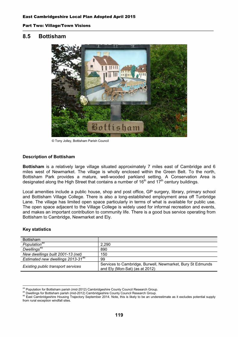
East Cambridgeshire Local Plan Adopted April 2015
Part Two: Village/Town Visions
119
8.5 Bottisham
Description of Bottisham
Bottisham is a relatively large village situated approximately 7 miles east of Cambridge and 6 miles west of Newmarket. The village is wholly enclosed within the Green Belt. To the north, Bottisham Park provides a mature, well-wooded parkland setting. A Conservation Area is designated along the High Street that contains a number of 16th and 17th century buildings.
Local amenities include a public house, shop and post office, GP surgery, library, primary school and Bottisham Village College. There is also a long-established employment area off Tunbridge Lane. The village has limited open space particularly in terms of what is available for public use. The open space adjacent to the Village College is widely used for informal recreation and events, and makes an important contribution to community life. There is a good bus service operating from Bottisham to Cambridge, Newmarket and Ely.
Key statistics
Bottisham Population44 2,290 Dwellings45 890 New dwellings built 2001-13 (net) 150 Estimated new dwellings 2013-3146 99
Existing public transport services Services to Cambridge, Burwell, Newmarket, Bury St Edmunds and Ely (Mon-Sat) (as at 2012)
44 Population for Bottisham parish (mid-2012) Cambridgeshire County Council Research Group. 45 Dwellings for Bottisham parish (mid-2012) Cambridgeshire County Council Research Group. 46 East Cambridgeshire Housing Trajectory September 2014. Note, this is likely to be an underestimate as it excludes potential supply from rural exception windfall sites.
© Tony Jolley, Bottisham Parish Council
East Cambridgeshire Local Plan Adopted April 2015
Part Two: Village/Town Visions
120
Housing
Bottisham has faced pressure for growth due to its close proximity to Cambridge, and is likely to continue to grow over the next 20 years. This will include new housing development on ‘infill’ sites within the village. In addition, a new housing allocation is proposed on the edge of Bottisham, off Bell Road (see details below).
A development envelope has been drawn around Bottisham to define the built-up part of the village where housing development may be permitted. The purpose is to prevent sprawl into the open countryside. Development on infill sites will need to be in line with Policy GROWTH 2. Development on the allocation site will need to be in line with Policy BOT 1.
Outside the development envelope, housing will not normally be permitted – unless there are exceptional circumstances, such as essential dwellings for rural workers, or affordable housing. Housing schemes outside the development envelope will be assessed against Policy GROWTH 2 and other Local Plan policies as appropriate.
Housing allocation – land east of Bell Road
The site is located to the south of Bottisham, wholly within the Cambridge Green Belt which surrounds the village. The area is bounded by the Hastoe housing development to the west, St Peter’s Field housing development to the north and a former medieval moated site and fishponds to the east which is designated as a Scheduled Ancient Monument (SAM). The allocation site is considered to be the most sustainable location for the expansion of Bottisham and was identified as a preferred broad area for growth in the Core Strategy (2009).
Land is released from the Cambridge Green Belt for the development of the site. Proposals will need to include measures to reinforce the Green Belt boundary for the village to protect the openness and rural character of the surrounding countryside from encroachment. Prominent physical features suitable for creating strong boundaries include roads, railways, watercourses, ridgelines, protected woodlands or hedges. In selecting the most appropriate type of boundary treatment, developers are encouraged to consider the level of noise protection/reduction it could provide from the A14.
The site’s sensitive location, adjacent to a Scheduled Ancient Monument (SAM) needs to be fully addressed. The monument is of national importance and its significance and value to the village have been enhanced by research undertaken as part of the St Peter’s Field housing development.
It will be important for any development to address the issues of setting and impact on the significance of the heritage asset to the satisfaction of English Heritage, Cambridgeshire County Council Archaeology and the District Council’s Conservation Officer. Key requirements include:
Allowing no development to the south of the moat as this would result in adverse impact upon the rural context and the position of the moat on the southern boundary of the historic core of Bottisham.
A buffer area to the west of the monument as indicated on Map 8.5 in order to protect its setting. The use of the buffer area should be restricted to activities that would not have an adverse impact on the SAM, e.g. public open space.
Careful consideration of the nature of the boundary treatment with the adjacent development; development should face the monument and create a soft edge.
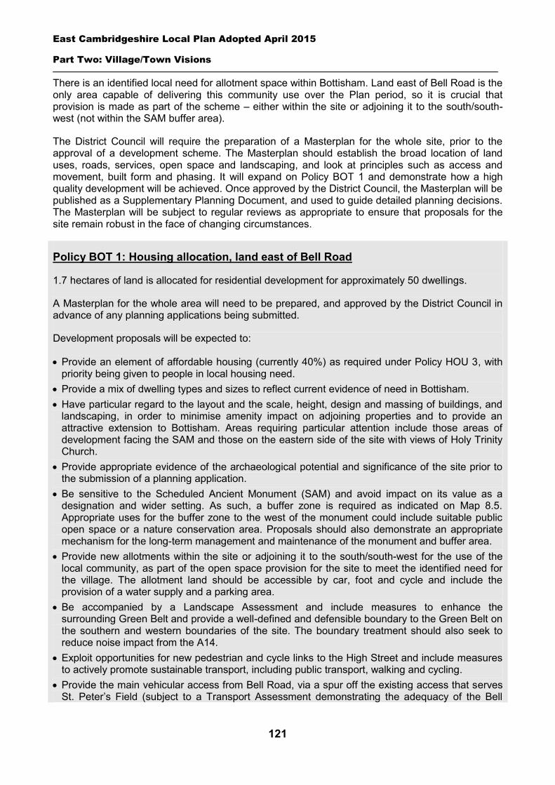
East Cambridgeshire Local Plan Adopted April 2015
Part Two: Village/Town Visions
121
There is an identified local need for allotment space within Bottisham. Land east of Bell Road is the only area capable of delivering this community use over the Plan period, so it is crucial that provision is made as part of the scheme – either within the site or adjoining it to the south/south-west (not within the SAM buffer area).
The District Council will require the preparation of a Masterplan for the whole site, prior to the approval of a development scheme. The Masterplan should establish the broad location of land uses, roads, services, open space and landscaping, and look at principles such as access and movement, built form and phasing. It will expand on Policy BOT 1 and demonstrate how a high quality development will be achieved. Once approved by the District Council, the Masterplan will be published as a Supplementary Planning Document, and used to guide detailed planning decisions. The Masterplan will be subject to regular reviews as appropriate to ensure that proposals for the site remain robust in the face of changing circumstances.
Policy BOT 1: Housing allocation, land east of Bell Road
1.7 hectares of land is allocated for residential development for approximately 50 dwellings.
A Masterplan for the whole area will need to be prepared, and approved by the District Council in advance of any planning applications being submitted.
Development proposals will be expected to:
Provide an element of affordable housing (currently 40%) as required under Policy HOU 3, with priority being given to people in local housing need.
Provide a mix of dwelling types and sizes to reflect current evidence of need in Bottisham. Have particular regard to the layout and the scale, height, design and massing of buildings, and
landscaping, in order to minimise amenity impact on adjoining properties and to provide an attractive extension to Bottisham. Areas requiring particular attention include those areas of development facing the SAM and those on the eastern side of the site with views of Holy Trinity Church.
Provide appropriate evidence of the archaeological potential and significance of the site prior to the submission of a planning application.
Be sensitive to the Scheduled Ancient Monument (SAM) and avoid impact on its value as a designation and wider setting. As such, a buffer zone is required as indicated on Map 8.5. Appropriate uses for the buffer zone to the west of the monument could include suitable public open space or a nature conservation area. Proposals should also demonstrate an appropriate mechanism for the long-term management and maintenance of the monument and buffer area.
Provide new allotments within the site or adjoining it to the south/south-west for the use of the local community, as part of the open space provision for the site to meet the identified need for the village. The allotment land should be accessible by car, foot and cycle and include the provision of a water supply and a parking area.
Be accompanied by a Landscape Assessment and include measures to enhance the surrounding Green Belt and provide a well-defined and defensible boundary to the Green Belt on the southern and western boundaries of the site. The boundary treatment should also seek to reduce noise impact from the A14.
Exploit opportunities for new pedestrian and cycle links to the High Street and include measures to actively promote sustainable transport, including public transport, walking and cycling.
Provide the main vehicular access from Bell Road, via a spur off the existing access that serves St. Peter’s Field (subject to a Transport Assessment demonstrating the adequacy of the Bell
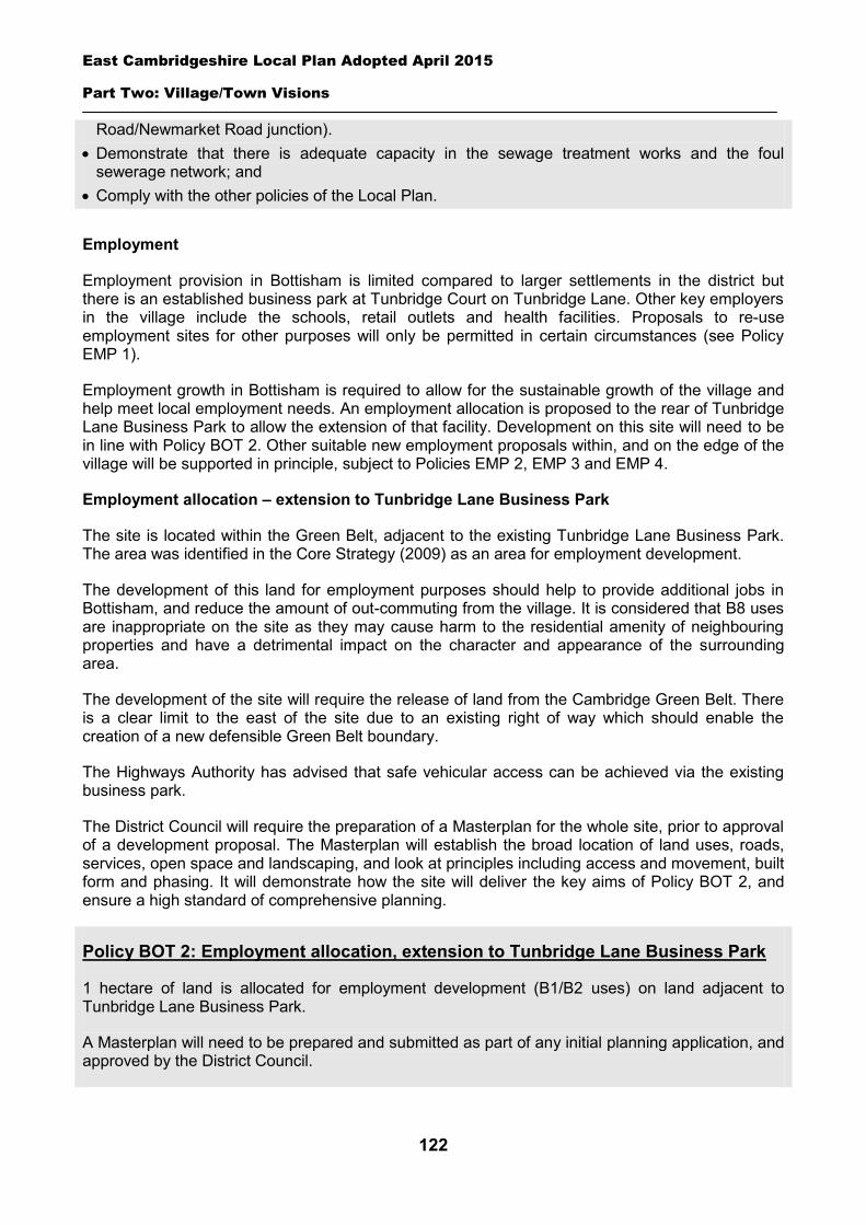
East Cambridgeshire Local Plan Adopted April 2015
Part Two: Village/Town Visions
122
Road/Newmarket Road junction). Demonstrate that there is adequate capacity in the sewage treatment works and the foul
sewerage network; and Comply with the other policies of the Local Plan.
Employment
Employment provision in Bottisham is limited compared to larger settlements in the district but there is an established business park at Tunbridge Court on Tunbridge Lane. Other key employers in the village include the schools, retail outlets and health facilities. Proposals to re-use employment sites for other purposes will only be permitted in certain circumstances (see Policy EMP 1).
Employment growth in Bottisham is required to allow for the sustainable growth of the village and help meet local employment needs. An employment allocation is proposed to the rear of Tunbridge Lane Business Park to allow the extension of that facility. Development on this site will need to be in line with Policy BOT 2. Other suitable new employment proposals within, and on the edge of the village will be supported in principle, subject to Policies EMP 2, EMP 3 and EMP 4.
Employment allocation – extension to Tunbridge Lane Business Park
The site is located within the Green Belt, adjacent to the existing Tunbridge Lane Business Park. The area was identified in the Core Strategy (2009) as an area for employment development.
The development of this land for employment purposes should help to provide additional jobs in Bottisham, and reduce the amount of out-commuting from the village. It is considered that B8 uses are inappropriate on the site as they may cause harm to the residential amenity of neighbouring properties and have a detrimental impact on the character and appearance of the surrounding area.
The development of the site will require the release of land from the Cambridge Green Belt. There is a clear limit to the east of the site due to an existing right of way which should enable the creation of a new defensible Green Belt boundary.
The Highways Authority has advised that safe vehicular access can be achieved via the existing business park.
The District Council will require the preparation of a Masterplan for the whole site, prior to approval of a development proposal. The Masterplan will establish the broad location of land uses, roads, services, open space and landscaping, and look at principles including access and movement, built form and phasing. It will demonstrate how the site will deliver the key aims of Policy BOT 2, and ensure a high standard of comprehensive planning.
Policy BOT 2: Employment allocation, extension to Tunbridge Lane Business Park
1 hectare of land is allocated for employment development (B1/B2 uses) on land adjacent to Tunbridge Lane Business Park.
A Masterplan will need to be prepared and submitted as part of any initial planning application, and approved by the District Council.
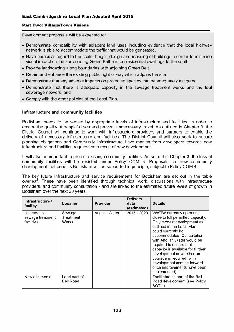
East Cambridgeshire Local Plan Adopted April 2015
Part Two: Village/Town Visions
123
Development proposals will be expected to:
Demonstrate compatibility with adjacent land uses including evidence that the local highway network is able to accommodate the traffic that would be generated.
Have particular regard to the scale, height, design and massing of buildings, in order to minimise visual impact on the surrounding Green Belt and on residential dwellings to the south.
Provide landscaping along boundaries with adjoining Green Belt. Retain and enhance the existing public right of way which adjoins the site. Demonstrate that any adverse impacts on protected species can be adequately mitigated. Demonstrate that there is adequate capacity in the sewage treatment works and the foul
sewerage network; and Comply with the other policies of the Local Plan.
Infrastructure and community facilities
Bottisham needs to be served by appropriate levels of infrastructure and facilities, in order to ensure the quality of people’s lives and prevent unnecessary travel. As outlined in Chapter 3, the District Council will continue to work with infrastructure providers and partners to enable the delivery of necessary infrastructure and facilities. The District Council will also seek to secure planning obligations and Community Infrastructure Levy monies from developers towards new infrastructure and facilities required as a result of new development.
It will also be important to protect existing community facilities. As set out in Chapter 3, the loss of community facilities will be resisted under Policy COM 3. Proposals for new community development that benefits Bottisham will be supported in principle, subject to Policy COM 4.
The key future infrastructure and service requirements for Bottisham are set out in the table overleaf. These have been identified through technical work, discussions with infrastructure providers, and community consultation - and are linked to the estimated future levels of growth in Bottisham over the next 20 years.
Infrastructure / facility Location Provider
Delivery date (estimated)
Details
Upgrade to sewage treatment facilities
Sewage Treatment Works
Anglian Water 2015 - 2020 WWTW currently operating close to full permitted capacity. Only modest development as outlined in the Local Plan could currently be accommodated. Consultation with Anglian Water would be required to ensure that capacity is available for further development or whether an upgrade is required (with development coming forward once improvements have been implemented).
New allotments Land east of Bell Road
Facilitated as part of the Bell Road development (see Policy BOT 1).
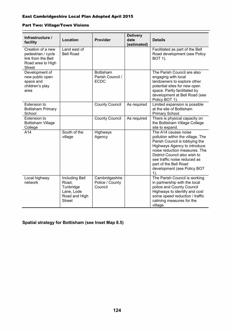
East Cambridgeshire Local Plan Adopted April 2015
Part Two: Village/Town Visions
124
Infrastructure / facility Location Provider
Delivery date (estimated)
Details
Creation of a new pedestrian / cycle link from the Bell Road area to High Street
Land east of Bell Road
Facilitated as part of the Bell Road development (see Policy BOT 1).
Development of new public open space and children’s play area
Bottisham Parish Council / ECDC
The Parish Council are also engaging with local landowners to explore other potential sites for new open space. Partly facilitated by development at Bell Road (see Policy BOT 1).
Extension to Bottisham Primary School
County Council As required Limited expansion is possible at the site of Bottisham Primary School.
Extension to Bottisham Village College
County Council As required There is physical capacity on the Bottisham Village College site to expand.
A14 South of the village
Highways Agency
The A14 causes noise pollution within the village. The Parish Council is lobbying the Highways Agency to introduce noise reduction measures. The District Council also wish to see traffic noise reduced as part of the Bell Road development (see Policy BOT 1).
Local highway network
Including Bell Road, Tunbridge Lane, Lode Road and High Street
Cambridgeshire Police / County Council
The Parish Council is working in partnership with the local police and County Council Highways to identify and cost some speed reduction / traffic calming measures for the village.
Spatial strategy for Bottisham (see Inset Map 8.5)
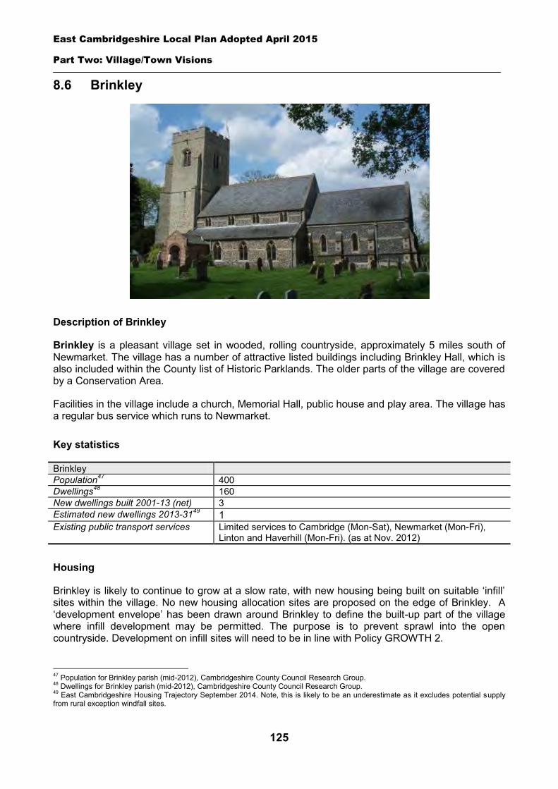
East Cambridgeshire Local Plan Adopted April 2015
Part Two: Village/Town Visions
125
8.6 Brinkley
Description of Brinkley
Brinkley is a pleasant village set in wooded, rolling countryside, approximately 5 miles south of Newmarket. The village has a number of attractive listed buildings including Brinkley Hall, which is also included within the County list of Historic Parklands. The older parts of the village are covered by a Conservation Area.
Facilities in the village include a church, Memorial Hall, public house and play area. The village has a regular bus service which runs to Newmarket.
Key statistics
Brinkley Population47 400 Dwellings48 160 New dwellings built 2001-13 (net) 3 Estimated new dwellings 2013-3149 1 Existing public transport services Limited services to Cambridge (Mon-Sat), Newmarket (Mon-Fri),
Linton and Haverhill (Mon-Fri). (as at Nov. 2012)
Housing
Brinkley is likely to continue to grow at a slow rate, with new housing being built on suitable ‘infill’ sites within the village. No new housing allocation sites are proposed on the edge of Brinkley. A ‘development envelope’ has been drawn around Brinkley to define the built-up part of the village where infill development may be permitted. The purpose is to prevent sprawl into the open countryside. Development on infill sites will need to be in line with Policy GROWTH 2.
47 Population for Brinkley parish (mid-2012), Cambridgeshire County Council Research Group. 48 Dwellings for Brinkley parish (mid-2012), Cambridgeshire County Council Research Group. 49 East Cambridgeshire Housing Trajectory September 2014. Note, this is likely to be an underestimate as it excludes potential supply from rural exception windfall sites.
East Cambridgeshire Local Plan Adopted April 2015
Part Two: Village/Town Visions
126
Outside the development envelope, housing will not normally be permitted – unless there are exceptional circumstances, such as essential dwellings for rural workers, or affordable housing. Housing schemes outside the development envelope will be assessed against Policy GROWTH 2 and other Local Plan policies as appropriate.
Employment
There are few businesses in the village. The District Council is keen to retain the stock of business land and premises in order to support local economic growth. Proposals to re-use employment sites for other purposes will only be permitted in certain circumstances (see Policy EMP 1).
No new employment allocation sites are proposed on the edge of Brinkley. However, suitable new employment proposals within or on the edge of the village will be supported in principle, subject to Policies EMP 2, EMP 3 and EMP 4.
Infrastructure and community facilities
Residents in Brinkley have indicated a desire for improvements to infrastructure and facilities in the village. A list of priorities is set out in the table below:
Priority Suggestions 1 Reduce speeding
through the village Parish Council to work with District and County Council and Cambridgeshire Police in exploring options to address speeding issues.
2 Improvements to the speed of local broadband service
Options for the provision of access to either superfast or basic broadband will be considered by the Connecting Cambridgeshire project. http://www.connectingcambridgeshire.co.uk/
3 Improvements to pedestrian/cycle routes
Cycle route to Burrough Green (along the road, not across country).
4 Improvements to the community/village hall
Identify specific improvements to be considered for future funding sources e.g. New flooring Landscaping Repaint the exterior
5 Community shop Explore options for the provision of a community shop. 6 More school places Work with County Council to ensure that any shortage of spaces is fully
considered and addressed within the next capital expenditure programme. The top priority is to address speeding issues through the village. Other priorities include more school places at Burrough Green School and improvements to the Memorial Hall. The District Council will work with the Parish Council and County Council to explore options and secure funding for the above improvements in Brinkley and will also liaise with the County Council to explore issue of extra school places.
The current community facilities in Brinkley (including the church, Memorial Hall, public house and play area) contribute to the quality of people’s lives. The loss of community facilities will be resisted under Policy COM 3. Proposals for new community development that benefits the village will be supported in principle, subject to Policy COM 4.
Spatial strategy for Brinkley (see Inset Map 8.6)
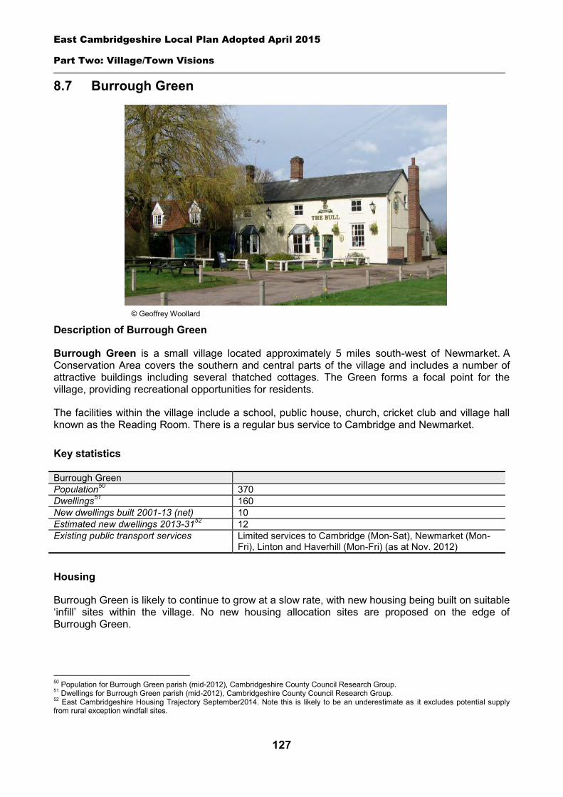
East Cambridgeshire Local Plan Adopted April 2015
Part Two: Village/Town Visions
127
8.7 Burrough Green
Description of Burrough Green
Burrough Green is a small village located approximately 5 miles south-west of Newmarket. A Conservation Area covers the southern and central parts of the village and includes a number of attractive buildings including several thatched cottages. The Green forms a focal point for the village, providing recreational opportunities for residents.
The facilities within the village include a school, public house, church, cricket club and village hall known as the Reading Room. There is a regular bus service to Cambridge and Newmarket.
Key statistics
Burrough Green Population50 370 Dwellings51 160 New dwellings built 2001-13 (net) 10 Estimated new dwellings 2013-3152 12 Existing public transport services Limited services to Cambridge (Mon-Sat), Newmarket (Mon-
Fri), Linton and Haverhill (Mon-Fri) (as at Nov. 2012)
Housing
Burrough Green is likely to continue to grow at a slow rate, with new housing being built on suitable ‘infill’ sites within the village. No new housing allocation sites are proposed on the edge of Burrough Green.
50 Population for Burrough Green parish (mid-2012), Cambridgeshire County Council Research Group. 51 Dwellings for Burrough Green parish (mid-2012), Cambridgeshire County Council Research Group. 52 East Cambridgeshire Housing Trajectory September2014. Note this is likely to be an underestimate as it excludes potential supply from rural exception windfall sites.
© Geoffrey Woollard
East Cambridgeshire Local Plan Adopted April 2015
Part Two: Village/Town Visions
128
A ‘development envelope’ has been drawn around Burrough Green to define the built-up part of the village where infill development may be permitted. The purpose is to prevent sprawl into the open countryside. Development on infill sites will need to be in line with Policy GROWTH 2.
Outside the development envelope, housing will not normally be permitted – unless there are exceptional circumstances, such as essential dwellings for rural workers, or affordable housing. Housing schemes outside the development envelope will be assessed against Policy GROWTH 2 and other Local Plan policies as appropriate.
Employment
Current businesses in the village include RE and GB Way antiquarian booksellers, R Jaggard & Sons coal merchants, and several units on the Running Horse business park. The District Council is keen to retain the stock of business land and premises in order to support local economic growth. Proposals to reuse employment sites for other purposes will only be permitted in certain circumstances (see Policy EMP 1).
No new employment allocation sites are proposed on the edge of Burrough Green. However, suitable new employment proposals within or on the edge of the village will be supported in principle, subject to policies EMP 2, EMP 3 and EMP 4.
Infrastructure and community facilities
Residents in Burrough Green have identified a number of infrastructure and community improvements. A list of priorities is set out in the table below:
Priority Suggestions
=1 New play areas Potential locations include the village green, near the school or near the pub
=1 Improvements to pedestrian/cycle routes
Parish Council to work with County Council to seek improvements, e.g. new link to Green Lane byway
=1 Improvements to the community / Village Hall
Identify specific improvements to be considered for future funding sources e.g. new windows
Three priorities were identified as equally important for the parish. The District Council will work with the County Council and Parish Council to explore options and secure funding for improvements to community facilities and transport infrastructure within Burrough Green.
The current community facilities within Burrough Green are good (including the school, pub, church and village hall) and contribute to the quality of people’s lives. The loss of existing community facilities will be resisted under Policy COM 3. Proposals for new community development that benefits the village will be supported in principle, subject to Policy COM 4.
Spatial strategy for Burrough Green (see Inset Map 8.7)
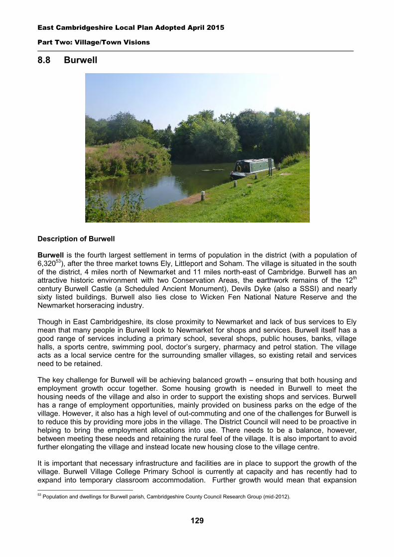
East Cambridgeshire Local Plan Adopted April 2015
Part Two: Village/Town Visions
129
8.8 Burwell
Description of Burwell
Burwell is the fourth largest settlement in terms of population in the district (with a population of 6,32053), after the three market towns Ely, Littleport and Soham. The village is situated in the south of the district, 4 miles north of Newmarket and 11 miles north-east of Cambridge. Burwell has an attractive historic environment with two Conservation Areas, the earthwork remains of the 12th century Burwell Castle (a Scheduled Ancient Monument), Devils Dyke (also a SSSI) and nearly sixty listed buildings. Burwell also lies close to Wicken Fen National Nature Reserve and the Newmarket horseracing industry.
Though in East Cambridgeshire, its close proximity to Newmarket and lack of bus services to Ely mean that many people in Burwell look to Newmarket for shops and services. Burwell itself has a good range of services including a primary school, several shops, public houses, banks, village halls, a sports centre, swimming pool, doctor’s surgery, pharmacy and petrol station. The village acts as a local service centre for the surrounding smaller villages, so existing retail and services need to be retained.
The key challenge for Burwell will be achieving balanced growth – ensuring that both housing and employment growth occur together. Some housing growth is needed in Burwell to meet the housing needs of the village and also in order to support the existing shops and services. Burwell has a range of employment opportunities, mainly provided on business parks on the edge of the village. However, it also has a high level of out-commuting and one of the challenges for Burwell is to reduce this by providing more jobs in the village. The District Council will need to be proactive in helping to bring the employment allocations into use. There needs to be a balance, however, between meeting these needs and retaining the rural feel of the village. It is also important to avoid further elongating the village and instead locate new housing close to the village centre.
It is important that necessary infrastructure and facilities are in place to support the growth of the village. Burwell Village College Primary School is currently at capacity and has recently had to expand into temporary classroom accommodation. Further growth would mean that expansion 53 Population and dwellings for Burwell parish, Cambridgeshire County Council Research Group (mid-2012).
East Cambridgeshire Local Plan Adopted April 2015
Part Two: Village/Town Visions
130
would need to be made permanent. The doctor’s surgery may also need to expand to meet the needs of the increased population. Concerns have been raised about the quality of outdoor sports facilities in the village and there is a desire within the community to consolidate the outdoor pitches on a single site, alongside team changing and parking facilities. Raising the quality of the riverside area is another priority for the village.
The village has good road access to the A11 and A14. It has a regular bus service to Newmarket and Cambridge, but no bus service to Ely. One key infrastructure requirement is provision of a foot/cycle path around the bridge on Exning Road, to enable safe access to Exning and Newmarket for pedestrians and cyclists.
A Vision for Burwell
A vision for Burwell in the year 2031 is set out below – followed by a set of strategic objectives to deliver and facilitate the vision. The vision provides clear direction for development in Burwell up to 2031. It has been developed from the key characteristics and issues described above, and through consultation on the Local Plan. It has also been informed by the ‘Burwell Masterplan’ document which looks at the long-term growth of Burwell over the next 20 years. Its purpose is to inform debate on the future capacity of Burwell to grow, and feed into development of the Local Plan. The Masterplan was adopted by the Council in 2013, and can be viewed on the Council’s website at www.eastcambs.gov.uk.
Burwell vision statement
In 2031 Burwell will be a thriving rural community with a variety of local shops, services and employment that has retained its local village character and community support networks.
Burwell strategic objectives
1. Ensure all new development is in keeping with the rural character of the village, reflecting its distinctive design characteristics and with densities that respect the rural tradition of the village.
2. Avoid further elongation of the village, and focus housing growth close to the centre part of Burwell where easy access can be provided via foot or cycle to key services and facilities.
3. Address the traffic volume and speeding issues as new development takes place, seeking to promote walking, cycling and public transport wherever possible.
4. Support job retention and creation by retaining existing employment sites and facilitating new developments in the village.
5. Protect and enhance the village centre, by retaining existing shops and facilities, and supporting proposals for expansion.
6. Provide enhanced infrastructure and facilities to support growth, including the consolidation of outdoor sports facilities on a single site off Newmarket Road.
7. Raise the quality of the riverside area of Burwell by exploring options to increase access and recreation facilities and ensuring that new development reflects and enhances the character of its riverside setting.
Housing
Burwell is one of the largest villages in the district, and is likely to continue to grow over the next 20 years.
East Cambridgeshire Local Plan Adopted April 2015
Part Two: Village/Town Visions
131
A ‘development envelope’ has been drawn around Burwell to define the built-up part of the village where housing development may be permitted. The purpose is to prevent sprawl into the open countryside. Outside the development envelope, housing will not normally be permitted – unless there are exceptional circumstances, such as essential dwellings for rural workers, or affordable housing. Housing schemes outside the development envelope will be assessed against Policy GROWTH 2 and other Local Plan policies as appropriate.
There are some opportunities for development on land within the built part of Burwell, on ‘infill’ sites. It is estimated that there could be capacity for perhaps 182 dwellings between 2013 and 2031, from outstanding planning permissions (yet to be completed), large potential sites within the village boundary, and potential small ‘windfall sites’ that may come forward within the village. Details of the estimated supply from these sources is set out in the table below (source: AMR March 2014).
However, the supply of potential sites within Burwell is limited, and a new housing allocation site is therefore proposed on the edge of Burwell off Newmarket Road. Development on this allocation site will need to be in line with Policy BUR 1 – see details below. The new housing site is located in the central belt of Burwell and should provide good access to shops and services in the core of the village and will avoid elongating the settlement. The site is allocated for approximately 350 dwellings.
Estimated housing supply in Burwell 2011-31 Housing sources Number of dwellings Completions 2011-13 13 Outstanding planning permissions54 127 Potential large future sites 24 Estimated windfall on small sites 31 Housing allocation 350 ESTIMATED SUPPLY 545
Housing allocation – land off Newmarket Road
The site is located to the east of the village, and is currently open farmland. The area is bounded by residential development to the west, Newmarket Road to the south, and farmland to the north and east. The area was allocated for housing in the East Cambridgeshire Core Strategy (2009) and identified as the preferred location for housing development in the Burwell Masterplan (2013). The site is in single ownership (Cambridgeshire County Council).
The allocation is for 350 dwellings, plus land for open space, and new outdoor sports provision (including sports pitches). It is estimated that approximately 20 hectares of land will be required to facilitate this scale of development.
The 20 hectare allocation will take up only a proportion of a large open field and landholding, and it is possible that at some unknown date in the future, there could be a proposal for further development on the site as part of a future Local Plan review. The design of any scheme will therefore have to have regard to this in relation to layout, design and access. This should take the form of an Indicative Development Framework or broad concept plan, which will need to be submitted alongside the planning application for the first phase of the development.
54 It should be noted that 35 of these outstanding commitments relate to an application approved for log cabins for tourism purposes off Weirs Drove.
East Cambridgeshire Local Plan Adopted April 2015
Part Two: Village/Town Visions
132
There is a community aspiration for land to be available for self-build properties and part of the site should be identified for such purposes. There is also a desire to consolidate outdoor sports facilities in the village on a single site as part of this development.
Careful landscaping around the perimeter of the site will be necessary to create an attractive setting and entrance to the village and a suitable buffer between the site and the existing residential development.
Safe vehicular, cycle and pedestrian access to the site will be provided off Newmarket Road, as demonstrated through a Transport Assessment. This will need to have regard to potential future expansion on the site. An additional access point for emergency vehicles exists off Ness Road and this should be brought up to a useable standard for emergency vehicles, pedestrians and cyclists. It will also be important to provide pedestrian and cycle links through to Felsham Chase, to allow ease of movement for local people.
The District Council will require the preparation of a Masterplan for the whole allocation, prior to approval of a scheme. The Masterplan should establish the broad location of land uses, roads, services, open space and landscaping, and look at principles such as access and movement, built form and phasing. It will demonstrate how the site will deliver the key aims of Policy BUR 1, and ensure a high standard of comprehensive planning. The Masterplan will need to be submitted alongside an outline planning application. Whilst new development does not necessarily have to take a traditional form, it will be expected to harmonise and be sympathetic with the character of the village. Development will need to comprise of a mix of densities across the site, have regard to the rural character of the village and be sensitive to the edge of settlement location.
Policy BUR 1: Housing allocation, land off Newmarket Road
Approximately 20 hectares of land is allocated for residential development for approximately 350 dwellings. The development envelope for Burwell should subsequently be considered to be located on the edge of the development scheme
A Masterplan for the whole scheme will need to be prepared and submitted as part of an outline planning application, and approved by the District Council.
Development proposals will be expected to:
Provide an element of affordable housing (currently 40%) as required under Policy HOU 3, with priority being given to people in local housing need.
Provide a mix of dwelling types and sizes to reflect current evidence of need within Burwell, including provision for an element of self-build properties.
Provide a minimum of 2.2 hectares of public open space on-site and at least 1 play area. Provide a minimum of 2.5 hectares of land for outdoor sports provision, changing facilities and
on-site parking principally within the site. Have particular regard to site layout, building height, and soft landscaping, to minimise the visual
impact of the development. Provide appropriate landscaping as a buffer where necessary to existing developments and
where the scheme follows the new edge of the village. Provide appropriate evidence of the archaeological potential and significance of the site prior to
the submission of a planning application. Provide footpath and cycle linkages between Felsham Chase, Newmarket Road and Ness Road,
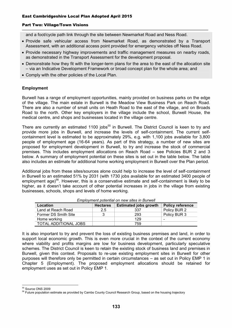
East Cambridgeshire Local Plan Adopted April 2015
Part Two: Village/Town Visions
133
and a foot/cycle path link through the site between Newmarket Road and Ness Road. Provide safe vehicular access from Newmarket Road, as demonstrated by a Transport
Assessment, with an additional access point provided for emergency vehicles off Ness Road. Provide necessary highway improvements and traffic management measures on nearby roads,
as demonstrated in the Transport Assessment for the development proposal. Demonstrate how they fit with the longer-term plans for the area to the east of the allocation site
– via an Indicative Development Framework or broad concept plan for the whole area; and Comply with the other policies of the Local Plan.
Employment
Burwell has a range of employment opportunities, mainly provided on business parks on the edge of the village. The main estate in Burwell is the Meadow View Business Park on Reach Road. There are also a number of small units on Heath Road to the east of the village, and on Broads Road to the north. Other key employers in the village include the school, Burwell House, the medical centre, and shops and businesses located in the village centre.
There are currently an estimated 1100 jobs55 in Burwell. The District Council is keen to try and provide more jobs in Burwell, and increase the levels of self-containment. The current self-containment level is estimated to be approximately 29%, e.g. with 1,100 jobs available for 3,800 people of employment age (16-64 years). As part of this strategy, a number of new sites are proposed for employment development in Burwell, to try and increase the stock of commercial premises. This includes employment allocations on Reach Road – see Policies BUR 2 and 3 below. A summary of employment potential on these sites is set out in the table below. The table also includes an estimate for additional home working employment in Burwell over the Plan period.
Additional jobs from these sites/sources alone could help to increase the level of self-containment in Burwell to an estimated 51% by 2031 (with 1730 jobs available for an estimated 3400 people of employment age)56. However, this is a conservative estimate and self-containment is likely to be higher, as it doesn’t take account of other potential increases in jobs in the village from existing businesses, schools, shops and levels of home working.
Employment potential on new sites in Burwell Location Hectares Estimated jobs growth Policy reference Land at Reach Road 2.5 337 Policy BUR 2 Former DS Smith Site 3 293 Policy BUR 3 Home working 129 - TOTAL ADDITIONAL JOBS 759
It is also important to try and prevent the loss of existing business premises and land, in order to support local economic growth. This is even more crucial in the context of the current economy where viability and profits margins are low for business development, particularly speculative schemes. The District Council is keen to retain the existing stock of business land and premises in Burwell, given this context. Proposals to re-use existing employment sites in Burwell for other purposes will therefore only be permitted in certain circumstances – as set out in Policy EMP 1 in Chapter 5 (Employment). The proposed employment allocations should be retained for employment uses as set out in Policy EMP 1.
55 Source ONS 2009 56 Future population estimate as provided by Cambs County Council Research Group, based on the housing trajectory
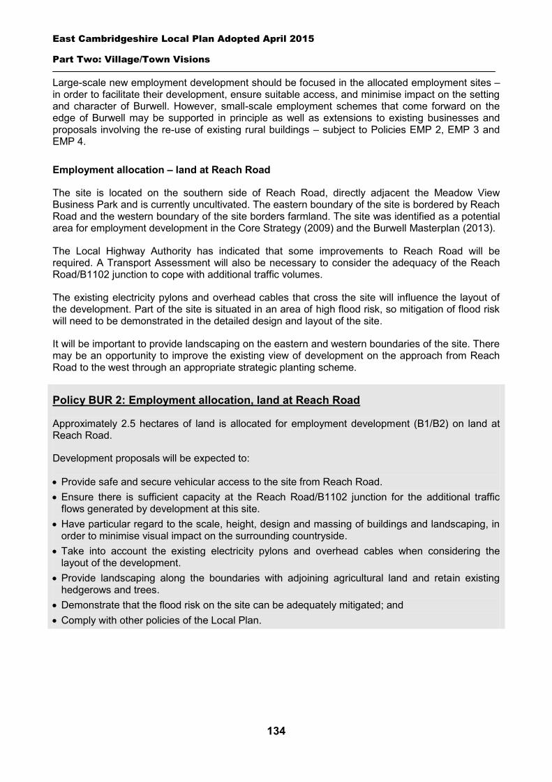
East Cambridgeshire Local Plan Adopted April 2015
Part Two: Village/Town Visions
134
Large-scale new employment development should be focused in the allocated employment sites – in order to facilitate their development, ensure suitable access, and minimise impact on the setting and character of Burwell. However, small-scale employment schemes that come forward on the edge of Burwell may be supported in principle as well as extensions to existing businesses and proposals involving the re-use of existing rural buildings – subject to Policies EMP 2, EMP 3 and EMP 4.
Employment allocation – land at Reach Road
The site is located on the southern side of Reach Road, directly adjacent the Meadow View Business Park and is currently uncultivated. The eastern boundary of the site is bordered by Reach Road and the western boundary of the site borders farmland. The site was identified as a potential area for employment development in the Core Strategy (2009) and the Burwell Masterplan (2013).
The Local Highway Authority has indicated that some improvements to Reach Road will be required. A Transport Assessment will also be necessary to consider the adequacy of the Reach Road/B1102 junction to cope with additional traffic volumes.
The existing electricity pylons and overhead cables that cross the site will influence the layout of the development. Part of the site is situated in an area of high flood risk, so mitigation of flood risk will need to be demonstrated in the detailed design and layout of the site.
It will be important to provide landscaping on the eastern and western boundaries of the site. There may be an opportunity to improve the existing view of development on the approach from Reach Road to the west through an appropriate strategic planting scheme.
Policy BUR 2: Employment allocation, land at Reach Road
Approximately 2.5 hectares of land is allocated for employment development (B1/B2) on land at Reach Road.
Development proposals will be expected to:
Provide safe and secure vehicular access to the site from Reach Road. Ensure there is sufficient capacity at the Reach Road/B1102 junction for the additional traffic
flows generated by development at this site. Have particular regard to the scale, height, design and massing of buildings and landscaping, in
order to minimise visual impact on the surrounding countryside. Take into account the existing electricity pylons and overhead cables when considering the
layout of the development. Provide landscaping along the boundaries with adjoining agricultural land and retain existing
hedgerows and trees. Demonstrate that the flood risk on the site can be adequately mitigated; and Comply with other policies of the Local Plan.
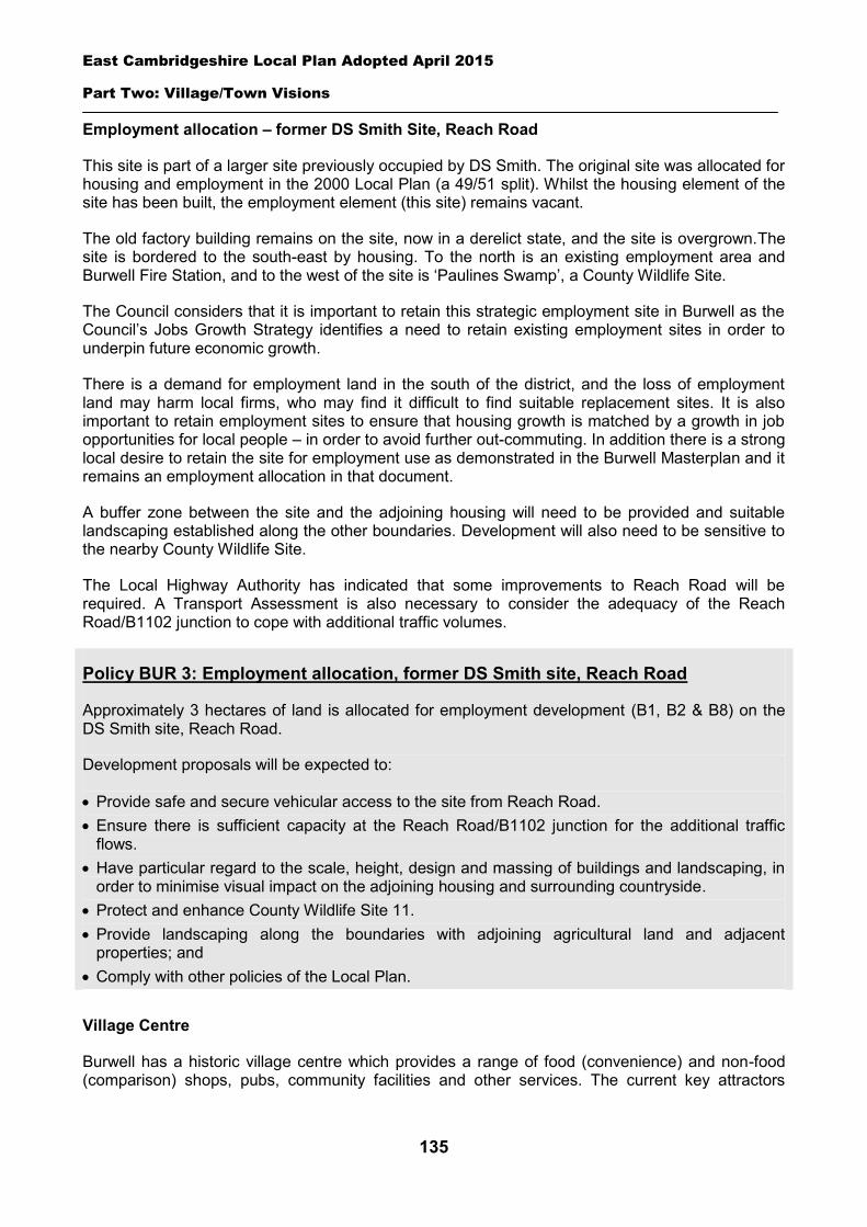
East Cambridgeshire Local Plan Adopted April 2015
Part Two: Village/Town Visions
135
Employment allocation – former DS Smith Site, Reach Road
This site is part of a larger site previously occupied by DS Smith. The original site was allocated for housing and employment in the 2000 Local Plan (a 49/51 split). Whilst the housing element of the site has been built, the employment element (this site) remains vacant.
The old factory building remains on the site, now in a derelict state, and the site is overgrown.The site is bordered to the south-east by housing. To the north is an existing employment area and Burwell Fire Station, and to the west of the site is ‘Paulines Swamp’, a County Wildlife Site.
The Council considers that it is important to retain this strategic employment site in Burwell as the Council’s Jobs Growth Strategy identifies a need to retain existing employment sites in order to underpin future economic growth.
There is a demand for employment land in the south of the district, and the loss of employment land may harm local firms, who may find it difficult to find suitable replacement sites. It is also important to retain employment sites to ensure that housing growth is matched by a growth in job opportunities for local people – in order to avoid further out-commuting. In addition there is a strong local desire to retain the site for employment use as demonstrated in the Burwell Masterplan and it remains an employment allocation in that document.
A buffer zone between the site and the adjoining housing will need to be provided and suitable landscaping established along the other boundaries. Development will also need to be sensitive to the nearby County Wildlife Site.
The Local Highway Authority has indicated that some improvements to Reach Road will be required. A Transport Assessment is also necessary to consider the adequacy of the Reach Road/B1102 junction to cope with additional traffic volumes.
Policy BUR 3: Employment allocation, former DS Smith site, Reach Road
Approximately 3 hectares of land is allocated for employment development (B1, B2 & B8) on the DS Smith site, Reach Road.
Development proposals will be expected to:
Provide safe and secure vehicular access to the site from Reach Road. Ensure there is sufficient capacity at the Reach Road/B1102 junction for the additional traffic
flows. Have particular regard to the scale, height, design and massing of buildings and landscaping, in
order to minimise visual impact on the adjoining housing and surrounding countryside. Protect and enhance County Wildlife Site 11. Provide landscaping along the boundaries with adjoining agricultural land and adjacent
properties; and Comply with other policies of the Local Plan.
Village Centre
Burwell has a historic village centre which provides a range of food (convenience) and non-food (comparison) shops, pubs, community facilities and other services. The current key attractors
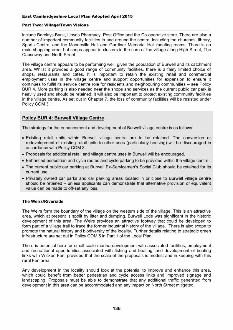
East Cambridgeshire Local Plan Adopted April 2015
Part Two: Village/Town Visions
136
include Barclays Bank, Lloyds Pharmacy, Post Office and the Co-operative store. There are also a number of important community facilities in and around the centre, including the churches, library, Sports Centre, and the Mandeville Hall and Gardiner Memorial Hall meeting rooms. There is no main shopping area, but shops appear in clusters in the core of the village along High Street, The Causeway and North Street.
The village centre appears to be performing well, given the population of Burwell and its catchment area. Whilst it provides a good range of community facilities, there is a fairly limited choice of shops, restaurants and cafes. It is important to retain the existing retail and commercial employment uses in the village centre and support opportunities for expansion to ensure it continues to fulfill its service centre role for residents and neighbouring communities – see Policy BUR 4. More parking is also needed near the shops and services as the current public car park is heavily used and should be retained. It will also be important to protect existing community facilities in the village centre. As set out in Chapter 7, the loss of community facilities will be resisted under Policy COM 3.
Policy BUR 4: Burwell Village Centre
The strategy for the enhancement and development of Burwell village centre is as follows:
Existing retail units within Burwell village centre are to be retained. The conversion or redevelopment of existing retail units to other uses (particularly housing) will be discouraged in accordance with Policy COM 3.
Proposals for additional retail and village centre uses in Burwell will be encouraged. Enhanced pedestrian and cycle routes and cycle parking to be provided within the village centre. The current public car parking at Burwell Ex-Servicemen's Social Club should be retained for its
current use. Privately owned car parks and car parking areas located in or close to Burwell village centre
should be retained – unless applicants can demonstrate that alternative provision of equivalent value can be made to off-set any loss.
The Weirs/Riverside
The Weirs form the boundary of the village on the western side of the village. This is an attractive area, which at present is spoilt by litter and dumping. Burwell Lode was significant in the historic development of this area. The Weirs provides an attractive footway that could be developed to form part of a village trail to trace the former industrial history of the village. There is also scope to promote the natural history and biodiversity of the locality. Further details relating to strategic green infrastructure are set out in Policy COM 5 in Part 1 of the Local Plan.
There is potential here for small scale marina development with associated facilities, employment and recreational opportunities associated with fishing and boating, and development of boating links with Wicken Fen, provided that the scale of the proposals is modest and in keeping with this rural Fen area.
Any development in the locality should look at the potential to improve and enhance this area, which could benefit from better pedestrian and cycle access links and improved signage and landscaping. Proposals must be able to demonstrate that any additional traffic generated from development in this area can be accommodated and any impact on North Street mitigated.
East Cambridgeshire Local Plan Adopted April 2015
Part Two: Village/Town Visions
137
Policy BUR 5: The Weirs/Riverside
The quality of The Weirs/Riverside area should be enhanced as this is a key open space for the people of Burwell. Opportunities should be explored to improve public access and create a new village trail along the river area.
Development proposals in the area, associated with the provision of river or recreation facilities will generally be supported.
All development proposals adjacent to or in the vicinity of The Weirs/Riverside area will be expected to:
Be sensitively designed and in scale with the character of the area. Demonstrate that the development is consistent with the objectives of the Anglian River Basin
Management Plan. Improve pedestrian and cycle access links to this area. Improve the appearance and setting of the area; and Demonstrate through a Transport Assessment that additional traffic generated can be
accommodated and mitigated.
Infrastructure and community facilities
Burwell needs to be served by appropriate levels of infrastructure and facilities, in order to ensure the quality of people’s lives and prevent unnecessary travel. This includes infrastructure such as water, energy, sewerage treatment works, and roads – and community facilities such as schools, open space, health, and sport and recreation facilities.
As outlined in Chapter 3, the District Council will continue to work with infrastructure providers to enable the delivery of necessary of infrastructure and facilities. The District Council will also seek to secure planning obligations and Community Infrastructure Levy monies from developers towards new infrastructure and facilities required as a result of new development.
It will also be important to protect existing community facilities. As set out in Chapter 7, the loss of community facilities will be resisted under Policy COM 3. Proposals for new community development that benefits Burwell will be supported in principle, subject to Policies GROWTH 3 and COM 4.
The key future infrastructure and service requirements for Burwell are set out in the table below. These have been identified through technical work, discussions with infrastructure providers, and community consultation - and are linked to the estimated future levels of growth in Burwell over the next 20 years.
Infrastructure / facility
Location Provider Delivery date (est.)
Details
Extension to Primary school
The Causeway Cambs County Council
Temporary extension granted 2012 – more permanent expansion to be determined.
Limited expansion of either or both Soham and Bottisham Village
Soham/ Bottisham
Cambs County Council
Limited expansion required. To be included in future County Council capital programme.

East Cambridgeshire Local Plan Adopted April 2015
Part Two: Village/Town Visions
138
Colleges Early years facility TBC Private provider TBC NK Exning Bridge Newmarket
Road Cambs County Council/Suffolk County Council
Provision of a safe foot/cycle path around the bridge.
Outdoor Sports facilities
Newmarket Road
Cambs County Council
Consolidation of outdoor sports pitches, car parking and changing facilities on Newmarket Road housing allocation site (see Policy BUR 1).
New link to create Burwell Circular walking/cycle route
Newmarket Road
Developer Provision of foot/cycle path link from Newmarket Road to Ness Road (see Policy BUR 1).
Improvements to riverside usage, appearance and access
The Weirs Various Possible modest Marina type development adjacent to Burwell Lode. Other improvements as set out in Policy BUR 5.
Burwell Lode Bridge Harrisons Drove
National Trust/Cambs County Council
Provision of a dual purpose bridge for cyclists, pedestrians and equestrians over Burwell Lode.
Expansion of Doctors Surgery
Newmarket Road
NHS Trust An extension to the existing surgery premises may be necessary to meet demands of new population.
Spatial Strategy for Burwell (see Inset Map 8.8)
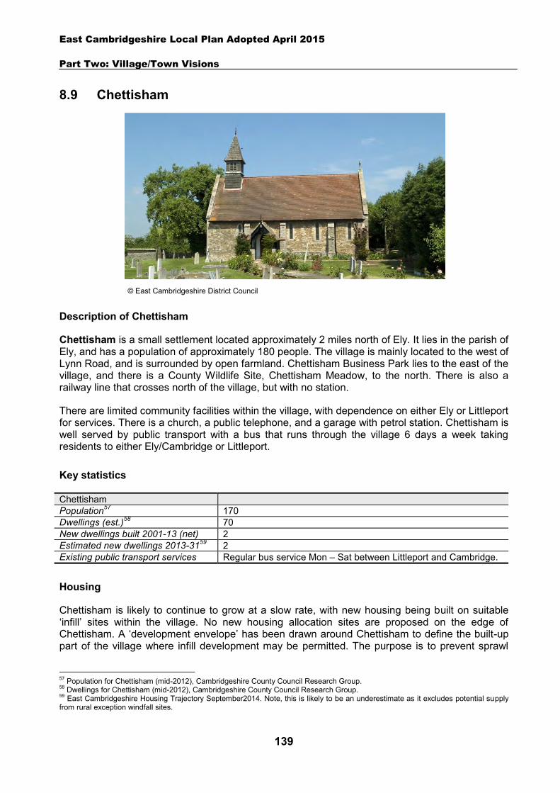
East Cambridgeshire Local Plan Adopted April 2015
Part Two: Village/Town Visions
139
8.9 Chettisham
Description of Chettisham
Chettisham is a small settlement located approximately 2 miles north of Ely. It lies in the parish of Ely, and has a population of approximately 180 people. The village is mainly located to the west of Lynn Road, and is surrounded by open farmland. Chettisham Business Park lies to the east of the village, and there is a County Wildlife Site, Chettisham Meadow, to the north. There is also a railway line that crosses north of the village, but with no station.
There are limited community facilities within the village, with dependence on either Ely or Littleport for services. There is a church, a public telephone, and a garage with petrol station. Chettisham is well served by public transport with a bus that runs through the village 6 days a week taking residents to either Ely/Cambridge or Littleport.
Key statistics
Chettisham Population57 170 Dwellings (est.)58 70 New dwellings built 2001-13 (net) 2 Estimated new dwellings 2013-3159 2 Existing public transport services Regular bus service Mon – Sat between Littleport and Cambridge.
Housing
Chettisham is likely to continue to grow at a slow rate, with new housing being built on suitable ‘infill’ sites within the village. No new housing allocation sites are proposed on the edge of Chettisham. A ‘development envelope’ has been drawn around Chettisham to define the built-up part of the village where infill development may be permitted. The purpose is to prevent sprawl
57 Population for Chettisham (mid-2012), Cambridgeshire County Council Research Group. 58 Dwellings for Chettisham (mid-2012), Cambridgeshire County Council Research Group. 59 East Cambridgeshire Housing Trajectory September2014. Note, this is likely to be an underestimate as it excludes potential supply from rural exception windfall sites.
© East Cambridgeshire District Council
East Cambridgeshire Local Plan Adopted April 2015
Part Two: Village/Town Visions
140
into the open countryside. Development on infill sites will need to be in line with Policy GROWTH 2.
Outside the development envelope, housing will not normally be permitted – unless there are exceptional circumstances, such as essential dwellings for rural workers, or affordable housing. Housing schemes outside the development envelope will be assessed against Policy GROWTH 2 and other Local Plan policies as appropriate.
Although no new housing allocations are proposed on the edge of Chettisham, there are proposals for a large area to the north of Ely to be developed for housing and employment uses. Further details can be seen in the Ely Town Vision section. It will be important to ensure that the integrity and setting of Chettisham is not adversely affected by this proposal and that adequate separation is provided.
Employment
There are a number of current businesses in the village, including Chettisham Garage, Century Park and Chettisham Business Park. The District Council is keen to retain employment land and premises in order to support local economic growth. Proposals to re-use any employment sites for other purposes will only be permitted in certain circumstances (see Policy EMP 1).
No new employment allocation sites are proposed on the edge of Chettisham. As part of the development of the North Ely area, an extension is proposed to Chettisham Business Park (see the Ely Vision for further details). Other suitable new employment proposals within or on the edge of the village will be supported in principle, subject to Policies EMP 2, EMP 3 and EMP 4.
Infrastructure and community facilities
Residents in Chettisham have indicated a desire for improvements to infrastructure and facilities in the village. A list of priorities is set out in the table below.
Priority Suggestions 1 New recreational facilities within village Provision of a children’s play area. =2 Improvements to pedestrian/cycle routes More footpaths and cycle routes, especially towards Ely. =2 New community facilities New community/village hall.
The top priority is to provide a new children’s play area to enhance the quality of life and well-being of young people in the village. The following priorities were equally important to residents. First, need to improve the pedestrian and cycle routes to better link the village to surrounding settlements such as Ely and Littleport, as well as Chettisham Meadow. Second, need for a new community/village hall as the last hall closed over 30 years ago. This will enhance the community facilities in the village and contribute to the quality of people’s lives. The District Council will work with the County Council and Parish Council to explore options and secure funding for improvements to community facilities and transport infrastructure within Chettisham.
The loss of community facilities will also be resisted under Policy COM 3. Proposals for new community development that benefits the village will be supported in principle, subject to Policy COM 4.
Spatial strategy for Chettisham (see Inset Map 8.9)
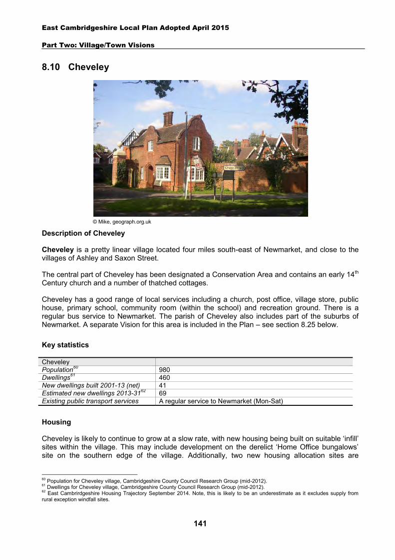
East Cambridgeshire Local Plan Adopted April 2015
Part Two: Village/Town Visions
141
8.10 Cheveley
Description of Cheveley
Cheveley is a pretty linear village located four miles south-east of Newmarket, and close to the villages of Ashley and Saxon Street.
The central part of Cheveley has been designated a Conservation Area and contains an early 14th Century church and a number of thatched cottages.
Cheveley has a good range of local services including a church, post office, village store, public house, primary school, community room (within the school) and recreation ground. There is a regular bus service to Newmarket. The parish of Cheveley also includes part of the suburbs of Newmarket. A separate Vision for this area is included in the Plan – see section 8.25 below.
Key statistics
Cheveley Population60 980 Dwellings61 460 New dwellings built 2001-13 (net) 41 Estimated new dwellings 2013-3162 69 Existing public transport services A regular service to Newmarket (Mon-Sat)
Housing
Cheveley is likely to continue to grow at a slow rate, with new housing being built on suitable ‘infill’ sites within the village. This may include development on the derelict ‘Home Office bungalows’ site on the southern edge of the village. Additionally, two new housing allocation sites are
60 Population for Cheveley village, Cambridgeshire County Council Research Group (mid-2012). 61 Dwellings for Cheveley village, Cambridgeshire County Council Research Group (mid-2012). 62 East Cambrirdgeshire Housing Trajectory September 2014. Note, this is likely to be an underestimate as it excludes supply from rural exception windfall sites.
© Mike, geograph.org.uk
East Cambridgeshire Local Plan Adopted April 2015
Part Two: Village/Town Visions
142
proposed for approximately 20 dwellings – on land to the rear of Star and Garter Lane, and land between 199-209 High Street. Details of the allocation sites are set out in the section below.
A ‘development envelope’ has been drawn around Cheveley to define the built-up part of the village where development (infill and the allocation sites) may be permitted. The purpose is to prevent sprawl into the open countryside. Development on infill sites will need to be in line with Policy GROWTH 2. Development on the allocation sites will need to be in line with Policies CHV 1 and CHV 2.
Outside the development envelope, housing will not normally be permitted – unless there are exceptional circumstances, such as essential dwellings for rural workers, or affordable housing. Housing schemes outside the development envelope will be assessed against Policy GROWTH 2 and other Local Plan policies as appropriate and deliver a higher quality scheme.
Housing allocation – land to the rear of Star and Garter Lane
The site is located close to the village centre, and is currently open farmland. The allocation site is not visible from the main road. However, development should be designed to minimise the impact on the amenity of adjacent properties.
Vehicular access to the site will need to be provided off Star and Garter Lane. This is a private drive and the Highway Authority has advised that the access is suitable to accommodate up to 2 dwellings.
Housing allocation – land between 199-209 High Street
The site is located off the High Street, opposite the junction with Spurling Close and is currently a grassed paddock. The southern and eastern boundaries of the site border open countryside. Development proposals should include an appropriate landscape buffer to lessen any potential impact upon the open countryside.
Vehicular access to the site will need to be provided off the High Street.
Policy CHV 1: Housing allocation, land rear of Star and Garter Lane
Approximately 0.2 hectares of land is allocated for residential development on land at the rear of Star and Garter Lane for up to 2 dwellings.
Development proposals will be expected to:
Have particular regard to the layout and the scale, height, design and massing of buildings, and landscaping, in order to minimise amenity impact on adjoining properties.
Provide safe vehicular access from Star and Garter Lane. Ensure that adequate maintenance and servicing (waste collection) arrangements would be
possible; and Comply with the other policies of the Local Plan.
East Cambridgeshire Local Plan Adopted April 2015
Part Two: Village/Town Visions
143
Employment
Local employment is focused on the horseracing industry, with several stud farms located around the village including Fittocks Stud, Brook Stud, Glebe Stud, Farmers Hill Stud and Sandwich Stud. There are also a number of businesses within and on the edge of the village. The District Council is keen to retain the stock of business land and premises in order to support local economic growth. Proposals to re-use employment sites for other purposes will only be permitted in certain circumstances (see Policy EMP 1).
No new employment allocation sites are proposed on the edge of Cheveley. However, suitable new employment proposals on the edge of the village, will be supported in principle, subject to Policies EMP 2, EMP 3 and EMP 4.
Infrastructure and community facilities
Residents in Cheveley have identified a number of infrastructure and community improvements. A list of priorities is set out in the table below:
Priority Suggestions 1 Traffic calming/highway
improvements Parish Council to work with District and County Council to explore specific priorities to which future funding sources can be directed e.g. improving road/footpath surfacing and addressing speeding issues.
2 Improvements to the community/village hall
Identify specific improvements to be considered for future funding sources e.g. improvements to the recreation ground pavilion.
3 Improvements to pedestrian/cycle routes
Parish Council to work with County Council to seek improvements to footpath surfaces and the potential to make paths wider.
4 Improvements to the pavilion and recreation ground
Explore provision of wheelchair access. Seek permanent space for preschool group, Cheveley Acorns.
5 Need for more school places Work with County Council to ensure that any shortage of spaces is considered and addressed within the next capital expenditure programme.
6 Improvements to play areas Identify specific improvements to be considered for future funding sources e.g. new play area equipment.
7 Improvements to public transport services
Seek improvements to local bus service.
Policy CHV 2: Housing allocation, land between 199-209 High Street
Approximately 0.75 hectares of land is allocated for residential development on land between 199-209 High Street for up to 18 dwellings.
Development proposals will be expected to:
Provide an element of affordable housing (currently 40%) as required under Policy HOU 3, with priority being given to people in local housing need.
Provide a mix of dwelling types and sizes to reflect current evidence of need within Cheveley. Have particular regard to the layout and the scale, height, design and massing of buildings, and
landscaping, in order to minimise amenity impact on adjoining properties and the open countryside.
Provide safe vehicular access from High Street; and Comply with the other policies of the Local Plan.
East Cambridgeshire Local Plan Adopted April 2015
Part Two: Village/Town Visions
144
The current community facilities in Cheveley (including the village store, pub, community hall, post office and church) contribute to the quality of people’s lives. The District Council will work with the County Council and Parish Council to secure funding, including developer contributions, to improve facilities wherever possible. The loss of community facilities will be resisted under Policy COM 3. Proposals for new community development that benefits the village will be supported in principle, subject to Policy COM 4.
Spatial strategy for Cheveley (see Inset Map 8.10)
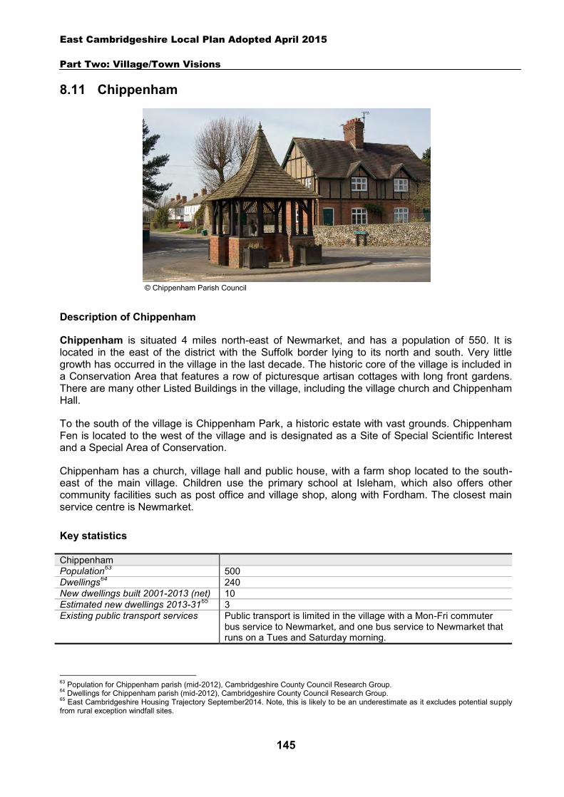
East Cambridgeshire Local Plan Adopted April 2015
Part Two: Village/Town Visions
145
8.11 Chippenham
Description of Chippenham
Chippenham is situated 4 miles north-east of Newmarket, and has a population of 550. It is located in the east of the district with the Suffolk border lying to its north and south. Very little growth has occurred in the village in the last decade. The historic core of the village is included in a Conservation Area that features a row of picturesque artisan cottages with long front gardens. There are many other Listed Buildings in the village, including the village church and Chippenham Hall.
To the south of the village is Chippenham Park, a historic estate with vast grounds. Chippenham Fen is located to the west of the village and is designated as a Site of Special Scientific Interest and a Special Area of Conservation.
Chippenham has a church, village hall and public house, with a farm shop located to the south-east of the main village. Children use the primary school at Isleham, which also offers other community facilities such as post office and village shop, along with Fordham. The closest main service centre is Newmarket.
Key statistics
Chippenham Population63 500 Dwellings64 240 New dwellings built 2001-2013 (net) 10 Estimated new dwellings 2013-3165 3 Existing public transport services Public transport is limited in the village with a Mon-Fri commuter
bus service to Newmarket, and one bus service to Newmarket that runs on a Tues and Saturday morning.
63 Population for Chippenham parish (mid-2012), Cambridgeshire County Council Research Group. 64 Dwellings for Chippenham parish (mid-2012), Cambridgeshire County Council Research Group. 65 East Cambridgeshire Housing Trajectory September2014. Note, this is likely to be an underestimate as it excludes potential supply from rural exception windfall sites.
© Chippenham Parish Council
East Cambridgeshire Local Plan Adopted April 2015
Part Two: Village/Town Visions
146
Housing
Chippenham is likely to continue to grow at a slow rate, with new housing being built on suitable ‘infill’ sites within the village. No new housing allocation sites are proposed on the edge of Chippenham.
A ‘development envelope’ has been drawn around Chippenham to define the built-up part of the village where infill development may be permitted. The purpose is to prevent sprawl into the open countryside. Development on infill sites will need to be in line with Policy GROWTH 2.
Outside the development envelope, housing will not normally be permitted – unless there are exceptional circumstances, such as essential dwellings for rural workers, or affordable housing. Housing schemes outside the development envelope will be assessed against Policy GROWTH 2 and other Local Plan policies as appropriate.
Employment
There are a number of employment opportunities in the village, including the public house, farm shop and Chippenham Hall, which is also a wedding venue. However, there is little employment land and premises (e.g. industrial or offices) in the village. The District Council is keen to retain employment land and premises in order to support local economic growth. Proposals to re-use any employment sites for other purposes will only be permitted in certain circumstances (see Policy EMP 1).
No new employment allocation sites are proposed on the edge of Chippenham. However, suitable new employment proposals within or on the edge of the village will be supported in principle, subject to Policies EMP 2, EMP 3 and EMP 4.
Infrastructure and community facilities
Residents in Chippenham have indicated a desire for improvements to infrastructure and facilities in the village. A list of priorities is set out in the table below.
Priority Suggestions 1 Highway improvement & traffic
calming scheme To include traffic calming of High Street and resurfacing works at Tharp Way.
2 Improvements to pedestrian/cycle routes
More footpaths and cycle routes, especially a link to La Hogue farm shop, and to Chippenham Fen.
3 Improvements to recreational facilities/open spaces
Improvements to include facilities for young people and families, such as picnic area, and play area.
4 Increasing school spaces Liaison with County Council. 5 Improvements to broadband The Council is part of a county wide scheme for broadband
improvements. The top priority is to improve local highways in order to reduce the volume and speed of traffic that passes through the village. Another priority is to improve pedestrian and cycle routes in the village including a link to both the farm shop and nearby Chippenham Fen.
Other suggestions by residents are to increase the amount of school places and to improve the recreational facilities and open spaces within the village to cater better for the younger population as well as families. The District Council will work with the County Council and Parish Council to explore options and secure funding for improvements to community facilities and transport

East Cambridgeshire Local Plan Adopted April 2015
Part Two: Village/Town Visions
147
infrastructure within Chippenham. A good broadband connection was also identified as a community priority. The District Council is already working with Cambridgeshire County Council to address this issue across the district through the Connecting Cambridgeshire project.
The current community facilities within Chippenham (including the pub, church and village hall) contribute to the quality of peoples’ lives. The loss of community facilities will also be resisted under Policy COM 3. Proposals for new community development that benefit the village will be supported in principle, subject to Policy COM 4.
Spatial strategy for Chippenham (see Inset Map 8.11)
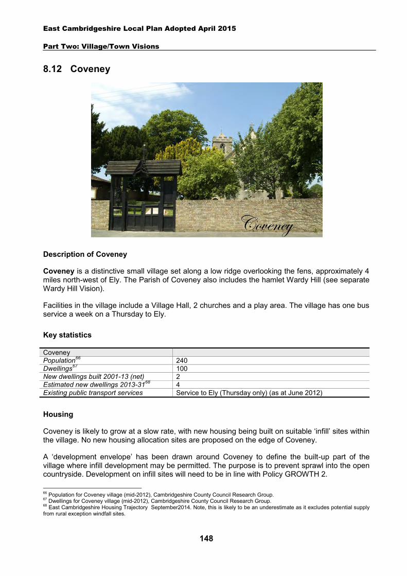
East Cambridgeshire Local Plan Adopted April 2015
Part Two: Village/Town Visions
148
8.12 Coveney
Description of Coveney
Coveney is a distinctive small village set along a low ridge overlooking the fens, approximately 4 miles north-west of Ely. The Parish of Coveney also includes the hamlet Wardy Hill (see separate Wardy Hill Vision).
Facilities in the village include a Village Hall, 2 churches and a play area. The village has one bus service a week on a Thursday to Ely.
Key statistics
Coveney Population66 240 Dwellings67 100 New dwellings built 2001-13 (net) 2 Estimated new dwellings 2013-3168 4 Existing public transport services Service to Ely (Thursday only) (as at June 2012)
Housing
Coveney is likely to grow at a slow rate, with new housing being built on suitable ‘infill’ sites within the village. No new housing allocation sites are proposed on the edge of Coveney.
A ‘development envelope’ has been drawn around Coveney to define the built-up part of the village where infill development may be permitted. The purpose is to prevent sprawl into the open countryside. Development on infill sites will need to be in line with Policy GROWTH 2.
66 Population for Coveney village (mid-2012), Cambridgeshire County Council Research Group. 67 Dwellings for Coveney village (mid-2012), Cambridgeshire County Council Research Group. 68 East Cambridgeshire Housing Trajectory September2014. Note, this is likely to be an underestimate as it excludes potential supply from rural exception windfall sites.
East Cambridgeshire Local Plan Adopted April 2015
Part Two: Village/Town Visions
149
Outside the development envelope, housing will not normally be permitted – unless there are exceptional circumstances, such as essential dwellings for rural workers, or affordable housing. Housing schemes outside the development envelope will be assessed against Policy GROWTH 2 and other Local Plan policies as appropriate.
Employment
There are few businesses in the village. The District Council is keen to retain the stock of business land and premises in order to support local economic growth. Proposals to re-use any employment sites for other purposes will only be permitted in certain circumstances (see Policy EMP 1).
No new employment allocation sites are proposed on the edge of Coveney. However, suitable new employment proposals within or on the edge of the village will be supported in principle, subject to Policies EMP 2, EMP 3 and EMP 4.
Infrastructure and community facilities
Residents in Coveney have indicated a desire for improvements and infrastructure and community facilities in the village. A list of priorities is set out in the table below.
Priority Suggestions 1 Improvements to
Broadband District Council is working in partnership with the County Council to seek improvements to the Broadband service across the district.
2 Improvements tovillage hall
New roof needed.
3 Improvements to roads and footpaths
Better upkeep of roads in village. Improve West Fen Road.
4 Improvements to the play area
Provision of more play equipment.
The top priority is improvements to Broadband speeds in the village, an issue that the District Council is already working with County Council to address across the district through the Connecting Cambridgeshire project. Other priorities include improvements to the village hall, roads and footpaths and play areas in the village. The District Council will work with the Parish Council and County Council to explore options and secure funding for improvements to community facilities and transport infrastructure in Coveney.
The current community facilities in Coveney (including the village hall, churches and play area) contribute to the quality of people’s lives. The loss of community facilities will be resisted under Policy COM 3. Proposals for new community development that benefits the village will be supported in principle, subject to Policy COM 4.
Spatial strategy for Coveney (see Inset Map 8.12)
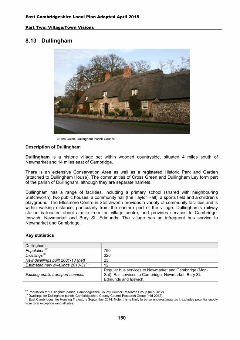
East Cambridgeshire Local Plan Adopted April 2015
Part Two: Village/Town Visions
150
8.13 Dullingham
Description of Dullingham
Dullingham is a historic village set within wooded countryside, situated 4 miles south of Newmarket and 14 miles east of Cambridge.
There is an extensive Conservation Area as well as a registered Historic Park and Garden (attached to Dullingham House). The communities of Cross Green and Dullingham Ley form part of the parish of Dullingham, although they are separate hamlets.
Dullingham has a range of facilities, including a primary school (shared with neighbouring Stetchworth), two public houses, a community hall (the Taylor Hall), a sports field and a children’s playground. The Ellesmere Centre in Stetchworth provides a variety of community facilities and is within walking distance, particularly from the eastern part of the village. Dullingham’s railway station is located about a mile from the village centre, and provides services to Cambridge-Ipswich, Newmarket and Bury St. Edmunds. The village has an infrequent bus service to Newmarket and Cambridge.
Key statistics
Dullingham Population69 750 Dwellings70 320 New dwellings built 2001-13 (net) 23 Estimated new dwellings 2013-3171 12
Existing public transport services Regular bus services to Newmarket and Cambridge (Mon-Sat). Rail services to Cambridge, Newmarket, Bury St. Edmunds and Ipswich.
69 Population for Dullingham parish, Cambridgeshire County Council Research Group (mid-2012). 70 Dwellings for Dullingham parish, Cambridgeshire County Council Research Group (mid-2012). 71 East Cambridgeshire Housing Trajectory September 2014. Note, this is likely to be an underestimate as it excludes potential supply from rural exception windfall sites.
© Tim Owen, Dullingham Parish Council
East Cambridgeshire Local Plan Adopted April 2015
Part Two: Village/Town Visions
151
Housing
Dullingham is likely to continue to grow at a slow rate, with new housing being built on suitable ‘infill’ sites within the village. No new housing allocation sites are proposed on the edge of Dullingham.
A ‘development envelope’ has been drawn around Dullingham to define the built-up part of the village where infill development may be permitted. The purpose is to prevent sprawl into the open countryside. Development on infill sites will need to be in line with Policy GROWTH 2.
Outside the development envelope, housing will not normally be permitted – unless there are exceptional circumstances, such as essential dwellings for rural workers, or affordable housing. The Parish Council is keen to explore the delivery of a small-scale affordable housing scheme on the edge of the village, possibly via a Community Land Trust mechanism. This and other housing schemes outside the development envelope will be assessed against Policies GROWTH 2, GROWTH 6 and other Local Plan policies as appropriate. The Parish Council wish to see the diversity of the village maintained, with the housing stock reflecting a range of sizes.
In developing any proposals for new housing, developers may wish to consult the Dullingham Parish Plan 2006 (http://www.dullingham.org.uk/Documents/Parish_plan/Parish_plan.pdf) as this sets out how the local community would like to see the character of the parish maintained and enhanced by any new development.
Employment
There are more than a dozen small and medium sized businesses in the village, including several stud farms, and a number of high tech businesses. The Parish and District Councils are keen to retain the stock of business land and premises in order to support local economic growth. Proposals to reuse employment sites for other purposes will only be permitted in certain circumstances (see Policy EMP 1).
No new employment allocation sites are proposed on the edge of Dullingham. However, suitable new employment proposals within or on the edge of the village will be supported in principle, subject to Policies EMP 2, EMP 3 and EMP 4.
Infrastructure and community facilities
Residents in Dullingham have identified a number of infrastructure and community improvements. A list of priorities is set out in the table below.
Priority Suggestions
1 Improvements to main sewer Main sewer through village runs near capacity and can overflow in heavy rain – needs improving.
2 Improvements to pedestrian/cycle/riding routes
B1061 needs to be made 30 m.p.h. through village to make walking, cycling and riding safer. Road to Newmarket is dangerous for cyclists. Keep heavy traffic off smaller roads where possible and encourage cycling and riding routes.
3 Improvements to village amenities
Encourage greater use of the Village Hall and improvements to Sports Pavilion.
East Cambridgeshire Local Plan Adopted April 2015
Part Two: Village/Town Visions
152
The top priority is improvement to the main sewer. Other priorities include improvements to walking/cycling/riding routes, and village amenities.
The current community facilities in Dullingham (including the school, pub, sports field and playground) contribute to the quality of people’s lives. The loss of community facilities will be resisted under Policy COM 3. Proposals for new community development that benefits the village will be supported in principle, subject to Policy COM 4.
Spatial strategy for Dullingham (see Inset Map 8.13)
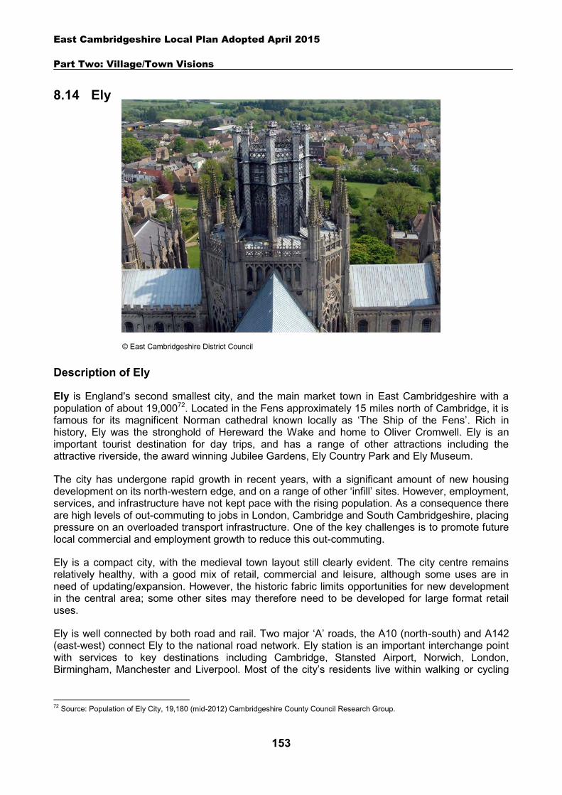
East Cambridgeshire Local Plan Adopted April 2015
Part Two: Village/Town Visions
153
8.14 Ely
Description of Ely
Ely is England's second smallest city, and the main market town in East Cambridgeshire with a population of about 19,00072. Located in the Fens approximately 15 miles north of Cambridge, it is famous for its magnificent Norman cathedral known locally as ‘The Ship of the Fens’. Rich in history, Ely was the stronghold of Hereward the Wake and home to Oliver Cromwell. Ely is an important tourist destination for day trips, and has a range of other attractions including the attractive riverside, the award winning Jubilee Gardens, Ely Country Park and Ely Museum.
The city has undergone rapid growth in recent years, with a significant amount of new housing development on its north-western edge, and on a range of other ‘infill’ sites. However, employment, services, and infrastructure have not kept pace with the rising population. As a consequence there are high levels of out-commuting to jobs in London, Cambridge and South Cambridgeshire, placing pressure on an overloaded transport infrastructure. One of the key challenges is to promote future local commercial and employment growth to reduce this out-commuting.
Ely is a compact city, with the medieval town layout still clearly evident. The city centre remains relatively healthy, with a good mix of retail, commercial and leisure, although some uses are in need of updating/expansion. However, the historic fabric limits opportunities for new development in the central area; some other sites may therefore need to be developed for large format retail uses.
Ely is well connected by both road and rail. Two major ‘A’ roads, the A10 (north-south) and A142 (east-west) connect Ely to the national road network. Ely station is an important interchange point with services to key destinations including Cambridge, Stansted Airport, Norwich, London, Birmingham, Manchester and Liverpool. Most of the city’s residents live within walking or cycling
72 Source: Population of Ely City, 19,180 (mid-2012) Cambridgeshire County Council Research Group.
© East Cambridgeshire District Council
East Cambridgeshire Local Plan Adopted April 2015
Part Two: Village/Town Visions
154
distance to the centre. However, pedestrian and cycle networks are fragmented and incomplete and require re-design improvement in many locations.
Key statistics
Ely Population73 19,180 Dwellings74 8,340 New dwellings built 2001-13 (net) 2,299 Estimated new dwellings 2013-3175 3,948 Employment76 8,000
Existing public transport services
Mainline railway station with services to Cambridge, London, Peterborough, the Midlands and the North-west. Regular bus services within Ely and to Cambridge, Chatteris, Newmarket and surrounding villages.
A vision for Ely
A vision for Ely in the year 2031 is set out below – followed by a set of strategic objectives to deliver and facilitate the vision. The vision provides clear direction for development in Ely and has been developed from the key characteristics and issues described above, and through consultation on the Local Plan. It has also been informed by the ‘Ely Masterplan’ (adopted 2010), which aimed to provide a holistic vision to help ensure that Ely develops in a coordinated, planned and integrated way. The Ely Masterplan can be viewed at www.eastcambs.gov.uk. The vision and policies in the Ely Town Vision have also been informed by the Ely Environmental Capacity Study (as referred to in paragraph 6.2.4). This Study provides a detailed assessment of the landscape character of Ely and its environs, including an analysis of the distant and near views of Ely Cathedral. The Study remains an important part of the evidence base informing the Local Plan and planning applications, and is due to be updated in 2015.
73 Population for Ely City, Cambridgeshire County Council Research Group (mid-2012). 74 Dwellings for Ely City, Cambridgeshire County Council Research Group (mid-2012). 75 East Cambridgeshire Housing Trajectory September 2014. Note, this is likely to be an underestimate as it excludes potential supply from rural exception windfall sites. 76 Source: ONS 2009
Ely vision statement
Ely will develop into a special 21st century cathedral city and Cambridgeshire market town that respects the national and international importance of its historic environment, with a thriving city centre and great quality of life for its residents. Development will respect the city’s distinctiveness, which includes the historic core of the city, the green rural spaces in and around the city, the river and fen setting, the views of the cathedral, the character and compactness of the city and the strong local cultural and community network.
A sustainable urban extension to the north of the city will provide new housing and small business opportunities as well as helping to support a range of existing and new community facilities – including a new leisure centre and multiplex cinema, new primary schools, a new transport interchange and employment hub at the station, and an extended Country Park. Major improvements to the A142 between Angel Drove and Stuntney Causeway alongside other transport solutions will help to reduce congestion in the station area and aid economic growth. The city’s strategic location will be attractive to employers wishing to establish or expand on newly serviced employment areas on the outskirts of the city, offering a range of job opportunities to local
East Cambridgeshire Local Plan Adopted April 2015
Part Two: Village/Town Visions
155
Ely strategic objectives
1. Improve and extend the city centre, to meet the needs of an expanded population and provide a revitalised and vibrant hub that is attractive to residents and visitors alike, creatively using and supporting its heritage assets.
2. Protect and enhance Ely’s ‘distinctiveness’, with all new development responding positively to the unique character of this historic city, and respecting the setting and views of Ely Cathedral (with regard to the Ely Environmental Capacity Study and subsequent updates).
3. Achieve sustainable growth and widen housing choice with an exemplar urban extension to the north.
4. Regenerate the area around the railway station to deliver a vibrant, mixed-use area, and enhance the riverside area of the city.
5. Enable easy access to key destinations with improved walking and cycling routes and public transport services, including a new transport interchange at the railway station and major improvements to the A142 between Angel Drove and Stuntney Causeway to reduce congestion.
6. Support the retention and creation of local jobs to reduce the current high levels of out-commuting, by retaining and expanding existing employment sites such as Lancaster Way Business Park, developing new locations for business and supporting enterprise e.g. at North Ely, the Station Gateway area and Octagon Business Park.
7. Provide enhanced infrastructure and facilities, from district-wide facilities to serve the wider rural community to local facilities of an appropriate scale to serve neighbourhoods. This should include the provision of 2 new primary schools, and a new sports and leisure village off Downham Road.
8. Protect and enhance the rural setting of Ely, and create a strategic network of green spaces on the eastern edge of the city, including an extension to Ely Country Park, which improves accessibility and has regard to the enhancement of biodiversity and geodiversity of designated sites which are of national/international significance.
9. Protect and enhance the historic environment, particularly in the city centre. 10. Respond to climate change, taking opportunities to make the city resilient for the future
including sustainable drainage systems and low carbon development.
Housing and employment strategy
Ely will be the focus for housing and employment growth over the next 20 years. This section gives an overview of the strategy and proposals for this growth. The following sections provide detail on specific development sites.
Housing
A development envelope has been drawn around Ely to define the built-up part of the city where housing development may be permitted. The purpose is to prevent sprawl into the open countryside. Outside the development envelope, housing will not normally be permitted – unless there are exceptional circumstances, such as essential dwellings for rural workers, or affordable housing. Housing schemes outside the development envelope will be assessed against Policies GROWTH 2, and other Local Plan policies as appropriate.
people.
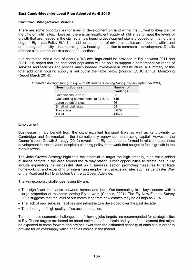
East Cambridgeshire Local Plan Adopted April 2015
Part Two: Village/Town Visions
156
There are some opportunities for housing development on land within the current built-up part of the city, on ‘infill’ sites. However, there is an insufficient supply of infill sites to meet the levels of growth that are needed in the city, so a new housing development site is proposed on the northern edge of Ely – see Policy ELY 1. In addition, a number of mixed-use sites are proposed within and on the edge of the city – incorporating new housing in addition to commercial development. Details of these sites are set out in subsequent sections.
It is estimated that a total of about 4,043 dwellings could be provided in Ely between 2011 and 2031. It is hoped that the additional population will be able to support a comprehensive range of services and facilities and provide much needed investment in infrastructure. A summary of this total additional housing supply is set out in the table below (source: ECDC Annual Monitoring Report March 2014).
Estimated housing supply in Ely 2011-31(source: Housing Supply Paper September 2014) Housing Sources Number of
dwellings Completions 2011-13 95 Outstanding commitments at 31.3.13 145 Large potential sites 56 Small windfall sites 68 Allocations 3,679 TOTAL 4,043
Employment
Businesses in Ely benefit from the city’s excellent transport links as well as its proximity to Cambridge and Newmarket – the internationally renowned horseracing capital. However, the Council’s Jobs Growth Strategy (2012) reveals that Ely has underperformed in relation to business development in recent years despite a planning policy framework that sought to focus growth in the market towns.
The Jobs Growth Strategy highlights the potential to target the high amenity, high value-added business sectors in the area around the railway station. Other opportunities to create jobs in Ely include expanding the successful ‘start up businesses’ sector, promoting measures to facilitate homeworking, and expanding or intensifying employment at existing sites such as Lancaster Way or the Road and Rail Distribution Centre at Queen Adelaide.
The key economic challenges facing Ely are:
The significant imbalance between homes and jobs. Out-commuting is a key concern with a large proportion of residents leaving Ely to work (Census, 2001). The Ely New Estates Survey 2007 suggests that the level of out-commuting from new estates may be as high as 70%.
The lack of new services, facilities and infrastructure developed over the past decade. The shortage of high quality office accommodation.
To meet these economic challenges, the following jobs targets are recommended for strategic sites in Ely. These targets are based on broad estimates of the scale and type of employment that might be expected to come forward and are set lower than the estimated capacity of each site in order to provide for an oversupply which enables choice in the market.
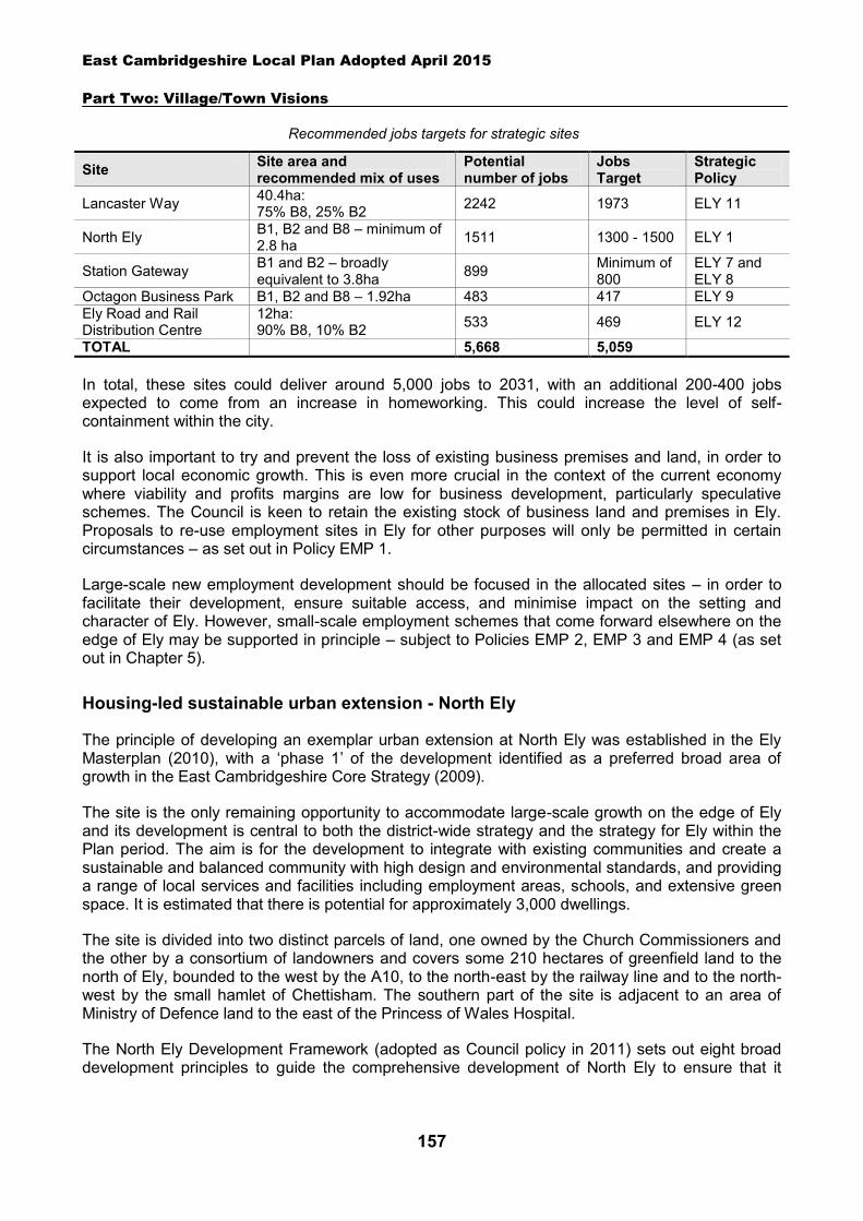
East Cambridgeshire Local Plan Adopted April 2015
Part Two: Village/Town Visions
157
Recommended jobs targets for strategic sites
Site Site area and recommended mix of uses
Potential number of jobs
Jobs Target
Strategic Policy
Lancaster Way 40.4ha: 75% B8, 25% B2 2242 1973 ELY 11
North Ely B1, B2 and B8 – minimum of 2.8 ha 1511 1300 - 1500 ELY 1
Station Gateway B1 and B2 – broadly equivalent to 3.8ha 899 Minimum of
800 ELY 7 and ELY 8
Octagon Business Park B1, B2 and B8 – 1.92ha 483 417 ELY 9 Ely Road and Rail Distribution Centre
12ha: 90% B8, 10% B2 533 469 ELY 12
TOTAL 5,668 5,059
In total, these sites could deliver around 5,000 jobs to 2031, with an additional 200-400 jobs expected to come from an increase in homeworking. This could increase the level of self-containment within the city.
It is also important to try and prevent the loss of existing business premises and land, in order to support local economic growth. This is even more crucial in the context of the current economy where viability and profits margins are low for business development, particularly speculative schemes. The Council is keen to retain the existing stock of business land and premises in Ely. Proposals to re-use employment sites in Ely for other purposes will only be permitted in certain circumstances – as set out in Policy EMP 1.
Large-scale new employment development should be focused in the allocated sites – in order to facilitate their development, ensure suitable access, and minimise impact on the setting and character of Ely. However, small-scale employment schemes that come forward elsewhere on the edge of Ely may be supported in principle – subject to Policies EMP 2, EMP 3 and EMP 4 (as set out in Chapter 5).
Housing-led sustainable urban extension - North Ely
The principle of developing an exemplar urban extension at North Ely was established in the Ely Masterplan (2010), with a ‘phase 1’ of the development identified as a preferred broad area of growth in the East Cambridgeshire Core Strategy (2009).
The site is the only remaining opportunity to accommodate large-scale growth on the edge of Ely and its development is central to both the district-wide strategy and the strategy for Ely within the Plan period. The aim is for the development to integrate with existing communities and create a sustainable and balanced community with high design and environmental standards, and providing a range of local services and facilities including employment areas, schools, and extensive green space. It is estimated that there is potential for approximately 3,000 dwellings.
The site is divided into two distinct parcels of land, one owned by the Church Commissioners and the other by a consortium of landowners and covers some 210 hectares of greenfield land to the north of Ely, bounded to the west by the A10, to the north-east by the railway line and to the north-west by the small hamlet of Chettisham. The southern part of the site is adjacent to an area of Ministry of Defence land to the east of the Princess of Wales Hospital.
The North Ely Development Framework (adopted as Council policy in 2011) sets out eight broad development principles to guide the comprehensive development of North Ely to ensure that it
East Cambridgeshire Local Plan Adopted April 2015
Part Two: Village/Town Visions
158
becomes a sustainable and high quality new neighbourhood. Proposals should accord with all eight principles:
1. Integrating green space into the structure of the development
Green infrastructure will form an integral part of the development for the benefit of new and existing residents. The development will provide a significant area of open space, including an extension to Ely Country Park which will help to facilitate a continuous network of accessible greenspace around the perimeter of the city. Green spaces should permeate through the development, reinforcing the character of the area and helping to provide a network of safe walking and cycling routes. The urban areas should relate to these adjoining green areas by creating attractive frontages enclosing or fronting spaces.
2. Creating strong links to the city and beyond
A sustainable transport strategy will be vital to reduce the impact of the development on the existing highway network and the environment. The development will be well connected to the city centre and other key destinations by a network of footpath and cycle routes and a high quality bus service. A new east-west link will be provided across the site, designed as a multifunctional tree-lined avenue that is capable of accommodating buses and higher traffic flows without functioning as a ‘bypass’. This will create a new access onto the A10.
3. Locating key facilities close to housing to maximise walking and cycling opportunities
Two local centres are proposed. The larger centre at the Lynn Road junction will provide a comprehensive range of local services and facilities including a primary school, a modest amount of retail / commercial space, community uses and public open space. Buildings and spaces should be designed to maximise social interaction, including the development of active frontages which have a positive relationship with the new east-west link road. There should be space for cycle and footpaths as well as sufficient cycle parking. The visual impact of car parking areas should be minimised. A smaller local centre should be delivered at the Cam Drive junction. This will provide small-scale ‘top-up’ shopping facilities and services within easy walking distance of homes. The centres should also be a focus for employment provision, strengthening their role as a vibrant community hub.
4. Providing a range of homes and community facilities for all ages
North Ely will need to meet the diverse needs of existing and future residents – this will include the provision of a wide range of housing types, sizes and tenures including affordable housing, self-build plots and a retirement community. Discussions with Cambridgeshire County Council suggest that there will be a need for 2 primary schools within North Ely. The schools will be a key element of the development and a focus for community activity.
5. Reinforcing the special quality and character of Ely through high quality design
North Ely must be a well-designed, high quality development that responds to the unique character of the city. Some key elements of Ely’s character include its walkability, and its network of green spaces – both large and small. Proposals that do not meet high standards of design will be resisted. Design Codes (or other mechanisms) will be established to give clear guidance to developers on the environmental and quality standards that the development is expected to achieve. Various methods should be adopted to create variety and distinctiveness in the built form including the use of different ‘character areas’, green
East Cambridgeshire Local Plan Adopted April 2015
Part Two: Village/Town Visions
159
infrastructure, locally distinctive features or buildings, and incorporation of key views of Ely Cathedral and the wider landscape. Developers should also consider using different architects and design approaches as a way of achieving variety. The construction of a ‘bland, characterless housing estate’, which could be anywhere in the country will not be acceptable.
6. Offering a range of local jobs
The site will need to provide a range of employment uses to complement the scale of housing growth and add value to Ely’s employment offer. Part of this provision will be facilitated through an extension of approximately 2.8 hectares to the Chettisham Business Park for B1, B2 or B8 development. Business units should also be included in the local centres providing potentially around 3,000m2 of offices and business incubation/start-up space and live/work units. The creation of jobs from other uses such as education, retail and community facilities and the facilitation of homeworking should also be maximised. In total, the scheme offers the potential to deliver around 1,300-1,500 jobs.
7. Striving to meet the highest environmental standards
The scale of development suggests that larger-scale technologies such as Combined Heat and Power may be viable options for meeting the energy requirements of the sustainable urban extension. A Renewable Energy and Low Carbon Feasibility Study will need to be produced to explore the potential for these technologies to be incorporated into the scheme.
8. Grouping together facilities and encouraging shared services
Where appropriate, certain community facilities should be co-located with other appropriate uses in single multi-use buildings.
Delivery
Due to the scale of the development it is estimated that it could take around 20 years to complete. As such, the site will need to be delivered in phases and landowners will need to continue working with the Council to facilitate comprehensive delivery. Temporary trade-offs, where some components are put on hold while other priorities are delivered, may be acceptable provided that the long-term vision for each component is not compromised, and that key infrastructure is delivered in a timely fashion.
The District Council has produced a North Ely Supplementary Planning Document (to be adopted in 2014) which sets out the broad location of land uses, roads, services, open space and landscaping, and examines principles such as access and movement, built form and phasing. The SPD has been informed by previous work, including the North Ely Development Framework (adopted as Council policy in 2011) and the Joint Strategic Masterplan prepared by the landowners in 2013. The SPD provides further detail on how the site will deliver the key aims of Policy ELY 1
.
East Cambridgeshire Local Plan Adopted April 2015
Part Two: Village/Town Visions
160
Policy ELY 1: Housing-led sustainable urban extension, North Ely
Approximately 210 hectares of land is allocated for a mixed-use urban extension, comprising:
Up to 3,000 dwellings 2 Primary schools with pre-school facilities Sufficient employment uses to deliver approximately 1,300-1,500 jobs. This should include a
minimum of 2.8 hectares of employment land for B1/B2/B8 uses which incorporates an extension to Chettisham Business ParkTwo local centres, providing retail and community facilities
Two local centres, providing retail and community facilities An extension of Ely Country Park
A Strategic Masterplan for the whole site is important to deliver exemplary development77 as well as being needed to provide context for consideration of planning applications. This context is provided by the North Ely Supplementary Planning Document.
Development proposals will be expected to:
Be exemplar, showcasing best practice of a quality that would be recognised nationally and that stands comparison with the city’s existing heritage.
Demonstrate a phased approach to development so that jobs, facilities and infrastructure are delivered alongside housing.
Provide a range of dwelling types and sizes to deliver a balanced community over the lifetime of the development, including a proportion of Lifetime Homes and a minimum of 5% self-build properties.
Provide an element of affordable housing (currently 30%) as required under Policy HOU 3. Provide sufficient employment-generating uses to deliver approximately 1,300-1,500 jobs, and
demonstrate that the number of jobs that can be provided on-site has been maximized. Pay particular attention to layout, scale, height, design and massing to ensure that the
development complements and reinforces the special quality and character of Ely. Proposals will be required to: o Take account of design guidance set out in the North Ely Development Framework (2011) /
subsequent SPD.. o Take account of approved Design Codes (or other mechanisms employed) to ensure high
quality and locally distinctive design. o Adopt a varied urban design/architectural approach across the site, with strong legibility and
permeability e.g. through the creation of different ‘neighbourhoods’ and ‘character areas’, green infrastructure, locally distinctive features or buildings, open spaces and incorporation of key views of Ely Cathedral and the wider fen landscape.
o Address how development on the edge will successfully integrate with the existing built form and landscape including the Princess of Wales Hospital, Ely Country Park, and the wider fen landscape.
o Create a clear green buffer between the development and Chettisham to maintain its distinctive identity and prevent coalescence.
o Maximise opportunities for walking and cycling by giving careful consideration to the location of key uses. Demonstrate that all homes are within a 5-minute walk of a local centre.
77 See Glossary for details.
East Cambridgeshire Local Plan Adopted April 2015
Part Two: Village/Town Visions
161
o Integrate sufficient on plot, on-street and off-street car and cycle parking into the scheme without creating excessive areas of surface car parking, recognising that levels of car ownership are high.
Provide a ‘heart’ for the development in the form of a mixed-use area focused around the interface between Highflyer Avenue and Lynn Road, comprising shopping facilities to meet the day-to-day needs of North Ely residents and a range of other community / employment uses which create vitality and generate footfall. Another local centre with corner shop type ‘top up’ shopping facilities should be provided in the Cam Drive area. The two local centres should jointly provide up to 1000m2 of convenience and up to 1000m2 comparison net retail floorspace.
Provide 2 new primary schools with pre-school facilities through Section 106 agreements. One in the Cam Drive area and one within the central mixed-use area.Provide a minimum 30% of the total gross site area as green infrastructure / public open space by: bringing green space into the development, delivering an extension to Ely Country Park (incorporating a mix of habitats and uses), creating green buffers to Chettisham and the A10, locating allotments in accessible locations and maximising opportunities to incorporate small-scale features including green roofs, living walls, street trees and small irregular green spaces. Maximise opportunities to make green spaces multifunctional e.g. recreation and health, food production, biodiversity, and climate change mitigation.
Undertake a project level Habitats Regulation Assessment screening. Where this identifies a likely significant effect, applicants will be required to submit sufficient information for a project level Appropriate Assessment to be undertaken by the District Council under the Habitats Regulation Assessment process, to ensure there will be no adverse effect on European sites.
Submit sufficient information, in consultation with Natural England, to explore the implications of development upon designated sites at national level and to address in particular the impact of additional visitor numbers within the Country Park and any extension, and to propose possible mitigation measures where appropriate to ensure there are no adverse impacts.
Create strong transport links to the city centre and other key attractors such as the station, river, proposed Leisure Village and Lancaster Way by incorporating safe and attractive walking and cycling routes and high quality public transport infrastructure. The main east-west link between Thistle Corner and the A10 should take the form of a tree-lined avenue (Highflyer Avenue), fronted by development.
Complete a feasibility assessment of the potential for significant on-site renewable energy provision (above any provision required to meet national standards). Where the feasibility assessment demonstrates that on-site renewable energy provision is both technically feasible and financially viable, this will be required as part of the development.
Demonstrate that there is adequate capacity in the foul sewerage network. Demonstrate that potential noise impacts from the A10 can be adequately mitigated. Take account of the North Ely Supplementary Planning Document; and other policies of the
Local Plan.
City centre sites
Ely has a historic city centre which provides a range of shops, pubs, restaurants and other services. The current key attractors for local residents are Waitrose and various markets, plus Ely Cathedral which attracts around 250,000 visitors a year. The city centre is focused along the High Street, Market Street, Market Place and The Cloisters shopping precinct. Ely Cathedral lies to the south of the core shopping area and leisure facilities are currently located within the Paradise area to the north.
East Cambridgeshire Local Plan Adopted April 2015
Part Two: Village/Town Visions
162
The healthcheck carried out by the Council as part of the 2012 Retail Study indicates the following key challenges facing Ely city centre:
Although the proportion of vacant units in Ely city centre is low compared to the national average, the natural churn of retailers indicates that it has not been immune from the effects of the downturn and increased competition from Internet retailers and competitor centres. Furthermore, the majority of businesses lost between 2010-11 were independent traders.
Ely ranks below the national average for leisure provision, particularly hotels/guesthouses, pubs and restaurants. There are also a number of comparison uses with little or no representation including childrens & infant wear, fitted furniture, gardens & equipment and office suppliers.
Retailers’ size requirements for new stores have increased significantly in recent years. However, Ely is a compact city with the medieval layout still clearly visible and there are limited opportunities to accommodate larger shops. As such there is unfulfilled demand from retailers wanting to move into Ely – in 2011, 12 retailers expressed an interest for a total of c.25,000 sq ft of space.
Whilst the car parking is well located in relation to the centre it does become congested at peak times, primarily on market days and Saturdays.
The Council’s vision is for the city centre to be expanded and improved, offering opportunities to bring additional people into the city centre, encouraging a more lively evening economy as well as a more viable retail offer. The city centre should remain a focus for A1 retail uses since they draw pedestrians. All proposals for development within Ely City Centre should accord with Policies COM 1 and COM 2. It will also be vital to ensure that any new retail developments developed outside the city centre adhere to Policy COM 1 which seeks to protect the vitality and viability of the city centre.
The Council’s 2012 Retail Study identifies a need for an additional 6373m2 of comparison (non-food) retail floorspace and 995m2 of convenience (food) retail floorspace within Ely to 2031. However, these estimates are based on maintaining the current leakage rates78 (76% for comparison and 44% for convenience spend).
Four potential redevelopment areas were identified for city centre expansion following the Ely Masterplan (2010), as listed below and shown on the map overpage. The Grange and the Waitrose site are likely to offer potential for retail development, which should help to significantly improve the retail offer of Ely city centre. However, at this stage, the capacity of the Grange site only has been fully assessed (with estimated potential for 4200 m2 of comparison floorspace). The other two sites are likely to offer potential for a mix of residential, office and community/leisure uses. Further details are set out in the following sections.
The Grange, Nutholt Lane (see Policy ELY 2) Paradise area (see Policy ELY 3) Waitrose carpark area (see Policy ELY 4) Police/ambulance stations, Nutholt Lane (see Policy ELY 5)
78 In retail, leakage occurs when members of a community spend money outside that community. For example, at present 76% of the money spent on non-food goods by the Ely community is not spent within the city.
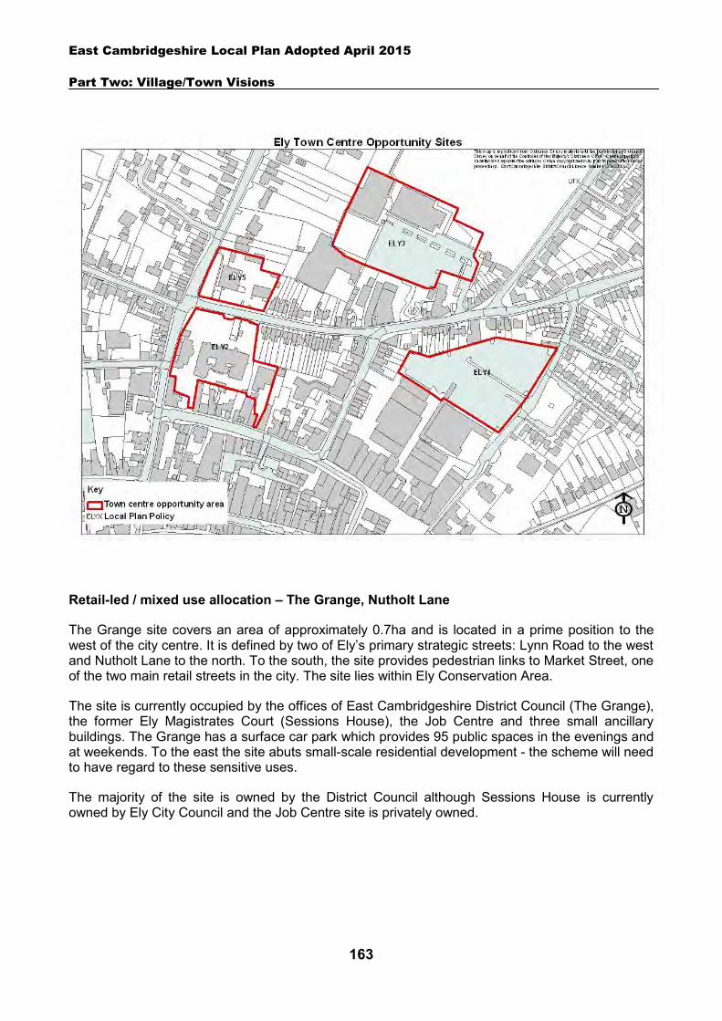
East Cambridgeshire Local Plan Adopted April 2015
Part Two: Village/Town Visions
163
Retail-led / mixed use allocation – The Grange, Nutholt Lane
The Grange site covers an area of approximately 0.7ha and is located in a prime position to the west of the city centre. It is defined by two of Ely’s primary strategic streets: Lynn Road to the west and Nutholt Lane to the north. To the south, the site provides pedestrian links to Market Street, one of the two main retail streets in the city. The site lies within Ely Conservation Area.
The site is currently occupied by the offices of East Cambridgeshire District Council (The Grange), the former Ely Magistrates Court (Sessions House), the Job Centre and three small ancillary buildings. The Grange has a surface car park which provides 95 public spaces in the evenings and at weekends. To the east the site abuts small-scale residential development - the scheme will need to have regard to these sensitive uses.
The majority of the site is owned by the District Council although Sessions House is currently owned by Ely City Council and the Job Centre site is privately owned.
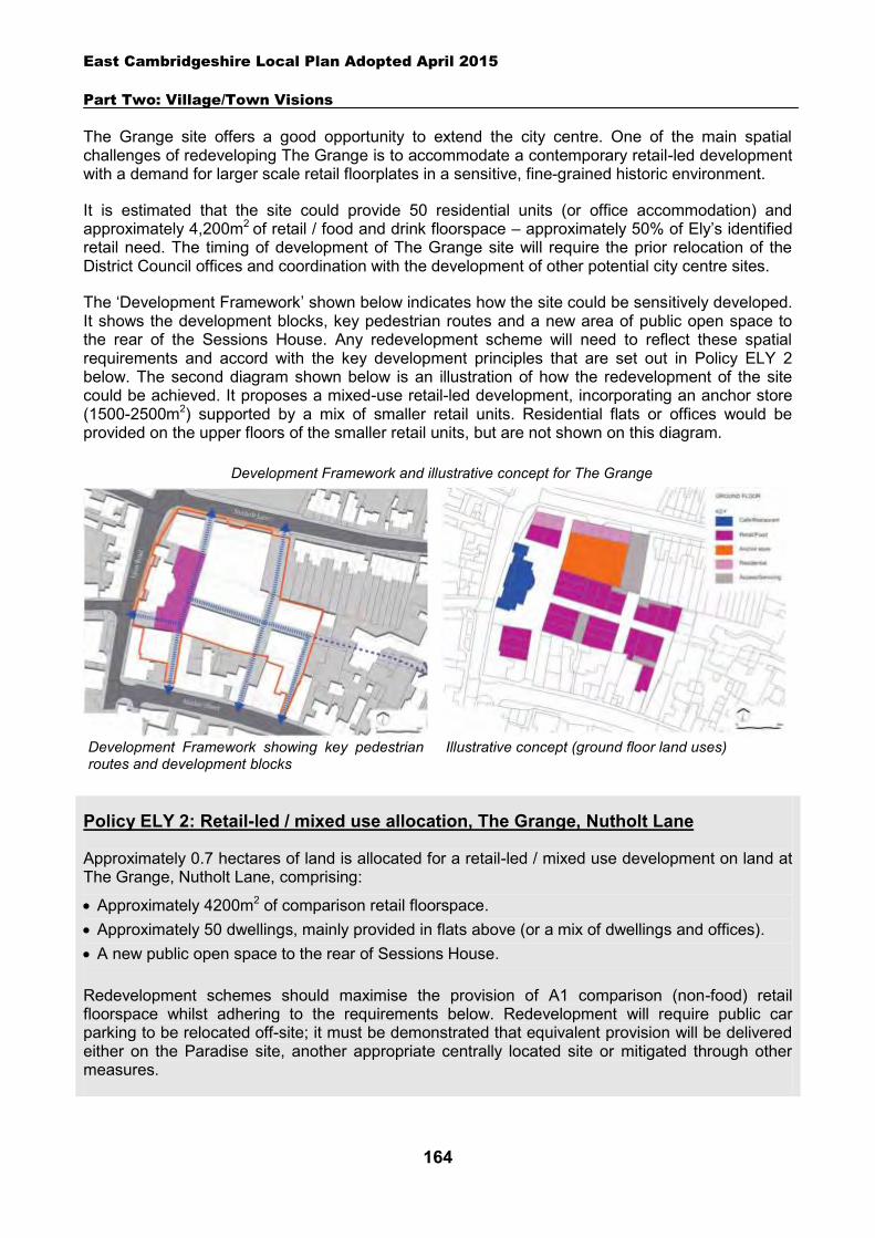
East Cambridgeshire Local Plan Adopted April 2015
Part Two: Village/Town Visions
164
The Grange site offers a good opportunity to extend the city centre. One of the main spatial challenges of redeveloping The Grange is to accommodate a contemporary retail-led development with a demand for larger scale retail floorplates in a sensitive, fine-grained historic environment.
It is estimated that the site could provide 50 residential units (or office accommodation) and approximately 4,200m2 of retail / food and drink floorspace – approximately 50% of Ely’s identified retail need. The timing of development of The Grange site will require the prior relocation of the District Council offices and coordination with the development of other potential city centre sites.
The ‘Development Framework’ shown below indicates how the site could be sensitively developed. It shows the development blocks, key pedestrian routes and a new area of public open space to the rear of the Sessions House. Any redevelopment scheme will need to reflect these spatial requirements and accord with the key development principles that are set out in Policy ELY 2 below. The second diagram shown below is an illustration of how the redevelopment of the site could be achieved. It proposes a mixed-use retail-led development, incorporating an anchor store (1500-2500m2) supported by a mix of smaller retail units. Residential flats or offices would be provided on the upper floors of the smaller retail units, but are not shown on this diagram.
Policy ELY 2: Retail-led / mixed use allocation, The Grange, Nutholt Lane
Approximately 0.7 hectares of land is allocated for a retail-led / mixed use development on land at The Grange, Nutholt Lane, comprising:
Approximately 4200m2 of comparison retail floorspace. Approximately 50 dwellings, mainly provided in flats above (or a mix of dwellings and offices). A new public open space to the rear of Sessions House. Redevelopment schemes should maximise the provision of A1 comparison (non-food) retail floorspace whilst adhering to the requirements below. Redevelopment will require public car parking to be relocated off-site; it must be demonstrated that equivalent provision will be delivered either on the Paradise site, another appropriate centrally located site or mitigated through other measures.
Development Framework showing key pedestrian routes and development blocks
Illustrative concept (ground floor land uses)
Development Framework and illustrative concept for The Grange
East Cambridgeshire Local Plan Adopted April 2015
Part Two: Village/Town Visions
165
Development proposals will be expected to:
Accord with the key spatial principles in the development framework diagram. Incorporate a larger floorplate retail unit within the scheme to maximise development potential. Enhance Ely Conservation Area and be sympathetic to the setting, appearance and character of
nearby Listed Buildings (particularly Ely Museum and the Sessions House). Improve the setting of Sessions House through the creation of an attractive new public open
space to the south and east of the building. Have particular regard to the layout, scale, height, design and massing of buildings, in order to
provide a high quality scheme that enhances the city centre and minimises impact on neighbouring residential uses. Appropriate height will generally be 2-3 storeys.
Maximise the number of pedestrian links, as indicated on the development framework diagram, including a minimum of two north-south links from Market Street to Nutholt Lane, a link to Lynn Road to the west and future provision for a link to the east.
Provide vehicular service access off Nutholt Lane, towards the east side of the site. Incorporate residential development on upper floors as appropriate. An element of affordable
housing (currently 30%) will be required under Policy HOU 3; and Comply with the other policies of the Local Plan.
Housing-led / mixed-use allocation – Paradise area
The Paradise area lies off Nutholt Lane to the north of the city centre. The site is currently occupied by the Paradise Sports Centre, the Paradise swimming pool, City of Ely Bowls Club and Newnham Street public car park which provides a total of 178 spaces. To the north is a public open space known locally as ‘Paradise Field’ which currently provides football and cricket facilities. The surrounding streets are primarily low to medium density residential. The site lies within Ely Conservation Area.
The ownership of the area is complex. Both Newnham Street car park and the Paradise Pool are owned by the District Council and are available for development in the short-term (the pool is currently on lease until 2015). The Paradise Sports Centre and Paradise field are also owned by the Council, however, they are subject to a lease to the Sports Trust until 2085. The Bowls Club is privately owned. The Sports Centre, playing field and Bowls Club are in active use and it is not clear when they may become available for development.
The District Council has aspirations for the area to be comprehensively developed as a mixed-use scheme incorporating residential, car parking and possibly community uses. Housing is considered to be the most appropriate primary use for the Paradise Pool/Newnham Street car park site given its location in a primarily residential area whilst the Bowls Club site could be suitable for a multi-storey car park. The Paradise field would be retained as a key community facility and area of amenity space. It is estimated there may be capacity for 64 dwellings – but this is dependent on which areas become available, and further masterplanning work.
Other important considerations for any comprehensive scheme would include:
Provision of improved pedestrian links to the city centre. Maintaining the existing level of green open space. Ensuring that development is appropriate for Ely Conservation Area and does not
obstruct key views of the cathedral.
East Cambridgeshire Local Plan Adopted April 2015
Part Two: Village/Town Visions
166
Provision of a positive frontage to overlook Paradise field. Exploring provision of a new vehicular access to the site from Deacon’s Lane. Provision of multi-storey car parking, in order to support the city centre.
The delivery timescales for parts of the area under third party control are uncertain. The policy below therefore provides a vision for the area and sets out key principles which redevelopment schemes for all or part of the area will need to accord with.
Retail-led / mixed use allocation – Waitrose carpark area
Waitrose is located off The Cloisters shopping precinct on the edge of the city centre, and has a large surface carpark. There is a need to retain carparking in this location, to serve Waitrose and the town centre. However, as the carpark area is currently surface only, it represents fairly inefficient use of space – and it is considered that there may be potential for the redevelopment of the area to provide additional retail floorspace as well as carparking. Development on this site would provide a logical extension to The Cloisters retail development, and could provide potential for either an extension to Waitrose or the provision of a mix of retail stores, including some large format units. There may also be some potential for the provision of offices, community uses and some flats on the upper floors.
The District Council has aspirations that this area will be comprehensively redeveloped in the future. However, at present there are no firm proposals by the John Lewis Parnership to redevelop the area, and it is not clear when this vision may be realised. As the delivery timescales are unclear, the policy below sets out a vision for the area and key principles which redevelopment schemes will need to accord with.
As part of any redevelopment scheme it will be important to improve the accessibility and permeability of the site – particularly to the north and west where access is currently poor. Opportunities should be explored to create new pedestrian and cycle links to Nutholt Lane and/or Newnham Street – potentially via land at 44 Nutholt Lane, or other locations. This could help to facilitate the creation of a new town centre pedestrian circuit, as well as enabling better access to the residential areas to the north.
Carparking could be partly re-provided on the site using an element of multi-storey provision. If a reduction in carparking spaces is proposed, the applicant will need to demonstrate provision of
Policy ELY 3: A Vision for Paradise area
The Paradise area will be redeveloped as a mixed-use scheme, providing residential uses, car parking and community uses as appropriate. The development will enhance Ely Conservation Area and be sympathetic to the setting, appearance and character of the historic setting including incorporating views of the cathedral. New pedestrian links to the city centre will be provided and a new vehicular access will be provided from Deacon’s Lane if feasible. Multi-storey car parking will be provided to support the city centre. The total area of Paradise Field will be retained and development will create a positive frontage to this important open space.
East Cambridgeshire Local Plan Adopted April 2015
Part Two: Village/Town Visions
167
additional parking spaces close by – for example, on land in the Paradise area (see Policy ELY 3). Improved pedestrian links via Nutholt Lane will be an important part of this concept.
Policy ELY 4: A Vision for the Waitrose carpark area
The Waitrose carpark area will be redeveloped as a retail-led mixed use scheme, providing new retail floorspace and carparking. There may also be potential for the provision of offices, community uses and flats on upper floors. The development will enhance Ely Conservation Area and be sympathetic to the setting, appearance and character of the historic setting, including incorporating views of Ely cathedral.
Carparking should be re-provided on-site to serve Waitrose and the city centre, potentially using an element of multi storey provision. If less carparking is provided than current levels, applicants will need to demonstrate that suitable alternative parking provision is available nearby for town centre requirements.
Options to improve the permeability of the site and pedestrian and cycle linkages should be explored. This should include the creation of a new link to Nutholt Lane if feasible.
Housing led / mixed use allocation – north of Nutholt Lane
This site is currently occupied by the Police and Ambulance stations. There are no current plans for the re-location of these facilities. However, this Plan covers the period up to 2031, and it is possible that one or both of these units may wish to move over this period – potentially to provide improved facilities without constrained highways access. As delivery timescales are uncertain, the policy below provides a vision for the area and key principles which redevelopment schemes will need to accord with.
It is considered that the site is suitable for residential-led development, but also potentially incorporating a mix of offices and community uses. As the site is located to the north of Nutholt Lane, it is considered to be less suitable for retail development. Suitable new locations will need to be secured for the relocated Police and Ambulance stations. It is broadly estimated that there could be potential for about 30 dwellings on the site, but this is subject to further design work.
Any redevelopment scheme should be sensitively designed, and be sympathetic to the Conservation Area and historic setting. As an important landmark site at a crossroads, the design of the scheme should be noteworthy, and incorporate a positive and attractive frontage onto Nultholt Lane and Lynn Road. A mix of houses and flats may be accommodated within the scheme.
Policy ELY 5: A Vision for land north of Nutholt Lane
The area will be redeveloped as a residential-led scheme, which may also incorporate community, leisure or office uses. Redevelopment will be dependent on identifying suitable locations for the current users of the site.
The development will enhance Ely Conservation Area and be sympathetic to the setting, appearance and character of the historic setting, including incorporating views of Ely cathedral.
East Cambridgeshire Local Plan Adopted April 2015
Part Two: Village/Town Visions
168
The design of the scheme will maximise use of its landmark setting, and will provide a positive frontage onto Nutholt Lane and Lynn Road.
Ely Market Square
Ely’s market square lies at the heart of the city, providing a dual role as a shopping destination and a civic square with weekly markets. The Council will support proposals which will enhance these important events to ensure that they remain attractive and competitive.
The square is a focus for activity on market days but can seem unused and uninviting at other times. Streetscape improvements were undertaken in the area in 2002 which have enhanced the environment with new street furniture. However, the current 1960s building overlooking the market square has long been considered to be unsympathetic to the historic character of central Ely and would benefit from redevelopment. The District Council will continue to work with the owner of the existing Market Place building on the potential to undertake improvement works.
Policy ELY 6: Ely Market Square
The District Council will support proposals that improve the character and appearance of the Market Square and its function as a market and activity hub for Ely.
Station Gateway
The Station Gateway is the area on the southern edge of the city around the railway station. The site covers an area of approximately 12.3 hectares and is bounded by the River Great Ouse to the east, the Cambridgeshire Business Park to the west, Ely railway station to the south, and residential development to the north. The railway station and the area to the north of Station Road lie within Ely Conservation Area. In addition to the railway station, the area currently contains a Tesco superstore, Standens Engineering, a car showroom and garages, vacant industrial units and other commercial enterprises.
The railway and the A142 have determined much of its character as an employment area and a public transport link for the city. However, this development is unsympathetic and blights the first impression of the city for thousands of rail and road users each day. Important views of the cathedral are framed by busy surface car parking, and industrial uses block both views and direct access to the attractive riverside. In addition, congestion caused by the level crossing on Station Road isolates the station and makes the area appear dangerous to cyclists and uninviting to pedestrians.
There is an opportunity to make some major improvements to the area. The appearance of the Station Gateway could be improved by the re-development of selected sites, and significant improvements could be made to the environment with major improvements to the A142 between Angel Drove and Stuntney Causeway.
Transport infrastructure development will play a dominant role in the considerations for development of the area. There is an opportunity to provide more car parking in the area for commuters and visitors within a sensitively designed multi-storey car park near the station. In addition, major improvements to the A142 between Angel Drove and Stuntney Causeway will manage heavy traffic from Angel Drove and Station Road and reduce congestion. This will address
East Cambridgeshire Local Plan Adopted April 2015
Part Two: Village/Town Visions
169
existing severance issues by allowing greater pedestrian and cycle access to the city centre and river. These environmental improvements will make the site more attractive to investors, enabling a high quality redevelopment that would support the long-term sustainable expansion of Ely.
The Station Gateway area is in multiple ownerships, so sites may come forward at different times. The Council has identified four broad ‘areas’, as set out in Policy ELY 8 below. However, it will be vital to ensure that the redevelopment of each area contributes to the realisation of an overall vision. A strategic Masterplan for the whole Station Gateway area is currently being prepared by the District Council, to establish the broad location of land uses, open space and landscaping, and principles such as access and movement and built form. Once completed this will be adopted as a Supplementary Planning Document and used to guide planning application decisions on individual proposals. Development schemes will be expected to take account of the SPD, as well as Policy ELY 7 and the relevant sections of Policy ELY 8.
Policy ELY 7: Employment-led / mixed-use allocation, Station Gateway
Vision: The Station Gateway area will be transformed into a vibrant mixed-use area which provides an attractive gateway to the city. Existing industrial uses will be relocated where possible and the sites comprehensively redeveloped with high quality offices and some apartments framing views of the cathedral. The station will be enhanced to provide transport interchange facilities and complementary small-scale retail units. Sensitively designed multi-storey car parks will provide parking for commuters and visitors. New pedestrian links will draw people to the riverside, Angel Drove and into the rest of the city.
Approximately 12.3 hectares of land are allocated for a high quality mixed-use development comprising:
Approximately 32,700m2 of employment floorspace (B1 and B2 uses) on an area broadly equivalent to 3.8 hectares (providing a minimum of 800 jobs).
A new public transport interchange at the railway station. Small retail units (up to approximately 1,000m2) linked to the redevelopment of the railway station
interchange. Approximately 400-630 residential units. Public open space, including public art. Carparking for occupiers/users of the site, and for the railway station.
A Masterplan is needed to provide context for consideration of planning applications in the area. This will be published as a Supplementary Planning Document. Development proposals for all sites within the Station Gateway area will be expected to:
Take account of guidance set out in the Ely Station Gateway SPD. Comply with the relevant part of Policy ELY 8 which relates to particular areas. Support the creation of a public transport interchange at the railway station. Have particular regard to the layout, scale, height, design and massing of buildings, in order to
create a strong coherent urban form, frame and protect views, increase accessibility to the River Ouse and Cathedral, minimise harm to Ely Conservation Area, and integrate development into the surrounding urban fabric.
Support the creation of a successful mixed-use environment that is easy to navigate and attractive to both visitors and residents as a place to visit.
East Cambridgeshire Local Plan Adopted April 2015
Part Two: Village/Town Visions
170
Develop new attractive, flexible and usable public spaces at key locations. Support the provision of a network of new pedestrian and cycle routes to Angel Drove and the
riverside area to link with new development and promote the enjoyment and use of the river and park, including additional cycle storage and parking and improved signage.
Provide easily accessible car parking which does not dominate the character of the area. Provide an element of affordable housing (currently 30%) for any housing element as required
under Policy HOU 3. Maximise development value through high quality design and by exploiting views of the river and
cathedral. Demonstrate that the development is consistent with the objectives of the Anglian River Basin
Management Plan. Demonstrate that any flood risk can be adequately mitigated; and Comply with the other policies of the Local Plan.
Policy ELY 8: Station Gateway visions by area
The District Council will support proposals for individual sites which deliver development in line with the Station Gateway SPD and the vision for the area as set out in Policy ELY 7, and accord with the following site-specific visions/requirements:
Area 1: Railway station, Tesco supermarket and petrol station
This area should incorporate a new transport interchange for pedestrians, cyclists, buses and taxis at the railway station, along with associated multi-storey car parking and appropriate small-scale retail facilities. Potential for a secondary vehicular access into the station from The Dock/A142 roundabout should be explored. There is an opportunity to create a new public space / pedestrian route across the Tesco site from the station towards the town centre, taking advantage of long distance views of the cathedral. The re-location of the Tesco supermarket would allow the area to be comprehensively re-developed. The Octagon Business Park off Angel Drove (Policy ELY 9) may offer potential for its relocation – see Policy ELY 9 below. The wider site should be developed for high quality offices and some apartments/houses, and small-scale retail units associated with the station. The built-up area of the site should broadly comprise the following proportion of floorspace – residential 50%, offices 47%, retail 3%.
Area 2: Hanson concrete, Westmill Foods, EMG Ford
Sites in this area should be developed comprehensively for a mix of employment uses including offices - and apartments/houses. The built-up area of the site should broadly comprise the following proportion of floorspace – offices 33%, residential 67%. It will be important for proposals to respect the sensitive location adjoining the County Wildlife Site. Opportunities should be taken to enhance the permeability of the area, for example with new pedestrian and cycle links to Potters Lane and the County Wildlife Site.
East Cambridgeshire Local Plan Adopted April 2015
Part Two: Village/Town Visions
171
Area 3: Standens area
This area should be developed for a mix of uses including high quality residential development, offering views of the riverside – with some office or hotel development near Station Road and the railway line. The built-up area of the site should broadly comprise the following proportion of floorspace – residential 61%, offices or hotel 39%. Strong pedestrian links should be provided to allow people to navigate easily between the station and the riverside/city centre. Proposals should ensure the retention and enhancement of the existing boatyard/dock area.
Area 4: Angel Drove car park
The commuter car park will be redeveloped for employment uses (B1/B2 uses). Parking for commuters will be re-provided in multi-storey car parking within Area 1.
Angel Drove - Octagon Business Park
This site comprises approximately 16ha of uncultivated and vacant fenland on the edge of the city at the southern end of Angel Drove (the A142). The railway line forms the south-eastern boundary of the site, with Angel Drove on its north-western edge. The established Cambridgeshire Business Park lies to the north-east with open land to the south-west. The site is suitable for employment uses (B1, B2 and B8) and also for retail uses, where it is demonstrated through a Retail Impact Assessment that there would be no adverse impact on Ely city centre, and that other criteria in Policy COM 1 are satisfied. This site offers potential to: re-locate the Tesco supermarket away from the Station Gateway area; provide comparison retail floorspace for bulky goods not able to be accommodated in the city centre (but which will reduce leakage of comparison goods outside of the district); and to accommodate service uses such as a hotel (C1) and a public house (A4). Planning permission has been approved in principle for a scheme accommodating these uses (planning reference 13/00122/ESF), subject to agreement of conditions and an appropriate Section 106 agreement. The scheme involves the provision of approximately 1.92 hectares of B1/B2/B8 development, 13.44 hectares of retail development and 0.64 hectares for provision of a hotel and pub.
The site is in a highly visible location, located at a key gateway into Ely. It will be important to ensure that the implementation of the approved scheme (or any alternative scheme) delivers design, layout, massing and landscaping of high quality and provides an attractive setting and entrance to the city.
The policy below provides a vision for the area and sets out key principles which redevelopment schemes for all or part of the area will need to accord with.
Policy ELY 9: A Vision for Octagon Business Park
The site will be redeveloped for employment uses (B1, B2 and B8), and retail development (e.g. for bulky retail goods or a supermarket), and other service uses (including C1 and A4). Proposals incorporating retail development will need to accord with Policy COM 1 and demonstrate through a Retail Impact Assessment that there will be no adverse impact on Ely city centre.
A Masterplan for the area will need to be prepared and submitted as part of any initial planning
East Cambridgeshire Local Plan Adopted April 2015
Part Two: Village/Town Visions
172
application for the site, and approved by the District Council.
Development will provide an attractive setting for this entrance into Ely, including the creation of a strong frontage along Angel Drove and consideration of the relationship of development to the Cambridgeshire Business Park. Substantial landscaping will reinforce the fen character of the site and minimise the visual impact of any car parking areas. A vehicular/pedestrian/cycle link to the Cambridgeshire Business Park will be incorporated and appropriate provision will be made for buses and taxis. The development of the site will need to be coordinated with the delivery of major improvements to the A142 between Angel Drove and Stuntney Causeway.
Downham Road sports and leisure hub
The Downham Road site lies on the north-western edge of Ely, close to large areas of housing in the north of the city (both existing and proposed). The site extends to approximately 7 hectares and is within the ownership of East Cambridgeshire District Council.
The area already represents a major focus for leisure and sporting activity within Ely, offering opportunities to play rugby, football, hockey, tennis, squash and golf. The District Council’s vision is to build on these existing facilities and create a ‘sports and leisure hub’ for the district with a new district-wide leisure centre and multiplex cinema. This will benefit the economy of Ely through additional visitors, but also improve social wellbeing in terms of promoting healthy lifestyles. The development should not harm the vitality or viability of Ely city centre.
The aim is to create a complete destination, where visitors can participate, eat, drink and relax, moving freely from one venue to another. There will be a need to give due consideration to the inter-relationship of different spaces within the site. It is therefore likely that a site-wide masterplan will need to be produced in advance of development.
Sports provision
There is an identified need for a larger public swimming pool and sports centre within Ely to cater for the increased population in the district79. The existing Paradise Pool is reaching the end of its life and is in need of replacement; however, there is insufficient space on the site to deliver the size of facility that is now required for the district. Following a thorough process of assessment, evaluation and consultation, it was concluded that the new leisure centre would be best located on land adjacent to Ely Rugby Club at Downham Road.
Planning permission was granted in 2010 for a new district-wide leisure centre, providing public sport and wet/dry leisure facilities including a main pool, studio pool and splash pool, fitness suite and flexible sports hall that could also host occasional concerts or events. Any application for development will need to demonstrate how the site could be safely accessed on foot and by cycle from the built-up area of Ely, and mitigates the A10 barrier. The proposals will allow the delivery of a new and much needed facility within the short term whilst avoiding disruption to services on the existing Paradise site.
79 Sports Facilities and Open Spaces Assessment (2005)
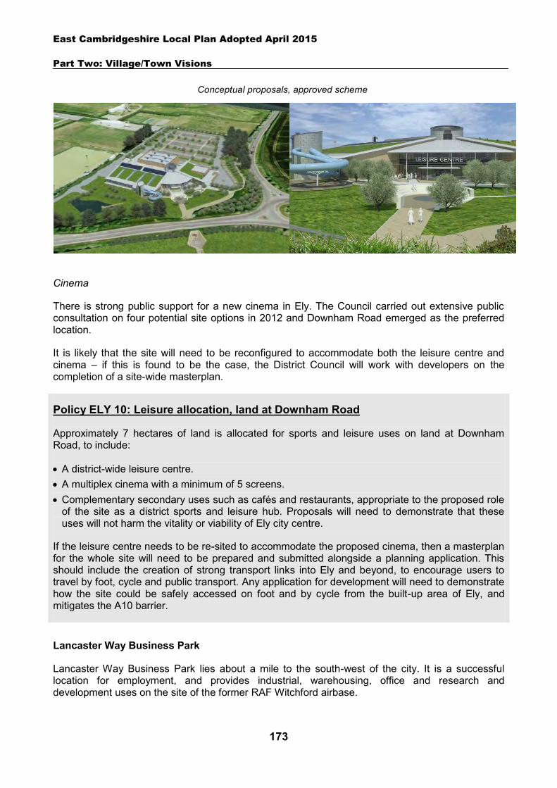
East Cambridgeshire Local Plan Adopted April 2015
Part Two: Village/Town Visions
173
Cinema
There is strong public support for a new cinema in Ely. The Council carried out extensive public consultation on four potential site options in 2012 and Downham Road emerged as the preferred location.
It is likely that the site will need to be reconfigured to accommodate both the leisure centre and cinema – if this is found to be the case, the District Council will work with developers on the completion of a site-wide masterplan.
Policy ELY 10: Leisure allocation, land at Downham Road
Approximately 7 hectares of land is allocated for sports and leisure uses on land at Downham Road, to include:
A district-wide leisure centre. A multiplex cinema with a minimum of 5 screens. Complementary secondary uses such as cafés and restaurants, appropriate to the proposed role
of the site as a district sports and leisure hub. Proposals will need to demonstrate that these uses will not harm the vitality or viability of Ely city centre.
If the leisure centre needs to be re-sited to accommodate the proposed cinema, then a masterplan for the whole site will need to be prepared and submitted alongside a planning application. This should include the creation of strong transport links into Ely and beyond, to encourage users to travel by foot, cycle and public transport. Any application for development will need to demonstrate how the site could be safely accessed on foot and by cycle from the built-up area of Ely, and mitigates the A10 barrier.
Lancaster Way Business Park
Lancaster Way Business Park lies about a mile to the south-west of the city. It is a successful location for employment, and provides industrial, warehousing, office and research and development uses on the site of the former RAF Witchford airbase.
Conceptual proposals, approved scheme
East Cambridgeshire Local Plan Adopted April 2015
Part Two: Village/Town Visions
174
The business park has seen significant expansion over recent years and its further development is a key element of the Council’s employment strategy for Ely. The site is capable of providing a range of employment opportunities through the provision of new flexible high quality employment space. This will allow choice for companies looking to expand or move into the district, provide local jobs and reduce out-commuting. Accordingly, the Core Strategy (2009) proposed a 30ha extension to the south-east of the business park.
Outline planning permission has since been granted to extend the business park by 36.6ha for a mix of B1, B2 and B8 uses. This development will make Lancaster Way one of the largest business parks in the region.
The allocation for the Lancaster Way site has been extended to reflect the area that has planning permission, providing certainty for its continuing employment use. It is estimated that there is potential for an estimated 1973 new jobs to be provided on the site.
Ely Road and Rail Distribution Centre, Queen Adelaide
Ely Road and Rail Distribution Centre is located in Queen Adelaide, approximately 1.2 miles north-east of Ely city centre. The site is owned by The Potter Group, who provide storage and logistics services across the UK.
The site benefits from a direct link to the mainline rail network at an important interchange point within the East Anglia rail network. Currently the site provides 24,000m2 of rail-connected warehousing, extensive hard standing and office accommodation.
An additional 12ha of land within the site is available for development. This area was previously used for the storage of motor vehicles and has an authorised use for general storage and distribution (B8 employment). Due to the historic use of the site, a Contamination Assessment will be required prior to development to demonstrate that any risk can be adequately mitigated. This area has potential to be redeveloped for a mix of B1, B2 and B8 uses, and to have capacity to provide an estimated additional 469 jobs. However, it should be noted that the Road and Rail Distribution Centre, plus some adjoining land, is identified in the Cambridgeshire and Peterborough Waste Plan as a Transport Safeguarding Area (reference T2F). In this area there is a presumption against any development that could prejudice the existing or potential use of the protected transport zone (as set out in Waste Policy CS23). Proposals will therefore need to have regard to this, and consultation will need to take place with the County Council as Waste Planning Authority.
The site is located in a sensitive position in terms of nature conservation following the designation of ‘Ely Pits and Meadows’ SSSI. This comprises much of the land to the west of the site (known locally as ‘Roswell Pits’) and land opposite the site (known locally as the ‘beet pits’). In addition, the site is bordered by the River Great Ouse to the south-east, which is designated as a County Wildlife Site. It will be important for any development to respect this setting, and ensure no adverse impact on the protected areas.
Policy ELY 11: Employment allocation, Lancaster Way
Approximately 40.5 hectares of land are allocated for employment at Lancaster Way for B1, B2 and B8 purposes. The area will need to be developed in accordance with the current or any subsequent planning permissions.
East Cambridgeshire Local Plan Adopted April 2015
175
Access to the site by road is currently from the east, via a private road bridge over the river. A secondary access into the site runs from Ely Road to the north of the site. A public footpath adjoins part of the southern boundary of the site, providing an important link between Ely and two long distance footpaths – the Fen Rivers Way and the Hereward Way.
Policy ELY 12: Employment allocation, Ely Road and Rail Distribution Centre
Approximately 12 hectares of land is allocated for employment development (B1, B2 and B8 uses).
Development proposals within the allocated area will be expected to:
Avoid any adverse impact on the adjacent County Wildlife Site, SSSI and Ely Country Park by providing appropriate landscaping treatment and other necessary mitigation measures.
Demonstrate that any contamination on the site can be adequately mitigated. Have regard to the Transport Safeguarding Area designation, and avoid prejudicing the
operations of the Rail and Road Centre (as set out in the adopted Cambridgeshire and Peterborough Waste Plan).
Retain and enhance the public footpath link on the south edge of the site. Provide any necessary highway improvements to nearby roads; and Comply with the other policies of the Local Plan.
Ely Riverside area
The riverside area of Ely is located on the east side of the city, in the vicinity of the River Great Ouse. It is a predominantly residential area, with historic character, and provides an attractive waterfront setting for the city. It also contains areas of open space, and a number of community and leisure facilities, including Jubilee Gardens, Pocket Park, the Maltings community hall, and a marina. The area provides opportunities for boating, walking, cycling and recreation, and is an important magnet for tourists and visitors to the city. There are a number of pubs and eating establishments in the area, which add to the area’s attraction.
This area of Ely is considered to be key to the local tourist economy, and provides an important attraction for local people. The District Council is keen to increase the attractiveness of the area for visitors and residents, and to promote it as a destination. Proposals which provide new or enhanced tourist, community or leisure attractions in the area, and which accord with other policies in this Local Plan, will normally be encouraged and supported. Opportunities should also be explored to improve pedestrian and cycle links in the area, landscaping and the quality of the streetscape. Any development should respect the historic character of the area, and look at potential to enhance and improve the appearance of the area and the setting of the riverside. Views across the area towards Ely cathedral will be particularly important to retain and enhance.
Policy ELY 13: Ely Riverside area
The quality and attractiveness of the riverside area should be protected and enhanced, as a key destination in the district. Opportunities should be explored to improve pedestrian and cycle links, landscaping and the quality of the streetscape.
Development in the area which provides new or enhanced tourist, community or leisure attractions,
East Cambridgeshire Local Plan Adopted April 2015
176
and which accords with other policies in this Local Plan, will normally be encouraged and supported. All development proposals will be expected to:
Be sensitively designed, and respect the historic character of the area. Protect and enhance the setting of the town. Retain and enhance key views of Ely cathedral; and Accord with other policies in this Local Plan.
Other infrastructure and community facilities
Ely needs to be served by appropriate levels of infrastructure and facilities, in order to ensure the quality of people’s lives and prevent unnecessary travel. This includes infrastructure such as water, energy, sewage treatment works, and roads – and community facilities such as schools, open space, health, and sport and recreation facilities.
As outlined in Chapter 3, the District Council will continue to work with infrastructure providers to enable the delivery of necessary of infrastructure and facilities. The District Council will also seek to secure planning obligations and Community Infrastructure Levy monies from developers towards new infrastructure and facilities required as a result of new development.
It will also be important to protect existing community facilities. As set out in Chapter 7, the loss of community facilities will be resisted under Policy COM 3. Proposals for new community development that benefit Ely will be supported in principle, subject to Policies GROWTH 3 and COM 4.
The key future infrastructure and service requirements for Ely are set out in the table below. These have been identified through technical work, discussions with infrastructure providers, and community consultation – and are linked to the estimated future levels of growth in Ely to 2031.
Transport
In the face of continuing growth, the challenge presented to Ely’s transport network is to sustainably support an economically vibrant, multi-functional city while preserving the unique character and heritage that gives Ely its identity. The compact nature of the city, particularly in the central historic area, acts as a constraint on the width of carriageway on many roads. This limits the scope for providing additional on-road infrastructure, such as dedicated cycle lanes and on-street parking bays. However, it will be important within these constraints, to consider the needs of all road users, and work towards improvements.
Ely has several long and short stay car parks that are managed by the District Council. Parking is currently provided free of charge. The majority of these car parks are clustered around the city centre, providing around 1,200 spaces. In addition, 200 paid for spaces are provided at Angel Drove, designed to accommodate railway station commuter traffic and free up space in the city centre car parks for visitors and shoppers.
Ely is well connected to the national railway network, with services running regularly to a variety of destinations. Bus services connect Ely with a number of the villages in its rural hinterland. Only a small number of services currently run commercially and the rest are under contract to the County Council, and it is clear that there are pressures on subsidies. Several of the contracted services are only available on market day (Thursday). There is no bus station in Ely but the main bus stops in Market Street are served by all of the bus routes.
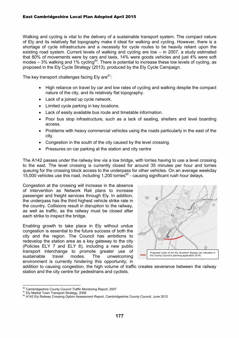
East Cambridgeshire Local Plan Adopted April 2015
177
Walking and cycling is vital to the delivery of a sustainable transport system. The compact nature of Ely and its relatively flat topography make it ideal for walking and cycling. However, there is a shortage of cycle infrastructure and a necessity for cycle routes to be heavily reliant upon the existing road system. Current levels of walking and cycling are low – in 2007, a study estimated that 80% of movements were by cars and taxis, 14% were goods vehicles and just 4% were soft modes – 3% walking and 1% cycling80. There is potential to increase these low levels of cycling, as proposed in the Ely Cycle Strategy (2013), produced by the Ely Cycle Campaign.
The key transport challenges facing Ely are81:
High reliance on travel by car and low rates of cycling and walking despite the compact nature of the city, and its relatively flat topography.
Lack of a joined up cycle network. Limited cycle parking in key locations. Lack of easily available bus route and timetable information. Poor bus stop infrastructure, such as a lack of seating, shelters and level boarding
access. Problems with heavy commercial vehicles using the roads particularly in the east of the
city. Congestion in the south of the city caused by the level crossing. Pressures on car parking at the station and city centre
The A142 passes under the railway line via a low bridge, with lorries having to use a level crossing to the east. The level crossing is currently closed for around 35 minutes per hour and lorries queuing for the crossing block access to the underpass for other vehicles. On an average weekday 15,000 vehicles use this road, including 1,200 lorries82 - causing significant rush hour delays.
Congestion at the crossing will increase in the absence of intervention as Network Rail plans to increase passenger and freight services through Ely. In addition, the underpass has the third highest vehicle strike rate in the country. Collisions result in disruption to the railway, as well as traffic, as the railway must be closed after each strike to inspect the bridge.
Enabling growth to take place in Ely without undue congestion is essential to the future success of both the city and the region. The Council has ambitions to redevelop the station area as a key gateway to the city (Policies ELY 7 and ELY 8), including a new public transport interchange to promote greater use of sustainable travel modes. The unwelcoming environment is currently hindering this opportunity; in addition to causing congestion, the high volume of traffic creates severance between the railway station and the city centre for pedestrians and cyclists.
80 Cambridgeshire County Council Traffic Monitoring Report, 2007 81 Ely Market Town Transport Strategy, 2008 82 A142 Ely Railway Crossing Option Assessment Report, Cambridgeshire County Council, June 2012
Proposed route of the Ely Southern Bypass (as indicated in the County Council’s planning application 2014)
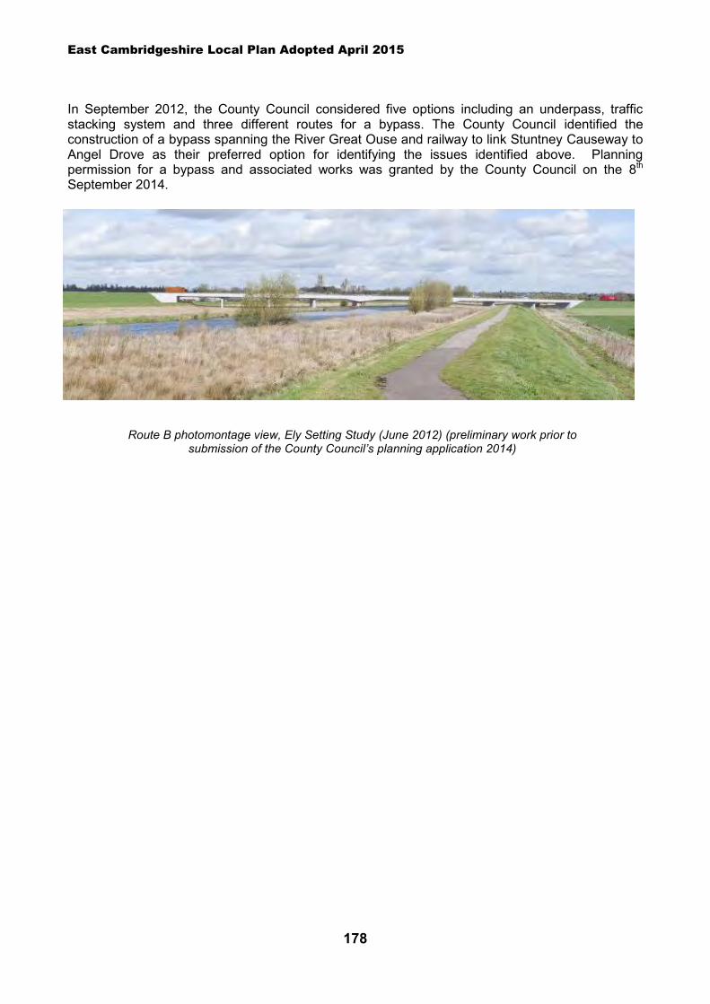
East Cambridgeshire Local Plan Adopted April 2015
178
In September 2012, the County Council considered five options including an underpass, traffic stacking system and three different routes for a bypass. The County Council identified the construction of a bypass spanning the River Great Ouse and railway to link Stuntney Causeway to Angel Drove as their preferred option for identifying the issues identified above. Planning permission for a bypass and associated works was granted by the County Council on the 8th September 2014.
Route B photomontage view, Ely Setting Study (June 2012) (preliminary work prior to submission of the County Council’s planning application 2014)
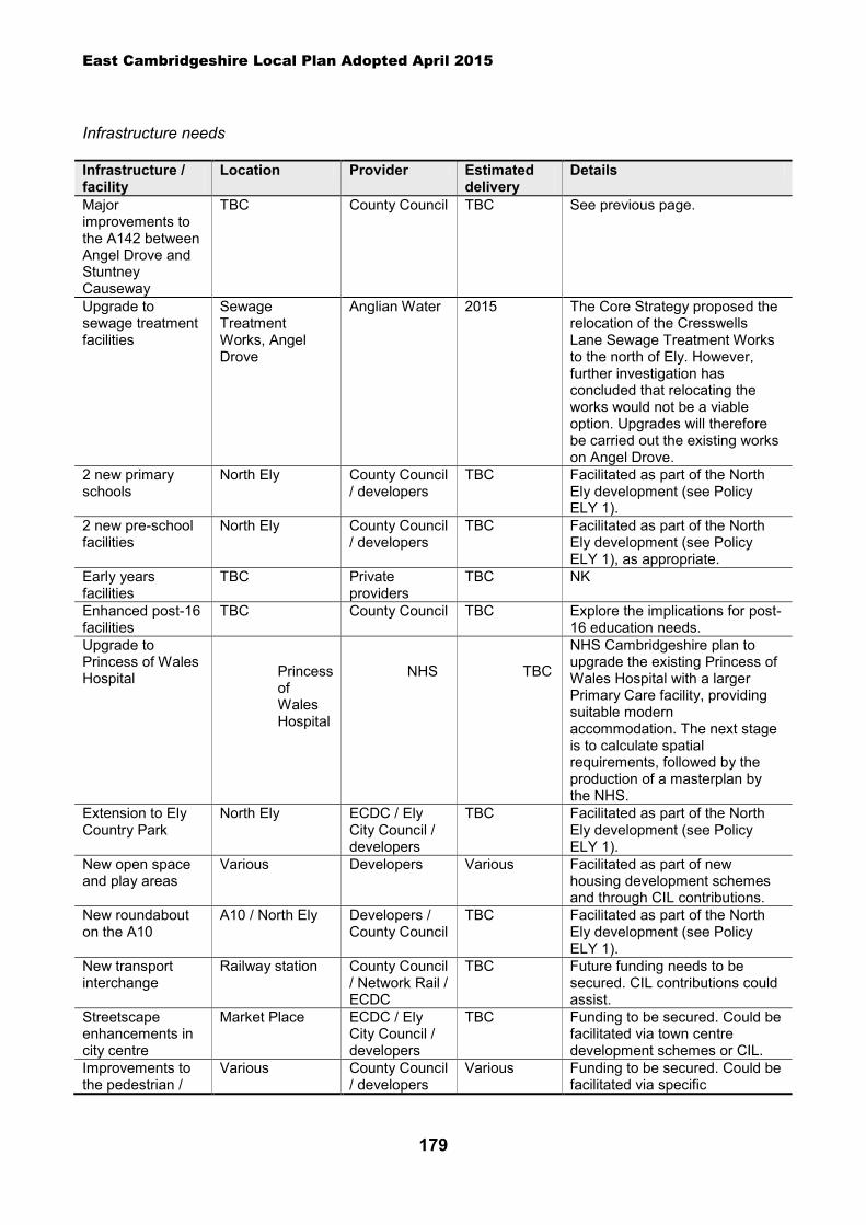
East Cambridgeshire Local Plan Adopted April 2015
179
Infrastructure needs
Infrastructure / facility
Location Provider Estimated delivery
Details
Major improvements to the A142 between Angel Drove and Stuntney Causeway
TBC County Council TBC See previous page.
Upgrade to sewage treatment facilities
Sewage Treatment Works, Angel Drove
Anglian Water 2015 The Core Strategy proposed the relocation of the Cresswells Lane Sewage Treatment Works to the north of Ely. However, further investigation has concluded that relocating the works would not be a viable option. Upgrades will therefore be carried out the existing works on Angel Drove.
2 new primary schools
North Ely County Council / developers
TBC Facilitated as part of the North Ely development (see Policy ELY 1).
2 new pre-school facilities
North Ely County Council / developers
TBC Facilitated as part of the North Ely development (see Policy ELY 1), as appropriate.
Early years facilities
TBC Private providers
TBC NK
Enhanced post-16 facilities
TBC County Council TBC Explore the implications for post-16 education needs.
Upgrade to Princess of Wales Hospital Princess
of Wales Hospital
NHS TBC
NHS Cambridgeshire plan to upgrade the existing Princess of Wales Hospital with a larger Primary Care facility, providing suitable modern accommodation. The next stage is to calculate spatial requirements, followed by the production of a masterplan by the NHS.
Extension to Ely Country Park
North Ely ECDC / Ely City Council / developers
TBC Facilitated as part of the North Ely development (see Policy ELY 1).
New open space and play areas
Various Developers Various Facilitated as part of new housing development schemes and through CIL contributions.
New roundabout on the A10
A10 / North Ely Developers / County Council
TBC Facilitated as part of the North Ely development (see Policy ELY 1).
New transport interchange
Railway station County Council / Network Rail / ECDC
TBC Future funding needs to be secured. CIL contributions could assist.
Streetscape enhancements in city centre
Market Place ECDC / Ely City Council / developers
TBC Funding to be secured. Could be facilitated via town centre development schemes or CIL.
Improvements to the pedestrian /
Various County Council / developers
Various Funding to be secured. Could be facilitated via specific

East Cambridgeshire Local Plan Adopted April 2015
180
Infrastructure / facility
Location Provider Estimated delivery
Details
cycle network development schemes or CIL.
Spatial strategy for Ely and Ely – Lancaster Way Business Park (see Inset Maps 8.14 and 8.15
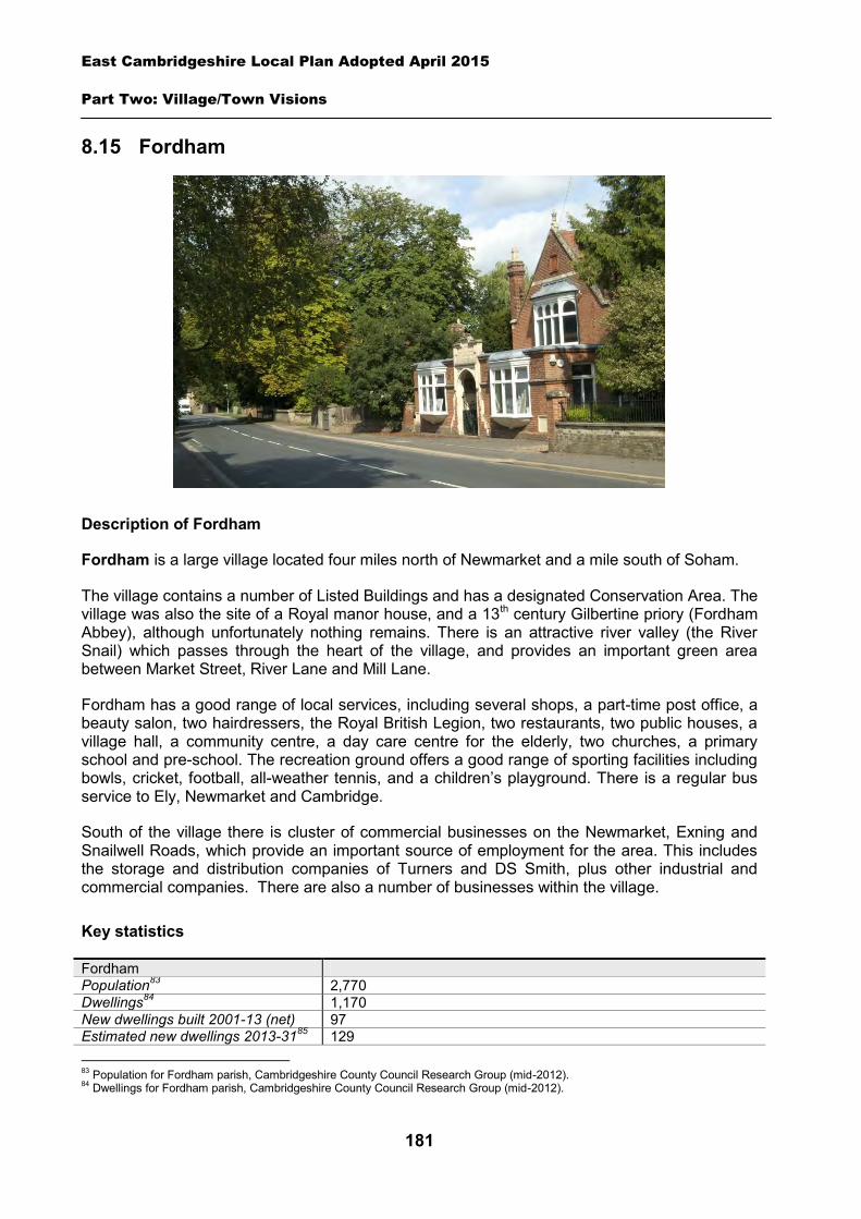
East Cambridgeshire Local Plan Adopted April 2015
Part Two: Village/Town Visions
181
8.15 Fordham
Description of Fordham
Fordham is a large village located four miles north of Newmarket and a mile south of Soham.
The village contains a number of Listed Buildings and has a designated Conservation Area. The village was also the site of a Royal manor house, and a 13th century Gilbertine priory (Fordham Abbey), although unfortunately nothing remains. There is an attractive river valley (the River Snail) which passes through the heart of the village, and provides an important green area between Market Street, River Lane and Mill Lane.
Fordham has a good range of local services, including several shops, a part-time post office, a beauty salon, two hairdressers, the Royal British Legion, two restaurants, two public houses, a village hall, a community centre, a day care centre for the elderly, two churches, a primary school and pre-school. The recreation ground offers a good range of sporting facilities including bowls, cricket, football, all-weather tennis, and a children’s playground. There is a regular bus service to Ely, Newmarket and Cambridge.
South of the village there is cluster of commercial businesses on the Newmarket, Exning and Snailwell Roads, which provide an important source of employment for the area. This includes the storage and distribution companies of Turners and DS Smith, plus other industrial and commercial companies. There are also a number of businesses within the village.
Key statistics
Fordham Population83 2,770 Dwellings84 1,170 New dwellings built 2001-13 (net) 97 Estimated new dwellings 2013-3185 129 83 Population for Fordham parish, Cambridgeshire County Council Research Group (mid-2012). 84 Dwellings for Fordham parish, Cambridgeshire County Council Research Group (mid-2012).
East Cambridgeshire Local Plan Adopted April 2015
Part Two: Village/Town Visions
182
Existing public transport services A Monday – Saturday regular service to Ely, plus a Monday – Friday regular service to Newmarket and Cambridge (as at 2012)
Housing
Fordham is likely to continue to grow, with new housing being built on suitable ‘infill’ sites within the village. Additionally, three new housing allocation sites are proposed off Mildenhall Road.
A ‘development envelope’ has been drawn around Fordham to define the built-up part of the village where development (infill and the allocation sites) may be permitted. The purpose is to prevent sprawl into the open countryside. Development on infill sites will need to be in line with Policy GROWTH 2. Development on the allocation sites will need to be in line with Policy FRD 1, Policy FRD 2, and Policy FRD 3.
Outside the development envelope, housing will not normally be permitted – unless there are exceptional circumstances, such as essential dwellings for rural workers, or affordable housing. Housing schemes outside the development envelope will be assessed against Policy GROWTH 2 and other Local Plan policies as appropriate.
Housing allocation - land east of 24 Mildenhall Road
The site is located between the Vicarage and a terrace of houses, and is currently in use as a paddock. The site is close to the school and church and within walking distance of the village shop and bus stops. Although it is a small gap site between houses, the site adjoins open countryside and allotments to the rear. The site has an attractive green frontage on Mildenhall Road, with a strong hedgeline along the front, which includes a number of small trees.
It will be important for any development to be sensitively designed to provide a high quality scheme which enhances the setting of Fordham. Particular care should be taken to provide attractive landscaped views of the scheme from along Mildenhall Road, across the fields from Collin’s Hill, and from the countryside and allotments to the rear. This should include retention of as much original hedgeline and planting as possible, and additional planting on all the boundaries (including new trees to off-set any loss on the frontage). It should also involve ensuring that the rear part of the site is sensitively designed with lower densities and sufficient areas of open space, landscaping and garden land close to the boundary with the countryside/allotments.
There is currently a pedestrian crossing island opposite the site on Mildenhall Road. If it is not possible to retain in its current location, this will need to be relocated as part of the development proposal. Vehicular access should be provided at one point into the site, in order to avoid driveways crossing the footpath on Mildenhall Road.
The site is owned by the Parish Council, and there are aspirations to utilise any monies generated from the scheme towards the provision of a new Pavilion building in the village, and/or other priorities identified by the village community through the Parish Council.
85 East Cambridgeshire Housing Trajectory September2014. Note, this is likely to be an underestimate as it excludes potential supply from rural exception windfall sites.
East Cambridgeshire Local Plan Adopted April 2015
Part Two: Village/Town Visions
183
Policy FRD 1: Housing allocation, land east of 24 Mildenhall Road
0.6 hectares of land is allocated for residential development for approximately 10 dwellings. Development proposals will be expected to:
Have particular regard to the layout and the scale, height, design and massing of buildings, and landscaping, in order to provide a scheme which minimises visual harm to the countryside, enhances the setting of Fordham, and provides attractive landscaped views from Mildenhall Road and Collins Hill.
Maximise the retention of existing hedgerows and trees on the site, and provide additional landscaping on the site boundaries.
Provide a single safe vehicular access from Mildenhall Road, which either allows for the retention of the pedestrian island on Mildenhall Road, or involves its relocation as part of the development proposal.
Provide an element of affordable housing (currently 40%) as required under Policy HOU 3, with priority being given to people in local housing need.
Provide a mix of dwelling types and sizes to reflect current evidence of need within Fordham. Demonstrate there is adequate capacity in the sewage treatment works and the foul
sewerage network. Provide appropriate evidence of the archaelogical potential significance of the site prior to the
submission of a planning application; and Comply with the other policies of the Local Plan.
Housing allocation - land between 37 and 55 Mildenhall Road
The site is located between housing on the north side of Mildenhall Road, and is currently an agricultural field. It is a small gap site between houses, and adjoins open countryside to the rear. The site is close to the school and church and within walking distance of the village shop and bus stops.
It will be important for any development to be sensitively designed to provide a high quality scheme which enhances the setting of Fordham and the appearance of Mildenhall Road. This should include retention of as much original hedgerow as possible, and additional planting on the site. Access to the site will need to cut through an existing cycle route, and a safe crossing point will therefore need to be provided. Vehicular access should be provided at one point into the site, in order to minimise driveways crossing the cycle/footpath on Mildenhall Road.
Policy FRD 2: Housing allocation, land between 37 and 55 Mildenhall Road
0.3 hectares of land is allocated for residential development for approximately 6 dwellings.
Development proposals will be expected to:
Have particular regard to the layout and the scale, height, design and massing of buildings, and landscaping, in order to minimise visual harm to the countryside and provide an attractive scheme which enhances the setting of Fordham.
Maximise the retention of existing hedgerows on the boundaries of the site. Provide safe vehicular access from one point off Mildenhall Road, a new crossing point for the
East Cambridgeshire Local Plan Adopted April 2015
Part Two: Village/Town Visions
184
pedestrian/cycle route, and any other necessary highway improvements. Provide an element of affordable housing (currently 40%) as required under Policy HOU 3,
with priority being given to people in local housing need. Provide a mix of dwelling types and sizes to reflect current evidence of need within Fordham. Demonstrate there is adequate capacity in the sewage treatment works and the foul
sewerage network. Provide appropriate evidence of the archaeological potential and significance of the site prior
to the submission of a planning application; and Comply with the other policies of the Local Plan.
Housing allocation – land east of 67 Mildenhall Road
The site is part of an open field, which is currently in arable use. The site adjoins the main part of the village, with residential properties to the west. It is bounded by open countryside to the rear and east, and forms part of a large gap site between the main part of the village, and the residential area around Eldrith Avenue. Mildenhall Road runs along a ridgeline that offers views to the north and the south – including good views across the site towards Isleham where there are gaps in the hedgerow. The site is close to the school and church and within walking distance of the village shop and bus stops.
It will be important for any development to be sensitively designed to provide a high quality scheme which enhances the setting of Fordham and the appearance of Mildenhall Road. Good quality landscaping will be needed, and this should include retention of as much original hedgerow as possible. It should also include provision of views across the site towards the north. Access to the site will need to cut through an existing cycle route, and a safe crossing point will therefore need to be provided. Vehicular access should be provided at one point into the site, in order to minimise driveways crossing the cycle/footpath on Mildenhall Road.
The site contains a main sewer that passes along the frontage close to Mildenhall Road. Development on the site will need to take account of the sewer, and developers will be expected to liaise with Anglian Water to discuss requirements. Anglian Water has indicated that an easement of at least 3 metres will need to be provided either side of the main sewer. In addition, any crossing point for vehicular traffic will need to be designed in accordance with the current edition of ‘Sewers for Adoption’ Guide (under S.104 of the Water Industries Act).
Policy FRD 3: Housing allocation, land east of 67 Mildenhall Road
0.5 hectares of land is allocated for residential development for approximately 10 dwellings.
Development proposals will be expected to:
Have particular regard to the layout and the scale, height, design and massing of buildings, and landscaping, in order to minimise visual harm to the countryside and provide an attractive scheme which enhances the setting of Fordham.
Maximise the retention of existing hedgerows on the boundaries of the site. Be designed to allow provision for a view across the site towards the north. Provide safe vehicular access from one point off Mildenhall Road, a new crossing point for the
pedestrian/cycle route, and any other necessary highway improvements. Take account of the main foul sewer which crosses the front part of the site, and liaise with
East Cambridgeshire Local Plan Adopted April 2015
Part Two: Village/Town Visions
185
Anglian Water to ensure requirements are satisfied. This is likely to involve provision of an easement of at least 3 metres either side of the sewer, and design of any vehicular crossing points in accordance with the current edition of ‘Sewers for Adoption’.
Provide an element of affordable housing (currently 40%) as required under Policy HOU 3, with priority being given to people in local housing need.
Provide a mix of dwelling types and sizes to reflect current evidence of need within Fordham. Demonstrate there is adequate capacity in the sewage treatment works and the foul
sewerage network. Provide appropriate evidence of the archaeological potential and significance of the site prior
to the submission of a planning application; and Comply with the other policies of the Local Plan
Employment
There are a number of small businesses within the village, including a garage, MOT and service centre, cattery and sports injury clinic. There is also a large cluster of commercial businesses to the south of the village, near Snailwell Road. This includes a number of storage and distribution firms, such as Turners and DS Smith, who have located there due to the area’s proximity to the A14. It also includes a number of manufacturing and industrial premises, as well as the Horse Racing Forensic Laboratories.
The District Council is keen to retain the stock of business land and premises in order to support local economic growth. Proposals to re-use employment sites for other purposes will only be permitted in certain circumstances (see Policy EMP 1).
The cluster of employment activity off Snailwell Road in the south of the parish is important to the economy of East Cambridgeshire, and is a key logistical location close to the A14. It is therefore proposed to allocate 5 additional sites for employment uses (B1/B2/B8) in the area, in order to provide additional capacity for employment development and new businesses. These sites are shown on Map 8.17. Development on these allocation sites will need to be in line with Policies FRD 4 to 8. Applications are likely to come forward at different points in time on each of these sites. However, there will be a need for some coordination and cooperation in terms of access arrangements. Firstly, vehicular access points will need to be designed in some cases to take account of potential employment development on adjoining land in the future. Secondly, there is a need to provide appropriate facilities to enable a bus service to serve the employment cluster. This will involve the provision of 2 bus stops and lay-bys, plus a pedestrian crossing facility on Newmarket Road – potentially on the stretch of the A142 between the Landwade Road roundabout and the Fordham roundabout. Thirdly the existing footway/cycleway from Fordham needs to be assessed to identify where widening is feasible to improve provision. All applications will be expected to make a contribution through Section 106 agreements to improvements for bus users and cyclists. Details of access requirements are set out in the individual site policies below.
No new employment allocation sites are proposed on the edge of Fordham village. However, suitable new employment proposals on the edge of the village, will be supported in principle, subject to Policies EMP 2, EMP 3 and EMP 4.
East Cambridgeshire Local Plan Adopted April 2015
Part Two: Village/Town Visions
186
Employment allocation - land south of Snailwell Road
The site is located on the A142, opposite DS Smith. It is currently an agricultural field, lying in a triangle between the A142 and Snailwell Road. To the east and south, the site is mainly bounded by industrial estates. However, there are four residential properties which border the site (one on the south side, and three on the northern side).
The area was identified in the District Local Plan (2000) as an area for employment development – but has yet to come forward. A review of future employment needs, as set out in the Council’s Jobs Growth Strategy (2012), identifies the logistically important location of the Fordham Snailwell Road employment cluster, and indicates that future expansion of storage and distribution and manufacturing businesses is likely in this locality over the Plan period (up to 2031). The site is currently in the ownership of Turners Ltd.
The site is highly visible from the A142 and Snailwell Road. Therefore, any scheme will need to be carefully designed in terms of layout, scale, height and massing of buildings, in order to minimise visual impact – and also to minimise harm to nearby residential amenity. Development will also need to maximise retention of existing hedgerows and planting along the boundaries, and incorporate significant areas of landscaping and new planting (particularly along the road boundaries, and adjoining the residential properties). The existing balancing pond within the site provides an attractive feature and will need to be retained. Opportunities to enhance its biodiversity, accessibility and appearance should be explored.
The site lies in an area of archaeological interest. To the north is a site of a Roman villa (a Scheduled Ancient Monument) and there is evidence of Iron Age settlement in the vicinity. Further archaeological investigation of the site will be required prior to an application being submitted for development.
Vehicular access to the site will need to be provided off Snailwell Road. There is an existing footpath on the north side of Snailwell Road, which stops partway along. This path will need to be extended to the entrance of the allocation site, and a new safe crossing point provided for pedestrians and cyclists into the site. The vehicular access point will also need to have regard to the need to provide future access to the employment allocation on the north side of Snailwell Road (see Policy FRD 5).
The District Council will require the preparation of a Masterplan for the whole site, prior to approval of a development proposal. The Masterplan will establish the broad location of land uses, roads, services, open space and landscaping, and look at principles such as access and movement, built form and phasing. It will demonstrate how the site will deliver the key aims of Policy FRD 4, and ensure a high standard of comprehensive planning.
Policy FRD 4: Employment allocation, land south of Snailwell Road
Approximately 7 hectares of land is allocated for employment development (B1/B2/B8 uses).
A Masterplan will need to be prepared and submitted as part of a planning application, and approved by the District Council.
Development proposals will be expected to:
Have particular regard to the layout and the scale, height, design and massing of buildings, and landscaping, in order to minimise the visual impact of the development from the A142 and
East Cambridgeshire Local Plan Adopted April 2015
Part Two: Village/Town Visions
187
Snailwell Road, and minimise impact on the amenity of nearby residential properties. Maximise the retention of existing hedgerows and trees on the site boundaries, and include
significant areas of new landscaping and planting on the boundaries (particularly alongside the A142, Snailwell Road, and adjoining neighbouring properties).
Retain and enhance the appearance, accessibility and biodiversity of the existing pond on the northern part of the site.
Provide for an extension to the site of the existing footpath/cycleway which currently stops partway along Snailwell Road, including a new crossing point across Snailwell Road into the site.
Provide safe vehicular access from Snailwell Road, which takes account of the need to provide future vehicular access to land north of Snailwell Road (see Policy FRD 5 below), and other necessary highway improvements.
Provide contributions towards the creation of two bus lay-bys and bus stops and a pedestrian crossing facility on Newmarket Road, to serve the employment cluster.
Demonstrate there is adequate capacity in the sewage treatment works and the foul sewerage network, and that adequate surface water drainage and flood storage capacity is provided.
Provide appropriate evidence of the archaeological potential and significance of the site prior to the submission of a planning application; and
Comply with the other policies of the Local Plan.
Employment allocation - land north of Snailwell Road
The site is located on the A142, opposite Turners, and is currently an agricultural field. To the north the site is bounded by commercial land operated by the Horse Racing Forensic Laboratory.
The site is highly visible from the A142 and Snailwell Road. Therefore, any scheme will need to be carefully designed in terms of layout, scale, height and massing of buildings, in order to minimise the visual impact. Development will also need to maximise retention of existing hedgerows and planting along the boundaries, and incorporate significant areas of landscaping and new planting (particularly along the road boundaries).
The site adjoins the attractive valley of the River Snail to the east, which is also an area of historical and archaeological interest. It includes the site of a Roman villa (which is a protected Scheduled Ancient Monument) and there is evidence of Iron Age settlement in the vicinity. An archaeological investigation of the site will be required prior to an application being submitted for development and the impact of the proposed development upon it. Development will also be required to respect the landscape character and biodiversity of the River Snail and the setting of the valley. A buffer zone and appropriate landscaping and planting should be provided in this part of the site, and measures investigated to avoid run-off into the River Snail.
Vehicular access to the site will need to be provided off Snailwell Road. There is an existing footpath on the north side of Snailwell Road, which stops partway along. This path will need to be extended to the entrance of the allocation site. The vehicular access point should also have regard to the need to provide future access to the employment allocation on the south side of Snailwell Road (see Policy FRD 4).
The District Council will require the preparation of a Masterplan for the whole site, prior to approval of a development proposal. The Masterplan will establish the broad location of land
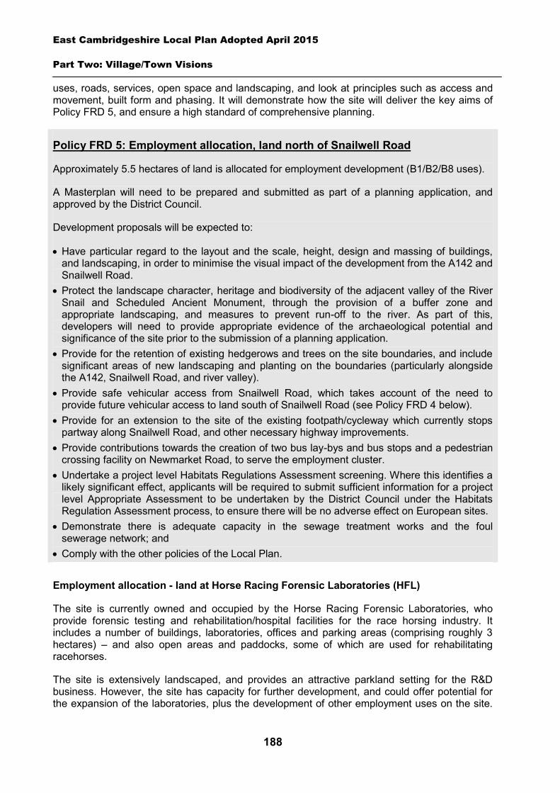
East Cambridgeshire Local Plan Adopted April 2015
Part Two: Village/Town Visions
188
uses, roads, services, open space and landscaping, and look at principles such as access and movement, built form and phasing. It will demonstrate how the site will deliver the key aims of Policy FRD 5, and ensure a high standard of comprehensive planning.
Policy FRD 5: Employment allocation, land north of Snailwell Road
Approximately 5.5 hectares of land is allocated for employment development (B1/B2/B8 uses).
A Masterplan will need to be prepared and submitted as part of a planning application, and approved by the District Council.
Development proposals will be expected to:
Have particular regard to the layout and the scale, height, design and massing of buildings, and landscaping, in order to minimise the visual impact of the development from the A142 and Snailwell Road.
Protect the landscape character, heritage and biodiversity of the adjacent valley of the River Snail and Scheduled Ancient Monument, through the provision of a buffer zone and appropriate landscaping, and measures to prevent run-off to the river. As part of this, developers will need to provide appropriate evidence of the archaeological potential and significance of the site prior to the submission of a planning application.
Provide for the retention of existing hedgerows and trees on the site boundaries, and include significant areas of new landscaping and planting on the boundaries (particularly alongside the A142, Snailwell Road, and river valley).
Provide safe vehicular access from Snailwell Road, which takes account of the need to provide future vehicular access to land south of Snailwell Road (see Policy FRD 4 below).
Provide for an extension to the site of the existing footpath/cycleway which currently stops partway along Snailwell Road, and other necessary highway improvements.
Provide contributions towards the creation of two bus lay-bys and bus stops and a pedestrian crossing facility on Newmarket Road, to serve the employment cluster.
Undertake a project level Habitats Regulations Assessment screening. Where this identifies a likely significant effect, applicants will be required to submit sufficient information for a project level Appropriate Assessment to be undertaken by the District Council under the Habitats Regulation Assessment process, to ensure there will be no adverse effect on European sites.
Demonstrate there is adequate capacity in the sewage treatment works and the foul sewerage network; and
Comply with the other policies of the Local Plan.
Employment allocation - land at Horse Racing Forensic Laboratories (HFL)
The site is currently owned and occupied by the Horse Racing Forensic Laboratories, who provide forensic testing and rehabilitation/hospital facilities for the race horsing industry. It includes a number of buildings, laboratories, offices and parking areas (comprising roughly 3 hectares) – and also open areas and paddocks, some of which are used for rehabilitating racehorses.
The site is extensively landscaped, and provides an attractive parkland setting for the R&D business. However, the site has capacity for further development, and could offer potential for the expansion of the laboratories, plus the development of other employment uses on the site.
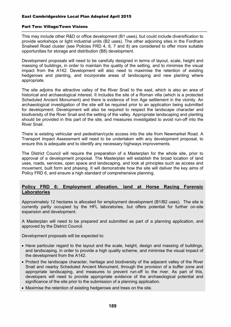
East Cambridgeshire Local Plan Adopted April 2015
Part Two: Village/Town Visions
189
This may include other R&D or office development (B1 uses), but could include diversification to provide workshops or light industrial units (B2 uses). The other adjoining sites in the Fordham Snailwell Road cluster (see Policies FRD 4, 6, 7 and 8) are considered to offer more suitable opportunities for storage and distribution (B8) development.
Development proposals will need to be carefully designed in terms of layout, scale, height and massing of buildings, in order to maintain the quality of the setting, and to minimise the visual impact from the A142. Development will also need to maximise the retention of existing hedgerows and planting, and incorporate areas of landscaping and new planting where appropriate.
The site adjoins the attractive valley of the River Snail to the east, which is also an area of historical and archaeological interest. It includes the site of a Roman villa (which is a protected Scheduled Ancient Monument) and there is evidence of Iron Age settlement in the vicinity. An archaeological investigation of the site will be required prior to an application being submitted for development. Development will also be required to respect the landscape character and biodiversity of the River Snail and the setting of the valley. Appropriate landscaping and planting should be provided in this part of the site, and measures investigated to avoid run-off into the River Snail.
There is existing vehicular and pedestrian/cycle access into the site from Newmarket Road. A Transport Impact Assessment will need to be undertaken with any development proposal, to ensure this is adequate and to identify any necessary highways improvements.
The District Council will require the preparation of a Masterplan for the whole site, prior to approval of a development proposal. The Masterplan will establish the broad location of land uses, roads, services, open space and landscaping, and look at principles such as access and movement, built form and phasing. It will demonstrate how the site will deliver the key aims of Policy FRD 6, and ensure a high standard of comprehensive planning.
Policy FRD 6: Employment allocation, land at Horse Racing Forensic Laboratories
Approximately 12 hectares is allocated for employment development (B1/B2 uses). The site is currently partly occupied by the HFL laboratories, but offers potential for further on-site expansion and development.
A Masterplan will need to be prepared and submitted as part of a planning application, and approved by the District Council.
Development proposals will be expected to:
Have particular regard to the layout and the scale, height, design and massing of buildings, and landscaping, in order to provide a high quality scheme, and minimise the visual impact of the development from the A142.
Protect the landscape character, heritage and biodiversity of the adjacent valley of the River Snail and nearby Scheduled Ancient Monument, through the provision of a buffer zone and appropriate landscaping, and measures to prevent run-off to the river. As part of this, developers will need to provide appropriate evidence of the archaeological potential and significance of the site prior to the submission of a planning application.
Maximise the retention of existing hedgerows and trees on the site.
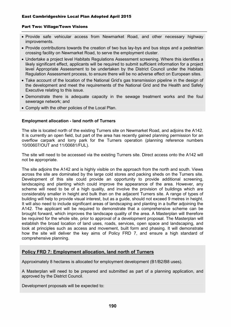
East Cambridgeshire Local Plan Adopted April 2015
Part Two: Village/Town Visions
190
Provide safe vehicular access from Newmarket Road, and other necessary highway improvements.
Provide contributions towards the creation of two bus lay-bys and bus stops and a pedestrian crossing facility on Newmarket Road, to serve the employment cluster.
Undertake a project level Habitats Regulations Assessment screening. Where this identifies a likely significant effect, applicants will be required to submit sufficient information for a project level Appropriate Assessment to be undertaken by the District Council under the Habitats Regulation Assessment process, to ensure there will be no adverse effect on European sites.
Take account of the location of the National Grid’s gas transmission pipeline in the design of the development and meet the requirements of the National Grid and the Health and Safety Executive relating to this issue.
Demonstrate there is adequate capacity in the sewage treatment works and the foul sewerage network; and
Comply with the other policies of the Local Plan.
Employment allocation - land north of Turners
The site is located north of the existing Turners site on Newmarket Road, and adjoins the A142. It is currently an open field, but part of the area has recently gained planning permission for an overflow carpark and lorry park for the Turners operation (planning reference numbers 10/00607/OUT and 11/00681/FUL).
The site will need to be accessed via the existing Turners site. Direct access onto the A142 will not be appropriate.
The site adjoins the A142 and is highly visible on the approach from the north and south. Views across the site are dominated by the large cold stores and packing sheds on the Turners site. Development of this site could provide an opportunity to provide additional screening, landscaping and planting which could improve the appearance of the area. However, any scheme will need to be of a high quality, and involve the provision of buildings which are considerably smaller in height and bulk than on the adjacent Turners site. A range of types of building will help to provide visual interest, but as a guide, should not exceed 9 metres in height. It will also need to include significant areas of landscaping and planting in a buffer adjoining the A142. The applicant will be required to demonstrate that a comprehensive scheme can be brought forward, which improves the landscape quality of the area. A Masterplan will therefore be required for the whole site, prior to approval of a development proposal. The Masterplan will establish the broad location of land uses, roads, services, open space and landscaping, and look at principles such as access and movement, built form and phasing. It will demonstrate how the site will deliver the key aims of Policy FRD 7, and ensure a high standard of comprehensive planning.
Policy FRD 7: Employment allocation, land north of Turners
Approximately 8 hectares is allocated for employment development (B1/B2/B8 uses).
A Masterplan will need to be prepared and submitted as part of a planning application, and approved by the District Council.
Development proposals will be expected to:
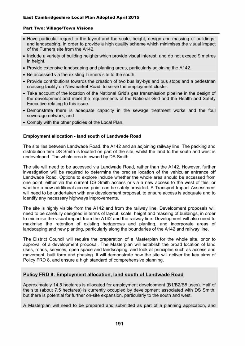
East Cambridgeshire Local Plan Adopted April 2015
Part Two: Village/Town Visions
191
Have particular regard to the layout and the scale, height, design and massing of buildings, and landscaping, in order to provide a high quality scheme which minimises the visual impact of the Turners site from the A142.
Include a variety of building heights which provide visual interest, and do not exceed 9 metres in height.
Provide extensive landscaping and planting areas, particularly adjoining the A142. Be accessed via the existing Turners site to the south. Provide contributions towards the creation of two bus lay-bys and bus stops and a pedestrian
crossing facility on Newmarket Road, to serve the employment cluster. Take account of the location of the National Grid’s gas transmission pipeline in the design of
the development and meet the requirements of the National Grid and the Health and Safety Executive relating to this issue.
Demonstrate there is adequate capacity in the sewage treatment works and the foul sewerage network; and
Comply with the other policies of the Local Plan.
Employment allocation - land south of Landwade Road
The site lies between Landwade Road, the A142 and an adjoining railway line. The packing and distribution firm DS Smith is located on part of the site, whilst the land to the south and west is undeveloped. The whole area is owned by DS Smith.
The site will need to be accessed via Landwade Road, rather than the A142. However, further investigation will be required to determine the precise location of the vehicular entrance off Landwade Road. Options to explore include whether the whole area should be accessed from one point, either via the current DS Smith access or via a new access to the west of this; or whether a new additional access point can be safely provided. A Transport Impact Assessment will need to be undertaken with any development proposal, to ensure access is adequate and to identify any necessary highways improvements.
The site is highly visible from the A142 and from the railway line. Development proposals will need to be carefully designed in terms of layout, scale, height and massing of buildings, in order to minimise the visual impact from the A142 and the railway line. Development will also need to maximise the retention of existing hedgerows and planting, and incorporate areas of landscaping and new planting, particularly along the boundaries of the A142 and railway line.
The District Council will require the preparation of a Masterplan for the whole site, prior to approval of a development proposal. The Masterplan will establish the broad location of land uses, roads, services, open space and landscaping, and look at principles such as access and movement, built form and phasing. It will demonstrate how the site will deliver the key aims of Policy FRD 8, and ensure a high standard of comprehensive planning.
Policy FRD 8: Employment allocation, land south of Landwade Road
Approximately 14.5 hectares is allocated for employment development (B1/B2/B8 uses). Half of the site (about 7.5 hectares) is currently occupied by development associated with DS Smith, but there is potential for further on-site expansion, particularly to the south and west.
A Masterplan will need to be prepared and submitted as part of a planning application, and
East Cambridgeshire Local Plan Adopted April 2015
Part Two: Village/Town Visions
192
approved by the District Council.
Development proposals will be expected to:
Have particular regard to the layout and the scale, height, design and massing of buildings, and landscaping, in order to minimise the visual impact from the A142 and railway line
Provide for the retention of existing hedgerows and trees on the site boundaries, and include significant areas of new landscaping and planting on the boundaries (particularly alongside the A142 and the railway line).
Demonstrate that safe vehicular access can be provided from Landwade Road (which takes account of the existing access points and development in the vicinity), and provide necessary highway improvements.
Provide contributions towards the creation of two bus lay-bys and bus stops and a pedestrian crossing facility on Newmarket Road, to serve the employment cluster.
Demonstrate there is adequate capacity in the sewage treatment works and the foul sewerage network
Comply with the other policies of the Local Plan.
Infrastructure and community facilities
Residents in Fordham have identified a number of infrastructure and community improvements. A list of priorities is set out in the table below.
Priority Suggestions 1 Need for more school places
and expansion of the primary school
Work with County Council to ensure that the current shortage of spaces and need for expansion is fully considered and addressed within the next capital expenditure programme. This may involve the expansion of the school onto neighbouring land.
2 Improvements to pedestrian/cycle routes
Explore separation of cycle paths from footpaths along Mildenhall Road. Work with neighbouring parishes to explore the provision of a cycle path from Fordham to Burwell to Cambridge, and Fordham to Newmarket.
3 Improvements to sports ground/open space
The following options have been identified as priority projects for future funding sources: New sports pavilion/centre. New play area equipment. Provision of additional seating around village. New park/gardens/walks. Maintenance/expansion of inner green core of village.
4 Traffic calming/highway improvements/weight restrictions
Work with District and County Council to ensure better maintenance of footpaths and improved road/footpath surfacing. Seek reduction of 30 mph speed limit on Mildenhall and Isleham Road (including provision of street lighting on Isleham Road). Improved road safety provision - particularly at school junction, Collin’s Hill and through the centre of Fordham. Provision of an additional bus stop on Newmarket Road near Horse Racing Forensic Laboratory.
East Cambridgeshire Local Plan Adopted April 2015
Part Two: Village/Town Visions
193
Seek improvements to bus service – particularly for students travelling into or out of Cambridge.
The top priority is the provision of more school places at Fordham Primary School, and the expansion of the school to cater for future additional demand. The County Council is currently (at April 2014) working with the school governers to establish the scale of future requirements, and to look at options for the expansion of the school. If the expansion cannot be catered for within the current school site, it may be necessary to expand onto land adjoining the school. The deliverability of expansion options will need to be fully investigated.
The District Council is working with the County Council to explore options for improving access to school places at Fordham and a number of surrounding local schools. The second priority is improvements to pedestrian/cycle links, with the third being improvements to sports ground/open space. The District Council will work with the Parish Council and County Council to explore options and secure funding for such schemes.
The current community facilities in Fordham (including the shops, pubs, community hall, post office and churches) contribute to the quality of people’s lives. The District Council will work with the County Council and Parish Council to secure funding, including developer contributions, to improve facilities wherever possible. The loss of community facilities will also be resisted under Policy COM 3. Proposals for new community development that benefits the village will be supported in principle, subject to Policy COM 4.
Spatial strategy for Fordham (see Inset Map 8.16) and Fordham – Employment allocations (See Inset Map 8.17)
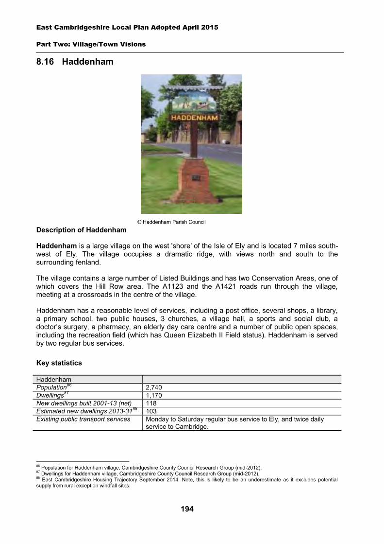
East Cambridgeshire Local Plan Adopted April 2015
Part Two: Village/Town Visions
194
8.16 Haddenham
Description of Haddenham
Haddenham is a large village on the west 'shore' of the Isle of Ely and is located 7 miles south-west of Ely. The village occupies a dramatic ridge, with views north and south to the surrounding fenland.
The village contains a large number of Listed Buildings and has two Conservation Areas, one of which covers the Hill Row area. The A1123 and the A1421 roads run through the village, meeting at a crossroads in the centre of the village.
Haddenham has a reasonable level of services, including a post office, several shops, a library, a primary school, two public houses, 3 churches, a village hall, a sports and social club, a doctor’s surgery, a pharmacy, an elderly day care centre and a number of public open spaces, including the recreation field (which has Queen Elizabeth II Field status). Haddenham is served by two regular bus services.
Key statistics
Haddenham Population86 2,740 Dwellings87 1,170 New dwellings built 2001-13 (net) 118 Estimated new dwellings 2013-3188 103 Existing public transport services Monday to Saturday regular bus service to Ely, and twice daily
service to Cambridge.
86 Population for Haddenham village, Cambridgeshire County Council Research Group (mid-2012). 87 Dwellings for Haddenham village, Cambridgeshire County Council Research Group (mid-2012). 88 East Cambridgeshire Housing Trajectory September 2014. Note, this is likely to be an underestimate as it excludes potential supply from rural exception windfall sites.
© Haddenham Parish Council
East Cambridgeshire Local Plan Adopted April 2015
Part Two: Village/Town Visions
195
Housing
Haddenham is a large village and is likely to continue to grow over the plan period, with new housing being built on suitable ‘infill’ sites within the village. Additionally, two new housing allocation sites are proposed on the edge of Haddenham at land off Rowan Close and land at New Road. Details of the allocation sites are set out in the sections below.
A ‘development envelope’ has been drawn around Haddenham to define the built-up part of the village where development (infill and on the 2 allocation sites) may be permitted. The purpose is to prevent sprawl into the open countryside. Development on the allocation sites will need to be in line with Policies HAD 1 and HAD 2.
Outside the development envelope, housing will not normally be permitted – unless there are exceptional circumstances, such as essential dwellings for rural workers, or affordable housing. Housing schemes outside the development envelope will be assessed against Policy GROWTH 2 and other Local Plan policies as appropriate.
Because of its ridge location, any future residential development within Haddenham must have particular regard to the potential for visual impact on the surrounding countryside.
Housing allocation – land off Rowan Close
The site is located to the south-west of the village along the road to Aldreth. The site is bounded by existing housing to the north and a private garden and paddocks to the south. It is screened to the south by hedgerows and mature trees, which should be retained as part of the landscaping scheme for the site. The site is a natural extension of the existing housing at Rowan Close and access will be via this estate.
Policy HAD 1: Housing allocation, land off Rowan Close
0.5 hectares of land is allocated for residential development of approximately 15 dwellings. Development proposals will be expected to:
Provide an element of affordable housing (currently 30%) as required under Policy HOU 3, with priority being given to people in local housing need.
Provide a mix of dwelling types and sizes to reflect current evidence of need within Haddenham.
Retain the existing hedgerow and mature trees that comprise the southern boundary of the site.
Have particular regard to site layout, building height, and soft landscaping, to minimise the visual impact of the development.
Demonstrate there is adequate capacity in the sewage treatment works and the foul sewerage network; and
Comply with other policies of the Local Plan.
Housing allocation – land at New Road
The site is located to the east of the village along the road to Wilburton. The site is bounded by Hinton Hall gardens and fields to the north, the A1223 to the south and private dwellings to the
East Cambridgeshire Local Plan Adopted April 2015
Part Two: Village/Town Visions
196
east and west. The site consists of two parcels of land in separate ownership. Land at 3A New Road is currently a mixed-use site with a small care repair business at the rear of the site. The owner is flexible with regard to retaining the employment use if appropriate and a lower number of dwellings will be appropriate on the site if the employment use remains. Land adjacent 5 New Road is currently undeveloped.
The site has mature hedges to all boundaries, these should be retained where possible and soft landscaping will be required to minimise the visual impact of the development from the main A1123 road. A single access onto the A1123 to serve the site will be required, which must be safe and a suitable distance away from the corner of the New Road.
Policy HAD 2: Housing allocation, land at New Road
0.8 hectares of land is allocated for residential development of approximately 24 dwellings. Development proposals will be expected to:
Provide an element of affordable housing (currently 30%) as required under Policy HOU 3, with priority being given to people in local housing need.
Provide a minimum of 0.16 ha of public open space on-site. Provide a mix of dwelling types and sizes to reflect current evidence of need within
Haddenham. Have particular regard to site layout, building height, and soft landscaping, to minimise the
visual impact of the development from the main A1123 road. Provide safe vehicular access from one point to the south-west of the site. Demonstrate there is adequate capacity in the sewage treatment works and the foul
sewerage network; and Comply with other policies of the Local Plan.
Employment
There are a number of businesses in Haddenham, both in the centre of the village and on the Haddenham Business Park. The District Council is keen to retain the stock of business land and premises in order to support local economic growth. Proposals to re-use employment sites for other purposes will only be permitted in certain circumstances (see Policy EMP 1).
The Local Plan proposes the allocation of additional 0.8 hectares of employment land in Haddenham in the form of an extension to Haddenham Business Park (see Policy HAD 3 below).
Other suitable new employment proposals within or on the edge of the village will be supported in principle, subject to Policies EMP 2, EMP 3 and EMP 4.
Employment allocation – land at Haddenham Business Park, Station Road
The proposed employment allocation, located to the south of the existing Haddenham Business Park, will provide for a mix of uses including B1, B2 and B8. Access to the extension will be via the existing business park entrance.

East Cambridgeshire Local Plan Adopted April 2015
Part Two: Village/Town Visions
197
The development will have to be sensitive to the adjoining residential properties and have regard to the scale, height, design and massing of buildings, in order to minimise visual impact from the A1421 and Ely Way and on adjoining residential properties. This proposal also presents an opportunity to improve the visual impact of the site from Ely Way by including soft landscaping to the boundary. Landscaping will also need to be provided along the boundaries adjoining residential properties.
Policy HAD 3: Employment allocation, land at Haddenham Business Park, Station Road
0.8 hectares of land is allocated for employment development at Haddenham Business Park (B1, B2, B8). Development proposals will be expected to:
Have particular regard to the scale, height, design and massing of buildings, in order to minimise visual impact from the A1421 and Ely Way and on adjoining residential properties.
Provide landscaping along the boundaries adjoining residential properties. Demonstrate there is adequate capacity in the sewage treatment works and the foul
sewerage network; and Comply with other policies of the Local Plan.
Infrastructure and community facilities
Residents in Haddenham have indicated a desire for improvements to infrastructure and facilities in the village. A list of priorities is set out in the table below.
Priority Suggestions 1 Traffic calming/highway
improvements/weight restrictions on roads
Work with Wilburton Parish Council to reduce the speed limit between the two villages. Install pedestrian crossing with traffic lights near crossroads.
2 Improvements to Broadband The District Council is working in partnership with the County Council to seek improvements to the Broadband service across the district.
3 Improvements to pedestrian/cycle routes
A Northstowe – Haddenham – Stretham – Ely route.
4 Improved transport links/public transport services
Improved regular service to Cambridge.
5 Improvements to the community facilities
Including the Arkenstall Centre, the Recreation Centre and the Sports and Social Club.
6 More support for home working and businesses operating from home
Improvements to Broadband service.
7 Need for more school places Work with the County Council to ensure that the shortage of space and future demand for additional capacity is fully considered and addressed within the next capital expenditure programme.
The top priority is to reduce the speed and volume of traffic, particularly lorries, coming through Haddenham. The District Council will work with the Parish Council and County Council to explore options and secure funding for traffic management schemes in Haddenham. The second priority, a better Broadband service, is an issue that the District Council is already working with County Council to address across the district through the Connecting Cambridgeshire project. The third priority is improvements to pedestrian/cycle links to enable connections to Ely and neighbouring villages. The District Council will work with the Parish

East Cambridgeshire Local Plan Adopted April 2015
Part Two: Village/Town Visions
198
Council and County Council to explore options and secure funding for such schemes. The District Council will also work in partnership to try to retain existing public transport levels, and encourage self-sufficient transport services, such as community transport.
The current community facilities in Haddenham (including shops, Post Office, pubs, Library, Arkenstall Centre, Doctors Surgery and churches) contribute to the quality of people’s lives. The loss of community facilities will also be resisted under Policy COM 3. Proposals for new community development that benefits the village will be supported in principle, subject to Policy COM 4.
Spatial strategy for Haddenham (see Inset Map 8.18)
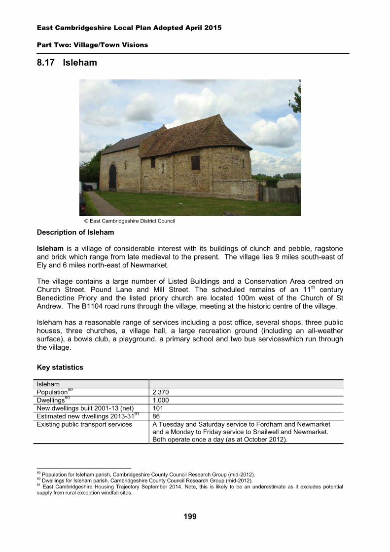
East Cambridgeshire Local Plan Adopted April 2015
Part Two: Village/Town Visions
199
8.17 Isleham
Description of Isleham
Isleham is a village of considerable interest with its buildings of clunch and pebble, ragstone and brick which range from late medieval to the present. The village lies 9 miles south-east of Ely and 6 miles north-east of Newmarket.
The village contains a large number of Listed Buildings and a Conservation Area centred on Church Street, Pound Lane and Mill Street. The scheduled remains of an 11th century Benedictine Priory and the listed priory church are located 100m west of the Church of St Andrew. The B1104 road runs through the village, meeting at the historic centre of the village.
Isleham has a reasonable range of services including a post office, several shops, three public houses, three churches, a village hall, a large recreation ground (including an all-weather surface), a bowls club, a playground, a primary school and two bus serviceswhich run through the village.
Key statistics
Isleham Population89 2,370 Dwellings90 1,000 New dwellings built 2001-13 (net) 101 Estimated new dwellings 2013-3191 86 Existing public transport services A Tuesday and Saturday service to Fordham and Newmarket
and a Monday to Friday service to Snailwell and Newmarket. Both operate once a day (as at October 2012).
89 Population for Isleham parish, Cambridgeshire County Council Research Group (mid-2012). 90 Dwellings for Isleham parish, Cambridgeshire County Council Research Group (mid-2012). 91 East Cambridgeshire Housing Trajectory September 2014. Note, this is likely to be an underestimate as it excludes potential supply from rural exception windfall sites.
© East Cambridgeshire District Council
East Cambridgeshire Local Plan Adopted April 2015
Part Two: Village/Town Visions
200
Housing
Isleham is likely to continue to grow in the future, with new housing being built on suitable ‘infill’ sites within the village. In addition new housing allocation sites are proposed at five locations across the village. (see Policies ISL 1, ISL 2, ISL 3, ISL 4 and ISL 5).
A ‘development envelope’ has been drawn around Isleham to define the built-up part of the village where development (infill and the allocation sites) may be permitted. The purpose is to prevent sprawl into the open countryside. Development on infill sites will need to be in line with Policy GROWTH 2. Development on the allocation sites will need to be in line with Policies ISL 1, ISL 2, ISL 3, ISL 4 and ISL 5.
Outside the development envelope, housing will not normally be permitted – unless there are exceptional circumstances, such as essential dwellings for rural workers, or affordable housing. Housing schemes outside the development envelope will be assessed against Policy GROWTH 2 and other Local Plan policies as appropriate.
Housing allocation – land south and west of Lady Frances Court
The site is located to the south side of the village, close to the existing recreation ground and is adjacent to a number of residential properties, which were previously developed to provide affordable housing.
The Lady Frances Peyton Hospital Almshouse Charity who is the owner of the above land has indicated that it may look to provide a greater proportion of affordable housing on this site than the minimum provision suggested under Policy HOU 3 of the Local Plan (currently 30%). The precise mix of private and affordable housing will be determined as part of the planning application process.
Policy ISL 1: Housing allocation, land south and west of Lady Frances Court
0.56 hectares of land is allocated for residential development of approximately 15 dwellings.
Development proposals will be expected to:
Provide an element of affordable housing (currently 30%) as required under Policy HOU 3, with priority being given to people in local housing need.
Provide a mix of dwelling types and sizes to reflect current evidence of need within Isleham. Have particular regard to site layout, building height and soft landscaping to minimise the
visual impact of development from Fordham Road and Station Road. Provide safe vehicular access from Fordham Road. Provide appropriate evidence of the archaeological potential and significance of the site prior
to the submission of a planning application; and Comply with the other policies of the Local Plan.
East Cambridgeshire Local Plan Adopted April 2015
Part Two: Village/Town Visions
201
Housing allocation – land at 5a Fordham Road
The site is located to the south side of the village and is currently farmland enclosed by a series of hedges. The site is adjacent to a number of residential properties on Fordham Road, and agricultural land to the east.
The site is located on the edge of the village and there will be a need to ensure that the site provides an attractive edge to the village and that it is designed so that it complements the existing built development on Fordham Road.
Policy ISL 2: Housing allocation, land at 5a Fordham Road
0.55 hectares of land is allocated for residential development of approximately 10 dwellings.
Development proposals will be expected to:
Provide an element of affordable housing (currently 30%) as required under Policy HOU 3, with priority being given to people in local housing need.
Provide a mix of dwelling types and sizes to reflect current evidence of need within Isleham. Have particular regard to site layout, building height and soft landscaping to minimise the
visual impact of development from Fordham Road. Provide safe vehicular access from Fordham Road. Provide landscaping along the boundary with agricultural land to the east and neighbouring
residential properties to the north and south; and Comply with the other policies of the Local Plan.
Housing allocation – land west of Hall Barn Road
The site is located to the north of the village to the west of Hall Barn Road and is currently open farmland with existing residential properties to the south and east of the site.
The site is in a sensitive setting on the edge of the village with agricultural land to the north and west and is visible from both Hall Barn Road and Temple Road. It will be important for any development to respect this rural setting, and to provide an attractive development on the edge of the village. There will also be a need to ensure that development of this site protects the views of the Grade II Listed Buildings, particularly from Temple Road.
Policy ISL 3: Housing allocation, land west of Hall Barn Road
1 hectare of land is allocated for residential development of approximately 12 dwellings.
Development proposals will be expected to:
Provide an element of affordable housing (currently 30%) as required under Policy HOU 3, with priority being given to people in local housing need.
Provide a mix of dwelling types and sizes to reflect current evidence of need within Isleham. Have particular regard to site layout, building height and soft landscaping to minimise the
visual impact of development from Hall Barn Road and Temple Road.
East Cambridgeshire Local Plan Adopted April 2015
Part Two: Village/Town Visions
202
Provide appropriate evidence of the archaeological potential and significance of the site prior to the submission of a planning application.
Provide safe vehicular access on Hall Barn Road with an access point to be located at a distance from the Hall Barn Road and Temple Road junction.
Provide landscaping along the boundary with the agricultural land to the west and existing residential properties.
Have regard to the setting of Listed Buildings located at Hall Barn Road; and Comply with the other policies of the Local Plan. Housing allocation – land west of Pound Lane The site is located to the north of the village on Pound Lane. It is bound to the west by the remains of Isleham Priory which is designated as a Scheduled Ancient Monument, and residential properties to the north and south. The site’s sensitive location, adjacent to a Scheduled Ancient Monument, within close proximity to several Listed Buildings and within Isleham Conservation Area will need to be fully addressed by any proposed scheme. There is evidence to suggest that this site is likely to include well preserved medieval archaeological remains, as the site has remained undeveloped since this period. Applicants will therefore be required to undertake a programme of archaeological works to determine the nature, extent and significance of any remains which are present on site. It will be important for any development to address the issues of setting and impact on the significance of these heritage assets to the satisfaction of English Heritage, Cambridgeshire County Council Archaeology and the District Council’s Conservation Officer. Development of this site will only be acceptable where it can be demonstrated to the District Council that it would not be detrimental to the historic environment assets which are present within the locality.
A public right of way bisects the site in two, and provides access from Pound Lane to the adjacent Scheduled Ancient Monument. This public right of way should be retained and enhanced as part of the development of this site.
Both parts of the site are grassland and are bound by a wire/wooden fence along the western boundary with the neighbouring Scheduled Monument. The site is visible from both Pound Lane and the grounds of the neighbouring Scheduled Monument. There is an attractive view of the Scheduled Monument across both parts of the site when looking south along the road close to number 34 Pound Lane. Any development on the site should be sensitively designed and configured to ensure retention of this long distance view.
The southern part of the site is bound to the east by a brick wall on Pound Lane. Part of the existing wall will need to be removed to enable vehicular access to this part of the site – although any scheme should seek to minimise its loss and preserve the remaining section. In addition, the existing footway on the west side of Pound Lane should be extended to enable pedestrian access to the south part of the site. A separate vehicular access point will need to be provided to the northern section of the site, along with a suitable pedestrian crossing point to access the footpath on the east side of Pound Lane.
East Cambridgeshire Local Plan Adopted April 2015
Part Two: Village/Town Visions
203
Policy ISL 4: Housing allocation, land west of Pound Lane
0.33 hectares of land is allocated for residential development of approximately 3 dwellings.
Development proposals will be expected to:
Have particular regard to site layout, building height, massing and soft landscaping to minimise the visual impact of development from Pound Lane, the neighbouring Scheduled Monument and to minimise amenity impact on neighbouring residential properties. This should include retention of the long distance view across the site towards the Scheduled Monument from the area close to 34 Pound Lane.
Be sensitively designed to minimise impact on the Scheduled Monument and its wider setting. Provide appropriate evidence of the archaeological potential and significance of the site prior
to the submission of a planning application to enable an informed decision to be made by the Local Planning Authority on the suitability of development proposals.
Provide safe vehicular access to the southern part of the site from Pound Lane, whilst maximising the retention of the existing brick boundary wall.
Extend the existing footway on the west of Pound Lane between Church Street and 15 Pound Lane, to the south-east corner of the site.
Provide safe vehicular access to the northern part of the site from Pound Lane, and a suitable pedestrian crossing point to access the footpath on the east side of Pound Lane.
Retain and enhance the existing public right of way which provides public access to the neighbouring scheduled monument; and
Comply with other policies in the Local Plan.
Housing allocation – land at Church Lane The site is located to the north of the village, to rear of residential properties on Church Lane. The site is currently grassland.
The site is well screened to the north from Coates Drove (a public byway) by substantial hedging, and partially screened from neighbouring residential properties by existing hedging and trees along the eastern boundary of the site.
There is an existing vehicular access to the site from Church Lane, which currently serves the farm building to the rear of residential properties at 24 –30 Church Lane. Access to the new development should be taken from this existing point, in order to minimise impact on the character and appearance of the locality.
East Cambridgeshire Local Plan Adopted April 2015
Part Two: Village/Town Visions
204
Policy ISL 5: Housing allocation, land at Church Lane
0.34 hectares of land is allocated for residential development of approximately 5 dwellings.
Development proposals will be expected to:
Provide an element of affordable housing (currently 30%) as required under Policy HOU3, with priority being given to people in local housing need.
Provide a mix of dwelling types and sizes to reflect current evidence of need within Isleham. Have particular regard to site layout, building height, massing and soft landscaping to
minimise the visual impact of development from Coates Drove and to minimise amenity impact on neighbouring residential properties on Church Lane.
Protect and enhance the existing planting and trees on the northern boundary of the site. Provide appropriate evidence of the archaeological potential and significance of the site prior
to the submission of a planning application. Provide safe vehicular, pedestrian and cycle access from Church Lane. Provide landscaping along the boundary with grassland to the east and neighbouring
residential properties to the west; and Comply with other policies in the Local Plan.
Employment
There are a number of businesses in the village, including at Wells Business Park and Hall Barn Road Industrial Estates. The District Council is keen to retain the stock of business land and premises in order to support local economic growth. Proposals to re-use employment sites for other purposes will only be permitted in certain circumstances (see Policy EMP 1).
The Local Plan proposes the allocation of additional employment land in Isleham in the form of an extension to Hall Barn Road Industrial Estate. The proposed employment allocation will provide for B1, B2 and B8 uses.
Policy ISL 6: Employment allocation, land adjacent to Hall Barn Road Industrial Estate
1 hectare of land is allocated for employment development adjacent to Hall Barn Road Industrial Estate (B1, B2 and B8 uses). Development proposals will be expected to:
Have particular regard to the scale, height, design and massing of buildings, in order to minimise visual impact from Hall Barn Road and Fordham Road and the nearby residential properties.
Provide safe vehicular access from Hall Barn Road. Provide necessary highway improvements to the existing Hall Barn Road/Fordham Road
junction. Provide landscaping along the boundaries with adjoining land particularly to the south and
east; and Comply with other policies of the Local Plan.
East Cambridgeshire Local Plan Adopted April 2015
Part Two: Village/Town Visions
205
Infrastructure and community facilities
Residents in Isleham have indicated a desire for improvements to infrastructure and facilities in the village. A list of priorities is set out in the table below. The table also includes details relating to the potential upgrading of the Isleham Waste Water Treatment Works.
Priority Suggestions 1 New primary school Work with the County Council to explore options for additional primary
school provision within the village. 2 Improvements to play areas Work with Isleham Parish Council to identify improvements to existing
play areas within the village. 3 On-going improvements to
the community/village hall Work with Isleham Parish Council to identify need for community space improvements following completion of replacement village hall.
3 Improvements to open space
Work with Isleham Parish Council to identify improvements to existing open space within the village.
4 Improvements to existing roads
Improvements to existing route to Soham and A142 junction.
- Potential upgrade to Waste Water Treatment Works
Anglian Water has indicated that the Isleham Wastewater Treatment Works may need to be upgraded to accommodate the proposed housing and employment allocations (see section 3 for further details).
The top priority identified by the community is a new primary school to replace the existing Isleham Primary school which serves Isleham and nearby settlements. Isleham Primary School is currently located on a relatively small site, which is constrained by existing built development. Concerns have been raised by the local community about the lack of primary school capacity and traffic in the surrounding area.
The scale of housing development envisaged in the Local Plan will not be sufficient to justify the development of a new primary school at Isleham and the County Council has indicated that there is capacity on site to cater for additional children likely to come forward from new development over the plan period. However the situation will be closely monitored, and options for additional primary provision within the village (including the potential for a new school) will be considered as part of a future review of the Local Plan.
The second and third priorities relate to improvements to the existing play area and open spaces within the village. The District Council will work with the Parish Council to identify specific improvements which are required within the village.
The joint third priority is improvements to the existing community/village hall within the village. Isleham Parish Council were granted planning permission to construct a new building to replace the existing village hall. The replacement building was delivered in 2013.
The current community facilities in Isleham (including the shops, public houses and post office) contribute to the quality of people’s lives. The District Council will work with the County Council and Parish Council to secure funding, including developer contributions, to improve facilities wherever possible. The loss of community facilities will also be resisted under Policy COM 3. Proposals for new community development that benefits the village will be supported in principle, subject to Policy COM 4.
Spatial strategy for Isleham (see Inset Map 8.19)
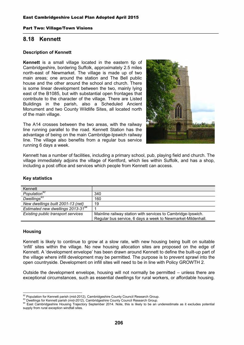
East Cambridgeshire Local Plan Adopted April 2015
Part Two: Village/Town Visions
206
8.18 Kennett
Description of Kennett
Kennett is a small village located in the eastern tip of Cambridgeshire, bordering Suffolk, approximately 2.5 miles north-east of Newmarket. The village is made up of two main areas; one around the station and The Bell public house and the other around the school and church. There is some linear development between the two, mainly lying east of the B1085, but with substantial open frontages that contribute to the character of the village. There are Listed Buildings in the parish, also a Scheduled Ancient Monument and two County Wildlife Sites, all located north of the main village.
The A14 crosses between the two areas, with the railway line running parallel to the road. Kennett Station has the advantage of being on the main Cambridge-Ipswich railway line. The village also benefits from a regular bus service running 6 days a week.
Kennett has a number of facilities, including a primary school, pub, playing field and church. The village immediately adjoins the village of Kentford, which lies within Suffolk, and has a shop, including a post office and services which people from Kennett can access.
Key statistics
Kennett Population92 340 Dwellings93 160 New dwellings built 2001-13 (net) 19 Estimated new dwellings 2013-3194 1 Existing public transport services Mainline railway station with services to Cambridge-Ipswich.
Regular bus service, 6 days a week to Newmarket-Mildenhall.
Housing
Kennett is likely to continue to grow at a slow rate, with new housing being built on suitable ‘infill’ sites within the village. No new housing allocation sites are proposed on the edge of Kennett. A ‘development envelope’ has been drawn around Kennett to define the built-up part of the village where infill development may be permitted. The purpose is to prevent sprawl into the open countryside. Development on infill sites will need to be in line with Policy GROWTH 2.
Outside the development envelope, housing will not normally be permitted – unless there are exceptional circumstances, such as essential dwellings for rural workers, or affordable housing.
92 Population for Kennett parish (mid-2012), Cambridgeshire County Council Research Group. 93 Dwellings for Kennett parish (mid-2012), Cambridgeshire County Council Research Group. 94 East Cambridgeshire Housing Trajectory September 2014. Note, this is likely to be an underestimate as it excludes potential supply from rural exception windfall sites.
© East Cambridgeshire District Council
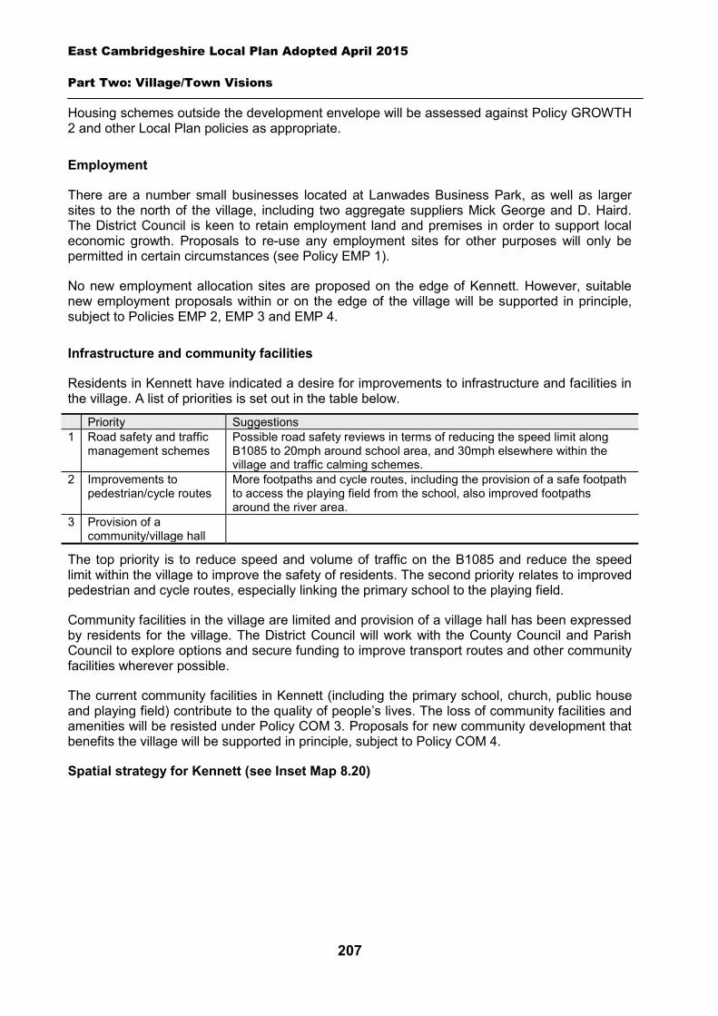
East Cambridgeshire Local Plan Adopted April 2015
Part Two: Village/Town Visions
207
Housing schemes outside the development envelope will be assessed against Policy GROWTH 2 and other Local Plan policies as appropriate.
Employment
There are a number small businesses located at Lanwades Business Park, as well as larger sites to the north of the village, including two aggregate suppliers Mick George and D. Haird. The District Council is keen to retain employment land and premises in order to support local economic growth. Proposals to re-use any employment sites for other purposes will only be permitted in certain circumstances (see Policy EMP 1).
No new employment allocation sites are proposed on the edge of Kennett. However, suitable new employment proposals within or on the edge of the village will be supported in principle, subject to Policies EMP 2, EMP 3 and EMP 4.
Infrastructure and community facilities
Residents in Kennett have indicated a desire for improvements to infrastructure and facilities in the village. A list of priorities is set out in the table below.
Priority Suggestions 1 Road safety and traffic
management schemes Possible road safety reviews in terms of reducing the speed limit along B1085 to 20mph around school area, and 30mph elsewhere within the village and traffic calming schemes.
2 Improvements to pedestrian/cycle routes
More footpaths and cycle routes, including the provision of a safe footpath to access the playing field from the school, also improved footpaths around the river area.
3 Provision of a community/village hall
The top priority is to reduce speed and volume of traffic on the B1085 and reduce the speed limit within the village to improve the safety of residents. The second priority relates to improved pedestrian and cycle routes, especially linking the primary school to the playing field.
Community facilities in the village are limited and provision of a village hall has been expressed by residents for the village. The District Council will work with the County Council and Parish Council to explore options and secure funding to improve transport routes and other community facilities wherever possible.
The current community facilities in Kennett (including the primary school, church, public house and playing field) contribute to the quality of people’s lives. The loss of community facilities and amenities will be resisted under Policy COM 3. Proposals for new community development that benefits the village will be supported in principle, subject to Policy COM 4.
Spatial strategy for Kennett (see Inset Map 8.20)
East Cambridgeshire Local Plan Adopted April 2015
Part Two: Village/Town Visions
208
8.19 Kirtling & Upend
Description of Kirtling and Upend
The parish of Kirtling includes Kirtling Green and Upend and is located to the east of the district, approximately 5 miles south-east of Newmarket.
There are many Listed Buildings in Kirtling parish but no Conservation Area. There is an area of Ancient Woodland, Lucy Wood, to the north-west of Kirtling, which is also a County Wildlife Site. There are also three Scheduled Ancient Monuments to the north of the village at Kirtling Tower. The scattered settlement of Kirtling has a reasonable range of facilities for its size. These include a garage, pub, two churches, a well equipped village hall, and cricket and carpet bowls club. There is a bus service that runs through Kirtling four days a week.
Upend is located north-east of Kirtling, with a population of only 70. The small village has a Conservation Area and also includes many Listed Buildings. The bus service mentioned above serving Kirtling is available to Upend residents subject to advance telephone request.
Key statistics
Kirtling parish Population95 340 Dwellings96 160 New dwellings built 2001-13 (net) 10 Estimated new dwellings 2013-3197 1 Existing public transport services There is a bus service that runs through Kirtling and Upend (on
request) four days a week to Newmarket
95 Population for Kirtling parish (mid-2012). 96 Dwellings for Kirtling parish (mid-2012), Cambridgeshire County Council Research Group. 97 East Cambs Housing Trajectory September2014. Note, this is likely to be an underestimate as it excludes potential supply from rural exception windfall sites.
© Kirtling Parish Council
East Cambridgeshire Local Plan Adopted April 2015
Part Two: Village/Town Visions
209
Housing
Kirtling and Upend are likely to continue to grow at a slow rate, with new housing being mainly built on suitable ‘infill’ sites within the villages. No new housing allocation sites are proposed on the edge of Kirtling or Upend. However, the Parish Council would like the opportunity to explore options in the future, and welcomes the indication in the Local Development Scheme that a review of the Local Plan will commence within 2 years. A ‘development envelope’ has been drawn around both villages to define the built-up areas of the villages where infill development may be permitted. Kirtling village particularly is characterised by scattered groups of dwellings in attractive countryside, and there are separate sections of the development envelope. The purpose is to prevent sprawl into the open countryside. Development on infill sites will need to be in line with Policy GROWTH 2.
Outside the development envelope, housing will not normally be permitted – unless there are exceptional circumstances, such as essential dwellings for rural workers, or affordable housing. Housing schemes outside the development envelope will be assessed against Policy GROWTH 2 and other Local Plan policies as appropriate.
Employment
There are a small number of current businesses in the villages, including the Garage and ATL Agricultural Technology Ltd, and bed and breakfast establishments in Kirtling, and Fittocks Stud in Upend. The pub in Kirtling is currently closed. However, there is little employment land and premises (e.g. industrial or offices) in the parish. The District Council is keen to retain the stock of business land and premises in order to support local economic growth. Proposals to re-use any employment sites for other purposes will only be permitted in certain circumstances (see Policy EMP 1).
No new employment allocation sites are proposed on the edge of Kirtling or Upend. However, suitable new employment proposals within or on the edge of the villages will be supported in principle, subject to Policies EMP 2, EMP 3 and EMP 4.
Infrastructure and community facilities
Residents in Kirtling parish have indicated a desire for improvements to infrastructure and facilities. A list of priorities is set out in the table below.
Priority Suggestions 1 Traffic calming/highways
improvements Reduction of speed limit of 40mph (due to be introduced in early 2013 – see below). Resurfacing of some roads – this is on-going as County Council funds allow.
2 Improvements to broadband
The Council is part of a countywide scheme for broadband improvements.
3 A village shop/general store in Kirtling
A small shop remains an aspiration for the village where a feasible location will be sought for the future.
4 New sports facilities/play area
No children’s play area currently available within the parish.
5 Improvements to pedestrian/cycle routes
More pavements and some cycle routes alongside existing roads is desired although considered a lower priority.
There are two main priorities for Kirtling and Upend. Firstly, for the reduction of the speed limit, which has been achieved and is due to be introduced in early 2013. Approval has been
East Cambridgeshire Local Plan Adopted April 2015
Part Two: Village/Town Visions
210
received (in August 2012) from Cambridgeshire County Council to reduce to 30mph in both Kirtling and Upend. Secondly, for the improvement to broadband provision, which is poor in both Kirtling and Upend and is a high priority for the parish. This is an important issue in rural areas and improvements can benefit local businesses as well as having social benefits to residents. The District Council is currently working with the County Council on a countywide project to improve broadband connections in rural areas where there is no planned private sector investment.
A small shop attached to the pub has in the past been suggested as a location for a village shop in KirtlingThe pub is currently closed. If the pub is re-opened this option may be potentially explored in the future. The provision of a shopremains an aspiration and is a medium priority for the parish. The District Council will work with the County Council and Parish Council to explore options and secure funding for improvements to community facilities and transport infrastructure within Kirtling parish.
The community facilities in Kirtling parish are relatively few but excellent (including the village hall, churches, sports clubs and garage) and contribute to the quality of people’s lives. The loss of community facilities will be resisted under Policy COM 3. Proposals for new community development that benefits the two villages will be supported in principle, subject to Policy COM 4.
Spatial strategy for Kirtling (see Inset Map 8.21)
Spatial strategy for Upend (see Inset Map 8.22)
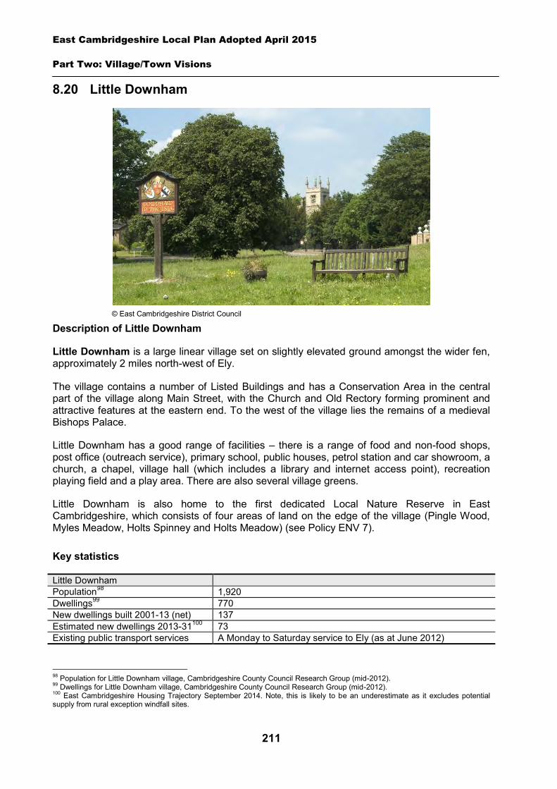
East Cambridgeshire Local Plan Adopted April 2015
Part Two: Village/Town Visions
211
8.20 Little Downham
Description of Little Downham
Little Downham is a large linear village set on slightly elevated ground amongst the wider fen, approximately 2 miles north-west of Ely.
The village contains a number of Listed Buildings and has a Conservation Area in the central part of the village along Main Street, with the Church and Old Rectory forming prominent and attractive features at the eastern end. To the west of the village lies the remains of a medieval Bishops Palace.
Little Downham has a good range of facilities – there is a range of food and non-food shops, post office (outreach service), primary school, public houses, petrol station and car showroom, a church, a chapel, village hall (which includes a library and internet access point), recreation playing field and a play area. There are also several village greens.
Little Downham is also home to the first dedicated Local Nature Reserve in East Cambridgeshire, which consists of four areas of land on the edge of the village (Pingle Wood, Myles Meadow, Holts Spinney and Holts Meadow) (see Policy ENV 7).
Key statistics
Little Downham Population98 1,920 Dwellings99 770 New dwellings built 2001-13 (net) 137 Estimated new dwellings 2013-31100 73 Existing public transport services A Monday to Saturday service to Ely (as at June 2012)
98 Population for Little Downham village, Cambridgeshire County Council Research Group (mid-2012). 99 Dwellings for Little Downham village, Cambridgeshire County Council Research Group (mid-2012). 100 East Cambridgeshire Housing Trajectory September 2014. Note, this is likely to be an underestimate as it excludes potential supply from rural exception windfall sites.
© East Cambridgeshire District Council
East Cambridgeshire Local Plan Adopted April 2015
Part Two: Village/Town Visions
212
Housing
Little Downham is expected to continue to grow in the future, with new housing being built on suitable ‘infill’ sites within the village. Additionally, a new housing allocation site is proposed at land to the west of Ely Road.
A ‘development envelope’ has been drawn around Little Downham to define the built-up part of the village where development (infill and the allocation sites) may be permitted. The purpose is to prevent sprawl into the open countryside. Development on infill sites will need to be in line with Policy GROWTH 2. Development on the allocation site will need to be in line with Policy LTD 1.
Outside the development envelope, housing will not normally be permitted – unless there are exceptional circumstances, such as essential dwellings for rural workers, or affordable housing. Housing schemes outside the development envelope will be assessed against Policy GROWTH 2 and other Local Plan policies as appropriate.
Housing allocation - land west of Ely Road
The site is currently grassland and is located to the rear of housing at Cannon Street and adjacent to an existing farm business located on Ely Road.
The site includes a small workshop located at 7 Cannon Street, which forms part of an existing agricultural engineering business. The owner of the workshop has stated that this building could be removed to enable the development of this site.
A Transport Assessment will be required to demonstrate that safe access can be achieved to the site and that any impact on surrounding roads can be mitigated. There are two potential access points, one from Ely Road and one from Cannon Street (which would require the demolition of the existing building at No. 7 to enable access to be provided). These routes should be explored to determine which option(s) should be used to provide vehicular, pedestrian and cycle access into the site.
The site is well screened from Ely Road by substantial hedging close to the junction with Cannon Street. This hedging is located adjacent to an attractive row of trees, which form part of the roadside verge on Ely Road. The site is also bound by hedging along the boundary with the open countryside to the rear of the site. It will be important to retain as much of the original hedgeline and roadside trees as possible, and provide additional landscaping along the boundaries of the site.
As this site is located close to existing residential properties on Cannon Street and Ely Road there will be a need to ensure that development is sensitively designed to minimise its impact.
Policy LTD 1: Housing allocation, land west of Ely Road
1.2 hectares of land is allocated for residential development of approximately 25 dwellings. Development proposals will be expected to:
Have particular regard to layout and the scale, height, design and massing of buildings, and landscaping to minimise the visual impact of development from Cannon Street, Ely Road and the open countryside, and to minimise amenity impact on adjoining residential properties.
East Cambridgeshire Local Plan Adopted April 2015
Part Two: Village/Town Visions
213
Maximise the retention of existing hedgerows on the site and roadside trees, and provide additional landscaping on the site boundaries.
Demonstrate through a Transport Assessment that safe vehicular, pedestrian and cycle access can be provided into and within the site.
Provide an element of affordable housing (currently 30%) as required under Policy HOU 3, with priority being given to people in local housing need.
Provide a mix of dwelling types and sizes to reflect current evidence of need within Little Downham.
Provide a minimum of 0.16 ha of public open space on site; and Comply with the other policies of the Local Plan.
Employment
There are a number of small businesses within the village, including a car showroom, bookkeepers, building contractor, betting shop and a public relations company. There is also a haulage company (Halls Transport) located close to the village at Black Bank Drove and a small industrial estate on Cowbridge Hall Road.
The District Council is keen to retain the stock of business land and premises in order to support local economic growth. Proposals to re-use employment sites (B1, B2 and B8 uses) for other purposes will only be permitted in certain circumstances (see Policy EMP 1).
No new employment allocation sites are proposed on the edge of Little Downham. However suitable new employment proposals on the edge of the village, will be supported in principle, subject to Policies EMP 2, EMP 3 and EMP 4.
Infrastructure and community facilities
Residents in Little Downham have indicated a desire for improvements to infrastructure and facilities in their village. A list of priorities is set out in the table below:
Priority Suggestions 1 More school places Work with the County Council to ensure that sufficient primary school
places are made available over the Plan period. 2 Improvements to
pedestrian/cycle routes Existing bridleway has been identified as a potential cycling route from Little Downham to Ely, which, subject to improvements could form part of national cycling network subject to funding being available.
3 New cemetery Little Downham Parish Council is currently working to identify and secure appropriate site for additional burial land.
4 Improvements to play area
Little Downham Parish Council has secured funding for replacement of some of the existing play equipment.
5 Improvements to sports ground/open space
Little Downham Parish Council has secured funding for the additional fencing at the all weather court. Little Downham Parish Council is seeking funding for the refurbishment and extension of the existing Pavilion.
6 Adequate bus service
The top priority is the provision of more school places at Little Downham Feoffees Primary School. The District Council is working with the County Council to explore options for improving
East Cambridgeshire Local Plan Adopted April 2015
Part Two: Village/Town Visions
214
access to school places at Little Downham. The second priority is improvements to pedestrian/cycle links with the fourth and fifth being improvements to play areas and sport ground/open space. The District Council will work with the Parish Council and County Council to explore options for funding for such schemes.
The third priority is a new cemetery to address the need for additional burial space within the Parish. Little Downham Parish Council has established a working group to explore potential options for the development of additional burial land within the Parish following public consultation on this issue in 2012.
The current community facilities in Little Downham (including the shops, public houses, village hall and church) contribute to the quality of people’s lives. The District Council will work with the County Council and Parish Council to secure funding, including developer contributions, to improve facilities wherever possible. The loss of community facilities will also be resisted under Policy COM 3. Proposals for new community development that benefits the village will be supported in principle, subject to Policy COM 4.
Spatial strategy for Little Downham (see Inset Map 8.23)
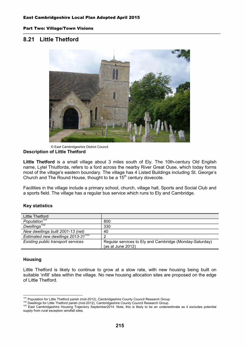
East Cambridgeshire Local Plan Adopted April 2015
Part Two: Village/Town Visions
215
8.21 Little Thetford
Description of Little Thetford
Little Thetford is a small village about 3 miles south of Ely. The 10th-century Old English name, Lytel Thiutforda, refers to a ford across the nearby River Great Ouse, which today forms most of the village's eastern boundary. The village has 4 Listed Buildings including St. George’s Church and The Round House, thought to be a 15th century dovecote.
Facilities in the village include a primary school, church, village hall, Sports and Social Club and a sports field. The village has a regular bus service which runs to Ely and Cambridge.
Key statistics
Little Thetford Population101 800 Dwellings102 330 New dwellings built 2001-13 (net) 40 Estimated new dwellings 2013-31103 2 Existing public transport services Regular services to Ely and Cambridge (Monday-Saturday)
(as at June 2012)
Housing
Little Thetford is likely to continue to grow at a slow rate, with new housing being built on suitable ‘infill’ sites within the village. No new housing allocation sites are proposed on the edge of Little Thetford.
101 Population for Little Thetford parish (mid-2012), Cambridgeshire County Council Research Group. 102 Dwellings for Little Thetford parish (mid-2012), Cambridgeshire County Council Research Group. 103 East Cambridgeshire Housing Trajectory September2014. Note, this is likely to be an underestimate as it excludes potential supply from rural exception windfall sites.
© East Cambridgeshire District Council

East Cambridgeshire Local Plan Adopted April 2015
Part Two: Village/Town Visions
216
A ‘development envelope’ has been drawn around Little Thetford to define the built-up part of the village where infill development may be permitted. The purpose is to prevent sprawl into the open countryside. Development on infill sites will need to be in line with Policy GROWTH 2.
Outside the development envelope, housing will not normally be permitted – unless there are exceptional circumstances, such as essential dwellings for rural workers, or affordable housing. Housing schemes outside the development envelope will be assessed against Policy GROWTH 2 and other Local Plan policies as appropriate.
Employment
There are a few businesses in the village, including D TEK cycle shop, and Two Acres caravan site, but little employment land or premises (e.g. offices and industrial). The District Council is keen to retain any employment land and premises in order to support local economic growth. Proposals to re-use employment sites for other purposes will only be permitted in certain circumstances (see Policy EMP 1).
No new employment allocation sites are proposed on the edge of Little Thetford. However, suitable new employment proposals within or on the edge of the village will be supported in principle, subject to Policies EMP 2, EMP 3 and EMP 4.
Infrastructure and community facilities
Residents in Little Thetford have indicated a desire for improvements to infrastructure and facilities in the village. A list of priorities is set out in the table below. The table also includes details relating to the potential upgrading of the Stretham Waste Water Treatment Works.
Priority Suggestions 1 Traffic calming Traffic calming measures at the junction of the village with the A10.
Traffic lights, roundabout or traffic islands required at entry to village. 2
Improvements to pedestrian/cycle routes
Foot/cycle path extensions required in the Wyches from the cemetery to A10 and between Little Thetford and Stretham. Better cycle route to Ely
- Potential upgrade to Waste Water Treatment Works
Anglian Water has indicated that the Stretham Wastewater Treatment Works which serves Little Thetford may need to be upgraded to accommodate future development (see section 3 for further details).
The top priority is for traffic calming measures in Little Thetford, particularly at the A10 junction. The second priority is also transport-related – involving improvements to pedestrian/cycle links. The District Council will work with the Parish Council and County Council to explore options and secure funding for these road and transport schemes. The District Council will also work in partnership to try to retain existing public transport levels, and encourage self-sufficient transport services, such as community transport.
The current community facilities in Little Thetford (including the primary school, church, village hall, Sports and Social Club and sports field) contribute to the quality of people’s lives. The loss of community facilities will also be resisted under Policy COM 3. Proposals for new community development that benefits the village will be supported in principle, subject to Policy COM 4.
Spatial strategy for Little Thetford (see Inset Map 8.24)
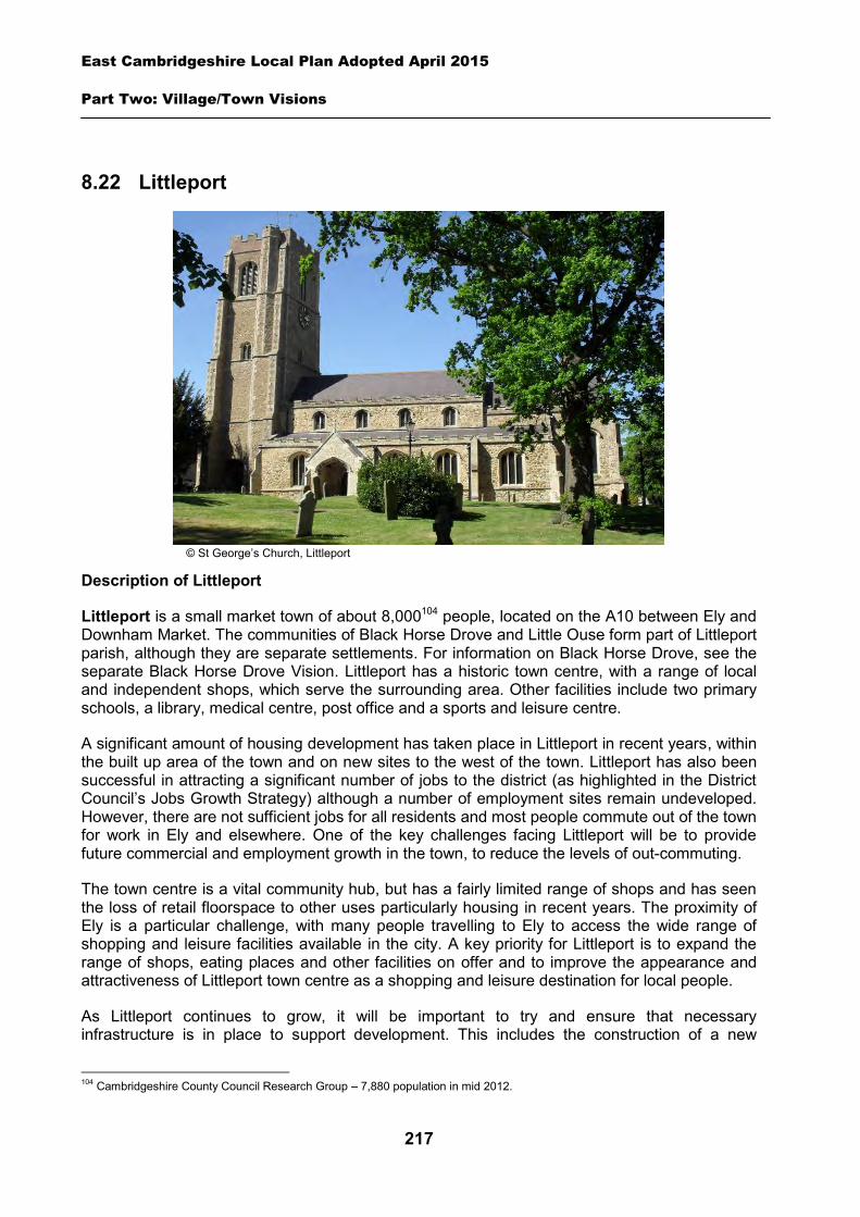
East Cambridgeshire Local Plan Adopted April 2015
Part Two: Village/Town Visions
217
8.22 Littleport
Description of Littleport
Littleport is a small market town of about 8,000104 people, located on the A10 between Ely and Downham Market. The communities of Black Horse Drove and Little Ouse form part of Littleport parish, although they are separate settlements. For information on Black Horse Drove, see the separate Black Horse Drove Vision. Littleport has a historic town centre, with a range of local and independent shops, which serve the surrounding area. Other facilities include two primary schools, a library, medical centre, post office and a sports and leisure centre.
A significant amount of housing development has taken place in Littleport in recent years, within the built up area of the town and on new sites to the west of the town. Littleport has also been successful in attracting a significant number of jobs to the district (as highlighted in the District Council’s Jobs Growth Strategy) although a number of employment sites remain undeveloped. However, there are not sufficient jobs for all residents and most people commute out of the town for work in Ely and elsewhere. One of the key challenges facing Littleport will be to provide future commercial and employment growth in the town, to reduce the levels of out-commuting.
The town centre is a vital community hub, but has a fairly limited range of shops and has seen the loss of retail floorspace to other uses particularly housing in recent years. The proximity of Ely is a particular challenge, with many people travelling to Ely to access the wide range of shopping and leisure facilities available in the city. A key priority for Littleport is to expand the range of shops, eating places and other facilities on offer and to improve the appearance and attractiveness of Littleport town centre as a shopping and leisure destination for local people.
As Littleport continues to grow, it will be important to try and ensure that necessary infrastructure is in place to support development. This includes the construction of a new
104 Cambridgeshire County Council Research Group – 7,880 population in mid 2012.
© St George’s Church, Littleport
East Cambridgeshire Local Plan Adopted April 2015
Part Two: Village/Town Visions
218
secondary school in the town, in the near future, which is expected to serve Littleport and the northern part of the district including parts of Ely. A new primary school will also be needed to cater for the expanded population. Details of the expected educational infrastructure requirements are set out in Policy LIT 6 below.
Littleport is easily accessed from the A10 and it also benefits from a railway station, which provides access to Cambridge, Ely, Kings Lynn and London. However there is a need for additional car parking to be provided at Littleport Rail Station to serve those using the station and to address existing parking problems in the area.
Littleport is characterised by its slightly elevated location above the surrounding fenland landscape with the River Great Ouse and its floodplain to the east of the town. Although the town benefits from being located close to a key riverside walking/cycling route (which forms part of the national cycling network) direct access to the countryside particularly to the north and west of the town is limited.
Littleport has a rich archaeological character owing to its location at the northern edge of the Isle of Ely. The fenland here was previously a salt marsh and provided an economic focus for the numerous prehistoric and Roman salt-making settlements that were once located here.
To the north-west of Littleport is the Ouse Washes, which is of international and national importance for its wildlife and rare breeding birds, and the Wildfowl and Wetland Trust’s Welney Wetland Centre.
Key statistics
Littleport Population105 7,880 Dwellings106 3,360 New dwellings built 2001-13 (net) 803 Estimated new dwellings 2013-31107 1,346 Estimated number of jobs108 1,500 Current public transport services Monday – Saturday regular bus service to Ely and Cambridge
and a limited service (Thursday only) to Prickwillow and Black Horse Drove. Rail services to Cambridge, Ely, King’s Lynn and London Kings Cross (as at June 2012)
A vision for Littleport
A vision for Littleport in the year 2031 is set out below – followed by a set of strategic objectives to deliver and facilitate the vision. The vision provides clear direction for development in Littleport up to 2031. It has been developed from the key characteristics and issues described above, and through consultation on the Local Plan. It has also been informed by the Council’s ‘Littleport Masterplan’ document (adopted May 2011), which looks at the long-term growth of Littleport. Its purpose was to inform debate on the future capacity of Littleport to grow, and feed into development of the Local Plan. The Littleport Masterplan can be viewed on the District Council’s website at www.eastcambs.gov.uk.
105 Population for Littlleport town, Cambridgeshire County Council Research Group (mid-2012). 106 Dwellings for Littlleport town, Cambridgeshire County Council Research Group (mid-2012). 107 East Cambridgeshire Housing Trajectory September 2014. Note, this does not include housing supply on ‘broad locations’ on the edge of the town. It also excludes potential supply from rural exception sites. 108 Source: ONS 2009
East Cambridgeshire Local Plan Adopted April 2015
Part Two: Village/Town Visions
219
The vision and objectives below have been used to develop specific policies to guide the future growth of Littleport. The policies are set out in the following sections, and the spatial plan for Littleport is shown in Map 8.25 at the end of this Vision document.
Littleport vision statement
Littleport will be a vibrant 21st century market town, which is enjoyed by residents, visitors and workers and which will continue to have a strong sense of community. Distinctive and high quality new housing developments to the west of the town will support a revitalised town centre which will provide a good range of shops and community facilities and act as a community hub. A range of job opportunities will also be provided as part of new employment sites.
The town will benefit from new and improved community facilities including a new primary and secondary school, attractive greenspaces and links to the wider countryside, which are easily accessible by residents and visitors. Littleport will also continue to have a strong sense of community amongst residents in the town.
Littleport strategic objectives
1. Strengthen the role of Littleport town centre by making it a focus for retail development and community facilities and make it a more attractive and pleasant place to visit, which is highly accessible by foot and cycle.
2. Develop a network of greenspaces/links within Littleport and to the River Great Ouse and the wider countryside including through the creation of a new circular route.
3. Provide high quality housing development to the west of Littleport, which is highly accessible on foot, or cycle and has good connections to the town centre and key facilities.
4. Facilitate improved access to Littleport rail station, through additional car parking and enhanced walking and cycling routes.
5. Provide an increased range of job opportunities by enabling further employment growth to the west of the town.
6. Provide sufficient community facilities and services including the provision of new primary and secondary schools within the town to support future housing growth.
7. Protect and enhance the historic environment, particularly within Littleport Conservation Area.
Housing
Littleport is the third largest market town in the district, and is likely to continue to grow over the plan period.
A ‘development envelope’ has been drawn around Littleport to define the built-up part of the town where housing development may be permitted. The purpose is to prevent sprawl into the open countryside. Outside the development envelope, housing will not normally be permitted – unless there are exceptional circumstances, such as essential dwellings for rural workers, or affordable housing.

East Cambridgeshire Local Plan Adopted April 2015
Part Two: Village/Town Visions
220
Housing schemes outside the development envelope will be assessed against Policy GROWTH 2, and other Local Plan policies as appropriate. The hamlet of Little Ouse is considered to be countyside for the purposes of Policy GROWTH 2.
There are some opportunities for housing development on land within the built-up part of Littleport, on ‘infill’ sites. It is estimated there could be capacity for perhaps 796 dwellings between 2013 and 2031. Development on infill sites in the town will need to be in line with Policy GROWTH 2.
Additional housing development is also proposed on two new sites on the edge of the town. Development on these allocation sites will need to be in line with Policies LIT 1 and LIT 2 – see details below. The new housing sites are located to the west of the town and should help to support the vitality of the town centre. The two sites have an estimated capacity for up to approximately 550 dwellings. A summary of the potential housing sources in Littleport is set out in the table below.
The town has further capacity to expand to the south – but it is considered vital that the identified Local Plan housing allocations come forward first, to support the vision for the town. Potential ‘phase 2’ housing areas to the south are shown indicatively in the Littleport Masterplan. These areas are referenced in Policy GROWTH 4 as broad locations where housing could come forward in the later part of the Plan period, and shown indicatively in the diagram in Chapter 3. It should be noted that these are not precise or accurate allocations, and further investigative work on site deliverability and suitability will be required in the future, prior to allocation in a development plan. The next review of the Local Plan will provide an opportunity to undertake further investigative work relating to delivery and site boundaries.
Estimated housing supply in Littleport 2011-31, from specific sites and windfall supply Housing sources Number of dwellings Completions 2011-13 103 Outstanding planning permissions 549 Potential large future sites 188 Estimated windfall on small sites 59 Housing allocations 550 TOTAL ESTIMATED SUPPLY 1,449
Housing/employment allocation – west of Woodfen Road
This site is located to the west of Woodfen Road, and is currently open farmland. The area is bounded by the A10 to the west, Saxon Way Business Park to the south, and Woodfen Road (including a number of residential gardens) to the east.
The site is identified in the Littleport Masterplan as a potential area for housing and employment development. It is estimated that there is potential for approximately 250 dwellings and up to 7 hectares of employment development subject to demand and economic viability of the whole scheme (as demonstrated through a financial viability assessment).
The Littleport Masterplan proposed that the employment land should be located to the south adjacent to Saxon Way Business Park, with housing within the northern part of the site. However, an alternative configuration may be more deliverable, and the final design, layout and location of uses will need to be determined through further transport and viability work. Part of the issue is that whilst there may be potential to provide vehicular access to residential dwellings from Woodfen Road, employment uses will need to be accessed from either the A10
East Cambridgeshire Local Plan Adopted April 2015
Part Two: Village/Town Visions
221
(via a new roundabout), or A10 roundabout (via a new arm). The suitability, cost and deliverability of access options will need to be carefully assessed through further Transport Assessment and other technical work.
The development should also be designed in such a way that vehicles accessing the employment land can do so without the need to travel through the proposed residential area.
The development should provide good pedestrian and cycle links across the site and between the employment area and the housing development. There will also be a need to provide additional pedestrian and cycle access across the site from Wisbech Road (close to the A10 roundabout) to Woodfen Road to provide part of a key circular route for Littleport. The potential for a pedestrian and cycle link to be provided from this site to the neighbouring Saxon Way Business Park will also need to be investigated.
The site is located on the edge of Littleport and is highly visible from the A10, and the southern part of Woodfen Road. Therefore it will be important for any development to be sensitively designed to provide a high quality scheme, which enhances the setting of Littleport. There will be a need to retain the existing planting which is located on the northern boundary of the site and adjacent to the A10, and provide significant new planting and landscaping – particularly along the boundary with the A10.
A small part of the site close to the A10 is at risk from flooding. Therefore there will be a need for a Flood Risk Assessment to be submitted with any planning application for this site.
The District Council will require the preparation of a Masterplan for the whole site, prior to approval of a development proposal. The Masterplan will establish the broad location of land uses, roads, services, open space and landscaping, and look at principles such as access and movement, built form and phasing. It will demonstrate how the site will deliver the key aims of Policy LIT 1, and ensure a high standard of comprehensive planning.
Policy LIT 1: Housing/employment allocation, west of Woodfen Road
17 hectares of land is allocated for a mixed-use development incorporating: Up to 7 hectares of employment development (B1/B2/B8 uses); Approximately 250 dwellings A Masterplan for the whole area will need to be prepared and submitted alongside any initial planning application, and approved by the District Council.
Development proposals will be expected to:
Provide an element of affordable housing (currently 30%) as required under Policy HOU 3. Provide a mix of dwelling types and sizes to reflect current evidence of need within Littleport,
including provision for at least 5% self-build properties. Provide a minimum of 1.6 hectares of public open space on-site, including land for provision
of a play area. This provision should have regard to the need to provide links into the countryside and should form part of the wider green network in Littleport.
Have particular regard to the layout and scale, height, design and massing of buildings, and landscaping, in order to minimise amenity impact on adjoining residential properties and screen the site from the A10 and the surrounding countryside.
East Cambridgeshire Local Plan Adopted April 2015
Part Two: Village/Town Visions
222
Demonstrate through a Transport Assessment that the site can be safely accessed by vehicles. This may involve provision of two separate access points, with the housing part of the scheme only accessed via Woodfen Road, and the employment part accessed either via the A10, or a new rounabout arm (to be determined through the Transport Assessment and further feasibility work). Both routes should also provide safe access for pedestrians and cyclists.
Undertake a project level Habitats Regulation Assessment screening. Where this identifies a likely significant effect, applicants will be required to submit sufficient information for a project level Appropriate Assessment to be undertaken by the District Council under the Habitats Regulation Assessment process to ensure there will be no adverse effect on European sites.
Provide a pedestrian and cycle link across the site from a point close to the A10 roundabout, to join Woodfen Road in the south-east corner of the site.
Provide pedestrian and cycle access between the housing and employment parts of the site. Investigate potential for provision of a pedestrian and cycle link between the site and the
neighbouring Saxon Way Business Park. Provide necessary highway improvements and traffic calming measures on nearby roads, as
demonstrated in a Transport Assessment, to deal with additional traffic and to provide safe crossing places for pedestrians and cyclists.
Demonstrate that flood risk on site the can be adequately mitigated. Demonstrate that potential noise impacts from the A10 can be mitigated. Demonstrate there is adequate capacity in the sewage treatment works and the foul
sewerage network; and Comply with other policies in the Local Plan.
Housing allocation – land west of Highfields
This site is located to the west of the town and is adjacent to the Highfields housing development (which is partially developed with the remainder of the site being under construction or undeveloped). The site is currently open farmland and is identified in the Littleport Masterplan as a potential area for housing development.
The site is bounded by an existing tree belt and grassland to the north, hedgerows to the south and a balancing pond (which is enclosed by a fence to prevent access) to the west.
The site will provide an extension of the existing Highfields housing estate, and will need to be accessed via the Highfields road network. Therefore its delivery will be dependant upon appropriate highway links and connections being made to the Highfields estate – which is still currently under construction. It is estimated there is potential for up to approximately 300 dwellings on the site. However there is also potential for further housing development to the south of this site, as highlighted above. Therefore there will be a need to ensure that any development has regard to the design of the Highfields development and allows for future housing development south to Grange Lane.
A Transport Assessment will need to be carried out to demonstrate that the site can be safely accessed and that any impacts on nearby highways can be adequately mitigated e.g. through traffic calming and other highways improvements.
This site will also need to provide appropriate connections to the existing highway and pedestrian and cycling routes which form of the Highfields development, to enable access to the
East Cambridgeshire Local Plan Adopted April 2015
Part Two: Village/Town Visions
223
town centre. There will also be a need to provide a pedestrian and cycle route across the site from the north-west corner to the north-east corner of the site to provide part of a key circular route for Littleport. There is also a need to formalise the existing informal footpath located on the northern boundary of the site, which is currently used by residents to gain access to Woodfen Road.
The site is located on the western edge of Littleport and is partially visible from Woodfen Road and Grange Lane. The site is higher than the surrounding area to the west, with the land sloping down towards Woodfen Road. Therefore it will be important for any development to be sensitively designed to provide a high quality scheme which enhances the setting of Littleport.
The District Council will require the preparation of a Masterplan for the whole site, prior to approval of a development proposal. The Masterplan will establish the broad location of land uses, roads, services, open space and landscaping, and look at principles such as access and movement, built form and phasing. It will demonstrate how the site will deliver the key aims of Policy LIT 2, and ensure a high standard of comprehensive planning.
Policy LIT 2: Housing allocation, land west of Highfields
13.25 hectares of land is allocated for residential development for up to approximately 300 dwellings.
A Masterplan for the whole area will need to be prepared and submitted as part of an outline planning application, and approved by the District Council.
Development proposals will be expected to:
Provide an element of affordable housing (currently 30%) as required under Policy HOU 3. Provide a mix of dwelling types and sizes to reflect current evidence of need within Littleport,
including provision for at least 5% self-build properties. Provide a minimum of 2 hectares of public open space on-site, including land for provision of
a play area. This provision should have regard to the need to provide links into the countryside and should form part of the wider green network in Littleport.
Have particular regard to the layout and scale, height, design and massing of buildings, and landscaping, in order to minimise visual impact from Woodfen Road, Grange Lane and the surrounding countryside.
Undertake a project level Habitats Regulation Assessment screening. Where this identifies a likely significant effect, applicants will be required to submit sufficient information for a project level Appropriate Assessment to be undertaken by the District Council under the Habitats Regulation Assessment process to ensure there will be no adverse impacts on European sites.
Provide pedestrian and cycle links from the site to the town centre via the adjoining Highfields development (Tilling Way/Cornfield Lane) and Upton Place.
Provide a pedestrian and cycle link across the site from Woodfen Road as part of a circular walking route around Littleport.
Contribute towards the provision of a pedestrian and cycle route on Grange Lane, between the A10 roundabout and Highfields mini roundabout.
Relate well to the established design character of the Highfields development and allow for future housing development to the south of the site.
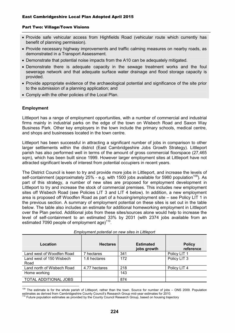
East Cambridgeshire Local Plan Adopted April 2015
Part Two: Village/Town Visions
224
Provide safe vehicular access from Highfields Road (vehicular route which currently has benefit of planning permission).
Provide necessary highway improvements and traffic calming measures on nearby roads, as demonstrated in a Transport Assessment.
Demonstrate that potential noise impacts from the A10 can be adequately mitigated. Demonstrate there is adequate capacity in the sewage treatment works and the foul
sewerage network and that adequate surface water drainage and flood storage capacity is provided.
Provide appropriate evidence of the archaeological potential and significance of the site prior to the submission of a planning application; and
Comply with the other policies of the Local Plan.
Employment
Littleport has a range of employment opportunities, with a number of commercial and industrial firms mainly in industrial parks on the edge of the town on Wisbech Road and Saxon Way Business Park. Other key employers in the town include the primary schools, medical centre, and shops and businesses located in the town centre.
Littleport has been successful in attracting a significant number of jobs in comparison to other larger settlements within the district (East Cambridgeshire Jobs Growth Strategy). Littleport parish has also performed well in terms of the amount of gross commercial floorspace (27,465 sqm), which has been built since 1999. However larger employment sites at Littleport have not attracted significant levels of interest from potential occupiers in recent years.
The District Council is keen to try and provide more jobs in Littleport, and increase the levels of self-containment (approximately 25% - e.g. with 1500 jobs available for 5980 population109). As part of this strategy, a number of new sites are proposed for employment development in Littleport to try and increase the stock of commercial premises. This includes new employment sites off Wisbech Road (see Policies LIT 3 and LIT 4 below). In addition, a new employment area is proposed off Woodfen Road as part of a housing/employment site – see Policy LIT 1 in the previous section. A summary of employment potential on these sites is set out in the table below. The table also includes an estimate for additional homeworking employment in Littleport over the Plan period. Additional jobs from these sites/sources alone would help to increase the level of self-containment to an estimated 33% by 2031 (with 2374 jobs available from an estimated 7090 people of employment age)110.
Employment potential on new sites in Littleport
Location Hectares Estimated jobs growth
Policy reference
Land west of Woodfen Road 7 hectares 341 Policy LIT 1 Land west of 150 Wisbech Road
1.6 hectares 172 Policy LIT 3
Land north of Wisbech Road 4.77 hectares 218 Policy LIT 4 Home working 143
TOTAL ADDITIONAL JOBS 874 109 The estimate is for the whole parish of Littleport, rather than the town. Source for number of jobs – ONS 2009. Population estimates as derived from Cambridgeshire County Council’s Research Group mid-year estimates for 2010. 110 Future population estimates as provided by the County Council Research Group, based on housing trajectory
East Cambridgeshire Local Plan Adopted April 2015
Part Two: Village/Town Visions
225
It is also important to try and prevent the loss of existing business premises and land, in order to support local economic growth. This is even more crucial in the context of the current economy where viability and profits margins are low for business development, particularly speculative schemes. The District Council is keen to retain the existing stock of business land and premises in Littleport given this context. Proposals to re-use employment sites in Littleport for other purposes will therefore only be permitted in certain circumstances – as set out in Policy EMP 1 in the Employment Chapter.
Large-scale new employment development should be focused in the allocated employment/mixed use sites – in order to facilitate their development, ensure suitable access, and minimise impact on the setting and character of Littleport. However, small-scale employment schemes that come forward on the edge of Littleport may be supported in principle – subject to Policies EMP 2, EMP 3 and EMP 4.Employment allocation – land west of 150 Wisbech Road
The site is currently grassland (which was formerly in agricultural use) to the north of Littleport. It is adjacent to a petrol filling station and a number of residential properties to the east, and is bounded by the A10 to the west. The site is identified in the Littleport Masterplan as a potential area for employment development. Planning permission was granted in 2013 for a business park development on the site comprising B1 uses (application reference 12/00932/FUM).
Given that this site is highly visible from the A10 any scheme, (the current approval or any subsequent applications) will need to be carefully designed in terms of layout, scale, height and massing of buildings, in order to minimise visual impact. Development will also need to maximise retention of existing hedgerows and planting along the northern and eastern boundaries, and incorporate landscaping and new planting where possible.
Vehicular access to the site will need to be provided from Wisbech Road by reconfiguring the existing junction, which provides access to the petrol filling station (which is in the same ownership as this site). To enable this the existing acoustic bund adjacent to the petrol station will also have to be repositioned as part of the development.
Any development scheme will need to incorporate provision of an additional pedestrian link through the site from Black Bank Drove to Wisbech Road, as part of a key circular route for Littleport (see the section on infrastructure).
Policy LIT 3: Employment allocation, land west of 150 Wisbech Road
Approximately 1.6 hectares of land is allocated for employment development for B1 and B2 uses on land north of Wisbech Road.
Development proposals will be expected to:
Provide safe vehicular access from Wisbech Road. Provide a pedestrian link across the site between Black Bank Drove and Wisbech Road as
part of circular walking route around Littleport. Provide adequate on-site car and cycle parking for employees and visitors. Have particular regard to layout and the scale, height, design and massing of buildings and
landscaping, in order to minimise visual impact on the surrounding countryside and minimise amenity impact upon neighbouring residential properties.
East Cambridgeshire Local Plan Adopted April 2015
Part Two: Village/Town Visions
226
Maximise the retention of existing trees and hedgerows on-site. Provide landscaping along the boundaries with the A10, Black Horse Drove and neighbouring
residential properties. Demonstrate that noise from the A10 can be adequately mitigated. Demonstrate there is adequate capacity in the sewage treatment works and the foul
sewerage network. Provide appropriate evidence of the archaeological potential and significance of the site prior
to the submission of a planning application; and Comply with other policies of the Local Plan.
Employment allocation – land north of Wisbech Road
The site is currently agricultural land on the western edge of Littleport adjacent to an existing agricultural machinery business (Thurlow Nunn Holdings) and north-east of the existing Faraday Business Park.
This site includes land previously identified in the East Cambridgeshire Local Plan (2000) as an area for employment. However part of the existing employment allocation remains undeveloped. Since then it has been identified as a potential future employment site in the Littleport Masterplan. It is also proposed that land to the north of the concrete products factory should be allocated for employment to enable the expansion of the existing business. Planning permission for the development of this land as an open storage yard/hard standing associated with the neighbouring concrete manufacturing premises was granted by the District Council in March 2014 (planning reference 13/01060/FUM).
Highway access to the site is provided from two separate points on Wisbech Road. The majority of the site will need to be accessed via the existing access point which serves Thurlow Nunn Standen. The Highways Authority has advised that improvements will need to be made to the junction to enable further employment development on this part of the site. The remainder of the site in the ownership of F. P. McCann will be accessed via the existing concrete factory, as an extension of their site.
This area is located in an area of high flood risk. Therefore a Flood Risk Assessment will be need to be submitted with any planning application(s) for this site.
Policy LIT 4: Employment allocation, land north of Wisbech Road
Approximately 4.77 hectares of land is allocated for employment development for B1/B2/B8 uses on land north of Wisbech Road.
Development proposals will be expected to:
Provide safe vehicular access for the majority of the site from Wisbech Road via the existing junction, which serves Thurlow Nunn Standen. This will require improvements to the junction.
Provide safe vehicular access to the land to the rear of the concrete products factory on Wisbech Road via the existing factory site.
Provide adequate on-site car and cycle parking for employees and visitors. Have particular regard to the scale, height, design and massing of buildings and landscaping,
in order to minimise visual impact on the surrounding countryside and minimise amenity
East Cambridgeshire Local Plan Adopted April 2015
Part Two: Village/Town Visions
227
impact upon nearby residential properties. Provide landscaping along the boundaries with nearby residential properties and adjoining
agricultural land. Demonstrate that the flood risk on the site can be adequately mitigated. Demonstrate there is adequate capacity in the sewage treatment works and the foul
sewerage network; and Comply with other policies of the Local Plan.
Town Centre
Littleport has a historic town centre which provides a range of food and non-food shops, a public house and community facilities. The current key attractors are the Co-op store, Lloyds Pharmacy and Barclays Bank. There are also a number of important community facilities in or near to the town centre, including the library, village hall and community centre. The main shopping area is focused on Main Street, with a number of retail units (the majority of which are service related) on Granby Street.
However the town centre is not performing as well as it could, given the population of the town and the surrounding area. Although there is a good range of community facilities, there is a fairly limited range of shops, restaurants and pubs, and a number of retail premises have been lost to other uses particularly housing. Footfall is low for a town of its size. Many people travel to Ely to access the wider range of shops and facilities available in the city.
The regeneration and improvement of the town centre is one of the key challenges for Littleport. The increasing population of the town should assist by bringing additional residents and increasing footfall. There are opportunities to provide new and expanded retail units on the High Street and on nearby Crown Street and Granby Street – although no sites which would be large enough to accommodate a supermarket or stores or similar size. Linked to this, it will be important to make improvements to the appearance, attractiveness and accessibility of the town centre, through street works, enhanced links/crossings for pedestrians and cyclists, and provision of more cycle parking. The Littleport Masterplan highlights the benefits that improvements on Crown Lane could bring in slowing down traffic, enhancing the public realm, and benefiting the vitality of the town centre.
The regeneration of the town centre will require action on a number of levels, and from a variety of sources. The recent establishment of a new ‘Town Centre Forum’ of local businesses should help to focus community efforts and make changes. The District Council will seek to work closely with the Parish Council and the Town Centre Forum to identify potential funding sources.
As part of the strategy it will be important to retain the existing retail units in the town centre and prevent their loss to other uses (in accordance with Policy COM 1). Policy LIT 5 below also identifies a number of specific attractions/facilities which are seen as critical to the long-term health and vitality of the town centre, and which are singled out for particular protection. This includes the Co-op supermarket on Main Street (which should be retained for food retail purposes), the community centre (former cinema) on Hempfield Road, and the public carparks at the community centre and off Main Street. The policy below also seeks to protect against the loss of private car parks/parking areas within and close to the town centre, recognising that these support the shops and businesses within Littleport Town Centre.
East Cambridgeshire Local Plan Adopted April 2015
Part Two: Village/Town Visions
228
Policy LIT 5: Strategy for Littleport Town Centre
The strategy for the enhancement and development of Littleport Town Centre is as follows:
The current Co-op site located on Main Street is identified as a key town centre facility and should be retained for its current food retailing use. Re-development schemes will only be appropriate where they involve the re-provision of at least equivalent food retailing floorspace on the ground floor. Other town centre uses may be appropriate on upper floors where proposed.
Other existing retail units within Littleport Town Centre particularly those located on the Main Street and Granby Street are to be retained. The conversion or redevelopment of existing retail units to other uses (particularly housing) will be discouraged in accordance with Policy COM 2.
Proposals for additional retail and town centres uses in Main Street, Crown Lane and Granby Street will be encouraged.
Public realm improvements should be provided in Crown Lane to make it more attractive and pedestrian/cyclist friendly.
Enhanced pedestrian and cycle routes and cycle parking to be provided within the town centre.
The current public car park on Main Street should be retained for its current use. Privately owned car parks and car parking areas located in or close to Littleport town centre
should be retained – unless applicants can demonstrate that alternative provision of equivalent value can be made to off-set any loss.
The current community centre site and adjacent public car parking on Hempfield Road should be retained for its current use. Redevelopment schemes will only be appropriate where they involve the re-provision of community uses and an equivalent amount of public car parking.
Infrastructure and community facilities
Littleport needs to be served by appropriate levels of infrastructure and facilities, in order to ensure the quality of people’s lives and prevent unnecessary travel. This includes infrastructure such as water, energy, wastewater treatment works, and roads – and community facilities such as schools, open space, health, and sport and recreation facilities.
As outlined in Chapter 3, the District Council will continue to work with infrastructure providers to enable the delivery of necessary of infrastructure and facilities. The District Council will also seek to secure planning obligations and Community Infrastructure Levy monies from developers towards new infrastructure and facilities required as a result of new development.
It will also be important to protect existing community facilities. As set out in Chapter 7, the loss of community facilities will be resisted under Policy COM 3. Proposals for new community development that benefits Littleport will be supported in principle, subject to Policies GROWTH 3 and COM 4.
The key future infrastructure and service requirements for Littleport are set out in the table below. These have been identified through technical work, discussions with infrastructure providers, and community consultation - and are linked to the estimated future levels of growth in Littleport over the plan period. Further details relating to the school allocation on Camel Road are set out in Policy LIT 6 after this table.
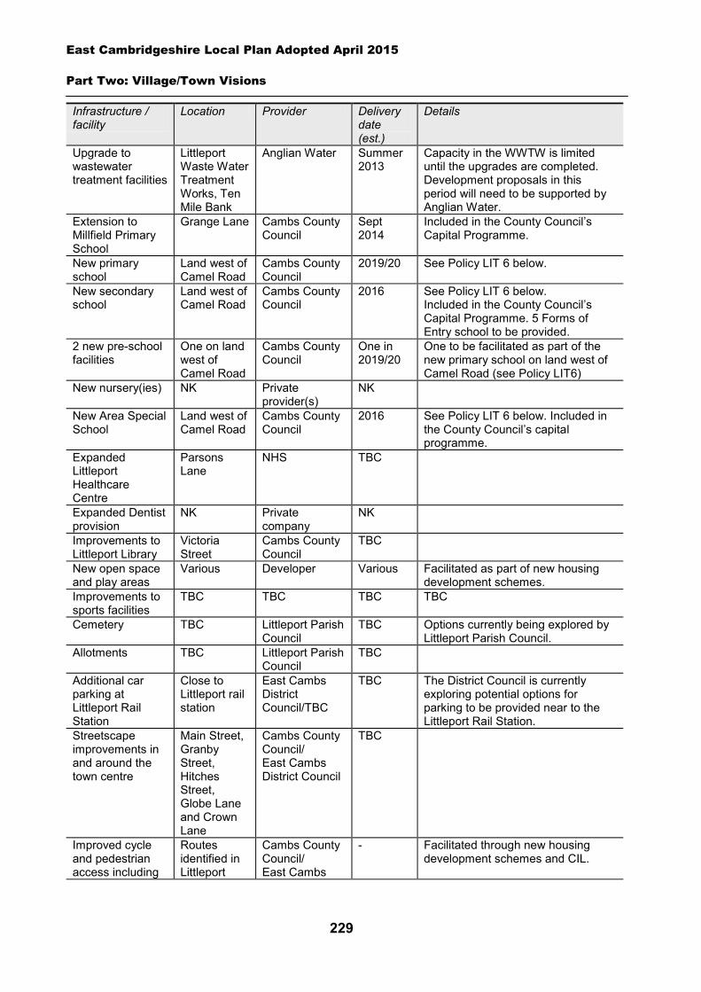
East Cambridgeshire Local Plan Adopted April 2015
Part Two: Village/Town Visions
229
Infrastructure / facility
Location Provider Delivery date (est.)
Details
Upgrade to wastewater treatment facilities
Littleport Waste Water Treatment Works, Ten Mile Bank
Anglian Water Summer 2013
Capacity in the WWTW is limited until the upgrades are completed. Development proposals in this period will need to be supported by Anglian Water.
Extension to Millfield Primary School
Grange Lane Cambs County Council
Sept 2014
Included in the County Council’s Capital Programme.
New primary school
Land west of Camel Road
Cambs County Council
2019/20 See Policy LIT 6 below.
New secondary school
Land west of Camel Road
Cambs County Council
2016 See Policy LIT 6 below. Included in the County Council’s Capital Programme. 5 Forms of Entry school to be provided.
2 new pre-school facilities
One on land west of Camel Road
Cambs County Council
One in 2019/20
One to be facilitated as part of the new primary school on land west of Camel Road (see Policy LIT6)
New nursery(ies) NK Private provider(s)
NK
New Area Special School
Land west of Camel Road
Cambs County Council
2016 See Policy LIT 6 below. Included in the County Council’s capital programme.
Expanded Littleport Healthcare Centre
Parsons Lane
NHS TBC
Expanded Dentist provision
NK Private company
NK
Improvements to Littleport Library
Victoria Street
Cambs County Council
TBC
New open space and play areas
Various Developer Various Facilitated as part of new housing development schemes.
Improvements to sports facilities
TBC TBC TBC TBC
Cemetery TBC Littleport Parish Council
TBC Options currently being explored by Littleport Parish Council.
Allotments TBC Littleport Parish Council
TBC
Additional car parking at Littleport Rail Station
Close to Littleport rail station
East Cambs District Council/TBC
TBC The District Council is currently exploring potential options for parking to be provided near to the Littleport Rail Station.
Streetscape improvements in and around the town centre
Main Street, Granby Street, Hitches Street, Globe Lane and Crown Lane
Cambs County Council/ East Cambs District Council
TBC
Improved cycle and pedestrian access including
Routes identified in Littleport
Cambs County Council/ East Cambs
- Facilitated through new housing development schemes and CIL.
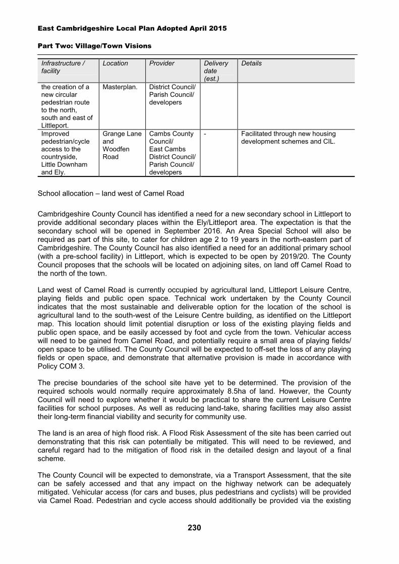
East Cambridgeshire Local Plan Adopted April 2015
Part Two: Village/Town Visions
230
Infrastructure / facility
Location Provider Delivery date (est.)
Details
the creation of a new circular pedestrian route to the north, south and east of Littleport.
Masterplan. District Council/ Parish Council/ developers
Improved pedestrian/cycle access to the countryside, Little Downham and Ely.
Grange Lane and Woodfen Road
Cambs County Council/ East Cambs District Council/ Parish Council/ developers
- Facilitated through new housing development schemes and CIL.
School allocation – land west of Camel Road
Cambridgeshire County Council has identified a need for a new secondary school in Littleport to provide additional secondary places within the Ely/Littleport area. The expectation is that the secondary school will be opened in September 2016. An Area Special School will also be required as part of this site, to cater for children age 2 to 19 years in the north-eastern part of Cambridgeshire. The County Council has also identified a need for an additional primary school (with a pre-school facility) in Littleport, which is expected to be open by 2019/20. The County Council proposes that the schools will be located on adjoining sites, on land off Camel Road to the north of the town.
Land west of Camel Road is currently occupied by agricultural land, Littleport Leisure Centre, playing fields and public open space. Technical work undertaken by the County Council indicates that the most sustainable and deliverable option for the location of the school is agricultural land to the south-west of the Leisure Centre building, as identified on the Littleport map. This location should limit potential disruption or loss of the existing playing fields and public open space, and be easily accessed by foot and cycle from the town. Vehicular access will need to be gained from Camel Road, and potentially require a small area of playing fields/ open space to be utilised. The County Council will be expected to off-set the loss of any playing fields or open space, and demonstrate that alternative provision is made in accordance with Policy COM 3.
The precise boundaries of the school site have yet to be determined. The provision of the required schools would normally require approximately 8.5ha of land. However, the County Council will need to explore whether it would be practical to share the current Leisure Centre facilities for school purposes. As well as reducing land-take, sharing facilities may also assist their long-term financial viability and security for community use.
The land is an area of high flood risk. A Flood Risk Assessment of the site has been carried out demonstrating that this risk can potentially be mitigated. This will need to be reviewed, and careful regard had to the mitigation of flood risk in the detailed design and layout of a final scheme.
The County Council will be expected to demonstrate, via a Transport Assessment, that the site can be safely accessed and that any impact on the highway network can be adequately mitigated. Vehicular access (for cars and buses, plus pedestrians and cyclists) will be provided via Camel Road. Pedestrian and cycle access should additionally be provided via the existing
East Cambridgeshire Local Plan Adopted April 2015
Part Two: Village/Town Visions
231
footpath from Elmside to Black Bank Drove via provision of a footbridge over the drain, and Black Bank Drove itself should be enhanced and upgraded. Other opportunities for pedestrian and cycle access points off Wisbech Road should also be explored. Car parking for staff and visitors will also be required.
Spatial Strategy for Littleport (see Inset Map 8.25)
Policy LIT 6: School allocation - land west of Camel Road
A broad area to the west of Camel Road has been identified for a new primary school (with a pre-school facility), secondary and area special school and associated playing fields, buildings and car parking. This would normally require approximately up to 8.5 hectares of land (but may be less if facilities are shared with the adjoining Leisure Centre).
Development proposals will be expected to:
Have particular regard to layout and the scale, height, design and massing of buildings and landscaping in order to minimise visual impact on Camel Road and minimise amenity impact on neighbouring properties.
Demonstrate through a Transport Assessment that safe vehicular, pedestrian and cycle access can be provided into the site (with the main vehicular access point from Camel Road).
Provide necessary highways improvements and traffic calming on nearby roads, as demonstrated through a Transport Assessment.
Provide a pedestrian and cycle link to the site via Elmside, through the provision of a new footbridge over the drain and upgrading of the existing link, and explore other options for additional pedestrian and cycle access from Wisbech Road.
Enhance and upgrade Black Bank Drove to provide a suitable route for pedestrians and cyclists.
Provide adequate car and cycle parking on site for employees and visitors. Mitigate the loss of existing playing fields by making alternative provision in line with Policy
COM 3. Provide appropriate evidence of the archaeological potential and significance of the site prior
to the submission of a planning application. Demonstrate that the flood risk on the site can be adequately mitigated; and Comply with other policies of the Local Plan.
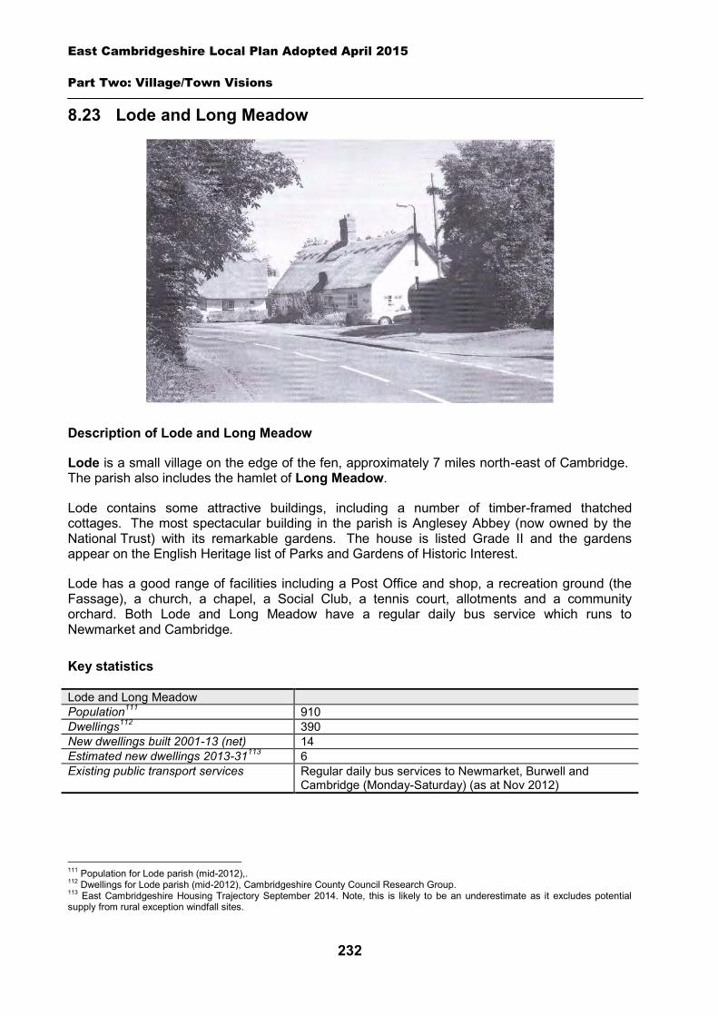
East Cambridgeshire Local Plan Adopted April 2015
Part Two: Village/Town Visions
232
8.23 Lode and Long Meadow
Description of Lode and Long Meadow
Lode is a small village on the edge of the fen, approximately 7 miles north-east of Cambridge. The parish also includes the hamlet of Long Meadow.
Lode contains some attractive buildings, including a number of timber-framed thatched cottages. The most spectacular building in the parish is Anglesey Abbey (now owned by the National Trust) with its remarkable gardens. The house is listed Grade II and the gardens appear on the English Heritage list of Parks and Gardens of Historic Interest.
Lode has a good range of facilities including a Post Office and shop, a recreation ground (the Fassage), a church, a chapel, a Social Club, a tennis court, allotments and a community orchard. Both Lode and Long Meadow have a regular daily bus service which runs to Newmarket and Cambridge.
Key statistics
Lode and Long Meadow Population111 910 Dwellings112 390 New dwellings built 2001-13 (net) 14 Estimated new dwellings 2013-31113 6 Existing public transport services Regular daily bus services to Newmarket, Burwell and
Cambridge (Monday-Saturday) (as at Nov 2012)
111 Population for Lode parish (mid-2012),. 112 Dwellings for Lode parish (mid-2012), Cambridgeshire County Council Research Group. 113 East Cambridgeshire Housing Trajectory September 2014. Note, this is likely to be an underestimate as it excludes potential supply from rural exception windfall sites.
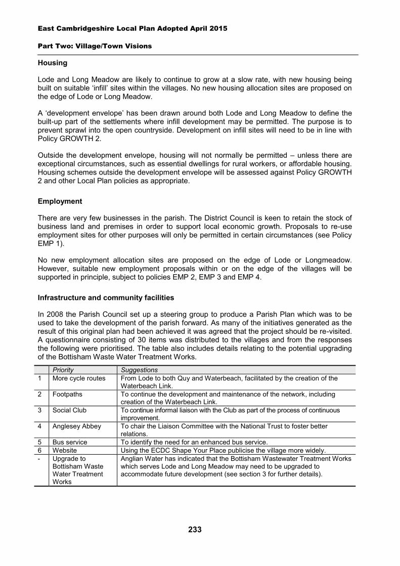
East Cambridgeshire Local Plan Adopted April 2015
Part Two: Village/Town Visions
233
Housing
Lode and Long Meadow are likely to continue to grow at a slow rate, with new housing being built on suitable ‘infill’ sites within the villages. No new housing allocation sites are proposed on the edge of Lode or Long Meadow.
A ‘development envelope’ has been drawn around both Lode and Long Meadow to define the built-up part of the settlements where infill development may be permitted. The purpose is to prevent sprawl into the open countryside. Development on infill sites will need to be in line with Policy GROWTH 2.
Outside the development envelope, housing will not normally be permitted – unless there are exceptional circumstances, such as essential dwellings for rural workers, or affordable housing. Housing schemes outside the development envelope will be assessed against Policy GROWTH 2 and other Local Plan policies as appropriate.
Employment
There are very few businesses in the parish. The District Council is keen to retain the stock of business land and premises in order to support local economic growth. Proposals to re-use employment sites for other purposes will only be permitted in certain circumstances (see Policy EMP 1).
No new employment allocation sites are proposed on the edge of Lode or Longmeadow. However, suitable new employment proposals within or on the edge of the villages will be supported in principle, subject to policies EMP 2, EMP 3 and EMP 4.
Infrastructure and community facilities
In 2008 the Parish Council set up a steering group to produce a Parish Plan which was to be used to take the development of the parish forward. As many of the initiatives generated as the result of this original plan had been achieved it was agreed that the project should be re-visited. A questionnaire consisting of 30 items was distributed to the villages and from the responses the following were prioritised. The table also includes details relating to the potential upgrading of the Bottisham Waste Water Treatment Works.
Priority Suggestions 1 More cycle routes From Lode to both Quy and Waterbeach, facilitated by the creation of the
Waterbeach Link. 2 Footpaths
To continue the development and maintenance of the network, including creation of the Waterbeach Link.
3 Social Club
To continue informal liaison with the Club as part of the process of continuous improvement.
4 Anglesey Abbey
To chair the Liaison Committee with the National Trust to foster better relations.
5 Bus service To identify the need for an enhanced bus service. 6 Website Using the ECDC Shape Your Place publicise the village more widely. - Upgrade to
Bottisham Waste Water Treatment Works
Anglian Water has indicated that the Bottisham Wastewater Treatment Works which serves Lode and Long Meadow may need to be upgraded to accommodate future development (see section 3 for further details).

East Cambridgeshire Local Plan Adopted April 2015
Part Two: Village/Town Visions
234
The current community facilities in Lode and Long Meadow (including the shop, church, chapel, recreation ground, Fassage Hall (community room/changing rooms) and the tennis court) contribute to the quality of people’s lives. The loss of community facilities will also be resisted under Policy COM 3. Proposals for new community development that benefits the parish will be supported in principle, subject to Policy COM 4.
Spatial strategy for Lode (see Inset Map 8.26)
Spatial strategy for Long Meadow (see Inset Map 8.27)
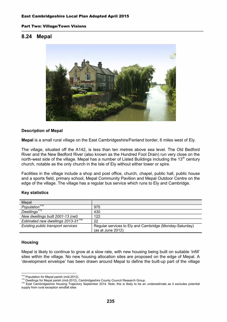
East Cambridgeshire Local Plan Adopted April 2015
Part Two: Village/Town Visions
235
8.24 Mepal
Description of Mepal
Mepal is a small rural village on the East Cambridgeshire/Fenland border, 6 miles west of Ely.
The village, situated off the A142, is less than ten metres above sea level. The Old Bedford River and the New Bedford River (also known as the Hundred Foot Drain) run very close on the north-west side of the village. Mepal has a number of Listed Buildings including the 13th century church, notable as the only church in the Isle of Ely without either tower or spire.
Facilities in the village include a shop and post office, church, chapel, public hall, public house and a sports field, primary school, Mepal Community Pavilion and Mepal Outdoor Centre on the edge of the village. The village has a regular bus service which runs to Ely and Cambridge.
Key statistics
Mepal Population114 970 Dwellings115 430 New dwellings built 2001-13 (net) 122 Estimated new dwellings 2013-31116 22 Existing public transport services Regular services to Ely and Cambridge (Monday-Saturday)
(as at June 2012)
Housing
Mepal is likely to continue to grow at a slow rate, with new housing being built on suitable ‘infill’ sites within the village. No new housing allocation sites are proposed on the edge of Mepal. A ‘development envelope’ has been drawn around Mepal to define the built-up part of the village
114 Population for Mepal parish (mid-2012). 115 Dwellings for Mepal parish (mid-2012), Cambridgeshire County Council Research Group. 116 East Cambridgeshire Housing Trajectory September 2014. Note, this is likely to be an underestimate as it excludes potential supply from rural exception windfall sites

East Cambridgeshire Local Plan Adopted April 2015
Part Two: Village/Town Visions
236
where infill development may be permitted. The purpose is to prevent sprawl into the open countryside. Development on infill sites will need to be in line with Policy GROWTH 2.
Outside the development envelope, housing will not normally be permitted – unless there are exceptional circumstances, such as essential dwellings for rural workers, or affordable housing. Housing schemes outside the development envelope will be assessed against Policy GROWTH 2 and other Local Plan policies as appropriate.
Employment
There are a few current businesses in the village, including Greens of Mepal, and Lillypot Dressmaking and Alterations, but little employment land or premises (e.g. office and industrial). The District Council is keen to retain any land and premises in order to support local economic growth. Proposals to re-use employment sites for other purposes will only be permitted in certain circumstances (see Policy EMP 1).
No new employment allocation sites are proposed on the edge of Mepal. However, suitable new employment proposals within or on the edge of the village will be supported in principle, subject to Policies EMP 2, EMP 3 and EMP 4.
Infrastructure and community facilities
Residents in Mepal have indicated a desire for the need for improvements to infrastructure and facilities in the village. A list of priorities is set out in the table below.
Priority Suggestions =1 Improvements to the
Village Hall Extension of Village Hall. Improvements to Village Hall kitchen and floor. Improved signage. Provision of a new car park
=1 Traffic calming Traffic calming on Sutton Road and School Lane. Extend 30mph speed limit to pub.
3 Improvements to pedestrian/cycle routes
More footpaths and cycle paths. Cycle path along the river. Pedestrian/cycle routes to link village with Sutton and Witchford/Ely. Provide cycle link to Mepal Outdoor Centre
4 Improvements to sports ground/open space
Creation of a cricket pitch.
One of the top priorities is improvements to Mepal Village Hall, in particular an extension and improvements to the kitchen and flooring in the hall and provision of a new car park. The other top and third priorities are both transport-related – a traffic calming scheme and improvements to pedestrian/cycle links. The District Council will work with the Parish Council and County Council to explore options and secure funding for improvements to community facilities and road and transport schemes in Mepal. The District Council will also work in partnership to try to retain existing public transport levels, and encourage self-sufficient transport services, such as community transport.
The current community facilities in Mepal (including the shop and Post Office, pub, public hall, church and community pavilion) contribute to the quality of people’s lives. The loss of community facilities will also be resisted under Policy COM 3. Proposals for new community development that benefits the village will be supported in principle, subject to Policy COM 4.
Spatial strategy for Mepal (see Inset Map 8.28)
East Cambridgeshire Local Plan Adopted April 2015
Part Two: Village/Town Visions
237
8.25 Newmarket Fringe
Description of Newmarket Fringe
Newmarket Fringe refers to the parts of Newmarket that lie within East Cambridgeshire. The area consists of the southern suburbs of the town, and includes Ditton Lodge First School and Newmarket Town Football Club. The main features of the suburb are shown on Inset Map 8.29. The rest of Newmarket lies within the local authority district of Forest Heath.
As a suburb of Newmarket, Newmarket Fringe looks to the services and facilities provided within the town. Newmarket is a large market town, with a wide range of shops, employment opportunities, community facilities – and good public transport links including a railway station (to Cambridge and Ipswich).
Given the geography of the town, it is important to coordinate and plan for the suburb in close partnership with Forest Heath District Council. Although the Local Plan timetables of the two authorities are not in unison, close liaison has taken place between the authorities, particularly on the identification of potential development sites, and the provision of infrastructure and facilities. Further expansion of the suburb area is not proposed, as there are very limited opportunities for growth due to the presence of stud farms on the edge of the suburb and lack of available land. However, a greenfield urban expansion including housing and employment is being considered for Newmarket, within the district of Forest Heath, in their Core Strategy Single Issue Review (July 2012). For further details, see Forest Heath’s website at www.forest-heath.gov.uk.
The production of this Vision has also involved working with the three Parish Councils who cover Newmarket. The Newmarket Fringe suburb lies partly within Woodditton Parish, and partly within Cheveley Parish. The rest of Newmarket town (within Forest Heath) is covered by Newmarket Town Council.
© Richard Humphrey
East Cambridgeshire Local Plan Adopted April 2015
Part Two: Village/Town Visions
238
Key statistics
Newmarket Fringe Population117 950 (total population of Newmarket is 18,039) Dwellings118 420 New dwellings built 2001-13 (net) 93 Estimated new dwellings 2013-31119 36 Existing public transport services Bus services within Newmarket (Monday-Saturday) (as at June
2012). Railway station in Newmarket with services to Cambridge and Ipswich.
Housing
The Newmarket Fringe area is likely to continue to grow at a slow rate, with new housing being built on suitable ‘infill’ sites within the area. No new housing allocation sites are on the proposed on the edge of Newmarket Fringe.
A ‘development envelope’ has been drawn around the Newmarket Fringe to define the built-up part of the settlements where infill development may be permitted. The purpose is to prevent sprawl into the open countryside. Development on infill sites will need to be in line with Policy GROWTH 2.
Outside the development envelope, housing will not normally be permitted – unless there are exceptional circumstances, such as essential dwellings for rural workers, or affordable housing. Housing schemes outside the development envelope will be assessed against Policy GROWTH 2 and other Local Plan policies as appropriate.
Employment
There are few businesses in Newmarket Fringe, but there are many stud farms and horse breeding establishments located in the countryside surrounding Newmarket. The District Council will continue to support and encourage the horse racing industry under Policy EMP 6. The District Council is keen to retain the stock of business land and premises in order to support local economic growth. Proposals to re-use any employment sites for other purposes will only be permitted in certain circumstances (see Policy EMP 1).
No new employment allocation sites are proposed on the edge of the Newmarket Fringe. However, suitable new employment proposals within or on the edge of the suburb will be supported in principle, subject to Policies EMP 2, EMP 3 and EMP 4.
Infrastructure and community facilities
Newmarket is a large market town, with a wide range of shops and community facilities which are used by residents of Newmarket Fringe suburb. The two local authorities (and County Council’s) regularly work in close partnership to facilitate and fund facilities which are used by residents in both local authority areas, and this work will continue in the future.
117 Population for Newmarket Fringe area - (mid-2012), Cambridgeshire County Council Research Group. Newmarket town population – 2011 Census. 118 Dwellings for Newmarket Fringe area – (mid-2012), Cambridgeshire County Council Research Group. 119 East Cambridgeshire Housing Trajectory September 2014. Note, this is likely to be an underestimate as it excludes potential supply from rural exception windfall sites.
East Cambridgeshire Local Plan Adopted April 2015
Part Two: Village/Town Visions
239
Residents of Newmarket Fringe have suggested a number of improvements to infrastructure and facilities within the suburb area. A list of priorities for the suburb is set out in the table below.
Priority Suggestions 1 Traffic calming/highway
improvements
Speed reduction measures along Ashley Road and Duchess Drive More speed checks on main routes Advance warning lights for high vehicles about the low rail bridge on New Ashley Road Better footway provision on the narrow road bridge on Woodditton Road
2 More school places Liaise with County Council Education Department
The top priority is for traffic calming/highway improvements particularly speed reduction measures and improved footpaths. The other priority is more school places at Ditton Lodge First School. The District Council will work with Cheveley and Woodditton Parish Councils and the County Council to explore options and secure funding for the above improvements and will also liaise with the County Council to explore the issue of extra school places.
The current community facilities in Newmarket Fringe (including the school and football club) contribute to the quality of people’s lives. The loss of community facilities will be resisted under Policy COM 3. Proposals for new community development that benefits the suburb will be supported in principle, subject to Policy COM 4.
Spatial strategy for Newmarket Fringe (see Inset Map 8.29)
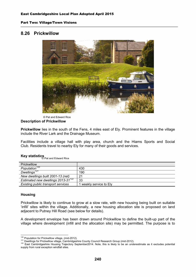
East Cambridgeshire Local Plan Adopted April 2015
Part Two: Village/Town Visions
240
8.26 Prickwillow
Description of Prickwillow
Prickwillow lies in the south of the Fens, 4 miles east of Ely. Prominent features in the village include the River Lark and the Drainage Museum.
Facilities include a village hall with play area, church and the Hiams Sports and Social Club. Residents travel to nearby Ely for many of their goods and services.
Key statistics
Prickwillow Population120 430 Dwellings121 190 New dwellings built 2001-13 (net) 21 Estimated new dwellings 2013-31122 33 Existing public transport services 1 weekly service to Ely
Housing
Prickwillow is likely to continue to grow at a slow rate, with new housing being built on suitable ‘infill’ sites within the village. Additionally, a new housing allocation site is proposed on land adjacent to Putney Hill Road (see below for details).
A development envelope has been drawn around Prickwillow to define the built-up part of the village where development (infill and the allocation site) may be permitted. The purpose is to
120 Population for Prickwillow village, (mid-2012). 121 Dwellings for Prickwillow village, Cambridgeshire County Council Research Group (mid-2012). 122 East Cambridgeshire Housing Trajectory September2014. Note, this is likely to be an underestimate as it excludes potential supply from rural exception windfall sites.
© Pat and Edward Rice
© Pat and Edward Rice
East Cambridgeshire Local Plan Adopted April 2015
Part Two: Village/Town Visions
241
prevent sprawl into the open countryside. Development on infill sites will need to be in line with Policy GROWTH 2. Development on the allocation site will need to be in line with Policy PRK 1.
Outside the development envelope, housing will not normally be permitted – unless there are exceptional circumstances, such as essential dwellings for rural workers, or affordable housing. Housing schemes outside the development envelope will be assessed against Policy GROWTH 2 and other Local Plan policies as appropriate.
It should be noted that Prickwillow is located in an area of flood risk, and therefore all development proposals will need to satisfy the requirement of the NPPF, and demonstrate through Flood Risk Assessments that risks can be adequately mitigated. A Flood Risk Assessment for the proposed allocation site at Putney Hill Road has been approved by the Environment Agency (dated June 2012).
Policy PRK 1: Housing allocation, land adjacent to Putney Hill Road
Approximately 0.5 hectares of land is allocated for residential development for up to 10 dwellings.
Development proposals will be expected to:
Provide an element of affordable housing (currently 30%) as required under Policy HOU 3, with priority being given to people in local housing need.
Provide a mix of dwelling types and sizes to reflect current evidence of need within Prickwillow.
Have particular regard to the layout and scale, height, design and massing of buildings, and landscaping, in order to minimise visual impact from Putney Hill Road and the surrounding countryside.
Demonstrate that the site can be suitably accessed by vehicles, pedestrians and cyclists, and provide any necessary improvements to the local footpath network.
Demonstrate that the flood risk on the site can be adequately mitigated; and Comply with the other policies of the Local Plan.
Employment
There are a small number of businesses in the village. The District Council is keen to retain the stock of business land and premises in order to support local economic growth. Proposals to reuse employment sites for other purposes will only be permitted in certain circumstances (see Policy EMP 1).
No new employment allocation sites are proposed on the edge of Prickwillow. However, suitable new employment proposals within or on the edge of the village will be supported in principle, subject to Policies EMP 2, EMP 3 and EMP 4, and satisfactory resolution of flood risk (see Housing section above).
Infrastructure and community facilities
Residents in Prickwillow have identified a number of infrastructure and community improvements. A list of priorities is set out in the table below:
East Cambridgeshire Local Plan Adopted April 2015
Part Two: Village/Town Visions
242
Priority Suggestions
1 Improvements to the broadband service
Options for the provision of access to either superfast or basic broadband in areas such as Prickwillow will be considered by the Connecting Cambridgeshire project http://www.connectingcambridgeshire.co.uk/
2 Improvements to pedestrian/cycle routes
Work with partners to explore the provision of an off-road cycle route into Ely.
3 New sports ground/open space Development of playing pitches, possibly as an extension to Hiams sports and social club to be considered for future funding sources.
4 Improvements to play areas Identify specific improvements to be considered for future funding sources e.g. new play area equipment.
The current community facilities in Prickwillow (including the village hall and sports / social club) contribute to the quality of people’s lives. The District Council will work with the County Council and Parish Council to secure funding, including developer contributions, to improve facilities wherever possible. The loss of community facilities will also be resisted under Policy COM 3. Proposals for new community development that benefit the village will be supported in principle, subject to Policy COM 4.
Spatial strategy for Prickwillow (see Inset Map 8.30)
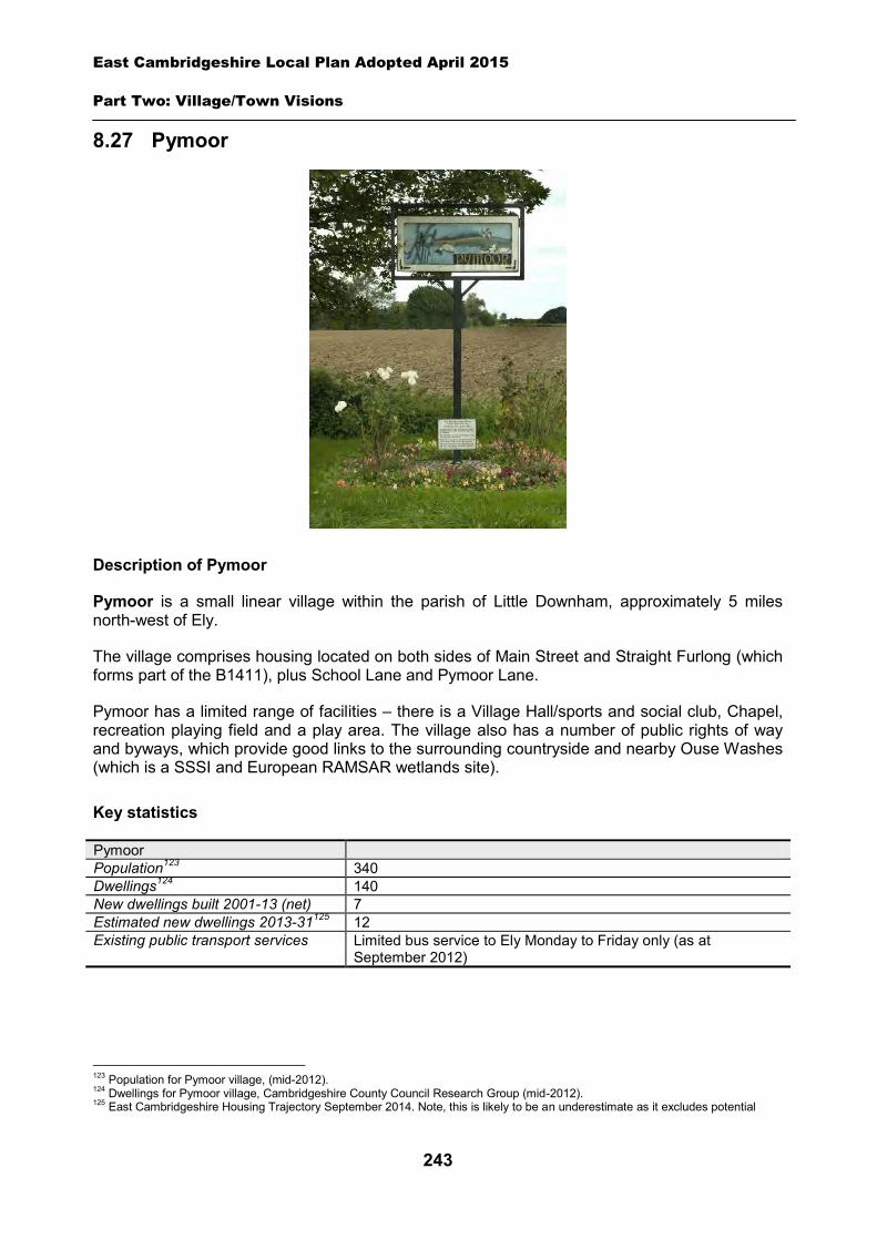
East Cambridgeshire Local Plan Adopted April 2015
Part Two: Village/Town Visions
243
8.27 Pymoor
Description of Pymoor
Pymoor is a small linear village within the parish of Little Downham, approximately 5 miles north-west of Ely.
The village comprises housing located on both sides of Main Street and Straight Furlong (which forms part of the B1411), plus School Lane and Pymoor Lane.
Pymoor has a limited range of facilities – there is a Village Hall/sports and social club, Chapel, recreation playing field and a play area. The village also has a number of public rights of way and byways, which provide good links to the surrounding countryside and nearby Ouse Washes (which is a SSSI and European RAMSAR wetlands site).
Key statistics
Pymoor Population123 340 Dwellings124 140 New dwellings built 2001-13 (net) 7 Estimated new dwellings 2013-31125 12 Existing public transport services Limited bus service to Ely Monday to Friday only (as at
September 2012)
123 Population for Pymoor village, (mid-2012). 124 Dwellings for Pymoor village, Cambridgeshire County Council Research Group (mid-2012). 125 East Cambridgeshire Housing Trajectory September 2014. Note, this is likely to be an underestimate as it excludes potential
East Cambridgeshire Local Plan Adopted April 2015
Part Two: Village/Town Visions
244
Housing
Pymoor is likely to continue to grow, with new housing being built on suitable ‘infill’ sites within the village. Additionally, a new housing allocation site is proposed north-west of Straight Furlong (see Policy PYM 1 below).
A ‘development envelope’ has been drawn around Pymoor to define the built-up part of the village where development (infill and the allocation sites) may be permitted. The purpose is to prevent sprawl into the open countryside. Development on infill sites will need to be in line with Policy GROWTH 2. Development on the allocation site will need to be in line with Policy PYM 1.
Outside the development envelope, housing will not normally be permitted – unless there are exceptional circumstances, such as essential dwellings for rural workers, or affordable housing. Housing schemes outside the development envelope will be assessed against Policy GROWTH 2 and other Local Plan policies as appropriate.
Housing allocation – land north-east of 9 Straight Furlong
The site is located between 9 Straight Furlong and an Anglian Water pumping station, and is currently a mix of agricultural and residential use.
The southern part of site includes an existing bungalow (11 Straight Furlong) in extensive grounds and a number of farm storage buildings. The owner of the storage buildings has stated that these could be relocated to enable the development of this site. The northern part of the site is an agricultural field.
The site is well screened from Straight Furlong by existing hedging and trees along the boundary of the site and on the vergeside. There are also a number of substantial trees within the site and on the boundaries with the open countryside. There will be a need to retain as much of the original hedgeline and planting as possible in any redevelopment scheme, and provide additional planting on the boundaries with the countryside as part of the development of this site (including new trees to off-set any loss on the site).
There is an existing vehicular access to the site from Straight Furlong, which currently serves the farm buildings and the residential properties at 9 and 11 Straight Furlong. However a new vehicular access should be provided from Straight Furlong as part of this development. The location of this will be determined as part of the planning application process. In addition the existing footway should also be extended to enable pedestrian access to the site.
This site is identified as an area of high flood risk. A Flood Risk Assessment of the site has been carried out demonstrating that this risk can potentially be mitigated partly by raising floor levels.
East Cambridgeshire Local Plan Adopted April 2015
Part Two: Village/Town Visions
245
Policy PYM 1: Housing allocation, land north-east of 9 Straight Furlong
0.8 hectares of land is allocated for residential development of approximately 10 dwellings. Development proposals will be expected to:
Have particular regard to layout and the scale, height, design and massing of buildings, and landscaping to minimise the visual impact of development from Straight Furlong and the surrounding countryside and to minimise amenity impact on the nearby residential properties.
Consider the proximity of the foul pumping station in the design and layout of the scheme, and allow for a distance of 15 metres from the boundary of the curtilage of the dwellings to reduce the risk of nuisance/loss of amenity associated with the operation of the pumping station.
Maximise the retention of existing planting and trees on the site, and provide additional landscaping on the boundaries with the open countryside, and in the area closest to the pumping station.
Demonstrate that the flood risk on the site can be adequately mitigated. Provide safe vehicular access from one point off Straight Furlong and extend the existing
footway. Provide an element of affordable housing (currently 30%) as required under Policy HOU 3,
with priority being given to people in local housing need. Provide a mix of dwelling types and sizes to reflect current evidence of need within Pymoor;
and Comply with the other policies of the Local Plan.
Employment
There are a number of small businesses within the village, including an independent seed supplier and a wooden door manufacturer. The District Council is keen to retain the stock of business land and premises in order to support local economic growth. Proposals to re-use employment sites for other purposes will only be permitted in certain circumstances (see Policy EMP 1).
No new employment allocation sites are proposed on the edge of Pymoor. However, suitable new employment proposals on the edge of the village, will be supported in principle, subject to Policies EMP 2, EMP 3 and EMP 4.
Infrastructure and community facilities
Residents in Pymoor have indicated a desire for improvements to infrastructure and facilities in the village. A list of priorities is set out in the table below.
Priority Suggestions 1 Improvements to pedestrian/cycle routes 2 Improvements to sports ground/open space 3 Improvements to play area Parish Council is to replace existing play area fence. 4 Improvement to roads in and around the
village/maintenance of roadside verges
The top priority is the provision of improvements to pedestrian and cycle routes. The second priority is improvements to sports ground/open space; with the third being improvements to the
East Cambridgeshire Local Plan Adopted April 2015
Part Two: Village/Town Visions
246
existing play area. The District Council will work with the Parish Council and County Council to explore options and secure funding for such schemes.
The current community facilities in Pymoor (including the Village Hall, Social and Sports Club, playing field and chapel) contribute to the quality of people’s lives. The District Council will work with the County Council and Parish Council to secure funding, including developer contributions, to improve facilities wherever possible. The loss of community facilities will also be resisted under Policy COM 3. Proposals for new community development that benefits the village will be supported in principle, subject to Policy COM 4.
Spatial strategy for Pymoor (see Inset Map 8.31)
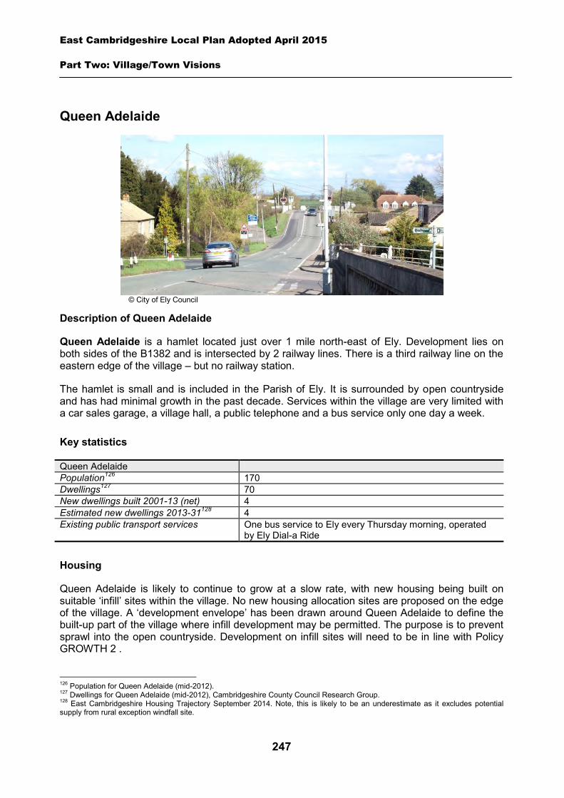
East Cambridgeshire Local Plan Adopted April 2015
Part Two: Village/Town Visions
247
Queen Adelaide
Description of Queen Adelaide
Queen Adelaide is a hamlet located just over 1 mile north-east of Ely. Development lies on both sides of the B1382 and is intersected by 2 railway lines. There is a third railway line on the eastern edge of the village – but no railway station.
The hamlet is small and is included in the Parish of Ely. It is surrounded by open countryside and has had minimal growth in the past decade. Services within the village are very limited with a car sales garage, a village hall, a public telephone and a bus service only one day a week.
Key statistics
Queen Adelaide Population126 170 Dwellings127 70 New dwellings built 2001-13 (net) 4 Estimated new dwellings 2013-31128 4 Existing public transport services One bus service to Ely every Thursday morning, operated
by Ely Dial-a Ride
Housing
Queen Adelaide is likely to continue to grow at a slow rate, with new housing being built on suitable ‘infill’ sites within the village. No new housing allocation sites are proposed on the edge of the village. A ‘development envelope’ has been drawn around Queen Adelaide to define the built-up part of the village where infill development may be permitted. The purpose is to prevent sprawl into the open countryside. Development on infill sites will need to be in line with Policy GROWTH 2 .
126 Population for Queen Adelaide (mid-2012). 127 Dwellings for Queen Adelaide (mid-2012), Cambridgeshire County Council Research Group. 128 East Cambridgeshire Housing Trajectory September 2014. Note, this is likely to be an underestimate as it excludes potential supply from rural exception windfall site.
© City of Ely Council
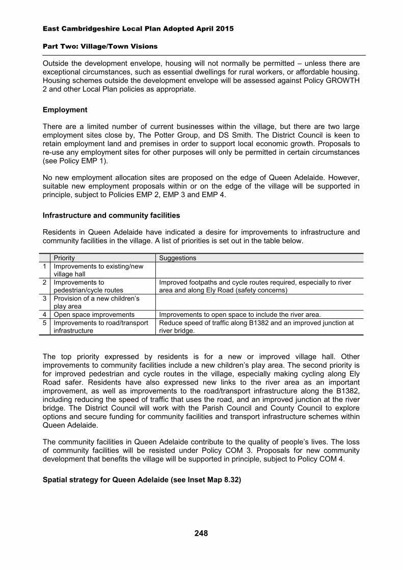
East Cambridgeshire Local Plan Adopted April 2015
Part Two: Village/Town Visions
248
Outside the development envelope, housing will not normally be permitted – unless there are exceptional circumstances, such as essential dwellings for rural workers, or affordable housing. Housing schemes outside the development envelope will be assessed against Policy GROWTH 2 and other Local Plan policies as appropriate.
Employment
There are a limited number of current businesses within the village, but there are two large employment sites close by, The Potter Group, and DS Smith. The District Council is keen to retain employment land and premises in order to support local economic growth. Proposals to re-use any employment sites for other purposes will only be permitted in certain circumstances (see Policy EMP 1).
No new employment allocation sites are proposed on the edge of Queen Adelaide. However, suitable new employment proposals within or on the edge of the village will be supported in principle, subject to Policies EMP 2, EMP 3 and EMP 4.
Infrastructure and community facilities
Residents in Queen Adelaide have indicated a desire for improvements to infrastructure and community facilities in the village. A list of priorities is set out in the table below.
Priority Suggestions 1 Improvements to existing/new
village hall
2 Improvements to pedestrian/cycle routes
Improved footpaths and cycle routes required, especially to river area and along Ely Road (safety concerns)
3 Provision of a new children’s play area
4 Open space improvements Improvements to open space to include the river area. 5 Improvements to road/transport
infrastructure Reduce speed of traffic along B1382 and an improved junction at river bridge.
The top priority expressed by residents is for a new or improved village hall. Other improvements to community facilities include a new children’s play area. The second priority is for improved pedestrian and cycle routes in the village, especially making cycling along Ely Road safer. Residents have also expressed new links to the river area as an important improvement, as well as improvements to the road/transport infrastructure along the B1382, including reducing the speed of traffic that uses the road, and an improved junction at the river bridge. The District Council will work with the Parish Council and County Council to explore options and secure funding for community facilities and transport infrastructure schemes within Queen Adelaide.
The community facilities in Queen Adelaide contribute to the quality of people’s lives. The loss of community facilities will be resisted under Policy COM 3. Proposals for new community development that benefits the village will be supported in principle, subject to Policy COM 4.
Spatial strategy for Queen Adelaide (see Inset Map 8.32)
East Cambridgeshire Local Plan Adopted April 2015
Part Two: Village/Town Visions
249
8.28 Reach
Description of Reach
Reach is a small hamlet in a pleasant setting about 6 miles north-west of Newmarket. It has a clearly defined centre around Fair Green and the majority of the village is covered by a Conservation Area. Reach Lode is to the north of the hamlet and to the south is Devils Dyke an Anglo-Saxon earthwork which is classified as a Scheduled Ancient Monument, and as a Site of Special Scientific Interest.
Facilities in Reach include a church, village centre/hall, and a public house. The village has a regular bus service which runs to Newmarket and Cambridge.
Key statistics
Reach Population129 360 Dwellings130 140 New dwellings built 2001-13 (net) 8 Estimated new dwellings 2013-31131 7 Existing public transport services Regular services to Newmarket and Cambridge (Monday-
Saturday) (as at June 2012)
129 Population for Reach parish (mid-2012). 130 Dwellings for Reach parish (mid-2012), Cambridgeshire County Council Research Group. 131 East Cambridgeshire Housing Trajectory September 2014. Note, this is likely to be an underestimate as it excludes potential supply from rural exception windfall sites.
East Cambridgeshire Local Plan Adopted April 2015
Part Two: Village/Town Visions
250
Housing
Reach is likely to continue to grow at a slow rate, with new housing being built on suitable ‘infill’ sites within the village. No new housing allocation sites are proposed on the edge of Reach.
A ‘development envelope’ has been drawn around Reach to define the built-up part of the village where infill development may be permitted. The purpose is to prevent sprawl into the open countryside. Development on infill sites will need to be in line with Policy GROWTH 2.
Outside the development envelope, housing will not normally be permitted – unless there are exceptional circumstances, such as essential dwellings for rural workers, or affordable housing. Housing schemes outside the development envelope will be assessed against Policy GROWTH 2 and other Local Plan policies as appropriate.
Employment
There are few current businesses in the village. The District Council is keen to retain the stock of business land and premises in order to support local economic growth. Proposals to re-use any employment sites for other purposes will only be permitted in certain circumstances (see Policy EMP 1).
No new employment allocation sites are proposed on the edge of Reach. However, a new employment allocation is proposed on Reach Road in Burwell, only a mile or so from the village. Suitable new employment proposals within or on the edge of Reach will be supported in principle, subject to Policies EMP 2, EMP 3 and EMP 4.
Infrastructure and community facilities
Residents in Reach have indicated a desire for improvements to infrastructure and facilities in the village. A list of priorities is set out in the table below.
Priority Suggestions 1 Improvements to pedestrian/cycle routes
Access to bridge between Reach and Swaffham Prior Pavement improvements between Reach – Burwell - Swaffham Prior Footpath clearance along the Lode, the Hythe end of the village Cycle route between Quy and Lode for commuters to Cambridge
2 More school places Liaison with County Council 3 Improvements to sports grounds/open
space Play area to be refurbished
4 Improvements to the community/village hall
To be confirmed
5 Traffic calming/problems with roadside parking
Traffic calming needed on main road into and out of village
The top priority is for improvements to pedestrian/cycle links in and around Reach. Other priorities include more school places, improvements to the sports ground/open space, the village hall and traffic calming. The District Council will work with the Parish Council and County Council to explore options and secure funding for improvements to community facilities and transport infrastructure within Reach.

East Cambridgeshire Local Plan Adopted April 2015
Part Two: Village/Town Visions
251
The current community facilities in Reach (including the, pub, and church) contribute to the quality of people’s lives. The loss of community facilities will be resisted under Policy COM 3. Proposals for new community development that benefits the village will be supported in principle, subject to Policy COM 4.
Spatial strategy for Reach (see Inset Map 8.33)
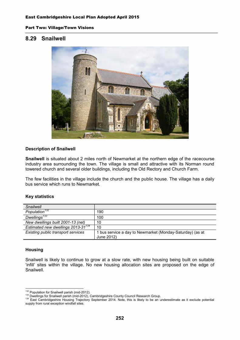
East Cambridgeshire Local Plan Adopted April 2015
Part Two: Village/Town Visions
252
8.29 Snailwell
Description of Snailwell
Snailwell is situated about 2 miles north of Newmarket at the northern edge of the racecourse industry area surrounding the town. The village is small and attractive with its Norman round towered church and several older buildings, including the Old Rectory and Church Farm.
The few facilities in the village include the church and the public house. The village has a daily bus service which runs to Newmarket.
Key statistics
Snailwell Population132 190 Dwellings133 100 New dwellings built 2001-13 (net) 10 Estimated new dwellings 2013-31134 10 Existing public transport services 1 bus service a day to Newmarket (Monday-Saturday) (as at
June 2012)
Housing
Snailwell is likely to continue to grow at a slow rate, with new housing being built on suitable ‘infill’ sites within the village. No new housing allocation sites are proposed on the edge of Snailwell.
132 Population for Snailwell parish (mid-2012). 133 Dwellings for Snailwell parish (mid-2012), Cambridgeshire County Council Research Group. 134 East Cambridgeshire Housing Trajectory September 2014. Note, this is likely to be an underestimate as it exclude potential supply from rural exception windfall sites.
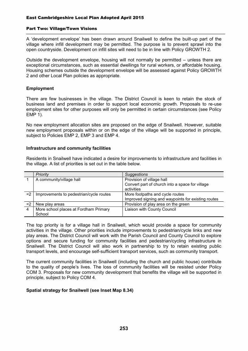
East Cambridgeshire Local Plan Adopted April 2015
Part Two: Village/Town Visions
253
A ‘development envelope’ has been drawn around Snailwell to define the built-up part of the village where infill development may be permitted. The purpose is to prevent sprawl into the open countryside. Development on infill sites will need to be in line with Policy GROWTH 2.
Outside the development envelope, housing will not normally be permitted – unless there are exceptional circumstances, such as essential dwellings for rural workers, or affordable housing. Housing schemes outside the development envelope will be assessed against Policy GROWTH 2 and other Local Plan policies as appropriate.
Employment
There are few businesses in the village. The District Council is keen to retain the stock of business land and premises in order to support local economic growth. Proposals to re-use employment sites for other purposes will only be permitted in certain circumstances (see Policy EMP 1).
No new employment allocation sites are proposed on the edge of Snailwell. However, suitable new employment proposals within or on the edge of the village will be supported in principle, subject to Policies EMP 2, EMP 3 and EMP 4.
Infrastructure and community facilities
Residents in Snailwell have indicated a desire for improvements to infrastructure and facilities in the village. A list of priorities is set out in the table below.
Priority Suggestions 1 A community/village hall Provision of village hall
Convert part of church into a space for village activities
=2 Improvements to pedestrian/cycle routes
More footpaths and cycle routes Improved signing and waypoints for existing routes
=2 New play areas Provision of play area on the green 4 More school places at Fordham Primary
School Liaison with County Council
The top priority is for a village hall in Snailwell, which would provide a space for community activities in the village. Other priorities include improvements to pedestrian/cycle links and new play areas. The District Council will work with the Parish Council and County Council to explore options and secure funding for community facilities and pedestrian/cycling infrastructure in Snailwell. The District Council will also work in partnership to try to retain existing public transport levels, and encourage self-sufficient transport services, such as community transport.
The current community facilities in Snailwell (including the church and public house) contribute to the quality of people’s lives. The loss of community facilities will be resisted under Policy COM 3. Proposals for new community development that benefits the village will be supported in principle, subject to Policy COM 4.
Spatial strategy for Snailwell (see Inset Map 8.34)
East Cambridgeshire Local Plan Adopted April 2015
Part Two: Village/Town Visions
254
8.30 Soham
Description of Soham
Soham is a market town of about 11,000 people135, located on the A142 between Ely and Newmarket. It has an attractive historic town centre, with a range of local and independent shops, and a vibrant and active local community. Other facilities include a successful secondary school, three primary schools, a library, sports complex and a drama centre. Soham has a unique landscape setting, being surrounded by Commons to the south, east and west. St. Andrews Church is of great architectural and historical significance and is a prominent local landmark. The town also has an excellent network of public footpaths and attractive green lanes, which provide good links into the surrounding countryside.
The town has grown considerably over the last 10 years, with new housing developments to the north of the town, and on a range of other ‘infill’ sites. This has placed pressure on local infrastructure and facilities. There are a number of employment opportunities in the town, including several industrial and trading estates. However, there are not sufficient jobs for all residents, and most people commute out of the town to work in Cambridge and elsewhere. The town centre is not performing as well as it could, given the growing population of the town. Turnover of units is high, and the range of shops is limited.
One of the key challenges facing Soham will be to expand the range of shops and facilities, and increase the vitality and health of the town centre. A second challenge will be to promote future commercial and employment growth in the town, to reduce the number of residents who out-commute. A third will be to ensure that necessary infrastructure and facilities are in place to support the continued growth of the town. This includes the construction of the new primary school on the north side of Soham, and the future expansion of the Village College and Medical Centre. Details of infrastructure requirements are set out in section 7 below.
135 Cambridgeshire County Council Research Group - 10,720 population in mid-2012.
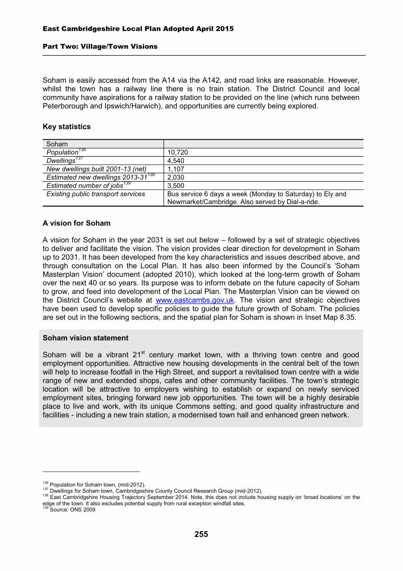
East Cambridgeshire Local Plan Adopted April 2015
Part Two: Village/Town Visions
255
Soham is easily accessed from the A14 via the A142, and road links are reasonable. However, whilst the town has a railway line there is no train station. The District Council and local community have aspirations for a railway station to be provided on the line (which runs between Peterborough and Ipswich/Harwich), and opportunities are currently being explored.
Key statistics
Soham Population136 10,720 Dwellings137 4,540 New dwellings built 2001-13 (net) 1,107 Estimated new dwellings 2013-31138 2,030 Estimated number of jobs139 3,500 Existing public transport services Bus service 6 days a week (Monday to Saturday) to Ely and
Newmarket/Cambridge. Also served by Dial-a-ride.
A vision for Soham
A vision for Soham in the year 2031 is set out below – followed by a set of strategic objectives to deliver and facilitate the vision. The vision provides clear direction for development in Soham up to 2031. It has been developed from the key characteristics and issues described above, and through consultation on the Local Plan. It has also been informed by the Council’s ‘Soham Masterplan Vision’ document (adopted 2010), which looked at the long-term growth of Soham over the next 40 or so years. Its purpose was to inform debate on the future capacity of Soham to grow, and feed into development of the Local Plan. The Masterplan Vision can be viewed on the District Council’s website at www.eastcambs.gov.uk. The vision and strategic objectives have been used to develop specific policies to guide the future growth of Soham. The policies are set out in the following sections, and the spatial plan for Soham is shown in Inset Map 8.35.
Soham vision statement
Soham will be a vibrant 21st century market town, with a thriving town centre and good employment opportunities. Attractive new housing developments in the central belt of the town will help to increase footfall in the High Street, and support a revitalised town centre with a wide range of new and extended shops, cafes and other community facilities. The town’s strategic location will be attractive to employers wishing to establish or expand on newly serviced employment sites, bringing forward new job opportunities. The town will be a highly desirable place to live and work, with its unique Commons setting, and good quality infrastructure and facilities - including a new train station, a modernised town hall and enhanced green network.
136 Population for Soham town, (mid-2012). 137 Dwellings for Soham town, Cambridgeshire County Council Research Group (mid-2012). 138 East Cambridgshire Housing Trajectory September 2014. Note, this does not include housing supply on ‘broad locations’ on the edge of the town. It also excludes potential supply from rural exception windfall sites. 139 Source: ONS 2009
East Cambridgeshire Local Plan Adopted April 2015
Part Two: Village/Town Visions
256
Soham strategic objectives
1. Improve the town centre, to provide a revitalised and vibrant hub with good shopping, leisure and community activities.
2. Expand the range of shopping and community facilities in Soham to match the growing population.
3. Focus housing growth in the central belt in order to support the town centre. 4. Provide high quality housing development which is easily accessible on foot or cycle to the
town centre and key facilities. 5. Support job retention and creation, by retaining existing employment sites and facilitating
new developments on the edge of the town. 6. Provide enhanced infrastructure and facilities to support growth, including local facilities of
an appropriate scale to serve neighbourhoods. 7. Re-introduce a railway station for Soham. 8. Protect and enhance the unique green setting of Soham, including the Commons, and
green network/links.
9. Protect and enhance the historic environment, particularly within the town centre.
Housing
Soham is the second largest market town in the district, and is likely to continue to grow over the next 20 years.
A ‘development envelope’ has been drawn around Soham to define the built-up part of the town where housing development may be permitted. The purpose is to prevent sprawl into the open countryside. Outside the development envelope, housing will not normally be permitted – unless there are exceptional circumstances, such as essential dwellings for rural workers, or affordable housing. Housing schemes outside the development envelope will be assessed against Policy GROWTH 2, and other Local Plan policies as appropriate.
There are some opportunities for housing development on land within the built-up part of Soham, on ‘infill’ sites. It is estimated there could be capacity for perhaps 410 dwellings between 2013 and 2031. Development on infill sites in the town will need to be in line with Policy GROWTH 2.
However, the supply of infill land is limited, and a number of new housing development sites are therefore proposed on the edge of the town. Development on these allocation sites will need to be in line with Policies SOH 1, SOH 2 SOH 3, SOH 4, SOH 5, SOH 6, SOH 7 and SOH 8 – see details below. The new housing is mainly located in the central belt of Soham, and should help to support the vitality of the town centre. There may also be some potential for an element of residential development (on upper floors) on two of the town centre opportunity sites identified in the ‘Town Centre’ section below. A summary of the potential housing sources in Soham is set out in the table below.
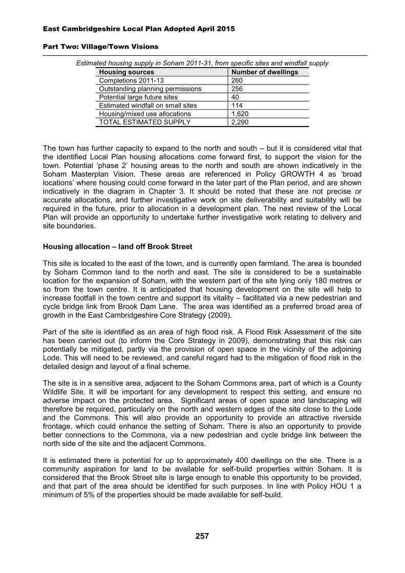
East Cambridgeshire Local Plan Adopted April 2015
Part Two: Village/Town Visions
257
Estimated housing supply in Soham 2011-31, from specific sites and windfall supply Housing sources Number of dwellings Completions 2011-13 260 Outstanding planning permissions 256 Potential large future sites 40 Estimated windfall on small sites 114 Housing/mixed use allocations 1,620 TOTAL ESTIMATED SUPPLY 2,290
The town has further capacity to expand to the north and south – but it is considered vital that the identified Local Plan housing allocations come forward first, to support the vision for the town. Potential ‘phase 2’ housing areas to the north and south are shown indicatively in the Soham Masterplan Vision. These areas are referenced in Policy GROWTH 4 as ‘broad locations’ where housing could come forward in the later part of the Plan period, and are shown indicatively in the diagram in Chapter 3. It should be noted that these are not precise or accurate allocations, and further investigative work on site deliverability and suitability will be required in the future, prior to allocation in a development plan. The next review of the Local Plan will provide an opportunity to undertake further investigative work relating to delivery and site boundaries.
Housing allocation – land off Brook Street
This site is located to the east of the town, and is currently open farmland. The area is bounded by Soham Common land to the north and east. The site is considered to be a sustainable location for the expansion of Soham, with the western part of the site lying only 180 metres or so from the town centre. It is anticipated that housing development on the site will help to increase footfall in the town centre and support its vitality – facilitated via a new pedestrian and cycle bridge link from Brook Dam Lane. The area was identified as a preferred broad area of growth in the East Cambridgeshire Core Strategy (2009).
Part of the site is identified as an area of high flood risk. A Flood Risk Assessment of the site has been carried out (to inform the Core Strategy in 2009), demonstrating that this risk can potentially be mitigated, partly via the provision of open space in the vicinity of the adjoining Lode. This will need to be reviewed, and careful regard had to the mitigation of flood risk in the detailed design and layout of a final scheme.
The site is in a sensitive area, adjacent to the Soham Commons area, part of which is a County Wildlife Site. It will be important for any development to respect this setting, and ensure no adverse impact on the protected area. Significant areas of open space and landscaping will therefore be required, particularly on the north and western edges of the site close to the Lode and the Commons. This will also provide an opportunity to provide an attractive riverside frontage, which could enhance the setting of Soham. There is also an opportunity to provide better connections to the Commons, via a new pedestrian and cycle bridge link between the north side of the site and the adjacent Commons.
It is estimated there is potential for up to approximately 400 dwellings on the site. There is a community aspiration for land to be available for self-build properties within Soham. It is considered that the Brook Street site is large enough to enable this opportunity to be provided, and that part of the area should be identified for such purposes. In line with Policy HOU 1 a minimum of 5% of the properties should be made available for self-build.
East Cambridgeshire Local Plan Adopted April 2015
Part Two: Village/Town Visions
258
Vehicular access to the site will need to be provided via at least one point off Brook Street (with an additional emergency vehicle access point being provided if there is only one access). A Transport Assessment will need to be carried out, which demonstrates that the site can be safely accessed and that any impacts on nearby highways can be adequately mitigated, e.g. through traffic calming or other highways improvements.
The majority of the site is in single family ownership, with three smaller parcels owned by other individuals. The District Council will require the site to be developed in a comprehensive way, and will expect the landowners to work together to facilitate comprehensive delivery.
The District Council will require the preparation of a Masterplan for the whole site, prior to approval of a scheme. The Masterplan should establish the broad location of land uses, roads, services, open space and landscaping, and look at principles such as access and movement, built form and phasing. It will demonstrate how the site will deliver the key aims of Policy SOH 1, and ensure a high standard of comprehensive planning. The Masterplan will need to be submitted alongside the outline planning application for the site.
Policy SOH 1: Housing allocation, land off Brook Street
Approximately 22 hectares of land is allocated for residential development for up to approximately 400 dwellings.
A Masterplan for the whole area will need to be prepared and submitted as part of an outline planning application, and approved by the District Council.
Development proposals will be expected to:
Provide an element of affordable housing (currently 30%) as required under Policy HOU 3. Provide a mix of dwelling types and sizes to reflect current evidence of need within Soham,
including provision for a minimum of 5% of self-build properties. Provide approximately 8 hectares of public open space on-site, including land for provision of
at least 2 play areas. Maximise opportunities to provide an attractive riverside frontage alongside the Lode and
brook, which incorporates public open space, landscaping and appropriate orientation of buildings.
Have particular regard to the layout and the scale, height, design and massing of buildings, and landscaping, in order to minimise visual harm to the adjacent Commons area and County Wildlife Site, and to provide views of St. Andrews Church.
Provide a new and enhanced pedestrian and cycle link to the town centre, via a new bridge link over the drain close to Brook Dam Lane.
Provide a new pedestrian and cycle link to the adjacent Commons to the north, via a new bridge link over the Lode at a suitable point to the rear of 10-22 East Fen Common. Will also require upgrades to the existing footpath between this point and Paddock Street.
Provide a pedestrian and cycle link across the site along the length of the Lode frontage, which links at the southern end across County Wildlife Site 55 to the existing footbridge to the Commons.
Provide a pedestrian and cycle link across the site to Greenhills. Protect and enhance County Wildlife Site 55 – particularly the section west of the Lode. Demonstrate that the flood risk on the site can be adequately mitigated.
East Cambridgeshire Local Plan Adopted April 2015
Part Two: Village/Town Visions
259
Demonstrate, through a Transport Assessment, that the site can be safely accessed by vehicles and that impacts on nearby roads can be adequately mitigated through traffic calming or other highways improvements.
Provide safe vehicular access from at least one point off Brook Street, with an additional access point provided for emergency vehicles if only one main access point is provided.
Provide high speed broadband, and a proportion of homes that are suitable for homeworking. Demonstrate there is adequate capacity in the sewage treatment works and the foul
sewerage network. Provide appropriate evidence of the archaelogical potential and significance of the site prior to
the submission of a planning application; and Comply with the other policies of the Local Plan.
Housing-led / mixed use allocation – land off Station Road
The site is located at the western edge of Station Road, and mainly comprises the old station area and vacant railway sidings. There are also several areas of garden land, and a vacant industrial unit. The majority of the site has been vacant for a number of years, following the closure of the railway station in 1965.
The re-development of this area could help to regenerate this part of Soham, and improve the interface between Soham and the surrounding countryside. Re-development could also fit well with the proposal to re-open Soham Station (currently being investigated by the District Council, County Council and Network Rail), and provide an attractive approach and setting to the new station building, as well as facilitating access.
The area surrounding the old station has been safeguarded in the development plan for the last 20 years or so, for the provision of a new station, and is owned by Network Rail. The remainder of the area has previously been identified as a preferred area for housing development, in the East Cambridgeshire Core Strategy (2009).
The site is proposed for housing-led/mixed use development – comprising up to approximately 90 dwellings, and land for a station building, car and cycle parking, and drop-off/pick-up facilities. In addition, a small element of business use is proposed, recognising that a mix of business and residential uses in the station quarter could provide an attractive commercial hub. It may also be appropriate to provide a limited number of small retail units as part of the station/employment quarter (e.g. serving the needs of station users and office workers) – providing it can be demonstrated there is no significant adverse impact on the town centre.
The site is bounded to the west by the railway line, which is still operational. The potential for noise and vibration will need to be investigated prior to approval of a planning application. The layout of the scheme and mix of uses will need to have regard to this.
Part of the site is an area of high flood risk. A Flood Risk Assessment of the site has been carried out (to inform the Core Strategy in 2009), demonstrating that this risk can potentially be mitigated. This will need to be reviewed, and careful regard had to the mitigation of flood risk in the detailed design and layout of the final scheme.
A Transport Assessment will be required to demonstrate that safe access can be achieved to the site, and that any impact on surrounding roads can be mitigated. There are currently two known potential access points into the site – along the old station approach road, and land at Prescient Engineering off Mereside. These (and potentially other) routes should be explored,
East Cambridgeshire Local Plan Adopted April 2015
Part Two: Village/Town Visions
260
having regard to the need to provide adequate width and visibility splays to facilitate car, bus, pedestrian and cycle access into and within the site. The potential safety and residential amenity benefits of providing two access points and separating the traffic accessing the station from the residential area should also be taken into account. If vehicular access cannot be achieved via the old station approach road, a pedestrian and cycle path should be provided along this route, to enable direct access to the town centre.
The development should provide good pedestrian and cycle links across the site, between the station area, commercial area and the housing development. A new pedestrian and cycle link should also be provided onto Spencer Drove, and a new footpath access provided to farmland to the west, via a new bridge over the railway line. This latter access point will only be possible once the new station building with its two platforms has been constructed. It will also allow the closure of the current pedestrian crossing point over the railway line, at the south corner of the site.
The site is in multiple ownership, with Network Rail owning the south part of the site in the vicinity of the old station, and a number of private landowners owning other parcels. It is possible that the scheme may come forward in phases, particularly given that the timescales for the delivery of a new railway station are not yet clear. However, the whole area will need to be comprehensively planned, and the District Council will require a Masterplan for the whole area to be submitted alongside any initial planning application (either outline application for the whole site, or for phase 1 development). This will require all landowners to work together. The District Council will also use planning conditions and Section 106 agreements to ensure that comprehensive planning and delivery is achieved.
The railway station and pick-up/drop-off facilities will need to be provided on Network Rail land, but other uses may occur on Network Rail land or on the other land parcels. The Masterplan should be used to explore the site layout, mix of uses, roads, open spaces and landscaping, and will look at principles such as access and movement, built form and phasing. It will demonstrate how the site will deliver the key aims of Policy SOH 2, and ensure a high standard of comprehensive planning.
Policy SOH 2: Housing-led / mixed use allocation, land off Station Road
Approximately 3.6 hectares of land is allocated for a housing-led/mixed use development off Station Road. Within the site, provision will be made for up to approximately 90 dwellings, a station building, parking and associated facilities (on about 0.6 ha), and a minimum of 0.5 hectares of office/industrial development. A limited number of small retail units may also be appropriate in the station quarter, to meet the needs of station users/employees – providing it can be demonstrated there is no significant adverse impact on the town centre.
A Masterplan for the whole area will need to be prepared and submitted as part of any initial planning application on the site, and approved by the District Council.
Development proposals will be expected to:
Provide an attractive station square or potential setting to the station, which incorporates public open space, landscaping and appropriate orientation of buildings – and includes a mix of office/industrial and residential uses.
Provide or identify sufficient safeguarded land for a station building and associated facilities, including drop-off/pick-up facilities for cars and buses, and cycle and car parking.
East Cambridgeshire Local Plan Adopted April 2015
Part Two: Village/Town Visions
261
Have particular regard to the layout and the scale, height, design and massing of buildings, and landscaping, in order to minimise amenity impact on adjoining properties, and to provide an attractive setting to Soham.
Demonstrate through a Transport Assessment that safe vehicular (car and bus), pedestrian and cycle access can be provided into and within the site.
Provide a pedestrian and cycle link to the town centre, via the current station approach road – and a pedestrian and cycle link onto Spencer Drove.
Provide good pedestrian and cycle links across the site, between the housing, station and commercial uses.
Provide a new pedestrian link to the farmland to the west, via a new bridge which serves the railway platforms (and at the same time, effect the closure of the existing crossing point at the southern end of the site).
Provide necessary highway improvements and traffic calming measures on nearby roads, as demonstrated in a Transport Assessment
Demonstrate that vibration and noise pollution from the adjacent railway line can be adequately mitigated.
Demonstrate that the flood risk on the site can be adequately mitigated. Demonstrate there is adequate capacity in the sewage treatment works and the foul
sewerage network. Provide an element of affordable housing (currently 30%) as required under Policy HOU 3. Provide a mix of dwelling types and sizes to reflect current evidence of need within Soham. Provide high speed broadband and a proportion of flexible live-work units; and Comply with the other policies of the Local Plan.
Housing-led / mixed use allocation – Eastern Gateway
The Eastern Gateway area is located to the east of Weatheralls Primary School, between the built-up part of Soham and the A142 bypass. It is predominantly an area of agricultural land, but also contains an extensive area of land in current allotment use, and a redundant Garden Centre site. It is a large area, covering approximately 33 hectares.
The Eastern Gateway is identified in the Soham Vision Masterplan as an area which is crucial for the future development of Soham, and which could potentially provide a new connection from the A142 into the heart of the town, and help to support the regeneration of the town centre. A Conceptual Masterplan for the area (excluding the Garden Centre site) was produced and adopted by the District Council in early 2011140, in conjunction with the landowners. The Conceptual Masterplan provides a sound framework for the development of the area, and has informed Policy SOH 3 below. However, it will need to be re-visited and updated prior to the approval of any development, in order to reflect the outcome of further technical work on viability, deliverability, and design aspects. It should build on the Conceptual Masterplan and reflect its key principles and elements. The revised Masterplan may or may not include the Garden Centre site, but should have regard to it.
The Conceptual Masterplan (2011) proposes much of the area for housing development – with a small area of employment/retail uses, plus land for an extension to Weatheralls Primary School and to the Soham Medical Centre. In addition, a significant area of new Common 140 The Masterplan was financed by the Department of Communities and Local Government (DCLG) and the Department of the Environment, Food and Environmental Affairs (DEFRA), from their Rural Masterplanning Fund.
East Cambridgeshire Local Plan Adopted April 2015
Part Two: Village/Town Visions
262
land/open space is provided, plus land for the re-location of the existing allotments within the site.
The allotments are located at the only feasible point of access from the town, and therefore their partial re-location is a critical part of the development scheme. In accordance with Policy COM 3, the District Council would expect to see the re-provision of an equivalent area of allotments on the Eastern Gateway site, plus the provision of a water supply, parking areas, and adequate security measures (e.g. fencing/gates). As statutory allotments, the re-location will also need to accord with relevant statutory requirements. Viability and design work undertaken as part of the Conceptual Masterplan indicates that the re-provided allotments will need to be located elsewhere in the site, rather than immediately adjacent to the remaining ones. This is because having the allotments in one place would restrict the amount of housing development that could be created at an early stage to fund the new access road – and the large scale of a single allotment site at the heart of the Eastern Gateway would limit the flexibility of the Masterplan framework and the ability to achieve a good standard of design and layout. However, it is acknowledged that the Conceptual Masterplan will need to be updated as part of the planning application process. This will provide an opportunity to revisit in more detail the extent of the impact on viability, and the impact on the quality of the design and layout of the scheme. If the scheme involves provision of allotments in one location, the applicant will be expected to demonstrate that this would not have an unacceptable impact on viability, or on the design and layout of the overall scheme.It is estimated there is capacity in the Eastern Gateway area for up to approximately 600 dwellings.
The adjoining redundant Garden Centre site has been purchased by Scotsdales Garden Centres. A re-developed Garden Centre on this site could provide additional jobs for the town. If this scheme does not come forward, the site could potentially be appropriate for a range of employment uses (B1/B2/B8) – although this will need to be explored through the planning application process.
The main access into the site from Pratt Street crosses open land in the ownership of the County Council, which is currently being used as a temporary playing field for Weatheralls school (prior to new playing fields being delivered on the Eastern Gateway site). As the land is in County Council ownership, delivery should be secure. Any proposed development which prejudices this access point will be resisted by the District Council.
Although a housing-led scheme, the Eastern Gateway is notable for the significant amount of community uses and open space that will be provided. The allotments will need to be re-provided with enhanced facilities for allotment holders, whilst the development will provide vital land for the expansion of the primary school and the medical centre, and provision of a new pre-school facility. In addition, the Conceptual Masterplan proposes the provision of a very significant amount of open space, including a new Commons area which will provided a useful link between Qua Fen Common to the north and East Fen Common to the south, and facilitate a continuous network of accessible greenspace on the east side of the town. The development will also involve provision of an employment area comprising small starter business units and offices, provided as part of an attractive town square/neighbourhood centre, with a small local shop and extended medical centre.
This large mixed use allocation will need to be delivered in phases. The area is owned by 5 organisations/individuals, and there will be a need to continue working together to facilitate comprehensive delivery.
A new roundabout will be required on the A142 to serve the Eastern Gateway area (including a re-developed Garden Centre/employment site), and provide a direct link to the centre of Soham.
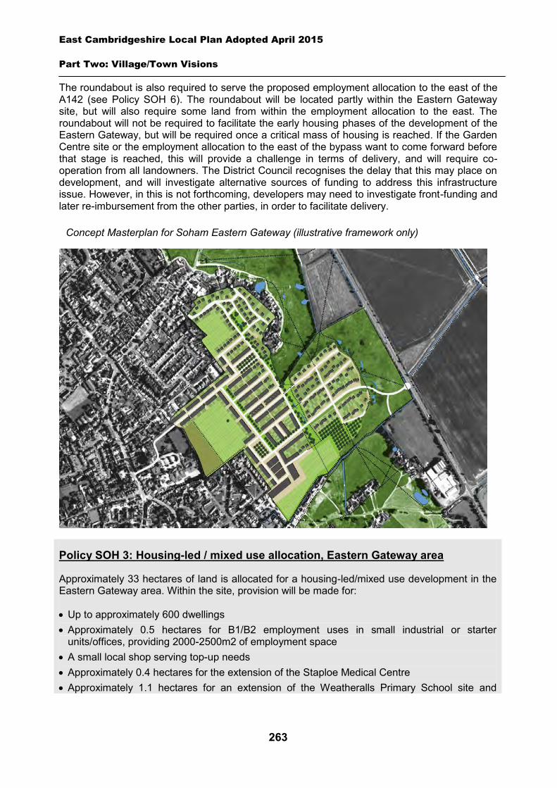
East Cambridgeshire Local Plan Adopted April 2015
Part Two: Village/Town Visions
263
The roundabout is also required to serve the proposed employment allocation to the east of the A142 (see Policy SOH 6). The roundabout will be located partly within the Eastern Gateway site, but will also require some land from within the employment allocation to the east. The roundabout will not be required to facilitate the early housing phases of the development of the Eastern Gateway, but will be required once a critical mass of housing is reached. If the Garden Centre site or the employment allocation to the east of the bypass want to come forward before that stage is reached, this will provide a challenge in terms of delivery, and will require co-operation from all landowners. The District Council recognises the delay that this may place on development, and will investigate alternative sources of funding to address this infrastructure issue. However, in this is not forthcoming, developers may need to investigate front-funding and later re-imbursement from the other parties, in order to facilitate delivery.
Policy SOH 3: Housing-led / mixed use allocation, Eastern Gateway area
Approximately 33 hectares of land is allocated for a housing-led/mixed use development in the Eastern Gateway area. Within the site, provision will be made for:
Up to approximately 600 dwellings Approximately 0.5 hectares for B1/B2 employment uses in small industrial or starter
units/offices, providing 2000-2500m2 of employment space A small local shop serving top-up needs Approximately 0.4 hectares for the extension of the Staploe Medical Centre Approximately 1.1 hectares for an extension of the Weatheralls Primary School site and
Concept Masterplan for Soham Eastern Gateway (illustrative framework only)
East Cambridgeshire Local Plan Adopted April 2015
Part Two: Village/Town Visions
264
provision of a new pre-school facility Approximately 3.6 hectares of allotment land Approximately 8 hectares of public open space and Commons land Approximately 3 hectares for the provision of a new Garden Centre, or employment uses
(B1/B2/B8) The Masterplan will need to be updated and submitted as part of an outline planning application for the whole site, and approved by the District Council. These may or may not include the garden centre site. The revised Masterplan will need to build on and reflect the key principles and elements in the Conceptual Masterplan.
Development proposals will be expected to:
Provide an element of affordable housing (currently 30%) as required under Policy HOU 3. Provide a mix of dwelling types & sizes to reflect current evidence of need in Soham,
including provision for a minimum of 5% self-build properties. Provide alternative land of an equivalent size within the site to facilitate the re-location of the
existing allotments. The allotment land should be provided in multiple locations, unless updated Masterplanning work indicates that provision in one location would not have an unacceptable impact on overall scheme viability or on the design and layout quality of the overall scheme. The re-provided allocations should be accessible by car, foot and cycle, and include the provision of a water supply, parking and adequate security measures.
Provide extensive areas of public open space within the site (incorporating a number of play areas), and a new Commons area adjoining the A142 which provides a link between Qua Fen Common and East Fen Common.
Provide a town square/neighbourhood centre comprising business/starter units and offices and a small local shop, adjacent to the expanded medical centre.
Have particular regard to the layout and the scale, height, design and massing of buildings, and landscaping, in order to provide a high quality scheme which enhances the setting of Soham, focuses on St. Andrews Church as a key landmark building, and minimises amenity impact on adjoining properties.
Provide a new roundabout on the A142 and link road through the scheme to Pratt Street. Contribute towards safety improvements of the junctions of Northfield Road, Qua Fen Common and Paddock Street on the A142.
Retain and enhance the existing rights of way which cross the site, and provide an upgraded cycle/footpath link between the link road and Kents Lane. Provide new pedestrian & cycle access points to adjoining roads, as indicated in the Conceptual Masterplan.
Provide safe and secure access to the site past Weatheralls School, with necessary junction and highway improvements on the road, and at the junction with Pratt Street.
Provide high speed broadband and a proportion of units suitable for home working. Demonstrate that the flood risk on the site can be adequately mitigated. Demonstrate there is adequate capacity in the sewage treatment works and the foul
sewerage network. Provide appropriate evidence of the archaelogical potential and significance of the site prior to
the submission of a planning application; and Comply with the other policies of the Local Plan.
East Cambridgeshire Local Plan Adopted April 2015
Part Two: Village/Town Visions
265
Housing allocation – land off Fordham Road
This site is located to the south-east of the town, and is a mix of farmland and paddock land. The area is adjacent and to the rear of a number of residential properties on Fordham Road and is bounded by agricultural land to the east.
A historic byway (Clipsall Track) crosses the northern part of the site and provides access to the east into the wider countryside. As part of the historic network of green lanes around Soham, it will be important to retain the route as much as possible, and to enhance its appearance and usability for pedestrians in any development scheme. Further investigation should also be carried out on the feasibility of upgrading the pedestrian crossing point where the track crosses the A142, as part of any development scheme – and contributions secured through Section 106 agreements. The public footpath on the eastern boundary of the site should also be retained and enhanced.
The northern part of the site is bound with hedgerows and trees with more limited vegetation on the remainder of the site. The existing boundary hedgerows on the northern part of the site should be retained wherever possible.
Vehicular access to the site will need to be provided at some point between numbers 53 and 55 Fordham Road. An additional access may also prove to be necessary in highway and/or design terms to the southern section of the site between 69 and 71 Fordham Road. A Transport Assessment will need to be carried out, which demonstrates that the site can be safely accessed and that any impact on nearby highways can be adequately mitigated, e.g. through traffic calming or other highway improvements.
Prior to the approval of the scheme, the District council will require the preparation of a Masterplan for the whole site. The Masterplan should establish the broad location of landuses, roads, services, open space and landscaping, and look at principles such as access and movement, built form and phasing. It will demonstrate how the site will deliver the key aims of the Policy SOH 4, and ensure a high standard of planning and design. The Masterplan will need to be submitted alongside the outline planning application of the site.
Policy SOH 4: Housing allocation, land off Fordham Road
Approximately 3.85 hectares is allocated for residential development for up to 90 dwellings.
A Masterplan for the whole site will need to be prepared and submitted as part of an outline planning application and approved by the District Council.
Development proposals will be expected to:
Provide an element of affordable housing (currently 30%) as required under Policy HOU 3. Provide a mix of dwelling types and sizes to reflect the current evidence of need within
Soham. Maximise the retention of existing hedgerows on the boundary of the site and provide
additional landscaping on the site boundaries. Provide approximately 0.6 hectares of public open space on-site, including land for the
provision of a play area. Have particular regard to the layout and the scale, height, design and massing of buildings
and landscaping, in order to minimise the visual impact of the development from the A142 and minimise impact on amenity of nearby residential properties.
East Cambridgeshire Local Plan Adopted April 2015
Part Two: Village/Town Visions
266
Demonstrate through a Transport Assessment that safe vehicular, pedestrian and cycle access can be provided into and within the site.
Provide safe vehicular access from up to two points on Fordham Road. Retain the existing right of way/green lane (Clipsall Track) within the site as much as
possible, and enhance its appearance and usability for pedestrians. Explore the feasibility of upgrading the pedestrian crossing where Clipsall Track crosses the
A142, and make necessary contributions to improvements - in order to help facilitate publicly accessible walking routes in the wider countryside.
Retain and enhance the existing right of way on the eastern boundary of the site. Provide a safe pedestrian crossing and link from the site across the A142 to the publicly
accessible walking routes in the wider countryside. Demonstrate there is adequate capacity in the sewage treatment works and the foul sewage
network. Provide appropriate evidence of the archaeological potential and significance of the site prior
to the submission of a planning application; and Comply with the other policies of the Local Plan.
Housing allocation – land south of Blackberry Lane
The site is located to the south-east of the town, and is currently farmland. The area adjoins residential dwellings and farm buildings to the west and the A142 bypass to the east.
The site is located within close proximity to Soham Wet Horse Fen SSSI. It will be important for any development to ensure that there is no adverse impact on this designated site.
A public footpath crosses the site and provides access to the east of the site to the A142 and the wider countryside. This route should be retained and enhanced in any development scheme. The site is also bound by historic green lanes to the north (Blackberry Lane) and south/southwest (Longmere Lane). As part of the historic network of green lanes around Soham, it will be important to retain and enhance these green lanes in any development scheme, and to provide additional pedestrian access points into the lanes as appropriate. The hedgerows and trees which border the green lanes form an integral part of their character and should be retained. Both Blackberry Lane and Longmere Lane cross the A142 and provide access to the wider countryside surrounding the town. Further investigation should be carried out on the feasibility of upgrading the pedestrian crossing points where the tracks crosses the A142, as part of any development scheme – and necessary contributions secured through Section 106 agreements.
The site is located on the edge of Soham and is highly visible from the A142. Therefore it will be important for any development to be sensitively designed to provide a high quality scheme, which enhances the setting of Soham. This should include the provision of a sizable undeveloped ‘green buffer zone’ between the built-up area and the bypass, which provides a soft landscaped edge to the town.
It is estimated that there is potential for approximately 160 dwellings on the site. There is a community aspiration for land to be available for self-build properties within Soham. It is considered that this site is large enough to enable this opportunity to be provided and that part of the area should be identified for such purposes. In line with Policy HOU 1 a minimum of 5% of the properties should be made available for self-build.
East Cambridgeshire Local Plan Adopted April 2015
Part Two: Village/Town Visions
267
Vehicular access to the site will need to be provided from Brook Street within close proximity to the existing junction with Regal Lane. This is likely to require the removal of the existing farm buildings located at 141 Brook Street. A Transport Assessment will need to be carried out, which demonstrates that the site can be safely accessed and that any impact on nearby highways can be adequately mitigated, e.g. through traffic calming or other highway improvements.
Prior to the approval of a scheme, the District Council will require the preparation of a Masterplan for the area. The Masterplan should establish the broad location of land uses, roads, services, open space and landscaping, and look at principles such as access and movement, built form and phasing. It will demonstrate how the site will deliver the key aims of Policy SOH 5, and ensure a high standard of planning and design. The Masterplan will need to be submitted alongside the outline planning application of the site.
Policy SOH 5: Housing allocation, land south of Blackberry Lane
Approximately 6.85 hectares is allocated for residential development for up to 160 dwellings
A Masterplan for the whole area will need to be prepared and submitted as part of an outline planning application and approved by the District Council.
Development proposals will be expected to:
Provide an element of affordable housing (currently 30%) as required under Policy HOU 3. Provide a mix of dwelling types and sizes to reflect the current evidence of need within
Soham, including provision for at least 5% self build properties. Maximise the retention of existing hedgerows and trees within the site and on the boundaries
of the site, and provide additional landscaping on the site boundaries. Provide approximately 1.1 hectares of public open space on-site, including land for the
provision of a play area. Provide a significant green buffer zone between the built-up area and the A142 which is
undeveloped and provides a soft landscaped edge to Soham. Have particular regard to the layout and the scale, height, design and massing of buildings
and landscaping, in order to minimise the visual impact of the development from the A142 and minimise impact on amenity of nearby residential properties.
Retain and enhance existing rights of way/green lanes to the north, west and south of the site. Provide new pedestrian links from the site to green lanes at key points on these routes, where appropriate.
Retain and enhance the existing public right of way which crosses the site from Longmere Lane to the A142 bypass.
Explore the feasibility of upgrading the pedestrian crossings where Blackberry Lane and Longmere Lane cross the A142, and make necessary contributions to improvements - in order to help facilitate publicly accessible walking routes in the wider countryside.
Provide safe vehicular access from Brook Street following the removal of existing farm buildings.
Demonstrate that noise impacts from the A142 can be adequately mitigated. Demonstrate there is adequate capacity in the sewage treatment works and the foul sewage
network. Provide appropriate evidence of the archaeological potential and significance of the site prior
to the submission of a planning application; and Comply with the other policies of the Local Plan.
East Cambridgeshire Local Plan Adopted April 2015
Part Two: Village/Town Visions
268
Housing allocation – land north of Blackberry Lane
The site is located to the south-east of the town, and is currently farmland. The area adjoins a County Wildlife Site to the north, residential dwellings to the west, and the A142 bypass to the east.
The site is in a sensitive location on the edge of Soham, and is highly visible from the A142. It will be important for any development to be sensitively designed to provide a high quality scheme, which enhances the setting of Soham. This should include the provision of a sizable undeveloped ‘green buffer zone’ between the built-up area and the bypass, which provides a soft landscaped edge to the town.
The site is bounded by Blackberry Lane to the south. As part of the historic network of green lanes around Soham, it will be vital to retain and enhance this feature in any development scheme. The hedgerows and trees which border the green lane form an integral part of its character and should be retained. Blackberry Lane cross the A142 and provides access to the wider countryside surrounding the town. Further investigation should be carried out on the feasibility of upgrading the pedestrian crossing point where the track crosses the A142, as part of any development scheme – and necessary contributions secured through a Section 106 agreement. A public footpath also crosses the site between Greenhills and Blackberry Lane, and should retained and enhanced in any scheme.
It is estimated that there is potential for approximately 100 dwellings on the site. There is a community aspiration for land to be available for self-build properties within Soham. It is considered that this site is large enough to enable this opportunity to be provided and that part of the area should be identified for such purposes. In line with Policy HOU 1 a minimum of 5% of the properties should be made available for self-build.
Vehicular access to the site should be provided at a point close to the Greenhills/Brook Street junction. However, if further Transport Assessment work demonstrates this cannot be safely achieved, access will need to be provided via the adjoining allocation site (land south of Blackberry Lane – see Policy SOH 5). If this alternative access point is required, it will be important to ensure that only one vehicular crossing of Blackberry Lane is provided, and that this is as close to the rear of properties on Brook Street as possible – in order to minimise harm to the integrity, appearance and function of Blackberry Lane.
A Transport Assessment will need to be carried out, which demonstrates that the site can be safely accessed and that any impact on nearby highways can be adequately mitigated, e.g. through traffic calming or other highway improvements.
Prior to the approval of a scheme, the District Council will require the preparation of a Masterplan for the area. The Masterplan should establish the broad location of land uses, roads, services, open space and landscaping, and look at principles such as access and movement, built form and phasing. It will demonstrate how the site will deliver the key aims of Policy SOH 6, and ensure a high standard of planning and design. The Masterplan will need to be submitted alongside the outline planning application of the site.
Policy SOH 6: Housing allocation, land north of Blackberry Lane
Approximately 4.4 hectares is allocated for residential development for up to 100 dwellings.
A Masterplan for the whole area will need to be prepared and submitted as part of an outline
East Cambridgeshire Local Plan Adopted April 2015
Part Two: Village/Town Visions
269
planning application and approved by the District Council.
Development proposals will be expected to:
Provide an element of affordable housing (currently 30%) as required under Policy HOU 3. Provide a mix of dwelling types and sizes to reflect the current evidence of need within
Soham, including provision for at least 5% self build properties. Provide approximately 0.7 hectares of public open space on-site, including land for the
provision of a play area. Provide a significant green buffer zone between the built-up area and the A142 which is
undeveloped and provides a soft landscaped edge to Soham. Have particular regard to the layout and the scale, height, design and massing of buildings
and landscaping, in order to minimise the visual impact of the development from the A142 and minimise impact on amenity of nearby residential properties.
Demonstrate that noise impacts from the A142 can be adequately mitigated. Demonstrate through a Transport Assessment that the site can be safely accessed by
vehicles, pedestrians and cyclists. Provide safe vehicular access close to the Brook Street/Greenhills junction. If further
Transport Assessment work demonstrates this cannot be safely achieved, vehicular access may need to be provided via the adjoining allocation (land south of Blackberry Lane – Policy SOH 5). If this alternative access is necessary, the impact on Blackberry Lane should be minimised by providing one vehicular crossing point only, as close to the rear of properties on Brook Street as possible.
Demonstrate through a Transport Assessment that the site can be safely accessed by vehicles, pedestrians and cyclists.
Retain and enhance Blackberry Lane. Retain and enhance the existing public right of way which crosses the site between
Greenhills and Blackberry Lane. Explore the feasibility of upgrading the pedestrian crossing where Blackberry Lane crosses
the A142, and make necessary contributions to improvements - in order to help facilitate publicly accessible walking routes in the wider countryside.
Maximise the retention of hedgerows and trees which border the site and lie within. Demonstrate there is adequate capacity in the sewage treatment works and the foul sewage
network. Provide appropriate evidence of the archaeological potential and significance of the site prior
to the submission of a planning application; and Comply with the other policies of the Local Plan.
Housing allocation – land adjacent to the cemetery
The site is located to the south-west of the town, and is currently open farmland. The area adjoins the cemetery to the north, residential dwellings to the east and is bounded by green lanes to the south and west.
The site is sensitively located, adjacent to a County Wildlife site, and is bounded by historic green lanes. It will be important for any development to respect this setting, and seek to ensure that there is no adverse impact. Development proposals will be expected to retain and enhance the adjoining green lanes, and provide additional pedestrian access points from the scheme as appropriate. The existing boundary trees and hedgerows along the green lanes are an integral part of their character and should be retained.
East Cambridgeshire Local Plan Adopted April 2015
Part Two: Village/Town Visions
270
It is estimated that there is potential for approximately 115 dwellings on the site. There is a community aspiration for land to be available for self-build properties within Soham. It is considered that this site is large enough to enable this opportunity to be provided and that part of the area should be identified for such purposes. In line with Policy HOU 1 a minimum of 5% of the properties should be made available for self-build.
Vehicular access to the site will need to be provided from Fordham Road. A Transport Assessment will need to be carried out, which demonstrates that the site can be safely accessed and that any impact on nearby highways can be adequately mitigated, e.g. through traffic calming or other highway improvements.
Prior to the approval of a scheme, the District Council will require the preparation of a Masterplan for the area. The Masterplan should establish the broad location of land uses, roads, services, open space and landscaping, and look at principles such as access and movement, built form and phasing. It will demonstrate how the site will deliver the key aims of Policy SOH 7, and ensure a high standard of planning and design. The Masterplan will need to be submitted alongside the outline planning application of the site.
Policy SOH 7: Housing allocation, land adjacent to the cemetery
4.8 hectares of land is allocated for residential development for approximately 115 dwellings.
A Masterplan for the whole area will need to be prepared and submitted as part of an outline planning application, and approved by the District Council.
Development proposals will be expected to:
Provide an element of affordable housing (currently 30%) as required by Policy HOU 3. Provide a mix of dwelling types and sizes to reflect current evidence of need within Soham,
including provision for a minimum of 5% of self-build properties. Provide approximately 0.8 hectares of public open space, including land for the provision of
a play area. Maximise the retention of existing boundary hedgerows and trees. Retain and enhance the green lane between Fordham Road and The Butts (Cherrytree
Lane). Explore opportunities to provide additional pedestrian links into the green lane at key
strategic points. Protect and enhance County Wildlife Site 58. Demonstrate through a Transport Assessment that the site can be safely accessed by
vehicles and that impacts on nearby roads can be adequately mitigated through traffic calming or other highway improvements.
Provide safe vehicular access from Fordham Road. Demonstrate that there is adequate capacity in the sewage treatment works and the foul
sewerage network. Provide appropriate evidence of the archaeological potential and significance of the site prior
to the submission of a planning application; and Comply with the other policies of the Local Plan.
East Cambridgeshire Local Plan Adopted April 2015
Part Two: Village/Town Visions
271
Housing allocation – land east of The Shade
The site is located to the north-east of the town, and is currently split into two paddocks. The area adjoins an employment site to the north-west and residential properties to the south-east.
It is estimated that there is potential capacity for approximately 45 dwellings on the site. Vehicular access should be provided via The Shade only (not via Northfield Road). Further transport assessment work will be required to identify the nature and location of the access point. Access may be provided directly onto The Shade, or through a new shared junction with the adjoining employment allocation (this land is the same ownership).
The site is crossed by a number of public footpaths and is bounded by a green lane to the north. It will be important for any development to retain and enhance these features as much as possible, although it is possible that vehicular access to the site will need to cross the green lane at one point. The existing boundary and internal hedgerows and trees should be retained wherever possible.
Due to the proximity of the existing employment area any development proposal will be required to submit a noise impact assessment and to provide necessary mitigation measures as required.
The site is in single ownership and forms part of a current planning application for the provision of a supermarket, petrol filling station, restaurant and associated car parking and highway engineering works. The application has been approved subject to the agreement of Section 106 negotiations, but is not being pursued by the applicant.
Prior to the approval of a scheme, the District Council will require the preparation of a Masterplan for the area. The Masterplan should establish the broad location of land uses, roads, services, open space and landscaping, and look at principles such as access and movement, built form and phasing. It will demonstrate how the site will deliver the key aims of Policy SOH 8, and ensure a high standard of planning and design. The Masterplan will need to be submitted alongside the outline planning application of the site.
Policy SOH 8: Housing allocation, land east of The Shade
1.96 hectares of land is allocated for residential development for approximately 45 dwellings.
A Masterplan for the whole area will need to be prepared and submitted as part of an outline planning application, and approved by the District Council. Development proposals will be expected to:
Provide an element of affordable housing (currently 30%) as required by Policy HOU 3. Provide a mix of dwelling types and sizes to reflect current evidence of need within Soham. Provide approximately 0.3 hectares of public open space. Maximise the retention of existing boundary hedgerows and trees, and those within the site. Retain and enhance the green lane along the northern boundary as much as possible. Retain and enhance the public footpaths crossing the site. Provide safe vehicular access from The Shade. Demonstrate that noise impact from the adjoining Northfield Road Business Park can be
adequately mitigated. Demonstrate that there is adequate capacity in the sewage treatment works and the foul
sewerage network.
East Cambridgeshire Local Plan Adopted April 2015
Part Two: Village/Town Visions
272
Provide appropriate evidence of the archaeological potential and significance of the site prior to the submission of a planning application; and
Comply with the other policies of the Local Plan.
Employment/mixed use allocation – land east of The Shade
The site is currently agricultural land on the edge of Soham, adjacent to the existing Northfield Road Business Park. The area was identified in the District Local Plan (2000) as an area for employment development. However, the area failed to come forward, and was subsequently ‘de-allocated’ in the Core Strategy (2009). Since then, the area has been identified in the Soham Vision Masterplan as a potential site for future new employment development – including a small neighbourhood centre with a small local convenience store. However, in October 2013, the District Council resolved to approve planning permission in principle (subject to conditions and Section 106 agreement being agreed) for a supermarket and a pub on part of the site (application reference 12/00247/OUM).
The area is identified in the Local Plan as employment-led development, incorporating a small local convenience store to serve the northern residential part of Soham. However, if the proposal referred to above is implemented, this will supercede the allocation on part of the site. The other part of the site without planning permission will remain allocated for employment uses, as set out in the policy below.
The site is bounded to the north by the A142 bypass, and is highly visible from the main road. Therefore, any scheme will also need to include a significant strip of open land between the built-up area and the road, to provide an attractive buffer and a green setting for Soham.
The site is currently bounded by an attractive byway (Longmere Lane) on the south side, with a footpath link partly alongside a watercourse. As part of the historic network of green lanes around Soham, it will be vital to retain and enhance this feature in any development scheme. Other public rights of way across the site should also be retained and enhanced. There are a number of existing trees and hedgerows on the site which should be retained wherever possible.
Access to the site will be provided from The Shade, rather than Northfield Road (due to capacity restrictions at the junction of Northfield Road and the A142 bypass). Access should be provided at a point opposite Kingfisher Drive, to allow for a shared roundabout or traffic signals.
The District Council will require the preparation of a Masterplan for the whole site, to inform development proposals. The Masterplan will establish the broad location of land uses, roads, services, open space and landscaping, and look at principles such as access and movement, built form and phasing. It will demonstrate how the site will deliver the key aims of Policy SOH 9, and ensure a high standard of comprehensive planning.
Employment
Soham has a range of employment opportunities, mainly provided on business parks on Regal Lane, Mereside, and The Shade. Other key employers in the town include the schools, Medical Centre, and shops and businesses located in the town centre.
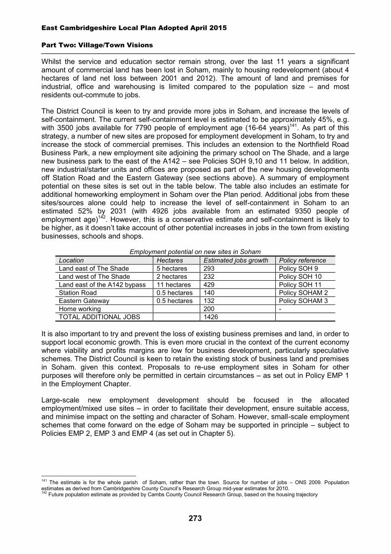
East Cambridgeshire Local Plan Adopted April 2015
Part Two: Village/Town Visions
273
Whilst the service and education sector remain strong, over the last 11 years a significant amount of commercial land has been lost in Soham, mainly to housing redevelopment (about 4 hectares of land net loss between 2001 and 2012). The amount of land and premises for industrial, office and warehousing is limited compared to the population size – and most residents out-commute to jobs.
The District Council is keen to try and provide more jobs in Soham, and increase the levels of self-containment. The current self-containment level is estimated to be approximately 45%, e.g. with 3500 jobs available for 7790 people of employment age (16-64 years)141. As part of this strategy, a number of new sites are proposed for employment development in Soham, to try and increase the stock of commercial premises. This includes an extension to the Northfield Road Business Park, a new employment site adjoining the primary school on The Shade, and a large new business park to the east of the A142 – see Policies SOH 9,10 and 11 below. In addition, new industrial/starter units and offices are proposed as part of the new housing developments off Station Road and the Eastern Gateway (see sections above). A summary of employment potential on these sites is set out in the table below. The table also includes an estimate for additional homeworking employment in Soham over the Plan period. Additional jobs from these sites/sources alone could help to increase the level of self-containment in Soham to an estimated 52% by 2031 (with 4926 jobs available from an estimated 9350 people of employment age)142. However, this is a conservative estimate and self-containment is likely to be higher, as it doesn’t take account of other potential increases in jobs in the town from existing businesses, schools and shops.
Employment potential on new sites in Soham Location Hectares Estimated jobs growth Policy reference Land east of The Shade 5 hectares 293 Policy SOH 9 Land west of The Shade 2 hectares 232 Policy SOH 10 Land east of the A142 bypass 11 hectares 429 Policy SOH 11 Station Road 0.5 hectares 140 Policy SOHAM 2 Eastern Gateway 0.5 hectares 132 Policy SOHAM 3 Home working 200 - TOTAL ADDITIONAL JOBS 1426
It is also important to try and prevent the loss of existing business premises and land, in order to support local economic growth. This is even more crucial in the context of the current economy where viability and profits margins are low for business development, particularly speculative schemes. The District Council is keen to retain the existing stock of business land and premises in Soham. given this context. Proposals to re-use employment sites in Soham for other purposes will therefore only be permitted in certain circumstances – as set out in Policy EMP 1 in the Employment Chapter.
Large-scale new employment development should be focused in the allocated employment/mixed use sites – in order to facilitate their development, ensure suitable access, and minimise impact on the setting and character of Soham. However, small-scale employment schemes that come forward on the edge of Soham may be supported in principle – subject to Policies EMP 2, EMP 3 and EMP 4 (as set out in Chapter 5).
141 The estimate is for the whole parish of Soham, rather than the town. Source for number of jobs – ONS 2009. Population estimates as derived from Cambridgeshire County Council’s Research Group mid-year estimates for 2010. 142 Future population estimate as provided by Cambs County Council Research Group, based on the housing trajectory
East Cambridgeshire Local Plan Adopted April 2015
Part Two: Village/Town Visions
274
Employment/mixed use allocation – land east of The Shade
The site is currently agricultural land on the edge of Soham, adjacent to the existing Northfield Road Business Park. The area was identified in the District Local Plan (2000) as an area for employment development. However, the area failed to come forward, and was subsequently ‘de-allocated’ in the Core Strategy (2009). Since then, the area has been identified in the Soham Vision Masterplan as a potential site for future new employment development – including a small neighbourhood centre with a small local convenience store.
The area is identified in the Local Plan as employment-led development, incorporating a small local convenience store to serve the northern residential part of Soham. The site is bounded to the north by the A142 bypass, and is highly visible from the main road. Therefore, any scheme will also need to include a significant strip of open land between the built-up area and the road, to provide an attractive buffer and a green setting for Soham.
The site is currently bounded by an attractive byway (Longmere Lane) on the south side, with a footpath link partly alongside a watercourse. As part of the historic network of green lanes around Soham, it will be vital to retain and enhance this feature in any development scheme. Other public rights of way across the site should also be retained and enhanced. There are a number of existing trees and hedgerows on the site which should be retained wherever possible.
Access to the site will be provided from The Shade, rather than Northfield Road (due to capacity restrictions at the junction of Northfield Road and the A142 bypass). Access should be provided at a point opposite Kingfisher Drive, to allow for a shared roundabout or traffic signals.
The District Council will require the preparation of a Masterplan for the whole site, prior to approval of a development proposal. The Masterplan will establish the broad location of land uses, roads, services, open space and landscaping, and look at principles such as access and movement, built form and phasing. It will demonstrate how the site will deliver the key aims of Policy SOH9, and ensure a high standard of comprehensive planning.
Policy SOH9: Employment/mixed use allocation, land east of The Shade
Approximately 5 hectares of land is allocated for employment-led development for B1/B2/B8 uses on land adjacent to Northfield Business Park. Within the site, provision will also be made for a small local convenience store (serving local top-up needs), and a minimum of 1.5 hectares of undeveloped land adjoining the A142 as a buffer strip.
A Masterplan will need to be prepared and submitted as part of an outline planning application, and approved by the District Council.
Development proposals will be expected to:
Provide safe and secure vehicular access from the area onto The Shade opposite to Kingfisher Drive, via either a roundabout or junction with traffic signals.
Provide other necessary highway improvements on the road network, as demonstrated via a Transport Assessment.
Retain and enhance the adjoining existing green lane (Longmere Lane) and other byways and public rights of way which cross the site.
Maximise the retention of existing trees and hedgerows on the site.
East Cambridgeshire Local Plan Adopted April 2015
Part Two: Village/Town Visions
275
Have particular regard to the scale, height, design and massing of buildings and landscaping, in order to minimise visual impact from the A142, and minimise amenity impact on adjoining residential properties.
Provide a soft landscaped edge to Soham acting as a sensitive transition to the countryside. This should include landscaping as part of the buffer strip adjoining the A142, and on the boundaries with adjoining residential properties.
Provide a small local convenience store on the road frontage with The Shade. Undertake a programme of archaeological works in advance of construction (to be secured
via planning condition). Demonstrate there is adequate capacity in the sewage treatment works and the foul
sewerage network; and Comply with other policies of the Local Plan.
Employment allocation – land west of The Shade
The site is currently agricultural land on the edge of Soham, and adjoins the site of the primary school. The site is identified in the Soham Masterplan Vision as a potential future area for employment development.
The site is identified in the Local Plan as an employment allocation, with approximately 2 hectares of land for industrial, storage or office development (B1, B2 and B8). Vehicular access to the employment area (and the primary school) will need to be provided via a new arm on the existing roundabout on the A142. Additional pedestrian and cycle access to the employment area should also be provided directly off The Shade.
The site is in a highly visible location, located at a key gateway into Soham. It will be important to ensure that the design, layout, massing, and landscaping of a scheme is of high quality, and provides an attractive setting and entrance to the town.
The site lies within the Safeguarding Area for the Soham Waste Water Treatment Works. As part of the planning application process, an odour assessment will need to be carried out, to demonstrate risks can be adequately mitigated.
Policy SOH10: Employment allocation, land west of The Shade
Approximately 2 hectares is allocated for employment land (B1/B2/B8 uses).
Development proposals will be expected to:
Provide safe and secure vehicular access to the site, via a new arm off the roundabout on the A142.
Provide an additional access point into the site for pedestrians and cyclists directly from The Shade.
Retain and enhance the existing public right of way which adjoins the western side of the site. Have particular regard to the scale, height, design and massing of buildings and landscaping,
in order to minimise visual impact on the surrounding countryside, and provide an attractive setting and entrance to Soham.
Retain the existing tree belt on the northern edge of the site, and provide high quality
East Cambridgeshire Local Plan Adopted April 2015
Part Two: Village/Town Visions
276
landscaping to minimise the impact of the scheme from the A142. Demonstrate there is adequate capacity in the sewage treatment works and the foul
sewerage network. Demonstrate that odour risk relating to the nearby Waste Water Treatment Works can be
adequately mitigated. Undertake a programme of archaeological works in advance of construction (to be secured
via planning condition); and Comply with other policies of the Local Plan.
Employment allocation – land east of the A142 bypass
The site is currently agricultural land, lying to the east of the A142 bypass, and north of Isleham Road. The site was identified in the Core Strategy (2009) and the Soham Masterplan Vision (2010) as a potential future area for employment development (about 11 hectares).
The development of this land for employment purposes should help to provide additional jobs in Soham, and reduce the amount of out-commuting from the town. As a large site, it should be able to accommodate a mix of employment uses – including industrial, office and storage/distribution uses (B1/B2/B8). Delivery of the site is anticipated in the second part of the Plan period.
Vehicular access to the area will need to be provided via a new roundabout on the A142, which will be delivered as part of the development of the Eastern Gateway area to the west (see Policy SOH 3 in section 3 above). It is likely that new slip roads and other potential upgrades to the roundabout may be required to accommodate the employment development. In addition, safety upgrades to the other junctions on the A142 (at Northfield Road, Qua Fen Common and Paddock Street) are also likely to be required. A pedestrian and cycle footbridge or underpass over or under the A142 will also be required. This should link with the new cycle and pedestrian path across the Eastern Gateway development, to provide a sustainable route to the town centre.
The site has a flat topography and is highly visible from the A142. Particular regard should be had to the layout, design and massing of development, in order to provide attractive views along the A142 and from the Eastern Gateway development, and minimise adverse visual impact. This should include the provision of landscaping and open areas.
Part of the site is located in an area of high flood risk. A Flood Risk Assessment of the site has been carried out (to inform the Core Strategy in 2009), demonstrating that this risk can potentially be mitigated. This will need to be reviewed, and careful regard had to the mitigation of flood risk in the detailed design and layout of the final scheme.
This large allocation is likely to be delivered in phases. The District Council will require the preparation of a Masterplan for the whole site, prior to approval of a development proposal. The Masterplan will establish the broad location of land uses, roads, services, open space and landscaping, and look at principles such as access and movement, built form and phasing. It will demonstrate how the site will deliver the key aims of Policy SOH11, and ensure a high standard of comprehensive planning.
East Cambridgeshire Local Plan Adopted April 2015
Part Two: Village/Town Visions
277
Policy SOH11: Employment allocation, land east of the A142 bypass
Approximately 11 hectares of land is allocated for employment development (B1/B2/B8) on land east of the A142 bypass.
A Masterplan will need to be prepared and submitted as part of an outline planning application, and approved by the District Council.
Development proposals will be expected to:
Provide safe and secure vehicular access to the site from the roundabout on the A142, including any necessary highway upgrades or works.
Provide a new cycle and pedestrian bridge or underpass over or under the A142, linking up with the new cycle and pedestrian route across the Eastern Gateway development.
Contribute towards safety improvements of the junctions of Northfield Road, Qua Fen Common and Paddock Street on the A142.
Have particular regard to the scale, height, design and massing of buildings, and landscaping, in order to minimise visual impact on the surrounding countryside, and provide an attractive development scheme when viewed from the A142.
Provide landscaping and a significant buffer zone along the boundary with the A142, and landscaping along boundaries with adjoining agricultural land.
Demonstrate that flood risk on the site can be adequately mitigated. Demonstrate there is adequate capacity in the sewage treatment works and the foul
sewerage network. Provide appropriate evidence of the archaelogical potential and significance of the site prior to
the submission of a planning application; and Comply with other policies of the Local Plan.
Town centre
Soham has a historic town centre which provides a range of food (convenience) and non-food (comparison) shops, pubs, community facilities and other services. The current key attractors are Budgens and the Co-operative store. There are also a number of important community facilities in and around the town centre, including the church, library, public park, community meeting rooms and Youth Theatre. The main shopping area is focused on the traditional linear High Street, and part of Churchgate Street.
However, the town centre appears to be underperforming, given the population of Soham and its catchment area. Whilst it provides a good range of community facilities, there is a limited choice of shops, restaurants and pubs, and the retail offer could be greater. Footfall in the town centre is relatively low for a town of its size, and the turnover of retail units is high. There is scope to increase the quality and range of the retail offer, and to make the town centre a more vibrant hub for the Soham. Improvements could also be made to the appearance and character of the town centre, to make it more attractive and pedestrian friendly. The town centre does not currently have a market, although it has historically had one. Its re-introduction could be beneficial to the town.
The regeneration of the town centre will require action on a number of levels, and from a variety of sources. The Town Council will continue to play a leading role in this process, and in helping
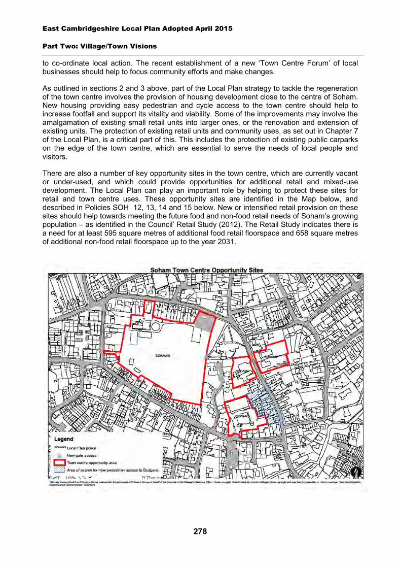
East Cambridgeshire Local Plan Adopted April 2015
Part Two: Village/Town Visions
278
to co-ordinate local action. The recent establishment of a new ‘Town Centre Forum’ of local businesses should help to focus community efforts and make changes.
As outlined in sections 2 and 3 above, part of the Local Plan strategy to tackle the regeneration of the town centre involves the provision of housing development close to the centre of Soham. New housing providing easy pedestrian and cycle access to the town centre should help to increase footfall and support its vitality and viability. Some of the improvements may involve the amalgamation of existing small retail units into larger ones, or the renovation and extension of existing units. The protection of existing retail units and community uses, as set out in Chapter 7 of the Local Plan, is a critical part of this. This includes the protection of existing public carparks on the edge of the town centre, which are essential to serve the needs of local people and visitors.
There are also a number of key opportunity sites in the town centre, which are currently vacant or under-used, and which could provide opportunities for additional retail and mixed-use development. The Local Plan can play an important role by helping to protect these sites for retail and town centre uses. These opportunity sites are identified in the Map below, and described in Policies SOH 12, 13, 14 and 15 below. New or intensified retail provision on these sites should help towards meeting the future food and non-food retail needs of Soham’s growing population – as identified in the Council’ Retail Study (2012). The Retail Study indicates there is a need for at least 595 square metres of additional food retail floorspace and 658 square metres of additional non-food retail floorspace up to the year 2031.
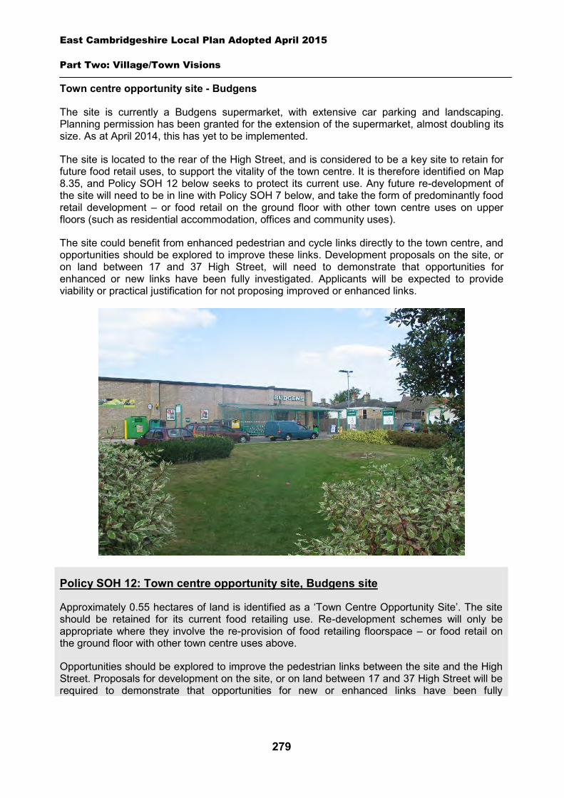
East Cambridgeshire Local Plan Adopted April 2015
Part Two: Village/Town Visions
279
Town centre opportunity site - Budgens
The site is currently a Budgens supermarket, with extensive car parking and landscaping. Planning permission has been granted for the extension of the supermarket, almost doubling its size. As at April 2014, this has yet to be implemented.
The site is located to the rear of the High Street, and is considered to be a key site to retain for future food retail uses, to support the vitality of the town centre. It is therefore identified on Map 8.35, and Policy SOH 12 below seeks to protect its current use. Any future re-development of the site will need to be in line with Policy SOH 7 below, and take the form of predominantly food retail development – or food retail on the ground floor with other town centre uses on upper floors (such as residential accommodation, offices and community uses).
The site could benefit from enhanced pedestrian and cycle links directly to the town centre, and opportunities should be explored to improve these links. Development proposals on the site, or on land between 17 and 37 High Street, will need to demonstrate that opportunities for enhanced or new links have been fully investigated. Applicants will be expected to provide viability or practical justification for not proposing improved or enhanced links.
Policy SOH 12: Town centre opportunity site, Budgens site
Approximately 0.55 hectares of land is identified as a ‘Town Centre Opportunity Site’. The site should be retained for its current food retailing use. Re-development schemes will only be appropriate where they involve the re-provision of food retailing floorspace – or food retail on the ground floor with other town centre uses above.
Opportunities should be explored to improve the pedestrian links between the site and the High Street. Proposals for development on the site, or on land between 17 and 37 High Street will be required to demonstrate that opportunities for new or enhanced links have been fully
East Cambridgeshire Local Plan Adopted April 2015
Part Two: Village/Town Visions
280
investigated.
Any development proposals will be required to undertake a programme of archaeological works in advance of construction (to be secured via planning condition)
Town centre opportunity site - Church hall area
The area includes a vacant site previously occupied by the Church hall, an office building, car parking areas, and a small number of residential units. It presents a key opportunity for comprehensive re-development to provide an expansion of the town’s retail and town centre facilities. This could include redevelopment for one large retail unit, or several retail units of a range of sizes – along with the provision of new car parking in the heart of the town centre. It could also include a number of other town centre uses such as offices and community facilities. Residential development on upper floors may also be appropriate, to facilitate scheme viability. It is broadly estimated there could be potential for up to 10 dwellings, but this will depend on the mix of uses proposed and is subject to further detailed design work.
The site is the last significant area of land adjoining the town centre, and therefore provides the last remaining opportunity to expand and consolidate the town centre to meet the needs of future Soham residents. The site previously had planning permission for 8 dwellings, but this has now expired. Residential development only on this site would present a significant lost opportunity to improve the health and long-term vitality of the town centre. Identifying the site as a Town Centre Opportunity site should help to maintain its availability for future town centre retail investment over the Plan period.
The area adjoins several areas of private residential land which landowners have indicated are not currently available for re-development. However, when a scheme is put forward for the Church hall area, developers will be expected to demonstrate that they have explored all opportunities for the delivery of adjoining sites, and to develop the area for retail-led development in a comprehensive way.
Policy SOH13: Town centre opportunity site, Church hall area
Approximately 0.4 hectares of land is allocated as a Town Centre Opportunity Site. The site should be developed for retail purposes – or for a mixed use scheme with a significant element of retail provision plus other town centre uses such as offices and community facilities. Residential development will be appropriate on upper floors of any development scheme, and potentially to the rear of the site.
Development proposals will be expected to:
Provide safe and secure vehicular access from one point onto the High Street, and any necessary highways improvement works.
Provide car parking, to an appropriate standard, which is linked to the town as a whole. Maximise opportunities for the provision of retail development on the ground floor and the
frontage of the site. Provide an interesting area of new townscape which enhances the Conservation Area, and is
sympathetic to the setting, appearance and character of the historic core and adjoining Listed Building.
East Cambridgeshire Local Plan Adopted April 2015
Part Two: Village/Town Visions
281
Demonstrate that the area can be developed comprehensively, and that additional opportunities to expand the site have been fully explored.
Undertake a programme of archaeological works in advance of construction (to be secured via planning condition); and
Comply with other policies in the Local Plan.
Town centre opportunity site - Cooperative store area
The area includes a Cooperative food store with adjacent car parking, and the Post Office which includes the delivery office and vacant land to the rear. The site is considered to offer an opportunity for potential intensification and redevelopment. The current Cooperative store is small and does little to enhance the appearance and setting of the High Street and adjacent church. There is vacant land to the rear of the Post Office, and scope for the delivery office to be located elsewhere in or close to the town centre. The site offers an opportunity to provide attractive new retail units and additional floorspace, whilst enhancing the appearance of the High Street. Any redevelopment scheme will need to be retail-led, given the site’s location in the heart of the High Street.
The Cooperative store is one of the key attractors in the town centre which is important to retain. Therefore any re-development of the site should include the provision of a foodstore of at least equivalent floorspace. This could potentially include other town centre uses on upper floors to increase scheme viability - including residential accommodation, offices and community uses. Alternatively, if at least equivalent new food retail floorspace is to be provided on the Church hall site, this could help to off-set the loss of any food retail on the Cooperative site, and could justify its re-development for other retail uses. In these circumstances, these applications would need to be linked. It is broadly estimated there could be potential for up to 10 dwellings, but this will depend on the mix of uses proposed and is subject to further detailed design work.
A small amount of car parking is currently provided for the Cooperative store customers. This level of parking would need to be retained in any redevelopment scheme which involves replacement of the food floorspace. If the Cooperative store area is redeveloped for non-food retail uses, the provision of on-site car parking will need to be considered in the context of the Council’s car parking standards and provision available in the locality.
The Post Office shop is also a key attractor in the town centre. This should be re-provided as part of any development proposal – or suitable alternative premises found elsewhere on the High Street. A new location for the delivery sorting office would also need to be identified in or close to the town centre.
Re-development could provide an opportunity to create an attractive new area of townscape. Development should have particular regard to the site’s location in the Conservation Area, adjoining the listed Parish Church, and a listed residential property. It should also maximise opportunities to re-create an attractive frontage to the site, and for views to and from the Parish Church.
The area is in the ownership of the Cooperative Group and one private individual. The landowners/developers will need to work together to bring forward a comprehensive re-development scheme for the site. If this cannot be facilitated, extensive evidence and practical reasons (such as viability) will need to be provided by the landowners/developers to justify why this requirement should be set aside.
East Cambridgeshire Local Plan Adopted April 2015
Part Two: Village/Town Visions
282
Policy SOH14: Town centre opportunity site, Cooperative store area
Approximately 0.3 hectares of land is allocated as a Town Centre Opportunity Site. Re-development schemes should include the provision of food retail floorspace, at least equivalent in net square metres to the current Cooperative store, plus other retail uses or office or community uses. Residential properties may be appropriate on upper floors. An element of carparking will be required to support food retail floorspace. The Post Office counter facility will need to be re-provided on-site or secured elsewhere on the High Street. The delivery office facility will need to re-provided elsewhere in or close to the town centre.
The loss of equivalent food retail floorspace on the site will only be appropriate if it can be demonstrated that alternative equivalent provision will be delivered on the Church hall site, to off-set the loss.
Development proposals will be expected to:
Provide an interesting area of new townscape which enhances the Conservation Area, and is sympathetic to the setting, appearance and character of adjoining Listed Buildings.
Provide a new attractive street frontage which enhances the historic streetscape, and maximises views to and from the Parish Church.
Maximise opportunities for the provision of retail development on the ground floor and the frontage of the site.
Demonstrate that the site can be developed comprehensively, and that additional opportunities to expand the site have been fully explored. If comprehensive development is not proposed, applicants will be required to submit extensive evidence and practical reasons to justify why it cannot be achieved.
Undertake a programme of archaeological works in advance of construction (to be secured via planning condition); and
Comply with other policies in the Local Plan.
Town centre opportunity site - Fountain Lane recreation ground and car park
This area is adjacent to the High Street, and includes a large recreation area, and a range of community facilities, including The Pavilion meeting hall, Scout hut, Fire station, public car park and toilets. The Soham Masterplan Vision identifies the area as a key part of the town centre, and highlights its function as an important open space facility for the town.
The public car park is one of the two main car parks which serve the town centre. It also contains some public toilets and a disused ambulance station. The car park is currently small, and the whole area is unattractive and could benefit from being re-developed in the future as funds become available. Any re-development should look at the potential to reconfigure and increase the number of car parking spaces available, whilst retaining as much of the open space and green areas as possible. Access to the car park should be made clearer, and more user friendly. The frontage of the site should be opened up and landscaped, with views into the park from Fountain Lane. To facilitate this the ambulance station will need to be demolished, and opportunities explored to refurbish or re-locate the public toilets within the site.
East Cambridgeshire Local Plan Adopted April 2015
Part Two: Village/Town Visions
283
The Pavilion building is a vital community hub which houses the Town Council, and has a range of meeting rooms. There are plans by the Town Council to refurbish and upgrade the building and adjoining car park area. This facility should be retained and enhanced for the people of Soham.
The recreation ground could benefit from improved pedestrian and cycle access links, both to the site, and within it (i.e. to the Pavilion), as well as improved signage and landscaping. Opportunities to improve or provide new access points and routes should be investigated and brought forward wherever possible. In particular, focus should be placed on:
Upgrading or improving on the existing route from the town centre to the Pavilion Formalising the pedestrian/cycle link across the Fire Station site. If the Fire Station is re-
developed, a pedestrian and cycle link should be provided across the site as part of any re-development scheme.
Policy SOH15: Town centre opportunity site, Fountain Lane recreation ground and car park
Fountain Lane recreation ground and car park (including The Pavilion and other facilities within) should be retained and enhanced, as a key facility for the people of Soham.
Development proposals to improve Fountain Lane car park will be supported. Development proposals will be expected to:
Provide additional car parking space to serve the town centre. Improve the appearance and setting of the park, including views into the site. Improve the setting of the church and churchyard. Provide refurbished or relocated public toilet facilities within the site. Provide appropriate evidence of the archaelogical potential and significance of the site prior to
the submission of a planning application. Any development proposals to re-develop the Fire Station site should provide a cycle and pedestrian link across the site from Fountain Lane to The Pavilion/recreation ground.
Opportunities to improve pedestrian and cycle links and access to the recreation ground should be explored, with particular focus on:
Upgrading or improving on the existing route from the town centre to the Pavilion. Formalising a walking/cycling link to the Pavlion/recreation ground, across the Fire Station
site.
Green lanes and Commons
Soham has an excellent network of public footpaths, including a large number of historic ‘green lanes’ which used to provide key routes from the town out into the surrounding countryside, and to the Commons and Mere. Many of these footpaths are along tree-lined routes or bounded by hedgerows, providing very attractive walking routes which enhance the character and setting of Soham. Cambridgeshire County Council has definitive rights of way maps, whilst the Soham Footpaths Society’s website provides further information on routes and walks around the town (www.soham.org.uk/leisure/footpaths/index.htm).
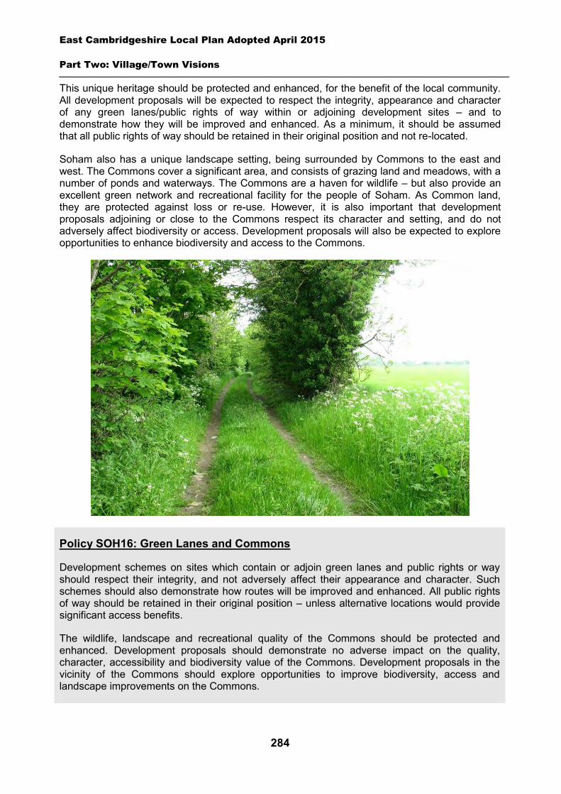
East Cambridgeshire Local Plan Adopted April 2015
Part Two: Village/Town Visions
284
This unique heritage should be protected and enhanced, for the benefit of the local community. All development proposals will be expected to respect the integrity, appearance and character of any green lanes/public rights of way within or adjoining development sites – and to demonstrate how they will be improved and enhanced. As a minimum, it should be assumed that all public rights of way should be retained in their original position and not re-located.
Soham also has a unique landscape setting, being surrounded by Commons to the east and west. The Commons cover a significant area, and consists of grazing land and meadows, with a number of ponds and waterways. The Commons are a haven for wildlife – but also provide an excellent green network and recreational facility for the people of Soham. As Common land, they are protected against loss or re-use. However, it is also important that development proposals adjoining or close to the Commons respect its character and setting, and do not adversely affect biodiversity or access. Development proposals will also be expected to explore opportunities to enhance biodiversity and access to the Commons.
Policy SOH16: Green Lanes and Commons
Development schemes on sites which contain or adjoin green lanes and public rights or way should respect their integrity, and not adversely affect their appearance and character. Such schemes should also demonstrate how routes will be improved and enhanced. All public rights of way should be retained in their original position – unless alternative locations would provide significant access benefits.
The wildlife, landscape and recreational quality of the Commons should be protected and enhanced. Development proposals should demonstrate no adverse impact on the quality, character, accessibility and biodiversity value of the Commons. Development proposals in the vicinity of the Commons should explore opportunities to improve biodiversity, access and landscape improvements on the Commons.
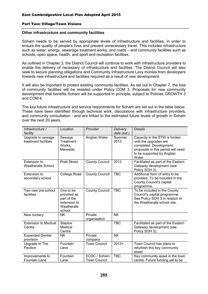
East Cambridgeshire Local Plan Adopted April 2015
Part Two: Village/Town Visions
285
Other infrastructure and community facilities
Soham needs to be served by appropriate levels of infrastructure and facilities, in order to ensure the quality of people’s lives and prevent unnecessary travel. This includes infrastructure such as water, energy, sewerage treatment works, and roads – and community facilities such as schools, open space, health, and sport and recreation facilities.
As outlined in Chapter 3, the District Council will continue to work with infrastructure providers to enable the delivery of necessary of infrastructure and facilities. The District Council will also seek to secure planning obligations and Community Infrastructure Levy monies from developers towards new infrastructure and facilities required as a result of new development.
It will also be important to protect existing community facilities. As set out in Chapter 7, the loss of community facilities will be resisted under Policy COM 3. Proposals for new community development that benefits Soham will be supported in principle, subject to Policies GROWTH 3 and COM 4.
The key future infrastructure and service requirements for Soham are set out in the table below. These have been identified through technical work, discussions with infrastructure providers, and community consultation - and are linked to the estimated future levels of growth in Soham over the next 20 years.
Infrastructure / facility
Location Provider Delivery date (est.)
Details
Upgrade to sewage treatment facilities
Sewage Treatment Works, Mereside
Anglian Water Summer 2013
Capacity in the STW is limited until the upgrades are completed. Development proposals in this period will need to be supported by Anglian Water.
Extension to Weatheralls School
Pratt Street County Council 2013 Facilitated as part of the Eastern Gateway development (see Policy SOH 3).
Extension to secondary school
College Road County Council TBC Additional form of entry to be provided. To be included in the County Council’s capital programme.
Two new pre-school facilities
One to be provided as part of the extension to Weatheralls school.
County Council TBC To be included in the County Council’s capital programme. See Policy SOH 3 in relation to the Weatheralls school site.
New nursery NK Private organisation
NK
Extension to Medical Centre
Staploe Medical Centre
TBC Facilitated as part of the Eastern Gateway development (see Policy SOH 3).
Expanded Dentist provision
NK Private company
NK
Upgrade to The Pavilion
Fountain Lane
Town Council 2013+ Town Council has plans to refurbish this key community asset.
Improvements to Fountain Lane
Fountain Lane
ECDC / Soham Town Council
TBC Key community asset in the town centre. Future funding yet to be
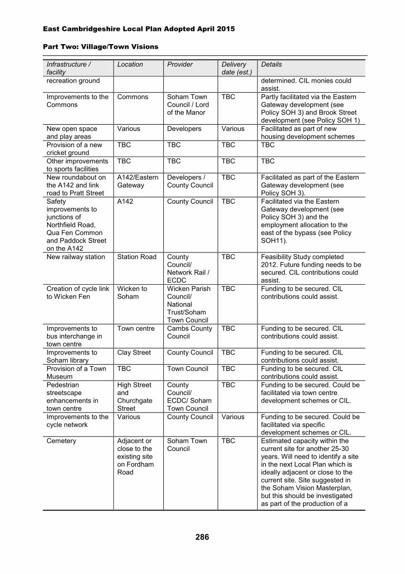
East Cambridgeshire Local Plan Adopted April 2015
Part Two: Village/Town Visions
286
Infrastructure / facility
Location Provider Delivery date (est.)
Details
recreation ground determined. CIL monies could assist.
Improvements to the Commons
Commons Soham Town Council / Lord of the Manor
TBC Partly facilitated via the Eastern Gateway development (see Policy SOH 3) and Brook Street development (see Policy SOH 1)
New open space and play areas
Various Developers Various Facilitated as part of new housing development schemes
Provision of a new cricket ground
TBC TBC TBC TBC
Other improvements to sports facilities
TBC TBC TBC TBC
New roundabout on the A142 and link road to Pratt Street
A142/Eastern Gateway
Developers / County Council
TBC Facilitated as part of the Eastern Gateway development (see Policy SOH 3).
Safety improvements to junctions of Northfield Road, Qua Fen Common and Paddock Street on the A142
A142 County Council TBC Facilitated via the Eastern Gateway development (see Policy SOH 3) and the employment allocation to the east of the bypass (see Policy SOH11).
New railway station Station Road County Council/ Network Rail / ECDC
TBC Feasibility Study completed 2012. Future funding needs to be secured. CIL contributions could assist.
Creation of cycle link to Wicken Fen
Wicken to Soham
Wicken Parish Council/ National Trust/Soham Town Council
TBC Funding to be secured. CIL contributions could assist.
Improvements to bus interchange in town centre
Town centre Cambs County Council
TBC Funding to be secured. CIL contributions could assist.
Improvements to Soham library
Clay Street County Council TBC Funding to be secured. CIL contributions could assist.
Provision of a Town Museum
TBC Town Council TBC Funding to be secured. CIL contributions could assist.
Pedestrian streetscape enhancements in town centre
High Street and Churchgate Street
County Council/ ECDC/ Soham Town Council
TBC Funding to be secured. Could be facilitated via town centre development schemes or CIL.
Improvements to the cycle network
Various County Council Various Funding to be secured. Could be facilitated via specific development schemes or CIL.
Cemetery Adjacent or close to the existing site on Fordham Road
Soham Town Council
TBC Estimated capacity within the current site for another 25-30 years. Will need to identify a site in the next Local Plan which is ideally adjacent or close to the current site. Site suggested in the Soham Vision Masterplan, but this should be investigated as part of the production of a

East Cambridgeshire Local Plan Adopted April 2015
Part Two: Village/Town Visions
287
Infrastructure / facility
Location Provider Delivery date (est.)
Details
site-specific Masterplan for any development between Fordham Road, Cherry Tree Lane and The Butts.
A spatial strategy for Soham (See Inset Map 8.35)
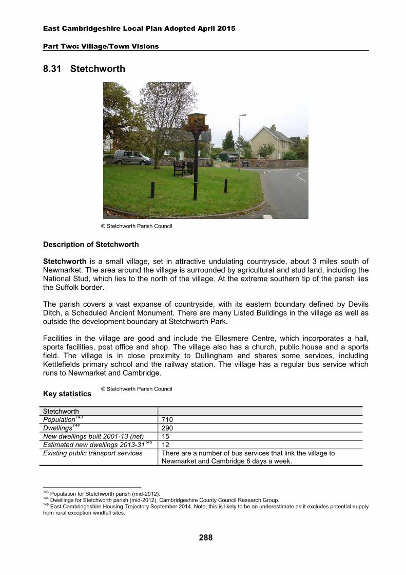
East Cambridgeshire Local Plan Adopted April 2015
Part Two: Village/Town Visions
288
8.31 Stetchworth
Description of Stetchworth
Stetchworth is a small village, set in attractive undulating countryside, about 3 miles south of Newmarket. The area around the village is surrounded by agricultural and stud land, including the National Stud, which lies to the north of the village. At the extreme southern tip of the parish lies the Suffolk border.
The parish covers a vast expanse of countryside, with its eastern boundary defined by Devils Ditch, a Scheduled Ancient Monument. There are many Listed Buildings in the village as well as outside the development boundary at Stetchworth Park.
Facilities in the village are good and include the Ellesmere Centre, which incorporates a hall, sports facilities, post office and shop. The village also has a church, public house and a sports field. The village is in close proximity to Dullingham and shares some services, including Kettlefields primary school and the railway station. The village has a regular bus service which runs to Newmarket and Cambridge.
Key statistics
Stetchworth Population143 710 Dwellings144 290 New dwellings built 2001-13 (net) 15 Estimated new dwellings 2013-31145 12 Existing public transport services There are a number of bus services that link the village to
Newmarket and Cambridge 6 days a week.
143 Population for Stetchworth parish (mid-2012). 144 Dwellings for Stetchworth parish (mid-2012), Cambridgeshire County Council Research Group. 145 East Cambridgeshire Housing Trajectory September 2014. Note, this is likely to be an underestimate as it excludes potential supply from rural exception windfall sites.
© Stetchworth Parish Council
© Stetchworth Parish Council
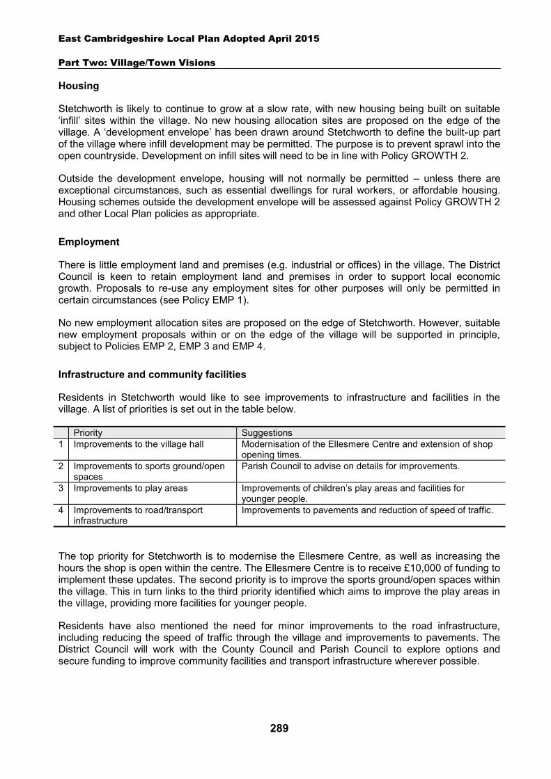
East Cambridgeshire Local Plan Adopted April 2015
Part Two: Village/Town Visions
289
Housing
Stetchworth is likely to continue to grow at a slow rate, with new housing being built on suitable ‘infill’ sites within the village. No new housing allocation sites are proposed on the edge of the village. A ‘development envelope’ has been drawn around Stetchworth to define the built-up part of the village where infill development may be permitted. The purpose is to prevent sprawl into the open countryside. Development on infill sites will need to be in line with Policy GROWTH 2.
Outside the development envelope, housing will not normally be permitted – unless there are exceptional circumstances, such as essential dwellings for rural workers, or affordable housing. Housing schemes outside the development envelope will be assessed against Policy GROWTH 2 and other Local Plan policies as appropriate.
Employment
There is little employment land and premises (e.g. industrial or offices) in the village. The District Council is keen to retain employment land and premises in order to support local economic growth. Proposals to re-use any employment sites for other purposes will only be permitted in certain circumstances (see Policy EMP 1).
No new employment allocation sites are proposed on the edge of Stetchworth. However, suitable new employment proposals within or on the edge of the village will be supported in principle, subject to Policies EMP 2, EMP 3 and EMP 4.
Infrastructure and community facilities
Residents in Stetchworth would like to see improvements to infrastructure and facilities in the village. A list of priorities is set out in the table below.
Priority Suggestions 1 Improvements to the village hall Modernisation of the Ellesmere Centre and extension of shop
opening times. 2 Improvements to sports ground/open
spaces Parish Council to advise on details for improvements.
3 Improvements to play areas Improvements of children’s play areas and facilities for younger people.
4 Improvements to road/transport infrastructure
Improvements to pavements and reduction of speed of traffic.
The top priority for Stetchworth is to modernise the Ellesmere Centre, as well as increasing the hours the shop is open within the centre. The Ellesmere Centre is to receive £10,000 of funding to implement these updates. The second priority is to improve the sports ground/open spaces within the village. This in turn links to the third priority identified which aims to improve the play areas in the village, providing more facilities for younger people.
Residents have also mentioned the need for minor improvements to the road infrastructure, including reducing the speed of traffic through the village and improvements to pavements. The District Council will work with the County Council and Parish Council to explore options and secure funding to improve community facilities and transport infrastructure wherever possible.

East Cambridgeshire Local Plan Adopted April 2015
Part Two: Village/Town Visions
290
The current community facilities in Stetchworth (including the community centre, public house, church and sports field) contribute to the quality of people’s lives. The loss of community facilities will be resisted under Policy COM 3. Proposals for new community development that benefits the village will be supported in principle, subject to Policy COM 4.
Spatial strategy for Stetchworth (see Inset Map 8.36)
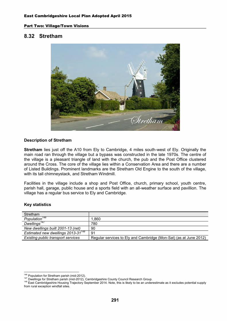
East Cambridgeshire Local Plan Adopted April 2015
Part Two: Village/Town Visions
291
8.32 Stretham
Description of Stretham
Stretham lies just off the A10 from Ely to Cambridge, 4 miles south-west of Ely. Originally the main road ran through the village but a bypass was constructed in the late 1970s. The centre of the village is a pleasant triangle of land with the church, the pub and the Post Office clustered around the Cross. The core of the village lies within a Conservation Area and there are a number of Listed Buildings. Prominent landmarks are the Stretham Old Engine to the south of the village, with its tall chimneystack, and Stretham Windmill.
Facilities in the village include a shop and Post Office, church, primary school, youth centre, parish hall, garage, public house and a sports field with an all-weather surface and pavillion. The village has a regular bus service to Ely and Cambridge.
Key statistics
Stretham Population146 1,860 Dwellings147 780 New dwellings built 2001-13 (net) 90 Estimated new dwellings 2013-31148 91 Existing public transport services Regular services to Ely and Cambridge (Mon-Sat) (as at June 2012)
146 Population for Stretham parish (mid-2012). 147 Dwellings for Stretham parish (mid-2012), Cambridgeshire County Council Research Group. 148 East Cambridgeshire Housing Trajectory September 2014. Note, this is likely to be an underestimate as it excludes potential supply from rural exception windfall sites.
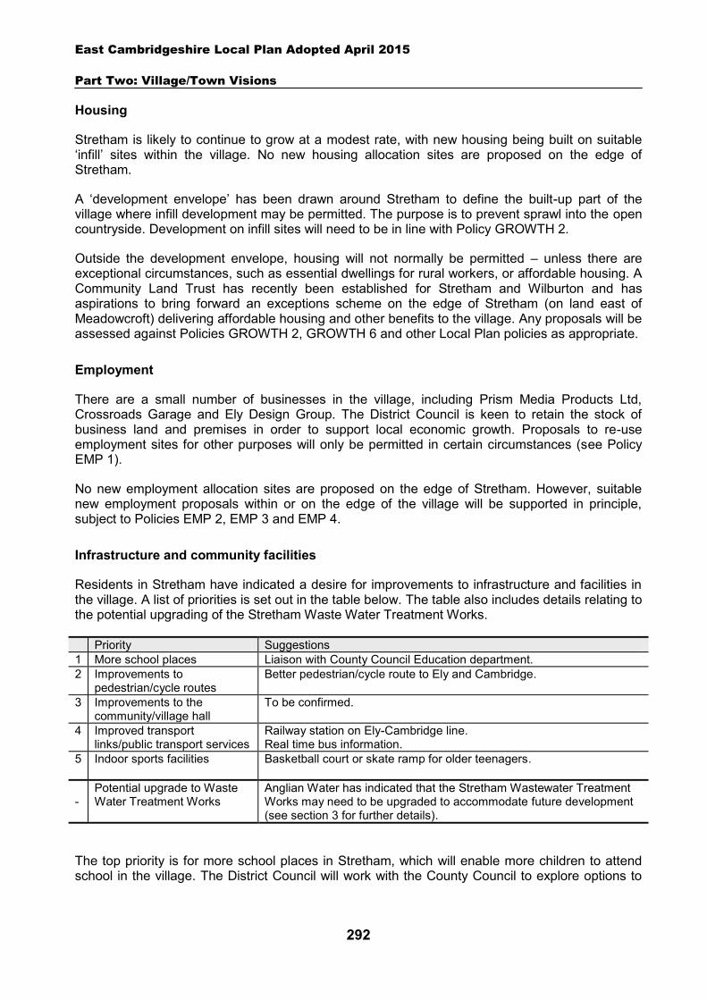
East Cambridgeshire Local Plan Adopted April 2015
Part Two: Village/Town Visions
292
Housing
Stretham is likely to continue to grow at a modest rate, with new housing being built on suitable ‘infill’ sites within the village. No new housing allocation sites are proposed on the edge of Stretham.
A ‘development envelope’ has been drawn around Stretham to define the built-up part of the village where infill development may be permitted. The purpose is to prevent sprawl into the open countryside. Development on infill sites will need to be in line with Policy GROWTH 2.
Outside the development envelope, housing will not normally be permitted – unless there are exceptional circumstances, such as essential dwellings for rural workers, or affordable housing. A Community Land Trust has recently been established for Stretham and Wilburton and has aspirations to bring forward an exceptions scheme on the edge of Stretham (on land east of Meadowcroft) delivering affordable housing and other benefits to the village. Any proposals will be assessed against Policies GROWTH 2, GROWTH 6 and other Local Plan policies as appropriate.
Employment
There are a small number of businesses in the village, including Prism Media Products Ltd, Crossroads Garage and Ely Design Group. The District Council is keen to retain the stock of business land and premises in order to support local economic growth. Proposals to re-use employment sites for other purposes will only be permitted in certain circumstances (see Policy EMP 1).
No new employment allocation sites are proposed on the edge of Stretham. However, suitable new employment proposals within or on the edge of the village will be supported in principle, subject to Policies EMP 2, EMP 3 and EMP 4.
Infrastructure and community facilities
Residents in Stretham have indicated a desire for improvements to infrastructure and facilities in the village. A list of priorities is set out in the table below. The table also includes details relating to the potential upgrading of the Stretham Waste Water Treatment Works.
Priority Suggestions 1 More school places Liaison with County Council Education department. 2 Improvements to
pedestrian/cycle routes Better pedestrian/cycle route to Ely and Cambridge.
3 Improvements to the community/village hall
To be confirmed.
4 Improved transport links/public transport services
Railway station on Ely-Cambridge line. Real time bus information.
5
Indoor sports facilities Basketball court or skate ramp for older teenagers.
-
Potential upgrade to Waste Water Treatment Works
Anglian Water has indicated that the Stretham Wastewater Treatment Works may need to be upgraded to accommodate future development (see section 3 for further details).
The top priority is for more school places in Stretham, which will enable more children to attend school in the village. The District Council will work with the County Council to explore options to
East Cambridgeshire Local Plan Adopted April 2015
Part Two: Village/Town Visions
293
address this issue. Other priorities include improvements to pedestrian/cycle routes, the village hall and transport links/services. The District Council will work with the Parish Council and County Council to explore options and secure funding for improvements to community facilities and transport infrastructure in Stretham. In relation to public transport, the District Council will also work in partnership to try to retain existing public transport levels, and encourage self-sufficient transport services, such as community transport.
The current community facilities in Stretham (including the shop, pub, village hall, primary school, church and sports field) contribute to the quality of people’s lives. The loss of community facilities will also be resisted under Policy COM 3. Proposals for new community development that benefits the village will be supported in principle, subject to Policy COM 4.
Spatial strategy for Stretham (see Inset Map 8.37)
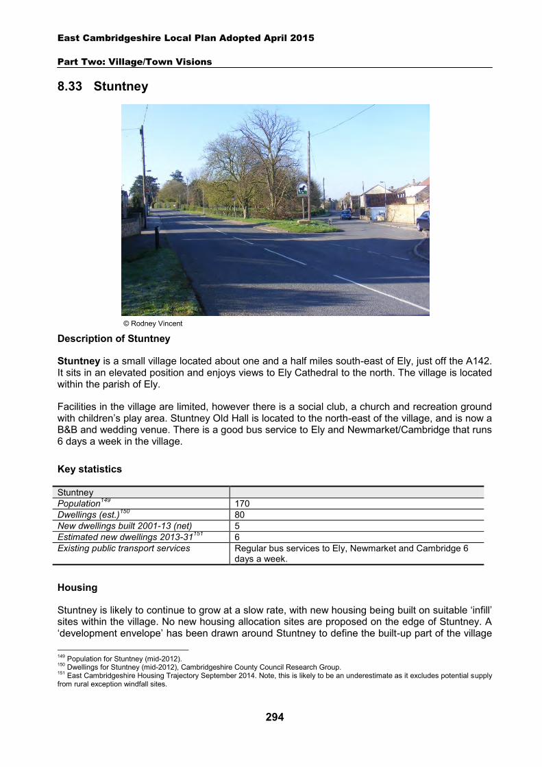
East Cambridgeshire Local Plan Adopted April 2015
Part Two: Village/Town Visions
294
8.33 Stuntney
Description of Stuntney
Stuntney is a small village located about one and a half miles south-east of Ely, just off the A142. It sits in an elevated position and enjoys views to Ely Cathedral to the north. The village is located within the parish of Ely.
Facilities in the village are limited, however there is a social club, a church and recreation ground with children’s play area. Stuntney Old Hall is located to the north-east of the village, and is now a B&B and wedding venue. There is a good bus service to Ely and Newmarket/Cambridge that runs 6 days a week in the village.
Key statistics
Stuntney Population149 170 Dwellings (est.)150 80 New dwellings built 2001-13 (net) 5 Estimated new dwellings 2013-31151 6 Existing public transport services Regular bus services to Ely, Newmarket and Cambridge 6
days a week.
Housing
Stuntney is likely to continue to grow at a slow rate, with new housing being built on suitable ‘infill’ sites within the village. No new housing allocation sites are proposed on the edge of Stuntney. A ‘development envelope’ has been drawn around Stuntney to define the built-up part of the village 149 Population for Stuntney (mid-2012). 150 Dwellings for Stuntney (mid-2012), Cambridgeshire County Council Research Group. 151 East Cambridgeshire Housing Trajectory September 2014. Note, this is likely to be an underestimate as it excludes potential supply from rural exception windfall sites.
© Rodney Vincent
East Cambridgeshire Local Plan Adopted April 2015
Part Two: Village/Town Visions
295
where infill development may be permitted. The purpose is to prevent sprawl into the open countryside. Development on infill sites will need to be in line with Policy GROWTH 2.
Outside the development envelope, housing will not normally be permitted – unless there are exceptional circumstances, such as essential dwellings for rural workers, or affordable housing. Housing schemes outside the development envelope will be assessed against Policy GROWTH 2 and other Local Plan policies as appropriate.
Employment
There is little employment land and premises (e.g. industrial or offices) in the village. The District Council is keen to retain employment land and premises in order to support local economic growth. Proposals to re-use any employment sites for other purposes will only be permitted in certain circumstances (see Policy EMP 1).
No new employment allocation sites are proposed on the edge of Stuntney. However, suitable new employment proposals within or on the edge of the village will be supported in principle, subject to Policies EMP 2, EMP 3 and EMP 4.
Infrastructure and community facilities
Residents in Stuntney have indicated a desire for improvements to infrastructure and community facilities in the village. A list of priorities is set out in the table below.
Priority Suggestions 1 Improvements to
pedestrian/cycle routes Extended pedestrian and cycle routes including a possible cross-country route to Ely.
2 Improvements to community facilities
Improvements to existing Social Club, or re-location closer to playing field with car park. A new village shop to be incorporated into new village hall scheme or a stand alone venture.
3 Improvements to sports ground/open spaces
Improvements to existing playing field and the creation of a nature reserve/orchard.
4 Minor road/transport improvements
Traffic calming measures to reduce speed of traffic through the village.
The top priority is to improve and extend existing cycle routes and footpaths in the area, including a possible cross-country link to Ely, avoiding the busy A142. The second priority is to improve the community facilities in the village. There was much support for either the improvement or relocation of the social club/village hall. Relocation next to the playing field along with a car park was noted as an option, and was proposed that the new facility should include a shop. The third priority was to improve the playing field and to also designate an area for a nature reserve/orchard. The District Council will work with the Parish Council and County Council to explore options and secure funding to improve community facilities and infrastructure in Stuntney.
The current community facilities in Stuntney are good (including the social club, church, and recreation ground with play area) and contribute to the quality of people’s lives. The loss of community facilities will be resisted under Policy COM 3. Proposals for new community development that benefits the village will be supported in principle, subject to Policy COM 4.
Spatial strategy for Stuntney (see Inset Map 8.38)
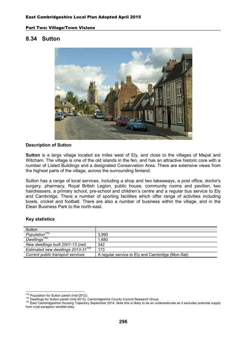
East Cambridgeshire Local Plan Adopted April 2015
Part Two: Village/Town Visions
296
8.34 Sutton
Description of Sutton
Sutton is a large village located six miles west of Ely, and close to the villages of Mepal and Witcham. The village is one of the old islands in the fen, and has an attractive historic core with a number of Listed Buildings and a designated Conservation Area. There are extensive views from the highest parts of the village, across the surrounding fenland.
Sutton has a range of local services, including a shop and two takeaways, a post office, doctor's surgery, pharmacy, Royal British Legion, public house, community rooms and pavilion, two hairdressers, a primary school, pre-school and children’s centre and a regular bus service to Ely and Cambridge. There a number of sporting facilities which offer range of activities including bowls, cricket and football. There are also a number of business within the village, and in the Elean Business Park to the north-east.
Key statistics
Sutton Population152 3,990 Dwellings153 1,680 New dwellings built 2001-13 (net) 342 Estimated new dwellings 2013-31154 173 Current public transport services A regular service to Ely and Cambridge (Mon-Sat)
152 Population for Sutton parish (mid-2012). 153 Dwellings for Sutton parish (mid-2012), Cambridgeshire County Council Research Group. 154 East Cambridgeshire Housing Trajectory September 2014. Note this is likely to be an underestimate as it excludes potential supply from rural exception windfall sites.
East Cambridgeshire Local Plan Adopted April 2015
Part Two: Village/Town Visions
297
Housing
Sutton is likely to continue to grow, with new housing being built on suitable ‘infill’ sites within the village. Additionally, a new housing allocation site is proposed at land north of The Brook. Details of the allocation site are set out in the section below.
A ‘development envelope’ has been drawn around Sutton to define the built-up part of the village where development (infill and the allocation site) may be permitted. The purpose is to prevent sprawl into the open countryside. Development on infill sites will need to be in line with Policy GROWTH 2. Development on the allocation site will need to be in line with Policy SUT 1.
Outside the development envelope, housing will not normally be permitted – unless there are exceptional circumstances, such as essential dwellings for rural workers, or affordable housing. Housing schemes outside the development envelope will be assessed against Policy GROWTH 2 and other Local Plan policies as appropriate.
Housing allocation – land north of The Brook
The site is located to the north side of the village, and is currently open farmland. The area was previously part of the Mepal airfield, used during WW2 and the post-war period.
The site is considered to be a sustainable location for new housing development, and it is proposed that an initial development of 50 dwellings should come forward within the Plan period. The site is shown on the Inset Map.
The applicant will also be expected to consider the future potential of the whole area to the north of The Brook (between the primary school and Mepal Road), and to demonstrate how the 50 dwelling scheme scheme fits with potential longer-term plans for the area. This should take the form of an Indicative Development Framework or broad concept plan, which will need to be submitted alongside the planning application for the development. Future development is likely to be predominantly housing, but there is also an identified need for a new burial ground and additional playing fields in the village. These facilities will need to be provided as part of a comprehensive future scheme of development on land north of The Brook (phase 2+).
The site is in a sensitive setting on the edge of the village, and visible from the A142. It will be important for any development to respect this rural setting, and to provide an attractive edge to the village. This should include open space and landscaping – particularly on the north-eastern edge which is most visible from the A142. Vehicular access to the site will need to be provided off Mepal Road, with an additional cycle and footpath link provided via land adjacent to 26 The Orchards. This pedestrian and cycle link will provide easy access to the village centre via Priors Court. It will also provide an alternative route to the primary school via Stirling Way, once the link between The Orchards and Stirling Way is opened up. This link was planned as part of the Stirling Way development, but has not yet been implemented.
The development will need to be designed to allow for future vehicular, pedestrian and cycle access to adjoining land. In order to facilitate further development of the whole area, an additional vehicular access point is likely to be required in future plans, potentially via Stirling Way.
The site is owned by two landowners. The District Council will require the site to be developed in a comprehensive way, and will expect the landowners to work together to facilitate comprehensive delivery.
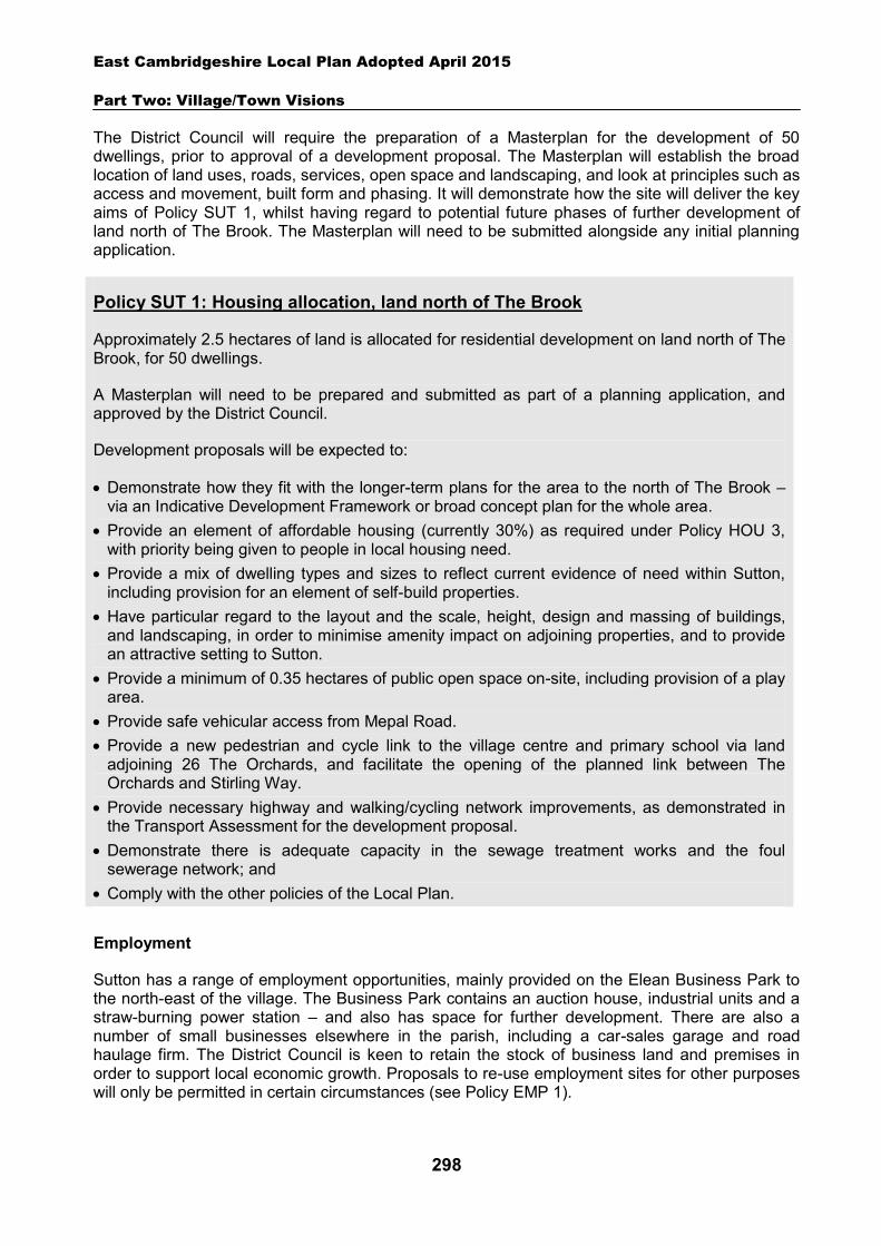
East Cambridgeshire Local Plan Adopted April 2015
Part Two: Village/Town Visions
298
The District Council will require the preparation of a Masterplan for the development of 50 dwellings, prior to approval of a development proposal. The Masterplan will establish the broad location of land uses, roads, services, open space and landscaping, and look at principles such as access and movement, built form and phasing. It will demonstrate how the site will deliver the key aims of Policy SUT 1, whilst having regard to potential future phases of further development of land north of The Brook. The Masterplan will need to be submitted alongside any initial planning application.
Policy SUT 1: Housing allocation, land north of The Brook
Approximately 2.5 hectares of land is allocated for residential development on land north of The Brook, for 50 dwellings.
A Masterplan will need to be prepared and submitted as part of a planning application, and approved by the District Council.
Development proposals will be expected to:
Demonstrate how they fit with the longer-term plans for the area to the north of The Brook – via an Indicative Development Framework or broad concept plan for the whole area.
Provide an element of affordable housing (currently 30%) as required under Policy HOU 3, with priority being given to people in local housing need.
Provide a mix of dwelling types and sizes to reflect current evidence of need within Sutton, including provision for an element of self-build properties.
Have particular regard to the layout and the scale, height, design and massing of buildings, and landscaping, in order to minimise amenity impact on adjoining properties, and to provide an attractive setting to Sutton.
Provide a minimum of 0.35 hectares of public open space on-site, including provision of a play area.
Provide safe vehicular access from Mepal Road. Provide a new pedestrian and cycle link to the village centre and primary school via land
adjoining 26 The Orchards, and facilitate the opening of the planned link between The Orchards and Stirling Way.
Provide necessary highway and walking/cycling network improvements, as demonstrated in the Transport Assessment for the development proposal.
Demonstrate there is adequate capacity in the sewage treatment works and the foul sewerage network; and
Comply with the other policies of the Local Plan.
Employment
Sutton has a range of employment opportunities, mainly provided on the Elean Business Park to the north-east of the village. The Business Park contains an auction house, industrial units and a straw-burning power station – and also has space for further development. There are also a number of small businesses elsewhere in the parish, including a car-sales garage and road haulage firm. The District Council is keen to retain the stock of business land and premises in order to support local economic growth. Proposals to re-use employment sites for other purposes will only be permitted in certain circumstances (see Policy EMP 1).
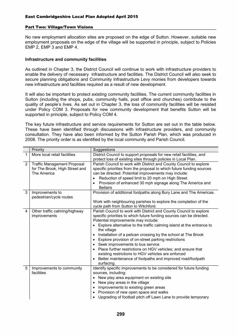
East Cambridgeshire Local Plan Adopted April 2015
Part Two: Village/Town Visions
299
No new employment allocation sites are proposed on the edge of Sutton. However, suitable new employment proposals on the edge of the village will be supported in principle, subject to Policies EMP 2, EMP 3 and EMP 4.
Infrastructure and community facilities
As outlined in Chapter 3, the District Council will continue to work with infrastructure providers to enable the delivery of necessary infrastructure and facilities. The District Council will also seek to secure planning obligations and Community Infrastructure Levy monies from developers towards new infrastructure and facilities required as a result of new development.
It will also be important to protect existing community facilities. The current community facilities in Sutton (including the shops, pubs, community halls, post office and churches) contribute to the quality of people’s lives. As set out in Chapter 3, the loss of community facilities will be resisted under Policy COM 3. Proposals for new community development that benefits Sutton will be supported in principle, subject to Policy COM 4.
The key future infrastructure and service requirements for Sutton are set out in the table below. These have been identified through discussions with infrastructure providers, and community consultation. They have also been informed by the Sutton Parish Plan, which was produced in 2008. The priority order is as identified by the local community and Parish Council.
Priority Suggestions 1 More local retail facilities District Council to support proposals for new retail facilities, and
protect loss of existing sites through policies in Local Plan. 2 Traffic Management Proposal
for The Brook, High Street and The America
Parish Council to work with District and County Council to explore specific priorities from the proposal to which future funding sources can be directed. Potential improvements may include: Reduction of speed limit to 20 mph on High Street Provision of enhanced 30 mph signage along The America and
Bellairs 3 Improvements to
pedestrian/cycle routes Provision of additional footpaths along Bury Lane and The Americas. Work with neighbouring parishes to explore the completion of the cycle path from Sutton to Witchford.
4 Other traffic calming/highway improvements
Parish Council to work with District and County Council to explore specific priorities to which future funding sources can be directed. Potential improvements may include: Explore alternative to the traffic calming island at the entrance to
the village Installation of a pelican crossing by the school at The Brook Explore provision of on-street parking restrictions Seek improvements to bus service Place further restrictions on HGV vehicles; and ensure that
existing restrictions to HGV vehicles are enforced Better maintenance of footpaths and improved road/footpath
surfacing. 5 Improvements to community
facilities Identify specific improvements to be considered for future funding sources, including: New play area equipment on existing site New play areas in the village Improvements to existing green areas Provision of new open space and walks Upgrading of football pitch off Lawn Lane to provide temporary
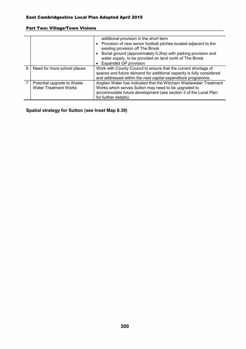
East Cambridgeshire Local Plan Adopted April 2015
Part Two: Village/Town Visions
300
additional provision in the short term Provision of new senior football pitches located adjacent to the
existing provision off The Brook Burial ground (approximately 0.2ha) with parking provision and
water supply, to be provided on land north of The Brook Expanded GP provision
6 Need for more school places Work with County Council to ensure that the current shortage of spaces and future demand for additional capacity is fully considered and addressed within the next capital expenditure programme.
7 Potential upgrade to Waste Water Treatment Works
Anglian Water has indicated that the Witcham Wastewater Treatment Works which serves Sutton may need to be upgraded to accommodate future development (see section 3 of the Local Plan for further details).
Spatial strategy for Sutton (see Inset Map 8.39)

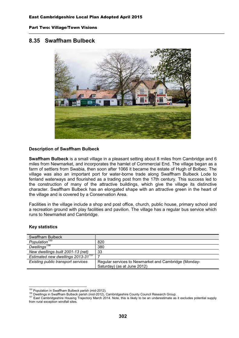
East Cambridgeshire Local Plan Adopted April 2015
Part Two: Village/Town Visions
302
8.35 Swaffham Bulbeck
Description of Swaffham Bulbeck
Swaffham Bulbeck is a small village in a pleasant setting about 8 miles from Cambridge and 6 miles from Newmarket, and incorporates the hamlet of Commercial End. The village began as a farm of settlers from Swabia, then soon after 1066 it became the estate of Hugh of Bolbec. The village was also an important port for water-borne trade along Swaffham Bulbeck Lode to fenland waterways and flourished as a trading post from the 17th century. This success led to the construction of many of the attractive buildings, which give the village its distinctive character. Swaffham Bulbeck has an elongated shape with an attractive green in the heart of the village and is covered by a Conservation Area.
Facilities in the village include a shop and post office, church, public house, primary school and a recreation ground with play facilities and pavilion. The village has a regular bus service which runs to Newmarket and Cambridge.
Key statistics
Swaffham Bulbeck Population155 820 Dwellings156 380 New dwellings built 2001-13 (net) 33 Estimated new dwellings 2013-31157 7 Existing public transport services Regular services to Newmarket and Cambridge (Monday-
Saturday) (as at June 2012)
155 Population in Swaffham Bulbeck parish (mid-2012). 156 Dwellings in Swaffham Bulbeck parish (mid-2012), Cambridgeshire County Council Research Group. 157 East Cambridgeshire Housing Trajectory March 2014. Note, this is likely to be an underestimate as it excludes potential supply from rural exception windfall sites.
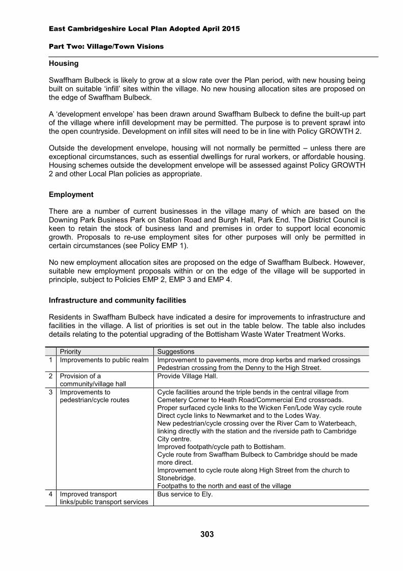
East Cambridgeshire Local Plan Adopted April 2015
Part Two: Village/Town Visions
303
Housing
Swaffham Bulbeck is likely to grow at a slow rate over the Plan period, with new housing being built on suitable ‘infill’ sites within the village. No new housing allocation sites are proposed on the edge of Swaffham Bulbeck.
A ‘development envelope’ has been drawn around Swaffham Bulbeck to define the built-up part of the village where infill development may be permitted. The purpose is to prevent sprawl into the open countryside. Development on infill sites will need to be in line with Policy GROWTH 2.
Outside the development envelope, housing will not normally be permitted – unless there are exceptional circumstances, such as essential dwellings for rural workers, or affordable housing. Housing schemes outside the development envelope will be assessed against Policy GROWTH 2 and other Local Plan policies as appropriate.
Employment
There are a number of current businesses in the village many of which are based on the Downing Park Business Park on Station Road and Burgh Hall, Park End. The District Council is keen to retain the stock of business land and premises in order to support local economic growth. Proposals to re-use employment sites for other purposes will only be permitted in certain circumstances (see Policy EMP 1).
No new employment allocation sites are proposed on the edge of Swaffham Bulbeck. However, suitable new employment proposals within or on the edge of the village will be supported in principle, subject to Policies EMP 2, EMP 3 and EMP 4.
Infrastructure and community facilities
Residents in Swaffham Bulbeck have indicated a desire for improvements to infrastructure and facilities in the village. A list of priorities is set out in the table below. The table also includes details relating to the potential upgrading of the Bottisham Waste Water Treatment Works.
Priority Suggestions 1 Improvements to public realm Improvement to pavements, more drop kerbs and marked crossings
Pedestrian crossing from the Denny to the High Street. 2 Provision of a
community/village hall Provide Village Hall.
3 Improvements to pedestrian/cycle routes
Cycle facilities around the triple bends in the central village from Cemetery Corner to Heath Road/Commercial End crossroads. Proper surfaced cycle links to the Wicken Fen/Lode Way cycle route Direct cycle links to Newmarket and to the Lodes Way. New pedestrian/cycle crossing over the River Cam to Waterbeach, linking directly with the station and the riverside path to Cambridge City centre. Improved footpath/cycle path to Bottisham. Cycle route from Swaffham Bulbeck to Cambridge should be made more direct. Improvement to cycle route along High Street from the church to Stonebridge. Footpaths to the north and east of the village
4
Improved transport links/public transport services
Bus service to Ely.
East Cambridgeshire Local Plan Adopted April 2015
Part Two: Village/Town Visions
304
- Potential upgrade to
Bottisham Waste Water Treatment Works
Anglian Water has indicated that the Bottisham Wastewater Treatment Works which serves Swaffham Bulbeck may need to be upgraded to accommodate future development (see section 3 for further details).
Many of the priorities identified are transport-related, involving improvements to pedestrian/cycle links and pavements, provision of pedestrian crossings in the village and improved public transport services. The second priority is for a community/village hall in Swaffham Bulbeck to provide premises to hold events and a meeting place for local groups. The District Council will work with the Parish Council and County Council to explore options and secure funding for community facilities and road and transport schemes in Swaffham Bulbeck. The District Council will also work in partnership to try to retain existing public transport levels, and encourage self-sufficient transport services, such as community transport.
The current community facilities in Swaffham Bulbeck (including the shop, pub, primary school, recreation ground, play area and church) contribute to the quality of people’s lives. The loss of community facilities will also be resisted under Policy COM 3. Proposals for new community development that benefits the village will be supported in principle, subject to Policy COM 4.
Spatial strategy for Swaffham Bulbeck (see Inset Map 8.40)
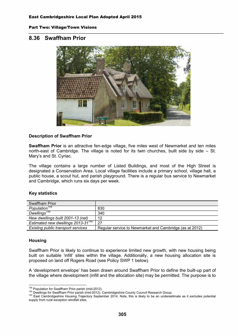
East Cambridgeshire Local Plan Adopted April 2015
Part Two: Village/Town Visions
305
8.36 Swaffham Prior
Description of Swaffham Prior
Swaffham Prior is an attractive fen-edge village, five miles west of Newmarket and ten miles north-east of Cambridge. The village is noted for its twin churches, built side by side – St. Mary’s and St. Cyriac.
The village contains a large number of Listed Buildings, and most of the High Street is designated a Conservation Area. Local village facilities include a primary school, village hall, a public house, a scout hut, and parish playground. There is a regular bus service to Newmarket and Cambridge, which runs six days per week.
Key statistics
Swaffham Prior Population158 830 Dwellings159 340 New dwellings built 2001-13 (net) 12 Estimated new dwellings 2013-31160 27 Existing public transport services Regular service to Newmarket and Cambridge (as at 2012)
Housing
Swaffham Prior is likely to continue to experience limited new growth, with new housing being built on suitable ‘infill’ sites within the village. Additionally, a new housing allocation site is proposed on land off Rogers Road (see Policy SWP 1 below).
A ‘development envelope’ has been drawn around Swaffham Prior to define the built-up part of the village where development (infill and the allocation site) may be permitted. The purpose is to
158 Population for Swaffham Prior parish (mid-2012). 159 Dwellings for Swaffham Prior parish (mid-2012), Cambridgeshire County Council Research Group. 160 East Cambridgeshire Housing Trajectory September 2014. Note, this is likely to be an underestimate as it excludes potential supply from rural exception windfall sites.
East Cambridgeshire Local Plan Adopted April 2015
Part Two: Village/Town Visions
306
prevent sprawl into the open countryside. Development on infill sites will need to be in line with Policy GROWTH 2. Development on the allocation site will need to be in line with Policy SWP 1.
Outside the development envelope, housing will not normally be permitted – unless there are exceptional circumstances, such as essential dwellings for rural workers, or affordable housing. Housing schemes outside the development envelope will be assessed against Policy GROWTH 2 and other Local Plan policies as appropriate.
Housing allocation - land off Rogers Road
The site is located on the eastern edge of the village, and is currently agricultural land. It is part of a large open field, and is highly visible from the B1102 and Rogers Road. Any development scheme will therefore need to be of high quality design, and have careful regard to site layout, building height and massing, and include a significant amount of landscaping. Landscaping and planting on the south and west boundaries of the site will be particularly important.
Policy SWP 1: Housing allocation, land off Rogers Road
1 hectare of land is allocated for residential development for up to 20 dwellings.
Development proposals will be expected to:
Provide an element of affordable housing (currently 40%) as required under Policy HOU 3, with priority being given to people in local housing need.
Provide a minimum of 0.1 hectares of public open space on-site. Provide a mix of dwelling types and sizes to reflect current evidence of need within Swaffham
Prior. Have particular regard to site layout, building height and soft landscaping, to minimise the
visual impact of the development from the main B1102 road. Provide landscaping along the boundary with the agricultural land to the west and south. Demonstrate there is adequate capacity in the sewage treatment works and the foul
sewerage network. Provide appropriate evidence of the archaeological potential and significance of the site prior
to the submission of a planning application; and Comply with the other policies of the Local Plan.
Employment
There are several small businesses within the village, including a number of building/construction firms, a communications business, and a counselling and advice service. The District Council is keen to retain the stock of business land and premises in order to support local economic growth. Proposals to re-use employment sites for other purposes will only be permitted in certain circumstances (see Policy EMP 1).
Additionally, a new employment allocation is proposed on land east of Goodwin Farm, Heath Road, for B1, B2 or B8 uses. Development on this site will need to be in line with Policy SWP 2. Other suitable new employment proposals within, and on the edge of the village, will be supported in principle, subject to Policies EMP 2, EMP 3 and EMP 4.
East Cambridgeshire Local Plan Adopted April 2015
Part Two: Village/Town Visions
307
Employment allocation - Goodwin Farm, Heath Road
The site lies to the south of the village and is currently agricultural land. Heath Road is a rural road, and is likely to require a number of improvements in order to provide safe and secure access for vehicles and pedestrians/cyclists. This includes a new footway along Heath Road, and any other necessary highway improvements as demonstrated by a Transport Assessment.
The site is part of a large open field, and therefore any scheme should be sensitively designed in order to minimise visual impact on the countryside. Landscaping on the boundaries will also be important, in order to soften the impact of built development.
Policy SWP 2: Employment allocation, land east of Goodwin Farm, Heath Road
1 hectare of land is allocated for employment development (B1, B2 and B8 uses) on land east of Goodwin Farm.
Development proposals will be expected to:
Provide street lighting and a kerbed footway on the north-east side of Heath Road, and any other necessary highway improvements as demonstrated through a Transport Assessment.
Have particular regard to the scale, height, design and massing of buildings, in order to minimise visual impact on the surrounding countryside.
Provide landscaping along the boundaries with adjoining agricultural land. Provide appropriate evidence of the archaelogical potential and significance of the site prior to
the submission of a planning application; and Comply with other policies of the Local Plan.
Infrastructure and community facilities
Residents in Swaffham Prior have identified a number of infrastructure and community improvements. A list of priorities is set out in the table below:
Priority Suggestions 1 Traffic calming/highway
improvements Improve access onto Mill Hill from Cage Hill and Heath Road. Provision of a pedestrian crossing on Mill Hill. Traffic calming on Mill Hill. Traffic calming at Lower End, between Manor house and the National Speed Limit. Work with District and County Council to ensure better maintenance of footpaths and improved road/footpath surfacing.
2 Need for more school places
Work with County Council to ensure that current shortages within the local area are fully considered and addressed within the next capital expenditure programme.
3 Improvements to the community/village hall
Create more flexible use of the village hall by developing the rear exit as a separate entrance. Provision of a stage and stage curtains. Creation of more storage facilities for use by community groups.
4 Improvements to pedestrian/cycle routes
Improved pedestrian access to the Fens and Lodes. The District Council and Parish Council to continue to seek opportunities to increase circular walking routes in and around the village by means of permissive paths.
East Cambridgeshire Local Plan Adopted April 2015
Part Two: Village/Town Visions
308
Continuation of cycle path from Lode/Swaffham Bulbeck through to Swaffham Prior. Cycle route linking Swaffham Prior to Clayhithe to link to the west side of the Cambridge route to Cambridge cycle bridge across A14.
5 Improvements to sports ground/open space
Identify specific improvements to be considered for future funding sources e.g. New play area equipment Creation of a village green or woods Provision of a tennis court or bowling green Pavilion and toilets for sports field in Station Road Youth club
6 Provision of a village shop -
The current community facilities in Swaffham Prior (including the pub, community hall, play area and churches) contribute to the quality of people’s lives. The District Council will work with the County Council and Parish Council to secure funding, including developer contributions, to improve facilities wherever possible. The loss of community facilities will also be resisted under Policy COM 3. Proposals for new community development that benefits the village will be supported in principle, subject to Policy COM 4.
Spatial strategy for Swaffham Prior (see Inset Map 8.41)
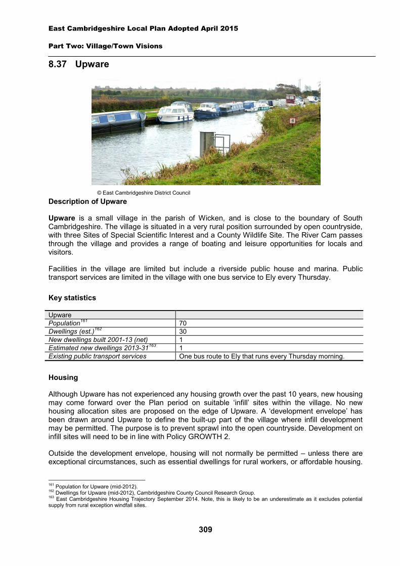
East Cambridgeshire Local Plan Adopted April 2015
Part Two: Village/Town Visions
309
8.37 Upware
Description of Upware
Upware is a small village in the parish of Wicken, and is close to the boundary of South Cambridgeshire. The village is situated in a very rural position surrounded by open countryside, with three Sites of Special Scientific Interest and a County Wildlife Site. The River Cam passes through the village and provides a range of boating and leisure opportunities for locals and visitors.
Facilities in the village are limited but include a riverside public house and marina. Public transport services are limited in the village with one bus service to Ely every Thursday.
Key statistics
Upware Population161 70 Dwellings (est.)162 30 New dwellings built 2001-13 (net) 1 Estimated new dwellings 2013-31163 1 Existing public transport services One bus route to Ely that runs every Thursday morning.
Housing
Although Upware has not experienced any housing growth over the past 10 years, new housing may come forward over the Plan period on suitable ‘infill’ sites within the village. No new housing allocation sites are proposed on the edge of Upware. A ‘development envelope’ has been drawn around Upware to define the built-up part of the village where infill development may be permitted. The purpose is to prevent sprawl into the open countryside. Development on infill sites will need to be in line with Policy GROWTH 2.
Outside the development envelope, housing will not normally be permitted – unless there are exceptional circumstances, such as essential dwellings for rural workers, or affordable housing.
161 Population for Upware (mid-2012). 162 Dwellings for Upware (mid-2012), Cambridgeshire County Council Research Group. 163 East Cambridgeshire Housing Trajectory September 2014. Note, this is likely to be an underestimate as it excludes potential supply from rural exception windfall sites.
© East Cambridgeshire District Council
East Cambridgeshire Local Plan Adopted April 2015
Part Two: Village/Town Visions
310
Housing schemes outside the development envelope will be assessed against Policy GROWTH 2 and other Local Plan policies as appropriate.
Employment
There are very few businesses following the closure of the Cambridgeshire Environment Education Service (CEES) field centre, and little employment land and premises (e.g. industrial or offices) in the village. The District Council is keen to retain employment land and premises in order to support local economic growth. Proposals to re-use any employment sites for other purposes will only be permitted in certain circumstances (see Policy EMP 1).
No new employment allocation sites are proposed on the edge of Upware. However, suitable new employment proposals within or on the edge of the village will be supported in principle, subject to Policies EMP 2, EMP 3 and EMP 4.
Infrastructure and community facilities
Residents in Upware have indicated a desire for improvements to infrastructure and facilities in the village. A list of priorities is set out in the table below.
Priority Suggestions 1 Improvements to broadband The Council is part of a county wide scheme for broadband
improvements. 2 Improvements to
pedestrian/cycle routes Cycle routes to Wicken and Waterbeach, including a cycle/footbridge over the river next to the public house.
3 Provision of allotment land Obtain some land by purchase or rental for use as allotments. 4 Provision of a children’s play
area Obtain land for use as a small children’s play area.
5 Provision of more school places
More school places at both Soham primary and secondary schools to be secured. Liaison with County Council.
The top priority for Upware is to improve broadband services in the village. The District Council is working with the County Council on a county-wide project to improve broadband connections in rural areas where there is no planned private sector investment. The second priority is to improve the pedestrian and cycle routes in the village. Residents expressed a need for a cycle route to Wicken, as well as a footbridge over the river next to the public house to give cycle access to Waterbeach.
Other priorities identified by residents are for the provision of allotments in the village. Land near the old school has been suggested as a possible location. Also, provision of a new small children's play area is desired. The District Council will work with the County Council and Parish Council to explore options and secure funding for improvements to community facilities and transport infrastructure within Upware.
The current community facilities in Upware are very limited and residents are very reliant on nearby villages such as Wicken. The loss of community facilities will be resisted under Policy COM 3. Proposals for new community development that benefits the village will be supported in principle, subject to Policy COM 4.
Spatial strategy for Upware (see Inset Map 8.42)
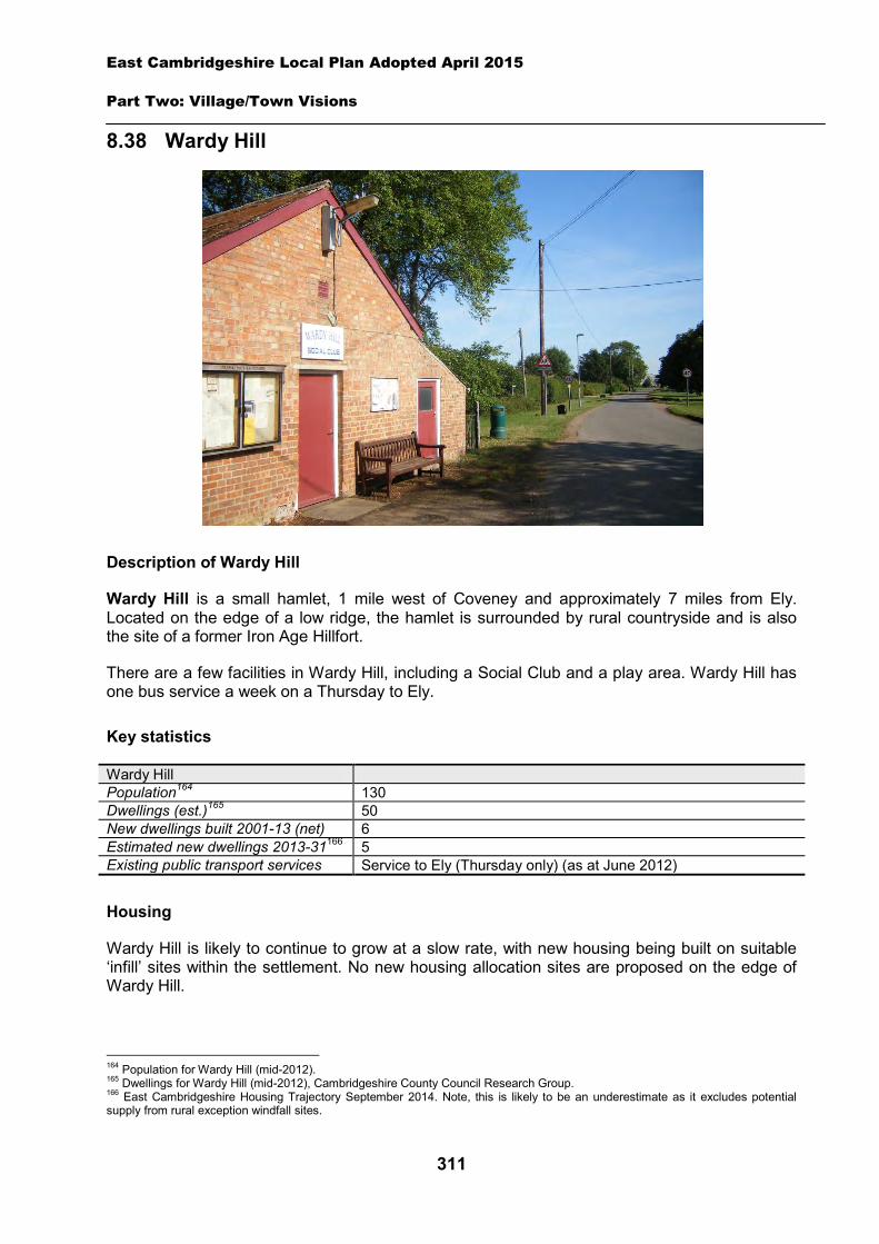
East Cambridgeshire Local Plan Adopted April 2015
Part Two: Village/Town Visions
311
8.38 Wardy Hill
Description of Wardy Hill
Wardy Hill is a small hamlet, 1 mile west of Coveney and approximately 7 miles from Ely. Located on the edge of a low ridge, the hamlet is surrounded by rural countryside and is also the site of a former Iron Age Hillfort.
There are a few facilities in Wardy Hill, including a Social Club and a play area. Wardy Hill has one bus service a week on a Thursday to Ely.
Key statistics
Wardy Hill Population164 130 Dwellings (est.)165 50 New dwellings built 2001-13 (net) 6 Estimated new dwellings 2013-31166 5 Existing public transport services Service to Ely (Thursday only) (as at June 2012)
Housing
Wardy Hill is likely to continue to grow at a slow rate, with new housing being built on suitable ‘infill’ sites within the settlement. No new housing allocation sites are proposed on the edge of Wardy Hill.
164 Population for Wardy Hill (mid-2012). 165 Dwellings for Wardy Hill (mid-2012), Cambridgeshire County Council Research Group. 166 East Cambridgeshire Housing Trajectory September 2014. Note, this is likely to be an underestimate as it excludes potential supply from rural exception windfall sites.
East Cambridgeshire Local Plan Adopted April 2015
Part Two: Village/Town Visions
312
A ‘development envelope’ has been drawn around Wardy Hill to define the built-up part of the settlement where infill development may be permitted. The purpose is to prevent sprawl into the open countryside. Development on infill sites will need to be in line with Policy GROWTH 2.
Outside the development envelope, housing will not normally be permitted – unless there are exceptional circumstances, such as essential dwellings for rural workers, or affordable housing. Housing schemes outside the development envelope will be assessed against Policy GROWTH 2 and other Local Plan policies as appropriate.
Employment
There are few businesses in Wardy Hill. The District Council is keen to retain the stock of business land and premises in order to support local economic growth. Proposals to re-use any employment sites for other purposes will only be permitted in certain circumstances (see Policy EMP 1).
No new employment allocation sites are proposed on the edge of Wardy Hill. However, suitable new employment proposals within or on the edge of Wardy Hill will be supported in principle, subject to Policies EMP 2, EMP 3 and EMP 4.
Infrastructure and community facilities
Residents have indicated a desire for improvements to infrastructure and facilities in Wardy Hill. A list of priorities is set out in the table below.
Priority Suggestions 1 Improvements to Broadband District Council is working in partnership with the County Council
to seek improvements to the Broadband service across the district.
2 A community/village hall
District Council and Parish Council to work in partnership to explore options for provision of a village hall.
3 Improvements to play area Provision of a slide.
The top priority is for a community/village hall in Wardy Hill. The second and third priorities involve improvements to the play area and open space. The District Council will work with the Parish Council and County Council to explore options and secure funding for community facilities in Wardy Hill and is already working with the County Council to bring improvements to the Broadband service across the district through the Connecting Cambridgeshire project.
The current community facilities in Wardy Hill (including the Social Club and play area) contribute to the quality of people’s lives. The loss of community facilities will be resisted under Policy COM 3. Proposals for new community development that benefits the village will be supported in principle, subject to Policy COM 4.
Spatial strategy for Wardy Hill (see Inset Map 8.43)
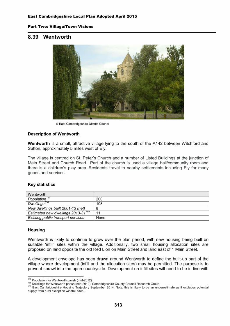
East Cambridgeshire Local Plan Adopted April 2015
Part Two: Village/Town Visions
313
8.39 Wentworth
Description of Wentworth
Wentworth is a small, attractive village lying to the south of the A142 between Witchford and Sutton, approximately 5 miles west of Ely.
The village is centred on St. Peter’s Church and a number of Listed Buildings at the junction of Main Street and Church Road. Part of the church is used a village hall/community room and there is a children’s play area. Residents travel to nearby settlements including Ely for many goods and services.
Key statistics
Wentworth Population167 200 Dwellings168 108 New dwellings built 2001-13 (net) 8 Estimated new dwellings 2013-31169 11 Existing public transport services None
Housing
Wentworth is likely to continue to grow over the plan period, with new housing being built on suitable ‘infill’ sites within the village. Additionally, two small housing allocation sites are proposed on land opposite the old Red Lion on Main Street and land east of 1 Main Street.
A development envelope has been drawn around Wentworth to define the built-up part of the village where development (infill and the allocation sites) may be permitted. The purpose is to prevent sprawl into the open countryside. Development on infill sites will need to be in line with
167 Population for Wentworth parish (mid-2012). 168 Dwellings for Wentworth parish (mid-2012), Cambridgeshire County Council Research Group. 169 East Cambridgeshire Housing Trajectory September 2014. Note, this is likely to be an underestimate as it excludes potential supply from rural exception windfall sites.
© East Cambridgeshire District Council
East Cambridgeshire Local Plan Adopted April 2015
Part Two: Village/Town Visions
314
Policy GROWTH 2. Development on the allocation sites will need to be in line with Policies WEN 1 and WEN 2.
Outside the development envelope, housing will not normally be permitted – unless there are exceptional circumstances, such as essential dwellings for rural workers, or affordable housing. Housing schemes outside the development envelope will be assessed against Policy GROWTH 2 and other Local Plan policies as appropriate.
Policy WEN 1: Housing allocation, land opposite the old Red Lion, Main Street
Approximately 0.15 hectares of land is allocated for residential development for up to 2 dwellings.
Development proposals will be expected to:
Provide for frontage development only, to reflect the existing character of this part of Main Street.
Have particular regard to the protected trees which are present on the site through the submission of a full trees assessment.
Have particular regard to the scale, height, design and massing of buildings, and landscaping, in order to provide a high quality scheme which enhances the character of the village and minimises amenity impact on neighbouring properties.
Provide any necessary highway improvements and/or traffic calming measures to Main Street as required by the Highways Authority; and
Comply with the other policies of the Local Plan.
Policy WEN 2: Housing allocation, land east of 1 Main Street
Approximately 0.12 hectares of land is allocated for residential development for up to 2 dwellings.
Development proposals will be expected to:
Provide for frontage development only, to reflect the existing character of this part of Main Street.
Have particular regard to the protected trees which are present on the site through the submission of a full trees assessment.
Have particular regard to the scale, height, design and massing of buildings, and landscaping, in order to provide a high quality scheme which enhances the character of the village and minimises amenity impact on neighbouring properties.
Provide any necessary highway improvements and/or traffic calming measures to Main Street as required by the Highways Authority; and
Comply with the other policies of the Local Plan.
East Cambridgeshire Local Plan Adopted April 2015
Part Two: Village/Town Visions
315
Employment
The village has no business premises, although a handful of small businesses are run from residential properties including JFB interiors and Desiderata Bed and Breakfast.
No new employment allocation sites are proposed on the edge of Wentworth. However, suitable new employment proposals on the edge of the village will be supported in principle subject to Policies EMP 2, EMP 3 and EMP 4.
Infrastructure and community facilities
Residents in Wentworth have identified a number of infrastructure and community improvements. A list of priorities is set out in the table below. The table also includes details relating to the potential upgrading of the Witcham Waste Water Treatment Works.
Priority Suggestions
1 Improvements to pedestrian/cycle routes
Pedestrian/cycle routes to link village with surrounding settlements including Sutton and Witcham Toll.
2 Improvements to play area More equipment for all ages of children in the new play area, e.g. swings.
3 Improvements to the Village Hall at St Peter’s Church
Installation of a new heating system.
4 More school places Need for adequate school places to be provided in Witchford for Wentworth children.
- Potential upgrade to Waste Water Treatment Works
Anglian Water has indicated that the Witcham Wastewater Treatment Works which serves Wentworth may need to be upgraded to accommodate future development (see section 3 of the Local Plan for further details).
The current community facilities in Wentworth (including the church/community hall and play area) contribute to the quality of people’s lives. The District Council will work with the County Council and Parish Council to secure funding, including developer contributions, to improve facilities wherever possible. The loss of community facilities will also be resisted under Policy COM 3. Proposals for new community development that benefit the village will be supported in principle, subject to Policy COM 4.
Spatial strategy for Wentworth (see Inset Map 8.44)
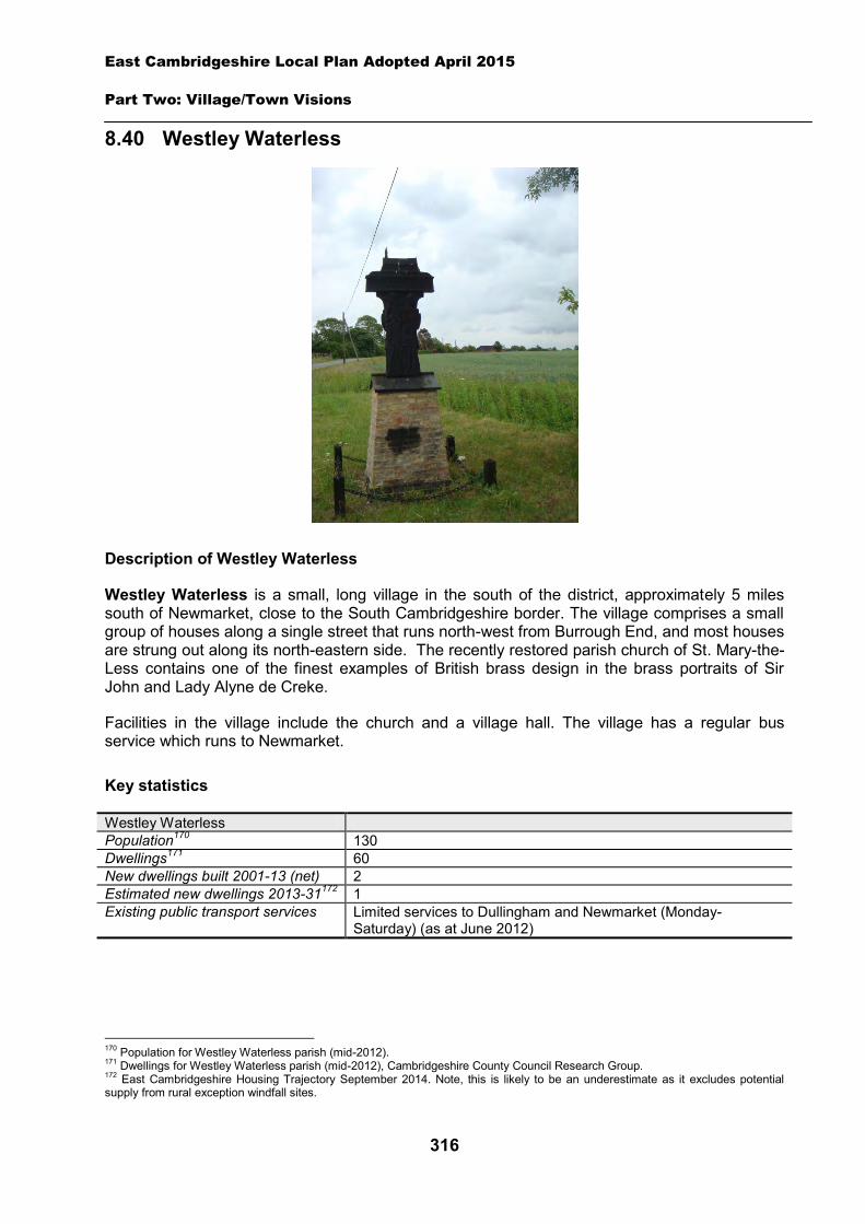
East Cambridgeshire Local Plan Adopted April 2015
Part Two: Village/Town Visions
316
8.40 Westley Waterless
Description of Westley Waterless
Westley Waterless is a small, long village in the south of the district, approximately 5 miles south of Newmarket, close to the South Cambridgeshire border. The village comprises a small group of houses along a single street that runs north-west from Burrough End, and most houses are strung out along its north-eastern side. The recently restored parish church of St. Mary-the-Less contains one of the finest examples of British brass design in the brass portraits of Sir John and Lady Alyne de Creke.
Facilities in the village include the church and a village hall. The village has a regular bus service which runs to Newmarket.
Key statistics
Westley Waterless Population170 130 Dwellings171 60 New dwellings built 2001-13 (net) 2 Estimated new dwellings 2013-31172 1 Existing public transport services Limited services to Dullingham and Newmarket (Monday-
Saturday) (as at June 2012)
170 Population for Westley Waterless parish (mid-2012). 171 Dwellings for Westley Waterless parish (mid-2012), Cambridgeshire County Council Research Group. 172 East Cambridgeshire Housing Trajectory September 2014. Note, this is likely to be an underestimate as it excludes potential supply from rural exception windfall sites.
East Cambridgeshire Local Plan Adopted April 2015
Part Two: Village/Town Visions
317
Housing
Westley Waterless has experienced very low growth over the last ten years. Some new housing is likely to come forward on suitable ‘infill’ sites within the village over the Plan period. No new housing allocation sites are proposed on the edge of Westley Waterless.
A ‘development envelope’ has been drawn around Westley Waterless to define the built-up part of the village where infill development may be permitted. The purpose is to prevent sprawl into the open countryside. Development on infill sites will need to be sensitively designed to reflect the open and attractive character of the village and be in line with Policy GROWTH 2.
Outside the development envelope, housing will not normally be permitted – unless there are exceptional circumstances, such as essential dwellings for rural workers, or affordable housing. Housing schemes outside the development envelope will be assessed against Policy GROWTH 2 and other Local Plan policies as appropriate.
Employment
There are few businesses in the village. The District Council is keen to retain the stock of business land and premises in order to support local economic growth. Proposals to re-use any employment sites for other purposes will only be permitted in certain circumstances (see Policy EMP 1).
No new employment allocation sites are proposed on the edge of Westley Waterless. However, suitable new employment proposals within or on the edge of the village will be supported in principle, subject to Policies EMP 2, EMP 3 and EMP 4.
Infrastructure and community facilities
Westley Waterless Parish Council has indicated a desire for improvements to infrastructure and facilities in the village. The key priority is set out in the table below:
Priority Suggestions 1 A road improvement scheme Traffic calming at entrances to village
The District Council will work with the Parish Council and County Council to explore options and secure funding for traffic calming features in Westley Waterless.
The current community facilities in Westley Waterless (including the church and the village hall) contribute to the quality of people’s lives. The loss of community facilities will be resisted under Policy COM 3. Proposals for new community development that benefits the village will be supported in principle, subject to Policy COM 4.
Spatial strategy for Westley Waterless (see Inset Map 8.45)
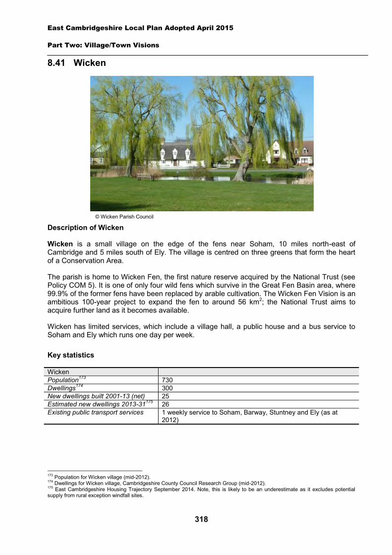
East Cambridgeshire Local Plan Adopted April 2015
Part Two: Village/Town Visions
318
8.41 Wicken
Description of Wicken
Wicken is a small village on the edge of the fens near Soham, 10 miles north-east of Cambridge and 5 miles south of Ely. The village is centred on three greens that form the heart of a Conservation Area.
The parish is home to Wicken Fen, the first nature reserve acquired by the National Trust (see Policy COM 5). It is one of only four wild fens which survive in the Great Fen Basin area, where 99.9% of the former fens have been replaced by arable cultivation. The Wicken Fen Vision is an ambitious 100-year project to expand the fen to around 56 km2; the National Trust aims to acquire further land as it becomes available.
Wicken has limited services, which include a village hall, a public house and a bus service to Soham and Ely which runs one day per week.
Key statistics
Wicken Population173 730 Dwellings174 300 New dwellings built 2001-13 (net) 25 Estimated new dwellings 2013-31175 26 Existing public transport services 1 weekly service to Soham, Barway, Stuntney and Ely (as at
2012)
173 Population for Wicken village (mid-2012). 174 Dwellings for Wicken village, Cambridgeshire County Council Research Group (mid-2012). 175 East Cambridgeshire Housing Trajectory September 2014. Note, this is likely to be an underestimate as it excludes potential supply from rural exception windfall sites.
© Wicken Parish Council
East Cambridgeshire Local Plan Adopted April 2015
Part Two: Village/Town Visions
319
Housing
Wicken is likely to continue to grow at a slow rate, with new housing being built on suitable ‘infill’ sites within the village. Additionally, two new housing allocation sites are proposed: land north-west of The Crescent and land south of Church Road. Details of the allocation sites are set out below.
A ‘development envelope’ has been drawn around Wicken to define the built-up part of the village where development (infill and the allocation sites) may be permitted. The purpose is to prevent sprawl into the surrounding countryside. Development on infill sites will need to be in line with Policy GROWTH 2. Development on the allocation sites will need to be in line with Policies WIC 1 and WIC 2.
Outside the development envelope, housing will not normally be permitted – unless there are exceptional circumstances, such as essential dwellings for rural workers, or affordable housing. Housing schemes outside the development envelope will be assessed against Policy GROWTH 2 and other Local Plan policies as appropriate.
Policy WIC 1: Housing allocation, land north-west of The Crescent
Approximately 0.2 hectares of land is allocated for residential development on land to the north-west of The Crescent for up to 5 dwellings.
Development proposals will be expected to:
Provide an element of affordable housing (currently 30%) as required under Policy HOU 3, with priority given to people in local housing need.
Provide a mix of dwelling types and sizes to reflect current evidence of need within Wicken. Have particular regard to the layout, scale, height, design and massing of buildings, and
landscaping, in order to minimise impact on the open countryside; and Comply with the other policies of the Local Plan.
Policy WIC 2: Housing allocation, land south of Church Road
Approximately 0.2 hectares of land is allocated for residential development on land to the south of Church Road for up to 5 dwellings.
Development proposals will be expected to:
Be frontage development only, to reflect the existing character along Church Road. Provide an element of affordable housing (currently 30%) as required under Policy HOU 3,
with priority given to people in local housing need. Provide a mix of dwelling types and sizes to reflect current evidence of need within Wicken. Have particular regard to the layout, scale, height, design and massing of buildings, and
landscaping, in order to minimise impact on the open countryside. Provide appropriate evidence of the archaeological potential and significance of the site prior
to the submission of a planning application; and
East Cambridgeshire Local Plan Adopted April 2015
Part Two: Village/Town Visions
320
Comply with the other policies of the Local Plan.
Employment
The District Council is keen to retain the stock of business land and premises in order to support local economic growth. Proposals to re-use employment sites for other purposes will only be permitted in certain circumstances (see Policy EMP 1).
No new employment allocation sites are proposed on the edge of Wicken. However, suitable new employment proposals on the edge of the village, will be supported in principle, subject to Policies EMP 2, EMP 3 and EMP 4.
Infrastructure and community facilities
Residents in Wicken have identified a number of infrastructure and community improvements. A list of priorities is set out in the table below:
Priority Suggestions
1 Improvements to local broadband service
Options for the provision of access to either superfast or basic broadband will be considered by the Connecting Cambridgeshire project http://www.connectingcambridgeshire.co.uk/
2 Improvements to pedestrian / cycle routes
Cycle route between Wicken and Soham via Downfields / Drury Lane.
3 Improvements to play areas
Identify specific improvements to be considered for future funding sources e.g. extension of existing play areas. Play equipment suitable for older children at recreation ground such as BMX track, and play equipment suitable for very young children.
4 Improvements to the community / Village Hall
Identify specific improvements to be considered for future funding sources e.g. wall / roof insulation, refurbishment of kitchen and bar areas, and refurbishment of original roof towers.
5 Improvements to sports pitches / open space
Identify specific improvements to be considered for future funding sources e.g. cricket pitch on recreation ground, and improved drainage.
6 Reducing speeding through the village
Parish Council to work with District and County Council and Cambridgeshire Police in exploring options to address speeding issues.
7 Improvements to public transport services
The District Council’s aspiration is to see existing service levels retained, and to encourage and support self-sufficient demand responsive transport services, including community transport. The District Council will work with the County Council to secure funding, including developer contributions, to develop transport services and infrastructure in the most effective way.
The current community facilities in Wicken (including the village hall and pub) contribute to the quality of people’s lives. The District Council will work with the County Council and Parish Council to secure funding, including developer contributions, to improve facilities wherever possible. The loss of community facilities will be resisted under Policy COM 3. Proposals for new community development that benefits the village will be supported in principle, subject to Policy COM 4.
Spatial strategy for Wicken (see Inset Map 8.46)
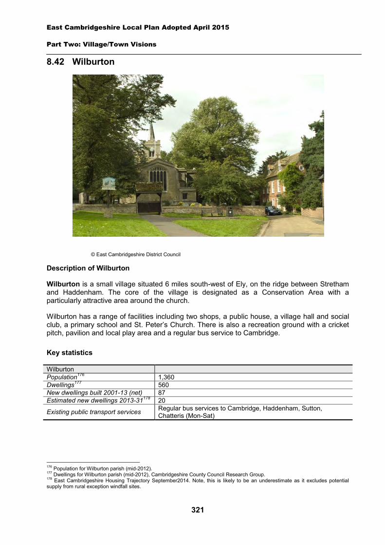
East Cambridgeshire Local Plan Adopted April 2015
Part Two: Village/Town Visions
321
8.42 Wilburton
Description of Wilburton
Wilburton is a small village situated 6 miles south-west of Ely, on the ridge between Stretham and Haddenham. The core of the village is designated as a Conservation Area with a particularly attractive area around the church.
Wilburton has a range of facilities including two shops, a public house, a village hall and social club, a primary school and St. Peter’s Church. There is also a recreation ground with a cricket pitch, pavilion and local play area and a regular bus service to Cambridge.
Key statistics
Wilburton Population176 1,360 Dwellings177 560 New dwellings built 2001-13 (net) 87 Estimated new dwellings 2013-31178 20
Existing public transport services Regular bus services to Cambridge, Haddenham, Sutton, Chatteris (Mon-Sat)
176 Population for Wilburton parish (mid-2012). 177 Dwellings for Wilburton parish (mid-2012), Cambridgeshire County Council Research Group. 178 East Cambridgeshire Housing Trajectory September2014. Note, this is likely to be an underestimate as it excludes potential supply from rural exception windfall sites.
© East Cambridgeshire District Council
East Cambridgeshire Local Plan Adopted April 2015
Part Two: Village/Town Visions
322
Housing
Wilburton is likely to continue to grow at a modest rate, with new housing being built on suitable ‘infill’ sites within the village. No new housing allocation sites are proposed on the edge of Wilburton.
A ‘development envelope’ has been drawn around Wilburton to define the built-up part of the village where infill development may be permitted. The purpose is to prevent sprawl into the open countryside. Development on infill sites will need to be in line with Policy GROWTH 2.
Outside the development envelope, housing will not normally be permitted – unless there are exceptional circumstances, such as essential dwellings for rural workers, or affordable housing. A Community Land Trust has been established for Wilburton and Stretham, and the group has aspirations to bring forward an exceptions scheme on the edge of Wilburton to deliver affordable housing and other community benefits. This and other housing schemes outside the development envelope will be assessed against Policies GROWTH 2, GROWTH 6 and other Local Plan policies as appropriate.
Employment
There are a range of businesses located in the village, including Wilburton Garage, Twentypence Garden Centre and a number of small employers such as building contractors, business and PR consultants and computer software developers. The District Council is keen to retain the stock of business land and premises in order to support local economic growth. Proposals to reuse employment sites for other purposes will only be permitted in certain circumstances (see Policy EMP 1).
No new employment allocation sites are proposed on the edge of Wilburton. However, suitable new employment proposals within or on the edge of the village will be supported in principle, subject to policies EMP 2, EMP 3 and EMP 4.
Infrastructure and community facilities
Residents in Wilburton have identified a number of infrastructure and community improvements. A list of priorities is set out in the table below. The table also includes details relating to the potential upgrading of the Witchford Waste Water Treatment Works.
Priority Suggestions
1 Improvements to sports grounds/open space New pavilion; better changing facilities; off road parking.
2 Improvements to pedestrian/cycle routes
Pedestrian/cycle routes to link village with Stretham, Cottenham, Ely and Cambridge.
3 Improvements to play areas Updated play equipment; new equipment for toddlers.
4 Improvements to the community/Village Hall Parking provision.
- Potential upgrade to Waste Water Treatment Works
Anglian Water has indicated that the Wilburton Wastewater Treatment Works may need to be upgraded to accommodate future development (see section 3 of the Local Plan for further details).
The current community facilities in Wilburton (including the village hall, social club and recreation ground) contribute to the quality of people’s lives. The District Council will work with the County Council and Parish Council to secure funding, including developer contributions, to improve facilities wherever possible. The loss of existing community facilities will also be

East Cambridgeshire Local Plan Adopted April 2015
Part Two: Village/Town Visions
323
resisted under Policy COM 3. Proposals for new community development that benefit the village will be supported in principle, subject to Policy COM 4.
Spatial strategy for Wilburton (see Inset Map 8.47)
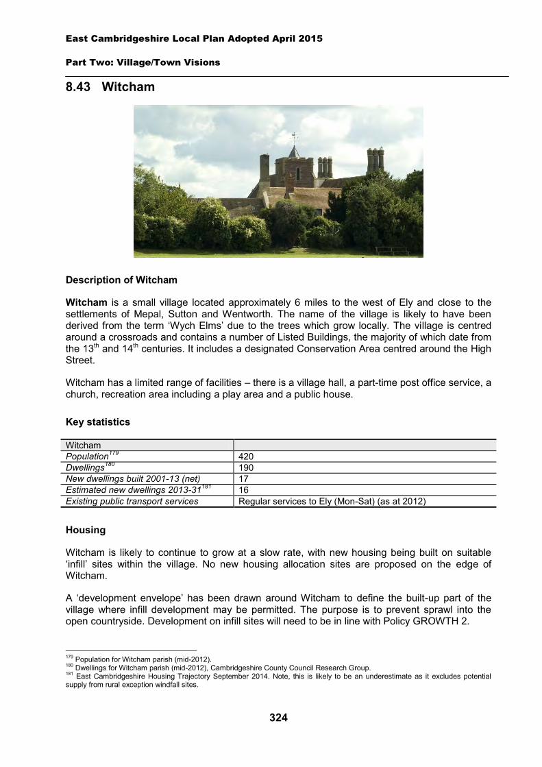
East Cambridgeshire Local Plan Adopted April 2015
Part Two: Village/Town Visions
324
8.43 Witcham
Description of Witcham
Witcham is a small village located approximately 6 miles to the west of Ely and close to the settlements of Mepal, Sutton and Wentworth. The name of the village is likely to have been derived from the term ‘Wych Elms’ due to the trees which grow locally. The village is centred around a crossroads and contains a number of Listed Buildings, the majority of which date from the 13th and 14th centuries. It includes a designated Conservation Area centred around the High Street.
Witcham has a limited range of facilities – there is a village hall, a part-time post office service, a church, recreation area including a play area and a public house.
Key statistics
Witcham Population179 420 Dwellings180 190 New dwellings built 2001-13 (net) 17 Estimated new dwellings 2013-31181 16 Existing public transport services Regular services to Ely (Mon-Sat) (as at 2012)
Housing
Witcham is likely to continue to grow at a slow rate, with new housing being built on suitable ‘infill’ sites within the village. No new housing allocation sites are proposed on the edge of Witcham.
A ‘development envelope’ has been drawn around Witcham to define the built-up part of the village where infill development may be permitted. The purpose is to prevent sprawl into the open countryside. Development on infill sites will need to be in line with Policy GROWTH 2.
179 Population for Witcham parish (mid-2012). 180 Dwellings for Witcham parish (mid-2012), Cambridgeshire County Council Research Group. 181 East Cambridgeshire Housing Trajectory September 2014. Note, this is likely to be an underestimate as it excludes potential supply from rural exception windfall sites.
East Cambridgeshire Local Plan Adopted April 2015
Part Two: Village/Town Visions
325
Outside the development envelope, housing will not normally be permitted – unless there are exceptional circumstances, such as essential dwellings for rural workers, or affordable housing. Housing schemes outside the development envelope will be assessed against Policy GROWTH 2 and other Local Plan policies as appropriate. However, it should be noted that Witcham Parish Council does not support development coming forward outside the development envelope (as at May 2013).
Employment
There are several businesses in Witcham including, a window and conservatory installer, turf supplier and a Bridal Design business. The District Council is keen to retain the stock of business land and premises in order to support local economic growth. Proposals to re-use employment sites for other purposes will only be permitted in certain circumstances (see Policy EMP 1).
No new employment allocation sites are proposed on the edge of Witcham. However, suitable new employment proposals within or on the edge of the village will be supported in principle, subject to Policies EMP 2, EMP 3 and EMP 4.
Infrastructure and community facilities
Residents in Witcham have indicated a desire for improvements to the village hall, pedestrian/cycle routes and the existing play area as their top 3 priorities. A full list of priorities is set out in the table below. The table also includes details relating to the potential upgrading of the Witcham Waste Water Treatment Works.
Priority Suggestions 1 Improvements to the
village/community hall Further development and refurbishment including sport changing facilities.
2 Improvements to pedestrian/cycle routes
Parish Council supporting A142 cycleway working party in completing the link between Witcham Toll and Wentworth to complete the cycleway between Sutton and Ely.
3 Improvements to the existing play area
Refurbishment and maintenance of existing play area necessary for the future.
4 Improvements to public transport/community transport
Cambridgeshire County review and consultation on only bus service for village following removal of subsidy.
5 New play area 6
Improvements to sports ground/open space
- Potential upgrade to Waste Water Treatment Works
Anglian Water has indicated that the Witcham Wastewater Treatment Works may need to be upgraded to accommodate future development (see section 3 of the Local Plan for further details).
The current community facilities in Witcham (including the village hall and recreation area) contribute to the quality of people’s lives. The District Council will work with the County Council and Parish Council to secure funding, including developer contributions, to improve facilities wherever possible. The loss of community facilities will also be resisted under Policy COM 3. Proposals for new community development that benefits the village will be supported in principle, subject to Policy COM 4.

East Cambridgeshire Local Plan Adopted April 2015
Part Two: Village/Town Visions
326
The District Council will also continue to work in partnership with Cambridgeshire County Council to try to ensure that the community retains its current levels of accessibility, and encourage self-sufficient transport services such as community transport.
Spatial strategy for Witcham (see Inset Map 8.48)
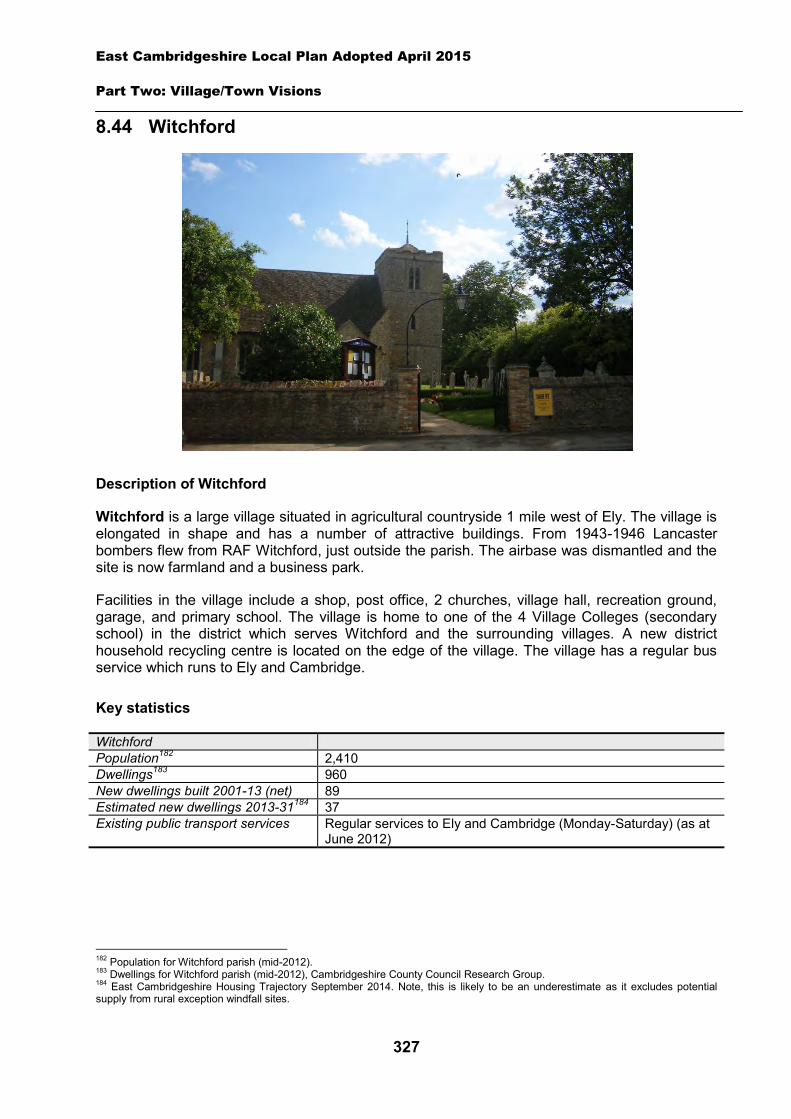
East Cambridgeshire Local Plan Adopted April 2015
Part Two: Village/Town Visions
327
8.44 Witchford
Description of Witchford
Witchford is a large village situated in agricultural countryside 1 mile west of Ely. The village is elongated in shape and has a number of attractive buildings. From 1943-1946 Lancaster bombers flew from RAF Witchford, just outside the parish. The airbase was dismantled and the site is now farmland and a business park.
Facilities in the village include a shop, post office, 2 churches, village hall, recreation ground, garage, and primary school. The village is home to one of the 4 Village Colleges (secondary school) in the district which serves Witchford and the surrounding villages. A new district household recycling centre is located on the edge of the village. The village has a regular bus service which runs to Ely and Cambridge.
Key statistics
Witchford Population182 2,410 Dwellings183 960 New dwellings built 2001-13 (net) 89 Estimated new dwellings 2013-31184 37 Existing public transport services Regular services to Ely and Cambridge (Monday-Saturday) (as at
June 2012)
182 Population for Witchford parish (mid-2012). 183 Dwellings for Witchford parish (mid-2012), Cambridgeshire County Council Research Group. 184 East Cambridgeshire Housing Trajectory September 2014. Note, this is likely to be an underestimate as it excludes potential supply from rural exception windfall sites.
East Cambridgeshire Local Plan Adopted April 2015
Part Two: Village/Town Visions
328
Housing
Witchford is likely to continue to grow at a slow rate, with new housing being built on suitable ‘infill’ sites within the village. No new housing allocation sites are proposed on the edge of Witchford.
A ‘development envelope’ has been drawn around Witchford to define the built-up part of the village where infill development may be permitted. The purpose is to prevent sprawl into the open countryside. Development on infill sites will need to be in line with Policy GROWTH 2.
Outside the development envelope, housing will not normally be permitted – unless there are exceptional circumstances, such as essential dwellings for rural workers, or affordable housing. Witchford Parish Council is keen to see more affordable housing in the village and has indicated positive support for exception schemes outside the development envelope for affordable housing to meet local needs. Housing schemes outside the development envelope will be assessed against Policy GROWTH 2 and other Local Plan policies as appropriate.
Employment
There are a number of businesses in the village and two business parks in Witchford parish – Greenham Park and Sedgeway Business Park. The District Council is keen to retain the stock of business land and premises in order to support local economic growth. Proposals to re-use employment sites for other purposes will only be permitted in certain circumstances (see Policy EMP 1).
No new employment allocation sites are proposed on the edge of Witchford. However, suitable new employment proposals within or on the edge of the village will be supported in principle, subject to Policies EMP 2, EMP 3 and EMP 4.
Infrastructure and community facilities
Residents in Witchford have indicated a desire for improvements to infrastructure and facilities in the village. A list of priorities is set out in the table below. The table also includes details relating to the potential upgrading of the Witchford Waste Water Treatment Works.
Priority Suggestions 1 Improvements to
pedestrian/cycle routes Foot/cycle bridge to cross A10 from BP garage into Ely. Pedestrian path on Grunty Fen road from Main Street. Increase width of footpath/cycle paths along Ely Road/Main street and Sutton Road.
2 Improvements to sports grounds/open space
New netball courts at Bedwell Hey Lane recreation ground. Improvements to Victoria Green Park. Improvements to Common Road play area.
3 Improvements to the community/village hall
Refurbishment of Village Hall.
4 More school places Liaison with County Council Education department. - Potential upgrade to Waste
Water Treatment Works Anglian Water has indicated that the Witchford Wastewater Treatment Works may need to be upgraded to accommodate future development (see section 3 of the Local Plan for further details).
The top priority is for improvements to pedestrian/cycle routes, particularly to Ely. Other priorities include improvements to sports grounds/open spaces and to the Village Hall, and more school places in Witchford. The District Council will work with the Parish Council and
East Cambridgeshire Local Plan Adopted April 2015
Part Two: Village/Town Visions
329
County Council to explore options and secure funding for improvements to open spaces and community facilities in Witchford. The District Council will work with the County Council to explore the issue of extra school places and also work in partnership to try to retain existing public transport levels, and encourage self-sufficient transport services, such as community transport.
The current community facilities in Witchford (including the shop, post office, churches, village hall, and recreation ground) contribute to the quality of people’s lives. The loss of community facilities will be resisted under Policy COM 3. Proposals for new community development that benefits the village will be supported in principle, subject to Policy COM 4.
Spatial strategy for Witchford (see Inset Map 8.49)
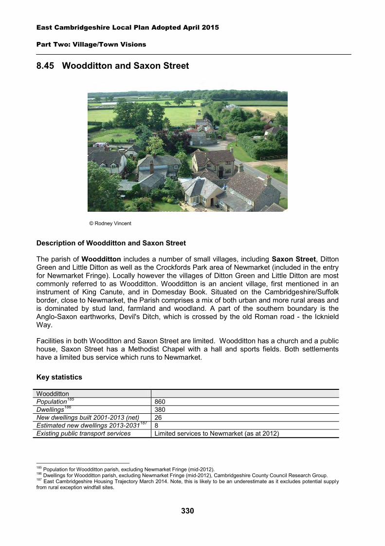
East Cambridgeshire Local Plan Adopted April 2015
Part Two: Village/Town Visions
330
8.45 Woodditton and Saxon Street
Description of Woodditton and Saxon Street
The parish of Woodditton includes a number of small villages, including Saxon Street, Ditton Green and Little Ditton as well as the Crockfords Park area of Newmarket (included in the entry for Newmarket Fringe). Locally however the villages of Ditton Green and Little Ditton are most commonly referred to as Woodditton. Woodditton is an ancient village, first mentioned in an instrument of King Canute, and in Domesday Book. Situated on the Cambridgeshire/Suffolk border, close to Newmarket, the Parish comprises a mix of both urban and more rural areas and is dominated by stud land, farmland and woodland. A part of the southern boundary is the Anglo-Saxon earthworks, Devil's Ditch, which is crossed by the old Roman road - the Icknield Way.
Facilities in both Wooditton and Saxon Street are limited. Woodditton has a church and a public house, Saxon Street has a Methodist Chapel with a hall and sports fields. Both settlements have a limited bus service which runs to Newmarket.
Key statistics
Woodditton Population185 860 Dwellings186 380 New dwellings built 2001-2013 (net) 26 Estimated new dwellings 2013-2031187 8 Existing public transport services Limited services to Newmarket (as at 2012)
185 Population for Woodditton parish, excluding Newmarket Fringe (mid-2012). 186 Dwellings for Woodditton parish, excluding Newmarket Fringe (mid-2012), Cambridgeshire County Council Research Group. 187 East Cambridgeshire Housing Trajectory March 2014. Note, this is likely to be an underestimate as it excludes potential supply from rural exception windfall sites.
© Rodney Vincent
East Cambridgeshire Local Plan Adopted April 2015
Part Two: Village/Town Visions
331
Housing
Woodditton and Saxon Street are likely to continue to grow at a slow rate, with new housing being built on suitable ‘infill’ sites within the settlements. No new housing allocation sites are proposed on the edge of Woodditton or Saxon Street.
A ‘development envelope’ has been drawn around both Woodditton and Saxon Street to define the built-up part of the settlements where infill development may be permitted. The purpose is to prevent sprawl into the open countryside. Development on infill sites will need to be in line with Policy GROWTH 2.
Outside the development envelope, housing will not normally be permitted – unless there are exceptional circumstances, such as essential dwellings for rural workers, or affordable housing. Housing schemes outside the development envelope will be assessed against Policy GROWTH 2 and other Local Plan policies as appropriate.
Employment
There are few businesses in Woodditton and Saxon Street. The District Council is keen to retain the stock of business land and premises in order to support local economic growth. Proposals to re-use employment sites for other purposes will only be permitted in certain circumstances (see Policy EMP 1).
No new employment allocation sites are proposed on the edge of Woodditton or Saxon Street. However, suitable new employment proposals within or on the edge of the village will be supported in principle, subject to Policies EMP 2, EMP 3 and EMP 4.
Infrastructure and community facilities
Residents of both Woodditton and Saxon Street have indicated a desire for improvements to infrastructure and facilities. A list of priorities for each settlement is set out in the tables below.
Woodditton
Priority Suggestions 1 Traffic calming/highway
improvements More speed checks. Warning chevrons at Three Ponds Corner, Vicarage Lane.
2 Improvements to pedestrian/cycle routes
Extension of cycle paths to compensate for reduction in bus services.
Saxon Street
Priority Suggestions 1 Traffic calming/highway improvements
Gateway treatment for both ends of The Street Improved footway at the bends at the narrow lower end of The Street. More speed checks on School Road and The Street
2 Improvements to pedestrian/cycle routes
Extensions to cycle paths.
3 Improvements to play area
Continued development of the large sports field in School Road including provision of sports pitches and better facilities.
East Cambridgeshire Local Plan Adopted April 2015
Part Two: Village/Town Visions
332
The top two priorities for both areas are traffic calming/highway improvements and improvements to pedestrian/cycle links. Other priorities include improvements to play areas, sports grounds and open space. The District Council will work with the Parish Council and County Council to explore options and secure funding for community facilities and road and transport schemes in both settlements. The District Council will also work in partnership to try to retain existing public transport levels, and encourage self-sufficient transport services, such as community transport.
The current community facilities in Woodditton and Saxon Street (including the church, chapel and public house) contribute to the quality of people’s lives. The loss of community facilities will also be resisted under Policy COM 3. Proposals for new community development that benefits the village will be supported in principle, subject to Policy COM 4.
Spatial strategy for Wooddittton (see Inset Map 8.50)
Spatial strategy for Saxon Street (see Inset Map 8.51)
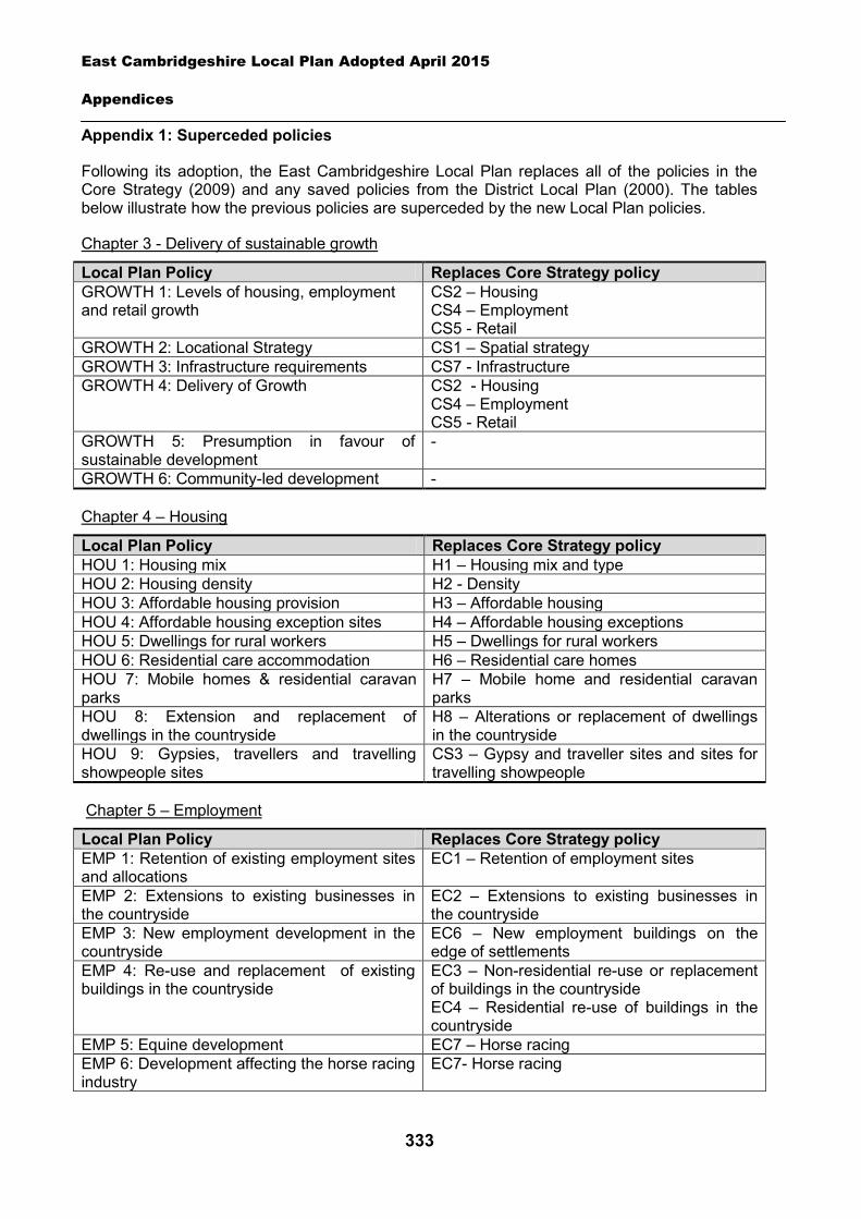
East Cambridgeshire Local Plan Adopted April 2015
Appendices
333
Appendix 1: Superceded policies
Following its adoption, the East Cambridgeshire Local Plan replaces all of the policies in the Core Strategy (2009) and any saved policies from the District Local Plan (2000). The tables below illustrate how the previous policies are superceded by the new Local Plan policies.
Chapter 3 - Delivery of sustainable growth
Local Plan Policy Replaces Core Strategy policy GROWTH 1: Levels of housing, employment and retail growth
CS2 – Housing CS4 – Employment CS5 - Retail
GROWTH 2: Locational Strategy CS1 – Spatial strategy GROWTH 3: Infrastructure requirements CS7 - Infrastructure GROWTH 4: Delivery of Growth CS2 - Housing
CS4 – Employment CS5 - Retail
GROWTH 5: Presumption in favour of sustainable development
-
GROWTH 6: Community-led development -
Chapter 4 – Housing
Local Plan Policy Replaces Core Strategy policy HOU 1: Housing mix H1 – Housing mix and type HOU 2: Housing density H2 - Density HOU 3: Affordable housing provision H3 – Affordable housing HOU 4: Affordable housing exception sites H4 – Affordable housing exceptions HOU 5: Dwellings for rural workers H5 – Dwellings for rural workers HOU 6: Residential care accommodation H6 – Residential care homes HOU 7: Mobile homes & residential caravan parks
H7 – Mobile home and residential caravan parks
HOU 8: Extension and replacement of dwellings in the countryside
H8 – Alterations or replacement of dwellings in the countryside
HOU 9: Gypsies, travellers and travelling showpeople sites
CS3 – Gypsy and traveller sites and sites for travelling showpeople
Chapter 5 – Employment
Local Plan Policy Replaces Core Strategy policy EMP 1: Retention of existing employment sites and allocations
EC1 – Retention of employment sites
EMP 2: Extensions to existing businesses in the countryside
EC2 – Extensions to existing businesses in the countryside
EMP 3: New employment development in the countryside
EC6 – New employment buildings on the edge of settlements
EMP 4: Re-use and replacement of existing buildings in the countryside
EC3 – Non-residential re-use or replacement of buildings in the countryside EC4 – Residential re-use of buildings in the countryside
EMP 5: Equine development EC7 – Horse racing EMP 6: Development affecting the horse racing industry
EC7- Horse racing
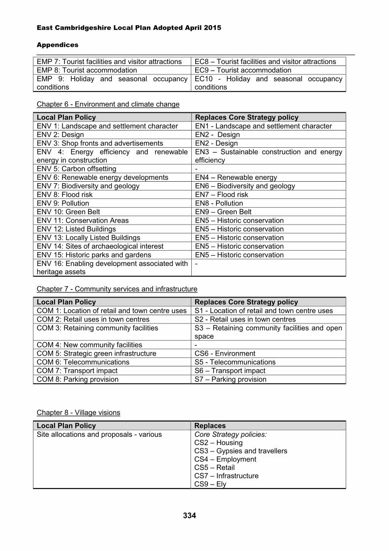
East Cambridgeshire Local Plan Adopted April 2015
Appendices
334
EMP 7: Tourist facilities and visitor attractions EC8 – Tourist facilities and visitor attractions EMP 8: Tourist accommodation EC9 – Tourist accommodation EMP 9: Holiday and seasonal occupancy conditions
EC10 - Holiday and seasonal occupancy conditions
Chapter 6 - Environment and climate change
Local Plan Policy Replaces Core Strategy policy ENV 1: Landscape and settlement character EN1 - Landscape and settlement character ENV 2: Design EN2 - Design ENV 3: Shop fronts and advertisements EN2 - Design ENV 4: Energy efficiency and renewable energy in construction
EN3 – Sustainable construction and energy efficiency
ENV 5: Carbon offsetting - ENV 6: Renewable energy developments EN4 – Renewable energy ENV 7: Biodiversity and geology EN6 – Biodiversity and geology ENV 8: Flood risk EN7 – Flood risk ENV 9: Pollution EN8 - Pollution ENV 10: Green Belt EN9 – Green Belt ENV 11: Conservation Areas EN5 – Historic conservation ENV 12: Listed Buildings EN5 – Historic conservation ENV 13: Locally Listed Buildings EN5 – Historic conservation ENV 14: Sites of archaeological interest EN5 – Historic conservation ENV 15: Historic parks and gardens EN5 – Historic conservation ENV 16: Enabling development associated with heritage assets
-
Chapter 7 - Community services and infrastructure
Local Plan Policy Replaces Core Strategy policy COM 1: Location of retail and town centre uses S1 - Location of retail and town centre uses COM 2: Retail uses in town centres S2 - Retail uses in town centres COM 3: Retaining community facilities S3 – Retaining community facilities and open
space COM 4: New community facilities - COM 5: Strategic green infrastructure CS6 - Environment COM 6: Telecommunications S5 - Telecommunications COM 7: Transport impact S6 – Transport impact COM 8: Parking provision S7 – Parking provision
Chapter 8 - Village visions
Local Plan Policy Replaces Site allocations and proposals - various Core Strategy policies:
CS2 – Housing CS3 – Gypsies and travellers CS4 – Employment CS5 – Retail CS7 – Infrastructure CS9 – Ely
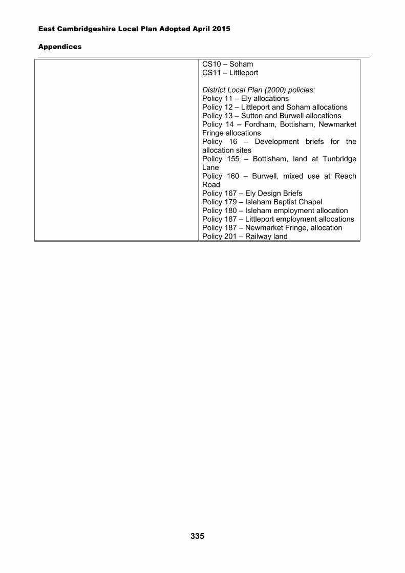
East Cambridgeshire Local Plan Adopted April 2015
Appendices
335
CS10 – Soham CS11 – Littleport District Local Plan (2000) policies: Policy 11 – Ely allocations Policy 12 – Littleport and Soham allocations Policy 13 – Sutton and Burwell allocations Policy 14 – Fordham, Bottisham, Newmarket Fringe allocations Policy 16 – Development briefs for the allocation sites Policy 155 – Bottisham, land at Tunbridge Lane Policy 160 – Burwell, mixed use at Reach Road Policy 167 – Ely Design Briefs Policy 179 – Isleham Baptist Chapel Policy 180 – Isleham employment allocation Policy 187 – Littleport employment allocations Policy 187 – Newmarket Fringe, allocation Policy 201 – Railway land
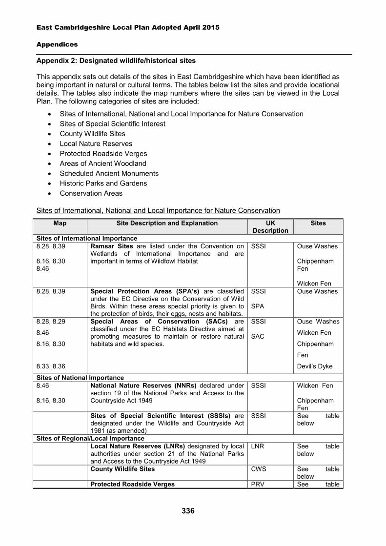
East Cambridgeshire Local Plan Adopted April 2015
Appendices
336
Appendix 2: Designated wildlife/historical sites
This appendix sets out details of the sites in East Cambridgeshire which have been identified as being important in natural or cultural terms. The tables below list the sites and provide locational details. The tables also indicate the map numbers where the sites can be viewed in the Local Plan. The following categories of sites are included:
Sites of International, National and Local Importance for Nature Conservation Sites of Special Scientific Interest County Wildlife Sites Local Nature Reserves Protected Roadside Verges Areas of Ancient Woodland Scheduled Ancient Monuments Historic Parks and Gardens Conservation Areas
Sites of International, National and Local Importance for Nature Conservation
Map Site Description and Explanation UK Description
Sites
Sites of International Importance 8.28, 8.39 8.16, 8.30 8.46
Ramsar Sites are listed under the Convention on Wetlands of International Importance and are important in terms of Wildfowl Habitat
SSSI Ouse Washes Chippenham Fen Wicken Fen
8.28, 8.39 Special Protection Areas (SPA’s) are classified under the EC Directive on the Conservation of Wild Birds. Within these areas special priority is given to the protection of birds, their eggs, nests and habitats.
SSSI SPA
Ouse Washes
8.28, 8.29
8.46
8.16, 8.30
8.33, 8.36
Special Areas of Conservation (SACs) are classified under the EC Habitats Directive aimed at promoting measures to maintain or restore natural habitats and wild species.
SSSI SAC
Ouse Washes
Wicken Fen
Chippenham
Fen
Devil’s Dyke
Sites of National Importance 8.46 8.16, 8.30
National Nature Reserves (NNRs) declared under section 19 of the National Parks and Access to the Countryside Act 1949
SSSI Wicken Fen Chippenham Fen
Sites of Special Scientific Interest (SSSIs) are designated under the Wildlife and Countryside Act 1981 (as amended)
SSSI See table below
Sites of Regional/Local Importance Local Nature Reserves (LNRs) designated by local
authorities under section 21 of the National Parks and Access to the Countryside Act 1949
LNR See table below
County Wildlife Sites CWS See table below
Protected Roadside Verges PRV See table
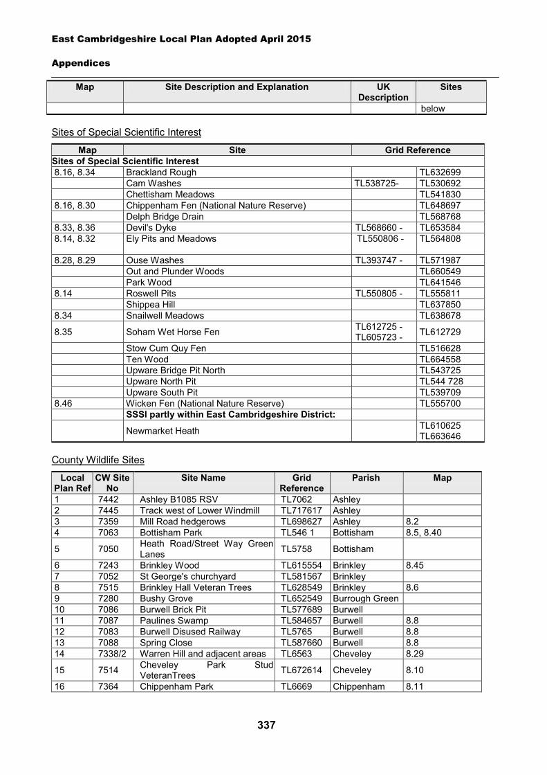
East Cambridgeshire Local Plan Adopted April 2015
Appendices
337
Map Site Description and Explanation UK Description
Sites
below
Sites of Special Scientific Interest
Map Site Grid Reference Sites of Special Scientific Interest 8.16, 8.34 Brackland Rough TL632699 Cam Washes TL538725- TL530692 Chettisham Meadows TL541830 8.16, 8.30 Chippenham Fen (National Nature Reserve) TL648697 Delph Bridge Drain TL568768 8.33, 8.36 Devil's Dyke TL568660 - TL653584 8.14, 8.32
Ely Pits and Meadows TL550806 - TL564808
8.28, 8.29 Ouse Washes TL393747 - TL571987 Out and Plunder Woods TL660549 Park Wood TL641546 8.14 Roswell Pits TL550805 - TL555811 Shippea Hill TL637850 8.34 Snailwell Meadows TL638678
8.35 Soham Wet Horse Fen TL612725 - TL605723 - TL612729
Stow Cum Quy Fen TL516628 Ten Wood TL664558
Upware Bridge Pit North TL543725 Upware North Pit TL544 728 Upware South Pit TL539709
8.46 Wicken Fen (National Nature Reserve) TL555700 SSSI partly within East Cambridgeshire District:
Newmarket Heath TL610625 TL663646
County Wildlife Sites
Local Plan Ref
CW Site No
Site Name Grid Reference
Parish Map
1 7442 Ashley B1085 RSV TL7062 Ashley 2 7445 Track west of Lower Windmill TL717617 Ashley 3 7359 Mill Road hedgerows TL698627 Ashley 8.2 4 7063 Bottisham Park TL546 1 Bottisham 8.5, 8.40
5 7050 Heath Road/Street Way Green Lanes TL5758 Bottisham
6 7243 Brinkley Wood TL615554 Brinkley 8.45 7 7052 St George's churchyard TL581567 Brinkley 8 7515 Brinkley Hall Veteran Trees TL628549 Brinkley 8.6 9 7280 Bushy Grove TL652549 Burrough Green 10 7086 Burwell Brick Pit TL577689 Burwell 11 7087 Paulines Swamp TL584657 Burwell 8.8 12 7083 Burwell Disused Railway TL5765 Burwell 8.8 13 7088 Spring Close TL587660 Burwell 8.8 14 7338/2 Warren Hill and adjacent areas TL6563 Cheveley 8.29
15 7514 Cheveley Park Stud VeteranTrees TL672614 Cheveley 8.10
16 7364 Chippenham Park TL6669 Chippenham 8.11
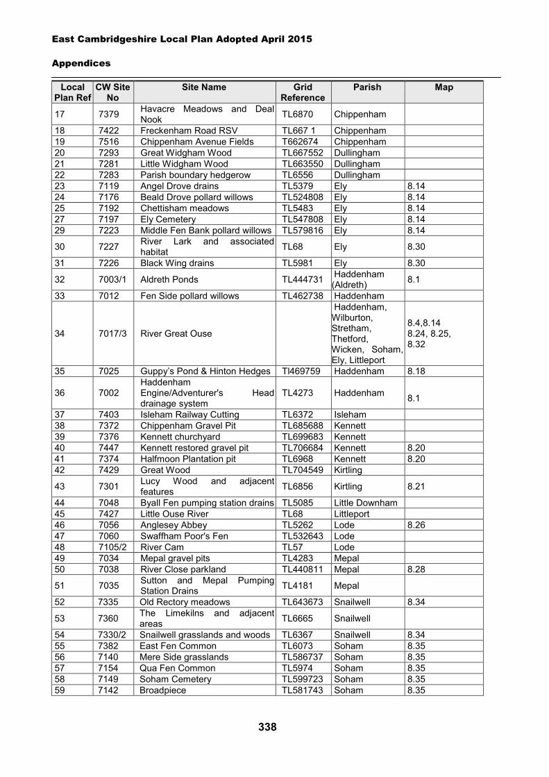
East Cambridgeshire Local Plan Adopted April 2015
Appendices
338
Local Plan Ref
CW Site No
Site Name Grid Reference
Parish Map
17 7379 Havacre Meadows and Deal Nook TL6870 Chippenham
18 7422 Freckenham Road RSV TL667 1 Chippenham 19 7516 Chippenham Avenue Fields T662674 Chippenham 20 7293 Great Widgham Wood TL667552 Dullingham 21 7281 Little Widgham Wood TL663550 Dullingham 22 7283 Parish boundary hedgerow TL6556 Dullingham 23 7119 Angel Drove drains TL5379 Ely 8.14 24 7176 Beald Drove pollard willows TL524808 Ely 8.14 25 7192 Chettisham meadows TL5483 Ely 8.14 27 7197 Ely Cemetery TL547808 Ely 8.14 29 7223 Middle Fen Bank pollard willows TL579816 Ely 8.14
30 7227 River Lark and associated habitat TL68 Ely 8.30
31 7226 Black Wing drains TL5981 Ely 8.30
32 7003/1 Aldreth Ponds TL444731 Haddenham (Aldreth) 8.1
33 7012 Fen Side pollard willows TL462738 Haddenham
34 7017/3 River Great Ouse
Haddenham, Wilburton, Stretham, Thetford, Wicken, Soham, Ely, Littleport
8.4,8.14 8.24, 8.25, 8.32
35 7025 Guppy’s Pond & Hinton Hedges Tl469759 Haddenham 8.18
36 7002 Haddenham Engine/Adventurer's Head drainage system
TL4273 Haddenham 8.1
37 7403 Isleham Railway Cutting TL6372 Isleham 38 7372 Chippenham Gravel Pit TL685688 Kennett 39 7376 Kennett churchyard TL699683 Kennett 40 7447 Kennett restored gravel pit TL706684 Kennett 8.20 41 7374 Halfmoon Plantation pit TL6968 Kennett 8.20 42 7429 Great Wood TL704549 Kirtling
43 7301 Lucy Wood and adjacent features TL6856 Kirtling 8.21
44 7048 Byall Fen pumping station drains TL5085 Little Downham 45 7427 Little Ouse River TL68 Littleport 46 7056 Anglesey Abbey TL5262 Lode 8.26 47 7060 Swaffham Poor's Fen TL532643 Lode 48 7105/2 River Cam TL57 Lode 49 7034 Mepal gravel pits TL4283 Mepal 50 7038 River Close parkland TL440811 Mepal 8.28
51 7035 Sutton and Mepal Pumping Station Drains TL4181 Mepal
52 7335 Old Rectory meadows TL643673 Snailwell 8.34
53 7360 The Limekilns and adjacent areas TL6665 Snailwell
54 7330/2 Snailwell grasslands and woods TL6367 Snailwell 8.34 55 7382 East Fen Common TL6073 Soham 8.35 56 7140 Mere Side grasslands TL586737 Soham 8.35 57 7154 Qua Fen Common TL5974 Soham 8.35 58 7149 Soham Cemetery TL599723 Soham 8.35 59 7142 Broadpiece TL581743 Soham 8.35
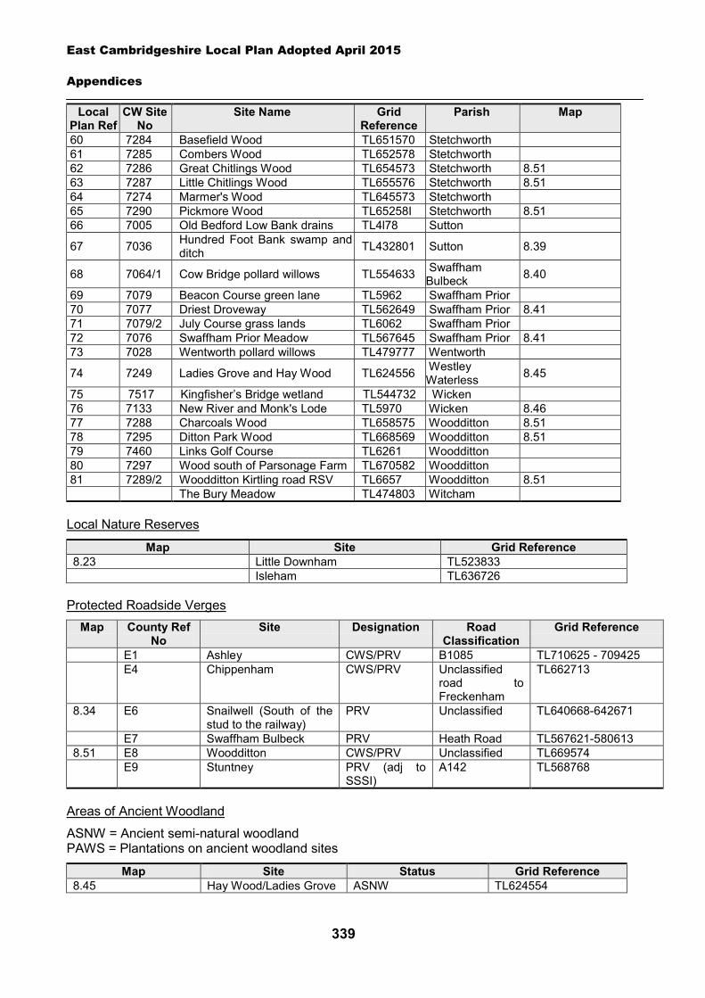
East Cambridgeshire Local Plan Adopted April 2015
Appendices
339
Local Plan Ref
CW Site No
Site Name Grid Reference
Parish Map
60 7284 Basefield Wood TL651570 Stetchworth 61 7285 Combers Wood TL652578 Stetchworth 62 7286 Great Chitlings Wood TL654573 Stetchworth 8.51 63 7287 Little Chitlings Wood TL655576 Stetchworth 8.51 64 7274 Marmer's Wood TL645573 Stetchworth 65 7290 Pickmore Wood TL65258I Stetchworth 8.51 66 7005 Old Bedford Low Bank drains TL4l78 Sutton
67 7036 Hundred Foot Bank swamp and ditch TL432801 Sutton 8.39
68 7064/1 Cow Bridge pollard willows TL554633 Swaffham Bulbeck 8.40
69 7079 Beacon Course green lane TL5962 Swaffham Prior 70 7077 Driest Droveway TL562649 Swaffham Prior 8.41 71 7079/2 July Course grass lands TL6062 Swaffham Prior 72 7076 Swaffham Prior Meadow TL567645 Swaffham Prior 8.41 73 7028 Wentworth pollard willows TL479777 Wentworth
74 7249 Ladies Grove and Hay Wood TL624556 Westley Waterless 8.45
75 7517 Kingfisher’s Bridge wetland TL544732 Wicken 76 7133 New River and Monk's Lode TL5970 Wicken 8.46 77 7288 Charcoals Wood TL658575 Woodditton 8.51 78 7295 Ditton Park Wood TL668569 Woodditton 8.51 79 7460 Links Golf Course TL6261 Woodditton 80 7297 Wood south of Parsonage Farm TL670582 Woodditton 81 7289/2 Woodditton Kirtling road RSV TL6657 Woodditton 8.51 The Bury Meadow TL474803 Witcham
Local Nature Reserves
Map Site Grid Reference 8.23 Little Downham TL523833 Isleham TL636726
Protected Roadside Verges Map County Ref
No Site Designation Road
Classification Grid Reference
E1 Ashley CWS/PRV B1085 TL710625 - 709425 E4 Chippenham CWS/PRV Unclassified
road to Freckenham
TL662713
8.34 E6 Snailwell (South of the stud to the railway)
PRV Unclassified TL640668-642671
E7 Swaffham Bulbeck PRV Heath Road TL567621-580613 8.51 E8 Woodditton CWS/PRV Unclassified TL669574 E9 Stuntney PRV (adj to
SSSI) A142 TL568768
Areas of Ancient Woodland
ASNW = Ancient semi-natural woodland PAWS = Plantations on ancient woodland sites
Map Site Status Grid Reference 8.45 Hay Wood/Ladies Grove ASNW TL624554
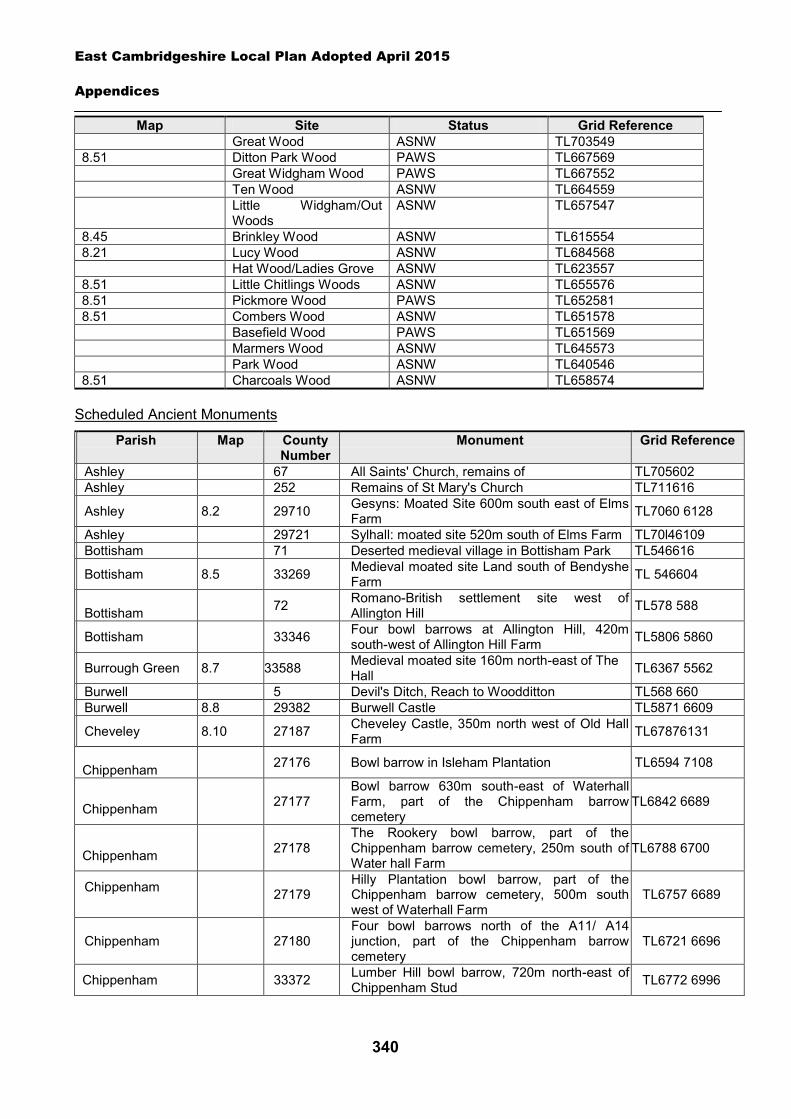
East Cambridgeshire Local Plan Adopted April 2015
Appendices
340
Map Site Status Grid Reference Great Wood ASNW TL703549 8.51 Ditton Park Wood PAWS TL667569 Great Widgham Wood PAWS TL667552 Ten Wood ASNW TL664559 Little Widgham/Out
Woods ASNW TL657547
8.45 Brinkley Wood ASNW TL615554 8.21 Lucy Wood ASNW TL684568 Hat Wood/Ladies Grove ASNW TL623557 8.51 Little Chitlings Woods ASNW TL655576 8.51 Pickmore Wood PAWS TL652581 8.51 Combers Wood ASNW TL651578 Basefield Wood PAWS TL651569 Marmers Wood ASNW TL645573 Park Wood ASNW TL640546 8.51 Charcoals Wood ASNW TL658574
Scheduled Ancient Monuments
Parish Map County Number
Monument Grid Reference
Ashley 67 All Saints' Church, remains of TL705602 Ashley 252 Remains of St Mary's Church TL711616
Ashley 8.2 29710 Gesyns: Moated Site 600m south east of Elms Farm TL7060 6128
Ashley 29721 Sylhall: moated site 520m south of Elms Farm TL70l46109 Bottisham 71 Deserted medieval village in Bottisham Park TL546616
Bottisham 8.5 33269 Medieval moated site Land south of Bendyshe Farm TL 546604
Bottisham 72 Romano-British settlement site west of
Allington Hill TL578 588
Bottisham 33346 Four bowl barrows at Allington Hill, 420m south-west of Allington Hill Farm TL5806 5860
Burrough Green 8.7 33588 Medieval moated site 160m north-east of The Hall TL6367 5562
Burwell 5 Devil's Ditch, Reach to Woodditton TL568 660 Burwell 8.8 29382 Burwell Castle TL5871 6609
Cheveley 8.10 27187 Cheveley Castle, 350m north west of Old Hall Farm TL67876131
Chippenham 27176 Bowl barrow in Isleham Plantation TL6594 7108
Chippenham 27177
Bowl barrow 630m south-east of Waterhall Farm, part of the Chippenham barrow cemetery
TL6842 6689
Chippenham 27178
The Rookery bowl barrow, part of the Chippenham barrow cemetery, 250m south of Water hall Farm
TL6788 6700
Chippenham 27179
Hilly Plantation bowl barrow, part of the Chippenham barrow cemetery, 500m south west of Waterhall Farm
TL6757 6689
Chippenham 27180 Four bowl barrows north of the A11/ A14 junction, part of the Chippenham barrow cemetery
TL6721 6696
Chippenham 33372 Lumber Hill bowl barrow, 720m north-east of Chippenham Stud TL6772 6996
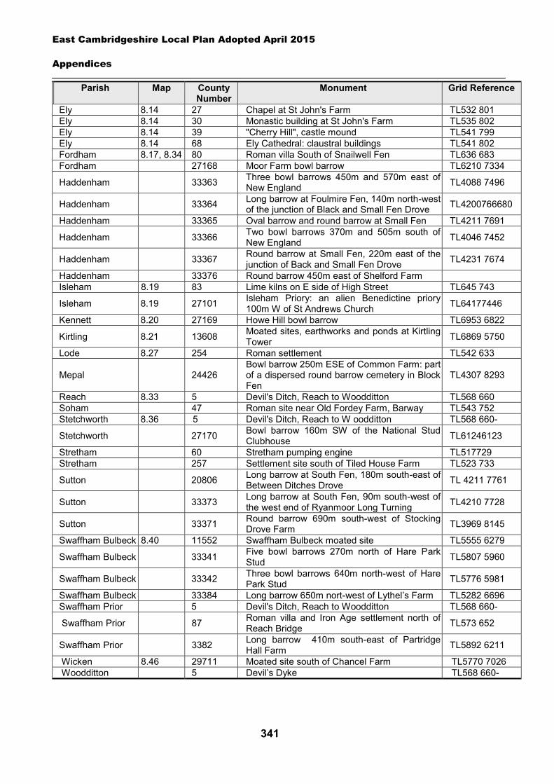
East Cambridgeshire Local Plan Adopted April 2015
Appendices
341
Parish Map County Number
Monument Grid Reference
Ely 8.14 27 Chapel at St John's Farm TL532 801 Ely 8.14 30 Monastic building at St John's Farm TL535 802 Ely 8.14 39 "Cherry Hill", castle mound TL541 799 Ely 8.14 68 Ely Cathedral: claustral buildings TL541 802 Fordham 8.17, 8.34 80 Roman villa South of Snailwell Fen TL636 683 Fordham 27168 Moor Farm bowl barrow TL6210 7334
Haddenham 33363 Three bowl barrows 450m and 570m east of New England TL4088 7496
Haddenham 33364 Long barrow at Foulmire Fen, 140m north-west of the junction of Black and Small Fen Drove TL4200766680
Haddenham 33365 Oval barrow and round barrow at Small Fen TL4211 7691
Haddenham 33366 Two bowl barrows 370m and 505m south of New England TL4046 7452
Haddenham 33367 Round barrow at Small Fen, 220m east of the junction of Back and Small Fen Drove TL4231 7674
Haddenham 33376 Round barrow 450m east of Shelford Farm Isleham 8.19 83 Lime kilns on E side of High Street TL645 743
Isleham 8.19 27101 Isleham Priory: an alien Benedictine priory 100m W of St Andrews Church TL64177446
Kennett 8.20 27169 Howe Hill bowl barrow TL6953 6822
Kirtling 8.21 13608 Moated sites, earthworks and ponds at Kirtling Tower TL6869 5750
Lode 8.27 254 Roman settlement TL542 633
Mepal 24426 Bowl barrow 250m ESE of Common Farm: part of a dispersed round barrow cemetery in Block Fen
TL4307 8293
Reach 8.33 5 Devil's Ditch, Reach to Woodditton TL568 660 Soham 47 Roman site near Old Fordey Farm, Barway TL543 752 Stetchworth 8.36 5 Devil's Ditch, Reach to W oodditton TL568 660-
Stetchworth 27170 Bowl barrow 160m SW of the National Stud Clubhouse TL61246123
Stretham 60 Stretham pumping engine TL517729 Stretham 257 Settlement site south of Tiled House Farm TL523 733
Sutton 20806 Long barrow at South Fen, 180m south-east of Between Ditches Drove TL 4211 7761
Sutton 33373 Long barrow at South Fen, 90m south-west of the west end of Ryanmoor Long Turning TL4210 7728
Sutton 33371 Round barrow 690m south-west of Stocking Drove Farm TL3969 8145
Swaffham Bulbeck 8.40 11552 Swaffham Bulbeck moated site TL5555 6279
Swaffham Bulbeck 33341 Five bowl barrows 270m north of Hare Park Stud TL5807 5960
Swaffham Bulbeck 33342 Three bowl barrows 640m north-west of Hare Park Stud TL5776 5981
Swaffham Bulbeck 33384 Long barrow 650m nort-west of Lythel’s Farm TL5282 6696 Swaffham Prior 5 Devil's Ditch, Reach to Woodditton TL568 660-
Swaffham Prior 87 Roman villa and Iron Age settlement north of Reach Bridge TL573 652
Swaffham Prior 3382 Long barrow 410m south-east of Partridge Hall Farm TL5892 6211
Wicken 8.46 29711 Moated site south of Chancel Farm TL5770 7026 Woodditton 5 Devil’s Dyke TL568 660-
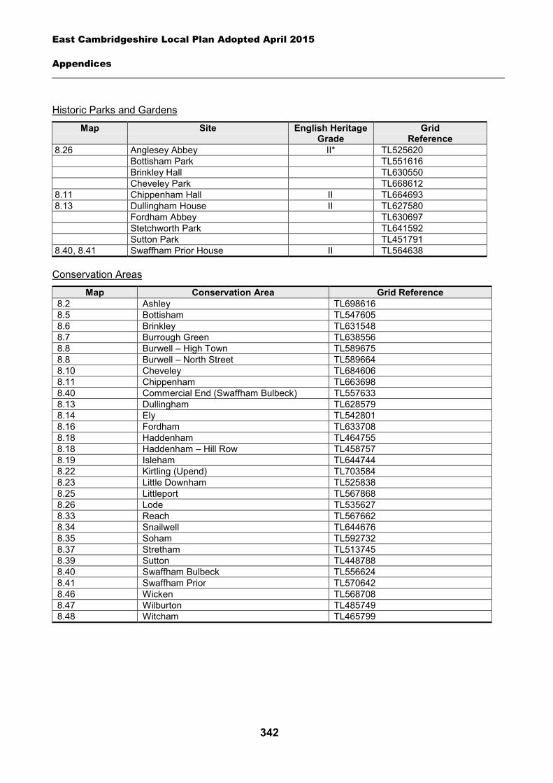
East Cambridgeshire Local Plan Adopted April 2015
Appendices
342
Historic Parks and Gardens
Map Site
English Heritage Grade
Grid Reference
8.26 Anglesey Abbey II* TL525620 Bottisham Park TL551616 Brinkley Hall TL630550 Cheveley Park TL668612 8.11 Chippenham Hall II TL664693 8.13 Dullingham House II TL627580 Fordham Abbey TL630697 Stetchworth Park TL641592 Sutton Park TL451791 8.40, 8.41 Swaffham Prior House II TL564638
Conservation Areas
Map Conservation Area Grid Reference 8.2 Ashley TL698616 8.5 Bottisham TL547605 8.6 Brinkley TL631548 8.7 Burrough Green TL638556 8.8 Burwell – High Town TL589675 8.8 Burwell – North Street TL589664 8.10 Cheveley TL684606 8.11 Chippenham TL663698 8.40 Commercial End (Swaffham Bulbeck) TL557633 8.13 Dullingham TL628579 8.14 Ely TL542801 8.16 Fordham TL633708 8.18 Haddenham TL464755 8.18 Haddenham – Hill Row TL458757 8.19 Isleham TL644744 8.22 Kirtling (Upend) TL703584 8.23 Little Downham TL525838 8.25 Littleport TL567868 8.26 Lode TL535627 8.33 Reach TL567662 8.34 Snailwell TL644676 8.35 Soham TL592732 8.37 Stretham TL513745 8.39 Sutton TL448788 8.40 Swaffham Bulbeck TL556624 8.41 Swaffham Prior TL570642 8.46 Wicken TL568708 8.47 Wilburton TL485749 8.48 Witcham TL465799
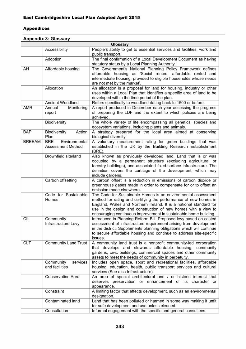
East Cambridgeshire Local Plan Adopted April 2015
Appendices
343
Appendix 3: Glossary Glossary
Accessibility People’s ability to get to essential services and facilities, work and public transport.
Adoption The final confirmation of a Local Development Document as having statutory status by a Local Planning Authority.
AH Affordable housing The Government’s National Planning Policy Framework defines affordable housing as ‘Social rented, affordable rented and intermediate housing, provided to eligible households whose needs are not met by the market’.
Allocation An allocation is a proposal for land for housing, industry or other uses within a Local Plan that identifies a specific area of land to be developed within the time period of the plan.
Ancient Woodland Refers specifically to woodland dating back to 1600 or before. AMR Annual Monitoring
report A report produced in December each year assessing the progress of preparing the LDF and the extent to which policies are being achieved.
Biodiversity The whole variety of life encompassing all genetics, species and ecosystem variations, including plants and animals.
BAP Biodiversity Action Plan
A strategy prepared for the local area aimed at conserving biological diversity.
BREEAM BRE Environmental Assessment Method
A voluntary measurement rating for green buildings that was established in the UK by the Building Research Establishment (BRE).
Brownfield site/land Also known as previously developed land. Land that is or was occupied by a permanent structure (excluding agricultural or forestry buildings), and associated fixed-surface infrastructure. The definition covers the curtilage of the development, which may include gardens.
Carbon offsetting
A carbon offset is a reduction in emissions of carbon dioxide or greenhouse gases made in order to compensate for or to offset an emission made elsewhere.
Code for Sustainable Homes
The Code for Sustainable Homes is an environmental assessment method for rating and certifying the performance of new homes in England, Wales and Northern Ireland. It is a national standard for use in the design and construction of new homes with a view to encouraging continuous improvement in sustainable home building.
CIL Community Infrastructure Levy
Introduced in Planning Reform Bill. Proposed levy based on costed assessment of infrastructure requirement arising from development in the district. Supplements planning obligations which will continue to secure affordable housing and continue to address site-specific issues.
CLT Community Land Trust A community land trust is a nonprofit community-led corporation that develops and stewards affordable housing, community gardens, civic buildings, commercial spaces and other community assets to meet the needs of community in perpetuity.
Community services and facilities
Includes open space, sport and recreational facilities, affordable housing, education, health, public transport services and cultural services (See also Infrastructure).
Conservation Area An area of special architectural and / or historic interest that deserves preservation or enhancement of its character or appearance.
Constraint A limiting factor that affects development, such as an environmental designation.
Contaminated land Land that has been polluted or harmed in some way making it unfit for safe development and use unless cleaned.
Consultation Informal engagement with the specific and general consultees.
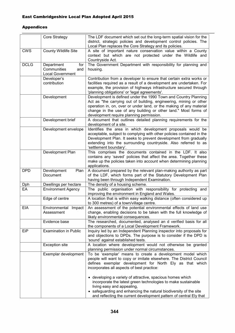
East Cambridgeshire Local Plan Adopted April 2015
Appendices
344
Core Strategy The LDF document which set out the long-term spatial vision for the district, strategic policies and development control policies. The Local Plan replaces the Core Strategy and its policies.
CWS County Wildlife Site A site of important nature conservation value within a County context but which are not protected under the Wildlife and Countryside Act.
DCLG Department for Communities and Local Government
The Government Department with responsibility for planning and housing.
Developer’s contribution
Contribution from a developer to ensure that certain extra works or facilities required as a result of a development are undertaken. For example, the provision of highways infrastructure secured through 'planning obligations' or 'legal agreements'.
Development
Development is defined under the 1990 Town and Country Planning Act as "the carrying out of building, engineering, mining or other operation in, on, over or under land, or the making of any material change in the use of any building or other land." Most forms of development require planning permission.
Development brief
A document that outlines detailed planning requirements for the development of a site.
Development envelope
Identifies the area in which development proposals would be acceptable, subject to complying with other policies contained in the Development Plan. It seeks to prevent development from gradually extending into the surrounding countryside. Also referred to as ‘settlement boundary’.
Development Plan
This comprises the documents contained in the LDF. It also contains any ‘saved’ policies that affect the area. Together these make up the policies taken into account when determining planning applications.
DPD Development Plan Document
A document prepared by the relevant plan-making authority as part of the LDF, which forms part of the Statutory Development Plan having been through Independent Examination.
Dph Dwellings per hectare The density of a housing scheme. EA Environment Agency The public organisation with responsibility for protecting and
improving the environment in England and Wales. Edge of centre A location that is within easy walking distance (often considered up
to 300 metres) of a town/village centre. EIA Environmental Impact
Assessment
An assessment of the potential environmental effects of land use change, enabling decisions to be taken with the full knowledge of likely environmental consequences.
Evidence base
The researched, documented, analysed an d verified basis for all the components of a Local Development Framework.
EiP Examination in Public Inquiry led by an Independent Planning inspector into proposals for and objections to DPDs. The purpose is to consider if the DPD is ‘sound’ against established tests.
Exception site A location where development would not otherwise be granted planning permission under normal circumstances.
Exemplar development To be ‘exemplar’ means to create a development model which people will want to copy or imitate elsewhere. The District Council defines exemplar development for North Ely as that which incorporates all aspects of best practice:
developing a variety of attractive, spacious homes which incorporate the latest green technologies to make sustainable living easy and appealing,
safeguarding and enhancing the natural biodiversity of the site and reflecting the current development pattern of central Ely that
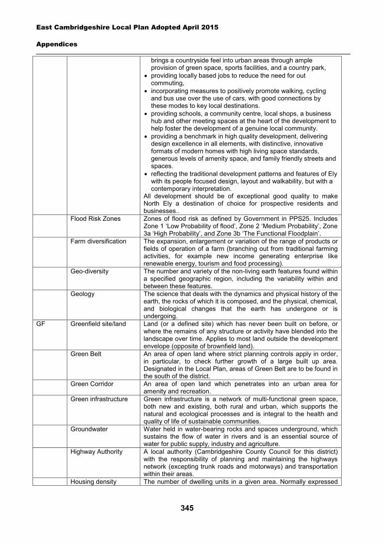
East Cambridgeshire Local Plan Adopted April 2015
Appendices
345
brings a countryside feel into urban areas through ample provision of green space, sports facilities, and a country park,
providing locally based jobs to reduce the need for out commuting,
incorporating measures to positively promote walking, cycling and bus use over the use of cars, with good connections by these modes to key local destinations.
providing schools, a community centre, local shops, a business hub and other meeting spaces at the heart of the development to help foster the development of a genuine local community.
providing a benchmark in high quality development, delivering design excellence in all elements, with distinctive, innovative formats of modern homes with high living space standards, generous levels of amenity space, and family friendly streets and spaces.
reflecting the traditional development patterns and features of Ely with its people focused design, layout and walkability, but with a contemporary interpretation.
All development should be of exceptional good quality to make North Ely a destination of choice for prospective residents and businesses..
Flood Risk Zones
Zones of flood risk as defined by Government in PPS25. Includes Zone 1 ‘Low Probability of flood’, Zone 2 ‘Medium Probability’, Zone 3a ‘High Probability’, and Zone 3b ‘The Functional Floodplain’.
Farm diversification
The expansion, enlargement or variation of the range of products or fields of operation of a farm (branching out from traditional farming activities, for example new income generating enterprise like renewable energy, tourism and food processing).
Geo-diversity
The number and variety of the non-living earth features found within a specified geographic region, including the variability within and between these features.
Geology The science that deals with the dynamics and physical history of the earth, the rocks of which it is composed, and the physical, chemical, and biological changes that the earth has undergone or is undergoing.
GF Greenfield site/land
Land (or a defined site) which has never been built on before, or where the remains of any structure or activity have blended into the landscape over time. Applies to most land outside the development envelope (opposite of brownfield land).
Green Belt An area of open land where strict planning controls apply in order, in particular, to check further growth of a large built up area. Designated in the Local Plan, areas of Green Belt are to be found in the south of the district.
Green Corridor An area of open land which penetrates into an urban area for amenity and recreation.
Green infrastructure Green infrastructure is a network of multi-functional green space, both new and existing, both rural and urban, which supports the natural and ecological processes and is integral to the health and quality of life of sustainable communities.
Groundwater Water held in water-bearing rocks and spaces underground, which sustains the flow of water in rivers and is an essential source of water for public supply, industry and agriculture.
Highway Authority A local authority (Cambridgeshire County Council for this district) with the responsibility of planning and maintaining the highways network (excepting trunk roads and motorways) and transportation within their areas.
Housing density The number of dwelling units in a given area. Normally expressed
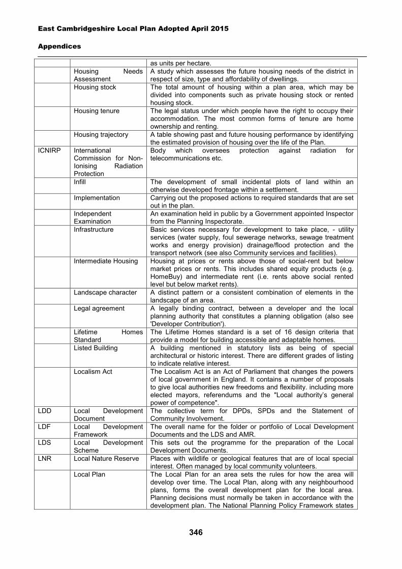
East Cambridgeshire Local Plan Adopted April 2015
Appendices
346
as units per hectare. Housing Needs
Assessment A study which assesses the future housing needs of the district in respect of size, type and affordability of dwellings.
Housing stock The total amount of housing within a plan area, which may be divided into components such as private housing stock or rented housing stock.
Housing tenure The legal status under which people have the right to occupy their accommodation. The most common forms of tenure are home ownership and renting.
Housing trajectory A table showing past and future housing performance by identifying the estimated provision of housing over the life of the Plan.
ICNIRP International Commission for Non-Ionising Radiation Protection
Body which oversees protection against radiation for telecommunications etc.
Infill The development of small incidental plots of land within an otherwise developed frontage within a settlement.
Implementation Carrying out the proposed actions to required standards that are set out in the plan.
Independent Examination
An examination held in public by a Government appointed Inspector from the Planning Inspectorate.
Infrastructure Basic services necessary for development to take place, - utility services (water supply, foul sewerage networks, sewage treatment works and energy provision) drainage/flood protection and the transport network (see also Community services and facilities).
Intermediate Housing
Housing at prices or rents above those of social-rent but below market prices or rents. This includes shared equity products (e.g. HomeBuy) and intermediate rent (i.e. rents above social rented level but below market rents).
Landscape character
A distinct pattern or a consistent combination of elements in the landscape of an area.
Legal agreement A legally binding contract, between a developer and the local planning authority that constitutes a planning obligation (also see 'Developer Contribution').
Lifetime Homes Standard
The Lifetime Homes standard is a set of 16 design criteria that provide a model for building accessible and adaptable homes.
Listed Building
A building mentioned in statutory lists as being of special architectural or historic interest. There are different grades of listing to indicate relative interest.
Localism Act The Localism Act is an Act of Parliament that changes the powers of local government in England. It contains a number of proposals to give local authorities new freedoms and flexibility. including more elected mayors, referendums and the "Local authority’s general power of competence".
LDD Local Development Document
The collective term for DPDs, SPDs and the Statement of Community Involvement.
LDF Local Development Framework
The overall name for the folder or portfolio of Local Development Documents and the LDS and AMR.
LDS Local Development Scheme
This sets out the programme for the preparation of the Local Development Documents.
LNR Local Nature Reserve Places with wildlife or geological features that are of local special interest. Often managed by local community volunteers.
Local Plan The Local Plan for an area sets the rules for how the area will develop over time. The Local Plan, along with any neighbourhood plans, forms the overall development plan for the local area. Planning decisions must normally be taken in accordance with the development plan. The National Planning Policy Framework states
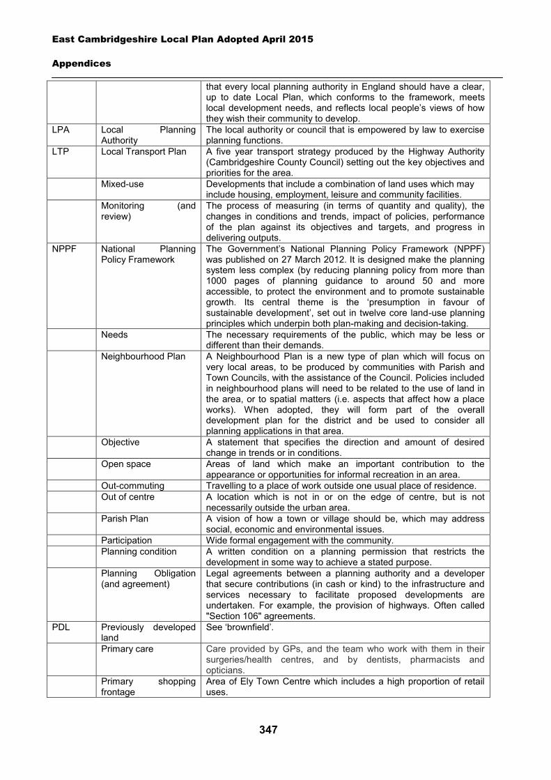
East Cambridgeshire Local Plan Adopted April 2015
Appendices
347
that every local planning authority in England should have a clear, up to date Local Plan, which conforms to the framework, meets local development needs, and reflects local people’s views of how they wish their community to develop.
LPA Local Planning Authority
The local authority or council that is empowered by law to exercise planning functions.
LTP Local Transport Plan
A five year transport strategy produced by the Highway Authority (Cambridgeshire County Council) setting out the key objectives and priorities for the area.
Mixed-use Developments that include a combination of land uses which may include housing, employment, leisure and community facilities.
Monitoring (and review)
The process of measuring (in terms of quantity and quality), the changes in conditions and trends, impact of policies, performance of the plan against its objectives and targets, and progress in delivering outputs.
NPPF National Planning Policy Framework
The Government’s National Planning Policy Framework (NPPF) was published on 27 March 2012. It is designed make the planning system less complex (by reducing planning policy from more than 1000 pages of planning guidance to around 50 and more accessible, to protect the environment and to promote sustainable growth. Its central theme is the ‘presumption in favour of sustainable development’, set out in twelve core land-use planning principles which underpin both plan-making and decision-taking.
Needs The necessary requirements of the public, which may be less or different than their demands.
Neighbourhood Plan A Neighbourhood Plan is a new type of plan which will focus on very local areas, to be produced by communities with Parish and Town Councils, with the assistance of the Council. Policies included in neighbourhood plans will need to be related to the use of land in the area, or to spatial matters (i.e. aspects that affect how a place works). When adopted, they will form part of the overall development plan for the district and be used to consider all planning applications in that area.
Objective A statement that specifies the direction and amount of desired change in trends or in conditions.
Open space Areas of land which make an important contribution to the appearance or opportunities for informal recreation in an area.
Out-commuting Travelling to a place of work outside one usual place of residence. Out of centre A location which is not in or on the edge of centre, but is not
necessarily outside the urban area. Parish Plan A vision of how a town or village should be, which may address
social, economic and environmental issues. Participation Wide formal engagement with the community. Planning condition A written condition on a planning permission that restricts the
development in some way to achieve a stated purpose. Planning Obligation
(and agreement) Legal agreements between a planning authority and a developer that secure contributions (in cash or kind) to the infrastructure and services necessary to facilitate proposed developments are undertaken. For example, the provision of highways. Often called "Section 106" agreements.
PDL Previously developed land
See ‘brownfield’.
Primary care Care provided by GPs, and the team who work with them in their surgeries/health centres, and by dentists, pharmacists and opticians.
Primary shopping frontage
Area of Ely Town Centre which includes a high proportion of retail uses.
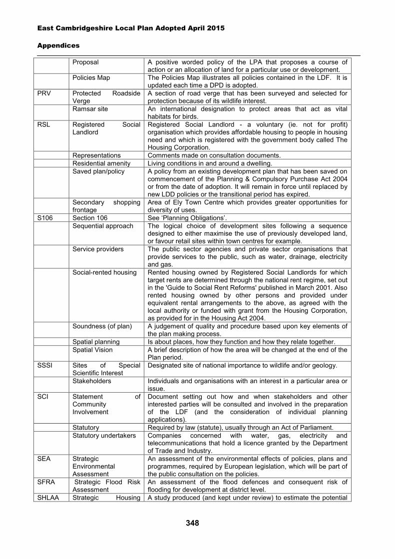
East Cambridgeshire Local Plan Adopted April 2015
Appendices
348
Proposal A positive worded policy of the LPA that proposes a course of action or an allocation of land for a particular use or development.
Policies Map The Policies Map illustrates all policies contained in the LDF. It is updated each time a DPD is adopted.
PRV Protected Roadside Verge
A section of road verge that has been surveyed and selected for protection because of its wildlife interest.
Ramsar site
An international designation to protect areas that act as vital habitats for birds.
RSL Registered Social Landlord
Registered Social Landlord - a voluntary (ie. not for profit) organisation which provides affordable housing to people in housing need and which is registered with the government body called The Housing Corporation.
Representations Comments made on consultation documents. Residential amenity Living conditions in and around a dwelling. Saved plan/policy
A policy from an existing development plan that has been saved on commencement of the Planning & Compulsory Purchase Act 2004 or from the date of adoption. It will remain in force until replaced by new LDD policies or the transitional period has expired.
Secondary shopping frontage
Area of Ely Town Centre which provides greater opportunities for diversity of uses.
S106 Section 106 See ‘Planning Obligations’. Sequential approach
The logical choice of development sites following a sequence designed to either maximise the use of previously developed land, or favour retail sites within town centres for example.
Service providers
The public sector agencies and private sector organisations that provide services to the public, such as water, drainage, electricity and gas.
Social-rented housing
Rented housing owned by Registered Social Landlords for which target rents are determined through the national rent regime, set out in the 'Guide to Social Rent Reforms' published in March 2001. Also rented housing owned by other persons and provided under equivalent rental arrangements to the above, as agreed with the local authority or funded with grant from the Housing Corporation, as provided for in the Housing Act 2004.
Soundness (of plan)
A judgement of quality and procedure based upon key elements of the plan making process.
Spatial planning Is about places, how they function and how they relate together. Spatial Vision A brief description of how the area will be changed at the end of the
Plan period. SSSI Sites of Special
Scientific Interest Designated site of national importance to wildlife and/or geology.
Stakeholders Individuals and organisations with an interest in a particular area or issue.
SCI Statement of Community Involvement
Document setting out how and when stakeholders and other interested parties will be consulted and involved in the preparation of the LDF (and the consideration of individual planning applications).
Statutory Required by law (statute), usually through an Act of Parliament. Statutory undertakers
Companies concerned with water, gas, electricity and telecommunications that hold a licence granted by the Department of Trade and Industry.
SEA Strategic Environmental Assessment
An assessment of the environmental effects of policies, plans and programmes, required by European legislation, which will be part of the public consultation on the policies.
SFRA Strategic Flood Risk Assessment
An assessment of the flood defences and consequent risk of flooding for development at district level.
SHLAA Strategic Housing A study produced (and kept under review) to estimate the potential
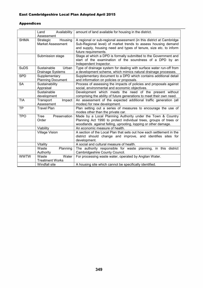
East Cambridgeshire Local Plan Adopted April 2015
Appendices
349
Land Availability Assessment
amount of land available for housing in the district.
SHMA Strategic Housing Market Assessment
A regional or sub-regional assessment (in this district at Cambridge Sub-Regional level) of market trends to assess housing demand and supply, housing need and types of tenure, size etc. to inform future requirements.
Submission stage
Stage at which a DPD is formally submitted to the Government and start of the examination of the soundness of a DPD by an Independent Inspector.
SuDS Sustainable Urban Drainage Systems
Type of drainage system for dealing with surface water run-off from a development scheme, which mimics natural drainage processes.
SPD Supplementary Planning Document
Supplementary document to a DPD which contains additional detail and information on policies or proposals.
SA Sustainability Appraisal
Process of assessing the impacts of policies and proposals against social, environmental and economic objectives.
Sustainable development
Development which meets the need of the present without comprising the ability of future generations to meet their own need.
TIA Transport Impact Assessment
An assessment of the expected additional traffic generation (all modes) for new development.
TP Travel Plan Plan setting out a series of measures to encourage the use of modes other than the private car.
TPO Tree Preservation Order
Made by a Local Planning Authority under the Town & Country Planning Act 1990 to protect individual trees, groups of trees or woodlands against felling, uprooting, lopping or other damage.
Viability An economic measure of health. Village Vision
A section of the Local Plan that sets out how each settlement in the district should change and improve, and identifies sites for development.
Vitality A social and cultural measure of health. Waste Planning
Authority The authority responsible for waste planning, in this district Cambridgeshire County Council.
WWTW Waste Water Treatment Works
For processing waste water, operated by Anglian Water.
Windfall site A housing site which cannot be specifically identified.
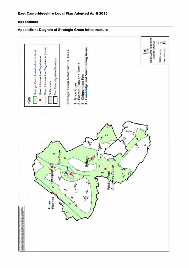
East Cambridgeshire Local Plan Adopted April 2015
Appendices
350
Appendix 4: Diagram of Strategic Green Infrastructure
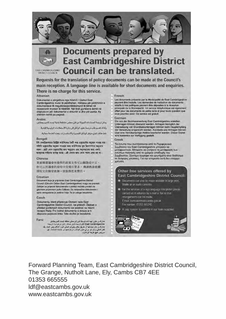
Forward Planning Team, East Cambridgeshire District Council, The Grange, Nutholt Lane, Ely, Cambs CB7 4EE01353 [email protected]