Embed Size (px)
Citation preview
Earth – Maps and Navigation
size/shape/rotation of Earth is fundamental to ocean dynamics
- interesting to know history of Earth’s geometry
- need to know how to describe location and size of features
- bit of navigational history (can use oceans/celestial)
Geography 104 - “Physical Geography of the World’s Oceans”
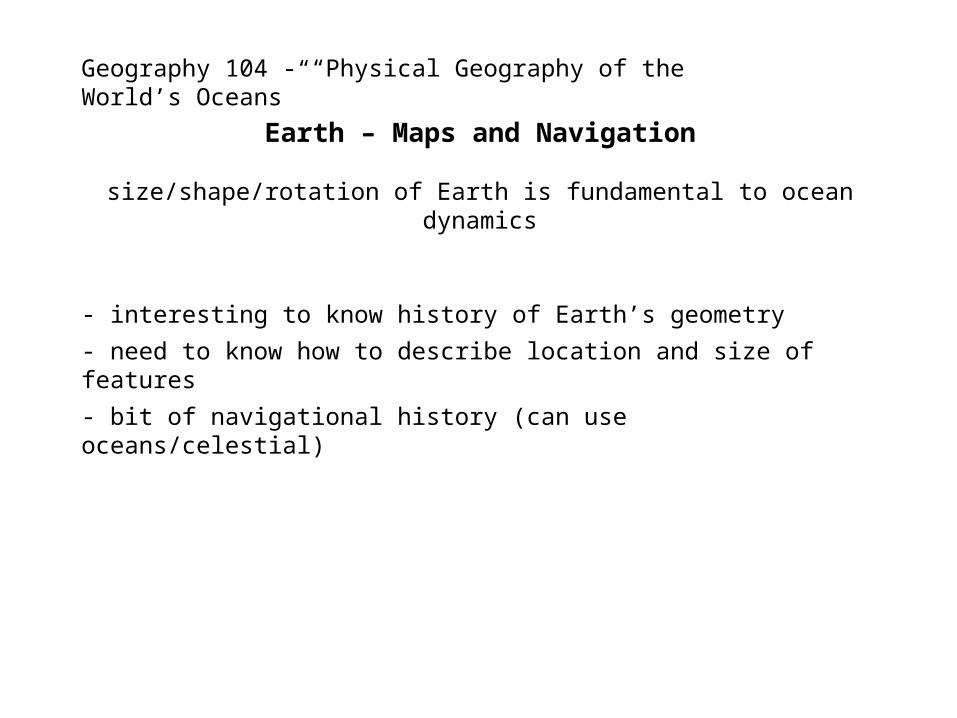
Greek mathematician, poet, athlete, geographer and astronomer
Eratosthenes of Cyrene (c.275-192):
http://www.livius.org/aj-al/alexander/alexander_t33.html
Interesting to know
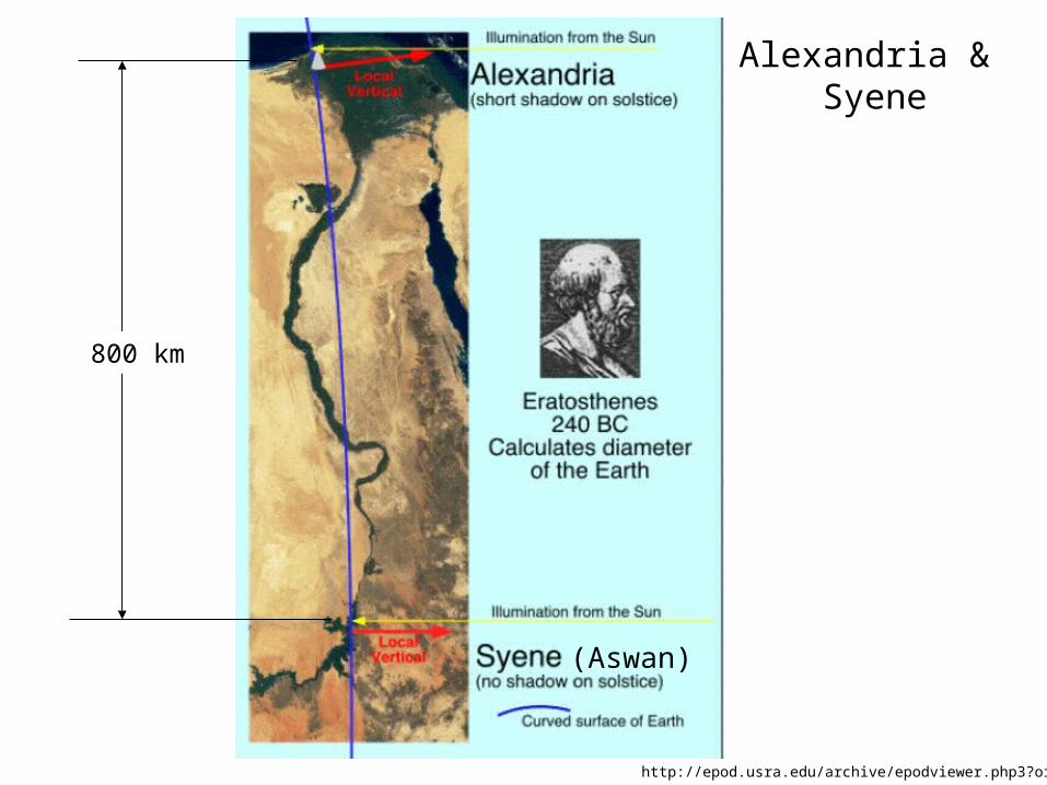
http://epod.usra.edu/archive/epodviewer.php3?oid=61280
800 km
Alexandria & Syene
(Aswan)
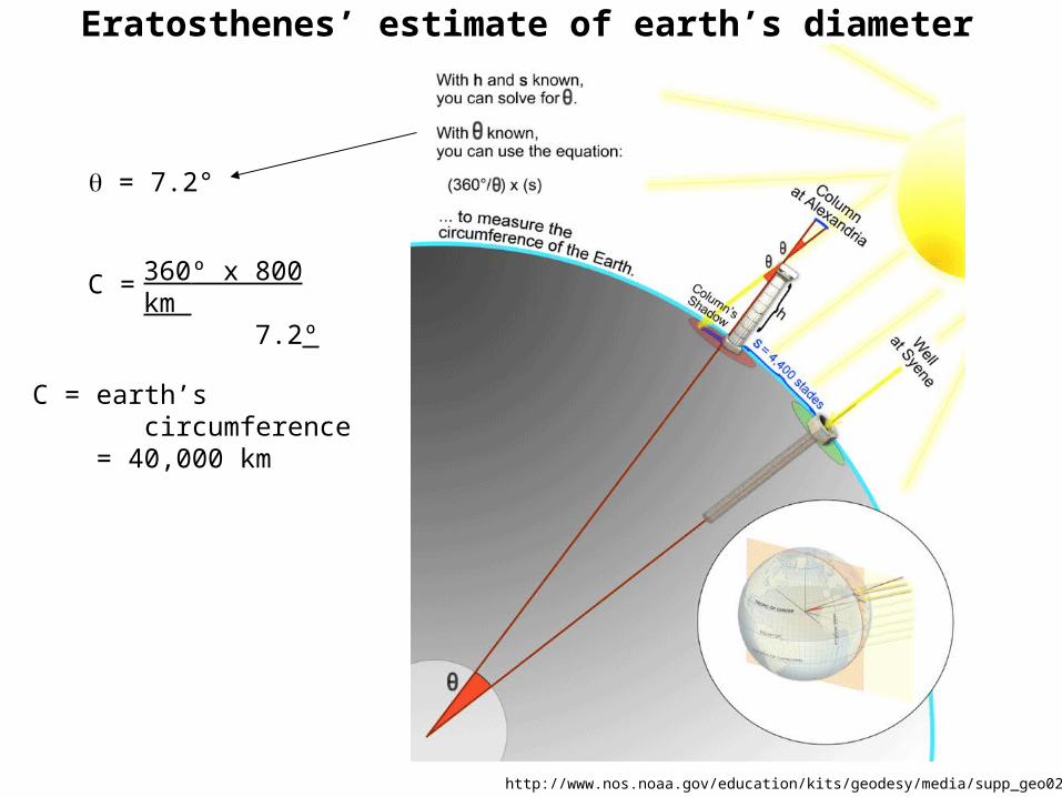
Eratosthenes’ estimate of earth’s diameter
http://www.nos.noaa.gov/education/kits/geodesy/media/supp_geo02a.html
360º x 800 km 7.2º
C =
C = earth’s circumference = 40,000 km
= 7.2°
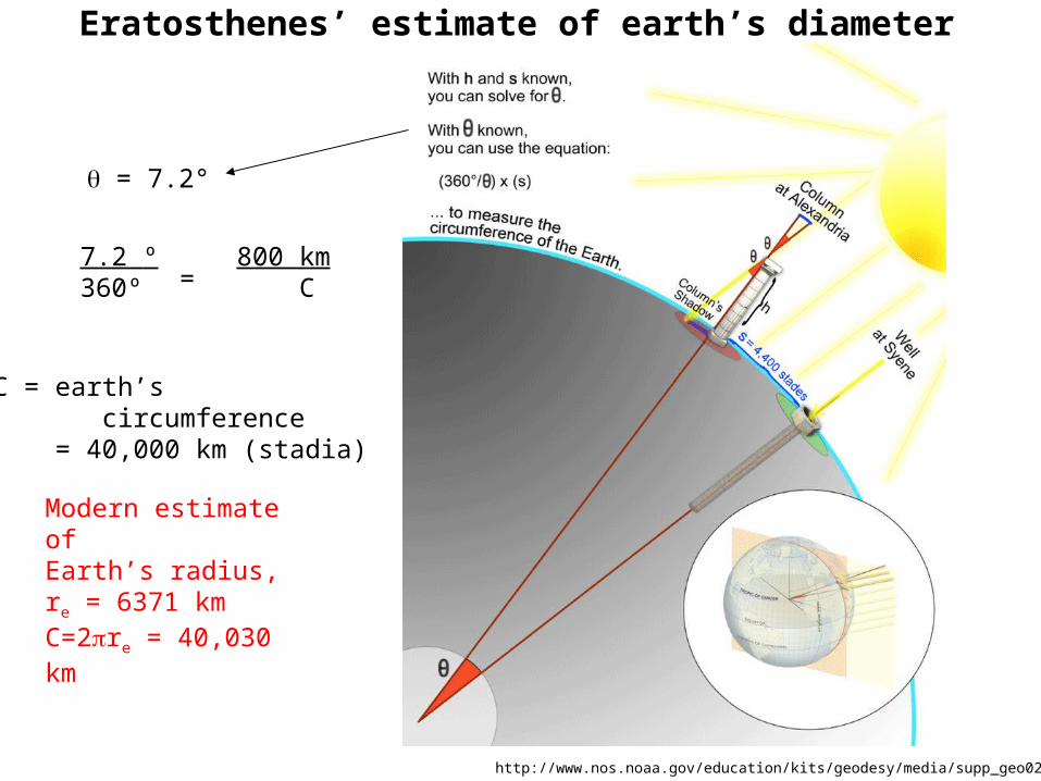
Eratosthenes’ estimate of earth’s diameter
http://www.nos.noaa.gov/education/kits/geodesy/media/supp_geo02a.html
7.2 º360º =
800 km C
C = earth’s circumference = 40,000 km (stadia)
= 7.2°
Modern estimate of Earth’s radius,re = 6371 kmC=2re = 40,030 km
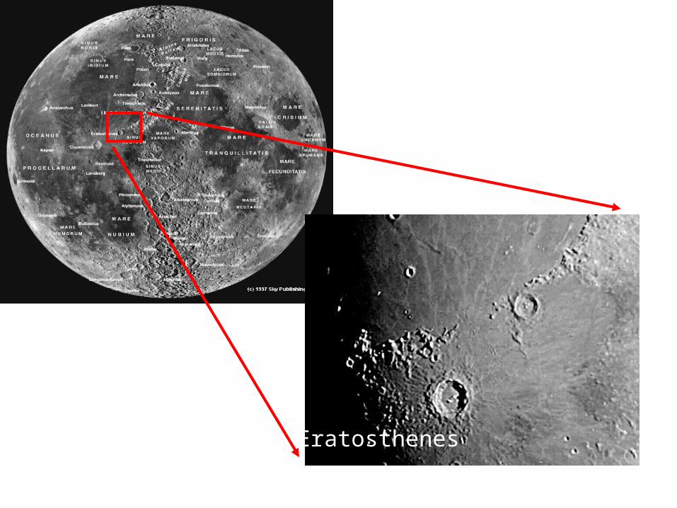
Eratosthenes

polar radius = 6357 kmequatorial radius = 6378 = 0.9967
radius of sphere with Earth’s volume is 6371 km
non-spherical shape important for satellite orbits
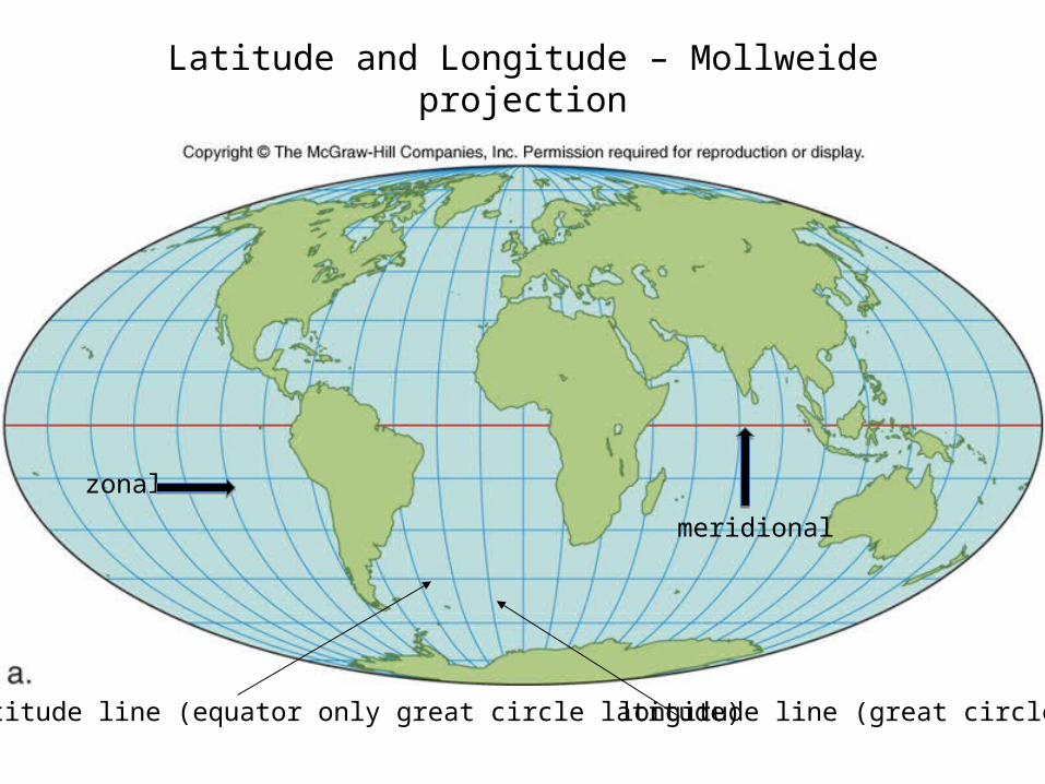
Latitude and Longitude – Mollweide projection
latitude line (equator only great circle latitude) longitude line (great circle)
zonal
meridional
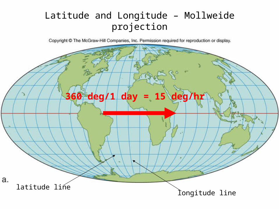
Latitude and Longitude – Mollweide projection
latitude line longitude line
360 deg/1 day = 15 deg/hr
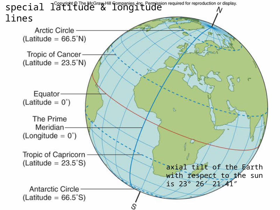
special latitude & longitude lines
axial tilt of the Earth with respect to the sun is 23° 26′ 21.41″
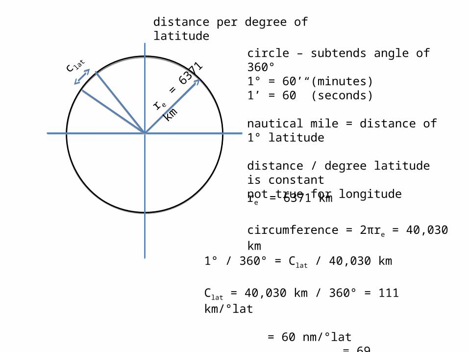
circle – subtends angle of 360°1° = 60’ (minutes)1’ = 60” (seconds)
nautical mile = distance of 1° latitude
distance / degree latitude is constantnot true for longitude
re = 6371 km
circumference = 2πre = 40,030 km
r e =
637
1 kmc lat
1° / 360° = Clat / 40,030 km
Clat = 40,030 km / 360° = 111 km/°lat = 60 nm/°lat
= 69 mi/°lat
distance per degree of latitude
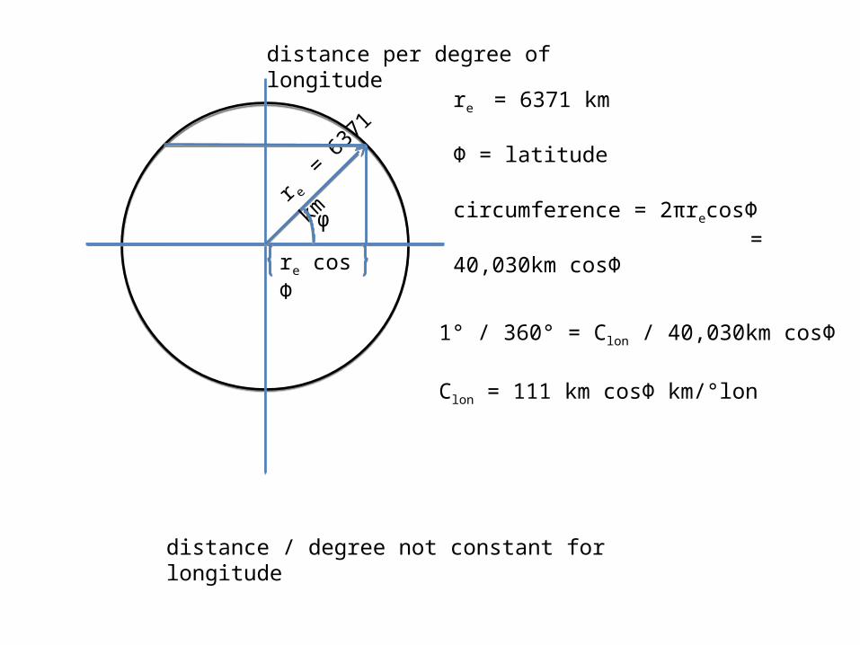
distance / degree not constant for longitude
re = 6371 km
Φ = latitude
circumference = 2πrecosΦ = 40,030km cosΦ
r e =
637
1 km
1° / 360° = Clon / 40,030km cosΦ
Clon = 111 km cosΦ km/°lon
distance per degree of longitude
ϕ
re cos Φ
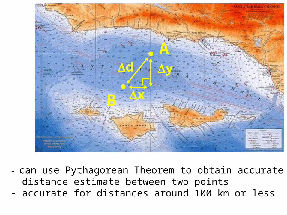
A
B
d
x
y
- can use Pythagorean Theorem to obtain accurate distance estimate between two points- accurate for distances around 100 km or less
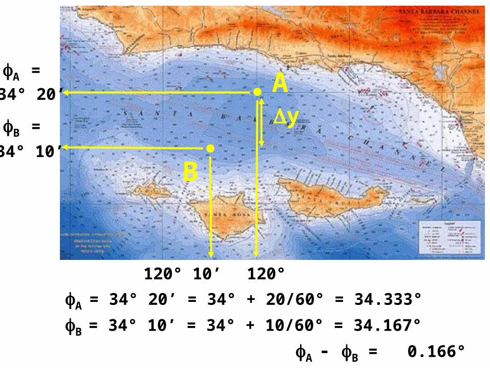
34° 20’
34° 10’
120° 10’ 120°
A
B
A = 34° 20’ = 34° + 20/60° = 34.333°
B = 34° 10’ = 34° + 10/60° = 34.167°
A - B = 0.166°
A =
B = y
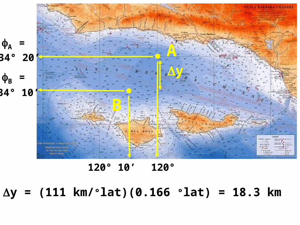
34° 20’
34° 10’
120° 10’ 120°
A
B
y = (111 km/°lat)(0.166 °lat) = 18.3 km
A =
B = y
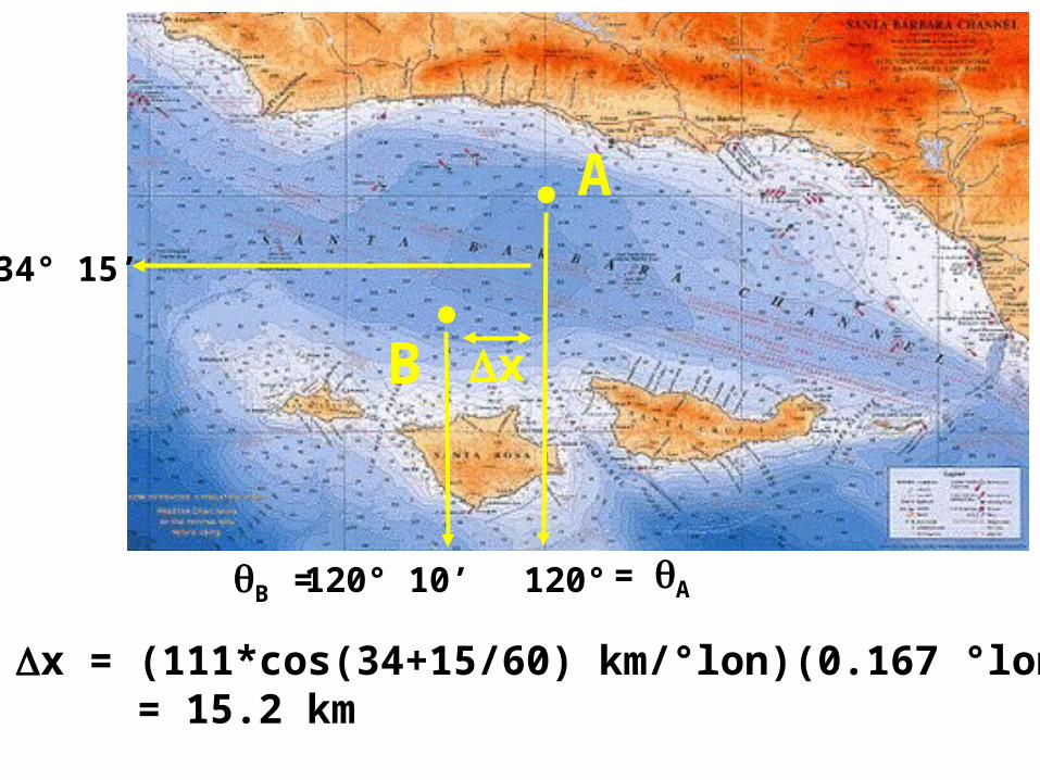
120° 10’ 120°
A
B
=AB =
x
x = (111*cos(34+15/60) km/°lon)(0.167 °lon) = 15.2 km
34° 15’
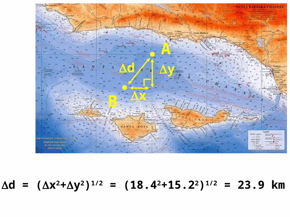
A
B
d
x
y
d = (x2+y2)1/2 = (18.42+15.22)1/2 = 23.9 km
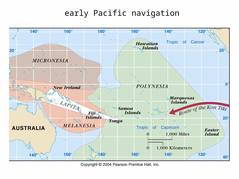
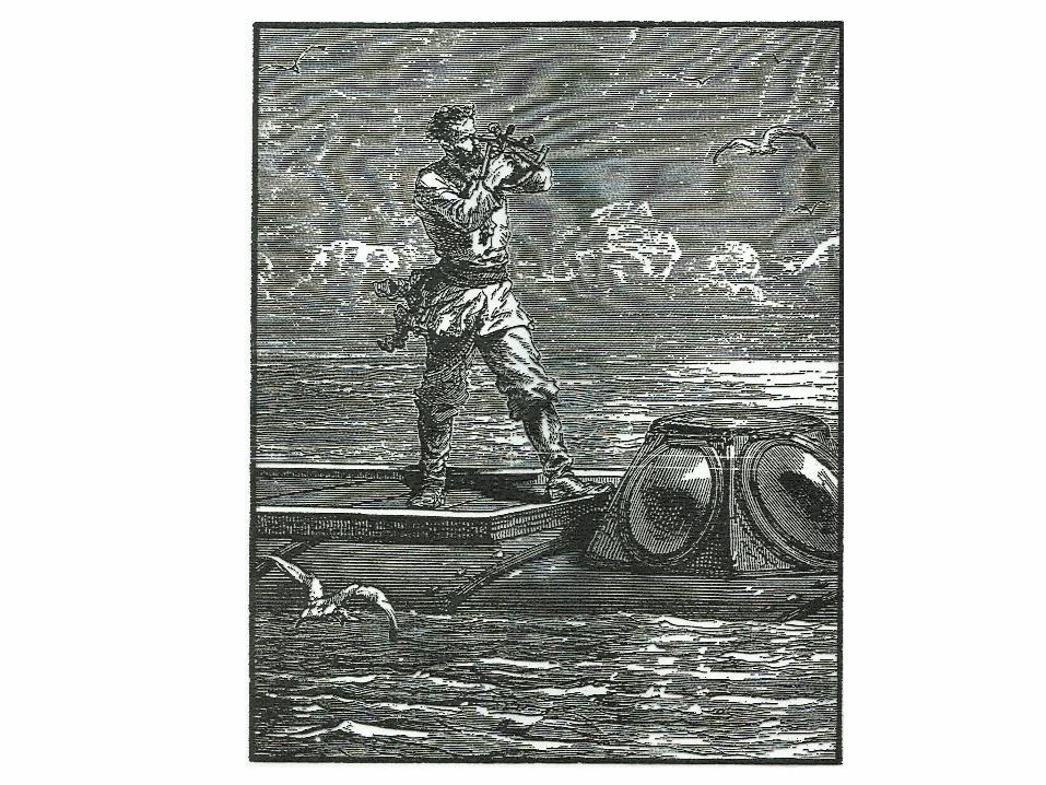
early Pacific navigation
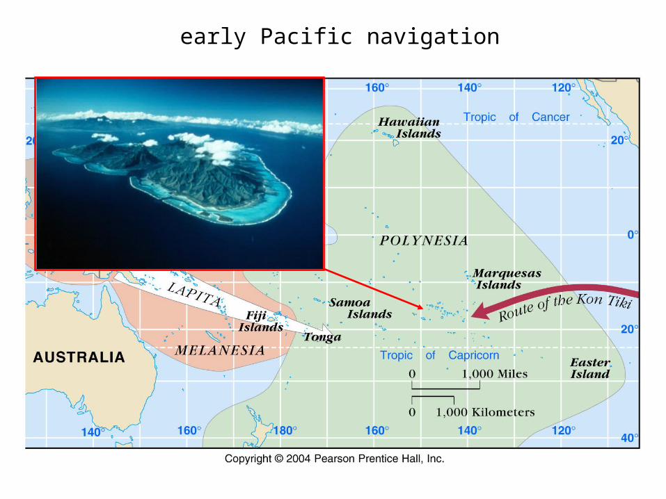
early Pacific navigation
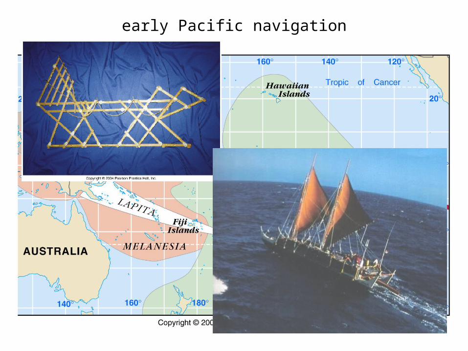
early Pacific navigation
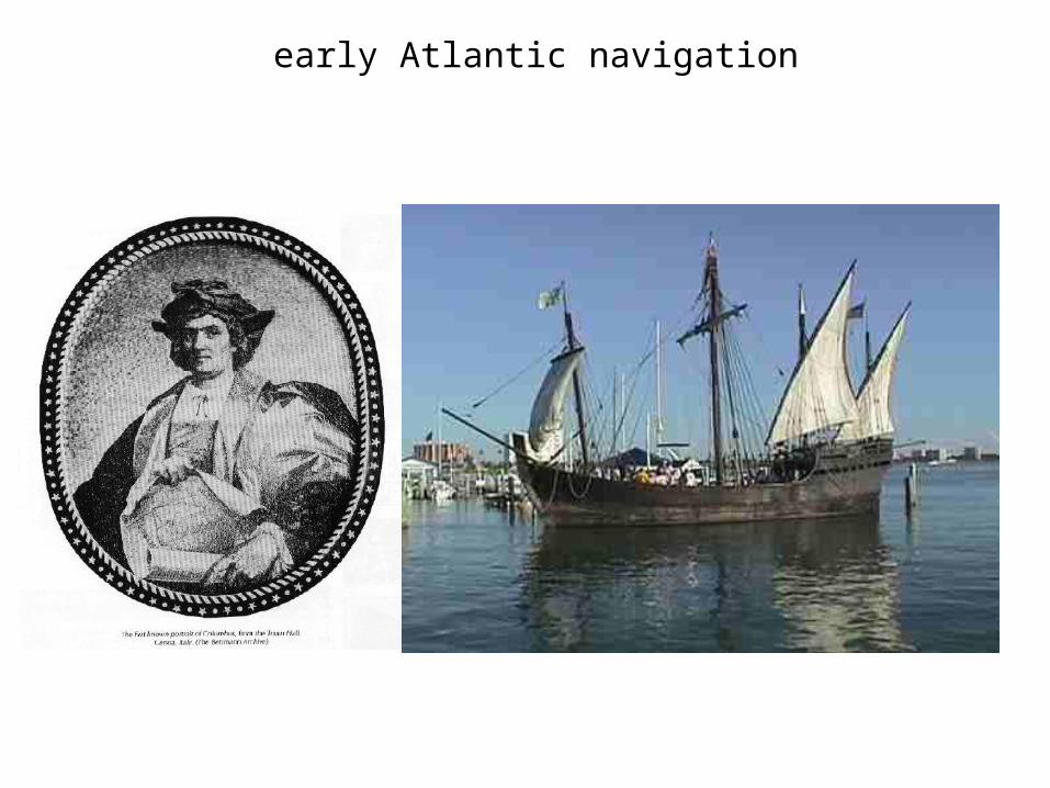
early Atlantic navigation
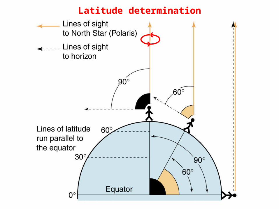
Latitude determination
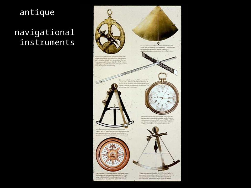
antique navigational instruments
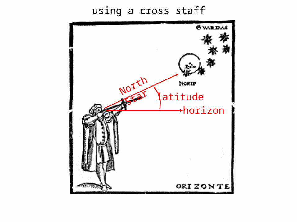
horizon
North Star
latitude
using a cross staff
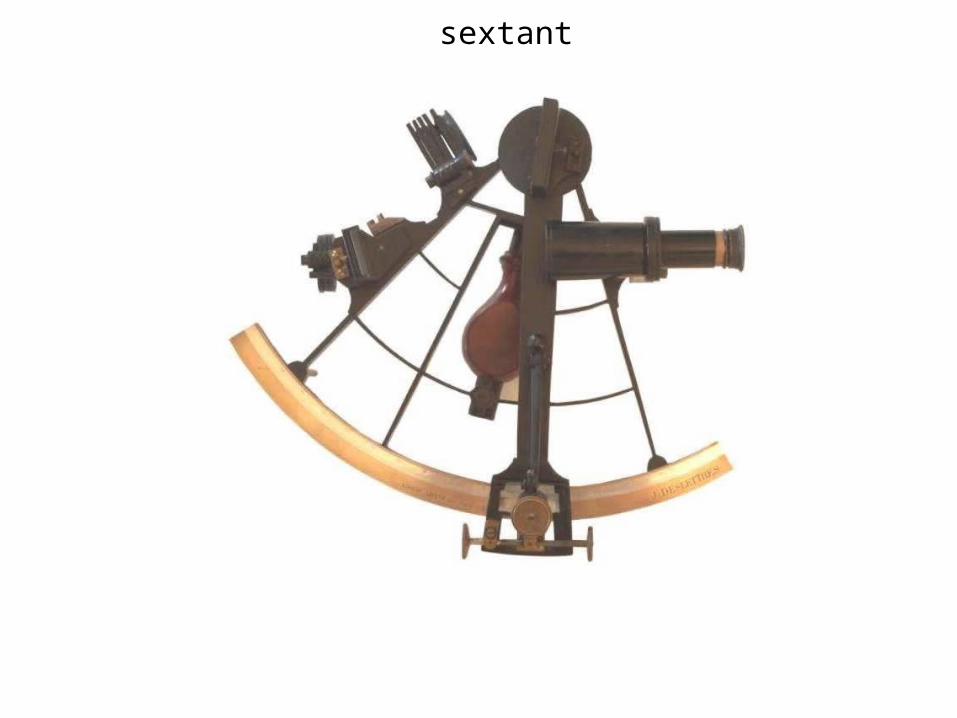
sextant
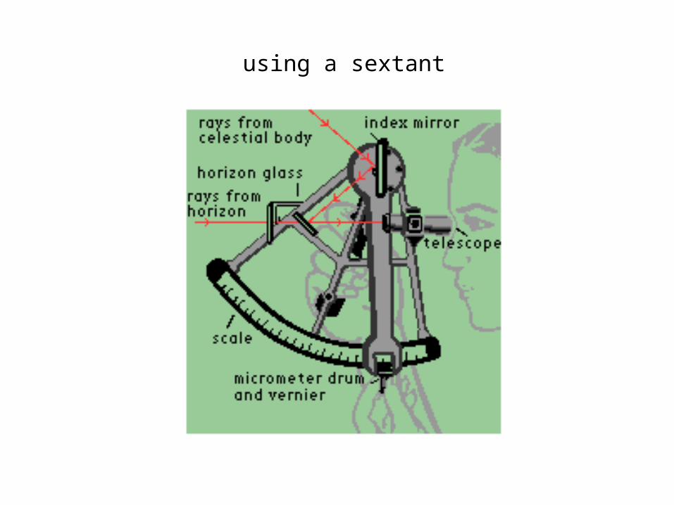
using a sextant
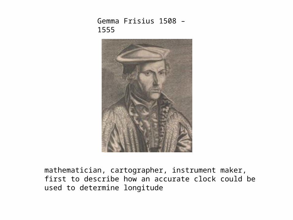
Gemma Frisius 1508 – 1555
mathematician, cartographer, instrument maker, first to describe how an accurate clock could be used to determine longitude
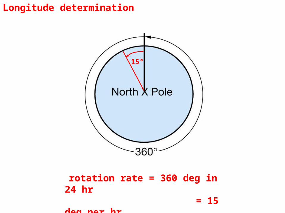
Longitude determination
rotation rate = 360 deg in 24 hr = 15 deg per hr
15°
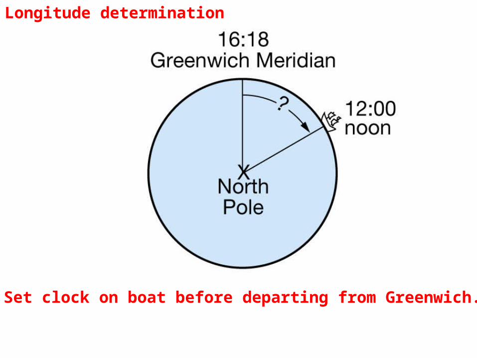
Set clock on boat before departing from Greenwich.
Longitude determination
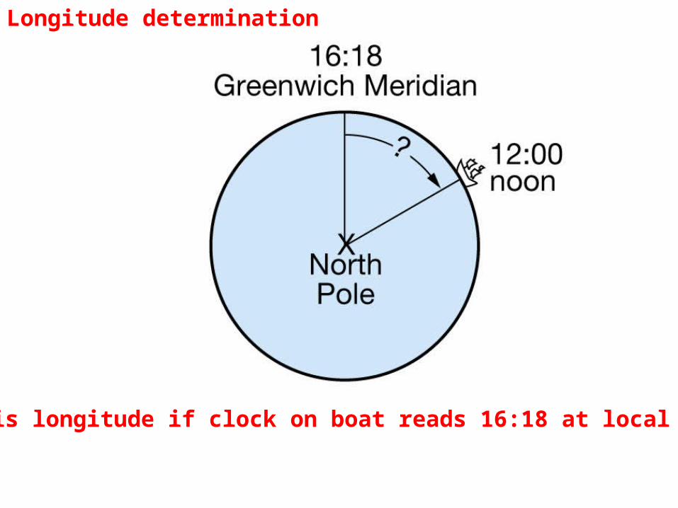
What is longitude if clock on boat reads 16:18 at local noon?
Longitude determination
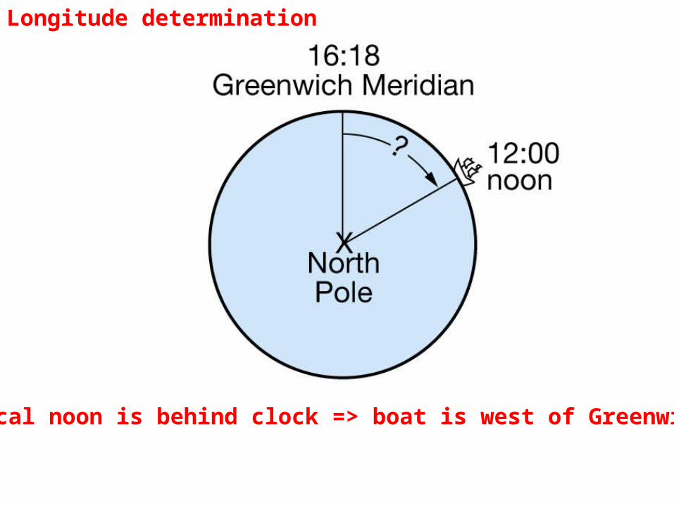
Local noon is behind clock => boat is west of Greenwich
Longitude determination
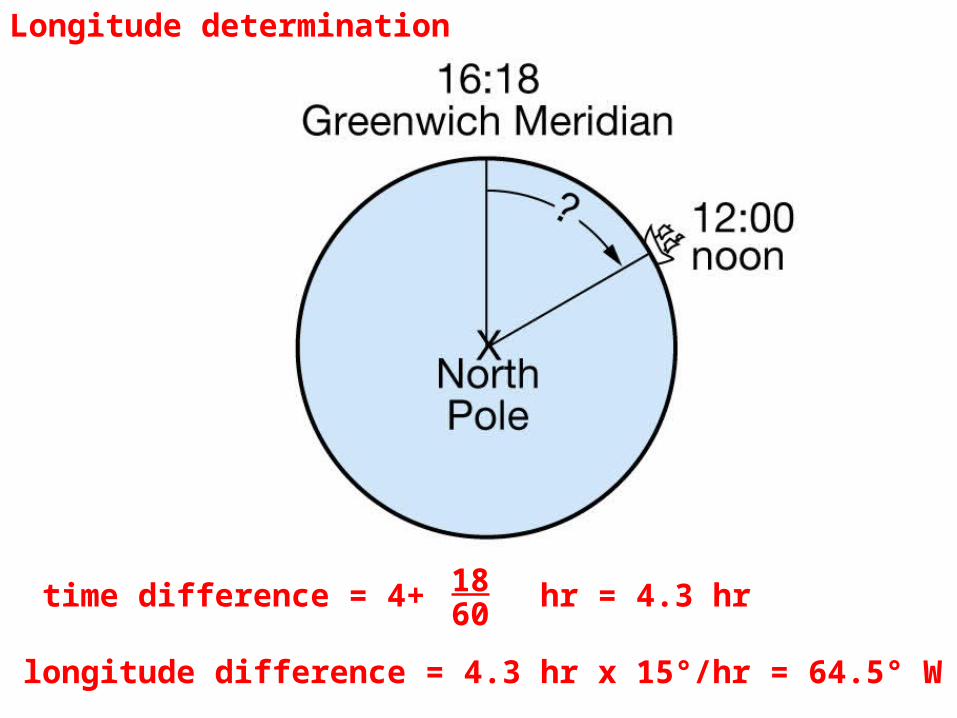
time difference = 4+ hr = 4.3 hr longitude difference = 4.3 hr x 15°/hr = 64.5° W
1860
Longitude determination
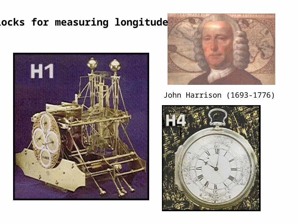
John Harrison (1693-1776)
Clocks for measuring longitude
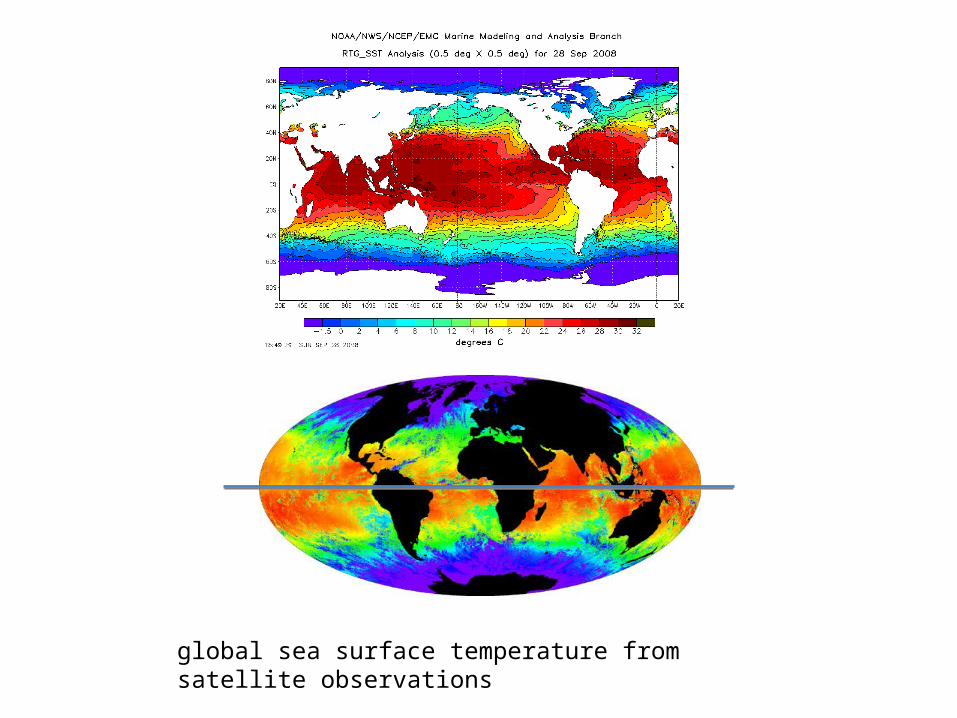
global sea surface temperature from satellite observations
Readings for next time (Seafloor):-Read Chapter 4 “Seafloor Features”; article “Emergence of Complex Societies After Sea Level Stabilized”; article “Risk of Rising Sea Level to Population and Land Area”