Embed Size (px)
Citation preview
EART163 Planetary Surfaces
Francis Nimmo

Course Overview • How did the planetary surfaces we see form and
evolve? What processes are/were operating?
• Techniques to answer these questions:
– Images
– Modelling/Quantitative analysis
– Comparative analysis and analogues
• Case studies – examples from this Solar System
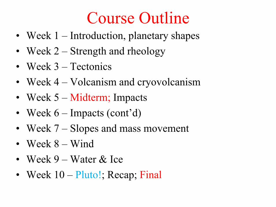
Course Outline • Week 1 – Introduction, planetary shapes
• Week 2 – Strength and rheology
• Week 3 – Tectonics
• Week 4 – Volcanism and cryovolcanism
• Week 5 – Midterm; Impacts
• Week 6 – Impacts (cont’d)
• Week 7 – Slopes and mass movement
• Week 8 – Wind
• Week 9 – Water & Ice
• Week 10 – Pluto!; Recap; Final

Pluto! (and Charon)

Logistics • Website:
http://www.es.ucsc.edu/~fnimmo/eart163
• Set text – Melosh, Planetary Surface Processes (2011)
• Prerequisites – 160; some knowledge of calculus
• Grading – based on weekly homeworks (~30%), midterm (~20%), final (~50%).
• Homeworks due on Tuesdays
• Location/Timing – TuTh 12:00-1:45pm D226 E&MS
• Office hours – TuTh 1:45-2:45pm (A219 E&MS) or by appointment (email: [email protected])
• Questions/feedback? - Yes please!

Expectations
• Homework typically consists of 3 questions
• Grad students will have one extra question (harder)
• If it’s taking you more than 1 hour per question on average, you’ve got a problem – come and see me
• Midterm/finals consist of short (compulsory) and long (pick from a list) questions
• In both the midterm and the final you will receive a formula sheet
• Showing up and asking questions are usually routes to a good grade
• Plagiarism – see website for policy.
• Disability issues – see website for policy.
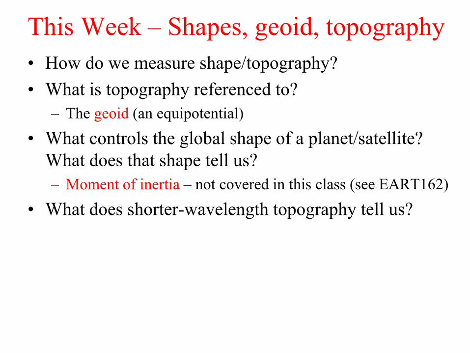
This Week – Shapes, geoid, topography
• How do we measure shape/topography?
• What is topography referenced to?
– The geoid (an equipotential)
• What controls the global shape of a planet/satellite?
What does that shape tell us?
– Moment of inertia – not covered in this class (see EART162)
• What does shorter-wavelength topography tell us?

How high are you?
• What is the elevation measured relative to?
– Mean Sea Level (Earth)
– Constant Radius Sphere (Mercury, Venus)
– Geoid at 6.1 mbar (Mars)
– Center of Mass (Asteroids)
• Geoid (see later)
– Equipotential Surface
– Would be sea level if there was a sea
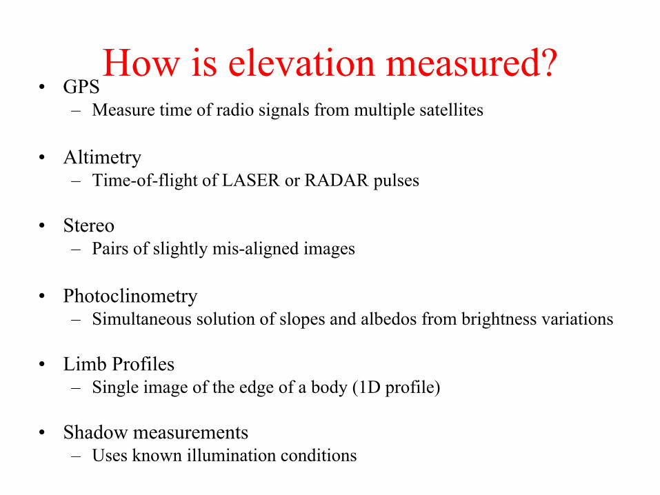
How is elevation measured? • GPS
– Measure time of radio signals from multiple satellites
• Altimetry – Time-of-flight of LASER or RADAR pulses
• Stereo – Pairs of slightly mis-aligned images
• Photoclinometry – Simultaneous solution of slopes and albedos from brightness variations
• Limb Profiles – Single image of the edge of a body (1D profile)
• Shadow measurements – Uses known illumination conditions
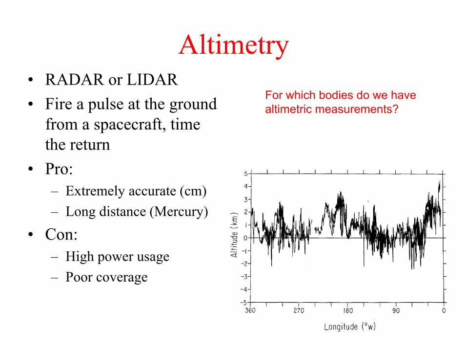
Altimetry • RADAR or LIDAR
• Fire a pulse at the ground
from a spacecraft, time
the return
• Pro:
– Extremely accurate (cm)
– Long distance (Mercury)
• Con:
– High power usage
– Poor coverage
For which bodies do we have
altimetric measurements?
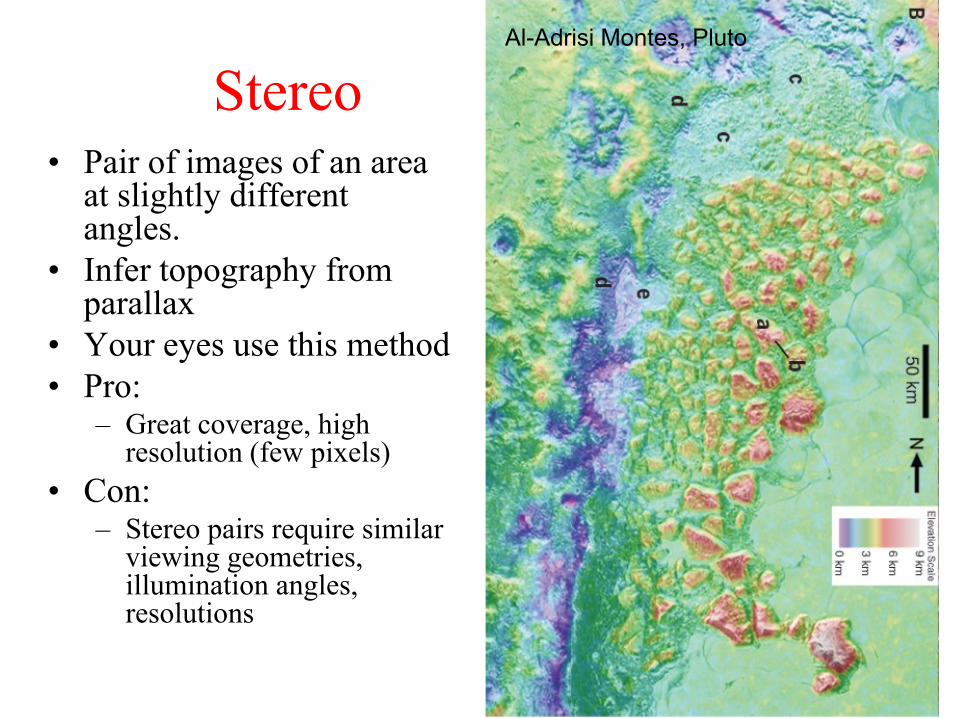
Stereo • Pair of images of an area
at slightly different angles.
• Infer topography from parallax
• Your eyes use this method
• Pro: – Great coverage, high
resolution (few pixels)
• Con: – Stereo pairs require similar
viewing geometries, illumination angles, resolutions
Al-Adrisi Montes, Pluto

LOLA 128 ppd versus
Kaguya Terrain Camera Stereo Data (7 m/px )
Image courtesy Caleb Fassett
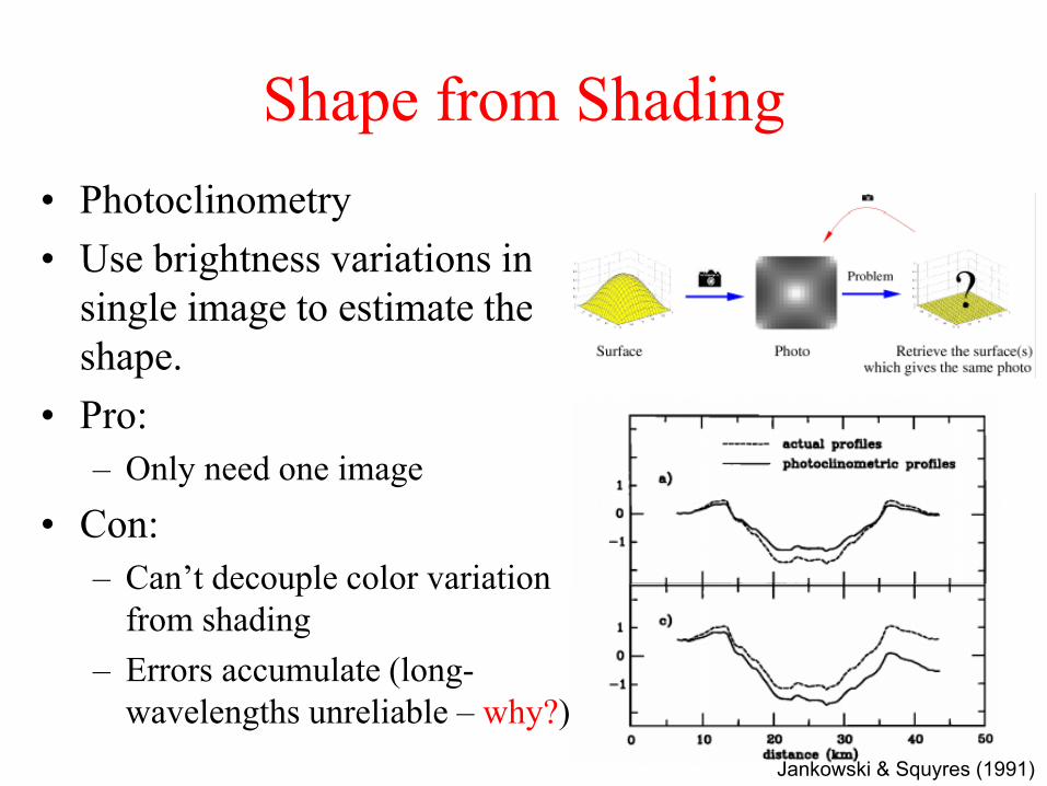
Shape from Shading
• Photoclinometry
• Use brightness variations in a
single image to estimate the
shape.
• Pro:
– Only need one image
• Con:
– Can’t decouple color variation
from shading
– Errors accumulate (long-
wavelengths unreliable – why?)
Jankowski & Squyres (1991)
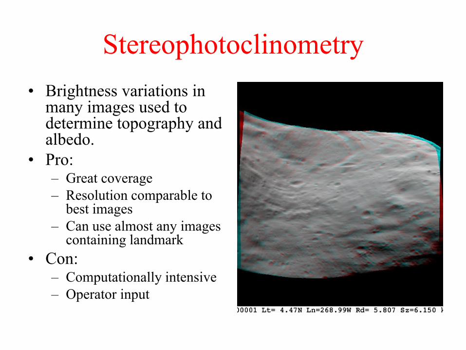
Stereophotoclinometry
• Brightness variations in many images used to determine topography and albedo.
• Pro: – Great coverage
– Resolution comparable to best images
– Can use almost any images containing landmark
• Con: – Computationally intensive
– Operator input
Dermott and Thomas 1988
~0.1 pixel accuracy
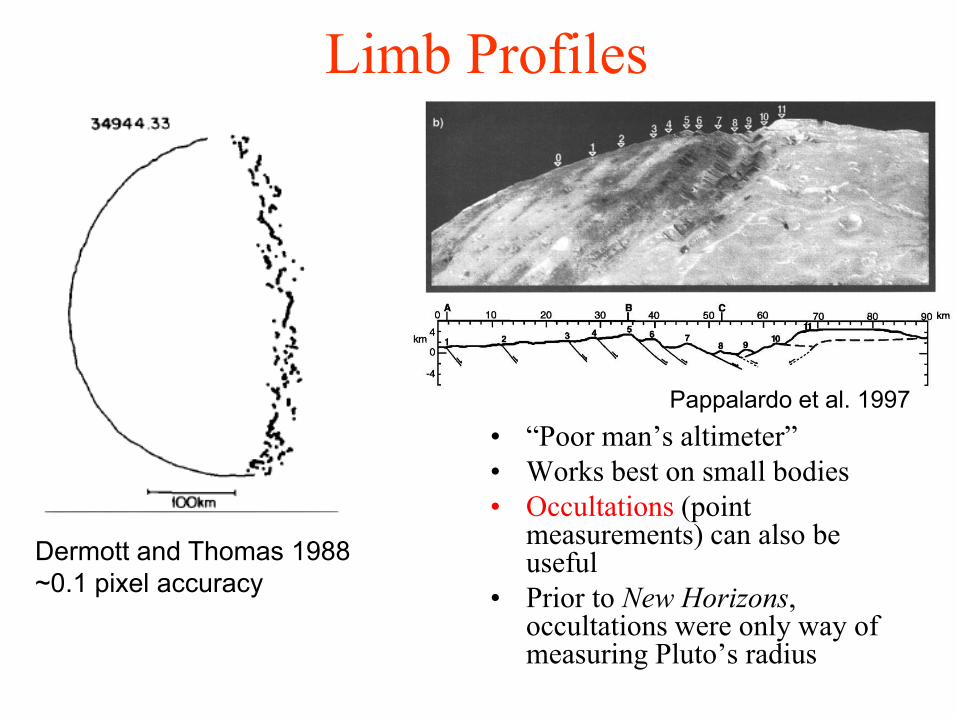
Limb Profiles
Pappalardo et al. 1997
• “Poor man’s altimeter”
• Works best on small bodies
• Occultations (point measurements) can also be useful
• Prior to New Horizons, occultations were only way of measuring Pluto’s radius
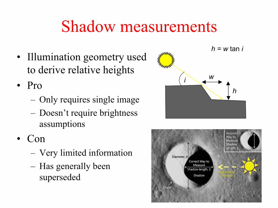
Shadow measurements
• Illumination geometry used
to derive relative heights
• Pro
– Only requires single image
– Doesn’t require brightness
assumptions
• Con
– Very limited information
– Has generally been
superseded
h
w i
h = w tan i
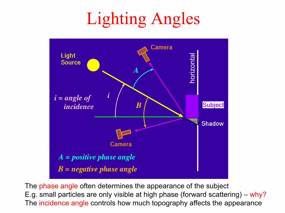
Lighting Angles
The phase angle often determines the appearance of the subject
E.g. small particles are only visible at high phase (forward scattering) – why?
The incidence angle controls how much topography affects the appearance
hori
zonta
l

Shadows • High incidence angle
– Longer shadows
– Easier to see topography
• Low incidence angle
– Topo washed out
– See inherent brightness
(albedo) variations
i
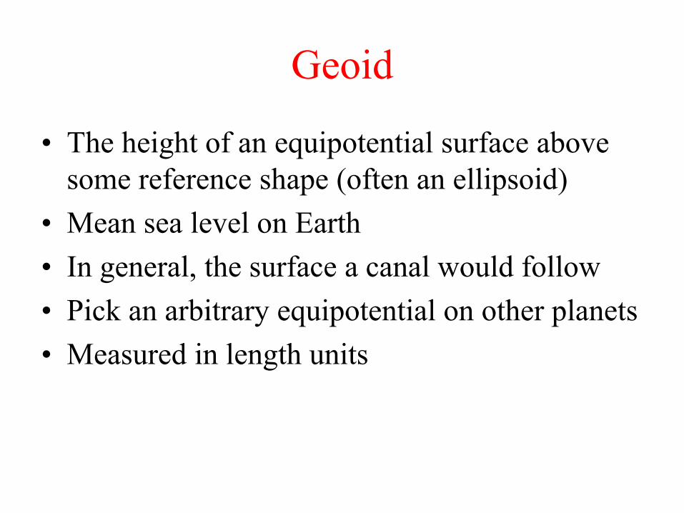
Geoid
• The height of an equipotential surface above
some reference shape (often an ellipsoid)
• Mean sea level on Earth
• In general, the surface a canal would follow
• Pick an arbitrary equipotential on other planets
• Measured in length units
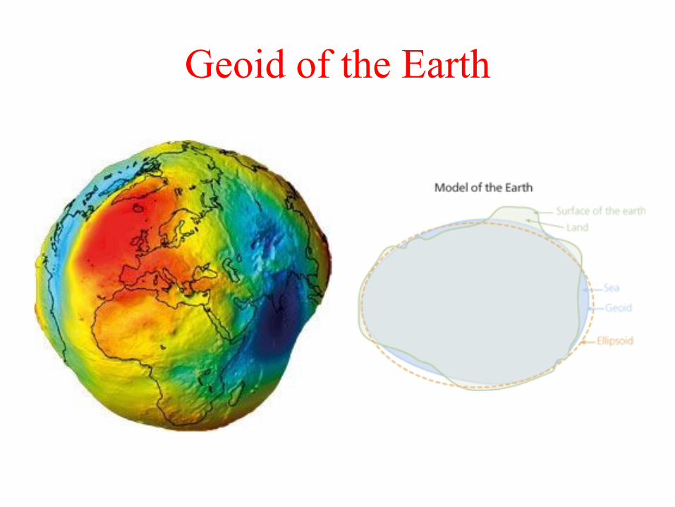
Geoid of the Earth

Gravitational Potential V • Gravitational potential is the work done to bring a
unit mass from infinity to the point in question:
rr
drrgdrm
rFV )(
)(
• For a spherically symmetric body we have
2)(
r
GMmrF
which gives us
r
GMV a
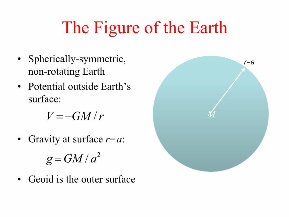
The Figure of the Earth
• Spherically-symmetric,
non-rotating Earth
• Potential outside Earth’s
surface:
• Gravity at surface r=a:
• Geoid is the outer surface
M V =-GM / r
r=a
g =GM / a2
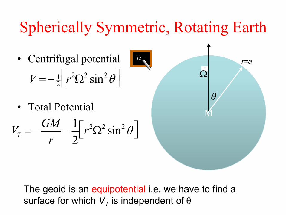
Spherically Symmetric, Rotating Earth
• Centrifugal potential
• Total Potential
M
r=a
V =- 12r2W2 sin2qéë
ùû
W
q
VT = -GM
r-1
2r2W2 sin2qéë
ùû
The geoid is an equipotential i.e. we have to find a
surface for which VT is independent of q
a

What is the geoid?
• Find a surface of constant
VT: r = a + dr(q)
• This is true for a rigid
planet – for fluid planets
it is only approximate
qqd 242
sin2
const.)(GM
ar
M M M
r=a
W
q
Line of constant potential
(this is the level a canal
would be at)
Potential (and gT)
smaller at surface
Potential (and gT)
larger at surface
1. Centrifugal force offsets gravity at equator
2. Going from pole to equator is walking “downhill”
a

Equatorial Bulge & Flattening • Define the flattening f:
• From the previous page we have
• What is the physical explanation for this expression?
• For the Earth, f~1/300 i.e. small (~22 km)
• What happens if 2a/g~1?
a
caf
c
a
GM
aca
2
42
g
a
GM
af
232
2
1
2
1 So
Remember these equations are approximate – assume a rigid body!
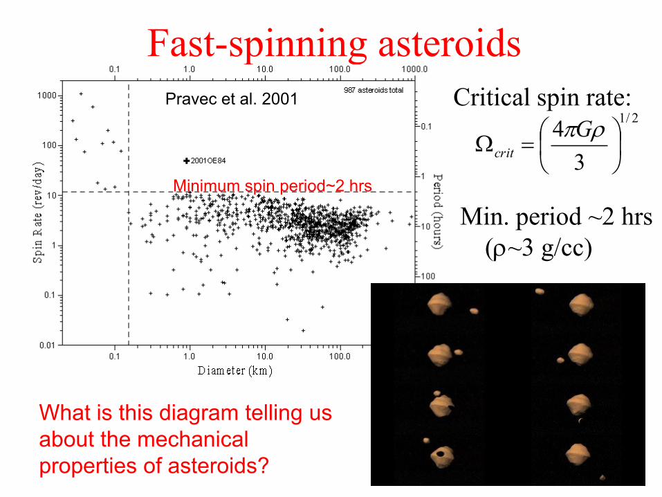
Fast-spinning asteroids
Pravec et al. 2001 2/1
3
4
Gcrit
Critical spin rate:
Min. period ~2 hrs
(~3 g/cc)
Minimum spin period~2 hrs
What is this diagram telling us
about the mechanical
properties of asteroids?

Why do asteroids spin so fast?
• Photons carry momentum!
• Absorption and reradiation of photons can change the spins and
orbits of small bodies
• Depends on surface area:volume ratio and distance from Sun
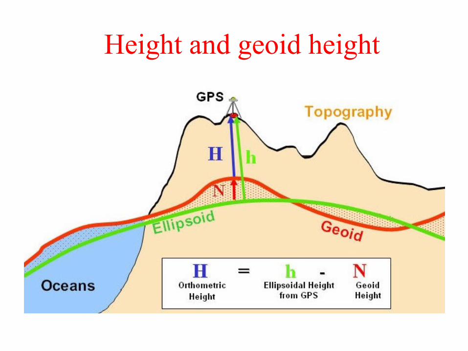
Height and geoid height

Satellite shapes • Deformed by tides and
rotation
• Triaxial ellipsoid (not oblate spheroid)
• For synchronous satellites (i.e. most of them)
c
a (tidal axis) b
g
RRa
2
12
351
g
RRb
2
12
101
g
RRc
2
12
251
The equipotential surface shape is given by:
This is the shape a fluid satellite would adopt.
Any such satellite will have (a-c)/(b-c)=4 and f=52a/g

Table of Shapes
Body 2a/g a (km) b (km) c (km) (a-c)/a (a-c)/(b-c) Notes
Earth 0.0034 6378 6378 6357 0.0033 1 fluid
Jupiter 0.089 71492 71492 66854 0.065 1 fluid
Io 0.0017 1830.0 1819.2 1815.6 0.0079 4.0 fluid
Titan 0.000040 2575.15 2574.78 2574.47 0.00026 2.2 Not fluid
Mars 0.0046 3397 3397 3375 0.0065 1 Not fluid
g
a
a
ca
2
)( 2
1
)(
)(
cb
caFluid planet predictions:
g
a
a
ca 25)(
4
)(
)(
cb
caFluid satellite predictions:
Remember these equations are approximate
A more rigorous expression is given in EART162
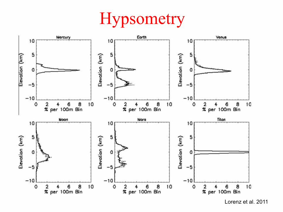
Hypsometry
Lorenz et al. 2011

Topographic Roughness
Local slopes at
0.6, 2.4 and 19.2
km baselines
(Kreslavsky and
Head 2000)
Global topography
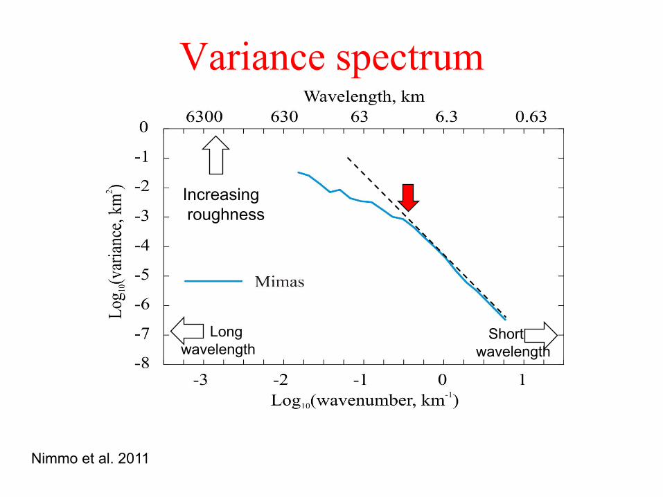
Variance spectrum
Short
wavelength
Long
wavelength
Increasing
roughness
Nimmo et al. 2011
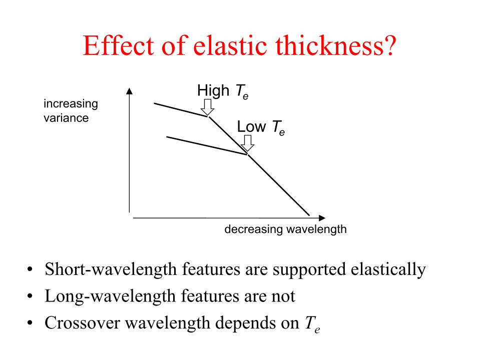
Effect of elastic thickness?
• Short-wavelength features are supported elastically
• Long-wavelength features are not
• Crossover wavelength depends on Te
increasing
variance
decreasing wavelength
Low Te
High Te

Summary – Shapes, geoid, topography
• How do we measure shape/topography?
– GPS, altimetry, stereo, photoclinometry, limb profiles, shadows
• What is topography referenced to?
– Usually the geoid (an equipotential)
– Sometimes a simple ellipsoid (Venus, Mercury)
• What controls the global shape of a planet/satellite?
What does that shape tell us?
– Rotation rate, density, (rigidity)
– Fluid planet f~2a/2g Satellite f~52a/g
• What does shorter-wavelength topography tell us?
– Hypsometry, roughness, elastic thickness?

Earth
• Referenced to ellipsoid
• Bimodal distribution of
topography
• No strong correlation with
gravity at large scales
• Long-wavelength gravity
dominated by internal
density anomalies
– Mantle convection!
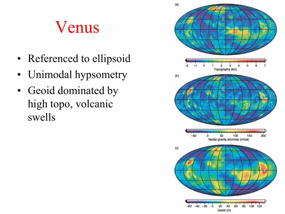
Venus
• Referenced to ellipsoid
• Unimodal hypsometry
• Geoid dominated by
high topo, volcanic
swells

Mars
• Referenced to ellipsoid
• Bimodal hypsometry
(hemispheric
dichotomy)
• Huge gravity/geoid
anomaly, dominated by
tharsis
• High correlation
between topo and grav.
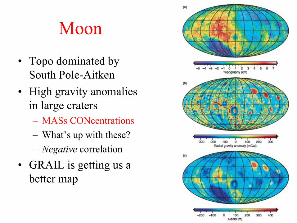
Moon
• Topo dominated by
South Pole-Aitken
• High gravity anomalies
in large craters
– MASs CONcentrations
– What’s up with these?
– Negative correlation
• GRAIL is getting us a
better map
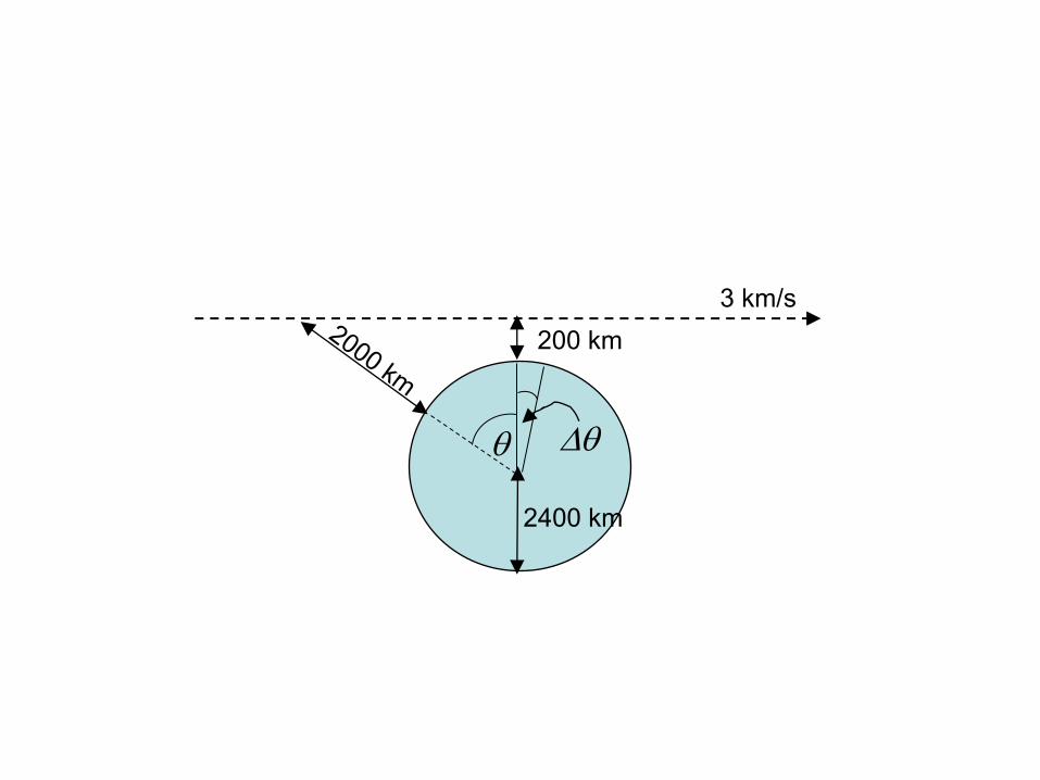
200 km
2400 km
3 km/s
q Dq