Embed Size (px)
Citation preview
Headline Bold Ipsum loremHeadline Light
Key FeaturesEasy to define mission parameters and restrictions
Waypoint Insertion
Context Menus for common functions
Route Copy between aircraft
Easy route planning
Manage multiple aircraft on single map
High performance smooth zoom 2D and 3D terrain mapping
Terrain database supporting DTED and SRTM
Integration with web mapping servers for elevation and imagery
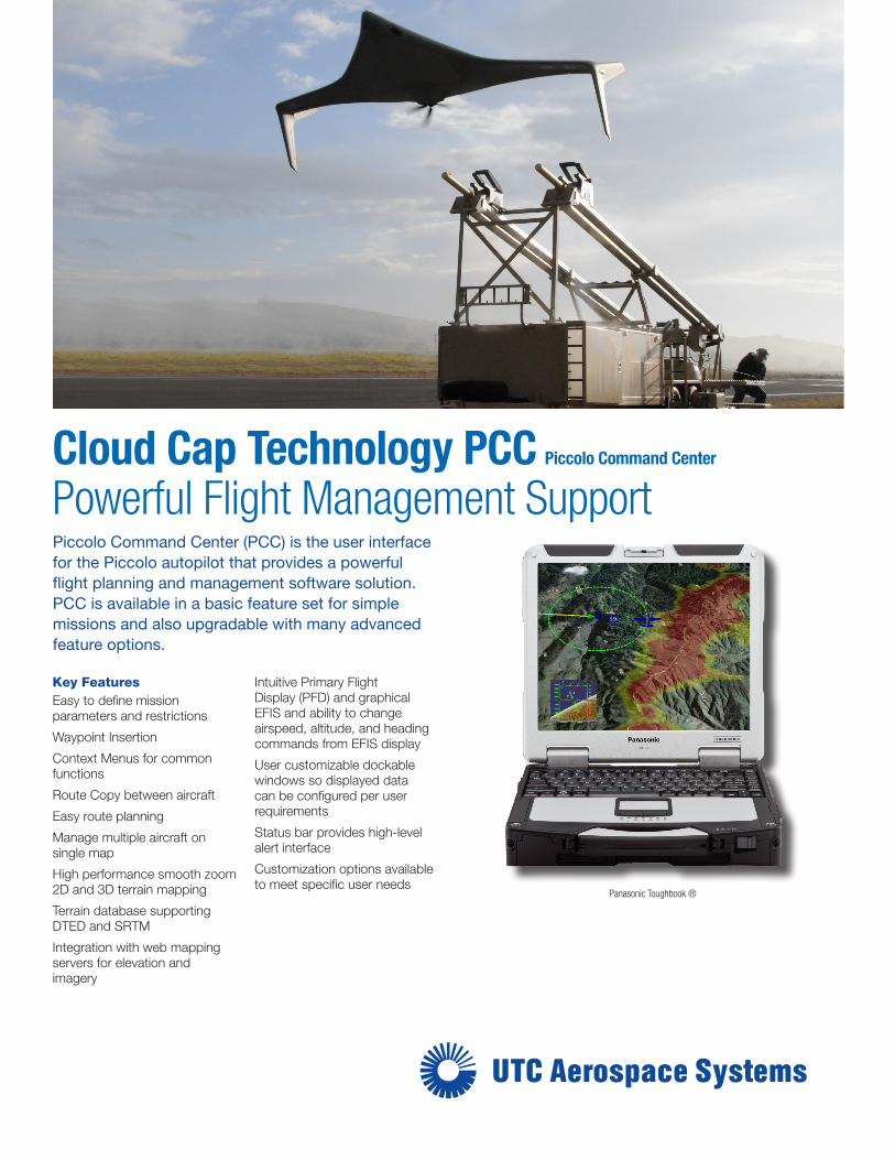
Intuitive Primary Flight Display (PFD) and graphical EFIS and ability to change airspeed, altitude, and heading commands from EFIS display
User customizable dockable windows so displayed data can be configured per user requirements
Status bar provides high-level alert interface
Customization options available to meet specific user needs
Piccolo Command Center (PCC) is the user interface for the Piccolo autopilot that provides a powerful flight planning and management software solution. PCC is available in a basic feature set for simple missions and also upgradable with many advanced feature options.
Cloud Cap Technology PCC Piccolo Command Center Powerful Flight Management Support
Panasonic Toughbook ®

For additional information:Cloud Cap Technology202 Wasco Loop, Suite 103Hood River, OR 97031USAPh: +1.541.387.2120www.cloudcaptech.com
Cloud Cap TechnologyTASE Stabilized Gimbals
OSR approval no. 13-S-1506. This document does not contain EAR technology or ITAR technical data. Due to our continued efforts in product improvement, all product specifications are subject to change without notice. March 2014
Accelerate your time to unmanned success! The Piccolo Command Center (PCC) overview course helps customers understand the basics of operating a Piccolo Autopilot through the standard interface. Flight training at a desired flight facility can also be accommodated and supported, call for details.
Intuitive Primary Flight Display, graphical EFIS, and customizable dockable windows integrate all flight parameters into one optimized display.
Geo Fence (right) sets hard limits on where the aircraft can be commanded to go.
Powerful Flight Management Support
Piccolo Command Center is the user interface for the Piccolo autopilot including flight planning and access to all of the Piccolo features. The PCC software can be used as a fully functional free software download, or a license can be purchased to enable many advanced features
The Basic Feature Set includes the following features at no cost:
Dockable windows, context menus for common functions.
Complete support for all Piccolo controlled vehicles.
Primary Flight Display and graphical EFIS with the ability to change airspeed, altitude and heading.
Real-time flight planning. Flexible drag and drop flight plan generation and updates.
Integration with web mapping servers for elevation imagery data.
View multiple aircraft on single map. Route copy between aircraft.
The Full Feature Set includes the following additional features with purchased license:
Terrain aware flight planning and warning system. 3-D views, high performance mapping with the profile viewer. Terrain database supporting DTED and SRTM.
Geo-Fence: Airspace boundary definition and warning system.
PCC Software supports a growing number of plug-in applications that can be purchased separately.
TASE Gimbal plug-in for TASE or servo pan/tilt cameras.
TASE Gimbal Object Tracker (Requires ViewPoint software).
Strip Chart displays plug-in adds graphical display of telemetry data.
Directional antenna steering control plug-in supports longer UAV ranges.
Airspace Boundary (left) allows the user to draw three dimensional regions on the map interface typically used to mark boundaries in an available air space.
Map Terrain Warning Layer (right) visually displays the areas on the map in yellow and/or red where the aircraft is in danger of impacting the terrain in relation to the current altitude.