Embed Size (px)
Citation preview
e-Navigation Development in Russia, industry View
E-Navigation Underway 2013
Sergey Cherepanov
Deputy Managing Director
Transas Technologies Ltd.
Major government funded developments going in Russian might be classified rather as navigation than e-Navigation yet, these are:
Regular VTS upgrades and VTS areas expansion;
Extension of AIS Network coverage;
Integration of separate AIS networks into national network;
Implementation of AIS networks along largest rivers;
Implementation of large RIS implementation program;
Shore GMDSS systems regular upgrade;
Running of national LRIT data centre and vessel monitoring centre;
Unfortunately there is no official entity assigned to manage or coordinate development of national e-Navigation concept;
At the same time some related to navigation developments are happening. These are: number of GLONASS satellites increases, preparation for satellite AIS launching is going on, weather and ice services are improving.
1. Major navigation activities
As for e-Navigation:
2009 year Russian government launched research work “Approach” aimed at the development of a national program for implementing e-Navigation principles in Russia;
Till now that was only work directly addressed to e-Navigation in Russia;
Transas was one of two companies who did this e-Navigation research for national authorities;
Despite this research was done two years ago I think some of considerations might be still valid and interesting for e-Navigation society.
2. e-Navigation research
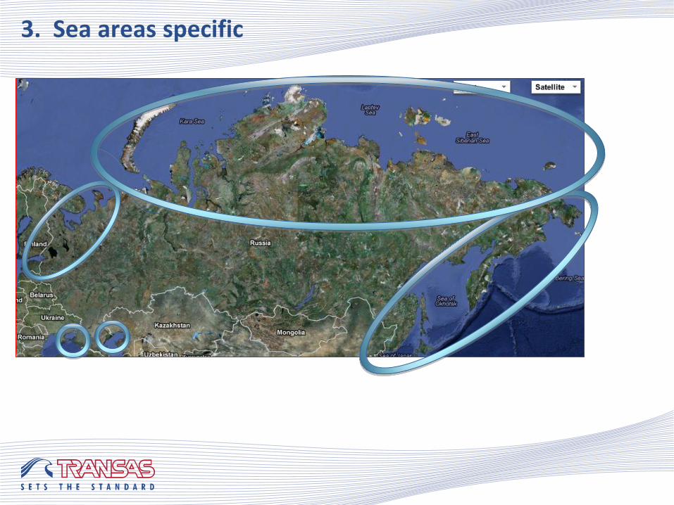
3. Sea areas specific
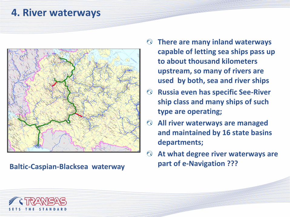
4. River waterways
There are many inland waterways capable of letting sea ships pass up to about thousand kilometers upstream, so many of rivers are used by both, sea and river ships
Russia even has specific See-River ship class and many ships of such type are operating;
All river waterways are managed and maintained by 16 state basins departments;
At what degree river waterways are part of e-Navigation ??? Baltic-Caspian-Blacksea waterway
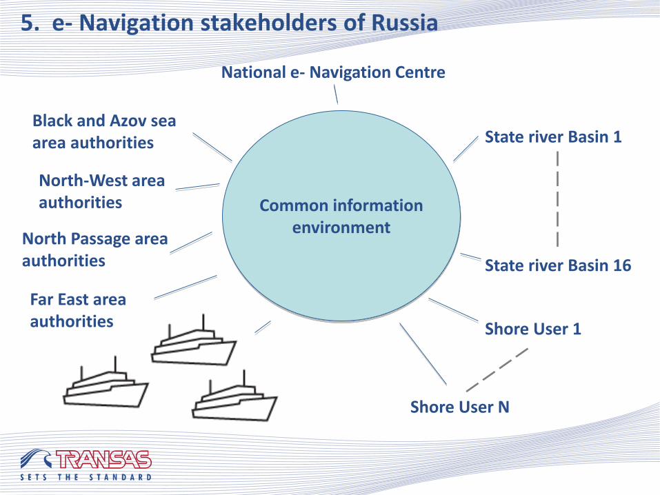
Black and Azov sea area authorities
5. e- Navigation stakeholders of Russia
State river Basin 1
State river Basin 16
Shore User 1
Shore User N
Common information environment
North Passage area authorities
Far East area authorities
North-West area authorities
National e- Navigation Centre
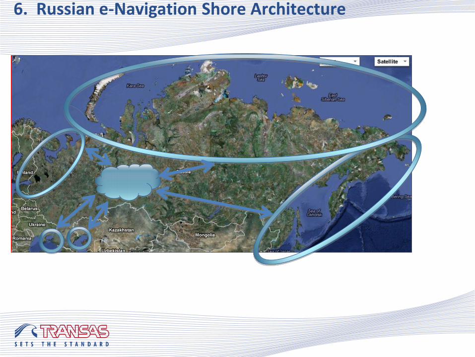
6. Russian e-Navigation Shore Architecture
7. e- Nav Shore Services Layout
National level
Area level
Local level
National Services
Area Services
Area Services
Local Services
Local Services
Gateway to access eNav services via shore communication infrastructure
VTS - AIS Network - SAR centre - etc.
Ship connection to eNav services via the shore communication infrastructure
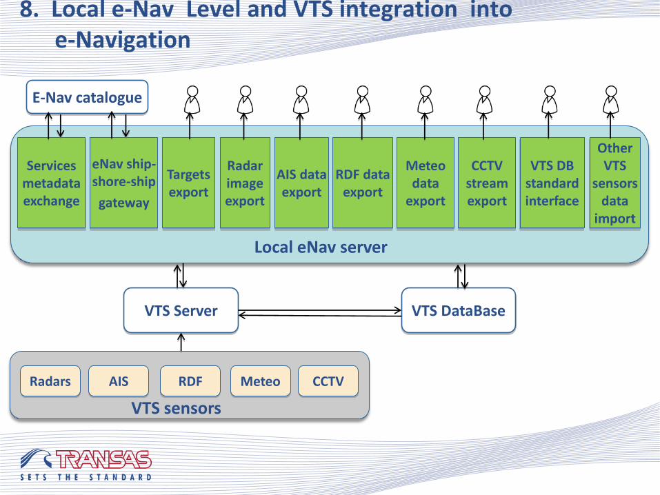
8. Local e-Nav Level and VTS integration into e-Navigation
Local eNav server
Services metadata exchange
eNav ship-shore-ship
gateway
Targets export
Radar image export
AIS data export
RDF data export
Meteo data
export
CCTV stream export
VTS DB standard interface
Other VTS
sensors data
import
VTS Server
E-Nav catalogue
VTS DataBase
VTS sensors
AIS Radars RDF Meteo CCTV
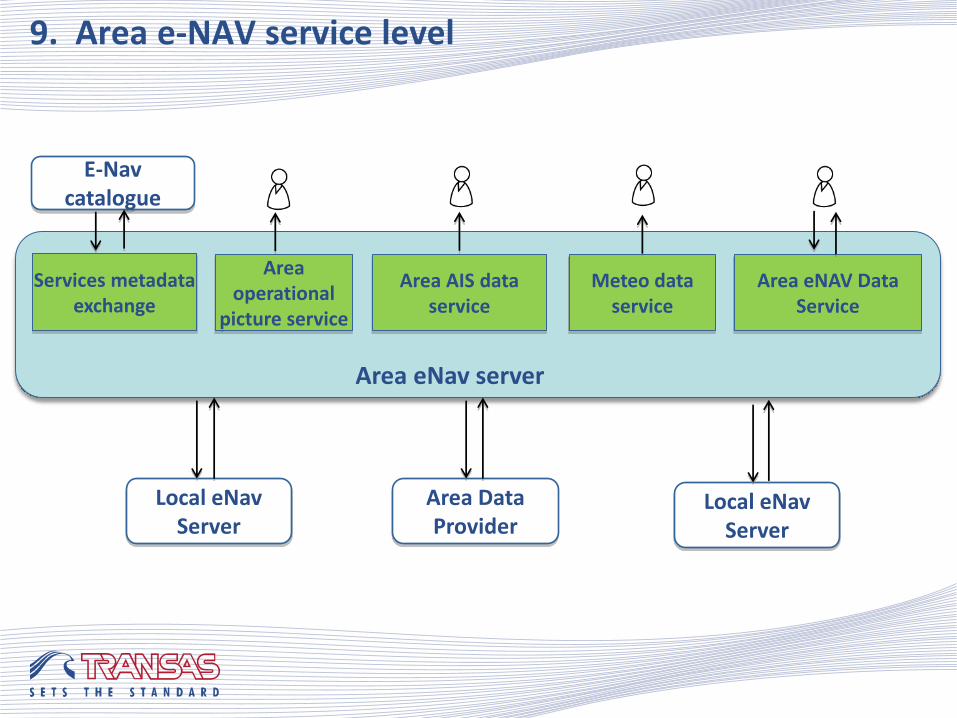
9. Area e-NAV service level
Area eNav server
Services metadata exchange
Area operational
picture service
Area AIS data service
Meteo data service
E-Nav catalogue
Area eNAV Data Service
Local eNav Server
Area Data Provider
Local eNav Server
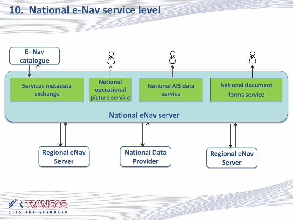
10. National e-Nav service level
National eNav server
Services metadata exchange
National operational
picture service
National AIS data service
E- Nav catalogue
National document
forms service
Regional eNav Server
National Data Provider
Regional eNav Server
In world of official services each service to be verified and registered. It should be searcheable, as information on this service might be requested by any stakeholder according to his particular needs. That is why E-Navigation services catalogue to be part of national e-Navigation environment.
E-NAV service catalogue is sort of registry, which has to provide:
services specification registry;
and services instances registry, while each instance is operating in particular area and is provided by particular provider;
verification of service instances before putting them into the service registry;
search of cervices in respond to a stakeholder request, containing needed functionality and related geographical area.
E-Navigation service catalogue itself supposed to be service of national or even international level;
e-Navigation service service instances to be registered by initiative of a service provider.
11. E-Nav catalogue
To demonstrate some practical examples on how to use services to extract a new added value from information, which is actually available onboard and ashore today, e-Navigation mockup was created and tested.
Basing on available Transas onboard, shore and simulation products 14 scenarios including activity of ships and various shore services were modelled, among them:
Ship automatically requests and receives chart collection to suit the selected route;
VTS assigns port approach route to the ship;
Ship’s master retrieves valid Port Forms, related to next port of call, fills in a few fields to be managed manually and sends forms to the relevant shore organization in electronic form;
Ship generates a Noon Report, the ship master updates necessary fields and sends the report to the shipowner office electronically.
12. E-Navigation Mockup
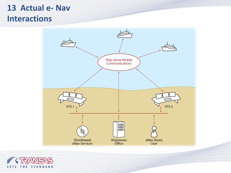
13 Actual e- Nav Interactions
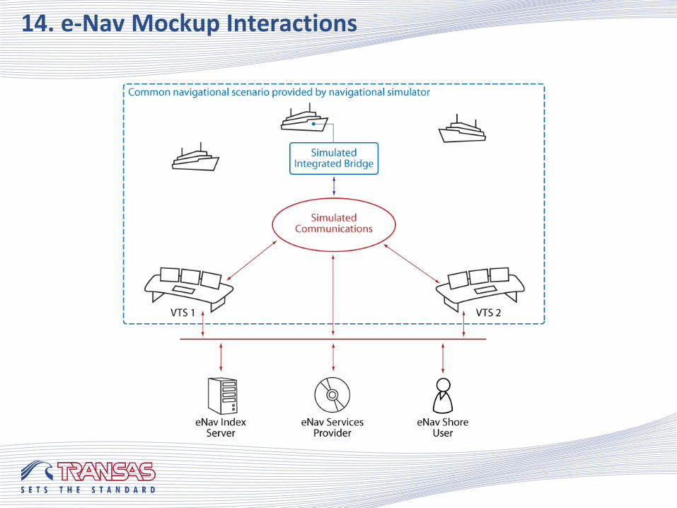
14. e-Nav Mockup Interactions
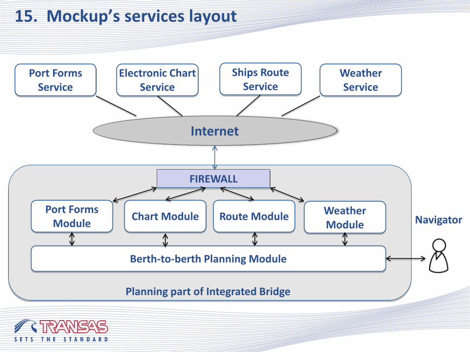
15. Mockup’s services layout
Port Forms Service
Electronic Chart Service
Ships Route Service
Weather Service
Internet
FIREWALL
Planning part of Integrated Bridge
Port Forms Module
Chart Module Route Module Weather Module
Berth-to-berth Planning Module
Navigator
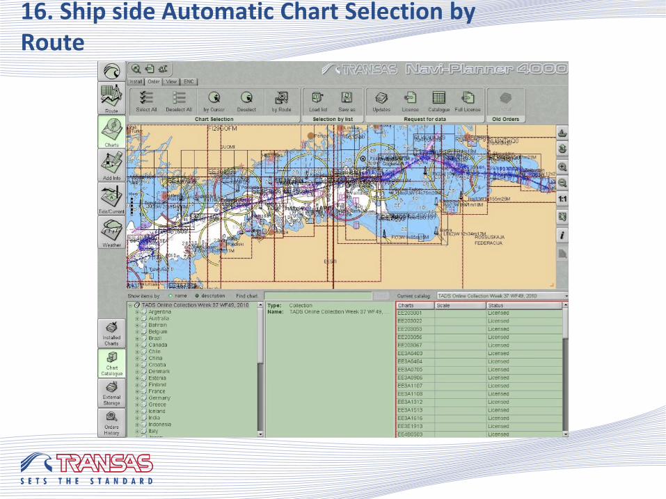
16. Ship side Automatic Chart Selection by Route
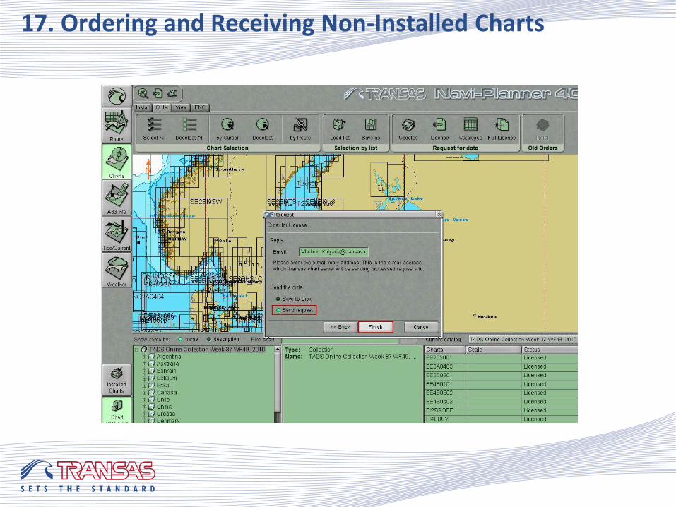
17. Ordering and Receiving Non-Installed Charts
!
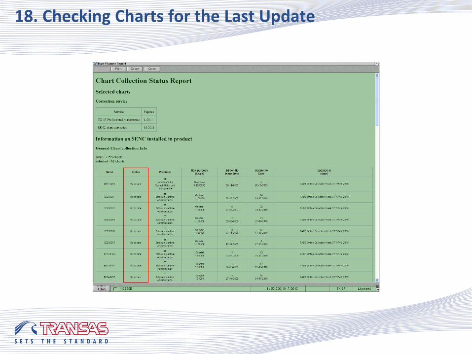
18. Checking Charts for the Last Update
!
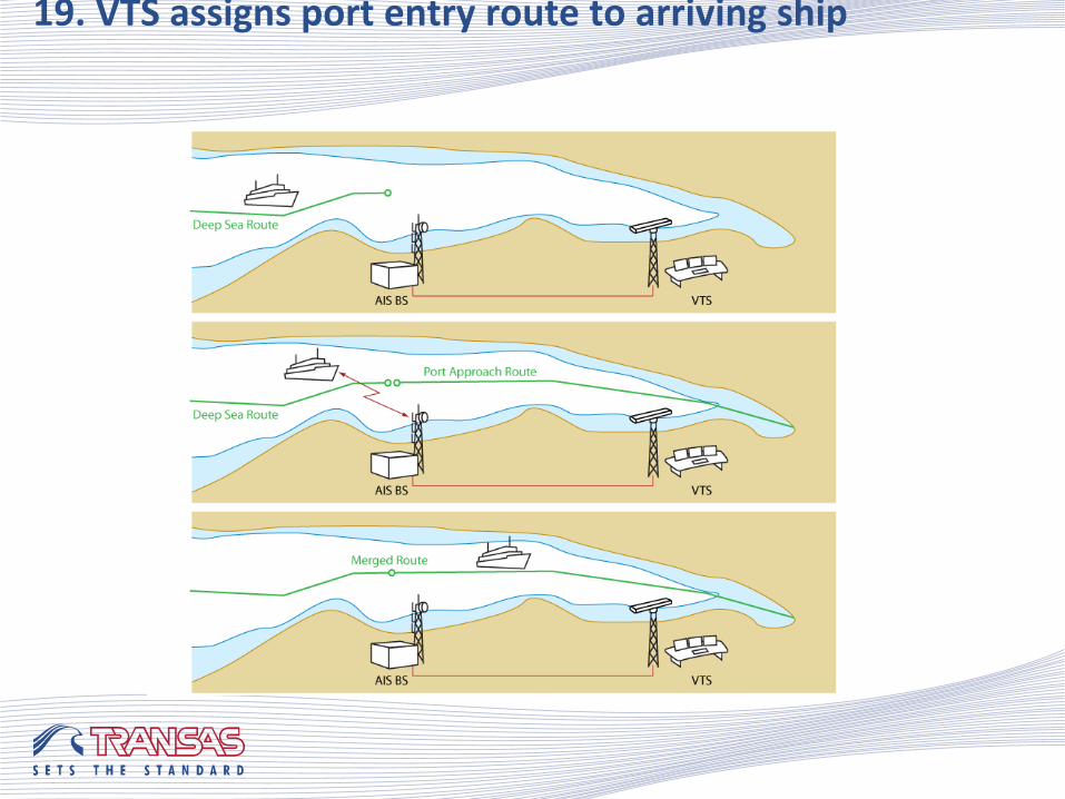
19. VTS assigns port entry route to arriving ship
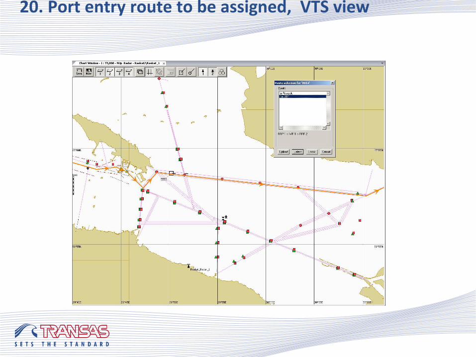
20. Port entry route to be assigned, VTS view
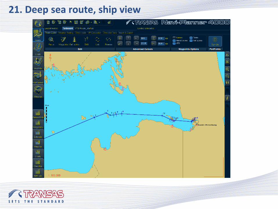
21. Deep sea route, ship view
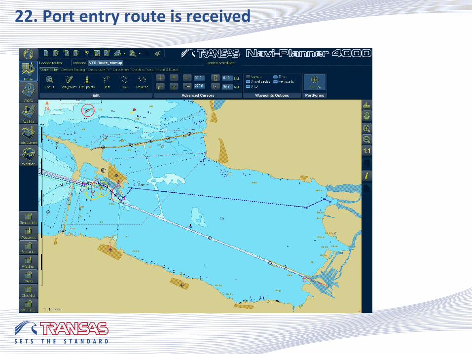
22. Port entry route is received
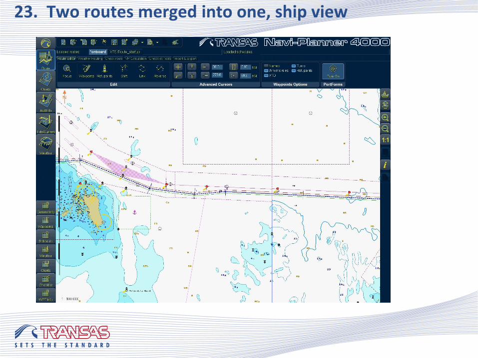
23. Two routes merged into one, ship view
Some of recommendations on technical and administrative measures necessary to move country toward e-Navigation were well accepted and were progressing toward real projects, namely:
Start of e-Navigation testbed in Finish Gulf is included into governmental program for 2014 year;
National Satellite AIS apparatus are planned to be launched one in 2013 year and next in 2014 year
Technical development was continuing by industry, e.g. many of scenarios demonstrated by research work mockup two years ago were matured and achieved status of regular products features, namely:
Automatic electronic chart delivery service;
Electronic chart service “Pay as you sail”;
Automatic regular reporting from ship to shipping company office;
Automatic route exchange and fuel saving related data exchange between ship and shipping company office.
24. Progress since 2010

Thank you! [email protected]