Embed Size (px)
DESCRIPTION
Dynamic Planet- Sub unit 3 Battle for the Biosphere. 3.1a What is the value of the biosphere? What are biomes? Why are they important? What causes differences between them?. Key Term. - PowerPoint PPT Presentation
Citation preview
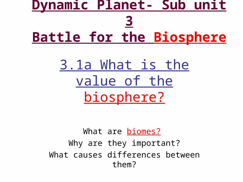
Dynamic Planet- Sub unit 3
Battle for the Biosphere
3.1a What is the value of the biosphere?
What are biomes? Why are they important?
What causes differences between them?
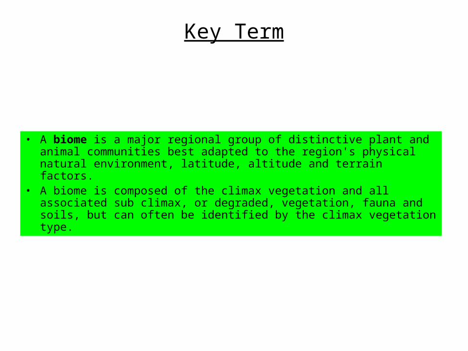
Key Term
• A biome is a major regional group of distinctive plant and animal communities best adapted to the region's physical natural environment, latitude, altitude and terrain factors.
• A biome is composed of the climax vegetation and all associated sub climax, or degraded, vegetation, fauna and soils, but can often be identified by the climax vegetation type.
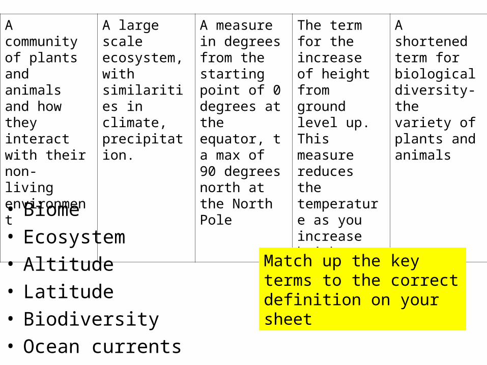
• Biome• Ecosystem• Altitude• Latitude• Biodiversity• Ocean currents
A community of plants and animals and how they interact with their non- living environment
A large scale ecosystem, with similarities in climate, precipitation.
A measure in degrees from the starting point of 0 degrees at the equator, t a max of 90 degrees north at the North Pole
The term for the increase of height from ground level up. This measure reduces the temperature as you increase height
A shortened term for biological diversity- the variety of plants and animals
Match up the key terms to the correct definition on your sheet
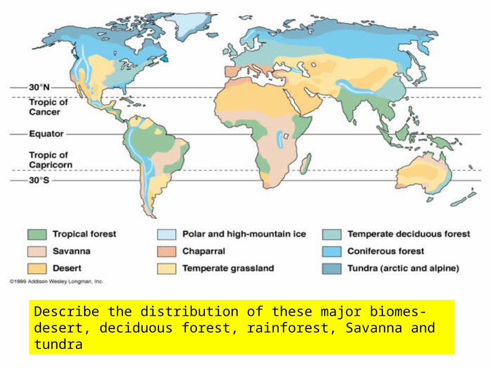
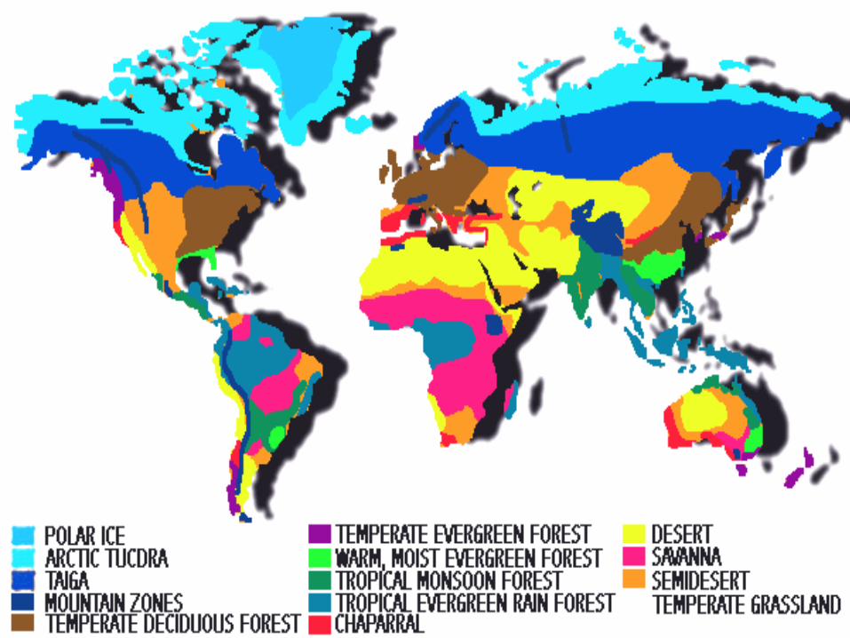
Describe the distribution of these major biomes- desert, deciduous forest, rainforest, Savanna and tundra
Factors that affect CLIMATE
Brainstorm the factors which you think effect climate in the back of your book –
discuss with people around you.
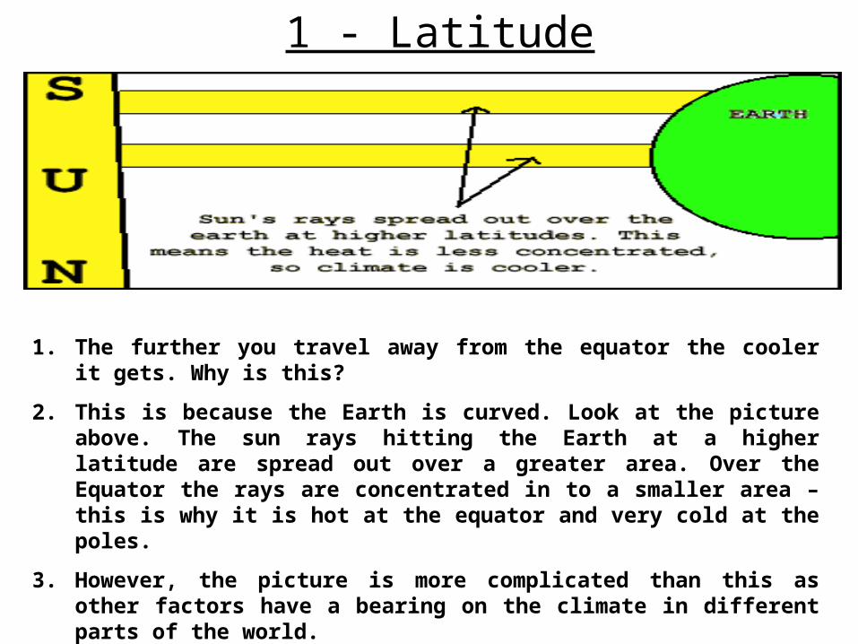
1 - Latitude
1. The further you travel away from the equator the cooler it gets. Why is this?
2. This is because the Earth is curved. Look at the picture above. The sun rays hitting the Earth at a higher latitude are spread out over a greater area. Over the Equator the rays are concentrated in to a smaller area – this is why it is hot at the equator and very cold at the poles.
3. However, the picture is more complicated than this as other factors have a bearing on the climate in different parts of the world.
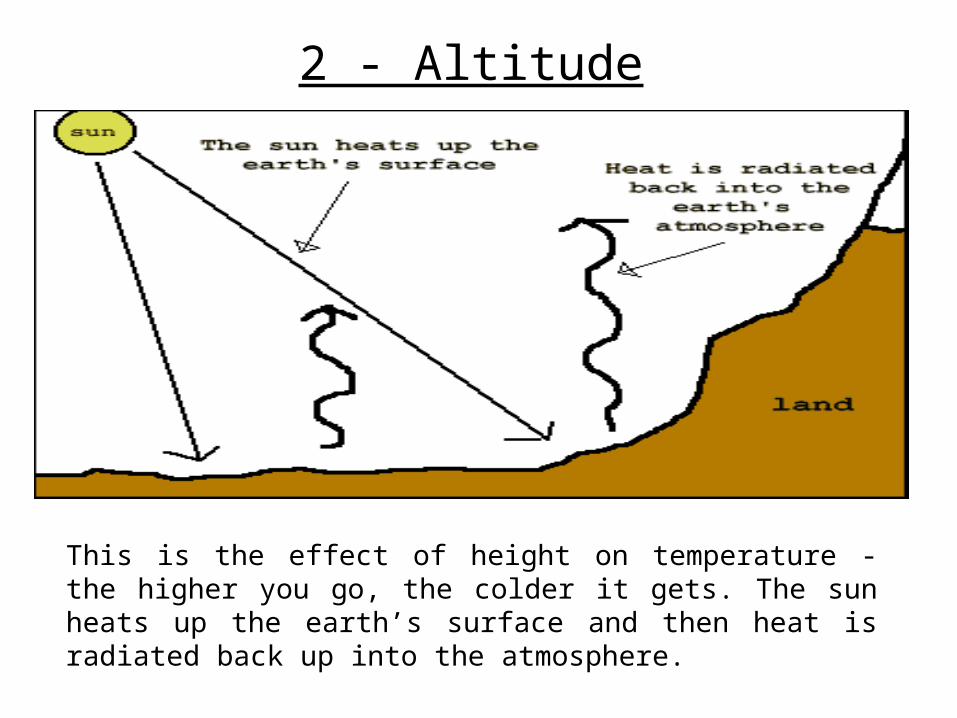
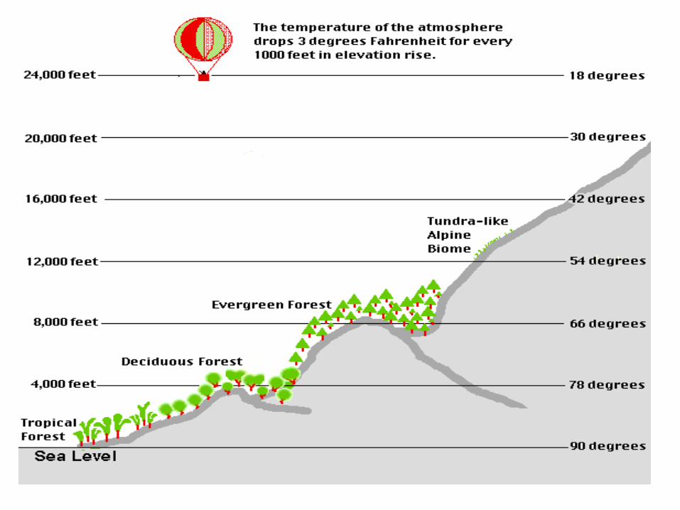
2 - Altitude
This is the effect of height on temperature - the higher you go, the colder it gets. The sun heats up the earth’s surface and then heat is radiated back up into the atmosphere.
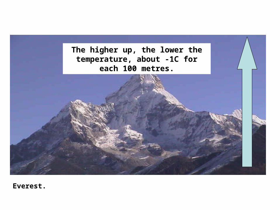
Everest.
The higher up, the lower the temperature, about -1C for each 100
metres.
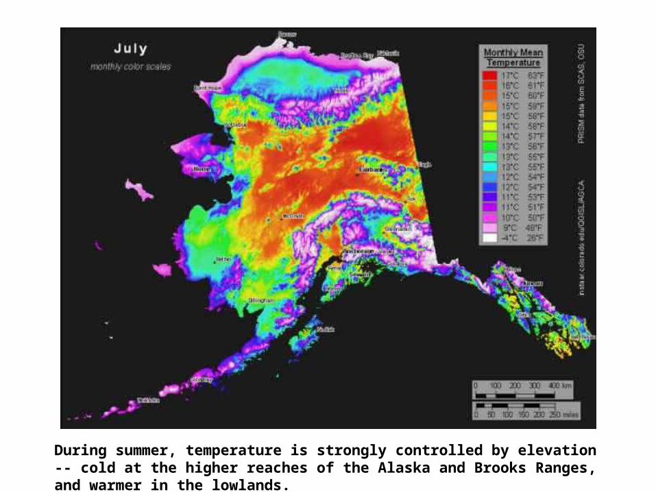
During summer, temperature is strongly controlled by elevation -- cold at the higher reaches of the Alaska and Brooks Ranges, and warmer in the lowlands.
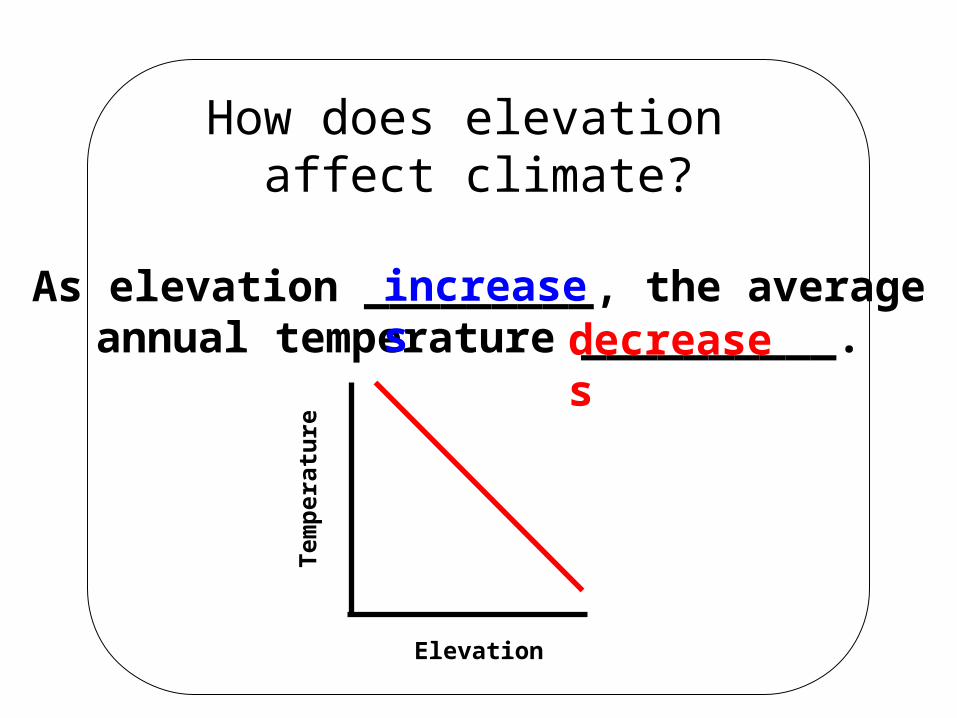
How does elevation affect climate?
As elevation _________, the averageannual temperature __________.
Elevation
Tem
per
atu
reincreases
decreases

3 - Prevailing Winds
The movement of the earth’s winds starts at the equator, where it is hottest.
There are certain set patterns of winds called prevailing winds, which means that direction winds travels most of the time.
Wind affects the climate where it has travelled over the :
Maritime - ocean
Continental - overland
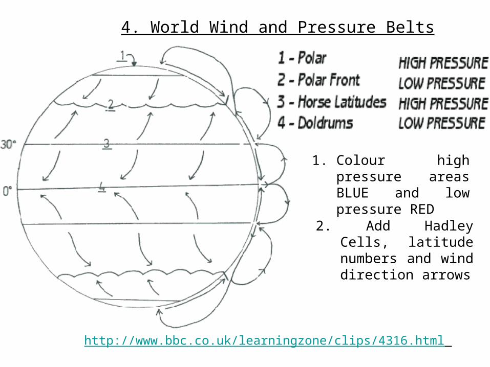
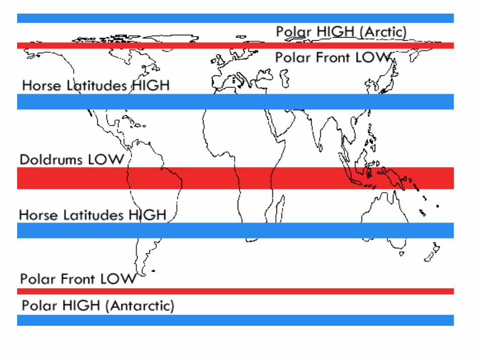
4. World Wind and Pressure Belts
1. Colour high pressure areas BLUE and low pressure RED
2. Add Hadley Cells, latitude numbers and wind direction arrows
http://www.bbc.co.uk/learningzone/clips/4316.html
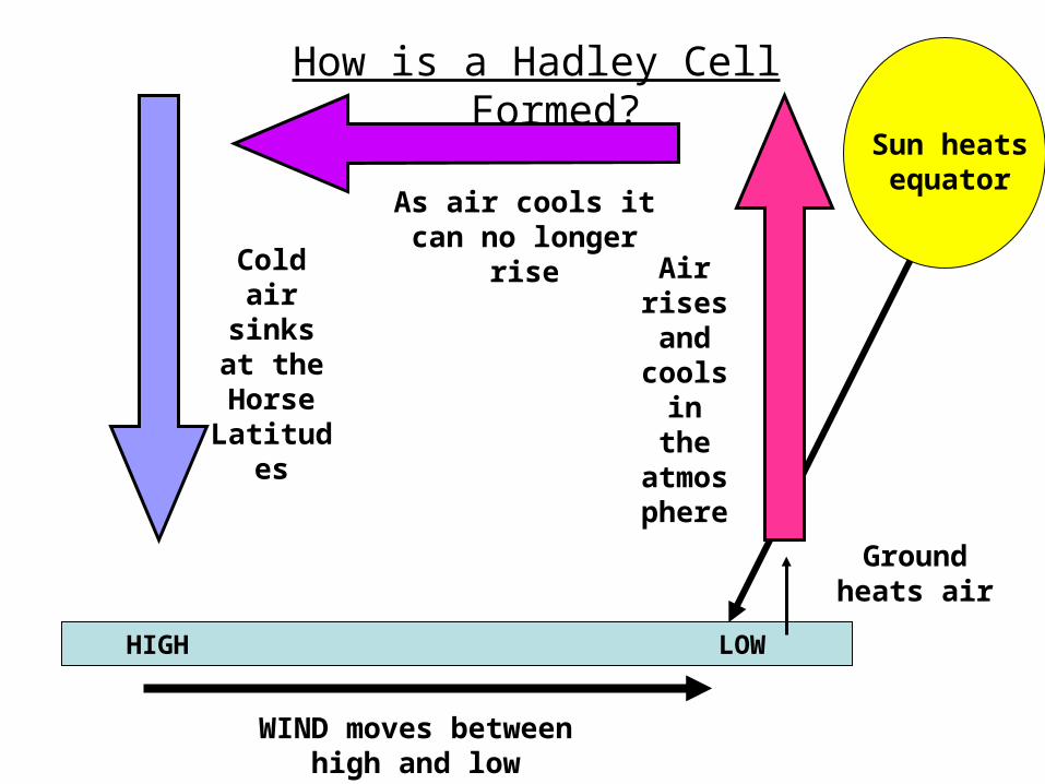
How is a Hadley Cell Formed?
Sun heats equator
Ground heats air
Air rises and
cools in
the atmosphe
re
As air cools it can no longer rise
Cold air sinks at
the Horse
Latitudes
WIND moves between high and
low pressure
LOWHIGH
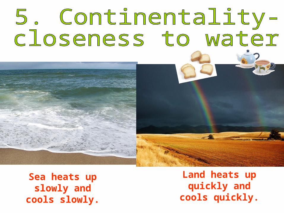
Sea heats up slowly and
cools slowly.
Land heats up quickly and
cools quickly.
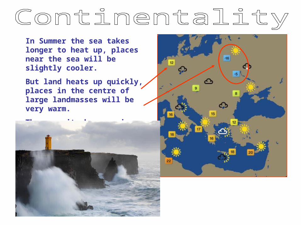
In Summer the sea takes longer to heat up, places near the sea will be slightly cooler.
But land heats up quickly, places in the centre of large landmasses will be very warm.
The opposite happens in winter.

5. Continentality (Closeness to water)
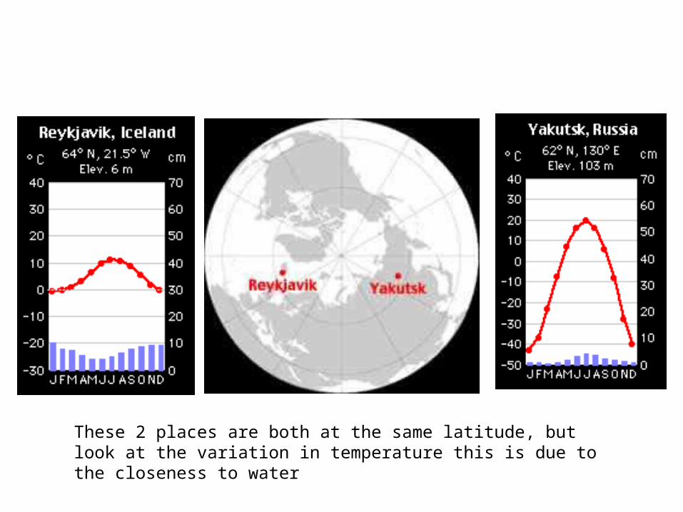
These 2 places are both at the same latitude, but look at the variation in temperature this is due to the closeness to water

How does closeness to a large body of water affect climate?
Water __________ the temperature._______ summers. _______ winters.
City B is closer to a large body of water.
Its temperature line is flatter (moderated).
moderates
Cities A & B are located at the same latitude.
Cooler Warmer
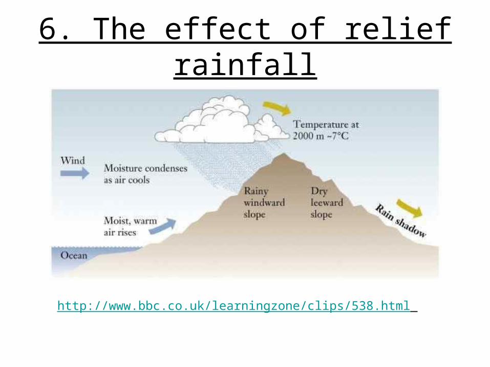
6. The effect of relief rainfall
http://www.bbc.co.uk/learningzone/clips/538.html
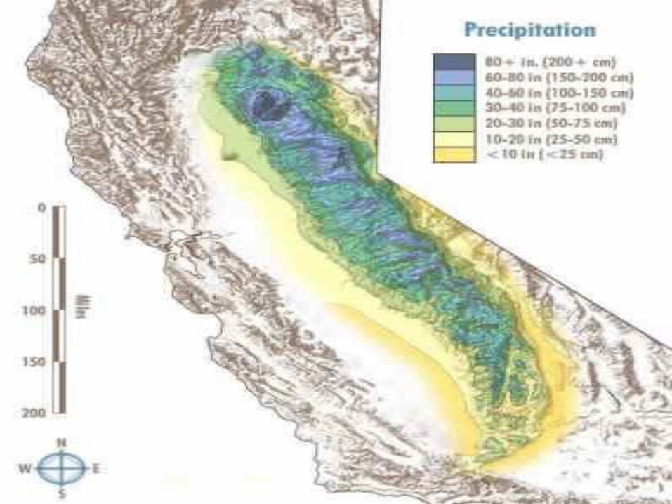

The windward sides of the Adirondacks & Catskills receive a great deal more
precipitation
The leeward sides of the
Adirondacks & Catskills
receive much less
precipitation
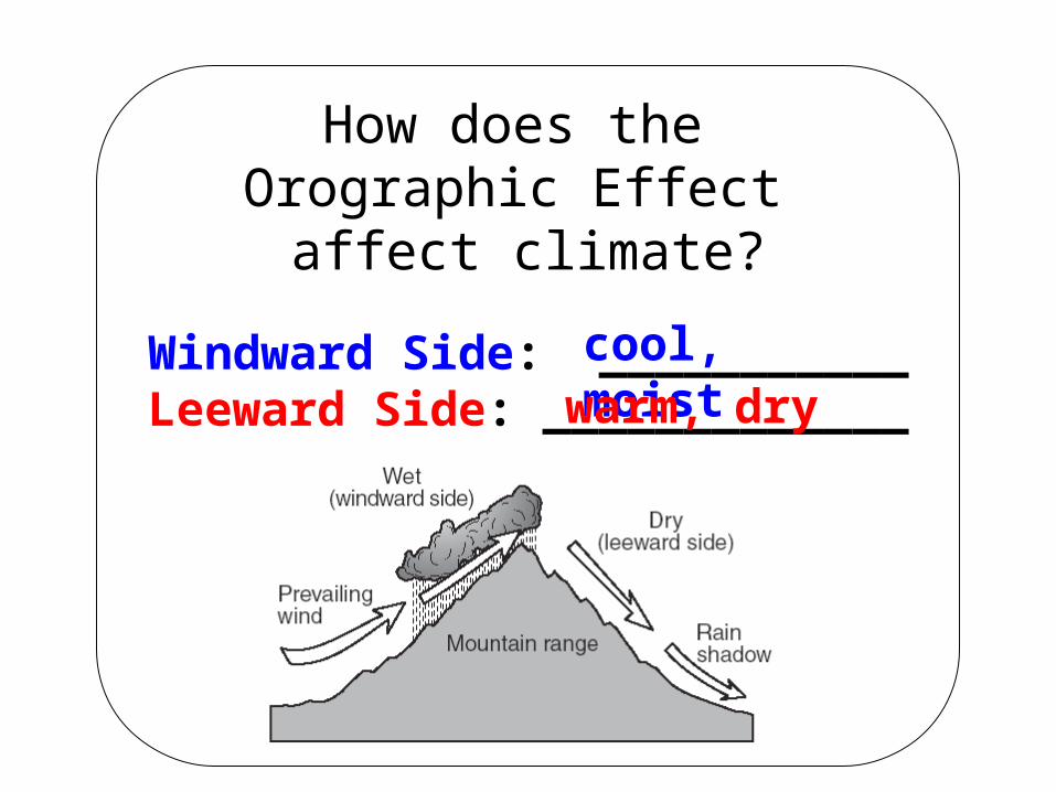
How does the Orographic Effect
affect climate?
Windward Side: ___________Leeward Side: _____________
cool, moistwarm, dry
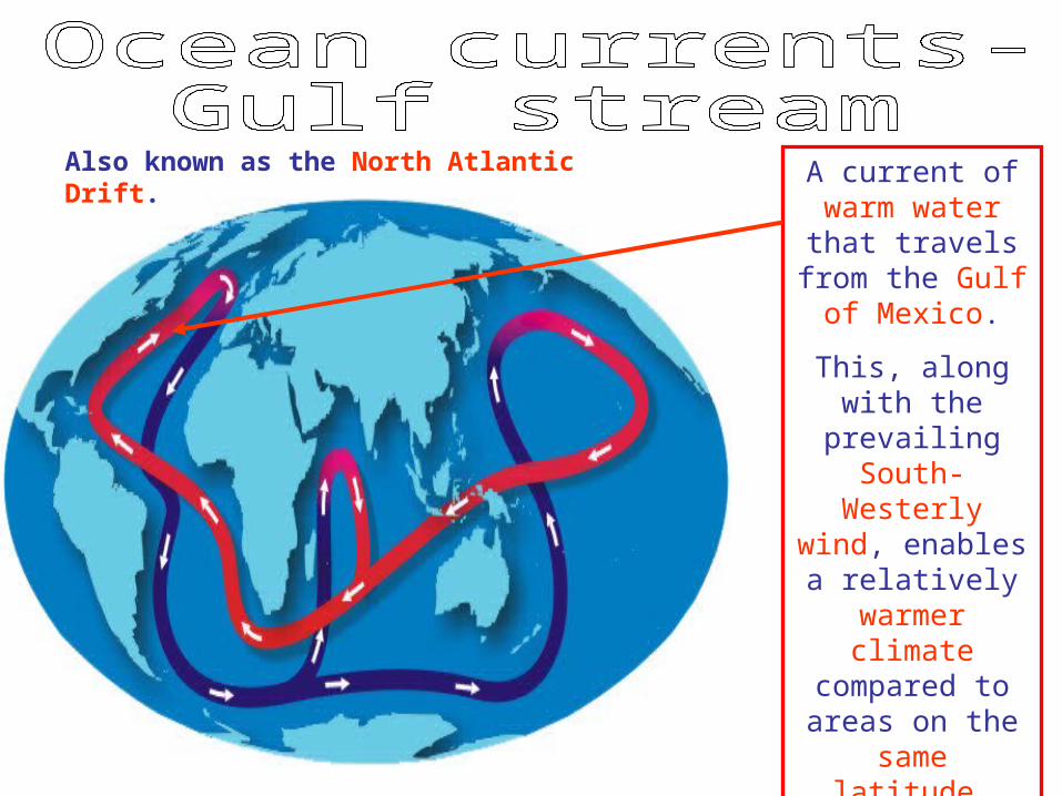
Also known as the North Atlantic Drift.
A current of warm water that travels
from the Gulf of Mexico.
This, along with the prevailing
South-Westerly wind, enables a
relatively warmer climate
compared to areas on the
same latitude.

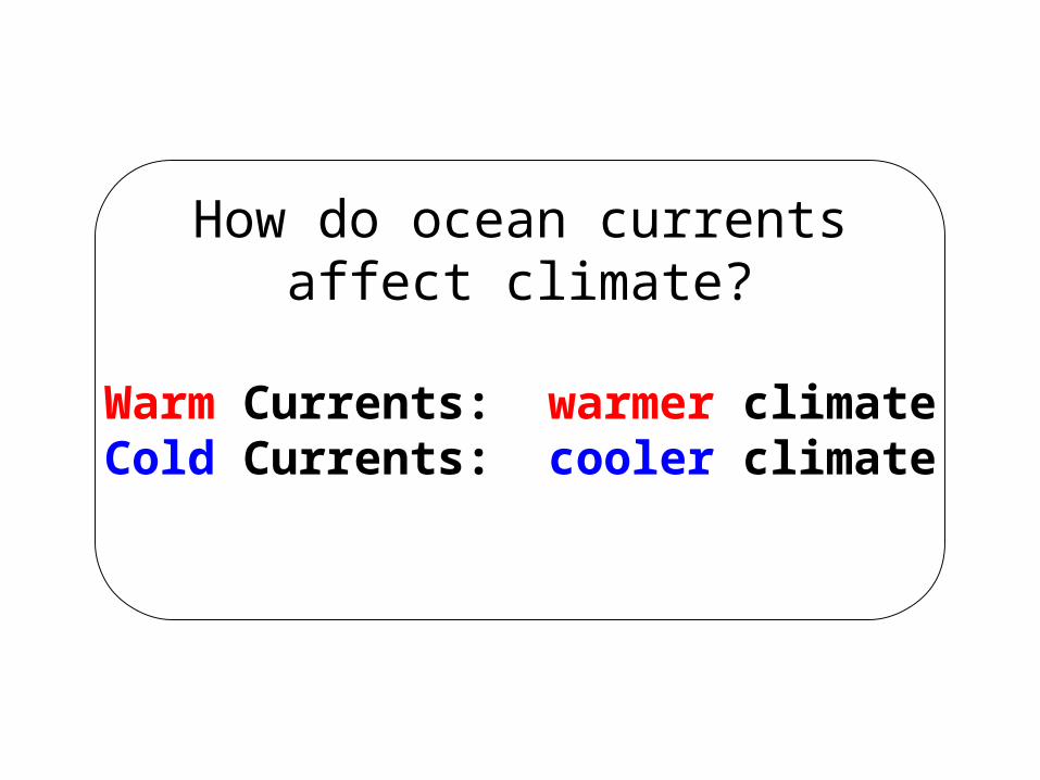
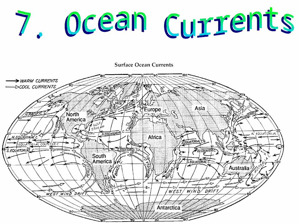
How do ocean currentsaffect climate?
Warm Currents: warmer climateCold Currents: cooler climate
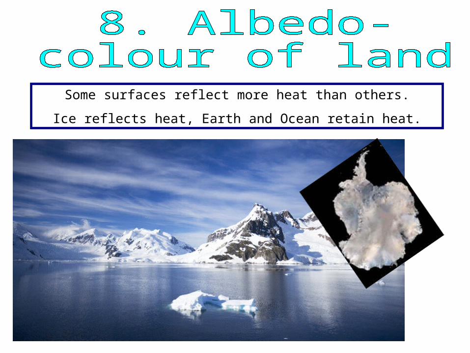
Some surfaces reflect more heat than others.
Ice reflects heat, Earth and Ocean retain heat.

Local examples
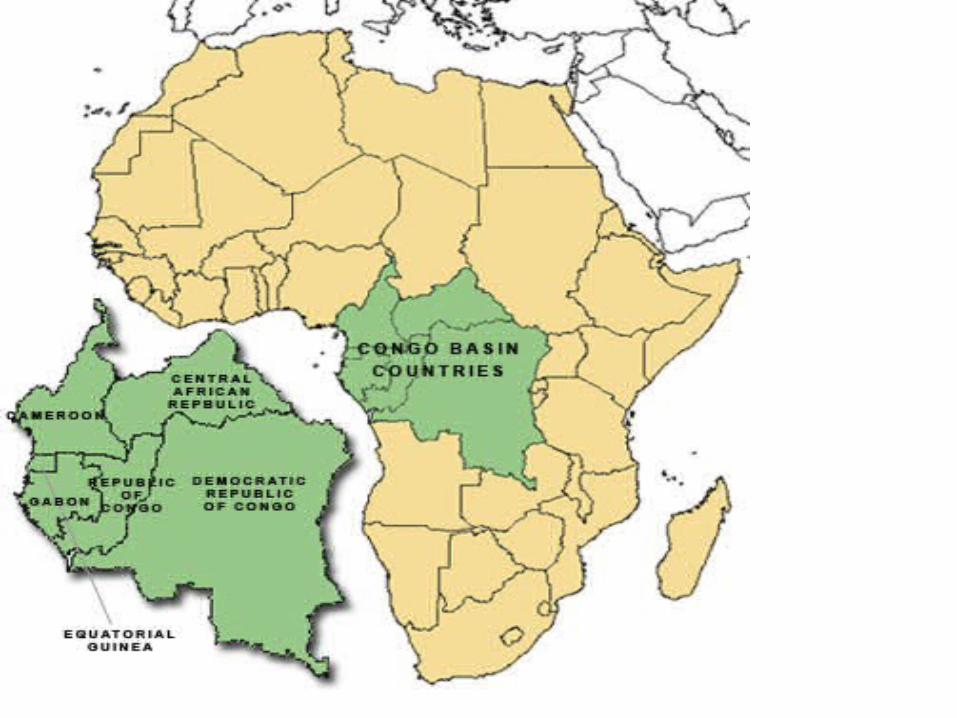
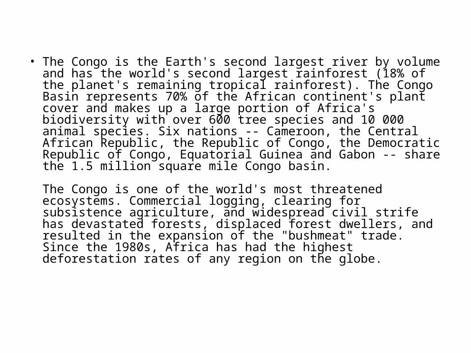
• The Congo is the Earth's second largest river by volume and has the world's second largest rainforest (18% of the planet's remaining tropical rainforest). The Congo Basin represents 70% of the African continent's plant cover and makes up a large portion of Africa's biodiversity with over 600 tree species and 10 000 animal species. Six nations -- Cameroon, the Central African Republic, the Republic of Congo, the Democratic Republic of Congo, Equatorial Guinea and Gabon -- share the 1.5 million square mile Congo basin.
The Congo is one of the world's most threatened ecosystems. Commercial logging, clearing for subsistence agriculture, and widespread civil strife has devastated forests, displaced forest dwellers, and resulted in the expansion of the "bushmeat" trade. Since the 1980s, Africa has had the highest deforestation rates of any region on the globe.

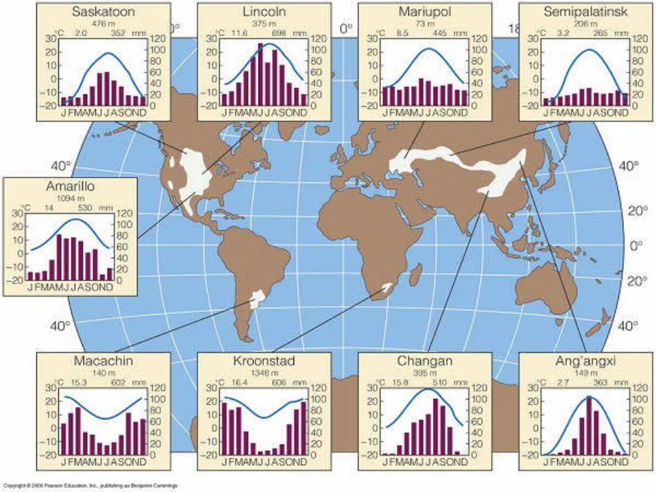
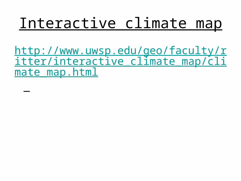
Interactive climate map
http://www.uwsp.edu/geo/faculty/ritter/interactive_climate_map/climate_map.html
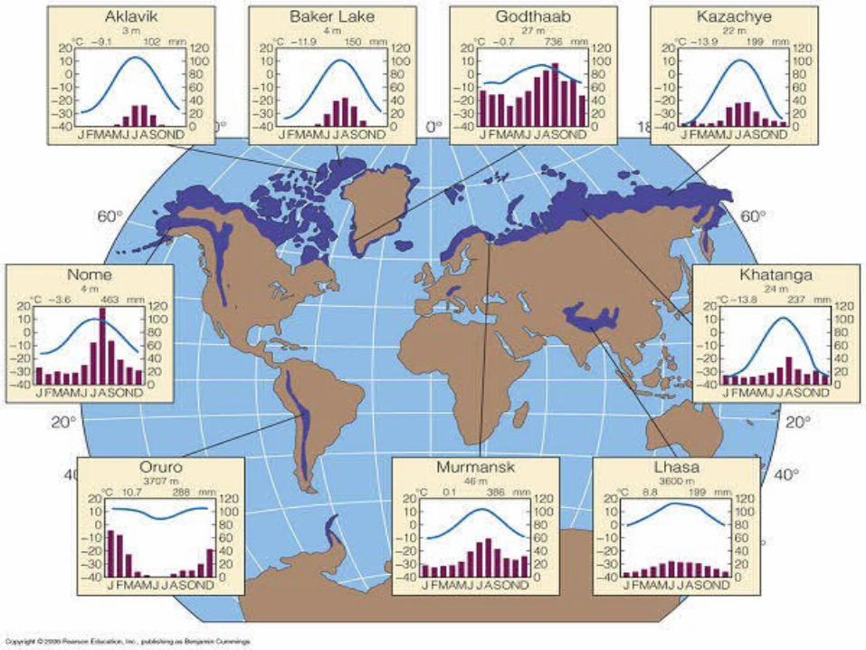
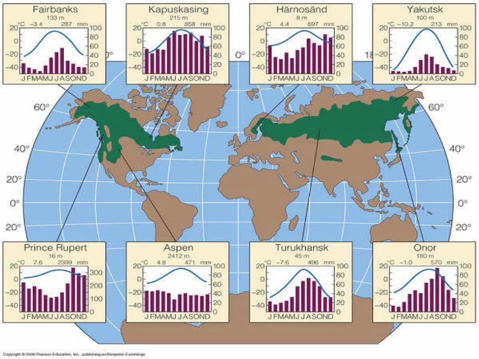
In your pairs….• Use the information in your pack to produce a
fact file about your biome• Draw out and annotate a climate graph-
annotations including- describing rainfall and temperature patterns, highest and lowest temps and precipitation amounts- also temperature range
• Draw an arrow to link your climate graph to the world location map
• Give reasons for the climate of your biome- e.g. latitude, albedo, altitude, prevailing wind, ocean currents, Continentality
• Brief overview of your biome, plants, animals, humans, structure etcTemperature range=
difference between the highest and lowest temperatures in a biome
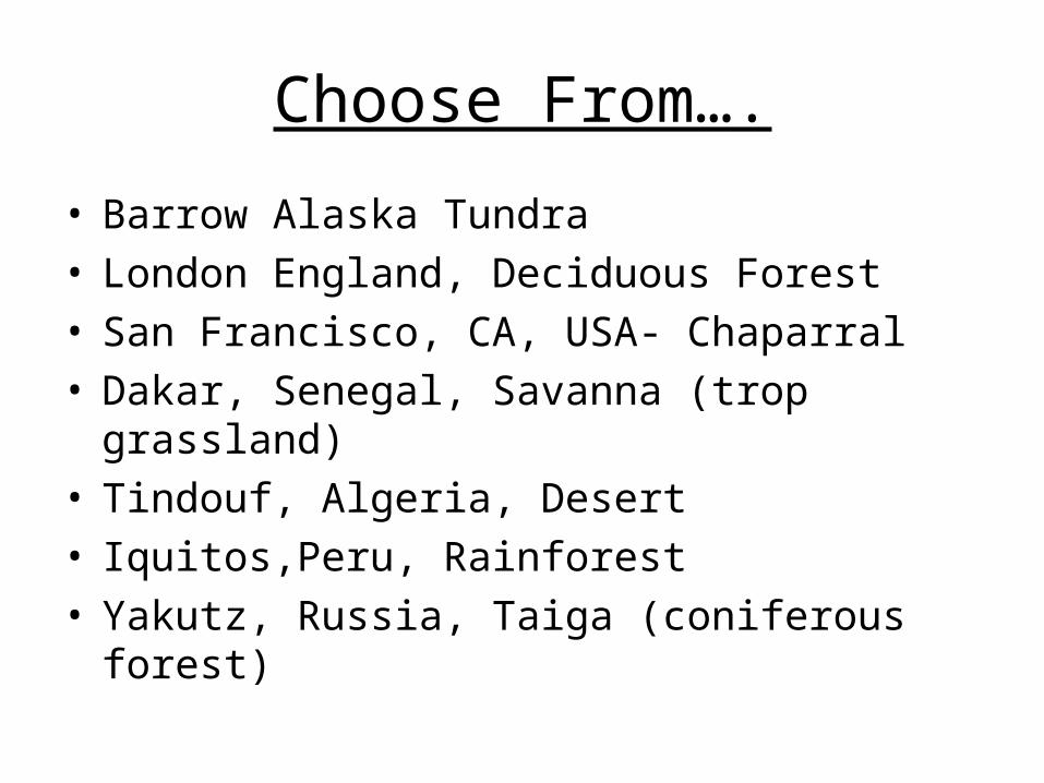
Choose From….
• Barrow Alaska Tundra• London England, Deciduous Forest• San Francisco, CA, USA- Chaparral• Dakar, Senegal, Savanna (trop grassland)• Tindouf, Algeria, Desert• Iquitos,Peru, Rainforest• Yakutz, Russia, Taiga (coniferous forest)
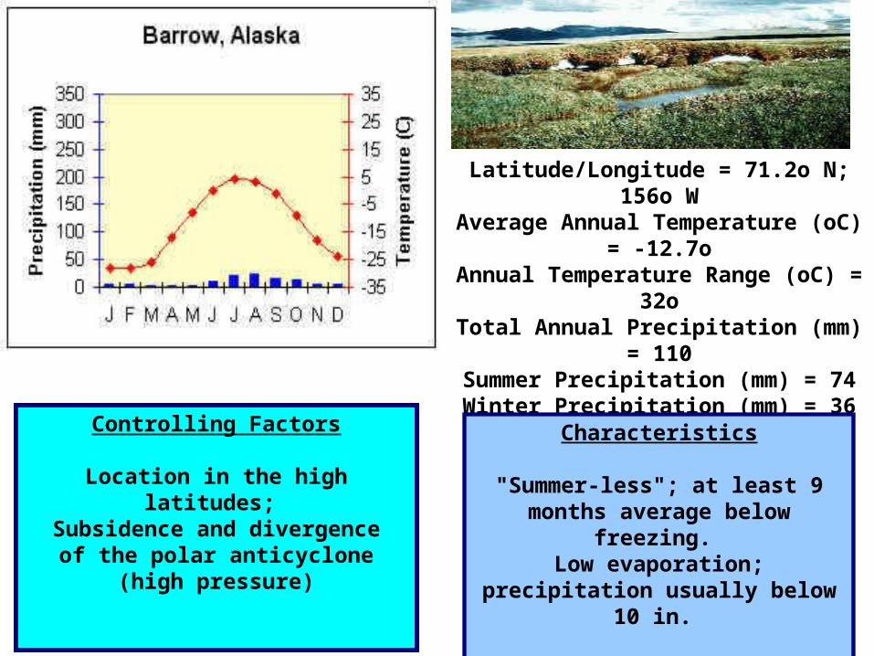
Latitude/Longitude = 71.2o N; 156o W
Average Annual Temperature (oC) = -12.7o
Annual Temperature Range (oC) = 32o
Total Annual Precipitation (mm) = 110
Summer Precipitation (mm) = 74Winter Precipitation (mm) = 36
Characteristics
"Summer-less"; at least 9 months average below
freezing. Low evaporation;
precipitation usually below 10 in.
Controlling Factors
Location in the high latitudes; Subsidence and divergence
of the polar anticyclone (high pressure)
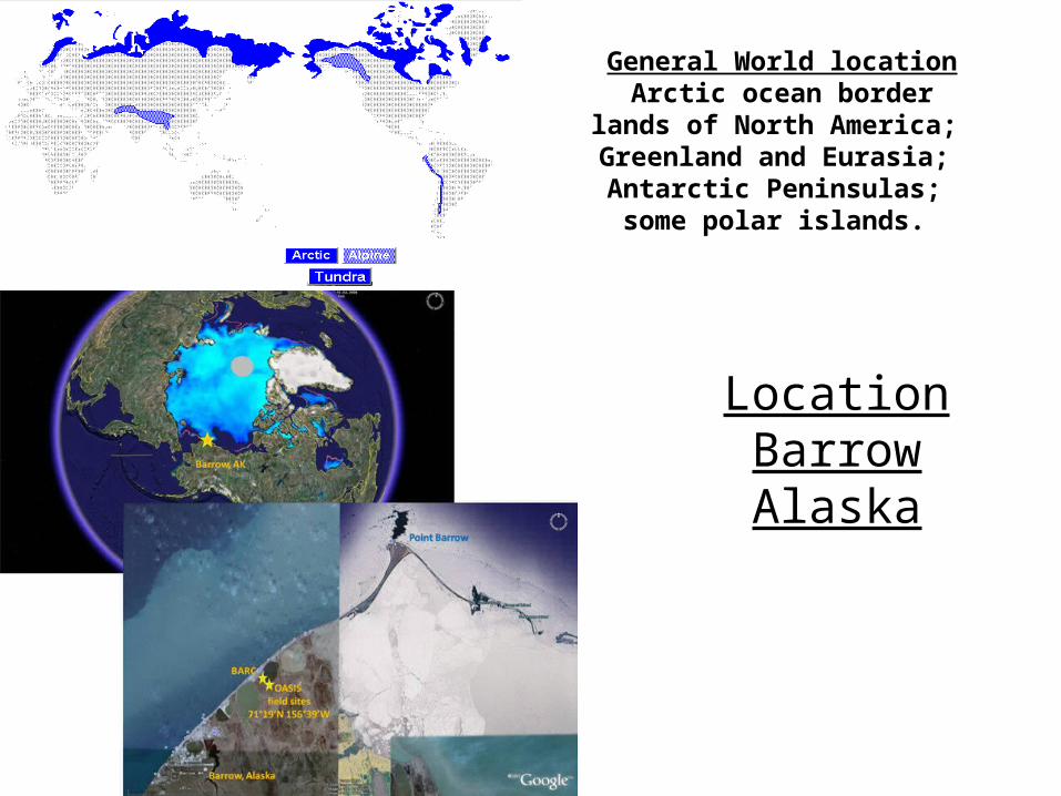
LocationBarrow Alaska
General World locationArctic ocean border lands
of North America; Greenland and Eurasia; Antarctic Peninsulas; some polar islands.

What we will do…
• With your fact files a wall display will be made to show you the variations in world climates

http://www.bbc.co.uk/learningzone/clips/3235.html http://www.bbc.co.uk/learningzone/clips/3236.html
• Give reason for the differences between Morecombe and Torremolinos