Embed Size (px)
Citation preview
Drone Flyover 2018 Lake Ice Shoreline Damage
Don Meredith, Communications Chair February 2018
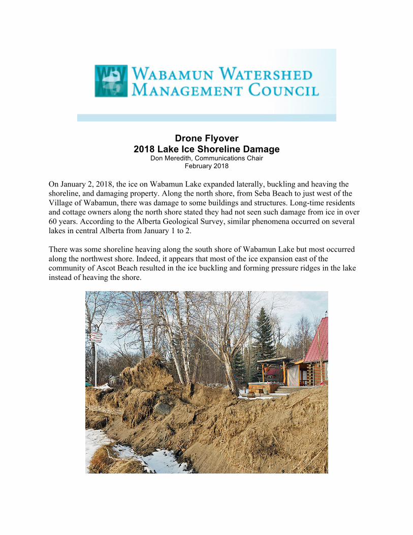
On January 2, 2018, the ice on Wabamun Lake expanded laterally, buckling and heaving the shoreline, and damaging property. Along the north shore, from Seba Beach to just west of the Village of Wabamun, there was damage to some buildings and structures. Long-time residents and cottage owners along the north shore stated they had not seen such damage from ice in over 60 years. According to the Alberta Geological Survey, similar phenomena occurred on several lakes in central Alberta from January 1 to 2. There was some shoreline heaving along the south shore of Wabamun Lake but most occurred along the northwest shore. Indeed, it appears that most of the ice expansion east of the community of Ascot Beach resulted in the ice buckling and forming pressure ridges in the lake instead of heaving the shore.
2018 Drone Flyover 2
So, why did it occur? In short it was a combination of events: lack of sufficient insulating snow cover on the ice and a sudden change in temperature from extreme cold to near freezing that caused the ice to suddenly expand. My blog piece on “The Power of Lake Ice” (https://donmeredith.wordpress.com/2018/01/26/the-power-of-lake-ice/) attempts to explain what happened and illustrates some of the damage. As well, Alberta Environment and Parks has produced a brochure under its Respect Our Lakes program, “Understanding Ice Ridges and Ice Pushes” (http://www.wwmc.ca/images/pdf/RespectOurLakes-Ice-Ridges.pdf), which further explains the process and how to go about legally fixing the damage with minimal effect on the health of the lake.
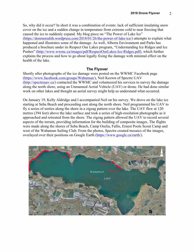
The Flyover Shortly after photographs of the ice damage were posted on the WWMC Facebook page (https://www.facebook.com/groups/Wabamun/), Neil Keown of Spectre UAV (http://spectreuav.ca/) contacted the WWMC and volunteered his services to survey the damage along the north shore, using an Unmanned Aerial Vehicle (UAV) or drone. He had done similar work on other lakes and thought an aerial survey might help us understand what occurred. On January 19, Kelly Aldridge and I accompanied Neil on his survey. We drove on the lake ice starting at Seba Beach and proceeding east along the north shore. Neil programmed his UAV to fly a series of sorties along the shore in a zigzag pattern over the lake. The UAV flew at 120 metres (394 feet) above the lake surface and took a series of high-resolution photographs as it approached and retreated from the shore. The zigzag pattern allowed the UAV to record several aspects of the terrain, providing information for the building of composite images. The flights were made along the shores of Seba Beach, Camp Oselia, Fallis, Ernest Poole Scout Camp and west of the Wabamun Sailing Club. From the photos, Spectre created mosaics of the images, overlayed over their positions on Google Earth (https://www.google.ca/earth/).
2018 Drone Flyover 3
The following are examples of some of the images compiled from the flyover of the five areas along the north shore: Seba Beach, Camp Oselia, Fallis, Ernest Poole Scout Camp and the area west of the Wabamun Sailing Club (as identified on Google Earth).
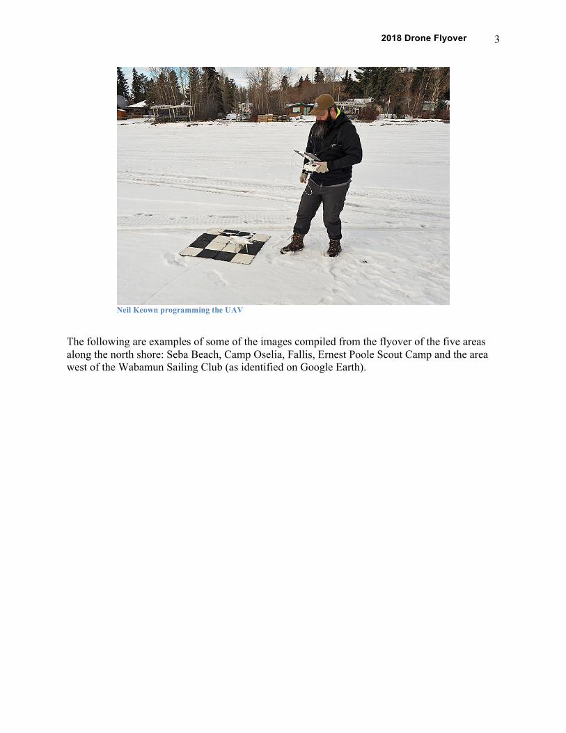
Neil Keown programming the UAV
2018 Drone Flyover 4
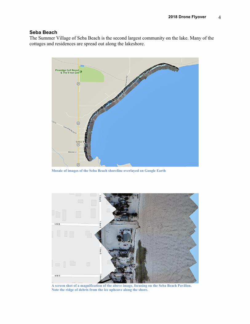
Seba Beach The Summer Village of Seba Beach is the second largest community on the lake. Many of the cottages and residences are spread out along the lakeshore.
Mosaic of images of the Seba Beach shoreline overlayed on Google Earth
A screen shot of a magnification of the above image, focusing on the Seba Beach Pavilion. Note the ridge of debris from the ice upheave along the shore.
2018 Drone Flyover 5
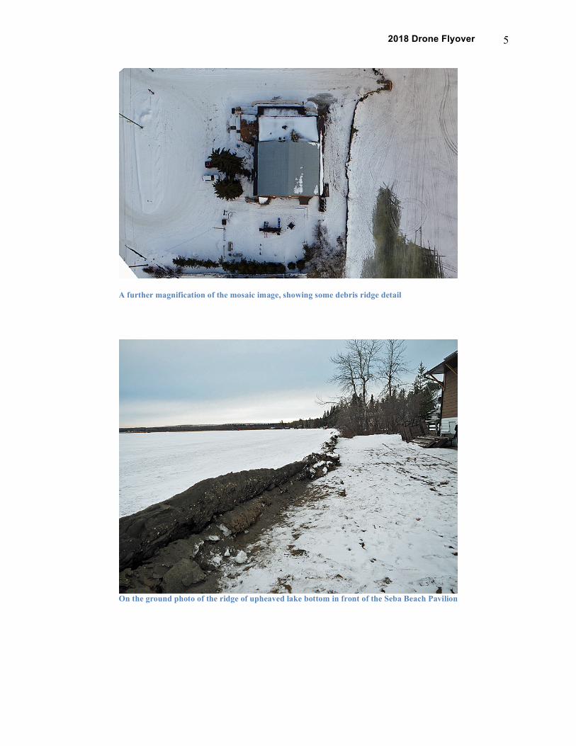
A further magnification of the mosaic image, showing some debris ridge detail
On the ground photo of the ridge of upheaved lake bottom in front of the Seba Beach Pavilion
2018 Drone Flyover 6
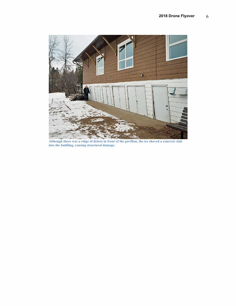
Although there was a ridge of debris in front of the pavilion, the ice shoved a concrete slab into the building, causing structural damage.
2018 Drone Flyover 7
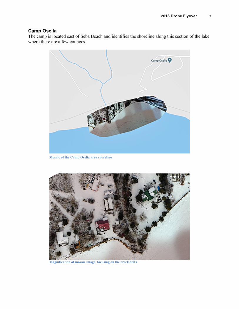
Camp Oselia The camp is located east of Seba Beach and identifies the shoreline along this section of the lake where there are a few cottages.
Mosaic of the Camp Oselia area shoreline
Magnification of mosaic image, focusing on the creek delta
2018 Drone Flyover 8
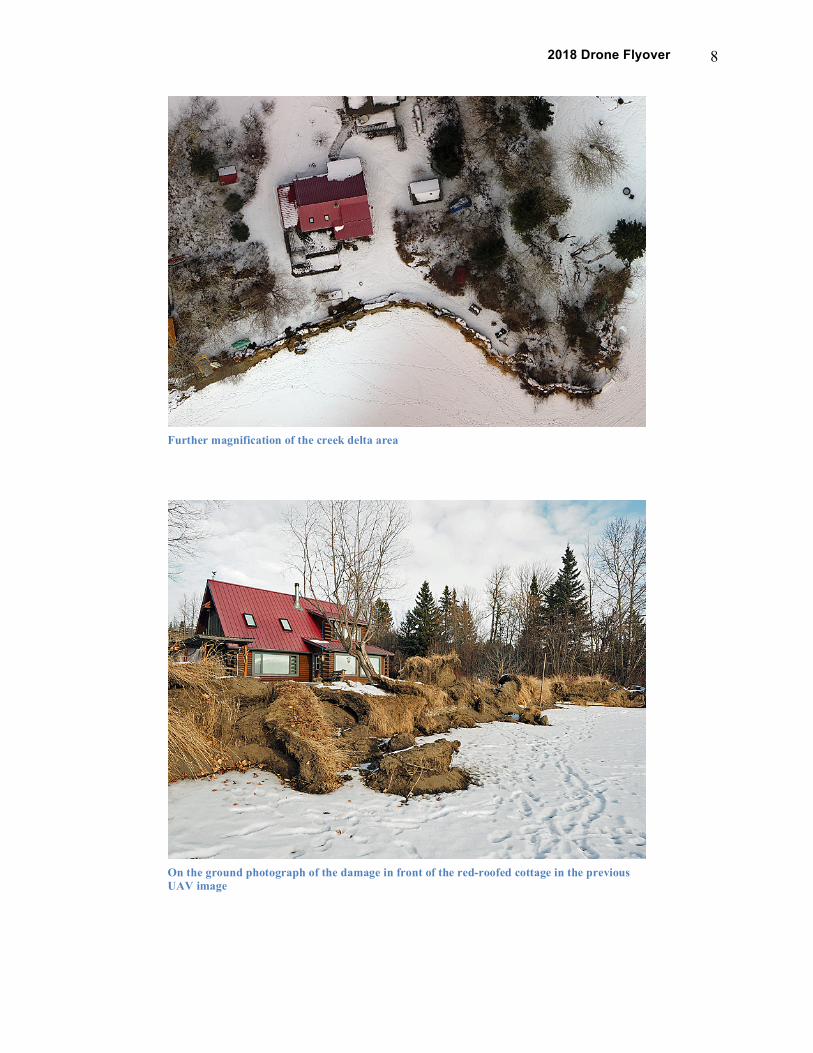
Further magnification of the creek delta area
On the ground photograph of the damage in front of the red-roofed cottage in the previous UAV image
2018 Drone Flyover 9
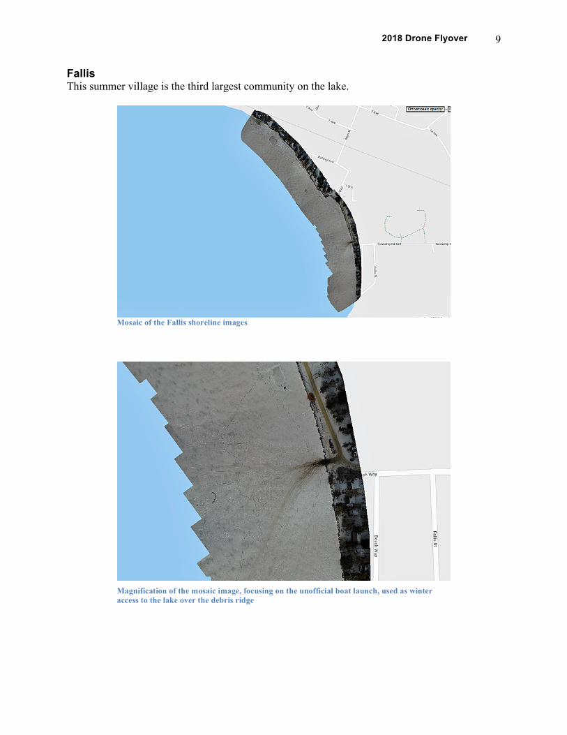
Fallis This summer village is the third largest community on the lake.
Mosaic of the Fallis shoreline images
Magnification of the mosaic image, focusing on the unofficial boat launch, used as winter access to the lake over the debris ridge
2018 Drone Flyover 10
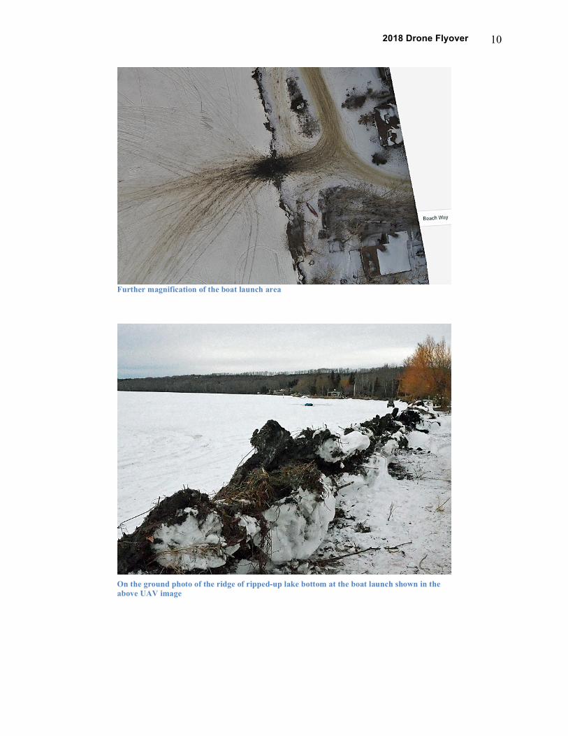
Further magnification of the boat launch area
On the ground photo of the ridge of ripped-up lake bottom at the boat launch shown in the above UAV image
2018 Drone Flyover 11
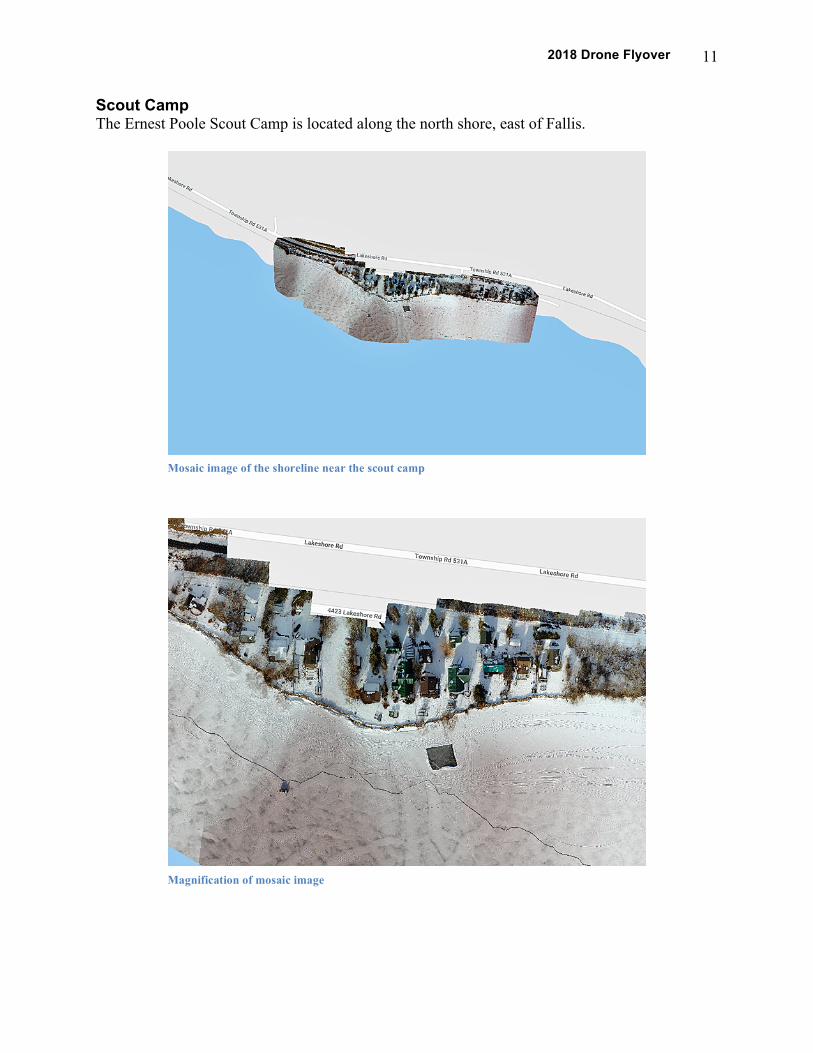
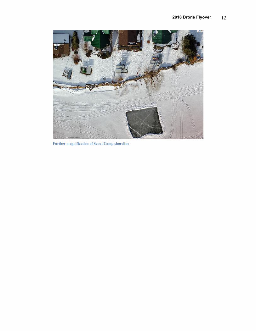
Scout Camp The Ernest Poole Scout Camp is located along the north shore, east of Fallis.
Mosaic image of the shoreline near the scout camp
Magnification of mosaic image
2018 Drone Flyover 12
Further magnification of Scout Camp shoreline
2018 Drone Flyover 13
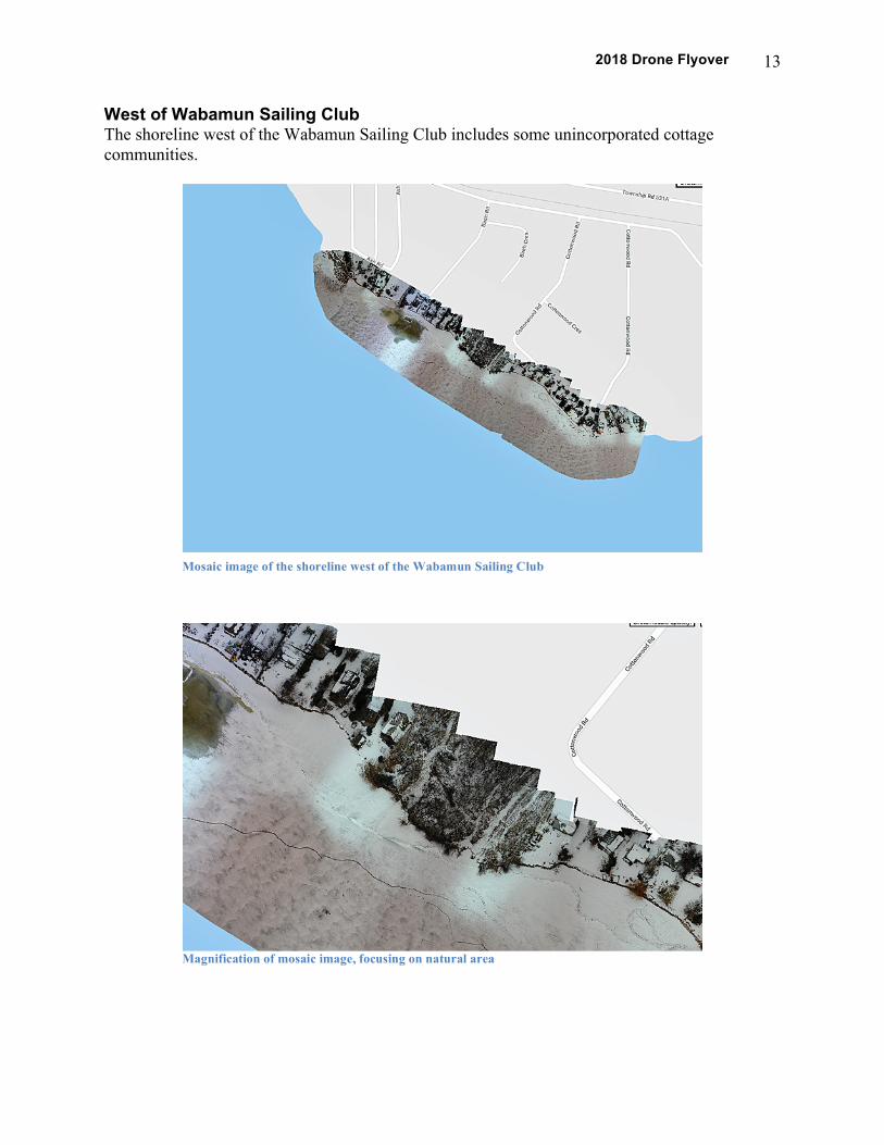
West of Wabamun Sailing Club The shoreline west of the Wabamun Sailing Club includes some unincorporated cottage communities.
Mosaic image of the shoreline west of the Wabamun Sailing Club
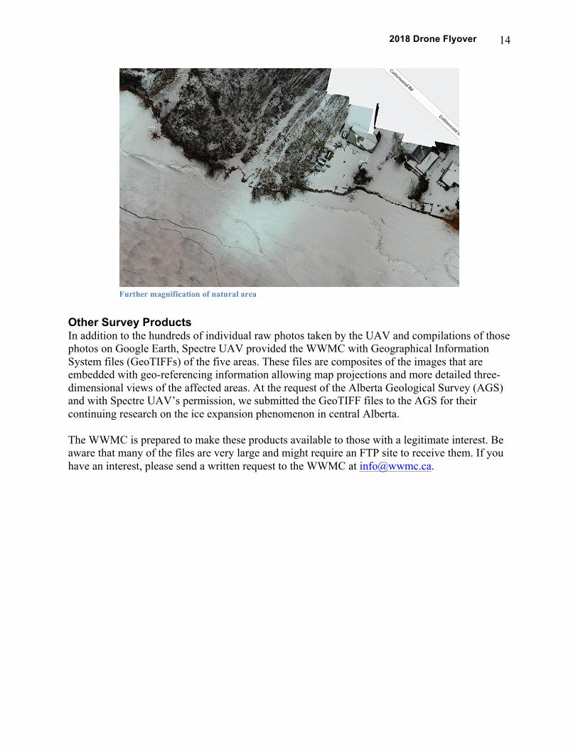
Magnification of mosaic image, focusing on natural area
2018 Drone Flyover 14
Other Survey Products In addition to the hundreds of individual raw photos taken by the UAV and compilations of those photos on Google Earth, Spectre UAV provided the WWMC with Geographical Information System files (GeoTIFFs) of the five areas. These files are composites of the images that are embedded with geo-referencing information allowing map projections and more detailed three-dimensional views of the affected areas. At the request of the Alberta Geological Survey (AGS) and with Spectre UAV’s permission, we submitted the GeoTIFF files to the AGS for their continuing research on the ice expansion phenomenon in central Alberta. The WWMC is prepared to make these products available to those with a legitimate interest. Be aware that many of the files are very large and might require an FTP site to receive them. If you have an interest, please send a written request to the WWMC at [email protected].
Further magnification of natural area