Embed Size (px)
Citation preview

1
Draft Cooper Street West Position Paper 8 April 2016

Table of Contents
1.0 Introduction ...................................................................................... 4
2.0 Land Use Opportunities .................................................................... 7
Land Use Opportunities ........................................................................... 7
Economic Opportunities .......................................................................... 7
Transport Linkages .................................................................................. 7
Environmental and Heritage Values ...................................................... 10
3.0 Land Use Constraints ...................................................................... 10
Former Landfills and Closed Landfill Buffers .......................................... 10
Development on Former Landfill Sites ................................................... 11
Active Quarry Buffers ............................................................................ 12
Environmental and Heritage Values ...................................................... 12
Road Network........................................................................................ 13
O’Herns Road Access ............................................................................. 13
Cooper Street Access ............................................................................. 14
Gas Pipeline ........................................................................................... 14
Stormwater ........................................................................................... 15
Pedestrian and Cycling Links .................................................................. 15
Melbourne Airport ................................................................................ 17
4.0 Cooper Street West Sub-Precincts .................................................. 18
5.0 Sub-Precinct 1 – Merri Creek Marran Baba Parklands and Conservation Land .......................................................................... 20
Creeks and waterways ........................................................................... 20
Open Space ........................................................................................... 20
Biodiversity Conservation Strategy ........................................................ 23
Summary of Land Use Constraints ............................................................ 23
Precinct 1 – Site Summaries: Merri Creek Marran Baba Parklands and Conservation Land ................................................................... 23
Key recommendations .............................................................................. 24
2

Key planning considerations ..................................................................... 25
6.0 Sub-Precinct 2 – Animal Welfare ..................................................... 26
Key recommendations ........................................................................... 29
Key planning considerations .................................................................. 29
7.0 Sub-Precinct 3 – Earth Resources and Waste Recovery ................... 31
Extractive Industry ................................................................................. 31
Waste and Resource Recovery .............................................................. 33
Key recommendations ........................................................................... 35
Key planning considerations .................................................................. 35
Landfill and Quarry Buffers and Gas Pipeline ............................................ 35
Extractive Industry and Waste and Resource Recovery ............................ 36
Design and Development .......................................................................... 36
Environmental and Heritage Values .......................................................... 36
8.0 Sub-precinct 4 – Gateway – Emerging Industry ............................... 38
Key recommendations ........................................................................... 42
Key planning considerations .................................................................. 42
Landfill and Quarry Buffers and Gas Pipeline ............................................ 42
Design and Development .......................................................................... 42
Road network ........................................................................................... 43
9.0 Northern Quarries Investigation Area (NQIA) ................................. 44
10.0 Conclusion ...................................................................................... 45
Where to from here? ............................................................................. 45
11.0 Glossary .......................................................................................... 47
12.0 References ...................................................................................... 49
3

1.0 Introduction
The purpose of this Draft Position Paper is to establish City of Whittlesea’s position with respect to the future use and development of land in the Cooper Street West Precinct. The precinct forms part of the broader Cooper Street Employment Area which is intended to develop as well-designed employment land.
In 1996, the City of Whittlesea and the City of Hume prepared a precinct strategy for Cooper Street, titled Cooper Street Precinct Strategy (October 1996). The strategy was prepared to guide future development to an area which was largely rural to developing into an urban area. The shared vision for Cooper Street was: To create a vibrant living and working community, which integrates good urban design, effective use of physical services and the significant natural environment of the Merri Creek and nearby Grasslands, to promote the precinct as a gateway to the Northern Metropolitan growth areas (Cooper Street Precinct Strategy, 1996: 5).
Cooper Street West is the remaining land in the broader Cooper Street Employment Area yet to be planned since the original inception for Cooper Street as an employment area. The precinct is important as nearby planning and development is creating more interest and demand for the precinct. North of the precinct is the Northern Quarries Investigation Area (NQIA) currently under investigation by the Metropolitan Planning Authority; east of the Precinct lies the Cooper Street Development Plan Area, Epping Metropolitan Activity Centre and Melbourne Wholesale Markets and south of the precinct is the more recently approved Cooper Street South-West Employment Area (Alex Fraser Group and Biodiversity Business Park).
The Cooper Street West Precinct is bound by O’Herns Road to the north, Hume Freeway to the east, Cooper Street to the south and the Merri Creek to the west (Figure 1). Cooper Street is an important east-west arterial road which links the City of Whittlesea with the Hume Highway industrial corridor. The industrial activities located adjacent to Cooper Street include large scale warehousing, manufacturing and distribution activity. Its proximity to national road, rail, air and port transport linkages, makes the Cooper Street West precinct an ideal location for industrial development, reliant on good transport networks and freight movement. The Local Planning Policy Framework in the Whittlesea Planning Scheme, Clause 21.10 (Economic Development) identifies that the Cooper Street Employment Area (including the Melbourne Wholesale Market) contributes to greater economic diversity by supporting employment generating industries and is identified as one of Whittlesea’s four major employment areas.
The Statewide Waste and Resource Recovery Infrastructure Plan Victoria 2015-2044 has identified Cooper Street, Epping as a State significant waste and recovery hub that is well located to service Melbourne as it is located close to major transport routes. The Plan states that pressure from residential encroachment and incompatible industrial and commercial activities could impact on the functionality of the precinct in the future. It recommends preserving adequate buffer distances and the use of planning controls to prevent the encroachment of incompatible industrial land uses such as food manufacturing, food processing and offices. The Plan also recognises that some of the existing hubs identified will transition out of waste and resource recovery activities over time.
4

The Precinct has a long history of quarrying and extractive industry which has significantly altered the physical landscape and facilitated the establishment of significant areas of filled land. While quarrying activities continue, in recent years, the number of extractive and landfill industries operating within the study area has reduced considerably.
The quarrying and landfill operations have severely constrained the extent of future developable land for employment purposes within Cooper Street West Precinct. A high pressure gas pipeline easement also runs along the eastern portion of the precinct, which carries a level of risk and may limit the type of uses and development that may be appropriate. The precinct also contains protected environmental values along the Merri Creek Corridor which further restrains development for a number of properties.
Ongoing take up of employment land within the broader Cooper Street Precinct, reduction in land supply in the immediate area and recent development interest are key factors in reviewing the planning for this precinct.
The underlying basis for future economic growth in the Precinct includes:
· its attraction for manufacturing, warehousing storage and distribution activities; · the opportunity for broad acre development projects; · its accessibility to local, metropolitan and regional routes.
The purpose of the paper is to identify Council’s position in relation to this complex and constrained precinct and identify at the outset, the key planning considerations for development and land use planning.
The Position Paper has identified 4 sub-precincts to the overall area, reflecting the distinctive uses in the precinct. The Position Paper aims to support the intended employment purposes for the precinct and identify the constraints to provide greater certainty for land owners and future development interests.
5

6

2.0 Land Use Opportunities
Land Use Opportunities The Cooper Street West Precinct has been designated for employment uses however due to some of its constraints; this may be more limited than the other areas of Cooper Street Employment Area.
The proximity of the study area to future growth areas, transport infrastructure and regionally significant employment precincts present significant opportunities for future investment. Key opportunities include:
Economic Opportunities
· The relocated Melbourne Wholesale Fruit and Vegetable Market is a state significant project which presents opportunities for related businesses.
· Proximity to the broader Cooper Street Employment Area, State significant Northern Industrial Area (as identified in Plan Melbourne) and Epping Metropolitan Activity Centre.
· The precincts gradual transitioning away from extractive and landfill activities with a reduction in the number of active sites and others at various stages of rehabilitation.
· Cooper Street’s (Epping) role as a State significant waste and resource recovery hub as identified in the Statewide Waste and Resource Recovery Infrastructure Plan, for the medium term.
· Proximity to the Northern Quarries Investigation Area (NQIA) and the potential for additional employment land north of the precinct.
· The emerging development south of the precinct at Biodiversity Business Park.
Transport Linkages
· Access to major transport infrastructure including the Melbourne-Brisbane Rail Line, the Hume Highway (M31), the Metropolitan Ring Road and Sydney Road (Route 55).
· Proximity to Melbourne Airport and the future Beveridge Interstate Freight Terminal provides an incentive for freight and logistics investment. The Freight Terminal will significantly increase the capacity of interstate rail freight transport and will be directly accessible from the study area via the Hume Freeway.
· Proposed construction of the O’Herns Road interchange to the Hume Highway.
7

An opportunity to improve road connectivity and services (i.e. drainage) throughout the site.
8
·

9

Environmental and Heritage Values · Opportunities to link the Merri Creek Parklands to the nationally significant Craigieburn
Grasslands to the north.
· Opportunities to improve the environmental and conservation conditions of the Merri Creek and surrounding area.
· Opportunities to restore and rehabilitate native grassland vegetation and Redgum woodland habitat for protected native fauna.
· Opportunities to protect and restore highly valued Growling Grass Frog habitat.
· Opportunities to provide additional high quality open space in Epping.
· Opportunities to protect and integrate identified heritage values into the precinct.
3.0 Land Use Constraints
The precinct is encumbered by a number of significant constraints which limit the development potential in the short to medium term. The precinct contains former quarries and former putrescible waste and solid inert fill which require time for the land to remediate and stabilise. Former landfill sites can impact on the land adjoining the properties. In addition to the former land uses impacting on the development potential of the precinct, the land also contains identified environmental values which are required to be protected. A portion of the precinct along the eastern boundary is also affected by a gas pipe line easement. It is noted that development within the broader precinct must not prejudice the ability for Council as the landowner to meet environmental compliance requirements of its landfill monitoring program. Key land use constraints are discussed below. Former Landfills and Closed Landfill Buffers One of the key land use constraints for developing within the precinct is the former landfills and their buffers which affect adjoining land.
· The EPA’s “Closed Landfill Guidelines” (December 2012) identifies that it can take approximately 30 years for landfills to decompose and therefore that potential risks from landfill gas remain for at least 30 years post-closure. Environmental risks include leachate, site contamination, land instability and subsidence; and landfill gas migration.
· The EPA guidelines, Landfill BPEM - Best practice environmental management – Siting,
design, operation and rehabilitation of landfills (EPA Publication 788.3, August 2015) recommends a 500m buffer distance for Type 2 (Putrescible) landfill from buildings or structures and a 200m buffer distance for Type 3 (Solid Inert) landfill from buildings or structures. The EPA advises that there may be potential for these buffers to be reduced
10

given the age of the closed landfills. Landfill gas risk assessments are required to determine a reduction in buffers.
· Buffer distances are measured from the edge of the landfill cells, however, if the location of the cell is unknown; the buffer distance is measured from the boundary of the landfill. For the purposes of this paper, the buffers are measured from the property boundaries.
· Land within buffer areas may be used for non-sensitive uses provided the uses do not prejudice the ability for environmental compliance and monitoring requirements to be met.
· The closed landfill buffer distance applies to any building or structure located near a closed landfill including industrial development and subsurface structures such as stormwater drains or service trenches that may allow landfill gas to migrate / accumulate. The buffer provides a protection zone for subsurface landfill gas migration.
· Where a proposed development or planning scheme amendment is proposed within the recommended EPA landfill buffer, a Section 53V audit under the Environment Protection Act 1970 may be required to assess the “risk of harm” to the proposed development, by the potential offsite impacts. A 53V (risk of harm) audit could be avoided if “other relevant and sufficient information” from previous assessments or audits is available, which may be relied on in making a decision.
· The Statewide Waste and Resource Recovery Infrastructure Plan Victoria 2015-2044 encourage the use of closed landfills, where appropriate, for resource recovery activities given the existing provision of a buffer. It also recommends the use of planning controls to prevent encroachment of incompatible industrial land uses (i.e. food manufacturing, food processing, offices) near waste and recovery facilities which could impact the functionality of the site.
Development on Former Landfill Sites
· Former landfills present a high potential for contamination and as such are likely to require a Section 53X contaminated land audit under the Environment Protection Act 1970, as they can pose an environmental risk.
· Development potential of former landfill sites is significantly constrained and generally limits the construction of significant buildings or structures.
· The EPA’s “Closed Landfill Guidelines” (December 2012) suggest that practical post closure uses for landfills can include sports grounds, public open space and golf courses. In limited circumstances, landfills can also potentially be developed subject to resolving issues of site contamination land stability, leachate and landfill gas.
· Significant site investigations and rehabilitation is required before former landfills can be developed to ensure latent risks are appropriately managed. Development of a
11

former landfill will generally require: hydrogeological investigation, risk assessment, ensuring sub-base stability for any foundations/building construction/works.
· Gas extraction and monitoring facilities on former putrescible landfill sites will impact on any proposed works and the location of any future road connections within the precinct. The location of a road, works, services or development will be restricted by:
o The location of any active gas extraction pipes, including the header line or bulk line or main;
o The location of leachate sumps, including any connecting pipework to/from the leachate ponds;
o Any pipework or lines may need to be protected from the impact of development / works (i.e. culverts) which needs to be determined in consultation with the ‘gas contractor’ engaged by the landfill owner to manage the gas extraction.
Active Quarry Buffers
· There are two active quarries in the Precinct (Works Authority 149 and 445 respectively).
· Separation buffers of 250 metres from sensitive uses are required from these active quarries (where no blasting occurs) to minimise off-site impacts arising from unintended fly rock, odour and dust emissions.
· The existing active quarries cannot be used for landfill purposes as these sites are not listed on the Landfill Schedule by the Regional Waste Management Group. EPA has indicated that on this basis, new landfills within this precinct would not be supported.
Environmental and Heritage Values
· A portion of land (605 O’Herns Road) within the precinct is covered by the State Government’s Biodiversity Conservation Strategy (BCS). The BCS is the overarching strategy for the protection of biodiversity in the growth corridors and protects sites of state and national significance. The precinct is within Conservation Area 34 which protects the habitat for the Growling Grass Frog (Litoria raniformis) which is listed as vulnerable under the Environment Protection and Biodiversity Conservation Act 1999 (the EPBC Act) and threatened under the Victorian Flora and Fauna Guarantee Act 1988.
· A portion of the precinct includes Growling Grass Frog habitat which is protected as an environmental offset for the lost habitat at the Melbourne Wholesale Market site.
12

Native grassland vegetation, recovering Redgum woodlands and large River Redgum trees exist within the study area. The study area also includes remediation and restoration of native grassland and grassy woodland habitat which provides for protected native fauna, including the Golden Sun Moth populations and remnant kangaroo populations.
·
Protected Aboriginal Cultural Heritage sites and sites identified in the Victorian Heritage Inventory.
· Protected heritage values of State significance identified for 3 sites within the precinct.
Road Network · Whilst the precinct is in a strategically significant location with respect to roads
infrastructure it currently suffers from a delay in investment in the surrounding network. The redevelopment of an area at this scale will require internal roads network which will be made more challenging by the issues of land instability for former landfill sites.
· The precinct currently lacks a functional local road network. As a result, more detailed planning for the Precinct is required to identify future north-south, east-west road alignments. Given the potential land instability from a history of extensive quarrying and landfilling in the area, geotechnical investigations will be required to determine the appropriate siting of future east- west, north-south road connections within the precinct. Such investigations will ensure roads are located in areas that are able to support the construction of roads to an industrial standard.
· There is limited north-south road access from O’Herns Road to Cooper Street, and a portion of Vearings Road south of O’Herns Road is not in Council ownership.
· The precinct contains a number of unsealed roads and single carriageways. The western section of O’Herns Road is an unsealed Council road which terminates at the Merri Creek.
· The eastern boundary of the study area is the Craigieburn Bypass (Hume Highway). VicRoads is currently preparing a business case for the upgrade to the Hume Highway and O’Herns Road interchange. This will vastly improve areas into the study area and provide a major catalyst for development opportunities.
O’Herns Road Access
· The North Growth Corridor Plan illustrates O’Herns Road as extending over the Merri Creek to allow a future connection to Sydney Road. This is a long term plan and further discussion and investigation will be required with VicRoads. Notwithstanding, O’Herns Road is not fully constructed and is not capable of taking additional traffic. Further development of the
13
·

precinct will require duplication and full reconstruction of O’Herns Road. Land reservations may be required to allow for a future 4-lane divided road with median and service roads.
· Cooper Street Employment Area Development Plan – identifies Cooper Street and O’Herns Road as arterial roads with service roads along the O’Herns Road, Cooper Street frontages. Local access to land frontages on the arterial roads is generally proposed via service roads, which will minimise safety concerns and reduce delays on the arterials.
· The preferred arrangement for a north-south access onto O’Herns Road would be from Vearings Road. Vearings Road is intended to be the main north-south access road through the precinct.
· There is limited road access to Cooper Street West Precinct from O’Herns Road.
Cooper Street Access
· Cooper Street is identified as a gateway to the City of Whittlesea in the Cooper Street Employment Area Development Plan. Cooper Street is identified as the most important east-west arterial in the middle region of the municipality in the Cooper St Development Plan. Landscaped median and landscaped verges will significantly increase the amenity of this road. A high standard of design is expected from development fronting Cooper St to reflect the gateway location and the high level of exposure.
· Access arrangements for Cooper Street have been largely determined by the approved subdivision for the Cooper Street South-West Precinct. Signalised intersections along Cooper Street have been identified for Graystone Court and Biodiversity Drive. Direct vehicular access to Cooper Street as an arterial road may not be permitted and sites with Cooper Street and O’Herns Road frontages may require service road access, or to be accessed from future roads internal to the Precinct.
Gas Pipeline · A high pressure gas transmission pipeline (known as Keon Park to Wollert T47.1) exists
along the eastern boundary within the precinct in an easement of approximately 35 metres in width (running north-south). A measurement length of approximately 370 metres is applicable for development in the vicinity of the high pressure gas infrastructure which may present some constraints on the use and development of this land.
· A gas pipeline (known as Somerton Pipeline T102) exists along the northern boundary of the precinct (running east-west). Some sections of the pipeline are within the precinct, while some sections run along the north side of O’Herns Road. The pipeline has an easement of 7 metres and measurement length of approximately 135 metres that is within the precinct.
· High pressure gas pipelines carry a level of risk which must be assessed to ensure that risk to people, property and the environment is within acceptable levels, in accordance with the
14

Guideline for the Planning and Development of Land in the Vicinity of High Pressure Natural Gas Pipelines in Victoria, 2014 (APA Group) and Australian Standard 2885 Pipelines: Gas and Liquid Petroleum.
· The City Gate facility, which is a pressure reducing facility, also exists within the diamond interchange of O’Herns Road and Hume Freeway.
· The Whittlesea Planning Scheme (Clause 19.03-6) requires existing high pressure pipelines to be protected from further encroachment by incompatible residential, commercial, industrial and other sensitive land uses, unless suitable additional protection of pipelines is provided. Land use and zone compatibility with the existing pipeline design needs to be assessed to manage the risk.
·
The relevant gas pipeline authority (APA Group) needs to be consulted early in the process to determine the potential safety impacts. A Safety Management Study may be required where an impact on pipeline safety and associated risk is identified.
· Development restrictions apply on pipeline easements. Easements are required to be kept clear to allow access to the pipeline for maintenance and operations. The Guideline states that permanent structures including; buildings, storm water compensating basins, inflammables and corrosives are not permitted on a pipeline easement.
·
Land use must also be compatible with the conditions of pipeline easements. The Guideline recommends that pipeline easements be used as open space, such as parks, gardens and reserves, designed and developed in line with AS 2885. Landscaping is typically restricted to grasses, groundcovers and low shrubs to maintain line of sight along the pipeline.
Stormwater
· The Edgars Creek Drainage Scheme runs north south through the eastern portion of the precinct. If and when this area is to be developed, Melbourne Water would require the owners to enter into an agreement that implements the Drainage Services Scheme (DSS). The Agreement will facilitate and require provision of Works and payment of contributions.
· It is anticipated that the precinct will incorporate design which utilises the natural attributes of the precinct in a manner which enhances the development and the stormwater drainage.
· It is also anticipated that the subdivision layout of the precinct will reflect the overall drainage scheme and will incorporate best practice stormwater management.
Pedestrian and Cycling Links · Currently, no formalised pedestrian and cycling access exist within the study area, however,
it is noted that the Parks Victoria Merri Creek Marran Baba Parklands Strategic Management Plan (2013) provide for the future establishment of shared trails through the
15

16

precinct. This includes the establishment of a pedestrian/cycling link between the ‘Galada Tamboore’ trail and the ‘Cooper Street Grasslands’ along the eastern side of the Merri Creek.
· A shared pathway currently exists along Cooper Street. The Galada Tamboore Trail also provides a link between the Merri Creek Trail and the eastern side of the Craigieburn bypass via a pedestrian footbridge into the Whittlesea Public Gardens.
Melbourne Airport · Proximity to Melbourne Airport requires consideration of various safeguarding
considerations including uses that may attract birdlife, pilot lighting distribution and structures within prescribed airspace.
17

4.0 Cooper Street West Sub-Precincts
The Position Paper identifies 4 sub-precincts for Cooper Street West, recognising the current and intended future land uses for the precinct can be categorised as follows:
· Merri Creek Parklands and Conservation Land, · Animal Welfare, · Earth Resources and Extractive Industries, · Gateway and emerging industry.
The purpose is to analyse each precinct, identify the opportunities and constraints for each sub-precinct, the key issues and make recommendations to inform future planning (shown in Figure 4).
18

19
20
5.0 Sub-Precinct 1 – Merri Creek Marran Baba Parklands and
Conservation Land
The former landfill at 490 Cooper Street is currently undergoing remediation and revegetation to form part of the Merri Creek Marran Baba Parklands. It also includes Growling Grass Frog habitat that forms part of an environmental offset for lost habitat on the Melbourne Wholesale Market site. The revegetated open space uses along the Merri Creek provide passive recreation, including the future Merri Creek trail, and visitor entry points. The land towards the north (605 O’Herns Road) has been identified by the Federal and State Governments as highly valued conservation land with significant habitat for the endangered and federally protected Growling Grass Frog due to its position at the confluence of the Merri and Curly Sedge Creeks. Creeks and waterways
The Merri Creek is an iconic and valued Melbourne waterway that flows into the Yarra River. Council recognises its importance and the need to protect and preserve the Creek’s natural beauty, its flora and fauna and its cultural and historic significance. The creek extends along the western boundary of the study area, forming the spine of current and future open space provision within Cooper Street West. The Environmental Significance Overlay Schedule 3 (ESO3) covers the land adjacent to the Creek throughout the study area. This overlay recognises the Creek’s environmental significance and the role its preservation has in protecting threatened flora and fauna species. The overlay also includes in its objectives the protection of the landscape character, the waterways, the natural systems and the views amongst other things.
Both State and Local planning policy directions for the Merri Creek seek to ensure:
· The environmental and recreational values associated with the Merri Creek and its surrounds are protected and enhanced; and
· The creation of continuous links and trails extending to Craigieburn.
Open Space The Merri Creek Marran Baba Parklands Strategic Management Plan (2013) was released by Parks Victoria in May 2013. The plan builds upon previous strategic planning exercises undertaken for the parklands including the Merri Creek Parklands Draft Concept Plan (2006) and Merri Creek Strategic Statement (2008).
It outlines the key directions for the future use and management of the Merri Creek parklands over the next 15 years. The management plan provides high level strategic objectives for the future use and development of land parcels within and surrounding the Cooper Street West

area. This includes Council owned land at 490 Cooper Street and the Craigieburn Grasslands National Conservation reserve.
21

22

The plan is primarily a management tool to administer the state-owned areas of land within the parklands. However, it does also provide some direction around the integration and complementary management of land owned by local government, with specific references to 490 Cooper Street, Epping.
Biodiversity Conservation Strategy The land at 605 O’Herns Road is protected by the State’s Biodiversity Conservation Strategy; this strategy protects nationally significant fauna and flora in the Northern Growth Corridor. The strategy identifies the following actions in protecting the conservation areas:
· Apply appropriate planning provisions to the land depending on the circumstances (may include a Rural Conservation Zone, and Environmental Significance Overlay or another statutory mechanism) to be determined by the State Minister for Planning.
· Prepare conservation management plan(s) and ensure planning provisions for implementation and funding are in place.
· Establish management agreements with landowners under section 69 of the Conservation Forests and Lands Act 1987 and/or transfer land to Crown to be managed by Melbourne Water.
Summary of Land Use Constraints
23
Land Use Constraints
Former Landfill Sites
Closed Landfill Buffers
Pipeline Easement
Biodiversity Conservation Strategy
Environmental Offsets
Protected habitat
Protected heritage values
· · · · · · ·
Precinct 1 – Site Summaries: Merri Creek Marran Baba Parklands and Conservation Land
Address Owner Land Area Planning Controls
Summary of land
490 Cooper St, Epping
City of Whittlesea 26.08ha ES03
SUZ4
RFO
VHR H7822-0064
Council owned land.
Former landfill (solid inert) site subject to ongoing remediation works (known as Northern).
Site contains a Growling Grass Frog offset area for the Melbourne Wholesale Markets and pockets of significant native vegetation.

24
Address Owner Land Area Planning Controls
Summary of land
Earmarked for inclusion in the Merri Creek Marran Baba Parklands Strategic Management Plan. A draft master plan has been prepared to facilitate this.
Aboriginal Cultural Heritage considerations
Victorian Heritage Inventory
Victoria Heritage Register listing – Sheep Wash
Affected by the Somerton Gas Pipeline (T102) measurement length
605 O’Herns Road Epping
Private 37.64 ha SUZ
UFZ
ES03
PAO4
VHR H7822-0065
Vacant land in private ownership.
Protected under the Biodiversity Conservation Strategy - highly valued conservation land
A Public Acquisition Overlay (schedule 4) applies to a portion of land; this overlay was originally applied for the Craigieburn Bypass but is now considered potentially redundant.
Aboriginal Cultural Heritage considerations
Victoria Heritage Register listing – Sheep Pens
Contains the Somerton Gas Pipeline (T102)
Key recommendations

· Support the implementation of the Merri Creek Marran Baba Parklands Strategic Management Plan and Biodiversity Conservation Strategy.
· Investigate the potential removal of the Public Acquisition Overlay on 605 O’Herns Road.
· Review the application of Special Use Zones (Schedule 4 – Extractive Uses) for land at 490 Cooper Street intended to be protected for conservation purposes and open space.
· Support the rezoning of land at 605 O’Herns Road to protect the environmental values of the site, in line with the Biodiversity Conservation Strategy; and investigate opportunities for its potential inclusion into the Merri Creek Marran Baba Parklands Plan.
·
To work with Department Water Environment Land Planning to implement the Biodiversity Conservation Strategy and protect conservation areas through appropriate planning provisions, conservation management plans and agreements.
Key planning considerations
· To recognise and manage environmental risks associated with being a former landfill site
and within a closed landfill buffer and an active quarry buffer. · To enhance and preserve protected habitat for the endangered Growling Grass frog. · To maintain the habitat corridor along Merri Creek. · To ensure rehabilitation and enhancement of the Merri Creek environs and extension of the
Merri Trail link along the Merri Creek Corridor. · To ensure protection and conservation of threatened species. · To avoid the removal of native vegetation. · To protect identified heritage values. · To protect Aboriginal Cultural Heritage. · To provide vistas to and from the Merri Creek, there are various opportunities to capitalise
on views of the Melbourne CBD to the south and the Quarry Hills to the east. · To provide landscaping and architectural features which define the entry point into the
Merri Creek Parklands as appropriate? · To plan for pedestrian and bicycle access and linkages. · To ensure safe access for fire management and emergency vehicles is available in the
precinct. · To manage stormwater runoff and drainage. · To recognise and respond to the constraints on land use and development within the
vicinity of the gas pipeline easement and consult with the relevant authority.
25

6.0 Sub-Precinct 2 – Animal Welfare
26

This sub-precinct consists of three (3) allotments which are accessed from Pound Road.
The Animal Welfare Precinct will contain Council’s facility for lost pets and impounded livestock. The facility will be owned and constructed by Council with the intention to lease the facility to an animal welfare agency. The proposed new facility will be constructed on Lot 3 with options for other appropriate uses for Lot 1 and 2. The land is zoned Public Use Zone (schedule 6) for Lot 3 and Industrial 1 zone for Lots 1 and 2, with an overall area of 2.91 ha. The land is within a closed landfill buffer and as such any proposed development and any works within the recommended landfill buffer can pose a safety risk. Council must be satisfied that it is appropriate to reduce or develop/undertake any works within a landfill buffer.
A portion of the precinct contains native grassland vegetation, recovering Redgum woodlands and large old Redgum trees and is of significant value due to its proximity to Golden Sun Moth populations, which is listed as threatened under the Flora and Fauna Guarantee Act 1988 (Vic). The rehabilitated portion of the precinct also provides native grassland and Redgum woodland habitat for protected native fauna, including remnant kangaroo populations. These areas are to be protected as part of the overall environmental assets of the broader Cooper Street West Precinct. Summary of land use constraints
27
Land Use Constraints
Former Landfill Sites
Closed Landfill Buffers
Active Quarry
Active Quarry Buffers
Biodiversity Conservation Strategy
Environmental Offsets
Protected habitat
Protected heritage values
· · ·
Precinct 2 – Site Summaries: Animal Welfare
Address Owner Area Planning Controls Summary of land
2,12,20 and 38 Pound Road, Epping
City of Whittlesea 2.91 ha Industrial 1 Zone
PUZ (Schedule 6) DDO3
Council owned land that is proposed to develop as a metropolitan animal shelter Contains restored grassland and grassy woodland communities as a result of remediation works.

28

Key recommendations
· Support the development of the City of Whittlesea’s Animal Welfare Precinct.
· To maintain and protect the native grassland, redgum woodland habitat and large old Redgum trees.
· Ensure that any new development proposal meets the requirements identified in the Best practice environmental management – Siting, design, operation and rehabilitation of landfills (EPA Publication 788.3 August 2015).
Key planning considerations
· To recognise and manage environmental risks associated with being within a closed landfill buffer and an active quarry buffer.
· Support appropriate development and uses, subject to satisfying the environmental risks and buffers associated with a closed landfill.
· Provide vehicular access from Pound Road as a left-in and left-out only treatment from Cooper Street.
· Provide a high profile, well designed interface with Cooper Street. · To protect and maintain the rehabilitated native grassland and redgum woodland for the
purposes of providing habitat for native fauna.
29

30

7.0 Sub-Precinct 3 – Earth Resources and Waste Recovery
This sub-precinct is gradually transitioning away from extractive and landfill activities, with most sites in various stages of rehabilitation.
There are two remaining active quarrying sites and other waste and resource recovery industries (green waste and materials recycling centres) on the former landfill sites under remediation. The area has been identified in the Statewide Waste and Resource Recovery Infrastructure Plan as being a hub for waste and resource recycling of State significance, although it is recognised that some existing hubs will transition out of waste and resource recovery activities over time.
The active quarry and closed landfill sites have existing buffers ranging from 200 metres to 500 metres. The precinct is currently separated from sensitive uses with farm land to the north and east. South of the precinct is the planned ‘biodiversity business park’ industrial estate and west lies the Merri Creek and Somerton Industrial Estate.
Adequate separation distances are required to be maintained to minimise impacts on sensitive uses from the possible off-site amenity impacts of extractive industries and waste and resource recovery activities. The Statewide Waste and Resource Recovery Infrastructure Plan also recommends the use of planning controls to prevent encroachment of incompatible industrial land uses (i.e. food manufacturing, food processing, offices) near waste and recovery facilities which could impact the functionality of the site.
The off-site amenity impacts of open window composting operations have been identified as being more difficult to contain and more technologically advanced processing, such as in-vessel composting is preferred for urbanised areas.
31
As the sub-precinct contains a number of closed landfills, there are a number of environmental risks associated with former solid inert and putrescible landfills which require careful management and which encumbers future development. A high pressure gas pipeline easement also exists within the precinct which may limit the type of uses and development that are appropriate. These constraints will determine the suitability of future rezoning, land uses and development for this precinct.
Extractive Industry
The existing active Work Authorities (WA 445, WA 149) reflect the long-standing quarrying activity in the area. It is difficult to determine how much longer the extractive industries will continue to operate. Work Authorities are active until the resource is depleted.
These uses should be protected from encroachment while the extractive operations are active. However, over the next 20-30 years it is anticipated that this hub will transition out of resource extraction activities as the natural resource is depleted, environmental risks are reduced, and demand for other uses occur in the sub-precinct.

32

The intention is to allow these sites to eventually be rehabilitated such that they can be redeveloped once the resource extraction is complete and the land has stabilised, in accordance with a rehabilitation plan. The sites are not suitable to be used as a future landfill as they are not identified on the Regional Waste Management Group’s Landfill Schedule.
Waste and Resource Recovery
The sub-precinct forms part of a network of waste and resource recovery sites which service the northern metropolitan region. The use of closed landfill sites offer locational advantages given existing buffers and separation from sensitive uses. The sub-precinct contains 3 separate recycling facilities on Council owned land which are subject to lease agreements. A planning permit (Notice of Decision) has recently been issued for a materials recycling facility at 460 Cooper Street. The timber waste and compost green organic waste recycling provided at this facility offers a number of benefits to the local community, including the recycling benefits, and the reduction in cost to transport and dispose of waste to another location. While the former landfill sites are under rehabilitation, Council will continue to support waste recycling industries in the sub-precinct. Such facilities will be required to maximise the use of technologically advanced processing equipment to mitigate odour and dust emission impacts.
Co-location of other compatible activities that support and enhance waste and resource recovery activities during this time, are also encouraged. It is Council’s intention that this hub will transition out of waste and resource recovery activities as the extractive activities cease and the quarry and former landfill sites are rehabilitated. This will enable the sub-precincts gradual transition towards employment uses as demand for such uses grows.
Summary of Land Use Constraints
33
Land Use Constraints
Former Landfill Sites
Closed Landfill Buffers
Active Quarry
Active Quarry Buffers
Biodiversity Conservation Strategy
Pipeline Easement
Central Creek
Protected heritage values
· · · · · · ·
Precinct 3 – Site Summaries: Earth Resources and Waste Recovery
Address Ownership Land Area Planning Controls
Summary
335-355 O’Herns Road, Epping
Lot1-TP102498 (14.24ha)
Lot4-TP805492 (34.50ha)
City of Whittlesea
48.61ha SUZ (part)
Farming Zone (part)
SIO (part)
Former quarry and landfill (putrescible) site (known Cooper No.2) owned by Council.
Land is currently leased as a concrete batching plant and materials recycling facility (Permit no. 709220). The existing

34
Address Ownership Land Area Planning Controls
Summary
lease will expire in 2021.
Contains the Somerton Gas Pipeline (T102)
375 O’Herns Road, Epping
Private 42.06ha SUZ
LSIO
Privately owned land.
Active quarry.
Work Approval 445 - Existing operations comprise a residence, offices and associated quarrying infrastructure.
The Northern Quarries Investigation Area Addendum identifies that the operation is expected to continue for the next 20 years.
Victorian Heritage Inventory
Affected by the Somerton Gas Pipeline (T102) measurement length
460 Cooper St, Epping
Private 55.89ha SUZ
ESO3 (small portion)
LSIO
Privately owned land.
Active quarry. Contains extensive fill areas.
Works Approvals (149) - The site has been significantly disturbed by quarrying activity, is susceptible to inundation and contains large areas of filled ground.
Works Approval for Northern Quarries – 8ha available with quarry life of 7 years WA extended to cover additional 20 ha frontage to Cooper St.
A Notice of Decision to Grant a Permit (No.714470) has been issued (8 December 2015) for the use and development of a materials recycling centre.
The site’s redevelopment potential is constrained by the presence of extensive areas of fill and drainage issues associated with Central Creek.
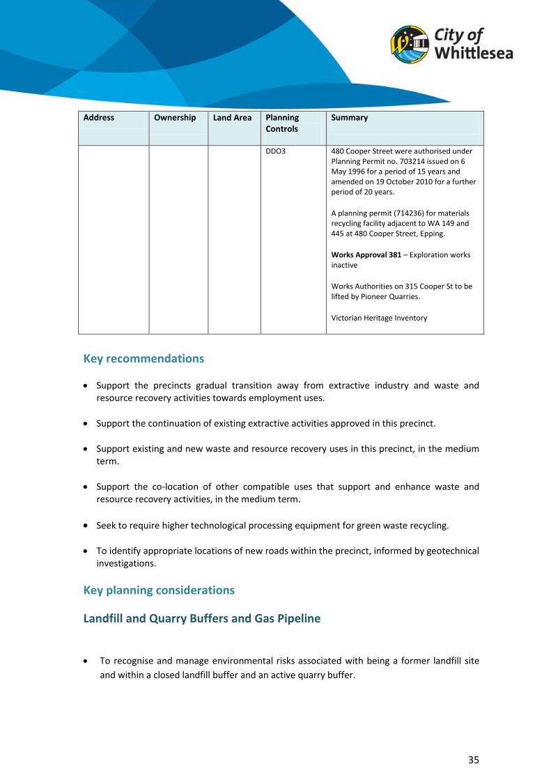
480 Cooper St, Epping
City of Whittlesea
27.83 ha Industrial 1 Zone
LSIO
ES03 (part)
Council owned land. Former landfill (putrescible) site (known as Cooper No.1)
Land is currently leased. Two of the leases are currently active including: timber waste recycling facilities and green organic composting facilities.
Activities on Lease Plan Areas 1 and 2 at
35
Address Ownership Land Area Planning Controls
Summary
DDO3 480 Cooper Street were authorised under Planning Permit no. 703214 issued on 6 May 1996 for a period of 15 years and amended on 19 October 2010 for a further period of 20 years.
A planning permit (714236) for materials recycling facility adjacent to WA 149 and 445 at 480 Cooper Street, Epping.
Works Approval 381 – Exploration works inactive
Works Authorities on 315 Cooper St to be lifted by Pioneer Quarries.
Victorian Heritage Inventory
Key recommendations
· Support the precincts gradual transition away from extractive industry and waste and resource recovery activities towards employment uses.
· Support the continuation of existing extractive activities approved in this precinct.
· Support existing and new waste and resource recovery uses in this precinct, in the medium term.
· Support the co-location of other compatible uses that support and enhance waste and resource recovery activities, in the medium term.
· Seek to require higher technological processing equipment for green waste recycling.
· To identify appropriate locations of new roads within the precinct, informed by geotechnical investigations.
Key planning considerations
Landfill and Quarry Buffers and Gas Pipeline
· To recognise and manage environmental risks associated with being a former landfill site and within a closed landfill buffer and an active quarry buffer.

To ensure adequate buffers and measures are made to allow continuing gas extraction and maintenance of gas extraction equipment.
· To recognise and respond to the constraints on land use and development within the
vicinity of the gas pipeline easement and consult with the relevant authority.
Extractive Industry and Waste and Resource Recovery
· Recognise the various timelines for existing extractive uses to conclude and the need to remediate closed sites.
· The State significant waste and resource recovery hub within this sub-precinct will continue to provide a service to the local community and support initiatives to increase recovery and improved management of waste, in the medium term.
· Council needs to be satisfied that sufficient information has been provided by a proponent that the proposed rezoning of land and/or development will not be adversely impacted by its proximity to a landfill site.
Design and Development
· Provide opportunities for connectivity and integration of the precinct to surrounding land and future development.
· Design to reflect the locational attributes of the precinct.
· To recognise and manage off site impacts by ensuring operators engage in best practice to minimise off-site impacts to support its continuing operations in a metropolitan area.
· Provide high quality urban design response, reflective of the high visibility of this gateway location, in particular from the view lines of Cooper Street, O’Herns Road and Hume Freeway.
· Road network design to minimise impacts on access along Cooper Street and O’Herns Road. Environmental and Heritage Values
· To ensure that former Works Authority sites are appropriately remediated and rehabilitated in accordance with the approved rehabilitation plan.
· To recognise and minimise potential impact on waterways and to manage any risks associated with storm events.
36
·

· Protect stony knolls, significant trees, River Red Gums and areas of dry stone walls. · Maintain open waterways to Central Creek.
· Protect cultural heritage significance.
37

8.0 Sub-precinct 4 – Gateway – Emerging Industry
38

Precinct 4 has been identified as land which could play a significant gateway role, being on the north-west corner of the Craigieburn Bypass (Hume Hwy) and Cooper Street interchange. High quality built form responses and landscaping are expected to reflect the high visibility of this precinct.
The precinct is located within the buffer of closed landfills which requires a ‘risk of harm’ audit or assessment to be carried out before any development can occur within the buffer. The high pressure gas pipeline easement also exists within the precinct which may limit the type of uses and development that are appropriate. These constraints will determine the suitability of future rezoning, land uses and development for this precinct.
Development of this precinct should not prejudice the planning and development of the broader precinct, particularly in terms of internal road access arrangements. Development will also require works or services to be provided or paid for including roads, easements and other requirements identified. This would need to be achieved by either a Development Contributions Plan/Infrastructure Contributions Plan or Section 173 Agreement.
Summary of Land Use Constraints
39
Former Landfill Sites
Closed Landfill Buffers
Active Quarry
Active Quarry Buffers
Biodiversity Conservation Strategy
Environmental Offsets
Protected habitat
Pipeline Easement
Protected heritage values
· · · ·
Precinct 4 – Site Summaries: Gateway and Emerging Industry
Address Ownership Area Planning Controls Summary
410 Cooper St, Epping
Private 32.09 ha
Farming Zone
DD02
VHR H7822-0269
Privately owned.
Existing farm dwelling.
A high pressure gas pipeline extends through the site in a north/south alignment (known as Keon Park to Wollert T47.1)
The site has not been quarried to any significant extent and offers scope for redevelopment.
Victoria Heritage Register listing for stonewalls.

40
315 O’Herns Road, Epping
Private 29.33 ha
Farming Zone
SUZ
DD02
PAO2 (partial north-east corner)
Privately owned.
Currently used for grazing.
A high pressure gas pipeline extends through the site in a north/south alignment (known as Keon Park to Wollert T47.1)
The land has not been quarried to any significant extent and offers scope for redevelopment.
Victorian Heritage Inventory.
Contains the Somerton Gas Pipeline (T102)
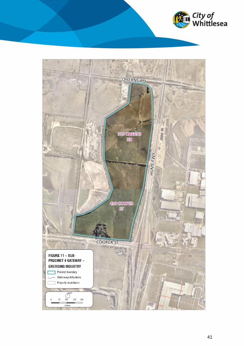
41

Key recommendations
· Support the rezoning of the precinct to reflect the intended employment land.
· Ensure development of this precinct does not prejudice the planning and development of the broader precinct, particularly in terms of internal road access arrangements.
· Ensure a rezoning is accompanied by a development plan, including a Development Contributions Plan/Infrastructure Contributions Plan or Section 173 Agreement, as required.
· Ensure integration of the development of this sub-precinct with the broader Cooper Street West Precinct.
Key planning considerations Landfill and Quarry Buffers and Gas Pipeline
· To recognise and manage environmental risks associated with being within a closed landfill buffer and an active quarry buffer.
· To ensure adequate buffers and measures are made to allow continuing gas extraction and maintenance of gas extraction equipment.
· To recognise and respond to the constraints on land uses and development within the vicinity of the gas pipeline easements and consult the relevant authority.
Design and Development
· To seek opportunities for road access and integration of the precinct with future
redevelopment potential of the surrounding land.
· To provide high quality built form and landscape amenity at this highly exposed gateway location.
· To enhance the aesthetic appearance and experience along the Hume Highway, Cooper Street and O’Herns Road.
· Provide a subdivision layout which allows for vehicles required for industrial areas and within and into/out of the site and with varying allotment sizes, to allow for a variety of industrial/employment uses to establish in the precinct.
· To ensure adequate environmental assessments are made.
42

To identify any development contributions required for the delivery of infrastructure to service the development of the area.
·
To protect the identified heritage values.
Road network
· Provide a road hierarchy that is designed to ensure that local collector roads support the major roads and provide a range of access alternatives.
· Require a modified grid-based road network with a high degree of connectivity and accessibility which support ease of movement for larger and heavier industrial vehicles.
· To identify and design the subdivision layout to allow for the earliest delivery of east-west access to adjoining sites, informed by appropriate geotechnical investigations.
· To provide a subdivision layout and local collector road network that is suitable for
industrial/employment type uses.
· To conduct geotechnical investigations to inform the siting of connector roads that may be impacted by former quarry/landfill operations.
· To provide access from Cooper Street in alignment with Graystone Court.
· To provide access off O’Herns Road from Vearings Road (south).
· To identify a functional north and south road access, and access to O’Herns Road.
43
·

9.0 Northern Quarries Investigation Area (NQIA)
44

The Metropolitan Planning Authority (MPA) released an addendum on the North Growth Corridor Plan in 2015, to investigate the “Northern Quarries Investigation Area” which is a study area north of Cooper Street West. The addendum identifies a potential development area immediately north of Cooper Street West Precinct at 25 Vearings Road. The land is substantially covered by the Biodiversity Conservation Strategy. The remaining identified developable area is covered by non-sensitive use buffers relating to noise and possible fly rock from WA 445 which is located to the south and which is expected to continue operation for the next 20 years.
The land is currently zoned Rural Conservation and the area nominated for future urban development will be managed though a Structure Planning Process. Ministerial direction and resolution of the NQIA has yet to occur. The land at 25 Vearings Road will share the use of O’Herns Road as the major access road, the upgrade of the O’Herns interchange will increase the demand for these sites and future upgrades to O’Herns Road are required.
10.0 Conclusion
The Cooper Street West Precinct is well located for future employment/enterprise land. It is anticipated that over time the precinct will evolve to reflect its employment designation.
The Cooper Street West Precinct is proposed to be split into 4 sub-precincts:
· Precinct 1 contains high ecological values and will evolve into an open space and conservation area adjacent to the Merri Creek which will support the transition of this precinct from a waste and extractive resource area.
· Precinct 2 will support Council owned facilities such as the proposed new Animal Welfare Precinct and presents opportunities for new enterprise land.
· Precinct 3 will continue to support extractive industries and materials recycling until the resources are depleted or operations cease. The land may present opportunities for environmental offsets as part of its rehabilitation.
· Precinct 4 contains some of the most developable land, although constrained by closed landfill buffers and APA gas line easements.
This Position Paper aims to identify the key issues required for any consideration in developing the precinct. It also aims to inform landholders and the surrounding area of Council’s position in relation to future land use and development. Over time it is intended to integrate the precinct with the original vision of Cooper Street Employment Area. Notwithstanding this, the precinct is severely constrained by former land uses which require careful investigation, management and remediation before any major development proposals will be appropriate. Due to the high risk associated with closed landfill, additional technical studies will be required for any proposed new developments. Where to from here?
45

Council is seeking feedback on the Draft Position Paper. The Draft Position Paper outlines Council’s vision for Cooper Street West in the short to medium term. Feedback is sought on the key recommendations and planning considerations expected for any new development in the precinct. Submissions received will be reviewed and reported to Council, a final Position Paper will be presented for Council for consideration.
46
Key Recommendations Precinct 1 · Support the implementation of the Merri Creek Marran Baba Parklands Strategic
Management Plan and Biodiversity Conservation Strategy. · Investigate the potential removal of the Public Acquisition Overlay on 605 O’Herns Road. · Review the application of Special Use Zones (Schedule 4 – Extractive Uses) for land at 490
Cooper Street intended to be protected for conservation purposes and open space. · Support the rezoning of land at 605 O’Herns Road to protect the environmental values of
the site, in line with the Biodiversity Conservation Strategy; and investigate opportunities for its potential inclusion into the Merri Creek Marran Baba Parklands Plan.
· To work with Department Water Environment Land Planning (DWELP) to implement the Biodiversity Conservation Strategy and protect conservation areas through appropriate planning provisions, conservation management plans and agreements.
Precinct 2 · Support the development of the City of Whittlesea’s Animal Welfare Precinct. · To maintain and protect the native grassland, redgum woodland habitat and large old
Redgum trees. · Ensure that any new development proposal meets the requirements identified in the Best
practice environmental management – Siting, design, operation and rehabilitation of landfills (EPA Publication 788.3 August 2015).
Precinct 3 · Support the precincts gradual transition away from extractive industry and waste and
resource recovery activities towards employment uses. · Support the continuation of existing extractive activities approved in this precinct. · Support existing and new waste and resource recovery uses in this precinct, in the
medium term. · Support the co-location of other compatible uses that support and enhance waste and
resource recovery activities, in the medium term. · Seek to require higher technological processing equipment for green waste recycling. · To identify appropriate locations of new roads within the precinct, informed by
geotechnical investigations. Precinct 4 · Support the rezoning of the precinct to reflect the intended employment land. · Ensure development of this precinct does not prejudice the planning and development
of the broader precinct, particularly in terms of internal road access arrangements · Ensure a rezoning is accompanied by a development plan, including a Development
Contributions Plan/Infrastructure Contributions Plan or Section 173 Agreement, as required.
· Ensure integration of the development of this sub-precinct with the broader Cooper Street West Precinct.

11.0 Glossary
Buffer zone: Buffer zones, or separation distances, aim to minimise the off-site impacts of sensitive land uses arising from unintended, industry generated odour and dust emissions.
A buffer zone is an area of land outside the operating area of a facility that is set aside to maintain an adequate distance between the facility and sensitive land uses (such as residential development) so those uses are not adversely affected by noise, odour or dust. The land may or may not be owned by the facility owner. Construction and demolition waste: Solid inert waste generated from residential and commercial construction and demolition activities. In-vessel composting: Composting technology involving the use of a fully enclosed chamber or vessel, in which the composting process is controlled by regulating the rate of mechanical aeration. Aeration assists in heat removal, temperature control and oxygenation of the mass. Aeration is provided to the chamber by a blower fan which can work in a positive (blowing) and/or negative (sucking) mode. Rate of aeration can be controlled with temperature, oxygen or carbon dioxide feedback signals.
Landfill: Discharge or deposit of solid wastes onto land that cannot be practically removed from the waste stream.
Landfill gas: Landfill gas is produced from the degradation of the organic material in the landfill. The hazards associated with gas are:
· physical hazard of explosion (from methane mixing with air and ignited by a spark), or from asphyxiation (by methane build up within enclosed spaces).
· toxic hazard from gases generated in the landfill. For a landfill that has received hazardous gases, there may be potentially harmful significant concentrations of gases other than the traditional landfill gases.
Landfill BEPM (Best practice environmental management: Facility management in line with EPA publication in Best Practice Environmental Management – siting, design, operation and rehabilitation of landfills.
Leachate: Contaminated water that has percolated through or drained from a landfill.
47

Measurement Length The 4.7W/m2 radiation contour for a full bore rupture, as defined in AS 2885.1 Clause 4.3.2. This radiation intensity is sufficient to cause serious injury after 30 seconds exposure.
Open windrow composting operation: A type of outdoor composting process where organic materials are piled in to windrows and are turned for aeration.
Potentially Contaminated land: Is defined as land used or known to have been used for industry, mining or the storage of chemicals, gas wastes or liquid fuel, land that may have been contaminated by other means such as by ancillary activities, contamination from surrounding land, fill using contaminate soil or agricultural uses. Prescribed waste and prescribed industrial waste (PIW): These wastes are defined in the Environment Protection (Industrial Waste Resource) Regulations 2009. EPA closely regulates these wastes because of their potential adverse impacts.
48

12.0 References
· Australian Standard 2885 Pipelines: Gas and Liquid Petroleum. · Biodiversity Business Park Cooper Street Epping, Planning and Design Guidelines, City
of Whittlesea. · Council Plan 2013-2017, City of Whittlesea, 2013. · Cooper Street South West Employment Area Panel Report (Amendment C174),
Planning Panels Victoria, August 2014. · Cooper Street Employment Area Development Plan, City of Whittlesea, October 2007. · Frogs in the Grass – community monitoring of the Growling Grass Frog at the City of
Whittlesea Quarry – Seasons 1 and 2, Victorian National Parks, October 2012. · Guideline for the Planning and Development of Land in the Vicinity of High Pressure
Natural Gas Pipelines in Victoria, APA Group, 2014. · Merri Creek and Environs Strategy 2009-2014, Merri Creek Management Committee,
May 2009. · Merri Creek Marran Baba Parklands Strategic Management Plan, Parks Victoria, May
2013. · Ministerial Direction No. 1 – Potentially Contaminated Land, Minister for Planning,
September 2001. · Northern Quarries Investigation Area Addendum, Metropolitan Planning Authority. · Plan Melbourne: Metropolitan Planning Strategy, Department of Transport, Planning
and Local Infrastructure, 2014. · Potentially Contaminated Land: General Practice Note, Department of Sustainability
and Environment and EPA Victoria, June 2005. · Recommended separation distance for industrial residual air emissions Publication
1518, EPA Victoria, March 2013. · Statewide Waste and Resource Recovery Infrastructure Plan Victoria 2015-2044,
Sustainability Victoria, 2015. · Separation distances for large composting facilities Publication 1495, EPA Victoria,
August 2012. · Siting, design, operation and rehabilitation of landfills Publication 788.2, EPA Victoria,
October 2014. · The North Growth Corridor Plan, Metropolitan Planning Authority, June 2012. · Whittlesea Planning Scheme, 2014.
49