Embed Size (px)
Citation preview
DPSIR Approach (NB cyclical to helical)
Pressures (suite from each driver)
State changes (environmental/natural variables)
Impact (on human uses and on users)
Response (economic, governance actions, etc)
Drivers (human activities responsible)
Fulfil ‘The Ecosystem Approach’ (D+P)+R ≠ (S+I)
Approach
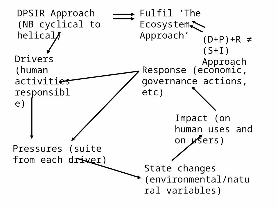
MANAGE -
Who:Fisheries committeesIndustry departments
Nature conservation bodiesEnvironment protection agencies
Amenity committeesRecreation access Energy ministriesLocal authoritiesHow:
Access controlsTraffic movement
Abstraction licencesPermits, consents, authorisations (Effluent
& dredge material disposal/run-off)Dredging/seabed extraction
Planning applicationsRecreation access
Fishing permits
What:Industry
AgricultureNavigation/ports
Mineral extractionInfrastructureRecreationFisheriesWildlife
Why:“social and ecological well-
being”

Coastal, Marine and Estuarine Habitats:
Primary aim – protect the natural environment, habitats, populations:
seagrass beds reed bedssaltmarsh lagoonsmudflats sandflatsestuaries sand dunessubtidal mud bed subtidal sandbanksbiogenic reefs freshwater run-offsandy beach tidal freshwater areas
… and the people!

Human needs for/uses and abuses of estuaries:fisheries (potting, trawling, etc.) telecommunications cables urban areas, infrastructure alternative energy generation (wind, tidal, wave) conventional energy generation (nuclear, coal, oil, gas) land claim coastal defence military uses navigation/shipping recreation/tourism safety (lifeboats/coastguards) water abstraction ports/harbours aquaculture dredging/spoil disposal agriculture aggregate extraction waste discharge industry (petrochemical, food, etc.) education, research oil and gas exploration/extraction barrages (amenity, safety) wildlife, conservation
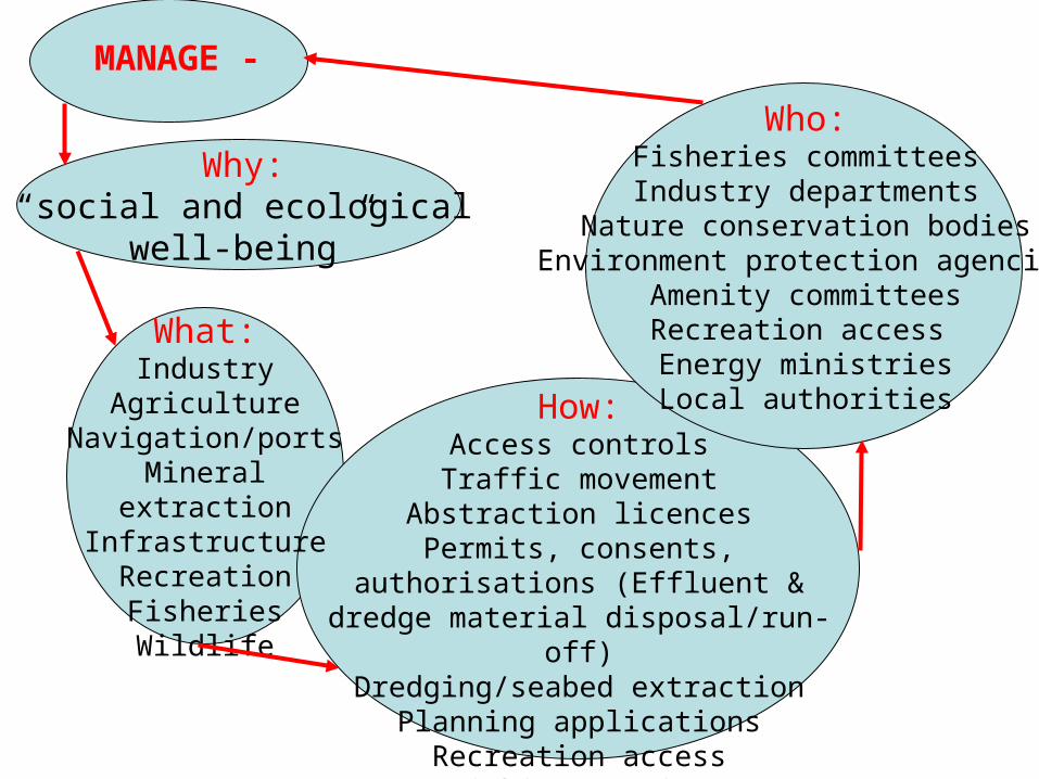
Manage:
• to protect critical processes
• to protect critical areas and species
• for the production of ecological and economic goods and services
And?
• to prevent prosecution and
• to look after shareholders
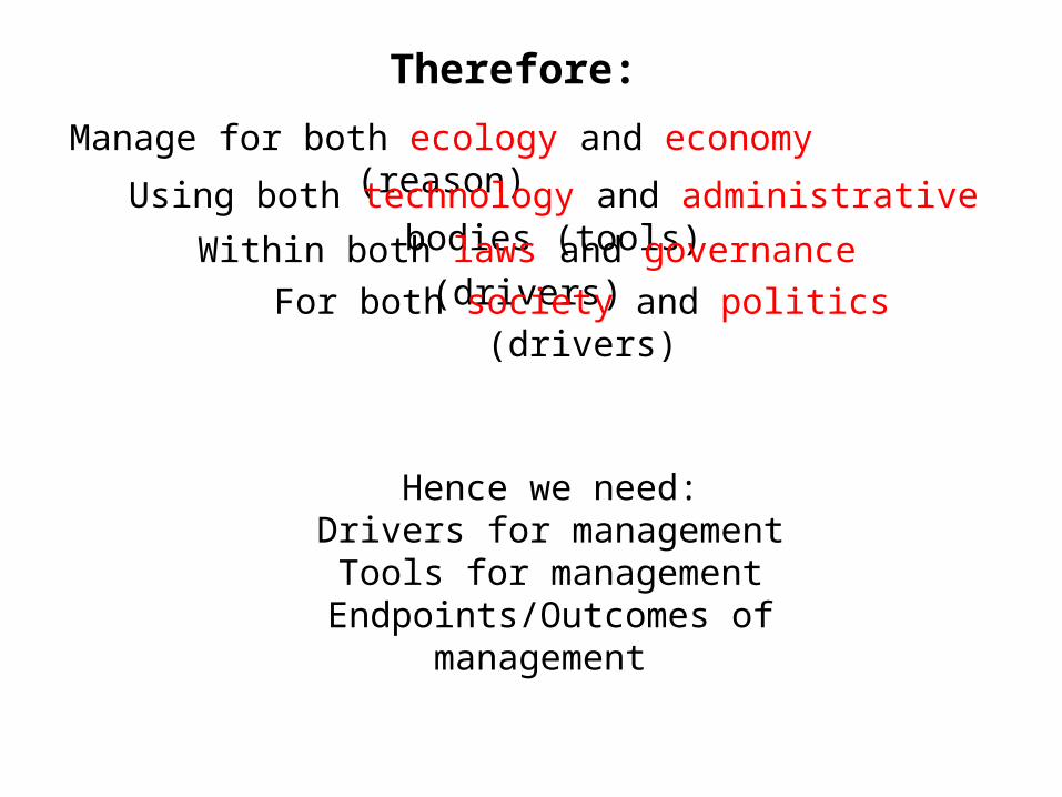
Hence we need:Drivers for managementTools for management
Endpoints/Outcomes of management
Therefore:
Manage for both ecology and economy (reason)
Using both technology and administrative bodies (tools)
Within both laws and governance (drivers)
For both society and politics (drivers)

Hence to get sustainable and successful management we need to
harmonise within and between:• sectors• stakeholders• regulators• mediums• estuaries• regions• countries• outcomes• implementation
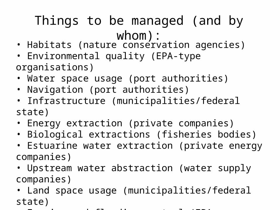
Things to be managed (and by whom):
• Habitats (nature conservation agencies)• Environmental quality (EPA-type organisations)• Water space usage (port authorities)• Navigation (port authorities)• Infrastructure (municipalities/federal state)• Energy extraction (private companies)• Biological extractions (fisheries bodies)• Estuarine water extraction (private energy companies)• Upstream water abstraction (water supply companies)• Land space usage (municipalities/federal state)• Erosion and flooding control (EPA, municipalities etc)• Industry (EPA and private companies)• Recreation and tourism (agencies)
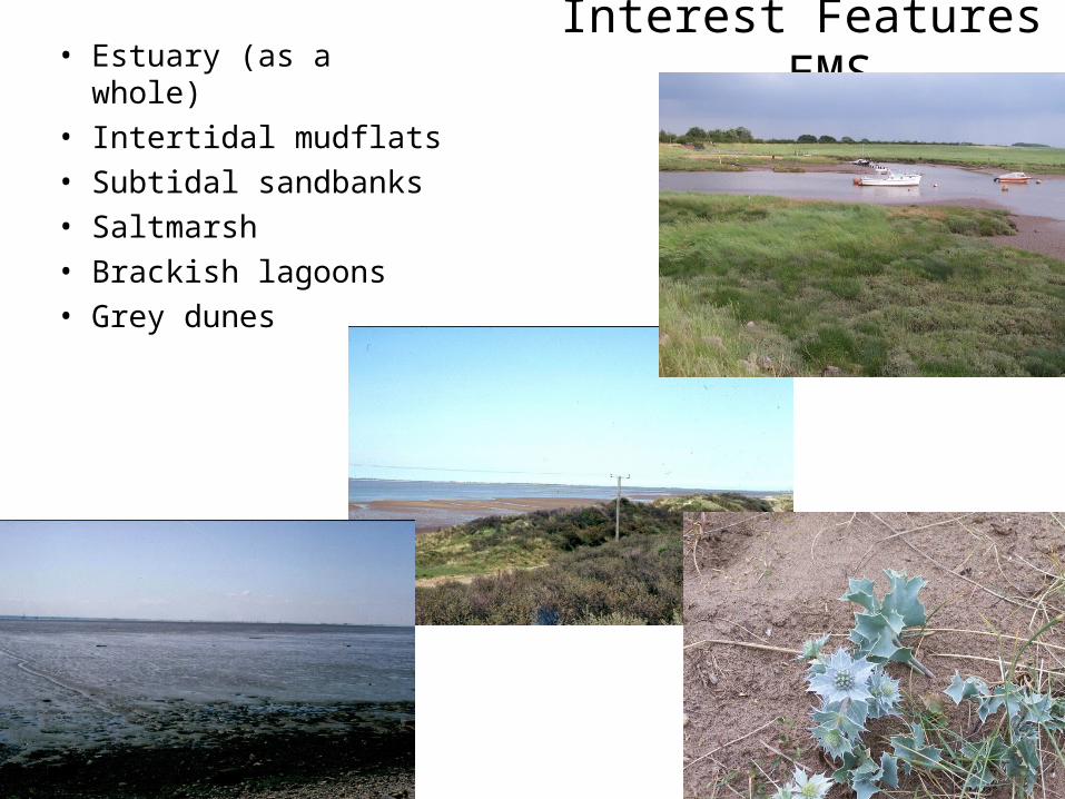
Interest Features - EMS• Estuary (as a whole)• Intertidal mudflats• Subtidal sandbanks• Saltmarsh• Brackish lagoons• Grey dunes
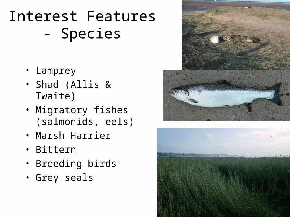
Interest Features - Species
• Lamprey• Shad (Allis & Twaite)• Migratory fishes
(salmonids, eels)• Marsh Harrier• Bittern• Breeding birds• Grey seals

Immingham (plus Hull, Goole, Grimsby) – Largest Ports Complex in UK
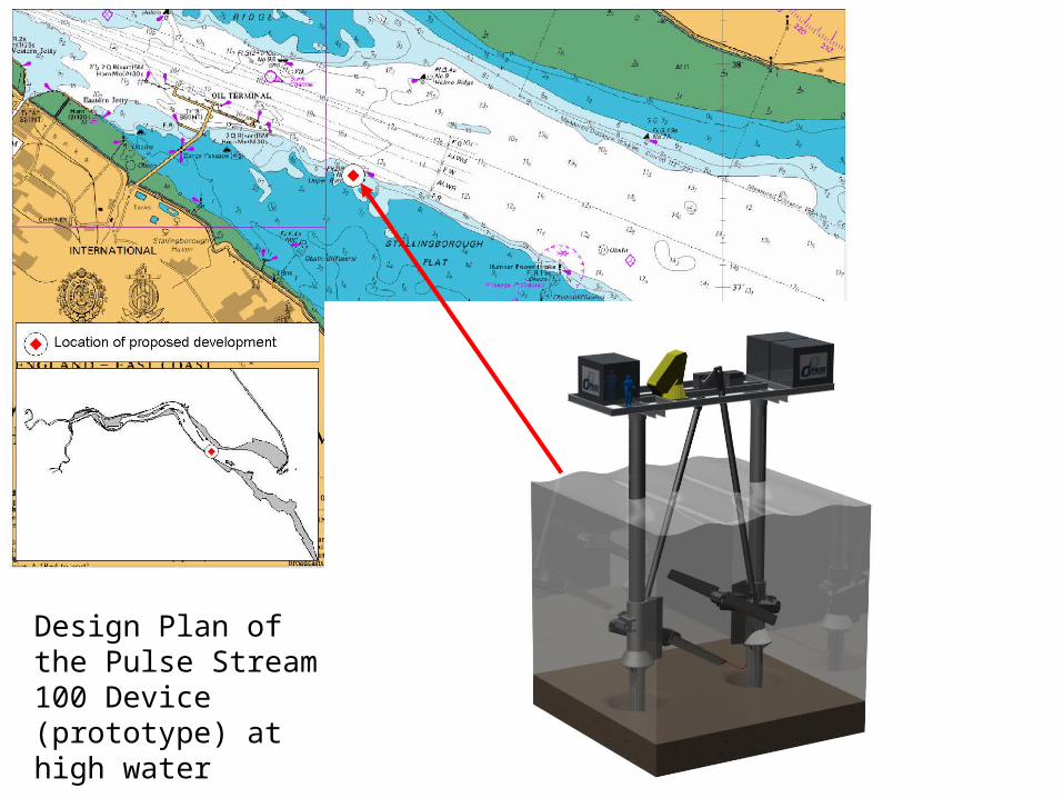
Design Plan of the Pulse Stream 100 Device (prototype) at high water
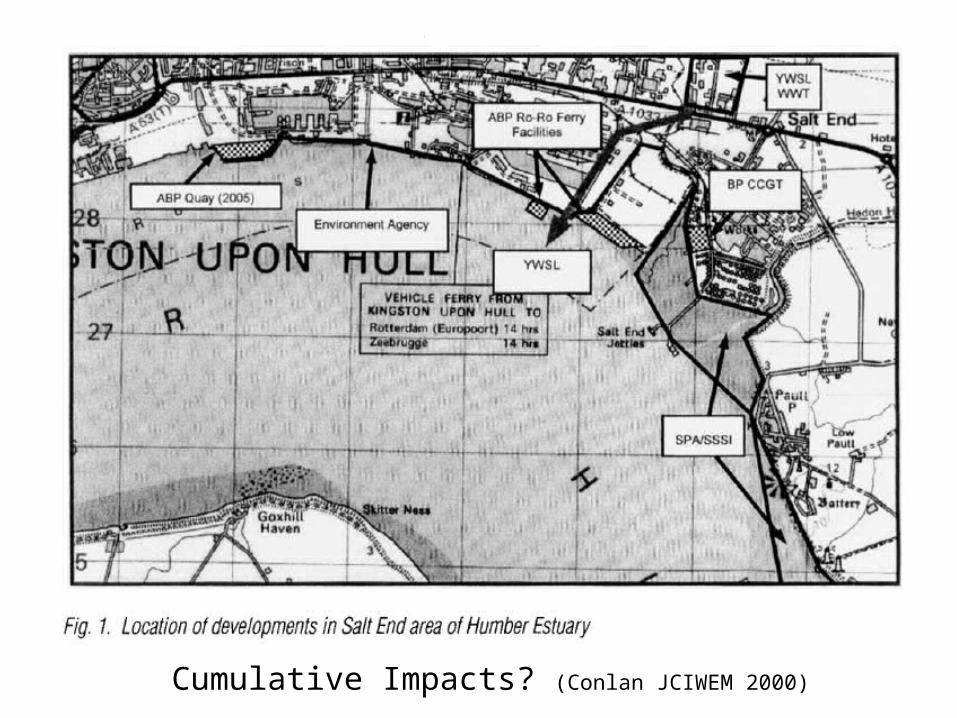
Cumulative Impacts? (Conlan JCIWEM 2000)
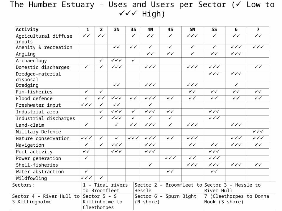
Activity 1 2 3N 3S 4N 4S 5N 5S 6 7 Agricultural diffuse inputs Amenity & recreation Angling Archaeology Domestic discharges Dredged-material disposal Dredging Fin-fisheries Flood defence Freshwater input Industrial area Industrial discharges Land-claim Military Defence Nature conservation Navigation Port activity Power generation Shell-fisheries Water abstraction Wildfowling Sectors: 1 – Tidal rivers to
BroomfleetSector 2 – Broomfleet to Hessle Sector 3 – Hessle to River Hull
Sector 4 – River Hull to S Killingholme
Sector 5 – S Killinholme to Cleethorpes
Sector 6 – Spurn Bight (N shore)
7 (Cleethorpes to Donna Nook (S shore)
The Humber Estuary – Uses and Users per Sector ( Low to High)
Source: Environment Agency
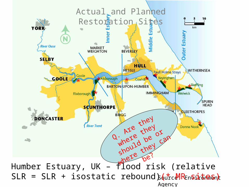
Humber Estuary, UK – flood risk (relative SLR = SLR + isostatic rebound)(* MR sites)
*
* * * * **
* *
*
Q. Are they where
they should be or
where they can be?
Actual and Planned Restoration Sites
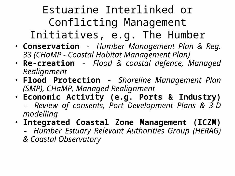
Estuarine Interlinked or Conflicting Management Initiatives, e.g. The Humber
• Conservation - Humber Management Plan & Reg. 33 (CHaMP - Coastal Habitat Management Plan)
• Re-creation - Flood & coastal defence, Managed Realignment
• Flood Protection - Shoreline Management Plan (SMP), CHaMP, Managed Realignment
• Economic Activity (e.g. Ports & Industry) - Review of consents, Port Development Plans & 3-D modelling
• Integrated Coastal Zone Management (ICZM) - Humber Estuary Relevant Authorities Group (HERAG) & Coastal Observatory
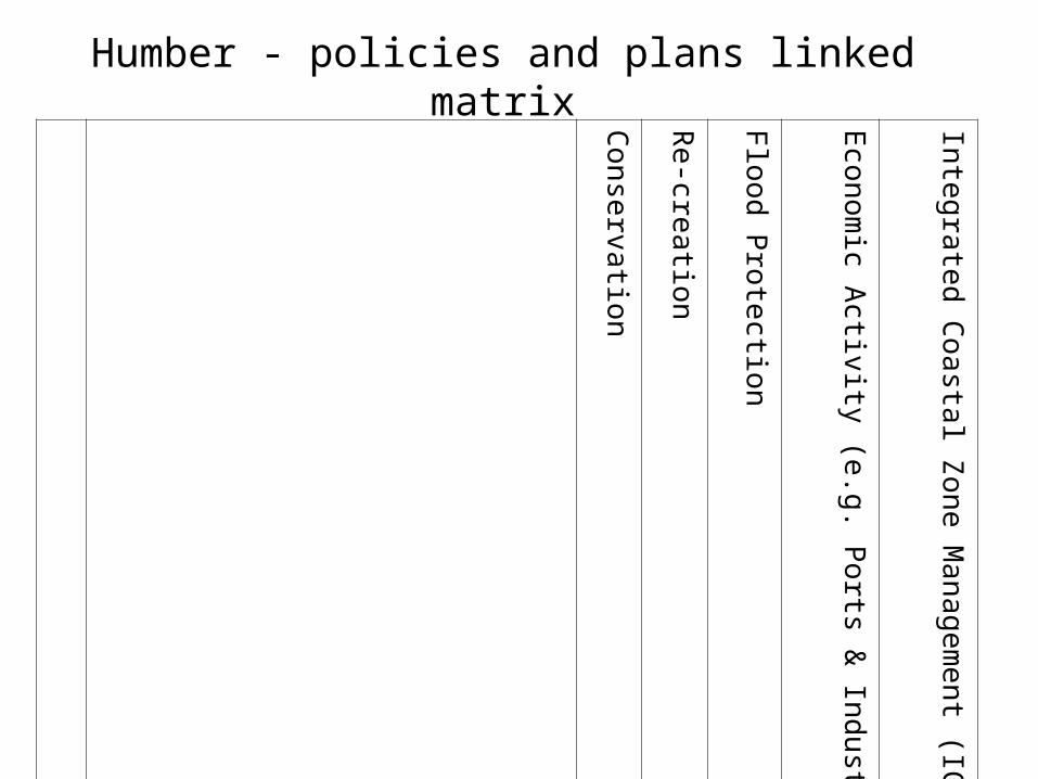
Co
nse
rvation
Re
-creatio
n
Flo
od
Pro
tection
Econ
om
ic Activity (e
.g. Ports &
Indu
stry)
Integ
rated C
oa
stal Z
one
Ma
nag
em
en
t (ICZ
M)
A Ecological aspects
B Management practices / Decision Tools
C Communication strategies
D Policy implementation
E Estuary vision / trajectory
Humber - policies and plans linked matrix

Basis of an Environmental Management System (from Hyde and Reeve, 2005, Essentials of Environmental Management)
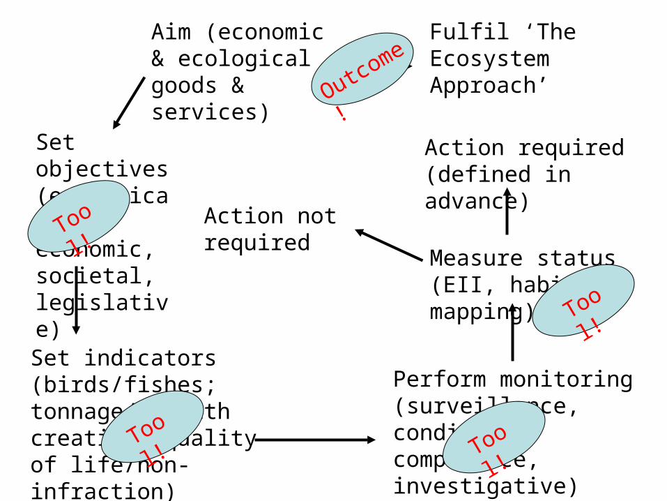
Aim (economic & ecological goods & services)
Set indicators (birds/fishes; tonnage/ wealth creation, quality of life/non-infraction)
Perform monitoring (surveillance, condition, compliance, investigative)
Measure status (EII, habitat mapping)
Action required (defined in advance)
Set objectives (ecological, economic, societal, legislative)
Fulfil ‘The Ecosystem Approach’
Action not required Tool!
Tool!
Tool!Tool!
Outcome!

Objectives - need to be set and to know when they have been met: hence SMART
• Specific • Measurable• Achievable / Appropriate / Attainable• Realistic / Results focussed / Relevant• Time-bounded / Timely
P.E.S.T analysis (modified)
• The organisation of an environment can be analysed by conducting a P.E.S.T analysis.
• This is a simple analysis of an environment’s Political, Economical, Social and Technological organisation.
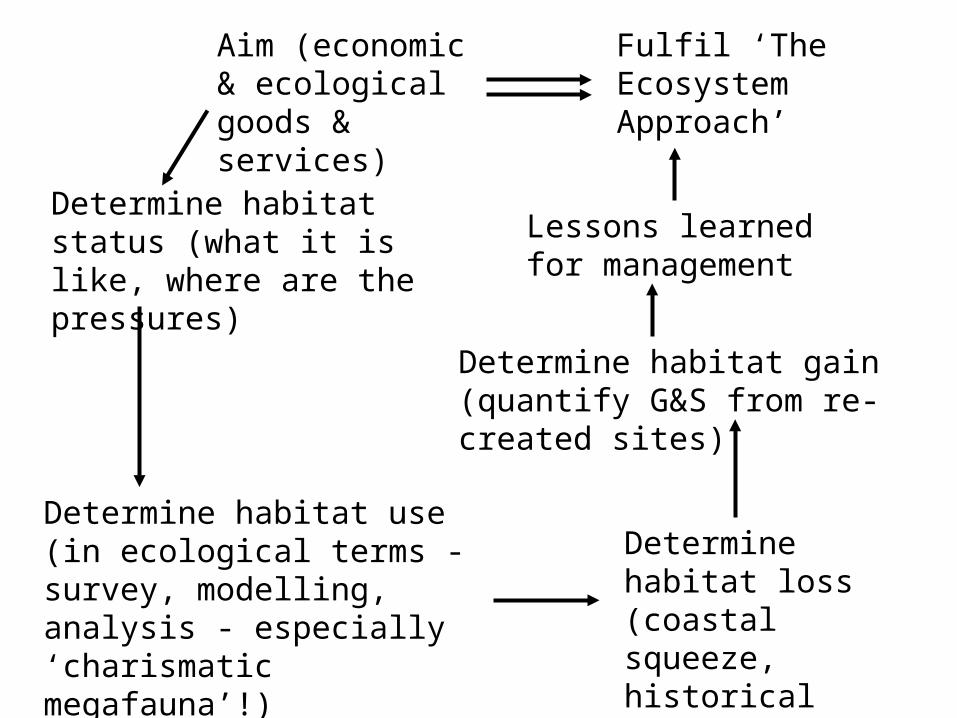
Aim (economic & ecological goods & services)
Determine habitat use (in ecological terms - survey, modelling, analysis - especially ‘charismatic megafauna’!)
Determine habitat loss (coastal squeeze, historical loss, hindcasting)
Determine habitat gain (quantify G&S from re-created sites)
Determine habitat status (what it is like, where are the pressures)
Fulfil ‘The Ecosystem Approach’
Lessons learned for management

• Environmentally/ecologically sustainable
7 tenets for sustainable and successful environmental management – that actions
must be:
• Technologically feasible• Economically viable• Socially desirable/tolerable
• Legally permissible• Administratively achievable
• Politically expedient
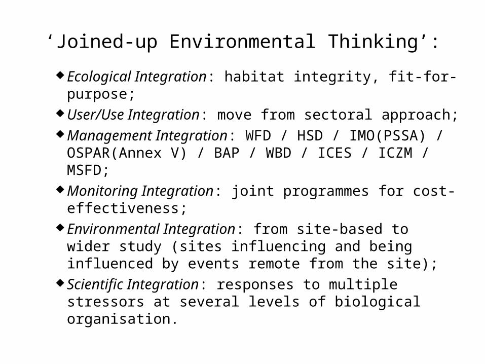
‘Joined-up Environmental Thinking’:
Ecological Integration: habitat integrity, fit-for-purpose;
User/Use Integration: move from sectoral approach; Management Integration: WFD / HSD / IMO(PSSA) /
OSPAR(Annex V) / BAP / WBD / ICES / ICZM / MSFD;
Monitoring Integration: joint programmes for cost-effectiveness;
Environmental Integration: from site-based to wider study (sites influencing and being influenced by events remote from the site);
Scientific Integration: responses to multiple stressors at several levels of biological organisation.