Embed Size (px)
Citation preview
AIG-ADIA Drilling for Geology seminar 1/8/2014
1
Down hole rock properties and their application to
geological and geophysical interpretation
AIG/ADIA: Drill for geology seminar – Aug 1, 2014
© 2014 Mira Geoscience Pty. Ltd.
Glenn PearsTim Chalke
Peter FullagarJohn McGaughey
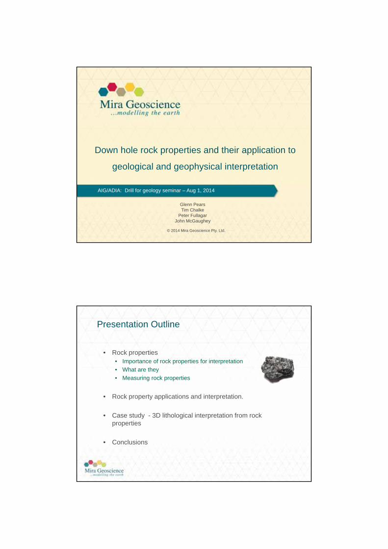
Presentation Outline
• Rock properties• Importance of rock properties for interpretation
• What are they
• Measuring rock properties
• Rock property applications and interpretation.
• Case study - 3D lithological interpretation from rock properties
• Conclusions
AIG-ADIA Drilling for Geology seminar 1/8/2014
2
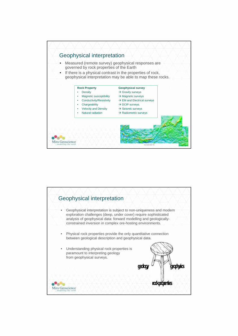
Geophysical interpretation• Measured (remote survey) geophysical responses are
governed by rock properties of the Earth• If there is a physical contrast in the properties of rock,
geophysical interpretation may be able to map these rocks.
Rock Property Geophysical survey
• Density Gravity surveys
• Magnetic susceptibility Magnetic surveys
• Conductivity/Resistivity EM and Electrical surveys
• Chargeability DCIP surveys.
• Velocity and Density Seismic surveys
• Natural radiation Radiometric surveys
Geophysical interpretation
• Geophysical interpretation is subject to non-uniqueness and modern exploration challenges (deep, under cover) require sophisticated analysis of geophysical data: forward modelling and geologically-constrained inversion in complex ore-hosting environments.
• Physical rock properties provide the only quantitative connection between geological description and geophysical data.
• Understanding physical rock properties is paramount to interpreting geology from geophysical surveys.
geology geophysics
rock proper ties
AIG-ADIA Drilling for Geology seminar 1/8/2014
3
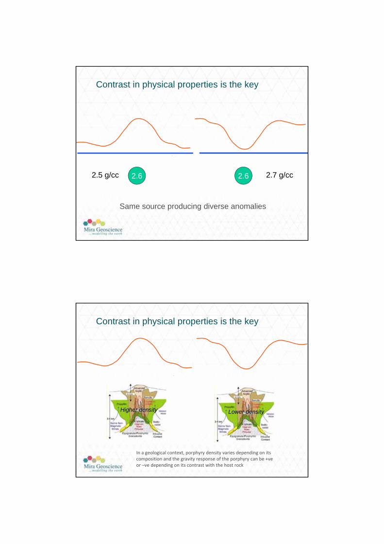
2.62.5 g/cc 2.7 g/cc2.6
Contrast in physical properties is the key
Same source producing diverse anomalies
2.62.5 g/cc 2.7 g/cc2.6
In a geological context, porphyry density varies depending on its composition and the gravity response of the porphyry can be +veor –ve depending on its contrast with the host rock
Higher density Lower density
Contrast in physical properties is the key
AIG-ADIA Drilling for Geology seminar 1/8/2014
4
Constrained 3D Potential Fields Inversion
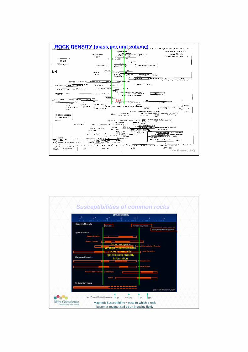
(after Emerson, 1990)
ROCK DENSITY (mass per unit volume)
2.67
Susceptibilities of common rocks
1010
Magnetic Minerals
Igneous Rocks
Basalt / Dolerite
Gabbro / Norite
Granite / Granodiorite / Tonalite
Acid Volcanics
Metasediments
Metamorphic rocks
Acid Granulite
Banded Iron Formation (anisotropic)
Sedimentary rocks
0.1% 0.5% 5% 20%1%Vol. Percent Magnetite approx.
SI Susceptibility-
10-10
-4 -310 -2 10 -1 1
hematite monoclinic pyrrhotite
(titano) magnetite / maghemite
Skarn
(after Clark & Emerson, 1991)
-5
Magnetic Susceptibility = ease to which a rock becomes magnetised by an inducing field.
Broad ranges –ambiguity between rock
types – need site specific rock property
information
AIG-ADIA Drilling for Geology seminar 1/8/2014
5
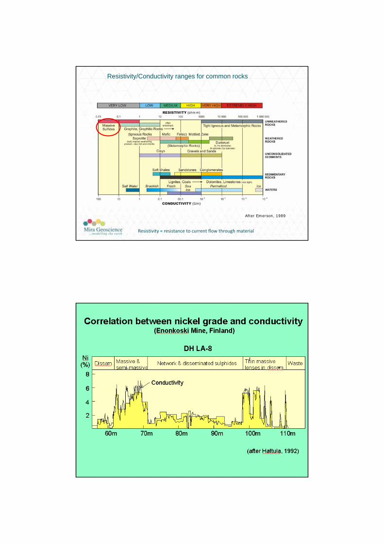
Resistivity/Conductivity ranges for common rocks
After Emerson, 1989
Resistivity = resistance to current flow through material

AIG-ADIA Drilling for Geology seminar 1/8/2014
6
Reasons for measuring rock properties
• Geophysical Inversion Constraints
• Evaluation of geological & geophysical models
• Make decisions regarding remote geophysical surveys
• Lithological interpretation
• Calibration of borehole logs
• Resource estimation
• Hydrogeology
• Paleomagnetism
How do we get physical rock properties
• Existing literature
• Rock samples measurements
• Drill core sample measurements
• Down hole logging
• Remote sensing ( inversion of geophysical surveys)
field data
rock property model
inversion
AIG-ADIA Drilling for Geology seminar 1/8/2014
7
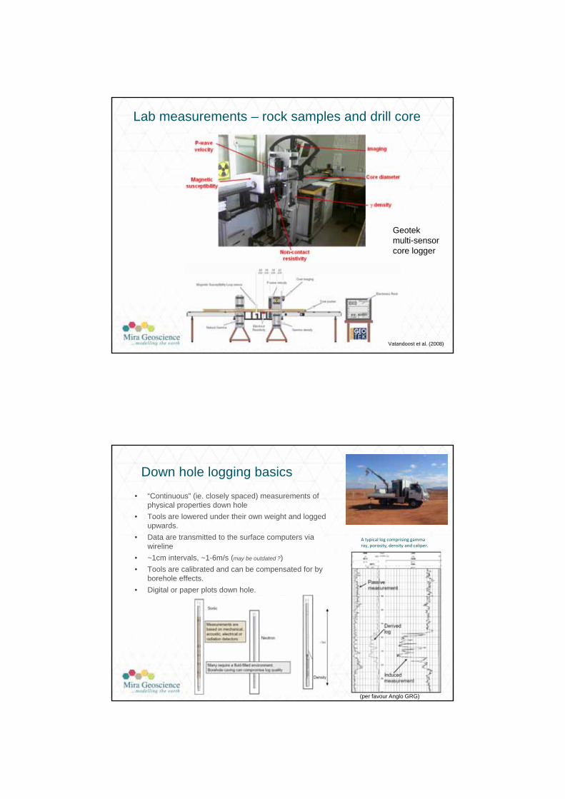
Vatandoost et al. (2008)
Geotekmulti-sensorcore logger
Lab measurements – rock samples and drill core
Down hole logging basics
• “Continuous” (ie. closely spaced) measurements of physical properties down hole
• Tools are lowered under their own weight and logged upwards.
• Data are transmitted to the surface computers via wireline
• ~1cm intervals, ~1-6m/s (may be outdated ?)
• Tools are calibrated and can be compensated for by borehole effects.
• Digital or paper plots down hole.
(per favour Anglo GRG)
A typical log comprising gamma ray, porosity, density and caliper.
AIG-ADIA Drilling for Geology seminar 1/8/2014
8
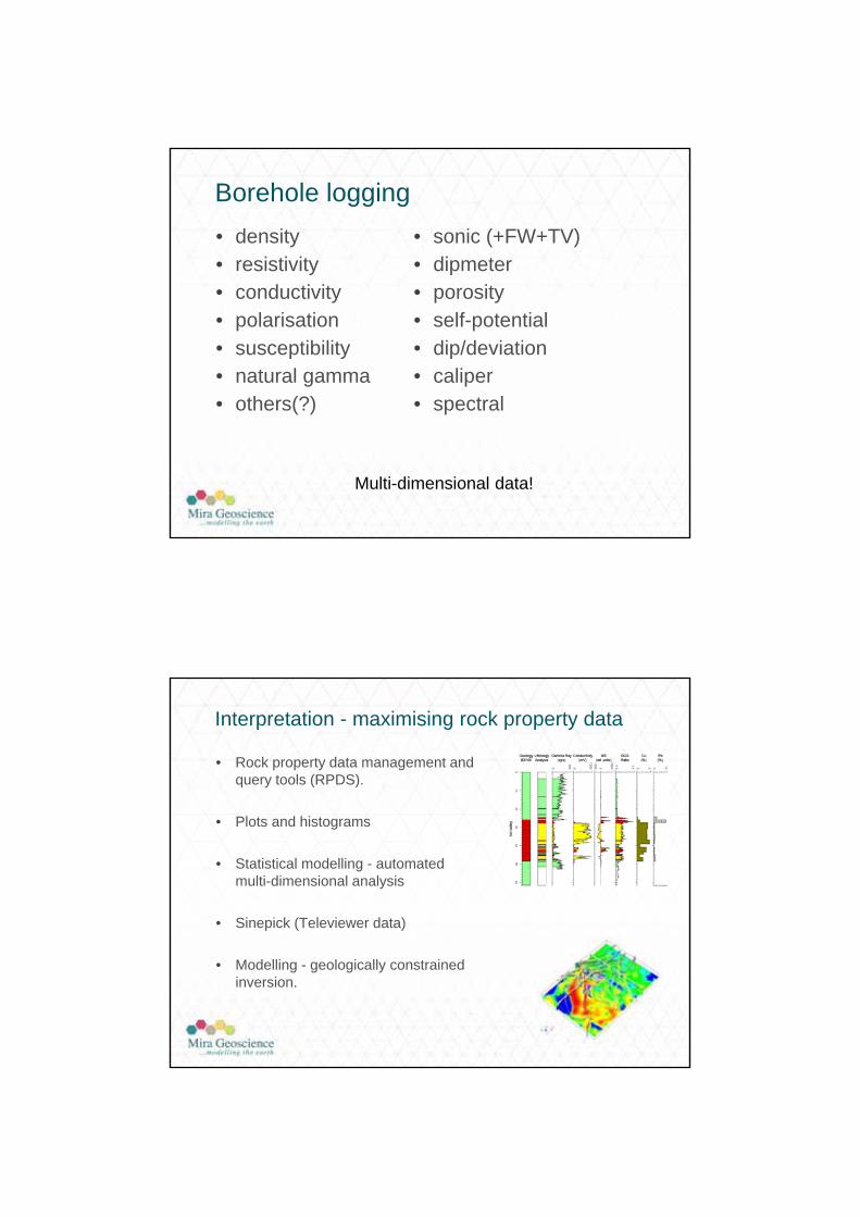
Borehole logging
• density• resistivity• conductivity• polarisation• susceptibility• natural gamma• others(?)
• sonic (+FW+TV)• dipmeter• porosity• self-potential• dip/deviation• caliper• spectral
Multi-dimensional data!
Interpretation - maximising rock property data
• Rock property data management and query tools (RPDS).
• Plots and histograms
• Statistical modelling - automated multi-dimensional analysis
• Sinepick (Televiewer data)
• Modelling - geologically constrained inversion.
AIG-ADIA Drilling for Geology seminar 1/8/2014
9
Rock Property Data Management
Multiple data sources throughout the industry, government, academia, and publications.
Large amount of data and metadata, especially with wireline data.
Archived at numerous locations around the world with significant risk of loss.
Stored in various hardcopy and digital formats.
Rock Property Database Vision
•general organization of petrophysical measurements: sample and wireline
•global “normalization” of geological description and rock property data
•quality control and classification
•global access with extensive search
•public and private data
•connection to modelling software
Types of queries:• Retrieve boreholes from BC which have been logged between 1980 and 1990 that have density
measurements and that come from Xstrata-owned holes.• What is the correlation between velocity and fracture frequency for rhyolites in VMS-type
deposits?• What is the mean density of granite in central west QLD?
AIG-ADIA Drilling for Geology seminar 1/8/2014
10
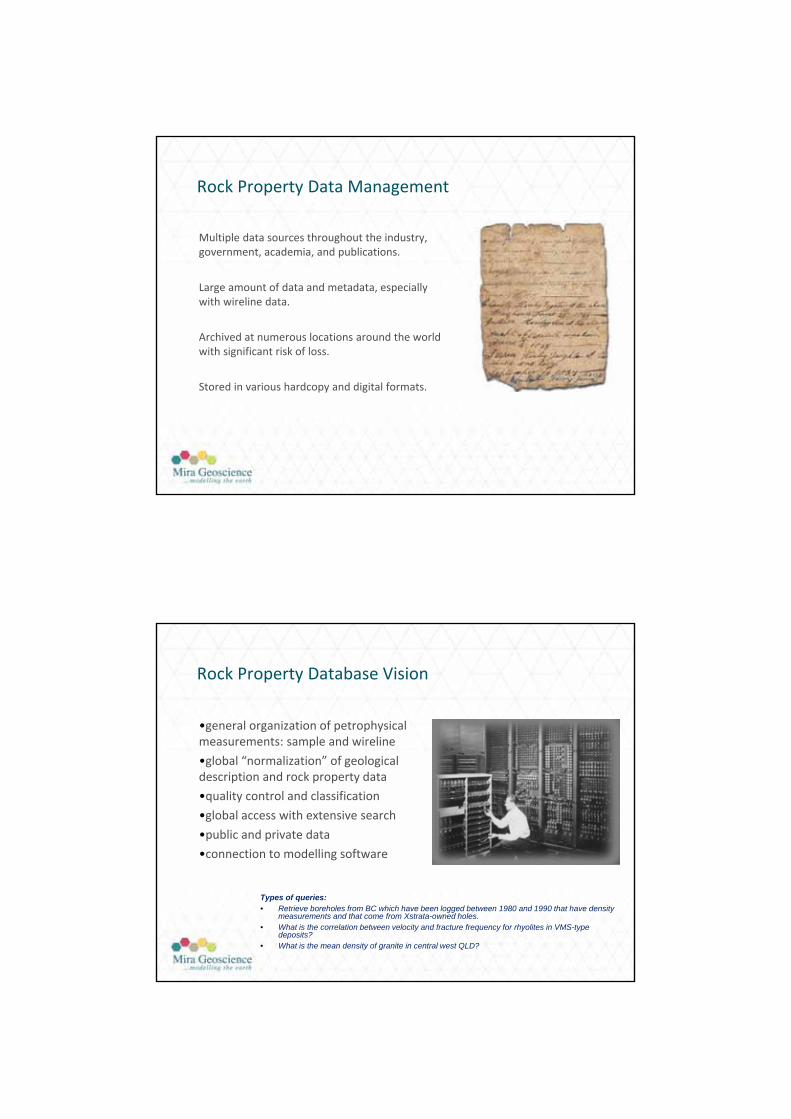
RPDS Input
DBA’s Interface
Web Interface
OracleDB
Wireline Data
Borecore Data
Surface Sample Data
Spatial Data
Metadata Docs/PhotosGSC
Geology
Geochemical
Geotechnical Data
RPDS Output
Density
Basalt
XYZ
Tabular output Graphical output
LogViewExport
Gocad Export
AIG-ADIA Drilling for Geology seminar 1/8/2014
11
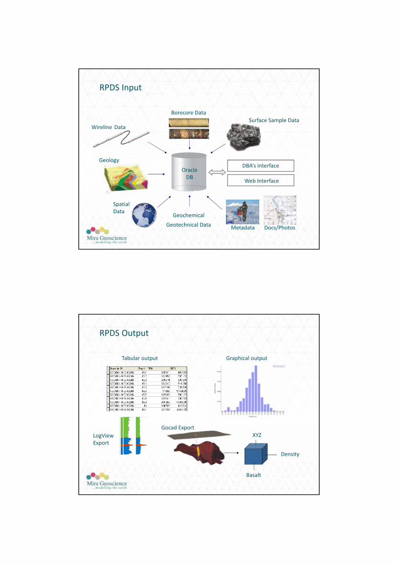
bimodal distributions
Understanding Rock Property Distributions
Multi-dimensional data
LogTrans
• Automatic interpretation tool for geophysical borehole logs“Convert squiggly lines to useful form.”
– Multi-log parameter analysis.
– Adaptable for geological, geotechnical or geochemical interpretation
– Discriminate lithology, alteration, grade, ore/waste, strength
– Batch processing
– Provision of a measure of confidence
– Optional stratigraphic constraints
– Extended application to 3D block models
• Two stage operation
– Conditioning based on control data
– Application to non-control data
Multi-dimensional statistical grouping of measurements to
define domains
AIG-ADIA Drilling for Geology seminar 1/8/2014
12
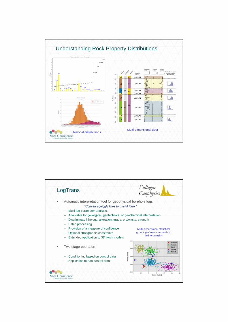
HWD hangingwall dolomite
Unit 1 sideritic siltstone
Unit 2 sphalerite in shale + PbUnit 3 sideritic siltstone
Unit 4 sphalerite in shale
UFW upper footwall siltstone
Control hole
Unit 1 sideritic siltstone
Unit 4 sphalerite in shale
Independent hole

AIG-ADIA Drilling for Geology seminar 1/8/2014
13
Sinepick
• Automatic interpretation (‘picking’) of sinusoids and breakouts in televiewer data Acoustic televiewer (ATV)
Measures both reflection amplitude and travel time of acoustic pulse as a function of both depth and azimuth
Orientation of televieweralso recorded:on-board accelerometers & magnetometers
Auto picking of fractures from sinusoids
Quantitative geophysical modelling of rock properties
“Forward modelling” computes the response of a geological model attributed with rock property data (density, susceptibility, conductivity etc).
“Inversion” algorithms produce a rock property model consistent with measured survey data (subject to imposed geological and petro physical constraints).
field data
earth model
inversionForward
modelling
Computeddata
earth model

AIG-ADIA Drilling for Geology seminar 1/8/2014
14
“Unconstrained” inversion
• Recover a rock property model from geophysical (remote) survey data.
• Starting model homogeneous background - no geological knowledge
• Well accepted for first pass potential field inversion, relatively easy to use, but limited, highly non-unique (more than one model can explain the geophysical response)
• Model constraints such as depth weights andsmoothness are typically used in a geologically unconstrained inversion.
Unconstrained inversion
Geophysical inversion in a geological context- a.k.a. geologically constrained inversion
• Less models can explain geophysical data and maintain consistency with down hole geology and petrophysics
a more robust model.
• Inversion explicitly operates on a geological model (constrained by drill hole geology) attributed with physical rock properties
• Geologically constrained inversions produce additional value-add information from the contributing data sets.
Geologically constrained inversion.Constrained by drill holes, interpreted sections and down hole density.
AIG-ADIA Drilling for Geology seminar 1/8/2014
15
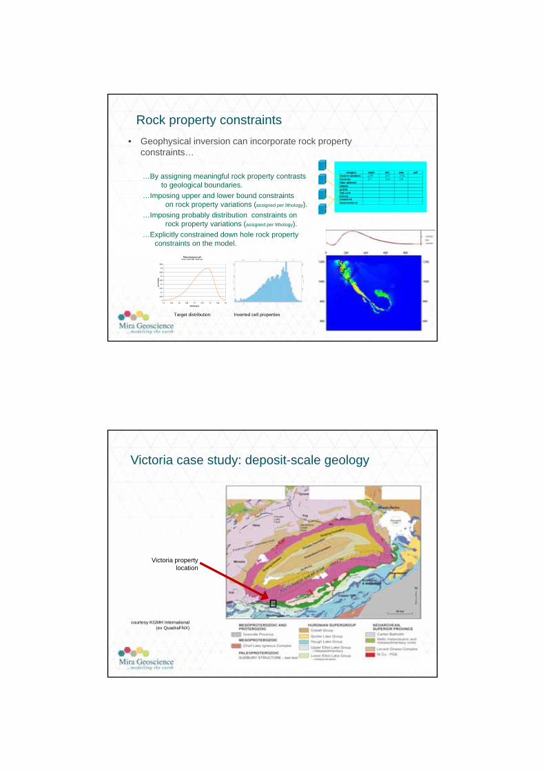
Rock property constraints
• Geophysical inversion can incorporate rock property constraints…
…By assigning meaningful rock property contrasts to geological boundaries.
…Imposing upper and lower bound constraints on rock property variations (assigned per lithology).
…Imposing probably distribution constraints on rock property variations (assigned per lithology).
…Explicitly constrained down hole rock property constraints on the model.
Target distribution Inverted cell properties
Victoria case study: deposit-scale geology
courtesy KGMH International (ex QuadraFNX)
Victoria property location
AIG-ADIA Drilling for Geology seminar 1/8/2014
16
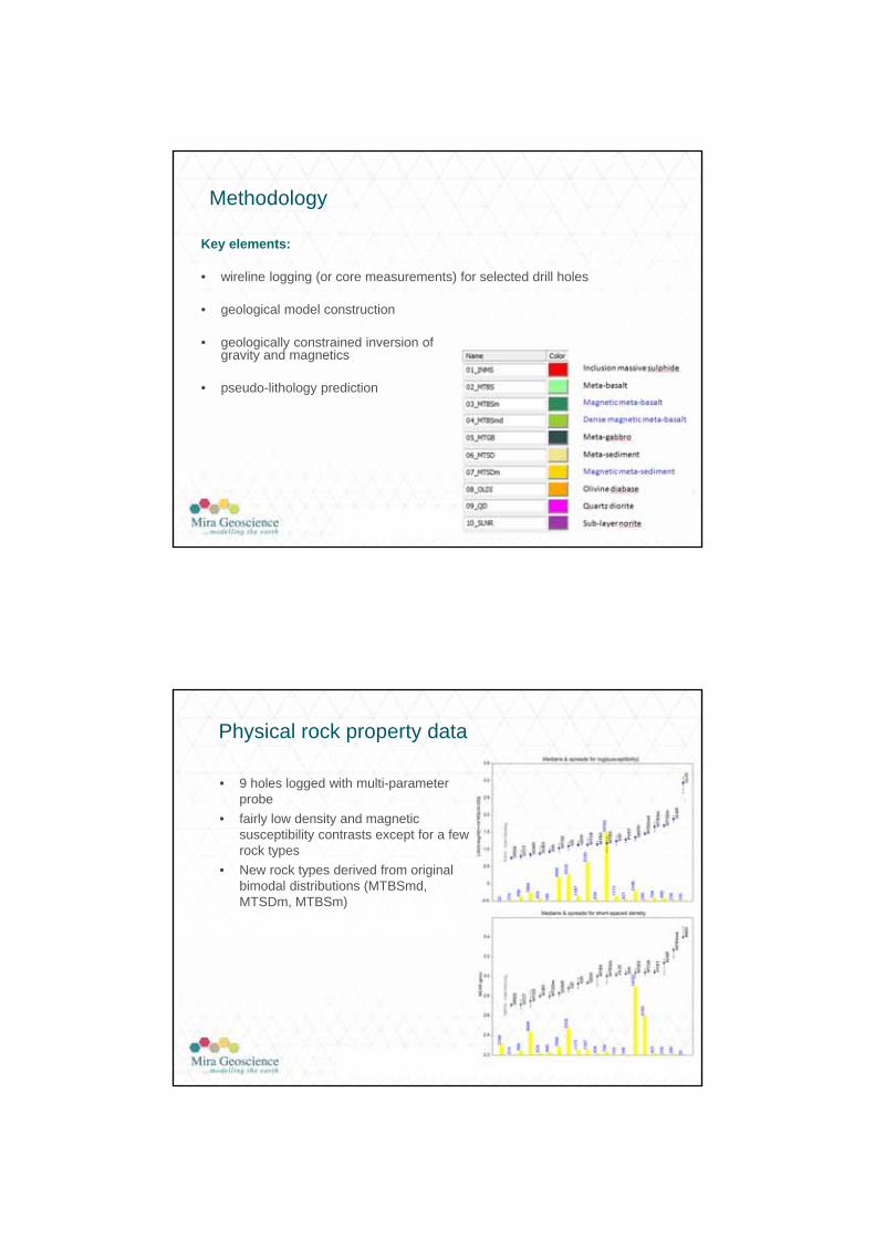
Methodology
Key elements:
• wireline logging (or core measurements) for selected drill holes
• geological model construction
• geologically constrained inversion of gravity and magnetics
• pseudo-lithology prediction
Physical rock property data
• 9 holes logged with multi-parameter probe
• fairly low density and magnetic susceptibility contrasts except for a few rock types
• New rock types derived from original bimodal distributions (MTBSmd, MTSDm, MTBSm)
AIG-ADIA Drilling for Geology seminar 1/8/2014
17
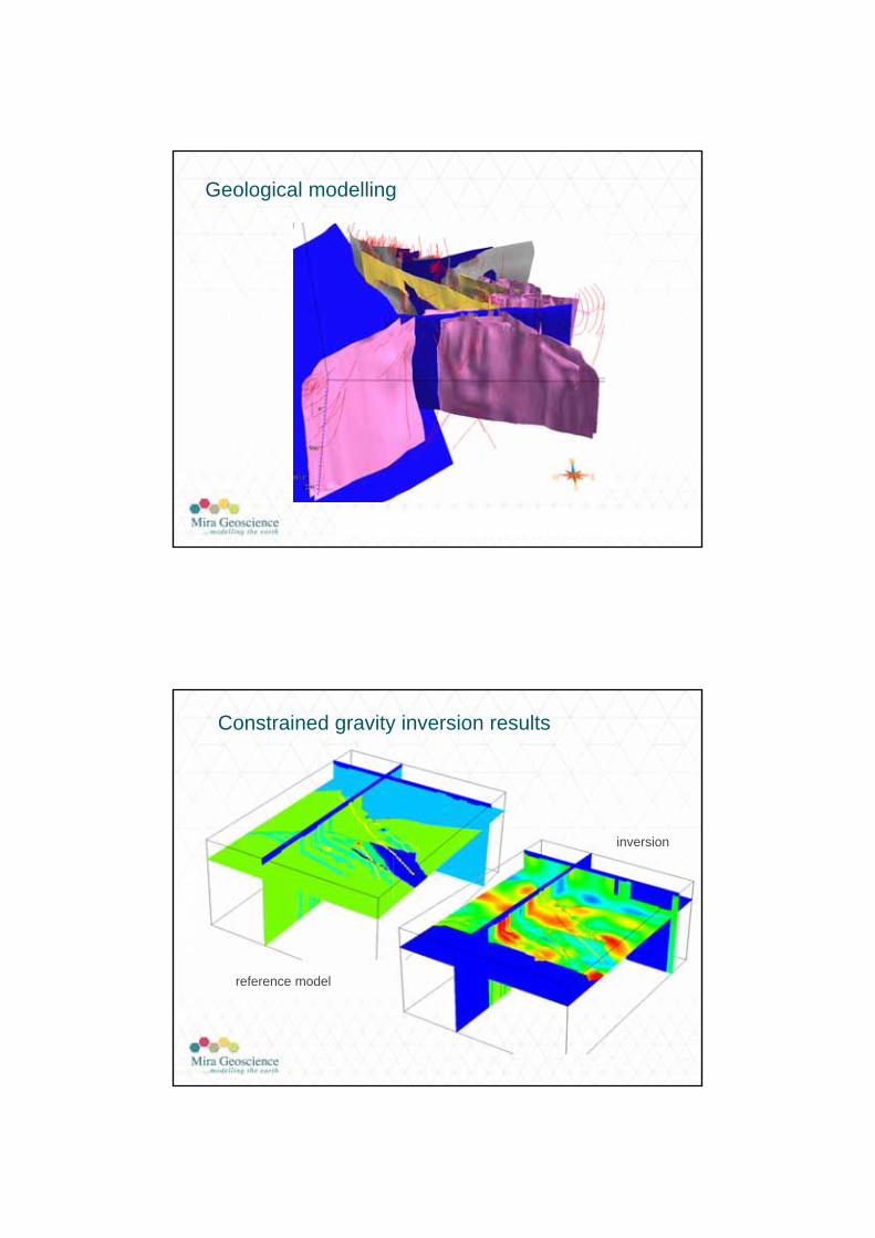
Geological modelling
reference model
inversion
Constrained gravity inversion results
AIG-ADIA Drilling for Geology seminar 1/8/2014
18
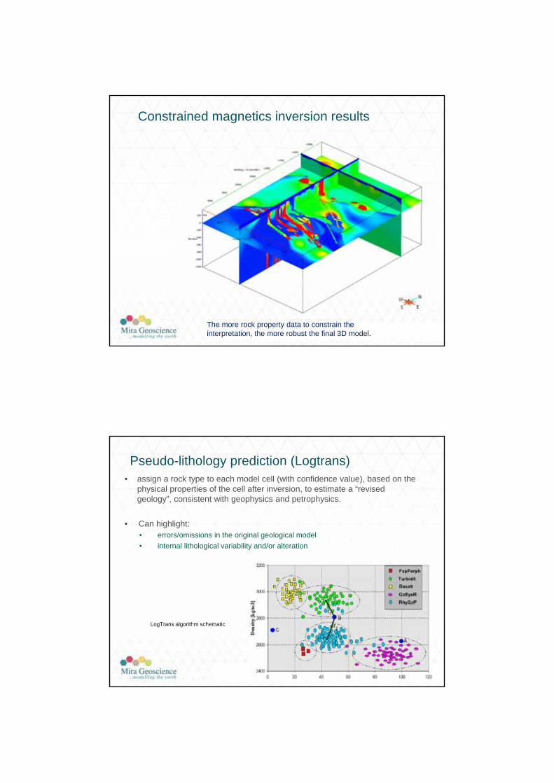
Constrained magnetics inversion results
The more rock property data to constrain the interpretation, the more robust the final 3D model.
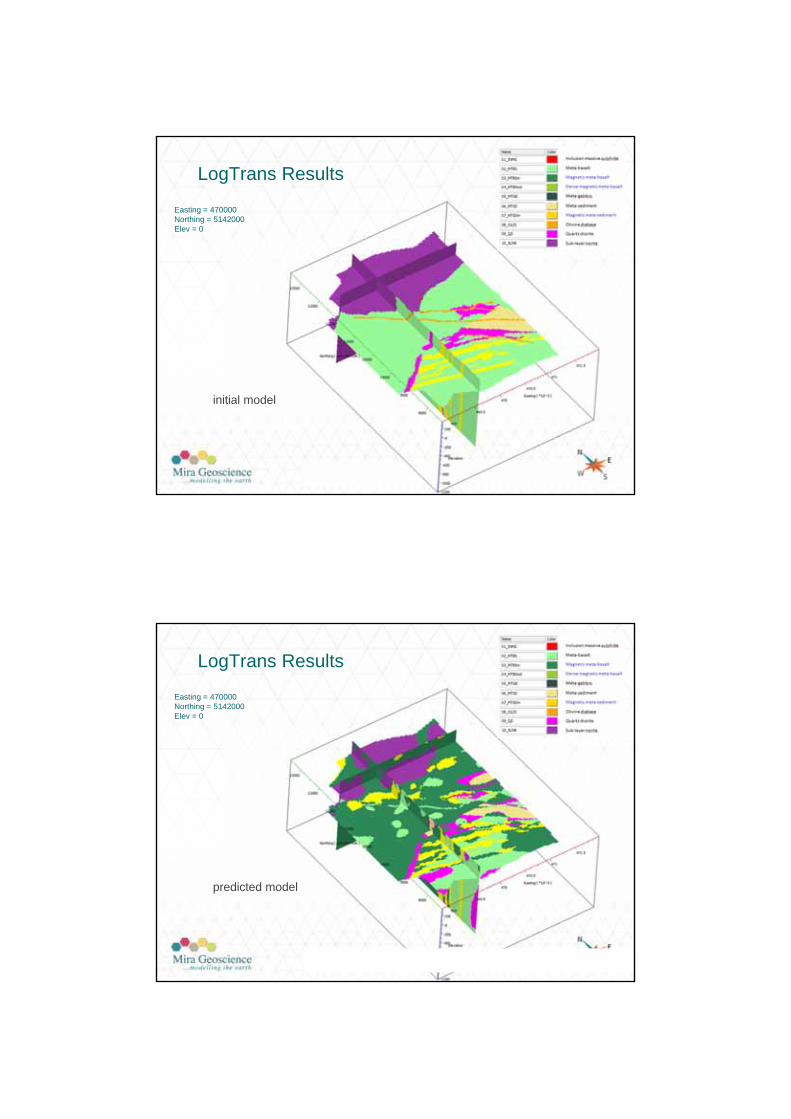
Pseudo-lithology prediction (Logtrans)• assign a rock type to each model cell (with confidence value), based on the
physical properties of the cell after inversion, to estimate a “revised geology”, consistent with geophysics and petrophysics.
• Can highlight:• errors/omissions in the original geological model
• internal lithological variability and/or alteration
LogTrans algorithm schematicMeasures of confidence:
r1 and r1/r2
AIG-ADIA Drilling for Geology seminar 1/8/2014
19
LogTrans Results
Easting = 470000Northing = 5142000Elev = 0
initial model
LogTrans Results
Easting = 470000Northing = 5142000Elev = 0
predicted model
AIG-ADIA Drilling for Geology seminar 1/8/2014
20
Conclusions
• Understanding physical rock properties is paramount to interpreting geology from geophysical surveys.
• Collect down hole rock property data understand site specific rock property variations
• Management, access and the ability to query rock property data is important.
• Aside from geophysical modelling, other applications of rock properties include lithology prediction, calibration of borehole logs, resource estimation, hydrogeology.
• A variety of methods and tools exist for interpreting and maximising the information from rock property data.
geology geophysics
rock proper ties