Embed Size (px)
DESCRIPTION
Editores: Cipriano Marín Cabrera & Francisco García Nov. (2005). Published by: Doñana 2005 Project - Confederación Hidrográfica del Guadalquivir, with the support UNESCO-MaB Programme. "This emblematic publication symbolizes in a nutshell how humans strive to reach equilibrium with nature - an attempt which in many cases, as in the case of Doñana, can indeed be reached.The book is therefore an example of how, although this sometimes entails making hard choices, humans can turn ecosystems to their advantage in a manner entirely compatible with the principles of sustainable development, including taking into due account social responsibility, respect for cultural identities and the awareness of the importance of conserving biological diversity and its sustainable use". KOÏCHIRO MATSUURA UNESCO Director General - 2006
Citation preview


DoñanaWater and Biosphere

Francisco García NovoCipriano Marín Cabrera
with the assistance of:Eva Mª Alonso Vizcaíno
contributions from:Regla Alonso Miura - Elena Angulo Aguado - Salvatore Arico - Sarat Babu Gidda
Benigno Bayán Jardín - Juan Bautista Gallego - Ernest Bladé Castellet - Francisco Borja BarreraMiguel Ángel Bravo - Juan Calderón Rubiales - Jesus Casas Grande
Eloy M. Castellanos- David Coates - José Juan Chans Pousada - Josefina Cruz VillalónEmilio Custodio Gimena - Miguel Delibes de Castro - Maguelon Déjeant-Pons
Ricardo Díaz-Delgado - Mari Cruz Díaz Antunes Barradas - Carmen Díaz PaniaguaMari Paz Esquivias Segura- María Ángeles Fernández - Carlos Fernández Delgado- Andy J. Green
Juan Fernández Haeger - Josep Dolz Ripollés - Rodrigo Gámez Lobo - Pablo García MurilloJosep A. Gili Ripoll - José González Delgado - Mauricio González Gordon - Fernando Hiraldo Cano
Mireille Jardin - Pierre Lasserre - Marisol Manzano Arellano - Juan Ángel Mintegui AguirreCarlos Montes del Olmo - Kalemani Jo Mulongoy - Juan F. Ojeda Rivera
Félix Manuel Pérez Miyares - Joaquín Rodríguez Vidal - Alberto Ruíz de LarramendiLaura Serrano Martín - Ramón C. Soriguer Escofet- Luis E. Santamaría Galdon
Julia Toja Santillana - Carlos Urdiales Alonso - María Zunzunegui González Published contributions by Ramón Margalef and José Antonio Valverde
Revised by:Giuseppe Orlando
DoñanaWater and Biosphere

The Editors would like to thank:Félix Manuel Pérez Miyares, Benigno Bayán Jardín, and Fernando Hiraldo for having been the true supporters and driving force of this editorialproject.José María Pérez de Ayala for generously contributing with his magnificient photographs.The Doñana Biological Station and the Department of Plant Biology and Ecology of the University of Seville for their support, scientific contri-bution, and supply of information.Mauricio González-Gordon, for opening the door to choice information on the events that lead to the creation of the Doñana National Park.CENEAM and the Spanish Autonomous Park Authority for their graphical and informative support.Mireille Jardin, Salvatore Arico, Jane Robertson and the Secretariat of the UNESCO MaB Programme, as well as Pierre Lasserre for their keyguidance that was determining for carrying out this work.Dionysis Assimacopoulos for his advice on the new water paradigms.José María Romero for his support and for contributing with contents and technical data on the Doñana 2005 project.Jesús Casas Grande for his advice and orientation on the conception and strategy of the Doñana 2005 project.Carlos Urdiales for his comments, for contributing with his great experience on Doñana, and for his suggestions on the contents.Andrew J. Green, Miguel Delibes de Castro, José Dolz Ripollés, Carlos Fernández Delgado, Juan Mintegui Aguirre, José González Delgado,Fernando Díaz del Olmo, Javier Cobos Aguirre, Carlos Montes del Olmo, Francisco Borja Barrera, Marisol Manzano Arellano, Jose MªFernández Palacios, Francisco Quirós Herruzo, José Juan Chan, Alberto Ruíz de Larramendi, and José Mª Arenas Cabello, for their guidance asmembers or participants of the Doñana 2005 Scientific Committee and, in particular, the Coordinator of the Committee, Hermelindo CastroNogueira.But our acknowledgements are also addressed to all those anonymous authors that are protagonists of this unique place, to the hundreds ofresearchers and defenders of nature who have studied, worked, and fought for Doñana to succeed in the conservation of this gem of nature, anactual legacy for future generations.
Published by:Doñana 2005 Project - Confederación Hidrográfica del Guadalquivir (Guadalquivir Hydrologic Basin Authority),Spanish Ministry of the Environment. Madrid, 2006.
This English edition is a translation of the former Spanish edition published in 2005, updated with new data and the addition of 2 new chapters.
With the support of:UNESCO - MaB (Man and Biosphere Programme), Junta de Andalucía (Consejería de Medio Ambiente)
Edited by:Cipriano Marín Cabrera - Francisco García Novo
Design and Layout:Francisco Martín García
Photography:José María Pérez de Ayala, Antonio Sabater.Doñana Biological Station, CENEAM ,and Spanish Autonomous National Park Authority.Paisajes Españoles S.A., AYESA, Miguel G. Muñoz Sariot, Eva Mª Alonso Vizcaíno, Nassima Aghanim, Luciana Bartolini, Andrés Ceballos,Yann Arthus-Bertrand, Oscar Contreras Navarro, J.L. González Grande, Carlos Fernández Delgado, Tom Fritts, Bárbara García Moreda,Cipriano Marín, Juan A. Mintegui Aguirre, A. Portheault, Gordon Rodd, Tobias Salathé, Yolanda Vento, W. de Vries, Aurora Suárez, Ziesle,Alberto Luengo Barreto, Adam Petrusek, Adam Petrusek, Carlos Urdiales..Authors of the photographs kindly provided by CENEAM - Spanish Autonomous Park Authority:Carlos Sanz, Antonio Camoyán, J.M. Pérez de Ayala, J.M. Reyero, Vicente García Canseco, Fernando Cámara Orgaz, Jesús Huertas Muñóz,Jorge Remacha, J.L. Perea, Antonio Moreno Rodríguez, Carlos Sánchez, J.C. Dueñas, FON-3, Miguel Angel de la Cruz Alemán.
Illustrations, water colours and pictures:Regla Alonso Miura, Rosalía Martín Franquelo, Luis Mir Payá., Francisco Martín García.
Revision of texts:Patricia Marín Garavito, Giuseppe Orlando, Carlos Urdiales.Juan Bautista Gallego, Mari Cruz Díaz, Carlos García Gómez, Luis Gortázar Díaz-Llanos, Angel Martín, J. Carlos Muñoz, José Marrero y Castro, Laura Serrano, María Zunzunegui.
Revision of the English translation (Introductions to chapters):Tony Corballis.
Translation of texts:GABINETE ERASMUS - Consuelo Giansante.
Maps and graphics:GAIA. S.L.
Photomecanics:TENYDEA S.L.
Printed by:MATEU CROMO ARTES GRÁFICAS S.A. - Madrid / D.L. M-10992-2006ISBN 84-609-6326-8

7
Water and the Biosphere
Man is the first technological species, the first product of
evolution, capable of re-thinking the meaning of his existence,
of converting his dreams into ideas, and his ideas into techno-
logical devices.Along this road, he has found improvements and
facilities, but there has also been sadness. He has produced
gems of thought and action, but he has also brought about
much poverty, his share of disasters and an appreciable amount
of hardship and desolation.With the passing of the centuries,
we have become a global species capable of making significant
changes on a general scale.We can transform more than just
the immediate horizon on which we believe our actions have
an impact. Our species walks the earth, bearing an obsession
to grow, reproduce, transform and change everything around
us into a recreated space, into a de-naturalised territory at our
service and tailor made exclusively to meet only our needs.We
have become a race of planet manipulators, manipulators of
our planet, and we even aspire to being able to manipulate
other planets.
Perhaps for the first time in the course of this long journey,
we are realising just how alone we are in an empty cosmos.We
are like stowaways on a small planet that is no longer unknown
territory to explore and settle; it has become our salvation, the
fragile life raft of the castaway in which we sail through the uni-
verse. This planet, our only home, is finite. There is no other
earth. It would be a good idea to consider how we can all con-
tinue to live here in dignity. That is an important project, to
forge a bond of commitments with men and with the land.
Opting for solidarity and common sense. Opting for a more
sustainable development; i.e. opting for a fairer, more intelligent
and more responsible development.
A growing number of our ranks want to change our world,
so that the world does not change.We want to ignite a revo-
lution to curb our current rush to the very edge of what is
possible. We want to rationalise our habits and our tireless
consumption.We want to put an end to the leading environ-
mental problem that is poverty, ignorance and fanaticism. In
short, we want this to remain a friendly and habitable planet.
And we have to start doing this now, and we have to do it
properly. That is why it is important for us to be able to put
examples, real situations, on the table. Examples that show that
CRISTINA NARBONA
Minister of the Environment
8
rationality is not incompatible with improving our quality of
life; on the contrary, this is the best argument for fair, balanced
and equitable development.
Our world, our very existence, hangs by a thin thread of
water. Everything that happens, everything wonderful in life,
happens in the water. Life exists thanks to water.Water is the
life blood of the planet. Water that remains ever changeless,
flowing from the sky to earth, and from the earth back to the
sky in an unbroken cycle to feed dreams, forge landscapes and
sculpt architectures with names of life forms. Learning to move
to the rhythm of water is to understand something more than
the mere existence of each of us.Accepting this continual and
infinite flow is the best guarantee that tomorrow other water,
but the same water in the end, will continue to flow. Our lives
are not rivers that run down to the sea to die; our lives are
moments of dreams that the water amalgamates with the shad-
ows of still waters.
The history of Doñana is a good example of waters that
merge and separate, of improbable wishes, unacceptable cir-
cumstances and unforeseeable realities. It is a good story of
water and life. A good example. What for centuries was a
wilderness underwent many changes and opposing attitudes
last century. A wilderness, inhabited by fears and impossible
expectations, became a playing field on which the great argu-
ments that moved, and move, our society clash.This was a land
that has demonstrated that not everything has a price, and that
the price should not always be paid, even if we can afford it.The
result of decades of conflict between alleged promoters of
development and conservationist "romantics" in a space in
which the conservation of the biodiversity, enhancing the value
of endogenous resources and a rational use of its potential has
become the overarching argument for ensuring the quality of
life of our people.Today, the district of Doñana speaks the lan-
guage of sustainable development, its people are prepared to
accept the challenge of moving forward in that direction.
In this kaleidoscope of situations, in this succession of alter-
natives, the watercourses were blocked up, to the detriment of
the marshes and many horizons became routine and uniform.
In this succession of events, some took decisions that are now
considered as vital and visionary, but there were unacceptable
accidents too and reproachable or, at the very least, inappro-
priate, behaviour.The marks are still there, and our mission for
the future should be to patiently and lovingly suture the
wounds of both the land and its people. Restore the bonds
between man and his environment; allow the watercourses to
flow once more and the horizons to recover their variation
and their leading role.We must learn to leave the mark of the
memories of our elders in the gaze of our children.We must
recover the lost landscapes before the last of those who
remember them disappear for ever.
To attain this, the work of reconstruction and restoration
will have to continue.This is a process that will have a dimin-
ishing content of technological argument and an increasing
content of social sensitivity. Restoring nature and recovering
territories for the environment is far more than just a well pre-
sented technique. It is a process that represents a new way of
galvanising public action. It is as important as the watercours-
es that are restored, as the hectares of marshes that are recov-
ered; it is the measured protocol that provides the context for
action and that gradually accumulates friends, forges alliances,
creates complicity and, with all the simplicity of words, adds
vectors and efforts in our need to start thinking and acting dif-
ferently.
By restoring Doñana, by recovering its waters, returning
what should never have ceased to be wetlands to the domain
of the swamps, we are doing far more than just recovering a
wetland, however valuable this may be. What we are really
doing is to draw a symbolic sign pointing to a future in which
water works blend in with and are hidden in the vital womb of
the land, acting as a dressing wherever they are needed, rather
than an argument or a rationale.We are opening up the hearts
of the people, of the good people, showing them that this can
be done, must be done and, moreover, that this is the only eth-
ical way of doing it.

9
UNESCOUnited Nations Educational,Scientific and Cultural Organization
Water-dependent ecosystems and associated services are
crucial to the well being of humans, other species and ecosys-
tems. Indeed, these important ecosystems play a key role in
maintaining global ecological, economic, social and cultural bal-
ances. Examples of this type of ecosystems are, inter alia, wet-
lands, peatlands, brackish ecosystems such as coastal lagoons,
marshes, streams and rivers.
Water is the basis for the sound development of ecological
interactions among the components of these ecosystems, for
their organization, and their full functioning. In turn water pro-
vision as a service would not be possible without the ecologi-
cal processes that take place within these ecosystems.This was
the conceptual basis that led the Organization to establish
"water and associated ecosystems" as its principal programme
priority for the natural sciences for the period of its Medium-
Term Strategy 2002-2007.
UNESCO is keenly interested in the role of science in pol-
icy-making. The work of UNESCO in coordinating research,
monitoring and scientific assessment programmes is comple-
mented by its work in the areas of human rights and social
transformation, information and communication technologies
and the further development of a knowledge society, preserva-
tion of cultural heritage and promotion of cultural diversity,
and education, training and public awareness.The overarching
goal of UNESCO is to promote peace through cooperation on
matters that relate to education, science and culture.
I am therefore pleased and honoured to introduce readers
to this new and truly innovative book on "Doñana:Water and
Biosphere". This emblematic publication symbolizes in a nut-
shell how humans strive to reach equilibrium with nature - an
attempt which in many cases, as in the case of Doñana, can
indeed be reached.The book is therefore an example of how,
although this sometimes entails making hard choices, humans
can turn ecosystems to their advantage in a manner entirely
compatible with the principles of sustainable development,
including taking into due account social responsibility, respect
for cultural identities and the awareness of the importance of
conserving biological diversity and its sustainable use.
This book also bears witness to the longstanding collabo-
ration between UNESCO and the Spanish Authorities, includ-
ing the Ambassador of Spain to UNESCO, the Spanish National
PROLOGUE
KOÏCHIRO MATSUURAUNESCO Director General

10
Commission for UNESCO, the Spanish National Committee
for UNESCO's Man and the Biosphere Programme, and the
Doñana 2005 Project.
I do hope that, after reading this important book, we can all
be inspired in our views and practices on how water and the
biosphere interact.

11
Ramsar ConventionSecretariat(Ramsar, Iran, 1971)
Designated on 04/05/82 and covering 50,720 ha, Parque
Nacional de Doñana Ramsar site is one of the most important
Ramsar sites in the western Mediterranean, and Spain's first
Ramsar site. Although it has been affected by a number of
human activities that have reduced its integrity, Parque
Nacional de Doñana Ramsar site is a resilient system with
many parts retaining natural appearances and functions.
The special features of the site are:
its high diversity of habitats: as well as wetlands of many
types, coastal dunes, Mediterranean scrub, pine, juniper, and
cork oak/olive woodlands;
its high ornithological values with habitat for five endan-
gered breeding species, one of the largest heronries in the
Mediterranean supporting over half a million wintering
waterfowl, and as a critical link in the migration route for
palearctic waders, and
its status as one of the remaining sites for the Iberian lynx,
Lynx pardinus.
Yet despite all these attributes, it was also placed on the
Montreux Record on 04/07/90, due to possible effects from
changing hydrological regimes. In 1998 there was also the spill
from the Boliden Apirsa pyrite mine, some 60 km upstream,
where some 6 million m3 of toxic sludge and acid waters were
released along the Guadiamar river bed, downstream to the
very edge of the National Park, and into the core zone of the
wetland area.
This ecological disaster proved a tipping point in provoking
government action. Finally, after many efforts and committees
established over the years, the long awaited and clearly focused
programme of priority actions for Doñana were initiated. With
respect to the accident, the Andalusian authorities worked tire-
lessly to remove the large amounts of toxic sludge and restore
the Guadiamar river basin.
A strategy "Corredor verde del Guadiamar", aimed at
restoring the natural riverbed and its riverine forests, was
started in 1999 and has progressed substantially since. The
Spanish government has an ambitious restoration strategy,
"Doñana 2005", to restore the damaged ecosystems and to
solve the remaining management problems. This is an innova-
tive and welcome approach to a clearly difficult problem. But
PETER BRIDGEWATER
Secretary Generall

12
an approach which is needed if the Ramsar keystone concept
of wise use is ever to prevail.
Two concurrent programmes aim to restore the main
water inflows to the Guadalquivir Marsh in terms of quantity
and quality, to re-establish the necessary water exchanges
between the freshwater marshes and the Guadalquivir estuary,
to create more than 4000 ha of natural landscapes on former-
ly drained and cultivated areas, and to establish a programme
of monitoring of ecological health and for the prevention of
further accidents.
Progress with this substantial programme of actions and
investments is already well underway, as noted by the Ramsar
Advisory Mission during its first field visit, in 2002. The rele-
vant authorities are to be congratulated on instigating this
complex programme, which will undoubtedly result in a more
effective conservation and management strategy for this wet-
land dominated landscape.
In conclusion, this book will play an important role in bring-
ing together the existing information, and showing where we
need further work and information. Eventually, we hope to see
Doñana as a leading example of a Montreaux listed site which
has been rehabilitated and restored to ecological viability,
allowing genuine sustainable development to occur.

13
Convention onBiological Diversity
It is a great pleasure for me to present this brief prologue
to this auspicious publication. Water is central to life and
nowhere is this more apparent than in wetlands. Wetland
ecosystems are physically, chemically, biologically and socio-cul-
turally complex and support an incredible variety of biodiver-
sity as well as provide immeasurable goods and services to
human populations. Yet despite their value they remain
amongst the world's most threatened ecosystems.Water is a
valuable and sought after resource, in increasingly short supply
globally, yet world-wide we continue to squander and abuse its
bounty.The biodiversity it supports, and the livelihoods of peo-
ple who depend upon it, are the first casualties in this process.
The message is clear - we must learn to manage water better.
There are encouraging signs that we are starting to take
serious notice of this situation and do something about it.
Whilst the decline in the health of wetlands in many regions
continues to be alarming, in other areas societies have begun
to not only recognize their value better but to demand that
they be conserved, rehabilitated or restored.The present pub-
lication illustrates the complexities of the problems at hand
and the challenges ahead, but also that when we try hard
enough we can achieve much.
The Convention on Biological Diversity (1992) covers mul-
tiple ecosystem types in all geographical regions. It was quick
to identify water and wetlands as important areas through its
thematic programmes of work on the biological diversity of
inland water and marine and coastal ecosystems. These were
comprehensively revised, or up-dated, at the seventh
Conference of the Parties to the CBD in February 2004 and
are complemented by work programmes in a number of other
areas, most of which also have direct or indirect impacts upon
aquatic ecosystems.The CBD work programmes lay down the
framework for what needs to be done by Parties and other
stakeholders, in order to meet the objectives of the
Convention - to conserve and sustainably use biodiversity and
equitably share the benefits of the genetic resources that these
ecosystems support.A critical test is, of course, the extent to
which the work programmes are implemented. On this front I
am pleased to make two important observations. First, that the
CBD process has shifted recently from a phase of policy/strat-
egy development towards implementation. Second, the
HAMDALLAH ZEDAN
Executive Secretary

14
Strategic Plan of the Convention is now accompanied by the
important target of achieving, by 2010, a significant reduction in
the current rate of loss of biodiversity at the global, regional
and national levels.The target has been widely endorsed and its
importance to related human development goals (such as the
Plan of Implementation of the World Summit on Sustainable
Development and the Millennium Development Goals) clearly
recognized. Sub-targets have been set for various focal areas
and viable indicators for assessing progress towards them iden-
tified. These will help to assess whether the activities carried
out to reach the target are effective.
The Parties to the CBD have also re-iterated their commit-
ment to fostering improved partnerships with other conven-
tions, organizations, institutions and processes. Regarding
water and biodiversity, we have many valued partners.We are
proud to mention specifically our long-standing collaboration
with the Ramsar Convention on Wetlands, which has always
been the lead partner on matters relating to wetlands under
the CBD.We intend to continue to forge partnerships with all
others with whom we share common interests and goals,
towards a truly global partnership for biodiversity conserva-
tion and sustainable use. In no other field than water is this so
urgent or important.
In this issue of Doñana I am pleased to see these principles
and approaches embodied in practice. I congratulate the
authors and contributors who have so eloquently and artisti-
cally conveyed such a multi-disciplinary approach to the sub-
ject. But what impresses me most is not only the content but
also the sense of common purpose it portrays - to recognize
and promote the value of these ecosystems and collectively
help sustain them by managing our activities better.The CBD
stands by to support all such efforts wherever and whenever
they occur.This is, after all, what the CBD is about.
15
The ties of the world
One of the leading characters of a Saul Bellows book
expressed the following thoughts: "I fully agree with Hegel (lec-
tures in Jena, 1806) in that all the mass of ideas that have been
in use to date, the very ties of the world, are dissolving and col-
lapsing like a vision in a dream.A new spirit is about to emerge
- or it better had do".
This character has his doubts about the imminent reality of
this new spirit that will re-make the ties: "for a long time,
mankind was sustained by an unheard music that kept them
afloat and gave him continuity, coherence. But this music has
stopped and a new, different and barbaric music is emerging:
the cosmic orchestra that sends the music has suddenly can-
celled its concert, and where does that leave us?" (*).
A general feeling of progress and modernity seems to dom-
inate our horizons; but a feeling of loss and loneliness seeps in
from time to time, an underlying sadness and desperation that
dulls the mind and festers as an indicator of a certain cosmic
pessimism. Are we playing with the fire that Prometheus gave
us? We seem to be resigned to watch some black prophecies
become self-fulfilling, like, for instance, the evidence that preda-
tory gains in the short term (very often as short as the dead-
line itself) to the benefit of tiny segments of present genera-
tions always prevail over the common good in the longer term.
Beyond the frustrating limits of each life, we seem to be stalked
by a basic nihilism that reproduces, to a lesser extent, the dis-
tant lament of the cynical Greek poet: "the best thing for man
is not to have been born". In the end, we are neither at home
nor are we entirely happy with our inn.This is the new barbar-
ic music, the murmur of the anti-cosmos.
For those of us who wish to listen to a new musical score
(new and different, but not barbaric), we feel comforted by the
work offered by the authors of "Doñana, Water and
Biosphere". Far from inviting us to share a mere erudite essay,
or an ecological-technical treatise about a biosphere reserve,
which is well worth the effort, they offer us an outstanding tes-
timony of the enormous integrating effort being made, based
on the reality of Doñana, in which contributions from very dif-
ferent fields are tied together with a coherence, aesthetic and
a joie de vivre that not only impregnates the work with sense;
it also projects them towards a new vision of the world. In this
carefully crafted choreographic work on one of Spain's great-
LUIS IGNACIO RAMALLO MASSANET
President
Spanish National Commission for UNESCO

16
est treasures, time, geography, history, ecology, the natural sci-
ences, biology, photography, planning, engineering, sociology
and culture are both an illustration of what Doñana is today
and an announcement of what we are called upon to do with
her. This work strikes a balance between present rigour and
future will that goes beyond mere information, it is spiritually
moving. It is as if one could feel and see the cosmic ties we
form part of in the natural and social micro-world of Doñana.
According to Bellow's tale, Hegel's question for us was
where does that leave us? in the face of the perceived silence
of the old, secular music.The authors of "Doñana:Water and
Biosphere" bring us the chords of the new cosmic orchestra,
or rather, they enable us to listen to the cosmic orchestra once
again, as it had only appeared to stop playing in a time of pro-
found collective deafness among mankind, but they now delight
us with the gift of a renewed music that, with conditions, prom-
ises the hope of continuity and coherence.
* “Cousins”, a short story by Saul Bellow, was firstly published in his collection“Him with His Foot in His Mouth and Other Stories” (1984).
17
Doñana 2005
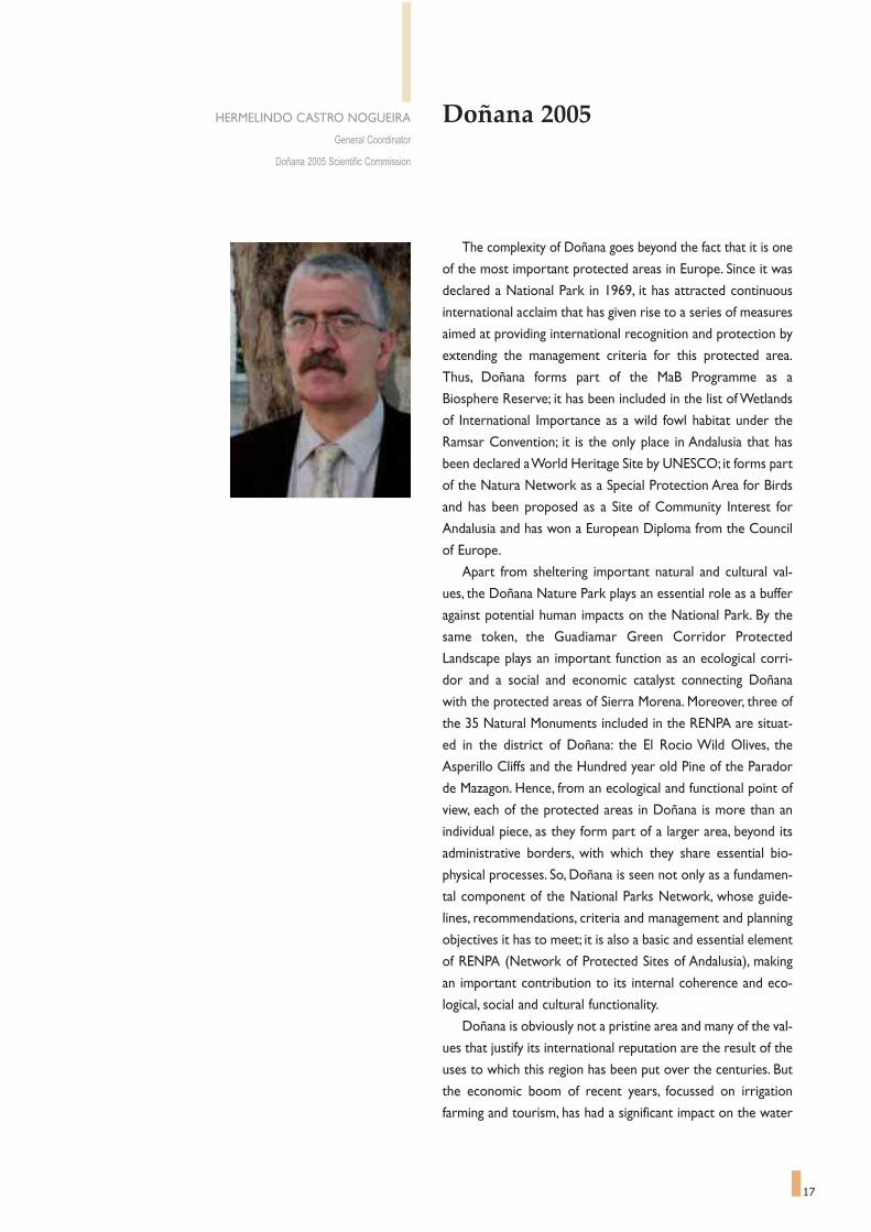
The complexity of Doñana goes beyond the fact that it is one
of the most important protected areas in Europe. Since it was
declared a National Park in 1969, it has attracted continuous
international acclaim that has given rise to a series of measures
aimed at providing international recognition and protection by
extending the management criteria for this protected area.
Thus, Doñana forms part of the MaB Programme as a
Biosphere Reserve; it has been included in the list of Wetlands
of International Importance as a wild fowl habitat under the
Ramsar Convention; it is the only place in Andalusia that has
been declared a World Heritage Site by UNESCO; it forms part
of the Natura Network as a Special Protection Area for Birds
and has been proposed as a Site of Community Interest for
Andalusia and has won a European Diploma from the Council
of Europe.
Apart from sheltering important natural and cultural val-
ues, the Doñana Nature Park plays an essential role as a buffer
against potential human impacts on the National Park. By the
same token, the Guadiamar Green Corridor Protected
Landscape plays an important function as an ecological corri-
dor and a social and economic catalyst connecting Doñana
with the protected areas of Sierra Morena. Moreover, three of
the 35 Natural Monuments included in the RENPA are situat-
ed in the district of Doñana: the El Rocio Wild Olives, the
Asperillo Cliffs and the Hundred year old Pine of the Parador
de Mazagon. Hence, from an ecological and functional point of
view, each of the protected areas in Doñana is more than an
individual piece, as they form part of a larger area, beyond its
administrative borders, with which they share essential bio-
physical processes. So, Doñana is seen not only as a fundamen-
tal component of the National Parks Network, whose guide-
lines, recommendations, criteria and management and planning
objectives it has to meet; it is also a basic and essential element
of RENPA (Network of Protected Sites of Andalusia), making
an important contribution to its internal coherence and eco-
logical, social and cultural functionality.
Doñana is obviously not a pristine area and many of the val-
ues that justify its international reputation are the result of the
uses to which this region has been put over the centuries. But
the economic boom of recent years, focussed on irrigation
farming and tourism, has had a significant impact on the water
HERMELINDO CASTRO NOGUEIRA
General Coordinator
Doñana 2005 Scientific Commission

18
resources of the area and, in consequence, on the associated
natural systems. Furthermore, if we bear in mind that Doñana
is laid out over the bottom of a basin, we will realise that its
ecosystems are especially sensitive to the man's actions
beyond the borders of the protected areas and of the district
itself, especially with regard to the quality and quantity of sur-
face and groundwater, as was made painfully clear after the
Aznalcollar accident.
It is therefore undeniable that the survival of the values that
make Doñana an eco-cultural heritage that is unique in Europe
require a management strategy that is anchored in the reality
of its territorial environment. For this reason, it is essential not
only to adopt an integral management of the different forms of
protection and recognition that have the area has been
endowed with; it is just as important to manage the region in
a co-ordinated fashion, based on shared responsibility and on
building a consensus among the different authorities and sec-
tors involved.
In recent years, much progress has been made in this direc-
tion and the main instruments used in the fields of conserva-
tion, regional planning and development in Doñana have been
created on the basis of accepting the need to strike a balance
between the different interests that overlap in this region,
based on the foundation of consensus and an active commit-
ment by all those involved in the day to day work. Hence, all
concerned recognise that the economic development modal
for the district and the conservation of its ecological and cul-
tural values are interdependent.
Further progress is needed along these lines, promoted by
a common effort on the part of the public administrations and
society, so that the full integration of Doñana with its environ-
ment, protected or not, becomes the principle paradigm of sus-
tainability and conservation on a broad scale.

19
Index
1 AA cchanging wworldWater for all, water for life . . . . . . . . . . . . . . . . . . . . . . . . . . . . . . . . . . . . . . . . . . . . . . . . . . . . . . . . . . . . . . . . . . . . . . . . . . . . . . . . . . . . . . . . . . . . . . . . . . . . . . . . . . . . 23The importance of Biodiversity . . . . . . . . . . . . . . . . . . . . . . . . . . . . . . . . . . . . . . . . . . . . . . . . . . . . . . . . . . . . . . . . . . . . . . . . . . . . . . . . . . . . . . . . . . . . . . . . . . . 45Wetlands and Biosphere Reserveslaboratories of Sustainable Development . . . . . . . . . . . . . . . . . . . . . . . . . . . . . . . . . . . . . . . . . . . . . . . . . . . . . . . . . . . . . . . . . . . . . . . . . . . . . . . . . . . . . . . . . . . . . . . . . . . . 47Wetlands and Sciencescientists to help nature conservation practitioners and society to set priorities in wetlands . . . . . . . . . . . . . . . . 53Wetlands and the European Landscape Convention . . . . . . . . . . . . . . . . . . . . . . . . . . . . . . . . . . . . . . . . . . . . . . . . . . . . . . . . 59Protected areas, biodiversity conservation and sustainable development in wetlandsissues and prospects . . . . . . . . . . . . . . . . . . . . . . . . . . . . . . . . . . . . . . . . . . . . . . . . . . . . . . . . . . . . . . . . . . . . . . . . . . . . . . . . . . . . . . . . . . . . . . . . . . . . . . . . . . . . . . . . . . . . . . . . . . . . . . . . . . . . 65
2 TThe eevolution oof DDoñanaThe time of the Marsheslands marked by water and diversity . . . . . . . . . . . . . . . . . . . . . . . . . . . . . . . . . . . . . . . . . . . . . . . . . . . . . . . . . . . . . . . . . . . . . . . . . . . . . . . . . . . . . . . . . . . . . . . . . . . . . . . . . . . 77The decisive yearsThe role of Doñana in the history of conservation . . . . . . . . . . . . . . . . . . . . . . . . . . . . . . . . . . . . . . . . . . . . . . . . . . . . . . . . . . . . . . . . . . . . . . . . . . . . . . . . . . . 95Research in Doñanathe necessary relations between science and natural resource conservation . . . . . . . . . . . . . . . . . . . . . . . . . . . . . . . . . . . . . . . . . . 101The milestones that made Doñana a National Park . . . . . . . . . . . . . . . . . . . . . . . . . . . . . . . . . . . . . . . . . . . . . . . . . . . . . . . . . 107
3 WWatery llandscapesWater as the main player . . . . . . . . . . . . . . . . . . . . . . . . . . . . . . . . . . . . . . . . . . . . . . . . . . . . . . . . . . . . . . . . . . . . . . . . . . . . . . . . . . . . . . . . . . . . . . . . . . . . . . . . . . . . . . . . 119The geomorphological evolution of Doñana . . . . . . . . . . . . . . . . . . . . . . . . . . . . . . . . . . . . . . . . . . . . . . . . . . . . . . . . . . . . . . . . . . . . . . . . . 137The Doñana aquifer and its relations with the natural environment . . . . . . . . . . . . . . . . . . . . . . . 141The paths of water in the Marsheschanges in the hydrological network . . . . . . . . . . . . . . . . . . . . . . . . . . . . . . . . . . . . . . . . . . . . . . . . . . . . . . . . . . . . . . . . . . . . . . . . . . . . . . . . . . . . . . . . . . . . . . . . . . . . . . . . . . . 151A Numerical Hydrodynamic Model for the Marshes of Doñana National Park . . . . . . . . . . . . . . . . . . . . . . . . . . . . . . . . . . . . . . . . . . . . . . . . . . . . . . . . . . . . . . . . . . . . . . . . . . . . . . . . . . . . . 157El Partido streaman example of the challenges posed by hydrological restoration . . . . . . . . . . . . . . . . . . . . . . . . . . . . . . . . . . . . . . . . . . . . . . . . . . . . . . . . . . . . . . . 159Man and water in the history of Doñanadifferent approaches to water management . . . . . . . . . . . . . . . . . . . . . . . . . . . . . . . . . . . . . . . . . . . . . . . . . . . . . . . . . . . . . . . . . . . . . . . . . . . . . . . . . . . . . . . . . . . . . . . . 163A Doñana with clean and transparent waters for lifeThe agricultural commitment . . . . . . . . . . . . . . . . . . . . . . . . . . . . . . . . . . . . . . . . . . . . . . . . . . . . . . . . . . . . . . . . . . . . . . . . . . . . . . . . . . . . . . . . . . . . . . . . . . . . . . . . . . . . . . . . . . . . . . . 165Marshes and pondsthe graphic expression of water . . . . . . . . . . . . . . . . . . . . . . . . . . . . . . . . . . . . . . . . . . . . . . . . . . . . . . . . . . . . . . . . . . . . . . . . . . . . . . . . . . . . . . . . . . . . . . . . . . . . . . . . . . . . . . . . . . 169
4 TThe bbiological hheritage oof DDoñanaThe performance of nature and the worlds of biodiversity within Doñana . . . . . . . 175The aquatic systems of Doñana . . . . . . . . . . . . . . . . . . . . . . . . . . . . . . . . . . . . . . . . . . . . . . . . . . . . . . . . . . . . . . . . . . . . . . . . . . . . . . . . . . . . . . . . . . . . . . . . . . . 213The ecology of Doñana scrub . . . . . . . . . . . . . . . . . . . . . . . . . . . . . . . . . . . . . . . . . . . . . . . . . . . . . . . . . . . . . . . . . . . . . . . . . . . . . . . . . . . . . . . . . . . . . . . . . . . . . . 221Freshwater algae of Doñana . . . . . . . . . . . . . . . . . . . . . . . . . . . . . . . . . . . . . . . . . . . . . . . . . . . . . . . . . . . . . . . . . . . . . . . . . . . . . . . . . . . . . . . . . . . . . . . . . . . . . . . . . . 225Birds and Hunting . . . . . . . . . . . . . . . . . . . . . . . . . . . . . . . . . . . . . . . . . . . . . . . . . . . . . . . . . . . . . . . . . . . . . . . . . . . . . . . . . . . . . . . . . . . . . . . . . . . . . . . . . . . . . . . . . . . . . . . . . . . . . . . . 231Doñana fish speciesthreat factors affecting a community in decline . . . . . . . . . . . . . . . . . . . . . . . . . . . . . . . . . . . . . . . . . . . . . . . . . . . . . . . . . . . . . . . . . . . . . . . . . . . . . . . . . . . . . . . . . . 237The amphibians of Doñana . . . . . . . . . . . . . . . . . . . . . . . . . . . . . . . . . . . . . . . . . . . . . . . . . . . . . . . . . . . . . . . . . . . . . . . . . . . . . . . . . . . . . . . . . . . . . . . . . . . . . . . . . . . . . 243

20
The uniqueness of marsh butterflies . . . . . . . . . . . . . . . . . . . . . . . . . . . . . . . . . . . . . . . . . . . . . . . . . . . . . . . . . . . . . . . . . . . . . . . . . . . . . . . . . . . . . . . . 247The rabbit in Doñanathe tale of two different tales . . . . . . . . . . . . . . . . . . . . . . . . . . . . . . . . . . . . . . . . . . . . . . . . . . . . . . . . . . . . . . . . . . . . . . . . . . . . . . . . . . . . . . . . . . . . . . . . . . . . . . . . . . . . . . . . . . . . . . 251The Iberian lynxrescuing a species for Doñana and for the world . . . . . . . . . . . . . . . . . . . . . . . . . . . . . . . . . . . . . . . . . . . . . . . . . . . . . . . . . . . . . . . . . . . . . . . . . . . . . . . . . . . . . . 255
5 TThe cchallenges oof rrestorationThe context of restoration and the new paradigms of Doñana . . . . . . . . . . . . . . . . . . . . . . . . . . . . . . . . 263The agricultural development in the surroundings of Doñanaspatial and landscape changes . . . . . . . . . . . . . . . . . . . . . . . . . . . . . . . . . . . . . . . . . . . . . . . . . . . . . . . . . . . . . . . . . . . . . . . . . . . . . . . . . . . . . . . . . . . . . . . . . . . . . . . . . . . . . . . . . . . . . . 275Co-existence of livestock in the marshes of Doñana . . . . . . . . . . . . . . . . . . . . . . . . . . . . . . . . . . . . . . . . . . . . . . . . . . . . . 281Reconstruction of the Abalario landscapea referent model for environmental restoration in Doñana . . . . . . . . . . . . . . . . . . . . . . . . . . . . . . . . . . . . . . . . . . . . . . . . . . . . . . . . . . . . . . . . . . . . . . 283The Guadiamar Green Corridora research programme, example of science's social responsibility . . . . . . . . . . . . . . . . . . . . . . . . . . . . . . . . . . . . . . . . . . . . . . . . . . . . . . . . . . . . . 289Doñana and its district, on the same path . . . . . . . . . . . . . . . . . . . . . . . . . . . . . . . . . . . . . . . . . . . . . . . . . . . . . . . . . . . . . . . . . . . . . . . . . . . . . 293
6 TThe DDoñana 22005 PProjectWater regeneration of the basins and water courses feeding the
marshes of the Doñana National Park
The Doñana 2005 Project . . . . . . . . . . . . . . . . . . . . . . . . . . . . . . . . . . . . . . . . . . . . . . . . . . . . . . . . . . . . . . . . . . . . . . . . . . . . . . . . . . . . . . . . . . . . . . . . . . . . . . . . . . . . . . 301Caracolesa new laboratory for science and wetland restoration . . . . . . . . . . . . . . . . . . . . . . . . . . . . . . . . . . . . . . . . . . . . . . . . . . . . . . . . . . . . . . . . . . . . . . . . . . . . . . 325Extending Doñanaan important step towards regenerating the water system . . . . . . . . . . . . . . . . . . . . . . . . . . . . . . . . . . . . . . . . . . . . . . . . . . . . . . . . . . . . . . . . . . . . . . . 329Monitoring and Evaluationthe key to the Doñana 2005 Restoration Project . . . . . . . . . . . . . . . . . . . . . . . . . . . . . . . . . . . . . . . . . . . . . . . . . . . . . . . . . . . . . . . . . . . . . . . . . . . . . . . . . . . . . . 331
7 TThe bbiological ddiversity oof DDoñanaDoñana species checklist . . . . . . . . . . . . . . . . . . . . . . . . . . . . . . . . . . . . . . . . . . . . . . . . . . . . . . . . . . . . . . . . . . . . . . . . . . . . . . . . . . . . . . . . . . . . . . . . . . . . . . . . . . . . . . . . 339
8 EEpílogueDoñana 2005, a forward looking project . . . . . . . . . . . . . . . . . . . . . . . . . . . . . . . . . . . . . . . . . . . . . . . . . . . . . . . . . . . . . . . . . . . . . . . . . . . . . . . . 363by Felix Manuel Pérez Miyares


23
band, Osiris, to life, after rescuing his coffin from among the bul-
rushes of the delta.The Goddess Isis protected her son, Horus,
the fruit of her relations with the resuscitated Osiris, from the
aggressions of his uncle Sept, bringing him up in the depths of the
marshes. In the end, Horus took the form of a peregrine falcon
in the Egyptian skies, his divinity evident by his proximity to the
sun.And so it seems that this facet of mythology was dreamed
up to describe the eventful biological and human history that
these bodies of water on the edge of the sea have sustained.
But, coming back down to earth, and before getting into
watery landscapes, one must also remember that the origins of
the modern world also very much depend on the previous exis-
tence of wetlands. In the carboniferous age, these were the areas
On the fourth day, Isis was born among the marshes.This
is how most of the tales of Egyptian mythology begin,
by linking one of their most important Gods with the waters of
the great Nile Delta. "The Egyptians say that Isis is crying to
Osiris when the river starts to rise; and they claim that the fields
flooding are, in fact, her tears"1.
Isis was an ambivalent Goddess who, through the centuries,
represented fertility, maternity, the symbol of growth and the
safety of life; she was also worshipped as the Goddess of the hid-
den knowledge of nature and of magic, and because of these
attributes, she is possibly the best symbol of many of the world's
wetlands. She is, after all, the Goddess of the water enclosed in
the earth, capable of creating new life and of returning her hus-
Water for All, Water for Life
Wetlands stand out as hotspots of biological diversity. However, this productive capacity is especially true in coastal marshes and swamps, which often hostunique and endangered species and ecosystems. The picture shows an Iberian lynx hunting a mallard among the rushes of Doñana.Photograph by Antonio Sabater.

24
that generated and created most of the fossil resources now
used in the form of oil-resources that define the wealth fought
over in unending wars, in effect bringing the dramas of the
Egyptian Gods back to life.
We must also remember that a great part of our modern
society is once again becoming aware of the practical and cultur-
al importance of these wetlands, especially those that are situat-
ed on the edge of the seas: places that used to be remote and
deserted, reviled as the source of epidemics, but, at the same
time, appreciated for their incredible wealth in producing unlim-
ited reserves of life.They are the final refuge of Isis, the Goddess
of life.
And so, thousands of years on, the scientific community has
lashed out in astonishing force in defence of the wetlands. In
recent years, these surviving aquatic environments are rightly
valued as sources, channels and transformers of a multitude of
chemical, biological and genetic materials, revealing a new, water-
dependent cosmos. Our knowledge of this cosmos remains
extremely limited, but wetlands are now generally considered as
the most important ecosystems on Earth, not only because of
their important role as refuge or habitat to protected or endan-
gered species, or as a major source of resources, but also
because they are among the most productive ecosystems on the
planet in terms of biomass and species.They are bastions of bio-
logical generation that continue to offset a systematic loss of
biodiversity.
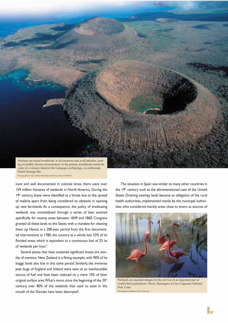
Wetlands can be found in all countries, from the tundra to
the tropics, although the exact percentage of the Earth's surface
that flood plains make up is not known. Most international sci-
entific agencies estimate that these territories, in all their forms,
encompass close to 600 million hectares, approximately 4% of
the planet's dry land. In terms of area, the most important of
these are the peat bogs, accounting for almost one third of all
wetlands, followed by swamps, marshes and flood plains, with
lakes accounting for a mere 2%.
Wetlands stand out as hotspots of biological diversity.
However, this productive capacity is especially true in coastal
marshes and swamps, as they are exceptional ecotones between
the sea and the land that many adjacent ecosystems depend on.
These are boundary or frontier zones, sharing both land and
aquatic systems, providing protection for both which confers on
them supreme importance in conservation. This new view has
enabled us to rediscover the value of the fragile and sometimes
temporary aquatic landscapes that represent a refuge for count-
less forms of life, related in the myths of civilisations that exist-
ed long before our own.
The value of bodies of water close to the sea can be seen in
their subtlety, like in some outstanding manifestations of art.The
slightest variation in the water level can be a determining factor
in how we ultimately define its biological and scenic features.
Maintaining the artistic simile, the presence and character of the
wetlands is sometimes ephemeral, in geological terms of course.
Many of these features in temperate and sub-arctic zones are no
older than 12,000 years, a mere second on the geological scale
of history, when they started to consolidate after the ice melt-
ed, changing the sea level at the end of the Ice Age.The contin-
uous variations in sea level during recent ages (known as eusta-
tic effects), some tectonic effects, the transference of sediments,
and the power of the wind transporting sand and other materi-
als resulted in the emergence of deltas and estuaries, creating
intricate and varied coastal marshlands as they silted up.
With the passage of time, mankind sometimes contributed
towards environmental diversification even further, rather than
compromising it. Archaeological and documentary evidence
shows us that the final configuration of the deltas and estuaries
of Norfolk, in the east of England, is the product of digging peat
500 to 700 years ago, and in many places, the mining of gravel
from the alluvial plains over the last 200 years has been followed
by the appearance of lakes and swamps. These close relations
between human activity and fresh or brackish water on the edge
of the sea are repeated throughout the world, at different times
and to varying degrees
THE DIFFICULT CO-EXISTENCE OF MAN
WITH AQUATIC LANDSCAPES
The latest threats to zones essential for life on the planet
are, firstly, the remarkable shift of the world's population in
recent decades to coastal areas, and secondly, the exponential
Several societies have been living in harmony with wetlands since ancienttimes. Above, the lagoon of Porto Novo, a Ramsar site close to Cotonou,Benin.Photograph by Nassima Aghanim - Ramsar. January 2004.

increase in new activities that use these delicate maritime strips,
such as the development of coastal tourism or the creation of
industrial estates based on a port. Whole cities like Belize or
Panama City have spread over wetlands. The co-existence, or
conflict, between human activity and the wetland areas, howev-
er, dates back much further, especially in the coastal zones.
Wetland birds have been hunted since the dawn of time as
the staple diet of early human societies, using nets, bows and
arrows, and trained cats and birds of prey, among a long list of
other techniques. In the bas reliefs of the temple of Esna, from
the fifth dynasty of Egypt, there are paintings of complex meth-
ods of catching waterfowl, including the use of domestic geese
as bait and decoys made from clay and leaves for hidden hunters
to attract migrating birds.The relationship between man and the
wetlands is also seen in the use of the many species of rushes
and fresh water reeds that have been used for centuries in build-
ing canoes and rafts, the world over.These practises still survive,
for instance in the wetlands of the Tigris and the Euphrates
where reeds are utilized, in South America where totora reeds
or bulrushes are used, and in Africa, where papyrus is still made
use of2.
In Belize and Guatemala, the Maya used to drain marshes for
growing crops 3,000 years ago. In Papua New Guinea, research
carried out along the Waghi River in the highlands, has uncov-
ered evidence from earlier ages of irrigation ditch systems and
mounds the size of an orchard built to grow different plants
9,000 years ago.These, with the passage of millennia, have been
turned into the intensive production of marsh taro that still sur-
vives. In Japan, marshes have been cultivated for at least 2,500
years; rice paddies were constructed in marshes,with basins sur-
25
Mar Menor is a Ramsar site close to Murcia (Spain). It is a good exampleof the difficulties faced by wetlands under the pressure of human expan-sion along coastal areas. Here irrigation for agriculture, tourist develop-ment, old salt works, fishing, and nautical activities co-exist.Photograph: Paisajes Españoles S.A.

26
rounded by palisades and wood lined terraces. In medieval
Europe, many wetlands were partially drained to improve graz-
ing and to grow hay in the marshes, as sheep could graze there
free from the distomatosis parasite. Dating tells us that many
wetlands developed at the hands of our forefathers; a variety of
cultures had an impact on such ecosystems that we are actually
now trying to protect.
Of all human intervention, one of the most important mod-
ifications of the wetlands throughout history was rice growing in
China 6,000 years ago.This has had a major effect on the trans-
formation of costal and delta areas that has increased over the
centuries. Rice paddies gradually consumed a significant part of
these habitats, progressively covering them. The expansion of
rice growing over the last five hundred years has been spectac-
ular.Yet, in the Mediterranean basin, rice fields only reached their
peak relatively recently, in the mid 20th century, when they cov-
ered almost a million hectares. This is a good example of the
clash between human activity and the survival of marshes and
coastal wetland zones, although it is often thought that their
existence helps floodable lands to be maintained, having a posi-
tive effect on waterfowl.The problem is that, on a small scale,
rice paddies have not been very aggressive in ecological terms,
but on the larger scale, they work in contradiction to the dynam-
ics of coastal marshlands and estuaries.The clash lies in that the
need for fresh water for irrigating the rice is out of synchronisa-
tion with the water cycle of the natural wetland zones.As in the
case of Doñana, this has meant a radical change in handling the
original hydrological system3.
Not all human needs directly challenge the wetlands water
cycle. Another Mediterranean example shows the symbiosis
between human activity and the marshlands.Countless small salt
flats of immense strategic value since Roman times consolidated
to become water engineering, prompting the transformation of
coastal areas in successive episodes throughout history. Salt,
considered by Aristotle as the fifth element, became the symbol
of power and economic strength of the great civilisations, from
Carthage to Venice.But salt works rarely needed modification to
the water cycle, as all they needed was brackish water and large
areas of flat ground.Although they have been abandoned for all
intents and purposes in the Mediterranean basin now, the enor-
mous cultural and economic value they had up until the early
20th century meant that they could be maintained and conserved
along with many of their associated wetlands.
However, the utilization of the wetlands over the course of
the millennia is nothing compared to what has happened in the
last one hundred and fifty years and, more specifically, with the
major transformations imposed in the 20th century to the 1970s.
The loss of wetlands, in particular coastal swamps and marshes,
occurred at a dizzying speed during recent times. Even admitting
that historic data on the wetlands worldwide are far from reli-
able, it is generally accepted that practically 50% of the total esti-
mated area of these zones at the beginning of the 20th century
has now disappeared.This gives us a very rough idea of the glob-
al conflict of interests that affects their conservation, either
because of the spread of irrigated farmlands, or of tourism and
urban development, or because of draining to prevent malaria. In
the example of the Mediterranean, records show that 73% of the
marshes of northern Greece have been drained since 1930;
most of the major flood plains of France have deteriorated
thanks to the application of official public regional planning poli-
cies between 1960 and 1994; Spain has lost nearly 60% of the
original area of wetlands it enjoyed at the beginning of the 20th
century; while 84% of the floodable lands of the Medjerdah, in
Tunisia, were lost between 1881 and 1987.Table 1 shows alarm-
ing percentages of wetlands lost forever in OECD countries
during certain periods of the 20th century4.
The case of the United States of America is especially signif-
TABLE 1Significant wetland areas lost during the XX century compared withthose existing at the beginning of the each period.
Among the ancient Gods, Isis can be considered the Goddess of wetlands.Her symbol in the sky was the star Sirius, whose appearance heraldedNile’s awaited annual floods.
COUNTRY PERÍOD % OF LOST WETLANDSFrance 1900-1993 67
Germany 1950-1985 57
Greece 1920-1991 63
Italy 1938-1994 66
The Netherlands 1950-1985 55
Spain 1948-1990 60
USA 1970-1985 54
World estimation 1900-1998 50
27
icant and well documented. In colonial times, there were over
159 million hectares of wetlands in North America. During the
19th century, these were identified as a threat due to the spread
of malaria, apart from being considered an obstacle in opening
up new farmlands. As a consequence, the policy of eradicating
wetlands was consolidated through a series of laws enacted
specifically for swamp areas between 1849 and 1860. Congress
granted all these lands to the States with a mandate for cleaning
them up. Hence, in a 200-year period from the first document-
ed interventions in 1780, the country as a whole lost 53% of its
flooded areas, which is equivalent to a continuous loss of 25 ha
of wetlands per hour5.
Several places that have sustained significant losses are wor-
thy of mention. New Zealand is a fitting example, with 90% of its
boggy lands also lost in this same period. Similarly, the immense
peat bogs of England and Ireland were seen as an inexhaustible
source of fuel and have been reduced to a mere 10% of their
original surface area.What's more, since the beginning of the 20th
century, over 80% of the wetlands that used to exist in the
mouth of the Danube have been destroyed6.
The situation in Spain was similar to many other countries in
the 19th century such as the aforementioned case of the United
States. Draining swampy lands became an obligation of the rural
health authorities, implemented mainly by the municipal author-
ities, who considered marshy areas close to towns as sources of
Wetlands are found worldwide, in all situations and at all latitudes, creat-ing incredibly diverse environments. In the picture, marshlands inside thecrater of a volcanic island in the Galapagos archipelago, an emblematicWorld Heritage Site.Photograph by Yann Arthus-Bertrand, Earth from above/UNESCO.
Wetlands are essential refuges for the survival of an important part ofworld’s bird populations. Above, flamingoes at Cayo Caguanes NationalPark, Cuba.Photograph by Bárbara García Moreda.

28
infection -hazardous, unhealthy areas. Hence, as towns grew, any
swampy area was immediately eliminated.This trend was made
official in a circular on the prevention of typhus dated the 28th of
April 1869 and in the Royal Order of the 7th of January 1878, giv-
ing instructions for reversing the spread of leprosy. Some
marshlands partially escaped these interventions because they
were considered useful, once cleaned up and transformed into
rice paddies.The work of clearing and draining the wetlands was
soon considered as public works, as seen in the General Public
Works Act of 18777.
The Inventory of Wetlands, drawn up in 1991 by the
Directorate General of Hydraulic Works of what was at the
time the Ministry of Public Works and Transport (Table 2), shows
that practically 60% of the surface area of wetlands and natural
lakes had disappeared, most of it between 1950 and 1990. Some
114,100 ha remained when the inventory was drawn up, of an
estimated total area of 280,228 ha documented at the beginning
of the century. Proportionally, the most affected areas were the
flood plains,with only one fifth of their original area surviving the
conversion to farmland. Inland freshwater wetlands followed,
with only one third of their estimated original area surviving. But
in quantitative terms, the coastal wetlands are the worst affect-
ed by this process, loosing 59% of their original surface area.This
means that 141,949 ha, or 50% of the total surface area of wet-
land coastal areas at the beginning of the 20th century, were lost
in the 20th century, although they still represent a large propor-
tion of the total surface area of aquatic environments.This is why
Doñana is so important in the overall count, as its floodable area
alone (27,000 ha) accounts for one fifth of the natural salt marsh
areas that now survive in Spain8.
However, a simple analysis of surface area losses, although
illustrative per se, does not give a complete picture of the
threats that still endanger these enclaves and the urgent need to
protect them at all costs. Although pressure on wetlands has
diminished significantly since 1980, most of the factors that trig-
ger their transformation and degradation remain dormant in
many places. A long list of activities and actions could lead to
direct or indirect changes in the physical, chemical and biological
components of the aquatic ecosystems, with serious conse-
quences like them drying out.The most common types of alter-
ation can be divided into four main groups:
- Alteration to the physical structure of the wetland, due to
the frequent changes made to natural branches, canals,
streams and brooks, turning them into artificial waterways
because of building or water works that change their topog-
raphy. This is the case in certain symbolic areas like the
Everglades, or even Doñana. In the Everglades case, the
restoration of its hydrological system, approved almost a
decade ago, has been a major operation costing almost 1.5
billion dollars. On a different scale geographically, the
restoration of the Doñana water system faces similar prob-
lems, arising from the interventions carried out in the second
half of the 20th century. Alterations to hydrological systems
and infrastructures usually have the effect of fragmenting
habitats.
- Alteration to the hydrological regime, or the quantity of
water in the wetland; in other words, of the water inputs,
both surface and subterranean, that feed it. A good example
TABLE 2Evolution of the area of Spanish wetlands and lakesincluded in the DGOH inventory (1991).
Type Original Present % Superficieof wetland area in ha area in ha present/original
Interior wetlands 40,600 16,421 40.4
Mountain 2,389 2,314 96.9
Carstic 874 784 89.7
Interior freshwater 14,802 4,805 32.4
Interior brackish 6,743 5,212 77.2
Flood plains 15,867 3,234 20.3
Coastal wetlands 239,628 97,679 40.6
Total 280,228 114,100 40.7
Salt pans and rice fields are millennia-old typical uses of marshlands. Inthe picture, Janubio salt-pans, Lanzarote (Canary Islands).Photograph by Alberto Luengo.

29
of this is Lake Ichkeul in Tunisia, a Ramsar wetland that is rap-
idly salting up due to restrictions in the water flow caused by
damns situated at the head of the drainage basin.This creates
water quality problems that affect water plants, zooplankton
and the complex food chain9. Reservoirs have also caused
degradation to the great coastal wetlands in the mouth of
the Parana-Plata Delta, causing overall change to its water
cycle rhythms. Major water works transporting water from
one basin to another and hydroelectric plants are another
danger factor.The Arenal-Corobici-Sandilla project in Costa
Rica is a good example of this, with direct consequences on
the coastal mangrove swamps.
- Alteration to the quality of the wetland water, especially by
contaminating inputs, either directly or diluted, or by sedi-
ments brought down from catchment areas. This has
increased exponentially in recent decades.An exam-
ple of the dangers inherent in urban pollution is
found in the difficult situation of the coastal
wetlands of the Yellow Sea and the mouth of
the Yangtze. There is a similar risk in San
Francisco Bay, where the presence of high
concentrations of pesticides used in the sur-
rounding agriculture and serious sedimenta-
tion problems have been detected. The input
of sediments from deforestation in areas far
from the coastal wetlands has become the most
critical aspect for those in the
Philippines. Lastly, we find an
extreme example of pollution
in Cambodia, in this case
caused by the widespread use
of the enduring chemical DDT
in the past to eradicate mos-
quitoes, plus the devastating
effects of bombing
and defo-
liants used during the
Vietnam War.
- Alteration to the biological
communities associated with
the wetland, either from over-
exploitation of resources (hunting,
grazing, fishing, farming), or the introduc-
tion of exotic species.The traditional threats
that hung over these areas from highly intensive
land use that exceeded its carrying capacity, have
given way to new forms, such as fish farming.The expansion of
nurseries for crustaceans in mangrove swamps and marshes is
a good example of new factors contributing to the degrada-
tion of the wetlands. The floodable coasts of South
America, on both the Pacific and the Atlantic sides, find
themselves caught in this new dilemma. It is most endem-
ic in places like Bahia, in mangrove swamps like those of the Gulf
of Fonseca, and along long stretches of the coast from Ecuador
to southern Chile. But the great mobility and interconnected-
ness of the modern world brings another risk of incalculable
consequence. It facilitates the accidental or voluntary introduc-
tion of countless invading exotic species of all kinds. Every day,
fish such as tilapias and gambusias, crustaceans such as red crabs,
algae, tortoises, snakes, insects, molluscs, mammals and birds are
introduced to wetlands around the world far from their original
habitats, with consequences that are sometimes devastating and
usually, as yet, unknown.There are countless means of acciden-
tal transport: species that travel encrusted on the hulls of ships,
bilge water discharge in estuaries, zoos, air freight transport, the
pet trade, etc.
TABLE 3
Main causes of wetland loss or degradation.
- Drainage for agriculture.
- Salinisation due to over-exploitation or changes in the hydrologic balance of
associated aquifers.
- Diversion of water for irrigation.
- Drainage to avoid foci of diseases.
- Urban development of coastal araes .
- Tourist occupation of the coast.
- Regulatory dams, hydroelectric power stations.
- Transfers between river basins.
- Changes in the hydrologic system to favour navigation or protect occupied
lands.
- Pollution caused by discharge of untreated urban waste water.
- Pollution caused by industry and agriculture.
- Mining in the wetland upper basin.
- Large-scale agriculture and fishery over-exploitation.
- Pastures and fire practices.
- Introduction of exotic species.
- Fragmentation of habitats.
Introduction of exotic and inva-sive species is one of present-day greatest risks for wetlandsand for coastal wetlands in par-ticular, causing considerablealterations of biological commu-nities and leading to a largenumber of extinctions. In thephotograph, the brown treesnake Boiga irregularis, an inva-sive species that played havocwith several species of birds inthe Pacific area.Photograph: USGS, Tom Fritts/Gordon Rodd.

30
INTERNATIONAL ACTIONS
FOR PROTECTING AQUATIC ECOSYSTEMS
Alarming statistics on wetlands destruction have been grad-
ually put together over the second half of the twentieth centu-
ry, spurring a long overdue concerted effort among nature con-
servationists and the global scientific community. This has
involved as many countries as possible in order to curb one of
the most serious processes of environmental degradation affect-
ing the planet.
The first major precedent in pulling together this global ini-
tiative emerged in 1960, when the International Union for the
Conservation of Nature (IUCN) joined the International
Waterfowl and Wetlands Research Bureau (IWRB) and the
International Council for Bird Preservation (ICBP) to launch the
MAR Project, with a view to conservation of the wetlands and
disseminating such values.This initiative was followed by other
projects like AQUA and TERMA, tackling the protection of inland
waters and peat bogs. But it was during a conference held in the
French town of Sainte Marie in 1962, promoted by the MAR
project, that an idea for a convention took shape.A process was
initiated to convene an international conference based on a doc-
ument that was to be the foundation of the wetland convention.
The MAR conference was organised at the time with the partic-
ipation of the IUCN, ICBP10 (currently BirdLife International) and
IWRB11 (now Wetlands International).
Over the following eight years, the wording of the future
convention was developed in a series of international technical
meetings (St. Andrews, 1963; Noordwijk, 1966; Morges, 1967;
Vienna, 1969; Moscow, 1969; Espoo, 1970) with the firm support
of the IWRB11 and the Dutch government. Originally, the pro-
posal's main idea was to promote the protection of waterfowl
habitats. However, as the wording developed, the conservation
of wetlands as whole ecosystems started to take shape instead
of merely protecting the species that inhabited them.
This preparation took place in parallel with other important
initiatives that have converged in time and space. In the same
decade, foundations were also laid for the MaB Programme12
(Man and Biosphere) introducing the concept of the Biosphere
Reserve as a practical step forward towards the fundamentals of
sustainable development. From the outset, it paid special atten-
tion to wetlands as scientific laboratories and fields for experi-
menting with the constructive relationship between humanity
and its environment. This productive period also saw the first
steps of the International Hydrological Programme - stemming
from the International Hydrological Decade (IHD, 1965-1974) -
with one of its main tasks to gauge the situation of the world's
aquifers and their interactions with the activities of man.There
were also other important precedents like the Programme for
Protecting Habitats and Endangered Species promoted by the
World Wildlife Fund (WWF), or the important role played by
the Council of Europe in the launch of the European Water
Charter in 1967.
All this preparatory work for a wetlands convention finally
came together in a conference organised by the Iranian
Department of Hunting and Fishing, in the city of Ramsar on the
shores of the Caspian Sea.The original wording of what is now
commonly known as the Ramsar Convention was produced,
agreed upon and signed by the delegates of 18 countries on the
3rd of February 1971. Under the auspices of UNESCO as the
holding body for the initiative, the Convention came into force
in December 1975, and currently has 1,469 areas entered in the
List of Wetlands of International Importance, also known as the
Ramsar List.The wetlands entered account for almost ten per
cent of all the world's wetlands, approximately 128.9 million
hectares - an area slightly smaller than Greece. Moreover, the
contracted parties signed up the Convention have increased sig-
nificantly, including practically all countries around the world; the
thirteen original signatories have grown to 146 signatories today.
The Ramsar Convention on Wetlands is now the only envi-
ronmental treaty for a specific ecosystem and it is the first to
link the conservation of natural resources with their sustainable
use, along the same lines as the philosophy developed for the
COUNTRIES Total area by Date of Total Ramsar Totalcountry (km2) ratification area number
in 1994 (including of Ramsarmarine areas) Sites
(km2) in 1998Austria 83 858 1983 1 028 9Belgium 30 518 1986 79 6Denmark 43 094 1978 7 390 27Finland 338 145 1975 1 013 11France 543 965 1986 5 791 15Germany 356 970 1976 6 712 32Greece 131 957 1975 1 635 10Ireland 70 285 1985 697 45Italy 301 323 1977 569 46Netherlands 41 526 1980 3 249 18Norway 323 880 1975 697 18Portugal 91 905 1981 658 10Spain 505 990 1982 1 579 38Sweden 449 964 1975 3 828 30UK 244 101 1976 4 843 129Total UE 39 049 427
Note: The first column (total area by country) does not take into account marine areas,but it includes estuaries. This table does not include the new accession countries whichjoined the EU in 2004.Photograph: Wetland International, Ramsar Bureau. Data source: EIONET; Eurostat.
TABLE 4Main figures of Ramsar sites in the European Union (EU 15).

31
Biosphere Reserves. Moving on from the original idea of con-
serving wildfowl habitats, the scope of the Convention has been
extended over the years to include coastal wetlands like man-
grove swamps, coral reefs and marine plant beds, valuing their
biodiversity and the beneficial role they play in human commu-
nities. The range of situations dealt with in the Convention
becomes clear from Article 1.1 of the text, which defines wet-
lands as: "Areas of marsh, fens, peat land or water, whether nat-
ural or artificial, permanent or temporary, with water static or
flowing, brackish or salty, including areas of marine water the
depth of which at low tide does not exceed six metres".
It is important to note that the inclusion of a wetland in the
List of Wetlands of International Importance, or Ramsar List,
does not automatically guarantee its protection, as many coun-
tries unfortunately do not meet their commitments, or because
of major external factors affecting their integrity. A recent study
of a sample of 344 sites from the Ramsar List - including wetland
and lake ecosystems - concluded that an alarming 84% of them
suffered serious ecological changes caused by drainage for con-
version to farmland, urban development, pollution, invading
species and the input of sediments.
Adverse changes to the ecological characteristics recorded
in many Ramsar sites have forced the signatories to introduce a
series of amendments to the Convention. Examples include the
Paris amendment of 1982 and the decisions taken by the parties
to the 1987 Regina Conference. As the Convention was pro-
gressively applied, a significant number of sites included in the
List had been damaged or were facing serious threats that accel-
erated their degradation.There was, therefore, an urgent need
to take fast and efficient action to prevent these processes of
wetland destruction accelerating, and promoting the restoration
of damaged sites at the same time. Thus, when parties met in
Montreux in 1990, a resolution was passed to investigate sites
that have suffered attacks or in which undesirable changes are
likely to occur, so that preventative or restorative actions are
clearly outlined in these places and the appropriate consulta-
tions and monitoring is established with any stakeholders.There
are presently 55 sites included in this category that has come to
be known as the Montreux Register. Because of the possible
The Ramsar Convention on Wetlands is now the only environmental treaty for a specific ecosystem and it is the first to link the conservation of naturalresources with their sustainable use, along the same lines as the philosophy developed for the Biosphere Reserves. In the above picture, a purple heron and ablack-winged stilt in the marshes of the Doñana National Park, declared Ramsar Site, Biosphere Reserve, and World Heritage Site.Photograph by José María Pérez de Ayala.
The Ramsar Convention came into force in December 1975, and currentlyhas 1,469 wetland sites entered in the List of Wetlands of InternationalImportance, also known as the Ramsar List.Above, Kakadu National Park (Australia), Ramsar site.

32
YEAR MILESTONE RESULTS1965 Start of the International Hydrological Decade Start of the International Hydrological Programme . UNESCO.
1967 European Water Charter Launching of the Charter by the Council of Europe.
1971 Ramsar Conference, Iran Launching of the Ramsar Convention.
MaB (Man and Biosphere) Programme Constitution of the MaB Programme and of the first Biosphere Reserves.
UNESCO, Paris
1972 United Nations Conference Declaration of the UN Conference on the Human Environment.
on the Human Environment, Stockholm
1973 MARPOL Convention Allows to declare wetlands and nearby sea areas as “sensitive areas”.
1975 Ramsar Convention Coming into force of the Convention under the auspices of UNESCO.
CITES Convention, Convention on International Trade in Endangered Species of Wild Fauna and Flora. It concerns wetlands both in the field
Washington of species protection and in introduction of alien species.
1977 United Nations Water Conference, Mar del Plata Plan of Action (PAMP)
Mar del Plata
1979 Berna Convention, Council of Europe Convention dealing with the Conservation of European Wildlife and Natural Habitats.
Birds Directive, European Union Protection of birds and classify as Special Protection Areas (SPAs) the most suitable territories for migratory birds, such as wetlands.
1981 International Drinking Water and Sanitation Decade Global, balanced focus on problems related with water and sanitation specific of each country.
Links with protected areas.
European Charter of the Littoral, Chania, Crete. Preserving valuable littoral ecosystems such as coastal wetlands.
1982 United Nations Convention Links between coastal wetlands, fisheries and reproduction of economically productive species.
on the Law of the Sea.
Montego Bay, Jamaica.
1990 Global Consultation on Safe Water New Delhi Statement:“Some for all rather than more for some” - Sharing water equitably. Integrated water resources management.
and Sanitation for the 1990's,
New Delhi
1992 International Conference on Dublin Statement on Water and Sustainable Development. Fresh water is a finite and vulnerable resource. Economic value of water,
Water and the Environment, Dublin solution of conflicts, natural disasters, sensitisation.
UN Conference on Environment and Rio Declaration on Environment and Development.Agenda 21, Chapter 18.
Development (UNCED Earth Summit)
Río de Janeiro
OSPAR Convention Convention for the Protection of the Marine Environment of the North-East Atlantic.Annex V: Protection and Conservation of
of Marine Biodiversity and Ecosystems.
Habitats Directive, European Union On the conservation of natural habitats and of wild fauna and flora. Natura 2000 and wetlands Network.
1993 Convention on Biological Diversity Wetlands as world biologiical diversity hotspots.
1995 World Summit for Social Development, Copenhagen Declaration on Social Development.“Poverty, water supply, sanitation and natural systems”.
Copenhagen
Conference of the UEU Ministers of Environment. Pan-European Biological and Landscape Diversity Strategy .
Sofia, Bulgaria.
Jakarta Mandate Enlargement of the objectives of the Biological Diversity Convention to coastal and sea environments
with particular incidence on coastal wetlands.
1996 UN Conference on Human Settlements Development of sustainable human settlements in an urbanizing world.“Making the creation of new healthy environments compatible
(Habitat II), Istanbul. with the maintenance of essential wetland resources and ecosystems”.
1997 1st World Water Forum, Marrakech. Marrakech Declaration “Water and sanitation, management of shared waters, preserving ecosystems,
efficient use of waters”.
2000 2nd World Water Forum,The Hague. World Water Vision:“Making Water Everybody's Business”.The challenges: satisfying basic needs, ensuring
food supply, protecting ecosystems, sharing water resources, valuing water and administrating it in a responsible way
.
Ministerial Conference on Water Security Launching of the Report on World Water Resource Development.
in the 21st Century,The Hague
European Landscape Charter Adoption of the definitive text in Florence. Inclusion of the landscape dimension in the protection of wetlands. Launching of
the European Landscape Convention.
Water Framework Directive Inclusion of the “basin” concept for water ecosystems, prevention and water quality.
European Union Promotion of restoration.
2001 International Conference on Freshwater, Water: the key of sustainable development, good governance, mobilisation of financial resources, development of capabilities,
(Dublin + 10), Bonn exchange of know-how.
2002 World Summit on Sustainable development, Plan of Action. Integrated management of water resources.
(Rio + 10), Johannesburg
2003 International Year of Freshwater Governability, integrated management of water resources, efficient use of water, water quality for ecosystems,
3rd World Water Forum, Kyoto restoration, legislative framework.
2005 Start of the International Decade "Water for Life" Resolution approved by the UN General Assembly for the decade 2005-2015.
TABLE 5Main Conventions, Conferences and Milestones related to freshawater and wetlands, coastal wetlands in particular, in Europe and the World.

33
effects brought about by changes in the hydrological regimes,
Doñana was added to this register on the 4th of July 1990, and
the Doñana 2005 Project is one way to address this high-risk sit-
uation.The Everglades, added in 1993, was treated similarly.
Coinciding with goals set by the Ramsar Convention, a large
number of international provisions, agreements, treaties and
programmes have come about since the 1970s, dealing directly
or indirectly with protecting wetlands.These were particularly in
the protection of the coastal wetlands,which helped bring about
a constructive framework on the world stage for the survival of
waterscapes. The "International Convention on the Prevention
of Pollution from Ships" of the 2nd of November 1973, widely
known as the MARPOL Convention, was such a case. It made it
possible to declare certain marine spaces special zones that are
particularly sensitive.These included recent declarations like the
Great Barrier Reef (Australia), Sabana-Camagüey (Cuba-
Biosphere Reserve) and the Wadden Sea, all of which are whol-
ly or partially Ramsar sites. In the same year that Ramsar was
established, the Convention on International Trade in
Endangered Species of Wild Flora and Fauna (CITES) came into
force, which has and will continue to have particular impact on
the protected wetlands and the endangered species they shelter,
and its sphere of action will have to be considerably increased in
the face of the growing threat from exotic species in these areas.
In 1979, the Convention for the Conservation of Migratory
Wild Species, known as the Bonn Convention, was adopted,
which aims to ensure the stringent protection of endangered
migratory species throughout all or part of their range of distri-
bution. In this case, a major proportion of the species mentioned
in the two appendices of the Convention are directly associated
with the coastal wetland zones. Three years later, the United
Nations Convention on the Law of the Sea was adopted in April
1982 in Montego Bay, Jamaica. Some aspects of this Convention
cover the same matters, but in this case, it referred to the need
to preserve the great hubs of marine bio-diversity and areas that
produce hatchlings to maintain fishing resources. This clearly
highlighted many areas of canals and streams in salt marshes,
estuaries, coastal lagoons connected to the sea, and the highly
productive mangrove swamps. It is curious that this recognition
should once again validate the ancient Roman view, two thou-
sand years on, that places like Estany des Peix in Formentera and
San Antioco in Sardinia should be seen as strategic enclaves.They
played a valuable role as reserves for guaranteeing fishing in the
surrounding areas.
Well into the eighties, the term biological diversity with all it
represents started to circulate, together with concepts like sus-
tainable development. The two concepts had been tested at a
practical level through the running of programmes like MaB.At
this time the UNEP13 eestablished a series of task forces of
experts with a mandate to prepare an international legally bind-
ing instrument for the conservation and sustainable use of bio-
logical diversity. In 1991, the group became the Inter-governmen-
tal Negotiating Committee that prepared the wording to be
signed in 1992 during the Earth Summit held in Rio de Janeiro.
This is how the Convention on Biological Diversity, finally adopt-
ed in 1993, appeared on the scene as one of the great accords
to come out of the Rio Conference. It recognised for the first
time that conserving biological diversity is a common concern
for mankind and forms part of the process of development.Two
years later, during the Second Meeting of the Parties in 1995, the
programme called the "Jakarta Mandate on Coastal and Marine
Biodiversity" was approved, aimed at specifically implementing
this aspect, in the spirit of the Convention on Biological
Diversity (CBD). The importance that the CBD has placed on
coastal wetlands is reflected both in the aforesaid Mandate and
in the areas of co-operation that have been developed in recent
years concerning Ramsar. Priority has been given to aspects such
as "improving the conservation and rational use of wetlands sit-
uated in the inter-tidal zones" and the "integrated management
of coastal zones that include wetlands".
Initiatives in the conservation of wetlands within a specifical-
ly European framework have followed a very similar pattern. In
1974, the former European Commission established the first
Recommendation on Protecting Birds and their Vital Spaces,
where the decline of many species was highlighted, calling on
member states to sign up to the Ramsar Convention. Five years
later in 1979, the member states of the European Union adopt-
ed the "Birds Directive", which was the first European regulation
dedicated to bird conservation.The Birds Directive, binding on
all E.U. member states, proclaimed the need to conserve and
Combining a sustainable use of wetlands with the guarantee of conserva-tion of their ecosystems, species and water quality, is one of the biggestchallenges in nature conservation. In the photograph, fishing huts in the"Ortazzo e Ortazzino" Ramsar Site, located in the Po river delta (Italy).Photograph by Tobias Salathé, Ramsar.

34
suitably manage populations of wild birds. It established the SPA
(Special Protection Areas for Birds) network to this end, an
instrument aimed at protecting 181 of the most endangered bird
species in Europe, especially migratory birds. A considerable
proportion of the SPA zones were obviously wetlands.And yet,
as was happening globally, the various programmes within the
European framework and the directive started to consider not
only conserving the species, but also protecting their habitats.
Along the same lines, the so-called Habitats Directive was
finally published in 1992, on the conservation of natural habitats
and wild flora and fauna. The transfer of territory within this
directive led to the creation of the Natura 2000 Network that
encompasses the SPAs and includes all the other important
areas, such as the Special Areas of Conservation (SAC), develop-
ing a coherent network aimed at guaranteeing the biodiversity
of natural habitats and wildlife throughout the European Union.
The importance for the wetlands of the Directive and of creat-
ing the Natura 2000 Network was clearly articulated in the
European Union's 5th Framework Programme when it estab-
lished the need for identifying a set of specific protection meas-
ures for these territories.These measures include integrating the
largest and most important wetland areas in the Natura 2000
Network, integrated management of water resources with
regard to both quality and quantity, the inclusion of European
Union criteria on wetlands14 in the strategic management of land
use, and major financial support for programmes that include
ecological use of these zones. Furthermore, member states and
the Commission are called upon to guarantee that the measures
promoted by the Common Agricultural Policy (CAP) do not
come into conflict with the European Union policy on the
appropriate use and conservation of the wetlands.
Thus, a new point of view - seeing the wetlands politically and
socially - opened up. New directives and recommendations
came into play, either directly or indirectly related to the wet-
lands, characterised by their innovative stance.Water began to
take on a central role. Waterscapes started to become integrat-
ed, or better still, recognised as final users: with all the necessary
guarantees, in directives like the "Urban waste water treatment"
or the "Protection of waters against pollution caused by nitrates
from agricultural sources".
On the 22nd of December 2000, this new vision took shape
with the European Parliament adopting the Water Framework
Directive (WFD). The wetlands took a leading role in an historic
debate about the necessary new water culture. In fact, the pro-
visions of Article 1 of the Directive include the following15:
"The purpose of this Directive is to establish a framework for
the protection of inland surface waters, transitional waters,
coastal waters and groundwater which:
a) prevents further deterioration and protects and enhances the
status of aquatic ecosystems and, with regard to their water
needs, terrestrial ecosystems and wetlands directly depending
on the aquatic ecosystems;
b) promotes sustainable water use based on a long-term protec-
tion of available water resources; ...".
The EU Water Framework Directive (WFD) recognises the
European wetland zones as such. Moreover, the articles of the
The coverage of the Ramsar Convention extends to an impressively widevariety of wetlands. For the purpose of this Convention wetlands are"marsh, fen, peatland or water, whether natural or artificial, permanent ortemporary, with water that is static or flowing, fresh, brackish or salt,including areas of marine water the depth of which at low tide does notexceed six metres". In the photograph, aerial view of the Doñana Marshes.Photograph: Paisajes Españoles.
"To ensure a sustainable water supply of good quality, we should protectand use in a sustainable manner the ecosystems that naturally capture, fil-ter, store, and release water, such as rivers, wetlands, forests, and soils".Paragraph 24 of the Ministerial Declaration of the 3rd World Water Forum,Kyoto, 2003.

35
directive promote an awareness of catchment areas in establish-
ing sustainable water use strategies and it highlights the funda-
mental role of ggroundwater. It also introduces water quality as
an essential factor. It gives priority to the entitlement to the sus-
tainable use of water, in appropriate conditions.This could be for
human activities as a whole or for maintaining essential ecosys-
tems like wetlands.
The list of supplementary measures which Member States
may choose to adopt for implementing the WFD, in its Part B it
reads, "recreation and restoration of wetlands areas". Hence, the
recommendation is based on the fact that wetland protection is
sufficiently covered in European legal regulations. The new
Directive provides a model of prevention and draws up future
strategy centred on the major challenge of restoring modified
wetlands. It also introduces the concept of "creating" new wet-
lands. As this publication shows, the history of Doñana, like
many other emblematic wetlands, runs in parallel with the evo-
lution of events in Europe and the rest of the world, by truly and
effectively facing up to these new challenges that were first iden-
tified by the scientific community and by certain managers of the
Doñana Park years ago.
The inclusion of an environmental variable in the manage-
ment of water resources for human use, in other words, the
securing of a holistic way of seeing water management, and espe-
cially the role of wetlands and other important ecosystems, is
starting to become the basis of many WFD projects as it unfolds.
In the case of Doñana or the Larnaka wetlands in Cyprus, for
example, initiatives like WSM (Water Strategy Man Project) are
included.This is a European Commission project aimed at defin-
ing new exemplars of water management and its future strate-
gies.
Now moving back to the world stage, having reviewed the
trend of events in Europe, we can see that the same phenome-
non has occurred world wide with the recognition of the essen-
tial role of wetlands and aquatic ecosystems.At the same time,
there is a call to integrate this dimension of conservation into
general water policies (see Table 5). The first references start
with the United Nations Water Conference of 1977, in Mar de
Plata, and they continue with important international milestones
and rulings like those of 1992, the year in which the Rio Summit
and the Dublin International Conference on Water and the
Environment were held. More recently, this common thread of
international concern for the state of water resources has
brought us the appearance of new policies on sustainable water
use at the Conferences on Water and Sustainable Development
(Paris 1998) and the World Water Forum held in The Hague
(2000).
Finally, 2003 was a crucial year for water with the appearance
of the ambitious World Water Development Report. It was
launched at the Third World Water Forum, organised in Kyoto,
Japan.All the United Nations agencies and committees devoted
to dealing with the water issue worked together for the first
time in drawing up this report, in order to examine the progress
made in pursuit of water-related objectives.These included areas
like health, food, conservation of ecosystems, cities, industry and
energy, as well as a financial evaluation, shared use and good
administration of water resources. An extensive network of
interlocutors, broadly from the United Nations, has taken part in
creating the World Water Assessment Programme (WWAP),
whose secretariat is run by UNESCO. For the first time ever,
twenty three agencies and secretariats of United Nations con-
ventions have joined forces and shared experiences to produce
the most complete and up-to-date report on the situation of the
world's fresh water. Some of the wake-up calls reported include
those concerning the increase in pollution, over-exploitation of
groundwater, and a progressive disappearance or alteration of
lakes and wetlands. In the face of these risks, a new vision is tak-
ing root that complements the protection of waterscapes. It
includes the integrated management of water resources, pro-
moting efficiency in water use, focussing more on the quality of
aquatic ecosystem waters, fostering research and the promotion
of large scale restorative action, and creating satisfactory legisla-
tive frameworks.
In 1979, the member states of the European Union adopted the "BirdsDirective", which was the first European regulation dedicated to bird con-servation. After it, the so-called Habitats Directive was finally published in1992 developing a coherent network that encompasses the SPAs, aimed atguaranteeing the biodiversity of natural habitats and wildlife throughoutthe European Union. Above, a water rail (Rallus aquaticus) in Doñana.Photograph: Organismo Autónomo de Parques Nacionales.

36
LABORATORIES OF NATURE CONSERVATION
AND SUSTAINABLE DEVELOPMENT
Doñana belongs to an extremely select group of coastal wet-
lands that have been classed as Biosphere Reserves by the inter-
national community, in other words, laboratories of conserva-
tion and sustainable development, and furthermore, as World
Heritage sites. This is a set of exceptional ecotones that also
form part of the Ramsar List of Wetlands of International
Importance.
Very few places in the world meet the triple conditions of
being recognised as a World Heritage site, Biosphere Reserve
and a Wetland of International Importance.They are a very spe-
cial group of seventeen territories that includes such emblemat-
ic places as the Pantanal (Brazil), Boeng Chmar (Cambodia), the
"W" Region of the Níger, San San-Pond Sak (Panama), and
Palawan (Philippines). If we restrict our selection to coastal areas
with these characteristics, the list would be further restricted to
include only Ichkeul (Tunisia),The Everglades (USA), El Vizcaíno
(Mexico), the Danube Delta (Romania-Ukraine) and, of course,
Doñana National Park.There are a few particular settings that
should be added to these, in which the flooded area represents
only a small part of larger reserves, such as the South Isabela
Wetlands in the Galapagos Islands. Table 6 lists the world's
coastal wetlands that have been declared Biosphere Reserves or
recognised as World Heritage sites, with the corresponding
named sites or Ramsar sites having been added.
On analysing each of these cases in detail, the most surpris-
ing aspect is that the alteration of their hydrological systems is
the main impact and the principle threat to the survival of all of
them.With the exception of El Vizcaino, these cases are current-
ly undergoing major restoration programmes related to their
hydrological functionality.This is the fundamental aspect of the
new challenges of conserving aquatic ecosystems of internation-
al importance.
Lake Ichkeul, covering an area of 12,600 ha, is situated in the
Bizerte region, in the north of Tunisia. It is connected to the
Mediterranean by the four-kilometre-long Tinaja Wadi (water-
course) and is a sublittoral saltwater lagoon, surrounded by a
permanent fresh water wetland. The main threat hanging over
this area at the moment is the construction of dykes to collect
water in three of the lake's tributaries, including the main ones
(Djoumine and Sedjennane). This lowers the water level and
increases salinity with a significant impact on flora and fauna.The
restrictions to the water supply led to the draining of the marshy
rim of the lake, triggering a chain of harmful effects such as the
rapid disappearance of Scirpus maritimus (staple diet of the
common goose, that winters here), which has been progressive-
ly replaced by invading plant species (Ammi visnaga and
Scolymus maculatus). Following that, the pronounced and pro-
longed fall in the water levels of Lake Ichkeul, whose maximum
depth never exceeds 1.5 m, provides access for livestock to pre-
viously inaccessible areas and causes a progressive increase in
salinity, with a resulting radical transformation of the aquatic
ecosystems. In the current situation, the restoration plans
designed by international agencies and bodies like the GEF and
IUCN inevitably depend on guaranteeing sufficient water input
of at least 20 million cubic metres per year.16 Due to these cir-
cumstances, Ichkeul has been on the List of World Heritage in
Danger since 1996.
Apart from the obvious differences of scale and bio-geo-
graphic characteristics, both this case and Doñana are very sim-
ilar to what happened in the Everglades,which is in the same cat-
egory of endangered heritage. The size of the Everglades
Biosphere Reserve is slightly larger, with a floodable area includ-
ed in the Ramsar list of 566,143 ha, which is twenty times larg-
er than Doñana, although this is only half the original wetland
area of 1800.
Before the arrival of European settlers in Florida, the water
of the immense Okeechobee Lake flowed slowly south, along a
watercourse that was wide enough, at some points, to cover up
to one hundred kilometres of surrounding flood plain. The
Everglades were really a wide shallow river running across an
extensive prairie. But an extensive network of canals was dug in
the early 19th century to drain the area to turn it into farmland.
Over the years, arable land beyond measure was cleared
between the great upper lake and the immense mouth of the
Before the arrival of European settlers in Florida, the Everglades were real-ly a wide shallow river running across an extensive prairie. Over the yearsover 2,400 km of drainage canals were built, which radically transformedthe hydrological system, and until a few years ago, were diverting anaverage of 600 hm3 per day of fresh water into the Atlantic Ocean. Photograph by Eva Mª Alonso Vizcaino.

37
coastal marshes, drained by over 2,400 km of canals that radical-
ly transformed the hydrological system.This massive transforma-
tion grew exponentially after 1948 until it reached the point
where, until a few years ago, the canals were diverting an aver-
age of 600 hm3 per day of fresh water into the Atlantic Ocean.
The efforts that have been made with the Everglades hydro-
logical restoration plan, perhaps the most expensive and compli-
cated wetland conservation operation in the world, show that
this is no time for making irresponsible decisions as made in the
past.This is because the cost of restoration, not to mention the
irreplaceable loss of biological capital, is a heavy burden on future
generations. The apparent social and political impossibility of
curbing farmland expansion, and the need to "protect" the
waterside urban spread of Miami's mass conurbation from the
waters themselves, forced the authorities to develop an impres-
sive mechanism of water storage, diversion and pumping. This
ended in restricting the traditional inputs into the surviving wet-
lands. In practise, input quantities are presently being guaranteed
with an unprecedented investment in energy, infrastructure and
maintenance. At the same time, the colossal restoration pro-
gramme, consisting of 52 actions over a period of 20 years, faces
new problems similar to those of Doñana, such as the need to
treat waters laden with nutrients from industry or agriculture,
or to mitigate the effects arising from the contamination of
underground aquifers. Maintaining ecosystems also needs meas-
ures established to guarantee the level and behaviour of bodies
of water, in a terrain in which centimetres turn into mountains17.
The relative similarity between the risk factors was the basis on
which the members of the Doñana 2005 Project Committee of
Experts sent a mission to the Everglades in 2003 to seek points
in common for facing the complex task of restoring Doñana.
The case of the Danube Delta rests on similar assumptions.
All the conflict involved in conserving its immense basin and
associated wetlands in the many countries along its course cul-
minates in this delta.This is a conflict that also exists upstream,
as can be seen from the inclusion of the Donau-March-Auen
Ramsar site (Austria) in the Montreux Register in 1990. The
delta of the Danube is the largest in Europe,encompassing about
580,000 hectares, 113,000 of which are permanently covered by
water. Its survival is currently threatened by mistakes made and
decisions taken similar to those made last century in Doñana
and the Everglades, with the difference that we now have the
technical and scientific capacity to prevent the consequences of
major hydrological alterations. A shipping channel that the
Ukraine is dredging in the delta threatens the survival of over
500 species of birds and fish that inhabit this Biosphere Reserve.
Countries like Germany and Romania, the principal victims, and
international agencies like UNESCO and the Ramsar
Convention, asked for the works to be stopped and for an envi-
ronmental impact assessment be carried out on the project. But
the authorities of Kiev started building this channel on the
Bistroe Arm in May 2004, without informing Romania, where
80% of the vast marshland area is located.Their intention is to
open a link with the Black Sea.The Ukrainian government, which
This image, taken by the Terrasatellite, shows two coastalwetlands of the Baja Californiapeninsula. The darker circleshows the San Ignacio Lagoon,a World Heritage Site part ofthe El Vizcaino BiosphereReserve that also includes thelagoon system Ojo de Liebre atthe top-right of the image.Social pressure, determinationof environmental authoritiesand the involvment of interna-tional organisations allowedthe integral conservation ofthese salt marshes unique inthe world.The UNESCO’s missioncharged by the World HeritageCentre to prepare the reporton this threatened area wasmade up by Mechtild Rössler(UNESCO), Cipriano Marín(INSULA), Randall R. Reeves(Canada) and Pedro ManuelRosabal González (IUCN).
Photograph: Jacques Descloitres, MODISLand Rapid Response Team, NASA/GSFC.

38
has ignored all the complaints presented to them, justifies the
project by the fact that they need their own maritime-fluvial
channel in the region; a channel 120 kilometres long, with a
depth of 10 metres and a width of between 100 and 500 metres
to ensure that it is navigable.
The other side of the coin is represented by the case of El
Vizcaino. In an act without precedent in the Mexican
Government's management of the environment, President
Ernesto Zedillo announced the decision to completely cancel
the ESSA project during the "Evaluation of National Bio-diversi-
ty Conservation Policy" meeting, held on the 2nd of March 2000.
Backed by Mitsubishi, the ESSA project surrounded the San
Ignacio lagoon; a whale sanctuary declared a World Heritage site
and part of the Biosphere Reserve of the same name enclosing
one of the most interesting virgin marshlands on the planet.The
project consisted of developing a great industrial salt works that
would directly affect some 30,000 ha of land bordering on the
natural salt flats and would represent a major alteration to their
hydrological regime. The decision of the government was the
conclusive response to a report drafted by the Mission and sent
by UNESCO18 to evaluate the impact of the project on the nat-
ural values of the site. It was presented at the 23rd Session of the
World Heritage Committee held in Marrakech in November
1999. The UNESCO Mission's ruling explicitly recognised that
traditional salt production is not exactly an very aggressive activ-
ity with this kind of habitat and that the grey whale sanctuary
would not be seriously affected by it, but at the same time it did
warn that what made this project extremely dangerous was its
scale and the influence it would have on the hydrology of the
marshes. For the first time, a decision of this kind included two
concepts put forward to justify its rejection, breaking the bound-
aries of how losses in biological diversity would traditionally be
dealt with.The ruling argued that the activity should be an inte-
gral part of a sustainable development strategy in which water
was a central player, which was not the case, especially as the
project was within a Biosphere Reserve. Moreover, it included a
new social dimension in that there was a lack of provisos for
altering the existing natural landscape, resources that are
increasingly rare on the planet. It questioned the legal grounds
that made it possible to alter this common heritage, just when
other activities and economies that were far more environmen-
tally friendly were being developed in the area (selective fishing,
pharmacology, responsible tourism, and agriculture of native
products). For the first time, a whole coastal wetland of this size
has been rescued because of the convergence of several factors
that mobilised society and the scientific community: integrated
conservation of a wetland, non-intervention when there is a high
degree of uncertainty, strict application of sustainable develop-
ment criteria, and recognition of these areas as the heritage of
society as a whole. Some months later, James E. Brumm, Vice
President of Mitsubishi, declared in a public appearance that "the
preservation of the area in its natural condition is more impor-
tant that proceeding with the salt works".
As with the above cases, the Doñana Ramsar site was includ-
ed in the Montreux Register in 1990, following Recommendation
4.9.1, which noted that "despite positive actions, there is still a
risk of changes to the ecological character of the Ramsar site as
a result of water being drawn for farming and the development
of tourism, among other problems". The reasons for including
the site in the Montreux Register are grounded on the reason-
able doubt that these activities would over-exploit the regional
aquifer, hence diminishing the levels of groundwater, causing a
reduction in the duration and the level of seasonal flooding in
the Doñana Marshes. But, unlike Doñana, the other sites men-
tioned as benchmark sites are included in the List of World
Heritage in Danger.
This brief description of the planet's most emblematic
coastal wetlands, or at least those considered as included in the
leading international natural environment protection conven-
tions and programmes, enables us to put forward a new exem-
plar that shapes their survival.This is based on their hydrological
restoration as the fundamental challenge and the crux of all
actions. In fact, the World Water Development Report (2004)
explicitly recognises the essential role that these "living water
laboratories" play. In addition to the above cases, it mentions
other coastal wetlands of world importance like the Camargue.
The Report corresponds with the above views, encouraging the
development of international co-operation based on knowing
what can be implemented in these benchmark cases. It not only
Marshes and lagoons have always been a mysterious source of inspirationfor artists in several cultures. In the image, a reproduction of the painting"Crossing the Styx", by the Flamish peinter Joachim Patinir born inBouvignes in 1485.Prado Museum. Madrid.

39
highlights the importance of conservation policies, but also the
new challenges of generating innovation in the area of integrat-
ed management of water resources, the restoration of degraded
systems and the maintenance of acceptable water quality
standards.The challenge is not so much to overcome the
negative perceptions provoked by an alert ruling on the
conservation of an area, but rather to recognise that
critical situations have come about in these territories
that have generated solutions, be they right or wrong,
and that all the cases together as a whole provide an
enormous potential for scientific knowledge and
management know-how that could be harnessed or
replicated in many other coastal wetlands.
BENEFITS BEYOND THEIR BORDERS
Enhancing skills and exchanging experiences on the manage-
ment and conservation of these waterscapes will add value, as
we gain a better insight into the future benefits that the wet-
lands provide for mankind. The known beneficial functions of
the wetlands include:
- Export of biomass. Wetlands are systems
that offer an enormous wealth of flora and
fauna that are directly or indirectly usable
by man. These include both wild
species (fish, birds, plants) and domes-
tic species (rice, livestock, reeds, etc.)
Apart from this production, nutrients
are carried by watercourses, and the
run-off or re-charging of aquifers
feeds other freshwater or marine
environments, where they enter the
food chain and are re-cycled and
reused.
- Re-charging aquifers. This
occurs when the water fil-
ters from the wetland to the
aquifers below ground. The
water that reaches the aquifer is
usually of higher quality than the water
originally entering the wetland thanks to its
capacity to purify. Once in the aquifer, the water
can be drawn off for human consumption, or it can be
left to follow the subterranean flow until it rises to the sur-
face again in another wetland, in the form of aquifer discharge.
- Nutrient retention. In certain conditions, nutrients - especially
nitrogen and phosphorus - are retained by the plants and sedi-
ments of the wetlands, improving water quality and preventing
eutrophication. The nitrates can be reconverted into nitrogen
gas and fed back into the atmosphere as a result of denitrifica-
tion. The wetlands may sometimes act as natural water treat-
ment plants. On the other hand, some wetlands play an
important role in retaining CO2.The masses of marsh
plants, and especially the peaty organic deposits pro-
duced by the accumulation of the plants remains,
account for a large
proportion
of the car-
bon fixed as
organic mat-
ter. This capacity to retain
nutrients make many wet-
lands some of the most
productive ecosystems
known to man, to the
extent that they can com-
pete with systems of inten-
sive agriculture. In some African wetlands,
annual primary production of papyrus
amounts to 100 tonnes per hectare and
typha (bulrushes) varies
between 30 and 70
tonnes per hectare.
These figures are similar
to and even exceed the
commercial production
figures for maize (63
tonnes per hectare) and
sugar cane (60 tonnes
per hectare).
- Fisheries and shellfish
production. Marine
species provide 20% of
all the animal protein
consumed on the
planet. Two thirds of
the fish eaten
worldwide depend
on coastal wetlands at some
stage in their biological cycle, so this is
an extremely important function for mankind
that goes way beyond the fixed borders of these threat-
ened zones. Our knowledge of the role that wetlands play as
critical habitats necessary for the development of many wild
species in their larval and juvenile stages grows day by day, and
Waterwheels, wind-mills, stone walls andparticular buildingssuch as piledwellings, make upthe incredibly variedlist of constructiveelements associatedto coastal wetlandsthroughout theworld. In the image,engraving of an oldwind-mill of theJanubio salt-works.Lanzarote.Engraving: Antonio Ramos

40
some of these species are of great commercial value. In the early
stages of their life, these species use wetlands temporarily,
before moving to the surrounding habitats. For example, the
mangrove swamps of the Pacific coastlines maintain an average
of over one hundred species of fish that grow there before leav-
ing for coastal waters.
- Plant food. Wetlands are the natural habitat of rice, a principal
food cereal. Most varieties are grown in modified wetland habi-
tats. It is estimated that in Asia alone, over two billion people
depend on the sources of protein provided by wetland agricul-
tural production and fish.
- Biodiversity and genetic resources. From the point of view of
ecosystems, coastal wetlands are a basic source of genetic
resources that include potentially essential basic products, for
key industries like pharmacology in the future. One example of
such potential is found in the alga Dunaliella salina, from which
basic substances are extracted for treating cancer. Some wet-
lands are also valuable for the conservation of certain native
breeds and varieties of organism, like the Mostrenca cows and
the Lebrijana sheep of the Guadalquivir marshes, or the drum
rice that is still grown in the "veles" of s'Albufera, in Majorca.
- Protection from storms. Coastal wetlands help to dissipate the
force of the wind and the waves and often reduce the damage
caused by storms, which is especially important in tropical
False coloured image ofSouthern Florida takenby the Terra satellite. Itclearly shows the bigOkeechobee lake whichonce fed Everglades.The large, green-dottedbrown area is the pres-ent wetland area, evi-dently squeezedbetween a large stripopf cultivated landsand the Miami hugeurbanised area thatstretches along the east-ern coast. These mainfeatures are sufficientto understand the com-plexity of one of themost ambitious hydro-logical restorations evermade.
Photograph: Jacques Descloitres,MODIS Land Rapid ResponseTeam, NASA/GSFC.
This painting was produced in Costa Rica during the 7th meeting of theConference of the Contracting Parties (COP) to the Ramsar Convention,May 1999. The 7 indigenous artists, from the Solentiname archipelago inthe south-east corner of Lake Cocibolca, Nicaragua, live in fishing andfarming communities that are closely linked to their wetland environment.Their presence at the Conference was part of a much larger project organ-ized by IUCN-Mesoamerica that brought together local groups in severalcountries to discuss the importance of wetlands in their lives; an outcomeof the meeting was a "People's declaration on wetlands", which was subse-quently presented at the Conference. As part of the project, a workshopfor artists in Solentiname encouraged an artistic expression of the closerelationship between the people and their wetlands, and a group of theseartists, working during the COP in Costa Rica, produced this painting oftheir Solentiname environment. The painting is currently displayed in theoffice of the Secretary General of the Ramsar Convention in Switzerland.The 7 artists: F ernando Altamirano, Paula Clarisa Arellano, Rodolfo Arellano, Silvia Arellano, GloriaGuevara, Elba Jiménez, Rosa Pineda

41
regions.
- Stabilising the coast and controlling erosion. Typical wetland
vegetation can stabilise the coastline by reducing the energy of
waves, currents and other forces of erosion.At the same time,
the roots of the plants sustain seabed sediments.The vegetation
of riverbank wetlands, in turn, stabilises the banks of these rivers
and thus, reduces erosion.
- Climate change. It is suspected that the wetlands play an impor-
tant part in the earth's carbon cycle, although it is not known to
what extent.What is beyond all doubt is that draining, convert-
ing swamps into farmlands and the widespread degradation of
the wetlands releases large quantities of carbon dioxide and
other green house gasses that could make a substantial contri-
bution to climate change.
Despite the way they have been treated, other clear contri-
butions that these zones have made to human survival should be
assessed objectively.The constant supply of plant products for a
wide range of purposes other than food would be such a case:
for building related purposes (wood, reeds, cane), for making
utensils (bulrushes), for making furniture (wood, reeds), for mak-
ing chemicals (lime), or for making fuel (firewood, peat). The
coastal marshes have also been a major source of salt for cen-
turies, a basic commodity in our civilisation that countless activ-
ities and applications depend on. Finally, in today's knowledge
society, wetlands have become hubs of economic development
with the appearance of new activities like tourism. Doñana,
Kakadu, the Everglades and the Pantanal are good examples of a
different way of making a healthy profit from these zones, creat-
ing a new form of cultural co-existence.
In this process of change, a new way of seeing the wetlands
is taking root.They have managed to survive the passage of civil-
isation, and the accumulated cultural heritage to be found in
these waters should not be forgotten. Some wetlands sustain
traditional activities that form part of the history of entire peo-
ples. For example, the Mai Po swamps are the only place left
where the residents of Hong Kong can see how the Gei Wai
(nurseries) work, where the local community uses a centuries-
old traditional method for breeding prawns19. In Australia, many
wetlands are of enormous social and cultural value for their tra-
ditional aboriginal owners. They still lead an active ceremonial
life and still use semi-traditional hunting and gathering practices
in the marshes of the Coburg Peninsula (the world's first Ramsar
site). Other wetlands are of outstanding archaeological impor-
tance, like the Stavns Fjord Ramsar site (Denmark), well known
for its archaeological remains, and one of the first Bronze Age
settlements to include buildings from the time of the Vikings. On
the other side of the world, the Kakadu National Park, in the
Northern Territory of
Australia, offers a land-
scape in which exten-
sive swamp alternates
with rugged mountain
relief, with caves full of
prehistoric rock paint-
ings. 196 archaeological
sites have been identi-
fied in Kakadu, many of
which are at least
10,000 years old20.
Concerning architectural heritage, lagoons and coastal
marshes have been the setting for some incredible works in
which man has adapted to his environment, some of which still
survive. One only has to mention the "Stazione da Pesca"
(Fishing Posts) of the Venice lagoon, the "corrales" making har-
monious shapes in the shallow waters of the Atlantic estuaries,
the "fish houses" forming labyrinths on the coasts of Kerkennah,
the old mussel farms of "Étang de Thau", or the incredible salt
pans of Guérande.These blend perfectly with the topography of
the marsh, in contrast with the Roman linear design of the thou-
sand-year-old salt works of Trapani, Marsala and Ibiza21. All of
these are expressions that give food for thought about the
capacity we used to have for harnessing and adapting to our
environment. They are highly imaginative projects, like the
Palafittes, that have flourished in shallow waters throughout the
world. In some places, they provide shelter for ethnic cultures
surviving from former times, like the Warao of the Orinoco
Delta, where a sustainable development programme has been
started to maintain this ancient symbiosis22.
The power of coastal waterscapes not only reaches the tan-
gible world, it is also relayed in traditions, myths, customs, arts
History repeats itself. The opening of a new navigable canal threatensagain the survival of large areas of the Danubio delta, completely chang-ing its hydrological system.Photograph : Jacques Descloitres, MODIS Land Rapid Response Team, NASA/GSFC.
Human activity in coastal wetlands has cre-ated a yet little-known cultural, industrialand ethnographic heritage. In the photo-graph, an ancient wind-mill of the salt-works in the Secovlje Ramsar site(Slovenia).Photograph by Emil Hilje.

42
and crafts, building up an intangible cultural heritage that emu-
lates the diverse biological heritage that inhabits it. In this publi-
cation, J.A.Valverde offers a magnificent sketch of this aspect in
Doñana. Not in vain, preferential attention has been paid to the
marshes and lagoons that dot the shoreline, as much by the
World Heritage Centre, defining them as "Cultural Landscapes",
as by the European Landscape Convention. Both international
conventions emphasise the power of spaces in which the work
of nature has been wisely combined with the work of man.
Given all of this, and if we merge the scientific perspective
with the environmental and cultural points of view, a large part
of the world's coastal wetlands have become, without a shadow
of doubt, genuine laboratories of innovation for sustainable
development.These places that are so significant for science, the
environment and for biodiversity, can and should become melt-
ing pots of experience and problem solving that may prevent
what we are seeing today in former Mesopotamia. Over 20,000
km2 of wetlands surrounding the confluence of the Tigris and the
Euphrates in the south of Iraq were the cradle of an important
branch of world civilisation. 5,000 years ago, at the dawn of the
Sumerian culture, extensive natural marshes lived in harmony
with a society that worshipped water and created artificial
islands. Birds and shallow waters were used as calming images
throughout history, permeating art, music and alphabets. In a
mere two decades, thoughtless waterworks have wiped out
unique areas of this cultural and ecological jewel that will end up
being buried by this senseless oil war - a war that does not even
respect the waterscapes that were the ancestral origins of the
cultures that its promoters claim to defend.
The Kakadu National Park, in the Northern Territory of Australia, offers a landscape in which extensive swamp alternates with rugged mountain relief, withcaves full of prehistoric rock paintings. 196 archaeological sites have been identified in Kakadu, many of which are at least 10,000 years old. It is undoubtedlyan emblematic example of fusion between cultural and natural heritage in the same wetland.Photograph: Kakadu National Park.
During the last decades, experience showed that conservation of threat-ened species living in wetlands is increasingly linked with the amount ofwater resources that support these landscapes and to the functionalrestoration of their disturbed hydrological systems. Above, an imperialeagle, one of the symbols of Doñana.Photograph: Doñana 2005 files.

43
TABLE 6Coastal wetlands conatained in areas declared Biosphere Reserves or included in the World Heritage list and their coincidence with the Ramsar listof wetlands of international importance.
COUNTRY BIOSPHERE RESERVE WORLD HERITAGE SITE RAMSAR SITE
Algeria El Kala Marais de la MekhadaGermany Waddensea of Schleswig-Holstein Schleswig-Holsteinisches Wattenmeer
Waddensea of Hamburg Hamburgisches WattenmeerWaddensea of Lower Saxony Wattenmeer, Elbe-Weser-Dreieck
Wattenmeer, Jadebusen & westliche WesermündungWattenmeer, Ostfriesisches Wattenmeer & Dollart
RügenArgentina Delta del Paraná
Costero del Sur Bahía de SamborombónMar Chiquita
Australia CroajingolongMornington Peninsula and Western Port Western Port
Fraser Island Great Sandy StraitKakadu National Park Kakadu National ParkWet Tropics of Queensland
Bangladesh Sundarbans SundarbansBelize Belize Barrier-Reef Reserve SystemBurkina Faso La Mare aux hippopotames La Mare aux hippopotamesBrazil Mata Atlántica Atlantic Forest Southeast Reserves Baixada Maranhense
Discovery Coast Atlantic Forest Reserves Reentrâncias Maranhenses
Canada Clayoquot SoundCharlevoixGrand Codroy Estuary
Chile Laguna San RafaelChina Shankou Mangrove Shankou Mangrove Nature Reserve
Yancheng Dafeng National Nature ReserveYancheng National Nature Reserve
Nanji IslandsColombia Ciénaga Grande de Santa Marta Sistema Delta Estuarino del Río Magdalena
Ciénaga Grande de Santa Marta.Costa Rica Area de Conservación GuanacasteCuba Ciénaga de Zapata Ciénaga de Zapata
Península de GuanahacabibesBaconaoBuenavista
Dominicana Republic Jaragua-Bahoruco-Enriquillo Ecuador Archipelago de Galápagos Archipelago de Galápagos Humedales del Sur de IsabelaSpain Doñana Parque Nacional de Doñana Parque Nacional de Doñana
Urdaibai Ria de Mundaka-GuernikaCabo de Gata-Nijar Salinas del Cabo de GataMarismas del Odiel Marismas del OdielLanzarote
Estonia West Estonian Archipelago Hiiumaa Islets & Käina Bay Vilsandi - National ParkLaidevahe - Natural Reserve
France Camargue CamargueLa Petite Camargue
Archipel de la Guadeloupe Grand Cul-de-Sac Marin de la GuadeloupeIndia Sundarbans SundarbansIndonesia Komodo Parque Nacional de Komodo
Ujung KulonIran Hara Khouran Straits
Miankaleh Miankaleh Peninsula, Gorgan BayLapoo-Zaghmaz Ab-bandan
Ireland North Bull Island North Bull IslandMauritania Banc d'Arguin Banc d'ArguinMexico Alto Golfo de California
El Vizcaino Santuario Ballenero El Vizcaíno Laguna San IgnacioIslas del Golfo de CaliforniaSian Ka'an Sian Ka'an
Netherlands Waddensea Area BoschplaatGriendWaddenzee
Nicaragua Río San Juan Refugio de Vida Silvestre Río San JuanPhilippines Palawan Tubbataha Reef Marine Park Tubbataha Reefs National Marine Park
Polonia Slowinski Parque Nacional SlowinskiRumania Delta del Danubio Danubio Delta Danubio River DeltaRussian Federation Astrakhanskiy Volga River Delta
Commander IslandsSenegal Delta du Saloum Delta du Saloum
Djoudj DjoudjSouth Africa Cape West Coast Langebaan
Greater St. Lucia Wetland Park Upper Kwa Zulu NatalTunisia Ichkeul Ichkeul IchkeulUkraina Chernomorskiy United Kingdom Dyfi Cors Fochno & Dyfi
Loch Druidibeg Loch Druidibeg, Loch à Machair and Loch StilligarryNorth Norfolk Coast North Norfolk CoastBraunton BurrowsSilver Flowe-Merrick Kells Silver Flowe
United States of America Everglades & Dry Tortugas Everglades National Park EvergladesCarolinian-South AtlanticVirginia CoastCentral Gulf Coast PlainChannel IslandsCalifornia Coast RangesCascade Head
Uruguay Bañados del Este Bañados del Este y Franja CosteraVietnam Ha Long Bay


isms, from single cell microbes only visible to a microscope, to giant
trees, enormous whales and elephants.
Strictly speaking, Biodiversity is a quality or characteristic of liv-
ing entities, but the sense of the meaning has been broadened in
the literature, to include not only the very diversity of life on Earth,
but also to encompass all life itself, as an entity or a resource
(Heywood and Watson, 1995;Wilson, 1992).
Scientists distinguish and analyse Biodiversity at least on three
different levels of organisation: ecosystems, species and genes, the
traits and qualities of which have been defined and described by dif-
ferent authors, (Heywood and Watson, 1995; Raven, 1997;Wilson,
1992,1988,1997) and which are summarised in broad terms below.
An ecosystem is commonly known as a community of species
of organisms that interact between themselves and with the phys-
ical environment around them. Some macro-types of ecosystems
can be defined in general terms, as a tropical forest, a wetland or a
moor. But despite of the fact that ecosystems of a certain macro-
type may share certain features, they are always different, they are
never identical, due to differences in the identity of the species that
they consist of,or in the characteristics of the physical environment
around them. Some ecosystems, in turn, shelter unique, endemic
species that only exist in certain places and environments and
which can be found nowhere else.
One of the major problems facing biodiversity lies in these
unique features of an ecosystem and in the destruction and disap-
pearance of ecosystems with unique qualities, which are not even
45
The importance of Biodiversity
RODRIGO GÁMEZ *
45
The term Biodiversity, synonymous of Biological Diversity,
has become globally popular since the proceedings of the
National Biodiversity Forum, organised by the American National
Academy of Sciences and held in Washington D.C. in 1986, were
published in 1988 (Wilson, 1988). Biodiversity appeared in scientif-
ic literature nearly 20 years ago (Lovejoy, 1980), and it was already
being used in Costa Rica in scientific and conservationist circles
since1996. The Convention on Biological Diversity, a result of the
United Nations Conference on the Environment and Development
held at Rio in 1992,made a significant contribution to spreading the
concept on a global scale, introducing the term Biodiversity to the
general public.
In simple terms, the diversity of life forms that live in the bios-
phere is what we understand as Biodiversity. One quality of living
beings is that they are all different from each others. This gives
them the ability to occupy the most diverse forms of niches in the
biosphere, wherever they may find available energy, giving them, in
turn, the particular characteristics of the landscapes of the places
they occupy. We can see this in the full range of the Earth's natu-
ral formations, from the depths of the oceans to the summits of the
highest mountain ranges, and from the tropical rain forests to the
most arid and driest of deserts. We can appreciate it in the
immense and fascinating variety of shapes and sizes of living organ-
* National Biodiversity Institute.Santo Domingo de Heredia, Costa Rica.
Scientists analyse Biodiversity on several different levels of organisation, such as communities, species, and genes. In the picture, flock of terns in DoñanaNational Park.Photograph by José María Pérez de Ayala.

46
shared by other ecosystems close by, which may be similar, but not
the same.
Ecosystems are naturally difficult to classify and define, or even
to delimit geographically. Species, on the other hand, are easier to
define and describe, which is why they have become the focus of
attention of biologists for several hundred years, used as basic ele-
ments in dealing with taxonomic and phylo-genetic issues or stud-
ies of a bio-geographic nature.
But the definition of species too, faces problems. Biologists
define a species as a population of individuals capable of breeding
with each other, of freely exchanging their genes among the popu-
lation, under natural conditions.This concept is highly applicable to
most animals and plants, but it is unsure as to whether it is applica-
ble to populations of organisms that occupy different geographic
ranges.
Where the difficulty in using this concept of species becomes
most evident is in the case of organisms that do not reproduce
sexually, or in species in which sexual reproduction is unimportant
in their life cycle. This is the case of bacteria and archi-bacteria,
which are the most primitive and most abundant forms of life on
Earth. In these cases, other criteria are used for characterising and
classifying them, mainly bio-chemical and molecular in nature.
Biological diversity on a genetic level deals with the variability
caused by the appearance of different forms of the same gene, that
is, of the alleles, the product of mutations that, in turn, cause varia-
tions in the sequences of nucleotides of the DNA macro-mole-
cules. Sexual reproduction clearly also leads to a mixture of alleles
by recombination.There are also other processes that cause muta-
tions but, in the end, and regardless of their origin, it is the muta-
tions that directly affect the basic characteristics that determine an
individual and, in turn, a population.
The knowledge that we have of the biodiversity is still very lim-
ited.There is no consensus among scientists concerning the num-
ber of species that exist on the planet. Nearly 1.9 million of them
have been described scientifically, but estimations of the total num-
ber of species vary from 3 to 100 million, and 5 to 15 million is con-
sidered a plausible range. Our ignorance of Biodiversity at an eco-
logical and genetic level is even greater.
Given the nature of the processes that lead to its creation, bio-
diversity is the product of millions of years of evolution that occur
in a given place at a given time.This is something that we human
beings should appreciate and value, as a form of wealth of a nation,
just as we do with material and cultural wealth, and this is one of
the most precious legacies to be found in Doñana (Wilson, 1992).
Mankind has taken de facto control of the biosphere and the
tragedy that we face is that we are irrationally destroying this won-
derful work of nature.We have triggered the sixth great extinction
faced by biodiversity without yet understanding its origin and its
formation, characteristics or how it works. Moreover, we do not
understand the vital role that it plays for mankind, for our own
welfare.
The knowledge that we have of the biodiversity is still very limited. There isno consensus among scientists concerning the number of species that existon the planet. Nearly 1.9 million have been described scientifically, but esti-mations of the total number of species vary from 3 to 100 million.Photograph: CENEAM files.
The diversity of life forms that live in the biosphere is what we understand as the Biodiversity. One quality of living beings is that they are all different fromeach others. This gives them the ability to occupy the most diverse forms of niches in the biosphere. Pine trees emerging from a “corral” surrounded by dunesin Doñana.Photograph: CENEAM Files.

ecosystems worldwide. Such driving forces include: demograph-
ic factors; economic factors (e.g. trade); institutional, legal and
other governance factors; development and the use of new tech-
nologies; climate change; natural hazards; land use changes; envi-
ronmental policies (e.g., on use of fertilizers, biological control,
etc.); access to resources and use; etc.24.
The number of wetland biosphere reserves
worldwide is relatively small - compared with, for
example, the total number of wetland sites in
the world. However, they are important
due to their role as 'living laboratories'
for demonstrating workable, partici-
patory solutions to achiev-
ing sustainable develop-
ment. The Doñana
Biosphere Reserve is one
of such 'laboratories'.
Here, the tremendous
ongoing efforts to rehabili-
tate the site after the Aznalcollar
mine spill in 1998 will serve as a 'learn-
ing case' for many other sites with simi-
lar problems.
THE 'BIOSPHERE RESERVE' CONCEPT
Biosphere reserves are areas of terrestrial and coastal
ecosystems under a particular set of management regimes
known as the 'biosphere reserve concept.' They are internation-
ally recognized within the framework of the UNESCO's inter-
governmental programme on Man and the Biosphere (MaB), and
remain under sovereign jurisdiction of the states where they are
located.
Biosphere reserves are united globally into the World
Network of Biosphere Reserves: and currently there are 440
sites established in 97 countries. Although biosphere reserves
are found in very different geographical, economic and cultural
contexts, they do have a common interest in seeking concrete
solutions to reconcile biodiversity conservation with sustainable
use of natural resources, for the benefit of local people, based on
commonly agreed approaches.
47
Wetlands and Biosphere Reserveslaboratories of sustainable development
MIREILLE JARDIN *, SALVATORE ARICO *
47
Under UNESCO's Man and the Biosphere (MaB)
Programme, at least 60 'biosphere reserves' in some 38
countries, out of a total number of 440 biosphere reserves in 97
countries, host wetland systems. These are sites dominated by
wetland ecosystems and where wetlands are the subject of
research and monitoring activities. Moreover, sites list-
ed both under the MaB Programme and the
Convention on Wetlands (Ramsar, 1971) - the Ramsar
Convention - count at least 74 MaB biosphere
reserves and 85 sites under the Ramsar
List of Wetlands of International impor-
tance, in 43 countries.
These slight differ-
ences in counting can be
attributed to the fact
that certain biosphere
reserves may include
more than one Ramsar
site. In any event, these
figures show that there
is a significant number of biosphere
reserves having wetlands as their dominant
ecosystem type in all parts of the world.
The global distribution of wetland bios-
phere reserves is representative both from the point of view of
geographic and biogeographic features, which determine differ-
ent wetland types.Wetland biosphere reserves cover: wetlands
in arid and semi-arid lands such as wadis, gueltas or saline and
intermittent lakes; wetland systems associated with coral reefs,
mangroves, lagoons, inter-tidal mudflats and other types of
coastal systems; wetlands in mountain and highland systems,
including high altitude lakes; wetlands in tropical humid systems,
sub-tropical and temperate wetland systems; boreal wetlands,
including different bog, fen and mire systems; etc.
Moreover, and perhaps more importantly, as a whole, these
wetland sites are subject to most of the socioeconomic drivers
of environmental use and change that have an effect on these
* UNESCO's Division of Ecological Sciences and Man and the Biosphere ProgrammeSecretariat, UNESCO.The authors thank J. Robertson of UNESCO-MAB for her revision of the manuscript.

48
Ideally, fully functioning biosphere reserves perform three
main roles:
- conservation in situ of ecosystems and landscapes, as well as
their inherent diversity;
- the establishment of demonstration areas for ecologically
and socio-culturally sustainable land and water resource use;
and
- the provision of logistic support for research, monitoring,
education, training and information exchange related to con-
servation and sustainable development issues.
These functions are associated through a zonation system
(see Figure 1) consisting of a core area with minimal human
activities such as non-extractive research and monitoring (there
may be several patchy core areas within in a single biosphere
reserve). The surrounding area acts as a buffer for the core and
accommodates more interventionist human activities such as envi-
ronmental education, training, as well as tourism and recreation.An
outer transition area, or area of cooperation, extends outwards
and serves as a liaison with the larger region in which the biosphere
reserve lies, and promotes in particular the development role with
activities such as, traditional use or rehabilitation of ecosystems,
human settlements, agriculture, fisheries, etc. It is here that research
is applied to resolve resource use problems.
Initially, the three zones were presented schematically as a
series of concentric rings. However, the zonation is usually
implemented in many different ways to accommodate local geo-
graphic conditions and constraints (see Figure 1).This flexibility
allows for creativity and adaptability, and is one of the strengths
of the concept. In particular, the logistic function of biosphere
reserves described above aims to promote scientific research
and monitoring in biosphere reserves,which in some ways serve
as 'living laboratories' for testing out and demonstrating inte-
grated management of land, water and biodiversity.The way in
which biosphere reserves are organized and run differs from site
to site but the key idea is that a mechanism is set up fostering
cooperation amongst the participating institutions, which agree
upon an overall management policy for the whole biosphere
reserve. Such an overall policy or vision is particularly important
for wetland biosphere reserves, with their interconnectivity of
upstream and downstream actions.
The World Network of Biosphere Reserves serves to fos-
ter exchanges among sites, for example, knowledge about, or
experience in resolving, specific issues (such as conflicts over
access to resources), and to facilitate cooperative activities,
including scientific research and monitoring, environmental edu-
cation and specialist training.The World Network itself is com-
FIGURE 1Theoretical zonation scheme for biosphere reserves.
CORE AREA(S)
BUFFER AREA(S)
TRANSITION AREA(S)
Research Station
Monitoring
Education/training
Tourism

49
posed of a number of geographic regional and thematic sub-net-
works.The provisions pertaining to the establishment and man-
agement of biosphere reserves are spelled out in the Seville
Strategy for Biosphere Reserves and the Statutory Framework
of the World Network of Biosphere Reserves25.
WETLAND BIOSPHERE RESERVES AS
LABORATORIES FOR SUSTAINABLE DEVELOPMENT
Wetland systems stabilize mobile substrata through the
mechanical action of wetland plant species,which thus reduce soil
or sediment erosion and allow other species to establish them-
selves.They are a source of organic matter, which is the basis for
complex trophic (food and energy) interactions, and which makes
wetlands among the most productive ecosystems in the world.
They provide home and shelter to many species, including
humankind.They also provide many other services, including sup-
plies of freshwater, maintenance of water quality, fibers for cloth-
ing, medicinal plants and animals, active compounds for pharma-
ceuticals, etc.
Yet, wetland systems worldwide are subject to unsustainable
human impacts, which continue increasing in frequency and inten-
sity.Habitat fragmentation and loss, over-harvesting of species and
populations, introductions of invasive species, pollution, climate
change - all these factors affect negatively the sustainability of wet-
lands and their continued provision of ecological services that are
a precept to human well-being. In particular, wetlands are particu-
larly prone to receiving discharges and toxic material from activi-
ties upstream (as was the case with the Doñana with the mine
spill): this underlines the need to publicize the results of rehabili-
tation work for the benefit of other countries.
Although neither science nor policy, nor their combined
efforts have succeeded in formulating a 'magic' cocktail of ingredi-
ents for ensuring sustainability in man's interaction with nature,
there are lessons that start emerging in the context of specific dis-
ciplines with respect to what makes sustainable development pos-
sible, including lessons relating to wetland systems.
As one example, there is evidence that the success of education
programmes depends on proper programme design, on approaches
which ensure a high degree of engagement of participants, on the
degree of impact of the programme on increasing knowledge about
the issues being dealt with, on the respect for the specificity of local
perceptions,etc., as shown in Example 1 below. In addition,education
programmes need to regularly evaluated and monitored, so that they
can be adapted to changing conditions.
The global distribution of wetland biosphere reserves is representative both from the point of view of geographic and biogeographic features, which determinedifferent wetland types. Wetland biosphere reserves cover: wetlands in arid and semi-arid lands such as wadis, gueltas or saline and intermittent lakes; wetlandsystems associated with coral reefs, mangroves, lagoons, inter-tidal mudflats and other types of coastal systems; wetlands in mountain and highland systems,including high altitude lakes; wetlands in tropical humid systems, sub-tropical and temperate wetland systems; boreal wetlands, including different bog, fenand mire systems. In the phortograph, Trinitario River wetlands, Cuba.Photograph by Bárbara García Moreda.

50
CONCLUSIONS
Biosphere reserves provide a tool for sustainable development,
including of wetlands, in that they strive for a balance between con-
servation of biodiversity and of key ecological services, sustainable
use of resources, and the equitable sharing of benefits arising from
the utilization of those resources and biodiversity.They are adapt-
ed, both in their purpose and structure, to cushion changes and to
provide means to adapt to them.They provide an array of mecha-
nisms for all relevant stakeholders for discussing, negotiating and
responding to present and emerging pressures and issues. Not less
importantly, they provide a tool for preventing conflicts over access
to and use of natural resources and geographical space. In short,
biosphere reserves, including wetland biosphere reserves, can help
a great deal in consolidating and linking the environmental, eco-
nomic, social and cultural pillars of sustainable development.
Experiences gathered in the case of wetland biosphere
reserves, examples of which are contained in Box 1 below, have
demonstrated that sustainable development requires, inter alia23:
- undertaking conservation actions of key ecological services
and of the biodiversity within those ecosystems, and aligning
local conservation efforts with national and international
objectives, including through transboundary conservation
measures (see Example 2);
- ensuring sustainable economies, through the promotion of
'quality economies' (see Example 3) and/or of measures for
the sharing of the benefits arising from the utilization of the
resources under consideration;
- ensuring social and cultural sustainability of the human popu-
lations inhabiting biosphere reserves (see Example 4);
- using scientific research and monitoring to tailor sustainable
development actions to local conditions and needs (see
Example 5).
Wetlands are a source of organic matter, which is the basis for complex trophic (food and energy) interactions, and which makes wetlands among the mostproductive ecosystems in the world. In the image, false coloured satellite view of the Lena River delta, the largest protected area in Russia.Image: Landsat 7 TM, USGS-NASA (7/27/2000).

51
EDUCATIONAL ACTIVITIES IN THE WETLAND CAPE WEST COAST BIOSPHERE RESERVE.The Cape West Coast Biosphere Reserve lies on the coast to the northof Cape Town in South Africa. It is characterized by the local dominantbiome - the fynbos (Mediterranean sclerophyllous shrublands), with spe-cific coastal marine areas and wetland systems.The area is an importantnursery for several fish species as well as a haven for birds (the area hoststhe largest colony of gulls in South Africa): people are also very muchpresent, engaged in farming and fisheries.The active local environmentaleducation center has played an important role in achieving a balancebetween the ecologically and economic supporting functions of this wet-land site.
CONSERVATION ACTIVITIES IN THE WETLAND TONLE SAP BIOSPHERE RESERVE.The Great Tonle Sap Lake, located in central Cambodia, is the largestfreshwater body in South-East Asia. The Biosphere Reserve covers thelake as well as the flood plains, which play a key economic role for theregion, in that they provide 80% of the proteins consumed within thecountry.The area is a living demonstration on how combined ecohydro-logical and ecological conservation approaches can sustain the key ecolog-ical functions and services of his huge wetland system, on which severalmillion people depend.
PROMOTION OF SUSTAINABLE ECONOMIES IN THE WETLANDYANCHENG BIOSPHERE RESERVE.The Yancheng Biosphere Reserve is locat-ed in the central part of the east coast ofChina and covers an area of 280,000hectares. Some 90,000 people live in thissite, plus some 20,000 visitors every year.Increasing demand for land puts greatpressure on the wetland systems in thearea, with wetlands being normallyreplaced with managed fishponds. In
order to reach a compromise between ecological and social sustainabil-ity in the biosphere reserve, a combination of natural and social sciencestudies are conducted, and the information collected used for adaptinglocal economic activities to the features of the wetland system in thearea, so as to promote appropriate technologies and habitat manage-ment measures.
ENSURING SOCIAL STABILITY IN THE WETLAND LOBAU BIOSPHERE RESERVE.The Lobau Biosphere Reserve in Austria Major is a multi-habitat site,which is characterized by hardwood forest systems (including partly arti-ficial tree monocultures), rivers, lakes, and wet meadows.The area is sub-ject to human activities such as small-scale fishing, timber production andrecreation. However, because of its important role as the area that pro-vides groundwater resources for the city of Vienna, the area has beenprotected since the early last century so that it can perform this func-tion sustainably (the area has been significantly man-managed and adapt-ed to this end ).As access to water can be one key factor of social sus-tainability (as demonstrated by the numerous conflicts over access towater resources worldwide), the sustainable management of this wetlandarea guarantees, in addition to ecological sustainability, also the sustain-ability of a non-negligible portion of Austrian society.
RESEARCH & MONITORINGIN THE WETLAND CIÉNAGAGRANDE DE SANTA MARTABIOSPHERE RESERVE.The Ciénaga Grande de SantaMarta Biosphere Reserve islocated in the northern part ofColombia and covers an areaconsidered to be one of themain coastal wetlands in SouthAmerica. Research activities inthis biosphere reserves arevery developed and span fromfundamental studies, aimed atthe collection of baseline datafor future reference, to appliedresearch on monitoring ofwater quality, biodiversity stud-ies at the species and ecosys-
tem levels, environmental and strategic impact assessments, and socioe-conomic studies.The information collected is used for sustainably man-aging the fisheries in the local coral reef and mangrove systems, and toplan local agricultural activities (banana and African palm plantations).
EXAMPLE 1
EXAMPLE 2
EXAMPLE 3
EXAMPLE 4
EXAMPLE 5

Iberian lynx (Lynx pardinus) in DoñanaPhotograph by Antonio Sabater

FUNCTION AND VALUE OF WETLANDS:NEED FOR SCIENTIFIC EXPERTISE
The function and value of wetlands raise problems not just
aesthetic and moral (nature conservation). Wetlands play a cru-
cial role in almost all biogeochemical processes that sustain the
biosphere, and provide a variety of products (goods) and func-
tions (services), which are essential to mankind's well being,
including the production of food and natural substances, the
assimilation of wastes, the remineralization of organic matter
and a significant contribution to the regulation of the world's
climate.
Wetlands act as natural traps, for organic materials produced
within their fertile waters as well as for materials entering from
surrounding terrestrial, aquatic and coastal environments. The
resulting organic-rich sediments are the sites of intense micro-
bially mediated degradation processes,which control sedimenta-
ry geochemical distribution and recycle vital nutrient elements
and other mobile chemical end-products to overlying waters. In
this context, in order to understand and to better control the
seasonally variable eutrophication process, it is important to
examine the mechanisms and rates of sediment-water recycling
systems driven by the degradation reactions, eventually leading
to reducing conditions and anoxia.
The structure of benthic communities has a strong influence
on the fluxes of nutrients from the sediment to the water col-
umn, and therefore, on the whole wetland productivity.
Quantitative measurements of such processes are still sparse so
that those global estimates of sources and sinks or of com-
pounds of climatic and ecological importance remain uncertain.
The presence of human activity on wetlands is not neces-
sarily incompatible with the maintenance of rich biodiversity
53
Wetlands and Sciencescientists to help nature conservation practitionersand society to set priorities in wetlands
PIERRE LASSERRE *
53
* University “Pierre et Marie Curie” - Paris, France.Former Director of the UNESCO’s Division of Ecological Sciences and Secretary of the MaB Programme.
Wetland ecosystems are intrinsically dynamic, and many features that are most valuable for human activities are naturally variable, with a complex interplay ofbiological, chemical and physical factors over a wide range of temporal and spatial scales. The scientific challenge is therefore to gain sufficient knowledge ofenvironmental processes to assess the consequences of current patterns of human interferences and their future trajectories. In the image, a view of the OdielMarshes protected area, one of the Biosphere Reserves of SW Spain seated in the scope of Doñana.Photograph: Paisajes Españoles S.A.

54
and healthy ecosystems. Nevertheless, in many wetlands, native
endemic species and communities have been destroyed or
replaced due to inadequate conservation measures, ill-advised
agricultural mono-cultures, or inappropriate intensive aquacul-
ture. Expanding tourism and the intensification of agriculture
place considerable pressure on freshwater and coastal wetland
ecosystems.
In the Parc Natural s'Albufera, a coastal wetland in the
Northeast of Mallorca, Spain, freshwater supply to the wetland
decreased significantly in the catchment, as a result saltwater
intrusion increased with considerable impact on the wetland
biodiversity.A long term monitoring of abundance and diversity
of submerged vegetation community provides useful information
to evaluate the sustainability of current tourist developments
and land use in the s'Albufera catchment, and offers a common
framework to assess opportunities and constraints for linking
socio-economic and conservation interests26.
In addition, the invasion of alien species is now recognized as
one of the major threats to biodiversity and ecosystem function-
ing27. In Europe, the current piecemeal invasion legislation lends
itself, moreover, to the unfortunate management of introduced
species in a growing number of wetlands, saltmarshes and
lagoons.
Typical examples are invasion of aquatic vascular plants, such
as Myriophyllum sp., Lagarosiphon sp., and Ludwigia spp., origi-
nally from South America that have been introduced into
European wetlands, e.g. the "marais" and lakes of the South West
coast of France and the Spanish wetlands, including Doñana28.
The spread of the invasive native clonal grass Elymus athericus
is one of the most significant changes that have affected the
plant communities of European salt marshes in the last decade29.
The idea of broad distributional ranges of aquatic plants col-
onizing wetlands and their limited taxonomic differentiation,
need reappraisal.With the application of new taxonomic crite-
ria, for example, the combination of reproductive isolation and
ecological differentiation proposed in the ecogenetic concept30,
and tools such as molecular markers and genomics, broadly dis-
tributed species will be shown to be composed of groups of sib-
ling species. Recent work has revealed limited genetic variation
within aquatic plant species.Variation within populations is par-
ticularly low. In contrast, variation among populations seems to
be rather high, mainly due to the persistence of long-lived
clones. According to Santamaria31, the alleged uniformity and
"benign" character of the aquatic environment is a misrepresen-
tation of this type of habitat.Aquatic habitats are heterogeneous
environments, but this heterogeneity largely occur at relatively
small scales (within water bodies and among neighbouring ones).
This small-scale environmental mosaic tends to be repeated
regionally, and it is only in this sense that the wetland environ-
ment should be considered uniform.
We should recognize that the vast majority of wetland
microbes, both prokaryotes and eukaryotes, remain uncharac-
terized.Their role should be studied using the innovative tools
of genomics, in particular with respect to key processes such as
degradation of organic matter, nitrogen fixation, or even photo-
synthesis. Until this is better understood, there is little hope of
developing realistic models of ecosystem functioning. A further
example is our lack of understanding of how marine organisms
(from bacteria to fishes and algae) respond to stress. Such
knowledge is critical if we are to predict the response of marine
communities to factors such as pollution or coastal engineering.
Given the complexity of these challenges, there is an urgent
need for the scientific community to help conservation practi-
tioners, decision-makers and society to take appropriate meas-
ures that go beyond the obvious impulse to protect economical-
ly valuable species and landscapes providing services, or aesthet-
ically appealing ones. Classical plans established for wetlands and
their surrounding terrestrial and coastal-marine areas, however,
are mostly oriented towards local measures of conservation and
pollution prevention, with little tangible effort being directed on
large scale inventories and long term monitoring. Furthermore,
data collection and monitoring networks are often embedded in
fragmented institutional framework.
A high level of international scientific expertise is needed in
order to develop methodologies for the better understanding
Wetland's conservation and management requires research initiatives atscale in space and time that cannot be encompassed by any single countryor loose consortium of countries. Knowledge exchange and creation ofreseaerch networks are among the best tools to establish sound conserva-tion bases. In the image, birds-of-prey radio monitoring in the DoñanaNational Park.Photograph: Antonio Sabater.
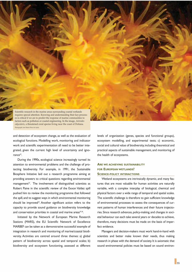
55
and detection of ecosystem change, as well as the evaluation of
ecological functions. Modelling work, monitoring and indicator
work and scientific experimentation all need to be better inte-
grated, given the current high level of uncertainty and igno-
rance32.
During the 1990s, ecological science increasingly turned its
attention to environmental problems and the challenge of pro-
tecting biodiversity. For example, in 1991, the Sustainable
Biosphere Initiative laid out a research programme aiming at
providing answers to critical questions regarding environmental
management33. The involvement of distinguished scientists as
Robert Paine in the scientific review of the Exxon Valdez spill
pushed him to review the monitoring programme that followed
the spill, and to suggest ways in which environmental monitoring
should be improved34. Another significant action refers to the
capacity to provide sound guidance on biodiversity knowledge
and conservation priorities in coastal and marine areas35,36.
Initiated by the Network of European Marine Research
Stations (MARS), the EU Scientific Network of Excellence
MARBEF can be taken as a demonstrative successful example of
integration in research and monitoring of marine/coastal biodi-
versity. Activities are centred around three themes: a) global
pattern of biodiversity across spatial and temporal scales; b)
biodiversity and ecosystem functioning, assessed at different
levels of organization (genes, species and functional groups),
ecosystem modelling, and experimental tests; c) economic,
social and cultural value of biodiversity, including theoretical and
practical aspects of sustainable management, and monitoring of
the health of ecosystems.
ARE WE ACHIEVING SUSTAINABILITY
FOR EUROPEAN WETLANDS?SCIENCE-POLICY INTERACTIONS
Wetland ecosystems are intrinsically dynamic, and many fea-
tures that are most valuable for human activities are naturally
variable, with a complex interplay of biological, chemical and
physical factors over a wide range of temporal and spatial scales.
The scientific challenge is therefore to gain sufficient knowledge
of environmental processes to assess the consequences of cur-
rent patterns of human interferences and their future trajecto-
ries. Since research advances, policy-making, and changes in soci-
etal behaviour can each take several years or decades to achieve,
therefore, many decisions must be made on the basis of imper-
fect evidence.
Managers and decision-makers must work hand-in-hand with
scientists and better make known their needs, thus making
research in phase with the demand of society. It is axiomatic that
sound environmental policies must be based on sound environ-
Scientific research in the marine areas surrounding coastal wetlandsrequires special attention. Knowing and understanding their key-process-es is critical if we are to predict the response of marine communities tofactors such as pollution or coastal engineering. In the image, Astroidescalycularis, a threatened coral species living near the coast of Doñana.Photograph: José María Pérez de Ayala.

56
mental science. There are problems,however, in that relationship.
Thus cultural differences between researchers and policy-makers
reduce the efficiency of communications between them, affecting
the flow and use of scientific information37.
Since complex, dynamic systems are likely to change during
the time between information gathering and the policy response,
knowledge deficiencies are near-inevitable. Policy decisions can-
not therefore be post-poned until science produces certain
answers,but must necessarily be made on the basis of risk assess-
ments and the much-discussed precautionary principle38. These
considerations are fully applicable to wetlands.
Scientists need to recognize that policy decisions within
democracies are essentially pragmatic constructs, taking account
of public acceptability, cultural perception, business interests and
media attention. In contrast, policy-makers need to recognise
that scientific information is inherently incomplete and
unknown, albeit that fundamental "natural laws" are universal
and unchanging.There is an extensive literature on this relation-
ship for a range of environmental areas39,40.The initial outcome of
environmental research is the acquisition of information on the
status and behaviour of wetland ecosystems. Such effort is fund-
ed by public bodies primarily with the expectation of direct soci-
etal benefit: the information gained has the potential to change
the behaviour of society (via legislature and/or management
practices) in ways that improve the human use of natural
resources and nature conservation.
THE MELDING OF SCIENCE AND SOCIETY:RESEARCH SITES AND BIOSPHERE RESERVES
In the evolution of the UNESCO Man and the Biosphere
(MaB) Programme, launched in 1971, it was unquestioned excel-
lence of participating scientists which elevated applied research
to its proper status. The connection between basic and more
applied environmental research has emerged in several aspects
of the MaB approach and of the highly successful Biosphere
reserve concept that emerged from it41.
Recent trends in modern conservation ecology include a mix
of: (1) controlled experimental removal of species and manipu-
lations of ecosystems, (2) ecosystem approach, and (3) natural
history and monitoring. The lessons learned from field experi-
ments and recent research emphasizing the functions of species
in biogeochemical or ecosystem processes and their role in
ensuring reliable ecosystem functioning42,43,44, have been impres-
sive and are reshaping our understanding of ecological systems
and ecosystem functioning.Therefore, the fundamental ecologi-
cal science has the capacity to provide sound guidance on con-
servation priorities in wetlands.
Policy-makers and managers require practical, defensible rec-
ommendations now.They are usually forced to proposing quick
partial solutions, often based on very local scientific observa-
tions.
What can scientists offer? They can provide theoretical and
practical elements for evaluating the complex compromise
involved in managing wetlands for either biodiversity conserva-
tion, selecting indicators and criteria to assess effects of freshwa-
ter use in wetlands, safeguarding ecosystem services. Moreover,
the scientists typically work to the rhythm of multi-annual fund-
ing and project cycles. They track complex phenomena whose
changes may sometimes be confirmed only after many years or
event decades have elapsed. Therefore, biodiversity scientists
being asked for advice by managers and policy-makers are con-
fronted to a dilemma:
- should they respond by providing the "best practice" sce-
nario? or,
- should they reply that they cannot provide advice in the
absence of data, or reliable records?
WETLAND SCIENTIFIC NETWORKS OF EXCELLENCE:A EUROPEAN RESPONSE TO A PRESSING DEMAND
Wetland's conservation and management requires research
initiatives at scale in space and time that cannot be encompassed
by any single country or loose consortium of countries.
Widespread realisation that wetland habitats are strongly influ-
enced by accelerating changes, largely derived from human activ-
Initiated by the Network of European Marine Research Stations (MARS),the EU Scientific Network of Excellence MARBEF can be taken as a demon-strative successful example of integration in research and monitoring ofmarine/coastal biodiversity.Photograph: CENEAM.

57
In this context, the scientist today has more than ever the
responsibility of entering into the "social demand" arena, of
probing into how decisions regarding nature conservation and
regional development are made, and who they affect.There are
now strong reasons for reinforcing cooperative initiatives
between existing networks with complementary targets and
geographical distribution.
Progress through integrated wetland management will be
conditioned by the degree to which "accountability" and "trust"
issues are successfully tackled. No process of integrated wetland
management can produce legitimate answers and effective solu-
tions to the challenges posed without meaningful public (i.e. a full
range of interest holders) inclusions in the procedures.The pub-
lic need to be incorporated in a proactive,participatory and con-
flict minimising fashion.
The need for "balancing the scales", policies for increasing
biodiversity's chances through bioregional management has been
widely recognized and discussed these last 10 years, and inte-
grated in the range of classifications and networks of protected
areas of outstanding national and regional cultural and biological
value (e.g. EU Habitat 2000, Council of Europe, RAMSAR,
UNESCO MaB biosphere reserves) as contasted to the World
Heritage sites for identifying areas of outstanding global impor-
tance.
The biosphere reserve concept (UNESCO-MaB Seville
Strategy, 1995), attempts to integrate, through appropriate land
zonation (i.e. core areas,buffer zones, transition areas) and active
participation of local people to activities which are compatible
with the preservation of wildlife values. Presently, a total of 78
biosphere reserves in 45 countries (UNESCO data 2002) are
ity, whether stemming from local pressure or from climate
change, should foster plans:
- to protect their highly important biodiversity from the
spread of invasive species,
- to focus on the characteristics of adjacent watershed fea-
tures and prevent pollution,
- to integrate, in addition to the recognised resting area func-
tion for a wide array of migratory birds, the many physical
and other ecological functions and socio-economic values,
- to improve understanding of wetland processes and dynam-
ics, and of how climate change in combination with other
human induced pressures is likely to become a main critical
factor in wetland degradation and loss.
Achieving these ambitious goals require a diversity of skills,
expertise, resource and networks of researchers and sites. A
critical mass of research workers and wetland conservation
managers, and decision-makers needs to be reached. Once
attained, this should significantly boost appropriate basic scientif-
ic studies and applied measures for appropriate conservation
and regional development of wetlands and their surrounding ter-
restrial and coastal-marine biota.This can be done by:
- producing communication tools for scientists and managers
involved in wetland research within and outside their region;
- developing strong training programmes designed to spread
excellence;
- creating data banks of primary data and metadata;
- producing high-impact scientific publications, and promoting
public information;
- promoting submission of collaborative proposals for joint
research by natural and socio-economic scientists;
The Biosphere Reserveconcept (UNESCO-MaBSeville Strategy, 1995),attempts to integrate,through appropriate landzonation (i.e. core areas,buffer zones, transitionareas) and active partici-pation of local people toactivities which are com-patible with the preserva-tion of wildlife values.Presently, a total of 78biosphere reserves in 45countries are wholly orpartially RAMSAR wet-lands In the image Azure-winged Magpie, an Asianspecies introduced intoSpain.
Photograph by José María Pérez de Ayala.

58
wholly or partially RAMSAR wetlands. These programmes are
ideally linked to strong education and training programmes, and
are usually driven by science and government needs to provide
experimental sites where planning, monitoring and research can
be achieved on the ground.
European-wide collaboration will allow us to effectively
address the effects of global change on wetland ecosystems over
a nested array of relevant sales, both in terms of spatial (local to
regional), biogeochemical structures, and biological (molecular
to ecosystem) levels of organization.The European dimension of
organized cooperation is even more imperative because of the
contiguous and open nature our wetlands, including the dangers
of transfer and introduction of invasive species.There is a criti-
cal need to develop networks of field infrastructures acting as
wetland observatories, in reference sites, encouraging the devel-
opment of a more effective interplay between research, conser-
vation and management processes at regional and sub-regional
levels. It is clear that conservation and sustainable use of
European wetlands will require research and management plans
at unprecedented geographic scales.
There are clear provisions (following in particular the deci-
sion of Johannesburg World Summit on Sustainable
Development, 2002) on the need to establish networks of rep-
resentative protected areas that include wetlands. In 1995 (Sofia,
Bulgaria), the Environment Ministers of 54 European countries
endorsed the Pan-European Biological and Landscape Diversity
Strategy. Following the recommendations of the Dubronik
Symposium (October 2003) on marine and coastal biodiversity,
the Committee of Ministers of the Council of Europe (May 5th,
2004) underlined that "research networks be encouraged, such
as the European Union's Marine Biodiversity and Ecosystem
Functioning (MARBEF) Network of Excellence, which aim to
integrate the most reliable scientific knowledge into policy-mak-
ing and management decisions" (Council of Europe, 2004).
Of a total of 100 "reference" and "focal" sites selected all
over Europe, for intensive and comparative research activities
and several salt marshes have been identified45. Conceptual and
field oriented cooperation between MARBEF Network of
Excellence and UNESCO-MaB is now envisaged to help nature
conservation practitioners and society to set priorities in coastal
and marine areas42. In this context, biosphere reserves, wholly or
partially RAMSAR wetlands, offer privileged biodiversity obser-
vatories and arenas for the study of multi-purpose management
melding science and society.
In conclusion, maintaining and enhancing the dialogue among
scientists, policy-makers and the public will ensure that critical
and reliable information is developed and communicated and,
also, continue to elaborate innovative monitoring and, therefore,
to invigorate sustainable wetland management, improving the
human use of natural resources and nature conservation.
From this perspective, the Doñana National Park offer
unique situation, where the mingling of human action and natu-
ral ecology has been ancient, complex, and profound.Maintaining
Doñana integrity is essential, an absolute priority. Future objec-
tives should combine biodiversity conservation, sustainable
ecosystem management, in a coherent approach of high scientif-
ic value and relevance to human society. Doñana is an interna-
tional treasure that deserves full concern and attention.
An old, deep, and complex co-existence of human action and natural envi-ronment makes of Doñana National Park an extraordinary e reference forwetland conservation
View of the River Gualdalquivir and the Doñana marshes.Photograph kindly provided by the Seville Port Authority:

"The landscape…… has an important public interest role in the cultural, ecological, environ-
mental and social fields, and constitutes a resource favourable to economicactivity and whose protection, management and planning can contribute to jobcreation;
… contributes to the formation of local cultures and … is a basic compo-nent of the European natural and cultural heritage, contributing to human well-being and consolidation of the European identity;
… is an important part of the quality of life for people everywhere: inurban areas and in the countryside, in degraded areas as well as in areas of highquality, in areas recognised as being of outstanding beauty as well as everydayareas;
… is a key element of individual and social well-being and … its protec-tion, management and planning entail rights and responsibilities for everyone."
Preamble to the European Landscape Convention
The European Landscape Convention applies to the entire ter-
ritory of the Parties and covers both land areas and water areas,
and applies both to inland waters, such as lakes and areas of brack-
ish water and marine areas - coastal waters and the territorial sea.
The Convention is therefore of major importance for wetlands.
The wetlands' highly productive ecosystems constitute a remark-
able natural and cultural heritage because of the richness of their
biology and landscape.
ORIGINS AND FRAMEWORK OF THE CONVENTION
An international intergovernmental organisation set up in 1949,
the Council of Europe is based in Strasbourg, France. It currently
consists of 45 member states46. Its main objectives are to promote
democracy, human rights and the rule of law and to seek common
solutions to the main problems facing European society today.The
Organisation is active in environment protection and in promoting
sustainable development in line with the Recommendation of the
Committee of Ministers of the Council of Europe to Members
States on the Guiding Principles for sustainable spatial development
of the European continent, previously adopted by the European
Conference of Ministers responsible for regional planning
(CEMAT). The aim is to bring the economic and social require-
ments to be met by the territory into harmony with its ecological
and cultural functions and therefore to contribute to long-term,
large-scale and balanced spatial development.These seek to protect
59
Wetlands and the European Landscape Convention
MAGUELONNE DÉJEANT-PONS *
59
* Head of the Spatial Planning and Landscape Division of the Council of Europe.
The European Landscape Convention applies to the entire territory of the Parties and covers both land areas and water areas, and applies both to inland waters,such as lakes and areas of brackish water and marine areas, including also coastal waters and the territorial sea. In the image, sunset in the coast of Doñana.Photograph: José María Pérez de Ayala.

60
Europeans' quality of life and well-being taking into account land-
scape, cultural and natural values47.
Origins of the convention
On the basis of an initial draft prepared by the Congress of
Local and Regional Authorities of Europe, the Committee of
Ministers decided in 1999 to set up a select group of experts res-
ponsible for drafting a European Landscape Convention, under the
aegis of the Steering Committee of cultural heritage (CDPAT) and
the Committee for the activities of the Council of Europe in the
field of biological and landscape diversity (CO-DBP). Following the
work of this group of experts, in which the principal governmental
and non-governmental international organisations participated, the
Committee of Ministers adopted the final text of the Convention
on July 19th, 2000. The Convention was opened for signature in
Florence, Italy on October 20th, 2000 in the context of the Council
of Europe Campaign "Europe, a common heritage".The Convention
entered into force on March 1st, 2004.As at March 29th, 2003, it was
ratified by twelve States and signed by sixteen other States48.
WHY A LANDSCAPE CONVENTION, AND WHAT
ARE ITS BENEFITS FOR WETLANDS?As an essential factor of individual and communal well-being
and an important part of people's quality of life, landscape con-
tributes to human fulfilment and consolidation of the European
identity. It has also an important public interest role in the cultural,
ecological, environmental and social fields, and constitutes a
resource favourable to economic activity, particularly to tourism.
The advances of production techniques in agriculture, forestry,
industrial and mineral productions techniques and in regional plan-
ning, town planning, together with the practices followed in town
and country planning, transport, networks, tourism and recreation,
and more generally the global economic changes, have unfortunate-
ly in very many cases led to degradation, deterioration or transfor-
mation of landscapes. It is therefore necessary to react to this evo-
lution.
While each citizen must of course contribute to preserving the
quality of landscape, it is the responsibility of the public authorities
to define the general framework in which this quality can be
secured.Thus, the Convention lays down the general legal princi-
ples, which should guide the adoption of national and community
landscape policies and the establishment of an international co-
operation in this field.
Relationship with other existing texts
The signatory states declare in their preamble that they wish
"to provide a new instrument devoted exclusively to the protec-
tion, management and planning of all landscapes in Europe".Today,
the convention is in fact the foremost international treaty dealing
exclusively with the protection, management and enhancement of
the European landscape.A few international legal instruments are
concerned with the subject of landscape, either directly or indirect-
ly. None of them, however, deals directly, specifically and fully with
European landscapes and their preservation, in spite of their invalu-
able contribution to our natural and cultural heritage and the
numerous threats facing them.The convention aims to fill this gap:
it is thus distinct from the Unesco Convention concerning the
Protection of the World Cultural and Natural Heritage of
November 16th, 1972, both formally and substantively.The two con-
ventions have different purposes, as do the organisations under
"The landscape has an important public interest role in the cultural, ecological, environmental and social fields, and constitutes a resource favourable to eco-nomic activity ... contributes to the formation of local cultures and … is a basic component of the European natural and cultural heritage". Fragments from thePreamble to the European Landscape Convention.Photograph: José María Pérez de Ayala.

61
whose auspices they were drawn up. One is regional in scope, the
other world-wide. The Council of Europe convention can be
regarded as complementary to the Unesco one. As regards sub-
stantive scope, the Council of Europe convention covers all land-
scapes, even those that are not of outstanding universal value, but
does not deal with historic monuments, unlike the Unesco conven-
tion. Similarly, its main objective is not to draw up a list of assets of
exceptional universal value, but to introduce protection, manage-
ment and planning rules for all landscape based on a set of princi-
ples.Thus each convention has its distinctive features49.
In the work leading up to the drafting of the convention, con-
stant reference was made to existing international and national
legal texts concerned with landscape50.The convention states in its
preamble that it has regard to the legal texts existing at internation-
al level in the field of protection and management of the natural and
cultural heritage, regional and spatial planning, local self-government
and transfrontier co-operation, in particular the Convention on the
Conservation of European Wildlife and Natural Habitats (Bern,
September 19th, 1979), the Convention for the Protection of the
Architectural Heritage of Europe (Grenada, October 3rd, 1985), the
European Convention on the Protection of Archaeological
Heritage (revised) (Valetta, January 16th, 1992), the European
Outline Convention on Transfrontier Co-operation between
Territorial Communities or Authorities (Madrid, May 21st, 1980)
and its additional protocols, the European Charter of Local Self-
government (Strasbourg, October 15th, 1985), the Convention on
Biological Diversity (Rio, June 5th, 1992), the Convention concern-
ing the Protection of the World Cultural and Natural Heritage
(Paris, November 16th, 1972), and the Convention on Access to
Information, Public Participation in Decision-making and Access to
Justice in Environmental Matters (Aarhus, June 25th,1998).
In order to avoid any difficulties with other international legal
instruments, the convention states that it shall not prejudice stricter
provisions concerning landscape protection, management and plan-
ning contained in other existing or future binding national or interna-
tional instruments51. The Convention on Wetlands of International
Importance especially as Waterfowl Habitat (Ramsar, February
2nd,1971, as amended by the Protocol of December 3rd, 1982 and the
Amendments of May 28th, 1987) could be one of them.
SCOPE
The landscape is now recognised irrespective of its exception-
al value, since all kinds of landscapes influence people's surround-
ings and deserve to be taken into account in landscape policies.
Many rural and peri-urban areas in particular are undergoing pro-
found changes and should receive more attention from the author-
ities and the public at large.Among them there are a large number
of wetlands that have been progressively drained, but which still
save relevant natural, cultural and landscape elements.
An original feature of this convention is that it applies to ordi-
nary landscapes no less than to outstanding ones.This comprehen-
sive coverage is justified for the following reasons: every landscape
forms the setting for the lives of the population concerned; urban
and rural landscapes interlock in complex ways; most Europeans
live in towns and cities (large or small), the quality of whose land-
scapes greatly affects their lives; and finally, rural landscapes occupy
an important place in the European consciousness.
Extending the scope of local authorities' official landscape
action to cover the whole of national territory does not mean,
however, that the same measures and policies must be applied to
all landscapes.These measures and policies should be adaptable to
particular types of landscape, which, depending on their specific
characteristics, will need various forms of treatment at local level,
ranging from the strictest conservation via protection,management
and planning to actual creation.These various treatments may pave
the way for major socio-economic development of the area con-
cerned.
The convention is not confined, either, to the cultural or man-
made components of landscape: it is concerned with all of these
and how they interconnect. This dimension significantly involves
green corridors and space interconnection, being Doñana and its
surroundings a good exemple of it.
CONTENT OF THE CONVENTION AND DOÑANA
The terms used in the convention are defined in Article 1 in
order to ensure that they are interpreted uniformly by everyone
concerned with the well-being of Europe's landscapes:
- "landscape" means an area, as perceived by people,whose char-
In his Mediteranski Brevijar, the great Mediterranean poet PedragMatvejevic, expressed beautifully and enigmatically the value of the largesalt marshes of the coast: "sage men say that white salt has to be stored toprevent black days". Image from the film of Antonioni dealing with the saltworks of Trapani.

62
acter is the result of the action and interaction of natural
and/or human factors52;
- "landscape policy" means an expression by the competent pub-
lic authorities of general principles, strategies and guidelines
that permit the taking of specific measures aimed at the protec-
tion, management and planning of landscapes;
- "landscape quality objective" means, for a specific landscape, the
formulation by the competent public authorities of the aspira-
tions of the public with regard to the landscape features of their
surroundings.
The Contracting Parties undertake to implement four general
measures:
- to recognise landscapes in law as an essential component of people's
surroundings, an expression of the diversity of their shared cultural
and natural heritage, and a foundation of their identity;
- to establish and implement landscape policies aimed at land-
scape protection, management and planning;
- to establish procedures for the participation of the general
public, local and regional authorities, and other parties with an
interest in the definition and implementation of landscape poli-
cies;
- to integrate landscape into its regional and town planning poli-
cies and in its cultural, environmental, agricultural, social and
economic policies, as well as in any other policies with possible
direct or indirect impact on landscape.
The Contracting Parties further undertake to implement, in a
consecutive manner, five specific measures:
- Awareness-raising; this involves increasing awareness among
civil society, private organisations and public authorities of the
value of landscapes, their role and changes to them;
- Training and education; this involves promoting: training for
specialists in landscape appraisal and operations; multidiscipli-
The European Landscape Convention (Florence, 2000) defines the landscape as “an area, as perceived by people, whose character is the result of the action and inter-action of natural and/or human factors”. Spain was one of the signatory States of the European Landscape Convention, and is at present in process of ratifying it. Inthe image, landscape of pine trees on the sands of Doñana.Photograph: José María Pérez de Ayala.

63
of measures taken under the provisions of the convention, and in
particular: to render each other technical and scientific assistance
in landscape matters through the pooling and exchange of experi-
ence, and the results of research projects; to promote the
exchange of landscape specialists in particular for training and infor-
mation purposes; and to exchange information on all matters cov-
ered by the provisions of the convention53.
Transfrontier landscapes are covered by a specific provision: the
Parties undertake to encourage transfrontier co-operation at local
and regional level and, wherever necessary, prepare and implement
joint landscape programmes54.
Contemporary lifestyles are such that people aspire more and
more to rediscover an unspoiled setting and to preserve their natu-
ral as well as cultural heritage. By means of this growing social
demand, landscape gains or regains prestige and begins to be per-
ceived as a major component of sustainable development policies. It
is necessary to recognise the importance and value of landscapes and
reconciling the right to achieve profitability with the right to enjoy
well-being, health and scenic beauty.
Situated between soil, sea and sky,wetlands are magic and special
attention must be given to them and specialy to Doñana, as one of
the major symbols of European wetlands.
nary training programmes in landscape policy, protection, man-
agement and planning, for professionals in the private and pub-
lic sectors and for the relevant associations; school and univer-
sity courses which, in the relevant subject areas, address the val-
ues attaching to landscapes and the issues raised by their pro-
tection, management and planning;
- Identification and assessment; this involves mobilising the inter-
ested parties with a view to improving knowledge of the land-
scapes and guiding the landscape identification and assessment
procedures through exchanges of experience and methodolo-
gy, organised between the Parties at European level;
- Landscape quality objectives; this involves framing landscape
quality objectives for the landscapes identified and assessed,
after public consultation;
- Implantation; this involves introducing instruments aimed at
protecting, managing and/or planning the landscape.
At the international level, one of the most relevant features of
the Convention is that the Contracting Parties undertake to co-
operate in the consideration of the landscape dimension of inter-
national policies and programmes, and to recommend, where rele-
vant, the inclusion in them of landscape considerations. They fur-
ther undertake to co-operate in order to enhance the effectiveness
A few international legal instruments are concerned with the subject of landscape. None of them, however, deals directly, specifically and fully with Europeanlandscapes and their preservation, in spite of their invaluable contribution to our natural and cultural heritage and the numerous threats facing them. The conven-tion aims to fill this gap: it is complementary to the Unesco Convention concerning the Protection of the World Cultural and Natural Heritage of 1972 and to themore recent one aiming at safeguarding the intangible heritage (2003). In the image, view of the “pajareras” of Doñana, cork oaks full of life at the hedge of themarshes, a symbol of identity that go beyond their biological value.Photograph: Antonio Sabater.

Purple heron (Ardea purpurea) in DoñanaPhotograph by Antonio Sabater

PROTECTED AREAS CORNERSTONES
FOR BIODIVERSITY CONSERVATION
Protected areas are essential components in national and glob-
al conservation strategies. The importance of protected areas is
widely recognized at international level. Establishment and manage-
ment of protected areas are central to Article 8 on in situ
Conservation of the Convention on Biological Diversity.The World
Summit on Sustainable Development Plan of Implementation has
specifically called for the establishment of a representative system
of marine protected areas by 2012 and for the promotion and sup-
port for conservation of 'hot spot' initiatives, and ecological net-
works. One of the indicators for meeting goal 7 of the Millennium
Development Goals ("Ensure Environmental Sustainability") is the
"amount of land area protected to maintain biological diversity".
65
Protected areas,biodiversity conservationand sustainable development in wetlandsissues and prospects
KALEMANI JO MULONGOY *,SARAT BABU GIDDA **, DAVID COATES **
65
Protected areas -national parks, nature reserves and other
areas where special measures are taken to conserve biodi-
versity and ecological processes- have long been recognized as a
key tool to counter loss of the world's biodiversity.Their impor-
tance ranging from conservation of biological diversity, storehous-
es of genetic material, provision of essential ecosystem services for
human welfare, and contribution to sustainable development, has
been recognized at multiple levels, from international bodies, to
national governments, local groups, and communities
Almost all countries have a system of protected areas,
which now cover some 12 percent of the planet's land surface,
making them one of the earth's most significant land uses.
While they represent our best chance of effective in situ con-
servation of biological diversity, protected areas have many
other demands upon them. Comprehensive and effectively
managed protected areas networks at national, regional and
consequently at global levels are critical elements in the imple-
mentation of the Convention on Biological Diversity (CBD).
However, while we have clearly made significant progress in
conserving representative terrestrial ecosystems, recent
assessments indicate that conservation of marine and coastal
biodiversity is woefully inadequate, with less than one per cent
of the Earth's marine ecosystems protected. Other biomes,
including some major types freshwater systems and grasslands,
are also poorly represented. Protected areas also have to com-
pete for limited financial resources in the allocation of nation-
al budgets; this is a difficult task, when many governments are
faced with major developmental issues such as health, poverty
alleviation and the provision of essential infrastructure.
Nevertheless, the key environmental services that are provid-
ed by protected areas underpin many aspects of sustainable
development and this role is increasingly recognized as we deal
with a period of global environmental change unprecedented in
human history.
Scientific Technical and Technological Matters DivisionSecretariat of the Convention on Biological Diversity (SCBD). The views expressed are of authors and do not necessarily purport the CBD.* Head ** Programme Officer
Almost all countries have a system of protected areas, and they now coversome 12 percent of the planet's land surface, making them one of theearth's most significant land uses. Coastal wetlands have a particularimportance for biological diversity conservation among all protectedareas, especially if we take into account that 37 % of total world popula-tion lives within 100 km from the coast (FAO, 1998).Photograph: The Nature Conservancy

66
The extent of world's protected areas
The most comprehensive dataset on protected areas world-
wide is the World Database on Protected Areas (WDPA) managed
by the UNEP World Conservation Monitoring Centre working in
partnership with the IUCN World Commission on Protected
Areas and a consortium of internationally active organizations and
networks. Protected areas are established for many purposes, and
can be classified by management objective. IUCN has developed a
system of six categories of protected area defined by primary man-
agement objective (Box 1), and about two thirds of the sites in the
WDPA have an assigned IUCN management category. Of these
sites the most numerous are categories III and IV, while in terms of
area occupied, categories II and VI predominate. The categories
offering the strictest protection from outside influence (categories
Ia and Ib) make up a much smaller proportion of both the number
and area of the sites.The cumulative growth rate of protected areas
as per IUCN management categories is given in Figure 1 demon-
strating that those categories concerned with landscape (category
V) and with resource management (category VI) have increased
more rapidly in recent years.
Global protection of biodiversity based on habitat analysis
UNEP-WCMC has analysed global protected areas data as far
as possible by biome type to give a first indication of protection in
different regions and different ecosystems. Initial comparisons were
made using the framework developed by Udvardy56 in 1975, which
classifies the world into 14 terrestrial biomes. It shows that nine of
the 14 terrestrial biomes in the Udvardy system have now met or
exceeded the target of 10 per cent representativeness.By contrast,
the biomes falling well behind the global average include temperate
grasslands and lake systems, while temperate needle leaf forests
and temperate broadleaf forests are also both below 10 per cent
coverage. Many countries have designated protected areas under
the various international agreements and programmes that recog-
nize specific sites.These include the World Heritage Sites (World
Heritage Convention), Ramsar Sites (the Convention on wetlands
of International Importance especially as Waterfowl Habitat) and
Biosphere Reserves (UNESCO - Man and Biosphere Programme).
PROTECTED AREAS AND SUSTAINABLE DEVELOPMENT
Values and benefits of protected areas
Protected areas provide a wide range of values and benefits to
humanity. They provide vital protection to many indigenous and
local peoples and space where they can continue traditional
lifestyles.A disproportionate amount of the world's drinking water
comes from forest-protected areas (for instance a third of the
world's hundred largest cities draw a substantial proportion of
their drinking water from protected areas). Marine protected areas
provide fish breeding grounds and thus maintain fisheries: in conse-
quence local fishing communities often support them. Parks and
reserves are important "green lungs" providing space for people to
enjoy recreation.They help to protect cultural and spiritual values.
They are also increasingly recognized for their role in mitigating cli-
mate change by sequestering carbon and by buffering countries
against impacts such as sea-level rise and extreme weather events
in particular cyclones and flooding.The values of a national protect-
Protected areas provide vital protection to many indigenous and localpeoples and space where they can continue traditional lifestyles. Severalcoastal marshes and wetlands offer fish breeding grounds and thus main-tain fisheries: in consequence local fishing communities often supportthem.Photograph: WWF International

67
ed area network are thus more than the traditional issues of
wildlife conservation and extend, spatially, far beyond the bound-
aries of the sites. IUCN summarized the main benefits of protect-
ed areas as58: scientific research; wilderness protection; preserva-
tion of species and genetic diversity; maintenance of environmental
services; protection of specific natural and cultural features;
tourism and recreation; education; sustainable use of resources
from natural ecosystems; and maintenance of cultural and tradi-
tional attributes.
Broadly, the benefits of protected areas can be divided into
direct use values and benefits; indirect use values and benefits;
option values; and non-material values and benefits. Taken togeth-
er, these constitute a protected area's total economic value. The
concept of Total Economic Value (TEV) has been widely used to
attempt to convert all values and benefits of natural ecosystems
into simple economic terms. Instead of focusing only on direct
commercial values. One 1997 study estimated the annual value of
ecosystem services from the entire biosphere at $33 trillion, not-
ing that most of this value is outside the market59.
Role of protected areas in poverty alleviation and sustainable
development
People living in rural areas have long depended on natural
resources. Commodities such as animal skins, bamboo, construc-
tion materials, firewood, fish, game meat, honey, medicinal plants,
resins and timber have been harvested from protected areas for
thousands of years. Local people have often developed mechanisms
for managing these resources sustainable and allocating benefits.
Properly managed tourism in protected areas can also bring con-
siderable income without threatening the natural resource base.
More important still are the ecological services protected areas
can provide. Particularly important services at the community level
include soil regeneration, nutrient cycling, pollination, recreation,
pure water and maintenance of harvestable resources. Such bene-
fits are difficult to quantify and even local people may take them for
granted.
Increasing population levels,more sophisticated technology, and
changing social, economic and political structures have removed
many traditional controls on resources management. If sustainable
benefits are to be provided to local communities more effective
controls may be required to ensure that populations of plants and
animals are maintained at viable and productive levels60.
KEY ISSUES
Threats
The ecological viability of many protected areas is under threat,
and some have already been significantly degraded.A 1999 survey
of threats to forest protected areas by IUCN concluded that "con-
siderably less than 10 percent of protected areas has been subject
to any kind of analysis of threat, and far less have been subject to
Cumulative rate of protected area coverage by IUCN managementcategory (data from UNEP-WCMC )57.
Category Ia - Strict Nature Reserve: Protected area managed main-ly for science.Area of land and/or sea possessing some outstandingor representative ecosystems, geological or physiological featuresand/or species, available primarily for scientific research and/orenvironmental monitoring.
Category Ib - Wilderness Area: Protected area managed mainly forwilderness protection. Large area of unmodified or slightly modi-fied land, and/or sea, retaining its natural character and influence,without permanent or significant habitation, which is protected andmanaged so as to preserve its natural condition.
Category II - National Park: Protected area managed mainly forecosystem protection and recreation. Natural area of land and/orsea, designated to (a) protect the ecological integrity of one ormore ecosystems for present and future generations, (b) excludeexploitation or occupation inimical to the purposes of designationof the area and (c) provide a foundation for spiritual, scientific, edu-cational, recreational and visitor opportunities, all of which must beenvironmentally and culturally compatible.
Category III - Natural Monument: Protected area managed mainly forconservation of specific natural features: Area containing one ormore specific natural or natural/cultural features which are of out-standing or unique value because of their inherent rarity, represen-tative or aesthetic qualities or cultural significance.
Category IV - Habitat/Species Management Area: Protected areamanaged mainly for conservation through management interven-tion.Area of land and/or sea subject to active intervention for man-agement purposes so as to ensure the maintenance of habitatsand/or to meet the requirements of specific species.
Category V - Protected Landscape/Seascape: Protected area managedmainly for landscape/seascape conservation and recreation:Area ofland, with coast and sea as appropriate, where the interaction ofpeople and nature over time has produced an area of distinct char-acter with significant aesthetic, ecological and/or cultural value, andoften with high biological diversity. Safeguarding the integrity of thistraditional interaction is vital to the protection, maintenance andevolution of such an area.
Category VI - Managed Resource Protected Area: Protected areamanaged mainly for the sustainable use of natural ecosystems:Areacontaining predominantly unmodified natural systems, managed toensure long term protection and maintenance of biological diversi-ty, while providing at the same time a sustainable flow of naturalproducts and services to meet community needs.
Box 1
IUCN Protected Areas Management Categories (1994)55
Figure 1

68
detailed assessment"61. Threats to protected areas can be divided
into direct threats which directly stress the biological components
of the protected area, indirect threats which drive the direct
threats, and underlying causes which comprise broad socio-eco-
nomic forces often far from the site. Encroachment by farmers, for
example, may pose a direct threat to a protected area. This
encroachment may be driven, however, by an indirect cause - the
rapid privatisation and concentration of agricultural land in adjacent
areas.The underlying cause for this situation, in turn, may be subsi-
dies or other changes in government policy aimed at boosting
export agriculture to help pay off debts to international financial
institutions.Another threat example is the large-scale declassifica-
tions of parts of or entire protected areas, legally agreed between
national ministries and agro-industrial, timber, mining or oil and gas
companies.These may be prompted by the budgetary needs of the
relevant countries, driven, in turn, by the underlying cause of struc-
tural adjustment policies and constraints.
System and network design
Today, the theory and practice of protected area design are
becoming increasingly sophisticated, due to a better understanding
of their role of protection of biological diversity. Recently, several
analyses have demonstrated that current protected area systems
do not adequately cover key biodiversity features. For example, gap
analyses carried out for the World Parks Congress in 2003 demon-
strated that at least 300 critically endangered species, and at least
237 endangered and 267 vulnerable species of bird, mammal, turtle
and amphibian have no protection in any part of their ranges62,63.A
comprehensive planning exercises of protected areas should con-
sider conservation needs of whole, ecologically distinct regions,
known as ecoregions or bioregions, which cover large areas and
often extend across national borders. Governments and NGOs
have collaborated on ecoregion conservation planning exercises in
many parts of the world, drawing on information about biodiversi-
ty, threats and pressures and socio-economic data to propose com-
prehensive conservation strategies that include, but are not limited
to, comprehensive networks of protected areas. The aim of such
networks is usually to include representative samples of all major
ecosystem types and species, in large enough quantities to be viable
in the long term: 'ecologically representative protected area net-
works' are now recognized as a foundation of national and region-
al conservation strategies.
The design of protected area networks therefore needs to take
into account the needs of many different species and ecosystems.
It also needs to look beyond the borders of individual protected
areas to question whether it is important that these areas be linked
by other suitable forms of habitat and how this might be achieved,
and also at how protected areas can themselves be protected from
outside pressures. The importance of connectivity is increasingly
being recognized. Protected areas that are surrounded by urban
development or agricultural land are more like islands than parts of
a broader landscape or seascape and can easily lose species
through natural processes or as a result of human pressure.
The WCPA framework (Source: Hockings et al. 2000).
Figure 2
The values of a national protected area network are thus more than thetraditional issues of wildlife conservation and extend, spatially, far beyondthe boundaries of the sites. The main benefits of protected areas as: scien-tific research; wilderness protection; preservation of species and geneticdiversity; maintenance of environmental services; protection of specificnatural and cultural features; tourism and recreation; education; sustain-able use of resources from natural ecosystems; and maintenance of cultur-al and traditional attributes. In the above photograph, a view of theKakadu National Park.Photograph: Ramsar

69
Protected area networks therefore usually include corridors link-
ing protected areas, buffer zones around protected areas,which are
geographically isolated from protected areas but serve as staging
posts for migratory species such as birds.
Governance
Governance is about power, relationships, responsibility and
accountability. Some define it as the interactions among structures,
processes and traditions that determine how power is exercised,
how decisions are taken on issues of public concern, and how citi-
zens or other stakeholders have their say. In a protected area con-
text, a basic understanding of governance refers to who holds man-
agement authority and responsibility and can be held accountable
according to legal, customary or otherwise legitimate rights. In this
sense, governance is crucial for the achievement of protected area
objectives (management effectiveness), determines the sharing of
relevant cost and benefits (management equity), is key to prevent-
ing or solving social conflicts, and affects the generation and suste-
nance of community, political and financial support. The manage-
ment of protected areas has often been based on models that
exclude the local resident populations and perceive their concerns
as incompatible with conservation.While the IUCN protected area
categories V and VI are conceived to be more inclusive of human
communities, virtually all IUCN categories can be compatible with
resident or user communities. In the light of the principles of good
governance, national protected area systems can enter an era of
renewed strength. Four main protected area governance can be
identified64: government-managed protected areas; co-managed
protected areas; private protected areas; and community-con-
served areas.
Management effectiveness
Protected areas are only effective in helping to ensure the con-
servation and sustainable use of biological diversity if they are effec-
tively managed.Various national and international organizations are
working on this issue, with the aim of helping individual sites and
systems to develop more effective management. Much of this work
is based on guidelines for evaluating effectiveness published by the
IUCN World Commission on Protected areas65.Management effec-
tiveness evaluation measures the degree to which a protected area
is protecting its values and achieving its goals and objectives. Its pri-
mary aim is to help better management, but it can also help guide
project planning and resource allocation, provide accountability and
transparency, and increase community awareness, involvement and
support. Evaluation will also enable managers to anticipate future
threats and opportunities. The IUCN World Commission on
Protected Areas developed a framework for assessing management
effectiveness of protected areas (figure 2).Based on this framework
several methodologies are developed from rapid assessments of
protected area systems to detailed monitoring of individual pro-
tected areas. Depending on available time and resources and the
objectives of evaluation, the processes range from complex and
expensive to simple and cheap. The World Bank and WWF have
developed a simple, site-level assessment system for tracking
progress in effectiveness.The methodology,which is also being used
by the Global Environment Facility, is designed to provide a relative-
ly quick, easy and consistent system for reporting progress in a
diverse range of protected areas.
While significant progress has been made on developing
methodologies, assessments of management effectiveness have so
far been undertaken in only a small percentage of the world's pro-
tected areas.A major challenge is to have these tools widely used
and to have monitoring and evaluation established as core business
within protected areas management: to achieve this there needs to
be a further increase in awareness of the benefits of evaluation;will-
ingness to use such systems; and capacity of often under-resourced
areas to conduct evaluation.
INTERNATIONAL COMMITMENTS AND PROSPECTS
CBD Programme of work on protected areas
The Conference of the Parties (COP) to the CBD at its sev-
enth meeting building upon the Millennium Development Goals,
Most coastal wetland protected areas present special problems in terms oftheir establishment, management and sustainability. In particular, mostrely upon water inflow from surrounding areas in order to maintainecosystem health and integrity. The need to include buffer areas in the sur-roundings of protected wetlands is an increasing need. In the case ofDoñana, the protected area system includes this dimension, through a net-work of protected areas that enclose the most sensitive zones such as theDoñana and Odiel marshes. In the photograph, the mouth of the OdielRiver.Photograph: Juanta de Andalucía

70
the Plan of Implementation of the World Summit on Sustainable
Development and the Durban Accord and Plan of Action from the
Vth World's Parks Congress, adopted a programme of work on
protected areas.The overall objective of the programme of work is
to establish and maintain, "comprehensive, effectively managed and
ecologically representative systems of protected areas" that collec-
tively, will significantly reduce the rate of loss of global biodiversity.
Implementation of the programme of work will thus contribute to
the three objectives of the Convention, its strategic plan, the
Millennium Development Goals in particular poverty alleviation
and sustainable development.
The programme of work on protected areas contained a spe-
cific set of targets and timetables primarily organized around
national-level actions. The programme of work consists of four
interlinked elements mutually reinforcing and cross - cutting in
their implementation. In essence, programme element 1 deals with
what protected area systems need to conserve and where.
Programme elements 2 and 3 cover how to effectively implement
protected are systems, including issues such as the policy environ-
ment, governance and participation, and capacity building.
Programme element 4 covers the steps needed for assessing and
monitoring the effectiveness of actions taken under programme
elements 1-3. Each programme element is structured into specific
goals - targets - and activities.The programme of work contains 16
goals,which are outcome-oriented statements of ultimate purpose.
Each goal is accompanied by a target that sets a specific date by
which the goal is to be accomplished, and in many cases provides
indicators to measure progress towards the goal.A list of activities,
92 in total follow each paired goal and target that individual coun-
tries should consider to meet their commitments to achieve the
identified goals and targets.
The overall target deadline for implementation of the pro-
gramme of work is 2010 for terrestrial and 2012 for marine areas.
The COP has put forward intermediate target dates for many
activities with time bound deadlines of either 2006/ 2008 or 2010/
2012 or 2015, in recognition of the fact that many of the goals and
targets will require a phased, step-by-step approach.
PROTECTED AREAS AND AQUATIC ECOSYSTEMS
Inland aquatic ecosystems are very diverse and include rivers,
their flood plains and estuaries, lakes, bogs, swamps, marshes and
coastal wetlands such as mangrove forests and lagoons. They
include all of the world's freshwater ecosystems but many are also
brackish-water or saline (as, for example, with some inland seas). In
many parts of the world inland water ecosystems continue to be
intensely modified and degraded by human activities. Freshwater
ecosystems are the world's most threatened biome and the one
under the most rapidly escalating pressure due to demands upon
water resources for development purposes.
Inventories of inland aquatic ecosystems are incomplete, incon-
sistent in coverage and difficult to undertake for a number of rea-
sons including: difficulties with definitions, limitations of maps, ill-
defined boundaries and the limitations of remote sensing. Heavily
vegetated wetlands (e.g., swamps or naturally flooded forests) and
difficult to inventory because of technical difficulties discerning
land/water interfaces and problems of definition regarding what
constitutes land or wetland. A particular feature of many inland
aquatic ecosystems is their highly seasonal nature (especially the
expansion and contraction of many wetlands, such as on river
floodplain, due to seasonal changes in flooding).This marked tem-
poral dimension complicates classification systems, including legal
descriptions, across spatially and seasonably variable land-water
interfaces. Without good time-series data such wetlands are also
difficult to quantify, even locally.
The most systematic registry of protected areas for inland
Figure 3
Annual history of Ramsar site designations66.
Marine and coastal areas are severely under-represented in the global net-work of protected areas. In the photograph, the Nature Reserve of Curto-Pichetto, a partly abandoned area of salt pans in Slovenia. Photograph: Sergio Gobbo

71
water ecosystems is the list of sites maintained under the auspices
of the Convention on Wetlands of International Importance,
Especially as Waterfowl Habitat (Ramsar, Iran, 1971). There are
presently 146 Contracting Parties to the Convention, with 1469
wetland sites, totaling 128.9 million hectares, designated for inclu-
sion in the Ramsar List of Wetlands of International Importance.A
number of Ramsar sites are also declared jointly with the World
Heritage Convention. Data for protected areas at the national or
local levels have not been adequately compiled.
All inland water and most coastal wetland protected areas
present special problems in terms of their establishment, manage-
ment and sustainability. In particular, most rely upon water inflow
from surrounding areas in order to maintain ecosystem health and
integrity. Buffer zones around the protected areas are desirable, as
with any terrestrial protected area. But inland and coastal wetland
protected areas require management measures within the entire
watershed or catchment, that is - well beyond the protected area,
which maintain both the ecological quality and quantity of water
being fed to, and often through, the wetland. In this sense they rep-
resent one of the clearest examples of the need for the ecosystem
approach to planning and management.To be effective, inland and
coastal wetland protected areas must be planned, established and
managed within a basin-level framework that fully adopts integrat-
ed resource management planning. For rivers, which include those
feeding most wetlands, a critical need is to maintain ecological con-
nectivity along their entire length. Dams and other major infra-
structure fragment rivers and disrupt connectivity. Such develop-
ment must be planned with due regard to sustaining ecosystem
functioning in rivers and the substantial ecological services provid-
ed by wetlands.
CBD Programme of work on marine and coastal areas, with par-
ticular attention to the wetland coastal areas.
Marine habitats and ecosystems are severely under-represent-
ed in the global network of protected areas. Concern about this
under representation reflected in decision VII/5 and accompanying
Programme of Work on Marine and Coastal Biological Diversity
under programme element 3 (marine and coastal protected areas)
and operational objectives 3.1 to 3.5. These operational objectives
include:
- 3.1:To establish and strengthen national and regional systems of
marine and coastal protected areas integrated into a global net-
work and as a contribution to globally agreed goals.
- 3.2:To enhance the conservation and sustainable use of biological
diversity in marine areas beyond the limits of national jurisdiction
- 3.3: To achieve effective management of existing marine and
coastal protected areas
- 3.4: To provide support for and facilitate monitoring of national
and regional systems of marine and coastal protected areas
- 3.5: To facilitate research and monitoring activities that reflect
identified global knowledge gaps and priority information needs of
management of marine and coastal protected areas.
Marine protected areas vary in management objectives in the
same way as their terrestrial counterparts. Decision VII/5 puts for-
ward a marine and coastal biodiversity management framework
consisting of two types of marine and coastal protected areas: (i)
Multiple use protected areas, which may permit extractive uses but
contain areas that are more strictly controlled for biodiversity pro-
tection. Such controls may also have other (e.g., economic or
social) objectives. Examples include controls on fishing (e.g.,
restricting bottom trawling),on the removal of certain species (e.g.,
habitat forming species), rotational closures, and controls on pollu-
tion and sedimentation. Such areas can protect particular species
or life cycle stages (such as spawning); help to maintain connectivi-
ty and buffer more strictly protected areas. (ii) No-take zones,
which permit no extraction and are managed to maintain their
ecology or to allow natural restoration. Such strictly protected
areas form the backbone of the marine biodiversity conservation
measures and need to be selected for coverage and representation
in the same way as land and freshwater sites.There is ample evi-
dence that such no-take zones can have short and long-term ben-
efits to human communities through, for example, helping to main-
tain fish stocks Decision VII/5 also acknowledges that marine and
coastal protected areas on their own are not be enough for con-
servation and sustainable use of biodiversity, and that they need to
Delimitation of protected coastal marshes and wetlands is usually a com-plex challenge. This is due to the variability of the flooded area, the diffi-culty to mark an exact border, the conflicts existing with upper riverbasins, and also to the influence of groundwater. The Doñana 2005 projectis contributing, through its research plans and modelling tools, to elimi-nate this uncertainness. In the photograph, El Acebrón pond, in DoñanaNature Park.Photograph: CENEAM Files.

72
be incorporated into a framework of sustainable management
practices over the wider marine environment.
CBD 2010 biodiversity target
The Parties to the CBD acknowledged, in 2002, the continued
threat to biodiversity from human activities. For these reasons, the
Conference of the Parties adopted a Strategic Plan, in which Parties
committed themselves to a more effective and coherent implemen-
tation of the three objectives of the Convention in order to
achieve by 2010 a significant reduction of the current rate of bio-
diversity loss at the global, regional and national level, as a contri-
bution to poverty alleviation and for the benefit of all life on earth.
This target was subsequently endorsed by the World Summit on
Sustainable Development.
Parties recognized that in order to achieve the Strategic Plan,
and its 2010 biodiversity target, they required a framework to facil-
itate an assessment of progress made-a framework within which
national and regional targets could be set, and indicators of
progress identified.The resulting framework, adopted by Decision
VII/30, is structured around seven focal areas, which together rep-
resent both responses to the drivers of biodiversity loss, and the
means to achieve the three objectives of the Convention. The focal
areas are:
1) Reducing the rate of loss of the components of biodiversity,
including: (i) biomes, habitats and ecosystems; (ii) species and pop-
ulations; and (iii) genetic diversity;
2) Promoting sustainable use of biodiversity;
3) Addressing the major threats to biodiversity, including those aris-
ing from invasive alien species, climate change, pollution, and habi-
tat change;
4) Maintaining ecosystem integrity, and the provision of goods and
services provided by biodiversity in ecosystems, in support of
human well-being;
5) Protecting traditional knowledge, innovations and practices;
6) Ensuring the fair and equitable sharing of benefits arising out of
the use of genetic resources; and;
7) Mobilizing financial and technical resources, especially for devel-
oping countries, in particular, least developed countries and Small
Island developing states among them, and countries with
economies in transition, for implementing the Convention and the
Strategic Plan.
Protected area coverage is one of the headline indicators iden-
tified for assessing the progress in 2010 biodiversity target. This
indicator has direct relevance to goal 7 (Ensuring Environmental
Sustainability) and target 9 (Integrate the principles of sustainable
development into country policies and programmes and reverse
the loss of environmental resources) of the Millennium
Development Goals. The targets for focal areas are now being
incorporated into the existing programmes of work of the
Convention and will be the basis of future review or formulation of
new programmes. Other Conventions, processes and stakeholders
have been invited to contribute, in their own areas of interest, to
both achieving the targets and monitoring progress towards them
using suitable indicators. However, national implementation of the
programmes of work will be the backbone of progress towards
achieving the 2010 biodiversity target.
In the face of increasing human pressure on planet's resources, an effective global protected area system is the best hope for conserving viable and representa-tive areas of natural ecosystems, habitats and species to achieve 2010 biodiversity target. Parties to the Convention on Biological Diversity through its variousprogrammes of work agreed on a far-reaching and ambitious programme of action to establish and maintain "comprehensive, effectively managed, and ecologi-cally representative systems of protected areas" that, collectively, will significantly reduce the rate of global biodiversity loss. Wetlands represent ecosystems ofimmense importance to biodiversity and humans. The ecosystem goods and services they provide have been historically seriously undervalued but are becom-ing increasingly recognized. The provisions of the CBD, working in partnership with the Ramsar Convention, cover most of the requirements for the improvedplanning, establishment and management of effective networks and systems of protected areas for wetlands at the local, national, regional and global levels.In the photograph, a spoonbill in the Marsh of Doñana.Photograph by Jose María Pérez de Ayala

73
1. SETHE, K., 1964. Dramatische Texte zu AltaegyptischenMysterienspielen. Vol. 10, Hildesheim: Georg Olms Verlagbuchhandlung.
2. AGUANTIPLANO, 2001. Centro de Información sobre RecursosHídricos.
3. SALVATORE, R., 2001. Les Riziéres. Stratégies et critères d’améliorationde l’environnement. Med-Wet. ICONA. Madrid 2001.
4. IUCN, 2000. Vision for water and nature. A world strategy for conserva-tion and sustainable management of water resources in the 21st century.
5. CLAIRAIN, ELLIA J. Jr., 2002. Wetlands Research Program.Hydrogeomorphic Approach to Assessing Wetland Functions. Guidelinesfor Developing Regional Guidebooks. March 2002.
6. UNESCO, 2004. World Water Assessment Programme.7. CEBALLOS MORENO, M., 2002. La problemática jurídico-administra-
tiva de las zonas húmedas. Sehumed Magazine n. 19.8. Spanish Strategy Plan for Conservation and Rational Use of Wetlands.
Spanish Ministry of the Envirnment.9. MOORE, D., 2003. Those Dammed Wetlands.10. International Council for Bird Preservation.11. International Waterfowl and Wetlands Research Bureau12. Man and Biosphere Programme13. United Nations Environment Programme14. On May 29th, 1995, the European Commission issued a Communication to
the Council and the European Parliament on the wise use and conservationof wetlands, recognising their important role in water resource protection.
15. Directive 2000/ /CE of the Council and the European Parliament to estab-lish a Community action framework in water policy. Brussels, July 18th,2000.
16. LABANE, Y., 2002. Climate change and Water Resources In Tunisia.Institut National de la Météorologie. Mediterranean Regional Roundtable.Athens, Greece.
17. COMPREHENSIVE EVERGLADES RESTORATION PLAN (CERP),2003. Program management Plan. South Florida Water ManagementDistrict - U.S. Army Corps of Engineers Jacksonville District.
18. The members of the UNESCO mission were Metchild Rössler (WHC-UNESCO), Cipriano Marín Cabrera (INSULA), Randall R. Reeves(Canadá) and Pedro Manuel Rosabal González (IUCN).
19. Ramsar Bureau Information Pack on Wetlands Values and Functions.2003.
20. VIÑALS, M .J. (coord.), 2002. El patrimonio cultural de los humedales.Ministerio de Medio Ambiente.
21. MARIN, C., 1997. Nature and Workmanship. Insula, Unesco, EuropeanCommission.
22. CORDOVA, S., 2003. Informe sobre ecoturismo. Cormotur – Estado deMonagas.
WETLANDS AND BIOSPHERE RESERVES
23. JACOBSON, S.K. & MCDUFF, M.D., 1997. Success factors and evalu-ation in conservation education programmes. International research andenvironmental education, 6(3): 204-221.
24. MILLENNIUM ECOSYSTEM ASSESSMENT, 2003. Ecosystems andhuman well-being: A framework for assessment. Island Press, WashingtonD.C., 266 pp.
25. UNESCO, 1996. Biosphere Reserves: Strategy of Seville and StatutoryFramework for the World Network. UNESCO, Paris, pp. 18.
WETLANDS AND SCIENCE
26. VERAART, J.A., DE GROOT, R.S., PERELLO, G., RIDDIFORD, N.J.,ROIJACKERS, R., 2004. Selection of (bio) indicators to assess effects offreshwater use in wetlands: a case study of s’Albufera de Mallorca, Spain.Reg. Environ. Change, 4: 107-117.
27. MOONEY, H.A., MCNEELY, J., NEVILLE, L.E., SCHEI, P.J., WAAGE,J.K.., (eds), 2002. Invasive alien species: Searching for solutions.Washington: Island Press.
28. http://eunis.eea.eu.int/index.jsp29. VALERY, L., BOUCHARD, V., & LEFEUVRE, J.C., 2004. Impact of the
invasive native species Elymus athericus on carbon pools in a salt marsh.Wetlands, 24: 2.
30. LEVIN, D.A., 2000. The origin, expansion, and demise of plant species.Oxford: Oxford University Press.
31. SANTAMARIA L., 2002. Why are most aquatic plants widely distrib-uted? Dispersal, clonal growth and small-scale heterogeneity in a stress-ful environment. Acta Oecologica, 23: 137-154.
32. TURNER, R.K., 2000. Integrating natural and socio-economic science incoastal management. Journal of Marine Science, 25: 447-460.
33. CORILA-UNESCO (in press). Lagoons and coastal wetlands in the glob-al change context: Impacts and management issue. Proceedings of theInternational Conference CORILA-UNESCO (26-28 April 2004), Venice.
33. LUBCHENCO, J., OLSON, A.M., BRUBAKER L.B., CARPENTER,S.R., HOLLAND, M.M., HUBBELL, S., LEVIN, S.A., MACMAHON,J.A., MATSON, P.A., MELILLO, J.M., MOONEY, H.A., PETERSON,C.H., PULLIAM, R., REAL, L.A., REGAL, P.J., AND RISSER, P.G.,1991.The sustainable Biosphere Initiative: An ecological research agenda.Ecology, 72: 371-412.
34. PAINE, R.T., RUESINK, J.L., SUN, A., SOULANILLE, E.L., WON-HAM, M.J., HARLEY, C.D.G., BRUMBAUGH, D.R., SECORD, D.L.,1996. Trouble on oiled waters: Lessons from the Exxon Valdez Oil Spill.Ann. Rev. Ecol. Syst., 27: 197-235.
35. LASSERRE, P., MCINTYRE, A.D., OGDEN, J.C., RAY, G.C.,GRASSLE, J.F., 1994. Marine laboratory networks for the study of thebiodiversity, function and management of marine ecosystems. BiologyInternational, IUBS, sp. Issue N. 31, 33 p.
36. HEIP, C., HUMMEL, H., (ed) 2000. Establishing a framework for theimplementation of marine biodiversity research in Europe. EC-DGResearch/ESF Marine Board/MARS Network/UNESCO Venice Office.European Science Foundation, Strasbourg, 48 p.
37. TURNER, R.K., SUBAK, S., ADGER, N., 1996. Pressure, trends andimpacts in coastal zones: Interactions between socio-economic and natu-ral systems. Environ. Manag., 20: 159-173.
38. GOLLIER, C., JULLIEN, B. Y TREICH, N., 2000. Scientific progressand irreversibility: an economic principle of the precautionary principle.J. Public. Econ. 75: 229-253.
39. LIPIATOU, E., Y CORNAERT, M.H., 1999. Marine research and policyinterface: an overview from the session. In: Marine Research and PolicyInterface. Ed: M. Cornaert & E. Lipiatou. Research in enclosed seasseries, No6 EC Brussels: 5-8.
40. NORSE, D. Y TSCHIRLEY, J.B. 2000. Links between science and policymaking. Agriculture, Ecosystems & Environment, 82: 15-26. UNESCO-MaB, 1995. The Seville Strategy. Paris: UNESCO.
41. BATISSE, M., 1997. Biosphere reserves: a challenge for biodiversity con-servation & regional development. Environment, 39: 6-15.
42. LASSERRE, P. 2004. Marine biodiversity and ecosystem functioning:European scientific network of excellence (MARS/MARBEF). 4th Int.Symp. On the Pan-European Ecological Network. Marine and coastal bio-diversity and protected areas. Council of Europe, Env. Enc. No 56: 77-92.
43. KAREIVA AND LEVIN (eds) 2003. The importance of species.Perspectives on expendability and triage. Princeton and Oxford: PrincetonUniversity Press.
44. MORRIS, J., (2004). Effect of changes in sea level on th productivity, bio-geochemistry, and stability of salt marshes. In: “Lagoons and coastal wet-lands in the global change context: impact and management issues.Proceedings international Conference, CORILA-UNESCO, Venice 26-28April 2004.
45. WARWICK, R.M., EMBLOW C., FÉRAL, J.P., HUMMEL, H., VANAVESAATH, P., HEIP C., 2003. European marine biodiversity researchsites. BIOMARE Implementation and networking of large-scale long-termmarine biodiversity in Europe. EU, NIOEO-CEME, Netherlands.
WETLANDS AND THE EUROPEAN LANDSCAPE CONVENTION
46. As at 29 March 2003: Albania, Andorra, Armenia, Austria, Azerbaijan,Belgium, Bosnia and Herzegovina, Bulgaria, Croatia, Cyprus, CzechRepublic, Denmark, Estonia, Finland, France, Germany, Georgia, Greece,Hungary, Iceland, Ireland, Italy, Latvia, Liechtenstein, Lithuania,Luxembourg, Malta, Moldova, Netherlands, Norway, Poland, Portugal,Romania, Russian Federation, San Marino, Serbia and Montenegro,Slovak Republic, Slovenia, Spain, Sweden, Switzerland, "the formerYugoslav Republic of Macedonia", Turkey, Ukraine, United Kingdom.
47. Concerning the natural and cultural heritage, see the other conventions ofthe Council of Europe: Convention on the Conservation of European
NOTES AND REFERENCES

74
Wildlife and Natural Habitats (Bern, 19 September 1979), Convention forthe Protection of the Architectural Heritage of Europe (Granada, 3 October1985) and European Convention on the Protection of the ArchaeologicalHeritage (London, 6 May 1969) (revised, Valetta, 16 January 1992).
48. See Appendix 2. The convention came into force on the first day of themonth following the expiry of a period of three months after the date onwhich ten Council of Europe member states have consented to be boundby it, with the deposit of instruments of ratification, acceptance orapproval.
49. The explanatory report states that in order to co-ordinate action under thetwo conventions, consideration could be given to scientific co-operationbetween the Unesco World Heritage Committee and the Committees ofExperts mentioned under Article 10 of the European LandscapeConvention, under Article 13.7 of the Unesco Convention of 16 November1972, and as suggested in Article 7 of the convention.
50. These include, apart from the Unesco Convention concerning theProtection of the World Cultural and Natural Heritage, the Convention forthe Protection of the Architectural Heritage of Europe, the Convention onthe Conservation of European Wildlife and Natural Habitats, the EuropeanConvention on the Protection of the Archaeological Heritage, Committeeof Ministers Recommendation 95 (9) on the integrated conservation ofcultural landscape areas as part of landscape policies, Committee ofMinisters Recommendation (79) 9 concerning the identification and eval-uation card for the protection of natural landscapes, the MediterraneanLandscape Charter, the European Community regulation on agriculturalproduction methods compatible with the requirements of the protection ofthe environment and the maintenance of the countryside, the EuropeanCommunity directive on the conservation of natural habitats and of wildfauna and flora, the European Community directive on the assessment ofenvironmental effects, and other important national, EuropeanCommunity and international instruments.
51. Article 12 of the convention (Relationship with other instruments). Thewording of this article is based on model provisions already used in otherinternational conventions in order to deal with the problem of linking upconventions concerned with similar fields.
52. The term "landscape" is thus defined as a zone or area as perceived bylocal people or visitors, whose visual features and character are the resultof the action of natural and/or cultural (that is, human) factors. This defi-nition reflects the idea that landscapes evolve through time, as a result ofbeing acted upon by natural forces and human beings. It also underlinesthat a landscape forms a whole, whose natural and cultural components aretaken together, not separately.
53. Article 8 of the convention (Mutual assistance and exchange of informa-tion). Recent years have seen a burgeoning of political, professional andacademic interest in the subject of landscapes, hence the development ofa growing body of experience and expertise on which member states, localand regional authorities and others can draw as they seek to implement theconvention. At the same time, the growth of electronic communication andthe arrival of the Internet have provided radically improved tools forexchanging ideas and, indeed, for the technical study of landscapes. These
developments create a much wider basis for the exchange of ideas andmutual support than was possible even a decade ago, allowing local actorsthroughout Europe to take part and thus creating a true "landscape democ-racy”.
54. Article 9 of the convention (Transfrontier landscapes). This articlerequires the parties to set up transfrontier programmes for the identifica-tion, evaluation, protection, management and planning of landscapeswhich straddle borders. In doing so, they are asked to rely as far as possi-ble, in accordance with the subsidiarity principle defined by the EuropeanCharter of Local Self-Government, on local and regional authorities, andto use the implementation tools advocated in the European OutlineConvention on Transfrontier Co-operation between TerritorialCommunities or Authorities in Europe of 21 May 1980 and its additionalprotocols.
PROTECTED AREAS, BIODIVERSITY CONSERVATIONAND SUSTAINABLE DEVELOPMENT IN WETLANDS:ISSUES AND PROSPECTS.
55. ANON, (1994). Guidelines for Protected Area Management Categories,IUCN and the World Conservation Monitoring Centre, Gland, Switzerlandand Cambridge, UK.
56. UDVARDY, M., 1975. A classification of the biogeographical provincesof the world. Prepared as a contribution to UNESCO's Man and BiosphereProgramme Project No.18. Morges, Switzerland: IUCN.
57. See UNEP/CBD/SBSTTA/10/INF/12.58. MULONGOY, K.J., CHAPE, S., (Eds) 2004. Protected areas and biodi-
versity: an overview of key issues. CBD Secretariat, Montreal Canada andUNEP-WCMC, Cambridge, UK.
59. COSTANZA et al. The value of world's ecosystem services and naturalcapitol. Nature, 387:253-260.
60. MULONGOY, K.J., CHAPE, S., (Eds) 2004 op.cit.61. IUCN, 1999. Threats to Forest Protected Areas: Summary of a survey of
10 countries carried out in association with the World Commission onProtected Areas. Research Report for the World Bank/WWF Alliance forForest Conservation and Sustainable Use. November.
62. RODRIGUES, A.S.L., et al. 2003. Global Gap Analysis: Towards a rep-resentative network of protected areas. Advances in Applied BiodiversityScience, No.5. Centre for Applied Biodiversity Science, Washington. D.C.
63. RODRIGUES, A.S.L., et al. 2004. Effectiveness of the global protectedareas network in representing species diversity. Nature 428, 8 April 2004.
64. BORRINI-FEYERABEND, G., 2004. Governance of protected areas,participation and equity. In Secretariat of the Convention on BiologicalDiversity (2004). Biodiversity issues for consideration in the planning,establishment and management of protected area sites and networks,Montreal, SCBD, pp 100-105.
65. HOCKING, M., STOLTON, S., DUDLEY, N., 2000. Evaluating effective-ness: A Framework for Assessing the Management of Protected Areas.IUCN, Gland, Switzerland and Cambridge, UK.
66. http://www.wetlands.org/RSDB/
NOTES AND REFERENCES


77
and branches of the rivers to the initial game reserves.The exten-
sion of the National Park in 1979 with the inclusion of a 77,260-ha
"pre-park" buffer zone, and the creation of a 52,529-ha Nature
Park around it in 1982, have extended the Doñana title, as direct-
ed by the Doñana 21 Trust. It now encompasses the municipalities
of Huelva, Seville and Cadiz to an area of almost 250,000 ha.
After the latest extensions in 2004, the Doñana National Park
currently covers 54,720 ha and the Doñana Nature Park that sur-
rounds it covers a further 53,709 ha, offering a spectacular protect-
ed area of 108,429 ha altogether.
A CHANGING FACE
The current appearance of Doñana is no more than two thou-
sand years old, as its terrain is sedimentary and recent, the result
of the action of winds, tides and rivers. Doñana is the product of
changes in a large estuary situated in the mouth of the
Guadalquivir River, which formed with the last rise in sea level, and
which has gradually been filled with sediments brought down by
the river flooding, by the tides, currents and storms of the Atlantic
Ocean, and by sand carried in by the wind to form dunes.
The area covered by Doñana came about as a consequence of
a range of geological processes that have taken place in the Lower
Guadalquivir Basin. They can be summarised in a series of steps
that help us understand the basic characteristics of how it is now.
At the end of the Tertiary Age, there was a general subsidence of
what is now the Guadalquivir Basin, forming a deep sea in which
blue marl was deposited to depths of up to 1,000 m.Then, in the
Quaternary Age, a much finer layer of red sand was deposited in
the shallow coastal environment of the Guadalquivir Estuary.The
Doñana singularly encompasses every dimension imagina-
ble for a protected space. We have before us a tremen-
dously changeable, rich and diverse territory whose originality is
reflected as much in its geo-morphological evolution as in the gen-
esis of its ecosystems. It is also reflected in the historic episodes
that have given it its reputation and especially in the role that it has
played for science and the world of nature conservation in recent
decades. Presided over by water as the fundamental player in all its
vicissitudes, this is a reserve of life that has changed its appearance
and its social function constantly and without interruption.Today it
is symbolised as one of the great platforms on which some of the
most important acts in the agitated history of environmental pro-
tection and aquatic ecosystems unfold.
Until the mid 20th century, Doñana was the name of a historic
swathe of big game hunting grounds with a landscape of scrub and
forest that was bounded to the East by the Guadalquivir Marshes
and Estuary, and to the West by a dividing line based on a track run-
ning from El Rocío Church to Torre de la Higuera in Arenas Gordas
(Coarse Sands), as this section of the Gulf of Cadiz shoreline was
known.
An interest in hunting initially, and later wildlife, attracted
hunters, zoologists and conservationists who spread the news of
the ecological treasures of the area, clearly linking it to the name
Doñana. El Médano and the Dunes, Las Rocinas, Las Marismas and
the Isla Mayor, the Branches of the Guadiamar and Guadalquivir
rivers, Rocío itself, Lomo del Grullo and Coto del Rey all took a
back seat to the new name used both to identify the zone and what
was to become a symbol of conservation in Spain.News of this nat-
ural wealth was spread by turn-of-the-century travellers,who com-
pared the Guadalquivir marshes with those of the Ganges because
of their overwhelming wealth of waterfowl.They were referring to
a grand space of 250,000 ha of flood plains crossed by the four
branches and channels of the Guadalquivir and Guadiamar Rivers -
Caño Guadiamar, Caño Travieso, the Torre Branch (Brazo de la
Torre), the Eastern Branch (Brazo del Este) - leaving extensive flat
islands between them with large shallow pans, "lucios", on them.
The creation of the 6,974 ha Biological Station and Reserve in
1964, and its inclusion in the Scientific Research Council, made
Doñana an administrative and research property, and a short time
later in 1969, it was enhanced with the creation of the Doñana
National Park (35,000 ha), adding marshes, the shallow island lakes
The Time of the Marsheslands marked by water and diversity
Location of Doñana and mouth of the River Guadalquivir.

78
lower basin of the Guadalquivir continued to evolve in the same
way as the sea lowered.After sea-level stabilization (approximately
6,000 B.C.), an advancing coastal bar running NW-SE was pro-
duced, formed by wind-blown sands and material carried down by
the Tinto, Odiel, Piedras and Guadiana rivers, then subject to long-
shore drifts. This bar gradually closed the Guadalquivir Estuary,
forming an interior lagoon of calm waters that made it into record-
ed history.This was the Ligurian Lake of Phoenician times and the
Ligustinus Lake of the Roman Empire. Sediments from the mainland
were deposited on the lakebed and currently form the base of the
Marshes.The surface level of this 50-100 m thick sedimentary layer
is made up of fine silt and blue-grey clays.
As a result of these processes, the characteristics of the
Doñana are said to be broadly divided into three major landscape
units: the "cotos" or stable sand dunes, the coastal string of shifting
dunes, and the Marshes. Looking further, there is the Guadalquivir-
Guadiamar estuary, with its islands and channels; the shoreline with
its beaches and its embryonic dunes; further west, the cliffs and sta-
ble dunes of El Medano de El Asperillo; and to the north, the gen-
tle hills of La Campiña.
Half the sands, including beach, dunes and cotos, are recent
wind-born mantles (during the 15th-16th centuries) laid over older
dune formations, after the Flandrian transgression.These, in turn,
are superimposed over continental detritic formations, of sand and
gravel. These continental formations are permeable and stretch
extensively within and beyond the Park, resting on a Miocene
marine deposit.Their impermeable clay deposits form the wall of
the great Almonte-Marismas aquifer that underlies much of
Doñana.
The current Marshes cover an area of some 27,000 ha, approx-
imately half the area of the National Park.Yet, they account for only
part of the 140,000 ha known at the beginning of the 20th century
as the Guadalquivir Marshes. "Las Marismas" (The Marshes) is the
traditional name for the low-lying flood plains on either side of the
Guadalquivir Estuary. The left bank has given in to an intense
process of transformation while only the right bank of the estuary
has survived as the Doñana Marshes. Moreover, they are no longer
tidal; they act as a floodplain now fed by rains and by streams.
The Marshes are carved up by a network of seasonal water-
courses, some more recent and active than others.These include
channels (the caños) on the right hand side of the Marshes, or the
so-called “albinas” on the, now disappeared, left hand side.The oth-
ers, effectively ancient watercourses, were only activated at times
of heavy flow, often finding themselves filled to the brim and cut
across by other more recent watercourses. The ancient water-
courses correspond with the so-called “quebradas” (gorges).
Within them, areas of higher points alternate with much lower
stretches.These are the well-known “lucios” (shallow pans) of the
Marshes.
Water patterns in the Doñana Marshes maintain forms remi-
niscent of the different stages in its development.There are wind-
ing tidal channels, older straighter branches of the river later cut off
as ox-bow lakes, and silt or sandy-silt levies, called "vetas", flanked
by palaeo-channels.There are old sand bars with accumulations of
shells and elongated troughs along stretches of canal, forming lucios
like Los Ansares and El Largo, or the old tidal areas bordered by
levies, forming more regular lucios like Buen Tiro, Seville or El Real
and Herrero on Isla Mayor.
HISTORIC GENESIS OF THE
DOÑANA ECOSYSTEMS AND LANDSCAPES
Historically, Doñana was a space nearly ten times smaller, lim-
ited to some 30,000 ha of cotos, owned by the House of Medina
Sidonia. Communally owned, it ran between the municipalities of
Almonte, Hinojos, Aznalcázar, the Marshes and the beach. From
Sanlucar, on the other side of the Guadalquivir River mouth, the
Dukes have run "their" Doñana for six centuries: the woodlands,
livestock, crops and, receiving special attention, big game hunting.
An interest in hunting initially, and later wildlife, attracted hunters, zoolo-gists and conservationists who spread the news of the ecological treasuresof the area, clearly linking it to the name Doñana.Photograph by José María Pérez de Ayala.

The Marshes, however,were not initially the property of the Duke,
because they had been granted to the city to be used as summer
grazing lands, after the conquest of Seville in 1248.
History and archaeology highlight the fact that the infertile sta-
ble sand dunes and the neighbouring marshlands remained a
desert, a demographic vacuum whose only settlements were huts
for fishermen, herdsmen and coal merchants.There are, however,
Neolithic records of both the permanent and temporary use of the
zone. These are found in cabin floors from the Bronze Age, in
Roman salt fish works1 and in pottery remains from the last three
thousand years,which have been found in Doñana. Such findings are
to be expected in a flourishing regional setting where Tartessians,
Phoenicians, Greeks, Carthaginians, Romans,Visigoths, Muslims and
Byzantines have all played an important historic role.
The first historic record of these territories dates from 1262,
when Alfonso X "The Wise" declared them "Royal Hunting
Grounds", shortly after the 1261 conquest by the Count of Niebla
who exploited them.The Rocinas Forests attracted the attention of
Alfonso X in his Hunting Book (Libro de La Montería) because of the
good boar hunting. It was later, in 1294, when King Sancho IV would
grant this royal game reserve to Alfonso Pérez de Guzmán "The
Good", although the grant was not effective until the next generation
when, in 1309, King Fernando IV confirmed the land settlement to
Alfonso Pérez son.
The House of Medina Sidonia, which maintained Doñana in its
estate until 1895, has conserved much of the documentation gener-
ated in the course of these six centuries in its Duchy Archives in
Sanlucar.This provides us with an exceptional international case in
conservation: a protected area with a detailed description of its his-
tory spanning centuries1.This has allowed the documentation of dis-
putes between the Duchy and its neighbouring municipal authorities
to be analysed2. Milestones such as historic changes in early wood-
lands, scrublands and pastures are documented, along with livestock
grazing and resource use3.
All this research has managed to demarcate a series of stages
in the historic management of Doñana that start with the creation
of the Royal Estate in 1262. It remained almost unaltered due to its
use as a big game hunting reserve, until 1636, when it was opened
up to grazing livestock.Table 1 shows the different stages in land
management through to modern times.
Documentation from the 13th and 14th centuries refers to
Doñana as a "woodland", (Bosque de Las Rocinas).The quantitative
descriptions that have been put together from documents from
1636 reveal a thick and diverse forest dominated by cork and
juniper trees.The situation changed rapidly around this time with
the introduction of livestock to improve the profitability of the
Duchy's properties during an economic crisis. The livestock and
herdsmen cleared the woods and it must have begun to look more
like open grassland, as the rich forest soil began to produce pro-
ductive pastures. But the low clay content of these predominantly
sandy soils led to their degradation, a process that was accelerated
by pig farming. Finally, to maintain the productivity of these exhaust-
79
Historic stages in the management of Doñana.TABLE 1
PERIOD PREDOMINANT LAND USE
1262-1636 Mediterranean forest and scrubland managed as a game reserve for deer and boar. Almadrabas (Tuna fish salting works) of Torre Carboneras.1636-1670 Thinning. Open forest with pastures for cattle and sheep. Big game hunting. High point of the tuna fishing and salting industry.1670-1709 Overgrazing by sheep and pigs, controlled burning of scrub. Sandy soils cultivated and dunes mobilised. Livestock, big game hunting, fish salting works.1709-1737 Extensive felling of cork trees. General de-forestation.Trial pine nut plantations in Marismillas. Livestock, big game hunting, fish salting works.1737-1895 General spread of pine plantations to the stable coastal dunes. Livestock, big game hunting, fish salting works. Salt works in the marshes.1895-1950 Fragmentation of the property, sold to new owners who maintain the big game hunting and the livestock and forestry business.
Umbrella pine plantations. The start of the "polderisation" of the marshes to convert to rice fields and eradicate malaria.1952-1992 Scientific takeoff and birth of conservation. Creation of the National Park and the Nature Park. Extension of the Doñana administration.
Profound agricultural change and tourism development.The end of controlled burning and planting of pines and eucalyptus.1992-2005 Sustainable development fostered by the authorities. Restoration of degraded ecosystems and environmental quality management of the area.
The Doñana territory is broadly divided into three major entities: the sta-ble sand dunes, the coastal string of shifting dunes, and the Marshes. Thephotography shows the Marshes between Madre de las Marismas channeland the Biological Reserve in the Municipality of Almonte.Photograph by José María Pérez de Ayala.

80
ed soils, a slash and burn policy was introduced, with a 10-12 year
cycle, which ended up transforming the surviving remains of the
original woodland into a pyrophytic scrub of heather, gorse and
Halimium that now predominates.Although these well-document-
ed traditional burns were few and far between, controlled burning
did impact as ecological degradation5.
It was not until 1737 that the first trials were carried out with
pine nut plantations, although they had been successfully established
in nearby areas, like Villamanrique, for centuries. As tree coverage
grew well in Marismillas, high-density plantations were possible for
firewood production and low-density plantations for shipbuilding.
Some areas of the beach dune systems that had started shifting in
the 17th century were re-forested after 1805. Favourable results led
to these pines being sown on other areas of stabilised dunes further
inland, with the pine ending up as characteristic of the dunes rather
than the original juniper species. Further inland, pruning, livestock
pressure and controlled burning reduced the counts of oak, cork
tree, strawberry tree, wild olive, cottonwood and ash to a token
presence, except for along the water lines, pond borders or areas
where the sands meets the Marshes,where gallery forests and trees
for shade and shelter survived.The traditional woodland vegetation
gave way to scrubland that, with burning, was overcome by pyro-
phyte species.
A comprehensive knowledge of all these processes and of the
evolution of the Doñana ecosystems constitutes the foundation of
the ambitious restoration projects that have emerged in recent
years, including the Doñana 2005 Project.
CHANGES IN THE TRADITIONAL USE
OF DOÑANA RESOURCES
Throughout this time, there has been a permanent conflict
between game and other alternative land uses: grazing and forestry,
fishing and gathering, and salt works.The current context of oppos-
ing interests competing for land has a background spanning cen-
turies in Doñana.Neighbouring municipalities sometimes sought to
benefit from one of the resources; at other times, it was the
landowners who tried different forms of exploitation.
The confrontation between the Duchy and the inhabitants of
Almonte is well known. Lawsuits were dragged through the courts
for centuries over the ownership of "lands in question" to the
northwest of the National Park. This legal battle was no isolated
incident. The western boundary between the properties of the
Duchy and the municipality of Almonte roughly followed the pres-
ent road to Matalascañas that was staked out and marked. Herders
and woodsmen were not to cross it, with threat of imprisonment.
The current appearance of Doñana is nomore than two thousand years old, as itsterrain is sedimentary and recent, theresult of the action of winds, tides andrivers. Doñana is the product of changesin a large estuary situated in the mouthof the Guadalquivir River, which formedwith the last rise in sea level, and whichhas gradually been filled with sedimentsbrought down by the river flooding, bythe tides, currents and storms of theAtlantic Ocean, and by sand carried inby the wind to form dunes. The satellitepicture shows the true to life result ofthese processes and the survival of theDoñana Marshes on the right bank of theRiver Guadalquivir.
The History of Doñana starts with the Roman settlements of the 2nd centu-ry B.C., which survived up until the 7th century A.D. These people livedmainly from fishing and fish salting in the area known as Marismas delGuadalquivir, or the Guadalquivir Marshes. But, despite its reduced pop-ulation and remoteness, Doñana has always formed part of a flourishingregional environment, where Tartessians, Phoenicians, Greeks,Carthaginians, Romans, Visigoths, Byzantines and Muslims have allplayed an important historic role. The photograph shows one of the tidaltowers that provided protection against the raids by Berber corsairs.A village that ran the tuna fishing works, known as "almadrabas", grewup around it.Photograph by José María Pérez de Ayala.

81
The competition between the different land uses on either side of
the line led to a growing tension at the boundary, and the stakes
were often moved or removed altogether, triggering conflict.After
a spate of confrontation, the borders would be marked out once
more.The records of these interventions offer an exact picture of
the state of the vegetation throughout the 17th and 18th centuries.
Up until 1628, Doñana retained its character as a cork tree for-
est with junipers and Mediterranean woodland scrub, run exclusive-
ly as a private game reserve. Since then, new land uses have been
authorized:pastures were leased to grazers, and the herdsmen were
allowed to cut whatever wood they needed for their huts and for
fires.This change in vegetation took place very rapidly with these
new land uses.The forest was first thinned and then cleared to take
on the look of grasslands. In 1636, the trees still covered 45% of the
area, falling to 36% in 1647 and 27% five years later.
Fluctuations in the finances of the Duchy, periods of inflation in
the Spanish economy in the 16th-19th centuries, and demand for mer-
chandise exported from Sanlucar to America are all reflected in
Doñana's alternating land use: cattle, sheep, goats and the expansion
of pig farming that virtually destroyed the pasturelands and soil. On
top of the grazing, one can add the exploitation of bark, cork, tim-
ber, firewood, and charcoal, which gradually reduced the tree cover,
and also the introduction of controlled burning techniques to pro-
mote tender new pastoral growth6. Over the centuries, there has
been an accumulation of changes in the ecosystems of the dunes:
deforestation, regression of the original native foliage, an invasion of
the pyrophitic scrub, halimium (Halimium halimifolum) and the
degradation of the soils.
Two other historic interventions are of outstanding signifi-
cance: the planting of grape vines and pine nut trees.The demand
for wine and the attempt to bring in settlers encouraged the plant-
ing of vineyards in Las Marismillas, in the extreme south of Doñana
opposite Sanlucar. Wine growing is possible in these sandy soils
where wild grape vines already formed part of the natural vegeta-
tion, and the first wine producing trials appear to have taken place
in 1773.According to Granados Corona (1988), this was initially a
success and there were 60,000 vines in the area by 1778. It later
declined and the vines, fruit orchards and the attempts at colonis-
ing Las Marismillas were all abandoned, leaving behind only a few
allotments and some huts. It has been suggested7 that the second-
ary formation of dunes on the coast shaping the current mobile
dune system took place in various stages since the 17th century.This
The above images clearly show the siege of Doñana, started in the middle of last century. Comparing the two images the transformation of the northern sideof the marshes is evident. The left image, showing still unaltered marshes, was taken in 1956, while the one on the right corresponds to 1999 situation.New rice fields, farms, and channelings clearly outline the sharp boundary that isolated Doñana from its surroundings.The right image is a detail of the orthophoto of the Doñana marshes produced in the framework of the Doñana 2005 project.
The photograph shows a reconstruction of the traditional huts in the cen-tre of el Poblado de la Plancha, currently a tourist centre. After 1785, thevines and fruit trees were abandoned leaving just a few allotments and ascattering of huts.

82
was due to the clearing of junipers to make way for vineyards -
intense felling that possibly came with over-grazing during a period
of unstable climate.
As mentioned, another important historic intervention in this
region was the planting of pine nut trees. In 1737, the Duchy decid-
ed to try out a pine plantation in El Puntal. The results were prom-
ising and the plantation area was extended. Later it was gradually
introduced to the "corrales" (inter-dune valleys) and the stabilised
dunes close to Sanlucar, and from 1805, in the corrales of the
mobile dune system. In contrast to the outcome of the grape vines,
the pine plantations gave excellent results, offering timber, fire-
wood, charcoal and pine nuts, and they soon became a character-
istic feature of Doñana.The forests that had dominated the face of
Doñana up until the 17th century were once again outstanding in
the 19th and 20th centuries.
These major conflicts and interventions in the historic uses
described above do not exhaust the full list. Owners tried fruit
trees, olives, carob trees, mulberry trees and poplars but the hos-
tile environment prevented any financial success and any odd trees
that have survived from those trials are testimony to their efforts
spanning centuries. Of the animal kingdom, beehives were exploit-
ed and fish (carp and eels) were introduced to the ponds, although
traditional livestock and game species always prevailed.
There was also widespread collection of natural produce
grown in the wild. This was more a complementary use of
resources, rather than an alternative land use.The most important
of these was the collection of ducks, geese and wildfowl eggs,which
were the basis of the confectionary industry in Sanlucar. Rabbits,
hares and partridges were lesser game in the sand country. Other
natural products saw quick surges, like the collection of flexible wil-
low branches for barrel hoops, charcoal from the heather stock for
gunpowder, resin oil from juniper berries for curing livestock dis-
eases, leeches for medical use and even cochineal for dyes.
Exploiting the Marshes was traditionally shared between Seville
and its neighbouring municipalities and the Duchy. It focussed on
livestock.The local cattle can survive for months on boggy land and
they even graze on water plants by swimming into the deeper
channels. Summer droughts, river flooding or sometimes an unusu-
al cold snap,would constrain livestock rearing, but this shortfall was
covered by raising local marsh horses and Lebrija sheep, both of
which are very hardy.
Separate mention should be given to the salt flats and fish salt-
ing works. The former, situated in the Marshes and fed by the
Guadalquivir Estuary, remained operative until the mid 20th centu-
ry.Yet, the salt flats on the other bank still cling to life, although pre-
cariously.The most important of the fish salting works were those
at Torre Carboneros above the present beach, which used large
quantities of wood and cork from Doñana for floats and for fires
and huts for the thousands of workers.Tuna production in Torre
Carbonero became a traditional resource, which represented a
healthy income for the Duchy.
Throughout this process,we can see how the historically sparse-
ly populated Doñana and the Marshes were basically maintained as a
game reserve with few other uses until the 16th century.The situation
changed categorically in the first half of the 17th century, giving rise to
conflicts over the different land use between Doñana and the sur-
rounding area. In 1895, the last Duke of Medina Sidonia died without
leaving an heir. The traditional property was broken up and sold to
Protected by the dunes and the marshes and hidden by the forests, is theDoñana Palace, a country house that was the seat of the Dukes and theirguests. Doña Ana de Silva y Pantoja, elder daughter of the Duchess ofEboli and wife of the Fourth Duke, who commanded the unfortunateInvincible Armada, left Sanlucar to live in the Palace until shortly beforeher death in 1610. Because of her long stay here, the Palace came to beknown as Doña Ana. Francisco de Goya visited the Palace in 1797, as aguest of the then Duchess of Alba, Maria Cayetana de Silva, the widow ofthe XV Duke. He dedicated some of his best paintings to her, including"Sólo mia" (Mine alone), a full-length portrait against a background of veg-etation and water that is usually associated with the Laguna de SantaOlalla of Doñana. A pine nut tree and brushwood are recognisable, as isthe form and colour of the dunes and the estuary tidal flats of bothDoñana and Sanlúcar.

83
different owners, who maintained its role as a game reserve as well
as for traditional livestock and forestry activities. Along with the aris-
tocracy, the new owners included members of the emerging
European industrial bourgeoisie that were to pioneer the transfor-
mation of Doñana and the surrounding areas in the 20th century.
RECENT CHANGES IN THE DOÑANA LANDSCAPE
The historic balance of the Doñana region, based on the
exploitation of livestock, forestry and hunting resources, became
extremely unstable as the 20th century advanced.The stable sand
country - the cotos - was re-planted with faster growing forestry
species and the Marshes were transformed for rice growing.The
historic Marshes have been reduced from the 140,000 ha they ini-
tially covered to the 27,000 ha that are presently conserved.
This has been felt in the cotos, with pine nut trees re-planted
from the 1950s on, followed by eucalyptus in the 70s.The second
phase of the Almonte-Marismas Plan was implemented, as a result
of the development mindset of the time, to irrigate the sandy soils
to the north of Doñana Park,where the constant pumping of water
had drained and desalinated the Marshes.At the same time, the left
bank of the estuary underwent a radical transformation. It was con-
verted from flood plain grazing pastures into productive irrigated
land fed by the Lower Guadalquivir Canal.The major transforma-
tion to the Marshes,which border the present National Park, start-
ed in 1940, with the general spread of the trials that had started in
the 20s.This transformation created a new landscape of rice pad-
dies served by a network of canals that, together with the newly
created villages, changed the traditional marshes completely. The
origins of this great wave of changes go back to 1926, with the cre-
ation of the Islas del Guadalquivir S.A. company, that started trans-
forming the marshes into rice fields using polders.After careful lev-
elling, the irrigation waters in the rice paddies are re-circulated to
prevent brackish water entering the circuit from the estuary.This
was one of the major transformations of the Doñana hydrological
system that had a substantial impact on the design of the present
strategy for conserving the wetlands. The transformation was
begun on Isla Minima and has been extended south along the right
bank to now cover an area of 53,000 ha.
With regard to the important changes arising from replanting
trees, the landscapes of sandy hills that formed the previously
1940 marked the start of major transformation to the right-hand bank of the Guadalquivir River, which borders today's Doñana Park, creating a new landscapeof rice paddies served by a network of canals, which, together with the new towns, radically changed the appearance of the traditional marshes. After carefullevelling, the rice "paddies" re-circulate the irrigation waters, thus preventing brackish estuary water from entering the system. This is one of the major transfor-mations to the Doñana water system that has had a profound impact on the design of the current conservation strategy for the marshes.Photo: CENEAM files.
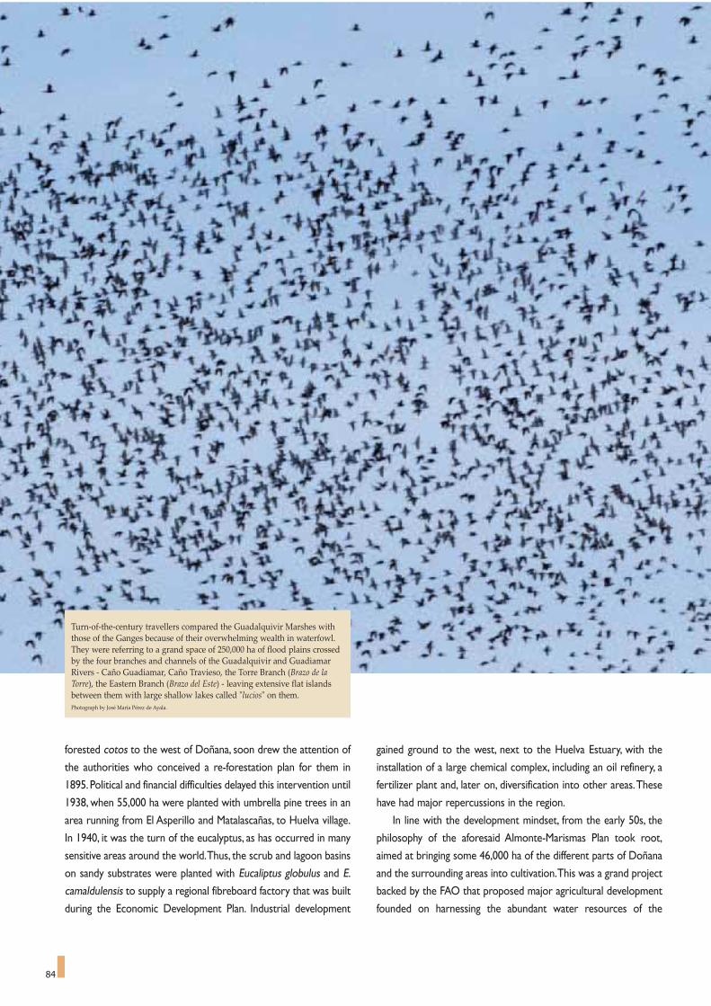
84
forested cotos to the west of Doñana, soon drew the attention of
the authorities who conceived a re-forestation plan for them in
1895.Political and financial difficulties delayed this intervention until
1938, when 55,000 ha were planted with umbrella pine trees in an
area running from El Asperillo and Matalascañas, to Huelva village.
In 1940, it was the turn of the eucalyptus, as has occurred in many
sensitive areas around the world.Thus, the scrub and lagoon basins
on sandy substrates were planted with Eucaliptus globulus and E.
camaldulensis to supply a regional fibreboard factory that was built
during the Economic Development Plan. Industrial development
gained ground to the west, next to the Huelva Estuary, with the
installation of a large chemical complex, including an oil refinery, a
fertilizer plant and, later on, diversification into other areas.These
have had major repercussions in the region.
In line with the development mindset, from the early 50s, the
philosophy of the aforesaid Almonte-Marismas Plan took root,
aimed at bringing some 46,000 ha of the different parts of Doñana
and the surrounding areas into cultivation.This was a grand project
backed by the FAO that proposed major agricultural development
founded on harnessing the abundant water resources of the
Turn-of-the-century travellers compared the Guadalquivir Marshes withthose of the Ganges because of their overwhelming wealth in waterfowl.They were referring to a grand space of 250,000 ha of flood plains crossedby the four branches and channels of the Guadalquivir and GuadiamarRivers - Caño Guadiamar, Caño Travieso, the Torre Branch (Brazo de laTorre), the Eastern Branch (Brazo del Este) - leaving extensive flat islandsbetween them with large shallow lakes called "lucios" on them. Photograph by José María Pérez de Ayala.

85
Almonte-Marismas Aquifer System, estimated at some 400
hm3/year.The decrees that brought about the transformation were
enacted in 1972 and 1974 and the plots of land were distributed in
the 80s.
Hence, with ups and downs, and successes and failures, changes
to the Marshes and their adjacent sands came about.The private
sector gave way to the public initiative for the first time in Doñana,
when the Spanish Government, in collaboration with the FAO,
undertook this enormous agricultural reform, draining 100,000 ha
of marshes. Finally, some 35,000 ha were designated for growing
rice and 100,000 ha of irrigated land for cotton and beetroot. In
course of this vast operation, some 25,000 ha were transformed by
equipping them with wells and pumping and irrigation infrastruc-
ture.This change in the use of the land meant the existing forests
and pastures diminished, and the rivers and streams were chan-
nelled into a single watercourse called Arroyo del Partido, which
fed into the marshes surrounding El Rocío.Thus, some 15,000 ha
were brought into cultivation, which meant extracting about 60
hm3 of water a year.Over the years, this has had a significant impact
on the water table, which has progressively dropped in many
places, leaving traditional springs and lucios dry.
Cultivating and irrigating such a large area of land, in an agricul-
tural region dominated by dry land farming and mainly cash crops,
has turned out to be difficult and controversial, like all such experi-
ments of the time. In the end, this whole operation shifted into
strawberry growing, using advanced and highly technical farming
methods.These include green houses, grow-bags under plastic and
an intensive use of water, fertilisers, weed killers and pesticides.
The intensification of agricultural development coincided with
the start of tourism.Attention should be drawn to the appearance
of the typical large tourist resorts of the Spanish coast, where the
boundaries between the concept of mass tourism and the con-
struction industry and the real estate business remain blurred and
confused to this time. The towns of Matalascañas and Mazagon
appeared on the coast, the former right on the edge of the
National Park. These large-scale interventions were preceded by
attempts to build tourist developments in the very heart of
Doñana, and major coastal road projects to open up the area for
settlement, such as the absurd idea of building the Huelva-Cadiz
motorway, with the first section running right along the coastal
stretch of Doñana as far as Sanlucar. Under such pressures, the tra-
ditional harmonious landscapes of Doñana suffered major and pro-
found changes, endangering the conservation of species and
ecosystems and opening the gates to controversy over the sustain-
able management of the region.This enormous impact, transform-
ing the region in a few short years, has certainly put the survival of
After 1737, planting trials with pine nut trees were undertaken, which had beensuccessfully grown in nearby areas since the reign of Felipe II. The excellenttree cover growth in Marismillas made it possible to conduct high density trialsfor firewood and low density plantations for ship building. From 1805, someareas of the beach dune system that had become unstable in the 17th centurywere re-planted. In this way, Doñana started one of its characteristic phasesbased on forestry. The photograph shows a recreation of a firewood and char-coal holding in the Doñana area.Photo by Jose Maria Perez de Aayala. CENEAM file.
The extreme mobility of the dunes, which became unstable again in the17th century, can be clearly seen in this picture. We can see the collar of thewell at “Cuartel de los Inglesillos” that was successively raised on thecrest of a dune to avoid being buried. The dune has shifted since then andthe whole structure is now exposed. Photograph by Cipriano Marín.
its natural legacy in danger. Doñana, like so many other coastline
strips, wetlands and forests that were destroyed by the develop-
ment boom of the 60s and 70s, found itself at a great disadvantage
in its struggle for survival.The tourism versus conservation dilem-
ma opened the first door towards the Doñana paradigm, which,
thanks to a collective contribution, started to weigh in favour of
more sustainable solutions.
Nature finally triumphed, allowing conservation in Spain to take
shape. As the first benchmarks were created and public concern
was articulated, strategies were set to face the future battles of the

86
View of the Guadalquivir River mouth showing, on the left, the large"arrow" of dunes that closes the mouth and the marshes in the back-ground. The Salt Works of Sanlúcar can be seen to the right of the image.Photo: CENEAM files.
new millennium.
THE FUNDAMENTAL ROLE
OF SCIENTIFIC RESEARCH
The final conservationist stage, in which Doñana highlights the
links between the environment and society, has been grounded in
science.The discovery, protection and presentation of this scientif-
ic aspect to the media, and from the media to the global commu-
nity, have been achieved by university faculties and the CSIC
(Spanish Higher Research Council).The arguments in favour of pro-
tection are scientific.The soundness of the conservationist offer is
founded in investigative excellence that has provided examples,
data and references that stand out in the world literature and act
as valid currency in the critical debates that have presided over this
outstanding site in recent decades.
Apart from appearing in the press and other media,Doñana has
also secured its presence in the scientific media, in conferences and
symposia, and in leading journals, thanks to its stakeholders and
institutions. Some lines of research, like bird and mammal ecology,
have reached levels of excellence, followed closely by limnology,
Aerial view of one of the “corrales“ of Doñana, inclosed by the dunes.Photograph by José María Pérez de Ayala.
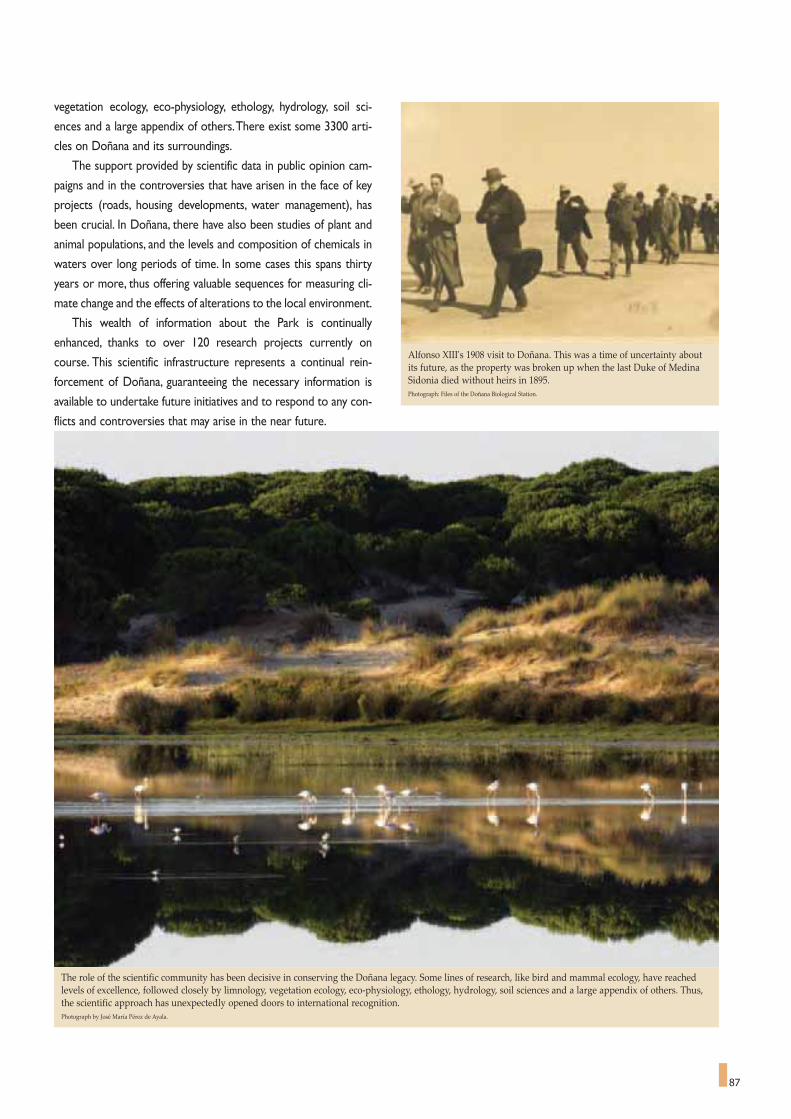
87
The role of the scientific community has been decisive in conserving the Doñana legacy. Some lines of research, like bird and mammal ecology, have reachedlevels of excellence, followed closely by limnology, vegetation ecology, eco-physiology, ethology, hydrology, soil sciences and a large appendix of others. Thus,the scientific approach has unexpectedly opened doors to international recognition. Photograph by José María Pérez de Ayala.
Alfonso XIII's 1908 visit to Doñana. This was a time of uncertainty aboutits future, as the property was broken up when the last Duke of MedinaSidonia died without heirs in 1895.Photograph: Files of the Doñana Biological Station.
vegetation ecology, eco-physiology, ethology, hydrology, soil sci-
ences and a large appendix of others.There exist some 3300 arti-
cles on Doñana and its surroundings.
The support provided by scientific data in public opinion cam-
paigns and in the controversies that have arisen in the face of key
projects (roads, housing developments, water management), has
been crucial. In Doñana, there have also been studies of plant and
animal populations, and the levels and composition of chemicals in
waters over long periods of time. In some cases this spans thirty
years or more, thus offering valuable sequences for measuring cli-
mate change and the effects of alterations to the local environment.
This wealth of information about the Park is continually
enhanced, thanks to over 120 research projects currently on
course. This scientific infrastructure represents a continual rein-
forcement of Doñana, guaranteeing the necessary information is
available to undertake future initiatives and to respond to any con-
flicts and controversies that may arise in the near future.

88
BASIC INFORMATION ON
DOÑANA AND ITS SURROUNDS
The only way to approach the current view of Doñana and get
an idea of the new challenges involved in its conservation and
hydrological restoration is with a broader geographic view. This
starts with what is known as Greater Doñana (Ambito de
Doñana). It is especially true if we are talking about water and nat-
ural processes, as functional inter-relationships, water basins,
ecosystems and species mobility generally pay very little heed to
administrative boundaries.
Greater Doñana
The definition of what is known as Greater Doñana arose ini-
tially from the Sustainable Development Plan for the Doñana Area
(1993) and the limits are clearly established in the Greater Doñana
Regional Planning Master Plan. It is an area of 2,733 km2 between
the Guadalquivir River, the 50 km of beaches of the Huelva coast,
the mouth of the Tinto and Odiel Rivers and bounded to the north
by most of the road corridor linking Seville and Huelva. However,
for the purposes of this chapter, the scope has been extended to
include the umbrella pine forests of Bonanza, the Algaida Marshes
on the left bank of the Guadalquivir, and the marshes at Odiel river-
banks on the west coast of the district (Figure 1).The connections
between these places and Doñana are quite clear, as they have cer-
tain natural processes and species in common.
Greater Doñana is home to a population of 107,049 inhabitants
(2002 census), which has grown at an uneven rate. In the period
1991-2002, there were variations that range from 2.5% in Lucena
del Puerto to 31.1% in Moguer. Basically, the population is divided
among several settlements that form a fringe around the protect-
ed natural areas.
The administrative complexity of the district can be seen from
the fact that there are 12 municipalities. There are Almonte,
Bollullos Par del Condado, Bonares, Hinojos, Lucena del Puerto,
Moguer, Palos de la Frontera and Rociana del Condado in the
province of Huelva; there are Aznalcazar, Pilas, La Puebla del Rio,
Villamanrique de la Condesa and Isla Mayor in the province of
Seville; and there is Sanlúcar de Barrameda in the province of Cádiz.
This is a territory, therefore, of over 280,000 ha, whose identity is
determined by the Doñana National Park. It has water as a com-
mon thread, both in the form of watercourses that mark the route
of the surface waters and in the effect the aquifers have in deter-
mining this same geography underground. Figure 2 shows the
enlarged Greater Doñana, highlighting the surface water network,
the main settlements and the road network.
The protected zones of Greater Doñana
In 1262, King Alfonso X the Wise established the lands of Las
Rocinas as a Royal Crown game reserve, but the name of Doñana
did not appear until 1599.The name of these lands was established
a century on, when the seventh Duke of Medina Sidonia had a
palace built for his wife, Doña Ana Gomez de Mendoza y Silva, in
the heart of the countryside.The surrounding lands soon became
known as the Forest of Doña Ana, the Estate of Doña Ana, and so
on, until it was finally shortened to the name we now know.
The long road to protect and conserve Doñana reached its first
milestone in 1963, when the Spanish State acquired some 7,000 ha
in collaboration with the World Wildlife Fund (WWF) and created
the Doñana Biological Reserve. Doñana was declared a National
Park in 1969 and it has been extended on several occasions.The
first of these extensions took place in 1978; the most recent one,
in February 2004, to the present surface area of 54,291 ha.This area
includes a mosaic of ecosystems that provide refuge for a biodiver-
sity that is unique in Europe, especially the Marshes, which are
extraordinarily important staging and breeding grounds and winter-
feeding grounds for thousands of European and African birds.
Other exceptional and outstanding sites are La Vera, the dune sys-
tem and the series ofponds that run around the edge of the Park.
There are also unique and seriously endangered species living in
Doñana, like the Spanish imperial eagle (Aquila adalberti) and the
Spanish lynx (Lynx pardinus).
Presently, few areas are the object of so many classifications as
Doñana, a clear indication of its international importance. In 1980,
it was declared a Biosphere Reserve by UNESCO.Two years later,
the National Park was declared a Ramsar Site. This declaration
specifies that "Doñana is one of the largest and most important
remaining wetlands in Europe. It consists of a vast coastal marsh-
land complex in the floodplain of the lower Guadalquivir River, sep-
FIGURE 1Greater Doñana

89
arated from the Atlantic Ocean by an extensive system of both
active and stabilized dunes.The area is of international importance
for breeding, staging and wintering birds. It is the breeding site of
the endangered Marbled Duck Marmaronetta angustirostris and
the rare gull Larus genei.The trees found on the grasslands of La
Vera support a large mixed nesting colony of Ardea cinerea,
Egretta garzetta, Nycticorax nycticorax, Ciconia ciconia and
Platalea leucorodia. Nesting species in the Marshes also include
Anas strepera, Aythya ferina, Netta rufina, Porphyrio porphyrio
(1,000-2,000 pairs), Fulica cristata, Himantopus himantopus,
Recurvirostra avosetta and Chlidonias hybridus.Wintering species
include Anser anser (80,000), Anas penelope (120,000), A. acuta
(20,000), A. crecca (170,000), A. clypeata (80,000), Fulica atra
(40,000) and Limosa limosa (40,000). In descending order of pre-
dominance, it includes the following wetlands types: Sp,Tp, E, M, N,
Ss,Ts, 4.The area contains both fresh and saltwater marshes, sea-
sonal marshes, dunes and permanent and seasonal lakes”.
On the 23rd of September 1985, the Council of Europe award-
ed the Doñana National Park the European Diploma for
Management, which has been renewed in 1990, 1995, 2000 and
2005. On the 15th of January 1988, it was declared a SPA (Special
Protection Area for Birds),pursuant to Directive 79/409/CEE of the
2nd of April 1979 concerning the Conservation of Wild Birds in
Europe.This means that the Spanish State accepts the commitment
to prevent the deterioration and contamination of the habitat and
to prevent any disturbances that could affect the birds. In 1990, it
was included in the Montreux Register of sites that face threats to
conservation.And, finally, in 1994, Doñana was finally entered in the
UNESCO's list of World Heritage Sites.
Doñana National Park should be seen as the heart of a net-
work of zones that cover an area of 121,647 ha altogether, or just
over 40% of the entire Greater Doñana area, including the Doñana
FIGURE 2The above image highlights the water network of Doñana and its surrounding area, and the location of the region's population. The colouredtopographical representation of the terrain shows the scope of the original marshes that, until the 19th century, covered much of the depressionformed by the mouth of the Guadalquivir River.Image: Junta de Andalucía.(Andalusia Regional Government)

90
Nature Park around the National Park. The very declaration of
Doñana as a UNESCO Biosphere Reserve defined the National
Park as a core zone, with an area of over 26,000 ha of lands that
now form part of the Nature Park as a buffer zone, and an unde-
fined transition zone around that.
Figure 3 shows all the declared nature spaces in the Doñana
area and Table 1 lists their category, time of declaration and the
municipal districts involved. Some of these spaces have also been
designated SPAs, Ramsar Sites, or Sites of Community Importance
(Table 2). These include the Marismas del Odiel on the western
edge of Greater Doñana, declared a Biosphere Reserve in 1984.
The 53,709 ha of Nature Park share similar landscapes with the
National Park, along with the habitat of diverse animal and plant
species, including massive pine forests, marshes in different stages
of development and stretches of river branches and channels of the
Guadalquivir, that used to flood the marshes. The series of areas
that make up the Nature Park include, first of all, the Algaida Marsh
close to Sanlucar de Barrameda, very close to the mouth of the
Guadalquivir River on the other side of the river from the borders
of the National Park.This is a strip of natural marshland flooded by
the tides, unlike the rest of the Guadalquivir marshes that only
receive rainwater from certain watercourses. There are still salt
flats to be found in these marshes that are visited by flamingos and
avocets in search of refuge and food. Close by is the Pinar de la
Algaida,where a popular pilgrimage is held in October.This pine nut
forest stems from large-scale historic replanting carried out in the
early 19th century and other plantations later on.Within in, there
are nesting populations of black kite, with over a hundred pairs,
buzzards, booted eagles, magpies and azure winged magpies.
Former ponds, like the Laguna del Ansar, attract flocks of geese that
are highly appreciated by hunters.The pine forest is also the site of
1. Doñana National Park (the recent extensions can be seen within its borders).)
2. Pre-Park areas (maritime zone, transition zone with the Rocina stream)
3. Doñana Nature Park (area of El Abalario and El Asperillo cliffs)
4. Doñana Nature Park(Coto del Rey pine forest)
5. Doñana Nature Park (Isla Mayor, Entremuros del Guadiamar and Brazo de la Torre)
6. La Algaida marsh and pine forest7. Brazo del Este Nature Reserve8. Dehesa de Abajo Concerted Nature Reserve9. Marismas del Odiel Nature Area
(including the Burro marsh and the Isla de en Medio Nature Reserve)10. Lagunas de los Palos y las Madres Nature Area11. Estero de Domingo Rubio Nature Area12. Guadiamar Green Corridor
FIGURE 3Protected Areas in Greater Doñana.
El Asperillo cliffs, in the Doñana Nature Park. Behind the coastal strip, thearea contains countless ponds of extraordinary scientific and natural inter-est.Photograph: Junta de Andalucía (Andalusia Regional Government)

91
El Santuario del Lucero, a former holy place where remains from
several diverse ancestral cultures have been found, and the Pozo de
los Caveros, a well of Roman origin.
Another area of interest that falls within the Nature Park is the
Coto del Rey pine woodland, situated in the municipal district of
Hinojos, whose woods provide refuge for several birds of prey.
Furthermore, it also includes marshes, which have been trans-
formed to a greater or lesser extent for rice growing, and channels
and other watercourses like the Torre Branch, Isla Mayor and
Entremuros del Guadiamar. These attract birds living in Doñana
during summer and winter droughts. In the province of Huelva are
the Hinojos pine forests and marshes, which attract thousands of
waterfowl when they flood. Down on the coastal strip of the
municipality of Almonte, we find the spectacular El Asperillo cliffs,
with its system of fossil dunes. Further inland is the Abalario com-
plex, dotted with small but fascinating ponds that have been under
restoration.
Other local land has been classed as Natural Areas,Reserves or
Protected Landscapes.The Dehesa de Abajo estate, located in the
municipal district of Puebla del Río, has great ecological wealth and
also provides a link between the marshes and the woodlands. It
floods at certain times of year, making it ideal for large numbers of
migratory species. Cañada de los Pajaros is also nearby. This is a
private nature reserve, with a wide variety of waterfowl, and
1. River Guadalquivir 9. Partido stream2. Torre Branch (Brazo de La Torre) 10. La Rocina stream3. River Guadiamar 11. Brenes channel (Caño de Brenes)4. River Guadiamar channeling 12. El Abalario complex and peri-dune ponds of the National Park.5. Entremuros 13. Current flooding marsh zone.6. Travieso channel (Caño Travieso) 14. Cañada Mayor stream7. Guadiamar channel (Caño Guadiamar) 15. La Cigüeña stream8. Madre de las Marismas channel 16. Majaberraque stream
The Travieso channel is shown here to be connected after the restoration work carried out as part of the Doñana 2005 Project.
FIGURE 4Water-related toponyms in the Doñana marshes.

92
includes wetlands and nesting grounds. On the opposite bank of
the Guadalquivir River, the Eastern Branch (Brazo del Este) Nature
Area is found.This is one of the former branches of the river sur-
rounded by marsh transformed into rice fields - a reasonably large
wetland area made up of Quaternary sediments and alluvial
deposits of gravel, sands, silt and clays. It provides habitat for the
typical marshland vegetation.
To the far west, there are other emblematic protected areas.
The Marismas del Odiel Biosphere Reserve, declared as such in
April 1983 and covering an area of 7,158 ha, encompasses the
Nature Reserves of the Burro Marshes and Enmedio Island. The
marshes at Odiel are maintained by the coastal dynamics of the
Atlantic shoreline of Andalusia. Their character as tidal marshes
gives this wetland the dynamism of a landscape gifted with the
rhythm of flooding and draining twice daily. This makes it highly
productive. Apart from aquatic vegetation, there are also charac-
teristic Mediterranean scrub species - home to a large colony of
spoonbills, one of its leading assets.The Biosphere Reserve is locat-
ed next to Huelva, the capital of the westernmost province of
Andalusia and port with an ancient history of important Roman
and Tartessian achievements.
Behind the coastal strip of Greater Doñana, there are two
other Nature Areas: Palos and Las Madres ponds and Estero de
Domingo Rubio. Up until recently, the "estero" (swampy flats) were
a typical tidal marsh system from end to end, subject to flooding
twice a day. But now, the tides barely affect the upper stretch,
because the drains of the roads that cross it have become clogged
up.These blocked drains, along with the water that feeds into this
area from a series of small streams, have modified this stretch into
a lake regime, presenting an interesting combination of fresh and
saltwater biocenoses.
More to the north of the National Park, the last of these clas-
sified spaces is the Guadiamar Green Corridor Protected
Landscape. It was declared as such due to an unfortunate accident
when toxic mud spilt from the Boliden mine tailings at Aznalcollar
on the 25th April 1998.The recovery of this area, after cleaning up
and removing the sludge, gave rise to one of the most ambitious
projects ever carried out in the Doñana area. It generated a green
corridor to provide an ecological union with the protected areas
of La Sierra, whilst at the same time recovering the environmental
quality and functionality of the historic course of the River
Guadiamar.
With Doñana as a Biosphere Reserve and given the network of
protected spaces and how they work now, it would seem advisable
Aerial photograph of the Doñana Marshes taken from the south. In theforeground, you can see Las Marismillas pine woodland which surroundsLucio del Membrillo. To the left and in the background, you can see theHinojos Marshes.Photograph: Paisajes Españoles S.A.
1. Madre de las Marismas channel 9. Lucio de Mari López2. Rosaliman channel 10. Lucio del Lobo3. Guadiamar channel 11. Lucio del Cangrejo4. Travieso channel 12. Hinojos marsh5. Torre Branch 13. Gallega marsh6. Brenes channel 14. Vuelta de La Arena7. Lucio del Membrillo 15. Santa Olalla pond8. Lucio de los Ánsares
Doñana National Park boundary
FIGURE 5The extent of the Doñana National Park Marshes.
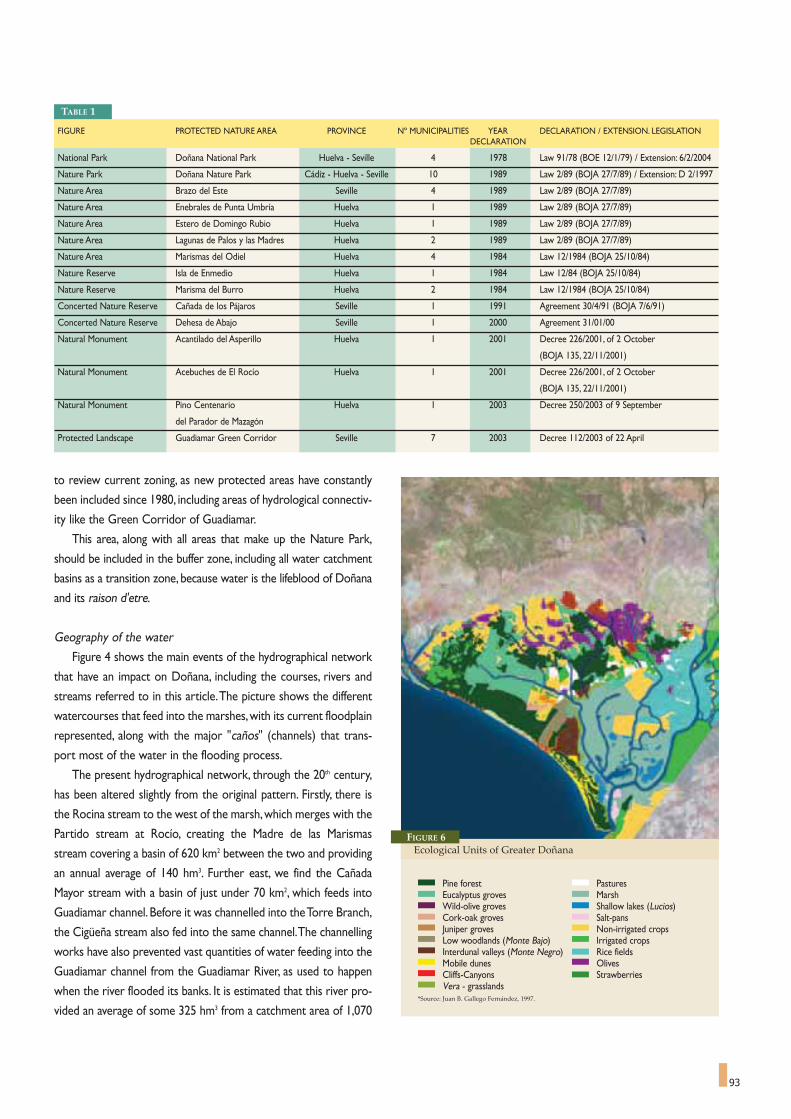
FIGURE PROTECTED NATURE AREA PROVINCE Nº MUNICIPALITIES YEAR DECLARATION / EXTENSION. LEGISLATIONDECLARATION
National Park Doñana National Park Huelva - Seville 4 1978 Law 91/78 (BOE 12/1/79) / Extension: 6/2/2004
Nature Park Doñana Nature Park Cádiz - Huelva - Seville 10 1989 Law 2/89 (BOJA 27/7/89) / Extension: D 2/1997
Nature Area Brazo del Este Seville 4 1989 Law 2/89 (BOJA 27/7/89)
Nature Area Enebrales de Punta Umbría Huelva 1 1989 Law 2/89 (BOJA 27/7/89)
Nature Area Estero de Domingo Rubio Huelva 1 1989 Law 2/89 (BOJA 27/7/89)
Nature Area Lagunas de Palos y las Madres Huelva 2 1989 Law 2/89 (BOJA 27/7/89)
Nature Area Marismas del Odiel Huelva 4 1984 Law 12/1984 (BOJA 25/10/84)
Nature Reserve Isla de Enmedio Huelva 1 1984 Law 12/84 (BOJA 25/10/84)
Nature Reserve Marisma del Burro Huelva 2 1984 Law 12/1984 (BOJA 25/10/84)
Concerted Nature Reserve Cañada de los Pájaros Seville 1 1991 Agreement 30/4/91 (BOJA 7/6/91)
Concerted Nature Reserve Dehesa de Abajo Seville 1 2000 Agreement 31/01/00
Natural Monument Acantilado del Asperillo Huelva 1 2001 Decree 226/2001, of 2 October
(BOJA 135, 22/11/2001)
Natural Monument Acebuches de El Rocío Huelva 1 2001 Decree 226/2001, of 2 October
(BOJA 135, 22/11/2001)
Natural Monument Pino Centenario Huelva 1 2003 Decree 250/2003 of 9 September
del Parador de Mazagón
Protected Landscape Guadiamar Green Corridor Seville 7 2003 Decree 112/2003 of 22 April
93
to review current zoning, as new protected areas have constantly
been included since 1980, including areas of hydrological connectiv-
ity like the Green Corridor of Guadiamar.
This area, along with all areas that make up the Nature Park,
should be included in the buffer zone, including all water catchment
basins as a transition zone, because water is the lifeblood of Doñana
and its raison d'etre.
Geography of the water
Figure 4 shows the main events of the hydrographical network
that have an impact on Doñana, including the courses, rivers and
streams referred to in this article.The picture shows the different
watercourses that feed into the marshes,with its current floodplain
represented, along with the major "caños" (channels) that trans-
port most of the water in the flooding process.
The present hydrographical network, through the 20th century,
has been altered slightly from the original pattern. Firstly, there is
the Rocina stream to the west of the marsh,which merges with the
Partido stream at Rocío, creating the Madre de las Marismas
stream covering a basin of 620 km2 between the two and providing
an annual average of 140 hm3. Further east, we find the Cañada
Mayor stream with a basin of just under 70 km2, which feeds into
Guadiamar channel. Before it was channelled into the Torre Branch,
the Cigüeña stream also fed into the same channel.The channelling
works have also prevented vast quantities of water feeding into the
Guadiamar channel from the Guadiamar River, as used to happen
when the river flooded its banks. It is estimated that this river pro-
vided an average of some 325 hm3 from a catchment area of 1,070
TABLE 1
FIGURE 6Ecological Units of Greater Doñana
Pine forest PasturesEucalyptus groves MarshWild-olive groves Shallow lakes (Lucios)Cork-oak groves Salt-pansJuniper groves Non-irrigated cropsLow woodlands (Monte Bajo) Irrigated cropsInterdunal valleys (Monte Negro) Rice fieldsMobile dunes OlivesCliffs-Canyons StrawberriesVera - grasslands
*Source: Juan B. Gallego Fernández, 1997.

94
km2. This situation is repeated with the Majaberraque stream.
Nowadays, this water is channelled along Entremuros into the
Torre Branch, draining into the Guadalquivir River.One of the lead-
ing objectives of the hydrological restoration projects started in
recent years is to resolve this atypical situation.
Another hydrological aspect worthy of highlighting in Doñana
is the string of 'peri-dune' ponds that border the National Park
Marshes, and their continuation in the Abalario marsh complex
between the Rocina stream and the coast.All of these elements, of
extraordinary ecological interest, are influenced by the behaviour
of the aquifer.
Figure 5 shows the layout of the three major caños (channels)
- Madre de las Marismas, Guadiamar and Travieso - in the Marshes
floodplains. These finally converge into Brenes channel before
reaching the Guadalquivir River. It is important to note that the
Travieso channel used to act as an overflow channel when the Torre
Branch flooded its banks. To get a better understanding of how
water is used in this area, it is worth mentioning that the Torre
Branch now acts as a drainage channel for over 400 hm3 of water
that are pumped from the Guadalquivir River for irrigating the local
rice fields.
Figure 5 also indicates the main "lucios" (depressions that hold
the water for a longer time), in contrast to the "vetas" or "paciles"
(areas that normally remain above water level during times of
flooding), and the names of the main marsh areas.
The behaviour of groundwater is dealt with in detail in Chapter
3.This is of vital importance in understanding the Doñana hydro-
logical system. Nevertheless, it is worth mentioning at this stage
that there is a major aquifer under the marsh area and the adjacent
zones, with reserves of up to approximately 5,500 hm3 of water.
These vast resources have led to some highly misleading views in
water management.The capacity to harness these reserves is lim-
ited.Also the essential ecosystems of Doñana require high phreat-
ic levels, according to what extent they depend on springs and the
proximity of the phreatic layer. Bearing these constraints in mind,
the Guadalquivir River Hydrological Plan, adopted in 2001, consid-
ers that the resources of this aquifer, known as the Almonte-
Marismas Aquifer, show a deficit of 51 hm3 in comparison with fore-
seeable demand.
Figure 6 shows the ecological map of Greater Doñana, drawn
up by Juan B. Gallego Fernandez in 1997, in which the waters of
Doñana can be seen in a regional context from a bird's eye view.
This view of Greater Doñana is completed in Figure 7, showing the
main towns in the area, the road system dominated by the Seville-
Huelva motorway, and the location of the protected areas. The
information on land use is fully developed in chapter 5.
FIGURE 7Road system and settlements in the Doñana area
PROTECTED NATURE AREA AREA (ha) MAB RAMSAR SCI/SAC SPAS
Doñana National Park 54,251Doñana Nature Park 53,709Brazo del Este 1,336Enebrales de Punta Umbría 162Estero de Domingo Rubio 480Lagunas de Palos y las Madres 693Marismas del Odiel 7,185Isla de Enmedio 480Marisma de El Burro 597Cañada de los Pájaros 7.43Dehesa de Abajo 617.71Acantilado del Asperillo 11.85Acebuches de El Rocío 0.63Pino Centenario del Parador de Mazagón 0.2Guadiamar Green Corridor 2,076.8
TOTAL PROTECTED AREA OF GREATER DOÑANA 121,607.62
TABLE 2

95
The decisive yearsthe role of Doñana in the history of conservation
MAURICIO GONZÁLEZ GORDON *
95
When in May of 1952 Francisco Bernis and Jose Antonio
Valverde came to visit me in Jerez on their way to
Doñana, I could not have imagined the repercussions that our
meeting would later have. I think none of us could have. Doñana,
until then, had been a unique hunting ground, and, as such, the
object of passion of many generations of hunters, and aside from
an occasional study, at that time it was only just beginning to be
acknowledged as a natural treasure meriting protection at all costs.
Doñana had been, from the 18th century until just forty years
ago, a vast expanse of land virtually free of any human activity
except for that of hunting.
Midway through the 19th century, interest in Doñana took a
somewhat more scientific turn. In 1846, Antonio Machado, our
patriarch of poets, had already begun to describe the birdlife of the
* Ornithologist and pioneer of the Doñana conservation.
Members of the Doñana Expedition of 1957. José Antonio Valverde, Guy de Mountfort and Max Nicholson participated, among the others,in this third expedition. The publications resulting from these expeditions made the Doñana heritage widely known throughout Europe.Files of the Doñana Biolgical Station.
region. Interest in the area was reflected in the descriptions made
by certain visiting Romantic writers, revealing idiosyncrasies typical
of the period's hunting aficionados that journeyed to Doñana,many
from abroad and almost always English, in whom the passion for the
hunt was coupled with a love for natural science.
This dual passion, for the hunt and for nature, led my grandfa-
ther, Pedro González Soto, into an association with Abel Chapman,
Walter J. Buck and Alexander Williams, all of them Englishmen, in
order to acquire the hunting rights for the Coto de Doñana hunt-
ing reserve in 1897. The four friends combined hunting with the
observation and study of nature, which Chapman and Buck had
earlier commenced in their book "Wild Spain"8. After associating
with my grandfather, the two published "Unexplored Spain"9, dedi-
cated to the Spanish monarchs Alfonso XIII and Victoria Eugenia, in
which thirteen chapters out of a total of forty dealt with their
expeditions and observations in the Coto de Doñana.

96
My father cherished Doñana. While passing through London
on his way to Chile where he was working as an engineer on the
construction of the Ferrocarril Longitudinal (Longitudinal railway),
he read news that the Coto was up for sale. He immediately wrote
my grandfather urging him to find a way to buy the land with the
offer of returning it to Spain while assuming the post of administra-
tor and game warden of Doñana.His wish to purchase Doñana and
to be its guardian was not to be granted at that time, but did come
true later when in 1940 he and two friends, the Marques del Merito
and Salvador Noguera, were able to acquire two thirds of the total
surface area of Doñana and when, shortly before his death in 1980
at the age of 93, he was named Honorary Headkeeper of Doñana
National Park by Spain's national park service, the National
Institute for the Conservation of Nature (ICONA).
He had always admired and held the gamekeepers of Doñana,
to whom we owe so very much, in high esteem, a feeling that was
transmitted to his children and grandchildren.After all, as Alberto
Ruiz de Larramendi, the Park's Director Curator, states so well in
his book "Doñana cara a cara" ("Doñana Face to Face"),with regard
to the ones who are no longer with us, "… they are part, in their
own right, of the history of Doñana.They have bequeathed to us a
life of work in benefit of the conservation of these lands, in their
hopes that Doñana should be more than a mythical name in the
millennium that we now embark upon."
From our earliest childhood, my father transmitted his special
feelings of love for Doñana to my brother Jaime and me. In my case,
I poured them into birdlife, a hobby that was more practical than
scientific. Owing to this I have had the good fortune to meet and
get to know people of great renown in ornithology and biology in
general, such as Francisco Bernis and Jose Antonio Valverde, who
were undoubtedly among the most eminent in our country. I both
greatly enjoyed and was honoured by their friendship.
My brother Jaime was more the hunter than I, and bearing in
A happy confluence landowners’, scientists’ and nature-lovers’ enthusiasmallowed in a difficult moment the rescue of Doñana as a World HeritageSite.Photograph kindly provided by M. González-Gordon.
His dual passion for the hunt and for nature lead Pedro González Soto into an association with Abel Chapman, Walter J. Buck and Alexander Williams, in orderto acquire the hunting rights for the Coto de Doñana hunting reserve in 1897.Photograph by Antonio Sabater.

97
mind Ortega y Gasset's conditions in his magnificent essay10, which
stated that hunting activity should be scant, he was, I believe, the
first to establish quotas on hunts in the Coto, both for large game
and ducks and geese, and even set a time limit (11.00 h) for shoots.
In short, I would affirm that the concurrence of love for nature
and for the hunt that was always present in the private owners of
Doñana is what permitted its preservation as a natural paradise. In
an interview we did in 1975, Jose Antonio Valverde stated it thus:
"To understand the situation, it must first be made clear that it was
the private owners of the hunting reserve who saved Doñana and
the Marshes from the general devastation of the environment in
Spain arising from the period of forced sale of Church and commu-
nally-owned property known as the Desamortización.Not that this
directly affected Doñana, but the owners at that time refused to be
swept into the ensuing frenzy of deforestation and ploughing up of
virgin territories. Doñana was defended at all costs against every
onslaught and both heritors and later owners continued to protect
and fight for the reserve, even at the risk of losing their property
in the process. To avoid the latent threat of expropriation of the
lands for social ends nothing would have been easier than to dis-
member them and sell them in plots"11.
Valverde was referring to the projects, fortunately abandoned,
to "colonise" the Coto and the marshlands, that arose during the
Primo de Rivera dictatorship and during the Second Republic; but,
fundamentally, he was recalling the serious shift that began on April
1st, 1952, stemming from a new governmental decree ordering the
afforestation -with eucalyptus trees!- of Doñana, under threat of
expropriation. The project, like those of earlier years, could have
signified the end of what we today know as Doñana National Park.
As the owners,we sought for a review of the new law and, after
a visit Franco paid to Doñana in 1953 during which he asked my
father if the afforestation already carried out had caused any dam-
age to Doñana, my father and I sent him a memorandum that we
prepared with the collaboration of Francisco Bernis, and which
Bernis drew up, in which, among other things, we stated: "…. the
Coto de Doñana, is, first and foremost, a precious relic of inviolate
nature, in whose midst is sheltered perhaps the most extraordinary
and renowned zoological community yet extant in Europe"… "We
entertain doubts as to whether the afforestation of the Coto with
exotic trees would constitute an issue of vital importance to our
nation. On the other hand, it is our profound conviction that pre-
cisely what is truly conducive to the interests of Spain is the preser-
vation of the Coto de Doñana and the protection of its wild vege-
tation, so as to allow the wholesale conservation of its rich and var-
ied wildlife as well."… "… within the general plan of feasible con-
servation in Spain, the Coto de Doñana merits the utmost atten-
tion."… "As a present and potential reserve, Doñana has no peer
in Spain nor perhaps in all of Europe".We ended thus, " … and as
long as we remain the proprietors of the Coto, we commit our-
selves to its conservation….as a reserve worthy of Spain, given that
we consider that this unique estate is worthy of the privileges
granted to protected reserves and national parks"12. Undoubtedly,
we had reached these conclusions, my own family as well as
Francisco Bernis, Jose Antonio Valverde and myself, in the meeting
we held in May of 1952, after, just a few days earlier, the threat of
expropriation was published in the official government bulletin.
Having staved off the eucalyptus threat as well as another proj-
ect to plant 6,000-hectares with guayule plants in the middle of the
Coto for rubber production - which we had also opposed - we
embarked on a decade of fervid activity to preserve Doñana, result-
Midway through the 19th century, interest in Doñana took a somewhatmore scientific turn. In 1846, Antonio Machado, our patriarch of poets,had already begun to describe the birdlife of the region. The book"Unexplored Spain" is published in 1910, in which thirteen chapters out of atotal of forty dealt with observations made in Doñana.Photograph kindly provided by M. González-Gordon.

98
- The first visit, in 1952, of French scientists, who were joined by GuyMountfort and Roger T. Peterson, which brought about the organisationof Mountfort's expeditions to Doñana in 1956 and 1957.
- The commencement, in 1953, of permanent scientific research in theDoñana wetlands with the ringing of 2,000 herons by the ringingscheme of the Aranzadi Society of Sciences of the San Telmo Museumin San Sebastian, Spain.This work, organised by Jose Antonio Valverde,continued on into the sixties, during which time a total of 15,000 mem-bers of the Ardeidae family were rung.
- The afforestation of Doñana was stopped as a result of the memoran-dum presented by my father and myself in November of 1953, to whichI earlier referred.
- The Spanish Ornithological Society (S.E.O.), a private association com-mitted to the study and protection of birdlife, was established in 1954(also determined in our 1952 meeting) by six founding members inMadrid,Valladolid, Barcelona, Burgos, Huelva and Jerez. Fifty years laterour group has 8000 members.
- In December of 1954 the first issue of "Ardeola", the Iberian Journal ofOrnithology and Bulletin of the Spanish Ornithological Society was pub-lished, Spain's first wholly ornithological journal. The first issue beganwith the publication of Francisco Bernis's "Prontuario de la AvifaunaEspañola" ("Compendium of Spanish Birdlife")13 which included 395species from Portugal and the Balearic and Canary Islands and listed thescientific and Spanish names approved by the Master List Commissionof the S.E.O.This magnificent piece of work resulted in "the outstand-ing and rapid growth of ornithology in Spain", a hope that the authorhad expressed in his letter to the readers which served as a prologueto the first issue.
- The first study in the history of Spain on Spanish bird migration waspublished14.
- In 1956 and 1957 I helped to organise Guy de Mountfort's second andthird expeditions into Doñana and suggested that he invite Jose AntonioValverde to the 1957 expedition, which he did. Both expeditions werea resounding success and are reflected in "Portrait of a Wilderness"15.The book made Doñana widely known throughout Europe and allowedValverde to, on the one hand, transmit his ideas to expeditioners on theneed to adopt conservation measures in the Doñana wetlands and, onthe other hand, meet Max Nicholson, director general of NatureConservancy, who invited Valverde to England to visit different centresand research laboratories.
- The publication in Spain, in 1957, of the adaptation of the work byPeterson, Mountfort and Hollom "A Field Guide to the Birds of Britainand Europe" which I translated and Francisco Bernis adapted.This trans-lation-adaptation was an anticipated response, which Mountfort himselfproposed and Bernis,Valverde and I accepted, to the obstacles that we
expected would arise concerning a prompt general adoption of theapproved nomenclature of the Master List Commission of the S.E.C16.
- In 1958 Valverde summoned fellow ornithologists to two sessions dur-ing the XII International Ornithological Conference held in Helsinki. Heproposed an international fund-raising project to purchase part of themarshlands which are an essential winter shelter for Nordic Anatidaespecies. During the conference, the International Committee for BirdPreservation issued its 11th Official Resolution, advised by the IWRB(International Wildfowl Research Bureau), calling for the protection ofwetlands in different European countries, including Spain. The protec-tion of Spanish wildlife was discussed during the technical meeting ofthe IUCN held in Athens.
- The first general study on Spain's conservation needs, "La protection dela Faune en Espagne: ses problemes"18, was published.
- The Juan March Foundation awarded Jose Antonio Valverde a grant tocarry out a study on the Marshes from which "a protection programmethat could lead to the setting up of a reserve will be prepared".
- In 1960 the Spanish Higher Council for Scientific Research (CSIC) pub-lished, in the Archives of the Institute of Acclimatisation in Almeria,Valverde's study entitled "Vertebrates of the Marshes of theGuadalquivir" (an introduction to his environmental study), in which hestressed the urgent need for a biological field laboratory in theMarshes19.
- José Maria Albareda, CSIC's Secretary General, authorised and encour-aged the start of the quest for international funds in order to purchase6,000 hectares of the Marshes.The quest, from the very beginning, wassupported by the IUCN, the IWRB, the International Council for BirdPreservation (ICBP/CIPO- now called BirdLife International) and theComité Internationale de la Chasse. Delegates from these organisationsmet in June, 1961 with Mr. Ibañez Martín, the Minister of NationalEducation, offering to finance the acquisition of the marshlands if theCSIC were to set up a research centre within it. Upon reaching anagreement, the protocol was signed in October in Jerez. Days later,members of the Mountfort expeditions held a meeting in London, sim-ilar to those held with the Spanish government, calling for support fora higher governing body that would be set up in Switzerland and calledthe World Wildlife Fund (WWF). Doñana, as Jose Antonio Valverde usedto say, was not a creation of the WWF, but quite the contrary!
- In 1962 the CSIC founded the Patronato Estación Biológica de lasMarismas (Biological Station of the Marshes Trust).
- In 1963 the funds for the proposed purchase of the marshes werereleased and with a matching contribution from the WWF were invest-ed in the acquisition of 6,700 hectares of the property known as theCoto Palacio de Doñana which is transferred to the CSIC.
- In 1964 the CSIC established the Doñana Biological Station and NatureReserve.
- The establishment of the Doñana Biological Station and its directionentrusted to Jose Antonio Valverde -which was highly innovative in theworld of conservation- was the final factor needed to, at last after sixyears, declare Doñana a National Park. Jose Antonio Valverde was des-ignated, as he well-deserved, its first director conservator.
MAIN MILESTONES
Spanish imperial eagle in Doñana.Photograph kindly provided by M. González Gordon.
In an interview we did in 1975, Jose Antonio Valverde stated it thus: "Tounderstand the situation, it must first be made clear that it was the privateowners of the hunting reserve who saved Doñana and the Marshes from thegeneral devastation of the environment in Spain arising from the periodknown as the Desamortización”.Photograph by José María Pérez de Ayala.

99
ing from the seed sown during our May 1952 meeting. Our efforts
culminated in the purchase of the lands, in 1963, by the World
Wildlife Fund, to be ceded to the Spanish Higher Council for
Scientific Research (CSIC), on which the following year the Doñana
Biological Station would be established.
In a letter sent to me in 1997, Francisco Bernis stated, "Apart
from the two or three first national parks established in Spain… it
can be affirmed that the first national park to be driven by modern
conservationist theory is none other than that of the Marshes of
the Guadalquivir. This, and its precursor, the Doñana Biological
Reserve, was and continues to be our country's most resounding
conservationist event."
In view of the brief historical summary offered within these
pages I believe it is evident that without the confluence at Doñana
of private owners and scientists, all devoted to nature conservan-
cy, the protectionist theses that took root so profoundly and so
quickly within Spain - and most likely outside as well - would not
have been possible.
In addition, this confluence took place during certain years, the
decisive years, in which public authorities were not inclined - the
In 1962 the CSIC founded the Patronato Estación Biológica de lasMarismas (Biological Station of the Marshes Trust) and, in 1963, 6,700hectares of the property known as the Coto Palacio de Doñana wereacquired with a contribution from the WWF, and transferred to the CSIC.In 1964 the Doñana Biological Station is established. The photo shows thePalace of Doñana at the time of the acquisition.Photograph kindly provided by M. González-Gordon.
The Decree of 1952 ordering the afforestation of Doñana was one of the biggest threats to the survival of this area. Private owners drew up a memorandumagainst the application of the Decree that, among the others things, stated: “ ... the Coto de Doñana, is, first and foremost, a precious relic of inviolate nature, inwhose midst is sheltered perhaps the most extraordinary and renowned zoological community yet extant in Europe”... “We entertain doubts as to whether theafforestation of the Coto with exotic trees would constitute an issue of vital importance to our nation. On the other hand, it is our profound conviction that pre-cisely what is truly conducive to the interests of Spain is the preservation of the Coto de Doñana and the protection of its wild vegetation, so as to allow thewholesale conservation of its rich and varied wildlife as well.”Phototograph by José María Pérez de Ayala.
moment had not yet arrived - towards such conservationist theo-
ries. Even more, the threat of expropriation in 1952 was perhaps
the factor that triggered such a combination of efforts.

Squacco heron (Ardeola ralloides) in Doñana.Photograph by José María Pérez de Ayala.

initial catalyst for gaining protection for Doñanaa.Valverde, and all
the others who helped him, used these articles as a foundation
for their work of converting Doñana into a protected area for all
to enjoy.
The Doñana Biological Station was created in 1964, including
the Biological Reserve of the same name. Its founding father,
Valverde, was also its first director. Hence the first step towards
the "official" protection of Doñana was taken. Although the
Reserve was not a legally valid category of protection in Spanish
legislation that could ensure its conservation,Valverde, as direc-
tor, was a fair guarantee of this. In fact, four years later, he man-
aged to persuade the authorities to declare Doñana a National
Park, whose 37,425 hectares encompassed the Biological
Reserve.At that time,Valverde had also managed to create a small
residence in the Reserve and that a certain amount of human
support was available to facilitate research work in the National
Park.
Ever since the Reserve was declared,Valverde attempted to
attract scientists to use it as a research area. This was far from
being a simple task in a country, like Spain at the time, in which
research potential was minimum and any interest in studying
renewable natural resources even less. Perhaps that is why the
first scientific article of interest was written by Valverde himself,
when he published "Estructura de una Comunidad de
Vertebrados Terrestres" in 1967, as the first number of the
101
Research in Doñanathe necessary relations between science and natural resource conservation
FERNANDO HIRALDO CANO *
101
Most people would obviously consider scientific research
as the natural foundation on which measures aimed at
conserving the ecosystems of a given place, the processes that
occur there and the species that inhabit those ecosystems should
rest. Another obvious point of this scenario is that any research
carried out in a protected natural area should give priority to the
conservation needs of that area. My experience in Doñana and
other areas, however, suggests that the necessary dialectic that
should be established between research and conservation does
not always occur, and when it does, it is often not as creative or
as positive as could be expected.On this point, as in other aspects
of the management of protected areas, the Doñana experience is
rich and varied and it offers much that we can and must learn,
both for those who work here and for those who work in the
field of these intimately linked activities in any other protected
area of the world.
This is the context that justifies the need to offer a brief sum-
mary of scientific activity in Doñana since active protection meas-
ures were first put in place, in 1964, when the Biological Reserve
was created, and their relations with the conservation of the
National Park.
RESEARCH AS THE DRIVING FORCE
BEHIND THE CONSERVATION OF DOÑANA
Research and conservation have always gone hand in hand in
Doñana. In the 1950s, Francisco Bernis and José Antonio Valverde
published several articles that highlighted the ornithological
wealth of Doñana. Apart from these two scholars, there were
also contributions by other researchers, including Ferguson-Lees,
Mountfort and Peterson. These first scientific works started to
raise awareness of Doñana and of the threats hanging over the
park and some of the species that inhabited it, like the lynx and
the imperial eagle.The need to conserve Doñana started to take
shape nationally and internationally. In this respect, one especially
important milestone was Valverde's article, "An ecological sketch
of the Coto Doñana", published in British Birds and later extend-
ed and enriched in the work "Vertebrados de las Marismas del
Guadalquivir" published in the Archives of the Almeria
Acclimatisation Institute.These scientific articles represented the
* Director of the Doñana Biological Station.
Source: Database of theResearch CoordinationOffice of the DoñanaBiological Station.
FIGURE 1Evolution of the number of research projects carried out in theDoñana National Park.
Number of projects in force for each year

102
"Monografías de la Estación Biológica de Doñana". Valverde
raised new issues in the area of Spanish terrestrial ecology, con-
cerning predator-prey relations and the organisation of commu-
nities. Thus he made (independent) contact with the school of
thought that was making a name for itself at the time in the flour-
ishing field of terrestrial ecology in the U.S.A.This work, based on
ecological research conducted in Doñana, undoubtedly had a
major impact on young Spanish workers taking their first steps in
Zoological and Ecological research, especially those studying ver-
tebrates.
However, the objective of opening the Reserve up to research
was not attained until the mid seventies and investigation did not
become consolidated until well into the eighties (Figures1 and
2).The contributions made by the team led by Fernando
Gonzalez Bernaldez, from the University of Seville Department of
Ecology, were especially important in these early stages. Their
work cast light on the functional aspects of the plant communi-
ties of Doñana; the fundamental relations that existed between
groundwater and surface waters and the role they play in model-
ling ecosystems. Other leading contributions included both the
detailed mapping of the Reserve vegetation, which was later
extended by the same team, spatially and conceptually, to cover
the rest of the Park, and for the questions raised that led to
debate and measures aimed at curbing actions in the National
Park and the surrounding area that could perhaps irreversibly
affect many of the ecological processes that attracted such a con-
centration of biological diversity to Doñana.Their contributions
were decisive for enhancing the management of Doñana's ecosys-
tems. If the conservation actions implemented in Doñana were
not all correct, this was probably due more to the fact that the
recommendations made by this team were not always followed,
rather than the measures themselves not being either right or
appropriate. As in the case of Valverde, the work conducted
marked a substantial advance in Spanish terrestrial ecology and
they were decisive for modernising this discipline, and even more
so for extending the use of multi-variant statistics in data process-
ing.
The above clearly shows the importance of research in the
early days of "official conservation" in Doñana, and the transcen-
dental impact of the investigation carried out in the National Park
on the development of the fields of Botany, Zoology and Ecology
in Spain.
THE UPS AND DOWNS OF RESEARCH IN DOÑANA
Research work has increased significantly in Doñana over the
last twenty years. If we take the number of projects and explo-
rations registered in the Research Co-ordination Office of the
Doñana Biological Station (Figure 1) as an indicator, a clear
increase in the number of projects can be observed in the eight-
ies, stabilising around fifty in the nineties.This increase in research
activities has also made it possible to make a better selection of
projects given authorisation to use the Doñana National Park as
a study area. In fact, if we look at the publications that have orig-
inated from these projects, we can see a clear increase in publi-
cations that have had a major international impact, while publica-
tions of local interest have remained stable.
The fact that science with an impact, "good science" is done
in a National Park does not necessarily mean that they are doing
the research that should be done.These scientific activities could
be focussed on relatively unimportant aspects for discovering an
in-depth view of the system. It may neglect other, more necessary
aspects that are of greater interest for improving the conserva-
tion prospects of the area. Although it is always a risky business
to make value judgements of this kind, a review of the lines of
research covered by the different projects will help to give us an
The Doñana Biological Station, and its Biological Reserve of the samename, was created in 1964. The founding father, Jose A. Valverde, was alsoits first director. In the photograph, Prince Juan Carlos (that later became
King Juan Carlos I of Spain) at the opening of the Bolin laboratory in 1972.The opening ceremony was also attended by Valverde and Felix
Rodriguez de la Fuente.
����
����
����
����
����
����
���
���
����
����
����
����
����
����
����
����
���
���
����
����
����
����
����
����
����
���
� �������������������������������������������������������������
���
��
��
�
��
�
!�����" �����������������#$���%�&������
Source: Database of theResearch CoordinationOffice of the DoñanaBiological Station.
FIGURE 2Evolution of the number of publications about Doñana.
Numer of articles published in magazines listed in the Science Citation Index
Other technical-scientific publications

103
idea of the situation in Doñana. In Figure 3, we have divided the
projects carried out since 1978 into different lines of research.
This division may be somewhat coarse, but it is sufficient for our
objectives.The projects classed as "functional aspects of ecosys-
tems and ecological relations in Doñana" account for the major-
ity of projects. Even though nobody could doubt the importance
of these projects, there are far too many of them in comparison
with the other lines of work.
Aspects like the "surface hydrology and hydro-geology of
Doñana National Park and its drainage basin" are essential for
understanding the Doñana ecosystems. These are decisive areas
that require more attention, as is also true of projects concerned
with the re-generation of the vegetation, endangered species and
pollution.
Our results also show that little scientific effort has been
focussed on issues related to the Park and how it interacts with
its surrounding environment and with visitors. Further studies in
these areas seems fundamental for improving our understanding
of these difficult relations and, thus, make progress in the quality
of interactions with the neighbouring towns and the role of the
park as an environmental education tool. The heads of research
and management of the National Park are well aware of this sit-
uation. Why has it not been corrected? To date, National Park
funding for adequate research into priority issues has been few
and far between. On the other hand, there have been no clear
mechanisms for demonstrating these preferences to the scientif-
ic community as a whole. Most of these projects were approved
by research financing agencies or entities without any kind of rela-
tions with the Park. So the projects were assessed on their scien-
tific quality, without considering the importance they could have
for the Park, which was only able to make any kind of selection
after the fact.This situation has now changed. First of all, a specif-
ic call for projects has been opened for National Parks as part of
the "National Research Plan", funded by the Ministry of the
Environment, in which priority is given to lines of research pro-
posed by National Parks. On the other hand, the recently adopt-
ed Doñana National Park Use and Management Plan includes the
elaboration of a Sectorial Research Plan. This document, to be
approved by the Board, will be drafted by scientists, with the
counselling of managers, and it will focus on the research aspects
that are considered of special interest for the National Park. In
the selection process, special consideration will be given to the
immediate interest of a potential project for improving manage-
ment.With these two new tools, the research situation in Doñana
takes another step closer to the desirable optimum situation.
Doñana will be a living laboratory, open to the entire scientific
community and research will provide the necessary information
and scientific standards for taking management decisions in the
Park.The new lines of funding opened up should not represent a
considerable increase in the number of projects conducted there,
'()��������"��*������+����%����,
��
�
-
���
��
���
��
. �� / 0 1 2
Identifying nature conservation problems and proposing ways of solvingthem has been an important contribution made by many of the differentlines of research conducted in the Park. The scientific contributions relatedto how the aquifer works and its relations with surface waters and vegeta-tion, and studies related to the populations of endangered species like thelynx and the imperial eagle, have been especially important.Photograph by Antonio Sabater.
a) Surface hydrology and hydro-geology of the National Park and itsdrainage basin.
b) Strategy and methodologies for re-generating plant formations and asso-ciated processes.
c) Biology and ecology of endangered species: Factors that affect the size oftheir populations.
d) Ecological effects of abiotic (contaminant) and biotic elements (invasivespecies) introduced in the National Park.
e) Functional aspects of ecosystems and ecological relations in Doñana.
f) Man's interactions with his environment in the National Park.
g) The response of visitors and inhabitants of the area to the Park's systemof public use and its message.
Source: Database of theResearch CoordinationOffice of the DoñanaBiological Station.
FIGURE 3Number of projects in the different lines of research.
Number of projects (1978-2002)

104
as the Park has a limited capacity to host these projects.The fore-
seeable increase in the number of scientists seeking funding to
work in Doñana should make for a better selection of projects,
with the emphasis place firmly on the criterion of scientific qual-
ity and how a project responds to the current conservation prob-
lems faced by the Park.
During this period, and despite the deficiencies already
described, Doñana has been an area open to science and the
research results have provided valuable information for improving
conservation work in the National Park.The former can be clear-
ly seen from the publications and the reports produced during
this period (Figure 2), and from the fact that the Doñana
Biological Reserve was included in the European Commission's V
Framework Programme, "Trans-national access to major research
facilities", designed to sponsor access to Doñana for research
teams from other European countries.
Identifying conservation problems and proposing ways of
solving them has also been an important contribution made by
many projects in the different lines of research conducted in the
Park. In this area, the scientific contributions related to how the
aquifer works and its relations with the surface waters and the
work done on populations of endangered species like the lynx
and the imperial eagle have been especially important. In these
cases, many of the results produced by the research work done
have not been applied to the conservation of the Park, clearly
highlighting the need to improve the mechanisms that are
presently used for transferring research results to the area of
management. The first steps towards solving this problem have
In a protected natural area, priority should be given to research aimed atcovering its conservation needs and requirements.Photograph by Antonio Sabater.
From 1950, Francisco Bernis and José Antonio Valverde published several articles that highlighted the ornithological wealth of Doñana. These led to others,including contributions by Ferguson-Lees, Mounfort and Peterson. These early scientists started to disseminate the enormous flow of information to be foundin Doñana.Photograph by José María Pérez de Ayala.

105
probable already been taken with the measures put in place as
part of the "National Plan" and the "Use and Management Plan"
that we have mentioned previously.
It could be said that the research/conservation relations in
Doñana have been positive, but that there is room for improve-
ment, and that mechanisms are being put in place that are expect-
ed to make this relationship more productive.Accumulated expe-
rience in this area suggests that it is not enough to make a pro-
tected natural area an attractive study site for scientists to guar-
antee that it gets the research it needs.The budgets of these areas
should include funds for research that can direct projects in the
direction of whatever lines of research may be considered as pri-
ority.And this should be done without closing the door to other
research projects that do not directly address immediate conser-
vation problems. In the mid and long term, these contributions
will help us to understand the system as a whole, help us to iden-
tify problems at an early stage, when they are easier to solve. I
would say that the relations between science and conservation in
a protected natural space should never be conceived as a con-
frontation between basic science and applied science or the appli-
cations of science. Both of these are necessary and, in the end,
there are only two forms of science; good science and bad sci-
Greater attention should be paid to aspects related to the surfacehydrology and hydro-geology of Doñana National Park and its drainagebasin and to those addressing the regeneration of the vegetation, endan-gered species and pollution, as these are all fundamental for understand-ing Doñana's ecosystems.Photograph by Antonio Sabater.
Research programmes have had a profound impact on the conservation ofDoñana. In the picture, results of breeding lynx in captivity for laterrelease.Photograph by Antonio Sabater.
ence. The former is always applicable, sooner or later, and the lat-
ter is never applicable.We must provide incentives for the lines
of research that most interest us, fostering a dialogue between
scientists and managers, but we must not forget that one of the
most important functions of a protected natural area is to open
its doors to science to generate the knowledge we need to understand
the world we live in.

“La Saca de Yeguas” (The Mares' Roundup)a centuries old tradition in Doñana.Photograph by José María Pérez de Ayala.

The creation of the Doñana National Park was the result
of a process that was driven more by individual will and
impulses than by general planning or a long term political proj-
ect. When the efforts of a few dedicated people were translat-
ed into printed letters in the Official State Gazette, the preser-
vation of what is perhaps the very best of Spanish nature,
endangered at the time, was assured. But the future preserva-
tion of this space was obviously not ensured per se. In the years
between that time and now, the National Park has undergone
many changes.These changes, in general, have always been for
the good and they have helped to consolidate the conservation
of the Park that is no longer questioned by anybody. From time
to time, somebody is always determined to compare "the state
of Doñana now" with how it was in the past, and, of course,
depending on the ideology of the person making the compari-
son, they will consider that Doñana is "in a better state than it
has ever been in", or "on the edge of extinction". I firmly believe
that it has improved constantly since it was declared a National
Park. This improvement is often founded on controversy and
sometimes on confrontation.These improvements are also off-
set by the changes suffered by the area around the National
Park, where, of course, transformation has inevitably led to a
reduction in the natural state of the environment. Doñana is no
longer an isolated, marginal and wild area in lower Andalusia.
But, despite all this, the Park, as a whole, has continued to flour-
ish. It has grown as a support for conserving the biodiversity,
and it has also developed as a facility in the service of this con-
servation, providing information to visitors, scientific know-how
and it also makes an important contribution to the quality of life
of the district.
107
The milestones that madeDoñana a National Park
JESÚS CASAS GRANDE *
107
* Head of the department of planning and technical programmes for National Parks.Ministry of the Environment, Spain.
The National Park of Doñana is the result of a Solomon-like agreementthat has attempted to strike a balance between the simultaneous presenceof three different policies on the same territory: nature conservation, agri-cultural transformation and the development of the tourist industry.Photograph by Cipriano Marín.
The work of the Doñana Board, driving a Sustainable Development Plan, and the institutional support for this from the National Park played an important roleto secure the support of the European Union to carry out the project. In the picture, sands barrs in the marshes boundary merge into one in the sunset ofLa Vera.Photograph by José María Pérez de Ayala. CENEAM Files.

But, in the course of these
thirty five years, we have also
witnessed a succession of del-
icate situations involving the
National Park, with significant
social repercussions. Doñana
was declared a National Park
as the result of a Solomon-like
agreement in an attempt to
strike a balance between three
different models that were
applied to the same territory
at the same time, which were
probable incompatible in prin-
ciple.These three models; nature conservation, agricultural trans-
formation and mass tourism, were not only highly difficult to com-
bine, they were also obliged to co-exist shoulder to shoulder,with-
out any kind of buffer zone between them.The result is obvious:
visitors to Doñana are constantly amazed by the lack of balance
that enables the most protected area of Europe live alongside
areas of intensive farming or high density tourist resorts, only sep-
arated from them by a simple fence.
In the course of this same period of time, and in parallel with
the National Park, the district has also undergone a major social,
cultural and economic transformation. And the demands of the
population have grown.These demands have often been associat-
ed with the National Park.The Park has always been a touchstone,
the heart of each and every one of the major issues.
If you could take an objective view, something I still find impos-
sible, when analysing the distance between the current situation
and the situation of forty years ago, the result would probably be
surprising. It is now a shared opinion that the driving force for the
regional planning of this district is the National Park. It has not
only become a determining factor in vertebrating all land uses and
activities; it is also the main catalyst of economic activity by a long
way. Anything that does not have some kind of connection with
the National Park is difficult to sell nowadays.The ambition of the
district is to become a benchmark for sustainable development. It
is true that names are merely names, and that there are more
doubts than certainties behind the concept of sustainable develop-
ment, but this ambition is indicative of the extent to which the
concept has taken root in a society that, initially was not very
prone to changing its attitude towards life until very recently.The
National Park is now well accepted and its value recognised.This
is a situation that was unthinkable forty years ago. Forty years ago,
the Park was a conceptual, political and social dwarf, facing enor-
mous battleships of transformation that had social approval, polit-
ical backing and financial resources.Although it many not be easy
to understand, David defeated Goliath in this story too. Not only
did he defeat him, he even managed to persuade Goliath that it
was better for both of them to live side by side, David's way.
Doñana was declared a National Park by a Decree passed in
1969. But the modern history of Doñana really did not start until
1978, when it was re-classified in Parliament.To outside eyes, this
re-classification was apparently a mere legal consolidation at the
highest level. It brought an expansion in the area of the National
Park that increased from around 35,000 hectares to 54,251
hectares, bringing in major areas of marshes, Coto del Rey, the
beach and Marismillas, in comparison to the original declaration.
But the Doñana Act was far more than just a law. For the first time
in Spain, it meant the implementation of a participative process
prior to enacting the law, in order to build an initial, fragile social
consensus in declaring a protected area. It was the first law enact-
ed by Parliament after the Constitution was adopted, and it is
Doñana was declared a NationalPark by a Decree passed in 1969. Butthe modern history of Doñana reallydid not start until 1978, when it wasre-classified in Spanish Parliament.
Colony of flamingos on a Marsh "veta" (rised old levee).Photograph by José María Pérez de Ayala.

impregnated with the same spirit of consensus and balanced
progress that enlightened our political leaders at that time. The
Doñana Act was not just a decision of the Spanish Parliament.
Behind this Act, and basically behind its limits, there were hours of
deliberations in the Inter-Ministerial Environmental Commission
(CIMA, from its acronim in Spanish), in which the different sectors
presented their demands and finally reached a reasonable agree-
ment. If this preliminary agreement had not been tacitly accepted
by all concerned, implementing the National Park in practise
would have been even more eventful.
The Doñana Act was totally innovative. It introduced the pri-
ority of conservation over any other activity in the National Park
as a basic concept. It created the first buffer zones and areas of
influence for a National Park, outside its borders, where part of
the management and conservation activity was transferred, includ-
ing the Park administration and the Board, although these buffer
zones were not given the same degree of protection. It took on
board the criterion of drainage basin, for both surface and ground-
water, and how these could affect the National Park. It established
the possibility of maintaining private property ownership within
the protected area, although this was subject to accepting the
determinations of the Park managers who, in the case of a dis-
agreement, were empowered to expropriate land to nationalise it.
It recognised the need to manage the National Park based on
planning and with its own, specific administration, and it sanctioned
the vital presence of the Board as an organ of social consensus,
support, deliberation and participation. All these issues, which we
work on in protected areas, may seem obvious now and inherent
in any declaration of this kind, but it is good to remember that
they grew out of the Doñana Act. Much of what has happened
since, both in Doñana in particular and in Spanish nature conser-
vation in general, is a direct consequence of the fact that Doñana
had and has excellent legislation. This law acted as a model for
other areas and even today, twenty five years after it was enacted,
it remains absolutely valid and up to date.
The first consequence of this law was the creation of an
administration for the National Park.This is a dedicated adminis-
tration and independent from the Doñana Biological Station that,
for many years had acted as the tacit administrator of Doñana. It
is true that the new administration, belonging to the Ministry of
Agriculture at the time, was seen as being non conservationist, or
openly hostile to the ideology of the National Park. For years,
newspaper archives collected pages and pages on the conflict
between Doñana National Park and Doñana Biological Station.
There was talk of Doñana having two heads, and of there being
open discrepancies that made park management sterile.The diffi-
culty in striking a balance and for the two administrations to work
together in a common area, but each with its own clearly defined
Doñana is one of the few protected spaces that has managed to consoli-date an independent scientific unit as part of the Park. The picture showsthe Palace of Doñana, seated in the Doñana Biological Reserve.Photograph by Cipriano Marín.

110
responsibilities, one a management body and the other a research
body, was a built-in handicap for the development of the National
Park.The controversy reached its height in the early eighties, and
the idea of two "de facto" administrations for the same area was
even considered, each with its own administrative procedures and
arrangements.These teething troubles, which were not exempt of
personality cults and over-inflated egos in both administrations,
has undoubtedly been the main constraint on the National Park as
a working entity.
Today, there is an evident balance and the two administrations
maintain reasonable relations, but, with the advantage of hindsight
and their capacity to resolve their differences, there remains a cer-
tain general feeling that the model has not worked, or that the
dynamic generated by its dual approach was not the right one. In
reality, once again with hindsight, and in the light of the innovations
formulated from Doñana to other pro-
tected areas, the only thing that has not
been transferred is precisely this, the idea
of creating an independent scientific unit,
sited in the protected area. The law
declaring Las Tablas de Daimiel a National
Park, enacted immediately afterwards,
included the possibility of creating a
Biological Station in the Park, although
this was never done. The following
National Parks Acts have not contemplat-
ed this possibility. Neither has the abun-
dant regional legislation that has been
developed in the course of the last few
decades. It is probably obsolete now as a
concept, as we now have more complex
models and more people are involved, and the very role and pres-
ence of the administrations in managing protected areas is clearly
in flux.This approach is now tinged with the sepia of old photo-
graphs, as there appears to be a mutual understanding of the role
that each institution can play in the future of the National Park.
Another consequence of the Doñana Act was to bring to an
end a series of transformations in the National Park that were
either planned or in course in the neighbouring zones. The
Almonte-Marismas Plan suffered slight cuts, the "World Hotel"
complex moved out of the National Park grounds, the possibility
of a coastal road running between Huelva and Cadiz (provinces
crossing the Park) was discarded, etc.These decisions took sever-
al things beyond the boundaries of the National Park. In some
cases, for example, in reducing the area of the Almonte-Marismas
Plan, the social tension was shifted to the area around the National
Park. And in others, such as the case of the "World Hotel", the
issue was to transfer the complex elsewhere, in this case, border-
ing on the National Park, propitiating a new, probably unforesee-
able, direction for developments: the National Park was starting to
have an impact on its immediate surroundings.
We started to glimpse the curious phenomenon of osmotic
involvement.The National Park felt "threatened" by the transfor-
mation of its surroundings that, to some extent, represented a
threat to the continuity of the natural systems and processes
encompassed therein. But at the same time, the surrounding area
felt threatened by a National Park with the ability to induce, from
an imprecise but notorious position, changes in organisation.The
National Park feared its surroundings and the surrounding area
feared the National Park.
The "World Hotel" was designed as a shorefront complex on
Marismillas lands, to the south of the National Park. The law
declared the affected area part of the
National Park, but the project already had
enough papers and permits to present a
solid case for litigation with the govern-
ment.The result was a permutation of the
project to lands to the west of
Matalascañas, south of El Acebuche,
beyond the borders of the National Park.
There were changes in the ownership,
probably due to the financial difficulties
faced by the developers and in the mid
eighties, the project reappeared in the
guise of "Costa Doñana", a powerful
development initiative with significant
political support and social backing. The
position of the Park administration, which
could, in theory, afford to stay out of the operation, was critical,
highly critical. In fact, the park administration formed part of an
opposition movement to the project, with the silent acquiescence
of the government it belonged to.The opposition generated ten-
sion in the district at a time of economic difficulties, and did not
exactly win many friends among the authorities. From time to
time, there were even highly complicated moments.The fact that
the controversy reached its height during the regional government
election campaign created a fertile breeding ground for seeking an
outside solution that took the form of a International Committee
of Experts.The Committee was created to solve the controversy.
What happened is history. For the first time in the history of Spain,
a protected area was able to generate a debate on planning the
area around this protected area, but outside of the system.
What is known as the "Experts' Report" consolidated much of
what the National Park was defending as its position. Deep down,
There is currently no doubt that the driving force behindthe regional planning of this district is the NationalPark. It has not only been decisive for vertebrating usesand activities, it is also the main catalyst to economicactivity by a long way.Photograph: CENEAM Files.

111
effects of this process are evident. On the one hand, a certain and
increasingly flourishing economy has been created, based on con-
servation. But much more important than this activity is the fact
that a culture of sustainability has been consolidated as a bench-
mark and the view of the National Park in the district as the prin-
ciple argument for accepting the sustainability culture.And you can
only smile wryly when the legacy of "Costa Doñana" converted
it was a formidable support for the theories promoted by the
managers of Doñana. In essence, the report proposes that the
future of the district of Doñana was more closely associated with
the conservation of its natural assets than with their transforma-
tion, and the environmental differential of the district was the main
argument for gaining a leading place in the competition with other
areas. But harnessing the advantageous difference that lay in the
excellent state of conservation of the area obviously required
extra investment in resources, capacity building, training and tech-
nology that the district could not provide on its own.The work of
the Doñana Board, driving a Sustainable Development Plan, and
institutional support for this from the National Park was perhaps
responsible for with the major financial support that the authori-
ties, basically the regional authorities, finally obtained for the Plan
and completed with the support of the European Commission.
Obviously there was a political opportunity that was seized, and
part of the money invested has probable not been put to the best
possible use, but the change has been obvious and pronounced;
and not only in appearances. In summary, you want to remember
the sensation that it was thanks to the National Park that the dis-
trict attracted a formidable flow of investment and activity. The
Much of what has happened in the last decades, both in Doñana in parti-cular and in Spanish nature conservation in general, is a direct consequen-ce of the fact that Doñana had and has excellent legislation. This law actedas a model for other areas and even today, twenty five years after it wasenacted, it remains absolutely valid and up to date.Photograph by José María Pérez de Ayala.
Marshes and dunes. In this water colour, two areas of Doñana meet. In the foreground, we find geese on the sand. On one side, the cork oaks of La Vera withthe imperial eagle flying over them, and, in the background, the Marshes with groups of flamingos and avocets. A water colour that reflects the area that hasbeen saved for conservation.The painting has been prepared by Regla Alonso Miura and Rosalía Martín Franquelo.

112
into "Castillo de la Luz”, has also finally found its place in the area,
this time over 25 kilometres from the borders of the National
Park.
Some may wonder if there wasn't a certain social toll to paid
for travelling this path.And the answer is yes there was, and it was
not cheap.The history of Doñana also contains a page of conflicts
with a social environment that demanded the recovery of title to
the use and rights of the land.This title was neither justified, nor
was it possible to deliver.The administration tried to undermine
the critics in every way possible, with unequal results, by embark-
ing on a range of different initiatives.
First of all, it increased its capacity to invest in local labour.The
investment budget was increased four fold in three years in the
early nineties, and the number of local employees increased from
less than twenty to over three hundred. But despite all the finan-
cial effort made, this job creation policy did not mark a turning
point or strike a balance in demand until well into the nineties,
when the employment situation of the district was turned around
and moved towards full employment and a significant presence of
immigrant labour.The positive side of all this is that the formida-
ble investment effort that has been maintained and practically all
the infrastructures and facilities of the National Park are now
complete and almost more money is now spent on maintenance
than on investment.
The second step was an attempt to create a social economy
associated with managing the area. In the early eighties, the initia-
tive of creating the "Marismas del Rocio" Co-operative to run the
public visits to the National Park, was the first attempt to consol-
idate a local economy based on the National Park, not only in the
area, but also in Spain in general. Looking back over this now, and
despite the many delays that the task has suffered, it has obvious-
ly been a resounding success, an in situ benchmark that clearly
shows that it is possible to live off the resources of the National
Park, but not by exploiting it in traditional ways.The Co-operative
Nobody fishes in the National Park today; nor is their any irregular camp-ing, nor are vehicles allowed to circulate freely along the beach and that,in itself, is good for conservation, it is good for Doñana and it is good forits surrounding district. For this reason too, we can now maintain one ofthe most outstanding images of Doñana: observing geese when they con-gregate at dawn on Cerro del Trigo to eat sand.Photograph by José María Pérez de Ayala.
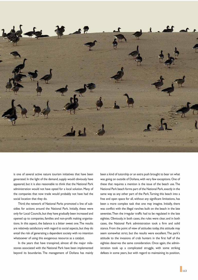
113
is one of several active nature tourism initiatives that have been
generated. In the light of the demand, supply would obviously have
appeared, but it is also reasonable to think that the National Park
administration would not have opted for a local solution. Many of
the companies that now trade would probably not have had the
social location that they do.
Third; the network of National Parks promoted a line of sub-
sidies for actions around the National Park. Initially, these were
only for Local Councils, but they have gradually been increased and
opened up to companies, families and non-profit making organisa-
tions. In this aspect, the balance is a bitter sweet one.The results
are relatively satisfactory with regard to social aspects, but they do
entail the risk of generating a dependent society with no intention
whatsoever of using this exogenous resource as a catalyst.
In the years that have transpired, almost all the major mile-
stones associated with the National Park have been implemented
beyond its boundaries. The management of Doñana has mainly
been a kind of tutorship or an extra push brought to bear on what
was going on outside of Doñana, with very few exceptions. One of
these that requires a mention is the issue of the beach use.The
National Park beach forms part of the National Park, exactly in the
same way as any other part of the Park.Turning this beach into a
free and open space for all, without any significant limitations, has
been a more complex task that one may imagine. Initially, there
was conflict with the illegal ranches built on the beach in the late
seventies.Then the irregular traffic had to be regulated in the late
eighties. Obviously, in both cases, the rules were clear, and in both
cases, the National Park administration took a firm and solid
stance. From the point of view of attitudes today, this attitude may
seem somewhat strict, but the results were excellent.The park's
attitude to the invasions of crab hunters in the first half of the
eighties deserves the same consideration. Once again, the admin-
istration took up a complicated struggle, with some striking
defeats in some years, but with regard to maintaining its position,

114
which was evidently supported by the regulations, it won accept-
ance and credibility for the Park authorities in the medium term.
Nowadays, nobody fishes for crab in the National Park, neither do
they camp illegally, or roam freely in cars along the beach… and
that is a good thing for conservation, per se, it is positive for
Doñana and it is good for the district as a whole.This is a clear
example of how a willingness to maintain a dialogue, always essen-
tial, cannot ignore the letter of the law in the application of the
rules when any contravention of these rules is clearly harmful to
the general interests.
During the same time, there has also been another process,
concerning the evolution of what are known as the traditional
uses of the land, which is also worth mentioning.When the area
was declared a National Park, as has been mentioned, the declara-
tion was accompanied by a resurgence of the demand to "return"
Doñana to its residents. Initially, the area declared a National Park
was mostly in private hands.The administration later nationalised
this land, either by buying it or by expropriating it.This move to
public ownership put demands for land use on the table that had
hardly been considered to date.These demands to be able to use
the land were enhanced and reinforced by the desire to recover
traditional uses, forming part of local traditions that are abundant
in the district. It is still too early to assess the results of this situ-
ation.The National Park maintained a relatively firm stance in the
early nineties, in defence of the general interest, but it softened its
positional significantly in the mid nineties. Everybody still remem-
bers the livestock invasion, which, it is true, was not significant
from the point of view of numbers, but it was a turning point from
a qualitative point of view.The effect this had on other protected
areas, as Doñana was a basic yardstick in Spanish conservation, is
to give an exaggerated pre-eminence to traditional uses, some of
which are little more than alleged traditions, in management plan-
ning.This is an open question, and one we will have to return to in
the years to come. There is a general impression that some of
these are not traditional uses at all and in many cases, considering
them as such merely sustains something that forms part of the
past.There is an appreciable new school of thought that does not
necessarily identify tradition with balanced, sustainable conserva-
tionism, a school of thought that will probably put things back into
perspective in the coming years; a perspective in which traditions
are not excluded, but neither are they raised to the category of
absolute truth.
The Doñana experience has acted as a foundation for spreading the idea that protected areas require their own, specific administration, which should be based inthe area of the National Park, and which should have sufficient human resources for administration, technical work, public use and services.Photograph by José María Pérez de Ayala.

115
Like most other things in life, Doñana has been moved by the
principle of action and reaction. Part of the administrative power
the space now has is due to the mortality of birds in the mid eight-
ies.The sensation of ignorance and impotence, of not being able to
do something that had become a media phenomenon is closely
associated with the reinforcement that park management has
undergone in the second half of the eighties. Here too, Doñana is
a yardstick. Nowadays, nobody would argue about the fact that
protected spaces require their own, specific administration, which
should be locally based and should have sufficient administrative
staff, technical staff, park rangers, public use resources and servic-
es. The consolidation of the management machine of Doñana
National Park, with over 500 employees and, in some years, a
budget of almost 10 million euros, seems impossible to understand
if it is not supported by a formidable political base that was creat-
ed in the late eighties. Doñana could have adopted another man-
agement model, with far less people and with far less resources.
But, if we accept that the National Park is the differential yardstick
in planning the district, then this is the only possible model. One
as yet unsolved issue is whether such a high degree of resource
allocation remains strictly necessary, once the process is launched,
or whether, on the contrary, the organisational drive provided by
managers has led to excesses, completely out of place, at practi-
cally all levels of district action that should be reconsidered and
shifted towards focussing spending on the objectives of the
National Park.
Finally, something should perhaps also be put down to luck.
Luck disguised as an economic boom that few could have fore-
seen. In the early eighties, after a long period of drought, the
National Park authorities promoted an initial regeneration of
water resources that, despite its failure, is worth reconsidering
because it highlights the anxiety of the management who felt over-
whelmed by social pressure and convinced that the progressive
decadence they were witnessing was unstoppable. The Almonte-
Marismas Plan, however, found neither the water, nor the agricul-
tural know-how, nor the markets that their ideologists were
dreaming of, and the Plan failed.And although there was no short-
age of fingers pointing accusingly at the National Park as the cul-
prit of the failure, it really had nothing to do with it.The develop-
ment of the tourist industry along the coast beyond Matalascañas
also failed to find the quality of services, products or complemen-
tary activities, and also failed. Some of the failures of other region-
al planning models touched upon in the district consolidated their
pre-eminent position over the National Park, as the up-side, but
also generated a current of playing the victim that was only
plugged when the treasure trove of resources associated with the
Sustainable Development Plan appeared on the horizon.
Hence, by way of conclusion, one would like to believe that cir-
cumstances have always been on the side of the National Park.
Although it is also true that there has always been someone with
vision enough to grasp the opportunities offered. From the time it
was declared a National Park, Doñana has always been conserved,
with better fortune at some times than others, and no change in
this conservation policy has ever been considered, in fact, it has
continued to expand in practise. The creation of what was first
called the Doñana Area Natural Park, now called Doñana Natural
Park, and its successive extensions, and the creation of other pro-
tected areas in the immediate proximities of the National Park, the
increasing involvement of the National Park in defining policies and
strategies that go beyond the borders of the Park,Doñana 2005.All
of these are examples of this attitude, clear examples of how the
National Park has always been a growing and expanding reality.
The National Park has recently been extended, the third time
in its history that this has happened. It now encompasses the orig-
inal lands that were transformed and opened up for farming, and
which will shortly recover their natural state. This is an unusual
event, because it not only signifies continuing with the policy of
protecting well conserved areas under the Doñana umbrella, it
also means implementing another policy, a policy of restoring
transformed lands and returning them to something like their
original state.This time, however, the district has understood these
changes, and they support them.The extension has been planned
and implemented on the basis of a broad consensus That is the
conclusion, rather than a paradox.What started out as a defensive
mechanism to save something of the virgin territory from the
unstoppable advance of alleged progress has become the main
argument for ensuring that the future is possible.And it remains a
great National Park.
The public use of Doñana and the flow of visitors became one of the firstlinks with the local economy of the area. In the photograph, the Palace ofAcebrón, one of the old Doñana mansions now adapted as a visitor centre.Photograph: Spanish Autonomous National Park Authority.
116
1. The present Duchess has studied the Archives from an historic stand pointand has also analysed the management of the Torre Carboneros TunaFishing Post. Ojeda (1990) published an historic analysis of the transfor-mation of Almonte.
2. This material has been analysed by Professor Martin Vicente's team fromthe University of Seville, who laid the fundamental groundwork for study-ing the ecological history of Doñana.
3. GARCIA MURILLO et al (2000, 2003), while studying place names,identified the changes in the landscape units of the Cotos, El Albario andLas Rocinas, thus offering a regional framework for the ecological histo-ry of the Park.
4 GRANADOS CORONA, M., MARTIN VICENTE, A., FERNANDEZALES, R., GARCÍA NOVO, F., 1984. Long term vegetation changes inthe stabilized dunes of Doñana National Park. Vegetatio, 75:73-80.
5. GARCÍA NOVO, F., 1977. The effects of fire in the vegetation of DoñanaNational Park. En: Mooney, H., Conrad, F. (Eds.) Symposium on the envi-ronmental consequencies of fire and fuel management in mediterraneanecosystems. Technical Report WO-3.U.S.Forest Service. Washington: 318-325.
6. GRANADOS CORONA, M, MARTIN VICENTE, A., FERNANDEZALES, R., GARCÍA NOVO, F. 1987. Evolución conjunta del paisaje y sugestión. El caso del Parque Nacional de Doñana. Estudios Territoriales24:183-187.
7. GARCÍA NOVO, F., 1990. The origin of the Doñana Ecosystems. En TheNational Park of Doñana. ICONA, Lunberg. Madrid: 8-17.
8. CHAPMAN, A. & BUCK, W.J., 1893. Wild Spain. London, Guerney andJackson.
9. CHAPMAN, A. & BUCK, W.J., 1910. Unexplored Spain. London, E.Arnold.
10. ORTEGA Y GASSET. J., 1948 prólogo, Yebes. Conde de, Veinte años deCaza Mayor. Editorial Plus Ultra. Madrid.
11. VALVERDE, J.A., 1975. Doñana y las marismas del Guadalquivir: surescate y sus problemas presentes y futuros. Ardeola. Número especial.
12. GONZÁLEZ GORDON M. & MAURICIO GONZÁLEZ, D., 1953.Exposición a F. Franco Bahamonde.
13. BERNIS, F., 1954. Prontuario de la Avifauna Española. Ardeola Vol 1. 14. VALVERDE, J.A., WEICKERT P, 1956. Sobre la migración de varias
garzas españolas. Munibe 1956 II.15. MOUNTFORT, G., 1958. Portrait of a Wilderness. London, Hutchinson.16. PETERSON, R., MOUNTFORT, G.., HOLLOM, P.A.D., 1957. Guia de
campo de las aves de España y de Europa. Barcelona, Ediciones Omega S.A.17. MOUNTFORT, G.., HOLLOM, P., 1954. A field guide to the birds of
Britain and Europe. London, Collins.18. VALVERDE, J.A., 1959. La protection de la Faune en Espagne: ses proble-
mes. Comptes Rendues de la Reunion Technique d'Áthens de l'UICN VolV:31-43.
19. VALVERDE J.A., 1960. Vertebrados de las Marismas del Guadalquivir.Archivos del Instituto de Aclimatación Vol. IX Almería.
NOTES AND REFERENCES


119
Doñana's waters, using a series of aerial photographs taken over
thousands of years, we would see how the final stretch of the
Guadalquivir depression was quickly filled in with the sediments it
transported.This included sediments from other water courses like
the River Guadaira, on the left bank, the Huelva River and the
Guadiamar River on the right bank. The great gulf gradually gave
way to increasingly smaller bays where spreading tidal flats and
marshes finally took over the area, constructing a silt plain above
sea level.The Doñana Marshes are the last phase of this landfill in
our sequence of pictures, forming a floodplain that is separated
from the tides of the estuary, fed only by rainfall and continental
waters.
Almost a million years of shoreline evolution would by synthe-
sized in these brief images.This shoreline has seen rises and falls in
In The Birth of Venus,Botticelli makes the goddess emerge on
the coast, in an allegory that could well represent the appear-
ance of Doñana at the other end of the Mediterranean.This unique
place arose out of its relationship with the sea, and water is the
essence of its birth and formation.As with the birth of Venus, the
wetlands that give form to Doñana recreate the landscape with the
passage of each season, renewing its flora and fauna and consolidat-
ing over time its well-deserved fame.
With water as a common thread, it is easier to understand the
natural systems and functional relations that turn the wetlands into
the dynamic environment that is the foundation of its great diver-
sity.Water has been the cause and agent of change, a building block
of the landscape, and is now the main argument for its restoration.
If we took a bird's eye view of the evolution of the world of
Water as the main player
Every year, whether wet or dry, the Donaña Marshes come out in an explosion of life. In this canvas, Boticelli paints a picture that could be interpreted as theemergence of Doñana, showing Venus arriving at the coast, pushed by the wind, after her birth. On her right, we see Zephyr, the Greek god of the west wind,considered the gentlest of all winds, and father of two immortal horses. Next to him is Chloris, the nymph of flowers and springtime. On land, we find one ofthe Horai, the nymph of the seasons, covering herself with her mantle to show that the mysteries of Venus are hidden, like in Doñana, where science attemptsto unravel the complex secrets of nature.Uffizi Gallery, Florence.

120
sea level of almost 200 metres in each direction with successive
Pleistocene ice ages, all of which has remodelled valleys, water
courses and deposits.The shoreline advanced up the Guadalquivir
valley during the marine transgression of the interglacial periods,
due to rises in sea level.This contrasts with periods when water
accumulated as continental ice during the ice ages and falls in sea
level made the river channel grow deeper and longer. These old
courses of the Guadalquivir and Tinto Rivers are still recognisable
on the coastal shelf, as underwater canyons that run south for
some 15 or 20 km from today's coastline.
For a million years, Mother Nature has experimented with
building a mosaic of different environments along the coastline of
the Gulf of Cadiz and the Guadalquivir Depression, varying the
placement and proportions of seas and continents, floodplains,
land and water species, and the populations that migrated to the
enclave. For this reason, Doñana represents the final act in a long
and enriching ecological process that has unfolded at the cross-
roads of the biosphere, at the meeting point of Africa and Eurasia,
of the Atlantic and the Mediterranean, of seas, rivers and lands.
Each episode and each transformation has left its marks, patterns,
processes and actors that all echo to the present, allowing us to
interpret their origins.
The final episode started about 20,000 years ago, at the end
of the last ice age (Würm, in Europe), with a eustatic rise of some
175 metres. The seawater flooded the coastal plain and
Guadalquivir depression for the last time, in alternating periods of
relative stability and quick episodes. In the Tyrrenian Age, about
6,500 years ago, the seawater reached its highest level, approxi-
mately 0.5 m above the present sea level, later receding to sta-
bilise at its present level. A new episode of a rising sea level has
been triggered during the 20th century, which could mean a rise of
some 10 - 15 cm in the 21st century, a considerable amount for
such a low-lying and flat coastline.
The variation in the sea level is a predominant agent of change
in marsh and estuary systems, but it is one that is not only due to
eustatic fluctuations and global changes in the sea level. By zoom-
ing in on much shorter periods - of hours or days - we can dis-
cover the oscillations of the tides, with a maximum range in the
area of 3.6 m.The wind, in turn, also affects rises and falls in the
sea level, and storms can raise the high tide mark by the odd
metre or two, carrying water with sediments onto the shore.
Within the Guadalquivir depression, rain and flooding rivers play
the same role, turning it into a flooded plain that, before river
dyke systems were built, covered an area of over 200,000 ha of
water surface. Over longer periods of time, erosion and sedimen-
tation were to be the agents that modified the level of the bot-
tom and, thus, the depth of the water column: the present-day
Marshes have risen by 0.5 to 3 mm a year. Finally, if we revert back
to a geological point of view, we see the tectonic movements that
induced blocks to shift vertically by tens of metres during the
Pliocene and Pleistocene Ages.
The balance between sea and continental waters has been
dynamic, with shifting boundaries between the different water
masses in their varying salinity, chemical composition, suspended
matter, temperature, origin and persistence.Water that varies in
its regime and salinity, either connected to or separated from
other water masses, make up a varied mosaic of contrasting habi-
tats, the foundation of the extreme bio-diversity of this territory.
The sea level is the absolute limit to the dry land and so too to
the areas where infiltration and run-off occur. Thus, we enter the
other world of Doñana water, where the surface waters flow to
feed a complex drainage network, carrying inputs of water, nutri-
For a million years, Mother Nature has been experimenting with the con-struction of a diverse mosaic of environments along the coast of the Gulfof Cadiz and the Guadalquivir Depression, varying the placement andproportions of the seas and continents, the floodplains, the land and waterspecies, and the populations that migrated into the enclave. The successivevariations in sea level have helped to forge what are now the greatDoñana Marshes. Photograph: CENEAM Files.

The balance between sea and continental waters has been dynamic, withshifting boundaries between the different water masses in their varyingsalinity, chemical composition, suspended matter, temperature, origin andpersistence. Water that varies in its regime and salinity, either connected toor separated from other water masses, make up a varied mosaic of con-trasting habitats, the foundation of the extreme bio-diversity of this terri-tory. The photograph shows the mouth of the River Guadalquivir, withPinar de las Marismas pine forest on the left and in the Park, and the saltpans of La Algaida Nature Area on the right at the far end.Photograph: CENEAM files.
ents, solutes and sediments to the Marshes and the shoreline.
Underneath this area of terra firma there is a powerful aquifer that
plays a decisive role in the current configuration of this varied
mosaic. The survival of this area depends on factors such as the
input of surface waters and the behaviour of the water table.The
streams and rivers that converge on this area provide the in-flow
that floods the Marshes for part of the year, but the existence of
permanent wetlands and ponds is also due to groundwater welling
up.
GROUNDWATER,THE HIDDEN DEFENDER
OF DOÑANA’S DIVERSITY
Although not obvious at first glance, the role of the groundwa-
ter is an extremely important one.They do not just guarantee the
inputs that increase the flooding of the marshes, they also provide
vital sustenance in summer so that both animal and plant life can
maintain a year-round presence there. If it were not for these hid-
den resources, the major ecological reserve that Doñana has come
to represent would never have been possible. In the dune ecosys-
tem, for example, where the level of the water table is close to the
surface, the soil in the corrales (inter-dune valleys) retains moisture
all year round and peridune ponds swell in winter months.
Moving onto the subterranean geography of the water, the
Doñana zone is located at the southern tip of aquifer system num-
ber 27 (according to the classification of the Spanish Institute of
Geology and Mines) and, within this system, it forms part of the
Almonte-Marismas sub-system.The Almonte-Marismas Hydro-geo-
logical Unit is a free detrital aquifer in the NW sector. It is confined
and charging under the marsh sediments of the eastern zone,
stretching under an area that encompasses almost 3,000 km2.The
natural limits to this aquifer are imposed by the Tinto River and the
impermeable outcrops of blue Miocene marls, which coincide
roughly with the route of the Seville-Huelva Motorway to the
north and west; and to the east and south-east by the Guadiamar
River and the rising waters from Quaternary rock that surrounds
the marshes; and by the Atlantic Ocean to the south.The depth of
121
FIGURE 1
In the image, a few geological features of the Doñana aquifer (the Almonte-Marismas Hydro-geological Unit), useful to understand the hydrological behav-iour of the area, have been superimposed over the satellite photograph(Landsat-5).The blue marls of its impermeable bottom appear on the surface in the north ofthe area. The River Guadiamar acts as a subterranean watershed with theEspartinas sub-unit. Then follow the basal sands of Late Pleistocene, whose thick-ness under the marshes reaches almost 200 metres.Wind blown sands are next in the sequence, surrounding the left side of themarshes, reaching a thickness of 200 metres in the Acebuche area. The dunecover, which include older stabilised dunes of the quaternary period and therecent dune system, is characterised by high permeability and it is then an impor-tant recharge area.Then we find the marsh bowl of Doñana, with its impermeable basement madeof clay, silts and sand. In the satellite image it has been coloured of light blue,showing the original boundary of the big marsh.The area of "La Vera" has been differently coloured, emphasising this ecotonelocated between the silt-clay area and the sands, two materials with very differ-ent reply to water permeability. It is therefore a strip of springing water, anemblematic area of Doñana that maintains the humidity in the dry period.
1
2
3
4
5
67
1 LATE MIOCENE - Blue marls 5 RECENT DUNE SYSTEM
2 MIDDLE PLEISTOCENE - Basal silts 6 MARSHES3 LATE PLEISTOCENE - Basal sands 7 LA VERA 4 AEOLIAN SANDS

122
the aquifer gradually increases from the north,where it is just a few
metres deep, to over 220 metres in the South, under the marsh
sediments.
The impermeable base on which the permeable sediments rest
is made up of a powerful formation of Miocene blue marls, whose
ceiling gradually descends as we move from north to south, from
about 50 m above sea level, to about 250 m below sea level on the
southern border of the coastal strip. Most of the natural charge of
the unit occurs by direct filtration of rainwater falling in the areas
in which the water table is free and much less of it produced by
surplus irrigation water.
Concerning the character of the permeability of these materi-
als in facilitating the flow of groundwater, it can be seen that there
is also a clear north-south variation. The areas at the edge and
under the marshes are far more permeable than the northernmost
zones, where there is a higher proportion of silt material and the
water is transported more slowly. For this reason, the largest draw-
ings of groundwater currently in operation are concentrated
around El Rocío and all along the edge of the marshes.The amount
of water drawn up artificially from the aquifer is similar to the
amount discharged naturally.
The increase in extracting groundwater, which has affected the
water table to such a degree, arose from the development mindset
of the seventies, when the great irrigation strategy of the Almonte-
Marismas Plan was conceived.The plan appeared in 1971 as a result
of declaring the creation of the Almonte-Marismas irrigation zone
to be a programme in the national interests. It covered an area of
45,940 ha in the provinces of Huelva and Seville,which meant prac-
tically the entire immediate ring of land around Doñana. Since then,
the aquifer has been studied in greater depth and new protection
instruments have been arbitrated for the Doñana National Park
and Nature Park, and so the zone that can be irrigated has been
successively restricted, until now, at only 6,000 ha. Most of the
water extracted from the water table is now used for growing rice.
Moreover, there is another important event for the management of
groundwater resources that must be taken into consideration. It
occurred on the 1st of January 1986,when the Water Act came into
force, proclaiming all waters, be they surface or underground
waters, as public property, although the transitory provisions do
recognize the private ownership of the groundwater that were
being exploited before this date. Even in this case, if the owner
wished to increase the amount of water they draw up, or if they
wish to modify conditions of use of the water, they would need a
formal administrative concession covering the entire usage, which
is of great importance for both the present and the future manage-
ment of the waters of Doñana.This exception has created prob-
lems that have been identified, for example, in the Aznalcazar Marsh
and more specifically on the Hato Blanco and Hato Raton estates.
Large volumes of water are drawn up from the aquifer to irrigate
rice, leading to the formation of a cone-shaped depression in the
phreatic layer. This has grave consequences for the region where
rice growing occurs in the north of the Marshes, and especially at
Coto del Rey.
The influence of rising water discharging from the water table
to the surface is key to the survival of many of the outstanding
ecosystems and landscapes of Doñana.We can see that discharges
on the southern shore and within inter-dune valleys or corrales,
have allowed the formation of temporary ponds, characteristic of
this environment. To the east, in a lowland strip called La Vera,
formed by a sandy rib running around the Marshes, the water table
allows emerging water in the depressions, creating ponds, like El
Hondon and El Sopeton, and springs from which some of the canals
that drain to the marshes flow. Further north, between El Rocío
and the old Santa María stream (Arroyo de Santa Maria), near
Almonte, there was a string of seasonal ponds that were also fed
by springs arranged in a network that discharged into the right
bank of the Partido stream (Arroyo del Partido) until the mid 20th
century. Unfortunately, they have all disappeared because of the
agricultural transformation caused by the abovementioned
Almonte-Marismas Plan (part of Sector II).The last few ponds dried
up in the year 1987.
Another important area of springs is El Abalario, in line with the
Rocina stream (Arroyo de la Rocina) and south of it, running along
a small tectonic step, with a string of ponds, in an area reaching to
The influence of rising water discharging from the water table to the sur-face is key to the survival of many of the outstanding ecosystems andlandscapes of Doñana. We can see that discharges on the southern shoreand within inter-dune valleys or corrales, have allowed the formation oftemporary pond, characteristic of this environment. The picture shows aview of one wooded corral beyond a dune in the foreground. Pinus pineadominates tree cover in dune corrals.Photograph by Cipriano Marín.

123
the Matalascañas-Mazagon road which gets flooded during heavy
rainfalls. Dozens of small springs and seasonal ponds appear here
too, with tributaries that feed the "algaidas" (creeks of sand areas)
and flow into the Rocina stream from the right bank. There is
another interesting unfolding of events the El Abalario area. The
regular input of waters with a low mineral content from the aquifer
has led to the creation of peat bogs.The largest flood plain is the
chain of ponds called Laguna de Ribetehilos, which has been
restored and at times of heavy rain, covers a large area.
To the west of Doñana, on its detrital formations, there are
three interesting ponds, which are protected areas: Laguna de Las
Madres, very close to Mazagon, and what are known as Laguna
Grande and Laguna Pequeña de Palos, the latter two closer to the
Park. Laguna de las Madres, practically destroyed by the human
greed of the 1960s, forms the last part of the Avitor stream and is
fed with waters with low mineral content from the water table.The
most interesting aspect of this pond lies in the formation of a peat
deposit in the flooded basin. Pollen studies of the peat deposits
have provided a record of vegetation over the last 6,000 years. In
general terms, these studies indicate that there have not been any
changes in the species identified, but rather variations in abundance
shown by fluctuations in climate and by expansions and reductions
in the size of water surface. Unfortunately, the dense gallery vege-
tation and part of the abundant peat deposits have been exploited,
hence, diminishing the ecological interest of Las Madres.The two
Palos ponds, also connected to the water table, occupy eroded
depressions in the detrital formations, their drainage impeded by
wind blown sands. Although they have lost their original dense
shoreline vegetation, they still offer extensive surface areas of
water, and they act as suitable wetlands for vertebrate water fauna.
If we change our perspective again and superimpose a map of
the major differences in chemical composition over this extraordi-
nary range of groundwater inputs, we see a significant diversity in
water environments.We would find springs with an extraordinary
range of pH values (1.9 to 9.6), or with different concentrations of
several elements such as N, P, Mg, Ca, Fe, Cu, Mn and others. It has
been discovered that the characteristics of the water that feeds the
Doñana springs may depend on depth. Mineralization may increase
with depth, although human influence appears to be a commanding
factor.On the surface,mineralization is low and very irregular. If the
location is favourable for discharging from greater depths, the
water that rises has a higher mineral content and rises at a more
The impermeable nature of the clay silt that covers the Doñana depressionguarantees the permanence of water for long periods of time. The plain isonly interrupted by small elevations almost imperceptible to the payper-son, known as paciles and vetas, and dotted with water-filled depressions,caños, lucios and quebradas, that form a subtle hydrographical network.Small variations in water level allow for a wide variety of environments tobe housed in the Marshes.Photograph by José María Pérez de Ayala.

124
regular rate. So different water bodies under the influence of the
same multi-year water cycle may respond differently, i.e. annual
flooding, flooding in certain years, continual drop in the water table
level under the basin. It is clear how this water narrative shows us
its incredible capacity for creating diverse niches of life, before it
even surfaces.
THE CHANGING FLOW OF WATERS
THROUGH THE DOÑANA MARSHES
Having lost their former tidal influence, the variable water sur-
faces that dot the most outstanding landscapes of Doñana depend
almost entirely on the input of rain waters and the overflow from
the rivers and streams that converge on the great trough of the
Marshes.The low permeability of silts that form their foundation
guarantees that the waters will remain for long periods of time.The
landscape is only interrupted by small elevations known as paciles
or vetas, flat depressions (lucios) and river beds (caños, quebradas)
that perform as a subtle hydrographical network.These small vari-
ations in the water level cause a variety of environments that can
be seen in the zones of pools, ponds, pans, and channels.
The great marsh plain has always been subjected to a variable
flooding regime, which has depended on rainfall and the flow of
watercourses draining into the Marshes.The flood process starts
slowly and evolves progressively between October and November
and under natural conditions, the Marshes continue to fill until
water level reaches the heigth of the levee or right embankment of
the Guadalquivir River, in the area known as Las Salinas and Los
Rompidos. This acts as a natural overflow, channelling the excess
waters into the estuary of the Guadalquivir River, "Wadi al-Kabir"
or Great River or as it was called by the Arabs.This was how the
maximum flood levels were regulated and the spatial limits to the
non-floodable marsh ecosystems were set - areas of exceptional
value as refuge for the terrestrial wildlife in times of major flood-
ing.
The flooding phase lasts through until March or April, which is
normally when a balance is struck between water inputs and evap-
oration / transpiration. From this time on, water loss through evap-
oration and transpiration leads to a progressive drying out of the
marshes until the annual cycle is completed.The input of surface
waters, before the hydraulic developments began in the mid 20th
century, guaranteed this cycle, with areas remaining flooded well
into summer, or even all year round.
But to gain a more detailed insight of how the water cycle
works in the Marshes and the effects of the changes that have
occurred, one has to understand the character the varying inputs
of surface waters and their different systems. The contribution
made by rainfall is determined, in broad terms, by an annual aver-
age rainfall of 575 mm, which, on average, is distributed as follows:
20% in spring, 5% in summer,35% in autumn and 40% in winter. The
autumn rains are generally torrential while in spring and winter
they are produced by frontal perturbations with a lower intensity.
With regard to river and stream input, consideration must be
given to the fact that the Doñana Marshes have always been cov-
ered by a complex hydrographical network formed by branches
of the Guadalquivir and Guadiamar rivers and the La Rocina, Los
Sotos, El Ajolí and Las Cañadas streams. One of the major contri-
butions comes from the Guadiamar River, which stems from
beyond the Doñana aquifer system, and which has a much greater
catchment basin than the other sources of surface water, except
for the Guadalquivir River itself.The Guadiamar River is the final
tributary feeding into the Guadalquivir River on the right hand
bank before the river mouth. Until mid XX century, its basin was
Although not so obvi-ous at first sight, therole of the groundwa-ter is extremelyimportant, providingvital sustenance to theanimal and plant lifein times of low rain-fall. The pictureshows a temporarypond in a corral slack,between active dunes.
Photograph: CENEAM files.

125
the main hydrological sub-system that flooded the Doñana
marshes. It is still one of the few unregulated river complexes of
the Andalusian hydrographical system.
Inputs from the branches of this river account for over half the
input of water into Doñana. For an average year, it was estimated
at 225 hm3/year. Its high inter-annual irregularity must be empha-
sised, comparing the 19 hm3 debit for the year 1982/83, or the
extremes of 724 hm3 in 1962/63 .This water feeds in through the
Guadiamar channel (Caño Guadiamar), basically during winter rises
in the water level,or through the Travieso channel (Caño Travieso).
The inputs from this latter stream normally used to be fresh water,
although it was able to feed in brackish water in late summer
because of the influence of the tides and the connection with Torre
Branch (Brazo de La Torre). Moreover, from a broader perspec-
tive, the layout and geographic situation of the Guadiamar basin
turns this watercourse into the most important corridor connect-
ing Doñana's coastal ecosystems with those of the Western Sierra
Morena, specifically the Sierra Norte and Sierra de Aracena ranges.
Another major component of the input that defines the surface
hydrological system is that of the fresh waters from the Rocina
stream and its tributaries.They are notably supported by contribu-
tions from groundwater draining out of Doñana's aquifer. Oddly, this
system provides relatively regular flows throughout the year,
although the average annual contribution shows a pronounced fluc-
tuation, ranging from 1.5 hm3 in cycles of drought to a maximum of
73 hm3 recorded in 1995/1996, the period of highest rainfall and
flooding on record in Doñana in the last thirty years.
However, the regulation of this intricate and delicate hydrological
network was to be radically transformed. Some areas of the former
marshes had already been dried out and used as grazing pastures for
livestock by the end of the 18th century.Walls and locks were to be
used to control the flooding of the low lying areas, letting in fresh
water from the estuary during the "botamentos" (fllodings during
very high tides), to promote the growth in the Marshes of grass and
macrophytes for livestock consumption. But the most profound
transformations in the hydrological regime took place in the second
half of the 20th century, basically by two actions: the draining of the
Marshes to convert them into irrigated farmland and rice paddies,
and the regulation of the Guadalquivir River basin through dam build-
ing. Both these changes are closely interrelated, as it was essential to
build reservoirs and diversion canals in order to supply irrigation
water to the farmlands and rice fields in summer. For example, the
Canal de los Presos (Channel of the Prisoners), built by political
detainees after the Civil War,was a key project for granting the water
supply for farmland irrigation on the left bank of the estuary.The reg-
ulation of the Guadalquivir had other clear impacts, such as the
dredging of the shipping canal between Sanlucar and Seville thus
favouring one branch of the river over the others,which finally led to
their silting up.
Another wave of changes was produced at the hands of the
development mindset that orchestrated the Almonte-Marismas
Plan.This plan had altered basins and extensive marshlands and the
functionality and layout of the channels and branches of the
Guadalquivir, such as the Torre Branch.At the same time, the dig-
ging of deep wells lined with steel and the use of submerged elec-
tric pumps had a profound effect on the functioning of the aquifer4.
And so the goalposts of Doñana's hydrological system were
permanently shifted. It triggered processes to accelerate, disturb-
ing a centuries-old balance. The most important interventions in
recent decades that have changed the original way these wetlands
were arranged and their most significant consequences can be
summarized as follows:
- The transformation of tidal marshes into reclaimed land (pol-
ders) for rice growing on the right bank (55,000 ha) and for irri-
gation crops (10,000 ha) on the left bank.
FIGURE 2In the image, the original Doñana network has been superimposed overthe survey and the satellite photograph (Landsat-5), highlighting the for-mer rivers and streams that flowed into the Marshes. The system isbounded to the right by the River Guadalquivir. The current flood area ofthe Marshes has been coloured in, bounding to the south on the dune sys-tem and Torre Branch (Brazo de la Torre) in the confluence with theGuadalquivir, and to the north by the town of El Rocío. Also clear is thebordering flood corridor known as the Encauzamiento Guadiamar.The most significant lucios, or depressions, in the Marshes area have beenhighlighted. The watercourses marked within this zone are locally knownas caños. Following the coast line to the west, a major pond complex hascome about, running from the edges of the Doñana Marshes, along a stripbetween the Rocina stream, Arroyo de la Rocina, and the coast. The ElAbalario pond complex and the peri-dune ponds of Doñana make up adiverse and rich wetland system.

The image, built upfrom a Digital SurfaceModel developed forthe Doñana Marshes,clearly shows the sub-tle network of thehydrographical system.The intersection of thetwo channels, CañoMadre de las Marismasand Caño Guadiamar,can be seen on the left,both of which convergeinto a channel knownas Caño de Brenes. Onthe right, the Traviesochannel can be clearlyseen, and at the bot-tom, the Lucio de losAnsares. The scale givesa clear idea of how theslight variations in theterrain define the par-ticular hydrologicalsystem of Doñana..
5
Elevation (m a.s.l.)
0

127
- The draining and desalination of mainland marshes on the right
bank (10,000 ha), under the auspices of state promoted projects
and private initiatives, forming a fringe of transformed areas
around National Park marshes.
- The regulation of the Guadalquivir River basin with 52 large
dams.The winter maximum floods (bujarretes) have disappeared
and the maximum river flow is now in late summer. This flow is
wholly controlled by River Authority (Confederación
Hidrológica del Guadalquivir) and it is aimed at maintaining low
salinity (under 4g/l) waters in order to use them to irrigate rice
paddy fields.
- Major flash flooding has diminished or been reduced excessively
by the headwater irrigation trenching. So inputs to the
Guadalquivir when these would have coincided with high tides
have been reduced.
- The construction of drainage canals and retaining walls to pro-
Since the earlier tidal influence has been lost, the variable water surfaces that create the Doñana landscapes now depend almost exclusively on the input ofwater from rains and floodwaters of the rivers and streams that flow into the great trough that is home to the Marshes. In this picture, water is leaving theMarshes for the estuary by the Old Cherry canal during a period of flooding (note the muddy waters and near-full canal).Photograph: CENEAM files.

128
tect crops from the flash flooding of the Guadiamar, the Torre
Branch (Brazo de La Torre), the Cigüeña and Partido streams
(Arroyo de la Cigüeña and Arroyo del Partido) and the River
Guadalquivir.This has led to a fragmentation of water resources.
- The decline in the tidal function of the Torre Branch since the
turn of the century.This was a consequence of building the regu-
lation reservoirs mentioned above, together with the digging and
dredging work carried out in the River Guadalquivir to facilitate
shipping.This aspect is especially worrying because of the reper-
cussions it has on fish life.
- The loss of functionality of the Guadiamar and Travieso channels.
The first case came about in 1955 when diversions to the
Guadiamar River were constructed in order to clean up the land
for later cultivation.Then, the Travieso channel lost its connection
when they converted Caracoles estate to polders in 1969. In this
way, waters were prevented from continuing to flood former
marshes (Marisma Gallega, Cantarita, Caracoles and Isla Mayor),
thus reducing the marshes to a mere one third of their original
area.
- The transformation of sectors II and III of the Almonte-Marismas
Plan, which cleared extensive areas of brush and large areas of
forest to the north and east of El Rocío, levelling the land and dig-
ging wells to draw on what were then considered to be inex-
haustible water table resources. Private owners fuelled changes,
bringing new areas into cultivation, including the rice fields in
Hato Raton. In most cases, this has led to falls in water table
levels, with springs in depressions drying up and some old
"lucios" disappearing.
- Concentrating surface drainage in a new canal bordered with
walls in the Partido stream, causing erosion in the channel and its
banks, an increase in the transport of sands, and the consequent
formation of a sandy delta of some 300 ha that now covers part
of the National Park Marshes in the proximity of the village of El
Rocío.
- Planting of eucalyptus groves in areas of what is now the Nature
Park. This has provoked an increase in transpiration and falling
water table levels in zones like El Abalario, which has led to the
drying out or shrinking of the local ponds. Ribetehilos pond is a
clear example of this, with a drastic decline of aquatic resources
and clean spring water.
- Extracting water from the water table to supply new settle-
ments, such as Matalascañas tourist resort. Cones of depression
resulted, which penetrate into the National Park and can be felt
as far as Charco del Toro. In the same way, the extraction of
groundwater in the municipal districts of Almonte, Hinojos and
Vilamanrique have caused a general fall in water table levels in
the Nature Park and the surrounding area.The level has fallen by
as much as 20 m in Villamanrique (NE of the Park).
Faced with this situation, it would be worth considering the
obvious: the changes that have been wrought on many wetlands
through the pressures of human activity over time, is causing them
to shift towards a new scenario. In relative terms, this is a different
and sometimes equally as diverse and valuable scenario. In fact, very
The image shows a reproduction of an early meteorological record entryof 1888, an exceptionally wet year. To the early decades of the 20th centurythe inhabitants of Doñana district faced the challenge of the changingwaters: cycles of floods and droughts, storms, overflowing of the streamsand the major floods of the Guadalquivir River. An extract from Murray'snarrative gives us a good idea of this view:"The Guadalquivir… when it reaches Seville, gradually casts off its fineclothing until it becomes little more than an enormous canal that windsacross the great plain; when the steamer we are travelling in rounds itsbends, one after another, the spectacle that opens before our eyes is farfrom picturesque, and the only living thing to be seen are the vast herds ofbulls that graze on its banks. And these animals are walking on treacher-ous ground, as they are just a few palms above the water level, and, there-fore, exposed to frequent floods that carry them away, as happened tothousands of head of cattle in the winter of 1837, when the incessant rainsswelled the flow of the "great river" in a way that the inhabitants of itsbanks had never seen before. It was not only these pastures that wereunderwater, the entire countryside around Seville was turned into a widesheet of water with isolated villages sticking up above the water here andthere; not even the city escaped the catastrophe, as all the neighbourhoodsclose to La Alameda were flooded and impassable for several days."Source: R.D.Murray. 1849 The Cities and Wilds of Andalusia. 2 vol. R. Bentley Ed.
The Fernandina Cut (Corta Fernandina) was made in 1816, isolating theTorre Branch (Brazo de la Torre) from the Guadalquivir and, therefore onlyreceiving water inputs from the Guadiamar River. The picture shows thedrawing of this canal at the time, opened at the Island called Isla Menorby the Compañía de Navegación in 1816.Source: Port of Seville Archives.

129
FIGURE 3The great Marsh plain has always been subjected to a variable regime of flooding that depends on rainfall and the flows provided by the watercourses that feedinto it. The flooding process starts slowly but surely between October and November, and, in natural conditions, the Marshes continue to fill until they reachthe high water line defined by the lowest area of the right levee or bank of the Guadalquivir, at the area known as Las Salinas or Los Rompidos. The sequenceof images, according to the Digital Surface Model, shows us how the flooded areas evolve, depending on the level reached by the water in the flooding-drain-ing process, providing an excellent tool for studying and zoning the different aquatic ecosystems. The water mass that fills corresponds with the Lucio de losAnsares.

130
few marshland areas are now in a strictly "natural" state.
Nevertheless, most of the changes listed go beyond this abstract
threshold.They cannot be justified any longer.We have abandoned
the development whims of the past and the historic mistakes
caused by scientific ignorance of the biological legacy the area is
home to.
This is the context, the new challenge and the basic work to do
in restoring the water cycle in Doñana. It has begun translating into
initiatives like the Doñana 2005 Project and the Guadiamar Green
Corridor. It is not just a question of correcting the effects of his-
toric cultural treatment of our natural heritage; it is simply about
cleaning up after the absurd decisions taken in certain decades of
the 20th century,with a view to establishing a hydrological basis that
will allow the marshes to survive in a dynamic world.
In contrasting how the water cycle worked in the recent past
when the main rivers and streams draining into the marshes had
full use of their free space, we can illustrate with current points of
reference. It is enough to highlight some examples of indicator
species that have now disappeared completely, or which are seri-
ously endangered by a loss of, or modification to their habitat. In
the case of waterfowl, we could mention the great bittern
(Botaurus stellaris) that used to maintain a large breeding popula-
tion that no longer exists because of the disappearance or degra-
dation of large formations of helophyte vegetation; the glossy ibis
(Plegadis falcinellus), which disappeared as a breeding species in the
1950s following the disappearance of bulrushes when major trans-
formation of the marshes started, although recovery of this species
has now been triggered; the marbled teal (Marmaronetta angu-
stirostris), which almost disappeared because of changes to the
clear water marsh system; and finally the white headed duck
(Oxyura leucocephala) that requires the deep waters of certain
areas that used to remain flooded for long periods of time.
Although less visible, other important changes have taken place
in the waters of Doñana.These concern aspects related to water
"quality" in the broadest sense of the word, something that has only
become a cause for concern in the world of conservation in recent
decades, yet it is possibly just as important as the challenges of
restoring the natural hydrological functioning of the water systems.
A general understanding of these waters, and especially the
The changes induced in many wetlands by the pressure of human activity, has pushed them toward new scenarios, scenarios that are different and in somecases flourishing with new forms of diversity. But, most of the changes in the hydrological system carried out between 1950 and 1980 can no longer be justifiedfrom any perspective. Alleviating the effects makes up an important part of the new challenges facing the hydrological restoration of Doñana, as these havenow translated into specific initiatives like the Doñana 2005 Project and the Guadiamar Green Corridor. In the image, flamingos are seen in the marshes.Photo by José María Pérez de Ayala.
A view of the Santa Olalla pond. It is the largest pond in the dune area ofDoñana. Its variable regime is clearly shown by its desiccation happenedseveral times in the last decades. Nevertheless, in 1624 King Philip IV washunting in this area on a large boat for the whole day. The mute swan(Cygnus olor) was breeding in this pond until 1750. It is a pesent one of thesites where the white headed duck (Oxyura leucocephala) has started breed-ing again.Photograph by Cipriano Marín.

131
influence of these other water properties, is certainly recent.We
know that during the 19th century, chemists started to document
the major changes in composition and that, later on, with the
appearance of microbiology, studies of small aquatic organisms
began.Limnology combined physics and biology to understand how
different water masses work and, in the 20th century, integrated
responses to the effects of human intervention were first offered.
Applying molecular techniques to identify micro-organisms has
recently revealed an astonishingly diverse panorama of life. Old
species are made up of a multitude of lines that differ widely in their
activity, production of toxins, smells and irritant molecules.
Advances in analysis, in turn, providing access to concentrations of
less than 1 ppb, are now discovering compounds that have come
from drugs like female hormones, beta-blockers, anti-inflammatory
medication, antibiotics, cosmetics like ceramides and cleansing
products like tensio-actives in our waters, apart from the weed
killers and pesticides that we already know about. Even in these
concentrations, some of these molecules have been shown to have
harmful biological effects.
We are, therefore,entering a scenario of an ecological mutation
in aquatic resources, caused by chemical changes and by the intro-
duction of biological species and strains from other areas.Almost
the entire drainage network is affected by these kinds of impacts,
as pollutant substances are used in all human and agricultural set-
tlements, including those in the Doñana area.
All of this forces us to take a broader view of the management
of Doñana, a view that encompasses the basins. For even if we
resolved the main aspects of the ecological restoration of the sur-
face waters, the invisible effects on the quality of the Doñana's
water sources would persist.
A sample of data and events show how far we still have to go
to strike a harmonious balance with an ecosystem as exceptional
as Doñana:
- The urban spread represented by the Matalascañas tourist
resort, set in the very borders of the National Park and with
summer peaks of 175,000 inhabitants, generates a large volume
of wastewater that affects the shoreline at this time of year.
However, in recent years these affects have been resolved since
the installation of a wastewater treatment plant, including terti-
ary treatment that might meet the demands of golf-course irri-
gation.
- The growth of Almonte, and to a lesser extent Rociana and the
disastrous state of its collectors and the wastewater treatment
plant, mean that the Santa Maria stream, that later changes its
name to El Partido stream, receives raw wastewater or half-
treated spills that contaminate it before passing on these effects
to the marshes of the National Park.
- Discharges from Villamanrique into the Cigüeña stream (Arroyo
de la Cigüeña) and urban and industrial waste from Pilas,
Aznacazar, Hinojos, and Sanlucar la Mayor, with little or no treat-
ment, still reach the Guadiamar River today. The river also still
suffers spills of brine, oil press dregs and untreated urban efflu-
ent.
- The Aznacollar mining basin, exploited almost since early times
but far more intensely from the 18th century on, has accumulat-
ed a large volume of slag.This has sustained profound long-term
levels of contamination at the head of the Guadiamar River, via
the Agrio tributary. Its acid waters which, in times of low water
contain dissolved metals, have been documented in the mid
stretch of the Guadiamar River since the 1970s3.But a new phase
This orthophoto shows us part of the advancing dune system, interruptedby the green strips of the "corrales". The marsh is practically dry. Beyondthe sands of wandering dunes we can observe a green-coloured area ofsands saturated by the water springing from the aquifer, which are cov-ered of woody vegetation. In a different colour, on the bottom-right, the ElHondón pond, fed by springing water.Orthophoto: Ayesa.
Ship navigating on the River Guadalquivir seen from the Doñana Marshes.Photograph kindly provided by the Seville Port Authority.

132
in mining was initiated in 1990, which managed to accumulate
nearly 6 hm3 of excess minerals, mostly finely ground pyrites and
arsenopyrites, in a pool next to El Agrio. It spilled when the banks
of the pool dramatically burst in 1988.
- Seville's wastewater treatment is very good, but the Estuary
receives the discharges and spills from the towns of Alcalá del
Río, La Algaba, Santiponce, Camas, Sanjuán, Gines, El Aljarafe,
Coria and La Puebla on the right bank, and from La Rinconda and
its industrial estates on the left bank. Moreover, other inland
towns, like Utrera and Los Palacios, only partially treat their
wastewater, which ultimately reaches the Estuary or its tributar-
ies. This depressing picture means that the last stretch of the
Estuary, which forms part of the National Park, is polluted and
eutrophicated, creating a strange need to, at least partially, dis-
connect Doñana from the Guadalquivir.
- The first incident of massive waterfowl poisoning was detected
in 1970, causing recurrent spates of deaths during summer.The
1972 episode was estimated to have taken 40,000 birds, the 1986
episode 22,000 and there were other less deadly episodes in the
1990s, until measures were taken to collect dead birds and mon-
itor the water mass.
The Guadalquivir Hydrographical Authority (Confederación
Hidrográfica del Guadalquivir) has been systematically monitoring
water quality in Doñana since 1989, using its 18-point monitoring
network that includes all surface watercourses that affect or feed
Doñana, plus other points in the interior of the marshes.An under-
standing of the water quality data, heightened by the Aznacollar
accident, has made it possible to alert the authorities about this
new dimension in the management of water resources associated
with Doñana, and a wide range of actions has now been implement-
ed.There has been a substantial reduction in the organic pollution
recorded in El Partido stream and the Guadiamar River. This has
managed to put a brake on the onerous wastewater problem that
used to affect the National Park.
Nevertheless, in the face of this complex scenario, in which it is
essential to admit that even if the main sources of pollution are
eliminated, the collateral effects will take a certain time to disap-
pear, Doñana comes up with new surprises, as always. In this terri-
tory, certain water masses are still conserved that maintain a pris-
tine composition. This is of great importance for science, as it
makes it possible to work on its ecosystems in conditions that no
longer exist in the rest of the park.These are the spring waters in
the Nature Park and National Park that are fed by the aquifer sys-
tem, and they do not currently present any evidence of pollution.
In this way, the El Abalario ponds in the Nature Park and the 'peri-
dune' ponds of the National Park have become biochemical yard-
sticks, natural controls of the state of surface waters and every
effort must be made towards their conservation.
THE SURFACE WATER DILEMMA:THE FIRST SIGNS OF DRYING OUT
The first publications on the study of insects in 1971, suggest-
ed that the marshes were, in fact, made up of a mosaic of different
water masses that varied greatly in depth,duration,mineral content
and chemical composition2.Aguilar Amat, Ramírez Diaz and Montes
conducted the first numeric analyses of the chemical characteris-
tics of the waters of the Marshes, and, with Antonio Torres, they
published an ecological map of the National Park in 1977, a map
that is still consulted today3.
From a more detailed insight into all water-related aspects, the
first attempts at explaining the heterogeneity of the Marshes have
been taken, based on hydrological structures that cause the chem-
ical and physical variations in the water.Being such an extensive ter-
ritory with over 30,000 ha of floodable land, studies of it with tra-
ditional instruments advanced very slowly, until recent decades
when remote sensors and refined procedures for accurate topo-
graphical surveying have become available.
FIGURE 4
Layout of the ponds fed by groundwater in Greater Doñana On the edge of the Marshes, where the caños and lucios are highlighted,peri-dune ponds can be seen, laid out along the sandy rim that bordersthe flood zone, all of which are integrated within the National Park. To theleft, the string of ponds in the El Abalario area can be seen below thestream known as Arroyo de La Rocina. Most of them fall within the NaturePark, where there is a group of peaty ponds that have undergone one ofthe most interesting restoration operations of recent times in Doñana.

133
The first interpretation trials, dating from 1977, used satellite
images from the Landstat Satellite (then ERTS-1)4, giving a water
surface area of 26,000 ha. Sufficiently powerful computer-support-
ed numeric models for making fine numeric simulations in the
marshes were not accessible until the 1990s. Hence, topography
accurate to the millimetre and numeric flooding models have only
been available since early 2004, after the development of a marsh-
es modelling project. This has been promoted since the Doñana
2005 Project, with the support of the Inter-ministerial Commission
of Science and Technology (CICYT).
It is feasible that the recent history of water in Doñana might
have been written differently, had we had the means and knowledge
that we have now. In 1970, the FAO5 report drew attention to an
important aquifer with high quality waters, capable of supporting an
extensive irrigation area of sandy soils. In 1971, the Almonte-
Marismas Plan was declared a Zone of National Interest with an
area of 45,960 ha, 30,000 of which could be irrigated. Sandy soils
were brought under the plough by irrigating them with groundwa-
ter. The transformation of the marshes grew by way of drying them
out and desalinating the soil with deep drains. Grande Covian,
heading the IRYDA project, accepted the task as a crusade against
a hostile natural environment, to push back the agricultural fron-
tiers beyond the barren lands of the marshes. In his words, he was
"rescuing the marshes and cotos (stable sand dunes)."
The plan's proposal took into account the low revenues from
the area involved, the climate that was ideal for fruit orchards, and
the fact that there were annual inputs into the aquifer (overestimat-
ed by 400 hm3). The plan ignored the ecological impacts, despite
their clear inclusion in a preliminary report by Herteaux6 (1970). It
was mistakenly accepted that the entire local population of farm
workers would find employment in the production of the new
high-tech crops.The slow implementation of the plan delayed crop
production and water extractions until 1980, with some 14,000 ha
being prepared for irrigation, of which some 4000 ha were distrib-
uted among settlers and their co-operatives, although not all of this
land was farmed. On the other hand (and not included in the land
area of the plan) the private sector had started farming a larger
area of land and the volume of water extracted in 1990 was around
50-55 hm3 per year12. And so, from 1972 onwards, the historic
wilderness of Doñana and its marshes was to suffer anew from the
The inundation of the marshes seen from the satellite.The sequence of Landsat satellite images, taken over several years, clearly shows the water filling of the Marshes. The inundation starts slowly and progressive-ly between October and November, the flooding phase lasting usually until February-March, when equilibrium levels between water intake and evapo-transpi-ration are reached. Then losses from evapo-transpiration increase, leading to a progressive desiccation of the marshes, followed by the summer drought thatclose the cycle.Image montage made by Carlos Urdiales.

134
interference of this plan - on top of the polderisation that had
started in 1918, the stabilization of the dunes with pine trees in
1938, the planting of eucalyptus in 1941 and the urbanization of
Matalascañas after 1968.
The agricultural trials carried out on the transformed sandy
soils produced mediocre results in citric and stone fruits, because,
in much of the region, there was a ferruginous base layer just a few
decimetres below the surface.This layer tended to cause a small
hanging water table, causing puddles to form in the area and pre-
venting roots from growing. But, at the same time, the private sec-
tor created a large, 223 ha plantation of strawberry fields near
Mazagon, with the aid of peat dug from Las Madres lagoon, which
turned out to be the best agricultural option.Thus, the crops that
spread to Moguer, Palos and Lucena in the eighties extended to
the Almonte-Marismas Plan and to Lepe-Isla Cristina to the west
of the Odiel River.
At a practical level, the farmers of Almonte, Hinojos and
Villamanrique were used to small irrigated fields and orchards, and
larger plots for dry land farming, using old-fashioned farming meth-
ods like the hoe and animal power. The plots offered in 1980 by
the Almonte-Marismas Plan averaged 17.5 ha per family and were
mechanized farms, endowed with wells that were equipped with
submerged pumps and electricity connections. They were designed
for an entrepreneurial mentality in a slick export market, with agri-
cultural services, warehouses and a processing industry. None of
these things had existed in the local farming of the time. So, the
take-off of these crops was slow in the context of administrative
chaos of the state maintaining ownership of plots of land that were
not always farmed, but which did act as collateral to guarantee the
loans of their tenants to finance other sectors.After years of neg-
lect, some of the pumps and irrigation systems fell into ruin until
the administration took over the debts in the nineties, taking back
these plots of land and redistributing them,but this time with deeds
of ownership.
The private sector created plantations of citric fruits, stone
fruit and strawberries outside of the Almonte-Marismas Plan, occu-
pying scrublands or by clearing forests.The entire area of the Palos
ponds was occupied, despite being declared a protected area. On
the banks of the Odiel estuary, the small Pliocene hills were flat-
tened to fill in the depressions that used to able to fill up as ponds
or bogs and cover the tidal marshes.This process of encroachment
converted the public domain of shoreline, municipal countryside
and woodlands into private plantations, with the support of local
authorities and the acquiescence of the public administration.
The current intensive farming of Sector II is highly productive,
exporting strawberries to European markets, and is now starting to
diversify into raspberries, with pilots of garden flowers and plants.
The old Sectors I-Villamanrique and II-El Rocío have been restruc-
tured and Sector III Marshes have been mostly abandoned. The
owners of Hato Blanco have turned an area of sandy soils into rice
fields, using groundwater in what could be described as the most
incoherent case of farming in the region.
The ecological impacts of this profound transformation can be
assigned to a range of different processes. Firstly, there is, the
destruction of the vegetation cover and soils in the sandy areas
(sectors I and II). Then, there is the concentration of the surface
drainage network in two artificial canals to replace the Marin chan-
nel (Caño Marín) and the Partido stream and preventing them from
working as inter-connected water courses connected to the
Cañada Mayor to the East, during times of flooding. And finally,
there is the draining of wetlands dotted with small canals, pools,
temporary ponds and lucios,which used to covered the Guadiamar
overflow area and drained into the Travieso channel and the
Guadiamar River, joining the Brenes channel (Caño de Brenes) and
the Madre de las Marismas, and finally draining into the Torre
Branch.
A combination of drains and canals with earth banks to con-
fine the floods, have transformed the Guadiamar River and the
Cigüeña stream - a tributary on the right bank, into almost ruler-
straight watercourses at almost sea level to provide maximum
drainage.The upper stretch of the Torre Branch - which ran east,
was reduced to nothing, the Guadiamar and Travieso almost disap-
peared and the Torre Branch was narrowed and filled in.There was
an enormous geo-morphological transformation and the old
The Almonte-Marismas Plan represented the 'point of no return' fornature, due to the extensive farming on sands in the area of Doñana whichhas not ceased expanding and has become more and more mechanised,constantly increasing the extractions of water. The private sector hadalready created a large, 223 ha, strawberry plantation near Mazagon, withthe help of peat taken from Las Madres lagoon, which turned out to be thebest agricultural option. Hence, farming that had spread in the eighties toMoguer, Palos and Lucerna, now spreads to the Almonte-Marismas and toLepe-Isla Cristina to the west of the Odiel River, making Huelva the lead-ing European strawberry producer.Photograph by Antonio Sabater.

135
Doñana marshes lost their water inputs from the Guadiamar River
and the Cigüeña, and were cut off from the Torre Branch.The water
flowed only along the canals and the great wetland had been bro-
ken up into fragments.
As the agricultural changes advanced, other impacts made
themselves felt: swapping the scrubland, pastures and woodland for
farmland, with its power lines, metal fences, wells, huts and rubbish
dumps among other things.The increase in the population and the
extension of the water supply into Almonte, Rociana and Bollullos
increased discharges into the Santa María and Partido streams.The
waste from Hinojos, Pilas,Villamanrique and Aznalcazar affected the
Alcarayon stream and the Guadiamar River. On top of the urban
waste, there was also untreated industrial waste from olive oil
plants, wineries, poultry farms, workshops and other installations.
Mining activity in Aznacollar produced acid waters with a high
metal content that flowed into the Guadiamar River at low waters.
Contaminated water invading Doñana began to exceed the self-
purifying capacity of its tributaries.
Nature can maintain its balance with human activity for long
periods of time, sometimes for centuries. But in some cases, the
introduction of new technologies or a major intervention mark a
threshold, when nature is forced to sound the retreat before find-
ing a new balance.The Almonte-Marismas Plan represented such a
major threshold because it triggered cultivation of the sands in the
Doñana area. The process has not stopped expanding and has
become more technological and mechanized, extracting increasing
quantities of water, generating ever more agricultural waste so that
the effects of using agrochemicals are more prominent.
Fortunately for conservation, although the Almonte-Marismas
Plan was implemented without any consideration given to the envi-
ronment, at least it was implemented slowly. It was developed dur-
ing the 'golden decade' of the 70s, at the same time as the National
Park was extended (1969-79), in coincidence with the change of
political regime in Spain. In 1969, the Decree that created the Park
was published in the same issue of the Spanish Official Gazette as
the FAO Experimental Plot for future crop trials.And poor admin-
istrative co-ordination led to an overlap of some hectares between
the park and the plot. Ten years later, the Park was extended at the
expense of Sector II, fragmenting it because the Rocina stream was
protected, and exploiting the aquifer was brought into doubt.
The effects of pumping were revealed in the eighties as alarm-
ing, causing concern among conservationists. But sufficient informa-
tion had become available to discover the actual extent of these
effects. The hydrology of the lower Guadalquivir River had been
outlined by Vanney in 1970.This was a starting point for hydro-geo-
logical studies that linked up with the surface hydrology studies in
the reserve and the limnology studies started in 1970 by the
Ecology Department of the Hispalense University in Seville. The
Doñagua Project, conducted by the Universities of Granada and
Seville, created a piezometric network with impressive continuous
recordings.The works of the Institute of Geology and Mining and
the CEDEX continued, with isotopic studies of the waters. The
Complutense Universities and Catalonia Polytechnic set up new
surveys, which were implemented first by the Geological Services
of MOPU and later by the Guadalquivir Hydrological
Confederation.The National Park ranger service started recording
systematic piezometer readings and the surface levels that were to
generate data sets and make it possible to analyse the problem
quantitatively9.
At this time, Professor Ramon Llamas coined the term
"daimielisation" (in reference to the problems faced by Las Tablas
de Daimiel - Damiel's Tables) for the process of a natural area dry-
ing out due to an overexploitation of the aquifer, and the term won
wide acceptance,with debates on whether Doñana was indeed fac-
ing these circumstances.The water problems vary from one sector
to another, according to findings from analyses developed by the
team of Josep Dolz of the Polytechnic University of Catalonia. In
the north, surface flows have been reduced and untreated waste-
water is discharged into the Doñana Marshes and the streams.
Agricultural water consumption has caused a fall of several metres
in Sector III (Villamanrique) and to a lesser extent, some five
metres, in Sector II (El Rocío). Concentrating water flows in the
Partido stream increases the transport of sands, and a delta is start-
ing to appear over the marshes, next to El Rocío. Channelling the
Prof. Ramon Llamas coined the term "daimielisation" (in reference to theproblems faced by Las Tablas de Daimiel, or Damiel's Tables) for the processof a natural area drying out due to an overexploitation of the aquifer, andthe term won wide acceptance, with debates on whether Doñana wasindeed facing these circumstances.Photograph: CENEAM. Files.

136
Guadiamar River prevents flooding of the marshes in winter. In his
contributions, Benigno Bayán details the steps in the process of
hydraulic transformation and J.A. Mintegui describes the changes in
the Partido stream regime, after all these complex and necessary
interventions to prevent the growth of sandy deltas over the
marshes. Finally, wells have been dug on the borders of the park to
supply the Matalascañas resort and the depression cones have
reached as far as Charco del Toro pond.
The accumulated evidence has shown that, since the 1980s,
there has been a fall in the deep piezometer readings of the
National Park near the areas where water is drawn. Research
conducted in this field has allowed us to understand that, between
the main aquifer and the surface, there are interspersed water
retardants - detrital clay or silt formations, and localised layers of
peat and that diminish the vertical flow of the water. This provides
the conditions for a surface aquifer, whose discharges are impor-
tant from an ecological point of view. Studies carried out by Muñoz
Reinoso have shown the relations between the levels of the
aquifer, the discharges in different topographic situations and their
role in the vegetation21. This has re-evaluated the 1975 Gonzalez
Bernaldez model of the relationship between topography and
scrub composition. On sandy ground, in times of heavy rains, the
emergence of spring waters with low electric conductivity spreads
to the small depressions.Annual rains, concentrated in autumn and
winter, feed the surface aquifer, which then discharges into the
extensive depressions. Part of the annual infiltration makes it
down to the lower aquifer, the level of which follows a multi-year
cycle, feeding ponds and lower zones and the grassland area of La
Vera. These waters have a higher conductivity than the intermedi-
ate ones and they can reach hyper-saline concentrations.
La Vera, the grassy edge of the Marshes, may receive all three
kinds of input after episodes of intense winter rains during wet
cycles. The massive discharges flood the edge of the marshes and
create watercourses hundreds of metres wide, as in the case of El
Martinazo,where the flowing surface area is over a kilometre wide.
The marsh sediment of silt and clay is almost impermeable and the
upward flow it allows is very weak, except where it emerges in par-
ticular clusters, the so-called "Eyes" (Ojos) of the Marshes.The cur-
rent piezometric decline means that vertical flow has changed
direction, and perhaps the surface waters now slowly filter down.
During dry cycles, the aquifer levels behave differently. The
hydrophytic vegetation and ponds in the National Park that are fed
by them show tendencies that vary greatly in time and in chemical
composition, affecting the nutrient dynamics and the progression of
plankton.The Limnology Group from Hispalense University, head-
ed up by Julia Toja, has done intense research on the peri-dune
ponds, the composition of the phytoplankton and zooplankton, the
annual fluctuations in nutrients and the effect of the bank vegeta-
tion and water run-off on the chemical composition of the ponds.
A pioneering article by Ramon Margalef on the plankton of the
ponds that addresses this aspect has been included in this book, as
a tribute to this great limnologist.This intense work has produced
a classifying system for water masses in the sandy substrate of the
National Park, as well as long data sets on the ponds of Santa Olalla,
Dulce,Taraje, Zahillo,Verde, Charco del Toro and Las Pajas.
Other authors have studied different aspects of the ponds, like
the sediments and water balance,macro-invertebrates and the sub-
merged macrophyte vegetation.Apart from the peri-dune ponds of
the National Park, the ponds of El Abalario, located in the Nature
Park,have been studied by Pablo Garcia Murillo and his group, com-
prising another set of facts that have attracted scientific attention.
Obviously, the Marshes themselves have also been studied in depth.
For example, El Lucio del Cangrejo is the object of a multi-discipli-
nary study that began in 2003. This includes the study of macro-
invertebrates, waterfowl, fish and shoreline vegetation.
Hydro-geological evidence and a large part of all the scientific
work done demonstrate that conserving the diversity of Doñana
and the flows of the surface water masses cannot be separated
from maintaining the aquifer in close to natural conditions. So
water extraction has to be reduced to levels that will guarantee the
sustainability of the ecosystems, whilst at the same time the chem-
ical composition must be monitored to ensure that this is not
altered by discharges or pollutants. In 1992, the "Ruling of the
International Commission of Experts on the Sustainable
Development of Greater Doñana"13 proposed reducing the level of
water extractions and to maintain them at a level of 55-60
hm3/year, a target that has yet to be reached.
The proposal of the Almonte-Marismas Plan was based on the low rent ofthe zones for intervention and on the favourable climate for fruit growing.However, the capacity of the aquifer was over-estimated and it ignoredthe ecological impacts, despite these already being clearly pointed out in apreliminary report by Herteaux in 1970. The image shows a view of a stripof the marshland edge where it meets the sand.Photograph: CENEAM files.

Strabo, the famous Roman historian, wrote of the existence of
two mouths to the Guadalquivir River, with an inland lake (Lacus
Ligustinus) from which two channels flowed to the sea. Between
the channels was, according to oral tradition, an island on which
a city with the same name as the river was situated,Tartessos, the
capital city of a mining and trading emporium located in the
south-eastern lands of the Iberian Peninsula; the kingdom of the
legendary Argantonius (between 630 and 550 BC).
The geomorphological research carried out in Doñana and
the Gulf of Cadiz has allowed us to distinguish up to 5 evolution-
ary episodes.The three oldest, dating from 30,000 to 2600 BP, are
stabilised and cover a large area spreading out towards the inte-
rior of the continent.The two most modern (in historical time)
are found on the coastal zone, are smaller in extent and frequent-
ly overlapping, and comprise the most outstanding dune complex-
es. In some sectors the dune systems have encroached upon the
marshland and eclipse it, in the same way that they are superim-
posed upon the older dune systems. These dune systems inter-
face with a network of freshwater ponds, of which the Santa
Olalla is the most significant, created by the discharge from the
water table underlying the dune fronts.
The migration of the active dune systems is approximately
north-east with a variable rate of movement of 5 m/year. The
dune morphology is asymmetric, with a longer leeward slope and
aeolian deflation depressions, locally known as "corrales".
With regard to coastal barriers, the most outstanding is the
coastal stretch of Doñana, on the right bank of the Guadalquivir
137
The geomorphologicalevolution of Doñana
JOAQUÍN RODRÍGUEZ VIDAL *
137
Geology tells its tale within a framework of millions of
years and Doñana is, geologically speaking, just a bird
passing in flight. Its origins date back only six thousand years while
its present appearance goes back only about two thousand.
Doñana is nothing more than a large estuary that was formed
during the last rise in sea level, the same general level that still
exists today, and which determines the wetlands' maximum sheet
of water.
Since then, the deep estuary of the Guadalquivir River has
been filling with the sediments brought by river floodwaters, by
tides, and by Atlantic currents and storms, as well as the sands
blown by the winds in the form of dunes.This slow but continu-
ous work the different environments that we now know and
enjoy.
* Professor of External Geodynamics, Department of Geodynamics and Palaeontology, University of Huelva, Spain. Doñana and the Gulf of Cadiz in its early evolutionary stage.
FIGURE 1

138
River and La Algaida on the left bank. Both were initially formed
by the deposition of beach material, and are disfigured on the
most part by the dunes that are encroaching upon the mouth of
the estuary.
The coastal stretch of Doñana is the large coastal complex of
the Gulf of Cadiz; it presents an elongated form stretching 25
kilometres NNW-SSE and is the coastal prolongation of the El
Asperillo Sandcliffs. In its morphology it is possible to distinguish
several minor episodes of progradation (infilling or accretion
towards the interior of the estuary) formed by beach crests and
troughs: these are the Marismilla and San Jacinto spits to the far
SE of the strand. Dating of these ancient beaches reveals a recent
advance of the coast (during the last 2,000 years) of about 2-4
m/year.
On the opposite bank of the mouth of the Guadalquivir is the
La Algaida spit the coastal prolongation of the Chipiona-Sanlucar
de Barrameda section measuring 12 kilometres SSW-NNE. It is
completely bordered by marshes which denote its relict charac-
ter. Although it has undergone subsequent changes, the origins of
this sedimentary formation dates back prior to 2500 BP.
The coastal systems of this sector of the Atlantic were
formed during several phases of coastal advance (Figure 1). The
first, established at a regional level, and occurring between 6500
and 4700 BP, the second between 4200 and 2500 BP, the third
between 2200 and 1100 BP, and the fourth between 1000 BP and
the present. All advance phases were separated by successive
erosion phases. The extensive area situated behind the coastal
strands is occupied by fluvial-coastal formations; these are the
Guadalquivir marshlands. Sediment accumulation developed pro-
gressively as the coastal formations encroached upon the estuary,
thus revealing the direct relationship between the two processes.
A variety of diverse morphologies resulting from the intense
fluvial-tidal dynamics can be distinguished within the marshland.
There are oxbow lakes filled in by silting, ancient levees, alluvial
fans, and what are known as "vetas". Vetas are sandy spits with
remnants of malacofauna,which seem to stem from intensive ero-
sive events, such as storms and tsunamis.The most ancient vetas
are the Carrizosa and the Veta la Arena, dating from 4755 BP,
while the most recent are La Plancha and Vetalengua, dating from
1808 and 1753 BP.
Natural estuarine areas of the type of Doñana are fragile, sen-
sitive to change and transform rapidly. Doñana's landscape evolu-
tion, aided by human intervention, tells us that it is currently in a
state of advanced maturity, without being old.When old-age does
arrive, and it could be very soon, the landscape will change into a
wide desiccated coastal plain with no marshlands, upon which the
dunes will advance inland.The mouth of the Guadalquivir will be
completely fluvial, with scant tidal influence and will advance into
the sea creating a deltaic point that will shift slowly towards the
southeast and will join with the Punta del Malandar to the west,
and with the coast between Sanlúcar de Barrameda and Chipiona
to the east, transforming the present appearance of the territory.
This prediction of the evolution of Doñana is common to
nearly all tidal estuaries, and it should proceed thus, excepting
human modifications that, almost surely, would accelerate the
siltation processes of the Doñana Marshes.
The future management of Doñana National
Park and its surroundings, perhaps the area
most sensitive to change of all
Spanish coasts, will be debat-
The migration of the active dune systems is approximately north-eastern with a variable rate of movement of 5 m/year. The dune morphology is asymmetric,with a longer leeward slope and aeolian deflation depressions, locally known as "corrales".Photgraph by José María Pérez de Ayala.

139
ed between two models: that of its siltation and natural transfor-
mation into a dry coastal plain, and that of the gradual encroach-
ment of the sea and coastal recession owing to the rise in sea
level brought about by climate change. Society must take into
account that this unique area of nature is geologically ephemeral
and that its permanence should be achieved through human
measures under strict scientific control; decisions of any other
nature would not be beneficial towards conserving Doñana in a
state similar to its present condition.
Natural estuarine areas of the typeof Doñana are fragile, sensitive tochange and transform rapidly.Doñana's landscape evolution,aided by human intervention, tellsus that it is currently in a state ofadvanced maturity, without beingold.
The “Flecha de Doñana”, an arrow-shaped, 25 km-long coastal strand, is the prolongation of the El Asperillo sandcliffs. The image shows a partial view of the“Flecha” close to the Marismillas pine grove, where the Visitor Centre of the National Park is located.Photograph: Paisajes Españoles S.A.

Coto del Rey Palace. Doñana.Photograph: CENEAM

were contributed by the Pliocene fluvial network with its headwa-
ters in the high relief of what is now Sierra Morena, to the north
of Doñana.This Deltaic Unit is more developed to the north of the
aquifer than to the west.To the south-east, under the marshes, the
sediments become finer and less permeable and, therefore, from a
hydraulic point of view they are considered part of the imperme-
able substrate of the aquifer.
- Beneath the marshes, the upper part of the Deltaic Unit is
replaced by alluvial gravel layers deposited between the Pliocene
and the Quaternary (Alluvial Unit in Figure 1).The Alluvial Unit lies
mainly under the marshes, where its thickness is up to about one
hundred metres; its lateral extension is limited and to the south it
is interspersed with layers of much finer sediments (sands, silts and
clays) of marine platform and estuarine origin; they disappear
before the present day coast line.The Alluvial Unit is covered by a
fairly uniform layer (50 to 70 metres thick) of Quaternary silts and
clays of estuarine and tidal origin ("Marismas" Unit in Figure 1), and
it is separated from the present sea shore by the coastal eolian
sand spit of Matalascañas-Malandar, also dating from the
Quaternary Age.
- In the south-west sector of the aquifer the Deltaic Unit is far less
developed (less than 15 metres thick) and the Alluvial Unit seems
to be absent, at least in the form of gravel deposits. A thick sedi-
mentary deposit (between 20 and 80 metres) of medium-grain
sand, coming mainly from the continental shelf and the shoreline
relief of the Algarve-Huelva coastline, accumulated over the Deltaic
Unit.Although it is called the Aeolian Unit (Figure 1), these sands
have different origins: the deepest layers originated in a submerged
141
The Doñana aquifer andits relations with the natural environment
MARISOL MANZANO *, EMILIO CUSTODIO **
141
The district of Doñana contains a large sedimentary aquifer,
convening an area of about 3400 km2, that is of outstand-
ing environmental and human importance, as groundwater plays an
essential role both in the generation and maintenance of a wide
variety of ecologically important natural habitats, and in the subsis-
tence and development of a population that depends almost entire-
ly on this groundwater for their domestic water supply and for
crop irrigation.The formerly Aquifer 27 and now Aquifer 05-51 +
04-14 in the catalog of the Geological Survey of Spain (IGME), is
officially known as the Almonte-Marismas Hydrogeological Unit,
and in practice simply as the Doñana Aquifer.
From the hydrogeological point of view it is an "aquifer system",
that is, a set of spatially and hydraulically interconnected units of dif-
ferent origin and ability for storing and transmitting water. It is
comprised of Pliocene (between 5 and 2 million years old) to
Quaternary (less than 2 million years old) sediments, deposited in
the Guadiana-Guadalquivir rivers arc, over a thick (exceeding 2000
m in places) substrate of Miocene (between 24 and 5 million years
old) blue marls, which acts as an impermeable base to the aquifer
throughout its extension. Most of the permeable sediments are
unconsolidated, fine grained ones that were deposited in fluvial-
marine (coastal, alluvial, aeolian, estuarine, tidal) sedimentary envi-
ronments.The aquifer system thickness varies spatially, from a max-
imum in the south-east (>300 m under the Marshes, near the
coast), to less than 100 m in the south-west (El Asperillo-El
Abalario), and to the north it ranges between 10 and 50 m thick.
Recent geological studies and works still in course65 explain the
aquifer geometry and its hydrological characteristics as a function
of the environments in which it was formed and of the processes
that led to the accumulation of the sediments. Figure 1 shows the
main geometrical and structural features:
- A layer of silts, loams and fine sands of deltaic origin, aged between
the Pliocene and the Pleistocene, was gradually deposited over the
Miocene blue marls and the clayey-sandy sediments that cover
them (Deltaic Unit in Figure 1; which corresponds to the Basal Silts
and Basal Sands of older studies) (IGME, 1982). These sediments
* Technical University of Cartagena, Spain.** Technical University of Catalonia, Barcelona, Spain.
Soil CO2 sampling in anaturally vegetated areaof the wind-blownsands, to determine car-bon isotopic composi-tion in the aquiferrecharge area. The amount of carbon-14 dissolved in ground-water allows a reason-able estimation of water'residence time in theground.Photograph by Emilio Custodio.

142
FIGURE 1Regional geology and geometry of the Doñana (or Almonte-Marismas) aquifer.
PLIO-CCUATERNARIOUM Unidad de Marismas.ArcillasUE Unidad Eólica.ArenasUD Unidad Deltáica. LimosUM Unida
PLIO-QQUATERNARY TTERCIARY ((Miocene)
UM Marsh Unit. Clays MA Blue marls Lucio (permanent shallow pond)UE Aeolian Unit. Sands Sands and silts River, streamUD Deltáic Unit. Silts National Park limitUD Deltáic Unit. Sands Natural Park limitUA Alluvial Unit. Sands and gravelsAlluvial deposits of the Guadiamar River

143
beach, the intermediate ones in an emerged beach and also from
alluvial deposits, and the shallower ones have been wind
borne.Actually, most of these sands have been re-worked through-
out the local geological history, shifting from one sedimentary envi-
ronment to another in later times.The upper layers, deposited by
the wind during different dune episodes in the course of the
Quaternary41, form what is known as the Doñana Coastal Aeolian
Mantle42,43, the second largest aeolian mantle in western Europe,
covering an area of some 400 km2. Interlayered with these sands
there is a layer of marine clays that stretches from El Abalario vil-
lage to the east to connect with the clays of the marshes.This is the
result of an old westwards pulsation of the shoreline and, from a
hydrogeological point of view; it differentiates the upper sands,
which act as a water-table aquifer, from the lower ones, which
behave as a semi-confined aquifer53.
On a regional scale these Pliocene-Quaternary sediments, as a
whole, create two perfectly differentiated hydrogeological areas,
although they are side by side without a break and hydraulically
connected:
1. The sands, which cover the entire western sector from the Tinto
River valley to the Guadalquivir River marshes, stretch north to
Villamanrique de la Condesa and reach the Guadiamar River valley.
This river valley separates the Doñana aquifer from the Aljarafe
aquifer (see Figure 1).The sands are the outcrop of the permeable
materials of the aquifer system, and acts as an impluvium to aquifer
recharge from rain water. Until about 10 years ago, the whole sand
sector was considered a single water-table aquifer, but when the
Guadalquivir Water Authority (CHG) installed a network of nest-
ed piezometric observation stations it was confirmed that although
the upper part of the sands and silts contains the water-table, deep-
er down semi-confined layers can be clearly seen with different
piezometric levels due to the three-dimensional flow.This causes
upward and downward vertical flows at different spots of the
aquifer, which play an important role in generating and maintaining
the natural habitats with the constant discharges into them of low
mineral-content fresh water on the western edge of the marshes,
and also by maintaining the dense phreatic vegetation that thrives
in some areas.
2. The marshes, under whose clay sediments the gravels and sands
that make up the confined part of the aquifer's permeable sector are
found.The clays and silts of the Marisma Unit also are part of the
aquifer system, behaving as an aquitard with respect to the underly-
ing more permeable sediments.They contain connate salt water in
their pores that has slowly been moved from the time of their for-
mation to the present day, mostly by upward vertical flow to the
surface of the marshes51,64.The confined part of the aquifer accounts
for some 1800 of the 3400 km2 of the aquifer surface.
HOW THE AQUIFER SYSTEM WORKS
The only water source to recharge the aquifer is the infiltration
of rainwater falling on the sands. Irrigation surpluses do not pro-
duce a net recharge, as irrigation is done with waters drawn from
the aquifer itself, but they do modify the quality of groundwater.The
scarce surface runoff does not provide much recharge either.The
regional water-table (Figure 2a) is a tight reproduction of the ter-
rain topography, with some local modifications due to localised and
intensive groundwater extractions.The figure shows that the rivers
and streams are lineal groundwater discharges or drains, some of
which are permanent and others seasonal. It also shows how the
topography favours the formation of a piezometric dome in the
western sector of the sands, whose highest altitude (some 60
metres) coincide with the highest topographic heights close to El
Abalario village. On a regional scale, most of the groundwater
moves south and east from the sands and silts, that is, towards the
area where the aquifer becomes confined under the marshes, and
towards the shore. On a local scale, part of the groundwater fol-
lows other, shorter routes (towards the rivers, streams and
lagoons).
The south-east sector of the confined aquifer contains a large
mass of long residence time water (several thousand years) of high
salinity.This is sea water that was trapped in the pores of the sed-
iments at their time of deposition, when the sea level raised after
the low stand glaciation, or it is partly evaporated sea water in
lagoons or "lucios", and later modified by a series of physical and
chemical processes within the sediments55,57.The sea level went up
fast about 10,000 years ago, and stabilised some 6000 years ago.
This saline water has not been displaced towards the sea by the
fresh water flowing from the cropping-out sands over the last few
thousand years due to the flatness of the area.
The natural discharge of the aquifer system takes place in sev-
eral ways: into the sea along the entire coastal strip (the springs and
seepages of the El Asperillo-El Arenosillo cliff, to the west, are a
good example of this, although most of the discharge occurs dif-
fusely along the coast45); into the streams (Las Madres, La Rocina, El
Partido, Cañada de la Mayor, Río Loro, etc.) and rivers (lower
stretch of the Guadiamar and Tinto rivers); along the sand-clay
interface to the northern and western bounds of the marshes
(ecotone); by direct evaporation from the water-table (this is
An old well, close to Don Ignaciohouse in La Vera. At an earlier time itwas a flowing well, at least during thewet season. Nowadays it is not flow-ing due to the drawdown of thepiezometric levels caused by intensegroundwater pumping for irrigationof the areas S of La Rocina.Photograph by Emilio Custodio

144
favoured by its shallow depth in the western sector); through tran-
spiration of the phreatophytic vegetation (especially in the area
between El Abalario and La Rocina and between Los Cotos and the
marsh); as linear or diffuse discharges into shallow brooks, and
through the discharge, in periods of high levels, of phreatic water to
the hundreds of small wetlands (lagoons, vegetated stream belts
and small topographic depressions) of different geo-morphological
origin to be found on the surface of the Quaternary and Pliocene
sands55,56,62,63.
A small, poorly known part of groundwater flow may carry on
towards the confined aquifer instead of discharging along the
sands-clays contact. Once in the confined area, part of this water
may discharge onto the marsh surface by means of very slow
upward flows through the clays51. Little is known about the possi-
ble deep groundwater discharge into the sea and, if it exists at all,
it could well be very small, as most of the aquifer under the marsh-
es contains confined salt water.The Matalascañas-Malandar coastal
sand spit contains the water-table level of local recharge over the
dunes.This shallow groundwater in the dunes discharges towards
the sea shore, and towards the different wetland types to be found
in the inter-dune depression strips or "corrales"44. The confined
areas have flowing aquifer levels (with a piezometric level that is
above the surface height of the terrain), but the possible deep dis-
charge into the sea is difficult to explain, as the fresh water head at
the depth of the confined gravels is insufficient to off-set the pres-
sure difference with sea water due to its greater density.This aspect
is presently the subject of more detailed studies.
This scheme of natural behaviour of the aquifer must have been
operative since the last sea level stabilisation, about 6000 years
ago70,71, until about 30 years ago. In the last three decades, the nat-
ural flow system has been locally modified due to intensive and
concentrated pumping taking place just near some of the aquifer
natural discharge areas (Figure 2b): along the northern and north-
west marsh-clay and sands boundaries (in the proximity of El Rocío
and Villamanrique de la Condesa villages), and to the western cor-
ner of the aquifer, in the Mazagón-Palos-Moguer sector.The spatial
concentration of farmlands has had three effects: 1) a local draw-
down of the water-table level and of the deep piezometric levels
FIGURE 2A) Regional piezometry of the Doñana and Aljarafe aquifers. B) Location of main pumping centres within the aquifer. See geological legend in Figure 1.
Lines with the same phreatic level
Elevation of the phreatic level (in metres) above the sea level
A
B

145
(between several centimetres and a few metres); 2) a reduction of
the natural discharge, which has been replaced in part by artificial
discharge through wells48,61,66,67,68,69 and 3) a local reversal of the
hydraulic gradient and of the groundwater flow direction, slowly
shifting the saline waters confined under the marshes towards the
agricultural pumping centres in the north-east, some of which are
slowly salting up.
Localised intensive exploitation of groundwater has had a vary-
ing impact on the entire aquifer, but at a local scale (around El
Rocío, La Rocina,Villamanrique, Palos, Moguer, etc.) it has caused
significant natural environment modifications.The most significative
ones are the decreased water availability for the phreatophytic veg-
etation and for the fresh water brooks that sustain much of the
wild herbivore population in summer time (Figure 3). Also the
hydroperiod (flooding time) frequency of many small wetlands of
the aeolian mantle has diminished, changing them from permanent
to temporary or from seasonal to inter-annual (Figure 4). Some
wetlands have disappeared completely, as can be seen from some
local names for places where there are no longer any wetlands54,55,56.
The locally intense groundwater extractions to supply towns and
tourist resorts (Matalascañas, Mazagón) or for environmental uses
(Acebuche) also have a negative effect on the water-table and,
therefore, on the water availability to habitats (vegetation, flooding
of wetlands)53.
Another human action that has made a significant contribution
to the appreciable water-table drawdown (of tens of centimeters,
and impacting on a kilometric-sized area69) and to the consequent
modification to the water processes of many wetlands, was the
introduction of foreign plant species (e.g. eucalyptus) that displace
native vegetation through their greater accessibility to groundwa-
ter with their deeper roots and the corresponding drawdown they
produce.This is the case of the El Abalario-La Mediana-La Rocina
area, where much of the natural discharge of water-table waters to
the Ribetehilos and Mediana wetland complexes, and other isolat-
ed lagoons, had completely dried up due to the introduction of
eucalyptus trees some fifty years ago. However, the eradication of
practically all these trees in the area ten years ago, as part of the
Doñana Natural Park restoration plan, has favoured a recovery of
much of the original water cycle of these lagoons.
The average time that groundwaters remain in the terrain
varies over a wide range, depending on the local conditions of each
place. From studies of environmental radioisotopes (tritium and
carbon 14) in the water, it results that the time for recharge water
to reach the water-table from the land surface varies from less than
one to a few years; groundwater discharging in the coastal springs
of El Asperillo is only a few years old; groundwater regional flows
discharging through the coast or through the sand-marsh bound-
aries spends several decades in the ground, and the deep wells
under the marshes tap water 1000 to 15,000 years old40,49,55.
CHEMICAL COMPOSITION AND QUALITY
OF THE DOÑANA GROUNDWATER
The chemical composition and natural quality of groundwater
is the result of a series of inter-related factors such as the geology,
climate, topography, biological processes and how the land is used.
They combine to give water what is known as natural chemistry
baseline or chemical background.The first factor that contributes
to the chemical background of an aquifer
is the chemical composition of the rain
that fails on the aquifer. Rain contributes
solutes of both marine and terrestrial ori-
gin, as well as gasses in different propor-
tions, depending on where the clouds
come from and their spatial trajectory.
Once in the ground, evapotranspiration
increase the saline concentration of the
water, that will vary from one place to
another. Besides this process, there is also
a series of interactions between the water
and the soil that take place from the
moment the rainwater starts to infiltrate.The main processes are:
dissolution of soil CO2 into the water during its transit through the
soil; precipitation and dissolution of minerals out of and into the
water; adsorption of substances initially dissolved in the water on
clays, organic matter and iron oxides; ion exchange of some cations
initially dissolved for others initially adsorbed on the soil solid sur-
faces; oxidation-reduction reactions; bio-degradation of some dis-
solved substances, etc.To understand the chemical reactions taking
place between the soil water and the soil solid matrix, and to quan-
tify their contribution to groundwater chemical background, it is
crucial to determine the mineral composition of the terrain, the
chemical composition of rain water and that of the infiltrating
water.
The chemical background of the Doñana aquifers, and the
processes that originates it, are reasonably well known after
detailed studies of the chemical composition of the water and the
mineral composition of the terrain at different depths. By way of a
summary,on a regional scale the origin and chemical characteristics
of groundwater are as follows:
- In the unconfined zones of the aquifer, the chemical background
of groundwater is controlled by the following processes: the com-
position of the local rain water, which comes from the Atlantic
ocean and is of the sodium-chloride type; saline concentration of
soil water produced by evapotranspiration; dissolution of CO2
Discharge of groundwa-ter to the sea throughsprings and seepages inthe El Asperillo cliffs.Photo by Marisol Manzano.
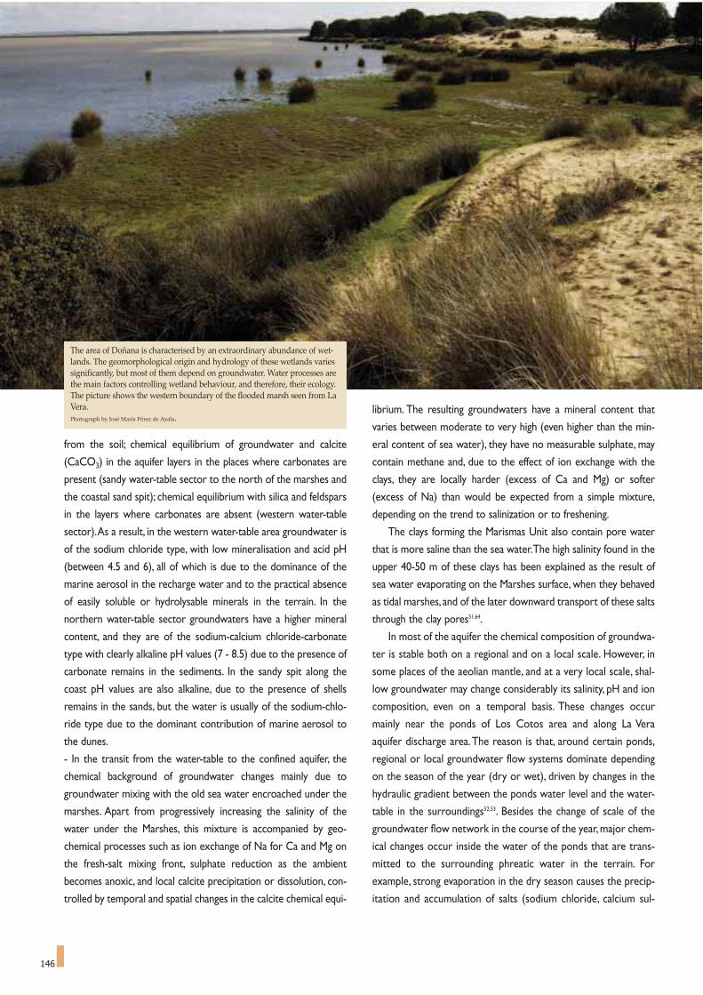
146
from the soil; chemical equilibrium of groundwater and calcite
(CaCO3) in the aquifer layers in the places where carbonates are
present (sandy water-table sector to the north of the marshes and
the coastal sand spit); chemical equilibrium with silica and feldspars
in the layers where carbonates are absent (western water-table
sector).As a result, in the western water-table area groundwater is
of the sodium chloride type, with low mineralisation and acid pH
(between 4.5 and 6), all of which is due to the dominance of the
marine aerosol in the recharge water and to the practical absence
of easily soluble or hydrolysable minerals in the terrain. In the
northern water-table sector groundwaters have a higher mineral
content, and they are of the sodium-calcium chloride-carbonate
type with clearly alkaline pH values (7 - 8.5) due to the presence of
carbonate remains in the sediments. In the sandy spit along the
coast pH values are also alkaline, due to the presence of shells
remains in the sands, but the water is usually of the sodium-chlo-
ride type due to the dominant contribution of marine aerosol to
the dunes.
- In the transit from the water-table to the confined aquifer, the
chemical background of groundwater changes mainly due to
groundwater mixing with the old sea water encroached under the
marshes. Apart from progressively increasing the salinity of the
water under the Marshes, this mixture is accompanied by geo-
chemical processes such as ion exchange of Na for Ca and Mg on
the fresh-salt mixing front, sulphate reduction as the ambient
becomes anoxic, and local calcite precipitation or dissolution, con-
trolled by temporal and spatial changes in the calcite chemical equi-
librium. The resulting groundwaters have a mineral content that
varies between moderate to very high (even higher than the min-
eral content of sea water), they have no measurable sulphate, may
contain methane and, due to the effect of ion exchange with the
clays, they are locally harder (excess of Ca and Mg) or softer
(excess of Na) than would be expected from a simple mixture,
depending on the trend to salinization or to freshening.
The clays forming the Marismas Unit also contain pore water
that is more saline than the sea water.The high salinity found in the
upper 40-50 m of these clays has been explained as the result of
sea water evaporating on the Marshes surface, when they behaved
as tidal marshes, and of the later downward transport of these salts
through the clay pores51,64.
In most of the aquifer the chemical composition of groundwa-
ter is stable both on a regional and on a local scale. However, in
some places of the aeolian mantle, and at a very local scale, shal-
low groundwater may change considerably its salinity, pH and ion
composition, even on a temporal basis. These changes occur
mainly near the ponds of Los Cotos area and along La Vera
aquifer discharge area.The reason is that, around certain ponds,
regional or local groundwater flow systems dominate depending
on the season of the year (dry or wet), driven by changes in the
hydraulic gradient between the ponds water level and the water-
table in the surroundings52,53. Besides the change of scale of the
groundwater flow network in the course of the year, major chem-
ical changes occur inside the water of the ponds that are trans-
mitted to the surrounding phreatic water in the terrain. For
example, strong evaporation in the dry season causes the precip-
itation and accumulation of salts (sodium chloride, calcium sul-
The area of Doñana is characterised by an extraordinary abundance of wet-lands. The geomorphological origin and hydrology of these wetlands variessignificantly, but most of them depend on groundwater. Water processes arethe main factors controlling wetland behaviour, and therefore, their ecology.The picture shows the western boundary of the flooded marsh seen from LaVera.Photograph by José María Pérez de Ayala.

147
phate and may be calcium carbonate too) in the floodable zones
of the wetland basins, often accompanied by a reduction of sul-
phate into sulphide and the accumulation of reduced sulphur in
the sediments of the pond bottom. In the next wet season, a large
part of these salts is re-dissolved and transferred to the sur-
rounding local phreatic water along with the sulphur, once again
oxidized to sulphate (not in all the ponds), hence modifying the
salinity of groundwater close to the water-table and, eventually, its
ion composition. Another frequent process is the dissolution of
iron, abundant in Doñana as nodules and as coating of sand grains,
when the water redox potential drops and the acidity increases
around the abundant peaty soils generated in old and recent
lagoon beds.All these chemical changes, which usually occur with
the first rains after a long dry period, are fast, and they are trans-
Fine and medium-grained sand
Gravel and coarse sand
Impermeable o less permeable
Water-table
Deep piezometric level
Flow line
Rain recharge
Spring
Flowing borehole
Free water evaporating
Phreatic transpiration
Well pumping
FIGURE 3
Simplified sketchshowing intensivegroundwater pump-ing effects in the ElRocío andMatalascañas areas.Without pumpingactivity (natural state,left sketches), waterrecharge from thesandy area flowstowards the deepest ofthe aquifer and thenlocally raises and dis-charges close toLa Rocina and the sea.If this state is dis-turbed by water-pumping (rightsketches), both thepiezometric level ofdeeper beds and thewater-table in uppersands descend, thehydraulic gradientbetween them increas-es, and most flowpaths become down-ward. As a result, thenatural discharge toLa Rocina and the seadecreases. (Modifiedfrom Custodio andPalancar, 1995).
NATURAL SSTATEEL ROCÍO
DISTURBED BY WATER PPUMPINGEL ROCÍO
MATALASCAÑAS MATALASCAÑAS
(a)
(b)
Unsaturated zone Water level in wells/boreholes

148
mitted to the phreatic water around the lagoon when the water
level of the pond rises higher than the adjacent water-table after
a rainy period.These shallow phreatic waters discharge into local
depressions in the land surface (other lagoons, streams, channels,
edges of the Marshes) after short transit lengths, thus highlighting
the changes that have occurred inside or close to the lagoons.
The natural vegetation, both the vegetation that depends on
the moisture of the ground and the vegetation that depends on
phreatic water, has adapted to local groundwater chemistry. So, in
the western water-table sector there are vegetal species that are
adapted to acid waters with a low mineral content and poor in
nutrients; in the northern water-table sector, the scarce remain-
ing natural species are adapted to alkaline waters, but also poor
in nutrients, while around the lagoons with high evaporation rates
and in the coastal sectors of the aeolian mantle, the vegetation is
adapted to saline waters.
But the groundwater chemical background above explained is
today locally modified by human activity. Thus, in the shallower
levels of the sandy unconfined areas (less than 40 metres deep)
some products derived from chemicals used in agriculture appear
(mainly nitrates, but pesticides, other nutrients, metals used in
phyto-sanitary products, etc. can be expected), as well as industri-
al pollutants (mainly heavy metals that have been air-transported
from the industrial area of Huelva -some 30 km to the west-, and
perhaps also from the open cast mining activities in the Iberian
pyritic belt -some 50 km to the northwest-), which entered the
aquifer through the recharge water after rain dissolution of
atmospheric dust and gasses49,57.Also, some agricultural wells that
pump water from the confined layers at a depth of 40-50 metres
in the north-east of the Marshes contain agricultural nitrates that
have reached well catchment areas, either after percolating
through the ground, or by entering directly through the space
between the well piping and the ground. All these observations
are consistent with the water residence times calculated using
the environmental radioactive isotope tritium, which are a few
years for the shallower waters, and over 40 years for groundwa-
ter deeper than 35-40 metres45. In the confined zones there is no
human impact, and groundwater composition corresponds main-
ly to chemical background.
Although there is little information on water pollution of
rivers and streams, existing data indicate that certain substances
originating from human activity have reached the protected areas
of Doñana. Hence, the streams and rivers that flow towards the
marshes from the north carry heavy metals and organic com-
pounds from the local food industry and farming activities
(Almonte, Hinojos, Pilas).The source of some of these substances
is very close to the protected zones: in the sandy sector south-
west of El Rocío, much of the surplus irrigation water, with high
sulphate and nitrate contents, and probably containing pesticides
and other agricultural chemicals, discharges into small streams
coming from the farmland area.These polluted waters end up in
La Rocina or in La Vera, both of which are zones of dense vege-
tation and outstanding ecological value, to a large extent because
they are areas in which high quality groundwater discharge after
a long residence time underground.
THE DOÑANA WETLANDS
AND THEIR RELATIONS WITH THE AQUIFER
As already said, Doñana is characterized by a great abundance
of wetlands.The geo-morphological origin and hydrology of these
wetlands is diverse, but most of them are directly dependent on
groundwater45,55,59,60. Significant work has already been done on their
genetic and hydrological classification, an essential step for manag-
ing these wetlands62,63.
The main control factor of how these wetlands function, and
therefore of their ecology, is their hydrology46.This term encom-
passes factors such as the water origin in the wetland, how this
drains, its hydro-period (flooding frequency and duration), the
water mineralisation and its ionic type54,55.As most of the Doñana
wetlands are dependent on groundwater, a determining factor of
their hydrology is wetlands position in relation to the aquifer
regional flow network. Because of the large diversity of local fac-
tors there is a wide variety of genetic-hydrological types; but a few
main hydrological types can be established, along with their leading
characteristics, which, in broad terms, are56:
- In the water-table area,where regional recharge takes place, there
is an abundance of both permanent and temporary wetlands
appearing in the rainy season when the water-table intersects small
aeolian, erosive or simply morphological depressions (like the inter-
dune flats) existing amid both the old and the present day dunes.
This is due to the fact that, except in the areas in which the aquifer
is intensively developed, the water-table is generally shallow and it
easily intersects the low topographical features of the terrain. In the
dry season, direct phreatic evaporation and the transpiration of the
vegetation draws the water-table down to below the land level. In
these conditions, intense sporadic rains may accumulate to build up
The "eyes of the marsh"are localised, smallround areas where slowupflowing water, comingfrom shallow or deepsand beds dischargesonto the surface throughthe clay layers. Photograph by Emilio Custodio.

149
small water bodies in these wetlands.They remain there, perched
on the water-table for some time, thanks to the relatively imper-
meable nature of fine material and organic remains accumulated on
the lagoon floor; short after they disappear by evaporation.
Because of land use changes and aquifer development, nowadays
there are few naturally permanent wetlands left over on the sands
(Dulce, Santa Olalla, Las Madres -partially excavated-). Some of
them are artificially maintained as permanent bodies of water,
either because they are artificially fed by means of wells (El Huerto,
Las Pajas,Acebuche), or because the basin has been locally excavat-
ed ("zacallones") to provide livestock permanent access to water-
table (Alamillo, Moguer, Mata de los Dominguez…).
Some wetlands in the western water-table sector are fed by infil-
trating rain that feed temporary local flows perched within the
unsaturated zone of the terrain, above the regional water-table. On
their way down to the water-table, these infiltrating waters may
eventually find less permeable ground layers (compacted soils, old
lagoon beds, peaty layers, etc.) that facilitate their lateral displace-
ment rather than vertical flow, thus discharging into nearby small
depressions in the ground surface that come across in their trajec-
tory.
The wetlands located in the recharge area show a wide variation of
water mineralisation both in space and time. In general, the waters
are of the sodium-chloride type, or intermediate between sodium-
chloride and calcium-bicarbonate types.The temporary changes in
mineralization and ionic type depend mostly on changes in the bal-
ance between water inputs and outputs and on the chemical reac-
tions that occur within the lagoon, in which the biota plays a cru-
cial role. Regardless of the water origin and permanence, all wet-
lands over the sands sustain aquatic and phreatophyte species that
have helped to retain the wind-blown sands for hundreds or thou-
sands of years, thus helping to create the extensive and lush aeo-
lian mantle that runs along the Doñana coast.
- Most of the wetlands located in areas of groundwater natural dis-
charge are wet soils that support dense vegetation, with or with-
out a body of free standing water, and located in the lower parts of
small streams ("algaidas"). In natural conditions they are permanent
water-table discharge areas that allow aquatic and phreatophytic
FIGURE 4Functioning of the groundwater dependent Doñana's wetlands: water discharge to valleys, streams and small depressions.The above sketch shows water functioning in the most common wetland type in Doñana, comprising water discharges (both phreatic and from deeperbeds) to small depressions (ponds) and to valleys and slopes (streams). Under high water-level situations (wet year or undeveloped aquifer) the water-table always reaches the soil surface, giving rise to permanent laponds and streams, and to thick belts of riparian vegetation. This vegetation acts as anactive filter to contaminants (e.g. nutrients) transported by surface flows, and contributes to decrease soil erosion and to maintain environmental humiditythrough transpiration. Under low water-level situations (dry year or a situation altered by groundwater development) groundwater discharges only takesplace in the wet season and not every year, giving rise to seasonal wetlands or also interannually flooded areas. Phreatophytic vegetation then decreases,together with its protecting effect against erosion, the generation of atmospheric humidity and the neutralisation of some contaminants.
WET YEAROR
AQUIFER UNDERNATURALREGIME
DRY YEAROR
AQUIFER UNDERDISTURBED
REGIME
precipitation
precipitation
precipitation
precipitation
evaporation
evapotranspirationneutralisation of
pollutantsevapotranspiration
water-table
flow(river or stream)
water-table
evapotranspiration
flow
soil erosion and transport
of contaminants
water-table inwet year/season
water-table in dry year/season
soilerosion and
transport of contaminants
water-table
PERMANENT DISCHARGE TO LAGOONS PERMANENT GENERATION OF SURFACE FLOWS
SEASONAL/INTERANNUAL DISCHARGE SEASONAL/INTERANNUAL FLOW GENERATION

150
vegetation to survive all year round.This is the case of the small
streams, watercourses and brooks that flow into La Rocina and the
marshes along La Vera and La Retuerta, and also is the case of some
permanent streams, gullies and springs that run into the sea over
the western coastal cliffs of El Asperillo (e.g. Rio Oro). La Rocina
stream is also a linear drainage of both shallow and deep ground-
waters that supports a relatively well-conserved riverine forest
along its banks. The streams running into the Marshes from the
north (El Partido,Cañada de la Mayor, etc.) used to maintain dense,
water-table fed riparian vegetation, but in this case the vegetation
was cleared long ago to prepare the land for farming and for roads
and tracks. Its flow, especially in the lower stretch, is still of phreat-
ic origin most of the year, as the runoff from the rain is only signif-
icant when the precipitations are intense. In general, these waters
have a medium to high mineralisation, variable throughout the year
because of local processes of evaporation and chemical reactions,
as the groundwater inputs have a stable composition.
- In the Marshes, were the aquifer is confined, there are also differ-
ent types of wetlands. Some of these are fed from groundwaters.
The Marshes themselves, formerly mostly tidal and nowadays dom-
inantly fluvial, receive water from the rivers and streams that, in
turn, drain as base-flow the sandy aquifer to the north and north-
west of the Marshes. Other wetland types found in the Marshes
are: seasonal ponds of fresh to saline waters, which are remnants
of the winter flood; permanent ponds ("lucios") of fresh to saline
waters,whose water source can be either phreatic water discharge
from the coastal sand spit and/or remnants of the winter floods
(some of these "lucios" habitats are nowadays artificially maintained
with groundwater pumped from the confined gravels and sands);
small circular areas of permanently saturated sand ("eyes of the
marsh") fed by upward groundwater flows ascending from sandy
layers of varying depths; and tidal wetlands, of which only one
remains on the right bank of the Guadalquivir river, near the river
mouth.
Much of the extraordinary biodiversity that makes Doñana
world famous is the integrated result of combining the different
hydrological types of wetlands together with their location, their
water salinity and their chemical composition in a fluctuating envi-
ronment.
As already mentioned, intensive groundwater development for
over twenty five years, localised in areas where the aquifer dis-
charges naturally, has caused accumulated local drawdown of the
deep piezometric levels that, in turn, has induced lowering of the
water-table height.As these falls have not yet stabilised, the prevail-
ing hydrodynamic situation is a transient one evolving towards a
new equilibrium in accordance with the current aquifer recharge
and discharge.These piezometric drawdowns cause a reduction of
the natural groundwater seepage at the sand-clay interface, the
drying of formerly flowing boreholes placed along the same area,
the water-table lowering, the decrease of the upward seepage
through the marsh clays, and the generation of a large piezometric
depression cone in the north-east of the marshes, which has also
induced a slow south-to-north shift of saline groundwater.
Wetlands close to the aquifer regional discharge areas (around
the marshes and on the aquifer western edge) are the most vulner-
able to intensive groundwater development of deep and shallow
aquifers, but they are not the only ones.The numerous wetlands of
the El Alamillo-El Acebuche-El Abalario-La Mediana sector have also
been affected by the water-table drawdown caused by a combina-
tion of pumping for irrigating farms next to La Rocina and an
increase of phreatic evapotranspiration since eucalyptus trees were
introduced in the area some decades ago.The original phreatophyt-
ic vegetation of Los Cotos, La Vera and the northern edges of the
marshes have also experienced difficulties in drawing water from a
water-table that is now much deeper, and many specimens are dry-
ing up. As a consequence, many small wetlands situated close to
farmlands (El Acebuche; El Alamillo; El Peladillo; La Mediana and La
Rocina, to the west; Villamanrique and Guadiamar, to the north)
that were permanent 20 or 30 years ago, are now seasonal or even
sporadic, only flooded in very wet years.
One additional effect of the water-table drawdown in areas
close to the marshes perimeter is a reduction of groundwater dis-
charge into the many existing streams, brooks, algaidas, etc., whose
fresh water contributions, be it directly or via La Rocina creek, are
very important for the marshes in the dry season. Many of these
water sources used to be permanent, but today they are seasonal
and, moreover, they carry water from irrigation surplus, which
means that they introduce nutrients, organic matter, pesticides, etc.
into areas of high ecological value. Finally, another effect has been
the change in the dry and wet seasons length, which affects vegeta-
tion access to phreatic water46,69 and increases the water stress
duration.

can be seen at an average height of 3.6 metres above sea level.The
height of the soil surface determines its connections with the sea,
in such a manner that the marshes are only connected to the sea
during very high tides.The practical lack of relief is only interrupt-
ed by a few elevations of old levees and islets and by depressions
which corrspond to channels, riverbeds, shallow ponds and gullies
that make up a shallow hydrographical network.This determines
the hydraulic behaviour of the Marshes and favours the existence
of a wide variety of environments, which, in turn, promotes a flora
and fauna that is highly differentiated in both time and space.The
temporal diversity is motivated, to a large extent, by the acute
annual variation of water levels of the Marshes.Apart from a rich
variety of fauna, the productive surfaces are also rich in quantity. It
is estimated that approximately half a million water fowl spend the
winter in the National Park, a population which requires some 50
tonnes of food per day. It is thanks only to these special weather,
soil, and hydrological conditions that local productivity can meet
such a high demand in the Marshes.
The Doñana Marshes are located in an area of mild
Mediterranean climate, with an Atlantic influence that keeps the
temperatures within narrower limits.The average annual rainfall in
the region is approximately 600 mm and real evaporation-transpi-
ration is estimated at between 400 and 500 mm/year.
It is essential to consider the fact that the prevailing winds play
151
The paths of waterin the Marshes: changes in the hydrological network.
BENIGNO J. BAYÁN JARDÍN *
151
The area covered by Doñana has been subject to the range
of geological processes that have occurred in the Lower
Guadalquivir. At the end of the Tertiary Era, there was a general
subsidence of what is now the Guadalquivir basin, forming a deep
sea in which blue marls were deposited to a depth of up to one
thousand metres.
During the Quaternary period, a much thinner layer of red
sands were deposited in a shallow coastal region: the Guadalquivir
estuary.The evolution of the lower Guadalquivir basin continued
along the same path and a coastal sand bar started moving in a
NW-SE direction. This bar was formed by the deposit of wind-
blown sands and materials from the Tinto, Odiel, Piedras and
Guadiana rivers, which drifted on the coastal marine currents. A
series of successive bars gradually closed off the Guadalquivir
estuary, forming a shallow lagoon of calm waters between the bar
and the open sea, which survived up until historic times.This was
the Ligur Lake of the Phoenicians, later called Lake Ligustinus
under the Roman Empire.The sediments from the mainland were
deposited in the bottom of this lake, which now form the base of
the Marshes.The most superficial part of this layer, between 50 and
100 metres thick, is made up of fine silt and grey-blue clays.
At the same time, systems of sand dunes developed that must
have reached a considerable height. The shifting dunes we see
today reach a height of 40 metres above sea level, advancing on the
Marshes at a rate of between three and six metres a year.The rate
of advance is accelerated when the vegetation that stabilises the
sands disappears, as has repeatedly occurred.
The Doñana Marshes have been created as the result of the
silting up of the lagoon caused by the estuary being enclosed.
Sedimentation rates have been estimated at 1 to 2.5 millimetres
per year over the last few millennia. Up until the 18th century, the
marshes of both sides of the estuary were heavily influenced by
tides.They completely lost this tidal influence and became conti-
nental in nature, although some peripheral areas retained tidal
marsh surfaces.
The continued input of sediments from the streams draining in
the old lagoon forged the present topography, where a great plain
* Director of projects and works: "Doñana 2005 Project". Guadalquivir Water Authority
The subtle hydrographical network of the Marshes allows for a widerange of environments. Knowing how they work and discovering thecomplex paths of the water are essential for keeping the niches of biodi-versity alive.Photograph by Jose Maria Perez de Ayala.

152
an important role in the behaviour of water level in the Marshes
as they displace these waters. Water level may vary by several
inches as wind force and intensity change, although the prevailing
winds are blowing from the west.
ORIGINAL HYDROGRAPHICAL NETWORK
Along the River Guadalquivir, down river from Seville and La
Puebla del Río, and some 60 kilometres before the mouth at
Sanlúcar de Barrameda, the river branches, forming an arm on the
left bank, East Branch (Brazo del Este) , which creates Isla Menor,
and another branch on the right bank,Torre Branch (Brazo de la
Torre), which forms Isla Mayor. The original area of the marshes
encompassed the entire area situated between these two branch-
es of the Guadalquivir, together with large areas to the east of East
Branch and to the west of Torre Branch (Figure 1).
La Rianzuela stream, or Majaberraque, flowed out into the
Northern part of Torre Branch, as did the River Guadiamar, which
had very little flow close to the mouth, and it flooded over the
right banks almost every year.This flooding fed Guadiamar chan-
nel (Caño Guadiamar), a broad and seasonal water course. The
course of Guadiamar channel flows slightly south, receiving the
waters of the Cigüeña stream (Arroyo de La Cigüeña) on its right
bank and, further down, it receives the waters of the Almirante,
Sajon, Portachuelo, Juncosilla and Cañada Mayor streams.
We should now turn our attention to Travieso channel (Caño
Travieso) that runs approximately E-W across the Marshes. It
divides off the right bank of Torre Branch, at a place known as
Vuelta de la Arena, and runs into Guadiamar channel (Caño
Guadiamar) from its left bank. Travieso too only acts as an over-
spill channel for the flood waters of Torre Branch.
The Rocina stream (Arroyo de La Rocina) flows to the west
of the Marshes, next to the village of El Rocío, where it joins
Partido stream (Arroyo del Partido), creating the Madre de la
Marisma channel, which, in turn, joins Guadiamar and Travieso
channels to create the Brenes channel, which finally drains into the
River Guadalquivir, downstream from the confluence with the
Torre Branch.
The drainage of waters flooding the Marshes into the
Guadalquivir and Torre Branch was impaired by the levees of estu-
ary which formed a high bar next to the river bed slowing down
the flow of the waters along Brenes, Figuerola and Buen Tiro chan-
nels.This bar less than two metre high was known as Montaña del
Rio (River Mountain) and although the name may seem somewhat
exaggerated, it should be considered in the context of immense
and almost horizontal plains where the levee made a noticeable
elevation.
Montaña del Río also controlled the entry of brackish water
from the Guadalquivir estuary during high tides.This tidal input to
Doñana was, and continues to be, negligible.
ALTERATIONS TO THE ORIGINAL
HYDROGRAPHICAL NETWORK
Transformations brought to the original hydrographical net-
work date back to the first interventions in 1775. The Corta
Fernandina (Fernandina Cut) was made in 1816, isolating Torre
Branch from the Guadalquivir and only received water inputs,
therefore, from the Guadiamar. In more recent times, work was
carried out around the Doñana National Park by the former
Ministry of Public Works, through the Guadalquivir Water Board.
These works (channelling water courses and modifications to the
hydrological system) started in 1947 and were finished in 1977
(Figure 2).
The major works undertaken involved channelling the banks of
River Guadiamar, which could also be called the channelling of
Torre Branch. Basically, this consisted of building two long parallel
earthen walls about one kilometre apart.The floodable area was
limited to the marsh span between the walls, channelling the water
directly into the Torre Branch.The right hand wall starts before the
River Guadiamar drains into Brazo de la Torre, preventing water
spilling from River Guadiamar into Guadiamar channel. La Cigüeña
stream, which also fed into Guadiamar channel, is also channelled
FIGURE 1
The old hydrographical network of the Marshes, where the former floodarea can be observed. The original marsh surface encompassed the entirevast area that stretched among river branches, reaching much of the cur-rent farming land to the north.
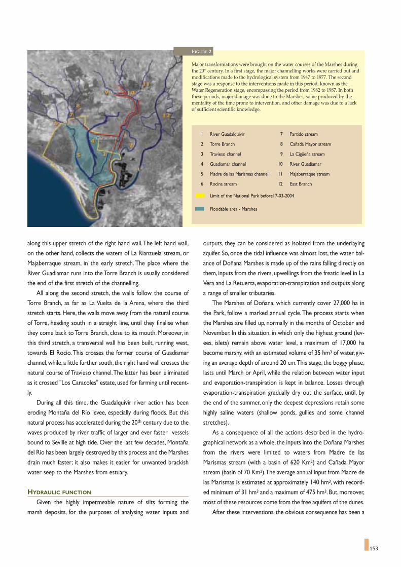
153
along this upper stretch of the right hand wall.The left hand wall,
on the other hand, collects the waters of La Rianzuela stream, or
Majaberraque stream, in the early stretch. The place where the
River Guadiamar runs into the Torre Branch is usually considered
the end of the first stretch of the channelling.
All along the second stretch, the walls follow the course of
Torre Branch, as far as La Vuelta de la Arena, where the third
stretch starts. Here, the walls move away from the natural course
of Torre, heading south in a straight line, until they finalise when
they come back to Torre Branch, close to its mouth. Moreover, in
this third stretch, a transversal wall has been built, running west,
towards El Rocío. This crosses the former course of Guadiamar
channel,while, a little further south, the right hand wall crosses the
natural course of Travieso channel.The latter has been eliminated
as it crossed "Los Caracoles" estate, used for farming until recent-
ly.
During all this time, the Guadalquivir river action has been
eroding Montaña del Río levee, especially during floods. But this
natural process has accelerated during the 20th century due to the
waves produced by river traffic of larger and ever faster vessels
bound to Seville at high tide. Over the last few decades, Montaña
del Río has been largely destroyed by this process and the Marshes
drain much faster; it also makes it easier for unwanted brackish
water seep to the Marshes from estuary.
HYDRAULIC FUNCTION
Given the highly impermeable nature of silts forming the
marsh deposits, for the purposes of analysing water inputs and
outputs, they can be considered as isolated from the underlaying
aquifer. So, once the tidal influence was almost lost, the water bal-
ance of Doñana Marshes is made up of the rains falling directly on
them, inputs from the rivers, upwellings from the freatic level in La
Vera and La Retuerta, evaporation-transpiration and outputs along
a range of smaller tributaries.
The Marshes of Doñana, which currently cover 27,000 ha in
the Park, follow a marked annual cycle.The process starts when
the Marshes are filled up, normally in the months of October and
November. In this situation, in which only the highest ground (lev-
ees, islets) remain above water level, a maximum of 17,000 ha
become marshy, with an estimated volume of 35 hm3 of water, giv-
ing an average depth of around 20 cm.This stage, the boggy phase,
lasts until March or April, while the relation between water input
and evaporation-transpiration is kept in balance. Losses through
evaporation-transpiration gradually dry out the surface, until, by
the end of the summer, only the deepest depressions retain some
highly saline waters (shallow ponds, gullies and some channel
stretches).
As a consequence of all the actions described in the hydro-
graphical network as a whole, the inputs into the Doñana Marshes
from the rivers were limited to waters from Madre de las
Marismas stream (with a basin of 620 Km2) and Cañada Mayor
stream (basin of 70 Km2).The average annual input from Madre de
las Marismas is estimated at approximately 140 hm3, with record-
ed minimum of 31 hm3 and a maximum of 475 hm3. But, moreover,
most of these resources come from the free aquifers of the dunes.
After these interventions, the obvious consequence has been a
FIGURE 2
Major transformations were brought on the water courses of the Marshes duringthe 20th century. In a first stage, the major channelling works were carried out andmodifications made to the hydrological system from 1947 to 1977. The secondstage was a response to the interventions made in this period, known as theWater Regeneration stage, encompassing the period from 1982 to 1987. In boththese periods, major damage was done to the Marshes, some produced by thementality of the time prone to intervention, and other damage was due to a lackof sufficient scientific knowledge.
1 River Guadalquivir 7 Partido stream
2 Torre Branch 8 Cañada Mayor stream
3 Travieso channel 9 La Cigüeña stream
4 Guadiamar channel 10 River Guadiamar
5 Madre de las Marismas channel 11 Majaberraque stream
6 Rocina stream 12 East Branch
Limit of the National Park before17-03-2004
Floodable area - Marshes
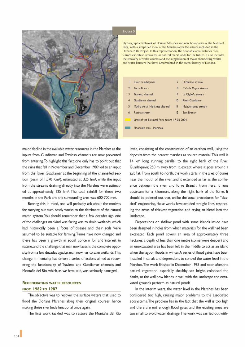
154
major decline in the available water resources in the Marshes as the
inputs from Guadiamar and Travieso channels are now prevented
from entering.To highlight this fact, one only has to point out that
the rains that fell in November and December 1989 led to an input
from the River Guadiamar at the beginning of the channelled sec-
tion (basin of 1,070 Km2), estimated at 325 hm3, while the input
from the streams draining directly into the Marshes were estimat-
ed at approximately 125 hm3. The total rainfall for these two
months in the Park and the surrounding area was 600-700 mm.
Bearing this in mind, one will probably ask about the motives
for carrying out such costly works to the detriment of the natural
marsh system.You should remember that a few decades ago, one
of the challenges mankind was facing was to drain wetlands, which
had historically been a focus of disease and their soils were
assumed to be suitable for farming.Times have now changed and
there has been a growth in social concern for and interest in
nature, and the challenge that man now faces is the complete oppo-
site from a few decades ago; i.e. man now has to save wetlands.This
change in mentality has driven a series of actions aimed at recov-
ering the functionality of Travieso and Guadiamar channels and
Montaña del Río, which, as we have said, was seriously damaged.
REGENERATING WATER RESOURCES
FROM 1982 TO 1987The objective was to recover the surface waters that used to
flood the Doñana Marshes along their original courses, hence
making these riverbeds functional once again.
The first work tackled was to restore the Montaña del Río
levee, consisting of the construction of an earthen wall, using the
deposits from the nearest marshes as source material.This wall is
14 km long, running parallel to the right bank of the River
Guadalquivir, 250 m away from it, except where it goes around a
salt flat. From south to north, the work starts in the area of dunes
near the mouth of the river, and it extended as far as the conflu-
ence between the river and Torre Branch. From here, it runs
upstream for a kilometre, along the right bank of the Torre. It
should be pointed out that, unlike the usual procedures for "clas-
sical" engineering, these works have avoided straight lines, respect-
ing the areas of thickest vegetation and trying to blend into the
landscape.
Depressions or shallow pond with some islands inside have
been designed in holes from which materials for the wall had been
excavated. Each pond covers an area of approximately three
hectares, a depth of less than one metre (some were deeper) and
an unexcavated area has been left in the middle to act as an island
when the lagoon floods in winter.A series of flood gates have been
installed in canals and depressions to control the water level in the
Marshes.The work finished in December 1983 and soon after, the
natural vegetation, especially shrubby sea bright, colonised the
banks, so the wall now blends in well with the landscape and exca-
vated grounds perform as natural ponds.
In the interim years, the water level in the Marshes has been
considered too high, causing major problems to the associated
ecosystems.The problem lies in the fact that the wall is too high
and there are not enough flood gates and the existing ones are
too small to avoid water drainage.The work was carried out with-
FIGURE 3
Hydrographic Network of Doñana Marshes and new boundaries of the NationalPark, with a simplified view of the Marshes after the actions included in theDoñana 2005 Project. In this representation, the floodable area includes "LosCaracoles" estate, recovered as natural marshlands for the future. It also includesthe recovery of water courses and the suppression of major channelling worksand water barriers that have accumulated in the recent history of Doñana.
1 River Guadalquivir 7 El Partido stream
2 Torre Branch 8 Cañada Mayor stream
3 Travieso channel 9 La Cigüeña stream
4 Guadiamar channel 10 River Guadiamar
5 Madre de las Marismas channel 11 Majaberraque stream
6 Rocina stream 12 East Branch
Limit of the National Park before 17-03-2004
Floodable area - Marshes

155
The satellite picture shows the Montaña del Río levee as a line around theflooded Marshes (upper part of the picture), running parallel toGuadalquivir and Torre Branch riverbeds.False colour image from the Landsat satellite (2000).
View of the Montaña del Río levee and the "sacatierras" excavation grounds. It should be pointed out that, unlike the normal procedure in "classical" engineer-ing works, straight lines have been avoided, respecting the areas of densest vegetation and attempting to blend the works into the landscape. The hollows leftby excavation for the wall have been shaped in shallow ponds of approximately three hectares each, with a depth of less than one metre, and an unexcavatedarea has been left in the middle to act as an island when they are flooded in winter.Photograph: CENEAM files.
out the necessary scientific counselling, so important points of
view were not taken into consideration.
The second work undertaken in this process of regenerating
water resources is what is known as the Centre-North Project. In
essence, this is the transfer of up to 6 m3/second debit from the
River Guadiamar, taken from the Vuelta de la Arena bend, using a
pumping station, to the course of Guadiamar channel, at Junta de
los Caños, in order to make them flow into the Marshes.This proj-
ect uses existing drains from the Almonte-Marismas irrigation
zone, and it was finished in May 1985. In all these years, these
works have been used very little because the quality of the water
was unsuitable for the Doñana Marshes, making it a failed experi-
ence that, once again, highlights the need to plan projects of this
kind on a scientific and multi-disciplinary basis.
The third works addressed, the so-called South Project, was
aimed at making Travieso channel functional again.Works consist-
ed of building an earthen canal, 0.50 metres deep and 250 metres
wide, just South of "Los Caracoles" estate, within the boundaries
of the Doñana National Park, connecting the channelled part of
Guadiamar with Travieso channel. This canal is 2,100 metres long,
running in ample bends to blend in with the landscape. Works
were completed by September 1987. The so-called South Project
only comes into operation during those floods of River Guadiamar
that can fill the channel, but it has been seen that, once the initial
flood waters pass, most of the water coming in through the South
Solution returns to the Guadiamar channel, following the same
course, but in the opposite direction.


157
A Numerical Hydrodynamic Model for the Marshes of Doñana National Park
JOSEP DOLZ, ERNEST BLADÉ, JOSEP GILI *
157
The Marshes of Doñana National Park comprise a very
complex water system whose qualitative characteristics
are fairly well known, whereas its quantitative aspects are not. It
should be noted that currently there is scant information on such
important hydrological data as the relationship between water lev-
els and flooded marsh surface, temporal evolution of marsh inflow
and outflow rate, evaporation and evapotranspiration, temporal
and spatial evolution of water levels and physical, chemical and bio-
logical characteristics, water flow characteristics, and the impact of
wind on water flow. An understanding of these variables is essen-
tial to precisely defining the actions required to prevent the degra-
dation of the marshes.
The Guadalquivir River Basin Authority (Confederación
Hidrográfica del Guadalquivir), aware of and sensitive to these con-
cerns, commissioned, within the framework of the Doñana 2005
project, a numerical model to study the hydrodynamics of the
marshes. To do this required detailed knowledge of the marsh
topography and of the water outflow from the catchments that
* School of Civil Engineering, Polytechnic University of Catalonia, Spain.
The numerical hydrodynamic simulation model of the Marshes allows for the calculation of the temporal evolution of water levels and velocity at differentspots in the area. The above image shows the drainage network superposed to the wavy natural canals of the Gallega marsh.
drain to the marshes. These variables had previously been
researched in a study also commissioned by the Guadalquivir River
Basin Authority.
The marshes are located in an area of very low topographic
relief and the drainage system is therefore defined by minor alti-
metric variations. This type of drainage system to a large extent
determines water flow in the marshes, particularly at the beginning
of the flooding period and towards the end of the recession of the
water levels.Therefore, in order to study the hydrodynamics of the
marshes, detailed topographic information must first be available,
particularly with regard to the relief of the terrain.This information
is especially difficult to obtain given the extension (40,000 Ha) of
the Park and the required altimetric precision of the measurements
(down to a few decimetres).
An emerging technology known as laser altimetry is now avail-
able for obtaining digital terrain models (DTM). The technique
consists of laser pulse emissions directed from an airborne instru-
ment that scan the terrain.The instrument receives a signal reflect-
ed back by the surface and calculates the distance based on the
signal's round-trip time-of-flight. Although the measurements have

158
The Marshes are located in an area of very low topographic relief and the drainage system is therefore defined by minor altimetric variations. Image obtainedfrom the Digital Surface Model (DSM) showing an area nearby the Doñana Palace. The vegetation, higher than water, has a lighter colour. Trees can be seen asyellow dots.
an accuracy of around one centimetre, the calculation of the loca-
tion of the aircraft (obtained through the Global Positioning
System, GPS), and the direction in which the laser pulse was emit-
ted (obtained through an Inertial Navigation System, INS) can intro-
duce errors, rendering a final accuracy of about 15 centimetres.
Laser altimetry is capable of measuring the elevation of several
tens of thousands of surface points per second.The technique is an
excellent way to obtain a DTM of the flat extensive area of the
marshes owing to the high density of surface points and the accu-
racy of the measurements. Consequently, the system was used to
determine the mean coordinates (surface and height) of a surface
spot every 3 m2 in the approximately 40,000 ha of marshes. The
height and distribution of the vegetation at the time the measure-
ments were taken (September 2002)71 were fairly accurately deter-
mined as well.The image below shows, as an example, the Digital
Surface Model (DSM) of an area nearby the Palacio de Doñana.
The numerical hydrodynamic simulation model of the marsh-
es72 allows for the calculation of the temporal evolution of water
levels and flow rates at different spots in the marshes and is based
on Saint Venant equations for gradually varied open channel flow.A
one-dimensional approach is used to study flow in the network of
stream channels and a two-dimensional approach (associated to
the one-dimensional approach) is used to analyse the flow in the
rest of the marshes. The water levels and velocity are measured
every 10 minutes at each of the 200 x 200 m2 cells into which the
marshes have been divided. Both intervals, time and space, could be
shorter, but would involve a longer calculation time.
The calibration and validation of the model was undertaken
using field data on the annual evolution of inflows and the water
levels at specific spots in the marshes. Field data on infiltration,
evaporation and the impact of wind on water flows are also neces-
sary to ensure that the model can adequately take these factors
into account for optimal performance.
Based on the finished digital terrain model, the numerical model
was developed and the first calibration-validation process was car-
ried out in March 2004. Field data used for this purpose was
obtained from the measure stations that had been set up in the
area the previous year. The calibration-validation process will
advance systematically as new field data is obtained. In a later stage,
this hydraulic model (temporal evolution of water levels and veloc-
ity) will be used as the basis for the study of other phenomena
associated with the hydrodynamics of the marshes, such as the
transport and sedimentation of solid load and the evolution of
water quality.
The conclusions of these studies will provide us with a very
powerful tool to understand the hydrodynamic behaviour of the
marshes and the likely impact of the measures that may be taken
for their protection.
Elevationmasl
15
10
5
0

ing years in which it was flooded by fall and winter spates.The rest
of the time the land was left untended as the sandy soil could not
ensure a harvest. The advent of new farming technologies posed
the possibility of putting the lands to agricultural use, and so in
1981, within this context and to that end, seven kilometres of the
lower reach of El Partido stream were channelised, immediately
upstream of its outlet to the marsh.
Channelisation of the stream substantially modified the way in
which the streamflow circulated during peak flows, concentrating
the flow in such a way that when it finally debouched into the
marshes it generated a new alluvial fan, due to the expansion of the
current and the subsequent deposition of the solid load which up
to then was incorporated in the flow. In other words, the chan-
nelling had moved the former alluvial cone towards the interior of
the marsh.
The increase in the surface area of the marshes occupied by the
new alluvial fan between 1982 and 1998 is shown on Table 1.These
159
El Partido streaman example of the challenges posed by hydrological restoration
JUAN ANGEL MINTEGUI AGUIRRE *
159
* Professor, Department of Forestry Engineering (Hydraulics and Hydrology unit) ofthe Technical College of Forestry Engineers, Polytechnic University of Madrid.
FIGURE 1El Partido stream watershed: Significant sections.
A La Calancha streamB La Cárcaba streamC La Parrilla streamD Paraje de CabezudosE Santa María streamF Partido streamG Section 1H Section 2I Section 3J Section 4
A B
C
D
E
F
G
H
I
J
Unforeseeable mid- and long-term consequences can
result from changes to the hydrological system and alter-
ing of the waterways in a system as fragile as that of Doñana. El
Partido stream is a typical case of the damaging effect of interven-
tions that, although well-intentioned, are not supported by a sound
base of precautionary foresight and monitoring of induced effects.
El Partido stream is a small watercourse with a low gradient,
less than 0.2 % on its lower reach, which flows directly into the El
Rocío marsh to the north of Doñana National Park. The stream is
fed by a catchment area covering 307.37 Km2 and has maximum
and minimum elevations of 121 and 5 metres respectively. The
headwaters present moderate slopes which decline with the
descent towards the area dominated by the stream, in which there
are wide zones that do not exceed 1% (Figure 1).
The stream has a marked torrential character owing to its
proximity to the ocean and the orientation of its catchment area,
which is exposed to the penetration of Atlantic storms as there are
no obstacles to moderate their advance. Hence, fall and winter
downpours cause the discharge of the stream to multiply from
twenty to thirty times its mean summer flow, estimated at 5 m3/s,
and to even exceed these values under occasional extraordinary
circumstances. Similarly, with the exception of its moderate slope,
the rest of the catchment morphology is characteristic of a torrent
catchment: with its catchment area, gorge, and, prior to 1981, its
former alluvial cone and even its own drainage channel. This chan-
nel, called Caño Ajolí and today filled with sand, was where the
stream current finally flowed sediment-free into the Doñana
Marsh.
Originally, the stream's spate flow would expand outwards
before it reached the marsh, generating a series of secondary chan-
nels in such a way that the scant depth of the channels could not
exert shear stress capable of breaching the resistance and initiating
the motion of the sands that made up their beds. In fact, these
streams were forced to drop their entrained sediments, thus form-
ing the initial alluvial fan. Subsequently, once the floodwaters reced-
ed, the streamflow was conveyed smoothly through the drainage
channel into the marsh, devoid of sediments.
Occasionally the land surface of the alluvial fan was farmed,dur-

160
tion and directly applying it. Furthermore, while on the one hand El
Partido stream presents a torrential character typical of mountain
torrents, given that it presents very significant liquid and solid dis-
charges (refer to the aforementioned 58 spate events); on the other
hand, its bed, comprised almost exclusively of sands, its slight slope
and prolonged periods of concentrated flow differentiate the stream
from mountain torrents, making it necessary to test many types of
equations.
In regard to the discharge of suspended load, water samples
were collected from section 3 of the stream during the transit of
the spates and later studied in the laboratory to determine the
concentration of sediments. In short, application of the MUSLE
model estimated a total volume of 1,151,957 m3 of suspended sed-
iment discharged by El Partido stream into the El Rocío marsh
between 1995 and 1998.A mean concentration of 6.86 g/l74 of sus-
pended sediment was established for the group of 58 spate events
studied.
Finally, in order to determine the bed load deposited into the
marsh, an estimation was made of the 1995 to 1998 annual
increase of the volume of El Partido stream's alluvial fan within
the marsh itself and its surroundings, using all of the information
shown in bold- in Table 1, and based on which the table was
completed.
On the other hand, in order to verify that we were really
dealing with a bed load discharge, the erosion of the floor and
sides of the channelled segment of the stream was evaluated
using the information obtained from the 1996, 1997, 1998 aerial
photographs and from the topographical map of the channelled
section made in June of 199975. We were thus able to verify that
there had been downcutting of the bed of the channel of over 2
metres with respect to the level of the terrain in 1981.This made
it evident that although erosional versus sedimentation phenom-
enon had taken place on the channel floor, there had been a
remarkable predominance of the first. Additionally, retrogressive
erosion of El Partido streambed was found along an over-2-kilo-
values were determined after delimiting the successive expansions
of the fan on aerial photographs taken during the corresponding
years and then transferring the data to a GIS in order to correctly
identify, situate and measure the phenomenon (Figure 2).
In view of the situation, and in seeking an answer to the phe-
nomenon, the following two questions were specifically posed:
- Where do the sediments discharged by El Partido stream
into the El Rocío marsh originate?
- What steps must be taken to arrest the process?
To answer this, research was designed with the following work
plan:
On one hand, measurement of the progression of El Partido
stream's alluvial fan into the El Rocío marsh and its bordering area
during the 1995-98 period was commenced.The alterations occur-
ring along the stream's channelled segment during the same period
were also measured.These measurements were based on the plani-
metric studies mentioned earlier and bolstered by topographic
field campaigns. To this end, the cone's radials were measured in
July, 1997, this same area was levelled between April and May of
1998, and a map was drawn up of the channelled segment of the
stream in June of 1999.
On the other hand, the Hydrologic Modeling System (H.M.S.)
version 2 (2000), an integrated hydrologic model, was applied to
define the characteristics of El Partido stream's 58 spates occurring
over the 1995-98 period73.
To evaluate sediments carried in suspension by El Partido stream,
coming from the catchment runoff and discharged into the marsh by
way of the 58 spates earlier defined, the Modified Universal Soil Loss
Equation (MUSLE) model was combined with the aforementioned
hydrologic model.This required prior determination of the defining
factors of soil erosion conditions in the catchment area.
What was more complicated was the estimation of the sedi-
ments discharged into the marshes as bed load, meaning as a conse-
quence of the abrasion of the streambed by the current. To start
with, there were no clear criteria for the selection of a specific equa-
YEARS ESTIMATION OF THE ALLUVIAL FAN RECEIVED OBSERVATIONS
AREA MEAN THICKNESS VOLUME SEDIMENTS
(m2) (m) (m3) (m3)
1982 147,220
1985 290,593
1993 1,038,802 0.365 379,163 600,654 Spates 1995-96
1996 2,041,283 0.480 979,816 903,718 Spates 1996-97
1997 3,176,280 0.593 1,883,534 1,116,466 Spates 1997-98
1998 3,815,055 0.786 3,000,000
TABLE 1 Evolution of the surface areas and volumes occupied by El Partido stream new alluvial fan in the El Rocio marsh and its surroundings, downstream from Cañada Real.

161
metre section upstream from the channelled segment.
The volume of sediment originating from excavation
processes on El Partido's channelled segment and discharged
into the marsh was evaluated at 1,685,814.30 m3 regarding
spate events occurring between 1995 and 1998 and at
344,050 m3 regarding spates occurring during the 1987-88 and
FIGURE 2
The expansion of El Partido stream's newalluvial fan into the El Rocio Marsh and surrounding area between 1982 and 1998.
1989-90 hydrological years. Finally, the yield from the retro-
gressive erosion of El Partido streambed, upstream from the
channelled segment, was evaluated at 785,362.5 m3 after
analysing the effects detected on the aerial photos, from field
verification and then carrying out an estimation. Thus, the
total yield of erosion was estimated at of 2,820,226.8 m3.This
is a deviation of less than 6% with respect to the 3,000,000 m3
that were established after the levelling carried out between
April and May of 1998 as the deposition of El Partido stream's
new alluvial cone.
Based on this, I conclude with some considerations and rec-
ommendations on solving the problem of El Partido stream's
discharge of sediments into the El Rocío marsh, especially in
relation to bed load.
a) It has been verified that both under the circumstances prior
to the channelling of the lower segment of El Partido stream
in 1981, and under the present circumstances, the stream
generates the same physical processes in the section where
the formation of its alluvial fan commences. This primarily
consists of the dissemination of its discharge flow to dissipate
the energy during spate events, a process known as channel
shifting. The difference lies in that prior to 1981 this section
was near the Casa de la Matanza Bridge (section 2 of Figure
1), while it is presently located in the vicinity of the Ajolí
bridge (section 4 of Figure 1).
b) Clearly, any attempt to channel El Partido stream spate
events, thus impeding the stream's original tendency to dis-
perse, would disturb the fragile balance capable of maintain-
ing the stability of a watercourse of these characteristics
View of the sands deposited by El Partido stream next to the Ajolí bridge.Photograph by J.A. Mintegui Aguirre.

162
downstream from it,with the purpose of allowing the waters
to cover a large part of the stream's former floodplain. To
achieve this it will be necessary to remove the left wall of the
present channelled segment of the stream, situated down-
stream from where the barrage would be, so that the cur-
rent can overflow the banks and deposit the sands it trans-
ports before the spate flow debouches into the marsh.
Implementing these actions is both advisable and necessary;
but could nonetheless prove to be insufficient.The issue of the
stability of the new alluvial fan forming downstream from the
checkdam is as yet to be resolved.To achieve this stability, the
gradient that the floodplain must adopt downstream from the
barrage and upstream from the marsh must be designed and
planned. Shaping this compensation or equilibrium slope may
require some complementary hydraulic works which would
eventually be covered with soil and vegetation so the final visual
and environmental impact would be virtually null.
Lastly, once the final segment of El Partido stream is correct-
ed, it would be necessary to restore its catchment in order to
consolidate the applied measures and ensure its future stability76.
when confronted with torrential flow spikes. The shear stress
of the current is increased and, because of the poor resist-
ance of the materials that make up the floor and sides of the
channelled segments, the material is eroded and dragged
along by the action of the current. Furthermore, the ongoing
process of abrasion of the streambed by the current during
spate events has caused a serious problem of retrogressive
erosion on the bed of El Partido stream itself.
c) The solution to the problem leads to contemplating two
main actions:
- The building of a checkdam at a section of El Partido
stream near the Casa de la Matanza bridge, to control the
retrogressive erosion processes occurring upstream from it.
- Allow the current to expand out during spates, from the
section where the aforementioned barrage is situated and
Image obtained from the Digital Surface Model (DSM) developed for theDoñana marshes, showing of the alluvial fan.Source: Ayesa.
Detail of the erosion on the right side of the stream, close to the Matanza bridge (road to Hinojos). Photograph by J.A. Mintegui Aguirre.
Aerial view of El Partidostream alluvial fan. In 1981seven kilometres of the lowerreach of El Partido streamwere channelised. It substan-tially modified the way inwhich the streamflow circula-ted during peak flows,concentrating the flow insuch a way that when itfinally debouched into theMarshes it generated a newalluvial fan. Photo: CENEAM.

163
world. This analysis has arisen from re-reading the analyses of
the organisation and regional planning of Doñana and its sur-
rounding area, taking water as the starting point, which has led
me to present the following hypotheses about the different per-
ception of the waters in recent centuries, and on the manage-
ment model that each perception has developed around them:
A.During the General Franco regime (1939-1975), a time of low
production and voluntary isolation of the lands of Doñana -too
poor for agriculture, but rich in range, timber and game, a time
of a social order established by Lords and Councils, of aristo-
cratic and council by-laws, pacts and litigation over the jurisdic-
Man and waterin the history of Doñanadifferent approaches to water management
JUAN FCO. OJEDA RIVERA *
163
When we talk about the world of Doñana, one should
bear in mind that this is a complex,dynamic and con-
flictive space.These features are sustained by the very nature of
the areas as a "hybrid territory", where a range of physical, eco-
nomic, social and cultural elements combine, creating an area of
frontiers and encounters between ecosystems, economies, soci-
eties and cultures. It reminds of a colonial territory that is still
unfinished from the point of view of both its physical layout
(advancing dunes, senescent marshes) and its economic and
social perception (major change in values in recent decades,
when resource limitations became new resources), and even in
its administrative organisation (confrontation of administrative
and management bodies).
In this world that is being created -"terra in fieri", as the
Romans would say, or "Argolida", in Caballero Bonald's words -
surface and groundwater, the sands, the streams and many other
inputs, reach the National Park. Park settings, at the end of a
river mouth, mean that in a sense it plays the role of a collector,
as opposed to nature conservation.Thus, Doñana National Park
becomes a challenge, a melting pot of the economic system that
allowed itself the "useful luxury" of declaring it as such in pre-
democratic times.
While the General Franco dictatorship was showing the
world how it was opening up by declaring Doñana a National
Park (1969), in France there was a democratic debate as to
whether to do the same with the Camargue.This Mediterranean
delta was less complex than the Atlantic estuary of Doñana, but
even so the French Government reached the conclusion that it
was preferable not to set up a National Park in a river mouth
area, and declared it a Regional Nature Park, despite its power-
ful symbolic and representative potential.The maximum degree
of protection for areas where man has maintained a permanent
presence for centuries, is usually granted to islands, or to high-
land and mountain areas.
The analysis addressed herein, of the different views of water
in Doñana in the course of recent history, intends to bear wit-
ness to these contradictions that are inherent to this complex
* Pablo de Olavide University. Seville. Spain.
Until well into the 20th century, the vision of Doñana came into constantconflict with its image as a marginal territory and a feudal manor. Later,with a view to solving this marginal status, new, enlightened ideas of pro-duction appeared and part of its lands were occupied by the hands of theautocracy's philosophy launched by the General Franco regime after theSpanish Civil War (1936-39).Photograph: Doñana Biological Station Archives.

164
tion and use of territorial resources. A time of little develop-
ment of the means and the forces of production -low popula-
tion, unhealthy conditions and lack of technology to exploit
sandy or clay soils. Nature dominated in this world of Doñana,
and one of the most conspicuous elements was water, which
was sometimes anxiously awaited and sometimes feared.
Regional and productive planning attempted to adapt to the
changing and unforeseeable circumstances of dry years, followed
by wet years, summer followed by winter, drought, flood, salt
water, fresh water, etc. seeking micro and macro scale strategies.
In short, the key phrases that could describe this early tradition-
al stage of the configuration of Doñana, were the following:
Marginalised territory and feudal rule, Predominance of nature,
Adaptive water management.
B.These approaches can be seen in Doñana since the late 18th
and early 19th centuries, pointing to the need to convert these
wild lands into productive lands, with development projects and
programmes -province of Sanlúcar de Barrameda, agricultural
and forestry settlements, draining of the Marshes- that always
contemplated controlling the water. The romantic paradigm -
spread from the mid 19th century until the mid 20th century -dis-
covered the naturalist, scenic and scientific values of Doñana, and
this paradigm was the pioneer in considering the need for pro-
tecting nature.At the same time, during the first half of the 20th
century, interventions were focused on dunes, and later on
marshes that founded their initial justification in environmental
arguments and, after the Spanish Civil War (1936-1939),on auto-
cratic national reasons. The key concepts of this second stage
were: Enlightened promotion of production, as opposed to a
pioneering and romantic protection of nature; Transformation
of marshes, draining ponds, fixing dunes; Controlling water man-
agement.
C.The developmental period of the 1960s and 70s in Doñana is
characterised by its public discovery as a space for new produc-
tions: intensive farming on sands, sun, sea and sand tourism, vis-
itable nature. The search for groundwater undertaken by the
FAO from the late 50s was rounded off with the success of hav-
ing found a large resource (Aquifer 27) that, according to the
forecasts made at the time, could change the face of this margin-
al district and may lay the foundations of a brilliant future: thou-
sands of hectares of irrigated farmland on traditionally barren
sands.The Atlantic beaches of Doñana,with their white sands,on
the other hand, were to be the scenarios for the Huelva coast
Tourist Development Plan. El Rocio and Doñana National Park
itself were to act as tourist attractors. Surface and underground
waters, at this time became a factor of conflict - as a resource
shared among farming, recreational and tourist settlements, and
natural spaces. Key concepts of the development stage:
Discovery of the aquifer and the beach; Intensification of uses:
Irrigation/Nature/Tourism; Dominating; Squandering and con-
flictive water management.
D. In the present democratic stage, starting with the Doñana Act
(December 1978),we have moved on from a stage characterised
by compensating the surrounding towns for having given Doñana
to the world, to a second period in which the aim is to integrate
Doñana in a peripheral and subsidised European district to attain
a paradigmatic "sustainable development".The contradictions of
this situation are highlighted in many ways, but here, we should
mention the projected infrastructures for importing water to
the areas in order to make possible to supply the economic
emergency (agricultural, tourist demand) and the ecological
emergency (park needs) of this space.Awareness of the squan-
dering of the previous phase has not led to an advanced sustain-
able management, but to plans to import water from neighbour-
ing districts to make irrigation and mass tourism compatible
with nature and conservation. Compensations, integration, "sus-
tainability" and a management philosophy that imports and
restores water are, therefore, the key words of the present
moment.
The most recent scenario, starting with the 1978 Doñana Act, has beencharacterised by an initial phase in which the ideology of compensating thetowns in the surrounding area for having granted the legacy of Doñana tothe world predominated, and a second phase in which the emphasis isplaced on integrating Doñana in a peripheral and subsidised Europeandistrict to attain a paradigmatic "sustainable development".Photograph: Jose Maria Perez de Ayala.

mechanical equipment for processing agricultural produce, etc., as
well as the industrialisation, distribution and marketing of all these
products and their derivatives.This means that we are dealing with
what is known as an Agro-Food Industrial System, which includes
both the pre and the post agricultural phases in a seamless interac-
tion.That is, the weight of “traditional agriculture" is reduced in this
new context, but the whole system experiences a strong expan-
sion.
The system now includes all operations concerning the manu-
facture and distribution of the means of production for farming, the
harvest operations in agricultural facilities and the storage and dis-
165
A Doñana with cleanand transparent waters for lifeThe agricultural commitment
JOSÉ GONZÁLEZ DELGADO *
165
In a broad sense Agriculture encompasses what is known as
the agricultural or primary sector, which is made up of the
sub-sectors of agriculture, in the strict sense, livestock and forestry.
This definition also includes the food sector and modern fish farm-
ing.
For several decades, the "agri-business" has been understood as
a concept that, on top of farming, includes the production of inputs
for the sector like the manufacture of fertilisers, pesticides, herbi-
cides, irrigation equipment, different agricultural machinery,
* Professor of the Faculty of Economics and Business Sciences.University of Seville.
Building a solid alliance between sustainable agriculture and the waters of Doñana is one of the top priorities in the immediate future. This way, all the watersof the area, that drain into the Marshes will do so without the alterations caused by soil erosion, transport and deposit of sediments, surplus of nutrients andorganic matter, pesticides, weed killers, waste waters from the towns and from the agro-food industry. View of the Marshes when flooded.Photograph by Jose Maria Perez de Ayala.

166
tribution of all products. In any event, farming is the central pillar of
the system.
This is why the industry cannot always provide solutions to the
problems of the sector. We need a more in-depth analysis of its
interrelations with the system prior to production, and in the phas-
es that follow the harvest, as they are so important in this system.
INCOME GROWTH AND INTENSIVE FARMING
This shift in the interpreation of the functions of farming is the
consequence of how the economy has evolved in all the developed
countries, with a steady increase of income for consumers.
Increases in income trigger a demand for more processed and
diversified products, with better quality and better presentation
that would be very difficult for traditional agriculture to provide.
Agricultural holdings are unable of meeting the demands of a
growing population with greater purchasing power; holdings have
to resort to loosing their leading role in the process, sharing it with
some other, closely related entities, to supply them with agricultur-
al inputs and to process and distribute the final produce.
Traditional farming has also provided its own farming machin-
ery, its beasts of burden, auxiliary equipment, manure, organic fer-
tilisers based on burying beans or lupins, seeds for the crops, stud
animals and other means of production.The farmes manufactured
their food and clothing, and directly marketed the family consump-
tion surplus. However, the industry has now transferred all these
functions and has become highly dependent on others for buying
all its inputs and selling its products, all of which are outside the
sector.These outside agents are the first links in a long process of
industrialisation and distribution that is outside the scope of tradi-
tional agricultural sector.
Intensive agricultural production, such as the farming in the
Doñana area, on the one hand, has made a large supply of food
available and, on the other hand, has triggered problems like soil
erosion, environmental pollution, some reduction in biological
diversity and the drop of water tables, among others.
For all the above reasons, the challenge to be met is how to
continue increasing food production, while maintaining quality lev-
els and prices, without undermining the conservation of natural
resources.
FARMING AND THE ENVIRONMENT
One thing that must be made clear is that agriculture per se is
not the enemy of the environment; on the contrary, properly
organised, agriculture can improve natural resources such as soil
and water. The interaction between agriculture and the environ-
ment is currently well known.As a consequence of industrial devel-
opment, farming activity is severely affected by the "greenhouse
effect" of carbon dioxide, as well as by acid rain, industrial and urban
waste. Furthermore, intensive agricultural production without ade-
quate management can cause pollution from fertilisers, pesticides,
weed killers, salinisation of the soil, over exploitation of groundwa-
ter, exhaustion of resources, over grazing, inadequate handling of
the land, leaving soil unprotected, etc. Doñana and the surrounding
area have obviously not been left unaffected by these processes; in
fact some of them continue to have a significant impact on Doñana
today.
This very process of intensifying farming by using more fertilis-
ers and pesticides in general than are strictly necessary together
with an inadequate use and handling of mechanical equipment, non-
conservative growing systems, and the fact that farmers no longer
add well fermented manure to the land from time to time, as this
is now relatively scarce, distances agriculture from the natural eco-
logical process.
AGRICULTURE AND SUSTAINABLE DEVELOPMENT
This model of intensive farming is not considered sustainable,
as it cannot possibly meet current economic needs without endan-
gering the capacity of future generations to meet their needs.
Hence, a new alternative system of agricultural production
appeared, completely opposed to the production oriented model,
known as biological, ecological or organic farming, based on not
using chemical inputs.This method has expanded fast and its prod-
ucts are winning the corresponding "niche" in the market.
The Doñana 21 Label is a brand created by the Doñana 21 Foundation tohighlight the companies of Doñana District and their products. Companiesexhibiting Doñana 21 Label show responsible attitudes, respect for accept-ed standards of quality and environmental protection in the everydaymanagement. Certificated brands belong to some agricultural companies,making this one of the means of opening up new links between the agricul-tural sector and the environment,working together in returning Doñanawaters to their former healthy state.The Marshes seen from José Antonio Valverde Visitor Centre.CENEAM files.

167
However, refusing to benefit from technological progress, this new
school of farming involves higher costs, since an increase in the area
used for farming means a rise in prices for the consumer.
In consequence, the most reasonable option appears to be an
intermediate model, one that can harness the advances of technol-
ogy to apply them to a balanced agriculture, eliminating any
processes that are harmful to the environment and to conserving
natural resources, in order to guarantee quality of life for today and
for the future.
This sustainable agriculture model must be possible in real from
an ecological, financial and social point of view as the European
Common Agricultural Policy has confirmed in each of its successive
reforms. Hence, it is essential to accept the concept of integral
agrarian management for the entire industrial-agro-food sector, in
each and every one of its stages of production, which can ensure
sustainable agriculture in the long term with a balanced use of
inputs.
This includes the following actions that have a special impact on
the future of Doñana:
- The crops to be grown should place the minimum possible
demand on water and additional nutrients, they should be
resistant to plagues and disease and they should have deep and
well developed roots to retain particles of soil in the face of
erosion.
- The growing system should require minimum cultural tasks and
it should follow the contours of the land in strips or bands,
interrupting the run off.Top priority should be given to main-
taining some vegetation cover in all stages of production.
- The farm implements should only act at a shallow depth and
without turning the soil over, and compact the terrain as little
as possible.
- Irrigation has to be applied efficiently, to attain minimum con-
sumption, depending on the needs of each crop, its pheonolog-
ical state and evaporation-transpiration.
The land should be fertilised in a similar way, to provide the
plants with what they strictly need at any one time:
- Pesticides and weed killer should be kept to the minimum dose,
and applied at the best time, using products that do not remain
in the soil for long, which degrade into non toxic metabolites
as soon as possible, in order to prevent a persistent pollution
of soil or water.
- Manure shall be well fermented and swill waste and
unprocessed organic matter eliminated.
- Industrial and domestic waste should be treated prior to being
released to the environment.
DOÑANA AND THE WATERS RECEIVED
FROM THE SURROUNDING COUNTRYSIDE
The Doñana area, especially sensitive, demands a sustainable
agriculture, so that all the water, draining into the Marshes arrives
with minimal disturbances caused by soil erosion, transport and
deposit of sediments, surplus nutrients and organic matter, pesti-
cides, weed killers or waste waters from towns, the agro-food
industry and livestock farms.
The "Doñana 2005" Project is implementing a series of far-
reaching actions to return the area to the state it was in formr
times.With a programme of sustainable agrarian activity in the sur-
rounding area, clean waters will flow into Doñana to support its
rich biodiversity.
The mine tailings spill into the River Guadiamarin April 1988 acted as awake up call for all decision makers and authorities and detailed monitor-ing of pollution levels in several water courses, including the Guadiamar,started at this time. Available data showed a presence of sources of con-taminations other than the mine residues. The main sources of these con-taminants are to be found in intensive farming, the agro-food industry ofthe area (brines and swill), urban effluents and heavy metals loads fromthe small industries of the area. The photograph shows part of the layer oftoxic sludge after the Aznalcollar accident.Photograph by Jose MAntonio Sabater.

168
We should not forget that "Doñana is water" and water is life.
Defending the quality of Doñana's waters must be understood as
defending the rights that all living creatures in Doñana have to sur-
vive,thus sustaining a rich biodiversity. These are also the rights of
the people that live from its crops and livestock.
Sustainable agriculture in this area should be understood by
farmers, first of all using the pertinent training and counselling. It
also must be understood by the Local and Regional Authorities who
can render it economically and socially viable with grants, guidelines and
regulations, in order to produce the optimum quantities that are com-
patible with conserving nature and a rational and efficient use of
resources.
We must not forget that "Doñana is water" and water is life. The defence of its waters must be understood as the defence of the right of all living creatures in"Doñana" to survive in optimum conditions, sustaining the rich biodiversity of the area. This also includes the people who live from growing crops and raisinglivestock.Photograph by José María Pérez de Ayala.

situation of the sheet of water, colour level of information, etc.
By establishing comparisons among the results, we can draw
some conclusions on perception and representation like those
given as examples below.
Images 1 and 3 have represented two Doñana ecosystems;
marsh and pond, respectively.These pictures share their princi-
ple elements: sheet of water, well structured scrubland of cork
trees and marsh vegetation. In both of them, the water covers a
similar space, it is the same colour and it is open on the right
side of the picture.The size of the tree mass is similar, as is the
marsh vegetation. Only certain structural and formal aspects
have been accentuated or varied. In the picture of the marsh, a
distant, linear horizon has been chosen, one that enlarges the
surface area to give the sensation of an unmanageable space with
distant boundaries. In the pond, we come closer to the horizon
and its elements can be made out as individual and personalised
features, seeking to encircle and close the perimeter to give the
feeling of a secluded environment. Marsh vegetation is laid out in
a different way in each picture. In the marsh, the picture concen-
trates on the area to the left, leaving the sheet of water free,
while, in the lagoon, it is also situated in the area to the right,
delimiting and attempting to bound the water, but without doing
so physically.
169
Marshes and ponds the graphic expression of water
REGLA ALONSO MIURA *
169
The pleasure that we experience in the presence of water
in a landscape has a deep, almost genetic origin.The sen-
sual characteristics and the symbolic aspects with an intense
emotional content, make them into the conveyor and generator
of aesthetic values. Spaces associated with water and which form
a frontier with that water, usually possess an enormous treasure
trove of flora and fauna. In Doñana, we have addressed marshes
and ponds, two units with a horizontal surface that is free of all
visual obstacles and other specific individual features.They both
share the element that defines them; water, but they forge differ-
ent landscapes.The areas of contact (eco-tone) with the ecosys-
tem around them possess a major morphological and biological
richness, but they have different physiognomies.They also behave
differently throughout the year and have divergent influences on
their surroundings.
In a study conducted between 1982-85 dealing with the
graphic expression of these Doñana landscapes, the structural,
formal, chromatic elements, etc. that define and make them indi-
vidually distinct have been analysed. To do this, large sets of
images were taken, introducing certain elements like: location,
size and density of the different elements, height of the horizon,
depth of field, point of view, proportions of the format, size and
PICTURE 1Marshes and “Vera”. End of Winter. DoñanaBiological Reserve.Author: Regla Alonso Miura.
* Professor of Anatomy. University of Seville, Spain.

170
The changes in the colour of these waters are due to
ephemeral factors like the time of day or the weather condi-
tions. But it is surprising that, in the course of the year, and
regardless of the seasons and the position of the sun, they show
an unusual consistency in their colour, which we described as
ultramarine blue with flecks of cobalt.
As has been pointed out, the behaviour of marshes and
ponds is different throughout the year. In the former,one can see
extreme morphological changes, with the amazing process of
seasonal filling and emptying, and with the growth and senes-
cence of the vegetation that fills it.A few succinct brush strokes
with the colours that express this discourse can provide use
with the information that defines the landscape and its moment
in the seasons. In the lagoons, the annual cycle is reflected in the
vegetation that surrounds the water (pictures 2 and 3).
In the whole process of transmitting the morphology of the
landscape into graphic images, we have followed the rule of
economising on means: what can be expressed with one stroke
does not need using two, what can be indicated with three mil-
limetres of line is not to be accentuated with another.There may
be an infinity of possible solutions, but obviously, not all of them
have the same value. Only the images with the best expressive
quality,of the hundreds taken,have the power to convey the sug-
gestion of Doñana landscapes.
PICTURE 2Dulce pond. End of Winter. Doñana Biological Reserve.Author: Regla Alonso Miura.
IMAGEN 3Dulce Pond. Onset of Autumn. Doñana Biological Reserve.Author: Regla Alonso Miura.

171
1. BAYÁN JARDIN, B., CASAS GRANDE, J., RUIZ DE LARRAMENDI,A., SAURA MARTÍNEZ, J., URDIALES ALONSO, C., 2001. ProyectoDoñana 2005: Restauración hidrológica de las marismas y cuencas ver-tientes a Doñana. Ed. Ministerio de Medio Ambiente.
2. En 1971 González Bernáldez colabora con Agustín Soler, profesor de Zoología enla Hispalense que iniciaba el estudio de los insectos de la Marisma, los cuales habíansido abordados con anterioridad por Bigot y Marazanof.
3. AMAT,J.A.,MONTES,C.,RAMÍREZ DÍAZ,L., TORRES MARTÍNEZ,A.1977 Mapa Ecológico del Parque Nacional de Doñana. ICONA Madrid
4. GARCÍA NOVO,F., COTA GALÁN, H., POU ROYO, A., 1977. Estudiode las marismas del P.N.Doñana utilizando las imágenes del satéliteERTS-1. Bol.Estación Central Ecología 6:29-41
5. FAO, 1972. Proyecto piloto de utilización de aguas subterráneas para eldesarrollo agrícola de la cuenca del Guadalquivir. Anteproyecto de latransformación en regado de la zona Almonte-Marismas (margen dere-cha). Informe técnico. I-AGL:SF/SPA 16. Madrid. 2 vol 263 p.
6. HEURTEAUX, P., 1970 Influences nefastes de risque d´asurer l’equilibreecologique du Parc National de Doñana l’utilisation voir a de fins agri-coles et touristiques des nappes aquiferes d´Almonte et des marismes.Informe. Station Biologique de la Tour du Valat.CNRS. 32 p.
7. VANNEY, J.R., 1970. L’hidrologie du Bas Guadalquivir. Publicacionesdel Dep. de Geografía Aplicada. CSIC. Madrid.
8. BAONZA DE PRADO, E., PLATA, A., SILGADO, A., 1984. Hidrologíaisotópica de las aguas subterráneas del Parque Nacional de Doñana y suzona de influencia. CEDEX. MOPU. Madrid. 139 p.
9. IGME, 1982. Hidrogeología del Parque Nacional de Doñana y suentorno. Col. Informe. Ministerio de Industria y Energía. Madrid. 120 p.
10. LLAMAS, R., 1990. Geohydrology of the eolian sands of the DoñanaNational Park (Spain). Catena Supplement 18:145-154
11. LÓPEZ, T., MAZUELOS, N., MUÑOZ REINOSO, J.C., 1993. Spatialand temporal variation in the ionic composition of shallow water table inDoñana National Park (SW Spain). Verh. Internat.Verein.Limnol.
12. SUSO, J.M., LLAMAS, M., 1990. El impacto de la extracción de aguassubterráneas en el P.N.Doñana. Estudios Geológicos. 46:317-345
13. CASTELLS, M., CRUZ VILLALON, J., CUSTODIO, E., GARCÍANOVO, F., GAUDEMAR, J. P., GONZÁLEZ VALLVE, J. L., GRANA-DOS, V., MAGRANER, C., ROMAN, M., SMART, M., VAN DERMAAREL, E., 1992. (Comisión internacional de expertos sobre el desar-rollo del entorno de Doñana). Dictamen sobre Estrategias para elDesarrollo Socioeconómico Sostenible del Entorno de Doñana. Sevilla:Consejería de Obras Públicas y Transportes, Junta de Andalucía.
14. GALINDO, D., MAZUELOS, N., MATA,J.A., SERRANO,L., 1994.Microcrustacean and rotifer diversity relating to water temporality in duneponds of Doñana National Park (SW Spain). Verh. Int. Verein. Limnol.25:1350-56.
15. SERRANO, L., 1994. Sources, aboundance and disappearance ofpolyphenolic compounds in temporary ponds of Doñana National Park InM.A. BROCK, P.I., BOON, A., GRANT, Plant and Processes inWetlands. CSIRO. Australia. 1994.
16. SERRANO, L., TOJA, J., 1993. Influencia de las extracciones de aguasobre las lagunas peridunares de Doñana. Quercus, 92: 21-23.
17. SUSO, J.M., LLAMAS, M., 1990. El impacto de la extracción de aguas sub-terráneas en el Parque Nacional de Doñana. Estudios Geológicos 46(3-4):321-323 / Influence of Groundwater Development on the Doñana-National-Park Ecosystems (Spain). J. Hydrology 141(1-4):239-269.
19. ZUNZUNEGUI, M., DIAZ BARRADAS, M.C.,GARCIA NOVO, F.1998. Vegetation fluctuation in Mediterranean dune ponds in relation toraifall variation and water extraction. Applied Vegetation Science 1:151-160.
20. MONTES,C., AMAT J., RAMÍREZ DÍAZ, L., 1982. Ecosistemas acuáti-cos del Bajo Guadalquivir (SW España). Variación estacional de los com-ponentes fisicoquímicos y biológicos de las aguas. Studia Oecologica 3:1259-180
21. OLIAS ALVAREZ, M., CRUZ SANJULIAN, J., BENAVENTE HER-RERA, J., GARCÍA NOVO, F., MUÑOZ REINOSO, J.C., 1991. Newdata about the Almonte-Marismas aquifer from the hydrological monitor-ing (1989-90). Sobreexplotación de Acuíferos.23 Congreso AIH. IslasCanarias: 159-163.
22. IGME, 1982. Hidrogeología del Parque Nacional de Doñana y suentorno. Colección Informe. Madrid 120 p.
23. LLAMAS, M.R., 1990. Geohydrology of the eolian sands of the DoñanaNational Park (Spain). Catena Supplement 18:145-154.
24. GARCÍA NOVO, F., GALINDO, M.D., GARCÍA SANCHEZ, J.A.,GUISANDE C., JAUREGUI, J., 25. LÓPEZ, T., MAZUELOS, N.,MUÑOZ, J.C., SERRANO, L., TOJA, J., 1991. Tipificación de los escosis-temas acuáticos sobre sustrato arenoso del Parque Nacional de Doñana.3er Simposio sobre el Agua de Andalucía. Córdoba :165-177
26. TOJA, J., 1991. Ecología del Río Guadalquivir. Memorias de la Academiade Ciencias de Sevilla.1(1986/89):329-353.
27. TOJA, J., LÓPEZ, T., GUISANDE, C., BRIEVA,C., 1986. Ecología delestuario del rio Guadalquivir. II Simposio del Agua en Andalucía 1:523-532
28. LÓPEZ, T., TOJA, J., GABELLONE, N., 1990. Limnological comparisonof two periduar ponds in the Doñana National Park (SW Spain). Archiv.Hydrobiol. 120(3):357-378
29. SERRANO, L., TOJA, J., 1999. Limnology of temporary ponds in DoñanaNational Park (SW Spain) Limnética.
30. TOJA, J., LÓPEZ, T., GABELLONE, N., 1990. Succesional changes intwo dune ponds in Doñana National Park (SW, Spain). Verh. InternatVerein Limnol. 24
THE GEOMORPHOLOGICAL EVOLUTION OF DOÑANA
31. CARRETERO, M.I., RUÍZ, F., RODRÍGUEZ-RAMÍREZ, A.,CÁCERES, L., RODRÍGUEZ-VIDAL, J., GONZÁLEZ-REGALADO,M.L., 2002. The use of clay minerals and microfossils in palaeoenviron-mental reconstructions: The Holocene littoral strand of Las Nuevas(Doñana National Park, SW Spain). Clay Minerals 37: 93-103.
32. LARIO, J., 1996. Último y Presente Interglacial en el área de conexiónAtlántico-Mediterráneo (Sur de España). Variaciones del nivel del mar,paleoclima y paleoambientes. Tesis Doctoral, Universidad Complutensede Madrid, 269 p.
33. MENANTEAU, L., 1979. Les Marismas du Guadalquivir. Exemple detransformation d’un paysage alluvial au cours du Quaternaire récent.Thèse 3è cycle, Univ. Paris-Sorbonne, 154 p.
34. RODRIGUEZ RAMIREZ, A., 1996. Geomorfología continental y subma-rina del Golfo de Cádiz (Guadiana-Guadalquivir) durante el Cuaternarioreciente. Tesis Doctoral, Universidad de Huelva, 378 p.
35. RODRÍGUEZ-RAMÍREZ, A., RODRÍGUEZ-VIDAL, J., CÁCERES,L.M., CLEMENTE, L., BELLUOMINI, G., MANFRA, L., IMPROTA, S.,DE ANDRÉS, J.R., 1996. Recent coastal evolution of the DoñanaNational Park (SW Spain). Quaternary Science Reviews, 15: 803-809.
36. RODRÍGUEZ-RAMÍREZ,A.,RUÍZ,F., CÁCERES, L.M., RODRÍGUEZ-37. VIDAL, J., PINO, R., MUÑOZ, J.M., 2003. Analysis of the recent storm
record in the southwestern Spanish coast: implications for littoral man-agement. The Science of the Total Environment, 303: 189-201.
38. RODRÍGUEZ VIDAL, J., 1999. Doñana. In: DURÁN, J.J. y NUCHE, R.(Ed.). Patrimonio Geológico de Andalucía: 214-219, ENRESA, Madrid.
39. ZAZO, C., GOY, J.L., SOMOZA, L.; DABRIO, C.J., BELLUOMINI, G.,IMPROTA, S., LARIO, J., BARDAJÍ, T., SILVA, P.G., 1994. Holocenesequence of sea-level fluctuations in relation to climatic trends in theAtlantic-Mediterranean linkage coast. Journal of Coastal Research, 10(4): 933-945.
THE DOÑANA AQUIFER AND ITS RELATIONS WITH THE NATURAL ENVI-RONMENT
40. BAONZA, E., PLATA, A. Y SILGADO, A., 1984. Hidrología isotópica delas aguas subterráneas del Parque Nacional de Doñana y zona de influ-encia. Centro de Estudios y Experimentación de Obras Públicas(CEDEX), Madrid, Cuadernos de Investigación C7: 1-139.
41. BORJA, F. Y DÍAZ DEL OLMO, F., 1992. Eastern sector of the cliff at ElAsperillo (Huelva cost, SW Spain): formation and chronology. MBSS,Newsletter, 14: 87-93.
42. BORJA, F. Y DÍAZ DEL OLMO, F., 1994. Geomorfología de el mantoeólico litoral de El Abalario (Huelva). In : J. Arnáez, J.M. Garía Ruíz y A.Gómez, (eds.), Geomorfología de España, Sociedad Española deGeomorfología: 337-338.
43. CMA, 1998. Reconocimiento biofísico de espacios naturales protegidos.Doñana. Consejería de Medio Ambiente, Junta de Andalucía. Memoria ymapa ecológico de Doñana.
44. COLETO, I., 2003. Funciones hidrológicas y biogeoquímicas de las for-maciones palustres hipogénicas de los mantos eólicos de El Abalario-Doñana (Huelva). Tesis Doctoral, Universidad Autónoma de Madrid.
45. CUSTODIO, E., 1993. Preliminary outlook of saltwater intrusion condi-tions in the Doñana National Park (Southern Spain). Study and Modellingof Salt Water Intrusion. CIMNE-UPC. Barcelona: 295-315.
46. CUSTODIO, E., 2000. Groundwater-dependent wetlands. Acta GeologicaHungarica, 43(2): 173-202.
47. CUSTODIO, E., 2004. Posibles procesos de contaminación agrícola deaguas subterráneas en el área de Doñana (Huelva). Congreso NacionalAnálisis y Evolución de la Contaminación de las Aguas Subterráneas,Alcalá de Henares.
NOTES AND REFERENCES

172
48. CUSTODIO, E., Y PALANCAR, M. 1995. Las aguas subterráneas enDoñana. Revista de Obras Públicas, Madrid, 142 (3340): 31-53.
49. IGLESIAS, M., 1999. Caracterización hidrogeoquímica del flujo del aguasubterránea en El Abalario, Doñana, Huelva. Tesis Doctoral, ETSICCPB,Universidad Politécnica de Cataluña, Barcelona.
50. IGME, 1982. Hidrogeología del Parque Nacional de Doñana y su entorno.Instituto Geológico y Minero de España. Madrid, 120 p.
51. KONIKOV, L.F. Y RODRÍGUEZ-ARÉVALO, J.,1993. Advection and dif-fusion in a variable-salinity confining layer. Water Resources Research,29 (8): 2747-2761.
52. LOZANO, E.; DELGADO, F.; MANZANO, M. Y CUSTODIO, E., 2002.Caracterización hidrogeoquímica de las aguas subterráneas y superfi-ciales de la Vera del Parque Nacional de Doñana (SW de España).Groundwater and Human Development (Bocanegra, Martínez y Massone,eds.). Univ. Mar del Plata, Argentina: 1348-1358 (CD).
53. LOZANO, E., 2004. Las aguas subterráneas en los Cotos de Doñana y surelación con las lagunas. Tesis doctoral, ETSICCPB, UniversidadPolitécnica de Cataluña, Barcelona.
54. MANZANO, M., 1999. Los humedales de Doñana y su relación con elagua subterránea. 1ª Reunión Internacional de Expertos sobre laRegeneración Hídrica de Doñana (Doñana 2005). Huelva, octubre de1999. MMA, Madrid.
55. MANZANO, M., 2001. Clasificación de los humedales de Doñana aten-diendo a su funcionamiento hidrológico. Hidrogeología y RecursosHidráulicos, Madrid, XXIV: 57-75.
56. MANZANO, M.; BORJA, F. Y MONTES, C., 2002. Metodología de tip-ificación hidrológica de los humedales españoles con vistas a su valo-ración funcional y a su gestión: Aplicación a los humedales de Doñana.Boletín Geológico y Minero, 113 (3): 313-330.
57. MANZANO, M. Y CUSTODIO, E., 2004. Groundwater baseline compo-sition of the Doñana aquifer (SW Spain) and geochemical controls. 4ªAsamblea Hispano-Portuguesa de Geodesia y Geofísica, Figueira de Foz,Portugal, Febrero de 2004.
58. MANZANO, M.; CUSTODIO, E.; LOOSLI, H.H.; CABRERA, M.C.;RIERA, X. Y CUSTODIO, J., 2001. Palaeowater in coastal aquifers ofSpain. Palaeowaters in Coastal Europe: Evolution of Groundwater sincethe late Pleistocene. (EDMUNDS, W.M. & MILNE, C.J., eds.).Geological Society London, Sp. Publ. 189: 107-138.
59. MANZANO, M.; CUSTODIO, E.; MEDIAVILLA, C. Y MONTES, C.,2002b. Effects of localised intensive aquifer exploitation on the Doñanawetlands (SW Spain). Simposium on Intensive Use of Groundwater.Challenges and Opportunities, SINEX. Instituto Geológico y Minero deEspaña, Generalitat Valenciana y Fundación Marcelino Botín. Abstracts.
60. MANZANO, M.; CUSTODIO, E.; MEDIAVILLA, C. Y MONTES, C.,2005. Effects of localised intensive aquifer exploitation on the Doñanawetlands (SW Spain). BALKEMA Publishers.
61. MONTES, C.; BORJA, F., MANZANO, M. Y OTROS (2000). Inventarioy tipificación de los humedales del Manto Eólico Litoral de Doñana.Consejería de Medio Ambiente, Junta de Andalucía.
62. PAH, 2002. Plan Andaluz de Humedales. Consejería de Medio Ambiente,Junta de Andalucía. Sevilla.
63. RODRÍGUEZ-ARÉVALO, F.J., 1988. Origen del movimiento del aguaintersticial en el acuitardo arcilloso de las marismas del Guadalquivir.Tesis Doctoral. FC., Universidad Complutense de Madrid, 300 p.
64. SALVANY, J.M. Y CUSTODIO, E., 1995. Características litológicas delos depósitos pliocuaternarios del Bajo Guadalquivir en el área deDoñana: implicaciones hidrogeológicas. Rev. Soc. Geol. De España 8 (1-2): 21-31.
65. SUSO, J.M. Y LLAMAS, M., 1990. El impacto de la extracción de aguassubterráneas en el Parque Nacional de Doñana. Estudios Geológicos, 46:317-345.
66. SUSO, J.M. Y LLAMAS, M., 1993. Influence of Groundwater develop-ment on the Doñana National Park ecosystems (Spain). Journal ofHydrology, 141: 239-269.
67. TRICK, TH. 1998. Impacto de las extracciones de agua subterránea enDoñana: aplicación de un modelo numérico con consideración de la vari-abilidad de la recarga. Tesis Doctoral. ETSICCPB, UniversidadPolitécnica de Cataluña, Barcelona.
68. TRICK, TH. Y CUSTODIO, E., 2004. Hydrodynamic characteristics ofthe western Doñana Region (area of El Abalario), Huelva, Spain.Hydrogeology Journal, 12: 321-335..
69. ZAZO, C., GOY, J.L., LARIO, J. Y SILVA, P.G., 1996. Littoral zone andrapid climatic changes during the last 20,000 years: the Iberian studycase. Z. Geomorph. N.F.; Berlin-Stuttgart, Suppl. 102: 119-134.
70. ZAZO, C.; DABRIO, C.; GONZÁLEZ, A.; SIERRO, F.; YLL, E.I.; GOY,J.L.; LUQUE, L.; PANTALEÓN-CANO, J.; SOLER, V.; ROURE, J.M.;LARIO, J.; HOYOS, M.; Y BORJA, F., 1999. The record of the last gla-
cial and interglacial periods in the Guadalquivir marshlands (Mari Lópezdrilling, SW Spain). Geogaceta, 26: 119-122.
A NUMERICAL HYDRODYNAMIC MODEL FOR THE MARSHES OFDOÑANA
71. Production of the DTM of the marshes was a joint effort of EstudioCartográfico Gea S.A. and Fotonor As.
72. Development of the numerical model was a joint effort of AYESA andWL/Delft Hydraulics.
EL PARTIDO STREAM
73. Simulating these flash floods made it possible to estimate the volume ofthe run off Q (m3); peak flow qp (m3/s) and peak times tp (hours) for theseflows. All these parameters were determined in section 3 of El Arroyo delPartido (Figure 1), located in the channelled stretch, about 4 km up riverfrom where it flows into the Marshes, where it spills 95% of the area ofthe basin, and fitted with the Guadalquivir Water Board's metre number151. The downpours that caused the aforementioned flash floods used tobe defined from the hourly rainfall data provided by the Almonte HU007weather station that forms part of the Andalusia Regional GovernmentMinistry of Agriculture and Fisheries Alert and Phyto-sanitaryInformation Network.
74. This figure is only a 10% deviation from the average value of the 7 sam-ples of water with sediments taken in the same section, during the courseof seven flash floods in the period 1996-98, which gave a value of 6,244g/l. Despite the small size of the sample, the simulation as such offers agood fit when one considers that thee of solid flows in suspension.
75. It should be pointed out that the winter of 1998-99 was one of extremedrought and without any flash floods in the Doñana area, so the delay inthis alter operation did not alter the morphology of the Arroyo from theprevious year.
76. This research forms part of the Project 174/93; Sedimentary Dynamics ofthe Doñana National Park marshes, future prospects and managementalternatives, funded by the Regional National Parks Board. We would liketo express our gratitude to Doctors Jose Carlos Robredo Sanchez and PabloJ. Sendra Arce for their significant participation in this project.
MEN AND WATER IN THE HISTORY OF DOÑANA
77. OJEDA RIVERA, J.F., 1985. Le Parc National Doñana et son environnement.Revue géographique des Pyrénées et du Sudouest. T.56/2, avril-juin 85. Toulouse:225-242
78. OJEDA RIVERA, J.F., 1987. Organización del territorio en Doñana y suentorno próximo. (Almonte). Siglos XVIIIXX. Ministerio de AgriculturaICONA. (Monografía, 49). Madrid. 456 p.
79. OJEDA RIVERA, J.F., 1990. Doñana paisaje cultural. Doñana culturallandscape. Doñana: La naturaleza en España. Ed. Lunwerg, Barcelona:18-25
80. OJEDA RIVERA, J.F., 1992. Políticas forestales y medio ambiente enDoñana y su entorno. Agricultura y Sociedad, nº 65, Ministerio deAgricultura, Pesca y Alimentación, Madrid: 303-357.
81. OJEDA RIVERA, J.F., 1993. Doñana: Esperando a Godot. Instituto deDesarrollo Regional, Sevilla. Cuaderno, nº 31. 84 p.
82. GRANADOS, M. y OJEDA, J.F., 1994. Doñana. Paisaje y poblamiento.Edificaciones en el Parque Nacional. Consejería de Obras Públicas yTransportes. Dirección General de Arquitectura y Vivienda, Junta deAndalucía, Sevilla. 142 p.
83. OJEDA RIVERA, J.F., 1999. Una aproximación interpretativa a lacatástrofe del Guadiamar. Cuchará y paso atrá, nº 7. Colectivo deEstudios Marxistas, Sevilla: 49-56.
84. OJEDA RIVERA, J.F., GONZALEZ FARACO, J.C. y VILLA DÍAZ, J.2000. El paisaje como mito romántico. Su génesis y pervivencia enDoñana, en MARTÍNEZ DE PISÓN, E.(Coord.) Estudios sobre el paisaje.Madrid, Universidad Autónoma de Madrid y Fundación Duques de Soria.Colección de Estudios, nº67: 343-357.
MARSHES AND LAGOONS
85. ALONSO MIURA, R., 1987. Flora y Paisaje en Doñana. Ministerio de ObrasPúblicas. Madrid.
86. ALONSO MIURA, R., 1988. Doñana. Vegetación y paisaje. Percepción morfoló-gica y análisis plástico. MOPU/Junta de Andalucía. Sevilla. 250 p.
87. ALONSO MIURA, R., 1992. La emoción de descubrir. UniversidadHispanoamericana. Santa María de la Rábida. 259 p.
NOTES AND REFERENCES


175
ventional, without any physical feature to mark the frontiers.These
Pleistocene hills and Miocene marls have always been farmed and the
settlements between Niebla and Seville form a rim of age-old human
presence in the countryside.The County of Niebla, which remained
independent from Seville during many periods, and the River
Guadiamar have played the political role of border with Aljarafe,
Seville. The boundaries of the southernmost municipalities, like
Rociana,Almonte, Hinojos,Aznalcazar,Villamanrique, Puebla del Río,
Coria and the recently created Isla Mayor, form belts running down
to the shore, marshes or estuary. To the east, the Guadalquivir
Estuary and its islands offered a continuity with the marshes. The
inhabitants of Trebujena and Sanlúcar, in the province of Cádiz, have
always been linked to Doñana and its resources, so these municipal
districts can be considered as the eastern boundaries of the Greater
Doñana area.
Seville and Cádiz are the regional centres, in political and
administrative terms, followed by Niebla, Jerez and Huelva, with
Sanlúcar as the local capital of the old Doñana Estate. The El
The ecological traits of the area that surrounds the former
game reserve called “Coto de Doñana” vary enormously
and have also varied though history. A first approach to studying
the biological heritage found in this area is through looking back for
remnants of history and the first descriptions of its resources: how
they were used and how they were considered, including the
accounts of the first scientific explorers of these lands.These are
points of reference that should be addressed in the search for a
better understanding of the Doñana of today.
The first characteristic of the wider area of Doñana is a grand
rolling sandy plain of old dunes,dotted with ponds in the depressions
that border the edge that runs down to the shores of the Gulf of
Cádiz. Historically, this area has been considered a desert uninhabit-
ed land.
To the west, the area borders on the Huelva and Tinto estuaries,
forming escarpments in the sandstone that give way to tidal marsh-
es.The Río Tinto marshes border this northwestern part of the ter-
ritory as far as Niebla,while the northern boundaries are more con-
The performance of nature and the worlds of biodiversity within Doñana
To get an idea of the enormous wealth of this area, one only has to realise that 400 species of birds have been sighted in Doñana. There are also 33 species ofmammals, 19 reptiles, 12 amphibians and 7 fish species, plus a further 60 species in the Guadalquivir Estuary. These figures, while high for Spain, are excep-tional for the European continent. In the photograph, a backlit view of a "pajarera" (open aviary), cork oaks renowned for the enormous quantity of birds thatnest in them in La Vera, facing the Doñana Marshes.Photgraph of José María Pérez de Ayala.

176
Rocío chapel has always acted as the spiritual centre for the
region with the pilgrimages of religious hermandades (brother-
hoods) from these municipalities during Whitsuntide.
Shipping has been one of the keys to this area for thousands of
years. Merchandise was shipped out down the rivers from Niebla
with its active port, and from Palos, Moguer, Sanlúcar, Coria, San
Juan and Seville.The Torre Branch (Brazo de la Torre) was naviga-
ble by boat down to the River Guadiamar, where it ran back into
the main Branch of the River Guadalquivir. The Eastern Branch
(Brazo del Este) was also open to river traffic. Even the cattle trails
to Puntal de Doñana and Moguer used barges to carry the cattle
down to Sanlúcar or Huelva.The livestock crossed to the islands
on the edges of the different branches of the rivers, and they were
recovered with barges from the "vetas" or islands of the Doñana
Marshes (Las Marismas) during the floods. The bridge over the
River Tinto was in Niebla, the Guadalquivir bridge was a ferry
crossing at Seville, and it is on record that the River Guadiamar
used to have a Roman bridge at Aznalcázar, although the river was
crossed at the fords.To a certain extent, the Doñana Marshes had
the appearance of an archipelago, in which the vetas on which peo-
ple built huts and settlements were the islands.The inhabitants trav-
elled with livestock and belongings from one to another on horse-
back through the shallow waters or, if the water was deep, in
"cajones" - flat bottomed punts that they pushed along with a pole.
A description of the resources historically available and how
they were harnessed gives us another view of Doñana and its dis-
tricts at different times in history.Along the coastline and the estu-
aries,man has fished with nets and traps for thousands of years and
collected shellfish along the shores. Two types of fishing became
important in the area: the tuna fishing traps (almadrabas), particu-
larly the traps at Torre Carboneros, and the stone fish pens in
Sanlúcar. Fish, shellfish, fresh and pickled oysters, and sun-dried fish
were distributed throughout the region from here.With time, the
tuna from the fish traps and the "sollos" or sturgeons from the
Guadalquivir Estuary were produced industrially and gained an
excellent reputation.
The fish that became trapped in the marshes and temporary
lagoons, like the mullet, carp (known locally as "panarras"), eels and
lampreys,were fished in large numbers.According to Juan Francisco
Ojeda, the place name of Canaliega, next to El Rocío, is named after
an ancient structure based on canals to allow fishermen to catch
the eels coming out of Las Marismas on their way up La Rocina
stream (Arroyo de La Rocina). Other resources from the wetlands
that were collected were the leeches for medical purposes, the
eggs and chicks of waterfowl, the bulrushes for weaving seats, rush-
es for weaving bags and baskets, canes for training plants in allot-
ments or for making sun shades, linen for weaving and saltwort
plants for making soap. Salt flats were built all along the
Guadalquivir Estuary, a strategic activity dating back to ancient
times throughout the Mediterranean that boomed thanks to trade
with the Americas because of the demand for salted meat and fish.
Some salt flats still survive on the left bank of the Guadalquivir, and
the crystalisation pools and flats from old salt works are still con-
served on the edges of the National Park.The San Isidro and San
Rafael salt works are examples.
Further inland, farming was developed on rich soils: cereals
(including buckwheat), olive trees (often grafted on to wild olive
trees), fruit trees (orange and figs), and allotments on the edges
of the villages, using the fertile plains of the streams. In Sanlúcar,
Hinojos and perhaps elsewhere, there used to be "navazos" or
"lavazos", excavations made in sandy soil down to the damp
With the means now available, scientists are convinced that they know theDoñana of today relatively well. But, when its evolution and future projec-tion are discussed, major questions arise. What was Doñana like centuriesago, with marshes that were still tidal to a certain extent? Or a thousandyears ago, with a sea gulf and large marsh islands between the branches ofthe Estuary inhabited by immense flocks of birds? What was Doñana likebeforehand, with bears eating the juniper berries, attacking the flocks ofbirds and fishing in the shallow pools, at a time when the sandy islands ofthe estuary mouth were inhabited by colonies of monk seals and the seaturtles came ashore on the beaches to lay their eggs. In the picture, thebank of a pool.Photograph by José María Pérez de Ayala.
This picture of a tin of caviar processed in the area gives an idea of theabundance of sturgeon. They were finally wiped out in a few years afterthe adults were caught in mass, having been retained by the constructionof the Alcala dam on the Guadalquivir River.

underlying sand, as
an alternative to
irrigation.Vines for
producing young
wines thrived in
the loose soil. In
order to meet the
demands of the
American market
in the 16th century,
the wines were
laced with alcohol
so they would
keep better during
the journey. The
18th century saw a
boom in wine
growing for mak-
ing dry and man-
zanilla sherry, lead-
ing to the creation
of great wineries
in Sanlúcar and
great expansion in
land devoted to
vines once and for
all. Later, from 1920 onwards, the local agriculture was trans-
formed when rice paddies were established in the Marshes, or
they were drained for irrigation-based crops. From 1970, the
sandy soils with groundwater were reclaimed for irrigation farm-
ing, many as green houses.
The predominantly sandy soils of the southern sector and close
to the shoreline were not appropriate for farming, so the forests
were conserved until felling gradually eliminated them. Forestry
covered the needs for firewood, furniture and tools, building, and
one particular market, shipbuilding, was an important industry in
Moguer and Palos and along the Estuary as far as Sanlúcar. Local
forest products included forest resin, pitch for caulking, charcoal,
coal dust for making gun powder, cork for floats, bark for tanning,
juniper resin, willow branches for basketwork, juniper forks for
supporting the bunches of grapes on the vines.There was trading
in pine nuts, pinecones, acorns and carob beans. Re-planting
umbrella pine trees on the coastal dunes started in 1938 followed
in 1941 by eucalyptus, and later pine trees further inland.
Sheep, goats, pigs, cows and horses were the main livestock in
the countryside of this district. Flocks and herds grazed in the
forests and brush in the winter, and the marshes and lagoons in
summer when water levels were low, in a local nomadic cycle, in
other words, with relatively short moves from one place to anoth-
er.We should not forget the beekeepers, who produced important
resources like honey and wax, in the area.There were also grazing
lands and tree-studded range land, with long-term crop rotation of
about fifteen years, and evergreen oaks, cork trees, gall oaks, wild
olive trees, carob trees and hackberries in open forests,which were
used for pig herds to forage on their fallen fruits and berries.The
scrubland on poor soils had controlled burns every twelve years.
Small game hunting for partridge, rabbit and hare was common,
and hares could be hunted in the dry marshes in summer. Ducks
and geese were hunted in great quantities in the ponds, marshes
and on the shores of the estuary. Big game hunting was centred on
boar and deer but later increased with the introduction of fallow
deer. According to records, to promote these activities on the
177
Small game hunting for partridge, rabbit and harewas common. Ducks and geese were hunted ingreat quantities in the ponds, marshes and on theshores of the estuary. Big game hunting was cen-tred on boar and deer but later increased with theintroduction of fallow deer. This spread to hunt-ing lynx, wild cats, foxes, eagles and other birdsof prey, all of which were considered pest at thetime of the hunting estates.Documental Centre of the Doñana Biological Station.
The Ebro Deltaand Doñanaattract thelargest concen-trations of littleterns on theIberianPeninsula.This speciesprefers to settleon sandy coastsand on theshores of pondsor marshes.Photograph by: AntonioSabater

178
country estates, there were organised hunts aimed at driving out
wolves. This spread to hunting lynx, wild cats, foxes, eagles and
other birds of prey, all of which were considered pests.
The better land has always been farmed and has never been
part of the hunting estates, as these were to be found on sandy
soils or marshes, with forest or scrub vegetation. Hunting was a
right that was jealously guarded by the landowners and defended
against the local settlers who, apart from poaching game, also tried
to let their livestock into the hunting grounds to graze, or to gath-
er the forestry resources. The excellent state of conservation in
the area that we have inherited is due, to a large extent, to the fact
that these were not arable lands and the fact that there was malar-
ia in the wetlands.
Two grand hunting estates still survive: one, in the south, was
known as Las Rocinas Forest (Bosque de Las Rocinas) or the Coto
de Doñana, belonging to the House of Medina Sidonia; and the
other, in the north, was called Lomo del Grullo or Coto del Rey,
owned by the Monarchy. Both included woods and scrub, they had
ponds and streams and bordered the Doñana Marshes.The Coto
de Doñana included the juniper woods and the dunes of the shore-
line down to the beach, and was surrounded by a large uninhabit-
ed area. Lomo del Grullo, on the other hand, was surrounded by
settlements and it was on the livestock route to the marshe, so it
has understandably been subject to greater pressure from humans.
Breaking up the ownership of the historic hunting estates in the
19th century did not bring about a radical change in the use of these
lands.The new owners continued to hunt and raise their livestock,
and in a later phase they re-planted forests.
The original vegetation of the sandy area of Doñana, from the
stabilised dune mantles to calcarenites, can still be deduced from
the surviving remnants. These include forests of junipers on the
sandy coastal mantles and cork trees in the damper sandy parts,
with ash, black and white poplars and tamarisks in areas with a ten-
dency to flood, depending on the salinity of waters. Wild olives
were found on higher ground and in stronger soils, and evergreen
oaks on well-drained soils and calcarenites. There were probably
juniper and prickly juniper further inland, on poor substrates, and
maples (Acer granatense) on better soils. Shrubs like strawberry
trees, buckthorn or glossy buckthorn (Frangula alnus ssp. baetica),
and kermes oak, with maquis scrub, would create dense thickets
that would be difficult to penetrate. In the rest of the area, there
was scrub, heather and pasture.The spread of the dunes and forest
fires would have helped this scrub to survive for long periods of
time (20-40 years) after each episode.
Old descriptions and studies in historical ecology agree on
this point.We have the reference of Ojeda's transcription of the
parish priest of Almonte's reply to Tomas Lopez' questionnaire in
1785: "most of the district is populated with undergrowth, with a
variety of branchless trees like cork trees and wild olive and an
undergrowth of rock rose, greenweed, mastic trees and strawber-
ry trees. It has several ranges of cork trees and evergreen oaks
and a large part in pine forest"1.
Some of these species must have first appeared thousands of
years ago, possibly in the Neolithic Period, like the carob tree that
came from the eastern Mediterranean. The presence of umbrella
pine trees has been the subject of much scientific debate as it
grows easily in distressed areas, affected by the spreading dunes,
instability of the substrate, or fires. Umbrella pine nuts have been
consumed in the Mediterranean basin since the Stone Age, as they
are easy to carry and store.The pinecones and wood have been
used as fuel, as building material, for making tools and for shipbuild-
ing.The resin too has been used as a preservative for sealing con-
tainers and tar to caulk ships' hulls.This valuable tree, closely asso-
ciated with human presence, is also easy to grow from seed.This
An outline of the historic ecology of Doñana can be gleaned from olddescriptions. 18th century descriptions indicated the presence of oak treesand wild olive, rock rose, greenweed, mastic tree and strawberry treescrub. They also indicate the presence of evergreen oak and extensive pineforests. In the picture, undergrowth of cork trees lit up by the sun set.Photograph by Antonio Sabater.

179
would make migration of pine trees along with human groups plau-
sible, at least in the Neolithic Period, forming part of its first, pre-
agricultural phase that Fernando González Bernáldez labeled
"fruitalisation of the Mediterranean forest". These arguments do
not exclude the spontaneous incidence favoured during the intense
Pleistocene disturbances that repeatedly offered open areas to be
colonised by pine forests during changes in climate and major
eustatic movements.The maturity of the luxuriant forest, with its
dense undergrowth, however, would end up excluding the pine
from reproducing in a few centuries, creating pine-free woodlands
but maintaining patches of pine woods in disturbed or unstable
areas.The inverse correlation between the abundance of Pinus and
Quercus pollen is well established in the pollen diagrams of the
Acebrón-Las Madres-Acebuche area.
There are no records of umbrella pine trees in the Doñana
Estate until 1624 or in the demarcation of its boundaries, or in the
Coto del Rey, where they are first mentioned in 1636.There are
records of sowing their seeds in 1737 in El Puntal, from where the
species spread rapidly. In 1751, Gutierrez de Ruvalcava, a naval
inspector, recorded 18,000 cork trees, 1,119 poplars and 222,200
pines on the estate, though probably including other adjacent areas.
Pines were only sown in the dune valleys after 1805, and Ojeda
indicates that there were 895 "fanegas" (about 450 ha) of pine
forests in the Doñana Estate in 1852.There are also records of his-
toric pine forests in Moguer,Almonte, Sanlúcar and other towns, in
addition to the cork tree woodlands1.
Neither is there any conclusive evidence on the origin of
other species. There is a stand of some twenty specimens of
Tetraclinis articulata that appears to be a 19th century plantation.
The possibility of hackberry and mastic tree being introduced
into the region centuries ago cannot be ruled out.There has been
intensive trade in the latter bush species throughout the
Mediterranean, for medicinal purposes and for fresh consumption
since 1000 B.C.The Greek island of Khios was one of the best-
known centres of its production and distribution.To benefit the
resin, the so-called "mastic" for medicinal purposes, the evergreen
pistaches were pruned to give them a crown and a trunk, in the
form of an evergreen oak. These were the nursery trees that
were tapped for resin. Up until the 1980s, there were two speci-
mens at the entrance to the El Rocío Trail, in Coto del Rey, very
close to Puente del Ajolí.
Eucalyptus was introduced into the area in ancient times, and
those that can now be seen in Coto del Rey or in the Palacio de
Doñana are old specimens, forming an integral part of the landscape
in La Vera, and occasionally providing support for the nest of a pair
of imperial eagles. Breeding colonies of storks have settled in the
rows of eucalyptus that link the Palacio del Rey with the marshes.
The first three decades of the 20th century saw a Dutch
company carry out planting trials with fast growing tree species
on the sandy soils of the coastal plain of Huelva, and species
from the Eucalyptus family gave promising results for these pur-
poses.After the Spanish Civil War, in the early forties, Gaspar de
la Lama continued with this initiative in the National Forestry
Trust, created in 1941, experimenting with new species and
planting an interesting arboretum in the Doñana region. After
fifty years of growth, those trials now look like an antipodean
forest from Australia or New Zealand3.
This selection of species identified Eucalyptus rostrata (= E.
camaldulensis) and E. globulus as suitable species for the region,
starting a wave of planting that covered 33,280 ha by the end of
1950, mostly in the province of Huelva, with about 20,000 ha of
umbrella pine and pinaster and another 11,800 ha of eucalyptus.
Fortunately, the guayule (Parthenium argentatum) introduced for
producing rubber was only planted on a few hundred hectares. and
soon abandoned. Eucalyptus planting in the Doñana Estate started
in 1946.Mauricio González Gordon remembers, in his contribution
to this book, the efforts made to curb this planting, triggering a
series of events that culminated in the creation of the National
Park.
The eucalyptus spread at the expense of the semi-natural veg-
etation: the original scrub, the pyrophytic scrub, the pastures and
wetlands.The diverse mosaic of communities generated by water
in ponds, springs and streams was overwhelmed by these interven-
tions. Moreover, the powerful roots of the eucalyptus drew up
more water than the existing vegetation, causing the water table to
drop and so drying up the rising water sources and their associat-
ed wetlands.The serious ecological impact did, however, have major
social benefits, as it provided employment in a depressed region for
Unlike the Spanish imperial eagle, other resident birds of prey in Doñanahave a brighter future. This is the case of the short toed eagle, kestrels, theMontagu and marsh harriers, the Bonelli's eagle (in the picture), the redkite, the buzzard and the peregrine falcon. Photograph: Spanish Autonomous National Park Authority.

180
about twenty years and created new settlements where the work-
ers lived with their families.Towns like Los Cabezudos, Bodegones,
El Abalario and El Acebuche owe their foundations to the eucalyp-
tus plantations.The main aim at this time was to reduce wetlands
in in order to clear land for new human activities.This effort was
helped by the introduction of the gambusia (Gambusia holbrooki),
a small fish that managed to reduce the mosquito population,
which, along with new medical treatments, made it possible to
eradicate malaria.
The initial replanting of eucalyptus in the hinterland, in the
1940s, linked up with the umbrella pine trees, stabilising the coastal
dunes that had developed since the beginning of the century and
gradually spread when the Forestry Trust bought new properties in
the coastal sector between the River Guadiana and the River
Guadalquivir. Private land owners followed this official policy and
also planted eucalyptus and pines.This forestry practice continued
in the sixties for producing fibreboard in a factory in San Juan del
Puerto, and a maximum of about 200,000 ha of eucalyptus planta-
tions was reached in the province of Huelva alone. After three
felling periods, production started to fall sharply and stumping
became expensive, meaning that replanting with eucalyptus was no
longer commercially viable.
It is interesting to note, in the new conservationist phase, that
from the mid-eighties, eucalyptus plantations were cleared in the
National Park and, later on, in the Nature Park. Recent replanting
in the nineties and the replanting work carried out this century
have been done for restoration purposes, planting the original veg-
etation species: juniper, cork, ash, poplar and the various woodland
scrub.
The list of species gives us little clue about the landscape, as the
same flora can produce a dense forest or open scrubland with the
odd tree, a large vertebrate community, or one made up of just a
few specimens. There are relicts of mature forest vegetation and
large ferns like the royal fern (Osmunda regalis) in the area of
Encinillas Altas in the Biological Reserve, along the banks of La
Rocina stream around the Ribetehilos Lagoon, crossing the Coto
del Rey (Matasgordas), and on the edges of the Llanos de Velasquez
touching El Puntal.The cork trees of Encinillas reached a diameter
of 23 m at the crown.We can only imagine the landscape of the
past, based on these remains and other evidence that has survived
in the western Mediterranean. El Dehesón, the remains of a forest
that has been conserved on sandy mantles emerging from the Tagus
River Valley in the municipal district of Navalcan (Toledo, central
Spain), has a vegetation of very large cork trees, scrub and lianas
that might give us an idea of what Doñana was like in the 13th cen-
tury,when it was preserved as a Royal game reserve named Bosque
de Las Rocinas (Las Rocinas Forest).
The difficulty of reconstructing the ecological past, even if only
in our imagination, has always been a constant challenge, not only
for the imagination but for science too.What was Doñana like cen-
turies ago, with a dense forest still inhabited by wolves, and arshes
that were still tidal to a certain extent with swans in the lagoons
and an overwhelming presence of birds? Or a thousand years ago,
with a sea gulf and the coastline to the hinterland, with large marsh
islands between the branches of the Estuary inhabited by immense
flocks of birds? Or before that even? What was Doñana like before-
hand, with bears eating the juniper berries, the acorns and the
strawberry tree berries, attacking the flocks of birds and fishing in
the shallow ponds, at a time when the sandy islands of the estuary
mouth were inhabited by colonies of monk seals and the sea tur-
tles came ashore on the beaches to lay their eggs?
THE WEALTH OF DOÑANA TODAY
A few brief lines will give us an initial approach to the excep-
tional heritage that Doñana and the surrounding area still safe-
guard. The MaB Report on the Doñana National Park (Table 1)
reveals the wealth of a great mosaic of environments that it encom-
passes, identifying twenty kinds of terrestrial ecosystems and eight
aquatic ones, classifying six of them as of world importance, anoth-
er ten as of European importance and five more as important for
the Iberian Peninsula.The predominant land ecosystems are scrub
(16.7% of the area), followed by woodland (15.8%),which are main-
The hydrological features strongly determine Doñana's vegetation. Onlands not so prone to flooding, the vegetation is dominated by maquisscrub forming large islands of mastic tree (5 - 10 m wide by 3 - 6 m high)associated with umbrella pine trees and wild olives. The presence of corktrees and other scrub species varies depending on substrate and topogra-phy. The picture shows a close up of the branch of a female mastic tree(Pistacia lentiscus). Black berries are fertile, while sterile ones are red.Photograph by José María Pérez de Ayala.

181
ly umbrella pine, with remains of juniper, prickly juniper, cork and
ash woodlands. Grazing meadows account for a further 5.5% and
the shifting dunes and beaches, another 10.1%. Finally, the Marshes,
with 52%, cover just over half the area, with 13.5% of them form-
ing shallow ponds and lagoons and channels that flood in winter.
Such a variety of ecosystems obviously provides shelter for a large
number of species.
The vertebrate fauna has been studied in detail.To get an idea
of the enormous wealth of this area, one only has to realise that
400 species of birds have been sighted in Doñana.There are also 33
species of mammals, 19 reptiles, 12 amphibians and 7 fish species,
plus a further 60 species in the Guadalquivir Estuary.These figures,
while high for Spain, are exceptional for the European continent.
The magnificent vertebrate fauna includes species that are high-
ly endangered in Spain, like the spur-thighed tortoise, the Iberian
lynx, the ichneumon and especially birds: the squacco heron, slen-
der-billed gull, spoonbill, rednecked nightjar, little bittern, gallinule,
crested coot, marbled teal, ferruginous duck, white headed duck,
black shouldered kite and the magnificent Iberian imperial eagle.
Other bird species of great interest from a conservationist point of
view are the short-toed eagle, Bonelli's eagle, the peregrine falcon,
the glossy ibis, the bittern and the redshank.
Doñana also plays an extraordinary role in the migration of
birds, constituting a major staging post on the Western Europe
migratory route that runs along the Atlantic shoreline.The water-
fowl that winter in the Park's marshes can number almost a million
individuals in a good year, with a predominance of ducks: wigeon,
shoveler, pintail, pochard, mallard, gadwall, crested coot and greylag
goose. Another outstanding population is the community of over
35,000 pink flamingos.The vertebrate fauna of the Mediterranean
forest is also in a satisfactory state of conservation, because the
protected area is well conserved and the exchange of specimens
within the surrourrounding areas is maintained. In the sandy scrub-
land, a large number of deer, fallow deer and boar can be found.
For all the above, both the Doñana National Park and the
Nature Park must be understood to play an exceptional role in
preserving the European vertebrate fauna, as well as the intrinsic
value of their well preserved ecosystems.
There are very few endemic species in the park. Only 6 taxa of
vascular plants (of the 896 species described) are considered
endemic, although they are probably also to be found in other areas
close by, as bio-geographic barriers are almost non-existent. The
residual populations of endangered species, expelled from their for-
mer wider ranges by transformations to their territories, are of
more interest than the endemic species. This biological legacy of
In the picture, a young little bittern (Ixobrychus minutus), always a difficultbird to spot that stretches its neck and beak upwards when it is in danger.Photograph: Spanish Autonomous National Park Authority.
TABLE 1Ecosystems of DoñanaThe important thing in Doñana is the animal populations and the ecosystems and landscapes as a whole. This table summarises this features, referring solelyto the Doñana National Park. (MaB 1994). Upper/lower case indicates greater/lesser importance.
TYPE OF ECOSYSTEM OUTSTANDING FEATURES
Castañuela Marsh VE AN BR MI ST EC LA IB EU WOAlmajos Marsh VE AN ST EC LA IB EU
Shallow ponds (lucios) ve AN BR MI ST EC LA IB EU WOStreams VE AN BR MI ST EC LA IB EU
Permanent lagoons VE AN BR MI ST EC LA IB EU WOTemporal lagoons VE AN EC LA IB EU
Vera grasslands VE AN BR ST EC LA IB EU WOMonte noble VE AN BR MI ST EC LA IB EU
Monte blanco VE AN ST EC LA IB EUMonte negro, heathlands VE AN ST EC LA IB
Cork-oak groves VE AN ST EC laJuniper groves VE an ST EC LA IB EU
Prickly juniper groves VE an ST EC LA IBPine woodlands VE an ST EC la
Mobile dunes VE an ST EC LA IB EU WO
VE/ve vegetation
AN/an animals, fauna
BR/br breeding areas
MI/mi breeding areas of migratory birds
ST/st structuration of space
EC/ec important ecological processes for the Park
LA/la singular landscape
IB important ecosystem within the Iberian Peninsula
EU ecosystem of European importance
WO ecosystem of world importance

182
the Doñana countryside acting as a sanctuary is of tremendous
conservationist interest. Such is the case of the Iberian lynx (Lynx
pardinus), which survives here in larger numbers than the few
other remaining populations of the Iberian Peninsula,or the Spanish
imperial eagle (Aquila adalberti).This species used to be
abundant in the Iberian Peninsula and in the region
around Doñana, but its range has now been reduced
and the few breeding pairs of the Parks are essential
for the survival of the species.These two sym-
bolic species have also been great accomplish-
ments in conservation in Doñana so far. In
the case of the eagle, its protection dates
back to the mid 20th century and this work
continues tirelessly in the park.An exam-
ple of the work done is that the census-
es of Doñana's imperial eagle population
are now the longest series
of data monitoring for a
bird of prey in the world4.
The other side of the
coin is the number of
species that have been
driven to extinction. One
the earliest of the vertebrate
extinctions was the brown
bear, most probably prior to
the 13th century.The extinc-
tion of the wolf - populations
that used to breed in Doñana -
occurred in the 19th century, although
the last animal, from Sierra de
Huelva, was shot in 1954. It is difficult
to verify the disappearance of bird species
because there is a lack of old data and the
very dense data of today identify wandering
birds of distant origins. Cranes are worthy of
mention as birds that used to be abundant, but which no longer
nest in Doñana (since 1900), as are the swans that used to breed
here regularly before the 20th century. Fish species that have
become extinct in the estuary include the shad and the stickle-
back. Shad must have been abundant as the old Roman coins made
at the local mint at Coria, on the western banks of the
Guadalquivir River, bear a shad on one side.The sturgeon has suf-
fered the same fate, with the last conserved specimen dating back
to 1973 and a later catch, in 1983, has also been recorded,
although the Guadalquivir population of the Atlantic species
(Acipenser sturio) is now extinct.
THE IMPACT OF WATER ON
THE ECOSYSTEMS OF DOÑANA
Each year, with the arrival of the first heavy rains, the process
of recharging the water table begins and the drainage network
comes into operation in the basin. After successive episodes of
rainfall, the phreatic level rises close to the surface. The flow of
water into Doñana during such heavy precipitation becomes flash
floods that run along the drainage
courses. When they get to the
Doñana Marshes, these flash floods
provoke spectacular waves of flood-
ing that can reach a width of several
hundred metres.As winter advances,
the marsh basin fills up and a transi-
tional world between areas above
and below water is identified. In the area around the
Marshes, the hydrological network is more evident.
Channels and watercourses are well defined despite the flood-
ing, but in wet winters, this entire area is dotted with ponds and
seasonal pools. So this would be the normal scenario that, put
simply, defines the impact of water on the layout of the different
ecosystems of the marsh environment.
These hydrological features thus determine Doñana's veg-
etation. On the dune hills which are always free of flooding, there
are patches of pine forest with an undergrowth of halimium
(Halimium halimifolium), thorny legumes (Ulex australis,
Stauracanthus genistoides, Genista hirsuta), rock rose
(Cistus salviifolius and Cistus monspeliensis), and berry species
like butcher's broom (Ruscus aculeatus), with red berries set on
shoots shaped like a pointed leaf, and spurge flax (Daphne gnidi-
um).
On lands not so prone to flooding, the vegetation is dominated
by maquis scrub forming large islands of mastic trees (5 - 10 m wide
by 3 - 6 m high) associated with pine trees and wild olives.The pres-
ence of cork trees and other scrub species varies depending on the
substrate and the topography, which determine the level of flood-
ing. In the area, there are specimen of Phillyrea angustifolia, buck-
thorn (Rhamnus lycioides), and hawthorn (Crataegus monogy-
na), and in the less floodable areas Kermes oak (Quercus coc-
cifera), strawberry tree (Arbutus unedo), wild pear (Pyrus
bourgeana) that was sometimes planted on small plots to support
rabbit breeding, and dwarf fan palm (Chamaerops humilis) that
takes on the appearance of a small palm tree, two to three metres
in height if there are no great disturbances. In areas where the
water table is accessible in summer, there are ferns, heather (Erica
scoparia and Calluna vulgaris), and myrtle (Myrtus communis), the
famous plant that appeared with the gods of Greek mythology,
In areas where the water table is acces-sible to plant roots in summer, thereare ferns, heather (Erica scoparia andCalluna vulgaris), and myrtle (Myrtuscommunis), the famous plant thatappeared with the gods of Greekmythology. In the picture, a watercolour of Calluna painted in Doñana byRegla Alonso Miura.

183
which delays its aromatic blooming until summer time.
From late spring until mid autumn, shrubs and trees offer a
sequence of edible fruits and berries for mammals and birds.The
wild olives, blackcurrants, dwarf palm dates, acorns and other fruits
and berries from the vegetation listed above provide food
resources.Where there are pines and junipers, pine nuts and cones
complete the list of edible plant resources.
Competing to attract consumers, these fruits and berries are
usually brightly coloured,offering aromatic and nutritious pulp in an
attempt to get eaten and, thus, to spread the genes contained in
their seeds.The great terrestrial ecologist, Carlos Herrera Maliani,
has studied in depth the symbiosis between birds and the
Mediterranean fruit producing scrub in Cazorla Nature Park. Pedro
Jordano has extended the studies to Doñana. Both areas have
become one of the benchmark systems that enable scientists to
analyse these forms of symbiosis.
These bushes have lianas like the blackberry (Rubus idaeus, R.
ulmifolius), the field speedwell, (Lonicera implexa, L. etrusca), the
prickly ivy (Smilax aspera), and others like Sherardia arvensis and
Bryonia dioica.The lush fruit-bearing native scrub and maquis scrub
vegetation is very similar to the original mature form of the
Mediterranean forests of cork trees, evergreen oaks, wild olive and
dense undergrowth. This vegetation has a stable structure and is
typically highly productive with a large biomass and an appreciable
diversity of woody plants. For vertebrates, it provides seasonal food
resources and it always offers shelter from intense summer heat,
strong winds or winter frosts.Along with the birds of the scrub and
those that nest in the crown or in holes in the trunks, this vegeta-
tion also acts as a refuge, nursery and resting place for mammals
like deer, boar, lynx, genet, wild cat, fox and badger, and it used to
provide shelter for wolves and perhaps bears, although there is no
documentation to confirm the latter.
Along the banks, there are ash trees, poplars, and willows, inter-
twined by "parreños", climbing wild vines that are associated with
this gallery type of vegetation.The small grapes of the parreño vine
Setting out from the Doñana shoreline, the inland areas bordering the Marshes are old stabilised dune trains. In this environment, there are juniper groves asmature vegetation on the higher ground, known locally as "naves". In the picture, a grove of juniper in Las Naves, with “monte blanco”scrub in the foreground.Photograph by Cipriano Marín.
From late spring until autumn, the shrubs and trees offer a sequence of edi-ble fruits and berries for mammals and birds.Along with the birds of thescrub and those that nest in the crown or in holes in the trunks, this vegeta-tion also acts as a refuge, nursery and resting place for mammals like deer,boar, lynx, genet, wild cat, fox and badger, and it used to provide shelterfor wolves and perhaps bears, although there is no documentation to con-firm the latter. Photograph by Jose María Pérez de Ayala.

184
are still used to produce an acid condiment in the province of
Cádiz, outside of the protected areas of Doñana.This is used like
vinegar and could be the origin of our ancestral procedure of
preparing wine.The plaited vines were also used for making rough
ropes. In 1985, while studying the pollen register of La Laguna de la
Madres near Mazagón, Stevenson found a level formed almost
exclusively of vine pollen, which he interpreted as a 4000-year-old
vineyard (carbon 14 dating).Yet, the practice that has survived into
modern times is pruning the parreños and clearing the scrub to
promote their production of fruit, so the Laguna de Las Madres
sample could well represent the oldest example of harnessing
these natural resources4.
Near the water, we find roundhead bulrush (Scirpus
holoschoenus) and reeds as well, if the flooding is permanent.
Different vegetation sequences can be seen, depending on how
long the floodwaters last: the pine forest and the wild olive grove
will survive a short temporary flooding whereas the cork trees will
survive longer periods. Flooding can be almost permanent in the
case of the ash, willow, Lombardy poplar and the tamarisk, which,
in this order, indicate an increase in the mineralisation of the water.
The sequence of reeds (Phragmites australis ssp. australis and ssp.
altissima) and tamarisks (Tamarix africana, T. gallica and T.
canariensis) also indicate a growing mineralisation and the substitu-
tion of one species by another.Among the thickets of woody veg-
etation on damp silty soils that are rich in nutrients, one finds an
herbaceous nitrophilic vegetation that can reach exceptional
heights: Trifolium repens or T. resupinatum that can grow to a
height of 60 cm, Scolymus hispanicus, Lithrum salicaria, Picris hiera-
cioides, Sonchus oleraceus can grow to two metres in height.
An exceptional situation among Doñana's ecosystems,occurs at
the "Vera" or edge of the Marshes.The proximity of the topograph-
ic surface, and the up-welling of phreatic waters at some points,
characterises this strip of sands that ring the Marshes to the south
and west.The excessive consumption of well water and overgrazing
of the pastures is putting this particular feature of Doñana in seri-
ous danger. During the late summer, the marsh area presents the
very special feature of still being able to provide water, which rises
up around the sandy edges, supporting productive vegetation. Here,
the vegetation is bushy and typical of watercourses, hedges and
riverbank forests, with ash, willow, poplars, Lombardy poplars and
tamarisks.
IMPORTANCE OF THE AQUATIC ECOSYSTEMS
The aquatic ecosystems of the Doñana Marshes encompass
shallow masses of water, with abundant macrophyte vegetation and
a major seasonal development of benthos and plankton.The avail-
ability of seeds, leaves, stems and rhizomes on the one hand, and of
algae on the other, promotes secondary productivity and an abun-
dance of water insects and crustaceans, supporting trophic systems
that provide a food base for small predators, filterers and other
species that live of the detritus. Fish larvae and fingerlings grow
quickly in the deeper and longer lasting lucios (shallow lakes) which
sometimes connect in autumn and winter with the Guadalquivir
Estuary or with the Guadiamar, allowing eels, mullet, carp, barbels
and other fish to enter as well. Fish rarely reach the sandy lagoons
and shallow ponds with softer, less mineralised waters, so they are
ideal for large colonies of amphibian larvae and adults (toads, frogs
and newts), certain reptiles like the common and the stripe necked
turtle, and the water snake.
The concentration of birds that use the temporary flooded
marsh and pond environments is overwhelming.There are major
fluctuations between one year and another, depending on rainfall,
as the rainfall determines the abundance of water and, therefore,
the configuration of aquatic environments and availability of food
resources. For this reason, the data on bird numbers present are
always only illustrative and refer to the more favourable periods.
The largest populations are of greylag goose (Anser anser) with
75,000 individuals, and ducks like the teal (Anas crecca) at 50,000,
gadwall (Anas strepera) at 40,000, mallard (Anas platyrhynchos) at
20,000, shoveler (Anas clypeata) at 25,000, pintail (Anas acuta) at
11,000, and tufted duck (Aythya fuligula) at 11,000.There are also
other interesting species of waterfowl like the flamingo
(Phoenicopterus ruber) that maintain a regional population ranging
between 30,000 and 60,000 over Odiel, Doñana, the Ebro Delta
and the Camargue, breeding mainly in La Laguna de Fuente Piedra
Reeds are found in permanently flooded environments. The sequence ofreeds (Phragmites australis) and tamarisks (Tamarix africana, T. gallica and T.canariensis) also indicate a growing mineralisation and the substitution ofone species by another. Photograph: CENEAM files.

185
in Málaga, where up to 15,000 chicks may hatch in a good year.
The herons are a constant feature of the aquatic environments,
like the small cattle egret (Bubulcus ibis), the little egret (Egretta
garzetta) and the Squacco heron (Ardeola ralloides). But the grey
heron (Ardea cinerea), the purple heron (A. purpurea) and the
night heron (Nycticorax nycticorax) are the rarest of these birds.
The populations of these three heron species are the main popu-
lations in Spain.The mixing of colonies of storks, herons and cranes
is one of the features of Doñana, perched in the cork trees and
poplars of La Vera within the Biological Reserve.This is known as
the Doñana "open aviaries".The most important species that nests
in this area is the spoonbill (Platalea leucorodia).
Other species of waterfowl to be found in the marshes and
ponds include the marbled teal (Marmaronetta angustirostris), seen
occasionally, the red crested pochard (Netta rufina) and the coot
(Fulica atra). The crested coot (F. cristata) has become scarcer,
while the gallinule (Porphyrio porphyrio), which takes refuge in the
dense fringe of water plants, has become a very frequent sight in
recent years. Some wandering specimens of the glossy ibis (Plegadis
falcinellus), unseen since the 1960s, started to reappear in the
1990s and soon began to nest, beating the record in 2004 with a
breeding population estimated to be at least 1,100 pairs over six
colonies (one in the managed site of Cerrado Garrido and the rest
in the Doñana Marshes).
A complex mixture of events and environments, in which the
water is always the point of reference, makes Doñana an explosion
of life and the largest wintering grounds of Western Europe. Each
stage of flooding creates different scenarios, which will also vary
depending on the specific area.
After the winter, a large part of the Marshes start to dry out,
turning it into an ochre plain, dotted with occasional patches of
water.The different species segregate in accordance with the habi-
tat and the kind of resources they need. In breeding colonies, the
availability of shallow water among the vegetation, including bran-
ches and scrub on the edges of the marsh, will determine their bre-
eding success.The presence of such large colonies of waterfowl has
an impact on the vegetation, as the rushes and reeds are used by
ducks for building their nests, and the seeds and shoots are food for
many of these birds. In recent years, they have become more preva-
lent in the lagoons and, to a lesser extent, in the scrub. Geese have
strong beaks endowed with a slight protuberance or nail that they
use to dig up the cherry sized chestnut rhizomes from the soils of
the marsh. Such soils can store large food reserves producing up to
5 kg/m2. Moving and digging in the marshes mobilises nutrients, an
"The 'pajareras' are, without doubt, the crown jewels of Iberian wildlife. Many European nations would like to have something of the kind on their soil, willing to con-serve and protect them with all the force of the law. The scientific interest of these colonies is enormous as they are ideal for studying animal biology and psychologyand for practising ringing on a large scale. But contemplating them in ecstasy arouses even more emotion and beauty. They are real national monuments - livinginstead of dead - that should also be given every consideration by the Spanish state." (Text by F. Bernis and J. A. Valverde, 1952).Photograph by José María Pérez de Ayala. CENEAM files.

186
effect enhanced by the excretions of the birds. Peak production
always comes in spring as the water plants are constrained by low
temperatures until mid winter, after which the shoots start to emer-
ge from the water.
By late spring, the Doñana Marshes have practically dried out,
drastically reducing the area of open water throughout the area. If
the water levels fall rapidly and nests are left high and dry, some of
the chicks and fledglings will never fly.
As summer approaches, the surviving small and highly eutro-
phied bodies of water show high primary production and often
develop a layer of cyanobacteria over the bottom.The high temper-
atures and fluctuations in oxygen and pH levels during the daily
cycle, due to photosynthesis, reduce the presence of zooplankton
and, hence, insects give way to crustaceans as the predominant
group of aquatic invertebrates. The fish that have proliferated
thanks to the productivity of the plankton often become trapped
in isolated bodies of water, where they die when the pools dry out,
providing food for the herons, kites, gulls and other birds that
exploit this fleeting resource.
The beds of the ponds and riverbeds crossing the marsh, and
the small sandy elevations, known as vetas, maintain areas of aqua-
tic vegetation during these periods.The damp beds of the ponds
and channels are quickly colonised by annual herbaceous plants
that are resistant to the salinity to various degrees; while it is the
halophyte species that proliferate in the "pastures" as these are hig-
her than the floodwaters. In the northern part of the Doñana
Marshes, and on the higher levees, where the permanent
macrophyte vegetation is replaced by salt wort, the common name
given to the arid, salt-resistant plants of the Arthrocnemum,
Salicornia and Sarcocornia genera that are resistant to the salt in
the water and soil to varying degrees.They are usually accompanied
by a cohort of herbaceous plants that will germinate when the
water dries out to reveal the soil - forming a short-lived mantle of
Parapholis, Lolium and Hordeum.
Other interesting forms of vegetation associated with the aqui-
fer discharge occur in the abovementioned contact zone with the
sandy formations of Vera-Retuerta and the so-called "eyes". During
the dry seasons, areas of standing water from the sand formations
seep into the marsh, creating a moist strip that supports vegetation,
maintaining the remains of wetlands in cycles of drought that can
turn into streams running along surface channels. González
Bernaldez coined these vegetated strips "crypto-wetlands". El
The magnificent vertebrate fauna includes species that are highly endan-gered in Spain, including birds like the the Squacco heron, slender-billedgull, spoonbill, rednecked nightjar, little bittern, gallinule, crested coot,marbled teal, ferruginous duck, white headed duck, black shouldered kiteand the magnificent Spanish imperial eagle. In the picture, a gallinule(Porphyrio porphyrio), a species that has become a very frequent sight inrecent years. An identification ring can be observed on its right leg.Photograph: CENEAM files.

187
Hondón and El Sopetón, for instance, are large spring-fed ponds
situated on the sandy rim. But this phenomenon can also be detec-
ted, though on a smaller scale, on the edge of the Marshes. In these
strips, a varied vegetation thrives that can iºnclude remains of
woods with ash (Fraxinus angustifolia), poplar (Populus nigra, P.
alba) and willow (Salix spp.), along with scrub species and heath
land of Calluna vulgaris, Erica scoparia, E. umbellata,Ulex minor and
a rim of brambles (Rubus ulmifolius) almost always accompanied by
ferns (Pteridium aquilinum).
The "ojos" (eyes), areas of less than 1000 m2 of open water,
connect the aquifer that is confined by the Marshes with the surfa-
ce, crossing the thick layer of silty marsh sediments, using sand and
silt chimneys as conduits for the spring water to flow along. The
ojos are filled with a thin water-saturated sediment.
The dried out Marshes enable larger vertebrates to roam
through them. Fallow deer are common around the edge touching
the sands. Deer, hares and foxes venture further into the interior
of the Marshes. Boars come into this area when the water level is
low, eating the fish trapped in the pools and sometimes destroying
the breeding colonies of flamingos and other birds. In summer time,
in the middle of this drying out process when the aquatic species
leave, steppe birds start to appear, like the pratincole (Glareola pra-
tincola). Records show that flocks of wintering cranes (Grus grus)
could be seen in the Marshes during the mid 20th century and it was
not uncommon to see great bustard (Otis tarda), which can still be
seen further east, in the cereal fields of Jerez.
The interface between the Doñana Marshes and the Estuary is
marked by the presence of other species.There has been an incre-
ase in fish species in this area, and other groups of deeper water
birds have appeared, including the great crested grebe (Podiceps
cristatus), the red breasted merganser (Mergus serrator), cormo-
rants (Phalacrocorax carbo, P. aristotelis), and sea birds like the
gannet (Sula bassana). Montagu's harrier (Circus pygargus) is often
seen flying over the Marshes, as is the marsh harrier (C. aerugino-
sus) on the edges, a species linked to the flooding. Moving into the
muddy flats of the estuary at low tide, you can see wading birds in
abundance.
There are large flocks of gulls on the coastal strip of Doñana
and oystercatchers (Haematopus ostralegus) and you can often see
the sandpipers and plovers on the beach, running back and forth
with the waves.The Kentish plover (Charadrius alexandrinus) nests
on the actual beach. Pods of whales and dolphins often come in
close to the shore and, more occasionally, marine turtles too.
The presence of the osprey (Pandion haliaetus) is also worth
mentioning. It is a regular visitor to the Guadalquivir Estuary and
inlets. It migrates south from northern Europe to Africa, following
the Atlantic coastline.
THE WORLD OF SANDS
Sand formations in Doñana surround the Marshes to the west,
offering highly structured ecosystems of scrub and forest.Although
primary productivity is lower in this area than in the marshes, the
resources that it offers are available for a longer time. Here we can
see the Mediterranean woodland in its different modalities, offering
an ideal habitat for many vertebrates, particularly birds and mam-
mals.
The scrub vegetation of the sands occupies what was the ori-
ginal forest.The old forests of prickly juniper, juniper and cork trees
The glossy ibis (Plegadis falcinellus), unseen since the 1960s, started to reap-pear in the 1990s and soon began to nest, beating the record in 2004 with abreeding population estimated to be at least 1,100 pairs over six colonies(one in the managed enclave of Cerrado Garrido and the rest in theDoñana Marshes).Photograph by José María Pérez de Ayala.
In the skies of Doñana, there are flocks of flamingos, spoonbills, herons,storks, magpies, geese, shoveler ducks; small birds like the partridge,robin, lapwing; waterfowl like great crested grebe, kingfisher and the littlegrebe; owls, kites, falcons, short toed eagle and majestic imperial eaglesthat find an inexhaustible source of food among so many species. In thepicture, a young kingfisher.Photograph: CENEAM files.

188
have been replaced by individual specimens of these species and a
few groups, forming groves where there are more favourable con-
ditions.The original forest was followed by maquis scrub and some
original scrub with large strawberry trees, mastic trees, myrtle,
mock privet (Phillyrea angustifolia) and Italian buckthorn (Rhamnus
alaternus).This scrub has been radically reduced by controlled bur-
ning regimes and replaced by the predominant contemporary vege-
tation, pyrophyte heather scrub in the moister parts, with Calluna
vulgaris, Erica scoparia, E. umbellata, Ulex minor, and intermediate
cover where these species are accompanied by halimium
(Halimium halimifolium), white rock rose (Cistus salvifolius),
Stauracanthus genistoides or Genista species. On dryer surfaces,
you see thyme, lavender, rosemary and species of Dianthus, Arabis,
Malcolmia, Cistus, Halimium and Leucojum.
This scrubland offers an interesting case of symbiotic interac-
tion between three of its inhabitants: the small Plebejus argus but-
terfly, the Lasius niger ant and the halimium (Halimium halimifo-
lium), the pyrophyte bush that grows on sandy soils.This descrip-
tion was developed by Fernández Haguer in his contribution on the
butterflies of Doñana. It reminds us that the greatest attraction of
Doñana, as regards conserving our natural legacies, is to maintain
the diversity of both species and populations, with their subtle
arrangements that make possible the survival of the whole, as in
this case described.
The most outstanding wildlife in this environment, which have
been mentioned on several occasions, are the Iberian lynx and the
imperial eagle.The diet of these species, and other predators like
the badger, mongoose and fox, was largely dependent on the rab-
bit.The reduction in the numbers of rabbits due to a series of dise-
ases, from myxomatosis to rabbit haemorrhaging viral pneumonia
(NVHc), has placed a severe limitation on the populations of these
predators, of which the lynx seems to have been the worst affec-
ted.The shortage of rabbits redirected pressure onto reptiles, large
snakes like the false smooth snake or the Montpellier snake, or
onto the eyed lizard,which suffered reductions in their populations.
On the other hand, pressure increased on rodents, like the field
mouse and the water rat, which started to compete for prey with
their own predators, like the short-toed eagle, grey owl, long-eared
owl, and others. The collapse of the rabbit population has had a
major impact on the populations of many species of predator in
Doñana,modifying the delicate balance typical of ecosystems of this
kind, as described by Valverde in 1962.
There is a series of ponds in this kingdom of sands that are dis-
tributed over both the National Park and the Nature Park.These
An interesting ecosystem associated with the water table discharge occur in the contact zone with the sandy formations of Vera-Retuerta. In dry seasons, waterfrom the sandy formations seeps into the marshes, creating a moist strip that supports vegetation, maintaining patches of wetland and feeding surface canals.This allows for the growth of a varied vegetation that may include remains of the typical river bank forest trees and scrub, with heath land and a border ofbrambles. In the picture, contact between the shifting dunes and the Doñana Marshes in La Retuerta. This marshy border is a singular ecotone that representsone of the major assets of Doñana's diversity. Photograph: Paisajes Españoles S.A.

189
lagoons are interesting for a number of reasons. On the one hand,
they constitute hundreds of bodies of water, usually small ones. For
example, the largest of them, the Santa Olalla-Dulce pond complex
in the National Park,only reaches an area of 1 km2 at times of maxi-
mum flooding. The hydro-geological conditions vary enough to
allow for different behaviour arising from their specific connections
with the water table. For this reason, the number of zooplankton
species is high for this environment as a whole (68), although it is
rare to find more than 30 species at a time in a single pond.The
lack of an impermeable layer on the bottom of these ponds means
that the water mass filters down towards the water table, or that
the water table feeds the lagoons in periods of discharge.The result
is a complex pattern in the nutrient balance, especially in the case
of phosphorus.
Another interesting process concerns the role of the scrub
vegetation surrounding the lagoons.When there is heavy precipita-
tion, polyphenols are dissolved from leaves and branches of the
scrub, creating a run off of richly coloured waters, carrying large
quantities of tannin into the ponds. This dark material interferes
with the penetration of light and the circulation of nutrients until it
disappears when ponds dry out in summer.
Moving on from the wetlands, we come to another curious
area in the world of sands: the system of shifting dunes. One of the
most striking aspects is the intense dynamic of the system, with
fronts that can advance several metres a year. The distinctive
"corrales" or inter-dune valleys are created in the middle of dune
fields. The scrub vegetation here reproduces all those described
above in the sands.The highest sandy crests bear no vegetation, in
contrast with the inter-dune valleys where grasslands with gorse
and heather grow, and temporary bodies of water may accumula-
te.The natural tree vegetation consists of prickly juniper (Juniperus
oxycedrus ssp. macrocarpa), which is currently scarce.
The umbrella pine trees have predominated in the corrales
since they were introduced in 1805. But it is interesting to note
how this introduced species has become subspontaneous, provi-
ding shelter for doves, pigeons, magpies, azure-winged magpies and
other species.With the sand dunes advancing by up to 5 m/year, the
pine forests have to be able to colonise the sands at a similar speed
to avoid their disappearance, an important factor for primary forest
succession. It would appear that the vector for the pines in this fast
and continuous colonisation are the magpies and azure-winged
magpies that take pine nuts from cones and bury them in small poc-
kets, or they lose them in transit over the dunes.
These are just a few sketches of the rich ecosystems to be
found in Doñana. Our knowledge of them is gradually unfolding
thanks to the work of many researchers in getting to the bottom
of some of their mechanisms, and offering fascinating examples of
natural interactions in this space, where for centuries natural pro-
cesses have been inundated with intervention after intervention.
BIODIVERSITY IN DOÑANA:INTRODUCED, ENDEMIC AND EXTINCT SPECIES
It is worth remembering at this point that biodiversity reflects
the distribution of the forms of life that exist in the biosphere, and
should not be confused with simply the number of species.
Biological diversity is established at three main levels of the organi-
sation of life: ecosystems, species and genes. Up till now, we have
taken a brief look at the different ecosystems in Doñana, illustra-
ting this with many of the emblematic species that inhabit them.
Taking a closer look at the concept of wealth being measured
by the number of species, it has been calculated that almost 1.9
million species have been described in the biosphere to date and
most of these are insects. Biodiversity estimations for the planet
suggest that the number of species is at least ten times that. In this
biological universe, extrapolations show that most of the unknown
species are insects and, at the other end of the scale, there are very
few bird species remaining to be discovered. Excluding micro-orga-
nisms and fungi, but including algae, the number of reported species
in the Doñana Parks is over 4,000, of an estimated potential of
10,000.This is, therefore, an appreciable number in the context of
a living planet that is only just starting to be discovered.
Descriptions of the biodiversity of Doñana usually highlight the
The umbrella pine trees have predominated in the corrales since they wereintroduced in 1805. With the sand dunes advancing by up to 5 m/year, thepine forests have to be able to colonise the sands at a similar speed. It wouldappear that the vector for the pines in this fast and successive colonisationare the magpies and azure-winged magpies that take pine nuts from conesand bury them in small reserves, or they lose them in transit over the dunes. In the picture, dune front invading Corral Largo.Photograph by José María Pérez de Ayala.

190
large number of species that can be found in both the National
Park and in the surrounding protected areas.This paradise contains
an extraordinary mammal fauna, with 22 species, and a long list of
birds, which the area is most known for, including 400 species sigh-
ted up to January 2004.There is also a large number of reptiles and
amphibians that are being added to the list. Marine turtles coming
ashore on the beaches add a further five species and the estuary
fish that sometimes swim up the channels represent over 70 spe-
cies. In the appendix, there is a list of 2,300 species covering a wide
range of biological groups.
Whenever the abundance of species and the biodiversity of
Doñana are described, there are certainly always surprises when
any given group is studied in depth.The vertebrates, with 530 spe-
cies, are the best-known taxonomic group.Animals are followed by
crustaceans and other zooplankton groups, with some 360 identi-
fied species.Of the marine coastal organisms, in-depth studies from
Portugal to the Mediterranean coasts have been done on the stri-
kingly coloured and shaped opistobranchia molluscs.The 154 spe-
cies found by Carlos Garcia Gomez, from the University of Seville,
highlight the contact between the Mediterranean groups and the
Portuguese and Mauritanian groups to provide a highly diversified
set. 59 species have been reported in the sector between Cabo
Roche and the mouth of the Guadalquivir in Doñana.Nine of these
species have been described in the last twenty years, two of which
are exclusive to this stretch of coastline (Cuthona thompsoni and
Trapania sanctipretensis). Another two (Trapania orteai and
Lomanotus barlettai) have a geographic range that extends as far as
Gibraltar. Pisenotecus gaditanus and Cuthona willani have a range
that reaches as far as Portugal. Aeolidiella glauca, Eubranchus linen-
sis and the lovely Flabellina baetica, found on both sides of Doñana,
are probably also found in the Doñana Coastal Sea Protection
Zone7.
Obviously, the number of insects is much higher than those repor-
ted,but this is a group that is not very well known in Doñana.Only the
rhopalocera, diurnal (daytime) butterflies, have been studied in any
depth,with total of 56 species found.
Studies of the different families of coleoptera,hymenoptera,orthop-
tera and other groups of invertebrates like the continental, aquatic and
The slender mongoose (Herpestes ichneumon), in the picture, is one of theoutstanding vertebrates of Doñana. It is a type of mongoose of African ori-gin and it is currently causing problems as it competes with the lynx andthe imperial eagle for its basic prey: the rabbit.Photography by Antonio Sabater.
The dried out marshes enable larger vertebrates to roam through them. Fallow deer are common around the edge touching the sands. Deer, hares and foxesventure further into the interior of the marshes. In the picture, male fallow deer in the pastures of La Vera. Their growing horns are covered in skin at this time.Photograph by José María Pérez de Ayala.

shoreline molluscs are relatively advanced. Our knowledge of the
remaining invertebrates is quite incomplete.
Finally, among the flora there are 896 vascular species described
(cryptogams and phanerogams),330 plankton and epibenthic species of
algae and some 20 lichens.Little is known,on the other hand,about the
fungi and micro-organisms, although in-depth studies are sure to bring
about surprises.
INTRODUCED SPECIES
In a recent article, Ferrer and Donázar have suggested that
Doñana's zoological gems, the lynx and the imperial eagle, must
have reached the Iberian Peninsular from Asia about a million years
ago, at the beginning of the Pleistocene Period, and have survived
thanks to the abundance of rabbits, their prey of choice. This
example shows that species evolve, their populations spread or
they are fragmented and become extinct. The ecosystems they
form part of change over time and, finally, our distinction between
native and introduced species, surviving and extinct species,
merely reflects the information we have on their distribution in
the last few centuries.
The Mediterranean has been a basin of unceasing exchanges
and trials, and Doñana is an example of this. In the National Park
itself, you can find Canary Island date palms (Phoenix canariensis)
and ombu (Phytolacca dioica).Castor oil plants (Ricinus communis)
and tree tobacco (Nicotiana glauca) are to be found in the Nature
Park and the surrounding area, introduced species that have beco-
me subspontaneous. In the areas around the nearby towns and
villages, we can find a wide variety of introduced fruit trees and
ornamental plants, including the agaves and prickly pears brought
from Mexico in the 16th century to be used as hedges.
191
When addressing the issue of introduced species, one should
not forget that Doñana has always been on one of the most impor-
tant cultural and trading crossroads of history, so the transit of spe-
cies should be analysed in both directions. 1492, with Columbus'
first voyage taking on supplies at Palos, marked the beginning of a
grand bio-geographic exchange that took livestock, rabbits, chic-
kens, fruit trees, wheat and other cereals to the New World.These
were accompanied by rats, diseases and by accidental wild vegeta-
tion. Seed and forage was taken to feed cows and horses during the
voyage, which proliferated in the first crops, transferring the high
levels of biodiversity found in the pastures and fallow lands of
Doñana, western Andalusia and Extremadura to the Americas.
Once they germinated in the new continent, the Iberian species of
Bromus, Lolium, Hordeum, Agrostis, Taeniatherum, Medicago,
Melilotus, Ornithopus, Crepis and many others, displaced the nati-
ve herbaceous plants, with the help of livestock. And their fruits,
endowed with ridges or thorns to hook onto the hide of the ani-
mals, spread with the herds and flocks throughout the continent,
recreating the pasture lands of their origin. This is a process of
change in the biodiversity of the Americas that is still able to con-
tinue today.The novelties from the Indies were landed in the port
of Sanlúcar, and that is where the Acclimatisation Garden was esta-
blished for American flora. From this spot opposite Doñana, corn
and potato started to colonise Europe.The first description of the
pineapple was made here.Throughout this period, the introduction
of American animals also covered a broad range, from excellent
contributions like the turkey, to persistent plagues like the species
of American cockroaches.
Certain introductions are of particular interest because of their
origin.The European silk industry suffered epidemics since the 16th
Studies of the newts Triturus pigmaeus and T. boscai in the DoñanaBiological Reserve over the course of many years have highlighted theimportance of maintaining the temporary pools, which are also importantfor other aquatic life forms. Photograph: Spanish Autonomous National Park Authority.
In the picture, members of the Doñana 2005 Scientific Committee anddirectors of the National Park on a visit made during the project. In thebackground, a view of the Doñana Marshes flooded in spring. From left toright, Carlos Fernández Delgado, Cipriano Marín, Carlos Urdiales, JesúsCasas and Fernando Hiraldo.Photograph by Maria Ángeles Fernández
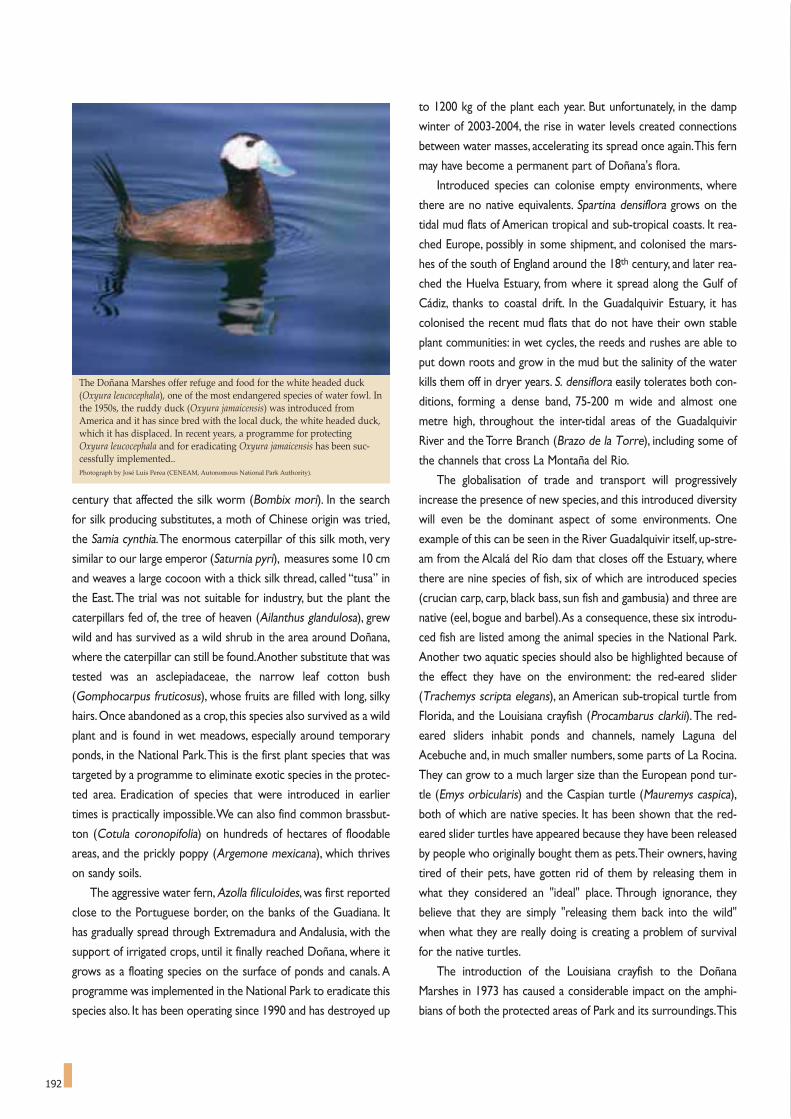
192
century that affected the silk worm (Bombix mori). In the search
for silk producing substitutes, a moth of Chinese origin was tried,
the Samia cynthia.The enormous caterpillar of this silk moth, very
similar to our large emperor (Saturnia pyri), measures some 10 cm
and weaves a large cocoon with a thick silk thread, called “tusa” in
the East.The trial was not suitable for industry, but the plant the
caterpillars fed of, the tree of heaven (Ailanthus glandulosa), grew
wild and has survived as a wild shrub in the area around Doñana,
where the caterpillar can still be found.Another substitute that was
tested was an asclepiadaceae, the narrow leaf cotton bush
(Gomphocarpus fruticosus), whose fruits are filled with long, silky
hairs.Once abandoned as a crop, this species also survived as a wild
plant and is found in wet meadows, especially around temporary
ponds, in the National Park.This is the first plant species that was
targeted by a programme to eliminate exotic species in the protec-
ted area. Eradication of species that were introduced in earlier
times is practically impossible.We can also find common brassbut-
ton (Cotula coronopifolia) on hundreds of hectares of floodable
areas, and the prickly poppy (Argemone mexicana), which thrives
on sandy soils.
The aggressive water fern, Azolla filiculoides, was first reported
close to the Portuguese border, on the banks of the Guadiana. It
has gradually spread through Extremadura and Andalusia, with the
support of irrigated crops, until it finally reached Doñana, where it
grows as a floating species on the surface of ponds and canals. A
programme was implemented in the National Park to eradicate this
species also. It has been operating since 1990 and has destroyed up
to 1200 kg of the plant each year. But unfortunately, in the damp
winter of 2003-2004, the rise in water levels created connections
between water masses, accelerating its spread once again.This fern
may have become a permanent part of Doñana's flora.
Introduced species can colonise empty environments, where
there are no native equivalents. Spartina densiflora grows on the
tidal mud flats of American tropical and sub-tropical coasts. It rea-
ched Europe, possibly in some shipment, and colonised the mars-
hes of the south of England around the 18th century, and later rea-
ched the Huelva Estuary, from where it spread along the Gulf of
Cádiz, thanks to coastal drift. In the Guadalquivir Estuary, it has
colonised the recent mud flats that do not have their own stable
plant communities: in wet cycles, the reeds and rushes are able to
put down roots and grow in the mud but the salinity of the water
kills them off in dryer years. S. densiflora easily tolerates both con-
ditions, forming a dense band, 75-200 m wide and almost one
metre high, throughout the inter-tidal areas of the Guadalquivir
River and the Torre Branch (Brazo de la Torre), including some of
the channels that cross La Montaña del Rio.
The globalisation of trade and transport will progressively
increase the presence of new species, and this introduced diversity
will even be the dominant aspect of some environments. One
example of this can be seen in the River Guadalquivir itself, up-stre-
am from the Alcalá del Río dam that closes off the Estuary, where
there are nine species of fish, six of which are introduced species
(crucian carp, carp, black bass, sun fish and gambusia) and three are
native (eel, bogue and barbel).As a consequence, these six introdu-
ced fish are listed among the animal species in the National Park.
Another two aquatic species should also be highlighted because of
the effect they have on the environment: the red-eared slider
(Trachemys scripta elegans), an American sub-tropical turtle from
Florida, and the Louisiana crayfish (Procambarus clarkii).The red-
eared sliders inhabit ponds and channels, namely Laguna del
Acebuche and, in much smaller numbers, some parts of La Rocina.
They can grow to a much larger size than the European pond tur-
tle (Emys orbicularis) and the Caspian turtle (Mauremys caspica),
both of which are native species. It has been shown that the red-
eared slider turtles have appeared because they have been released
by people who originally bought them as pets.Their owners, having
tired of their pets, have gotten rid of them by releasing them in
what they considered an "ideal" place. Through ignorance, they
believe that they are simply "releasing them back into the wild"
when what they are really doing is creating a problem of survival
for the native turtles.
The introduction of the Louisiana crayfish to the Doñana
Marshes in 1973 has caused a considerable impact on the amphi-
bians of both the protected areas of Park and its surroundings.This
The Doñana Marshes offer refuge and food for the white headed duck(Oxyura leucocephala), one of the most endangered species of water fowl. Inthe 1950s, the ruddy duck (Oxyura jamaicensis) was introduced fromAmerica and it has since bred with the local duck, the white headed duck,which it has displaced. In recent years, a programme for protectingOxyura leucocephala and for eradicating Oxyura jamaicensis has been suc-cessfully implemented..Photograph by José Luis Perea (CENEAM, Autonomous National Park Authority).

The herons are a con-stant feature of theDoñana Marshes, likethe night heron(Nycticorax nycticorax),the small cattle egret(Bubulcus ibis), the littleegret (Egretta garzetta)the Squacco heron(Ardeola ralloides), thegrey heron (Ardeacinerea) and the purpleheron (A. purpurea). Inthe picture, Squaccoheron, a highly endan-gered species that can besighted in Doñana.Photograph: CENEAM files.

194
decapod has colonised practically the entire marshes, the edges of
the shallow ponds and channels, the riverbeds of rivers even if they
are not continuous, the ponds of the sands, and the rice paddies.
Highly aggressive, it hunts amphibians and the larvae of macro-
invertebrates and also scavenges the carrion of birds and fish. It
churns over the deposits on the beds of the ponds and digs alco-
ves, where it seeks refuge.The effect on the amphibian population
has been significant, as perhaps has the effect on the invertebrates
and the bottoms of lakes also.The spread of this freshwater cray-
fish is due to the fact that it can move easily out of water, and to
human distribution too, since it has become a valuable commercial
product. One collateral effect that has amplified the overall negati-
ve impact of this species is the fact that it is caught in traps, which
cause often-reiterated management problems:The fishermen place
their traps in the Nature Park's canals and ponds, disturbing the
terrestrial fauna and trapping aquatic life other than the freshwater
crayfish, like eels, turtles, black necked grebes, coots and even
ducks. On the positive side, otters, the white stork and herons
eagerly catch the crayfish. In fact, the increase, in the 1990s, in the
colonies of white storks in La Dehesa de Abajo, in Coria, close to
the Parks, has been essentially due to the abundant food resources
of these crayfish.
The larvae of other decapods, and even adults, can travel in
ballast waters of ships sailing the Guadalquivir River to the Seville
port. José Antonio Cuesta, of the CSIC Institute of Marine Sciences
in Cádiz, has found Palaemon macrodactylus in the estuary, an
oriental species to add to the native species of prawns (Palaemon
longirostris, P. adspersus, P. serratus, P. elegans). Other, more
recent introduced species have also been found, such as
Rhithropanopeus harrisii, Synidotea laticauda, Eriocheir sinensis9.
Some of the terrestrial animal introductions date back many
centuries, like the genet (Genetta genetta), probably introduced by
the Arabs, or the slender mongoose (Herpestes ichneumon), of
African origin.The chameleon (Chamaeleo chamaeleo) too, rare in
the protected areas of Doñana but frequent in the coastal dunes of
Huelva and Cádiz, was introduced from Africa. The azure-winged
magpie (Cyanopica cyanus), originally from the Far East, is cited in
many reports as a species introduced as the result of Portuguese
sailors roaming these coasts in the 16th century. But the recent dis-
covery of remains of this bird at a Neanderthal site in two caves
very close to Gibraltar would appear to invalidate the hypothesis
in favour thus far12. The Greek tortoise (Testudo graeca ibera) is a
case of an ancient introduction that experienced a sharp fall in
population numbers, but then became established again on several
occasions in the 20th century by means of successive re-introduc-
tions of specimens from Morocco.
Other species have arrived thanks to the unintentional help of
humankind.The sands, silts and trees of Doñana are a hostile envi-
ronment for species that need substrates of stone, walls or cracks.
Yet, houses offer excellent eaves for swallows, swifts and martins,
and cracks for species of bats, and holes and stones for lichen.The
mortar of walls is a lime substrate for hedge mustard.Wellheads,
with their damp stones, are ideal for the fine leaves of maiden hair
(Adiantum capillus-veneris), only found in these enclaves.Another
curious case is the rock rose (Cistus ladanifer),with large white flo-
wers, abundant in the western Iberian Peninsula but infrequent in
Doñana and practically non existent on its dune cover. However, in
the 1970s, an access road had to be built in the Reserve of the
National Park to gain access to the Doñana Palace, using gravel and
silt from outside of the area in its construction. The rock rose
immediately colonised the favourable substrate, spreading in lines
along the ditches on either side, although it has been unable to
penetrate any further into these sandy soils.
Voluntary introductions include, first of all, the fallow deer
(Dama dama), introduced on several occasions, either as semi-
domestic livestock with herders, or for hunting. In 1829, the
Marquis of Villafranca brought camels from the Canary Islands to
Cádiz for farm work, but the bad tempered animals proved difficult
to handle. Giving up his attempts, he released them into the
Marshes, where the herd survived, despite periods of flooding and
the pressure from neighbouring villagers who hunted them.
There are large flocks of oystercatchers and gulls (yellow-legged gull, lesserblack-backed gull, and Audouin’s gull) on the coastal strip of Doñana, andyou can often see the sandpipers and plovers on the beach, running backand forth with the waves. The Kentish plover (Charadrius alexandrinus)nests on the actual beach. In the picture, a group of oystercatchers.Photograph by José María Pérez de Ayala.

195
Chapman came across them in the flooded Marshes in 1883, devo-
ting long accounts to them in Wild Spain (1893) and Unexplored
Spain (1910) that describe his failed attempts to catch up with
them on horseback. His testimony was initially received with incre-
dulity among European zoologists, but their existence was soon
confirmed.Phillip,Duke of Orleans, read the description and,on the
17th of June 1893, he sent Chapman a letter with the details of his
efforts to protect the camels from the "terrible poachers" that
crossed the Guadalquivir from Trebujena village and sold their meat
as venison. He enclosed some photographs taken in the spring of
that year, with a pole device to catch a camel from horseback by
passing a lasso over its head.William Garvey is also mentioned, for
having easily caught up with three camels in the Marshes in 1907,
having chased them by car! The last individuals survived until the
60s.
The extensive area of grazing offered by the Marshes supports
large flocks and herds in spring and summer, in a productive but
hostile environment that has produced some interesting local bre-
eds, like the Lebrija sheep, the retinto or stray cow and the marsh
horse. The legend of the oxen of Gerion, the mythical King of
Tartessus in the Tasks of Hercules, could be a reference to the
ancient livestock of the Doñana Marshes. The introduction of
marsh cattle to the Americas is well documented, as the Indies
Fleets sailed from Seville, loading freight all along the Guadalquivir
Estuary with heavy cargos and animals in Sanlúcar.The herds of long
horn and mustang horses that transformed the resources of
America have this distant link with Doñana. The connection has
survived among the fishermen of Sanlúcar in the legend of the
Piedra de Salmedina, a reef close to the mouth of the Guadalquivir.
The legend says that the cows of Doñana jumped into the ocean in
a desperate attempt to find the animals taken to America, and that
the sea returned their bodies on the Piedra de Salmedina. In the
end, there may be an element of truth to the legend, as when the
Guadalquivir suffered violent flash flooding, barges, huts, trees and
many dead cattle were swept away to the beach of Bajo de Guia. It
is feasible that some cattle carcasses may have been swept up onto
the Piedra de Salmedina during these events.
There has also been speculation about land animals crossing
the Atlantic by their own means. In the 20th century, the cattle egret
(Bubulcus ibis), so abundant in Doñana and the surrounding area,
The legend says that the cows of Doñana jumped into the ocean in a desperate attempt to find the cattle taken to America, and that the sea returned their bod-ies on the Piedra de Salmedina. The herds of long horn cows and mustang horses that transformed the resources of America have this distant link with Doñana.In the picture, a bull of mostrenco breed in the pastures of Doñana showing its "beach" horns.Photograph by José María Pérez de Ayala.

196
colonised wetlands and pastures in the Americas.The first disco-
very was apparently in Guyana in 1930, and from there it spread
through South America. It had reached Florida by 1948, spreading
quickly through the United States in the 1950s, with occasional
sightings in Canada. In the other direction, the ruddy duck (Oxyura
jamaicensis) was introduced from North America in the 1950s,bre-
eding with the local white-headed duck (O. leucocephala) and dis-
placing it. In recent years, a programme has been successfully imple-
mented to protect the native duck in the National Park.
The Argentine ant (Iridomyrmex humilis), from its country of
origin via the shipping ports, has colonised the middle latitudes. It
has very recently displaced native species in certain areas, without
any possibility of control. With introduced species, there are the
two sides to the coin. In some cases, a species has arrived, to be
followed later by a predator. For example, the potato beetle
(Leptinotarsa decemlineata) was introduced in Spain much later
than the potato, its food plant, although it eats other species too.
The processes that led the Monarch butterfly (Danaus plexip-
pus) to settle in Doñana remain to be seen.This is a large American
danaid butterfly that makes migrations lasting several generations
between Mexico and Canada. It seems to have reached Europe
from America, but the Doñana specimens may have come from
migrations seen on the Costa del Sol and originating in the Canary
Islands. Their presence has been confirmed in the National Park,
where a large breeding colony of Gomphocarpus was found in
Marismillas, in 2004. Introduced asclepiadaceae, its food plant, are
to be found here in the form of Asclepias curassavica and
Gomphocarpus fruticosus.
It is also worth mentioning that, in very recent times, 30-cm-long
specimens of serrasalmidae, cousins of the piranha, and the red-bellied
pacu (Piaractus brachypomus) have been caught by the Guadalquivir
Docks in Seville, between 2002 and 2004.They are becoming one of
the latest threats to the area from exotic species.
A fleeting glimpse at tracking species introduction gives us a
general idea of what Doñana is today and, basically, if we wish to
conserve certain environments and ecosystems, then the control
of exotic species is an essential task in the management of pro-
tected areas. Introductions are a "biodiversity time-bomb" that
could explode at any moment, colonising Doñana with non-nati-
ve species.
THE SPECTACLE OF MOTHER NATURE
AND THE LONG ROAD TO HER SCIENTIFIC EXPLANATION
The attraction of a natural space lies in the diversity and
uniqueness of its various manifestations: the landscapes, expres-
sions of its flora and fauna, the forms of the terrain, its geological
constitution. It also lies in the possibility of seeing species that are
rare or nonexistent in other places, the chance to see them sur-
vive, flourish, nest, hunt and defend themselves, or the chance to
admire large numbers of a single species.Among all the intense, yet
ephemeral and dynamic processes, the ones that exert the greatest
attraction in the end, are those that manage to convey the living
elements of how nature actually works..
It is a kaleidoscope of images that triggers our memories of
Doñana: the vibrant "open aviaries" in the cork trees of La Vera; the
flocks of flamingos forming a pink brow over wet surfaces, which
they light up with their reflection when they take flight; the flocks of
geese flying to Cerro del Trigo at dawn to eat sand; the terns nose-
diving into the water for fish; the columns of white storks and black
kites flying in spirals over the dry marshes when they prepare to
migrate; the hundreds of dying carp in pools fast drying out, lying
prey to the kites; the bellowing of the deer on autumn nights; the
advance of shifting dunes with sheets of sand that creep forward as
silent wraps to bury the vegetation; the furious flash flooding of
Arroyo del Partido that has its delta overflowing and the marshes
filling with turbulent and milky waters; the storm that reaches the
foot of the El Asperillo cliffs, with parts of them collapsing; the first
great storm of autumn that floods the parched and cracked marsh-
es, releasing the aromas trapped by the summer drought to take
command of the air and trigger a storm of smells...
For nature lovers, the spectacle of Mother Nature spurs them
to curiosity: the need to know what, when, how, how big, etc.
Thanks to the high degree of conservation of its ecosystems and
Herons are a constant feature of the aquatic ecosystems of Doñana. Thegrey heron (Ardea cinerea) is the most emblematic species, with its slow,elegant flight and its unmoving posture in the mudflats. The colonyobserved by Benis and Valverde in Doñana in 1961 had over 200 occupiednests and, thanks to the protection afforded to the species in the NationalPark, its presence has spread to other areas, further north. Photograph: CENEAM files.
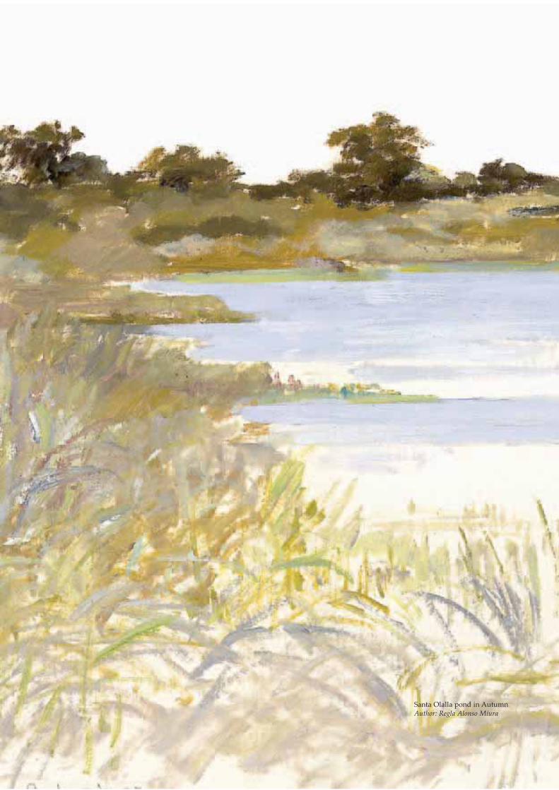
Santa Olalla pond in AutumnAuthor: Regla Alonso Miura

198
the fact that the territory is relatively unchanged, Doñana has
always offered excellent potential for answering these questions.
This seems to be reason enough to see the attraction the National
Park of Doñana holds for leading scientists to come and carry out
research here.Thus, it is an important focus for scientific investiga-
tion. The symbiosis between researchers and the protected area
has grown and continues to be reinforced day after day. But,
beneath all of this, there is an experience that dates back to ancient
times, because Doñana is and always has been a difficult and almost
incomprehensible space, though always open to knowledge. The
ongoing discovery of Doñana appears to have unfolded in a series
of initiatives isolated in time and space, but nothing could be fur-
ther from the truth.
In Chapter 2, Fernando Hiraldo, Director of the Doñana
Biological Station, provides basic detail of the research done in one
of the most important natural areas of the world, especially in
incorporating the wetlands with their surroundings. But to have
gotten this far, one has to admit that we have come a long way:The
knowledge, that now enables us to analyse Doñana from so many
angles and in so many fields, is founded in a chain of inherited, and
often little known, efforts. Following this path will also enable us
to fairly assess the biological treasures that have been discovered
to date.
The first steps in the scientific discovery of Doñana
We start our journey at the beginning of the 16th century.Soon
after trans-Atlantic voyages began, the Casa de Contratación
(Trading Company) was founded in Seville in 1503.This became the
city's leading scientific and technical centre.The Pilot in Chief was
responsible for their education and navigation, and the professors
of cosmography were responsible for cartography and making
instruments. Leading international figures were chosen, often
changing Court in the process. The list of these leading names is
impressive, including Amerigo Vespucci, Juan Díaz de Solís and
Sebastian Cabot.
The inclusion of American plants was soon begun and, in 1574
Monardes, from Seville, added descriptions of the sassafras and
tobacco plants, detail of dissemination of maize and peanuts from
Seville, and reports on the pineapple.This excellent beginning ran
aground economically in the 17th century and, unfortunately, cultur-
ally and scientifically too, despite the immense potential of relations
with the Americas for driving knowledge and discovery.Three quar-
ters of the science books published in the 17th century were includ-
ed in the index of the officers of the Inquisition, like Fernando
Valdés (1612) and Antonio Zapata (1632). The writer Miguel
Delibes recreates the suffocating atmosphere for new ideas during
the reign of King Phillip IV in El Hereje. In this context, the institu-
tions fell into decline and the Hispalense University of Seville,
founded in 1505, followed suit.
The recovery of science and the appearance of the natural sci-
ences occurred through the Enlightenment, which advanced
through Europe and was consolidated in Spain when the House of
Bourbon replaced the House of Austria in 1701. In Seville, a group
of doctors, chemists, priests and "enlightened scholars" maintained
the Medical-Chemical Tertulia Hispalense. In 1700, King Charles II
approved the statutes of this group as the Royal Medical Society,
which were endorsed by King Phillip V a year later.This society was
founded at approximately the same time as the Cimento Academy
of Florence and the London Royal Society.This was the age of sci-
entific revolution;perhaps the most important change in direction in
the history of science.
The Tertulia Hispalense discussion group became ever more
active in its natural fields, especially in medicine which included
medicinal plants. It employed a botanist,Antonio Ramos, from 1776
to 1780, to collect plants from the region and develop the Botanical
Gardens, which would have as many as 300 species. From 1786 to
1800, the Gardens were directed by Pedro Abad, who managed to
create a herbarium of 2000 sheets, 1709 of which have been con-
served in Seville University. The Society became the Seville
Academy of Medicine and Surgery and they ran the Gardens until
the 19th century, when they took over the San Telmo Palace, later
surrendered to the Montpensier family and practically lost when
alterations were carried out in 1913.
In 1804,Godoy sent oil-producing Argania spinosa seeds to the
Sanlúcar Economic Society for Acclimatisation.This was the nucle-
us of the La Paz Experimental and Acclimatisation Gardens
designed by Esteban Boutelou in 1806. The Gardens were
The dryer areas of the sands of Doñana are the home to thyme, lavender(Lavandula stoechas in the picture), rosemary and several species ofDianthus, Cistus, Arabis, Malcolmia, Leucojum.Photograph: Spanish Autonomous National Park Authority.

199
destroyed in 1808 when Godoy fell into disgrace. Esteban returned
to Aranjuez and, together with his brother, Claudio Boutelou, he
worked with the Chair of Applied Botany of the Royal Botanical
Gardens of Madrid. But Claudio was expelled from the Botanical
Gardens in the political purges of 1813, and was hired in Seville in
1819 by the Guadalquivir Company "to take charge of all the
Agriculture works, plough and plant the lands granted to the
Company with all kinds of trees". He started a nursery in 1826.
Hence, Claudio Boutelou designed the abovementioned
Acclimatisation Gardens in Seville in 1832, in the grounds of the San
Telmo Palace.The gardens were endowed with a Chair of Botany,
and Boutelou was appointed professor, a post he maintained until
his death in 1842. He was appointed in 1833 to run the Alcazar
Gardens, which included the Palacio del Rey in Coto del Lomo de
Grullo as an annex, which explains his repeated botanical trips to
the area of Doñana, visiting the islands, the marshes and also taking
samples from Sanlúcar on the left hand riverbank.This means that
the Doñana area had a professional botanist in the mid 19th centu-
ry. Claudio Boutelou's grand herbarium (7,000 sheets) includes the
plants of Doñana and Seville, specimens from the Royal Botanical
Gardens of Madrid, from his brother Esteban Boutelou and from
other botanists. Willkomm, author of Prodromus Florae
Hispanicae, visited Seville in 1844, to study the plant collection, of
which he described 10 new species and one variety. He also
appointed Iberis bouteloui and Tetragonolobus bouteloui to this
family of scientific accomplishments.
As far as we can see, this did not go unnoticed by the scientif-
ic community of the early 19th century. Mariano Lagasca, a favourite
pupil of the great botanist Cavanilles, explored the right bank of the
Guadalquivir in the summer of 1823, from Coria to Coto del Rey,
studying the vegetation of Lomo del Grullo. On this first expedi-
tion, he found three new species for science that he described:
Loeflingia baetica, with the diagnosis that "its corolla is longer than
the calyx and it has five stamens", and Malva anodaeformis and
Ononis subspicata in the same area. Of the Malva, he adds "I have
seen it in flower from mid May until the 7th of June and I surmise
that it will flower until July. I picked it in Coria del Rio, in damp
grounds, on my way to the area called Coto del Rey". He indicates
two forms: the A, with a single stalk, and the B with a branched
stalk. Each of these forms is now considered a different species.A
is Malva althaeoides, described by Cavanilles a few years earlier in
1793, and B is Linneaus' Malva hispanica.About Ononis, he points
out that "it grows in great abundance in sandy areas of the men-
tioned Coto del Rey and especially next to the track. It blooms in
The marine coastal organisms have been studied in-depth from Portugal to the Mediterranean coasts, all along the Andalusia coast. The 154 species of opisto-branchia molluscs found highlight the contact between the Mediterranean groups and the Portuguese and Mauritanian groups to provide a highly diversifiedset. 59 species have been reported in the sector between Cabo Roche and the mouth of the Guadalquivir in Doñana. The knobbed triton (Charonia lampas lam-pas), in the picture, is a prosobranch mollusc, and one of the endangered species of this coastline that is now protected.

200
May and June and it appears to me to be an annual plant. I have seen
it eaten frequently by the cattle, but I do not know what kind of
livestock grazes it". Ononis subspicata is now considered as the
baetica variety of Ononis baetica, described by Clemente in 1807.
There is another variety of O. baetica, described by Devesa (1986),
the donanensis variety that is typical of the Doñana dunes.
The exploration of Lagasca provided the first scientific invento-
ry of Doñana.The list of 22 species of vascular plants, three new
ones for science that the author had found in Coto del Rey togeth-
er with the species he describes, is reproduced in Table 2.
The Hispalense University played a fundamental role in this long
process. In 1857, the Moyano Plan created the Faculties of Exact,
Physical, and Natural Sciences, with a Department of Natural
History. Miguel Colmeiro, Professor of Botany from 1847 to 1857,
was responsible for the repeated collection expeditions to Doñana
and the Guadalquivir. After he was transferred, Antonio Machado
Nuñez (1845-83) was appointed Professor of Mineralogy and
Zoology, and he too organised scientific expeditions to Doñana, the
Marshes and the Guadalquivir. At this time, the Hispalense
University planted a Botanical Garden, with greenhouses, for con-
ducting trials with crops and other plants. In 1864, Machado was
sent some eucalyptus seeds from the Ministry of Agriculture, for a
trial in the Garden. It is ironic that this early scientific presentation
of the eucalyptus led to its domination of vast areas of Doñana in
less than a century.
Antonio Machado Nuñez, grandfather of poets Antonio and
Manuel Machado, promoted the Natural Sciences and the
University of Seville in general. In fact, he was Chancellor of the
University. He introduced the ideas of evolution, translating and
annotating Darwin and other authors. His research work included
vertebrate collections, which incorporated the data of Antonio
Cabrera, Canon of Cádiz (1763-1827), who had studied the marine
flora and birds of the Gulf of Cádiz and published works on the fish
in 1817. In 1854, Machado published a Catalogue of the birds of
Seville, including parts of Huelva and Cádiz. Unfortunately, he did
not tackle Doñana, arguing that "in the Marshes of the left bank of
the Guadalquivir, not far from Lebrija and Trebujena ... there is a
diversity of waders and web-footed birds that I have found most
striking; the right bank of the river is also very abundant in the same
TABLE 2Inventory of plant species in Coto del Rey drawn up by Mariano Lagascain 1823. This is the earliest scientific inventory of the Doñana region.
The water crowfoot isone of the mostshowy element of thefresh water vegeta-tion. It is a sub-merged or partiallyfloating plant wide-spread all over themarshes, includingthe relatively brackishareas of Marismillasand Las NuevasPhotograph: CENEAM. files.
1. Loeflingia baetica
2. Malva anodaeformis (=M. hispanica)
3. Ononis subspicata (=O. baetica)
4. Malva hispanica
5. Thapsia foetida (=Elaeoselinum foetidum)
6. Seseli ammoides (=Ammoides pusilla)
7. Cachrys sicula
8. Cistus albidus
9. Cistus crispus
10. Cistus thymifolius (=Fumana thymifolia)
11. Lavandula stoechas
12. Scorpiurus vermiculata
13. Nigella hispanica (=N. papillosa)
14. Herniaria annua?
15. Polycarpon tetraphyllum
16. Oenanthe peucedanifolia
17. Oenanthe globulosa
18. Satureja capitata (=Thymbra capitata)
19. Ornithopus compressus
20. Ornithopus nudiflorus?
21. Corrigiola littoralis
22. Festuca alopecuros (=Vulpia alopecuros)
The species name within brackets is the name currently in use, if it has changed. Two ofthe species are doubtfully identified. Lagasca mentions this list of species as accompany-ing plants to Malva anodaeformis, but C.littoralis, F. alopecurus and Leoflingia baetica, whichaccompanied Ononis subspicata.
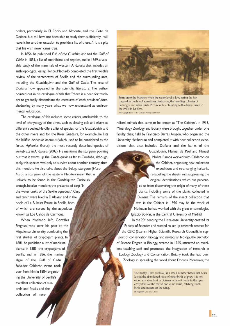
201
orders, particularly in El Rocío and Almonte, and the Coto de
Doñana, but, as I have not been able to study them sufficiently, I will
leave it for another occasion to provide a list of these...". It is a pity
that his wish never came true.
In 1856, he published Fish of the Guadalquivir and the Gulf of
Cádiz, in 1859, a list of amphibians and reptiles, and in 1869, a valu-
able study of the mammals of western Andalusia that includes an
anthropological essay. Hence, Machado completed the first wildlife
review of the vertebrates of Seville and the surrounding area,
including the Guadalquivir and the Gulf of Cádiz. The area of
Doñana now appeared in the scientific literature. The author
pointed out in his catalogue of fish that "there is a need for teach-
ers to gradually disseminate the creatures of each province", fore-
shadowing by many years what we now understand as environ-
mental education.
The catalogue of fish includes some errors, attributable to the
level of ichthyology of the times, such as classing eels and elvers as
different species.He offers a list of species for the Guadalquivir and
the other rivers and, for the River Guadaira, for example, he lists
the killifish Aphanius baeticus (which used to be considered as the
fartet, Aphanius iberus), the most recently described species of
vertebrate in Andalusia (2002). He mentions the sturgeon, pointing
out that it swims up the Guadalquivir as far as Cordoba, although,
sadly, this species was only to survive about another century after
this mention. He also talks about the Beluga sturgeon (Huso
huso), a sturgeon of the eastern Mediterranean that is
unlikely to be found in the Guadalquivir. Curiously
enough, he also mentions the presence of carp "in
the water tanks of the Seville aqueduct". Carp
and tench were bred in El Alcázar and in the
pools of La Buhaira Estate, in Seville, both
of which are served by the aqueducts
known as Los Caños de Carmona.
When Machado left, González
Fragoso took over his post at the
Hispalense University, conducting the
first studies of cryptogam plants. In
1881, he published a list of medicinal
plants; in 1883, the cryptogams of
Seville; and in 1886, the marine
algae of the Gulf of Cádiz.
Salvador Calderón Arana took
over from him in 1884,organis-
ing the University of Seville's
excellent collection of min-
erals and fossils and the
collection of natu-
ralised animals that came to be known as "The Cabinet". In 1913,
Mineralogy, Zoology and Botany were brought together under one
faculty chair, held by Francisco Barras Aragón, who organised the
University Herbarium and completed it with new collection expe-
ditions that also included Doñana and the banks of the
Guadalquivir. Manuel de Paul and Manuel
Molina Ramos worked with Calderón on
the Cabinet, organising new collection
expeditions and re-arranging herbaria,
re-labelling the sheets and suppressing the
original identifications, which has prevent-
ed us from discovering the origin of many of these
plants, including some of the plants collected in
Doñana. The remains of the insect collection that
was in the Cabinet in 1970 may be the work of
Molina, as he had worked with the great entomologist,
Ignacio Bolivar, in the Central University of Madrid.
In the 20th century, the Hispalense University created its
Faculty of Sciences and started to set up research centres for
the CSIC (Spanish Higher Scientific Research Council). In sup-
port of conservation biology and molecular biology, the Bachelor
of Science Degree in Biology, created in 1965, attracted an excel-
lent teaching staff and promoted the integration of research in
Ecology, Zoology and Conservation. Botany took the lead over
Zoology in spreading the word about Doñana. Moreover, the
Boars enter the Marshes when the water level is low, eating the fishtrapped in pools and sometimes destroying the breeding colonies offlamingos and other birds. Picture of boar hunting with a lance, taken inthe 1940s in La Vera.Photograph: Files of the Doñana Biological Station.
The hobby (Falco subbuteo) is a small summer hawk that nestslate in the abandoned nests of other birds of prey. It is notespecially abundant in Doñana, where it hunts in the openecosystems of the marsh and dune scrub, catching smallbirds and insects on the wing.Photograph: CENEAM. files.
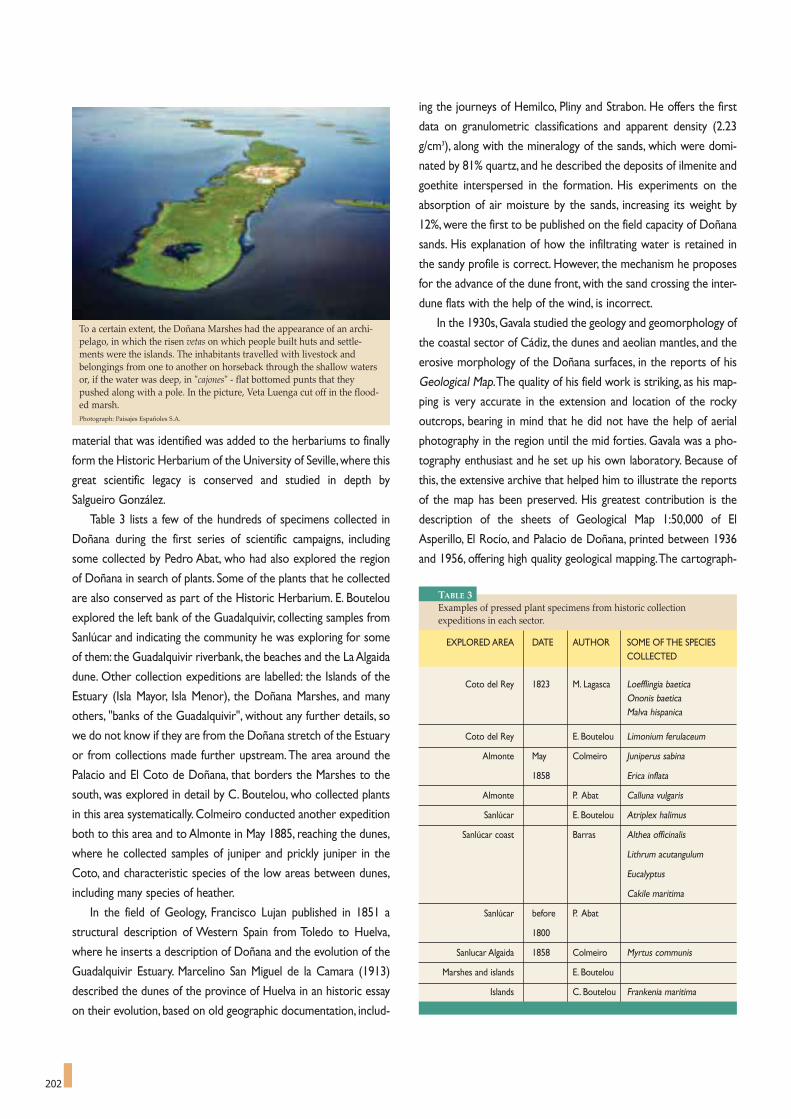
ing the journeys of Hemilco, Pliny and Strabon. He offers the first
data on granulometric classifications and apparent density (2.23
g/cm3), along with the mineralogy of the sands, which were domi-
nated by 81% quartz, and he described the deposits of ilmenite and
goethite interspersed in the formation. His experiments on the
absorption of air moisture by the sands, increasing its weight by
12%, were the first to be published on the field capacity of Doñana
sands. His explanation of how the infiltrating water is retained in
the sandy profile is correct. However, the mechanism he proposes
for the advance of the dune front, with the sand crossing the inter-
dune flats with the help of the wind, is incorrect.
In the 1930s,Gavala studied the geology and geomorphology of
the coastal sector of Cádiz, the dunes and aeolian mantles, and the
erosive morphology of the Doñana surfaces, in the reports of his
Geological Map.The quality of his field work is striking, as his map-
ping is very accurate in the extension and location of the rocky
outcrops, bearing in mind that he did not have the help of aerial
photography in the region until the mid forties. Gavala was a pho-
tography enthusiast and he set up his own laboratory. Because of
this, the extensive archive that helped him to illustrate the reports
of the map has been preserved. His greatest contribution is the
description of the sheets of Geological Map 1:50,000 of El
Asperillo, El Rocío, and Palacio de Doñana, printed between 1936
and 1956, offering high quality geological mapping.The cartograph-
202
material that was identified was added to the herbariums to finally
form the Historic Herbarium of the University of Seville,where this
great scientific legacy is conserved and studied in depth by
Salgueiro González.
Table 3 lists a few of the hundreds of specimens collected in
Doñana during the first series of scientific campaigns, including
some collected by Pedro Abat, who had also explored the region
of Doñana in search of plants. Some of the plants that he collected
are also conserved as part of the Historic Herbarium. E. Boutelou
explored the left bank of the Guadalquivir, collecting samples from
Sanlúcar and indicating the community he was exploring for some
of them: the Guadalquivir riverbank, the beaches and the La Algaida
dune. Other collection expeditions are labelled: the Islands of the
Estuary (Isla Mayor, Isla Menor), the Doñana Marshes, and many
others, "banks of the Guadalquivir", without any further details, so
we do not know if they are from the Doñana stretch of the Estuary
or from collections made further upstream.The area around the
Palacio and El Coto de Doñana, that borders the Marshes to the
south, was explored in detail by C. Boutelou, who collected plants
in this area systematically. Colmeiro conducted another expedition
both to this area and to Almonte in May 1885, reaching the dunes,
where he collected samples of juniper and prickly juniper in the
Coto, and characteristic species of the low areas between dunes,
including many species of heather.
In the field of Geology, Francisco Lujan published in 1851 a
structural description of Western Spain from Toledo to Huelva,
where he inserts a description of Doñana and the evolution of the
Guadalquivir Estuary. Marcelino San Miguel de la Camara (1913)
described the dunes of the province of Huelva in an historic essay
on their evolution, based on old geographic documentation, includ-
To a certain extent, the Doñana Marshes had the appearance of an archi-pelago, in which the risen vetas on which people built huts and settle-ments were the islands. The inhabitants travelled with livestock andbelongings from one to another on horseback through the shallow watersor, if the water was deep, in "cajones" - flat bottomed punts that theypushed along with a pole. In the picture, Veta Luenga cut off in the flood-ed marsh.Photograph: Paisajes Españoles S.A.
TABLE 3Examples of pressed plant specimens from historic collectionexpeditions in each sector.
EXPLORED AREA DATE AUTHOR SOME OF THE SPECIESCOLLECTED
Coto del Rey 1823 M. Lagasca Loefflingia baeticaOnonis baeticaMalva hispanica
Coto del Rey E. Boutelou Limonium ferulaceum
Almonte May Colmeiro Juniperus sabina
1858 Erica inflata
Almonte P. Abat Calluna vulgaris
Sanlúcar E. Boutelou Atriplex halimus
Sanlúcar coast Barras Althea officinalis
Lithrum acutangulum
Eucalyptus
Cakile maritima
Sanlúcar before P. Abat
1800
Sanlucar Algaida 1858 Colmeiro Myrtus communis
Marshes and islands E. Boutelou
Islands C. Boutelou Frankenia maritima

203
ic interpretation of Avieno's Sea Itinerary is an outstanding person-
al effort of will that has not won any critical praise.The evolution
that he proposes for the old Lacus Ligustinus up-dates the descrip-
tion of San Miguel de la Camara and has been quoted repeatedly in
the literature. However, it is not accurate, as it incorporates a com-
plex process that includes advances and retreats of the coastline
and major climate changes in a single episode of erosion fill.
Moreover, some of the present forms have been inherited from
preceding glacial cycles and prior eustatic changes as Cary Zazo,
Joaquin Rodriguez Vidal and other coastal geomorphologists have
shown.These are summarised in one of the contributions to this
book.
The first monographs on Doñana
As can be inferred from the scientific historiography described
above,Doñana does not appear with its own profile in the research
conducted in the region until the early 20th century.Abel Chapman,
in Unexplored Spain published in 1910, devotes several chapters to
certain species present in Doñana, like flamingos,providing interest-
ing details on their populations. He found a "mystery" in the flamin-
go that he was unable to solve: its reproduction. He spent years
searching the Doñana Marshes for the breeding colonies until he
found them. Yet, he found that clutches of eggs failed to hatch
because of the weather and chicks only hatched every four years,
which he considered incompatible with maintaining population lev-
els. It was to take almost half a century for the mystery to be solved
- by Valverde who discovered that the main breeding ground was
Laguna de Fuentepiedra, in Malaga, and that the parents raised their
chicks by bringing the food they needed from Doñana and else-
where.The flamingos of Western Mediterranean behave as a single
large population that is currently growing thanks to the protection
afforded to these enclaves and to the fact that they have established
new breeding colonies, like the one in the Ebro Delta, in 2004.
The Hispalense University botany publications and campaigns,
Machado's study of the fish of the Guadalquivir, Gavala's geological
works, and the forestry study on the dune mantles and their re-
forestation, all these did not focus on El Coto de Doñana. It was
only after 1953 that a series of important scientific publications
appeared that were to lay the foundations of the future of Doñana,
based on research. Francisco Bernis had the honour of starting this
series.Working with Valverde, he ringed birds in the pajareras, the
nesting colonies, in 1952, providing the first censuses and descrip-
tions of colonies, along with an outline of the vegetation, ecosys-
tems and landscapes.
Francisco Bernis Madrazo was a superb naturalist with training
in botany and a great interest in birds. In fact, early on he published
articles on them, aimed at determining a list of species to be found
in Spain and to establish common names to make their study easi-
er. He also launched an ambitious attempt to take a national cen-
sus of the white stork, by correspondence. But, Bernis had heard of
Doñana and decided to make a visit. He obtained financial support
for the campaign from a doctor in Lugo and he invited a bird enthu-
siast student of his, José Antonio Valverde, to accompany him. In the
González Byass Company wineries in Jerez, he asked the family for
their permission to visit the Coto de Doñana, of which they were
co-owners. In June 1952, the three leading figures in the zoological
re-founding of Doñana came together: Paco Bernis, José Antonio
Valverde and Mauricio González, who were to work together for
half a century, changing the course of history of nature conserva-
tion in Spain.
In 1952, Bernis and Valverde published a description of the
pajareras (nesting colonies) of Doñana, cork oaks famous for the
enormous quantity of birds that nest in them that they describe as
the crown jewels of the Iberian wildlife. In the following, and most
expressive paragraph, they reflect: "As we write these lines, the
threat of colonisation and industrialisation hang over the famous
hunting grounds of the Guadalquivir.Will it not be possible to leave
even one small corner of this natural wilderness intact forever?"
This important text clearly highlights the urgency of conserving
Doñana and planted the seed that was to bear fruit seventeen
years later with the creation of the National Park.
General Franco, Head of Spanish Government, visited Doñana
in 1952 to monitor the success of the eucalyptus plantations that
the State had imposed on the area. He asked about the impact that
replanting had on hunting.The González Family thought it worth
writing to Franco to explain that if the government continued to
plant eucalyptus, it would put an end to all big game hunting.
Red crested pochard (Netta rufina). The Doñana Marshes shelter most ofthe Andalusia population, with an average of almost 2000 specimens win-tering there.Photography: CENEAM files.

204
Although they agreed, the other owners did not have the courage
to sign the letter. Mauricio González, with the co-operation of
Francisco (Paco) Bernis, gave shape to the idea, suggesting that a
protected area be created, offering: "…as long as we remain the
owner of the Estate, we undertake to conserve it, should your
Excellency so desire, as a reserve worthy of Spain, as we consider
that this unique estate deserves the privileges that national parks
and reserves enjoy". González personally explained the situation
and delivered the report to General Franco who made no com-
ment, but he did read it the very same day. He did not support the
idea of creating a Park, but he suspended the order to repopulate
Doñana with eucalyptus, saving the area from the death sentence
hanging over it. Through this little known part of the history of
Doñana, Mauricio González and his father created conditions to its
future conservation.
At last, and thanks again to the González family, Doñana was
presented to the international scientific community in the
"Doñana Expeditions" of 1952, 1956 and 1957. Guy Mountfort,
one of the participants, has described them in a magnificent book
that we would like to pay tribute to here: Portrait of a Wilderness.
As the author explains so well in his dedication, Mauricio Gordon
and his wife Milagro were the heart and soul of the Expeditions,
enabling their interest in birds to overcome the Customs prob-
lems that arose with the logistics and communication equipment
in that small ornithological Babel.
Mauricio, a chemist by trade, had shown an interest in
ornithology since his youth. Attracted by the descriptions of
Doñana in Chapman's book, Wild Spain, many naturalists and
ornithologists had attempted to reach this nature sanctuary.The
González family kindly met their requests and, in Mauricio, they
came across an expert in the local fauna. In 1952, Professor
François Bourlière and a group of French ornithologists planned a
trip to the south of Spain, inviting Guy Mountfort and Dr. Roger
Peterson to join them in a small expedition in April of that year.
After exploring La Janda Lagoon, the River Guadalete and other
wetlands, they reached Jerez, where Mauricio helped them to plan
a visit to the Doñana Marshes.Roger Peterson and Guy Mountfort
crossed the estuary and rode with Antonio Chico, Head Warden,
to the Palace, making the First Expedition, lasting a week.The great
diversity of birds and resources convinced them to organise a seri-
ous major scientific expedition, inviting specialists in mammals, veg-
etation and other biological groups and, thus, they managed to put
together a outstanding team in 1956, including Mauricio González,
Roger Peterson and Guy Mountfort, together with Eric Hosking
and a group of six experts in scientific photography and nature
documentaries that were starting to become popular at the time.
Lord Alanbrooke, a leading field marshal of the British Army, and
his wife formed part of the expedition as documentalists.The sci-
entific results of the Second Expedition were excellent, identifying
171 species of birds, one of which, the masked shrike (Lanius nubi-
cus), was reported for the first time in Spain.
The Third Expedition, the most ambitious of all, set out on the
28th of April 1957, when the advance party reached Jerez. It was
made up mainly of members of the earlier expeditions, together
with Nobel Laureate, Sir Julian Huxley and his wife, Max
Nicholson, Director of Nature Conservancy in Great Britain, José
Antonio Valverde, Mauricio González and his wife Milagro, or
"Doña Milagro" as Guy Mountfort called her.The scientific and cin-
ematographic results of the Third Expedition were also of great
importance, identifying 168 birds in Coto Doñana and 204 in all,
22 of which had not been found in 1956, and making the first doc-
umentaries of the imperial eagle with chicks in the nest. Lynx, rep-
tiles, insects (some 300 species collected by Guy Mountfort) and
the vegetation (240 species collected by Julian Huxley), were also
studied.
In 1956 and 1957,Valverde published new contributions in which
he mentions the herons of Doñana and an important article on the
lynx, also in 1957. In 1958, he published An ecological sketch of the
Coto Donana, inspired by the recently published work by Nicholson
on the Camargue and Doñana.His description,with profiles and bar
charts by Valverde himself and photographs by Eric Hosking, is a
milestone for the area. In the references, he mentions Portrait of a
Wilderness by Mountfort, the first monograph on Doñana, which
was also published in 19589.
For nature lovers, the spectacle of Mother Nature spurs them to curiosity:the need to know what, when, how, how big, etc. Thanks to the highdegree of conservation of its creatures and the fact that the territory is rel-atively unchanged, Doñana has always offered excellent potential foranswering these questions. El Acebuche pond in the Doñana NationalPark.Photograph: Spanish Autonomous National Park Authority.

205
The Portrait text follows the tradition of 19th century British
travel books, but it completes the information about the route
with precise scientific detail of species, and excellent sketches and
photographs by Eric Hosking.The accounts of the Coto Doñana
Expedition convey an adventurous image of a team of scientists
overcoming difficulties in the remote south of Spain, filled with pic-
turesque characters like Pepe Menegildo, travelling barefoot, and
uneducated folk attached to their ancestral traditions and inca-
pable of understanding the efforts of science.The text considers
Valverde an excellent zoologist, an absolute expert in vertebrate
wildlife, and it reproduces his diagram of relations for the lynx, and
his ecological profiles. But, in line with the cliché of romantic trav-
ellers in Andalusia, he is presented as a fun loving and entertaining
figure, unafraid of animals or of the perils involved in catching them
by hand, as he often did with snakes and vipers, taking lizards or
amphibians out of his pockets at lunch or explaining how he
caught a lynx by hand by covering its head with a jacket.According
to the book, the scientists, mostly British, were exploring unchart-
ed territory, about which little was known,offering the contents of
Portrait to science.The works of Valverde and Bernis on Doñana
appear in the references to Spanish authors, together with the
classic works by Cabrera on mammals, the works of Baca on the
birds of Spain the works of the Duke of Almazán on hunting, and
little else. This is something that is in sharp contrast, as we have
seen here, with the fact that the flora and fauna had already been
studied for over a century, with surveys of the fish, reptiles, mam-
mals and birds, and the fact that there were already descriptions
and maps of the geology. Corema album, mentioned as a novelty,
had already been collected by Clemente around 1880 in Cádiz and
trials had been done with it as a species for anchoring the dunes
at the turn of the century.
The principal merit of Portrait was that it validated for zoolo-
gy the presence of a long list of birds, the existence of colonies,
the "pajareras" of great size living in a preserved natural environ-
ment, and the existence of an exceptional world of dunes, marsh-
es, forest and scrub. It also offered excellent pictures of species
that had hardly been seen before, like the imperial eagle on its nest
with chicks. Doñana as a valuable nature sanctuary was consecrat-
ed as such.
On re-reading the book, one can find interesting information
about the unique situation of the estuary, marshes, ponds, and
"pajareras", an enormous wolf shot by rangers, the huts of the stur-
geon fishermen on the banks of the Guadalquivir that they visited
in 1953, and the last individuals of the camel herds as described by
Chapman, the descendents of the camels brought in by the Marquis
of Villafranca in 1829.They are testimonies to a former world that
had survived but which was already feeling the impact of new
forces that would lead to its disappearance.To the north, the trans-
formation of the marshes into rice paddies and the projects for irri-
In 1913 MarcelinoSan Miguel de laCamara made a firstgeomorphologicaldescription of thedunes of theprovince of Huelvain an historic essayon their evolution.In the picture, anumbrella pine tree(Pinus pinea) on afixed dune stickingout from wanderingdunes of Doñana.
Photograph by José María Pérez de Ayala.
Since 1969 J.A. Valverde has promoted the study of the most emblematicspecies of Doñana in the Biological Station. The pioneering group ofresearchers conducted highly advanced studies, receiving internationalacclaim. In the picture, view of the Marshes from El Bolín Laboratory, locat-ed in the Doñana Biological Reserve.Photograph by Cipriano Marín.

206
gation in the sands.To the west, extensive plantation of pines and
eucalyptus.To the south, the pressure from the tourist industry to
develop the shoreline. The Guadalquivir, the whimsical god that
invaded the marshes at his will, was losing his power as the dams
starved him of his waters.
Two scientific monographs by Valverde were published between
the first and second editions of Portrait. The first dealt with The
Vertebrates of the Guadalquivir marshes, published by the Almería
Institute of Acclimatisation in 1960, offering an excellent descrip-
tion of the vertebrate communities, using the food chain as the
common thread. It analyses the diets and habitats, the use of the
area, and reproduction of these vertebrates, becoming the first
ecological description of the wildlife of Doñana and their ecosys-
tems.The second monograph, published in 1962, entitled Structure
of a community of terrestrial vertebrates, was undoubtedly a land-
mark that rounds off the previous works and makes an in-depth
analysis of the structure of the community, proposing ecological
and evolutionary mechanisms that explain its functional structure.
Neither the foreign scientists, nor Valverde or Bernis, both
from Castile, had contacted the Hispalense University or the
Cabinet of Natural Sciences and its collections, nor were they
familiar with publications on the area dating back more than a cen-
tury. In 1963, Emilio Fernández Galiano was appointed as
Professor of Botany in the recently created Biology Section of the
University of Seville. His experience in the Chair of Botany at the
Complutense University and his time directing the Royal Botanic
Gardens of Madrid meant that he realised the importance of a ref-
erence herbarium for the south of Spain and he located the old
items and organised the return of the material that had been
deposited with the Royal Botanic Gardens of Madrid. He prepared
the Floras of Seville and Cádiz, published the floral novelties and
preserved classic herbaria. Finally, he completed his great contri-
bution to science: The Vascular Flora of Western Andalusia
(1987), magnificently illustrated and published in collaboration
with two of his former students, Benito Valdés and Salvador
Talavera, now appointed to the Chairs of Botany t the University
of Seville.
Fernández Galiano, who had been familiar with Doñana since
the seventies, began the studies of its vegetation.As full Professor
of Botany, he was to play a decisive role in creating the Biological
Reserve as a member of The Marshes Biological Station Board.
Later on, as Chairman of the UNESCO Spanish MaB Committee,
he pushed for the declaration of the National Park as a Biosphere
Reserve, implementing the first environmental education pro-
grammes in the Park (1981-82). Doñana's contribution to the MaB
programme has certainly been an important one throughout this
time, compelling the Spanish Committee Report authored by F.
García Novo, to be published in 1993. UNESCO was to later
include the National Park to its World Heritage List in 1994.
ICONIC SPECIES AND THE BUZZ OF THE MARSHES
Valverde had successfully tried to protect the imperial eagle
and the lynx in the 1950s, seeking support from the owners of the
estates to prevent hunting and the collection of eggs from nests.As
the director of the Reserve and Park, he promoted a sophisticated
study of these species in 1969 that won recognition from the inter-
national scientific community for its authors and collaborators:
Miguel Delibes, Fernando Hiraldo and Miguel Ferrer.
Malcomia lacera, a member of the Brassicaceae family, grows on sandysoils, sometimes so poor in nutrients that the plant only reaches a heightof an inch. The result is a carpet of flowers covering the desolate area ofsands with colour.Photograph: CENEAM files.

207
The two felines that used to live in Doñana, the lynx and the
wild cat, have suffered declines that has placed them on the edge of
extinction, although with very different perceptions towards them.
The lynx has been studied in depth and major efforts and extraor-
dinary resources have been devoted to conserving it.The wild cat
has been lost in a tide of indifference from zoologists and conser-
vationists.
The collapse of the lynx population, starting in the second half
of the 20th century,was so intense that skeletons of dead specimens
could still be found in some areas.There were many reasons for
this: hunting, poisoned bait, transformation of its habitat for farm-
ing, the construction of roads and the increase in traffic. Sometimes
a single intervention, like filling in a reservoir, fragmented the area,
triggering a local catastro-
phe. In Doñana, the threats
to them were the draining
of the marshes, the traffic
on the road to
Matalascañas, clearing fields
for crops, surrounding the
fields with wire fencing, and
the large wells where they
drowned. The conclusions
of the research work done
at the time were devastat-
ing: their almost continu-
ous range that used to
cover the Iberian Peninsula
from north to south, was
being fragmented into a
series of small, discontinu-
ous areas where many sur-
viving populations were
condemned to extinction.
The species was only left
significant areas in the
southwest of Spain. Reality has, in the end, been even bleaker than
the forecasts, and twenty years on, the lynx only survives in two
small areas of its former range: Doñana and Sierra Morena.
The dangers hanging over the lynx and interest in the results
drove new research programmes with a permanent monitoring of
individuals fitted with radio collars. The results revealed that the
lynxes of the Biological Reserve ranged far and wide, making con-
tact with the lynxes of the rest of the National Park and the Nature
Park, and sometimes going much further afield, crossing roads and
farmland.Their food resources suffered from the decline in rabbit
populations, leading them to seek other prey and this was often
impossible for young animals. In this context, successive "lynx
plans" were launched after 1988 with actions such as creating
crossings for lynxes on the roads from Matalascañas to Mazagón
and El Rocío, the release of vaccinated rabbits in the National Park,
the creation of rabbit warrens and treatment of areas to foster rab-
bit population growth, and breeding lynxes in captivity. But, unfor-
tunately, the lynx continued to decline and there are probably no
more than 200 specimens left. Dead animals keep appearing, killed
by hunters, run over by cars, poisoned or caught in traps.
A broad sector of society is committed to defending the lynx:
another sector considers that it is responsible for its own extinc-
tion and they are opposed to traffic speed limits or to building
crossings.This is the tragedy of conservation. Politicians sometimes
make enthusiastic com-
mitments; other times
their pathetic analysis
explains why certain
attitudes can accelerate
its disappearance. And
one example of this is
from a presentation by
the Ministry of the
Environment before the
Senate in 2003:
"It is true, the sur-
vival of the lynx is com-
plicated, and I think that
you will agree with me
on this. It can also be a
problem of space,
because we are limiting
its territory.That is why
I say that I hope it will
be intelligent enough to
adapt to the new cir-
cumstances, because
these things happen in life... Luckily, man is more intelligent and can
adapt to it. The lynx seems to be quite a lot less smart than we
thought. It may have good eyesight, but then, in its behaviour, it is an
animal that runs very fast, and when running very fast, it sometimes
fails to see; it does not stop to see where it is going and so goes
over instead of under... I believe there must be a factor of adapting
to the environment, as others have had to, to survive, unless there
are other causes that we are trying to mitigate... I hope we will
shortly be able to say, because there aren't many left, that our lynx-
es are adapting to the circumstances, while, of course, helping them
in everything they need because the Ministry is open to sugges-
In Doñana, the threats to the Iberian lynx were the draining of the Marshes, the traffic on the roadto Matalascañas, clearing fields for crops, surrounding the fields with wire fencing, and the largewells/reservoirs where they drowned, as well as the decline of rabbit population, its main prey.Photograph by Antonio Sabater.

208
tions, and I hope we will be able to find them in Extremadura,
because they are to be found in the south of Portugal, and even a
bit further up, if possible, although the environment does not seem
as appropriate".
As regards the imperial eagle, its breeding habits were closely
monitored, and individuals marked to study their mating habits
(they are usually faithful to their mate), the chicks that hatched each
year and what happened to them.After many close observations of
their nests, which were started in the Coto Donana Expeditions of
1956 and 1957, detailed information was obtained on the catch of
prey, and the rhythm, selection and size of the prey caught.Along
with the data already known about the presence of rabbits and
some reptiles, the importance of coots and other waterfowl in the
diet of the imperial eagle in Doñana was striking.
The dispersion of the chicks was crucial for understanding how
the territory was used and to establish conservationist strategies.
It was important to increase observations in the surrounding areas
in an increasing radius. Furthermore, by improving the monitoring
in other regions, like Los Montes de Toledo, El Monte de El Pardo
and the Spanish Central Mountain Range, and exchanging records
between areas, a picture started to emerge about the status of the
population and their problems, of which Doñana was just a sample.
The young birds, after leaving the nest, disperse and spend between
one and two years in any available territory, where they perfect
their hunting techniques as, in fact, they learn to hunt rabbits.The
fledglings return to their original area to mate and try to establish
a range there or, at least on the periphery of their home range.This
homing effect has a positive result in that it guarantees that dense
breeding areas are maintained in favourable environments like
Doñana, although there have not been more than six chicks a year
of all those counted during the period 1998-2004. The negative
effect of this homing instinct is that these birds are forced to occu-
py marginal areas when the central area becomes saturated.And in
Doñana, the protected core is surrounded by built up areas and
farms, with fewer resources and greater risks.The use of radio col-
lars on some individuals led to a quantum leap in our knowledge of
the movements of the young birds that could be monitored con-
tinually around the region. In some cases, it also meant that their
remains could be recovered, to discover the cause of death: impact
with power lines, poisoned bait or poaching.
These eagles are animals with good longevity, 20-22 years, but
their breeding success for Doñana is modest (0.75
chicks/pair/year). Pre-adult mortality is high: 80-87% per year, falling
to lower figures among adults: 4.8-7.3% per year. Genetic studies
have now been carried out on the populations and genealogy stud-
ies have been pursued on many individuals and offsprings. Their
pathology has been studied, and their diet is well known, as is how
to supplement it during critical periods. Nests are monitored from
the early phase of occupation or construction and measures are
taken to prevent activities or car traffic in the area that could com-
promise incubation or the raising of chicks.The key is not so much
to increase productivity, but to reduce juvenile mortality. One sin-
gle factor, power lines, represents a disaster for population num-
bers and merely correcting them would enhance the expectations
for the species.This would be a worthwhile step because the impe-
Black vultures build their nests as platforms in the top of large trees. Theyused to be common in the north of Doñana, in Coto del Rey, the ranges, andeven in the olive groves. They now nest in the foothills of the Sierra Morenafar apart. Photograph: Spanish Autonomous National Park Authority.
33 species of mammals have been counted in Doñana, including fallowdeer, deer, mongoose, otter, genet and rabbit. In the picture, a genet with itsyoung in Doñana. Photograph: CENEAM files.

209
rial eagle currently faces a bleak future. It is not enough to keep a
tiny network of spaces where the eagles can mate in order to
maintain the population, while allowing favourable areas to disap-
pear in the rest of the territory and the risks to multiply.
On the other hand, other resident species of birds of prey in
Doñana face a brighter future: Bonelli's eagle, the kestrel, buzzard
and the peregrine falcon, although the last of these is scarce due to
the absence of crags or cliffs for nesting.The honey buzzard and,
above all, the black kite gather in large numbers during migrations.
In his memoirs,Valverde records the impression that the concen-
tration of kites had on him in 1952: "they formed large colonies in
the pine forests on both banks of the estuary".The same cannot be
said for the short-toed eagle, with a small nesting population in
Doñana (around 2-3 pairs), or the serious decline in the population
of the red kite (5-6 pairs), made worse by the fact that they are the
only birds of this species in western Andalusia.
Finally, the Gibraltar Straits see the passage of hundreds of
thousands of birds, from storks to swallows and swifts. For many
waterfowl and scrub birds,Doñana is an important staging post and
it has been calculated that some 6.5 million birds pass through the
park each year. These include the osprey, a determined aquatic
predator capable of catching its prey down to a depth of two
metres with its spectacular dives. At the end of the summer, it
leaves its territories in the north of Europe and follows the Atlantic
seaboard down to the Doñana Marshes, where it spends a few
weeks fishing in the canals before continuing its journey south over
the straits.There is a growing shortage of perches in the Marshes
and sometimes rows of ospreys can be seen using the telegraph
posts of power lines to perch on. It does not currently breed in
mainland Spain, although one individual was seen in 2002, trying to
build a nest in Doñana, in the restored Algaida Marsh, in Sanlúcar.
Miguel Ferrer, heading up a team from the Biological Station, has
done "transplant" trials, transferring osprey chicks to artificial nests,
built on the banks of reservoirs rich in Andalusian fish, to accustom
them to their new environment and re-introduce the species.Their
efforts have been met with success.
Other characteristic species to be found in Doñana are the
Egyptian vulture, which winters here, and the honey buzzard that
only migrates through. They migrate along the route through
Doñana and the coastal mountain ranges to Tarifa and, once they
have crossed the Gibraltar strait, they set out on a spectacular
journey, crossing the Sahara to reach their wintering grounds.
Black vultures build their nests as platforms in the top of large
trees.They used to be common in the north of Doñana, in Coto
del Rey, the ranges, and even in the olive groves.They now nest in
the foothills of the Sierra Morena, almost 100 Km to the North.
The griffon vultures, somewhat smaller in size and much more gre-
garious, nest on crags, forming colonies that they sometimes share
with Egyptian vultures and other birds of prey.The protection that
they have been afforded in the second half of the 20th century has
increased their numbers throughout Spain.They come to Doñana
on sunny days from the vulture colonies of Sierra de Aracena, Picos
de Aroche and Sierra Pelada, sometimes flying in long rows of up to
one hundred birds, in search of dead deer, fallow deer, boar or cat-
tle to feed off. The pecking order for eating the carrion is estab-
lished according to the hierarchical status of each bird in the flock.
If there are birds of different species together, the black vultures
will take preference over the griffon vultures and these will take
preference over other birds like Egyptian vultures, kites, rooks,
magpies and azure-winged magpies that will also take turns to feed
off the carrion.The small wagtails will feed off the insects that are
attracted by the corpse, including the fresh generation of maggots
that emerge from the carrion after a few days.
González Bernaldez remembered a visit he made in the winter
of 1972 to the lower stretch of the Guadiamar, accompanied by
Caballero, Professor of Plant Physiology, and Ramon Margalef, the
famous limnologist. Some sheep caught in the mud were surround-
ed by griffon vultures that gradually set siege to them.The natural-
ists tried to free the sheep from the mud, but if the animals were
exhausted or they had injured themselves in their attempts to get
free, the vultures would return for the kill. In the 1970s, after rainy
years or floods, this was a regular occurrence and there was an
abundance of carrion for vultures in the Doñana Marshes and
watercourses.When the pools dry out, the small ducks, carp and
other trapped fish, still attract vultures and black kites. Herons and
The ferruginous duck is a species that is almost extinct in the DoñanaMarshes; the one in the picture is a captive, maimed bird. The ruddy shel-duck has suffered the same fate, as it has disappeared as a nesting species inDoñana for over a century and only accidental specimens or specimens thathave escaped from captivity have been observed.Photograph: Spanish Autonomous National Park Authority.

210
the white headed duck and the glossy ibis that has recently estab-
lished stable colonies, recovering a population that had become
extinct in Doñana years ago.The black stork, a shy elusive bird in
comparison with the white stork, can also be seen in the Doñana
Marshes, although in small numbers.And the most spectacular, dis-
tinct and iconic sightings of marsh bird life are the flocks of flamin-
gos, the colonies of spoonbills and the abovementioned "pajareras"
over the cork trees and scrub of La Vera. Gulls (the common less-
er black-backed, and the black-headed), common terns, little terns,
black terns, and oystercatchers, which are keen bi-valve feeders
(especially of wedge clams in Doñana),dominate the beaches. In the
sea off Doñana, there are common scoters and marine ducks and,
occasionally, gannet, razorbills, Balearic shearwater, skuas and
petrels. And to round off the continual spectacle on the beach,
foxes, black kites and even boar occasionally in their wanderings
make it down to the beach.The sandpipers and plovers run around
in search of water fleas and other crustaceans, or they approach
the embryonic dune vegetation in search of insects and seeds.
Chapter 7 offers a list of bird species to be found in the Doñana
Marshes, including the most emblematic species. But as observers
and recordings have increased, more outstanding birds are added.
Chapman and Buck have reported tundra swan and pelican; and
Marabou stork, also sighted, could either be from zoos or wander-
ing specimens. There are exceptional reports of birds sighted far
from their normal range, like Allen's gallinule (Porphyrula alleni) and
storks eat the eyes of the fish, along with eels and other small fish.
Excrement-feeding insects and their larvae near the water are also
eaten by geese.The cycle of life and death is characteristic of the
marshes, inseparable from its fluctuating wetland character of flood
and drought.
After the autumn floods, bird life flocks to the Doñana
Marshes, occupying the different environments according to the
depth of the water or, later on, depending on the growth of the
aquatic vegetation. They come from regional wetlands, or they
have started their migrations from more distant regions, seeking
their wintering grounds in Doñana. In the ponds and somewhat
deeper waters, we find coot, known locally as gallaretas, common
mallards, shovelers and gadwalls, pintails, wigeon, shelduck, teals,
garaganey, marbled teal, red-crested pochard, pochard and grebes.
In very shallow bodies of water, we find waders. Near the banks,
there are herons, storks, moorhens, water rail and the striking
gallinules.The terns feed in pools, canals, lagoons and the estuary.
Grebes and cormorants leave the Marshes as the water levels
drop, but they can still be seen in the estuary, in the pools and
ponds of Isla Mayor.
The geese form flocks on the open waters, approaching the
banks to feed off the rhizomes, particularly the round castañuela.
One of the unforgettable sights of Doñana is the image of the geese
when they gather at dawn on Cerro del Trigo to eat sand.
The ornithological rarities of Doñana include the crested coot,
In Unexplored Spain Abel Chapman and Walter Buck found a "mystery" inthe flamingo that they were unable to solve: its reproduction. They spentyears searching the Doñana Marshes for the breeding colonies until theyfound them. Yet, they found that clutches of eggs failed to hatch becauseof the weather and chicks only hatched every four years, which wasincompatible with maintaining population levels. It was to take almosthalf a century for the mystery to be solved by Valverde who discoveredthat the main breeding ground was Laguna de Fuentepiedra, in Malaga.Photograph: CENEAM Files.

211
the red-necked phalarope (Phalaropus lobatus). Others, previously
abundant, have become rare, like the Hubara bustard, cranes, little
bustards and the buttonquail.
The presence of large concentrations of individuals of the same
species,which often happens in the Marshes,makes it more difficult
to identify other, similar species that accompany them. For exam-
ple, there may be 80,000 geese flying around in flocks of several
hundred specimens, forming larger groups of thousands, most of
which are greylag geese. But there are sometimes specimens of
greater white-fronted goose, bar-headed goose and snow goose,
and more occasionally, specimens of lesser white-fronted goose,
bean goose or pink-footed goose. These groups sometimes also
include barnacle geese, including the Canadian barnacle goose, well
established in Europe, the white-faced barnacle goose, the black-
faced barnacle goose and, very rarely, the red-necked barnacle
goose.
Testimonies from the 1950s recall the presence of overwhelm-
ing numbers of waterfowl in the Doñana Marshes, the immensity of
the "pajareras", and the clouds of mosquitoes that rose like smoke
at dusk.Yet, they also mention the abundance of reptiles, the con-
centrations of amphibians and the massive migrations of ribbed
newts and spade foot toads leaving the marshes for the ponds of
the sands, accompanied by an amazing number of water snakes. In
a pool, next to the track leading to Palacio de Doñana, you were
able to find newts and after spawning, the water used to bubble
with the activity of tadpoles that slid their way with difficulty
through the flooded grass. In the mid 1960s, anyone walking
through the scrub of the sands in late spring would constantly see
scaly and red-tailed lizards, and often ladder snakes, false smooth
snakes and horse shoe whip snakes, too.They would also witness
the challenge of the eyed lizard or feel the ill humour and snorts of
the Montpellier snake. In the water, the water snake hunted among
the turtles.
It is easy to spot traces of lizards among the bushes, but they
do not venture far from the cover of the vegetation. In the shifting
dunes, it is surprising to find snakes, vipers and slow moving tor-
toises, which move from one corral (inter-dune basin) to another,
covering hundreds of metres of dune front and leaving an unmis-
takeable trail.As with the rabbits, reptiles and amphibians play and
have played an important ecological role as energy transmitters in
the food chain, although they are not part of the group of iconic
species of Doñana. Depending on their size, the amphibians eat fil-
amentous and epiphyte algae, submerged macrophytes, crustaceans
and other aquatic invertebrates, insects and their larvae, and they
fall prey to fish, grebes, herons and storks.And, in larger concentra-
tions, they attract other waterfowl, foxes, boars and other preda-
tors. Reptiles basically eat insects, and they are the prey of other
reptiles, birds of prey, hunting birds like shrikes, opportunists like
kites, blackbirds, magpies, azure-winged magpies and some mam-
mals.
We could continue, in this way, down the flow chart of species
and their functions. That is why the same conclusion is reached
every time we embark on describing the iconic species of Doñana:
that there is nothing unnecessary here and maintaining the area
involves being aware of the intricate network of inter-dependencies
created by all the different forms of life.
Grebes and cormorants leave the Marshes as water levels drop, but they canstill be seen in the estuary, in the pools and ponds of Isla Mayor and occa-sionally in lagoons. In the picture, a great crested grebe.Photograph: Spanish Autonomous National Park Authority.
The two felines that used to live in Doñana, the lynx and the wild cat, havesuffered declines that has placed them on the edge of extinction, althoughwith very different perceptions towards them. The lynx has been studied indepth and major efforts and extraordinary resources have been devoted toconserving it. The wild cat has been lost in a tide of indifference fromzoologists and conservationists. The greatest threat to this specie in Doñanais inter-breeding with domestic cats, leaving very few pure-bloodedspecimens.Photograph: Spanish Autonomous National Park Authority.


their hydrology and chemical composition29,42, their hydrology and
substrate18 or their hydro-chemistry and littoral vegetation45. The
larger size of Santa Olalla and Dulce ponds made them suitable for
many limnological studies37,64,50,57,65,41 compared to the rest of ponds17,
39, 54. Additionally, the relevance of sediment in the functioning of
these shallow aquatic systems has been brought forward in numer-
ous publications32,33,40,21,15,61. The interaction with their surrounding
terrestrial ecosystems has also been studied under different per-
spectives, such as vegetation-groundwater interactions30, 67, climate
change63 and landscape management47. Research into the processes
that determine the environmental quality of the Doñana aquatic
systems should be the basis for conservation and management
strategies.This approach requires a huge spatial scale and the sup-
port of long-term studies because the chemical composition of its
waters is influenced by multiple processes: rainfall, evaporative con-
centration, groundwater discharge, biogeochemical reactions at the
sediment-water interface, and the interaction with soils and vege-
tation of the terrestrial systems within their watersheds.
213
The aquatic systems of Doñana
JULIA TOJA SANTILLANA *LAURA SERRANO MARTÍN *
213
The Doñana region includes an extraordinary variety of
aquatic systems, from salt pans to peatbogs. They are
broadly classified according to their location on either eolian sands
or marshland as their hydrology largely depends on the geomor-
phology of their basins.The permeability of each geomorphologic
unit is very different: the eolian sands correspond to an unconfined
aquifer (with a shallow water table and several flow systems) while
groundwater is confined below the silty-clay deposits of the
Marshes floodplain. Both units composed an aquifer system of
about 3400 km2 bottomed by impermeable marine marls known as
the Almonte-Marismas aquifer36. Groundwater recharge is pro-
duced by rainfall infiltration in the unconfined aquifer66 at an esti-
mated annual rate of 200 mm while it flows at 0.1-1cm in the con-
fined aquifer35.
The contemporary Marshes occupy a vast floodplain of about
23,000 ha, while hundreds of small ponds are scattered over the
aeolian sands during floods.A total of 568 temporary wetlands on
sandy soils have been recorded in the area by the local administra-
tion34. Additionally, salt pans operate on the left bank of the
Guadalquivir River, numerous artificial wetlands (about 3000 ha)
are devoted to extensive fish cultures in the estuary islands (Veta
La Palma, on Isla Mayor), and tidal marshes are reduced to a nar-
row fringe along the banks of Guadalquivir River28. Most running
waters are intermittent streams. Major hydrologic projects have
reshaped the flow of the main rivers, Guadalquivir and Guadiamar
that used to drain and flood over the Marshes. Small streams are
fed by rainfall and groundwater seepage; some of them drain to the
Marshes and others to the sea, across the cliffs formed by ancient
dune fields (Medano del Asperillo), providing shelter to some
hygrophyte species that hold vestiges of Atlantic peatbogs20.
Outside its protected areas, Doñana watersheds are severely
altered by human activities, featuring a wide variety of pressures
regarding the use and assignment of water resources. Despite its
significance for wildfowl, research into the limnological processes of
the Doñana aquatic systems started merely two decades ago.The
first ecological studies (aimed at relating biological populations to
environmental variables) were published in the early 80's24,44. The
water composition of the Doñana marshland and the quality of the
surface waters entering the Marshes were thoroughly studied dur-
ing the 80's16. Later, the Doñana ponds were typified according to
* University of Seville, Spain.
Studies of the ecological processes of the floodable areas of Doñana haveonly recently started to play the role they deserve. The Landsat 7 satelliteimage (2000) shows in false colour, the lower area of the Marshes duringthe floods, rimmed by dune formations and the course of the RiverGuadalquivir. The Marshes used to be isolated from the course of the riverby a natural levee, which has now been replaced by what is known as LaMontaña del Río.Photograph: Landsat 7 (2000). NASA.

214
THE MARSHES
The Doñana Marshes are basically fed by direct rainfall on its
floodplain and by several watersheds:Guadiamar River (1,180 km2),
El Partido stream (300 km2) and La Rocina stream (1,000 km2)
which are included in the lower sector of the Guadalquivir River
watershed (57,500 km2).The land is basically occupied by agricul-
ture and range.
The flatness of the vast extension occupied by the Doñana
Marshes (about 23,000 ha) is altered at a topographic scale of a few
dm creating shallow pans (locally known as lucios) and old levee
remnants (paciles) which have the appearance of emerged islands
(vetas) during floods. Quantitavely less important, but ecologically
relevant, is the ground water seepage along the ecotone border (La
Vera) that provides soil moisture to grass meadows and hygrophyte
vegetation, feeds small creeks (sotos) and maintains permanent
sub-surface springs (ojos).The tidal influence from the estuary of
the Guadalquivir River on the Marshes is currently impeded due to
the construction of a levee (Montaña del Río) that isolates the
marshland from the estuary. Several outlets along this levee are
provided with floodgates to maintain the confinement of the water
outflow during winter and spring though, occasionally, the levee is
overflowed at heavy floods. On the north-western area, surface
water is supplied by rainfall and the over flood of small streams (La
Rocina, El Partido, Caño Marín and Cañada Mayor) which drain
southwards into the Park feeding a large riverbed, the Madre de las
Marismas del Rocío channel. On the north-eastern end the
Guadiamar River used to drain southwards into the Marshes
through numerous small channels (caños). Nowadays, the lower
stretch of the Guadiamar River runs between two earthen dikes
(Entremuros) finally draining to a dead arm of the river (Brazo de
la Torre) so most of its water-flow and the drainage of the nearby
paddy-fields are presently deviated to the estuary of the
Guadalquivir River. Only a minor flow reaches the Marshes
(Guadiamar channel) passing through both pipes and a complex
canal network.The marked seasonality of flooding periods followed
by summer drought, and the isolation of the Marshes from the
estuary has imposed an endorreic character to the historical
marshes. Freshwater is accumulated in the depressions causing the
solubilization of salts from the top sediment.As the confined water
evaporates, their salts and particulates become increasingly con-
centrated.The resulting ionic composition of the lucio pans is then
dominated by Cl- and Na+, the concentration of salts being depend-
ent on the frequency and duration of flooding in each area19.
Carophytes are particular abundant in the submersed vegeta-
tion of the Doñana marshland as only five carophyte species
account for 98.4% of total biomass22.The following environmental
units, with their local names, can be distinguished in the Marshes,
according to flooding duration,water composition and vegetation23:
1) Lucios in depressions with long flooding periods and no emer-
gent macrophytes (helophytes) though some carophytes may
develop (Nytella hyalina and Chara canescens).
2) Pajas in depressions with long flooding periods where helo-
phytes grow on both caños and margins of lucios. Scirpus mar-
itimus and Scirpus litoralis are the dominant annual emergent
species in either monoespecific or mixed populations. Submersed
macrophytes such as Nytella hyalina and Chara connivens are also
found.
3) Candilejar in areas with an intermediate flooding period.
Vegetation composed of Juncus subulatus and Arthrocnemum
macrostachyum. Submersed vegetation including Chara gallioides,
Chara canescens, Callitriche truncata occidentalis and Zanichellia
obtusifolia.
4) Almajar in upper areas with no flooding or very shortly.
Vegetation dominated by Arthrocnemum macrostachyum, annual
grasses and no helophytes.
5) Estero in upper tidal areas along the coast line of the
Guadalquivir River and its dead arm-river (Brazo de la Torre).
Brackish waters with dense Spartina densiflora stands.
6) Salao in elevated dry areas (former levees). Vegetation of
Limoniastrum monopetalum.
7) Tidal areas where vegetation community composition follows
the frequency and duration of tidal flow, from Spartina densiflora
and Salicornia europaea (lower areas), Sarcocornia fruticosa and
Sarcocornia perennis (intermediate) to Artrocnemum
macrostachyum (upper areas). Submersed vegetation is rich
(Ruppia drepanensis,Chara canescens,Callitriche truncata occiden-
talis, Zanichellia obtusifolia and Rannunculus peltatus fucoides), and
with some rare species (Tolypella glomerata, Tolypella hispanica,
The Marshes can be divided into eight environmental units, based on theflood regime and the characteristics of the water, each of which is associat-ed with a certain kind of vegetation. In the picture, view of the Marshesfrom the Doñana Palace.Photograph by Cipriano Marín.

215
Riella helicophylla and Riella notarisi).
8) Carrizal in particular sites, such as the upper stretch of Torre
branch, intersection of Guadiamar channel with Madre de las
Marismas del Rocío, below-surface springs (ojos) and other sites
with a semi-permanent flooding. Emergent vegetation dominated
by Phragmites australis and Scirpus litoralis; submersed vegetation
by Nytella hyalina and Chara connivens.
THE PONDS ON THE SANDS
The Holocene eolian sand mantle is composed of several dune
generations originally deposited on the beach by marine action.A
system of moving dunes with several dune fronts run parallel to the
coast-line with a NW-SE direction, both within the National Park
limits (max. altitude: 30 m) and along the Asperillo dune system
(max. altitude: 100 m).Within the Doñana Biological Reserve, the
sand mantle is mostly covered by Mediterranean scrub (stabilized
dunes) with a species composition closely following water availabil-
Doñana is famous for its wealth of biodiversity of organisms to be seen, especially the birds, but the wealth of species of organisms that cannot be seen, like the algae and micro-invertebrates, is even greater. This high level of biodiversity can be explained by the vast ecological wealth of the temporary aquatic systems. Some of these species are endemic tothe area, or they have been described for the first time in specimens collected in Doñana, like Daphnia hispanica and Daphnia mediterranea. In the photograph, from left to right, viewof: D. hispanica male, D. mediterranea female, D. mediterranea ephippial female, D. similis ephippial female and D. similis male.Photograph by Adam Petrusek, Charles University, Prague.
FIGURE 1Sketch showing the hydrological feeding of sandy substrate ponds.
FIGURE 2
Changes in some physical, chemicaland biological variables over 4hydrological years in the sandy sub-strate ponds of Santa Olalla andDulce. The vertical dotted lines sep-arate the different hydrologicalyears. The continuous vertical lineindicates the beginning of a periodof heavy rains, with surface run off.(according to Toja et al., 1991).

216
ity which, in turn, depends on groundwater flow systems of differ-
ent spatial scales47. In this undulating landscape, hundreds of small
ponds appear when the water table rises above the topographical
surface during heavy rains.These ponds are fed by freshwater (rain-
fall, runoff and groundwater discharge), and have no surface or
groundwater connection to the sea so they cannot be properly
called lagoons (in English) though they receive salts of marine ori-
gin through airborne deposition.Their groundwater feeding is rela-
tively complex due to changes in recharge and topographic bound-
aries that modify their connection to different aquifer flow systems
through time50.They range widely in size (from rain puddles to shal-
low lakes) and in flooding duration (from days to decades), but they
all have been reported to dry out eventually. Hence, they all are
temporary water bodies that exhibit wide fluctuations of water
level. Those ponds located at the boundary between the moving
dunes and the stabilised sand mantle are called peridune ponds.
Ponds also appear amid the interdune valleys of the moving dune
system, creating a wet-slack formation. Many attempts have been
made to classify ponds into different categories (permanent, semi
permanent, seasonal, ephemeral), but a short number of observa-
tions have produced contradictory results.As a whole, the Doñana
ponds form a system of temporary water bodies of remarkable sin-
gularity in Europe due to their abundance, diversity and high pro-
tection status.The density of ponds in the Biological Reserve was
estimated during winter floods in six ponds per 100 ha (holding
water for 1-6 months) and one pond in 100 ha (holding water for
more than 6 months)30. A few artificial wetlands are maintained by
groundwater pumping; another common practice in the area is to
dig water-holes near ponds (zacallones) for wildlife during dry peri-
ods.The only permanent non-artificial aquatic system over sands is
the lagoon of Tarelo, located on the left bank of the Guadalquivir
River, fringing the pine woodland of La Algaida of Sanlúcar. Its basin
was excavated for sand and gravel extraction, became flooded in
1989 by rainfall and groundwater seepage from the estuary of the
Guadalquivir River, and was later declared a protected site of the
Doñana Nature Park for its importance to the white-headed
duck62.
The chemical composition of the unconfined aquifer is domi-
nated by Ca (HCO3)2 and with a salinity usually lower than 0.5
mg/l.The high proportion of NaCl in rainwater due to marine influ-
ence affects the composition of shallow groundwater.The succes-
sive cycles of flooding and evaporation in the discharge areas have
enriched in NaCl the shallow free groundwater (or phreatic) below
the pond basins39.Ca2+ dominates over Na+ only in small depression
PERMANENT AND TEMPORARY EPHEMERAL PONDS
PERIDUNE PONDS ECOTONE LAS ROCINAS Aquifer discharge Aquifer rechargeAND
LITTORAL ZONE Eutrophic Non eutrophic Eutrophic Non eutrophic
Santa Olalla Hondón Charco del Acebrón Caño Martinazo Acebuche Encinillas Bajas Corral largo 1Dulce Lucio del Faro Algaida de los Naranjos Alcornoque de las Monjas de las Palomas El Moral Corral largo 2Taraje Navazo largo Algaida 1 Corral close Navazo del Toro Caño de la Raya La MogeaZahillo Llano de Velázquez to Charco del Toro Ojillo El RicoCharco del Toro Bajada de Martín Pavón Rodrigo Pérez El PinoComplejo de las Pajas El Caballo Los Pájaros Caño Tio Antoñito
Berraco Tojal del Lobo Las BaquetasEl Brezo AlcornoqueAlcornoque EscobarLa Jabata
TABLE 1List of some ponds on a sandy substrate in the Doñana Parks29.
FIGURE 3Depth distribution and daily cycle (June 1991) of temperature, pH, dis-solved oxygen and chlorophyll concentration, in the Las Verdes andSanta Olalla ponds (according to Serrano et al., 1994). The high concentra-tion of polyphenol compounds in Las Verdes and the protection from thewinds afforded by the surrounding vegetation cause the pond to behavein a polymictic manner, stratified during the day and mixing at night.Santa Olalla is open to the wind, so it does not stratify, but its hypertro-phy leads to pronounced variations in Oxygen and pH, depending on thepredominance of photosynthesis or respiration at any given moment.

217
within the dune tail where recharge dominates over discharge flow
and water is temporary deposited. The chemical composition of
water filling the ponds results from an interaction of both surface
(rainfall and runoff) and groundwater sources during discharge, but
general trends are difficult to predict (Figure 1). Firstly because
water budgets have not yet been elucidated with sufficient resolu-
tion and, secondly because of the impact of sparse local events on
these shallow systems. For example, heavy rainstorms (>80 mm)
that only represented 1.4% of total observations in a 7-year
record58 disrupted the pond development and reverted it to earli-
er succession stages64. A general hydrologic budget for Santa Olalla
and Dulce ponds estimated that rainfall (and runoff) accounted for
48% and 100% of the water input during the rainy season
(October-March) of very dry (<250mm) and extremely wet cycles
(>1000 mm), respectively.The rest of the water input was due to
groundwater discharge (from both the shallow and deep water-
tables)49.
A review of studies on the ionic composition in the Doñana
aquatic systems reveals the influence of the different scales of
observation in each study.The hydroperiod (or duration of water
on the surface) and the water origin are relevant hydrologic fea-
tures that influence the ionic composition of water, but their
assessment is greatly affected by the duration of the study period.
The first extensive survey (47 ponds) of water chemical composi-
tion was performed during the heavy floods of winter 199029.Again,
Na+ and Cl- were the dominant ions in all pond waters. The
Ca2+/Na+ ratio was not a good predictor compared to the Mg2+/Na+
ratio, probably due to the local effect of micro topography and veg-
etation on CaCO3 precipitation. A Mg2+ /Na+ ratio higher than 0.25
(in meq/l) corresponded to discharge areas, and a lower ratio indi-
cated recharge areas where water runoff could be temporary
deposited due to the presence of a high concentration of organic
matter or clay in the sediment.They segregated the ponds in three
discharge groups according to their location, mineralization and
trophic state (Table 1): 1) ponds in Las Naves, 2) those along the
boundary between the moving dunes and the stabilized sands
(peridune pond system), and 3) those between the stabilized sands
and the Marshes (La Vera). Later, this classification was enlarged to
5 groups by including the wet-slack formation of the moving dunes,
and dividing the peridune ponds in two other groups according to
pond size45.Water pH is usually alkaline in the discharge areas due
to the dominance of Na+ over Ca2+, but acidic water (pH 4-5) has
been occasionally reported when rainfall is temporary deposited
on rich organic soils. The combination of alkaline waters over
siliceous sand basins makes these water bodies rather singular
compared to other European wetlands54.
Hydro-chemical classifications of ponds based on absolute lim-
its have, so far, proved evasive as the ionic composition of the
Doñana ponds change widely in time.The change in water conduc-
tivity (at 20ºC) recorded in some of the most visited ponds during
the last two decades (Taraje, Dulce and Santa Olalla) ranges from
0.1 to 8.5 mS/cm during wet years, and from 1.0 to 28.4 mS/cm
during dry years. Low maximum conductivity values corresponded
to wet cycles while high minimum values to dry years in all ponds,
but the relationship between conductivity and rainfall was not lin-
ear because conductivity also reflected the past conditions of pre-
vious dry cycles: the minimum conductivity values were not
attained in 1995/96 despite it was the wettest cycle in the record
as it had been preceded by several dry years. The conductivity
range was widest in the larger pond of Santa Olalla (0.3 to 28.4
mS/cm). Its larger watershed ensures a higher contribution of rain-
fall and the flooding of a considerable extension of soil and vegeta-
tion which accounts for the solubilization and leaching of salts
which progressively concentrate in the water as evaporation pro-
ceeds. The higher mineralization of Santa Olalla pond was also
achieved by the down gradient movement of solutes through seep-
age from its neighbouring ponds (Dulce and Las Pajas) due to its
larger evaporative discharge and lower altitude49. During extreme-
Doñana's reputation depends to a large extent on the fact that it receiveshundreds of thousands of birds every year. The food for these birds comesfrom the aquatic macrophytes, as in most of the refuges that these birdsuse. The nutrients they deposit in the environment are also re-cycled bythe macrophytes, which also organise different habitats, thus contributingto maintain the high level of biodiversity.Photograph: CENEAM files.

218
ly wet periods, this pond complex (Santa Olalla-Dulce-Las Pajas)
behaves as a flow-through floodplain of about 100 ha that evacu-
ates water and solutes to the nearby Marshes through intermittent
discharges on wide river beds29.
Ponds as fluctuating environments
Wetlands are generally fluctuating environments.The variability
of the Doñana ponds is particularly high, both within and between
years (Figure 2). Daily variations are also drastic in those ponds
sheltered from the prevailing winds (Figure 3). Dulce pond illus-
trates an average limnological cycle37. At the beginning of a moder-
ate flooding period, submersed macrophytes and associated algae
start growing on the pond basin. The primary production of the
pond is, then, basically benthonic. The biomass of these primary
producers reaches a maximum in mid-spring, coincident with a
clear-water phase. Submersed macrophytes eventually die and
leach nutrients that enhance phytoplankton growth. As water
evaporates, the concentration of both dissolved nutrients and
plankton cells increases, and phytoplankton reaches very large den-
sities throughout summer and mid-autumn. If the pond finally dries
up, the organic matter deposited on the dry sediment is photo-oxi-
dized and its nutrients mineralized. Smaller ponds will hold water
for a shorter time.Therefore, they go through the different stages
quicker and annual plants tend to colonise the dry bed more easi-
ly.This general functioning is not applied to the larger pond of Santa
Olalla because it rarely dries up so phytoplankton prevails and
hypertrophic conditions are usual. During heavy rainfall, all ponds
change dramatically which led some authors13 to state that they had
distrophic phases during floods: their water colour was dark and,
their conductivity and primary production were very low.
Interaction with terrestrial ecosystems
As any other aquatic system, the Doñana ponds are not iso-
lated from their surrounding watershed. Despite rainfall infiltrates
very quickly in sandy soils, surface runoff develops during heavy
floods for sufficient time to produce a significant contribution of
nutrients and organic matter to the ponds.The concentration of
phosphate is usually higher in surface runoff water than in
groundwater discharge, but these differences are brief and can be
detected only during heavy rainfall54.A careful study of the P-frac-
tional sediment composition showed that the incoming phos-
phate was efficiently adsorbed by the sediment during the first
weeks of their filling period21.The Doñana ponds received a sig-
nificant concentration of phosphate from the leaching of soils,
organic matter and vegetation within its watershed during heavy
rainstorms after drought58 (Figure 4). In Dulce pond, phosphate
concentration was 100 times higher in the littoral than in the
open-water area (Figure 5). Soil samples from the sandy uplands
and the floodplain meadow, fresh xerophytic scrub, and cattle
manure leached phosphate concentrations higher than 0.9 mg/g
dw in distilled-water under laboratory conditions, suggesting that
this material was a source of P to runoff water draining to the
pond.The slow decomposition rate of litter in arid sandy soils of
Doñana can explain the accumulation of nutrients in the upland
areas of the pond watersheds where leaching of soluble com-
pounds from litter can last up to 4 moths after deposition27.The
FIGURE 4Concentrations of soluble phosphorous and organic matter that can be liberated by the rain from different components of the terrestrial ecosystems adjacent tothe lagoons, which are flushed out and transported laterally into the lagoons (According to Serrano et al., 1999). Units: mg/kg dry matter weight.
VEGETATIONhygrophytic scrub
SOILhygrophytic scrub SEDIMENTpastures sand
EXCREMENTSpastures cow horse deerxerophytic scrub
xerophytic scrub
1250.0
>2mm 2-0.1 mm <0.01 mm
83.7 5.7 25651.0 950.0 1500.4
78.6 10.7331.7 630.0
46.8 2.4756.4 1354.7
46.4 20.2440.2 1097.4
0.5961.0
>2mm 2-0.1 mm >2mm 2-0.1 mm >2mm 2-0.1 mm2-0.1 mm
455.7 205.1 954.8 409.2 976.5
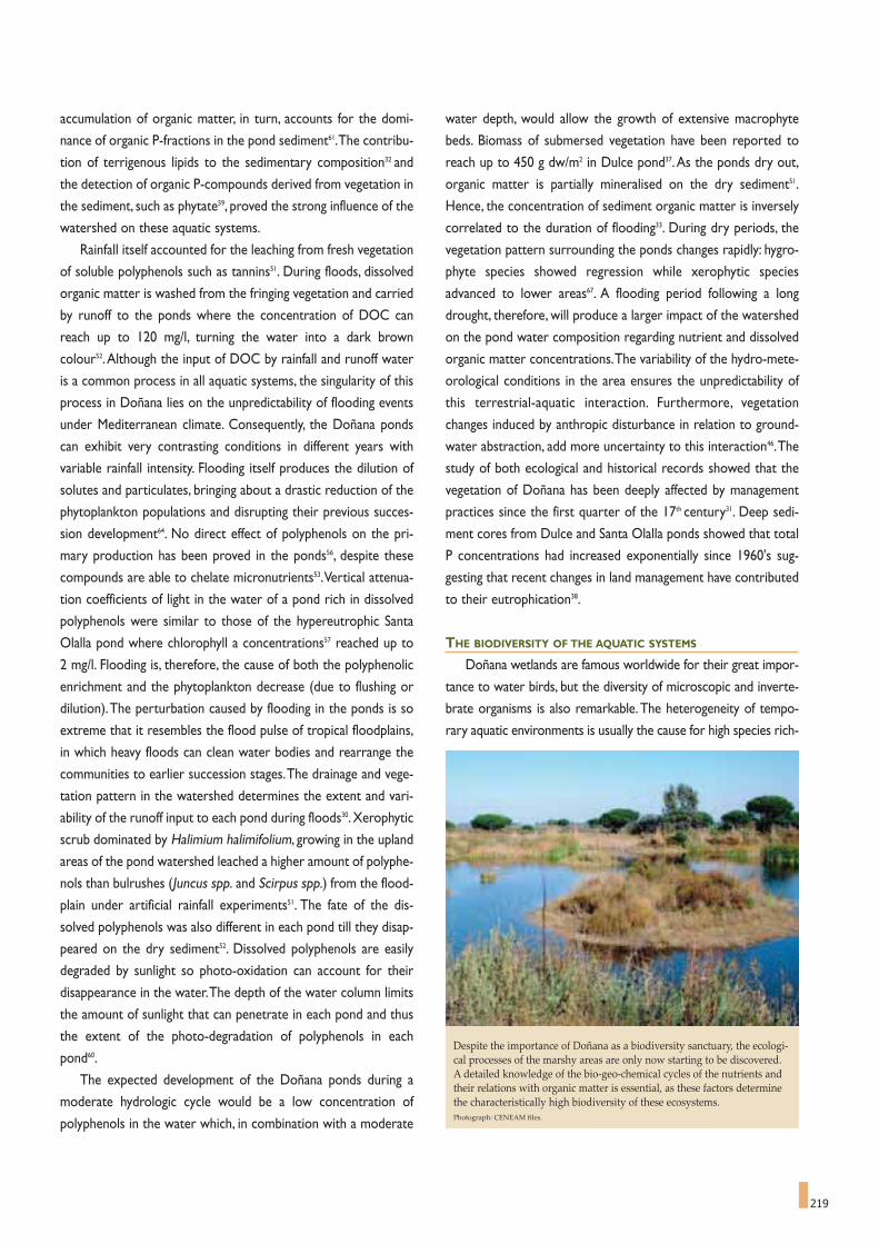
219
accumulation of organic matter, in turn, accounts for the domi-
nance of organic P-fractions in the pond sediment61.The contribu-
tion of terrigenous lipids to the sedimentary composition32 and
the detection of organic P-compounds derived from vegetation in
the sediment, such as phytate59, proved the strong influence of the
watershed on these aquatic systems.
Rainfall itself accounted for the leaching from fresh vegetation
of soluble polyphenols such as tannins51. During floods, dissolved
organic matter is washed from the fringing vegetation and carried
by runoff to the ponds where the concentration of DOC can
reach up to 120 mg/l, turning the water into a dark brown
colour52.Although the input of DOC by rainfall and runoff water
is a common process in all aquatic systems, the singularity of this
process in Doñana lies on the unpredictability of flooding events
under Mediterranean climate. Consequently, the Doñana ponds
can exhibit very contrasting conditions in different years with
variable rainfall intensity. Flooding itself produces the dilution of
solutes and particulates, bringing about a drastic reduction of the
phytoplankton populations and disrupting their previous succes-
sion development64. No direct effect of polyphenols on the pri-
mary production has been proved in the ponds56, despite these
compounds are able to chelate micronutrients53.Vertical attenua-
tion coefficients of light in the water of a pond rich in dissolved
polyphenols were similar to those of the hypereutrophic Santa
Olalla pond where chlorophyll a concentrations57 reached up to
2 mg/l. Flooding is, therefore, the cause of both the polyphenolic
enrichment and the phytoplankton decrease (due to flushing or
dilution).The perturbation caused by flooding in the ponds is so
extreme that it resembles the flood pulse of tropical floodplains,
in which heavy floods can clean water bodies and rearrange the
communities to earlier succession stages.The drainage and vege-
tation pattern in the watershed determines the extent and vari-
ability of the runoff input to each pond during floods30. Xerophytic
scrub dominated by Halimium halimifolium, growing in the upland
areas of the pond watershed leached a higher amount of polyphe-
nols than bulrushes (Juncus spp. and Scirpus spp.) from the flood-
plain under artificial rainfall experiments51. The fate of the dis-
solved polyphenols was also different in each pond till they disap-
peared on the dry sediment52. Dissolved polyphenols are easily
degraded by sunlight so photo-oxidation can account for their
disappearance in the water.The depth of the water column limits
the amount of sunlight that can penetrate in each pond and thus
the extent of the photo-degradation of polyphenols in each
pond60.
The expected development of the Doñana ponds during a
moderate hydrologic cycle would be a low concentration of
polyphenols in the water which, in combination with a moderate
water depth, would allow the growth of extensive macrophyte
beds. Biomass of submersed vegetation have been reported to
reach up to 450 g dw/m2 in Dulce pond37.As the ponds dry out,
organic matter is partially mineralised on the dry sediment51.
Hence, the concentration of sediment organic matter is inversely
correlated to the duration of flooding33. During dry periods, the
vegetation pattern surrounding the ponds changes rapidly: hygro-
phyte species showed regression while xerophytic species
advanced to lower areas67. A flooding period following a long
drought, therefore, will produce a larger impact of the watershed
on the pond water composition regarding nutrient and dissolved
organic matter concentrations.The variability of the hydro-mete-
orological conditions in the area ensures the unpredictability of
this terrestrial-aquatic interaction. Furthermore, vegetation
changes induced by anthropic disturbance in relation to ground-
water abstraction, add more uncertainty to this interaction46.The
study of both ecological and historical records showed that the
vegetation of Doñana has been deeply affected by management
practices since the first quarter of the 17th century31. Deep sedi-
ment cores from Dulce and Santa Olalla ponds showed that total
P concentrations had increased exponentially since 1960's sug-
gesting that recent changes in land management have contributed
to their eutrophication38.
THE BIODIVERSITY OF THE AQUATIC SYSTEMS
Doñana wetlands are famous worldwide for their great impor-
tance to water birds, but the diversity of microscopic and inverte-
brate organisms is also remarkable.The heterogeneity of tempo-
rary aquatic environments is usually the cause for high species rich-
Despite the importance of Doñana as a biodiversity sanctuary, the ecologi-cal processes of the marshy areas are only now starting to be discovered.A detailed knowledge of the bio-geo-chemical cycles of the nutrients andtheir relations with organic matter is essential, as these factors determinethe characteristically high biodiversity of these ecosystems.Photograph: CENEAM files.

220
ness.The richness of temporary waters is not particularly high at a
momentary scale though it can be very large when wide fluctua-
tions are taken into account.A list of planktonic species recorded
in Doñana is presented in Chapter 7. Despite these lists accumu-
late a large number of species (438 for phytoplankton and 205 for
microinvertebrates), they are not exhaustive, as they collect the
results of only a few studies.The more samples accumulate from
the same site or from new sites, the more species are identified.
During a monthly sampling (1985-87) of Santa Olalla and Dulce
ponds, 120 phytoplankton species were identified (14 cyanobacte-
ria, 1 pyrrophyte, 12 euglenophytes, 3 cryptophytes, 1 heteroconte,
44 diatoms and 45 chlorophytes)37. Fifty-four taxa of ciliates were
identified in merely 50 ml of water from the littoral of Santa Olalla
pond48. The number of zooplankton taxa (micro crustaceans and
rotifers) coexisting at a given time in the same pond tend to range
widely, from 3 to 27 species, but the number of species inhabiting a
site over several successive cycles is always larger.Resting eggs pro-
vide the mechanisms for organisms to withstand dehydration and,
at the same time, create a long-time pool of species that will even-
tually develop as the environment changes. Some rotifer species,
unrecorded over 3 successive years, hatched from the pond sedi-
ment incubated in the laboratory55.
Extensive surveys in numerous ponds also accumulate a large
richness: 34 rotifer taxa and 41 micro crustacean species were
recorded in a total of 33 ponds43.The study of 7 ponds over 3 suc-
cessive cycles yielded 71 zooplankton taxa (40 rotifers and 31
micro crustaceans)25. A new rotifer species, Lecane donyananesis,
was described in small pond of merely 30 cm of depth26. Other
endemic species recorded in Doñana include the copepod
Dussartius baeticus, while specimens collected in Doñana have
been used to describe endemisms of the Iberian-Balearic region14.
The collective richness of zooplankton from both ponds and marsh
is likely to be greater as salinity is a major factor affecting the com-
position of micro crustacean assemblages (Figure 6).
FIGURE 5Concentration of phosphorous in samples of water taken from Dulcepond, in the National Park, from the edge to the centre, immediately aftera large storm (108.5 mm) on December 15th, 1995 (according to Serrano etal., 1999).
FIGURE 6Distribution of some species of micro-crustaceans over the course of a flood cycle in 3 sandy substrate ponds and in 3 shallow pools of the Marshes(according to Furest and Toja, 1981).

(Xerophytic sites), on crests of ancient dunes where soil water
table in Summer was deeper than 4 m, and always lies over 3 m
below the soil surface.The community is dominated by Juniperus
phoenicea, Halimium commutatum, Halimium halimifolium,
Rosmarinus officinalis and Cistus libanotis. Standing crop is 500
g/m2 dry weight (SD 250 g/m2). "Monte Negro" (Hygrophytic sites)
located at depressions, where water table in summer rarely lies 1
m below soil surface and temporary flooding of the ground occurs
in winter. Plant community is dominated by Erica scoparia, Erica
ciliaris, Calluna vulgaris, Ulex minor, Myrtus communis and Cistus
salvifolius. Standing crop is 2200 g/m2 (SD 500 g/m2). "Monte
Intermedio" is located on the slopes of the dune ridges with water
table depth in transition and no surface flooding. Community is
dominated by Halimium halimifolium and Ulex australis and stand-
ing crop attains 1300 g/m2 (SD 350 g/m2)71,72 (Figure 1)
The sandy soils of Doñana exhibit a low field capacity (13%
w/w)76.This implies that plants from the elevated areas have almost
no water available during the summer period, while plants from
depressions can reach water from the water table the whole year.
We were interested to find out how the scrub species stand the
summer drought conditions under a brilliant sun and a quartz sand
that reflects as much as 30% of incoming radiation.The seasonal
variation of some physiological variables in permanent plants of
the dominant species of xerophytic and hygrophytic communities
has been monitored seasonality79. Leaf water potential, as a meas-
ure of the water status of the plant, and maximum photochemical
efficiency, an indirect measure of photosynthesis and a global phys-
The ecology of Doñana scrub MARI CRUZ DÍAZ ANTUNES BARRADAS *
MARÍA ZUNZUNEGUI GONZÁLEZ *
Doñana National Park is composed of two geological for-
mations: continental detritic deposits of Pliocene age
covered by Holocene aeolian mantels and recent estuarine
deposits of Guadalquivir river.Based on this geological origin three
main ecological domains are found in the Park: the floodable plain
filled with silt deposits, the mobile dunes and the stabilized sands.
The Mediterranean type climate bears with some oceanic
influence, resulting in milder temperatures (average16.7ºC), higher
air moisture and rainfall (540 mm) than further inland. Under this
climate, the mature vegetation of sandy substrate is the
Mediterranean woodland, giving way to scrublands and grasslands
if some kind of disturbance or limitative process occurs.
The history of Doñana well documented since the XIII centu-
ry, recorded the sandy areas covered by woodlands dominated by
Quercus suber, with Arbutus unedo, Myrtus communis and
Pistacia lentiscus and several species of vines on the humid areas,
Juniperus phoenicea on the dry elevated ground, and Juniperus
oxycedrus closer to the littoral.
The destruction of natural vegetation by falling and overgraz-
ing helped setting in motion the sand mantles largely destroying
the natural vegetation and even the deeper layers of the organic
soil profile.Ancient woodlands gave way to scrublands that follow
the topography and only remains as isolated spots generally
around a discharge area of the underground aquifer, survived to
the present day.
Three main types of scrub communities are now found on the
stabilized sands depending on water table depth: "Monte Blanco"
* University of Seville. Spain.
Seasonal variation ofgroundwater tabledepth and approximatelocation of main speciesof the xerophytic andhygrophytic communi-ties in the studied area.
FIGURE 1
221

222
iological index of the plant, were selected as the significant physi-
ological variables. Leaf water potential presents always negative
values, and maximum photochemical efficiency shows an optimal
range between 0.8-0.85.
On dune crests where summer conditions are harsher, some
species as Cistus libanotis, Rosmarinus officinalis and Juniperus
phoenicea suffered a severe water stress (leaf water potential
lower than -10 MPa that is a sign of a conspicuous water stress).
Other species exhibited a moderate decrease of leaf water poten-
tial, with values not lower than -3 MPa as Halimium halimifolium,
but the legume species Stauracanthus genistoides did not show
signs of water stress at the end of summer (-1.7 MPa). On the
depressions almost all the species did not present signs of water
stress, except for the small shrub Cistus salvifolius that suffered
the lowest values of leaf water potential (-8.9 MPa) and a signifi-
cant leaf shedding (Table 1). H. halimifolium plants present optimal
values of their photochemical efficiency the whole year, due the
leaf pubescence that increases leaf reflectance, the control of leaf
angle and some others physiological mechanisms79. In summer the
maximum photochemical efficiency for other species is correlated
with the leaf water status of the species, but in winter although all
plants present an optimal water status some woodland species,
from the depressed areas, showed signs of photoinhibition (pho-
tochemical efficiency decrease) (Figure 2). Myrtus communis, a
sclerophyll species from the lower areas, presented very low val-
ues of maximum photochemical efficiency (35% from the opti-
mum) even though water supply to roots was plentiful this is
probably due to cold stress as winter air temperatures in scrub
may approach freezing point for several days79. In clear winter days
light irradiation in Doñana may be high (1500 μmoles·m-2·s-1 in
clear days), but temperatures were too low for the photosynthet-
ic apparatus and thus plant activity decreases. If these conditions
continue for a long time leaves turn red and they can even be shed
of.
From the evolutionary point of view sclerophyll species belong
to taxa evolved in the Tertiary (pre-Pliocene), under a tropical type
TABLE 1Leaf water potential of the main scrub species in the xerophytic and hygrophytic areas during the study period.
COMMUNITY SPECIES NOV-98 FEB-99 MAY-99 SEP-99 NOV-99
Rosmarinus officinalis -2.0 -1.8 -1.8 -11.3 -1.8
Juniperus phoenicea -1.8 -1.7 -1.9 -10.6 -1.9
Cistus libanotis -2.0 -2.0 -1.8 -14.6 -1.9
XEROPHYTIC Lavandula stoechas -1.5 -1.4 -1.7 -3.7 -1.4
Halimium commutatum -1.8 -1.9 -2.2 -4.3 -1.7
Halimium halimifolium -1.6 -1.7 -1.7 -4.0 -1.8
Stauracanthus genistoides -1.4 -1.2 -1.3 -1.7 -1.5
Ulex australis -1.4 -1.1 -1.4 -2.7 -1.5
Halimium halimifolium -1.5 -1.1 -1.6 -3.7 -1.5
HYGROPHYTIC Cistus salvifolius -3.0 -2 -2.4 -9.0 -1.7
Myrtus communis -1.8 -1.3 -1.8 -2.5 -2.0
Pistacia lentiscus -1.8 -1 -2.0 -4.7 -1.8
Erica scoparia -1.9 -1.6 -2.3 -4 -1.9
Seasonal variations of maximal photochemicalefficiency (Fv/Fm) for all the study species in thexerophytic area and the hygrophytic area. Summer time represents the stress period for thexerophytic vegetation underlined by a drop inphotochemical efficiency.
FIGURE 2

223
climate before the quaternary glaciations and thus they are more
sensitive to cold winter days.
An attribute x species matrix was analysed by a cluster analy-
sis to sort out groups related to each one of these strategies.The
results are plot in Figure 3. On the xerophytic community the
main plant strategy (74% of relative importance) is formed by
species that withstand harsh summer conditions, without active
control mechanisms (sufferers), showing unusual values for their
physiological variables (summer leaf water potential of -11 MPa
for Rosmarinus officinalis and -13 MPa for Cistus libanotis), but
they recover very fast after the first autumn rains. On the hygro-
phytic community the main plant strategy (73% of relative impor-
tance) is formed by species that maintain moderate values (con-
trollers) of their physiological variables (being Erica scoparia the
most representative species).
Wild fires are a common disturbance in Mediterranean
ecosystems. Scrub species from Doñana sands regenerate after
fire either by seed germination (seeders) or by resprouting from
below ground organs (resprouters). These strategies are closely
tied with physiological and morphological attributes77. Lamiaceae
and Cistaceae from the xerophytic areas are obligate seeders and
they experience the lowest leaf water potentials in summer, and
their leaf tissues are less sensitive to water stress, while Erica and
woodland species from the depressions are deep-rooted or pos-
sess underground organs and they are resprouters.
In the case of Doñana the destruction of the former organic
soils has transformed the succession after fire in a process of
autosuccession74, because most of the species are present since
the first stages and the successional process does nor occur as a
species substitution.
Halimium halimifolium, a species of the Cistaceae family, is the
dominant species of the scrub of the Monte Intermedio areas on
the stabilized sands, it does not resprout after fire, being an obli-
gate seeder. Its seedlings germinate very well with the autumn or
winter rains after fire on the whole topographic gradient on the
stabilized sands. Martin Vicente75 has studied the succession after
fire on Doñana sands and has shown that in the first year after fire
the relative importance of this species is around 90% in both ele-
vated and depressed areas. It remained with an average figure of
50% on the slopes of Monte Intermedio, but decreases to 10% in
the previous areas after several years post-fire.
H. halimifolium also spreads easily on the surface of dry ponds
during drought periods, but as this species does not tolerate
flooding all individuals will die during a new wet period. This
process originates lateral movements of plant communities, as a
result of fluctuation in the phreatic level.Although changes in the
water regime may originate irreversible changes of plant commu-
Relative importance of the plant strategies described in the xerophytic andhygrophytic areas.
FIGURE 3
HYGROPHYTIC SITE
XEROPHYTIC SITE
Pistacia lentiscus Cistus salvifolius
Myrtus communis Stauracanthus genistoides
Controllers 72.4%
Legumes 15.3%
Sufferers 6.7%
Cold stress 5.6%
Sufferers 74.1%
Controllers 21.8%
Legumes 4.1%
Ulex australis Cistus libanotis
Halimium halimifolium

224
nities towards a more xerophytic community, like it has been
described in the Brezo pond closed to the pumping area of
Matalascañas tourist resort78.
H. halimifolium also withstands a moderate browsing from
cattle and deers mainly in the more humid areas as the border of
ponds and the ecotone between the sands and the Marsh.
Browsing stimulate lateral growth through axyllary meristems.
This species was subjected to stimulated and natural browsing in
the stabilized sands. In a drier area without herbivores, plants were
subjected to different intensities of clipping and were compared
with control plants. In a more humid area with high herbivore
pressure, control plants were isolated using cages.The experiment
showed that biomass removal caused by herbivores has an
enhancing effect on shoot growth.
On the mobile dune system, especially in the inland fronts and
as isolated plants on the top of the stabilized sands an endemic
species of the Atlantic coast of the Iberian Peninsula is found.
Corema album is a dioecious shrub up to 1 m, densely branched
from the base, with persistent ericoid leaves.
Fruits are white or pink-white berries (5-8 mm diameter).
Flowering and fruiting occur from February to August, but fruits
can be found until November or December. Fruit production is
high ranging from 4.000 to 13.000 fruits/m2 of plant cover. They
contained 75% of water from dry weight 77% was composed by
non structural sugars and 8% by lipids and proteins73.The fruits are
consumed by a number of vertebrates during the summer (rab-
bits, foxes,wild boars, seagulls) and probably contribute to animals'
water balance during the dry season.
Field observations and laboratory experiments have shown
that animals´ consumption favours seed germination68.
Germination occurs after the autumn rains although 99.9% of the
seedlings die during the next summer.
Detailed studies on the ecology of Doñana Mediterranean
scrubs reveals a surprising diversity of physiological mechanisms
to stand adverse conditions taking advantage of favourable peri-
ods. Each environmental tesela tends to reward the presence of
some plant characters while punishing others, thus selecting the
local composition of plant communities.
As short and long-term interactions overlap, what is left is a
most diverse occurrence of shrub species, which will change end-
lessly in response to climate change, wildfires and human interac-
tions.
Fruits and leaves, nectar and pollen, roots and plant debris all
contribute to consumers and decomposes thus maintaining the
trophic network that supports the extraordinary biodiversity of
Doñana.
Corema album is an endemic shrub of de coastal dunes of Portugal and Atlantic Spain, in Galicia and Western Andalusia. In the picture, a female plant showingthe large number of fleshy round fruits, like pearls, sharply contrasting with the deep green colour of leaves. The twisted stem, sticking from the ground, recalls along history of the plant alternatively engulfed by wandering sands and eroded by strong winds.Photograph by Leonor Alvarez in Asperillo cliffs, Doñana Nature Park.

In recent years, the Doñana Biological Reserve, on the
right hand bank of the Guadalquivir River, next to the sea,
has attracted the converging interest of naturalists and has
become a paradigm for other, equally endangered wetlands
(the Ebro Delta, for example). Until recently, high mountains
and marshlands were the only systems that had not suffered
direct and intense human pressure and we now cling to the
illusion that can conserve something of their disappearing
primitive nature.The dangers overshadowing these ecosystems
are many and varied, but they can be summed up in the word
"development". Tourists from countries that have obtained a
certain level of local protection, in their countries, can be par-
ticularly destructive.
Fluctuations in the environment are characteristic of
marshy areas. Unpredictability is essential for the life of marsh-
es, which suffer in their essence if we try to regulate them.
Their most characteristic organisms are opportunists, defend-
ed by the same irregularity of the living conditions, with little
water some years and too much water in others.These varia-
tions prevent ecosystems from either becoming too complicat-
ed or from stagnating. Marshes are maintained in a dynamic
state, or, if you prefer, they are stabilised on a fluctuating
regime, by the very mechanism of fluctuation and exploitation,
governed fundamentally by the physical environment.
Temporary accumulations of biomass mean that much of the
transfer of energy at the upper end of the food chain is
attained in the form of detritus, with the intervention of bac-
teria, with little of this energy being harnessed, or it is based on
the mobility and activity of animals, like birds, that can exploit
large areas.These systems are relatively easy to conserve and
even to reconstruct; they do not require so many years for this
as the more complex, more internalised systems, which can be
described as more mature. Regulating water flows is a serious
threat and all drainage works or works that lead to a variation
in salinity can affect the Marshes.
The characteristics of the waters of Doñana include a lack
of stability and the continual fluctuations that explain, in part,
their high productivity. This is the same principle that the
monks of the Middle Ages learned when they first started
breeding carp in pools and they would leave these ponds dry
from time to time.At this time, we do not have any exact data
on production values, which are indirectly recognised as high.
The interest of the ponds as dynamic temporary residences or
the habitats for creatures at the end of one stage in life should
also be pointed out.They have been highly effective for distrib-
uting a large number of aquatic animals, especially diaptomids
and ostracods.The aquatic vegetation of flowering plants is also
interesting, although here, I will only mention the presence of
Wolffia (Punta Umbría).
In a series of visits to Doñana, made by different people
from the Department of Ecology of the University of
Barcelona (Marta Estrada, María Rosa Miracle, the team
charged with studying Spanish reservoirs, and myself), a certain
number of samples of water and aquatic organisms have been
collected. These samples were not collected systematically;
they were collected randomly from wherever the researchers
happened to be. Having said that, without spending too much
effort on searching for rarities, an examination of the material
has easily produced a list of some 300 species that form the
substance of these pages.
225225
* This chapter has been included as a tribute to its author, Spain's leading ecologist,
who died in 2004. The work reproduced here was published in Oecologia Aquatica, 2:
72-93, in November 1976. The authors of this publication are grateful for having been
authorised for reproducing this article.
Chlorophyceae of genus Spirogyra with their characteristic ribbon-likechloroplast rolled into a spiral.
Freshwater algae of Doñana
RAMÓN MARGALEF *

226
Many of these species are common species to be found
almost anywhere, but many of them had still not been report-
ed on Mainland Spain, which is not saying very much as very lit-
tle research has been done in this field in the past. The local
diversification of communities is of certain interest.The ponds
behind a row of dunes contain plankton with an abundance of
organisms that are siderophile to a varying
degree, such as Trachelomonas, and
other euglenal algae or xantho-
phyceae. A more banal flora is to be
found in the flood waters, with a good
number of diatoms and filamentous
algae that develop in pulses.The plank-
ton in all these waters, in general, is
characteristically formed of very small
elements (nano-plankton) that indi-
cates, at the very least, an extreme reac-
tivity of the populations, which are capa-
ble of rapidly increasing in a mere few
days.
Taken as a whole, when all these
species and communities are compared
with those described from other
regions of Spain, based on the many
tables published, often with the name of
an association or a higher education
centre, in accordance with the customs
of plant sociologists, they fall into the
category of communities grouped under
the name of Tribonemion
(Tribonemetum siderophilum in stag-
nant waters, Eunotieto-Fragilarietum in
flowing waters) with a series of highly
characteristic components. These include
species of Tribonema and other xantho-
phyceae, Oedogonium, Bulbochaete,
Eunotia pectinalis, Apiocystis, a variety of
euglenal algae, etc. The influence of the
salinity is less pronounced than we
expected, it can only be seen in the distri-
bution of Nodularia, Cylindrotheca and
other diatoms of the genera Nitzschia, Chaetoceros,
Campylodiscus, etc.
Unfortunately, no further information was gathered on the
characteristics of the waters sampled in the visit of January
1973, and the information gathered was only partial. These
waters are very rich in silica, which remains in solution thanks
to the high alkalinity of the waters. Paradoxically, they are also
very rich in phosphorous and metals, despite the high oxygen
concentration and pH. The nitrogen/phosphorous relation is
extremely low, which can be associated with the periodic
development of cyanophyceae, including some very interesting
ones (Anabaenopsis). In the sediment of ponds there is an
abundance of silica remains of organisms, such as fresh water
sponge spicules, chrysophyceae cysts
(so-called chrysostomataceae) and
diatom valves. Moreover, in other
ponds, there have been observations
of recent deposits of silica on
Tribonema filaments and dead
diatom valves, obliterating their
structure. The presence of iron and
manganese is evident from the abun-
dance of organisms that precipitate
these elements in shells
(Trachelomonas), membranes
(Oedogonium, Closterium,
Tribonema) and sheaths (mainly bac-
teria).
Non quantitative samples of algae
were available, collected in small tubes
and preserved in formol, and some
water samples fixed with lugol. These
latter samples have been used for the
counts presented in table 2, which give
an idea of the plankton (nano-plankton)
to be found in the ponds. Analyses of
the other samples have made it possible
to prepare lists of communities, with an
estimate of the relative abundance,
expressed by means of a notation applied
with personal criteria, from 1 (scarce) to
5 (very abundant). Different lists from the
same place and date have been merged,
and similar communities have been
grouped together in tables, which can be
considered representatives of these kinds
of communities (tables 3 to 6). In order to
keep the lists manageable, the rarest species, or those with a
very limited presence, have been left out.Table 3 includes the
most permanent ponds, containing richer life forms; table 4
includes the more stable and the poorer ponds; table 5
includes flowing waters and table 6 the flood waters, shallow
pools and marshes.

227
TORO TARAJE ZAHILLO GRANDE SANTA OLALLA
Temperature, ºC 10.7 9.7-9.8 9.4 9.05-9.22
Oxygen, ml O2/l 8.0 7.80-8.41 8.04-8.79 7.70 7.80-8.54
pH 8.7-9.3 8.6-9.2 8.0-9.3 7.8 8.4-9.4
Alcalinity, meq./l 2.48 2.10-2.17 0.91-0.93 1.65 3.65 , 3.67 , 3.75
SiO4 μg-at Si/l 92.33-95.09 106.12-121.85 304.50 345.44 , 363.44 , 388.81
NO3 μg-at N/l 0.32-0.60 0.22-0.52 1.89 1.08 , 1.74 , 1.84
NO2 μg-at N/l 0.03-0.05 0.02-0.03 0.61 0.49 , 0.55 , 0.58
PO4 μg-at P/l 2.15-2.28 2.31-2.49 9.93 9.89 , 10.64 , 10.78
Chlorophyll, mg/m3 1.29 2.55 1.34 127.80 82.75 , 92.30 , 112.39
Pigment diversity index D430/D665 2.23 2.42 2.15 2.24 2.43-2.50
TABLE 1Some characteristics of the waters of several Doñana ponds, according to samples taken on January 28th 1973. One or more samples from each pond.
Laguna del Toro, 30-XII-1968
Trachelomonas oblonga 27,600Actinastrum hantzschii" 23,320Chlorella sp." 6,220Aphanocapsa elachista 5,125Trachelomonas volvocina 3,040Scenedesmus opoliensis 1,545Scenedesmus falcatus 1,466Ankistrodesmus falcatus 667Trachelomonas intermedia 614Fragilaria capucina 614Phacus pusillus 480Euglena sp. 240Phacus psudonordstedtii 160Fragilaria construens 107Scenedesmus denticulatus 107Cryptomonas erosa 95Cylindrotheca gracilis 50Diploneis elliptica 27Anomoeoneis sphaerophora 27Amphora ovalis 27Nitzschia sp. 27
Other sspecies: Merismopedia tenuissima, Chroococcus limneticus,Scenedesmus quadricauda, Tetraedron caudatum, Anabaenopsis tan-ganykae, Chlamydomonas, Navicula cuspidata ambigua, Euglena sp.,Synedra unita.
Laguna del Toro, 28-I-1973(Bacteria, 500,000-800,000/ml)Microcystis aeruginosa 73,600Selenastrum minutum 40,500Ankistrodesmus falcatus 22,900Scenedesmus quadricauda 19,600Chlorella sp. 12,900Scenedesmus falcatus 6,450Chroococcus dispersus 5,160Sc. quadricauda maximus 2,310Cylindrotheca gracilis 1,680Tetraedron trigonum 1,550Trachelomonas volvocina 1,162Scenedesmus opoliensis 1,033Flagelados pequeños 1,033Navicula sp. (cf. protracta) 905Tetraedron caudatum 905Nitzschia sp. 905Chlamydmonas sp. 516Pediastrum boryanum 516Trachelomonas oblonga 387Fragilaria construens 254Trachelomonas intermédia 254Phacus pusillus 129Gymnodinium sp. 129Navicula sp. 129Chryptomonas sp. 129Eunotia pectinalis 129Synedra ulna 129Lyngbya limnetica 539 mmSpirulina labyrinthiformis 3 mmPinnularia microstauron 129Amphora sp. 129
TABLE 2Composition of phytoplankton in some of the Doñana ponds. The figures represent the number of cells per ml; in some cases (cyanophyceae and bacteria)the length of the filaments per ml; they may also indicate the number of colonies per ml. The category "other species" lists the species present in densities ofless than 10 cells/ml.
Laguna del Taraje, 30-XII-1968
Cymbella sp. 258Navicula sp. 129Nitzschia sp 129
Other sspecies: Navicula cuspidata ambigua, Gyrosigma sp., iron oxidebacteria.
Laguna de Santa Olalla, 30-XII-1968
Anabaenopsis tanganykae(12,750 colonies) 140,300A. tang. Recta 12,300Microcystis aeruginosa 21,360Bacterias filamentosas 1,152 mmAphanotece clathrata (241 colonies) 15,400Pediastrum boryanum 640Pediastrum duplex 240Scenedesmus acutus (+falcatus) 187Scenedesmus quadricauda 107Merismopedia punctata 107Pediastrum tetras 107Navicula cuspidata ambigua 80Legerheimia wratislaviensis 53Oocystis sp. 53Glenodinium sp 53Elakotothrix gelatinosa 27Cyclotella sp. 27Nitzschia sp. 27Surirella ovata 27

228
Laguna Dulce, 30-XII-1968
Scenedesmus quadricauda 534Pediastrum boryanum 426Navicula sp. 267Trachelomonas volvocina 187Cyclotella sp. 160Thalassiosira fluviatilis 133Scenedesmus opoliensis 107Anabaenopsis tanganykae (80 colonies) 880Nitzschia sp. Cyclotella sp. 80Ankistrodesmus falcatus 53Phacus raciborskii 27Lepocinclis ovum 27Cryptomonas erosa 27Saelenastrum capricornutum 27Synedra acus 27Navicula cuspidata 27Cosmarium laeve 27Eunotia pectinalis 27Melosira varians 27Amphora ovalis pediculus 27Pinnularia sp. 27Acromatium oxaliferum (bacteria) 27
Other sspecies: Tribonema angustissimum, Rhopalodia gibba, Synedraulna, Navicula cryptocephala, Pediastrum clathratum, Phacus pyrum.
El Chorrito, 31-XII-1968
Synedra rumpens 1,001Chlorella sp. 213Trachelomonas volvocina 93Nitzschia sp. 93Eunotia pectinalis 93Closterium kuetzingii 80Synedra acus 53Gomphonema sp. 53Cyclotella sp. 27Closterium moniliferum 27Synedra ulna 27Lyngbya maior 8 mm
Other sspecies: Trachelomonas orenburgica, Trachelomonas verrucosa,Cryptomonas reflexa, Rhodomonas sp., Gonyostomum sp., Staurastrum pedun-culatum, Euglena sp., Navicula radiosa, Pinnularia sp., Zygnema sp., Mougeotiasp., Spirogyra sp., Nitzschia tryblionella, Ankistrodesmus falcatus, Closterium sp.
Trachelomonas volvocina Trachelomonas hispida Trachelomonas oblonga Trachelomonas intermedia Trachelomonas orenburgica Trachelomonas scabra Trachelomonas stokesiana Trachelomonas sp.Lepocinclis ovumPhacus pl. sp.Ankistrodesmus falcatus Navicula sp. pl. Oedogonium sp. pl.Cymbella sp. Eunotia pectinalisPinnularia viridisAmphora ovalisSynedra rumpensNitzschia sp. pl.Nitzschia clausiNavicula cuspidata ambiguaEunotia lunarisTribonema minus (+ elegans)Tribonema aequaleTribonema virideGomphonema gracilisNavicula cryptocephala exilisCyclotella meneghinianaPediastrum boryanumAchnanthes minutissimaScenedesmus quadricauda Scenedesmus quadricauda var. maximus Scenedesmus falcatus S. quadrispina
2 1 1 1 2 1 2 1 1+ 2 1 1 2
2 1 1 2 11 1 1
1 1 1 1 11 1
11 1
1 1 2 11 1 2 1 1 12 1 1 1 1 2 1 2 1 2 23 2 1 2 1 2 2 1 1 2
3 2 1 3 3 1 2 2 11 2 2 1 1 1 1
1 2 1 1 3 2 2 21 1 1 2 1 2 2 1
2 1 1 1 1 1 21 1 3 3 2 3 33 2 2 1 1 2
1 2 2 1 1 11 1 1 1 1 1 1 1
1 1 2 1 1 2 11 1 2 2 2 2
1 2 21
1 2 2 1 13 3 2 1 31 1 1 1 11 1 1 1 1 2
1 1 1 2 1 21 2 3 2 2
1 2 2 1 12 1 1 1 12 2 1 1 2
TABLE 3Communities of algae rich in species, with siderophile organisms, typical of longer lasting stagnant waters.
Cha
rco
del T
oro,
XII-
68
Cha
rco
del T
oro,
I-73
Lagu
na d
el Z
ahill
o,X
II-68
Lagu
na d
el Z
ahill
o,I -
73
Lagu
na d
el T
araj
e,X
II-68
Lagu
na d
el T
araj
e,I-7
3
Lagu
na D
ulce
,XII-
68
Lagu
na D
ulce
,I-7
3
Lagu
na G
rand
e,X
II-68
Lagu
na d
e Sa
nta
Ola
lla,X
II-68
Lagu
na d
e Sa
nta
Ola
lla,I
-73
El C
horr
ito,X
II - 6
8
Ace
buch
e M
atal
asca
ñas,
XII
- 68
Scenedesmus abundans Scenedesmus opoliensis Scenedesmus ecornis Thread bacteria Fe oxideMougeotia sp.Caloneis siliciculaCocconeis placentulaAmphora venetaStauroneis phoenicenteronLyngbya limneticaMicrocystis aeruginosaApiocystis braunianaPinnularia microstauronOphiocytium majusNavicula dicephalaAmphora ovalis pediculusNitzschia hungaricaFragilaria construensNitzschia amphibiaStauroneis ancepsSelenastrum minutumPinnularia majorSpirogyra sp. pl. Bulbochaete sp.Cosmarium laeveColacium vesiculosumNitzschia subtilisSynedra ulnaMonallantus sp.Diploneis ellipticaTetraedron minimum scrobiculatumEpithemia zebra saxonicaAnomoeneis sphaerophoraFragilaria capucina
1 1 11 1 1
1 13 2 2 3 2
1 1 1 21 1 1 2
2 1 1 11 3 1 1
1 1 1 13 1 4 4 32 1 2 2 4
2 1 1 1 21 2 2 1 2
1 1 1 1 11 1 1
3 1 11 1 11 3 1 1
1 3 1 12 1 1 2
2 2 2 21 1 1 1
1 2 41 1 1 1
1 1 11 1 4
1 1 12 1 1
1 1 11 1 1
1 1 1 11 1
1 13 1 1
Cha
rco
del T
oro,
XII-
68
Cha
rco
del T
oro,
I-73
Lagu
na d
el Z
ahill
o,X
II-68
Lagu
na d
el Z
ahill
o,I -
73
Lagu
na d
el T
araj
e,X
II-68
Lagu
na d
el T
araj
e,I-7
3
Lagu
na D
ulce
,XII-
68
Lagu
na D
ulce
,I-7
3
Lagu
na G
rand
e,X
II-68
Lagu
na d
e Sa
nta
Ola
lla,X
II-68
Lagu
na d
e Sa
nta
Ola
lla,I
-73
El C
horr
ito,X
II - 6
8
Ace
buch
e M
atal
asca
ñas,
XII
- 68
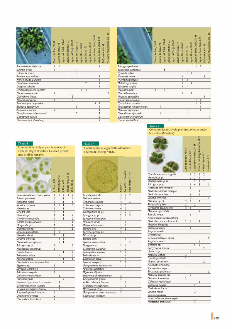
229
Staurodesmus dejectusSurirella ovataEpithemia sorexSynedra acus radiansMerismopedia punctataDinobryon sertulariaOocystis solitariaCylindrospermum stagnaleChrysostomataceaeCladophora fractaNavicula hungaricaAnabaenopsis tanganykaeZygnema sphaericumAnisonema acinumGomphonema abbreviatum?Cosmarium humilePleurotaenium ehrenbergi
1 1 11 1
1 11 1 2
1 1 11 2 1
1 1 11 2
1 25
1 35 1
5 12 1
2 21 21 2
Cha
rco
del T
oro,
XII-
68
Cha
rco
del T
oro,
I-73
Lagu
na d
el Z
ahill
o,X
II-68
Lagu
na d
el Z
ahill
o,I -
73
Lagu
na d
el T
araj
e,X
II-68
Lagu
na d
el T
araj
e,I-7
3
Lagu
na D
ulce
,XII-
68
Lagu
na D
ulce
,I-7
3
Lagu
na G
rand
e,X
II-68
Lagu
na d
e Sa
nta
Ola
lla,X
II-68
Lagu
na d
e Sa
nta
Ola
lla,I
-73
El C
horr
ito,X
II - 6
8
Ace
buch
e M
atal
asca
ñas,
XII
- 68
Spirogyra perforansTetraspora gelatinosaCymbella affinisPinnularia brauniPhormidium fragileMelosira granulataEpithemia turgidaDiploneis ovalisPhormidium tenueNitzschia spectabilisClosterium aciculareCystodinium cornifaxTetradesmus wisconsinensisNitzschia sigmoideaGlenodinium dybowskiClosterium moniliferumClosterium leiblenii
1 25 1
1 21 11 21 11 1
1 11 1
1 11 11 1
1 11 1
1 11
1
Cha
rco
del T
oro,
XII-
68
Cha
rco
del T
oro,
I-73
Lagu
na d
el Z
ahill
o,X
II-68
Lagu
na d
el Z
ahill
o,I -
73
Lagu
na d
el T
araj
e,X
II-68
Lagu
na d
el T
araj
e,I-7
3
Lagu
na D
ulce
,XII-
68
Lagu
na D
ulce
,I-7
3
Lagu
na G
rand
e,X
II-68
Lagu
na d
e Sa
nta
Ola
lla,X
II-68
Lagu
na d
e Sa
nta
Ola
lla,I
-73
El C
horr
ito,X
II - 6
8
Ace
buch
e M
atal
asca
ñas,
XII
- 68
Crisostomatáceas, restos cistesEunotia pectinalisPinnularia viridisSynedra rumpensNitzschia sp.Synedra ulnaNavicula sp.Gomphonema gracileGomphonema parvulumMougeotia sp.Oedogonium sp.Scenedesmus falcatusNitzschia clausiLyngbya limneticaMicrocystis aeruginosaSpirogyra sp. pl.Microcoleus steentrupiEunotia lunarisTribonema minusNavicula populaPinnularia brauni amphicephalaZygnema sp.Spirogyra communisTribonema aequaleColacium vesciculosumPinnularia gibbaScenedesmus quadricauda + var. maximusCylindrospermum stagnaleLyngbya aeurugineocoeruleaStauroneis phoenicenteronOscillatoria formosaPhormidium foveolarum
1 1 2 3 22 1 1 21 1 1 12 1 1 31 1 1+ 1 12 1 41 1 23 1 12 11 31 12 1
4 35 1
2 23
1 21 2
1 14
332
22
222
1 122
L..B
rezo
,I-7
1
Det
rás
Dun
a,V-
71
L.D
una V
-71
Nav
azo
Toro
,XII-
68
Ojil
lo,X
II,68
TABLE 4Communities of algae poor in species, inunstable stagnant waters. Elevated persist-ence of silica remains.
Eunotia pectinalisMelosira variansTribonema elegansTribonema vulgareTribonema virideOedogonium sp. pl. Spirogyra sp. pl. Spirogyra ellipsosporaPinnularia viridisOphiocytium maiusSynedra ulnaBacterias precip. FeNitzschia sp.Synedra acusSynedra acus radiansMougeotia sp.Closterium kuetzingiiApiocystis braunianaBulbochaete sp.Cosmarium laeveSynedra rumpensGomphonema acuminatumNitzschia spectabilisDiploneis ellipticaStauroneis phoenicenteronGomphonema gracileAnkistrodesmus falcatusCyclotella meneghinianaMicrocoleus, 2 sp.Gomphonema constrictum cap.Cosmarium vexatum
3 2 23 24 23 34 23 2 32 1 531 11 1 14 35 31 11 11 22 11 22 11 11 12 21 1
11
221 11 1321
Rocí
o.V-
71
Rocí
o.V-
71L.
Dun
a V-7
1
Cañ
o A
ulag
a,X
I - 6
8
Cylindrospermum stagnaleNavicula sp. pl.Oedogonium sp. plSpirogyra sp. pl.Anabaena scheremetieviNavicula cuspidata ambiguaNavicula lanceolataLyngbya limneticaNitzschia sp. pl.Rhopalodia gibbaGyrosigma acuminatumMitzschia spectabilisSurirella ovataAnomoeoneis sphaerophoraNavicula cryptocephala exilisNitzschia hungaricaEpithemia sorexAmphora ovalisCymbella sp.Crisostomatáceas, cistesAmphora venetaZygnema sp.Botrycoccus brauniiUlothrix sp.Nitzschia obtusaEunotia pectinalisNostoc sphaericumApiocystis braunianaStauroneis ancepsTetraspora gelatinosaNitzschia tryblionellaNitzschia lorenzianaColacium vesiculosum Epithemia turgidaCladophora fractaLyngbya maiorGomphosphaerialacustrisCosmarium botrytisHantzschia amphioxis
1 1 2 1 21 3 3 1 11 2 1 2
1 4 5 11 1 11 1 1 11 1 1 11 3 1 13 2 1 23 22 1 1
1 1 11 1 11 12 2 21 1 11 11 1 11 1 1
1 1 21 1 1
1 5 22
23 12 1
1 21 1
1 15
22
32
2
2
Luci
o de
l Pal
acio
,XII-
68
Luci
o de
l Pal
acio
,III-
71
Gua
dalq
uivi
r M
arsh
es,X
II-68
Clo
se t
o Le
o Bi
aggi
labo
rato
ry,I
II-71
HIn
ojos
Mar
sh,I
II-71
Gua
diam
ar,I
II-71
TABLE 6Communities relatively poor in species in unsta-ble waters (Marshes).
TABLE 5Communities of algae with siderophilespecies in flowing waters.

Mallard (Anas platyrhynhos) in Doñana.Photograph by José María Pérez de Ayala.

only ceasing to be so as I write (in 1973),with the enactment of the
Doñana National Park Use and Management Master Plan...
It is a shame that no documental data remains - as far as we
know - on what hunting in the marshes was like for the ordinary
people. The towns that have lived in close association with the
marshes were those of the eastern bank (Los Palacios, Lebrija,
Trebujena) and those overlooking the river, particularly Coria, La
Puebla and Sanlúcar de Barrameda.The kinds of hunting that took
place must be based on what we know happened last century, and
which is probably also true for the last four centuries.
The most important use of the marshes must undoubtedly
have been the collection of eggs in spring and of coot and duck
chicks in the early summer.The people of the marshes even had to
invent a special kind of boat for this, the "cajon", a flat bottomed,
very narrow, very sharp, doubled ended type of punt designed to
open the way through bulrush patches in shallow water. Leaning on
two poles, used for propulsion, collectors could move as fast as a
game-keeper on horseback, who could not catch him when the
waters were up to its hocks. Moreover, a "cajon" could be hidden
almost anywhere if necessary.
Hundreds of thousands of eggs were collected every year in the
early 20th century, by two teams that supplied the Sanlúcar market.
Each team was made up of half a dozen men, each with a "cajon"
punt, hunting for eggs beyond Las Nuevas, where they set up their
headquarters.All kinds of eggs were collected, but mainly the eggs
of the coot (Fulica atra),whose floating nests, half covered by a roof
of sheep's fescue bent into the nest, held an average of 6-8 eggs.But
although these were the most sought after eggs, they also took
eggs from other birds, like the pochard (Aythia ferina), black necked
grebe (Podiceps nigricollis), moorhen (Gallinula chloropus) and
black tern (Chlidonias hybridus). On the islets, next to the clutch-
es of several species of ducks (mallard, marbled teal, pin tails, etc.),
they could often find the excellent eggs of the avocet
(Recurvirostra avosetta), black winged stilt (Himantopus himanto-
pus) and lapwing (Vanellus vanellus).The two great colonies of gull-
billed tern (Gelochelidon nilotica) were systematically plundered
year after year.
For a month, people from Sanlúcar, Lebrija,Trebujena and Los
Palacios went out collecting eggs, filling their punts with a confus-
ing mixture of brown,white, red and green eggs that they later sold
in the shops.There are still many people who consider coot eggs
231
Birds and Hunting JOSÉ ANTONIOVALVERDE *
231
There are a few places in the world, all situated in the
mouths of large rivers in the temperate zone, that have
always attracted vast flocks of birds that move between the polar
regions and the tropics.The banks of some of these deltas saw the
birth of fabulous nations: the civilisations of the Tigris and the
Euphrates, the Nile delta, the Guadalquivir and the Tartessos.These
deltas have also been magnets attracting men, in search of the
excitement of hunting and relaxation inspired by an open horizon.
The great open plains of the Guadalquivir Marshes, where the river
broadens to a width of several miles, is one of these privileged
places.
As far as hunting is concerned, the lower Guadalquivir has been
a kind of paradise for as long as the records go back.As soon as it
was taken back from the Moors,Alphonse X settled his huntsmen
in the Marisma (marsh), who bought lands in what is now Hato
Ratón, then called Mures (which means mice, or "ratones" in
Spanish).The Lomo de Grullo Royal Hunting Grounds, or "Coto"
was established in the same area,which was mentioned in the times
of the Catholic Monarchs together with Las Rocinas. The bar
between the river and the sea and the north western area of the
Marshes have been a hunting grounds for aristocrats ever since,
* This chapter has been included as a tribute to its author, a leading conservationist,researcher and driving force behind Doñana. The text was published in 1973 in the bookentitled "El Río. El Bajo Guadalquivir", published by Grupo 28. The authors of this pub-lication would like to thank Grupo 28 for being so kind as to authorise the transcription ofthis chapter from their work.
Bronze plaque, the work of Jose Manuel Diaz Cerpa, as a tribute to JoseAntonio Valverde. Valverde was a basic reference for Doñana, as he is con-sidered the father of most of the initiatives that led to the conservation ofthis space. He was the founder of the Doñana Biological Station, he pub-lished books and articles helping lay the foundations for its conservation,as well as creating the National Park, of which he was the first CuratorDirector.

232
to be far tastier than chicken eggs, and they would buy them with-
out a second thought if they came onto the market. They were
right too, because they really do have an excellent taste and, as
most birds can lay a second clutch, reaping the enormous harvest
of eggs from the marshes should not have caused any great harm.
These egg collectors could also distinguish incubated eggs from the
fresh ones at a glance - incubated eggs start to show a shine that is
brought out by the contact with the brooding mother as the incu-
bation progresses, and,when necessary, they test them on the spot.
To do this, they cup the egg in the palm of their hand and gently
submerge it in the water: if the egg remains horizontal, it is fresh, if
it turns fat end up, it is starting to
incubate. A well incubated egg
almost stands on its pointed end,
and can even float.
A month after the second egg
harvest finishes, they started hunt-
ing coots and ducks. Now the
punts were only used for carrying
the cargo, an incredible cargo col-
lected by the hunters.
Men and their horses set out
from every village each day for the
marshes to hunt ducks; this was a
unique and exciting hunt. There
were several forms of hunting, but
the most important ones were "la
bulla" and "el rastro" (tracks).
The "bulla" method was used
when there was no wind and the
movement of the birds, transmit-
ted to the waving stems of the
rushes, easily gave away their posi-
tion.A family of coots surprised by
a hunter approaching on horseback or on foot, would fan out in
their flight and after a short "race" over the water. "Ahí va la bulla"
shouts the hunter: they would dive under the water and hold on
with their long toes.There they would be found, where the noise
stopped, rolled in a ball with the silver colour of the air around
their grey feathers.
The men went out hunting in groups, with their animals fitted
with large panniers in which the "gallaretos" (large coot chicks) and
"mancon", or crippled ducks (i.e. they could not fly as their wing
feathers were changing) were thrown, tied together in pairs. The
teams were often accompanied by poodles, almost always with an
eye missing from the evilly aimed pecks of older coots.They were
expert hunters that almost doubled the take of a man.
You could hunt with the "bulla" method almost every day, at
least you could during the time of calm you find at mid morning and
in the afternoon when the wind is going to change direction - from
an off-shore to an on-shore breeze -, cooling the marshes. But
when the wind made this method impossible, and especially when
the water level was low and the panicky swimming of the birds left
a wake of bubbles and sediment from the bottom, or when the
pollen from the plants covered the water with billions of yellow
spots, marking the tracks of the birds like a map, then the coots
were hunted using what is still called "el rastro", the tracking
method.
For another month, caravans
of men and beasts entered the
marshes from every side, hunting
young coots that, mixed with the
fresh eggs of the second clutch,
make an excellent omelette. The
young coot chicks do not suffer
from the problem of the tough-
ened leg tendons, as rigid as
bones, that make coot legs so dif-
ficult as a meal. Boiled, boned and
served with scrambled eggs, they
are delicious.Taken live to the vil-
lages and sold in pairs, they soon
found buyers.
How many coot chicks were
produced by the marshes in a
good year? It is impossible to cal-
culate. Probably between 250,000
and 500,000.There is an incredi-
ble density of coots' nests in the
marshes. I finally came to really
understand this when erudite
men of science with years of experience told me that they had
found that this was the most productive biotope known to man in
shallow fresh waters.The coots,which transformed the grass of the
bottom into a rich protein, harnessed this wealth directly before
being passed on to the towns of the marshes, for which the
Marshes had always been the main supplier of meat. Used rational-
ly, the Marshes, with their coots and ducks, would have remained
the most profitable per hectare meat producing zone ever in
Andalusia. But it was destroyed by a few short sighted and selfish
men.
The hot summer that dried the pools, saw the arrival of the
hares from the banks of the marshes. Driven out by the winter
floods, the hares returned when the waters dropped, first of all to
In the early 20th century, hundreds of thousands of eggs were collected eachyear by teams that supplied the Sanlúcar market. Each team was made up ofhalf a dozen men, with a punt each, which set out to collect eggs beyond LasNuevas, where they set up their headquarters. On the islets, together withthe clutches of several duck species (mallard, marbled teal, pin tails, etc),they could find the excellent eggs of the avocet, black-winged stilt and lap-wing. In the photograph, a black-winged stilt in the Doñana Marshes.Photograph: CENEAM Files.

233
the meadows, and later, when the water only remained in channels
and shallow pools, spreading out everywhere.Good food and a lack
of enemies guaranteed good breeding and hence the marshes, or at
least the higher ground to the north, were full of hares.When they
started to be exterminated at night, using lamps, the Guardia Civil,
a rural police for the countryside, stopped the car of a hunter with
as many as forty hares. It is true that there were lots of them, and
there would be again if they were left alone.
I think that hunting hares cross country with a motorbike,
enjoyed so much by the people of the eastern margins of the
marshes, should be made legal and regulated.After all, it would only
be a modernisation of a tradition that is probably as old as man's
encounter with the marshes. I am referring to hunting hares on
horseback and with a club, a tradition among the villages of the
marshes, and which started when the first waters packed the ani-
mals together among the islets. I do not think that any local tradi-
tion should be killed off by general and uniform laws, and I do not
see why greyhounds can hunt, but boys cannot.
With the arrival of the autumn came hundreds of thousands of
ducks and geese from the north. The Spanish poet Juan Ramón
Jiménez pointed them out to his donkey Platero in his famous
book.With the ducks, the duck hunters: these were incredible, soli-
tary men,who rode out of the villages on horseback,with a gun and
a blanket, when the October rains started to accumulate the birds
on the "beaches" of the marshes.They used punt guns, "big guns" as
they call them.They made their own powder with a consecrated
formula that is reminiscent of the original musketeers: so many
measure of saltpetre, so many of sulphur and so many of charcoal.
They ground this powder in large stone mortars, pounding it with
a thick wild olive stick to avoid sparks.They carried the powder in
their bags, slung their gun over their shoulder and off they went
hunting.
They could spend days before they managed to get enough
ducks together for a good shot, and enough to make it worth going
back to the village to sell their bag. It could rain during the day, with
the rain falling on their large rubber treated ponchos, and it could
rain at night, when they sometimes had to sleep under their horse,
with the saddle for a pillow. This is what the legend says and,
undoubtedly, it was the truth. "I swum across Torre Branch (Brazo
de la Torre) with the horse to speak to the duck hunter that was
on the other side",one told me, relating the story of a day on which
the loneliness and the Marshes got the better of him.
But there were great days too.When clouds of geese and ducks
had arrived from the north, and when the heavy rains had come
With the autumn came hundreds of thousands of ducks and geese from the north, and with the ducks, came the duck hunters: incredible, solitary men who setout from their villages on horseback, with a gun and a blanket when the October rains started to amass the birds on the "beaches" of the Marshes. In the photo-graph, a flock of geese flying over Doñana.Photograph by José María Pérez de Ayala.
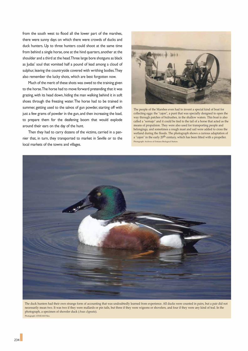
234
from the south west to flood all the lower part of the marshes,
there were sunny days on which there were crowds of ducks and
duck hunters. Up to three hunters could shoot at the same time
from behind a single horse, one at the hind quarters, another at the
shoulder and a third at the head.Three large bore shotguns as black
as Judas' soul that vomited half a pound of lead among a cloud of
sulphur, leaving the countryside covered with writhing bodies.They
also remember the lucky shots, which are best forgotten now.
Much of the merit of these shots was owed to the training given
to the horse.The horse had to move forward pretending that it was
grazing, with its head down, hiding the man walking behind it in soft
shoes through the freezing water.The horse had to be trained in
summer, getting used to the salvos of gun powder, starting off with
just a few grams of powder in the gun, and then increasing the load,
to prepare them for the deafening boom that would explode
around their ears on the day of the hunt.
Then they had to carry dozens of the victims, carried in a pan-
nier that, in turn, they transported to market in Seville or to the
local markets of the towns and villages.
The people of the Marshes even had to invent a special kind of boat forcollecting eggs: the "cajon", a punt that was specially designed to open theway through patches of bulrushes, in the shallow waters. This boat is alsocalled a "sornajo" and it could be tied to the tail of a horse that acted as themeans of propulsion. They were also used for transporting people andbelongings, and sometimes a rough mast and sail were added to cross thewetland during the floods. The photograph shows a curious adaptation ofa "cajon" in the early 20th century, which has been fitted with a propeller.Photograph: Archves of Doñana Biological Station.
The duck hunters had their own strange form of accounting that was undoubtedly learned from experience. All ducks were counted in pairs, but a pair did notnecessarily mean two. It was two if they were mallards or pin tails, but three if they were wigeons or shovelers, and four if they were any kind of teal. In thephotograph, a specimen of shoveler duck (Anas clypeata).Photograph: CENEAM Files.

235
These duck hunters had their own, strange form of accounting
that they had obviously learned by experience. All ducks were
counted in pairs, but a pair did not necessarily mean two: a pair was
two if they were mallards or pintails, but three if they were wigeons
or shoveler, and four if they were any kind of teal. This yardstick
evened out the shots, because it was not the same thing to wipe out
half a hectare of teals with a shot as it was to bring down a few mal-
lards, or just a few geese.
But it is also true that the large bore duck gun was totally indis-
criminate.The family was back at home awaiting the results, and any
kind of kill, as long as it went into the bag, was counted as a good
shot.When the storks arrived in mid winter, they could get a load
of pink meat by skinning the bodies and cutting off the necks and
legs that would betray them.Everything goes into the pot in the vil-
lages of the Marshes, and I would go as far as to bet that there were
recipes for stork and flamingo too.
This is how it was in the immense Marshes for centuries, the
cradle of recurring fevers, but also the source of birds and fish
throughout the year.This was the homeland of a few men who lived
there almost from the cradle to the grave. No less than 1,674
square kilometres of fishing grounds and bird colonies that bred
ducks, hares, coots and snails. Because collecting snails, an ancestral
rite for man, was of tremendous importance.There were millions
of snails, (Theba pisana), of different colours on each islet, collect-
ed by women and children among the reeds up until July or August,
when the white worm starts to kill them.
How much does each bunch of reeds produce in snails? And
the Marshes as a whole? Has anyone worked it out? How much do
As far as hunting is concerned, the lower Guadalquivir has always been a kind of paradise, as long as there have been records. They were scarcely re-conqueredfrom the Moors, when Alphonse X settled his huntsmen in what is now Hato Raton, known as Mures at the time (which means mice, "ratones" in Spanish). Inthe same area, the Royal Hunting Grounds of El Lomo del Grullo were established. Centuries later, interest in hunting was replaced by an interest in observingnature. The Marshes had started to win an international reputation as an area of extraordinary ornithological interest since 1856, when Saunders wrote abouthis travels in Spain in The Field.Photograph by José María Pérez de Ayala.
we spend on importing snails from Morocco now?
The platonic contemplation of nature is a recent phenomenon
in Europe. It probably emerged as a consequence of the Second
World War, which left mankind sick to the stomach of horror and
with a new desire for peace of the spirit that could only be found
in nature. Moreover, there were several other circumstances:
colour photography had been discovered, and the grand illustrated
magazines could offer their pages to the photographers that
opened the grand book of wildlife and its environment. Moreover,
the world had become a much smaller place with the impressive
advances in aviation and the off-road vehicle. Legions of photogra-
phers and film makers set out in search of what the western world
demanded, and many of them turned their gaze to the mighty River
Guadalquivir, its marshes and the famous Coto de Doñana that
forms the upper lip of the mouth of the river.
The Marshes had started to gain an international reputation as
an area of extraordinary ornithological interest since 1856, when
Saunders wrote the stories of his travels in Spain in The Field. In
the following years, the yachts of kings and nobles dropped anchor
in the Guadalquivir, while their owners practised what could be
called scientific hunting, although it was more hunting than science.
Thus, the illustrious list of visitors included Prince Rudolph of
Austria, the Duke of Orleans, Lord Lilford - an excellent ornithol-
ogist - and after them, a swarm of egg collectors that discovered
and laid waste to the Marshes in the last century and at the begin-
ning of this one (the author is referring to the 19th and 20th cen-
turies).
So, with an international reputation, it is hardly surprising that

236
the waters had barely recovered their calm after the world war,
when ornithologists started to visit the Marshes, coming in through
the main gate of Doñana, which Mauricio Gonzalez opened for
them.The first expedition, French, arrived in 1952, a few days ahead
of another, Spanish expedition that started an uninterrupted
ornithological work.The first film was made in 1957.
A phenomenon then started for the Marshes that would later
spread to many other places.Through a process of feedback, pho-
tographers provided people what they were asking for, and the
growing interest of these people led to the appearance of zoolog-
ical tourism - fundamentally ornithological - that with the help of
How many coot chicks could the marshes produce in a good year? It isimpossible to calculate. Probably between 250,000 and 500,000. The densi-ty of coot nests in the Marshes is truly amazing. In the photograph, a coot.Photograph: CENEAM Files.
Many people consider the Doñana Marshes as an obligatory visit, the same as a visit to the Prado Museum would be, but the truth is that they are much betterknown than the museum.Photograph by José María Pérez de Ayala.
useful Field Guides was undertaken be a wide circle of Europeans.
This enthusiasm for Nature snow balled and the Marshes, the first
place in Europe that decided to approach conservation with a joint
effort, immediately became a Mecca for Nature Tour Operators.
They came from as far away as the United States from the 60s
onwards, in regular expeditions organised by the Audubon Society.
The Spanish government helped to develop the Marshes for
tourism and for research.
But the most important aspect of the Marshes, even though
both hunting and tourism were important, has been the multiplier
effect. People have come from all over Spain, and from many places
beyond, to photograph the wildlife - an excellent school was creat-
ed here - and to plan scientific and conservationist activities.
Many people now believe that Doñana and its Marshes are an
obligatory visit, as you would visit the Prado Museum, but the truth
is that they are better known than the museum.There is an index
that clearly illustrates the vitality of this issue: the number of hours
that Spanish State Television devotes to it. In this aspect, between
the Marshes and the Prado - with an apology for art lovers -, there
is just no comparison.
What really happens is that going out on a Sunday in pursuit of
light and peace in the countryside, or let both of these stream in
through the little screen, is now a pressing need for society, and this
oasis of calm waters, with a green sea of waving grasses and a sky
in which the only clouds are the birds flying across it, make the
Marshes - and Doñana - something that we all need at one time or
another.This is the release that we need; to escape, if only for a few
hours, from the cities that overwhelm use with their overcrowding,
stress and pollution.

between highly euryhaline estuarine species (which readily adapt to
salinity changes) and freshwater species, some of which are resist-
ant to low degrees of salinity. Each group can be subdivided into
indigenous species, most of which are in decline and some already
extinct, and extraordinarily abundant exotic species. Last of all are
the sporadic species caught in the area and which present no
apparent biological pattern. Most of these species are of marine
origin and enter the Lower Guadalquivir basin, when freshwater
flow rates are low and tidal inflows are higher.
The conservation status of this community varies greatly
(Figure 1). Of the three migratory groups, the anadromous species
present the worst conservation status, with two extinct species,
sturgeon (Acipenser sturio) and shad (Alosa alosa), and two criti-
cally endangered species, sea lamprey (Petromyzon marinus) and
twaite shad (Alosa fallax). The catadromous and amphidromous
species can be classified as vulnerable.This difference is a clear indi-
cation of the poor conservation status of the riverine habitat. In the
case of the anadromous species, the most complicated stage in
their life cycle - breeding - takes place in the river, whereas the
catadromous and amphidromous species breed in the sea, which is
a less degraded environment and has a greater capacity to recover
from human disturbance.
The conservation status of the sedentary species is also very
poor.The three-spined stickleback (Gasterosteus gymnurus) is now
extinct, whereas the chub (Squalius pyrenaicus) and the killifish
(Aphanius baeticus), recently described as a new species, are on the
237
Doñana fish speciesthreats affecting a community in decline
CARLOS FERNÁNDEZ-DELGADO *
237
The relatively recent origin of the formation, the character-
istics of the climate and the joint effect of winds, tides and
river dynamics have afforded extraordinary environmental hetero-
geneity to the Doñana Ecosystems.The aquatic environment, with
its highly diverse and comprehensive range of permanent and tem-
porary ponds, with or without tidal influence, fresh or hypersaline
waters, isolated or connected, turbid or clear, natural or subject to
intense human activity, is a good example of Doñana's heteroge-
neous nature. Fish have made the most of this heterogeneity and
comprise one of the area's most interesting zoological taxon.Table
I lists the species found in Doñana and its environs, including those
now extinct. Some of these species complete their entire life cycle
in the area, others only certain stages, and yet others use it only as
a migratory path between the river and the sea. Diadromous
(migratory) fish species are the most numerous and are divided
into three representative groups: anadromous (which live in the sea
and spawn in freshwater), catadromous (which live in freshwater
and spawn in the sea), and amphidromous (whose movements are
for trophic and not reproductive purposes). The latter is typical of
juveniles that remain in the estuary during several months to feed
and grow.
Amongst the sedentary fish species, one must distinguish
* Department of Zoology, University of Cordova, Spain.
FIGURE 1Conservation status of speciesfound in the National Park ofDoñana and its surroundings.
Least Concern - Near Threatened (LC-NT) 4
Vulnerables (VU) 30
Endangered (EN) 1
Critically Endangered (CR) 5
Extinct (EX) 3
2%
7%
9%
12%
70%
The Guadalquivir River was dammed in 1930 at the town of Alcalá delRío, with disastrous effects for the shad and sturgeon whose spawningareas were located just upstream from the insurmountable wall. The situa-tion was seriously exacerbated by intensive fishing at the foot of the damduring breeding migration periods. The photograph, taken in 1992, showsone of the last sturgeons fished in the river.Photograph by Carlos Fernández Delgado.

238
DIADROMOUS SPECIESANADROMOUS CATADROMOUS
Sea lamprey, Petromyzon marinus Eel, Anguilla anguillaSturgeon, Acipenser sturio Thick-lipped grey mullet, Chelon labrosusShad, Alosa alosa Thin-lipped mullet, Liza ramadaTwaite shad, Alosa fallax Golden grey mullet, Liza aurata
Leaping mullet, Liza saliensFlathead mullet, Mugil cephalus
AMPHIDROMOUS
Sardine, Sardina pilchardus Gilthead bream, Sparus aurataAnchovy, Engraulis encrasicolus Shi drum, Umbrina cirrosaAfrica halfbeak, Hyporhamphus picarti Canary drum, Umbrina canariensisEuropean sea bass, Dicentrarchus labrax Meagre, Argyrosomus regiusSpotted sea bass, Dicentrarchus punctatus Transparent goby, Aphia minutaBastard grunt, Pomadasys incisus Wedge sole, Dicologoglossa cuneataSenegal seabream, Diplodus bellottii Senegal Sole, Solea senegalensisWhite seabream, Diplodus sargus Sole, Solea vulgarisCommon two-banded seabream, Diplodus vulgaris Bluefish, Pomatomus saltatorBlue butterfish, Stromateus fiatola Blenny, Lipophrys trigloides
SEDENTARY SPECIESNATIVE SPECIES
Freshwater EstuarineBarbel, Barbus sclateri Big-scale sand smelt, Atherina boyeriChub, Squalius pyrenaicus Black goby, Gobius nigerMoroccan loach, Cobitis paludica Rock goby, Gobius paganellus
Killifish, Aphanius baeticusThree-spined stickleback, Gasterosteus gymnurusBlack-striped pipefish, Syngnathus abasterGreater pipefish, Syngnathus acusCommon goby, Pomatoschistus micropsSand goby, Pomatoschistus minutus
EXOTIC SPECIES
Freshwater EstuarineGoldfish, Carassius auratus Mummichog, Fundulus heteroclitusCarp, Cyprinus carpioEastern mosquitofish, Gambusia holbrookiLargemouth bass, Micropterus salmoidesPumpkinseed, Lepomis gibbosus
SPORADIC SPECIESNATIVE
FRESHWATER
Iberian Nase, Chondrostoma willkommiiPardilla, Chondrostoma lemmingiiMARINE
European conger, Conger conger Derbio, Trachinotus ovatusSerpenteel, Ophisurus serpens Mojarra, Diplodus annularisLusitanian toadfish, Halobatrachus didactylus Annular seabream, Diplodus puntazzoGarpike, Belone belone Salema, Sarpa salpaSmall sandeel, Ammodytes tobianus Striped red mullet, Mullus surmuletusShort-snouted seahorse, Hippocampus hippocampus False scad, Caranx rhonchusSeahorse, Hippocampus ramulosus , Baillon’s wrasse, Symphodus bailloniBroad-nosed pipefish, Syngnathus typhle Grey wrasse, Symphodus cinereusBlack-striped pipefish, Syngnathus abaster Five-spotted wrasse, Symphodus roissaliStraightnose pipefish, Nerophis ophidion Ocellated wedge sole, Dicologoglossa hexophthalmaTompot blenny, Parablennius gattorugine Two-spotted clingfish, Diplecogaster bimaculataBrown comber, Serranus hepatus Leerfish, Lichia amiaPortuguese sole, Synaptura lusitanica Peacock blenny, Lipophrys pavoEuropean barracuda, Sphyraena sphyraena Shanny, Lipophrys pholisBrill, Scophthalmus rhombus Armless snake eel, Dalophis imberbisEchelus mirus Common torpedo, Torpedo torpedoLesser weever, Echiichtys vipera Greater weever, Trachinus dracoAtlantic horse mackerel, Trachurus trachurus
EXOTIC SPECIES
FreshwaterNorthern pike, Esox lucius Rainbow trout, Oncorhynchus mykiss
Extinct species in the zone Species found in the National Park
TABLE 1Species found in Doñana National Park and surroundings.
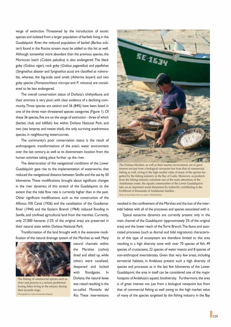
239
verge of extinction. Threatened by the introduction of exotic
species and isolated from a larger population of barbels living in the
Guadalquivir River, the reduced population of barbel (Barbus scla-
teri) found in the Rocina stream must be added to this list as well.
Although somewhat more abundant than the previous species, the
Moroccan loach (Cobitis paludica) is also endangered. The black
goby (Gobius niger), rock goby (Gobius paganellus) and pipefishes
(Syngnathus abaster and Syngnathus acus) are classified as vulnera-
ble, whereas, the big-scale sand smelt (Atherina boyeri) and two
goby species (Pomatoschistus microps and P. minutus) are consid-
ered to be less endangered.
The overall conservation status of Doñana's ichthyofauna and
their environs is very poor, with clear evidence of a declining com-
munity.Three species are extinct and 36 (84%) have been listed in
one of the three main threatened species categories (Figure 1). Of
these 36 species, five are on the verge of extinction - three of which
(barbel, chub and killifish) live within Doñana National Park, and
two (sea lamprey and twaite shad), the only surviving anadromous
species, in neighbouring watercourses.
The community's poor conservation status is the result of
anthropogenic transformations of the area's water environment
over the last century, as well as its downstream location from the
human activities taking place further up the river.
The deterioration of the navigational conditions of the Lower
Guadalquivir gave rise to the implementation of waterworks, that
reduced the navigational distance between Seville and the sea by 50
kilometres.These modifications brought about significant changes
in the river dynamics of this stretch of the Guadalquivir, to the
extent that the tidal flow rate is currently higher than in the past.
Other significant modifications, such as the construction of the
Alfonso XIII Canal (1926) and the canalization of the Guadiamar
River (1944) and the Eastern Branch (1964) reduced flooding in
Seville, and confined agricultural land from the marshes. Currently,
only 27,000 hectares (12% of the original area) are preserved in
their natural state within Doñana National Park.
Transformation of the land brought with it the extensive modi-
fication of the natural drainage system of the Marshes as well. Many
natural channels within
the Marshes (caños)
dried and silted up, while
others were canalized,
deepened and locked
with floodgates. In
Doñana, the natural levee
was raised resulting in the
so-called Montaña del
Río. These interventions
resulted in the confinement of the Marshes and the loss of the inter-
tidal habitat with all of the processes and species associated with it.
Typical estuarine dynamics are currently present only in the
main channel of the Guadalquivir (approximately 2% of the original
area) and the lower reach of the Torre Branch.The fauna and asso-
ciated processes (such as diurnal and tidal migrations) characteris-
tic of this type of ecostystem are therefore limited to this area
resulting in a high diversity zone with over 70 species of fish, 49
species of crustaceans, 22 species of water insects and 8 species of
non-anthropod invertebrates. Given that very few areas, including
terrestrial habitats, in Andalusia present such a high diversity of
species and processes as in the last few kilometres of the Lower
Guadalquivir, the area in itself can be considered one of the major
hotspots of Andalusia's aquatic biodiversity. Furthermore, the area
is of great interest not just from a biological viewpoint but from
that of commercial fishing as well owing to the high market value
of many of the species targetted by the fishing industry in the Bay
The Doñana Marshes, as well as their marine environment, are of greatinterest not just from a biological viewpoint but from that of commercialfishing as well, owing to the high market value of many of the species tar-getted by the fishing industry in the Bay of Cadiz. Moreover, as productsfrom the fishing industry constitute one of the main attractions of theAndalusian coasts, the aquatic communities of the Lower Guadalquivirtake on an important social dimension by indirectly contributing to thelivelihood of thousands of Andalusian families . Photo by José María Pérez de Ayala. CENEAM files.
The fishing of commercial species such aselver and prawns is a serious problemaf-fecting fishes living in the estuary duringtheir juvenile stage.Photograph by Carlos Fernández-Delgado.

240
of Cadiz. Every year many different species of fish, including
anchovy (Engraulis encrasicholus), sardine (Sardina pilchardus), sea
spotted bass (Dicentrarchus punctatus), meagre (Argyrosomus
regius), sole (Solea vulgaris and S. senegalensis), and prawn
(Melicertus kerathurus) remain in the Lower Guadalquivir for a
span of several months. It can thus be expected that the survival
rate of the fry of these species and the subsequent abundance of
the same in the fishing grounds will depend on the conservation
status of the area. Moreover, as products from the fishing industry
constitute one of the main attractions of the Andalusian coasts, the
aquatic communities of the Lower Guadalquivir take on an impor-
tant social dimension by indirectly contributing to the livelihood of
thousands of families.
Another important anthropogenic impact is the retention of
approximately 7,000 hm3 of water in reservoirs throughout the
watersheds, affecting the hydrological system of the estuary and
bringing about its gradual salinisation.The reservoirs retain not only
water, but sediments and nutrients as well with the subsequent
threat of lateral erosion (i.e. loss of territory from a decrease in
alluvial deposition) in the estuary and the progressive loss of pro-
ductivity in the area.The loss of productivity may be offset for the
time being by the high nutrient load of the water draining agricul-
tural fields and from untreated urban waste water.
Even the main channel of the Guadalquivir was dammed in
1930 at the towns of Alcalá del Río and Cantillana, with disastrous
effects for the shad and sturgeon whose spawning areas were
located just upstream from the insurmountable walls. The situa-
tion was seriously exacerbated by intensive fishing at the foot of
the dam during breeding migration periods. The eel (Anguilla
anguilla), a migratory species, was also affected with the resulting
loss of the only natural fish predator among the fish species of the
Guadalquivir basin.
Human activity in the sub-catchment areas of the marshlands
is one of the greatest threats not only to the aquatic communi-
ties, but to the whole of Doñana National Park itself. Erosive
processes have become predominant in most of the sub-catch-
ments and wide areas are silting up as in the case of the 300
hectares of marsh filled in by sediments from El Partido stream.
Added to this is the threat arising from very poor water quality
with an excessive nutrient load and toxic substances from
untreated urban waste water, farmlands and industrial activities
such as mining and table olive production. Farming activities also
led to aquifer depletion with a subsequent decrease in the flow
rates of rivers and the lowering of the water table. The most
immediate effect has been the alteration of the natural hydrolog-
ical regime of the Marshes: with shorter hydroperiods and more
severe droughts. This has resulted in the loss of many bodies of
Until recent times it was thought that the distribution of the “fartet”(Aphanius iberus), a small Cyprinodont fish endemic of the Iberianpeninsula, extended along the Mediterranean coast from Catalonia toAndalusia, and included a few small populations of the Atlantic coast ofAndalusia. Nevertheless, a research project financed by the Board ofthe Environment of the Andalusia Government, with the participationof the Universities of Cordova and Murcia and the National Museumof Natural Sciences (CSIC) showed that the Atlantic populations comefrom a different evolutionary line.This difference has been demonstrat-ed through genetic and morphological analyses of specimen from bothareas. The two populations could have diverged about three millionyears ago, after the desiccation of the Mediterranean Sea and its pos-terior isolation during the Late Pliocene. The new species has beennamed Aphanius baeticus, in honour of the River Guadalquivir (theBaetis of ancient Romans), because its largest populations are found inthe Guadalquivir’s basin .Eight populations have been found until this moment.The westernmostone is localised at Laguna del Hondón within the Doñana NationalPark, while the easternmost is found near to Conil de la Frontera(Cadiz).The conservation status of the new species is very poor and,according to UICN’s categories, this species has been catalogued as"Critically Endangered" (CR).An appealing and integrative proposal for its conservation has beendeveloped within the framework of the Doñana 2005 project. Anaction within this project included an advanced water-treatment planfor the villages discharging their wastewater to the Marshes. Takingadvantage of the outflow canal of the El Rocío treatment plant, the onewith the most advanced treatment cycle, the idea was developed tocreate a sanctuary for this species.The treatment process was comple-mented with a network of canals bordered by vegetation and fed bythe outflow canal, where the fish population can be maintained.
A NEW FISH SPECIES
IN THE IBERIAN ICHTHYOFAUNA
FEMALE
MALE

surface water, such as the so-called “ojos” (eyes) of the Marshes,
which are points at which groundwater reaches the surface, and
this in turn has affected the vegetation.
Another major problem for the aquatic community is the com-
pletely unregulated fishing taking place along the last 40 kilometers
of the Guadalquivir's main channel. The fishing of commercial
species such as elver and prawns is a serious problem affecting fish-
es living in the estuary during their juvenile stage. They are con-
fronted at the inlet with several thousand square metres of 1mm
mesh fly net used to catch prawns and elver.
Further complicating the matter are the large number of
allochthonous species. The first to colonise the area were most
likely carp (Cyprinus carpio) and goldfish (Carassius auratus) native
to Eastern Europe and Asia, probably in the 19th century and by nat-
ural means. In 1921 the Eastern mosquitofish (Gambusia holbroo-
ki) was introduced from the United States to fight malaria. Both
native to North America, the largemouth bass (Micropterus
salmoides) and the mummichog (Fundulus heteroclitus) were
introduced in the 1970s, the first into the Rocina stream and sec-
ond into the Marshes.The red swamp crayfish (Procambarus clar-
ki), which had such a marked impact on Doñana's freshwater
ecosystems, also arrived in the 1970s. During the heavy rain sea-
sons in 1996 and 1997 the pumpkinseed (Lepomis gibbosus)
became the last American species to colonise Doñana.
Exotic species will normally replace the native species through
competition, predation or parasitism, altering the functional dynam-
ics of the system. In this specific case, goldfish,Eastern mosquitofish,
largemouth bass, and pumpkinseed put pressure mainly on fresh-
Typical estuarinedynamics are currentlypresent only in themain channel of theGuadalquivir and thelower reach of the TorreBranch. The fauna andassociated processes(such as diurnal andtidal migrations) char-acteristic of this type ofecostystem are there-fore limited to this area,giving Doñana anextraordinary impor-tance for fish conserva-tion. The image showshypsometry of the out-let of theGuadalquivir’s mainchannel into the TorreBranch.
Image extracted from the DigitalSurface Model of Torre Branch(Brazo de la Torre).
The large number of exotic fish species is one of the bigger problems to befaced in Doñana. The first to colonise the area were most likely carp(Cyprinus carpio) and goldfish (Carassius auratus) native to Eastern Europeand Asia, probably in the 19th century and by natural means. In 1921 theEastern mosquitofish (Gambusia holbrooki) was introduced from the UnitedStates to fight malaria. The pumpkinseed (Lepomis gibbosus) became thelast American species to colonise Doñana . Above, couple of Easternmosquitofish (Gambusia holbrooki).
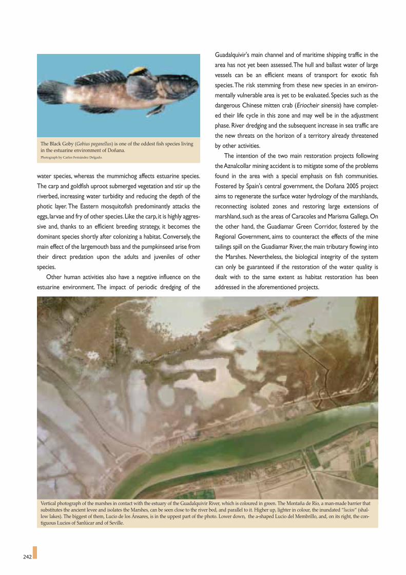
242
water species, whereas the mummichog affects estuarine species.
The carp and goldfish uproot submerged vegetation and stir up the
riverbed, increasing water turbidity and reducing the depth of the
photic layer. The Eastern mosquitofish predominantly attacks the
eggs, larvae and fry of other species.Like the carp, it is highly aggres-
sive and, thanks to an efficient breeding strategy, it becomes the
dominant species shortly after colonizing a habitat. Conversely, the
main effect of the largemouth bass and the pumpkinseed arise from
their direct predation upon the adults and juveniles of other
species.
Other human activities also have a negative influence on the
estuarine environment. The impact of periodic dredging of the
Guadalquivir's main channel and of maritime shipping traffic in the
area has not yet been assessed.The hull and ballast water of large
vessels can be an efficient means of transport for exotic fish
species.The risk stemming from these new species in an environ-
mentally vulnerable area is yet to be evaluated. Species such as the
dangerous Chinese mitten crab (Eriocheir sinensis) have complet-
ed their life cycle in this zone and may well be in the adjustment
phase. River dredging and the subsequent increase in sea traffic are
the new threats on the horizon of a territory already threatened
by other activities.
The intention of the two main restoration projects following
the Aznalcollar mining accident is to mitigate some of the problems
found in the area with a special emphasis on fish communities.
Fostered by Spain's central government, the Doñana 2005 project
aims to regenerate the surface water hydrology of the marshlands,
reconnecting isolated zones and restoring large extensions of
marshland, such as the areas of Caracoles and Marisma Gallega. On
the other hand, the Guadiamar Green Corridor, fostered by the
Regional Government, aims to counteract the effects of the mine
tailings spill on the Guadiamar River, the main tributary flowing into
the Marshes. Nevertheless, the biological integrity of the system
can only be guaranteed if the restoration of the water quality is
dealt with to the same extent as habitat restoration has been
addressed in the aforementioned projects.
The Black Goby (Gobius paganellus) is one of the oddest fish species livingin the estuarine environment of Doñana.Photograph by Carlos Fernández Delgado.
Vertical photograph of the marshes in contact with the estuary of the Guadalquivir River, which is coloured in green. The Montaña de Río, a man-made barrier thatsubstitutes the ancient levee and isolates the Marshes, can be seen close to the river bed, and parallel to it. Higher up, lighter in colour, the inundated “lucios“ (shal-low lakes). The biggest of them, Lucio de los Ánsares, is in the uppest part of the photo. Lower down, the a-shaped Lucio del Membrillo, and, on its right, the con-tiguous Lucios of Sanlúcar and of Seville.

are highly unpredictable since
both are dependant on weather
conditions. However, the charac-
teristic flexibility of the reproduc-
tive cycle of amphibians makes it
possible for them to settle and use
such ponds by adjusting their
aquatic phase to the duration of
such environments. Since larvae
can metamorphose under envi-
ronmental conditions that are
inappropriate for their growth and
development, their metamorphic
period may be shortened or
extended according to the condi-
tions of the environment, resulting
in a highly variable duration of
their embryonic and larval stages.
Eleven species of amphibians
can be found In Doñana in a wide variety of reproductive habitats.
Species that undergo metamorphosis at smaller sizes, such as the
common toad, the natterjack toad and the Portugal painted frog,
The amphibians of Doñana CARMEN DÍAZ PANIAGUA *
Amphibians have a complex aquatic cycle, since most
species lay their eggs in aquatic environments, in which
larvae develop until metamorphosis. Later, their juvenile and adult
stages usually take place in terrestrial environments. Some species
have aquatic habits and are always found in the water or next to
it, but many adult amphibians are fully terrestrial and only venture
to water to breed. The presence of appropriate water environ-
ments for their reproduction is therefore necessary for amphibian
populations to exist.
Not all aquatic environments are appropriate as breeding
grounds. Eggs and larvae of most amphibian species are vulnerable
to predators such as fish, typical residents of permanent water
environments. Only species that have developed defence mecha-
nisms against predation usually breed in this type of environment.
However, temporary water environments are generally optimal
for amphibian breeding. Pools and small ponds of this type abound
in the Doñana area and host the eggs and larvae of a rich and
abundant amphibian fauna.
Temporary ponds are formed in Doñana in autumn after heavy
rainfalls. Both the time when they are formed and their duration
* Doñana Biological Station.
Currently, there is a worldwidedecline in amphibian species.The alteration and loss of habi-tats, climate change, increase inultraviolet radiation, introduc-tion of exotic fauna, pollution,diseases and animal trade aresome of the primary potentialcauses that may explain thisdecline. Photograph by Carmen Díaz Paniagua.

244
only need two or three months to complete their larval stage and
can start their terrestrial phase when they reach the length of 10
mm. The two latter species thus breed in very shallow and
ephemeral ponds that are often inhabited by a single species with
few predators and little competition for food resources.
Natterjack toads lay strings of some three thousand eggs in two
long rows that are easy to detect on the banks of the ponds in
which they breed. The Portugal painted frog takes advantage of
small ephemeral ponds where it can lay its eggs several times a
year, i.e. any time heavy rainfalls flood the ponds. However, since
the eggs of common toads contain toxins to prevent them from
being eaten by fish or other predators, this species is adapted to
more permanent aquatic habitats.The common toad is not a very
abundant species in Doñana but can be found in large permanent
ponds such as the Santa Olalla and Dulce lagoons.
At the other end of the spectrum we find amphibians that
require more stable habitats to complete their larval stage.As the
larvae of Western spadefoot are characterised by their large size,
sometimes similar to that of the adults, the larval stage of this
species is longer.They usually remain in the water from the time
large temporary ponds or even marshes are flooded in autumn
until the ponds are drying up in late spring or early summer.The
same habits are shared by the morphologically different sharp-
ribbed newt, an amphibian of the Urodela group frequently found
in the marshes and other large temporary habitats which allow
larvae to reach large sizes before undergoing metamorphosis.The
larvae of this species prey upon invertebrates and even larvae of
other amphibian species that share their habitat.Another unique
species also found in the marsh area and in the small ponds that
form on its borders is the Iberian parsley frog, which is capable of
Stripeless tree frog singing during courtship. Photograph by A. Portheault.
developing relatively large larvae in less than three months, usual-
ly in the autumn/winter period.The characteristic courtship songs
of the males reveal the presence of this species in the Doñana
marshes.The early breeding period of the species probably spare
the larvae from having to compete for food with other amphibian
species.
The amphibian species most frequently found in the sand
dunes of Doñana are those that breed in the countless tempo-
rary ponds that flood in the autumn, reach their maximum pro-
ductivity in the spring and dry out in the early summer.The ponds
are located in small depressions and are frequently surrounded
by monte negro heathland or situated in cork oak groves.These
ponds are the typical habitat of the stripeless tree frog, the
Bosca's newt and the Southern marbled newt.The stripeless tree
frog is a colourful tree-dwelling amphibian, which is capable of
climbing up vegetation and usually ventures to the ponds to
breed once the coldest days of winter are over. Its continuous
courtship songs are a typical feature of winter and spring nights
in Doñana. Because the tree frogs have a longer egg-laying peri-
od, the arrival of the females to the pond does not take place
massively as it does with toads.The male/female couple scatters
the eggs in small groups that stick to plants. Larvae can complete
their cycle in about three months and, just after completing their
metamorphoses, small frogs can be observed over an extended
period of time before ponds dry up.
Newts arrive immediately after the ponds are formed to com-
mence their charming underwater courtship in which males make
repetitive movements of their tails to attract females that will col-
lect the sperm that has been deposited on the bottom of the
Couple of of Iberian parsley frogs in amplexus. Photograph by A. Portheault.

245
pond. Egg-laying does not take place until winter and lasts a long
time as females must lay their eggs by wrapping them one by one
in the leaves of aquatic plants and thus require one to two months
to complete the process. Likewise, larvae can complete their
metamorphosis in around three months but the extended egg-lay-
ing period results in a wide variation of larva ages and sizes with-
in the pond.We can find larvae undergoing metamorphosis during
several months before and up until the time the ponds dry up.
The Southern marbled newt is more common than Bosca's
newt and both use similar habitats.The adults of both species
are very small and Doñana's newts are the smallest of their dis-
tribution area.An adult Bosca's newt, for example, can breed at
just 0.5 grams weight, and a Southern marbled newt at just 1
gram. Very small size is a characteristic of the newts found in
the Doñana area, as the newts even in nearby locations are
larger. This feature could be attributed to the shorter annual
activity period, to their reaching maturity at an earlier age, or
to the greater longevity of the individuals living in Doñana.
Southern marbled newts in this area also have a characteristic
breeding male pattern which is less conspicuous than that of
other populations.
In general, the majority of Doñana's amphibian species char-
acteristically exhibit a smaller size as compared to other pop-
ulations. Some water environments are not necessarily
permanent but do last well into the summer.
Nevertheless, during this dryer period they display
poorer conditions than during the spring, with
less submerged vegetation, a lower concen-
tration of oxygen, higher
temperatures, and
so forth.This type of medium is used by the Iberian green frog
for breeding.This species lays its eggs later (around April) than
other amphibian species. Its larvae usually do not coexist with
those of other species and thanks to their lungs they can toler-
ate lowoxygen concentrations in water. They are even able to
aestivate and complete their metamorphosis the following
autumn, if ponds did not dry up.Adults have aquatic habits and
are active both day and night and are therefore usually associ-
ated with permanent water environments.
Among the amphibian species found in Doñana
there is one that stands out because of its peculiar
breeding process. This is the Iberian midwife
toad, which is quite rare in the area,
although some individuals have been
found north of the Park. Females lay
20 to 40 large-sized eggs each
which the males collect and
place between their legs
after fecundation.The
A characteristic feature of the Western spadefoot is that its larvae can reach alarge size, sometimes similar to that of adults. Photograph by A. Portheault.
Bosca’s newt larva.Photograph by W. de Vries.

246
males, which have nocturnal terrestrial habits, then carry the eggs
during the embryonic stage until they are close to hatching,when they are
placed and released into the water. The larvae will then remain in the
water until they complete their metamorphosis.
Currently, there is a difficulty to explain worldwide decline in
amphibian species. The alteration and loss of habitats, climate
change, increase in ultraviolet radiation, introduction of exotic
fauna, pollution, diseases and animal trade are some of the primary
potential causes that may explain this decline. But none of them
suffuces to cause the overall amphibian recession. It is the accumu-
lation of small deleterious effects what is driving the whole group
into risk of extinction.There is a public concern among conserva-
tionists that the amphibian collapse was an early warning to the
foreseeable biodiversity crisis of the biosphere.
The amphibian fauna of Doñana include both a large number
of species - among which six endemic Iberian species stand out -
UrodelaTriturus pygmaeus Southern marbled newtTriturus boscai Bosca’s newtPleurodeles waltl Sharp-ribbed newt
AnuraAlytes cisternasii Iberian midwife tod Discoglossus galganoi Portugal painted frog Pelobates cultripes Western spadefootPelodytes ibericus Iberian parsley frog Bufo bufo Common toadBufo calamita Natterjack toadHyla meridionalis Stripeless tree frog Rana perezi Iberian green frog
Endemic species of the Iberian Peninsula.
Scientific and common English names of Doñana's amphibian species
Eggs of Western spadefoot laid in shallow water. Photograph by A. Portheault.
and local populations with unique characteristics, such as their
small size. Although the protection level of the Park guarantees
the preservation of amphibian habitats, the duration of the
hydroperiod must be controlled in order to ensure successful
breeding. Water abstraction in the surrounding areas and the
inter-annual climatic variability, with occasionally long drought
periods, could affect the dynamics of these habitats and of the
amphibians that depend on them.
Among other threats, the introduction of invasive species
could have a considerable impact, especially during dry years. One
of the most significant invasive species is the red swamp crayfish
Procambarus clarkii that was initially introduced into the Marshes
area in 1973, and has since then spread to almost all of the aquat-
ic environments in the Park, including temporary ponds. The
impact on amphibian populations has not as yet been clearly ascer-
tained. However, it has been found that the red swamp crayfish
consume the amphibian eggs adhered to the plants that comprise
the crayfish's main food and can pray on larvae and adults.
Amphibian populations exhibit a large production in spring, pro-
viding predators (fish, birds, some reptiles and mammals) with a
large food resource.Their reduction will be felt along the trophic
chain. In former times the migration of toads and sharp-ribbed
newts across the Vera grasslands on the Marshes border, implied
the movement of hundreds of thousands of animals that almost
covered the ground, forming an appealing wandering carpet.
Nowadays with the regression of these populations also in the
Park grounds, massive migrations ceased, and during drought
intervals surviving populations are confined to some areas.

In order to explain this situation,one must pay attention to the
way in which the butterfly's life history develops. This species is
univoltine, that is to say, butterflies emerge from their chrysalis
once a year, between mid-May and late June. Male butterflies usu-
ally emerge before females (protandry), hence there are many
more males in proportion to the females at the beginning of the
season.The newly emerged females are quickly spotted by males
and after copulation lay their eggs at the base of the foodplants for
247
The uniqueness of marsh butterflies
JUAN FERNÁNDEZ HAEGER *
247
The richness of butterfly species in Doñana National Park
is not surprisingly high: 43 species in a 540 km2 area is not
an exceptional amount. In southern Spain, a much larger number
of species can coexist in other geographical zones of similar
extension, particularly in mountainous areas. This number in
Doñana can be explained based on several characteristics of the
park.The first of these, is that an important part of the park area
is seasonally flooded marshland and butterflies cannot complete
their life cycles in this kind of habitat. Second, the stabilized sand
dunes that make up most of the park are quite monotonous, lack-
ing the heterogeneity of other areas, with a more varied relief, that
offer a greater diversity of resources and microenvironments.
Doñana National Park was obviously not created with the butter-
flies in mind.Hence we have a clear example of how other species,
namely the vertebrates, have acted as an umbrella species that
protect many others coexisting in the same habitat.
Nonetheless, on the butterfly checklist of Doñana, several of
them stand out because their existence in this geographical loca-
tion is unexpected.These species are the satyride Pyronia tithonus
and the lycaenides Cyaniris semiargus and Plebejus argus. These
three species are usually found in habitats that tend to have more
oceanic characteristics. In the southern Iberian Peninsula they are
mainly limited to the mountainous areas with more favourable
conditions for humidity. The vegetation associated with the shal-
low water table in Doñana probably has played a significant role in
the survival of these species, which undoubtedly should have been
more abundant in southern Iberia during colder and damper peri-
ods.
This species is commonly found in Central and Northern
Europe, whereas in the Iberian Peninsula it mainly inhabits moun-
tain areas. The mountain ranges in Granada are the only other
areas in Andalusia where this species has been found, with some
populations living over 2500 metres above sea level. Particularly
remarkable is the fact that this butterfly is the most abundant
found in the Park, to such extent that there are as many butter-
flies of this species as the sum of all the other 42 butterfly species
combined. It is surprising that this species is so abundant in spite
of being located in the southern limit of its continental distribu-
tion, and at sea level.
* Professor of Ecology. Department of Botany, Ecology and Plant Physiology.University of Cordova, Spain.
Several of the Doñana butterfly species stand out because theirexistence inthis geographical location is unexpected. These species are the satyridePyronia tithonus and the lycaenides Cyaniris semiargus and Plebejus argus (inthe picture).Photograph by Miguel G. Muñoz Sariot

248
plants. Butterfly larvae have specific food requirements and there-
fore they cannot feed on a wide range of plants.They will usually
feed on a small number of closely related plant species with a sim-
ilar chemical composition.The biochemical and physiological sys-
tem of the larvae is capable of detoxifying the chemical defence
compounds developed by foodplants, assimilating their nutrients.
This is an evolutionary response to the "chemical war" developed
between plants and herbivores.
In Doñana, the Plebejus argus feeds mainly on Halimium halim-
ifolium, the most common and abundant scrub in the Park. The
abundance of scrublands on which larvae can feed could be the
underlying reason for the abundance of this butterfly species.
However, this butterfly does not inhabit all locations in which
Halimium is plentiful. It is concentrated in specific areas where
another important insect species with which it interacts can be
found, namely the ant Lasius niger. Since the substrate of the
Doñana scrubland is mainly sand, building ant nests in this unsta-
ble medium is not easy. Many ant species therefore use plant roots
as a support structure for their nests. Furthermore, by placing the
nests at the base of the scrub, the ant can create a more
favourable microclimate in terms of temperature and dampness,
particularly during the summer when the surface temperature of
the sand is too high. In addition, ants will not select Halimium
plants situated at locations that are too high above the soil water
table, as they would be too dry, or too close, as they would be
flooded during rainy winters.Thus, ant nests are located in a range
of intermediate heights close to the "monte negro" heathland.
During spring, females lay eggs close to the ground, beneath
the Halimium plants and its leaf litter, selecting plants with ant
nests.The mechanism used by gravid females to detect ants is
yet unknown, however, a combination of visual and chemical
reactions seem to be involved.Ants ignore the eggs as they are
of no interest to them. The mortality rate over the next ten
months until spring,when the larvae hatch from the eggs, is very
high.
After hatching, the ant is attracted to the larvae, and both
species begin to interact henceforth. During their development
stages, or instars, larvae develop several organs that secrete sub-
stances alluring to ants.The button-like organs distributed over
the body, produce chemical compounds similar to the
pheromones used by ants to communicate. Larvae also have a
dorsal nectary organ that develops in the third instar, which
secretes droplets rich in sugars and amino acids upon which the
ants avidly feed. Lastly, the larvae have a pair of reversible tentac-
ular organs that produce substances which excite and alarm the
ants.Thus, there are always several ants around or on top of a
larva feeding on a plant. Indeed, given the mimetic nature of lar-
An interesting case of mutualistic interaction is observed between three spe-cies found in Doñana: the small butterfly Plebejus argus (Lycenid), the antLasius niger and the shrub Halimium halimifolium, very widespread on sandysoils.Photograph by José María Pérez de Ayala.
their larvae. Larvae will not hatch until the following spring and
then transform quickly, within a few weeks, into pupae. Other but-
terfly species, denominated multivoltine, can complete this cycle
several times per year. However, the most unique aspect of their
life history is the relationship that develops between the butter-
flies and larval foodplants and, in turn, with the ants living on these

249
vae, the best way to locate them on a plant stem is to search for
ants.
The obvious question is: why do larvae endeavour to attract
ants? Why do they expend so much energy on ensuring that sev-
eral ants are on or around them while they feed on Halimium?
The answer involves a third party or group of protaganists of this
story,which are- tiny,parasitic wasps that complete their life cycle
at the expense of butterfly larvae.These wasps are extremely effi-
cient in locating caterpillars, when they try to deposit their eggs
inside their bodies.The eggs develop very quickly into wasp lar-
vae, feeding on butterfly larva tissues. The wasp larvae emerge
when they have completed their development, consuming the
butterfly larvae which in the end have helped to produce new
wasps instead of butterflies.The ants will effectively protect lar-
vae from parasitoid attacks, in most cases preventing the assault
of wasps. To reduce parasitoid attacks, larvae have the habit of
feeding at night; hence, one must wait several hours after sunset
to find larvae feeding on tender leaves. During the day, larvae
crawl down the scrub stems into the ant nests, where they will
remain protected until night falls. The transformation from larvae
to pupae also takes place in the ant nest. The adult butterfly
emerges from the chrysalis within two weeks, drying and spread-
ing its wings outside, thus initiating a new cycle.
Consequently, one could think that the presence of an ant
nest beneath a Halimium could negatively affect the plant, given
that there is a great probability that oviposition takes place on
these plants. Larvae must complete their cycle on these plants,
feeding on vegetal material (particularly apical leaves) that the
plant itself needs for its own development, especially for its
annual reproductive output (flowers, fruits, seeds). Densities of
larvae vary considerably from plant to plant and more than one
hundred have been counted on a single plant. Such a large num-
ber of larvae will consume a substantial part of the foliar sur-
face. Even if a leaf is not completely eaten by the larvae, it will
dry up and fall. Due to their defoliation or leaf abscission, plants
that have been attacked by larvae can be easily spotted in early
summer.
Summertime is the least favourable season for plants in
Doñana.The sandy soil retains very little water and consequently
plants suffer from severe water stress.A plant's capacity to survive
the dry season is related to the balance between root absorption
of water and leaf transpiration. If absorption is reduced to mini-
mum levels, transpiration must be reduced correspondingly.
Defoliation could paradoxically contribute to the reduction of
water loss. In September, the water stress of plants to which a
known larvae density was applied was lower than the stress of
equivalent control plants without larvae. Those plants also pro-
duced more seed capsules, indicating a higher degree of reproduc-
tive success of this seeder species.
There is definitely a complex interaction across different lev-
els.The position of the plants with regard to the aquifer will deter-
mine the presence of ant nests' and, in turn, these will influence the
presence of larvae, which seek the protection of the ants from
parasitoids.Although in principle the presence of ants, and there-
fore larvae,would seem to entail a negative effect on the plant, our
experience shows that in fact plants were proved to benefit from
this relationship, at least in terms of reduced water stress and
increased reproductive success.
In Doñana, the Plebejus argusfeeds mainly on Halimiumhalimifolium, the most com-mon and abundant scrub inthe Park. There are alwaysseveral ants around or on topof a caterpillar feeding on aplant. Indeed, given themimetic nature of caterpillars,the best way to locate them ona plant stem is to look forants.Photograph by Miguel G. Muñoz Sariot.

Spanish iris (Iris xiphium) in Doñana.Photograph by José María Pérez de Ayala.

the years after 1970, Pat Rogers was the first to quantify not only
the rabbit populations of the Biological Reserve, but also their spa-
tial distribution and ecological characterisation.At this time, popula-
tions had already been locally decimated in comparison with previ-
ous years, although large areas in which the rabbit was very abun-
dant could still be seen.These areas were close to La Vera and the
pond borders grazing meadows. Other plant communities like the
undergrowth were also within their range, although abundance was
very much lower. Rogers observed the extremely low capacity of
251
The rabbit in Doñanathe tale of two different tales
RAMÓN C. SORIGUER *, ELENA ANGULO **
251
It is undoubtedly the most widespread mammal throughout
the Iberian Peninsula. Its high fertility rate is offset by a high
mortality rate. In Spain alone, almost 40 species of vertebrates that
prey on the rabbit have been reported (Figure 1), apart from man.
They are the basic prey item of two specialist and highly emblem-
atic predators of Doñana: the Iberian lynx (Lynx pardinus) and the
Spanish Imperial Eagle (Aquila adalberti). Few species are capable of
attaining such high densities naturally, with such a large number of
predators and bearing in mind that the rabbit accounts for a major
part of their diet.
THE HISTORY OF DOÑANA
RELATED BY ITS RABBIT POPULATIONS
The rabbit and the original Doñana
In Doñana, the history of its numeric dynamics is so well doc-
umented that it reveals to us some really unknown features of the
species.The first records were made in historic times, dating back
over 300 years.These records describe the rabbit as abundant in
the hunting grounds and this has been a constant feature over the
last few centuries. From the early years of the 20th century to the
late 50s, the tales and testimonies of old game keepers of El Coto
de Doñana confirm the abundance of rabbits, although populations
were unevenly distributed, as they were far more frequent in
“cotos” and in the forests of cork trees and wild olives with an
undergrowth of mastic, especially among the ferns and meadows of
La Vera and areas around the ponds.They were also abundant in
areas of sage leaf rockrose, bordering on damper depressions. In
the area of the dunes, there were only abundant populations to be
found temporarily in the meadows of inter-dune valleys. Finally, in
the Marshes, they were very rare, limited to an occasional specimen
on the islets, walls or around buildings.
All this changed in 1959, with the appearance of myxomatosis,
which caused a genuine catastrophe: Valverde (1960) calculated a
mortality rate of over 90%. It was also at this time when the true
value of the rabbit was recognised and the importance of its contri-
bution to the stability and wealth of Mediterranean ecosystems. In
* Department of Applied Biology. Doñana Biological Station. CSIC. Seville. Spain.** Lab. Ecol. System. & Evol. Univ. Paris XI. Department of Applied Biology. Doñana Biological Station. CSIC. Seville.

252
the rabbit to colonise the new pine forests and the thick, closed
bush. He also revealed the importance of ecotonal areas and inter-
faces between different plant communities for rabbit populations
and the important role played by soils and the water table depth in
the stability and viability of rabbit communities. The most striking
result, however, was the detection of a tendency among rabbit pop-
ulations to decline in abundance, although in a less spectacular and
dramatic fashion than the trend shown by Valverde in the previous
decade. As with Valverde, we are once again surprised when the
close association between the distribution and abundance of rabbits
and lynxes is demonstrated.
In the 80s,M.Beatriz Kufner (1986) analysed the impact on rab-
bits of the different predators of Doñana in the different areas and
depending on the time of day and time of year. Beatriz showed how
the generalist predators have a special impact on the rabbits of
Doñana, and that these general predators could come into compe-
tition with the specialist predators. She also showed how rabbits
are most frequently distributed on the edges of moist pastures and
medium cover shrub, although their distribution varies, depending
on the time of year.
A study similar to Rogers', conducted by Rafael Gerschwiz twen-
ty years later (1994), shows us a very different pattern: low abun-
dance figures, more isolated patches of distribution and almost
reaching local extinction in some of the populations identified by
Rogers.
But what has happened in the course of these last twenty years?
These two decades have witnessed two opposing phenomena: on
the one hand, a recovery of populations (although not necessarily in
the same places or to the same levels reported previously) as a con-
sequence of their greater resistance to myxomatosis and, on the
other, a dramatic mortality rate, from the early 90s, due to the
appearance of a new viral infection: rabbit haemorrhaging disease.
So what was the situation as we entered the new millennium?
From 1994 to date (2004), there has been a pronounced change in
the National Park's conservation policy, because of both the imple-
mentation of specific recovery plans for some endangered species
and because of more interventionist environmental policies in gen-
eral. In the course of the last ten years there have been controlled
translocation and re-introduction programmes with rabbits (over
TABLE 1Clearing the scrub in Doñana National Park. Analysis of the effectiveness of rabbit re-populations and other management meas-ures in Doñana National Park. Final report. IREC. Nov 2001. RBD: Doñana Biological Reserve.
YEAR TOTAL AREA (ha) AVERAGE AREA (ha) NUMBER OF PLOTS SHAPE METHOD SITE
1985 3 3 1 CLEARING ACEBUCHE
1986 27 2 17 CLEARING AND BURNING ACEBUCHE
1987 19 2 9 CLEARING, BURNING, HARROWING ACEBUCHE, MARISMILLAS
1988 163 3-10 40 CLARING, BURNING, HARROWING ACEBUCHE, EL LOBO
MARISMILLAS, MOGEA,ALGAIDA
1989 53 2-9 15 CLEARING, BURNING, PERIPHERAL HARROWING MARISMILLAS, EL PUNTAL
1990 38 1.5 51 LOBED CLEARING, BURNING, PERIPHERAL HARROWING ACEBUCHE, DBR
NAJARSA, ACEBUCHE
1991 22.5 0.5 >70 LOBED CLEANING, HARROWING AND SOWING DBR, NAJARSA, EL PUNTAL
1992 25 0.2-0.5 >50 LOBED CLEANING DBR
1993 29 0.5 >80 LOBED CLEANING MARISMILLAS, EL PUNTAL
NAJARSA,ACEBUCHE
1994 21 <0.5 70 LOBED CLEANING PINE WOODS MARISMILLAS
1995 16 0.4 40 LOBED CLEANING EL LOBO
1996 >27 0.3 125 LOBED CLEANING DBR, NAJARSA,ACEBUCHE
1998 >20? 0.5 >100 LOBED CLEANING DBR
FIGURE 1Diversity of rabbit predators (number of species).

253
8000 releases), thousands of hectares of pines planted in the 50s
have been cleared, dozens of plots have been pruned to favour rab-
bit habitats and hundreds of rabbit warrens have been dug (Tables
1 and 2).
The decline in the rabbit was attributed to a series of changes
in the ecosystem; in particular, the abandonment of traditional prac-
tises, like the prescribed fire regime and clearing the brush. In 1985,
interventions started in the form of clearing scrub on plots,
schemes that were honed with the results of research conducted.
In the early years, these plots were large and square, and in patch-
es of the same kind of scrub. In the early 90s, the effectiveness of
this clearing was seen to depend on the quality of the habitat. Since
then, clearing is usually accompanied by either sewing herbaceous
seeds or improving herbaceous plants to enhance the availability of
food for the rabbits, and these operations were carried out in eco-
tone zones, where two different habitats meet. It was also discov-
ered that the rabbits only use the edges of these plots, so the opti-
mum size and shape of the areas to be treated were defined (lobed
plots of no more than 50 metres between any of their sides, ben-
efiting the lynx' predatory strategy; stalking). These clearing oper-
ations and their effectiveness in Doñana were weighed up once
again in 1999, and it was found that there was still a positive effect
(greater abundance) in most of the areas that had been targeted
since 1988, although maximum effectiveness appeared to occur
three years after the intervention.
Stocking with rabbits has been a frequently used strategy in
Doñana National Park, despite the fact that it is not contemplated
in the Park's management plans or in the initial plans for address-
ing the problems of the lynx and the Imperial eagle1.
After the first studies were conducted, 8,000 rabbits were trans-
fered to Doñana between 1993 and 1996 (see Table 2), using main-
ly rabbits from areas a good distance away from Doñana National
Park and at different times and in different areas.There was no seri-
ous and exhaustive monitoring of any of these trans-locations in
the long term. In 1999, rabbit abundance of the re-stocked areas
was compared with other areas close by or with similar habitats,
and it was observed that re-stocking had no long term effects.
The conclusion of these studies was that the recovery of rabbits by
means of trans-locations is characterised by concentrating manage-
ment efforts in a few, and never isolated, plots.The history of rab-
bit re-stocking work, in Doñana and in the rest of Spain, shows us
that it is a tool of limited use; it is controversial and should only be
used in specific situations. Like medicine, it can have unwanted side
effects.
The rabbit in Doñana today
Despite the lack of efficacy of most of the actions carried out,
there has been a slow but continued trend for rabbit populations
to increase in Doñana today.This tendency would probably have
been observed anyway, or may even have been stronger, as in
other rabbit populations nearby, where no trans-locations have
been done.
The difference from previous decades is not the kind of spatial
distribution, but the lower abundance of rabbits on these plots
today.This patchwork system is not a static one; on the contrary,
it is highly dynamic in both time and space, adapting very efficient-
ly to changes in the physical environment (soil and vegetation), abi-
otic factors (climate) and epizootes. The rabbit's extraordinary
capacity to grow and breed, together with the fact that it is so
adaptable, has changed the situation slightly in 2002 (see Figure 2).
A pronounced increase was observed in the area of Las
Marismillas and El Puntal, and isolated populations appeared in
Monteruelos and Los Sotos.The juniper forests remained the habi-
tat in which rabbits abounded, and the re-planted pine trees, Las
1993 1994 1995 1996 REMARKS
DBR 888 1056 593 248
Acebuche 675 65 Re-stocking in cleaned area. Monitoring through faeces counting until 1999.
Marismillas 712 369 307 Construction of artificial warrens. Monitoring through faeces counting in 1998.
El Lobo 248 311 823
La Algaida 160 160 Research Project. Radio-monitoring to prove efficacy.
Najarsa 115 17
El Puntal 158 485
La Rocina 235
La Mogea 243
Yearly total 2275 2266 2256 1075
TABLE 2Re-stocking actions undertaken in Doñana National Park, data modified in accordance with the PML report, 1998. Figures in individuals

254
Naves and El Matorral, once they were cleared, started to show a
gradual increase. On the contrary, El Coto del Rey and
Matasgordas, although they sill maintain remarkable densities, are
showing a decline. The Marshes, most of which is a habitat that
excludes rabbits, is showing the presence of major rabbit warrens,
and although these are restricted to the islet meadows and build-
ings, and although they have not to date been very striking, there
have been more and larger colonies observed in the course of the
last year and they seem to be more active since they have been
protected from trampling by large herbivores.
The spectacular increase in grazing in the Park between 1992
and 2001 (with over 4,000 head of large livestock) is increasingly
considered as an element that disturbs the viability of rabbit pop-
ulations, as they concentrate in higher areas (preferred by rabbits
for building their warrens), collapsing rabbit warrens. Fortunately,
the Livestock Plan of 2001-2002 has rationalised this situation to
a certain extent.
The real causes of the changes in abundance of rabbit popula-
tions remain unknown.Working hypotheses currently being given
consideration include both the local intensity of predation,
changes in the structure and distribution of the habitat, changes in
the water level regimens and the length of the floods as a conse-
quence of modifications made to the marshes drainage system.
FIGURE 2Spatial distribution map of rabbit abundance (faeces/ha) in DoñanaNational Park.Developed by Soringer and Fandos, 2003.
Spectacular scene of a lynx hunting a rabbit in Doñana.Photograph by Antonio Sabater.

Ratón, no pairs remained, as the last ones had been killed shortly
before. Nor are there any lynxes in La Juncosilla, or further east of
Hato Ratón, so the population can be calculated as no more than
about fifteen pairs, if there are any pairs on State lands". These fig-
ures are clearly higher than now, but not much.
255
The Iberian lynxrescuing a species for Doñana and for the world
MIGUEL DELIBES DE CASTRO *
255
The Iberian lynx is a highly endangered species and it is
known to breed only in two small areas of Spain: Doñana
and the mountain ranges of Sierra Andujar and Sierra Cardeña.This
makes conservation of this species, now restricted to Spain, a top
priority objective for Doñana.
Many hunting stories mention the killing of lynxes in Doñana in
the late 19th century and the early 20th century. Some skins and
skulls from this time, deposited in different European museums,
seem to bear witness to the fact that the Iberian lynx was an abun-
dant species at the time. But things may not have been quite as
clear as they seem.The authors who have devoted most effort to
this issue are undoubtedly English authors Abel Chapman and
Walter J. Buck,who wrote at least two books in which Doñana was
the main, but not only, scene (Wild Spain, published in 1893, and
Unexplored Spain, in 1910). These enthusiasts of El Coto de
Doñana, which they considered "a fragment of the wild loneliness
of Africa (...) in this corner of Europe", talked of catching live lynx-
es, shooting bullets (successfully or not) or shot at the great cat, a
variety of methods for drawing to the guns, etc. But, although they
say that the lynx is "even common" in the southern provinces of
mainland Spain in their first work, in the second, they claim, with
apparent surprise, that "it is difficult to explain why an animal
whose only enemy is man can be so scarce".
Was the lynx ever abundant in Doñana? Undoubtedly it was
abundant locally, but maybe less so than we are tempted to imag-
ine. After his first visits to the area, in the 1950s, Jose Antonio
Valverde was pessimistic about the survival of the lynx, postulating
that only a few pairs probably remained in the district, so few that
they could be counted on the fingers of one hand. Around 1967,
now working in the Reserve and with rangers and ringers conduct-
ing a detailed register of all observations, he was a little more pos-
itive in his opinion: "In Las Marismillas, only a single pair from
Doñana remained in 1956, and we do not know whether it will sur-
vive.There are probably no more than ten pairs in Doñana, possi-
bly not even half that number.According to the rangers, in Coto del
Rey, there was still one pair in the summer of 1958. Around the
same time, the Head Game Keeper of La Rocina claimed that only
one other pair remained in his estate. In Hato Blanco and Hato
* Doñana Biological Station, CSIC.
Although the Iberian lynx has been able to survive in Doñana for over halfa century with numbers scarcely larger than the current ones, the smallexisting population is extremely vulnerable.Photograph by Antonio Sabater.

256
I reached Doñana in late 1972, and soon
became fascinated by the lynx, which I did not
manage to see. For months, I had to limit my
work to collecting its faeces, which I analysed
enthusiastically, and to describing the bodies of
some fawns and young bucks that had been
brought down by the predator.Thus, I managed
to get an idea about which areas of the
Reserve the lynx frequented.My impression, at
the time, was that the protection given to the
district and to the species for the last ten years
had been a success. Inside the National Park
(the boundaries of which had still not been
extended, 35 ha at the time), there seemed to
be lynxes more or less all over the place. A
decade later,however,when we started putting
traps to catch and tag the lynxes with radio
collars, I was deeply disappointed: there only
seemed to be stable pairs in La Vera, near the
edge of La Marisma Marshes, and there were
none, in contrast, in the countryside or near
the dunes and the lagoons. Even though myx-
omatosis had been affecting rabbits since the
seventies and the disease had not yet reached
Doñana, rabbits had become frankly scarce in
these zones between 1970 and the first half of
the eighties.
Between 1984 and 2000, we radio tracked
dozens of lynxes in Doñana and we have even
got to know their habits well.We know that
only the territorial females breed, and that
their territories, which they will not share
with other females, vary in size between 300
and just over 1000 hectares. We also know
that males may overlap the territories of more
than one female, that the cubs are usually born
in mid to late March and that the females usu-
ally give birth to a litter of three cubs.Three
months later, however, only two cubs usually
accompany the mother in her wanderings.At
an age of between one and two, the young
leave their maternal range and disperse.
Between 1984 and 2000, dozens of lynxes have been tracked in Doñana and we have got to know their habits well. Only the territorial females breed, and their ter-ritories, which they will not share with other females, vary in size between 300 and just over 1000 hectares.Photograph by Antonio Sabater.
Many hunting stories mention the death oflynxes in Doñana at the end of the 19th centuryand at the beginning of the 20th century.Photograph: Doñana Biological Station Files.

257
Leaving their home range, which represents a great danger for the
young, allows animals born in the National Park to colonise the few
favourable areas outside of the protected terrain (if they manage to
survive the traffic, guns and traps). In recent years, there seems to
be a slight increase in the number of territories in the Nature Park,
in the area of El Abalario.
As we have reported to the Board of the Nature Park, in 2002,
apparent signs of breeding have been detected for at least nine
females, although it has not always been possible to confirm the
posterior survival of the young (i.e. successful breeding). In the case
of six of these females, their litters were either directly observed
or photographed.The largest breeding colony was in Coto del Rey
(within the borders of the National Park), followed by La Vera
colony (Puntal-Reserva-Algaida, inside the National Park). Other
females bred outside the National Park and sometimes, outside of
the Nature Park too (Acebuche, Rocina and Hato Ratón). Lynx
tracks were also observed in Las Marismillas (where no breeding
has been detected), inside the National Park and beyond its bor-
ders, in Torrecuadros, Mazagón, Bonares and several areas of El
Abalario and the upper reaches of La Rocina.The total number of
adult and sub-adult specimens (excluding yearling cubs) has been
estimated at just over
forty.
Even though it has
managed to survive for
over half a century with
population numbers
that are barely higher
than those of today, such
a small population is
extremely vulnerable.
The situation is even
worse if we consider
the fact that it is not a
continuous population.
The breeding specimens
are located in scattered
areas. We call this a
meta-population, which
is merely a "population
of populations" con-
nected by the dispersing
specimens. The most
persistent nuclei of the
meta-population are
located inside the
National Park, while the
peripheral populations of the exterior are easily extinguished and
require re-colonisation every so often.
So, what can we do to prevent the lynxes of Doñana from
becoming extinct and to increase their numbers and, thus, their
chances of survival? We know the solution, but applying it is more
difficult: we need to increase the numbers of lynxes, and they have
to enhance their breeding success, inside the National Park, and at
the same time, the mortality rate outside the Park has to be
reduced. Increasing breeding and survival of the cubs in their first
months of life requires that we enhance the availability of food (rab-
bits or alternative prey items) in the regular breeding grounds.We
even need to resort to artificial feeding points or "exclusive restau-
rants for lynxes", as is now done in the Biological Station, spon-
sored by BP and under the direction of Paco Palomares. On the
other hand, new breeding grounds must be made available outside
the Park and, above all, we have to prevent lynxes from getting run
over by cars, or shot or trapped by hunters. Building traffic calming
measures, like speed bumps to force cars to slow down is undoubt-
edly a good idea, but it is no good if the construction of black top
roads continues in the district at the rate it has over the last twen-
ty five years.
Coming back to the
beginning, a century
ago, two English trav-
ellers, romantic hunters
who had found their
"heaven on Earth" in
Doñana, warned us that
the lynx were inexplica-
bly scarce. We now
know not only that they
are scarcer now than
then, we also know that
if they disappear alto-
gether, they will disap-
pear for ever and from
the entire world. But,
moreover, we now have
the explanations that
they did not, and, there-
fore, we can fight
against the motive for
their scarcity. In the
21st century, that
makes the salvation of
the lynx an inexcusable
mission.
The Iberian lynx is a highly endangered species world wide. In fact it is only known to breed intwo small areas of Spain: Doñana and the mountains of Sierra Andujar and Sierra Cardeña. Thismakes its conservation a top priority objective for Doñana. The penetrating stare of the lynx hasbecome proverbial.Photograph by José María Pérez de Ayala. CENEAM Files.

258
1. OJEDA RIVERA, J.F., 1987. Organización del territorio de Doñana y suentorno próximo (Almonte) siglos XVIII-XX. Monografía 49. ICONA.Ministerio de Agricultura. Madrid. 459 p.
2. MENÉNDEZ AMOR, J., FLORSCHÜTZ, F., 1964. Resultados del análi-sis paleobotánico de una capa de turba en las cercanías de Huelva(Andalucía). Estudios Geológicos 3-4:183-187.
3. STEVENSON, AC., 1984, 1985. Studies in the vegetational history of SWSpain Journal of Biogeography 11:527-551; 12:293-314
4. STEVENSON, AC., MOORE, PD. 1988. Studies in the vegetational histo-ry of SW Spain IV Journal of Biogeography 15:339-361
5. CONSEJERÍA DEL MEDIO AMBIENTE, 2004. El pino piñonero (Pinuspinea L.) en Andalucía. Junta de Andalucía. Sevilla. 261 p.
6. LAMA GUTIÉRREZ, G., 1951. Diez años de trabajos forestales. Montes39 (mayo-junio): 195-201
7. CONSEJERÍA DE MEDIO AMBIENTE, 2004. Las poblacionesandaluzas de vid silvestre. Junta de Andalucía. Sevilla. 173 p.
8. OCETE, R., LARA, M., PÉREZ, M.A., ROMERO, R., PÉREZ, J., 1996.Prospección del estado sanitario de Vitis vinifera sylvestris (Gmelin) Hegisituadas en el entorno del Parque Nacional de Doñana (Huelva y Cadiz) yen el Parque Natural de la Sierra Norte (Sevilla). Bol.San.Veg.Plagas 22(2):433-441
9. MOORE, P., GARCÍA NOVO, F., STEVENSON, A., 1982. Survival of awilderness. New Scientist 96(1331): 352-355
10. STEVENSON A.C., 1985. Studies in the vegetational story of SW Spain IIPalinological investigations at Laguna de las Madres SW Spain. Journal ofBiogeography12: 293-314
11. GARCÍA GÓMEZ, J.C., 2002. Paradigmas de una fauna insólita. Institutode Estudios Campo Gibraltareño. CEPSA Cultural. Algeciras. 397 p.
12. KRYUKOV, A., IWASA, M.A., KAKIZAWA, R., SUZUKI, H.,PINSKER, W., HARING, E., 2004. Synchronic east-west divergence inazure-winged magpies (Cyanopica cyanus) and magpies (Pica pica). J.Zool. Syst. Evol. Research 42 (2004) 342-351. Blackwell Verlag, Berlin.
THE AQUATIC SYSTEMS OF DOÑANA
13. ALLIER, C.L., L. RAMÍREZ-DÍAZ & F. GONZÁLEZ-BERNÁLDEZ.1974. Doñana: Mapa Ecológico. Publicaciones del CSIC, Seville. 12 p.
14. ALONSO M. 1998. Los Crustáceos de la España Peninsular. Limnetica 15: 1-176.
15. ÁLVAREZ, S. E., M. C. GUERRERO & C. MONTES. 2001. Descompositionof Juncus maritimus in two shallow lakes of Doñana National Park. Int. Rev.Hydrobiol. 86: 541-554.
16. ARAMBARRI P., F. CABRERA & R. GONZÁLEZ-QUESADA. 1996.Quality evaluation of the waters entering the Doñana National Park (SW Spain).Sci. Total Environ. 191: 185-196.
17. BERNUÉS, M., 1990. Limnología de los sistemas acuáticos del ParqueNacional de Doñana. Ph.D. Thesis. Universidad Autónoma de Madrid. 242 p.
18. BRAVO, M. A. & C. MONTES. 1993. Inventario de las formaciones palustresdel manto eólico del Parque Nacional de Doñana (SW España): 31-44. In: L.Cruz, R. Morales, P. Sánchez, and P. Carrillo (eds.) Actas VI Congreso Españolde Limnología. Facultad de Ciencias, Granada, Spain.
19. CLEMENTE L., L. V. GARCÍA, & P. SILJESTROM. 1998. Suelos del ParqueNacional de Doñana. Ministerio de Medio Ambiente. Madrid.
20. DÍAZ-BARRADAS, M.C. & J. C. MUÑOZ-REINOSO. 1992. The ecology ofvegetation of the Asperillo dune system, southwest Spain. In: Coastal Dunes.Carter et al (eds.): 211-218. Rotterdam, The Netherlands.
21. DÍAZ-ESPEJO, A. L. SERRANO, & J. TOJA. 1999. Changes in sediment phos-phate composition of seasonal ponds during filling. Hydrobiologia, 392: 21-28.
22. ESPINAR J. L. 2000. Distribución espacial y temporal de las comunidades demacrófitos acuáticos de la "Marisma salada" del Parque Nacional de Doñana.Master Thesis, University of Seville (Spain). 126 p.
23. ESPINAR, J. L. 2004. Ecología de las comunidades de grandes helófitos de lamarisma de Doñana. Ph.D. Thesis. University of Seville. 214 p.
24. FUREST A. & J. TOJA. 1981. Ecosistemas acuáticos del Parque Nacional deDoñana: Distribución del zooplancton. Actas I Simposio sobre el Agua enAndalucía: 151 -167.
25. GALINDO, D., N. MAZUELOS, A. J. MATA & L. SERRANO. 1994a.Microcrustacean and rotifer diversity relating to water temporality in duneponds of the Doñana National Park. Verh. Int. Verein. Limnol. 25: 1350-1356.
26. GALINDO, M.D., L. SERRANO, H. SEGERS, & N. MAZUELOS, 1994b.
Lecane donyanensis n. sp. (Rotifera: Monogodonta, Lecanidae) from theDoñana National Park (Spain). Hydrobiologia, 284: 235-239.
27. GALLARDO, A. & J. MERINO. 1993. Leaf decomposition in twoMediterranean ecosystems of Southwest Spain: influence of substrate quality.Ecology, 74: 152-161.
28. GALLEGO-FERNÁNDEZ J. B. Y F. GARCÍA-NOVO. 2003. Bases ecológi-cas para la restauración de marismas de régimen mareal en el estuario delGuadalquivir. Rev. Soc. Gad. Hist. Nat. 3: 243-249.
29. GARCÍA-NOVO, F., D. GALINDO, J.A. GARCÍA SÁNCHEZ, C.GUISANDE, J. JAUREGUI, T. LÓPEZ, N. MAZUELOS, J.C. MUÑOZ, L.SERRANO & J. TOJA. 1991. Tipificación de los ecosistemas acuáticos sobresustrato arenoso del Parque Nacional de Donana. Actas III Simposio del aguaen Andalucía. Córdoba. Vol. 1: 165-176.
30. GARCÍA-NOVO, F., M. ZUNZUNEGUI, J.C. MUÑOZ-REINOSO, J.B.GALLEGO-FERNÁNDEZ & MC DIAZ-BARRADAS. 1996. Surface andgroundwater control on ecosystem development: the case of Doñana NationalPark (SW Spain). In: J. Cruz-Sanjulián & J. Benavente (eds.) Wetlands: a multi-approach perspective. University of Granada, Spain: 81-101.
31. GRANADOS-CORONA, M., A. MARTÍN-VICENTE & F. GARCÍA-NOVO.1988. Long-term vegetation changes on the stabilized dunes of Donana NationalPark (SW Spain). Vegetatio 75: 73-80.
32. GRIMALT, J. O., I. YRUELA, C. SAINZ-JIMÉNEZ, J. TOJA, J. W. LEEUW& J. ALBAIGES. 1991. Sedimentary lipid biogeochemistry of and hypertrophicalkaline lagoon. Geoch. Cosmoch. Acta 55: 2555-2577.
33. JAUREGUI, J. & J. TOJA. 1993. Dinámica del fósforo en lagunas temporalesdel P. N. de Doñana. In: L. Cruz-Pizarro, R. Morales-Baquero, P. Sánchez-Castillo & P. Carrillo (eds.). Actas VI Congreso Español de Limnología.Granada, Spain: 99-106.
34. JUNTA DE ANDALUCÍA. 2002. Plan andaluz de humedales. Consejería deMedio Ambiente, Sevilla, Spain.
35. KONIKOW, L.F. & J. RODRÍGUEZ ARÉVALO. 1993. Advection and diffusionin a variable-salinity confining layer. Water Resources Research, 29: 2747-2761.
36. LLAMAS, R. 1990. Geomorphology of the eolian sands of the Doñana NationalPark (Spain). Catena Supplement IS: 145-154.
37. LÓPEZ, T., J. TOJA& N. A. GABELLONE, 1991. Limnological comparison oftwo peridunar ponds in the Doñana National Park (Spain). Arch. Hydrobiol.120: 357-378.
38. LÓPEZ, T., J. ROMAN & J. TOJA, 1993. Diatomeas de los sedimentos de laslagunas de Santa Olalla y Dulce (P.N. Doñana). In: L. Cruz-Pizarro, R. Morales-Baquero, P. Sánchez-Castillo & P. Carrillo (eds). Adas VI Congreso Espanol deLimnologia. Granada, Spain: 291-298
39. LÓPEZ, T., N. MAZUELOS & J. C. MUÑOZ, 1994. Spatial and temporal vari-ations in chemical characteristics of groundwater in the Biological Reserve ofDoñana (SW, Spain). Verh. int. Verein. Limnol. 25: 1438-1444.
40. LÓPEZ, T. N. A. GABELLONE, J. JAUREGUI & J. TOJA. 1997.Paleolimnological studies at Santa Olalla and Dulce ponds in Doñana NationalPark. In: F. García Novo, R.M.M. Crawford & M.C. Díaz Barradas (eds.). TheEcology and Conservation of European Dunes. Serv. Publ. Universidad Sevilla,Spain:229-236 p.
41. LÓPEZ-ARCHILA, A..L, S. MOLLA, M.C. COLETO, M.C. GUERRERO &C. MONTES. 2004. Ecosystem metabolism in a Mediterranean shallow lake(Laguna de Santa Olalla, Doñana National Park, Sw Spain). Wetlands 24: 848-858.
42. MANZANO, M. 2001. Clasificación de los humedales de Doñana atendiendo asu funcionamiento hidrológico. Hidrogeología y Recursos Hidráulicos XXIV:57-75.
43. MAZUELOS, N., J. TOJA & C. GUISANDE. 1993. Rotifers in ephemeralponds of Doñana National Park. Hydrobiologia 255/256: 429-434.
44. MONTES, C, J. AMAT & L. RAMÍREZ-DÍAZ. 1982. Ecosistemas acuáticosdel Bajo Guadalquivir (SW España). Variación estacional de los componentesfísico-químicos y biológicos de las aguas. Studia Oecologica3: 159-180.
45. MUÑOZ-REINOSO, J.C. 1996. Topología de las descargas sobre arenas de laReserva Biológica de Doñana. Limnetica 12: 53-63.
46. MUÑOZ-REINOSO, J.C. 2001. Vegetation changes and groundwater abstrac-tion in SW Doñana, Spain. J. Hydrology 242: 197-209.
47. MUÑOZ-REINOSO J.C. & F. García-Novo. 2005. Multiscale control of vege-tation patterns: the case of Doñana (SW Spain). Landscape Ecology 20: 51-61.
48. PÉREZ CABRERA, J. & J. TOJA. 1986. Introducción al conocimiento de lascomunidades de ciliados en la zona de la laguna de Santa Olalla (P.N. deDoñana). Oxyura V: 5-29.
49. SACKS, L. 1989. Seasonal dynamics of groundwater-lake interaction at
NOTES AND REFERENCES

259
Doñana National Park Spain. Master Thesis. University of Virginia, US. 173 p.50. SACKS L.A, J. S. HERMAN, L.F. KONIKOW & A. L. VELA. 1992. Seasonal
dynamics of groundwater-lake interactions at Doñana National National Park,Spain. J. Hydrology 136: 123-154
51. SERRANO, L. 1992. Leaching from vegetation of soluble polyphenolic com-pounds, and their abundance in temporary ponds in the Doñana National Park(SW, Spain). Hydrobiologia 229: 43-50.
52. SERRANO., L. 1994. Sources, abundance and disappearance of polyphenoliccompounds in temporary ponds of Doñana National Park (South-westernSpain). Australian Journal of Marine and Freshwater Research, 45: 1555-1564.
53. SERRANO, L. & C. GUISANDE. 1990. Effects of phenolic compounds on phy-toplankton. Verh. Int. Verein. Limnol. 24: 282-288.
54. SERRANO, L. & J. TOJA. 1995. Limnological description of four temporaryponds in the Doñana National Park (SW, Spain). Archivfiir Hydrobiologie, 133:497-516.
55. SERRANO, L. & J. TOJA. 1998. Interannual variability in the zooplanktoncommunity of shallow temporary pond. Verh. Internal Verein Limnol., 26: 1575-1581.
56. SERRANO, L. R. SEMPERE, L. TORRES & J. TOJA. 1993. Efecto de com-puestos polifenólicos naturales sobre el crecimiento de Chlamydomonas sp. enlagunas del P.N. de Doñana. In: L. Cruz-Pizarro, R. Morales-Baquero, P.Sánchez-Castillo & P. Carrillo (eds). Actas VI Congreso Español de Limnología.Granada, Spain: 245-252 p.
57. SERRANO L., R. M. LAMELAS, J. JAUREGUI & J. TOJA. 1994. Daily vari-ations in two ponds of different mixing dynamics in the Donana N. P. (SW, Spain).Verh. Int.. Verein Limnol. 25: 1345-1349.
58. SERRANO, L., M. D. BURGOS, A. DÍAZ-ESPEJO & J. TOJA. 1999.Phosphorus inputs to wetlands following storm events after drought. Wetlands,19: 318-326.
59. SERRANO L.5 M. REINA, E. DE VERD, J. TOJA & H.L. GOLTERMAN.2000a. Determination of the sediment phosphate composition by EDTA methodof fractionation. Limnetica 19: 199-204.
60. SERRANO, L., P. PÉREZ-ROMERO, A. PLAZUELO, A. TORRES & J.TOJA. 2000b. Microbial degradation of dissolved polyphenolic compounds insesonal ponds. Verh. Int. Verein. Limnol. 27: 3252-3259.
61. SERRANO, L., I. CALZADA-BUJAK & J. TOJA. 2003. Variability of the sed-iment phosphate composition of a temporary pond (Doñana National Park, SWSpain). Hydrobiologia, 429: 159-169.
62. SERRANO L., M. REINA, A. ARECHEDERRA M. A. CASCO & J. TOJA.2004. Limnological description of the Tarelo lagoon (SW Spain). Limnetica 23(1-2): 1-10.
63. SOUSA A. & P. GARCÍA-MURILLO. 2003. Changes in the wetlands ofAndalusia (Doñana Natural Park, SW Spain) at the end of the Little Ice Age.Climatic Change 58: 193-217.
64. TOJA, J., T. LÓPEZ & N. GABELLONE. 1991. Succesional changes in twodune ponds (Doñana National Park). Verh. Int. Verein. Limnol., 24: 1556-1559.
65. TOJA, J., T. LÓPEZ & N..A. GABELLONE. 1997. Limnology of the permanentdune ponds in Doñana National Park. In: F. García-Novo, R. M. M. Crawford& M. C. Díaz-Barradas (eds.). The Ecology and Conservation of EuropeanDunes. Serv. Publ. Universidad Sevilla, Spain: 221-228 p.
66. VELA, A. 1984. Estudio preliminar de la hidrogeología e hidrogeoquímica delsistema de dunas móviles y flecha litoral del Parque Nacional de Doñana.Master Thesis. Universidad Complutense de Madrid. 221 p.
67. ZUNZUNEGUI M., M. C. DÍAZ-BARRADAS & F. GARCÍA-NOVO.1998. Vegetation fluctuation in Mediterranean dune ponds in relation to rain-fall variation and water extraction. Applied Vegetation Science 1: 151-160
THE ECOLOGY OF DOÑANA SCRUB
68. CLAVIJO, A., DÍAZ BARRADAS, MC, ZUNZUNEGUI, M., AIN-LHOUT F.,ALVAREZ CANSINO, L., CORREIA, O. & GARCÍANOVO, F. 2003. A con-servaçâo de Corema album no litoral Atlântico da Península Ibérica; A influên-cia de dispersores animais na regeneraçâo natural. Revista de Biología 21: 43-56
69. CLEMENTE, A., REGO F.C. & CORREIA, O. 2005. Growth, water relationand photosynthesis of seedlings and resprouts after fire. Acta Oecologica 27:233-243.
70. GARCÍA NOVO, F. & MERINO, J. 1993 Dry coastal ecosystems ofSouthwestern Spain. Dry coastal ecosystems (ed E. van der Maarel), pp. 349-362. Elsevier. Amsterdam.
71. GARCÍA NOVO, F., ZUNZUNEGUI, M., MUÑOZ REINOSO, J.C.,GALLEGO FERNÁNDEZ, J.B. & DÍAZ BARRADAS, M.C. 1996 Surfaceand groundwater control on ecosystem development: the case of DoñanaNational Park (SW Spain). Wetlands: A multiapproach perspective (eds J. CruzSan Julián & J. Benavente), pp. 81-101. Universidad de Granada. Granada.
72. GARCÍA NOVO, F. & MERINO, J.A. 1997 Pattern and processes in the dunesystem of Doñana National Park, Southwestern Spain. Dry coastal ecosystems.Part C. General aspects (ed E. van der Maarel), pp. 453-468. Elsevier.Amsterdam.
73. HERRERA, C.M. 1987. Vertebrate-dispersed plants of the Iberian Peninsula: astudy of fruit characteristics. Ecological Monographs 57: 305-331.
74. MERINO, J. & MARTÍN VICENTE, A. 1981 Biomass, productivity, and suc-cession in the scrub of the Doñana Biological Reserve in Southwest Spain. InComponents of productivity of Mediterranean-climate regions. Eds. N SMargaris, H A Mooney. pp 197-203. Dr Junk Publishers, The Hague.
75. MARTÍN VICENTE, A. 1982. Sucesión tras el fuego del matorral en las arenasestabilizadas de la Reserva Biológica de Doñana. Phd Universidad de Sevilla.Spain.
76. SILJESTRÖM, P. 1985 Geomorfología y edafogénesis de las arenas del ParqueNacional de Doñana. Ph. D. Thesis, University of Sevilla. Sevilla , Spain.
77. TRABAUD, L. 1981 Man and fire: impacts on Mediterranean vegetation. In'Mediterranean-type shrublands' (Eds F di Castri, DW Goodall and RL Specht).Pp. 523-537. Elsevier Sc. Pub., Amsterdam.
78. ZUNZUNEGUI, M., DÍAZ BARRADAS, M.C. & GARCÍA NOVO, F. 1998.Vegetation fluctuation in Mediterranean dune ponds in relation to rain fall vari-ation and water extraction. Appl. Veg. Sci. 1:151-160.
79. ZUNZUNEGUI, M.; DÍAZ BARRADAS, M.C.; AIN-LHOUT, F.; CLAVIJO,A. Y GARCÍA NOVO, F. 2005. To live or to survive in Doñana dunes: Adaptiveresponses of woody species under a Mediterranean climate. Plant and Soil273:77-89
DOÑANA FISH SPECIES
80. DEL MORAL, L., 1991. La obra hidráulica en la cuenca baja delGuadalquivir (siglos XVIII-XX). Gestión del agua y organización del ter-ritorio. Ed. Consejería de Obras Públicas y Transportes. Ministerio deAgricultura, Pesca y Alimentación. Universidad de Sevilla.
81. DOADRIO, I. (ed.) 2001. Atlas y Libro Rojo de los Peces Continentales deEspaña. Dirección General de Conservación de la Naturaleza, Madrid.
82. DOADRIO, I., CARMONA, J. A., FERNÁNDEZ-DELGADO, C., 2002.Morphometric study of the Iberian Aphanius (Actinopterygii,Cyprinodontiformes), with description of a new species. Folia Zoologica1(51): 69-79.
83. DRAKE, P., BALDÓ, F., CUESTA, J.A., GARCÍA-GÓNZALEZ, D.,SILVA-GARCÍA, A., ARIAS, A.M., RODRÍGUEZ, A., SOBRINO, I.,FERNÁNDEZ-DELGADO, C., 2002. Spatial and temporal variation ofthe Nekton and Hyperbenthos from a temperate European estuary withregulated freshwater inflow. Estuaries 25 (3): 451-468.
84. FERNÁNDEZ-DELGADO, C., DRAKE, P., ARIAS, A.M., GARCÍA, D.,2000. Peces de Doñana y su entorno. Colección Técnica, OrganismoAutónomo Parques Nacionales, Madrid.
85. GARCÍA-NOVO, F., MERINO ORTEGA, J., RAMÍREZ-DÍAZ, L.,RODENAS-LARIOS, M., SANCHO-ROYO, F., TORRES-MARTÍNEZ,A., GONZÁLEZ-BERNÁLDEZ, F., DÍAZ-PINEDA, F., ALLIER, C.,BRESSET, V., LACOSTE, A., 1977. Doñana, prospección e inventario deecosistemas. Ministerio de Agricultura. Monografía 18. ICONA. Madrid.
86. CONSEJERÍA DE MEDIO AMBIENTE, 2001. Corredor Verde delGuadiamar. Abril 1998-Abril 2001. Junta de Andalucía.
87. MONTES, C., BORJA, F., BRAVO, M.A., MOREIRA, J.M., 1998.Reconocimiento biofísico de Espacios Naturales protegidos. Doñana, unaaproximación ecosistémica. Consejería de Medio Ambiente. Junta deAndalucía.
88. SAURA MARTÍNEZ, J., BAYÁN JARDÍN, B., CASAS GRANDE, J.,RUIZ DE LARRAMENDI, A., URDIALES ALONSO, C., 2001.Documento Marco para el Desarrollo del Proyecto Doñana 2005.Regeneración hídrica de las cuencas y cauces vertientes a las marismasdel parque nacional de Doñana. Ministerio de Medio Ambiente. Madrid.
NOTES AND REFERENCES

260
THE RABBIT IN DOÑANA
89. ANGULO, E., 2003. Factores que afectan a la distribución y abundanciadel conejo en Andalucía. Tesis doctoral. Universidad Complutense deMadrid.
90. ROGERS, P.M., ARTHUR C.P. Y SORIGUER, R.C., 1994. The rabbit inContinental Europe: 22-63. In: The European wild rabbit": the history ofa successful colonizer. Thompson & King. Eds. Oxford Univ. Press. 245p.
91. SORIGUER, R.C., ROGERS, P.M., 1981. The european wild rabbit inmediterranean Spain.(600-613).: Proc. I World Lagomorph Conference.Univ. Guelph, Canada.
92. SORIGUER, R.C., 1981. Biología y dinámica de una población de cone-jos (Oryctolagus cuniculus, L.) en Andalucía Occidental. Doñana, ActaVertebrata, 8(3): 1-379.
93. SORIGUER, R.C., 1977. Mixomatosis en una población de conejos deAndalucía Occidental. Evolución temporal, epidemia invernal y resisten-cia genética.
94. VALVERDE, J.A., 1967 . Estructura de una comunidad de vertebradosterrestres. Monografías, 1. CSIC. Madrid. 219 p.
NOTES AND REFERENCES


263
on the survival of this gem, and the final form that it takes. It should
not be forgotten that we are talking about a natural area situated
at the mouth of the Guadalquivir River Basin and, therefore, it is
affected by almost everything that occurs throughout the region.
The same is true of the Doñana Marshes watershed and the
recharge surface of Aquifer 27, the water reservoir beneath
Doñana soils.These are areas in which practically all human activi-
ty is reflected in the water that finally wells up or drains into the
Marshes.
Another important feature is that Doñana is one of the last
major unspoilt coastal territories in Europe, in which temperature
and sunshine conditions and the sandy nature of soils form a foun-
dation and valuable support for intensive farming and for other
economical activities like tourism.These conditions have generated
conflicts of use and a temptation in the past to build on the coast-
line and to continue to do so. In the broad sense of the term,
Before facing the challenges of restoring the hydrology of
Doñana and its catchment areas, it is useful to first recog-
nise the perceptions that have been held about this space from a
number of perspectives.This is a district of 2,700 km2, the heart of
which is the National Park, enveloped within the embrace of pro-
tected areas like the Nature Park and extensive lands that border
settled districts. These areas make up what is known as Greater
Doñana and cover an extensive natural region of 53,958 ha that
crosses ten municipal districts in the provinces of Huelva, Seville
and Cádiz. All of these natural areas are closely interrelated with
the National Park's ecosystems.They are surrounded by a fringe of
land that has been heavily influenced by human intervention, where
there are many activities with direct impact on the natural systems
of Doñana.
Water is the backbone of the relationship between Doñana and
its surroundings. It is a dynamic vector that makes up the dialogue
The context of restorationand the new paradigms of Doñana
Articles and descriptions of Doñana usually start with the tales of the travellers that visited the area out of some sort of scientific interest and who spread the wordabout its wildlife, or they presented it as an out-of-the-way spot full of surprises. In the picture, a lynx attentively follows a prey from the base of a cork oak.Photograph by Antonio Sabater.

264
Greater Doñana is a territory characterised by an extreme polar-
ization between natural uses - nearly 60% of this area is made up
of marshes, river banks and forest of great ecological and environ-
mental value - and urban and agricultural uses that make up 36%,
where intensive,highly productive farming (rice fields and strawber-
ries) coexist with more extensive and traditional farming (vineyards
and olive groves)1.
In less than two hundred years, the Doñana region has changed
its appearance and uses surprisingly often. Each time, the changes
have been driven by the prevalent thinking of the time, a process
that has not always been either linear or without conflict.The pro-
tected areas have been successively extended since the conserva-
tionist movement began, while intensive uses of the land were
becoming increasingly widespread and enormous building develop-
ments appeared with the growth of the tourist industry. While the
pressure on groundwater resources increased in some areas, in
others, like El Abalario, restoration work was done on the wet-
lands. Doñana grew into a protected natural area by means of the
transformation of hunting estates into what have become real lab-
oratories for science and for the observation of nature.
During each stage, a specific model or paradigm for Doñana has
arisen, which permeates how it is seen. There was the romantic
view, the "productivist" approach, the speculative and development
views, the nature conservation view and,more recently, the appear-
ance and implementation of ideas on sustainable development.Each
of these perspectives marks a different stage, sometimes over-lap-
ping in time and space.A review of these ideas and the actions they
have upheld enables us to gain a better idea of the multi-faceted
perception of Doñana in the great debate on the best approaches
to its conservation and restoration, especially in the area of water
resources.
In less than two hundred years, the Doñana region has changed its appearance and uses surprisingly often. Each time, the changes have been driven by theprevalent thinking of the time, a process that has not always been either linear or without conflicts. In the photograph, umbrella pine trees on sandy soils in theBiological Reserve.Photograph by Antonio Sabater.
The beginning of the 20th century marked the destiny of the land owners inDoñana, consolidating their estates. On the death of José Garvey in 1912,half of the Coto de Doñana passed to his niece Maria Medina Garvey. MariaMedina bought the other half of the Coto from the Count of Niebla. Herhusband, Carlos Fernández de Córdoba, Duke of Tarifa, was a dynamic per-son who built the Marismilla Palace and repaired the Doña Ana Palace, aswell as building houses for the game keepers and installing the metal platesmarking the boundaries. The planting of pine trees, started by Garvey, con-tinued, and magnificent hunts were organized in both Palaces. The King ofSpain Alphonse XIII attended on several occasions up until 1931, usually onthe 25th of January, to shoot deer, birds, and even lancing boar. He evenpresided over the Council of Ministers in Doñana. There are photographs ofthe King moving around the Doñana Estate with the aid of the latest tech-nology of the time, such as the one above showing a half-track “Citroën”vehicle that has been adapted to the sands of Doñana.Photograph: Archives of the Doñana Biological Station.

THE ROMANTIC VIEW:PARADISE IN THE INDUSTRIAL REVOLUTION
Articles and descriptions of Doñana usually start with the
tales of travellers who visited the area, inspired by a particular
scientific interest. They spread the word about the area's
wildlife, or they presented it as an out-of-the-way spot full of
surprises.These tales formed part of a tradition known as the
"Grand Tour" among upper class youth of Great Britain and
northern Europe. Such formative travel involved a romantic
interest in Spain in general and in Andalusia in particular. In
1976,Alderich compiled 124 travel books on Spain just from the
first half of the 19th century, by English authors, some well-
known, like Saunders, George Borrow, Robert Murray and
Richard Ford, who came to Seville and took trips to Sanlúcar. In
a letter dated January 1st, 1831, Ford relates that he had taken
part in a hunt in the Coto del Rey, at the invitation of the
Asistente Arjona, describing Doñana as "magnificent country
for hunting, full of wild cocks", and he reproduced the Coto del
Rey Palace in one of his illustrations2.
In the late 19th century, the Coto de Doñana (Doñana game
reserve) attracted hunters, some with a defined naturalist interest,
who have left us some interesting descriptions. Abel Chapman
(1851-1929), merchant, hunter and traveller to many countries, and
amateur naturalist, published Wild Spain in 1883, which was to be
followed by other books.The recurring references in many of these
publications included the difficult access, the harsh landscapes of
shifting sand dunes and the inhospitable nature of the wild marsh-
es for mankind, made worse by their isolation at the time. In the
spring of 1883, Abel Chapman wrote a frank entry in his diary:
"There are no comforts. Spanish tobacco. No meat. Strong, dry, salt
cod and other repugnant things.All wet, no fire and no hope of get-
ting dry. Nobody speaks English. Nothing to read, drink or sit on!"3
Walter J. Buck (1843-1917) was British Vice Consul in Jerez, the
capital of a rich Sherry producing region of Spain and close to
Doñana. A keen hunter, Walter Buck founded in 1969 the first
Pigeon Shooting Society, setting a precedent that was to become
highly popular in Spain. In 1910, together with his friend Abel
Chapman, he published Unexplored Spain. Along with Alexander
Dingwall Williams and the Marquis of Torresoto de Brivieisca,
Chapman and Buck formed the group of "escriturarios" (scrip-
turals) that leased out the hunting in Coto de Doñana to the suc-
cessive owners between 1872 and 1912. Wild Spain and
Unexplored Spain combine an interest in hunting with a descrip-
tion of nature in a lifestyle that highlights adventure and exotic sit-
uations and which evokes images of incredible shoots with hun-
dreds of ducks brought down by one hunter in a single day's hunt-
ing.These works, written almost thirty years apart, offer the best
data on Doñana to appear in the travel books of the time, includ-
ing geographic descriptions and reports on the local customs that,
however, deal with issues in a way that is, at times, more insulting
than harsh.An example of such is the chapter "The Hurdes and the
wild tribes that inhabit them" found in Unexplored Spain. These
works remained un-translated for years and were little known in
Spain, but in Europe, they became basic reference books for duck
and big game hunters in Doñana and other parts of the Iberian
Peninsula. In the end, they were the stories that wrapped the Coto
Doñana in an aura of myth that helped to drive later initiatives.
For Chapman and Buck, Doñana transcended the hunting
estate to become a legend. Late in life, in his memoirs, Chapman
recalles "For us... it has always seemed like a fragment torn from
some wild African solitude and especially prepared for our person-
al benefit in this remote corner of Europe... Beyond the far edges
of the known world... For us, field naturalists and lovers of the wild,
Doñana represented nothing short of Heaven on Earth"4.This quo-
tation immerses us in the perceptions of Spain that were held by
travellers from Great Britain and central Europe in the late 19th
century, filtered by their romantic ideal, "Le pays de l´imprévu". It
was a time in which the Andalusia of Washington Irving's Tales from
the Alhambra was more believable than the real thing. Doñana
embodied the naturalist version of the romantic ideal, where the
exotic was represented by the prodigious and incredible wildlife,
described as "African" to highlight just how extraordinary it was. It
265
The recovery and restoration of the aquatic ecosystems of Doñana and itssurrounds has become one of the main challenges faced in the frameworkof the new conservation and sustainable development strategy that hasgradually taken hold in the area.Photograph by José María Pérez de Ayala.

266
was an extremely difficult place to get to and the wildlife was hid-
den in the immensity of a flat landscape.
The version of Doñana as a "paradise" has lasted almost up to
the present day, and a proportion of its visitors, estimated at 7%,
come here for what is almost a mystic experience.Threats, like the
mining accident of 1998, have been reported by conservationists as
a transcendental assault capable of converting this protected area
into a "Paradise Lost".
But the reality of the Greater Doñana area and the River
Guadalquivir estuary as perceived from its region Andalusia, and
from its capital Seville, was very different at this time. First of all, we
should not forget that, centuries earlier, the discovery and explo-
ration of the Americas and the Philippines meant the arrival of ani-
mals, plants, minerals and other natural objects totally unknown to
Europeans, turning this region into one of the major gateways to
the new worlds. But during the same decades as the romantic view
was being forged, this district was seen as an area for livestock, fish-
ing and forestry, a centuries-old hunting ground, along with other
similar ones, situated in a dynamic region open to world trade.The
paddle steamer Real Fernando had been sailing up Guadalquivir
River in a regular line between Seville and Cádiz with a stopover in
Sanlúcar facing Doñana since 1817, just 10 years after Fulton's boat
sailed up the Mississippi. In the second half of the century, the rail-
road networks spread over the region, connecting Seville with
Jerez, Puerto de Santa Maria and Sanlúcar. Mining in the Sierra
Morena had caused a thick web of railway lines to spread out,
which reached Niebla and the Tinto River, and the largest mineral
wharfs in Europe had been built in the Huelva Estuary, the work of
Eiffel. Seville was an important city, and in it the Court of
Montpensier, a noble family of pretenders to the Throne of Spain,
was to incorporate the latest European cultural and artistic trends.
From a scientific point of view, the Doñana region had been an
object of study by botanists and zoologists from Seville.
THE STRUGGLE AGAINST THE DUNES
Some of the motives that prompted the waves of reforestation
of the coastal area were attempts to bring the wasteland into pro-
duction by "exploiting Doñana".This is the case of the battle against
the dunes that began in the 19th century.
The period of climate fluctuation in Modern Age known as the
"Small Ice Age" lasted from 16th to 19th century. From 1830 to 1870,
a period of heavy precipitations did take place with intervals of
severe drought, such as that of 1850-53.The wet period gave way
to a progressively more arid interval during which the wind-borne
layer of sand that had stabilised and been colonised by vegetation
again during the wet phase, once again became instable and start-
ed to shift.At the end of the 19th century, shifting sand dunes invad-
ed farmlands in the Spanish coasts of Galicia to the North and of
Catalonia and Murcia on the Mediterranean coast, and they threat-
ened some settlements.This was a time in which there were sev-
eral active dune fields in the coast of the South of Spain such as in
Huelva and Cádiz provinces; in Barbate, the dune front even
reached the first rows of houses.
The "threat" of the dunes mobilised the public authorities.The
"Without seeing them, it would be hard to believe that the shifting sandsof Sanlúcar were endowed with the fertility they have. It would appearthat, in ancient times, the sea has bathed most of the beaches and sandylands, now used for growing vines. The remains of shells, zoophytes andother marine produce, mixed with the sand, provides evidence of itsancient origin".
Esteban Boutelou 1807. Memoria sobre el Cultivo de la Vid en Sanlyucar de Barrameda y Xerez de laFrontera.Imprenta Villalpando Madrid 160p. Edición Facsimil de la Consejería de Agricultura y Pesca, Juntade Andalucía.Sevilla 2001.Photograph: CENEAM files.

267
Directorate General of Agriculture appointed a commission of
experts in 1887, to stabilize the SW coastal dunes from River
Guadiana to River Guadalquivir mouths.The chairman,Luis Heraso,
presented a study in 1889 and the South-West Dunes Afforestation
Commission was established in 1892. Measures were implemented
in the 20th century: 1902, Isla Cristina; 1905, Puerto de Santa María
and Barbate; 1906, Vejer; 1924, Odiel (Moguer and Palos); 1938,
Almonte.After these stabilizing schemes, the planting of pines and
eucalyptus continued until it reached 30,000 ha by 1948.
In the Revista de Montes in 1900, Luis Heraso published a doc-
umented study of the Almonte dunes6 and their stabilisation, which
was the first scientific description of the Doñana dunes. He
describes the region as an immense 20,000-ha wilderness, dotted
with fouled lagoons and ponds, and with a vegetation of pines,
poplars, oaks and cork oaks, referring to shifting sand dunes with
little vegetation and the remains of pine forests "from 40 years
ago".This must have been the afforestation which started in 1850
on the outer stable dunes of the system.He estimated that the area
covered by the dunes was 8,397 ha, including what is now El
Asperillo and El Abalario in the Nature Park of Doñana to the east.
He describes the morphology as 4 or 5 major dune fronts separat-
ed by "corrales" or small interdune valleys, and in several sectors
he made the first estimates in measuring the dynamics, getting val-
ues for the dune advance of between 1 and 25 m/year, which are in
line with more accurate studies conducted in the 1970s that gave
values of 3-6 m/year with an observed range of1-15 m/year.
In contrast with the current idea of Doñana as a World
Heritage Site, it is worth reproducing here the terrible impression
that the dunes and the sandy areas of Doñana left on Heraso6:
"..the dune band ...stretches down to the sea, and to give it a bleak-
er appearance, it runs into the poor land of flying sands and one
part that covers 80,000 ha. It has unvarying vegetation that forms a
mass of scrub comprising gorse, heather, mastic, rock rose and
liquorice, and only insignificant remains of the magnificent pine
forests that covered it 40 years ago. Furthermore, countless fouled
lagoons and ponds can be observed dotted over about and they fill
the atmosphere with unhealthy marshy emissions.And in another
one next to the sea, the most complete bareness, with only the
pure white surface of sand in continuous movement to be seen,
whirling around on the wind, forming dunes,which advance unceas-
ingly, which invade and sterilise everything, which block up the nat-
ural courses of the water, generating new hubs of infection, and
which present an image of an African desert throughout the length
of this place.To complete the picture, it is suffice to say that this is
a zone in which the only thing usually to be found is the odd herd
of goats guided by sallow-faced goat herders, their faces marked by
fevers that have not left them since childhood, a few groups of wild
animals, or animals turned wild, like deer, lynx, rogue bulls7, stray
asses and water fowl, such as the brightly coloured flamingo and the
geese and ducks; a district wanting in all resources...." p262.
"...the appearance of everything to be seen in the 70 square kilo-
metres that the dunes occupy in these parts is that of a sea of sand,
almost completely devoid of vegetation,with many places giving the
appearance of snow-covered land or of a desert.One would say,on
seeing the monotonous surface of this region, that it had been the
scene of a great catastrophe, as the accidents that show up in this
zone appear before one's eyes to be in complete disorder..." p285.
Heraso also includes two interesting historic details concerning
the Torre La Higuera. He mentions that the ruins of the Tower
(Torre) were situated on the dune, from where it fell into the sea.
This was apparently based on an account from oral history,
although there is a report of 1855 confirming the evidence. Heraso
also mentioned that the Poleosas ponds formed a tributary, a
stream called the Arroyo de la Higuera, at times of high water,
which drained into Arenas Gordas by the Tower, although the
movement of the sands had blocked its course.He records that the
Santa Olalla pond had lost half its basin to the invading dunes
between 1860 and 1890.He then completes his analysis with mete-
orological data on Sanlúcar (1888) and the well water temperature,
as an estimated average temperature of the area. It comes very
close to the values accepted nowadays: Sanlúcar at 17.2º, and the
first known data on the waters of Doñana: 18º to 19º for the Los
Carabineros and Charco del Toro wells.
Water is the backbone of the relationship between Doñana and its sur-roundings. It is a dynamic vector that makes up the dialogue on the sur-vival of this gem, and the final form that it takes. It should not be forgot-ten that this natural area is situated at the mouth of the Guadalquivir and,therefore, it is affected by almost everything that occurs throughout theregion. The photograph shows a view of the mouth of the RiverGuadalquivir with the arrow of dunes, hosting the Marismillas pine for-est, ending at Punta del Malandar.Photograph: Paisajes Españoles S.A.

268
He also did research into analysing replanting techniques that
would be applicable to the dunes and potential species to be used,
discussing their behaviour in terms of plant physiology, photosyn-
thesis and nutrients, and showing a good scientific background. His
suggested candidates for planting the shifting dunes included
European beach grass (Ammophila arenaria), Leymus arenarius,
broom, gorse, salt cedar and Corema album.Tree species include
the umbrella pine tree and the pinaster pine. As a technique, he
gives a detailed description of the "navazos"8 (orchards excavated
in the sands) of Sanlúcar, pointing out the early use of cat's claw to
stabilize sand walls. All the work was done by hand using animal
power, and it must have been extremely hard for men working on
sandy soils in the summer months.The author calculated that an ox
cart covers an average of 20 km per day with a load of 500 kg and
a man can walk 30 km carrying a 20 kg bundle. In 1900 and 1912,
Castro documented the advances made in replanting the Huelva
and Cádiz dunes and he supplies a long list of species used for sta-
bilising them, including eucalyptus, acacias and pine trees.
THE CHALLENGE OF CONSERVATION
With the help of Mauricio González, Doñana was present-
ed to the international scientific community in 1953. Since
then, a wave of information on the enclave has begun circulat-
ing around Europe and the world.
Famous expeditions to Doñana bore important fruits. In order
to promote the unification of common bird names around Spain,
which Prof. Bernis had published in his handbook called Prontuario
de las aves de España,Mauricio González took on the task of trans-
lating Peterson's "A field guide to the birds of Britain and Europe",
published in 1953, transliterating the song of each species into
Spanish phonetics. Moreover, in 1954, Mauricio González, Pedro
Weickert, Rubio Recio, José Antonio Valverde and Francisco Bernis
together created the Spanish Ornithological Society, which com-
memorated its founders in 2004. The Andalusia Regional
Government awarded its Environmental Award to the first three of
these in 2004.
Valverde's active participation in the Third Expedition (1957)
allowed him to contact leading scientists. Max Nicholson invited
him to visit reserves in Great Britain and this experience proved to
be a catalyst for his efforts to create a Biological Reserve in
Doñana. In 1959, he prepared a summary on the decline of the
Doñana Marshes wildlife for the IUCN and, in 1960, he document-
ed the decline of the Spanish imperial eagle which, in light of agri-
cultural changes, could have been driven to extinction. He saw that
the conservation of this bird, in the end, depended on the owner
of the land and that a change in ownership or a change in land use
could easily wipe out the endangered population. He saw the
answer to conserving the eagles and other threatened species was
to buy a large enough area of land in the heart of the Doñana
Marshes and to create a research centre there.
He agreed to buy in the core part of the Marshes the Estate of
Las Nuevas, from the Marquis del Mérito. To raise the necessary
finance, he set up in London in 1961 an international fund for the
protection of nature, which later became the World Wildlife Fund,
with the collaboration of Max Nicholson, Peter Scott and Guy
The idea of that wild Doñana described by romantics, completely isolatedfrom civilisation, was very different from the truth. In the same decades asthe romantic view was being forged, this district was seen as an area forlivestock, fishing and forestry, a centuries-old hunting ground, along withother similar ones, situated in a dynamic region open to world trade. Thepaddle steamer Real Fernando had been sailing between Seville and Cádizwith a stopover in Sanlúcar, since 1817, just 10 years after Fulton's boatsailed up the Mississippi. In the photograph, the homonimous boat that isnow used to visit Doñana, leaving from Sanlúcar de Barrameda.Photograph: Spanish Autonomous National Park Authority.
With the help of Mauricio González , Doñana was presented to the interna-tional scientific community in 1953. Since then, a wave of information on theenclave has begun circulating around Europe and the world, always high-lighting the exceptional bird life. In the photograph, a bean goose (Anserfabalis) in the Marshes of Doñana.Photograph: Spanish Autonomous National Park Authority.

269
Mountfort, in London in 1961. In Spain, the Board of the Biological
Station of the Marshes was created, which remained in operation
from the 17th of January 1962 to the 22nd of December 1964. In
December of 1963,Valverde, the Secretary of the Board, negotiat-
ed with the González family the purchase of 6,974 hectares bor-
dering the Doñana Marshes,with funds coming from the WWF and
a similar contribution from the Spanish State. The Biological
Reserve was handed over to the Council for Scientific Research on
the 22nd of June 1965 and the Council created the Doñana
Biological Station in Seville the following year.This initial core was
to act as a nucleus for creating the 35,000 ha of National Park that
was declared as such in 1969, in response to the question asked by
Professor Bernis twelve years before as to whether it would be
possible to conserve this natural paradise or not.
The scientific community, government and society now recog-
nised the existence of Doñana, but the new Park was surrounded
by initiatives that could have been its death toll: the Almonte-
Marismas Agricultural Plan, the coastal road and beachfront urban-
isation. In the seventies, Spanish society, during its transition
towards democracy, after General Franco death in 1975, was to
witness a stubborn fight put up by scientists and conservationists
against developers, speculators and "experts" in the service of an
out-of-date administration. In 1979, Doñana National Park was
extended to the south coast and pushed back the irrigated farm-
lands to the north, as well as absorbing large cultivated areas in the
"pre-park" zones, which were given a new protection status within
the Doñana Nature Park in 1982, increasing the protected surface
area to over 1000 km2.The role of research was key to the success
of the conservationists, as the scientists accepted the controversy,
fostered environmental education and communication and used
international scientific forums to great success in their famous
"Save Doñana!" campaign.
THE HOPES AND DREAMS OF TOURISM
Sun, sea and sand tourism burst onto the scene in the 1960s as
the great panacea for the development of the Spanish coastline and,
of course,Doñana was not to be left out of this tide of urbanisation.
The entire coast of Doñana suffered a wide range of attempts to
build tourist rersorts at this time.These were the years when every-
one thought that the magic wand of tourism guaranteed prosperity.
The tourist development point of view was even more powerful, if
that were possible, than the "utopia" of agricultural development
advocated by the Almonte-Marismas Plan. Even today, it is still sur-
prising that the coastal road in pursuit of this goal was never built,
although it was planned, as was the case along most of the virgin
coasts of Spain.
In 1986, on the western corner of the National Park that bor-
ders the coast, Matalascañas resort was declared a Centre of
Doñana was created as a 35,000-ha Park in 1969, under pressure from the north by the intensive farming of the Almonte-Marismas Plan, to the east by processesof change implemented in the Marshes, and to the south by tourist developments, whose driving idea, based on what was known as the Fraga Act of 1963, wasto convert the magnificent beaches of Doñana into an uninterrupted strip of development from Sanlúcar de Barrameda to Matalascañas. In the photograph, anearly view of Matalascañas, a tourist resort set between the sea and the National Park.Photograph: Paisajes Españoles S.A.

270
National Tourist Interest, an enclave like Mazagón, located on the
same coast and close to Huelva.At the time of the declaration, the
tourist industry was limited to a few summertime vacationers,
mainly from the bourgeoisie of Seville's Bajo Aljarafe who, since the
1920s, had been renting the ranches that farmers and hunters had
built along the coastal strip.The case of Mazagón is somewhat dif-
ferent,being associated with the infrastructure that came out of the
reforestation process of the 1940s.
Matalascañas, however, is now a built up wedge that literally
borders on the National Park, where there are summer peaks of
300,000 visitors and residents. Like most of the major operations
of this kind at the time, so called tourist development did, in fact,
become real estate operations in which construction was the main
aim.Yet, the buildings were for second residences rather than for
the tourist industry. Much of the present effort is focused on
attempts to integrate this development into the surrounding area.
Hence, Doñana was created as a 35,000-ha park in 1969, under
pressure from the north by the intensive farming of the Almonte-
Marismas Plan, to the east by processes of change implemented in
the marshes, and to the south by tourist developments, whose
basic idea, based on what was known as the Fraga Act of 1963, was
to convert the magnificent beaches of Doñana into an uninterrupt-
ed strip of development from Sanlúcar de Barrameda to
Matalascañas, supported by a coastal road.The end of the dictature
of General Franco in 1975 and the new Constitution of 1978 cre-
ated a more favourable climate for integrated conservation in
Doñana and, as a highpoint of the decade, the National Park was
extended to reach the sea in 1979, including a maritime-shoreline
area along its coastal front to the Gulf of Cádiz. It was also extend-
ed north to protect other areas.
SUSTAINABLE DEVELOPMENT AND DOÑANA
As was to be expected in a naturally and socially dynamic zone
that was always on the edge of controversy,Doñana was early early
identified as a potential area for sustainable development. Ideas on
sustainable development generated in the eighties, with the
Bruntland Report (1987), led to the creation of an International
Committee of Experts in 1991 with Prof. Manuel Castells as its
Chairman. In 1992, the Committee published a report entitled
"Basis for the Sustainable Development of Doñana and the sur-
rounding area". Based on their estimates, in December 1993, the
first Plan for Sustainable Development was approved by the region-
al Andalusian Government for the Greater Doñana area.
The Plan for the Sustainable Development of Greater Doñana
took the shape of eight action programmes with general objectives
that focussed on resolving the issues of natural heritage conserva-
tion and establishing the foundations for compatible social and eco-
nomic development. In an area of such extremes, this experience
For Chapman, Doñana transcended the hunting estate to become a legend.Late in life, in his memoirs, Chapman writes "For us... it has alwaysseemed like a fragment torn from some wild African solitude and espe-cially prepared for our personal benefit in this remote corner of Europe...Beyond the far edges of the known world... For us, field naturalists andlovers of the wild, Doñana represented nothing short of Heaven onEarth.”Photograph: José María Pérez de Ayala.

271
stant reduction in the quality of the waters and a widespread pollu-
tion that is difficult to assess. Nevertheless, the most notable point
is that the systematic monitoring of water quality conducted after
the accident of 1998 has enabled experts to learn that all catchment
areas draining to the Nature Park now have some disfunctions to
be addressed.
The problem lies in the fact that once a policy is established to
solve a local problem (or because it has been promised by politi-
cians), new amendments are often assayed as new options where
none exist. In order to avoid affecting Doñana aquifer today, the
politicians are discussing transferring water from the Guadiana
catchment basin some 200 km apart. But, at the same time, other
alternatives have arisen within the original scope of the Plan and
have been successful. For example, the Doñana 21 label provides an
ecological quality certification system for farm produce and servic-
es that has been a clear success since it was promoted by the
Doñana 21 Foundation. Innovative developments like the Dune
Park, which has, in fact, acted as a buffer against the urban spread of
the Matalascañas tourist resort, are now a reality. Such is the case of
the long awaited Maritime Museum and the CICEMA, a research
centre of the University of Huelva. The Museum exhibits the sea
mammal collection that José Antonio Valverde campaigned so long
The banks of the Guadalquivir River have been often re-shaped andaltered, being saltworks among the oldest man-made interventions. In theabove photograph, remains of the Levante saltworks, located within theNational Park opposite to Sanlúcar de Barrameda. Although salt exploita-tion has been abandoned, they are preserved for the important ecosystemsthey support.Photograph: Ayesa.
and the intentions of the programme have produced one of the
most exhaustive known exercises in social debate and project
implementation in the area of sustainability, a concept so difficult to
put into practice.The programmes dealt with an the integrated man-
agement of water, farming, environment, tourism, road equipment
and infrastructure, the development of economic activity, education,
cultural heritage, planning and management.
The starting point for the International Committee of Experts
was to raise a model of sustainability for the Greater Doñana
encompassing over 2,700 km2 of area of influence. There are very
few cases of regional planning in which a protected area exercises
direct influence over such an extensive area, and fewer still in which
the natural area is the leading player. Greater Doñana was forty
times the size of the initial area of the Biological Reserve set up by
Valverde and three times the size of the protected areas to date
included in the National Park and Nature Park.This is perhaps the
most important aspect and it has left its mark on the last twenty
years of Doñana's history. It involves the whole territory, even
where it does not contain relevant natural value, and it marks the
turning point in the destruction of the marshes and natural areas
that was proceeding at an average rate of over 500 ha/year.The Plan
for Sustainable Development not only slowed down this process, it
also increased the rate of recovery and restoration over and above
the rate of destruction.What is more, it recognizes water as the key
asset in the new definition of the territory. The initiative was ten
years ahead of its time: this was the central concept of the World
Parks Conference, held in Durban in 2003, "Benefits before
Boundaries".
However, the same cannot be said of the ambitious programmes
that the Plan attempted to implement because, among other rea-
sons, it is still too early. Concerning the integrated management of
water resources, the balance is somewhat poor, with the exception
of the two major initiatives in course, Doñana 2005 and the Green
Corridor of the Guadiamar River, whose driving force was the
Aznalcóllar mine tailings accident of April 1998.Water continues to
be drawn from the Aquifer 27 at the same rate.The number of wells
and the total volume drawn has increased since the ruling was
made.The International Committee of Experts recommended not
irrigating rice with water from this aquifer. But, for example, the
"Hato Blanco" concession has maintained the same rate of water
consumption (around 10 hm3/year), causing a significant drop in the
phreatic levels year after year, mainly in Vera Norte, the northern
boundary of the Marshes of the National Park. El Arroyo de la
Rocina stream has lost some of its original flow because of the wells
that have been dug for the intensive farming that is practised
throughout the headwaters of the catchment basin.The basic meth-
ods of intensive farming have hardly changed, which means a con-

272
for,ever since he began to realize that the boundaries of the Doñana
concept did not stop at the beach.Will this be the new Doñana par-
adigm?
THE RECOVERY OF DOÑANA:BEGINNING A CULTURE OF RESTORATION
The recovery and restoration of the aquatic ecosystems of
Doñana and its surrounds has become one of the main chal-
lenges faced in the framework of the new conservation and
sustainable development strategy that has gradually taken hold
in the area.The first stage, basically aimed at conserving species
and ecosystems, and including new protected areas, especially
the development of the "pre-park" zones. Experts have now
turned to addressing the main challenge: to recover, restore
and rehabilitate outstanding aquatic ecosystems that were in
an advanced state of degradation.This policy received an enor-
mous boost after the Aznalcollar accident, in which, after clear-
ing up the pollutants, two major projects were tackled: Doñana
2005 (restoration and regeneration of all the water drainage
basins) and the Green Corridor of the Guadiamar River (func-
tional and ecological restoration of the watercourse). Apart
from these major projects, however, another two earlier ones
should also be mentioned, as they have allowed scientific
understanding to amass and they act as benchmarks in restor-
ing a range of different ecosystems.These were the El Albalario
Landscape Reconstruction, a large number of ponds and other
wetlands on sandy substrates of an extraordinary interest that
is dealt with in depth in this chapter, and the ecological restora-
tion programme for La Algaida Marsh of Sanlúcar, a clear illus-
tration of the potential opened up by restoring a tidal marsh10.
The banks of the Guadalquivir River Estuary, where La Algaida
is located, have been re-shaped with every flood, leaving visible
remains of former lucios (shallow lakes), cut-off river branches,
tidal marsh channels and levees that have had tracks, walls, chan-
nels, salt flats and erosion defences built on them. Since 1985, four
million cubic metres dredged from the shipping channel have
been dumped in the tidal marsh along an 8 km stretch of the left
bank, most of which belongs to the Nature Park. The dredged
material was dumped in a series of enclosures that measured 250
m wide by up to 500 m long, raising the mounds to 3 m high. For
this reason, the Ministry of the Environment has included in the
Doñana Sustainable Development Plan the restoration of 52 ha of
enclosures from the Martin Ruiz channel.
The first phase consisted of removing the disposed dredged
material (some 600,000 m3) that was to be used to improve farm
holdings in the neighbourhood.The Ecological Restoration Project,
carried out by Francisco García Novo and Juan Bautista Gallego of
the Department of Plant Biology and Ecology of the Seville
University, was implemented in 2000, and the follow-up pro-
gramme, run by the Ministry, was implemented over the four-year
period 2001-2005.The Andalusian Regional Government has also
funded the monitoring of vertebrates, an important aspect as it
involves the Doñana Nature Park.
A panorama of the area to be restored, including the tidal
marsh of the estuary, was that of vegetation dominated by Spartina
densiflora (a highly aggressive introduced species) and bunches of
Phragmites australis and Scirpus maritimus reeds, with a poorly
diversified vegetation cover.The initiative also faced an added chal-
lenge, as the conditions of this part of the marsh meant that con-
servation had to be compatible with the public use of the area.
Hence, three restoration options were considered: 1. Ecological
restoration to re-establish ecological functions and processes and
the characteristic species and communities of the area, all in a self-
sufficient regime. 2. Rehabilitation to recover elements of the
degraded ecosystem with a view to conserving species and
processes under a regime of artificial regulation. 3.Re-building, con-
structing different habitats from pre-existing ones, designed to
maintain certain species.
The ecological restoration applied was aimed at recovering the
ecosystems associated with tidal marshes, which had been reduced
to a very small area in the Guadalquivir Estuary, with actions being
focused on the basis of four criteria: to increase biodiversity,
After La Algaida marsh was restored, monthly censuses of the birds havebeen carried out by 2000, which show an increase in diversity, reaching 91species in 2004. Given the characteristics of the area that belongs to theNature Park, the potential diversity could be as high as some 200 species.In the photograph, an avocet (Recurvirostra avosetta).Photograph: Spanish Autonomous National Park Authority.

273
restore tidal flow, promote the self-organisation of the system and
facilitate public use.Two restoration methods were applied, dividing
the zone into two areas: the north (22 ha), with intensive interven-
tion, and the south (30 ha) with moderate intervention and a high-
er degree of self-organisation (see Figure 1).The use of cement or
metallic sluices was ruled out, in order to maintain a natural
appearance of a dendritic marsh landscape, with undulating chan-
nels and giving rounded shapes to the contours of ponds and
islands.
The intensive intervention on the north area maximised water
renewal and the maintenance of 0.5 m of water or more in 20% of
the surface area.To study this system, a simulation programme was
used with fluctuating tidal levels in the estuary, and trials were done
with different channel lengths and cross sections, and opening two
mouths, each one 13 m wide, to connect to the estuary, and exca-
vating 2,060 m of channels. Removable gravel sluicegates were
installed in the mouths.The material removed (30,000 m3) was used
to build three islands, each of which stood up to 0.5 m above the
surface of the surrounding areas.Two of them have had 0.15 m top-
soils added from areas nearby. In order to import propagules to the
“islands”, submerged deposits of sand and gravel were prepared, in
order to offer an array of substrates to aquatic organisms.
In the southern area, the moderate intervention consisted of
opening small channels and three wide mouths into the estuary.
The tidal flow facilitated the self-organisation of channels, generat-
ing a typical tidal marsh dendritic network that made a diversity of
habitats possible. Access was opened up to the species from ter-
restrial and aquatic environments, enhancing connectivity with the
help of tidal flow, letting species move into the zone.
The result of this is a highly diverse system in terms of the
diversification of habitats.The hydrology was the main factor that
defined the zoning of animal and plant species. This was attained
through introducing variations in the height and the slope of the
surfaces.Along with the tidal cycle, it has determined the extension,
depth and duration of the flood, thus, in turn, facilitating the coloni-
sation of the area by different communities of plants, macro-inver-
tebrates and ground fauna, an essential resource for water fowl,
mainly wading birds.The channels are a suitable habitat for algae,
water plants, fish and decapods, and they also provide food
resources for herons, cormorants, geese, terns and other water-
fowl. On two of the islands, the introduction of seed banks and
propagules from neighbouring sandy pasture lands was opted for.
These came in the sandy soil that was brought in, which already
contained insects and other soil invertebrates. As they are free
from flooding, these islands have allowed fully terrestrial communi-
ties to develop, and have also acted as breeding grounds for some
birds.
After this stage was completed, a monitoring programme was
established, including: a system to regulate the flow of the tide,
measuring of the rate of sedimentation and erosion, and the mon-
itoring of physical, chemical and biological variables in the water, the
plant succession, and the use of the different habitats by wildlife. In
accordance with the model of adaptive management, small modifi-
cations have been when the succession or the regime of floods on
the Guadalquivir River made it necessary.
This follow up has shown that the re-vegetation of the area has
occurred very quickly, with colonisation by typical tidal and non-
tidal marsh species. Most of these are Chenopodiaceae (Salicornia,
Sarcocornia, Atriplex, Salsola, Suaeda, Halimione), apart from other
genera like Spartina, Mesembryanthemum, Spergularia and others.
These species have distributed in varying numbers and cover, with
greater alpha diversity in the higher marshes and lesser diversity in
the lower marshes. On the sandy islands, the pasture is similar to
FIGURE 1La Algaida Marsh Restoration Project.Designed by the Department of Plant Biology and Ecology of theUniversity of Seville. 2000.
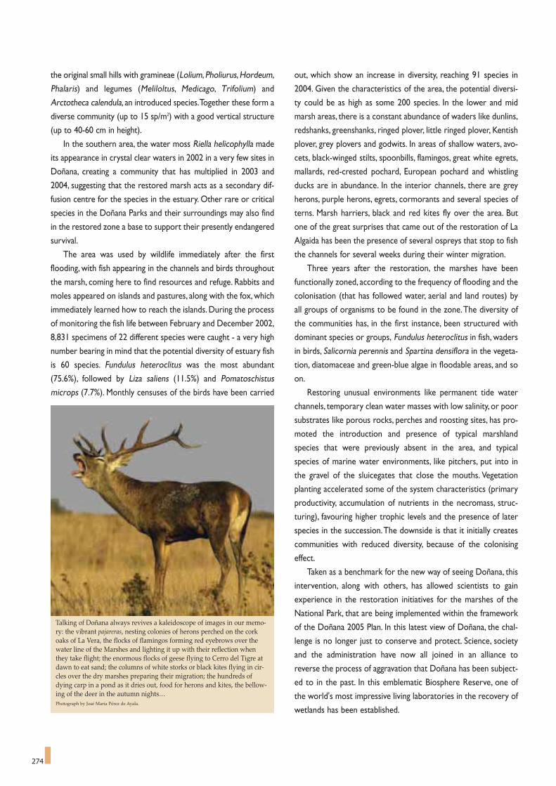
274
the original small hills with gramineae (Lolium,Pholiurus,Hordeum,
Phalaris) and legumes (Meliloltus, Medicago, Trifolium) and
Arctotheca calendula, an introduced species.Together these form a
diverse community (up to 15 sp/m2) with a good vertical structure
(up to 40-60 cm in height).
In the southern area, the water moss Riella helicophylla made
its appearance in crystal clear waters in 2002 in a very few sites in
Doñana, creating a community that has multiplied in 2003 and
2004, suggesting that the restored marsh acts as a secondary dif-
fusion centre for the species in the estuary. Other rare or critical
species in the Doñana Parks and their surroundings may also find
in the restored zone a base to support their presently endangered
survival.
The area was used by wildlife immediately after the first
flooding, with fish appearing in the channels and birds throughout
the marsh, coming here to find resources and refuge. Rabbits and
moles appeared on islands and pastures, along with the fox, which
immediately learned how to reach the islands. During the process
of monitoring the fish life between February and December 2002,
8,831 specimens of 22 different species were caught - a very high
number bearing in mind that the potential diversity of estuary fish
is 60 species. Fundulus heteroclitus was the most abundant
(75.6%), followed by Liza saliens (11.5%) and Pomatoschistus
microps (7.7%). Monthly censuses of the birds have been carried
out, which show an increase in diversity, reaching 91 species in
2004. Given the characteristics of the area, the potential diversi-
ty could be as high as some 200 species. In the lower and mid
marsh areas, there is a constant abundance of waders like dunlins,
redshanks, greenshanks, ringed plover, little ringed plover, Kentish
plover, grey plovers and godwits. In areas of shallow waters, avo-
cets, black-winged stilts, spoonbills, flamingos, great white egrets,
mallards, red-crested pochard, European pochard and whistling
ducks are in abundance. In the interior channels, there are grey
herons, purple herons, egrets, cormorants and several species of
terns. Marsh harriers, black and red kites fly over the area. But
one of the great surprises that came out of the restoration of La
Algaida has been the presence of several ospreys that stop to fish
the channels for several weeks during their winter migration.
Three years after the restoration, the marshes have been
functionally zoned, according to the frequency of flooding and the
colonisation (that has followed water, aerial and land routes) by
all groups of organisms to be found in the zone.The diversity of
the communities has, in the first instance, been structured with
dominant species or groups, Fundulus heteroclitus in fish, waders
in birds, Salicornia perennis and Spartina densiflora in the vegeta-
tion, diatomaceae and green-blue algae in floodable areas, and so
on.
Restoring unusual environments like permanent tide water
channels, temporary clean water masses with low salinity, or poor
substrates like porous rocks, perches and roosting sites, has pro-
moted the introduction and presence of typical marshland
species that were previously absent in the area, and typical
species of marine water environments, like pitchers, put into in
the gravel of the sluicegates that close the mouths. Vegetation
planting accelerated some of the system characteristics (primary
productivity, accumulation of nutrients in the necromass, struc-
turing), favouring higher trophic levels and the presence of later
species in the succession.The downside is that it initially creates
communities with reduced diversity, because of the colonising
effect.
Taken as a benchmark for the new way of seeing Doñana, this
intervention, along with others, has allowed scientists to gain
experience in the restoration initiatives for the marshes of the
National Park, that are being implemented within the framework
of the Doñana 2005 Plan. In this latest view of Doñana, the chal-
lenge is no longer just to conserve and protect. Science, society
and the administration have now all joined in an alliance to
reverse the process of aggravation that Doñana has been subject-
ed to in the past. In this emblematic Biosphere Reserve, one of
the world's most impressive living laboratories in the recovery of
wetlands has been established.
Talking of Doñana always revives a kaleidoscope of images in our memo-ry: the vibrant pajareras, nesting colonies of herons perched on the corkoaks of La Vera, the flocks of flamingos forming red eyebrows over thewater line of the Marshes and lighting it up with their reflection whenthey take flight; the enormous flocks of geese flying to Cerro del Tigre atdawn to eat sand; the columns of white storks or black kites flying in cir-cles over the dry marshes preparing their migration; the hundreds ofdying carp in a pond as it dries out, food for herons and kites, the bellow-ing of the deer in the autumn nights…Photograph by José María Pérez de Ayala.
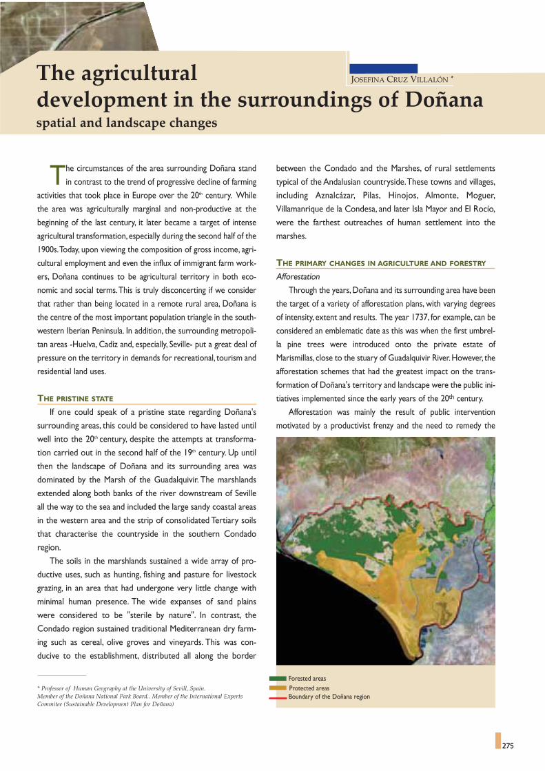
Forested areasProtected areasBoundary of the Doñana region
between the Condado and the Marshes, of rural settlements
typical of the Andalusian countryside.These towns and villages,
including Aznalcázar, Pilas, Hinojos, Almonte, Moguer,
Villamanrique de la Condesa, and later Isla Mayor and El Rocío,
were the farthest outreaches of human settlement into the
marshes.
THE PRIMARY CHANGES IN AGRICULTURE AND FORESTRY
Afforestation
Through the years, Doñana and its surrounding area have been
the target of a variety of afforestation plans, with varying degrees
of intensity, extent and results. The year 1737, for example, can be
considered an emblematic date as this was when the first umbrel-
la pine trees were introduced onto the private estate of
Marismillas, close to the stuary of Guadalquivir River.However, the
afforestation schemes that had the greatest impact on the trans-
formation of Doñana's territory and landscape were the public ini-
tiatives implemented since the early years of the 20th century.
Afforestation was mainly the result of public intervention
motivated by a productivist frenzy and the need to remedy the
275
The agriculturaldevelopment in the surroundings of Doñanaspatial and landscape changes
JOSEFINA CRUZ VILLALÓN *
275
The circumstances of the area surrounding Doñana stand
in contrast to the trend of progressive decline of farming
activities that took place in Europe over the 20th century. While
the area was agriculturally marginal and non-productive at the
beginning of the last century, it later became a target of intense
agricultural transformation, especially during the second half of the
1900s.Today, upon viewing the composition of gross income, agri-
cultural employment and even the influx of immigrant farm work-
ers, Doñana continues to be agricultural territory in both eco-
nomic and social terms.This is truly disconcerting if we consider
that rather than being located in a remote rural area, Doñana is
the centre of the most important population triangle in the south-
western Iberian Peninsula. In addition, the surrounding metropoli-
tan areas -Huelva, Cadiz and, especially, Seville- put a great deal of
pressure on the territory in demands for recreational, tourism and
residential land uses.
THE PRISTINE STATE
If one could speak of a pristine state regarding Doñana's
surrounding areas, this could be considered to have lasted until
well into the 20th century, despite the attempts at transforma-
tion carried out in the second half of the 19th century. Up until
then the landscape of Doñana and its surrounding area was
dominated by the Marsh of the Guadalquivir. The marshlands
extended along both banks of the river downstream of Seville
all the way to the sea and included the large sandy coastal areas
in the western area and the strip of consolidated Tertiary soils
that characterise the countryside in the southern Condado
region.
The soils in the marshlands sustained a wide array of pro-
ductive uses, such as hunting, fishing and pasture for livestock
grazing, in an area that had undergone very little change with
minimal human presence. The wide expanses of sand plains
were considered to be "sterile by nature". In contrast, the
Condado region sustained traditional Mediterranean dry farm-
ing such as cereal, olive groves and vineyards. This was con-
ducive to the establishment, distributed all along the border
* Professor of Human Geography at the University of Sevill,.Spain. Member of the Doñana National Park Board.. Member of the International ExpertsCommitee (Sustainable Development Plan for Doñana)

276
dearth of supply in the Spanish timber industry, and to a lesser
degree, from the need to stabilise the dunes that threatened the
towns along the south-western coast of the peninsula. Between
1904 and 1924 the Seville-Huelva District Forest Brigade carried
out an intensive transformation of nearly 17,000 hectares in the
wilds of Almonte, Hinojos and Aznalcazar. Nonetheless, the most
significant transformation took place after 1940 and was imple-
mented by the National Forest Heritage Authority.
Although they peaked in the 1950s, the activities of the
Heritage Authority lasted well into the 1970s and were not limit-
ed to afforestation, but also involved a resettlement process that
led to the construction of several forestry villages (Bodegones,
Acebuche, Abalario, Cabezudos, etc.), built to host the working
population.This is an excellent indicator of the demographic vac-
uum that existed in the area. However, these population settle-
ments neither endured nor changed the prior settlement system.
They only survive today as testimonies of the aforementioned
afforestation schemes and they might play a complementary role
in the tourist model for Doñana's surrounding areas.
Pursuing rapid growth rates of trees, the area was afforested
with eucalyptus and to a lesser extent with umbrella pines. The
current trend in public policy is to replace eucalyptus with pines
and cork oaks, in programmes aimed at environmental improve-
ment and the regeneration of native vegetation.Whereas the ini-
tial drive behind afforestation was the productive value of forests,
today greater value is placed on the role that forested areas play
in preserving Doñana's ecosystems and as buffer zones that miti-
gate human impact on the Parks and their associated landscapes.
Transformation for agricultural purposes
In following with the trend taking place in other European ter-
ritories of similar characteristics, and in the strictest sense of
"cleaning them up" and "improving" their value, since the 19th cen-
tury there have been several attempts at draining the Guadalquivir
Marshes and turning it into arable land. Nonetheless, due to a lack
of financial or technical resources, all attempts failed and the
marshes thus remained in their semi-natural state until well into
the 20th century.
Rice farming was successfully introduced in the 1920s under
private initiative on what were once the central islands of the
Guadalquivir river. The industry was bolstered by support from
the incoming authorities during the Spanish Civil War (1936-39),
after General Franco's rebel forces took the rice-producing areas
from the control of the Republican government. Currently, the
Guadalquivir rice fields comprise the largest and most productive
rice farming area in Spain, with a total surface area of about 35,000
hectares. With the exception of some that have been pumping
water from the aquifer in direct conflict with preservationist inter-
ests, most rice farmers use surface water from the Guadalquivir
River. As the farmers have increasingly taken up measures to
rationalize herbicide and pesticide use, it can be affirmed that rice
farming not only peacefully coexists with the Parks, but helps to
Agricultural production has been refocused responding to the marketdemands, being the significant expansion of citrus groves and strawberryplantations around El Rocio a good example of it. In the picture, view ofEl Rocío shrine from the Marsh.Photograph by José María Pérez de Ayala. Ceneam files.

277
sustain the population of migratory birds as well. The survival of
rice faming is conditioned by the availability of scarce water
resources, which is in turn determined by the granting of water
rights by the Guadalquivir River Basin Authority, by periodical
droughts, and by the subsidy policies of the European Union
regarding rice crops.
From the perspective of spatial development, the agricultural
colonisation of the central islands of the Guadalquivir estuary
entailed human settlement as well and the construction of farming
villages, whose original names (Alfonso XIII, Queipo de Llano,Villa
Franco del Guadalquivir) are clear indications of the historical
time period in which they were founded, the first half of 20th cen-
tury.The firmly established humanisation of this territory, directly
resulting from rice farming, became patent on an administrative
level when the village of Villa Franco del Guadalquivir, until then
administratively dependent on the town of La Puebla del Río, was
granted independent status as a municipality in 1988.Villa Franco
changed its name to Isla Mayor in 2001, with a population of over
6,000 inhabitants.
The marshes situated on the Guadalquivir's left bank were suc-
cessfully transformed into arable land as a result of a government
intervention project targeting over 70,000 hectares of which
33,000 were marshlands. Starting in 1960, the publicly funded
"Irrigation Area of the Lower Guadalquivir" project entailed the
construction of several colonisation settlements that later became
permanent.The project divided the area into geometric plots and
caused profound spatial and landscape changes. Due both to its
location on the left bank of the river and to the fact that the irri-
gation water comes from reservoirs that are external to the water
resources affecting the Parks, there is an increasing trend to disas-
sociate this area from the so-called "surroundings of Doñana".
However, it must not be forgotten that a large part of this area is
the result of the draining of ancient marshes on the left bank of
the Guadalquivir River.
On the right bank of the Guadalquivir River, and based on FAO
(Food and Agriculture Organization) reports regarding the exis-
tence of a large aquifer in the area, the Spanish government began
transforming the sandy plains of the Doñana surroundings into
irrigated farmland in 1971. The initial project intended to trans-
form a total surface area of 46,000 hectares into irrigated farm-
land, estimating that 160 hm3 could be abstracted from the aquifer.
But from its very inception, the story of the Almonte-Marismas
Irrigation Plan is a story of controversy and redesign.This was evi-
denced as Doñana Park became embattled in formal disputes on
two fronts that were interconnected to each other. The first dis-
pute focuses on water resources: the planned volumes of irriga-
tion water were reduced as knowledge of the true conditions of
the aquifer increased, leading to the conclusion that its capacity
had been initially overestimated. At the same time, the relation-
ship between water abstraction for irrigation and the lowering of
the piezometric levels inside the Parks became better understood.
Dry-farming fieldsRice fieldsAlmonte-Marismas irrigable areaOther irrigated areas
Doñana and its surrounding area have been the target of a variety ofafforestation plans. The year 1737 was when the first pine trees were intro-duced onto the private estate of Marismillas, now within the National Park.However, the afforestation schemes that had the greatest impact on thetransformation of Doñana's territory and landscape were the public initia-tives implemented in the 20th century. In the picture, prearation of a charcoalpit in Doñana. Photograph by José María Pérez de Ayala. CENEAM files.

278
The second dispute is related to the evolution of the Park's
boundaries and of the irrigated area: the larger the extension of
the Park, the greater the reduction in irrigated farmland.
Currently some 15,000 hectares are being irrigated with
groundwater, nearly 10,000 of which were transformed for agricul-
tural purposes under the Almonte-Marismas Plan, while somewhat
over 5,000 are located outside the boundaries of this scheme.
These two areas, which together consume between 55 and 60 hm3
of water per year, are in direct contact with the natural protected
areas. Agricultural production has been refocused according to
water availability - with new extensive irrigation crops and, in the
case of Villamanrique, even dry-farming - or responding to the
market demands in recent years, resulting in a significant expan-
sion of citrus groves and strawberry plantations around El Rocio.
Finally, also beginning in the 1970s, the farthest reaches of the
western sector of the National Park have undergone substantial
changes with the development of strawberry farming in areas that
up until then had been unproductive, forested or used for dry-
farming. Strawberry farming was introduced experimentally on a
private farm and owing to its high economic returns and labour
requirements spread in a very fast and uncontrolled manner.The
phenomenon has even involved illegal occupation of public land by
local landless agricultural workers (in Palos, Moguer, Lucena and
Bonares to the west of the National Park) who saw it as the solu-
tion to their depressed economic situation.
The uncontrolled occupation of public land seems to have
slowed down in recent years. For this very reason, now is the time
to undertake a public initiative aimed at reorganizing the territori-
al changes caused by the spontaneous and irregular phenomenon
of anarchic land use.This public initiative could include legal nor-
malization of land property and water abstraction rights, improv-
ing and organising rural trails and, above all, controlling the differ-
ent types of waste and pollutants that are endangering Doñana
and its heritage.
North-east of the National Park the Marshes meet the rice fields and thefarms previously dried to grow cereals. In both photographs it is possibleto see the Finca de Caracoles, included in the National Park in 2004 for itsrestoration. The above aerial photo clearly shows the outline of theTravieso channel after a period of flooding: the Marsh is claiming it back.Photograph: CENEAM files.

279
Currently the Guadalquivir rice fields outside the National Park comprise the largest and most productive rice farming area in Spain with a total surface area ofsome 35,000 hectares. Photograph: CENEAM files.


Since time immemorial domestic livestock has ranged the
Doñana Marshes under an extensive grazing system. At
present, the livestock herd is comprised of three native races: the
Doñana cattle (vaca mostrenca), the Retuertas horse (caballo de
Las Retuertas) and the Andalusian churra sheep (oveja churra lebri-
jana).The bulk of the herd is comprised of cattle and horses, which,
from several perspectives, play an important role in the area.
On the one hand, we find highly significant pre-existing histori-
cal-cultural components.There are strong indications it was from
here that the first horses and cattle were taken to the New World
in the early 16th century. In addition, every year on the 26th of June
a long-held tradition takes place, called the "saca de las yeguas"
(The Mares’ Roundup), which is one of the Spanish largest concen-
trations of equids. The horses that graze in Doñana Marsh are
herded together and then driven to the town of Almonte where
their manes and tails are trimmed and their foals are sold before
they are herded back to the countryside. Another cultural tradi-
tion closely linked to horses is the Rocio pilgrimage, which stems
from the deep devotion of the people of the surrounding towns to
Our Lady of El Rocio, a title of the Virgin Mary.Thousands of devo-
tees journey, mostly on horseback, to the village where the shrine
is located at the very edge of the Marshes.
Because they are Doñana's largest herbivores, cattle and hors-
es play an important role in marshes and dunes by modelling the
vegetation. Their presence has been an overriding factor in
Doñana's vegetation being what it is today. In addition, the way in
which they graze makes certain foodplants available to the small
herbivores (rabbits, small rodents, etc.) that are so very important
to Doñana's ecosystems given that they in turn are preyed upon by
the wide array of raptors and other carnivores.
Still, it is essential that the delicate balance between the grazing
load of the cattle and horses and the vegetation that they consume
be maintained. Care must be taken that their presence does not
endanger their own survival nor that of the other herbivores (rab-
bits, hares, geese, ducks, deer, fallow deer, and so forth) during pro-
longed droughts.The Livestock Plan recently came into force with
281
Co-existence of livestockin the Marshes of Doñana
JUÁN CALDERÓN RUBIALES *
281
* Doñana Biological Station
One of the largest concentrations of equids in Spain, a long-held tradition called the “saca de las yeguas” (The Mares' Roundup), takes place every year on the 26th
of June.Photograph by José María Pérez de Ayala.

282
the intent of achieving this balance even under the most adverse
conditions.
Another important role played by livestock is that of food for
carrion feeders, among which we find vultures, Egyptian vultures,
foxes, imperial eagles, kites, and others.These animals have an ever
more difficult task of finding places in which large herbivores are
left in the countryside when they die. Doñana is now one of the
few natural feeding grounds for vultures, for whom fallen livestock
is the main source of food.
The particular manner in which livestock exploitation is carried
out in Doñana has created a remarkably close bond between the
inhabitants of the surrounding area and the protected area. In fact,
it has led many nature-loving livestock breeders to become fre-
quent visitors of Doñana, creating an emotional bond with the area
at the same time it affords them financial benefits. Nonetheless,
social benefits constitute the primary value that the National Park
obtains from livestock. Maintaining this, without increasing the
upsetting movement of people carrying out these activities within
the park, is the main challenge of the Livestock Plan, which is the
result of consensus between management and livestock breeders
associations in the surrounding area.
On the other hand, recent analyses are starting to reveal that
Doñana cattle and the Retuertas horse have genetic singularities
worthy of preservation. It would not be surprising to discover that
limited human intervention in selection processes has given rise to
two races that are superbly adapted to the environment with a high
degree of genetic richness. Confirmation of preliminary impres-
sions would afford further biodiversity, in this case to domestic ani-
mals, to Doñana's already privileged domain of biological variety.
Doñana cattle (vaca mostrenca) present genetic singularities worthy of preservation.Photograph by José María Pérez de Ayala.
It is essential that the delicate balance between the grazing load ofthe cattle and horses and the vegetation that they consume bemaintained, avoiding possible impacts on the complex marshsystem.Photograph by José María Pérez de Ayala.

"...the land is used exclusively for hunting, it is unsuitable for agri-
culture and is permanently and on the most part comprised of dunes
and unhealthy marshes"
Executive Decree, September 3, 1941 (BOE 265 of 22 September)
Until just a few years ago, the landscape of Doñana National
Park stood in stark contrast to the panorama viewed
upon crossing its western boundaries.The idyllic landscape of the
famous protected area gave way to a bleak territory; an immense
space, mostly arid but covered by monotonously endless eucalyp-
tus plantations at its most northerly reaches, and by rickety pine
trees in the areas nearest the coast.The area presented numerous
ponds and dry washes covered over with a tapestry of eucalyptus
leaves, ghost villages and an endless array of paths that led
nowhere.
Although the area targeted for restoration lay within the
Natural Park, for reasons of landscape coherence the team of
botanists conducting the restoration expanded the study area
beyond the limits of the Protected Area26. Specifically, a surface area
of nearly 25,000 hectares (Figure 1) was included, enclosed
between the Rocina stream (northern boundary), Castilla Beach
(southern boundary), the C-445 motorway (eastern boundary) and
the wildlands known as “Montes Propios de Moguer” (western
boundary).
Apart from climate factors and focusing on the physical medi-
um, the area presented two basic features that characterised the
landscape. In the first place, the substrate was very poor, comprised
mostly of sandy sediments of relatively recent origin (from the
Quaternary eolian mantle), a product of the successive appearance
of a number of dune fronts. Secondly, the very low relief of the area,
which is altered only by the presence of the Asperillo sand cliff to
the south, with elevations exceeding 100 metres.
THE LANDSCAPE IN 1993The study zone had undergone little change in recent decades.
Preliminary surveys clearly revealed the difficulties to be overcome
in interpreting the vegetation cover of the landscapes, which had
been so highly modified as a consequence of afforestation activities
that the organisational pattern of autochthonous vegetation could
not be clearly established.
Broadly speaking, the zone's vegetation cover could be divided
into two well-differentiated parts (Figure 2):
- The northern half and the pond complex, where the soils were
moister and the ancient pond basins were occupied by huge
masses of dense eucalyptus groves that in many places had
grown spontaneously from seeds.
- The southern half, which was comprised of the area with the
lowest soil moisture, was populated with often stunted pine
trees which in many places afforded minimal cover.
The native vegetation had been reduced to poor ephemeral
pastures and open and occasionally sparse scrubland, correspon-
ding to the subserial stages of the former native forests.
Additionally, although a few ponds formed following the rainy sea-
son, there was virtually no aquatic vegetation owing to the basins
being occupied by the eucalyptus trees and to the effects of the ter-
penic compounds from their leaves (Figure 2).
Among the difficulties encountered in analysing the vegetation
cover, as there were not sufficient samples of either palustrine or
land vegetation, the team of botanists decided to combine tradition-
al techniques of floristic (plant survey and collection) and vegetation
283
Reconstruction of the Abalario landscapea referent model for environmental restoration in Doñana
PABLO GARCÍA MURILLO *
283
* University of Seville.
FIGURE 1Setting of the study area.
National ParkNature ParkLimits of the study area

284
(transects surveying and analysis of aerial photography and satellite
imagery studies) with techniques more in line with history and
geography disciplines, such as the search for documents offering
information on the area's landscape in the past, testimony from for-
mer inhabitants, studies of land use, toponymy and study of the sur-
face hydrology.
With the information gathered via both channels, the group was
able to sectorise the space according to natural vegetation types.
The different plant communities observed were grouped into vege-
tation units. In most cases the units were related to the most promi-
nent woody communities and usually included various communities
that were identified following phytosociological methods, with the
purpose of facilitating comparisons to other studies.A summary of
the recognised units can be found in Table 1. In addition, bearing in
mind how environmental factors and afforestation had influenced
the vegetation, functional models of the acknowledged vegetation
units were elaborated in relation to different environmental param-
eters. The conclusion was that the most influential factors in the
organisation of the different plant communities of the zone were,
apart from afforestation activities, soil moisture and time.
Data from a diachronic study of aerial photographs (from over-
flights in 1946, 1956 and 1987), as well as satellite images from
Landsat TM (1986 and 1990) and Spot (1989) were then added to
the results obtained in the vegetation study.The maps enabled sur-
face area measurements of the recognised vegetation units and the
afforested zone (Table 2) to be taken, thus enabling the magnitude
of change to be quantified.
Through the analysis of aerial pictures, it was possible to note
important changes in the surface drainage network as well as in the
surface area associated to the wetlands. In the same way, in order to
obtain a better perspective on the changes, diverse historical maps
were used together with current maps to carry out an exhaustive
toponymic study that proved to be highly useful in the landscape
analysis19,29. Once compiled, the data were used to draw up an array
of thematic maps among which we highlight those of vegetation,
afforested areas, surface drainage and the evolution of the surface
areas of the ponds (Figure 3).
HISTORY OF THE LANDSCAPE AND ITS ECOLOGY
Finally, with the information that had been compiled, the
changes that had taken place in the Abalario were reconstructed
from a chronological viewpoint following the evolution of its land-
scape.The result was the identification of three well-defined stages,
each with a vegetation cover clearly distinguishable from the oth-
ers and reflecting the different land uses of the zone: Stage 1 (17th
century?-1930), Stage 2 (1940-1970) and Stage 3 (1993-2005).
Stage 1 (17th century?-1930)
This period was characterised by a landscape with little human
intervention in which the vegetation cover presented maximum
complexity.This was possible owing to the marginal nature of the
lands as its soil was not suitable for agriculture, not good for live-
stock and situated in an area that was seasonally flooded and con-
FIGURE 2Eucalyptus forest plantations in the northernzone
View of the village and surroundings of theAbalario, where the umbrella pine plantationsand the masses of eucalyptus trees can beobserved around the ponds.
Eucalyptus in the Ribatehilos ponds.
LANDSCAPES OF ABALARIO IN 1993
MAP OF LAND USES IN 1987
FIGURE 3
Preliminary surveys clearly revealed the difficulties in interpreting thevegetation cover, which had been so highly modified as a consequence ofafforestation that the patterns of native vegetation could not be clearlyestablished.

285
sidered to be a focus of malaria. Due to this, human settlements in
the zone of study were very few and isolated and roads were
practically non-existent.This stage corresponds to the periods of
communal ownership (18th and 19th centuries) and private owner-
ship (1855-1940).The vegetation landscape during this period was
articulated around three distinct formations:
Sclerophyllous woodlands: situated in the areas with moist soil
and comprised of cork oaks and wild olive trees, with irregular
cover; abundant lianas and a quite diverse and developed array of
woody strips located in the northern half of the territory.
Psammophilous communities: Located on the most sterile sub-
strates, mobile and with a very low degree of moisture in the soil;
cover was minimal and the mature communities were charac-
terised by the presence of Phoenician juniper (Juniperus
phoenicea subsp. turbinata), accompanied by xerophytic scrub
such as Halimium halimifolium and gorse (Stauracanthus genis-
toides). Broadly speaking, their location corresponded to the area
forested with pine groves.
Pond and palustrine formations: undoubtedly the wide scattering
of ponds is one of the most unique features of the Abalario land-
scape.Together with the cork oak groves, the pond and palustrine
formations were the landscapes most damaged by human inter-
vention in the following stage.Among the diverse types of palus-
trine environment that were present in the zone, especially rele-
vant were the peat bogs, that were extremely abundant during this
period but are today restricted to an very reduced surface area
(Figure 4).
Stage 2 (1940-1970)
This stage, coinciding with the period of widespread afforestation,
underwent the most considerable amount of change.As a result of
the dearth of raw materials following the Spanish Civil War (1936-
1939), a new model of intensive environmental exploitation was
tested and put into practice. Immediately following the declaration
of southwest Huelva as a Region of National Interest in 1941, fast-
growth forest plantations were tested and developed by the
Patrimonio Forestal del Estado (National Forest Heritage
Authority) and these marginal "wastelands" were turned into a
model, both in Spain and abroad, for forestry actions.The activities
were overseen by the chief engineer of the Huelva Forest Brigade,
Gaspar de la Lama Gutierrez, whose imposing personality pervad-
ed his colossal task.
De la Lama, who began by following the directives of the 5th
Forest Hydrology Division, radically changed his forestry policies
when he became deeply impressed by the 1930s Coto Cabezudos
(to the north of the territory) operations of the Dutch company
Handelmaastchppij Ibérica, owners of the Forestal de Villarejos
company, and with their fast-growth tree plantation experience in
Indonesia.He saw in the eucalyptus plantations a solution to Spain's
dearth of national products, and as a source of products for which
there was a strong national and international demand (pulp for
paper, essential oil, wood for timber, etc.). He therefore ordered a
massive reforestation of these trees, primarily Eucalyptus globulus
and E. camaldulensis, and built the network of infrastructures
(roads, villages, work shops, tree nurseries, and so forth) required
for their exploitation.
By the late sixties, the forest plantations covered most of the
Department of Forest Resources lands, 24,316 hectares (Table 2);
most of the ponds had been targeted for the task and the
autochthonous woody vegetation had been virtually eliminated.
Stage 3 (1993-2005)
There was a fall in the yield of the plantations after the seventies.
Advanced age, a plague of Phoracantha beetle, low timber prices
and a rise in maintenance costs caused a plunge in the high market
value that had characterised the territory. At the same time, the
rise of environmental ideology led to an increasing trend towards
EVOLUTION OF THE PEAT BOGS (1956-1987)
FIGURE 4The high number of scattered ponds was undoubtedly one of the singularelements of the Abalario landscape.

286
Native vegetation types in 1993
TABLE 1
FIGURE 5The Ribatehilos peat bog is an exceptional example of the successful restoration work conducted at the Abalario ponds.Photograph by Antonio Sabater.
UNIT CHARACTERISTIC COMMUNITIES LOCATION
Intertidal zone Cakilion aegyptiacae-Ammophilion australis Sandy coasts.Semi-stable coastal sand-dunes Rubio longifoliae-Coremetum albi Elevated parts of the sand-dunes.Phoenician juniper groves Osirio quadripartitae-Juniperetum turbinatae Base of the coastal dune range.Abalario scrubland Halimio halimifolii-Stauranthetum genistoidis Found between the Phoenician juniper grove,
& Erico scopariae-Ulicetum australis strawberry tree and western scrubland units.Western scrublands Halimio commutati-Cistetum libanotis Western zone.Peat bogs Erico ciliaris-Ulicetum (minoris) lusitanicus Center of the zone,
in places called Ribatehilos and Peladillo.Lowland scrub Erico scopariae-Ulicetum australis & Lonicero hispanicae-Rubetum ulmifoliae North to the zone of study.Atlantic streams Lonicero hispanicae-Rubetum ulmifoliae & Viti viniferae-Salicetum atrocinereae Streams crossing the sandbanks.Strawberry tree (Arbutus) groves Phyllireo angustifoliae-Arbutetum unedonis Bordering the most southern reaches
of the peat bogs.
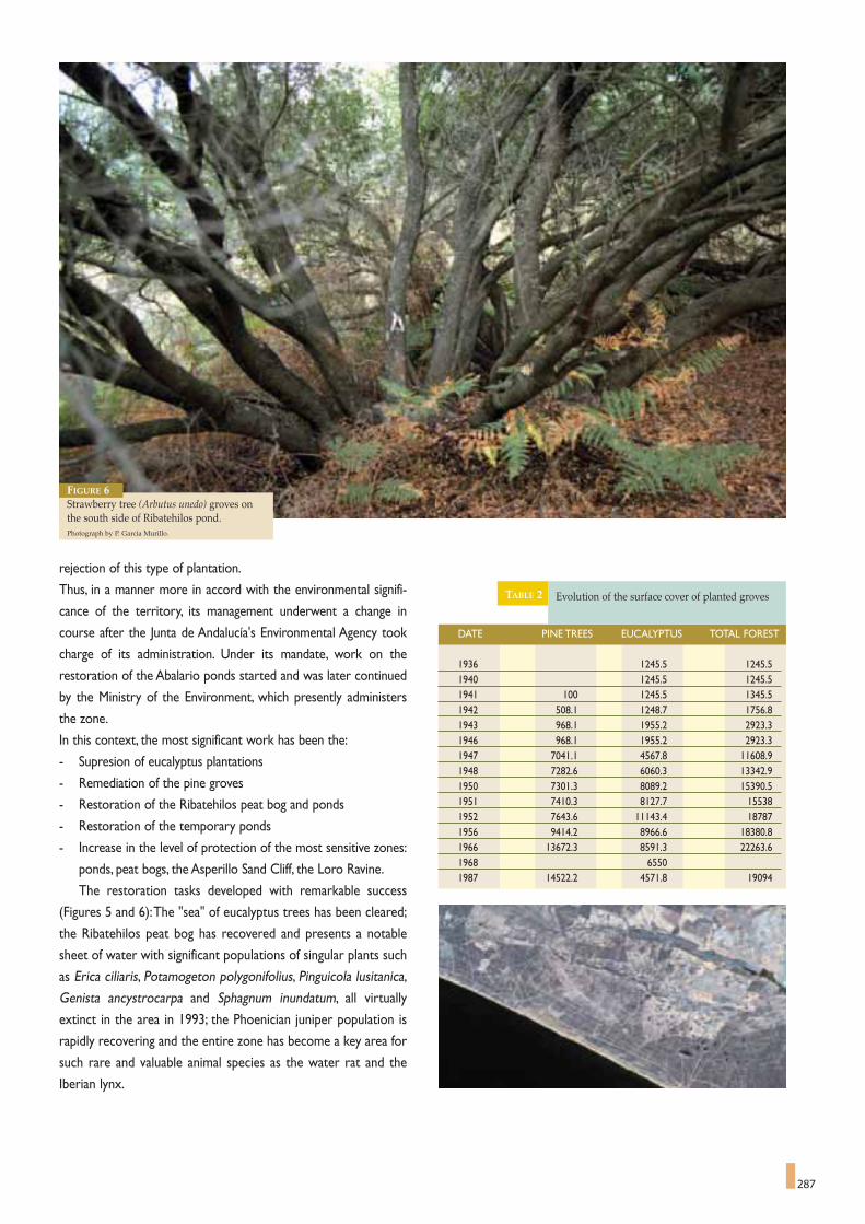
287
rejection of this type of plantation.
Thus, in a manner more in accord with the environmental signifi-
cance of the territory, its management underwent a change in
course after the Junta de Andalucía's Environmental Agency took
charge of its administration. Under its mandate, work on the
restoration of the Abalario ponds started and was later continued
by the Ministry of the Environment, which presently administers
the zone.
In this context, the most significant work has been the:
- Supresion of eucalyptus plantations
- Remediation of the pine groves
- Restoration of the Ribatehilos peat bog and ponds
- Restoration of the temporary ponds
- Increase in the level of protection of the most sensitive zones:
ponds, peat bogs, the Asperillo Sand Cliff, the Loro Ravine.
The restoration tasks developed with remarkable success
(Figures 5 and 6):The "sea" of eucalyptus trees has been cleared;
the Ribatehilos peat bog has recovered and presents a notable
sheet of water with significant populations of singular plants such
as Erica ciliaris, Potamogeton polygonifolius, Pinguicola lusitanica,
Genista ancystrocarpa and Sphagnum inundatum, all virtually
extinct in the area in 1993; the Phoenician juniper population is
rapidly recovering and the entire zone has become a key area for
such rare and valuable animal species as the water rat and the
Iberian lynx.
DATE PINE TREES EUCALYPTUS TOTAL FOREST
1936 1245.5 1245.51940 1245.5 1245.51941 100 1245.5 1345.51942 508.1 1248.7 1756.81943 968.1 1955.2 2923.31946 968.1 1955.2 2923.31947 7041.1 4567.8 11608.91948 7282.6 6060.3 13342.91950 7301.3 8089.2 15390.51951 7410.3 8127.7 155381952 7643.6 11143.4 187871956 9414.2 8966.6 18380.81966 13672.3 8591.3 22263.61968 65501987 14522.2 4571.8 19094
Evolution of the surface cover of planted groves TABLE 2
FIGURE 6Strawberry tree (Arbutus unedo) groves onthe south side of Ribatehilos pond.Photograph by P. García Murillo.


remediate the metal pollution, but this was not the final objective.
Advantages can arise from crises, as they drive change and create
opportunities. And that is exactly what was done, going beyond
merely recovering the sludge and abating impacts.An integral man-
agement project was implemented for the entire basin, allowing the
ecosystems that had been destroyed by the mine spill to be
restored, and helping to regain the basin's function as an ecological
corridor between Sierra Morena ranges to the North and the
Doñana coastal plains to the South.This also helped restoring eco-
nomic activaties in the area, improving the quality of life of the
inhabitants of the basin.
The Action Plan known as The Guadiamar Green Corridor
Strategy was designed as a Demonstration Project that could be
applied to other areas of Andalusia and the Mediterranean. The
project highlighted the fact that maintaining the functionality of the
ecosystems of Guadiamar basin, due to its relations with Doñana,
was compatible with meeting the economic demands for attaining
a good living standard for its inhabitants. In the end, the aim was to
break away from the traditional sectorial and water-tight approach-
es to tackling environmental problems, moving towards a new style
289
The Guadiamar Green Corridora research programme, example of science's social responsibility.
CARLOS MONTES *, FRANCISCO BORJA **
289
* Inter-University Department of Ecology. Autonomous University of Madrid, Spain.** Department of History II (Area of Geography) University of Huelva, Spain.
The fact that researchers and managers, and sometimes NGOs like ADENA/WWF, have worked together has been essential for the general success of the GreenCorridor project, both in controlling pollution and in the functional restoration of its ecosystems.Photograph by Antonio Sabater.
The greatest ecological catastrophe seen to date in
Andalusia happened in April 1998. Six million cubic metres
of pyrites sludge and acid waters from a mine tailings repository in
the Boliden mines of Aznalcollar spilled into the River Guadiamar.
The mines were located in the middle of Guadiamar River, a tribu-
tary of Guadalquivir River, which fed water to some of Doñana
Marshes.As a consequence of the mine spill that contained a high
concentration of heavy metals, a 62 km stretch of the river, as far
as Doñana National Park, was polluted with mine tailings, covering
a surface of 4,634 ha of the water course, alluvial plain and the
Entremuros Marsh.
The Urgent Measures Plan designed by national and regional
environmental authorities was implemented, basically aimed at
removing the sludge and treating the polluted waters.The Regional
Environment Authority of Andalusia started implementing a project
called the Guadiamar Green Corridor as a long term response to
the Aznalcollar catastrophe. The top priority objective was to

290
of management based on inter-disciplinary scientific knowledge,
education, environmental training and environmental sustainability.
Thus, the project was designed, right from the beginning, as a
test bed to put into practise advanced procedures and strategies
concerning the integral management of ecological-economic sys-
tems. From this viewpoint, and given the complexity of the original
problem, it was understood that the Project should be developed
on the basis of a wide multi-disciplinary scientific knowledge of the
natural and human systems of the Guadiamar basin. Hence, the
Guadiamar Green Corridor Research Programme (PICOVER, its
acronym in Spanish) was created in 1999, and implemented in two
stages: PICOVER-I (1999-2001) and PICOVER-II (2002-2003).
The PICOVER programme, with a budget of almost six million
Euros, was the largest multi-disciplinary research programme that
has ever been set up in Spain to address an environmental prob-
lem. Nearly three hundred scientists from all the universities in
Andalusia and many of the Higher Spanish Scientific Research
Council Centres covering a broad spectrum of fields from natural
sciences, social and health sciences, technology, etc., have been
incorporated. They have provided know-how to develop the differ-
ent lines of action included in the Green Corridor Strategy, reduc-
ing the room for uncertainty and developing Management
approach. Scientific and technological research then became one of
the basic traits highlighting the Green Corridor Project. In this con-
text scientists, government experts and environmental NGO’s
worked together, sharing responsibilities and easing decision mak-
ing with regard to the management of a territory in crisis.
The PICOVER succeeded in avoiding the dialectics that con-
fronts the world of science to the world of management, that has
separated them, each going his own way, when they possess com-
plementary languages that enable us to discover and interpret
nature and its relations with human beings. Science and manage-
ment are are two different worlds that are trying to answer the
same questions, but, unfortunately, the world of science and the
world of management have organised separate living and learning
spaces that have caused us to loose our global view.
With the Green Corridor and its Research Programme, an
attempt has been made to lay the first stone for the foundations of
a genuine scenario of a scientific-technical mix in addressing the
mine spill. A forum for discussion and debate in which managers,
government experts and researchers from a range of professional
fields, languages and expertise have worked together in a search for
integrated knowledge, planning and management models that will
pave the way for the environmental sustainability.A merger, a com-
bination of science and regional management, has been promoted
to generate an idea of the two concepts as expressions of a uni-
quereality, rather than as different realities.
Science with a conscience and committed management have
much to offer and to share,with regard to how to address environ-
mental problems and how to tackle them in a society like today's
society, subject to fast, profound and globalising changes for which
most of society's institutions are not ready. Dialogue on this issue
has to act as a catalyst for creating a new, integral and integrating
environmental discourse like the discourse initiated with the Green
Corridor.The PICOVER programme has attempted to show how
the scientific and management discourses are complementary for
addressing the Aznalcollar catastrophe and to pave the way
towards the best possible sustainability model for the affected area.
It has been essential for researchers and managers to work
together, and sometimes with NGOs like ADENA/WWF too, for
the Green Corridor project to be successful in both controlling
pollution and in attaining the functional restoration of its ecosys-
tems. It is true that dialogue between research and management is
easier at times of crisis and that the acid test for this combination
lies in what relations are like during times of "environmental
peace". Obviously, the aim must be to promote science to avoid,
rather than solve catastrophes.That is, we must promote a preven-
tative, rather than a curative Science, one that is above a science of
environmental crises or disasters.
Several lessons can be learned from the five years that
researchers and managers have been working together, to act as a
foundation for future projects:
Lesson 1. Scientific know-how has to be present from the beginning
and at all stages of the design and development of management
projects and programmes, and not an element to be brought on
board at a later stage, once these programmes have been elaborat-
ed, as happens so often.
One of the greatest ecological disasters to occur in Spain happened inApril 1998: six million cubic metres of pyrite sludge and acid waters fromBoliden mines in Aznalcollar (Seville) spilled into the River Guadiamar,reaching the very boundaries of the National Park.Photograph by Antonio Sabater.

291
Lesson 2. Given the complexity involved in solving environmental
problems, they usually have to be addressed from an inter-discipli-
nary point of view, including the areas of natural, social and techno-
logical sciences.
Lesson 3. It is essential to have a conceptual reference for provid-
ing meaning to these projects and to provide a common thread
running through all the actions included in a project. In this sense,
every attempt must be made to avoid projects drawn up as a cat-
alogue or a mere list of more or less independent and insufficient-
ly articulated actions.
Lesson 4. It is essential to translate the results of the research into
specific management proposals, couched in simple and direct lan-
guage.
Lesson 5. It is important to adjust the times of research to those
of the development of technical projects.That is, we must try to
harmonise the co-ordination to avoid the pressures of urgency
generated by management and the knowledge generated by scien-
tific research.
Lesson 6. Given the uncertainty inherent in management pro-
grammes, especially programmes related to Mediterranean ecosys-
tems, it is essential to have the funds to finance long term research.
Once the PICOVER programme finalised in 2003, the Regional
Environmental Authority of Andalusia started a new research pro-
gramme for implementing the Eco-Regional Monitoring Plan for
the Green Corridor (SECOVER, its acronym in Spanish).This new
Plan focuses on evaluating the socio-ecological state and the ten-
dencies to change that have started in the Gudiamar ecological-
economic system as a consequence of the major direct and indi-
rect interventions that have taken place in the course of recent
years, either to their natural or man-made systems, through the
application of the Guadiamar Green Corridor Strategy. One of the
aims of the new Research Programme is to provide continued sup-
port for a dialogue between scientists and managers, creating an
inter-disciplinary space for discussion, opinions and decisions, to
move forward in designing specific future projects that will mobilise
public awareness to promote a scientific culture that will enable us
to understand the social role played by science in general and
demonstration programmes like the Guadiamar Green Corridor, in
particular. In other words, we need a civic Science, rather than a
selfish Science that locks up scientists in their research laborato-
The aim of the Green Corridor of River Guadiamar and its Research Programme (1999-2003) has been to lay the foundations of a mixed scenario of scientific andtechnical approaches. A forum for discussion and debate in which managers, government experts and researchers from different professional areas, languages andexpertise have worked together in the search for integrated knowledge, planning and management models to pave the way towards environmental sustainability forthe area.Photograph by Antonio Sabater.

292
ries, totally isolated from the problems and concerns of society.
As a final thought, the PICOVER programme has attempted to
develop a new way of addressing large scale environmental prob-
lems like the Aznalcollar crisis. The new approach has turned its
back on the mechanistic scientific approach that promotes a secto-
rial, compartmentalised and over analytic approach, to move
towards a holistic, mixed, preventative, civic, scientific approach,
aimed at solving environmental problems. A science that accepts
uncertainty, the unpredictable, the undetermined, i.e. nature in all its
complexity. From gauges to clouds, as Karl Popper used to say.
Anyone taking an interest in what has been done in the last five
years, in the conceptual and methodological context of the Green
Corridor Project, will most probably find few definite, complete
and final answers to their initial questions. But, we hope and trust
that, once they have finished examining what has been done, that
they will ask new questions that will stimulate and challenge their
creativity and that will motivate them to participate actively in
developing the current project and apply its best aspects and expe-
riences elsewhere. Should this happen, then the adventure of the
Guadiamar Green Corridor and its Research Programme has been
worth while.The important thing is the journey…
The GuadiamarRiver GreenCorridor project isa creative responseto the Aznalcollarmine spill of 1988.It went beyond theclean up of thesludge from theriver bed to theintegral manage-ment of the basinstrip to restore theecosystemsdestroyed by themine spill and torecover its functionas an ecologicalcorridor betweenSierra Morena andthe coastal plainsof Doñana. The leftpicture shows amosaic of aerialphotographs of theGuadiamar GreenCorridor, taken inApril 1998, August1998 and January1999.The dark shadowof pirite sludge isvery noticeable inthe April picture.After a strenuouseffort, the area wasagain clean byJanuary 1999.Photograph:Junta de Andalucía.

THE WEIGHT OF EIGHT CENTURIES OF HISTORY
Time and time again, many authors have suggested that one of
the keys to the excellent degree of conservation of Doñana was
the fact that so little of the land has been shared out in the last
eight centuries, apart from the unhealthy conditions and the isola-
tion that reigned over Doñana during this long period. The idea has
a certain logic, although it sometimes provides support for the the-
ory of a virgin Doñana, cut off from its surroundings and from the
action of man, which bears little relation to reality. The works of F.
García Novo,V. Granados, J. Casas, J. F. Ojeda and many others have
made it perfectly clear that everything, or almost everything, has
been affected by man in Doñana and that the changes in the lands-
cape until it attained its present appearance, run in parallel with
293
Doñana and its district,on the same path.
ALBERTO RUIZ DE LARRAMENDI *
293
There are few simpler things in Doñana than the region in
terms of municipal districts and the distribution of the
ownership of the land among a handful of proprietors.These cir-
cumstances date back at least to the year 1293, when the Crown,
embodied in the figure of King Sancho IV, know as “the Brave”,
granted these lands, then belonging to the County of Niebla, to
Don Alfonso Perez de Guzman surnamed "El Bueno", the good, a
concession that was truly made effective for his son,Alonso Perez
de Guzman, by King Ferdinand IV in 1309. Most of traditional
Doñana lands have belonged to a very small group of families ever
since, apart from the local authorities of the municipal districts of
Hinojos and Almonte.
* Director of Doñana National Park.
It is practically impossible to guarantee the functional viability of large areas of land if the ownership is fragmented and their management is based on criteriaother than the conservation of their natural assets. In the picture, a flock of avocets flying over the Marshes.Photograph by Jose Maria Perez de Ayala.

294
human intervention in a wide variety of forms. Does this all mean
that nothing is original in Doñana? Does the fact that it has lost its
virginity mean that its ecosystems are worth any less? Or that
there is something wrong with its state of conservation? Not at all.
We must not get into discussions that have very little to do with
the idea of a permanent human presence in Doñana and, moreo-
ver,which do not fit easily into the framework of the analysis of the
Mediterranean ecosystems, which have suffered the intervention of
man throughout their history.
Returning to the idea of the concentration of the ownership of
Doñana over the centuries, there are records that show that, his-
torically, there have been endless episodes of tension among the
inhabitants of the neighbouring towns, as they sought to appropria-
te lands that they felt they had the a right to as they had exploited
them for so long.The aim of this contribution is not to analyse pro-
blems caused by these ambitions, although a general overview
would be appropriate: The municipal ownership of properties of
Almonte in Doñana were based on a one hundred and fifty year
conflict between the Council and the Duchy over the ownership of
the lands in question, while Hinojos would support its claim to
ownership of the Marsh of Hinojos with another court case in
1961, in this case a suit brought against the public administration.
Livestock - and other traditional resources - has been another of
the recurring points of confrontation since at least 1628, with the
latest episode in this long running battle, being the livestock inva-
sion of 1993. In short, isolation of the ownership of the land in
comparison with the social environment in which Doñana is sub-
merged, has historically provoked a long series of tensions and pro-
blems of very different kinds, maintaining a flank or perennial con-
frontation between Doñana and its inhabitants throughout this
time.
A NEW SCENARIO,THE DE-PRIVATISATION OF THE LAND.
The conservationist history of Doñana starts in the year 1964,
when the State bought the lands of the current Biological Reserve
from the Marquis of Merito. Five years later, by 1969, the National
Park was constituted, with just over 35,000 hectares and the
forestry administration that managed the area made perfectly
clear their wish to buy any properties that may come on the mar-
ket.This policy has been maintained and practically all the land in
question has now been de-privatised. In fact the Gonzalez family,
the historic owners and earliest advocates for Doñana conserva-
tion, is currently the only private landowner, holding a few small
properties. The logic behind this de-privatisation was overwhel-
ming, based squarely on the recommendations of the international
The value of the traditional uses of the land is not limited to their quantitative importance, high in itself. It is founded on a deep rooted historic base. For exam-ple, La Saca de las Yeguas (Doñana Mares' Roundup), the leading exponent of horse breeding activity in the region, celebrated its five hundredth anniversary in2004.Photograph: CENEAM Files.

295
conservation doctrine for National Parks. It is practically impossi-
ble to guarantee the functional viability of large areas of land if
ownership is fragmented and management is based on objectives
other than the conservation of their natural assets; even in these
conditions, conservation is a difficult and, above all, costly task.
Doñana is a luxury and, as such, it must be paid for. Imagine what
it would cost if the land was in private hands, or subject to the
principles of profitability!
DOES DOÑANA BELONG TO EVERYBODY?But we run a risk. Doñana is a singularly fragile and accessible
environment - in fact, with a 4 whhel drive vehicle, you can drive
round the National Park twice in a morning -, so any conservation
caution is justified. If the transition of the land from private to
government hands is not done cleanly, the local inhabitants may not
see any difference, generating a risk that the society of the area
around the Park may think that nothing has changed, that, in fact, it
is six of one and half a dozen of the other. This situation would
maintain the deep divide between the Park and the social environ-
ment it is situated in, undoubtedly generating a confrontational
dynamic that would be incompatible with conserving the assets of
this space. This is a hypothetical situation that is not desired by
anyone and to prevent it from happening, the directors of the
National Park have to practise a clear, transparent and participati-
ve management. Now more than ever, it is a question of persuading
and finding allies.The more people and groups that are interested
in the conservation of Doñana, the better. In the district, Doñana
should be considered as a collective mission under the auspices of
sustainable development.Doñana has to be seen as a common inte-
rest of almost all, so that we all have something to gain in the mid
and long term if the area maintains its vital pulse and its privileged
position in the international context.
However, how can we attain a change in attitude of the magni-
tude required in the social environment of Doñana? As we have
said before, in Doñana, we are fighting against a historic view that
has prevailed for the last eight centuries. How can we get the inha-
bitants of the district to appreciate Doñana as a part of their world,
as something to be proud of and a source of welfare for each and
every one of them?
There is no single answer to this question, as no single line of
action can obtain the desired result.The search for the right rela-
tion between Doñana and its District should be a constant in all
policies developed in the National Park.We need to be well aware
that we are not talking about a third party, with nothing to do with
the Park, that requires an enhanced level of communication. This
approach is wrong, despite the fact that it can sometimes lead to
gestures that take us forward along the right path. It is not a ques-
tion of sponsoring sporadic relations or an encounter between
Park and District. First of all, we need to ensure fluid communica-
tions and a degree of participation in the management that will
trace an unequivocal path of mutual trust and the conviction by all
parties concerned that without close co-operation, we will not
make it. As with marriages in the past, a bunch of flowers from time
to time makes life easier and adds beauty to the relationship, but
the evolution of centuries of history in common is something far
deeper, something that should come to the fore in each of the
thousand situations and problems that arise every day.
FINDING THE WAY AS WE GO
Despite the above hindrances, if we want the discourse to
translate into specific results, it is essential to develop well articu-
lated lines of work, taking a mid and a long term view. In this sense,
the National Park, together with the main stake-holders of the
District, headed by the local authorities, is developing a battery of
lines, which, at times, may appear to be heading in different direc-
tions, but at a closer look will show that they are merely different
manners of addressing the same objective. Below is a summary of
the content of these lines of work and how they affect relations
between the Park and the District.
Environmental education is the principle line of work, aimed
mainly at young people, but also dealing with singular groups of
adults. In the case of the former, the objective is that every child of
the District has at least two formal contacts with the National Park
in the course of his formal education, articulated around six diffe-
rent activities under the umbrella of the Doñana-Surroundings
Programme. Such an ambitious objective translates into high annual
Developing different sectorial policies for traditional uses is one of themain planks of the joint work with the District. For example, the totalnumber of livestock breeders in Almonte and Hinojos is over 600, makingthem the largest group with a direct interest in the National Park. By thesame token, collecting coquina shells, a local clam considered as a delicacyin the region, creates jobs for nearly two hundred people, while bee-kee-ping is becoming increasingly profitable. In the picture, traditional handcollection of coquina clams on the beaches of the National Park.Photograph by Cipriano Marín.

296
numbers of young people participating in the scheduled tasks:
around 3,500 students per year and over 500 teachers.When these
figures are multiplied for the more than ten years that the
Programme has been running, the magnitude of the work done can
be appreciated. This work is already bearing fruit; young people,
new blood, are the best guarantee for the future of Doñana.
In the case of the adults, there are three different programmes
that bring in two thousand, five hundred people a year to Doñana
National Parks, from the municipal districts in which Doñana is
situated. It is striking to see that this Programme is often providing
people of an advanced age with their first chance to discover
Doñana first hand. In reality, more is said about Doñana than is
known from experience.
The new Use and Management Master Plan goes even further
along this road. The previous document established that the
National Park should have information points in the towns of the
districts covered by the Park. This objective has been attained in
one case, and it is about to be attained in two others. However, the
new planning instrument establishes that the area of Relations with
the District Surrounding the Park should be located physically in
Almonte, the largest settlement ariound the Parks, reinforcing com-
mon lines of work and bringing the reality of the Park to the peo-
ple of the District.
The subsidies offered by the National Park as a contribution to
the sustainable development of the municipal districts involved are
another important tool to work with.At this time, these subsidies
represent an annual budget of 800,000 Euros for Doñana, paid
directly to a selection of projects presented by councils, non-profit
making associations or individuals. If we do not wish to empty the
essence of these subsidies of their meaning and content, we must
not forget that they are designed to help projects that can contri-
bute to the sustainable development of the District, and by no
means as mere compensation for hypothetical loss of earnings.This
second path is difficult to justify - as said losses are real and the
The 1978 National Park Reclassification Act was a pioneer in the field of Conservation. Concepts that are now familiar to us - like peripheral protection zones,Master Plans and Park Boards - first appeared in Spain on this occasion. Moreover, it was the precursor of an essential aspect in the current concept of sustaina-ble development: the need to drive active employment policies to off-set any possible limitations that the area could generate. In the picture, umbrella pine treesbacklit by the sunset.Photograph by José María Pérez de Ayala.

297
benefits are not usually quantified - and, in any event, they would
not create any satisfaction in the District, which would rapidly
become accustomed to contributions that would always be consi-
dered insufficient.
Developing the different sectorial policies for traditional uses is
one of the main planks of working together with the District. Some
figures will help to illustrate their importance: the total number of
livestock breeders in Almonte and Hinojos is over six hundred,
making them the largest group with a direct interest in the Park. In
the same way, collecting coquina shells, a local clam considered as
a delicacy in the region, provides work for 170 people, while bee-
keeping is becoming increasingly profitable. One challenge that
remains to be met is to apply the criteria of organic production to
these cottage industries, including the collection of pine nuts.
The importance of traditional farming and gathering industries
is not limited to their quantitative importance, high per se.They are
founded on a long standing historic base; La Saca de las Yeguas, the
Doñana Mares' Roundup, the leading exponent of horse breeding
in the region, which celebrated its five hundredth anniversary in
2004, although it is not always exempt of controversy and long
standing litigation. Moreover, these activities are part of the area's
living culture, understood as the personal experience that many
people still have of ways of life that have never been completely
abandoned.And this is their true importance, forming part of the
common imagery and the common path that has been shared by
the inhabitants of the District for centuries.
The most important economic resource that the National Park
has now, and the one with the best potential for the future, is,
without a doubt, the development of services aimed at the public
that visits Doñana.Doñana,perhaps driven by the fact that the envi-
ronment is so fragile to the presence of man referred to previously,
pioneered the development of forms of guided tours inside the
Park area that,while offering an attractive chance for visitors to dis-
cover the Park, also promoted the creation of local active tourism
companies with the consequent job opportunities.This model pro-
ved to be a success and was exported to other places in Spain.The
new Use and Management Plan significantly reinforces this line of
work, and also covers one deficit that has yet to be addressed:
horse riding tourism, very popular in the District because of the
exceptional conditions for horse riding offered by the Village of El
Rocio, just in the North boundary of the National Park.
The 1978 National Park Reclassification Act was pioneering in
many aspects. Concepts that are now familiar, like Peripheral
Protection Zones, Master Plans and Park Board, were first seen in
Spain at that time. Moreover, the content was the precursor of the
current concept of sustainable development: the need to drive acti-
ve employment policies to off-set the possible limitations that the
area could generate.The idea was a basic one and remains just as
valid today: nobody discusses the convenience and the authority of
the government to actively drive the protection of an area, but this
line cannot generate a space that is empty of all economic activity
and employment, because this would place the conservationist bur-
den directly on the inhabitants.There is a certain tendency in the
District to judge that Doñana has developed this line of work satis-
factorily, both with the consolidation of its own staff and because
of the jobs that are generated by its investments.
Many years ago, the expression "parachute Parks" became
popular, referring to protected areas that were totally closed off
and isolated from the social and natural dynamics of the surroun-
ding area. This could not be further from the reality of Doñana.
There currently exists the conviction that Doñana should extend
its borders in a friendly and cordial way if it intends to guarantee
its conservation.We are not referring to a physical extension of its
administrative boundaries, which cannot be ruled out either, but
rather of attaining a friendly surrounding that is non-aggressive to
the Park.This concept has two aspects: a direct one on the ground,
the leading exponent of which are the works in course to regene-
rate the water cycle of the National Park; and the other refers to
the social environment and is associated with the fundaments and
actions explained in greater detail above. The final objective pur-
sued really, has a name and a form: the materialisation of new sus-
tainable development models for the District that strike a long
sought after social balance, while guaranteeing the future integrity
of one of the most emblematic zones of Europe: the Parks of
Doñana.
How can we get the inhabitants of the District to appreciate Doñana aspart of their world, something to be proud of and as a source of welfarefor each and every one of them? In the picture, an azure winged magpiefeeding its chicks.Photograph : CENEAN Files.

298
1. POTAD, 2003. Plan de Ordenación del Territorio del Ámbito de Doñana.Consejería de Obras Públicas y Transportes. Junta de Andalucía.
2. ALDERICH, J., 1976. Del Támesis al Guadalquivir. Antología de viaje-ros ingleses en la Sevilla del siglo XIX. Publicaciones de la Universidadde Sevilla Colección de bolsillo. Sevilla 257 p.
3. Tomado de MOUNFORT, G., 1958. Portrait of a Wilderness. The story ofCoto Doñana Expeditions. David & Charles: Newton Abbot. p.67.
4. CHAPMAN, A., 1930. Memories p 169. Tomado de López Ontiveros A.1988. Introducción en CHAPMAN, A,. BUCK, W.J., 1989. La Españainexplorada. Ed. Consejería de Obras Públicas de la Junta de Andalucía yPatronato del Parque Nacional de Doñana. Sevilla.
5. GARCÍA NOVO, F., 1993. A trip to Doñana National Park- to a ParadiseLost?. Sitter-Liver, B., Sitter.Liver, B. (Eds.) Culture within Nature/Culture dans la Nature. Swiss Academy of Humanities and SocialSciences/UNESCO:315-329.
6. HERASO PIZARRO, L., 1890. Estudio sobre la fijación de las dunassituadas en el Término municipal de Almonte en la Provincia de Huelva.Revista de Montes 14 (322).
7. Mufíe, es un término que se aplicó a los musulmanes solitarios huídos delas expulsiones de los moriscos. Según el profesor Angel Martín, proba-blemente se usaba esta voz en Almonte para los animales solitarios expul-sados de la manada, conocidos más tarde como “toros abochornaos”.
8. Los navazos son explotaciones en forma de cubeta que permiten el riegoautónomo por el ascenso capilar del agua del acuífero. El sistema, de ori-gen árabe, tiene un fundamento físico inverso al empleado en el “enarena-do” de Almería, y fue ampliamente generalizado en el siglo XVIII. Suestructura se enmarca en unos bardos de arena laterales dispuestos a modode cortavientos y que se empleaban para el cultivo de hortalizas, con lacapa freática de agua dulce localizada a poca profundidad.
9. Alauda, 1960.10. GALLEGO FERNÁNDEZ, J.B, GARCÍA NOVO, F. 2002. Restoration
of tidal marshes in Gudalquivir River estuary (SW Spain). Zaldis, E.,Crisman,A., Gerakis,A. (Eds). The restoration of MediterraneanWetlands. Hellenic Ministry of Environment: 213-228.
11. GALLEGO FERNÁNDEZ, J.B., GARCÍA NOVO, F., 2003. Bases eco-lógicas para la restauración de marismas de régimen mareal en elEstuario del Guadalquivir. Revista de la Sociedad Gaditana de HistoriaNatural 3:243-249
12. GARCÍA NOVO, F., GALLEGO, J.B. 2003. Restaurando las Marismasdel Guadalquivir. Medio Ambiente 43: 52-55. Junta de Andalucía.Sevilla.
13. MUÑOZ PÉREZ, J.J., BORRERO VILLALÓN, A., GOLDARACENAMUÑOZ, J., GALLEGO FERNÁNDEZ, J.B., GARCÍA NOVO, F.,GÓMEZ PINA, G., 2004. Metodología para el diseño hidráulico de larestauración ecológica de la Marisma de la Algaida (Sanlúcar deBarrameda,Cádiz). Ingeniería Civil 133:27-35.
THE AGRICULTURAL DEVELOPMENT IN THE SURROUNDINGS OFDOÑANA: SPATIAL AND LANDSCAPE CHANGES.
14. COMISIÓN INTERNACIONAL DE EXPERTOS SOBRE EL DES-ARROLLO DEL ENTORNO DE DOÑANA, 1992. Dictamen sobreestrategias de desarrollo socioeconómico sostenible del entorno deDoñana. Junta de Andalucía / Consejería de Obras Públicas y Transportes.
15. CRUZ VILLALÓN, J., 1988. La intervención del hombre en la Ría yMarismas del Guadalquivir. Eria, 16: p. 109-123.
16. CRUZ VILLALÓN, J., 1995. Conservación y desarrollo en el ParqueNacional y su entorno. Actes de les Jornades sobre aiguamolls litoralsmediterranis. 79-88.
17. MENANTEAU, L., 1984. Evolución histórica y consecuencias morfoló-gicas de la intervención humana en las zonas húmedas: el caso de lasMarismas del Guadalquivir. Ministerio de Obras Públicas y Urbanismo.
18. OJEDA RIVERA, J.F., 1987. Organización del territorio de Doñana y suentorno próximo (Almonte), siglos XVIII-XX. Ministerio de Agricultura,Pesca y Alimentación.
RECONSTRUCTION OF THE ABALARIO LANDSCAPE:A REFERENT MODEL FOR ENVIRONMENTAL RESTORATION IN DOÑANA.
19. SOUSA MARTÍN, A., GARCÍA MURILLO, P., 2000. Los topónimoscomo indicadores de los cambios territoriales y la percepción del Paisaje:el Caso del Abalario (Parque Nacional de Doñana, Huelva). SerieCuadernos de Almonte nº 49. Sevilla. 80 pp. Edita Ayuntamiento deAlmonte.
20. GARCÍA MURILLO, P., SOUSA MARTIN, A., 1996. Vulpia fontquera-na Melderis & Stace (Gramineae). ¿Endemismo Gaditano-Onubense?.Anales Jard. Bot. Madrid 55: 174-176.
21. GARCÍA MURILLO, P., SOUSA MARTIN, A., 1999. El Paisaje vegetalde la zona oeste del Parque Natural de Doñana (Huelva). Lagascalia 21:111-132.
22. GARCÍA MURILLO, P., SOUSA MARTIN, A., 1997. Vegetation chan-ges in Abalario (Natural Park of Entorno de Doñana, SW of Spain.Lagascalia.19: 737-744.
23. GARCÍA MURILLO, P., 2001. Restauración del Complejo Palustre delAbalario: la reconstrucción del paisaje. Ministerio de Medio Ambiente(Ed.) 1ª Reunión Internacional de Expertos sobre la Regeneración Hídricade Doñana. Ministerio de Medio Ambiente: 117-130.
24. GARCÍA MURILLO, P., SOUSA MARTÍN, A., FUERTES, E., 1996.Sphagnum inumdatum Russ., nuevo para Andalucía. Anales Jard. Bot.Madrid 53: 245.
25. SOUSA MARTÍN, A., GARCÍA MURILLO, P., 2002. Méthodologie pourl’étude des effects du petit age glaciaire dans le Parc Naturel de Doñana(Huelva, Espagne). Essai de reconstitution des formations palustres et dudrainage superficiel. Publications de l’Association International deClimatologie 14: 359-367.
26. SOUSA MARTÍN, A., GARCÍA MURILLO, P., 2003. Changes in thewetlands of Andalucía (Doñana Natural Park, SW Spain) at the end of thelittle Ice Age. Climatic Change 58: 193-217.
27. SOUSA MARTÍN, A., GARCÍA MURILLO, P., 1998. Cambios históri-cos en el avenamiento superficial y la vegetación del Parque Natural deDoñana (Sector Abalario), Huelva. Ería 46: 165-182.
28. SOUSA MARTÍN, A., GARCÍA MURILLO, P., 1999. Historical evolu-tion of the Abalario lagoon complex (Doñana, Natural Park, SW Spain).Limnetica 16: 85-98.
29. SOUSA MARTÍN, A., GARCÍA MURILLO, P., 2001. Can place namesbe used as indicators of landscape changes? Application to the DoñanaNatural Park (Spain). Landscape Ecology.16. 391-406.
NOTES AND REFERENCES


301
Andalusian Regional Government to prevent the waste waters
from flowing into the National Park. The Doñana Marshes were
saved. Some 4 hm3 of polluted waters flowing through the Aguas
Mínimas canal were held up in Entremuros for several months until
a new treatment plant was built in the marsh and waters were tre-
ated before being discharged into the Guadalquivir Estuary.
The need to save Doñana mobilised all the environmental
authorities, many people and various associations in an unprece-
dented effort to organise a mega-operation that included treating
the waters held in Entremuros, and removing all the contaminated
soils.The collection of sludge and earth contaminated by the slud-
ge started immediately in a joint operation conducted by the
Andalusian Regional Government and the Spanish Ministry of the
Environment through the Guadalquivir Water Board.
The catastrophe of Boliden mine acted as a wake up call for all
the administrative bodies.The confirmation of such a serious risk
anticipated in scientific reports for several years, changed attitudes
with regard to the protection requisites for the protected area and
their effectiveness. Hence, after solving the main problem of the
The Boliden mine tailings in Aznacóllar, to the north of the
Park, burst its banks on the 25th of April 1998, spilling some
6 hm3 of water, with a high content of arsenopyrite, pyrolusite and
other minerals in suspension, into the River Agrio and, from there,
into the Guadiamar River. The sludge ran over forty kilometres
along these water courses, depositing the minerals on an area of
2,600 ha of the Guadiamar river bed spreading to neighbouring
farms. Another 2,300 ha of agricultural lands were contaminated by
mine waters rich in dissolved metals, reaching the Nature Park and
posing a serious threat to the National Park. Immediate interven-
tion by the Conservation Directors of both Parks managed to con-
fine the polluted water to Entremuros, the walled course of the
River Guadiamar, on the very edge of the National Park, spilling the
polluted waters into the Torre Branch (Brazo de la Torre), and
from there, into the Guadiamar River estuary.The destructive tide
was eventually stemmed on the 28th, never entering the Doñana
Marshes, due to earth banks that were rapidly built by the
The Doñana 2005 Project
The Doñana National Park contains more than just biological diversity and landscapes. Its edges have forged traditions and uses that reaffirm its identity.But, as with the El Rocío Pilgrimage, its collateral effects have to be monitored; an aspect that is included in the Action Plan of the Doñana 2005 Project.Photograph by José María Pérez de Ayala.
Basic documentation extracted from the reports of Benigno Bayán. GuadalquivirHydrologic Basin Authority. Project and Work Manager of the “Doñana 2005 Project”.

302
heavy metal pollution of the River Guadiamar water bed and era-
dicating the main threat of the sludge, a new awareness concerning
the hydrological restoration of Doñana began to take shape, based
on the ideas that were already being discussed by managers of pro-
tected areas and the scientific community.The lesson was learned:
global view, minimum human intervention in the area of the
National Park and an ambitious action plan in all the basins and
water courses of the surrounding areas were needed to return to
Doñana the water, the lifeblood that feeds its marshes.
On the 16th of May 1998, the National Park Board adopted a
proposal that included a request for the Ministry of the
Environment to assess the situation and to restore the water cycle
to guarantee sufficient water resources, in terms of both quality
and quantity, to cover the needs of Doñana and its marshes.Thus,
on the 22nd of May, the Council of Ministers adopted a package of
urgent measures to deal with the mining accident, which also inclu-
ded the foundations of an ambitious water cycle regeneration pro-
ject called "Doñana 2005".The scope of this project, the National
Park and its drainage basins, went far beyond the decontamination
area.The Andalusia Regional Government, nevertheless, presented
an "Action Plan" in July 1998, to deal with the effects of the Boliden
mine accident. This also marked a significant step forward as it
included ambitious goals like buying-off the farmland that had been
affected, so that it would no longer be considered as an agricultu-
ral area, and the creation of an ecological corridor on the polluted
banks of the Guadiamar River.This corridor, born out of the catas-
trophe, was to link Doñana Nature Park with Sierra de Aracena
Nature Park to the north. The corridor was re-named the
"Guadiamar Green Corridor" and was declared as a “Protected
Landscape”.
But before coming to the Doñana 2005 Project and the new
philosophy that underpins actions aimed at restoring the water
balance, it is worth turning the attention briefly to some well-mea-
ning, but somewhat unfortunate, background measures that cast
light on how marsh water projects should not be dealt with.The
new ideas and projects designed for Doñana had been based on the
accumulated experience of previous actions aimed at restoring lost
balances, though they did not take a global view of the problem.
View of the Rocina stream before it reaches El Rocío, which can be seen in the background, on the edge of the Doñana Marshes.Photograph: Paisajes Españoles S.A.

Instead, they sought to cure the symptoms of a disease that affec-
ted the entire hydrological system of the Park region.
It is now known that it is difficult to restore an ecosystem that
has been altered for centuries, and it can only be attained in part.
In the case of restoring river or marsh ecosystems, a detailed
understanding of their structure and how their physical, chemical
and biological processes work is required.The restoration process
also includes a wide range of actions and measures designed to
allow the Guadiamar River corridor and the Doñana Marshes to
recover their dynamic balance and function and to be self-sustai-
ning in this processes.The first and most critical step in implemen-
ting restoration is to put a halt to the disturbances that have cau-
sed degradation or that prevent the system from recovering1.
These considerations fully apply to areas like Doñana, where
the disappearance of wetlands, the reduction of water bodies and
courses, the encroachment of sands, pollution, and the decline of
aquatic species have been a concern for the managers of the
National Park ever since it was created. From these considerations,
the early "solutions" have ben attempted.We are referring to the
Water Regeneration Plan that was initially implemented in 1984, of
which there is a detailed analysis in Chapter 3.The three solutions
provided by the Plan in retrospect highlighted the difficulties invol-
ved in restoring the Doñana Marshes if the underlying causes of its
degradation were not tackled within a broad holistic overview. In
the Montaña del Río dyke, a 14-km silt levee that separates the
Marshes from the Guadalquivir estuary in order to return water
in the Marshes for a longer period. In this case, the solution has
produced the collateral result of raising the water level in excess,
thus flooding some areas of high ground (grazing pastures and
islets) for much longer than they would be in natural conditions.
They would normally only be flooded for a few days at a time, and
then only if there were exceptionally heavy rains coinciding with
very high tides. Another example is the "Centre-South" solution,
aimed at regenerating the southern area of the southern area of
the Marshes around the Travieso channel (Caño Travieso) by allo-
wing waters from the Guadiamar river to flow down into the
system during floods.This did not work either. One of the reasons
for its failure was the sudden appearance of uncontrolled volumes
of water outside of their natural courses, due to the build up occu-
rring at the Entremuros end,which caused a loss of relief within the
marsh system, and water levels became the same throughout.With
this came a reduction in diversity. Finally, there was the "Centre-
North" solution, designed to transfer waters from the River
Guadiamar, taking it from a bend called Vuelta de La Arena to the
Guadiamar channel, replacing the earlier inputs to this river.But this
solution did not achieve its aims either, as the water put in, which
came from the Aguas Mínimas canal, contained an excessive salt
tenure from the neighbouring farmland.
These results highlight the fact that any intervention must be
able to guarantee the results it seeks to obtain and that the objec-
tive pursued has to be fully defined before action is taken.
ACTIONS OF THE DOÑANA 2005 PROJECT
With all this background, and with a solid foundation of expe-
rience in managing the National Park and its surrounding protec-
ted areas, the Doñana 2005 Project established a set of integrated
actions implemented with a global approach, some of which were
genuine pilot projects that will act as a research resource and labo-
ratory for other interventions in the future.
The proposed restoration actions cover an ample scope in sup-
porting this holistic view.They cover actions such as those aimed
at restoring the characteristic water dynamics of the Doñana
Marshes and providing the necessary water in terms of both quan-
tity and quality; and other actions such as those aimed at regenera-
ting areas that have been altered by crops, experimenting with
natural filters, treating spill waters, recovering the tidal regime of
the channels, and restoring watercourses to curb the input of sedi-
ments.
The new vision for restoration promoted by the Doñana 2005
Project also offers a number of fundamental initiatives.The first of
these is to put in place a permanent system to assess, monitor and
follow all actions and projects, with a view to correcting decisions
before they have an irreversible impact on the well-being of the
marshes.This is followed by an ambitious programme of associated
research (Table 1). The second initiative is to create a Scientific
Committee to validate interventions and anticipate their effects,
and even to advise against interventions if there are reasonable
doubts concerning the processes that they might trigger. It will defi-
303
Sand deposits in the overflow fan of the Mimbrales canal. El Rocío and theMarshes in the background.Photograph: CSIC Follow-up team.

FIGURE 1Localisation of the Doñana 2005 Project actions.

305
ne the range of uncertainty and, above all, forge new alliances bet-
ween science and management. Finally, one of the objectives of the
Project is to provide essential instruments and resources for
enhancing our knowledge of the Doñana hydrological system.
These include, for example, the design of a "Numerical
Hydrodynamic Model for the Doñana Marshes" in the National
Park, based on a precise digital version of a terrain that is highly dif-
ficult to represent because of the lack of variation in heights and
levels.Thus it will require accuracy to within a few centimetres to
model the behaviour of the surface waters correctly.
With the support that comes with forecasting and protection,
the Doñana 2005 Project designated a series of high priority
actions, as listed in Figure 1:
- Action 1 addressed the recovery of the Soto Chico and Soto
Grande streams and the Laguna de los Reyes stream.The inter-
vention included the expropriation of 310 ha of the "Los
Mimbrales" estate to restore their natural functions, the resto-
ration of the courses of the streams and the building of two
naturalised ponds.The objective was to avoid erosion and the
deposit of sandy sediments in El Rocío marsh and to recover
an especially important marsh environment.
- Action 2 consists of attaining a maximum level of treatment for
the wastewater of El Rocío that formerly drained into the
Doñana Marshes, untreated.
- Action 3 addresses the restoration of El Partido stream by con-
trolling the processes of erosion, transport and sedimentation
in the basin, thus curbing the advance of the stream alluvial fan
into the Doñana Marshes.The farmland that is not expropria-
ted is still protected and a full environmental restoration is con-
ducted on a wide zone bordering the Doñana Nature Park and
National Park.
- Action 4 is aimed at restoring the Gallega marsh in the Nature
Park. It consists of restoring the original features of this zone,
eliminating the artificial drainage network and walking trails,
restoring the profile of the Guadiamar channel and re-establis-
hing the hydrological continuity between the marshes of the
View of El Rocío marsh. Two actions of the Doñana 2005 Project focus on its restoration. Photograph: CSIC Follow-up team..
El Partido stream by the Ajolí bridge. The photo shows the state of theeutrophic waters in the summer and the silting up of the water course.Photograph by Cipriano Marín.

306
National Park and those of the Nature Park.
- Action 5 is aimed at recovering the Guadiamar channel that
would feed water into the northwest of the Doñana Marshes
from the River Guadiamar. This action consists of recovering
the Marshes' surface water inputs from the Cigüeña, Almirante,
Sajón and Juncosilla streams.
- Action 6 involves restoring the Travieso channel, both morpho-
logically and functionally, from Vuelta de la Arena all the way to
its mouth in the Los Ánsares pond, thus recovering water input
(in quality and quantity) for the Doñana Marshes. This action
also includes restoring the Caracoles estate, a property that has
become part of the National Park and which has been subject
to an integral environmental restoration.
- Action 7 proposes recovering the fluvial and tidal function of
the Torre Branch, as far as Vuelta de la Arena, hence restoring
it to the course where it receives the normal flow of the River
Guadiamar. Its tidal regime will be restored, with implicit gains
in biodiversity to go with it.
- Action 8 is designed to monitor and allow seepage between the
Doñana Marshes and the Guadalquivir River, the Torre Branch
and Entremuros. It was initially designed to prevent contamina-
ted waters or sediments bearing pyrite sludge from the River
Guadiamar from entering the Park.This has been a temporary
measure and the data collected from the monitoring program-
me suggests that pollution has been eliminated from the
Guadiamar River, so the levees built to prevent flooding can
now be removed.This action also includes monitoring the func-
tionality of the Montaña del Río dyke and treating it accordingly.
The most important aspects of these actions to restore
Doñana are described below, highlighting their interconnectivity
and the role they play as milestones in the process of re-building
and conserving this area for future generations.
Working session of the Scientific Committee focussing on restoring the Gallega marshes. The actions are explained by Benigno Bayán, member of theCommittee and representative of the Guadalquivir Water Board.Photograph by Cipriano Marín.
View of Cerrado Garrido, an area that forms part of the Jose AntonioValverde Visitors' Centre, on the edge of the Gallega marsh restored area.This is an artificially restored site encompassing three ponds, separatedfrom the rest of the Marshes and regulated by pumping water from a well.Photograph: CENEAM files.

307
SOTO CHICO AND SOTO GRANDE
THE DIALYSIS OF THE STREAMS
The construction of a drainage system in the Mimbrales estate
in 1963 completely transformed the natural hydrology of the stre-
ams that drained the area into the final stretch of the Rocina stre-
am, part of the National Park's Protected Zone, causing a serious
alteration to its hydrological regimen.The estate drainage system
intercepted the drainage basins and courses of these streams, drai-
ning waters into the Mimbrales canal, to the detriment of these
streams. In consequence, the hydrological regimen of the streams
that drained into the marshes of the National Park (mainly the Soto
Grande and Soto Chico streams) became highly seasonal, as their
average flows had been significantly lowered.
The ecological problems for Soto Grande and Soto Chico stre-
ams was a decline in their riparian vegetation and the silting-up of
El Rocío marsh with sandy sediments, thus creating a barrier effect
for wildlife and a noticeable impact on the scenery.
To tackle these problems, the artificial drainage network of the
estate was suppressed, including the final drain, and two ponds
were built: Los Mimbrales and Los Guayules, providing room for
flash floods and for their sediments to be deposited, and allowing
for a partial self-depuration of incoming waters. Naturalised water-
courses were built with very shallow sloping levees.The expropria-
ted estate in general, and the riverbanks in particular, were planted
with native species to accelerate the natural process of colonising
the affected area. The entire area in which this intervention has
taken place has now been included in the Doñana National Park,
which, in itself, counts as added value.These actions would be more
effective, however, if the quality of inflowing water were improved.
This would require a change in farming practices and community
agreement to make it possible.
The Laguna de Los Reyes stream, separate from the other stre-
ams and very close to El Rocío,has the problem of depositing sandy
sediments in the Doñana Marshes. For this reason, this action inclu-
ded a connection between the Laguna de Los Reyes and Rocina
streams, filling the artificial channel and re-building the former
course and planting the banks of the final section of the stream
with native vegetation. As a general criterion, the natural topo-
graphy of the entire sector concerned was to be restored, with
special consideration given to the areas of ponds and to the natu-
ral drainage.As a result, in 2002-2003 the waters once again flowed,
with sufficient quality, as they had decades earlier, before the area
was transformed for farming2.
THE WATER OF EL ROCÍO
El Rocío is seated on the very edge of the marshes of the
National Park, causing serious pollution problems because of the
discharge of untreated wastewaters into the marsh until very
recently. Furthermore, El Rocío is the destination of a famous pil-
grimage, one of the most important cultural events in Andalusia,
attracting hundreds of thousands of pilgrims for one week. This
seriously increases wastewater flow and it explains why the capa-
city of the treatment plant had to be adapted to deal with these
sharp peaks in wastewater production with the help of a storage
and pre-treatment reservoir. Moreover, the plant was located three
kilometres from El Rocío, next to the Marin channel, in order to
prevent the water works from having an impact on the scenic
aspects of the marshes.The plant has been operating since 2004.
But a new mentality that upstages the Doñana 2005 Project
means that the objectives had to be far more ambitious. In order
to attain a greater and much needed environmental integration of
this action into its surroundings, bearing in mind the proximity of a
very valuable natural area, the Doñana National Park, wastewaters
from El Rocío had to undergo tertiary treatment with chemicals. to
abate nutrient concentration, especially N and P, in effluents. The
treated out-flow provides excellent quality water, a resource that
has become scarce in Doñana. For this reason, this treated effluent-
will feed a small wetland of low nutrient waters that will act as a
clear water refuge for native species.These include the little Iberian
This image, obtained with the Digital Surface Model, shows the large allu-vial fan of El Partido stream (above). The lower picture shows the sanddeposits caused by the old Mimbrales canal. These are being tackled byAction 1.Image: Doñana 2005 - Ayesa.

308
toothcarp (Aphanius iberus), an endemic fish of Andalusia whose
range extends as far west as Doñana.
Action 2 has eliminated the spill of polluted waters into the
Doñana Marshes, allowing a threatened environment to be resto-
red also helping to maintain populations that are in a critical state.
Future plans include a remodelling of the topography of the
Marin channel that receives the treated effluents, to recover the
original lay out of both its meandering course and its longitudinal
and transversal profiles. This includes the planting and sowing of
appropriate vegetation for the ecological conditions of the site and
characteristic natural species of the area, such as ash, willow and
rushes.All the vegetation to be used to create a green filter will be
subject to genetic control to monitor its origin and to prevent the
invasion from undesired species or the spread of plagues.
The project's characteristics have made it a point of reference
for all actions in the area of water treatment in the Doñana region,
showing us the future path to follow in developing a culture of co-
existence with the Park.
1
3
4
4
5 6
7
2
1 Permeabilisation of the FAO wall.2 Suppression of the drainage network and restoration of the profiles and sections of the original channels.3 "José Antonio Valverde" Visitors’ Centre4 Original Guadiamar river bed (Guadiamar channel)5 Rosalimán channel6 El Lobo pond7 Connection with Action 5, aimed at recovering the former Guadiamar river bed and its connection with the Guadiamar River.
FIGURE 2Action 4 - Restoration of the Gallega marshes.
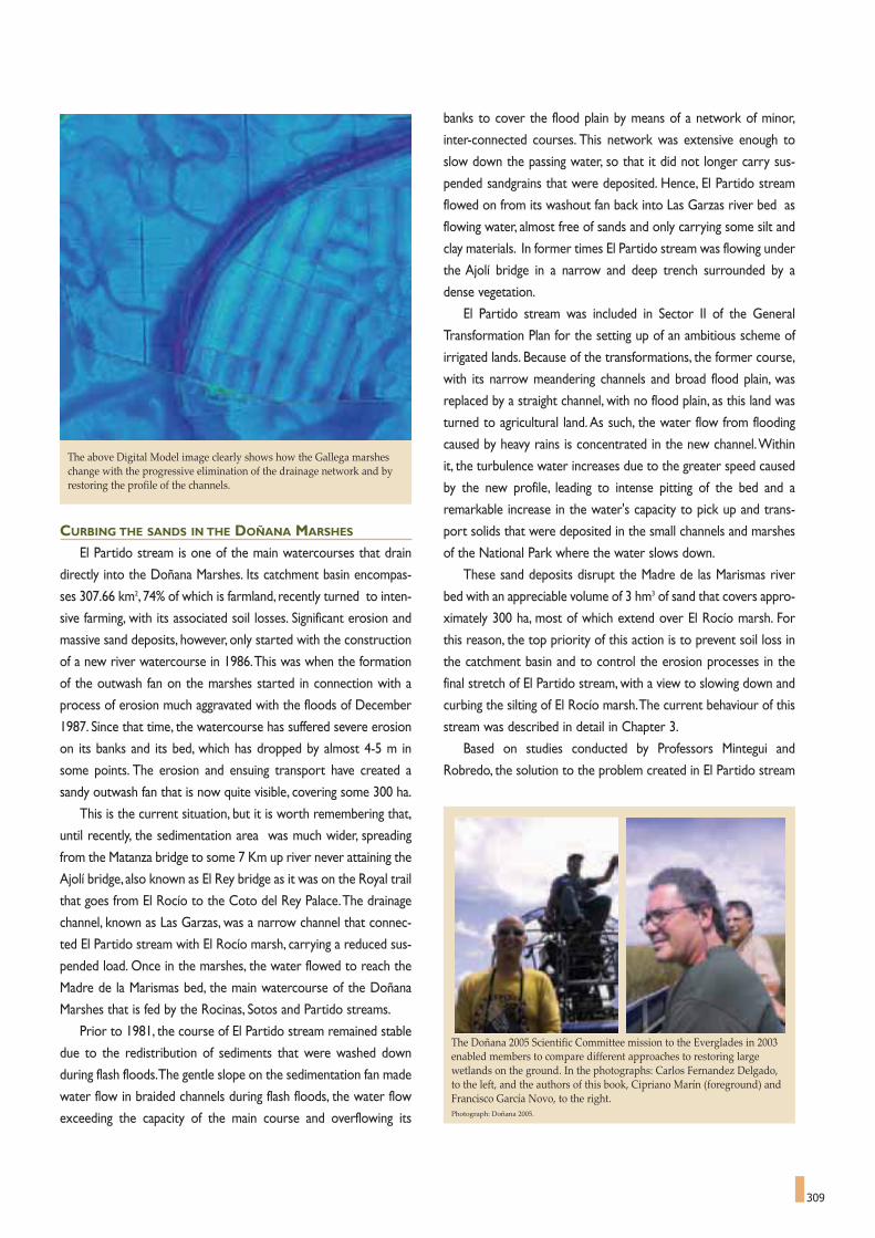
309
CURBING THE SANDS IN THE DOÑANA MARSHES
El Partido stream is one of the main watercourses that drain
directly into the Doñana Marshes. Its catchment basin encompas-
ses 307.66 km2, 74% of which is farmland, recently turned to inten-
sive farming, with its associated soil losses. Significant erosion and
massive sand deposits, however, only started with the construction
of a new river watercourse in 1986.This was when the formation
of the outwash fan on the marshes started in connection with a
process of erosion much aggravated with the floods of December
1987. Since that time, the watercourse has suffered severe erosion
on its banks and its bed, which has dropped by almost 4-5 m in
some points. The erosion and ensuing transport have created a
sandy outwash fan that is now quite visible, covering some 300 ha.
This is the current situation, but it is worth remembering that,
until recently, the sedimentation area was much wider, spreading
from the Matanza bridge to some 7 Km up river never attaining the
Ajolí bridge, also known as El Rey bridge as it was on the Royal trail
that goes from El Rocío to the Coto del Rey Palace.The drainage
channel, known as Las Garzas, was a narrow channel that connec-
ted El Partido stream with El Rocío marsh, carrying a reduced sus-
pended load. Once in the marshes, the water flowed to reach the
Madre de la Marismas bed, the main watercourse of the Doñana
Marshes that is fed by the Rocinas, Sotos and Partido streams.
Prior to 1981, the course of El Partido stream remained stable
due to the redistribution of sediments that were washed down
during flash floods.The gentle slope on the sedimentation fan made
water flow in braided channels during flash floods, the water flow
exceeding the capacity of the main course and overflowing its
banks to cover the flood plain by means of a network of minor,
inter-connected courses. This network was extensive enough to
slow down the passing water, so that it did not longer carry sus-
pended sandgrains that were deposited. Hence, El Partido stream
flowed on from its washout fan back into Las Garzas river bed as
flowing water, almost free of sands and only carrying some silt and
clay materials. In former times El Partido stream was flowing under
the Ajolí bridge in a narrow and deep trench surrounded by a
dense vegetation.
El Partido stream was included in Sector II of the General
Transformation Plan for the setting up of an ambitious scheme of
irrigated lands. Because of the transformations, the former course,
with its narrow meandering channels and broad flood plain, was
replaced by a straight channel, with no flood plain, as this land was
turned to agricultural land. As such, the water flow from flooding
caused by heavy rains is concentrated in the new channel.Within
it, the turbulence water increases due to the greater speed caused
by the new profile, leading to intense pitting of the bed and a
remarkable increase in the water's capacity to pick up and trans-
port solids that were deposited in the small channels and marshes
of the National Park where the water slows down.
These sand deposits disrupt the Madre de las Marismas river
bed with an appreciable volume of 3 hm3 of sand that covers appro-
ximately 300 ha, most of which extend over El Rocío marsh. For
this reason, the top priority of this action is to prevent soil loss in
the catchment basin and to control the erosion processes in the
final stretch of El Partido stream, with a view to slowing down and
curbing the silting of El Rocío marsh.The current behaviour of this
stream was described in detail in Chapter 3.
Based on studies conducted by Professors Mintegui and
Robredo, the solution to the problem created in El Partido stream
The above Digital Model image clearly shows how the Gallega marsheschange with the progressive elimination of the drainage network and byrestoring the profile of the channels.
The Doñana 2005 Scientific Committee mission to the Everglades in 2003enabled members to compare different approaches to restoring largewetlands on the ground. In the photographs: Carlos Fernandez Delgado,to the left, and the authors of this book, Cipriano Marín (foreground) andFrancisco García Novo, to the right.Photograph: Doñana 2005.

310
has taken the form of action performed globally on the basin, sup-
ported by specific interventions on the course of the stream itself.
Hence, the planned actions are basically aimed at attaining the follo-
wing goals:
- Reduction of the erosion of solids from El Partido course.
- Control of the processes of transport and sedimentation; slo-
wing down the building up of the outwash fan in the marsh to
bring the siytuation back to its former equilibrium.
- Regeneration of the ecosystems of the area that has been
transformed by farming projects and by sand deposits, restoring
the ecological function of the Northern sector of the National
Park.
Reducing the flow of solids transported from the basin can be
achieved by implementing reforestation programmes, especially in
the basins of Calancha and Cárcava, together with initiatives to pro-
mote hydrologically appropriate farming practices (planting by con-
tour lines, planting in strips or terraces). Planting vegetation along
the watercourses and their banks will reduce transfer of solids and
generate a diverse ecosystem that would rise the ecosystem con-
nectivity for wildlife.
To achieve the second goal, the project includes the construc-
tion of two steps, one on the bed of El Partido stream and the
other in the Cañada del Pinar,which will cause the main watercour-
se to deviate some of its flow to the floodable plain in high waters.
This will recover the broad flood plain between the Marin channel
and the Cañada del Pinar stream, where the future sand sedimen-
1 The Caracoles estate, formerly ploughed for crops, hasnow been expropriated and included in the National Park for restoration and to convert it back into marshland.The former bed of the Travieso channel can be distinguished on the estate.This is also being recovered, and now starts working again as a channel.
2. Stretch of the canal known as Entremuros, confiningmuch of the Guadiamar River and part of the Travieso channel.This action also includes demolishing the wallrunning along the boundary of Los Caracoles in order tofully restore the function of this canal
3 The Vuelta de La Arena will recover its connection with the Torre Branch that, once again, will receive the ordinary water flow from the Guadiamar River, as this is one of the ojectives of Action number 7.
4 Torre Branch.
FIGURE 3
This orthophotograph shows the scope of Action 6. The mainareas marked in the image are:
4
2
1
4
3

311
tation will occur.Thus, the natural function of the watercourses will
be completely restored and abandoned farmlands turned over to
conservation.
THE GALLEGA MARSH
NATURALISED MARSHES
The 2,200 hectares of the Gallega marsh are situated to the
north of Doñana National Park, within the Nature Park. Before it
was restored, the Gallega marsh formed part of the Almonte-
Marismas irrigation zone. To prepare this area for farming, a net-
work of drains was opened, dessicating the natural marshland.This
network of primary and secondary drainage channels carried
waters into the original Guadiamar river bed, which was deepened
and its appearance was completely changed. Moreover, several ser-
vice roads were built. Unfortunately, both for nature and for the
economy, the land was never farmed. While this situation remained,
the drainage system artificially dried the soils and started changing
its chemical properties in the Gallega marsh.
Hence,Action 4 was aimed at recovering this area of transfor-
med marshes hydrologically and environmentally, including the
Guadiamar channel section, restoring its original shape and restruc-
turing these lands, that had been altered and drained for almost fifty
years, bringing them back to marshes once again (see Figure 2).
A transversal dyke known as the FAO wall had been built bet-
ween the Gallega marsh of the Nature Park and the National Park,
marking the northern boundary of the National Park for the lives-
tock risers of Hinojos and Almonte villages and for tourist trips to
the "Jose Antonio Valverde" Visitors' Centre. But this dyke also pre-
vented waters from rivers and streams like Cañada Mayor, Molino
and Cerrabarba channels from reaching the Gallega marsh. The
Guadiamar channel connection, via a sluice gate, was too small for
the flow of a sufficient volume of water.
The measures taken to return the Gallega marsh to their ori-
ginal state have consisted of filling the drains using material from
the service roads that have been eliminated and from material that
had accumulated in the marshes from the time that these drains
were opened.There were several natural channels in the Gallega
marsh that had to be recovered.To this end, special care was taken
in areas in which drains crossed these natural channels.The sup-
pression of the FAO dyke was also considered. However, in the
end, an agreement was reached to maintain it as a livestock trail,
but with a battery of pipes crossing underneath to connect the two
sides of the marshland area5.
The over eight-kilometre long main drain in the Guadiamar
channel has been filled in to restore its natural features and lands-
cape. But the original channel and its profile have only been partially
recovered (to a height slightly below that of the adjacent land), in
order to be able to assess and monitor the measures taken and also
to allow small elevations and shallow pools to be created.These will
help facilitate the growth of vegetation and attract ecologically inte-
resting species, and also to preserve some of the new habitats that
have evolved during the long interval (50-years) when the transfor-
med marshland was neglected.
THE ORIGINAL COURSE
RESTORING THE GUADIAMAR RIVER BED
Historically, the water feeding into Doñana National Park from the
different branches of the Guadiamar river during the floods, including
the Guadiamar channel,accounted for over half the total water flowing
into the Doñana Marshes before they were altered. Moreover the
Cigüeña stream drained directly into the Guadiamar channel through
an interconnected system of small ponds.
But, once again, the Almonte-Marismas Transformation Plan
diverted the waters from the River Guadiamar and the Cigüeña
stream into Entremuros, in order to irrigate the cleared lands for
As a consequence of channelling the lower sector of the Guadiamar Riverfor farming in the area, the Torre Branch, a former branch of theGuadalquivir River, has become clogged up and reduced to a trickle ofshallow waters, covered with reeds in its upper reaches.Photograph: CENEAM files.
Members of the Doñana 2005 Scientific Committee during a visit to theNational Park. From left to right: Benigno Bayán, Félix Manuel PérezMiyares, Eva Mª Alonso, Mariangeles Fernández, Andy Green, FernandoHiraldo and Cipriano Marín. Photograph by Juan Mintegui.

312
crops.With this transformation, the Doñana Marshes lost water
inputs from the channel, although the receiving surface area was
considerably reduced as well. The marsh water deficit problems
are especially pressing in dry years and in a sequence of successi-
ve dry years, when tributaries would only provide about 50% of
their natural debit during the year.This, together with the fact that
these dry years are relatively frequent (around 30% of the hydro-
logical series of the last 55 years), means that the Marshes face
dry periods more frequently and for longer than before. The
result is a significant shortage of water with an appreciable impact
on the marsh ecosystems.
On the other hand, the water quality of Guadiamar River has
fallen significantly and continuously over recent decades as a
consequence of wastewater draining into the river, diffuse pollu-
tion from agriculture and acid waters high in metals from mining.
This process reached an extreme importance with the Boliden
mine accident of 1998. The lower the water flows, the more
obvious the River Guadiamar's water quality problems become.
Contamination was tolerable under average flow of River
Guadiamar, because of dilution effects.
So, the objective of this action was to restore the water input
from the Guadiamar river bed into the Gallega marsh, in terms of
both quality and quantity. These waters come from the River
Guadiamar catchment basin and the Cigüeña stream, an area that
belongs to the Nature Park and has already been environmentally
and morphologically restored as a result of Action 4.
With regard to recovering the water input from the
Guadiamar river bed, it should be pointed out that the aim is not
to raise the flood levels of the Doñana Marshes above the natu-
ral heights.This currently happens in years of above-average flo-
oding due to the Montaña del Río which acts as a dyke, causing
the flooding of higher parts of the marshes (local elevations
usually performing as islands) that would not occur if waters
drained naturally into the river.This problem should be tackled
at the same time as the Montaña del Río dyke extension is remo-
ved (phase II of Action 8).The aim of this action is two-fold. On
the one hand, it is to reduce the frequency and intensity of dry
periods, which have a very negative effect on the ecological func-
tion of the marshes of Doñana National and Nature Parks. On
the other, it is to recover the traditional hydrological function of
the remaining marshes, including the areas that have been resto-
red, or remain to be restored under the Doñana 2005 Project.
This is to promote a gradual circulation of waters through the
Marshes with a predominant north-south flow, and in synchrony
with re-establishing the natural connection with Guadalquivir
River and the Torre Branch.
A secondary objective is to improve the environmental inte-
gration of the area corresponding to Sector III of the Almonte-
Marismas Irrigation Zone.This involves ecological and landscape
restoration actions also capable of creating areas that can be
opened up to the public, or devoted to environmental education.
RESTORING THE TRAVIESO CHANNEL:A GUIDE TO GOOD PRACTICE
The scope of this restoration action also addresses the pro-
blems caused by the Almonte-Marismas Plan draining parts of the
old marshes. One of the greatest impacts at the time was to divert
the Guadiamar River water flow, which was channelled along
Entemuros to allow the former wetlands to be torned to farmland
(Figure 3).
The right hand wall of the Guadiamar channel crosses the natu-
ral bed course of the Travieso channel, so this traditional input of
water into the Doñana Marshes was cut off.The first stretch of the
natural bed of the Travieso channel, 5.5 kilometres long from where
it rises in Vuelta de la Arena, has been channelled in the Entremuros
area. The second stretch of the natural bed, 7.8 kilometres long,
flows through the Caracoles estate, a property surrounded by
earth walls along its perimeter.The third and final part of the natu-
ral river bed of the Travieso channel runs through Doñana National
Park and it is in a good state of conservation, despite the fact that
it had no water flow for several decades.
The objective of the first phase of Action 6 is to recover the
New dykes were built to seal off the Doñana Marshes after theAznalcóllar mine accident of 1998, thus preventing serious impactson the Park and allowing the restoration material to be removed inthe future.Diagram: Ayesa - Guadalquivir Water Board.
1 Doñana National Park2 Only access to sacatierras (excavation pond)3 Pile of organic soil4 Torre channel 5 Protection dyke 6 Sacatierras (excavation pond)7 Stretch of dyke assigned to the excavation pond

313
natural watercourse of the Travieso channel in the Caracoles esta-
te and to restore the entire zone to becoming a natural marshland
once again, as an extension of the Doñana National Park Marshes
around it.This operation is one of the greatest technical and scien-
tific challenges addressed by Doñana conservationists in recent
decades because of the complex and experimental nature of resto-
ring such a large area to its natural state.
The first step towards this objective was to expropriate the
Caracoles estate (in September 2003), which used to grow barley
crops and was used for hunting up until that time.This recovered
an area of 2,680 ha of drained marshes.The estate is roughly squa-
re in shape and had a dyke running around its perimeter to pre-
vent flooding. Inside the estate, there is a drainage network con-
nected to a pumping station that, to date, has pumped surplus
water into the Entremuros area. The project includes plans to
demolish all the auxiliary buildings and facilities on the estate and
to remove the southern and western walls, which will provide a
connection with the surrounding National Park marshes.
The network of main and secondary drains will be filled in, as
with the Gallega marsh, to restore the original landscape of the
area and its natural water flow.The lower part of the drains will be
filled in with earth from the Travieso bed excavation and from the
excavation of new shallow ponds.
At the same time, it will be connected to the Travieso channel
(Entremuros stretch - Figure 3), and this stretch of the channel will
be restored as far as Vuelta de la Arena. It will also be connected
with the Torre Branch and, of course, the right hand wall of
Entremuros will be suppressed7.
THE TORRE BRANCH
THE TIDAL INFLUENCE OF THE MARSHES
At the beginning of the 20th century, the Torre Branch, the wes-
ternmost marshy branch of River Guadalquivir, was an important
waterway for barges because of the tidal influence and large water
flow. But successive regulation of the Guadalquivir,“The Big River”
(from the Arabic: Wadi al-Kabir, the “Guadalquivir”), cutting and
dredging the main shipping channel, together with the loss of water
input from the Guadiamar River, has reduced the importance of the
Torre Branch to the point of converting it into a clogged water-
course at its head waters, and one of shallow waters that are cut
off from the influence of the tides lower down.As a result, the tidal
function of the Doñana Marshes' water system has been lost, inclu-
ding water inputs in summer with the high tides (botamentos), and
water from the Guadiamar river breaking its banks and providing
water along its connection with the Travieso channel in Vuelta de la
Arena.
Hence, the objective of this action is to recover both the fluvial
and tidal hydrological functions of the Torre Branch, bringing brac-
kish water into the Guadiamar marshes.This intervention will be
based on:
- Setting back the left stretch of Entremuros between Vuelta de
la Arena and the holding known as Veta de Alí. This will reco-
ver a significant area of its former flood plain north of the rice
paddies of Cantarita, so that its ordinary flow there (that pre-
sently run along the minimum water canal) and part of the
flood waters from the Guadiamar river will be channelled into
the former course of the Torre Branch.
- Sufficiently dredging the currently silted up riverbed to allow
tidal waters in at this point, which will link with the Marshes via
the Travieso channel.
Once the traditional hydrological function has been restored,
the vegetation, habitats and landscape of the Torre Branch course
will recover. For this reason, hydraulic and tidal studies and rese-
arch are vitally important.The extending of the tide along the Torre
Branch will need to be simulated, based on research, to provide the
best solutions for restoring basic ecological processes like the
recovery of brackish water vegetation and enhancing the biological
diversity with the introduction of fish.
Stretch of the extension of the Montaña del Río dyke where the sacatierras(excavation areas) from the construction work can be seen between theTorre Branch, and the Los Ansares pond.Image: Ayesa.

314
REMOVING THE BARRIERS
Action 8 arose initially in response to 1998 Boliden mine acci-
dent and helped to seal the Doñana Marshes from the acid waters
of the toxic spill.The dykes did their work as the spill was contai-
ned beyond the boundaries of the National Park. Once it has been
confirmed that the sources of the pollution have been almost com-
pletely eliminated from upriver, the dykes and levees will be disman-
tled, allowing the original connection between the Doñana Marshes
and the Guadiamar river considered in Action 6.
However, this process has reignited the debate on whether
the Montaña del Río should be removed or not, and to what extent
it should be permeable, as a continuation of the process of making
the Marshes permeable to both river and tide flows.This barrier to
the Guadalquivir River was built as one of Doñana's defences over
twenty years ago, at the request of the Doñana National Park
Board, as it was alleged that the natural levees that marked the
boundary with the Guadalquivir were being eroded by wave action
due to shipping in the estuary. This is a typical example of the kind
of decision that should be weighed up carefully in the new stages
of restoration.This was the hand of man that intervened, for good
or for bad, depending on the variables used, in an attempt to
correct losses in a natural system but that could have undesirable
effect on the Marshes.
In this new scenario, modelling the water function of the
National Park and other associated research work has provided
guidance for new proposals solidly founded on scientific evidence.
DEALING WITH UNCERTAINTY
The series of actions and initiatives that have or which remain
to be implemented, in projects like Doñana 2005 and the
Guadiamar Green Corridor, should be based on the fact that, des-
pite the enormous volume of information, research and qualified
human resources dedicated to Doñana, this area remains an extre-
mely complex system in which there is a high degree of uncertainty
and many points that are still unexplored territory for science.
Experience of restoring the water and ecological systems of these
marshes in previous decades clearly shows this, as we have seen in
the course of this publication.
Yet, there is another, equally important factor. Doñana was, is
and will continue to be an extremely dynamic and changing system.
Both these points of view imply that restorative actions must be
flexible.That means the restoration process must be considered, in
essence, as an experiment providing opportunities to use the feed-
back obtained; an experiment that can enhance our understanding
of processes and one in which further changes will be made,depen-
ding on the responses of the system. For this reason, monitoring
and the associated research plan form an integral part of the hydro-
logical and environmental restoration projects from the very begin-
ning. They are interconnected parts of the same bodye, analysing
how the system as a whole responds to the changes made to
external environmental variables and how the internal processes
evolve.
The new stage of restoration that has commenced in Doñana
basically implies re-connecting fluvial and marsh ecosystems, and
re-building lost natural connections among different habitats.
Therefore, in a case of this kind, it is more productive to seek spa-
tial heterogeneity than homogeneity as an intervention premise,
which will allow for more and better results and reduce the risk of
failure.
There are clear limitations inherent in the different restorative
projects launched. But these limitations can be either ignored, seen
Meeting of the Doñana 2005 Project Scientific Committee chaired by FélixManuel Pérez Miyares.Photograph: Doñana 2005 Technical Office.
After the decontamination of River Guadiamar that started immediatelyafter the Aznalcóllar accident, the watercourse has not only been returnedto its normal state, it will also recover its original function of feeding theDoñana marshes and will act as an ecological corridor to the protectedareas of the northern area, as the river has become a basic objective of the“Doñana 2005” and “Guadiamar Green Corridor” projects.Photograph by Antonio Sabater.

315
TABLE 1Evaluation and Monitoring Plan of the Doñana 2005 Project
AREA OF MONITORING OBJECTIVE STUDY ZONE
Underground waters Identify the impact of actions 1 and 3 Soto Chico and Soto Grande streamsof the Doñana 2005 Project on the (Action Zone 1)aquifer-streams and aquifer-ponds relations. El Partido stream (Action Zone 3)
Phytoplankton and Physically and chemically characterise Scope of all the actionszooplankton communities of water bodies and assessand the physical and the abundance of phytoplanktonchemical properties and zooplankton speciesof waters. Monitor changes in the physical and chemical variables
of waters over time, and the zooplankton and phytoplankton communities, assessing the results of the action.
Aquatic Flora Analysis of the submerged and emergent Gallega marsh (Action Zone 4)and vegetation. vegetation of streams and water bodies Guadiamar channel (Action Zone 5)
in the study zone. Travieso channel(Action Zone 6)Determine the distribution of Brazo de la Torre - Torre Branch (Action Zone 7)endangered species and invading plant species Entremuros (Action Zone 8)of the study zone.Draw up a theoretical reference framework to explain the dynamics of the vegetationin the study zone in relation to water flow and inundation.
Hydro-geomorphology Analyse changes to the alluvial fan Gallega marsh(Action Zone 4)in El Partido stream. Guadiamar channel (Action Zone 5) Diagnose future trends of the alluvial Travieso channel (Action Zone 6)fan of El Partido stream. Torre Branch (Action Zone 7)Analyse and describe the behaviour of the flow Soto Chico and Soto Grande streamsprovided by the Guadiamar River on entering (Action Zone 1)the Marshes and estimate the area affected.To be extended El Partido stream (Action Zone 3)to analyse the flows of the Cigueña and Pescador streams.Impact on the Marshes of variations in water flow entering the area.Identify the layout and profiles of the original river beds, particularly the former Travieso river through the Caracoles estate.
Changes Draw up an inventory of existing biodiversity in the Soto Chico and Soto Grande streamsin fresh water water courses that are the scene of interventions. (Action Zone 1)macro-invertebrate Monitor changes in the macro-invertebrate El Partido stream (Action Zone 3)communities. communities. Gallega marsh (Action Zone 4)
Using biotic indexes based on the Guadiamar channel (Action Zone 5) abundance of macro-invertebrates, Travieso channel (Action Zone 6)evaluate actions intended to improve the biological quality of El Partido stream waters.Monitor macro-invertebrate communityof Gallega marshand assess the community changes that will occur after connection between the River Guadiamarand the Gallega Marsh.
Changes in estuarine Monitor fish populations Actions involving estuarine and Torre Branch watersmacro-invertebrate in the restored water courses.and fish communities. Analyse macro-invertebrate
communities in restored areas.Study changes in the communities of macro-invertebrates and fish that could be established in different bodies of water within the Marshes as a result of recovering their tidal function.
Monitor the Document modifications that occur in Scope of all actions involving terrestrial vegetation.terrestrial vegetation the vegetation of the area affected by the on restored areas. Doñana 2005 Project.Monitor the effects Map the vegetation in each Action.of Doñana 2005 Project Monitor the areas of restored vegetation.on the vegetation of Create a data base of the spontaneous vegetationNational and Nature Parks. and the vegetation restored in these Actions.
Describe changes in the terrestrial vegetationAssociated with the water regeneration work.Create an observation network for future ·monitoring of the response of the terrestrial vegetation to the modifications in the water regimen of the Doñana area.

316
as a problem or considered as opportunities. In the present situa-
tion, it has been decided to regard these limitations as opportuni-
ties.This is the case of the Caracoles estate, where the limitation
lies in the fact that, from the restoration point of view, the starting
point is a uniform area, flat and homogenous, an area that has been
artificially drained for years and used for growing cereals. If this area
were merely flooded in its current state, it would probably produ-
ce a uniform community of plants, although the specific type would
be difficult to predict. For this reason, this initiative plans to resto-
re a more natural topography, and, therefore, restore more natural
cycles of flooding, all of which will be achieved by restoring the ori-
ginal profile of the Travieso channel, filling in the artificial drainage
canals and restoring the original contours of the marshes also cre-
ating small artificial ponds. In this way, the diversification of habitats
will promote more diverse communities.The strategy could even
be extended to create a series of different topographies within the
Caracoles estate (different types of plots with depressions and ele-
vations), to guarantee a far more heterogeneous marshland as a
result.
Hence, the initiatives taken work within the context of these
uncertainties, which clash with the laudable desire of many sectors of
society and the scientific community to return Doñana to a state of
completely natural systems, as it was in the past. But this is no longer
possible. One has to face the fact that major and irreversible changes
have been wrought, both due to external impacts and to internal pro-
cesses, and Doñana is a highly dynamic system in terms of both geolo-
gical and ecological time scales. It cannot recover its pristine conditions,
but measures can be taken to return it to a state that is close to this
impossible objective, and preserves a rich diversity.
The Marshes cover an area of 26,572 ha in Doñana National Park, plus the2,627 ha of the Caracoles estate that are being restored, the lands of theNature Park to the east of Entremuros as far as the Torre Branch and theGallega marsh restored area. The Digital Terrain Model constructed forthe Doñana Marshes, superimposed over a satellite photograph, clearlyshows the floodable area and the main elevations and depressions thatform the lucios (shallow lakes) and vetas (elevations).Source: Carlos Urdiales.
TABLE 2Research projects associated to ecologic restoration of the marshes of the National Park - Doñana 2005.
RESEARCH PROJECT ENTIDAD INVESTIGADORA AND COORDINATION
ANALYSIS OF GEOMORPHOLOGIC RISKS AND EVALUATION OF EROSION University of Huelva.PROCESSES IN THE PARTIDO STREAM BASIN . Coordinator: Francisco Borja Barrera
MONITORING OF CONTAMINATION AND ITS BIOLOGICAL EFFECTS THROUGH University of Córdoba and University of HuelvaMOLECULAR BIO MARKERS AND CHEMICAL SPECIATION. Coordinator: Juan López Barea. Subproject managers: J.L. Gómez Ariza,
C. Pueyo de la Cuesta, S. Garrido MorenoRESTORATION ECOLOGY OF THE FAUNA AND FLORA IN THE CARACOLES ESTATE, Doñana Biological Station. Spanish Higher Research Council (C.S.I.C.) INTEGRATED IN AND ADAPTIVE MANAGEMENT FRAMEWORK Coordinator:Andy J. Green
FUNCTIONAL CHARACTERIZATION OF THE DOÑANA MARSHES AND THEIR SURROUNDINGS: Doñana Biological Station. Spanish Higher Research Council (C.S.I.C.) RETROSPECTIVE ANALYSIS AND PROJECTION OF THE EFFECTS OF THE DOÑANA 2005 PROJECT. Coordinators: Miguel Delibes, José M. Paruelo and Néstor Fernández
CURRENT STATE OF KNOWLEDGE ON HEAVY METAL, FERTILIZER, Natural Resources and Agrobiology Institute of Seville AND PESTICIDE CONTAMINATION IN AIR,WATER, SOIL, SEDIMENTS AND ORGANISMS Spanish Higher Research Council (C.S.I.C.)IN THE BASINS FEEDING DOÑANA AND THE GUADALQUIVIR MARSHES. Coordinator: Francisco Cabrera Capitán
LIMNOLOGIC STUDY OF THE LAGOON FORMED IN EL ROCÍO MARSH. University of SevilleCoordinator: Julia Toja Santillana
STUDY OF CURRENT SITUATION AND MONITORING OF THE BASIC PARAMETRES University of Seville OF CONTAMINATION OF THE WATERS FLOWING INTO THE MARSHES OF DOÑANA NATIONAL PARK, Coordinator: José González Delgado, José Manuel González LimónFROM A PERSPECTIVE OF SUSTAINABLE AGRICULTURE IN THE AREA.
STUDY OF THE RELATIONSHIPS BETWEEN VEGETATION AND THE ALMONTE-MARISMAS AQUIFER Aquatic Ecology Station (University of Seville - EMASESA)IN THE DOÑANA PARKS. Coordinator: Francisco García Novo

317
EL PARTIDO STREAM BASIN
RETURNS TO ITS NATURAL STATE
Action number 3 is being implemented in the lower stretches of
El Partido stream basin, just downstream from the Matanza bridge.The
aim of this action is to prevent the building-up of an alluvial fan in the
Marshes with sediments from the Marin channel, when it receives
waters from El Partido stream.The sandy delta that has quickly formed
covers a valuable marsh ecosystem with a grassland vegetation that is
quickly invaded by tamarisks and which is of little value for conserva-
tion.
The hydraulic solution put forward by Professor Mintegui for the
water system to avoid it silting up, as outlined in detail in Chapter 3,
consists of diverting most of the flood waters from the stream to a
FIGURE 4
Vegetation type and treatment map(2005) of El Partido stream restorationproject.
Ecological restoration map drawn up byDaniel García Sevilla of El Partido streamEcological Restoration Team, as part ofthe Doñana 2005 Project. Aquatic Ecology Station, University of Seville.
broad inter-fluvial plain where they would deposit their sandy load,
before entering the Park free of sands to feed La Madre de las
Marismas channel.
This model requires flooding a large area of 1500 ha in periods of
maximum debt.This has led the authorities to expropriate the affected
area, which was in private hands and used for agricultural crops and
pasture.But,apart from the water system,the lands,most of which are
inside Doñana Nature Park and to the North of the National Park,
need ecological restoration.
The restoration project has been developed in the Aquatic Ecology
Station (Estación de Ecología Acuática), a joint research centre belon-
ging to the University of Seville and to EMASESA, Sevilla Water Supply
Company. A team of scientists from the Universities of Seville and

318
Extremadura, made up of Professors José Carlos Escudero, Ángel
Martín Vicente, María Cruz Díaz Barradas, Juan Bautista Gallego, María
Zunzunegui, Daniel García Sevilla, Mari Paz Esquivias Romero, Raquel
Fernández Lo Faso,Luciana Carotenutto,Adalgisa ALves,Alberto Troca
and Francisco García Novo.
Before addressing the restoration itself, the available data from the
area was analysed.These include old maps, aerial photographs dating
back as far as 1946, ownership maps and documentation on the eco-
logical history of Coto del Rey studied by Professor Ángel Martín
Vicente from the University of Seville. On the other hand, the local
vegetation and its changes during the 20th century have also been stu-
died, to build up successive sets of data and determine the objectives
by means of vegetation types as reference.
Once the restoration model of scrub species to be found in the
area had been defined in 2003, a planting trial was conducted on an
experimental plot of one hectare, located in the National Park, at El
Rocío. Planting trials were conducted with scrub and trees and the
survival and growth rates of the plants and the composition and pro-
duction of semi-natural vegetation were monitored from 2003 to
2005. Rainfall and piezometric levels were recorded once a month.
The data from the experimental plot meant growth rates were
documented and they helped in selecting planting techniques, bearing
in mind the variation of the water table depth, which fluctuates by up
to 4 m between annual cycles.
The soil has been studied (texture and profile) in the area to be
restored and a piezometric network has been installed to monitor the
levels in comparison with El Partido stream.The remains of woody
vegetation in the restoration target area have been described and
mapped.At other points in this intervened area, seeds,berries and soil
samples have been taken in order to study the germination of the seed
bank.Trials have also been conducted in depositing mulch soil covers
for re-planting the new banks built for the water projects.
The use of the area by vertebrates has been analysed in the res-
toration analysis.The results of an in-depth study of the distribution of
rabbits conducted in 2004 by Sacramento Moreno,Sonia Cabezas and
Raquel Moreno, from Doñana Biological Station, have also been taken
on board. The abundance of prey makes this area an ideal hunting
ground for lynx and Spanish imperial eagle.The basic premise for this
initiative is that restoration should foster these functional aspects in
particular. It should favour the movement of larger mammal species in
the northern area of the National Park, preventing them from ente-
ring the areas of intensive farming under the Almonte-Marismas Plan.
Using the semi-natural vegetation that can be recognised in pho-
tographs from the 40s and 50s, and the vegetation series from the
area, an ecological restoration project has been developed. This is
based on the reconstruction and consolidation of existing specimens
and patches of woody vegetation, the regeneration of areas in which
the natural dynamic can restore the original formation (such as the
banks of the watercourses) and planting thickets of woody vegetation
in the rest of the areas, and two patches of woodland in areas that
used to bear them.
Some large trees (umbrella pine trees over 6 m high) will be plan-
ted to cover the scarcity of perchs for birds,along with cork trees with
holes in the trunk,with a view to attracting other groups of vertebra-
tes.The restoration project also eliminates the tracks and rights of
way, high-tension cables and the abandoned irrigation facilities.A new
peripheral path has been built to link up with the paths that lead to
Raya Real, a traditional staging post connecting El Rocío to
Villamanrique village.
This restoration model consolidates the surviving vegetation and
attempts to foster the system dynamics towards greater structuring,
bearing in mind that the irregular climate makes it impossible to fore-
cast possible floods or guarantee the survival of new plantations.
The vegetation thickets follow the morphology of local woody
vegetation, the structure of which is dominated by patches, combining
one or few trees and a dense undergrowth of large shrub:Pistacia len-
tiscus, Phillyrea angustifolia, Myrtus communis, Rhamnus oleoides,
Crataegus monogyna, Pyrus bourgeana, Daphne gnidium, Ruscus acu-
leatus,Quercus coccifera and Chamaerops humilis.The smaller, flowe-
ring shrubs are planted around the edges, consisting of thyme, laven-
False-coloured satellite image of the Marshes of of Doñana during flooding.Image: Landsat 7 (2000).

319
der, rock roses (Cystus spp.), Genista spp. and Halimium halimifiolium.
The structure, diversity and dynamics of these formations have been
studied, as has their relation with the soil characteristics, which have
been reproduced during the restoration.The thickets to be planted,
between 12 and 20 metres in diameter, combine a nucleus of trees, a
rim of other berry producing scrubs and a periphery of flowering
shrubs.The nuts and berries will attract vertebrates,which, in the futu-
re,will help these species to spread to the rest of the area.The flowe-
ring shrubs will attract flying insects and the thicket as a whole will pro-
vide structure, resources, diversity and support for wandering animal
species and will encourage the progressive incorporation of other spe-
cies to the restored area.
The composition of these thickets will vary depending on the
degree of flooding that is foreseen and the soil texture. The sandy
areas, invaded by shifting dunes in the 16th and 17th centuries, will be
planted with open scrub and stands of trees.At lower levels, the com-
position of the patches of vegetation will vary from north to south and
from east to west, progressively denser and with larger species to the
east and south, where patches of pine woodlands have survived, and
where the larger species of wildlife currently seek refuge. At even
lower floodable heights,a thicker vegetation and rivr bank will be plan-
ted, in line with the surviving vegetation to be found in Cañada Mayor.
These actions will be supported by creating an area of mixed forest
(oak, cork, wild olive and umbrella pine trees) with native scrub run-
ning in continuous strips so that it can act as a temporary refuge for
vertebrate fauna.There will also be a broad band of open grazing pas-
tures dotted with small thickets (5 m) with one tall tree as a perch and
a refuge for vertebrates.
In order to create a barrier to prevent species invading the site
from the farmlands to the west of the restoration ground, an area of
unfertile washed sand will be maintained.This is to be followed by ano-
ther area of dense and highly diverse scrub,which completes this diver-
sity "filter", holding back the invasion of species from the areas suffe-
ring from change, and thus protecting the restored area.
Figure 4 shows a map of the ecological restoration work drawn by
Daniel García Sevilla of the restoration team. The different patches
show the different zones of vegetation and the small circles represent
the location of the thickets to be planted, with all their variations (in
size, composition, etc.).The blue lines represent the flow concentra-
tion, along which the water will run at times of flooding, depositing
most of the sand before reaching the road running from El Rocío to
Villamanrique,which will be covered with water and cut off during flo-
ods.The parallel lines to the west represent the diversity barriers.
Two experimental areas are to be established to the west, where
the plant material will be prepared and restoration and regeneration
trials will be conducted.On the other hand, there are no plans for far-
ming or livestock rearing in the area,although part of it will be used by
the parks' tour programmes, once the restoration is complete.
Strictly speaking, this is not an ecological restoration; it merely
moves things in that direction, facilitating the self-organisation of natu-
ral systems and pushing them in the right direction, allowing natural
succession to play its part.
The growth data obtained in the experimental plot have been
used to simulate the behaviour of vegetation in different scenarios,and
the transformation of the landscape,diversity and habitats.A program-
me has been developed to monitor the vegetation, wildlife, water,
landscapes and such, since Action number 3 of the Doñana 2005
Project was implemented.
Raquel Fernández Lo Faso, member of the restoration team, has
developed a landscape mapping system that represents the shift from
artificial and intervened areas (red) to natural and conserved areas
(green) in a sequence of colours. She has used this code to map these
landscapes before these actions were implemented (2002) and after
the lands were expropriated (2005), and she has simulated the next
two stages,as can be seen in Figure 5. The first stage will be taken once
the hydrological intervention and the ecological restoration were
completed (2006) and the second landscape simulation stage will
occur ten years later (2016).As the images clearly show, this sector of
Doñana, once restored, will recover both the landscape and the eco-
logical function that it lost in the 1970s.
Two major ecological restorations of aquatic systems have been
carried out in Doñana over the last ten years: the Abalario wetlands
and the Algaida marsh of Sanlúcar, as described in previous chapters.
A further two are currently on course, and are also focussed on
water:ecosystems and landscapes:the recovery of the Caracoles esta-
te in the Doñana Marshes (Action 6) and the restoration of the basin
of El Partido stream. The remaining actions of the Doñana 2005
Project are working in the same direction. In all of this, Doñana has
undoubtedly become a European benchmark in ecological restoration.
Initial situation oflandscapes (2002) befo-re the restoration of ElPartido stream basin.The natural conditionof the area to be resto-red varies from violet(more artificial) togreen (well preservedarea).
Mapdrawn up by Raquel FernándezLo Faso and Diego García Sevilla.

320
2002
2005
2006
2016
Scenarios showing the landscape evolution with restoration ofEl Partido stream basin. The sequence of colours that indicatethe progression from artificial (violet) and altered (red) landsto natural (yellow) and conserved (green) lands. This criterionhas been used to map the landscapes before these interven-tions (2002) and after they were expropriated (2005), followedby a simulation of the next two stages. The first stage aftercompleting the hydraulic intervention and the restoration(2006) and the second stage, ten years later (2016). Maps drawn up by Raquel Fernández Lo Faso.
FIGURE 5

321
THE NUMERICAL HYDRODYNAMIC MODEL OF THE MARSHES
AND ITS APPLICATION TO THE MONTAÑA DEL RÍO CASE*
In the context of the research programme associated with the
Marshes restoration project, the Doñana 2005 Scientific Committee
saw the need for a modelling tool to provide greater accuracy to sup-
port scientific theories and for monitoring and evaluating the actions
implemented in this outstanding area of the Parks.
The numerical hydrodynamic model of the Marshes, as explained
in Chapter 3, makes it possible to simulate the flow of water inputs
from the watercourses that drain into the National Park and how
water levels vary over time in the Doñana Marshes.These are also
affected by how the water drains and whether this drainage is artificial
or natural.
The objective was to develop a hydraulic model that would enable
scientists to simulate the present hydrodynamic conditions of the Park,
in order to calculate with greater accuracy the impact of restoration
measures and any other factors that could determine the distribution
and flow of waters.This model was developed by the UTE made up of
WL/Delft Hydraulics and AYESA, using the SOBEK software model as
a base.The model allows a 1D combination of designs for the flows
along channels, and 2D combinations for surface flows.This necessary
combination arises from the fact that 2D analyses are less appropriate
for modelling hydraulic structures and the effect of channels and other
watercourses in the Marshes environment. Hence, the surface flow,
including the obstruction effects of dykes and natural slopes, can be
simulated in 2D with equations (the greater Marshes area), while the
channels and hydraulic structures have been modelled in 1D
(Guadalquivir River, the Torre Branch and the small channels close to
sluice gates).
The 2D surface run-off model, in turn, rests on the foundation of
the Terrain Elevation Model (TEM), which was constructed using data
obtained with LIDAR (Light Detection and Ranging) technology for
measuring distances with Laser.Another important aspect for deter-
mining water flows in 2D was to determine the roughness of the
water,which was obtained by digitalising an Ecological Map of Doñana
with some data on vegetation,making it possible to estimate the range
of values of the friction co-efficient with water.
The bathymetric information provided by the Port of Seville
Authority and new surveys carried out within the Doñana 2005
actions, served as a base for the single dimensional flow. Furthermore,
existing structures, such as the sluices of Brenes, La Fuengirola, Los
Rompidos,Montaña del Río,Cherry,Carajola, those of the Guadiamar
channel and the hydraulic infrastructures created after 2000, like the
Molino and Cerrabarba channels, have been incorporated.
The image shows a simplified version of the components used to calibratethe hydraulic model. The pink squares are water inputs. The red trianglesare functional water connections with the 2D grid. The green trianglesrepresent hydraulic structures.Source of the image: AYESA
Evolution of rainfall accumulated in the different agricultural years(September-August) from 1970 to 2003. The simulation generated by appl-ying the Model for wet years, such as the 1995-1996 period, is excellent.The modelling also takes on board other basic values like available evapo-ration-transpiration data, the flow of Guadalquivir River, including waterlevels at the mouth, and data sets of the four main watercourses that draininto the Doñana Marshes.The bottom photograph shows a view of the right bank of theGuadalquivir, in the Doñana National Park, by Punta de los Cepillos,between Brenes and Caño Nuevo, showing an area of maximum erosionof the levee. The photograph was taken during a serious floodingrecorded in January 1996.Image and data source: AYESA
years
mm

322
Water roughness depends mainly on vegetation. The above map high-lights the most common types of vegetation to be found in different areasof Doñana.
Upper zoneA. Arthrocnemum macrostachyum in the higher, central parts of the DoñanaMarshes, between riverbeds.B. Scirpus maritimus in low-lying areas.Central zoneC. Juncus subulatus in the depressions in the higher ground of the Marshes.D. Scirpus litoralis in palaeo-channels of the lowest part of the Marshes.E. Scirpus litoralis in depressions in the lower ground.Low zoneF. Arthrocnemum macrostachyum in the higher part of the central zone of theMarshs, between riverbeds.G. Juncus subulatus in the depressions in the lower-lying ground.H. Depressions with no helophytic vegetation in the lower-lying ground.Source and vegetation map: AYESA
Calibrating the model with the reference year 1999-2000 has been
far from simple.The calibration process highlighted some of the weak
points in the model. In some years, it was in line with events, but in
others, there were noticeable differences. An in-depth analysis has
shown that the fundamental problem lay in the inconsistency of some
of the data sets, highlighting the fact that numerical models are highly
dependent on the protocols and the rigour of data sets entered into
them.Validations that have been done for data sets from the years
2000-2001 and 1995-1996 showed a good fit. Even so, as in any simu-
lation process,the developers of the model will not consider it as a clo-
sed and definitive instrument. It remains permanently open to refine-
ments based on successive approaches.
The scenarios analysed
Once the model had been calibrated, the first operational stage
addressed the task of simulating a range of different scenarios repre-
senting the restoration work conducted in the Doñana Marshes, inclu-
ding the Doñana 2005 project.The scenarios analysed were as follows:
Scenario 0 or baseline:This scenario is the situation in 2003, including
existing waterworks structures.The reference inputs for rainfall and
evaporation are taken from the water cycle of 1995-1996, which sho-
wed a good fit with the model.
Scenario 1. Elimination of the original Montaña del Río and its exten-
sion as protection against the effects of the Boliden mine accident.
Scenario 2. The actions to recover the Travieso riverbed and Torre
Branch are included in the base line case.
Scenario 3.The input from the Cigüeña stream, after restoration, is
added to the above.
Scenario 4. Elimination of the original Montaña del Río while maintai-
ning the extension along the Torre Branch.
Scenario 5.Elimination of the current situation of Montaña del Río and
the extension from the estuary to Entremuros,lowering the rest of the
dyke.
Scenario 6.The same as scenario 5, but this scenario includes the eli-
mination of the south and west walls of the Caracoles estate, the con-
nection with the Travieso riverbed and the Cangrejo Grande pond.
Above: Cherry sluice gate and the dyke with a flood water level of 1.96 m(20/12/2004), close to the natural holding capacity of the Marshes reservoir. Below: Cherry Canal with a flood water level of 1.82 m (12/04/2004), anexceptional level of flooding for this time of year, due to the spring floodsof 2004.

323
Channels with their associa-ted sluice gates in theMontaña del Río dykesystem and its 1999 exten-sion: Carrajola, Cherry or delBuentiro, Las Nuevas, Nuevoor del Lucio de los PatosReales, Brenes, Figuerola andLos Rompidoss.
Image source: Carlos Urdiales
View of the final stretch of the Brenes channel. The NumericalHydrodynamic Model of the Marshes highlights the importance of sup-pressing the Montaña del Río dyke as far as the mouth to the estuary.Photograph by Carlos Urdiales.
Accepting that this action is both feasible and advisable, once La
Montaña del Río is virtually eliminated, other scenarios were introdu-
ced into the model that took into consideration the drainage capacity
of the ponds into the Torre Branch and the Guadalquivir River, assig-
ning different sections for channel types.The final conclusion is that
flood levels and duration are within recommended targets,which ena-
bles us to validate the proposal of suppression.Moreover, it shows that
the tidal influence reaches to the Marshes, which have always been
affected by the tides,without causing any excessive saline intrusions. In
this case, there is an additional benefit, as mentioned in Chapter 3,
because, once the peak of the floods has passed, fish and other aqua-
tic life forms from the estuary shall enter the Marshes following the
former natural and naturalised channels, or by swimming over the
levee at very high tides. Increased connectivity between estuary and
Marshes will be highly valuable for aquatic biodiversity, as the restora-
tion of the Algaida marsh of Sanlúcar has shown.
As a corollary to this strategy of recovering the function of the
edges of the Doñana Marshes,the possibility of naturalising the current
deep channels that lead to the present outlet sluice gates has been
considered.These were built by the Guadalquivir Water Board, based
on old sluices and canals, in different stages between 1983 and 1989.
They followed an agreement adopted by the National Park Board that
was justified on the grounds that the loss of capacity of the Marshes
One of the most striking aspects after applying the model is that
the current levels of the Montaña del Río dyke and its extension (the
baseline situation) are too high for the Marshes to work properly from
a hydraulic point of view, and in accordance with its natural behaviour
prior to the major changes that they have suffered.These levels are dif-
ferent from the ideal levels set by Doñana National Park and the
Biological Station. The recommendations, included in the "Proposed
Management Model for attaining a biologically optimum situation in the
Doñana National Park Marshes", set an objective for floodwater surfa-
ce levels never to exceed 2.2 m at any time, and that the duration of
time that they rise above 1.90 m should only be during flash floods.
The levels reached in 95-96 were considered too high at the time.
The vetas (islets) and paciles (elevated surfaces) remained flooded for
prolonged periods, with water levels higher than previous records. In
the baseline scenario, the water level in the Doñana Marshes reaches
2.5 m and remains above the 2 m mark for some three months, in
comparison with the 2.3 m maximum water level for 95-96.
The results clearly show that the height of the present dykes that
separate the Doñana Marshes from the Torre Branch and the
Guadalquivir river, along with the limited drainage capacity of existing
sluices, make it impossible to meet the recommendations in the case
of flooding.The present system, therefore, has to be made permeable
to avoid that maximum water levels during flooding exceeded target
levels.
Hence, the proposal suggested by the model depends on elimina-
ting the function of the Montaña del Río from the Torre Branch as far
as the Brenes channel, which would make it possible to reduce the
peaks of flooding and the duration of maximum flood water levels in
the Doñana Marshes.This action implies eliminating the channel of low
waters filling it in so that it did not drain the Marshes and, therefore,
preventing unwanted draining of water out of flooded areas. For the
rest of the dyke, south of Casa de Brenes,with little significance in the
modelling of the hydraulic system, it should be made permeable,rather
than eliminated.The reason for this is that, basically, it is important to
maintain this access for management activities in the southern area of
the National Park.

324
was due to the progressive deterioration of the Montaña del Río dyke
because of the erosion of this bank caused by the river. Images, like the
aerial photographs taken by the American flight in 1956,clearly illustra-
te how a canal like La Carrajola (without any sluice gates to regulate it
and directly open to the influence of the tides from the Torre Branch)
had developed a well-established dendritic drainage pattern that is
typical of tidal channels and creeks.To this end, a series of proposed
actions presented by the National Park have been modelled.The base-
line scenario, used for checking the extent differences occur, is scena-
rio number 6, with all the Doñana 2005 actions taken on board.
Proposed Management Model for attaining a biologically optimum
situation in the Doñana National Park marshes
Some of the most important stipulations presented by the National
Park and the Doñana Biological Station as the terms of reference for
the Doñana 2005 actions and for modelling work, are llisted below:
- In conditions of significant flooding, the water level should only exce-
ed the maximum flooding levels of the elevations (1.9 m above sea
level) for short periods of time during the arrival of flash flooding, and
to a maximum level of 2.2 m. Flooding should not exceed the level of
2.2 m above sea level at any point in the Doñana Marshes under any
Land in the east of the National Park marshes with a flood water level 1.90m above sea level. The highest part of the Guadalquivir-Torre Branchnatural levee and the course of the Montaña del Río dyke can be clearlyseen. The excavated canals are shown in dark blue, the locks that regulatethem (all currently operative) are marked with a green circle. The oldnaturalised channel and natural channels are marked in light blue and thesmall 1984 locks, not currently operative, are marked with a red circle.Image and data source: Carlos Urdiales
circumstances, so that dry surfaces remain above floodwaters at all
times.
- The drying out process or sequence for the Doñana Marshes should
adjust to the volume of flooding recorded for that year, and the pat-
tern followed by the receding waters in the flooded areas should be in
line with the natural pattern defined by the topography of the terrain.
- The regimen of flooding in the National Park marshes should be reco-
vered and should tend to bring forward and prolong the period of flo-
oding in comparison with the floods recorded in similar years in recent
decades (since the hydrological alteration of the Marshes), to shorten
the annual dry period,even accounting for the natural fluctuations due
to rainfall.
- A stringent plan should be drawn up for monitoring the quality of
waters entering the Marshes, both in terms of sediment content and
pollutants in general. These checks should be even more rigorous
during flash flooding.
- It is important to recover the hydrological function in the area within
the gully defined by El Lobo and Marilópez ponds and the function
should be as similar as possible to the original situation.
A specific monitoring and early warning protocol should be drawn up
to cover extraordinary summer mortality in the Doñana Marshes and
an action plan to implement the appropriate solutions for each and any
cause that may be identified as the origin of these processes.
- Permanent contact and exchange of waters and aquatic life between
Marshes and estuary is fundamental for the Doñana system to func-
tion correctly.
- To make the system as natural as possible, it is advisable to eliminate
or modify the present deep channels that drain the Marshes and the
sluice gates that regulate them.This is even more important in the light
of any possible modification to the Montaña del Río dyke or the exten-
sion from its current layout.
* The contents of this section have been taken from the works of Carlos Urdiales Alonso,conducted as part of the Doñana 2005 Project.

325
Action number 6 of the Doñana 2005 Project, aimed at
restoring an area of marshes ("marismas") that had been
turned into farmland in the 1960s, and to restore the hydrology
of the Travieso channel (Caño Travieso), is one of the most far-
reaching scientific and experimental challenges that the National
Park currently faces.The Almonte-Marismas Transformation Plan
diverted the waters of the River Guadiamar, channelling them
along the Entremuros canal and, as a result, draining the Caño
Travieso channel and the adjacent flood plains, including the Los
Caracoles estate, for farming.
The estate is on the northern boundary of the National Park,
bordered by the Entremuros canal and the Cangrejo Chico and
Cangrejo Grande "lucios" (shallow, seasonal lakes).To the south,
the estate borders on to the Marilopez "lucio" and the Travieso
Nuevo canal. It also borders with El Lobo "lucio" to the west and
with the FAO wall built in the 1970s to the north. In preparation
for planting cereals, the marshes were drained by installing a
drainage system of permeable pipes one metre below ground all
over the estate. These drained into the network of drainage
canals visible in aerial photographs.
The full restoration of these 27 km2 is one of the largest wet-
land restoration projects in Europe. It is an initiative that will
restore the water cycle based on ecological criteria and, at the
same time, develop restoration models that can serve as tools for
other restorations in coastal and estuarine environments.
The restoration of wetlands of this kind has to meet two
basic requirements: recover the functional, hydrological and eco-
logical functions and to establish spatial distribution patterns for
habitat types and biodiversity. The results of the actions to be
undertaken must ensure that the new spatial structure can opti-
1.38 m 1.50 m 1.70 m
1.80 m 1.90 m 2.00 m
Sequence of rainfall-induced flooding of the marshes in the Caracoles estate, based on the Digital Terrain Model. The depths quoted are the depths at point N28in the Los Ánsares "lucio".Images: Monitoring Team of Natural Processes/R.Díaz-Delgado
Caracolesa new laboratory for science and wetland restoration
* Mediterranean Institute of Advanced Studies (IMEDEA).** Doñana Biological Station.*** Monitoring Team of Natural Processes of the Doñana Biological Station.**** Department of Environmental Biology and Public Health, Faculty of ExperimentalScience, University of Huelva.
LUIS SANTAMARÍA *, ANDY J. GREEN **
RICARDO DÍAZ-DELGADO ***
MIGUEL ÁNGEL BRAVO ***
ELOY M. CASTELLANOS ****

326
to prevent a repetition of the mistakes made in the past, the
underlying philosophy behind this restoration should be that the
restoration per se is a challenge full of uncertainties.These uncer-
tainties encompass how the water behaves in the marshes, the
dynamics of the sediments and the new role that the different
species will play in this restored area.
To strike this balance, both the design of the restoration and
the posterior management of the restored area have to take into
account the basic functional features that characterise marsh
ecosystems. The aquatic ecosystems of the Doñana Marshes
oscillate in an instable fashion between two alternative states of
equilibrium: "turbid waters" (caused by sediment in suspension
and the development of phytoplankton) and "clear waters", when
there is sufficient submerged vegetation to prevent the suspen-
sion of sediments in the waters9.The water cycles modulate the
relative dominance of each of these states in the different marsh
wetlands, as both excessive depth and early desiccation will
encourage the persistence of turbid water states. The spatial
mosaic of wetlands, with varying depths and sizes, guarantees the
large scale resilience of the system from this locally unpredictable
factor by allowing some of the wetlands to remain in a clear
water state at all times. Herbivorous waterfowl are another key
element in the dynamics of these aquatic ecosystems because, by
eating the water plants at the beginning of the spring cycle, they
can destabilise the clear water state10; whereas, by dispersing plant
propagules and aquatic invertebrates, they foster the re-colonisa-
tion of the wetlands when these are in a turbid water state11,12. For
all these reasons, any attempt to identify an "optimal" flood cycle
for these marshes in general is a mistake.
Current knowledge suggests that maintaining a highly diversi-
fied spatial structure and guaranteeing exchange and connection
between the wetlands that make up the marshes is the best way
to optimise the resilience, diversity and ecological function of the
Historic transformation of Caracoles in a series of photographs taken in October 1956 (first American flight), May 1972 (panchromatic images from the CORO-NA satellite) and July 1999. This short history shows the process of clearing the original marshes for farming and the channelling of the Guadiamar River, withthe consequent elimination of the Travieso channel. In the 1972 image, the start of construction work on the perimeter wall around the estate and theEntremuros Canal can be seen. Fifty years later, the waters are starting to return to their original channel.Images kindly supplied by Laboratorio de SIG y Teledetección-EBD/R. Díaz-Delgado.
Photogrammetric reconstruction of vegetation and topography in 1956 byESPN/M.A. Bravo, based on the first American flight.Source: Teledetection as a tool for restoration (Ricardo Díaz-Delgado, 2004).
Vetas (small sandy elevations) Bulrush formationsPaciles (pastures) with saltworts Lucios (shallow ponds)Areas between quebradas and pacil Travieso channel outlineQuebradas (depressions) Channels
0.90 - 0.95 a.s.l.
0.95 - 1.00 a.s.l.
1.00 - 1.05 a.s.l.
1.05 - 1.10 a.s.l.
1.10 - 1.15 a.s.l.
1.15 - 1.20 a.s.l.
1.20 - 1.25 a.s.l.
1.25 - 1.30 a.s.l.
1.30 - 1.35 a.s.l.
1.35 - 1.40 a.s.l.
1.40 - 1.45 a.s.l.
1.45 - 1.50 a.s.l.
1.50 - 1.55 a.s.l.
1.55 - 1.60 a.s.l.
1.60 - 1.65 a.s.l.
1956 1972 1999
mise the ecological function and the biodiversity of the aquatic
ecosystems, while at the same time minimising the need to fur-
ther manipulate the hydrological function in the future. Moreover,
Localisation of the new pools with different shapes and sizes. The imagehas been superimposed on the Digital Terrain Model of the marshes.The topographic variation along the transversal profile is of about 20 cm.Source: Carlos Urdiales. Doñana National Park.

327
aquatic ecosystems of the Doñana marshes.
Bearing in mind this available knowledge, the restoration faces
uncertainties like deciding the best combination of sizes and
depths of the restored wetlands, and the most appropriate spatial
structure to foster the dispersal of propagules by different vec-
tors (birds, water or wind). The range of uncertainties also
includes dimensions that we do not know enough about and that
we cannot control sufficiently, such as the possible effect of fish
entering from the estuary, exotic species, herbivores (waterfowl,
livestock, horses, deer, hares) and flamingos on the stability of
clear water states. Work on a restoration design of this kind
includes aspects that are in their first steps of development, such
as determining ideal wetland profiles (size, depth, bank morphol-
ogy) that will attract waterfowl in order to accentuate their dis-
persal function.
For all these reasons, the research team and scientific institu-
tions responsible for the design of this project recognised the
need to adopt an "adaptive management approach", avoiding iden-
tifying an optimum design a priori and then monitoring the result.
Instead, they opted for a robust and flexible design that seeks to
clarify present uncertainties experimentally and progressively
optimise the restoration work. In practise, this approach trans-
lates into the need for a broad diversity of sizes and shapes of
wetlands, distributed over the spatial gradient of the area being
restored. During the restoration, apart from monitoring the
ecosystem of the restored area, experiments will also be carried
out (for example, manipulating the colonisation rates or exclud-
ing herbivores).These criteria are also applicable to the emerging
vegetation and to the marshes, for instance by creating structures
that make it easier for species to disperse and to settle, or by
manipulating the residual drainage structures.
The hydrological analysis necessary for designing the restora-
tion has been hard work, in which the images provided by remote
satellite sensing over the last fifty years have played an essential
part. To evaluate the flooding regime, a time series of Landsat
satellite images was used (1973-2003) provided by the Doñana
Biological Station Remote Sensing Laboratory, aerial photos from
a 1956 American flight, images from a range of panchromatic cam-
eras installed aboard the CORONA satellite (used by U.S.A. in
the early seventies as a spy satellite, whose picture have recently
been declassified) and all the different images and orthopho-
tographs taken over the last ten years13. This material, together
with a Digital Terrain Model constructed for Doñana with a hor-
izontal spatial resolution of 2 m and a Numeric Hydrodynamic
Model for the Marshes, has made it possible to develop a broad
range of scenarios, providing a solid foundation for designing the
restoration and experimental work.
What was initially an unjustifiable encroachment on the
Marshes has become a vitally important laboratory for the future
of Doñana and similar areas. It should not be forgotten that one
of the objectives of the Caracoles project was to ensure that
whatever actions were taken should provide systematic informa-
tion on the ecology of both the natural and restored wetlands in
the Doñana Marshes, i.e., to learn as much as possible as as to
benefit many future restoration and management actions.
Before connecting the Caracoles area with the rest of the National Park,pools that will provide the foundation for much of its future diversity andwill act as a laboratory to enhance our knowledge of the marshes havebeen built. At the same time, work began on the task of eliminating theeffect of the drainage systems that were installed to prepare the land forfarming..Source: ESPN/Hector Garrido
Flooding as shown by a radar image from the RADARSAT satellite(December 1996). The blue shows the levels of flooding in the Caracolesfarm in this exceptionally wet year, where the original bed of the Traviesochannel is clearly visible. The average maximum flood levels are in greenand the minimum levels in red.Source: LAST/R.Díaz-Delgado and Aurensa.


The newly re-classified area now covered 50,720 hectares. Since
then, the boundaries have not been modified,despite pressure from
many sectors. In fact, there was a wide spread consensus about the
advantages of increasing the area of the National Park to bring in
some of the surrounding land, especially the western triangle.
With the extension implemented in this first stage, some ambi-
tious objectives were met, like solving some of the anomalies of the
boundaries, thus endowing the National Park with a more coher-
ent lay out that was more recognisable and in line with the real sit-
uation; strengthening a framework of stability between the National
Park and its surroundings, and even helping to consolidate the pop-
ulations of some outstanding species.
RECOVERING THE MARSHES AND THE
FUNCTIONALITY OF THE WATER SYSTEM
The actions encompassed by the Doñana 2005 project includ-
ed a series of expropriations that were necessary to be able to take
action on lands that up to that time had been in private hands.Two
329
Extending Doñanaan important step towards regenerating the water system
MARIA ANGELES FERNÁNDEZ *
329
In February 2004, the Council of Ministers agreed to extend
the boundaries of Doñana National Park to cover a further
3,531 hectares, representing a 7% increase in the area of this pro-
tected natural area, rising its total area to 54,251 hectares8.
The Park has been extended thanks to the Doñana 2005 proj-
ect, which expropriated most of the extra land, through the
Guadalquivir Water Board, to guarantee the implementation of the
actions aimed at regenerating the National Park's water system and
resources.
The extension of the National Park has focussed basically on
three neighbouring pieces of land which could be included in the
protected area as the uses they had been zoned for did not include
any that would have prevented their inclusion.All these lands main-
tain a real or potential environmental continuity with the National
Park.They also meet the five requisites laid down by the National
Park Network Master Plan: they help to make the National Park
more representative Park; they imply a territorial readjustment that
could enhance their capacity to sustain ecological processes in the
National Park; they are in a good state of conservation, or can be
restored to said state in a short period of time; the general conti-
nuity of the National Park is maintained physically and environmen-
tally; these areas do not include inhabited centres and, as a result of
the extension, they improve the environmental permeability and
the continuity of ecological processes between the National Park
and its surroundings.
The reasons for extending the Park have focussed on solving
some of the most important problems concerning the regenera-
tion of the water cycle in Doñana and, at the same time, address
one of the most complex and ambitious wetland recovery and
restoration projects undertaken to date.
AN HISTORIC MOMENT
Doñana was declared a National Park in 1969, covering an area
of 35,000 hectares that included most of the original Coto de
Doñana hunting estate and part of the neighbouring Guadalquivir
Marshes. In 1978, it was extended to take in coastal strips of dunes,
sands and pine forests, plus marsh areas and the neighbouring Coto
del Rey hunting estate to the north of the Guadalquivir Marshes.
* Doñana 2005 Project.
The latest extension of Doñana is a major victory in the long civil and sci-entific battle to defend a unique and changing space, a rough diamondwith defects in the process of polishing, that is the legacy for future gener-ations.Photograph by Cipriano Marín.

330
of these estates, "Cortijo de los Mimbrales" (310 hectares) and
"Los Caracoles" (2,665 hectares), have provided the project with
additional interest as, by becoming part of the National Park, they
increase its surface area. Most of the rest of the lands expropriat-
ed under the Doñana 2005 project become the property of the
Ministry of the Environment. Environmental criteria will now be
used in the management of all these lands.
Such is the case of the 310 hectares that were part of the
Cortijo de Los Mimbrales estate, in the western triangle. These
lands were used in part for growing irrigation crops, and partially
for dry-land farming and cork tree plantations.The estate had an
artificial drainage system that collected the surface run-off from the
rainfall and the surplus irrigation water from the farm and from
higher ground.This drainage system transformed the natural hydro-
logical system of the Soto Chico and Soto Grande streams, with
the consequent negative effects on the local native vegetation.The
restoration work undertaken as part of the Doñana 2005 project
eliminated these drainage canals and the eucalyptus plantations
from the estate.The land has been replanted with native vegetation
(cork oak, kermes oaks, ashes, etc.).
The marshland area included in the 2,665 hectares of Los
Caracoles estate had been cut off from its surroundings with
perimeter walls and transformed with a network of artificial
drainage channels to drain the estate to provide new lands for
farming, although it was only used for extensive livestock farming.
The project for recovering the Travieso riverbed (action number 6
of the Doñana 2005 Project) will eliminate the artificial drainage
channels and the crops grown on the farm for years. Restoring this
estate and recovering its former marshes is one of the most ambi-
tious conservation actions in Doñana, representing a real scientific
challenge.
The 142 hectares of flood plain of the El Partido stream includ-
ed in the extension were expropriated by the Guadalquivir Water
Board in order to address restoration work on this stream. The
restoration work is designed to maintain control over the process-
es of erosion, transport and sedimentation in the stream basin, thus
curbing the advance of the overflow fan and situating this on the
flood plain.This action also includes an environmental restoration
of the basin of the stream bringing it back to the ecological func-
tioning of Doñana Parks.
Doñana is embarking on a new journey full of uncertainties, but in the knowledge that it has overcome the main difficulties in the process of recognising itsidentity.Photograph by José María Pérez de Ayala.

currently impeded and, later on, a favourable response from the
biological communities.With all this, and apart from the objectives
set, any restoration intervention implies uncertainties that can be
reduced by research and monitoring, but they cannot be eliminat-
ed totally, basically because these natural systems are so complex.
MAIN PROCESSES OF ECOLOGICAL DEGRADATION
AND THEIR EFFECTS ON BIOLOGICAL COMMUNITIES
Reduction of the area of wetland
Transforming the lands for farming, forestry, industry, urban
development and the shipping traffic to Seville in the Lower
Guadalquivir River has led to a considerable loss of natural marsh-
land area, which is the main origin and source of the impacts suf-
fered by Doñana for over two centuries.
This loss of area has had a direct and decisive influence on the
loss of habitat, with the natural marshland ecosystem being
reduced from 1780 km2 to some 300 km2, and thus constraining
the abundance and distribution of plant and animal communities25.
331
Monitoring and Evaluationthe key to the Doñana 2005 Restoration Project
JOSÉ JUAN CHANS *
RICARDO DÍAZ-DELGADO **
331
Evaluating the success of the Doñana 2005 hydrological and
ecological restoration project requires an extensive mon-
itoring and follow up programme that, first of all, allows scientists
to identify the state of the system prior to the project, during the
project and, then, to provide information on the response of the
natural system after these interventions.To this end, Doñana 2005
has a monitoring and evaluation programme that will be imple-
mented by different teams of specialists39, who will study aspects
considered important for the natural dynamics of the Doñana
Marshes.
Of the abiotic factors, attention will focus on hydro-geo-mor-
phological changes in the area affected by the project and water
quality. On the other hand, and as part of the biotic factors, both
land and water communities of plankton and plants will also be
studied, together with fresh water and estuarine macro-inverte-
brate communities: fish, amphibians, reptiles, birds and mammals,
hence including representatives of most of the links in the food
chain of the marshland biocenosis.
At the same time, information will be made available from
other research and monitoring projects in course that may pro-
vide additional information on the dynamics of the surface and
groundwater, pollutants transported in by water flowing into the
Doñana Marshes and changes that may occur to landscapes.
The final success of the restoration project depends on
obtaining favourable results in ecological and biological terms, by
eliminating the main processes of degradation that are identified.
In this regard,Wetlands International establishes spatial reduction,
alteration of the water regimen, reduction of water quality, the
introduction of exotic species, unsustainable use and management
and restoration as the main processes that lead to the deteriora-
tion of wetlands globally, and which also affect the Doñana
Marhses41.
Eliminating the processes of degradation and their associated
stress factors and impacts, which affect natural processes and bio-
logical communities, is the priority objective of the restoration
project, in order to work towards a final scenario offering a dou-
ble result. Initially, the recovery of ecological processes that are
* Vice-director of the Doñana Biological Station. Spain.** Monitoring Team of Natural Processes of Doñana Biological Station. Spain.
The invasion of introduced species is one of the causes for the reductionand extinction of native species. Apart from the carp, an early introduc-tion, and the brown rat (Rattus norvegicus), the exotic species that are caus-ing the greatest ecological damage in Doñana are the eucalyptus, theLouisiana crayfish, the ruddy duck, the water fern Azolla filiculoides andthe Florida red eared slider (Trachemys scripta) are potential dangers. In thephoto, a specimen of the common pond turtle (Emys orbicularis), which isbeing displaced by the red eared slider.Photograph: CENEAM files.

branches of rivers, Brazo del Noroeste and the two branches that
formed the Guadiamar channel, has gradually been reduced. In the
1950s, the inputs of water that spread out through the northern
part of the current marshlands of the National Park were elimi-
nated, so they now flow basically along the Entremuros canal, built
to drain the waters into the sea as quickly as possible.
Since the National Park was created, different restoration
projects (Table 1) have been undertaken to off-set the negative
effects caused to the area of protected marshland by the transfor-
mation work done on the Lower Guadalquivir.
Until 1973, the main water inputs flowing into the Marshes of
the National Park came from Entremuros, to the south of the
Cangrejo Chico pond, the channelled part of the Guadiamar and
the Gallega marsh, Cañada Mayor, El Partido and La Rocina
streams and the channels flowing from the stabilised sands to the
west of the National Park.
Three wells were dug in 1974 to flood Marilopez and Lobo
ponds, situated in the Guadiamar Reserve, with water from the
aquifer.At first, the wells were used in autumn and late spring to
extend the floods, but they were later used only in autumn.The
large flocks of birds attracted in these years have had a decisive
influence on the area by almost completely eliminating all the veg-
etation from the ponds.
The reconstruction of the Montaña del Río levee in 1984 is
presented as "The Natural Mountain" and described by Bayan and
Delibes17 as "an elevation of the land scarcely one metre high,
that, on the one hand, closed off the Marshes, preventing them
from draining into the Guadalquivir (with the exception of a few
canals) and, on the other, in the opposite direction,made it impos-
sible for the salt waters of the Lower Guadalquivir from penetrat-
ing into the Marshes in any great quantities when the tide came
in".
332
It has also indirectly determined key ecological aspects like the
water regime and quality.
Before restoration started within the Doñana 2005 Project, a
total of 557 ha and 17.5 km of water courses (Sotos 307 ha,
Partido 950 ha, Gallega marsh 1800 ha, Caracoles 2665 ha and
Torre Branch 17.5 km) were cut off from Doñana's natural system,
either fully or in part, thus generally affecting the marsh ecosys-
tems as a whole and some of the areas of stable sands.
With regard to the Gallega marsh and Torre Branch (Brazo de
la Torre), isolated from their natural systems, the rest of Doñana
marshes and the River Guadalquivir respectively, they have suf-
fered a loss of biological potential in comparison with the estuary
environment, in both cases, because they have been cut from these
and the flooding dynamics have been altered23. Recovering or
restoring these areas will increase the area of marshlands in a nat-
ural state, which should generally favour their biological communi-
ties.
Altering the water regimen, restoration and management
Human activities and the loss of space, together with restora-
tion and management activities undertaken in the protected area
since it was first created, have had a notable impact on altering the
regimen of both surface and subterranean waters.The most obvi-
ous consequences are the increasingly severe floods and droughts,
with higher levels of flooding of larger areas in winter, shorter
periods of flooding during the mating and breeding season in the
National Park and a reduction of rains and water resources in gen-
eral, during spring and autumn outside the National Park.
With regard to the surface waters, since the Doñana Marshes
were first transformed, the influence of the floods of the main
Hunting of water fowl in the Doñana area may be affecting endangeredspecies like the marbled teal and the crested coot, as they are often misiden-tified because they are very similar in appearance to other species that canbe hunted, like the teal and the coot. In the photograph, a crested coot.Photograph: CENEAM files.
Year RESTAURATION UNDERTAKING
1974 Marilópez, Lobo and Almajal wells. Artificial flooding.1981 Hydrological regeneration.1984 Restoration of Montaña de Río levee
New sluices built.South-North intervention.
1986 Travieso Nuevo Canal1986-1990 Old riverbeds regain flow.
Restoration of Cangrejo Chico pond.Control of trenches in levees to Estuary.
1998 - Doñana 2005 Project.Guadiamar “Green Corridor” Project.
TABLE 1 Main interventions of hydrological restoration inthe Doñana National Park - 1973-1998.

333
The destruction of the river levee must have happened due to
the combined effect of several factors: the erosion produced by
major floods in wet years, as larger amounts of water were con-
fined in the south of the Doñana Marshes along Entremuros, the
effect of large ships sailing along the Guadalquivir and the dredg-
ing of the river20.
The Travieso Nuevo canal was finished in 1986, which will feed
a considerable flow of water into Doñana Marshes in wet years,
from south of Cangrejo Grande pond, which caused damage to
the Montaña del Rio levee due to the action of wind, opening
breaches and hence draining the marshes easily and without con-
trol through these breaches.
Penetration of the Montaña del Rio levee has caused an exces-
sive elevation of the height of the water level with widespread
flooding throughout the Marshes, including islets and elevations,
and an acceleration of the silting up process37. As a consequence,
the huts of wardens have been flooded in the Marshes, something
that had never happened in the past. In the period 1986-1990, the
canals were finally restored and cleaned, and new ones built, to
allow the Marshes to drain rapidly in the event of botulism epi-
demics that could have a disastrous effect on the waterfowl.
On the other hand, the Doñana Marshes have almost com-
pletely lost the influence of the flooding from the River
Guadalquivir, although they do have a decisive effect on the water
dynamics, especially in wet periods, as they prevent the Marshes
from draining when the water level of the river is too high.
Concerning the groundwater, pumping for domestic and agri-
cultural uses is causing the water table to steadily fall, which, in
consequence, reduces the water input from the ecotone (La Vera)
into the Marshes and from La Rocina stream21 (Committee of
Experts 1992). Moreover, a widespread loss of natural up-welling
points (ojos) has also been recorded in the Marshes, which used
to be a refuge for fish, amphibians and reptiles during the summer,
making natural droughts to be more severe44.
The transformation of the water network and harnessing the
aquifer seem to have shortened the wet season of the Marshes.
Although this has to verified quantitatively, the consequences can
already be detected in the marsh biocenosis.
The combined action of reducing the area of the Marshes,
altering the water dynamics and restoration actions taken global-
Restoration experiences in areas as complex and sensitive as wetlands indicate that success is closely linked to the development of an evaluation and monitor-ing system that enables managers to correct undesired causes and effects in real time. For this reason, and in order to guarantee the hydrological and ecologicalobjectives of the "Doñana 2005" restoration project, an extensive monitoring programme has been designed that, first of all, makes it possible to identify the ini-tial state of the system, its state during the actions and later, it provides information on the responses of the natural system to the interventions. In the picture, apartial view of the area of action concerning the control and creation of new connections between the Doñana Marshes and the neighbouring RiverGuadalquivir, the Torre Branch (Brazo de la Torre) and Entremuros.Phoograph: AYESA.

334
ly, have had repercussions on the water regimen of the Doñana
Marshes. On the one hand, this combination has produced exces-
sive flooding, especially in the winters of wet years, and, on the
other, it has shortened the period of flooding in spring-summer, as
the connection between ponds to the north of the Marshes, now
transformed, and those to the south, have been lost. Some indica-
tions provided by an analysis of the presence of some species of
water fowl in the Marshes of the National Park, suggest that the
Marshes dry out earlier since the canals have been restored.
A digital analysis of the time series of satellite images will give
us more accurate information on the changes that have occurred
to the duration of the wet season in winter and spring and the
area that is flooded in the Marshes. But, with the existing informa-
tion about the flood area, the height of the water column and time
taken for the Marsh to dry out7 (National Park Reports 1997,
1998 and 1999), it can be said that the level of the water and the
area of flooding have a negative impact on the biological commu-
nities of the Marshes.
In the period 1986-1998, it has been found that the high level
of flooding had a negative impact on the wintering bird colonies as
a whole, as well as harming some mammal communities. In the
95/96 and 96/97 seasons, a decline in the total number of birds
spending the winter here was observed, especially among the
geese, which was attributed to the high level of flooding35. The
mammals, especially buck and hares, suffered a high mortality rate
in years with extremely high levels of flooding, such as in the 89/90
and 95/96 seasons. Furthermore, excessive levels of flooding
seems to have a negative impact on breeding among birds, with
birds delaying the moment they lay their eggs, which reduces the
mating season.The flamingo population has seen a fall in the num-
ber of nesting pairs trying to breed, which suggests that they have
been affected by the high levels of flooding in wet years, during the
period between the opening of the Nuevo Travieso canal (1986)
and the construction of the extension of the Montaña del Rio
(1998).The crested coot also has also shown a tendency to post-
pone the moment to lay its eggs when flood waters are too high
(Field Diaries of the Doñana Biological Station).
The changes in the duration of the winter and spring floods
have also had a negative effect on plant communities, with an
increase in mortality among shrubby sea bright and a reduction of
the cover of submerged macrophytes being observed in wet years
with high levels of flooding36,42.
Shortening of the flood period seems to be responsible for at
least some of the changes in the bird life and the vegetation.
Excessive grazingin the NationalPark has reducedthe vegetation insome areas, affect-ing birds andmammals. Someresearchers sug-gest that the waterrat's distributionhas been limitedin La Vera, anarea of contactbetween theMarshes and theSands, as thereare no reeds forthe rats to spreadthrough, becausethese have allbeen trampleddown by live-stock. In the pic-ture, a magnifi-cent Mostrencabreed bull.
Photograph byJosé María Pérez de Ayala.

335
Valverde38 described the vegetation of the channels in general
terms, recording the presence of bulrushes, a species that indicates
the period of flooding, as it requires a prolonged period of swampy
ground and, although it can survive short periods of drought, it
needs to keep the roots damp to maintain its population numbers.
Sanchez, in 1974, recorded the presence of bulrushes in Caño
Travieso38 and there are also records, in the field diaries of the
Doñana Biological Station, of breeding colonies of purple herons
in the bulrushes of the Guadiamar channel.This species has disap-
peared almost completely from the natural channels of the
Marshes of the National Park, and only maintains large populations
in artificially managed sites.
With regard to the birds and the shortening of the period of
floods, the marbled teal, a globally endangered species, has been
observed to lay its eggs early and has had lower breeding success
rates in comparison with the rates observed in periods in which
flooding occurred later26.
The planned interventions, like recovering Caracoles estate
and its connection to the Travieso channel and making Montaña
del Rio permeable to tides and water discharge to estuary, should
reduce the level of the flood.
Reduction of the water quality
In Doñana, all river courses have brought in some kind of con-
tamination to a greater or lesser extent15. Heavy metal pollution
directly affects and limits the abundance and living conditions of
the aquatic flora, invertebrates, fish, amphibians, birds and mam-
mals. Some heavy metals and pesticides bio-accumulate, so they
can move up the food chain to higher levels, thus increasing their
area of influence to include other species16,22,24,32,34,40.
An excessive inflow of nutrients, particularly of N and P, stim-
ulates the growth of phytoplankton to the extreme that it causes
harmful explosions of algae that can be extremely toxic and can
kill birds and mammals19,27. In Doñana, the high mortality rate
among water fowl is well known, put down to epidemics caused
presumably by botulism. But one should not rule out the influence
of toxic algae in these events.
Water fowl have been described as important vectors of nutri-
ents into aquatic systems16. Certain indications of this phenome-
non occur in Doñana in late spring, when the birds tend to con-
centrate in the few places where the flood waters remain.A con-
centration of birds during the process of changing their feathers
promotes the explosion of blooms of toxic algae.
The submerged aquatic vegetation is a key factor in a whole
range of natural processes, due to the roles it plays in the ecosys-
tem, like stabilising and immobilising sediments, as primary produc-
ers and as habitats-refuges for fish fingerlings, and providing food
for a large number and variety of herbivore waterfowl. Large
amounts of sediment in suspension also limit the growth of
macrophytes, hence affecting the entire food chain of the wet-
land ecosystem.
Improving water quality is the aspect that creates the great-
est uncertainty in the restoration project. On the one hand
there appears to have been a clear improvement in water qual-
ity in the El Rocio Marsh, after the waste water treatment plant
was brought into operation, and one would expect that water
conditions will improve in a similar fashion throughout the
Doñana district in the near future. But, on the other hand, it has
proved impossible to date, to eliminate the transport of sedi-
ments in suspension into the marshes from Los Sotos and
Laguna de los Reyes streams.With regard to the behaviour of
agricultural pollutants, to date, the impact that the input from
Entemuros will have since it has been restored and re-connect-
ed with the Doñana Marshes, is unknown.
UNSUSTAINABLE EXPLOITATION OF RESOURCES
Although the exploitation of resources does not form part
of the Doñana 2005 Project, these activities can affect the state
of some biological communities that are among the objects of
the project.
There is unsustainable fish farming in the Torre Branch and
around Doñana, which is particularly serious with regard to the
capture of young fish, causing an inevitable affect on the popu-
lation dynamics of several species18.
Hunting of water fowl in the Doñana area is also affecting
endangered species like the marbled teal and the coot18.
Overgrazing in the National Park has reduced the vegeta-
tion in some areas, affecting birds and mammals. The distribu-
tion of the water rat in La Vera - a contact zone between the
Marshes and the scrubland - seems to be limited as there are
no reeds for them to disperse through, as they have all been
trampled down by the livestock37.
INTRODUCTION OF EXOTIC SPECIES
The introduced species that are causing most ecological
harm in Doñana are the eucalyptus, the Louisiana crayfish and
the ruddy duck.There is also a potential danger from the water
fern Azolla filiculoides and the Florida red eared slider
(Trachemys scripta).These latter two species could affect both
the abundance of submerged macrophytes and the populations
of native turtles.
The introduction of the Louisiana crayfish in 1974 has
wrought a change in the Doñana Marsh food chain, benefiting
and increasing the populations of its predators (herons, sea

gulls, glossy ibis, spoonbills, storks), most probably to the detri-
ment of other herbivorous species like ducks and coots, and pos-
sibly to small wading birds that suffer from greater competition
from these other crayfish consumers28.
The ruddy duck may endanger the white headed duck.
Fortunately, control programmes seem to be limiting the spread of
the species.
SOME PRELIMINARY RESULTS
OF THE DOÑANA 2005 RESTORATION PROJECT
During this initial period of the Project, endangered species
that had disappeared almost completely, or which only nested spo-
radically and in small numbers have been recovered as nesting
species.The bittern disappeared as a nesting species in the 60s, but
it returned to nest in the Marshes of the National Park in the
springs of 2002 and 2003, with 7 and 8 breeding areas being locat-
ed respectively. The crested coot has undergone a spectacular
recovery, with 40-42 pairs nesting in 2002 to between 68 and 74
pairs in 2003. The marbled teal, a globally endangered species,
seems to have started the process of recovering its breeding pop-
ulation numbers, with an estimated 86 to 103 breeding pairs iden-
tified in 2002 and between 68 and 84 in 2003.
The negative aspects detected in this period include the
appearance of the exotic fern species Azolla filiculoides, which is
spreading alarmingly in the Doñana Marshes.
On the other hand, there was an elevated mortality rate
among flamingo chicks born in Doñana in 2000, caused by them
eating toxic algae14, hence confirming the danger that cyanobacte-
ria can represent for the biological communities, highlighting the
importance of water quality in this project.
High mortality rates among water fowl are well known in Doñana. These have been put down to epidemics caused by botulism, but one should not rule outthe possible influence of toxic algae in these deaths, and in the deaths of birds of prey that are often found during the breeding season. In the picture, thecourtship of a pair of avocets in Doñana.Photograph by José María Pérez de Ayala.
The potential nesting sites of some birds are limited as the vegetation hasbeen decimated by overgrazing. This is the case of the purple heron thatstarted nesting in Juncabalejo as soon as a herbivore exclusion area was cre-ated. In view of the favourable results, at least for some endangered speciesand for communities of macrophytes included in the objectives of theDoñana 2005 project, it can be deduced that precautions should be taken toavoid excessive flooding of the marshes after restoration, and that specialattention should be paid to the quality of the inflowing waters.Photograph CENEAM.

337
1. BAYÁN, B., CASAS, J., RUÍZ DE LARRAMENDI, A., SAURA,J.,URDIALES, A., 2001. Documento Marco de Desarrollo del ProyectoDoñana 2005. Regeneración Hidrológica de las cuencas y cauces ver-tientes al Parque Nacional de Doñana. Ministerio de Medio Ambiente.
2. BAYÁN, B., 2001. La Diálisis de los Arroyos. Revista Doñana 2005.Noviembre nº 1. Ministerio de Medio Ambiente.
3. BAYÁN, B., 2002. El agua de El Rocío: Claves de la actuación nº2:Depuración de las aguas residuales de El Rocío. Revista Doñana 2005.Abril nº 2. Ministerio de Medio Ambiente.
4. BAYÁN JARDIN, B., CASAS GRANDE, J., RUIZ DE LARRAMENDI,A., SAURA MARTÍNEZ, J., URDIALES ALONSO, C., 2001. ProyectoDoñana 2005: Restauración hidrológica de las marismas y cuencas ver-tientes a Doñana. Ed. Ministerio de Medio Ambiente.
5. BAYÁN, B., 2002. La Marisma al Natural: Claves de la actuación nº 4:Restauración de la Marisma Gallega. Revista Doñana 2005. Noviembrenº 3. Ministerio de Medio Ambiente.
6. BAYÁN, B., 2003. Fase I. Frenar las arenas: Claves de la actuación nº3.Restauración del Arroyo del Partido. Revista Doñana 2005. Abril nº 4.Ministerio de Medio Ambiente.
7. BAYÁN, B., 2003. Claves de la actuación nº 6: Restauración del CañoTravieso. Fase 1. Revista Doñana 2005. Noviembre nº 5. Ministerio deMedio Ambiente.
8. RESOLUCIÓN de 6 de febrero de 2004, del Organismo AutónomoParques Nacionales, por la que se hace público el Acuerdo del Consejo deMinistros de 6 de febrero de 2004, por el que se amplían los límites del ParqueNacional de Doñana por incorporación de terrenos al mismo. BOE nº47, de 24de febrero de 2004.
CARACOLESA NEW LABORATORY FOR SCIENCEAND WETLAND RESTORATION
9. SANTAMARÍA, L., 1995. Ecology of Ruppia drepanensis Tineo in aMediterranean Brackish Marsh (Doñana National Park, SW Spain). ABasis for the Management of Semiarid Floodplain Wetlands. Balkema,Rotterdam, the Netherlands, 243 p.
10. SANTAMARÍA, L., MONTES,C., HOOTSMANS, M.J.M. 1996.Influence of Environmental Parameters on the Biomass Development ofRuppia drepanensis Populations in Doñana National Park: TheImportance of Conditions Affecting the Underwater Light Climate.International Journal of Salt Lake Research 5: 157-180.
11. FIGUEROLA, J., GREEN, A.J. AND SANTAMARÍA, L., 2002.Comparative dispersal effectiveness of wigeongrass seeds by waterfowlwintering in south-west Spain: quantitative and qualitative aspects.Journal of Ecology 90: 989-1001.
12. FIGUEROLA J., GREEN A.J., SANTAMARIA L., 2003. Passive internaltransport of aquatic organisms by waterfowl in Doñana, south-west Spain.Global Ecology and Biogeography 12: 427-436.
13. DÍAZ-DELGADO, R., GREEN, A., SANTAMARÍA, L., GRILLAS,P.,FERNÁNDEZ-DELGADO, C., CHANS, J.J., BRAVO, M.A.,CASTELLANOS, E., URDIALES, C., BAYÁN, B., 2003. La teledetec-ción como herramienta de restauración en la Actuación Nº 6 del ProyectoDoñana 2005 (Finca de Los Caracoles). En: Actas de las VII Jornadas dela Asociación Española de Ecología Terrestre. Ed. CREAF. UniversidadAutónoma de Barcelona.
MONITORING AND EVALUATIONTHE KEY TO THE DOÑANA 2005 RESTORATION PROJECT
14. ALONSO-ANDICOBERRY, C., GARCÍA-VILLADA, L., LÓPEZ-RODAS, V., COSTAS, E., 2002. Catastrophic mortality of flamingos in aSpanish national park caused by cyanobacteria. Veterinary Record 151:706-707.
15. ARAMBURU, P., CABRERA, F., GONZÁLEZ, R., 1996. Quality evalu-ation of the surface waters entering the Doñana National Park (SWSpain). The Science of the Total Environment 191: 185-196.
16. BAOS R. BLAS, J. HIRALDO, F. GÓMEZ, G., JIMÉNEZ, G.,GONZÁLEZ, M.J., BENITO, V. VÉLEZ, D., MONTORO, R., 2003.
Niveles de metales pesados y arsénico en las aves de Doñana y su entornotras el vertido de las minas de Aznalcóllar. Efecto a nivel de individuo eimpacto en las poblaciones. En Corredor Verde de Guadiamar, 2003.Ciencia y Restauración del Río Guadiamar. Consejería de MedioAmbiente.
17. BAYÁN, B., DELIBES, M., 1986. Doñana, con el agua al cuello. Cauce2000, 5: 72-77.
18. CALDERÓN, J., RAMO, C., CHANS, J.J., GARCÍA, L., 1996. Plan degestión cinegética para el ánsar común en las marismas delGuadalquivir. Convenio Cooperación IARA-CSIC, 224 p.
19. CARRILLO, E.; FERRERO, L.M.; ALONSO-ANDICOBERRY, C.;BASANTA, A.; MARTIN, A.; LÓPEZ RODAS, V., COSTAS, E., 2003.Interstrain variability in toxin production in populations of the cyanobac-terium Microcystis aeruginosa from water-supply reservoirs of Andalusiaand lagoons of Doñana National Park (southern Spain). Phycologia42(3).
20. CASAS, J., URDIALES, C., 1995. Introducción a la gestión hidraúlicade las marismas del Parque Nacional de Doñana (SO de España). En:Bases ecológicas para la restauración de humedales en la cuenca mediter-ránea. Consejería de Medio Ambiente, J.A.:165-189.
21. CASTELLS M. (Coordinator), CRUZ J., CUSTODIO E., GARCIANOVO F.,GAUDEMAR J.P., GONZALEZ VALLVE J.L., GRANADOSV., MAGRANER A., ROMAN C., SMART, M., VAN DER MAAREL, E.(International Commission of Experts appointed by the President ofAnadalusia Regional Government), Dictamen sobre estrategias para eldesarrollo socioeconómico sostenible del entorno de Doñana.1992. E.,131 p.
22. DELIBES, M., JIMÉNEZ, B., RIVILLA, J.C., ALÍS, S., GONZÁLEZ,M.J., 2003. Metales pesados y arsénico en heces de Nutria (Lutra lutra)del Río Guadiamar tras el Vertido Tóxico. En Corredor Verde deGuadiamar, 2003. Ciencia y Restauración del Río Guadiamar. Consejeríade Medio Ambiente.
23. FERNÁNDEZ-DELGADO, C., DRAKE, P., ARIAS, A.M., GARCÍA, D.,2000. Peces de Doñana y su Entorno. Organismo autónomo de ParquesNacionales. Ministerio de medio Ambiente.
24. FERNÁNDEZ-DELGADO, C., DRAKE, P., ARIAS, A.M., GARCÍA-GONZÁLEZ,O., BALDÓ, F., MORENO, R., GORDILLO, M.J.,SÁNCHEZ, GARCÍA, P.J., C., ARRIBAS, C., GARCÍA, D. 2000.Efectos del vertido tóxico de las minas de Aznalcóllar sobre la fauna pis-cícola del río Guadiamar y Estuario del Guadalquivir. En Programa deinvestigación del Corredor Verde del Guadiamar. PICOVER 1999-2002.Junta de Andalucía.
25. GAVALA Y LABORDE, J., 1931-1952. Memoria explicativa de la hojanº 1002 (Dos Hermanas), 1017 (El Asperillo), 1018 (El Rocío), 1033(Palacio de Doñana-Las Marismillas) del Mapa Geológico de España1:50.000. IGME, Madrid 1-23; 1-48; 1-68;
26. GREEN, A.J., 1998. Clutch size, brood size and brood emergence in theMarbled Teal Marmaronetta angustirostris in the Marismas delGuadalquivir; southwestern Spain. Ibis 140: 670-675.
27. HAVENS, K., BARRY, H., 1999. Draft Lake Okeechobee conceptualmodel. En Central and Southern Florida project comprehensive Reviewstudy.
28. HIRALDO, F., TABLADO, Z., 2003. Efectos del Cangrejo americano sobre lascomunidades de Vertebrados de Doñana. Informe final. Octubre 2003.
29. Instituto de la Juventud, 1988. Recuperación del patrimonio cultural deDoñana y su entorno. Ministerio de Cultura.
30. KITCHELL, J., SCHINDLER, D., HERWING, B., POST, D., OLSON,M., 1999 Nutrient cycling at landscape scale: The role of diel foragingmigrations by geese at the bosque del Apache national Wildlife Refuge,New Mexico.Limnol. Oceanogr., 44 (3, part 2):828-836.
31. MANNY, B.A., JOHNSON, W.C., WETZEL, R.G., 1994. Nutrient addi-tions by waterfowl to lakes and reservoirs: predicting their effects on pro-ductivity and water quality. Hydrobiologia 279/280: 121-132.
32. MERINO, J.A., MURILLO, J.M., CABRERA, F., MARAÑÓN, T.,LÓPEZ, R., MADEJÓN, P., MARTÍNEZ, F. & LAZO, O. 2000.Evaluación de los efectos del vertido de las minas de Aznalcóllar sobre laconcentración de metales pesados en las especies más significativasdesde el punto de vista trófico. En Programa de investigación del CorredorVerde del Guadiamar. PICOVER 1999-2002. Junta de Andalucía.
33. MONTES, C. Y OTROS, 1998. Reconocimiento Biofísico de EspaciosNaturales Protegidos. Doñana. Consejería de Medio Ambiente.
NOTES AND REFERENCES

338
34. PRAT, N., TOJA, J., SOLÁ, C., BURGOS, M.D., PLANS, M., RIER-ADEVALL, M., 1999. Effect of dumping and cleaning activities on theaquatic ecosystems of the Guadiamar River following a toxic flood; TheScience of the Total Environment 242 (1-3). Special Issue: The environ-mental impact of the mine tailing accident in Aznalcóllar (south-westSpain): 231-248.
35. PERSSON, H., 2003. Anser anser, Greylag Goose. BWP Update Vol. 4No. 3: 181-216.
36. POST, D., TAYLOR, P., KITCHELL, J., OLSON, M., SCHINDLER, D.,HERWIG, B., 1998. The role of Migratory Waterfowl as Nutrient Vectorsin a Managed Wetland. Conservation Biology: 910-920.
37. ROMÁN, J., FERRERAS, P., DELIBES, M., 2001. ¿Puede ser el excesode ganado un condicionante para la presencia de la rata de agua enDoñana?. V Jornadas de la Sociedad Española de Conservación y Estudiode los Mamíferos (SECEM).
38. SÁNCHEZ, A., 1974. Sobre la Reproducción de la Focha Común (Fulicaatra, L.) en Las Marismas del Guadalquivir. Boletín Central de Ecología.
39. SAURA, J., BAYÁN, B., CASAS, J., RUIZ DE LARRAMENDI, A.,URDIALES, C., 2001. Documento Marco para el desarrollo del proyectoDoñana 2005. Regeneración hídrica de las cuencas y cauces vertientesalas marismas de Doñana. Ministerio de Medio Ambiente.
40. TEJEDO, M., REQUES, R., 2003. Evaluación de los efectos del veridoTóxico de las minas de Aznalcóllar sobre la comunidad de anfibios delRío Guadiamar. En Corredor Verde de Guadiamar, 2003. Ciencia yRestauración del Río Guadiamar. Consejería de Medio Ambiente.
41. TOMAS VIVES P., (ed). 1996. Monitoring Mediterranean Wetlands: AMethodological Guide. MedWet Publication; Wetlands International,Slimbridge, UK and ICN, Lisbon. 150 p.
42. URDIALES C., 1999. El sistema de la Montaña del Río en la Marismadel Parque Nacional de Doñana: Función, estado y propuestas deactuación. Parque Nacional de Doñana. Junio 1999.
43. VALVERDE, J.A., 1960. Vertebrados de la Marisma del Guadalquivir.Archivos del Instituto de Aclimatación de Almería.
44. VALVERDE, J.A., 1967. Estructura de una Comunidad de VertebradosTerrestres. Monografías de Ciencia Moderna 76; Monografía de la EBD.CSIC, Madrid. 219 p.
NOTES AND REFERENCES


Biodiversity is defined as "the collection of genomes,
species, and ecosystems occurring in a geographically
defined region". The main features that characterise the most
important ecosystems and species in Doñana, and their function-
al relations,have been addressed from many points of view in the
course of previous chapters, always following the discourse of
water. This chapter brings together the lists of species of those
biological groups in Doñana that have been studied in depth: ver-
tebrates, crustaceans and rotifers, continental water algae and
vascular plants.
Other groups have been investigated, such as several orders
of insects, fungi, lichens and bryophytes, but have not been
included for some reason or other. It should be pointed out that
the objective of this annex was not to list all reported records
in the area, but rather to demonstrate the biological diversity of
Doñana through some well known groups.
This description and these lists, presented in the form of an
annex, are based on the report drawn up by Juan Bautista
Gallego in 2000, and the new data and corrections provided by
a range of different authors that have taken part in this publica-
tion. Recent revisions of Doñana freshwater algae and several
zooplancton groups have yielded a large number of newly iden-
tified taxa. For this reason the present edition contains a broad-
er species list that the Spanish edition of the book (García Novo
& Marín Cabrera, 2005).
FAUNA
A substantial part of the data published on the global diver-
sity of animal species in Doñana National Park were initially pro-
vided by the book Doñana Datos Básicos (Junta de Andalucía -
1999), which mentions 319 animal species recorded in the zone,
341
not including invertebrates. Figures for the number of vertebrate
species in Doñana differ from those provided by other, older
sources.Hence, Fernandez (1982) counted a total of 272 species
and García Novo counted 428 species in the MaB report (1994).
These three sources of information provide detailed data for
five groups of vertebrates. A comparative analysis shows that
there is no homogeneity in the number of species in any of the
groups.The most striking cases are those of the fish, in which the
total number varies considerably, depending on whether or not
the species found in the estuary are included. In the bird group
too the figures vary, as there is no common criterion concern-
ing whether or not to consider passing species or species occa-
sionally sighted. Finally, the difference in the number of mammal
species is striking, probably due to the inclusion of three species
of bats, a group that was little studied until recently in Doñana
National Park, cetaceans and a new species of micro-mammal,
Crocidura suaveolens.
As in most of the world, the invertebrate fauna of the
Doñana is less well known.There is no exhaustive list of all the
species recorded in the zone, with the exception of some
groups like coleopterans (only some families), dragonflies, but-
terflies, and moths1.
Invertebrates
The groups of species that have focussed the attention of
most studies are the aquatic invertebrates, both from the marsh
area and from fresh water bodies. Research has enabled scien-
tists to reveal the biological wealth of the temporary ponds,
where there are still many species remaining to be recorded,
especially among rotifers and crustaceans, some of which are
endemic species, like Dussartius baeticus (Dussart 1976) and
Lecane donyanensis (Galindo et al. 1994). One species in partic-
ular has been widely investigated, given the repercussions it has
for Doñana wetlands as an invading species, mainly the Marshes.
This is the Louisiana crayfish (Procambarus clarkii).Among ter-
restrial invertebrates, work has focussed on the study of butter-
flies, moths, and ants, with a new species, Cataglyphis floricola,
discovered in the early 90s.
TABLE 1Number of species of vertebretes of Doñana.
VVERTEBRATES FERNÁNDEZ (1982) MAB ((1994) DOÑANA BASIC DATA
Fishes 7 7 +30 estuary 24
Amphibians 12 12 11
Reptiles 19 19 21
Birds 205 361 226
Mammals 29 29 37
TOTAL 272 428 319
Doñana species checklists

342
The micro-crustaceans and rotifers of Doñana*.
In the aquatic environments of Doñana, crustaceans are the
largest group of arthropods.With the exception of the Estuary
and its banks, where decapods play an important role, the largest
amount of biomass and activity is accounted for by the micro-
crustaceans of the plankton and benthos in the inland bodies of
water. Moreover, they offer an extraordinary diversity that, once
again, highlights the role played by water in Doñana's biodiversi-
ty.
This list is the first taxonomic review of rotifers and micro-
crustaceans of the zooplankton of Doñana and its area. It has
been compiled by Arancha Arechederra and co-workers, studying
the reports of 19 scientific publications from 1962 to the present
day, up-dating or correcting the taxa mentioned. Early research
was conducted by pioneers such as Dussart and De Ridder. Later,
the study of zooplankton has continued thanks to the work done
by the Limnology Group of the Department of Plant Biology and
Ecology of the University of Seville since the 70s.
The table includes 205 taxa that have been identified to
species level: 80 rotifers and 126 micro-crustaceans (50
Cladocerans, 25 Ostracods, 23 Cyclopoids, 13 Diaptomids, 8
Harpacticoids, 5 Anostraca, 1 Notostraca and 1 Conchostraca).
Taxa only identified to genus level have been excluded.
The species marked with an * are new reports for Doñana.
The number of Cladocera species, 50, is very high as the total
number of species described by Alonso (1998) for all the ponds
of Mainland Spain as a whole, is 64. By the same token, the num-
ber of Rotifers, 80, appearing in Doñana, is relatively high in com-
parison with the 394 Rotifer taxa (species and varieties) report-
ed for Spain by Velasco (1990).With regard to the Harpacticoids
and Cyclopoids, the number of species reported in the zone is
relatively low if we compare it with Dussart's results (1967) for
European continental waters, where he reported a total of 264
species: 139 Harpacticoids, 82 Cyclopoids and 43 Calanoids; of
the latter, 30 were Diaptomids. The 13 species of Diaptomids
reported in Doñana, in comparison, is high.
The zooplankton species of the aquatic ecosystems of
Doñana and the surrounding area are usually from taxa with a cir-
cum-Mediterranean distribution, together with typical species of
North Africa and the Ethiopian region. Other common species in
these bodies of water are those with a tropical and pan-tropical
distribution. These ecosystems are also an enclave for endemic
species from the Balearic Islands region, like the Cladocerans:
Alona iberica, Alona azorica, Alona salina, Daphnia mediterranea,
Daphnia hispanica and Ephemeroporus margalefi, and the
Anostracean Branchipus cortesi.The singularity of Doñana's zoo-
plankton species is rounded off with endemic species that have
only been described in this zone, such as the Diaptomid
Dussartius baeticus and the rotifer Lecane donyanensis.
* Arancha Arechederra, David León, Khalid Fahd, Julia Toja and Laura Serrano.Department of Plant Biology and Ecology of the University of Seville. Data from Alonso, 1985 and 1998; Armengol, 1976; Furest and Toja, 1981; Fahd et al.,2000: Galindo et al., 1994; Mazuelos et al., 1992; Serrano and Toja, 1998; Arechederra etal., in press; León et al., in press. Taxonomic names originally given by the authors of pub-lications have been retained unless more recent research has evidenced a different identi-fication. Taxa where identification is uncertain have been indicated as cf. or sp. and fur-ther studies are under way to their precise identification or new description.

TABLE 2Checklist of aquatic microinvertebrate species of well studied groups found in Doñana.
343
Water bodies onsandy substrates only
Water bodies onmarshy substrates only
Water bodies oneither substrate
Water bodies onsandy substrates only
Water bodies onmarshy substrates only
Water bodies oneither substrate
Ascomorpha cf. saltans*Brachionus angularisBrachionus bidentataBrachionus calyciflorusBrachionus falcatusBrachionus novae-zelandiaeBrachionus patulusBrachionus plicatilisBrachionus quadridentatusBrachionus urceolarisBrachionus variabilisCephalodella gibbaColurella obtusaDipleuchlanis propatulaFilinia longisetaFilinia opoliensisFilinia terminalisHexarthra fennicaKeratella cochlearisKeratella quadrataKeratella tropicaLecane bullaLecane leontinaLecane lunaLecane lunarisLecane quadridentataLepadella patellaLophocharis salpinaMytilina mucronataNotholca acuminataPlatyias quadricornisTrichotria tetractisTestudinella patinaTripleuchlanis plicata
Triops cancriformis
Alona affinisAlona azoricaAlona costataAlona rectangulaAlona salinaAlonella excisaAlonella nanaBosmina longirostrisCeriodaphnia dubiaCeriodaphnia laticaudataCeriodaphnia quadrangulaCeriodaphnia reticulataChydorus sphaericus
Cephalodella catellinaColurella uncinata*Lecane nanaMytilina cf. ventralis*Testudinella clypeata
Daphnia atkinsoniMoina salina
ROTIFERAAnuraeopsis cf. fissa*Asplachna brightwelliAsplanchnopus multicepsBeauchampiella eudactylotaBrachionus budapestinensisBrachionus leydigy*Cephalodella cf ventripes*Cephalodella forficulaConochilus dossuariosEpiphanes macrourusEuchlanis dapidulaEuchlanis dilatataKeratella procurvaKeratella valgaLecane candidaLecane cf. mucronata*Lecane closterocercaLecane donyanaensisLecane furcataLecane haliclystaLecane lamellataLecane ohioensisLecane stichaeaLecane submagnaLepadella cf. acuminata*Lepadella persimilisLepadella quadricarinataLepadella rhomboidesLophocharis oxysternonMytilina bisulcataPolyarthra vulgarisPompholyx sulcataProales globuliferaSynchaeta cf. oblonga*Testudinella cf. mucronata*Trichocerca bidensTrichocerca elongataTrichocerca gillardiTrichocerca mollisTrichocerca myersiTrichocerca rattus
ANOSTRACABranchipus cortesi*Branchipus schaefferiChirocephalus diaphanusStreptocephalus torvicornis*Tanymastix stagnalis
NOTOSTRACA
SPINICAUDATACyzicus grubei
CLADOCERAAcroperus harpaeAlona ibericaAlona quadrangularisAlona tenuicaudisCeriodaphnia setosaDaphnia bolivariDaphnia hispanicaEsthaterosporus gauthieriGraptoleberis testudinariaMacrothrix laticornisMegafenestra aurita
COPEPODA CALANOIDACopidodiaptomus steueriDiaptomus castorDiaptomus cyaneus
COPEPODA CYCLOPOIDAAcanthocyclops cf. venustusAcanthocyclops vernalisCryptocyclops bicolorCyclops furciferDiacyclops bisetosusDiacyclops languidoidesDiacyclops langidusMegacyclops gigasMetacyclops lusitanusThermocyclops dybowskiiTropocyclops prasinus
COPEPODAHARPACTICOIDAAttheyella crassaBryocamptus pigmaeus
OSTRACODACyclocypris laevisCypricercus reticulatusCypridopsis parvaCypridopsis viduaCyprinotus salinusCypris puberaDarwinula stevensoniEucypris virensHerpetocypris reptansIsocypris beauchampiNotodromas monachus
Diaptomus castanetiNeolovenula alluaudi
Halicyclops cf. brevispinosus*Metacyclops planus*Oithona cf. nana
Bryocamptus cf. minutusHorsiella brevicornis*Nitocra lacustris
Ilocypris decipiens
Daphnia longispinaDaphnia magnaDaphnia meditrerraneaDaphnia parvulaDaphnia pulicariaDaphnia cf. hispanicaDiaphanosoma brachyuraDunhevedia crassaEphemeropus margalefiEurycercus lamellatusIlyocryptus silvaeducensisLeydigia acanthocercoidesLeydigia leydigiiMacrothrix hirsuticornisMacrothrix roseaMoina brachiataMoina micruraOxyurella tenuicaudisPleuroxus aduncusScapholeberis rammneriScapholeberis mucronataSimocephalus exspinosusSimocephalus vetulusTretocephala ambigua
Arctodiaptomus salinusArctodiaptomus wierzejskiiCopidodiaptomus numidicusDiaptomus kenitraensisDussartius baeticusEudiaptomus vulgarisHemidiaptomus roubaouiMixodiaptomus incrassatus
Acanthocyclops cf. kieferiAcanthocyclops robustusDiacyclops bicuspidatusEucyclops serrulatusMacrocyclops albidusMegacyclops viridisMetacyclops minutusParacyclops cf. fimbriatus
Attheyella trispinosaCletocampus retrogressusCanthocamptus staphylinus
Candona neglectaCypria ophthalmicaCypricercus affinisCypricercus obliquusCypridopsis aculeataCypridopsis newtoniCypris bispinosaHerpetocypris chevreuxiHeterocypris cf. barbaraHeterocypris exiguaHeterocypris incongruensIlocypris gibbaLimnocythere inopinata

search effort deployed after the Boliden mine tailings spill, in
April 1998, has helped to raise the number of species recorded.
Together with the extinction of such well known species as
the Atlantic sturgeon, the exotic species are
one of the major threats. A good example of
this is the dangers facing one fish species, the
Andalusian fartet (Aphanius baeticus), classed
as in danger of extinction.
344
TABLE 3Species of butterflies found in the Doñana National Park.
HESPERIDAE NYMPHALIDAE PAPILIONIDAE
Tymelicus actaeon Vanessa atalanta Papilio machaon
Rottemburg Cynthia cardui Iphiclides podalirius
Gegenes nostrodamus(1) Argynnis paphia (2) Zerynthia rumina
Carcharodus alceae Issoria lathonia PIERIDAE
LYCAENIDAE Malitaea phoebe Colias crocea
Laeosopis roboris Charaxes jasius Gonepteryx rhamni
Satyrium spini Pararge aegeria Gonepteryx cleopatra
Satyrium esculi Lasiommata megera Euchloe crameri
Callophris rubi Coenonympha pamphilus Euchloe belemia
Lycaena phlaeas Maniola jurtina Euchloe tagis
Lampides boeticus Melanargia occitanica Pieris brassicae
Cacyreus marshalli(3) Hipparchia statilinus Pieris rapae
Leptotes pirithous Hipparchia fidia Pontia daplidice
Zizeeeria knysna Pyronia tithonus
Celastrina argiolus Pyronia bathseba (2)
Plebejus argus Pyronia cecilia
Aricia cramera Danaus plexippus (3)
Polyommatus semiargus
Polyommatus icarus
(1) Observed by Huertas Dionisio (1977)(2) Observed by Venero (1981)(3) Observed since the work by Rodriguez (1991). Danaus plexippus has been reported frequently in coastal areas of theMediterranean and the south of Cadiz province. The caterpillar feeds on Asclepias curassavica and Gomphocarpus fruticosus, twointroduced Asclepiadaceae species. Caterpillars have been seen on these plants in the area of Las Marismillas. Cacyreus marshalliis a species of South African origin that has recently invaded the Iberian Peninsular, from the Balearic Islands. The caterpillarfeeds on ornamental geraniums. It is frequently found in the yard of the Palacio de Doñana and other settlements within the Parkand its surroundings (Matalascañas tourist resort).This list includes species mentioned in the Rodriguez Ph.D Thesis (1991). This Thesis includes reports from other authors thathad worked in the Biological Reserve, and which are cited in the references.
Vertebrates
FISH
The works of Fernandez-Delgado (1987) provided the initial
list of fish, the number of which varies ostensibly depending on
whether the Estuary area is included or not. From here, there-
* Species extinct in the area** Species found inside the National Park. Based on data supplied by Carlos Fernández-Delgado
DIADROMOUS SPECIES
Petromyzon marinus
Acipenser Studio*
Alosa alosa*
Alosa fallax
Anguilla anguilla**
Chelon labrosus**
Liza ramada**
Liza aurata**
Liza saliens**
Mugil cephalus**
Sardina pilchardus
Engraulis encrasicholus
Hyporhamphus picarti
Dicentrarchus labrax
Dicentrarchus punctatus
Pomadasys incisus
Diplodus bellottii
Diplodus sargus
Diplodus vulgaris
TABLE 4Species of fish found in the Doñana National Park and its surroundings.
Stromateus fiatola
Sparus aurata
Umbrina cirrosa
Umbrina canariensis
Argyrosomus regius
Aphia minuta
Dicologoglossa cuneata
Solea senegalensis
Solea vulgaris
Pomatomus saltator
Lipophrys trigloides
MARINE SPECIES
Barbus sclateri**
Squalius pyrenaicus**
Cobitis paludica**
Atherina boyeri**
Gobius niger
Gobius paganellus
Aphanius baeticus**
Gasterosteus gymnurus*
Syngnathus abaster
Syngnathus acus
Pomatoschistus microps
Pomatoschistus minutus
FRESHWATER SPECIES
Carassius auratus**
Cyprinus carpio**
Gambusia holbrooki**
Micropterus salmoides**
Lepomis gibbosus**
Fundulus heteroclitus*

AMPHIBIANS
11 species of amphibians have been recorded in the Doñana
area.The conservation problems related to the alarming fall in
the number of specimens per species is caused fundamentally by
them being run over, by fishing in the marsh area, by habitat des-
truction and use of pesticides, especially in the rice fields. It has
also been suggested that the introduction of the Louisiana cray-
fish in 1973 has led to a significant reduction in the abundance
of amphibians, due to direct predation or competition for
resources.
REPTILES
The number of reptile species reported in Doñana amounts
to 21. A large part of the research conducted has focussed on
the tortoise (Testudo graeca).Outside the Parks,but inside their
area of influence, there are other species like the chameleon.
The conservation problems concerning these species are
often the same as for the amphibians. But it is also important to
point out the effects of myxomatosis that repeatedly reduced
rabbit population in the 1960s and 1970s.As the rabbit was one
345
TABLE 5Species of Amphibians found in the Doñana area.
URODELA
Triturus pygmaeus*
Triturus boscai*
Pleurodeles waltl
ANURA
Alytes cisternasii*
Discoglossus galganoi*
Pelobates cultripes
Pelodytes ibericus*
Bufo bufo
Bufo calamita
Hyla meridionalis*
Rana perezi
TABLE 6Species of Reptiles found in the Doñana area.
Testudo graeca
Emys orbicularis
Mauremys leprosa
Dermochelys coriacea
Chelonia mydas
Tarentola mauritanica
Acanthodactylus erythrurus
Lacerta lepida
Podarcis hispanica
Psammodromus algirus
Chalcides bedriagai
Chalcides chalcides
Blanus cinereus
Coluber hippocrepis
Coronella girondica
Elaphe scalaris
Macroprotodon cucullatus
Malpolon monspessulanus
Natrix maura
Natrix natrix
Vipera latasti
* Species endemic of the Iberian Peninsula.

346
TABLE 7Species of birds found in the Doñana area.
Acanthis cannabina
Accipiter gentilis
Accipiter nisus
Acrocephalus arundinaceus
Acrocephalus dumetorum
Acrocephalus melanopogon
Acrocephalus paludicola
Acrocephalus palustris
Acrocephalus schoenobaenus
Acrocephalus scirpaceus
Actitis hypoleucos
Aegithalos caudatus
Aegypius monachus
Aix galericulata
Alauda arvensis
Alca torda
Alcedo atthis
Alectoris rufa
Alle alle
Amandava amandava
Anas americana
Anas acuta
Anas clypeata
Anas crecca
Anas cygnoides
Anas discors
Anas penelope
Anas platyrhynchos
Anas querquedula
Anas strepera
Anser albifrons albifrons
Anser albifrons flavirostri
Anser anser anser
Anser anser rubirostri
Anser brachyrhychus
Anser caerulescens
Anser erytropus
Anser fabalis fabalis
Anser fabalis rossicus
Anser indicus
Asio flammeus
Asio otus
Athene noctua
Aythya collaris
Aythya ferina
Aythya fuligula
Aythya marila
Aythya nyroca
Botaurus stellaris
Branta bernicla
Branta canadiensis
Branta leucopsis
Branta ruficollis
Bubo bubo
Bubulcus ibis
Bucephala clangula
Bucephala islándica
Burhinus oedicnemus
Buteo buteo
Buteo rufinus
of the basic prey items of the large vertebrate hunters of the
Doñana area, the effect of a shortage of rabbits was that these
were replaced by large reptiles (snakes, smooth lizard), whose
populations suffered a striking reduction.
BIRDS
Doñana's close relations with birds can be seen from the
fact that the area may be used by six million birds in one year
alone.With regard to the number of species, there is also wide
variation in this group, depending fundamentally on the criteria
used: 205 species according to Fernandez (1982); 342 species in
Llandrés and Urdiales (1990); 361 species in García et al. (1989).
Research has concentrated mainly on water fowl in the
broadest sense, of which there are aerial censuses of differing
Anthus campestris
Anthus cervinus
Anthus novaeseelandiae
Anthus pratensis
Anthus spinoletta
Anthus trivialis
Antropoides virgo
Apus apus
Apus melba
Apus pallidus
Aquila adalberti
Aquila chrysaetos
Aquila clanga
Aquila pomarina
Aquila rapax
Ardea cinerea
Ardea purpurea
Ardeola ralloides
Arenaria interpres
Asio capensis
periods of time, from five to one year series, with special inci-
dence on some species like the greylag goose (Anser anser), the
marbled teal (Marmaronetta angustirostris), the white-headed
duck (Oxyura leucocephala), the spoonbill (Platalea leucorodia)
and the flamingo (Phoenicopterus ruber). None water bird
species include the Spanish imperial eagle (Aquila adalberti),
which is the species that has been most studied, due to its crit-
ical conservation situation. Other birds of prey have also been
widely observed and studied, like the black kite (Milvus
migrans), the red kite (Milvus milvus) and the marsh harrier
(Circaetus aeruginosus).
By number, the leading species are the greylag goose and
shoveler duck (Anas clypeata), with over 70,000 individuals per
winter season, followed by the teal (Anas crecca) and the

347
Calandrella brachydactyla
Callandrela raytal
Calandrella rufescens
Calidris alba
Calidris alpina
Calidris canutus
Calidris ferruginea
Calidris maritima
Calidris melanotos
Calidris minuta
Calidris temminckii
Caprimulgus europaeus
Caprimulgus ruficollis
Carduelis carduelis
Carduelis chloris
Carduelis spinus
Carpodacus erythrinus
Catharacta skua
Cercotrichas galactotes
Certhia brachydactyla
Cettia cetti
Charadrius alexandrinus
Charadrius dubius
Charadrius hiaticula
Charadrius morinellus
Chersophilus duponti
Chlidonias hybridus
Chlidonias leucopterus
Chlidonias niger
Ciconia ciconia
Ciconia nigra
Circaetus gallicus
Circus aeruginosus
Circus cyaneus
Circus pygargus
Cisticola juncidis
Clamator glandarius
Clangula hyemalis
Coccothraustes coccothraustes
Columba oenas
Columba palumbus
Coracias garrulus
Corvus corax
Corvus corone
Corvus monedula
Coturnix coturnix
Crex crex
Cuculus canorus
Cyanopica cyana
Cygnus olor
Cygnus columbianus
Delichon urbica
Dendrocopos major
Egretta alba
Egretta garzetta
Egretta gularis
Elanus caeruleus
Emberiza aureola
Emberiza bruniceps
Emberiza calandra
Emberiza cirlus
Emberiza hortulana
Emberiza pusilla
Emberiza rustica
Emberiza schoeniclus
Eremophila alpestris
Erithacus rubecula
Erytripygia galactotes
Estrildia senegalesa
Falco biarmicus
Falco columbarius
Falco eleonore
Falco naumanni
Falco peregrinus peregrinus
Falco peregrinus brookei
Falco subbuteo
Falco tinnunculus
Falco vespertinus
Ficedula albicollis
Ficedula hypoleuca
Ficedula parva
Fratercula arctica
Fringilla coelebs
Fringilla montifringilla
Fulica atra
Fulica cristata
Fulmarulus glacialis
Galerida cristata
Galerida theklae
Gallinago gallinago
Gallinago media
Gallinula chloropus
Gavia arctica
Gavia immer
Gavia stellata
Geronticus eremita
Glareola pratincola
Grus grus
Gypaetus barbatus
Gyps fulvus
Haematopus ostralegus
Haliaeetus albicilla
Hieraetus fasciatus
Hieraetus pennatus
Himantopus himantopus
Hippolais icterina
Hippolais pallida
Hippolais polyglotta
Hirundo daurica
Hirundo rustica
Hydrobates pelagicus
Ixobrychus minutus
Jynx torquilla
Lanius collurio
Lanius excubitor
Lanius nubicus
Lanius senator
Larus argentatus argentatus
Larus argentatus argenteus
Larus argentatus michaellis
Larus audouinii
Larus cachinans
Larus canus
Larus cirrocephalus
Larus delawarensis
Larus fuscus fuscus
Larus fuscus intermedius
Larus fuscus graellsii
Larus genei
Larus glaucoides
Larus hiperboreus
Larus marinus
Larus melanocephalus
Larus minutus
Larus pipixcan
Larus ridibundus
Larus tridactylus
Leptoptilos crumeniferus
Limicola falcenellus
Limnodromus griseus
Limnodromus scolopaceus
Limosa lapponica
Limosa limosa
Locustella luscinioides
Locustella naevia
Loxia curvirostra
Lullula arborea
Luscinia megarhynchos
Luscinia svecica
Lymnocryptes minimus
Marmaronetta angustirostris
Melanitta fusca
Melanitta nigra
Melanocorypha calandra
Melanocorypha yeltoniensis
Mergus serrator
Merops apiaster
Milvus migrans
Milvus milvus
Monticola saxatilis
Monticola solitarius
Motacilla alba alba
Motacilla alba yarrellii
Motacilla cinerea
Motacilla flava
Muscicapa striata
Neophron percnopterus
Netta rufina
Numenius arquata
Numenius phaeopus
Numenius tenuirostris
Nycticorax nycticorax
Oceanites oceanicus
Oceanodroma castro
Oceanodroma leucorrhoa
Oenanthe hispanica
Oenanthe leucopyga
Oenanthe leucura
Oenanthe oenanthe
Oriolus oriolus
Otis tarda
Otus scops
Oxyura jamaicensis
Oxyura leucocephala
Pagophila eburnea
Pandion haliaetus
Parus ater
Parus caeruleus
Parus cristatus
Parus major
Passer domesticus
Passer hispaniolensis
Passer montanus
Pelecanus onocrotalus
Pernis apivorus
Petronia petronia
Phalacrocorax aristotelis
Phalacrocorax carbo
Phalaropus fulicarius
Phalaropus lobatus
Phalaropus tricolor
Philomachus pugnax
Phoinicopterus chilensis
Phoenicopterus minor
Phoenicopterus ruber roseus
Phoenicopterus ruber ruber
Phoenicurus ochruros
Phoenicurus phoenicurus
Phylloscopus bonelli
Phylloscopus collybita
Phylloscopus inornatus
Phylloscopus proregulus
Phylloscopus schwarzi
Phylloscopus sibilatrix
Phylloscopus trochilus
Pica pica
Picus viridis
Platalea leucorodia
Plectrophenax nivalis
Plegadis falcinellus
Pluvialis apricaria
Pluvialis squatarola
Podiceps cristatus
Podiceps nigricollis
Porphyrio porphyrio
Porphyrula alleni
Porzana carolina
Porzana parva
Porzana porzana
Porzana pusilla
Prunella modularis
Pterocles alchata
Pterocles orientalis
Ptyonoprogne rupestris
Puffinus puffinus
Puffinus griseus
Pyrrhula pyrrhula
Quelea quelea
Rallus aquaticus
Recurvirostra avosetta
Regulus ignicapillus
Remiz pendulinus
Rhodopechys githaginea
Riparia riparia
Saxicola rubetra
Saxicola torquata
Scolopax rusticola
Serinus serinus
Sitta europaea
Somateria mollisima
Stercorarius parassiticus
Sterna albifrons
Sterna bengalensis
Sterna caspia
Sterna fuscata
Sterna hirundo

348
Sterna maxima
Sterna nilotica
Sterna paradisea
Sterna sandvicensis
Streptopelia orientalis
Streptopelia turtur
Strix aluco
Sturnus unicolor
Sturnus vulgaris
Sula bassana
Sula capensis
Sylvia atricapilla
Sylvia borin
Sylvia cantillans
Sylvia communis
Sylvia conspicillata
Sylvia curruca
Sylvia hortensis
Sylvia melanocephala
Sylvia nisoria
Sylvia sarda
Sylvia undata
Tachybaptus ruficollis
Tadorna ferruginea
Tadorna tadorna
Tetrax tetrax
Tringa erythropus
Tringa flavipes
Tringa glareola
Tringa nebularia
Tringa ochropus
Tringa stagnatilis
Tringa totanus
Troglodytes troglodytes
Turdus iliacus
Turdus merula
Turdus philomelos
Turdus pilaris
Turdus torquatus
Turdus viscivorus
Turnix sylvatica
Tyto alba
Upupa epops
Uria aalge
Vanellus gregarius
Vanellus vanellus
Xenus cinereus
wigeon (Anas penelope), with over 50,000 individuals of each
species.To all these birds, one must add the large populations of
bar tailed godwit (Limosa limosa), black headed gull (Larus ridi-
bundus) and flamingos (Phoenicopterus ruber roseus).
Adding up the different reports the total recorded to date
is 397 species of birds that are included in the attached list

Suncus etruscus
Crocidura suaveolens
Crocidura russula
Myotis myotis
Pipistrellus pipistrellus
Eptesicus serotinus
Miniopterus schreibersii
Mustela nivalis
Mustela putorius
Lutra lutra
Meles meles
Vulpes vulpes
Lynx pardinus
Felis silvestris
Genetta genetta
Herpestes ichneumon
Eliomys quercinus
Apodemus sylvaticus
Rattus rattus
Rattus norvegicus
Mus musculus
Mus spretus
Arvicola sapidus
Microtus duodecimcostatus
Oryctolagus cuniculus
Lepus granatensis
Sus scrofa
Cervus elaphus
Dama dama
Erinaceus europaeus
Delphinus delphis
TABLE 8Species of mammals found in the Doñana area.
MAMMALS
After birds, mammals are the fauna group that attracts most
research attention to their ecology, ethiology and conservation.
Detailed studies have been done on many species, with the
Iberian lynx (Lynx pardinus) topping the ranking.The lynx is fol-
lowed in interest by its prey, the rabbit, a key species in the area
for sustaining carnivore populations, and, then by the mongoose
and the fallow deer, this later, an introduced species.
One group of mammals for which there were very little data
in the late 1990s, and which we now have a good knowledge of,
is the Chiroptera, or bats. In a early study conducted in 1995, it
was established that there are two breeding species of bats in
Doñana National Park and another 5 species that use the area
as a staging ground.
The Boliden mine tailings spill also affected the mammals,
especially the otter (Lutra lutra) a regular species in River
Guadiamar before the spill. Given it characteristics (habitat and
feeding habits), it is especially sensitive to events of this kind, as
it eats around one kilo of fish and crustaceans per day, and,
therefore, has a high potential for bio-accumulating pesticides
and metals.

FLORA
The global data on plant biodiversity provided by Rivas
Martinez et al. (1980), Garcia Novo (1997) and Doñana Datos
Básicos (1998), refer only to phanerogams, and they observe
how the number has increased over the years. For fungi, the
350
TABLE 9Checklist of Algae species found in the Doñana area.
CYANOPHYTA
Anabaenopsis circularis
Anabaenopsis tanganyikae
Aphanocapsa elachista
Aphanothece clathrata
Chroococcus dispersus
Chroococcus aff. turgidus
Colesphaerium kuetzin-
gianum
Coenocystis aff. plancton-
ica
Dactylococcopsis sp.
Gomphosphaeria aponina
Lyngbia aerugineo-
coerulea
Mastigocladus lamellosus
Merismopedia glauca
Merismopedia punctata
Merismopedia tennuisima
Merismopedia ralleve
Merismopedia tralleri
Microcoleus steenstrupi
Microcystis aeruginosa
Microcystis holsaltica
Microcystis sp.
Water bodies onsandy substrates only
Water bodies onmarshy substrates only
Water bodies oneither substrate
Anabaena aphanizomenoides
Anabaena aff. torulosa
Chroococcus limneticus
Chroococcus minutus
Lyngbya limnetica
Lyngbya maior
Pseudoanabaena limnetica
Rabdonema lineare
Spirulina majus
Synechocystis aff. parvula
Amphidinium sp.
Peridinium sp.
Dystigma sp.
Euglena erhenbergii
Euglena granulata
Euglena texta
Euglena. variabilis
Phacus tortus
Ceratium hirundinella
Colacium vesiculosum
Euglena acus
Euglena oxyuris
Phacus aff. acuminatum
Phacus orbicularis
Oscillatoria formosa
Oscillatoria limnetica
Oscillatoria okenis
Oscillatoria tenuis
Phormidium foveolarum
Phormidium fragile
Phormidium tenue
Rhabdoderma lineare
Raphidiopsis mediterranea
Spirulina labyrinthiformis
Spirulina laxissima
Spirulina platensis
Synecococcus aeruginosus
DINOPHYTA
Glenodinium dybowskii
Gymnodinium sp.
EUGLENOPHYTA
Euglena clara
Euglena aff. spathryncha
Lepocynclis ovum
Phacus brevicaudatus
Phacus caudatus
Phacus curvicauda
Anabaena scheremetievi
Anabaena flos-aquae
Anabaena recta
Anabaena spiroides
Anabaena sphaerica
Aphanocapsa. aff. clathrata
Aphanocapsa elachista
Aphanocapsa aff. holsatica
Aphanothece smithii
Chroococcus minimus
Dermocarpa sp.
Geitleribactrum periphyticum
Gomphosphaeria lacustris
Heteroleiblenia aff. fontana
Lyngbya aestuari
Nostoc sphaericus
Oscillatoria annae
Oscillatoria brevis
Oscillatoria limosa
Oscillatoria lacustris
Oscillatoria aff. laetevires
Phormidium boryanum
Pseudoanabaena amphigranulata
Pseudoanabaena catenata
Water bodies onsandy substrates only
Water bodies onmarshy substrates only
Water bodies oneither substrate
benchmark is the work by Calonge and Telleria (1980) and for
mosses and hepatic plants, the work of Guerra and Wallace
(1986).

351
Phacus pyrum
Trachelomonas intermedia
Trachelomonas hispida
Trachelomonas oblonga
Trachelomonas orenburgica
Trachelomonas scabra
Trachelomonas stockensiana
Trachelomonas varians
Trachelomonas verrucosa
Trachelomonas volvocina
CRYPTOPHYTA
Cryptomonas erosa
Cryptomonas marsoni
Cryptomonas reflexa
CHRYSOPHYTA
(excepting Diatoms)
Anisonema acinus
Aff. Conodendron
Mallomonas sp.
Tribonema aequale
Tribonema angustissimum
Tribonema minus
Tribonema vulgare
BACILLAROPHYCEAE
(Diatoms)
Achnanthes aff. brevipes
Achnanthes aff. ploenensis
Amphora commutata
Amphora ovalis pediculus
Asterionella formosa
Caloneis aff. ladogensis
Caloneis silicicula
Caloneis noricus
Campylodiscus noricus
Cymbella aff. navienliformis
Cymbella aff. tumidula
Diploneis ovalis
Epithemia argus
Epithemia zebra saxonica
Eunotia lunaris
Fragilaria construens
(=Staurosira construens)
Fragilaria intermedia
Gomphonema abreviatum
Gomphonema acuminatum
Gomphonema aff. longiceps
Gomphonema spencerii
Melosira oviens
Nitzschia amphibia
Nitzschia aff. amphioeys
Nitzschia aff. circumsuta
Nitzschia clausi
Nitzschia commutata
Navicula cryptocephala exilis
Nitzschia cuspidata
Navicula dicephala
Nitzschia digitoradiata
Nitzschia aff. gibbula
Nitzschia aff. ignorata
Nitzschia aff. recta
Nitzschia subtilis
Nitzschia viridula
Pinnularia braunii
Pinnularia braunii amphicephala
Pinnularia aff. borealis
Pinnularia aff. divergens
Pinnularia aff. hemiptera
Pinnularia aff. lundii
Pinnularia major
Pinnularia microstaurum
Pinnularia nodosa
Pinnularia aff. paraleliestriata
Stauroneis aff. acuta
Synedra acus radians
(= Ulnaria acus radians)
Thalassiosira fluviatilis
CHLOROPHYTA
Ankistrodesmus gracilis
Ankistrodesmus hantzschii
Chladophora aff. cornuta
Chlamydocapsa planctonica
Water bodies onsandy substrates only
Water bodies onmarshy substrates only
Water bodies oneither substrate
Water bodies onsandy substrates only
Water bodies onmarshy substrates only
Water bodies oneither substrate
Botriococcus braunii
Chrysidalis sp.
Achnanthes coarctata
Achnanthes aff. inflata
Achnanthes longipes
Achnanthidium exiguum
Achnanthidium hungaricum
Amphora cofeaeformis
Bacillaria paradoxa
Brachysira neoexilis
Caloneis bacillum
Caloneis permagna
Caloneis ventricosa
Cocconeis pediculus
Coscinodiscus lacustris
Craticula cuspidata heribaui
Craticula halophyla
Cyclotella atomus
Cyclotella glomerata
Cymatopleura solea
Cymbella amphicephala
Cylindrospermun stagnale
Denticula küetzingii
Diatoma elongatum
Encyonema caespitosum
Encyonema minutum
Encynopsis microcephala
Entomoneis alata
Epithemia adnata
Eunotia exigua
Eunotia pestinalis
Fallacia subhamulata
Fallacia pygmaea
Frustulia vulgaris
Gomphoneis olivacea
Gomphonema angustatum
Gomphonema lanceolaum
Cryptomonas ovata
Rhodomonas minuta
Rhodomonas sp.
Dynobryon sertularia
Ophiocytium majus
Tribonema elegans
Tribonema viride
Achnantes minutissima
(=Achnanthidium minutissimun)
Amphripora alata
Amphora ovalis
Amphora veneta
Anomoeoneis sphaerophora
Aulacoseria granulata
Caloneis anphisbaena
Cocconeis placentula
Campylodiscus clypeus
Cyclotella kutzingiana
Cyclotella meneghiniana
Cyclotella ocellata
Cylindrotheca gracilis
Cymbella affinis
Cymbella ventricosa
Diploneis elliptica
Eunotia pectinalis
Epithemia sorex
Epithemia turgida
Epithemia zebra
Fragilaria capucina
Gomphonema constrictum
Gomphonema gracile
Gomphonema parvulum
Gyrosigma acuminatum
Mastogloia smithii
Melosira varians
Navicula cryptocephala
Navicula cuspidata
(=Craticula cuspidata)
Navicula cuspidata ambigua
(=Craticula cuspidata ambigua)
Navicula pupula
(=Sellaphora pupula)
Gomphonema olivaceun
Gyrosigma attenuatum
Gyrosigma macrum
Gyrosigma scalproides
Gyrosigma spenceeri
Gyrosigma strgtile
Hantzschia amphioxys
Haslea spicula
Luticola mutica
Luticola ventricosa
Matogloia eliptica
Navicula cryptocephala exilis
Navicula erifuga
Navicula imbricata
Navicula lanceolata
Navicula salinarum
Navicula schroeteri
Navicula seminulum
Navicula subminuscula
Navicula tribialis
Nitzschia commutata
Nitzschia dissipata
Nitzschia fasciculata
Nitzschia filiformis
Nitzschia frugalis
Nitzschia gracilis
Nitzschia granulata
Nitzschia hantzchiana
Nitzschia linearis
Nitzschia lorenciana
Nitzschia obtusa
Nitzschia parvula
Nitzschia pusilla
Nitzschia stagnorum
Nitzschia staurastrum
Nitzschia umbonata
Pinnularia appendiculata
Pinnularuia biceps
Plagiotropis lepidoptera
Planotidium frequentissimum
Planothidium lanceolatum
Pleurosigma elongatum
Rhopalodia musculus
Stauroneis salina
Stephanodiscus dubius
Surirella angusta
Surirella brevisonnii
Surirella ovata apiculata
Surirella striatula
Surirella tenera
Tabularia tabulata
Thalassiosira weissflogii
Tryblionella apiculata
Tryblionella compressa
Tryblionella granulata
Tryblionella littoralis
Tryblionella navicularis
Ankistrodesmus acicularis
Chladophora fracta
Cosmarium botrytis
Crucigenia quadrata
Navicula radiosa
Nitzschia acicularis
Nitzschia closterium
Nitzschia dicephala
Nitzschia hungarica
(= Tryblionella hungarica)
Nitzschia longissima
Nitzschia palea
Nitzschia sigma
Nitzschia sigmoidea
Nitzschia spectabilis
Nitzschia tryblionella
(= Tryblionella gracilis)
Pinnularia gibba
Pinnularia viridis
Rhopalodia gibba
Stauroneis anceps
Stauroneis phoenicenteron
Surirella ovalis
Surirella ovata
Synedra acus
(= Ulnaria acus)
Synedra rumpens
Synedra ulna
(= Ulnaria ulna)
Actinastrum hantzschi
Ankistrodesmus falcatus
Apiocystis brauniana
Bulbochaete sp.

352
Chlorella vulgaris
Closterium aciculare
Closterium dianale
Closterium lunula
Closterium leiblenii
Closterium longisima
Closterium moniliferum
Closterium tumidum
Cosmarium aff. dimazum
Cosmarium humile
Closterium aff. subtumidum
Cosmarium aff. obtusatum
Crucigenia rectangularis
Cylindroteca gracilis
Cystodiniun cornifex
Dictiosphaerium pulchellum
Dictiosphaerium aff. sphagnale
Diplochloris lunata
Elakatothix gelatinosa
Eutetramourus planctonica
Gonium formosum
Hormidium aff. subtile
Hyalorhaphidium rectum
Kirchneriella microscopica
Lagerheimia wratislabiensis
Lagerheimia genevensis
Monorhaphidium arcuatum
Monoraphidium circunde
Monoraphidium aff. dybowski
Monoraphidium griffithii
Monoraphidium komarkovae
Monoraphidium pusillum
Monoraphidium rectum
Oocystis parva
Ourococcus bicaudatus
Pediastrum boryanum
Pediastrum clathratum
Pediastrum duplex
Pediastrum simplex
Pediastrum tetras
Pediastrum aff. distincta
Pleurotaenium errhenbergi
Podoedra aff. distracta
Scenedesmus abundans
Scenedesmus. acutus
Scenedesmus denticulatus
Scenedesmus dimorphus
Scenedesmus intermedius
Scenedesmus opoliensis
Scenedesmus ovalternus
Scenedesmus quadricauda
maximus
Scenedesmus quadispina
Selenastrum capricornutum
Selenastrum minutum
Sphaerocystis schroederi
Spirogyra communis
Spirogyra aff. majuscula
Spirogyra perforans
Spirogyra varians
Staurastrum punctulatum
Staurodesmus dickie circularis
Staurastrum pedunculatum
Tetradesmus wisconsiensis
Tetraedon caudatum
Tetraedon minimum scrobic-
ulatum
Tetraedon regulare
Tetraedron triangulare
Tetraedon trigonum
Tetrastrum heteracanthum
Treubaria setigera
Treubaria triappendiculata
Zygnema sphaericum
Data from Margalef, 1976; López et al., 1991 and unpublished data; Martín y Reyesunpublished data. Taxonomic names originally given by the authors of publicationshave been retained unless more recent research has evidenced a different identifi-cation. Taxa where identification is uncertain have been indicated as aff. or sp. andfurther studies are under way to their precise identification or new description.They have been incorporated to the biodiversity list because they differ from allother identified algae. The list includes 438 taxa.List elaborated by Julia Toja Santillana, Department of Plant Biology and Ecology,University of Seville.
Pseudendoclonium postra-
tum
Ptheromonas angulosa
Scenedesmus appicularis
Scenedesmus bicaudatus
Scenedesmus flexuosus
Scenedesmus lefevrii
Scenedesmus smithii
Scenedesmus tennuispina
Scenedesmus sooi
Scroederia sp.
Spirogyra ellipsospora
Stigeoclonium sp.
Tetraedron cuadratum
Tetradesmus aff. crocini
Tetraedron aff. victoriae
Chlamydomonas spp.
Chodatella quadriseta
Closterium kuetzingii
Cosmarium vexatum
Closteriopsis acicularis
Coelastrum microporum
Cosmarium laeve
Cylindrospermun stagnale
Crucigenia tetrapedia
Monoraphidium circinale
Monoraphidium contortum
Monoraphidium tortile
Neochloris sp.
Oedogonium sp.
Oocystis solitaria
Scenedesmus acuminatus
Scenedesmus ecornis
Scenedesmus falcatus
Scenedesmus quadricauda
Scenedesmus spinosus
Tetraedron minimum
Tetraspora gelatinosa
Ulothrix sp.
Zygnema sp.
Water bodies onsandy substrates only
Water bodies onmarshy substrates only
Water bodies oneither substrate
Water bodies onsandy substrates only
Water bodies onmarshy substrates only
Water bodies oneither substrate
FUNGI
The work of Calonge and Telleria3 done in the area of
Doñana on this group (only in the National Park) lists 250
species.This inventory is, however, recognised as limited, espe-
cially with regard to higher fungi.
Knowledge of the fungi is important for the ecosystem.The
sand flats in particular, very poor in nutrients, are environments
in which the fungus-plant relations (mycorrhyzae relations)
almost certainly play an important role in how the ecosystem
works.
LICHENS
Lichens also belong to the category of the lesser known
groups; in fact, there is no systematic work done on the lichen
flora of the Doñana area. This group is mainly represented by
arenicolous and corticolous lichens, and saxicolous lichen abun-
dance is highly limited as there is very little area of rocky out-
crops in the zone.

353
group. The author recorded7 46 species of macrophytes (11
chlorophytes, 4 bryophytes, 1 pteridophyte, 30 spermatophytes),
11 of which were reported for the first time for the area.
List of vascular plants. Characteristics*.
From a basic list of reports appearing in the literature, pre-
pared by the Doñana Biological Station, the nomenclature of the
taxa has been corrected and sorted out, bringing it in line with
the nomenclature used in the published volumes of Flora Iberica
and, where necessary, with the Flora Vascular de Andalucía
Occidental, indicating the synonyms.
The information has been completed with new reports aris-
ing from field work in Doñana in the "Monitoring the terrestrial
vegetation and the restoration of the vegetation cover" project
undertaken by the Continental Water Ecology Group of the
University of Seville.
The list is made up of currently accepted names, and syn-
onyms have been indicated. Some of the taxa on the list may
possibly be mistaken reports due to misidentification in the orig-
inal publications, and other taxa to be found have not been
included. Nonetheless, the list, with 963 taxa, is the most com-
plete list of the vascular plants of Doñana and the surrounding
area to date:
- 15 pterydophytes, 14 native and 1 introduced.
- 8 gymnosperms, 6 native and 2 introduced.
- 252 monocotyledons, 240 native and 12 introduced.
- 688 dicotyledons, 642 native and 46 introduced.
- Total: 963 taxa, 902 native and 61 introduced.
List elaborated by Mª Paz Esquivias Segura, Department of Plant Biology and Ecologyof the University of Seville.
BRYOPHYTES
The only work published on this group, by Guerra and
Wallace4, is the first and only moss and hepatic study of the area.
As the authors point out, despite the fact that Doñana is an envi-
ronment of low diversity of plants of this kind, the bryophyte
flora is highly interesting.This article reports 66 taxa, including a
new report for Spanish flora; Bryum gemmiferum, and an impor-
tant chorological find; the Ephemerum sessile.
VASCULAR PLANTS
Classical studies of the vascular flora and vegetation of
Doñana National Park have been conducted by Fernández
Galiano and Cabezudo, including the well known ecological map
by González Bernaldez, the ICONA monograph on the ecosys-
tems of the Lower Guadalquivir and Rivas Martínez series of
three monographs5. These articles on vegetation offered a
detailed knowledge of the flora of the Doñana area, estimate at
803 species of flowering plants by Rivas Martínez.
García Novo6 later returned to the subject and described
and interpreted the Doñana vegetation.The many articles writ-
ten, especially by scientists from the Department of Plant
Biology and Ecology, have increased the number of known
species in this area, and have described some new taxa, hence
reaching the figure given by Doñana Datos Básicos (1998) of 875
species.
Taking into consideration the different ecosystems, the data
on the composition of the flora are complete for the sandy
areas, and less so for wetland areas, marshes and fresh water
wetlands. Research into aquatic flora (macrophytes) has pro-
gressed in the last ten years through the works of García Murillo

354
TABLE 10Checklist of vascular plant species found in Doñana.
PTERYDOPHYTES
ADIANTACEAE Adiantum capillus-veneris L.
AZOLLACEAE Azolla filiculoides Lam.Introduced, native to North America.
EQUISETACEAE Equisetum ramosissimum Desf.Equisetum telmateia Ehrh.
HEMIONITIDACEAE Anogramma leptophylla (L.) Link
HYPOLEPIDACEAE Pteridium aquilinum (L.) Kuhn
ISOETACEAE Isoetes histrix Bory Isoetes velatum A. Braun in Bory & Durieu Isoetes velatum A. Braun in Bory & Durieu subsp. vela-tum
MARSILEACEAE Marsilea strigosa Willd.
OPHIOGLOSSACEAE Ophioglossum lusitanicum L.Ophioglossum vulgatum L.
OSMUNDACEAE Osmunda regalis L.
SELAGINELLACEAE Selaginella denticulata (L.) Spring
THELYPTERIDACEAE Thelypteris palustris Schott= Thelypteris thelypteroides (Michaux) J. Holub subsp.glabra J. Holub
GYMNOSPERMS
CUPRESSACEAE Cupressus sempervirens L.Introduced, native to the eastern Mediterranean.Juniperus navicularis Gand.= Juniperus oxycedrus subsp. transtagana FrancoJuniperus oxycedrus L. subsp macrocarpa (Sm.) Ball = Juniperus macrocarpa Sm.Juniperus phoenicea L. subsp. turbinata (Guss.) Nyman =Juniperus oophora G. Kunze = Juniperus phoenicea L. subsp. lycia auct.Tetraclinis articulata (Vahl) Masters in J. RoyIntroduced, native to northern Africa and Malta.
EPHEDRACEAE Ephedra fragilis Desf.
PINACEAE Pinus pinea L.Pinus pinaster Aiton
MONOCOTYLEDONS
AGAVACEAE Agave americana L.Introduced, native to Mexico.
ALISMATACEAE Alisma lanceolatum With.Alisma plantago-aquatica L.Baldellia ranunculoides (L.) Parl.= Alisma ranunculoides L.= Echinodorus ranunculoides (L.) Engelm. in AschersonIntroduced.Damasonium alisma MillerDamasonium polyspermun Cosson
AMARYLLIDACEAE Leucojum autumnale L.Leucojum trichophyllum SchousboeNarcissus bulbocodium L. subsp. bulbocodiumNarcissus cavanillesii A. Barra & López
= Pancratium humile Cav.= Narcissus humilis (Cav.) Traub = Braxireon humile (Cav.) RafinNarcissus papyraceus Ker-Gawler Narcissus serotinus L.Pancratium maritimum L.
ARACEAE Arum italicum Miller subsp. italicumArisarum simorrhinum Durieu in Duchartre = Arisarum vulgare auct. p. p., non Targ. -Tozz.Pistia stratiotes L.Introduced, native to tropical America.
ARECACEAE (PALMAE)Chamaerops humilis L.Phoenix canariensis Hort ex Chabaud
CYMODOCEACEAECymodocea nodosa (Ucria) Ascherson
CYPERACEAE Carex acuta L.Carex arenaria L.Carex distans L.Carex divisa Hudson= Carex chaetophylla SteudelCarex elata subsp. tartessianaCarex extensa Good.Carex hispida Willd. in Schkuhr Carex laevigata Sm.Carex mairii Cosson & Germ.Carex otrubae Podp.Carex panicea L.Carex paniculata L. subsp. lusitanica (Schkuhr) Maire Carex pseudocyperus L.Carex riparia CurtisCladium mariscus (L.) Pohl Cyperus capitatus Vandelli = Cyperus schoenoides Griseb.Cyperus flavescens L.Cyperus fuscus L.Cyperus laevigatus L. subsp. distachyos (All.) Maire &Weiller in WeillerCyperus longus L.Cyperus michelianus (L.) Link Cyperus rotundus L.Eleocharis multicaulis (Sm.) Desv.Eleocharis palustris (L.) Roemer & Schultes Fimbristylis bisumbellata (Forsskål) Bubani = Fimbristylis dichotoma auct., non (L.)Vahl Fimbristylis cioniana SaviIntroduced, common in topical Africa.Fuirena pubescens (Poiret) Kunth Rhynchospora modesto-lucennoiSchoenus nigricans L.Scirpus cernuus VahlScirpus fluitans L.= Eleogiton fluitans (L.) LinkScirpus holoschoenus L.= Holoschoenus vulgaris LinkScirpus lacustris L.Scirpus littoralis Schrader= Scirpus littoralis Schrader subsp. termalis (Trabut)Murb.Scirpus maritimus L. subsp. maritimusScirpus pseudosetaceus Daveau Scirpus setaceus L.= Isolepis setacea (L.) R. Br.Scirpus tabernaemontani C. C. Gmelin
DIOSCOREACEAE Tamus communis L.
HYDROCHARITACEAE Hydrocharis morsus-ranae L.
IRIDACEAE Crocus serotinus Salisb. subsp. salzmannii (J. Gay) Mathew = Crocus salzmannii J. Gay
Crocus serotinus Salisb. subsp. serotinusGynandriris sisyrinchium (L.) Parl.= Iris sisyrinchium LGladiolus communis L. subsp. byzantinus (Miller) A. P.HamiltonGladiolus illyricus Koch Iris germanica L.Introduced, often garden hybrids.The species is native to the east-ern Mediterranean.Iris pseudacorus L.Iris xiphium L.Romulea bulbocodium (L.) Sebastiani & MauriRomulea ramiflora Ten. subsp. gaditana (G.Kunze) MaraisRomulea ramiflora Ten. subsp. ramiflora
JUNCACEAE Juncus acutiflorus Ehrh.ex Hoffm. subsp. rugosus (Steudel)Coutinho= Juncus rugosus SteudelJuncus acutus L.Juncus ambiguus Guss.Juncus articulatus L.= Juncus lamprocarpus Ehrh. ex HoffmJuncus bufonius L.Juncus bulbosus L.Juncus capitatus Weigel Juncus effusus L.Juncus emmanuelis A. Fernandes & GarcíaJuncus heterophyllus DufourJuncus hybridus Brot.Juncus maritimus Lam.Juncus pygmaeus L. C. M. Richard in Thuill.Juncus striatus Schousboe ex E. H. F. MeyerJuncus subnodulosus SchrankJuncus subulatus Forsskål Juncus tenageia Ehrh. ex L. fil.Juncus x donyanae Fernández-Carvajal
JUNCAGINACEAE Triglochin barrelieri Loisel.= Triglochin bulbosa subsp. barrelieri (Loisel.) RouyTriglochin laxiflora Guss.
LEMNACEAE Lemna gibba L.Lemna minor L.Lemna trisulca L.Wolffia arrhiza (L.) Horkel ex Wimmer
LILIACEAEAllium ampeloprasum L.Allium pallens L. subsp. pallensAllium paniculatum L. subsp. paniculatumAsparagus acutifolius L.Asparagus albus L.Asparagus aphyllus L.Asphodelus aestivus Brot.= Asphodelus microcarpusVivAsphodelus ramosus L.= Asphodelus cerasiferus J. Gay Dipcadi serotinum (L.) Medicus subsp. serotinumFritillaria hispanica Boiss. & Reuter, in Boiss.Fritillaria lusitanica Wikström.Muscari comosum (L.) MillerMuscari neglectum Guss. ex Ten.Ornithogalum narbonense L.Ornithogalum orthophyllum Ten. subsp. baeticum (Boiss.)Zahar.Ruscus aculeatus L.Scilla autumnalis L.Urginea maritima (L.) Baker = Scilla maritima L.
ORCHIDACEAE Orchis laxiflora Lam.Serapias lingua L.Serapias parviflora Parl.
355
POACEAE (Gramineae)Aeluropus littoralis (Gouan) Parl.Agrostis castellana Boiss. & Reuter Agrostis pourretii Willd.Agrostis reuteri Boiss.Agrostis stolonifera L.= Agrostis maritima Lam.Agrostis tenerrima Trin.Agrostis truncatula Parl.=Agrostis delicatula sensu auct. plur., non Pourret exLapeyrAiropsis tenella (Cav.) Ascherson & Graebner Ammophila arenaria (L.) Link subsp. arundinacea H. Lindb.fil.= Ammophila australis (Mabille) Porta & RigoAnthoxantum aristatum Boiss. subsp. macranthum ValdésAnthoxanthum ovatum Lag.= Anthoxanthum odoratum L. subsp. ovatum (Lag.) Trabutin Batt. & Trabut Anthoxanthum ovatum Lag. var. exertum H. Lindb. filArrhenatherum album (Vahl) W. D. ClaytonArrhenatherum elatius (L.) Beauv. ex J. & C. Presl subsp.bulbosum (Willd.) Schübler & Martens = Arrhenatherum elatius var. bulbosum (Willd.) SpennerArundo donax L.Introduced, probably native to Asia.Arundo plinii TurraAvellinia michelii (Savi) Parl.Avena barbata Pott ex Link subsp. barbataAvena barbata Pott ex Link subsp. lusitanica (Tab. Mor.)Romero ZarcoAvena byzantina C. Koch Introduced.Avena longiglumis Durieu in DuchartreAvena sativa L. subsp. macrantha (Hackel) Rocha AfonsoIntroduced.Brachypodium distachyon (L.) Beauv.Brachypodium phoenicoides (L.) Roemer & SchultesBrachypodium retusum (Pers.) Beauv.Brachypodium sylvaticum (Hudson) Beauv.Briza maxima L.Briza minor L.Bromus diandrus RothBromus hordeaceus L.Bromus lanceolatus RothBromus matritensis L.Bromus rigidus Roth= Bromus maximus Desf.Bromus rubens L.Chaetopogon fasciculatus (Link) Hayek Corynephorus canescens (L.) Beauv.Corynephorus divaricatus (Pourret) Breistr. subsp.macrantherus (Boiss. & Reuter) Paunero = Corynephorus macrantherus Boiss. & Reuter Crypsis aculeata (L.) Aiton Crypsis schoenoides (L.) Lam.Cutandia maritima (L.) W. Barbey Cynodon dactylon (L.) Pers.Cynosurus echinatus L.Dactylis glomerata L. var. hispanica (Roth) Koch = Dactylis hispanica RothDanthonia decumbens (L.) DC. in Lam. & DC.= Sieglingia decumbens (L.) Bernh.Desmazeria marina (L.) Druce Desmazeria rigida (L.) Tutin in Clapham, Tutin & E. F.Warburg subsp. rigida= Catapodium rigidum (L.) C.E. Hubbard in DonyDigitaria debilis (Desf.) Willd.Introduced, native to tropical and southern Africa.Digitaria sanguinalis (L.) Scop.Elymus farctus (Viv.) Runemark ex Melderis subsp. bore-ali-atlanticus (Simonet & Guinochet) Melderis = Agropyron junceiforme (A. & D. Löve) A. & D. Löve = Agropyron junceum auct. hisp.= Agropyron junceum Beauv. subsp. borealiatlanticumSimonet & GuinochetElymus farctus (Viv.) Runemark ex Melderis subsp. farctusFestuca ampla Hackel
Festuca arundinacea Schreber subsp. atlantigena (St.-Yves)AuquierGastridium ventricosum (Gouan) Schinz & Thell.= Gastridium lendigerum (L.) Desv.Gaudinia fragilis (L.) Beauv. subsp. fragilisGaudinia hispanica Stace & TutinGlyceria declinata Bréb.Glyceria fluitans (L.) R. Br.Glyceria notata Chevall.= Glyceria plicata (Fries) FriesHainardia cylindrica (Willd.) Greuter Hainardiopholis x pauneroi Castroviejo =Hainardia cylindrica (Willd.) Greuter x Parapholis incur-va (L.) C. E. Hubbard Holcus lanatus L.Holcus mollis L. subsp. mollisHordeum geniculatum All.= Hordeum hystrix RothHordeum leporinum Link= Hordeum murinum auct.= Hordeum murinum subsp. leporinum (Link) ArcangeliHordeum marinum Hudson= Hordeum maritimum Stokes ex With.Hyparrhenia hirta (L.) Stapf in Oliver Hyparrhenia podotricha (Hostch ex Steudel) Anderssonin Schweinf.Imperata cylindrica (L.) Raeuschel Lagurus ovatus L.Lolium multiflorum Lam.Lolium perenne L.Lolium rigidum GaudinMelica magnolii Gren. & Godron = Melica ciliata auct., non L.Mibora minima (L.) Desv.Micropyropsis tuberosa Romero Zarco & CabezudoMolineriella minuta (L.) Rouy subsp. australis (Paunero)Rivas Martínez = Molineriella australis (Paunero) E. RicoMolinia caerulea (L.) Moench subsp. arundinacea(Schrank) K. Richter Panicum repens L.Parapholis incurva (L.) C. E. Hubbard Parapholis pycnantha (Hackel ex Druce) C. E. Hubbard Paspalum paspalodes (Michx) ScribnerIntroduced, native to tropical and subtropical America.Paspalum vaginatum SwartzIntroduced, native to tropical and subtropical America..Phalaris brachystachys LinkPhalaris minor Retz.Phalaris paradoxa L.Phragmites australis (Cav.) Trin. ex Steudel subsp. australis= Phragmites communis Trin.Phragmites australis (Cav.) Trin. ex Steudel subsp. altissima(Bentham) W. D. Clayton = Arundo isiaca DelilePiptatherum miliaceum (L.) Cosson = Oryzopsis miliacea (L.) Bentham & Hooker exAscherson & Schweinf.Poa annua L.Poa infirma Kunth in Humb., Bonpl. & KunthPoa trivialis L.Polypogon maritimus Willd. subsp. maritimusPolypogon monspeliensis (L.) Desf.Polypogon viridis (Gouan) Breistr.Puccinellia fasciculata (Torrey) E. P. BicknellPuccinellia festuciformis (Host) Parl.Puccinellia stenophylla KerguélenRostraria cristata (L.) Tzvelev = Lophochloa cristata (L.) Hyl.Rostraria phleoides (Desf.) J. Holub = Lophochloa hispida (Savi) S. Pignatti Rostraria pumila (Desf.) Tzvelev = Lophochloa pumila (Desf.) BorSaccharum ravennae (L.) Murray = Erianthus ravennae (L.) Beauv.Spartina densiflora Brongn.Introduced and naturalised in coastal marshes, native to southernAmerica.
Spartina maritima (Curtis) FernaldSphenopus divaricatus (Gouan) Reichenb.Sporobolus pungens (Schreber) Kunth = Sporobolus virginicus var. arenarius (Gouan) MaireStipa gigantea LinkStipa tenacissima L.Trisetaria dufourei (Boiss.) Paunero Trisetaria panicea (Lam.) Paunero Vulpia alopecuros (Schousboe) Dumort. var. alopecurus.Vulpia alopecuros (Schousboe) Dumort. var. sylvaticaBoiss.Vulpia ciliata Dumort.Vulpia fontquerana Melderis & StaceVulpia geniculata (L.) LinkVulpia membranacea (L.) Dumort.Vulpia myuros (L.) C. C. Gmelin subsp. sciuroides (Roth)Rouy var. tenella (Boiss.) Maire & Weiller in Maire = Vulpia broteri Boiss. & Reuter
POTAMOGETONACEAE Potamogeton crispus L.Potamogeton lucens L.Potamogeton natans L.Potamogeton panormitanus Viv.= Potamogeton pusillus auct., non L.Potamogeton pectinatus L.Potamogeton polygonifolius Pourret Potamogeton trichoides Cham.& Schlecht.
RUPPIACEAE Ruppia cirrhosa (Petagna) Grande Ruppia drepanensis Tin. ex Guss.Ruppia maritima L. var. maritima
SMILACACEAE Smilax aspera L. var. altissima Moris & De Not.
SPARGANIACEAE Sparganium erectum L. subsp. erectum
TYPHACEAE Typha angustifolia L.Typha dominguensis (Pers.) SteudelTypha latifolia L.
ZANNICHELLIACEAEAlthenia orientalis (Tzvelev) García Murillo & Talaverasubsp. orientalisZannichellia obtusifolia Talavera, García Murillo & SmitZannichellia pedunculata Reichenb. in Mössler = Zannichellia palustris subsp. pedicellata (Vahlenb. &Rosen) Hegi Zannichellia peltata Bertol. Fl. Ital.
ZOSTERACEAE Zostera noltii Hornem.
DICOTYLEDONS
AIZOACEAECarpobrotus edulis (L.) N.E. Br. in E. PhillipsIntroduced, naturalised in several sectors of the coast. Native ofSouth Africa.Mesembryanthemum crystallinum L.Mesembryanthemum nodiflorum L.
AMARANTHACEAE Amaranthus albus L.Introduced, native to northern and central America.Amaranthus blitoides S.Watson Introduced, native to America.Amaranthus cruentus L.Introduced, native to tropical America.Amaranthus deflexus L.Introduced, native to southern America.Amaranthus graecizans L. subsp. sylvestris (Vill.) BrenanAmaranthus hypochondriacus L.Introduced, native to America..Amaranthus muricatus (Moq.) HieronIntroduced, native to southern America.Amaranthus retroflexus L.Introduced, native to northern America.Amaranthus viridis L.Introduced, native to tropical America.

356
ANACARDIACEAEPistacia lentiscus L.
APOCYNACEAENerium oleander L.
ARISTOLOCHIACEAE Aristolochia baetica L.
ASCLEPIADACEAEGomphocarpus fruticosus (L.) W.T.Aiton in W.AitonIntroduced, native to southern Africa.
BORRAGINACEAEAnchusa azurea MillerAnchusa calcarea Boiss.Borrago officinalis L.Cerinthe major L.Cynoglossum creticum MillerEchium arenarium Guss.Echium gaditanum Boiss.Echium plantagineum L.Heliotropium europaeum L.Heliotropium supinum L.Myosotis debilis PomelMyosotis discolor Pers. subsp. dubia (Arrondeau) Blaise Myosotis laxa Lehm. subsp. caespitosa (C.F. Schultz.) Hyl.ex Nordh.Myosotis ramosissima Rochel in Schultes subsp. ramosis-sima
CACTACEAE Opuntia dillenii (Ker-Gawler) Haw.Introduced, native to southwestern USA, the Bermudes and Cuba.Opuntia maxima Miller= Opuntia ficus-indica (L.) Miller = Opuntia megacantha Salm-DyckIntroduced, probably native to Mexico.
CALLITRICHACEAECallitriche brutia Petagna Callitriche lusitanica SchotsmanCallitriche obtusangula Le Gall = C. platycarpa Kütz.Callitriche stagnalis Scop.Callitriche truncata Guss. subsp. occidentalis (Rouy)Schotsman
CAMPANULACEAE Campanula lusitanica L.Jasione montana L.Lobelia urens L.
Solenopsis laurentia (L.) C. Presl = Laurentia gasparrinii (Tineo) StroblWahlenbergia hederacea (L.) Rchb.
CAPRIFOLIACEAE Lonicera periclymenum L. subsp. hispanica (Boiss.&Reuter) NymanLonicera etrusca G. SantiLonicera implexa Aiton
CARYOPHYLLACEAEArenaria algarbiensis Welw. ex Willk.Arenaria emarginata Brot. subsp. emarginataArenaria hispanica Sprengel = Areanaria cerastioides sensu A.O. Chater & Halliday = Arenaria spathulata sensu Willk. in Willk. and LangeArenaria leptoclados (Reichenb.) Guss.Cerastium glomeratum Thuill.Corrigiola litoralis subsp. perez-larae Chaudhrin= Corrigiola litoralis L. subsp. foliosa (Pérez Lara)ChaudhriChaetonychia cymosa (L.) Sweet = Paronychia cymosa (L.) DC. in Lam.Corrigiola telephiifolia PourretDianthus broteri Boiss. & Reuter = Dianthus malacitanus Haenseler ex Boiss.Dianthus hinoxianus GallegoHerniaria cinerea DC. in Lam. & DC.Honckenya peploides (L.) Ehrh.= Arenaria peploides L.Illecebrum verticillatum L.Loeflingia baetica Lag.Loeflingia baetica Lag. var. baetica Loeflingia baetica Lag. var. micrantha (Boiss. & Reuter)Heywood Moehringia pentandra GayMoenchia erecta (L.) P. Gaertner, B. Meyer & Scherb.Paronychia argentea Lam.Petrorhagia prolifera (L.) P.W. Ball & Heywood in Bull.Polycarpon alsinifolium (Biv.) DC.Polycarpon tetraphyllum (L.) L.Polycarpon tetraphyllum (L.) L. subsp. diphyllum (Cav.) O.Bolòs & Font Quer = Polycarpon diphyllum Cav.Polycarpon tetraphyllum (L.) L. subsp. tetraphyllumSagina apetala Ard. subsp. apelataSagina maritima G. Don Silene colorata Poiret Silene cretica L.
Silene gallica L.Silene gracilis DC.= Silene longicaulis Pourret ex Lag.Silene inaperta L.Silene laeta (Aiton) Godron in Gren. & GodronSilene latifolia Poiret = Silene alba (Miller) E. H. L. KrauseSilene littorea Brot. subsp. littoreaSilene micropetala Lag.Silene nicaeensis All.Silene nocturna L.Silene ramosissima Desf.Silene scabriflora Brot. subsp. scabrifloraSilene vulgaris (Moench) Garcke subsp. vulgarisSpergula arvensis L.Spergularia marina (L.) Besser = Spergularia salina J.Presl & K. Presl Spergularia media (L.) K. Presl = Spergularia marginata (C.A. Meyer) KittelSpergularia nicaeensis Sarato ex Burnat Spergularia purpurea (Pers.) G. Don fil.Spergularia rubra (L.) J. & C. Presl subsp. longipes (Lange)Briq.= Spergularia purpurea (Pers.) G. Don fil.Spergularia tangerina P. Monnier Stellaria media (L.) Vill.Stellaria pallida (Dumort.) Piré
CERATOPHYLLACEAE Ceratophyllum demersum L.
CHENOPODIACEAEArthrocnemum macrostachyum (Moric.) Moris in Moris& Delponte = Arthrocnemum glaucum (Delile) Ung.-Sternb.Atriplex halimus L.Atriplex patula L.Atriplex patula L.Atriplex prostrata Boucher ex DC.Beta macrocarpa Guss.Beta maritima L.= Beta vulgaris L. subsp. maritima (L.) Arcangeli Chenopodium album L.Chenopodium murale L.Halimione portulacoides (L.) Aellen Halopeplis amplexicaulis (Vahl) Ung.-Sternb. ex Cesati,Passer. & GibelliSalicornia europaea L.Salicornia ramosissima J.Woods
357
Salsola kali L.Salsola soda L.Sarcocornia fruticosa (L.) A. J. Scott = Arthrocnemum fruticosum (L.) Moq.Sarcocornia perennis (Miller) A. J. Scott = Arthrocnemum perenne (Miller) MossSarcocornia perennis (Miller) A. J. Scott subsp. alpini (Lag.)CastroviejoSuaeda maritima (L.) Dumort Suaeda splendens (Pourret) Gren. & GodronSuaeda vera Forsskål ex J. F. Gmelin
CISTACEAE Cistus albidus L.Cistus crispus L.Cistus ladanifer L.Cistus libanotis L.= Cistus bourgaeanus Coss.Cistus monspeliensis L.Cistus psilosepalus SweetCistus salviifolius L.Fumana thymifolia (L.) Spach ex Webb = Cistus thymifolius L.Halimium calycinum (L.) K. Koch = Halimium commutatum PauHalimium halimifolium (L.) Willk. in Willk. & Lange Helianthemum apenninum (L.) Mill. subsp. stoechadifolium(Brot.) Samp.= Helianthemum croceum (Desf.) Pers.Xolantha commutata (Gallego) Gallego = Tuberaria commutata GallegoXolantha guttata (L.) Raf.= Tuberaria bupleurifolia (Lam.) Willk.= Tuberaria guttata (L.) Fourr.Xolantha macrosepala (Salzm. ex Boiss.) Gallego = Tuberaria macrosepala (Salzm. ex Boiss.) Willk.
COMPOSITAE (ASTERACEAE) Achillea ageratum L.Aetheorhiza bulbosa (L.) Cass. subsp. bulbosa= Crepis bulbosa (L.) Tausch Anacyclus clavatus (Desf.) Pers.Anacyclus radiatus Loisel.Andryala arenaria (DC.) Boiss. & Reuter Andryala integrifolia L.Anthemis arvensis L.Anthemis cotula L.Anthemis maritima L.Arctotheca calendula (L.) LevynsIntroduced, naturalised in western Portugal and southwesternSpain, native to southern Africa.Artemisia caerulescens L. subsp. caerulescensArtemisia crithmifolia L.Aster squamatus (Sprengel) Hieron Introduced.Aster tripolium L. subsp. pannonicus (Jacq.) SoóBellis annua L. subsp. annuaCalendula arvensis L. subsp. arvensisCarduncellus caeruleus (L.) C. Presl subsp. caeruleusCarduus bourgeanus Boiss. & Reuter subsp. bourgeanusCarduus meonanthus Hoffmanns. & Link subsp. meonan-thusCarduus pycnocephalus L.Carduus tenuiflorus CurtisCarlina corymbosa L.Carlina racemosa L.Carthamus lanatus L. subsp. lanatusCentaurea calcitrapa L.Centaurea diluta AitonCentaurea exarata Boiss. ex Cosson Centaurea melitensis L.Centaurea sphaerocephala L.= Centaurea polyacantha Willd.Centaurea uliginosa Brot.Chamaemelum fuscatum (Brot.) Vasc.Chamaemelum mixtum (L.) All.= Anthemis mixta L.Chrysanthemum coronarium L.Chrysanthemum coronarium L. var. discolor d´Urv.Chrysanthemum segetum L.
Cichorium endivia L.Cichorium intybus L.Cirsium monspessulanum (L.)Hill subsp. ferox (Cosson)TalaveraCirsium pyrenaicum (Jacq.) All.Cirsium vulgare (Savi) Ten.= Cirsium lanceolatus (L.) Scop.Cladanthus arabicus (L.) Cass.Conyza bonariensis (L.) Cronq. Introduced, native to southern America.Conyza canadensis (L.) Cronq.Introduced, native to northern America.Cotula coronopifolia L.Introduced, naturalsied in western Europe and northern Africa,native to soutehrn Africa.Crepis capillaris (L.) Wallr.= Crepis virens L.Crepis neglecta subsp. cretica (Boiss.) Vierh.Introduced, native to Crete and the Carpathians.Cynara humilis L.Dittrichia viscosa (L.) Greuter = Inula viscosa (L.) AitonEvax lusitanica Samp.Evax pygmaea (L.) Brot. subsp. pygmaeaEvax pygmaea (L.) Brot. subsp. ramosissima (Mariz) R.Fernandes & Nogueira = Evax asterisciflora sensu Pérez Lara = E. asterisciflora var. ramosissima MarizGalactites tomentosa MoenchGamochaeta subfalcata (Cabrera) Cabrera = Gnaphalium subfalcatum CabreraIntroduced, native to northern and southern America..Gnaphalium luteo-album L.Gymnostyles stolonifera (Brot.) Tutin = Soliva stolonifera (Brot.) Loudon Introduced,naturalised in southwestern Europe,native to southernAmerica (Uruguay and northeastern Argentina).Hedypnois arenaria (Schousboe) DC.= Leontodon rothii BallHedypnois cretica (L.) Dum.-Courset = Hedypnois ragadioloides (L.) F. G. SchmidtHelichrysum italicum (Roth) G. Don fil. subsp. serotinum(Boiss.) P. FournHelichrysum picardii Boiss. & Reuter var. picardiiHelichrysum picardii Boiss.& Reuter var. virescens Valdés-BermejoHieracium baeticum Arvet-Touvet & Reverchon inHervierHyoseris scabra L.Hypochaeris achyrophorus L.Hypochaeris glabra L.Hypochaeris radicata L.
Inula crithmoides L.Lactuca serriola L.Leontodon longirrostris (Finch & P. D. Sell) Talavera inValdés & al.Leontodon maroccanus (Pers.) Ball Leontodon salzmannii (Schultz Bip.) Ball.Leontodon taraxacoides (Vill.) Mérat = Leontodon nudicaulis auct. non (L.) Banks ex Schinz &R. Keller = Leontodon saxatilis Lam.Logfia gallica (L.) Cosson & Germ.= Filago gallica L.Logfia minima (Sm.) Dumort.= Filago minima (Sm.) Pers.Onopordum dissectum Murb.Onopordum nervosum Boiss.= Onopordum acanthium sensu Pérez LaraOtanthus maritimus (L.) Hoffmanns. & Link Otospermum glabrum (Lag.) Willk.Picris echioides L.Pulicaria dysenterica (L.) Bernh.Pulicaria odora (L.) Reichenb.= Inula odora L.Pulicaria paludosa Link= Pulicaria uliginosa Hoffmanns. & Link Reichardia gaditana (Willk.) Samp.Reichardia intermedia (Schultz Bip.) Samp.Reichardia tingitana (L.) Roth = Sonchus hispanicum Jacq.Scolymus hispanicus L.Scolymus maculatus L.Scorzonera fistulosa Brot.Scorzonera laciniata L.Senecio aquaticus Hill subsp. erraticus (Bertol.) MathewsSenecio gallicus Chaix in Vill.Senecio jacobaea L.Senecio lividus L.Senecio sylvaticus L.Senecio vulgaris L.Silybum marianum (L.) Gaertner Sonchus asper (L.) Hill subsp. asperSonchus oleraceus L.Sonchus maritimus L. subsp. aquatilis (Pourret) NymanSonchus tenerrimus L.Tolpis barbata (L.) Gaertner Tolpis umbellata Bertol.Urospermum picroides (L.) Scop. ex F.W. SchmidtXanthium spinosum L.Introduced, native to southern America.Xanthium strumarium L. subsp. cavanillesii (Schouw) D.Löve & P. DansereauIntroduced, probably native to America.

358
CONVOLVULACEAE Calystegia sepium (L.) R. Br.Calystegia soldanella (L.) R. Br.Convolvulus arvensis L.Convolvulus siculus L. subsp. siculusCressa cretica L.
CRASSULACEAE Crassula tillaea Lest.-Garl.Sedum album L.Sedum lagascae PauSedum maireanum Sennen in Sennen & Mauricio = S.lagascae sensu auct. lusit., non Pau = Sedum villosum var. ramosum Pérez Lara Umbilicus gaditanus Boiss.= Umbilicus horizontalis auct. iber., non (Guss.) DC.Umbilicus heylandianus Webb & Berthel.Umbilicus rupestris (Salisb.) Dandy in Ridd.= Umbilicus neglectus (Cout.) Rothm. & P. Silva
CRUCIFERAE (BRASSICACEAE)Arabidopsis thaliana (L.) Heynh. in Holl & Heynh Brassica barrelieri (L.) Janka = Brassica sabularia Brot.Brassica fruticulosa CirilloBrassica nigra (L.) W.D.J. Koch in Röhl.Brassica oxyrrhina Coss.Brassica tournefortii GouanCakile maritima Scop. subsp. maritima= Cakile maritima Scop. subsp. aegyptia (L.) NymanCapsella bursa-pastoris (L.) Medik.= Capsella rubella Reut.Cardamine hirsuta L.Coronopus didymus (L.) Sm.Introduced, probably native to southern America.Coronopus squamatus (Forssk.) Asch.Diplotaxis catholica (L.) DC.Diplotaxis erucoides (L.) DC. subsp. erucoidesDiplotaxis siifolia Kunze = Diplotaxis catholica subsp. siifolia (Kunze) Maire inJahand. & Maire Diplotaxis siifolia Kunze var. vicentina (Welw. ex Samp.)Cout.Erophila verna (L.) Besser subsp. vernaHirschfeldia incana (L.) Lagr.-Foss. subsp. incanaHymenolobus procumbens (L.) Nutt. in Torr. & A. GrayHutera johnstonii (Samp.) Gómez CampoIberis linifolia L.M. triloba (L.) Spreng.= Malcolmia lacera auct.Malcolmia littorea (L.) R. Br. in W.T.Aiton Rorippa nasturtium-aquaticum (L.) Hayek = Nasturtium officinale R. Br. in W.T.Aiton
Raphanus raphanistrum L. subsp. raphanistrum= Raphanus raphanistrum L. subsp. microcarpus (Lange)Thell. in Hegi Rapistrum rugosum (L.) All. subsp. rugosumSinapis arvensis L.Sisymbrium irio L.Sisymbrium officinale (L.) Scop.Sisymbrium orientale L.Teesdalia coronopifolia (J. P.Bergeret) Thell.
CUCURBITACEAE Bryonia dioica Jacq.= Bryonia cretica L. subsp. dioica (Jacq.) Tutin Ecballium elaterium (L.) A. Rich. in Bory
CUSCUTACEAE (CONVOLVULACEAE)Cuscuta epithymum (L.) L.
DIPSACACEAEDipsacus fullonum L.= Dipsacus sylvestris HudsonPterocephalus diandrus (Lag.) Lag.Pterocephalus intermedius (Lag.) Coutinho.Scabiosa semipapposa Salzm. ex DC.Scabiosa turolensis Pau
ELATINACEAEElatine alsinastrum L.Elatine hexandra (Lapierre) DC.Elatine macropoda Guss.
EMPETRACEAE Corema album (L.)D. Don in Sweet
ERICACEAE Arbutus unedo L.Calluna vulgaris (L.) Hull = Erica vulgaris L.Erica ciliaris Loefl. ex L.Erica scoparia L. subsp. scopariaErica terminalis Salisb.Erica umbellata Loefl. ex L.
EUPHORBIACEAE Chamaesyce polygonifolia (L.) Small = Euphorbia polygonifolia L.Introduced, native to the eastern coast of northern America.Euphorbia baetica Boiss.Euphorbia exigua L.Euphorbia helioscopia L.Euphorbia hirsuta L.= Euphorbia pubescens VahlEuphorbia paralias L.Euphorbia peplus L.Euphorbia terracina L.Mercurialis annua L.Mercurialis elliptica Poir. in Lam.
Ricinus communis L.Introduced, native to tropical Africa.
FAGACEAE Quercus canariensis Willd.Quercus coccifera L.Qercus ilex subsp. ballota (Desf.) Samp.= Quercus rotundifolia Lam.Quercus suber L.
FRANKENIACEAE Frankenia boissieri Reut. ex Boiss.Frankenia laevis L.Frankenia pulverulenta L.
FUMARIACEAE (PAPAVERACEAE)Fumaria bastardii Boreau Fumaria capreolata L.Fumaria officinalis L.Fumaria parviflora Lam.Fumaria sepium Boiss. & Reuter in Boiss.
GENTIANACEAEBlackstonia perfoliata (L.) HudsonCentaurium erythraea Rafin subsp. grandiflorum (Biv.)MelderisCentaurium maritimum (L.) Fritsch, Mitt.Centaurium pulchellum (Swartz) Druce = Centaurium tenuiflorum subsp. acutiflorum (Schott)ZeltnerCentaurium spicatum (L.) FritschCicendia filiformis L.Exaculum pusillum (Lam.) Caruel in Parl.= Cicendia pusilla (Lam.) Griseb.Gentiana pneumonanthe L.
GERANIACEAE Erodium aethiopicum (Lam.) Brumh. & Thell. in ThellErodium botrys (Cav.) Bertol.Erodium cicutarium (L.) L´Hér. in Aiton Erodium moschatum (L.) L'Hér.in Aiton Geranium columbinum L.Geranium dissectum L.Geranium molle L.Geranium purpureum Vill. in L.Geranium rotundifolium L.
GUTTIFERAE (CLUSIACEAE) Hypericum elodes L.Hypericum humifusum L.Hypericum perforatum L.Hypericum tormentosum L.Hypericum undulatum Schousb. ex Willd.
HALORAGACEAE Myriophyllum alterniflorum DC. in Lam & DC.Myriophyllum spicatum L.
HIPPURIDACEAE Hippuris vulgaris L.
LAMIACEAE (LABIATAE)Lamium amplexicaule L.Lavandula stoechas subsp. luisieri (Rozeira) Rozeira = Lavandula luisieri (Rozeira) Rivas-Martínez Lavandula stoechas subsp. sampaiana Rozeira= Lavandula stoechas subsp. sampaiana var. lusitanica(Chaytor) RozeiraLavandula stoechas L. subsp. stoechasLycopus europaeus L.Mentha aquatica L.Mentha pulegium L.Mentha suaveolens Ehrh.Rosmarinus officinalis L.Scutellaria minor HudsonStachis arvensis (L.)L.Teucrium fruticans L.Teucrium scordium L. subsp. scordioides (Schreber)Maire & Petimengin = Teucrium scordioides SchreberThymbra capitata (L.) Cav.= Satureja capitata L.= Thymus capitatus (L.) Hoffmanns. & Link Thymus albicans Hoffmanns. & Link.= Thymus tomentosus Willd. var. virescens Cosson

359
= Melilotus messanensis (L.) All.Melilotus sulcatus Desf.Ononis baetica Clemente var. baetica= Ononis subspicata Lag.Ononis baetica Clemente var. doñanensisOnonis diffusa Ten.Ononis natrix L.Ononis pinnata Brot.Ononis spinosa subsp. australis (Širj.) Greuter & Burdet = Ononis repens L. subsp. australis (Širj.) DevesaOnonis subspicata var. donnanaeOnonis variegata L.Ornithopus compressus L.Ornithopus pinnatus (Mill.) Druce = Ornithopus ebracteatus Brot.Ornithopus sativus Brot. subsp. isthmocarpus (Coss.)DostálRetama monosperma (L.) Boiss.Scorpiurus muricatus L.Scorpiurus sulcatus L.Scorpiurus vermiculatus L.Stauracanthus genistoides (Brot.) Samp.Trifolium angustifolium L.Trifolium arvense L.Trifolium campestre Schreb.Trifolium cernuum Brot.Trifolium cherleri L.Trifolium dubium Sibth.Trifolium fragiferum L.Trifolium glomeratum L.Trifolium isthmocarpum Brot.Trifolium lappaceum L.Trifolium micranthum Viv.Trifolium nigrescens Viv. subsp. nigrescensTrifolium occidentale Coombe= T. repens subsp. occidentale (Coombe) M. LaínzTrifolium ornithopodioides L.Trifolium repens L. var. repensTrifolium resupinatum L.Trifolium scabrum L.Trifolium spumosum L.Trifolium squamosum L.= Trifolium maritimum Huds.Trifolium stellatum L.Trifolium striatum L.Trifolium strictum L.= Trifolium laevigatum Poir.Trifolium subterraneum L.Trifolium suffocatum L.Trifolium tomentosum L.Trifolium vesiculosum SaviUlex argenteusWelw. ex Webb subsp. subsericeus (Cout.)Rothm.Ulex australis Clemente subsp. australisUlex micranthus Lange= Ulex lusitanicus MarizUlex minor Roth. var. lusitanicus (Webb) C.Vicioso Ulex parviflorus Pourr.Vicia benghalensis L.Vicia dasycarpa Ten.= Vicia villosa Roth subsp. varia (Host) Corb.= V. varia HostVicia eriocarpa (Hausskn.) Halácsy = V. villosa Roth subsp. eriocarpa (Hausskn.) P.W. Ball = V. varia var. eriocarpa Hausskn.Vicia lutea L.Vicia parviflora Cav.= Vicia tenuissima Schinz & Thell.= V. laxiflora Brot.Vicia peregrina L.Vicia sativa L. subsp. nigra (L.) Ehrh.
LENTIBULARIACEAE Pinguicula lusitanica L.Utricularia australis R. Br.Utricularia gibba L.= Utricularia exoleta R. Br.= Utricularia gibba subsp. exoleta (R. Br.) P.Taylor
LINACEAE Linum maritimum L.
Linum tenue Desf.Radiola linoides Roth
LYTHRACEAE Lythrum acutangulum Lag.Lythrum baeticum Gonz.-Albo= Lythrum tribracteatum Spreng. subsp. baeticum (Gonz.-Albo) Borja Lythrum borysthenicum (Schrank) Litv.Lythrum hyssopifolia L.Lythrum junceum Banks & Sol.Lythrum salicaria L.Lythrum tribracteatum Spreng.
MALVACEAEAlthaea officinalis L.Lavatera cretica L.Malva hispanica L.Malva parviflora L.= Malva pusilla auct.= M. rotundifolia auct
MYRTACEAEEucalyptus camaldulensis Dehnh.Introduced, native to Australia. Widely cultivated worldwide andsometimes naturalised.Eucalyptus globulus Labill.Introduced, native to Tasmania.Myrtus communis L.
MYOPORACEAE Myoporum laetum G. Forst.= Myoporum tenuifolium auct., non G. Forst.Introduced, native to New Zealand.
NYMPHAEACEAE Nuphar luteum (L.) Sm.Nymphaea alba L.
ONAGRACEAE (OENOTHERACEAE) Epilobium hirsutum L.Ludwigia palustris (L.) Elliot Oenothera longiflora L. subsp. longiflora L.Introduced, native to southern America.
OLEACEAEFraxinus angustifolia Vahl subsp. angustifoliaJasminum fruticans L.Olea europaea L.Olea europaea L. var. europaeaPhillyrea angustifolia L.Phillyrea latifolia L.
OROBANCHACEAE Cistanche phelypaea (L.) Cout.Orobanche reticulata Wallr.
OXALIDACEAE Oxalis corniculata L.Oxalis pes-caprae L.Introduced, native to southern Africa.
PAPAVERACEAE Argemone mexicana L.Introduced, native to tropical areas of central and southernAmerica.Glaucium corniculatum (L.) J. H. RudolphGlaucium flavum CrantzPapaver dubium L.Papaver rhoeas L.
PHYTOLACCACEAE Phytolacca americana L.Introduced, native to northern and central America.Phytolacca dioica L.Introduced, native to southern America.
PLANTAGINACEAEPlantago afra L.Plantago bellardii All.Plantago coronopus L. subsp. coronopusPlantago crassifolia Forsskål Plantago lagopus L.= Plantago lusitanica L.Plantago lanceolata L.Plantago loeflingii L.Plantago serraria L.
Thymus carnosus Boiss.Thymus mastichina (L.) L. subsp. donyanae R. morales = Thymus tomentosus auct., p.p., non Willd.Thymus mastichina (L.) L. subsp. mastichina= Thymus tomentosus Willd.
LEGUMINOSAE (FABACEAE)Acacia longifolia (Andrews) Willd.Introduced, native to southeastern Australia.Acacia melanoxylon R. Br. in W.T.AitonIntroduced, native to southeastern Australia and Tasmania.Adenocarpus aureus (Cav.) Pau = A. complicatus subsp. aureus (Cav.) C.ViciosoAnagyris foetida L.Anthyllis hamosa Desf.= Himenocarpus hamosus (Desf.) Vis.Astragalus hamosus L.Astragalus lusitanicus Lam.= Erophaca baetica (L.) Boiss. subsp. baeticaCeratonia siliqua L.Coronilla repanda (Poir.) Guss.Cytisus grandiflorus (Brot.) DC.Cytisus grandiflorus (Brot.) DC. subsp. cabezudoi TalaveraDorycnium gracile Jord.= D. pentaphyllum subsp. gracile (Jord.) Rouy in Rouy &FoucaudDorycnium hirsutum (L.) Ser. in DC.= Lotus hirsutus L.Dorycnium rectum (L.) Ser.Erophaca baetica (L.) Boiss. subsp. baeticaGenista ancistrocarpa SpachGenista anglica L.Genista hirsuta VahlGenista triacanthos Brot.Gleditsia triacanthos L.Introduced, native to northern America.Himenocarpus hamosus (Desf.) Vis.= Anthyllis hamosa Desf.Lathyrus annuus L.Lathyrus aphaca L.Lathyrus palustris L. subsp. nudicaulis (Willk.) P.W. Ball = L. nudicaulis (Willk.) AmoLathyrus sphaericus Retz.Lotus angustissimus L.Lotus arenarius Brot.Lotus castellanus Boiss. & Reut. in Boiss.= L. subbiflorus subsp. castellanus (Boiss.& Reut.) P.W.BallLotus corniculatus L.Lotus creticus L.Lotus glaber Miller = Lotus tenuis Waldst. & Kit. Ex Willd.Lotus hispidus Desf. ex DC. in Lam. & DC.= Lotus subbiflorus LagLotus parviflorus Desf.Lotus pedunculatus Cav.= Lotus uliginosus SchkuhrL. corniculatus L. subsp preslii (Ten) P. Fourn.= Lotus preslii Ten.L. hispidus Desf. ex DC. in Lam. & DC.= Lotus subbiflorus Lag.Lupinus angustifolius L. Lupinus hispanicus Boiss. & Reut.Lupinus luteus L.Medicago coronata (L.) Bartal.Medicago disciformis DC.Medicago italica (Mill.) Fiori in Fiori & Paol.= Medicago tornata (L.) Mill.Medicago littoralis Rohde ex Loisel Medicago marina L.Medicago minima (L.) L.Medicago murex Willd.Medicago polymorpha L.= Medicago hispida Gaertn.Medicago rigidula (L.) All.Medicago turbinata (L.) All. var. olivaeformis (Guss.) PérezLaraMelilotus albus Medik.Melilotus elegans Salzm. ex Ser. in DC.Melilotus indicus (L.) All.Melilotus segetalis (Brot.) Ser. in DC.Melilotus siculus (Turra) B.D. Jacks.

360
PLUMBAGINACEAEArmeria gaditana Boiss. in DC.Armeria maritima Willd.Armeria pubigera (Desf.) Boiss.Armeria pungens (Link) Hoffmanns. & Link Armeria velutina Welw. ex Boiss.& ReuterArmeria welwitschii Boiss.Limoniastrum monopetalum (L.) Boiss. in A. DC.Limonium algarvense ErbenLimonium bellidifolium (Gouan) DumortLimonium binervosum (G.E. Sm.) C.E. Salmon = Limonium salmonis (Sennen & Elías) PignattiLimonium catalaunicum (Willk. & Costa) PignattiLimonium costae (Willk.) PignattiLimonium ferulaceum (L.) Chaz.Limonium narbonense Mill.= Limonium angustifolium (Tausch) Turrill = Limonium serotinum (Reichenb.) Erben Limonium tournefortii (Boiss.) Erben
POLYGALACEAE Polygala vulgaris L.
POLYGONACEAE Emex spinosa (L.) Campd.Polygonum amphibium L.Polygonum arenastrum BoreauPolygonum aviculare L.Polygonum equisetiforme Sm.Polygonum hydropiper L.Polygonum maritimum L.Polygonum salicifolium Brouss. ex Willd.Rumex acetosa subsp. biformis (Lange) Castroviejo &Valdés Bermejo = Rumex biformis LangeRumex acetosella L. subsp. angiocarpus (Murb.) Murb.= Rumex acetosella auct.= R. angiocarpus Murb.Rumex bucephalophorus L. subsp. hispanicus (Steinh.)Rech. fil.= R. bucephalophorus L. var. hispanicus Steinh.Rumex conglomeratus Murray Rumex crispus L.Rumex dentatus subsp. callosissimus (Meissner) Rech. fil.= Rumex dentatus L. subsp. halacsyi sensu PastorRumex pulcher subsp. woodsii (De Not.) Arcangeli = Rumex pulcher L. subsp. divaricatus auct.Rumex roseus L.= Rumex tingitanus L.
PORTULACACEAE Montia fontana L. subsp. amporitana Sennen
PRIMULACEAE Anagallis arvensis L.Anagallis crassifolia ThoreAnagallis foemina Miller= A. arvensis L. subsp. foemina (Mill.) Schinz & Thell.Anagallis monelli L.= Anagallis linifolia LAnagallis tenella (L.) L.Asterolinon linum-stellatum (L.) Duby in DC.Lysimachia ephemerum L.Samolus valerandi L.
PROTEACEAE Grevillea robusta A. Cunn. ex R. Br.Introduced, native to eastern Australia.
RAFFLESIACEAE Cytinus hypocistis (L.) L. subsp. macranthus Wettst.
RANUNCULACEAE Anemone palmata L.Clematis cirrhosa L.Clematis flammula L.Delphinium gracile DC.Nigella papilosa G. López = N. hispanica auct.Ranunculus bulbosus subsp. aleae (Willk.) Rouy & Fouc.= Ranunculus aleae Willk.Ranunculus bulbosus L. var. adscendens (Brot.) Pinto daSilva= Ranunculus bulbosus subsp. adscendens (Brot.) J. Neves
Ranunculus bullatus L.Ranunculus ficaria L.Ranunculus flammula L.Ranunculus muricatus L.Ranunculus ophioglossifolius Vill.Ranunculus parviflorus L. Ranunculus peltatus Schrank subsp. baudotii (Godron) C.D. K. Cook = Ranunculus baudotii GodronRanunculus peltatus Schrank subsp. peltatusRanunculus sardous CrantzRanunculus trilobus Desf.Ranunculus tripartitus DC.
RESEDACEAE Reseda media Lag.Sesamoides canescens (L.) Kuntze = S. interrupta (Boreau) G. LópezSesamoides interrupta (Boreau) G. López = Sesamoides canescens (L.) KuntzeS. suffruticosa (Lange) Kuntze var. latifolia (Merino) G.López= Sesamoides latifolia (Merino) Castrov. & Valdés Berm.
RHAMNACEAEFrangula alnus Miller subsp. baetica (Reverchon & Willk.)Rivas Goday ex DevesaRhamnus alaternus L.Rhamnus lycioides subsp. oleoides (L.) Jahandiez & Maire = R. oleoides L.
ROSACEAE Aphanes microcarpa (Boiss. & Reuter ) Rothm.Crataegus monogyna Jacq.Cydonia oblonga Mill.Introduced, native to western and central Asia and southeasternArabia.Potentilla erecta (L.) Raeusch.Potentilla reptans L.Pyrus bourgaeana Decne.Rosa canina L.Rubus ulmifolius Schott
RUBIACEAE Crucianella maritima L.Galium aparine L.Galium minutulum Jordan Galium mollugo L.Galium murale (L.)All.Galium palustre L.Galium parissiense L.Galium spurium L.Rubia peregrina subsp. longifolia (Poiret) O.Bolòs Sherardia arvensis L.
RUTACEAE Citrus limonum RissoIntroduced.Citrus sinensis (L.) OsbeckIntroduced.
SALICACEAEPopulus alba L.Populus nigra L.Salix alba L.Salix atrocinerea Brot.Salix fragilis L.Salix purpurea L. var. lambertiana (Sm.) W.D.J. Koch = Salix purpurea L. subsp. lambertiana (Sm.) A. Neumannex Rech. fil.Salix purpurea x S. salviifolia = Salix x matritensis Pau & C.Vicioso
SANTALACEAE Osyris alba L.Osyris lanceolata Hochst. & Steud., in sched.= Osyris quadripartita Salzm. ex Decne.
SCROPHULARIACEAE Antirrhinum majus L.Bellardia trixago (L.) All.= Trixago apula Stev.Gratiola linifolia VahlKickxia cirrhosa (L.) FritschLinaria heterophylla subsp. tartessiana C.Vicioso
Linaria lamarckii RouyLinaria munbyana Boiss. & Reuter var. pygmaea (Samp.)Samp.Linaria oblongifolia (Boiss.) Boiss. & ReuterLinaria spartea (L.) Chaz.Linaria tursica Valdés & Cabezudo = Linaria donyanae Valdés-Bermejo, Castroviejo, Costa &Rivas-MartínezLinaria viscosa (L.) Chaz.Misopates orontium (L.) Rafin.Parentucellia latifolia (L.) Caruel in Parl.Parentucellia viscosa (L.) Caruel in Parl.Pedicularis sylvatica L. subsp. lusitanica (Hoffmanns.& Link)CoutinhoScrophularia canina L. subsp. caninaScrophularia frutescens L.Scrophularia lyrata Willd.= Scrophularia auriculata fma. major Lange in Willk. &LangeVerbascum sinuatum L.Veronica anagallis-aquatica L.Veronica anagalloides Guss. Veronica arvensis L.Veronica scutellata L.
SIMAROUBACEAE Ailanthus altissima (Miller) SwingleIntroduced, native to China.A. altissima (Miller) Swingle = Ailanthus glandulosa Desf.
SOLANACEAE Datura stramonium L.Introduced, native to America.Mandragora autumnalis Bertol.Nicotiana glauca R. C. GrahamIntroduced, native to southern America.Solanum dulcamara L.Solanum nigrum L.Solanum sodomeum L.Introduced, native to southern Africa.
TAMARICACEAE Tamarix africana Poir.Tamarix canariensis Willd.Tamarix gallica L.Tamarix parviflora DC.Introduced, native to the eastern Mediterranean and northernAfrica.
THYMELEACEAE Daphne gnidium L.
ULMACEAEUlmus minor Mill.
UMBELLIFERAE (APIACEAE)Ammoides pusilla (Brot.) Breistr.Angelica pachycarpa LangeAnthriscus caucalis M. Bieb.Apium inundatum (L.) Rchb. fil. in Rchb.Apium nodiflorum (L.)Lag.Berula erecta (Huds.) Coville in Contr.= Sium erectum Huds.Bupleurum semicompositum L.Cachrys sicula L.Cachrys libanotis L.Caropsis verticillato-inundata (Thore) Rauschert = Thorella verticillato-inundata (Thore) Briq.Carum verticillatum (L.) W.D.J. Koch.Daucus carota L.Daucus carota L. subsp. gummifer (Syme) Hook. fil.Daucus crinitus Desf.Daucus muricatus (L.) L.Echinophora spinosa L.Elaeoselinum foetidum (L.) Boiss.= Thapsia foetida L.Eryngium campestre L.Eryngium corniculatum Lam.Eryngium galioides Lam.Eryngium maritimum L.Eryngium tenue Lam.Foeniculum vulgare Mill. subsp. piperitum (Ucria) Bég.Hydrocotyle vulgaris L.

361
Krubera peregrina (L.) Hoffm.= Capnophyllum peregrinum (L.) LagMargotia gummifera (Desf.) Lange in Willk. & Lange = Elaeoselinum gummiferum (Desf.) Samp.Oenanthe crocata L.Oenanthe fistulosa L.Oenanthe globulosa L.= Oenanthe globulosa L. subsp. kunzei (Willk.) NymanOenanthe lachenalii C.C. Gmel.Peucedanum lancifolium Hoffmanns. & Link ex LangePimpinella villosa Schousb.Pseudorlaya minuscula (Pau) M. LaínzPseudorlaya pumila (L.) Grande Ridolfia segetum (L.) Moris Thapsia villosa L.= Thapsia maxima Mill.Thapsia villosa L. var. dissecta Boiss.Torilis arvensis (Huds.) Link subsp. neglecta(Spreng.) Thell. in Hegi Torilis arvensis (Huds.) Link subsp. purpurea(Ten.) HayekTorilis nodosa (L.) Gaertn.
URTICACEAEParietaria judaica L.Urtica membranacea Poir. in Lam.= Urtica caudata Vahl = Urtica dubia Forssk.Urtica urens L.
VALERIANACEAE Centranthus calcitrapae (L.) DufresneFedia cornucopiae (L.) Gaertner
VERBENACEAEVerbena officinalis L.
VIOLACEAE Viola kitaibeliana Schult. in Roem. & Schult.
VITACEAEVitis vinifera L.Introduced, cultivated since ancient times. Probablynative to southwestern Asia.
ZYGOPHYLLACEAETribulus terrestris L.
Family photo of the Doñana 2005 ScientificCommittee, together with the directors ofthe Doñana Parks and authorities from theJunta de Andalucía (Andalusia RegionalGovernment), taken after the June 2005 ses-sion held in Seville. In that session theCommittee voted to eliminate Montaña delRío dykes and return the canals andriverbeds crossing the Doñana Marshes totheir former state. This was a long awaiteddecision that culminates a process of func-tional restoration of the Marshes.Photograph by Aurora Suárez.
Presentation of the Spanish editionof “Doñana: Water and Biosphere”on December 13th, 2005 in thepremises of the Doñana BiologicalStation (Sevilla). From the left:Francisco Tapia (President of theGuadalquivir HydrologicalConfederation), Fernando Hiraldo(Director of the Doñana BiologicalStation), Cipriano Marín (author),Cristina Narbona (SpanishMinister of Environment),Hermelindo Castro (GeneralCoordinator - Doñana 2005Scientific Commission), FranciscoGarcía Novo (author), LuisRamallo (President of the SpanishCommission for UNESCO).Photograph by Aurora Suárez

362
NOTES AND REFERENCES
1. FERNÁNDEZ HAEGER, J., GARCÍA GARCÍA I., AMAT, J.A., 1976,Guía de las Mariposas de Doñana. Naturalia Hispanica, 6: 12-28.
2. IBAÑEZ, GUILLEN, JUSTE, MIGENS, PEREZ, RUIZ (Grupo de Investigaciónde Sistemática y Ecología de Quirópteros) 1995. Quirópteros del ParqueNacional de Doñana: especies, y tamaño y metodos de estima de sus pobla-ciones. Memoria Final proyecto nº 172 Convenio de Cooperación ICONA -CSIC: 116 p.
3. CALONGE, F.D., TELLERIA, M.T., 1980. Introducción al conocimientode los hongos de Doñana (Huelva, España). Lazaroa, 2: 271-326.
4. GUERRA, J., WALLACE, E.C. 1986. Musgos y hepáticas de Doñana(Huelva, España). Bol. Soc. Brot., Ses 2, 59:77-86.
5. GALIANO Y CABEZUDO 1976. Plantas de la Reserva Biológica deDoñana (Huelva). Lagascalia 6 (1):117-176.
6. ALLIER, C., GONZALEZ BERNALDEZ, F., RAMIREZ DIAZ, L. 1972Mapa Ecológico/Ecological map. Reserva Biologica de Doñana. CSIC.Sevilla.
7. GARCIA NOVO, F. et al. 1977. Sintesis Ecológica de los ecosistemas delBajo Guadalquivir, ICONA Monografía 18:9-21;
8. RIVAS MARTÍNEZ et al. 1980. Vegetación de Doñana (Huelva). Lazaroa2:271-326.
9. GARCIA NOVO, F., 1997 The ecosystems of Doñana National Park, inGARCIA NOVO,F., CRAWFORD,R.M.M., DIAZ BARRADAS,M.C.(Eds.) The Ecology and Conservation of European dunes. EUDC/ U. deSevilla. Seville: 97-116.
10. GARCIA NOVO,F., et al. Informe sobre el estado de la Reserva deBiosfera de Doñana. Comité Español del Programa MaB de la UNESCO.Madrid. 77p.
11. GARCIA MURILLO P., BERNUES M., MONTES,C. 1993. Los macrófi-tos acuáticos del Parque Nacional de Doñana. Aspectos florísticos. Actasdel VI Congreso Español de Limnología: 261-267.
THE MICRO-CRUSTACEANS AND ROTIFERS OF DOÑANA
12. ALONSO, M., 1998. Las Lagunas de la España Peninsular. Limnetica15:1-176.
13. ARECHEDERRA, A., LEÓN, D., FAHD, K., TOJA, J., SERRANO, L.The influence of scale on the study of zooplankton in Doñana (SW, Spain).In preparation.
14. DUSSART, B.H., 1967. Contribution à l´étude des Copépodes d´Espagne.P. Inst. Biol. Apl. 42: 87-105.
15. VELASCO, J.L., 1990. Lista faunística y bibliográfica de los rotíferos(Rotatoria) de la Península Ibérica e Islas Baleares y Canarias.Asociación Española de Limnología Publicaciones. 8.
VASCULAR PLANTS
16. VALDÉS, B., TALAVERA, S., FERNÁNDEZ GALIANO, E. (Eds.) 1987.Flora Vascular de Andalucía Occidental. Ketres Editora. Barcelona Vol.1-3.
17. CASTROVIEJO, S., et al. (Eds), 1989. Flora iberica. Plantas vascularesde la Peninsula ibérica e Islas Baleares. Real Jardín Botánico, CSIC.Madrid. Vol. 1 ss.

the water basin as a whole, it was not until 1998, just after the
Aznalcollar Mines waste reservoir burst, that the Project was
approved. Its genesis at this time was accompanied by the approval
of a whole raft of urgent measures aimed at off-setting the immedi-
ate effects of the mine spill.
But despite all this, Doñana 2005 is far more than a response to
the mine spill. In fact, pressure was only applied in action number 8
(Control and sealing off of the Doñana National Park Marshes),
implemented urgently in the days following the spill, with a view to
preventing the contaminated waters of the Guadiamar River from
entering the National Park. It is true that the dramatic consequences
of the spill from the Aznalcollar Mines reservoir aroused a sense of
solidarity and a determination to overcome not only the immediate
problems caused by the spill, but also the other, underlying problems
that were continually present, but which had nothing to do with the
mines. These problems were, to a certain extent, like injuries that
363
EPILOGUEDoñana 2005a forward looking project
363
Since the Doñana 2005 Project was approved by Royal
Decree-Law 7/1999 on the 23rd of April 1998, many deci-
sions have been taken that have undoubtedly enhanced the original
idea. Right from the very beginning, the Project contemplated eight
actions on the ground, each with a specific aim, and a further three,
defined in a more open fashion, aimed at monitoring, research and
dissemination. It is the open natured profile that the legislator
designed for these three latter actions that has made it possible to
redefine the initial philosophy and endow it with a scientific and
social base that guarantees that the actions undertaken will build a
project that will provide a future, rather than just fulfil a mandate.
Regenerating the water system and resources of Doñana has
been a pressing requirement for over twenty years but, after a series
of frustrated attempts, suffering from the defect of not considering
* Coordinador del Proyecto Doñana 2005, durante el período 1999-2004.
Doñana 2005 can only be understood in the context of the space co-existing with its surroundings and its people. A historic merger that is being recovered day by day.In the picture, the first stages of the "Saca de las Yeguas" or Mares' Round Up, a tradition that clearly shows this co-existence. Photograph: CENEAM Files.
FÉLIX MANUEL PÉREZ MIYARES *

364
gradually harmed the water system of the marshes, which is, in turn,
the source of life for the National Park. But the actions aimed at
regenerating the water system of this space, the substance, were
already making their appearance in the collective conscience of the
people, but they only took shape in this moment of disaster.
In broad outlines, the aim of Doñana 2005 is to recover the nat-
ural conditions and state of a system that has been profoundly affect-
ed by man; to free the Mashes of the excessive pressures that were
brought to bear on them and to prevent future risks. Moreover, it is
a project that focuses on surface waters, attempting to eliminate
these complex alterations from different sides and which cannot,
under any circumstance, be considered as unilateral responses.
The most pressing aspect is probably the aspect dealing with
controlling the silting up of the Marshes, as its effects are so visible.
The erosion, transport and sedimentation of sand are especially seri-
ous in the Arroyo del Partido basin,where restoration has been con-
ceived the other way around from what could be considered the log-
ical approach. First of all, work has been done on the lower basin of
the streams to solve the most pressing problems, where sand
deposits are already causing problems, and the work will progress
towards the head waters, taking a global view.The sedimentation fan
will be transferred to the flood plain and the risk of flooding will be
reduced in farming areas by reinforcing the wall and by building oth-
ers. This action also encompasses an environmental restoration of
the banks of the Arroyo, to return it to its natural state and appear-
ance. It is,however,extremely difficult to define such a laborious proj-
ect in s few words, a project in which several years of debate have
been invested and in which the broadest possible consensus has
been built among scientists, local authorities, trade unions, conserva-
tionists, farmers' associations, etc.Action number 1 (Restoration of
the Soto Grande and Soto Chico streams and the Laguna de los
Reyes stream) is a less ambitious measure that was also aimed at pre-
venting the sands from silting up the El Rocio marshes.This action
consisted of eliminating the drainage network from Los Mimbrales
farm and of building naturalised lagoons to allow flash flood waters
some room to expand onto a flood plain,and the sand to be deposit-
ed there, together with a partial self-treatment of the waters.
On the other hand, Doñana 2005 is also about recovering
streams and water courses that no longer function due to agricultur-
al intervention, or even due to neglect, such as El Brazo de la Torre,
that has been cut off and filled in. Life will be brought back to these
waterways and low yield farming land that had been taken from the
Marshes and drained will be recovered, for instance in the area
known as Marisma Gallega and on Los Caracoles farm.
Another aspect of the project is designed to solve the problem
of water pollution that has progressively intensified with the increase
in farming activity. In this sense, a waste water treatment plant has
been built in El Rocio, which is supported by a Guadalquivir Water
The Doñana 2005 Project turned into something that went far beyond aresponse to a mining spill. The dramatic consequences of the bursting ofthe Aznalcollar mine reservoirs aroused an unusually fierce and wide-spread sense of solidarity and a determination to overcome the problems,triggering the start of a profound process of discussion and thought aboutour responsibility to Doñana. A real window looking out over the future.Photograph by José María Pérez de Ayala.
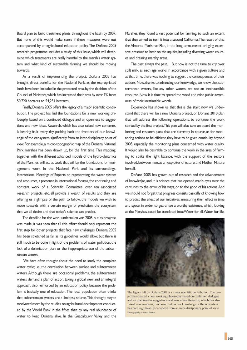
365
Marshes, they found a vast potential for farming, to such an extent
that they aimed to turn it into a second California.The result of this,
the Almonte-Marismas Plan, in the long term, meant bringing exces-
sive pressure to bear on the aquifer, including diverting water cours-
es and draining marshy areas.
The past, always the past… But now is not the time to cry over
spilt milk, as each age works in accordance with a given culture and
at that time, there was nothing to suggest the consequences of their
actions.Now,thanks to advancing our knowledge,we know that sub-
terranean waters, like any other waters, are not an inexhaustible
resource. Now it is time to spread the word and raise public aware-
ness of their inestimable worth.
Experience has shown us that this is the start, now we under-
stand that there will be a new Doñana project, or Doñana 2010 plan
that will address the following operations, to continue the work
started by the first project.This plan will also take on board the mon-
itoring and research plans that are currently in course, as for moni-
toring actions to be efficient, they have to be given continuity beyond
2005, especially the monitoring plans concerned with water quality.
It would also be desirable to continue the work in the area of farm-
ing to strike the right balance, with the support of the sectors
involved,between man, as an exploiter of nature, and Mother Nature
herself.
Doñana 2005 has grown out of research and the advancement
of knowledge, and it is science that has opened man's eyes over the
centuries to the error of his ways, or to the good of his actions.And
we should not forget that progress consists basically of knowing how
to predict the effect of our initiatives, measuring their effect in time
and space, in order to guarantee a worthy existence, which, looking
at the Marshes, could be translated into:Water for all,Water for life.
Board plan to build treatment plants throughout the basin by 2007.
But none of this would make sense if these measures were not
accompanied by an agricultural education policy.The Doñana 2005
research programme includes a study of this issue, which will deter-
mine which treatments are really harmful to the marsh's water sys-
tem and what kind of sustainable farming we should be moving
towards.
As a result of implementing the project, Doñana 2005 has
brought direct benefits for the National Park, as the expropriated
lands have been included in the protected area,by the decision of the
Council of Ministers,which has increased their area by over 7%, from
50,720 hectares to 54,251 hectares.
Finally,Doñana 2005 offers the legacy of a major scientific contri-
bution.The project has laid the foundations for a new working phi-
losophy based on a continued dialogue and an openness to sugges-
tions and new ideas. Research, which has also raised new concerns,
is bearing fruit every day, pushing back the frontiers of our knowl-
edge of the ecosystem significantly from an inter-disciplinary point of
view. For example, a micro-topographic map of the Doñana National
Park marshes has been drawn up, for the first time.This mapping,
together with the different advanced models of the hydro-dynamics
of the Marshes,will act as tools that will lay the foundations for man-
agement work in the National Park and its surroundings.
International Meetings of Experts on regenerating the water system
and resources, a presence in international forums, the continuing and
constant work of a Scientific Committee, over ten associated
research projects, etc. all provide a wealth of results and they are
offering us a glimpse of the path to follow, the models we wish to
move towards with a certain margin of prediction, the ecosystem
that we all desire and that today's science can predict.
The deadline for the work undertaken was 2005,but, as progress
was made, it was seen that all this effort should only represent the
first step for other projects that face new challenges. Doñana 2005
has been stretched as far as its guidelines would allow, but there is
still much to be done in light of the problems of water pollution, the
lack of a delimitation plan or the inappropriate use of the subter-
ranean waters.
We have often thought about the need to study the complete
water cycle; i.e., the correlation between surface and subterranean
waters. Although there are occasional problems, the subterranean
waters demand a plan of action, taking a global view and an integral
approach, also reinforced by an education policy, because the prob-
lem is basically one of education.The local population often thinks
that subterranean waters are a limitless source.This thought maybe
motivated more by the studies on agricultural development conduct-
ed by the World Bank in the fifties than by any real abundance of
water to keep Doñana alive. In the Guadalquivir Valley and the
The legacy left by Doñana 2005 is a major scientific contribution. The pro-ject has created a new working philosophy based on continued dialogueand an openness to suggestions and new ideas. Research, which has alsoraised new concerns, has born fruit, as our knowledge of the ecosystemhas been significantly enhanced from an inter-disciplinary point of view.Photograph by Antonio Sabater.

FRANCISCO GARCÍA NOVO
Born in Madrid (1943). He studied Bs. Sc. on Biology at the Universidad Complutense of Madrid, where he was awarded a Ph. D
degree in Ecology on 1968. Post doctoral specialization 1968-70 at the Estaçao de Melhoramento de Plantas (Elvas, Portugal) and
Botany Department,The University of St Andrews (UK). He joined the staff of the University of Seville in 1970, where he was appoint-
ed Professor of Ecology in 1976. He belongs to the Faculty of Biology and is Scientific Director of the Estación de Ecología Acuática.
His fields of interest have been the ecology of vegetation and the conservation biology. He focused research activities on the rela-
tionship of plants and their environment (plant-water relationships, photosynthesis, growth and structure of plants and vegetation),
working in the Mediterranean basin and in South America countries. His studies on long-term succession led him to investigate the
ecological story of vegetation and the effects of human exploitation on ecosystems. He has devoted a particular attention to sand dune
areas, and to the communities living in them. He has been active in the area of environmental studies (new methods of impact evalu-
ation, sensitivity and vulnerability of ecosystems, biodiversity studies on terrestrial and aquatic environments), and conservation and
restoration activities.
He carried out many of his studies in Andalusia (Spain) and in particular, in Doñana area, contributing to its description, preserva-
tion and present restoration initiatives. He was member of the International Committee of Experts that authored the Dictamen of the
Sustainable Development Plan for Doñana in 1992.
He has authored 320 publications, 107 of which dealing with Doñana. For several years he belonged to Spanish MaB Committee.
He belongs to the Spanish National Academy of Science, to the Academy of Sciences of Seville, and to several Conservation and
Environmental institutions.
He has been awarded the Prize Rey Jaime I for the Environment, the Cross of Alfonso X el Sabio, the Medal of the University of
Bari. He has been named International Commissioner of the Tortuguero National Park of Costa Rica.
Member of the Doñana 2005 Scientific Commission.
The Authors
CIPRIANO MARÍN CABRERA
Born in Santa Cruz de Tenerife (1952). He studied Mathematics at the Universidad de La Laguna. He has developed his profession-
al activity in the fields of sustainable development, renewable energies and environmental management.
Taking into account only his activity in fields related to Doñana and the subjects treated in this book, it has to be emphasized his
role of co-ordinator and promoter of "The Salt Route", an European Project aiming at restoration and valorisation of coastal salt pan
landscapes. He has participated in international projects such as Med-Wet and, more recently, Water Strategy Man (Developing
Strategies for Regulating and Managing Water Resources and Demand in Water Deficient Regions). He has been the Commissary of
the International Contest of Ideas "Parque Dunar" focused on the coastal area of Doñana.Among his several international missions,
his role of member of the UNESCO's Committee of Experts that achieved the defence and protection of the big lagoon complex and
whale sanctuary of "El Vizcaíno" (Biosphere Reserve and World Heritage Site), in Baja California (Mexico), stands out.
He has been co-director of the first eco-development project under the auspices of UNESCO (La Gomera Ecoplan) and has
directed the scientific reports that lead to the declaration of the islands of Minorca, Lanzarote, La Palma and El Hierro as UNESCO-
MaB Biosphere Reserves.
He is author or co-author of 29 books and 19 chapters in joint publications, mostly covering aspects of sustainable development.
He has also been editor and coordinator of 14 monographic publications, co-editor of the "International Journal of Island Affairs" and,
in 1975, co-founded "Alfalfa", the first ecologist magazine of Spain.
He has been Secretary-general of the 1st World Conference on Sustainable Tourism (1995) and of the 1st European Conference
on Sustainable Island Development (1997), as well as co-ordinator of other 9 international conferences. He has been, among others,
Vice Secretary-general of the International Scientific Council for Island Development and he is Secretary-general of the Unesco Centre
of the Canary Islands.
Member of the Doñana 2005 Scientific Commission.

367
This book has been possible thanks to people who only understood one way ofdoing things for Doñana, by simply doing them well and with enthusiasm.
That is what the authors were commissioned to do byFélix Manuel Pérez Miyares.
That is how we have done it and, hence, we understand that the missionhas been accomplished.
Seville - November, 2005.


![UNESCO - Man and the Biosphere (MAB) …...a biosphere reserve which are given in order below.] UNESCO - Man and the Biosphere (MAB) Programme - Biosphere reserve nomination form:](https://img.pdfslide.us/doc/110x75/5f0db46a7e708231d43bac72/unesco-man-and-the-biosphere-mab-a-biosphere-reserve-which-are-given-in.jpg)