Embed Size (px)
Citation preview
DOI Enterprise Geographic Information Management (EGIM) Team Initiative

Major changes in GIS• Who can use GIS• Point’n click GUI-based software• Web services
• Availability of GIS• Enterprise licensing – SmartBuy implementation• Access to data• NSDI clearinghouse nodes
• Delivery of GIS• Web serviceso Geospatial One-Stop (GOS) o The National Map (TNM)
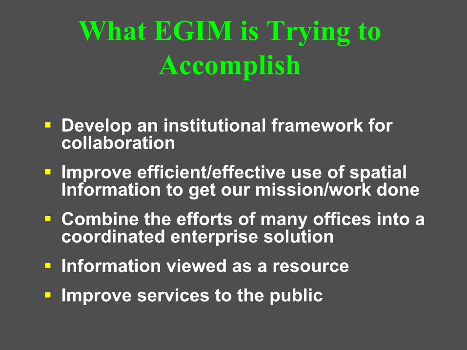
Develop an institutional framework for collaborationImprove efficient/effective use of spatial Information to get our mission/work doneCombine the efforts of many offices into a coordinated enterprise solutionInformation viewed as a resourceImprove services to the public
What EGIM is Trying to Accomplish
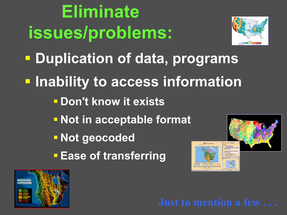
Eliminate issues/problems:Duplication of data, programsInability to access information
Don't know it existsNot in acceptable formatNot geocodedEase of transferring
Just to mention a few . . .

• Efficient• Effective• Responsive • Integrated• Sustainable• Participatory
Serving CommunitiesManagement for
Excellence & Accountability Recreation
Facilities & Land Management
Resource Use& Protection
Making Government More:
GIS Supports the Enterprise
GIS Data Resources
FWS
OSM
NPS
BLM BIA
BOR
MMSDOI
USGS
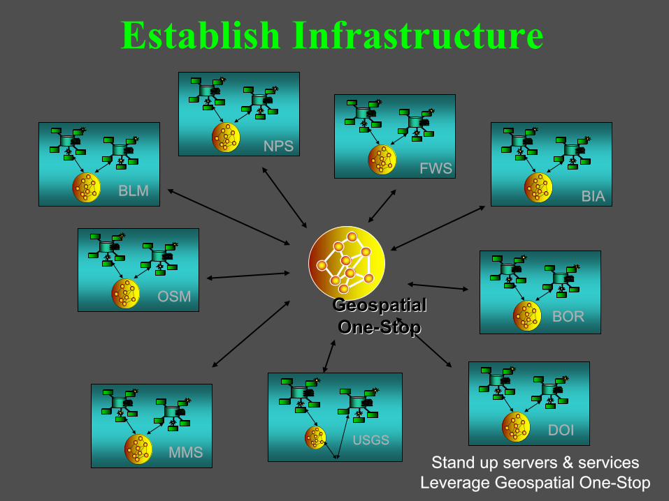
Stand up servers & services Leverage Geospatial One-Stop
Geospatial Geospatial OneOne--StopStop
Establish Infrastructure
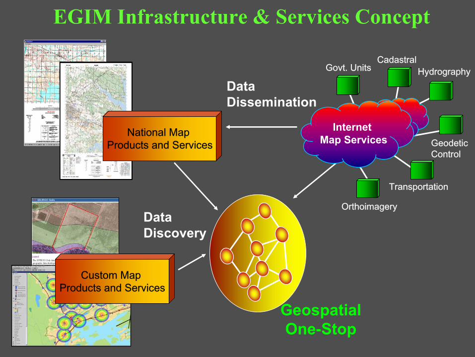
Internet Map Services
Geospatial One-Stop
Govt. UnitsCadastral
Transportation
Hydrography
Geodetic Control
National Map Products and Services
Custom Map Products and Services
Orthoimagery
EGIM Infrastructure & Services Concept
Data Discovery
Data Dissemination

Optimize use of geospatial technologies
Business Critical Systems
Projects, Applications
Re-engineer . . .
DOI’s “Lines of Business”
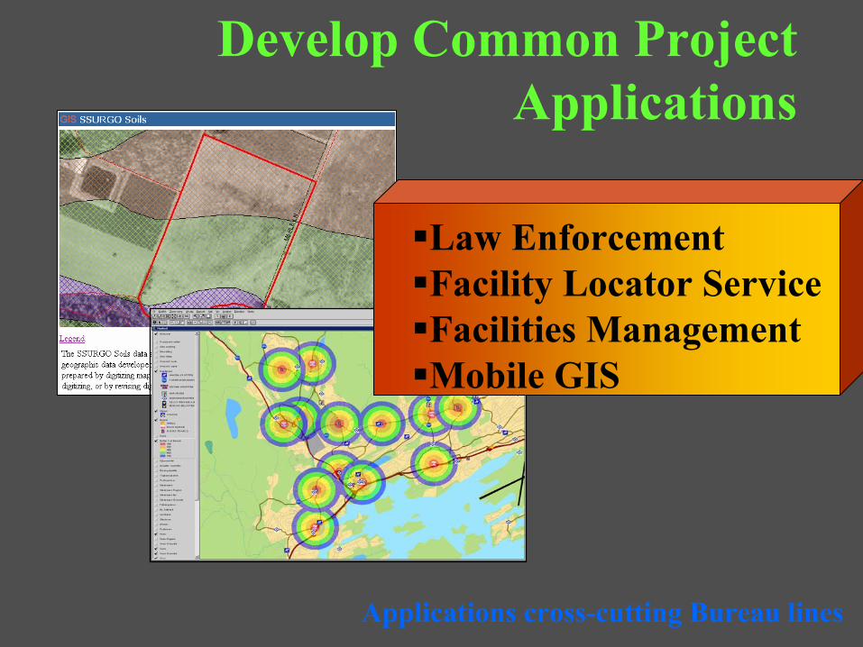
Develop Common Project Applications
Applications cross-cutting Bureau lines
Law Enforcement Facility Locator ServiceFacilities ManagementMobile GIS

Current Efforts
• Establishing within DOI:• A coordination mechanism for GIS • A baseline of existing GIS use• Business Case Development
• Establish a communications plan– Web site, presentations, internal user meetings
• Prioritize and plan efforts associated with Circular A-16 data efforts
• Define best practices for:– Creating department implementations from Bureau-
centric applications e.g. NILS– Data migration strategies
• Extension of the ESRI SmartBUY Agreement
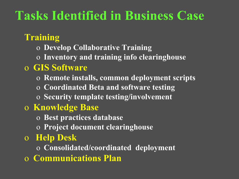
Tasks Identified in Business CaseTrainingo Develop Collaborative Trainingo Inventory and training info clearinghouse
o GIS Software o Remote installs, common deployment scriptso Coordinated Beta and software testingo Security template testing/involvement
o Knowledge Baseo Best practices databaseo Project document clearinghouse
o Help Desk o Consolidated/coordinated deployment
o Communications Plan
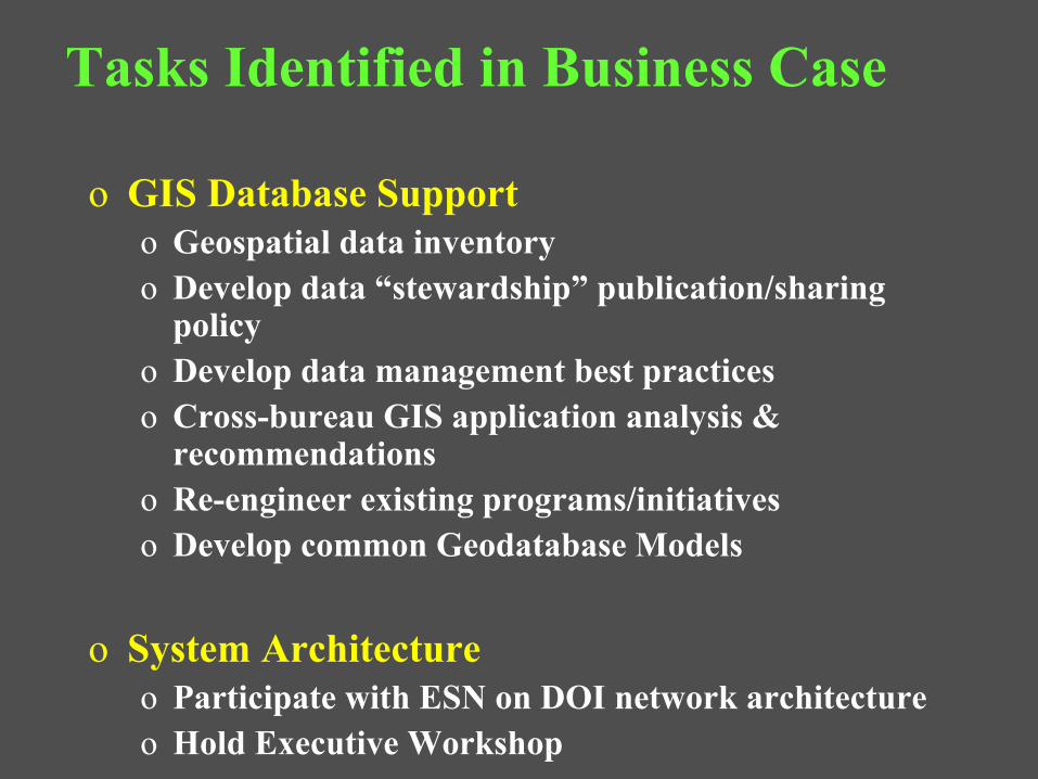
Tasks Identified in Business Case
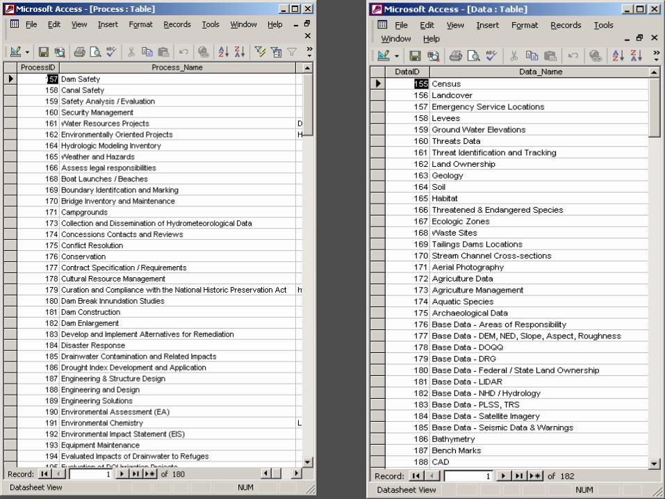
o GIS Database Supporto Geospatial data inventoryo Develop data “stewardship” publication/sharing
policyo Develop data management best practiceso Cross-bureau GIS application analysis &
recommendationso Re-engineer existing programs/initiatives o Develop common Geodatabase Models
o System Architectureo Participate with ESN on DOI network architectureo Hold Executive Workshop


Thank you!
The EGIM Team