Embed Size (px)
Citation preview
DOCUME NT
2nd workshop “Preparations for Sentinel-2 in
Europe: workshop summary”
Prepared by Gjertsen1, A. K. and Trollvik2, J. A. Reference 2nd workshop “Preparations for Sentinel-2 in Europe
– workshop summary”, Oslo, 11.–12. October 2016 Issue 1 Revision 1 Date 03/01/2017 Status Draft Document type Document 1The Norwegian Institute of Bioeconomy Research,
2 Norwegian Mapping Authority
Page 2/29 2nd workshop “Preparations for Sentinel-2 in Europe” Date 03/01/2017 Issue 1 Rev. 3
2nd workshop “Preparations for Sentinel-2 in
Europe: workshop summary”
Guro Dahle Strøm, Norwegian Space Centre
Sébastien Giordano, IGN France
Arnt Kristian Gjertsen, Norwegian Institute of Bioeconomical Research (NIBIO)
Line Langkaas, Norwegian Mapping Authority
Jon Arne Trollvik, Norwegian Mapping Authority, Chair EuroSDR Commission 3, Updating and
Integration
Page 3/29 2nd workshop “Preparations for Sentinel-2 in Europe” Date 03/01/2017 Issue 1 Rev. 3
Contents Executive summary ................................................................................................................................. 5
Context ................................................................................................................................................ 5
Workshop rationale and objectives .................................................................................................... 5
Workshop salient findings ................................................................................................................... 5
Summary of presentations and discussions ............................................................................................ 6
What is the status of preparation for ColGS in the different countries? ............................................ 6
What are the services that the ColGS delivers? .................................................................................. 6
Observations and recommendations from the NMA’s ....................................................................... 7
What are common research topics? ................................................................................................... 7
Recommendations .................................................................................................................................. 7
Highlights from the presentations .......................................................................................................... 8
Sentinel-2: mission status, data access and outlook ........................................................................... 8
Sentinel-2: products, data quality and evolution ................................................................................ 9
From rapid development to operational processing: Sentinel data user's support provided by ESA's
SNAP .................................................................................................................................................. 10
The French Theia Land data center products, based on Sentinel-2 data: cloud masks, atmospheric
correction, snow cover and land cover maps at country scale ......................................................... 11
Status of the Earth Observation Data Centre (EODC) services ......................................................... 13
Status of preparations for the Sentinels in Sweden: validation and applications of data from
Sentinel-2 .......................................................................................................................................... 14
Norwegian preparations for the National Ground Segment ............................................................. 15
Fully automatic land cover map production ..................................................................................... 16
Outcome of the break-out sessions ...................................................................................................... 17
1. National Mapping Agencies ........................................................................................................... 17
Quick background from persons present of organisation in their countries ................................ 17
Ability to provide in-situ data when data licences provide a block? ............................................. 18
Opportunities in NMAs to develop visualisation tools of long S2 time series? ............................ 18
Are there authoritative national databases that can be created/updated with Sentinel Images?
....................................................................................................................................................... 19
Potential Research Tasks? ............................................................................................................. 19
2. Collaborative Ground Segment ..................................................................................................... 20
Who has established ground segments? ...................................................................................... 20
Page 4/29 2nd workshop “Preparations for Sentinel-2 in Europe” Date 03/01/2017 Issue 1 Rev. 3
National basic requirements ......................................................................................................... 21
3. Toolboxes and training .................................................................................................................. 21
Do you use other tools to process Sentinel data (e.g. QGIS with Orfeo ToolBox (OTB), Python
with osgeo, commercial tools)? Which and why? ......................................................................... 21
Conclusions .................................................................................................................................... 22
4. Users/End Users Requirements ..................................................................................................... 22
Have any of you used S2 data? Have you checked the quality with other data? ......................... 22
What did you see as the biggest obstacle to use S2 data? ........................................................... 22
Do you plan to use S1 and S2 in conjunction with each other? .................................................... 22
Which application do you see have the highest potential? .......................................................... 23
Final remarks ................................................................................................................................. 23
5. Research and new algorithms ...................................................................................................... 23
5.1 Summary of the break-out session : .................................................................................. 23
What’s new? .................................................................................................................................. 24
New studies regarding data avaibility ........................................................................................... 24
New methods for Big Data Handling ............................................................................................. 24
New hypotheses for complementarity .......................................................................................... 25
Temporal analysis strategy ............................................................................................................ 25
Agenda ................................................................................................................................................... 25
List of registered participants ................................................................................................................ 27
Page 5/29 2nd workshop “Preparations for Sentinel-2 in Europe” Date 03/01/2017 Issue 1 Rev. 3
Executive summary
Context
This was the second workshop on preparation for Sentinel-2 in Europe.
A technical committee on remote sensing in Norway started a study on the needs for preparations
for acquisition and application of optical satellite data in 2012. One conclusion from this work was
that we need a forum where the European countries can meet to discuss common challenges.
The target group for the workshop was national agencies responsible for serving the users with data
from the Copernicus program. Specialists on key topics where invited as keynote speakers.
Workshop rationale and objectives
The main objective is to initiate contact and collaboration among national agencies (or project
groups) in Europe responsible for preparing or providing support and services to national users of
satellite images, with special focus on Sentinel-2.
It is almost two years since the first workshop. Since then, Sentinel-1A, 1B, -2A and 3A are all
operational and data are available from ESA’s Science HUB. Some countries have already a
Collaborative GS that serve national users or are in progress building a system. What are the
experiences with handling big data and the user demands? What is required of the system to serve
all types of use cases? What is the status of the Core GS and what are the plans for the European
integrated GS for next years?
We will share experiences and knowledge gained in the preparations for Sentinel-1 and -2 in each
country; identify common challenges and discuss possible solutions; identify fields of possible
cooperation and R&D.
Workshop salient findings
Sentinel-2 has been operational since 5 July 2016 and covers land surfaces between 56° S to 84° N.
The revisit frequency is 10 days for Europe and 20 days in the rest of the world, but this will be 10
days globally when the EDRS service is ready. Sentinel-2B will be launched in March 2017 and both
satellites will be operative from autumn 2017.
Orthorectified Level 1C based on the global terrain model PlanetDEM is available for download. The
global reference image (GRI), used to improve the sensor model and thereby improve the geometric
accuracy, will be validated in 2018. Several users request downloading of level 1B, a product level
where no geometric correction are applied, but it will not be available for the near future. The
absolute geometric accuracy and spectral geometric accuracy are higher than required. Multi-
temporal geometric accuracy is still lower than required, but expected to meet the requirements
when the GRI is completed in Q4 2017.
Systematic production of atmospheric corrected data, level 2A, is currently being prepared. An
atmospheric correction pilot will take place in 2017 where several algorithms will be evaluated and
compared: BC by Brockmann Consult, MAJA (MACCS and ATCOR joint algorithm) by CNES and DLR,
SCAPE-M by GFZ Potsdam, and Sen2Cor by DLR/TPZ. A pre-operational production of level 2A based
on Sen2Cor v. 2.2.3 will start in October 2016, followed by a feasability study for operational
Page 6/29 2nd workshop “Preparations for Sentinel-2 in Europe” Date 03/01/2017 Issue 1 Rev. 3
production. In a related study in the framework of CEOS, ESA and NASA are co-organizing a
comparison of 14 algorithms: FLAASH (Spectral Sciences), SMACAA (South Dakota State University),
Sen2Cor (DLR/TPZ), L8SR (NASA), GA-PABT (Geoscience Australia), ACOLITE (Royal Belgian Institute
for Natural Sciences), GRASP (LOA), OPERA (VITO), BC (BC), LAC (ACRI), MACCS (CNES), ATCOR (DLR),
Ind-prepro (Trier University), SCAPE-M (GFZ).
The Sentinel-2 archive at CoreGS will be restructured to a single tile format, so users can download
single 100 x 100 km tiles. In addition, the file names will be made shorter to fix the problem with too
long file paths on machines with Windows OS.
ESA SNAP is a modular tool developed for ESA to support ESAs Sentinel missions. It contains generic
tools, instrument specific tools, and programming tools (API for Python). One neat feature is that is
can work in native resolutions without the need to resample to a common resolution. Sen2Cor and
Sen2Three can be imported to SNAP, and allows atmospheric correction and spatio-temporal
composite for cloud free datasets.
Theia, the French national land thematic data center gives users access to data and advanced
products based on several missions, incl. Sentinel-2: ortho-rectification, mosaics, atmospheric
correction based on MACCS, cloud masks, and land cover classes. It serves currently French users.
MACCS is not open source yet, and is better suited for distribution of processed products rather than
the code itself. Sentinel-2 images covering an area of 5M km2 will be processed to level 2A with
MACCS.
EODC is an Austrian initiative and provides a platform for cooperation that offers a global archive and
a cloud for super-computing of value-added products. Users can subscribe to the service. Currently
value added products are for Sentinel-2 RGB composites, LAI, fAPAR, Albedo.
In Sweden and Norway work is under way to establish a national ground segment. Survey to map
user needs has been carried out, and the functionality of the ground segment has been described.
Some central requirements are: Subscription service, synthesis of images within a defined period,
times series as data cubes, cloud/shadow masks, subpixel geometric accuracy, and Landsat 8
processed in the same manner as Sentinel-2.
Summary of presentations and discussions
What is the status of preparation for ColGS in the different countries?
The French ColGS is called PEPS (Sentinel Product Exploitation Platform) and is run by CNES. It
contains a global copy of Sentinel acquisitions. Theia is a collaboration between 11 public partners
and delivers value added products to national users based on several satellite missions and not only
the Sentinels. In Sweden and Norway the ColGS are under establishment and are expected to be
operational during 2017. In Austria, the ColGS consists of a national mirror ZAMG, which is a data
hub relay. The EODC is a global sentinel archive and offers value added products.
What are the services that the ColGS delivers?
The ColGS serves as archives of data over national territories and area of interest and some also plan
to keep a global archive of sentinel data. As value added products the centers provides:
Page 7/29 2nd workshop “Preparations for Sentinel-2 in Europe” Date 03/01/2017 Issue 1 Rev. 3
archiving
search and fast downloading
simple products such as RGB composites
orthorectification based on national DEM
atmospheric correction based on Sen2Cor or MACCS
cloud/shadow masks, temporal composites
advanced products such as LAI, fAPAR, land cover classes
multi-temporal datasets as data cubes
subscription
Observations and recommendations from the NMA’s
No current use of satellite data in the NMA’s among the participants. Their role regarding satellite
data seems to be more coordinating or promoting. E.g. Norway (Digital Norway – NSDI), Germany
(Technical coordination) or Switzerland (mandate to promote satellite data). Estonian NMA will host
the mirror site for Copernicus. From some participants it was stated that the NMA’s must change
their thinking from “mapping” to “monitoring”.
Possible authoritative use: Change detection (“trend scouting”) to drive allocation of resources (E.g.
New forest roads, clearings (forestry) etc.) Will require automated processes.
What are common research topics?
Concerning applied research, the availability of Sentinel-2 image time series raises important
methodological issues that could be explored as well as solutions for well-known remote sensing
problems. The recommendations that can be suggested deal with the integration of Sentinel-2
images in existing methods, the need to develop new algorithms for temporal analysis, the
exploration of different strategies to combine them with Sentinel-1 images, and the consideration of
big data handling issues.
Recommendations The main objective with the workshop was to initiate contact and collaboration among European
mapping agencies, institutes and companies involved in work to support national users of data from
the fleet of Sentinel satellites, with special focus on Sentinel-2. There were 62 participants from 14
nations, represented by universities, research institutes, governmental and private industries
gathered to discuss challenges and opportunities.
The Copernicus program is still in the very beginning. In the following years new applications will
develop, and we will gain more experience both with the ColGS and the use of Sentinel-2 data.
A few recommendations:
SRTM stops at 60 deg. N. ESA must provide Sentinel-2 data with the best possible DEM for all countries in Europe. For Nordic countries, the national DEMs are required. Can the Arctic DEM1 available from 2018 replace the National DEMs or Planet DEM for ortho corrections?
1 ArcticDEM is a National Geospatial-Intelligence Agency (NGA)-National Science Foundation (NSF) public-private initiative
to automatically produce a high-resolution, high quality, digital surface model (DSM) of the Arctic using optical stereo imagery.
Page 8/29 2nd workshop “Preparations for Sentinel-2 in Europe” Date 03/01/2017 Issue 1 Rev. 3
A possible research project within this field could be: How can the NMA’s use Sentinel-2 data to improve or update basic topographic databases.
It was a common interest among the participants to arrange a new workshop within two
years (autumn 2018). Within this period more satellites are in service, national services are
established and in use. New studies based on the new data are completed and new products
are developed. Topics could be:
o Functionalities of national services.
o Access and processing of data including how to use toolboxes.
o Use cases, new products and opportunities with regard to high and low level users.
It is recommended to arrange conferences or workshops at national level to include the end
user needs (potential of Copernicus data, possible products for end users, use cases).
Highlights from the presentations
Sentinel-2: mission status, data access and outlook
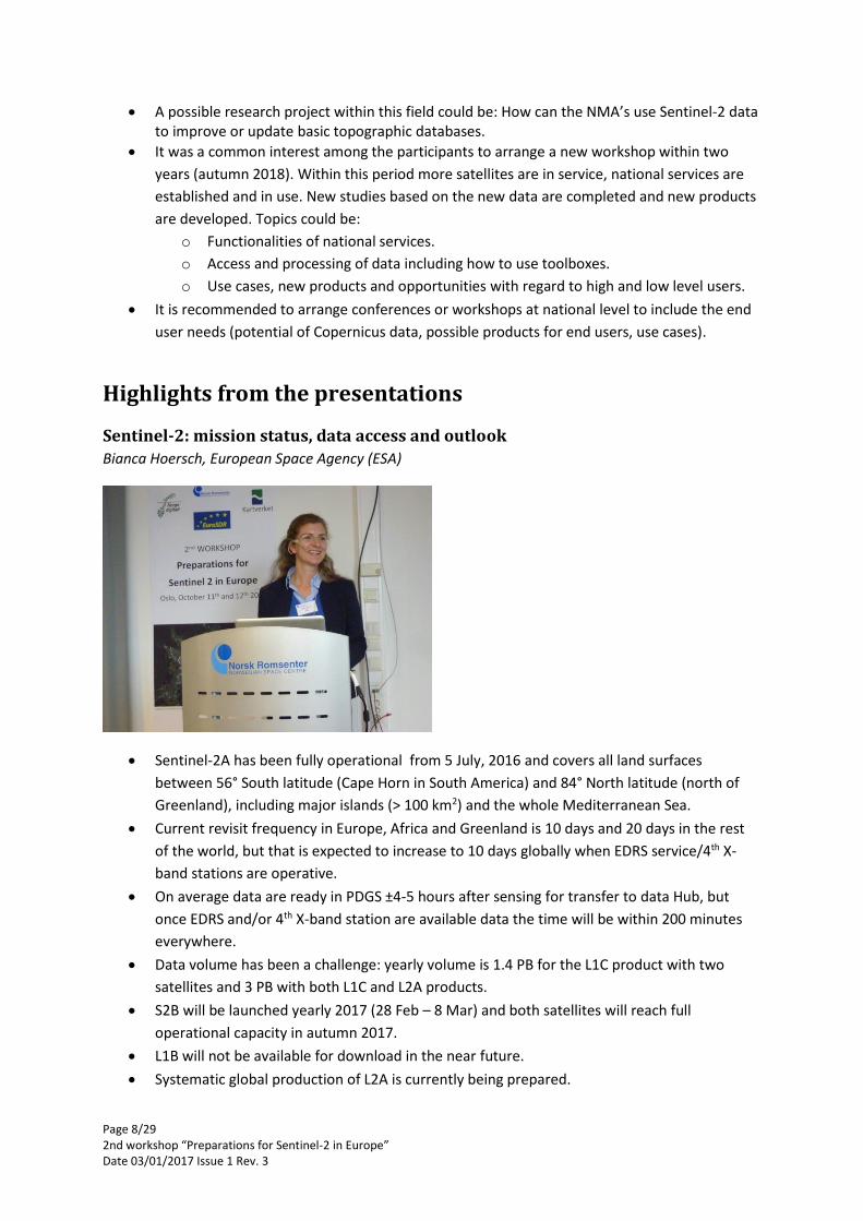
Bianca Hoersch, European Space Agency (ESA)
Sentinel-2A has been fully operational from 5 July, 2016 and covers all land surfaces
between 56° South latitude (Cape Horn in South America) and 84° North latitude (north of
Greenland), including major islands (> 100 km2) and the whole Mediterranean Sea.
Current revisit frequency in Europe, Africa and Greenland is 10 days and 20 days in the rest
of the world, but that is expected to increase to 10 days globally when EDRS service/4th X-
band stations are operative.
On average data are ready in PDGS ±4-5 hours after sensing for transfer to data Hub, but
once EDRS and/or 4th X-band station are available data the time will be within 200 minutes
everywhere.
Data volume has been a challenge: yearly volume is 1.4 PB for the L1C product with two
satellites and 3 PB with both L1C and L2A products.
S2B will be launched yearly 2017 (28 Feb – 8 Mar) and both satellites will reach full
operational capacity in autumn 2017.
L1B will not be available for download in the near future.
Systematic global production of L2A is currently being prepared.
Page 9/29 2nd workshop “Preparations for Sentinel-2 in Europe” Date 03/01/2017 Issue 1 Rev. 3
All Sentinel data generated since October 2014 are currently available online on Open Access
Data Hub (Scientific Data Hub).
Archive will restructure to a single tile format, so users can download 100 km x 100 km tiles.
Also the file names will be made shorter to fix the problem with too long filenames.
Atmospheric correction pilot in Europe will take place in 2017 and the global reference image
GRI will be validated in 2018.
A large reprocessing campaign will take place from 2018 to reflect the new tile structure,
improved geometry, shorter file names, and L2A product.
Sentinel-2: products, data quality and evolution
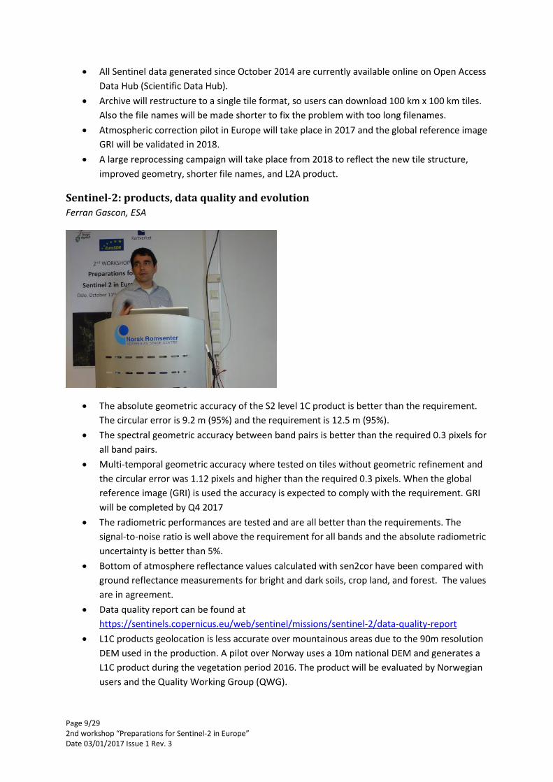
Ferran Gascon, ESA
The absolute geometric accuracy of the S2 level 1C product is better than the requirement.
The circular error is 9.2 m (95%) and the requirement is 12.5 m (95%).
The spectral geometric accuracy between band pairs is better than the required 0.3 pixels for
all band pairs.
Multi-temporal geometric accuracy where tested on tiles without geometric refinement and
the circular error was 1.12 pixels and higher than the required 0.3 pixels. When the global
reference image (GRI) is used the accuracy is expected to comply with the requirement. GRI
will be completed by Q4 2017
The radiometric performances are tested and are all better than the requirements. The
signal-to-noise ratio is well above the requirement for all bands and the absolute radiometric
uncertainty is better than 5%.
Bottom of atmosphere reflectance values calculated with sen2cor have been compared with
ground reflectance measurements for bright and dark soils, crop land, and forest. The values
are in agreement.
Data quality report can be found at
https://sentinels.copernicus.eu/web/sentinel/missions/sentinel-2/data-quality-report
L1C products geolocation is less accurate over mountainous areas due to the 90m resolution
DEM used in the production. A pilot over Norway uses a 10m national DEM and generates a
L1C product during the vegetation period 2016. The product will be evaluated by Norwegian
users and the Quality Working Group (QWG).
Page 10/29 2nd workshop “Preparations for Sentinel-2 in Europe” Date 03/01/2017 Issue 1 Rev. 3
A pre-operational L2A production using sen2cor v. 2.2.3 (atmospheric correction) over
Europe will start in October 2016 and will be followed by a feasibility study for operational
production. L2A products will be made available from Open Access Data Hub after an
evaluation period.
A group of experts will evaluate the following algorithms for atmospheric correction:
o BC by Brockmann Consult
o MAJA (MACCS ATCOR Joint Algorithm) by CNES/DLR
o SCAPE-M by GFZ Potsdam
o Sen2Cor by DLR/TPZ
In a related study in the framework of CEOS, ESA and NASA are co-organizing a comparison
of 14 algorithms:
o FLAASH (Spectral Sciences), SMACAA (South Dakota State University), Sen2Cor
(DLR/TPZ), L8SR (NASA), GA-PABT (Geoscience Australia), ACOLITE (Royal Belgian
Institute for Natural Sciences), GRASP (LOA), OPERA (VITO), BC (BC), LAC (ACRI),
MACCS (CNES), ATCOR (DLR), Ind-prepro (Trier University), SCAPE-M (GFZ).
From rapid development to operational processing: Sentinel data user's support
provided by ESA's SNAP
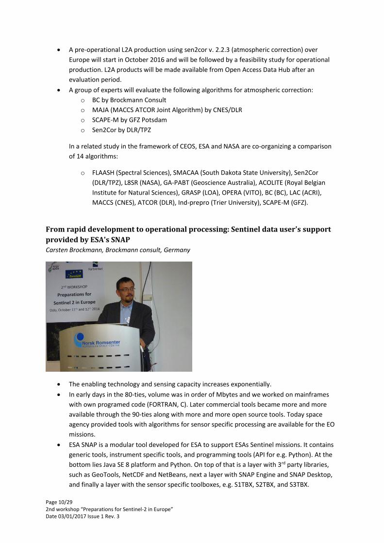
Carsten Brockmann, Brockmann consult, Germany
The enabling technology and sensing capacity increases exponentially.
In early days in the 80-ties, volume was in order of Mbytes and we worked on mainframes
with own programed code (FORTRAN, C). Later commercial tools became more and more
available through the 90-ties along with more and more open source tools. Today space
agency provided tools with algorithms for sensor specific processing are available for the EO
missions.
ESA SNAP is a modular tool developed for ESA to support ESAs Sentinel missions. It contains
generic tools, instrument specific tools, and programming tools (API for e.g. Python). At the
bottom lies Java SE 8 platform and Python. On top of that is a layer with 3rd party libraries,
such as GeoTools, NetCDF and NetBeans, next a layer with SNAP Engine and SNAP Desktop,
and finally a layer with the sensor specific toolboxes, e.g. S1TBX, S2TBX, and S3TBX.
Page 11/29 2nd workshop “Preparations for Sentinel-2 in Europe” Date 03/01/2017 Issue 1 Rev. 3
One feature is the ability to work in native resolution, i.e. it can simultaneously work with
10m, 20m, and 60m data without the need to resample to a common resolution.
The Python API allows using also numpy, scipy, pandas, etc. with SNAP.
sen2cor and sen2three are modules that can be imported to SNAP. sen2cor performs
atmospheric correction to L2A and sen2three performs a spatio temporal synthesis of L2A (or
alternatively uncorrected top of atmosphere L1C images), retrieved by the Sentinel 2 Multi
Spectral Instrument (MSI). sen2three is a level 3 product and results in cloud-free
composites.
sen2cor performs atmospheric-, terrain-, and cirrus corrections and delivers in addition
aerosol optical thickness, water vapor, scene classification maps, and quality indicators for
cloud and snow probabilities. The product format is equivalent to L1C
SNAP has a rich list of radiometric indices that can be used.
User support can be found at http://step.esa.int/main/doc/tutorials/sentinel-2-toolbox-
tutorials/
The majority of the SNAP functions are implemented as operators and they can be invoked
either from the Desktop or the command line. Processing chains can be set up using a graph
builder tool (gpt); the chains are configured in XML-files.
SNAP is platform independent and can be set up in various environments, including virtual
machines, web processing services, Apache Yarn/Hadoop (Calvalus).
The French Theia Land data center products, based on Sentinel-2 data: cloud
masks, atmospheric correction, snow cover and land cover maps at country scale
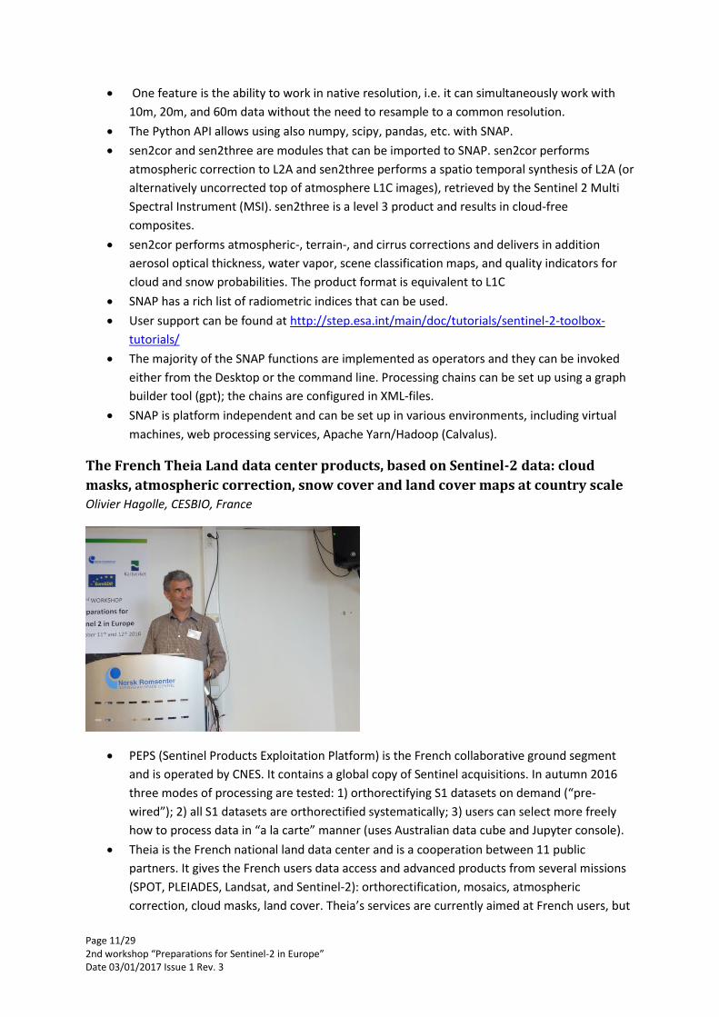
Olivier Hagolle, CESBIO, France
PEPS (Sentinel Products Exploitation Platform) is the French collaborative ground segment
and is operated by CNES. It contains a global copy of Sentinel acquisitions. In autumn 2016
three modes of processing are tested: 1) orthorectifying S1 datasets on demand (“pre-
wired”); 2) all S1 datasets are orthorectified systematically; 3) users can select more freely
how to process data in “a la carte” manner (uses Australian data cube and Jupyter console).
Theia is the French national land data center and is a cooperation between 11 public
partners. It gives the French users data access and advanced products from several missions
(SPOT, PLEIADES, Landsat, and Sentinel-2): orthorectification, mosaics, atmospheric
correction, cloud masks, land cover. Theia’s services are currently aimed at French users, but

Page 12/29 2nd workshop “Preparations for Sentinel-2 in Europe” Date 03/01/2017 Issue 1 Rev. 3
Theia could also cover all of Europe if financed. The data policy is free and open; the only
limits are set by data providers.
First achievements of Theia are: 1) full yearly coverage by high resolution (<5 m) images; 2)
access to Pleiades data bought by any public institution in France; 3) reprocessing of SPOT
world heritage data to level 1C; 4) time series of SPOT data (Take5) from 2013 and 2015
taken every 5 days over 5 months; 5) Landsat data since 2009 over France and overseas
territories processed to levels 1C and 2A.
Theia uses its own processor MACCS for atmospheric correction of SPOT, Sentinel-2 and
Landsat data. The algorithm is based on time series to detect cloud/shadow and to
determine optical thickness and water vapor. MACCS has demonstrated good results and
enhancements are on-going. Sentinel-2 images covering an area of 5M km2 will be processed
to level 2A with MACCS.
MACCS is not open source yet and is better suited for distribution of processed products
rather than the code itself. In contrast, sen2cor, which is based on ATCOR (not open source)
and Python, uses single images and has a code better suited for distribution to the users.
MACCS will be used in ESAs sen2agri system which will be ready in May 2017. DLR and CNES
have agreed to join MACCS and ATCOR to create a joined algorithm MAJA (MACCS-ATCOR
Joint Algorithm). I will be based on MACCS but use ATCOR’s better methods for water vapor
estimates, cirrus cloud correction and complement MACCS multi-temporal cloud detection.
MAJA is proposed to ESA/EU for global production but there are other runners: sen2cor,
Brockmann Consult, GFZ. Comparison exercise will start soon, but ESA is unlikely to start
production before 2018.
CESBIO has developed cloud free level 3A product which is a multi-temporal composite of
L2A products. It needs both satellites S2A/B to be operational and will be implemented in
Theia in 2017.
Theia has organized several expertise centers where each center groups 1 to 8 laboratories.
Each Theia partner can then support studies, implementation, and production carried out by
the expertise centers.
A snow cover monitoring tool has been developed. It is based on level 2A products plus a
cloud mask. The software is open source and is based on the Orfeo Toolbox. Production over
relevant tiles has begun and distribution is expected to start end 2016/beginning 2017.
A method for fully automatic land cover map production has been developed and used on
Landsat data to map all of France. The map has a nomenclature with 20 classes.
Page 13/29 2nd workshop “Preparations for Sentinel-2 in Europe” Date 03/01/2017 Issue 1 Rev. 3
Status of the Earth Observation Data Centre (EODC) services
Christian Briese, EODC, Austria
The Austrian collaborative ground segment consists of two parts: 1) the national mirror
ZAMG, which is a data hub relay, and 2) EODC which is a global sentinel archive and a center
for cloud computing, supercomputing and added-value products.
EODC is a private/public partnership and founded in 2014. Its main goals are to: 1) offer big
data storage and high performance computing (HPC); 2) provide data, processing chains, and
added-value products; 3) virtual research, development, and operation environment. It is an
Austrian initiative, but international partners are welcome.
EODC is co-located at the Technical University of Vienna’s super-computing center (Vienna
Scientific Cluster). It has 2000 nodes with 32000 cores that produce more than 600
terraflops.
EODC plans to evolve as a federation of data centers all directly connected to ESAs data hub.
The users can trigger processing via a net browser interface and the jobs queues are
scheduled and sent to several processing containers on the cloud; product delivery via e.g.
WMS/WCS.
EODC is currently being set up to host image store of S1 data with full coverage of Europe:
monthly backscatter, composites, different polarizations, georeferenced.
EODC provides on-demand processing of Sentinel-2 data to level 2A using sen2cor (v. 2.2.1).
Value-added products delivered are RGB colour composites, Leaf Area Index, Albedo, fAPAR.
Data access via dedicated API. An R package is currently being set up to allow easy access to
data.
EODC acts as a community facilitator and represents a new model for collaboration in earth
observation through its aims to develop and operate shared resources, connect science with
operations, and share know-how among different organizations.
Page 14/29 2nd workshop “Preparations for Sentinel-2 in Europe” Date 03/01/2017 Issue 1 Rev. 3
Status of preparations for the Sentinels in Sweden: validation and applications of
data from Sentinel-2
Mats Rosengren, Metria, Sweden
Current examples of uses of EO data from SPOT, Landsat, and IRS are: 1) yearly clear-cutting
map; 2) national forest inventory map with timber volume predictions (based on kNN);
3) recurrent mapping of all natural reserves, national parks, Nature 2000 sites, and other
protected areas. All applications are based on data from SACCESS, the Swedish national
satellite data archive. SACCESS provides yearly coverages since 2005 and data are free and
jointly funded by public and private institutes/companies.
SACCESS provides one cloud-free composite yearly from the vegetation season. It contains
historical data from all decades beginning with 70-ties. The data is used for land cover
change monitoring and is free to download for residents in the Nordic Countries.
SACCESS is temporary the Swedish mirror for Sentinel-2 data until the new national ground
segment Swea is operative. All S2 data over Swedish AOI are downloaded and archived. All
data are reformatted and reprojected into SWEREF99, the national spatial reference system.
A set of different multi-band images with different band combination is produced and stored
in either GeoTiff of BIL formats with simplified file names.
In December 2014 a study for the Swedish National Space Board (SNSB) was started to map
user needs and technical challenges. A review was made in January 2016 and an ITT was
issued in March 2016, which was won by Spacemetric and a contract was issued in May
2016. Swea is planned to be operational in Q1/2017.
Area of interest is the Swedish landmass plus the Baltic region (sea and drainage basin). The
list of users include among others forest authorities, forest owners and industry, the board of
agriculture, environment protection agency, environmental organizations and research
community.
A user need inventory shows that users demand subpixel absolute geometric accuracy
enabling time-series analysis and integration with other geographical datasets (corrections
for scene offsets and course global DEM is important); cloud/shadow mask; user friendly
data formats including band subsets for easy use as visual backdrops.
Swea will be built as a modular system with a mirror archive as the fundament and on top of
that an increasing level of advanced products: 1) national standard products (L1C-SE, L2A-
SE); 2) basic user defined products (subsets, wms, wcf views); 3) advanced user products
Page 15/29 2nd workshop “Preparations for Sentinel-2 in Europe” Date 03/01/2017 Issue 1 Rev. 3
(change detections, time-series products); 4) recurrent monitoring services; and finally
5) user defined products/services.
Some requirements on Swea are:
o Users can subscribe on data streams for a specific area
o Synthesis of images with pixels acquired the last 10 days
o Time series as data cubes with data from several sensors
o Cloud/shadow mask must be provided since automatic processes will depend on it
o Subpixel accuracy necessary for time-series analysis to be useful
o Landsat 8 to be handled the same way as Sentinel-2
Three projects under development now are: a new land cover map, agricultural block
database control and revision, and automatic clear-cut mapping.
Norwegian preparations for the National Ground Segment
Anja Strømme, Norwegian Space Centre (NSC), Norway
An early test for a CollGS was initiated with KSAT to provide easy access for Norwegian users
of Sentinel-1 data.
Some products established are 1) oil spill detection, 2) ship detection, 3) interferometric
land-slide mapping.
The Norwegian Space Centre has signed a down-link agreement with ESA and have
established a NRT/QRT chain for S1 data.
A technical team has investigated use cases, national needs, and technical issues for the land
community and delivered two reports, in 2012 and 2014.
By the end of October 2016 the national CollGS named Satellittdata.no will be opened. It will
ensure easy access of data from Sentinel-1, -2, and -3 for Norwegian users. Data will be made
ready with as short time delay as possible. Both basic and higher level products will be
produced and made available in a user friendly format. That means data can be projected to
a common national grid (i.e. S1 and S2 in same grid), users can freely select band
combinations and area of interest, and system will support time-series and change detection.
Several grids will be available, among others Euref89/UTM33. UTM33 fits most of Norway
very well, except the most easterly parts in the north (Finnmark).
At the start of the enhanced service focus is on: 1) Sentinel-1 QRT data; 2) orthorectified S1
data; 3) S2 level 1CN based on national 10 m DEM.
Page 16/29 2nd workshop “Preparations for Sentinel-2 in Europe” Date 03/01/2017 Issue 1 Rev. 3
Satellittdata.no will store data globally for 4 to 6 weeks and data over Norwegian AOI
permanently. Data will be stored in ESA’s SAFE format to enable seamless integration of
routines and scripts from other hubs.
In cooperation with ESA, a project has been launched that will produce orthorectified images
based on a national DEM with 10m resolution (level 1CN). This was initiated based on a
recommendation from the technical reports from 2012 and 2014. The data will be made
available at Satellittdata.no. A more careful study of the effects of using a more accurate
DEM than the global PlanetDEM will be carried out and ESA will participate in this effort.
Coordination with neighboring countries will be attempted to ensure continuity across
borders and possibly include a Nordic DEM as part of PlanetDEM.
Next steps are to evaluate atmospheric correction routines and cloud detection routines for
Norwegian conditions and the effect of national DEM vs. PlanetDEM on level 2A products.
NetCDF file format will be used by Satellittdata.no in addition to SAFE format to enable easy
access to small areas and enhance search in terms of area, time and bands. Support for
scripting is planned, tools for time-series analysis/change detection, and processing on
demand. Some InSAR subsidence data products will be included (geohazards, rock slides,
infrastructure).
Fully automatic land cover map production
Olivier Hagolle CESBIO, France presented Jordi Inglada’s work
Up-to-date land cover maps are a crucial asset for many research works and operational
services. It is therefore a need for frequent and regular updates. For high quality maps and
short production times we need automatic, robust, and reliable methods. The method
should be able to exploit all available relevant data (including reference data).
Input data includes time series of Sentinel-2 data (plant phenology conveys information) and
also Sentinel-1. The nomenclature includes 20 classes; the map has 20 m resolution, is yearly
updated, and is delivered 3 months after the reference period.
The kernel of the processing chain is a training phase where a part of the reference data is
used as training data to teach classifiers how to identify the classes, this constitutes the
supervised learning stage; and a supervised classification stage using the trained classifiers to
produce a land cover classification; and finally a validation step based on the reference data
not used for training.

Page 17/29 2nd workshop “Preparations for Sentinel-2 in Europe” Date 03/01/2017 Issue 1 Rev. 3
All available images are used regardless of cloud cover: 90% cloud cover means 10% of pixels
are clear. Time series is used as a classification feature.
A set of overlapping tiles, 100 km x 100 km in one spatial reference system, is used to split
the mapping area (France) into manageable parts. All image data are resampled into this
common grid and common virtual dates are used twice a month. Results show that this does
not degrade the classification results very much.
Several classifiers are trained and fusion of the classifiers gives more robust and
homogeneous maps.
Reference data are cleaned: e.g. Corine Land Cover maps are refined with topographic maps
to e.g. separate urban areas into buildings, streets, parks, etc.
Ongoing improvements comprise work to include Sentinel-1 time series.
Outcome of the break-out sessions The break-out session took place the second day and all participants could choose to take part in one
of five groups:
1. National Mapping Agencies
2. Collaborative Ground Segment
3. Toolboxes and training
4. Users/End Users Requirements
5. Research and new algorithms
All groups got several questions they could choose to work on or they could freely define other
questions relevant to the theme of the group.
1. National Mapping Agencies
Quick background from persons present of organisation in their countries
Sweden NMA: responsible for Geospatial Data (via an established network of authorities
working nationally). Sat. Data is also geo, but until now have no specific authority with
responsibility for this data within the organisation. Swedish National Space Board recently
designated lead (with support from NMA).
Sweden Space Agency: ground segment responsibility (financed by multiple agencies
including Met Office).
Poland NMA: there is no use of Sat. Data within the NMA activities, but are interested in
developing potential. There is no central authority responsible for this data.
Estonia NMA: responsible for INSPIRE and major spatial data provider. Will also host the
National Mirror site (via a commercial organisation) in order to support commercial
applications.
Switzerland: no use of Sat. Data in NMA operations mainly due to licence restrictions. Have a
mandate to support Swiss clients in their use of Sat. Data (e.g. Swiss engineering company
working on dams in Africa etc.). Scientific support from Zurich Uni. Mandate to also promote
use of Sat. Data nationally. Swiss Space Office provided that mandate.

Page 18/29 2nd workshop “Preparations for Sentinel-2 in Europe” Date 03/01/2017 Issue 1 Rev. 3
Norway is not a member of EU, but a fully Participant country of the Copernicus Program. Required wide internal stakeholder engagement on the benefits - gained wide motivation. The Norwegian Space Centre under the Ministry of Trade and Industry is responsible for the implementation of the Copernicus Program in Norway, and hosts the Copernicus secretariate in Norway. Different actors have different roles in the implementation, and the NMA will be a crucial partner. Negotiations on a contract is under way on collaboration.
Norway (NMA): do not imagine being a core user of S2 data, but do have a coordinating role
in NSDI and therefore will need a model to handle this big data element. Therefore a
stakeholder and specification in services of Ground Segment services.
Germany NMA: technical coordination point of land monitoring service of Copernicus with
collaboration with Env. Agency. Undertaking research on VHR for statistical classification of
land-use (want to use LUCUS/Nominstat classes – no other source for supplying data to EU).
Also interested in using S1 and S2 for completing cloud free coverage. Want to provide web
services for promotion of services.
UK NMA: little interaction with Copernicus leads (policy: Defra [Min. for Environment] and
facilitation: UK Space Agency)
Ability to provide in-situ data when data licences provide a block?
A real problem is use of ‘local’ DEM that is appropriate for the country (and better resolution of ESA
offering).
Sweden: national public access contract to all geospatial data and therefore do not consider
licence as such an issue
UK: very complex public/private licence of data, but NMA choosing to ignore issue
(assumption that it will be resolved!) and focusing on how to support the use of Sat. Data
with in-situ technically.
General discussion on the ultimate aim of open data to ease the supply of data between
users. Dangers of substitution of alternative sources over what is offered by NMA (may also
wider benefits – temporal frequency!).
Opportunities in NMAs to develop visualisation tools of long S2 time series?
Quality of data has improved significantly – however unrealistic demands placed on sector
(in terms of resolution and ‘cloud free’ ability to get suitable coverage). Also ‘thinking’ has
been dominated in terms of ‘mapping’ rather than thinking about appropriate use of
technology: i.e. more focus on monitoring not mapping (i.e. snap-shot in time vs. complete
coverage at defined scales/resolutions).
Is the NMA responsible for these things or the agencies that are ‘end-users’? Who provides
the requirements and who provides the utilities? How to involve private partnerships? E.g. in
Sweden commercial companies have ‘large area’ interests. Need to find ways to
accommodate a wider range of end-users.
Page 19/29 2nd workshop “Preparations for Sentinel-2 in Europe” Date 03/01/2017 Issue 1 Rev. 3
Are there authoritative national databases that can be created/updated with Sentinel
Images?
Norway: to produce statistical data (2003 – 12) using S2 (vegetation change) with cadastral
data. Is it possible to identify change, when development has started. Following the building
construction activity (e.g. similar to German “Building Radar”).
Sweden: not currently using S2/S1 data for this purpose but interested in developing
databases to support these uses (to meet other agencies responsibilities/requirements):
SACCESS database (to be transferred to National Space Board when CGS is set-up – and
supported by contractors). Thus activity is moving to the ‘users’. Sweden has number of
examples of long-time series:
o Sweden e.g. long-term study – on forestry clear cuts and monitoring progress of
notifications/clean-up/replanting (15 years). Data not used in Topo Map. (not NMA –
national forest agency / environment agency)
o Sweden: integration of all available sat data in a 10 year (every 3yr? In order to get
cloud free [SPOT] cover) HR data cover. S2 will improve re-fresh rates.
o Sweden: identification of older woodland (60 year archive – combined of aerial,
SPOT, etc.). Not automated. Identifies ‘touched’ woodland and removes for ‘ancient
tree layer’.
o Note: global ancient forest research – with a visualisation tool (slider bar) to see
change (illegal logging impacts etc.)
Estonia – suffers illegal forestry, and does monitor (but from aerial imagery not sat. data)
Switzerland: identified that if use of Sat. Data is to be used then automated processes are a
must. However this required a mind-set change from ‘definitive’ mapping to probability
mapping (100% certainty that a forest is there – not 95.5% that this is polygon is a forest). It
is noted that a map is not ‘right’ (cartographic constraints, simplified representation, age) but
it is deterministic – not process. Will require ‘training’.
Benefit in ‘extrapolated’ values (from Sat. Data) between NMA change. Or use of Sat. Data to
identify change (“trend scouting”) to drive allocation of resources (or to identify ‘no change’
areas – no change being easier to identify!)
Norway: finances international ‘Redd+’ programme (rainforest monitoring) (US$M! Also UK,
Germany). What other support can CGS provide to international programmes?
Potential Research Tasks?
Issue of promoting use of sentential data:
Automation (requires geometric accuracy – use of appropriate DEMs). Note: SRTM stops at
60 deg. North. Requires appropriate data for ESA (Nordic Level Cooperation)
Cloud cover (use of every cloud free pixel!) – data at right time of year (winter/leaf off vs.
leaf on).
Atmospheric correction (big changes addressed with haze, precise things such as leaf
area/health/vegetation etc. needs greater work. Note that correction also removes ‘bright’
targets [roads/sand/etc.] and therefore are issues to resolve).
Page 20/29 2nd workshop “Preparations for Sentinel-2 in Europe” Date 03/01/2017 Issue 1 Rev. 3
2. Collaborative Ground Segment
Who has established ground segments?
Yes: Austria, Norway, Finland, Poland, France, Germany, Greece, and Sweden.
No: Estonia.
Task of the ground segments:
Facilitate (open) data access and usage
Access to all data levels (low to high) is important - interested users will want to check details
Should be easy to harvest pixels, not images
Transparency in data and algorithms
Let users choose data sources
Enable sharing of algorithms
Find common workflows and tools
Separate (local) “know-how” and IT/technical requirements
Local know-how must be part of development
Common European/continental solution makes sense (e.g., for a DEM) but availability of
local solutions through national ground segments is needed – flexibility important
ESA/EU approach:
File based
Focused on the satellite data
Own format - metadata difficult to read and extract
Requires knowledge from the user side, few has competence to use it
Estonia
“move processing to data”, ice monitoring application, crop field monitoring
France
IT part separated from user part
Peps is IT and is funded until 2017
Additionally 4 data centers uses peps as source
Sweden
Infrastructure
Make data available in the form users want it
Norway
NetCDF and SAFE formats
Real-time data, from Sentinel-1,-2 and -3 from 2017 National DEM Google Earth Engine
Has a lot of data
Page 21/29 2nd workshop “Preparations for Sentinel-2 in Europe” Date 03/01/2017 Issue 1 Rev. 3
Useful for simple things to explore data
Risk of change of permissions
API not open-source
Data quality check missing
Requirements are similar but solutions are different.
Integration/combination with in-situ data is important (national/local knowledge)
Global data
How to bridge the gaps?
Ongoing task, needs to follow up over time when things get established
National basic requirements
Coordination between groups with similar interests (e.g., DEM for Scandinavian countries)
Need more “joint progress”
Summary of potential collaboration is needed
Copernicus data services - are countries waiting for this instead of creating national ground
segments?
For Norway, important with value-adding to Copernicus
Possibility to reprocess data
3. Toolboxes and training
Do you use other tools to process Sentinel data (e.g. QGIS with Orfeo ToolBox (OTB),
Python with osgeo, commercial tools)? Which and why?
The members of the group (four people) are using GRASS, Python ecosystem (incl. osgeo, numpy,
pandas, Jupyter), QGIS, ENVI, eCognition, SNAP, ArcGIS, sen2cor, and Fmask.
The reasons to use the particular tools are:
GRASS is powerful (handle huge amount of data via cloud and high performance computing
(HPC)) and has a time series module TGRASS.
Python has rich 3rd party libraries (incl. snappy from SNAP), easy to program and to learn,
many user groups and forums and therefore easy to get answers, supports all platforms,
similar to R, very convenient programming interface with Jupyter.
QGIS is easy to understand and is open source, easy to extend with 3rd party plug-ins or to
write own plug-ins, possible to use other tools from within QGIS, good graphical user
interface and cartographic output.
ENVI is a commercial image processing tool with a rich set of tools.
eCognition has a rich set of algorithms for object oriented analysis, esp. useful for high
resolution data.
SNAP gives easy access to ESA’s optical and SAR data and other EO data, has scientific work
flows, is extendible, and has API for Python.
sen2cor is a free tool (but not open source) to do atmospheric correction based on ATCOR,
can be used from command line, maintains the state of the processing (smart).
Fmask is fast and easy to use on Landsat and Sentinel-2 datasets.

Page 22/29 2nd workshop “Preparations for Sentinel-2 in Europe” Date 03/01/2017 Issue 1 Rev. 3
Conclusions
Large set of tools in use (by even a small group of 4 people)
Each tool has its strengths and weaknesses
Each tool has its justification to be used
Coordination among tools is important
Overview of available tools would be useful together with documentation about strengths
and weaknesses
Interoperability among tools is important
ESA to coordinate its various developments better (instrument toolboxes, tools developed in
R&D projects)
Tools should implement FULL compliance with standard: finding out that a certain dataset
can’t be read after 3 days of work is annoying
Training is needed
Open source tools are preferred
Python is a powerful tool for Earth Observation
Documentation should be written by people USING the tool, not developing it
4. Users/End Users Requirements
Have any of you used S2 data? Have you checked the quality with other data?
Usage of Sentinel-2 products:
Mosaic of the territory providing RGB and IRC composites.
Forestry monitoring (Norway) – clear cutting and changes in the forest.
Glaciers monitoring (Norway and Greenland)
Data quality:
In general, data quality is considered good both in terms of radiometry and geometry.
For some products geolocation issues identified (~30m).
What did you see as the biggest obstacle to use S2 data?
SNAP not easy enough for End Users (need GIS expertise).
Preferred QGIS than SNAP for visualizing.
Products filenames are too long.
Difficult to industrialize.
Need to re-project at the areas at the transition between UTM zones.
Data quality flags are not always reliable (some times marked as failed while the product is
still usable).
To cope with product format changes with short advance notification.
For End Users, the non-availability of prepared products specialized for the applications
needed.
Do you plan to use S1 and S2 in conjunction with each other?
Currently users do not have concrete plans to fuse radar and optical.
Page 23/29 2nd workshop “Preparations for Sentinel-2 in Europe” Date 03/01/2017 Issue 1 Rev. 3
However, the recent availability of S1 and S2 will foster new applications taking advantage of
both.
For iceberg monitoring in conditions where S1 is not sufficient (e.g. over windy areas where
the water backscatter is too high).
Which application do you see have the highest potential?
Land cover products for road and infrastructure planning having an updated product very
often (as current available data is not always up to date).
Combined use of S1 and S2 for land cover mapping in cloudy areas.
Interest on using L3A products (in particular users working on very cloud areas and with
snow).
For road network monitoring (detection of road displacements/cracks), there is a potential of
S1/S2 combined usage.
Identification of green areas in cities and monitoring over time.
Land cover maps produced on a yearly basis (with fewer classes).
Final remarks
We need innovative ways to really collect and understand end users needs as well as
promote and offer capacities; we are too focused on professionals (to/from professionals);
we need to transform user needs into technical and operational requirements, this is the
only way to manage expectations.
We need new indicators to identify the performanes, satisfaction of end users, and the social
return of products and services is paramount.
5. Research and new algorithms
5.1 Summary of the break-out session :
Concerning applied research, the availability of Sentinel-2 image time series raises important
methodological issues that could be explored as well as solutions for well-known remote sensing
problems. The recommendations that can be suggested deal with the integration of Sentinel-2 images
in existing methods, the need to develop new algorithms for temporal analysis, the exploration of
different strategies to combine them with Sentinel-1 images, and the consideration of big data handling
issues.
Without the need to develop new methods, the availability of Sentinel-2 data should improve
results of existing land-cover mapping and monitoring methodologies. The integration of
spectral (red-edge bands) and temporal features should be primarily explored. In particular,
vegetation classification (discrimination between tree species, seasonal changes), and tracking
issues (glaciers, …) can benefit from this new kind of information.
The availability at large-scale and at high spatial resolution of high temporal resolution time
series (5 days) is a major new feature. The fact that data continuity is guaranteed up to 2030
should make it possible to develop new methods for temporal analysis. In the field of change
detection and particularly high-frequency change detection, methods taking into account the
entire time series (e.g., 1 year) , instead of image-image approaches, should be supported. The
robustness of these methods to partial or missing data (due in particular to cloud coverage),
Page 24/29 2nd workshop “Preparations for Sentinel-2 in Europe” Date 03/01/2017 Issue 1 Rev. 3
time-shifting of the time series or heterogeneous observations (Sentinel-1+Sentinel-2) is a
crucial point to be tackled. Such long time series make it possible to use machine learning and
clustering techniques over temporal profiles. In this context, methods that could be
investigated are based on learning of temporal signatures of the objects, learning of changes
or nomenclatures of changes, and the complementarity with unsupervised approaches for
environments where changes are difficult to forecast (e.g., urban areas). In particular, change
detection for National Mapping and Cadastral Agencies is important as the update of national
geographic databases can be based or guided by the anomalies or changes that can be
automatically detected.
The complementarity with Sentinel-1 radar images should be investigated. Radar provides
complementary information on land cover types. Moreover, its more regular temporal
sampling is useful to fill in or to be combined with Sentinel-2 image time series (thanks to its
weather condition independence). In this sense, it has been proposed that complementarity
should more be tackled on the basis of the interactive strategy to combine Sentinel-1 and
Sentinel-2 than the standard fusion level and related methods. As a result, the different
methodologies developed would depend on the applications.
The growing size of the Sentinel archives is a great issue to be addressed. Big data handling - in
addition to mining- is itself a research topic. Working within the framework of big data will
ensure that the methods developed can further produce operational results. For instance, it
should be taken into account the fact that these methods can be based on distributed archives
and compatible with distributed or hosted processing techniques. Moreover, initiatives to
rewrite existing remote sensing algorithms to make them parallelizable should be supported.
What’s new?
HR spatial resolution
temporal resolution
S1 + S2
long-time series
systematic acquisition
spectral resolution
New studies regarding data avaibility
spectral features
o red-edge bands
tracking
o pair-wise vs. time series analysis
temporal features
o seasonal changes
New methods for Big Data Handling
New methods for
Page 25/29 2nd workshop “Preparations for Sentinel-2 in Europe” Date 03/01/2017 Issue 1 Rev. 3
distributed processing
hosted processing
distributed archiving
how to format data?
New hypotheses for complementarity
interactive use of S1 + S2
o not about fusion level, more about interactive strategy
depending on the applictaion
o example: snow mapping
fill-in /combine time series
Temporal analysis strategy
Methods for learning
o temporal signatures
o changes/nomenclature of changes
o complementarity with unsupervised approaches
High temporal change detection
o with entire time series
o robust to
partial, missing data (S2)
offsets
amplitudes
heterogeneous
Agenda
Title Preparations for the Sentinel-2 in Europe
Objective Initiate contact and collaboration among European mapping agencies, institutes and companies involved in work to support national users of data from the fleet of Sentinel satellites, with special focus on Sentinel-2.
Goal It is almost two years since the first workshop. Since then, Sentinel-1A, 1B, -2A and 3A are all operational and data are available from ESA’s Science HUB. Some countries have already a Collaborative GS that serve national users or are in progress building a system. What are the experiences with handling big data and the user demands? What is required of the system to serve all types of use cases? What is the status of the Core GS and what are the plans for the European integrated GS for next years? We will share experiences and knowledge gained in the preparations for Sentinel-1 and -2 in each country; identify common challenges and discuss possible solutions; identify fields of possible cooperation and R&D.
Preparation How are the preparations for the Sentinels organized in your country and what is the current status for a Collaborative GS? How is the production
Page 26/29 2nd workshop “Preparations for Sentinel-2 in Europe” Date 03/01/2017 Issue 1 Rev. 3
flow designed, from data input to user products? What is the main focus on application development in your country?
Venue Premises of the Norwegian Space Centre, Oslo, Norway 6th floor, Drammensveien 165, 0277 Oslo (http://www.romsenter.no/eng).
Dates October 11th and 12th 2016
Day 1 October 11th
11:30 – 12:30 Registration and lunch
12:30 – 12:40 Welcome address.
12:40 – 13:10 Sentinel-2: mission status, data access and outlook. Bianca Hoersch, European Space Agency (ESA)
13:10 – 13:40 Sentinel-2: products, data quality and evolution. Ferran Gascon, ESA
13:40 – 14:10 From rapid development to operational processing: Sentinel data user's support provided by ESA's SNAP. Carsten Brockmann, Brockmann consult, Germany
14:10 – 14:30 Coffee break
14:30 – 15:00 The French Theia Land data center products, based on Sentinel-2 data: cloud masks, atmospheric correction, snow cover and land cover maps at country scale. Olivier Hagolle, CESBIO, France
15:00 – 15:30 Status of the Earth Observation Data Centre (EODC) services. Christian Briese, EODC, Austria
15:30 – 16:00 Status of preparations for the Sentinels in Sweden. Validation and applications of data from Sentinel-2. Mats Rosengren, Metria, Sweden
16:00 – 16:30 Norwegian preparations for the National Ground Segment. Anja Strømme, Norwegian Space Centre (NSC), Norway
16:30 – 16:45 Coffee break
16:45 – 17:15 Fully automatic land cover map production. Olivier Hagolle CESBIO, France will present Jordi Inglada’s work
17:15– 17:30 Wrap up and practical information day 1 – Input to break out session from the audience
20:00 – Get-together dinner (no host)
Day 2, October 12th
08:45 – 09:00 Coffee
09:00 – 09:15 Introduction day 2 Topics to be discussed in groups (decided after the meeting day 1 is finished)
09:15 – 10:30 Break out session
10:30 – 10:45 Coffee break
10:45 – 11:45 Presentation of outcome from the groups
11:45 – 12:00 Wrap up, conclusions and close of workshop
12:00 – 13:00 Lunch
Page 27/29 2nd workshop “Preparations for Sentinel-2 in Europe” Date 03/01/2017 Issue 1 Rev. 3
List of registered participants Last_name First_name Company Country
Aas Christina Science [&] Technology AS Norway
Abelsen Rune FD Norway
Andreassen Liss NVE Norway
Andrzejewski Adam The Head Office of Geodesy and Cartography Poland
Blumentrath Stefan NINA Norway
Borg Pedersen Åse Alexandra Miljødirektoratet Norway
Briese Christian EODC Austria
Brockmann Carsten Brockmann Consult GmbH Germany
Broge Niels SDFE Denmark
Corbera Jordi Institute Cartographic and Geological of Catalonia Spain
Dehls John Geological Survey of Norway Norway
Drageset Ola-Mattis Norwegian Directorate of Public Roads Norway
Drozdivskyi Oleg
National University of Life and Environmental Sciences of Ukrainehas, Department of Geoinformatics and Aerospace Research of the Earth Ukraine
Edgardh Lars Spacemetric AB Sweden
Gascon Ferran ESA Italy
Giordano Sébastien IGN France
Gjertsen Arnt Kristian NIBIO Norway
Groesz Floris Blom Geomatics Norway
Grud Kristoffer SIOS Norway
Hagolle Olivier CESBIO/CNES France
Hansen Morten Wergeland Nansensenteret Norway
Heisig Holger Swisstopo: Swiss Federal Institute for Topography Switzerland
Helgesen Grud Kristoffer SIOS-KC Norway
Hoersch Bianca ESA - European Space Agency Italy
Holz Kirsten Statistics Norway Norway
Home Rollo Ordnance Survey UK
Jaccard Pierre Norwegian Institute for Water Research (NIVA) Norway
Johansen Bernt Norut Tromsø Norway
Jozefiak Maria Science [&] Technology AS Norway
Kamper john SDFE Denmark
Karlsen Stein Rune Norut - Northern Research Institute Norway
Kjærstad Lars FD Norway
Korosov Anton Nansen Environmental and Remote Sensing Center Norway
Korsnes Andreas Norwegian Mapping Authority Norway
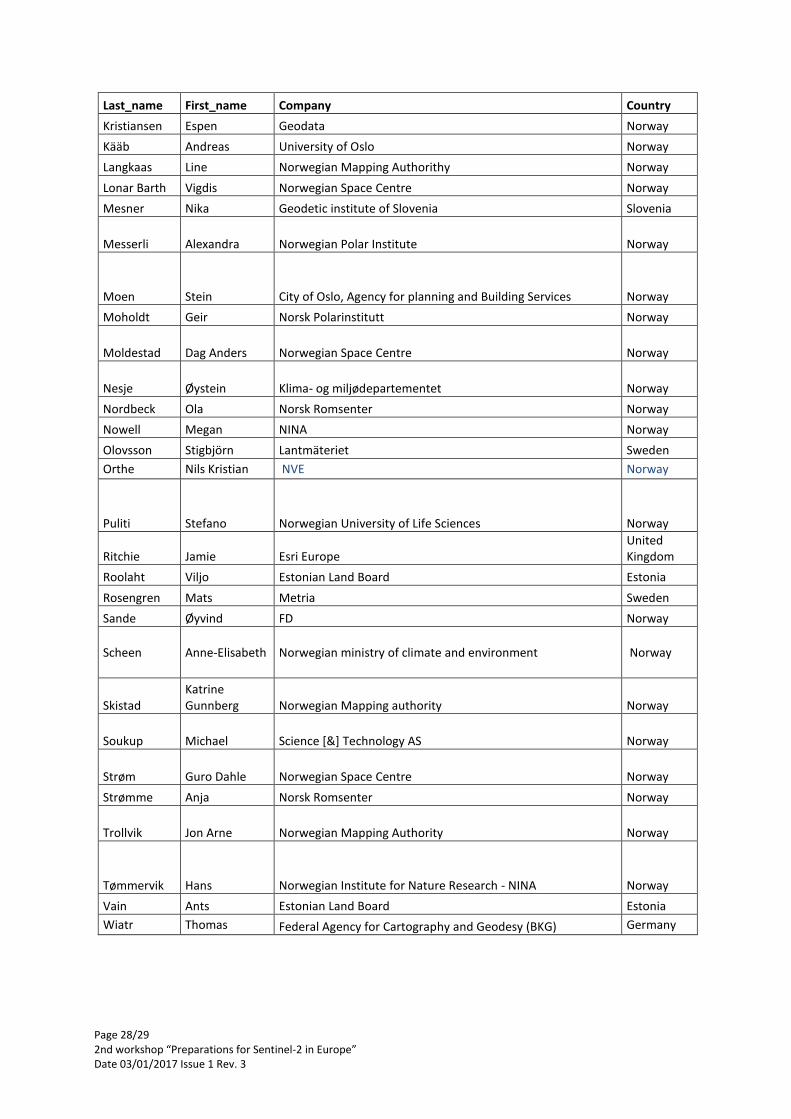
Page 28/29 2nd workshop “Preparations for Sentinel-2 in Europe” Date 03/01/2017 Issue 1 Rev. 3
Last_name First_name Company Country
Kristiansen Espen Geodata Norway
Kääb Andreas University of Oslo Norway
Langkaas Line Norwegian Mapping Authorithy Norway
Lonar Barth Vigdis Norwegian Space Centre Norway
Mesner Nika Geodetic institute of Slovenia Slovenia
Messerli Alexandra Norwegian Polar Institute Norway
Moen Stein City of Oslo, Agency for planning and Building Services Norway
Moholdt Geir Norsk Polarinstitutt Norway
Moldestad Dag Anders Norwegian Space Centre Norway
Nesje Øystein Klima- og miljødepartementet Norway
Nordbeck Ola Norsk Romsenter Norway
Nowell Megan NINA Norway
Olovsson Stigbjörn Lantmäteriet Sweden
Orthe Nils Kristian NVE Norway
Puliti Stefano Norwegian University of Life Sciences Norway
Ritchie Jamie Esri Europe United Kingdom
Roolaht Viljo Estonian Land Board Estonia
Rosengren Mats Metria Sweden
Sande Øyvind FD Norway
Scheen Anne-Elisabeth Norwegian ministry of climate and environment Norway
Skistad Katrine Gunnberg Norwegian Mapping authority Norway
Soukup Michael Science [&] Technology AS Norway
Strøm Guro Dahle Norwegian Space Centre Norway
Strømme Anja Norsk Romsenter Norway
Trollvik Jon Arne Norwegian Mapping Authority Norway
Tømmervik Hans Norwegian Institute for Nature Research - NINA Norway
Vain Ants Estonian Land Board Estonia
Wiatr Thomas Federal Agency for Cartography and Geodesy (BKG) Germany
Page 29/29 2nd workshop “Preparations for Sentinel-2 in Europe” Date 03/01/2017 Issue 1 Rev. 3
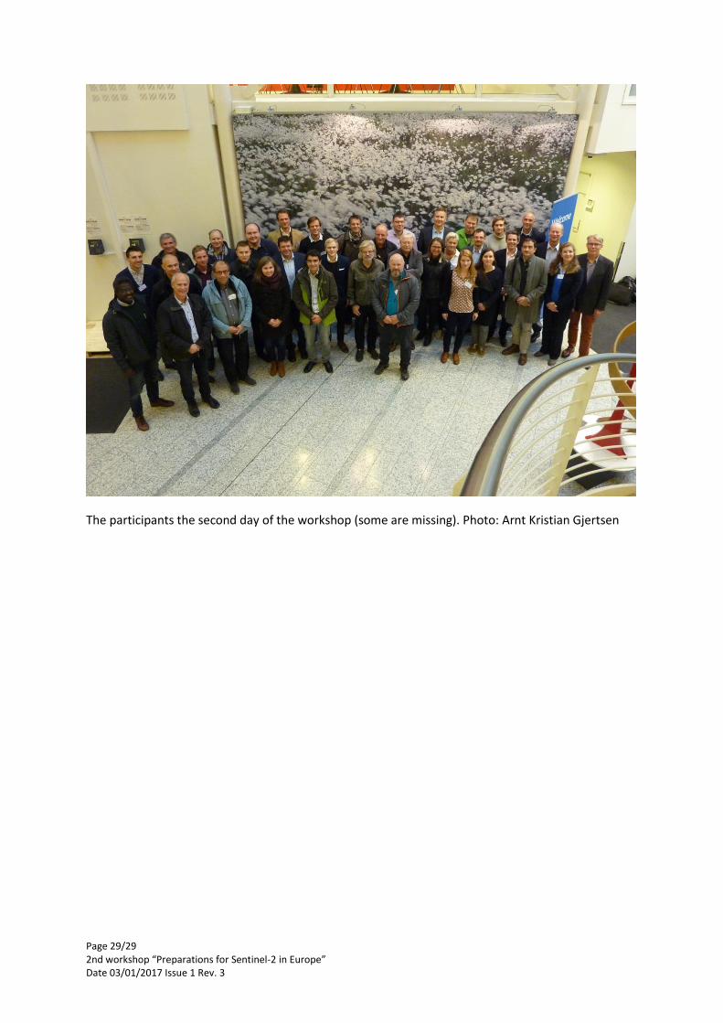
The participants the second day of the workshop (some are missing). Photo: Arnt Kristian Gjertsen


![INAS 342 - the Flying Sentinels [Indian Navy]](https://img.pdfslide.us/doc/110x75/577d1cf51a28ab4e1e8b4993/inas-342-the-flying-sentinels-indian-navy.jpg)