Embed Size (px)
Citation preview
htt
ps:
//n
dem
.nrs
c.g
ov.
in
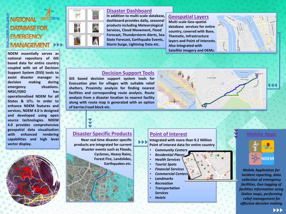
Disaster Dashboard In addition to multi-scale database, dashboard provides daily, seasonal products including Meteorological Services, Cloud Movement, Flood Forecast, Thunderstorm Alerts, Sea State Forecast, Earthquake Events, Storm Surge, Lightning Data etc.
Geospatial Layers Multi scale Geo-spatial database services for entire country, covered with Base, Thematic, Infrastructure layers and Point of Interests. Also Integrated with Satellite imagery and DEMs.
Decision Support Tools GIS based decision support system tools for Evacuation plan for villages with suitable relief shelters, Proximity analysis for finding nearest facilities and corresponding route analysis. Route analysis from a disaster location to nearest facility along with route map is generated with an option of barrier/road block etc.
NDEM essentially serves as national repository of GIS based data for entire country coupled with set of Decision Support System (DSS) tools to assist disaster manager in decision making during emergency situations. NRSC/ISRO has operationalized NDEM for all States & UTs. In order to enhance NDEM features and services, NDEM 4.0 is designed and developed using open source technologies. NDEM 4.0 provides comprehensive geospatial data visualization with enhanced rendering capabilities and high level vector display.
Disaster Specific Products Near real time disaster specific
products are integrated for current disaster events such as Floods,
Cyclones, Heavy Rains, Forest Fire, Landslides,
Earthquakes etc.
Point of Interest Integrated with more than 9.2 Million Point of Interest data for entire country
• Community Centers • Residential Places • Health Services • Tourist Spots • Financial Services • Commercial Centers • Landmarks • Recreation • Transportation
Services • Hotels
Mobile Apps
Mobile Application for Incident reporting, data collection of emergency facilities, Geo tagging of
facilities information using Online maps, performing
relief management for effective decision making.
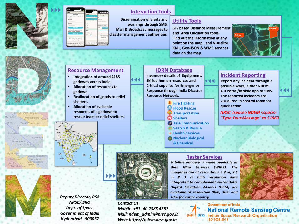
Interaction Tools
Dissemination of alerts and warnings through SMS,
Mail & Broadcast messages to disaster management authorities.
Utility Tools GIS based Distance Measurement and Area Calculation tools. Find out the Information at any point on the map., and Visualize KML, Geo-JSON & WMS services data on the map.
Incident Reporting Report any incident through 3 possible ways, either NDEM 4.0 Portal/Mobile app or SMS. The reported incidents are visualized in control room for quick action.
NRSC <space> NDEM <space> "Type Your Message" to 51969
IDRN Database Inventory details of Equipment, Skilled human resources and Critical supplies for Emergency Response through India Disaster Resource Network.
Fire Fighting Flood Rescue Transportation Shelters Tele Communication Search & Rescue Health Services Nuclear Biological & Chemical
Resource Management • Integration of around 4185
godowns across India. • Allocation of resources to
godown. • Reallocation of goods to relief
shelters. • Allocation of available
resources of a godown to rescue team or relief shelters.
Raster Services Satellite imagery is made available as Web Map Services (WMS). The imageries are at resolutions 5.8 m, 2.5 m & 1 m high resolution data integrated to complement vector data. Digital Elevation Models (DEM) are available at resolution 90m, 30m and 10m for entire country. Deputy Director, RSA
NRSC/ISRO Dept. of Space
Government of India Hyderabad - 500037
Contact Us Mobile: +91- 40 2388 4257 Mail: [email protected] Web: https://ndem.nrsc.gov.in