Embed Size (px)
Citation preview
published by theWestern Australian Planning Commission
Albert Facey House469 Wellington StreetPerth WA 6000
www.planning.wa.gov.au
metropolitan planning beyond the horizon
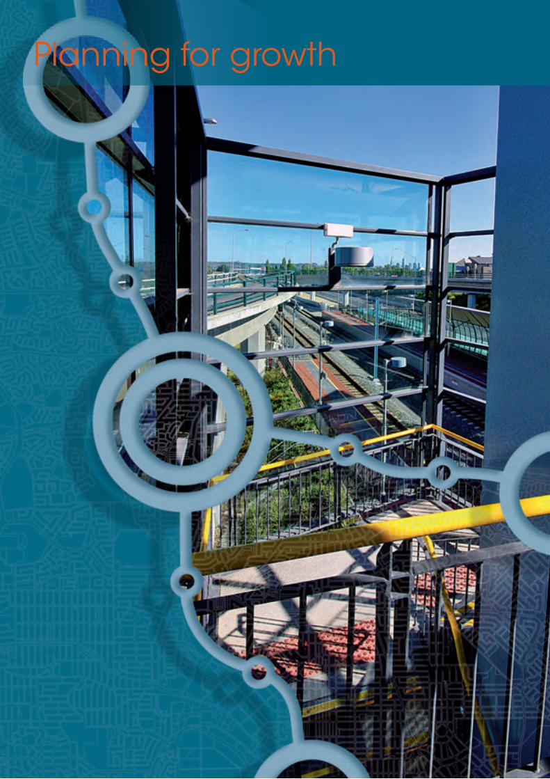
directions2031and beyond
dire
ctio
ns2031 a
nd
beyo
nd
- me
trop
olita
n p
lan
nin
g b
eyon
d th
e h
orizo
n A
ug
ust 2010
August 2010

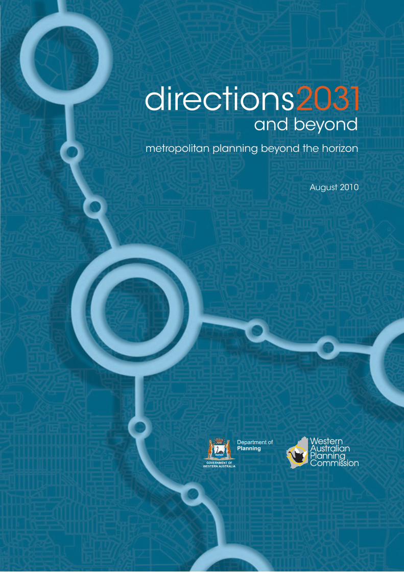
directions 2031
metropolitan planning beyond the horizon
August 2010
Department ofPlanning
directions2031and beyond
ii metropolitan planning beyond the horizon
Disclaimer
This document has been published by the Western Australian Planning Commission. Any representation, statement, opinion or advice expressed or implied in this publication is made in good faith and on the basis that the government, its employees and agents are not liable for any damage or loss whatsoever which may occur as a result of action taken or not taken, as the case may be, in respect of any representation, statement, opinion or advice referred to herein. Professional advice should be obtained before applying the information contained in this document to particular circumstances.
© State of Western Australia
Published by theWestern Australian Planning CommissionAlbert Facey House469 Wellington StreetPerth Western Australia 6000
Published August 2010
ISBN 0 7309 9989 0
internet: www.planning.wa.gov.auemail: [email protected]
tel: 08 9264 7777fax: 08 9264 7566TTY: 08 9264 7535infoline: 1800 626 477
Western Australian Planning Commission owns all photography in this document unless otherwise stated. This document is available in alternative formats on application to WAPC Communication Services.
directions2031and beyond

directions 2031 iiidirections2031and beyond
Minister’s ForewordWestern Australia has weathered the global financial crisis and the economy shows signs of sustained long-term growth.
Underpinning our growing economy is a growing population. We need to cater for our expanding population including new generations of Western Australians. Our challenge is to find room for this new growth while preserving our unique local environments and valued quality of life. Directions 2031 reconfirms the themes
identified in previous metropolitan strategic plans, which were to better use existing infrastructure and provide for a more sustainable city.
Directions 2031 recognises the benefits of a more consolidated city while working from historic patterns of urban growth. Importantly, the policy sets achievable goals that will promote housing affordability over the longer term. Directions 2031 addresses urban growth needs and also takes into consideration the need to protect our natural ecosystems. The framework provides for different lifestyle choices, vibrant nodes for economic and social activity and a more sustainable urban transport network. The framework will also encourage a long-term approach to the provision of infrastructure in an economically sustainable way.
For any planning vision to be successful it must be in tune with the aspirations of both residents and business. The planned growth of the outer suburbs must meet the needs of people seeking new accommodation in suburban surroundings. Increasing numbers of people are also looking for apartments in established areas close to employment centres with good public transport access. Other people want to remain in the suburbs where they have lived for many years but they no longer wish to maintain a traditional house and garden. The planning system needs to ensure that all of these lifestyle choices can be provided for.
It is also critical that the provision of infrastructure be fully integrated with land use planning and development. Directions 2031 strongly supports the development of a number of key strategic activity centres well connected by public transport. A focus on activity centres is essential if we are to create more efficient regions that facilitate economic development and reduce the need for travel.
We must of course continue to monitor how our regions develop and adjust our plans to meet global and local economic and environmental challenges. Directions 2031 as a guiding framework for regional planning is both visionary and flexible in order to respond to changes in our environment and patterns of social and economicdevelopment.
John Day MLAMinister for Planning

iv metropolitan planning beyond the horizon
directions2031and beyond
directions 2031 vdirections2031and beyond
Chairman’s ForewordWestern Australia has an enviable history of metropolitan planning starting with the adoption of the Stephenson-Hepburn plan in 1955, followed by the Corridor Plan in 1970, Metroplan in 1990 and Network City in 2004. Network City differed from earlier plans in its focus on a connected network of activity centres with an expressed desire to accommodate a significant amount of growth from within the existing built-up area.
The Directions 2031 Spatial Framework for Perth and Peel supersedes Network City and replaces Metroplan and all other metropolitan strategies as the highest level spatial framework and strategic plan for the metropolitan Perth and Peel region.
The draft framework was released for public comment in June 2009, and 294 submissions were received from 183 organisations and 111 individuals. These submissions have been used to redefine and enhance Directions 2031. They have also provided valuable input to the preparation of two draft sub-regional strategies - one for the central metropolitan sub-region and the other to address the outer metropolitan Perth and Peel sub-regions. These draft sub-regional strategies will be released for public comment and finalised in 2011.
In addition to this final report the Western Australian Planning Commission has prepared a paper on What was said about Directions 2031. This paper summarises the main themes and issues raised during the public comment period and how the Directions 2031 and Beyond final report has been updated in response.
The framework supports a more compact and environmentally sustainable city but acknowledges that we have to work with the city we have. We need to use land and infrastructure in an efficient manner and manage the expansion of the urban zone in balance with urban infill projects.
The planning time frame for the spatial framework is the 2031 census year. We also need to look beyond that date to ensure that the city is able to respond in a sustainable way to longer term growth pressures. In order to meet these needs, Directions 2031 has initiated the establishment of an urban expansion management program to strategically plan for the land and housing supply needs of long-term residential growth. In developing this program, a range of scenarios were modelled to provide an indication of how the planning system could accommodate a city of 3.5 million people. The scenario planning has informed the development of a draft urban expansion plan which indicates areas for potential rezoning in the short to medium term. The urban expansion plan is a key component of the Outer Metropolitan Perth and Peel Sub-regional Strategy.
Other key policies required to implement Directions 2031 include the activity centres policy for Perth and Peel, which has recently been adopted by the Commission, and the two draft sub-regional strategies that address the central and outer Perth metropolitan and Peel sub-regions. Another key implementation initiative is the public transport plan currently under preparation.
Gary PrattleyChairmanWestern Australian Planning Commission

vi metropolitan planning beyond the horizon
Contents
Executive Summary 1Introduction 1What is Directions 2031? 1What should we plan for? 2What kind of city will it be? 2Structural elements 3Connected city 4Achieving infill and greenfield housing targets 4Why manage growth? 5Implementation framework 5
Planning for growth 7What are we planning for? 7Population forecasts 9Scenario planning for a city of 3.5 million people 10
Planning beyond 2031 13Managing land supply 13Land use classifications 14Sufficient supply of land 14Planning for urban expansion 15Perth in 2050 17
Policy framework 19Policy framework 19Council of Australian Governments’ capital city agenda 19
Strategic framework 21Vision 21Key themes 22
Urban form 25Evolution of the city 25Connected city growth scenario 26Infill and greenfield housing targets 27Sub-regional planning areas 28Population distribution 30Dwelling distribution 30
Employment distribution 30
directions2031and beyond

directions 2031 viidirections2031and beyond
Structural elements 33Activity centres network 33Movement network 39Green network 39
Themes and strategies 43A liveable city 43A prosperous city 48An accessible city 52A sustainable city 63A responsible city 70
Sub-regional areas 75Central metropolitan Perth sub-region 77North-west sub-region 81North-east sub-region 83South-east sub-region 85South-west sub-region 87Peel sub-region 89
Implementation 91Initiatives for a liveable city 92Initiatives for a prosperous city 92Initiatives for an accessible city 94Initiatives for a sustainable city 98Initiatives for a responsible city 100
Monitoring 103Urban Development Program 103

viii metropolitan planning beyond the horizon
Executive summary
directions 2031 1directions2031and beyond
IntroductionOver the past 30 years the metropolitan Perth and Peel region has experienced sustained growth and is now home to a population of approximately 1.65 million. There are a number of growth projections for Western Australia - including the Western Australian Planning Commission’s WA Tomorrow planning forecasts and those produced by the Australian Bureau of Statistics. Based on the WA Tomorrow (WAPC 2005) report, it is expected that by 2031 the estimated population will have reached 2.2 million, adding more than half a million new residents to the city. Planning for these extra residents, along with the housing, infrastructure, services and jobs they will require presents a significant challenge to Government.
What is Directions 2031?Directions 2031 is a high level spatial framework and strategic plan that establishes a vision for future growth of the metropolitan Perth and Peel region; and it provides a framework to guide the detailed planning and delivery of housing, infrastructure and services necessary to accommodate a range of growth scenarios. Directions 2031 builds on many of the aspirational themes of previous metropolitan plans which sought to guide the future structure and form of the city. It encompasses all land within the metropolitan Perth and Peel region schemes, an area that is also referred to as the city or metropolitan region in this report.
Directions 2031 responds directly to several of the tasks identified in the WAPC Statement of Planning Policy No. 1 State Planning Framework Policy (Variation No. 2), including detailing the metropolitan structure, determining local population housing and job targets, managing growth and developing the activity centre concept. It is not a final blueprint, but the latest in an evolving series of plans that have shaped the city over the past 55 years. Each successive plan is based on an understanding of contemporary factors that influence the shape and growth of the city, and includes assumptions about how the city will change into the future.
Directions 2031 replaces all previous metropolitan strategic plans for the metropolitan Perth and Peel region and supersedes the draft Network City policy. It provides direction on:
1. how we provide for a growing population whilst ensuring that we live within available land, water and energy resources;
2. where development should be focused and what patterns of land use and transport will best support this development pattern;
3. what areas we need to protect so that we retain high quality natural environments and resources; and
4. what infrastructure we need to support our growth.

2 metropolitan planning beyond the horizon
What should we plan for?By 2031 the population of Perth and Peel is expected to have grown by between 35 and 40 per cent. This has significant implications for the city which must be planned carefully to ensure we preserve the qualities and characteristics we most value - the beaches, parks and bushland, the Swan River, lakes and wetland habitats, and the Darling Escarpment.
While Directions 2031 provides a medium term planning horizon, we must also look beyond that date to ensure the city is able to respond in a sustainable way to longer term growth pressures. Recent Commonwealth Government population forecasts project that the population of Australia will grow to 35.5 million by 2056 and that Perth will reach a population of 3.5 million by 20561. Other Commonwealth Government forecasts suggest a slightly higher rate of growth and project that Australia’s population will be 35.9 million by 20502.
In response to population growth, Directions 2031 has addressed the need to plan for urban expansion beyond 2031 and initiated the process by undertaking scenario planning. In order to plan for the land supply and housing needed to accommodate a city of 3.5 million people, three growth scenarios for different rates of infill and greenfield development have been modelled on high, medium and low-density scenarios.
Directions 2031 has also identified the need to introduce an urban expansion management program of and ongoing scenario planning will be undertaken as part of this program in order to maintain a sufficient supply of land for future growth.
1 Commonwealth of Australia, 2010. State of Australian Cities 2010. Major Cities Unit, Infrastructure Australia.
2 Commonwealth of Australia, 2010. Australia to 2050: future challenges. Attorney-General’s Department.
What kind of city will it be?Directions 2031 is based on a vision:
“By 2031, Perth and Peel people will have created a world class liveable city: green, vibrant, more compact and accessible with a unique sense of place.”
This vision is supported by five strategic themes and objectives:
Live
ab
lePr
osp
ero
us
Ac
ce
ssib
leSu
sta
ina
ble
Resp
on
sib
le

directions 2031 3directions2031and beyond
Structural elementsDirections 2031 has identified three integrated networks that form the basis of the spatial framework:
The objectives of Directions 2031 have been informed by community, economic and environmental issues and set the strategic directions to guide Government decision-making on land use, transport and service infrastructure planning, coordination and development.
Living in, or visiting our city should be a safe, comfortable and enjoyable experience.
Our success as a global city will depend on building on our current prosperity.
All people should be able to easily meet their education, employment, recreation, service and consumer needs within a reasonable distance of their home.
We should grow within the constraints placed on us by the environment we live in.
We have a responsibility to manage urban growth and make the most efficient use of available land and infrastructure.
A network and hierarchy of centres that provide a more equitable distribution of jobs and amenity throughout the city.
Activity centres network
An integrated system of public and private transport networks that are designed to support and reinforce the activity centres network.
Movement network
A network of parks, reserves and conservation areas that support biodiversity, preserve natural amenity and protect valuable natural resources.
Green network
4 metropolitan planning beyond the horizon
Connected city Directions 2031 identifies the connected city model as the preferred medium-density future growth scenario for the metropolitan Perth and Peel region.
A connected city pattern of urban growth is characterised by:
• promoting a better balance between greenfield and infill development;
• protecting and enhancing the natural environment, agricultural land, open spaces and our heritage and community wellbeing;
• reducing energy dependency and greenhouse gas emissions;
• developing and revitalising activity centres as attractive places in which to invest, live and work;
• ensuring that economic development and accessibility to employment inform urban expansion;
• planning for an adequate supply of housing and land in response to population growth and changing community needs;
• facilitating increased housing diversity, adaptability, affordability and choice;
• planning and developing key public transport corridors, urban corridors and transit oriented developments to accommodate increased housing needs and encourage reduced vehicle use;
• creating and enhancing transport and freight movement networks between activity centres and industrial centres; and
• maximising essential service infrastructure efficiency and equity and identifying and prioritising the coordination of projects to support future growth.
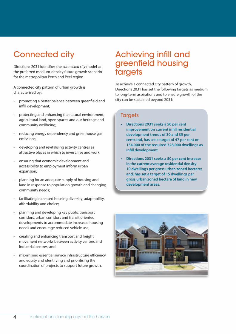
Achieving infill and greenfield housing targetsTo achieve a connected city pattern of growth, Directions 2031 has set the following targets as medium to long-term aspirations and to ensure growth of the city can be sustained beyond 2031:
Targets
• Directions 2031 seeks a 50 per cent improvement on current infill residential development trends of 30 and 35 per cent; and, has set a target of 47 per cent or 154,000 of the required 328,000 dwellings as infill development.
• Directions 2031 seeks a 50 per cent increase in the current average residential density 10 dwellings per gross urban zoned hectare; and, has set a target of 15 dwellings per gross urban zoned hectare of land in new development areas.

directions 2031 5directions2031and beyond
Why manage growth?If we do not plan for population growth and manage the future urban form of our city, growth pressures and unfavourable patterns of development can have serious impacts on our communities. These include a lack of access to essential infrastructure and services or increased response times for emergency services.
New urban areas must be planned to reduce dependency on private vehicle use and thereby reduce greenhouse gas emissions and air pollution. People living in areas with limited access to public transport or jobs will experience increased travel time to access work in other areas, traffic congestion and higher private transport costs to households as well as reduced leisure time, declining community health and increasing obesity as walking and riding become less practical.
The principles of good urban growth management should be applied to the planning of new areas to reduce any negative impacts on water resources; to avoid the loss of a sense of place; and to protect our natural habitats and rural food producing land close to the city.
Implementation frameworkA number of critical mechanisms are required to support the implementation of Directions 2031. First and foremost two draft sub-regional strategies have been prepared. The Central Metropolitan Perth Sub-regional Strategy addresses issues relating to creating more housing opportunities across the 19 local government areas in the inner/middle sectors of metropolitan Perth. The Outer Metropolitan Perth and Peel Sub-regional Strategy focuses on ensuring that there is an adequate supply of suitable urban land to support the strategic and sustainable growth of the city to 2031 and beyond. The outer sub-regions comprise the north-west, north-east, south-east and south-west areas of metropolitan Perth and the Peel sub-region.
To effectively implement Directions 2031, there is also a need to introduce an urban expansion management program to ensure an adequate supply of land that is suitable for urban development to meet medium to long-term residential needs. The aim of this program is to ensure an ongoing 25-year supply of undeveloped land composed of a minimum 15-year land bank of urban and urban deferred zoned land; and, a 10-year buffer of rural land identified for future urban expansion or investigation. This program will be introduced as a key component of the Outer Metropolitan Perth and Peel Sub-regional Strategy.
Directions 2031 has also identified a number of key policy and planning actions such as the implementation of the Activity Centres Policy for Perth and Peel recently adopted by the WAPC and the development of a 20-year public transport vision.
6 metropolitan planning beyond the horizon
Planning for growth
directions 2031 7directions2031and beyond
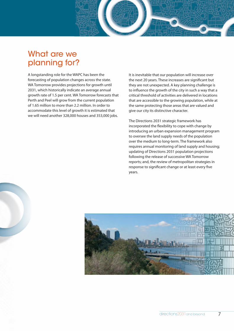
What are we planning for?A longstanding role for the WAPC has been the forecasting of population changes across the state. WA Tomorrow provides projections for growth until 2031, which historically indicate an average annual growth rate of 1.5 per cent. WA Tomorrow forecasts that Perth and Peel will grow from the current population of 1.65 million to more than 2.2 million. In order to accommodate this level of growth it is estimated that we will need another 328,000 houses and 353,000 jobs.
It is inevitable that our population will increase over the next 20 years. These increases are significant but they are not unexpected. A key planning challenge is to influence the growth of the city in such a way that a critical threshold of activities are delivered in locations that are accessible to the growing population, while at the same protecting those areas that are valued and give our city its distinctive character.
The Directions 2031 strategic framework has incorporated the flexibility to cope with change by introducing an urban expansion management program to oversee the land supply needs of the population over the medium to long-term. The framework also requires annual monitoring of land supply and housing; updating of Directions 2031 population projections following the release of successive WA Tomorrow reports; and, the review of metropolitan strategies in response to significant change or at least every five years.

8 metropolitan planning beyond the horizon
By 2031 the region will have a population of at least 2.2 million people.
This represents:over half a million new residents to be housed in 328,000 new dwellings and needing 353,000 new jobs.
Previous planning approaches focused on limiting the take up of land for urban development. However, the urban area of the Perth region has continued to grow.
192566 km2
1974 378 km2
2002631 km2
2008830 km2

directions 2031 9directions2031and beyond
Population forecastsThere are a number of growth projections for Western Australia, including the WA Tomorrow forecasts and those produced by the Australian Bureau of Statistics (ABS). These are based on different assumptions of mortality, fertility and migration.
The ABS publishes a series of population forecasts3 which suggest that the population of Perth and Peel will be between 2.40 million and 2.88 million. This means that we would need between 358,000 and 429,000 additional dwellings.
Whilst it is important to plan with a target population in mind, it is also important to remember that population growth depends very much on economic circumstances. Population forecasts play a pivotal role in understanding future challenges. As the population grows, so does demand for resources. In addition we also need to look at other determinates of demand. While population and economic growth have increased water demand, so have periods of drought. It is likely that some or all of the factors in the various scenarios may impact on future population size.
Most of the uncertainty in current long-term projections in Australia is about net overseas migration. It is the main contributor to the significant growth that Australia is currently experiencing. The range of annual migration between 1981 and 2009 is from less than
50,000 to more than 300,000. The current projections produced by the ABS (Figure 1) are directly related to the migration assumptions used.
The high forecasts shown in Figure 1 assume an annual net migration of 220,000 into Australia. The medium and low projections are 180,000 and 140,000 respectively. The WA Tomorrow forecasts are based on 125,000 per annum.
When compared with the average annual migration since 1981, which is slightly lower than 120,000, all of these three assumptions could be considered high. Prior to 2005 the only periods in which the annual migration was greater than lowest value of 140,000, were the quarters from March 1988 to March 1989.
It is therefore prudent to consider a range of projections that ensures the past trend is taken into consideration while also looking at the alternative possibilities.
The Commonwealth Government, State of Australian Cities 2010 report refers to the ABS population forecasts which project that the population of Australia will grow to 35.5 million by 2056 and that Perth will reach a population of 3.5 million by 20564. The Commonwealth Government Intergenerational Report 2010 forecasts a slightly higher rate of growth suggesting that Australia’s population will be 35.9 million by 20505. The connected city medium-growth scenario suggests that the population of Perth will reach 3.5 million around 2050 and this is currently considered the most likely medium to long-term outcome.
Australian Bureau of Statistics WA Tomorrow
Year A High B Medium C Low (WAPC 2005)
Population (m)
Dwellings Population (m)
Dwellings Population (m)
Dwellings Population (m)
Dwellings
2016 2.06 307,000 2.00 298,000 1.94 289,000 1.73 258,000
2021 2.32 346,000 2.20 328,000 2.10 313,000 1.86 277,000
2026 2.60 388,000 2.41 359,000 2.26 337,000 1.99 297,000
2031 2.88 429,000 2.62 391,000 2.40 358,000 2.20 328,000
Figure 1: Comparison of Australian Bureau of Statistics and WA Tomorrow population growth forecasts and additional housing needs
3 ABS 2008. Population Projections Australia, 3222.04 Commonwealth of Australia, 2010. State of Australian Cities 2010. Major Cities
Unit, Infrastructure Australia.5 Commonwealth of Australia, 2010. Australia to 2050: future challenges.
Attorney-General’s Department.

10 metropolitan planning beyond the horizon
Scenario planning for a city of 3.5 million peopleGrowth scenarios for low, medium and high-density rates of infill and greenfield development have been modelled to determine the area of greenfield land that will be required to accommodate a city of 3.5 million people. The scenarios are based on a series of assumptions for the expected density in greenfield development and the infill rate in both the central metropolitan and outer metropolitan Perth and Peel sub-regions, and they result in significantly different greenfield land requirements. Scenarios provide an indication of how the planning system could accommodate the housing and land supply needs of a city of 3.5 million people.
Scenario planning provides a systematic approach to urban growth management and an opportunity to take stock of current conditions and identify the drivers that may operate in the future. Rather than providing a prescriptive outcome, the scenario method makes assumptions about likely future conditions to predict alternative outcomes.
The initial scenario planning undertaken is set out in the sub-regional strategy for the outer metropolitan Perth and Peel sub-regions. The scenario modelling will be further refined as part of the review of the sub-regional strategy that will be undertaken at least every five years.
Land zoned urban and urbandeferred and not yet developed.
Existing: 18,600 ha.
Existing developedurban area.
Sizes are indicative only
Central sub-regionEstimated in�ll capacity in the Central Sub-region
Directions 2031 (121,000 dwellings)D
250,000225,000
200,000
High in�ll Medium in�ll Low in�ll
Outer sub-regionsEstimated in�ll capacity in the Outer Sub-regions
Directions 2031 (33,000 dwellings)
139,000116,000
93,000
High in�ll Medium in�ll Low in�ll
High density17 units per gross urban hectare.
Additional land required: 12,900 ha.
Medium density15 units per gross urban hectare.
Additional land required:20,300 ha.
Low density10 dwellings per gross urban hectare.Additional land required: 44,600 ha.

directions 2031 11directions2031and beyond
Land zoned urban and urbandeferred and not yet developed.
Existing: 18,600 ha.
Existing developedurban area.
Sizes are indicative only
Central sub-regionEstimated in�ll capacity in the Central Sub-region
Directions 2031 (121,000 dwellings)D
250,000225,000
200,000
High in�ll Medium in�ll Low in�ll
Outer sub-regionsEstimated in�ll capacity in the Outer Sub-regions
Directions 2031 (33,000 dwellings)
139,000116,000
93,000
High in�ll Medium in�ll Low in�ll
High density17 units per gross urban hectare.
Additional land required: 12,900 ha.
Medium density15 units per gross urban hectare.
Additional land required:20,300 ha.
Low density10 dwellings per gross urban hectare.Additional land required: 44,600 ha.
Figure 2: Scenario planning the land supply needs of a city of 3.5 million people
Land zoned urban and urbandeferred and not yet developed.
Existing: 18,600 ha.
Existing developedurban area.
Sizes are indicative only
Central sub-regionEstimated in�ll capacity in the Central Sub-region
Directions 2031 (121,000 dwellings)D
250,000225,000
200,000
High in�ll Medium in�ll Low in�ll
Outer sub-regionsEstimated in�ll capacity in the Outer Sub-regions
Directions 2031 (33,000 dwellings)
139,000116,000
93,000
High in�ll Medium in�ll Low in�ll
High density17 units per gross urban hectare.
Additional land required: 12,900 ha.
Medium density15 units per gross urban hectare.
Additional land required:20,300 ha.
Low density10 dwellings per gross urban hectare.Additional land required: 44,600 ha.

12 metropolitan planning beyond the horizon
Planning beyond 2031
directions 2031 13directions2031and beyond
Australia faces significant challenges over the long term to accommodate population growth and ageing, as well as climate change, national productivity and other social, economic and environmental drivers of change.
Although Directions 2031 provides a medium-term planning horizon, we must also look beyond that date to ensure that the city is able to respond in a sustainable way to longer term growth pressures.
Directions 2031 has considered a city of 3.5 million people and establishes the outer metropolitan Perth and Peel sub-regional strategy to address the planning implications for ongoing long-term land supply. The outer sub-regional strategy proposes an urban expansion plan that identifies a number of sites not currently zoned that will be investigated further to determine their suitability for future residential and industrial development.
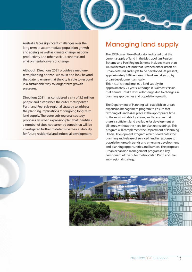
Managing land supplyThe 2009 Urban Growth Monitor indicated that the current supply of land in the Metropolitan Region Scheme and Peel Region Scheme includes more than 18,600 hectares of land that is zoned either urban or urban deferred and is yet to be developed. At present, approximately 880 hectares of land are taken up by urban development annually. This historic trend implies a land supply for approximately 21 years, although it is almost certain that annual uptake rates will change due to changes in planning approaches and population growth.
The Department of Planning will establish an urban expansion management program to ensure that rezoning of land takes place at the appropriate time in the most suitable locations, and to ensure that there is sufficient land available for development at all times, without the need for blanket rezonings. This program will complement the Department of Planning Urban Development Program which coordinates the planning and release of serviced land in response to population growth trends and emerging development and planning opportunities and barriers. The proposed urban expansion management program is a key component of the outer metropolitan Perth and Peel sub-regional strategy.
14 metropolitan planning beyond the horizon
Land use classificationsThe urban expansion management program will determine the availability of existing urban and urban deferred zoned land, and areas for expansion or investigation areas according to the following five land use categories for the Metropolitan Region Scheme and the Peel Region Scheme:
1 Urban undeveloped landLand currently zoned urban and not yet developed.
2 Urban deferred undeveloped landLand currently zoned urban deferred and not yet developed.
3 Areas in the process of region scheme rezoningAreas currently in the process of rezoning to urban and which have been granted WAPC approval to advertise for development in the short term.
4 Urban expansion areasAreas of rural land identified as potential urban expansion areas for rezoning in the short term (within five years) subject to statutory rezoning processes.
5 Investigation areasRural land to be investigated for potential rezoning in the short to medium term (within 10 years) subject to statutory rezoning processes.
It is intended that these land use categories be used in the preparation of future sub-regional growth management plans and associated structure plans.
Sufficient supply of landThe main purpose of the urban expansion management program is to identify land ahead of the rezoning process and to stage the rezoning of that land in response to future growth trends. The program will be responsible for preparing plans for urban expansion comprising urban expansion areas in which rural land is identified for potential rezoning in the short term; and, rural land to be investigated for consideration as future urban expansion areas or potential rezoning in the short to medium term.
The urban expansion management program is based on ensuring a 25-year supply of undeveloped land comprising an ongoing land bank of at least 15 years urban and urban deferred zoned land and, at least a 10-year buffer of rural land identified for future urban expansion or investigation.
Although Directions 2031 has set a target of 15 dwellings per gross urban zoned hectare, the proposed urban expansion plan assumes a business as usual approach to development and is calculated based on 10 dwellings per gross urban zoned hectare.
Although this approach identifies additional growth areas over and above land zoned urban and urban deferred and not yet developed, existing urban and urban deferred zoned areas should be prioritised for urban development, where appropriate.
Land identified in the urban expansion plan will provide guidance for the preparation or revision of structure plans and will inform the planning and coordination of infrastructure through the urban development program.
It should not be assumed that urban expansion areas and investigation areas indicated in the draft urban expansion plan will be rezoned for urban development at anytime.

directions 2031 15directions2031and beyond
Planning for urban expansionThe draft urban expansion plan proposed in the outer metropolitan Perth and Peel sub-regional strategy was developed as a result of the following ongoing work program:
• Scenario planning was undertaken to provide a broad indication of how different levels of demand for housing, based on the current population increasing by 1.85 million, will result in different land and housing requirements from infill and greenfield development.
• Opportunities and constraints analysis including environmental constraints, provided an overview of the metropolitan Perth and Peel sub-regions that informed the identification of potential areas for future urban expansion as well as areas that were significantly constrained.
• Infrastructure agencies and public utilities were engaged early in the process of developing the draft urban expansion plan in order to undertake a desktop review of the feasibility of areas identified for urban expansion and investigation. This work will be continued as a key part of the urban expansion management program through ongoing stakeholder engagement with state government planning, development and infrastructure agencies and local government.
• Performance indicators were developed as a tool to assess the appropriateness of rezoning applications for areas under the Metropolitan Region Scheme and Peel Region Scheme that are intended for future urban expansion.
• Land supply and the identification of areas for urban expansion or investigation will undergo regular monitoring and review in order to respond to significant changes in land supply, population growth and other impacts on the demand for land.
Figure 3: Urban expansion management program to ensure a 25 year
Investigation areas• Provide a bu�er of at least 5 years land supply.• Investigation areas for potential rezoning in the short to medium-term (within 5 to 10 years)
Urban expansion areas • Provide a bu�er of at least 5 years land supply• Expansion areas for potential rezoning in the short-term (within 5 years)
Urban and urban deferred zoned landnet yet developed• Ongoing land bank of at least 15 years supply
2010 2015 2020 2025 2030 2035
25 year land supply
Urb
an e
xpan
sion
pla
n

16 metropolitan planning beyond the horizon
Figure 4: Urban expansion management program
Ongoing engagem
ent with service providers,
public utilities and local government
Urban expansion areas and investigationareas subject to formal statutory processes
Statutory processes ory yy pr
Estimated dwelling supplyd dwe
Continuous monitoring and review
Urban expansion plan
Urban expansionareas
Areas forinvestigation
expapan
Performanceindicators
Scenarioplanning
Opportunityand constraints
analysis
PerforormScenenario Opportunityppoorrtu
Urban expansionmanagement program
directions 2031 17directions2031and beyond
Land supply will be monitored annually and sub-regional strategies will be reviewed at least every five years. These reviews will be informed by the work undertaken by the Department of Planning’s Office of Land and Housing Supply. This office has recently been established by the State Government to provide government with timely information on land and housing supply and to provide clarification on key impediments.
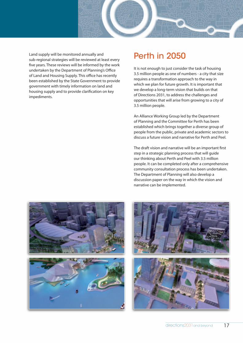
Perth in 2050It is not enough to just consider the task of housing 3.5 million people as one of numbers - a city that size requires a transformation approach to the way in which we plan for future growth. It is important that we develop a long-term vision that builds on that of Directions 2031, to address the challenges and opportunities that will arise from growing to a city of 3.5 million people.
An Alliance Working Group led by the Department of Planning and the Committee for Perth has been established which brings together a diverse group of people from the public, private and academic sectors to discuss a future vision and narrative for Perth and Peel.
The draft vision and narrative will be an important first step in a strategic planning process that will guide our thinking about Perth and Peel with 3.5 million people. It can be completed only after a comprehensive community consultation process has been undertaken. The Department of Planning will also develop a discussion paper on the way in which the vision and narrative can be implemented.