Embed Size (px)
Citation preview

Paul StephensDirector of Sales & Marketing
17 March 2010
Developments in the DMCii
Constellation & annual
Tropical forest monitoring
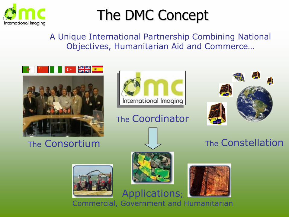
The DMC Concept
A Unique International Partnership Combining National Objectives, Humanitarian Aid and Commerce…
The Constellation
The Coordinator
Applications;
Commercial, Government and Humanitarian
The Consortium
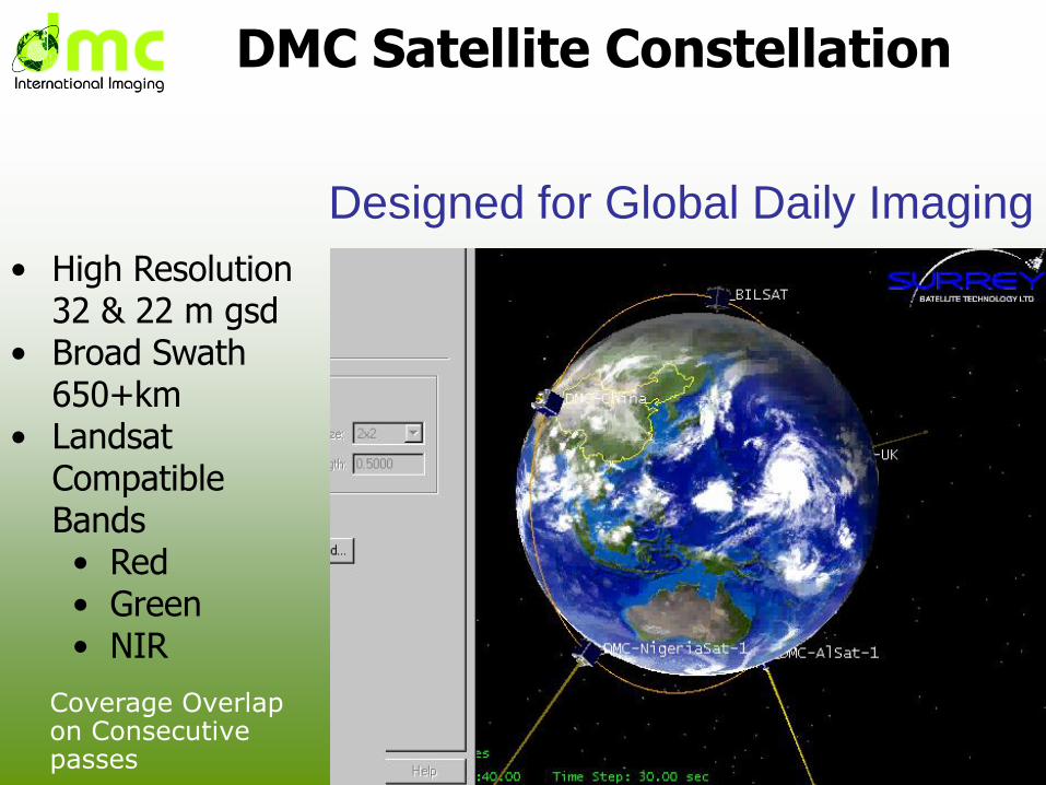
Coverage Overlap on Consecutive passes
• High Resolution 32 & 22 m gsd
• Broad Swath 650+km
• Landsat Compatible Bands• Red• Green• NIR
DMC Satellite Constellation
Designed for Global Daily Imaging
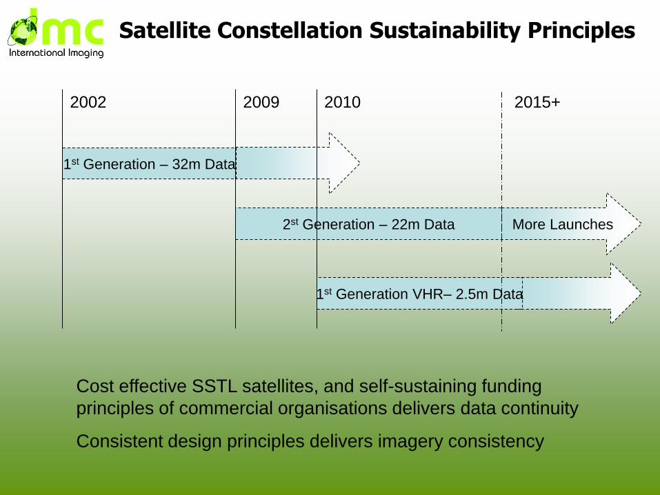
More Launches
Satellite Constellation Sustainability Principles
1st Generation – 32m Data
2st Generation – 22m Data
2002
1st Generation VHR– 2.5m Data
2010 2015+2009
Cost effective SSTL satellites, and self-sustaining funding
principles of commercial organisations delivers data continuity
Consistent design principles delivers imagery consistency

DMC daily imaging capacity
-
5,000,000
10,000,000
15,000,000
20,000,000
25,000,000
30,000,000
2002 2003 2004 2005 2006 2007 2008 2009 2010 2011 2012 2013 2014 2015
Year
Ima
gin
g c
ap
acit
y (
sq
km
/da
y)
ALSAT-1
UKDMC1
NIGERIASAT-1
BEIJING-1
DEIMOS-1
UK-DMC2
NIGERIASAT-X
NIGERIASAT-2
DMCii Imaging Capacity
Major capacity change
in 2010
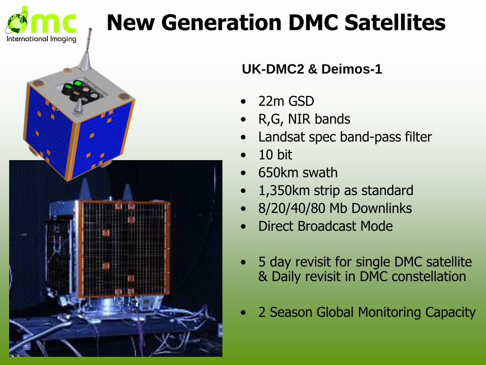
New Generation DMC Satellites
• 22m GSD
• R,G, NIR bands
• Landsat spec band-pass filter
• 10 bit
• 650km swath
• 1,350km strip as standard
• 8/20/40/80 Mb Downlinks
• Direct Broadcast Mode
• 5 day revisit for single DMC satellite & Daily revisit in DMC constellation
• 2 Season Global Monitoring Capacity
UK-DMC2 & Deimos-1
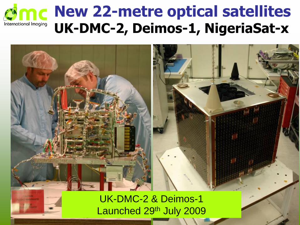
New 22-metre optical satellitesUK-DMC-2, Deimos-1, NigeriaSat-x
UK-DMC-2 & Deimos-1
Launched 29th July 2009
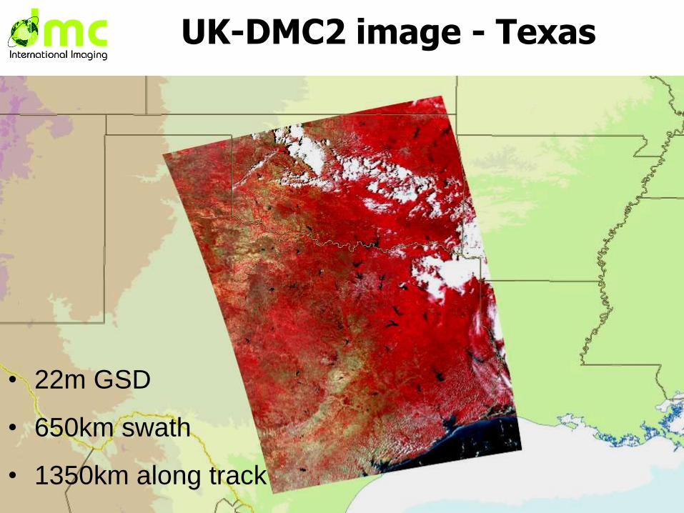
UK-DMC2 image - Texas
• 22m GSD
• 650km swath
• 1350km along track
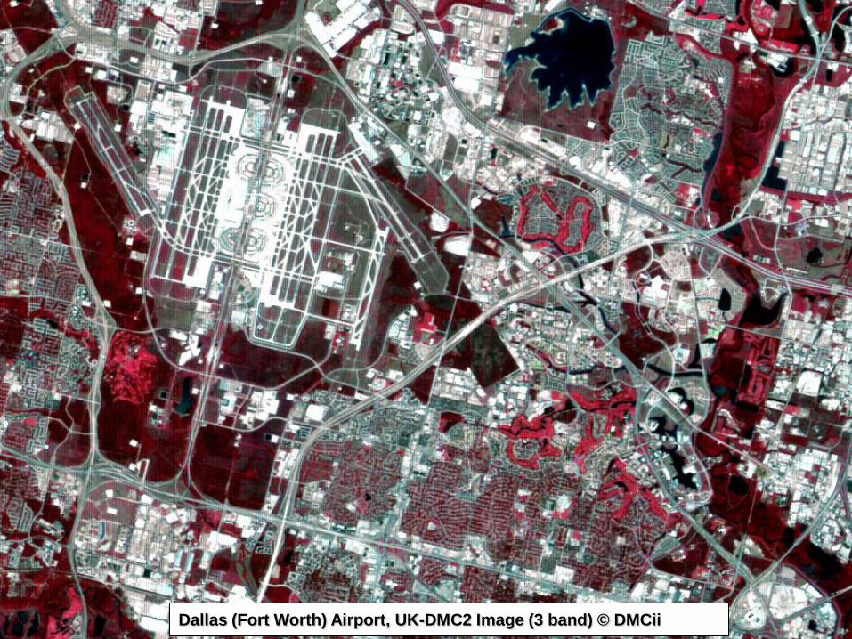
All 3 bands together
Dallas (Fort Worth) Airport, UK-DMC2 Image (3 band) © DMCii
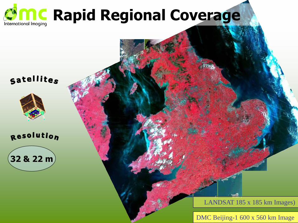
LANDSAT 185 x 185 km Images)
DMC Beijing-1 600 x 560 km Image
Rapid Regional Coverage
32 & 22 m
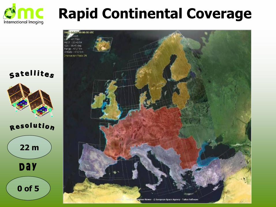
Rapid Continental Coverage
0 of 5
22 m
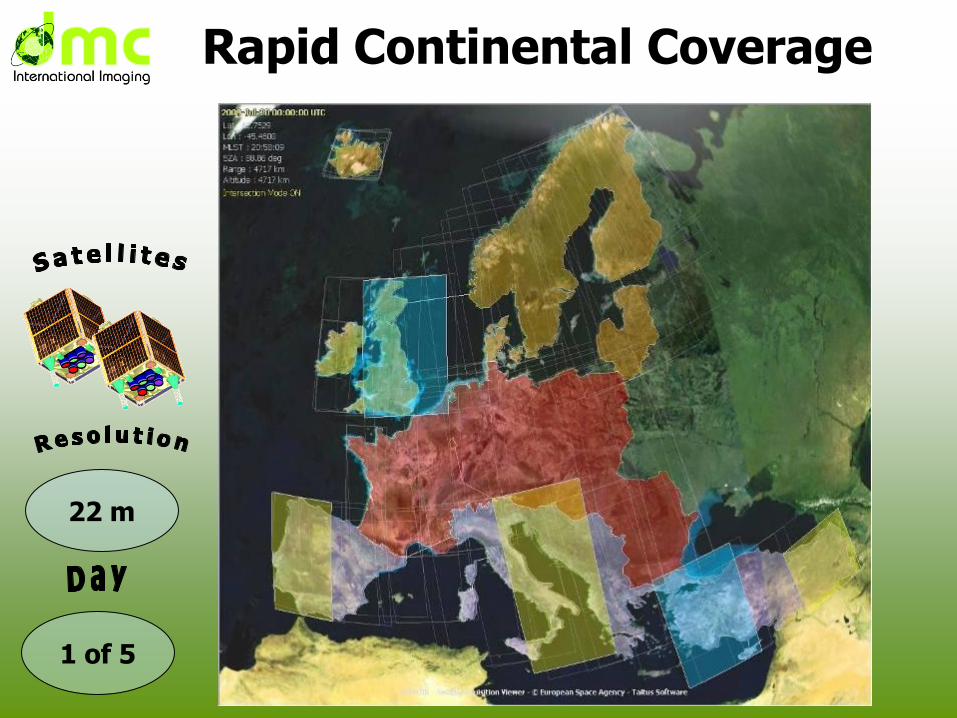
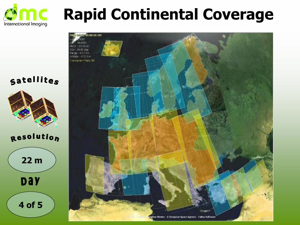
Rapid Continental Coverage
1 of 5
22 m
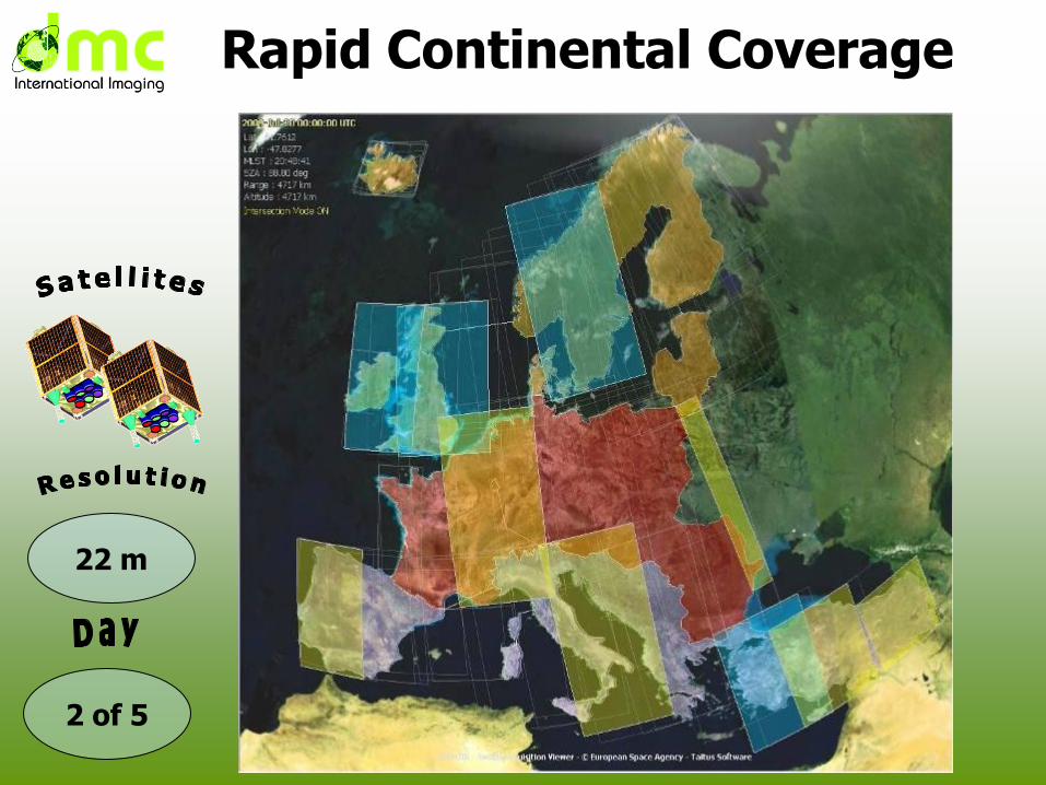
Rapid Continental Coverage
2 of 5
22 m
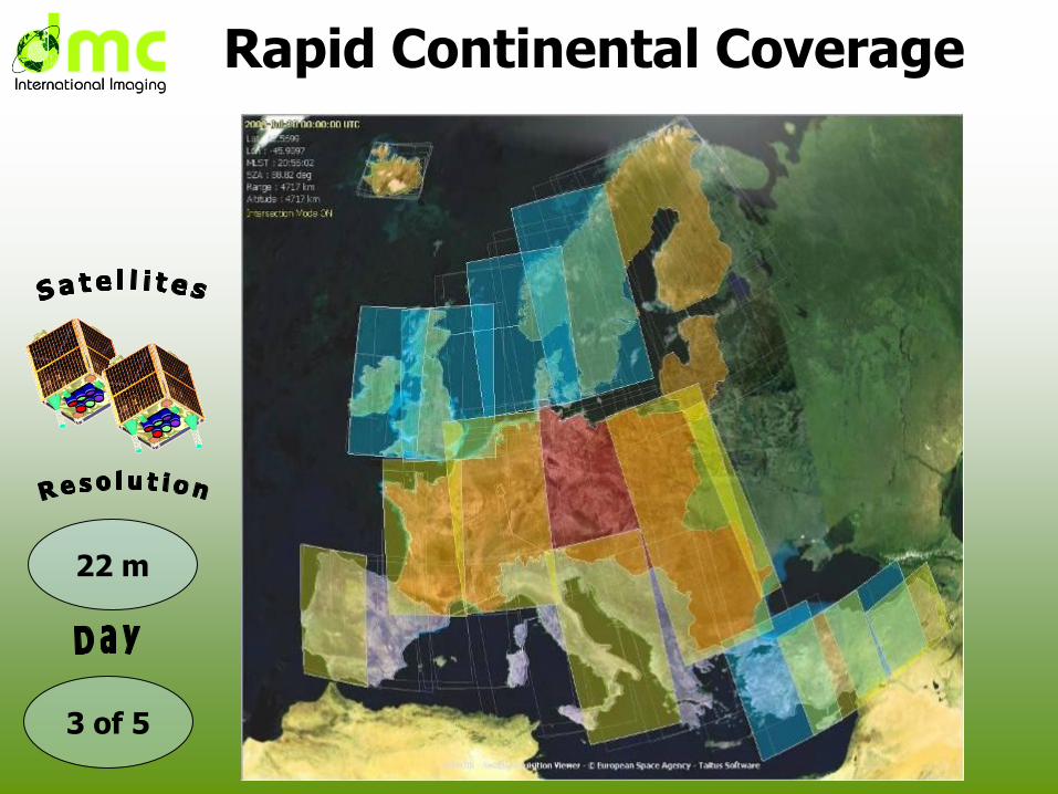
Rapid Continental Coverage
3 of 5
22 m
Rapid Continental Coverage
4 of 5
22 m
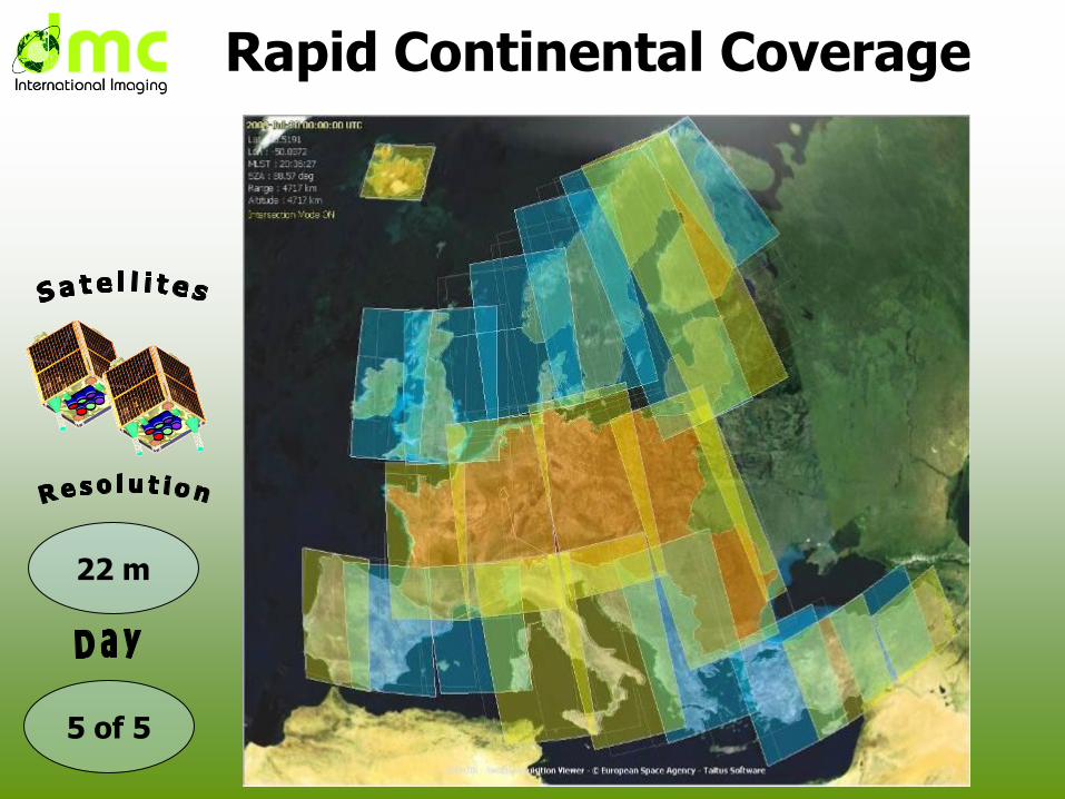
Rapid Continental Coverage
5 of 5
22 m

Tropical Forest Monitoring
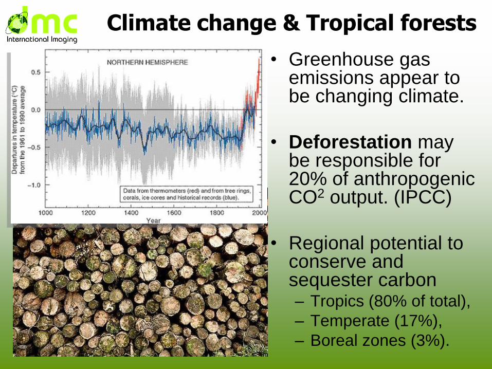
Climate change & Tropical forests
• Greenhouse gas emissions appear to be changing climate.
• Deforestation may be responsible for 20% of anthropogenic CO2 output. (IPCC)
• Regional potential to conserve and sequester carbon – Tropics (80% of total),
– Temperate (17%),
– Boreal zones (3%).
Deforestation & climate change
• The United Nations Framework Convention
on Climate Change (UNFCCC)
Reducing Emissions through Deforestation
and Degradation in developing countries
(REDD+) program
– Plan to pay nations to preserve tropical forest
• Requires reliable regular monitoring
– Management by governments
– Verification by funding agencies
• Satellites essential to monitor change
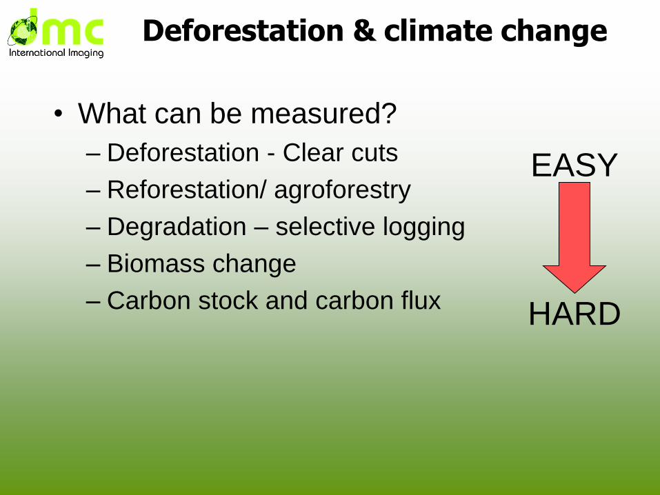
Deforestation & climate change
• What can be measured?
– Deforestation - Clear cuts
– Reforestation/ agroforestry
– Degradation – selective logging
– Biomass change
– Carbon stock and carbon flux HARD
EASY
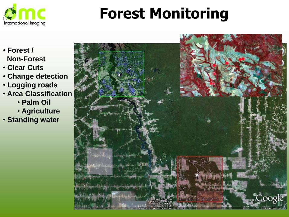
Forest Monitoring
• Forest /
Non-Forest
• Clear Cuts
• Change detection
• Logging roads
• Area Classification
• Palm Oil
• Agriculture
• Standing water
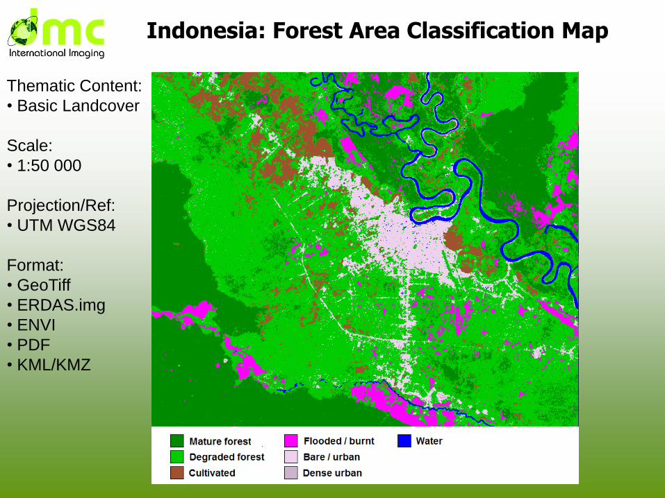
Indonesia: Forest Area Classification Map
Thematic Content:
• Basic Landcover
Scale:
• 1:50 000
Projection/Ref:
• UTM WGS84
Format:
• GeoTiff
• ERDAS.img
• ENVI
• KML/KMZ
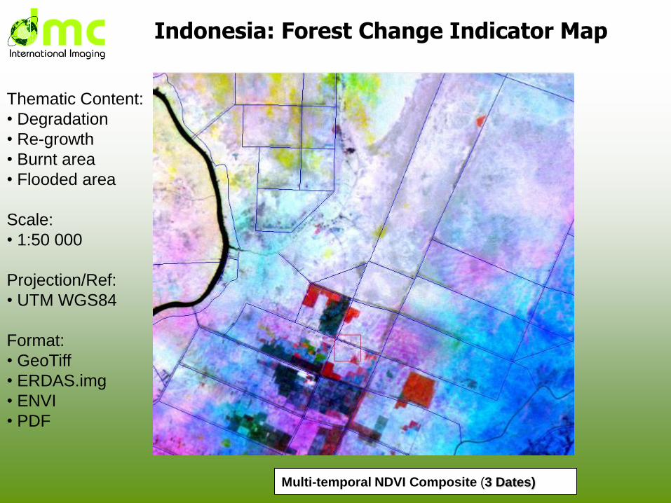
Indonesia: Forest Change Indicator Map
Multi-temporal NDVI Composite (3 Dates)
Thematic Content:
• Degradation
• Re-growth
• Burnt area
• Flooded area
Scale:
• 1:50 000
Projection/Ref:
• UTM WGS84
Format:
• GeoTiff
• ERDAS.img
• ENVI
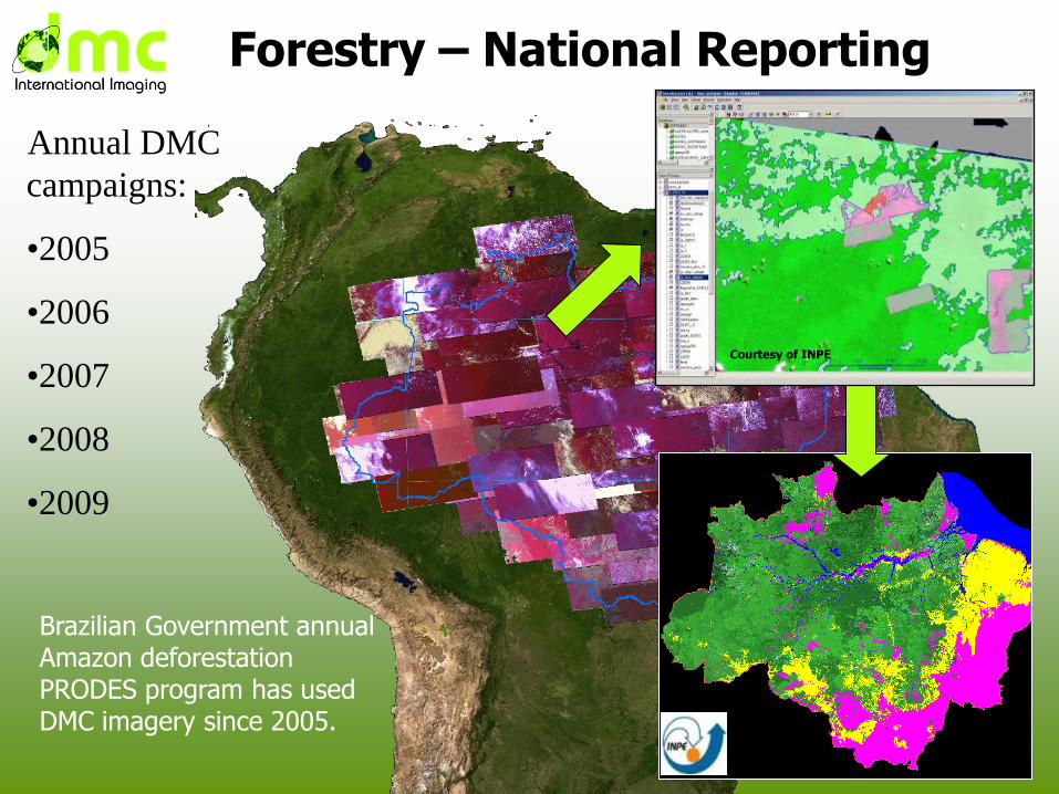
Annual DMC
campaigns:
•2005
•2006
•2007
•2008
•2009
Brazilian Government annual Amazon deforestation PRODES program has used DMC imagery since 2005.
Forestry – National Reporting
Courtesy of INPE
Central Africa• Remote sensing and forest inventory programmes in
Central Africa have produced comprehensive historical high quality records (CARPE)
– Highly accurate surveys are necessary for biomass/carbon flux, these take time and effort
• High frequency satellite surveys for operational monitoring are required
– After 1 year, degradation is difficult to detect
– Enforcement needs information to target ground surveys
• Countries without operational forest monitoring programmes will be refused entry to the REDD-Plus process
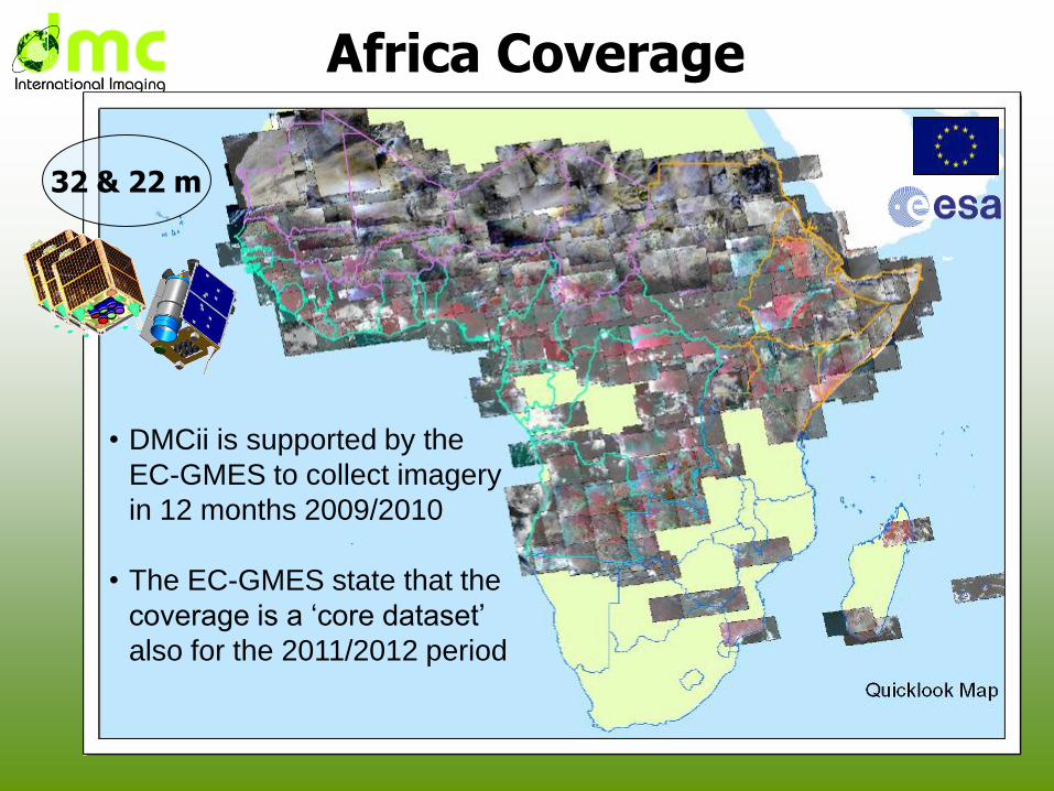
Africa Coverage
32 & 22 m
• DMCii is supported by the
EC-GMES to collect imagery
in 12 months 2009/2010
• The EC-GMES state that the
coverage is a ‘core dataset’
also for the 2011/2012 period
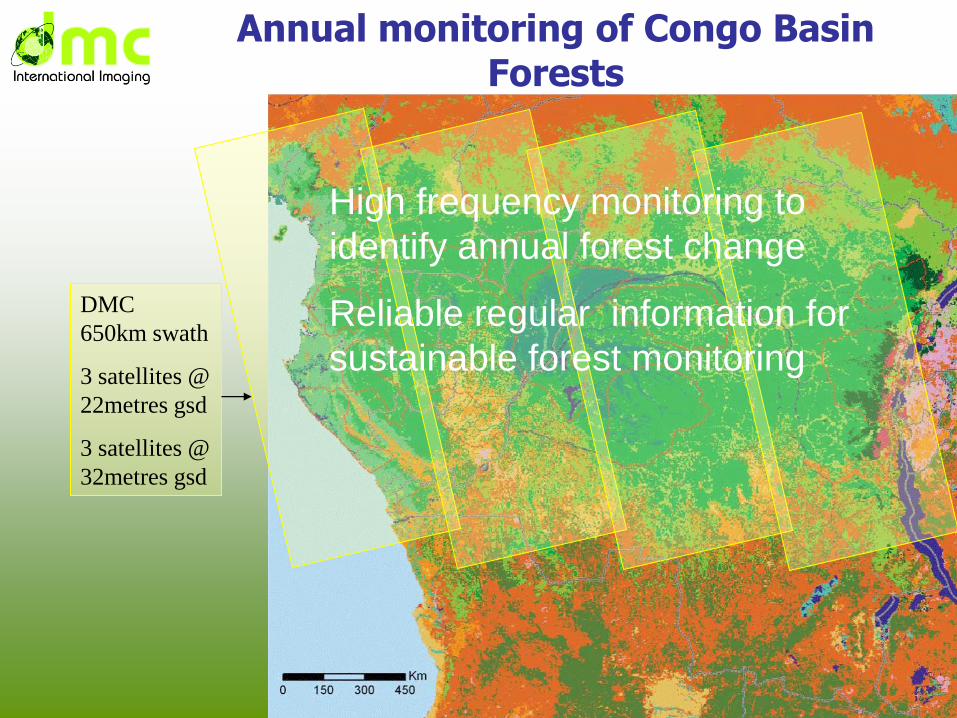
DMC
650km swath
3 satellites @
22metres gsd
3 satellites @
32metres gsd
Annual monitoring of Congo Basin Forests
High frequency monitoring to
identify annual forest change
Reliable regular information for
sustainable forest monitoring
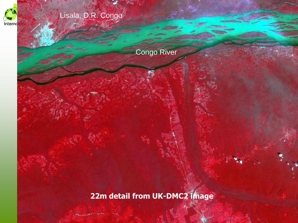
22m detail from UK-DMC2 image
Lisala, D.R. Congo
Congo River
Operational Imaging Services
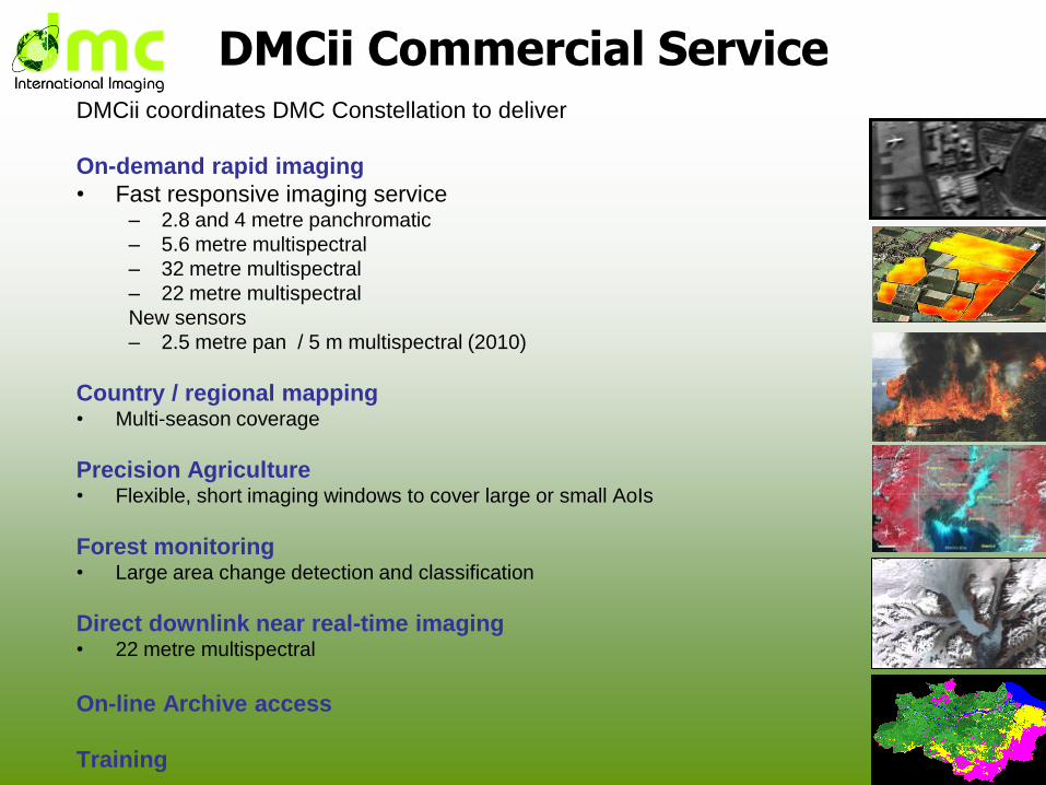
DMCii Commercial ServiceDMCii coordinates DMC Constellation to deliver
On-demand rapid imaging
• Fast responsive imaging service– 2.8 and 4 metre panchromatic
– 5.6 metre multispectral
– 32 metre multispectral
– 22 metre multispectral
New sensors
– 2.5 metre pan / 5 m multispectral (2010)
Country / regional mapping• Multi-season coverage
Precision Agriculture• Flexible, short imaging windows to cover large or small AoIs
Forest monitoring• Large area change detection and classification
Direct downlink near real-time imaging• 22 metre multispectral
On-line Archive access
Training
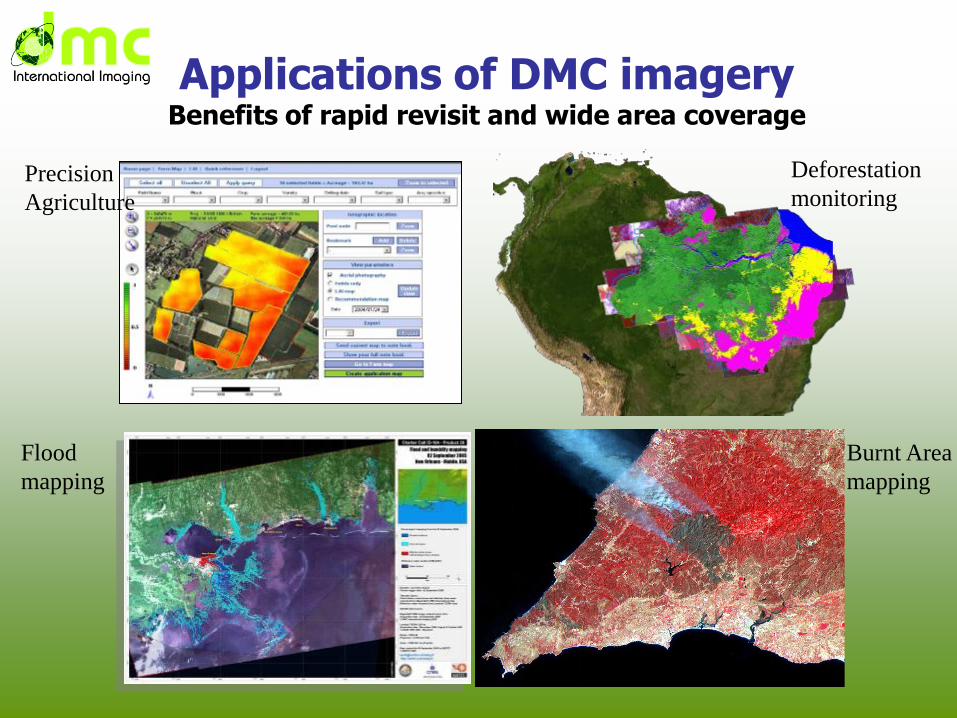
Applications of DMC imageryBenefits of rapid revisit and wide area coverage
Precision
Agriculture
Flood
mapping
Deforestation
monitoring
Burnt Area
mapping
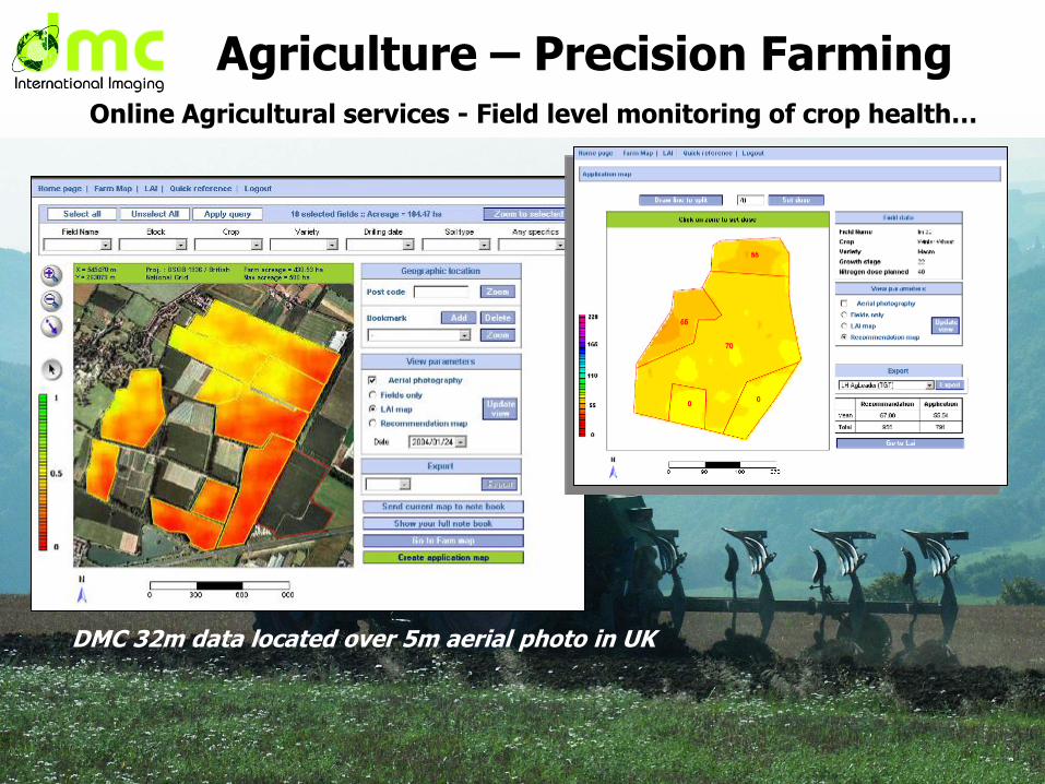
Online Agricultural services - Field level monitoring of crop health…
DMC 32m data located over 5m aerial photo in UK
Agriculture – Precision Farming
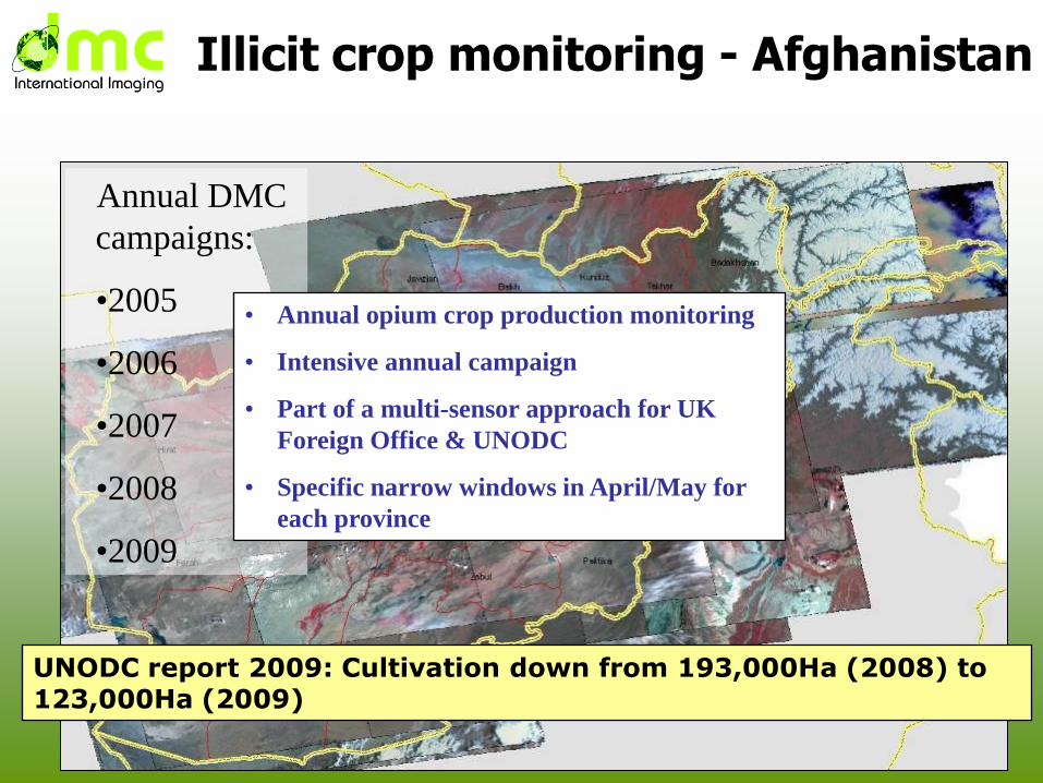
Illicit crop monitoring - Afghanistan
UNODC report 2009: Cultivation down from 193,000Ha (2008) to 123,000Ha (2009)
Annual DMC
campaigns:
•2005
•2006
•2007
•2008
•2009
• Annual opium crop production monitoring
• Intensive annual campaign
• Part of a multi-sensor approach for UK
Foreign Office & UNODC
• Specific narrow windows in April/May for
each province
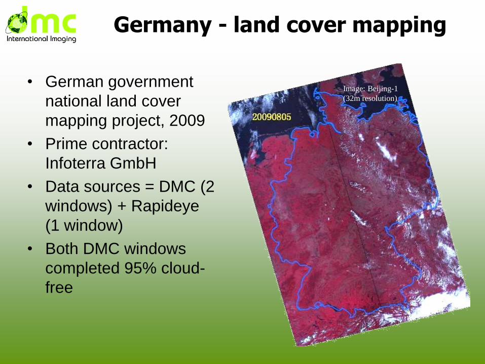
Germany - land cover mapping
• German government
national land cover
mapping project, 2009
• Prime contractor:
Infoterra GmbH
• Data sources = DMC (2
windows) + Rapideye
(1 window)
• Both DMC windows
completed 95% cloud-
free
Image: Beijing-1
(32m resolution)
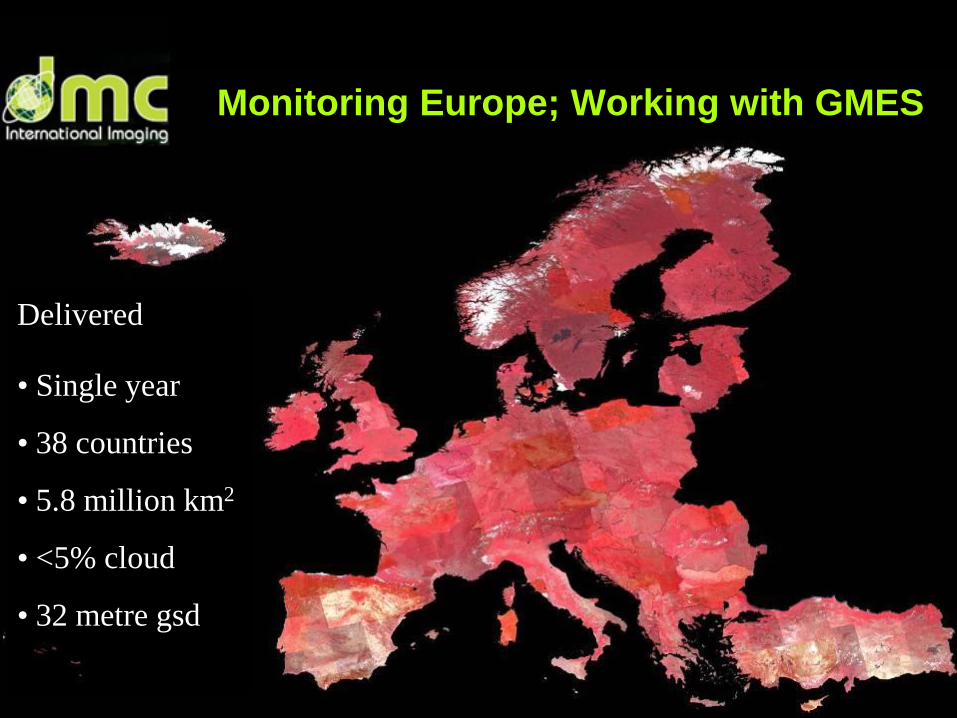
Monitoring Europe; Working with GMES
Delivered
• Single year
• 38 countries
• 5.8 million km2
• <5% cloud
• 32 metre gsd
Constellation benefits
• Global daily revisit
– operational monitoring of rapid change
• Coordinated imaging
– powerful for multiple applications
• Centralised calibration campaigns
– Consistent high quality data
• Modular addition of new satellites
– Data continuity
– Benefit from latest technology • increased capacity
• new sensors
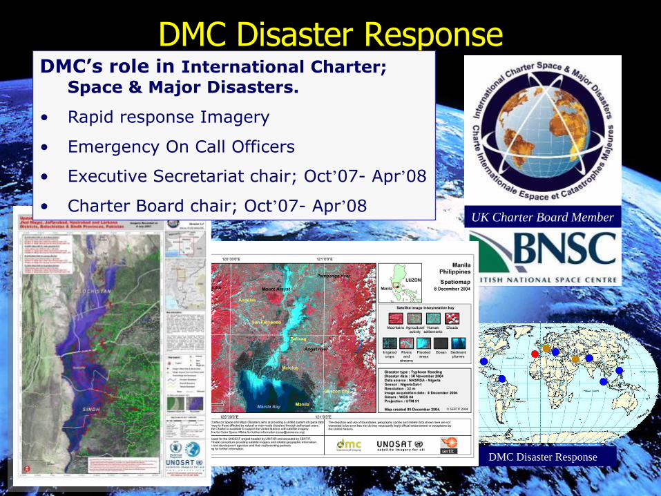
DMC Disaster Response
UK Charter Board Member
DMC Disaster Response
DMC’s role in International Charter;
Space & Major Disasters.
• Rapid response Imagery
• Emergency On Call Officers
• Executive Secretariat chair; Oct’07- Apr’08
• Charter Board chair; Oct’07- Apr’08