Embed Size (px)
Citation preview
Development of Integrated Technological Development of Integrated Technological
Information Systems to Support Land Information Systems to Support Land
Management Projects In PortugalManagement Projects In Portugal
Rui Paulo Coito
Paula Ermelinda Duarte
Vila Real, 26.Jul.2005

ITEMS TO BE PRESENTED:ITEMS TO BE PRESENTED:
•IntroductionIntroduction
•Brief description of the land consolidation in PortugalBrief description of the land consolidation in Portugal
•The role of EUROPOF in the land consolidation processThe role of EUROPOF in the land consolidation process
•General description of EUROPOFGeneral description of EUROPOF
•ConclusionsConclusions
CENTRAL SUBJECT OF THIS PRESENTATIONCENTRAL SUBJECT OF THIS PRESENTATION::Software EUROPOF, developed as a technological information Software EUROPOF, developed as a technological information application to be used in land management projects, namely in application to be used in land management projects, namely in land consolidationland consolidation
Introduction
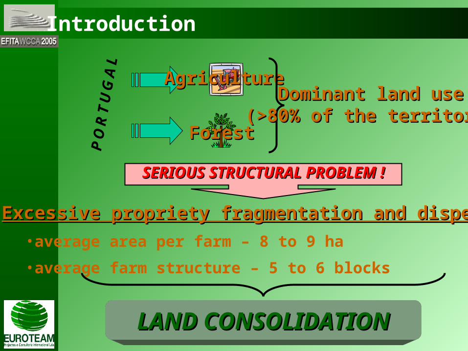
PORTUGAL
AgricultureAgriculture
ForestForest
Dominant land useDominant land use(>80% of the territory)(>80% of the territory)
SERIOUS STRUCTURAL PROBLEM !SERIOUS STRUCTURAL PROBLEM !
Excessive propriety fragmentation and dispersionExcessive propriety fragmentation and dispersion•average area per farm – 8 to 9 ha
•average farm structure – 5 to 6 blocks
LAND CONSOLIDATIONLAND CONSOLIDATION
Introduction
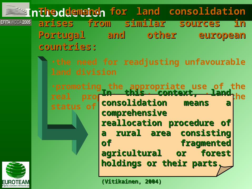
The demand for land consolidation arises from similar The demand for land consolidation arises from similar sources in Portugal and other european countries:sources in Portugal and other european countries:
•the need for readjusting unfavourable land division
•promoting the appropriate use of the real property without changing the status of ownership
In this context, land consolidation In this context, land consolidation means a comprehensive reallocation means a comprehensive reallocation procedure of a rural area consisting of procedure of a rural area consisting of fragmented agricultural or forest fragmented agricultural or forest holdings or their parts.holdings or their parts.
(Vitikainen, 2004)(Vitikainen, 2004)

Introduction
To minimize this situation in Portugal, we are trying hard toTo minimize this situation in Portugal, we are trying hard to::
simplify the proceedings
improve the process efficiency
MODERN INFORMATION TECHNOLOGIESMODERN INFORMATION TECHNOLOGIES
Regarding its development, land consolidation projects Regarding its development, land consolidation projects expanded into oversized in the workload and costs and overlong expanded into oversized in the workload and costs and overlong
durationduration
Brief description of the land consolidation process in Portugal
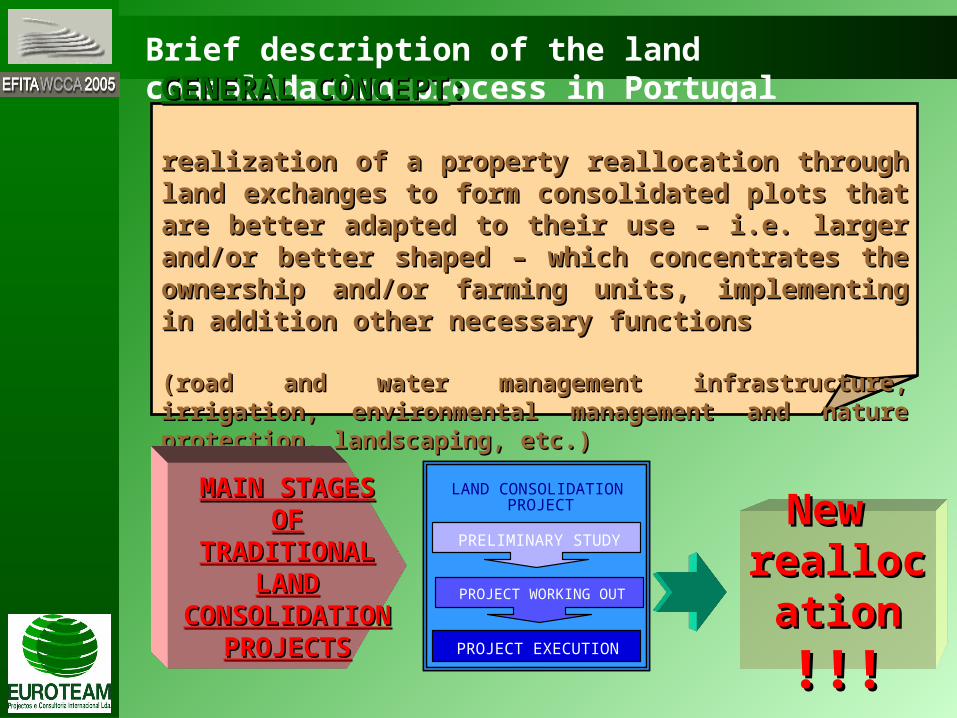
GENERAL CONCEPTGENERAL CONCEPT::
realization of a property reallocation through land exchanges to form realization of a property reallocation through land exchanges to form consolidated plots that are better adapted to their use – i.e. larger consolidated plots that are better adapted to their use – i.e. larger and/or better shaped – which concentrates the ownership and/or and/or better shaped – which concentrates the ownership and/or farming units, implementing in addition other necessary functionsfarming units, implementing in addition other necessary functions
(road and water management infrastructure, irrigation, environmental (road and water management infrastructure, irrigation, environmental management and nature protection, landscaping, etc.)management and nature protection, landscaping, etc.)
ELABORAÇÃO DO PROJECTO
LAND CONSOLIDATION
PRELIMINARY STUDY
PROJECT WORKING OUT
PROJECT EXECUTION
PROJECTMAIN STAGES OF MAIN STAGES OF
TRADITIONAL LAND TRADITIONAL LAND CONSOLIDATION CONSOLIDATION
PROJECTSPROJECTS
New New reallocatioreallocatio
nn
!!!!!!

Brief description of the land consolidation process in Portugal
NEW REALLOCATION PLANNEW REALLOCATION PLANIt’s a task of high importance in the procedure. Its complexity derives It’s a task of high importance in the procedure. Its complexity derives essencialy from:essencialy from:
the large volume of information to manipulte and over cross
the high number of relational variables to consider
Involves proper specifications and processing capability for Involves proper specifications and processing capability for which the common technological tools (CAD / GIS software) can´t which the common technological tools (CAD / GIS software) can´t reply properly according to the demanded patternsreply properly according to the demanded patterns
Came up the need of developing a technological tool specificaly Came up the need of developing a technological tool specificaly structured and conceived to fulfil this task requestsstructured and conceived to fulfil this task requests
EUROPOFEUROPOF

The role of EUROPOF in the land consolidation process
accelarating all technical operations involved in this taskaccelarating all technical operations involved in this task
maintaining high precision and flexibility standardsmaintaining high precision and flexibility standards
user-friendly capability for all kinds of operators or usersuser-friendly capability for all kinds of operators or users
It’s a software conceived and developed by It’s a software conceived and developed by EUROTEAM to be used in the design of land spatial EUROTEAM to be used in the design of land spatial rearrangements, in particular for the reallocation rearrangements, in particular for the reallocation definition in land consolidation projects. Main definition in land consolidation projects. Main objectives / attributes:objectives / attributes:
EUROPOFEUROPOF

it’s very easy and quick to make geometric changes in the it’s very easy and quick to make geometric changes in the reallocation plan layoutreallocation plan layout(deriving from the request for different shapes and or location of plots)
doesn’t demand any expertised knowledge or intensive doesn’t demand any expertised knowledge or intensive trainingtraining(the average training time needed for a new user is 2 days)
With EUROPOFWith EUROPOF::
The role of EUROPOF in the land consolidation process
Why was EUROPOF created?Why was EUROPOF created?
Conventional Conventional CAD softwareCAD softwareGIS softwareGIS software X EUROPOFEUROPOF
IT’S THE BEST TOOL FOR THE JOB !IT’S THE BEST TOOL FOR THE JOB !

The role of EUROPOF in the land consolidation process
EUROPOF functionality can be illustrated by an example of its use in a land EUROPOF functionality can be illustrated by an example of its use in a land consolidation project, in Portugal:consolidation project, in Portugal:
Projecto de Emparcelamento Rural das Courelas do Campo de CorucheProjecto de Emparcelamento Rural das Courelas do Campo de Coruche
ConventionalConventional5 months5 months
New situation107 parcels109 owners
Old situation:304 parcels112 owners
Area 500 ha
EUROPOFEUROPOF
EUROPOFEUROPOF3 weeks3 weeks
The role of EUROPOF in the land consolidation process
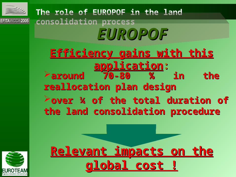
Efficiency gains with this applicationEfficiency gains with this application::
Relevant impacts on the global cost !Relevant impacts on the global cost !
around 70-80 % in the reallocation plan designaround 70-80 % in the reallocation plan design
over ¼ of the total duration of the land over ¼ of the total duration of the land consolidation procedureconsolidation procedure
EUROPOFEUROPOF
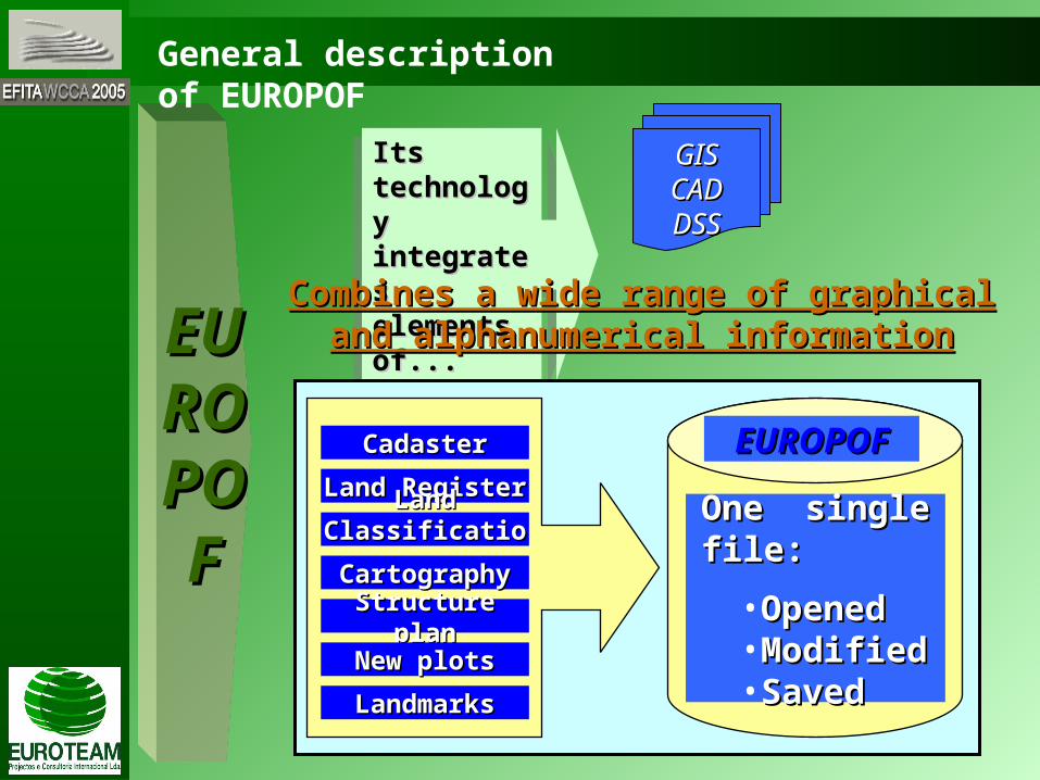
EUEURROOPPOOFF
Its Its technology technology integrates integrates elements of...elements of...
Its Its technology technology integrates integrates elements of...elements of...
GISGISCADCADDSSDSS
Combines a wide range of graphical and Combines a wide range of graphical and alphanumerical informationalphanumerical information
CadasterCadaster EUROPOFEUROPOF
One single file:One single file:
•OpenedOpened•ModifiedModified•SavedSaved
Land RegisterLand Register
Land ClassificationLand Classification
CartographyCartography
Structure planStructure plan
New plotsNew plots
LandmarksLandmarks
General description of EUROPOF


General description of EUROPOF
FROM THE USERS POINT OF VIEWFROM THE USERS POINT OF VIEW
the simplicity of the interface is related with the simplicity of the interface is related with the easiness to operate. The user can easily the easiness to operate. The user can easily design and allocate the new plots just using design and allocate the new plots just using the computer mouse to “drag and drop” the the computer mouse to “drag and drop” the owners parameters in question: the new plot owners parameters in question: the new plot allocation can be made according to...allocation can be made according to...
areaareaevaluationevaluation (land assessment)
other kind of dataother kind of data (buildings, tree plantations, irrigation equipments, etc.)
EUEURROOPPOOFF


General description of EUROPOF
Other functionalities to highlightOther functionalities to highlight::it’s possible to work simultaneously with all the it’s possible to work simultaneously with all the blocks in the projectblocks in the project
it’s easy to make all the needed amendments in the it’s easy to make all the needed amendments in the plot geometryplot geometryit’s possible to check systematicaly the owners values it’s possible to check systematicaly the owners values (not yet or already placed)
it can measure distances or calculate areas and it can measure distances or calculate areas and values on real timevalues on real timethe new plot landmarks can be set automaticalythe new plot landmarks can be set automaticaly
it can provide final project data, exporting it into it can provide final project data, exporting it into *.SHP and *.DBF files*.SHP and *.DBF files
it can provide individual reports of ownersit can provide individual reports of owners (old and new plot situation data)
EUEURROOPPOOFF

Conclusions
MAIN CONCLUSIONMAIN CONCLUSION::
The use of EUROPOF proves to be an effective The use of EUROPOF proves to be an effective
way to reduce time and costs in the land way to reduce time and costs in the land
consolidation projects, so that the proceedings consolidation projects, so that the proceedings
became simplified, cost-effective and shorter became simplified, cost-effective and shorter
in durationin duration

Conclusions
Attributes to standout:Attributes to standout:
hadling a large volume of information in an easy and hadling a large volume of information in an easy and quick way using only one filequick way using only one file
saving execution time in an efficient waysaving execution time in an efficient way
used as an interactive system since the beginnig of the used as an interactive system since the beginnig of the planning until the final resultplanning until the final result
Efficiency gains of 25 to 30% in theEfficiency gains of 25 to 30% in the
land consolidation procedure !land consolidation procedure !

Conclusions
EUROPOFEUROPOF was already used in several land consolidation projects in Portugal...was already used in several land consolidation projects in Portugal...
Project (location)Project (location) Area (ha)Area (ha) Client (promoter)Client (promoter)
Courelas do Campo de CorucheCourelas do Campo de Coruche 510510 Associação de Regantes do Vale do SorraiaAssociação de Regantes do Vale do Sorraia
Pinheiro Grande e CarregueiraPinheiro Grande e Carregueira 19801980 AGROTEJOAGROTEJO
Azinhaga, Golegã e RiachosAzinhaga, Golegã e Riachos 60006000 AGROTEJOAGROTEJO
Fráguas e Outeiro da CortiçadaFráguas e Outeiro da Cortiçada 25522552 Ass. Prod. Agr. Região Rio MaiorAss. Prod. Agr. Região Rio Maior
Veiga da MiraVeiga da Mira 350350 Câmara Municipal de ValençaCâmara Municipal de Valença
Moreira, Barroças e TaiasMoreira, Barroças e Taias 273273 Câmara Municipal de MonçãoCâmara Municipal de Monção
LagoaLagoa 14561456 FATAFATA
CarrapatasCarrapatas 670670 FATAFATA
Aldeia da LuzAldeia da Luz 19471947 IDRHaIDRHa
Vale do LisVale do Lis 10321032 IDRHaIDRHa
...covering more than 16.000 ha. The promoters are mainly administrative authorities, ...covering more than 16.000 ha. The promoters are mainly administrative authorities, municipalities and farmers associations.municipalities and farmers associations.
...can easily be used in ...can easily be used in diferent kinds of spatial diferent kinds of spatial rearrangment projects.rearrangment projects.
EUROPOFEUROPOF
forest consolidationforest consolidationurban rearrangeurban rearrangeparking areasparking areas......


Rua Oeiras do Piaui, nº 7B, 2780-285 Oeiras, PortugalRua Oeiras do Piaui, nº 7B, 2780-285 Oeiras, PortugalTel: (+351) 214405700 Fax: (+351) 214405709Tel: (+351) 214405700 Fax: (+351) 214405709
[email protected] [email protected] www.euroteam.ptwww.euroteam.pt

General description of EUROPOF
Technical aspects to emphasize concerning the data manipulationTechnical aspects to emphasize concerning the data manipulation::
advanced Graphical User Interface (GUI), taking advantage of the advanced Graphical User Interface (GUI), taking advantage of the latest Windows featureslatest Windows features
all the geometric elements are analytical represented and all the geometric elements are analytical represented and manipulated with the maximum accuracy permitted by the floating manipulated with the maximum accuracy permitted by the floating arithmetic point of double precision (64 bits)arithmetic point of double precision (64 bits)
all the geometric elements are topological integrated in a single all the geometric elements are topological integrated in a single geographic base that allows a better accuracy on the representation geographic base that allows a better accuracy on the representation (as resemblance with the Topologically Integrated Geographic (as resemblance with the Topologically Integrated Geographic Encoding and Referencing system – TIGER – of the US Census BureauEncoding and Referencing system – TIGER – of the US Census Bureau
global and local optimisation algorithmsglobal and local optimisation algorithms
all the geometric processes operates directly above the geometric all the geometric processes operates directly above the geometric elements analytical defined without appeal to simplifications or elements analytical defined without appeal to simplifications or approachapproach
high level geometric editing with real-time topology. Dynamic, real-high level geometric editing with real-time topology. Dynamic, real-time interaction between geometric properties (areas, property time interaction between geometric properties (areas, property boundaries, etc.) and alphanumeric databoundaries, etc.) and alphanumeric data
EUEURROOPPOOFF

Technical aspects to emphasize concerning the data manipulationTechnical aspects to emphasize concerning the data manipulation: (cont.): (cont.)
the landmarks that delimit the new plots are automatically placed by the landmarks that delimit the new plots are automatically placed by EUROPOF, and they are maintained always rigorous when the user EUROPOF, and they are maintained always rigorous when the user changes the geometry of the plotchanges the geometry of the plot
to import the initial data and export final information, the softwares to import the initial data and export final information, the softwares uses shapefiles and Dbase formatsuses shapefiles and Dbase formats
agile representation and navigation through massive orthophoto agile representation and navigation through massive orthophoto image basesimage bases
reports output , based on Apache FOP (Formating Objects reports output , based on Apache FOP (Formating Objects Processor) that offers a great flexibilityProcessor) that offers a great flexibility