Embed Size (px)
Citation preview
DEVELOPMENT OF GIS APPLICATION
– INDIA EXPERIENCE
C. CHAKRAVORTYOffice of the Registrar General, India
New Delhi
UNEGM on Census MappingNew York : 30th May 2007
2
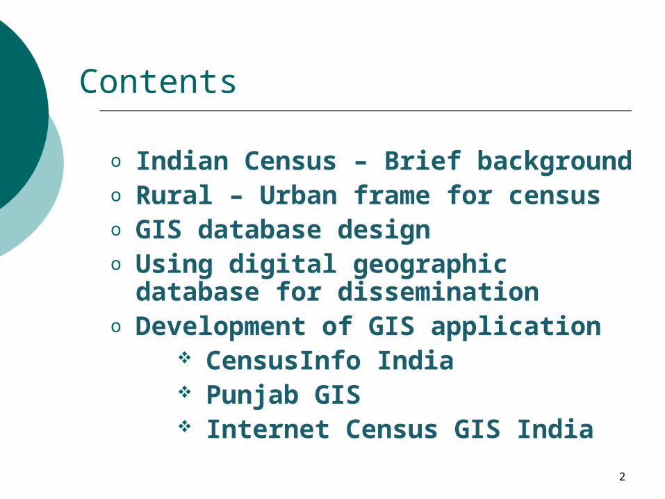
Contents
o Indian Census – Brief backgroundo Rural – Urban frame for censuso GIS database designo Using digital geographic database for
disseminationo Development of GIS application
CensusInfo India Punjab GIS Internet Census GIS India
3
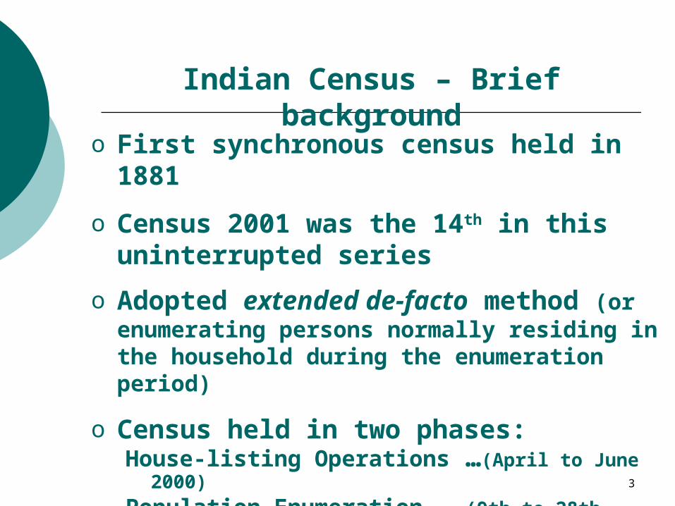
Indian Census – Brief background
o First synchronous census held in 1881
o Census 2001 was the 14th in this uninterrupted series
o Adopted extended de-facto method (or enumerating persons normally residing in the household during the enumeration period)
o Census held in two phases:House-listing Operations …(April to June 2000)
Population Enumeration …(9th to 28th February 2001)
4
Indian Census – Brief background
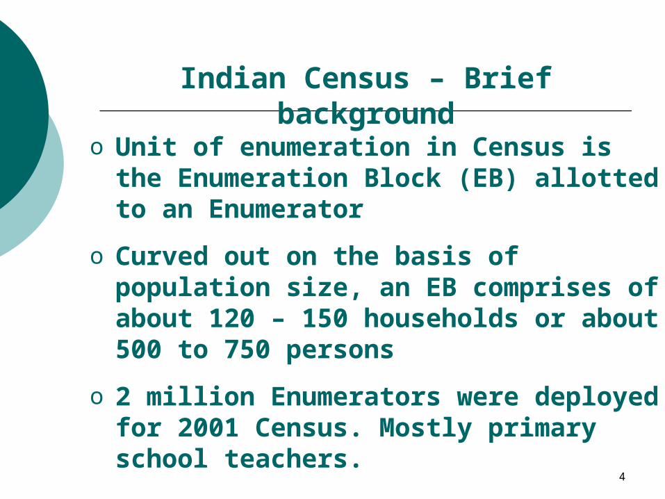
o Unit of enumeration in Census is the Enumeration Block (EB) allotted to an Enumerator
o Curved out on the basis of population size, an EB comprises of about 120 – 150 households or about 500 to 750 persons
o 2 million Enumerators were deployed for 2001 Census. Mostly primary school teachers.
5
Preparing Rural – Urban Frame
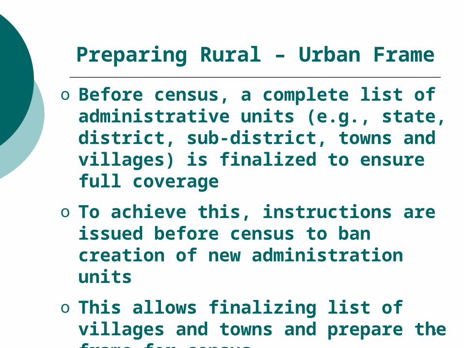
o Before census, a complete list of administrative units (e.g., state, district, sub-district, towns and villages) is finalized to ensure full coverage
o To achieve this, instructions are issued before census to ban creation of new administration units
o This allows finalizing list of villages and towns and prepare the frame for census.
6
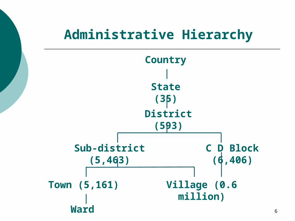
Administrative Hierarchy
Country
State (35)
District (593)
Sub-district (5,463) C D Block (6,406)
Town (5,161) Village (0.6 million)
Ward
7
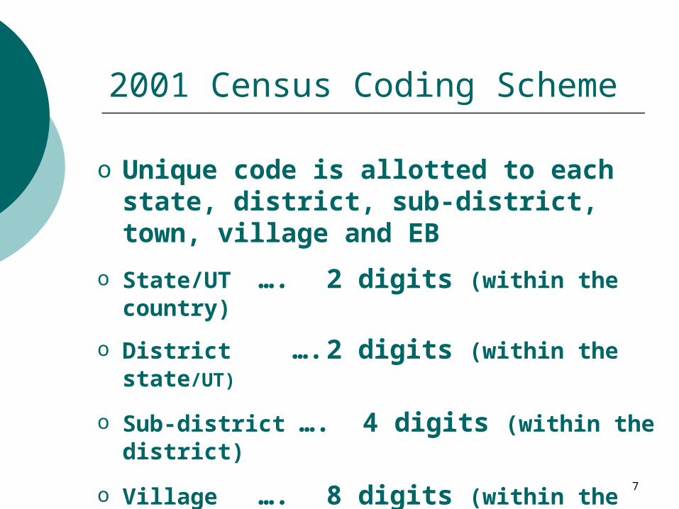
2001 Census Coding Scheme
o Unique code is allotted to each state, district, sub-district, town, village and EB
o State/UT …. 2 digits (within the country)
o District …. 2 digits (within the state/UT)
o Sub-district …. 4 digits (within the district)
o Village …. 8 digits (within the state/UT)
o Town …. 8 digits (within the district)
8
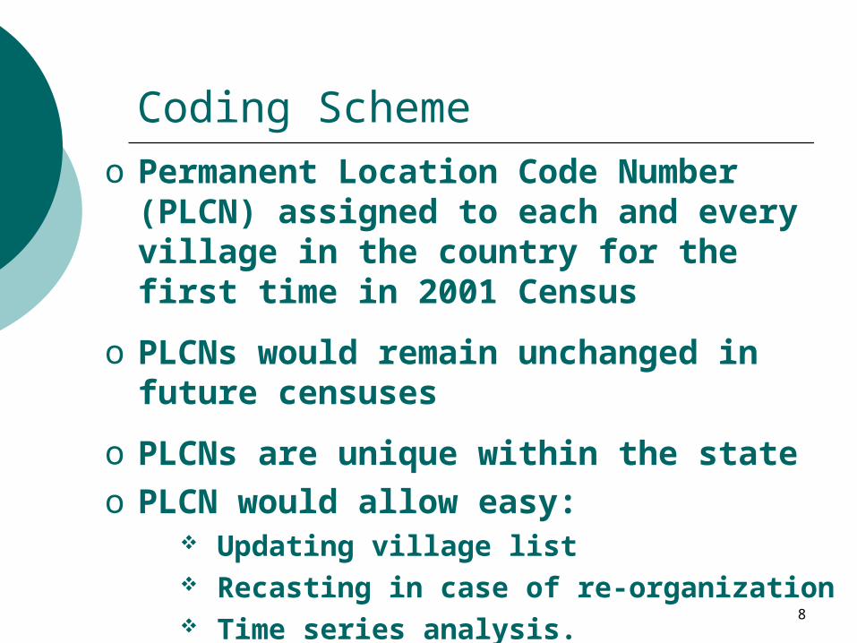
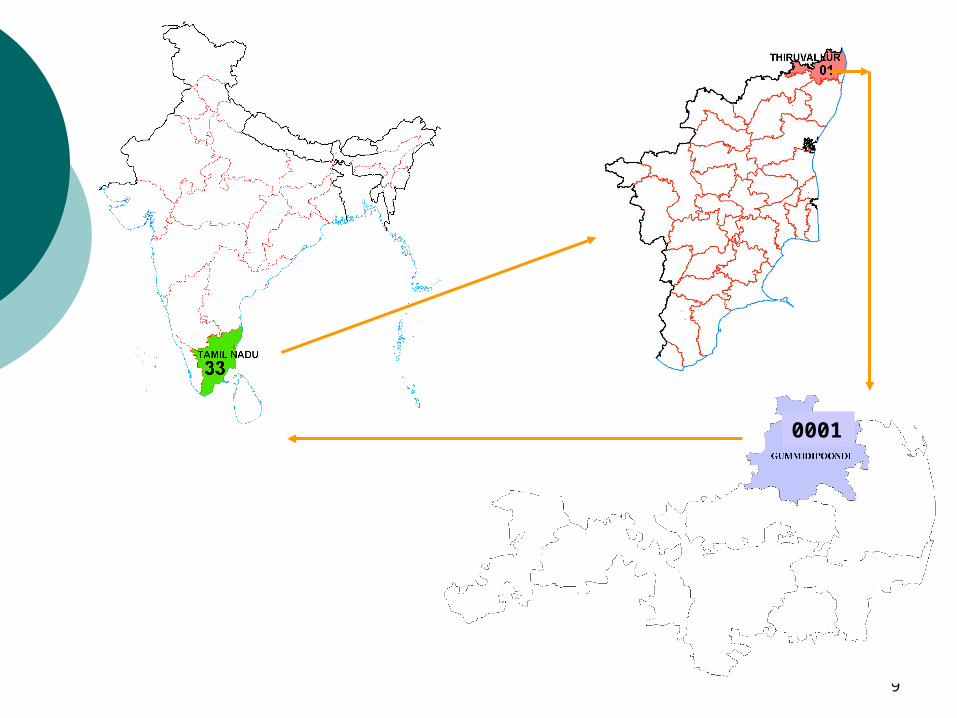
Coding Schemeo Permanent Location Code Number (PLCN)
assigned to each and every village in the country for the first time in 2001 Census
o PLCNs would remain unchanged in future censuses
o PLCNs are unique within the state
o PLCN would allow easy: Updating village list Recasting in case of re-organization Time series analysis.
9
0001
#
##
#
##
# #
#
##
#
#
#
#
##
#
##
#
# #
#
##
##
##
## #
#
# ###
#
#
#
###
#
#
#
#
#
#
#
#
##
##
# #S
#
##
#
#
#
# ##
# # ##
#
##
#
#
##
#
###
#
10
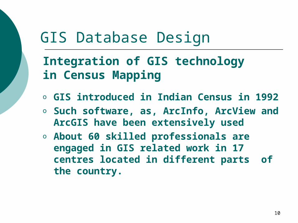
GIS Database Design
o GIS introduced in Indian Census in 1992o Such software, as, ArcInfo, ArcView and ArcGIS
have been extensively usedo About 60 skilled professionals are engaged in
GIS related work in 17 centres located in different parts of the country.
Integration of GIS technology in Census Mapping
11
GIS Database Design
o Maps showing jurisdictional boundaries are updated by incorporating changes before every census and used for pre-census work
o This work takes about three years to complete.
Pre-Census mapping
12
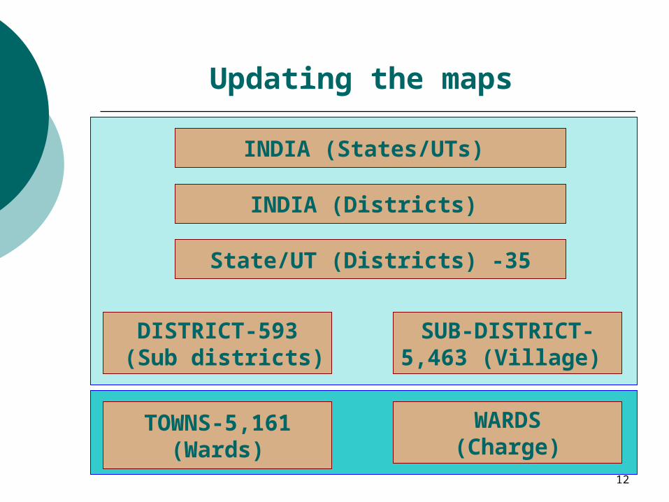
Updating the maps
INDIA (States/UTs)
INDIA (Districts)
State/UT (Districts) -35
DISTRICT-593 (Sub districts)
SUB-DISTRICT-5,463 (Village)
WARDS(Charge)
TOWNS-5,161(Wards)
13
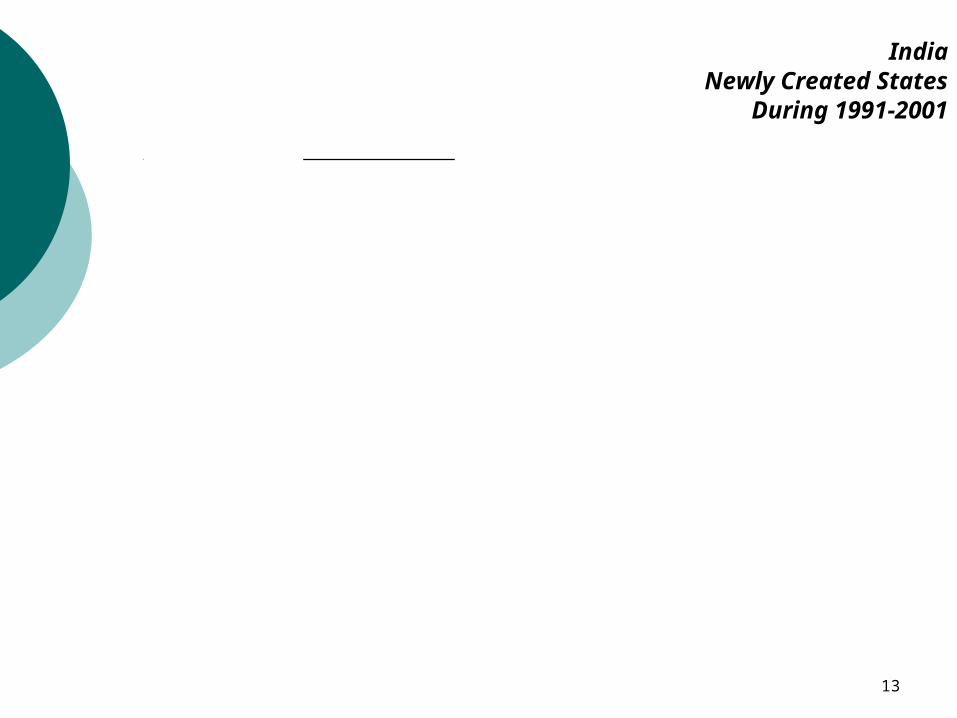
IndiaNewly Created States
During 1991-2001Uttaranchal
Jharkhand
Chhattisgarh
14
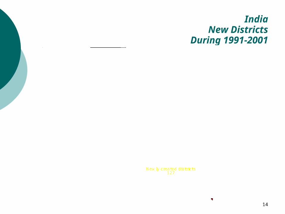
Newly created districts127
IndiaNew Districts
During 1991-2001
15
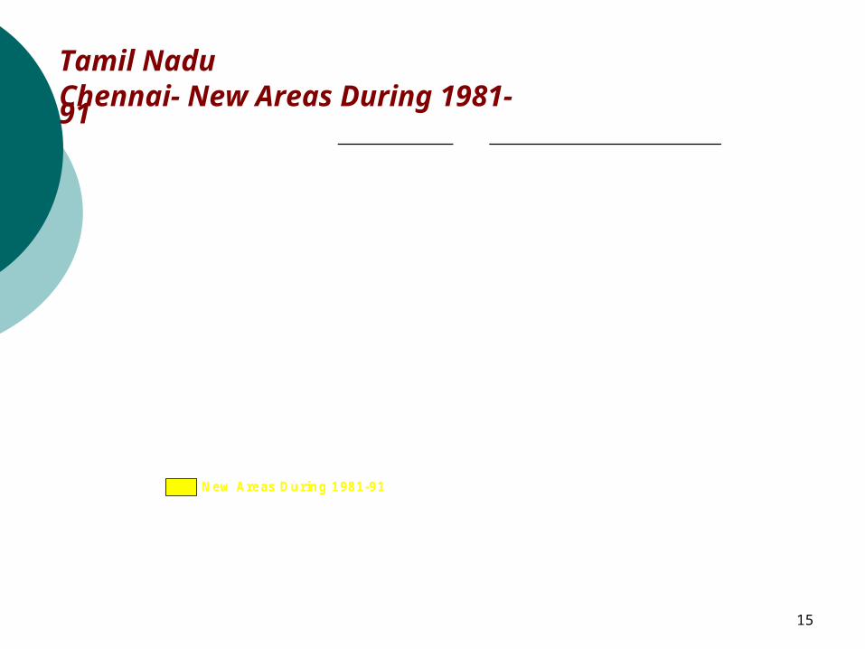
Tamil NaduChennai- New Areas During 1981-91
New Areas During 1981-91
16
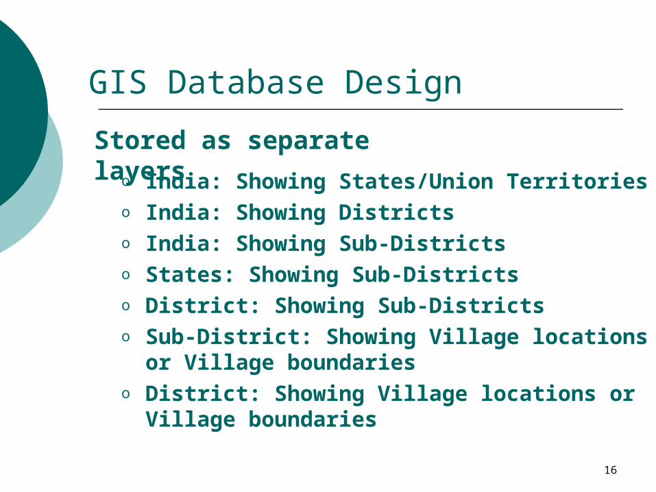
GIS Database Design
o India: Showing States/Union Territorieso India: Showing Districtso India: Showing Sub-Districtso States: Showing Sub-Districtso District: Showing Sub-Districtso Sub-District: Showing Village locations or
Village boundarieso District: Showing Village locations or Village
boundaries
Stored as separate layers
17
Post Census Mapping
o After the census various types of thematic maps portraying census and house listing data are prepared at country, state, district, sub-district level
o These maps are used in checking the quality of census data before publishing the results by comparing 1991 and 2001 Census data
o Extensive use of maps have been made using PowerPoint presentations while sensitizing the data users with the 2001 Census results.
18
Post Census Mapping
o Census Atlas - National Volume o Population Atlas - National Volumeo Census Atlases of each State and Union Territoryo District Census Hand Book maps o Tribal Atlas of India.o Administrative Atlas of Indiao Administrative Atlases of States and Union territorieso Language Atlas of Indiao Housing Atlas of India
o Map Profile 2001 – India, State and Union Territorieso Preparation of 593 District maps of the country showing
villages
List of Publications:
19
A
A
A
A
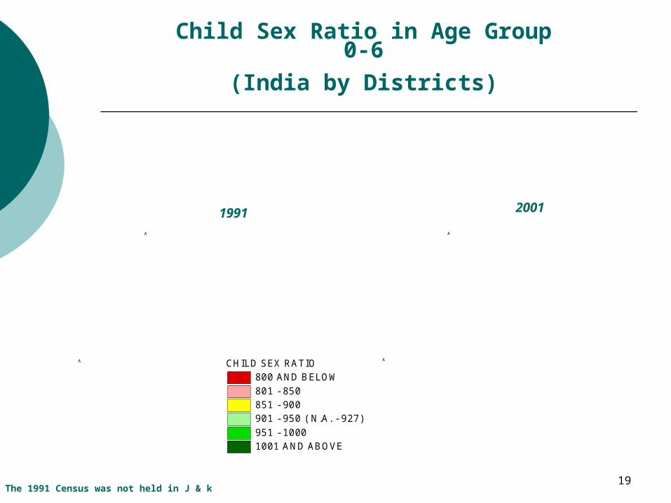
Child Sex Ratio in Age Group 0-6
(India by Districts)
1991 2001
The 1991 Census was not held in J & k
CHILD SEX RATIO800 AND BELOW801 - 850851 - 900901 - 950 ( N.A. - 927)951 - 10001001 AND ABOVE
20
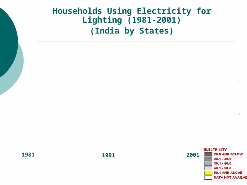
1981 1991 2001
Households Using Electricity for Lighting (1981-2001)
(India by States)
21
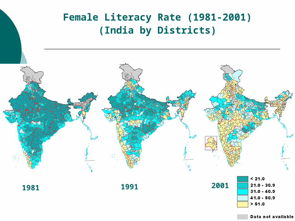
Female Literacy Rate (1981-2001)(India by Districts)
1981 1991 2001
22
Digital Database for Dissemination
o Indian Census has been a major supplier of map products in the country – both in print form and in digital form.
o With revision in policy it has now become possible to disseminate digital database
o Users could be categorized into three groups: Users who want to procure geographic database for
developing their own applications Users who would like to use a pre-packaged database
product developed by the Census Organisation and Users who would like to view thematic maps in the form
of static pages
23
Digital Database for Dissemination
o Census Organisation meets the need of all the three category of users
o Digital database are procured by large business houses, software developers for preparing GIS applications for use
o Census Organisation releases pre-packaged GIS products on selected census themes, which allow certain degree of interactivity both in CD as well on the Internet
o Static thematic maps are also disseminated in print and also made available on the census website.
24
Development of GIS Applications
o Before any GIS application is developed, it is important to keep in mind the target users and their need
o Too much information should not be packed in one application
o Care should be taken to make the application focused and user-friendly
o Need for development would usually arise by regular interactions with the data users over a period of time.
25
GIS Applications developed by Census
o CensusInfo India (on CD)
o Census GIS Punjab (on CD and Internet)
o Census GIS India (on Internet)
26
Development of CensusInfo India
o First application developed by Census
o Based on ChildInfo software developed by UNICEF
o CensusInfo India allows generation of maps up to sub-district level
o Steps involved include:
Finalizing geographic database
Finalizing attribute database
Integration of the two using GIS software
27
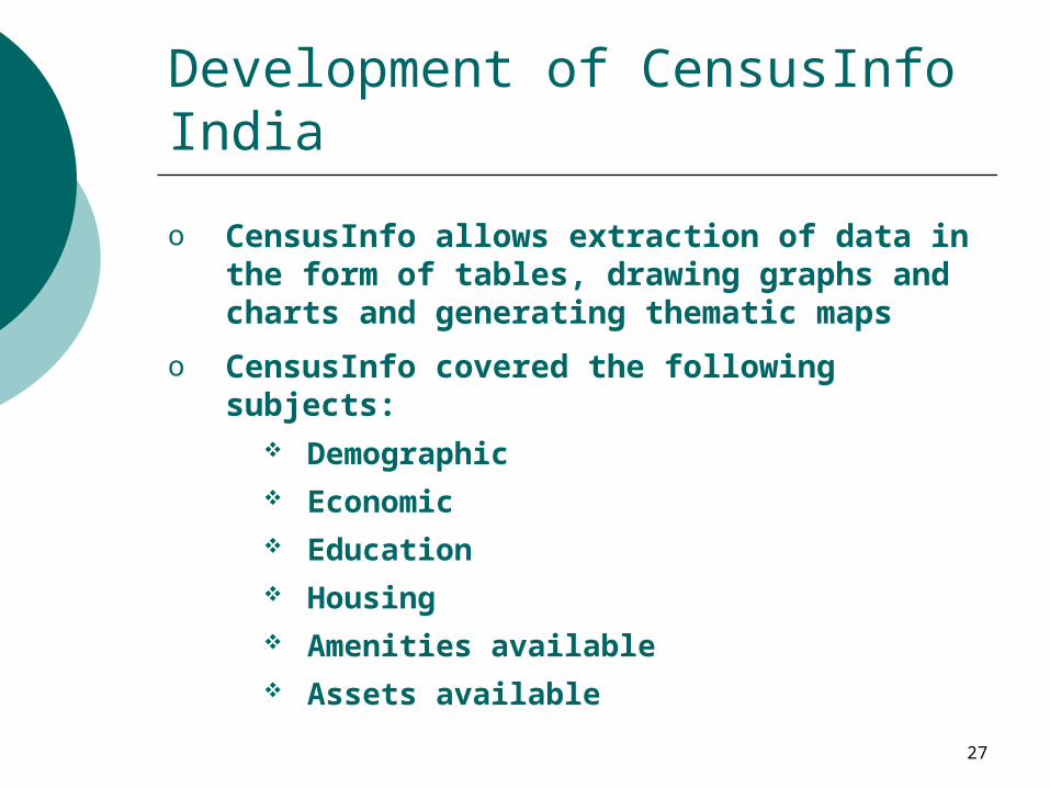
Development of CensusInfo India
o CensusInfo allows extraction of data in the form of tables, drawing graphs and charts and generating thematic maps
o CensusInfo covered the following subjects: Demographic Economic Education Housing Amenities available Assets available
28
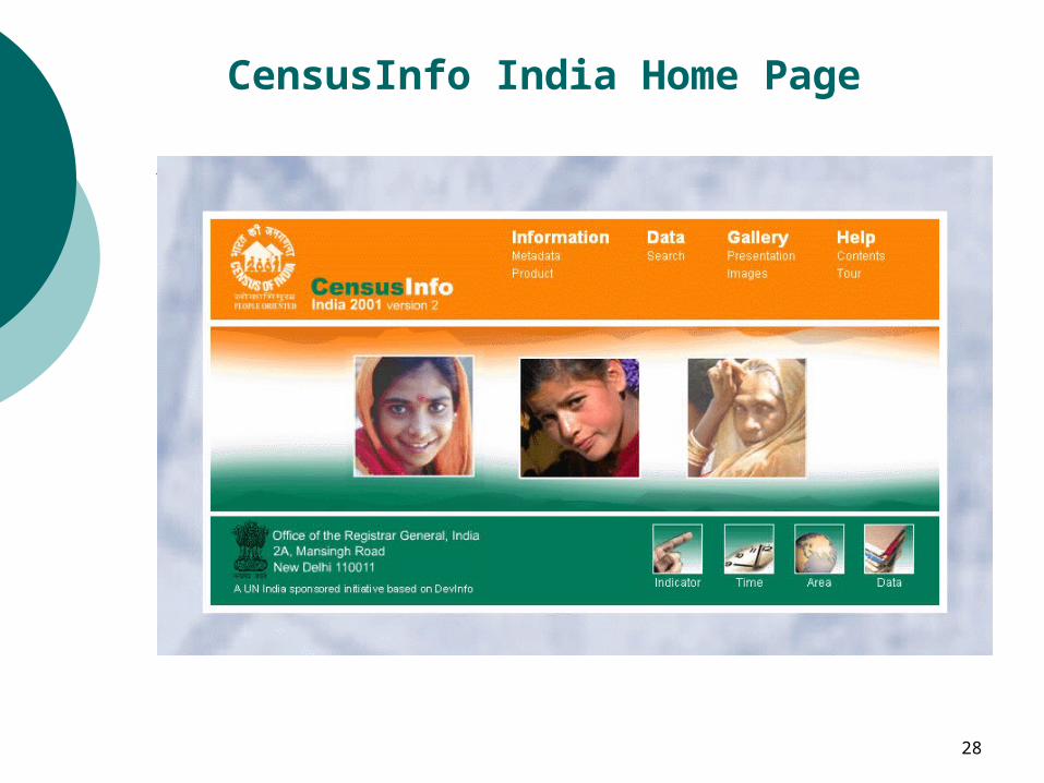
CensusInfo India Home Page
29
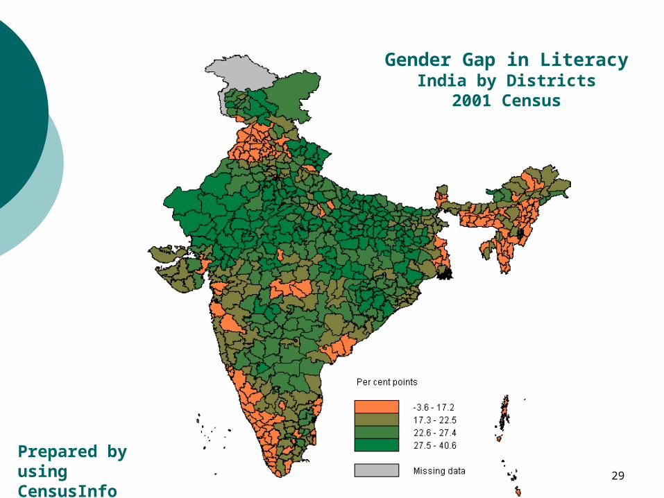
Gender Gap in LiteracyIndia by Districts
2001 Census
Prepared by usingCensusInfo India
30
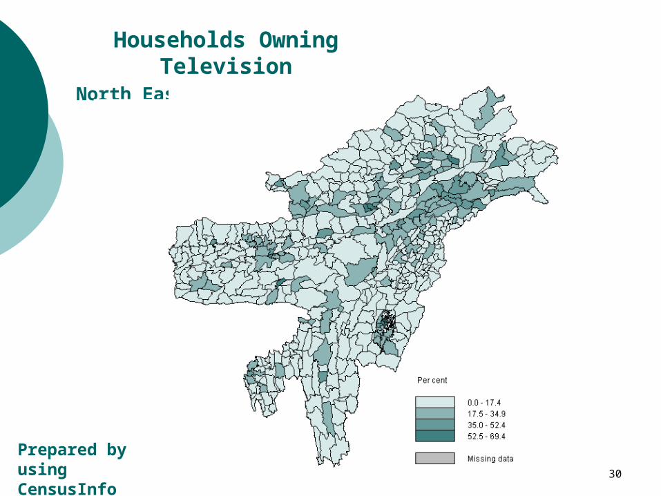
Households Owning TelevisionNorth Eastern India by Sub-districts
Prepared by usingCensusInfo India
31
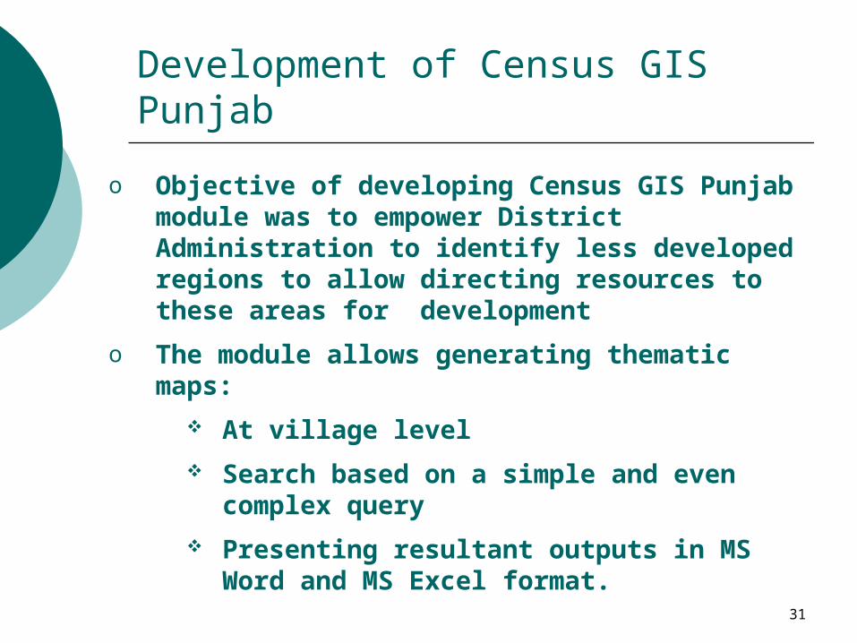
Development of Census GIS Punjab
o Objective of developing Census GIS Punjab module was to empower District Administration to identify less developed regions to allow directing resources to these areas for development
o The module allows generating thematic maps:
At village level
Search based on a simple and even complex query
Presenting resultant outputs in MS Word and MS Excel format.
32
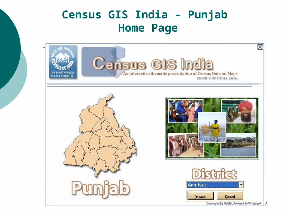
Census GIS India – Punjab Home Page
33
Development of Census GIS Punjab
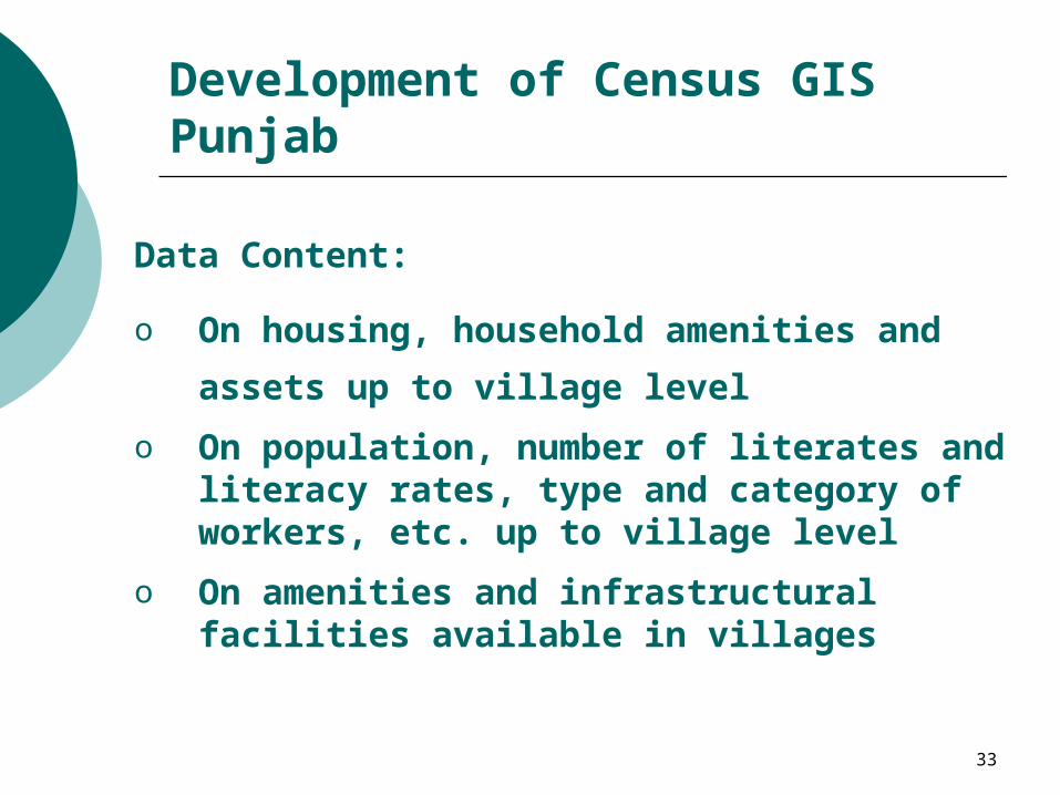
Data Content:
o On housing, household amenities and assets up
to village level
o On population, number of literates and literacy rates, type and category of workers, etc. up to village level
o On amenities and infrastructural facilities available in villages
34
Development of Census GIS Punjab
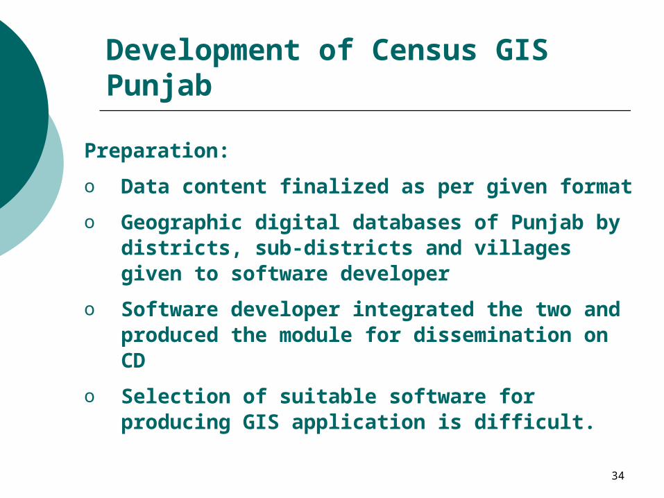
Preparation:
o Data content finalized as per given format
o Geographic digital databases of Punjab by districts, sub-districts and villages given to software developer
o Software developer integrated the two and produced the module for dissemination on CD
o Selection of suitable software for producing GIS application is difficult.
35
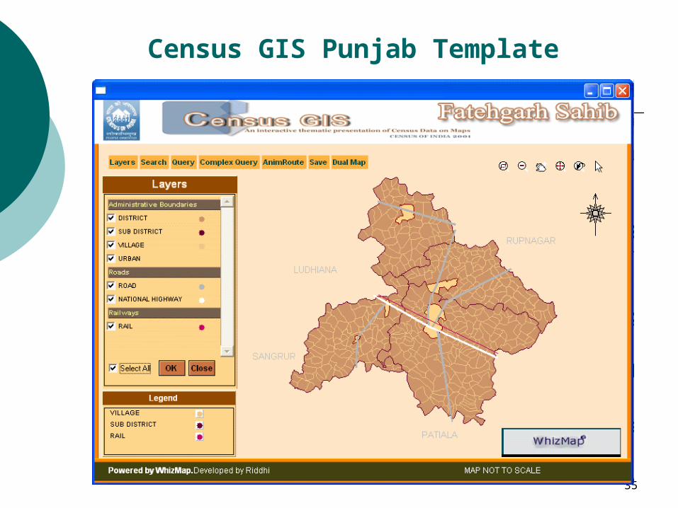
Census GIS Punjab Template
36
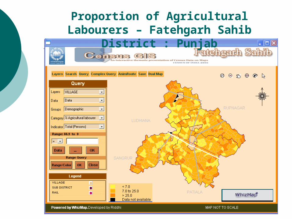
Proportion of Agricultural Labourers – Fatehgarh Sahib District : Punjab
37
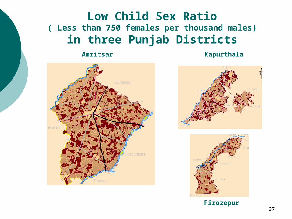
Low Child Sex Ratio( Less than 750 females per thousand males)
in three Punjab DistrictsAmritsar Kapurthala
Firozepur
38
Census GIS India on Internet
Features:
o Extends the facility of preparing thematic maps on Census subjects on the web
o Large variety of data made available
o Maps up to Sub-district level
o Absolutely free
o Output maps generated by the users could be used in reports and presentations.
39
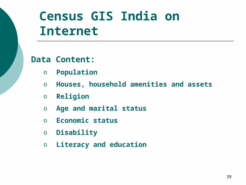
Census GIS India on Internet
Data Content:
o Population
o Houses, household amenities and assets
o Religion
o Age and marital status
o Economic status
o Disability
o Literacy and education
40
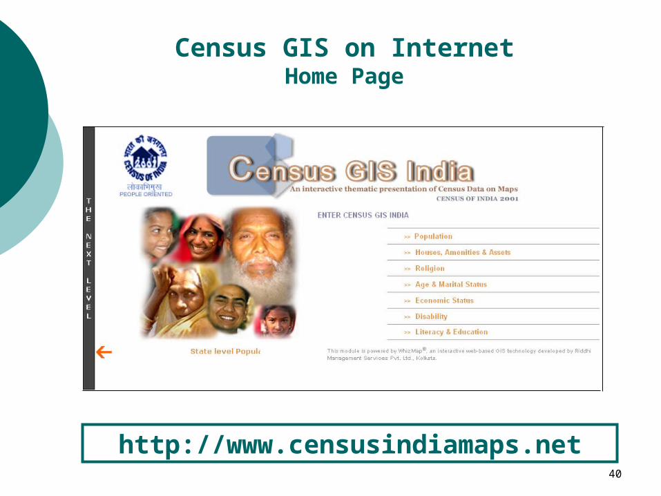
Census GIS on InternetHome Page
http://www.censusindiamaps.net
41
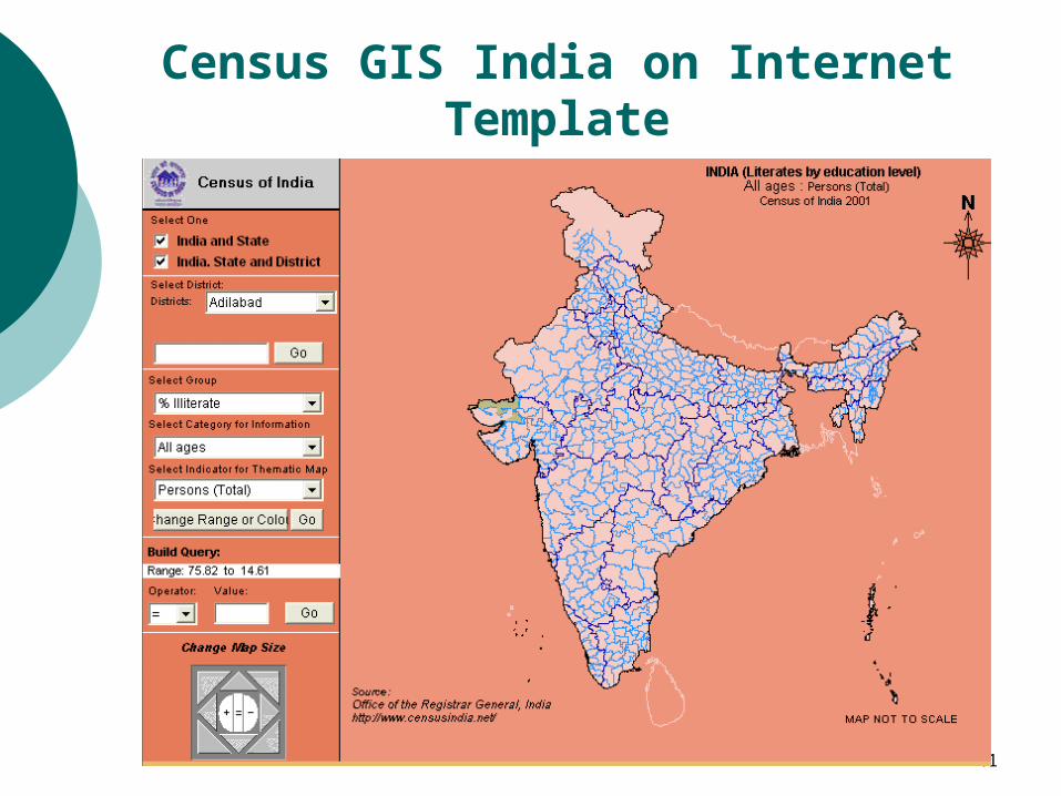
Census GIS India on InternetTemplate
42
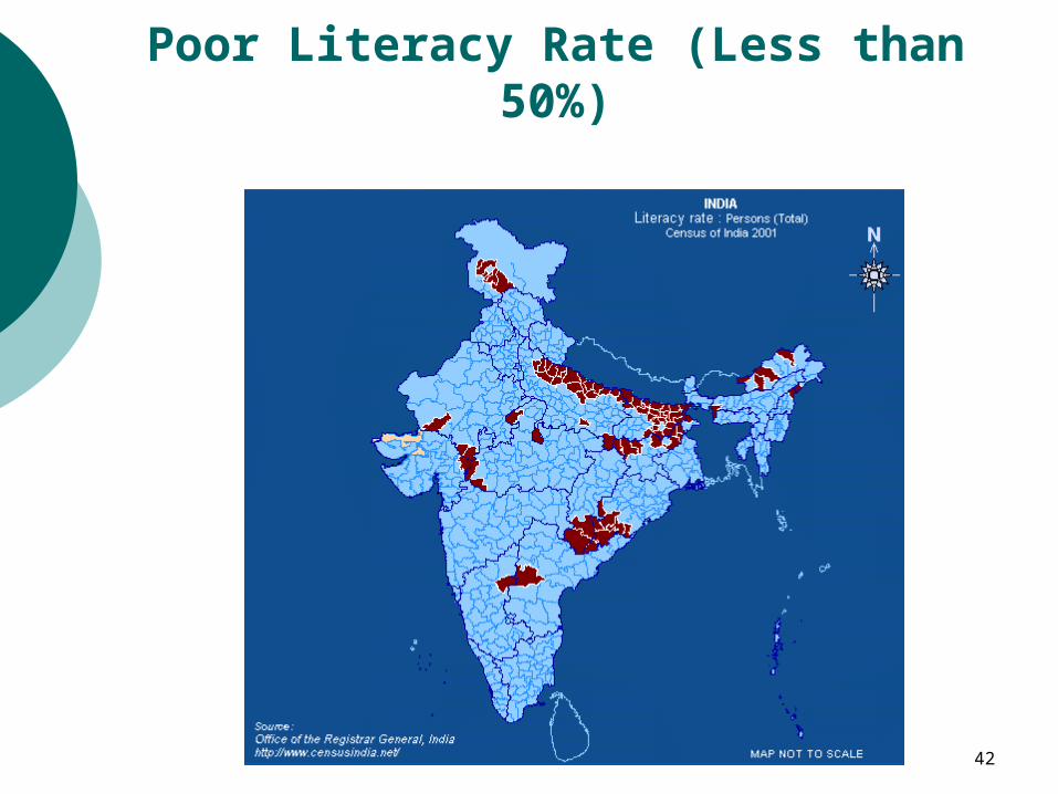
Poor Literacy Rate (Less than 50%)
43
Demonstration
o CensusInfo India
o Census GIS Punjab

44
…. Thank you


![127838406 Gayatri Chakravorty Spivak Live Theory[1]](https://img.pdfslide.us/doc/110x75/545be21fb1af9f870d8b4663/127838406-gayatri-chakravorty-spivak-live-theory1-55844fef05e99.jpg)