Embed Size (px)
Citation preview

www.vlaanderen.be/informatievlaanderen
Jo Van Valckenborgh
IACS workshop Ghent, May 2017
Detection of small landscape elements in Flanders based on remote sensing techniques
&DEPARTEMENTLANDBOUW& VISSERIJ
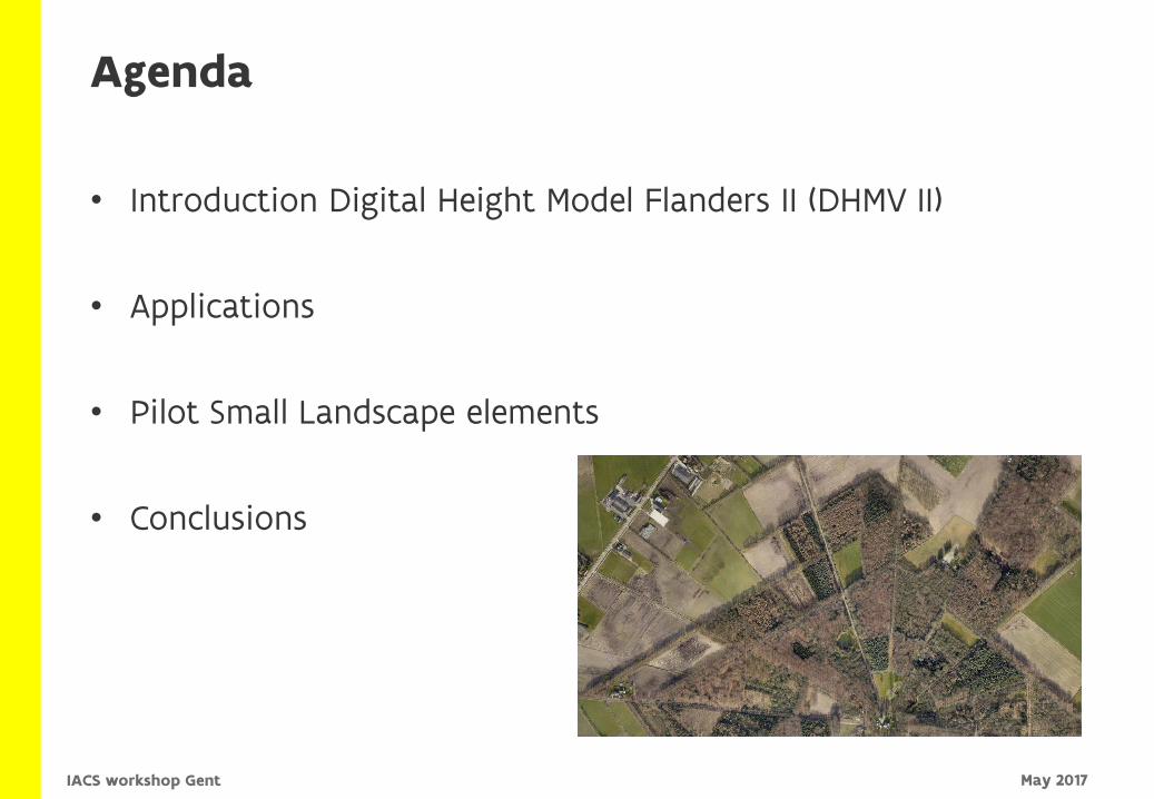
Agenda
• Introduction Digital Height Model Flanders II (DHMV II)
• Applications
• Pilot Small Landscape elements
• Conclusions
May 2017IACS workshop Gent

> Update DHMV I
> Data acquisition
> Aerial campaign over 3 years (2013-2015)
> Winter period (November – April)
> Flanders Region, Belgium (ca 13500 km2)
Introduction DHMV II
May 2017IACS workshop Gent
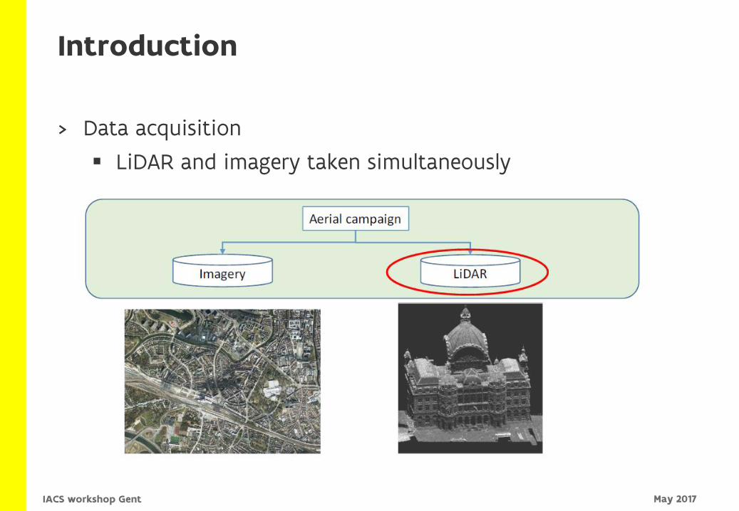
> Data acquisition
LiDAR and imagery taken simultaneously
Introduction
May 2017IACS workshop Gent
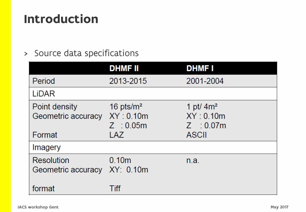
> Source data specifications
Introduction
May 2017IACS workshop Gent
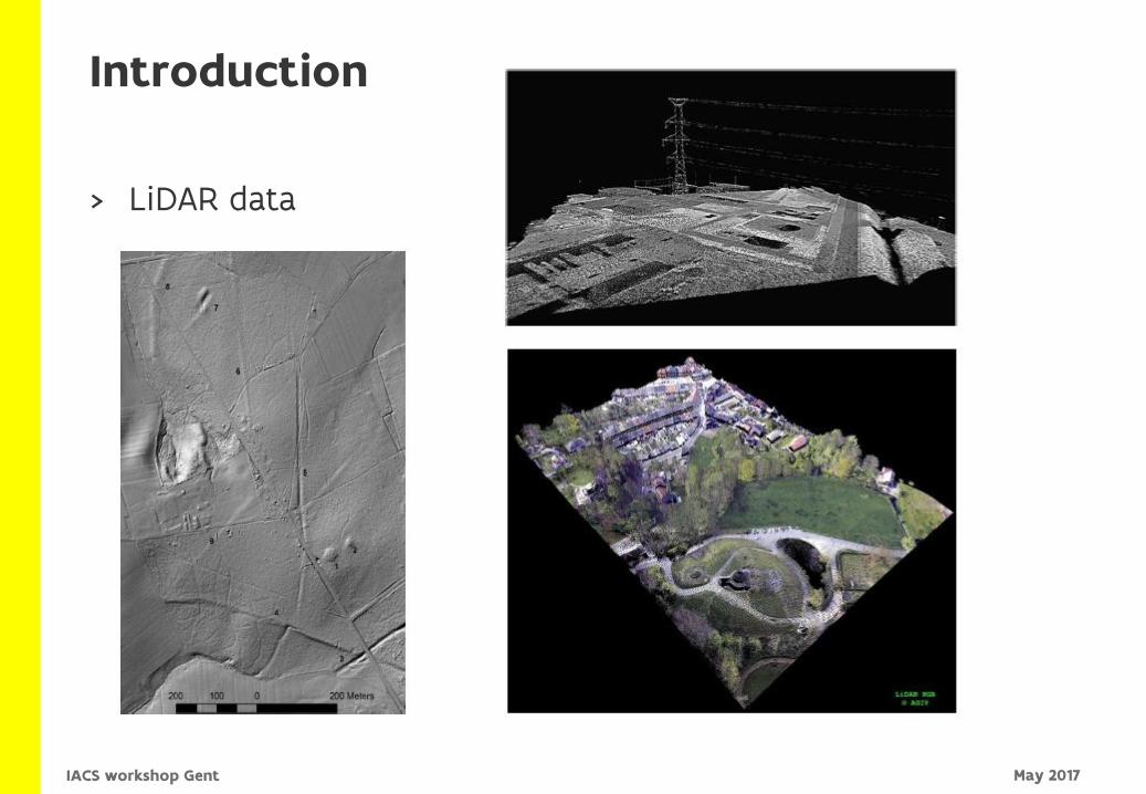
> LiDAR data
Introduction
May 2017IACS workshop Gent
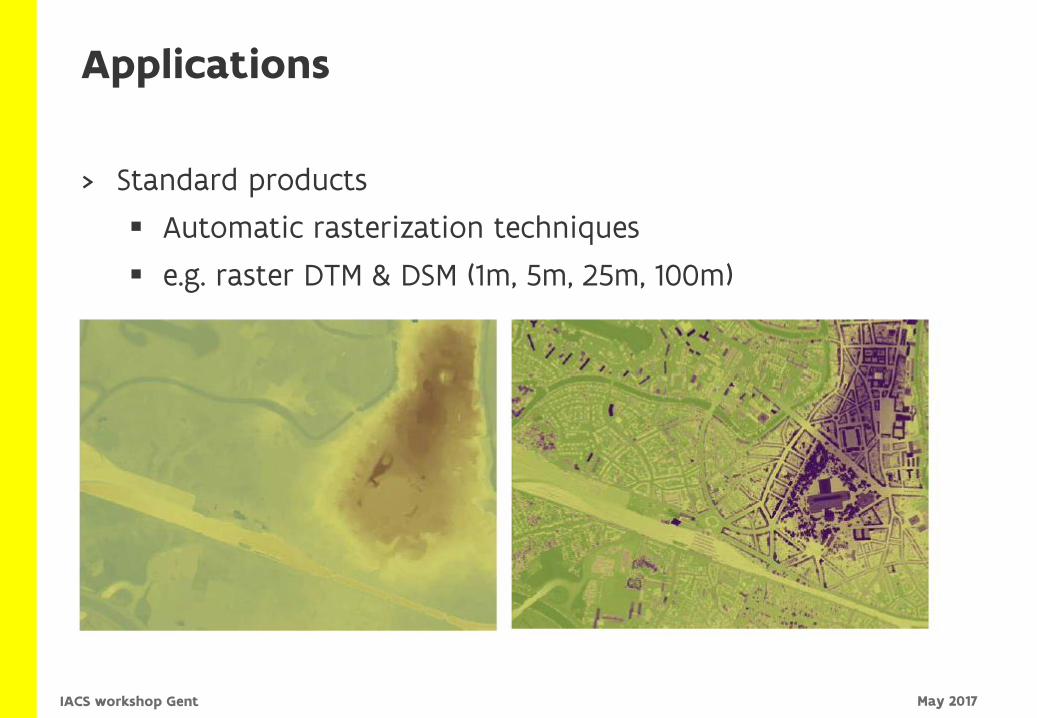
> Standard products
Automatic rasterization techniques
e.g. raster DTM & DSM (1m, 5m, 25m, 100m)
Applications
May 2017IACS workshop Gent
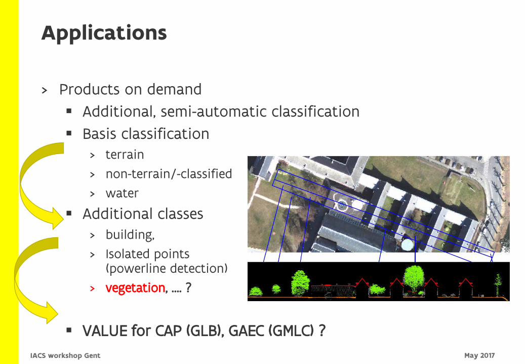
> Products on demand
Additional, semi-automatic classification
Basis classification> terrain
> non-terrain/-classified
> water
Additional classes> building,
> Isolated points(powerline detection)
> vegetation, …. ?
VALUE for CAP (GLB), GAEC (GMLC) ?
Applications
May 2017IACS workshop Gent
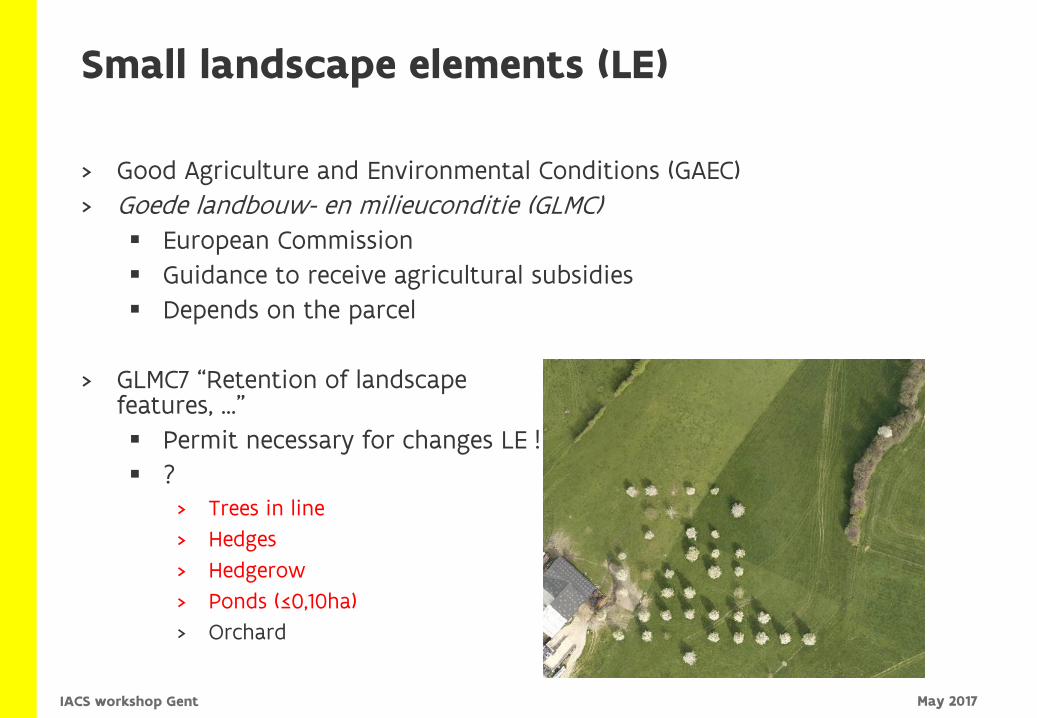
Small landscape elements (LE)
> Good Agriculture and Environmental Conditions (GAEC)
> Goede landbouw- en milieuconditie (GLMC) European Commission
Guidance to receive agricultural subsidies
Depends on the parcel
> GLMC7 “Retention of landscape features, …”
Permit necessary for changes LE !
?> Trees in line
> Hedges
> Hedgerow
> Ponds (≤0,10ha)
> Orchard
May 2017IACS workshop Gent
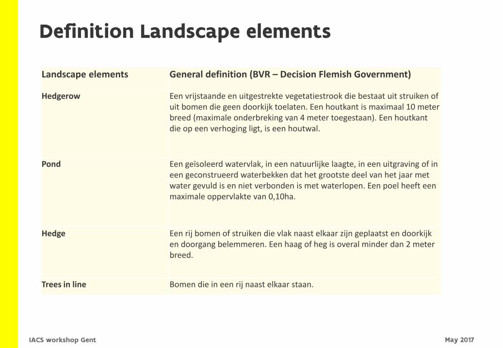
Definition Landscape elements
Landscape elements General definition (BVR – Decision Flemish Government)
Hedgerow Een vrijstaande en uitgestrekte vegetatiestrook die bestaat uit struiken of uit bomen die geen doorkijk toelaten. Een houtkant is maximaal 10 meter breed (maximale onderbreking van 4 meter toegestaan). Een houtkantdie op een verhoging ligt, is een houtwal.
Pond Een geïsoleerd watervlak, in een natuurlijke laagte, in een uitgraving of in een geconstrueerd waterbekken dat het grootste deel van het jaar met water gevuld is en niet verbonden is met waterlopen. Een poel heeft een maximale oppervlakte van 0,10ha.
Hedge Een rij bomen of struiken die vlak naast elkaar zijn geplaatst en doorkijk en doorgang belemmeren. Een haag of heg is overal minder dan 2 meter breed.
Trees in line Bomen die in een rij naast elkaar staan.
May 2017IACS workshop Gent
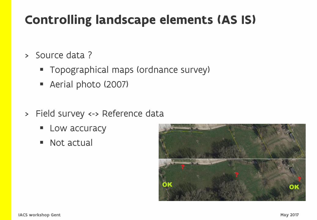
Controlling landscape elements (AS IS)
> Source data ?
Topographical maps (ordnance survey)
Aerial photo (2007)
> Field survey <-> Reference data
Low accuracy
Not actual
May 2017IACS workshop Gent
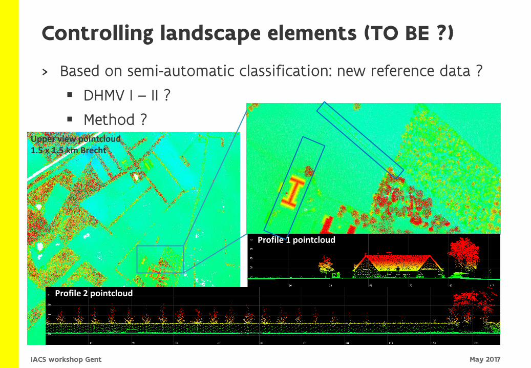
Controlling landscape elements (TO BE ?)
> Based on semi-automatic classification: new reference data ?
DHMV I – II ?
Method ? Upper view pointcloud1.5 x 1.5 km Brecht
Profile 2 pointcloud
Profile 1 pointcloud
May 2017IACS workshop Gent
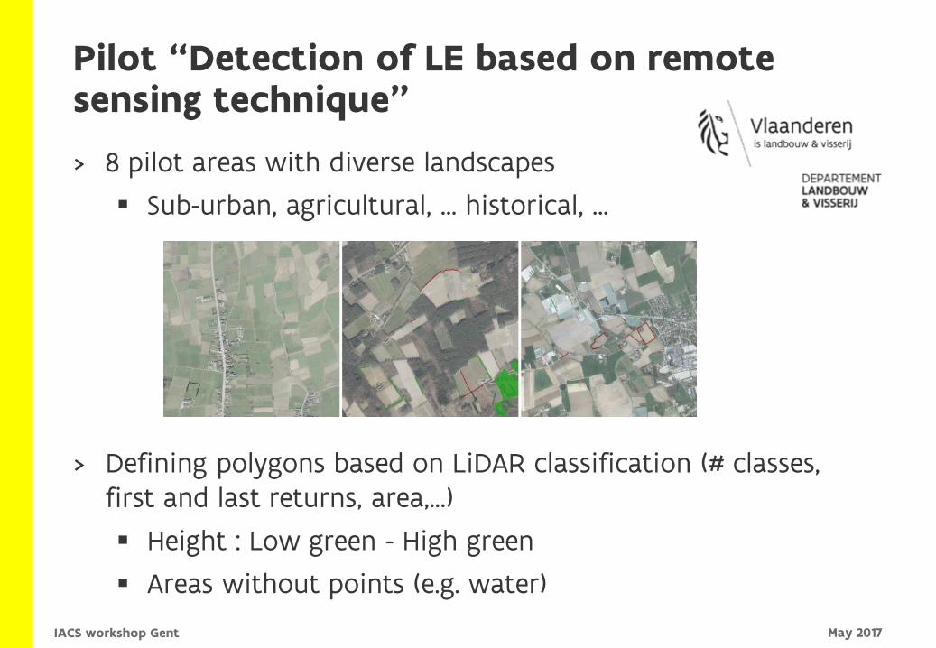
Pilot “Detection of LE based on remote sensing technique”
> 8 pilot areas with diverse landscapes
Sub-urban, agricultural, … historical, …
> Defining polygons based on LiDAR classification (# classes, first and last returns, area,…)
Height : Low green - High green
Areas without points (e.g. water)
May 2017IACS workshop Gent
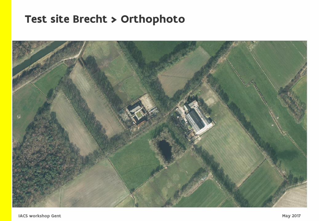
Test site Brecht > Orthophoto
May 2017IACS workshop Gent
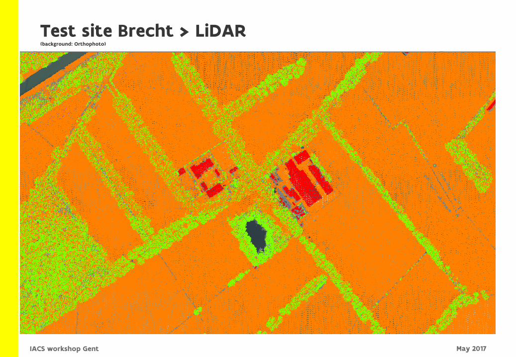
Test site Brecht > LiDAR(background: Orthophoto)
May 2017IACS workshop Gent
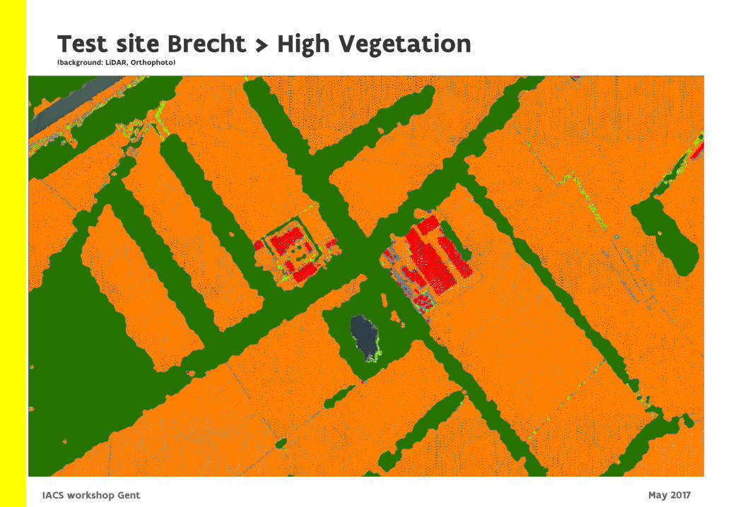
Test site Brecht > High Vegetation(background: LiDAR, Orthophoto)
May 2017IACS workshop Gent
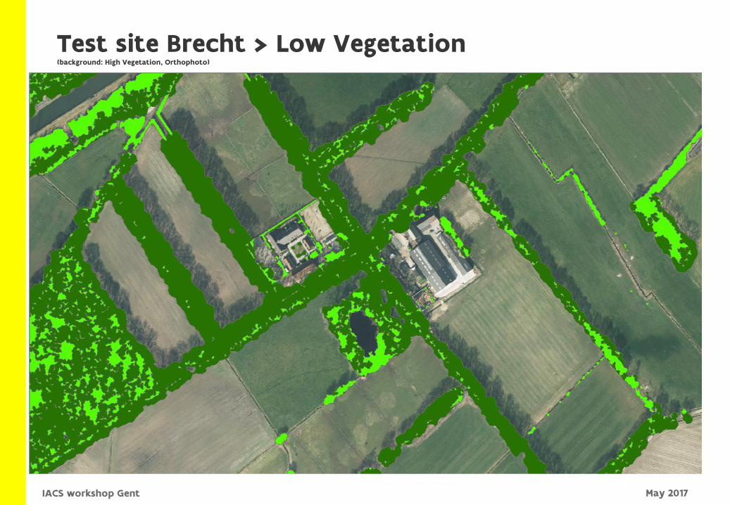
Test site Brecht > Low Vegetation(background: High Vegetation, Orthophoto)
May 2017IACS workshop Gent
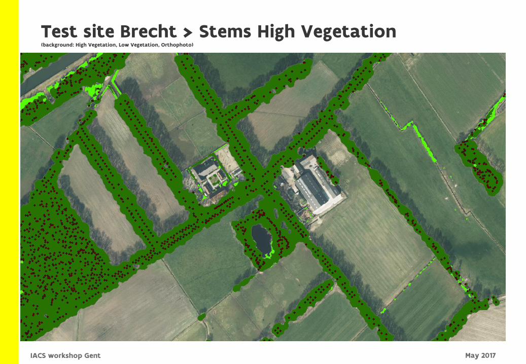
Test site Brecht > Stems High Vegetation(background: High Vegetation, Low Vegetation, Orthophoto)
May 2017IACS workshop Gent
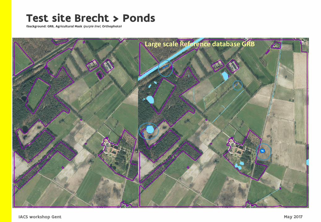
PoelenLarge scale Reference database GRB
Test site Brecht > Ponds(background: GRB, Agricultural Mask (purple line), Orthophoto)
May 2017IACS workshop Gent
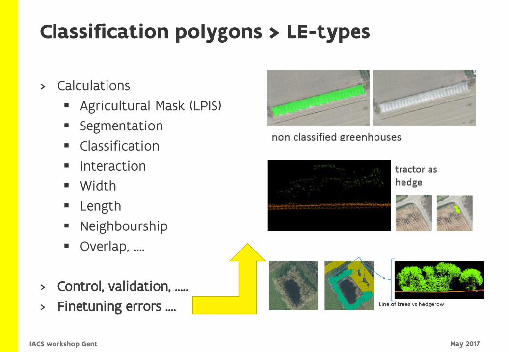
> Calculations
Agricultural Mask (LPIS)
Segmentation
Classification
Interaction
Width
Length
Neighbourship
Overlap, ….
> Control, validation, …..
> Finetuning errors ….
Classification polygons > LE-types
May 2017IACS workshop Gent
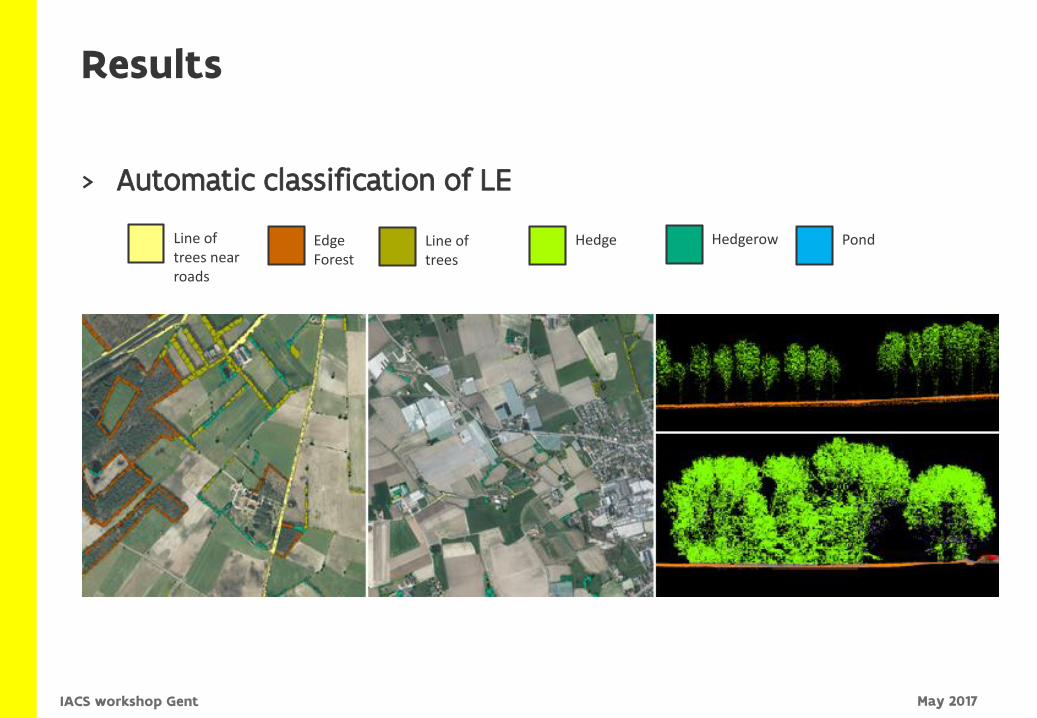
> Automatic classification of LE
Results
Line of trees near roads
Edge Forest
Line of trees
Hedge Hedgerow Pond
May 2017IACS workshop Gent
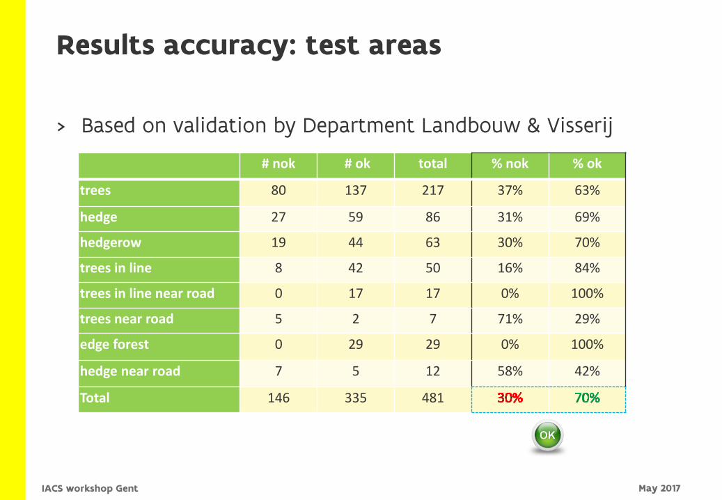
> Based on validation by Department Landbouw & Visserij
Results accuracy: test areas
# nok # ok total % nok % ok
trees 80 137 217 37% 63%
hedge 27 59 86 31% 69%
hedgerow 19 44 63 30% 70%
trees in line 8 42 50 16% 84%
trees in line near road 0 17 17 0% 100%
trees near road 5 2 7 71% 29%
edge forest 0 29 29 0% 100%
hedge near road 7 5 12 58% 42%
Total 146 335 481
May 2017IACS workshop Gent
> Sources Aerial images of 2007
The new regional reference LE dataset (AIV) (under construction)
> In case absence of LE is identified on the terrain compared to the reference sources Fining LE removals that have no permit can be considered
> Advantages of this approach Less noise in the control activities (according the validations made by ALV)
Supports more targeted (focused) control activities
Recent data
Long term : enhanced conservation of Landscape Elements !
Conclusion :Controlling landscape elements (TO BE ?)
May 2017IACS workshop Gent
> Jo Van Valckenborgh, Nancy Van Camp, Stijn Van der Linden, Toon Petermans
> Tim Baeten, Ruben Fontaine, Timo Ghysels, Sebastiaan Philips, Pieter Roggemans
Questions ?
May 2017IACS workshop Gent