Embed Size (px)
Citation preview
1
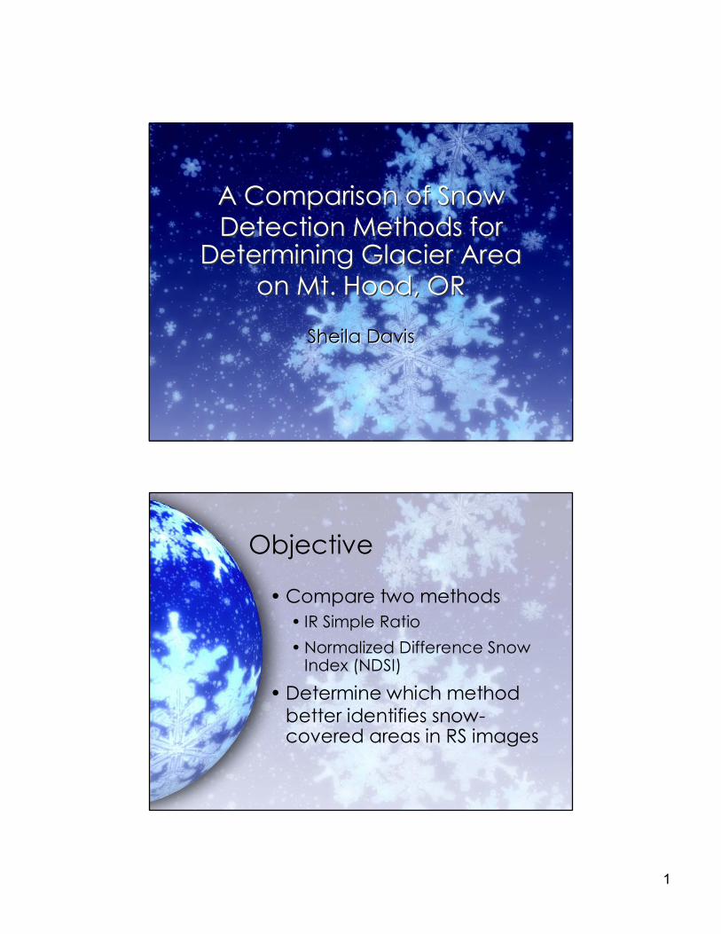
A Comparison of Snow Detection Methods for
Determining Glacier Area on Mt. Hood, OR
A Comparison of Snow Detection Methods for
Determining Glacier Area on Mt. Hood, OR
Sheila Davis Sheila Davis
Objective
• Compare two methods • IR Simple Ratio • Normalized Difference Snow
Index (NDSI)
• Determine which method better identifies snow covered areas in RS images
2
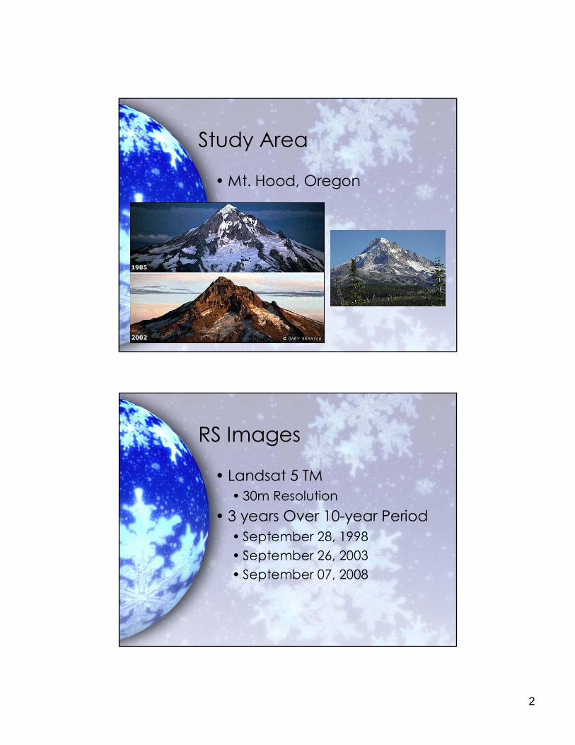
Study Area
• Mt. Hood, Oregon
RS Images
• Landsat 5 TM • 30m Resolution
• 3 years Over 10year Period • September 28, 1998 • September 26, 2003 • September 07, 2008
3
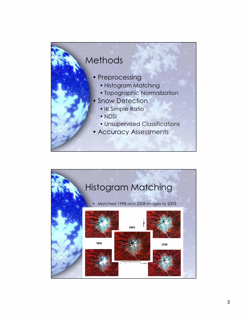
Methods
• Preprocessing • Histogram Matching • Topographic Normalization
• Snow Detection • IR Simple Ratio • NDSI • Unsupervised Classifications
• Accuracy Assessments
Histogram Matching • Matched 1998 and 2008 Images to 2003
4
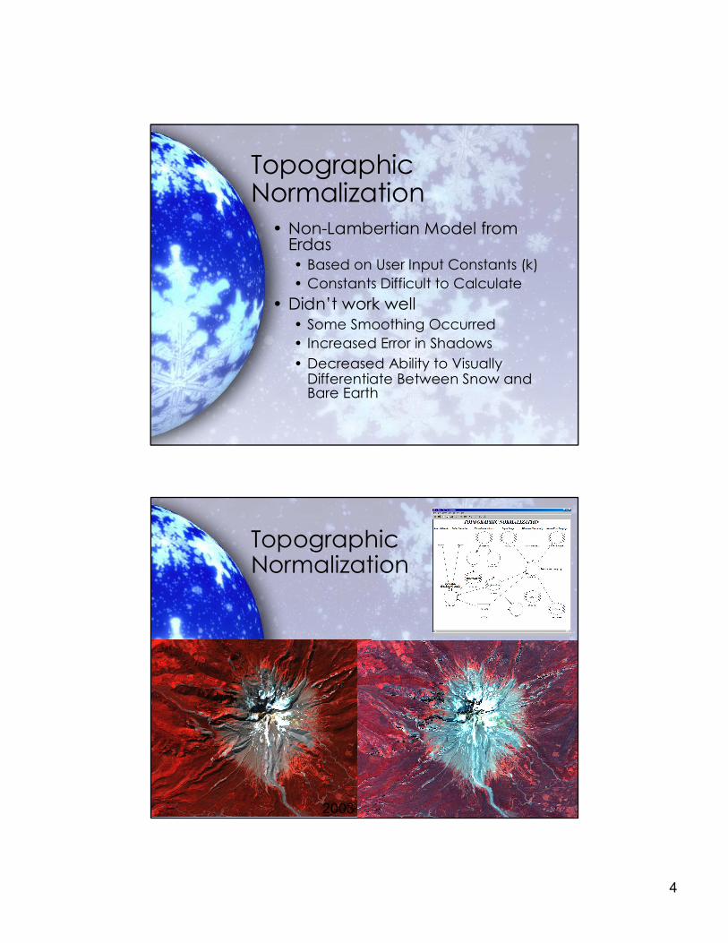
Topographic Normalization
• NonLambertian Model from Erdas • Based on User Input Constants (k) • Constants Difficult to Calculate
• Didn’t work well • Some Smoothing Occurred • Increased Error in Shadows • Decreased Ability to Visually
Differentiate Between Snow and Bare Earth
Topographic Normalization
2003
5
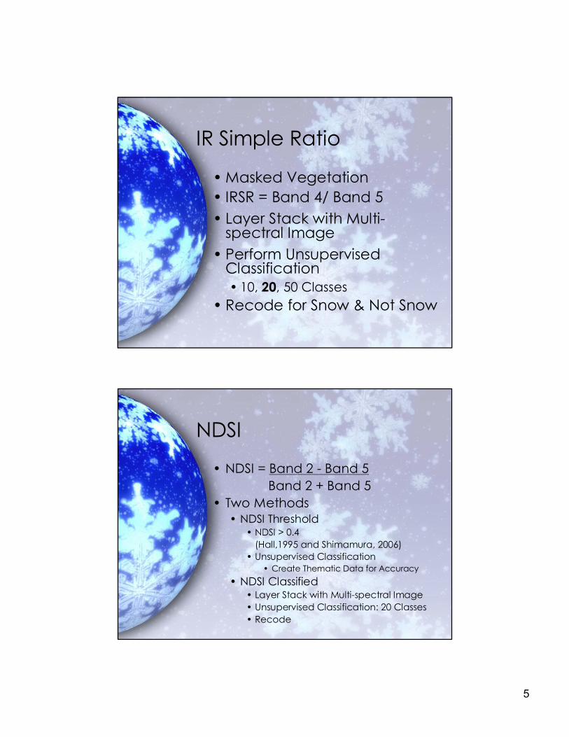
IR Simple Ratio
• Masked Vegetation • IRSR = Band 4/ Band 5 • Layer Stack with Multi
spectral Image • Perform Unsupervised
Classification • 10, 20, 50 Classes
• Recode for Snow & Not Snow
NDSI
• NDSI = Band 2 Band 5 Band 2 + Band 5
• Two Methods • NDSI Threshold
• NDSI > 0.4 (Hall,1995 and Shimamura, 2006)
• Unsupervised Classification • Create Thematic Data for Accuracy
• NDSI Classified • Layer Stack with Multispectral Image • Unsupervised Classification: 20 Classes • Recode
6
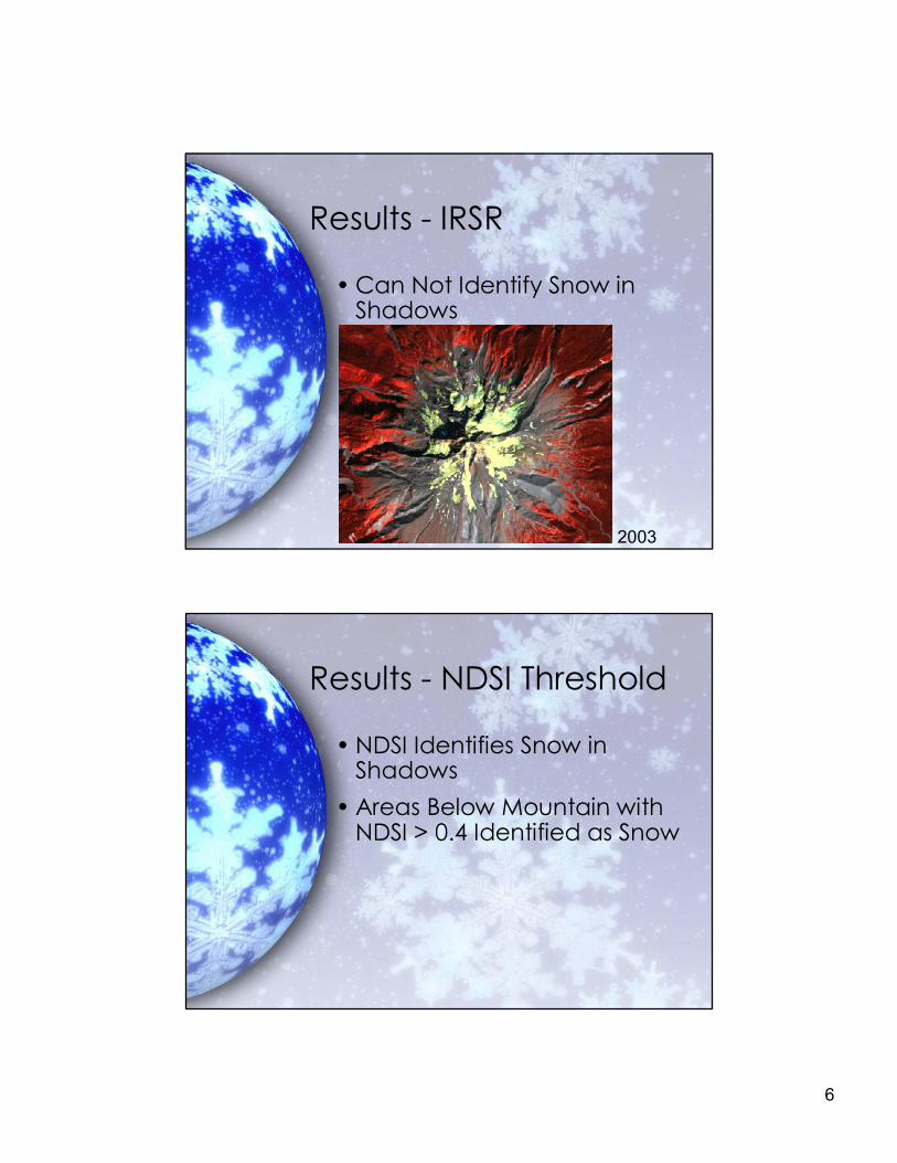
Results IRSR
• Can Not Identify Snow in Shadows
2003
Results NDSI Threshold
• NDSI Identifies Snow in Shadows
• Areas Below Mountain with NDSI > 0.4 Identified as Snow

7
Results NDSI Threshold
2003
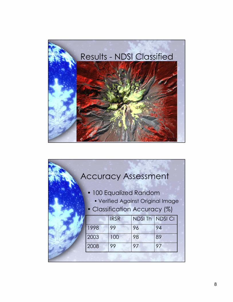
Results NDSI Classified
• NDSI Identifies Snow in Shadows
• Issues Differentiating Between Snow and Bare Earth
8
Results NDSI Classified
2003
Accuracy Assessment
• 100 Equalized Random • Verified Against Original Image
• Classification Accuracy (%)
97 97 99 2008
89 98 100 2003
94 96 99 1998
NDSI Cl NDSI Th IRSR
9
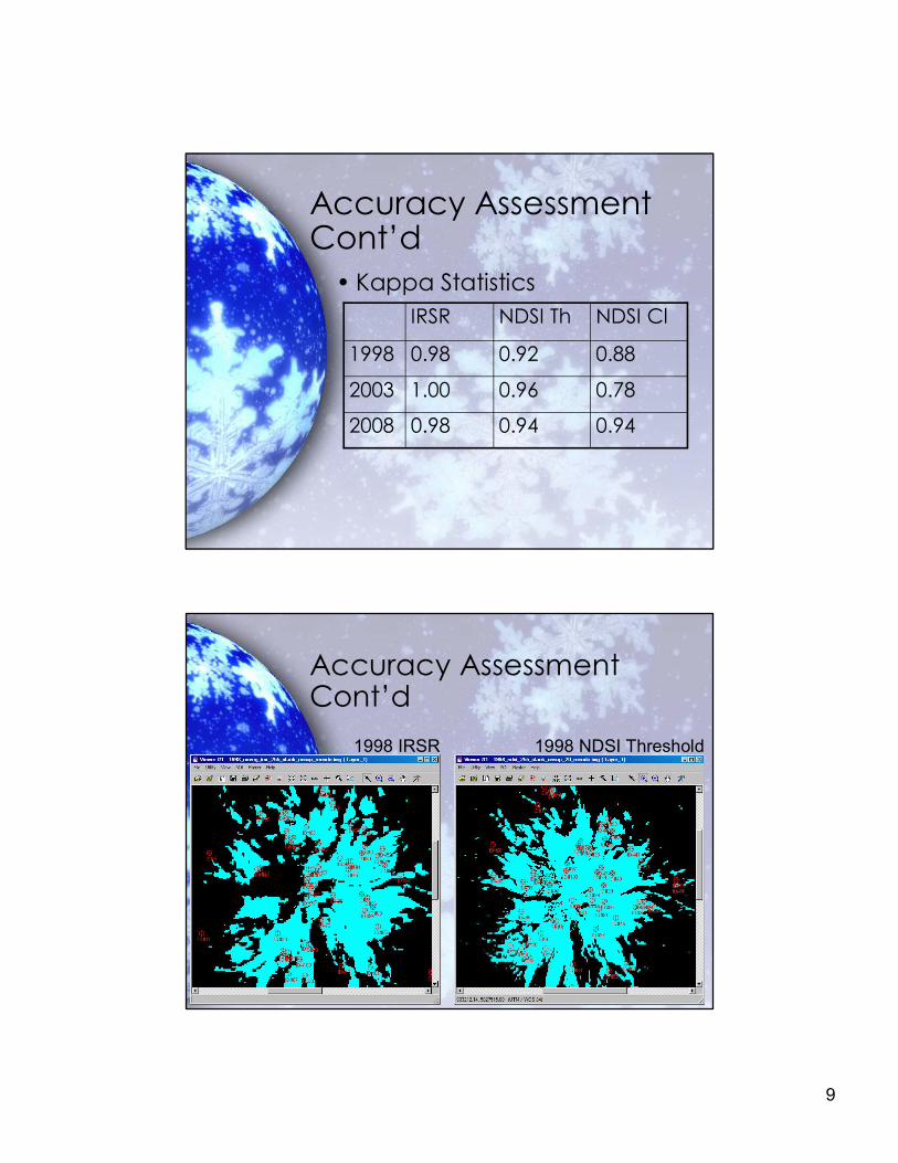
Accuracy Assessment Cont’d
• Kappa Statistics
0.94 0.94 0.98 2008
0.78 0.96 1.00 2003
0.88 0.92 0.98 1998
NDSI Cl NDSI Th IRSR
Accuracy Assessment Cont’d
1998 IRSR 1998 NDSI Threshold
10
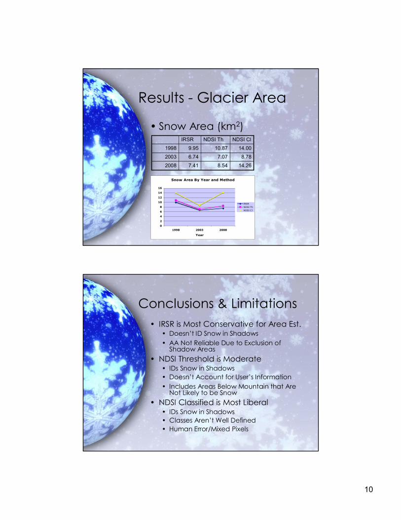
Results Glacier Area
• Snow Area (km 2 )
14.26 8.54 7.41 2008
8.78 7.07 6.74 2003
14.00 10.87 9.95 1998
NDSI Cl NDSI Th IRSR
Snow Area By Year and Method
0
2
4
6
8
10
12
14
16
1998 2003 2008
Year
IRSR NDSI Th NDSI Cl
Conclusions & Limitations • IRSR is Most Conservative for Area Est.
• Doesn’t ID Snow in Shadows • AA Not Reliable Due to Exclusion of
Shadow Areas • NDSI Threshold is Moderate
• IDs Snow in Shadows • Doesn’t Account for User’s Information • Includes Areas Below Mountain that Are
Not Likely to be Snow • NDSI Classified is Most Liberal
• IDs Snow in Shadows • Classes Aren’t Well Defined • Human Error/Mixed Pixels
11
Next Time…
• Higher Resolution Images • Mask Vegetation for NDSI • Subset Consisting Mostly of
Study Area • Number of Classes
• 50 > n >20 • Address Debris on Snow
References • Jackon, K., and Fountain, A., “Spatial and morphological change
on Eliot Glacier, Mount Hood, Oregon, USA”. Annals of Glaciology, 46 (1), p. 222
• Kulkarni, A., Bahuguna, I.M., Rathore, B.P., Singh, S.K., Randhawa, S.S., Sood, R.K., and Dhar, S. “Glacial retreat in Himalaya using Indian Remote Sensing satellite data”. Current Science, 92(1), p. 69
• Paul, F (2002). "Changes in glacier area in Tyrol, Austria, between 1969 and 1992 derived from Landsat 5 thematic mapper and Austrian Glacier Inventory data". International journal of remote sensing (01431161), 23 (4), p. 787.
• Shimamura, Y., Izumi, T., and Matsuyama, H. (2006). “Evaluation of a useful method to identify snowcovered areas under vegetation – comparisons among a newly proposed snow index, normalized difference snow index, and visible reflectance”. International journal of remote sensing, 27 (21), p. 4867
• Williams, R., Hall, D., and Benson, C. (1991). “Analysis of glacier facies using satelllite techniques”. Journal of Glaciology, 37 (125), p. 120
• Xiangming, X., Shen, Z., and Qin, X., “Assessing the potential of VEGETATION sensor data for mapping snow and ice cover: a Normalized Difference Snow and Ice Index”. International Journal of Remote Sensing, 22 (13), p. 2479