Embed Size (px)
Citation preview

Designing Maps
GTECH361Lecture 14

Cartographic Design Principles
Audience and purpose
Size, scale, and media
Visual balance

Audience and Purpose

Size, Scale and Media
Visual Balance

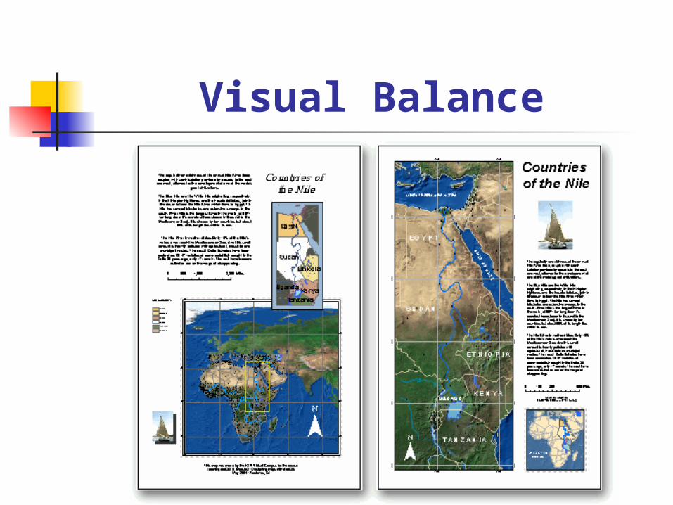
Elements of a Map
Map body Legend Title Scale North arrow (inset map)

Other Elements of a Map
Source of data Map projection Author Date Neatline Graphs, tables, images, informative
text ..leading towards a poster
Map Templates

Layer Transparency
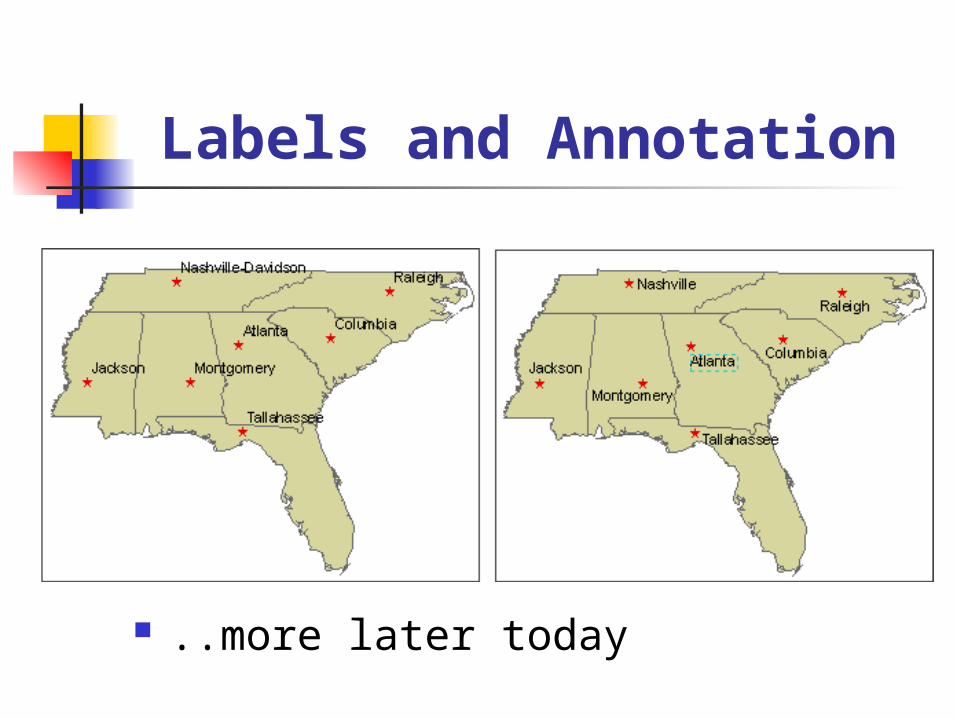
Labels and Annotation
..more later today

Reference System Graticule ºN/S, ºE/W Measured grid X, Y Reference grid 12B or 14G
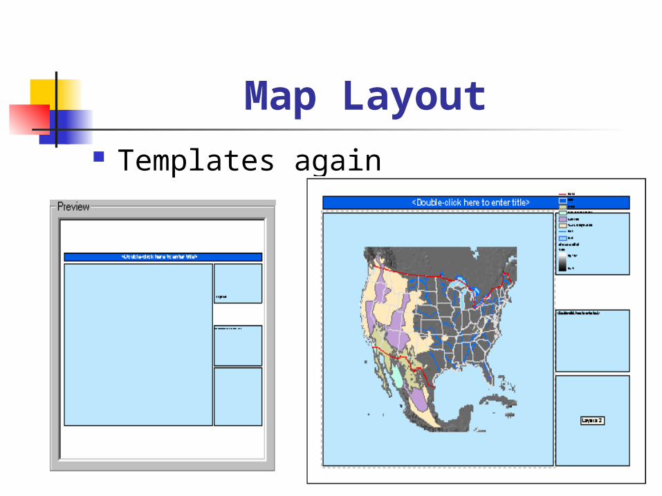
Map Layout Templates again

Working With Labels
Types Priorities
Feature weight Scale
Map Extent Label classes Label expressions

Point Labels
Labels for the cities are offset both vertically and horizontally to draw at the upper left of the features

Line Labels

Polygon Labels
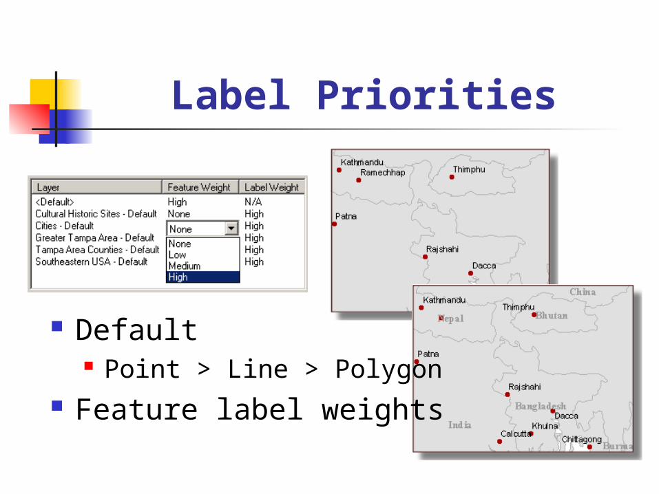
Label Priorities
Default Point > Line > Polygon
Feature label weights
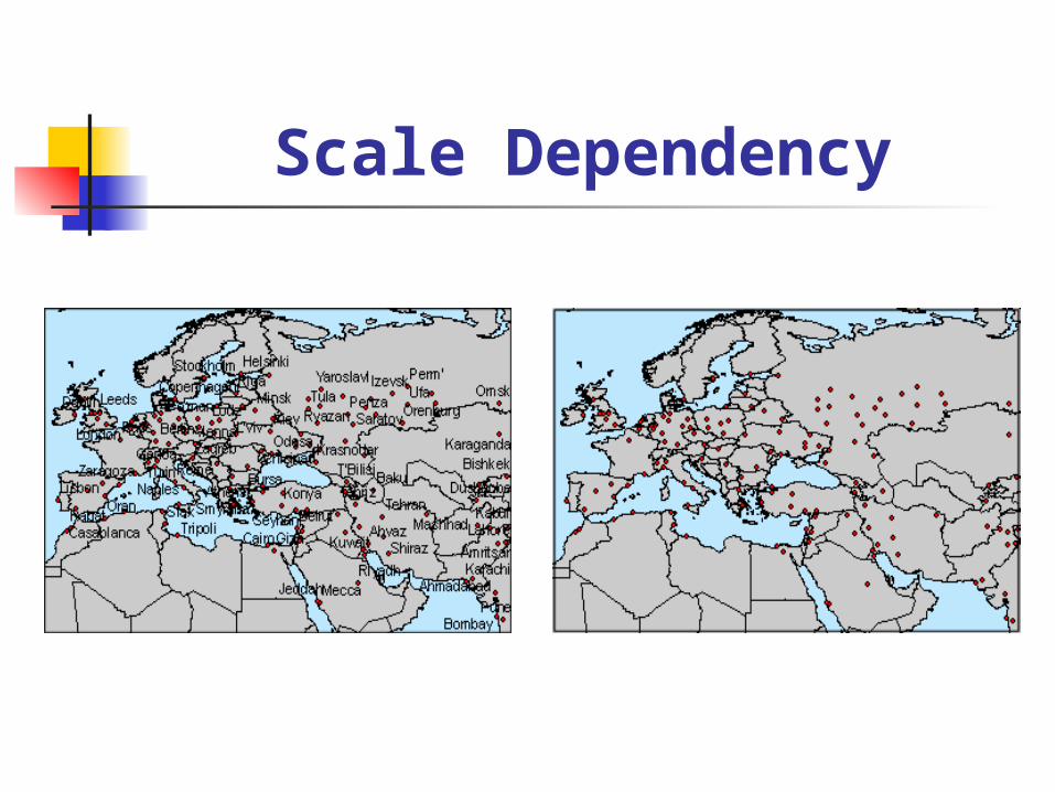
Scale Dependency
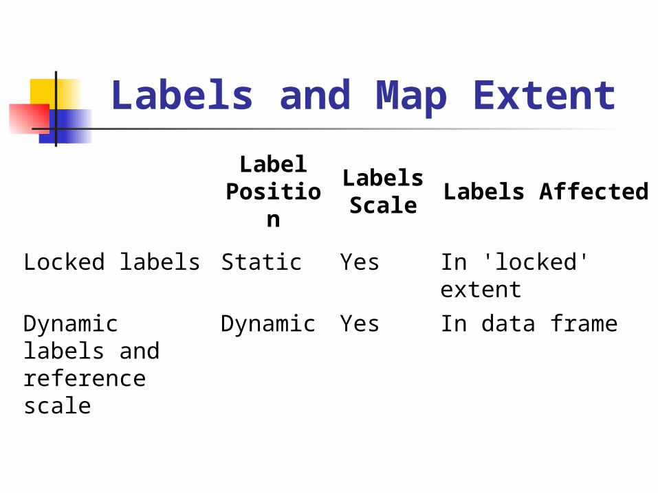
Labels and Map Extent
Label Position
Labels Scale
Labels Affected
Locked labels Static Yes In 'locked' extent
Dynamic labels and reference scale
Dynamic Yes In data frame

Non-uniform Labels
Label classes

Label Expressions
VBScript or JavaScript
[NAME] & vbNewLine & [AREA] & " Sq Km“

Annotations
Super-Labels Can be stored in their own
geodatabase class

Importing Annotations
From labels From Arc/Info coverage annotation Similar to address matching
Creates tables of unplaced annotations
Can be individually placed and edited

Annotation Groups
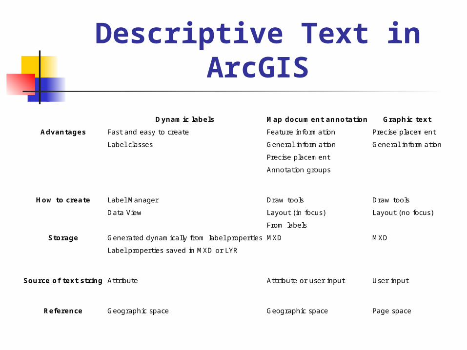
Descriptive Text in ArcGIS
Dynamic labels Map document annotation Graphic text Advantages Fast and easy to create Feature information Precise placement
Label classes General information General information Precise placement Annotation groups
How to create Label Manager Draw tools Draw tools
Data View Layout (in focus) Layout (no focus) From labels
Storage Generated dynamically from label properties MXD MXD Label properties saved in MXD or LYR
Source of text string Attribute Attribute or user input User input
Reference Geographic space Geographic space Page space