Embed Size (px)
Citation preview
Design and Mitigation
for East Link Light Rail
City Council Study Session
December 10, 2012
1
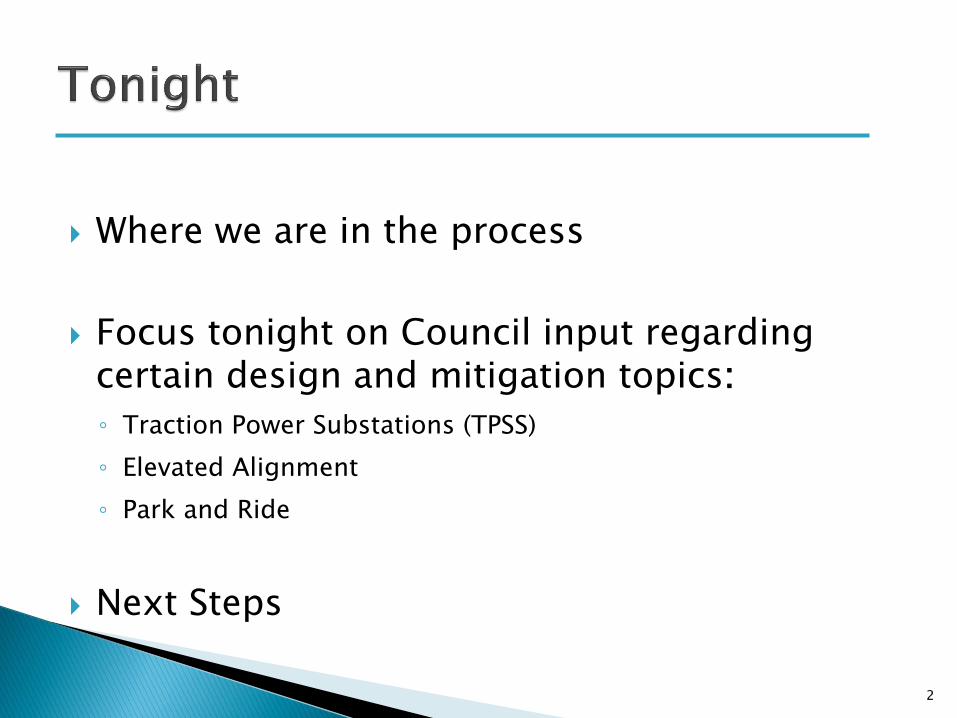
Where we are in the process
Focus tonight on Council input regarding certain design and mitigation topics:
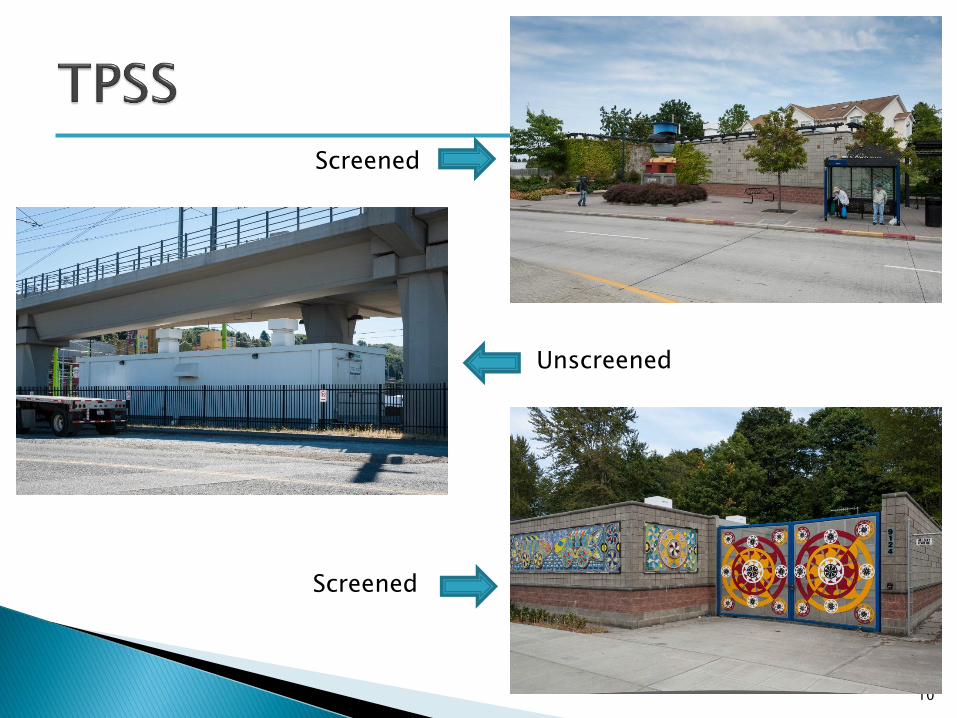
◦ Traction Power Substations (TPSS)
◦ Elevated Alignment
◦ Park and Ride
Next Steps
2
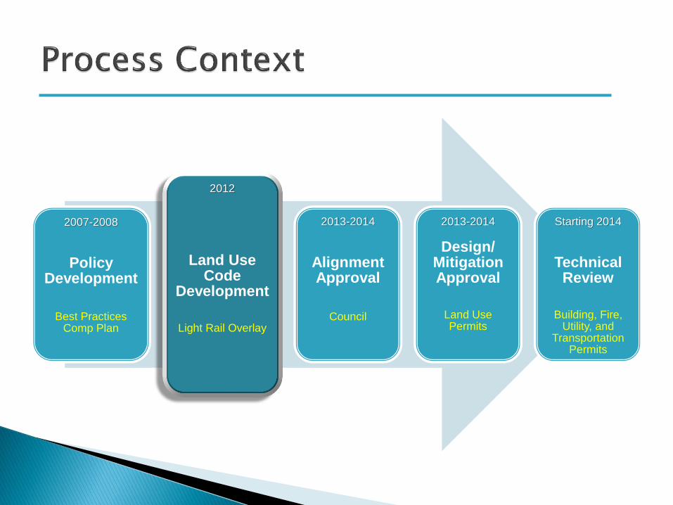
2007-2008
Policy
Development
Best Practices
Comp Plan
2012
Land Use Code
Development Light Rail Overlay
2013-2014
Alignment Approval
Council
2013-2014
Design/ Mitigation Approval
Land Use Permits
Starting 2014
Technical Review
Building, Fire, Utility, and
Transportation Permits

Time scheduled on upcoming Council agendas:
◦ All January Study Sessions
January Design and Mitigation Topic Blocks
◦ Concrete and Masonry Structures – tunnel portal, noise walls
◦ Other Alignment Elements – Fences, Lights, OCS, Signals, Vents
◦ Stations and Station Design Process
◦ Bel-Red (including the Operations and Maintenance Base)
◦ Overall Process (CUP/DA/Admin Modifications) and Wrap-up
4
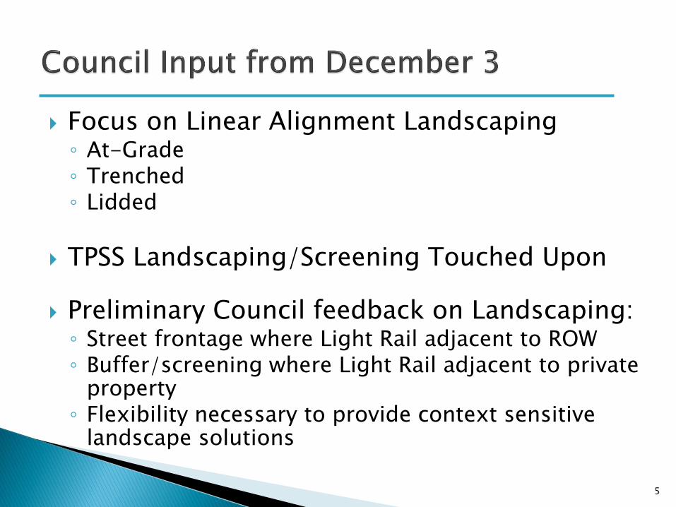
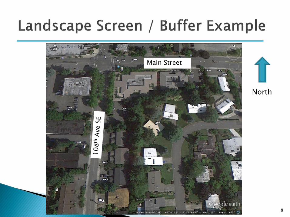
Focus on Linear Alignment Landscaping ◦ At-Grade ◦ Trenched ◦ Lidded
TPSS Landscaping/Screening Touched Upon
Preliminary Council feedback on Landscaping: ◦ Street frontage where Light Rail adjacent to ROW ◦ Buffer/screening where Light Rail adjacent to private
property ◦ Flexibility necessary to provide context sensitive
landscape solutions
5
6
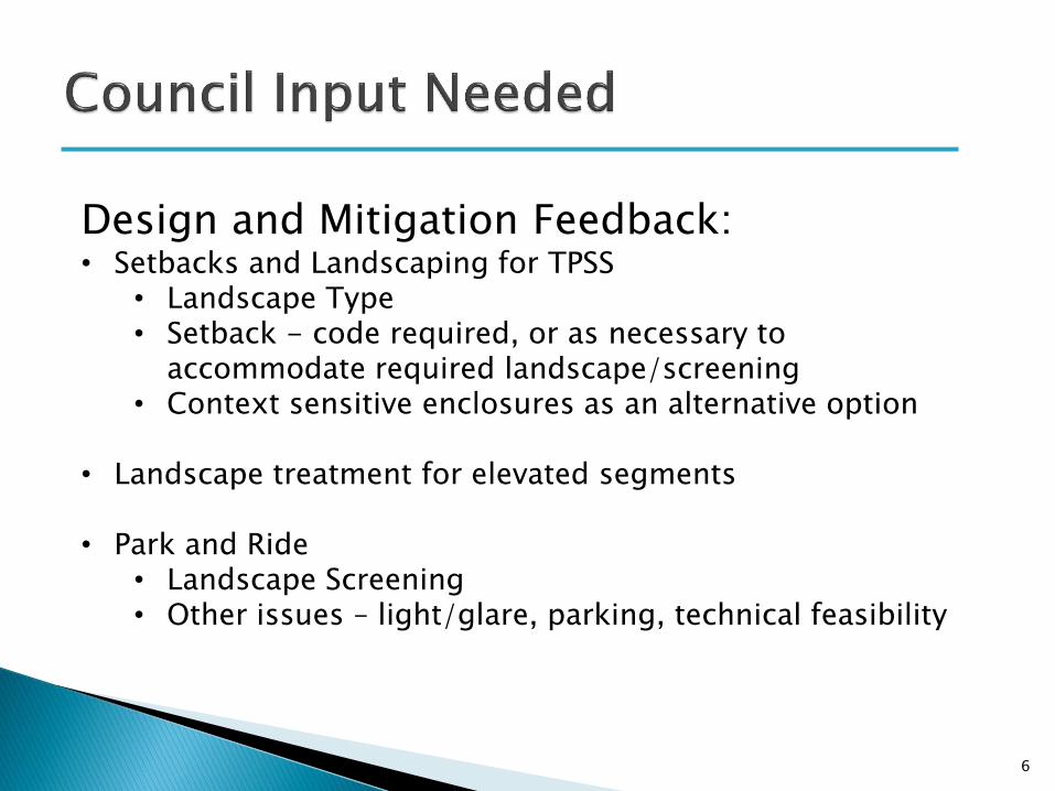
Design and Mitigation Feedback: • Setbacks and Landscaping for TPSS
• Landscape Type • Setback - code required, or as necessary to
accommodate required landscape/screening • Context sensitive enclosures as an alternative option
• Landscape treatment for elevated segments
• Park and Ride
• Landscape Screening • Other issues – light/glare, parking, technical feasibility
7
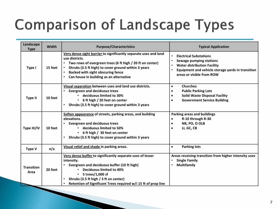
Landscape Type
Width Purpose/Characteristics Typical Application
Type I 15 feet
Very dense sight barrier to significantly separate uses and land use districts. • Two rows of evergreen trees (6 ft high / 20 ft on center) • Shrubs (3.5 ft high) to cover ground within 3 years • Backed with sight obscuring fence • Can house in building as an alternative
• Electrical Substations • Sewage pumping stations • Water distribution Facility • Equipment and vehicle storage yards in transition
areas or visible from ROW
Type II 10 feet
Visual separation between uses and land use districts. • Evergreen and deciduous trees
• deciduous limited to 30% • 6 ft high / 20 feet on center
• Shrubs (3.5 ft high) to cover ground within 3 years
Churches Public Parking Lots Solid Waste Disposal Facility Government Service Building
Type III/IV 10 feet
Soften appearance of streets, parking areas, and building elevations. • Evergreen and deciduous trees
• deciduous limited to 50% • 6 ft high / 30 feet on center
• Shrubs (3.5 ft high) to cover ground within 3 years
Parking areas and buildings R-10 through R-30 NB, PO, O OLB LI, GC, CB
Type V n/a Visual relief and shade in parking areas. Parking lots
Transition Area
20 feet
Very dense buffer to significantly separate uses of lesser intensity. • Evergreen and deciduous buffer (10 ft high)
• Deciduous limited to 40% • 5 trees/1,000 sf
• Shrubs (3.5 ft high / 3 ft on center) • Retention of Significant Trees required w/i 15 ft of prop line
Areas receiving transition from higher intensity uses • Single Family • Multifamily
8
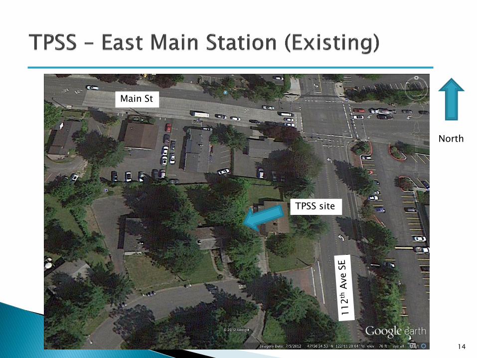
Main Street
North

9
10
Screened
Screened
Unscreened
11
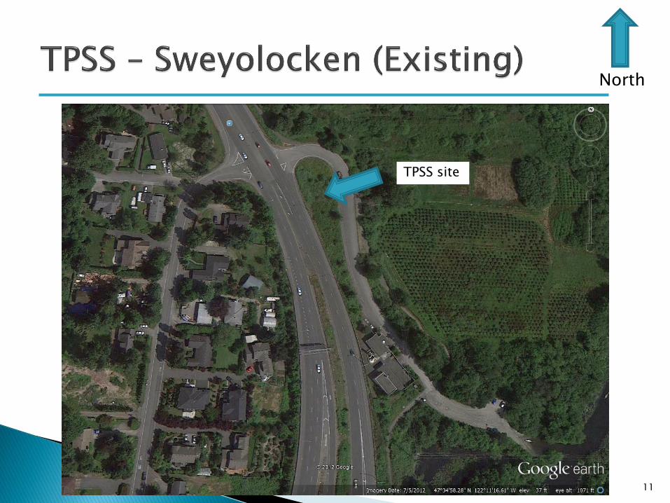
North
TPSS site

12

13
14
North
TPSS site
Main St

15
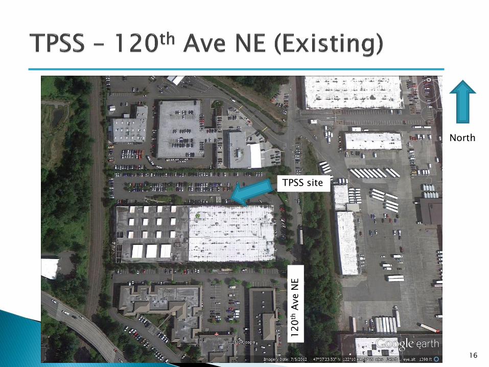
16
North
12
0th
Ave N
E
TPSS site
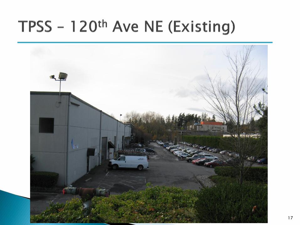
17
18
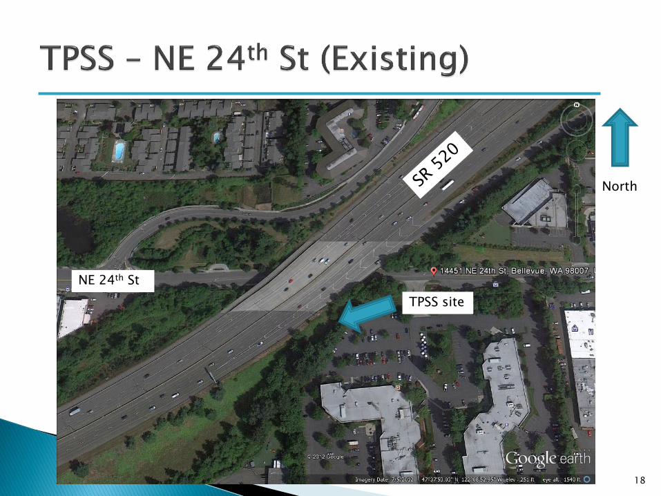
North
NE 24th St
TPSS site

19

20
North
Blueberry farm
Park-and-Ride

21
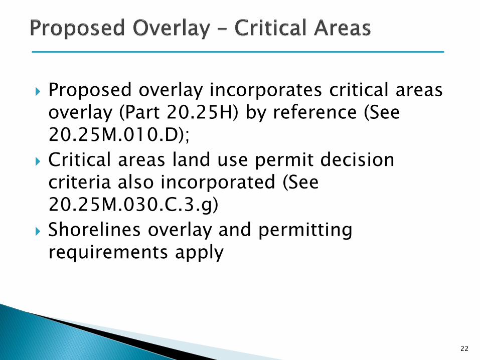
Proposed overlay incorporates critical areas overlay (Part 20.25H) by reference (See 20.25M.010.D);
Critical areas land use permit decision criteria also incorporated (See 20.25M.030.C.3.g)
Shorelines overlay and permitting requirements apply
22
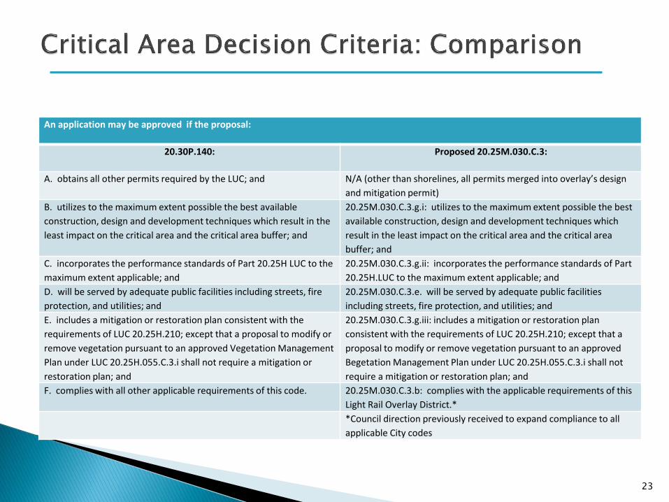
An application may be approved if the proposal:
20.30P.140: Proposed 20.25M.030.C.3:
A. obtains all other permits required by the LUC; and N/A (other than shorelines, all permits merged into overlay’s design
and mitigation permit)
B. utilizes to the maximum extent possible the best available
construction, design and development techniques which result in the
least impact on the critical area and the critical area buffer; and
20.25M.030.C.3.g.i: utilizes to the maximum extent possible the best
available construction, design and development techniques which
result in the least impact on the critical area and the critical area
buffer; and
C. incorporates the performance standards of Part 20.25H LUC to the
maximum extent applicable; and
20.25M.030.C.3.g.ii: incorporates the performance standards of Part
20.25H.LUC to the maximum extent applicable; and
D. will be served by adequate public facilities including streets, fire
protection, and utilities; and
20.25M.030.C.3.e. will be served by adequate public facilities
including streets, fire protection, and utilities; and
E. includes a mitigation or restoration plan consistent with the
requirements of LUC 20.25H.210; except that a proposal to modify or
remove vegetation pursuant to an approved Vegetation Management
Plan under LUC 20.25H.055.C.3.i shall not require a mitigation or
restoration plan; and
20.25M.030.C.3.g.iii: includes a mitigation or restoration plan
consistent with the requirements of LUC 20.25H.210; except that a
proposal to modify or remove vegetation pursuant to an approved
Begetation Management Plan under LUC 20.25H.055.C.3.i shall not
require a mitigation or restoration plan; and
F. complies with all other applicable requirements of this code. 20.25M.030.C.3.b: complies with the applicable requirements of this
Light Rail Overlay District.*
*Council direction previously received to expand compliance to all
applicable City codes
23
Park and ride facilities should be located where they can provide convenient access to light rail for Bellevue neighborhoods not directly served by light rail, and they should be integrated contextually with the surrounding environment. (Best Practices Final Report, p. 34)
New or expanded park and ride facilities should be consistent with the Comprehensive Plan vision for each specific location. (Final Report, p. 36)
Design park and ride lots to be consistent with the land use vision and community context of each unique location. (Final Report, p. 38)
Consider rider safety in design of park and ride lots (summary of Final Report discussion, pp. 75-78
24
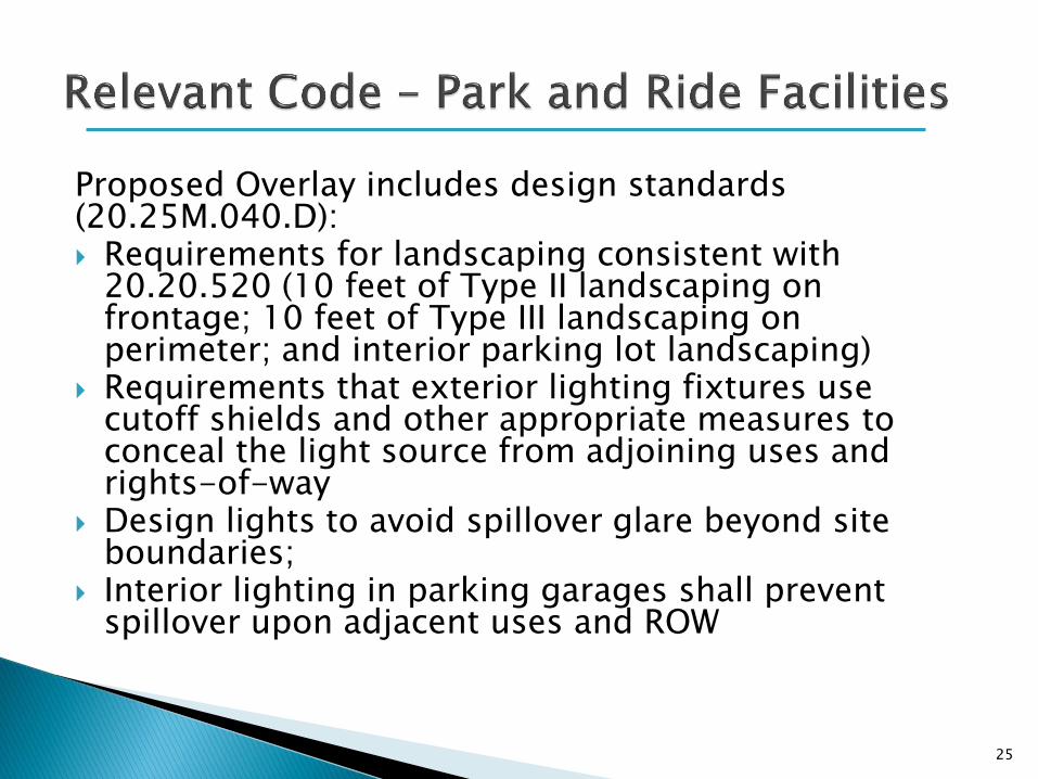
Proposed Overlay includes design standards (20.25M.040.D): Requirements for landscaping consistent with
20.20.520 (10 feet of Type II landscaping on frontage; 10 feet of Type III landscaping on perimeter; and interior parking lot landscaping)
Requirements that exterior lighting fixtures use cutoff shields and other appropriate measures to conceal the light source from adjoining uses and rights-of-way
Design lights to avoid spillover glare beyond site boundaries;
Interior lighting in parking garages shall prevent spillover upon adjacent uses and ROW
25

26
North
Shoreline jurisdiction boundary

27
KIRKLAND BELLEVUE
Parking garage
Surface Parking North
28
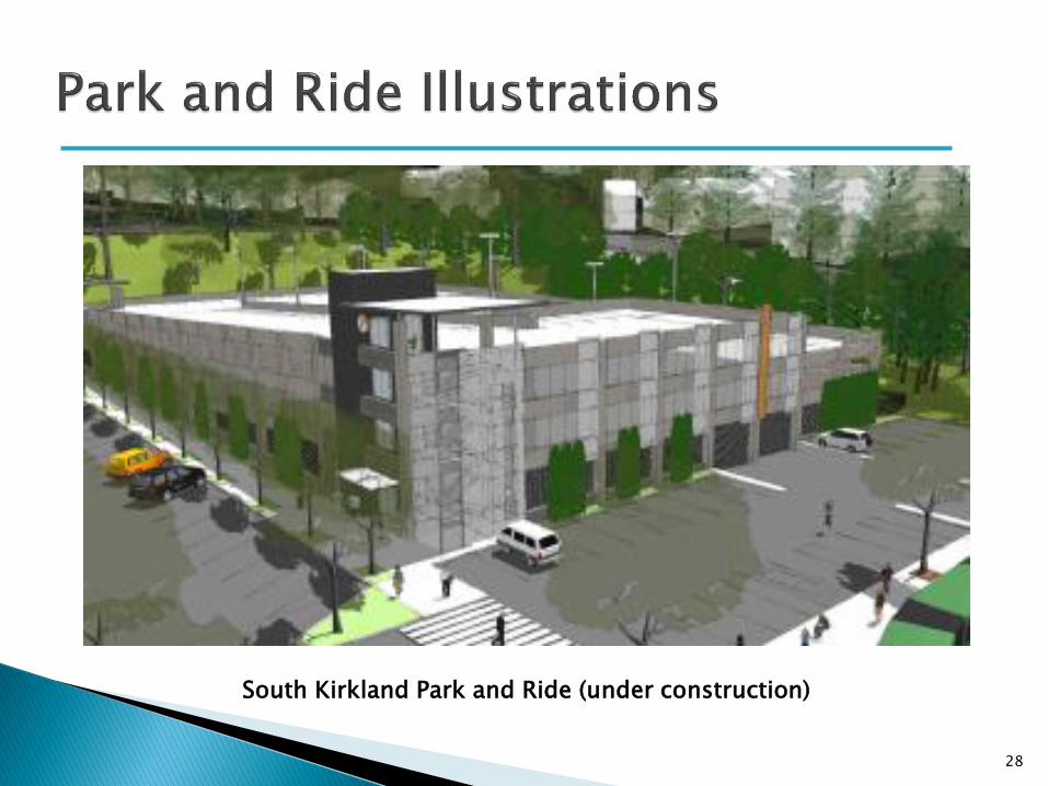
South Kirkland Park and Ride (under construction)

29
South Kirkland Park and Ride (under construction)
For more information, see East Link Project website at: http://www.bellevuewa.gov/light-rail-overlay.htm
30
Next Steps
‣ January study sessions – complete design & mitigation discussion; confirm procedural approach
‣ Late January/early February 2013 – Code amendment redraft, SEPA Threshold Determination