Embed Size (px)
Citation preview
DEPARTMENT OF SCIENCE AND TECHNOLOGY (DOST)
DOST Complex, Gen. Santos Avenue Bicutan, Taguig City, Metro Manila
Development of Non-Expert Tool
for Site-Specific Evaluation of Rain-Induced Landslide
Susceptibility
TERMINAL REPORT June 2010
Kalinga Apayao State College
(KASC) Bulanao, Tabuk, Kalinga
(Implementing Agency)
Philippine Council on Industry
and Energy Research and Development (PCIERD), DOST DOST Complex, Gen. Santos Avenue Bicutan, Taguig City, Metro Manila
(Monitoring Agency)
10 June 2010 Philippine Council on Industry and Energy Research & Development (PCIERD) Department of Science and Technology (DOST) DOST Complex, Gen. Santos Avenue Bicutan, Taguig City, Metro Manila Project: Development of Non-Expert Tool for Site-Specific Evaluation
of Rain-Induced Landslide Susceptibility Subject: Terminal Report Cc: DOST Balik-Scientist Program Mesdames and Sirs: We are forwarding herewith our terminal report for the above-mentioned project. For any questions or clarifications on the report, please do not hesitate to call or email us immediately. Thank you very much. Very truly yours,
Daniel C. Peckley Jr., PhD, CE Project Officer V, KASC Noted by:
Eduardo T. Bagtang, DBM, CPA Project Leader and President, KASC
Development of a Non-Expert Tool for Site-Specific Evaluation of Rain-induced Landslide Susceptibility
Project Terminal Report: Executive Summary
The 2009-27th year anniversary theme of PCIERD was “PCIERD Reaching Out to the Regions: Linking Technology to the Grassroots,” and the 2010-28th year anniversary theme, “Taking the Extra Mile in Facing Global Climatic Challenges.” These themes served as guides in the conduct of this project. In essence, the main objective of the study was to bring technology, i.e., rain-induced landslide susceptibility assessment, to our communities, to the grassroots. To meet this objective, many of the geotechnical surveys carried out were conducted with the involvement of communities, LGUs and other institutions. When the assessment procedure was developed, it was pilot-tested with communities. The development and the pilot-testing of the assessment procedure, as presented above, involved going beyond what was initially called for. Sixty (60) survey sites were planned; two hundred forty-three sites (243) were actually surveyed to validate the assessment procedure. The pilot-testing plan was to conduct it with five (5) communities; it was actually carried out with eight (8) communities. In this project, the project team, with the help, assistance and cooperation of the many institutions and individuals, delivered more than what it committed. The assessment procedure that was developed in this study is simple and user-friendly. It can be used for site-specific hazard assessment, which is the next level of assessment needed to effectively address, manage and mitigate the impacts of rain-induced landslides, after the large-scale susceptibility mapping being carried out by the Mines and Geosciences Bureau (MGB). Any site-specific assessment is usually costly, laborious and time-consuming, but with the cooperation of communities, LGUs, NGOs and non-experts – employing the assessment procedure developed in this study – the costs, effort and time required can be significantly reduced. The experience of the project team in this study would attest to this fact. The simplicity of the assessment procedure stems from the fact that it takes off from a very simple and fundamental engineering principle: the strength or capacity should always be greater than the load. In landslides and slope stability engineering, this principle can be stated as: the strength or capacity of the slope material should always be greater than the load or driving force, which in this case is gravity and is directly related to slope angle. To make the assessment procedure intuitive, other factors affecting slope stability were incorporated such that their nature or effect is reflected in the procedure. For example, the effect of rain water infiltration into the slope is a reduction in the slope material strength, thus poor drainage condition and the presence of springs were reflected as “minus” factors. On the other hand, the effect of the root systems of existing vegetation on the slope can increase the slope material strength, thus the vegetation factor is introduced as a multiplier with a value equal to or greater than 1.
As mentioned earlier, the assessment procedure was pilot-tested by conducting training seminars for community leaders and members of eight (8) communities in Benguet and Kalinga. Following were the lessons and insights gained from this activity:
1) Communities and non-experts have the capacity to understand and conduct a supposedly highly technical undertaking such as landslide susceptibility assessment. Among other reasons, the project team attributes this to the application of fundamental and simple engineering principles in the development of the assessment procedure.
2) Partnership with NGOs, the concerned LGUs and other institutions greatly
facilitate the enabling of communities to conduct landslide assessment on their own, thereby allowing these communities to become more rain-induced landslide disaster-resilient.
3) Wide participation and appreciation can be ensured when the training-
seminar is held at the community or barangay hall. “High-tech” presentations or seminar facilities may not be available at community or barangay halls, thus trainers/facilitators should be capable of giving the seminar using only a board and chalk.
4) Informed and trained communities/non-experts usually lead to open-
mindedness and the ability to discern appropriate action/s to protect the community/their families.
The assessment procedure also underwent a committee review primarily to come up with recommendations and suggestions to ensure that the proposed procedure has strong scientific and/or empirical basis and can indeed be used by non-experts. Among the comments and recommendations received from the reviewers were the following:
1) This study should have included the identification of practical and appropriate slope stability measures considering the different factors affecting susceptibility.
2) To facilitate the adoption of the proposed procedure as a national standard
or procedure for preliminary landslide susceptibility assessment, a reviewer recommended that a follow-up study be conducted to identify these slope stability measures with the active participation of the DPWH Bureau of Research and Standards. Another suggested that the adoption of the assessment procedure as a standard may be pursued through local legislation.
Considering that many of our communities remain highly vulnerable to rain-induced landslides, continued support is strongly recommended for the conduct of more training-seminars/workshops to introduce the assessment procedure developed in this study.
Development of a Non-Expert Tool for Site-Specific Evaluation of Rain-induced Landslide Susceptibility
Project Terminal Report
Prepared by:
Daniel C. Peckley Jr., Eduardo T. Bagtang, Jude F. Dakiwag; Froilan L. Eugenio,
Engr. Fides Lovella A. Baddongon, Dr. Lope T. Buen and Rhonjon Garming
Checked by:
Ruby Raterta, Laarni T. Piloton, and Donald Roy B. Grospe
Development of a Non-Expert Tool for Site-Specific Evaluation of Rain-induced Landslide Susceptibility
Project Terminal Report June 2010
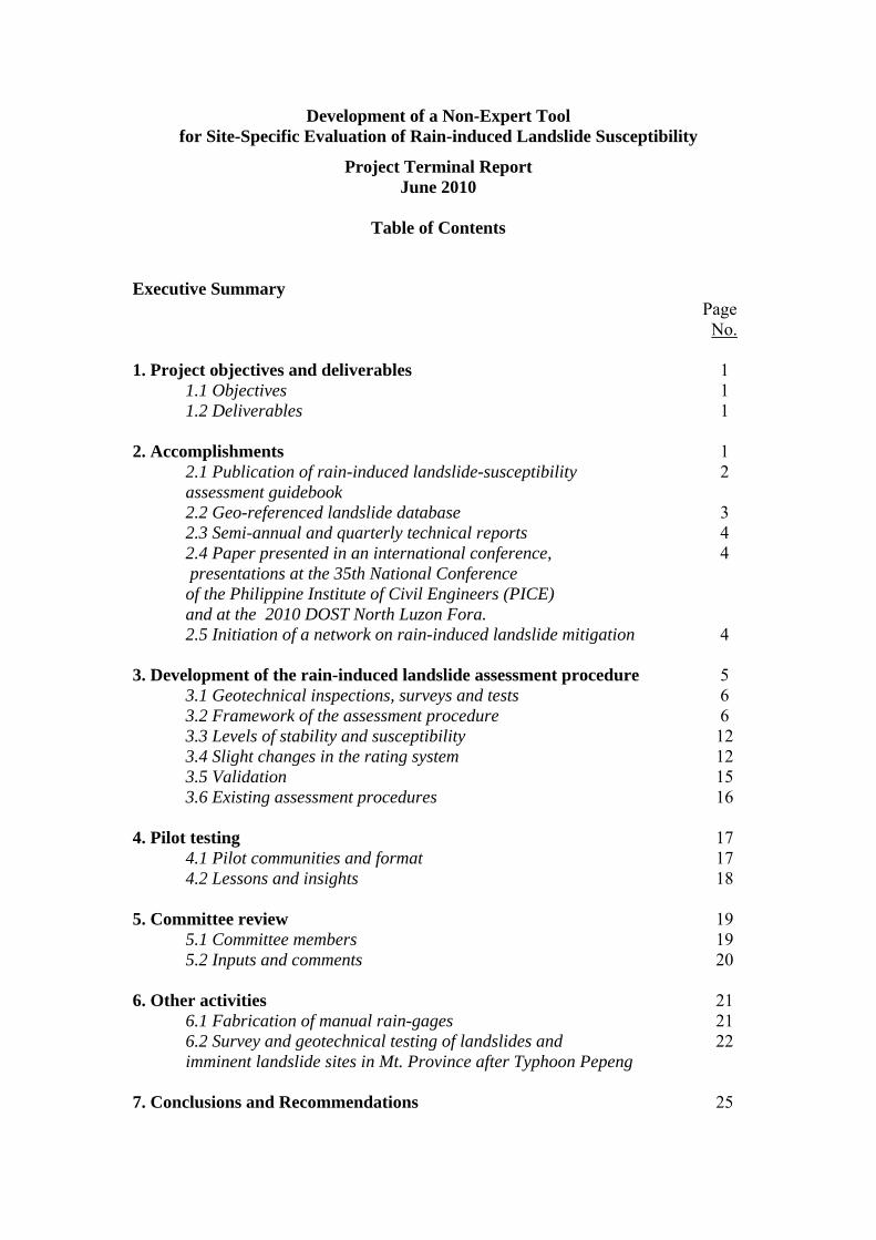
Table of Contents
Executive Summary Page No. 1. Project objectives and deliverables 1
1.1 Objectives 1 1.2 Deliverables 1
2. Accomplishments 1
2.1 Publication of rain-induced landslide-susceptibility 2 assessment guidebook 2.2 Geo-referenced landslide database 3 2.3 Semi-annual and quarterly technical reports 4 2.4 Paper presented in an international conference, 4 presentations at the 35th National Conference of the Philippine Institute of Civil Engineers (PICE) and at the 2010 DOST North Luzon Fora. 2.5 Initiation of a network on rain-induced landslide mitigation 4
3. Development of the rain-induced landslide assessment procedure 5 3.1 Geotechnical inspections, surveys and tests 6 3.2 Framework of the assessment procedure 6 3.3 Levels of stability and susceptibility 12 3.4 Slight changes in the rating system 12 3.5 Validation 15 3.6 Existing assessment procedures 16
4. Pilot testing 17
4.1 Pilot communities and format 17 4.2 Lessons and insights 18
5. Committee review 19 5.1 Committee members 19 5.2 Inputs and comments 20
6. Other activities 21 6.1 Fabrication of manual rain-gages 21
6.2 Survey and geotechnical testing of landslides and 22 imminent landslide sites in Mt. Province after Typhoon Pepeng
7. Conclusions and Recommendations 25
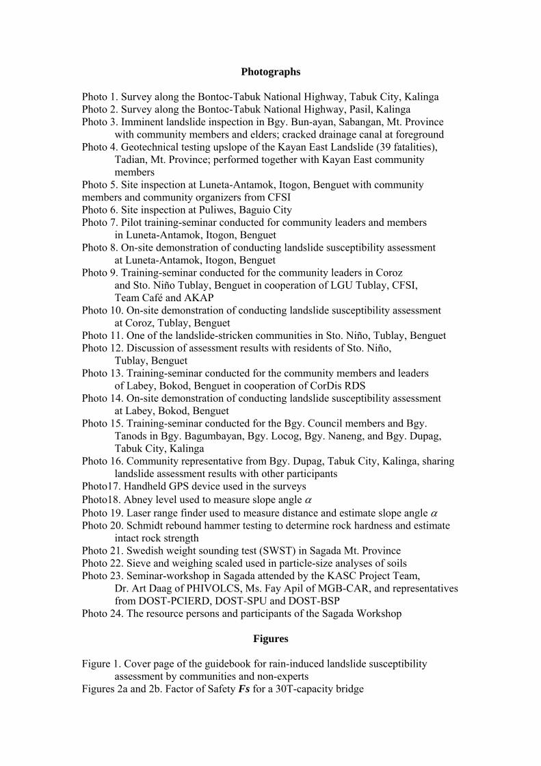
Photographs Photo 1. Survey along the Bontoc-Tabuk National Highway, Tabuk City, Kalinga Photo 2. Survey along the Bontoc-Tabuk National Highway, Pasil, Kalinga Photo 3. Imminent landslide inspection in Bgy. Bun-ayan, Sabangan, Mt. Province
with community members and elders; cracked drainage canal at foreground Photo 4. Geotechnical testing upslope of the Kayan East Landslide (39 fatalities),
Tadian, Mt. Province; performed together with Kayan East community members
Photo 5. Site inspection at Luneta-Antamok, Itogon, Benguet with community members and community organizers from CFSI Photo 6. Site inspection at Puliwes, Baguio City Photo 7. Pilot training-seminar conducted for community leaders and members
in Luneta-Antamok, Itogon, Benguet Photo 8. On-site demonstration of conducting landslide susceptibility assessment
at Luneta-Antamok, Itogon, Benguet Photo 9. Training-seminar conducted for the community leaders in Coroz
and Sto. Niño Tublay, Benguet in cooperation of LGU Tublay, CFSI, Team Café and AKAP
Photo 10. On-site demonstration of conducting landslide susceptibility assessment at Coroz, Tublay, Benguet
Photo 11. One of the landslide-stricken communities in Sto. Niño, Tublay, Benguet Photo 12. Discussion of assessment results with residents of Sto. Niño,
Tublay, Benguet Photo 13. Training-seminar conducted for the community members and leaders
of Labey, Bokod, Benguet in cooperation of CorDis RDS Photo 14. On-site demonstration of conducting landslide susceptibility assessment
at Labey, Bokod, Benguet Photo 15. Training-seminar conducted for the Bgy. Council members and Bgy. Tanods in Bgy. Bagumbayan, Bgy. Locog, Bgy. Naneng, and Bgy. Dupag,
Tabuk City, Kalinga Photo 16. Community representative from Bgy. Dupag, Tabuk City, Kalinga, sharing
landslide assessment results with other participants Photo17. Handheld GPS device used in the surveys Photo18. Abney level used to measure slope angle Photo 19. Laser range finder used to measure distance and estimate slope angle Photo 20. Schmidt rebound hammer testing to determine rock hardness and estimate
intact rock strength Photo 21. Swedish weight sounding test (SWST) in Sagada Mt. Province Photo 22. Sieve and weighing scaled used in particle-size analyses of soils Photo 23. Seminar-workshop in Sagada attended by the KASC Project Team,
Dr. Art Daag of PHIVOLCS, Ms. Fay Apil of MGB-CAR, and representatives from DOST-PCIERD, DOST-SPU and DOST-BSP
Photo 24. The resource persons and participants of the Sagada Workshop
Figures Figure 1. Cover page of the guidebook for rain-induced landslide susceptibility
assessment by communities and non-experts Figures 2a and 2b. Factor of Safety Fs for a 30T-capacity bridge
Figures 3a and 3b. Basic Factor of Stability, Fsbasic, for slopes
Charts Chart 1. Data distribution for each range of Fs and sites that failed Chart 2. Distribution according to slope material and sites that failed Chart 3. Distribution according to slope angle range and sites that failed Chart 4. Distribution according to vegetation cover and sites that failed Chart 5. Distribution according to occurrence of past failure and failure percentage Chart 6. Distribution according to presence of spring and sites that failed Chart 7. Distribution according to drainage canal condition and sites that failed Chart 8. Distribution according to land-use and sites that failed
Tables Table 1. Summary of evaluation using the procedure developed in this study Table 2. Summary of evaluation using the JRA procedure (1988 as cited
by ATC, 1997) Table 3. Summary of evaluation using the JMOC procedure (1997 as cited
by ATC, 1997) Table 4. MGB landslide susceptibility assessment procedure Table 5. Classification of slope failure potential evaluation procedures
(modified from ATC [1997]) Tables 6a and 6b. The JRA evaluation procedure Tables 7a and 7b. The JMOC evaluation procedure Table 8. Summary of inputs and comments from the members of the review committee
Annex Annex: Copy of “RAIN-INDUCED LANDSLIDE SUSCEPTIBILITY: A GUIDEBOOK COMMUNITIES AND NON-EXPERTS”
Attachments Attachment A: Georefenced landslide survey data Attachment B: Compilation of semi-annual and quarterly reports Attachment C: Paper submitted to the 2nd Regional Conference on Geo-Disaster
Mitigation and powerpoint presentations in workshops, forums and training seminars
Attachment D: Technical reports on pilot training-seminars conducted for communities
Attachment E: Inputs and comments from reviewers Attachment F: Ilocano translation of the Procedures for Rainfall Observation using a
Non-Recording Standard Rain-gauge
Development of a Non-Expert Tool for Site-Specific Evaluation of Rain-induced Landslide Susceptibility
Project Terminal Report
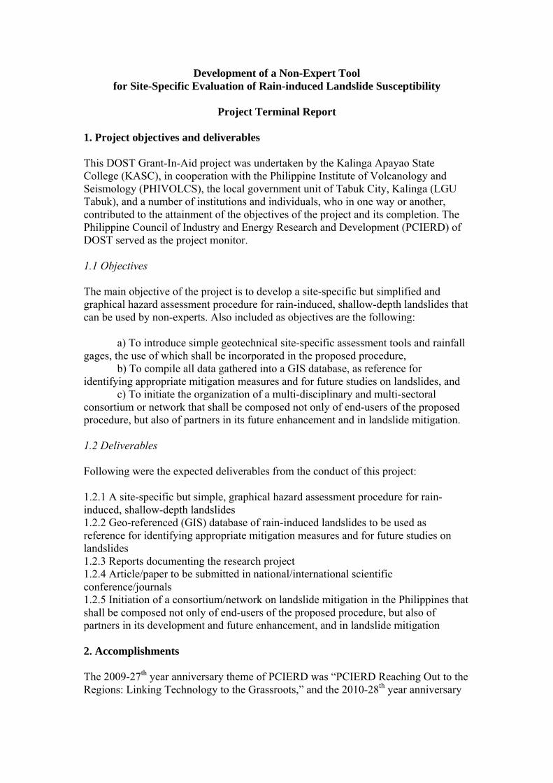
1. Project objectives and deliverables This DOST Grant-In-Aid project was undertaken by the Kalinga Apayao State College (KASC), in cooperation with the Philippine Institute of Volcanology and Seismology (PHIVOLCS), the local government unit of Tabuk City, Kalinga (LGU Tabuk), and a number of institutions and individuals, who in one way or another, contributed to the attainment of the objectives of the project and its completion. The Philippine Council of Industry and Energy Research and Development (PCIERD) of DOST served as the project monitor. 1.1 Objectives The main objective of the project is to develop a site-specific but simplified and graphical hazard assessment procedure for rain-induced, shallow-depth landslides that can be used by non-experts. Also included as objectives are the following:
a) To introduce simple geotechnical site-specific assessment tools and rainfall gages, the use of which shall be incorporated in the proposed procedure,
b) To compile all data gathered into a GIS database, as reference for identifying appropriate mitigation measures and for future studies on landslides, and
c) To initiate the organization of a multi-disciplinary and multi-sectoral consortium or network that shall be composed not only of end-users of the proposed procedure, but also of partners in its future enhancement and in landslide mitigation.
1.2 Deliverables Following were the expected deliverables from the conduct of this project: 1.2.1 A site-specific but simple, graphical hazard assessment procedure for rain-induced, shallow-depth landslides 1.2.2 Geo-referenced (GIS) database of rain-induced landslides to be used as reference for identifying appropriate mitigation measures and for future studies on landslides 1.2.3 Reports documenting the research project 1.2.4 Article/paper to be submitted in national/international scientific conference/journals 1.2.5 Initiation of a consortium/network on landslide mitigation in the Philippines that shall be composed not only of end-users of the proposed procedure, but also of partners in its development and future enhancement, and in landslide mitigation 2. Accomplishments The 2009-27th year anniversary theme of PCIERD was “PCIERD Reaching Out to the Regions: Linking Technology to the Grassroots,” and the 2010-28th year anniversary
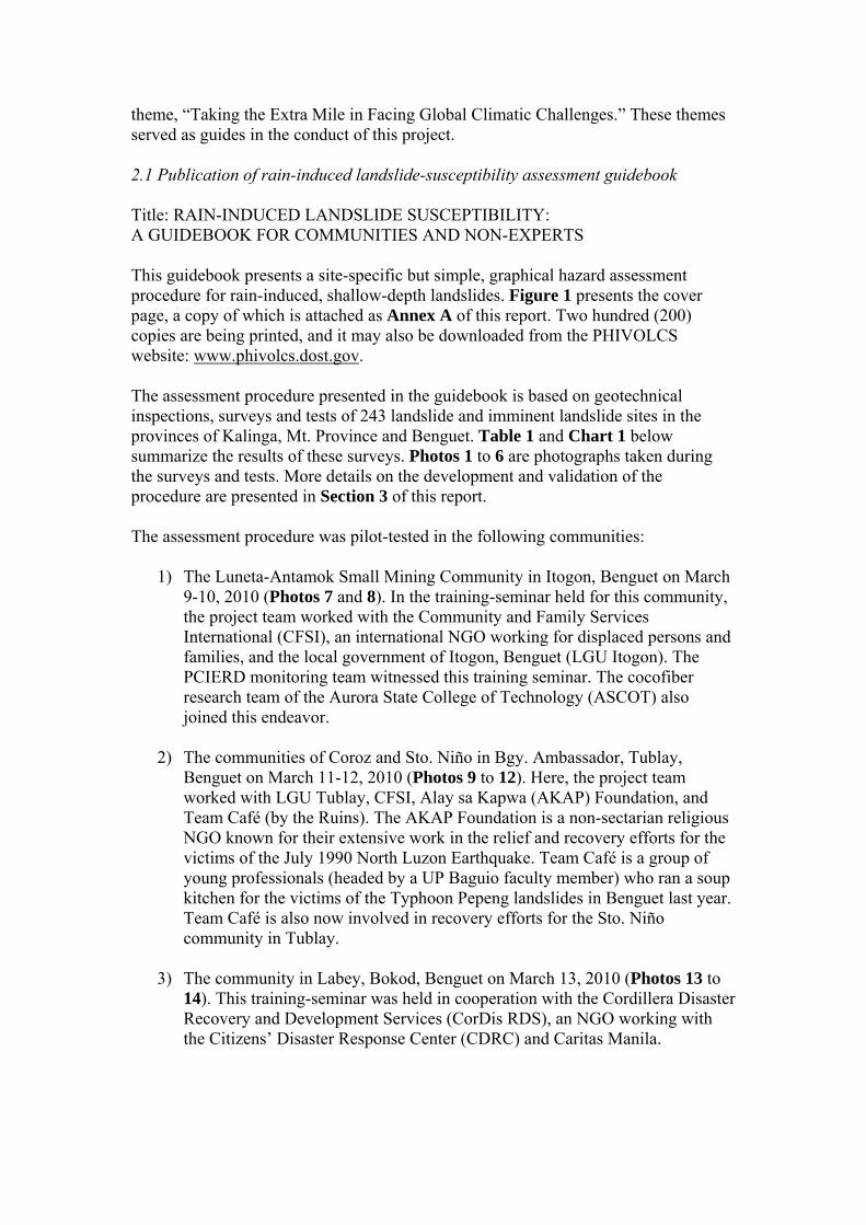
theme, “Taking the Extra Mile in Facing Global Climatic Challenges.” These themes served as guides in the conduct of this project. 2.1 Publication of rain-induced landslide-susceptibility assessment guidebook Title: RAIN-INDUCED LANDSLIDE SUSCEPTIBILITY: A GUIDEBOOK FOR COMMUNITIES AND NON-EXPERTS This guidebook presents a site-specific but simple, graphical hazard assessment procedure for rain-induced, shallow-depth landslides. Figure 1 presents the cover page, a copy of which is attached as Annex A of this report. Two hundred (200) copies are being printed, and it may also be downloaded from the PHIVOLCS website: www.phivolcs.dost.gov. The assessment procedure presented in the guidebook is based on geotechnical inspections, surveys and tests of 243 landslide and imminent landslide sites in the provinces of Kalinga, Mt. Province and Benguet. Table 1 and Chart 1 below summarize the results of these surveys. Photos 1 to 6 are photographs taken during the surveys and tests. More details on the development and validation of the procedure are presented in Section 3 of this report. The assessment procedure was pilot-tested in the following communities:
1) The Luneta-Antamok Small Mining Community in Itogon, Benguet on March
9-10, 2010 (Photos 7 and 8). In the training-seminar held for this community, the project team worked with the Community and Family Services International (CFSI), an international NGO working for displaced persons and families, and the local government of Itogon, Benguet (LGU Itogon). The PCIERD monitoring team witnessed this training seminar. The cocofiber research team of the Aurora State College of Technology (ASCOT) also joined this endeavor.
2) The communities of Coroz and Sto. Niño in Bgy. Ambassador, Tublay,
Benguet on March 11-12, 2010 (Photos 9 to 12). Here, the project team worked with LGU Tublay, CFSI, Alay sa Kapwa (AKAP) Foundation, and Team Café (by the Ruins). The AKAP Foundation is a non-sectarian religious NGO known for their extensive work in the relief and recovery efforts for the victims of the July 1990 North Luzon Earthquake. Team Café is a group of young professionals (headed by a UP Baguio faculty member) who ran a soup kitchen for the victims of the Typhoon Pepeng landslides in Benguet last year. Team Café is also now involved in recovery efforts for the Sto. Niño community in Tublay.
3) The community in Labey, Bokod, Benguet on March 13, 2010 (Photos 13 to
14). This training-seminar was held in cooperation with the Cordillera Disaster Recovery and Development Services (CorDis RDS), an NGO working with the Citizens’ Disaster Response Center (CDRC) and Caritas Manila.
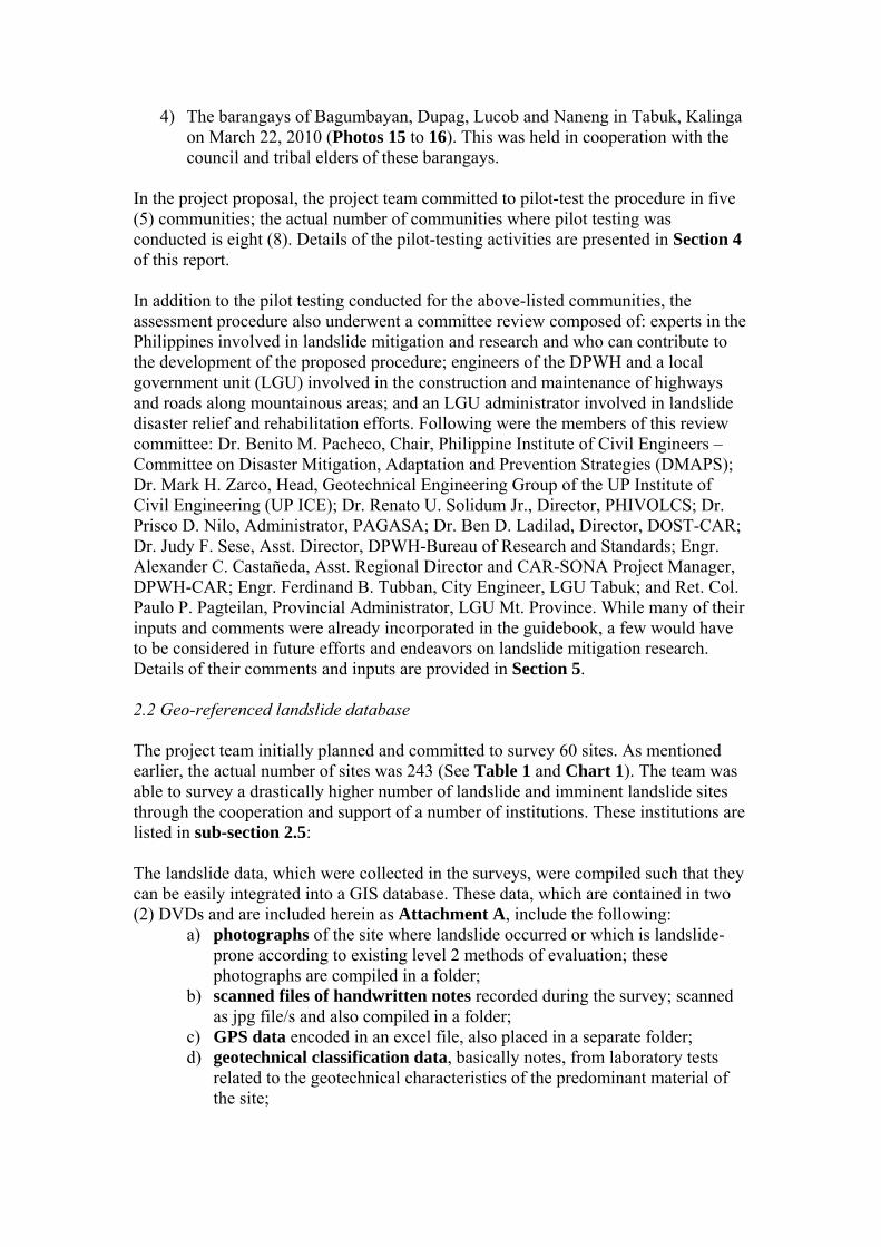
4) The barangays of Bagumbayan, Dupag, Lucob and Naneng in Tabuk, Kalinga on March 22, 2010 (Photos 15 to 16). This was held in cooperation with the council and tribal elders of these barangays.
In the project proposal, the project team committed to pilot-test the procedure in five (5) communities; the actual number of communities where pilot testing was conducted is eight (8). Details of the pilot-testing activities are presented in Section 4 of this report. In addition to the pilot testing conducted for the above-listed communities, the assessment procedure also underwent a committee review composed of: experts in the Philippines involved in landslide mitigation and research and who can contribute to the development of the proposed procedure; engineers of the DPWH and a local government unit (LGU) involved in the construction and maintenance of highways and roads along mountainous areas; and an LGU administrator involved in landslide disaster relief and rehabilitation efforts. Following were the members of this review committee: Dr. Benito M. Pacheco, Chair, Philippine Institute of Civil Engineers – Committee on Disaster Mitigation, Adaptation and Prevention Strategies (DMAPS); Dr. Mark H. Zarco, Head, Geotechnical Engineering Group of the UP Institute of Civil Engineering (UP ICE); Dr. Renato U. Solidum Jr., Director, PHIVOLCS; Dr. Prisco D. Nilo, Administrator, PAGASA; Dr. Ben D. Ladilad, Director, DOST-CAR; Dr. Judy F. Sese, Asst. Director, DPWH-Bureau of Research and Standards; Engr. Alexander C. Castañeda, Asst. Regional Director and CAR-SONA Project Manager, DPWH-CAR; Engr. Ferdinand B. Tubban, City Engineer, LGU Tabuk; and Ret. Col. Paulo P. Pagteilan, Provincial Administrator, LGU Mt. Province. While many of their inputs and comments were already incorporated in the guidebook, a few would have to be considered in future efforts and endeavors on landslide mitigation research. Details of their comments and inputs are provided in Section 5. 2.2 Geo-referenced landslide database The project team initially planned and committed to survey 60 sites. As mentioned earlier, the actual number of sites was 243 (See Table 1 and Chart 1). The team was able to survey a drastically higher number of landslide and imminent landslide sites through the cooperation and support of a number of institutions. These institutions are listed in sub-section 2.5:
The landslide data, which were collected in the surveys, were compiled such that they can be easily integrated into a GIS database. These data, which are contained in two (2) DVDs and are included herein as Attachment A, include the following:
a) photographs of the site where landslide occurred or which is landslide-prone according to existing level 2 methods of evaluation; these photographs are compiled in a folder;
b) scanned files of handwritten notes recorded during the survey; scanned as jpg file/s and also compiled in a folder;
c) GPS data encoded in an excel file, also placed in a separate folder; d) geotechnical classification data, basically notes, from laboratory tests
related to the geotechnical characteristics of the predominant material of the site;
e) evaluation results, which are spreadsheets (excel files) containing the analysis/es carried out to evaluate landsliding susceptibility.
Each of the sites visited or surveyed has an electronic folder containing all the above-listed data and files. 2.3 Semi-annual and quarterly technical reports To document the implementation of the project and update the monitoring agency on the project team’s activities, the team endeavored to submit semi-annual and quarterly technical reports to PCIERD, the monitoring agency. These reports are compiled as Attachment B of this report. 2.4 Paper presented in an international conference, presentations at the 35th National Conference of the Philippine Institute of Civil Engineers (PICE) and at the 2010 DOST North Luzon Fora. A paper on the development of the assessment procedure was already presented at the 2nd Regional Conference on Geo-Disaster Mitigation in ASEAN held on Feb. 25, 2010 in Bali, Indonesia. Presentations about the study were also made at the following events:
a) Earthquake Exposure and Vulnerability Workshop organized by the PHIVOLCS-DOST and Geoscience Australia on Nov. 14, 2009 at Clark, Pampanga.
b) The 35th Philippine Institute of Civil Engineers (PICE) National Convention on Nov. 28, 2009 in Baguio City. The presentation was made a part of a training-seminar conducted by the Committee on Disaster Mitigation, Adaptation and Prevention Strategies (DMAPS) during the convention.
c) The DOST Northern Luzon S&T Fora held on Feb. 16, 2010 at the Benguet State University in La Trinidad, Benguet
d) The MECO-TECO Climate Change Experts Forum held on April 6-7, 2010 at the Dusit Thani Hotel, Makati City. At this event, lessons and insights were presented on pilot-testing the procedure in the above-listed communities.
The conference paper and the MS Powerpoint presentation files for these events are compiled in Attachment C. 2.5 Initiation of a network on rain-induced landslide mitigation The conduct of this study was greatly facilitated through the support and cooperation of the following institutions:
1) PHIVOLCS-DOST 2) PAGASA-DOST 3) Mines and Geosciences Bureau, Cordillera Administrative Region (MGB-
CAR) 4) DOST-CAR
5) Cordillera Industry and Energy Research and Development Consortium (CIERDEC)
6) Committee Disaster Mitigation, Adaptation and Prevention Strategies, PICE 7) LGU Mt. Province 8) LGU Tadian, Mt. Province 9) LGU Tabuk City, Kalinga 10) LGU Pasil, Kalinga 11) LGU Tinglayan, Kalinga 12) LGU Sagada, Mt. Province 13) LGU Tublay, Benguet 14) LGU Itogon, Benguet 15) DPWH-Cordillera Administrative Region (CAR) 16) DPWH-Kalinga Engineering District (KED) 17) UP Institute of Civil Engineering (UP ICE) 18) Mt. Province State Polytechnic College (MPSPC) 19) Aurora State College of Technology (ASCOT) 20) Community and Family Services International (CFSI) 21) Team Café (by the ruins) 22) Cordillera Disaster Recovery and Development Services (CorDis RDS) 23) Alay sa Kapwa (AKAP) Foundation 24) DPWH Bureau of Research and Standards (DPWH-BRS) 25) DENR-CAR Environment Research and Development Services (ERDS)
A good working relationship has already been established with these institutions, thus a formal multi-disciplinary and multi-sectoral network, or better yet, a consortium, can be established for the future enhancement of the assessment procedure and for better concerted efforts in mitigating the impacts of rain-induced landslides among our communities. 3. Development of the rain-induced landslide assessment procedure The assessment procedure developed in this study essentially attempts to address certain limitations of existing procedures1 and to satisfy the seemingly conflicting criteria:
1) It is simple and intuitive, such that it can be used by non-experts. The framework should also be simple enough such that any institutional user, e.g., DPWH and DENR, that wishes to enhance the assessment procedure according to the institution’s needs and available expertise may be able to do so.
2) It has solid scientific and empirical basis. 3) It can be used for site-specific assessment, meaning that through this
procedure, the susceptibility of a very specific area, say a 20sq. m. of sloping ground, can be evaluated.
1 Refer to sub-section 3.3 for a brief review of existing procedures.
3.1 Geotechnical inspections, surveys and tests The assessment procedure is based on geotechnical inspections, surveys and tests of 243 landslide and imminent landslide sites in the provinces of Kalinga, Mt. Province and Benguet. These inspections, surveys and tests involved the following activities:
1) Delineation of survey sites based on slope angle and the predominant slope material. One survey site is assumed to have one slope angle and a predominant slope material.
2) Recording of site coordinates using a hand-held GPS receiver (Photo 17).
3) Taking of pictures of the site and preparation of sketches which include a site
cross-section and plan. In these sketches, notes were taken on the existing vegetation on the slope, observed past failures, presence of springs, condition of drainage system (if any), present land use, and other notable features of the slope.
4) Measurement of the slope angle using an abney level (Photo 18) or a laser
rangefinder equipped with a tiltmeter (Photo 19).
5) Geotechnical characterization of the slope material. If the slope material is rock, characterization is based on the Hoek-Brown Criterion (Hoek et al., 2002; Marinos et al., 2005; Hoek et al., 2005; Hoek and Marinos, 2007). Rock intact strength is estimated using a Schmidt Rebound Hammer (Photo 20). Hammering 4-inch common wire nails into the rock slope was also introduced to differentiate hard rock from soft rock. Four-inch common wire nails cannot penetrate hard rocks.
If the material is soil, on-site characterization involved using the ASTM D2488 known as the Standard Practice for Description and Identification of Soils: Visual-Manual Procedure (ASTM, 2004a) as reference. Soil penetration tests were also conducted using the Swedish Weight Sounding Test (SWST) (Photo 21), whenever applicable and practicable. Laboratory tests included particle size analysis using a set of sieves (Photo 22), using ASTM D2487-00 Practice for Classification of Soils for Engineering Purposes (ASTM, 2004b) as reference.
6) Compilation, evaluation and analyses of data collected. 7) Revisit of survey sites, especially after a heavy rainfall, to confirm and
validate the evaluation and analyses carried out. 3.2 Framework of the assessment procedure The framework of the assessment procedure was crystallized after a seminar-workshop conducted on June 13-17, 2010 in Sagada, Mt. Province (See Photos 23 and 24). The seminar-workshop was attended by the KASC Project Team and
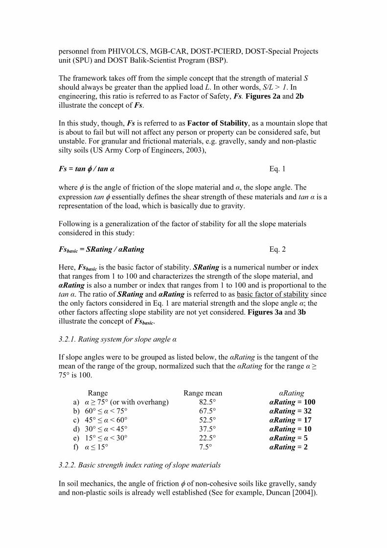
personnel from PHIVOLCS, MGB-CAR, DOST-PCIERD, DOST-Special Projects unit (SPU) and DOST Balik-Scientist Program (BSP). The framework takes off from the simple concept that the strength of material S should always be greater than the applied load L. In other words, S/L > 1. In engineering, this ratio is referred to as Factor of Safety, Fs. Figures 2a and 2b illustrate the concept of Fs. In this study, though, Fs is referred to as Factor of Stability, as a mountain slope that is about to fail but will not affect any person or property can be considered safe, but unstable. For granular and frictional materials, e.g. gravelly, sandy and non-plastic silty soils (US Army Corp of Engineers, 2003), Fs = tan / tan α Eq. 1 where is the angle of friction of the slope material and α, the slope angle. The expression tan essentially defines the shear strength of these materials and tan α is a representation of the load, which is basically due to gravity. Following is a generalization of the factor of stability for all the slope materials considered in this study: Fsbasic = SRating / αRating Eq. 2 Here, Fsbasic is the basic factor of stability. SRating is a numerical number or index that ranges from 1 to 100 and characterizes the strength of the slope material, and αRating is also a number or index that ranges from 1 to 100 and is proportional to the tan α. The ratio of SRating and αRating is referred to as basic factor of stability since the only factors considered in Eq. 1 are material strength and the slope angle α; the other factors affecting slope stability are not yet considered. Figures 3a and 3b illustrate the concept of Fsbasic. 3.2.1. Rating system for slope angle α If slope angles were to be grouped as listed below, the αRating is the tangent of the mean of the range of the group, normalized such that the αRating for the range α ≥ 75° is 100. Range Range mean αRating
a) α ≥ 75° (or with overhang) 82.5° αRating = 100 b) 60° ≤ α < 75° 67.5° αRating = 32 c) 45° ≤ α < 60° 52.5° αRating = 17 d) 30° ≤ α < 45° 37.5° αRating = 10 e) 15° ≤ α < 30° 22.5° αRating = 5 f) α ≤ 15° 7.5° αRating = 2
3.2.2. Basic strength index rating of slope materials In soil mechanics, the angle of friction of non-cohesive soils like gravelly, sandy and non-plastic soils is already well established (See for example, Duncan [2004]).
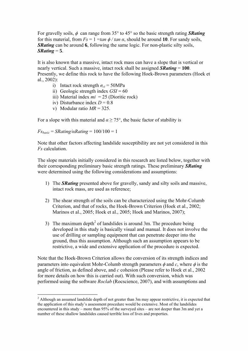
For gravelly soils, can range from 35° to 45° so the basic strength rating SRating for this material, from Fs = 1 =tan / tan α, should be around 10. For sandy soils, SRating can be around 6, following the same logic. For non-plastic silty soils, SRating = 5. It is also known that a massive, intact rock mass can have a slope that is vertical or nearly vertical. Such a massive, intact rock shall be assigned SRating = 100. Presently, we define this rock to have the following Hoek-Brown parameters (Hoek et al., 2002):
i) Intact rock strength σci = 50MPa ii) Geologic strength index GSI = 60 iii) Material index mi = 25 (Dioritic rock) iv) Disturbance index D = 0.8 v) Modular ratio MR = 325.
For a slope with this material and α ≥ 75°, the basic factor of stability is Fsbasic = SRating/αRating = 100/100 = 1 Note that other factors affecting landslide susceptibility are not yet considered in this Fs calculation. The slope materials initially considered in this research are listed below, together with their corresponding preliminary basic strength ratings. These preliminary SRating were determined using the following considerations and assumptions:
1) The SRating presented above for gravelly, sandy and silty soils and massive, intact rock mass, are used as reference;
2) The shear strength of the soils can be characterized using the Mohr-Columb
Criterion, and that of rocks, the Hoek-Brown Criterion (Hoek et al., 2002; Marinos et al., 2005; Hoek et al., 2005; Hoek and Marinos, 2007);
3) The maximum depth2 of landslides is around 3m. The procedure being
developed in this study is basically visual and manual. It does not involve the use of drilling or sampling equipment that can penetrate deeper into the ground, thus this assumption. Although such an assumption appears to be restrictive, a wide and extensive application of the procedure is expected.
Note that the Hoek-Brown Criterion allows the conversion of its strength indices and parameters into equivalent Mohr-Columb strength parameters and c, where is the angle of friction, as defined above, and c cohesion (Please refer to Hoek et al., 2002 for more details on how this is carried out). With such conversion, which was performed using the software Roclab (Rocscience, 2007), and with assumptions and
2 Although an assumed landslide depth of not greater than 3m may appear restrictive, it is expected that the application of this study’s assessment procedure would be extensive. Most of the landslides encountered in this study – more than 95% of the surveyed sites – are not deeper than 3m and yet a number of these shallow landslides caused terrible loss of lives and properties.
considerations given above, initial SRating values for the other slope materials considered in this study can be obtained.
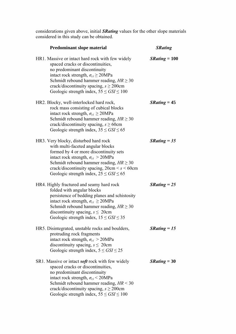
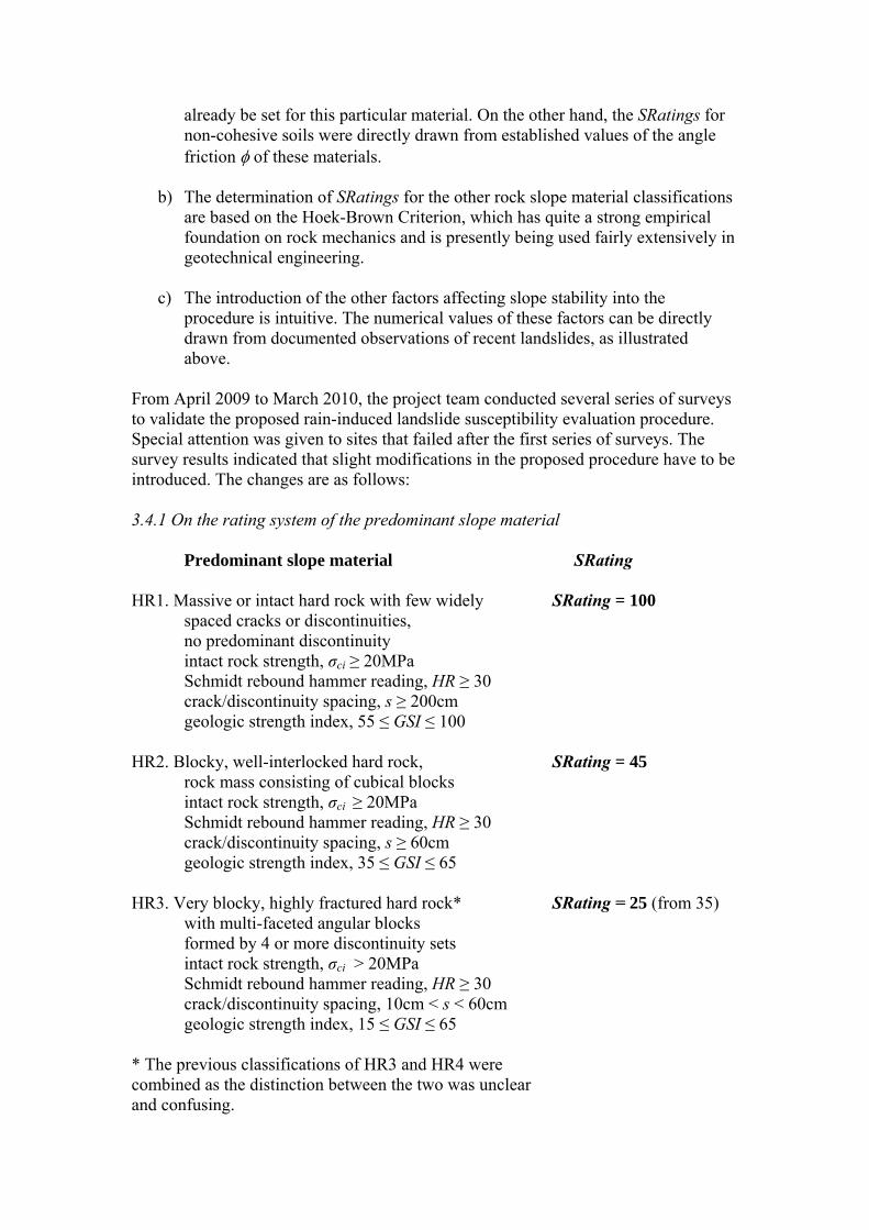
Predominant slope material SRating
HR1. Massive or intact hard rock with few widely SRating = 100 spaced cracks or discontinuities, no predominant discontinuity
intact rock strength, σci ≥ 20MPa Schmidt rebound hammer reading, HR ≥ 30
crack/discontinuity spacing, s ≥ 200cm Geologic strength index, 55 ≤ GSI ≤ 100 HR2. Blocky, well-interlocked hard rock, SRating = 45
rock mass consisting of cubical blocks intact rock strength, σci ≥ 20MPa Schmidt rebound hammer reading, HR ≥ 30
crack/discontinuity spacing, s ≥ 60cm Geologic strength index, 35 ≤ GSI ≤ 65 HR3. Very blocky, disturbed hard rock SRating = 35 with multi-faceted angular blocks formed by 4 or more discontinuity sets
intact rock strength, σci > 20MPa Schmidt rebound hammer reading, HR ≥ 30
crack/discontinuity spacing, 20cm < s < 60cm Geologic strength index, 25 ≤ GSI ≤ 65 HR4. Highly fractured and seamy hard rock SRating = 25 folded with angular blocks persistence of bedding planes and schistosity
intact rock strength, σci ≥ 20MPa Schmidt rebound hammer reading, HR ≥ 30
discontinuity spacing, s ≤ 20cm Geologic strength index, 15 ≤ GSI ≤ 35 HR5. Disintegrated, unstable rocks and boulders, SRating = 15 protruding rock fragments
intact rock strength, σci > 20MPa discontinuity spacing, s ≤ 20cm Geologic strength index, 5 ≤ GSI ≤ 25
SR1. Massive or intact soft rock with few widely SRating = 30
spaced cracks or discontinuities, no predominant discontinuity
intact rock strength, σci < 20MPa Schmidt rebound hammer reading, HR < 30
crack/discontinuity spacing, s ≥ 200cm Geologic strength index, 55 ≤ GSI ≤ 100
SR2. Highly fractured soft rock SRating = 15 intact rock strength, σci < 20MPa Schmidt rebound hammer reading, HR < 30
discontinuity spacing, s ≤ 20cm Geologic strength index, 5 ≤ GSI ≤ 35
HS1. Stiff and dense gravelly, sandy, SRating = 20
silty and clayey soils depth ≥ 0.5m 15 ≤ SPT-N value ≤ 50, SWST Nsw value ≥ 80
cohesion , c’ ≥ 30kPa angle of internal friction, 35° ≤ ’ ≤ 50°
SS1. Gravel/silty or sandy or clayey gravel deposit SRating = 10
depth > 0.5m SPT-N value ≤ 20,
angle of internal friction, 30° ≤ ’ ≤ 50° SS2. Sand/silty sand deposit SRating = 6 depth > 0.5m
SPT-N value ≤ 10, SWST Nsw value ≤ 80 undrained shear strength, Su ≤ 80kPa
angle of internal friction, 15° ≤ ’ ≤ 35° SS3. Soft clay/silt SRating = 5
depth > 0.5m SPT-N value ≤ 5, SWST Nsw value ≤ 60 undrained shear strength, Su ≤ 70 kPa
cohesion, 5kPa ≤ c’ ≤ 20kPa angle of internal friction, 5° ≤ ’≤ 25°
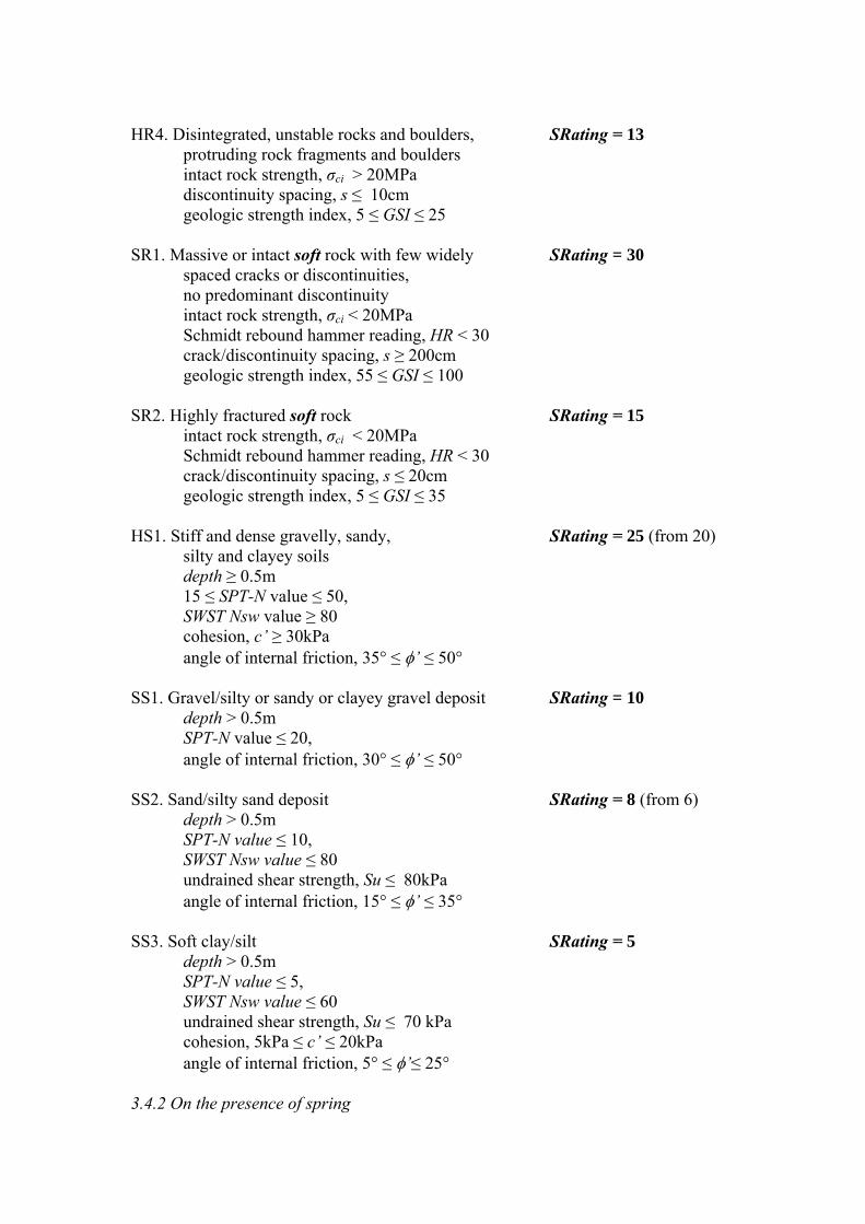
3.2.3. Overall Fs considering other factors The Fs, considering other factors that may affect the landslide susceptibility, shall be given as follows: Fs = (vFactor*fFactor*[SRating - sRed – dRed]) / lFactor* αRating Eq. 3 where
vFactor is a factor that takes into account slope vegetation cover, if any; fFactor is a factor that takes into account the frequency of slope failure, presence of cracks and previous failure history; sRed represents a reduction of the shear strength of the slope material due to saturation, as evidenced by the presence of spring/elevation of groundwater table due to infiltration;
dRed represents another reduction of shear strength of the material due to saturation because of poor drainage system; and lFactor is a factor that takes into account the land use.
Initially, the numerical values set for these factors were the following: 3.2.3.1 Presence of spring
Yearlong spRed = 2.5 Only during rainy season spRed = 1.2 No flow spRed = 0
3.2.3.2 Condition of drainage/canal/culvert (within the site)
No drainage system dRed = 2.5 Totally clogged, filled with debris dRed = 2.5 Partially clogged or overflows during heavy rains dRed = 1.2 Water leaks into the slope dRed = 1.2 Good working condition dRed = 0
3.2.3.3 Frequency of failure, deformation (e.g. rock fall, slides)
Once a year or more than once a year fFactor = 0.5 Presence of past failure, but occurrence not yearly fFactor = 0.8 Presence of tensile cracks in ground fFactor = 0.8 If with retaining wall, wall is deformed fFactor = 0.8 None fFactor = 1.2
3.2.3.4 Vegetation cover
No vegetation vFactor = 1.0 Predominantly grass or vegetation with shallow roots vFactor = 1.1 Coconut, bamboo or vegetation vFactor = 1.3 with moderately deep roots Trees with age less than or equal to 20 years vFactor = 1.5 Trees with age more than 20 years vFactor = 2.5
3.2.3.2 Land Use
Dense residential area lFactor = 1.4 (with closely spaced structures <5m)
Commercial/residential area lFactor = 1.4 with building/s having 2 storeys or more
Residential area with buildings having lFactor = 1.25 1 or 2 storeys spaced at ≥5m
Road/highway with heavy traffic lFactor = 1.4 (1 truck or more every 10mins)
Road/highway with light traffic lFactor = 1.25 (less than 1 truck every 10mins)
Agricultural area, grasslands and bushlands lFactor = 1.0 Forest lFactor = 1.0 Uninhabited and no vegetation lFactor = 1.0
Unlike in other landslide susceptibility rating systems developed previously, the introduction of factors that modifies the value of SRating is intuitive and would

conform to recent observations on the effects of these factors. For example, it is generally known that root systems of trees reinforce soils on slopes, thus this factor should be multiplied to SRating and given a numerical value greater than 1 if the slope is covered with trees. For the thick clayey slopes in Sagada, SRating = 5. According to this rating system, Fs = 1 (marginally stable), when the slope is between 15° and 30°. As these slopes are covered with thick pine forests, the net SRating would be 2*5 = 10. This indicates that these slopes can still be stable at slope angles between 30° and 45°, as we have observed in the environmental scanning carried out in the Sagada workshop. It is also generally known that the effect of saturation on soils is a reduction in their shear strength. At 100% saturation, this effect can result in a reduction of shear strength by as much as 20%, compared to the shear strength at 30% saturation. In the case of a sandy soil mass, having SRating = 6, when the soil mass becomes saturated due to poor drainage and groundwater rises as observed by strong spring flow from the soil mass, the SRating becomes Net SRating = 6 – 2.5 – 2.5 = 1. Note that a slope with a net SRating = 1 is no longer stable even with slopes of less than 15°. This was observed in the Himay-angan Landslide in Southern Leyte in February 2007 (Uchimura et al., 2007) and in the Paracelis Landslide in 2005 (Peckley et al., 2007). The assessment procedure also attempts to numerically evaluate the effects of environmental factors such as lost forest cover, poor drainage and others. It is hoped that such numerical evaluation would facilitate appropriate actions that can be undertaken by communities and concerned authorities. 3.3 Levels of stability and susceptibility In this study, the following definitions were adopted:
1) slopes having Fs > 1.2 shall be considered stable; 2) slopes having 1.0 < Fs < 1.2, marginally stable; 3) slopes having 0.7 < Fs < 1.0, susceptible; and 4) slopes having Fs < 0.7, highly susceptible.
3.4 Slight changes in the rating system One feature of the assessment procedure presented above is that it alleviates the need to perform many and lengthy iterations in determining the appropriate numerical values of the factors required in evaluating Fs. A quick trial-and-error can be conducted to establish reasonable numerical values of these factors, given the following attributes of the procedure:
a) The numerical values of SRating are bounded by the SRatings of massive and intact rock, and non-cohesive soils. As pointed out earlier, a massive and intact rock can support a slope that is vertical, thus an SRating of 100 can
already be set for this particular material. On the other hand, the SRatings for non-cohesive soils were directly drawn from established values of the angle friction of these materials.
b) The determination of SRatings for the other rock slope material classifications
are based on the Hoek-Brown Criterion, which has quite a strong empirical foundation on rock mechanics and is presently being used fairly extensively in geotechnical engineering.
c) The introduction of the other factors affecting slope stability into the
procedure is intuitive. The numerical values of these factors can be directly drawn from documented observations of recent landslides, as illustrated above.
From April 2009 to March 2010, the project team conducted several series of surveys to validate the proposed rain-induced landslide susceptibility evaluation procedure. Special attention was given to sites that failed after the first series of surveys. The survey results indicated that slight modifications in the proposed procedure have to be introduced. The changes are as follows: 3.4.1 On the rating system of the predominant slope material
Predominant slope material SRating
HR1. Massive or intact hard rock with few widely SRating = 100 spaced cracks or discontinuities, no predominant discontinuity
intact rock strength, σci ≥ 20MPa Schmidt rebound hammer reading, HR ≥ 30
crack/discontinuity spacing, s ≥ 200cm geologic strength index, 55 ≤ GSI ≤ 100 HR2. Blocky, well-interlocked hard rock, SRating = 45
rock mass consisting of cubical blocks intact rock strength, σci ≥ 20MPa Schmidt rebound hammer reading, HR ≥ 30
crack/discontinuity spacing, s ≥ 60cm geologic strength index, 35 ≤ GSI ≤ 65 HR3. Very blocky, highly fractured hard rock* SRating = 25 (from 35) with multi-faceted angular blocks formed by 4 or more discontinuity sets
intact rock strength, σci > 20MPa Schmidt rebound hammer reading, HR ≥ 30
crack/discontinuity spacing, 10cm < s < 60cm geologic strength index, 15 ≤ GSI ≤ 65 * The previous classifications of HR3 and HR4 were combined as the distinction between the two was unclear and confusing.
HR4. Disintegrated, unstable rocks and boulders, SRating = 13 protruding rock fragments and boulders
intact rock strength, σci > 20MPa discontinuity spacing, s ≤ 10cm geologic strength index, 5 ≤ GSI ≤ 25
SR1. Massive or intact soft rock with few widely SRating = 30
spaced cracks or discontinuities, no predominant discontinuity
intact rock strength, σci < 20MPa Schmidt rebound hammer reading, HR < 30
crack/discontinuity spacing, s ≥ 200cm geologic strength index, 55 ≤ GSI ≤ 100 SR2. Highly fractured soft rock SRating = 15 intact rock strength, σci < 20MPa Schmidt rebound hammer reading, HR < 30
crack/discontinuity spacing, s ≤ 20cm geologic strength index, 5 ≤ GSI ≤ 35
HS1. Stiff and dense gravelly, sandy, SRating = 25 (from 20)
silty and clayey soils depth ≥ 0.5m 15 ≤ SPT-N value ≤ 50, SWST Nsw value ≥ 80
cohesion, c’ ≥ 30kPa angle of internal friction, 35° ≤ ’ ≤ 50°
SS1. Gravel/silty or sandy or clayey gravel deposit SRating = 10
depth > 0.5m SPT-N value ≤ 20,
angle of internal friction, 30° ≤ ’ ≤ 50° SS2. Sand/silty sand deposit SRating = 8 (from 6) depth > 0.5m
SPT-N value ≤ 10, SWST Nsw value ≤ 80 undrained shear strength, Su ≤ 80kPa
angle of internal friction, 15° ≤ ’ ≤ 35° SS3. Soft clay/silt SRating = 5
depth > 0.5m SPT-N value ≤ 5, SWST Nsw value ≤ 60 undrained shear strength, Su ≤ 70 kPa
cohesion, 5kPa ≤ c’ ≤ 20kPa angle of internal friction, 5° ≤ ’≤ 25°
3.4.2 On the presence of spring
Yearlong spRed = 2.0 from (2.5) Only during rainy season spRed = 1.0 from (1.2) No flow spRed = 0
3.4.3 On the condition of drainage/canal/culvert (within the site)
No drainage system dRed = 2.0 from (2.5) Totally clogged, filled with debris dRed = 2.0 from (2.5) Partially clogged or overflows during heavy rains dRed = 1.0 from (1.2) Water leaks into the slope dRed = 1.0 from (1.2) Good working condition dRed = 0
3.4.4 On the occurrence of failure, deformation (e.g. rock fall, slides)
Once a year or more than once a year fFactor = 0.5 from (0.7) Presence of past failure, but occurrence not yearly fFactor = 0.7 from (0.8) Presence of tensile cracks in ground fFactor = 0.7 from (0.8) If with retaining wall, wall is deformed fFactor = 0.7 from (0.8) None fFactor = 1.2 from (1.25)
3.5 Validation As of April 2010, the total number of sites surveyed was 243. When the Fs of these sites are grouped as presented in Section 3.3, the results, as shown in Chart 1 and Table 1, can be obtained. As seen in Chart 1 and Table 1, none of the sites with Fs above 1.0 failed and almost 68% of the sites with Fs below 1 failed. For those with Fs below 0.7, the percentage of failure was quite high at 95%. When the same sites are evaluated using the procedure developed by the Japan Road Association (JRA) Methodology (ATC, 1997), the results shown in Table 2 can be obtained. The results that can be obtained using the procedure proposed by the Japanese Ministry of Construction (JMOC) Methodology (ATC, 1997) are shown in Table 3. A brief description of the JRA and JMOC methodologies are provided in sub-section 3.6.2. From these tables, it can be inferred that the results of the assessment procedure developed in this study and the JRA procedure are consistent with the indicated levels or categorization of landslide susceptibility. Such consistency cannot be observed with the evaluation carried out using JMOC procedure. Although the JRA procedure also appears simple and can be modified for non-expert use, it can be noted that it does not include a clear and numerical basis why slope failure is “likely”, “probable” or “unlikely”. In the procedure developed in this study, slope failure susceptibility is based on the calculated Fs, which has a clear meaning, i.e., an Fs below 1 means the strength of slope material cannot sustain or support the gravitational force which is attributed to the slope gradient. Moreover, the empirical data on which the JRA procedure was developed were taken from case studies on landslides due to earthquake. Refer to sub-section 3.6.2 for more information on the JRA Procedure.
While the assessment procedure developed in this study took off from established engineering principles, and the landslide data gathered would validate its application, continuous improvement of the procedure and more data gathering are suggested. As can be inferred from Chart 1 and Table 1, it can be said that there may have been “too much” focus on gathering data for sites that are very susceptible to landslides, i.e., those having an Fs below 0.7. It would be more desirable to gather more data that fit into the other levels of susceptibility. With additional data, modifications and improvements on the assessment procedure can be proposed. In gathering more data and proposing improvements, it is strongly recommended that the distribution of data according to each factor or parameter be considered and examined, as shown in Charts 2 to 8. 3.6 Existing assessment procedures This section presents a brief review of existing procedures for evaluating rain-induced landslide susceptibility that are being used in the Philippines and abroad. 3.6.1 DENR-MGB Procedure At present, the DENR Mines and Geosciences Bureau (MGB) is conducting regional rain-induced landslide susceptibility mapping, based on 1:50,000 topographic maps of NAMRIA. In this endeavor, the susceptibility of slopes to fail depends on the following parameters: slope gradient (angle), fracturing, weathering and ground stability. Susceptibility is classified as low, moderate and high. Table 4 provides an overview of the DENR-MGB Procedure. While appropriate for mapping with scale from 1:50,000 to 1:10,000, significant enhancement of the DENR-MGB procedure would be required for site-specific susceptibility assessment, where a definitive or numerical value of Factor of Stability (or Safety) would be required. It should also be noted that a slope angle of 35o or higher does not necessarily mean high susceptibility. 3.6.2 Other existing procedures In the 1990s, when disasters due to rain-induced landslides started to gain more attention globally, the Asian Technical Committee on Geotechnology for Natural Hazards of the International Society of Soil Mechanics and Foundation Engineering and the Japanese Geotechnical Society (JGS) compiled procedures developed in Japan, Hong Kong and elsewhere for the evaluation and prediction of slope failure by heavy rain (ATC, 1997; Orense, 2003). The procedures for the evaluation of landsliding potential were classified into three grades: Grade 1: Geomorphological Methods, Grade II: Overall Score Evaluation Methods, and Grade 3: Geotechnical Methods. Table 5 presents a summary of these landslide susceptibility assessment procedures. Examples of these methodologies are the so-called JRA Methodology by the Japanese Road Association, shown in Tables 6a and 6b, and the JMOC Methodology by the Japanese Ministry of Construction, shown in Tables 7a and 7b.
Developed in 1988, the JRA Methodology is a simple procedure for predicting slope instability of cut-slopes along roads. Here, instability of a slope is evaluated in two steps, the first of which involves getting the slope’s total score based on the 12 parameters shown in Table 6a. The second step involves categorization of instability depending on whether the slope has a retaining wall or not, as shown in Table 6b. Although this procedure is based on case studies of landslides caused by the 1978 Izu-Oshima Earthquake (JRA, 1988 as cited by Orense, 2003), the project team included this methodology as an procedure for evaluating the data gathered, for three reasons: (1) it incorporated the parameter on spring water flow, a very important parameter for rain-induced landslides; (2) the methodology appears to be earthquake-intensity neutral, i.e., earthquake intensity is not among the parameters considered in the evaluation of instability; and (3) many of the sites surveyed in this study were road cut-slopes. The JMOC is a simple and straightforward method in evaluating landslide risk, based on the eight parameters shown in Table 7a. Risk ranking is presented in Table 7b. While these Grade II evaluation methods are less mathematically rigorous and their use can be simple and straightforward, it can be noted that these methods are evidently not built upon established knowledge, professional practice and advances in soil mechanics and rock mechanics. 4. Pilot-testing Landslide susceptibility assessment is perceived as a very technical undertaking that only experts such as geotechnical engineers and engineering geologists can do. Given the facts, however, that the Philippines has very few geotechnical engineers and engineering geologists, and that every time a typhoon comes, tragedies and tremendous losses due to rain-induced landslides happen to tens, if not thousands, of communities, it is but practical and cost-effective to enable communities to assess the rain-induced susceptibility of their areas themselves (Peckley, 2005). The goals of the pilot-testing activities were (1) to determine if communities and non-experts can indeed carry out rain-induced landslide susceptibility assessment using the procedure developed in this study, and (2) identify aspects and areas of improvement. 4.1 Pilot communities and format As mentioned earlier, these pilot-testing activities were conducted on the following communities that were severely affected by landslides caused by Typhoon Pepeng in October 2009:
1) The Luneta-Antamok Small Mining Community on March 9-10, 2010 in
Itogon, Benguet (Photos 7 and 8). The project team worked with CFSI and LGU Itogon. The PCIERD monitoring team witnessed this training-seminar. The cocofiber research team of ASCOT also joined this endeavor.
2) The communities of Coroz and Sto. Niño on March 11-12, 2010 in Bgy.
Ambassador, Tublay, Benguet (Photos 9 to 12). Here, the project team worked with LGU Tublay, CFSI, AKAP Foundation and Team Café.
3) The community in Labey, Bokod, Benguet on March 13, 2010 (Photos 13 to
14). This activity was held in cooperation with CorDis RDS.
4) The barangays of Bagumbayan, Dupag, Lucob and Naneng in Tabuk, Kalinga on March 22, 2010 (Photos 15 to 16). This was held in cooperation with the council and tribal elders of these barangays.
These pilot-testing activities were presented in a training-seminar format and consisted of essentially of two parts, namely:
a) A lecture on rain-induced landslide assessment by communities and non-experts, including demonstrations on the use of rain gauge and Swedish Weight Sounding Test (SWST).
b) An on-site landslide susceptibility assessment, where the participants apply the assessment procedure introduced in the lecture.
For more details on the contents of the training-seminars conducted for these communities, refer to Attachment D.
4.2 Lessons and insights The lessons and insights gained from these training-seminars include the following: 1) Communities and non-experts have the capacity to understand and conduct a supposedly highly technical undertaking such as landslide susceptibility assessment. One attribute of the assessment procedure developed in this study is that it takes off from fundamental and simple ideas, namely:
a) Landslides are better understood as a “physics” problem rather than as a “chemistry” problem. As a “physics” problem, landslides are about stability, load vs. capacity, strength of materials, slope angle, cracks and discontinuities, and saturation. If it were a “chemistry” problem, it would be about chemical and mineralogical composition, rock origin and classification, age of rocks and soils.
b) The capacity or strength S should always be greater than the applied load L, as discussed in sub-section 3.2 and illustrated in Figures 2a, 2b, 3a, and 3b.
Comprehension and reception of the assessment procedure could also have been facilitated by the following:
a) Conducting the training-seminar and active interaction in the vernacular; b) Using the figures and photos prepared for the guidebook, which served as
visual aids in classifying rocks and soils; c) Presenting the validation of the assessment procedure with the data obtained
from the surveys of 243 landslide and imminent landslide sites; and d) Giving the participants the opportunity to actually apply the procedure and to
present the results to other participants and the trainers/facilitators for feedback and comments.
2) Partnership with NGOs, the concerned LGUs and other institutions greatly facilitate the enabling of communities to conduct landslide assessment on their own,
thereby allowing these communities to become more rain-induced landslide disaster-resilient. 3) Wide participation and appreciation can be ensured when the training-seminar is held at the community or barangay hall, not in some fancy function room or hall far from the community. “High-tech” presentations or seminar facilities may not be available at community or barangay halls, thus trainers/facilitators should be capable of giving the seminar using only a board and chalk. 4) Informed and trained communities/non-experts usually lead to open-mindedness and the ability to discern appropriate action/s to protect the community/their families. For example,
a) Communities advised by the MGB to relocate become more rational and objective in considering such advice.
b) Communities become interested and inquisitive on the proper design and implementation of slope stability works that are appropriate and practical, considering slope material classification and other local conditions.
5.0 Committee review The goals that were set for this particular activity were the following:
1) To come up with recommendations and suggestions to ensure that the proposed procedure has strong scientific and/or empirical basis and can indeed be used by non-experts, and
2) To facilitate the adoption of the proposed procedure as a national standard or procedure for preliminary landslide susceptibility assessment.
5.1 Committee members Selected as members of the committee to review the first draft of the guidebook containing the assessment procedure developed in this study were the following:
R1) Dr. Benito M. Pacheco. Dr. Pacheco is the chairperson of the Committee on
Disaster Mitigation Adaptation and Prevention Strategies (DMAPS) of the Philippine Institute of Civil Engineers (PICE). He is also the director of the Institute of Civil Engineering of the University of the Philippines (UP ICE) and was the president of Vibrametrics, an engineering consulting firm that was involved in studies on geohazards.
R2) Dr. Mark H. Zarco. Dr. Zarco is the head of the Geotechnical Engineering
Group of UP ICE. As a geotechnical engineering researcher, he is active in the study of landslides.
R3) Dr. Renato U. Solidum Jr. Dr. Solidum is a geologist and currently serves
as the director of PHIVOLCS. As a DOST service and research institution, PHIVOLCS is actively involved in landslide research, particularly earthquake-triggered landslides.
R4) Dr. Prisco D. Nilo. Dr. Nilo is a meteorologist and currently serves as the
administrator of PAGASA. Another DOST service and research institution,
PAGASA is leading research activities in global climate change, one impact of which is more intense and heavier precipitation, causing landslides.
R5) Dr. Judy F. Sese. Dr. Sese is the assistant director of DPWH-Bureau of
Research and Standards, a government agency in charge of identifying appropriate engineering standards for the implementation of national infrastructure like roads, highways, bridges and government buildings.
R6) Engr. Alexander C. Castañeda. Engr. Castañeda is currently the assistant
regional director of DPWH-CAR. He is also the project manager of the Presidential CAR-SONA project, which involves the widening and concreting of the highways connecting Baguio City and Bontoc, Mt. Province; Bontoc, Mt. Province and Tabuk City, Kalinga; and Bontoc, Mt. Province and Banaue, Ifugao.
R7) Dr. Ben D. Ladilad. Dr. Ladilad is the regional director of DOST-CAR and
serves as the chairman of CIERDEC, a regional consortium of PCIERD that plans to undertake more research activities on rain-induced landslides because of the tragedies and tremendous losses that happened in the region due to Typhoon Pepeng.
R8) Dr. Fatima T. Tangan. Dr. Tangan is a forester and the OIC regional
technical director of the Ecosystems Research and Development of DENR-CAR, which has been involved in research on erosion control and landslide mitigation through reforestation.
R9) Engr. Ferdinand B. Tubban. Engr. Tubban was the city engineer of LGU
Tabuk until April 2010, when he resigned to run for mayor of Tabuk City. As city engineer for several years, he was in charge of implementing a number of road and slope protection projects.
R10) Ret. Col. Paulo P. Pagteilan. Col. Pagteilan is a former Philippine Army
officer and currently serves as the provincial administrator of LGU Mt. Province. As provincial administrator, he was closely involved in the rescue, relief and rehabilitation efforts for the communities in Mt. Province that were stricken by landslides caused by Typhoon Pepeng.
5.2 Inputs and comments Tables 8a and 8b summarize the inputs and comments of the members of the review committee. As can be noted from these tables, many of the reviewers remarked on the simplicity and user-friendliness of the guidebook. A number of the reviewers, however, made the comment that this study or research is incomplete and should have included the identification of practical and appropriate slope stability measures considering the different factors affecting susceptibility. To facilitate the adoption of the proposed procedure as a national standard or procedure for preliminary landslide susceptibility assessment, a number of the reviewers recommended that a study be conducted to identify these slope stability measures. Engr. Castañeda, in particular, recommended that this study be carried out with the active participation of the DPWH Bureau of Research and Standards. Meanwhile, Col. Pagteilan suggested that the
adoption of the assessment procedure as a standard may be pursued through local legislation. Dr. Nilo and Dr. Tangan pointed out that the amount of rainfall should be included as a factor in the assessment. Saturation due to rainfall is indeed a direct parameter that should be considered. In this study, this was taken into account by the factors sRed and dRed in the calculation of the overall Fs. On the other hand, the alternative form for the calculation of Fs may already be proposed:
Fs = vFactor*fFactor*(SRating - Rain) Eq. 4. Rating * lFactor Here, the factor Rain would take into account the accumulated rainfall in 24 hours. While there are not enough data yet to establish the numerical values of Rain, the following conservative values can be adopted: Amount of rainfall in 24 hours Rain
50mm or less 0 More than 50mm but less than 100mm 2 More than 100mm but less than 200mm 3 More than 200mm 4 The lower value of Fs from Eq. 3 and Eq. 4 shall be conservatively adopted as the Fs of the slope. Considering that life, limb and properties are at stake whenever a landslide assessment is conducted, Dr. Pacheco recommended that precautionary notes on the limitations of the assessment method developed in this study be included in the guidebook. His recommendations were adopted. Dr. Tangan made a number of suggestions on the appropriate numerical values for vFactor, which takes into account the effect of vegetation on slope stability. Considering her expertise in this field, these suggestions were adopted in the manual. 6.0 Other activities 6.1 Fabrication of manual rain-gages Upon the instruction of the Hon. Secretary Alabastro, the project team fabricated twenty (20) units of non-recording standard rain-gages based on a prototype unit and drawings provided by PAGASA. The team also translated the rain-gage user’s manual from English to Ilocano, lingua-franca of the entire northern Luzon, including the CAR, to facilitate the adoption of this simple technology as an early warning device by communities against the possible occurrence of rain-induced landslides. Attachment F contains a copy of this manual. The recipients of the 20 units of rain-gages are the following: 1. Dupag, Tabuk, Kalinga
2. Bagumbayan, Tabuk, Kalinga 3. Naneng, Tabuk, Kalinga 4. Lucug, Tabuk, Kalinga 5. Kayan East, Mt. Province 6. Labey, Bokod, Benguet 7. Coroz, Ambassador, Tublay, Benguet 8. Sto. Niño, Ambassador, Tublay, Benguet 9. Luneta, Antamok, Itogon, Benguet 10. LGU Pasil, Kalinga 11. LGU Tinglayan, Kalinga 12. DOST- Kalinga 13. Institute of Mathematics, Engineering and Applied Technology (IMEAT), KASC 14. Apayao State College 15. Mountain Province State Polytechnic College (MPSPC) 16. Resettled community in Antipolo, Rizal c/o CFSI 17. Resettled community in Botolon, Zambales c/o CFSI 18. Resettled community in San Agustin, Tarlac c/o CFSI 19. Resettled community in San Manuel, Tarlac c/o CFSI 20. Resettled community in San Manuel, Tarlac c/o CFSI 6.2 Survey and geotechnical testing of landslides and imminent landslide sites in Mt. Province after Typhoon Pepeng 6.2.1 Imminent large-scale landslides in Mt. Province This sub-section presents the results of the inspections and geotechnical testing conducted in October 2009 at landslide sites and impending landslide sites affecting several barangays in Mt. Province, upon the invitation of Hon. Maximo B. Dalog, then governor of Mt. Province. Following were the barangays visited by the project team to date, brief summaries of the situation in these areas, and recommendations: 6.2.1.1 Bgy. Bun-ayan, Sabangan Brief summary of situation: Dangerously impending large-scale landslide with 3m to 10m boulders that can demolish an entire settlement with a population of around 500. Ground movements and cracks have already damaged around 20 residential structures. These damages include cracks in structural members like columns and walls, as well as dislocated suspended floors. Recommendation: Affected residents should be advised to relocate. 6.2.1.2 Bgy. Kayan East, Tadian Brief summary of situation: Impending large-scale landslide above the slope that failed on October 8, 2009, possibly larger in scale. Recommendation: Residents should be advised to relocate. Engineering slope mitigation works to ensure long-term stability could be extensive and very expensive (could be more than PhP10M). To lessen the probability of failure, but is not an assurance of long-term stability, the following practical mitigation measures can be
adopted: mapping of drainages, provision of reinforced concrete lining for these drainages, and bioengineering measures such as planting of trees with deep roots (around 5 to 6m). Mitigation measures should undergo extensive study and investigation. 6.2.1.3 Bgy. Tue, Tadian Brief summary of situation: Imminent landslide that can bury the entire old settlement of i-Tue (around 100 households); a landslide covering an area of around 130m and 200m already occurred near the settlement. Recommendation: Residents should be advised to relocate. 6.2.1.4 St. Michael’s Compound, Poblacion, Tadian Brief summary of situation: Imminent large-scale landslide that can affect around 14 households and the highway going to Bontoc. Recommendation: Residents below the impending slide should be advised to relocate. If the value of private properties in the area and the presence of a national highway can justify extensive and expensive mitigation works, these mitigation measures can include improvement of drainage system, installation of sub-horizontal drains, use of gabions and other slope-retaining technologies, and bioengineering measures. 6.21.5 Bgy. Kayan West, Tadian Brief summary of situation: A creeping landslide affecting around 6 households and the school ground. Recommendation: Provision of RC-lined drainage canals and use of gabions as retaining structures. 6.2.1.6 Bgy. Lubon, Tadian Brief summary of situation: One landslide below the main settlement that can affect 3 to 5 households. Creek at the toe of the slide and presence of springs around the settlement above the slide can worsen the situation and can affect more households. Recommendation: Relocation of affected families, if slope protection measures become too costly; improvement of drainage system. More detailed investigation and study should be conducted for the proper design of retaining structures. One requirement is that these structures should be free-draining, e.g. gabions. 6.2.1.7 Sitio Sum-at, Bgy. Caluttit, Bontoc Brief summary of situation: Several households on a very steep slope that previously failed; susceptibility rating is high.
Recommendation: Relocation of residents and prohibition of further construction along the slope; provision of better drainage system along the provincial road above the settlements. 6.21.8 Sitio Danom, Poblacion, Tadian Brief summary of situation: Impending landslide that could affect one household and rice fields. Recommendation: Improvement of drainage system and provision of slope protection to be undertaken by the owner/s of the affected area. The imminent large-scale landslides in Poblacion, Tadian; Bun-ayan, Sabangan; and Tue, Tadian, and the possible failure of the soft soil layer above the landslide in Kayan East, Tadian, require urgent attention from all concerned agencies and institutions as the downpour from another typhoon or depression, or an earthquake, can trigger these slides. Considering that there could be more vulnerable barangays or villages around the province that are in the same or similar situation, long-term planning and mobilization of all possible human, material and financial resources may also be required. Further to the recommendations enumerated above, the following may also be undertaken:
1) Rehabilitation of affected communities, including actions to find productive and economic use of areas to be abandoned;
2) “Lakbay-aral” and dialogues to facilitate relocation. These dialogues should include lessons learned on the recent experience in Kayan East;
3) Establishment of a practical rain-induced landslide warning-system with the use of manual rain gages and with the introduction of simple tools and procedures for evaluating landsliding susceptibility;
4) Relevant training of community leaders and members, LGU staff, DPWH engineers, college and high school faculty members and students on the nature of landslides, their assessment and mitigation;
5) Encourage and provide incentives for the colleges and high schools to conduct in-depth and extensive research/studies on landslides, e.g. require LGU scholars to conduct studies on landslides; and
6) Encourage and provide incentives for the private sector to invest in landslide and other geohazard mitigation technologies.
Evidently, ensuring that the tragedy that happened in Kayan East, Tadian, when 35 people died in a landslide during Typhoon Pepeng, will not occur again would be a long-term and difficult endeavor, one that the provincial leadership and all i-Mt. Province will have to undertake. Experiences among our Asian neighbors, especially Japan whose geology and geography is very similar to the Philippines, have shown that becoming disaster-resilient is a key element in socio-economic development. 6.2. Assistance from various agencies, institutions, LGUs and groups Concerned about the loss of lives in the Kayan East landslide and the reported impending large-scale landslides in several barangays in Mt. Province, then Governor (now Representative) Maximo B. Dalog invited the project team to undertake surveys
and geotechnical testing in the province. Since providing official advisory on rain-induced landslides is not under the purview of DOST nor the project team, the project team set the following as objectives in these surveys and testing:
1) to gather geotechnical data and information on landslide sites and on reported areas with imminent landslides that will be useful for authorities in giving advisories, and
2) to provide practical recommendations, which authorities can pursue to minimize the occurrence of tragedies due to landslides.
The surveys and testing that were started on October 21, 2009 would not have been completed without the assistance from the following agencies and institutions:
a) LGU Mt. Province, by providing the project team with a driver and a transport vehicle; b) The Provincial Engineering Office (PEO) of Mt. Province, through an instruction from the governor. The provincial engineer and a resident of Kayan East, Tadian, Engr. Arsenio L. Donga-el, together with three (3) engineers of the PEO, accompanied and helped the team in the inspections and testing; c) The Mountain Province State Polytechnic College (MPSPC) and its president, Dr. Nieves A. Dacyon. Dr. Dacyon hosted the project team and the PEO engineers in Kayan East. The completion of the soil penetration tests in Kayan East and Poblacion, Tadian were facilitated through the help of the faculty, staff and students of MPSPC;
d) LGU Tadian, through Mayor Constito S. Masweng, Vice Mayor Sally F. Cawilan, Engr. Jovencio F. Palingping, Asst. Municipal Engineer Leo Gawisan and other LGU staff; e) The barangay captains, kagawads and residents of Bgy. Bun-ayan, Bgy. Kayan East, Bgy. Kayan West, Bgy. Poblacion, and Bgy. Tue; and f) The Kayan Community Disaster Committee.
After completing the inspections and testing at each community, presentations on the results of these inspections and tests were made to concerned community leaders and members. Verbal reports of the results were also made to Vice Mayor Cawilan and the officials of LGU Tadian, MGB CAR Chief Geologist Fay W. Apil and her team who also visited the sites, Provincial Administrator Paulo P. Pagteilan, and the governor. Copies of the inspection notes and test data were turned over to the MGB team. This series of inspection and testing was completed on October 28, 2009 when the team returned to KASC, Tabuk, Kalinga. 7. Conclusions and Recommendations A simple, graphical, site-specific landslide hazard assessment procedure was developed and presented for communities and non-experts as a guidebook. This assessment procedure takes off from established and simple engineering principles

and has been validated with data from geotechnical surveys of 243 landslide and imminent landslide sites.
The assessment procedure was pilot-tested by conducting training seminars for community leaders and members of eight (8) communities in Benguet and Kalinga. Following were the lessons and insights gained from these pilot-testing activities:
1) Communities and non-experts have the capacity to understand and conduct a supposedly highly technical undertaking such as landslide susceptibility assessment. This was made possible in this study by employing fundamental and simple engineering principles in the development and introduction of the assessment procedure.
2) Partnership with NGOs, the concerned LGUs and other institutions greatly facilitate the enabling of communities to conduct landslide assessment on their own, thereby allowing these communities to become more rain-induced landslide disaster-resilient.
3) Wide participation and appreciation can be ensured when the training-seminar is held at the community or barangay hall. “High-tech” presentation or seminar facilities may not be available at community or barangay halls, thus trainers should be capable of giving the seminar using only a board and chalk.
4) Informed and trained communities/non-experts usually lead to open-mindedness and the ability to discern appropriate action/s to protect the community/their families.
The assessment procedure also underwent a committee review primarily to come up with recommendations and suggestions to ensure that the proposed procedure has strong scientific and empirical basis and can indeed be used by non-experts. Among the comments and recommendations received from the reviewers were the following:
1) The assessment procedure, presented as a guidebook, is simple and user-friendly.
2) This study or research is incomplete and should have included the identification of practical and appropriate slope stability measures considering the different factors affecting susceptibility. To facilitate the adoption of the proposed procedure as a national standard or protocol especially in the design of slope stability measures and, in general, the implementation of the nation’s infrastructure projects, a reviewer recommended that a follow-up study be carried out with the active participation of the DPWH Bureau of Research and Standards.
Considering that many of our communities remain highly vulnerable to rain-induced landslides, continued support is strongly recommended for the conduct of more training-seminars/workshops to introduce the assessment procedure developed in this study.
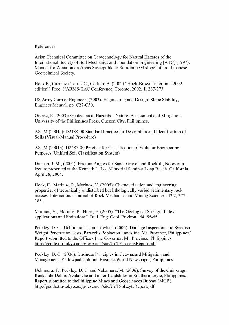
References: Asian Technical Committee on Geotechnology for Natural Hazards of the International Society of Soil Mechanics and Foundation Engineering [ATC] (1997): Manual for Zonation on Areas Susceptible to Rain-induced slope failure. Japanese Geotechnical Society. Hoek E., Carranza-Torres C., Corkum B. (2002) “Hoek-Brown criterion – 2002 edition”. Proc. NARMS-TAC Conference, Toronto, 2002, 1, 267-273. US Army Corp of Engineers (2003). Engineering and Design: Slope Stability, Engineer Manual, pp. C27-C30. Orense, R. (2003): Geotechnical Hazards – Nature, Assessment and Mitigation. University of the Philippines Press, Quezon City, Philippines. ASTM (2004a): D2488-00 Standard Practice for Description and Identification of Soils (Visual-Manual Procedure) ASTM (2004b): D2487-00 Practice for Classification of Soils for Engineering Purposes (Unified Soil Classification System) Duncan, J. M., (2004): Friction Angles for Sand, Gravel and Rockfill, Notes of a lecture presented at the Kenneth L. Lee Memorial Seminar Long Beach, California April 28, 2004. Hoek, E., Marinos, P., Marinos, V. (2005): Characterization and engineering properties of tectonically undisturbed but lithologically varied sedimentary rock masses. International Journal of Rock Mechanics and Mining Sciences, 42/2, 277-285. Marinos, V., Marinos, P., Hoek, E. (2005): “The Geological Strength Index: applications and limitations”. Bull. Eng. Geol. Environ., 64, 55-65. Peckley, D. C., Uchimura, T. and Towhata (2006): Damage Inspection and Swedish Weight Penetration Tests, Paracelis Poblacion Landslide, Mt. Province, Philippines,’ Report submitted to the Office of the Governor, Mt. Province, Philippines. http://geotle.t.u-tokyo.ac.jp/research/site/UoTParacelisReport.pdf. Peckley, D. C. (2006): Business Principles in Geo-hazard Mitigation and Management. Yellowpad Column, BusinessWorld Newspaper, Philippines. Uchimura, T., Peckley, D. C. and Nakamura, M. (2006): Survey of the Guinsaugon Rockslide-Debris Avalanche and other Landslides in Southern Leyte, Philippines. Report submitted to thePhilippine Mines and Geosciences Bureau (MGB). http://geotle.t.u-tokyo.ac.jp/research/site/UoTSoLeyteReport.pdf

Hoek, E. and Marinos, P. (2007): A brief history of the development of the Hoek-Brown failure criterion. Soils and Rocks, No. 2, November 2007. Rocscience Inc., (2007): RocLab User’s Guide.

Photos
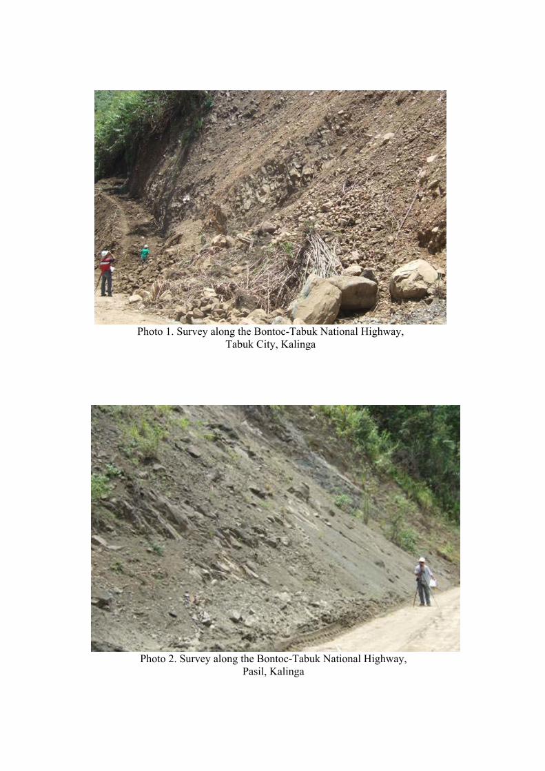
Photo 1. Survey along the Bontoc-Tabuk National Highway,
Tabuk City, Kalinga
Photo 2. Survey along the Bontoc-Tabuk National Highway, Pasil, Kalinga
Photo 3. Imminent landslide inspection in Bgy. Bun-ayan, Sabangan, Mt. Province with community members and elders; cracked drainage canal at foreground
Photo 4. Geotechnical testing upslope of the Kayan East Landslide (39 fatalities), Tadian, Mt. Province; performed together with Kayan East community members
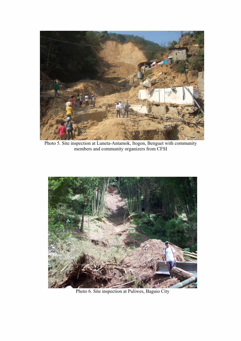
Photo 5. Site inspection at Luneta-Antamok, Itogon, Benguet with community members and community organizers from CFSI
Photo 6. Site inspection at Puliwes, Baguio City
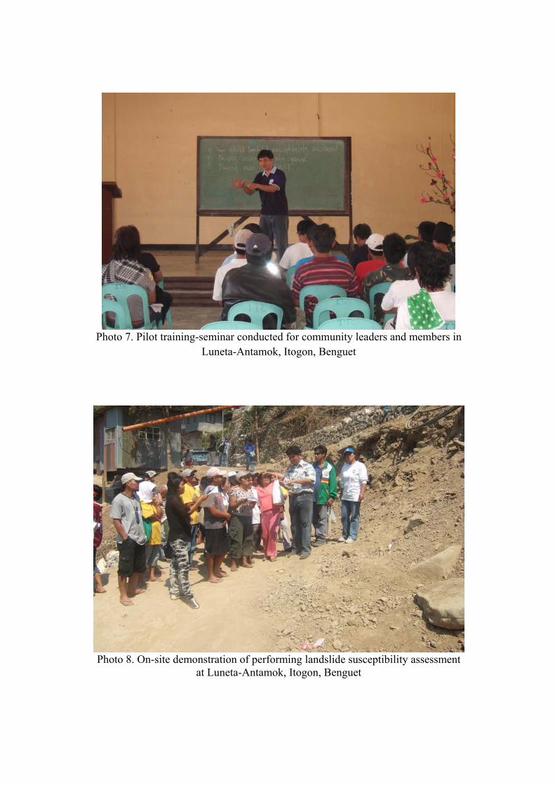
Photo 7. Pilot training-seminar conducted for community leaders and members in
Luneta-Antamok, Itogon, Benguet
Photo 8. On-site demonstration of performing landslide susceptibility assessment
at Luneta-Antamok, Itogon, Benguet
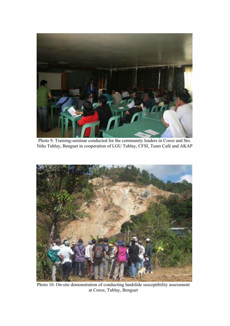
Photo 9. Training-seminar conducted for the community leaders in Coroz and Sto.
Niño Tublay, Benguet in cooperation of LGU Tublay, CFSI, Team Café and AKAP
Photo 10. On-site demonstration of conducting landslide susceptibility assessment at Coroz, Tublay, Benguet
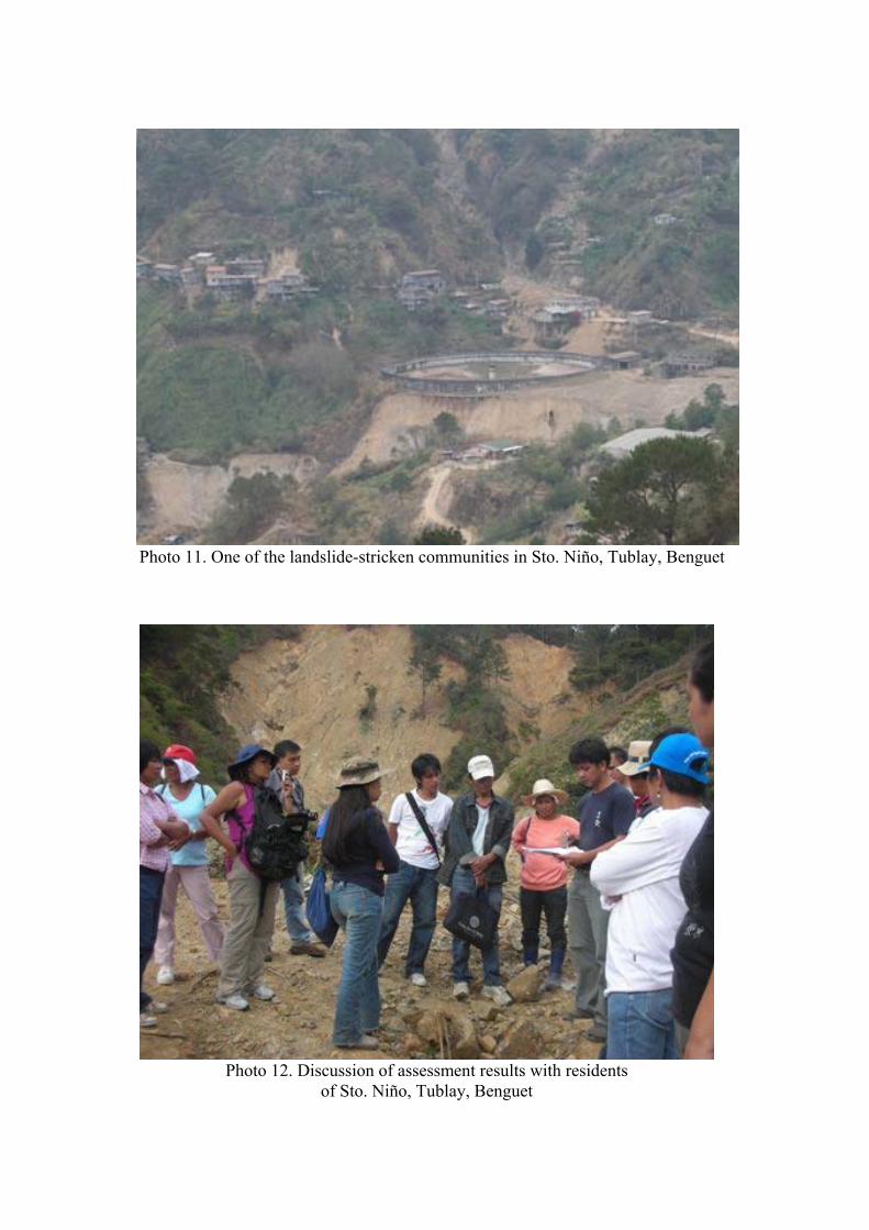
Photo 11. One of the landslide-stricken communities in Sto. Niño, Tublay, Benguet
Photo 12. Discussion of assessment results with residents
of Sto. Niño, Tublay, Benguet
Photo 13. Training-seminar conducted for the community members and leaders
of Labey, Bokod, Benguet in cooperation of CorDis RDS
Photo 14. On-site demonstration of conducting landslide susceptibility assessment
at Labey, Bokod, Benguet
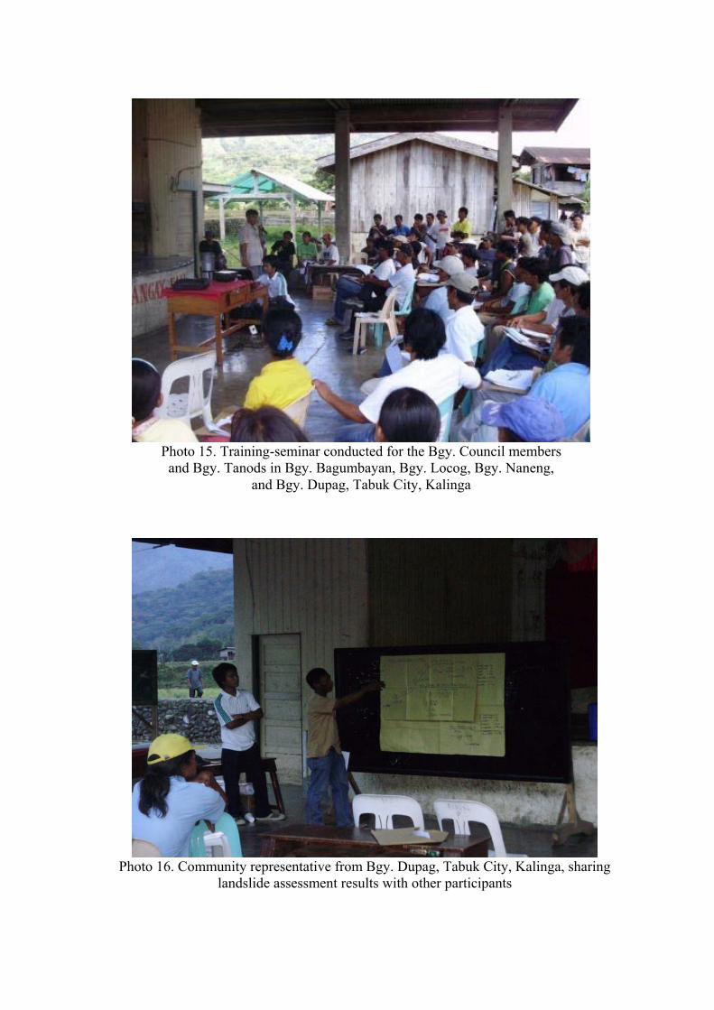
Photo 15. Training-seminar conducted for the Bgy. Council members and Bgy. Tanods in Bgy. Bagumbayan, Bgy. Locog, Bgy. Naneng,
and Bgy. Dupag, Tabuk City, Kalinga
Photo 16. Community representative from Bgy. Dupag, Tabuk City, Kalinga, sharing
landslide assessment results with other participants
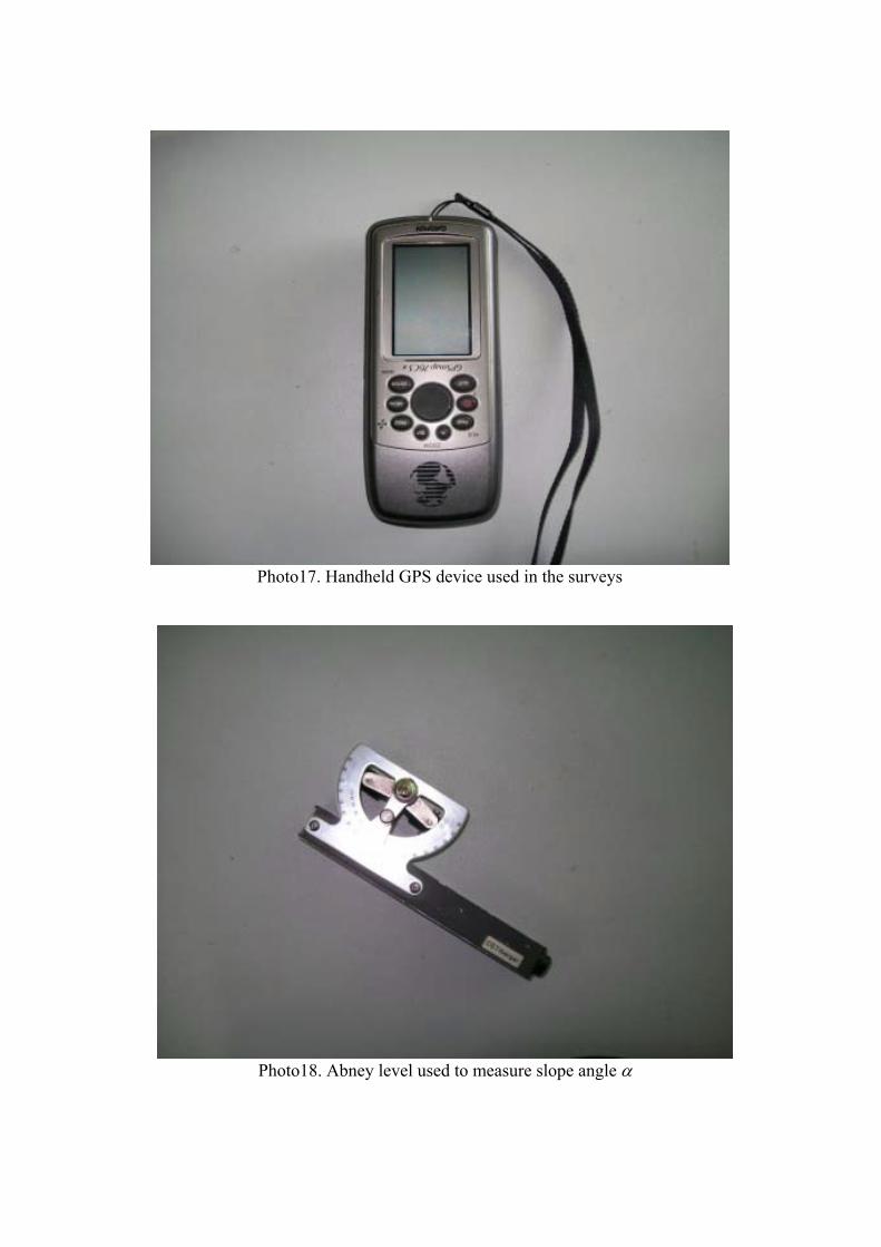
Photo17. Handheld GPS device used in the surveys
Photo18. Abney level used to measure slope angle
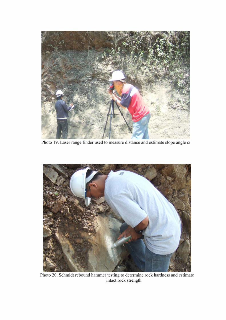
Photo 19. Laser range finder used to measure distance and estimate slope angle
Photo 20. Schmidt rebound hammer testing to determine rock hardness and estimate
intact rock strength
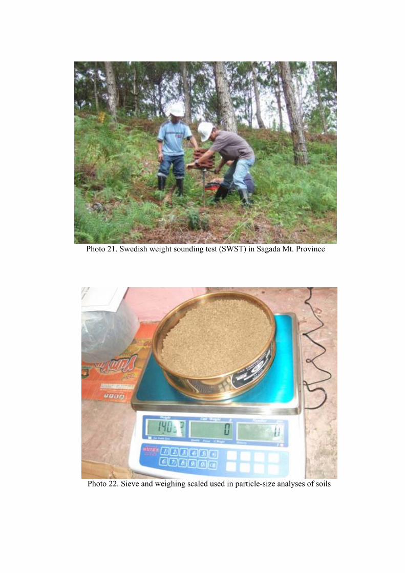
Photo 21. Swedish weight sounding test (SWST) in Sagada Mt. Province
Photo 22. Sieve and weighing scaled used in particle-size analyses of soils
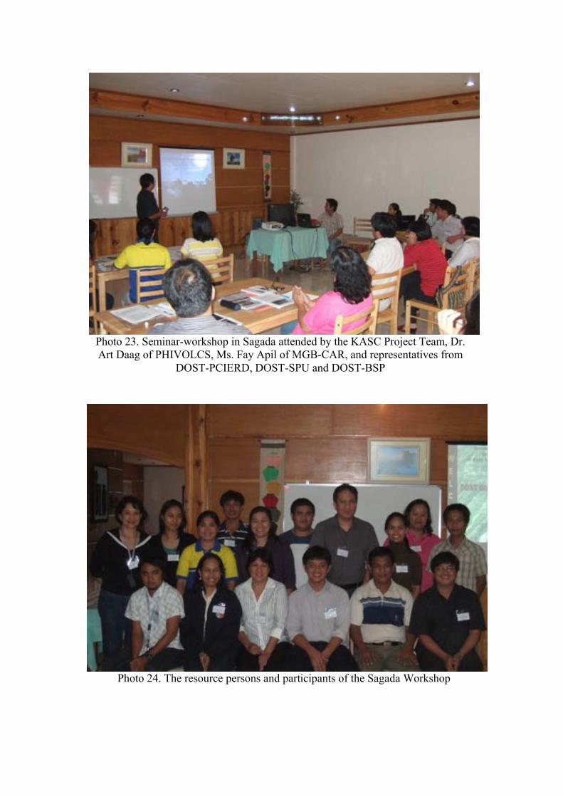
Photo 23. Seminar-workshop in Sagada attended by the KASC Project Team, Dr. Art Daag of PHIVOLCS, Ms. Fay Apil of MGB-CAR, and representatives from
DOST-PCIERD, DOST-SPU and DOST-BSP
Photo 24. The resource persons and participants of the Sagada Workshop

Figures
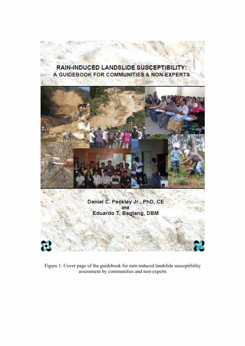
Figure 1. Cover page of the guidebook for rain-induced landslide susceptibility assessment by communities and non-experts
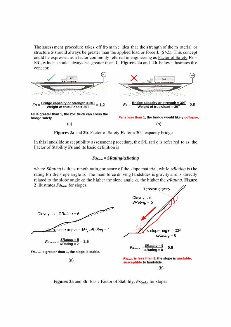
The assess ment procedure takes off fro m th e idea that the s trength of the m aterial or structure S should always be greater than the applied load or force L (S>L). This concept could be expressed as a factor commonly referred in engineering as Factor of Safety Fs = S/L, w hich should always b e greater th an 1. Figures 2a and 2b below i llustrates th e concept:
In th is l andslide su sceptibility a ssessment p rocedure, th e S/L rati o is refer red to as the Factor of Stability Fs and its basic definition is
Fsbasic= SRating/Rating where SRating is the strength rating or score of the slope material, while Rating is t he rating for the slope angle . The main force dr iving landslides is gravity and is directly related to the slope angle ; the higher the slope angle , the higher the Rating. Figure 2 illustrates Fsbasic for slopes.
Fs is greater than 1, the 25T truck can cross the bridge safely.
(a)
Bridge capacity or strength = 30T Weight of truck/load = 25T
Fs = = 1.2
Fs is less than 1, the bridge would likely collapse.
(b)
Bridge capacity or strength = 30T Weight of truck/load = 36T
Fs = = 0.8
Figures 2a and 2b. Factor of Safety Fs for a 30T-capacity bridge
Fsbasic is greater than 1, the slope is stable.
(a)
Fsbasic is less than 1, the slope is unstable, susceptible to landslide.
(b)
SRating = 5 Rating = 2
Fsbasic = = 2.5
Figures 3a and 3b. Basic Factor of Stability, Fsbasic, for slopes
SRating = 5 Rating = 8
Fsbasic = = 0.6

Charts
Chart 1. Data distribution for each range of Fs and sites that failed
Chart 2. Distribution according to slope material and sites that failed
Population
Sites that failed
Population
Sites that failed
No.
of
site
s N
o. o
f si
tes
Slope material designation
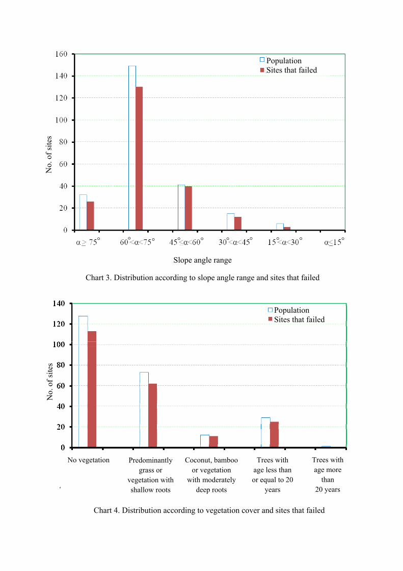
Slope angle range
Chart 3. Distribution according to slope angle range and sites that failed
Chart 4. Distribution according to vegetation cover and sites that failed
No vegetation Predominantly grass or
vegetation with shallow roots
Coconut, bamboo or vegetation
with moderately deep roots
Trees with age less than or equal to 20
years
Trees with age more
than 20 years
Population Sites that failed
Population Sites that failed
° ° ° °° ° °°°°_ _ _ _ _ _
No.
of
site
s N
o. o
f si
tes
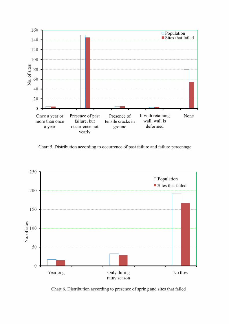
Chart 5. Distribution according to occurrence of past failure and failure percentage
Chart 6. Distribution according to presence of spring and sites that failed
Once a year or more than once
a year
Presence of past failure, but
occurrence not yearly
Presence of tensile cracks in
ground
If with retaining wall, wall is
deformed
None
Population Sites that failed
Population
Sites that failed
No.
of
site
s N
o. o
f si
tes
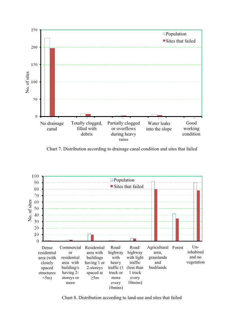
Chart 7. Distribution according to drainage canal condition and sites that failed
Chart 8. Distribution according to land-use and sites that failed
No drainage canal
Totally clogged, filled with
debris
Partially clogged or overflows during heavy
rains
Water leaks into the slope
Good working condition
Dense residential area (with
closely spaced
structures <5m)
Commercial or
residential area with building/s having 2-storeys or
more
Residential area with buildings
having 1 or 2-storeys spaced at ≥5m
Road/ highway
with heavy
traffic (1 truck or
more every
10mins)
Road/ highway with light
traffic (less than 1 truck every
10mins)
Agricultural area,
grasslands and
bushlands
Forest Un-inhabited
and no vegetation
Population
Sites that failed
PopulationSites that failed
No.
of
site
s N
o. o
f si
tes

Tables
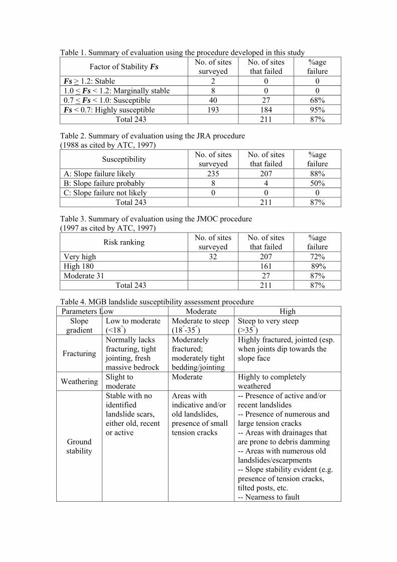
Table 1. Summary of evaluation using the procedure developed in this study
Factor of Stability Fs No. of sites surveyed
No. of sites that failed
%age failure
Fs > 1.2: Stable 2 0 0 1.0 < Fs < 1.2: Marginally stable 8 0 0 0.7 < Fs < 1.0: Susceptible 40 27 68% Fs < 0.7: Highly susceptible 193 184 95%
Total 243 211 87% Table 2. Summary of evaluation using the JRA procedure (1988 as cited by ATC, 1997)
Susceptibility No. of sites surveyed
No. of sites that failed
%age failure
A: Slope failure likely 235 207 88% B: Slope failure probably 8 4 50% C: Slope failure not likely 0 0 0
Total 243 211 87% Table 3. Summary of evaluation using the JMOC procedure (1997 as cited by ATC, 1997)
Risk ranking No. of sites surveyed
No. of sites that failed
%age failure
Very high 32 207 72% High 180 161 89% Moderate 31 27 87%
Total 243 211 87% Table 4. MGB landslide susceptibility assessment procedure Parameters Low Moderate High
Slope gradient
Low to moderate (<18°)
Moderate to steep (18°-35°)
Steep to very steep (>35°)
Fracturing
Normally lacks fracturing, tight jointing, fresh massive bedrock
Moderately fractured; moderately tight bedding/jointing
Highly fractured, jointed (esp. when joints dip towards the slope face
Weathering Slight to moderate
Moderate Highly to completely weathered
Ground stability
Stable with no identified landslide scars, either old, recent or active
Areas with indicative and/or old landslides, presence of small tension cracks
-- Presence of active and/or recent landslides -- Presence of numerous and large tension cracks -- Areas with drainages that are prone to debris damming -- Areas with numerous old landslides/escarpments -- Slope stability evident (e.g. presence of tension cracks, tilted posts, etc. -- Nearness to fault
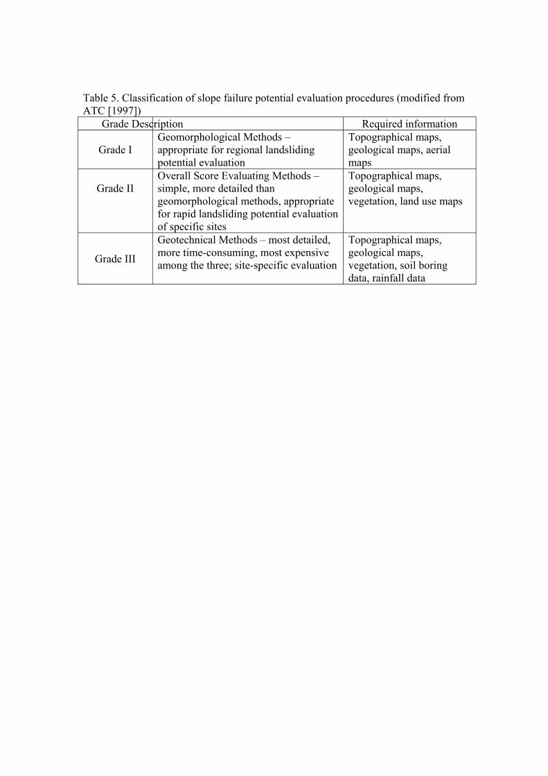
Table 5. Classification of slope failure potential evaluation procedures (modified from ATC [1997])
Grade Description Required information
Grade I Geomorphological Methods – appropriate for regional landsliding potential evaluation
Topographical maps, geological maps, aerial maps
Grade II
Overall Score Evaluating Methods – simple, more detailed than geomorphological methods, appropriate for rapid landsliding potential evaluation of specific sites
Topographical maps, geological maps, vegetation, land use maps
Grade III
Geotechnical Methods – most detailed, more time-consuming, most expensive among the three; site-specific evaluation
Topographical maps, geological maps, vegetation, soil boring data, rainfall data
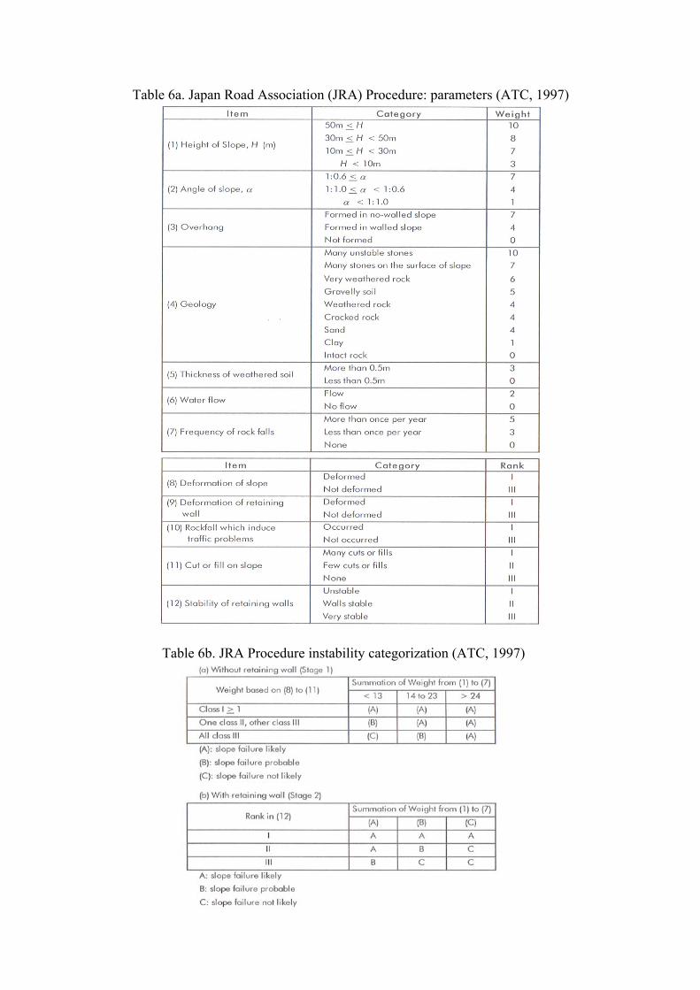
Table 6a. Japan Road Association (JRA) Procedure: parameters (ATC, 1997)
Table 6b. JRA Procedure instability categorization (ATC, 1997)
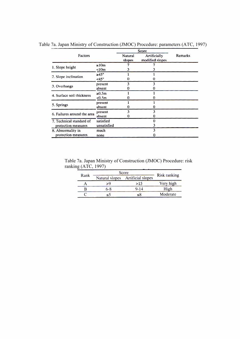
Table 7a. Japan Ministry of Construction (JMOC) Procedure: parameters (ATC, 1997)
Table 7a. Japan Ministry of Construction (JMOC) Procedure: risk ranking (ATC, 1997)
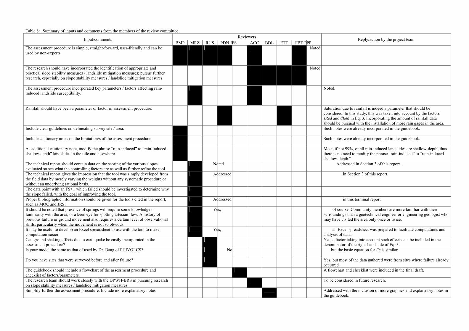
Table 8a. Summary of inputs and comments from the members of the review committee Reviewers Input/comments
BMP MRZ RUS PDN JFS ACC BDL FTT FBT PPP Reply/action by the project team
The assessment procedure is simple, straight-forward, user-friendly and can be used by non-experts.
Noted.
The research should have incorporated the identification of appropriate and practical slope stability measures / landslide mitigation measures; pursue further research, especially on slope stability measures / landslide mitigation measures.
Noted.
The assessment procedure incorporated key parameters / factors affecting rain-induced landslide susceptibility.
Noted.
Rainfall should have been a parameter or factor in assessment procedure. Saturation due to rainfall is indeed a parameter that should be considered. In this study, this was taken into account by the factors sRed and dRed in Eq. 3. Incorporating the amount of rainfall data should be pursued with the installation of more rain gages in the area.
Include clear guidelines on delineating survey site / area.
Such notes were already incorporated in the guidebook.
Include cautionary notes on the limitation/s of the assessment procedure.
Such notes were already incorporated in the guidebook.
As additional cautionary note, modify the phrase “rain-induced” to “rain-induced shallow-depth” landslides in the title and elsewhere.
Most, if not 99%, of all rain-induced landslides are shallow-depth, thus there is no need to modify the phrase “rain-induced” to “rain-induced shallow-depth.”
The technical report should contain data on the scoring of the various slopes evaluated so see what the controlling factors are as well as further refine the tool.
Noted. Addressed in Section 3 of this report.
The technical report gives the impression that the tool was simply developed from the field data by merely varying the weights without any systematic procedure or without an underlying rational basis.
Addressed in Section 3 of this report.
The data point with an FS>1 which failed should be investigated to determine why the slope failed, with the goal of improving the tool.
Proper bibliographic information should be given for the tools cited in the report, such as MOC and JRS.
Addressed in this terminal report.
It should be noted that presence of springs will require some knowledge or familiarity with the area, or a keen eye for spotting artesian flow. A history of previous failure or ground movement also requires a certain level of observational skills, particularly when the movement is not so obvious.
Yes, of course. Community members are more familiar with their surroundings than a geotechnical engineer or engineering geologist who may have visited the area only once or twice.
It may be useful to develop an Excel spreadsheet to use with the tool to make computation easier.
Yes, an Excel spreadsheet was prepared to facilitate computations and analysis of data.
Can ground shaking effects due to earthquake be easily incorporated in the assessment procedure?
Yes, a factor taking into account such effects can be included in the denominator of the right-hand side of Eq. 3.
Is your model the same as that of used by Dr. Daag of PHIVOLCS?
No, but the basic equation for Fs is similar.
Do you have sites that were surveyed before and after failure? Yes, but most of the data gathered were from sites where failure already occurred.
The guidebook should include a flowchart of the assessment procedure and checklist of factors/parameters.
A flowchart and checklist were included in the final draft.
The research team should work closely with the DPWH-BRS in pursuing research on slope stability measures / landslide mitigation measures.
To be considered in future research.
Simplify further the assessment procedure. Include more explanatory notes. Addressed with the inclusion of more graphics and explanatory notes in the guidebook.
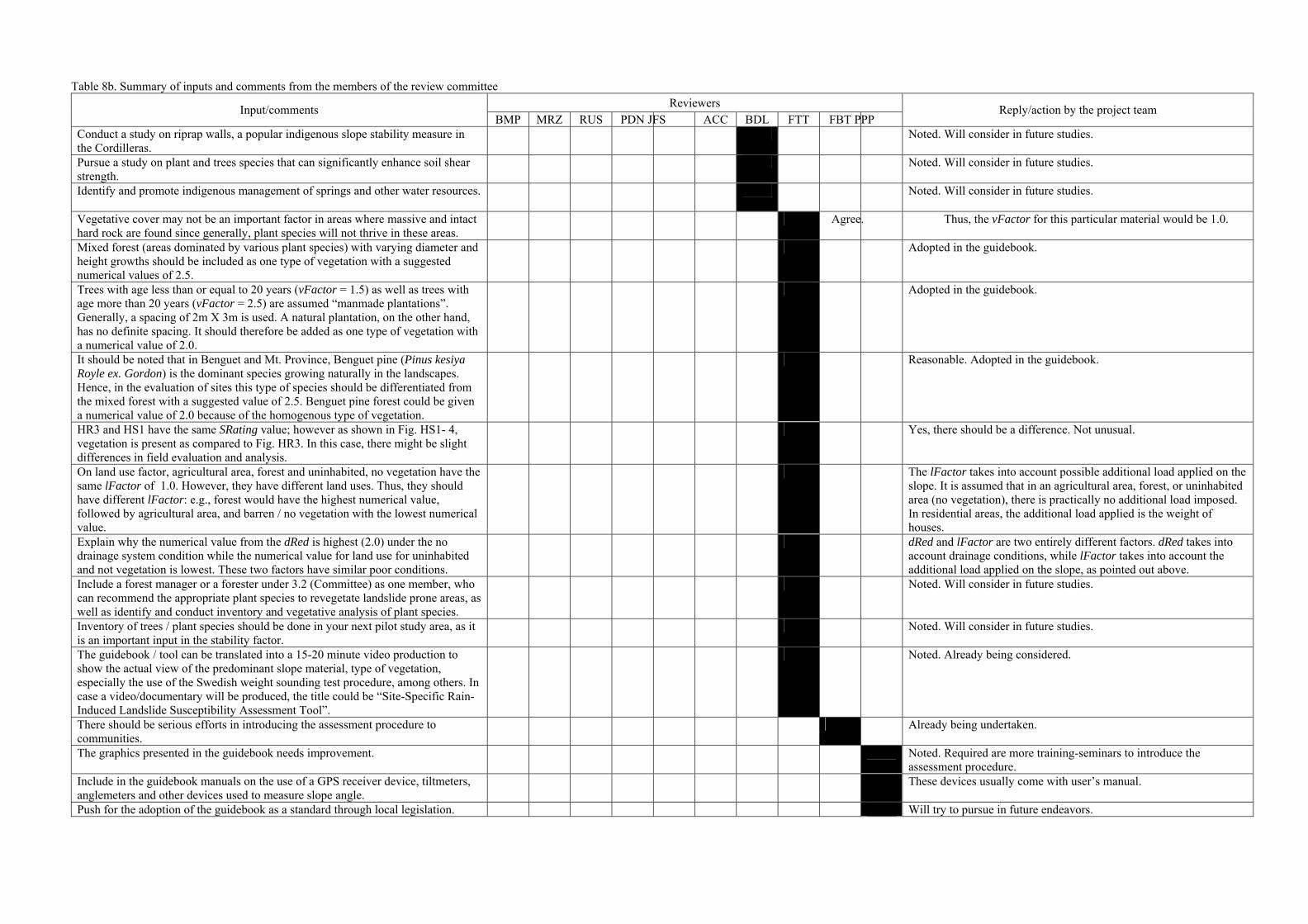
Table 8b. Summary of inputs and comments from the members of the review committee Reviewers Input/comments
BMP MRZ RUS PDN JFS ACC BDL FTT FBT PPP Reply/action by the project team
Conduct a study on riprap walls, a popular indigenous slope stability measure in the Cordilleras.
Noted. Will consider in future studies.
Pursue a study on plant and trees species that can significantly enhance soil shear strength.
Noted. Will consider in future studies.
Identify and promote indigenous management of springs and other water resources.
Noted. Will consider in future studies.
Vegetative cover may not be an important factor in areas where massive and intact hard rock are found since generally, plant species will not thrive in these areas.
Agree. Thus, the vFactor for this particular material would be 1.0.
Mixed forest (areas dominated by various plant species) with varying diameter and height growths should be included as one type of vegetation with a suggested numerical values of 2.5.
Adopted in the guidebook.
Trees with age less than or equal to 20 years (vFactor = 1.5) as well as trees with age more than 20 years (vFactor = 2.5) are assumed “manmade plantations”. Generally, a spacing of 2m X 3m is used. A natural plantation, on the other hand, has no definite spacing. It should therefore be added as one type of vegetation with a numerical value of 2.0.
Adopted in the guidebook.
It should be noted that in Benguet and Mt. Province, Benguet pine (Pinus kesiya Royle ex. Gordon) is the dominant species growing naturally in the landscapes. Hence, in the evaluation of sites this type of species should be differentiated from the mixed forest with a suggested value of 2.5. Benguet pine forest could be given a numerical value of 2.0 because of the homogenous type of vegetation.
Reasonable. Adopted in the guidebook.
HR3 and HS1 have the same SRating value; however as shown in Fig. HS1- 4, vegetation is present as compared to Fig. HR3. In this case, there might be slight differences in field evaluation and analysis.
Yes, there should be a difference. Not unusual.
On land use factor, agricultural area, forest and uninhabited, no vegetation have the same lFactor of 1.0. However, they have different land uses. Thus, they should have different lFactor: e.g., forest would have the highest numerical value, followed by agricultural area, and barren / no vegetation with the lowest numerical value.
The lFactor takes into account possible additional load applied on the slope. It is assumed that in an agricultural area, forest, or uninhabited area (no vegetation), there is practically no additional load imposed. In residential areas, the additional load applied is the weight of houses.
Explain why the numerical value from the dRed is highest (2.0) under the no drainage system condition while the numerical value for land use for uninhabited and not vegetation is lowest. These two factors have similar poor conditions.
dRed and lFactor are two entirely different factors. dRed takes into account drainage conditions, while lFactor takes into account the additional load applied on the slope, as pointed out above.
Include a forest manager or a forester under 3.2 (Committee) as one member, who can recommend the appropriate plant species to revegetate landslide prone areas, as well as identify and conduct inventory and vegetative analysis of plant species.
Noted. Will consider in future studies.
Inventory of trees / plant species should be done in your next pilot study area, as it is an important input in the stability factor.
Noted. Will consider in future studies.
The guidebook / tool can be translated into a 15-20 minute video production to show the actual view of the predominant slope material, type of vegetation, especially the use of the Swedish weight sounding test procedure, among others. In case a video/documentary will be produced, the title could be “Site-Specific Rain-Induced Landslide Susceptibility Assessment Tool”.
Noted. Already being considered.
There should be serious efforts in introducing the assessment procedure to communities.
Already being undertaken.
The graphics presented in the guidebook needs improvement. Noted. Required are more training-seminars to introduce the assessment procedure.
Include in the guidebook manuals on the use of a GPS receiver device, tiltmeters, anglemeters and other devices used to measure slope angle.
These devices usually come with user’s manual.
Push for the adoption of the guidebook as a standard through local legislation. Will try to pursue in future endeavors.