Embed Size (px)
Citation preview

Department of Geological Sciences California State University, Fullerton
Fullerton Arboretum
Wednesday, April 26, 2017

The Department of Geological Sciences at California State University, Fullerton is an interdisciplinary education and research community whose members are active mentors and role-models. Our mission is to provide a student-centered educational and research experience that emphasizes critical thinking, communication, and scientific citizenship.
‘Research Day’ is an extension of this mission, where students are afforded the
opportunity to share their research findings and scientific experiences with faculty, student peers, friends, family, and members of the professional geological community in an informal and supportive environment. Thank you for participating in this year’s event!


8th Annual Geology Research Day California State University, Fullerton
Department of Geological Sciences Fullerton Arboretum
April 26, 2017
Abstract Volume Table of Contents
Undergraduate BA/BS Proposal Category Linking Marine and Terrestrial Processes to the Evolution of a Mid-shelf Mudbelt: An
Investigation of the Salinas River Mudbelt, Central California, USA
Student: Jamie Hayward1
Faculty Advisor: Dr. Joe Carlin
Investigation and Monitoring the Spread of Water Contaminates Using an Open Source Database
in the Orange County Area
Student: Adam Meadows1
Faculty Advisor: Dr. W. Richard Laton
Investigating the causes of compositional variation in the Half Dome granodiorite unit of the
Tuolumne Intrusive Complex, Yosemite National Park, California: Big or small magma chambers?
Student: John Ayers2
Faculty Advisor: Dr. Vali Memeti
Ground source heat pump potential characterization for California State University Fullerton
Student: Adrian Escobar
Faculty Advisor: Dr. W. Richard Laton
Geochemical and Petrographic Analysis of Salt Dome Associated Calcite Phases in Gulf Coast Cap
Rocks: Implications for Carbon Sources and Paragenetic Evolution
Student: Connor Frederickson
Faculty Advisor: Dr. Sean Loyd
Investigating volcanic and plutonic connections in the Iron Mountain Pendant, Sierra National
Forest, CA
Student: Sabrina Green
Faculty Advisor: Dr. Valbone Memeti
Modeling Groundwater Contamination Using an EMriver Process Simulator
Student: Michelle Manzano2
Faculty Advisor: Dr. Natalie Bursztyn
Interpreting Recent Stratigraphic Changes for the Northern Monterey Bay Continental Shelf
Student: Victoria Severin
Faculty Advisor: Dr. Joe Carlin
Reanalysis of late Miocene walruses from the Eastern Pacific based on new specimens from the
Empire Formation of Oregon and their affinities to specimens from Orange County, California Student: Shooka Shahbazi2
Faculty Advisor: Dr. James F. Parham
Earthquake Modeling and the Effects on California State University, Fullerton Campus Using
Fema’s Hazus Program
Student: Josh Vanderwal
Faculty Advisor: Dr. W. Richard Laton
Manageable Molecular Mineralogy: Developing a User-Friendly Interactive Mineralogy Game for
Mobile Devices
Student: Leah Marie Wiitablake
Faculty Advisor: Dr. Natalie Bursztyn
On Campus Rock Garden as a Teaching Aid for Geoscience Students
Student: Anthony Mistretta
Faculty Advisor: Dr. Sinan Akciz
Undergraduate BA/BS Thesis Category Recent Sedimentation along Intertidal Mudflats within an Urban Estuary
Student: Dulce Cortez1,2
Faculty Advisor: Dr. Joe Carlin
A Paleoecology of Late Pleistocene Oyster Beds, San Pedro, California
Student: Jolene Ditmar1,2
Faculty Advisor: Dr. Nicole Bonuso
Investigating Variations in Holocene Sedimentation along the Monterey Bay Continental Shelf
Student: Kevin Hunter1
Faculty Advisor: Dr. Joseph Carlin
What motivates questionable interactions between humans and protected lands that result in
destructive behavior?
Student: Angelic Perez1
Faculty Adviser: Dr. Natalie Bursztyn
The Development and Study of Earth Science Lessons in Kindergarten Classrooms
Student: Annaimee Aguilar2
Faculty Advisor: Dr. Natalie Bursztyn
Analysis of 13 years of Data Collection: Water Pressure and Chemical Changes from Well CSF-1,
Fullerton, CA
Student: Terrinda Alonzo2
Faculty Advisor: Dr. W. Richard Laton
Sulfur Isotopic Composition of Anhydrite in the Salt Stock and Cap Rock of Gulf Coast Salt Domes
Student: Kaelin Andelin
Faculty Advisor: Dr. Sean Loyd
Examining the Geochemical Relationships between the Twentynine Palms and Queen Mountain
Plutons in Joshua Tree National Park
Student: Alexander Arita2
Faculty Advisor: Dr. Vali Memeti
Basalt Correlation in the Sylvania Mountains, California, by X-ray Fluorescence Spectroscopy
(XRF)
Student: Shayna Avila
Faculty Advisor: Dr. Jeffrey R. Knott
Applying Laser-induced Breakdown Spectroscopy to Geologic Provenance Studies
Student: Eduardo Chavez
Faculty Advisor: Dr. Vali Memeti
Petrography and Geochemistry of Suspected Hunter Mountain Batholith Clasts, Death Valley
Student: Emma Griffie
Faculty Advisor: Dr. Jeffrey Knott
Investigating the Volcanic-Plutonic Connection Using Geochemistry in the Minarets Caldera,
Eastern Central Sierra Nevada Mountain Range, California
Student: Evelyn Gutierrez
Faculty Advisor: Dr. Vali Memeti
Yosemite: Teaching the Impacts of Climate Change Through a Virtual Field Trip Student: Joseph Gutierrez2
Faculty Advisor: Dr. Natalie Bursztyn
Playing in the Sand: The AR Sandbox as an Interactive Topographic Lesson
Student: Danielle Jackson
Faculty Advisor: Dr. Natalie Bursztyn
Basalt Correlations across the Fish Lake Valley Fault Zone, CA/NV Using X-Ray Fluorescence
Student: Eddie Jimenez2
Faculty Advisor: Dr. Jeffrey Knott
Geochemical Analysis of Ubehebe Hills and related basalts, Northern Death Valley
Student: Grant G. Kennis
Faculty Advisor: Dr. Jeffrey R. Knott
Identifying Paleoseismic Events along Newport Inglewood Fault Zone from Salt Marsh
Stratigraphy
Student: Ryutaro Koga
Faculty Advisor: Dr. Joe Carlin
Geochemical and Petrographic Relations Between Mafic Intrusions in Post-Peach Spring Tuff
Deposits in the Southern Black Mountains, Meadow Creek Basin, Near Oatman, Arizona
Student: Veronica Smith
Faculty Advisor: Dr. Diane Clemens-Knott

Are Southern California Salt Marshes Keeping Pace with Sea Level Rise? An Investigation of Salt
Marsh Sedimentation in Upper Newport Bay, CA, USA
Student: Dane Anthony Van Orman
Faculty Advisor: Dr. Joseph Carlin
Examining an Oyster Reef Community from the Late Pleistocene Palos Verdes Sands, Knoll Hill,
San Pedro, California
Student: Walicki, Julian
Faculty Advisor: Dr. Nicole Bonuso
Assessing Pleistocene Sediment from the San Pedro Formation for Oyster Species and Other
Invertebrates to Piece Together the Paleoecology
Student: Maree Kutcher
Faculty Advisor: Dr. Nicole Bonuso
1BA Major 2 Undergraduate Research Fund Funded Student

Graduate Proposal Category
Reconstructing the Paleoseismic History of the Newport-Inglewood Fault Zone Using Marsh
Stratigraphy
Student: Michaela Adler
Faculty Advisor: Dr. Joseph Carlin
New fossil walrus skulls from the Los Angeles Basin shed light on major walrus radiations
Student: Jake Biewer
Faculty Advisor: Dr. James Parham
Southern California coastal wetland evolution: Using the geologic record to understand the shift
from a late Holocene oyster reef to salt marsh
Student: Sarah Dickson
Faculty Advisors: Drs. Joe Carlin and Nicole Bonuso
The Age of the Vaqueros Formation in Laguna Canyon, Orange County, CA
Student: Jared Heuck
Faculty Advisor: Dr. James Parham
Biogenic vs Thermogenic: Determining Native Sulfur Formation Mechanisms in Gulf Coast Salt
Domes Using Multiple Sulfur Isotopes
Student: John Hill
Faculty Advisor: Dr. Sean Loyd
A Geochemical Analysis of Productivity and Oxygenation Following the Permian-Triassic
Extinction Event, Opal Creek, Alberta, Canada
Student: Anthony A. Macias
Faculty Advisor: Dr. Adam Woods
Thermal Infrared Remote Sensing for Water Temperature Assessment along the Santa Ana River
using an Unmanned Aerial Vehicle (UAV) System
Student: Diana Carolina Chacon
Faculty Advisor: Dr. W. Richard Laton
Zoning in Feldspars as Tracers of the Extent of Magma Mixing and Magma Chamber Size in the
Tuolumne Intrusive Complex, Yosemite National Park, CA
Student: Louis Oppenheim
Faculty Advisor: Dr. Vali Memeti
A Determination of the Timing and Consequences of the Late Ordovician Glaciation Using the Ely
Springs Dolomite of East Central California Student: Austin Poncelet
Faculty Advisor: Dr. Adam Woods

Graduate Thesis Category
Geochemistry of phosphatic-shales and associated authigenic minerals of the Miocene Monterey
Formation: Implication for paragenetic evolution
Student: Tony Sandoval
Faculty Advisor: Dr. Sean Loyd
Carbonate Geochemistry of Marine Authigenic Carbonates and Host Sediments: Exploring
Mineral Formation Pathways and Organic Preservation Potential in Modern Sediments
Student: Marissa Smirnoff
Faculty Advisor: Dr. Sean Loyd
From Sheets to Blobs: Implications of Multiple Kuna Crest Hornblende Populations for the Initial
Construction of the Tuolumne Intrusive Complex, Sierra Nevada, CA
Student: Dustin Williams
Faculty Advisor: Dr. Vali Memeti
Research Category
Paper Models to the Rescue: New Exercises for Visualizing and Mapping Geological Structures in
3D Student: Joseph Gutierrez2
Faculty Advisor: Dr. Sinan Akciz
Analysis of vegetation diversity, density and cover on maturing alluvial fan substrates
Adrian Escobar, Maureen Kelley, Andrew Roxas
Faculty Advisors: Dr. Darren Sandquist CSUF and Dr. Jennifer Garrison CSULA
Investigation of the Laguna Cell Beaches Using Lidar and Erosional Examination
Student: Taylor Kennedy
Faculty Advisor: Dr. W. Richard Laton
Subsurface Analysis of Orange County Water District's La Palma Groundwater Recharge Basin in
Anaheim, California
Student: John Paul Masters
Faculty Advisor: Dr. W. Richard Laton
Building an Outdoor Garden for the College of Natural Sciences at CSUF
Student: Grant Kennis
Faculty Advisor: GEOL499L – Independent Research
First Record of Equus Occidentalis from Orange County, California, With Implications for the
Late Pleistocene Distribution of Equus in the American Southwest
Students: Maree Kutcher and Eric Scott
Faculty Advisor: Cooper Center

Undergraduate BA/BS Proposal Category

1
Linking Marine and Terrestrial Processes to the Evolution of a Mid-shelf Mudbelt: An
Investigation of the Salinas River Mudbelt, Central California, USA
Student: Jamie Hayward
Faculty Advisor: Dr. Joe Carlin
Earth’s history is largely recorded within sedimentary rocks. Interpreting this history over any time
scale requires the ability to link stratigraphy to the particular formative processes. The continental
shelf in particular, is a dynamic setting where the stratigraphy is influenced by a combination of
climate, marine, and terrestrial processes. As such, shelf stratigraphy is complex, but can preserve
a valuable record at a much higher resolution than deep sea deposits. Therefore, shallow marine
stratigraphy provides the key to understanding processes that operate on sub-millennial to sub-
decadal time scales. In order to improve interpretations of shallow marine stratigraphic records
however, it is critical to understand which processes influence shelf strata formation over relatively
short geologic time scales. Mid-shelf mud deposits offer the ideal location to study strata
formation. These features are common to continental shelves across a variety of climate and
tectonic settings (high and low latitude shelves and along active and passive margins), and
ultimately provide a significant contribution to the sediment budget of a continental margin during
interglacial periods. This project will utilize the Salinas River Mudbelt (SRM), located along the
central California continental shelf within Monterey Bay, to investigate modern changes in shelf
strata, and directly link those changes to processes from historical observations. The SRM is an
ideal location to study because it links active tectonics to a dynamic climate, driven by El Niño
cycles, that modulate both marine processes (elevated energetic ocean conditions), and terrestrial
(elevated fluvial discharge). Additional complexity stems from anthropogenic activities that can
influence sedimentary responses such as changes in agricultural practices, dam construction, and
nearshore sand mining. We hypothesize that there will be a shift in strata, reflected by changes in
sediment accumulation rates, sediment texture, and sediment source that reflect the combination
of natural climatic cycles and increases in anthropogenic disturbances. To test the hypothesis, we
will collect 5-6 sediment cores, ~ 40 cm long, from the SRM. The cores will be subsampled at 1
cm intervals. To characterize the sediment texture, we will perform grain size analysis on each
sample. Sediment provenance will be determined via X-ray diffraction and X-ray fluorescence. To
determine sedimentation rates, samples will be analyzed for 210Pb and 137Cs activities. These
analyses will increase our understanding of the processes influencing shelf strata formation;
ultimately improving our ability to interpret the stratigraphic record across a variety of time scales.
2
Investigation and Monitoring the Spread of Water Contaminates Using an Open Source
Database in the Orange County Area
Student: Adam Meadows
Faculty Advisor: Dr. W. Richard Laton
Orange County relies on a combination of the Santa Ana River, recycled water, and precipitation
as the main sources for water. Northern Orange County is a heavily industrialized urban area there
is cause for concern about contaminates reaching public water supply wells and risk of spread of
contaminates through the subsurface to groundwater pumps. Contaminants such as Toluene,
Perchlorate, Nitrate, Benzene, Trichloroethylene, and Perchloroethylene will be the focus of this
study. In order to understand the threat that these contaminates impose on local sources of water
supplies in Orange County, this study will be limited to the Fullerton-Placentia-Anaheim area.
Using pre-existing data from open source well databases from Geotracker, Orange County Water
District (OCWD) well data, and Geographical Information Systems (GIS) modeling software,
several three-dimensional models will be produced to map the rate and spread of contaminates
within the subsurface of the study area. I hypothesize that this data can firstly be used to accurately
track the movement of groundwater, and secondly that this open source data can be then modeled
into a three dimensional map showing the rate of spread of contaminates through the subsurface.
Furthermore, this thesis will track the groundwater movement around the OCWD recharge
facilities to identify possible spreading paths of contaminate plumes. This project will help us
understand how ground water moves through Orange County through the subsurface and identify
direct risks to our drinking supply as well as the source of these risks.

3
Investigating the causes of compositional variation in the Half Dome granodiorite unit of
the Tuolumne Intrusive Complex, Yosemite National Park, California: Big or small magma
chambers?
Student: John Ayers
Faculty Advisor: Dr. Vali Memeti
The understanding of the behavior of magmas in deep magma reservoirs (plutons) and their sizes
and what controls their compositional variations provides knowledge on causes of different
volumes and styles of volcanic eruptions, and improve the ability to predict future events. The
subject of this study is to use field mapping and geochemical analyses on the compositional
variation of the Half Dome unit in the Tuolumne Intrusive complex in Yosemite National Park,
California, to shed light on these questions.
The Tuolumne Intrusive Complex is a 1,100 km2 Cretaceous age granitoid intrusion that is
composed of three main units and situated along the eastern crest of the Sierra Nevada Mountains.
Coleman et al. (2012) suggested that the formation of the Half Dome Granodiorite unit in the
western lobe (and by inference the entire Tuolumne Intrusive complex) occurred through a stacked
series of km scale repeating magmatic ‘cycles’ (i.e. sills or laccoliths). These moderately outward
dipping sheet-like bodies display a sharp eastern contact of more mafic composition granodiorite
that gradationally becomes more felsic towards the west due to local fractional crystallization. This
stacked sill-model contrasts with previous models of large magma mush bodies (e.g. Memeti et
al., 2014; Paterson et al., 2016), which suggest that pulses of magma amalgamate to form large
magma chambers whose compositional variation is derived from magma chamber processes, such
as wide-scale fractionation and mixing of magmas. Research in Lyell Canyon of Yosemite
National Park will test the Coleman et al. (2012) and Memeti et al. (2014) models at the eastern
Half Dome granodiorite lobe where compositional variations are observed similar to what is seen
on the west side. Field mapping will determine the orientation and contact relationships as well
as the mineralogy of the compositional variation in the Half Dome unit. XRF whole rock
geochemical analysis on samples gathered from the field locations will be conducted to determine
the magmatic process and the length scale of the process that is responsible for the changes in
composition. Both field and lab data will be used to determine if the magma mush developed sheet-
like as suggested by Coleman et al. (2012) and never formed large magma chambers, or if the size
of interconnected magma mush is rather irregular and can be traced across the whole unit, arguing
for a big magma reservoir.
4
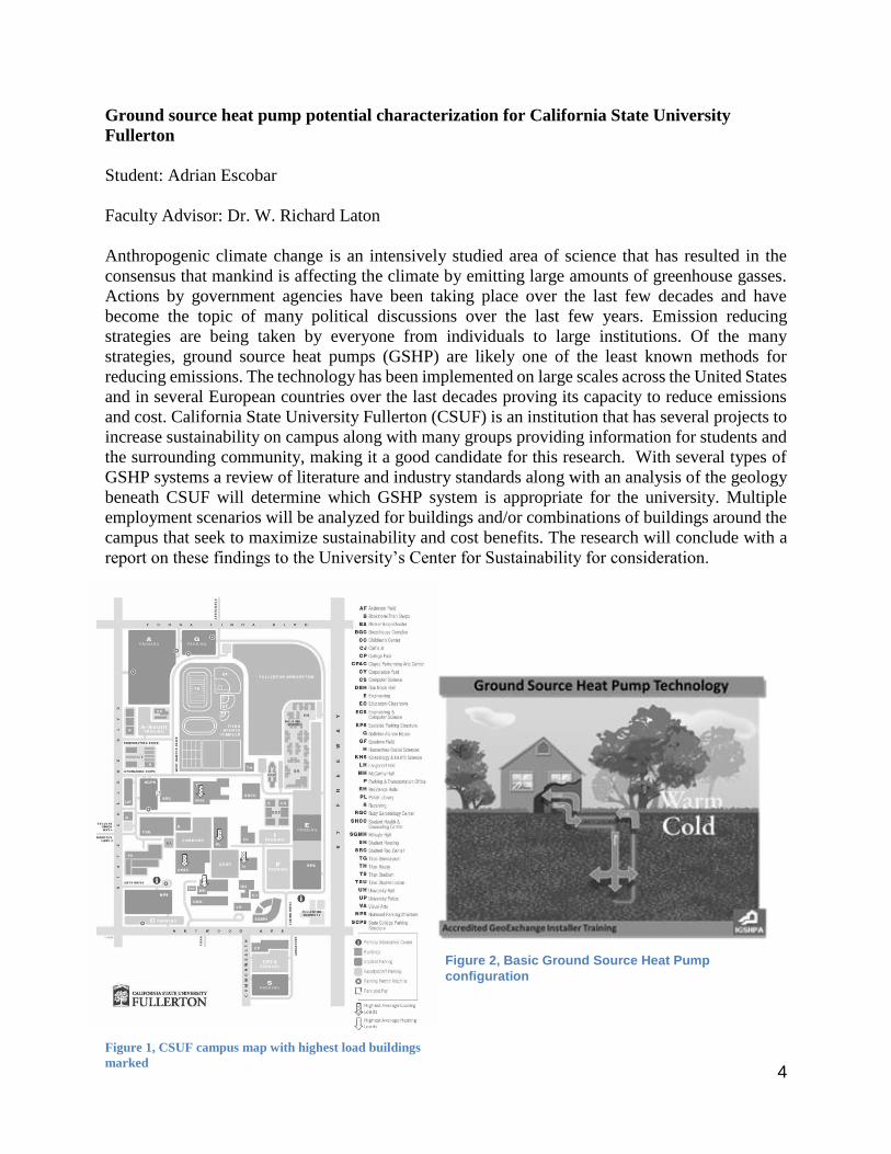
Ground source heat pump potential characterization for California State University
Fullerton
Student: Adrian Escobar
Faculty Advisor: Dr. W. Richard Laton
Anthropogenic climate change is an intensively studied area of science that has resulted in the
consensus that mankind is affecting the climate by emitting large amounts of greenhouse gasses.
Actions by government agencies have been taking place over the last few decades and have
become the topic of many political discussions over the last few years. Emission reducing
strategies are being taken by everyone from individuals to large institutions. Of the many
strategies, ground source heat pumps (GSHP) are likely one of the least known methods for
reducing emissions. The technology has been implemented on large scales across the United States
and in several European countries over the last decades proving its capacity to reduce emissions
and cost. California State University Fullerton (CSUF) is an institution that has several projects to
increase sustainability on campus along with many groups providing information for students and
the surrounding community, making it a good candidate for this research. With several types of
GSHP systems a review of literature and industry standards along with an analysis of the geology
beneath CSUF will determine which GSHP system is appropriate for the university. Multiple
employment scenarios will be analyzed for buildings and/or combinations of buildings around the
campus that seek to maximize sustainability and cost benefits. The research will conclude with a
report on these findings to the University’s Center for Sustainability for consideration.
Figure 1, CSUF campus map with highest load buildings
marked
Figure 2, Basic Ground Source Heat Pump
configuration
5
Geochemical and Petrographic Analysis of Salt Dome Associated Calcite Phases in Gulf
Coast Cap Rocks: Implications for Carbon Sources and Paragenetic Evolution
Student: Connor Frederickson
Faculty Advisor: Dr. Sean Loyd
Salt dome associated calcites of the Gulf of Mexico region exhibit multiple phases with varying
physical properties. These phases are thought to form through microbially mediated chemical
reactions that involve hydrocarbons, which locally accumulate around salt domes. This study seeks
to identify the carbon sources for cap rock calcites from six locations in the Gulf of Mexico: Boling
Dome, Damon Mound, Hockley Dome, Davis Hill Dome, Winnfield Dome and Main Pass Dome.
Samples of multiple calcite phases from each dome will be subjected to carbon isotope analysis.
Comparison among measured calcite carbon isotope and known Gulf Coast hydrocarbon (e.g.,
methane and petroleum) isotope compositions will provide insight into the carbon source(s) for
each calcite phase. Petrographic analysis will be used to characterize spatial relationships among
phases and determine the relative order of precipitation (i.e., paragenetic evolution). These two
sets of data, geochemical and crystallographic, allow for the development of a more complete
description of the evolution of salt dome associated calcites, with an emphasis on temporal
variability in carbon sources. We hypothesize that individual calcite phases precipitate from
distinct sources of carbon, as indicated by unique δ13Ccarb values. Research findings will provide
insight into salt dome related hydrocarbon degradation and microbially mediated mineralization.
6
Investigating volcanic and plutonic connections in the Iron Mountain Pendant,
Sierra National Forest, CA
Student: Sabrina Green
Faculty Advisor: Dr. Valbone Memeti
Volcanic eruptions and associated secondary hazards pose a threat to society on a daily basis, yet
the causes of eruption and what occurs in the magma chamber before and during an eruption is
poorly understood. Volcanoes are connected to deeper plutonic systems of a vertically extensive
magma plumbing; both volcanic and plutonic rocks record magmatic histories that help unravel
the magma processes at depth. The focus research area is the Iron Mountain pendant in the Sierra
Nevada batholith, located northeast of Oakhurst, CA, which exposes both Cretaceous volcanic and
plutonic rocks of what we hypothesize to be coeval in age and thus part of the same plumbing
system. The purpose of this research is to ascertain the rocks are contemporary and to understand
the chemical connection between the volcanic and plutonic rocks in order to help predict volcanic
eruptions in the future.
The goals are to firstly determine the age of the volcanic and plutonic rock units in the area to
make sure the rocks all formed contemporarily and therefore could have belonged to the same
magma plumbing. If this can be established, the geochemical analyses of volcanic and plutonic
rocks will test if the rocks are compositionally equivalent or complementary to one another. If
these different units are complementary in composition, we will conclude that fractional
crystallization of the magma chamber took place. If they are equivalent, then we can deduce that
part of a homogeneous magma chamber was evacuated.
To determine the age of the volcanic and plutonic rocks, zircon separations will be obtained from
the rock samples and used for U-Pb zircon geochronology using the LA-ICPMS technique at the
University of Arizona Laserchron lab. Using a polarizing light microscope, minerals present in the
different rocks will be determined by studying thin sections to investigate if the mineralogy
between volcanic and plutonic rocks is similar or different. Disequilibrium mineral textures will
point to magma mixing before the eruption. Lastly, to also test this hypothesis through
geochemical compositions, one inch homogeneous glass beads will be made from powders of the
rock samples and analyzed with the XRF machine at Pomona College, which will determine major
oxides and trace elements present in both rock types. Petrography and whole rock geochemistry
will help determine whether the system is equivalent or complementary in composition and test if
magmas were fractionated or mixed in the magma chamber before the volcanic rocks erupted.

7
Modeling Groundwater Contamination Using an EMriver Process Simulator
Student: Michelle Manzano
Faculty Advisor: Dr. Natalie Bursztyn
Groundwater is a resource that is important to all living things. It is an integral part of the
hydrologic cycle, which is a complex system that is difficult to understand using a physical or
computer model alone. Simple physical models such as the EMriver table and vertical aquifer
models, which focus on few variables, can be used to help our understanding of water systems.
The variables that can be manipulated on the EMriver table are flow rate and table slope; on the
aquifer model, only flow rate can be controlled. These two physical models can be used to learn
about the movement of contaminants in groundwater. Contamination is a variable that must be
tracked in groundwater in order to maintain federal or state water quality standards and foster life.
In this project an EMriver table and aquifer model will be used to model the movement of
groundwater contamination by changing inputs, such as flow rate and well type. The aquifer model
will show the vertical movement of contaminants through four dye injection wells that represent
wastewater wells. The EMriver table will also contain four wells that are used as wastewater wells.
The wells will be set up similarly to the aquifer model. The time and distance the contaminants
travel will be measured for both models to quantify any change as inputs are adjusted. The
objective of this project is to provide a physical model system that can be used for groundwater
contamination teaching demonstrations and as a visual learning tool for students.
8
Interpreting Recent Stratigraphic Changes for the Northern Monterey Bay Continental
Shelf
Student: Victoria Severin
Faculty Advisor: Dr. Joe Carlin
Continental shelves are dynamic environments that are influenced by marine, terrestrial, and
climatic process. As such, shelf environments can be important recorders of global change,
however there is a lack of understanding about how strata form in continental shelf mud deposits
over short time scales. The goal of this project is to improve our understanding of signal
preservation within shelf stratigraphy over relatively short time scales. To address this problem we
will investigate the Monterey Bay shelf located in central California. Monterey Bay is an ideal
study area because it is dominated by variable, but high sediment loads from small mountainous
rivers, impacted by high-energy wave events from the North Pacific Ocean, and lies at the northern
extent of the influence of El Niño. These factors contribute to a surplus of sediment accumulation
along the mid-shelf mud belt. This accumulation of mud cannot be accounted for by fluvial
sediment supply alone, highlighting the lack of understanding for this system. Moreover,
preliminary data suggests that modern sedimentation has changed over recent decades. This project
seeks to answer the following question: Is the limited preliminary data showing changes in
sedimentation since the 1960s uniform across the northern bay, and what is driving these changes?
We hypothesize that the sedimentation changes are uniform throughout, and that these changes are
primarily climate driven. To test this hypothesis, this summer we plan to collect plan to collect
five to six short (~ 50 cm) cores along the mid-shelf of Northern Monterey Bay to capture ~100-
150 year sedimentation record. The core will be subsampled in 1 cm intervals for short-lived
radionuclides (210Pb and 137Cs) to determine sedimentation rates, and sedimentological
characteristics. Lead-210 is a naturally occurring isotope with ~22 year half-life. It forms in the
atmosphere and seawater, adsorbing onto sediment particles as they sink through the water column.
Cesium-137 is an anthropogenic isotope that was introduced to the environment in the 1950s from
nuclear weapons testing. It provides an independent chronometer to 210Pb by establishing two time
horizons at 1953 and 1963. The sedimentological characteristics we will analyze include: sediment
texture (grain size analysis), and sediment provenance through mineralogical characterization (x-
ray diffraction and/or x-ray fluorescence). By understanding the drivers behind strata formation
on these short time scales, we aim to improve our stratigraphic interpretations throughout geologic
time.
9
Reanalysis of late Miocene walruses from the Eastern Pacific based on new specimens from
the Empire Formation of Oregon and their affinities to specimens from Orange County,
California
Student: Shooka Shahbazi
Faculty Advisor: Dr. James F. Parham
Walruses are represented by a single living species (Odobenus rosmarus) that is restricted to the
Arctic, but from the Miocene to the Pliocene a diversity of fossil odobenids (20 species) are known
throughout the North Pacific. Ongoing studies separates walrus lineage into two radiations, the
early Miocene and late Miocene, based on the description and analysis of a complete walrus
(OCPC 11141, AKA “Waldo”) from Orange County, California housed at the Cooper Center. My
thesis will focus on two walrus skulls collected from the late Miocene Empire Formation of Oregon
that share a striking similarity to the Orange County walrus. The goal of my research will be to: 1)
create scientific descriptions of the Oregon specimens, 2) perform a phylogenetic analysis to
determine the evolutionary relationship of the Oregon specimens to the Orange County specimen
(e.g., are they the same species?), 3) develop a new evolutionary tree to reflect these relationships.
This study will provide a deeper understanding of the evolutionary history and biogeography of
walruses through time.

10
Earthquake Modeling and the Effects on California State University, Fullerton Campus
Using Fema’s Hazus Program
Student: Josh Vanderwal
Faculty Advisor: Dr. W. Richard Laton
The purpose of this thesis is to look at the surrounding faults near California State University,
Fullerton campus and the impact that it can have on the campus buildings. The way to understand
the impact is to first understand the structures that are on campus and their construction. The
construction of the buildings and seismic retrofitting of the buildings will be determined by
communicating with facilities operations and building records for the campus. This data will then
be put into FEMA’s Hazard US, or HAZUS program. This program is used to determine the effects
of natural disasters and can run multiple parameters at once. To better understand the implications
a flood scenario will also be run. The integration of the data will project the events that will unfold
after the rupturing of the different faults that are within proximity of the campus like the Puente
Hills fault system, Whittier Fault and the Newport-Inglewood Fault to some degree. The focus of
the data will be on the library and McCarthy Hall, which are the buildings that are hypothesized
to be at most risk. The results of the simulation will then be used to determine the safety level of
the structures on campus. This is being undertaking due to the 2014 5.1 magnitude fault that
occurred in La Habra near the Puente Hills system that devastated part of the California State
University, Fullerton library and leave it still in a condition of repair. The overall safety of staff
and students on the campus is why simulations like these are run with the appropriate data.

11
Manageable Molecular Mineralogy: Developing a User-Friendly Interactive Mineralogy
Game for Mobile Devices
Student: Leah Marie Wiitablake
Faculty Advisor: Dr. Natalie Bursztyn
In this digital age, pedagogy falls short with methods of teaching mineralogy being stuck in the
past. This project addresses the problem documented in the chemistry community and anecdotal
in the geology community: students cannot visualize crystal structure. In the geoscience
community, there are papers published on students having difficulty with the visualization of
structural geology and ways to solve this problem. However, with respect to molecular mineralogy,
the struggle students have with the material has not been documented. Nonetheless, anecdotally,
there is teacher dissatisfaction with the poor retention of material from mineralogy classes.
Research has found that information relayed through images is retained better than information
relayed through text. In fact, three-dimensional (3D) models and visuals have been shown to be
the most effective methods for teaching and have results of greatest student retention of material.
Due to the great leap in technology in the last decade, reports on the use and effectiveness of virtual
reality and games in education has taken off.
Here we describe the design of an interactive game to teach crystal structure to undergraduates.
Game-like elements engage the user, while touch-manipulated 3D models allow students to play
with the structure of a mineral at the molecular level. Starting from an outcrop and zooming into
minerals, then to individual atoms, students will be able to build different silicate minerals by
rearranging silicon tetrahedra to see how different structures affect the outward appearance of the
crystal. We believe this game will improve student learning of minerals and their structure and
will help bridge the technology gap between the outdated ball and stick models and today’s digital
native undergraduates. By using up-to-date technology we can combine text, audio, video, and
user-manipulated 3D models to better help students understand the molecular world with a game
for mobile smart devices.

12
On Campus Rock Garden as a Teaching Aid for Geoscience Students
Student: Anthony Mistretta
Faculty Advisor: Dr. Sinan Akciz
The lack of readily available hands on learning environments for geoscience students could be a
hinder to their ability to apply skills from the classroom to actual field work. A rock garden with
a geologic emphasis constructed on campus would allow students and professors access to a
valuable resource that can aid in bridging the gap between the classroom and the field. The rock
garden’s theme is based around the rock cycle, and will be organized to show how rocks go through
changes and recycle within the three rock groups (Igneous, Sedimentary, and Metamorphic). The
boulders that make up the garden will be arranged in an oval with the path leading one through the
cycle with signs posted explaining the processes rocks experience along the cycle. This will aid
Geo-101 students by allowing them to see and feel many concepts and structures learnt in class
such as: the differences in types of rocks, igneous/sedimentary/metamorphic textures, volcanic vs.
plutonic, and mineral identification. Geo-380 (Geologic Field Techniques) and Geo-360
(Structural Geology) would use the shale/slate to practice strikes and dips on a real rock surface.
The inclusion of rocks with sedimentary structures and fossiliferous rocks to the garden would be
easily utilized by Geo-321(Sedimentology and Stratigraphy), Geo-333 (Oceanography) and Geo-
322 (Paleontology). Students would be able to practice note taking, compass usage, and drawing
sketches on campus with unlimited access so they can be a lot more efficient in the field, where
they have a limited time frame to comprehend subjects. The addition of a rock garden to the
campus would be beneficial to not just geoscience students of the campus but can also be used by
community college students as a field trip location, and addition of benches will make it nice place
to socialize and take a break.

13
Undergraduate BA/BS Thesis Category

14
Recent Sedimentation along Intertidal Mudflats within an Urban Estuary
Student: Dulce Cortez
Faculty Advisor: Dr. Joe Carlin
In southern California, many of the historic estuarine habitats have been lost as a result of
urbanization. Those that remain are often bound by development that prevents these habitats from
migrating landward with relative sea level rise (RSLR). In these systems therefore, it is critical
that habitats maintain elevation relative to RSLR. In order to maintain elevation, sediment
accumulation will be a critical process. This project investigated recent sedimentation along
mudflats in Upper Newport Bay, an estuary located in Orange County, CA, in order to better
understand seasonal sediment deposition, and long-term sediment accumulation. The goal of this
project was to assess the bay's vulnerability to future RSLR. To accomplish this goal, we collected
sediment cores from three mudflats located throughout the bay in both June and October of 2016.
Sediment samples were analyzed for grain size, total organic matter, and short-lived radioisotopes
(7Be, 210Pb, and 137Cs). The results showed the deepest penetration (~7 cm) of 7Be in June was
observed at the primary channel site. In October at this site however, 7Be was only detected at the
surface, and with overall lower activities. At the mid-estuary site, 7Be penetration was comparable
between seasons, although overall activities were lower. This 7Be data suggest centimeter-scale
deposition over the 2015-2016 winter and spring in the upper and middle reaches of the bay, but
in summer 2016 these sites experienced no-deposition. At the upper bay site not only was it non-
depositional, the data suggests that this site experienced up to 6 cm of erosion. These results
demonstrate that deposition only occurred during the winter (wet-season), and where winter
deposition was the highest, those deposits were nearly completely reworked and redistributed
during the summer (dry-season). In spite of this seasonal deposition/erosion cycles in the upper
reaches of the bay, long-term accumulation rates ranged from ~3 mm/yr to > 5 mm/yr. These rates
are greater than recent estimates of relative RSLR for Newport Bay. Additionally, the results from
the upper bay site also clearly show a cyclical trend in sediment accumulation, with short periods
of higher than average accumulation every couple of years. Preliminary interpretations of these
periods suggest that climate, e.g. El Niño, may be driving these pulses of sedimentation through
time. From this project we conclude that sedimentation throughout the estuary is dynamic on short
time scales, but over time appears to be out-pacing relative RSLR.
15
A Paleoecology of Late Pleistocene Oyster Beds, San Pedro, California
Student: Jolene Ditmar
Faculty Advisor: Dr. Nicole Bonuso
Oyster diversity steadily declined from four species in the Cenozoic to two oyster species in the
Pleistocene. Currently only one native species remains: Ostrea lurida. Biologists attribute the
decline of oyster beds to industrialization and urbanization of southern California. Restoration
efforts continue within southern California but researchers lack the deep-time perspective of oyster
bed community history. Here we examine an oyster paleocommunity to better understand pre-
human oyster habitats by documenting fossil content from the Late Pleistocene Palos Verdes Sands
on Knoll Hill, San Pedro, California and comparing that to oyster data documented by Kelly
Vreeland (2014). Two samples have been wet sieved, sorted and all usable fossils are identified to
the species level and counted. Length and width measurements of all oyster fossils are recorded.
Ostrea lurida accounts for 11.6 % of all taxa recovered from my sample. It is the most abundant
taxa present, with 86.5 individual specimens. Oyster specimens from the other sample only
account for 6.7% of the total taxa determined. Average oyster sizes from both samples are less
than one millimeter in difference. The addition of the Late Pleistocene San Pedro locality oyster
sizes disproves the hypothesis that oyster size decreases through the Quaternary. However, oyster
diversity data from the Late Pleistocene San Pedro locality supports the hypothesis that oyster
diversity decreases post-Miocene.
Vreeland, K. K., 2014, A paleoecological reconstruction of oysters from Orange County,
California: Understanding the past to help restore the future [M.S.: CALIFORNIA
STATE UNIVERSITY, FULLERTON, 140 p.]

16
Investigating Variations in Holocene Sedimentation along the Monterey Bay Continental
Shelf
Student: Kevin Hunter
Faculty Advisor: Dr. Joseph Carlin
Sedimentation on the continental shelf reflects the link between earth processes that occur in the
ocean and on land. Today, climate change, and associated sea level rise is approaching levels
comparable to the early and mid-Holocene, and understanding the changes that have occurred
during the past may help to prepare for the future changes. This project investigated sedimentation
along the Monterey Bay continental shelf throughout the late Holocene utilizing a 370 cm long
core that was collected from a mid-shelf location just north of the Monterey Canyon, proximal to
mouth of the Pajaro River. The sedimentary fabric of the core was analyzed from CT imagery,
while variations in wet bulk density, and sediment texture were also investigated. High-resolution
bulk density was determined from a multi-sensor core logger that was used to convert CT-derived
density data. Sediment texture was determined from grain size analysis using laser diffraction.
Each grain size sample was pre-treated to remove organic matter, carbonates, and biogenic silica
prior to analysis. From these results we identified 4 sedimentary packages. The lowermost package
spans from the base of the core to a depth of 180 cm, and is characterized by relatively high bulk
density (~1.97 g/cm3), is dominantly silty sand, and lacks definitive sedimentary structures. The
overlying package from 179 cm to 85 cm is comprised of distinct alternating layers of silty clay
and sandy silt, with generally low bulk density (~1.76 g/cm3). Above this package (84 cm – 45
cm) is another high density (~1.91 g/cm3), dominantly silty sand unit that lacks sedimentary
structures. The upper core 45 cm of the core is characterized by alternating layers of high (~1.90
g/cm3) and low (~1.60 g/cm3) densities that are dominantly sandy silt and silty sand, respectively.
The lowermost unit represents a shallow marine facies deposited > 11 kya when sea level was
lower. The upper contact of this unit was formed as sea level rose quickly as a result of Meltwater
Pulse 1B. Above this unit, the alternating layers likely reflect climate variations, with the low-
density, silty clay layer (~ 60 cm) corresponding to the Medieval Climate Anomaly. The overlying
coarse layer may correspond to the Little Ice Age. The top of the core represents modern warming,
and a return to increased climate variability. This study reveals how continental shelf
sedimentation records changes in sea level and climate, similar variability as is expected due to
future climate change.

17
What motivates questionable interactions between humans and protected lands that result
in destructive behavior?
Student: Angelic Perez
Faculty Adviser: Dr. Natalie Bursztyn
In the last two years there have been numerous news headlines about questionable interactions
between humans and protected public lands. Examples of these interactions include: destroying
geological structures, vandalizing iconic park landmarks and interfering with wild species. Though
park visitation is encouraged, many visitors damage natural structures and behave illegally during
their visits. Previous research conducted on this topic suggest that visitors recreate within these
parks with little regard for maintaining the act of preservation until the damage done begins to
affect their personal experience. This project aims to better understand the motivation behind
visitors’ illegal and destructive actions by utilizing social science research methods and a
foundation of policy and ethics. Data from the public was collected via a survey designed to
examine both knowledge of rules and personal opinions about behavior within protected public
lands. The survey was administered to students enrolled in classes that relate to National Parks,
and online via social media including Facebook and Instagram. Data from 158 participants was
analyzed using summary statistics to try and answer the question: What are the true motivations
and influences behind the destructive actions against protected natural lands? Results from
true/false questions showed a wide range in participants’ understanding of legal/illegal actions in
public lands with 50-90% accuracy on this part of the survey. 70-73% of participants identified as
extremely unlikely to perform an illegal action on protected public lands. Unfortunately, it is
certain that social desirability bias has convoluted these data. Remaining data on participant
opinions regarding case studies have been analyzed to interpret public opinion and the influence it
contributes to destructive behavior representation. The data show that the majority of survey
participants wanted a harsher sentence or agreed with the outcomes of fines or punishments for
perpetrators in the case studies.
18
The Development and Study of Earth Science Lessons in Kindergarten Classrooms
Student: Annaimee Aguilar
Faculty Advisor: Dr. Natalie Bursztyn
Kindergarten classrooms are filled with curriculum that allows the children to develop social and
motor skills, but falls short on teaching them scientific curriculum that will benefit them in the
long run. Earth science courses are not taught until middle school, which allows the students from
kindergarten to sixth grade to develop misconceptions about this scientific concept.
This project includes Kindergarten Earth science lessons that have been developed to fit the Next
Generation Science Standards in order to allow students at an early age to grasp these concepts
without developing misconceptions. Along with these lessons, teacher and student assessments
were created to better understand their perception of the lessons. Each lesson will be tested every
week and will correspond with the previous one. After every assessment has been completed, each
lesson will be revised to fit the notes and comments done in these assessments. This is done to
develop Earth science lessons that can be taught and understood in any kindergarten classroom.

19
Analysis of 13 years of Data Collection: Water Pressure and Chemical Changes from Well
CSF-1, Fullerton, CA
Student: Terrinda Alonzo
Faculty Advisor: Dr. W. Richard Laton
To better understand the hydrogeology surrounding CSF-1, a deep multiport monitoring well
located in the northwest corner of California State University, Fullerton (CSUF) was installed in
2003. Since the installation of the well, Orange County Water District (OCWD) has been
collecting both water pressure and water chemistry either seasonally or annually. In order to
understand the groundwater conditions under CSUF, it was proposed that a detailed review of the
past 13 years’ worth of data collected from well CSF-1 be reviewed. Patterns in the assembled
data composed correlations that can be traced to a potential source of recharge. The graphed
datasets of the chemicals Nitrate and Perchlorate showed a correlation to this recharge water but
at lower than expected depths. There are abnormally high concentrations in aquifers 2 and 5 with
lower but still significant levels in aquifers 3, 4, and 6. The key finding is that even though the
lower aquifers showed abnormally high amounts of these chemicals, they showed low to no traces
of the tracer chemicals in the upper unconfined aquifer. Based upon this finding, it was determined
that the tracer chemicals Nitrate and Perchlorate do not originate from local runoff or recharge.
But rather that the recharge of the lower aquifers originates further away, most likely the OCWD
recharge area east of the town of Placentia by the Santa Ana River and import of water from the
Colorado River.

20
Sulfur Isotopic Composition of Anhydrite in the Salt Stock and Cap Rock of Gulf Coast
Salt Domes
Student: Kaelin Andelin
Faculty Advisor: Dr. Sean Loyd
A salt dome is a column of salt that has protruded upward into overlying strata due to downward
pressure of overlying sedimentary units and the lateral pressure of tectonic movement. Salt, unlike
other sediment, has the ability to change its shape and flow when placed under enough pressure.
These salt domes are composed mainly of salt and other evaporite minerals, including minor
amounts of anhydrite and gypsum. Salt domes of the Gulf Coast are sourced from the Jurassic
Louann Formation, an extensive evaporite unit that formed during the early stages of development
of the North Atlantic Ocean. Minor anhydrite contents (determined from a sequential dissolution,
precipitation procedure) range from 0.633-3.56 wt%, similar to previously reported quantities
(0.694-3.950 wt %). Sulfur isotope data from this minor anhydrite will provide insight into sulfur
cycling. Sulfur isotope values that differ from the Jurassic seawater value of ~ +15‰ (VCDT) can
be explained by microbial reactions such as sulfate reduction and sulfide oxidation, both of which
are thought to occur in conjunction with salt domes. Sulfur cycling in salt dome environments is
often coupled to hydrocarbon degradation, thus impacting resource potential. In addition to
significance in the petroleum industry, salt domes are mined as an economically significant source
of salt and are popular sites for underground storage of hazardous waste.

21
Examining the Geochemical Relationships between the Twentynine Palms and Queen
Mountain Plutons in Joshua Tree National Park
Student: Alexander Arita
Faculty Advisor: Dr. Vali Memeti
Plutonic studies increasingly show that plutons spend a lot of their
hypersolidus time as magma mush. Over time, they may build
vertical magma mush pathways in arcs and interact at various
degrees with other magmas. How extensive these magma mushes
are, which magma processes dominate and if and how much
interplutonic interaction between different plutons takes place at the
emplacement level is not well understood.
A place where these questions can be investigated is in the northern
part of Joshua Tree National Park, California, which contains
outcrops of a Triassic arc magma plumbing system consistent of two
contemporaneous plutons: the ca. 235 Ma Twentynine Palms pluton
(TPP) and the Queen Mountain pluton (QMP). The TPP is a
megacrystic quartz monzonite composed of 1-20 cm blocky K-
feldspar phenocrysts in a medium grained, equigranular matrix of largely plagioclase,
hornblende, and minor quartz, biotite and accessories. The size and abundance of the
K-feldspar varies substantially between different pluton domains. The QMP is a
medium grained granodiorite with plagioclase, K-feldspar, quartz, biotite, hornblende and
accessories. In addition, both plutons contain small pendants and blocks (TPP) and smaller, cm-
dm pieces and biotite clots (QMP) of Pinto gneiss, the host rock into which the magmas intruded.
Together, the plutons form a roughly bull’s-eye shape map pattern with the megacrystic TPP
forming the outer rim and the QMP the interior of the complex. The contact between the two
plutons is steep and sharp to gradational where exposed and dikes of the QMP intruded the TPP.
The QMP contains sparse Alkali-feldspar phenocrysts up to 4 cm large, which resemble the
phenocrysts in the TPP. Both plutons exhibit local solid-state deformation with the strongest fabric
along the TPP margin.
Given these field relationships and concurrent crystallization of both plutons, we are investigating
through petrography and element and isotope geochemistry the hypothesis that the two units may
be related to one parent magma and are potentially representing a fractionate (QMP) and cumulate
(TPP) pair. Geochemical modeling suggests that fractionation of up to 30% of an assemblage
composed of 65 wt.% K-feldspar, 20 wt.% Amphibole and 15 wt.% Plagioclase can reproduce
QMP compositions from TPP magma, supporting our fractionate (QMP) and cumulate (TPP)
hypothesis. This would propose that we may be looking at a cross section of a horizontally and
vertically extensive magma mush zone that underwent extensive open system differentiation and
efficient crystal-melt separation.
Figure 1: Sharp contact
between the TPP (lower)
and QMP (Upper)

22
Basalt Correlation in the Sylvania Mountains, California, by X-ray Fluorescence
Spectroscopy (XRF)
Student: Shayna Avila
Faculty Advisor: Dr. Jeffrey R. Knott
I collected four rock samples from Willow Wash in Fish Lake Valley, California, and two rock
samples from Horse Thief hills, California. I analyzed these samples with X-Ray Fluorescence
(XRF) and obtained the geochemical signature for all six samples. The Willow Wash samples are
classified as basalt (47-52% SiO2). The Horse Thief hills samples are classified as andesite-
trachyandesite (56-60% SiO2). The four samples from Willow Wash are dated at 11.5 Ma (by
others) and using Zr/Ba and Ce/Y ratios I correlated these basalts with others in the White
Mountains, atop Horse Thief hills, Fish Lake Valley, and Deep Springs Valley. This correlation
shows that the 11.5 Ma basalt flowed over 40 km and predates the formation of Fish Lake Valley.
The 6.2 Ma andesitic rocks are unique in this area. These andesitic rocks are interbedded with
sedimentary rocks and thus represent a remnant Miocene basin now uplifted and exposed on the
south side of the Horse Thief hills. These data constrain the formation of Fish Lake Valley and the
Fish Lake Valley Fault zone to after 11.5 Ma.
23
Applying Laser-induced Breakdown Spectroscopy to Geologic Provenance Studies
Student: Eduardo Chavez
Faculty Advisor: Dr. Vali Memeti
Memeti et al. (2010) investigated the provenance of metasedimentary pendant units in the Sierra
Nevada and passive margin strata by collecting U-Pb detrital zircon ages to make inferences about
the Mojave-Snow Lake fault. While stratigraphy and age dating provided strong age correlations,
it is not clear from where exactly at the passive margin the strata came from. Although provenance
studies are typically conducted using U-Pb detrital zircon geochronology, this study is a good
example for that the method can be time consuming and expensive, and the results still
inconclusive.
Thirteen heavy mineral separates from Memeti et al. (2010)’s study underwent geochemical
analysis using laser-induced breakdown spectroscopy (LIBS) to discern between passive margin
strata at different locations. LIBS provides a detailed elemental signature of heavy minerals
(McMillan et al., 2014) in (meta)sediments and is capable of distinguishing between different
heavy mineral populations that are characteristic for each rock unit. The spectral lines produced
by LIBS can be analyzed using emitted light wavelengths and relative light intensity to determine
the element populations that are present to determine which mineral was ablated or to identify
elemental variations within the same mineral type.
Two approaches were used for this study: (1) minerals from heavy mineral separate fractions were
ablated blindly without mineral ID, and (2) specific minerals were ablated with the knowledge of
type of mineral (apatite, sphene, and zircon). Geochemical results between spots were then
compared and interpreted. One way to interpret the large amount of data collected by LIBS is to
do principal component analysis (PCA). PCA compares data sets in multiple dimensions in order
to observe correlations within data (McMillan et al., 2014). In PCA plots, points that plot closer
together are interpreted to be of similar chemistry; points that are further apart are of dissimilar
chemistries.
The plots produced by the first approach yielded insufficient clustering and result. Variability of
mineral types within the heavy mineral separates may have obscured the score plots with high
amounts of noise. The second approach yielded score plots with stronger clustering; implying that
provenance using characterized minerals is more efficient than blindly ablating heavy mineral
separates. Thus far, LIBS has shown to be capable of distinguishing between different mineral
populations within heavy mineral separates; however, further investigation will be needed in order
to optimize LIBS as a geologic provenance tool.

24
Petrography and Geochemistry of Suspected Hunter Mountain Batholith Clasts, Death
Valley
Student: Emma Griffie
Faculty Advisor: Dr. Jeffrey Knott
The fluvial conglomerates of the Miocene (13.4 Ma) Eagle Mountain Formation, located at Eagle
Mountain and the Resting Spring Range, eastern California, include monzogabbro clasts from the
Jurassic Hunter Mountain (HM) batholith in the Cottonwood Mountains over 100 km to the
northwest. Reconstruction of Basin and Range extension hinges on, in part, as to whether these
conglomerates were tectonically transported or were a 100-km-long fluvial system. If HM clasts
were found elsewhere, then reconstruction would be improved. This study investigated three
locations in Death Valley (Salt Creek, East Coleman Hills and Gower Gulch) where HM clasts
were anecdotally reported. Samples of “granitoid” clasts were collected from each location,
examined macroscopically and then analyzed by x-ray fluorescence. Additionally, these clasts are
present in three other Formations, all of which have different age constrains (Artist Drive (14-6
Ma), Furnace Creek (6-5 Ma), and Funeral (5-3 Ma)). Geochemical analysis was used to determine
if these clasts are sourced from Hunter Mountain. If these clasts are related, then these formations
can be used in conjunction with depositional environment to contribute to palinspastic
reconstruction of pre-Cenozoic extension in Death Valley. Mass spectrometer analysis was
performed on samples taken from Cottonwood Fan (control), Gower Gulch, Salt Creek, and
Coleman Hills. Results indicated that these rocks are related with low variability.

25
Investigating the Volcanic-Plutonic Connection Using Geochemistry in the Minarets
Caldera, Eastern Central Sierra Nevada Mountain Range, California
Student: Evelyn Gutierrez
Faculty Advisor: Dr. Vali Memeti
Understanding how magma plumbing systems operate at different levels of the crust helps
better understand volcanic eruptions and ultimately allow their prediction. Investigating how
exactly volcanic materials and deeper magma chambers (preserved as plutons) are geochemically
linked can provide insights into the magma processes that produce the compositional variations
observed at different levels of the magma plumbing and their vertical interconnectivity. Vertical
cross sections of contemporaneous volcanic and plutonic rocks, however, are rare.
One such location is the Minarets caldera in the eastern central Sierra Nevada Mountains,
where both the surficial, volcanic and the deeper, plutonic parts are exposed. The rock record in
the Minarets caldera shows a well-preserved intracaldera ignimbrite, an intercalated caldera-
collapse breccia, and a granitic to granodioritic intrusion known as the Shellenbarger Lake pluton
located at the center of the volcanic complex. The volcanic and plutonic rocks have been
determined to be contemporaneous at ca. 100 Ma (Tomek et al., 2015). Fiske and Tobisch (1994)
hypothesized that the Shellenbarger Lake pluton might represent the magma source for the
volcanic deposits. If true and the Minarets caldera represents an upper crustal magma plumbing
system, we can test the following hypothesis: Are the volcanic and plutonic rocks of the exact
same composition or are they complementary to one another? The former will imply that the
volcanics are partial extractions of a homogeneous magma chamber, whereas the latter will imply
that the erupted materials may have fractionated from the magma reservoir and the pluton
represents the restitic crystal-rich magma.
To test this hypothesis, volcanic and plutonic samples from the Minarets caldera were
analyzed for petrography and XRF major and minor trace elements. The XRF results were further
used for geochemical modeling to test a fractionation model. Preliminary results indicate that the
volcanic rocks include both equivalent and complementary compositions to the pluton. Major
oxide and trace element data of complementary rocks indicate that plagioclase was likely
fractionated, which is variably abundant as a phenocryst in the plutonic rocks. Some volcanic units
plot with or near plutonic compositions, indicating equivalent compositions.
Figure 1 (a) Volcanic sample of a plagioclase phenocryst in a plagioclase rich matrix
(b) plutonic sample with plagioclase twin on plagioclase and quartz + albite rich matrix
a
b
26
Yosemite: Teaching the Impacts of Climate Change Through a Virtual Field Trip
Student: Joseph Gutierrez
Faculty Advisor: Dr. Natalie Bursztyn
The benefit of field trips is undeniable— however, growing class sizes and high costs make the
logistics of organizing a traditional, on-location field trip challenging. This gives rise to the
concept of a virtual field trip (VFT) which can provide a field trip proxy. The current generations
of students entering college are digital natives and connected 24/7 allowing them to easily navigate
a VFT. These students also tend to have short attention spans making it that much more important
to incorporate field trips into the curriculum to keep students engaged. While not a complete
replacement for an actual field trip, VTFs can offer an interactive alternative to a traditional lecture.
Importantly, successful VTFs have proven to be comparable to real life field trips in educating
students.
Our VFT takes place within Yosemite National Park and showcases the rich geologic history and
iconic geomorphology of the park describing the effects of climate change via a roadside geology
style field trip app. The app is targeted towards 101 level geology students as well as the general
public who visit the National Parks. The story is told through three chapters with various stops in
Yosemite Valley (e.g. Yosemite Falls, Mirror Lake), along Tioga Road (e.g. Olmstead Point,
Fairview Dome) and additional stops on the outer roads (e.g. Hetch Hetchy, Glacier Point). As the
user reaches a stop in the chapter, the app will use GPS to trigger a narration explaining the
processes that formed the geology of the area. The user can pull over to the side of the road and
the app will offer pictures, figures and overlays to further explain the geologic processes and
effects of climate change. In the classroom, the app can be used as a standalone interactive VFT
without GPS triggers. We believe that an easily accessible VFT can teach and inspire a new
generation of students entering college as well as educate the general public about climate change
and the rich geologic history of Yosemite National Park.

27
Playing in the Sand: The AR Sandbox as an Interactive Topographic Lesson
Student: Danielle Jackson
Faculty Advisor: Dr. Natalie Bursztyn
The daily use of technology has become the norm in modern society. The simplicity of cellular
phones and GPS navigation systems in our digital age has resulted in a new challenge for educators
teaching topographic maps. Visualizing landforms from a 2-dimensional map and understanding
the basic concept of contour intervals has become increasingly troublesome for many students new
to the geosciences. Research has shown that undergraduate students have significant difficulties
understanding how to interpret information presented on topographic maps. In the last several
years, as virtual reality (VR) and augmented reality (AR) technologies have become more
accessible to classrooms, researchers are seeing an improvement in student learning through their
use. AR used in various STEM fields has improved teacher and student collaboration, and has been
especially useful in facilitating the learning of three dimensional forms.
In the last couple of years, AR sandboxes have been popping up across the nation in museums,
universities, and schools. This project will assess the educational effectiveness of the AR sandbox
by directly comparing it with a traditional topographic map lesson. Based on the educational
successes of AR, and the growing popularity of the AR sandbox, we suggest that this cutting edge
tool will result in improved student understanding of topographic maps and can easily be integrated
with already existing geology 101 labs. We are adapting an introductory paper topographic map
lab from a geology 101 class to include the AR sandbox while maintaining the same questions and
exercises. After students complete the traditional paper and AR-adapted labs, we will qualitatively
assess student perception of the experiences. Students typically look at a paper map and have
trouble visualizing the landforms; therefore for them to be able to view and manipulate the map in
three dimensions (by playing in the sand) is interactive, engaging and exciting.

28
Basalt Correlations Across the Fish Lake Valley Fault Zone, CA/NV Using X-Ray
Fluorescence
Student: Eddie Jimenez
Faculty Advisor: Dr. Jeffrey Knott
In this study, basalt outcrops across the Fish Lake Valley fault zone (FLVFZ), Fish Lake Valley,
California and Nevada, were collected and analyzed for chemical composition. These basalts are
found as isolated outcrops with no the volcanic source presumably in the White Mountains. Four
samples (three presumed basalt and one rhyolite) were collected. The first (EJ-1) is from a basalt
flow with a 4.8 Ma K/Ar age. EJ-2 and EJ-3 are a rhyolite and an 11.5 Ma (whole rock 40Ar/39Ar)
basalt, respectively, from west of the FLVFZ. The last sample (EJ-4) is a basalt deposited on a
monzonite east of the FLVFZ. All samples were powdered at CSUF and analyzed at Pomona
College by x-ray fluorescence (XRF) for geochemical signatures. Analysis shows that the rocks
are: trachy-basalt (EJ-1; 51% SiO2), rhyolite (EJ-2; 77% SiO2), basalt (EJ-3 and EJ-4; 47-51%
SiO2). When classifying using Zr/Ba and Ce/Y ratio EJ-3 and EJ-4 plot as asthenosphere
dominated (< 5 m.a.). EJ-1 plotted as lithosphere dominated (>5 m.a.) and can be differentiated
from the 11.5 m.a. flow because its composition and age (4.8 m.a.). EJ-3 & 4 are assumed to be
outcrops of the northern margin of the same 11.5 Ma basalt flow on either side of the FLVFZ. If
true, the northern margin of the flow is offset roughly 11 km, which yields a slip rate of ~1mm/yr
over the last 11.5 Ma. If, however, the FLVFZ did not begin until 4 Ma when the Willow Wash
basin began, the slip rate is ~2.5 mm/yr. These slip rates are comparable with the Pleistocene slip
rate of 1-5mm/yr. At the very least, these data show that the 11.5 Ma basalt flow was erupted prior
to the formation of Fish Lake Valley and uplift of western margin of the Silver Peak Range.
Comparison with other basalt outcrops in the White Mountains, Inyo Range, and Last Chance
Range show that the basalt flow covered an area 20 km wide (N to S) and 16 m long (W to E).

29
Geochemical Analysis of Ubehebe Hills and related basalts, Northern Death Valley
Student: Grant G. Kennis
Faculty Advisor: Dr. Jeffrey R. Knott
An olivine-bearing basalt flow in the Death Valley Wash (37.05175°N, 117.45295°W) underlies
the 3.3 Ma Mesquite Spring tuff. Determining the source of the Death Valley Wash (DVW) basalt
will help elucidate Death Valley Late Miocene-Pliocene paleogeography and stratigraphy. Based
on its stratigraphic position, the basalt flow was previously correlated with the 3.7±0.2 Ma basalt
of Ubehebe Hills found 10 km to the south; however, there are three other olivine-bearing basalt
flows older than 3.3 Ma closer to the DVW. A 4.2±0.3 Ma olivine-basalt is found 5 km to the west
on the eastern slope of the Last Chance Range. Two basalt flows in the Grapevine Mountains with
dates of 7.5±0.3 Ma and 7.4±0.4 Ma are found 8 km southeast and 8 km north, respectively. Major
and trace element ratios (Zr/Ba vs Ce/Y) measured by X-ray fluorescence (XRF) confirm the DVW
basalt is distal equivalent of the 3.7 Ma basalt of Ubehebe Hills. The 7.4-7.5 Ma basalt in the
Grapevine Mountains have a different asthenosphere-dominated magma source. The geochemistry
of the 4.2 Ma basalt that erupted from the Saline Range to the west, prior to uplift of the Last
Chance Range, is distinguishable from the DVW basalt. The basalt of Ubehebe Hills flowed south
to north in a narrow, north-south trending sedimentary basin. The eruptive source for the Ubehebe
basalts could be either locally in Death Valley or possibly from the Saline Range to the west.
Another Saline Range basalt with a K/Ar date of 3.17±0.12 Ma that crosses the Last Chance Range
near the basalt of Ubehebe Hills is a target for future research.

30
Identifying Paleoseismic Events along Newport Inglewood Fault Zone from Salt Marsh
Stratigraphy
Student: Ryutaro Koga
Faculty Advisor: Dr. Joe Carlin
Southern California is home to more than 20 million people. In addition to the large population,
Southern California is also home to numerous faults capable of producing damaging earthquakes.
Many of these faults remain under-studied, such as the Newport-Inglewood Fault Zone (NIFZ)
that extends through highly urbanized areas of Southern California including Culver City, Long
Beach, and Newport Beach. The most recent rupture associated with this fault was a magnitude
6.4 earthquake in 1933, but little is known about other past events over the recent geologic past.
One reason for this lack of knowledge is that the urban location of the fault that makes it
particularly hazardous also makes it difficult to study. Recent studies however, have shown that
wetlands located along the fault may offer key stratigraphic insight into better understanding the
seismic history of this fault. The goal of this study was to improve our understanding of the late
Holocene seismic history of the NIFZ. To accomplish this, we utilized the coastal sediment record
within the Seal Beach Wetlands (SBW) to identify past earthquake events. The salt marshes in the
SBW are an ideal sedimentary environment to preserve evidence of past earthquake events as
recent studies have shown that the SBW can experience co-seismic subsidence during earthquake
events. Building upon this work, we focused on a new core collected in 2016 from a previously
unstudied region of the SBW. High-resolution sample analysis from this core included magnetic
susceptibility, percent total organic matter, and percent total carbonate. From these results, we
characterized the sediment into one of three facies: marsh, mudflat, or subtidal. Typical marsh
progradation would follow a sequence of subtidal to mudflat to marsh; and we used variations
from this sequence that were indicative of elevation decreases to identify potential earthquake
events. In this core we identified 3 potential earthquake events. The lowermost event was at 275
cm, where a subtidal environment abruptly decreased in elevation to a mudflat environment. The
second event was at 214 cm where a mudflat environment was overlain by a subtidal environment,
and then at 130 cm where a subtidal environment abruptly changed to a mudflat environment. This
study has provided the initial insights into potential stratigraphic contacts that may reflect a
paleoseismic event. Future work will be focused on improving the confidences of these
interpretations through additional analyses, and determining the ages of each event.

31
Geochemical and Petrographic Relations Between Mafic Intrusions in Post-Peach Spring
Tuff Deposits in the Southern Black Mountains, Meadow Creek Basin, Near Oatman,
Arizona
Student: Veronica Smith
Faculty Advisor: Dr. Diane Clemens-Knott
Mafic rocks intrude and overlie the rhyolite- and trachyte- dominated Miocene volcanic
stratigraphy of the Meadow Creek basin in the Southern Black Mountains, AZ. The Meadow Creek
sequence postdates formation of the nearby Silver Creek Caldera, the source of the 18.8 Ma Peach
Spring Tuff (PST) supereruption (Ferguson, et all, 2012). Mafic magmas that intruded this
volcanic center and formed capping lavas can provide insights into the evolution of magmatism as
the silicic system that fed the supereruption waned.
Three large, NNW-striking aphanitic dikes that cut the younger lavas and tuffs are
compositionally and texturally similar trachyandesites with sparse phenocrysts of plagioclase and
cpx and a plag-dominated groundmass (SiO2 avg = 55-57 wt%, Fe2O3 (t) avg = ~7%, MgO avg
= ~3%, K2O avg = ~ 3%, Sr avg = ~ 700 ppm, Ba avg = ~1123ppm, Zr avg = ~ 300ppm, Rb avg
= ~60 ppm[by XRF]). Another parallel dike and a lopolith are diabase-textured (olivine and laths
of plag with interstitial cpx; traces of apatite, Fe-Ti oxide, and interstitial amphibole) and more
mafic (SiO2 avg = 49-51%, Fe2O3(t) avg = 11%, MgO avg = 5-8%, K2O avg = 0.3-0.7%, Sr avg
= 350-530ppm, Ba avg = 320-430ppm, Zr avg =110-135ppm, Rb avg = 20-30ppm). Capping lava
has similar elemental composition. MELTS modeling indicates that these mafic magmas were
emplaced at ~1200° C. The diabases and lava define a clear tholeiitic Fe-enrichment trend on an
AFM ternary. The more silicic dikes are clearly distinct from the diabases and cluster tightly near
the calc-alkaline:tholeiitic boundary.
The diabase intrusions are likely part of a system that fed the ~14-16 Ma capping lavas of
the region, which have been interpreted to have been late- to post extensional (Thorson, 1971;
Faulds et al., 2001; Varga et al 2004). Proximity and orientation of the trachyandesite dikes
suggests that they are part of the same intrusive episode, but their distinct characteristics indicate
that they not closely related petrogenetically.
Mafic to intermediate volcanics that predate the PST in the southern Black Mountains
form a continuous calc-alkaline compositional trend (Flansburg et al 2014), while younger capping
lavas are uniformly basalt (Spencer et al 2007) and form an identical tholeiitic trend to mafic rocks
in Meadow Creek basin. This compositional shift corresponds to evolution in tectonic setting from
early synextensional to late or post-extensional.
Faulds, J., et al. (2001). Cenozoic Evolution of the Northern Colorado River Extensional Corridor, Southern Nevada and
Northwest Arizona. Guidebook – Pacific Section, American Association of Petroleum Geologists, 78, 239-271.
Ferguson, C.A., et al., 2012, Silver Creek caldera – The Tectonically dismembered source of the Peach Spring Tuff:
Geology, v.41, p.3-6.
Flansburg, M.E., 2015, Priming for Supereruption: the hot pre-Peach Spring Tuff lavas and Peach spring tuff magmatic
enclaves, Black Mountains, Arizona., College of William and Mary Undergraduate Thesis, 1-110p.
Spencer, J.E., Ferguson, C.A., Pearthree, P.A., and Richard, S.M., 2006, Geologic map of the Boundary cone 7.5’
quadrangle, Mohave County, Arizona: Arizona Geological Survey Digital Geologic Map DGM-54, 2 sheets, 24,000 scale, 10 p.
text.
Thorson, J.P., 1971, Igneous Petrology of the Oatman District, Mohave County, Arizona: Santa Barbara, Calif.,
University of California at Santa Barbara Ph.D dissertation,189 p.
Varga, R.J., et al. 2004, Miocene extension and extensional folding in an anticlinal segment of the Black Mountains
accommodation zone, Colorado River extensional corridor, southwestern United States. Tectonics, v.23.

32
Are Southern California Salt Marshes Keeping Pace with Sea Level Rise? An Investigation
of Salt Marsh Sedimentation in Upper Newport Bay, CA, USA
Student: Dane Anthony Van Orman
Faculty Advisor: Dr. Joseph Carlin
Salt marshes are one of Earth’s most valuable ecosystems. These environments however, are
threatened by sea level rise due to climate change, and human activities. In southern California in
particular, urbanization has altered sediment fluxes to the marsh, and prevent marsh habitats from
migrating landward with relative sea level rise (RSRL). In this study, we sought to assess salt
marsh vulnerability in Upper Newport Bay (UNB) to RSLR. To accomplish this we collected
sediment cores from throughout UNB to characterize the sediment (grain size analysis and total
organic matter from Loss-On-Ignition), and measure decadal sediment accumulation rates (210Pb
and 137Cs geochronology). The results showed Salt Marsh 1 (SM1), in the upper reaches of the
bay, was dominantly muddy, with a ~10 cm sandy-gravel layer mid-core. The accumulation rate
at this site was 3.1 mm/yr. Salt Marsh 2 (SM2), proximal to the San Diego Creek mouth, was
consistently muddy throughout, with an accumulation rate of 8.0 mm/yr. Salt Marsh 3 (SM3), in
the lower reaches near the bay mouth, was a mix of mud and sand with an accumulation rate of
3.4 mm/yr. Therefore, sedimentation rates were highest at SM2, reflecting the proximity to the
primary sediment source. Removed from this input, rates at SM1 and SM3 were relatively similar.
At each site however, there were three different types of accumulation: 1) consistently rapid
accumulation (SM2), 2) slow sedimentation punctuated by event deposition (SM1), and 3) rapid
sedimentation punctuated by erosion (SM3). For all three accumulation types, the net
accumulation rate exceeded RSLR (~2.2 mm/yr), but only Type 1 demonstrates low vulnerability.
For Type 2, if not for a significant event deposit associated by extreme flooding in 1969, this
location may not have kept pace with RSRL. While for Type 3, relatively rapid accumulation has
been buffered by periods of erosion/non-deposition due to channel migration. The net effects of
these accumulation types are that for Types 2 and 3, where accumulation is more or less keeping
pace with RSRL, and then we would expect that habitats are building vertically in place. For Type
1 locations, we would expect habitats to prograde seaward given these accumulation conditions,
resulting in an apparent local drop in RSRL for these areas. This study suggests that UNB salt
marshes have been keeping pace with RSRL, but depositional variability increases with increased
distance from San Diego Creek, therefore increasing habitat vulnerability to future changes.

33
Examining an Oyster Reef Community from the Late Pleistocene Palos Verdes Sands,
Knoll Hill, San Pedro, California
Student: Walicki, Julian
Faculty Advisor: Dr. Nicole Bonuso
We examined samples of oysters from the Late Pleistocene Palos Verdes Sands rock formation,
Knoll Hill, San Pedro, California. We did this to document pre-human oyster communities.
Knowing what pre-human oyster communities looked like before humans disrupted their
environments can better help biologists restore damaged oyster beds back to what they used to be.
The first method we used was wet sieving. We wet sieved because we needed to get all the oysters
and other fossils out of the sand so we could examine them. Next we sorted them. We sorted the
fossils because we needed to see which fossils were gastropods or bivalves and which specimens
were identifiable. To identify the fossils, we used books and compared our specimens to other
curated collections from the Knoll Hill location. We identified all fossils to the species level. Then
we counted all the fossils for each species. We looked up the ecology of each genus using the
Paleobiology Database (www.paleobiodb.org). The three abundant species are Ostrea conchaplila
(12%), Callinax (olivella) biplicata (11%), and Glossaulax reclusiana (9%). In terms of ecology,
active mobile epifaunal carnivores dominate (27%) followed by slow moving low-level epifaunal
carnivores (19%), and facultatively mobile infaunal suspension feeders (18%).
34
Assessing Pleistocene Sediment from the San Pedro Formation for Oyster Species and
Other Invertebrates to Piece Together the Paleoecology
Student: Maree Kutcher
Faculty Advisor: Dr. Nicole Bonuso
Oysters are an important part of coastal water ecology in Southern California. Throughout the last
million years, during the Pleistocene Epoch, the ecology of Southern California has changed
drastically; the advance of civilization and the urban development of Southern California has
contributed to the decline of various oyster species as well as other mollusks and gastropods.
Currently only one species of oyster, Ostrea lurida, inhabits the coastal waters of Southern
California.
The present study reviewed the past record of invertebrate species from the Palos Verdes Sands of
the San Pedro Formation. Fossiliferous sediment from the San Pedro Formation, from Knoll Hill
in San Pedro, California, was examined for invertebrate fossil remains. Fossils were sorted into
taxonomic order and species, and then counted to assess relative abundance. Results show an
abundance of oyster species during the late Pleistocene; four different unidentifiable species of
oysters were documented. Determining which species are represented will require more in-depth
analysis.
In terms of relative abundance, the most well-represented species was Macoma nausta, a form
closely related to Ostrea. Overall the most abundant class is Bivalvia and the second most
abundant is Gastropoda. The most abundant type of ecology is facultatively mobile infaunal
suspension feeders. The data was collected from the sediment pertaining to Maree Kutcher and not
to the other students working with the same type of sediment.
This study suggests that Ostrea may not have shown similar abundance to that of other bivalves
and gastropods, and southern California coastal communities today do not differ much from those
of the late Pleistocene. Further research will explore this possibility, helping researchers at
California State University, Fullerton in the Biological Sciences department to restore the species
diversity that was misplaced during human and urban development in southern California.
Restoring Southern California oyster beds will improve the local shallow marine ecosystems by
the oysters filtering the waters, reducing the abundance of carbon, increasing landscape diversity,
and stabilizing intertidal and benthic habitats.
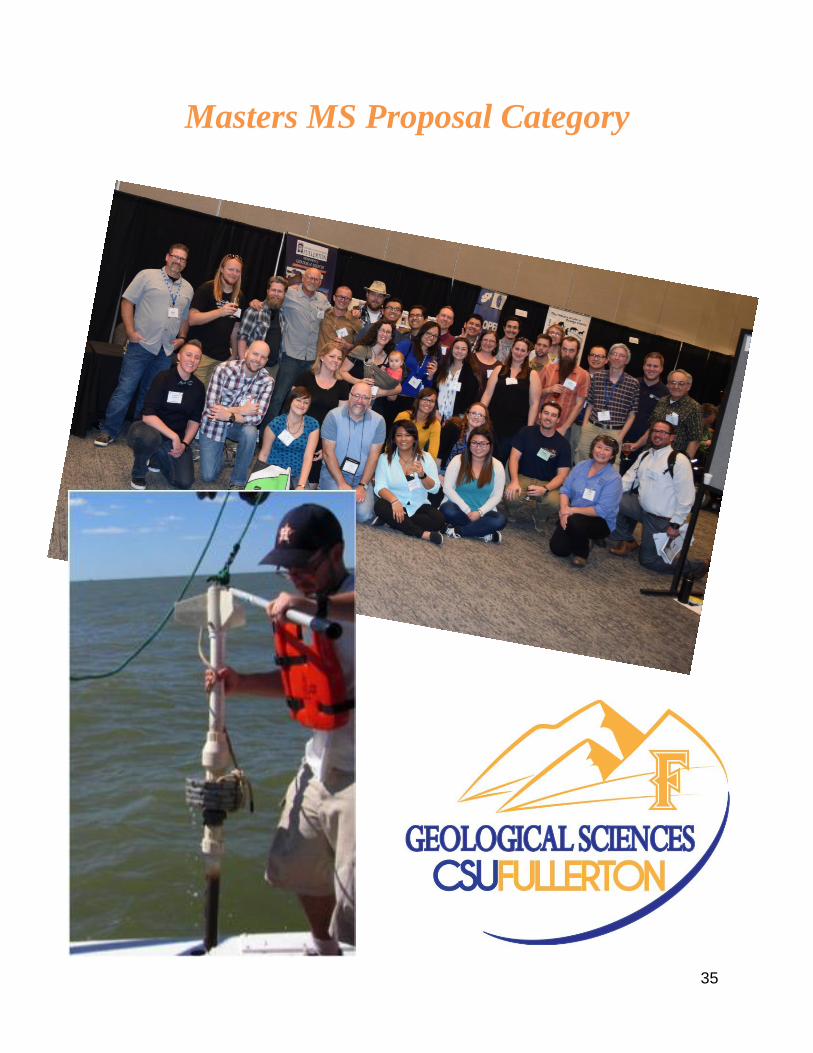
35
Masters MS Proposal Category

36
Reconstructing the Paleoseismic History of the Newport-Inglewood Fault Zone Using
Marsh Stratigraphy
Student: Michaela Adler
Faculty Advisor: Dr. Joseph Carlin
With more than 20 million people living in southern California, this tectonically active location
may be the most vulnerable region to seismic hazards in the United States. Although this region
contains numerous active faults, one that maybe particularly impactful is the Newport Inglewood
Fault Zone (NIFZ). The NIFZ bisects densely urbanized areas in the Los Angeles Basin, and
recently it has been suggested that the NIFZ extends down the coast, linking up with the Rose
Canyon Fault in the San Diego region. Therefore, this combined system may represent a seismic
hazard throughout much of the southern California region. Due to its urban location, NIFZ had
remained largely understudied until recently. The Seal Beach Wetlands (SBW), which straddle the
NIFZ, have emerged as key location to study the NIFZ. Recent work in wetlands suggests that
subsidence occurs during large magnitude earthquakes, but this work focused on only section of
the SBW, and could not provide a quantitative subsidence estimate.. Additionally, a second study
recently demonstrated that foraminifera could be used to determine past elevations in the wetlands.
Therefore, this proposed project aims to build upon this previous work to better understand the
extent of coseismic subsidence in the SBW, both laterally and vertically through addressing the
following questions: 1) is coseismic subsidence consistent throughout the SBW, and 2) how much
do the wetlands subside during these events? We hypothesize that abrupt sedimentary contacts will
be contemporaneous throughout the SBW, adding support for the interpretation that these contacts
form during large earthquakes. Further, we hypothesize that the observed stratigraphic changes
will require at least 0.5 m of subsidence. Preliminary data show similar stratigraphy in cores from
the unstudied sections of the SBW, suggesting lateral continuity. During this project, we will
analyze 5 new cores collected from the SBW, and preform new analyses on previously collected
cores. The analysis plan will consist of first; characterizing the sediment to identify potential
subsidence-induced contacts by measuring magnetic susceptibility, grain size distributions,
percent organic matter, and percent carbonate in the cores. Second, dating these potential contacts
using radiocarbon geochronology to connect contemporaneous events across the wetlands.
Finally, identifying the foraminifera present across the event contacts to apply a transfer model to
quantify vertical subsidence. Ultimately this study will provide a better understanding of the
frequency of these large magnitude earthquakes that will be beneficial for assessing seismic
hazards in the region.
37
New fossil walrus skulls from the Los Angeles Basin shed light on major walrus radiations
Student: Jake Biewer
Faculty Advisor: Dr. James Parham
Today, walruses are represented by a single species, Odobenus rosmarus, which is confined to the
Arctic. However, millions of years ago, walruses were more diverse (20 species in the Miocene)
and widespread throughout the Pacific. Ongoing phylogenetic studies identify two major
radiations of walruses, one in the early Miocene and one in the late Miocene, but with a gap in
data from the middle Miocene. This study will describe 11 new fossil walrus skulls from the Los
Angeles Basin in order to provide more information on the timing of walrus diversification events,
filling in the “middle Miocene gap,” as well as tie these events to climatic changes occurring in
the Miocene. Most of these specimens are housed at the John D. Cooper Archaeological and
Paleontological Center (OCPC) and Natural History Museum of Los Angeles County (LACM).
The 11 skulls represent 3-4 new species from a time when walruses were thought to have low
diversity. Furthermore, the amount of material from the LA Basin provides a rare opportunity to
make comparisons among males, females, and juveniles from the same formation. For my thesis I
will: 1) provide scientific descriptions of new fossil walrus material, 2) perform a phylogenetic
analysis to develop a new evolutionary tree for fossil walruses that includes insights from the new
material, and 3) reassess the fossil record of walruses through time. This work will allow me to
develop the most accurate picture of walrus evolution through time. I can then compare the timing
of walrus radiations and extinctions to those of other taxa as well as oceanographic patterns and
global climate change.
38
Southern California coastal wetland evolution: Using the geologic record to understand the
shift from a late Holocene oyster reef to salt marsh
Student: Sarah Dickson
Faculty Advisors: Drs. Joe Carlin and Nicole Bonuso
Ostrea lurida, commonly known as the Olympic oyster, is the only oyster species native to the US
Pacific coast. Although this species was once common throughout Southern California, the past
200 years have seen a serious decline in abundance as the result of anthropogenic influences.
Evidence of past oyster communities has also been observed in the geologic record of modern salt
marshes. This indicates that these environments once supported oyster communities, but naturally
lost favorable habitats in the transition to salt marshes. Therefore, in order to improve management
and restoration of this fishery, we must better understand the natural drivers that may adversely
affect oysters in the region.
The goal of this study is to answer two questions: (1) Does this shell layer represent a past oyster
reef? (2) Does the shell layer indicate a significant shift in the evolution of the lagoon? We
hypothesize that (1) the shell layer represents a past oyster reef community, and (2) the layer marks
the boundary of an environmental change marking the initiation of the marsh, and the decline of
suitable oyster habitat. These hypotheses are supported by preliminary data which show (1) that
the mollusks present correspond with those expected in an oyster community, and (2) that the shell
layer is the contact of an abrupt change from a sandy unit below to a muddy sequence.
Six cores will be extracted from Los Penasquitos Lagoon and analyzed to (1) assess the ecology
of the shells, (2) characterize the sediment, and (3) establish an age-depth relationship. The ecology
will be assessed through shell identification and taphonomic analysis, which will indicate whether
the shells are in situ or a reworked lag deposit. The sediment will be characterized by grain size
distribution and percent organic matter, both of which will be used as paleoenvironmental
indicators. Finally, radiocarbon dating will be used to constrain the age of the shell hash layer by
dating indicative shells, and other material throughout. This will provide a better sense of when
any environmental transitions occurred, and how the shell layer fits into that timeline. Ultimately,
this study will provide insight to the natural environmental factors that may have contributed to
the historical decline in Ostrea lurida. The results of this study will aid future restorative efforts,
and allow them to be more successful in reestablishing oyster communities throughout the west
coast.

39
The Age of the Vaqueros Formation in Laguna Canyon, Orange County, CA
Student: Jared Heuck
Faculty Advisor: Dr. James Parham
The precise ages of most fossil-bearing rock units in Orange County are poorly constrained, which
presents challenges to placing the rich fossil record of the region into a comparative context. The
Vaqueros Formation at Laguna Canyon in Irvine is one such poorly constrained unit that is
important because of its unusual marine mammal fauna. In particular, some specimens from
Laguna Canyon belong to a group of archaic mysticete (baleen-bearing) whales that still have
teeth. These so-called “toothed-baleen whales” are found around the margins of the North Pacific
Ocean, but are thought to go extinct by the end of the Oligocene. Previous authors have claimed
that the Laguna Canyon site is Miocene, but without providing much substantiating evidence. The
goal of my thesis is to use multiple methods for dating the Laguna Canyon to develop a precise
age for its fauna. Methods for this study include: 1) a correlation of marine invertebrates to other
known occurrences; 2) an isotopic analysis on invertebrate material; 3) a reevaluation of relevant
North American Land Mammal Assemblages and how these fauna relate to Orange County; 4)
structural examination of the site with emphasis on relationships with surrounding formations.
These studies should provide a reliable age for the Laguna Canyon site and its important whale
fossils. A refined age will allow me to make more accurate comparisons with other Oligo-Miocene
whale faunas and ultimately provide the most precise temporal and biogeographic context for the
origin of baleen whales.

40
Biogenic vs Thermogenic: Determining Native Sulfur Formation Mechanisms in Gulf
Coast Salt Domes Using Multiple Sulfur Isotopes
Student: John Hill
Faculty Advisor: Dr. Sean Loyd
Cap rocks of Boling and Main Pass Gulf Coast salt domes contain anomalously large elemental
sulfur concentrations. Isotopic and petrographic data indicate complex histories of calcite
paragenesis for both domes. Whereas paragenetic complexity is in part due to the open nature of
these hydrodynamic systems, a comprehensive understanding of sulfur sources and concentration
mechanisms is lacking. Large ranges in sulfur isotope compositions (δ34S) among oxidized and
reduced sulfur-bearing phases has led some to infer that microbial sulfate reduction and/or repeated
influx of sulfide-rich formation waters occurred during cap rock formation. Ultimately, traditional
sulfur isotope analyses alone cannot distinguish among local microbial or exogenous sulfur
sources. Recently, multiple sulfur isotope (32S, 33S, 34S) analyses reveal small, but measurable
differences in mass-dependent behavior between microbial and abiogenic sulfur cycling. We
propose to apply multiple-sulfur-isotope analyses to native sulfur from Boling and Main Pass cap
rocks to distinguish between the proposed sulfur sources. Similarities or deviations from the so-
called terrestrial mass-dependent relationship (δ33S = 0.515δ34S) can indicate which pathways
were responsible for native sulfur precipitation. Pathway determination will provide insight into
Gulf Coast cap rock development and potentially highlight the conditions that led to anomalous
sulfur enrichment in Boling and Main Pass Domes.

41
A Geochemical Analysis of Productivity and Oxygenation Following the Permian-Triassic
Extinction Event, Opal Creek, Alberta, Canada
Student: Anthony A. Macias
Faculty Advisor: Dr. Adam Woods
The Permian-Triassic Extinction event occurred about 251 million year ago, and is acknowledged
as the largest loss of biodiversity in the geologic record, resulting in the decimation of roughly
90% of marine and terrestrial species at the time. Recovery was not coeval after the extinction;
instead, recovery is thought to have been strongly influenced by regional or local environmental
conditions. To understand how organisms rebounded following such a devastating crisis, it is
necessary to examine the reestablishment of primary productivity and its relationship to
environmental conditions, specifically oxygenation levels, during this period as a whole. Located
within the southern section of the Canadian Rockies, the Opal Creek section is a stratigraphically
continuous section of Late Permian to Early Triassic deep-water sediments deposited along the
northwestern continental margin of Pangea. The Opal Creek section is an approximately 330m
thick unit composed of three distinct formations assigned to the Johnston Canyon, Ranger Canyon,
and Sulphur Mountain formation. To better understand the relationship between recovery and
environmental conditions related to the extinction, productivity and marine oxygenation levels will
be reconstructed by analyzing trace elements of samples previously collected from Opal Creek.
Trace element analysis allows for reconstruction of productivity levels through the collection of
Ba, Cu, Ni and Zn data, while Mo and V are used to reconstruct marine oxygenation (Tribovillard
et al., 2006.) In addition, Total organic matter content (%TOM) will be determined using the Loss
on Ignition procedure described by Dean (1974). Developing a better understanding of how
environmental conditions plays a role in recovery after catastrophic events such as the Permian-
Triassic mass extinction are important, because it can help us better understand the effects of
climate change on Earth’s current biota and determine when and how life will recover from Earth’s
modern mass extinction.
42
Thermal Infrared Remote Sensing for Water Temperature Assessment along the Santa
Ana River using an Unmanned Aerial Vehicle (UAV) System
Student: Diana Carolina Chacon
Faculty Advisor: Dr. W. Richard Laton
Water temperature is a critical regional indicator of water quality in rivers and streams that it is
influenced by surface water, groundwater, canopy cover, solar radiation, and discharge from
wastewater plants along the Santa Ana River. To identify areas that don’t meet water quality
standards and protect endangered or threatened wildlife, such as the Santa Ana sucker (Catostomus
santaanae), stream temperature monitoring is required by the Clean Water Act of 1977), (Section
303d). (Beschta et al. 1987; SWRCB, 2015). The conventional methods (in-stream data loggers)
provide continuous discrete data, yet they lack of spatial data which is needed to model temperature
distribution in rivers at a larger scale. Airborne remote sensing, using unmanned aerial vehicles
(UAVs), can provide images at high temporal and spatial resolutions suitable for narrower rivers
and streams. Moreover, the data acquisition has a much-reduced cost and flexibility (easily
deployable) compared to conventional sources of remote sensing. I proposed that by using UAV
high resolution imagery and TIR remote sensing technology, I’ll be able to identify thermal
variations in the stream by mapping the radiant water temperature (Tr) spatially and identify areas
with coarser substrates and riparian vegetation on an approximate 3-mile reach of the Santa Ana
River. To do this, a series of low altitude flights will be performed to generate a 3D point cloud,
Digital Elevation Models (DEMs), a digital orthomosaic, and Digital Surface Model (DSM) during
summer and winter (when the maximum temperature contrast of groundwater/surface water is
expected). Pix4mapper will be used to process the data collected, and the resulting models will be
exported to ArcMap for geospatial analysis. The results may have important implications regarding
identification of favorable areas for spawning of the Santa Ana sucker, who prefers coarse
substrates (gravels, rubbles, and boulders), native riparian vegetation that provides cover and
shelter, and colder flowing water that are only maintained in some areas by the upwelling of cooler
groundwater, tributary flows, or shade from overhanging vegetation (FWS, 2009; USFWS, 2000).

43
Zoning in Feldspars as Tracers of the Extent of Magma Mixing and Magma Chamber Size
in the Tuolumne Intrusive Complex, Yosemite National Park, CA
Student: Louis Oppenheim
Faculty Advisor: Dr. Vali Memeti
While there is general agreement in the granite community that intrusive bodies are emplaced
incrementally in the crust over prolonged time scales, it is unclear how interconnected these
magma increments (batches) get and if they ever amalgamate to form large magma mush bodies
or reservoirs, which has significant implications for how eruptible such magmas are and the nature
and size of volcanic eruptions at the surface.
This study focuses on characterizing alkali feldspar and plagioclase populations from the Half
Dome and Cathedral Peak granodiorites from the south-eastern section of the Tuolumne Intrusive
Complex (TIC), Yosemite National Park. The goal is to investigate whether it is possible to
determine if magmas were mixed at the emplacement level, especially at the interface between the
two units. If this was the case, the nature of the hybridization at the pluton contacts might provide
information on the extent of the interconnected magma mush and its crystallinity.
Cathodoluminescence and polarized light microscopy will be used on thin sections from different
parts of the transect to first characterize the morphology of the zoning patterns within both types
of feldspars and work to identify multiple mineral populations for analysis. Preselected mineral
populations will then be analyzed with an electron microprobe and LA-ICP-MS for distribution
and concentrations of slow-diffusing trace elements, such as barium and strontium. The following
hypotheses will be tested through this approach: 1) Feldspar populations are mixed across the
interface between Half Dome and Cathedral Peak units; 2) if mixing is only observed as
unidirectional from the older Half Dome granodiorite into the Cathedral Peak Granodiorite, then
the older unit might have been a majority crystallized when the younger Cathedral Peak was
emplaced, supporting TIC emplacement as a series of small batches that didn’t form magma
chambers across units. If mixing is mutual across the pluton interface and feldspars were mutually
recycled forming a hybrid of both units, the suggestion would be that the older unit was still mushy
when the younger one was emplaced, which supports the TIC forming an extensive magma mush
body.

44
A Determination of the Timing and Consequences of the Late Ordovician Glaciation Using
the Ely Springs Dolomite of East Central California
Student: Austin Poncelet
Faculty Advisor: Dr. Adam Woods
The Late Ordovician is characterized by an anomalous glacial episode that caused profound
changes in global oceanic circulation. Although the Late Ordovician glaciation is well recognized
from sedimentological observations, the timing/extent of glaciation is poorly understood, with two
competing hypotheses: 1) Glaciation during the Late-Ordovician was short-lived (<1 my) and
occurred during the Hirnantian (e.g., Brenchly et. al., 1994); and, 2) Glaciation during the Late
Ordovician was long-lived (lasting ~10-35 my) and began during the Sandbian (e.g. Saltzman and
Young, 2005). The goal of this study is to constrain the duration of the Late Ordovician glaciation,
while providing paleoceanographic data about the northwest margin of Laurentia during this time.
The Late Ordovician-Early Silurian Ely Springs Dolomite, deposited as part of a homoclinal
carbonate ramp along the northwestern margin of Laurentia, may help determine the nature and
timing of observed glaciation. Two inner to outer carbonate ramp settings will be examined in
south-central California, including the Nopah Range and Hard Scramble Nose. Evidence of
prolonged glaciation during the Late Ordovician is expected to show pronounced sequence
boundaries and cool-water carbonate grain associations related to the upwelling of cool waters
(James, 1997) during enhanced thermohaline circulation (Wilde, 1991). Evidence of a short lived
glaciation is expected to show smaller scale sea level fluctuations prior to the Hirnantian, along
with cool-water carbonate assemblages limited to the uppermost Ordovician. Analysis of the Ely
Springs Dolomite will shed light on the nature of the Late Ordovician glaciation and its effects on
a carbonate ramp far from the locus of glaciation.

45
Masters MS Thesis Category

46
Geochemistry of phosphatic-shales and associated authigenic minerals of the Miocene
Monterey Formation: Implication for paragenetic evolution
Student: Tony Sandoval
Faculty Advisor: Dr. Sean Loyd
The Monterey Formation is a petroleum source and reservoir rock in California that was deposited
in several basins during the tectonically-active Middle Miocene. The middle member of the
Monterey Formation contains intervals of phosphatic-shales that are rhythmically cemented by
dolomite as layers and concretions. Diagenetic-minerals can form as the result of organic matter
remineralization, facilitated by microbes utilizing oxygen, nitrate, iron (III), sulfate and
fermentation products as electron acceptors. Precipitation of phosphate and carbonate minerals
tends to occur in suboxic-anoxic sediments, generally experiencing sulfate reduction, where
degradation of organic matter yields alkalinity, sulfide and phosphate ions.
Here, we present sulfur and carbon geochemical data to better characterize the conditions that led
to the precipitation of phosphorous-rich minerals (e.g., carbonate-fluorapatite (CFA)) and
dolomite that occur in close stratigraphic proximity. These data include concentration of CFA-
associated sulfate, carbonate associated sulfate (CAS) and the respective δ³⁴S values. The
concentration of inorganic/organic carbon and associated δ¹³C values have been determined for
CFA, dolomite and the host-shale, to further characterize the diagenetic environment of
precipitation. These data indicate that authigenesis occurred in pore waters influenced by multiple
microbial reactions, including respiration and methanogenesis reactions, and ultimately highlight
the complexity of the Monterey diagenetic environment.

47
Carbonate Geochemistry of Marine Authigenic Carbonates and Host Sediments: Exploring
Mineral Formation Pathways and Organic Preservation Potential in Modern Sediments
Student: Marissa Smirnoff
Faculty Advisor: Dr. Sean Loyd
Ancient authigenic dolomites (e.g., concretions) have been long studied in order to determine
formation conditions and provide insight into shallow diagenetic environments. The formation of
these dolomites is commonly attributed to the anaerobic microbial degradation of organic matter
(a process that can increase the local pore water alkalinity), based on carbon isotope as well as
other geochemical data. Authigenic dolomites also occur in modern, “still soft” sediments rich in
organic matter, however a comprehensive carbon isotopic characterization of these precipitates
has yet to be conducted. Ultimately, organic matter degradation produced carbonates can be
distinguished from primary carbonates (i.e., marine-produced carbonate) by expression of non-
seawater δ13C values (~0‰ in the modern ocean). Data show a wide range of δ13C values (about -
11 to +12‰) that significantly differ from modern seawater. δ13Cinorg values generally increase
with depth consistent with exposure to deeper diagenetic zones. Positive values that typify
dolomites of the Gulf of California and the southwestern African margin indicate mineral
precipitation in the zone of methanogenesis. Dolomites of the Peru margin and Cariaco Basin yield
negative values that may represent a variety of respiratory-type organic matter degradation
mechanisms. Total insoluble organic carbon (TOCinsoluble) values range from ~0.5 wt% to ~9 wt%,
total inorganic carbon (TIC) values range from ~1 wt% to ~12 wt%. Values for TOCinsoluble
generally decrease with depth, suggesting progressive degradation with burial. Unlike previous
work on outcrop concretions, these dolomites do not express a significant correlation between TIC
and TOCinsoluble. This suggests that authigenic carbonates (i.e., these dolomites and concretions)
only protect organic matter during outcrop weathering.

48
From Sheets to Blobs: Implications of Multiple Kuna Crest Hornblende Populations for
the Initial Construction of the Tuolumne Intrusive Complex, Sierra Nevada, CA
Student: Dustin Williams
Faculty Advisor: Dr. Vali Memeti
Understanding the emplacement and evolution of large and long-lived plutons in the middle crust
is essential in comprehending igneous crustal growth, how arcs operate and are physically and
compositionally connected to the source and volcano. One challenge is that the plutonic rock
record seldom preserves the initial stages of pluton growth, which is often overprinted by
subsequent magmatism. The initial stages of growth, however, may give us clues on the size and
compositions of the first intruding magma batches and if or when they coalesce to form
interconnected magma mush bodies.
Early stages of pluton growth are preserved in the 95-93 Kuna Crest margin located in the southeast
lobe of the 95-85 Ma, 1,100 km2, normal zoned Tuolumne Intrusive complex (TIC) in the central
Sierra Nevada batholith. The Kuna Crest is composed of cm- to m-scale sheets at the margins to ≤
km-scale, irregular bodies toward the interior of the lobe. Compositions range from fine- to
medium-grained granodiorite, medium- to coarse-grained tonalite, diorite, and gabbro with knife
sharp to gradational contacts. Petrographic analysis revealed that color index ranges from 10% to
32%, and magmatic hornblendes vary in size from 1-4 mm, shape from euhedral to subhedral, and
pleochroic color from blue-green to olive-green. These variabilities suggest various mineral
populations with different growth histories present within single samples.
Previous Sr and Nd isotopes data from the compositionally diverse Kuna Crest sub-units show all
magmas originated from a homogenous and rather primitive source. To determine the significance
of the observed intra-unit mineralogical and geochemical variation observed in the field and
through petrography, we conducted whole rock and mineral-scale geochemical analysis.
Irrespective of the location, size, and shape of Kuna Crest hornblendes, they classify as
magnesiohornblende unless they have undergone sub-solidus alteration to actinolite. These
hornblendes display crystalizing temperatures ranging from 730-830 °C. Differing trace element
trends indicate that varying hornblende populations grew in chemically diverse magmas or
underwent various degrees of magmatic differentiation at the emplacement level. This study
concludes that incremental pluton growth was initially sheet-like and heterogeneous, but
subsequently magma pulses coalesced to form extended magma mush bodies.

49
Student Research Category

50
Paper Models to the Rescue: New Exercises for Visualizing and Mapping Geological
Structures in 3D
Student: Joseph Gutierrez
Faculty Advisor: Dr. Sinan Akciz
Students are generally expected to develop knowledge about geological features and processes
through visualizing 2D drawings and photos. This is not very intuitive to many at first because
they were never given an opportunity or a reason to develop 3D visualization skills. There are a
few geological 3D visualization models that many universities around the world use as educational
resources. However, many of them do not expect students to do anything besides interpret what is
already drawn on the faces of block diagrams. Computer apps are only semi-interactive: they teach
students by showing how a particular structure or a contact relationship should look like; similar
to providing a problem set and its key at the same time. The only other interactive block model
exercise, the dry-erase cube, requires the use of custom made dry-erase cubes and offers limited
constructive feedback opportunities to the students. For this project, we have created printable
paper models and related questions that will enable students to practice visualizing and exploring
multi-dimensional geological datasets. Our models are printed on an ordinary printer paper or card
stock. The models can be cut out and folded over 2”x2” wood block if a more rigid, stable work
surface is desired. The models and the accompanying questions are designed to help students in
their ability to recognize basic structures on a map and in cross section, interpret geologic history
and interpolate geologic maps from cross sections and vice versa. Students can also use the
exercises to practice with inking contacts, coloring geologic units and creating legends. In addition
to the four questions we present here as examples, new questions on different fold and fault types
are currently being developed. Once complete, these block diagram models will be used in
structural geology (GEOL 360) and field techniques (GEOL 380) classes at CSUF and will be
shared with other faculty teaching similar classes at other universities. We are currently trying to
find inexpensive and non-customized ways to incorporate topography into these models.

51
Analysis of vegetation diversity, density and cover on maturing alluvial fan substrates
Adrian Escobar, Maureen Kelley, Andrew Roxas
Faculty Advisors: Dr. Darren Sandquist CSUF and Dr. Jennifer Garrison CSULA
A comparative analysis of vegetation on maturing alluvial fan substrates was performed using
cover, density and diversity characteristics of perennial shrubs. Development of desert varnish and
pavement on lobes of the Springer and Zzyzx alluvial fans near the Desert Studies Center (Zzyzx,
California) were used as indicators of relative substrate age. Based on previous studies we
hypothesized that intermediate-aged lobes would possess higher plant cover and density than older
and younger lobes because intermediate substrates are less active than younger channels and more
permeable than significantly varnished older lobes. We also hypothesized that there would be
greater plant diversity at the distal end of the fan, regardless of substrate age, due to higher water
input and retention, and greater nutrient availability. Our results showed that plant density was
highest on the intermediate-aged lobes (0.21 plants/m2), plant cover was highest on youngest lobe
(6.5%), and plant diversity was higher at distal portions of the fan (0.12 plants/m2). While the
results show a trend in support of our initial hypotheses, larger sample sizes are needed for greater
confidence in these finding and to better understand alluvial fan vegetation development within
the Mojave.
Figure 2, Zzyzx Spring Fan complex outside of Zzyzx California

52
Investigation of the Laguna Cell Beaches Using Lidar and Erosional Examination
Student: Taylor Kennedy
Faculty Advisor: Dr. W. Richard Laton
Beaches, in general, are made from river and cliff deposits. As the tides change day to day and
season to season the waves will either erode or deposit sand. When storms move over the coast it
will cause high amounts of erosion and deposition to the beach and surrounding areas. Higher
amounts of erosion reduce cliffs and remove beach deposits. Strengths of geologic units can reduce
erosion for a time and the floodwaters can bring more sediment to beaches. Other institutions such
as dams and Gabion cages further reduce erosion and deposition. Cities will also import material
from other areas to deposit on their beaches. With so many different sources coming and going the
elevation of these areas can get complicated. Using topographic analysis of Light Detection and
Ranging (LIDAR) we can shows the change in elevation over the years. The change in elevation
will relate to the erosion, which in turn will relate to the rate of deposition of the beaches. This
will make the system less complicated. In order to witness these changes in topography a visible
medium is necessary. Using ESRI’s geographic information system ARCmap and LIDAR data by
Scripps Research Institute and the National Oceanic and Atmospheric Administration, a mapping
system is created that show this change in elevation.

53
Subsurface Analysis of Orange County Water District's La Palma Groundwater Recharge
Basin in Anaheim, California
Student: John Paul Masters
Faculty Advisor: Dr. W. Richard Laton
Orange County Water District’s Groundwater Replenishment System (GWRS) is crucial in
helping southern California become non-dependent upon outside water sources. The GWRS
program utilizes several recharge basins to replenish the underlying aquifers. The newest basin
constructed for this program is La Palma basin. To better understand the subsurface conditions of
the La Palma recharge basin in Anaheim, California, an evaluation of collected data was used to
create 3-Dimensional models. Boring and well logs taken within and around the site were used to
create a well log data base which was used with RockWare Software to create the models. These
models will be used to help Orange County Water District’s hydrogeologists and recharge
operators to gain a better understanding of the subsurface.

54
Building an Outdoor Garden for the College of Natural Sciences at CSUF
Student: Grant Kennis
Faculty Advisor: GEOL499L – Independent Research
Cal State Fullerton’s landscape is changing to make it more water wise, which creates a unique
opportunity to propose a geoscience rock garden that is designed to supplement our undergraduate
classes, and be an outreach exhibit attracting members of the university community. The locality
for this rock garden would be the 90x10m lot southwest of Dan Black Hall found on the south end
of campus. The purpose of this independent study is to provide a schematic landscaping design of
a rock garden to the College of Natural Sciences at CSUF that provides an outdoor learning
experience for various geology courses including, Physical Geology, Earth History, Field
Methods, Mineralogy, Structural Geology, and Sedimentology. I designed my project to display
boulders that have formed in settings that are similar to the main geologic regions that form
continental North America and its surrounding oceans. These regions from West to East are:
Hawaiian Islands, Pacific Ocean, California Coast, the Sierra Nevada, Basin and Range province,
the Rocky Mountains, the Mississippi Valley, North American craton, Appalachia, and the
Atlantic Ocean. Each section of the rock garden would allow students to recognize different rock
types in a setting outside the classroom, make their own interpretations on the various tectonic
environments based on the rock samples serving as diplomats for the various geographic localities.
This garden provides a unique opportunity to travel across North America without physically
leaving California State University, Fullerton.

55
First Record of Equus Occidentalis from Orange County, California, With Implications for
the Late Pleistocene Distribution of Equus in the American Southwest
Students: Maree Kutcher and Eric Scott
Faculty Advisor: Cooper Center
Horses (genus Equus) are common in Pleistocene faunas throughout North America. Despite this
abundance, the number of species occurring remains unresolved. Molecular data from fossils has
been employed to suggest no more than two species, one stout-limbed and the other stilt-legged,
while morphology-based paleontological investigations propose multiple species.
In the late Pleistocene, two morphospecies of large stout-limbed horses have been documented
from the American southwest: Equus occidentalis from California, west of the Sierra Nevadas and
south-southwest of the Transverse Ranges, and Equus scotti from the central Mojave Desert. These
species are readily distinguished dentally; E. scotti possesses lower incisor infundibula, while E.
occidentalis lacks them. The presence of two large, stout-limbed equine morphs in the southwest,
with no evident geographic overlap, suggests (in combination with fossils of small horses) that
multiple horse species inhabited the region during the late Pleistocene. However, fully diagnostic
remains of E. occidentalis and/or E. scotti are known from only five localities in the region.
Assessing whether the hypothesized distribution of these two large horse morphs is real, or instead
is an artifact of the dearth of diagnostic material, therefore requires additional fossils.
To test this hypothesis, we examined a previously undescribed late Pleistocene horse from San
Juan Capistrano, Orange County, California. Remains include a skull, mandible, articulated right
hind leg, and other postcrania recovered from nonmarine terrace deposits that also yielded remains
of Bison, an index taxon for the late Pleistocene. Metric data confirm that this is a large species of
horse; the metapodials are stout rather than slender, while the lower incisors lack infundibula.
These characters demonstrate clear affinity with Equus occidentalis. Based upon size and
morphology, this is the first confirmed record of E. occidentalis from Orange County.
The presence of Equus occidentalis in this region accords well with the hypothesized distribution
of late Pleistocene large stout-limbed Equus in the American southwest. Our results indicate that
multiple horse species inhabited North America during the late Pleistocene.

56

57

58

There is no greater influence than the generous donations the Department of Geological Sciences receives each year from our Alumni, Students, Faculty, Staff, and Friends. We want
to thank each of our donors listed below for their amazing gift. Without these contributions, the Department of Geological Sciences would not be able to fund the many scholarships
presented to our students at the Annual Awards banquet in April and throughout the year.
Tammy (Surko) Adler '06 Gregg Drilling
Timothy A. Alderman`82 Merri L. (Lacey) Casem '84
BC2 Environmental Corp William R. Laton
Beverly J. Berekian`08 Jennifer Law
Dan Black Leidos, Inc.
Kristin D. Weaver Bowman Anthony Lizzi
David D. Bowman Valbone Memeti
Patricia M. Butcher Laurie K. Morgan '88
Phillip A. Armstrong NMG Geotechnical, Inc.
Ms. Nancy H. Cooper '76 Anay Palafox `14
Michael J. Cruikshank `06 Eric S. Patschull `07
Kathleen Davis Rene A. Perez `02
Environmental Engineering & Contracting, Inc. Daniel J. Philo `14
Thomas B. Feistel `12 Brian P. Pitts `79
Everett Ferguson ‘92 Kay L. Pitts `77
Susan A. Fisher `03 Joe Roe ‘01
Candace J. Foster `93 Prem K. Saint
John H. Foster Susan C. (Titus) Smith '08
Anna L. Garcia `95 South Coast Geological Society
GMU Geotechnical, Inc. Everett Stuck '75
William Y. Goodman `83 Nancy E. Stuck '75
Groundwater Resources Association of California Aron Taylor '02 & '06
Dwight R. Haggard `77 Scott R. Traub `97
Sean Hunt Michelle L. Vitale `12
Brian A. Killeen `96 Kristen M. Waters `99
Diane Clemens-Knott Katherine F. Whitlow `05
Jeffrey R. Knott Steve Williams
Earth Forensics, Inc. Lynn Yost & Barney Yost ‘96
Janet R. Zeko ‘88 & Mark T. Zeko `87