Embed Size (px)
Citation preview
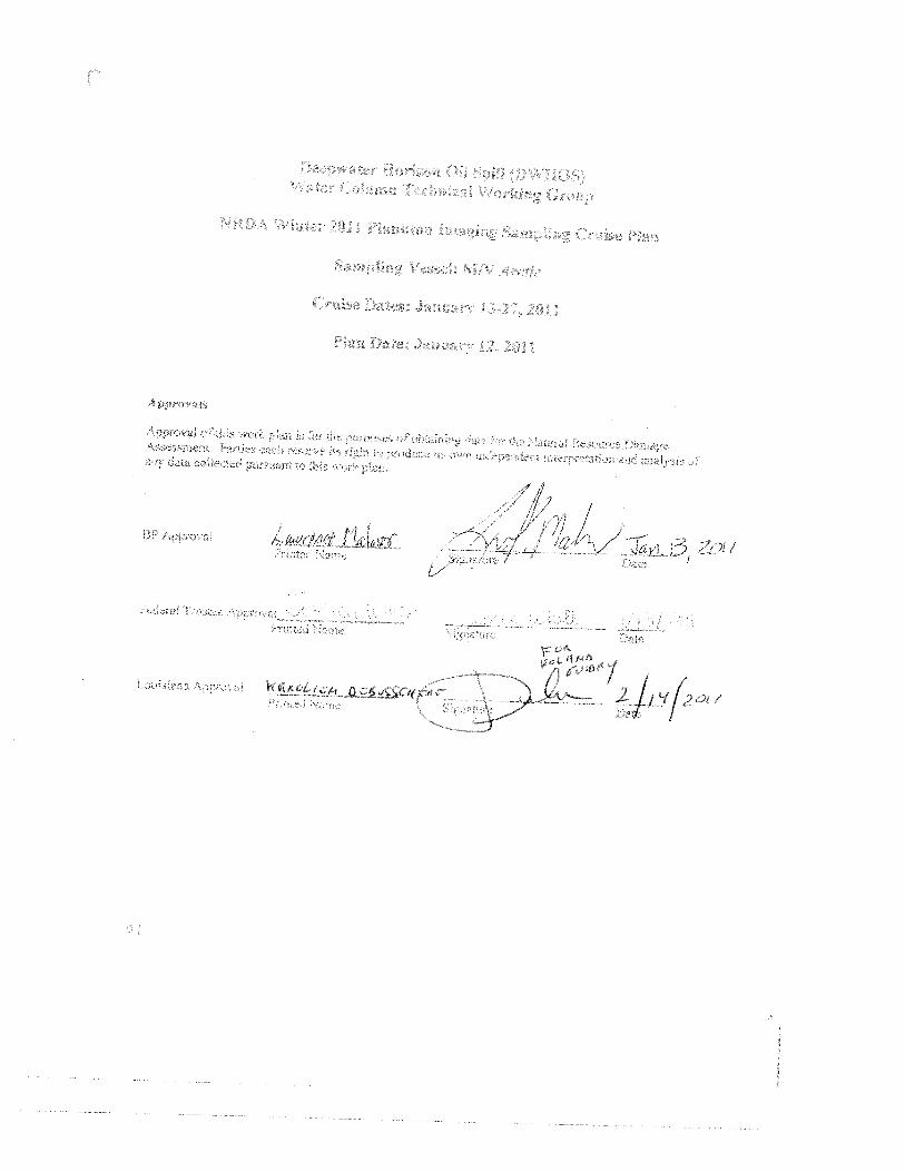
Deepwater Horizon Oil Spill (DWBOS)Water Column Technical Working Group
NRDA Winter 2011 Plankton Imaging Sampling Cruise Plan
Sampling Vessel: M/V Arctic
January 12, 2011
Prepared by:Deborah French-McCay, Eileen Graham ASA) and Cabefl Davis (WHOI) on behalf of the
TrusteesReviewed by:
Dan Hahn, John Qmnlan (NOAA)William Graeber. Jeffeiy Simms (Cardno ENTRIX) on benalfofBP
Proposed Cruise DatesJanuary 13— January 27, 20i1
Background/JustificationConceptual Model — Water Column Organisms
The trustees have developed a prelimmaiy conceptual model ofthe DWH release, potential pathways androarer olexposure, andpotential receptors. l7iis preliminary model has informed ike trustees decisionto purwie the sludies outhned in the or/c p/on. By signing this work plan and agreeing tojimd the workoutlined, B? is not endorsing the model arncvlotecl in the work plan.
Release and PathwasOil released from the broken well head both dispersed at depth and io’,e through nearly a mile of watercolumn. The composition of the released gas-liquid mixture changed oyei ttme and space as the result ofdilution, changes in pressure, dissolution, and addition of other constituents such as dispersants,methanol, and anti-foaming additives. Of oil that made it to the water surface, some entrained waterforming mousse, was dispersed into the water column naturally and by application of dispersants, andsome was removed mechanically or by in situ barning. Floating oil, oil droplets, flocculated anddissolved components were transported laige distances at sarious levels of the water column. Oil alsopicked up sediments, and other pardcuiate material, some ofvhich became neutrally or slightly negatisebuoyant, sinking to various depths. The oil dipersed at the selBieaf both .na tarhuience or by inleceionof dispersants) was transported by currents that varied in time and space. sdelmng a complex pathway ofubsurfacc oil contamination thas affected avsal. hathvpeiagic. and ;neso-oetagic waters of the off’>horcGulf of Mexico
Routes of gyposurefish and invertebrates in the water column are exposed to contaminants by ss mmmg thioughcontaminated water, spending time on/in contaminated sediments, taking up contaminants through bodysurfaces, passing contaminated water os-ei iesptrator) structures, and ingesting water, ad droulets,contaminated biota, and particulcies contaminated ‘a ith oil as part feedine Jnitionaliy, sensitive lifestages of pelagic fish and ii’ ertebi’ame. come ‘n direct contact :ei fluati’r ml ‘on: cc’. art and is mi\ed
iiiO the :itisiHn \Ct C p._r It. ml s.here niaii thr\os rim Lva d ci )t.ier CiNt(iljC
.s st use Ni iI’c,mle :i’. ii 1,11’. t:s.• -.e’, it’i liiin. ore:i •..ur a .‘ e .‘‘ ed s’ peihi i op e... ‘ :H[i :.u tpiida_..s ti
hod surfaces. Wat., eou.mn ori.anisnis hj’R.2 a]o been eYroseci t3 i_us; r,ants dissn! ci H’ waiL-r.on imdroplets and adsorbed to su nended particulate matter. Water coh’mn c’rgat’isrus sere aRo exposed todissol e im ‘sate—i—.e_iai shliii :5 sitch a. mafrn’oi :drn’ renl,.
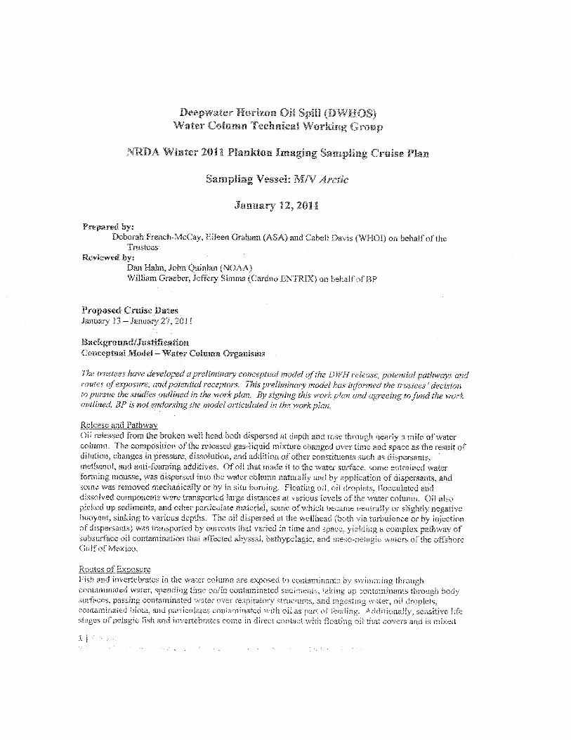
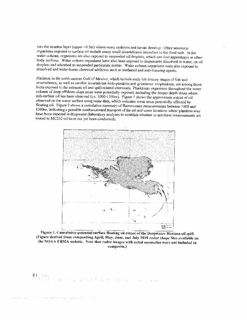
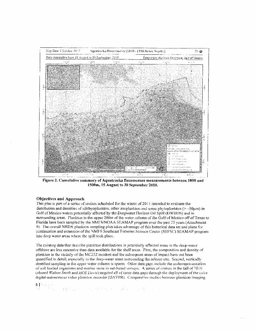
Ptankton in the north—i’ stem tjull .u1e\ico, which ncluu. ails ifa hRtor’ .acs of bh andn’’ertchratcs. as sseil is smNller n ertebrate bout—plankton and aelatinots A p]anLton. are among thosebioi.i e’posed i tluc i’,lca,.a ci] cli] spili—ralaled ci ‘re: Rms throu horn fe s’ icrcobmu ol deep oil eorc 1op at ea v. crc oieotiai R e ‘.pod. mci .tdine. I] c .epcr depth strata wheresub—surface 0ii has been obseiseci (i.e. 000—I 300m). igure h ws due ippi. sirirle extent ofulobsersed on ihe wuer surface nsing radar data. which indicates some Jres vtentirli affected bylicatiuct oil. lia:ir . hoso, a .‘uiib..ttRe summals (0 flucioeenc ‘ m curciuiit. 0(5’ fl ]u)j0 andI 50dm. indicitio ‘i os hue ,ou 1wc5iwe:J mn sport of the oil and sumc tc.0,00is (lie ‘ p1011 Lion n in’.ha’.c been exoosed in deep’.sater (laborators anal ses 10 establish shether or mt ihce measurements arelinked to MC 252 oil have not at been conducted).
_,_:;. a ‘f.:: . iv..:: ‘
: ‘ :: I. . 0,i. i,
— .t’ l.• a t’.l’i :-ce’.
-tatiac5:a - i5.O n
Figure 2. Cumu’ative summary of Aquatracka fluorescence measurements between 1000 andiSOOm, 15 August to 30 September 2010.
Objectives and ApproachThis plan is part of a series of cruises scheduled for the winter of 2011 intended to evaluate thedistnbutmn and densities of ichthyoplankton othei zoopianlilon and some phytoplankton (>-50p.m inGulf of Mexico waters potentially affected by the Decpwatcr Horizon Oil Spill (DWHOS) and insurrounding areas. Plankton in the upper 200rn of the water column of the Gulf of Mexico off of Texas toFlorida have been sampled by the NMFS/NOAA SEAMAP program over the past 25 years (Attachment9). The overall NRDA plankton sampling plan takes advantage of this historical data set and plans forcontinuation and extension of the NMFS Southeast Fisheries Science Center (SEFSC) SEAMAP programinto deep water areas where the spill took place.
[‘he existing data that describe plankton distributions in potentially affected areas in the deep-wateroffshore are less extensive than data available for the shelfareas. First, the eomnostion and density ofplankton in the vicinity of the MC252 incident anti the subsequent areas of impact have not beenquantified in detail, especially in the deep-water areas surrounding the reiease site. Second, verticallystratified samnling ii the upper water column is sparse. Other data gaps include the underrepresentationof soil bodied organisms and marine snow in net-based surveys. Aserics of cruises in the fall of 2010(aboard Walton S’mtih and I1OS DavIs) targeted all of these data gaps through ftc depiot mont of the colorJ mt aatan.m as d p tsr n “ecr icr 3i\ /Pl C —‘ ii’ e ‘-, nJ toci n L ii fl.iv
•1
I—I--F-
systems and traditional net-based sampling techniques have been carried out by various investigators (i.e.Broughton and Lough. 2006). These studies have shown the advantages and limitations of imagingsystems. For example fragile organisms and particles such as small gelatinous organisms and marinesnow are easily identified and quantifled using imaging systems, whereas these delicate groups aredestroyed or damaged beyond recognition in net samples.
Tins plan the winter 2011 MIV Aiclic plankton imaging sampling plan &scrtbes the sampling effort forwinter 2011. The primary objective of the cruise is to collect plankton image data using the digital-autonomous Video Plankton Recorder (DAVPR) and the 1-lolocarn (Attachment 10). The occurrence,abundance, biomass, and vertical distribution, of plankton and marine snow in the Gulf of Mexico will beassessed. The over-arching plan is to conduct sampling in each season, utilizing several samplingmethods (e.g. MOCNESS, bongo net, neuston riOt, and imaging systems). The duration of the programwith respect to the number of years is to be determined. Because plankton are transported over wideareas, and populations are connected across the northern Gulf of Mexico, sampling plans need to be broadin geographic scope.
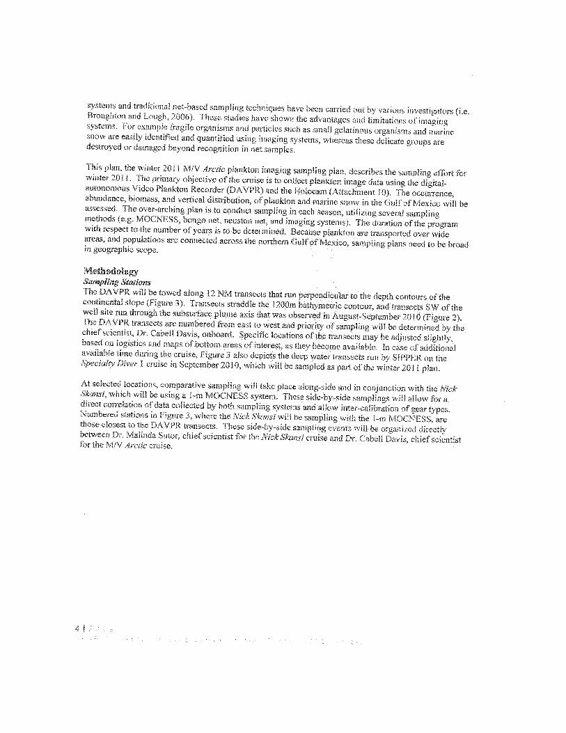
MethodologySampling StationsThe DAVPR will be towed along 12 NM transects that run perpendicular to the depth contours of thecontinental slope (Figure 3), Transects straddle the l200in bathymetric contour, and transects SW of thewell site rim ti rough the subsurface plume axis that was observed in August Siptembei 2010 (Figure 2)The DAVPR transects are numbered from east to west and priority of sampling will be determined by thehiet scientist. Dr Cabell Daus onoard Specific locations of the transects rnai be adjusted slightlybased on logistics and maps of bottom areas of interest, as they become available. In case of additionalavailable time during the cruise, Figure 3 also depicts the deep water transects run by SIPPER on the5oecialry Dive? 1 cruise in September 2010, which will be sampled as part of the winter 2011 plan.
At selected locations, comparative sampling will take place along-side and in conjunction with the Nickckansr which will be using a I m MONESS s)sten These side-by sine samplings will allow foradirect correlation of data collected by both sampling systems and allow inter-calibration of gear types.Numbered stations in Figure 3, where the Nick Skansi will he sampling with the i-rn MOCNESS. arethose closest to the DAVPR transects. These side-by-side sampling events will be organized directlybetween Dr. Melinda Sutor, chief scientist for the NickSlcansi cruise and Dr. Cabdll Davis, chief scientistfor the M/V Arctic cruise.
Dahloi)- o-. a
2]- 4133
N I 4C33-> it]
iawer33
‘I II i 1]tt-’ 14433
/
4,14it>iit]
4’3401
VI F—H—-t--------—I
2734,
Figure 3. DAVPR transect locations along the slope. Each transect straddles the 1200mbathymetric contour and is approximately 12 NM in length. SIPPER transects Specialtv Diver I
Cruise) and Deep MOCNESS stations (square icons, Walton Smith I & 3, Nick Skansi Plankton III& IV) are also depicted.
Sampling ProceduresDAVPR: A color Digital-Autonomous Video Plankton Recorder (DAVPR) aill oc used tu sun’ey thedistribution of plankton and marine snow (Cabefl Davis. WI-JOT). See Attaehmen: i 0 for a description ofthe instrument, specifications, and depoyincnt procedure. The DAVPR s towed nehind the vessel andundulates through the water column :n a tow-yo or saw-tooth prolile pattern it capable of reaching adepth of 120Gm. so it its towed from Pm to 120Gm. bach transect wdl be sampled twice: once 9am-3pm.
and again Ppm-Pam. This will require slat and night operations.
CPD: The DAVI’R will be mounted on the Seahird SBE9ii CTL) pratihug package to collect high-resolution water characterization data. The liuwing sensors are to he deployed with this package, aslogistically feasible: kquatracka (see next paragraph), turbidity. chlorophyll fluorometet,transnlissomcter, ABS (see below). dissols ci oxygen and salinity. teinperatnrw anti depth iniormatioa,
‘Jr
34
-. -
—
Di
Aquatracka: The Chelsea Aquatracka (Attachment 11) will be attached to DAVPR/CTD frame to detectfluorescence from submerged oil and/or dissolved components. These measurements will complementsimilar profiling activities performed on other cruises (e.g., Hos Davis 1 &2), as described elsewhere.
ABS: The Aquascat 1000 (ABS. Attachment 12) to detect and quantiii the presence of particles. in situ.
Holocam: The holocamera(l-lolocam, Attachment 10) is an underwater digital holographic imagingcamera developed to image plankton and particles ranging in size from a few microns to severalcentimeters. It may be attached to the CTD package or towed cable to capture in si/u imagescontinuously.
Data Management and Trustee Oversight: All profile, acoustic, and other electronic data will be savedto an onboard computer, and all data shall be migrated to a dedicated hard drive, The data will becontrolled and managed b the trustees under project protocols including Chain of Custody tracking ofthe hard drive ‘1 he hard di we will be duplicate-i in full immediately following the cruise, and theduplicate hard drive will be provided to Cardno ENTR1X on behalf of BP. The original hard drive shallbe kept in a secure facility in trustee custody.
Under the direction of the Chief Scientist, aNOAA Data Manager on board each vessel will summarizesampling activities and scientific observations throughout the day arid email a daily report to a designatedlist of recipients and NOAA NRDA ) by midnight each day of the cruise.
In addition, Cardno ENTRIX will use an internal data management system to store, manage and processdata from all sftdy elements This system will accommodate all chemistry and quality assurance data in
formats compatible with BP’s centralized database. A data management plan will be prepared todocument the systems and procedures that will be used to ensure that data quality arid data integrity aremaintained throughout data management processes (Attachment 7).
LogisticsVessel:Operations Will be completed on the MN Arctic, currently home ported at Bordelon Boat Yard, Houma,LA.
Personnel for MN Arctic (20 Science/Operations Berths Available):NOAA Contractors:
Dr. Cabell Davis, Chief ScientistKate Lingoni (LSU, DAVPR Technician)Fred Mann (AIS, DAVPR Technician)Data Manager (Dade Mueller)
Cardno ENTRTX Employees:2 (Observers)
CSA Operational Staft none
Budgeting:The Parties acknowledge that this budget is an estimate, and that actual costs may prove to be higher dueto a number of potential factors. As soon as factors are identified that may increase the estimated cost,BP will be notifled and a change order provided describing the nature and cause for the increase cost inaddition to a revised budget for hP’s consideration and review. The field survea costs, miscellaneouscosts, and travel casts indicated in Budget Chart f I below shall be reimbursed by EP upon receipt of
6L
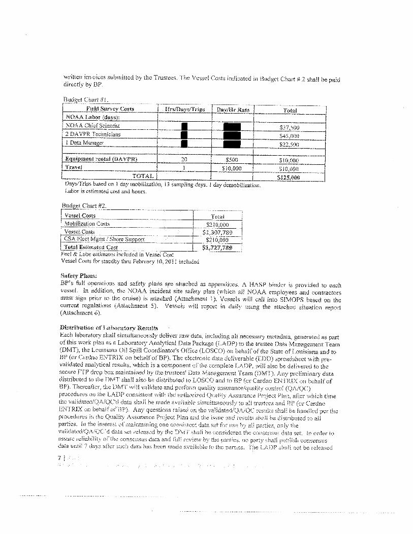
written invoices submitted by the Trustees. The Vessel Costs indicated in Budget Chart 4 2 shall be paiddirectly by BP.
Budget Chart #1
Field Survey Costs HrsIDavs/TripsNOAA Labor (davsi: I —___________________
NOAA Chief Scientist $37,5002 DAVPR Technicians $45,000I DataManager — $22,500
entrental(DAVPRL_, 20 — $500 $10,000Travel 1 $10,000 $10,000
TOTALS $125,000Days/Trips based on 1 day mobilization, 13 sampling days, I day demobilization.Labor is estimated cost and hours.
,getChart#2.
_____
Vessel Costs TotalMobilization Costs
__________
$210,000Vessel Costs
_____________
CSA Fleet Mgmt / Shore Support $2 l0,000Total Estimated Cost
_____
$1,727,789 JFuel & Lube estimates included in Vessel CostVessel Costs for standby thru February 10, 2011 included
Safety Plans:OP’s full operations and safety plans are attached as appendices. A HASP binder is provided to eachvessel, in addition, the NOAA incident site safety plan (which all NOAA employees and contractorsmust sign prior to the cruise) is attached (Attachment 1). Vessels will call into SIMOPS based on thecurrent regulations (Attachment 5). Vessels v,ill report in daily using the attached situation report(Attachment 6).
Distribution of Laboratory ResultsEach laboratory shall simultaneously deliver raw data, including all necessary metadata. generated as partof this work plan as a Laboratory Analytical Data Package (LADP) to the trustee Data Management Team(DMT), the Louisiana Oil Spill Coordinators Office (LOSCO) on behalf of the State of Louisiana and tcBP (or Cardno ENTR1X on behalf of BP). The electronic data deliverable (EDO) spreadsheet with prevalidated analytical results, which is a component of the complete LADP, will also be delivered to thesecure FTP drop hex msuntained b the trustees’ Data Management Team (DMT). Any ereliminary datadistributed to the DMT shall also be distributed to LOSCO and to OP (or Cardno ENTRIX on behalf ofBP). Thereafter, the DMT will validate and perform quality assurance/quality control (QA1QC)procedures on the LADP consistent with the authorized Quality Assurance Project Plan, after which timethe validated/QA!QC’d data shall be made available simultaneously to all trustees and OP (or CardnoENTRIX on behal fof BP). Any questions raised or, the vaiidatediQA!QC rcsu:ts shall he handled per theprocedures in she Quality Assurance Project Plan and she issue and results shall he distributed so auparties. in the interest of maintaining one consistent data set tot use by all parties, only thevalidated!QA/QC’d data set released by the DMT shall he considered the consensus data set. In order toassure reliabilit’, ofthe consensus data and full revIew by rho artes, no party shall publish consensusdata until 7 days alter such data has been made available to the parties. The LADP shall not fe released
7
by the DMT, LOSCO, BP or Cardno ENTRIX prior to vaiidation!QA!QC absent a showing of criticaloperational need. Should any party show a critical operational need for data prior o validation/QA/OC.any released data will he clearly marked “preliminary/unvalidated” and will be made available equally toall trustees and to BP (or Cardno ENTRIX on behalf of EP).
References:Broughton EA, Lough RG. 2006. A direct comparison of MOCNESS and Video Plankton Recorderzoopiankton abundance estimates: Possible applications for augmenting net sampling with video systems.Deep Sea Research Part II: Topical Studies in Oceanography, 53, 2789—2807.
Attachments:Attachment 1, N RDA_Ops_Safety Plan 08DEC20 10Attachment 2. MC252 HSSE incident Reporting Final 02 May 10 rev IAttachment 3. CSA-Davis HSE Plan Rev 005 finalAttachment 4. Transfer of Personnel and Material at Sea 070510Attachment 5. NRDA SIMOPS Procedures 1.11710Attachment 6. DWH Vessel Daily SitRepAtiachrnent 7. MC252 Analytical QAP V2. 1Attachment 8. NRDA_Fie1d_SamplerData_Management_Protocol_l 0232010Attachment 9. Historical Plankton Data 2OlOAugl7Attachment 10. Davis-VPR Holography-20 I ODec9Attachment 11. Chelsea Aquatracka FluorometerAttachment 12. Acoustic Backscattering Sensor (ABS)
8
ta
I
4
‘1