Embed Size (px)
Citation preview
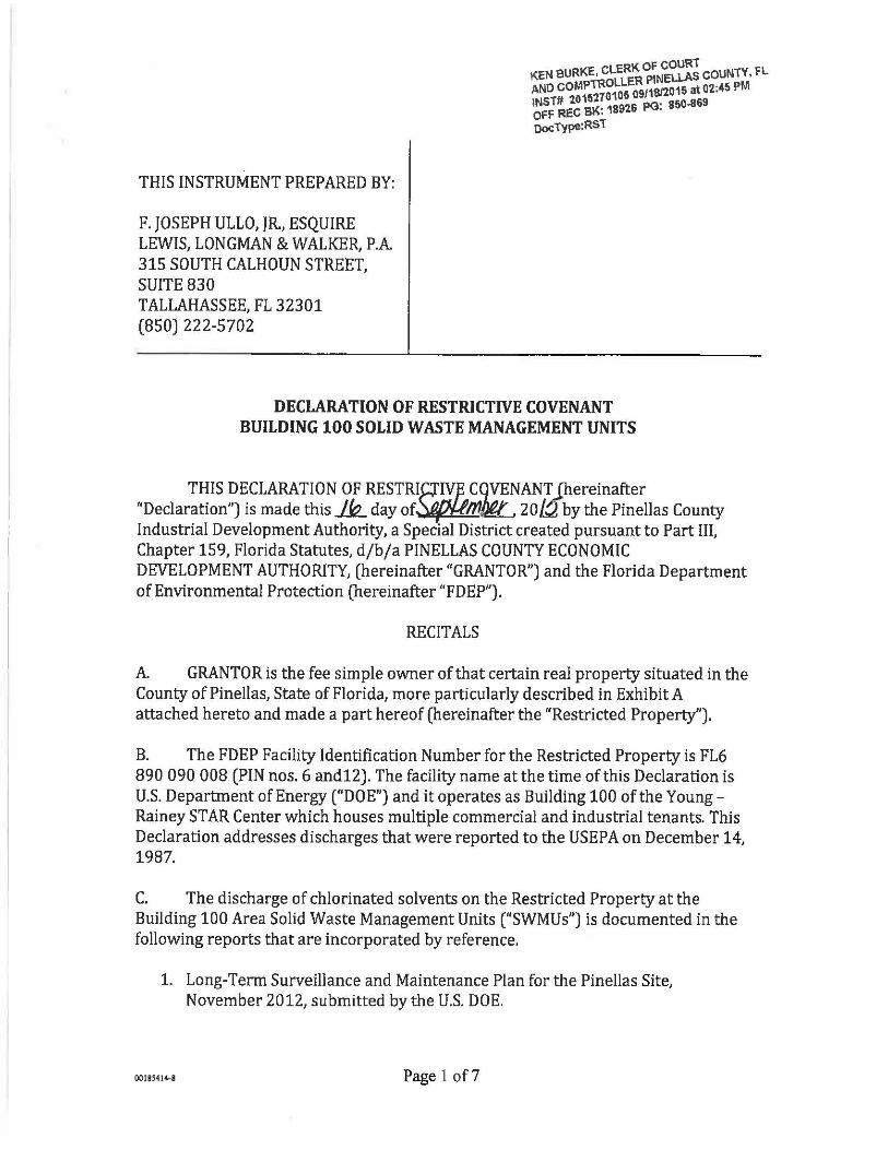
THIS INSTRUMENT PREPARED BY:
F. JOSEPH ULLO, JR., ESQUIRE LEWIS, LONGMAN & WALKER, P.A. 315 SOUTH CALHOUN STREET, SUITE 830 TALLAHASSEE, FL 32301 (850) 222-5702
KEN BURKE, CLE~~ ~N~~~~ COUNTY, FL AND COMf~~~~~ OS/'\S/2015 at 02:45 PM INST# 20 BK' 18916 PG: 850-869 Off REC · OocType:RST
DECLARATION OF RESTRICTIVE COVENANT BUILDING 100 SOLID WASTE MANAGEMENT UNITS
THIS DECLARATION OF RESTRIR!Yf ... ~~~ANT Jhereinafter "Declaration") is made this k day of~, 20/.:}, by the Pinellas County Industrial Development Authority, a Special District created pursuant to Part III, Chapter 159, Florida Statutes, d/b/a PINELLAS COUNTY ECONOMIC DEVELOPMENT AUTHORITY, (hereinafter "GRANTOR") and the Florida Department of Environmental Protection (hereinafter "FDEP").
RECITALS
A. GRANTOR is the fee simple owner of that certain real property situated in the County of Pinellas, State of Florida, more particularly described in Exhibit A attached hereto and made a part hereof (hereinafter the "Restricted Property").
B. The FDEP Facility Identification Number for the Restricted Property is FL6 890 090 008 (PIN nos. 6 and12). The facility name at the time of this Declaration is U.S. Department of Energy ("DOE") and it operates as Building 100 ofthe YoungRainey STAR Center which houses multiple commercial and industrial tenants. This Declaration addresses discharges that were reported to the US EPA on December 14, 1987.
C. The discharge of chlorinated solvents on the Restricted Property at the Building 100 Area Solid Waste Management Units ("SWMUs") is documented in the following reports that are incorporated by reference.
1. Long-Term Surveillance and Maintenance Plan for the Pinellas Site, November 2012, submitted by the U.S. DOE.
00185414-8 Page 1 of7
2. Sitewide Environmental Monitoring, Semiannual Progress Reports for the Young- Rainey STAR Center, submitted by the U.S. DOE and dated December 2012 through May 2013.
3. Building 100 Area Corrective Measures Study Report Addendum for the Young- Rainey STAR Center, submitted by the U.S. DOE, July 2006.
D. The reports noted in Recital C set forth the nature and extent of the contamination that is located on the Restricted Property. These reports confirm that contaminated soil and groundwater, as defined by Chapter 62-780 Florida Administrative Code (F.A.C.), exist on the Restricted Property. DOE continues monitoring groundwater in accordance with the Long-Term Surveillance and Maintenance Plan.
E. The intent of the restrictions in this Declaration is to reduce or eliminate the risk of exposure to users or occupants of the Restricted Property and to the environment of the contaminants and to reduce or eliminate the threat of migration ofthe contaminants.
F. The FDEP has agreed to issue a Site Rehabilitation Completion Order with Conditions (hereinafter "Order") upon recordation of this Declaration, and any nec~ssary amendments thereto, and the achievement of site rehabilitation in accordance with Chapter 62-780. The FDEP can unilaterally revoke the Order if the conditions of this Declaration or of the Order are not met. Additionally, if concentrations of chemicals of concern increase above the levels approved in the Order, or if a subsequent discharge occurs at the Restricted Property, the FDEP may require site rehabilitation to reduce concentrations of contamination to the levels allowed by the applicable FDEP rules. The Order relating to FDEP Facility No. FL6 890 090 008 (PIN12) can be found by contacting the appropriate FDEP district office or bureau.
G. GRANTOR deems it desirable and in the best interest of all present and future owners of the Restricted Property that an Order be obtained for the Building 100 Area SWMUs and that the Restricted Property be held subject to certain restrictions and engineering controls, all of which are more particularly hereinafter set forth.
NOW, THEREFORE, to induce the FDEP to issue the Order and for other good and valuable consideration, the receipt and sufficiency of which are hereby acknowledged by each of the undersigned parties, GRANTOR agrees as follows :
1. The foregoing recitals are true and correct and are incorporated herein by reference.
2. GRANTOR hereby imposes on the Restricted Property the following restrictions:
0018S4J4-8 Page 2 of7
001:5414-8
a.i. There shall be no use of or access to the groundwater under the Restricted Property unless pre-approved in writing by FDEP's Division of Waste Management ("DWM") in addition to any authorizations required by the Division of Water Resource Management ("DWRM") and the Water Management District ("WMD").
a.ii. For any dewatering activities on the Restricted Property a plan approved by FDEP's DWM must be in place to address and ensure the appropriate handling. treatment and disposal of any extracted groundwater that may be contaminated.
a.m. Attached as Exhibit B, and incorporated by reference herein, is a Survey identifying the size and location of existing stormwater swales, stormwater detention or retention facilities, and ditches on the Restricted Property. Such existing storm water features shall not be altered, modified or expanded, and there shall be no construction of new storm water swales, stormwater detention or retention facilities or ditches on the Restricted Property without prior written approval from FDEP's DWM in addition to any authorizations required by the DWRM and the WMD. A revised exhibit must be recorded when any stormwater feature is altered, modified, expanded, or constructed.
b.i. The area of soil contamination associated with free product on the Restricted Property is shown in Exhibit A and is beneath Building 100. This area shall be permanently covered and maintained with an impermeable material that prevents human exposure and prevents water infiltration (hereinafter referred to as "the Engineering Control"). An Engineering Control Maintenance Plan ("ECMP") approved by the Department shall be maintained that includes the frequency of inspections and monitoring and the criteria for determining when the Engineering Control has failed. A revised or amended ECMP should be developed as needed. The approved ECMP is included as Exhibit C.
b.ii. Excavation and construction is not prohibited on the Restricted Property provided any contaminated soils that are excavated are removed and properly disposed of pursuant to Chapter 62-780, F.A.C. and any other applicable local, state, and federal requirements. Nothing herein shall limit any other legal requirements regarding construction methods and precautions that must be taken to minimize risk of exposure while conducting work in contaminated areas. For any dewatering activities, a plan approved by FDEP's DWM must be in place to address and ensure the appropriate handling. treatment, and disposal of any extracted groundwater that may be contaminated. Nothing in this Declaration shall prevent, limit or restrict any excavation or construction at or below the surface outside the boundary of the Restricted Property.
Page 3 of7
3. In the remaining paragraphs, all references to "GRANTOR" and "FDEP" shall also mean and refer to their respective successors and assigns.
4. For the purpose of monitoring the restrictions contained herein, FDEP is hereby granted a right of entry upon and access to the Restricted Property at reasonable times and with at least 24-hours notice to the GRANTOR. Access to the Property is granted by an adjacent public right of way via Bryan Dairy Road.
5. It is the intention of GRANTOR that this Declaration shall touch and concern the Restricted Property, run with the land and with the title to the Restricted Property, and shall apply to and be binding upon and inure to the benefit of GRANTOR and FDEP, and to any and all. parties hereafter having any right, title or interest in the Restricted Property or any part thereof. The FDEP may enforce the terms and conditions of this Declaration by injunctive relief and other appropriate available legal remedies. Any forbearance on behalf of the FDEP to exercise its right in the event of the failure ofthe GRANTOR to comply with the provisions of this Declaration shall not be deemed or construed to be a waiver of the FDEP's rights hereunder. This Declaration shall continue in perpetuity, unless otherwise modified in writing by GRANTOR and the FDEP as provided in paragraph 7 hereof. These restrictions may also be enforced in a court of competent jurisdiction by DOE and/or any party that establishes proper standing. If the GRANTOR does not or will not be able to comply with any or all of the provisions of this Declaration, the GRANTOR shall notify FDEP in writing within three (3) calendar days. Additionally, GRANTOR shall notify FDEP thirty (30) days prior to any conveyance or sale, granting or transferring the Restricted ~roperty or portion thereof, to any heirs, successors, assigns or grantees, including, without limitation, the conveyance of any security interest in said Restricted Property.
6. In order to ensure the perpetual nature of these restrictions, GRANTOR shall reference these restrictions in any subsequent lease or deed of conveyance within the Restricted Property, including the recording book and page of record of this Declaration. Furthermore, prior to the entry into a landlord-tenant relationship with respect to the Restricted Property, the GRANTOR agrees to notify in writing all proposed tenants of the Restricted Property of the existence and contents of this Declaration of Restrictive Covenant.
7. This Declaration is binding until a release of covenant is executed by the FDEP Secretary (or designee) and is recorded in the public records of the county in which the land is located. To receive prior approval from the FDEP to remove any requirement herein, cleanup target levels es'tablished pursuant to Florida Statutes and FDEP rules must have been achieved. This Declaration may be modified in writing only. Any subsequent amendments must be executed by both GRANTOR and the FDEP and be recorded by the real property owner as an amendment hereto.
8. If any provision of this Declaration is held to be invalid by any court of competent jurisdiction, the invalidity of that provision shall not affect the validity of any other
00185414-8 Page 4 of7
provisions of the Declaration. All such other provisions shall continue unimpaired in full force and effect.
9. GRANTOR covenants and represents that on the date of execution of this Declaration that GRANTOR is seized of the Restricted Property in fee simple and has good right to create, establish, and impose this restrictive covenant on the use of the Property. GRANTOR also covenants and warrants that the Restricted Property is free and clear of any and all liens, mortgages, or encumbrances that could impair GRANTOR'S rights to impose the restrictive covenant described in this Declaration or that is superior to the restrictive covenant described in this Declaration.
[DECLARATION EXECUTED ON FOLLOWING PAGES]
00185414-8 Page 5 of?
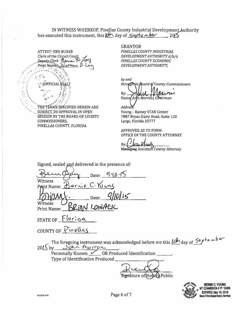
IN WITNESS WHEREOF, Pir;;ll;s County Industrial Developmen!,Authority has executed this instrument, this day of D-Qpf't? ""'her- . 20!5
ATTEST: KEN BURKE Clerk of the Circuit Coufk ../ . ,.
• _))13/illti}h~{~rk ·?t~ 'til ~d ___ .- · .. ~~~~raM~~~f!)rn.v.t"' D·~j
.--· ... · ........ •., .~:.·: .. ~~.·~:1.':_.• . -: r:··':';... f '
• I • , " ..- Q(' (" ~-> '1, .._ • ~ . ' ' f' I • •
;.~~ WFFICIAL $E4J-): } • \! ~ ~-~: :_~
• ~ • 1 .::;:'~ .. - · - · ... • r ;,
•L 'i •• ...~.t :8 ~4 .. ~ -~~ • , • ' ~ ("(..~ .. -~ I ·_·:.., :'·
'j / • • • • • • .. ; ~- ~ .. , - -
' · .. · · · . rfiE"tE:.ru.fs· sl?iciFIEn HEREIN ARE 0 'I . 0: . SUBJEC!: :i:e-APPROVAL IN OPEN
SESSib'N BY THE BOARD OF COUNTY COMMISSIONERS, PINELLAS COUNTY, FLORIDA
GRANTOR PINELLAS COUNTY INDUSTRIAL DEVELOPMENT AUTHORITY djbja PINELLAS COUNTY ECONOMIC DEVELOPMENT AUTHORITY,
by and throyf!Ft\ts ard
By: !J"-'~~·II'i·Ar-~"-¥'~~W: Nam ]o n Morroni, C irman
Addr : Young- Rainey STAR Center 7887 Bryan Dairy Road, Suite 120 Largo, Florida 33777
APPROVED AS TO FORM: OFFICE OF THE COUNTY ATTORNEY
By, (],b.~ Msaagiag Assistan County Attorney
d delivered in the presence of:
~~------~r-_. __ _ Date: c;-(() ,rt) Witness '-/ P[};t N arne: ~ "' r "; e C- r cl v "'5 ; OJ(Qll!L\-· Date: Cf/10/ I~
Witness U ~ n . ,.. 1 1 • ~l All 1 • Print Name: OJ--IJ\lv "".O[rlltT~'-
STATE OF f(o r ~ o a...
COUNTY OF 'Vtl\el~~S
( The foregoing instrument yvas acknowledged before me this _ldh_ day of ~f t-~ '"'h w-
2 0 l.1 by ~ c) h."' r'\-w r ro A. , •
Personally Known 7 OR Produced Identification _ _ _ Type of Identification Produced-------------,,...::;;;;;~-·
Public
00185414-8 Page 6 of7
#'~·~ BEANIE C. YOUNG
•
• ' • MY OOMMISSION IFF 124388 •,., ,
1 EXPIRES: May 19, 2018
........ "'cjlf"" ~llftladgetNollly $ei'Yicft
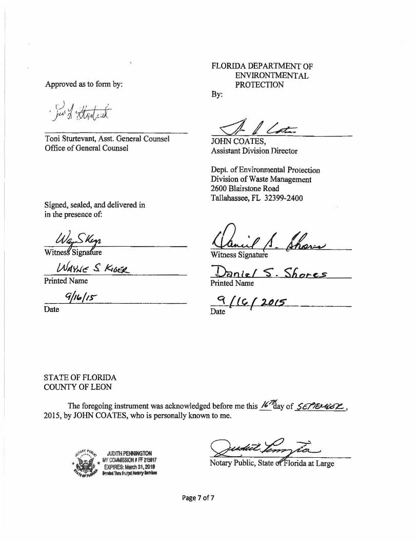
Approved as to form by:
Toni Sturtevant, Asst. GeneraJ Counsel Office of General Counsel
Signed, sealed, and delivered in in the presence of:
Date
STATE OF FLORIDA COUNTY OF LEON
FLORIDA DEPARTMENT OF ENVIRONTMENT AL PROTECTION
By:
JOHN COATES, Assistant Division Director
Dept. ofEnvironmental Protection Division of Waste Management 2600 Blairstone Road Tallahassee, FL 32399-2400
Witness Signature
J:2unltf S"- Shacc,.s Printed Name
_3_{.tc, f Yt$ Date 1
The foregoing instrument was acknowledged before me this lt~y of $~~ , 2015, by JOHN COATES, who is personally known to me.
Page 7 of7
001854144
EXHIBIT A LEGAL DESCRIPTION AND ILLUSTRATION OF
RESTRICTED PROPERTY
{00185414-8 J
I
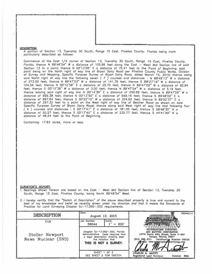
DESCRIPTION: A portion of Section 13, Township 30 South, Range 15 East, Pinellas County, Florida being more particularly described as follows:
Commence at the East 1/4 corner of Section 13, Township 30 South, Range 15 East, Pinellas County, Florida; thence N 89"46'54" W a distance of 105.99 feet along the East - West Mid Section line of said Section 13 to o point; thence N 00"1.3'06" E a distance of 75.41 feet to the Point of Beginning; said point being on the North right of way line of Bryan Dairy Rood per Pinellas County Public Works, Division of Survey and Mopping, Specific Purpose Survey of Bryon Dairy Rood, doted March 15, 201 0; thence along said North right of way line the following seven ( 7 ) courses and distances : N 88'48'1 .3" W o distance of 273.00 feet; thence N 89"47'03" W o distance of 141.79 feet; thence S 88"27'16" W a distance of 104.59 feet; thence N 00"12'58" E a d istance of 25.70 feet; thence N 89"47'05" W a distance of 62.84 feet; t hence S 00"12'36" W o distance of .3.00 feet; thence N 89"47'04" W a d istance of 5.1 9 feet; thence leaving said right of way line N 00'14'39" E a distance of 250.65 feet; thence N 89"47'59" W a distance of 669.38 feet; thence N 00'13'50" E o distance of 549. 16 feet; thence S 89' 48'02" E a distance of 997.64 feet; thence S 00"22'10" W o distance of 324.62 feet; thence N 89'52'37" E a distance of 297.32 feet to a point on the West r ight of way line of Belcher Rood as shown on said Specific Purpose Survey of Bryan Dairy Rood; thence along said West right of way line that following four ( 4 ) courses and distances : S 00'17'41" E a distance of 181.05 feet; thence S 08'48 '30" W o distance of 50.57 feet; thence S 00'17'40" E a distance of 2.35.77 feet; thence S 44'41 '49" W a distance of 48.24 feet to the Point of Beginning.
Containing: 1 7.93 acres, more or Jess.
SURVEYOR'S REPORT: 1. Bearings shown hereon are based on the East - West Mid Section line of Section 13, Township 30
South, Range 15 East, Pinellas County, being North 89'46'54" West.
2. I hereby certify that the "Sketch of Description" of the above described property is true ond correct to the best of my knowledge and belief as recently drown under my direction ond that it meets the Standards of Practice for Land Surveying Chapter 5J-17.050- .052 requirements.
DESCRIPTION FOR
Stoller Newport News Nuclear (SN3)
Dote: August 13, 2015
Job Number:
56044 JScole: 1" = zoo·
Chapter SJ-17.050-.052, Florida Administrative Code requires thot o legal description drawing bear
the notation thct
THIS IS NOT A SURVEY.
SHEET 1 OF 2 SEE SHEET 2 FOR SKETCH
.. ~~4014
SOUTHEAST£RN SURVEYING AND WAPPING CORPORATION
!0770 North 46lb Street, Suite C-300 Tampa, Florida 33617
(813) 898--.2711 c;;:~~9f .Number L!32106
_ta 71/~~""Zil--CHARLES M. ARNETT
L--------------------------------~----------- 1 Registered Land Surveyor Number 6684
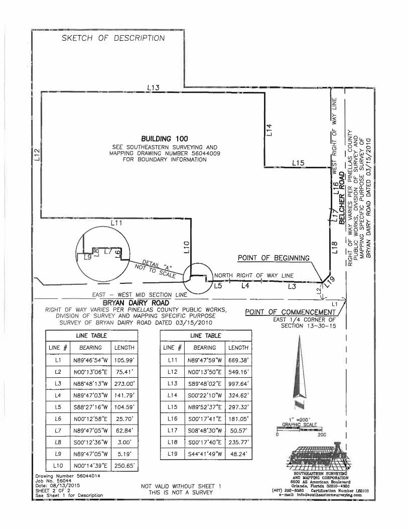
~---------------~-------------, SKETCH OF DESCRIPTION
L13 P---~-------- -----~------------------
BUILDING 1 00 SEE SOUTHEASTERN SURVEYING AND
MAPPING DRAWING NUMBER 56044009 FOR BOUNDARY INFORMATION
L-----------~----·~~----~~------~ L11
0 ...... -J
POINT OF BEGINNING
''-----NORTH RIGHT OF WAY LINE
L...j'--l~--~~~-:-----..--..-L5 L4 L3
EAST - WEST MID SECTION LINE - -- BRYAN DAIRY ROAD --
RIGHT OF WAY VARIES PER PINELlAS CO UNTY PUBLIC WORKS, DIVISION OF SURVEY AND MAPPING SPECIFIC PURPOSE
SURVEY OF BRYAN DAIRY ROAD DATED 03/15/2010
LINE TABLE
LINE # BEARING
L1 N89'46'54"W
l2 N00'1.3'06"E
LJ N88'48'13"W
l4 N89'47 '03 'W
L5 S88'27'16''W
l6 N00'12 '58"E
L7 N89'47'05 "W
l8 S00'12'36"W
l 9 N89' 47'05'W
L10 N00'14'39"E
Drawing Number 56044014 Job No. 56044 Date: 08/13/2015 SHEET 2 OF 2 See Sheet 1 for Description --
lENGTH
105.99'
75.41'
273.00'
141 .79'
104.59'
25.70'
62.84'
3.00'
5.19'
250.65'
UNE TABLE
LINE # BEARING
L11 N89'47'59"W
L12 N00'13'50"E
L1.3 S89'48'02''E
L14 S00'22'10"W
L15 N89'52'37"E
L16 S00'1 7'41"E
L17 S08'48'30"W
L18 S00'1 7 '40"E
L19 S44'41'49"W
NOT VALID WITHOUT SHEET 1 THIS IS NOT A SURVEY
L1
POINT OF COMMENCEMENT EAST 1/ 4 CORNER OF
SECTION 1 3-30- 15
LENGTH
669.38'
549.16'
997.64'
324.62'
297.32'
181.05 '
50.57'
235.77 '
48.24'
1'" z2QQ" GRAPHIC SCALE ,-.,.........
0 200
SOUTHBASTERK AND KAPPIKC CORPORATION
!1500 All American Boulevard Orl.e.nd.o. Florida 32610-4360
(407) 292-6560 CerUrlcatlon Number LB2108 c-mal~ lnfo~southeesternsurveytna.com
0018~414-8
EXHIBIT B STORMWATER FEATURES
{00185414-8)
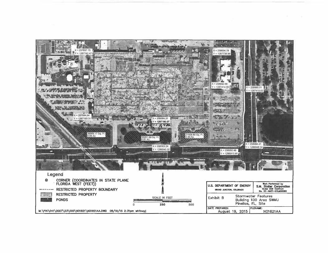
Legend ® CORNER (COORDINATES IN STATE PLANE
FLORIDA WEST (FEEl))
-·~-- RESTRICTED PROPERTY BOUNDARY ~ RESlRICTED PROPERTY
- PONDS 0
M: \PIN\0~1\0007\23\000\N01821\N01821AA.DWG 08/19/15 2:31pm whltneyj
! A
SCALE IN FEET
2!10 !100
U.S. DEPARlMENT OF ENERGY Cll.o.NDoliNC110N,ca..oltADO
Work Porfarmeo{ by S.t.l. Staller Cofl)oratlon
Undw DOE Canlnoct No. D£- Aiol01-o7UIOOOBO
Exhibit 8 Stormwater Features Building 100 Area SWMU Pinellas, FL, Site
821AA
EXHIBIT C ENGINEERING CONTROLS AND MAINTENANCE PLAN
0018S414-8 (0018S414-8 J
Introduction
YOUNG- RAINEY STAR CENTER ENGINEERING CONTROL MAINTENANCE PLAN
FOR THE BUILDING 100 AREA SWMUs
This document is the Engineering Control Maintenance Plan (ECMP) for the Building 100 Area Solid Waste Management Units (SWMUs) at the Yaung-Rainey STAR Center (STAR Center). The STAR Center is a former U.S. Department of Energy facility that is now owned by the Pinellas County Industrial Development Authority. The Building 100 Area SWMUs are located at the southeast comer of the STAR Center.
The plan has been prepared in accordance with the requirements of the Florida Department of Protection (FDEP) Chapter 62-780.680, Florida Administrative Code (F .A. C.) and the FDEP Department of Waste Management Institutional Controls Procedures Guidance, dated November 2013 (DWM IC Guidance). The activities related to the integrity and maintenance of the engineering control (concrete foundation) that occupies the area where source materials exist above the Chapter 62-777, F.A.C. Table II Soil Cleanup Target Levels (SCTLs) and Table I Groundwater Cleanup Target Levels (GCTLs) on site.
Description of Area of Concern The Building 100 Area is made up of two SWMUs: the Industrial Drain Leaks/Building 100 (PIN12) and the Old Drum Storage Site (PIN06). The Industrial Drain Leaks/Building 100 Area lies beneath and adjacent to the northwest comer of the main building concrete foundation, which covers approximately 11 acres, located near the southeast corner of the STAR Center. Building 100 is the most notable feature of the STAR Center, having housed the majority of the laboratory and production facilities during DOE operation of the facility. Building 100 contained individual drain systems used for health physics, chemical, sanitary, and storm water wastes. Leaks from these drain systems caused some of the contamination at the Building 100 Area. The drain systems were flushed, grouted, and abandoned by 1997, and some of the chemical drain systems were replaced by an aboveground system that currently is in use (DOE 1997b ).
The Old Drum Storage Site is located at the northwest comer ofthe Building 100 Area and is the former location of a concrete storage pad. This area was equipped with a drain and containment system and was used to store hazardous waste. The waste stored at this location included methylene chloride, ignitable liquids, arsenic, and calcium chromate solids. Empty drums containing residual waste solvents also were stored in this area.
Description of Engineering Co~;~trol The institutional controls implemented for this facility will include the SWMU s underneath the concrete foundation of Building 1 00. The engineering control area is shown on Attachment 1. The impervious concrete surface over the SWMUs serves as a barrier to prevent direct human contact with impacted soil and groundwater that might otherwise pose a threat to human health. Based on the current and future use of the property, the barriers should function as intended unless disturbed. Global Positioning System (GPS) coordinates based on the review of the Google Earth aerial for the property describes the boundary of the engineering controlled area as follows: 27° 52' 29.04" North and -82° 44' 59.42" West; 27° 52' 29.02" North and -82° 44'
1
55.31 " West; 27° 52' 27. 77" North and -82° 44' 55. 33" West; 27° 52' 27.90" North and -82° 44' 48.86" West; 27° 52' 23.65" North and -82° 44' 48.87" West; and 27° 52' 23.61 "North and -82° 44' 59.37" West.
Certification of Engineering Control This Engineering Control Maintenance Plan was reviewed and approved by a professional engineer licensed in the State of Florida. This certification is included as Attachment 2.
Inspections Inspection and maintenance of the engineering control will be conducted by the property owner or the owner' s designee in accordance with DWM IC Guidance. The site owner will maintain all building maintenance records that affect the integrity of the building for a period of five years from the date of maintenance activity. The property owner or their representative will review pertinent maintenance records and inspect the engineering control at least once per year, and a record of this inspection will be maintained by the site owner for a period of five years following the date of inspection. The inspection record must include the date of the inspection, the name of the inspector, the inspection results, and a description of any deficiencies and associated remedies. A copy of the inspection record will be kept at the address of the property owner and available for submittal or inspection by FDEP representatives upon their request. Failure criteria for the engineering control will consist of uncontrolled breaches in the building.
Maintenance If problems are noted during the inspections, repairs will be scheduled as soon as practical. Repairs can include patching and filling, and/or construction operations. In the event that necessary maintenance activities expose the underlying soil and/or groundwater, the owner must inform maintenance workers of the direct contact exposure hazard and provide them with appropriate personal protection equipment ("PPE"). The owner must also sample (laboratory analysis) any soil excavated or groundwater extracted from the site prior to disposal to ascertain if impacted soil and/or groundwater remains on-site. The soil and/or groundwater must be treated, stored, and disposed of by the owner in accordance with applicable local, state, and federal laws.
In the event the impervious surface overlying the impacted SWMUs is removed and replaced, the replacement barrier must be equally impervious. Any replacement barrier will be subject to the same maintenance and inspection guidelines as outlined in this ECMP, unless indicated otherwise by the FDEP, or its successor. The property owner, in order to maintain the integrity of the impervious surface, will maintain a copy of this ECMP on-site and make it available to all interested parties (i.e., on-site employees, contractors, future property owners, and county and/or state regulators etc.) for viewing. The following activities are prohibited on any portion of the property where pavement, a building foundation, soil cover, and/or engineered cap is required unless prior written approval has been obtained from the FDEP: 1) removal of the existing barrier; 2) replacement with another barrier; 3) excavating or grading of the land surface; 4) filling on capped or paved areas; or 5) construction or placement of a building or other structure. This ECMP can be amended or withdrawn by the property owner and its successors with the written approval from the FDEP
2
Contingency Plan If future actions at the site will result in a significant reduction of the effectiveness of the engineering control, a contingency plan will be implemented by the property owner. Such future detrimental actions include modifications to the footprint of Building 1 00, site redevelopment, and any other actions that would substantially alter or damage the engineering control.
This contingency plan includes the following items.
• A plan describing the proposed action will be submitted to the FDEP for approval. • If the change to the engineering control is temporary, the plan will describe hpw the
engineering control will be repaired to its original state. • If the change is permanent, the plan will describe how the altered engineering control will
remain effective. • The plan will describe how any contaminated soil or groundwater, if encountered, will be
disposed of.
At some time in the future, it may be possible to remove or remediate the source of contamination under Building 100. After the source is gone, an engineering control may no longer be needed.
3
Attachment 1
Location of Engineering Control, Building 100 Area SWMU Pinellas, Florida, Site.
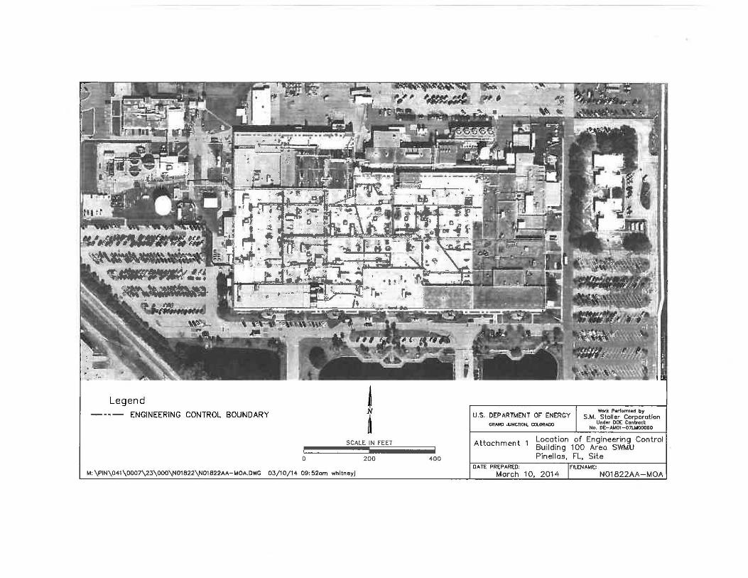
Legend j -··- ENGINEERING CONTROL BOUNDARY N
~ SCALE IN FEET
D 200 400
M: \PIN\041\0007\23\000\N01B22\N01822AA-MOA.DWG 03/10/14 09:52am whitneyj
G~.-HD ...,NCTION, C!l..ORADO
Work Performed by
S.M. u;J~11~6E ~~,1~[tation No. DE-At.401-07UA00060
U.S. DEPARTMENT OF ENERGY
Attachment l Lo~a~ion of Engineering Control Bu1ldmg 100 Area SWMU Pinellas, FL. Site
DATE PREPARED:
March N01822AA-MOA
Attachment 2
Engineering Control Certification
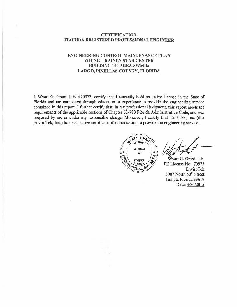
CERTIFICATION FLORIDA REGISTERED PROFESSIONAL ENGINEER
ENGINEERING CONTROL MAINTENANCE PLAN YOUNG - RAINEY STAR CENTER
BUILDING 100 AREA SWMUs LARGO, PINELLAS COUNTY, FLORIDA
I, Wyatt G. Grant, P.E. #70973, certify that I currently hold an active license in the State of Florida and am competent through education or experience to provide the engineering service contained in this report. I further certify that, in my professional judgment, this report meets the requirements of the applicable sections of Chapter 62-780 Florida Administrative Code, and was prepared by me or under my responsible charge. Moreover, I certifY that TankTek, Inc. (dba EnviroTek, Inc.) holds an active certificate of authorization to provide the engineering service.
EnviroTek 3007 North 50th Street Tampa, Florida 33619
Date: 4/30/2015
!I; ~ ( -".a .... .,. .... •
1 1 I ( ;; ' j : l' ~ ~ .. - o-
\\\\, , .......