Embed Size (px)
Citation preview
DFC Corporation of India Ltd.
(A Govt. of India Undertaking
Under Ministry of Railways)
Summary of
Environmental and Social Impact Assessment (ESIA) Study
For
Western Corridor of Dedicated Freight Corridor Project (Phase 2)
For JNPT - Vadodara And Rewari – Dadri Sections
December 2011
This summary explains main features of the final environmental and social impact assessment
(ESIA) study carried out for the Western Corridor of the Dedicated Freight Corridor (DFC) Project
Phase 2 for JNPT - Vadodara and Rewari – Dadri sections. This summary for Final ESIA is
distributed to the public as an information dissemination process under the project by the Dedicated
Freight Corridor Corporation of India Limited (DFCCIL) as project implementing agency.
The Project Brief
The Ministry of Railways (MoR) through the Dedicated Freight Corridor Corporation of India Limited
(DFCCIL), a Special Purpose Vehicle (SPV), is implementing Computerized Multi Modal High Axle
Load Dedicated Freight Corridor (DFC) Project between Delhi-Mumbai under the Western DFC
Corridor. Considering the ever increasing freight traffic movement between the metros and their
respective hinterlands, the DFC Project through adoption of improved technologies will result in a
paradigm shift of freight transportation from road to the low carbon intensive mode rail transport and
inherent improvement in energy efficiency of freight rail for transportation of bulk goods.
The Western DFC is designed to carry a total freight line of 37.7 million tonnes in fiscal year 2013-
2014, which would increase to 140.4 million tonnes in 2033-34. Creation of rail infrastructure on such a
scale, unprecedented in independent India, is also expected to drive the establishment of industrial
corridors, logistic parks and other economic and trade centres along its alignment and will support
India’s growing economy which is at present levelled as the second fastest in the world.
The Western DFC has two broad streams of traffic, one, between the terminal nodes at either end,
Jawaharlal Nehru Port Trust (JNPT) in Mumbai and Dadri in Uttar Pradesh including Tuglakabad
(TKD) in Delhi, and the other, the traffic entering from branch line feeder routes at the various junction
points en route. Implementation of the DFC Project will result in reducing the carbon intensity of
India’s transport sector.
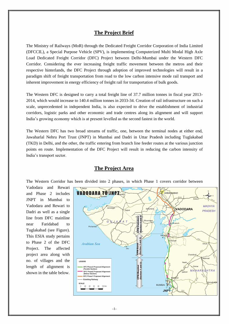
The Project Area
The Western Corridor has been divided into 2 phases, in which Phase 1 covers corridor between
Vadodara and Rewari
and Phase 2 includes
JNPT in Mumbai to
Vadodara and Rewari to
Dadri as well as a single
line from DFC mainline
near Faridabad to
Tuglakabad (see Figure).
This ESIA study pertains
to Phase 2 of the DFC
Project. The affected
project area along with
no. of villages and the
length of alignment is
shown in the table below.
-1-
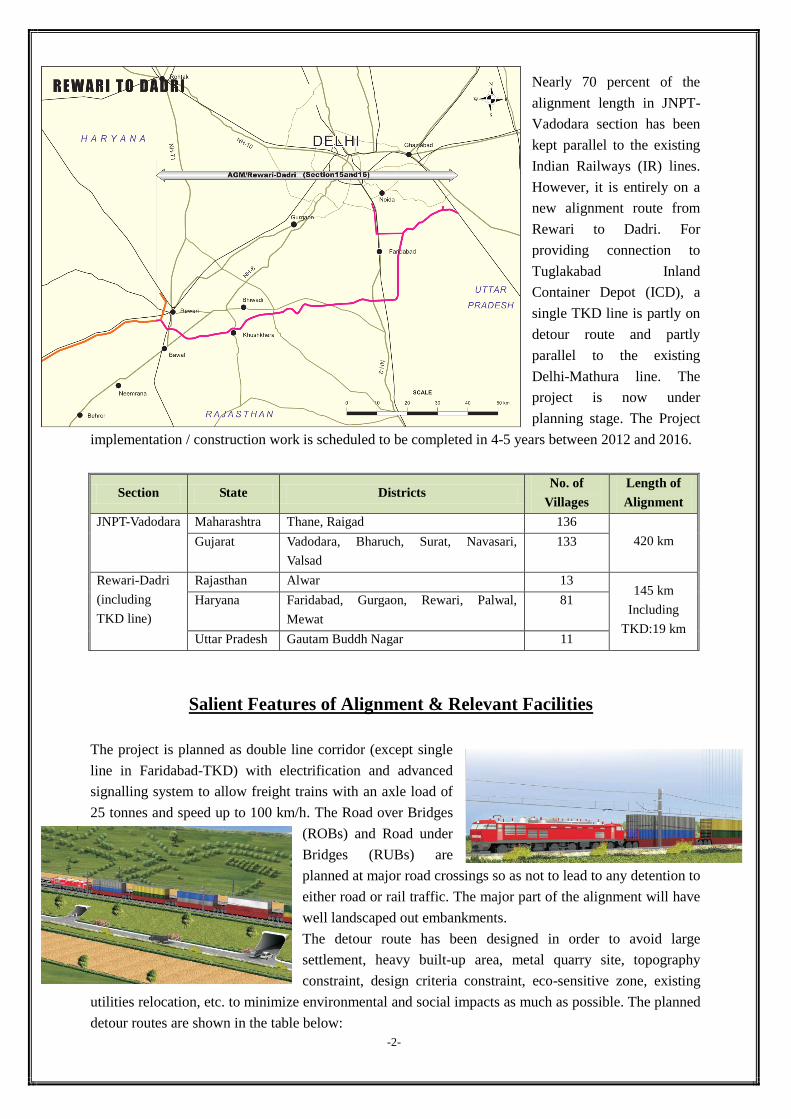
Nearly 70 percent of the
alignment length in JNPT-
Vadodara section has been
kept parallel to the existing
Indian Railways (IR) lines.
However, it is entirely on a
new alignment route from
Rewari to Dadri. For
providing connection to
Tuglakabad Inland
Container Depot (ICD), a
single TKD line is partly on
detour route and partly
parallel to the existing
Delhi-Mathura line. The
project is now under
planning stage. The Project
implementation / construction work is scheduled to be completed in 4-5 years between 2012 and 2016.
Section State Districts No. of
Villages
Length of
Alignment
JNPT-Vadodara Maharashtra Thane, Raigad 136
420 km Gujarat Vadodara, Bharuch, Surat, Navasari,
Valsad
133
Rewari-Dadri
(including
TKD line)
Rajasthan Alwar 13 145 km
Including
TKD:19 km
Haryana Faridabad, Gurgaon, Rewari, Palwal,
Mewat
81
Uttar Pradesh Gautam Buddh Nagar 11
Salient Features of Alignment & Relevant Facilities
The project is planned as double line corridor (except single
line in Faridabad-TKD) with electrification and advanced
signalling system to allow freight trains with an axle load of
25 tonnes and speed up to 100 km/h. The Road over Bridges
(ROBs) and Road under
Bridges (RUBs) are
planned at major road crossings so as not to lead to any detention to
either road or rail traffic. The major part of the alignment will have
well landscaped out embankments.
The detour route has been designed in order to avoid large
settlement, heavy built-up area, metal quarry site, topography
constraint, design criteria constraint, eco-sensitive zone, existing
utilities relocation, etc. to minimize environmental and social impacts as much as possible. The planned
detour routes are shown in the table below:
-2-
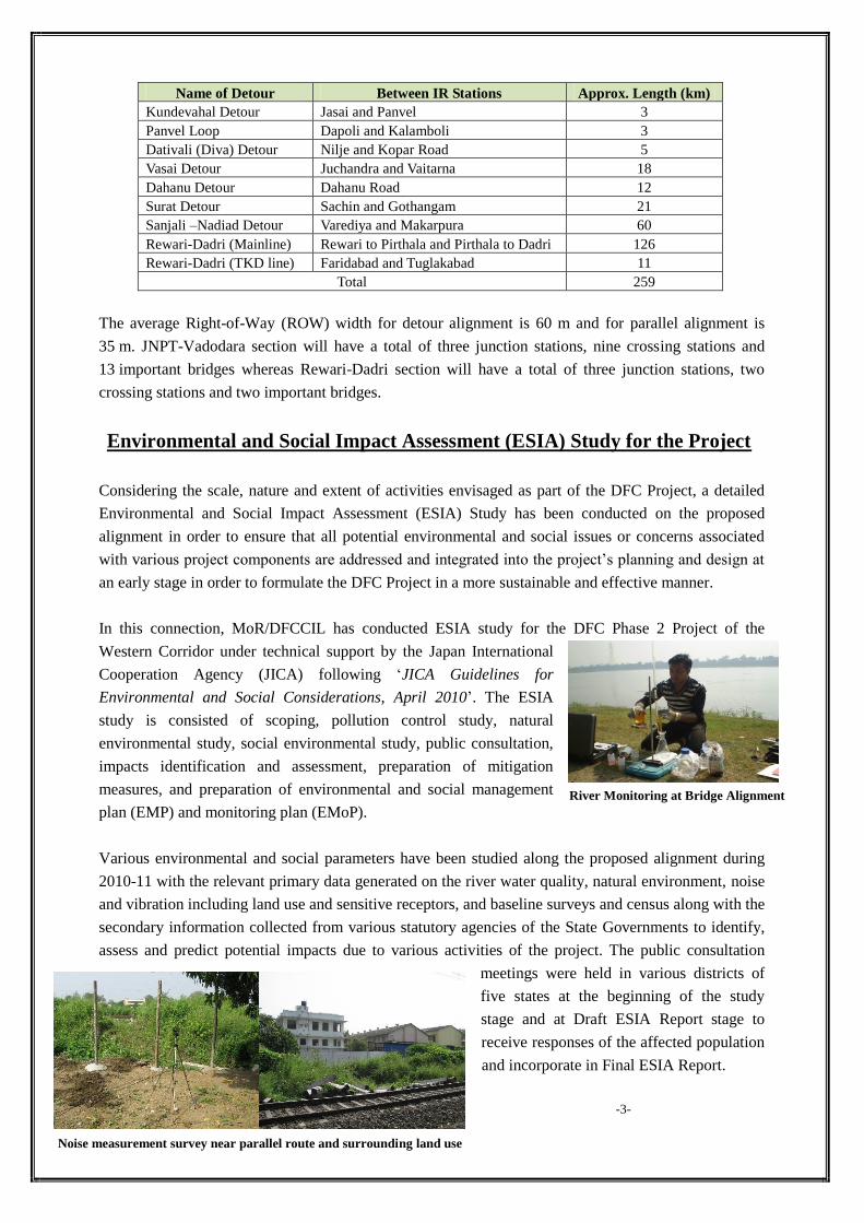
River Monitoring at Bridge Alignment
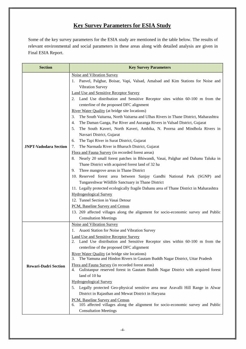
Noise measurement survey near parallel route and surrounding land use
Name of Detour Between IR Stations Approx. Length (km)
Kundevahal Detour Jasai and Panvel 3
Panvel Loop Dapoli and Kalamboli 3
Dativali (Diva) Detour Nilje and Kopar Road 5
Vasai Detour Juchandra and Vaitarna 18
Dahanu Detour Dahanu Road 12
Surat Detour Sachin and Gothangam 21
Sanjali –Nadiad Detour Varediya and Makarpura 60
Rewari-Dadri (Mainline) Rewari to Pirthala and Pirthala to Dadri 126
Rewari-Dadri (TKD line) Faridabad and Tuglakabad 11
Total 259
The average Right-of-Way (ROW) width for detour alignment is 60 m and for parallel alignment is
35 m. JNPT-Vadodara section will have a total of three junction stations, nine crossing stations and
13 important bridges whereas Rewari-Dadri section will have a total of three junction stations, two
crossing stations and two important bridges.
Environmental and Social Impact Assessment (ESIA) Study for the Project
Considering the scale, nature and extent of activities envisaged as part of the DFC Project, a detailed
Environmental and Social Impact Assessment (ESIA) Study has been conducted on the proposed
alignment in order to ensure that all potential environmental and social issues or concerns associated
with various project components are addressed and integrated into the project’s planning and design at
an early stage in order to formulate the DFC Project in a more sustainable and effective manner.
In this connection, MoR/DFCCIL has conducted ESIA study for the DFC Phase 2 Project of the
Western Corridor under technical support by the Japan International
Cooperation Agency (JICA) following ‘JICA Guidelines for
Environmental and Social Considerations, April 2010’. The ESIA
study is consisted of scoping, pollution control study, natural
environmental study, social environmental study, public consultation,
impacts identification and assessment, preparation of mitigation
measures, and preparation of environmental and social management
plan (EMP) and monitoring plan (EMoP).
Various environmental and social parameters have been studied along the proposed alignment during
2010-11 with the relevant primary data generated on the river water quality, natural environment, noise
and vibration including land use and sensitive receptors, and baseline surveys and census along with the
secondary information collected from various statutory agencies of the State Governments to identify,
assess and predict potential impacts due to various activities of the project. The public consultation
meetings were held in various districts of
five states at the beginning of the study
stage and at Draft ESIA Report stage to
receive responses of the affected population
and incorporate in Final ESIA Report.
-3-
Key Survey Parameters for ESIA Study
Some of the key survey parameters for the ESIA study are mentioned in the table below. The results of
relevant environmental and social parameters in these areas along with detailed analysis are given in
Final ESIA Report.
Section Key Survey Parameters
JNPT-Vadodara Section
Noise and Vibration Survey
1. Panvel, Palghar, Boisar, Vapi, Valsad, Amalsad and Kim Stations for Noise and
Vibration Survey
Land Use and Sensitive Receptor Survey
2. Land Use distribution and Sensitive Receptor sites within 60-100 m from the
centerline of the proposed DFC alignment
River Water Quality (at bridge site locations)
3. The South Vaitarna, North Vaitarna and Ulhas Rivers in Thane District, Maharashtra
4. The Daman Ganga, Par River and Auranga Rivers in Valsad District, Gujarat
5. The South Kaveri, North Kaveri, Ambika, N. Poorna and Mindhola Rivers in
Navsari District, Gujarat
6. The Tapi River in Surat District, Gujarat
7. The Narmada River in Bharuch District, Gujarat
Flora and Fauna Survey (in recorded forest areas)
8. Nearly 20 small forest patches in Bhiwandi, Vasai, Palghar and Dahanu Taluka in
Thane District with acquired forest land of 32 ha
9. Three mangrove areas in Thane District
10. Reserved forest area between Sanjay Gandhi National Park (SGNP) and
Tungareshwar Wildlife Sanctuary in Thane District
11. Legally protected ecologically fragile Dahanu area of Thane District in Maharashtra
Hydrogeological Survey
12. Tunnel Section in Vasai Detour
PCM, Baseline Survey and Census
13. 269 affected villages along the alignment for socio-economic survey and Public
Consultation Meetings
Rewari-Dadri Section
Noise and Vibration Survey
1. Asaoti Station for Noise and Vibration Survey
Land Use and Sensitive Receptor Survey
2. Land Use distribution and Sensitive Receptor sites within 60-100 m from the
centerline of the proposed DFC alignment
River Water Quality (at bridge site locations)
3. The Yamuna and Hindon Rivers in Gautam Buddh Nagar District, Uttar Pradesh
Flora and Fauna Survey (in recorded forest areas)
4. Gulistanpur reserved forest in Gautam Buddh Nagar District with acquired forest
land of 10 ha
Hydrogeological Survey
5. Legally protected Geo-physical sensitive area near Aravalli Hill Range in Alwar
District in Rajasthan and Mewat District in Haryana
PCM, Baseline Survey and Census
6. 105 affected villages along the alignment for socio-economic survey and Public
Consultation Meetings
-4-
Potential Impacts and Mitigation Measures
Based on the survey results and subsequent analysis, potential environmental and social impacts likely
to result from the DFC project activities have been identified. Specific mitigation measures are
proposed to avoid and minimize such impacts to the level of no significance at planning/design,
construction and operation phases. Such measures for major items of the environmental and social
impacts are mentioned below.
List of Main Potential Impacts and Mitigation Measures
4. Flora
< Planning/Design phase >
Alignment passes through several forest patches
of Recorded Forest Areas in Thane District and
one forest patch in Gautam Buddh Nagar
District
Consideration of adjustments to ROW or loop length to reduce loss of
reserved forest land to the minimum in detailed engineering
Procedure for obtaining clearance under the Forest Conservation Act,
1980 being followed after due consultation with the Forest Department
(FD)
Comply with all stipulated conditions of Forest Clearance when granted < Construction phase >
Loss of flora due to felling of trees within ROW
linearly along the proposed alignment
Deposition of fugitive dust on pubescent leaves
of nearby vegetation could lead to temporary
reduction of photosynthesis
Joint field verification with the respective State FD to avoid uncontrolled
and indiscriminate tree felling
Appropriate compensatory plantation using native species with rate of
replacement as per the State FD. For example, for Dahanu eco-sensitive
area, ten trees for each tree cut
Compensation for trees in private land based on fruit yield, timber and
other economic values
Regular and proper water sprinkling near the site to minimize dust
deposition on vegetation
-5-
Potential Impacts Mitigation Measures
1. Noise and Vibration
< Construction phase >
Noise and vibration due to movement of
vehicles, and operation of heavy construction
machineries
Major construction equipment and machineries shall be fitted with
acoustic control measures such as silencers and mufflers
Construction activities only during daytime near residential areas
Provision of protective gears such as ear muffs to construction personnel
exposed to high decibel levels
< Operation phase >
Noise and vibration due to movement of trains
and related facilities
Use of long welded rails
New technologies incorporated to lower noise and vibration generation
with respect to structures and rolling stocks
Appropriate maintenance of locomotives, tracks and structures
Consideration of noise barriers at appropriate locations such as residential
areas and sensitive receptors
2. Water Pollution
< Construction phase >
Wastewater from construction activities with
suspended impurities
Wastewater disposal from the workers camp
and sludge generated from construction sites
Control of quality of construction wastewater emanating from the
construction site through suitable drainage system with sediment traps
Provision of silt fencing and sand settling pond near water bodies
Provision of proper sanitation facilities at the construction sites to prevent
health related problems due to water contamination
3. Air Pollution
< Construction phase >
Deterioration of ambient air quality due to
particulate matter such as dust, especially
during dry conditions and gaseous emissions
from construction equipment and vehicular
traffic
Storage of construction materials in covered go-downs or enclosed spaces
Adequate dust suppression measures such as regular water sprinkling on
unpaved haul roads and vulnerable areas of the construction sites
All major construction machineries shall be inbuilt with appropriate dust
reduction measures
Necessary permission shall be taken for critically polluted areas and all
conditions of permission shall be complied with
Potential Impacts Mitigation Measures < Operation stage >
Improper post-plantation care/maintenance as
well as illegal felling of plantation
Plantation along the ROW shall be maintained properly as well as
protected from illegal felling
5. Fauna
< Construction phase >
Both terrestrial and avifauna affected by noise
and vibration due to construction equipment
and machinery
Destruction of habitats such as bird nests,
breeding sites along the proposed alignment
All major noise producing construction equipment and machinery shall
be fitted with acoustic control measures
No construction yard in the forest areas
Construction schedule shall avoid heavy construction activities near
forest areas during winter season when migratory birds inhabit the area
< Operation phase >
Impact on aquatic fauna in case of accidental
oil spill and toxic chemicals release find its
way into the water bodies
Immediate action shall be taken for speedy cleaning up of oil spills, fuel
and toxic chemicals in the event of accidents
6. Biodiversity
< Planning/Design phase >
Alignment passes through reserved forest area
between SGNP and Tungareshwar Wildlife
Sanctuary along parallel section
Some mangrove areas in Thane District along
parallel section
Consideration of adjustments to ROW or loop length to reduce loss of
reserved forest land to the minimum in detailed engineering
Procedure for obtaining clearance under the Wildlife Protection Act,
1972 after due consultation with the State’s Chief Wildlife Warden and
other key officials
Procedure for obtaining clearance under the Forest Conservation Act,
1980 for mangrove areas
Comply with all stipulated conditions
< Construction phase >
Mangrove areas with species having
conservation concern affected by the
construction activities
Felling of some endangered flora species in the
ROW near SGNP
Impact on some water holes and habitats such
as bird nests and breeding sites
Compensate loss of mangrove vegetation by replanting at other
mangrove sites after due consultation with FD and paying compensation
fees
Compensatory plantation for endangered species in the degraded forest
land near protected area in consultation with FD
Develop lost waster holes inside the forest areas to encourage wildlife
movement inside in consultation with the SGNP authority
< Operation phase >
Potential direct impact of DFC trains hitting
wildlife near protected area
Incorporate some appropriate structures into the design such as
underpasses, pipe culverts and/or other structures as needed to allow
wildlife to cross line safely
7. Topography and Geology
< Construction phase >
Impact on overall relief of the region due to the
proposed alignment passing through plain,
rolling and hilly terrain
Disfiguring of topography and disturbance to
geological setting due to indiscriminate
digging of borrow pits
Enhancement of rock-joint rupture hazard due
to deep cutting and rock excavation work in
hilly blocks along the alignment
Use of only identified borrow pits and quarry sites to avoid any
disfiguring of topography
Procurement of construction materials from the existing approved and
licensed quarry sites only
Involvement of specialized engineering geologist to study rock-rupture
hazards and bed rock geology along with characterization of weak
zones in critical hill blocks during detailed engineering stage
8. Soil Erosion
< Construction phase >
Loose soil for embankment preparation could
result in silt run-off
Uncontrolled opening up of borrow pits could
result in loss of productive soil
Loosening of top soil and loss of vegetative
cover within ROW due to excavation, land cut
and back filling could increase soil erosion
Avoid cut and fill operation in the monsoon season as much as possible
Protect embankment slopes and exposed hill surfaces from low cost bio-
engineering products
Reuse of top soil from the construction sites in construction of
embankment
Top soils of the borrow pit sites shall be conserved and restored after
excavation work is over
Use of fly ash as a substitute to top soil in construction of embankment
shall be done only after careful analysis of site conditions
Locate stockpiles of construction materials away from rivers, streams,
fertile agricultural lands, recorded forest lands or inhabited areas
9. Groundwater
< Construction phase >
Uncontrolled use of ground water for
construction use could put further stress on
ground water resource in the area
Prepare a comprehensive plan to conserve groundwater along with
recharging mechanism
Use of only identified groundwater sources by the CGWA based on
estimated quantity and expected quality for construction use
-6-
Potential Impacts Mitigation Measures
10. Hydrological Situation
< Construction phase >
Natural drainage and recharge conditions near
project sites affected due to blockage of
drainage channels, deep rock cutting, earth
filling, land levelling and other construction
activities
No dumping of material into natural drains and hence would not block
or impede flow in drainage channels
Consideration of provision of DFC track through viaduct (elevated)
instead of filled-in (embankment) in valley regions in detailed
engineering so that the surface water flow is not altered
Provision of suitable drainage at each construction site and labour
camps to avoid water logging or formation of stagnant pool of water
< Operation phase >
Local drainage likely to be affected due to
formation of embankment along the proposed
alignment
Provision of longitudinal drains of sufficient capacity on both sides of
the DFC track to accommodate increased run-off with an outfall in the
nearby drainage carrying system
Duly augmentation of the capacity of existing drainage works and cross
drainage structures in parallel section
11. Land Acquisition and Resettlement
< Planning/Design phase >
Loss of livelihood and properties
Compensation and assistance package shall be planned in the
Rehabilitation and Resettlement Plan (RRP)
< Construction phase >
Disturbance of vehicle traffic and pedestrian
(farmers) passage
Provision of detour with adequate sign board and instruction
12. Public Safety and Severance
< Operation phase >
Risks of accidents and fatalities in the early
stages of DFC operations especially in parallel
sections
Road and rail crossings on DFC track as well
as embankment structures could disrupt
people’s movements
Incorporate proper warning signals, alarm system and modern railway
safety measures in the design
Proper safety walls should be provided in accident prone areas
Provision of RUB, ROB, pedestrian sub ways, rail flyovers and level
crossings, etc. with proper height and width on major existing road
crossings and footpaths as needed
13. Temporary Use of Land
< Construction phase >
Land would be affected and polluted by works
such as labour camps, stockpiles of
construction materials, and borrow pits.
No fertile agricultural land or recorded forest area to be used for labour
camps, stockpiles, borrow pits etc.
Land should be reinstated to owner’s satisfaction after use
Note: Detailed explanation to above impacts and mitigation measures in addition to some more issues are given in Final ESIA Report.
-7-
Environmental Management Plan (EMP)
Environmental Management Plan (EMP) envisages the plans for the proper implementation of
mitigation measures to avoid and minimize the adverse impacts caused by the project activities during
planning/design, construction and operation phases. An effective EMP ensures that proper expected
results are obtained from the implementation of environmental mitigation measures. EMP has been
prepared addressing the following issues:
1. The following specific Environment Management Plans (EMP) is proposed in the Final ESIA
Report:
Greenbelt Development Plan
Management and Rehabilitation Plan for Quarry / Borrow Areas
Noise and Vibration Management and Control
Solid Waste Management Plan
Plan for Storage, Handling & Emergency Response for Hazardous Chemicals
Drainage Management Plan
Management for Land Acquisition and Resettlement (Details in RRP Report)
Plan for Sanitation and Housekeeping at the Construction Labour Camps
Occupational Health and Safety Management
2. Phase-wise Environmental Management Measures are proposed for the following environmental
and social issues:
a) Planning/Design Phase
Land acquisition, diversion of forest land, preservation of trees, borrow areas, quarry
areas, construction water, sites for other construction materials, site identification for
placement of construction machineries and disposal of unsuitable materials,
construction camp, arrangement for temporary yard, orientation of implementation
agency and contractors
b) Construction Phase
Site clearance, procurement of construction materials, construction work (drainage,
siltation, slope protection, etc.), water pollution, air pollution, noise and vibration,
safety, labour camp management, contractor’s demobilization (clean-up operation,
restoration and rehabilitation)
c) Operation Phase
Monitoring of operation performance of various mitigation measures, pollution
monitoring
Environmental Monitoring Plan (EMoP)
The purpose of the Environmental Monitoring Plan (EMoP) is to ensure the effective implementation of
EMP in order to achieve overall objective of the project in a more sustainable and effective manner.
The EMoP monitors the results of effective implementation of mitigation measures and suggest
additional measures, if any, to enhance the project benefits to the target population. The environmental
monitoring plan consists of performance indicators and environmental monitoring programme and are
mentioned below:
-8-
1. Performance Indicators
Planning/Design Phase: land acquisition, dumping locations, construction workers’ camps,
borrow areas and quarry sites
Construction Phase: ambient air quality, noise & vibration levels, water quality (ground
water, river water, drinking water), waste water quality, vegetation cover, soil quality
Operation Phase: survival rate of trees, rehabilitation of borrow areas, utility of noise barriers
for sensitive receptors
2. Environmental Monitoring Programme
This includes parameters to be monitored; monitoring methods; location of the monitoring sites;
frequency and duration of monitoring; institutional responsibilities for implementation and
supervision; and estimated cost. Some specific parameters that will be used for monitoring
environmental items are:
Ambient air quality, Noise and vibration levels, Water quality, Loss of trees and vegetation
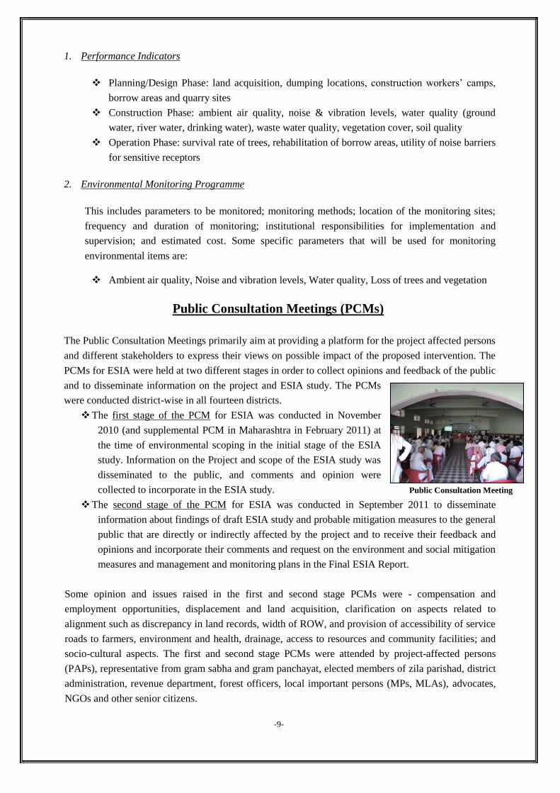
Public Consultation Meetings (PCMs)
The Public Consultation Meetings primarily aim at providing a platform for the project affected persons
and different stakeholders to express their views on possible impact of the proposed intervention. The
PCMs for ESIA were held at two different stages in order to collect opinions and feedback of the public
and to disseminate information on the project and ESIA study. The PCMs
were conducted district-wise in all fourteen districts.
The first stage of the PCM for ESIA was conducted in November
2010 (and supplemental PCM in Maharashtra in February 2011) at
the time of environmental scoping in the initial stage of the ESIA
study. Information on the Project and scope of the ESIA study was
disseminated to the public, and comments and opinion were
collected to incorporate in the ESIA study.
The second stage of the PCM for ESIA was conducted in September 2011 to disseminate
information about findings of draft ESIA study and probable mitigation measures to the general
public that are directly or indirectly affected by the project and to receive their feedback and
opinions and incorporate their comments and request on the environment and social mitigation
measures and management and monitoring plans in the Final ESIA Report.
Some opinion and issues raised in the first and second stage PCMs were - compensation and
employment opportunities, displacement and land acquisition, clarification on aspects related to
alignment such as discrepancy in land records, width of ROW, and provision of accessibility of service
roads to farmers, environment and health, drainage, access to resources and community facilities; and
socio-cultural aspects. The first and second stage PCMs were attended by project-affected persons
(PAPs), representative from gram sabha and gram panchayat, elected members of zila parishad, district
administration, revenue department, forest officers, local important persons (MPs, MLAs), advocates,
NGOs and other senior citizens.
-9-
Public Consultation Meeting
Information Dissemination in ESIA Process
The ESIA study findings were/are disseminated to PAPs, stakeholders and the implementation
authorities so that preventative measures can be taken in the project. The information disclosure is
implemented at two stages for the ESIA.
The first stage of information dissemination was conducted when the draft ESIA was prepared.
Sets of full draft ESIA report (main report and appendices) in English were placed at each
DFCCIL head office and respective Chief Project Manager (CPM) offices, major existing
railway stations and district offices along the proposed DFC alignment. Additionally, the
summary of the draft ESIA report was prepared in local languages, i.e. Hindi, Gujarati and
Marathi and was delivered to all the project affected villages along the DFC route.
[Among five comments received, two comments relating to reduction of dust pollution during construction to avoid damage to crops in nearby fields and minimizing impacts on existing drainage channels are incorporated in the final ESIA report with suitable mitigation measures and EMP. Other comments are related to higher compensation for land and utilities, employment, and other rehabilitation and resettlement issues. These specific issues will be dealt separately in RRP report]
The second stage of information dissemination is implemented at final ESIA stage. Sets of full
final ESIA report (main report and appendices) in English is placed at DFCCIL head office and
respective CPM offices, major existing railway stations and district offices along the proposed
DFC alignment. Additionally, the summary of the final ESIA is prepared in local languages, i.e.
Hindi, Gujarati and Marathi and is delivered to all the project affected villages along the
proposed DFC alignment.
Availability of Final ESIA Report
Final ESIA Report is available at the following disclosed locations:
DFCCIL head office and respective CPM offices, major stations and respective district offices
along the proposed DFC alignment from mid-December 2011 onwards.
Summary of Final ESIA Report in local languages is also available at Sarpanch offices of all the
project affected villages along the DFC alignment from mid-December 2011 onwards.
-10-
Address of DFCCIL Head Office and CPM Offices
Dedicated Freight Corridor Corporation of India Limited (DFCCIL) (Under Ministry of Railways), Fifth Floor, Pragati Maidan, Metro Station Building Complex, New Delhi – 110 001 Tel: 91-11-23454700; Fax: 91-11-23454701
CPM Office Mumbai 7th Floor, New Administrative Building, Central Railway, D.N. Road, Mumbai – 400 001, Maharashtra Tel: 91-22-22634184; Fax: 91-22-22634184
CPM Office Surat: 4th Floor, Aruns-1, Near Iscon Mall, Dumas Road, Piplod, Surat – 395 007, Gujarat Tel: 91-261-2633250; Fax: 91-261-2633250
CPM Office Vadodara: 13-14, 17-18, Panorama Complex, 3rd Floor, R. C. Dutt Road, Alkapuri, Vadodara – 395 007, Gujarat Tel: 91-265-2326024; Fax: 91-265-2326027
AGM Office Rewari-Dadri: “Star House”, First Floor, A-102, Sector-4, Noida, Uttar Pradesh Tel: 91-120-4309720; Fax: 91-120-4134554
Major Stations where the Final ESIA Report is available
Maharashtra Panvel (Jn), Kalyan (Jn), Vaitarna, Kelve Road, Palghar, Dahanu Road
Gujarat Sanjan, Vapi, Valsad, Bilimora (Jn), Navsari, Sachin, Kosamba (Jn), Bharuch (Jn)
Haryana, Rajasthan, UP, Delhi Rewari (Jn), Faridabad, Dadri