Embed Size (px)
Citation preview
De-mystifying Geospatial Technology
A case study on capacity-building in GIS & GPS
Kibera (Nairobi) June - July 2010
East Africa Regional Practitioners Workshop on Pro-Poor Urban Sanitation
and Hygiene Kigali, Rwanda, 29th-31st March 2011
Water Management MSc Project at Cranfield University (UK)
for Water and Sanitation for the Urban Poor (WSUP, Nairobi)
Matthew Waterkeyn(Civil Engineer, Mott MacDonald)
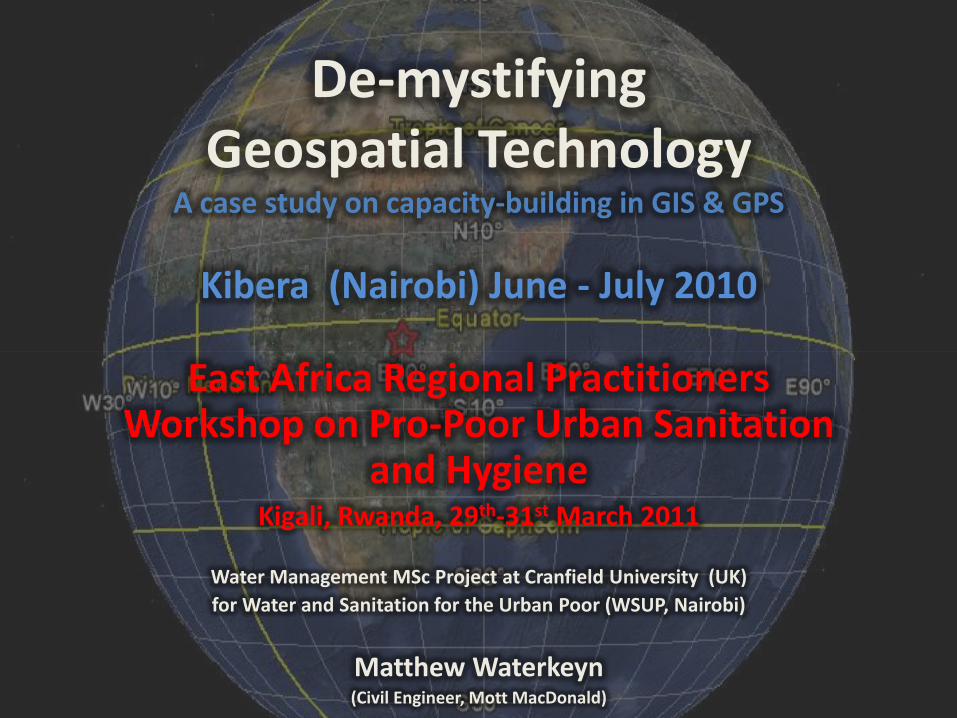
“The world possesses the resources and knowledge to ensure that eventhe poorest countries, and others held back by disease, geographicisolation or civil strife, can be empowered to achieve the MDGs.”
Ban Ki Moon (UN Secretary General, 2010)
Context: Kibera Informal Settlement

Everything that happens...happens somewhere
This photo essay discusses capacity-building for geographic informationsystems(GIS) and global positioning systems(GPS) for technical andmanagerial level staff from Nairobi City Water and Sewerage Company(NCWSC), Water Sanitation for the Urban Poor (WSUP), and the UmandeTrust. (Kibera Informal Settlements, Nairobi, Kenya: June – July 2010)GPS
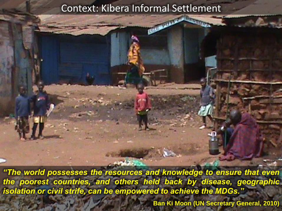
Conditions:• Shallow bed-rock and
very high housing density mean domestic latrine pits are shallow and difficult to access for emptying
• Communal toilet blocks are being built – but still significant levels of open defecation and sewage
• Broken sewerage and water mains, and poor drainage spread disease
• Illegal, unregulated water connections make problems worse
Challenges• Locating municipal pipes
for maintenance and improvement
• Locating leaks and illegal/unregulated
connections
• Keeping track of water usage for planning and
revenue purposes
• Updating existing maps to match what’s on the
ground
Kibera Informal Settlement

Without a GIS
• GIS (Geographical Information System) allows us to collect the key information and represent it as a map...
• GPS (Global Positioning System) is a very quick, and relatively accurate way to collect coordinates and to navigate in the field...
With a GIS
How can GIS & GPS help WASH Practitioners?
A picture (or a map) says a thousand words...

Proposed pipe layout on a traditional map of the township: no scale, legend and fewlabels of existing and proposed features. This poor quality and out of date map missesall the key features needed to orientate the reader, to accurately locate features. It doesnot illustrate the proposed WASH scheme clearly.Capacity building for GIS & GPS will help the project WASH staff to create and updatenew maps that clearly illustrate any proposed WASH project.
Pre-training Capacity: Map used by WSUP, Umande & NCWSC (Nairobi Water) project staff in a Community Liaison Meeting

Target Mapping Capacity:To create a clear map of existing and proposed infrastructure –archive data is used from theNCWSC database with ArcGIS software. This is geo-referenced with satellite images from GoogleEarth and new GPS data collected on-site with basic hand-held GPS devices.

Mapping Capacity Building Workshop:Training was carried out in one intensive week. It included an overview of GIS & GPSapplications and limitations; class demonstrations and tutorials in ArcGIS specificallyon a current WASH project; as well as learning how to collect and verify GPS datacollected on a site visit to Kibera.
Participants were 19 WASH practitioners from Nairobi Water (NCWSC), the Umande Trust, andWater and Sanitation for the Urban Poor (WSUP) including civil engineers, field technicians,surveyors, project managers and sociologists. They worked in groups to share ideas (andlaptops!).

Training Programme:

Capacity Building Results:This map was submitted by one of the groups and is of similar standard reached by all the participants. Themap demonstrates that the TARGET CAPACITY was reached. They learned how to navigate and collect datausing a GPS; understand the limitations of the technology and the risks involved in ‘blindly’ using secondarysources of geospatial data. They made clear project maps with all the features a reader needs toindependently orientate themselves and identify key features.
Some individuals struggled with particular areas namely, georeferencing of satellite images taken off GoogleEarth, and using the ArcGIS Digitising and Editing tools. However, though the interactive approach eachgroup was able to collectively produce a map that met the key targets of the capacity building programme.

Some groups explored additional applications of GIS & GPS. This map by some NCWSC staffshows the implications of having a 15m GPS reading error when calculating which householdscan be included in the proposed 50m Social Connection Policy. The scheme will only subsidisethe connections for households that are within 50m (households outside this line would need topay for pipe connections). Just as adding 2” onto the edge of a 7” pizza doubles the size of thepizza, the error of 15m on either side of a radial 50m threshold could have riotous implications!
Exploring the Limitations of GPS & GPS:

This map was created by the team from the Umande Trust after the course. It represents healthdata geospatially – allowing them to track health indicators in their project area.This map is a hypothetical Cholera Outbreak Map. Cholera is still a significant risk to the urbanpoor living in Kibera, so the use of GIS and GPS to trace and arrest an outbreak must surely beseen as an essential application of this technology by WASH practitioners.
Exploring other Applications of GPS & GPS:

And elsewhere in Africa... Water Point Mapping in Bamako, Mali (WSUP)
Mapping of all public water pointsaround the city of Bamako. A newfree software from Google hasbeen released called Fusion Tables.It can represent on Google Mapslarge amounts of data stored on anExcel spreadsheet. It’s very simpleto use, free, and allows the user torepresent and very efficiently sendlarge amounts project data viaemail by simply sending the link tofusion tables stored online.

And finally, in Zimbabwe... Locations and social data from 164 Community Health Clubs in Makoni District (Zimbabwe AHEAD)
Field workers marked their health clubs on a photocopied district map; these were thenlocated more precisely on Google Earth (not driving around the bush with GPS). The projectmap of the district was overlaid using a simple tool in Google Earth. Data from householdsurveys (indicators of water and sanitation uptake, membership numbers, project dates,Income Generating Projects etc) were entered on an Excel spreadsheet and transferred toGoogle Earth via a Google Fusion Table. A sophisticated map on a detailed satellite image –storing and representing vast amounts of data in a clear and user-friendly manner!

Speak your mind
with maps!