Embed Size (px)
Citation preview
David Avalos-Naranjo
Venice, Italy, 2012.
• Contents
– Mexico’s gravimetric network and models.
– Gravimetric geoid 2010.
– Views for future modeling.
– Collaboration with North America.
– Collaboration with Central America and Caribbean.
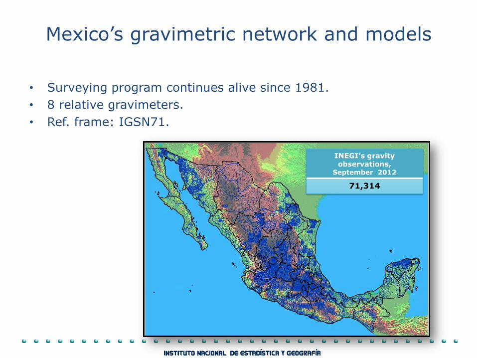
Mexico’s gravimetric network and models
• Surveying program continues alive since 1981.
• 8 relative gravimeters.
• Ref. frame: IGSN71.
INEGI’s gravity observations,
September 2012
71,314
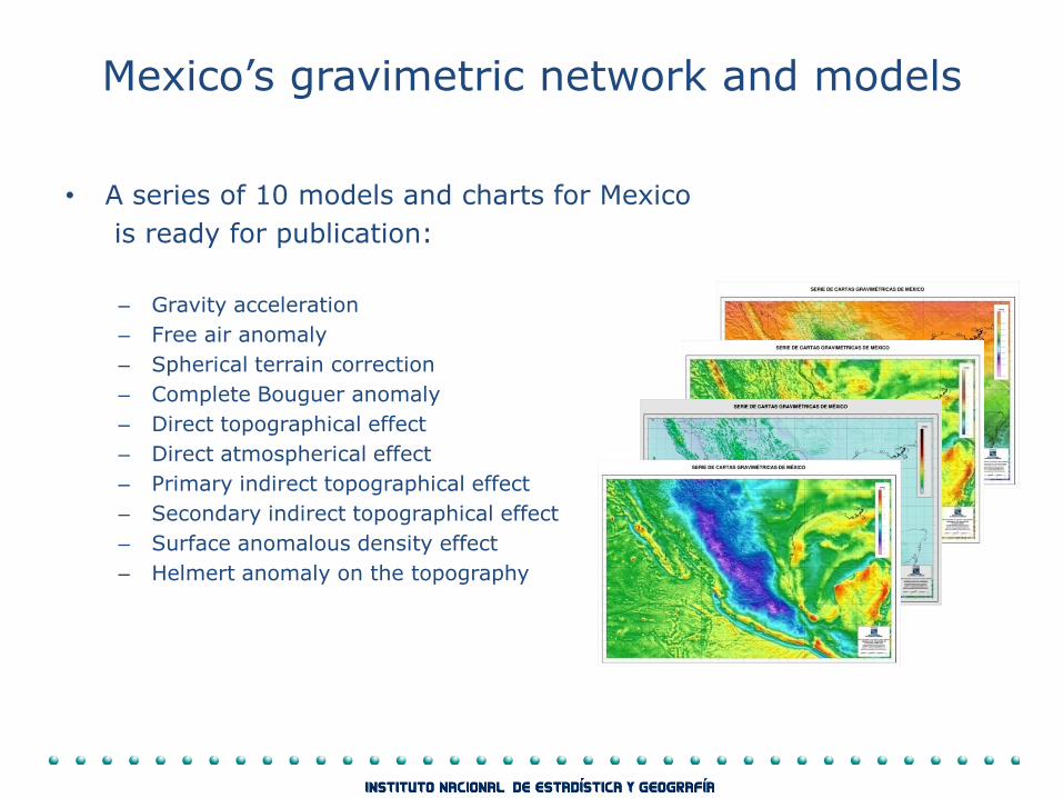
• A series of 10 models and charts for Mexico
is ready for publication:
– Gravity acceleration
– Free air anomaly
– Spherical terrain correction
– Complete Bouguer anomaly
– Direct topographical effect
– Direct atmospherical effect
– Primary indirect topographical effect
– Secondary indirect topographical effect
– Surface anomalous density effect
– Helmert anomaly on the topography
Mexico’s gravimetric network and models
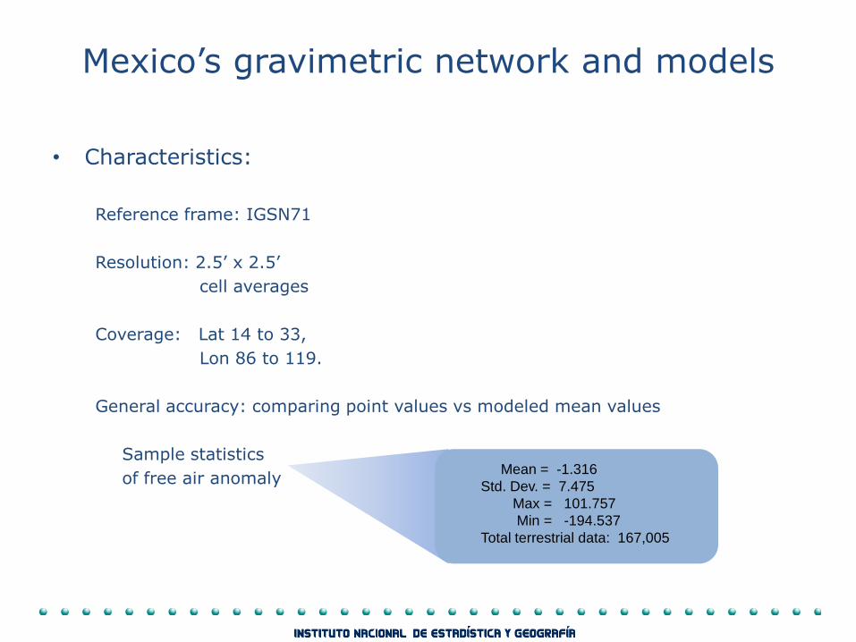
• Characteristics:
Reference frame: IGSN71
Resolution: 2.5’ x 2.5’
cell averages
Coverage: Lat 14 to 33,
Lon 86 to 119.
General accuracy: comparing point values vs modeled mean values
Sample statistics
of free air anomaly
Mean = -1.316
Std. Dev. = 7.475
Max = 101.757
Min = -194.537
Total terrestrial data: 167,005
Mexico’s gravimetric network and models
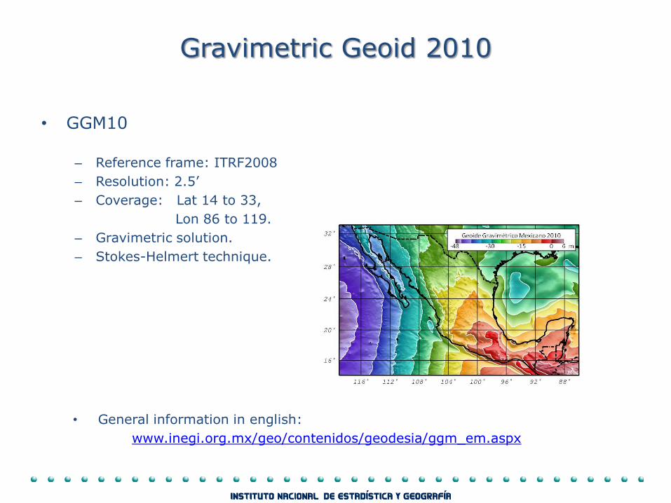
Gravimetric Geoid 2010
• GGM10
– Reference frame: ITRF2008
– Resolution: 2.5’
– Coverage: Lat 14 to 33,
Lon 86 to 119.
– Gravimetric solution.
– Stokes-Helmert technique.
• General information in english:
www.inegi.org.mx/geo/contenidos/geodesia/ggm_em.aspx
Gravimetric Geoid 2010
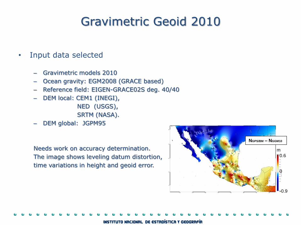
• Input data selected
– Gravimetric models 2010
– Ocean gravity: EGM2008 (GRACE based)
– Reference field: EIGEN-GRACE02S deg. 40/40
– DEM local: CEM1 (INEGI),
NED (USGS),
SRTM (NASA).
– DEM global: JGPM95
Needs work on accuracy determination.
The image shows leveling datum distortion,
time variations in height and geoid error.
0.6
-0.9
0
m
NGPS/BM – NGGM10
Views for future modeling
• INEGI is improving is coordinating efforts with most countries in the region.
• Wo = 62,636,856.0 is considered a convenient reference for Mexico.
• A significantly improved geoid model must be based on datasets of improved confidence level (gravimetric and DEMs).
• Main concern: heterogeneous quality in terrestrial gravimetry and may be regionaly biased frame (IGSN71).
• A strategy: – modernize the reference frame,
– modernize processing technique for propagation,
– obtain a gravity dataset of homogeneous quality.
– DEMs from lidar and satellite imaging.
Views for future modeling
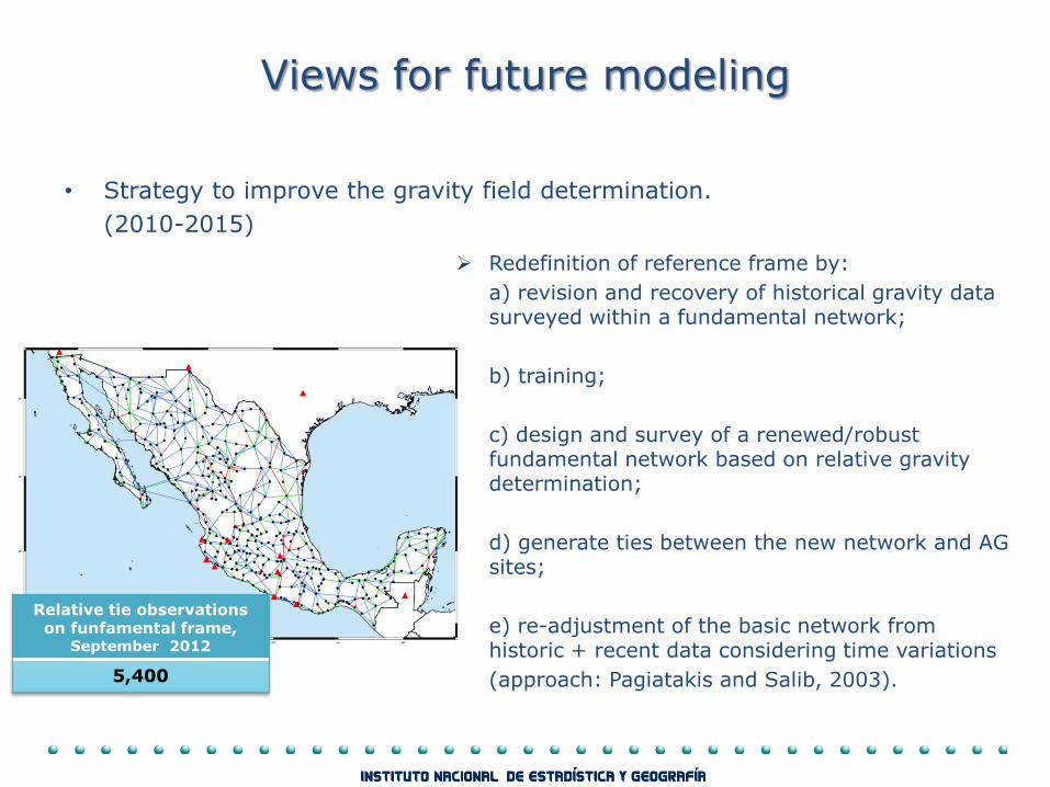
• Strategy to improve the gravity field determination.
(2010-2015)
Redefinition of reference frame by:
a) revision and recovery of historical gravity data surveyed within a fundamental network;
b) training;
c) design and survey of a renewed/robust fundamental network based on relative gravity determination;
d) generate ties between the new network and AG sites;
e) re-adjustment of the basic network from historic + recent data considering time variations
(approach: Pagiatakis and Salib, 2003).
Relative tie observations on funfamental frame,
September 2012
5,400
Views for future modeling
• Strategy to improve gravity field determination:
(2010-2015?)
Following steps:
- re-determine gravity values for the entire national network,
- mitigate methodological problems and re-process models.
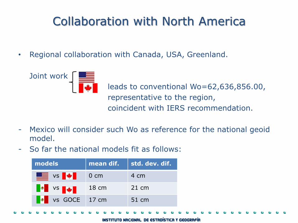
Collaboration with North America
• Regional collaboration with Canada, USA, Greenland.
Joint work
leads to conventional Wo=62,636,856.00,
representative to the region,
coincident with IERS recommendation.
- Mexico will consider such Wo as reference for the national geoid model.
- So far the national models fit as follows:
models mean dif. std. dev. dif.
vs 0 cm 4 cm
vs 18 cm 21 cm
vs GOCE 17 cm 51 cm
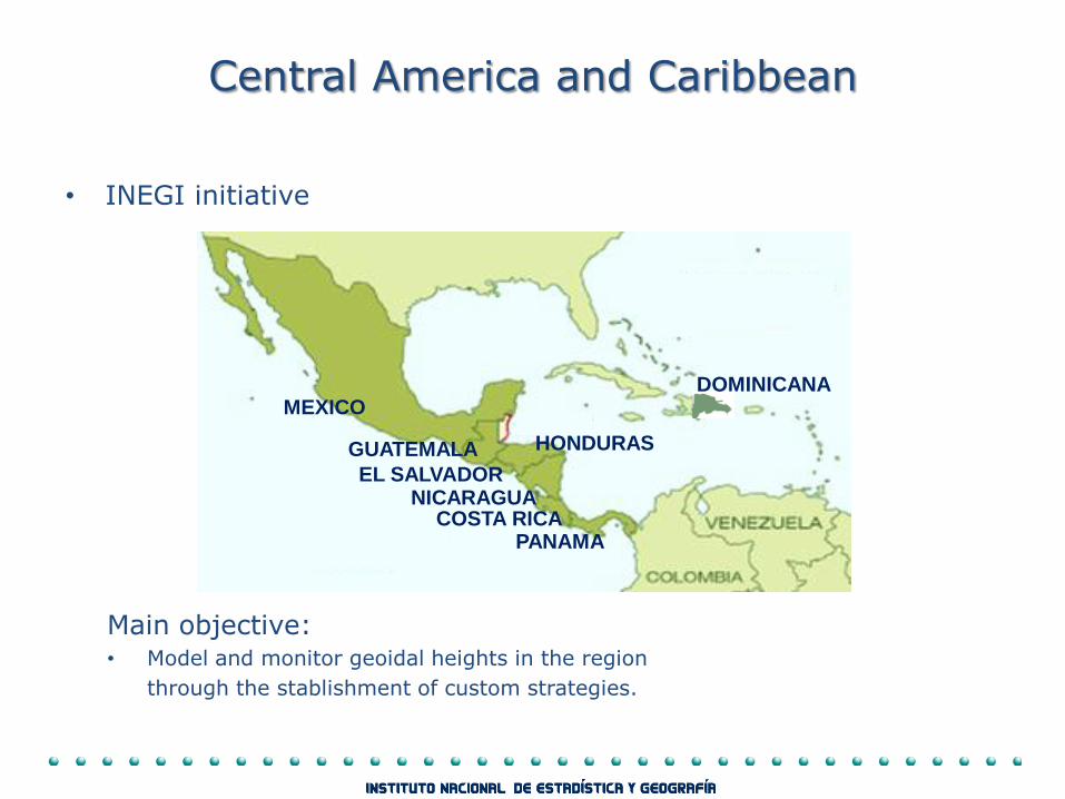
Central America and Caribbean
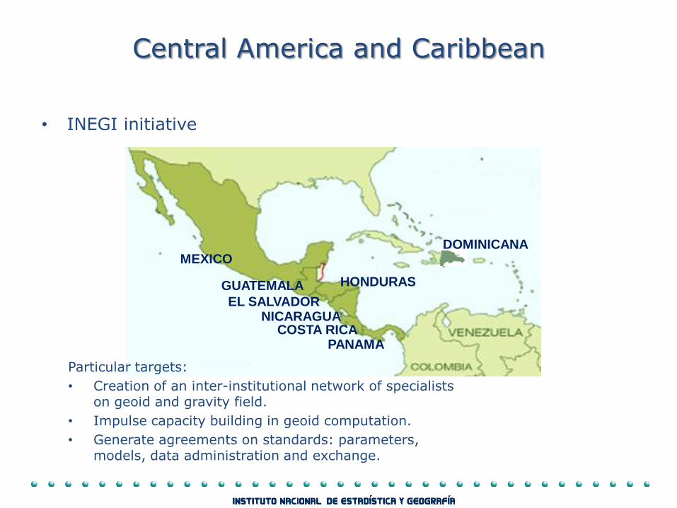
• INEGI initiative
Main objective: • Model and monitor geoidal heights in the region
through the stablishment of custom strategies.
MEXICO
GUATEMALA
EL SALVADOR NICARAGUA
COSTA RICA PANAMA
DOMINICANA
HONDURAS
Central America and Caribbean
• INEGI initiative
MEXICO
GUATEMALA
EL SALVADOR NICARAGUA
COSTA RICA PANAMA
DOMINICANA
HONDURAS
Particular targets:
• Creation of an inter-institutional network of specialists on geoid and gravity field.
• Impulse capacity building in geoid computation.
• Generate agreements on standards: parameters, models, data administration and exchange.
Central America and Caribbean
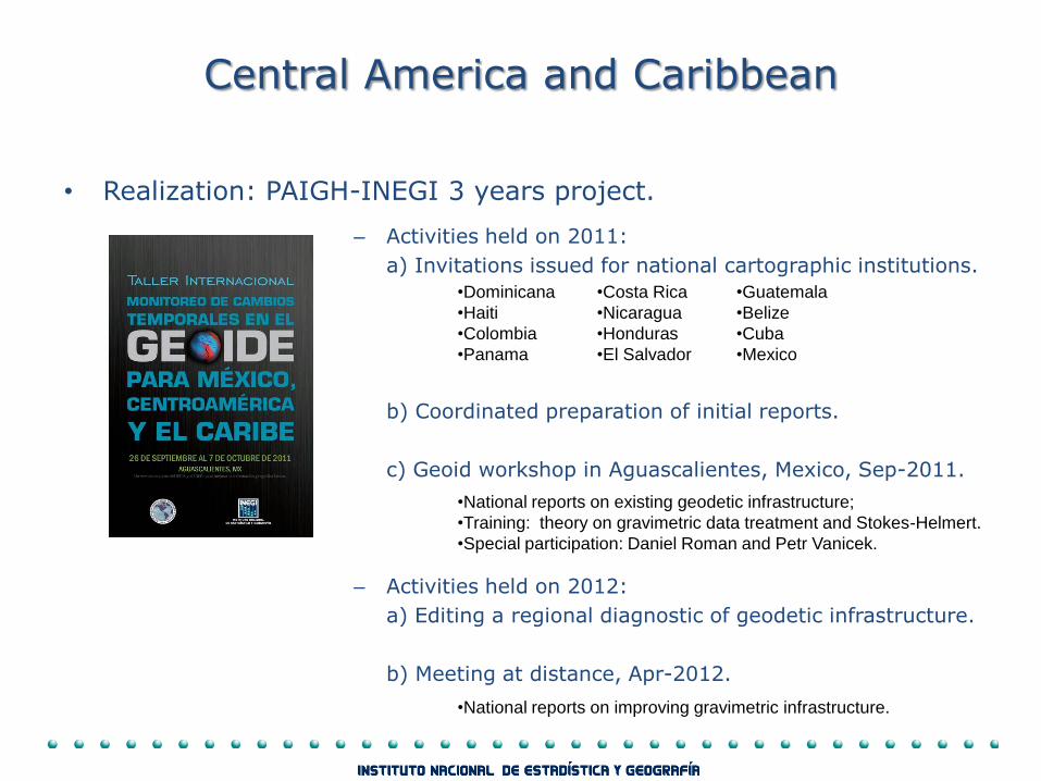
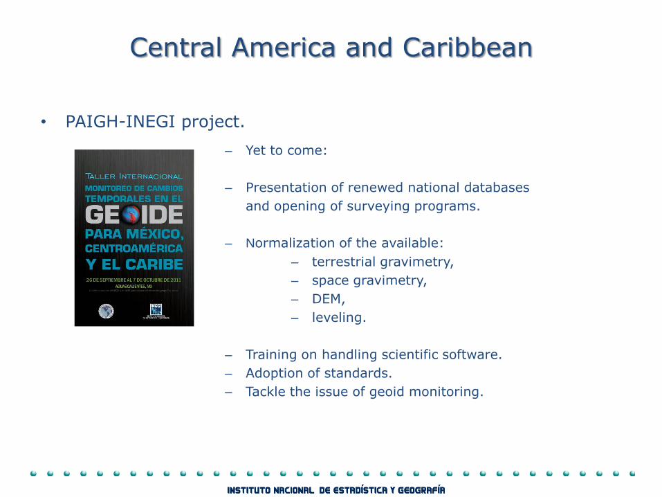
• Realization: PAIGH-INEGI 3 years project.
– Activities held on 2011:
a) Invitations issued for national cartographic institutions.
b) Coordinated preparation of initial reports.
c) Geoid workshop in Aguascalientes, Mexico, Sep-2011.
– Activities held on 2012:
a) Editing a regional diagnostic of geodetic infrastructure.
b) Meeting at distance, Apr-2012.
•Dominicana
•Haiti
•Colombia
•Panama
•Costa Rica
•Nicaragua
•Honduras
•El Salvador
•Guatemala
•Belize
•Cuba
•Mexico
•National reports on existing geodetic infrastructure;
•Training: theory on gravimetric data treatment and Stokes-Helmert.
•Special participation: Daniel Roman and Petr Vanicek.
•National reports on improving gravimetric infrastructure.
Central America and Caribbean
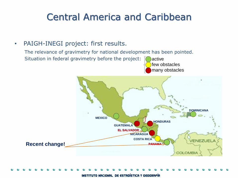
• PAIGH-INEGI project: first results.
The relevance of gravimetry for national development has been pointed.
Situation in federal gravimetry before the project:
active
few obstacles
many obstacles
MEXICO
GUATEMALA
EL SALVADOR
NICARAGUA
COSTA RICA
PANAMA
DOMINICANA
HONDURAS
Recent change!
EL SALVADOR
PANAMA
Central America and Caribbean
• PAIGH-INEGI project.
Of concern:
• Financial support for annual workshop as well as for trans-national surveys is not guarantied.
Workshop 2012 canceled.
• The lack of gravimeters and poor or outdated training, plus reduced budget prevents the feasibility of giving impulse to gravimetry in some geographic institutes.
Central America and Caribbean
• PAIGH-INEGI project.
– Yet to come:
– Presentation of renewed national databases
and opening of surveying programs.
– Normalization of the available:
– terrestrial gravimetry,
– space gravimetry,
– DEM,
– leveling.
– Training on handling scientific software.
– Adoption of standards.
– Tackle the issue of geoid monitoring.

Summary
• Mexico’s gravimetric models and geoid are released: see www.inegi.org.mx
• Actions to improve accuracy of the models are being taken through re-definition of the gravimetric reference frame and revision of the methodology.
• Future geoid modeling will be based on the regional Wo convention.
• Coordinated work in Central America and Caribbean has begun with enthusiastic acceptance. Advances in training, and gravimetric surveying are paramount for geoid modeling in Central America.
• Advertisement:
Attend session
Trans-natonal gravity field determination and regional height systems.
Department of the geoid
Because we provide
information for everybody…
01 800 111 46 34
www.inegi.org.mx
¡México counts with the INEGI!