Embed Size (px)
Citation preview
DATA V
ISUALIZ
ATIO
N
NEEDS IN C
OMMUNITY
DEVELOPM
ENT AND
PLANNIN
G
CE
NT
RA
L M
AS
SA
CH
US
ET
TS
RE
GI O
NA
L P
LA
NN
I NG
CO
MM
I SS
I ON
Trish Settles, AICPPrincipal Planner/Project
ManagerDATA DAY 2015
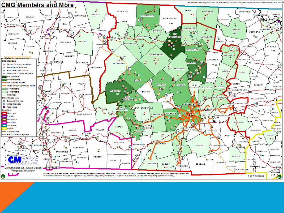
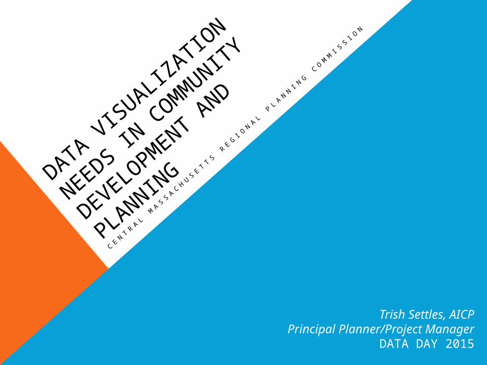
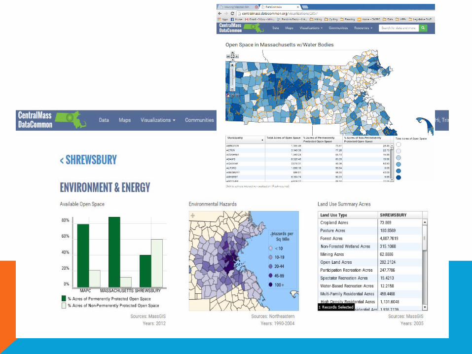
REGIONAL PLANNING COMMISSIONCOMMUNITY DEVELOPMENT AND PLANNINGData Visualization Needs• Housing Planning
• Open Space Planning
• Master Planning
• Topical Studies- Water Resource Planning
• Prioritization Projects
• Agriculture
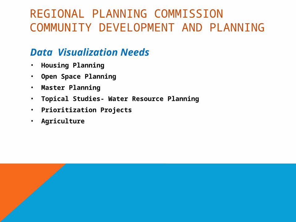
TYPICAL VISUALIZATIONS IN A HOUSING PRODUCTION PLAN• Regional Context Map
• Income By Census Tract
• Zoning Map
• Infrastructure Map
• Build Out Composite Map
• Housing Type Map
• Town Owned Land Map
• Open Space Map by Land Use
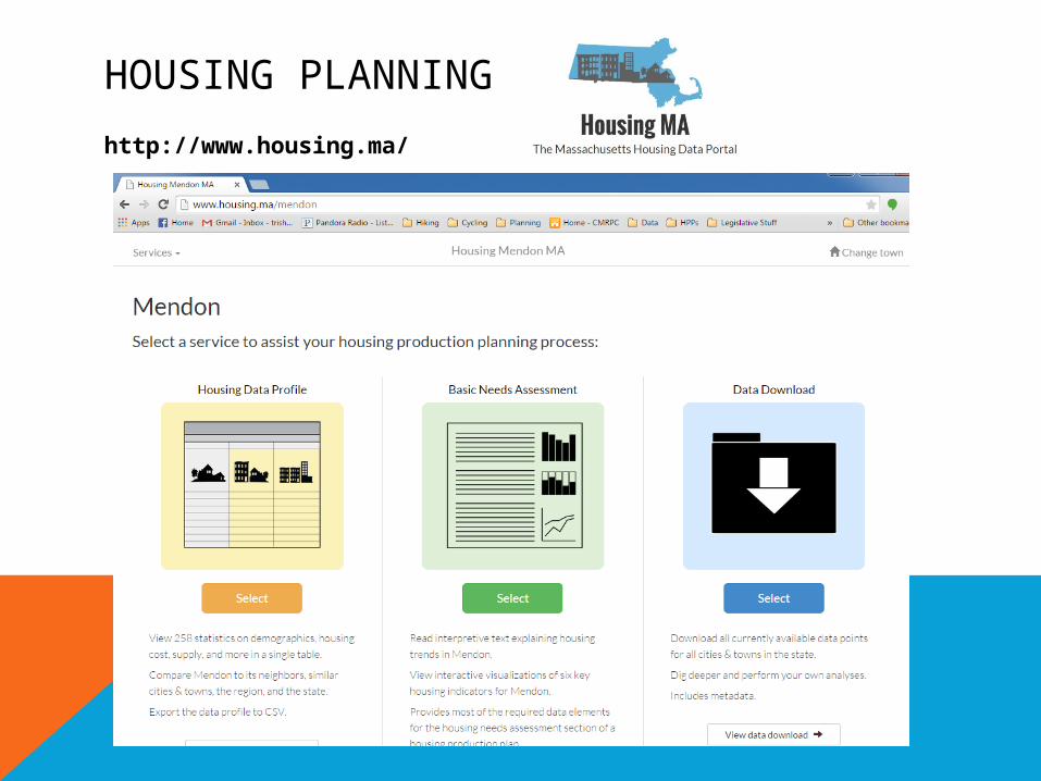
HOUSING PLANNING
http://www.housing.ma/
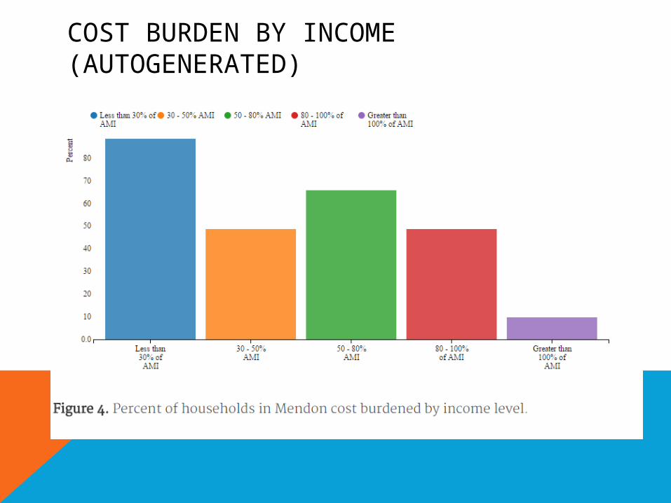
COST BURDEN BY INCOME (AUTOGENERATED)
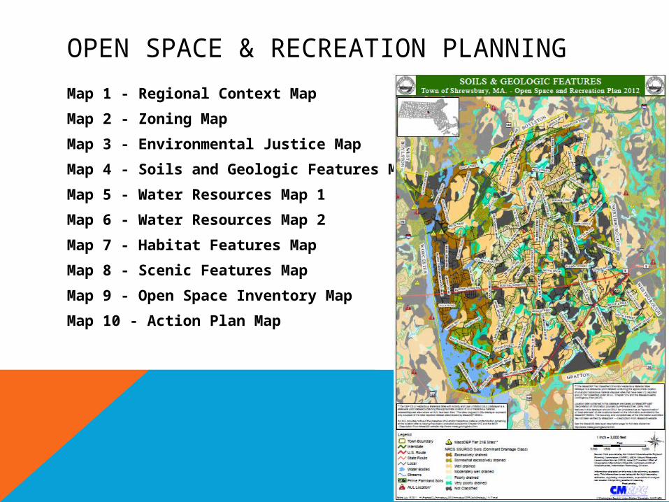
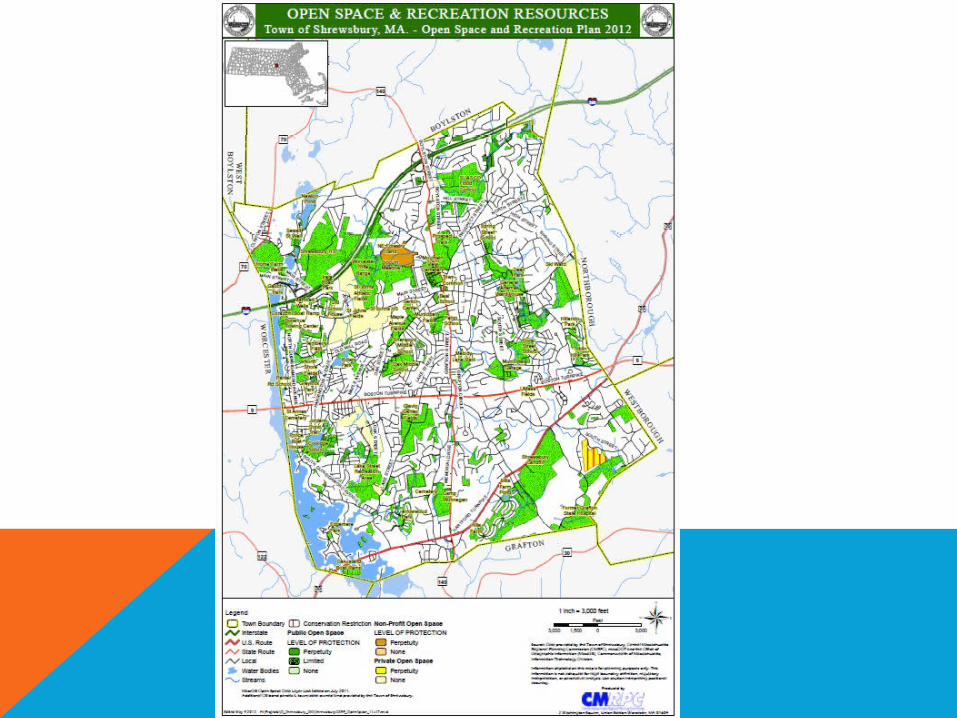
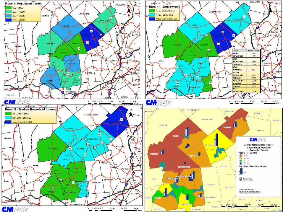
OPEN SPACE & RECREATION PLANNING
Map 1 - Regional Context Map
Map 2 - Zoning Map
Map 3 - Environmental Justice Map
Map 4 - Soils and Geologic Features Map
Map 5 - Water Resources Map 1
Map 6 - Water Resources Map 2
Map 7 - Habitat Features Map
Map 8 - Scenic Features Map
Map 9 - Open Space Inventory Map
Map 10 - Action Plan Map
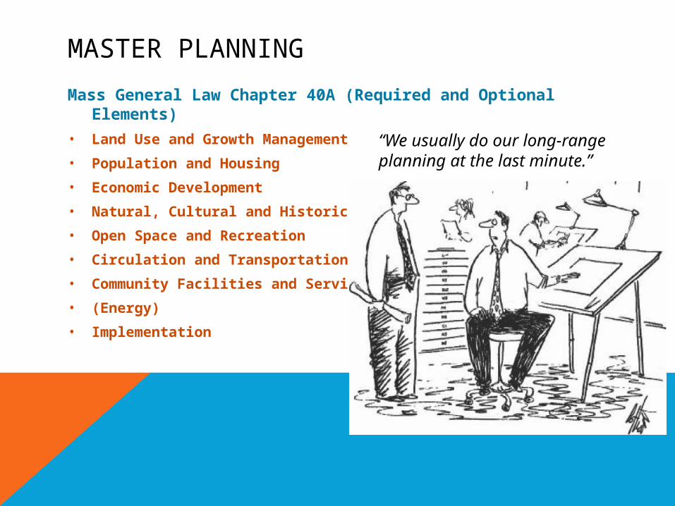
MASTER PLANNING
Mass General Law Chapter 40A (Required and Optional Elements)
• Land Use and Growth Management
• Population and Housing
• Economic Development
• Natural, Cultural and Historic Resources
• Open Space and Recreation
• Circulation and Transportation
• Community Facilities and Services
• (Energy)
• Implementation
“We usually do our long-range planning at the last minute.”
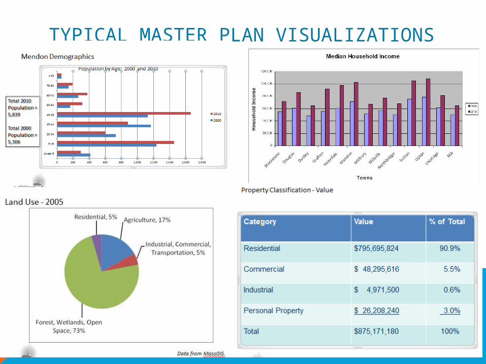
TYPICAL MASTER PLAN VISUALIZATIONS

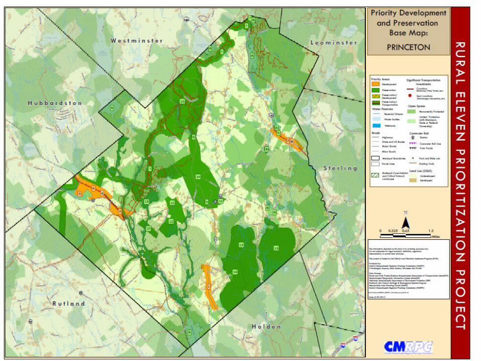
PROCESS
1.Document Review - Translate to Maps
2.Informal meetings with community leaders – Revised map with this new information
3.Local Public meetings - Revised map with this new information
4.Regional Public meetings – Prioritize
5.State Public meetings – Prioritize
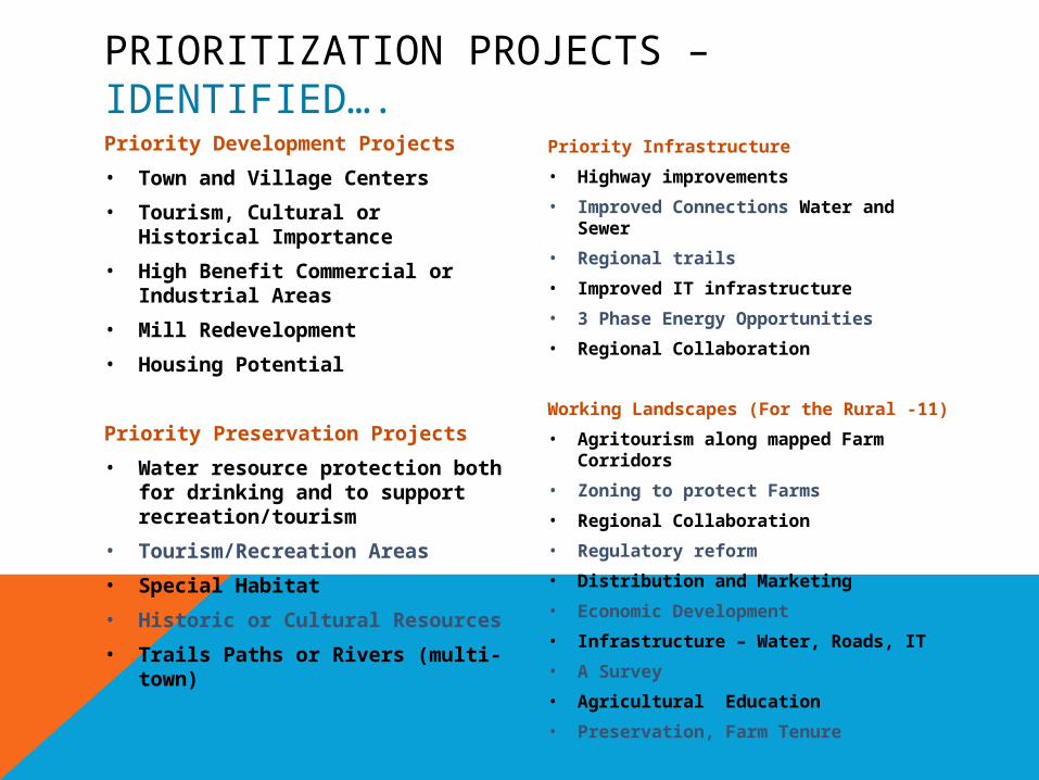
PRIORITIZATION PROJECTS – IDENTIFIED….Priority Development Projects
• Town and Village Centers
• Tourism, Cultural or Historical Importance
• High Benefit Commercial or Industrial Areas
• Mill Redevelopment
• Housing Potential
Priority Preservation Projects
• Water resource protection both for drinking and to support recreation/tourism
• Tourism/Recreation Areas
• Special Habitat
• Historic or Cultural Resources
• Trails Paths or Rivers (multi-town)
Priority Infrastructure
• Highway improvements
• Improved Connections Water and Sewer
• Regional trails
• Improved IT infrastructure
• 3 Phase Energy Opportunities
• Regional Collaboration
Working Landscapes (For the Rural -11)
• Agritourism along mapped Farm Corridors
• Zoning to protect Farms
• Regional Collaboration
• Regulatory reform
• Distribution and Marketing
• Economic Development
• Infrastructure – Water, Roads, IT
• A Survey
• Agricultural Education
• Preservation, Farm Tenure
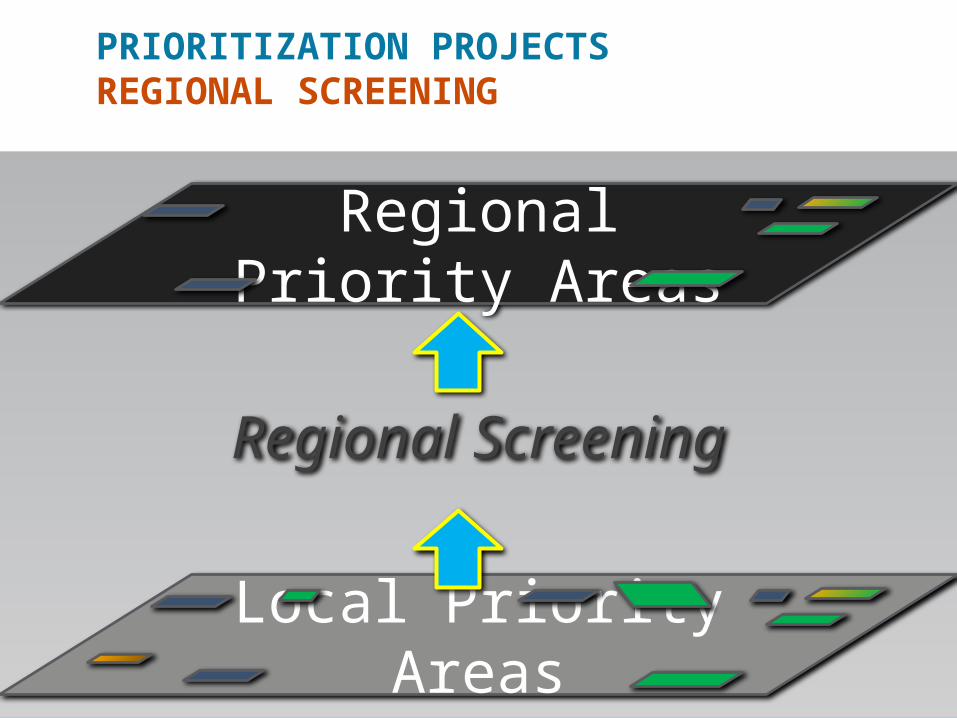
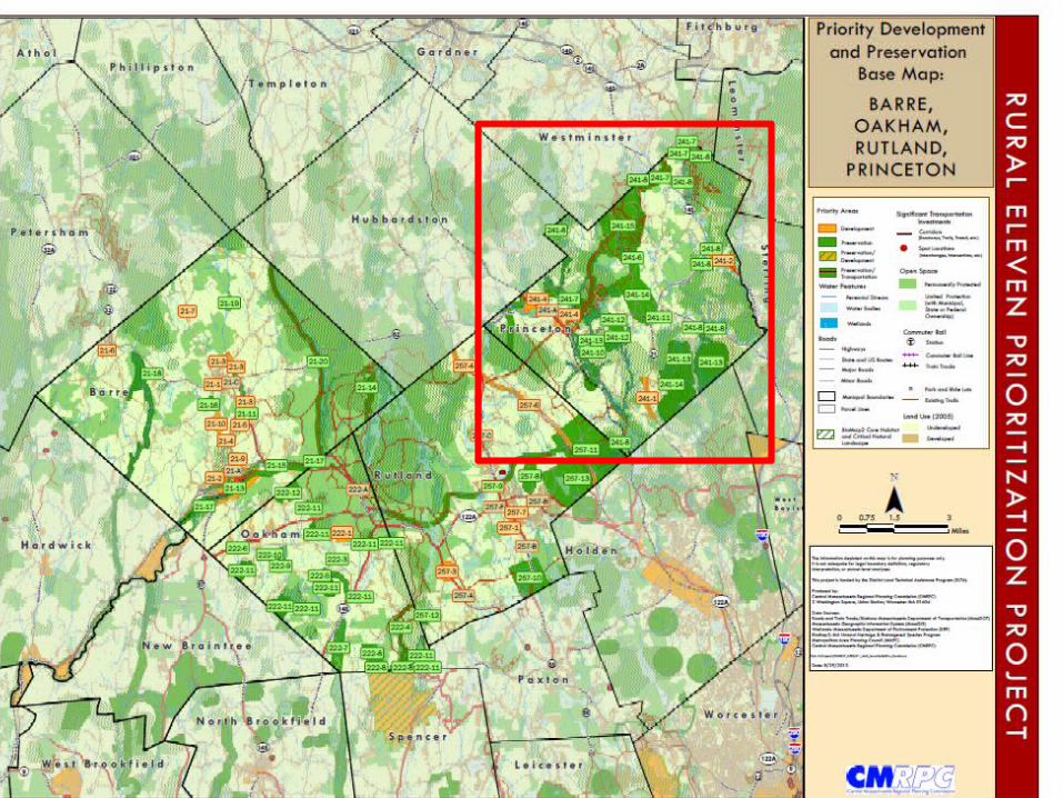
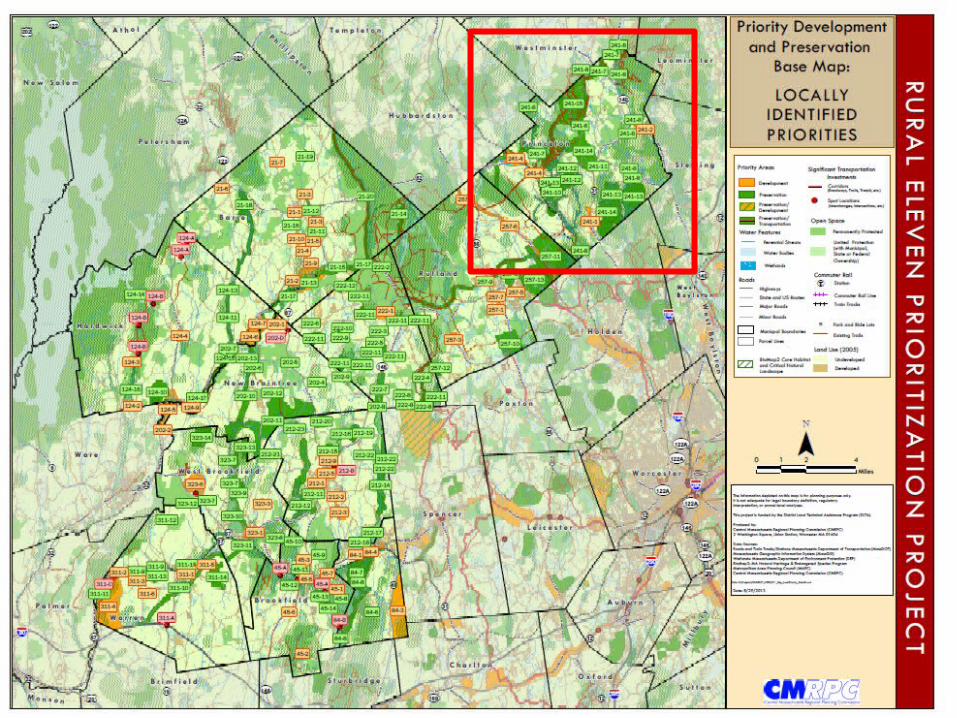
PRIORITIZATION PROJECTSREGIONAL SCREENING
Local Priority Areas
Regional Screening
Regional Priority Areas

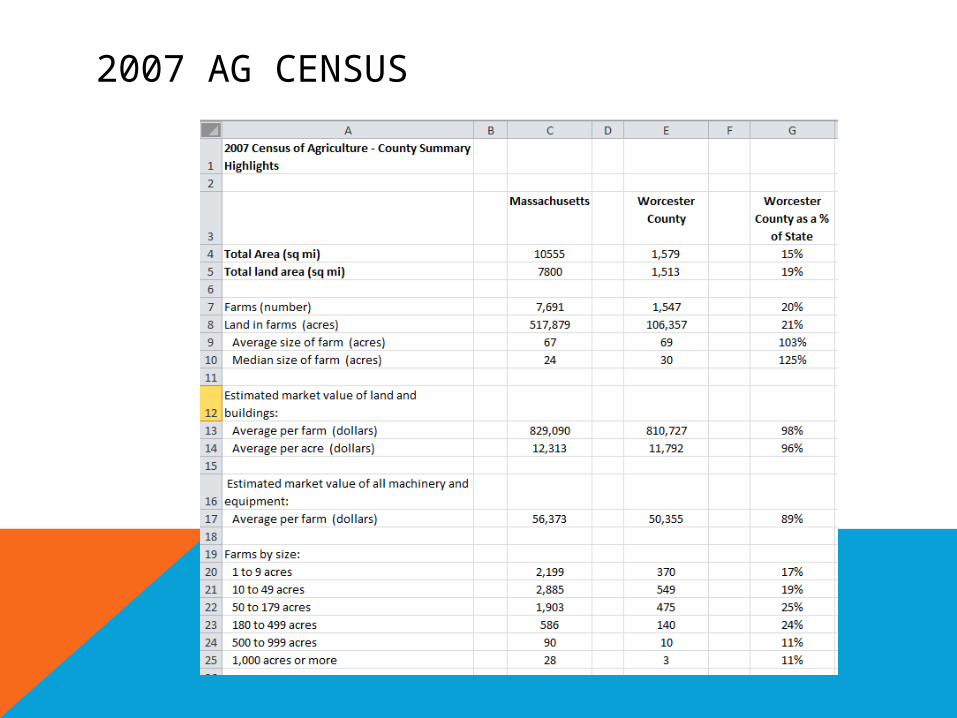
2007 AG CENSUS
WORKING LANDSCAPE
• Assessing Database
• MDAR Database/MassGIS
• Commonwealth Corporations
• Town Clerk Business Certificates
• Internet Research
• Google Maps
• Community Information
• Review
• Revise
• Repeat as Necessary

Barre
Hardw
ick
Oakha
m
War
ren
Brook
field
East
Bro
okfie
ld
New B
rain
tree
North
Bro
okfie
ld
Prin
ceto
n
Rutla
nd
Wes
t Bro
okfie
ld0
10
20
30
40
50
60
70
37
3
34
13 13
5
21
40
19 2015
26
9
11
10 11
5
25
16
15 15
17
Number of Farms by Size
AREA OPERATED: (1.0 TO 49.9 ACRES) AREA OPERATED: (50 or More ACRES)