Embed Size (px)
Citation preview
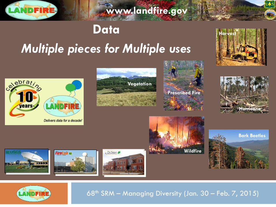
Wildfire
68th SRM – Managing Diversity (Jan. 30 – Feb. 7, 2015)
www.landfire.gov
Hurricane
Prescribed Fire
Bark Beetles
Harvest Data
Multiple pieces for Multiple uses
Vegetation
www.landfire.gov
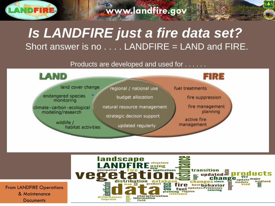
Is LANDFIRE just a fire data set?
Short answer is no . . . . LANDFIRE = LAND and FIRE.
Products are developed and used for . . . . . .
From LANDFIRE Operations
& Maintenance
Documents
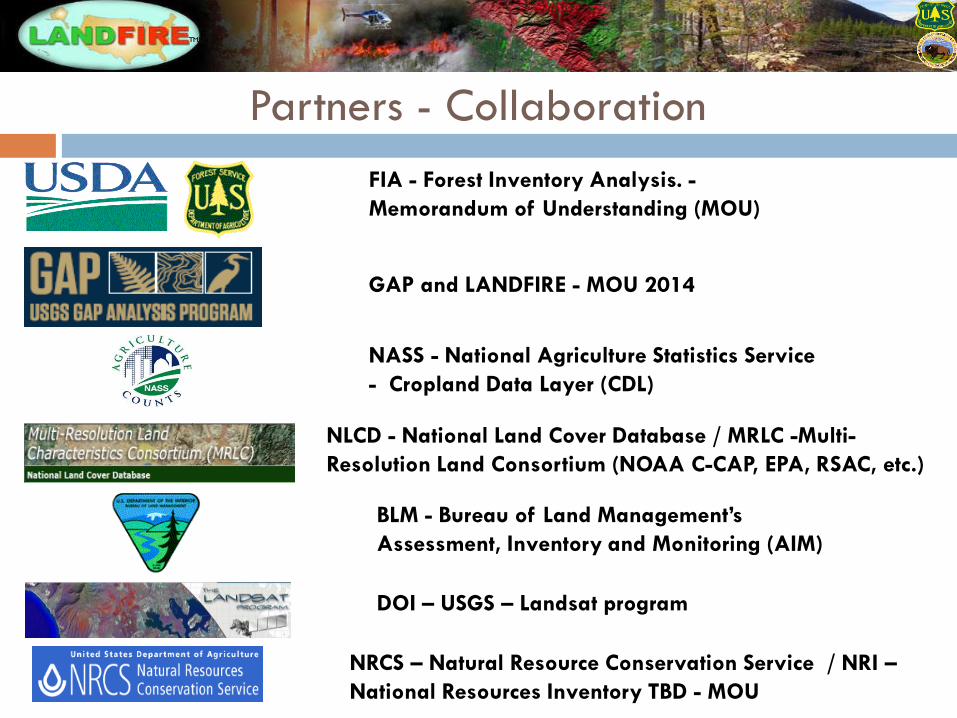
GAP and LANDFIRE - MOU 2014
Partners - Collaboration
NASS - National Agriculture Statistics Service
- Cropland Data Layer (CDL)
NRCS – Natural Resource Conservation Service / NRI –
National Resources Inventory TBD - MOU
FIA - Forest Inventory Analysis. -
Memorandum of Understanding (MOU)
NLCD - National Land Cover Database / MRLC -Multi-
Resolution Land Consortium (NOAA C-CAP, EPA, RSAC, etc.)
BLM - Bureau of Land Management’s
Assessment, Inventory and Monitoring (AIM)
DOI – USGS – Landsat program
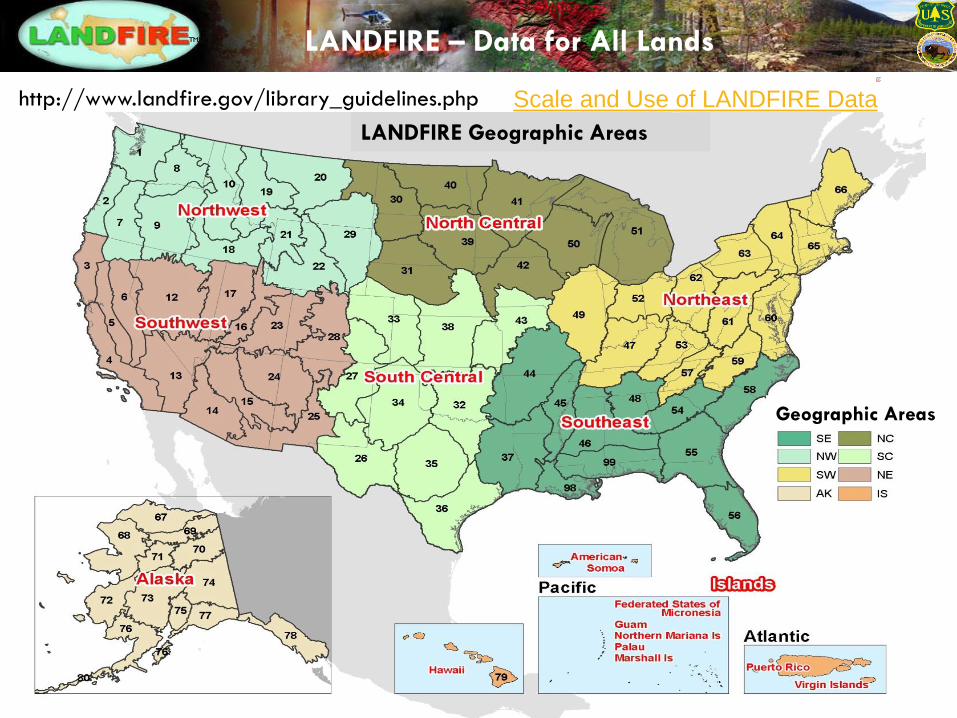
LANDFIRE – Data for All Lands
LANDFIRE Geographic Areas
Geographic Areas
Scale and Use of LANDFIRE Data http://www.landfire.gov/library_guidelines.php
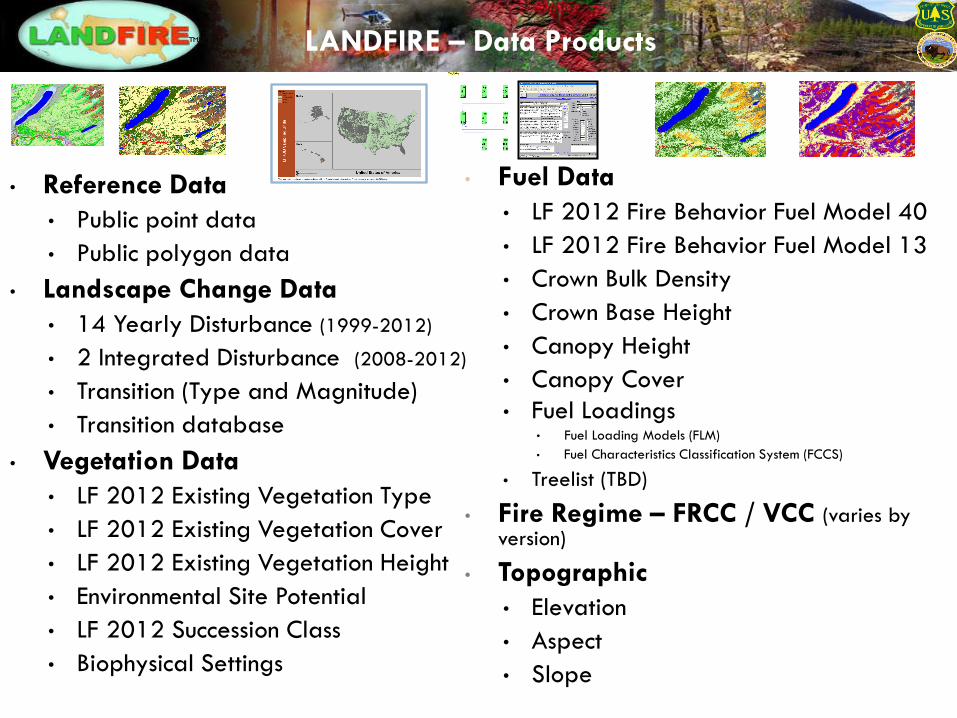
• Fuel Data
• LF 2012 Fire Behavior Fuel Model 40
• LF 2012 Fire Behavior Fuel Model 13
• Crown Bulk Density
• Crown Base Height
• Canopy Height
• Canopy Cover
• Fuel Loadings • Fuel Loading Models (FLM)
• Fuel Characteristics Classification System (FCCS)
• Treelist (TBD)
• Fire Regime – FRCC / VCC (varies by version)
• Topographic
• Elevation
• Aspect
• Slope
• Reference Data
• Public point data
• Public polygon data
• Landscape Change Data
• 14 Yearly Disturbance (1999-2012)
• 2 Integrated Disturbance (2008-2012)
• Transition (Type and Magnitude)
• Transition database
• Vegetation Data
• LF 2012 Existing Vegetation Type
• LF 2012 Existing Vegetation Cover
• LF 2012 Existing Vegetation Height
• Environmental Site Potential
• LF 2012 Succession Class
• Biophysical Settings
LANDFIRE – Data Products
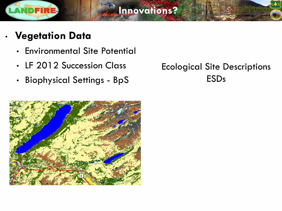
• Vegetation Data
• Environmental Site Potential
• LF 2012 Succession Class
• Biophysical Settings - BpS
Ecological Site Descriptions
ESDs
Innovations?
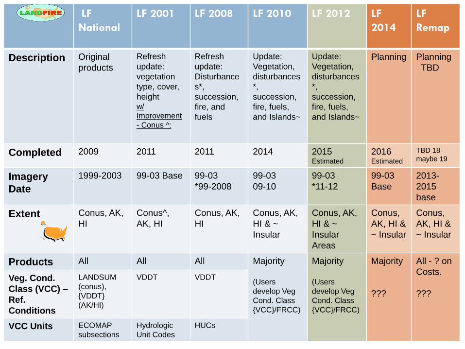
LF
National
LF 2001 LF 2008 LF 2010 LF 2012 LF
2014
LF
Remap
Description Original
products
Refresh
update:
vegetation
type, cover,
height w/
Improvement
- Conus ^:
Refresh
update:
Disturbance
s*,
succession,
fire, and
fuels
Update:
Vegetation,
disturbances
*,
succession,
fire, fuels,
and Islands~
Update:
Vegetation,
disturbances
*,
succession,
fire, fuels,
and Islands~
Planning Planning
TBD
Completed 2009 2011 2011 2014 2015 Estimated
2016 Estimated
TBD 18
maybe 19
Imagery
Date
1999-2003 99-03 Base 99-03
*99-2008
99-03
09-10
99-03
*11-12
99-03
Base
2013-
2015
base
Extent Conus, AK,
HI
Conus^,
AK, HI
Conus, AK,
HI
Conus, AK,
HI & ~
Insular
Conus, AK,
HI & ~
Insular
Areas
Conus,
AK, HI &
~ Insular
Conus,
AK, HI &
~ Insular
Products All All All Majority
(Users
develop Veg
Cond. Class
{VCC}/FRCC)
Majority
(Users
develop Veg
Cond. Class
{VCC}/FRCC)
Majority
???
All - ? on
Costs.
???
Veg. Cond.
Class (VCC) –
Ref.
Conditions
LANDSUM
(conus),
{VDDT}
(AK/HI)
VDDT VDDT
VCC Units ECOMAP
subsections
Hydrologic
Unit Codes
HUCs
44%
25%
18%
9%
2% 1%
1%
Percent of total records
USFS
Multi
BLM
State
NPS
USFWS
Misc
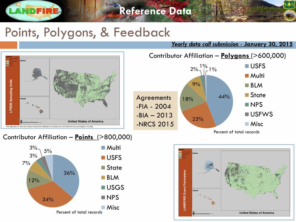
Points, Polygons, & Feedback
36%
34%
12%
7%
3%
3% 5%
Percent of total records
Multi
USFS
State
BLM
USGS
NPS
Misc
Contributor Affiliation – Points (>800,000)
Contributor Affiliation – Polygons (>600,000)
Yearly data call submission - January 30, 2015
Agreements
-FIA - 2004
-BIA – 2013
-NRCS 2015
Reference Data
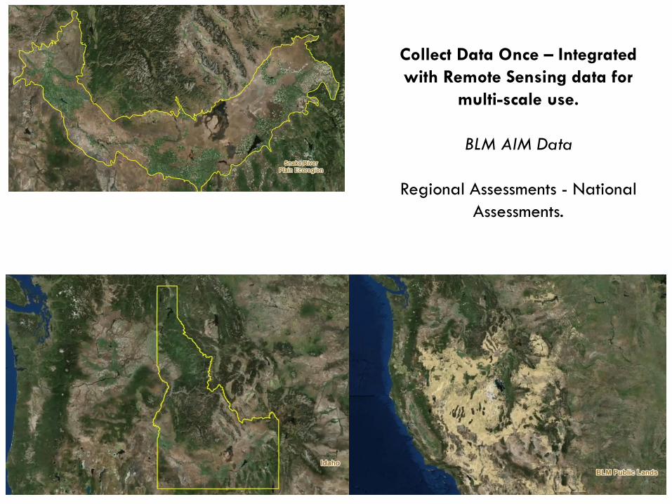
Collect Data Once – Integrated
with Remote Sensing data for
multi-scale use.
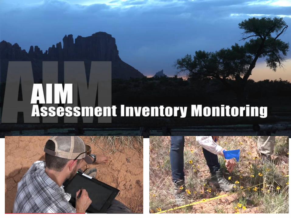
BLM AIM Data
Regional Assessments - National
Assessments.
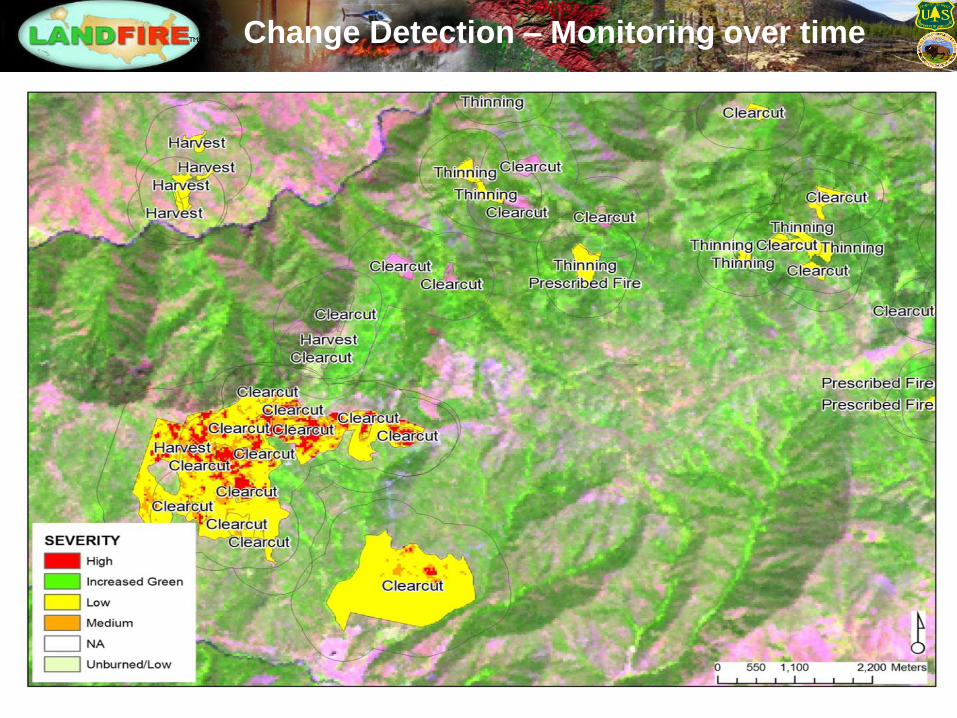
Change Detection – Monitoring over time
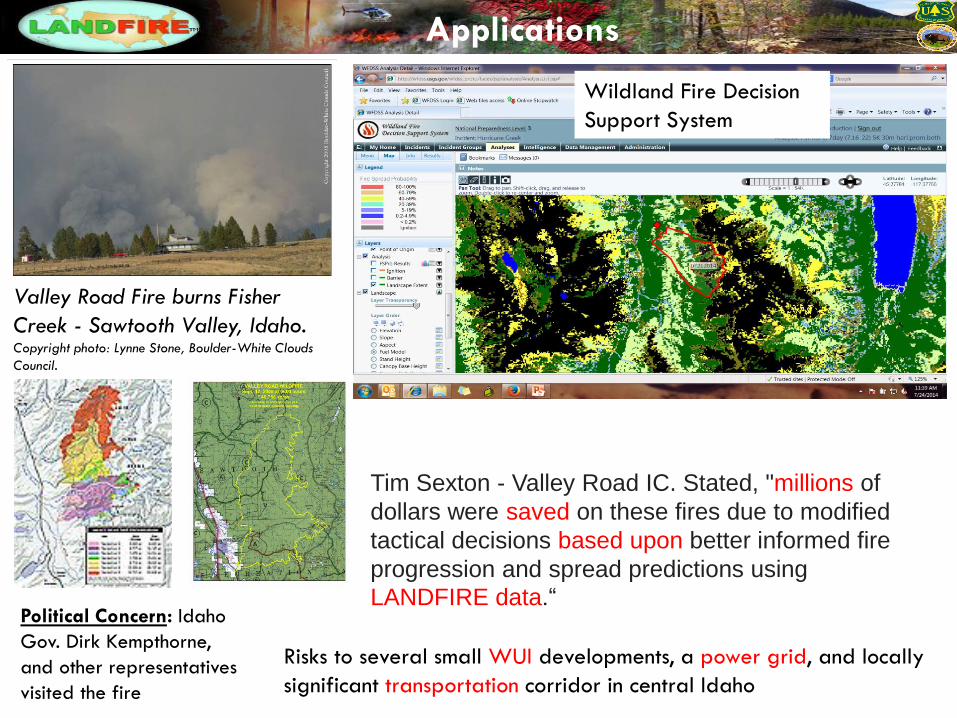
Applications
Tim Sexton - Valley Road IC. Stated, "millions of
dollars were saved on these fires due to modified
tactical decisions based upon better informed fire
progression and spread predictions using
LANDFIRE data.“
Risks to several small WUI developments, a power grid, and locally
significant transportation corridor in central Idaho
Valley Road Fire burns Fisher
Creek - Sawtooth Valley, Idaho. Copyright photo: Lynne Stone, Boulder-White Clouds
Council.
Political Concern: Idaho
Gov. Dirk Kempthorne,
and other representatives
visited the fire
Wildland Fire Decision
Support System
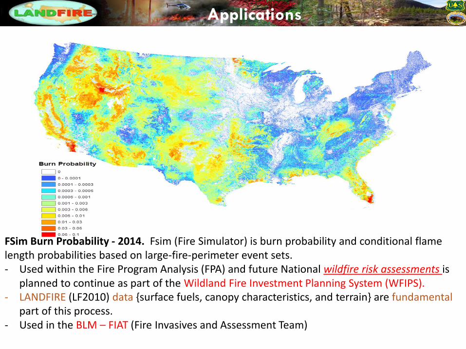
Applications
FSim Burn Probability - 2014. Fsim (Fire Simulator) is burn probability and conditional flame length probabilities based on large-fire-perimeter event sets. - Used within the Fire Program Analysis (FPA) and future National wildfire risk assessments is
planned to continue as part of the Wildland Fire Investment Planning System (WFIPS). - LANDFIRE (LF2010) data {surface fuels, canopy characteristics, and terrain} are fundamental
part of this process. - Used in the BLM – FIAT (Fire Invasives and Assessment Team)
Applications
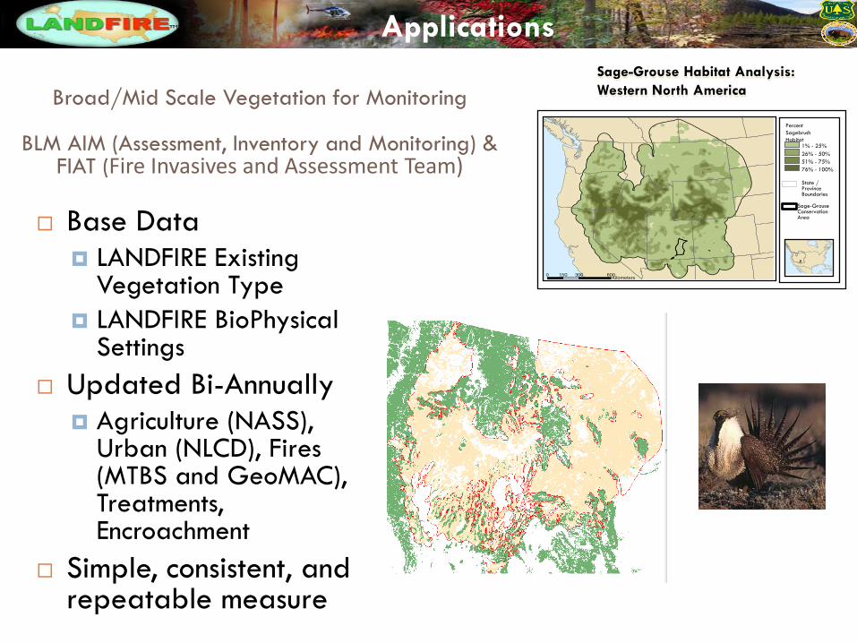
1% - 25%
26% - 50%
51% - 75%
76% - 100%
Percent
Sagebrush
Habitat
State / Province Boundaries
Sage-Grouse Conservation Area
0 300 600150Kilometers
Sage-Grouse Habitat Analysis:
Western North America
Base Data
LANDFIRE Existing Vegetation Type
LANDFIRE BioPhysical Settings
Updated Bi-Annually
Agriculture (NASS), Urban (NLCD), Fires (MTBS and GeoMAC), Treatments, Encroachment
Simple, consistent, and repeatable measure
Broad/Mid Scale Vegetation for Monitoring
BLM AIM (Assessment, Inventory and Monitoring) & FIAT (Fire Invasives and Assessment Team)
Applications
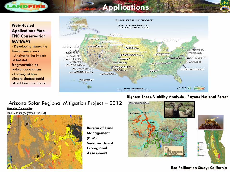
Bighorn Sheep Viability Analysis - Payette National Forest
Bee Pollination Study: California
Web-Hosted
Applications Map –
TNC Conservation
GATEWAY - Developing statewide
forest assessments
- Analyzing the impact
of habitat
fragmentation on
bobcat populations
- Looking at how
climate change could
affect flora and fauna
Arizona Solar Regional Mitigation Project – 2012
Bureau of Land
Management
(BLM)
Sonoran Desert
Ecoregional
Assessment
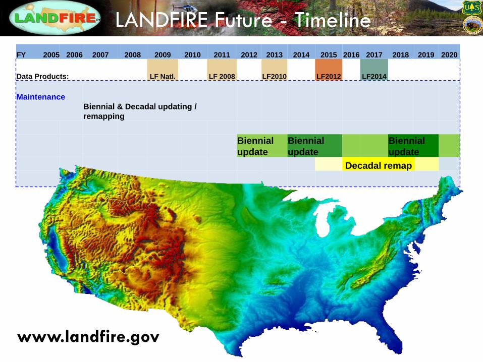
FY 2005 2006 2007 2008 2009 2010 2011 2012 2013 2014 2015 2016 2017 2018 2019 2020
Data Products: LF Natl. LF 2008 LF2010 LF2012 LF2014
Maintenance
Biennial & Decadal updating /
remapping
Biennial
update
Biennial
update
Biennial
update
Decadal remap
LANDFIRE Future - Timeline
www.landfire.gov
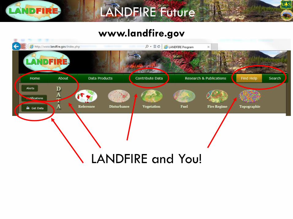
LANDFIRE Future
LANDFIRE and You!
www.landfire.gov