Embed Size (px)
Citation preview
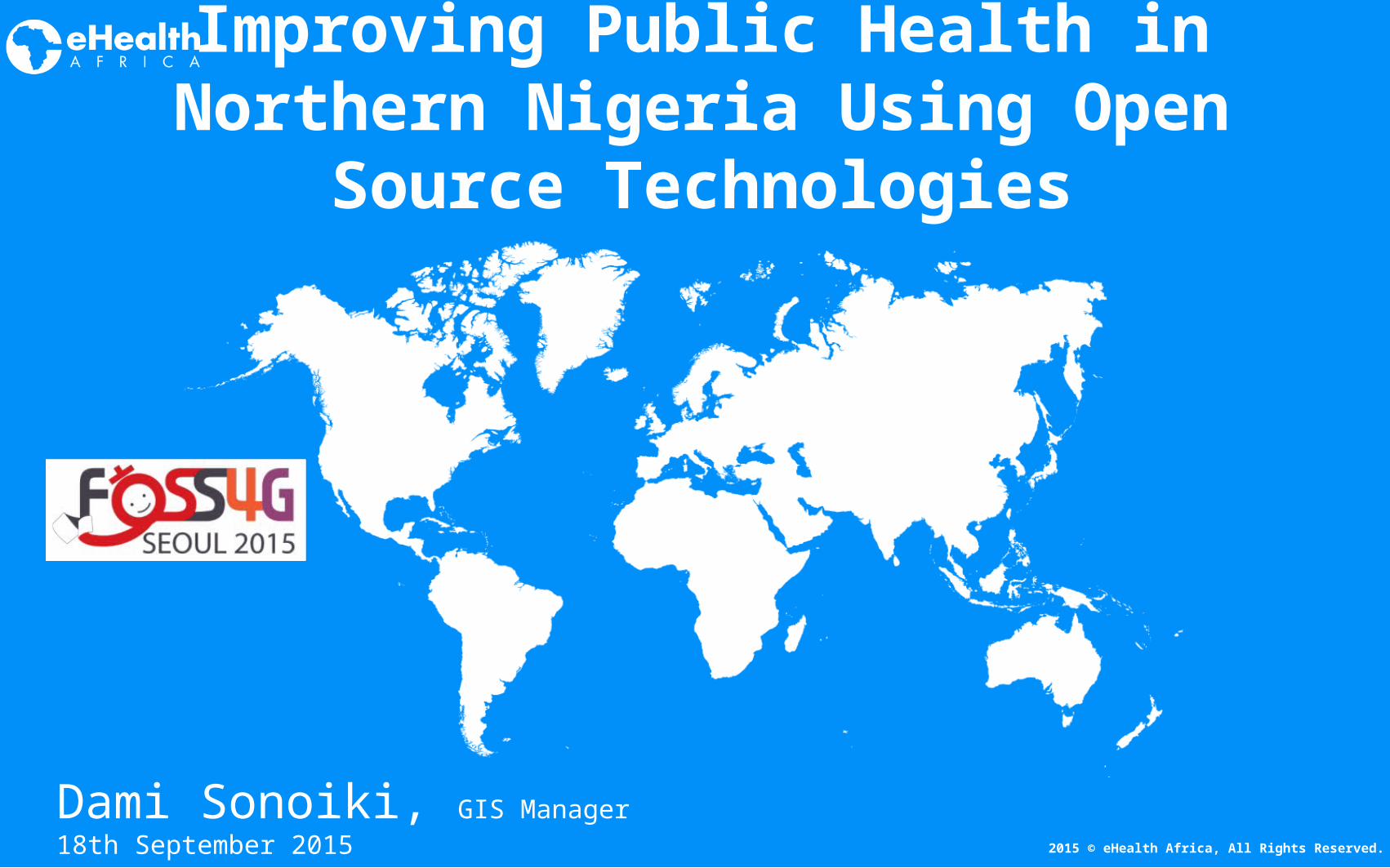
Dami Sonoiki, GIS Manager 18th September 2015
Improving Public Health in Northern Nigeria Using Open
Source Technologies
2015 © eHealth Africa, All Rights Reserved.
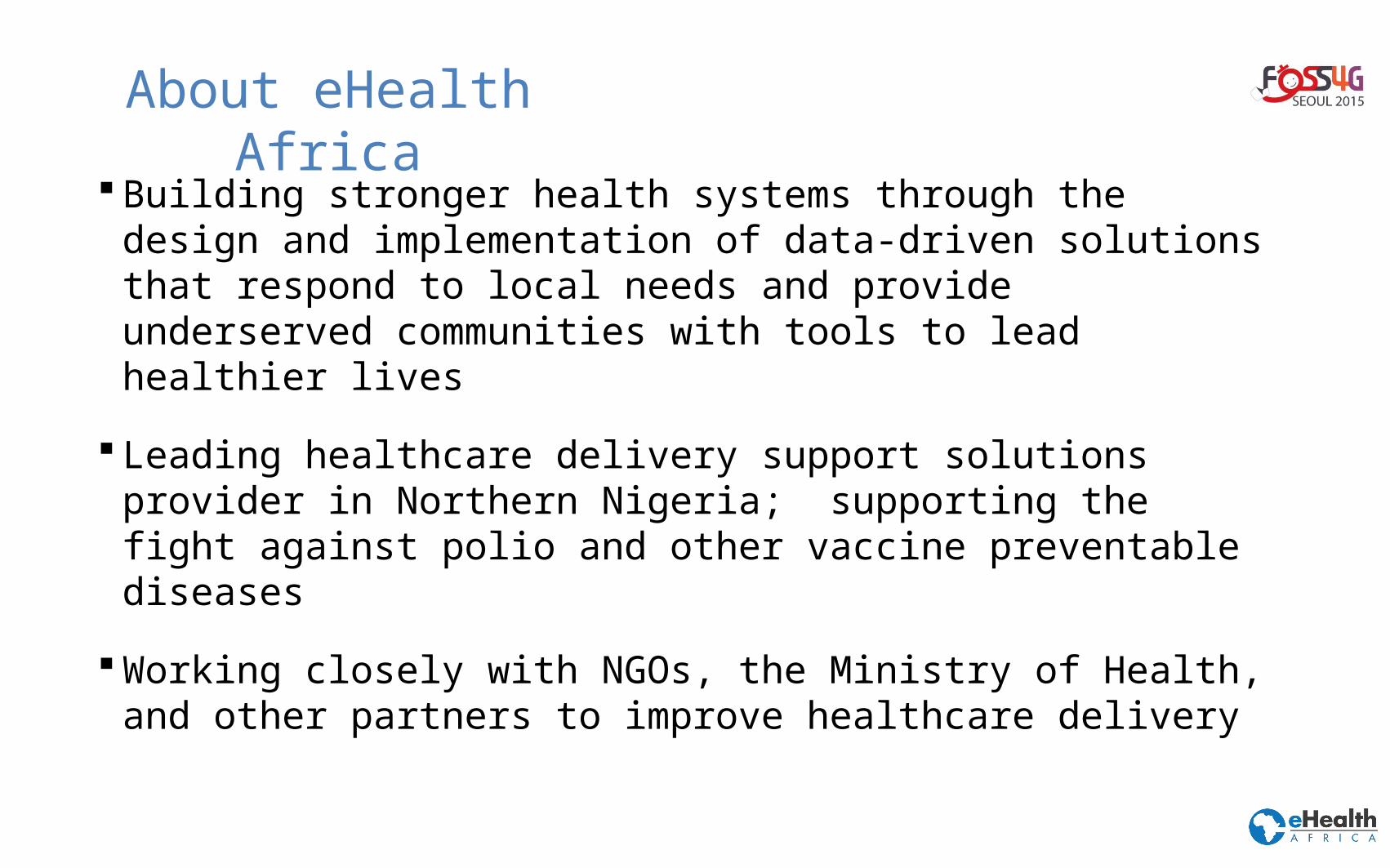
About eHealth Africa
Building stronger health systems through the design and implementation of data-driven solutions that respond to local needs and provide underserved communities with tools to lead healthier lives
Leading healthcare delivery support solutions provider in Northern Nigeria; supporting the fight against polio and other vaccine preventable diseases
Working closely with NGOs, the Ministry of Health, and other partners to improve healthcare delivery
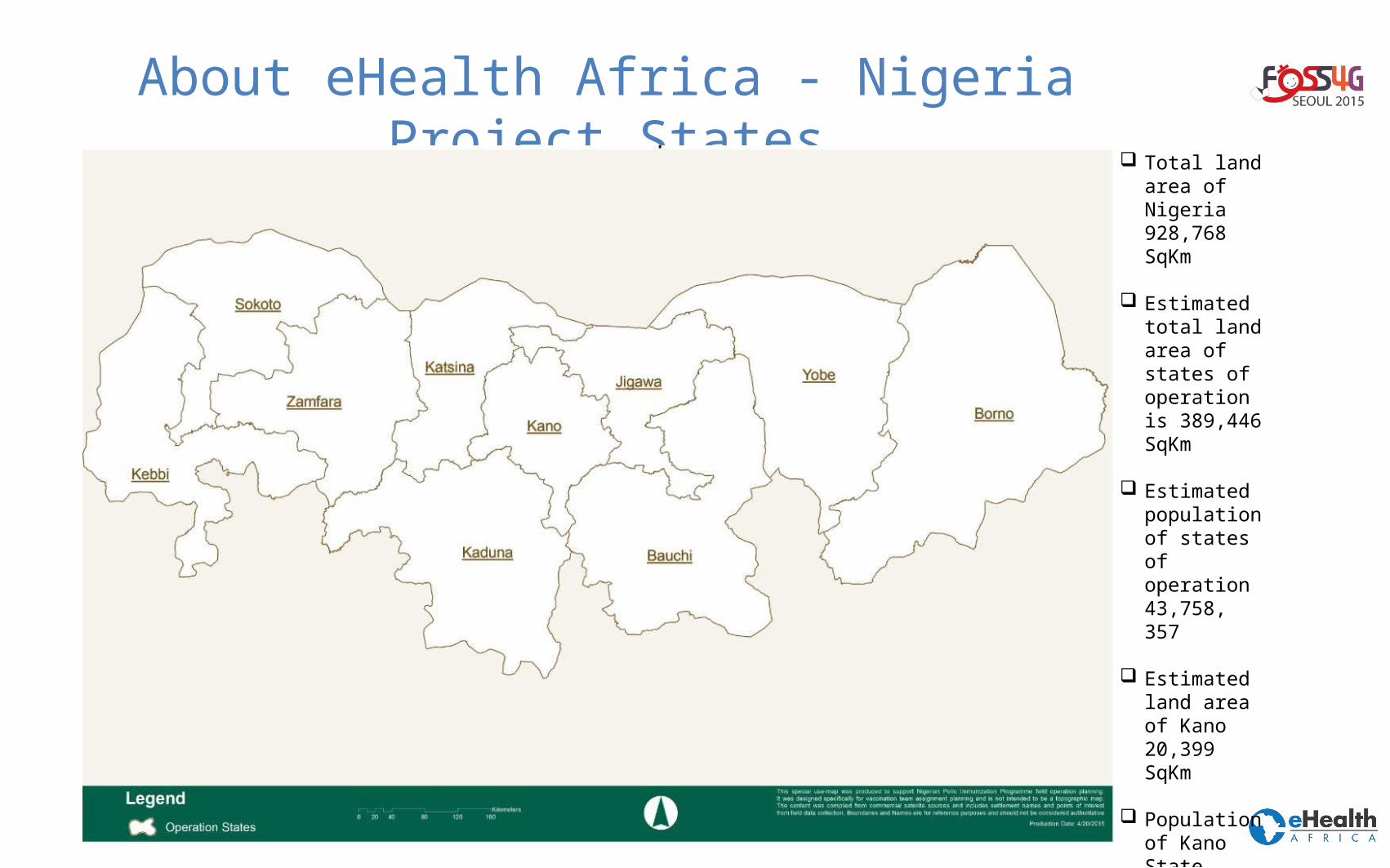
About eHealth Africa - Nigeria Project States Total land
area of Nigeria 928,768 SqKm
Estimated total land area of states of operation is 389,446 SqKm
Estimated population of states of operation 43,758, 357
Estimated land area of Kano 20,399 SqKm
Population of Kano State 9,383,682
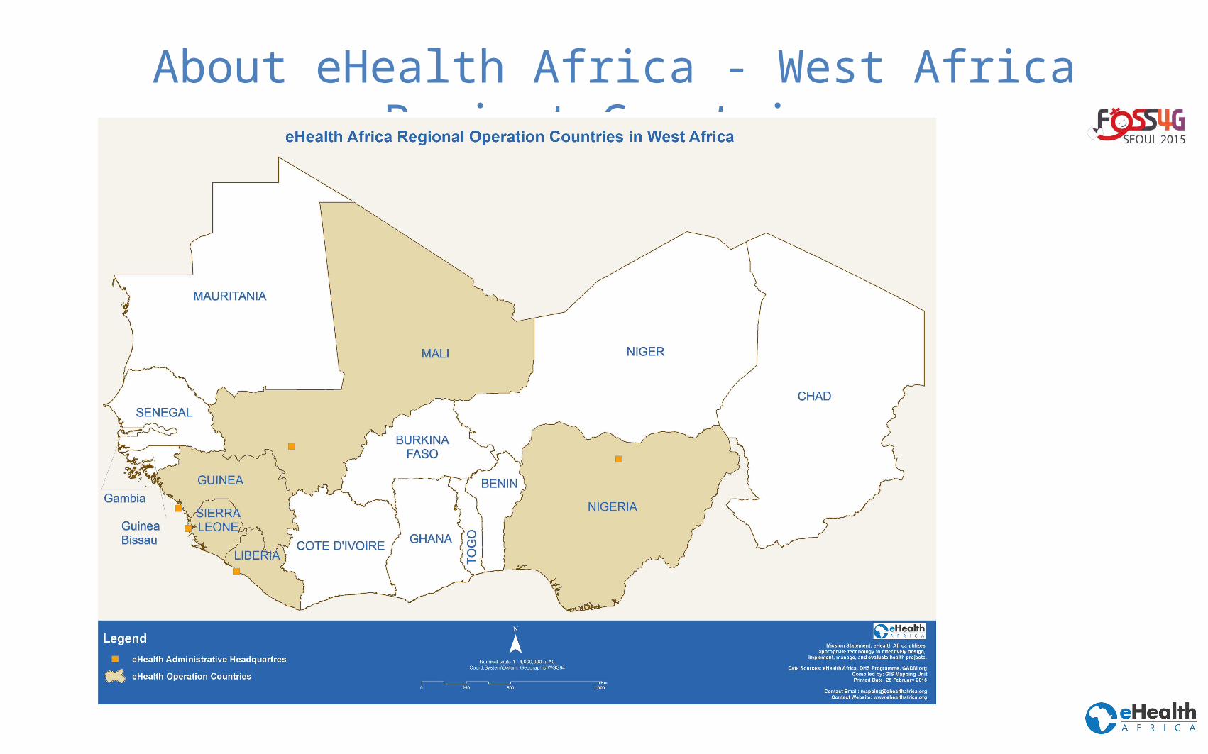
About eHealth Africa - West Africa Project Countries
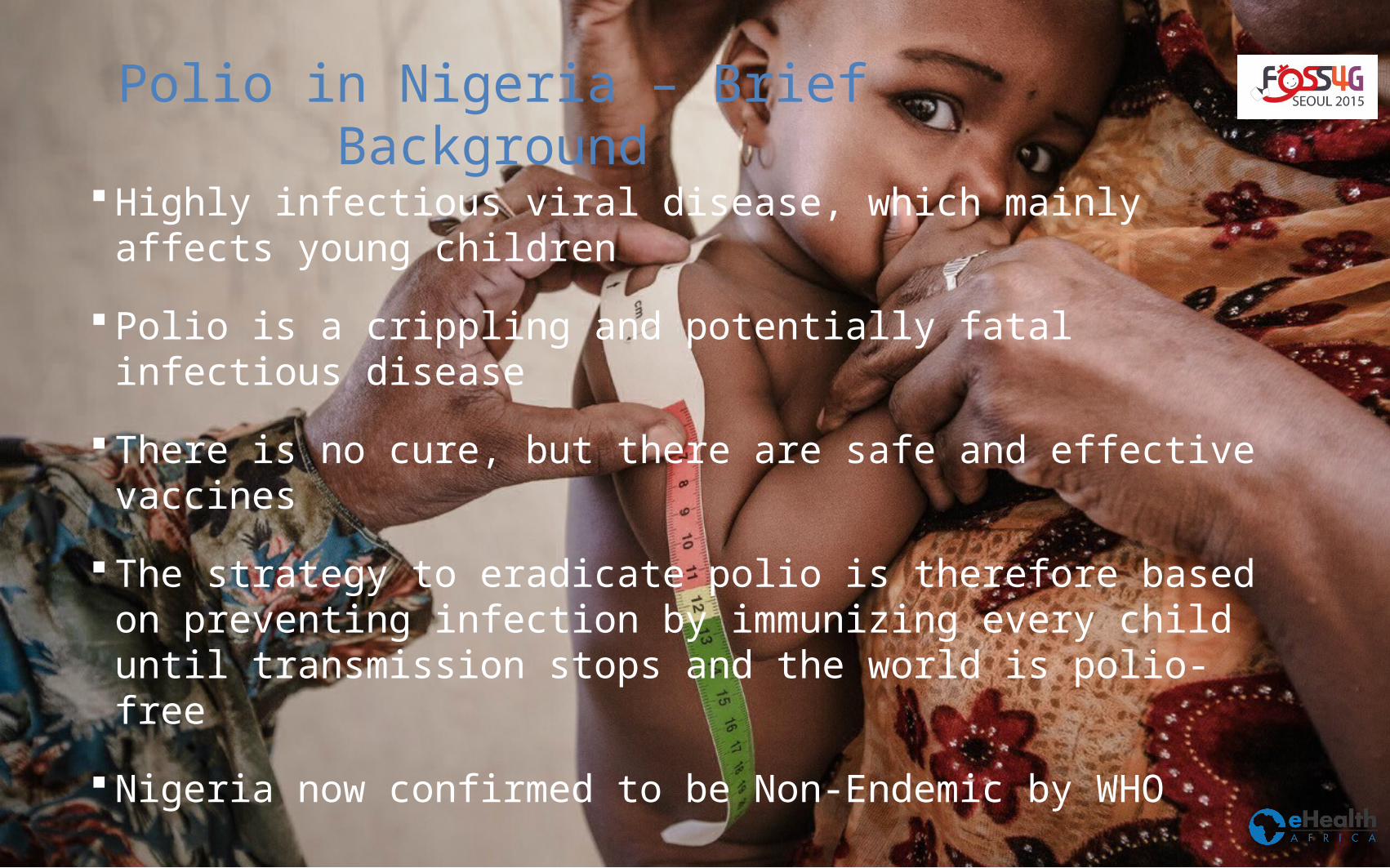
Polio in Nigeria – Brief Background
Highly infectious viral disease, which mainly affects young children
Polio is a crippling and potentially fatal infectious disease
There is no cure, but there are safe and effective vaccines
The strategy to eradicate polio is therefore based on preventing infection by immunizing every child until transmission stops and the world is polio-free
Nigeria now confirmed to be Non-Endemic by WHO
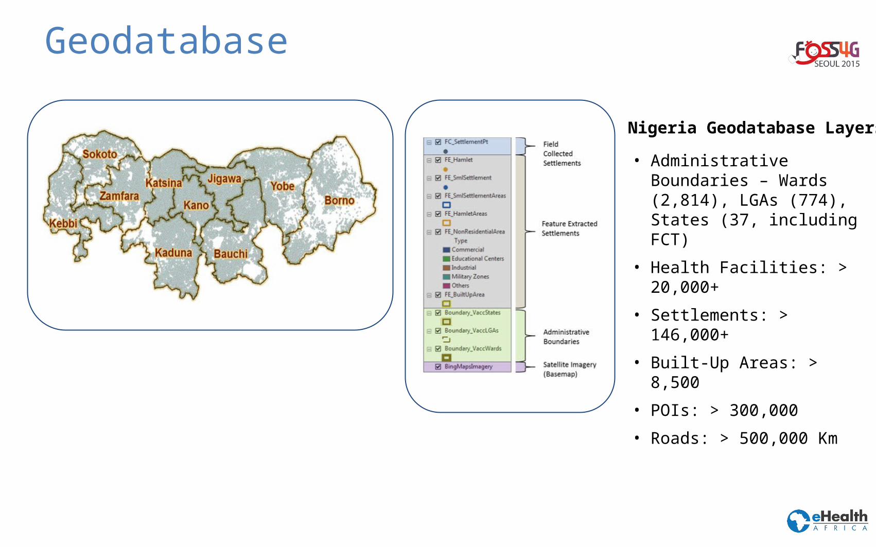
Geodatabase
• Administrative Boundaries – Wards (2,814), LGAs (774), States (37, including FCT)
• Health Facilities: > 20,000+
• Settlements: > 146,000+
• Built-Up Areas: > 8,500
• POIs: > 300,000
• Roads: > 500,000 Km
Nigeria Geodatabase Layers
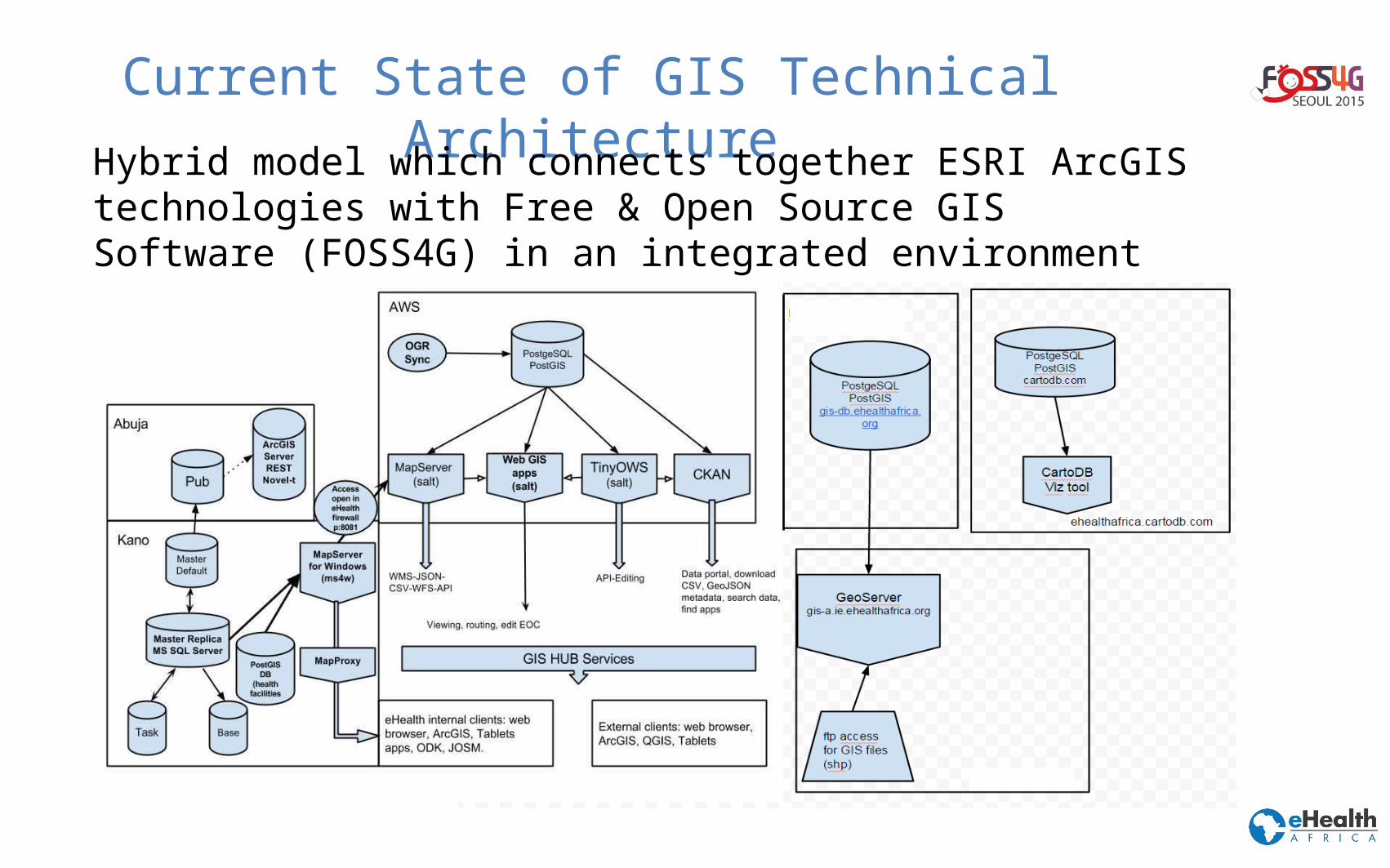
Current State of GIS Technical ArchitectureHybrid model which connects together ESRI ArcGIS
technologies with Free & Open Source GIS Software (FOSS4G) in an integrated environment
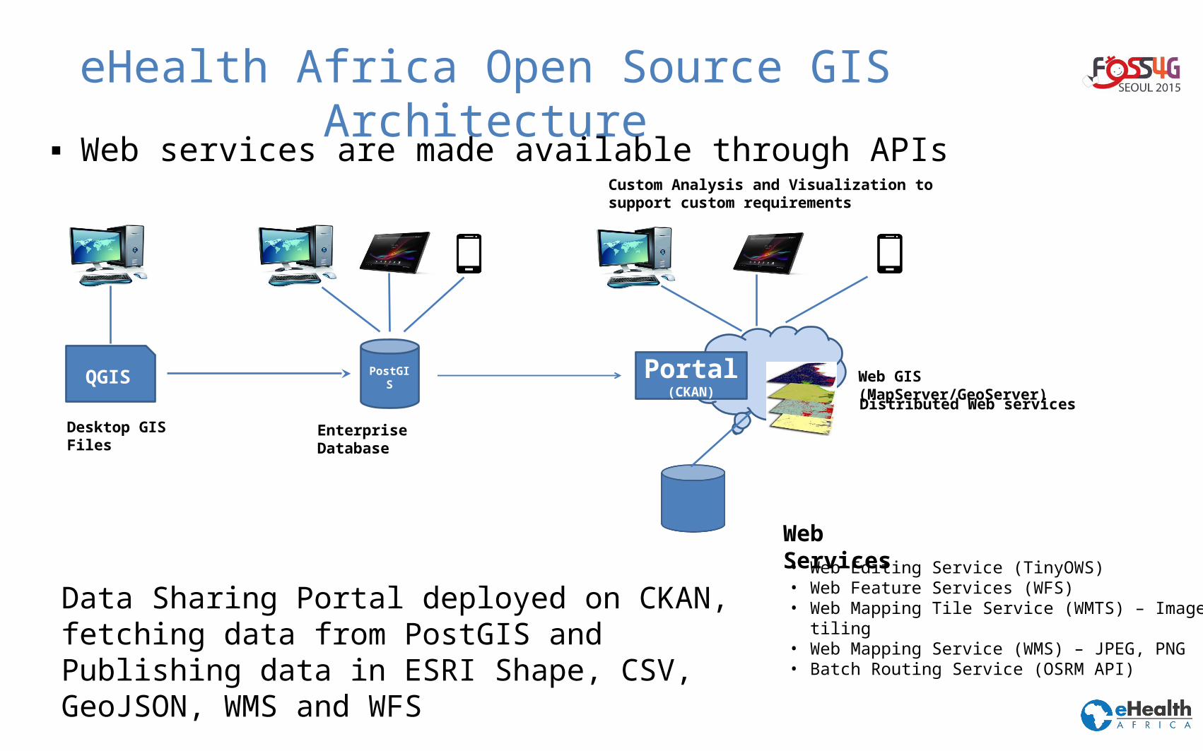
eHealth Africa Open Source GIS Architecture
▪ Web services are made available through APIs
QGIS PostGIS
Portal(CKAN)
Desktop GIS Files
Enterprise Database
Distributed Web services
Web GIS (MapServer/GeoServer)
Custom Analysis and Visualization to support custom requirements
Data Sharing Portal deployed on CKAN, fetching data from PostGIS and Publishing data in ESRI Shape, CSV, GeoJSON, WMS and WFS
• Web Editing Service (TinyOWS)• Web Feature Services (WFS) • Web Mapping Tile Service (WMTS) – Image tiling• Web Mapping Service (WMS) – JPEG, PNG• Batch Routing Service (OSRM API)
Web Services
eHealth Africa And FOSS4G
Project initially started on proprietary software
Need to for technology transfer to Government
Need to concentrate on capacity development
Need for community support
Need to integrate other open data and software applications
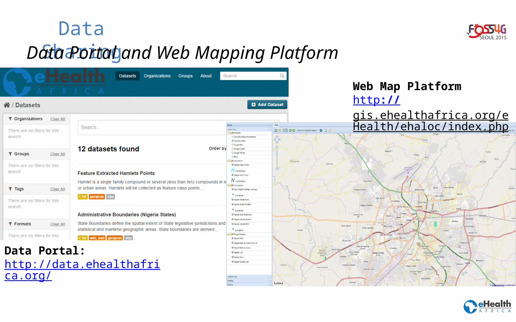
Data SharingData Portal and Web Mapping Platform
Web Map Platformhttp://gis.ehealthafrica.org/eHealth/ehaloc/index.php
Data Portal: http://data.ehealthafrica.org/
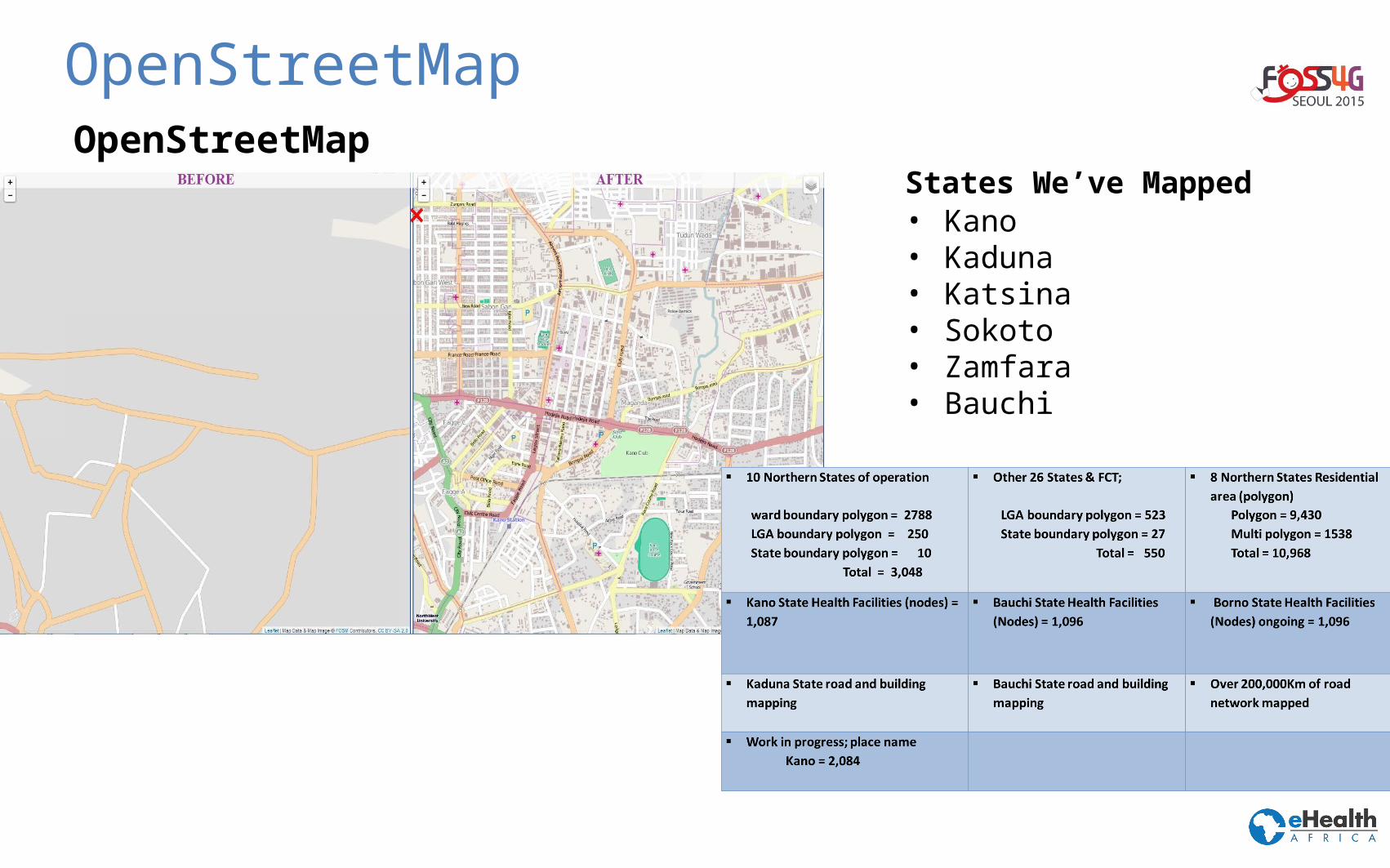
OpenStreetMapOpenStreetMap
States We’ve Mapped• Kano• Kaduna• Katsina• Sokoto• Zamfara• Bauchi
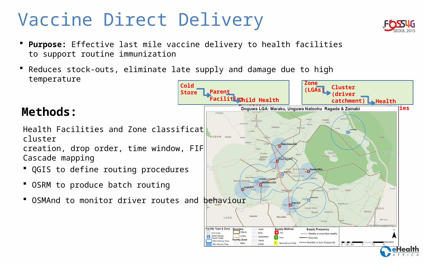
Vaccine Direct Delivery
Health Facilities and Zone classification, cluster creation, drop order, time window, FIFOCascade mapping
Methods:
Cold Store Parent Facilities
Child Health Facilities
Zone (LGAs)Cluster(driver catchment)
Health Facilities
Purpose: Effective last mile vaccine delivery to health facilities to support routine immunization
Reduces stock-outs, eliminate late supply and damage due to high temperature
QGIS to define routing procedures
OSRM to produce batch routing
OSMAnd to monitor driver routes and behaviour
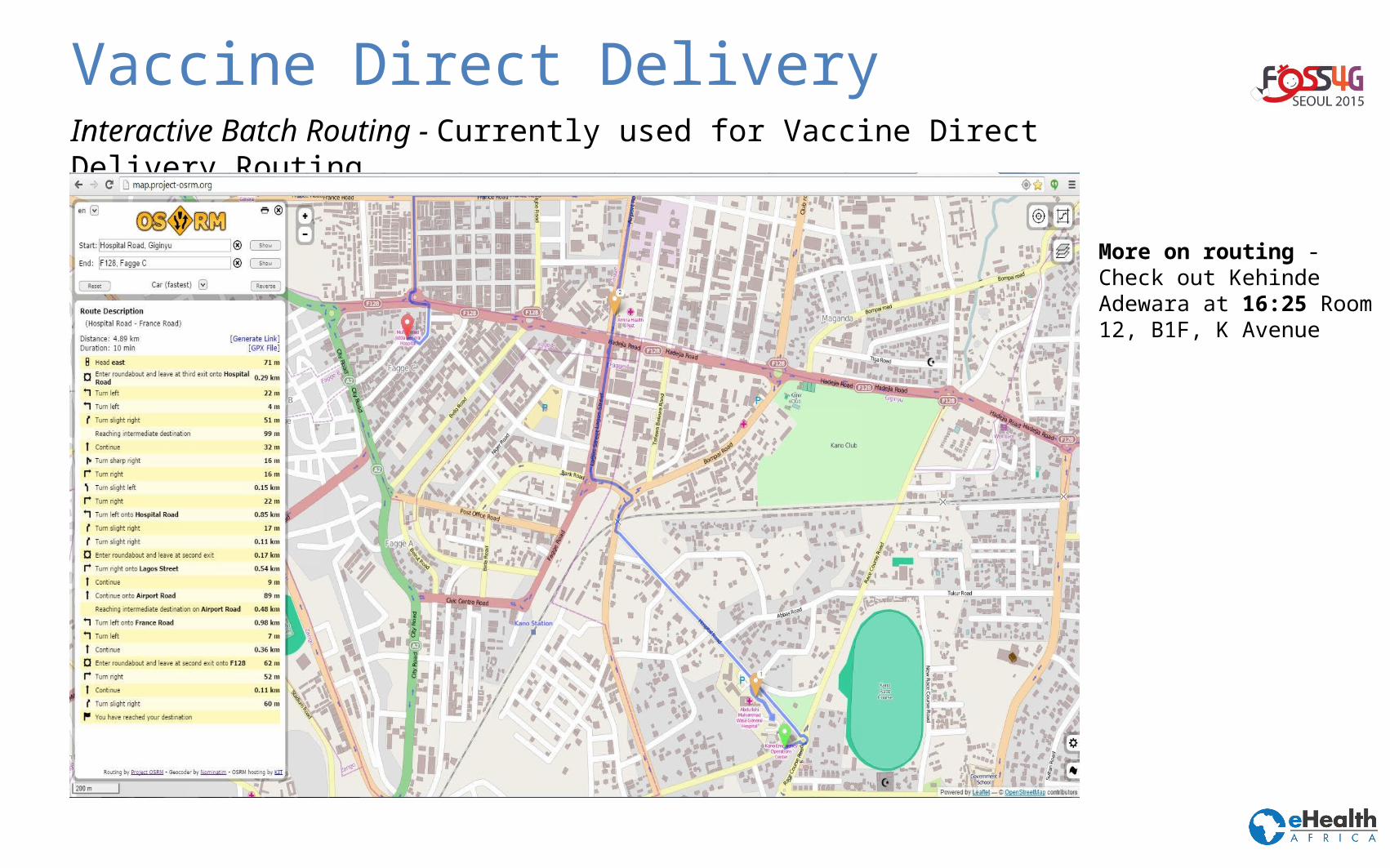
Vaccine Direct DeliveryInteractive Batch Routing - Currently used for Vaccine Direct Delivery Routing
More on routing - Check out Kehinde Adewara at 16:25 Room 12, B1F, K Avenue
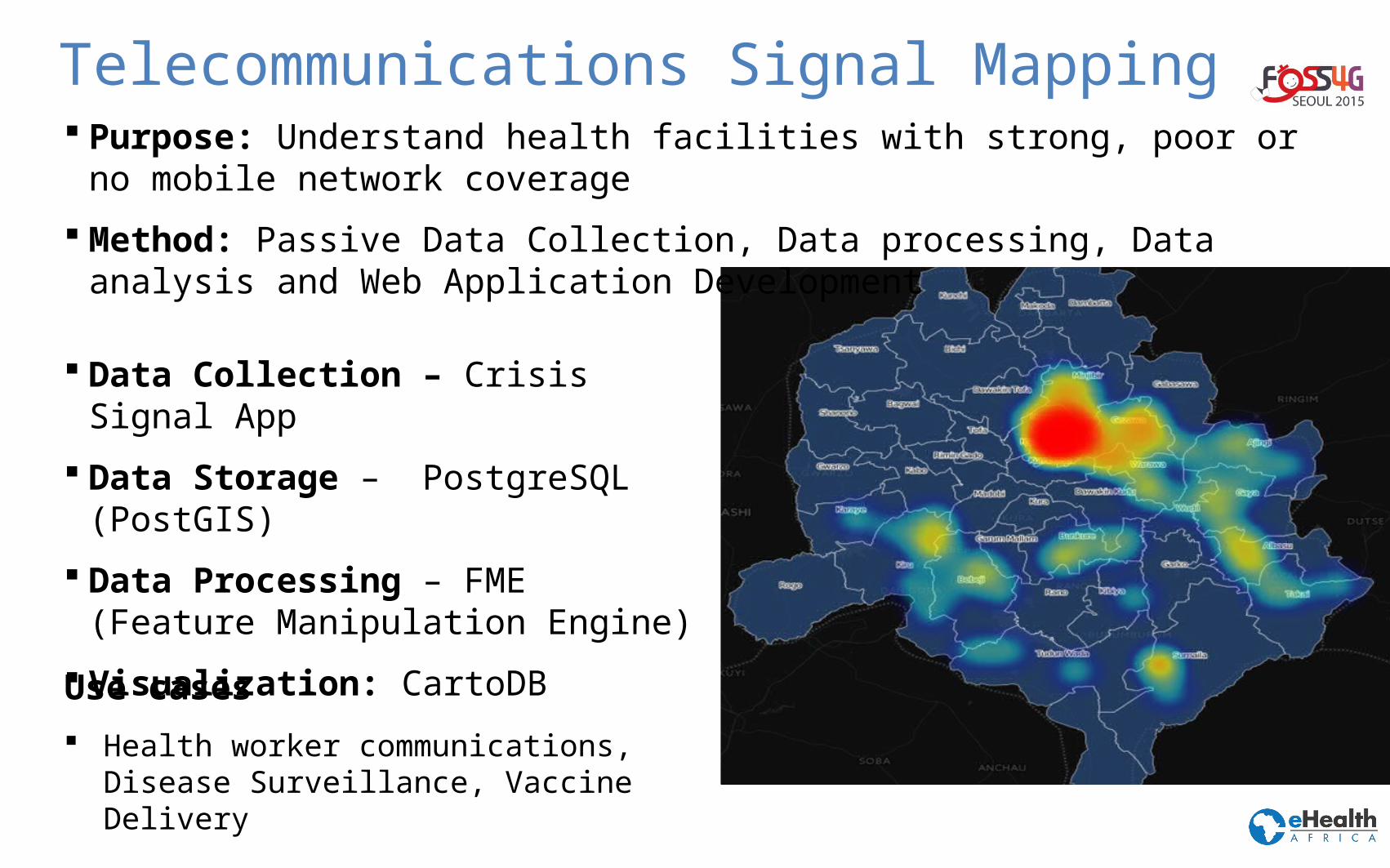
Telecommunications Signal Mapping Purpose: Understand health facilities with strong, poor or no mobile network
coverage
Method: Passive Data Collection, Data processing, Data analysis and Web Application Development
Data Collection – Crisis Signal App
Data Storage – PostgreSQL (PostGIS)
Data Processing – FME (Feature Manipulation Engine)
Visualization: CartoDB
Use cases
Health worker communications, Disease Surveillance, Vaccine Delivery
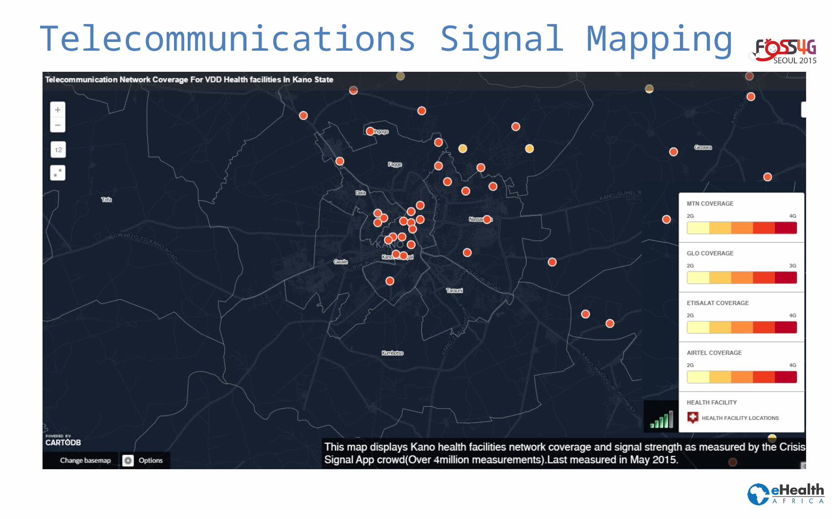
Telecommunications Signal Mapping
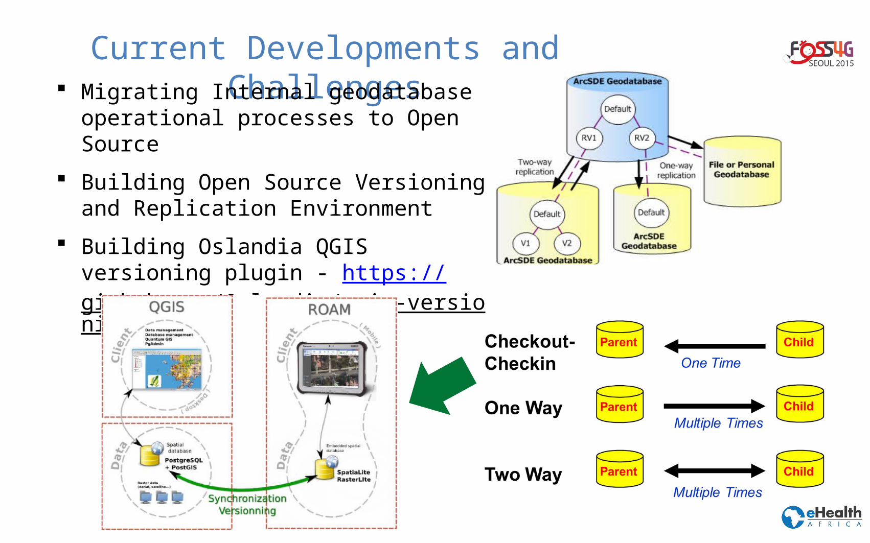
Current Developments and Challenges Migrating Internal geodatabase
operational processes to Open Source
Building Open Source Versioning and Replication Environment
Building Oslandia QGIS versioning plugin - https://github.com/Oslandia/qgis-versioning
Current Developments and Challenges Deploying OpenStreetMap Platform and osmosis
Customizing our CKAN platform - building analytics and user management into CKAN
More InformationAcknowledgement: eHealth Africa, eHA GIS Team, Oslandia, Nicolas Gignac
Contacthttp://www.ehealthafrica.org
Twitter@eHealth_africa@dammishow