Embed Size (px)
Citation preview

DAM BREAK FLOOD INUNDATION MODELLING FOR
KLANG GATE DAM
NURASHIKIN BINTI ZAINAL ABIDIN
A project report submitted in partial fulfilment of the
requirements for the award of the degree of
Master of Engineering (Civil-Hydrology & Water Resources)
Faculty of Civil Engineering
Universiti Teknologi Malaysia
JUNE 2015

iii
Specially dedicated to my beloved husband Mohd Irsyam Noorfawana Bin Masri and
my lovely daughters, Nurin and Nadia.
I love you.

iv
ACKNOWLEDGEMENT
Prima facea, I am grateful to Allah S.W.T for the good health and wellbeing
that were necessary to complete this dissertation.
I was really appreciated to many people that contribute towards my
understanding and thoughts in order to finish this study. I wish to express my sincere
thanks to my supervisor, Assoc. Prof. Dr. Supiah Binti Shamsudin for her guidance
and encouragement. Also to Dr. Zulhilmi B Ismail and Dr. Mohamad Hidayat B.
Jamal for their critics, advice and guidance.
I place on record, my sincere thank you to Jabatan Perkhidmatan Awam
(JPA) and Jabatan Kerja Raya, for the education fees sponsorship.
My sincere appreciation to my colleagues Mr. Irsyam, Miss Farihan, Mrs.
Niza, Mrs. Norhayati and Mr. Aliff for their supportive, motivation, love, advice and
friendship. Thank you for sharing expertise and experience to me.
I take this opportunity to express gratitude to all of the Hydrology and Water
Resources lecturers for their knowledge's and experiences. I also thank my parents
and parents in law for the unceasing Dua's, encouragement, support and attention.
Last but not least, to my beloved husband Mr. Mohd Irsyam Noorfawana Bin
Masri, I am extremely thankful and indebted to him for sharing expertise, and sincere
encouragement extended to me. To my lovely daughters, Nurin and Nadia, thank you
for being such a lovely and understanding along mummy's journey.
I also place on record, my sense of gratitude to one and all, who directly or
indirectly, have lent their hand in this venture.

v
ABSTRACT
Dams play a very vital role in the economy of a country by providing
essential benefits like irrigation, hydropower, flood control and mitigation, drinking
water and recreation. However in the unlikely and rare event of their failure, these
may cause catastrophic flooding in the downstream area which may result in huge
loss and damage to human life and property. In Malaysia, we have not had the
experience of any such dam failures. However as the dams in the country get older,
we cannot avoid but to face the reality that we have to take notice of the conditions
of these dams from the safety point of view. This project report presents flood
inundation mapping due to dam break of Klang Gate Dam. The Klang Gate Dam
were modelled using a HEC-RAS one-dimensional hydraulic model to capture the
hydraulic response of the river and its floodplains in extreme flooding condition due
to dam break. Klang Gate Dam has been chosen as the study area where the dam has
been classified as a significant high hazard. The purpose of this study is to determine
maximum inundation depth of the flood waves, peak discharge and flood wave
arrival time at various locations of the downstream valley and to develop flood
inundation map depending on the severity of the flood in event of the failure of the
Klang Gate Dam by using HEC-RAS. A steady flow HEC-RAS Model is developed
for a probable maximum flood (PMF) failure for overtopping mode and the breach
parameter of possible worst case scenario were considered in the study. The result
showed that the peak discharge due to overtopping failure is 21,272 m3/s with
possible maximum velocity of 12 m/s. The result indicated that impact of breach
outflow to the downstream area is significant. The finding, could benefit authorities
or dam owner in an emergency response plans to prevent catastrophic damage at
downstream in case of a dam break occurs.
vi
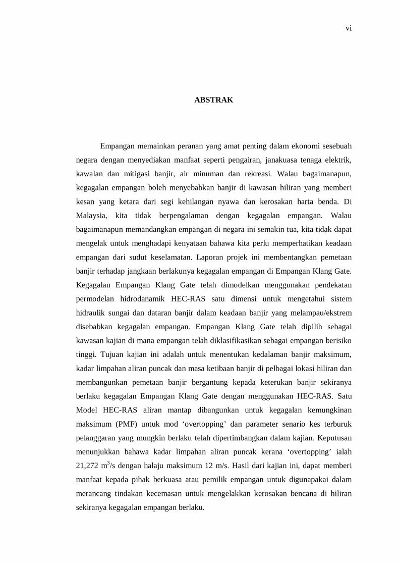
ABSTRAK
Empangan memainkan peranan yang amat penting dalam ekonomi sesebuah
negara dengan menyediakan manfaat seperti pengairan, janakuasa tenaga elektrik,
kawalan dan mitigasi banjir, air minuman dan rekreasi. Walau bagaimanapun,
kegagalan empangan boleh menyebabkan banjir di kawasan hiliran yang memberi
kesan yang ketara dari segi kehilangan nyawa dan kerosakan harta benda. Di
Malaysia, kita tidak berpengalaman dengan kegagalan empangan. Walau
bagaimanapun memandangkan empangan di negara ini semakin tua, kita tidak dapat
mengelak untuk menghadapi kenyataan bahawa kita perlu memperhatikan keadaan
empangan dari sudut keselamatan. Laporan projek ini membentangkan pemetaan
banjir terhadap jangkaan berlakunya kegagalan empangan di Empangan Klang Gate.
Kegagalan Empangan Klang Gate telah dimodelkan menggunakan pendekatan
permodelan hidrodanamik HEC-RAS satu dimensi untuk mengetahui sistem
hidraulik sungai dan dataran banjir dalam keadaan banjir yang melampau/ekstrem
disebabkan kegagalan empangan. Empangan Klang Gate telah dipilih sebagai
kawasan kajian di mana empangan telah diklasifikasikan sebagai empangan berisiko
tinggi. Tujuan kajian ini adalah untuk menentukan kedalaman banjir maksimum,
kadar limpahan aliran puncak dan masa ketibaan banjir di pelbagai lokasi hiliran dan
membangunkan pemetaan banjir bergantung kepada keterukan banjir sekiranya
berlaku kegagalan Empangan Klang Gate dengan menggunakan HEC-RAS. Satu
Model HEC-RAS aliran mantap dibangunkan untuk kegagalan kemungkinan
maksimum (PMF) untuk mod ‘overtopping’ dan parameter senario kes terburuk
pelanggaran yang mungkin berlaku telah dipertimbangkan dalam kajian. Keputusan
menunjukkan bahawa kadar limpahan aliran puncak kerana ‘overtopping’ ialah
21,272 m3/s dengan halaju maksimum 12 m/s. Hasil dari kajian ini, dapat memberi
manfaat kepada pihak berkuasa atau pemilik empangan untuk digunapakai dalam
merancang tindakan kecemasan untuk mengelakkan kerosakan bencana di hiliran
sekiranya kegagalan empangan berlaku.

vii
TABLE OF CONTENTS
CHAPTER TITLE PAGE
DECLARATION ii
DEDICATION iii
ACKNOWLEDGEMENTS iv
ABSTRACT v
ABSTRAK vi
TABLE OF CONTENTS vii
LIST OF TABLES x
LIST OF FIGURES xi
LIST OF SYMBOLS xiv
LIST OF APPENDICES xvi
1 INTRODUCTION 1
1.1
1.2
Introduction
Background of the Problem
1
2
1.3 Statement of the Problem 2
1.4 Objectives of the Study 4
1.5 Scope of the Study 4
1.6 Significance of the Study 5
2 LITERATURE REVIEW 6
2.1 Introduction 6
2.2 Dam Failure 7
2.3 Modes of Dam Failure 10
2.3.1 Overtopping Failure 11
2.3.2 Piping Failure 12
2.3.3 Structural Failure 12

viii
2.4 Review of Available Computational Tools
for Dam Break Analysis
13
2.5 Hydraulic Model Software 17
2.5.1 Simplified Numerical Models 17
I. SMPDBK / Simplified Dam break Modelling
by National Weather Service (NWS)
17
2.5.2 One Dimensional Models 19
I. Full Equations (FEQ) Model 19
II. FLDWAV Model developed by National
Weather Service
19
III. HEC-RAS Model 20
IV. ISIS Flow/Hydrology Model by 23
Wallingford Software
2.5.3 Two Dimensional and Coupled 1d- 2d Models 24
I. MIKE FLOOD 24
II. BASEMENT 25
III. CCHE2DFLOOD 25
IV. FLO2D: Two Dimensional Flood Routing 29
V. TELEMAC2D Model 30
2.6 Flood Mapping 30
2.7 Flood Modelling 32
2.8 Flood Modelling using HEC-RAS 33
2.9 Summary 35
3 RESEARCH METHODOLOGY 36
3.1 Introduction 36
3.2 Research Boundary 37
3.3 Design Methodology 38
3.4 Area of Study 42
3.5 Data Collection 47
3.5.1 LIDAR (Light Detection and Ranging) Data 47
3.5.2 Dam Data and Rainfall Data 48
3.6 Data Segmentation 49
ix
3.6.1 HEC-Geo RAS Development 49
I. Digitizing Process 50
3.6.2 HEC-RAS Model Development 60
I. Channel Data 61
II. Hydraulic Analysis in HEC-RAS 61
3.7 HEC-RAS Model 62
3.8 Data Analysis 74
3.9 Pros and Cons of HEC-RAS Modelling 76
3.9.1 Steady and Unsteady Flow Analysis in HEC
RAS
77
3.10 Research Limitations 80
3.11 Conclusion 81
4 RESULT & ANALYSIS 82
4.1 Introduction 82
4.2 To Determine Maximum Inundation Depth of the
Flood Waves, Peak Discharge and Flood Wave Travel
Time at Various Location of the Downstream Valley
When the Dam Failure.
83
4.2.1 Calibration 84
4.2.2 Breach Parameter 86
4.2.3 Overtopping Failure of Klang Gate Dam 89
4.3 To Develop Flood Inundation Map Depending on the
Severity of the Flood in Event of the Failure of the
Klang Gate Dam by Using HEC-RAS.
94
4.4 Conclusion 98
5 CONCLUSION & RECOMMENDATION 99
5.1 Conclusion 99
5.2 Recommendation 101
REFERENCES 104
Appendices 108

x
LIST OF TABLES
TABLE NO. TITLE PAGE
2.1 Statistics of Dams in Malaysia 9
3.1 Salient Features of Klang Gate Dam 44
4.1 Reservoir Routing 83
4.2 The Summary of Rainfall Data During 4th September 2012
Storm Event
85
4.3 Breach Parameter 87
4.4 Klang River Longitudinal Section Vs Infrastructure 87
4.5 Peak Flow Results for 100 years and PMF Failure 90
4.6 The Floodwater Depth for 100 years and PMF Failure 90
4.7 The Flood Wave Arrival Time for 100 years and PMF
Failure
91
4.8 The Predicted Maximum Velocity for 100 years and PMF
Failure
91
xi
LIST OF FIGURES
FIGURE NO. TITLE PAGE
2.1 Modes of Dam Failure 11
2.2 Steps for converting one-dimensional simulation results
into two-dimensional flood delineation maps
16
2.3 Simplified Dam-Break (SMPDBK) 18
2.4 Flood Inundation Map 31
2.5 Flood Hazard Map 31
2.6 Flood Risk Map 32
2.7 Flood Inundation Map of Sg. Kinta Dam 33
2.8 Flood Prone Area 34
3.1 Research Approaches 41
3.2 Area of Study 43
3.3 Plan and Elevation of Klang Gate Dam 45
3.4 Cross-sections of Klang Gate Dam 46
3.5 The Klang Gate Dam 46
3.6 Remote Sensing Image of the Study Area 47
3.7 Map of Klang Gate Dam 48
3.8 Steps In Digitizing Process 50
3.9 ArcGIS 10.3 51
3.10 New Map 51
3.11 Add Data 52
3.12 Base Map/ LIDAR Data 52
3.13 Create RAS Layers 53
3.14 Create All Layers 54
3.15 RAS Layers Are Successfully Created 54
3.16 Editor Toolbar 55

xii
3.17 Digitizing the Stream 55
3.18 Create River Topology 56
3.19 Complete Digitizing Process 57
3.20 Layer Setup- Required Surface 58
3.21 Layer Setup- Required Layers 58
3.22 Layer Setup- Optional Tables 59
3.23 Layer Setup- Optional Layers 59
3.24 Export GIS Data 60
3.25 Dam Break Analysis Flow Chart 61
3.26 Steps for HEC-RAS Model 62
3.27 HEC-RAS 4.1.0 62
3.28 Save Project As 63
3.29 River Reach Streamlines 63
3.30 Cross Section and IB Nodes 64
3.31 Georeferenced Schematic Of The River System 64
3.32 Edit Geometric Data 65
3.33 Flow data 66
3.34 Steady Flow Boundary Condition 66
3.35 Steady Flow Analysis 67
3.36 A dam is represented as an inline structure in HEC-RAS 68
3.37 Dam breach information entered in HEC-RAS 68
3.38 Enter/Edit Unsteady Flow Data 69
3.39 Initial boundary 70
3.40 Initial Stages 70
3.41 Normal Depth 71
3.42 Unsteady Flow Analysis 72
3.43 GIS Export 73
3.44 Convert RAS Output File to XML 73
3.45 Flood Inundation Map 74
3.46 Example profile comparison of dam failure scenarios in
HEC-RAS
75
3.47 Stage hydrographs at river mile locations downstream of
the dam
76

xiii
4.1 Klang Gate Dam Storage-Stage Curve 83
4.2 The Rainfall at AU6 Station on 4 September 2012 84
4.3 The Rainfall at Kelang Gate Station on 4 September 2012 84
4.4 The Rainfall at AU3 Station on 4 September 2012 85
4.5 The Rainfall at Ampang, Klang Station on 4 September
2012
85
4.6 The Result of Water Level Hydrograph from Observed
and Simulation for 4 September 2012 Storm Event
86
4.7 The Longitudinal Profile Of The Section Versus The
Infrastructure/Villages Near The Klang River
88
4.8 The Longitudinal Profile Of The Floodwater Depth Due to
Dam Break
92
4.9 The Predicted Maximum Velocity for 100 years and PMF
Failure
93
4.10 Flood Inundation Map of Klang Gate Dam due to Dam
Break of PMF Failure
95
4.11 Riverview Kemensah 96
4.12 Sek. St Maris and Sg. Klang & Sg Ampang Confluence 97
xiv
LIST OF SYMBOLS
DID - Drainage and Irrigation Department
GIS - Geographic Information System
DEM - Digital Elevation Model
LiDAR - Light Detection and Ranging
HEC-RAS - Hydrologic Engineering Center’s River Analysis
System
PMF - Probable Maximum Flood
km2 - Kilometre Square
1D - 1 Dimension
SMPDBK - Simplified Dam-Break
NWS - National Weather Service
FEQ - Full Equations
FLDWAV - Flood Wave
DWOPER - Dynamic Wave Operation Network Model
DAMBRK - Dam-Break Forecasting Model
UNET - Unsteady Flow Engine
ISIS - Full Hydrodynamic Simulator
FSR - Flood Studies Report
FEH - Flood Estimation Handbook
USSCS - US Soil Conservation Service
VAW - Laboratory of Hydraulics, Hydrology and Glaciology
ETH - Swiss Federal Institute of Technology
CCHE2DFLOOD Computational Hydroscience and Engineering
DSS-WISE - Decision Support System for Water Infrastructural
Security
HEC-GeoRAS Hydrologic Engineering Center’s Geographic River
Analysis System

xv
JUPEM - Jabatan Ukur dan Pemetaan Malaysia
TIN - Triangular Irregular Networks
m3/s - meter cubic per second
m/s - meter per second

xvi
LIST OF APPENDICES
APPENDIX TITLE PAGE
A Taman Melawati and Zoo Negara Flood Inundation Map 109
Taman Lembah Keramat and Taman Sepakat Flood
Inundation Map
110
JPS Water Level and Rainfall Stations in Wilayah
Persekutuan Kuala Lumpur
111
Flood Risk Map of Sungai Klang River Basin 112
Model of Sg. Klang Upstream of the Klang Gate Dam
Until Confluence of Sg Klang & Sg. Ampang
113
1
CHAPTER 1
INTRODUCTION
This chapter consist of introduction, research problem, research objectives,
research scope and significant of research.
1.1 Introduction
Dams play a very vital role in the economy of a country by providing
essential benefits like irrigation, hydropower, flood control and mitigation, drinking
water, recreation etc. A dam can also be used to collect water or for storage of water
which can be evenly distributed between locations. However in the unlikely and rare
event of their failure, these may cause catastrophic flooding in the downstream area
which may result in huge loss and damage to human life and property. Some notable
historic dam failure include Ka Loko Dam in Hawaii, 2006 ; Koshi Barrage in
Nepal, 2009; Delhi Dam in United States, 2010 and Nieodo Dam in Poland, 2010
(Wikipedia, 2013a). In 1975 the failure of the Banqiao Reservoir Dam and other
dams in Henan Province, China caused more casualties than any other dam failure in
history. The disaster killed an estimated 171,000 people and 11 million people lost
their homes (Wikipedia, 2013a). This loss and damage to life and property would
vary with extent of inundation area, size of population at risk, and the amount of
warning time available (S. Masood Husain, 1999).

2
1.2 Background of the Problem
In Malaysia, we have not had the experience of any such dam failures.
However as the dams in the country get older, we cannot avoid but to face the reality
that we have to take notice of the conditions of these dams from the safety point of
view. We should not wait until failure occurs which may endanger public safety.
A distinguishing feature of dam breach floods is the great magnitude of the
peak discharge in comparison to any precipitation runoff-generated floods, and its
consequences are often catastrophic if human developments exist downstream of the
dam. The prediction of the dam break flood is very important for the purposes of
planning and decision making concerning to dam safety, controlling downstream
developments, contingency evacuation planning and real time flood forecasting. For
assessing the flood damage due to dam breach it is necessary to predict not only the
possibility and mode of a dam failure, but also the flood hydrograph of discharge
from the dam breach and the propagation of the flood waves. The studies are to map
or delineate areas of potential flood inundation resulting from a dam breach, flood
depth, flow velocity and travel time of the flood waves etc. Knowledge of the flood
wave and flood-inundation area caused by a dam breach can potentially mitigate loss
of life and property damage.
1.3 Statement of the Problem
A flood produced by a dam breach is very different from a flood produced by
a rainfall event. In a dam-breach scenario, the subsequent flood wave develops over
a relatively short time and flows rapidly through the downstream area as opposed to
a rainfall event that would propagate more slowly through the downstream area.
When a dam fails or is deliberately demolished, large quantities of water are
suddenly released, creating major flood waves capable of causing disastrous damage
to downstream valley. Major flood waves may seriously damage or destroy power

3
plants, industrial plants, roads and bridges and may cause loss of life, adverse
ecological and environment impact.
Dam can fail either gradually or suddenly. The type of failure depends upon
the cause of failure and the type of dam. The failure can be because of the prolonged
periods of rainfall and flooding, inadequate spillway capacity, resulting in excess
overtopping of the embankment, internal erosion caused by embankment or
foundation leakage or piping, failure of upstream dams in the same drainage basin
and improper maintenance, including failure to remove trees, repair internal seepage
problems, or maintain gates, valves, and other operational components.
When the dam fails instantaneously, one assumes removal of the entire
structure or a large portion thereof. The sudden release of water generates a flood
wave that propagates over the initial stream flow and its front has the form of the
bore. A negative wave is created upstream of the dam and it propagates up along the
reservoir. The ruptured dam section becomes the pivotal point for the mass of water
to be released. The topography of the reservoir controls the movement of the
negative wave. (Muradee, 2009)
According to Emily Sirib (2005), there are about 75 dams in Malaysia and
most of the dams located next to the residential area. Dams that located near to the
residential posed high hazard to the downstream population. As results of the
situation, Dam-breach analysis and flood-inundation maps are vital for providing
data to make a better plan for and respond quickly and effectively to flooding.
Advanced knowledge of what areas may flood, what infrastructures may be
impacted, how long flooding may persist is necessary if units are to be able to
respond to such treats in timely manners.
Regarding to the significant of dam break study, a cooperative study has to
be done to simulate dam-break scenarios at Klang Gate Dam and to map the
potentially resulting flood-inundation areas.

4
1.4 Research Objectives
Followings are the objectives proposed for this study:-
(1) To determine maximum inundation depth of the flood waves, peak discharge
and flood wave arrival time at various locations of the downstream valley
when the dam failure.
(2) To develop flood inundation map depending on the severity of the flood in
event of the failure of the Klang Gate Dam by using HEC-RAS.
(3) To predict river flood risk map in Sungai Klang river basin.
1.5 Scope of the Study
A dam break flood modelling development of accurate flood-inundation
maps requires high-resolution topographic data of known accuracy. More accurate
topographic data lead to more accurate flood-inundation maps (Horritt and Bates,
2001). Field surveying produces the most accurate elevation data but can be time
consuming and expensive. Light detection and ranging (LiDAR) is an airborne laser-
profiling system that produces location and elevation data to define the surface of the
Earth and the heights of aboveground features. LiDAR can produce a digital
elevation model (DEM) with 1-foot (ft) contours that can be imported to a
geographic information system (GIS) in a relatively short amount of time.
Dam-breach flood-inundation maps indicate areas that would be flooded as a
result of a dam failure. The inundated areas depicted on flood-inundation maps are
approximate, and accuracy of such maps is a function of the accuracy of the
topographic data, the hydraulic models on which the maps are based, the
assumptions made about the dam failure mode, and the initial flood wave. For this
report, LiDAR data with a vertical accuracy of about 3.3 inches (in) were used to
develop a 1-ft contour elevation map for the study area of Klang Gate Dam. The

5
Hydrologic Engineering Center’s River Analysis System (HEC-RAS) modelling
software developed by the U.S. Army Corps of Engineers, a standard for dam-breach
flood-inundation models, was used to perform steady-flow simulations to model the
dynamic nature of the flood wave produced by a dam-breach scenario (Hydrologic
Engineering Center, 2010a).
The scope of this study is within this related area:-
• Data collection and analysis
• Dam breaks analysis with HEC-RAC modelling.
A dam break flood modelling will be conducted to determine the flood
inundation extents of a failure of the Klang Gate Dam. A steady flow HEC-RAS
Model is developed for a probable maximum flood (PMF) failure.
1.6 Significance of the Study
The significant of the study is to develop the river hydraulics model, simulate
a dam failure and map the resulting flood wave. The proper modelling of the hazards
associated with dam break will assist in land use planning and developing
emergency response plan to help mitigate catastrophic loss to human life and
property that might be inflicted by floods.

REFERENCES
Abbott, M. (1976). Computational hydraulics: A short pathology. Journal of Hydraulic Research, Vol. 14, No. 4
Angkasa Consulting Services Sdn. Bhd. (2012). Dam Break Risk Assessment. Prepared for Seminar Pengurusan Risiko dalam Pengurusan Projek. Putrajaya International Convention Centre, Malaysia. 12 July 2012.
Ariffin, M. (2006). Action Plan toward Effective Flood Hazard Mapping in My Country in Malaysia (Concluding report). Available from: http://www.icharm.pwri.go.jp/html/training/fhm/2006-d/ariffin_malaysia.pdf [Accessed 12 December 2013]
Cameron T. Ackerman, Gary, W.B., (2006). Dam Failure Analysis Using HEC-RAS and HEC-GeoRAS. Available from: http://www.gcmrc.gov/library/reports/physical/Fine_Sed/8thFISC2006/3rdFIHMC/11F_Ackerman.pdf [Accessed 29 April 2013]
Cameron T. Ackerman, Matthew, J.F., Gary, W.B., (2008). Hydrologic and Hydraulic Models for Performing Dam Break Studies. Journal of World Environmental and Water Resources Congress 2008. Ahupua'a, Hawaii,1-11.
Centre, G.E. (2015). River of Life (ROL) 2012. Available from http://www.myrol.my/[cited 20 April 2015]
Division of Water Resources, State of Colorado (June 1983). Dam Safety Manual. State Engineer's Office, Denver, Colorado.
Fread (1988) (reviced 1991). BREACH: An Erosion Model for Earth Dam Failure, National Weather Service, National Oceanic and Atmospheric Administration, Silver Spring, Maryland.
Fread, D.L., Some Limitations of Dam-Breach Flood Routing Models, ASCE Fall Convention, St. Louis, MO, October 26-30, 1981.

105
Government of Malaysia, Department of Irrigation and Drainage (March 2009). DID Manual- Dam Dam Safety,Inspection and Monitoring. Kuala Lumpur, Malaysia.
Guadalupe-Blanco River Authority (2011). Hazard Mitigation Plan Update-Dam Failure. Available from http://www.gbra.org/documents/hazardmitigation/update/Section14- Failure.pdf. [Accessed 15 December 2013]
Henry H., John H., Daniel H (2000). Dam Break Inundation Analysis for Lake Youngs Reservoirs. Available from http://ussdams.com/proceedings/2012Proc/1411.pdf.[ Accessed 20 November 2013]
HEC (2005). HEC-GeoRAS- An extension for support of HEC RAS using ArcGIS, CPD-83, September 2005. Hydrologic Engineering Center, Institute for Water Resources, U.S. Corps of Engineering, Davis, CA.
HEC (2008). HEC-RAS River Analysis System, User's Manual, Version 4.0, CPD-3, January 2008. Hydrologic Engineering Center, Institute for Water Resources, U.S. Corps of Engineering, Davis, CA.
HEC (2014). HEC-RAS River Analysis System, Using HEC-RAS for Dam Break Studies, Version 4.0, CPD-39, August 2014. Hydrologic Engineering Center, Institute for Water Resources, U.S. Corps of Engineering, Davis, CA.
Jansen, R.B. (1988). Advanced Dam Engineering for Design, Construction and Rehabilitation. Edited by S. Edition. New York: Van Nostrand Reinhold.
Japan International Cooperation Agency (JICA) (1989). Study of Flood Mitigation of the Klang River Basin. unpublished report to the Government of Malaysia, Kuala Lumpur.
Lembaga Urus Air Selangor (LUAS) (1999). Maklumat Empangan. Available from http://iwrims.luas.gov.my/ [Accessed 1 May 2015]
Malaysia Inter-Departmental Committee on Dam Safety (1989). Guidelines for Operation, Maintenance and Surveillance for Dam, Jabatan Kerja Raya, Malaysia.
Masood S.H., Nitya N.R.(1999). One Dimensional Dam Break Flood Analysis For Kameng Hydro Project, India. Available from: http://www.ymparisto.fi/default.asp?contentid. [Accessed 12 December 2013]

106
Merwade V. (2012). Tutorial on Using HEC-GeoRAS with ArcGIS 10 and HEC-RAS Modelling, School of Civil Engineering, Purdue University. Available from: https://web.ics.purdue.edu/~vmerwade/education/georastutorial.pdf. [Accessed 23 February 2015]
Meyer S., Olivera F. (2007) Floodplain Mapping & Hydraulic Analysis with HEC-GeoRAS 4.1.1 and ArcGIS 9.1, Zachry Department of Civil Engineeering, Texas A&M Universsity. Available from: http://waterinfotech.com/hec_ras/hecgeoras%20%20meyer%20and%20olivera.pdf. [Accessed 23 February 2015]
Montana Department of Matural Resources and Conservation. (2013). Dam Safety. Water Resources Division. Helena, MT.
M. S. Altinakar, E. E. Matheu, and M. Z. McGrath (2009). New Generation Modeling and Decision Support Tools for Studying Impacts of Dam Failures. Proceedings of the ASDSO Dam Safety 2009 Annual Conference.Hollywood, FL. Sept 27-Oct 1 2009.
Muradee, N.A. (2009). Dam Break Study for Earthfill Dam, Master of Civil Engineering, University Teknologi Malaysia, Skudai.
Neill, J. (2013). Qualitative versus Quantitative Research: Key Points in a Classic Debate 2007. Available from http://wilderdom.com/research/QualitativeVersusQuantitativeResearch.html. [Accessed 12 December 2013]
Omar, I.B.Z.B.C. (2014). Flood Hazard Map: An update. Article of JPS Bulletin.
Osman, I.Z.A.B. (2006). Overview of Dam Safety in Malaysia. Article in Jurutera, January 2006, 22-23.
Sirib, E. (2005). Dam Break Study, Master Thesis of Civil Engineering, University Teknologi Malaysia,Skudai.
Trade, N.Z.M.o.F.A.a. (2013). Preventing Loss of Life and Economic Damage from Natural Hazards Causing Extreme Dam Discharges in Viet Nam. Paper presented at Technical Excellence in Safe Dam-Potential Failure Modes Workshop, May 2013, at Vietnam.
USBR (1998). Prediction of Embankment Dam Breach Parameters, Dam Safety
Research Report DS0-98- 004. Dam Safety Office, U.S. Department of the Interior.
USBR (1983). Hydraulic Model Studies of Modification to Klang Gates Dam,
Malaysia, Dam Safety Research Report GR-82-12. Division of Research, U.S. Department of the Interior.

107
U.S. Army Corps of Engineers (1980). Flood Emergency Plans, Guidelines for
Corps Dams. Research Document 13. Hydrologic Engineering Center. Davis, CA.
Washington State Department of Ecology (July 1992). Dam Safety Guidelines- Dam Break Inundation Analysis and Downstream Hazard Classification. Dam Safety Section. Olympia, Washington.
Wikipedia (2013). Dam Failure. Available from http://en.wikipedia.org/wiki/Dam_failure [Accessed 7 May 2013].
Wikipedia (2013). Literature Review. Available from http://en.wikipedia.org/wiki/Literature_review [Accessed 14 December 2013].
Zahri, A.M. (2015). Flood Mapping Using Geographic Information System (GIS), Faculty of Civil Engineering, Universiti Teknologi Malaysia, Malaysia.