Embed Size (px)
Citation preview

© NERC All rights reserved
Current Knowledge of the UK’s subsurface….and evolving national good needs
Andy Howard* & Jon Ford
© NERC All rights reserved
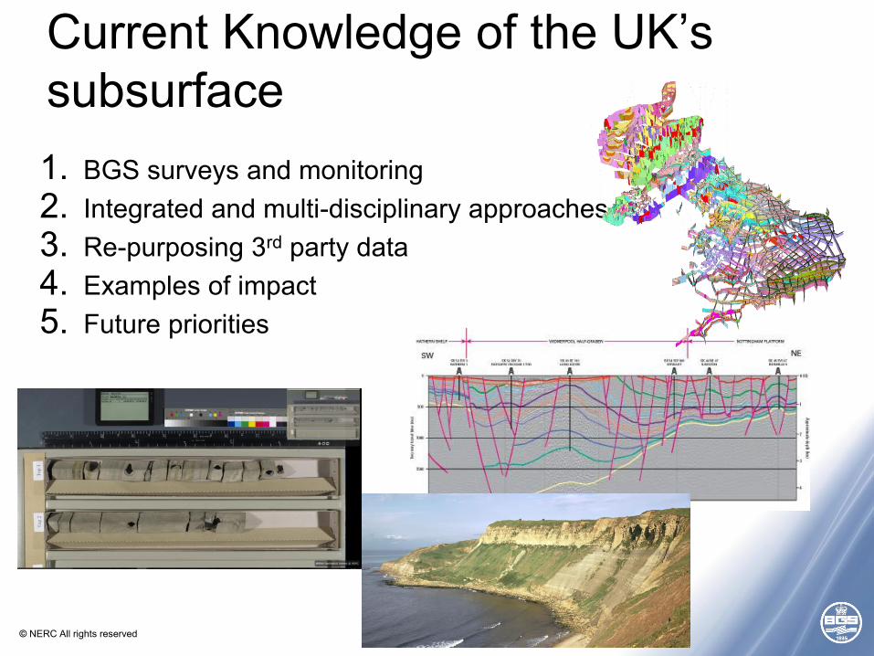
1. BGS surveys and monitoring2. Integrated and multi-disciplinary approaches3. Re-purposing 3rd party data4. Examples of impact5. Future priorities
Current Knowledge of the UK’s subsurface
© NERC All rights reserved
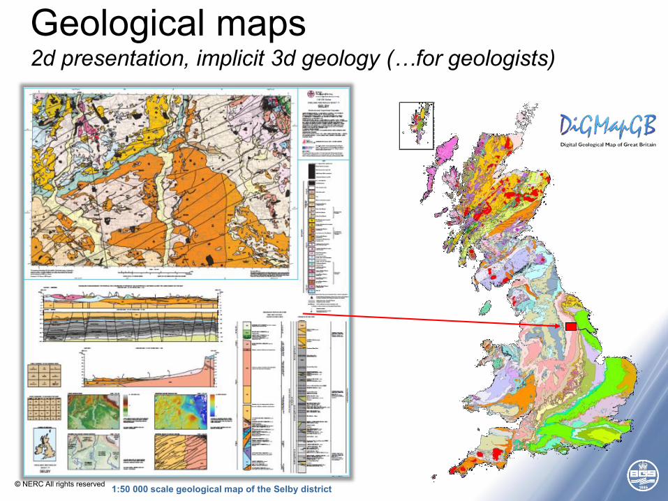
Geological maps2d presentation, implicit 3d geology (…for geologists)
1:50 000 scale geological map of the Selby district
© NERC All rights reserved
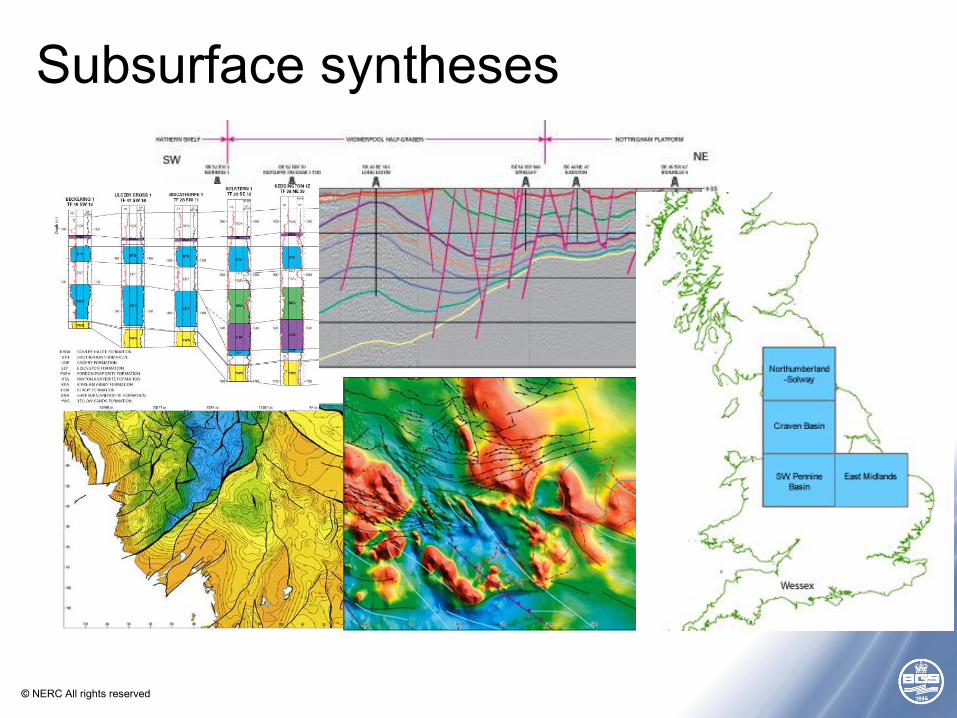
Subsurface syntheses
© NERC All rights reserved
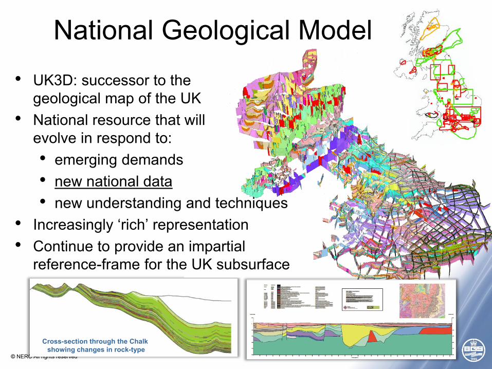
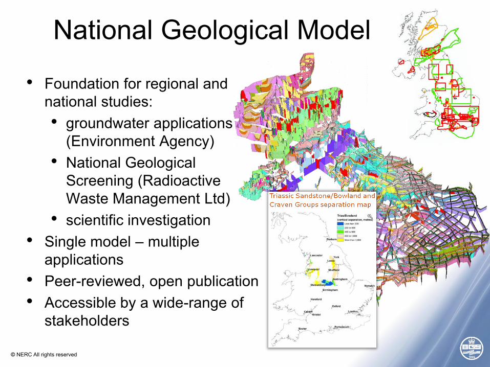
National Geological Model
• UK3D: successor to the geological map of the UK
• National resource that will evolve in respond to:• emerging demands• new national data• new understanding and techniques
• Increasingly ‘rich’ representation• Continue to provide an impartial
reference-frame for the UK subsurface
Cross-section through the Chalk showing changes in rock-type
© NERC All rights reserved
National Geological Model
• Foundation for regional and national studies:• groundwater applications
(Environment Agency)• National Geological
Screening (Radioactive Waste Management Ltd)
• scientific investigation• Single model – multiple
applications• Peer-reviewed, open publication• Accessible by a wide-range of
stakeholders
© NERC All rights reserved
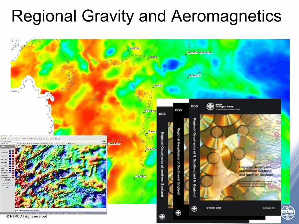
Regional Gravity and Aeromagnetics
© NERC All rights reserved
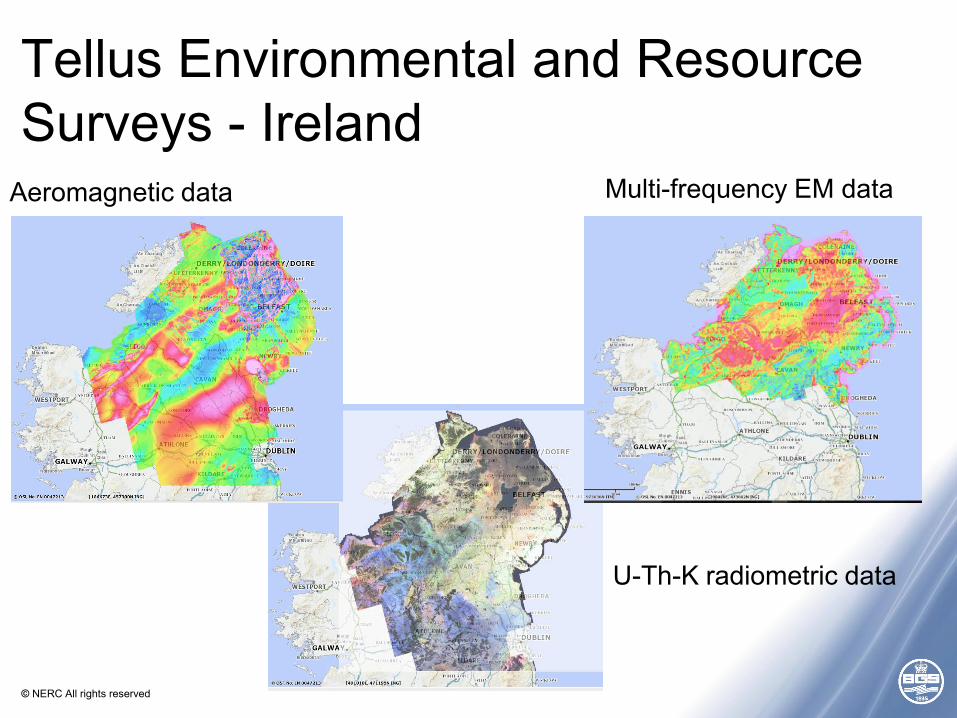
Tellus Environmental and Resource Surveys - Ireland
Aeromagnetic data Multi-frequency EM data
U-Th-K radiometric data
© NERC All rights reserved
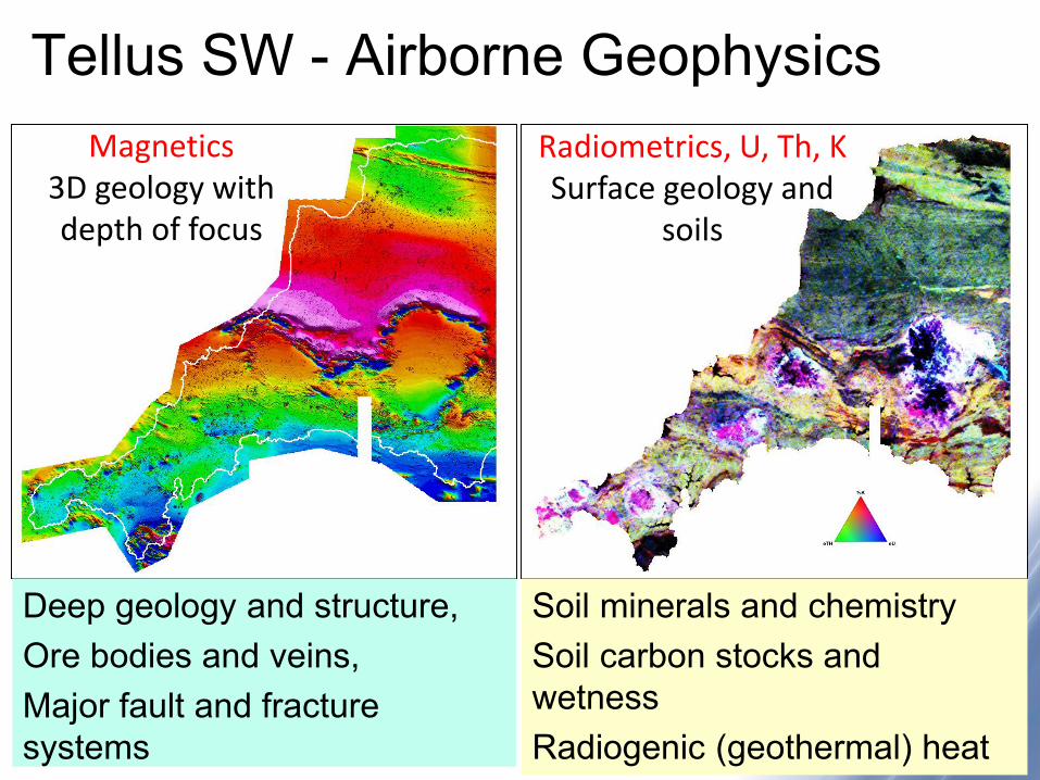
Tellus SW - Airborne GeophysicsMagnetics
3D geology with depth of focus
Radiometrics, U, Th, K Surface geology and
soils
Deep geology and structure, Ore bodies and veins, Major fault and fracture systems
Soil minerals and chemistrySoil carbon stocks and wetnessRadiogenic (geothermal) heat
© NERC All rights reserved
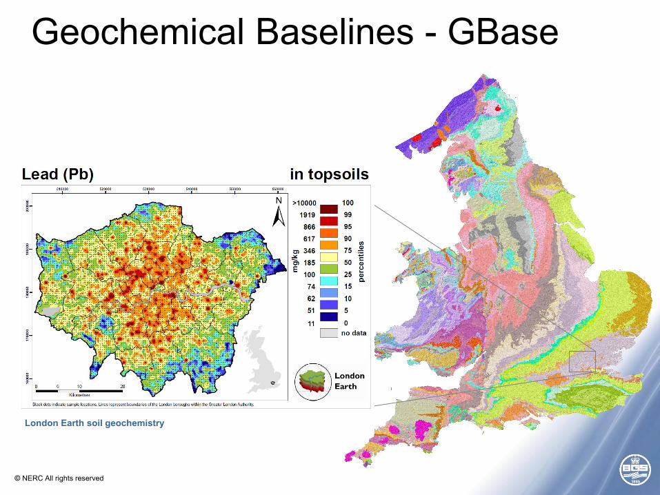
Geochemical Baselines - GBase
London Earth soil geochemistry
© NERC All rights reserved
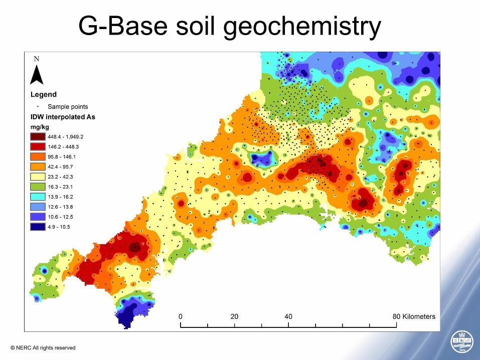
G-Base soil geochemistry
© NERC All rights reserved
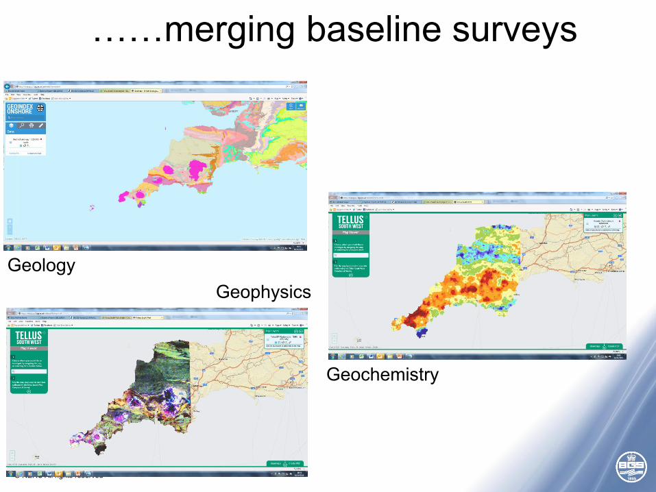
……merging baseline surveys
Geology
Geochemistry
Geophysics
© NERC All rights reserved
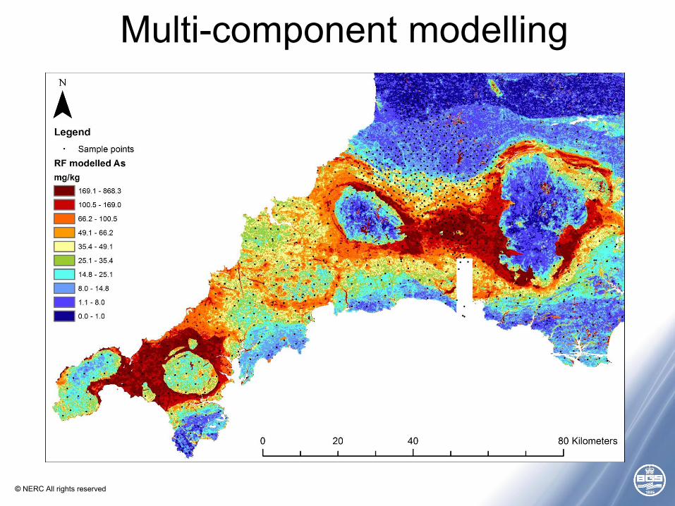
Multi-component modelling
© NERC All rights reserved
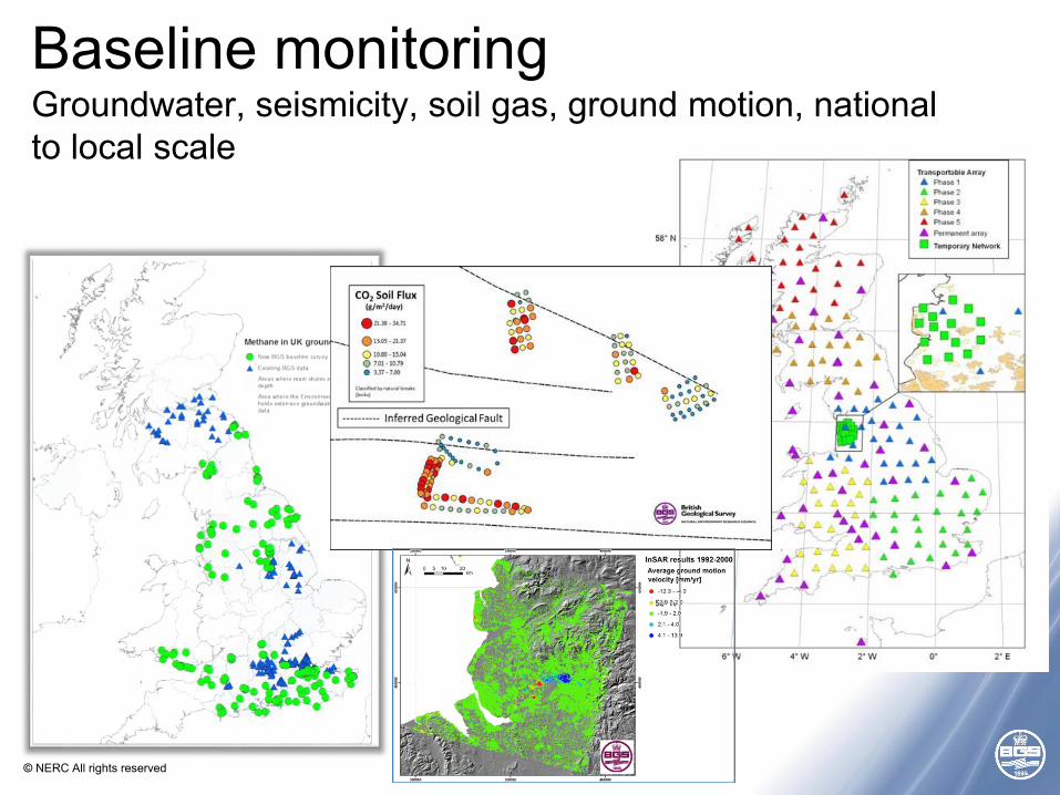
Baseline monitoringGroundwater, seismicity, soil gas, ground motion, national to local scale
© NERC All rights reserved
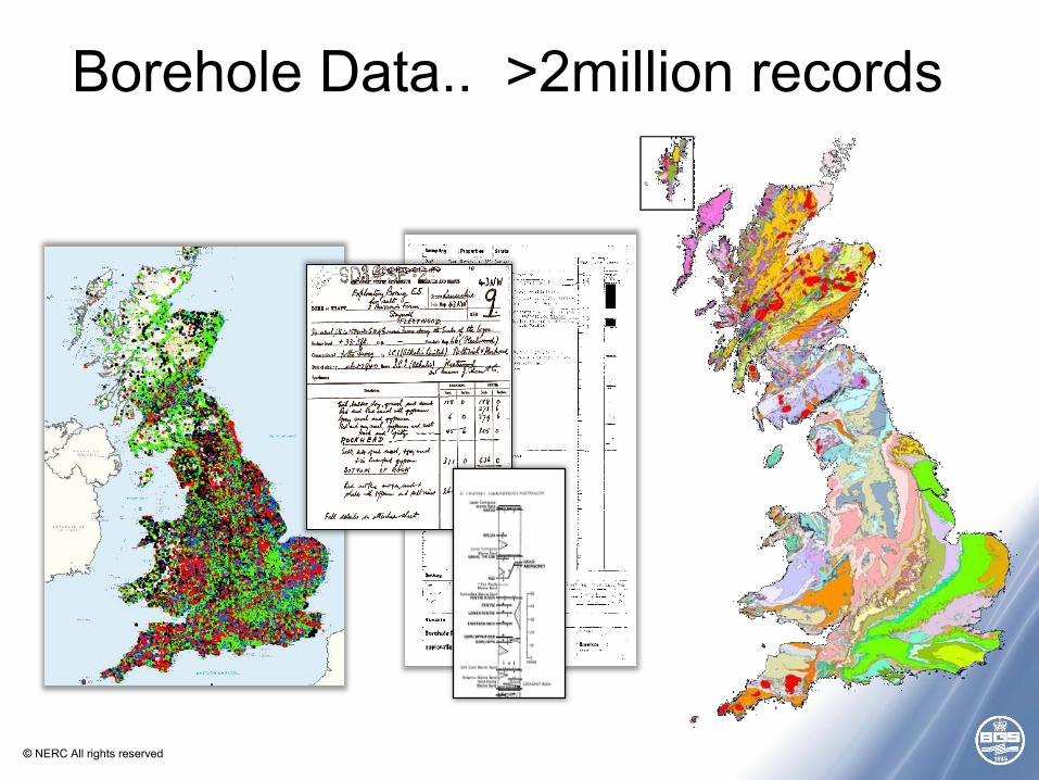
Borehole Data.. >2million records
© NERC All rights reserved
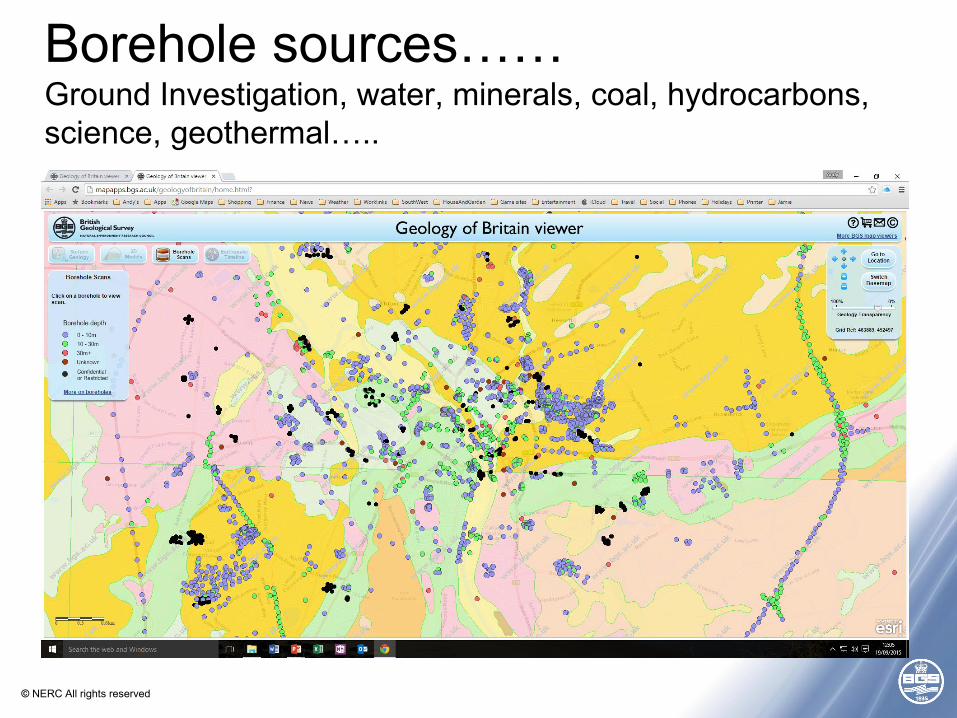
Borehole sources……Ground Investigation, water, minerals, coal, hydrocarbons, science, geothermal…..
© NERC All rights reserved
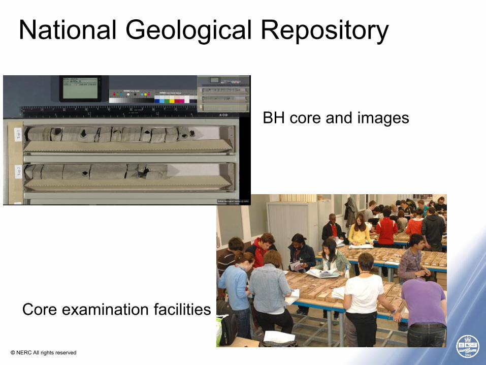
National Geological Repository
BH core and images
Core examination facilities
© NERC All rights reserved
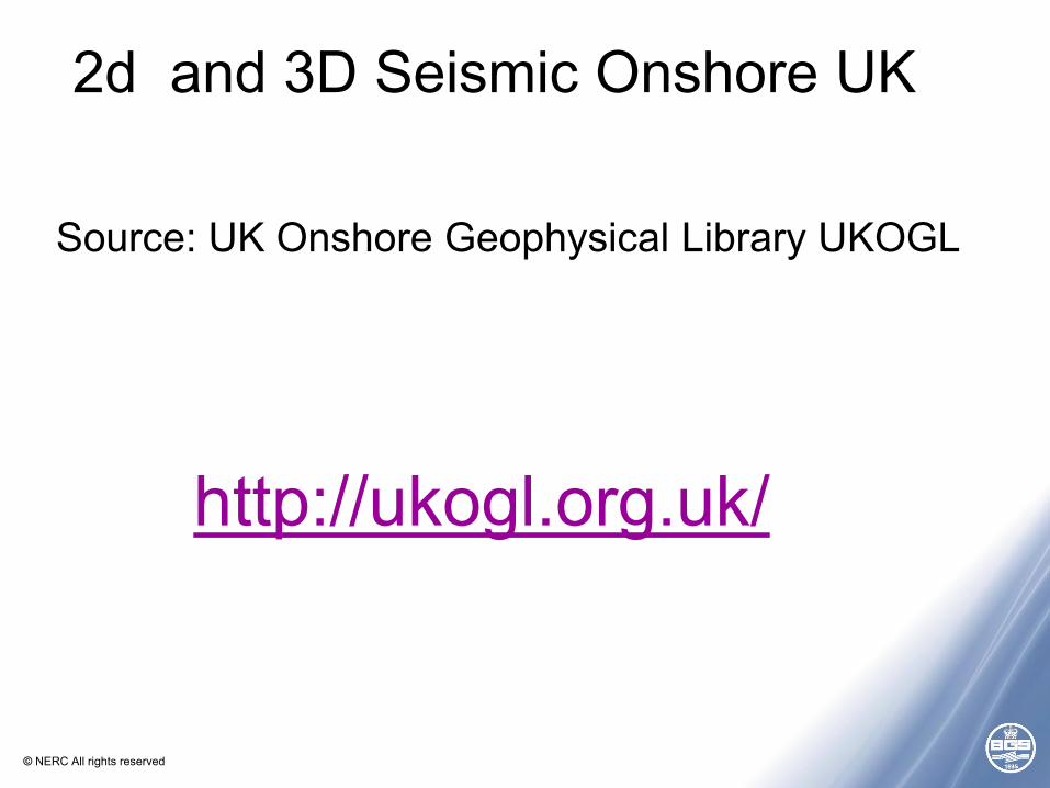
2d and 3D Seismic Onshore UK
Source: UK Onshore Geophysical Library UKOGL
http://ukogl.org.uk/
© NERC All rights reserved
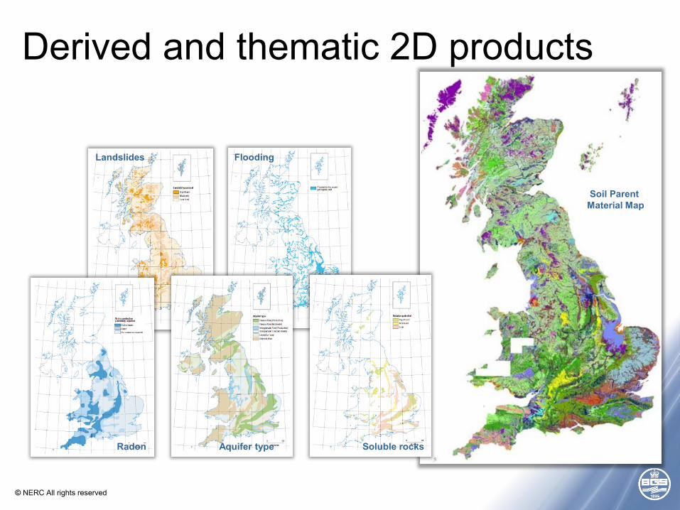
Soil Parent Material Map
Derived and thematic 2D products
Landslides
Radon
Flooding
Soluble rocksAquifer type
© NERC All rights reserved
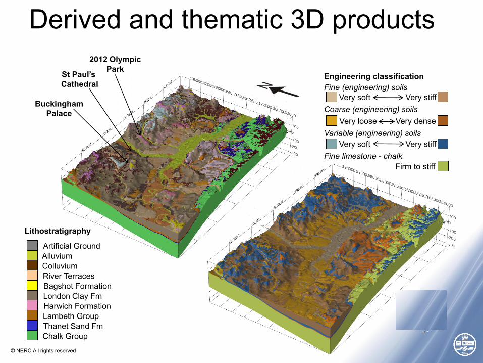
2012 OlympicPark
BuckinghamPalace
St Paul’s Cathedral
Lithostratigraphy
Artificial GroundAlluvium
Bagshot FormationLondon Clay FmHarwich FormationLambeth GroupThanet Sand FmChalk Group
River TerracesColluvium
Engineering classification
Very soft
Very soft
Very dense
Very stiff
Very stiff
Firm to stiff
Very loose
Fine limestone - chalk
Fine (engineering) soils
Variable (engineering) soils
Coarse (engineering) soils
Derived and thematic 3D products
© NERC All rights reserved
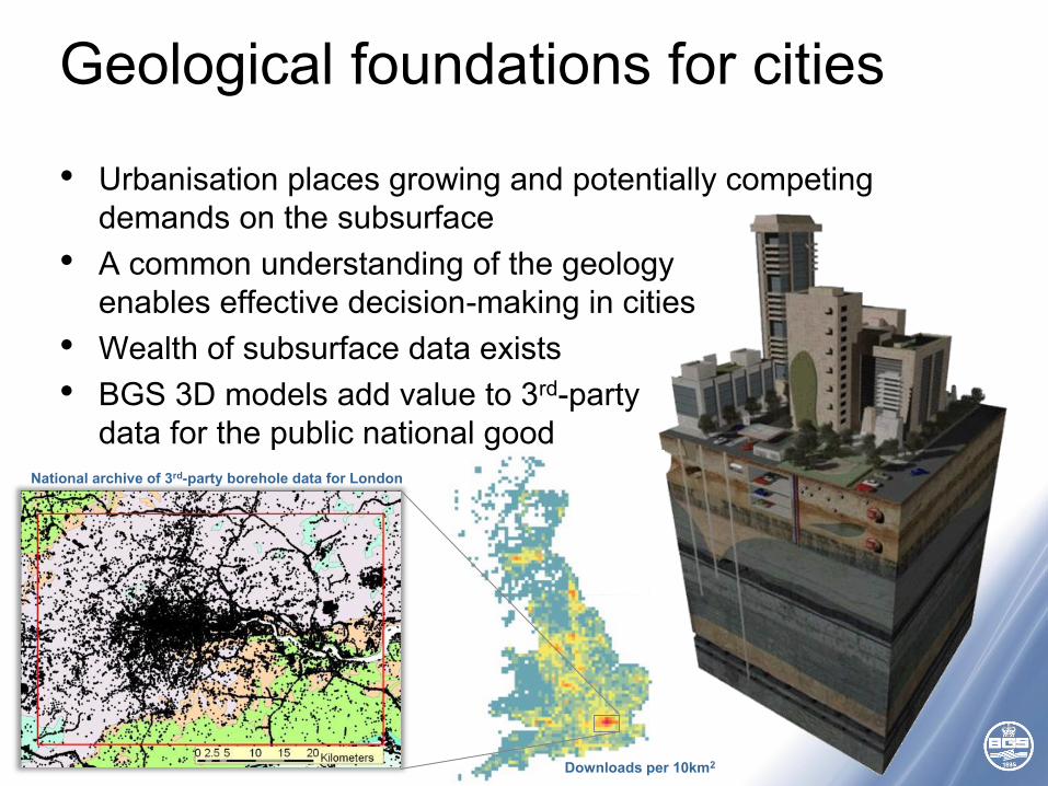
Geological foundations for cities
Downloads per 10km2
• Urbanisation places growing and potentially competing demands on the subsurface
• A common understanding of the geology enables effective decision-making in cities
• Wealth of subsurface data exists• BGS 3D models add value to 3rd-party
data for the public national goodNational archive of 3rd-party borehole data for London
© NERC All rights reserved
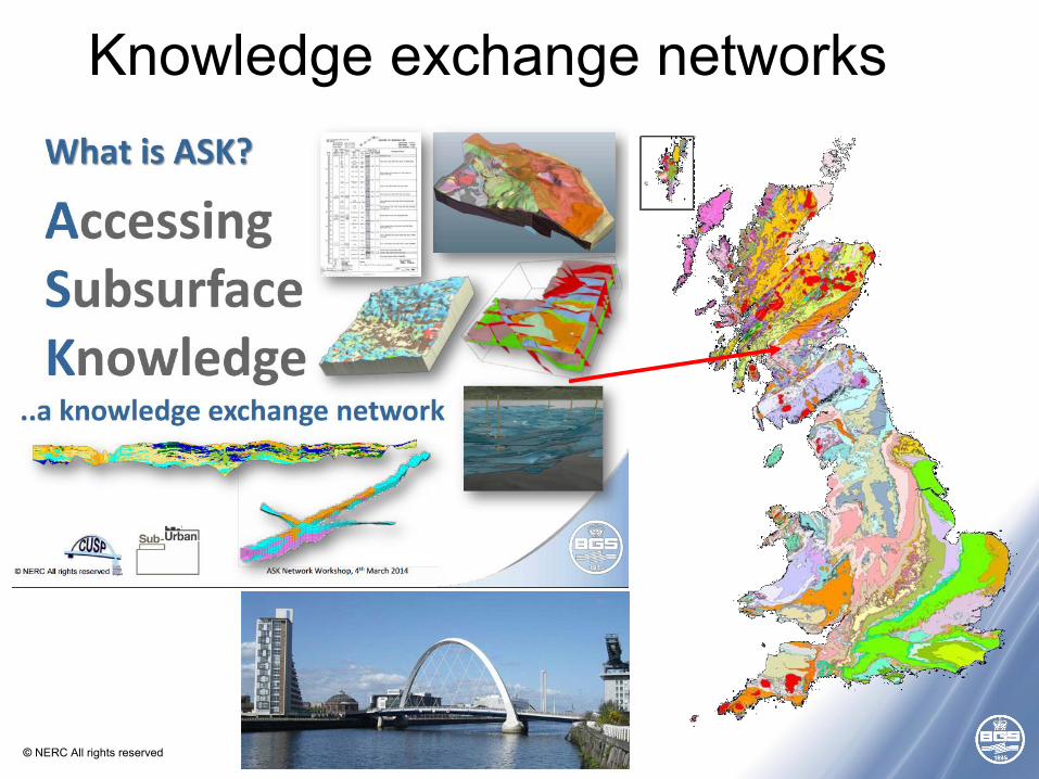
Knowledge exchange networks
© NERC All rights reserved
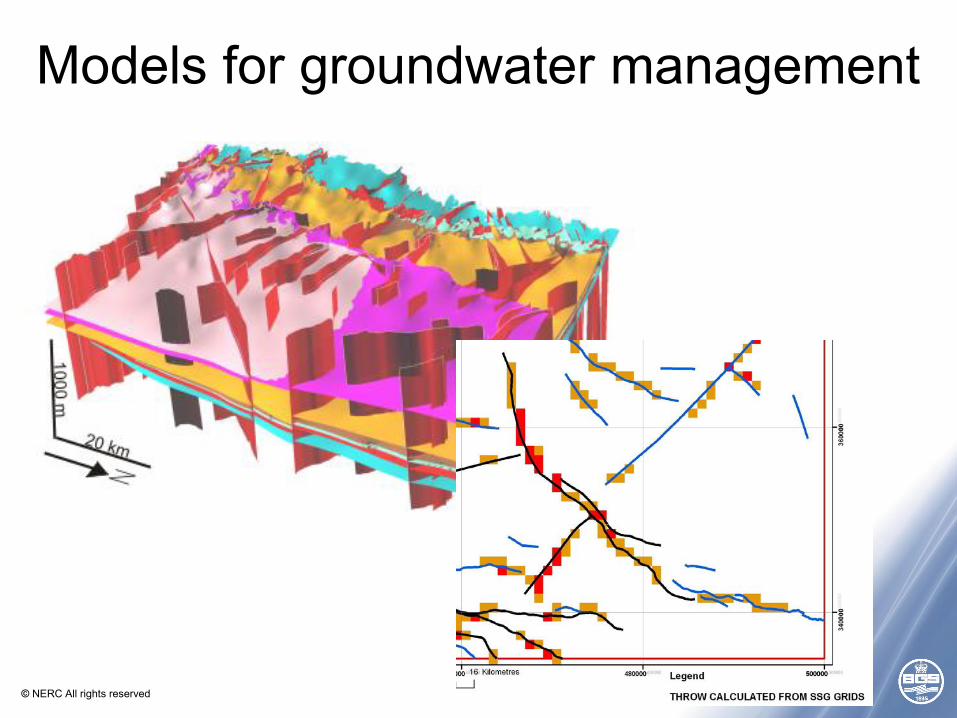
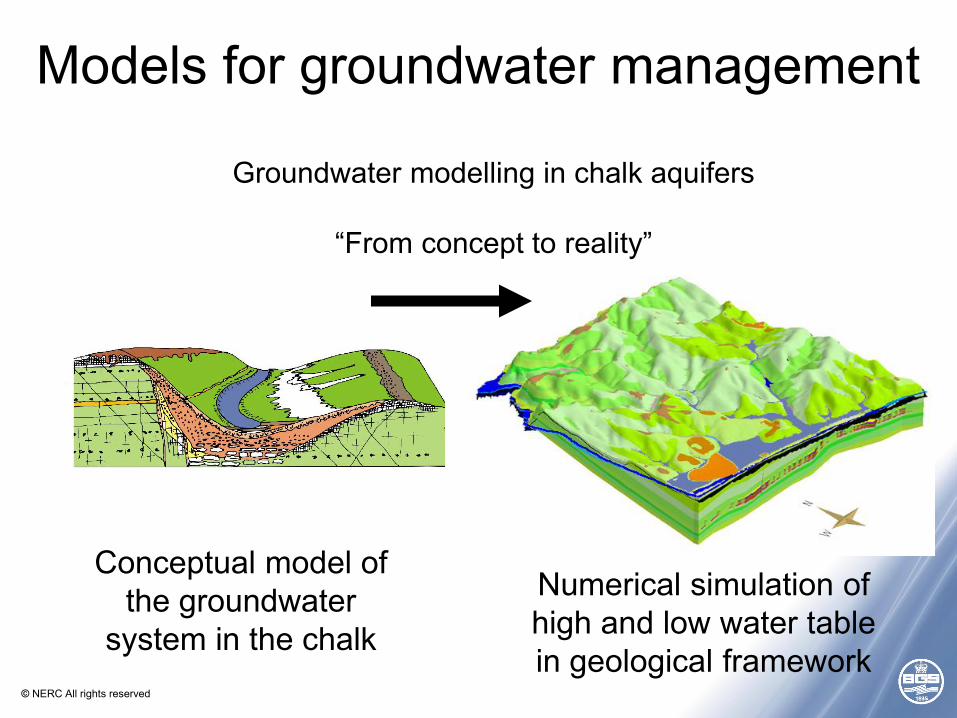
Models for groundwater management
© NERC All rights reserved
Groundwater modelling in chalk aquifers
“From concept to reality”
Conceptual model of the groundwater
system in the chalk
Numerical simulation of high and low water table in geological framework
Models for groundwater management
© NERC All rights reserved
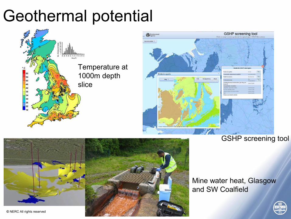
Geothermal potential
GSHP screening tool
Mine water heat, Glasgowand SW Coalfield
Temperature at 1000m depth slice
© NERC All rights reserved
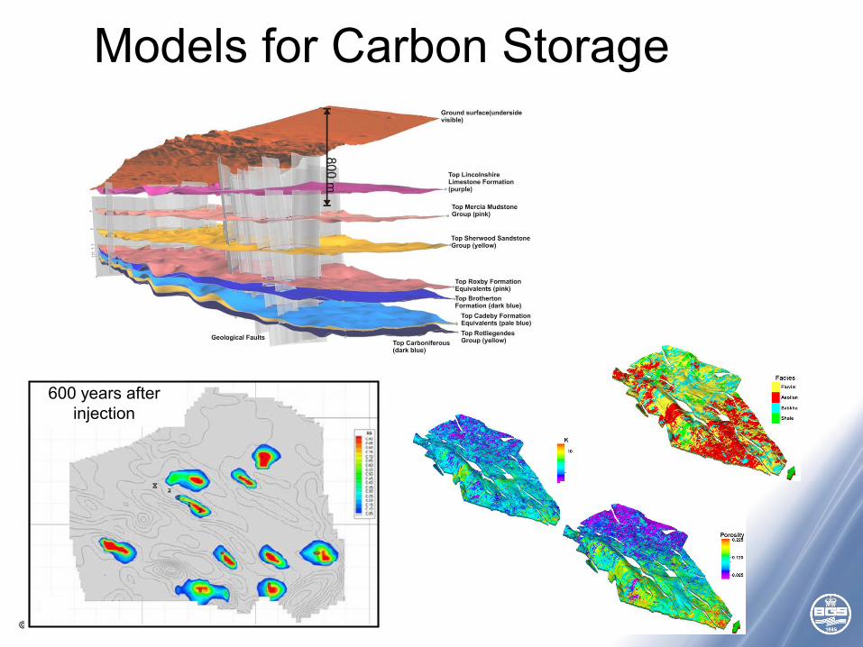
Models for Carbon Storage
600 years after injection
© NERC All rights reserved
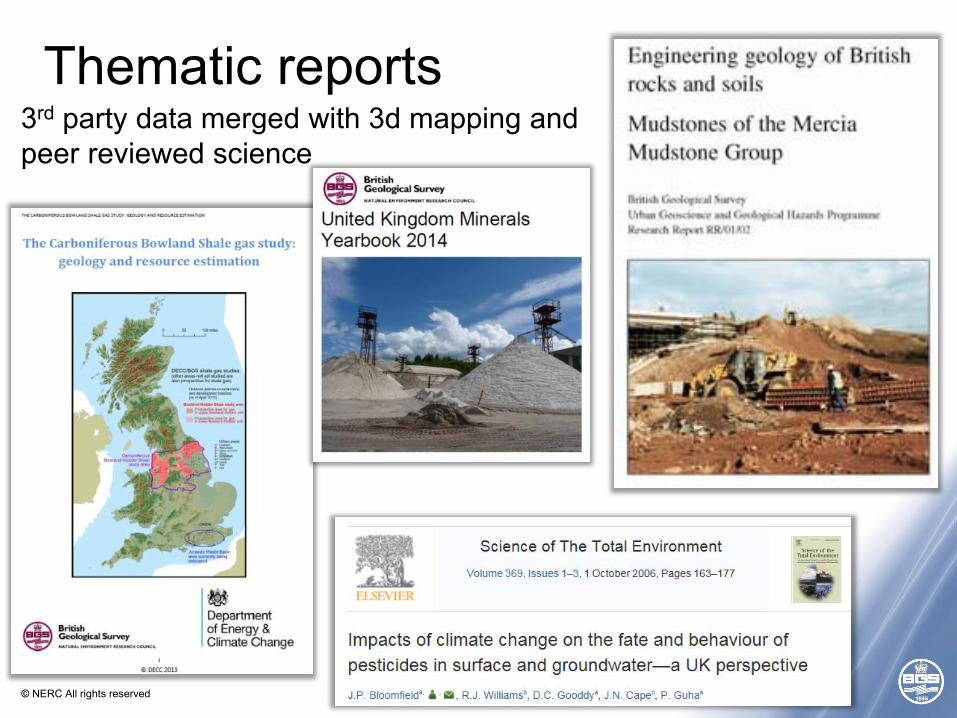
Thematic reports3rd party data merged with 3d mapping and peer reviewed science
© NERC All rights reserved
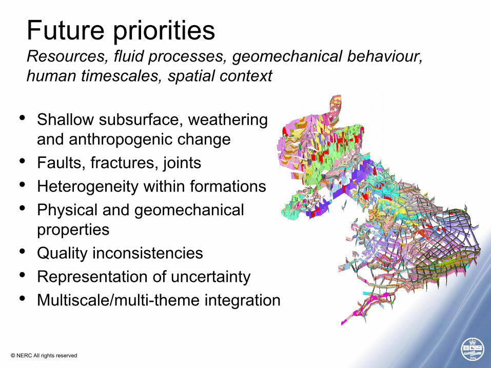
Future prioritiesResources, fluid processes, geomechanical behaviour, human timescales, spatial context
• Shallow subsurface, weathering and anthropogenic change
• Faults, fractures, joints• Heterogeneity within formations• Physical and geomechanical
properties• Quality inconsistencies• Representation of uncertainty• Multiscale/multi-theme integration
© NERC All rights reserved
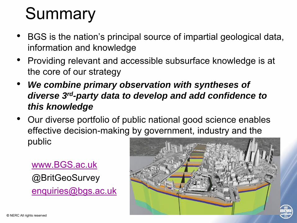
Summary• BGS is the nation’s principal source of impartial geological data,
information and knowledge• Providing relevant and accessible subsurface knowledge is at
the core of our strategy• We combine primary observation with syntheses of
diverse 3rd-party data to develop and add confidence to
this knowledge
• Our diverse portfolio of public national good science enables effective decision-making by government, industry and the public
www.BGS.ac.uk@[email protected]