Embed Size (px)
DESCRIPTION
CSRC Director’s Report. Yehuda Bock and Maria Turingan CSRC Coordinating Council Fall Meeting Scripps Institution of Oceanography La Jolla October 20, 2005. CSRC Mandate. - PowerPoint PPT Presentation
Citation preview
CSRC Director’s Report
Yehuda Bock
and
Maria Turingan
CSRC Coordinating Council Fall MeetingScripps Institution of Oceanography
La JollaOctober 20, 2005
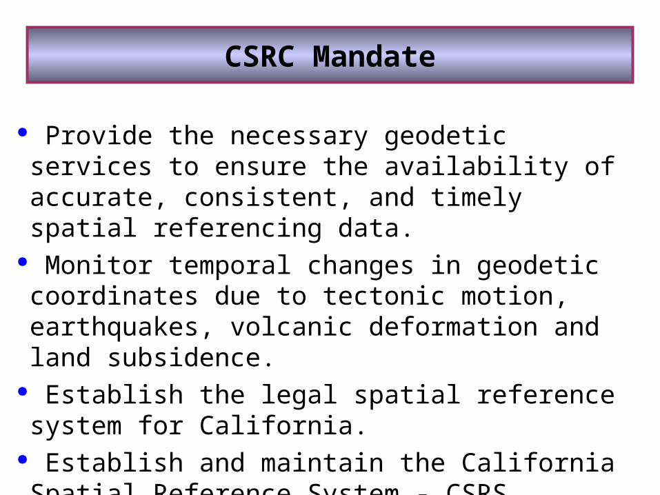
Provide the necessary geodetic services to ensure the availability of accurate, consistent, and timely spatial referencing data.
Monitor temporal changes in geodetic coordinates due to tectonic motion, earthquakes, volcanic deformation and land subsidence.
Establish the legal spatial reference system for California.
Establish and maintain the California Spatial Reference System - CSRS.
CSRC Mandate
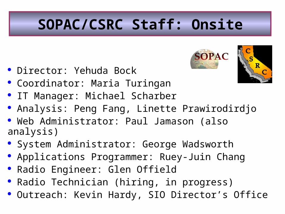
Director: Yehuda Bock Coordinator: Maria Turingan IT Manager: Michael Scharber Analysis: Peng Fang, Linette Prawirodirdjo Web Administrator: Paul Jamason (also analysis) System Administrator: George Wadsworth Applications Programmer: Ruey-Juin Chang Radio Engineer: Glen Offield Radio Technician (hiring, in progress) Outreach: Kevin Hardy, SIO Director’s Office
SOPAC/CSRC Staff: Onsite
N. California Geodetic Coordinator: Don D’Onofrio S. California Geodetic Coordinator: Cecilia Whitaker, PLS CSRC Executive Manager: John Canas, PLS Geodetic Analyst: Mike Potterfield, Geodetic Solutions PBO Support: Bob Packard, PLS Project Support, Jim Swanson, PLS Project Support, Larry Fenske PLS (proposed)
SOPAC/CSRC Staff: Offsite
Many others that volunteer their time on behalf of CSRC
CSRC Partners
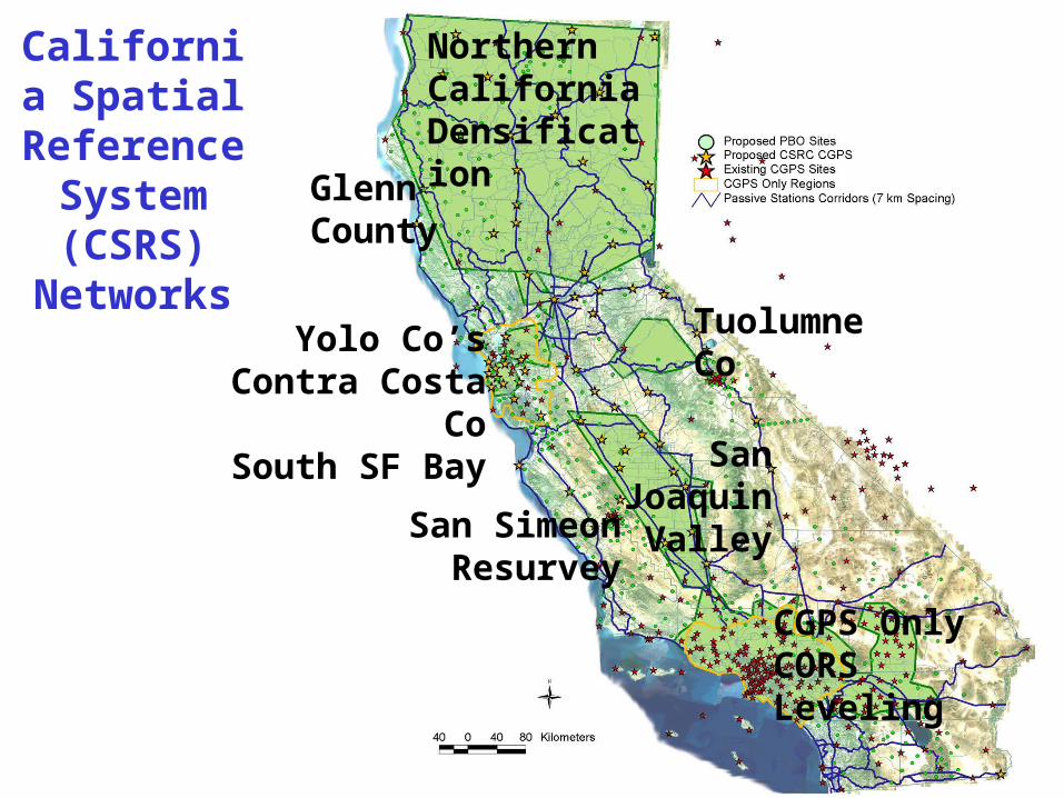
California Spatial
Reference System (CSRS)
Networks
Northern California Densification
Tuolumne Co
CGPS OnlyCORS Leveling
San Joaquin Valley
Yolo Co’sContra Costa Co
South SF Bay
San SimeonResurvey
Glenn County
FY’04-’05 Summary
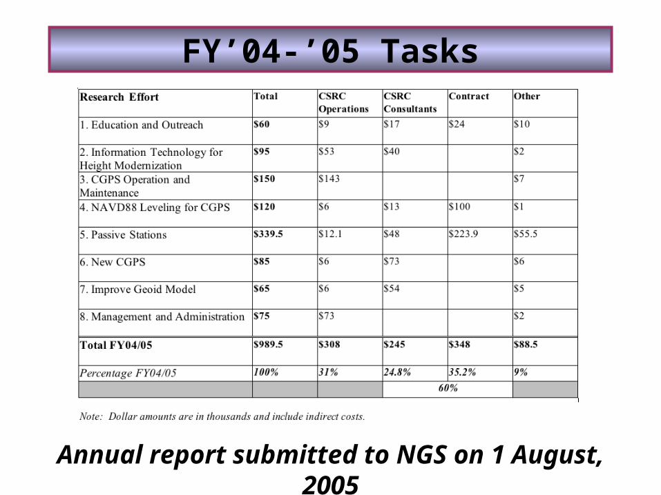
FY’04-’05 Tasks
Annual report submitted to NGS on 1 August, 2005

1. Education and Outreach
Objectives• Keep CSRC members informed through regularly scheduled meetings (Coordinating Council and Executive Committee).• Inform others on the objectives and activities of CSRC by participating in local meetings, conducting seminars, making presentations, and make a presence at professional conferences.• Support public resource code (PRC) legislation for orthometric (vertical) and geodetic (horizontal) datums.• Perform advocacy efforts to improve California’s spatial reference system, by informing and discussing with public agencies (local, state and federal) the benefits of, and funding needs for, a modern California spatial reference system.• Respond to general, day-to-day user inquiries in a timely manner.
Education and Outreach Highlights
Some Highlights• California Center of Population Dedication, October 16, 2004, Buttonwillow• University of California, Riverside Spatial Systems Seminar, October 19-20, 2004• Bay Area Real-Time Meeting, December 15, 2004, Alameda County• Real Time GPS Networks Symposium, February 4, 2005, Irvine• CSRC Booth at ACSM Conference, March 21-22, 2005, Las Vegas• League of California Surveying Organization (Southern Region) special meeting, April 7, 2005 • Meeting with Caltrans representatives at Scripps, April 8, 2005
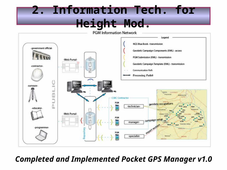
2. Information Tech. for Height Mod.
Completed and Implemented Pocket GPS Manager v1.0
3. CGPS Operations and Maintenance
• Partial support for the operation and maintenance of the existing CGPS sites in California, which form the backbone of the California Spatial Reference Network (CSRN), including site maintenance, data download, data archive, and data analysis.• Installation of of new Earthscope PBO stations by UNAVCO, and the funding of the NSF Nucleus project, which will transition over the next 3 years the operation and maintenance of many SCIGN, BARD, BARGN, and PANGA sites to PBO. • CSRC and its partners (e.g., Caltrans, MWD, and southern California Counties) have been assisting PBO field engineers with obtaining land-use permits for PBO sites throughout California. • Southern California Earthquake Center (SCEC) has recently announced its decision to cease further support for operation and the maintenance of SCIGN. SOPAC continues to receive funds through SCEC during the transition to PBO.
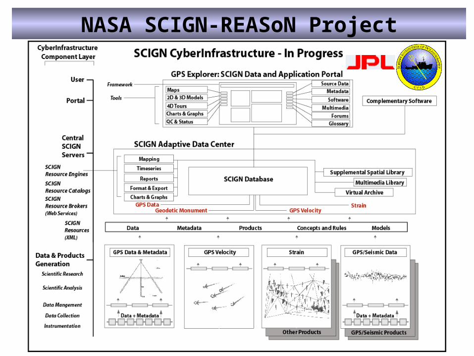
NASA SCIGN-REASoN Project
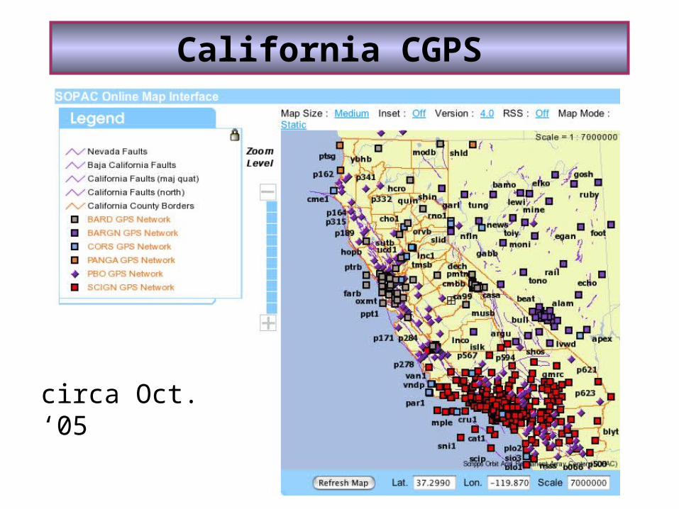
California CGPS
circa Oct. ‘05
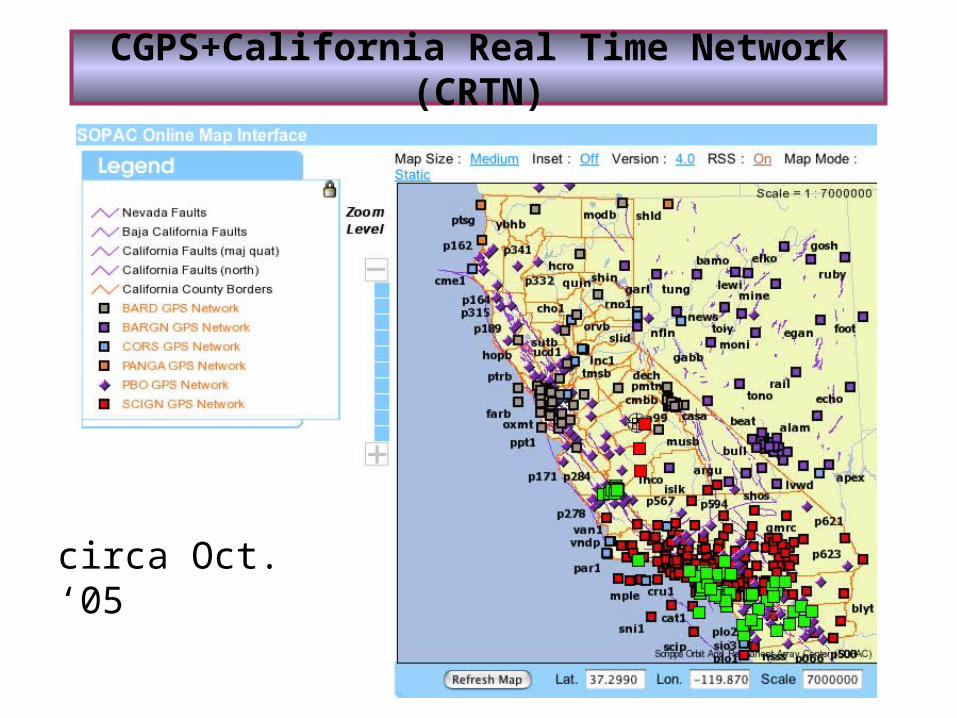
CGPS+California Real Time Network (CRTN)
circa Oct. ‘05
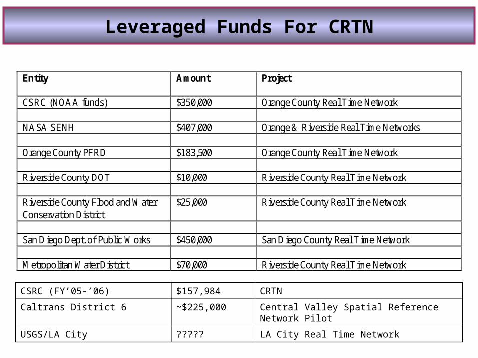
Entity
Amount Project
CSRC (NOAA funds) $350,000 Orange County Real Time Network NASA SENH $407,000 Orange & Riverside Real Time Networks Orange County PFRD $183,500 Orange County Real Time Network Riverside County DOT $10,000 Riverside County Real Time Network Riverside County Flood and Water Conservation District
$25,000 Riverside County Real Time Network
San Diego Dept. of Public Works $450,000 San Diego County Real Time Network Metropolitan Water District $70,000 Riverside County Real Time Network
Leveraged Funds For CRTN
CSRC (FY’05-’06) $157,984 CRTN
Caltrans District 6 ~$225,000 Central Valley Spatial Reference Network Pilot
USGS/LA City ????? LA City Real Time Network
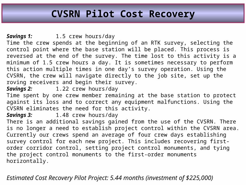
CVSRN Pilot Cost Recovery
Savings 1: 1.5 crew hours/dayTime the crew spends at the beginning of an RTK survey, selecting the control point where the base station will be placed. This process is reversed at the end of the survey. The time lost to this activity is a minimum of 1.5 crew hours a day. It is sometimes necessary to perform this action multiple times in one day’s survey operation. Using the CVSRN, the crew will navigate directly to the job site, set up the roving receivers and begin their survey.Savings 2: 1.22 crew hours/dayTime spent by one crew member remaining at the base station to protect against its loss and to correct any equipment malfunctions. Using the CVSRN eliminates the need for this activity.Savings 3: 1.48 crew hours/dayThere is an additional savings gained from the use of the CVSRN. There is no longer a need to establish project control within the CVSRN area. Currently our crews spend an average of four crew days establishing survey control for each new project. This includes recovering first-order corridor control, setting project control monuments, and tying the project control monuments to the first-order monuments horizontally.
Estimated Cost Recovery Pilot Project: 5.44 months (investment of $225,000)
Source: Darrell Bain, Caltrans District 6, Fresno
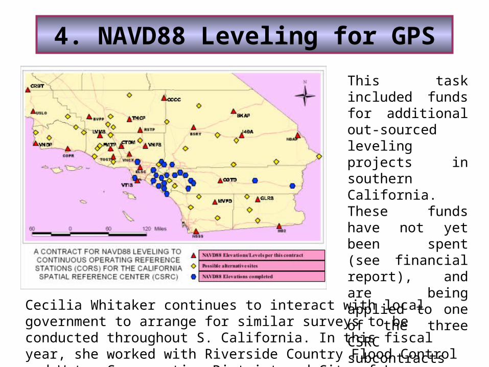
4. NAVD88 Leveling for GPS
This task included funds for additional out-sourced leveling projects in southern California. These funds have not yet been spent (see financial report), and are being applied to one of the three CSRC subcontracts in FY06.
Cecilia Whitaker continues to interact with local government to arrange for similar surveys to be conducted throughout S. California. In this fiscal year, she worked with Riverside Country Flood Control and Water Conservation District and City of Los Angeles.
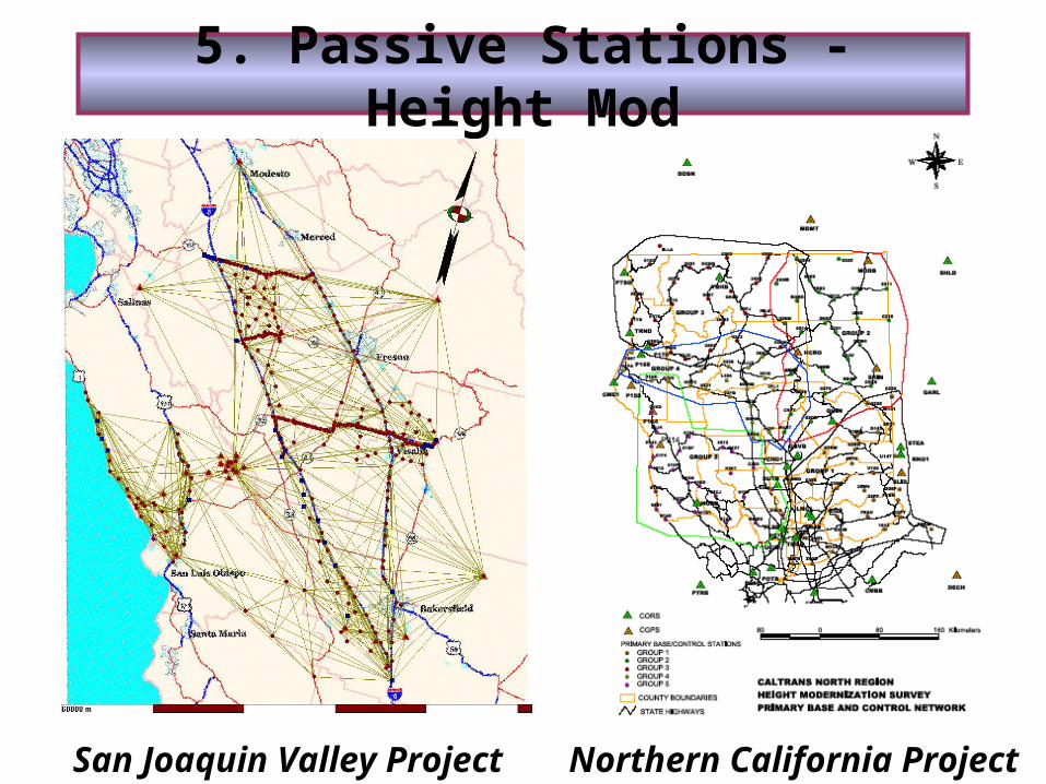
5. Passive Stations - Height Mod
San Joaquin Valley Project Northern California Project
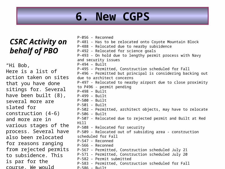
6. New CGPS
“Hi Bob,Here is a list of action taken on sites that you have done sitings for. Several have been built (8), several more are slated for construction (4-6) and more are in various stages of the process. Several have also been relocated for reasons ranging from rejected permits to subsidence. This is par for the course. We would definitely not be where we are at without your significant efforts, Bob.Regards,Chris”
P-056 - ReconnedP-481 - Has to be relocated onto Coyote Mountain BlockP-488 - Relocated due to nearby subsidenceP-492 - Relocated for science goalsP-493 - On hold due to lengthy permit process with Navy and security issuesP-494 – BuiltP-495 - Permitted, Construction scheduled for FallP-496 - Permitted but principal is considering backing out due to architect concernsP-497 - Relocated to nearby airport due to close proximity to P496 - permit pendingP-498 – BuiltP-499 – BuiltP-500 - BuiltP-501 - BuiltP-502 - Permitted, architect objects, may have to relocateP-506 - BuiltP-507 - Relocated due to rejected permit and Built at Red HillP-508 - Relocated for securityP-509 - Relocated out of subsiding area - construction scheduled for FallP-547 - ReconnedP-566 - ReconnedP-567 - Permitted, Construction scheduled July 21P-571 - Permitted, Construction scheduled July 20P-582 - Permit submittedP-583 - Permitted, Construction scheduled for FallP-586 - BuiltP-587 - Relocated for science goalsP-588 - Relocated and BuiltP-589 - Built
CSRC Activity on behalf of PBO
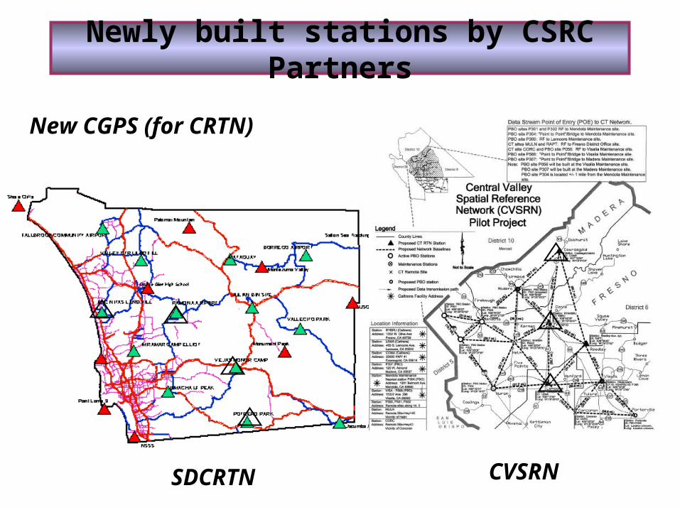
Newly built stations by CSRC Partners
New CGPS (for CRTN)
SDCRTN CVSRN
7. Improve Geoid Model
This task is an ongoing one and is related to the several height modernization projects that the CSRC has contracted out to the private sector, and the resulting network analysis performed by CSRC consultant Mike Potterfield. For example, in the San Joaquin Valley project (task 5) in this fiscal year we were able to compute an improved geoid model based on differential leveling circuits, ties to NAVD88 benchmarks, GPS heights and a gravimetric geoid model. The details are discussed in the report of the SJV height modernization project.
8. Management and Administration
Financial reporting was improved in this fiscal year on the advice of the Executive Committee. Monthly reports are provided by the third Wednesday of each month.
The Fall Coordinating Council Meeting was held at Scripps on October 22, 2004.
The Spring Coordinating Council Meeting was held at PG&E headquarters in San Francisco on May 17, 2005 (presentations can be found at http://csrc.ucsd.edu/general/presentations.html.
Enhancement of projects page on the CSRC web site. See http://csrc.ucsd.edu/projects/.
CSRC Facilities. The SOPAC/CSRC staff continued to upgrade and make changes to the Data Center.
FY’05-’06 Research Objectives
What is the proper observation mix to maintain a modern height network, and how should these measurements be optimally combined? Observation types include continuous GPS (CGPS), field GPS surveys at passive monuments, spirit leveling, and gravity surveys. What is the proper mix of geoid models and local corrector surfaces, in converting from GPS-determined geodetic heights to orthometric heights? What interpolation methods will provide the optimal corrector surfaces? Can we apply and enhance modern IT methods to provide timely access to height modernization information? How does one develop and implement a precise GIS for the purposes of height modernization? How can real-time (RT) CGPS networks, such as those being created in California, be best used to directly support height modernization and spatial referencing?
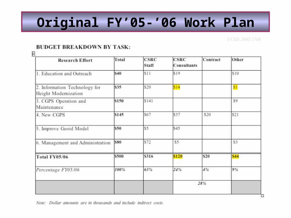
Original FY’05-’06 Work Plan
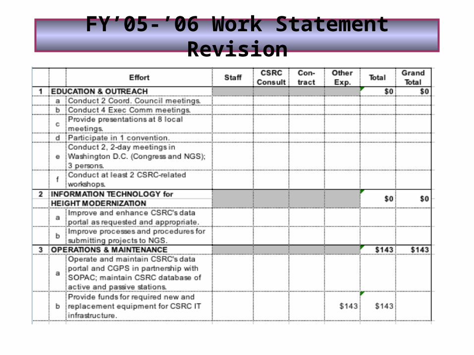
FY’05-’06 Work Statement Revision
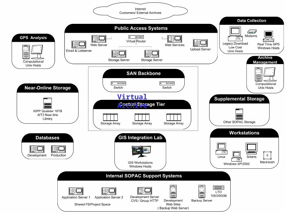
Virtual Archive
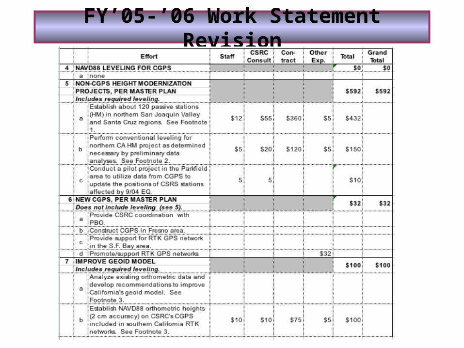
FY’05-’06 Work Statement Revision
FY’05-’06 Work Statement Revision
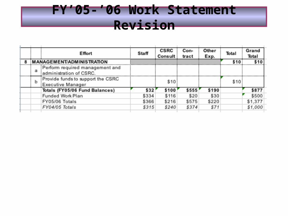
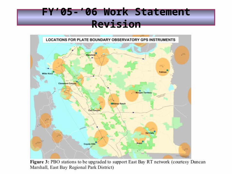
FY’05-’06 Work Statement Revision

Financial Report
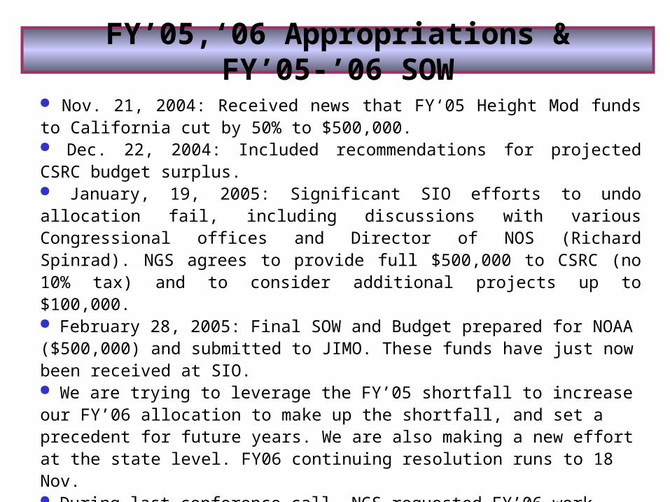
FY’05,‘06 Appropriations & FY’05-’06 SOW
Nov. 21, 2004: Received news that FY‘05 Height Mod funds to California cut by 50% to $500,000. Dec. 22, 2004: Included recommendations for projected CSRC budget surplus. January, 19, 2005: Significant SIO efforts to undo allocation fail, including discussions with various Congressional offices and Director of NOS (Richard Spinrad). NGS agrees to provide full $500,000 to CSRC (no 10% tax) and to consider additional projects up to $100,000. February 28, 2005: Final SOW and Budget prepared for NOAA ($500,000) and submitted to JIMO. These funds have just now been received at SIO. We are trying to leverage the FY’05 shortfall to increase our FY’06 allocation to make up the shortfall, and set a precedent for future years. We are also making a new effort at the state level. FY06 continuing resolution runs to 18 Nov. During last conference call, NGS requested FY’06 work plan by 1 Nov. Budget surplus is being addressed through efforts of EM and EC, based on recommendations from work plan committee and Director. Three external projects are in the works in FY’05-’06. Expected surplus at end of FY’05-’06 is $100K (the reserve fund)
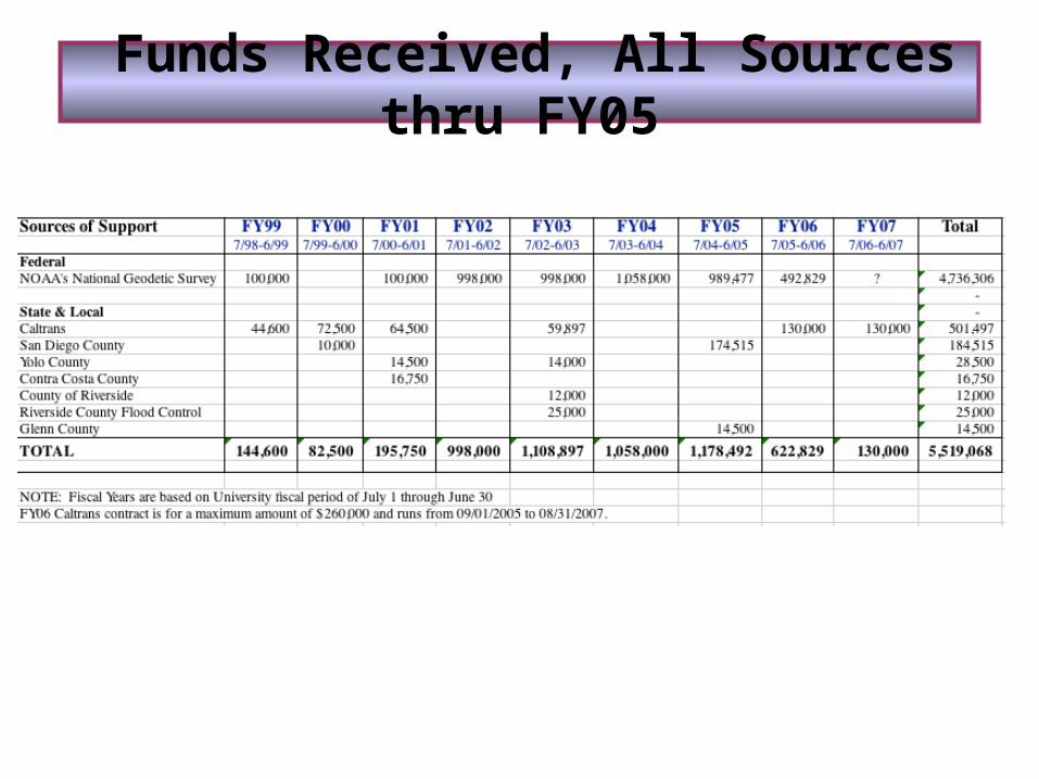
Funds Received, All Sources thru FY05
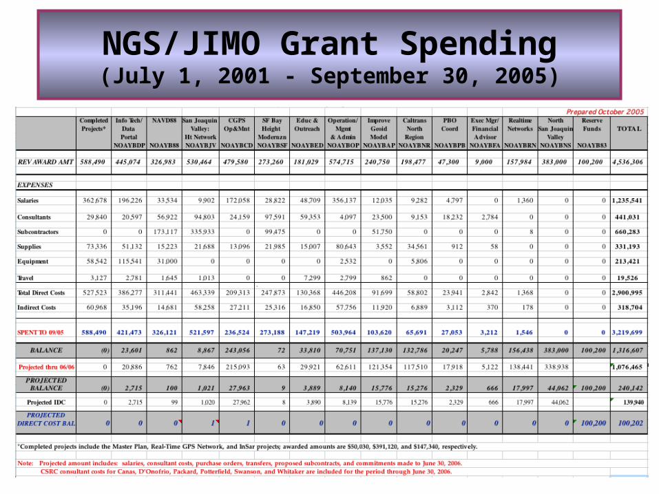
NGS/JIMO Grant Spending(July 1, 2001 - September 30, 2005)