Embed Size (px)
Citation preview
CS225: Spatial Computing
Introduction to
Spatial Computing
Amr Magdy
Computer Science and Engineering
www.cs.ucr.edu/~amr/

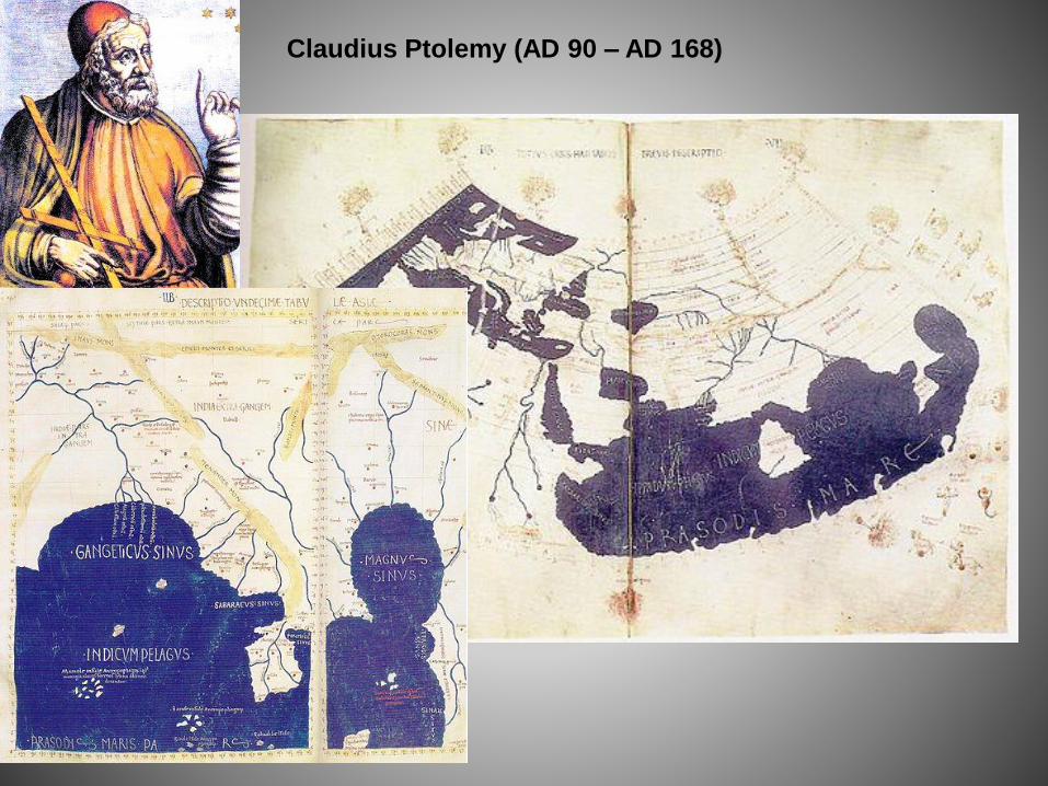
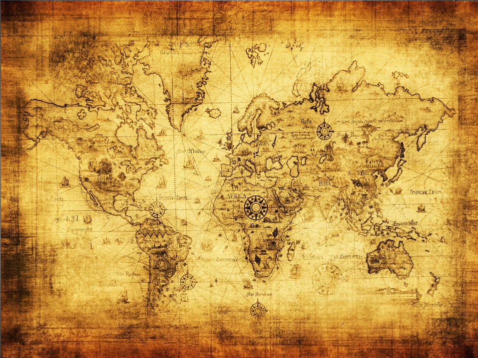
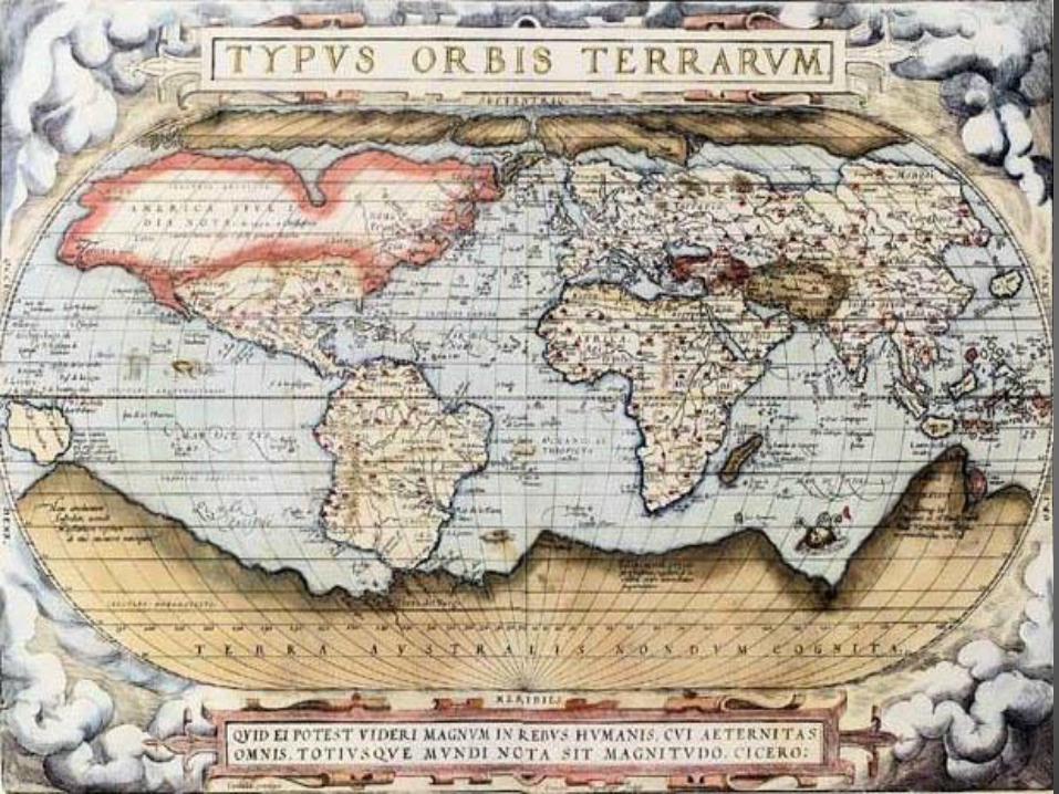
Claudius Ptolemy (AD 90 – AD 168)

Al Idrisi (1099–1165)
Cholera cases in the London epidemic of 1854
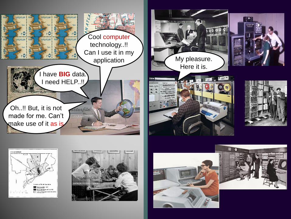
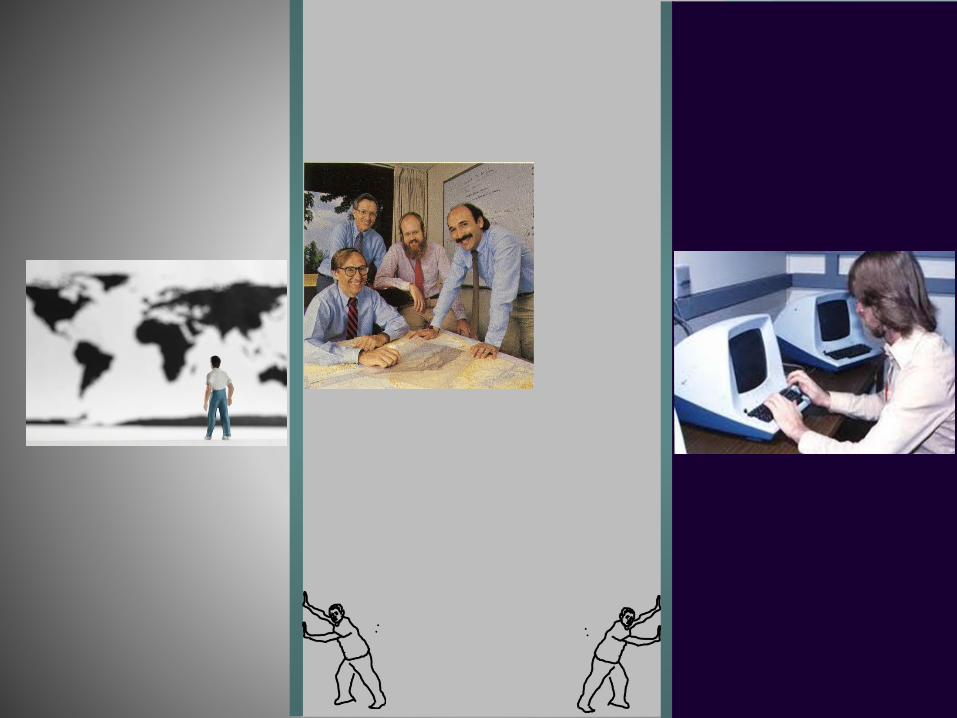
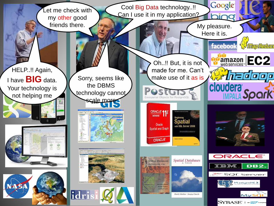
Cool computer
technology..!!
Can I use it in my
application
Oh..!! But, it is not
made for me. Can’t
make use of it as is
My pleasure.
Here it is.I have BIG data.
I need HELP..!!
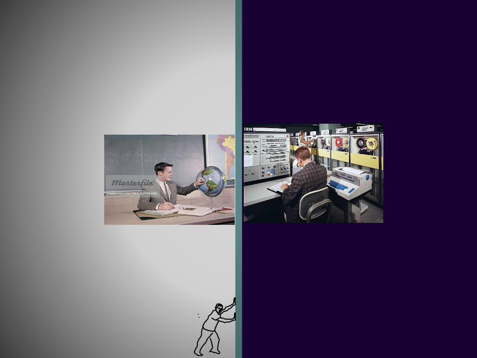
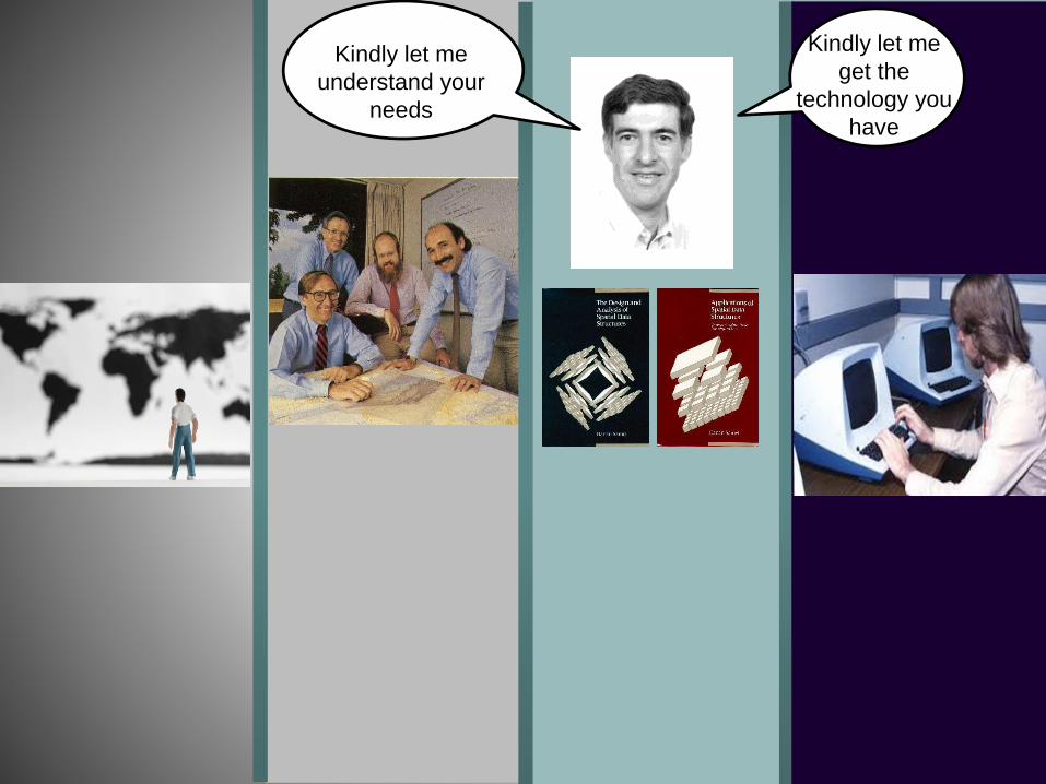
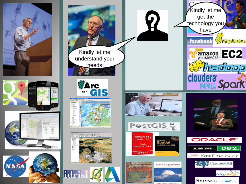
Kindly let me
get the
technology you
have
Kindly let me
understand your
needs
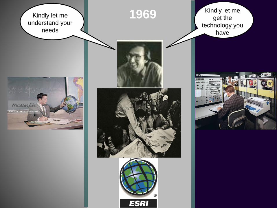
1969
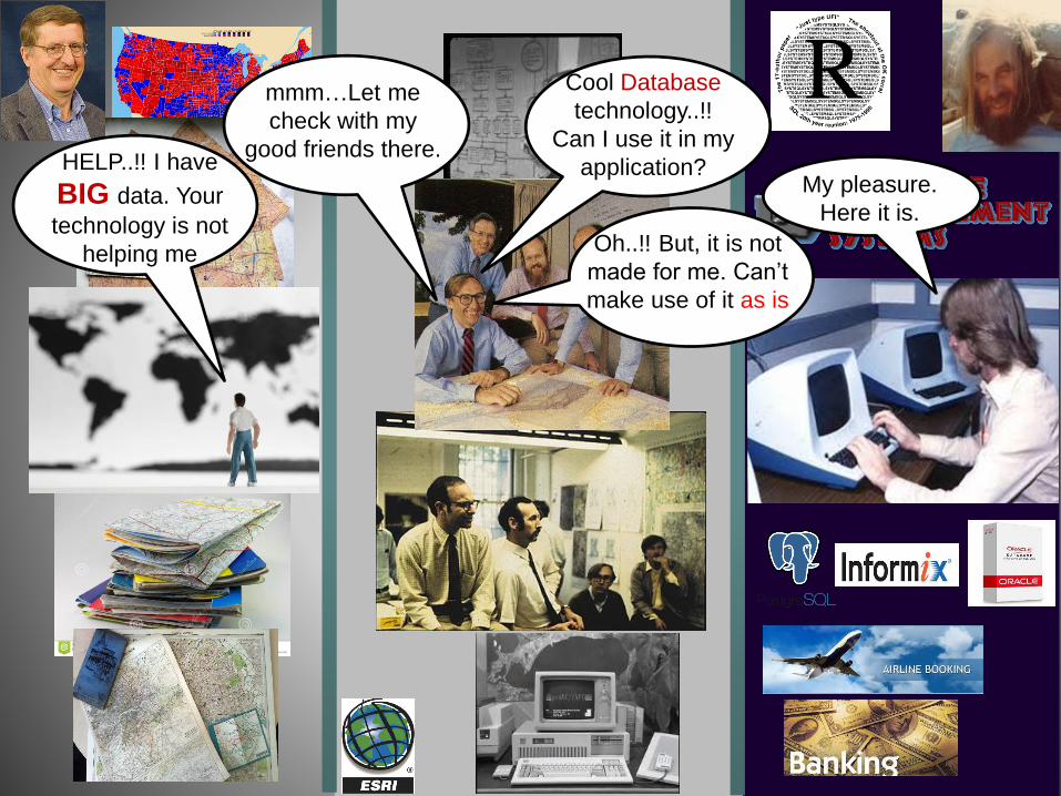
HELP..!! I have
BIG data. Your
technology is not
helping me
mmm…Let me
check with my
good friends there.
My pleasure.
Here it is.
Cool Database
technology..!!
Can I use it in my
application?
Oh..!! But, it is not
made for me. Can’t
make use of it as is
Kindly let me
understand your
needs
Kindly let me
get the
technology you
have

HELP..!! Again,
I have BIG data.
Your technology is
not helping me
Sorry, seems like
the DBMS
technology cannot
scale more
Let me check with
my other good
friends there.
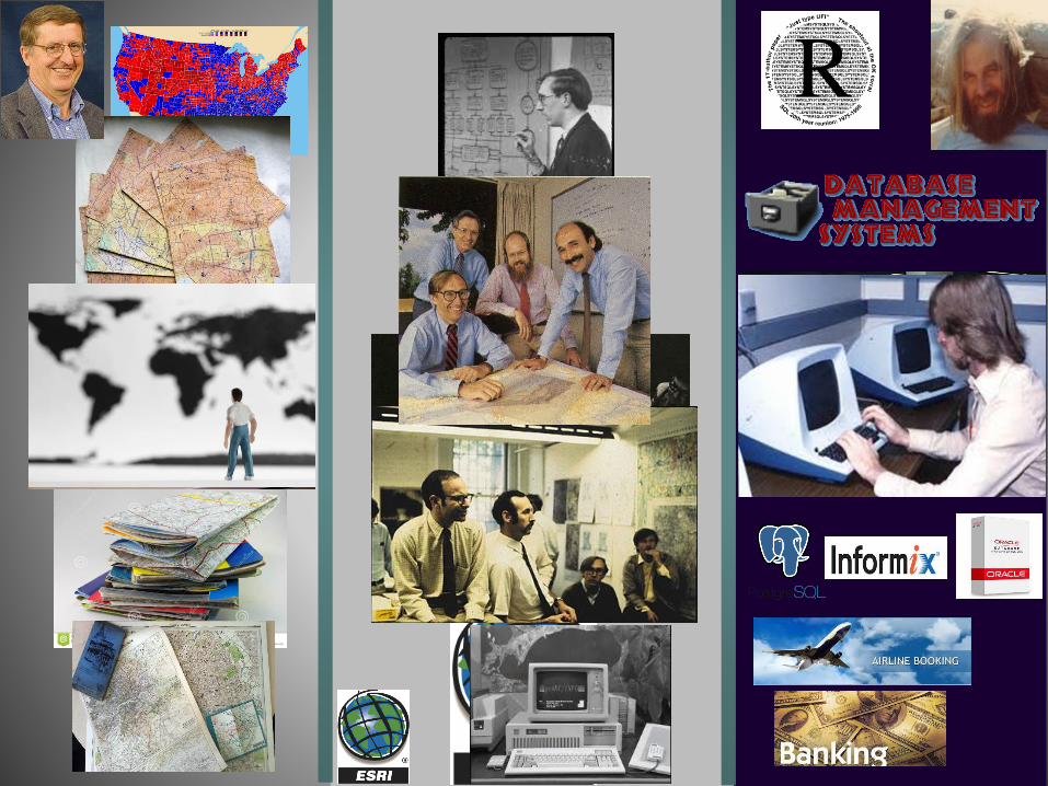
Cool Big Data technology..!!
Can I use it in my application?
Oh..!! But, it is not
made for me. Can’t
make use of it as is
My pleasure.
Here it is.
Kindly let me
understand your
needs
Kindly let me
get the
technology you
have
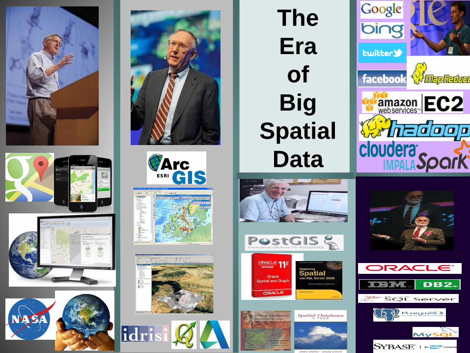
The
Era
of
Big
Spatial
Data
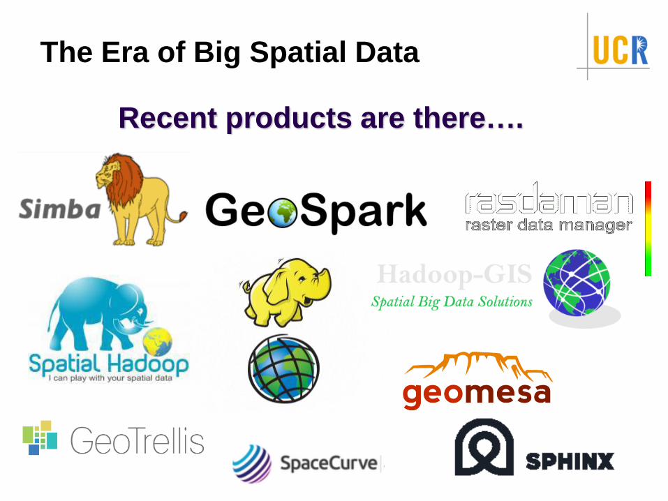
The Era of Big Spatial Data
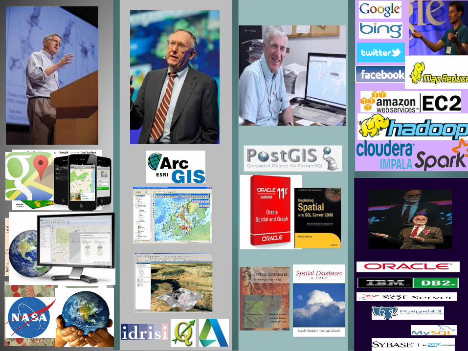
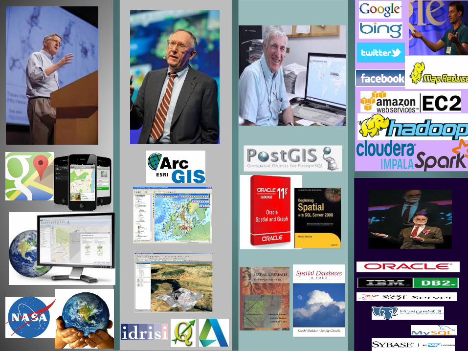
Recent products are there….
What is Spatial Computing?
28
What is Spatial Computing?
A field that innovates a set of technologies and techniques
to combine spatial information with computing technologies
29
What is Spatial Computing?
A field that innovates a set of technologies and techniques
to combine spatial information with computing technologies
[tentative] → emerging definition and field
Technologies could be software, hardware, or both
30
What is Spatial Computing?
A field that innovates a set of technologies and techniques
to combine spatial information with computing technologies
[tentative] → emerging definition and field
Technologies could be software, hardware, or both
Major questions of interest:
Where am I?
31
What is Spatial Computing?
A field that innovates a set of technologies and techniques
to combine spatial information with computing technologies
[tentative] → emerging definition and field
Technologies could be software, hardware, or both
Major questions of interest:
Where am I?
On Earth, in a mall, in a campus, in a plaza, inside a human
body…etc
32
What is Spatial Computing?
A field that innovates a set of technologies and techniques
to combine spatial information with computing technologies
[tentative] → emerging definition and field
Technologies could be software, hardware, or both
Major questions of interest:
Where am I?
On Earth, in a mall, in a campus, in a plaza, inside a human
body…etc
What is around me?
restaurants, hotels, gas stations, ATMs…etc
33
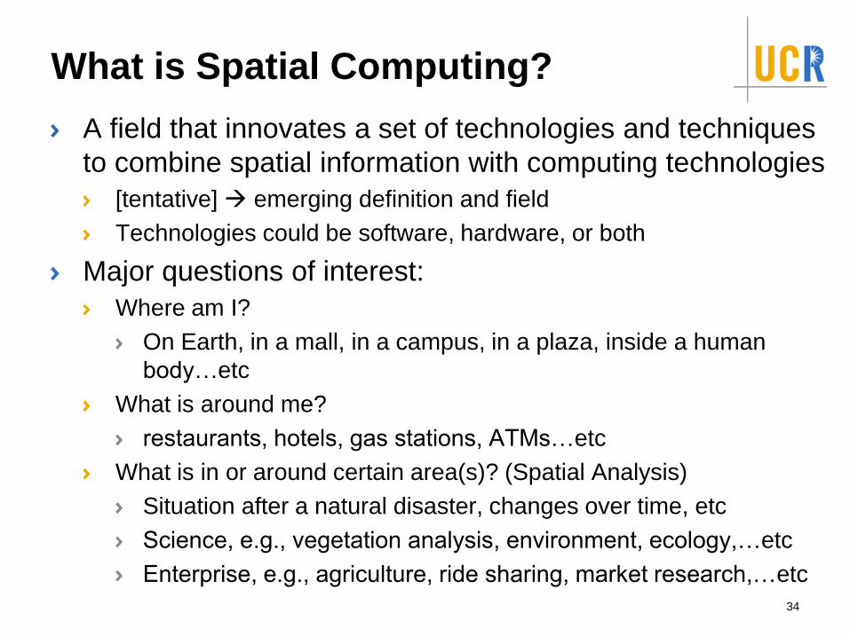
What is Spatial Computing?
A field that innovates a set of technologies and techniques
to combine spatial information with computing technologies
[tentative] → emerging definition and field
Technologies could be software, hardware, or both
Major questions of interest:
Where am I?
On Earth, in a mall, in a campus, in a plaza, inside a human
body…etc
What is around me?
restaurants, hotels, gas stations, ATMs…etc
What is in or around certain area(s)? (Spatial Analysis)
Situation after a natural disaster, changes over time, etc
Science, e.g., vegetation analysis, environment, ecology,…etc
Enterprise, e.g., agriculture, ride sharing, market research,…etc
34
Who use Spatial Computing?
Hundreds of millions of people (if not billions)
35
Who use Spatial Computing?
Hundreds of millions of people (if not billions)
Business
Estimated value by 2020: $600B
(McKinsey Global Institute, 2011 report on Big Data)
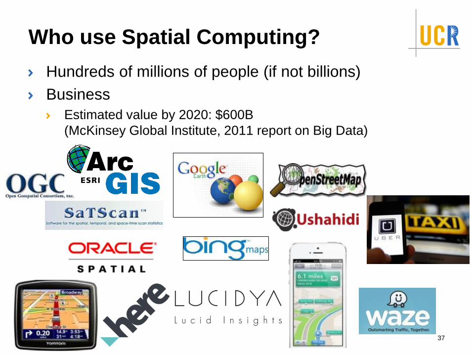
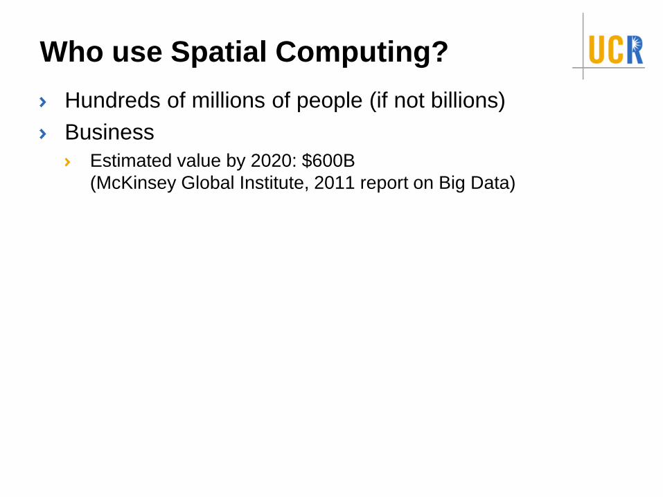
Who use Spatial Computing?
Hundreds of millions of people (if not billions)
Business
Estimated value by 2020: $600B
(McKinsey Global Institute, 2011 report on Big Data)
37
Who use Spatial Computing?
Hundreds of millions of people (if not billions)
Business
The governments
38
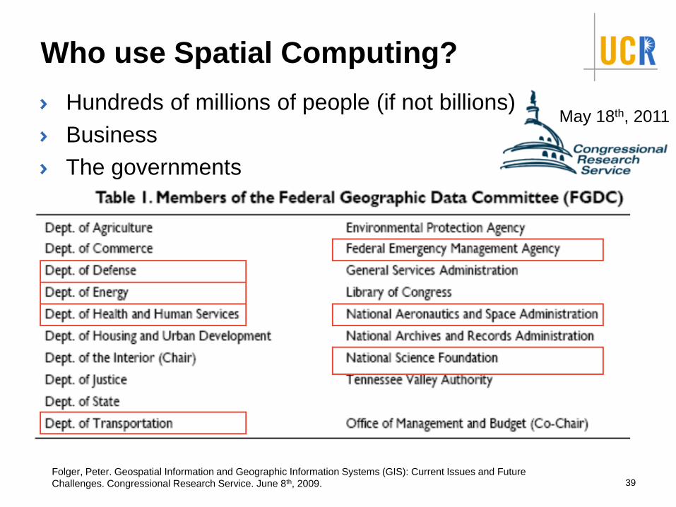
Who use Spatial Computing?
Hundreds of millions of people (if not billions)
Business
The governments
39
May 18th, 2011
Folger, Peter. Geospatial Information and Geographic Information Systems (GIS): Current Issues and Future
Challenges. Congressional Research Service. June 8th, 2009.
Who use Spatial Computing?
Hundreds of millions of people (if not billions)
Business
The governments
The public
4040
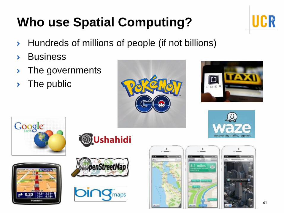
Who use Spatial Computing?
Hundreds of millions of people (if not billions)
Business
The governments
The public
4141
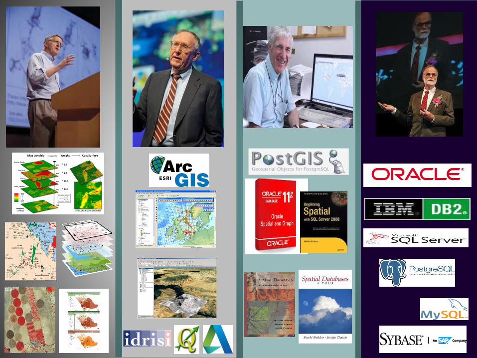
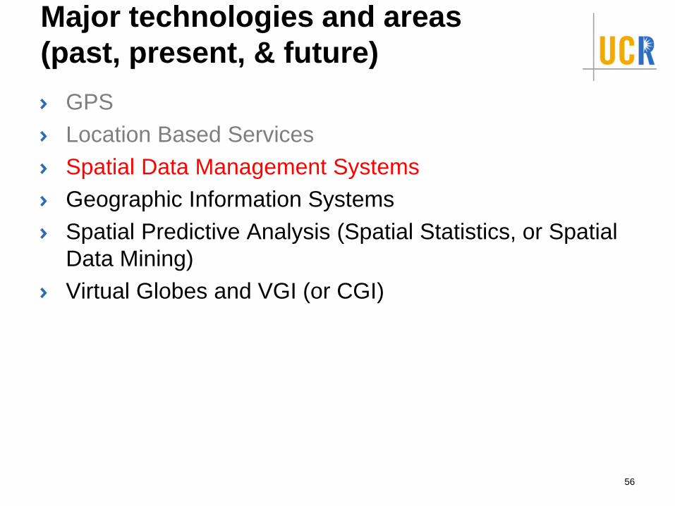
Major technologies and areas
(past, present, & future)
GPS
Location Based Services
Spatial Data Management Systems
Geographic Information Systems
Spatial Predictive Analysis (Spatial Statistics, or Spatial
Data Mining)
Virtual Globes and VGI (or CGI)
42
Major technologies and areas
(past, present, & future)
GPS
Location Based Services
Spatial Data Management Systems
Geographic Information Systems
Spatial Predictive Analysis (Spatial Statistics, or Spatial
Data Mining)
Virtual Globes and VGI (or CGI)
43
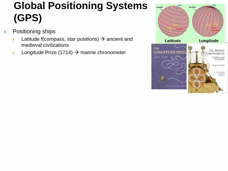
Positioning ships
Latitude f(compass, star positions) → ancient and
medieval civilizations
Longitude Prize (1714) → marine chronometer
Global Positioning Systems
(GPS)
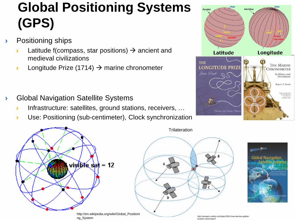
Positioning ships
Latitude f(compass, star positions) → ancient and
medieval civilizations
Longitude Prize (1714) → marine chronometer
Global Navigation Satellite Systems
Infrastructure: satellites, ground stations, receivers, …
Use: Positioning (sub-centimeter), Clock synchronization
Trilateration
http://answers.oreilly.com/topic/2815-how-devices-gather-
location-information/
http://en.wikipedia.org/wiki/Global_Positioni
ng_System
Global Positioning Systems
(GPS)
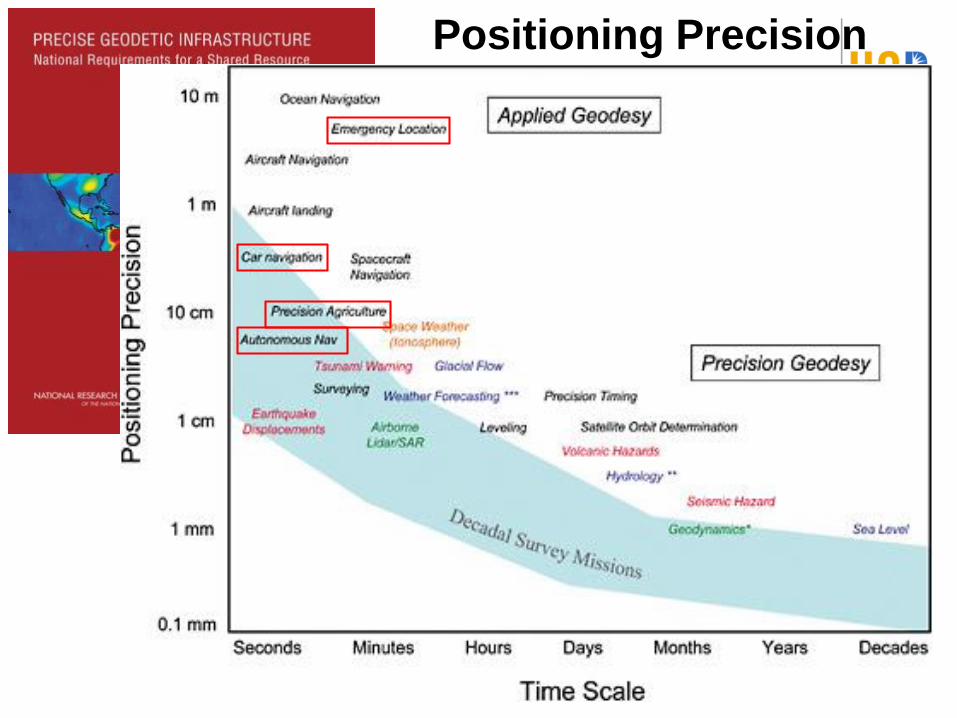
Positioning Precision
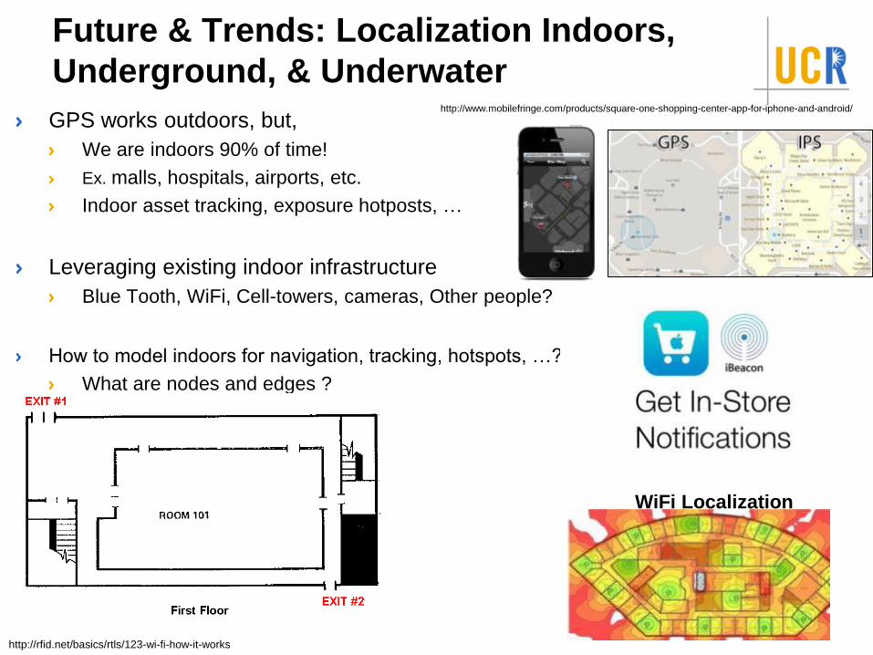
Future & Trends: Localization Indoors,
Underground, & Underwater
GPS works outdoors, but,
We are indoors 90% of time!
Ex. malls, hospitals, airports, …
Future & Trends: Localization Indoors,
Underground, & Underwater
GPS works outdoors, but,
We are indoors 90% of time!
Ex. malls, hospitals, airports, …
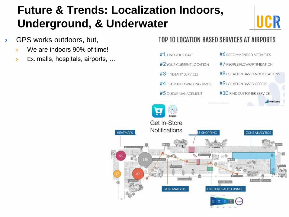
Future & Trends: Localization Indoors,
Underground, & Underwater
GPS works outdoors, but,
We are indoors 90% of time!
Ex. malls, hospitals, airports, …
Leveraging existing indoor infrastructure
Blue Tooth, Wi-Fi, …
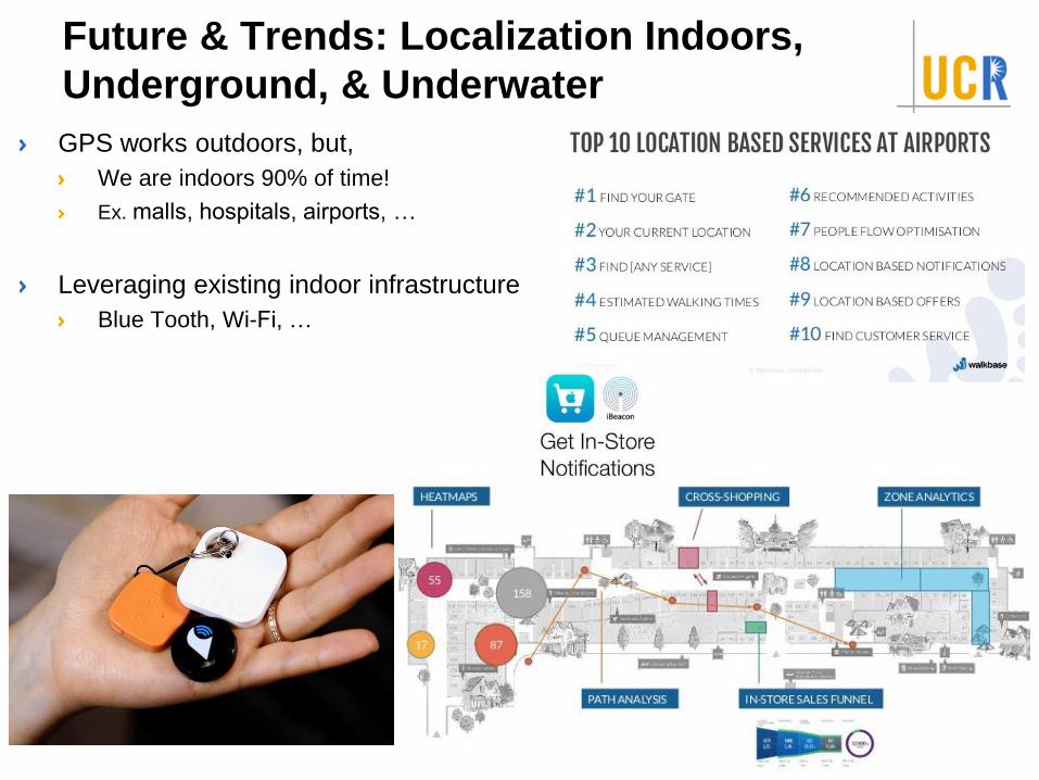
Future & Trends: Localization Indoors,
Underground, & Underwater
GPS works outdoors, but,
We are indoors 90% of time!
Ex. malls, hospitals, airports, etc.
Indoor asset tracking, exposure hotposts, …
Leveraging existing indoor infrastructure
Blue Tooth, WiFi, Cell-towers, cameras, Other people?
How to model indoors for navigation, tracking, hotspots, …?
What are nodes and edges ?
WiFi Localization
http://www.mobilefringe.com/products/square-one-shopping-center-app-for-iphone-and-android/
http://rfid.net/basics/rtls/123-wi-fi-how-it-works
Major technologies and areas
(past, present, & future)
GPS
Location Based Services
Spatial Data Management Systems
Geographic Information Systems
Spatial Predictive Analysis (Spatial Statistics, or Spatial
Data Mining)
Virtual Globes and VGI (or CGI)
51
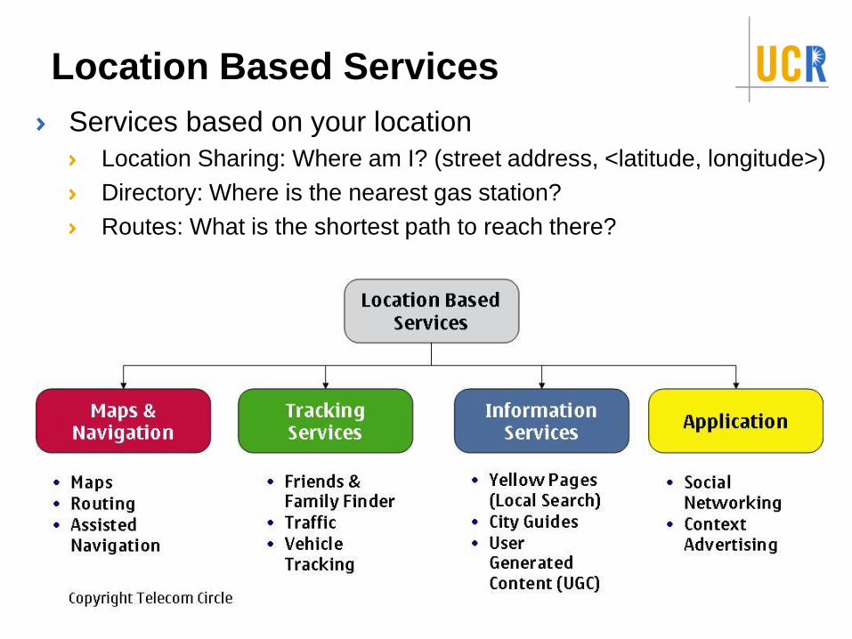
Location Based Services
Services based on your location
Location Sharing: Where am I? (street address, <latitude, longitude>)
Directory: Where is the nearest gas station?
Routes: What is the shortest path to reach there?
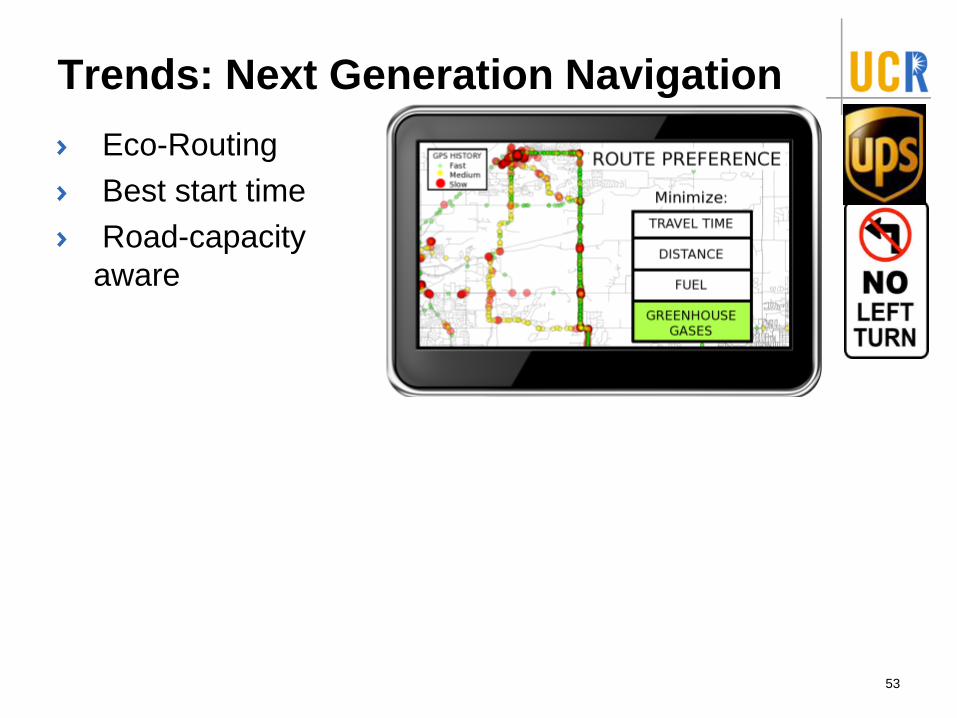
Trends: Next Generation Navigation
Eco-Routing
Best start time
Road-capacity
aware
53
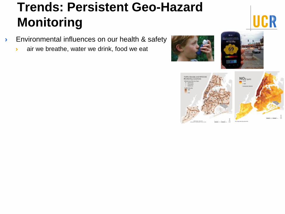
Trends: Persistent Geo-Hazard
Monitoring
Environmental influences on our health & safety
air we breathe, water we drink, food we eat
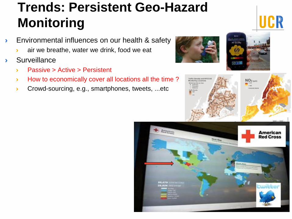
Trends: Persistent Geo-Hazard
Monitoring
Environmental influences on our health & safety
air we breathe, water we drink, food we eat
Surveillance
Passive > Active > Persistent
How to economically cover all locations all the time ?
Crowd-sourcing, e.g., smartphones, tweets, ...etc
Major technologies and areas
(past, present, & future)
GPS
Location Based Services
Spatial Data Management Systems
Geographic Information Systems
Spatial Predictive Analysis (Spatial Statistics, or Spatial
Data Mining)
Virtual Globes and VGI (or CGI)
56
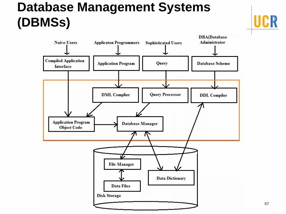
Database Management Systems
(DBMSs)
57
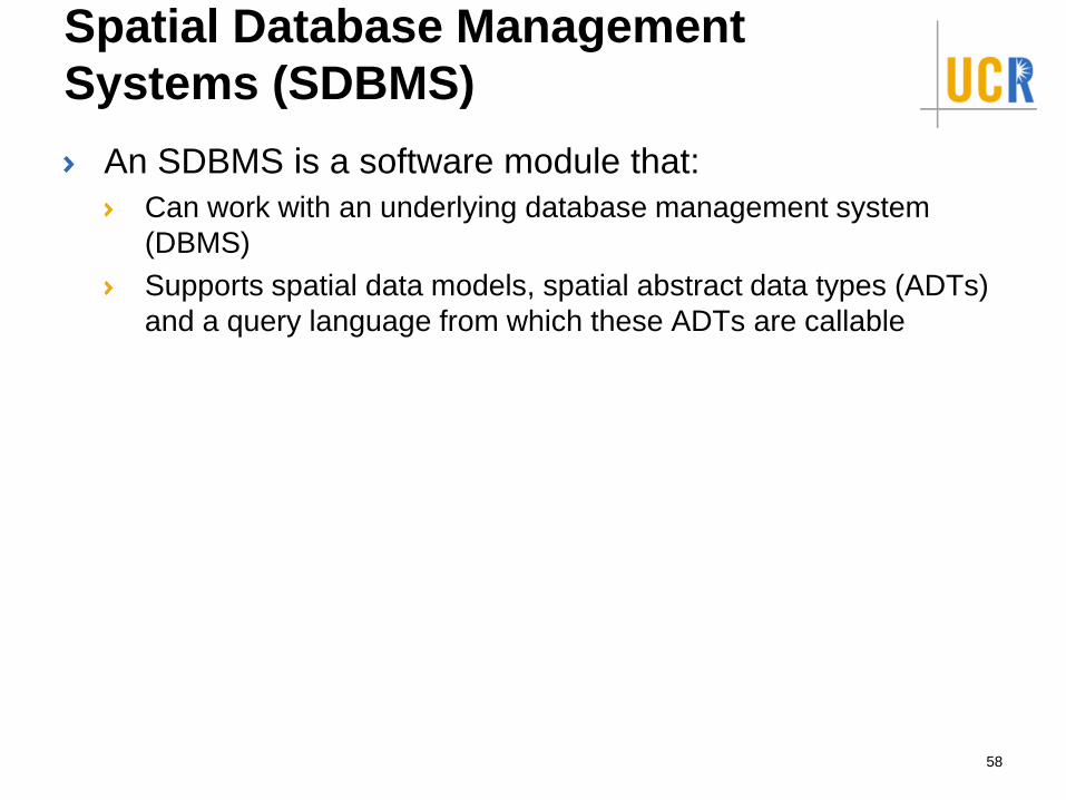
Spatial Database Management
Systems (SDBMS)
An SDBMS is a software module that:
Can work with an underlying database management system
(DBMS)
Supports spatial data models, spatial abstract data types (ADTs)
and a query language from which these ADTs are callable
58
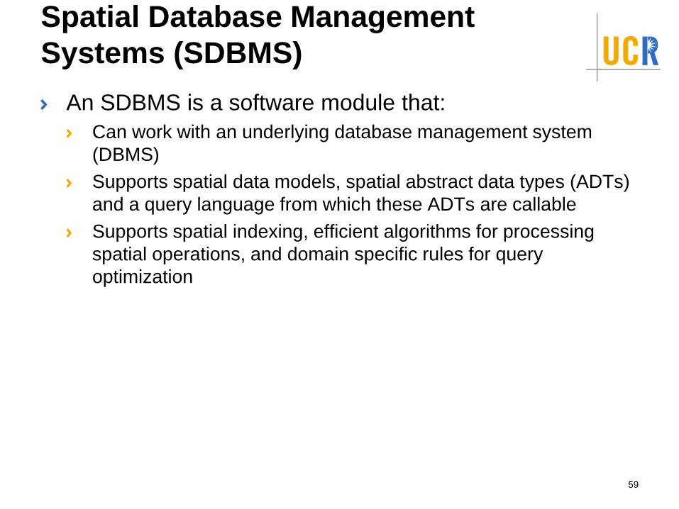
Spatial Database Management
Systems (SDBMS)
An SDBMS is a software module that:
Can work with an underlying database management system
(DBMS)
Supports spatial data models, spatial abstract data types (ADTs)
and a query language from which these ADTs are callable
Supports spatial indexing, efficient algorithms for processing
spatial operations, and domain specific rules for query
optimization
59
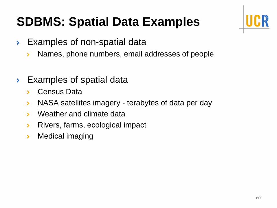
SDBMS: Spatial Data Examples
Examples of non-spatial data
Names, phone numbers, email addresses of people
Examples of spatial data
Census Data
NASA satellites imagery - terabytes of data per day
Weather and climate data
Rivers, farms, ecological impact
Medical imaging
60
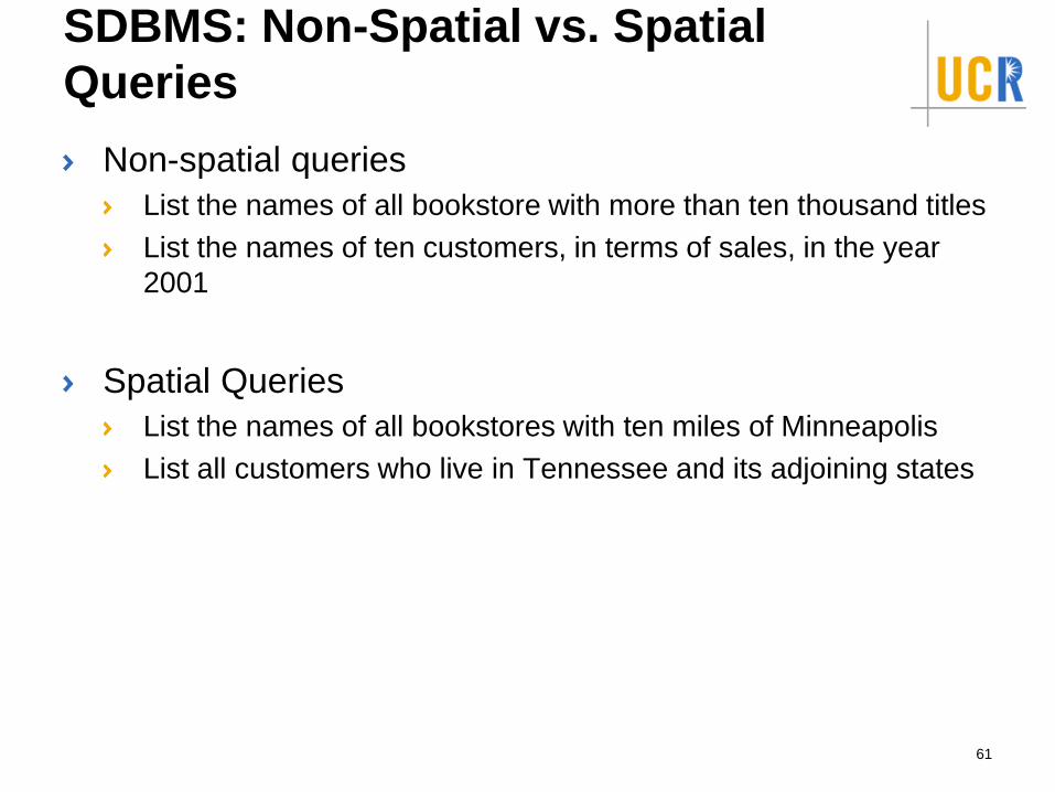
SDBMS: Non-Spatial vs. Spatial
Queries
Non-spatial queries
List the names of all bookstore with more than ten thousand titles
List the names of ten customers, in terms of sales, in the year
2001
Spatial Queries
List the names of all bookstores with ten miles of Minneapolis
List all customers who live in Tennessee and its adjoining states
61
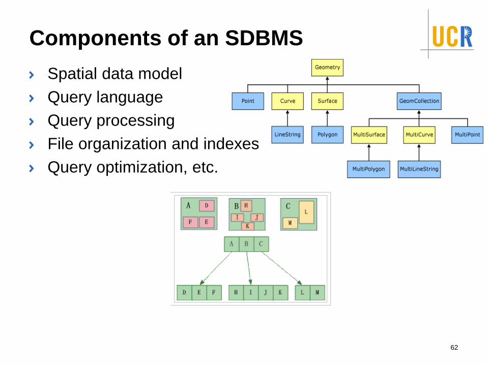
Components of an SDBMS
Spatial data model
Query language
Query processing
File organization and indexes
Query optimization, etc.
62
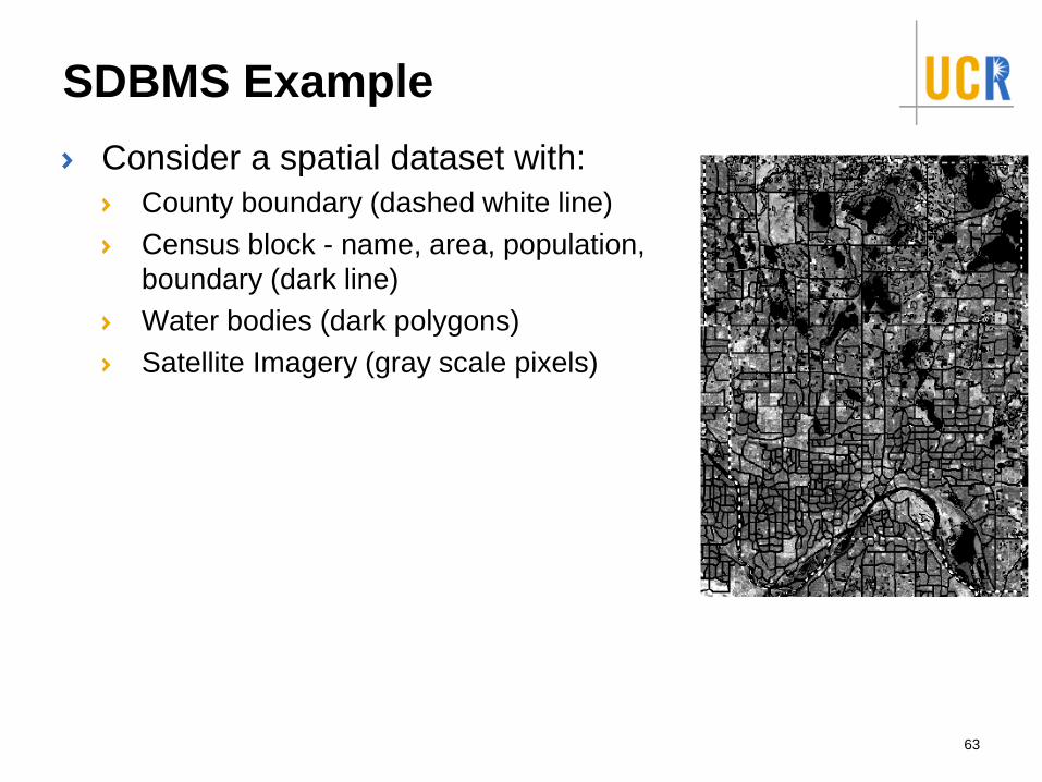
SDBMS Example
Consider a spatial dataset with:
County boundary (dashed white line)
Census block - name, area, population,
boundary (dark line)
Water bodies (dark polygons)
Satellite Imagery (gray scale pixels)
63
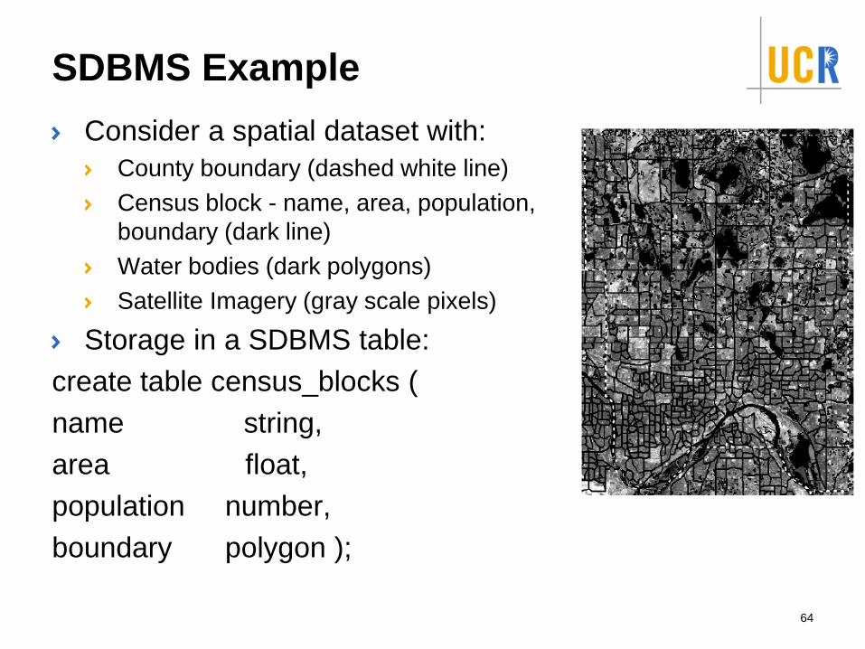
SDBMS Example
Consider a spatial dataset with:
County boundary (dashed white line)
Census block - name, area, population,
boundary (dark line)
Water bodies (dark polygons)
Satellite Imagery (gray scale pixels)
Storage in a SDBMS table:
create table census_blocks (
name string,
area float,
population number,
boundary polygon );
64
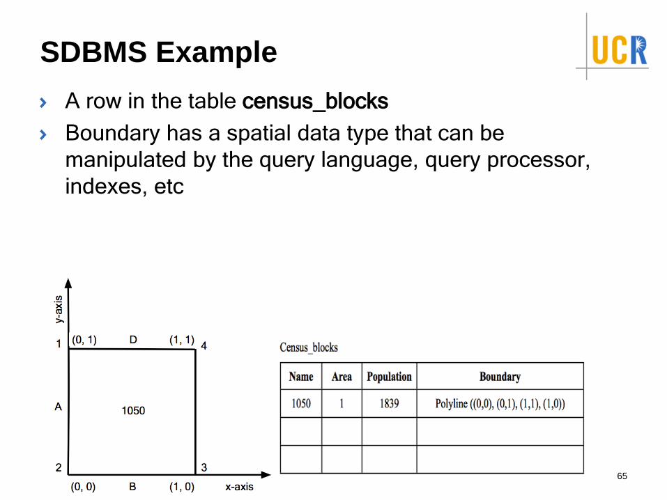
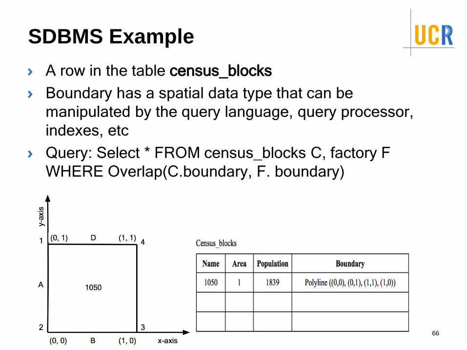
SDBMS Example
A row in the table census_blocks
Boundary has a spatial data type that can be
manipulated by the query language, query processor,
indexes, etc
65
SDBMS Example
A row in the table census_blocks
Boundary has a spatial data type that can be
manipulated by the query language, query processor,
indexes, etc
Query: Select * FROM census_blocks C, factory F
WHERE Overlap(C.boundary, F. boundary)
66
Spatial beyond Databases
Distributed systems
Hadoop, Spark, Impala, …etc
67
Spatial beyond Databases
Challenges: Privacy vs. Utility
Check-in risks: Stalking, GeoSlavery, Others know that
you are not home, etc
69
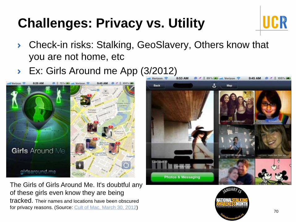
Challenges: Privacy vs. Utility
Check-in risks: Stalking, GeoSlavery, Others know that
you are not home, etc
Ex: Girls Around me App (3/2012)
70
The Girls of Girls Around Me. It's doubtful any
of these girls even know they are being
tracked. Their names and locations have been obscured
for privacy reasons. (Source: Cult of Mac, March 30, 2012)
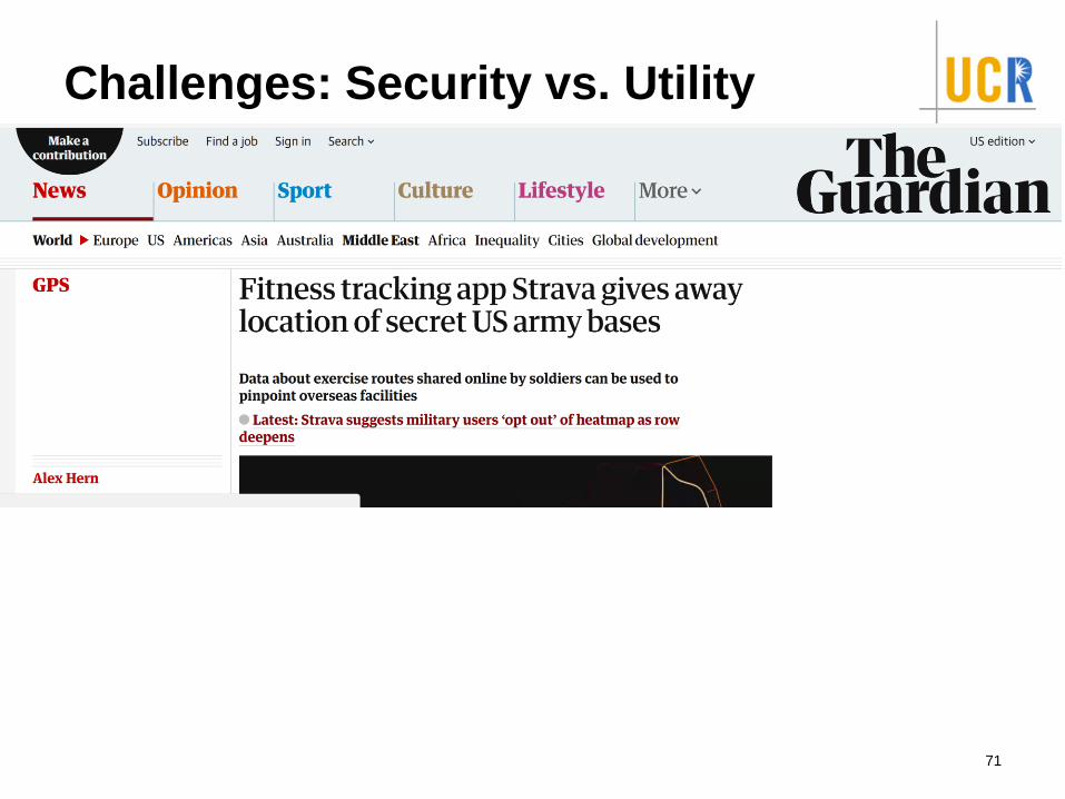
Challenges: Security vs. Utility
71
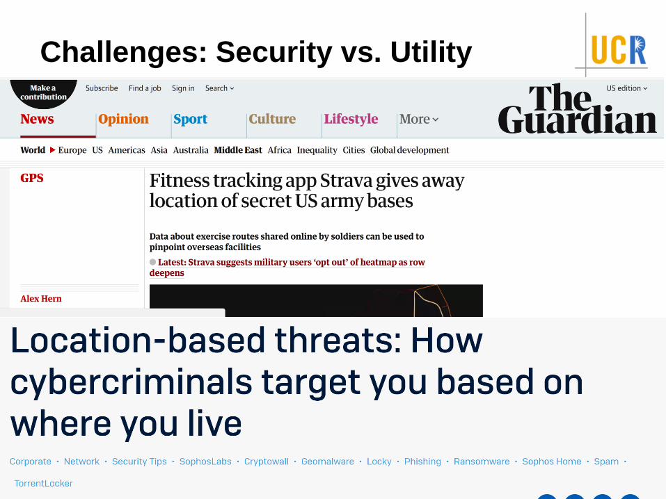
Challenges: Security vs. Utility
72
Challenges: Security vs. Utility
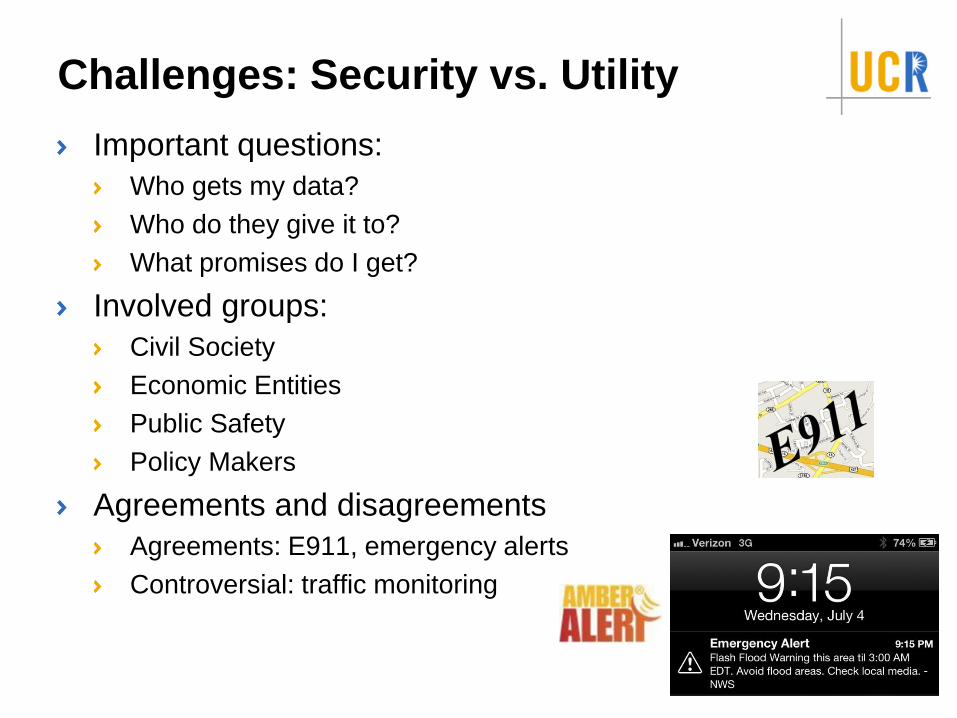
Important questions:
Who gets my data?
Who do they give it to?
What promises do I get?
73
Challenges: Security vs. Utility
Important questions:
Who gets my data?
Who do they give it to?
What promises do I get?
Involved groups:
Civil Society
Economic Entities
Public Safety
Policy Makers
74
Challenges: Security vs. Utility
Important questions:
Who gets my data?
Who do they give it to?
What promises do I get?
Involved groups:
Civil Society
Economic Entities
Public Safety
Policy Makers
Agreements and disagreements
Agreements: E911, emergency alerts
Controversial: traffic monitoring
75
Spatial beyond GeoSpatial
Examples:
Human bodies
VLSI
Universe
76
Spatial beyond GeoSpatial
Examples:
Human bodies
VLSI chips and boards
Universe
Indoor and virtual spaces
Challenges:
What are the reference system?
On Mars? Outside Milkyway galaxy? In augmented reality spaces?
Is it one for all humans? Or personalized?
Accuracy
3D+ scalability
77
Major technologies and areas
(past, present, & future)
GPS
Location Based Services
Spatial Data Management Systems
Geographic Information Systems
Spatial Predictive Analysis (Spatial Statistics, or Spatial
Data Mining)
Virtual Globes and VGI (or CGI)
78

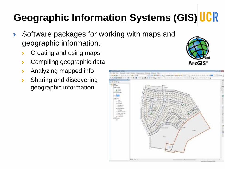
Geographic Information Systems (GIS)
Software packages for working with maps and
geographic information.
Creating and using maps
Compiling geographic data
Analyzing mapped info
Sharing and discovering
geographic information
79
Geographic Information Systems (GIS)
Software packages for working with maps and
geographic information.
Creating and using maps
Compiling geographic data
Analyzing mapped info
Sharing and discovering
geographic information
80
How different GIS from SDBMS?
81
How different GIS from SDBMS?
GIS uses SDBMS to store, search, and query spatial data
82
How different GIS from SDBMS?
GIS uses SDBMS to store, search, and query spatial data
GIS is a software application, SDBMS is a data
management system
83
How different GIS from SDBMS?
GIS uses SDBMS to store, search, and query spatial data
GIS is a software application, SDBMS is a data
management system
GIS used to visualize and analyze spatial data
Rich high-level analysis
SDBMS used to store, index, and query spatial data
efficiently
Efficient and scalable fundamental querying and data management
operations
84
How different GIS from SDBMS?
GIS uses SDBMS to store, search, and query spatial data
GIS is a software application, SDBMS is a data
management system
GIS used to visualize and analyze spatial data
Rich high-level analysis
SDBMS used to store, index, and query spatial data
efficiently
Efficient and scalable fundamental querying and data management
operations
SDBMS can be used by applications other than GIS
Astronomy, location-based services, brain informatics, etc
85
Major technologies and areas
(past, present, & future)
GPS
Location Based Services
Spatial Data Management Systems
Geographic Information Systems
Spatial Predictive Analysis (Spatial Statistics, or Spatial
Data Mining)
Virtual Globes and VGI (or CGI)
86

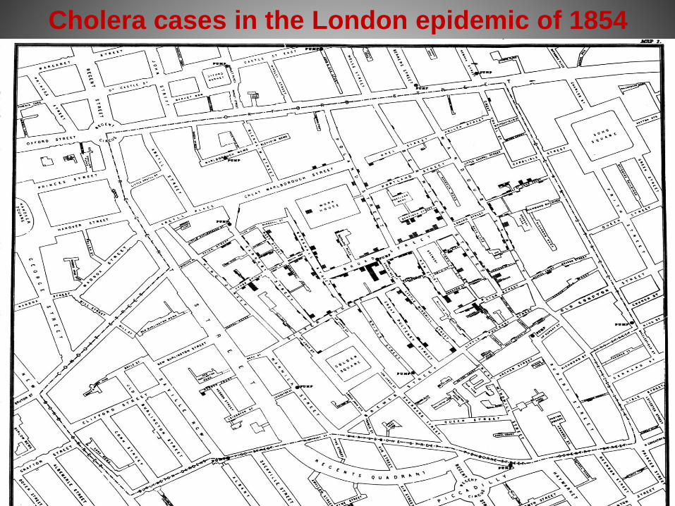
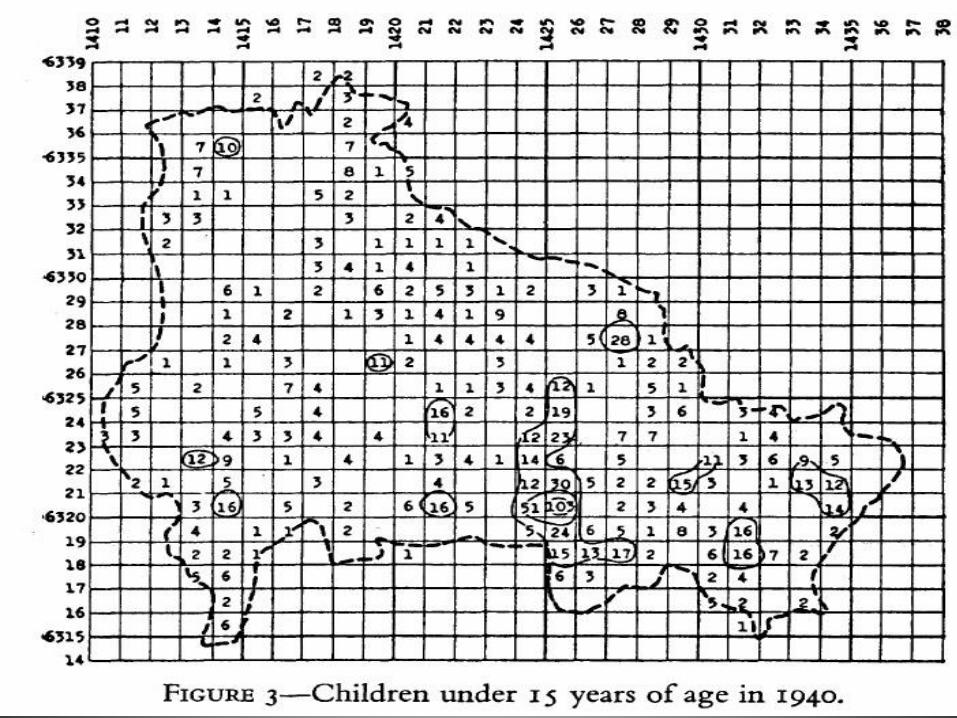
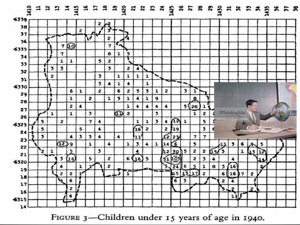
Cholera cases in the London epidemic of 1854
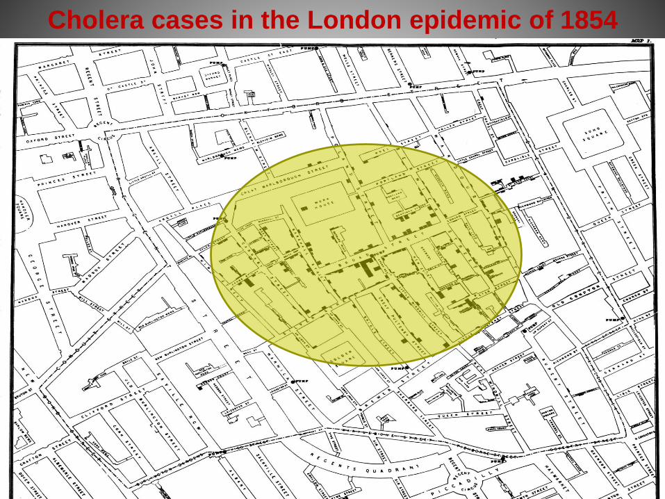
Cholera cases in the London epidemic of 1854
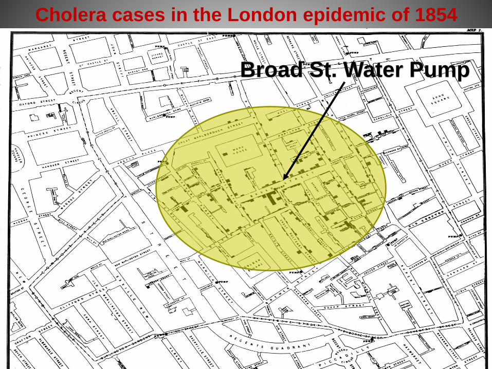
Cholera cases in the London epidemic of 1854
Broad St. Water Pump
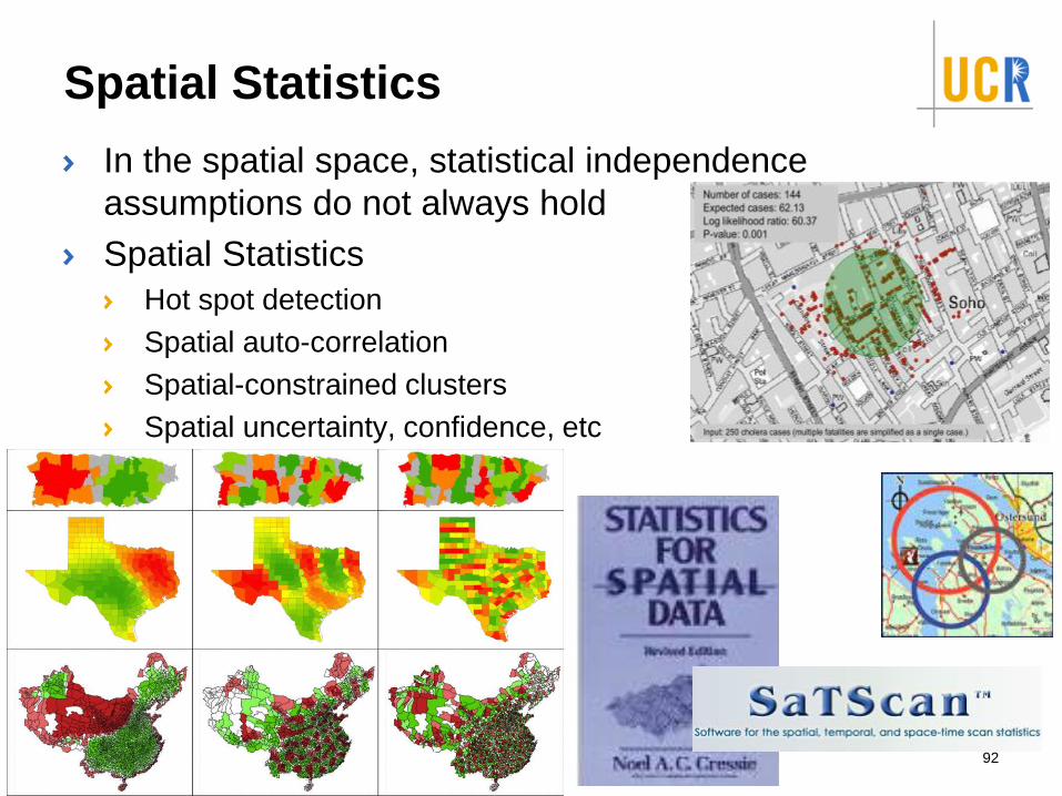
Spatial Statistics
In the spatial space, statistical independence
assumptions do not always hold
Spatial Statistics
Hot spot detection
Spatial auto-correlation
Spatial-constrained clusters
Spatial uncertainty, confidence, etc
92
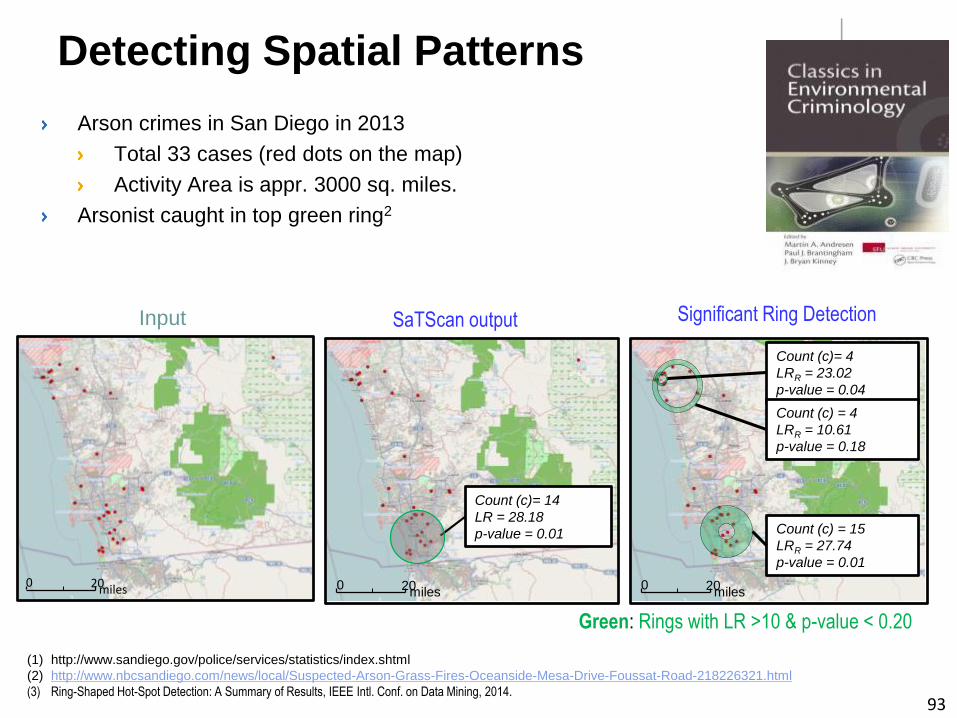
Detecting Spatial Patterns
Arson crimes in San Diego in 2013
Total 33 cases (red dots on the map)
Activity Area is appr. 3000 sq. miles.
Arsonist caught in top green ring2
(1) http://www.sandiego.gov/police/services/statistics/index.shtml
(2) http://www.nbcsandiego.com/news/local/Suspected-Arson-Grass-Fires-Oceanside-Mesa-Drive-Foussat-Road-218226321.html
(3) Ring-Shaped Hot-Spot Detection: A Summary of Results, IEEE Intl. Conf. on Data Mining, 2014.
Green: Rings with LR >10 & p-value < 0.20
SaTScan output
Count (c)= 14
LR = 28.18
p-value = 0.01
miles200
Significant Ring Detection
Output: SaTScan
Count (c)= 4
LRR = 23.02
p-value = 0.04
Count (c) = 15
LRR = 27.74
p-value = 0.01
Count (c) = 4
LRR = 10.61
p-value = 0.18
miles200miles200
Input
93
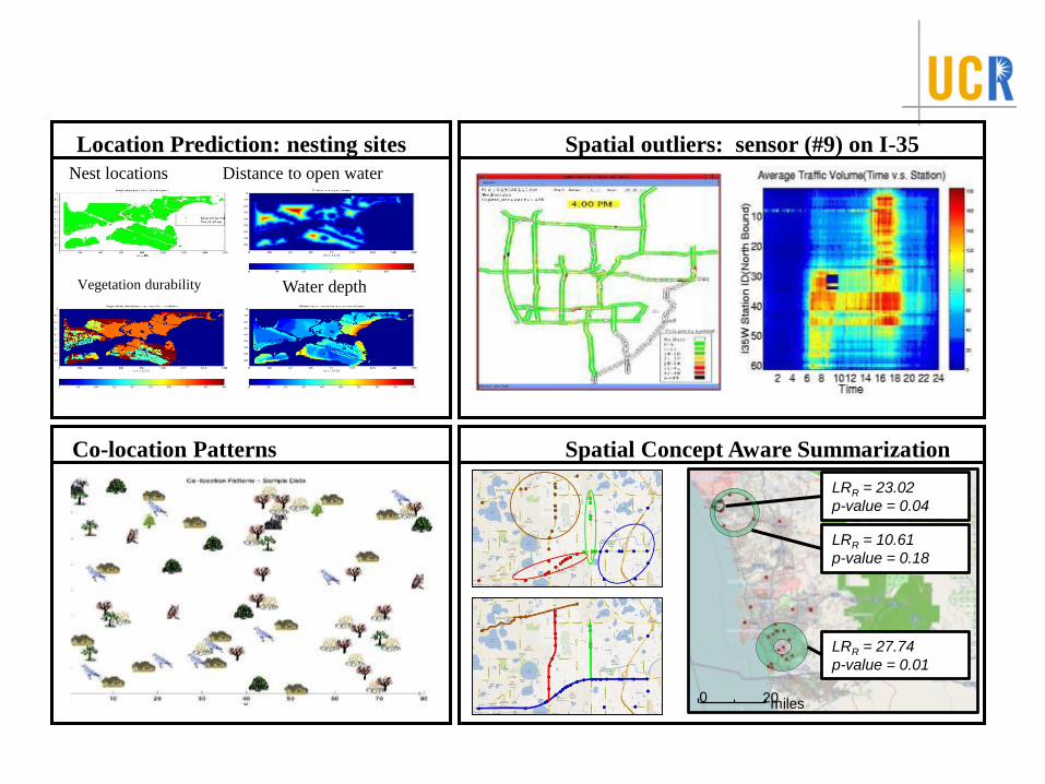
Nest locations Distance to open water
Vegetation durability Water depth
Location Prediction: nesting sites Spatial outliers: sensor (#9) on I-35
Co-location Patterns Spatial Concept Aware Summarization
Output: SaTScan
LRR = 23.02
p-value = 0.04
LRR = 27.74
p-value = 0.01
LRR = 10.61
p-value = 0.18
miles200
Major technologies and areas
(past, present, & future)
GPS
Location Based Services
Spatial Data Management Systems
Geographic Information Systems
Spatial Predictive Analysis (Spatial Statistics, or Spatial
Data Mining)
Virtual Globes and VGI (or CGI)
95
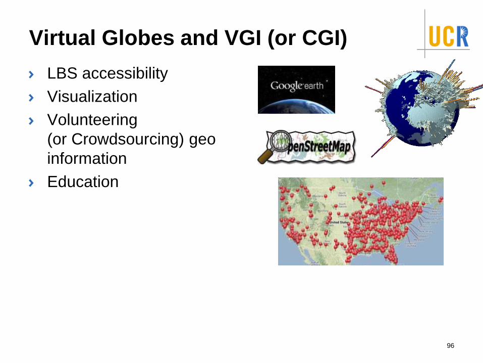
Virtual Globes and VGI (or CGI)
LBS accessibility
Visualization
Volunteering
(or Crowdsourcing) geo
information
Education
96
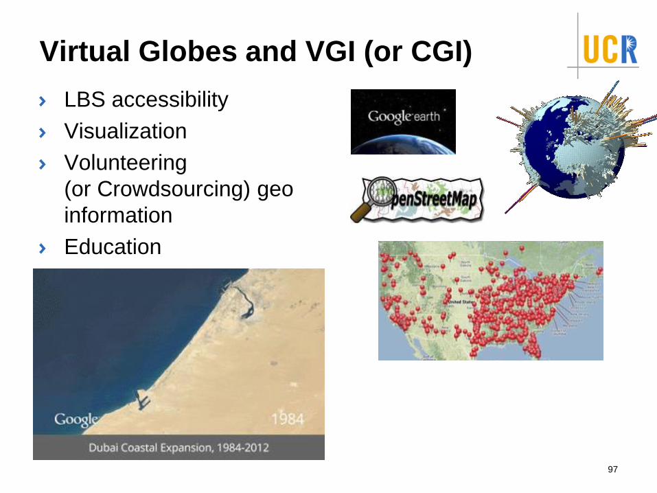
Virtual Globes and VGI (or CGI)
LBS accessibility
Visualization
Volunteering
(or Crowdsourcing) geo
information
Education
97
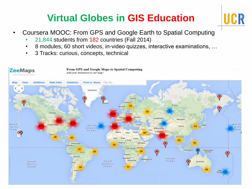
Virtual Globes in GIS Education
• Coursera MOOC: From GPS and Google Earth to Spatial Computing• 21,844 students from 182 countries (Fall 2014)
• 8 modules, 60 short videos, in-video quizzes, interactive examinations, …
• 3 Tracks: curious, concepts, technical
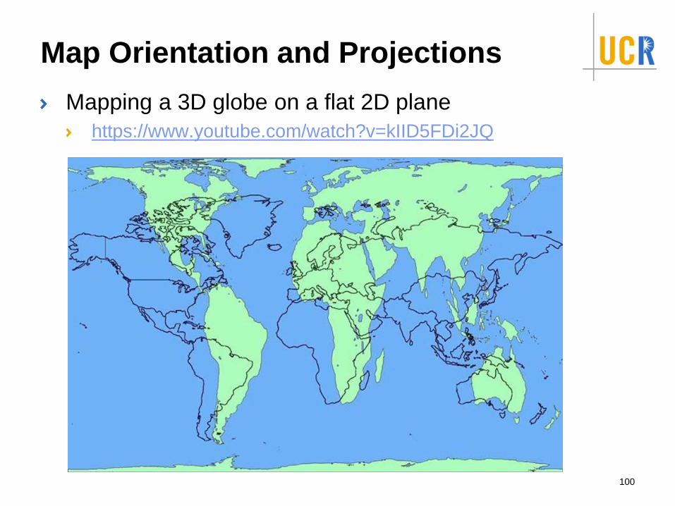
Map Orientation and Projections
Mapping a 3D globe on a flat 2D plane
https://www.youtube.com/watch?v=kIID5FDi2JQ
99
Map Orientation and Projections
Mapping a 3D globe on a flat 2D plane
https://www.youtube.com/watch?v=kIID5FDi2JQ
100
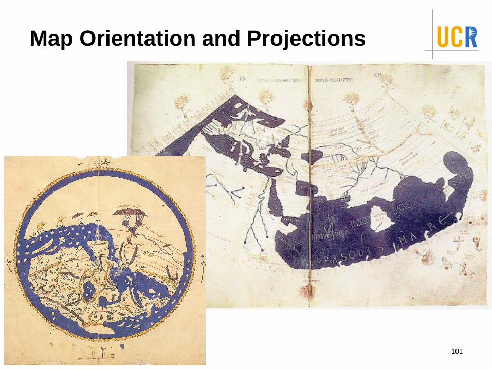
Map Orientation and Projections
101
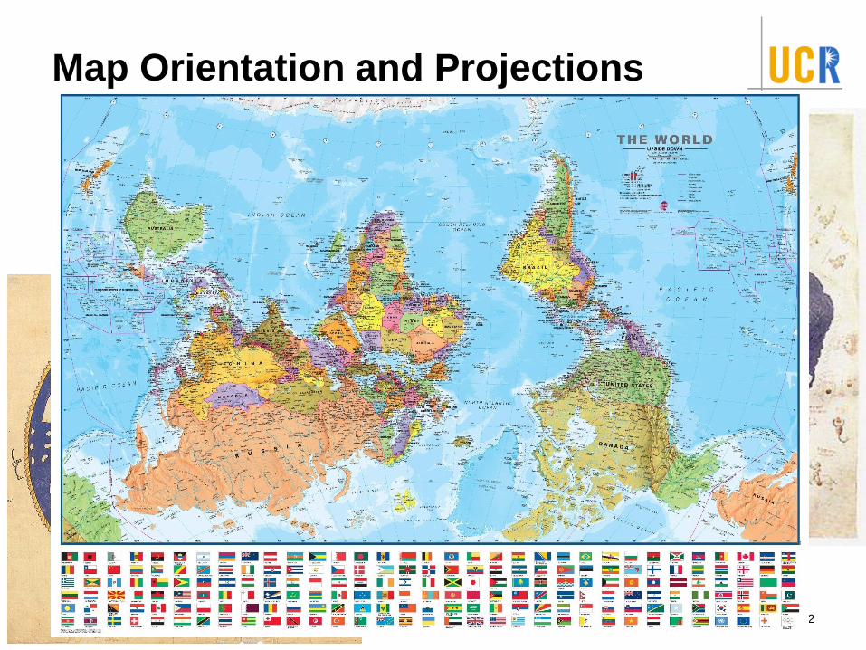
Map Orientation and Projections
102
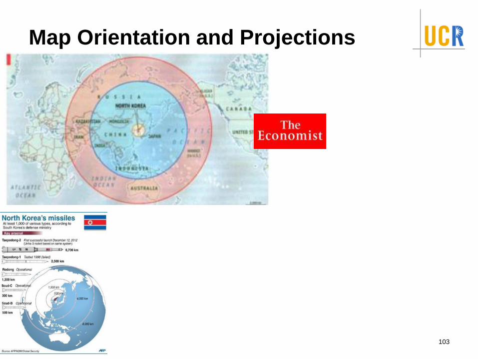
Map Orientation and Projections
103
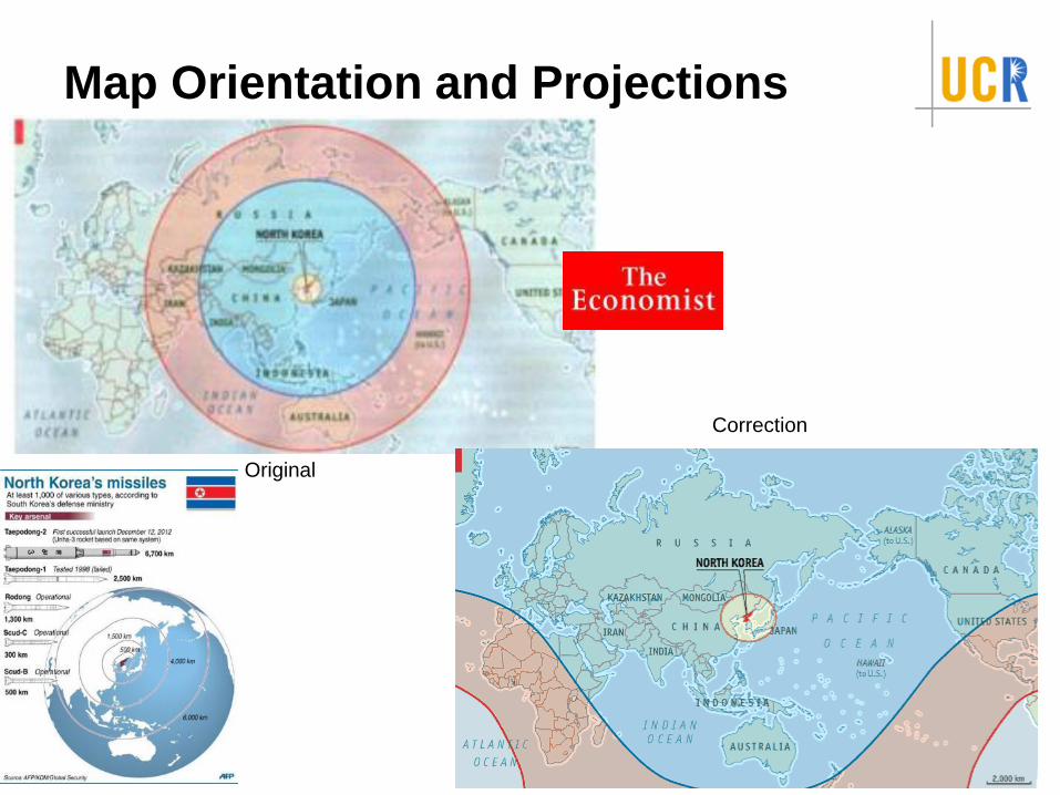
Map Orientation and Projections
104
Original
Correction
Readings and Credits
Readings
CACM Article: https://cacm.acm.org/magazines/2016/1/195727-
spatial-computing/fulltext
CCC Workshop Report: https://cra.org/wp-
content/uploads/sites/2/2015/05/Spatial_Computing_Report-
2013.pdf
Supp. book, Ch. 1
Spatial Computing Lectures:
https://www.youtube.com/watch?v=ftwWfB7JWaQ&list=PLq_27U
v53bDm3hyXd5QWG-N8L4Vgvcy9J&index=1
Credits:
Prof. Ahmed Eldawy and Prof. Mohamed Mokbel tutorial
http://www.vldb.org/pvldb/vol10/p1992-eldawy.pdf
Prof. Shashi Shekhar book slides
http://www.spatial.cs.umn.edu/Book/slides/
http://www.edugrabs.com/components-of-dbms/105


![Spatial Computing [16Mb]](https://img.pdfslide.us/doc/110x75/5875fa391a28abb46d8b64f2/spatial-computing-16mb.jpg)