Embed Size (px)
Citation preview
Ioannis Rekleitis
Space Robotics
On-Orbit Servicing of Satellites
Work done at the Canadian Space Agency
CS-417 Introduction to Robotics and Intelligent Systems
Ioannis Rekleitis
Guy Rouleau, Ioannis Rekleitis, Régent L'Archevêque, Eric Martin, Kourosh Parsa, and Erick Dupuis
Space Technologies Canadian Space Agency
Montréal, Canada
Presented at the 2006 International Conference on Robotics and Automation
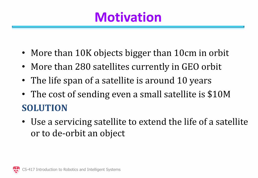
Motivation
• More than 10K objects bigger than 10cm in orbit
• More than 280 satellites currently in GEO orbit
• The life span of a satellite is around 10 years
• The cost of sending even a small satellite is $10M
SOLUTION
• Use a servicing satellite to extend the life of a satellite or to de-orbit an object
CS-417 Introduction to Robotics and Intelligent Systems
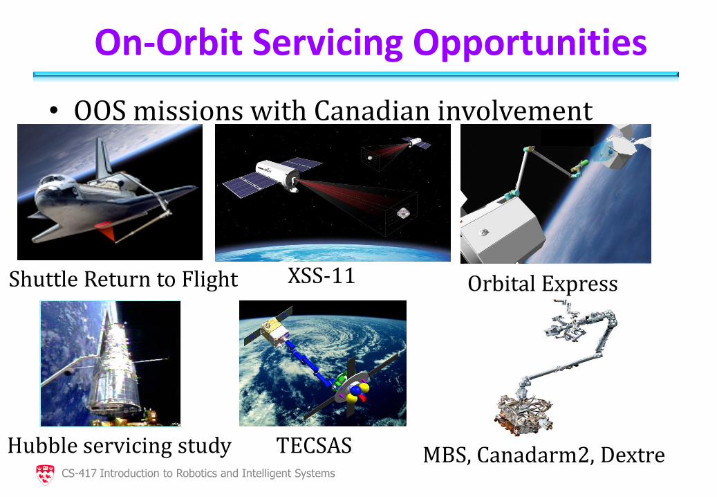
On-Orbit Servicing Opportunities
• OOS missions with Canadian involvement
Shuttle Return to Flight
XSS-11 Orbital Express
Hubble servicing study TECSAS MBS, Canadarm2, Dextre CS-417 Introduction to Robotics and Intelligent Systems
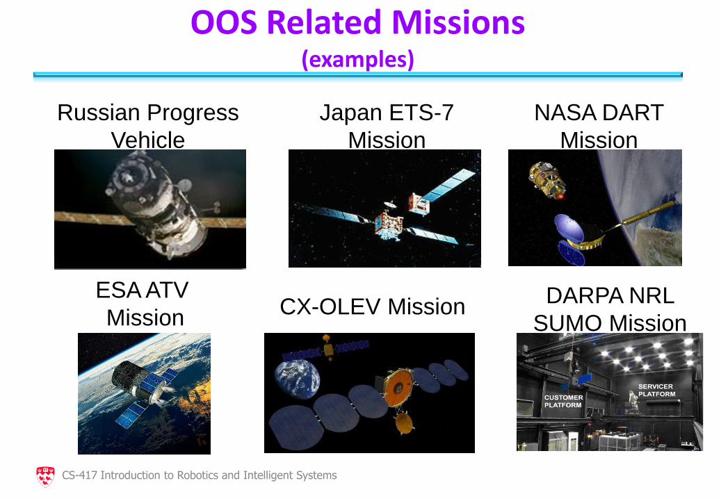
OOS Related Missions (examples)
Russian Progress
Vehicle
Japan ETS-7
Mission
NASA DART
Mission
ESA ATV
Mission CX-OLEV Mission
DARPA NRL
SUMO Mission
CS-417 Introduction to Robotics and Intelligent Systems
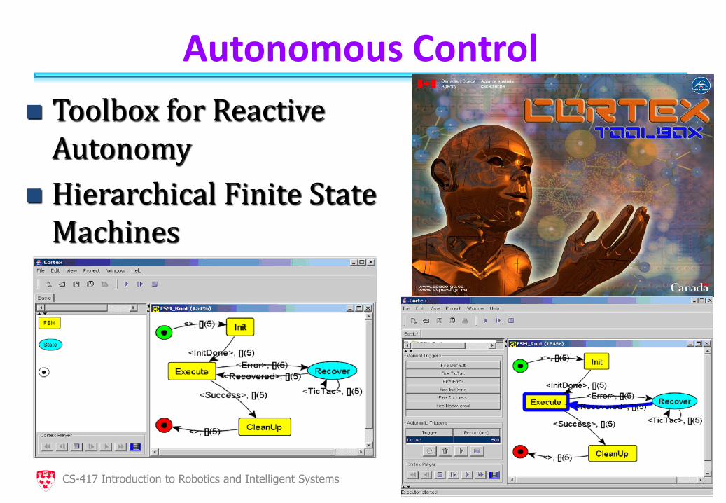
Autonomous Control
Toolbox for Reactive Autonomy
Hierarchical Finite State Machines
CS-417 Introduction to Robotics and Intelligent Systems
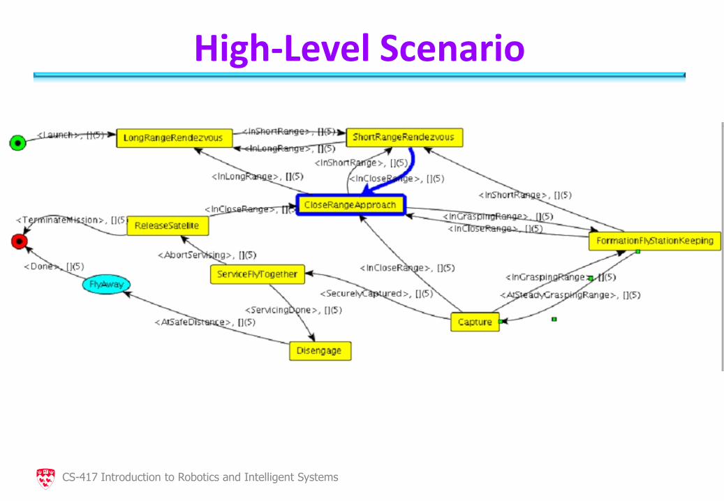
High-Level Scenario
CS-417 Introduction to Robotics and Intelligent Systems
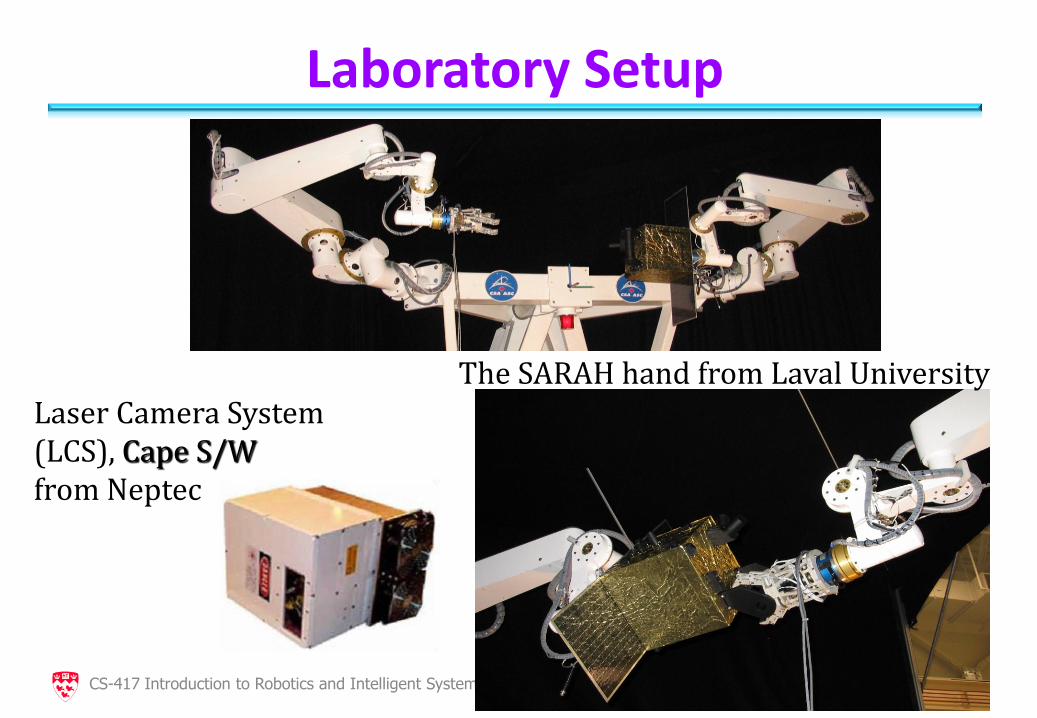
Laboratory Setup
CS-417 Introduction to Robotics and Intelligent Systems
Laser Camera System (LCS), Cape S/W from Neptec
The SARAH hand from Laval University
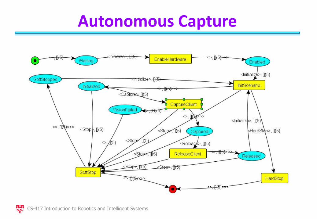
Autonomous Capture
CS-417 Introduction to Robotics and Intelligent Systems
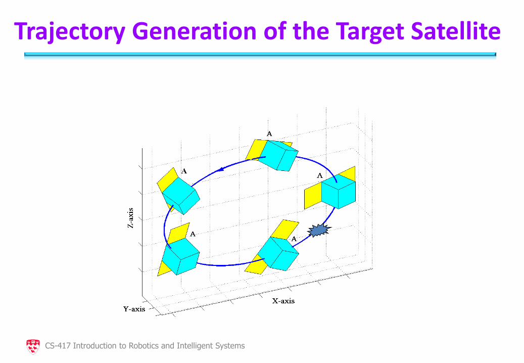
Trajectory Generation of the Target Satellite
CS-417 Introduction to Robotics and Intelligent Systems
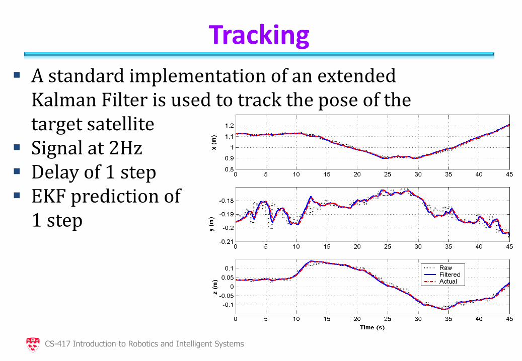
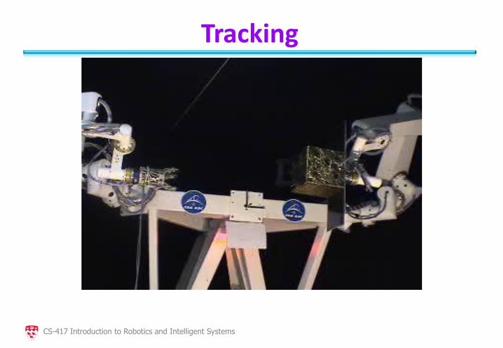
Tracking
CS-417 Introduction to Robotics and Intelligent Systems
A standard implementation of an extended Kalman Filter is used to track the pose of the target satellite
Signal at 2Hz Delay of 1 step EKF prediction of 1 step
Tracking
CS-417 Introduction to Robotics and Intelligent Systems
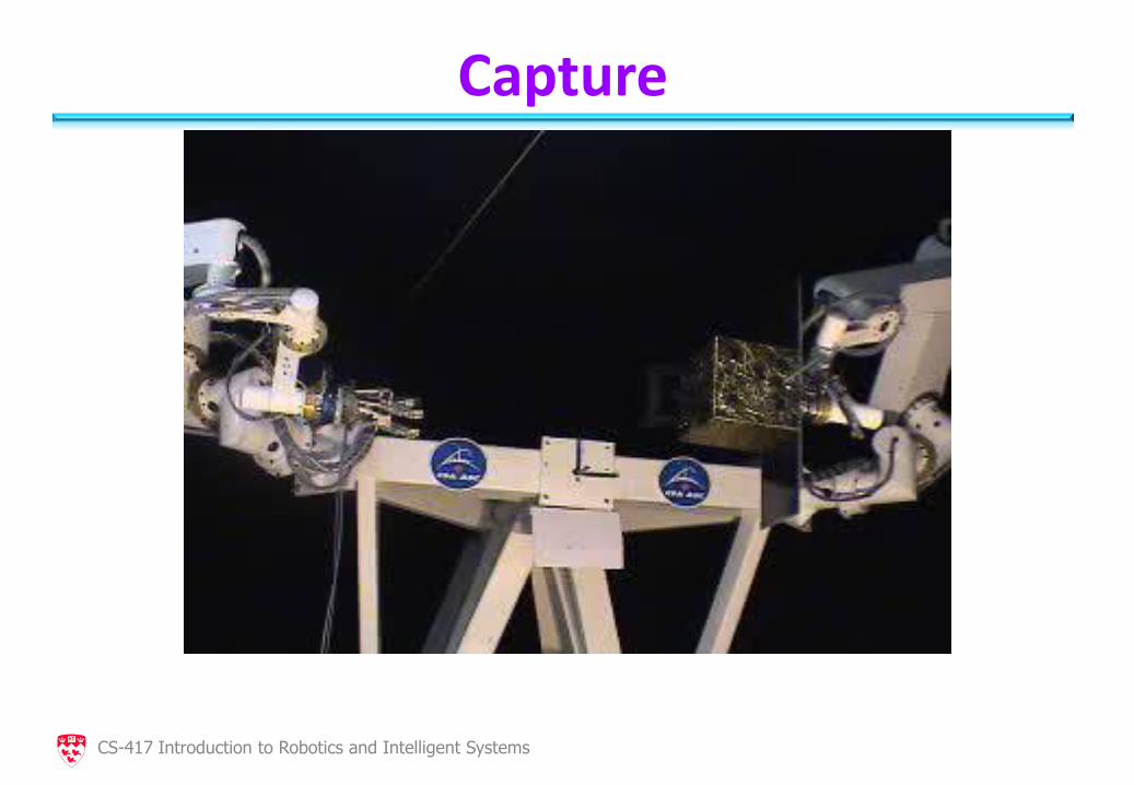
Capture
CS-417 Introduction to Robotics and Intelligent Systems
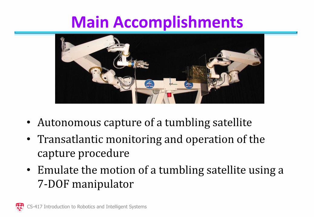
Main Accomplishments
• Autonomous capture of a tumbling satellite
• Transatlantic monitoring and operation of the capture procedure
• Emulate the motion of a tumbling satellite using a 7-DOF manipulator
CS-417 Introduction to Robotics and Intelligent Systems
Conclusions
• Cortex greatly facilitated the creation of autonomy scenarios
• The LCS from Neptec provided robust pose estimation (varying illumination conditions, obstructions)
• First step of autonomous capture in a laboratory setting
CS-417 Introduction to Robotics and Intelligent Systems
Planetary Exploration:
• Autonomous Over-the-Horizon Navigation
CS-417 Introduction to Robotics and Intelligent Systems
Outline
• Mars Exploration
• Background
• Main Blocks are: Terrain Modeling, Path Planning, Motion
• Control Tests from 2006 and 2007
CS-417 Introduction to Robotics and Intelligent Systems
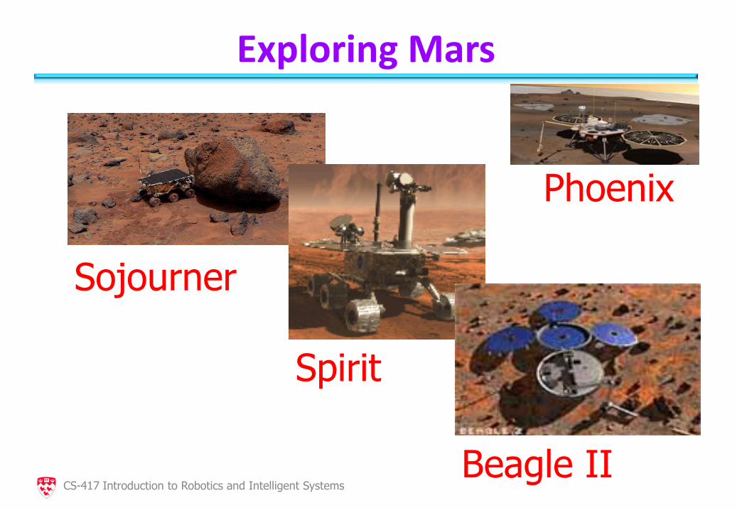
Exploring Mars
Sojourner
Spirit
Beagle II
Phoenix
CS-417 Introduction to Robotics and Intelligent Systems
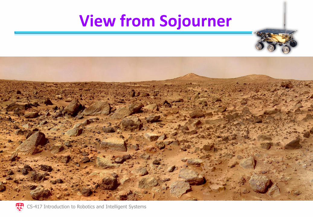
View from Sojourner
CS-417 Introduction to Robotics and Intelligent Systems
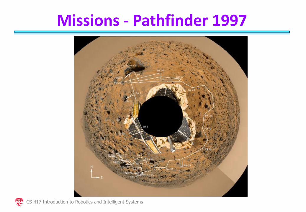
Missions - Pathfinder 1997
CS-417 Introduction to Robotics and Intelligent Systems
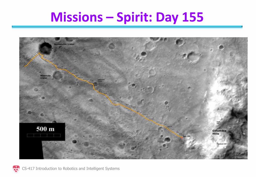
Missions – Spirit: Day 155
CS-417 Introduction to Robotics and Intelligent Systems
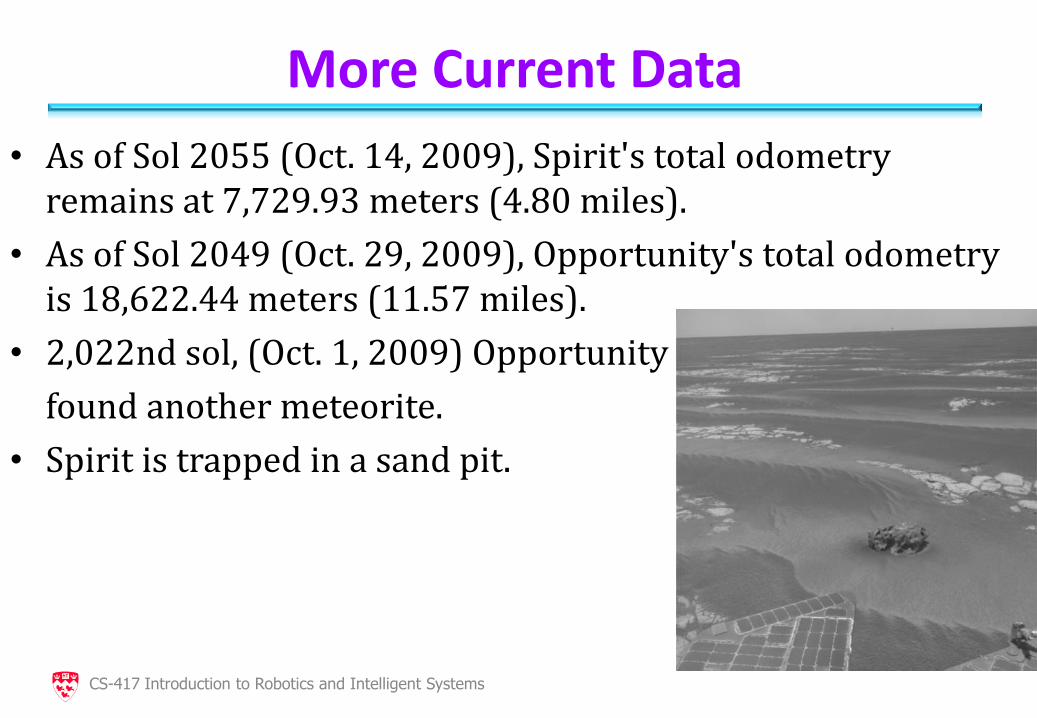
More Current Data
• As of Sol 2055 (Oct. 14, 2009), Spirit's total odometry remains at 7,729.93 meters (4.80 miles).
• As of Sol 2049 (Oct. 29, 2009), Opportunity's total odometry is 18,622.44 meters (11.57 miles).
• 2,022nd sol, (Oct. 1, 2009) Opportunity
found another meteorite.
• Spirit is trapped in a sand pit.
CS-417 Introduction to Robotics and Intelligent Systems
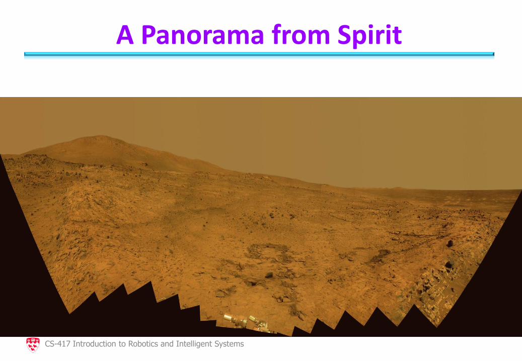
A Panorama from Spirit
CS-417 Introduction to Robotics and Intelligent Systems
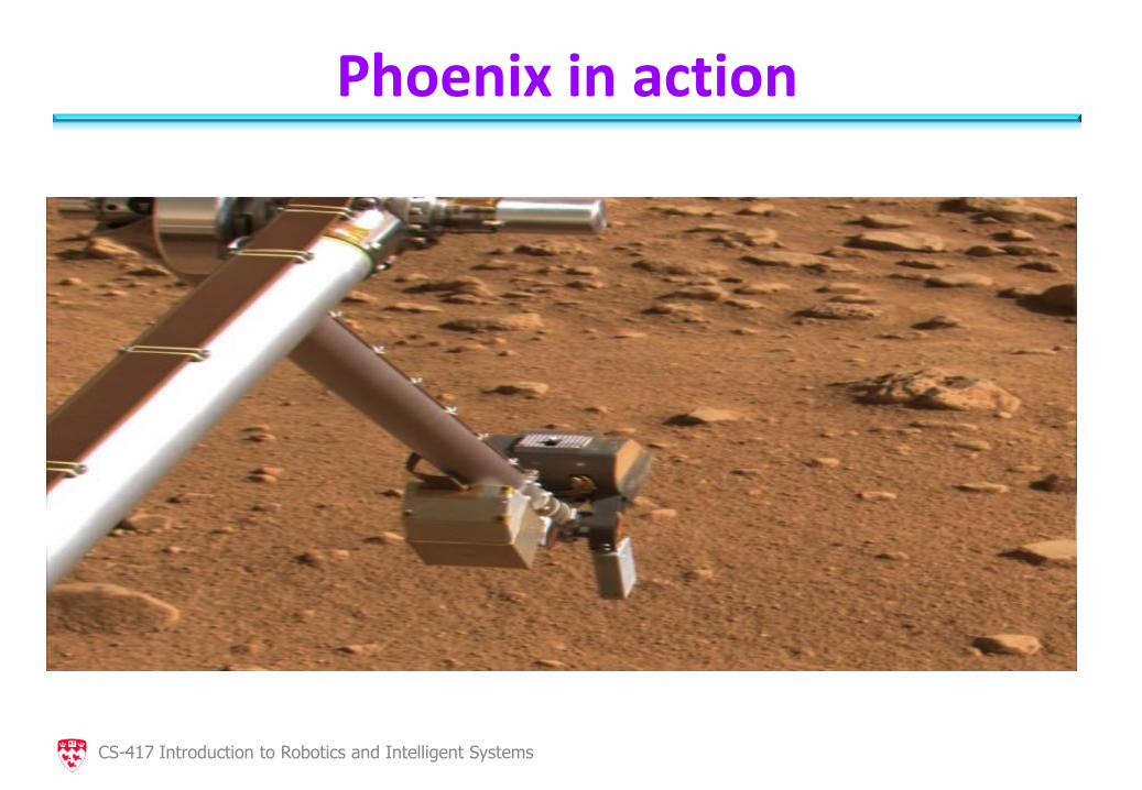
Phoenix in action
CS-417 Introduction to Robotics and Intelligent Systems
For more information visit:
• http://mars.jpl.nasa.gov/MPF/
• http://marsrovers.jpl.nasa.gov/home/
• http://phoenix.lpl.arizona.edu/index.php
• http://www.google.com/mars/
CS-417 Introduction to Robotics and Intelligent Systems
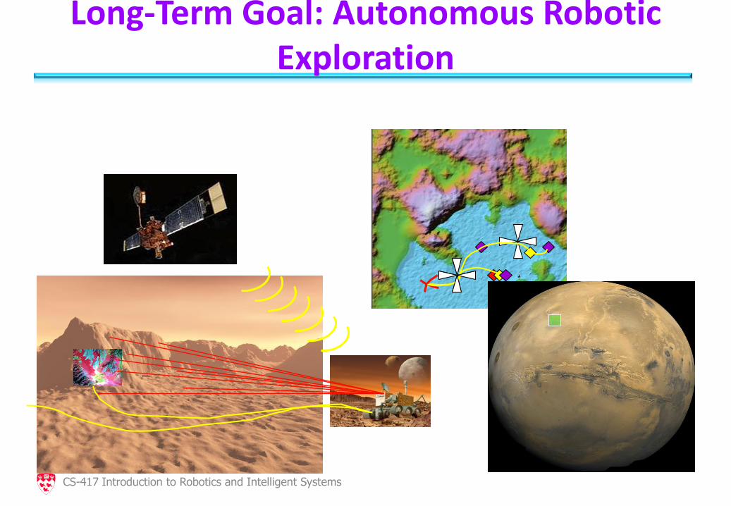
Long-Term Goal: Autonomous Robotic Exploration
CS-417 Introduction to Robotics and Intelligent Systems
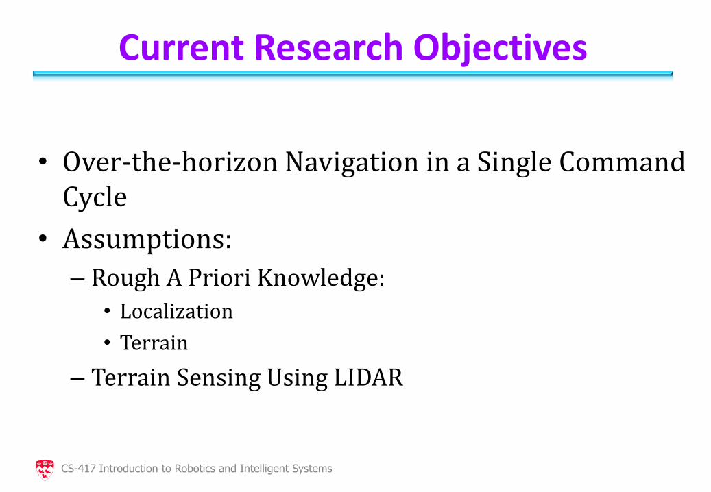
Current Research Objectives
• Over-the-horizon Navigation in a Single Command Cycle
• Assumptions:
– Rough A Priori Knowledge:
• Localization
• Terrain
– Terrain Sensing Using LIDAR
CS-417 Introduction to Robotics and Intelligent Systems
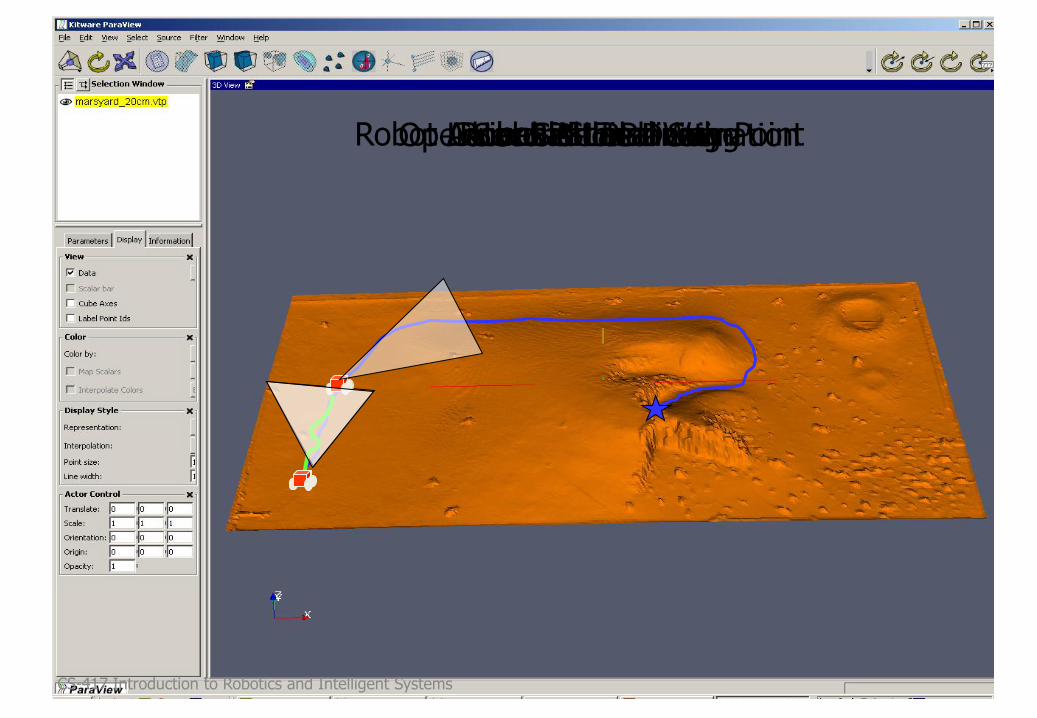
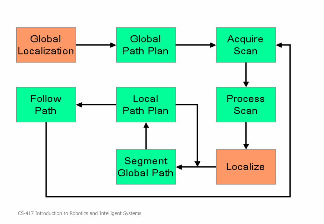
Local Path Planning Robot Arrives At First Way-Point Robot is Localized Operator Selects Destination Global Path Planning Local Scan Second Local Scan
CS-417 Introduction to Robotics and Intelligent Systems
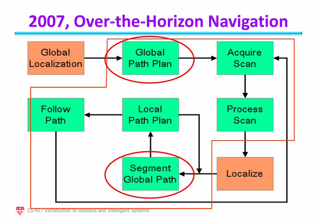
Over-the-Horizon Navigation
CS-417 Introduction to Robotics and Intelligent Systems
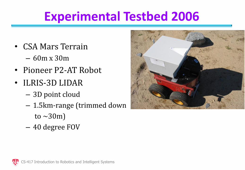
Experimental Testbed 2006
• CSA Mars Terrain
– 60m x 30m
• Pioneer P2-AT Robot
• ILRIS-3D LIDAR
– 3D point cloud
– 1.5km-range (trimmed down
to ~30m)
– 40 degree FOV
CS-417 Introduction to Robotics and Intelligent Systems
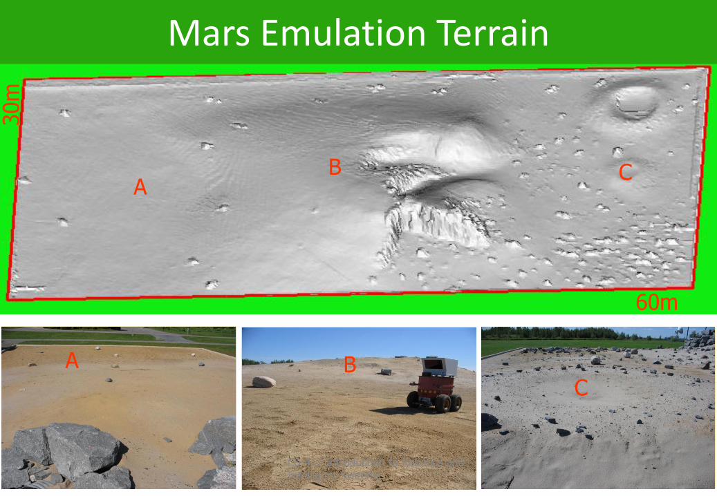
Mars Emulation Terrain 30m
60m
A B C
C B A
CS-417 Introduction to Robotics and Intelligent Systems
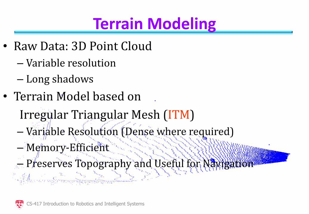
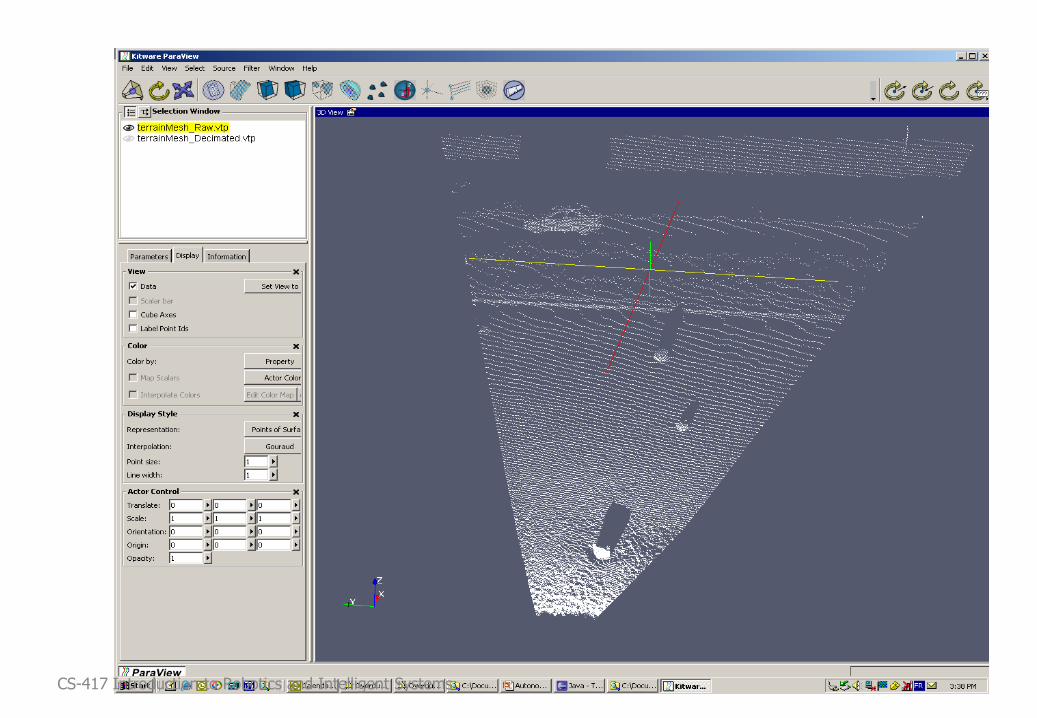
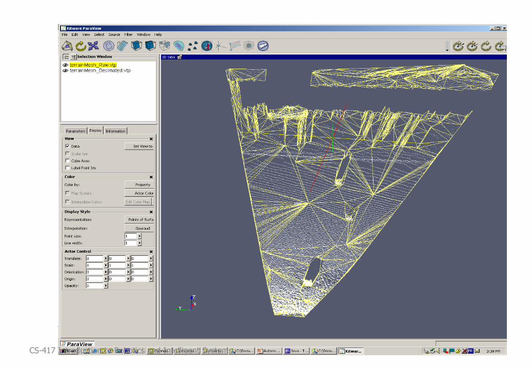
Terrain Modeling • Raw Data: 3D Point Cloud
– Variable resolution
– Long shadows
• Terrain Model based on
Irregular Triangular Mesh (ITM)
– Variable Resolution (Dense where required)
– Memory-Efficient
– Preserves Topography and Useful for Navigation
CS-417 Introduction to Robotics and Intelligent Systems
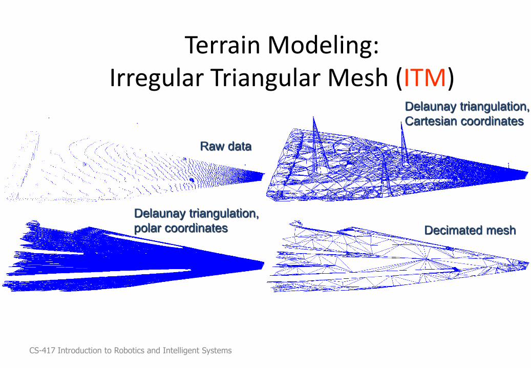
Terrain Modeling: Irregular Triangular Mesh (ITM)
Delaunay triangulation,
Cartesian coordinates
Delaunay triangulation,
polar coordinates Decimated mesh
Raw data
CS-417 Introduction to Robotics and Intelligent Systems
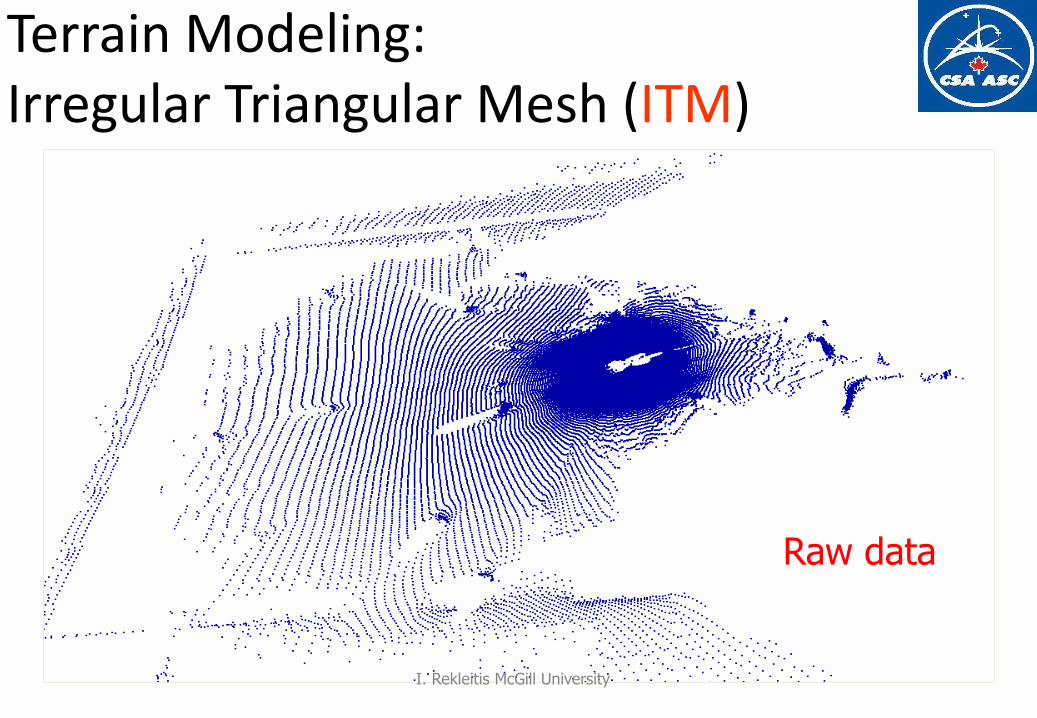
Terrain Modeling: Irregular Triangular Mesh (ITM)
Raw data
I. Rekleitis McGill University

Voronoi Diagrams For each point in the input set group all the points that are closer to it than any other input point.
I. Rekleitis McGill University
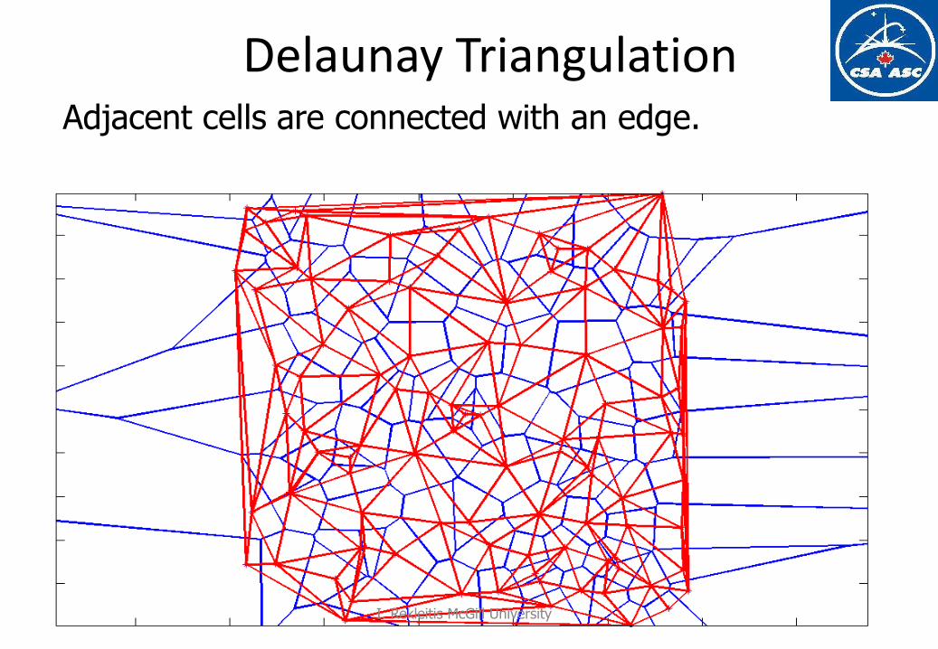
Delaunay Triangulation Adjacent cells are connected with an edge.
I. Rekleitis McGill University
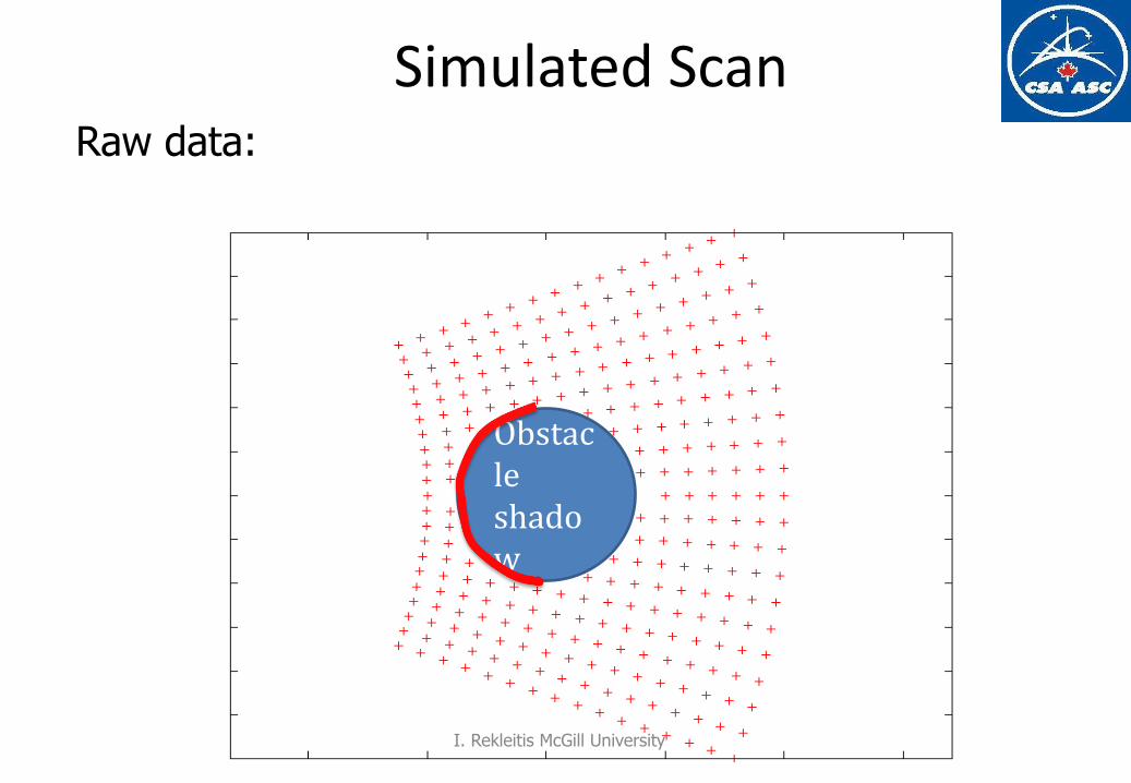
Simulated Scan Raw data:
Obstacle shadow
I. Rekleitis McGill University
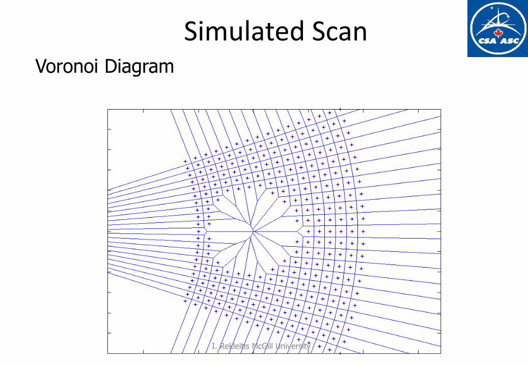
Simulated Scan Voronoi Diagram
I. Rekleitis McGill University
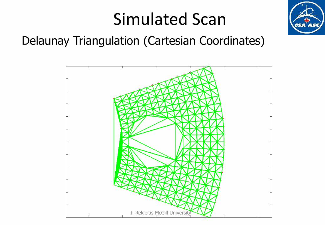
Simulated Scan Delaunay Triangulation (Cartesian Coordinates)
I. Rekleitis McGill University
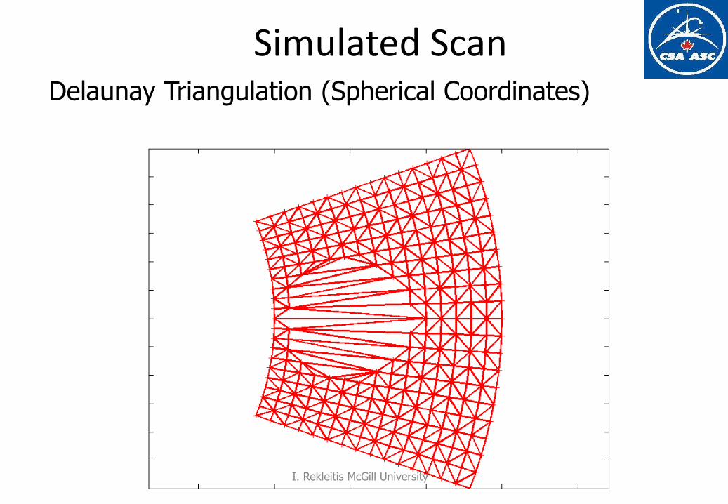
Simulated Scan Delaunay Triangulation (Spherical Coordinates)
I. Rekleitis McGill University
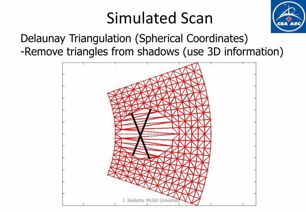
Simulated Scan Delaunay Triangulation (Spherical Coordinates) -Remove triangles from shadows (use 3D information)
I. Rekleitis McGill University
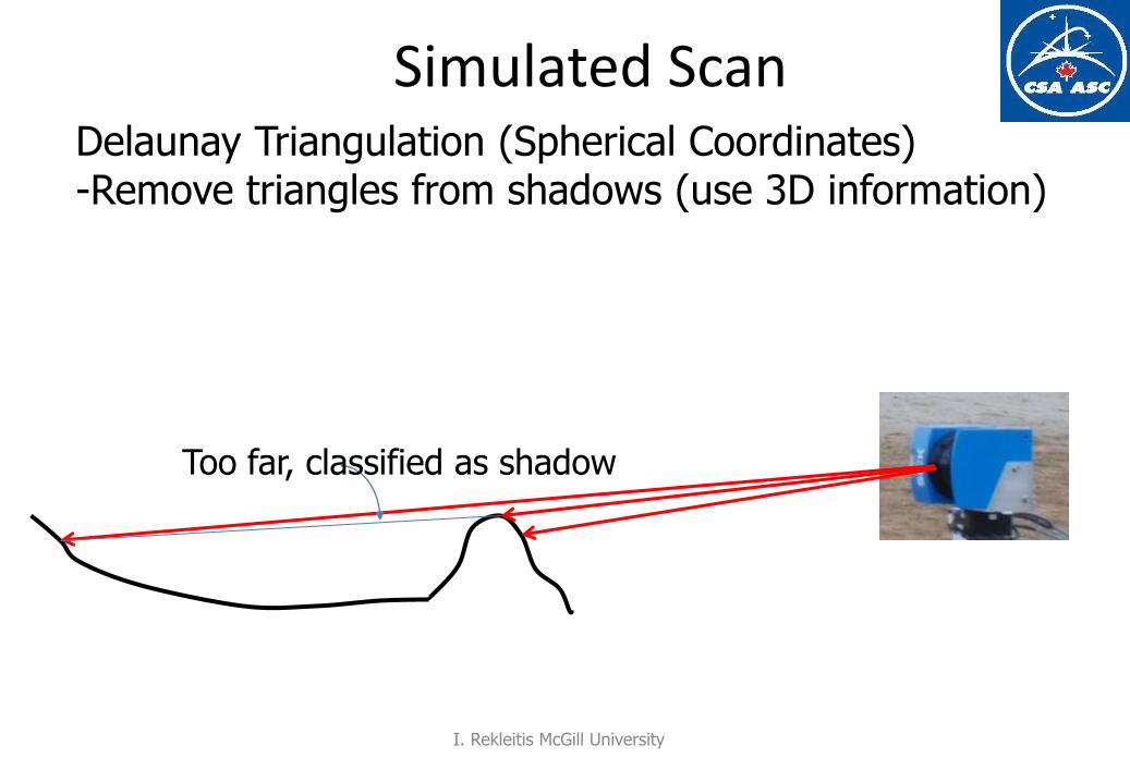
Simulated Scan Delaunay Triangulation (Spherical Coordinates) -Remove triangles from shadows (use 3D information)
Too far, classified as shadow
I. Rekleitis McGill University
CS-417 Introduction to Robotics and Intelligent Systems
CS-417 Introduction to Robotics and Intelligent Systems
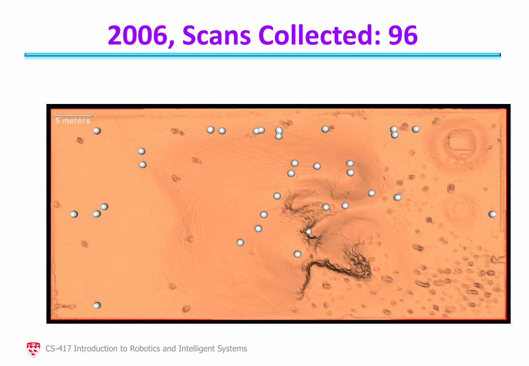
2006, Scans Collected: 96
CS-417 Introduction to Robotics and Intelligent Systems
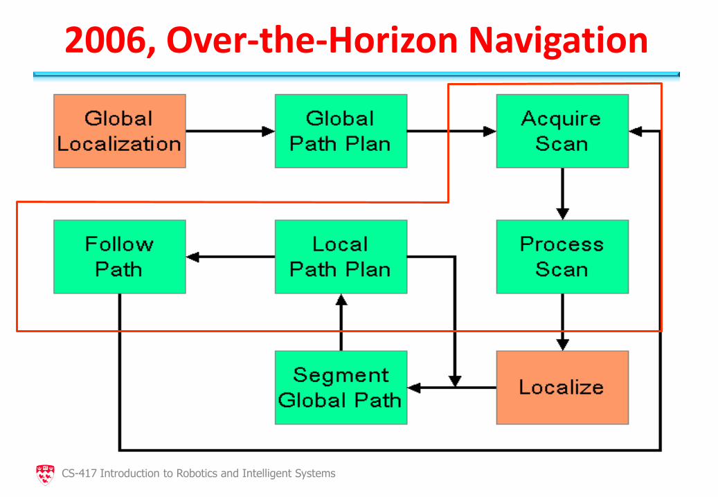
2006, Over-the-Horizon Navigation
CS-417 Introduction to Robotics and Intelligent Systems
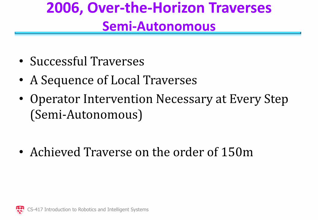
2006, Over-the-Horizon Traverses Semi-Autonomous
• Successful Traverses
• A Sequence of Local Traverses
• Operator Intervention Necessary at Every Step (Semi-Autonomous)
• Achieved Traverse on the order of 150m
CS-417 Introduction to Robotics and Intelligent Systems
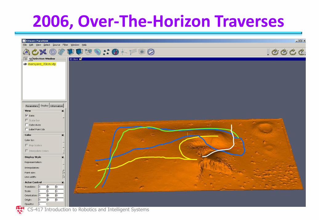
2006, Over-The-Horizon Traverses
CS-417 Introduction to Robotics and Intelligent Systems
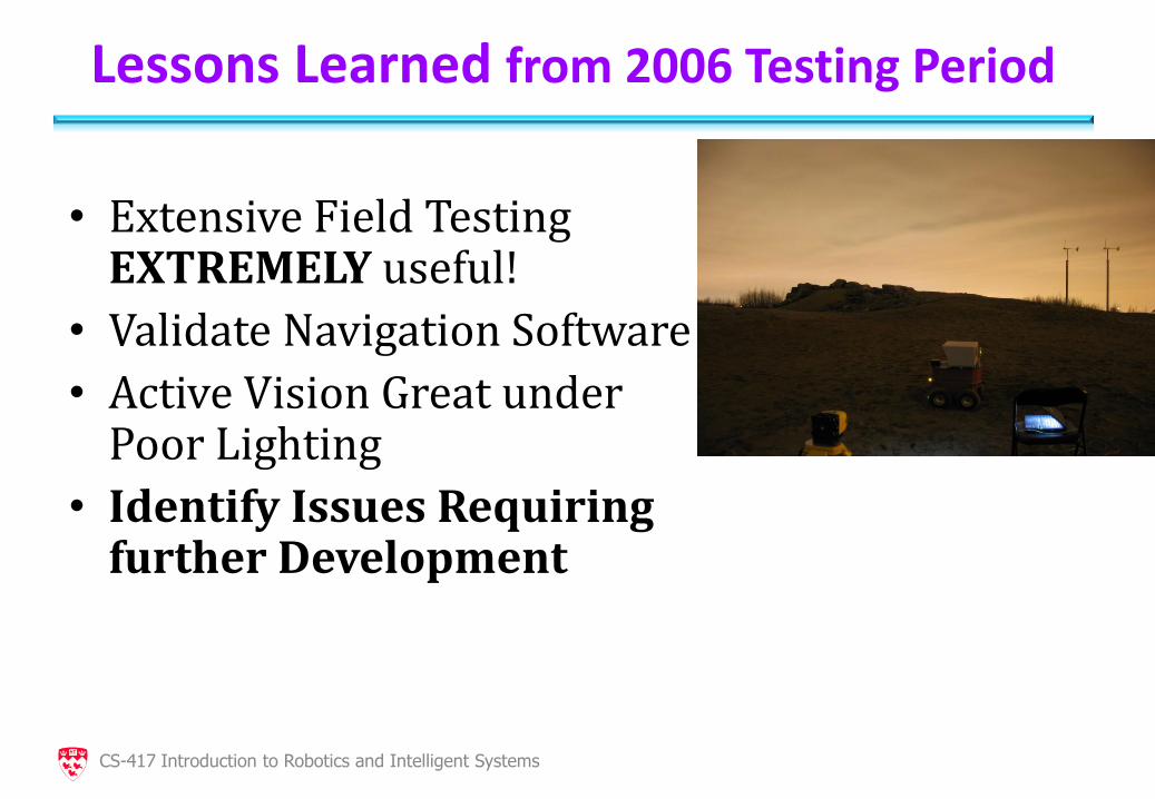
Lessons Learned from 2006 Testing Period
• Extensive Field Testing EXTREMELY useful!
• Validate Navigation Software
• Active Vision Great under Poor Lighting
• Identify Issues Requiring further Development
CS-417 Introduction to Robotics and Intelligent Systems
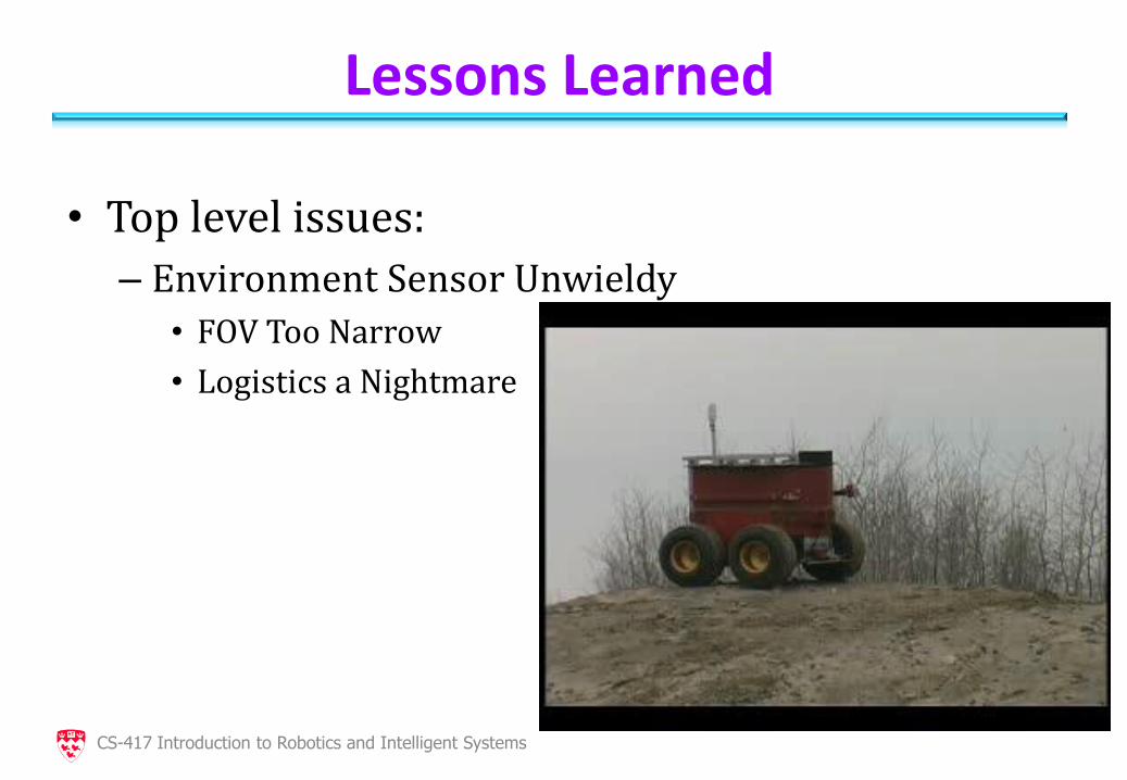
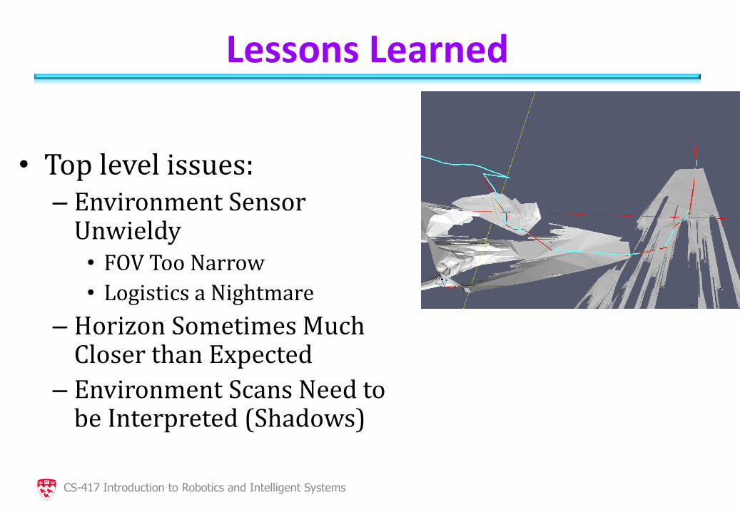
Lessons Learned
• Top level issues:
– Environment Sensor Unwieldy
• FOV Too Narrow
• Logistics a Nightmare
CS-417 Introduction to Robotics and Intelligent Systems
Lessons Learned
• Top level issues: – Environment Sensor
Unwieldy • FOV Too Narrow
• Logistics a Nightmare
– Horizon Sometimes Much Closer than Expected
– Environment Scans Need to be Interpreted (Shadows)
CS-417 Introduction to Robotics and Intelligent Systems
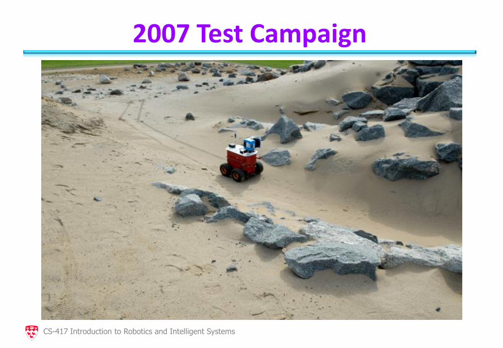
2007 Test Campaign
CS-417 Introduction to Robotics and Intelligent Systems
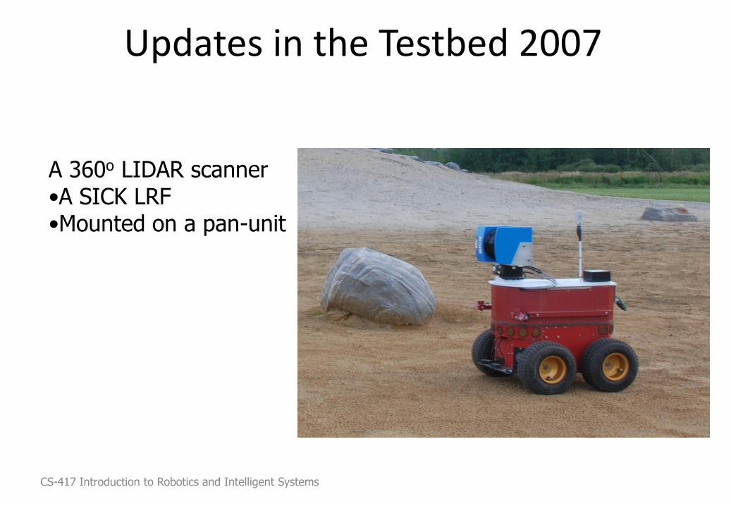
Updates in the Testbed 2007
A 360o LIDAR scanner •A SICK LRF •Mounted on a pan-unit
CS-417 Introduction to Robotics and Intelligent Systems
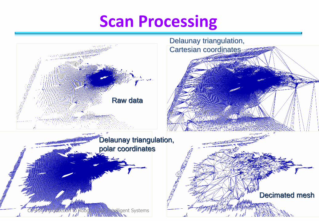
Scan Processing
Raw data
Delaunay triangulation,
Cartesian coordinates
Delaunay triangulation,
polar coordinates
Decimated mesh
CS-417 Introduction to Robotics and Intelligent Systems
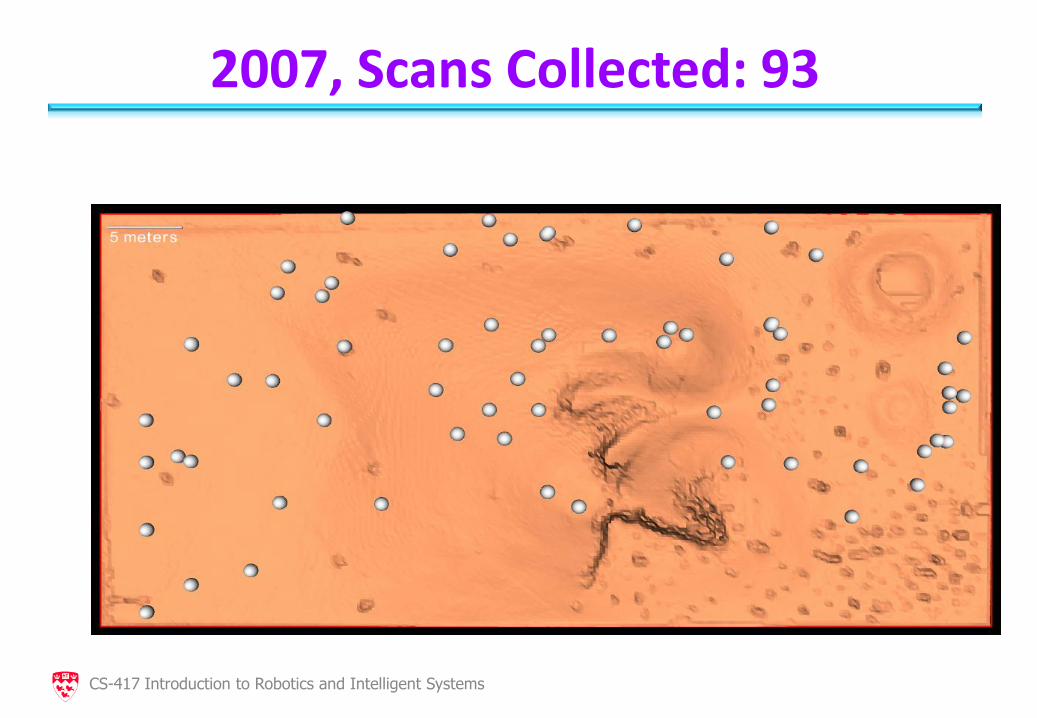
2007, Scans Collected: 93
CS-417 Introduction to Robotics and Intelligent Systems
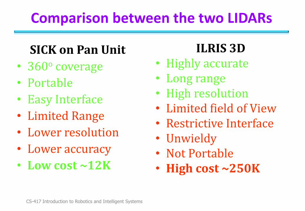
Comparison between the two LIDARs
SICK on Pan Unit
• 360o coverage
• Portable
• Easy Interface
• Limited Range
• Lower resolution
• Lower accuracy
• Low cost ~12K
ILRIS 3D • Highly accurate • Long range • High resolution • Limited field of View • Restrictive Interface • Unwieldy • Not Portable • High cost ~250K
CS-417 Introduction to Robotics and Intelligent Systems
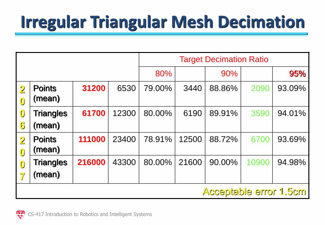
Irregular Triangular Mesh Decimation
Target Decimation Ratio
80% 90% 95%
2
0
0
6
Points
(mean)
31200 6530 79.00%
3440 88.86%
2090 93.09%
Triangles
(mean)
61700 12300 80.00% 6190 89.91% 3590 94.01%
2
0
0
7
Points
(mean)
111000 23400 78.91% 12500 88.72% 6700 93.69%
Triangles
(mean)
216000 43300 80.00%
21600 90.00%
10900 94.98%
Acceptable error 1.5cm
CS-417 Introduction to Robotics and Intelligent Systems
2007, Over-the-Horizon Navigation
CS-417 Introduction to Robotics and Intelligent Systems
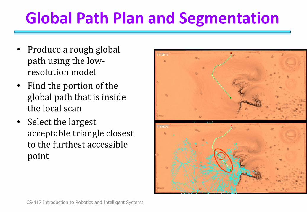
Global Path Plan and Segmentation
• Produce a rough global path using the low-resolution model
• Find the portion of the global path that is inside the local scan
• Select the largest acceptable triangle closest to the furthest accessible point
CS-417 Introduction to Robotics and Intelligent Systems
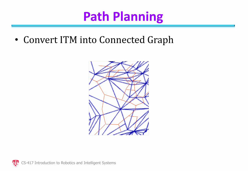
Path Planning
• Convert ITM into Connected Graph
CS-417 Introduction to Robotics and Intelligent Systems
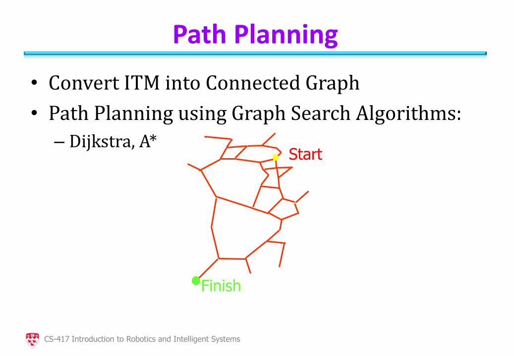
Path Planning
• Convert ITM into Connected Graph
• Path Planning using Graph Search Algorithms:
– Dijkstra, A*
Start
Finish
CS-417 Introduction to Robotics and Intelligent Systems
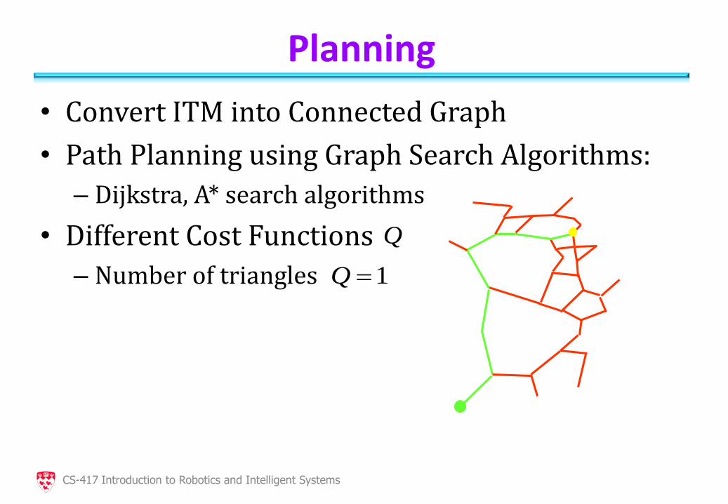
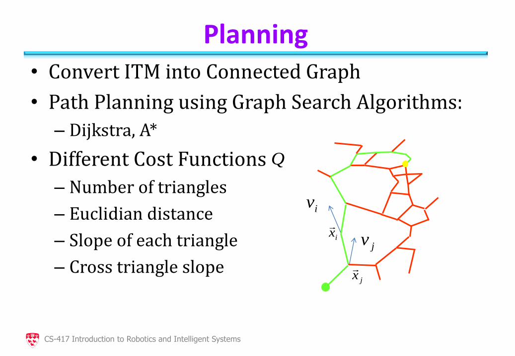
Planning
• Convert ITM into Connected Graph
• Path Planning using Graph Search Algorithms:
– Dijkstra, A* search algorithms
• Different Cost Functions
– Number of triangles
1Q
Q
CS-417 Introduction to Robotics and Intelligent Systems
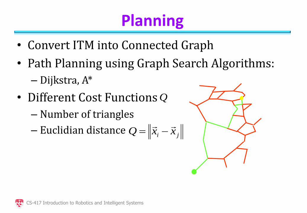
Planning
• Convert ITM into Connected Graph
• Path Planning using Graph Search Algorithms:
– Dijkstra, A*
• Different Cost Functions
– Number of triangles
– Euclidian distance
ji xxQ
Q
CS-417 Introduction to Robotics and Intelligent Systems
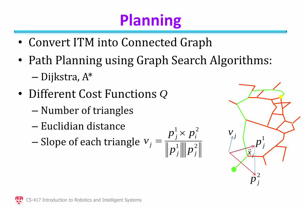
Planning • Convert ITM into Connected Graph
• Path Planning using Graph Search Algorithms:
– Dijkstra, A*
• Different Cost Functions
– Number of triangles
– Euclidian distance
– Slope of each triangle
21
21
jj
ij
jpp
ppv
jx
jv1
jp
2
jp
Q
CS-417 Introduction to Robotics and Intelligent Systems
Planning • Convert ITM into Connected Graph
• Path Planning using Graph Search Algorithms:
– Dijkstra, A*
• Different Cost Functions
– Number of triangles
– Euclidian distance
– Slope of each triangle
– Cross triangle slope
jx
jv
iv
ix
Q
CS-417 Introduction to Robotics and Intelligent Systems
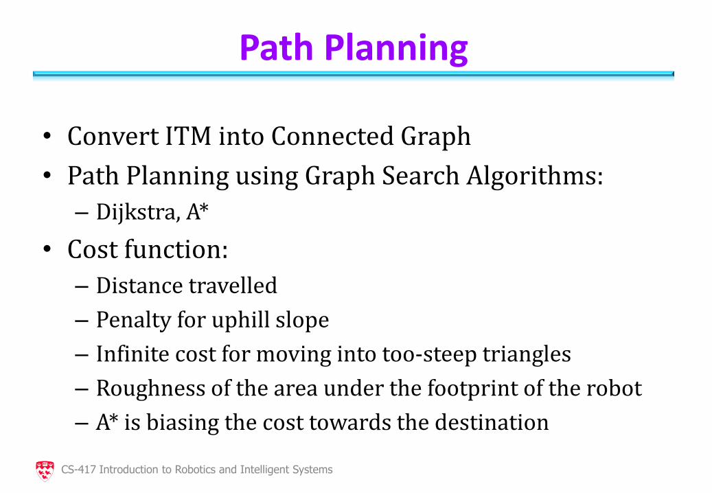
Path Planning
• Convert ITM into Connected Graph
• Path Planning using Graph Search Algorithms:
– Dijkstra, A*
• Cost function:
– Distance travelled
– Penalty for uphill slope
– Infinite cost for moving into too-steep triangles
– Roughness of the area under the footprint of the robot
– A* is biasing the cost towards the destination
CS-417 Introduction to Robotics and Intelligent Systems
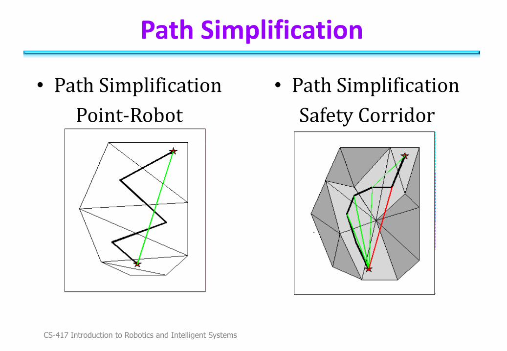
Path Simplification
• Path Simplification
Point-Robot
• Path Simplification
Safety Corridor
CS-417 Introduction to Robotics and Intelligent Systems
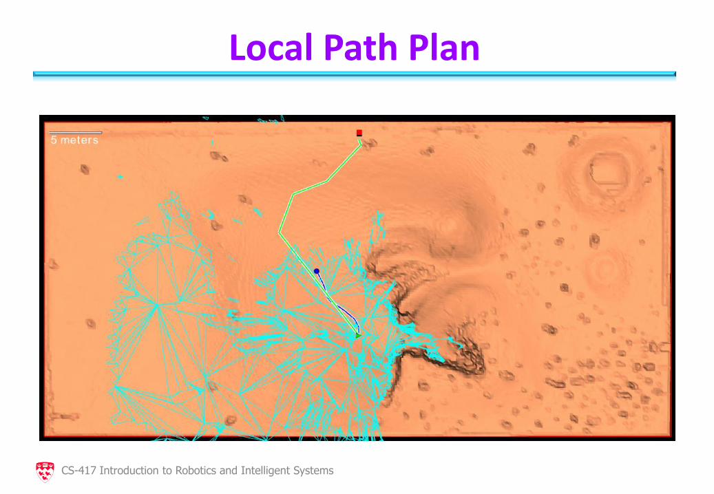
Local Path Plan
CS-417 Introduction to Robotics and Intelligent Systems
Motion Control
• Sensor Suite: Wheel Odometry, IMU, Heading sensor, No Visual Odometry
• 3D Pose Estimation:
Filter combines IMU+Odometry
No uncertainty estimation (currently)
• Path approximated with Catmull-Rom spline for smoothness
• Astolfi controller follows the spline trajectory
CS-417 Introduction to Robotics and Intelligent Systems
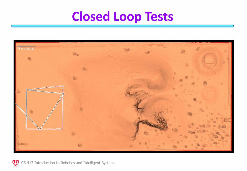
Closed Loop Tests
CS-417 Introduction to Robotics and Intelligent Systems
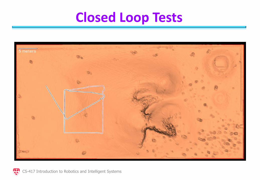
Closed Loop Tests
CS-417 Introduction to Robotics and Intelligent Systems
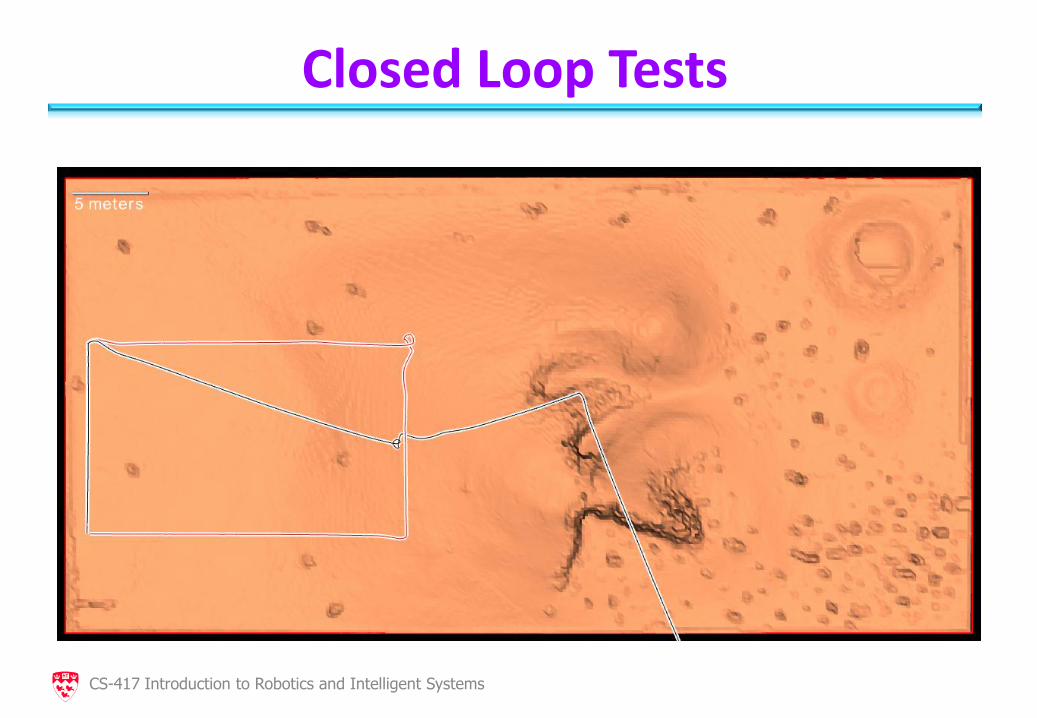
Closed Loop Tests
CS-417 Introduction to Robotics and Intelligent Systems
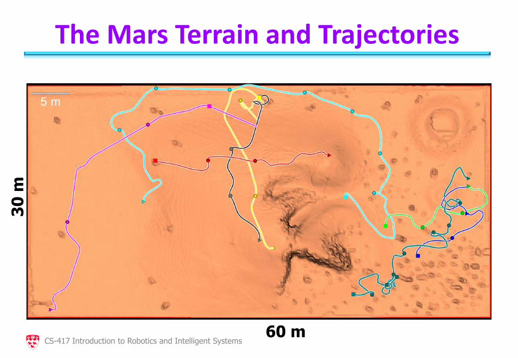
The Mars Terrain and Trajectories
60 m
30
m
CS-417 Introduction to Robotics and Intelligent Systems
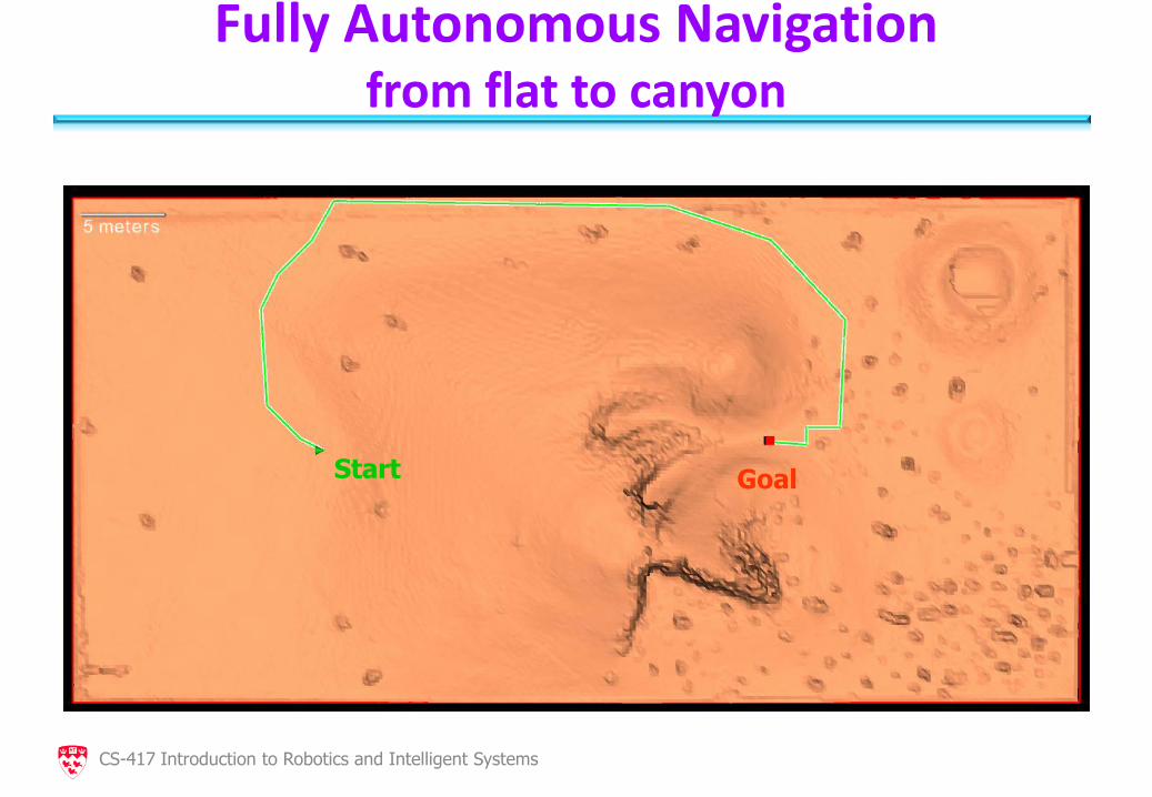
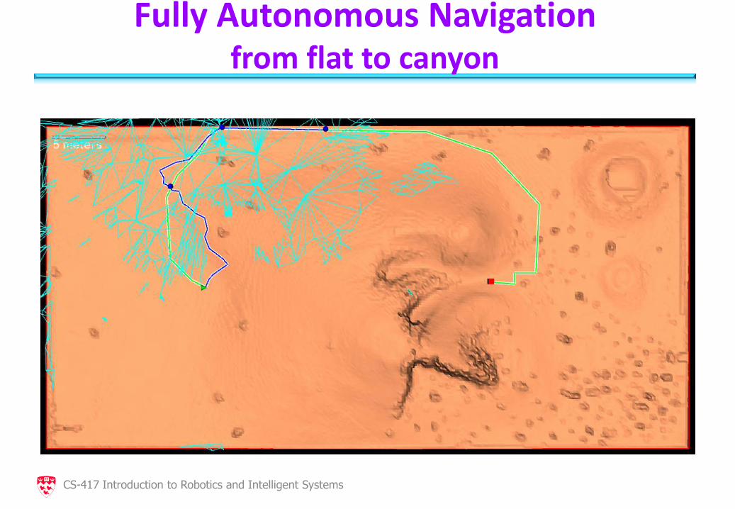
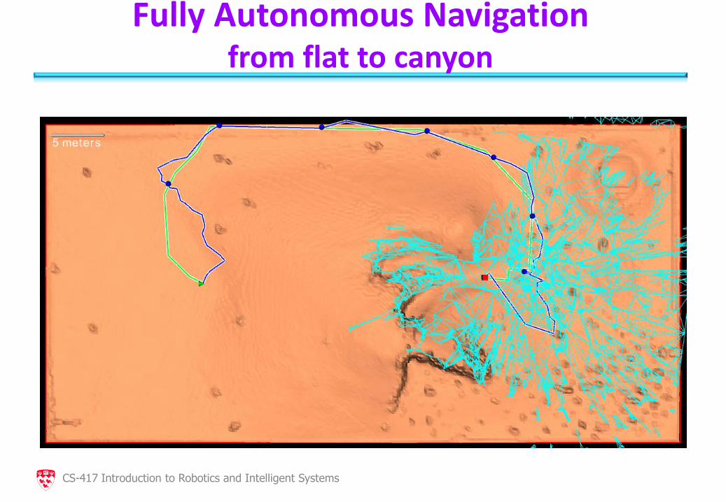
Fully Autonomous Navigation from flat to canyon
Goal Start
CS-417 Introduction to Robotics and Intelligent Systems
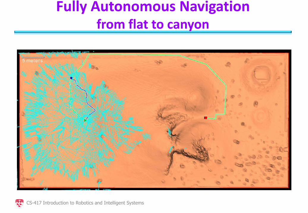
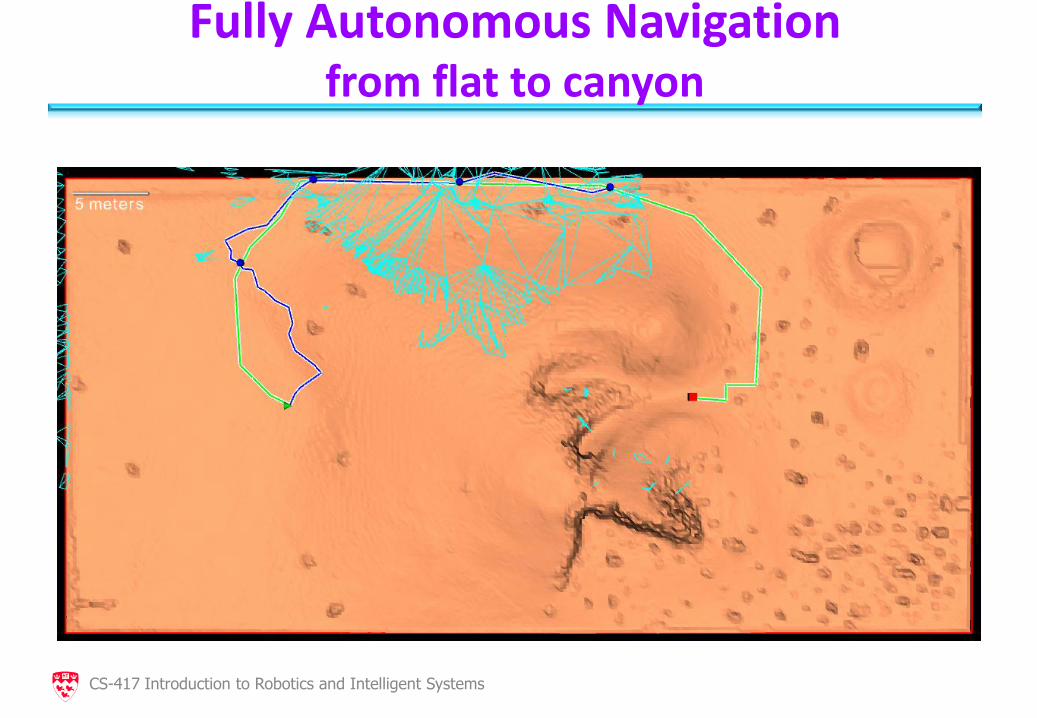
Fully Autonomous Navigation from flat to canyon
CS-417 Introduction to Robotics and Intelligent Systems
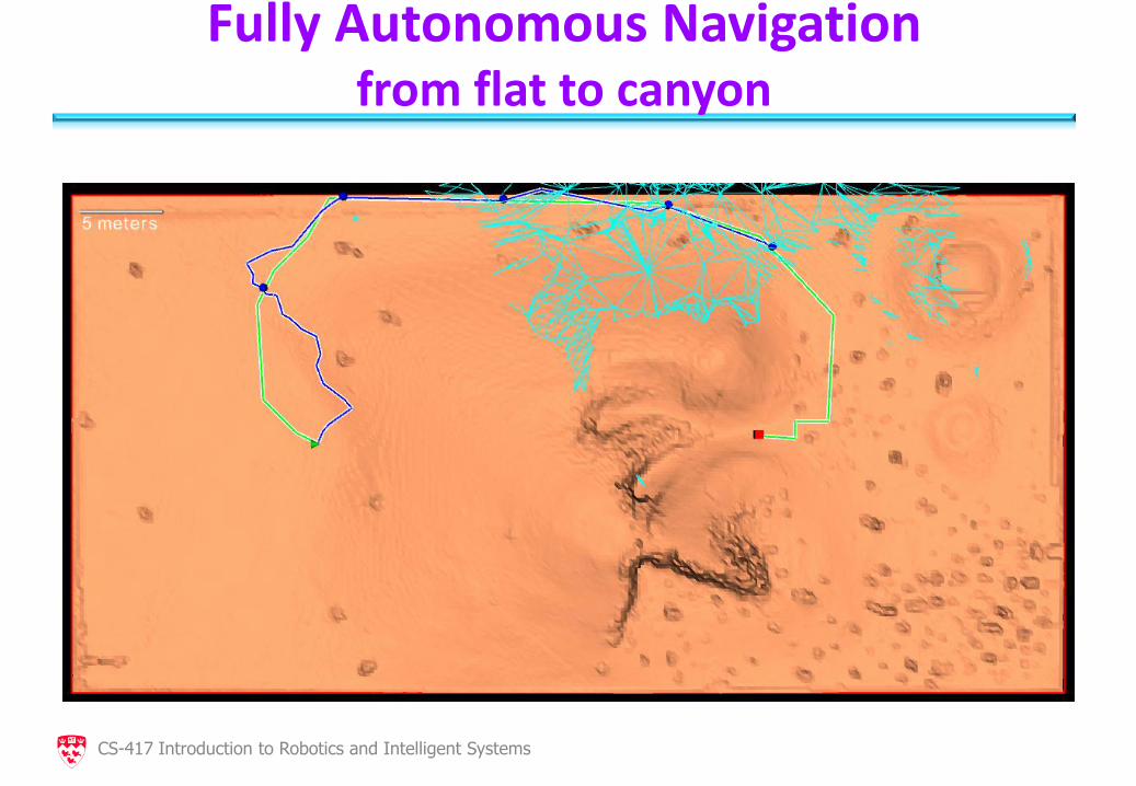
Fully Autonomous Navigation from flat to canyon
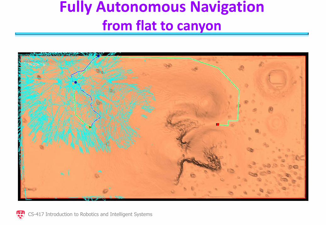
CS-417 Introduction to Robotics and Intelligent Systems
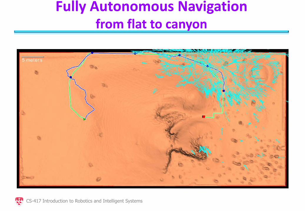
Fully Autonomous Navigation from flat to canyon
CS-417 Introduction to Robotics and Intelligent Systems
Fully Autonomous Navigation from flat to canyon
CS-417 Introduction to Robotics and Intelligent Systems
Fully Autonomous Navigation from flat to canyon
CS-417 Introduction to Robotics and Intelligent Systems
Fully Autonomous Navigation from flat to canyon
CS-417 Introduction to Robotics and Intelligent Systems

Fully Autonomous Navigation from flat to canyon
CS-417 Introduction to Robotics and Intelligent Systems
Fully Autonomous Navigation from flat to canyon
CS-417 Introduction to Robotics and Intelligent Systems
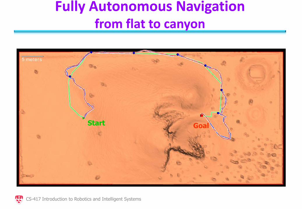
Fully Autonomous Navigation from flat to canyon
Start Goal
CS-417 Introduction to Robotics and Intelligent Systems
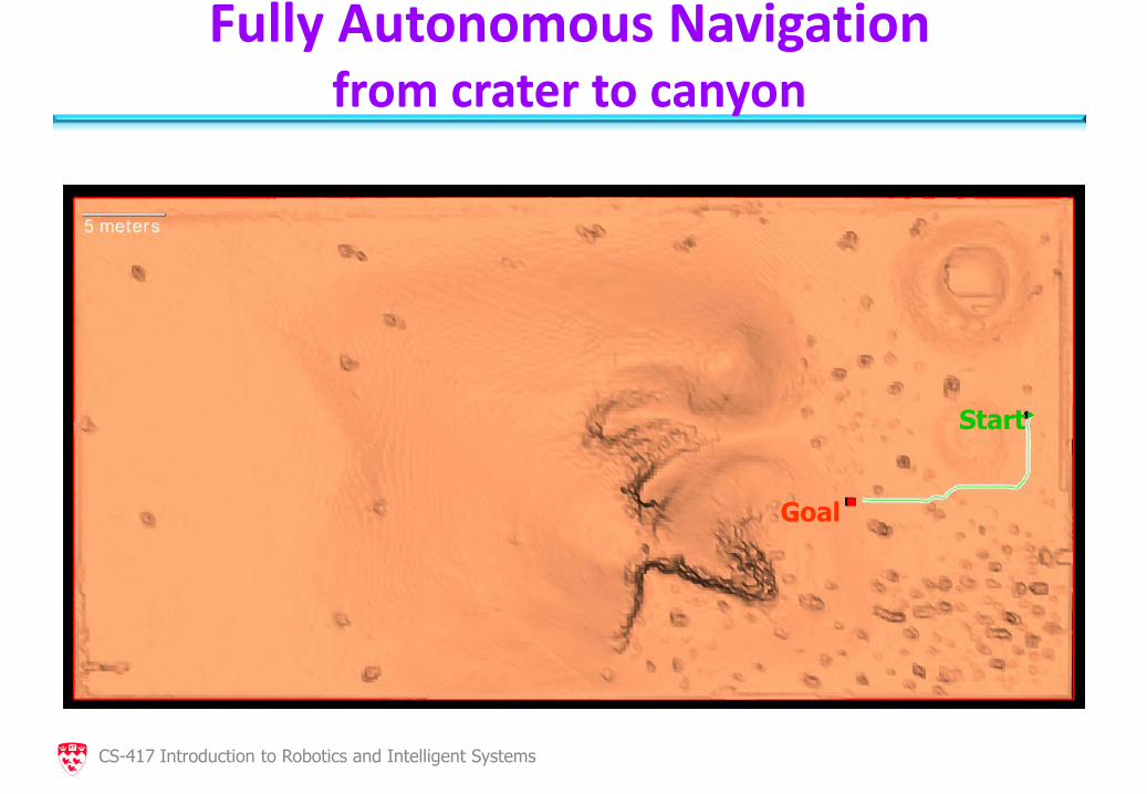
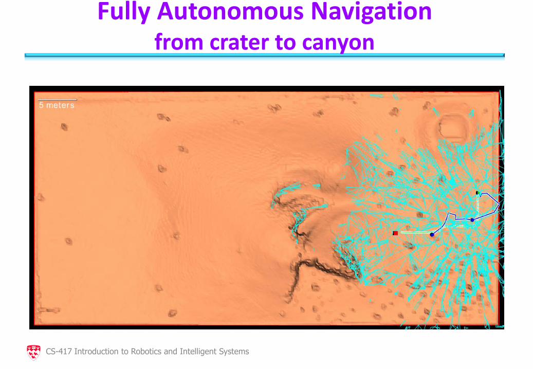
Fully Autonomous Navigation from crater to canyon
Goal
Start
CS-417 Introduction to Robotics and Intelligent Systems
Fully Autonomous Navigation from crater to canyon
CS-417 Introduction to Robotics and Intelligent Systems
Fully Autonomous Navigation from crater to canyon
CS-417 Introduction to Robotics and Intelligent Systems
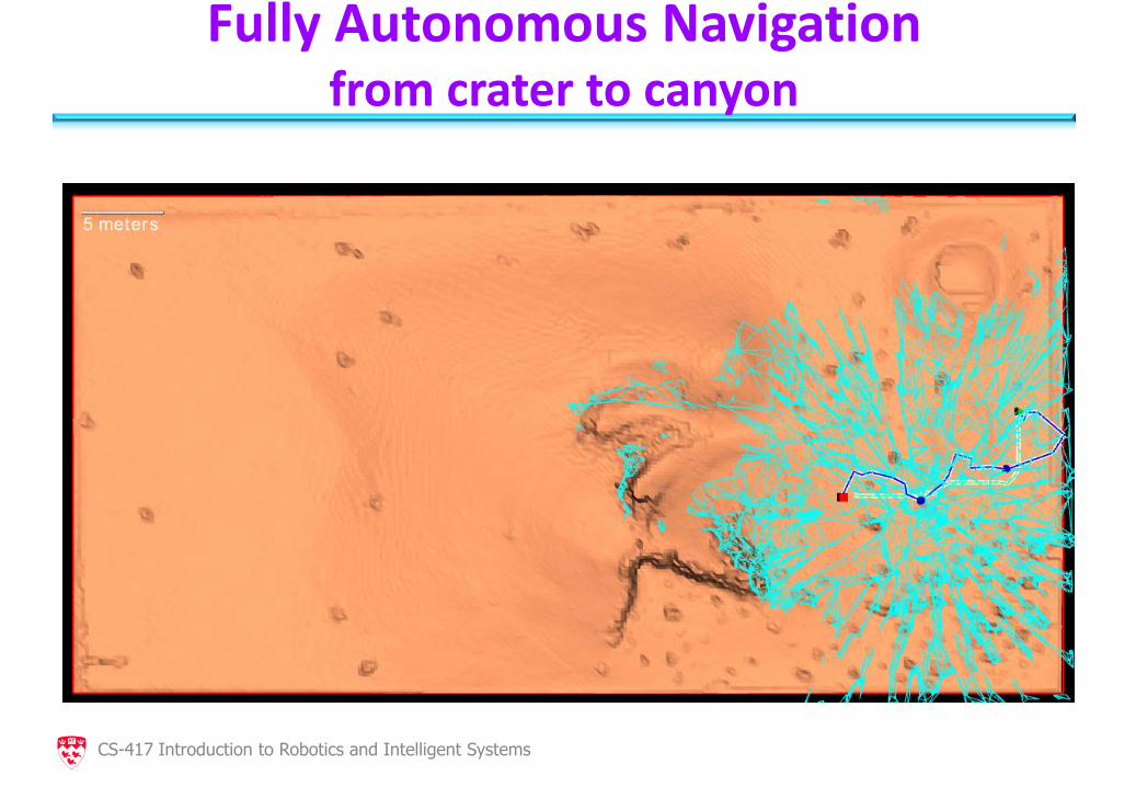
Fully Autonomous Navigation from crater to canyon
CS-417 Introduction to Robotics and Intelligent Systems
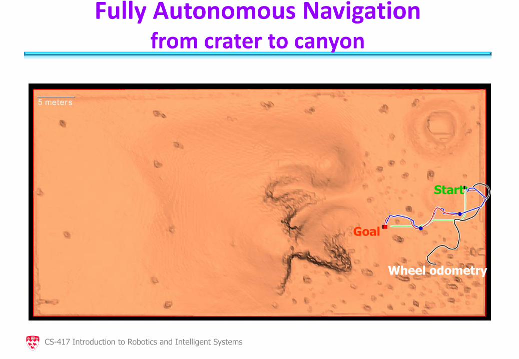
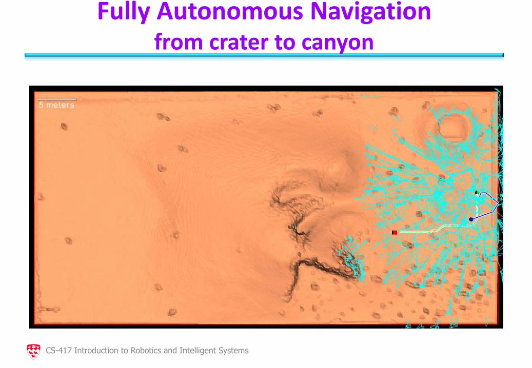
Fully Autonomous Navigation from crater to canyon
Wheel odometry
Goal
Start
CS-417 Introduction to Robotics and Intelligent Systems
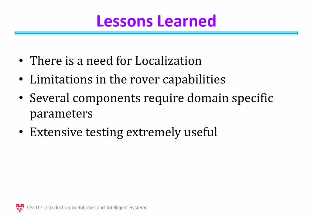
Lessons Learned
• There is a need for Localization
• Limitations in the rover capabilities
• Several components require domain specific parameters
• Extensive testing extremely useful
CS-417 Introduction to Robotics and Intelligent Systems
Future Work
• Terrain analysis – What does the robot sees?
• Open area, cluttered environment, the side of a hill?
• Different mobility platforms
• State estimation: – Implement 6DOF KF or RBPF
• Localization
• SLAM
CS-417 Introduction to Robotics and Intelligent Systems
Conclusions
• Active vision is accurate and robust
• ITM representation is compact and accurate
• ITM useful for environmental modeling and also for path planning
• Successful Over-the-Horizon navigation an important step towards autonomy capabilities in planetary exploration
CS-417 Introduction to Robotics and Intelligent Systems
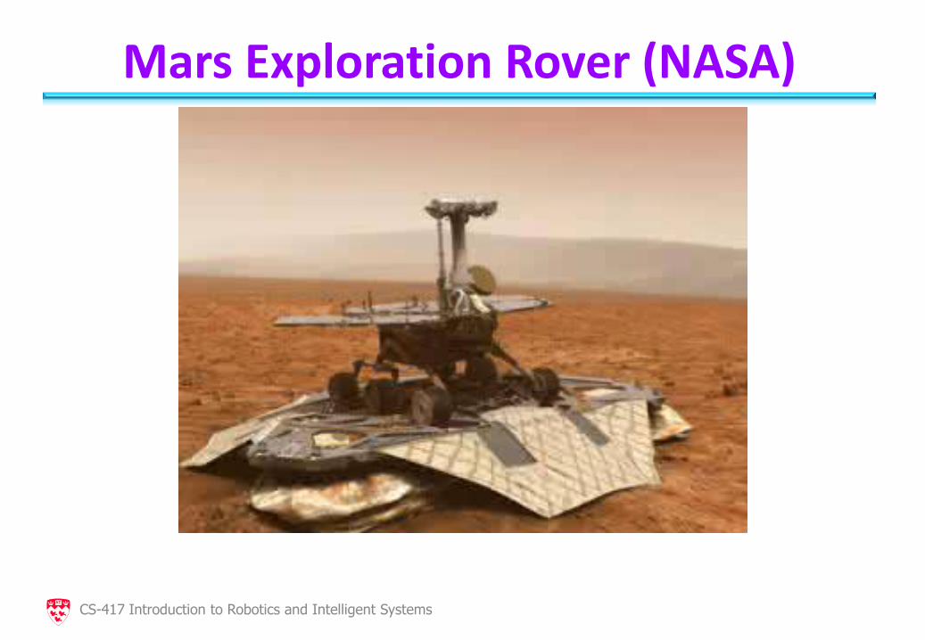
Mars Exploration Rover (NASA)
CS-417 Introduction to Robotics and Intelligent Systems