Embed Size (px)
Citation preview
CULTURAL RESOURCE MANAGEMENT
VOLUME 23 NO. 7 2000
Preservation Planning
U.S. DEPARTMENT OF THE INTERIOR National Park Service Cultural Resources
lor Our Pioji
CRM
PUBLISHED BY THE NATIONAL PARK SERVICE
Information for parks, federal agencies, Indian tribes, states, local governments, and the private sector that promotes and maintains high standards for preserving and managing cultural resources
DIRECTOR Robert Stanton
ASSOCIATE DIRECTOR CULTURAL RESOURCE STEWARDSHIP
AND PARTNERSHIPS
Katherine H. Stevenson
EDITOR Ronald M. Greenberg
ASSOCIATE EDITOR Janice C. McCoy
GUEST EDITOR Susan L. Henry Renaud
ADVISORS David Andrews
Editor, NPS
Joan Bacharach Curator, NPS
Randall J. Biallas Historical Architect, NPS
John A. Burns Architect, NPS
Harry A. Butowsky Historian, NPS
Pratt Cassity Executive Director,
National Alliance of Preservation Commisskxis
Muriel Crespi Cultural Anthropologist, NPS
Mary Cullen Director, Historical Services Branch
Parks Canada
Mark Edwards Historic Preservation and Cultural Resource Group Manager
URS Greiner Woodward Ctyde Federal Services
Roger E. Kelly Archeologist, NPS
Antoinette J. Lee Historian, NPS
ASSISTANT Denise M. Mayo
An electronic version of this issue of CRM can be accessed through the CRM homepage at <http://www.cr.nps.gov/crm>.
Design and Imaging McCoy Publishing Services
^ r % B ^ i ^ ^ r ^ i r % VOLUME 23 NO. 7 2000 V/OnlGniS ISSN 1068-4999
Preservation Planning
Preservation Planning—Ensuring a Future for Our Past 3 Susan L. Henry Renaud
Preservation Planning in Annapolis—A Community Commitment, A Community Task 4
Donna Hole
Community Consensus Planning for Battlefield Preservation 7 Joseph E. Brent
Taking America's Past into the Future—Prescott, Arizona, Plans for the Future of Historic Preservation 12
Nancy L. Burgess
Geographic Information Systems and Prescott's Historic Preservation Master Plan 16
Timothy Smothers
Cottage Grove—Heritage Preservation Planning in a Suburban Community 17 Robert C. Vogel
Planning and the Local Preservation Review Commission 21 Pratt Cassity
A Tale of Two Communities—Community Involvement in Preservation Planning 23
Gail C. Rothrock
Partnership Planning—Involving Partners in Meaningful Ways 26 Patrick H. Reed
Planning for and Preserving Cultural Resources through National Heritage Areas 29
Judy Hart
Pennsylvania's Historic Preservation Plan—Partnerships and Public Outreach 33 Michel R. Lefevre
The Kaho'olawe Use Plan—Non-traditional Planning for Traditional Use 36 Vincent R. Shigekuni
Tribes Working with Agencies to Protect Resources 41 Darby C. Stapp
Whither Historic Contexts?—Their Role in 21st-century Planning 45 Susan L. Henry Renaud
Cover: Recreation in the South Carolina National Heritage Corridor, photo courtesy Heritage Tourism Development Office, South Carolina Department of Parks, Recreation & Tourism; map of the Pacific Northwest, see article p. 41; the Kaho'olawe Use Plan, see article p.36.
Statements of fact and views are the responsibility of the authors and do not necessarily reflect an opinion or endorsement on the part of the editors, the CRM
advisors and consultants, or the National Park Service. Send articles and correspondence to the Editor, CRM, U.S. Department of the Interior, National Park
Service, 1849 C Street, NW, Suite 350NC, Washington, DC 20240 (U.S. Postal Service) or 800 North Capitol St, NW, Suite 350, Washington, DC 20002 (Federal
Express); ph. 202-343-3411, fax 202-343-5260; email: <[email protected]>, to subscribe and to make inquiries; <[email protected]> to submit articles.
CRM No 7—2000 2
Susan L. Henry Renaud
Preservation Planning Ensuring a Future for Our Past
I n a nutshell, planning is the process of figuring out where you want to go, evaluating where you are now, and identifying how you can reach your
destination—sort of like an American Automobile Association "Trip-Tik" into the future. This generally holds true, whether it's vacation planning, retirement planning, project planning, land-use planning, organizational planning, or any other kind of planning one could mention. There are as many kinds of plans and planning as there are plan-makers and planning situations.
This issue of CRM focuses on preservation planning—sometimes called historic preservation planning, cultural resource management planning, or heritage management planning. This is the planning that we do to help us identify, evaluate, protect, and manage historic and cultural resources, such as historic buildings and structures, historic districts, historic and cultural landscapes, prehistoric and historic archeological sites, and other physical places of historic and cultural importance. The articles in this issue represent just the tip of the iceberg of the variety of plan-makers and planning situations. These articles describe innovative preservation planning in local communities and at the state and federal levels, by coalitions of government agencies and citizens' groups.
The planning approaches discussed in almost all of these articles share a few common features—they offer different and unique responses to specific planning and preservation situations, they involved partnerships between citizens and government, and they produced effective tools for protecting valued historic and cultural resources. The planning locations in these articles range from the mid-Atlantic, upper-Midwest, Southwest, Northwest, and Pacific
regions of the United States. In addition, two articles offer more general discussions of preservation planning issues associated with the planning role of local preservation commissions and the role of historic contexts in preservation planning.
As a number of these articles show, local community planners are becoming increasingly knowledgeable about historic preservation. Strengthening ties between local planning and local preservation programs can greatly benefit both. To learn more about local community planning, visit the web site of the American Planning Association at <www.planning.org>. Of importance to historic preservation planning at the local and state levels, APA has adopted a Policy Guide on Historic and Cultural Resources (available under the "Legislation and Policy" section on the web site). APA has also incorporated recommendations for preservation planning into its multi-year "Growing SmartSM" research project to modernize state planning laws (found under the "Planning Research" section).
This issue of CRM does not explain how to do preservation planning in your particular situation, but hopefully it will provide you with ideas that will not only make you think in new ways about planning, but also will be useful in your planning efforts. For more information, please visit the web site addresses mentioned in some of the articles, or you may be interested in visiting the preservation planning web site for Heritage Preservation Services, National Park Service at <www2.cr.nps.gov/pad>.
Susan L. Henry Renaud is Senior Resource Planner with Heritage Preservation Services, National Park Service, where she manages the Preservation Planning Program as administered by State Historic Preservation Offices. She has a masters degree in anthropology with a specialization in archeology, and is a Registered Professional Archaeologist. She is guest editor of this issue o/CRM.
CRM No 7—2000 3
Donna Hole
Preservation Planning in Annapolis A Community Commitment, A Community Task
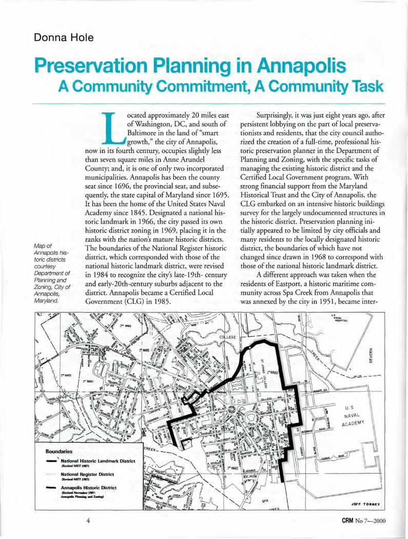
Map of Annapolis historic districts courtesy Department of Planning and Zoning, City of Annapolis, Maryland.
Located approximately 20 miles east of Washington, DC, and south of Baltimore in the land of "smart growth," the city of Annapolis,
now in its fourth century, occupies slightly less than seven square miles in Anne Arundel County; and, it is one of only two incorporated municipalities. Annapolis has been the county seat since 1696, the provincial seat, and subsequently, the state capital of Maryland since 1695. It has been the home of the United States Naval Academy since 1845. Designated a national historic landmark in 1966, the city passed its own historic district zoning in 1969, placing it in the ranks with the nation's mature historic districts. The boundaries of the National Register historic district, which corresponded with those of the national historic landmark district, were revised in 1984 to recognize the city's late-19th- century and early-20th-century suburbs adjacent to the district. Annapolis became a Certified Local Government (CLG) in 1985.
Surprisingly, it was just eight years ago, after persistent lobbying on the part of local preservationists and residents, that the city council authorized the creation of a full-time, professional historic preservation planner in the Department of Planning and Zoning, with the specific tasks of managing the existing historic district and the Certified Local Government program. With strong financial support from the Maryland Historical Trust and the City of Annapolis, the CLG embarked on an intensive historic buildings survey for the largely undocumented structures in the historic district. Preservation planning initially appeared to be limited by city officials and many residents to the locally designated historic district, the boundaries of which have not changed since drawn in 1968 to correspond with those of the national historic landmark district.
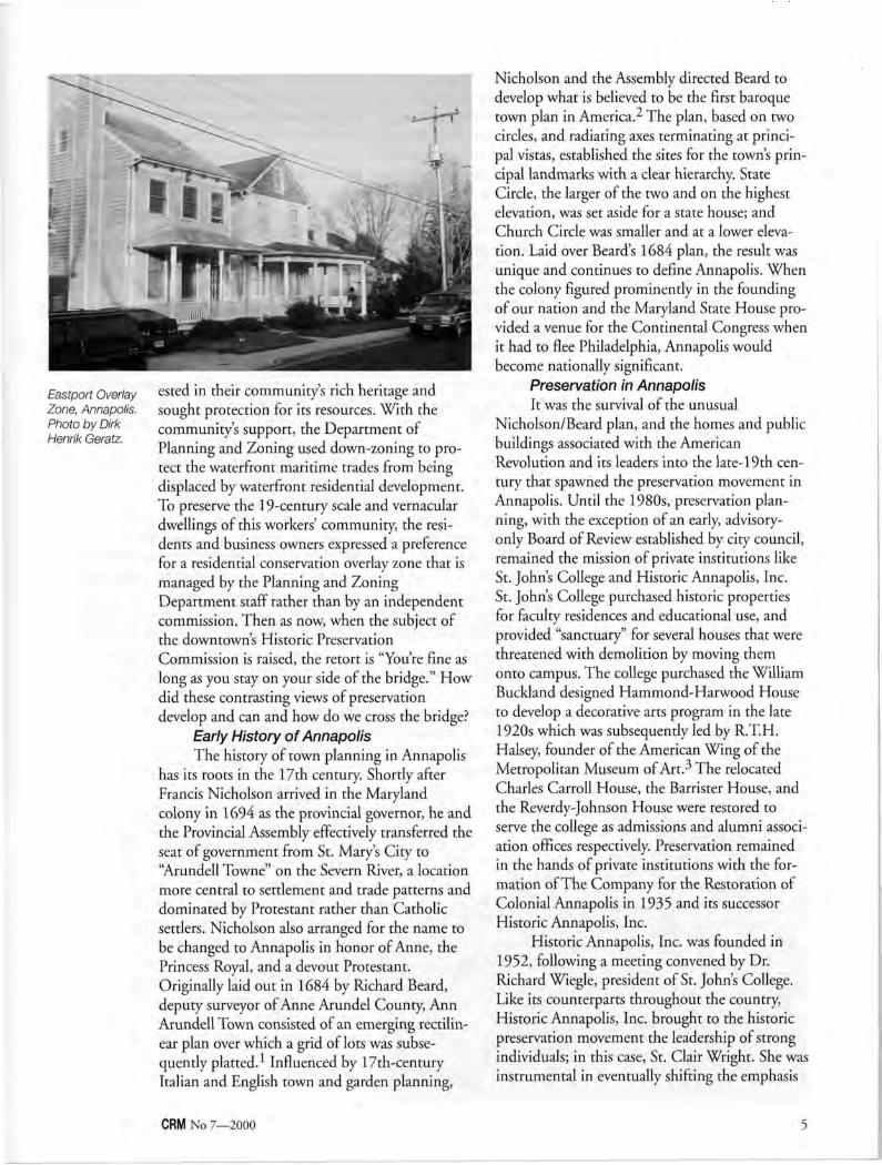
A different approach was taken when the residents of Eastport, a historic maritime community across Spa Creek from Annapolis that was annexed by the city in 1951, became inter-
CRM No 7—2000 4
Eastport Overlay Zone, Annapolis. Photo by Dirk Henrik Geratz.
ested in their community's rich heritage and sought protection for its resources. With the community's support, the Department of Planning and Zoning used down-zoning to protect the waterfront maritime trades from being displaced by waterfront residential development. To preserve the 19-century scale and vernacular dwellings of this workers' community, the residents and business owners expressed a preference for a residential conservation overlay zone that is managed by the Planning and Zoning Department staff rather than by an independent commission. Then as now, when the subject of the downtown's Historic Preservation Commission is raised, the retort is "You're fine as long as you stay on your side of the bridge." How did these contrasting views of preservation develop and can and how do we cross the bridge?
Early History of Annapolis The history of town planning in Annapolis
has its roots in the 17th century. Shortly after Francis Nicholson arrived in the Maryland colony in 1694 as the provincial governor, he and the Provincial Assembly effectively transferred the seat of government from St. Mary's City to "Arundell Towne" on the Severn River, a location more central to settlement and trade patterns and dominated by Protestant rather than Catholic settlers. Nicholson also arranged for the name to be changed to Annapolis in honor of Anne, the Princess Royal, and a devout Protestant. Originally laid out in 1684 by Richard Beard, deputy surveyor of Anne Arundel County, Ann Arundell Town consisted of an emerging rectilinear plan over which a grid of lots was subsequently platted. Influenced by 17th-century Italian and English town and garden planning,
Nicholson and the Assembly directed Beard to develop what is believed to be the first baroque town plan in America.2 The plan, based on two circles, and radiating axes terminating at principal vistas, established the sites for the town's principal landmarks with a clear hierarchy. State Circle, the larger of the two and on the highest elevation, was set aside for a state house; and Church Circle was smaller and at a lower elevation. Laid over Beard's 1684 plan, the result was unique and continues to define Annapolis. When the colony figured prominently in the founding of our nation and the Maryland State House provided a venue for the Continental Congress when it had to flee Philadelphia, Annapolis would become nationally significant.
Preservation in Annapolis It was the survival of the unusual
Nicholson/Beard plan, and the homes and public buildings associated with the American Revolution and its leaders into the late-19th century that spawned the preservation movement in Annapolis. Until the 1980s, preservation planning, with the exception of an early, advisory-only Board of Review established by city council, remained the mission of private institutions like St. John's College and Historic Annapolis, Inc. St. John's College purchased historic properties for faculty residences and educational use, and provided "sanctuary" for several houses that were threatened with demolition by moving them onto campus. The college purchased the William Buckland designed Hammond-Harwood House to develop a decorative arts program in the late 1920s which was subsequently led by R.T.H. Halsey, founder of the American Wing of the Metropolitan Museum of Art. The relocated Charles Carroll House, the Barrister House, and the Reverdy-Johnson House were restored to serve the college as admissions and alumni association offices respectively. Preservation remained in the hands of private institutions with the formation of The Company for the Restoration of Colonial Annapolis in 1935 and its successor Historic Annapolis, Inc.
Historic Annapolis, Inc. was founded in 1952, following a meeting convened by Dr. Richard Wiegle, president of St. John's College. Like its counterparts throughout the country, Historic Annapolis, Inc. brought to the historic preservation movement the leadership of strong individuals; in this case, St. Clair Wright. She was instrumental in eventually shifting the emphasis
CRM No 7—2000 5
Cornhill Street, Annapolis. Photo by Traceries.
from rescuing endangered individual properties like the William Paca House, to preserving a district of houses and commercial buildings using the tools of government, such as national historic landmark designation to local historic area zoning.
Although it would appear that preservation has become a community ethic and is carefully considered as part of each planning initiative and development project, the preservation of the historic scale—the residential, commercial, and maritime neighborhoods surrounding the district—is not always applied consistently. This became clear when comprehensive planning was initiated for the first decade of the 21st century.
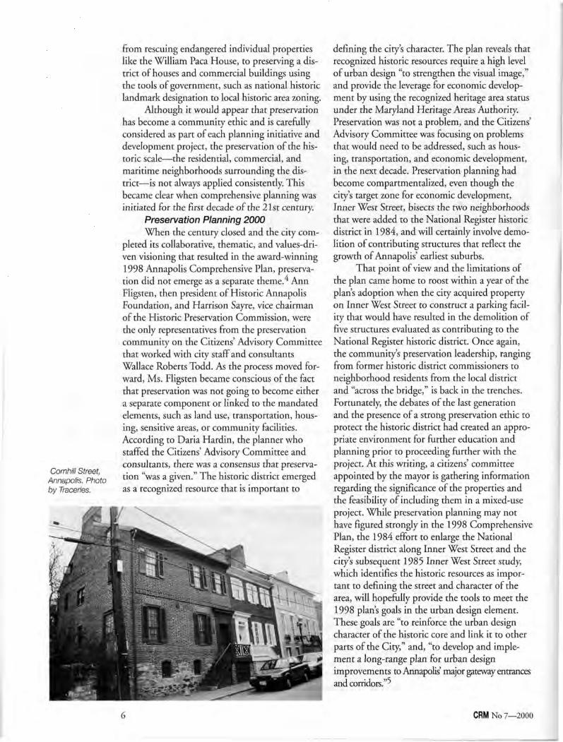
Preservation Planning 2000 When the century closed and the city com
pleted its collaborative, thematic, and values-driven visioning that resulted in the award-winning 1998 Annapolis Comprehensive Plan, preservation did not emerge as a separate theme. Ann Fligsten, then president of Historic Annapolis Foundation, and Harrison Sayre, vice chairman of the Historic Preservation Commission, were the only representatives from the preservation community on the Citizens' Advisory Committee that worked with city staff and consultants Wallace Roberts Todd. As the process moved forward, Ms. Fligsten became conscious of the fact that preservation was not going to become either a separate component or linked to the mandated elements, such as land use, transportation, housing, sensitive areas, or community facilities. According to Daria Hardin, the planner who staffed the Citizens' Advisory Committee and consultants, there was a consensus that preservation "was a given." The historic district emerged as a recognized resource that is important to
defining the city's character. The plan reveals that recognized historic resources require a high level of urban design "to strengthen the visual image," and provide the leverage for economic development by using the recognized heritage area status under the Maryland Heritage Areas Authority. Preservation was not a problem, and the Citizens' Advisory Committee was focusing on problems that would need to be addressed, such as housing, transportation, and economic development, in the next decade. Preservation planning had become compartmentalized, even though the city's target zone for economic development, Inner West Street, bisects the two neighborhoods that were added to the National Register historic district in 1984, and will certainly involve demolition of contributing structures that reflect the growth of Annapolis' earliest suburbs.
That point of view and the limitations of the plan came home to roost within a year of the plan's adoption when the city acquired property on Inner West Street to construct a parking facility that would have resulted in the demolition of five structures evaluated as contributing to the National Register historic district. Once again, the community's preservation leadership, ranging from former historic district commissioners to neighborhood residents from the local district and "across the bridge," is back in the trenches. Fortunately the debates of the last generation and the presence of a strong preservation ethic to protect the historic district had created an appropriate environment for further education and planning prior to proceeding further with the project. At this writing, a citizens' committee appointed by the mayor is gathering information regarding the significance of the properties and the feasibility of including them in a mixed-use project. While preservation planning may not have figured strongly in the 1998 Comprehensive Plan, the 1984 effort to enlarge the National Register district along Inner West Street and the city's subsequent 1985 Inner West Street study, which identifies the historic resources as important to defining the street and character of the area, will hopefully provide the tools to meet the 1998 plan's goals in the urban design element. These goals are "to reinforce the urban design character of the historic core and link it to other parts of the City," and, "to develop and implement a long-range plan for urban design improvements to Annapolis' major gateway entrances and corridors."-'
CRM No 7—2000 6
Conclusion Because preservation "was a given" in the
1998 Annapolis Comprehensive Plan, preservation planners and the community can continue to use existing tools, such as the studies mentioned above as well as the Historic Preservation Commission's general authority to order studies and surveys and designate landmarks, until 2004 when preservation will become part the 2004 comprehensive plan, according Jon Arason, director of the Department of Planning and Zoning. Planners and preservationists agree that a separate preservation plan would raise awareness and provide a framework for future projects that involve historic resources.
Notes 1 Anthony Lindauer, From Paths to Plats: The
Development of Annapolis, 1651 to 1718 (Annapolis, MD: Maryland State Archives and Maryland Historical Trust, 1997), p. 10.
2 John Reps, Tidewater Towns (Williamsburg, Va.: Colonial Williamsburg Foundation, 1972), p. 127. Edward Papenfuse, Maryland State Archivist,
demonstrates that archeological evidence suggests that was the beginning of a grand baroque scheme in St. Mary's City, in his monograph, "Doing Good to Posterity": The Move of the Capital of Maryland From St. Mary's City to Ann Arundell Towne, Now called Annapolis (Annapolis, MD: Maryland State Archives and the Maryland Historical Trust, 1995), pp. 5-7.
' Ann Jensen, "The History and Evolution of Preservation in Annapolis," Historic Preservation Forum 13 (Fall 1998): 30-36.
^ The Maryland Economic Growth, Resource Protection, and Planning Act of 1992 did not require a preservation element although historic and archaeological sites can be included under the required Sensitive Areas element. Annotated Code of Maryland, Article 66B, Section 3.05.
5 City of Annapolis, Annapolis Comprehensive Plan (Annapolis, 1998), prepared by Wallace Roberts Todd, pp. 90-91.
Donna Hole is the Chief of Historic Preservation, Department of Planning and Zoning, City of Annapolis. She can be reached at <[email protected]>. The city's website is <www.ci.annapolis.md.us> .
Joseph E. Brent
Community Consensus Planning for Battlefield Preservation
This essay deals with preservation planning for Civil War battlefields and sites; however, these techniques will work for other
types of historic preservation projects as well. All of the projects with which this author has been associated developed, ultimately, out of a partnet-ship between a non-profit entity and a government agency. Although these preservation efforts may not have begun as a partnership, they ended up that way.
The point to this essay is that the preservation planning process in and of itself is a catalyst for the preservation of a given site. By making the effort to go through the process, a preservation group takes a huge step forward to insure the site's preservation. The successful process is led by either a local non-profit or a local government agency to insure that it will be successful. The
impetus needs to be local and include an element of community consensus building. Successful battlefield preservation efforts are achieved through community consensus-based planning and strong local leadership. There is, of course, no magic formula, but the process draws upon the support of the general public and that of local governments. Efforts using community consensus-based planning have been highly successful.
A successful process for preserving a Civil War site involves three components: nominating the property for listing in the National Register of Historic Places, creating a preservation and management plan, and developing an interpretive program. The order in which these components are completed is not critical but a successful project achieves all three. Exactly how planning projects progress is dependent upon the initiator of the effort, but the process that each site goes
CRM No 7—2000 7
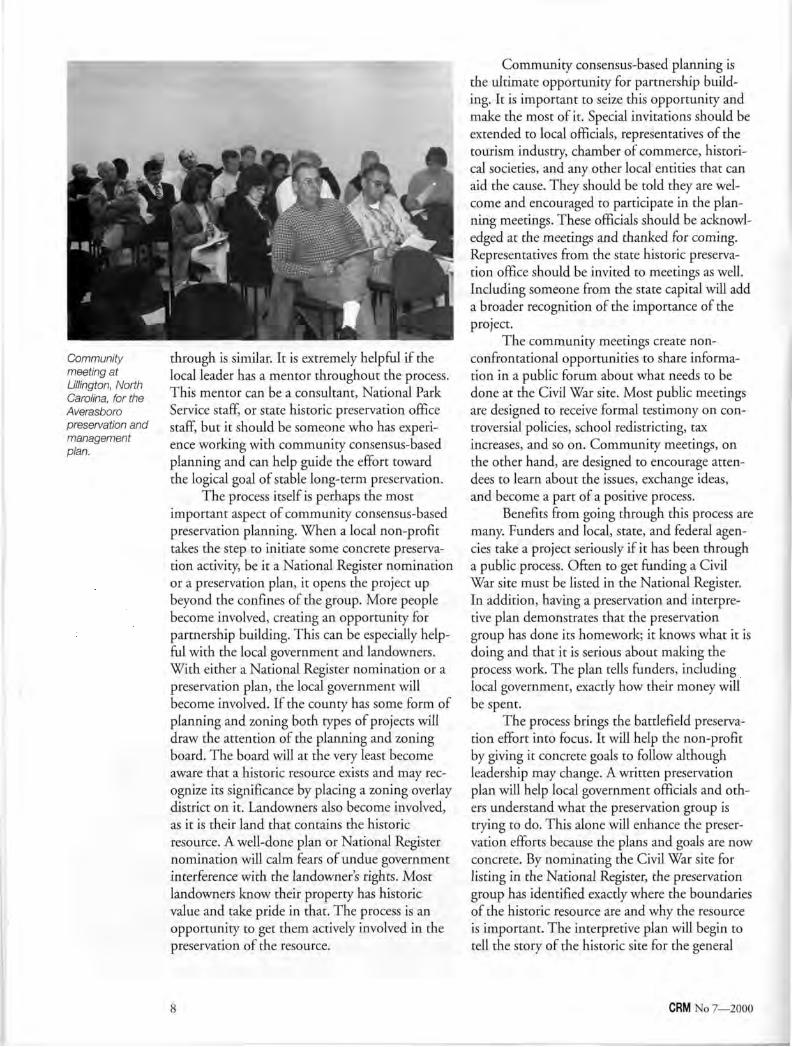
Community meeting at Lillington, North Carolina, for the Averasboro preservation and management plan.
through is similar. It is extremely helpful if the local leader has a mentor throughout the process. This mentor can be a consultant, National Park Service staff, or state historic preservation office staff, but it should be someone who has experience working with community consensus-based planning and can help guide the effort toward the logical goal of stable long-term preservation.
The process itself is perhaps the most important aspect of community consensus-based preservation planning. When a local non-profit takes the step to initiate some concrete preservation activity, be it a National Register nomination or a preservation plan, it opens the project up beyond the confines of the group. More people become involved, creating an opportunity for partnership building. This can be especially helpful with the local government and landowners. With either a National Register nomination or a preservation plan, the local government will become involved. If the county has some form of planning and zoning both types of projects will draw the attention of the planning and zoning board. The board will at the very least become aware that a historic resource exists and may recognize its significance by placing a zoning overlay district on it. Landowners also become involved, as it is their land that contains the historic resource. A well-done plan or National Register nomination will calm fears of undue government interference with the landowner's rights. Most landowners know their property has historic value and take pride in that. The process is an opportunity to get them actively involved in the preservation of the resource.
Community consensus-based planning is the ultimate opportunity for partnership building. It is important to seize this opportunity and make the most of it. Special invitations should be extended to local officials, representatives of the tourism industry, chamber of commerce, historical societies, and any other local entities that can aid the cause. They should be told they are welcome and encouraged to participate in the planning meetings. These officials should be acknowledged at the meetings and thanked for coming. Representatives from the state historic preservation office should be invited to meetings as well. Including someone from the state capital will add a broader recognition of the importance of the project.
The community meetings create non-confrontational opportunities to share information in a public forum about what needs to be done at the Civil War site. Most public meetings are designed to receive formal testimony on controversial policies, school redistricting, tax increases, and so on. Community meetings, on the other hand, are designed to encourage attendees to learn about the issues, exchange ideas, and become a part of a positive process.
Benefits from going through this process are many. Funders and local, state, and federal agencies take a project seriously if it has been through a public process. Often to get funding a Civil War site must be listed in the National Register. In addition, having a preservation and interpretive plan demonstrates that the preservation group has done its homework; it knows what it is doing and that it is serious about making the process work. The plan tells funders, including local government, exactly how their money will be spent.
The process brings the battlefield preservation effort into focus. It will help the non-profit by giving it concrete goals to follow although leadership may change. A written preservation plan will help local government officials and others understand what the preservation group is trying to do. This alone will enhance the preservation efforts because the plans and goals are now concrete. By nominating the Civil War site for listing in the National Register, the preservation group has identified exactly where the boundaries of the historic resource are and why the resource is important. The interpretive plan will begin to tell the story of the historic site for the general
CRM No 7—2000 8
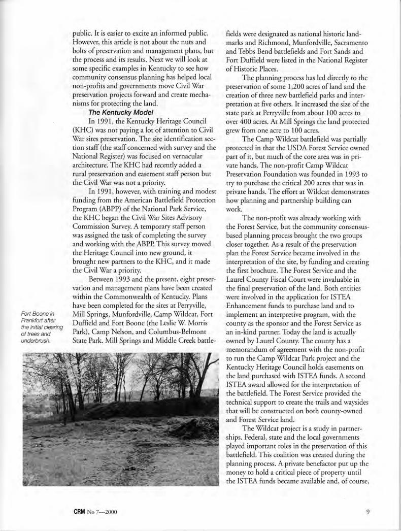
Fort Boone in Frankfort after the initial clearing of trees and underbrush.
public. It is easier to excite an informed public. However, this article is not about the nuts and bolts of preservation and management plans, but the process and its results. Next we will look at some specific examples in Kentucky to see how community consensus planning has helped local non-profits and governments move Civil War preservation projects forward and create mechanisms for protecting the land.
The Kentucky Model In 1991, the Kentucky Heritage Council
(KHC) was not paying a lot of attention to Civil War sites preservation. The site identification section staff (the staff concerned with survey and the National Register) was focused on vernacular architecture. The KHC had recently added a rural preservation and easement staff person but the Civil War was not a priority.
In 1991, however, with training and modest funding from the American Battlefield Protection Program (ABPP) of the National Park Service, the KHC began the Civil War Sites Advisory Commission Survey. A temporary staff person was assigned the task of completing the survey and working with the ABPP. This survey moved the Heritage Council into new ground, it brought new partners to the KHC, and it made the Civil War a priority.
Between 1993 and the present, eight preservation and management plans have been created within the Commonwealth of Kentucky. Plans have been completed for the sites at Perryville, Mill Springs, Munfordville, Camp Wildcat, Fort Duffield and Fort Boone (the Leslie W. Morris Park), Camp Nelson, and Columbus-Belmont State Park. Mill Springs and Middle Creek battle
fields were designated as national historic landmarks and Richmond, Munfordville, Sacramento and Tebbs Bend battlefields and Fort Sands and Fort Duffield were listed in the National Register of Historic Places.
The planning process has led directly to the preservation of some 1,200 acres of land and the creation of three new battlefield parks and interpretation at five others. It increased the size of the state park at Perryville from about 100 acres to over 400 acres. At Mill Springs the land protected grew from one acre to 100 acres.
The Camp Wildcat battlefield was partially protected in that the USDA Forest Service owned part of it, but much of the core area was in private hands. The non-profit Camp Wildcat Preservation Foundation was founded in 1993 to try to purchase the critical 200 acres that was in private hands. The effort at Wildcat demonstrates how planning and partnership building can work.
The non-profit was already working with the Forest Service, but the community consensus-based planning process brought the two groups closer together. As a result of the preservation plan the Forest Service became involved in the interpretation of the site, by funding and creating the first brochure. The Forest Service and the Laurel County Fiscal Court were invaluable in the final preservation of the land. Both entities were involved in the application for ISTEA Enhancement funds to purchase land and to implement an interpretive program, with the county as the sponsor and the Forest Service as an in-kind partner. Today the land is actually owned by Laurel County. The county has a memorandum of agreement with the non-profit to run the Camp Wildcat Park project and the Kentucky Heritage Council holds easements on the land purchased with ISTEA funds. A second ISTEA award allowed for the interpretation of the battlefield. The Forest Service provided the technical support to create the trails and waysides that will be constructed on both county-owned and Forest Service land.
The Wildcat project is a study in partnerships. Federal, state and the local governments played important roles in the preservation of this battlefield. This coalition was created during the planning process. A private benefactor put up the money to hold a critical piece of property until the ISTEA funds became available and, of course,
CRM No 7—2000 9
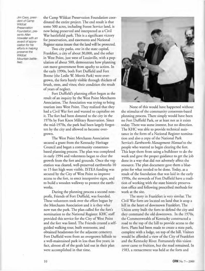
Jim Cass, president of Camp Wildcat Preservation Foundation, presents Allan Howeller with an award of appreciation for his efforts in helping preserve the Wildcat
Mountain battlefield.
the Camp Wildcat Preservation Foundation coordinated the entire project. The end result is that some 500 acres, including Forest Service land, is now being preserved and interpreted as a Civil War battlefield park. This is a significant victory for preservation, and easements and National Register status insure that the land will be protected.
Two city parks, one in the state capital, Frankfort, a city of about 30,000, and the other in West Point, just west of Louisville, with a population of about 500, demonstrate how planning can move government from apathy to action. In the early 1990s, both Fort Duffield and Fort Boone (the Leslie W Morris Park) were overgrown, the forts barely visible through thickets of brush, trees, and vines; their condition the result of years of neglect.
Fort Duffield's planning effort began as the result of an inquiry by the West Point Merchants Association. The Association was trying to bring tourism into West Point. They realized that they had a Civil War fort and wanted to capitalize on it. The fort had been donated to the city in the 1970s by Fort Knox Military Reservation. Since the mid-1970s, the park had been largely forgotten by the city and allowed to become overgrown.
The West Point Merchants Association secured a grant from the Kentucky Heritage Council and began a community consensus-based planning process. The plan was completed in early 1994 and volunteers began to clear the growth from the fort and grounds. Once the vegetation was cleared, well-preserved earthworks 10 to 15 feet high were visible. ISTEA funding was secured by the City of West Point to improve access to the fort, to erect interpretive signs, and to build a wooden walkway to protect the earthworks.
During the planning process a second nonprofit, Friends of Fort Duffield, was founded. These volunteers took over the effort begun by the Merchants Association and it is they who now run the park. The plan called for the fort's nomination to the National Register. KHC staff provided this service for the City of West Point and the fort was listed. The Friends created a self-guided walking tour, built restrooms, and obtained headstones for the adjacent cemetery. Fort Duffield went from an overgrown hillside to a well-maintained park in less than five years; in fact, almost all of the goals laid out in their plan were accomplished in that time.
None of this would have happened without the stimulus of the community consensus-based planning process. There simply would have been no Fort Duffield Park, or at least not as it exists today. There was some interest, but no direction. The KHC was able to provide technical assistance in the form of a National Register nomination and also a copy of the National Park Service's Earthworks Management Manual to the people who wanted to begin clearing the fort. This kept them from using a bulldozer to do the work and gave the proper guidance to get the job done in a way that did not adversely affect the resource. The plan document gave them a blueprint for what needed to be done. Today, as a result of the foundation that was laid in the early 1990s, the stewards of Fort Duffield have a tradition of working with the state historic preservation office and following prescribed methods for work at the site.
The story in Frankfort is very similar. The Civil War forts are located on land that is atop a hill in the heart of downtown Frankfort. The Union army built the forts to defend the city and they command the old downtown. In the 1970s, the Commonwealth of Kentucky constructed a road to the top of the hill to provide access to the forts. Plans had been made to create a state park, complete with a lodge, on top of the hill. Visitors would be afforded a view of the City of Frankfort and the Kentucky River. Fortunately this vision never came to fruition, but the road remained. In 1983, a reenactment was held at the forts and
10 CRM No 7—2000
this action nearly scuttled the current effort before it ever began. Thousands of spectators who could not get to the top of the hill in their cars parked their vehicles on the adjacent residential street, and walked to the top. They trampled lawns, blocked cars and generally irritated the people of the neighborhood.
For 12 long years, nothing happened on Fort Hill. In 1995, Historic Frankfort, Inc., a local preservation non-profit, obtained funding from the KHC to prepare a preservation and management plan for the park. Prior to the open community meeting, a meeting was held with the neighborhood committee. The residents of the neighborhood had very good memories, and photographs of what had happened during the reenactment. They did not want it to happen again. They were, and are, opposed to having the old state road opened to traffic, especially to tourists.
This small but vocal group forced the plan to exclude the old state road as an access option. The city, the planners, Historic Frankfort, Inc., and the newly formed Friends of Fort Hill agreed to abandon plans to use the road for vehicles and other options were explored. Eventually two separate means of access were developed. The old military road was to be used for pedestrian traffic and an alternate route used for vehicles. Because of the opposition, the community meetings in Frankfort were by far the most contentious of any held in Kentucky in the 1990s; yet the plan was completed and accepted by the city.
In June 1999, a two-day event officially opened the Leslie W. Morris Park. There was a living history event, food, and a large crowd of people on hand. The city had spent the spring clearing the underbrush from the forts and developing a rudimentary tour of the historic area. Since then an interpretive building has been built on the site and the interpretation is being upgraded.
The City of Frankfort, which had been indifferent at best to the park, has now embraced it as an important part of the city's tourism package. The city went so far as to enlarge the National Register boundary for the park. The Leslie W. Morris Park has become an asset for Frankfort. The change in the attitude of the city can be directly attributed to the planning process.
As a result of his active involvement in the process, the city manager, who had been unaware of the importance of protecting battlefields, attended a battlefield preservation conference, and returned to Frankfort a major supporter of the Fort Hill project.
While it is true that both Fort Duffield and the Leslie W. Morris Park are city property and, therefore, in theory protected, they were in danger of destruction by neglect. The planning process brought the parks back into the spotlight and allowed city government and/or the friends group to preserve and interpret the earthworks and open them to the public. In essence, through planning, the people got their heritage back.
Conclusion The community consensus-based planning
process in Kentucky has heightened awareness of Civil War battlefields and sites across the Commonwealth. While it would not be accurate to say that this has led to dramatic changes in planning and zoning policies in Kentucky, community planning has helped preserve land. At Camp Nelson plans are underway to place a historic preservation overlay zone on the Camp Nelson National Register district (some 600 acres of farmland) and any changes at the Leslie W Morris Park in Frankfort are monitored by the historic preservation board of that city. Once the updated national historic landmark boundary is finalized in Perryville, it too, or at least a portion of it, may fall under the review of the historic preservation board of that city.
Simply going through the planning process helps, not only the people trying to preserve the site, but the whole community. In the parlance of our times, the planning process helps move a site to the next level of commitment. It brings new people on board, it creates new partnerships and it helps preserve the land that is, after all, why we are doing this in the first place.
Joseph E. Brent served as the Civil War Sites Preservation Coordinator for the Kentucky Heritage Council, the state historic preservation office, from 1990 until 1999. He left state service to form a public history consulting firm with Maria Campbell Brent. He is now vice-president of Mudpuppy & Waterdog, Inc. in Versailles, Kentucky.
Photos by the author.
CRM No 7—2000 11
Nancy L. Burgess
Taking America's Past into the Future Prescott, Arizona, Plans for the Future of Historic Preservation
Richard Moe, president of the National Trust for Historic Preservation, explained the theme of this year's National Historic
Preservation Week in his "President's Message" on the Trust's Preservation Week 2000 poster. In discussing the theme, "Taking America's Past Into the Future," Moe wrote "...as America enters a new century and a new millennium, we should give serious thought to what we want to take with us on this journey into the future. It is essential that we be vigilant, flexible and well informed in order to deal with the rapid changes in everything from demographics to technology that are sure to have an impact on our irreplaceable historic places."
Historic Context In February 1863, President Abraham
Lincoln signed the Organic Act that created Arizona Territory, with the primary purpose of claiming the mineral resources that were being discovered in the area, for the benefit of the Union. In 1864, Prescott was established in the mountains of central Arizona as the capital of Arizona Territory and, shortly thereafter, as the county seat of Yavapai County. Laid out in grid in 1864, with 100-foot-wide streets and two city blocks set aside for government buildings, Prescott has a definite midwestern look. In spite of its isolation, Prescott grew fairly quickly and by the time the railroad arrived in 1886-1887, it was a well-established town with a population of 2,100 (1890). In 1889, the territorial capital was moved permanently to Phoenix.
The first buildings (1864-1875) were constructed of locally-made brick, Ponderosa pine logs, and milled lumber. When the railroad arrived, all types of building materials could be obtained, including redwood siding, Victorian trim, cast iron storefronts and pressed metal ceilings. Skilled craftsmen and architects also began to arrive. Also, at about this time, a definite social "upper-crust" was established, and large, ornate
Victorian homes were being constructed on the east side of town. "Whiskey Row" became known throughout the West. This notorious area of town contained from 40 to 70 "drinking establishments," including gambling houses where "good time girls" entertained. Many famous, infamous, and not-so-famous came to drink and gamble on "The Row," including Virgil and Wyatt Earp, Doc Holliday, Tom Mix, and cowboys and businessmen from all over the West.
Throughout the last years of the 19th century and into the 20th century, Prescott continued to grow economically and in population at a slow but fairly steady pace. Current annual growth rate is approximately 4%. In the 1995 special census, Prescott's population was 30,600. Known today as "Everybody's Hometown," Prescott retains hundreds of historic buildings and dozens of historic neighborhoods with an early-20th-century character and small-town charm that bring visitors and new residents from throughout the United States and many other countries.
Prescott's Preservation History In 1974, after the removal of a significant
1877 Victorian house from a prominent corner for the construction of a fast food restaurant, the citizens of Prescott formed the Yavapai Heritage Foundation. Shortly thereafter, the formal documentation of Prescott's territorial architecture began. At that time Prescott had a significant stock of territorial-era vintage buildings built before Arizona became a state in 1912. Although a few of those buildings have been lost in the ensuing 25 years, most are still intact and many have been restored.
In 1978, Yavapai Heritage Foundation received a grant and prepared a multiple resource area nomination to the National Register of Historic Places for those territorial commercial buildings that had sufficient integrity to be eligible for the Register, along with a significant number of residential buildings. The next important
12 CRM No 7—2000
step that year was the approval of a Townscape Conservation Ordinance by the city council.
In 1980, this ordinance was replaced by a new Historic Preservation Overlay Ordinance. Prescott also became a Certified Local Government (CLG), adopted a four-page historic preservation plan, and appointed a preservation commission. By this time, the City of Prescott had become a primary participant in the historic preservation movement in the community, but Yavapai Heritage Foundation continued to be very involved as one of the "squeaky wheels" which kept the process moving along.
With the hiring of a part-time staff person in 1990, the City of Prescott assumed full responsibility for documenting historic resources. Currently, there are eight National Register historic districts in place and two in process, comprising more than 700 buildings. There are at least 10 additional districts yet to be documented. Twelve historic preservation overlay districts have been established by city ordinance, including one city-owned archeological site, and one in progress.
Also in 1990, Prescott received an Arizona CLG grant to update the historic preservation ordinance and develop a new ordinance. One of the changes to the provisions of the ordinance was the opportunity to include archeological sites under the protection of historic preservation overlay district ordinances. The Prescott Preservation Commission was actively involved in the drafting and preparation of the new ordinance. The commission was also involved in the review of several other proposed ordinances and plans, including the 1990 Prescott General Plan, a Downtown Specific Area Plan, and various changes to the zoning code.
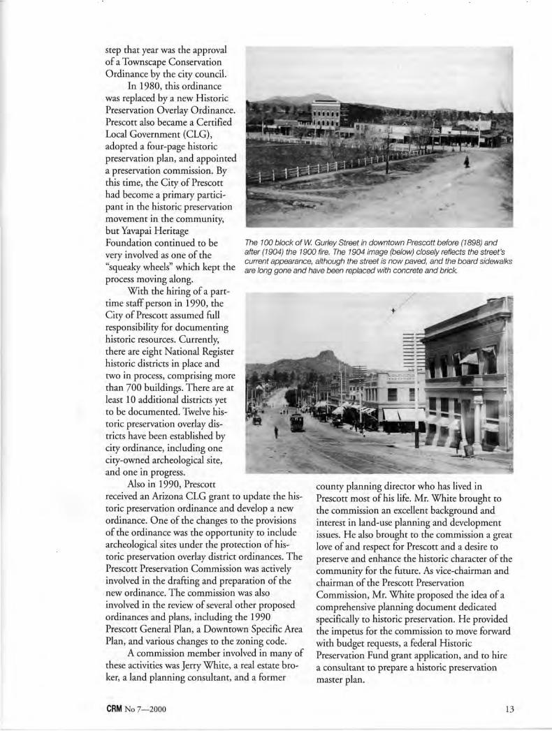
A commission member involved in many of these activities was Jerry White, a real estate broker, a land planning consultant, and a former
The 100 block of W. Gurley Street in downtown Prescott before (1898) and after (1904) the 1900 fire. The 1904 image (below) closely reflects the street's current appearance, although the street is now paved, and the board sidewalks are long gone and have been replaced with concrete and brick.
county planning director who has lived in Prescott most of his life. Mr. White brought to the commission an excellent background and interest in land-use planning and development issues. He also brought to the commission a great love of and respect for Prescott and a desire to preserve and enhance the historic character of the community for the future. As vice-chairman and chairman of the Prescott Preservation Commission, Mr. White proposed the idea of a comprehensive planning document dedicated specifically to historic preservation. He provided the impetus for the commission to move forward with budget requests, a federal Historic Preservation Fund grant application, and to hire a consultant to prepare a historic preservation master plan.
CRM No 7—2000 13
Historic Preservation Master Plan The purpose of Prescott's Historic
Preservation Master Plan {Plan), as stated in chapter one, is to provide a "proactive means of planning for the identification, preservation, and protection of Prescott's character and historic resources in order to enhance the quality of life and economic well-being of current and future generations."
The Plans first two chapters provide "a descriptive overview of preservation in general, and the resources of Prescott in particular, and outline the philosophical goals and recommendations for preservation and development." Chapters for each historic district stand alone, so that a user of the Plan would have to read only the first two chapters along with the individual chapter for the historic district of interest. For ease of use, each historic district chapter contains the same information in the same order, as follows: • an overview of the district, • location of the district, • history of the district, • formation of the district, • the responsibilities of the Prescott Preservation
Commission,
• a description of the qualities and design benefits of the district, and
• district recommendations. The recommendation sections of the chap
ters are some of the most important elements of the Plan; these recommendations are the key components that trigger the implementation aspects of the Plan. Many of the recommendations involve very specific suggestions dealing with siting of buildings, landscape/streetscape, building scale and massing, materials, open space, future projects (including infill), circulation and parking, and proximity to other land uses. The other very important recommendation section of each chapter of the Plan addresses zoning issues.
The importance of zoning in relation to historic preservation is often underestimated. As stated in chapter two of the Plan, "...zoning often presents a serious threat to the integrity of historic neighborhoods. .. .When zoning regulations and historic preservation goals work at cross-purposes both suffer." Chapter two provides a series of questions to ask as a starting point for assessing the conflicts between zoning and preservation. Some of those questions include:
14 CRM No 7—2000
• Are historic residential neighborhoods with single family houses zoned for single family residential or other compatible uses?
• Do lot sizes and building setback requirements from the front lot line match historic patterns?
• Does zoning for areas immediately surrounding the historic district provide an adequate buffer against development that would have a negative impact on the historic area?
• Does zoning require so many off-street parking spaces that it hampers the rehabilitation of historic buildings or the construction of compatible infill buildings?
• Does zoning allow increased residential densities in older historic neighborhoods (such as four-plexes or apartments)?
• Are minimum lot size provisions larger than actual lot sizes in historic neighborhoods, thereby creating non-conforming, vacant lots too small to be developed without applying for a zoning variance?
These questions were used to assess the zoning designations in each historic district. Specific recommendations were made in the Plan for changes in the zoning code to allow for more flexibility; for changes in zoning, particularly down-zoning, to reduce incompatible uses or
densities; for reduction in allowed building heights; and for elimination of incompatible adjacent uses which may be detrimental to the preservation of the historic district.
Implementation of the Historic Preservation Master Plan The Plan was adopted by Prescott on
December 9, 1997, as an addendum to the 1990 General Plan, After the adoption of the Plan, an assessment was prepared that listed the impact on each Prescott department if all of the recommendations of the Plan were to be implemented. Some of the financial impacts are considerable, since, in some districts, re-paving, the installation of sidewalks, curbs and/or gutters, and traffic abatement devices are recommended. Further, the potential impacts on staff are also considerable, particularly in regard to the time commitment necessary to prepare re-zonings and historic preservation overlay district designations, nominations to the National Register, and other recommended projects.
Prescott has been gradually tackling various aspects of the recommended general implementation strategies. Toward that goal, the city has recently hired an additional community planner whose responsibilities include assisting with the
CRM No 7—2000 15
preparation of neighborhood plans, which often have a historic preservation component, handling re-zonings, and assisting with the formation of historic preservation overlay districts.
Prescott has begun the process of pro-actively re-zoning some areas, and although none of these are historic district re-zonings at this time, this work will set the stage for the concept of city-initiated down-zoning in the community. An overlay district that limits building heights in the downtown has been approved.
Information about historic district designations, for both National Register and historic preservation overlay districts has been entered into the city's Geographic Information System (GIS). Accessing the GIS system provides this specialized data for any parcel of land to which it applies. Also, the GIS allows us to make many types of customized maps. The dozens of maps that are included in the Plan were produced with GIS technology.
The Future of the Historic Preservation Master Plan Historic preservation is a very important
component of Prescott's tourism and service-
based economy. The implementation of the Plan is a priority of management staff, and an analysis is currently in process that will set the priorities for the implementation and help to move historic preservation to the forefront in the community. This will not be an instant accomplishment, but planning for the implementation of the Plan, including the continuous updating of the Plan, will help to ensure that it is not a document that simply sits on a shelf, but will assist Prescott in taking our past into the future.
Nancy L. Burgess has been the half-time historic preservation specialist for the City of Prescott since August 1990. Prior to working for the city, she served as a member, Vice-Chairman, and Chairman of the Prescott Preservation Commission, and was very involved in creating the 1990 Historic Preservation Ordinance for the City of Prescott. With the exception of the 1978 Multiple Resource Area National Register nomination for Prescott, Ms. Burgess has prepared all of the historic district nominations for Prescott.
Illustrations courtesy City of Prescott, Arizona.
Geographic Information Systems and Prescott's Historic Preservation Master Plan
October 1996 brought the City of Prescott kicking and screaming into the 20th century with respect to Geographic Information Systems (GIS). Over the past three years,
Prescott's GIS division has been developing tools to bring together a citywide GIS application for viewing, reviewing, and reporting on a variety of spatial information. GIS users have the ability to check individual parcels or lots for a multitude of information, which is available in both map and tabular form. In respect to the historic preservation data, the GIS is used to reference differing historic preservation overlay districts and National Register historic districts. These can be global (all encompassing) references or single parcel queries. The goal of the GIS is to gather and store pertinent information to meet the needs of the users within the Community Development Department (which includes our historic preservation specialist). A single tool button has been developed to display all information contained inside a particular parcel. Information includes historic preservation overlay districts, the National Register historic districts, other zoning overlay districts, zoning, site address information, owner information, and land use information. This tool is a quick way to document any issues that may affect one's decisionmaking process about a piece of property—a one-stop-shop for zoning information.
In the future, digital imagery will be linked to existing historic preservation overlay district and National Register historic district parcels to both document current status, parcel by parcel, as well as engineer a "virtual" walk of Prescott's historic properties. This may include three-dimensional "maps" along with historic and contemporary photographs.
Timothy Smothers GIS Coordinator
City of Prescott
16 CRM No 7—2000
Robert C. Vogel
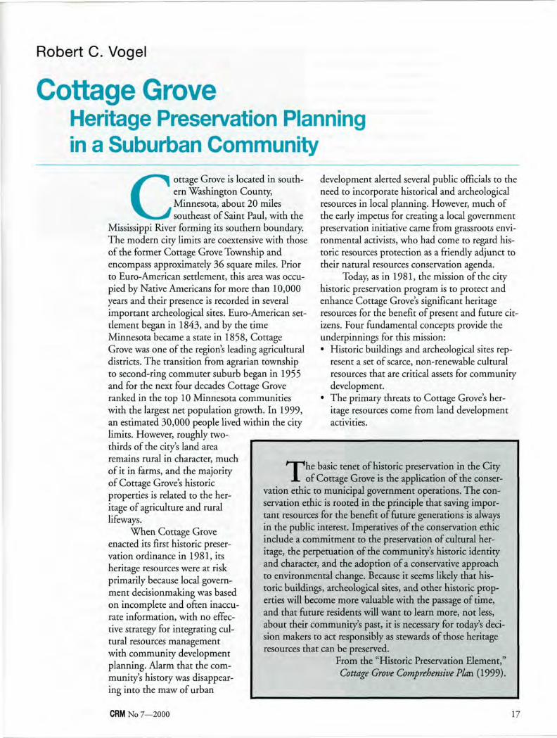
Cottage Grove Heritage Preservation Planning in a Suburban Community
Cottage Grove is located in southern Washington County, Minnesota, about 20 miles southeast of Saint Paul, with the
Mississippi River forming its southern boundary. The modern city limits are coextensive with those of the former Cottage Grove Township and encompass approximately 36 square miles. Prior to Euro-American settlement, this area was occupied by Native Americans for more than 10,000 years and their presence is recorded in several important archeological sites. Euro-American settlement began in 1843, and by the time Minnesota became a state in 1858, Cottage Grove was one of the region's leading agricultural districts. The transition from agrarian township to second-ring commuter suburb began in 1955 and for the next four decades Cottage Grove ranked in the top 10 Minnesota communities with the largest net population growth. In 1999, an estimated 30,000 people lived within the city limits. However, roughly two-thirds of the city's land area remains rural in character, much of it in farms, and the majority of Cottage Grove's historic properties is related to the heritage of agriculture and rural lifeways.
When Cottage Grove enacted its first historic preservation ordinance in 1981, its heritage resources were at risk primarily because local government decisionmaking was based on incomplete and often inaccurate information, with no effective strategy for integrating cultural resources management with community development planning. Alarm that the community's history was disappearing into the maw of urban
development alerted several public officials to the need to incorporate historical and archeological resources in local planning. However, much of the early impetus for creating a local government preservation initiative came from grassroots environmental activists, who had come to regard historic resources protection as a friendly adjunct to their natural resources conservation agenda.
Today, as in 1981, the mission of the city historic preservation program is to protect and enhance Cottage Grove's significant heritage resources for the benefit of present and future citizens. Four fundamental concepts provide the underpinnings for this mission: • Historic buildings and archeological sites rep
resent a set of scarce, non-renewable cultural resources that are critical assets for community development.
• The primary threats to Cottage Grove's heritage resources come from land development activities.
The basic tenet of historic preservation in the City of Cottage Grove is the application of the conser
vation ethic to municipal government operations. The conservation ethic is rooted in the principle that saving important resources for the benefit of future generations is always in the public interest. Imperatives of the conservation ethic include a commitment to the preservation of cultural heritage, the perpetuation of the community's historic identity and character, and the adoption of a conservative approach to environmental change. Because it seems likely that historic buildings, archeological sites, and other historic properties will become more valuable with the passage of time, and that future residents will want to learn more, not less, about their community's past, it is necessary for today's decision makers to act responsibly as stewards of those heritage resources that can be preserved.
From the "Historic Preservation Element," Cottage Grove Comprehensive Plan (1999).
CRM No 7—2000 17
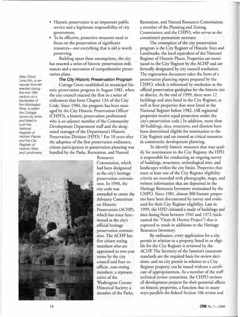
Grey Cloud Lime Kiln, a vernacular lime kiln erected during the mid- 19th century on a backwater of the Mississippi River, is within the Cottage Grove city limits and listed in both the National Register of Historic Places and the City Register of Historic Sites and Landmarks.
• Historic preservation is an important public service and a legitimate responsibility of city government.
• To be effective, protective measures need to focus on the preservation of significant resources—not everything that is old is worth preserving.
Building upon these assumptions, the city has enacted a series of historic preservation ordinances and a succession of comprehensive preservation plans.
The City Historic Preservation Program Cottage Grove established its municipal his
toric preservation program in August 1981, when the city council enacted the first in a series of ordinances that form Chapter 13A of the City Code. Since 1984, the program has been managed by the City Historic Preservation Officer (CHPO), a historic preservation professional who is an adjunct member of the Community Development Department staff and the designated manager of the Department's Historic Preservation Division (HPD). For 10 years after the adoption of the first preservation ordinance, citizen participation in preservation planning was handled by the Parks, Recreation, and Natural
Resources Commission, which had been designated as the city's heritage preservation commission. In 1990,the city code was amended to create the Advisory Committee on Historic Preservation (ACHP), which has since functioned as the city's official heritage preservation commission. The ACHP has five citizen voting members who are appointed to two-year terms by the city council and four ex-officio, non-voting members: a representative of the Washington County Historical Society; a member of the Parks,
18
Recreation, and Natural Resources Commission; a member of the Planning and Zoning Commission; and the CHPO, who serves as the committee's permanent secretary.
The centerpiece of the city preservation program is the City Register of Historic Sites and Landmarks, the local equivalent of the National Register of Historic Places. Properties are nominated to the City Register by the ACHP and are formally designated by city council resolution. The registration document takes the form of a preservation planning report prepared by the CHPO, which is referenced by resolution as the official preservation guideplan for the historic site or district. At the end of 1999, there were 12 buildings and sites listed in the City Register, as well as four properties that were listed in the National Register before 1982. (All registered properties receive equal protection under the city's preservation code.) In addition, more than 30 buildings, sites, structures, and districts have been determined eligible for nomination to the City Register and are treated as critical resources in community development planning.
To identify historic resources that may qualify for nomination to the City Register, the HPD is responsible for conducting an ongoing survey of buildings, structures, archeological sites, and landscapes within the city limits. Properties that meet at least one of the City Register eligibility criteria are recorded with photographs, maps, and written information that are deposited in the Heritage Resources Inventory maintained by the CHPO. Since 1981, almost 300 historic properties have been documented by survey and evaluated for their City Register eligibility. Late in 1999, the HPD initiated a study of buildings and sites dating from between 1941 and 1972 (nicknamed the "Ozzie & Harriet Project") that is expected to result in additions to the Heritage Resources Inventory.
By ordinance, every application for a city permit in relation to a property listed in or eligible for the City Register is reviewed by the ACHP. The Secretary of the Interior's treatment standards are the required basis for review decisions, and no city permit in relation to a City Register property can be issued without a certificate of appropriateness. As a member of the staff technical review committee, the CHPO reviews all development projects for their potential effects on historic properties, a function that in many ways parallels the federal Section 106 review and
CRM No 7—2000
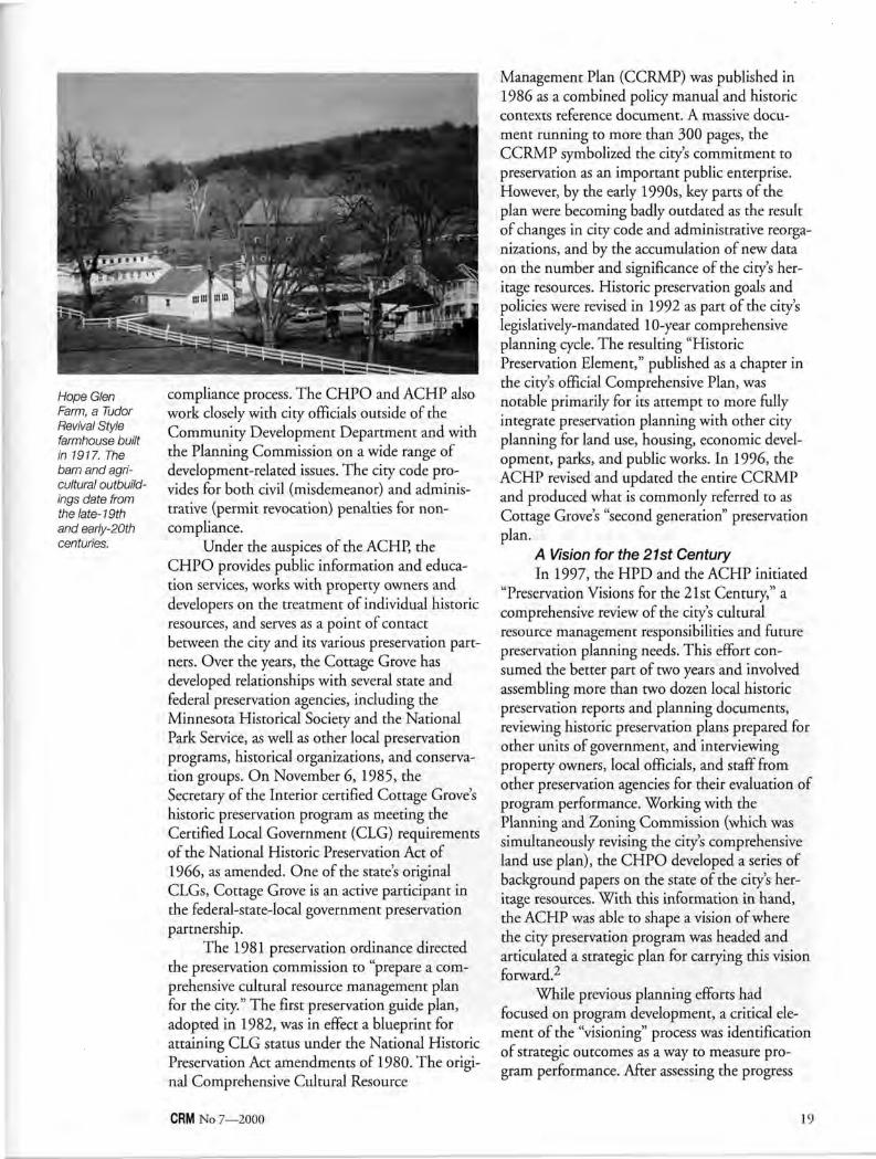
Hope Glen Farm, a Tudor Revival Style farmhouse built in 1917. The barn and agricultural outbuildings date from the late-19th and early-20th centuries.
compliance process. The CHPO and ACHP also work closely with city officials outside of the Community Development Department and with the Planning Commission on a wide range of development-related issues. The city code provides for both civil (misdemeanor) and administrative (permit revocation) penalties for noncompliance.
Under the auspices of the ACHP, the CHPO provides public information and education services, works with property owners and developers on the treatment of individual historic resources, and serves as a point of contact between the city and its various preservation partners. Over the years, the Cottage Grove has developed relationships with several state and federal preservation agencies, including the Minnesota Historical Society and the National Park Service, as well as other local preservation programs, historical organizations, and conservation groups. On November 6, 1985, the Secretary of the Interior certified Cottage Grove's historic preservation program as meeting the Certified Local Government (CLG) requirements of the National Historic Preservation Act of 1966, as amended. One of the state's original CLGs, Cottage Grove is an active participant in the federal-state-local government preservation partnership.
The 1981 preservation ordinance directed the preservation commission to "prepare a comprehensive cultural resource management plan for the city." The first preservation guide plan, adopted in 1982, was in effect a blueprint for attaining CLG status under the National Historic Preservation Act amendments of 1980. The original Comprehensive Cultural Resource
Management Plan (CCRMP) was published in 1986 as a combined policy manual and historic contexts reference document. A massive document running to more than 300 pages, the CCRMP symbolized the city's commitment to preservation as an important public enterprise. However, by the early 1990s, key parts of the plan were becoming badly outdated as the result of changes in city code and administrative reorganizations, and by the accumulation of new data on the number and significance of the city's heritage resources. Historic preservation goals and policies were revised in 1992 as part of the city's legislatively-mandated 10-year comprehensive planning cycle. The resulting "Historic Preservation Element," published as a chapter in the city's official Comprehensive Plan, was notable primarily for its attempt to more fully integrate preservation planning with other city planning for land use, housing, economic development, parks, and public works. In 1996, the ACHP revised and updated the entire CCRMP and produced what is commonly referred to as Cottage Grove's "second generation" preservation plan.
A Vision for the 21st Century In 1997, the HPD and the ACHP initiated
"Preservation Visions for the 21st Century," a comprehensive review of the city's cultural resource management responsibilities and future preservation planning needs. This effort consumed the better part of two years and involved assembling more than two dozen local historic preservation reports and planning documents, reviewing historic preservation plans prepared for other units of government, and interviewing property owners, local officials, and staff from other preservation agencies for their evaluation of program performance. Working with the Planning and Zoning Commission (which was simultaneously revising the city's comprehensive land use plan), the CHPO developed a series of background papers on the state of the city's heritage resources. With this information in hand, the ACHP was able to shape a vision of where the city preservation program was headed and articulated a strategic plan for carrying this vision forward.2
While previous planning efforts had focused on program development, a critical element of the "visioning" process was identification of strategic outcomes as a way to measure program performance. After assessing the progress
CRN! No 7—2000 19
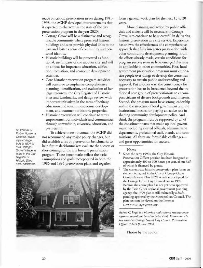
Dr. William W. Furber House, a Colonial Revival style cottage built in 1901 in "old Cottage Grove" village, is listed in the City Register of Historic Sites and Landmarks.
made on critical preservation issues during 1981-1998, the ACHP developed four statements that it expected to characterize the state of the city preservation program in the year 2020: • Cottage Grove will be a distinctive and recog
nizable community where preserved historic buildings and sites provide physical links to the past and foster a sense of community and personal identity.
• Historic buildings will be preserved as functional, useful parts of the modern city and will be a focus for important education, edification, recreation, and economic development activities.
• Core historic preservation program activities will continue to emphasize comprehensive planning, identification, and evaluation of heritage resources, the City Register of Historic Sites and Landmarks, and design review, with important initiatives in the areas of heritage education and tourism, economic development, and treatment of historic properties.
• Historic preservation will continue to stress empowerment of individuals and communities through stewardship, advocacy, education, and partnership.
To achieve these outcomes, the ACHP did not recommend any major policy changes, but did establish a list of preservation benchmarks to help future decisionmakers evaluate the success or shortcomings of the city historic preservation program. These benchmarks reflect the basic assumptions and goals incorporated in both the 1986 and 1994 preservation plans and together
form a general work plan for the next 15 to 20 years.
More planning and action by public officials and citizens will be necessary if Cottage Grove is to continue to be successful in delivering historic preservation as a city service. Experience has shown the effectiveness of a comprehensive approach that fully integrates preservation with other community development planning. From the efforts already made, certain conditions for program success seem to have emerged that may be applicable to other communities. First, local government preservation programs must emphasize people over things to develop the consensus necessary to sustain public understanding and approval. Put another way, the constituency for preservation has to be broadened beyond the traditional core group of preservationists to encompass citizens of diverse backgrounds and interests. Second, the program must have strong leadership within the structure of local government and the institutional means for playing an active role in shaping community development policy. And third, the program must be supported by all of the constituent parts that make up local government, including elected officials, administrative departments, professional staff, boards, and commissions. All three are formidable challenges— and great opportunities for success.
Notes 1 Since the early 1990s, the City Historic
Preservation Officer position has been budgeted at approximately 500 to 600 hours per year, about half of which is financed by grants.
2 The current city historic preservation plan forms an element (chapter) in the City of Cottage Grove Comprehensive Plan 2020, which was adopted by the Cottage Grove City Council late in 1999. Because the entire plan has not yet been approved by the Twin Cities' regional government planning agency, the 1999 plan is still technically a draft, pending approval by the Metropolitan Council. The plan text can be viewed on the Internet at<www.cottage-grove.org>.
Robert C. Vogel is a historian and cultural resource management consultant based in Saint Paul, Minnesota. He has served as Cottage Grove's City Historic Preservation Officer (CHPO) since 1984.
Photos by the author.
20 CRM No 7—2000
Pratt Cassity
Planning and the Local Preservation Review Commission
As the number of local design review programs seems to be multiplying like mosquitoes in mid-July, we find that the pro
grams are also increasing in areas of sophistication and impact. This expansion is directly related to the American system of local planning and the support, both financially and psychologically, of state and federal levels of government. The number of preservation-based design review and local commission programs has jumped dramatically because of some very deliberate actions in the past three decades: • The U.S. Supreme Court decision regarding
the fate of Grand Central Terminal in New York City.1
• The amendments to the National Historic Preservation Act in 1980 that created the Certified Local Government Program.
• Statewide planning acts that include provisions for the identification, evaluation and protection of historic resources.
In almost every ordinance that creates a local preservation review commission and institutes a local preservation program, the role of the local program is described as being "part of the planning functions" of the particular municipality. This ties the preservation program of the local government directly to the planning process. In many cases, municipalities go a step further and place the responsibility for staffing the preservation program in the planning department or code review and compliance office. The merits of locating preservation in planning have been discussed for years at national meetings and in publications in both planning and preservation circles.^ For better or worse, preservationists and planners are partners in community improvement.
In a recent survey conducted by the National Alliance of Preservation Commissions some rather interesting conclusions can be made about the 2,300 local historic preservation commissions and review boards in America and how they effect and are effected by local planning decisions.
The survey revealed that almost two-thirds of the communities responding have a preservation plan or a preservation element of their comprehensive/master plan.' A short 20 years ago, only a handful of local governments would have been able to point to a preservation element within their local planning process. Of course, this does not mean that all resources are fully protected with local governments who have preservation plans. It does mean, however, historic resources are considered when planning decisions are made. In addition, nearly one-third of the responding commissions reviewed (or had the opportunity to comment on) proposed comprehensive plan changes.
Other highlights of the survey results include: • The courts uphold design review. When
preservation commissions go to court an overwhelming majority (85%) of ordinances, designations, and decisions survive the challenge.
• Preservation commissions are approval bodies. A remarkable 95% of all commissions responding to the survey approve applications for changes to designated properties or properties within designated districts upon their initial review. Nearly all commissions then will approve the application upon resubmission and second review.
• Local preservation ordinances are valued locally. Communities report positively on enforcement of local preservation statutes and they indicate preservation is viewed as a positive, mainstream force that benefits widely divergent social groups and cultural resources.
• The preservation network works. Preservation commissions know where to go for assistance and many receive training on an annual basis. They all state that they could use more, but the number of workshops offered and agencies offering them have expanded from the last time commissions were surveyed in the 1980s. Commissions have especially expressed a greater reliance on their state historic preservation office for technical assistance.
CRM No 7—2000 21
• Local elected officials support preservation. Three-fourths of chief elected officials, mostly mayors, endorse and support historic preservation efforts and their locally-appointed commissions.
• Federal and state governments support preservation. Certified Local Government (CLG) grants, training programs, publications, and incentives are directed to local commissions.
• Demolition by neglect, determinations of economic hardship, and issues surrounding enforcement of decisions and monitoring of completed work continue to be baffling problems. The situations surrounding absentee landlords, building owners on fixed incomes, and under-staffed agencies plague the effective administration of local programs in most municipalities.. .still!
Planning decisions that include historic resources are recognized as better decisions. Likewise, planning programs at an administrative level should have a defined relationship with their historic preservation counterparts in municipal government, namely the historic preservation commission. It is not necessary for the preservation commission to be organizationally located within the planning department, but it should have a prescribed connection to the planning process.
There is a common way to make sure that historic preservation is considered in all planning decisions in larger metropolitan areas, not just planning that occurs in and around designated historic districts. Chiefly, historic resource protection should be included in a community's planning goals and policies, as this gives the commission decisions legislative teeth. Many communi
ties use a simple system that requires that a current historic resources inventory be keyed to the larger database used for tracking and monitoring building permits, zoning variances, and land subdivision. The preservation commission, more often their staff person, then is alerted and asked for comments on all major land use and new construction proposals that might impact historic resources. Even when this is an advisory process, it does result in more informed planning decisions.
As preservation moves closer to traditional planning methods (visioning, consensus building, permits, and quasi-judicial review) and as planning begins to incorporate preservation goals (city center revitalization and anti-sprawl efforts), American municipalities should be seeing more thoughtful community improvement schemes.
Notes 1 Penn Central Transportation Co. v. City of New York,
438 US 104, 107-108 129 (1978). 2 U.S. Congress, National Historic Preservation Act,
16 U.S.C. §§ 470-470w-6 (1994). 3 Eugenie Ladner Birch and Douglass Roby, "The
Planner and the Preservationist: An Uneasy Alliance," Journal of the American Planning Association 50:2 (1984): 194-207.
•* [Chris Cochran and Pratt Cassiry] United States Preservation Commission Identification Project II, (Athens: National Alliance of Preservation Commissions, 1998), idem.
5 Ibid 3.
Pratt Cassity is the Director of Public Service and Outreach, School of Environmental Design, University of Georgia. He also serves as the coordinator of Georgia's Certified Local Government Program and as Executive Director of the National Alliance of Preservation Commissions.
Information on the World Wide Web For information about preservation planning and related topics, take a look at the Cultural
Resources Partnership Notes series online at <www2.cr.nps.gov/pad/partnership/index.htm>.
To learn more about statewide historic preservation planning, visit <www2.cr.nps.gov/pad>
Statewide historic preservation plans are summarized in State Plan Profiles on the web at <www2.cr.nps.gov/pad/stateplans/index.htm>.
22 CRM No 7—2000
Gail C. Rothrock
A Tale of Two Communities Community Involvement in Preservation Planning
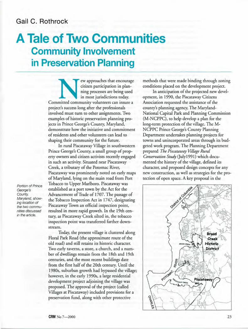
Portion of Prince George's County, Maryland, showing location of the two communities discussed in the article.
N ew approaches that encourage citizen participation in planning processes are being used in most jurisdictions today.
Committed community volunteers can insure a project's success long after the professionals involved must turn to other assignments. Two examples of historic preservation planning projects in Prince George's County, Maryland, demonstrate how the initiative and commitment of residents and other volunteers can lead to shaping their community for the future.
In rural Piscataway Village in southwestern Prince George's County, a small group of property owners and citizen activists recently engaged in such an activity. Situated near Piscataway Creek, a tributary of the Potomac River, Piscataway was prominently noted on early maps of Maryland, lying on the main road from Port Tobacco to Upper Marlboro. Piscataway was established as a port town by the Act for the Advancement of Trade of 1707. The passage of the Tobacco Inspection Act in 1747, designating Piscataway Town an official inspection point, resulted in more rapid growth. In the 19th century, as Piscataway Creek silted in, the tobacco inspection point was transferred farther downstream.
Today, the present village is clustered along Floral Park Road (the approximate route of the old road) and still retains its historic character. Two early taverns, a store, a church, and a number of dwellings remain from the 18th and 19th centuries, and the most recent buildings date from the first half of the 20th century. Until the 1980s, suburban growth had bypassed the village; however, in the early 1990s, a large residential development project adjoining the village was proposed. The approval of the project (called Villages at Piscataway) included provisions for a preservation fund, along with other protective
methods that were made binding through zoning conditions placed on the development project.
In anticipation of the projected new development, in 1990, the Piscataway Citizens Association requested the assistance of the county's planning agency, The Maryland-National Capital Park and Planning Commission (M-NCPPC), to help develop a plan for the long-term protection of the village. The M-NCPPC Prince George's County Planning Department undertakes planning projects for towns and unincorporated areas through its budgeted work program. The Planning Department prepared The Piscataway Village Rural Conservation Study (July 1991) which documented the history of the village, defined its character, and proposed design concepts for any new construction, as well as strategies for the protection of open space. A key proposal in the
CRM No 7—2000 23
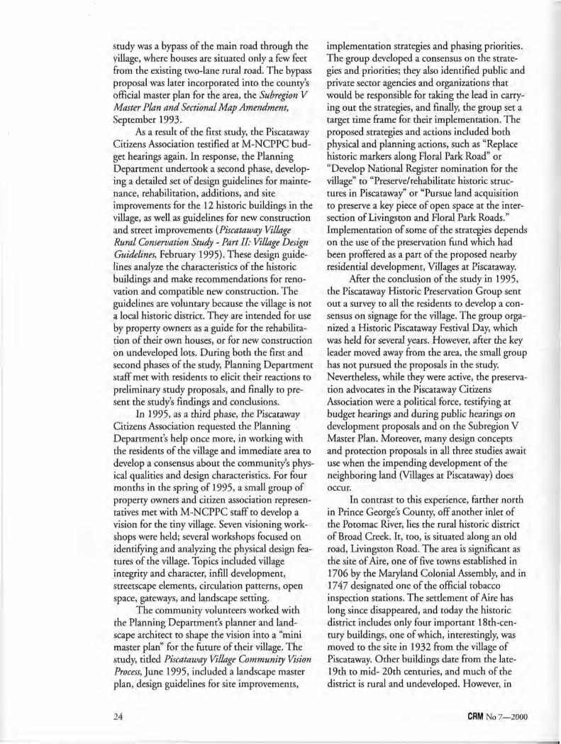
study was a bypass of the main road through the village, where houses are situated only a few feet from the existing two-lane rural road. The bypass proposal was later incorporated into the county's official master plan for the area, the Subregion V Master Plan and Sectional Map Amendment, September 1993.
As a result of the first study, the Piscataway Citizens Association testified at M-NCPPC budget hearings again. In response, the Planning Department undertook a second phase, developing a detailed set of design guidelines for maintenance, rehabilitation, additions, and site improvements for the 12 historic buildings in the village, as well as guidelines for new construction and street improvements {Piscataway Village Rural Conservation Study - Part II: Village Design Guidelines, February 1995). These design guidelines analyze the characteristics of the historic buildings and make recommendations for renovation and compatible new construction. The guidelines are voluntary because the village is not a local historic district. They are intended for use by property owners as a guide for the rehabilitation of their own houses, or for new construction on undeveloped lots. During both the first and second phases of the study, Planning Department staff met with residents to elicit their reactions to preliminary study proposals, and finally to present the study's findings and conclusions.
In 1995, as a third phase, the Piscataway Citizens Association requested the Planning Department's help once more, in working with the residents of the village and immediate area to develop a consensus about the community's physical qualities and design characteristics. For four months in the spring of 1995, a small group of property owners and citizen association representatives met with M-NCPPC staff to develop a vision for the tiny village. Seven visioning workshops were held; several workshops focused on identifying and analyzing the physical design features of the village. Topics included village integrity and character, infill development, streetscape elements, circulation patterns, open space, gateways, and landscape setting.
The community volunteers worked with the Planning Department's planner and landscape architect to shape the vision into a "mini master plan" for the future of their village. The study, titled Piscataway Village Community Vision Process, June 1995, included a landscape master plan, design guidelines for site improvements,
implementation strategies and phasing priorities. The group developed a consensus on the strategies and priorities; they also identified public and private sector agencies and organizations that would be responsible for taking the lead in carrying out the strategies, and finally, the group set a target time frame for their implementation. The proposed strategies and actions included both physical and planning actions, such as "Replace historic markers along Floral Park Road" or "Develop National Register nomination for the village" to "Preserve/rehabilitate historic structures in Piscataway" or "Pursue land acquisition to preserve a key piece of open space at the intersection of Livingston and Floral Park Roads." Implementation of some of the strategies depends on the use of the preservation fund which had been proffered as a part of the proposed nearby residential development, Villages at Piscataway.
After the conclusion of the study in 1995, the Piscataway Historic Preservation Group sent out a survey to all the residents to develop a consensus on signage for the village. The group organized a Historic Piscataway Festival Day, which was held for several years. However, after the key leader moved away from the area, the small group has not pursued the proposals in the study. Nevertheless, while they were active, the preservation advocates in the Piscataway Citizens Association were a political force, testifying at budget hearings and during public hearings on development proposals and on the Subregion V Master Plan. Moreover, many design concepts and protection proposals in all three studies await use when the impending development of the neighboring land (Villages at Piscataway) does occur.
In contrast to this experience, farther north in Prince George's County, off another inlet of the Potomac River, lies the rural historic district of Broad Creek. It, too, is situated along an old road, Livingston Road. The area is significant as the site of Aire, one of five towns established in 1706 by the Maryland Colonial Assembly, and in 1747 designated one of the official tobacco inspection stations. The settlement of Aire has long since disappeared, and today the historic district includes only four important 18th-cen-tury buildings, one of which, interestingly, was moved to the site in 1932 from the village of Piscataway. Other buildings date from the late-19th to mid- 20th centuries, and much of the district is rural and undeveloped. However, in
24 CRM No 7—2000
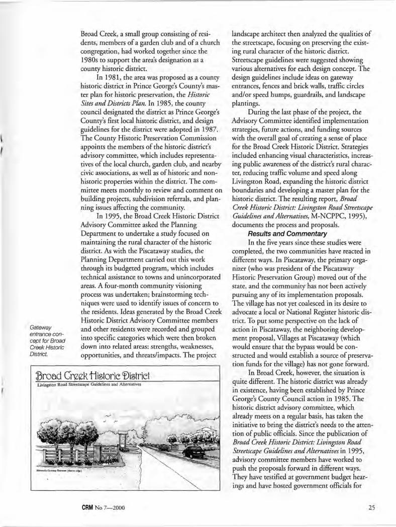
Gateway entrance concept for Broad Creek Historic District.
Broad Creek, a small group consisting of residents, members of a garden club and of a church congregation, had worked together since the 1980s to support the area's designation as a county historic district.
In 1981, the area was proposed as a county historic district in Prince George's County's master plan for historic preservation, the Historic Sites and Districts Plan. In 1985, the county council designated the district as Prince George's County's first local historic district, and design guidelines for the district were adopted in 1987. The County Historic Preservation Commission appoints the members of the historic district's advisory committee, which includes representatives of the local church, garden club, and nearby civic associations, as well as of historic and non-historic properties within the district. The committee meets monthly to review and comment on building projects, subdivision referrals, and planning issues affecting the community.
In 1995, the Broad Creek Historic District Advisory Committee asked the Planning Department to undertake a study focused on maintaining the rural character of the historic district. As with the Piscataway studies, the Planning Department carried out this work through its budgeted program, which includes technical assistance to towns and unincorporated areas. A four-month community visioning process was undertaken; brainstorming techniques were used to identify issues of concern to the residents. Ideas generated by the Broad Creek Historic District Advisory Committee members and other residents were recorded and grouped into specific categories which were then broken down into related areas: strengths, weaknesses, opportunities, and threats/impacts. The project
landscape architect then analyzed the qualities of the streetscape, focusing on preserving the existing rural character of the historic district. Streetscape guidelines were suggested showing various alternatives for each design concept. The design guidelines include ideas on gateway entrances, fences and brick walls, traffic circles and/or speed humps, guardrails, and landscape plantings.
During the last phase of the project, the Advisory Committee identified implementation strategies, future actions, and funding sources with the overall goal of creating a sense of place for the Broad Creek Historic District. Strategies included enhancing visual characteristics, increasing public awareness of the district's rural character, reducing traffic volume and speed along Livingston Road, expanding the historic district boundaries and developing a master plan for the historic district. The resulting report, Broad Creek Historic District: Livingston Road Streetscape Guidelines and Alternatives, M-NCPPC, 1995), documents the process and proposals.
Results and Commentary In the five years since these studies were
completed, the two communities have reacted in different ways. In Piscataway, the primary organizer (who was president of the Piscataway Historic Preservation Group) moved out of the state, and the community has not been actively pursuing any of its implementation proposals. The village has not yet coalesced in its desire to advocate a local or National Register historic district. To put some perspective on the lack of action in Piscataway, the neighboring development proposal, Villages at Piscataway (which would ensure that the bypass would be constructed and would establish a source of preservation funds for the village) has not gone forward.
In Broad Creek, however, the situation is quite different. The historic district was already in existence, having been established by Prince George's County Council action in 1985. The historic district advisory committee, which already meets on a regular basis, has taken the initiative to bring the district's needs to the attention of public officials. Since the publication of Broad Creek Historic District: Livingston Road Streetscape Guidelines and Alternatives in 1995, advisory committee members have worked to push the proposals forward in different ways. They have testified at government budget hearings and have hosted government officials for
CRM No 7—2000 25
walking tours of the historic district. Their work has brought results; in the last four years: • The M-NCPPC has assisted with a brochure
about the historic district. • Speed humps were installed by the County
public works department to calm traffic, a spin-off of the Livingston Road Streetscape Guidelines.
• The police department has monitored speeds on Livingston Road.
• Negotiations with a developer may lead to the proffer of "gateway" signage for the district, following the Livingston Road Streetscape Guidelines.
• The historic church has followed the guidelines to selectively clear woodland vegetation in order to provide a viewshed to its historic cemetery.
• A public utility has added plantings along its entrance road to enhance the views to Broad Creek, as proposed in the Guidelines.
• A conservancy has been incorporated to work with the National Park Service (NPS) in finding a new tenant for Harmony Hall, the historic property in the district owned by the NPS.
In the next fiscal year, the Planning Department, together with the Historic District Advisory Committee and other area stakeholders will produce a preservation plan for the district that updates the planning study completed before the district was designated in 1985. The study will result in an updated guide to the protection and appropriate development of the district.
These two examples demonstrate how preservation planning can help facilitate a community's determination of its own future. The studies have contributed plans, standards, and guidelines, which can help to serve as a road map for the community's future. Following such road maps will depend on continued vigilance and advocacy by each community, along with facilitation and professional advice from local planning agencies.
Gail C. Rothrock, A.I. C.P., is supervisor of the Planning and Preservation Section of the Community Planning Division of the M-NCPPC Planning Department in Prince Georges County, Maryland.
Illustrations courtesy Maryland-National Capital Park and Planning Commission.
Patrick H. Reed
Partnership Planning Involving Partners in Meaningful Ways
I n 1993, the battle of Chickamauga and the battles for Chattanooga were listed among the 20 most threatened Civil War sites in the Civil War Sites
Advisory Commission report to Congress. This finding did not come as a surprise, given the rapid growth and urbanization of the greater Chattanooga and north Georgia region. In 1994, Chickamauga and Chattanooga National Military Park initiated a related lands study called the Chattanooga Area Civil War Sites Assessment. This three-year process has proven very effective in developing new relationships with partners and getting valuable information to local decisionmakers to encourage preservation of the 38 sites studied.
This preservation planning effort was successful because of how the partnership planning team was developed and the meaningful roles that every partner played. All 38 sites were visited and assessed by all members of the multidiscipli-nary core planning team and group recommendations to encourage preservation were collectively developed by team members. Site assessment visits were publicly announced and local preservation groups, developers, and interested citizens joined the planning team in the field and had opportunities for direct input. Planning partners brought new ideas and perspectives, knowledge of local zoning and economic development issues, related planning efforts, and acted as liaison to local decisionmakers.
26 CRM No 7—2000
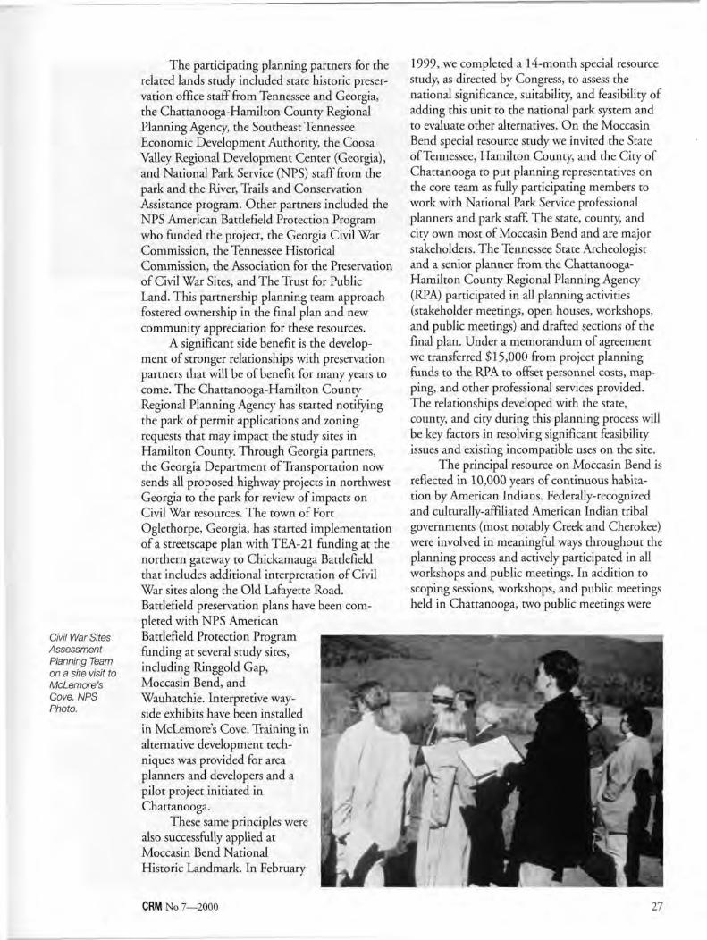
Civil War Sites Assessment Planning Team on a site visit to McLemore's Cove. NPS Photo.
The participating planning partners for the related lands study included state historic preservation office staff from Tennessee and Georgia, the Chattanooga-Hamilton County Regional Planning Agency, the Southeast Tennessee Economic Development Authority, the Coosa Valley Regional Development Center (Georgia), and National Park Service (NPS) staff from the park and the River, Trails and Conservation Assistance program. Other partners included the NPS American Battlefield Protection Program who funded the project, the Georgia Civil War Commission, the Tennessee Historical Commission, the Association for the Preservation of Civil War Sites, and The Trust for Public Land. This partnership planning team approach fostered ownership in the final plan and new community appreciation for these resources.
A significant side benefit is the development of stronger relationships with preservation partners that will be of benefit for many years to come. The Chattanooga-Hamilton County Regional Planning Agency has started notifying the park of permit applications and zoning requests that may impact the study sites in Hamilton County. Through Georgia partners, the Georgia Department of Transportation now sends all proposed highway projects in northwest Georgia to the park for review of impacts on Civil War resources. The town of Fort Oglethorpe, Georgia, has started implementation of a streetscape plan with TEA-21 funding at the northern gateway to Chickamauga Battlefield that includes additional interpretation of Civil War sites along the Old Lafayette Road. Battlefield preservation plans have been completed with NPS American Battlefield Protection Program funding at several study sites, including Ringgold Gap, Moccasin Bend, and Wauhatchie. Interpretive wayside exhibits have been installed in McLemore's Cove. Training in alternative development techniques was provided for area planners and developers and a pilot project initiated in Chattanooga.
These same principles were also successfully applied at Moccasin Bend National Historic Landmark. In February
1999, we completed a 14-month special resource study, as directed by Congress, to assess the national significance, suitability, and feasibility of adding this unit to the national park system and to evaluate other alternatives. On the Moccasin Bend special resource study we invited the State of Tennessee, Hamilton County, and the City of Chattanooga to put planning representatives on the core team as fully participating members to work with National Park Service professional planners and park staff. The state, county, and city own most of Moccasin Bend and are major stakeholders. The Tennessee State Archeologist and a senior planner from the Chattanooga-Hamilton County Regional Planning Agency (RPA) participated in all planning activities (stakeholder meetings, open houses, workshops, and public meetings) and drafted sections of the final plan. Under a memorandum of agreement we transferred $15,000 from project planning funds to the RPA to offset personnel costs, mapping, and other professional services provided. The relationships developed with the state, county, and city during this planning process will be key factors in resolving significant feasibility issues and existing incompatible uses on the site.
The principal resource on Moccasin Bend is reflected in 10,000 years of continuous habitation by American Indians. Federally-recognized and culturally-affiliated American Indian tribal governments (most notably Creek and Cherokee) were involved in meaningful ways throughout the planning process and actively participated in all workshops and public meetings. In addition to scoping sessions, workshops, and public meetings held in Chattanooga, two public meetings were
CRM No 7—2000 27
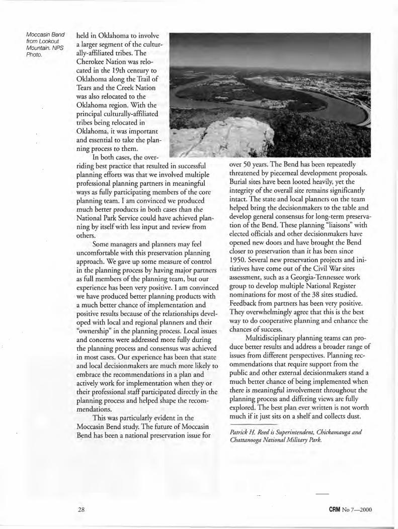
Moccasin Bend from Lookout Mountain. NPS Photo.
held in Oklahoma to involve a larger segment of the culturally-affiliated tribes. The Cherokee Nation was relocated in the 19th century to Oklahoma along the Trail of Tears and the Creek Nation was also relocated to the Oklahoma region. With the principal culturally-affiliated tribes being relocated in Oklahoma, it was important and essential to take the planning process to them.
In both cases, the overriding best practice that resulted in successful planning efforts was that we involved multiple professional planning partners in meaningful ways as fully participating members of the core planning team. I am convinced we produced much better products in both cases than the National Park Service could have achieved planning by itself with less input and review from others.
Some managers and planners may feel uncomfortable with this preservation planning approach. We gave up some measure of control in the planning process by having major partners as full members of the planning team, but our experience has been very positive. I am convinced we have produced better planning products with a much better chance of implementation and positive results because of the relationships developed with local and regional planners and their "ownership" in the planning process. Local issues and concerns were addressed more fully during the planning process and consensus was achieved in most cases. Our experience has been that state and local decisionmakers are much more likely to embrace the recommendations in a plan and actively work for implementation when they or their professional staff participated directly in the planning process and helped shape the recommendations.
This was particularly evident in the Moccasin Bend study. The future of Moccasin Bend has been a national preservation issue for Patrick H. Reed is Superintendent, Chickamauga and
Chattanooga National Military Park.
28 CRM No 7—2000
over 50 years. The Bend has been repeatedly threatened by piecemeal development proposals. Burial sites have been looted heavily, yet the integrity of the overall site remains significantly intact. The state and local planners on the team helped bring the decisionmakers to the table and develop general consensus for long-term preservation of the Bend. These planning "liaisons" with elected officials and other decisionmakers have opened new doors and have brought the Bend closer to preservation than it has been since 1950. Several new preservation projects and initiatives have come out of the Civil War sites assessment, such as a Georgia-Tennessee work group to develop multiple National Register nominations for most of the 38 sites studied. Feedback from partners has been very positive. They overwhelmingly agree that this is the best way to do cooperative planning and enhance the chances of success.
Multidisciplinary planning teams can produce better results and address a broader range of issues from different perspectives. Planning recommendations that require support from the public and other external decisionmakers stand a much better chance of being implemented when there is meaningful involvement throughout the planning process and differing views are fully explored. The best plan ever written is not worth much if it just sits on a shelf and collects dust.
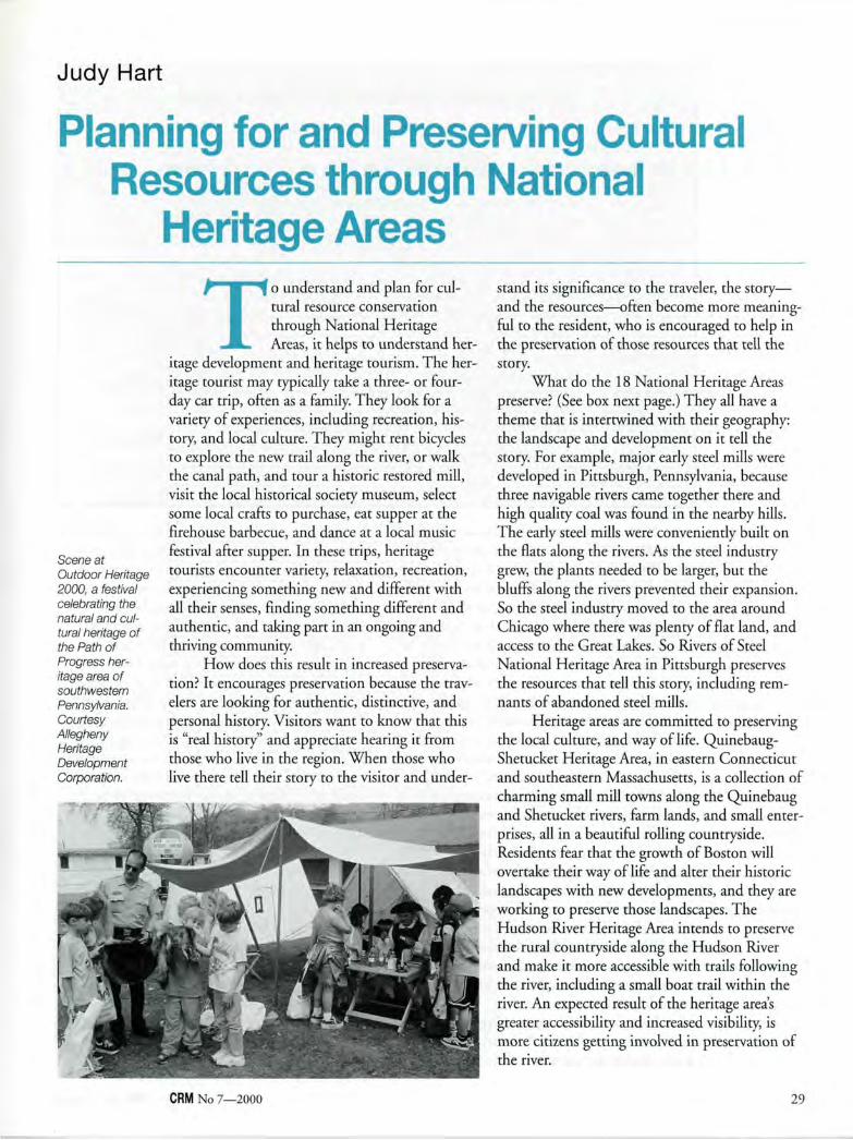
Judy Hart
Planning for and Preserving Cultural Resources through National
Heritage Areas
Scene at Outdoor Heritage 2000, a festival celebrating the natural and cultural heritage of the Path of Progress heritage area of southwestern Pennsylvania. Courtesy Allegheny Heritage Development Corporation.
To understand and plan for cultural resource conservation through National Heritage Areas, it helps to understand her
itage development and heritage tourism. The heritage tourist may typically take a three- or four-day car trip, often as a family. They look for a variety of experiences, including recreation, history, and local culture. They might rent bicycles to explore the new trail along the river, or walk the canal path, and tour a historic restored mill, visit the local historical society museum, select some local crafts to purchase, eat supper at the firehouse barbecue, and dance at a local music festival after supper. In these trips, heritage tourists encounter variety, relaxation, recreation, experiencing something new and different with all their senses, finding something different and authentic, and taking part in an ongoing and thriving community.
How does this result in increased preservation? It encourages preservation because the travelers are looking for authentic, distinctive, and personal history. Visitors want to know that this is "real history" and appreciate hearing it from those who live in the region. When those who live there tell their story to the visitor and under-
CRM No 7—2000
stand its significance to the traveler, the story— and the resources—often become more meaningful to the resident, who is encouraged to help in the preservation of those resources that tell the story.
What do the 18 National Heritage Areas preserve? (See box next page.) They all have a theme that is intertwined with their geography: the landscape and development on it tell the story. For example, major early steel mills were developed in Pittsburgh, Pennsylvania, because three navigable rivers came together there and high quality coal was found in the nearby hills. The early steel mills were conveniently built on the flats along the rivers. As the steel industry grew, the plants needed to be larger, but the bluffs along the rivers prevented their expansion. So the steel industry moved to the area around Chicago where there was plenty of flat land, and access to the Great Lakes. So Rivers of Steel National Heritage Area in Pittsburgh preserves the resources that tell this story, including remnants of abandoned steel mills.
Heritage areas are committed to preserving the local culture, and way of life. Quinebaug-Shetucket Heritage Area, in eastern Connecticut and southeastern Massachusetts, is a collection of charming small mill towns along the Quinebaug and Shetucket rivers, farm lands, and small enterprises, all in a beautiful rolling countryside. Residents fear that the growth of Boston will overtake their way of life and alter their historic landscapes with new developments, and they are working to preserve those landscapes. The Hudson River Heritage Area intends to preserve the rural countryside along the Hudson River and make it more accessible with trails following the river, including a small boat trail within the river. An expected result of the heritage area's greater accessibility and increased visibility, is more citizens getting involved in preservation of the river.
29
Designated National Heritage Areas (As of March 2000)
Year Designated National Heritage Area
1984 1986 1988 1988 1994 1994 1996 1996 1996 1996 1996 1996 1996 1996 1996 1996 1996 1998
Illinois & Michigan Canal National Heritage Corridor John H. Chafee Blackstone River Valley National Heritage Corridor Delaware & Lehigh National Heritage Corridor Southwestern Pennsylvania Heritage Route (Path of Progress) Cane River National Heritage Area Quinebaug & Shetucket Rivers Valley National Heritage Corridor Cache La Poudre River Corridor America's Agricultural Heritage Partnership Augusta Canal National Heritage Area Essex National Heritage Area Hudson River Valley National Heritage Area National Coal Heritage Area Ohio & Erie Canal National Heritage Corridor Rivers of Steel National Heritage Area Shenandoah Valley Battlefields National Historic District South Carolina National Heritage Corridor Tennessee Civil War Heritage Area Automobile National Heritage Area
State(s)
IL MA&RI PA PA LA CT&MA CO IA GA MA NY WV OH PA VA SC TN MI
Heritage areas make their landscapes more accessible to visitors, as well as to residents. The Ohio and Erie Canal National Heritage Corridor will, when restored, link Akron and Cleveland with communities in between, and with the Cuyahoga National Recreation Area in the middle. Residents will be able to walk or bicycle out into the country from their back yard. This new access is expected to inspire more residents to get involved in the preservation of the canal towpath.
How does heritage preservation work for specific resources? It is, at its best, local, personal, and sustainable. New visitors to an area can make it feasible to rent rooms in a historic home, which eases the burden of maintaining the structure. Farm-stay visitors can help out a small farm owner both by paying for the farm stay and perhaps by being inspired to help out with the farm work. Unique local crafts, like an airplane made from recycled Mountain Dew cans, could provide enough extra income to enable someone to continue to live in their mountain cabin. If a heritage area holds annual music festivals, some residents will be inspired to learn traditional music so they can compete and participate in the coming year's music festival.
How does a heritage area begin? Some have begun with a good idea one individual shared with a friend over a kitchen table; then they
brought in more friends; next they moved to the community center for meetings and then on to regional meetings. It is a grassroots program. A significant image for heritage areas is a big round table where folks who have not traditionally worked together, and perhaps have never even met, begin to meet on a regular basis and figure out how to make their dream come true.
It is this dream, this vision, and its early development that is special about heritage areas. This is also what makes heritage area planning different from other planning efforts. It is a collage of good ideas fused into a vision of what the residents in a region want their future to be, and a collage of thinking about how to get there. An effective strategy for heritage planning is giving disposable cameras to 50 residents and asking them to photograph what they like about their community and want to preserve, and what they don't like and want to reduce, eliminate, or restrict. When all the photographs are developed, the group together sorts the pictures into "good" and "bad" and displays them on the wall. Solutions begin to become evident, and the appropriate people for implementing those changes begin to think about how to make those changes. The best heritage development comes from the heart—from loving one's community, and wanting to make it an even better place to
30 CRM No 7—2000
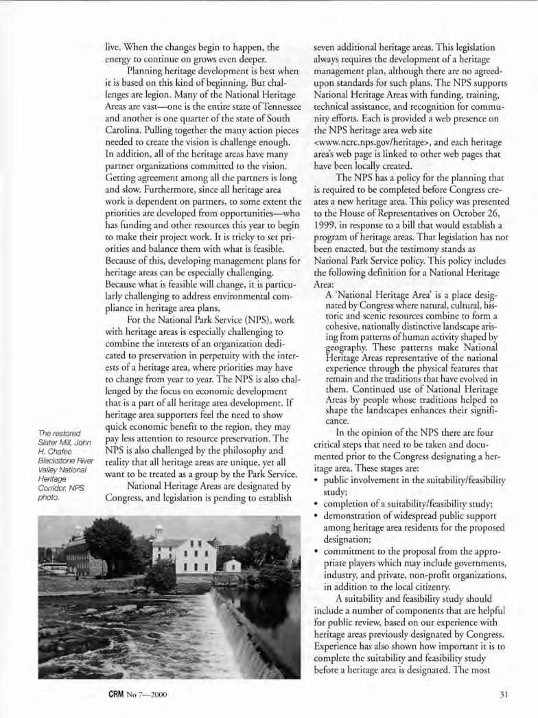
The restored Slater Mill, John H. Chafee Blackstone River Valley National Heritage Corridor. NPS photo.
live. When the changes begin to happen, the energy to continue on grows even deeper.
Planning heritage development is best when it is based on this kind of beginning. But challenges are legion. Many of the National Heritage Areas are vast—one is the entire state of Tennessee and another is one quarter of the state of South Carolina. Pulling together the many action pieces needed to create the vision is challenge enough. In addition, all of the heritage areas have many partner organizations committed to the vision. Getting agreement among all the partners is long and slow. Furthermore, since all heritage area work is dependent on partners, to some extent the priorities are developed from opportunities—who has funding and other resources this year to begin to make their project work. It is tricky to set priorities and balance them with what is feasible. Because of this, developing management plans for heritage areas can be especially challenging. Because what is feasible will change, it is particularly challenging to address environmental compliance in heritage area plans.
For the National Park Service (NPS), work with heritage areas is especially challenging to combine the interests of an organization dedicated to preservation in perpetuity with the interests of a heritage area, where priorities may have to change from year to year. The NPS is also challenged by the focus on economic development that is a part of all heritage area development. If heritage area supporters feel the need to show quick economic benefit to the region, they may pay less attention to resource preservation. The NPS is also challenged by the philosophy and reality that all heritage areas are unique, yet all want to be treated as a group by the Park Service.
National Heritage Areas are designated by Congress, and legislation is pending to establish
seven additional heritage areas. This legislation always requires the development of a heritage management plan, although there are no agreed-upon standards for such plans. The NPS supports National Heritage Areas with funding, training, technical assistance, and recognition for community efforts. Each is provided a web presence on the NPS heritage area web site <www.ncrc.nps.gov/heritage>, and each heritage area's web page is linked to other web pages that have been locally created.
The NPS has a policy for the planning that is required to be completed before Congress creates a new heritage area. This policy was presented to the House of Representatives on October 26, 1999, in response to a bill that would establish a program of heritage areas. That legislation has not been enacted, but the testimony stands as National Park Service policy. This policy includes the following definition for a National Heritage Area:
A 'National Heritage Area is a place designated by Congress where natural, cultural, historic and scenic resources combine to form a cohesive, nationally distinctive landscape arising from patterns of human activity shaped by geography. These patterns make National Heritage Areas representative of the national experience through the physical features that remain and the traditions that have evolved in them. Continued use of National Heritage Areas by people whose traditions helped to shape the landscapes enhances their significance.
In the opinion of the NPS there are four critical steps that need to be taken and documented prior to the Congress designating a heritage area. These stages are: • public involvement in the suitability/feasibility
study; • completion of a suitability/feasibility study; • demonstration of widespread public support
among heritage area residents for the proposed designation;
• commitment to the proposal from the appropriate players which may include governments, industry, and private, non-profit organizations, in addition to the local citizenry.
A suitability and feasibility study should include a number of components that are helpful for public review, based on our experience with heritage areas previously designated by Congress. Experience has also shown how important it is to complete the suitability and feasibility study before a heritage area is designated. The most
CRM No 7—2000 31
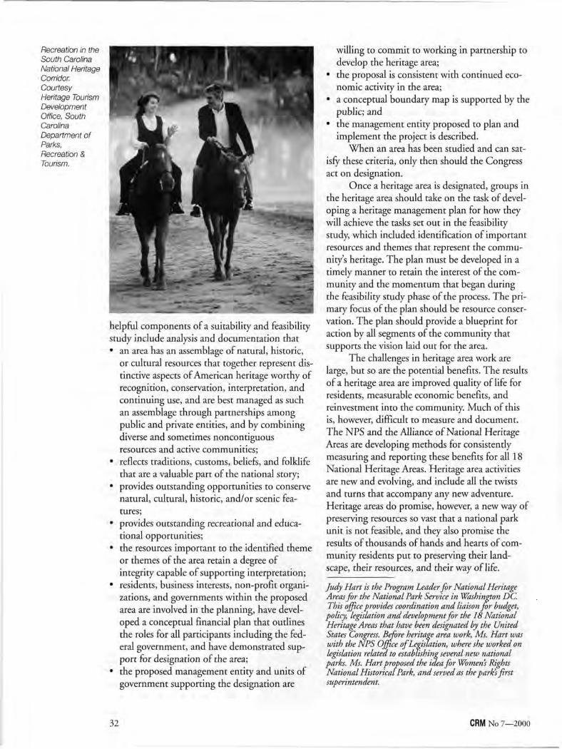
Recreation in the South Carolina National Heritage Corridor. Courtesy Heritage Tourism Development Office, South Carolina Department of Parks, Recreation & Tourism.
helpful components of a suitability and feasibility study include analysis and documentation that • an area has an assemblage of natural, historic,
or cultural resources that together represent distinctive aspects of American heritage worthy of recognition, conservation, interpretation, and continuing use, and are best managed as such an assemblage through partnerships among public and private entities, and by combining diverse and sometimes noncontiguous resources and active communities;
• reflects traditions, customs, beliefs, and folklife that are a valuable part of the national story;
• provides outstanding opportunities to conserve natural, cultural, historic, and/or scenic features;
• provides outstanding recreational and educational opportunities;
• the resources important to the identified theme or themes of the area retain a degree of integrity capable of supporting interpretation;
• residents, business interests, non-profit organizations, and governments within the proposed area are involved in the planning, have developed a conceptual financial plan that outlines the roles for all participants including the federal government, and have demonstrated support for designation of the area;
• the proposed management entity and units of government supporting the designation are
willing to commit to working in partnership to develop the heritage area;
• the proposal is consistent with continued economic activity in the area;
• a conceptual boundary map is supported by the public; and
• the management entity proposed to plan and implement the project is described.
When an area has been studied and can satisfy these criteria, only then should the Congress act on designation.
Once a heritage area is designated, groups in the heritage area should take on the task of developing a heritage management plan for how they will achieve the tasks set out in the feasibility study, which included identification of important resources and themes that represent the community's heritage. The plan must be developed in a timely manner to retain the interest of the community and the momentum that began during the feasibility study phase of the process. The primary focus of the plan should be resource conservation. The plan should provide a blueprint for action by all segments of the community that supports the vision laid out for the area.
The challenges in heritage area work are large, but so are the potential benefits. The results of a heritage area are improved quality of life for residents, measurable economic benefits, and reinvestment into the community. Much of this is, however, difficult to measure and document. The NPS and the Alliance of National Heritage Areas are developing methods for consistently measuring and reporting these benefits for all 18 National Heritage Areas. Heritage area activities are new and evolving, and include all the twists and turns that accompany any new adventure. Heritage areas do promise, however, a new way of preserving resources so vast that a national park unit is not feasible, and they also promise the results of thousands of hands and hearts of community residents put to preserving their landscape, their resources, and their way of life.
Judy Hart is the Program Leader for National Heritage Areas for the National Park Service in Washington DC. This office provides coordination and liaison for budget,
policy, legislation and development for the 18 National Heritage Areas that have been designated by the United States Congress. Before heritage area work, Ms. Hart was with the NPS Office of Legislation, where she worked on legislation related to establishing several new national parks. Ms. Hart proposed the idea for Women's Rights National Historical Park, and served as the park's first superintendent.
32 CRM No 7—2000
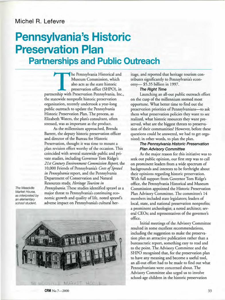
Michel R. Lefevre
Pennsylvania's Historic Preservation Plan
Partnerships and Public Outreach
The Meadville Market House, as interpreted by an elementary school student.
The Pennsylvania Historical and Museum Commission, which also acts as the state historic preservation office (SHPO), in
partnership with Preservation Pennsylvania, Inc., the statewide nonprofit historic preservation organization, recently undertook a year-long public outreach to update the Pennsylvania Historic Preservation Plan. The process, as Elizabeth Waters, the plan's consultant, often stressed, was as important as the product.
As the millennium approached, Brenda Barrett, the deputy historic preservation officer and director of the Bureau for Historic Preservation, thought it was time to mount a plan revision effort worthy of the occasion. This coincided with several statewide public and private studies, including Governor Tom Ridge's 21st Century Environment Commission Report, the 10,000 Friends of Pennsylvania's Costs of Sprawl in Pennsylvania report, and the Pennsylvania Department of Conservation and Natural Resources study, Heritage Tourism in Pennsylvania. These studies identified sprawl as a major threat to Pennsylvania's continuing economic growth and quality of life, noted sprawl's adverse impact on Pennsylvania's cultural her
itage, and reported that heritage tourism contributes significantly to Pennsylvania's economy— $5.35 billion in 1997.
The Right Time Launching an all-out public outreach effort
on the cusp of the millennium seemed most opportune. What better time to find out the preservation priorities of Pennsylvanians—to ask them what preservation policies they want to see realized, what historic resources they want preserved, what are the biggest threats to preservation of their communities? However, before these questions could be answered, we had to get organized; in other words, to plan the plan.
The Pennsylvania Historic Preservation Plan Advisory Committee As the major reason for this initiative was to
seek out public opinion, our first step was to call on prominent leaders from a wide spectrum of backgrounds and interests to be forthright about their opinions regarding historic preservation. With full support from Governor Tom Ridge's office, the Pennsylvania Historical and Museum Commission appointed the Historic Preservation Plan Advisory Committee. The committee's 14 members included state legislators; leaders of local, state, and national preservation nonprofits; a prominent archeologist; a noted architect; several CEOs; and representatives of the governor's office.
Initial meetings of the Advisory Committee resulted in some excellent recommendations, including the suggestion to make the preservation plan an attractive publication rather than a bureaucratic report, something easy to read and to the point. The Advisory Committee and the SHPO recognized that, for the preservation plan to have any meaning and become a useful tool, an all-out effort had to be made to find out what Pennsylvanians were concerned about. The Advisory Committee also urged us to involve school-age children in the historic preservation
CRM No 7—2000 33

plan process—they wanted to hear from all Pennsylvanians.
A Historic Preservation Convocation Before launching any public forums, the
Advisory Committee agreed to organize an all-day convocation of preservation professionals and advocates invited to identify issues that would be taken to the public forums as "talking points." The convocation was held March 1999, in Carlisle, Pennsylvania, attracting 175 participants from across the state. It highlighted specific themes and issues: for example, historic preservation creates attractive communities, is a form of economic development, and is a way to tell Pennsylvania's unique story. Also noted was the need for preservation to become a mainstream approach and, to make that a reality, education, public awareness, and government training had to occur.
Participants were asked to identify priority initiatives at the state, regional, and local levels for the next five years. At the local and regional levels of government, convocation attendees said, historic preservation must be incorporated into municipal comprehensive plans and zoning ordinances; and technical assistance to local governments and preservation nonprofit organizations needs to be increased. Attendees also noted that the statewide network of preservation organizations needs to be strengthened. Everyone agreed that the preservation constituency needed to be broader and more multicultural. It was remarked at the convocation, as well as at all public forums, that historic preservationists should adopt some of the strategies successfully employed by the environmental movement.
"Educate, educate, educate" was the major refrain heard throughout the day. "Time is of the essence—take action now," we were told. "Create a sense of urgency; publicize the loss of irreplaceable historic resources."
Launching the Planning Effort To help us launch the plan we invited a
class of fourth graders from the city of Harrisburg to present their drawings of historic sites they wished to preserve. At a news conference held in the capitol rotunda on December 17, 1998, under the festooned lights of a huge Christmas tree, the children presented their drawings to a William Penn re-enactor before an assembly of state officials. After briefly explaining their artwork, the children put them into a large gift-wrapped box as their gifts to the preservation
plan. It was a festive occasion and an auspicious way to launch the preservation plan public outreach.
Promoting the Plan: News Events With the able assistance of the agency's
press secretary, news releases were mailed to all news media in the state and media in our public forum locations were personally contacted. To generate interest and participation in the preservation plan and boost attendance at the public forums, we organized press conferences and invited the media to join us on tours or visits to historic sites in each of the public forum localities. Our local preservation partners took the opportunity to discuss current preservation issues affecting their region or community. We were also fortunate, due to the advance work of our press secretary, to meet with several editorial boards. This proved highly useful in that we were able to explain the preservation ethos to local newspapers that had little or no familiarity with it.
The Public Forums The difficult decisions we had to make were
how many public forums to organize and where and when to hold them. Pennsylvania is a large, essentially rural state, with a staggering 2,568 local governments. We knew we wanted to hold public forums in our two largest cities— Philadelphia and Pittsburgh, approximately 400 miles apart—but what about the in-between places? We wanted as broad a representation of public opinion as possible. We did our best to choose sites accessible to local residents where organizations were willing to help organize and publicize our meetings. The result was 13 locations spread out across the state. Without the assistance of our local partners we could not have managed as many public forums.
Working with our statewide nonprofit organization as a major partner and with local preservation organizations was crucial, not only for practical reasons, but also to strengthen the preservation network throughout Pennsylvania. It is clear that in order for the plan to work, Pennsylvania's historic preservation organizations and historical societies must be strongly committed to the plan from the beginning.
How We Held Our Public Forums Public forums were held weekdays in the
early evenings. Attendance was free, and we served refreshments. We invited the public to bring along their children and provided games and other quiet distractions for them, or urged
34 CRM No 7—2000
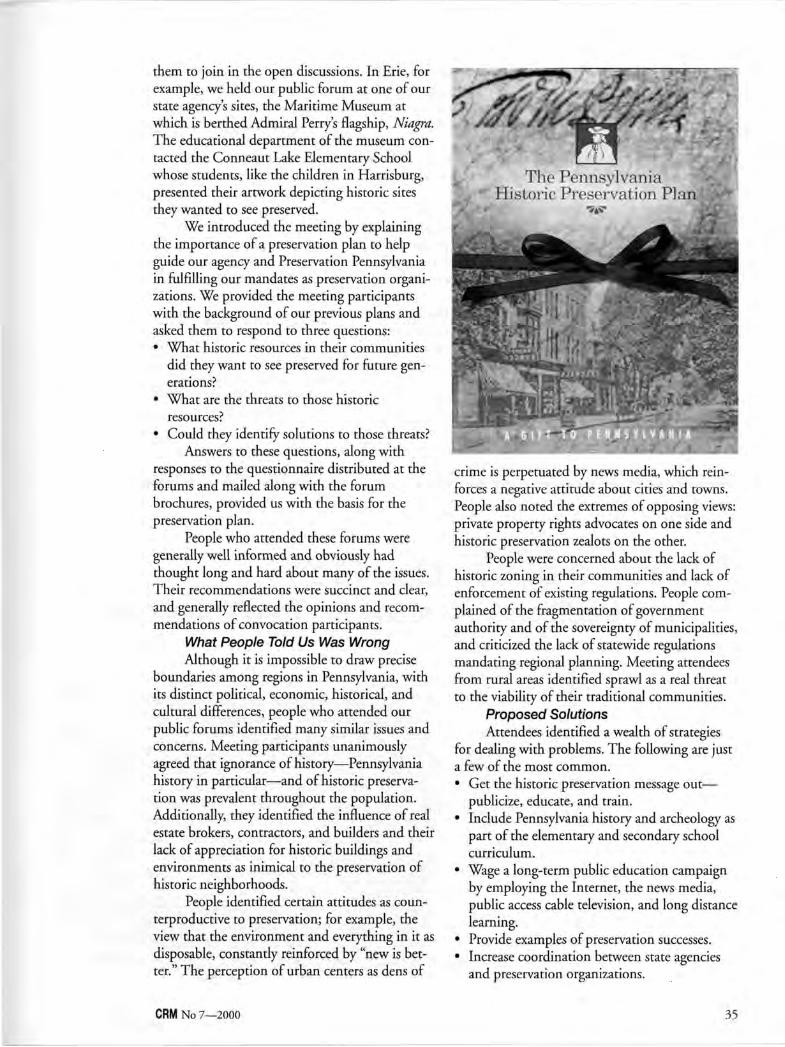
them to join in the open discussions. In Erie, for example, we held our public forum at one of our state agency's sites, the Maritime Museum at which is berthed Admiral Perry's flagship, Niagra. The educational department of the museum contacted the Conneaut Lake Elementary School whose students, like the children in Harrisburg, presented their artwork depicting historic sites they wanted to see preserved.
We introduced the meeting by explaining the importance of a preservation plan to help guide our agency and Preservation Pennsylvania in fulfilling our mandates as preservation organizations. We provided the meeting participants with the background of our previous plans and asked them to respond to three questions: • What historic resources in their communities
did they want to see preserved for future generations?
• What are the threats to those historic resources?
• Could they identify solutions to those threats? Answers to these questions, along with
responses to the questionnaire distributed at the forums and mailed along with the forum brochures, provided us with the basis for the preservation plan.
People who attended these forums were generally well informed and obviously had thought long and hard about many of the issues. Their recommendations were succinct and clear, and generally reflected the opinions and recommendations of convocation participants.
What People Told Us Was Wrong Although it is impossible to draw precise
boundaries among regions in Pennsylvania, with its distinct political, economic, historical, and cultural differences, people who attended our public forums identified many similar issues and concerns. Meeting participants unanimously agreed that ignorance of history—Pennsylvania history in particular—and of historic preservation was prevalent throughout the population. Additionally, they identified the influence of real estate brokers, contractors, and builders and their lack of appreciation for historic buildings and environments as inimical to the preservation of historic neighborhoods.
People identified certain attitudes as counterproductive to preservation; for example, the view that the environment and everything in it as disposable, constantly reinforced by "new is better." The perception of urban centers as dens of
crime is perpetuated by news media, which reinforces a negative attitude about cities and towns. People also noted the extremes of opposing views: private property rights advocates on one side and historic preservation zealots on the other.
People were concerned about the lack of historic zoning in their communities and lack of enforcement of existing regulations. People complained of the fragmentation of government authority and of the sovereignty of municipalities, and criticized the lack of statewide regulations mandating regional planning. Meeting attendees from rural areas identified sprawl as a real threat to the viability of their traditional communities.
Proposed Solutions Attendees identified a wealth of strategies
for dealing with problems. The following are just a few of the most common. • Get the historic preservation message out—
publicize, educate, and train. • Include Pennsylvania history and archeology as
part of the elementary and secondary school curriculum.
• Wage a long-term public education campaign by employing the Internet, the news media, public access cable television, and long distance learning.
• Provide examples of preservation successes. • Increase coordination between state agencies
and preservation organizations.
CRM No 7—2000 35
• Local governments and communities should share their preservation knowledge and avoid competing for the same resources.
• State agencies should abide by the Pennsylvania History Code.
• Amend the Municipalities Planning Code to clearly incorporate historic preservation language and an anti-sprawl policy.
• Support incentives for historic preservation, including tax credits for historic rehabilitation of commercial and residential properties.
• Use a carrot-and-stick approach to strengthen laws to protect archeological resources.
An Agenda for Action The culmination of our public outreach tar
geted three main areas of concentrated effort, which have become the Plan's goals: • Educate Pennsylvanians about our heritage and
its value. • Build better communities through preservation. • Provide strong leadership at the state level.
The Pennsylvania Historic Preservation Plan: A Gift to Pennsylvania was published in December 1999, and has been widely distributed. Copies have been mailed to all state legislators, it has been distributed through statewide government associations, and is available in state libraries. The plan can also be accessed through the web at <www.phmc.state.pa.us>.
In the forthcoming years, the fulfillment of the Plan's goals will be a collaborative effort undertaken by state agencies, Preservation Pennsylvania, local governments, legislators, preservation organizations, historical societies, and all those concerned with the preservation of our cultural heritage and economic well being.
Michel R. Lefevre is the Coordinator of Community Preservation for the Pennsylvania Historical and Museum Commission (PHMC), where he administers the Certified Local Government Program. He coordinated the development of the Pennsylvania Historic Preservation Plan.
Illustrations courtesy Pennsylvania Historical and Museum Commission.
Vincent R. Shigekuni
The Kaho olawe Use Plan Non-traditional Planning for Traditional Use
The island of Kaho" olawe is located in the Hawaiian island chain just southwest of the island of Maui. It is one of the eight
major islands of HawaiM, but unlike most, it has experienced limited development. The island was used in the 1800s to early 1900s for the ranching of sheep, cattle, and goats. With the outset of World War II, the United States military took over all use of the island to train for air and sea attacks as well as to train for marine landings. During the military period, almost every type of ordnance, other than chemical and nuclear weapons, has been fired at, dropped on, or detonated on the island.
During the early years of the 1970s, a number of Hawaiian residents called for the halting of the bombing. In 1976, a small group of Native Hawaiians representing the Protect Kaho'olawe
* Ohana illegally landed on the island in protest of the bombing. Several illegal landings on the island soon followed, gaining widespread support among both Native Hawaiians and non-Hawaiians.
Finally, in 1990, then President Bush ordered a temporary halt to all bombing and munitions training. This act is considered one of the first great successes of the modern Hawaiian rights movement. Three years later, the United States Congress returned the island of Kaho" olawe to Hawai'i under the Defense Appropriations Act of 1993. This legislation requires the U.S. Navy to complete an environmental remediation program in 10 years. Hawai'i designated the island and its surrounding waters to two miles out as the Kaho" olawe Island Reserve and restricted the use of the Island Reserve to:
36 CRM No 7—2000
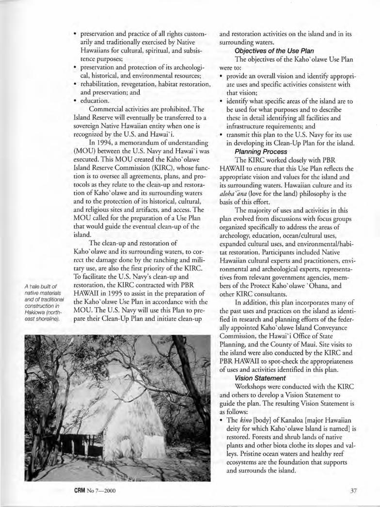
A hale built of native materials and of traditional construction in Hakiowa (northeast shoreline).
• preservation and practice of all rights customarily and traditionally exercised by Native Hawaiians for cultural, spiritual, and subsistence purposes;
• preservation and protection of its archeologi-cal, historical, and environmental resources;
• rehabilitation, revegetation, habitat restoration, and preservation; and
• education. Commercial activities are prohibited. The
Island Reserve will eventually be transferred to a sovereign Native Hawaiian entity when one is recognized by the U.S. and HawaPi.
In 1994, a memorandum of understanding (MOU) between the U.S. Navy and HawaPi was executed. This MOU created the Kaho'olawe Island Reserve Commission (KIRC), whose function is to oversee all agreements, plans, and protocols as they relate to the clean-up and restoration of Kaho'olawe and its surrounding waters and to the protection of its historical, cultural, and religious sites and artifacts, and access. The MOU called for the preparation of a Use Plan that would guide the eventual clean-up of the island.
The clean-up and restoration of Kaho'olawe and its surrounding waters, to correct the damage done by the ranching and military use, are also the first priority of the KIRC. To facilitate the U.S. Navy's clean-up and restoration, the KIRC contracted with PBR HAWAII in 1995 to assist in the preparation of the Kaho'olawe Use Plan in accordance with the MOU. The U.S. Navy will use this Plan to prepare their Clean-Up Plan and initiate clean-up
and restoration activities on the island and in its surrounding waters.
Objectives of the Use Plan The objectives of the Kaho'olawe Use Plan
were to: • provide an overall vision and identify appropri
ate uses and specific activities consistent with that vision;
• identify what specific areas of the island are to be used for what purposes and to describe these in detail identifying all facilities and infrastructure requirements; and
• transmit this plan to the U.S. Navy for its use in developing its Clean-Up Plan for the island.
Planning Process The KIRC worked closely with PBR
HAWAII to ensure that this Use Plan reflects the appropriate vision and values for the island and its surrounding waters. Hawaiian culture and its aloha s~ana (love for the land) philosophy is the basis of this effort.
The majority of uses and activities in this plan evolved from discussions with focus groups organized specifically to address the areas of archeology, education, ocean/cultural uses, expanded cultural uses, and environmental/habitat restoration. Participants included Native Hawaiian cultural experts and practitioners, environmental and archeological experts, representatives from relevant government agencies, members of the Protect Kaho'olawe "Ohana, and other KIRC consultants.
In addition, this plan incorporates many of the past uses and practices on the island as identified in research and planning efforts of the federally appointed Kaho'olawe Island Conveyance Commission, the HawaPi Office of State Planning, and the County of Maui. Site visits to the island were also conducted by the KIRC and PBR HAWAII to spot-check the appropriateness of uses and activities identified in this plan.
Vision Statement Workshops were conducted with the KIRC
and others to develop a Vision Statement to guide the plan. The resulting Vision Statement is as follows: • The kino [body] of Kanaloa [major Hawaiian
deity for which Kaho'olawe Island is named] is restored. Forests and shrub lands of native plants and other biota clothe its slopes and valleys. Pristine ocean waters and healthy reef ecosystems are the foundation that supports and surrounds the island.
CRM No 7—2000 37
• Nāpo "e Hawai' i [The people of Hawai' i] care for the land in a manner which recognizes the island and ocean of Kanaloa as a living spiritual entity. Kanaloa is a pu "uhonua [place of refuge or sanctuary] and wahi pana [special place] where Native Hawaiian cultural practices flourish.
• The piko [center] of Kanaloa is the crossroads of past and future generations from which the Native Hawaiian lifestyle spreads throughout the islands.
This Vision Statement is the expression of the KIRC's desires for the long-term, future restored condition of the environment and ecosystems of the Kaho" olawe Island Reserve, for the continuing involvement of the people of Hawai' i in caring for the island, and for how Kaho" olawe can help in the spread of indigenous Hawaiian culture and its perpetuation to future generations.
Guiding Principles of Land Use A set of non-traditional guiding principles
was developed to provide a framework for identifying specific uses and activities deemed appropriate for the island. These provide a traditional Hawaiian view of themes such as land ownership/stewardship, land division, and resource management. The guiding principles are as follows: • "Ike Pāpālua (Learn from the land, the ocean,
and the experience and knowledge of Hawaiian ancestors who originally settled the island.)
• Ka "Aina, Ke Kai A Me Ka Lewa (Recognize that the land, the ocean, and the air are interconnected elements.)
• Ka Wai (Availability of fresh water is the most important factor in planning for land uses.)
• yIU Concept (Use the ancient Hawaiian method of land division for planning. Divide the island into pie-shaped sections so that each section (or " Hi) extends from the central mountain to the ocean, similar to watershed boundaries. This concept recognizes that upland conditions and activities may affect shoreline conditions and activities, and vice versa.)
• Ho"olohe I Nā Kūpuna/Ho"olohe I Ka "Aina (Gain guidance on present and future uses through chants, place names, archeological and historical records, past residents, ancestors, and the land itself.)
• Aloha "Āina (Stewardship, conservation, and love for the land.)
• Ho "Ōla Hou (Environmental restoration.) • E Ho " omālamalama Hou Ana Ka Mauli Ola
(Cultural restoration.) Existing Conditions Topography. Kaho'olawe is approximately
11 miles long and 7 miles wide and consists of approximately 28,800 acres. The highest point on the island is 1,477 feet above sea level. The southern and eastern coastlines of the island are characterized by steep sea cliffs, while the north and western coasts are more gently sloping ridges with bays and beaches.
Fresh Water. Kaho" olawe lies in the lee of Haleakalā, and as a result, rainfall is generally limited to occasional heavy showers that occur during periods of southerly winds. Currently, all of the potable water for the island comes from man-made rainwater catchment systems, desalinization plants, or is brought onto the island.
Flora. More than 80% of the land on Kaho" olawe is characterized by hardpan, barren soil, and/or alien vegetation. The small remaining area of the island, mostly in the western coastal areas, contain the majority of the native vegetation. Nevertheless, Kaho'olawe still holds a wealth of vegetation types, including 14 rare plants, a new genus, and five distinctive native terrestrial communities.
Fauna. The threatened green sea turtle, the endangered Hawaiian monk seal, and the endangered Hawaiian hoary bat have been sighted on the island. In addition, owls and seabirds, such as red-tailed tropic birds and brown boobies, nest on the island. The offshore areas around Kaho"olawe are also important habitats for endangered humpback whales and indigenous Spinner dolphins. In addition, three distinctive native aquatic communities have been identified on Kaho"olawe.
Cultural and Historical Sites. The entire island is a historic district listed on the National Register of Historic Places. Numerous ancient sites such as fishing shrines, inland shrines, larger temple structures, habitation, and activity areas have been identified during archeological surveys. The majority of coastal sites and shrines are located on the island's northern shore. Some heiau (temples) and shrines have been rededi-cated for ongoing religious practices. In addition, new cultural sites, such as a platform of remembrance for the ancestors, have been built and dedicated. A number of historical sites asso-
38 CRM No 7—2000
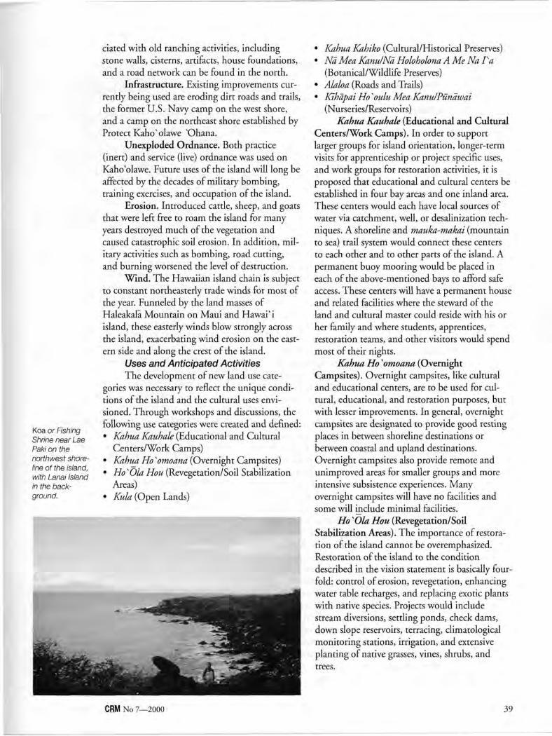
Koa or Fishing Shrine near Lae Paki on the northwest shoreline of the island, with Lanai Island in the background.
dated with old ranching activities, including stone walls, cisterns, artifacts, house foundations, and a road network can be found in the north.
Infrastructure. Existing improvements currently being used are eroding dirt roads and trails, the former U.S. Navy camp on the west shore, and a camp on the northeast shore established by Protect Kaho'olawe "Ohana.
Unexploded Ordnance. Both practice (inert) and service (live) ordnance was used on Kaho'olawe. Future uses of the island will long be affected by the decades of military bombing, training exercises, and occupation of the island.
Erosion. Introduced cattle, sheep, and goats that were left free to roam the island for many years destroyed much of the vegetation and caused catastrophic soil erosion. In addition, military activities such as bombing, road cutting, and burning worsened the level of destruction.
Wind. The Hawaiian island chain is subject to constant northeasterly trade winds for most of the year. Funneled by the land masses of Haleakalā Mountain on Maui and Hawaii island, these easterly winds blow strongly across the island, exacerbating wind erosion on the eastern side and along the crest of the island.
Uses and Anticipated Activities The development of new land use cate
gories was necessary to reflect the unique conditions of the island and the cultural uses envisioned. Through workshops and discussions, the following use categories were created and defined: • Kahua Kauhale (Educational and Cultural
Centers/Work Camps) • Kahua Ho ^omoana (Overnight Campsites) • HosOla Hou (Revegetation/Soil Stabilization
Areas) • Kula (Open Lands)
• Kahua Kahiko (Cultural/Historical Preserves) • Na Mea Kanu/Nā Holoholona A Me Na Va
(Botanical/Wildlife Preserves) • Alaloa (Roads and Trails) • Kīhāpai Ho "oulu Mea Kanu/Pūnāwai
(Nurseries/Reservoirs) Kahua Kauhale (Educational and Cultural
Centers/Work Camps). In order to support larger groups for island orientation, longer-term visits for apprenticeship or project specific uses, and work groups for restoration activities, it is proposed that educational and cultural centers be established in four bay areas and one inland area. These centers would each have local sources of water via catchment, well, or desalinization techniques. A shoreline and mauka-makai (mountain to sea) trail system would connect these centers to each other and to other parts of the island. A permanent buoy mooring would be placed in each of the above-mentioned bays to afford safe access. These centers will have a permanent house and related facilities where the steward of the land and cultural master could reside with his or her family and where students, apprentices, restoration teams, and other visitors would spend most of their nights.
Kahua Ho ^omoana (Overnight Campsites). Overnight campsites, like cultural and educational centers, are to be used for cultural, educational, and restoration purposes, but with lesser improvements. In general, overnight campsites are designated to provide good resting places in between shoreline destinations or between coastal and upland destinations. Overnight campsites also provide remote and unimproved areas for smaller groups and more intensive subsistence experiences. Many overnight campsites will have no facilities and some will include minimal facilities.
Ho KOla Hou (Revegetation/Soil Stabilization Areas). The importance of restoration of the island cannot be overemphasized. Restoration of the island to the condition described in the vision statement is basically fourfold: control of erosion, revegetation, enhancing water table recharges, and replacing exotic plants with native species. Projects would include stream diversions, settling ponds, check dams, down slope reservoirs, terracing, climatological monitoring stations, irrigation, and extensive planting of native grasses, vines, shrubs, and trees.
CRM No 7—2000 39
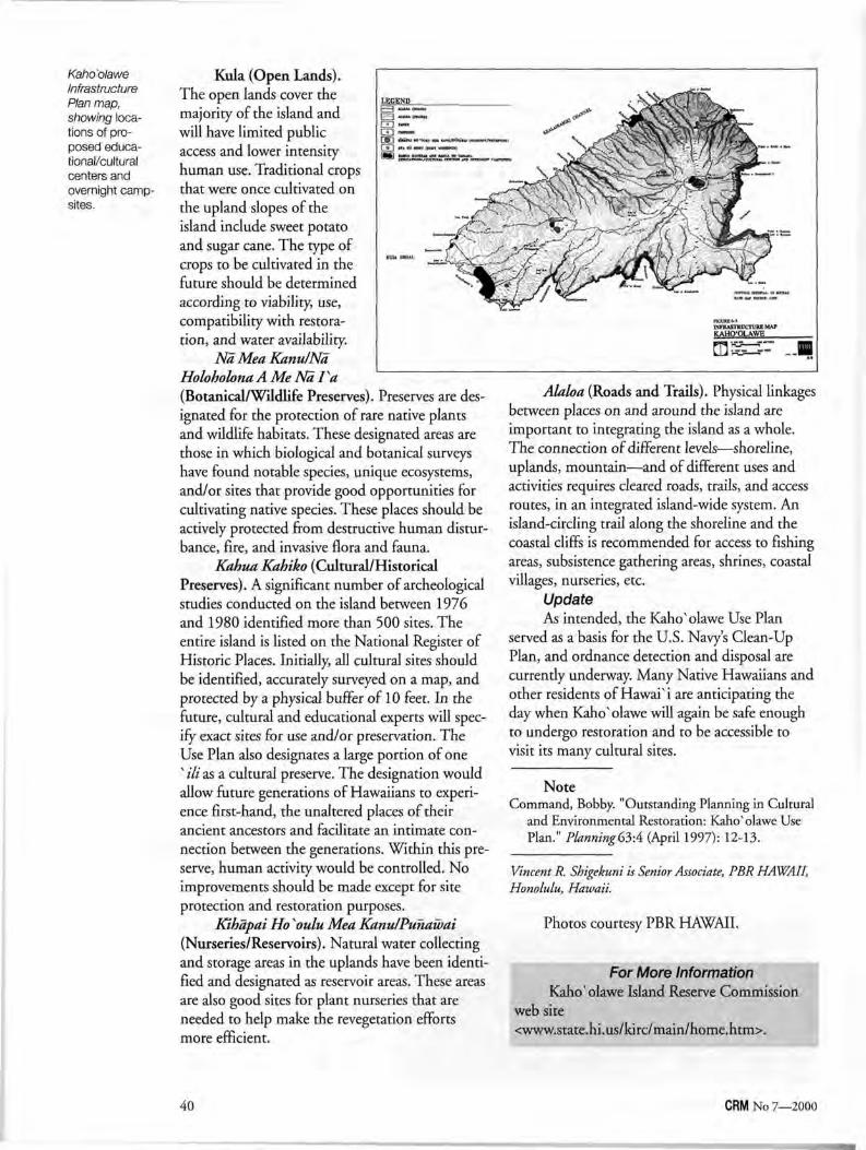
Kaho'olawe Infrastructure Plan map, showing locations of proposed educational/cultural centers and overnight campsites.
Kula (Open Lands). The open lands cover the majority of the island and will have limited public access and lower intensity human use. Traditional crops that were once cultivated on the upland slopes of the island include sweet potato and sugar cane. The type of crops to be cultivated in the future should be determined according to viability, use, compatibility with restoration, and water availability.
Nā Mea Kanu/Nā Holoholona AMeNaFa (Botanical/Wildlife Preserves). Preserves are designated for the protection of rare native plants and wildlife habitats. These designated areas are those in which biological and botanical surveys have found notable species, unique ecosystems, and/or sites that provide good opportunities for cultivating native species. These places should be actively protected from destructive human disturbance, fire, and invasive flora and fauna.
Kahua Kahiko (Cultural/Historical Preserves). A significant number of archeological studies conducted on the island between 1976 and 1980 identified more than 500 sites. The entire island is listed on the National Register of Historic Places. Initially, all cultural sites should be identified, accurately surveyed on a map, and protected by a physical buffer of 10 feet. In the future, cultural and educational experts will specify exact sites for use and/or preservation. The Use Plan also designates a large portion of one " Hi as a cultural preserve. The designation would allow future generations of Hawaiians to experience first-hand, the unaltered places of their ancient ancestors and facilitate an intimate connection between the generations. Within this preserve, human activity would be controlled. No improvements should be made except for site protection and restoration purposes.
Kihāpai Ho Koulu Mea Kanu/Punawai (Nurseries/Reservoirs). Natural water collecting and storage areas in the uplands have been identified and designated as reservoir areas. These areas are also good sites for plant nurseries that are needed to help make the revegetation efforts more efficient.
Alaloa (Roads and Trails). Physical linkages between places on and around the island are important to integrating the island as a whole. The connection of different levels—shoreline, uplands, mountain—and of different uses and activities requires cleared roads, trails, and access routes, in an integrated island-wide system. An island-circling trail along the shoreline and the coastal cliffs is recommended for access to fishing areas, subsistence gathering areas, shrines, coastal villages, nurseries, etc.
Update As intended, the Kaho'olawe Use Plan
served as a basis for the U.S. Navy's Clean-Up Plan, and ordnance detection and disposal are currently underway. Many Native Hawaiians and other residents of Hawai' i are anticipating the day when Kaho'olawe will again be safe enough to undergo restoration and to be accessible to visit its many cultural sites.
Note Command, Bobby. "Outstanding Planning in Cultural
and Environmental Restoration: Kaho*olawe Use Plan." Planning63:4 (April 1997): 12-13.
Vincent R. Shigekuni is Senior Associate, PBR HAWAII, Honolulu, Hawaii.
Photos courtesy PBR HAWAII.
For More Information Kaho'olawe Island Reserve Commission
web site <www.state.hi.us/kirc/main/home.htm>.
40 CRM No 7—2000
Darby C. Stapp
Tribes Working with Agencies to Protect Resources
Agencies can improve their historic preservation planning by involving groups and individuals with legal, moral, or personal
interests in the resources being managed. Such involvement helps the agency define its historic preservation goals, design its implementation approach, and garner the necessary funding and political support. This has been the case in the Mid-Columbia River region of the Pacific Northwest, where Native Americans, historical societies, and others are working with agencies to strengthen cultural resource protection efforts.
The Mid-Columbia River region is incredibly rich in resources that are critical to the future of Indian tribes in the area. For over a decade, Mid-Columbia tribes have taken an active role in the historic preservation planning process with federal agencies in the area. Tribal involvement has helped strengthen agency cultural resource programs, protect important places, and foster the development of regional stewardship coalitions that are essential to successful, long-term protection of resources for cultural use. This article focuses on the influence that Native American involvement has had on historic preservation planning and implementation in the Mid-Columbia.
Background The Mid-Columbia encompasses the area
from Umatilla, Oregon, to Wenatchee, Washington. Its dominant feature and primary cultural resource is the Hanford Reach, the last 51 miles of Columbia River that has not been inundated by hydroelectric dams. The river, tributaries, uplands, and mountains contain vestiges of villages, camps, cemeteries, sacred places, and other traditional and contemporary Native American use areas. Among its significant historic sites are Lewis and Clark campsites, fur trade posts, missionary sites, and army posts.
Development is the major threat to human remains and historic and cultural resources. Development has led to wholesale resource destruction and has compromised the integrity of cultural landscapes. Other threats include erosion from dams and economic practices such as timber harvesting, cattle grazing, and recreation; contamination of lands, food, medicinal plants, and animals; and looting of graves and archeolog-ical sites.
Expanding Tribal Involvement While tribes have recently been given a
voice through historic preservation legislation, the story begins earlier. The legal standing of tribes formally recognized in treaties signed by the U.S. government and ratified by Congress, executive orders, and other federal laws and regulations already grants them access to resources and involvement in regional decisionmaking that transcends what is granted in historic preservation legislation. The Nez Perce Tribe, the Confederated Tribes of the Umatilla Indian Reservation, and the Yakama Indian Nation all have important rights recognized and guaranteed in the Treaties of 1855- The tribes signing these treaties ceded lands, retaining rights to maintain their way of life, including the right to take fish, hunt, gather roots and berries, and pasture stock. In addition, the Wanapum, who live at Priest Rapids village, are a non-federally recognized tribe who have strong cultural ties to the Mid-Columbia and are consulted regularly by agencies on cultural resource issues. The Confederated Tribes of the Colville Reservation are involved to protect the interests of the Palus Tribe and the Wallowa Bands of the Nez Perce Tribe who live on the Colville Reservation.
From the 1950s through the 1980s, Mid-Columbia tribes and agencies interacted from time to time, principally over issues related to the construction of hydroelectric dams. Discussions focused on salmon survival, fishing access, village relocation, cemetery protection, inadvertent burial discoveries, and archeological salvage work. Relationships developed, for example, between the Wanapum Band and the Grant County Public Utility District, between the Wanapum Band and the Hanford Nuclear Reservation, and between the Nez Perce Tribe and the U.S. Army Corps of Engineers, Walla Walla District.
Hanford, a 560-square mile Manhattan Project and Cold War plutonium production facility, has played a significant role in expanding
CRM No 7—2000 41
tribal involvement in Mid-Columbia cultural resource management. The Nuclear Waste Policy Act of 1982, as amended, provided a mechanism for tribes to get involved in decisions concerning the siting of a high-level nuclear waste repository. The Confederated Tribes of the Umatilla Indian Reservation, the Nez Perce Tribe, and the Yakama Nation applied for and obtained the status of Affected Tribes, which enabled them to hire their own programmatic and technical staff to oversee Hanford's nuclear waste activities. Tribal work on nuclear issues served as a springboard for broader engagements in cultural resource management. Today, tribes meet monthly with Department of Energy cultural resource staff to discuss current and future projects that may impact important resources.
Once tribes had cultural resource protection programs in place, their influence began to spread beyond the borders of Hanford. As the programs matured, the nature of their efforts evolved from commenting on historic preservation plans and documents, to participating in preparing such plans and documents, and eventually performing the scope of cultural resource management work for themselves. Both the Umatilla and the Colville have assumed state historic preservation office responsibilities under Section 101(d) of the National Historic Preservation Act.
An example of tribal success came in the Bonneville Power Administration's System Operation Review (SOR). By making cogent arguments and exercising political muscle, tribes encouraged the Bonneville Power Administration to gain a greater appreciation for the importance of cultural resources and to do more for their protection. In the mid-1990s, the Bonneville Power Administration committed $65 million to the tribes for cultural resource protection over a 15-year period, beginning in 1997. To facilitate the work, Bonneville, in conjunction with the Army Corps of Engineers and the Bureau of Reclamation, formed five working groups across the Mid-Columbia to plan and oversee cultural resource work. The groups meet both individually and collectively, and conduct such activities as reservoir surveys, site evaluations, erosion control, oral histories, management plan preparations, technology training, and educational efforts to combat looting.
As a result of these and myriad other historic planning projects initiated by federal and local agencies in the Mid-Columbia, substantive
tribal involvement in planning, implementation, and oversight in the Mid-Columbia is at record levels. It is important to understand that tribes are not just doing cultural resource work the way it has always been done; they are infusing tribal values into the system and a different form of cultural resource management, one focused more on protection, is emerging.
Benefits of Tribal Involvement Mid-Columbia cultural resource manage
ment has changed in many ways as a result of two decades of increasingly sophisticated tribal involvement. Within the region there are similarities among various tribal approaches to historic preservation, but there are just as many differences. Despite the uniqueness of each tribe's approach, tribal involvement and the mutual concerns of Native Americans have initiated key changes in cultural resource management, such as the following:
Expanding definitions and understandings of cultural resources. Tribes have been successful in demonstrating to agencies that cultural resources include more than archeological sites and traditional cultural properties. They include the plants and animals—especially the salmon—and the habitats in which these resources survive. As a result, agency approaches are evolving from site-specific management to cultural landscape management, and cultural resource management professionals are beginning to understand that it is not just the places that are important, but the places as they relate to living communities. Managing resources by cultural units, not administrative boundaries. Tribes view resources within their own cultural and institutional contexts. They know which resources they have a responsibility to protect, which are needed for future generations, and so on, regardless of whether the resources are located on land belonging to the Army, Energy department, tribes, or private owners. Their past and future vision and sense of responsibility transcend these political and administrative boundaries. Currently it is only tribes who are forging consistency among the management strategies of various landowners; agency staffs recognize the problem, but agency bureaucracies rarely provide much leeway on this matter. Pressuring for compliance with federal laws and regulations. Few cultural resource programs are adequately funded to fully comply
42 CRM No 7—2000
with cultural resource laws and regulations. Agency staffs do what they can with the funding available, but the bottom line is that few if any agencies are in full compliance with cultural resource requirements. Tribes have been at the forefront of a movement to ensure that agencies live up to their National Historic Preservation Act and Archaeological Resource Protection Act responsibilities. Their efforts have created a boom in cultural resource management work, and have raised awareness and support among higher levels of agency management. Advancing from management to protection and stewardship. In the past, cultural resource management activities have focused on identifying sites, describing archeological patterns, and learning about past human behavior. What has been less common are activities designed to protect resources. If we do not focus more attention on protecting sites and resources, tribes argue, the resources will not be available for current or future generations of tribes, or for anyone else. If resources and places are not available for Native Americans to access, their ability to continue their way of life will be hurt. For this reason, tribes are asking agencies to monitor the conditions of important sites and, where impacts are observed from erosion, looting, or recreation, to implement protective measures. This is a key component of stewardship as opposed to management or conservation; resources are a continuing part of modern tribal cultural life, and not mere objects of spectatorship or scholarly curiosity.
These are a few of the major contributions that Native American involvement is making to advance the field of cultural resource management. What has not been discussed is the substantial contribution that tribal involvement is making to Native Americans and their efforts to maintain a way of life. Those interested in this topic are referred to a recent issue of Practicing Anthropology?
Emerging Issues Despite the advances being made in pro
tecting cultural resources in the Mid-Columbia, the struggle is ongoing. The following issues are current points of tension with which coalitions of tribes, agencies, cultural resource management professionals, and the public are currendy grappling.
Land transfers and historic preservation plans. Land management responsibilities are increasingly being transferred among federal agencies. When such a transfer occurs, does the historic preservation plan go with the land? Are commitments made to tribes and others during the historic preservation planning process still good? Is it possible that a historic preservation plan tailored to a particular region over many years and with substantial resources could get scrapped entirely when a new agency takes over? Agencies can best serve resource stewardship goals by not re-inventing wheels, by not applying management plans previously developed for other regions with different needs and characteristics, and by supporting commitments made by the former agency. In most cases, a historic preservation plan developed for a piece of land should stay with the land, regardless of who is managing it. Transferring lands with significant cultural resources to non-federal agencies. There is a national movement afoot to decrease the federal land holdings. Many times, lands being transferred have significant cultural resources on them. For example, in the Mid-Columbia the U.S. Corps of Engineers is transferring to the city of Kennewick five miles of Columbia River shoreline, most of which contains Native American villages, fishing sites, and cemeteries, including the famed Kennewick Man site. How will these transfers affect management and protection? Can the City of Kennewick be expected to protect the important sites newly added to its jurisdiction? The Kennewick Man legal case has cost the government in excess of $ 1 million per year for the last four years; the city would never be able to proffer such funds. A memorandum of agreement signed as part of the land transfer can commit the city to certain actions, but will the federal government maintain some role to ensure compliance with the MOA? Is that the responsibility of local tribes? Is it the responsibility of local historical societies? All too often, agreements are made to get the transfer completed, and then forgotten, to the detriment of the resource. The funding need for tribal involvement. Involving tribes and others in a cultural resource management program is worthwhile, as demonstrated by the examples presented in this article. Often, however, a tribe may not have the financial wherewithal to provide
CRM No 7—2000 43
meaningful involvement. Agencies need to be more accommodating in providing financial mechanisms for tribal staff to attend meetings, review plans, and provide meaningful comment. It goes without saying that tribes should have opportunities to conduct cultural resource work for agencies. Relations between Native Americans and archeologists. Perhaps no issue is more central to the success of resource planning, plan implementation, policy compliance, and tribal involvement than relations between Native Americans and archeologists. In the Mid-Columbia, substantial efforts at cross-cultural understanding have enabled the collaborative efforts discussed above. However, decades of improvement in relations between Native Americans and archeologists are now deteriorating as a result of events such as the recent Kennewick Man case and the efforts of a small group of scientists. A drive to rewrite the Native American Graves Protection and Repatriation Act and put physical anthropologists back in charge of human remains disposition threatens relations even further. Faced with such battles, both sides must nevertheless recognize that they are stronger working together than they are in conflict. It is time to move forward: the time of rigid thinking has passed. The drive to make Indians archeologists. Hindering progress in the drive to improve relations among Native Americans and archeologists is a fundamental flaw in many archeo-logical overtures to Native Americans. The profession erroneously believes that if it could just train Indians to be archeologists everything would be OK. While any Native American should be free to become an archeologist if he or she so chooses, Native Americans are not clamoring at the doors to enter the field of archeology because of fundamental differences in worldview and a general insensitivity of the profession to Native priorities. A more fruitful approach might be to educate archeologists about the needs and perspectives of Indian people. Those training the next generation of archeologists need to provide more guidance to their students about working with living peoples, especially peoples from other cultures. Archeologists need to become better anthropologists, not so they can learn more from their archeological data, but so they can better
understand how archeological sites and information about the past relate to the living. Developing tribal cultural resource management method and theory. Despite the rapid advances Native Americans have made in cultural resource management and in articulating the principles of stewardship, tribal cultural resource management as a new paradigm for practice is still in the early stages of development. True support for tribal cultural resource management is not simply a question of teaching Native Americans to do cultural resource management. Rather, archeologists and Native Americans must endeavor to re-fashion the cultural resource management framework in ways that integrate tribal values, and that is not easy. If archeology and tribes can rise to this challenge, both sides will benefit.
Adopting the Stewardship Paradigm In the Mid-Columbia and wherever Native
Americans have become active in cultural resource management, tribal values have re-framed standard approaches to the who, what, where, and why of our practice. Professionals trained in the paradigm of scientific archeology, history, or architecture no longer dominate the field. Instead, those who own, want, and need the resources are helping set the agenda, articulating their own expectations, and partnering with agencies to ensure desired outcomes. This should not be seen as a divergence in cultural resource management work; rather, we may be on a path toward practicing cultural resource management the way it was always supposed to be. Elders and youth, worldviews and ways of life, oral histories and ecosystems, tribal sovereignty and cultural integrity are once again finding their rightful places in a field that has for decades been dominated by the dyad of science and development.
Notes 1 Thomas C. McKinney, "CRM at the Federal
Columbia River Power System," CRM21:9 (1998):31.
2 Julia G. Longenecker and Jeff Van Pelt, "Training for Law Enforcement—A Tribal Perspective," CRM 22:5 (1999):17-18.
3 "Changing Paradigms in Cultural Resource Management," Special Issue, Practicing Anthropology 20:3 (1998):2-33.
Darby C. Stapp, Ph.D., RPA, is the Director of the Hanford Cultural Resources Laboratory, which is operated by Pacific Northwest National Laboratory for the U.S. Department of Energy, Richland, Washington. He has lived in the Mid-Columbia since 1987. He can be reached at <[email protected]>.
44 CRM No 7—2000
Susan L. Henry Renaud
Whither Historic Contexts? Their Role in 21 st-Century Planning
I n 1983, the Secretary of the Interior's Standards and Guidelines for Preservation Planning were published in the Federal Register.' These represent
the Secretary's "best advice" on preservation planning activities. The three Standards read (somewhat condensed):
Standard I. Preservation Planning Establishes Historic Contexts. Decisions about the identification, evaluation, registration, and treatment of historic properties are most reliably made when the relationship of individual properties to other similar properties is understood. The historic context [is a framework that] organizes information based on a cultural theme and its geographical and chronological limits. Contexts describe the significant broad patterns of development in an area that may be represented by historic properties. The development of historic contexts is the foundation for decisions about identification, evaluation, registration, and treatment of historic properties.
Standard II. Preservation Planning Uses Historic Contexts to Develop Goals and Priorities for the Identification, Evaluation, Registration, and Treatment of Historic Properties. A series of preservation goals is systematically developed for each historic context to ensure that the range of properties representing the important aspects of each historic context is identified, evaluated, and treated. Then priorities are set for all goals... The goals with assigned priorities established for each historic context are integrated to produce a comprehensive and consistent set of goals and priorities for all historic contexts in the geographic area of a planning effort.
Standard HI. The Results of Preservation Planning Are Made Available for Integration into Broader Planning Processes. Preservation of historic properties is one element of larger planning processes. Planning results, including goals and priorities, information about historic properties, and any planning documents, must be transmitted in a usable form to those responsible for other planning activities.
Guidelines for using these Standards explained an approach for developing historic context documents that included public participation and provided for updating and revision when new information becomes available. A brief review of this guidance follows.
The historic context is the cornerstone of the planning process. It provides a mechanism, a process, for assessing and organizing information about patterns of prehistory and history, and about historic and cultural resources; for identifying a full range of associated property types; and for defining goals and priorities for the identification, evaluation, registration, and treatment of historic properties. Historic contexts can be developed at a variety of scales appropriate for local, state, and regional planning. In actual practice, historic contexts can also vary considerably in the level of detail at any scale; some can be quite detailed, while others can be very general, depending upon the amount of information available and how they will be used, and these can co-exist at the same scale. However, historic contexts lose their effectiveness if they are defined so broadly that all historic resources are included in a single historic context, or so narrowly that only one type of resource is covered by a historic context.
Historic contexts subdivide the prehistoric and historic development of an area in time and space. Each context is defined on the basis of a developmental theme, and the geographical and chronological limits of that theme. The theme consists of a series of related trends or developments that occurred in the past. The historic context describes one or more features of the prehistoric or historic development of an area, and identifies patterns or trends that the historic and cultural resources represent. For example, a suburbanization theme may focus on a period in history characterized by a gradual shift in an area's rural focus to one oriented toward a nearby urban center. Related trends include the construction of suburban housing tracts, expanded transportation networks, and associated social, economic, and political systems. These developments are tangibly
CRM No 7—2000 45
apparent in a set of historic and cultural resources, such as new housing styles, designed street patterns and residential landscapes, shopping centers, and trolley lines and stations. Without the theme definition and description, the historical roles played by, and the relationships among, these types of resources might be imperfectly understood.
The geographical limits of a theme define the physical boundaries of the historic context. These boundaries are directly related to the theme, since its trends and developments occurred in specific areas and locations. The geographic limits of our suburbanization theme will encompass the areas of suburban development, the network of trolley lines, and associated commercial development.
Not only is a theme bounded geographically, but also chronologically. Prehistoric and historic developments passed through cycles of initial formation, growth, stability, decline, and abandonment. The beginning and end of one or more of these cycles can be used to mark the chronological boundaries of the theme. For our suburbanization theme, suburban development began about 1890 and continues up to the present.
An important feature in the development of a historic context is the identification of property types that represent the defined theme. A property type is a grouping of individual resources based on shared physical, functional, or associative characteristics. Property types link the conceptual basis of the historic context's theme with actual and potential resources that illustrate the theme, as in the suburbs, trolley lines, and shopping centers of our suburbanization historic context. Locational patterns and the condition of known and expected properties are identified, and gaps in information about the theme and its properties are defined.
The development of goals and priorities establish each historic context as a planning document. A goal is a statement of preferred preservation activity, generally stated in terms of property types. Preservation goals can deal with a variety of historic and cultural resource needs, including identification, registration, and treatment, as well as addressing information needs, research, and interpretation. Setting priorities for the goals is based on an examination of a number of factors, such as the conditions of individual resources; social, economic, political, and environmental conditions and trends affecting the resources;
costs and technical considerations associated with resource identification, protection, and research; and the extent to which such work has already been carried out on resources associated with the historic context.
For any area, there will likely be a number of historic contexts describing its prehistory and history, and the historic and cultural resources that represent that past. Balancing and adjusting the goals and priorities from all of these historic contexts results in an overall set of goals and priorities for the area's resources. This set of goals, together with other goals addressing other important preservation-related issues, such as increasing public knowledge about the past or strengthening preservation legislation, form the core of that area's preservation plan. These preservation goals and priorities are adapted to contemporary land units through integration with other planning concerns, which involves resolution of conflicts that arise when competing resources, uses, goals, policies, and plans occupy, occur, and apply to the same land base.
Where Do We Go From Here? At the time of their issuance in 1983, the
Secretary's Standards and Guidelines defined the practice of preservation planning, especially for those practitioners working in federally guided historic preservation programs. For some time afterward, preservation planning meant the development of scholarly historic context documents and compiling them into hefty, encyclopedic tomes called historic preservation plans. Tremendous effort went into producing these documents, and many were accompanied by condensed versions attractively published for general public consumption. Cultural resource specialists and managers, especially in land-managing agencies, continue to depend on the scholarly information presented in historic contexts to carry out their daily responsibilities.
It eventually became clear, however, that planners and managers who were not specialists in cultural resource management or historic preservation did not always need, and often could not use, that level of technical detail in order to make their daily decisions about historic and cultural resources. As a result, historic preservation plans were developed to serve their needs that did not actually contain historic context documents, although they may have been referenced and used as support studies. This situation has become more and more common, and at the beginning of
46 CRM No 7—2000
the 21st century, one rarely hears historic contexts mentioned in the same breath as preservation planning. The exception is in situations where cultural resource specialists use these technical documents on a daily basis to make recommendations or decisions about historic and cultural resources.
What, then, is the role of historic contexts in preservation planning as we move into the 21st century? Whether they are incorporated between the covers of a land-managing agency's cultural resource management plan or used as supporting documentation for a local preservation plan, historic contexts are a critical and fundamental component in preservation planning. The historic context is a tool that helps us increase our knowledge about historic and cultural resources, and helps us make informed decisions about their protection and management.
Preservation planning is, first and foremost, resource-based; that is, our goals and priorities rest on a foundation of organized data and thinking about protecting historic resources derived from what we currently know about resources in the planning area. Historic contexts provide a rational and carefully considered process to bring resource-based concerns and issues into the broader planning environment.
Preservation planning as practiced in the late 20th century and early 21st century places historic contexts in broader perspective by viewing them as "specialized planning studies," as technical historic resource analyses that are necessary to support issue statements and goals in the plan. In addition, historic contexts continue to provide critical support for related activities such as survey, research, and nominations to the National Register of Historic Places.
The purposes of historic contexts help us answer basic planning questions: • To compile, synthesize, analyze, and assess the
state of knowledge about historic and cultural resources: What do we know, what don't we know, what do we have?
• To evaluate comparative significance of historic and cultural resources: What is worth preserving? What merits expenditures of time and money for protection?
• To establish goals and priorities for identifying, evaluating, registering, and treating historic properties with shared prehistoric/historic characteristics: What needs to be done?
To serve these purposes, historic context documentation, by necessity, focuses on the his
toric and cultural resources themselves, and contains scholarly and technical assessments of historic and prehistoric themes and properties. Preservation professionals need this kind of information; it is what the technical experts need in order to make day-to-day, project-specific, technical decisions. This is not, however, the information that planners and other non-preservation decisionmakers need, understand, or can use when they make decisions about how land is to be used. For example, several years ago, the preservation staff in a large city prepared a number of historic contexts and gave them to the planning office for review. The planners found the material very interesting, but they didn't see historic contexts as relevant or useful to their concerns. Several years ago, I helped to develop a 500-page local preservation plan that was chock full of prehistory, history, maps, charts, and lists of historic and cultural resources. We were very proud of this plan, but no one else could use it because it was too technical. As long as we, the preservation professionals, used the information to make recommendations to the decisionmakers, the plan was helpful. When we were not involved, the plan was not used, and land-use decisions continued to be made as if the preservation plan did not exist.
To be useful, historic context technical information needs to be "translated" into formats and terms that others can understand and use. Narrative historic context information may not be understandable or usable (or even considered relevant) by land-use planners and decisionmakers who need location and map-oriented information unencumbered by analytical and technical detail. This "translation" can take the form of a preservation plan developed from a foundation of historic contexts and written specifically for planners and decisionmakers, or the "translation" can be done by historic preservation specialists themselves, who examine historic contexts and communicate their recommendations to planners and decisionmakers.
In many, if not most, preservation planning situations, historic contexts function in much the same way as background studies or specialized planning studies that are prepared for a local comprehensive plan. Planners also generate technical information—specialized studies and support documentation for the plan, such as traffic counts, retail location studies, affordable housing analyses. These types of studies are essential because they provide the data, analyses, and conclusions upon which the plan's findings and goals
CRM No 7—2000 47
rely. However, these studies are usually too detailed, too technical, and their focus too narrow to be included in the plan document.
In addition to existing historic contexts, a range of other studies on non-resource issues, such as public outreach, public relations, heritage tourism, and preservation legislation, could be prepared, compiled, or used to support the development and revision of a preservation plan. A series of "working papers" or "discussion papers" could be prepared specifically for the plan development efforts, and studies and reports prepared for other reasons, such as survey reports, could also be examined. For example, as part of its plan development in 1986, the Maryland Historic Trust developed a series of "Preservation Policy White Papers" on such topics as: • Regional and County-by-County Assessment
of Survey Coverage • Economic Benefits of Historic Preservation • An Analysis of the Impact of Historic
Preservation on the State's Tourism Industry • A Summary of Historic Preservation and
Affordable Housing Other planning studies could focus on char
acterizing the resource inventory in various ways, in order to define areas that may need attention during the planning process. It may be more important to conduct these kinds of analyses if portions of the resource inventory have not yet been addressed in historic context documents. Some of the studies could be done to address the following questions: • What do we know about the resources? How
well do we know it? What don't we know?
• What areas have, and have not yet, been surveyed for what kinds of resources?
• What kinds of resources have been recorded and what kinds have not?
• What time periods are or are not represented, and how well?
• Where are the resources located? • What condition are they in? • What resources are already protected and how? • How effective are existing protection mecha
nisms and incentives, and how can they be strengthened?
• Who controls the resources? • What resources are valued by the public? What
is public opinion about historic preservation? In order to plan well for the identification,
evaluation, registration, and treatment of historic and cultural resources, information about these resources must be organized into manageable units before it can be useful in planning and decisionmaking. Historic contexts perform this function and, therefore, continue to have an essential role to play in preservation planning. For perhaps the majority of situations, historic contexts are critical, specialized planning studies that are necessary to frame and support conclusions, statements of conditions, issues, goals, and priorities in the preservation plan. Historic contexts are not, and were not meant to be, the preservation plan or the sum total of all planning activities. As Yogi Bera allegedly said, "If you don't know where you're going, you won't get there." Historic contexts help us determine where we are going to protect historic and cultural resources, and the strategies we can use to get there.
VOLUME 23 • NO. 7 Cultural Resources Washington, DC
U.S. Department of the Interior
National Park Service Cultural Resources (Suite 350NC) 1849 C Street, NW Washington, DC 20240
OFFICIAL BUSINESS PENALTY FOR PRIVATE USE $300
FIRST CLASS MAIL Postage & Fees Paid U. S. Department of the Interior G-83