Embed Size (px)
Citation preview

i
Town of Creighton
Official Community Plan
i
Table of Contents
1. Introduction ............................................................................................................................. 1
2. Planning Context ...................................................................................................................... 1
2.1 Municipal Vision ............................................................................................................... 1
2.2 Municipal Goals ................................................................................................................ 1
2.3 Authority and Mandate .................................................................................................... 2
3. Guiding Principles .................................................................................................................... 4
3.1 Balance of Interests and Flexibility .................................................................................. 4
3.2 Sustainability .................................................................................................................... 4
3.3 Provincial-Aboriginal Involvement ................................................................................... 5
3.4 Mutual Respect ................................................................................................................ 5
3.5 Cooperation ...................................................................................................................... 5
3.6 Consultation ..................................................................................................................... 5
3.7 Initiative and Enterprise ................................................................................................... 6
3.8 Learning and Innovation .................................................................................................. 6
4. Background .............................................................................................................................. 7
4.1 Site and Situation ............................................................................................................. 7
4.2 Municipal Resources ........................................................................................................ 8
4.3 Municipal Constraints ...................................................................................................... 8
4.4 Surrounding Land ............................................................................................................. 9
5. Future Land Use Concept ...................................................................................................... 10
6. Residential ............................................................................................................................. 11
6.1 General Residential ........................................................................................................ 11
7. Economic Development......................................................................................................... 16

ii
7.1 General Commercial Development ................................................................................ 16
7.2 Main Street Commercial Development ......................................................................... 17
7.3 Highway Commercial Development ............................................................................... 19
7.4 Home Based Business..................................................................................................... 20
7.5 Heavy Industrial Development ....................................................................................... 21
7.6 Light Industrial Development ......................................................................................... 23
8. Community Services .............................................................................................................. 25
8.1 Medical Services ............................................................................................................. 25
8.2 Schools and Educational Facilities .................................................................................. 26
8.3 Protective Services ......................................................................................................... 27
8.4 Recreation and Park ....................................................................................................... 29
8.5 Heritage, Cultural, and Institutional Facilities ................................................................ 31
9. Natural Environment ............................................................................................................. 32
9.1 Ecological Integrity ......................................................................................................... 32
9.2 Land ................................................................................................................................ 33
9.3 Forest .............................................................................................................................. 34
9.4 Shoreline, Water Bodies, and Source Water Protection ............................................... 36
9.5 Bedrock ........................................................................................................................... 37
9.6 Sand and Gravel Quarries............................................................................................... 38
10. Public Utilities ........................................................................................................................ 39
10.1 Water System ................................................................................................................. 39
10.2 Sewage System ............................................................................................................... 41
10.3 Landfill ............................................................................................................................ 43
11. Transportation ....................................................................................................................... 45
iii
11.1 Highways, Streets, and Roads ........................................................................................ 45
12. Site Specific Discussion .......................................................................................................... 47
12.1 Phantom Lake Area ........................................................................................................ 47
12.2 Treaty Land Entitlement (TLE) ........................................................................................ 49
13. Plan Implementation, Tools, and Policies ............................................................................. 50
13.1 Zoning Bylaw .................................................................................................................. 50
13.2 Minor Variances to the Zoning Bylaw ............................................................................ 50
13.3 Subdivision and Concept Plans ...................................................................................... 50
13.4 Rezoning of Land ............................................................................................................ 51
13.5 Servicing Agreement ...................................................................................................... 51
13.6 Building Bylaw ................................................................................................................ 52
13.7 Land Acquisition ............................................................................................................. 52
13.8 Intermunicipal and Interjurisdictional Cooperation ...................................................... 53
13.9 Capital Works Program .................................................................................................. 53
14. Monitoring and Amendment ................................................................................................. 54
Maps
Map 1: Municipal Constraints ....................................................................................................... 55
Map 2: Town of Creighton Future Land Use Key .......................................................................... 56
Map 2A: Future Land Use ............................................................................................................. 57
Map 2B: Future Land Use ............................................................................................................. 58
Map 2C: Future Land Use.............................................................................................................. 59
Map 3: Town of Creighton Surrounding Waterbodies ................................................................. 60
1
1. Introduction
This Official Community Plan is adopted by the Town of Creighton (the Town), in accordance
with sections 29 and 35 of The Planning and Development Act, 2007 (the PDA) to provide a
framework of goals, objectives, and policies to guide the management and use of land, along
with its future development, within the Town limits. This Plan is designed to assist decision
makers in securing the goals of the community while evaluating the future effects of decisions
regarding land use planning.
2. Planning Context
2.1 Municipal Vision
Creighton will manage growth in a way that maintains and enhances community livability.
Council will ensure that the character of residential areas is protected and that commercial
areas are attractive, viable and complementary to their neighbourhood. Council will protect
natural areas, provide green space, and enhance recreational opportunities and facilities to
meet the needs of residents. Creighton will function as the service and recreation hub for
northeast Saskatchewan.
2.2 Municipal Goals
The following statements provide focus for the Official Community Plan and its policies as they
relate to development within the Town. The goals are not ranked by priority but collectively
represent the future aspirations of the Town of Creighton:
1) Creighton will be sustainable, healthy and safe, and a place in which today’s quality of life
will be enjoyed in the future.
2) Creighton will be a community in which people of all ages, family structures, backgrounds
and interests can live, work, and play.

2
3) Creighton will provide a range of economic opportunities and sustain a healthy and
diverse economy.
4) Creighton will work with the Churchill River Enterprise Region to identify opportunities
and create action plans for economic and tourism development.
5) Creighton will balance competing interests and values, maintain fairness and equity, and
involve residents and stakeholders in decision making processes.
6) Creighton will be a leader for intermunicipal cooperation to ensure that residents have
access to resources and essential services at equitable prices.
7) Creighton will work with the Hudson Bay Mining and Smelting Company to ensure that
mining activities are held to the highest environmental standards to ensure that the
health and safety of residents is maintained.
8) Creighton will preserve and enhance recreation and park greenspace in the municipality
to ensure residents continue to have opportunities to live an active and healthy lifestyle.
2.3 Authority and Mandate
Section 32(1) of the PDA states that “An Official Community Plan must incorporate, insofar as
practical, any applicable provincial land use policies and statements of provincial interest.”
Section 32(2) states that an Official Community Plan must also contain statements of policy
with respect to:
a) sustainable current and future land use and development in the municipality;
b) current and future economic development;
c) the general provision of public works;
d) the management of lands that are subject to natural hazards, including flooding,
slumping and slope instability;
e) the management of environmentally sensitive lands;
f) source water protection; and
g) the means of implementing the Official Community Plan.
3
Section 32(3) of the PDA states that an Official Community Plan may also:
a) address the co-ordination of municipal programs related to development;
b) contain statements of policy regarding the use of dedicated lands;
c) contain concept plans pursuant to section 44 (of the PDA);
d) contain a map or series of maps that denote current or future land use or policy areas;
e) contain any other statements of policy relating to the physical, environmental,
economic, social or cultural development of the municipality that the Council considers
advisable; and
f) contain policies that address the co-ordination of land use and development, future
growth patterns and public works with adjacent municipalities.

4
3. Guiding Principles
Land use principles are a foundation to guide action. The application of sound land use
principles will ensure that the needs and requirements of individual land uses are met while
minimizing any adverse impacts upon other land uses, municipal services, and the natural
environment. Planning is a shared responsibility among provincial and municipal governments
and individuals. Strong communities embrace the principle of shared responsibility, where
citizens and decision makers are responsible for stimulating and sustaining the environment
and economy and where individuals and governments are accountable for decisions and
actions, in the spirit of partnership and open cooperation. These guiding principles are broad
statements intended to assist decision makers as they consider the impact of their choices both
locally and regionally.
3.1 Balance of Interests and Flexibility
Planning decisions should consider and balance the interests of all stakeholders. This will
involve understanding the effect of development decisions on the cultural, natural, social, and
economic environments. There may be situations where one interest outweighs another and
tradeoffs may be necessary. Council will apply this flexibility to determine an outcome that is in
the best interests of the community, region, and province.
3.2 Sustainability
Planning decisions should be enduring. This means that decisions related to the management
and development of our resources and economy will be made with consideration to the
requirements of present and future generations ensuring healthy, prosperous, livable
communities. Conservation, reclamation, rehabilitation, mitigation, and prevention are all tools
that could be employed to ensure that growth and development are sustainable. The
application of sustainable planning, development, and production practices benefits everyone
and demonstrates Creighton’s commitment to the global community.

5
3.3 Provincial-Aboriginal Involvement
The Town is committed to working with the Province and with Aboriginal peoples that are part
of this northern community. It recognizes the provincial legal duty to consult on actions and
developments which could adversely impact Aboriginal and Treaty Rights. It will take part in
cooperation between governments, municipalities, and First Nations in land use planning and
development to the mutual benefit of the parties. The Town recognizes and respects the rights
and responsibilities of Aboriginal people as legally defined through Treaties and the
Constitution Act, 1982.
3.4 Mutual Respect
Mutual respect between stakeholders is fundamental to good planning. Differences in status,
cultures, traditions, social and economic views, and values must be respected as we plan
together to create a community. The needs and views of all people must be mutually respected
as Council works together with its public in the management of common resources, and the
development of economic, social, and environmental opportunities.
3.5 Cooperation
Cooperative planning maximizes the use of people and resources. Planning in collaboration
with multiple jurisdictions and sectors allows for greater access to resources, a larger resource
base, shared responsibility and wealth, and increases opportunity for growth and success
across regions.
3.6 Consultation
Consultation is integral to good development. The Town is committed to providing
opportunities for active and meaningful consultation with all segments of the community. The
Town will engage with the community in the preparation of plans to guide land use and
development, and to communicate with the public as development opportunities are
considered. The process, notification period and appeal mechanisms will be clearly outlined in

6
the planning documents. The Town will encourage developers to also engage the public in a
discussion, work to avoid conflicts, and resolve issues as they arise. Consultation and
cooperation in resolving land use issues between municipalities or other jurisdictions is
essential to facilitate development.
3.7 Initiative and Enterprise
Success is achieved by combining planning with individual initiative and enterprise. Planning
provides direction and timing for infrastructure development to support individual business
decisions. Council recognizes that opportunities may be missed if infrastructure is not available
in a timely manner. Council will negotiate service agreements with developers to ensure that
the cost of development is appropriately borne by those who benefit.
3.8 Learning and Innovation
Planning involves a process of learning and analysis. The Town accepts responsibility for
gathering and understanding information as it relates to development decisions. The
application of innovation solutions to planning issues will be carefully considered to provide
opportunities for successful development that might not have otherwise occurred.
Aerial view of the Town of Creighton.

7
4. Background
4.1 Site and Situation
The Town of Creighton is
located on the eastern
boundary of Saskatchewan
adjacent to Flin Flon,
Manitoba. Creighton is located
on Sections 12, 27, 34, and 35,
Township 66 and 67, Range
30, west of the Prime
Meridian. Creighton is within
the Precambrian Shield, an
area that consists of rock
outcrops, ravines, lakes, and
muskeg. The physical layout of
the community is determined
by the availability of
developable areas between
rock outcrops. The community has therefore grown in an irregular pattern and does not adhere
to any conventional grid layout.
The Town of Creighton grew as a result of the mining activities of the Hudson Bay Mining and
Smelting Company. The mine, located on the provincial boundary, began operating in 1928. The
settlement of Creighton grew rapidly and it was incorporated as a Village in 1952 (with a
population of 1200) and then incorporated as a Town in 1957, at which time the population
exceeded 1660. Creighton’s population remained constant around 1,700 people until its peak in
1971 of 1,857. Figure 1 shows the population trend of Creighton from 1981 to 2006. The
population declined by 12% from 1996 to 2006 due to smelting operations being shut down at
the Flin Flon mine. Currently, there are approximately 1,500 people living in Creighton.

8
4.2 Municipal Resources
The Creighton/Flin Flon area has large deposits of minerals that are being extracted. These
physical resources drive the local economy and mining provides the largest employment sector
in Creighton. The Town leases approximately 300 acres of land to the Hudson Bay Mining and
Smelting Company for mining activities which contributes to municipal revenue. With a
potential labour market of over 10,000 people in the Creighton/Flin Flon area there are many
skilled workers to draw on for economic growth and future development.
Creighton and the surrounding area have many natural and tourism resources. The Phantom
Lake area has a 9 hole golf course with driving range, pro shop and lounge. Phantom Lake also
has a sandy beach area accessible to the public with a playground and picnic area. There are
hundreds of other lakes in the area that have great fishing and natural beauty. Moose and bear
hunting also draw tourists to the region.
4.3 Municipal Constraints
The main constraint to development in Creighton is the physiography of the region. The
physical lay of the land possess challenges to economically develop in an orderly pattern (See
Map 1: Municipal Constraints). The availability of developable land is limited due to rock
outcrops and muskeg areas. Finding developable areas adjacent to or in close proximity to the
existing built up area, municipal facilities, and infrastructure is a challenge.
1000
1200
1400
1600
1800
2000
1981 1986 1991 1996 2001 2006
Figure 1: Population 1981 - 2006
Statistics Canada, 2006.

9
The Hudson Bay Mining and Smelting Company lease large amounts of land from the Town of
Creighton for the dumping of mine tailings. The lease includes approximately 300 acres of land
north of the developed area of Town. This mining activity is a constraint to expansion to the
north. This type of mining activity requires setbacks from residential and commercial uses that
will prohibit any further development to the north. Creighton is also located on the
Saskatchewan/Manitoba border which inhibits development or expansion to the east.
Creighton’s water source is Douglas Lake located south of Town. The lake is approximately one
kilometre south of the light industrial area on King Crescent. Expansion to the south is
constrained by setback requirements for municipal water sources.
4.4 Surrounding Land
The land surrounding the Town of Creighton includes Crown forests in northeast Saskatchewan
and northwest Manitoba. The land and natural resources of this area are used for a variety of
purposes including tourism, outdoor recreation, trapping, subsistence hunting and fishing,
forestry, mining, and mineral exploration. The surrounding land in Saskatchewan is unpatented
Crown land administered by the Ministry of Environment. Land outside municipal boundaries in
this area is within the unorganized area of the Northern Saskatchewan Administration District.
Northern Municipal Services in La Ronge, acting as the municipality, provides operational
function and municipal management for this area.
The Amisk-Atik Integrated Forest Land Use Plan covers approximately 4.4 million hectares of
land surrounding the Town of Creighton. The plan was prepared by the Ministry of Environment
to provide direction and a framework for resource management and land use on Crown land in
northeast Saskatchewan.

10
5. Future Land Use Concept
This Official Community Plan provides a general guideline for future land use in the Town of
Creighton. The future land use section designates land use patterns for the Town and specific
policy areas. The future land use maps (Map 2, 2A, 2B, & 2C) reflect the pattern of existing land
use and designate future land use areas. The designation of land uses reflects the Town’s
perspective on community development and provides a framework for decision making. Any
development within these areas will be subject to specific objectives, policies, and zoning
controls. The designations and the objective of each are as follows:
Residential – reflects existing areas of residential development, land to be subdivided
for residential development, and land intended for future residential growth.
Parks and Recreation – reflects existing and future areas of municipal reserve,
environmental reserve, and recreational areas.
Commercial – reflects existing and future areas of commercial development.
Industrial – reflects existing and future areas of industrial development.
Community Service – reflects existing major institutional uses, public recreational uses,
and public works.
Urban Holding – applies to land that may not be feasibly developed without substantial
infrastructure expansion or the prior development of other lands. Existing uses will be
provided for; however, no additional development is permitted that may jeopardize the
future development of the land for urban uses. Generally land will be rezoned to other
land uses after the completion of appropriate infrastructure installation and approval of
a development concept by Council.

11
6. Residential
6.1 General Residential
The dominant housing style in Creighton is the single detached dwelling. It accounts for 75% of
the total number of dwellings in the community. The second most common housing style is the
semi-detached dwelling making up 10%. The remainder is made up by mobile and apartment
style housing (Figure 2). The average household size in Creighton in 2006 was 2.4 persons,
down from 2.6 persons in 2001. The median age in Creighton is 37.5 years old and 20% of the
population is 55 years of age and older (Figure 3). Creighton’s population is slightly younger
than the provincial median age and the percentage of residents 55 years of age and older is 5%
below the provincial average. Despite having a population younger than the provincial average
Creighton will still face challenges to provide housing for an aging population in the decades to
come.
75%
10%
3%2%4%
6%
Private Dwelling Characteristics
Single Detached Semi-Detached Row Houses Apartments, duplex Apartments Mobile
Statistics Canada, 2006.

12
Creighton partners with Canada Mortgage and Housing Corporation (CMHC), Saskatchewan
Housing Corporation (SHC), and the private sector to meet the demand for senior and social
housing in the community. These types of partnerships are essential to ensure that the demand
for housing is being met in Creighton. SHC has 73 housing units in Creighton. There are 28 semi-
detached dwellings, 8 single detached dwellings, and a 9 unit apartment building. The Town will
continue to work with SHC to identify the need for low income housing in the community.
The development pattern of Creighton’s residential areas has been scattered because of the
physical constraints in the community. Typically, wherever space has been available between
rock outcrops, residential lots have been developed. Servicing new residential areas is costly
and providing the most affordable lots has shaped Creighton’s physical development. Servicing
constraints still pose the greatest challenge to the residential development in the community.
0102030405060708090
Figure 3: Population by Age & Sex
Male
Female
Statistics Canada , 2006.
Statistics Canada, 2006.

13
There are small pockets of potential residential infill areas scattered throughout the community
as shown on the Future Land Use Maps. These sites could accommodate approximately 9 single
detached dwellings; however, grading, leveling, and extending water and sewer from the street
to some of these sites may be cost prohibitive and therefore not feasible. Three other areas
have been identified on the Future Land Use Maps for residential development (Area A, Area B,
& Area C). Area A provides a possible location for a new residential subdivision in close
proximity to existing residential neighbourhoods. Single detached dwellings would be the most
appropriate housing style in this area to maintain the surrounding residential character. Areas B
and C are larger in size and could provide land suitable for a variety of housing types.
Subdivision in these areas should consider a variety of lot sizes to accommodate housing
diversity and to achieve higher densities. Area B should be subdivided before Area C so that
utility expansion is phased in an economical and logical fashion. Areas A, B and C, noted above,
are currently owned by the Town of Creighton.
The recent demand for housing in Creighton has been for single detached dwellings and lots
that can accommodate them. From 2006 to 2010 the Town of Creighton sold 25 newly
subdivided vacant lots. Some purchasers required two lots together to accommodate their
homes (as a result of the subdivision having narrow lots). 13 homes have been built on these
lots within this time period. The newest subdivision on Collins Street has 30 surveyed
unserviced lots that are owned by the Town. These lots currently need a road and water and
sewer services extended to them. Some of these unserviced lots have frontages smaller than 15
metres and resubdivision to accommodate larger frontages may be necessary to make them
more desirable for consumers. The Town of Creighton also owns and operates a trailer court
that can accommodate 37 trailers. There are currently 30 leases and 7 vacancies. At the current
growth rate it is anticipated that Creighton will need 5 lots per year to accommodate new
housing developments in the community. Approximately 75 to 100 new residential lots will be
needed in the next 15 to 20 years. With the current surplus of lots that the Town owns, the
subdivision of land for residential development will not be necessary for the next 3 to 5 years,
depending on actual growth.

14
6.1.1 Objectives
1) To maintain an inventory of available lots for residential use.
2) To encourage the development of various types of residential development that will meet
the needs of residents of various social and economic backgrounds.
3) To minimize conflicting land uses within residential areas in order to provide a safe
environment.
4) To provide residential lots at the lowest possible price.
5) To minimize the cost of servicing residential development to the municipality by
expanding residential areas in a contiguous and logical pattern as much as possible.
6) To ensure that citizens have access to affordable housing options.
6.1.2 Policies
1) Council will encourage residential infill development where servicing is economically
feasible to maximize the use of existing infrastructure and services.
2) Council will encourage housing proposals that are innovative, enhance sustainability,
protect green space, and maximize the developable areas in the municipality.
3) Council will monitor the availability of residential lots to ensure that there is an adequate
supply. At the current growth rates this is approximately 5 lots per year.
4) Council will continue to work with CMHC, SHC, and the private sector to secure funding
for senior housing and low income developments.
5) The Future Land Use Maps (Map 2, Map 2A, Map 2B, and Map 2C) direct the
development of residential land use to accommodate a variety of housing forms provided
for within the Zoning Bylaw. In planning new residential areas or rezoning portions of land
for residential use, Council will have regard to:
a) compatibility of adjacent land uses;
b) avoidance of environmentally sensitive and/or hazardous area;

15
c) the ability of the municipality to provide cost effective services;
d) the impact on financial and capital planning of the municipality;
e) zoning, subdivision design, street layout, and site planning;
f) the use of natural topography and drainage patterns to minimize the cost and risks
associated with storm drainage;
g) surface drainage; and
h) the provision of dedicated lands pursuant to the PDA.
6) Council may allow bed and breakfasts and home based businesses in residential areas,
and they will be regulated in the Zoning Bylaw.
7) Council will support affordable housing by:
a) identifying appropriate locations for its development;
b) assisting in the development review process; and
c) participating in affordable housing projects where appropriate and within the
municipality’s financial capabilities.
8) Single detached residential development will be allowed in all residential areas, excluding
the mobile home area identified in the Future Land Use Maps.
9) Multi-unit residential development will be allowed in the medium density and general
residential areas identified in the Future Land Use Maps.
10) Mobile home residential development will be allowed in areas shown as mobile home
area identified in the Future Land Use Maps.
11) The General Residential areas on the Future Land Use Maps designate areas for future
residential expansion and subdivision. As residential expansion becomes necessary these
areas will be appropriately zoned so that they meet the housing needs of the community.

16
7. Economic Development
7.1 General Commercial Development
The Town of Creighton values business development, expansion, and diversification.
Sustainable communities have vibrant economies that provide a full range of goods, services,
and jobs. The development and diversification of Creighton’s economy is essential to the long-
term viability of the Town as a desirable and attractive place to live and work. Council is
committed to providing opportunities for a range of commercial activities and directing them to
the most suitable locations.
The current range of commercial activity in Creighton is limited because of the close proximity
to the larger centre of Flin Flon, which is the commercial hub of the region. Despite this
competitive challenge Council is committed to providing an environment that encourages new
business.
7.1.1 Objectives
1) To ensure there is sufficient and suitable land available for general commercial
development.
2) To encourage infill development in the existing General Commercial areas.
3) To ensure that commercial uses in the General Commercial areas are compatible with
neighbouring uses, especially residential uses.
7.1.2 Policies
1) The Future Land Use Maps identify areas suitable for future general commercial
developments.
2) Council will encourage the infilling of the General Commercial areas.
3) The Zoning Bylaw will regulate the types of commercial uses in the General Commercial
District to ensure compatibility with surrounding uses.

17
7.2 Main Street Commercial Development
Commercial development in Creighton is primarily concentrated on Main Street (between 1st
and 4th Avenues) and along Creighton Avenue (Highway 167). These areas are well suited for
commercial activity because of their accessibility and location in the community. Council would
like to rejuvenate the Main Street Commercial area to create an attractive community centre
that is well designed and pedestrian friendly. The intent is to encourage investment into the
community and to provide residents with services within walking distance. The Main Street
Commercial area will encourage retail, financial, government, professional, entertainment,
restaurant, and personal service commercial development. There are currently no vacant lots in
the Main Street Commercial area for development but there is potential for some infill and
densification of existing lots. Council will continue to encourage reinvestment and physical
improvements of buildings and private property on Main Street to restore the character of the
neighbourhood.
7.2.1 Objectives
1) To encourage renewal of Main Street into an attractive, well designed commercial centre
for residents and visitors.
2) To encourage a range of retail, office, cultural, and service uses which are vibrant and
pedestrian friendly.
3) Buildings that cover the entire street frontage facing Main Street are strongly encouraged
to maximize pedestrian interest and continuity.
4) To encourage infill development.
5) To encourage buildings as close as possible to the front property line.
6) To encourage increased density of development that enhances the character and
sustainability of the neighbourhood.
18
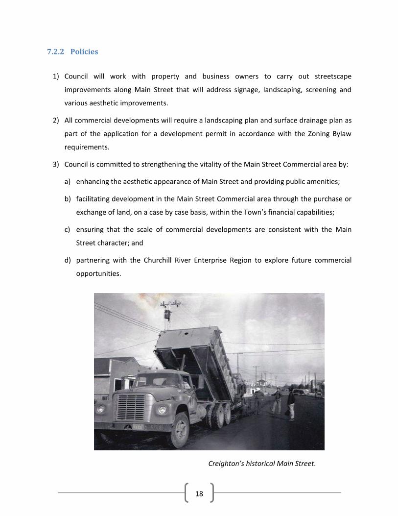
7.2.2 Policies
1) Council will work with property and business owners to carry out streetscape
improvements along Main Street that will address signage, landscaping, screening and
various aesthetic improvements.
2) All commercial developments will require a landscaping plan and surface drainage plan as
part of the application for a development permit in accordance with the Zoning Bylaw
requirements.
3) Council is committed to strengthening the vitality of the Main Street Commercial area by:
a) enhancing the aesthetic appearance of Main Street and providing public amenities;
b) facilitating development in the Main Street Commercial area through the purchase or
exchange of land, on a case by case basis, within the Town’s financial capabilities;
c) ensuring that the scale of commercial developments are consistent with the Main
Street character; and
d) partnering with the Churchill River Enterprise Region to explore future commercial
opportunities.
Creighton’s historical Main Street.

19
7.3 Highway Commercial Development
The majority of lots in the Highway Commercial area are located on Creighton Avenue (Highway
167) between Coronation Drive and Knight Street. There are also two other Highway
Commercial areas located on either end of Creighton Avenue. There is currently a surplus of
vacant parcels and lots in the Highway Commercial areas, although grading, leveling, and
servicing may pose development challenges.
7.3.1 Objectives
1) To ensure there is sufficient and suitable land available for highway commercial
development.
2) To encourage landscaping and other visual improvements to the highway commercial
area.
3) To support business development that maximizes the use of existing infrastructure and
reduces the need for infrastructure development and upgrades.
7.3.2 Policies
1) Highway commercial will generally include uses serving the travelling public, require good
vehicular access, highway exposure, or larger site size. Service and retail commercial uses
may be accommodated to provide a degree of flexibility and will be regulated in the
Zoning Bylaw.
2) Council will evaluate new highway commercial development proposals based on the
following factors:
a) consistency with the Future Land Use Map and any concept plans;
b) site planning and land use compatibility with existing surrounding developments;
c) the capacity of the Town to provide efficient and economical municipal services; and
d) provision for safe movement and integration of vehicular traffic into and out of the
commercial sites.

20
3) Council will promote an aesthetically pleasing Highway Commercial area by the
landscaping and fencing regulations outlined in the Zoning Bylaw.
4) All commercial developments will require a landscaping plan as part of the application for
a development permit in accordance with the Zoning Bylaw requirements.
7.4 Home Based Business
Home based business benefit the community by creating employment opportunities, enhancing
services, and stimulating the local economy. Council believes home based businesses are
valuable components of the local economy and feels confident accommodating for their use.
Council is committed to ensuring that any issues related to competition or nuisance will be
addressed through the appropriate regulations in the Zoning Bylaw regarding the scale and
location of home based business.
7.4.1 Objectives
1) To consider home based businesses that are compatible with the residential area through
provisions and regulations in the Zoning Bylaw.
2) To mitigate any negative impacts that home based businesses have on residential areas.
7.4.2 Policies
1) Home based business may be accommodated at Council’s discretion in the
R1 – Residential, R2 – Residential, RMH – Mobile Home Zoning Districts.
2) The Zoning Bylaw will contain development and operational standards for home based
businesses including number of employees, maximum building floor area, parking, signs,
outside storage, etc.

21
7.5 Heavy Industrial Development
The Town of Creighton recognizes that industrial development is vital to strengthening and
growing the local economy. Providing land for industrial development helps diversify the
Town’s tax base and creates opportunities for local employment.
Industrial land uses in Creighton are located at the north and south ends of the community. The
Hudson Bay Mining and Smelting Company is the largest consumer of industrial land within the
Town’s boundary. Over two sections of land are utilized by the mill for dumping of spoil
material. This land is north of the developed area of Town and east of highway 106 (Heavy
Industrial area on Map 2). Much of the land used by the Hudson Bay Mining and Smelting
Company is owned by the Town of Creighton and leased on a long term basis. The current lease
of lands within the Heavy Industrial area expires in 2026.
Hudson Bay Mining and Smelting operations in the Creighton/Flin Flon area.

22
7.5.1 Objectives
1) To ensure that there is an adequate supply of suitable land for heavy industrial
development to meet future requirements.
2) To ensure that industrial activities are compatible with nearby uses and developments.
3) To minimize negative environmental impacts of industrial land use.
4) To accommodate appropriate mineral exploration, development and extraction within the
municipality.
7.5.2 Policies
1) Heavy industrial activities will only be permitted in areas designated as Heavy Industrial
on the Future Land Use Maps.
2) Council will support mineral exploration, development and extraction in the Heavy
Industrial Area in the Future Land Use Map.
3) A lease agreement will be required for use of Town land that is in the Heavy Industrial
area.
4) All leases will address the appropriate laws and regulations in The Environmental
Management and Protection Act (particularly The Mineral Industry Environmental
Protection Regulations), The Clean Air Act, and any other legislation that is applicable to
the proposed use.
5) Council will require lessee’s to comply with the Government of Saskatchewan’s approved
plans for decommissioning, reclamation, abandonment, and post-decommission
monitoring of the leased lands, buildings, structures, and facilities at the sole expense of
the lessee.
6) Council may require performance bonds where there is storage of hazardous materials or
other uses that could lead to contamination of a site to ensure that remediation and
cleanup comply with provincial standards.
7) All heavy industrial developments will require a landscaping plan and surface drainage as
part of the application for a development permit in accordance with the Zoning Bylaw
requirements.

23
7.6 Light Industrial Development
Light industrial activities are primarily located in the south end of the community along King
Street, King Crescent, and Bereskin Avenue (Light Industrial area on Map 2). This industrial area
accommodates the Ministry of Highways and Infrastructure works yard, the Town of
Creighton’s garage, and various private storage and manufacturing facilities. Many of these lots
remain undeveloped and Council will continue to encourage light industrial development in this
area.
7.6.1 Objectives
1) To ensure that there is an adequate and suitable supply of land for light industrial
development to meet future requirements.
2) To ensure that industrial activities are compatible with nearby uses and developments.
3) To minimize negative environmental impacts of light industrial land use.
4) To attract new industrial and manufacturing operations in support of diversifying the local
economy.
7.6.2 Policies
1) Future light industrial subdivision and development proposals will be considered based
on:
a) land use compatibility with existing developments;
b) the ability of the Town to provide efficient and economical municipal services;
c) the impact on financial and capital planning by the Town;
d) site suitability and planning aspects including screening, vehicular access, and traffic
safety; and
e) development standards set out in the Zoning Bylaw.
24
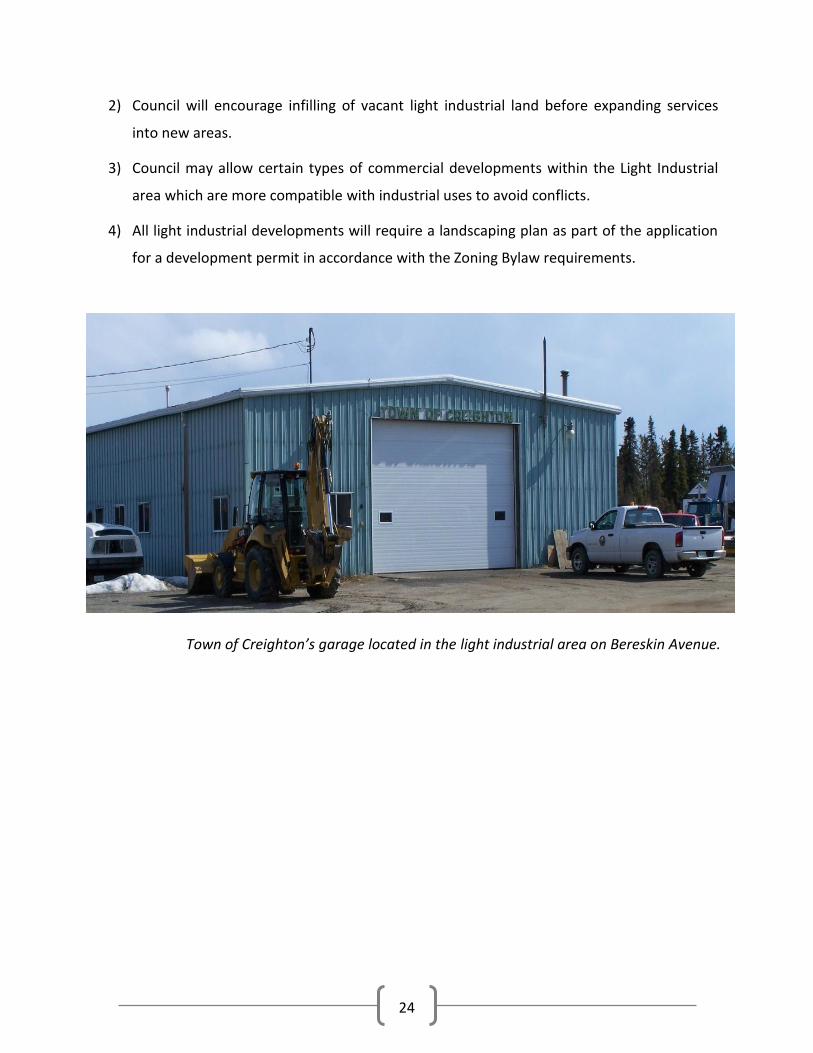
2) Council will encourage infilling of vacant light industrial land before expanding services
into new areas.
3) Council may allow certain types of commercial developments within the Light Industrial
area which are more compatible with industrial uses to avoid conflicts.
4) All light industrial developments will require a landscaping plan as part of the application
for a development permit in accordance with the Zoning Bylaw requirements.
Town of Creighton’s garage located in the light industrial area on Bereskin Avenue.

25
8. Community Services
8.1 Medical Services
Health care in Creighton is provided by the Mamawetan Churchill River Health Region.
Creighton’s health centre is located in the Provincial building on 1st Avenue East. The building
was constructed in 1985 and houses Public Health Nursing, Community Health, Mental Health,
Home Care, and a children’s dental program. The health facility does not have enough space to
adequately house all of these services. The Mamawetan Churchill River Health Region released
an infrastructure requirement strategy report in 2010. The report gave Creighton’s health
centre a negative rating (based on multiple criteria outlined in the methodology section of the
report). At its current state the facility lacks the required space which results in overcrowding
and overutilization. There is inadequate storage and office space as well as minimal waiting
areas in the facility. The report further describes inadequacies of the facility but the overarching
theme is that a new facility is needed. The report suggests that consideration should be given to
the possibility of accessing additional space in the existing facility or constructing (or leasing) a
new building.
The Nor-Man Health Authority in Manitoba operates the Flin Flon Hospital which is located
4 kilometres east of Creighton. This hospital is the regional hospital for communities in
northeastern Saskatchewan and northwestern Manitoba. It is a 42 bed facility that provides a
variety of acute care services such as emergency, pediatrics, surgery, obstetrics, psychiatry,
dialysis, chemotherapy, and palliative care. Saskatchewan and Manitoba have an interprovincial
agreement that allows residents of northeast Saskatchewan to utilize the health care facilities
of Flin Flon. The Mamawetan Churchill River Health Region has an agreement with the Province
of Manitoba to provide ambulance service to the residents of Creighton.
8.1.1 Objectives
1) To ensure that residents have access to quality health care facilities in Creighton.
2) To encourage the Mamawetan Churchill River Health Region to upgrade the existing
health centre or build a new facility.

26
8.1.2 Policies
1) Council will work with the Mamawetan Churchill River Health Region to identify possible
locations for a new health clinic in Creighton.
2) Council will accommodate medical facilities by permitting them in the CS - Community
Service, C1 - General Commercial, and C3 - Main Street Commercial Districts.
8.2 Schools and Educational Facilities
Education in Creighton is
provided through the
Creighton School Division
No. 111. The School
Division serves
approximately 1600km2 in
northeast Saskatchewan
and includes the
communities of
Creighton, Denare Beach,
and the Amiskosakahikan Indian Reserve of the Peter Ballantyne Cree Nation. Creighton
Community School is pre-kindergarten to Grade 12 with a steady student population around
500. Approximately 40% of students are bused to school daily. The school has many
extracurricular activities including volleyball, basketball, golfing, wrestling, cross country
running, track and field, as well as visual and performing arts. The school is located on
Municipal Reserve 5 on the corner of 1st Avenue and Main Street. The school is centrally located
in the community and is adjacent to sports fields and the community sports complex.
Northlands College has its eastern region campus located in Creighton. The college provides a
range of programs including adult basic education, trades, business, forestry, health and
community services, mine training, and technology enhanced learning. The college provides a
student residence for up to 15 occupants who live outside the Creighton and Denare Beach
area.

27
8.2.1 Objectives
1) To ensure the availability and access to educational programs and facilities for the
residents of Creighton.
2) To accommodate educational facilities in the Zoning Bylaw.
8.2.2 Policies
1) Council will accommodate educational facilities by permitting them to locate in the RP -
Recreation and Park, CS - Community Service, and C1 - General Commercial Districts.
2) Council will accommodate schools by permitting them to locate in the CS - Community
Service and RP - Recreation and Park Districts.
3) Council will work with the Creighton School Division and Northlands College to ensure
that they have adequate and suitable land for future growth opportunities.
8.3 Protective Services
The Town of Creighton and surrounding area is policed by the Royal Canadian Mounted Police
with the detachment consisting of 5 members. The detachment is located centrally in the
community on Creighton Avenue. The Fire Department consists of a volunteer fire brigade of 20
members. The fire hall is located on First Street East next to the Town Hall.
Creighton’s Fire Hall located on First Street East next to the Provincial Building.

28
Creighton has been assessed by the Ministry of Environment as a high risk area for potential
wildfires. This is due to the potential wildfire behavior in the region and as well as other man
made factors. The Community Wildfire Risk Assessment Project Report for Creighton revealed
that less than 25% of households use FireSmart principles for protecting their homes from
wildfires. This relates to the types of materials used in home construction to yard tidiness and
availability of fuel for fires (i.e. location of woodpiles, combustibles, and vegetation). With
distances between houses in the community less than 10 metres in some areas, following
FireSmart principles to protect properties is essential to preventing the spread of fires in the
community.
Creighton has an emergency response plan and regulations regarding open burning although
the Town lacks a community fuel management plan which is regarded as one of the best
preventative measures of wildfires.
Creighton’s municipal water system has enough capacity to store twice the daily water demand
which is the required amount for firefighting capabilities. The water system also exceeds the
Ministry of Environment’s minimum fire suppression requirements for pumping capacity and
there are a sufficient number of hydrants spaced throughout the community to provide fire
suppression for individual buildings.
8.3.1 Objectives
1) To provide a safe and secure community for residents and visitors.
2) To ensure that the Town provides the means to adequately equip and train emergency
response personnel.
3) To ensure that protective and emergency services are provided at an appropriate level.
4) To develop and maintain a community fuel management plan.
8.3.2 Policies
1) Council will ensure that there is sufficient funding allocated towards the purchase and
maintenance of emergency equipment and the training of emergency responders.

29
2) Council will ensure the municipal water system is capable of suppressing individual
building fires as determined by the provincial guidelines.
3) Council will educate and encourage residents to follow FireSmart principles on their
properties to reduce the spread of fires in the community. Council will also work to
incorporate Community FireSmart principles into new and existing neighbourhoods.
4) Council will continue to have a good working relationship with the Province and the City
of Flin Flon in dealing with emergency planning and response efforts.
5) Council will work with the Ministry of Environment to create a community fuel
management plan.
8.4 Recreation and Park
Residents of Creighton have access to a wide range of recreational activities within the Town.
Most of the recreational facilities are centrally located and surround the Sportex Ice arena. The
school yard adjacent to the Sportex contains a baseball diamond, tennis courts, and basketball
courts. Lions Park is also next to the Sportex arena and contains a Spray Park, Skateboard Park,
and soccer field. Creighton also has many municipal reserves in the community; however, many
of them are unusable for both recreation and development because they are rock outcrops.
The Future Land Use Maps show the location of recreation and park space in Creighton.

30
8.4.1 Objectives
1) To provide a broad range of recreational opportunities for residents and visitors.
2) To maximize the use of recreational and park facilities in the community.
3) To enhance the outdoor recreational experience for residents and visitors.
8.4.2 Policies
1) New residential subdivisions will provide appropriate sites and areas for park and
recreation space through the dedication of land as municipal reserve. In areas where park
is not suitable, Council will arrange for cash in lieu of dedicated lands to be provided for
the development of other recreation areas.
2) In commercial and industrial subdivisions, Council may request dedication of land where
the site is adjacent to a waterbody, otherwise cash in lieu will be the preferred option.
3) Areas that have significant development constraints such as muskeg and bedrock will be
left in a natural state and used as open space. Passive activities such as hiking and trail
development will be encouraged.
4) Council will continue to maintain and improve park, playground, and open space
development.
Creighton’s Sportex Ice Centre on White Street.

31
8.5 Heritage, Cultural, and Institutional Facilities
8.5.1 Objectives
1) To ensure that residents and visitors have access and opportunities for cultural
enjoyment.
2) To promote local culture and history by supporting and accommodating cultural
institutions in the community.
3) To support and encourage the growth and appreciation of arts and culture.
4) To ensure heritage resources are identified and protected where development occurs.
8.5.2 Policies
1) Council will support initiatives to provide and improve local arts and culture opportunities.
2) Places of worship, community centres, multiplex facilities, halls, and other places of
assembly will be permitted and encouraged in the community.
3) Council will work towards making the best use existing facilities to maximize their use and
provide affordable and assessable community facilities.
4) Council will ensure community facilities are well managed and well maintained.
5) Council will ensure development or any other activities likely to affect heritage resources
will be subject to review and, if necessary, a heritage resource impact assessment.

32
9. Natural Environment
9.1 Ecological Integrity
Ecological integrity is the ability of an ecological system to support and maintain a community
of organisms that has species composition, diversity, and functional organization comparable to
those of natural habitats within a region. The Town of Creighton is committed to respecting
natural processes occurring within the municipality and preserving and enhancing them.
9.1.1 Objectives
1) To ensure the ecological functions in Creighton are preserved and enhanced.
2) To ensure development respects natural drainage and wetland processes.
3) To support land use and development that preserves environmentally sensitive areas.
4) To identify and protect important ecosystems and other natural features.
9.1.2 Policies
1) All solid, liquid, and hazardous waste disposal will comply with provincial regulations and
will not adversely affect ecological processes.
2) Council will support the creation of an integrated plan for the surface water and ground
water management and drainage.
3) Wherever possible, important natural areas, features, and systems shall be integrated into
development areas and form part of a park as municipal reserve of dedicated lands.
4) Council will ensure that new development will not result in unnecessary or adverse
alteration of surface or subsurface drainage by the developer. Where necessary, the
developer may be required to provide additional information in regard to existing and
proposed drainage patterns.
5) Council will ensure land use and development preserves environmentally sensitive areas.

33
9.2 Land
Creighton is located in the Precambrian Shield and boasts beautiful landscapes and
environmental resources. Creighton is surrounded by northern boreal forest and lakes, thus
Council wants to ensure that quality of the natural environment is preserved. Tourism is a large
industry in Creighton, and maintaining and enhancing the natural setting is instrumental in
attracting visitors. Council is committed to ensuring that future land use and development does
not adversely impact the environment. Where environmental damage occurs Council is
committed to mitigating the problem and encourages innovative solutions to restore damaged
areas.
The Hudson Bay Mining and Smelting Company have been operating a fully functional mine and
base metal smelting complex in Flin Flon since the 1930’s. This mining activity has increased the
content of smelter related metals in the environment. Studies have been undertaken to assess
the exposure and human health risks in the Flin Flon and Creighton area. The overall conclusion
of these documents is that the likelihood of adverse health effects to area residents from
exposure to the metals evaluated is negligible to low. Studies investigating the effects of local
mining on humans and the environment are important and valued by the community.
9.2.1 Objectives
1) To provide an environmentally safe, sustainable, and visually pleasing community for
residents and visitors.
2) To ensure sound management of land in the community.
3) To protect and restore wildlife habitat, trees, and natural vegetation in the community.
4) To minimize future environmental problems caused by unregulated development or
disregard for site conditions.
5) To ensure future development is suited to the site, and that the land can support the
proposed development.

34
9.2.2 Policies
1) Council will assist the appropriate agencies to identify contaminated sites that may exist
in the community and cooperate on the development of appropriate mitigation plans for
those sites.
2) In the event that a site is slump prone or otherwise hazardous for the proposed use; or if
a proposed development may injuriously affect the safety or suitability of nearby lots,
Council may require a geotechnical report as prescribed in the Zoning Bylaw.
3) Council will support local and regional projects that restore natural areas in the
community and increase environmental quality.
4) Proper management and safe disposal of sewage, solid, industrial, and hazardous waste
will comply with the applicable legislation.
5) Where a development involves the onsite storage or handling of hazardous substances, it
shall comply with the applicable legislation.
6) Where a development involving the storage of hazardous substances ceases, the Town
shall be notified and the site will be decommissioned in compliance with applicable
legislation.
9.3 Forest
In the 1920’s and 1930’s the Hudson Bay Mining and Smelting Company cut much of the forest
in Creighton and Flin Flon for fuel and lumber. Forest fires have also damaged vegetation in the
Town and surrounding area. Mining has increased the acidity and metal content in the soil,
consequently reducing the ability for vegetation to recover. Much of the exposed topsoil has
been washed away exposing bedrock that cannot support vegetation. “The Green Project” is an
initiative to restore Creighton’s natural vegetation. The reforestation project treats soils with
crushed limestone to counteract the negative effects of metal concentration and acidity. The
project has been operating for over ten years and positive results have been made. Council will
support projects like these to restore natural areas to their original conditions.

35
9.3.1 Objectives
1) To effectively manage and protect the integrity of the urban forest in the Town of
Creighton.
2) To maintain a healthy, safe, and attractive public street and park tree population in
Creighton.
9.3.2 Policies
1) Retain safe and healthy trees and plant new trees on municipal properties.
2) Promote and encourage the protection of safe and healthy trees in the municipality.
3) Remove hazardous trees on public right of ways and trim trees to ensure a clear visual
path to traffic signals, signs, and street lights.
Before and after picture of an area in Creighton targeted by “The Green Project.”

36
9.4 Shoreline, Water Bodies, and Source Water Protection
Douglas and Bootleg Lakes are the water
sources for Creighton’s municipal
waterworks system. These sources of water
are located just outside the southern
boundary of the Town in the Northern
Saskatchewan Administration District. Land
use and development around these lakes
within the municipality will be restricted to
ensure this source water is protected from
pollution and contamination. The Subdivision
Regulations require a 1,500 metre setback
from the intake pipes of water treatment
plants which includes the southernmost area of Creighton (see Map 1: Municipal Constraints).
No subdivision or development will take place within this area identified on Map 1: Municipal
Constraints. Creighton contains other lakes including Hilary, Bomber, Myo, and Key Lake
(See Map 3: Town of Creighton Surrounding Waterbodies). All provincial and municipal setbacks
for development will be respected around these waterbodies.
9.4.1 Objectives
1) To ensure sound management of water resources.
2) To protect and restore wildlife habitat, wetlands, and natural shoreline vegetation.
3) To protect development from flooding and hazards to persons and property.
4) To protect municipal drinking water.
5) To enhance and maintain the visual appearance and public access of lakefront areas for
recreational and aesthetic purposes.

37
9.4.2 Policies
1) New subdivisions and infill development within the 1:500 flood event level will comply
with the safe building elevation set out in the Zoning Bylaw.
2) Council will ensure that all development and land use near waterbodies within the
Municipality will comply with applicable provincial and federal water and fisheries
regulations.
3) Council will prohibit future subdivision within the water intake setback (See Map 1:
Municipal Constraints) around Douglas Lake to protect the municipal water source from
contamination.
4) Council will work with Northern Municipal Services, the Ministry of Environment, and the
Saskatchewan Watershed Authority to protect Douglas Lake outside of the municipal
boundary.
5) Council will not sell or exchange shoreline environmental or municipal reserves.
6) Where there is a subdivision of land along the shoreline that cannot be defined as
environmental reserve, development proposals will provide a municipal reserve along the
shoreline that buffers the lake from development with a minimum 30 metre setback.
7) Where subdivision is proposed adjacent to a water body, Council will ensure that land is
dedicated as municipal or environmental reserve as appropriate to protect sensitive areas
and to ensure continued public access to the waterbodies.
9.5 Bedrock
Located in the Precambrian Shield the Town of Creighton has significant amounts of bedrock in
the community. Bedrock poses development challenges for road construction as well as utility
expansion. Developing bedrock areas is expensive and should be avoided if possible.

38
9.5.1 Objectives
1) To reduce development costs by avoiding land with severe development constraints.
2) To use available building methods in developable bedrock areas to make the most of
existing municipal services.
9.5.2 Policies
1) Subdivision of land with severe bedrock areas will dedicate those areas as municipal or
environmental reserve.
2) Areas with moderate constraints will be reviewed to determine if methods can be
implemented to reduce or mitigate the constraint.
9.6 Sand and Gravel Quarries
9.6.1 Objectives
1) To accommodate appropriate sand and gravel extraction within the municipality.
2) To ensure that sand and gravel quarrying is developed and operated with minimal
disturbance to the environment, including underlying aquifers.
9.6.2 Policies
1) Council will support sand and gravel quarrying provided the use is compatible with
surrounding land uses and adjacent developments.
2) Applications for sand and gravel quarries must be accompanied by a reclamation plan.
3) Council may require a performance bond for sand and gravel quarries to ensure
remediation.
39
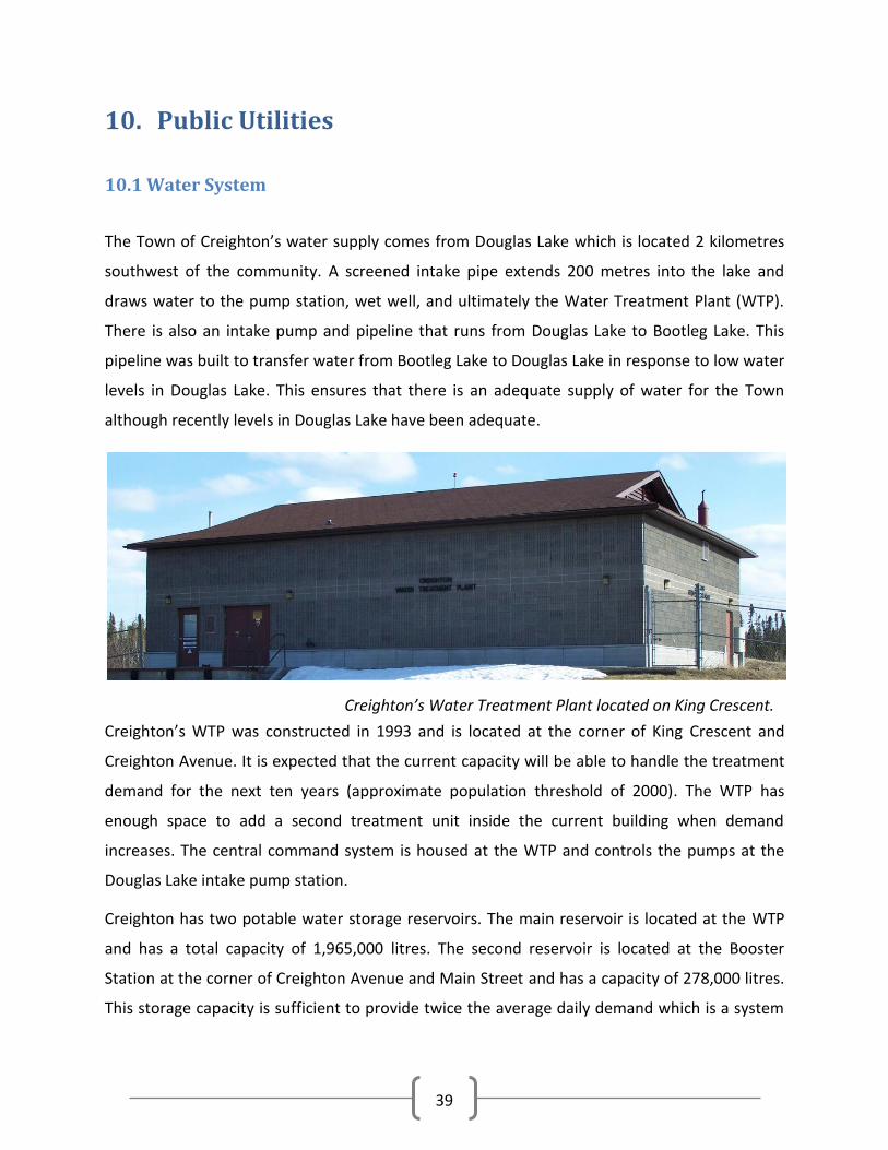
10. Public Utilities
10.1 Water System
The Town of Creighton’s water supply comes from Douglas Lake which is located 2 kilometres
southwest of the community. A screened intake pipe extends 200 metres into the lake and
draws water to the pump station, wet well, and ultimately the Water Treatment Plant (WTP).
There is also an intake pump and pipeline that runs from Douglas Lake to Bootleg Lake. This
pipeline was built to transfer water from Bootleg Lake to Douglas Lake in response to low water
levels in Douglas Lake. This ensures that there is an adequate supply of water for the Town
although recently levels in Douglas Lake have been adequate.
Creighton’s WTP was constructed in 1993 and is located at the corner of King Crescent and
Creighton Avenue. It is expected that the current capacity will be able to handle the treatment
demand for the next ten years (approximate population threshold of 2000). The WTP has
enough space to add a second treatment unit inside the current building when demand
increases. The central command system is housed at the WTP and controls the pumps at the
Douglas Lake intake pump station.
Creighton has two potable water storage reservoirs. The main reservoir is located at the WTP
and has a total capacity of 1,965,000 litres. The second reservoir is located at the Booster
Station at the corner of Creighton Avenue and Main Street and has a capacity of 278,000 litres.
This storage capacity is sufficient to provide twice the average daily demand which is a system
Creighton’s Water Treatment Plant located on King Crescent.

40
requirement for firefighting capabilities. The pumping capacity of the water system also
exceeds provincial standards for firefighting guidelines.
SaskWater provides a waterworks system assessment every five years for the Town of
Creighton. The 2010 report identifies decommissioning the old Booster Station as the most
immediate issue that needs to be addressed.
10.1.1 Objectives
1) To ensure that residents have access to clean drinking water that meets the provincial
quality guidelines.
2) To minimize the cost of expanding the water system into areas that provides extreme
servicing problems.
3) To ensure that storage and flows meet the requirements for firefighting capabilities.
4) To ensure provincial standards compliance for water system design, expansion, and
maintenance in new and existing developments.
5) To maintain an appropriate level of water service in the community to ensure that the
potential for growth is not adversely affected.
10.1.2 Policies
1) The planning and development of water services will be based on:
a) conformance with environmental regulations;
b) the demand for services and the need for upgrading;
c) the financial resources of the Town;
d) the logical extension of existing services; and
e) growth trends.
2) Usage fees for water will be used to assist in recovery of operating and maintenance costs
of the system.

41
3) Council will ensure that municipal water quality is maintained at a safe level.
4) Council will ensure development effectively utilizes existing water infrastructure and does
not place an excessive burden on the municipal utility services.
5) Developments that require new or upgraded water services must be responsible for the
provision and payment of these services. The developer will be required to enter into a
serving agreement to cover costs of the installation or improvements.
6) Council will aim to carry out the recommended improvements (as prescribed by the
Waterworks System Assessment Reports) in a timely manner.
10.2 Sewage System
Creighton has a domestic gravity sewer that serves all residential buildings in the community.
Sewage is directed to four pump stations then carried to the Sewage Treatment Plant (STP) via
sewage force mains. Most of the existing gravity sewer system is approaching 40 years old.
Sewage pumping station no. 1 is located at the intersection of First Street East and First
Avenue. It was commissioned in 1964 and underwent upgrades in 1998. This pumping station
collects sewage from the northeast side of Town and handles approximately 62% of the Town’s
total volume of sewage. Sewage pumping station no. 2 is located on the corner of Broderick
Avenue and Park Street. It was commissioned in 1964 and underwent upgrades in 1989. This
station moves approximately 25% of the Town’s wastewater production. Sewage pumping
station no. 3 is located at the end of Creighton Avenue on the northeast side of Town. This
station was also commissioned in 1964 and was upgraded in 1989. This pumping station only
serves a small part of the community handling about 2% of the total volume of wastewater.
Sewage pumping station no. 4 is located on King Crescent near the sewage lagoon and was
constructed in 1980. This station serves a very small portion of the community and is primarily
used to lift backwash and sewage from the water treatment plant to the sewage treatment
plant. The station handles approximately 13% of the total volume of the community’s
wastewater.
The sewage treatment plant was constructed in 1993/1994. It consists of four underground
concrete tanks and a control building. Treated effluent is discharged into the old lagoon, where

42
it is retained for additional processing. Discharges from the lagoon flow into Myo Lake, a
shallow wetland that drains east into Phantom Lake several kilometres to the southeast.
SaskWater provides a waterworks system assessment every five years for the Town of
Creighton including sewage works assessment. The 2010 report identifies installing a backflow
preventer on the transfer tank in the STP as the most immediate issue that needs to be
addressed.
10.2.1 Objectives
1) To maintain existing municipal sewage service and monitor the performance of this
service.
2) To ensure the provision of efficient sewage service necessary for the health and safety of
the community.
3) To maintain an appropriate service level of sewage treatment to ensure the potential for
growth is not adversely affected.
4) To ensure that sewer effluent is disposed of in an environmentally acceptable manner.
5) To minimize utility and infrastructure costs to the Town by avoiding expansion to areas
which present extreme servicing constraints.
6) Developments that require new or upgraded sewer services must be responsible for the
provision and payment of these services. The developer will be required to enter into a
serving agreement to cover costs of the installation or improvements.
10.2.2 Policies
1) The sewage treatment plant will be operated and maintained in compliance with
provincial standards.
2) The planning and development of sewer service will be based on:
a) conformance with environmental regulations;
b) the demand for services and the need for upgrading;

43
c) the financial resources of the Town;
d) the logical extension of existing services; and
e) growth trends.
3) Areas not connected to municipal sewage system will be required to have pump out style
holding tanks on site that are approved by Public Health, and be disposed of in the
municipal sewage system.
4) New sewage infrastructure will be planned, designed, and constructed with regard to
future land use development plans in a manner that minimizes disturbance to the natural
environment.
5) Council will ensure that development effectively utilizes utility infrastructure and does not
place excessive burden on municipal utility services.
6) Council will aim to carry out the recommended improvements (as prescribed by the
Waterworks System Assessment Reports) in a timely manner.
10.3 Landfill
Creighton’s landfill is located inside the municipal boundary in the Heavy Industrial area on land
owned by the Town. The 2009 volume of solid waste in the landfill was approximately
42,000 m3 with an estimate volume remaining for 80,000 m3. The volume may be increased
assuming the final elevation of the site is increased. The total area of the landfill is
approximately 46,000 m2. The Town of Creighton has explored using the current landfill site
with neighbouring municipalities as a regional landfill. This is due to the City of Flin Flon and the
Pelican Narrows Reserve approaching the end of the useful lifespan of their landfills. This will
reduce the number of years remaining in the life of Creighton’s the landfill but will increase
municipal revenues. The 2009 anticipated life remaining of the landfill with only the Town of
Creighton using it was 24 to 33 years. The lifespan can be increased to 31 to 42 years if the
landfill is compacted.
The Town provides garbage pickup twice a week as well as curb side recycling.
Green for Life (GLF) Environmental Corporation in the City of Flin Flon provides recycling

44
services for the Town of Creighton. The recycling facility handles common recyclables as well as
liquid commercial and industrial wastes, solvents, and oil related plastics.
10.3.1 Objectives
1) To reduce the amount of garbage going into the landfill to lower operational costs and
extend its lifespan.
2) To investigate the possibility of developing a regional landfill.
3) To encourage recycling and the responsible disposal of hazardous and potentially
hazardous materials.
10.3.2 Policies
1) Council will encourage partnerships with the private sector to ensure recycling and
hazardous waste disposal programs are available to residents.
2) Council will promote recycling and waste reduction programs in the community.
3) Council will explore methods of public education to encourage recycling and reduction of
garbage.
4) Council will ensure operation and maintenance of the landfill complies with provincial
regulations.

45
11. Transportation
11.1 Highways, Streets, and Roads
Creighton is located on the border of Saskatchewan and Manitoba and is accessible by road
from both provinces. Creighton is accessible from Highway 106 (Hansen Lake Highway) in
Saskatchewan, and Highway 10 in Manitoba. Highway 106 turns into Main Street when it enters
the Town of Creighton. Highway 167 to Denare Beach begins in Creighton and is a major
commuting route between the communities of Flin Flon, Denare Beach and Creighton.
Creighton is approximately 800 kilometres from Winnipeg, 400 kilometres from Prince Albert,
and 525 kilometres from Saskatoon. All of the streets and roads in Creighton are paved with the
exception of King Street and King Crescent in the Light Industrial area.
Creighton is within the North North East Transportation Planning Committee Area. Area
Transportation Planning Committee’s are an approach to involve local people and all levels of
government in the planning of the
provincial transportation system. The
Transportation Planning Committee’s
include representation from rural and
urban municipalities, Regional
Economic Development Authorities,
Saskatchewan Urban Municipalities
Association, the Ministry of Highways
and Infrastructure, and other
stakeholders in the area.
The closest airport to Creighton is the Flin Flon airport located approximately 25 kilometres
away on Highway 10 in Manitoba. The airport is owned and operated by the City of Flin Flon
and has regular service operated by Calm Air and Bearskin Airlines. Scheduled service is
available to The Pas and Winnipeg daily. The airport occupies over 500 acres and is operational
24 hours a day, 7 days a week.
Official opening of Highway 106 to Creighton in 1965.

46
11.1.1 Objectives
1) To provide a safe and efficient means of vehicular and pedestrian transportation
throughout the community.
2) To develop and maintain appropriate transportation links in order to provide efficient
movement of people and emergency services.
3) To protect the Town’s capital investment in roads and public right-of-ways through
continuing maintenance and improvement programs, and carry out road improvements in
accordance with identified needs.
4) To ensure that roads are safe and their location and design do not encourage excessive
vehicular speed.
5) To designate truck routes in the community for the movement of hazardous goods.
6) To participate in activities that improve the quality of the local and regional transportation
system.
11.1.2 Policies
1) Council will develop maintenance and upgrading plans for new and existing roads in the
municipality.
2) New roads will be planned and constructed with regard to land use and provision of
suitable access. The Town will acquire property for road right-of-ways though dedication
or agreement for purchase at the time of development or redevelopment of property.
3) New subdivisions will be required to enter into a servicing agreement and all road and
sidewalk construction must meet Town requirements.
4) Sight triangles will be regulated in the Zoning Bylaw to ensure there is clear visibility at
intersections of streets, alleys, and driveways.
5) Council will ensure that Creighton’s interests are represented within the regional and
provincial transportation strategies by participation in the North North East Area
Transportation Planning Committee.

47
12. Site Specific Discussion
12.1 Phantom Lake Area
The Phantom Lake area is a recreational area southeast of the Town of Creighton. Two
surveyed parcels (Parcel A – BQ53 and Parcel C – BQ5718, see Phantom Lake Annexation area
on Map 2: Town of Creighton Future Land Use Key) that cover over 400 acres of land are owned
by the Hudson Bay Mining and Smelting Company. The Hudson Bay Mining and Smelting
Company originally developed the area in the 1920’s and 1930’s for mine workers and their
families. The area includes a 9 hole golf course, clubhouse, driving range, soccer fields, picnic
and beach area, campground and cottage development. Phantom Lake is an area of possible
annexation and future development. Discussions between the Town of Creighton and the
Hudson Bay Mining and Smelting Company regarding annexation have been ongoing for many
years. This area provides an opportunity for further lakefront residential development. This is a
desirable area located near the Phantom Lake golf course with lake views in close proximity to
the Town. However, as it is not contiguous with existing developments, it will be cost
prohibitive to service with sewer and water lines. Currently the cabins in this area use onsite
water and sewer systems.
Phantom Lake beach area in the winter.

48
12.1.1 Objectives
1) To alter the Town boundaries to annex the Phantom Lake area.
2) To provide alternative options for residential development within the Town.
3) To increase the recreational opportunities and park space for Creighton residents.
12.1.2 Policies
1) Prior to the annexation of Parcel A Plan BQ53 and Parcel C Plan BQ5718, Council will
ensure that private dwellings on these parcels are on registered surveyed lots.
2) Future development in the Phantom Lake area will respect the natural environment and
comply with environmental regulations.
3) Municipal water and sewer will not be extended to the Phantom Lake area due to
extreme physical constraints. Property owners will be responsible for onsite water and
sewer systems that comply with provincial standards.
4) Once the annexation of Phantom Lake occurs Council will amend the Official Community
Plan and Zoning Bylaw to include growth objectives and policies and to regulate
development in the Phantom Lake area.
Phantom Lake public boat dock and golf course.

49
12.2 Treaty Land Entitlement (TLE)
The Peter Ballantyne Cree Nation (PBCN) people have occupied lands in northeast
Saskatchewan for over a thousand years. The traditional land occupied by the Cree Nation
encompasses over 50,000 square kilometres from the Saskatchewan/Manitoba border west to
Trade Lake, north to Reindeer Lake, and south to Sturgeon Landing. This was the traditional
hunting and gathering area of the Cree Nation and includes the area surrounding the Town of
Creighton. Article 9.01 (a) of the Saskatchewan Treaty Land Entitlement Framework Agreement
states that an agreement is required between the community and the First Nations before
designating any land in the community as reserve. The agreement will cover tax loss
compensation, compatible bylaws, and a method of resolving disputes.
12.2.1 Objectives
1) To develop a partnership with the PBCN, built upon respect for each other’s jurisdiction
and a common understanding of mutual interests.
2) To ensure compatibility of development between the Town and new reserve lands that
may be established in and near the Town.
12.2.2 Policies
1) The Town of Creighton will require an agreement with any First Nation seeking to
establish a reserve in or near the Town to cover matter such as:
a) compatibility of land use;
b) compatibility of bylaws;
c) compensation for tax loss;
d) payment of services provided; and
e) method for resolving disputes.
2) Council will collaborate and consult with PBCN with respect to any other area of mutual
interest.

50
13. Plan Implementation, Tools, and Policies
This Official Community Plan will provide guidance for Council in making decisions regarding
land use, zoning, subdivision, and development in general. These decisions must be made in
conformity with the stated policies and objectives to ensure that the goals for the future
development of Creighton will be achieved.
The following instruments and initiatives will be utilized in implementing this Official
Community Plan:
13.1 Zoning Bylaw
In conjunction with this Official Community Plan, the Zoning Bylaw will control the use of land.
The Zoning Bylaw establishes and prescribes uses and regulations for zoning districts.
Regulations will vary in each zoning district but the policies and provisions will be consistent
with this Official Community Plan.
13.2 Minor Variances to the Zoning Bylaw
Council will allow for minor variances to the Zoning Bylaw as a means of providing flexibility in
the administration of the bylaw and as a way of providing timely development decisions.
Council may approve the variance if the general intent of this Official Community Plan and
Zoning Bylaw are maintained. The Zoning Bylaw will identify how the site standards may be
varied. The Zoning Bylaw will also establish a procedure for processing and recording of minor
variance applications.
13.3 Subdivision and Concept Plans
Council directs the subdivision of land through the Official Community Plan and Zoning Bylaw.
Subdivision will be supported where it meets the requirements of this Official Community Plan
and Zoning Bylaw. Council will apply these tools to guide subdivision and lot design, street

51
layout, location of municipal reserve and other dedicated lands, as well as exercise control over
utility easements and leases.
Concept plans will be used to:
provide preliminary plans for proposed development;
guide the phasing of development;
identity street and lot layouts, land use, and density of development; and
determine the location of any school site, park, or pathway.
Development will proceed at a rate which meets residential, commercial, and industrial land
requirements. This will involve phased development that:
occurs in an efficient and cost effective manner taking into consideration the Town’s
capital works program and financial capability;
is orderly and geographically contiguous (insofar as practical); and
provides sufficient land so that market demands for land are met.
13.4 Rezoning of Land
Council will consider the following factors when dealing with applications to rezone, subdivide,
and develop land.
conformity to this Official Community Plan;
suitability of the site for the proposed development;
compatibility of existing adjacent land use;
provision of dedicated lands as may be required for subdivision;
the Town’s financial capability to support the development;
the adequate provision and timing of development of municipal services; and
the completion of a servicing agreement for onsite and offsite services.
13.5 Servicing Agreement
Where Council requires a servicing agreement, the agreement becomes a condition of approval
of a subdivision by the approving authority. The agreement will ensure that municipal

52
standards are met for capital works and ensure that such infrastructure development costs are
borne by the developer and their customers. A servicing agreement will be required unless
there are no services or offsite levies required for a subdivision. Council may consider a general
municipal share in the cost of offsite infrastructure where the improvement is designed to
serve more than the subject subdivision.
Where a subdivision of land requires the installation or improvement of municipal services such
as sewer lines, streets or sidewalks within the subdivision, the developer will be required to
enter into a servicing agreement with the Town to cover the installation or improvements
including, where necessary, charges to cover the costs of improvement or upgrading of off-site
services. Council will, by resolution, establish the standards and requirements for such
agreements and charges, including the posting of performance bonds or letters of credit.
Developers will be required to provide a grading and leveling site plan for new subdivisions. The
plan will show the future drainage patterns of the proposed subdivision to ensure that the
amount of serviceable and developable land is maximized.
Council will undertake studies necessary to define the benefiting areas and the unit costs
associated with required capital upgrading of offsite services. The studies will be used to
determine a fair level of offsite servicing charges.
13.6 Building Bylaw
In accordance with section 7(1) of The Uniform Building and Accessibility Standards Act, the
Town will ensure that building construction is regulated so that new construction is physically
acceptable to the community. The building bylaw will control the minimum standard of
construction through the issuance permits.
13.7 Land Acquisition
In accordance with The Northern Municipalities Act, 2010 Council may purchase land for urban
development. In this regard Council may consider the purchase of land for subdivision or
development to:
facilitate urban development including public facilities;

53
provide affordable housing;
facilitate the relocation of non-conforming uses; and
establish lot prices based on the recovery of development costs.
13.8 Intermunicipal and Interjurisdictional Cooperation
Council is interested in promoting Intermunicipal and Interjurisdictional initiatives that focus on
a cooperative approach to providing cost efficient services (fire protection, recreation, health
care, emergency services, and economic development). The Town will continue to work in
partnership with the Province, the City of Flin Flon, the Northern Village of Denare Beach, Peter
Ballantyne Cree Nation, and other agencies as a means of providing and sharing services
effectively and efficiently.
13.9 Capital Works Program
In accordance with The Northern Municipalities Act, 2010 Council will prepare a capital works
plan that will be coordinated with policies of this Official Community Plan to ensure the
effective and efficient control of development and public spending.

54
14. Monitoring and Amendment
This Official Community Plan establishes policies that are expected to meet anticipated
residential, commercial, and industrial needs within the financial and servicing capabilities of
the community. These policies will serve as a basis for detailed planning and servicing. To
ensure the effectiveness of this Official Community Plan in meeting the overall community
objectives, Council will monitor the local situation and evaluate the appropriateness of this
document and its policies.
Council will require an administrative review of this Official Community Plan exploring the need
for revisions or for legal consolidation of adopted amendments at least once every five years.
An office consolidation shall be maintained to keep the working copies current.
This Official Community Plan may be amended if determined desirable by Council.
Amendments may also be proposed by developers and the public to facilitate specific
development proposals. Council will consider such requests based on:
appropriate community development and public interest; and
overall community objectives as established by this Official Community Plan.