Embed Size (px)
Citation preview
CREATING PEDESTRIAN SAFETY SYNERGY: INTEGRATING & IMPLEMENTING THE E OF
ENGINEERING IN PRINCE GEORGE’S COUNTY
APRIL 2021
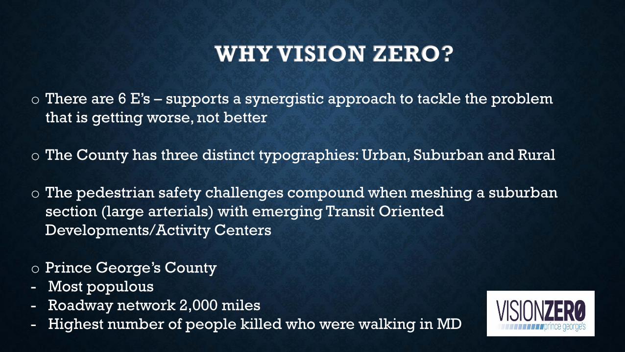
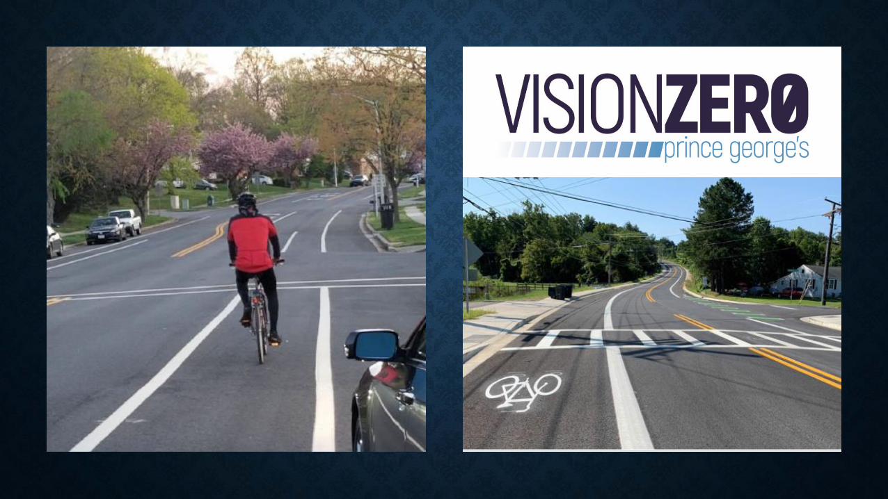
WHY VISION ZERO?
o There are 6 E’s – supports a synergistic approach to tackle the problem
that is getting worse, not better
o The County has three distinct typographies: Urban, Suburban and Rural
o The pedestrian safety challenges compound when meshing a suburban
section (large arterials) with emerging Transit Oriented
Developments/Activity Centers
o Prince George’s County
- Most populous
- Roadway network 2,000 miles
- Highest number of people killed who were walking in MD
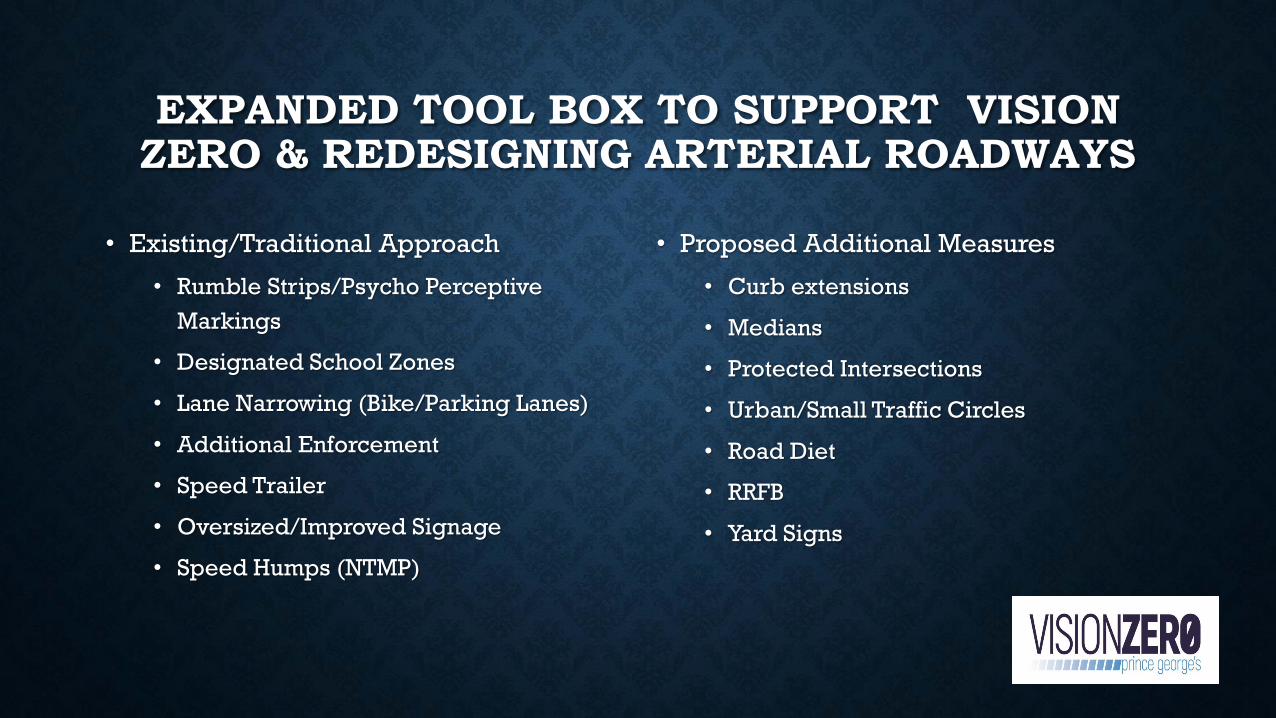
EXPANDED TOOL BOX TO SUPPORT VISION ZERO & REDESIGNING ARTERIAL ROADWAYS
• Existing/Traditional Approach
• Rumble Strips/Psycho Perceptive
Markings
• Designated School Zones
• Lane Narrowing (Bike/Parking Lanes)
• Additional Enforcement
• Speed Trailer
• Oversized/Improved Signage
• Speed Humps (NTMP)
• Proposed Additional Measures
• Curb extensions
• Medians
• Protected Intersections
• Urban/Small Traffic Circles
• Road Diet
• RRFB
• Yard Signs
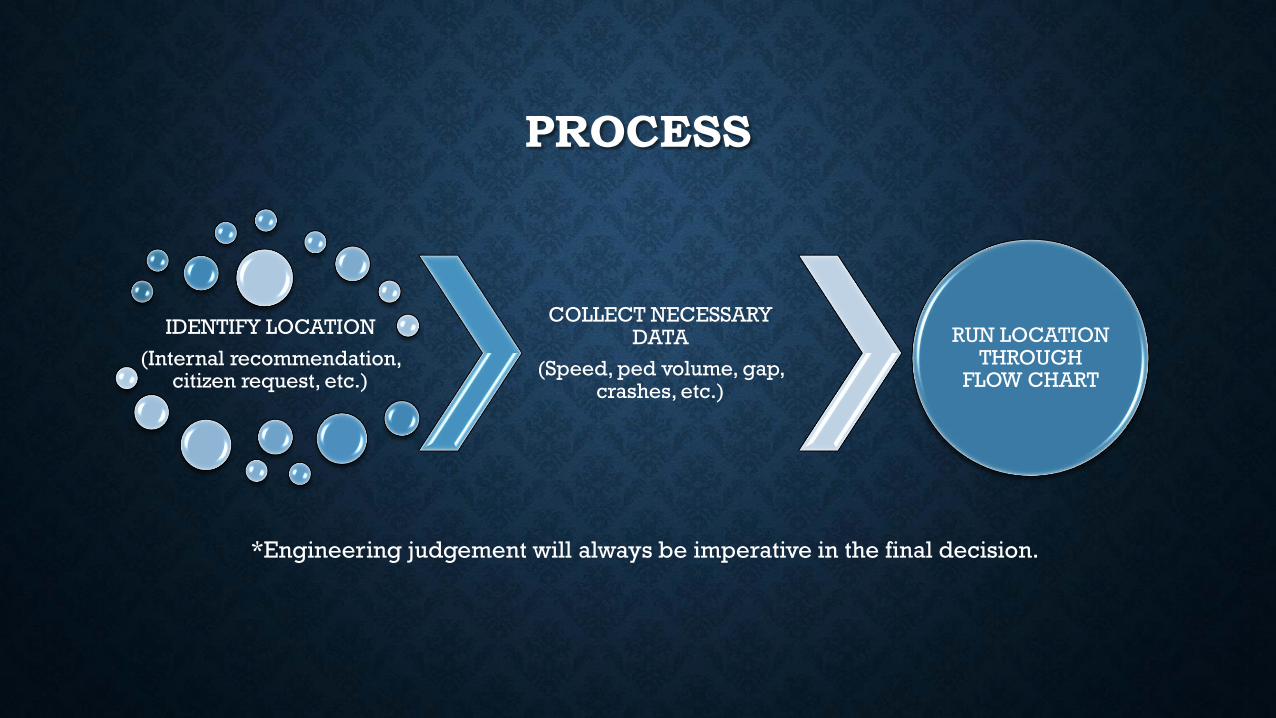
PROCESS
IDENTIFY LOCATION
(Internal recommendation, citizen request, etc.)
COLLECT NECESSARY DATA
(Speed, ped volume, gap, crashes, etc.)
RUN LOCATION THROUGH
FLOW CHART
*Engineering judgement will always be imperative in the final decision.
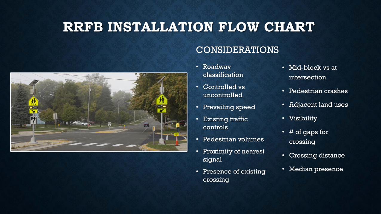
RRFB INSTALLATION FLOW CHART
• Roadway
classification
• Controlled vs
uncontrolled
• Prevailing speed
• Existing traffic
controls
• Pedestrian volumes
• Proximity of nearest
signal
• Presence of existing
crossing
CONSIDERATIONS
• Mid-block vs at
intersection
• Pedestrian crashes
• Adjacent land uses
• Visibility
• # of gaps for
crossing
• Crossing distance
• Median presence
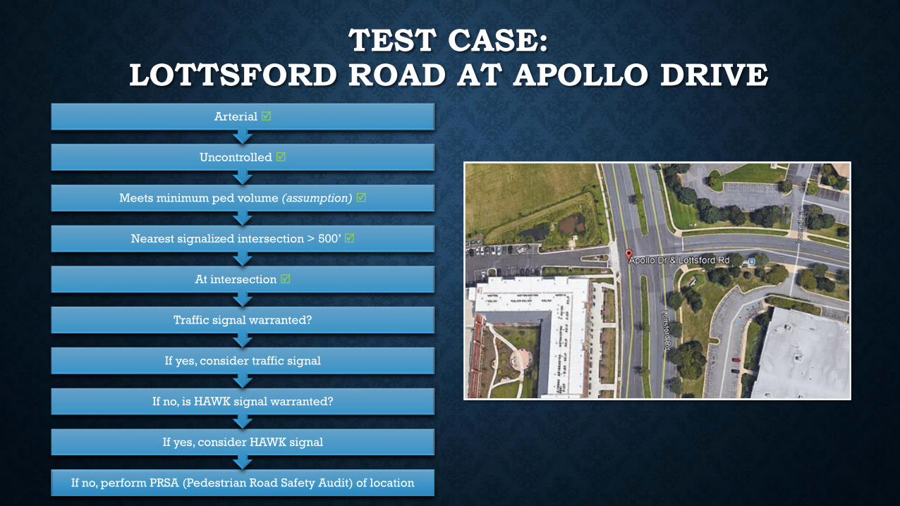
TEST CASE: LOTTSFORD ROAD AT APOLLO DRIVE
If no, perform PRSA (Pedestrian Road Safety Audit) of location
If yes, consider HAWK signal
If no, is HAWK signal warranted?
If yes, consider traffic signal
Traffic signal warranted?
At intersection
Nearest signalized intersection > 500’
Meets minimum ped volume (assumption)
Uncontrolled
Arterial
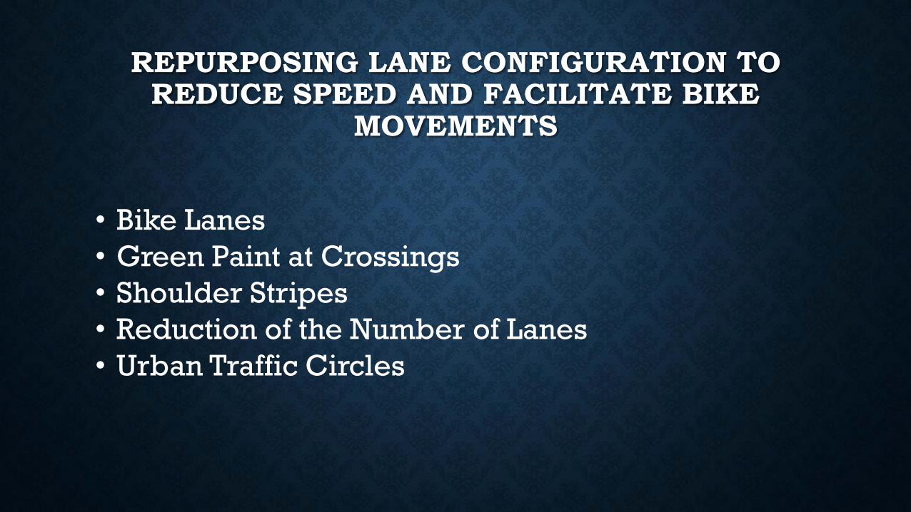
REPURPOSING LANE CONFIGURATION TO REDUCE SPEED AND FACILITATE BIKE
MOVEMENTS
• Bike Lanes
• Green Paint at Crossings
• Shoulder Stripes
• Reduction of the Number of Lanes
• Urban Traffic Circles
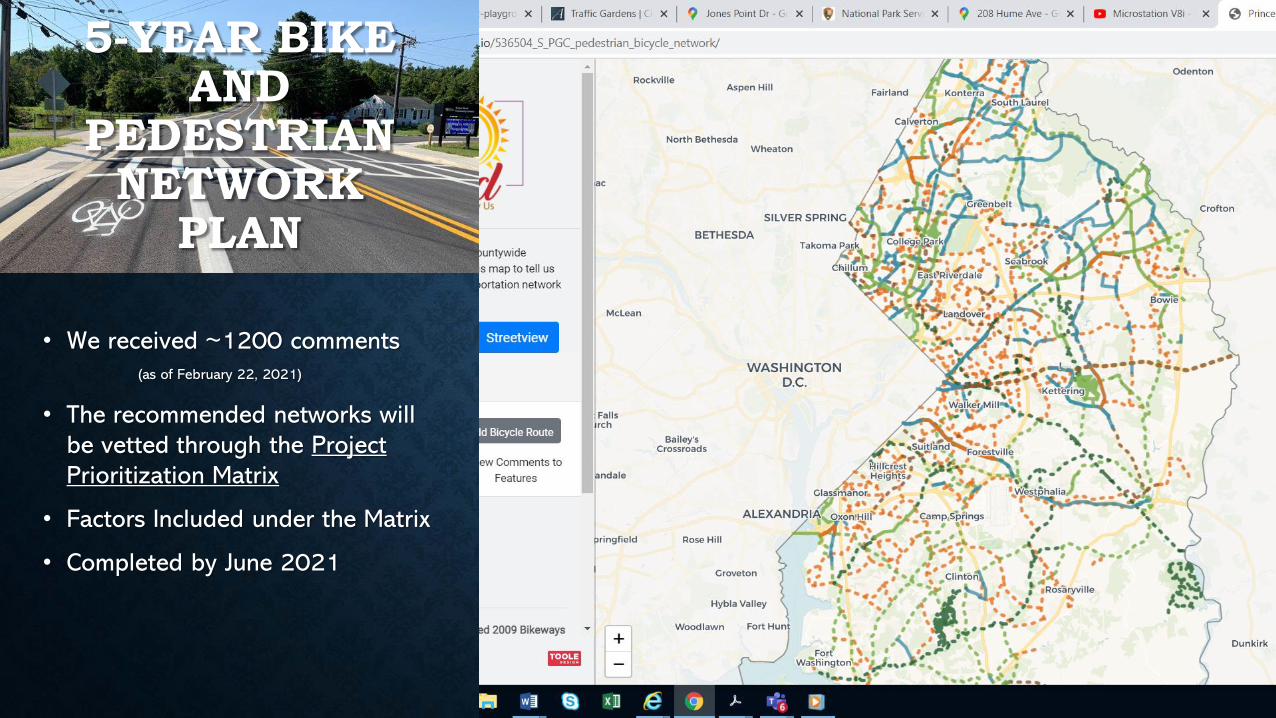
5-YEAR BIKE AND
PEDESTRIAN NETWORK
PLAN
• We received ~1200 comments
(as of February 22, 2021)
• The recommended networks will
be vetted through the Project
Prioritization Matrix
• Factors Included under the Matrix
• Completed by June 2021
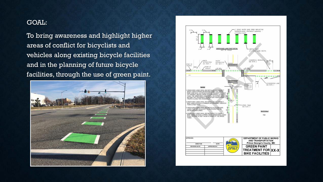
GOAL:
To bring awareness and highlight higher
areas of conflict for bicyclists and
vehicles along existing bicycle facilities
and in the planning of future bicycle
facilities, through the use of green paint.
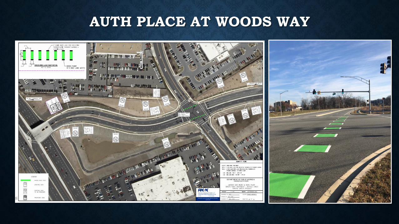
AUTH PLACE AT WOODS WAY
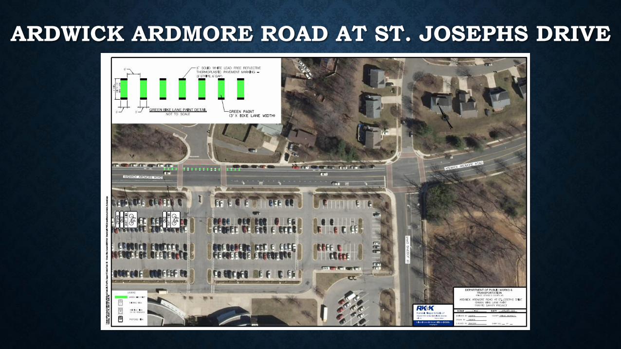
ARDWICK ARDMORE ROAD AT ST. JOSEPHS DRIVE
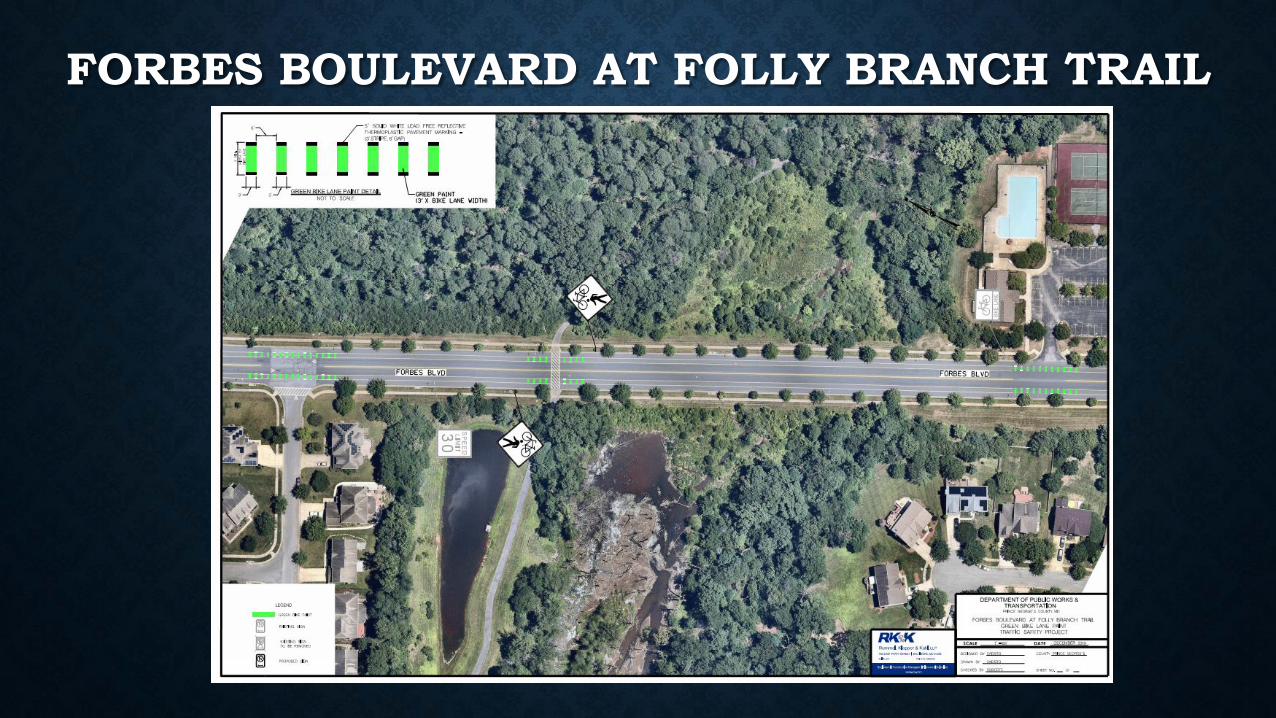
FORBES BOULEVARD AT FOLLY BRANCH TRAIL
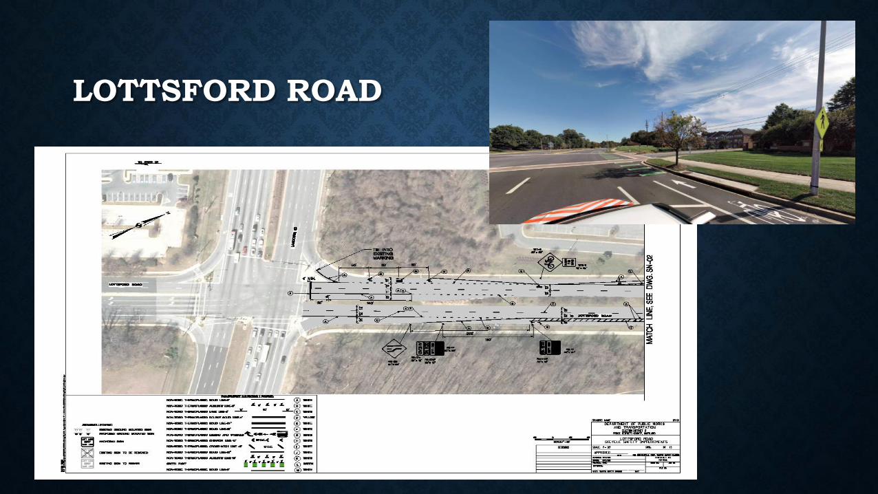
LOTTSFORD ROAD
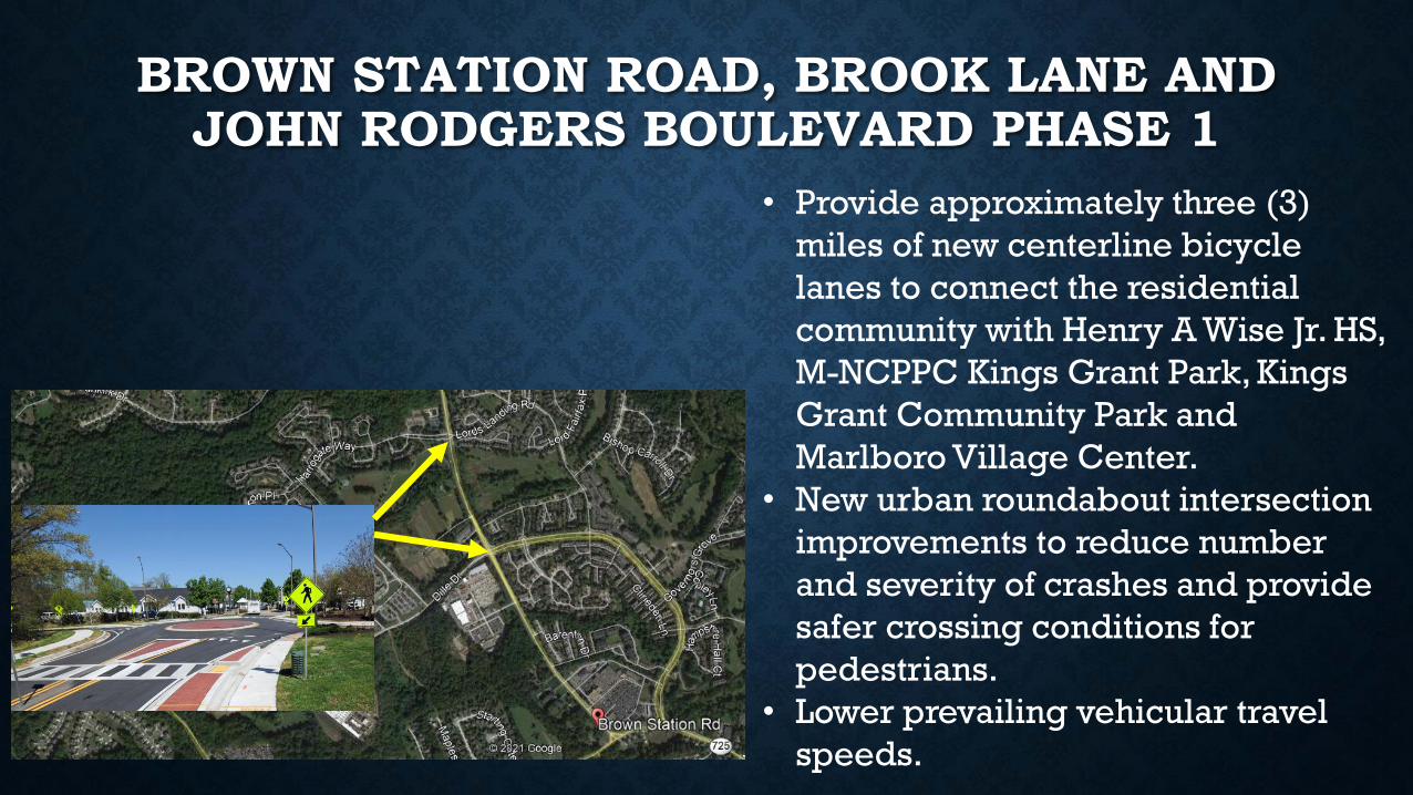
BROWN STATION ROAD, BROOK LANE AND JOHN RODGERS BOULEVARD PHASE 1
• Provide approximately three (3)
miles of new centerline bicycle
lanes to connect the residential
community with Henry A Wise Jr. HS,
M-NCPPC Kings Grant Park, Kings
Grant Community Park and
Marlboro Village Center.
• New urban roundabout intersection
improvements to reduce number
and severity of crashes and provide
safer crossing conditions for
pedestrians.
• Lower prevailing vehicular travel
speeds.
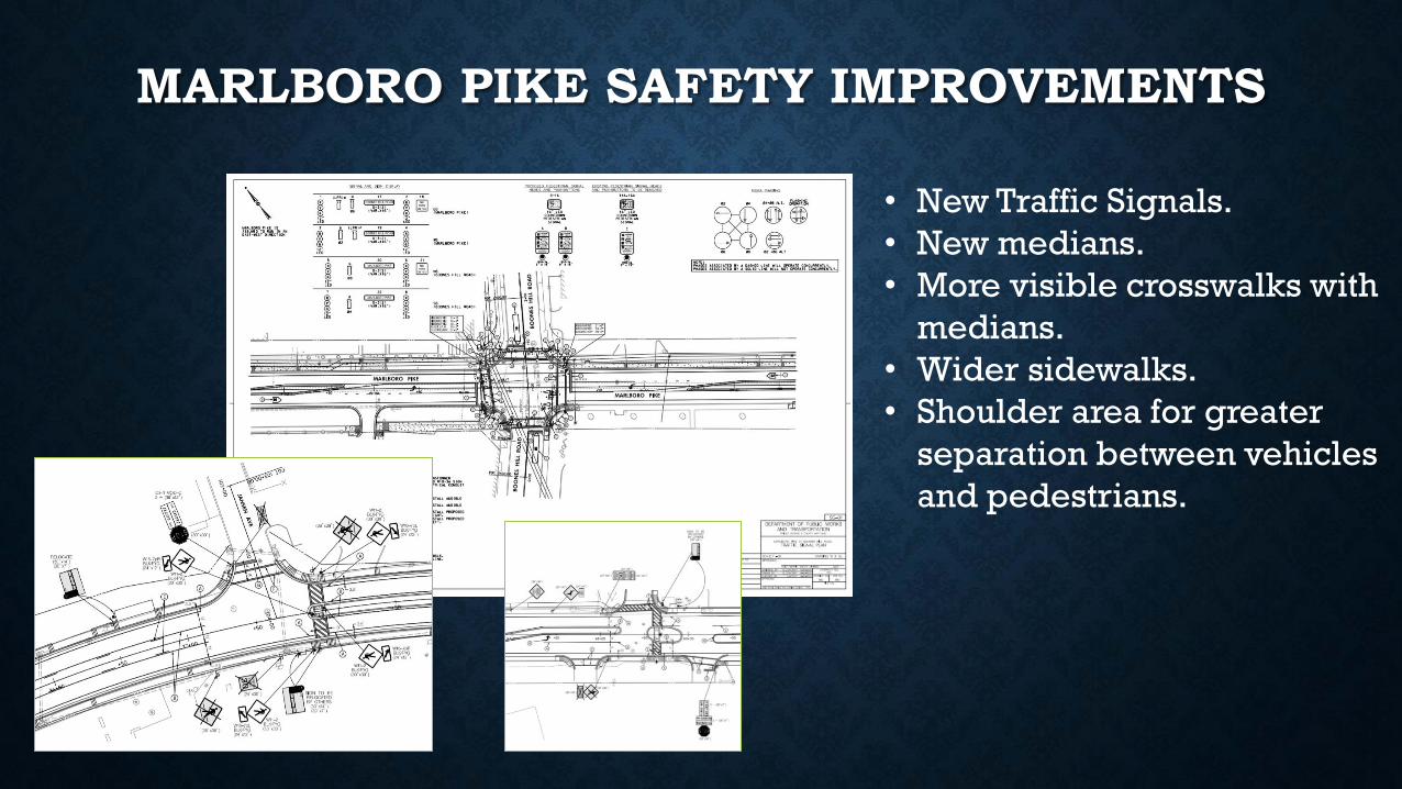
MARLBORO PIKE SAFETY IMPROVEMENTS
• New Traffic Signals.
• New medians.
• More visible crosswalks with
medians.
• Wider sidewalks.
• Shoulder area for greater
separation between vehicles
and pedestrians.
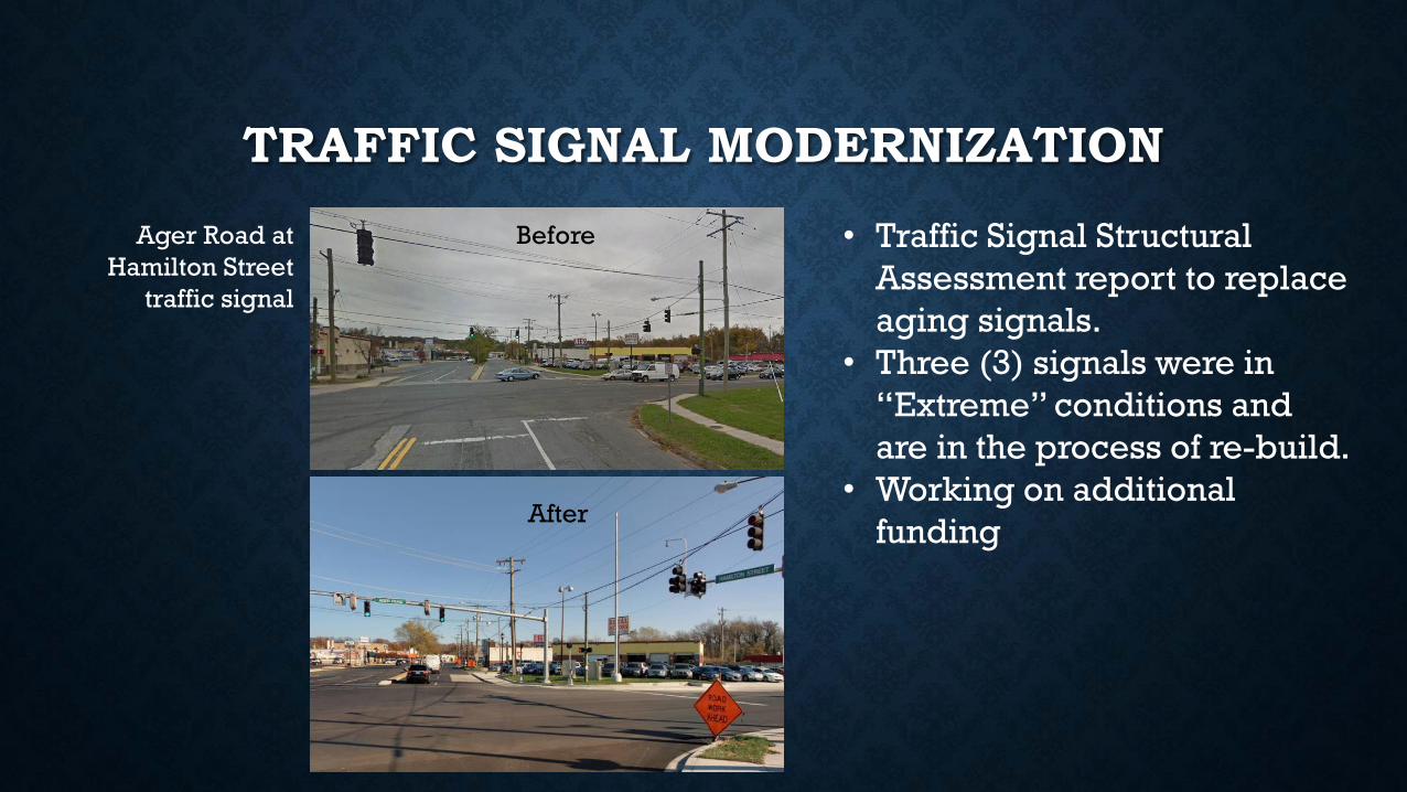
TRAFFIC SIGNAL MODERNIZATION
• Traffic Signal Structural
Assessment report to replace
aging signals.
• Three (3) signals were in
“Extreme” conditions and
are in the process of re-build.
• Working on additional
funding
Ager Road at
Hamilton Street
traffic signal
Before
After
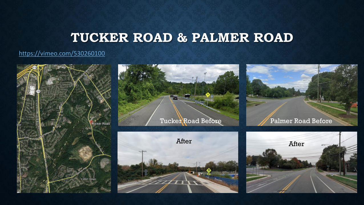
TUCKER ROAD & PALMER ROAD
Tucker Road Before Palmer Road Before
https://vimeo.com/530260100
After After
Q & A
THANK YOU FOR ATTENDING
HADI QUAIYUMDIVISION CHIEFTE&SD/OEPM