Embed Size (px)
Citation preview
Country Report
MALDIVES
Joint Meeting of RA II WIGOS Project and RA V TT-SU
Jakarta, Indonesia / 11 October 2018
BMKG Headquarter
Maldives Meteorological ServiceAhmed Rashed
Email: [email protected]
Phone: +960-7768565
Outline
I. Abstract (updates on status and plan of satellite data access, processing, application and training)
II. Satellite data and product requirements, training needs and infrastructure
Appendix
a. Background
b. Short description of NMHS activities
c. Current observational system overview
d. Access, processing and application of satellite data and products
e. Satellite data to address regional challenges
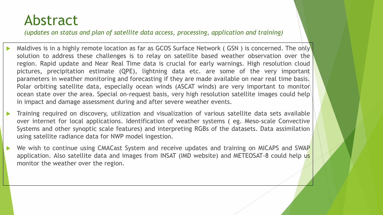
Abstract (updates on status and plan of satellite data access, processing, application and training)
Maldives is in a highly remote location as far as GCOS Surface Network ( GSN ) is concerned. The only
solution to address these challenges is to relay on satellite based weather observation over the
region. Rapid update and Near Real Time data is crucial for early warnings. High resolution cloud
pictures, precipitation estimate (QPE), lightning data etc. are some of the very important
parameters in weather monitoring and forecasting if they are made available on near real time basis.
Polar orbiting satellite data, especially ocean winds (ASCAT winds) are very important to monitor
ocean state over the area. Special on-request basis, very high resolution satellite images could help
in impact and damage assessment during and after severe weather events.
Training required on discovery, utilization and visualization of various satellite data sets available
over internet for local applications. Identification of weather systems ( eg. Meso-scale Convective
Systems and other synoptic scale features) and interpreting RGBs of the datasets. Data assimilation
using satellite radiance data for NWP model ingestion.
We wish to continue using CMACast System and receive updates and training on MICAPS and SWAP
application. Also satellite data and images from INSAT (IMD website) and METEOSAT-8 could help us
monitor the weather over the region.
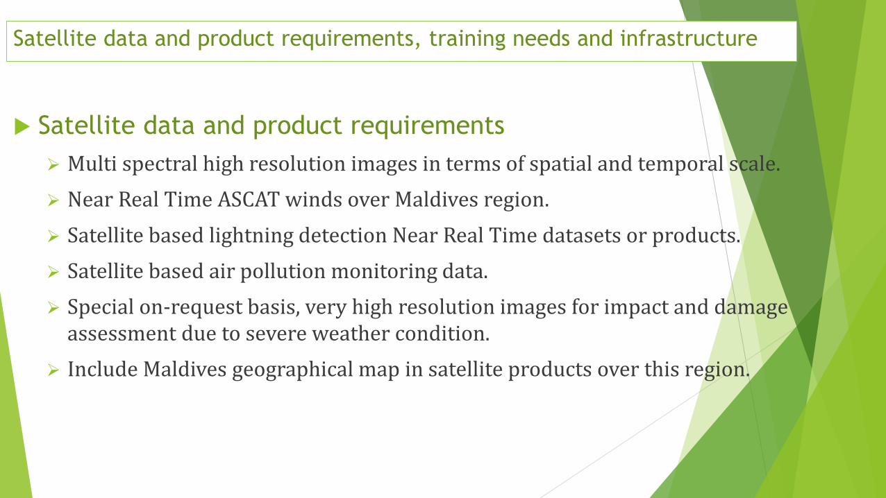
Satellite data and product requirements, training needs and infrastructure
Satellite data and product requirements
Multi spectral high resolution images in terms of spatial and temporal scale.
Near Real Time ASCAT winds over Maldives region.
Satellite based lightning detection Near Real Time datasets or products.
Satellite based air pollution monitoring data.
Special on-request basis, very high resolution images for impact and damage assessment due to severe weather condition.
Include Maldives geographical map in satellite products over this region.
Satellite data and product requirements, training needs and infrastructure
Training needs
Discovery of various satellite data sets available over internet.
Training on utilization and visualization techniques of such data sets for local application.
Identification of weather systems ( eg. Meso-scale Convective Systems and other synoptic scale features) and interpreting RGBs of the datasets.
Satellite based lightning detection dataset and Near Real Time lightning monitoring techniques.
Satellite radiance data assimilation techniques for NWP model run, research and simulation.
Technical infrastructure issues to access and process/visualize satellite data
Reception of high resolution and high frequency data and images from FY series and INSAT series of satellites, DVB-S2 reception (e.g. CMACast), internet service (http/ftp, data covering Maldives area), visualization (e.g. MICAPS, SWAP, SATAID) )
Processed images and datasets at higher resolution and high frequency.

Appendix
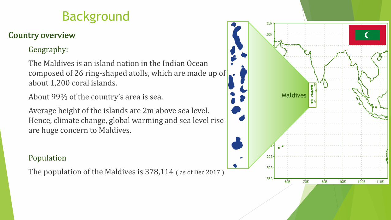
Country overview
Geography:
The Maldives is an island nation in the Indian Ocean composed of 26 ring-shaped atolls, which are made up of about 1,200 coral islands.
About 99% of the country’s area is sea.
Average height of the islands are 2m above sea level. Hence, climate change, global warming and sea level rise are huge concern to Maldives.
Population
The population of the Maldives is 378,114 ( as of Dec 2017 )
Background
Maldives
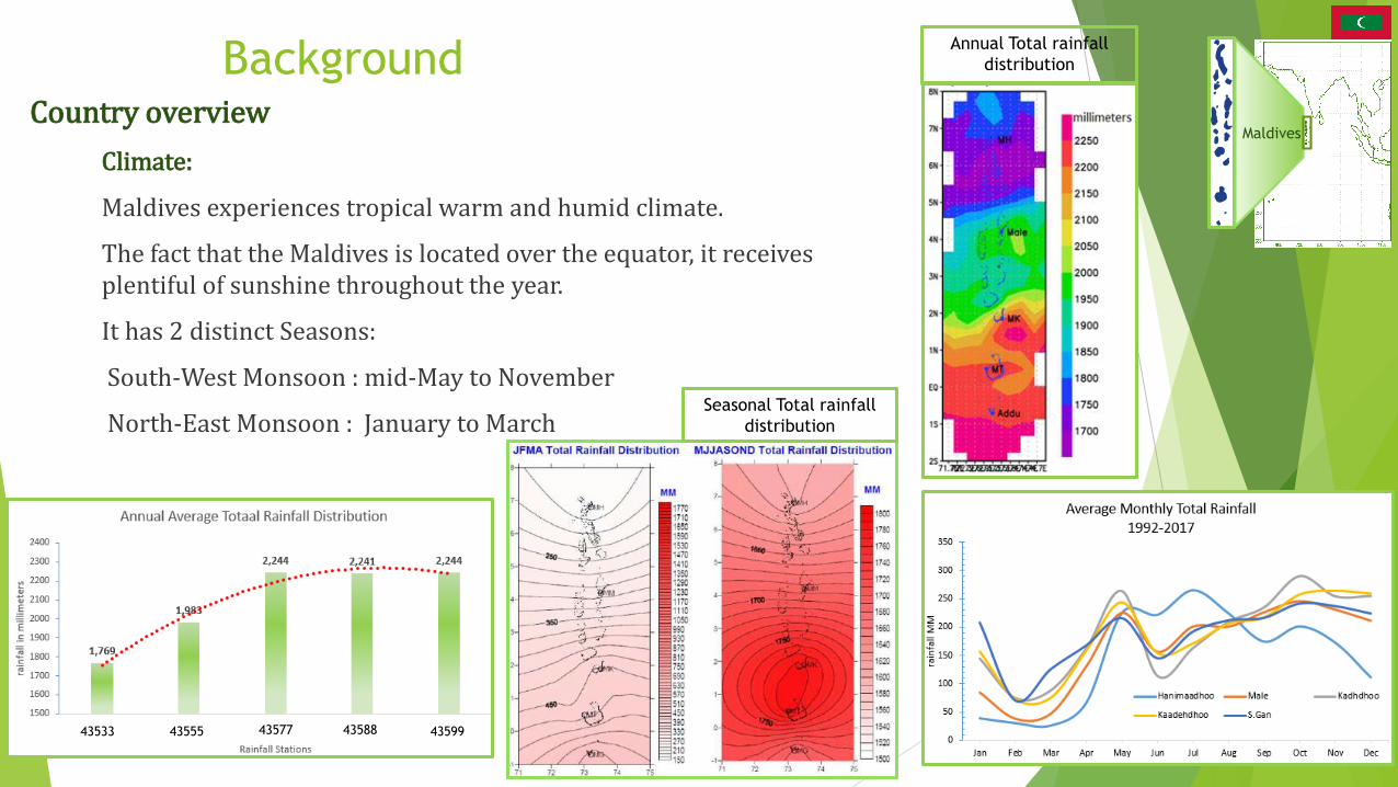
Country overview
Climate:
Maldives experiences tropical warm and humid climate.
The fact that the Maldives is located over the equator, it receives plentiful of sunshine throughout the year.
It has 2 distinct Seasons:
South-West Monsoon : mid-May to November
North-East Monsoon : January to March
Background
Maldives
Annual Total rainfall
distribution
Seasonal Total rainfall
distribution
43533 43555 43577 43588 43599
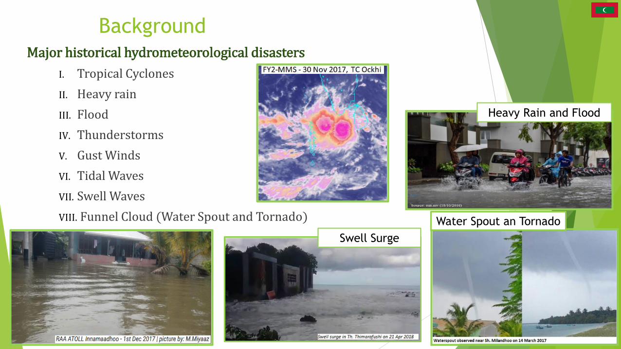
BackgroundMajor historical hydrometeorological disasters
I. Tropical Cyclones
II. Heavy rain
III. Flood
IV. Thunderstorms
V. Gust Winds
VI. Tidal Waves
VII. Swell Waves
VIII. Funnel Cloud (Water Spout and Tornado)
Heavy Rain and Flood
Swell Surge
Water Spout an Tornado
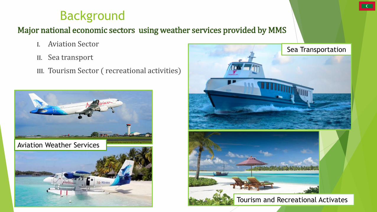
BackgroundMajor national economic sectors using weather services provided by MMS
I. Aviation Sector
II. Sea transport
III. Tourism Sector ( recreational activities)
Tourism and Recreational Activates
Aviation Weather Services
Sea Transportation
Short Description of MMS Activities
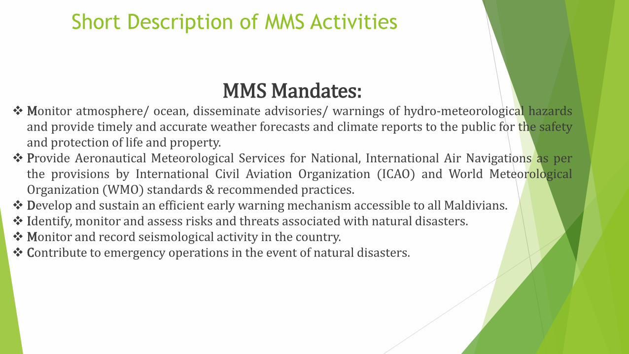
MMS Mandates: Monitor atmosphere/ ocean, disseminate advisories/ warnings of hydro-meteorological hazards
and provide timely and accurate weather forecasts and climate reports to the public for the safetyand protection of life and property.
Provide Aeronautical Meteorological Services for National, International Air Navigations as perthe provisions by International Civil Aviation Organization (ICAO) and World MeteorologicalOrganization (WMO) standards & recommended practices.
Develop and sustain an efficient early warning mechanism accessible to all Maldivians. Identify, monitor and assess risks and threats associated with natural disasters. Monitor and record seismological activity in the country. Contribute to emergency operations in the event of natural disasters.
Short Description of MMS Activities
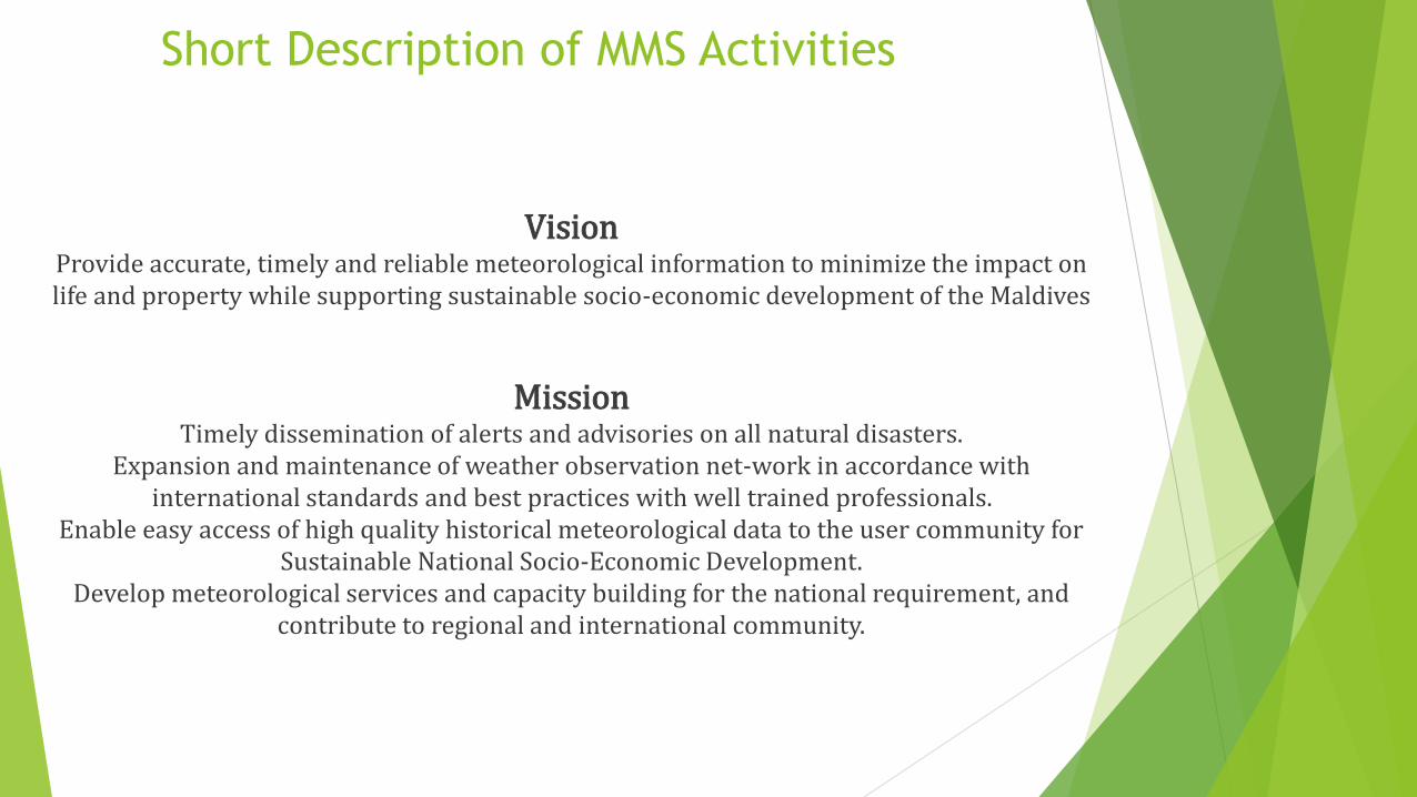
VisionProvide accurate, timely and reliable meteorological information to minimize the impact on life and property while supporting sustainable socio-economic development of the Maldives
MissionTimely dissemination of alerts and advisories on all natural disasters.
Expansion and maintenance of weather observation net-work in accordance with international standards and best practices with well trained professionals.
Enable easy access of high quality historical meteorological data to the user community for Sustainable National Socio-Economic Development.
Develop meteorological services and capacity building for the national requirement, and contribute to regional and international community.
Short Description of MMS Activities
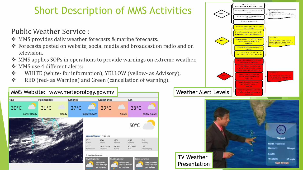
Public Weather Service : MMS provides daily weather forecasts & marine forecasts. Forecasts posted on website, social media and broadcast on radio and on
television. MMS applies SOPs in operations to provide warnings on extreme weather. MMS use 4 different alerts: WHITE (white- for information), YELLOW (yellow- as Advisory), RED (red- as Warning) and Green (cancellation of warning).
MMS Website: www.meteorology.gov.mv
TV Weather
Presentation
Weather Alert Levels
Short Description of MMS Activities
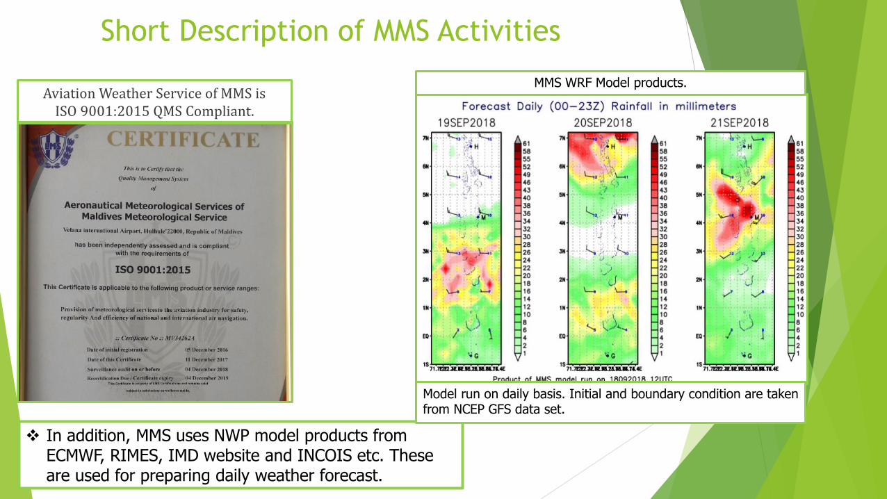
Aviation Weather Service of MMS is ISO 9001:2015 QMS Compliant.
In addition, MMS uses NWP model products from ECMWF, RIMES, IMD website and INCOIS etc. These are used for preparing daily weather forecast.
MMS WRF Model products.
Model run on daily basis. Initial and boundary condition are takenfrom NCEP GFS data set.
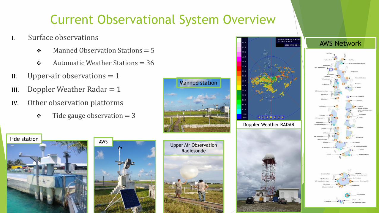
Current Observational System Overview
I. Surface observations
Manned Observation Stations = 5
Automatic Weather Stations = 36
II. Upper-air observations = 1
III. Doppler Weather Radar = 1
IV. Other observation platforms
Tide gauge observation = 3
AWS Network
Doppler Weather RADAR
Upper Air Observation
Radiosonde
AWSTide station
Manned station
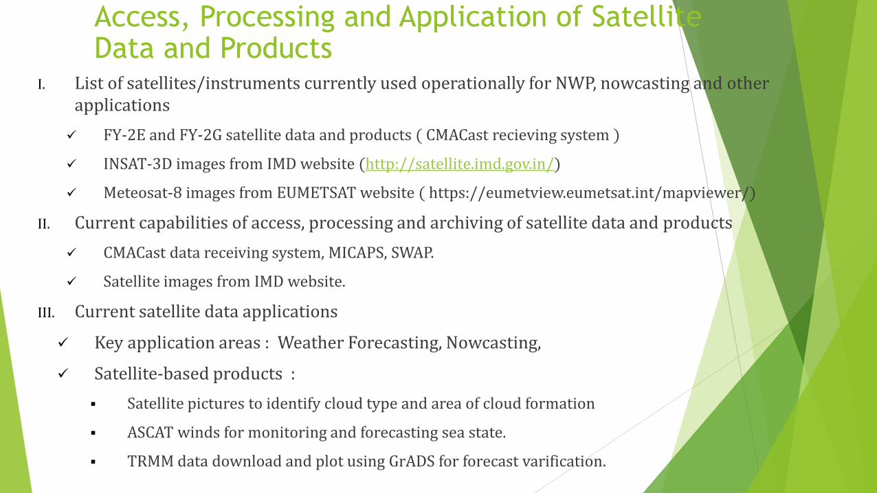
Access, Processing and Application of Satellite Data and Products
I. List of satellites/instruments currently used operationally for NWP, nowcasting and otherapplications
FY-2E and FY-2G satellite data and products ( CMACast recieving system )
INSAT-3D images from IMD website (http://satellite.imd.gov.in/)
Meteosat-8 images from EUMETSAT website ( https://eumetview.eumetsat.int/mapviewer/)
II. Current capabilities of access, processing and archiving of satellite data and products
CMACast data receiving system, MICAPS, SWAP.
Satellite images from IMD website.
III. Current satellite data applications
Key application areas : Weather Forecasting, Nowcasting,
Satellite-based products :
Satellite pictures to identify cloud type and area of cloud formation
ASCAT winds for monitoring and forecasting sea state.
TRMM data download and plot using GrADS for forecast varification.
Satellite Data to address Regional Challenges
With very limited local weather observation stations, geographically Maldives is in a highly remote and data(observation) sparse area, as such there is no routine weather observation data available from East, West and South of Maldives in its vicinity.
The only solution to address these challenges is to relay on satellite based observation for deriving weather parameters over the region.
Rapid update and Near Real Time(NRT) data is crucial as far as early warnings are concerned.
Polar orbiting satellite data, especially ocean winds (ASCAT winds) are very important to fill the data gaps over the area.
High resolution cloud pictures, precipitation estimate, wind vector at different levels of the atmosphere, area of divergence and convergence, wind sheer zones and turbulence are some of the parameters useful in weather forecasting if they are made available on near real time basis at higher temporal scale.
Data assimilation using satellite radiance data could improve NWP model performance. Such data assimilation techniques need to be taught to the local NWP modeling team.
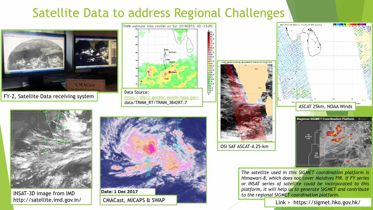
Satellite Data to address Regional Challenges
ASCAT 25km, NOAA Winds
OSI SAF ASCAT-A 25-km
Data Source:
https://disc2.gesdisc.eosdis.nasa.gov/
data/TRMM_RT/TRMM_3B42RT.7
FY-2, Satellite Data receiving system
INSAT-3D image from IMD
http://satellite.imd.gov.in/
The satellite used in this SIGMET coordination platform is
Himawari-8, which does not cover Maldives FIR. If FY series
or INSAT series of satellite could be incorporated to this
platform, it will help us to generate SIGMET and contribute
to the regional SIGMET coordination platform.
Link > https://sigmet.hko.gov.hk/CMACast, MICAPS & SWAP

Satellite Data to address Regional Challenges
Discovery of various regional satellite data sets available over internet. Training on utilization and visualization techniques of such data sets for
local application. Satellite radiance data assimilation techniques for NWP model run,
research and simulation.
Other challenges in weather observation network. Inadequate consumables (balloon and radio-sonde) in one and only upper air
station in the Maldives, interrupts routine daily observations from time to time. Due to its strategic location, this GUAN station(43599) is an important data point locally as well as globally.
AWS maintenance and calibrations (frequent data gaps due to AWS failures). Limited spare parts for AWS maintenance. No marine observation station at present.(One ocean buoy donated by FIO has been
drifted away from its anchored location) Limited coverage of the only one Doppler weather Radar in the country. Limited human resources and technical expertise to maintain observation network.
Satellite Data to address Regional Challenges
We hope that by increase in the launching of new-generationgeostationary satellites that cover Maldives’ region wouldenable us to access and utilize more satellite data at highresolution in terms of spatial and temporal scale.
This will help us overcome many shortcomings andchallenges currently we face in providing weather forecasts,advisories and warnings.
Thank You