Embed Size (px)
Citation preview
k AD-Al20'22A CORPS OF ENGINEERS ST PAUL RN ST PAUL DISTRICT F/S 13/2
EAU GALLE LAKE PROJECT, PIERCE AND ST. CROIX COUNTIES. WISCONSI -ETC U)
UNCLASSIFIED N
-EMEENOMOEEOEM
EC4N"lTY CLASSIFICATION OF THIS PAGE (1I~M Date Enterdej
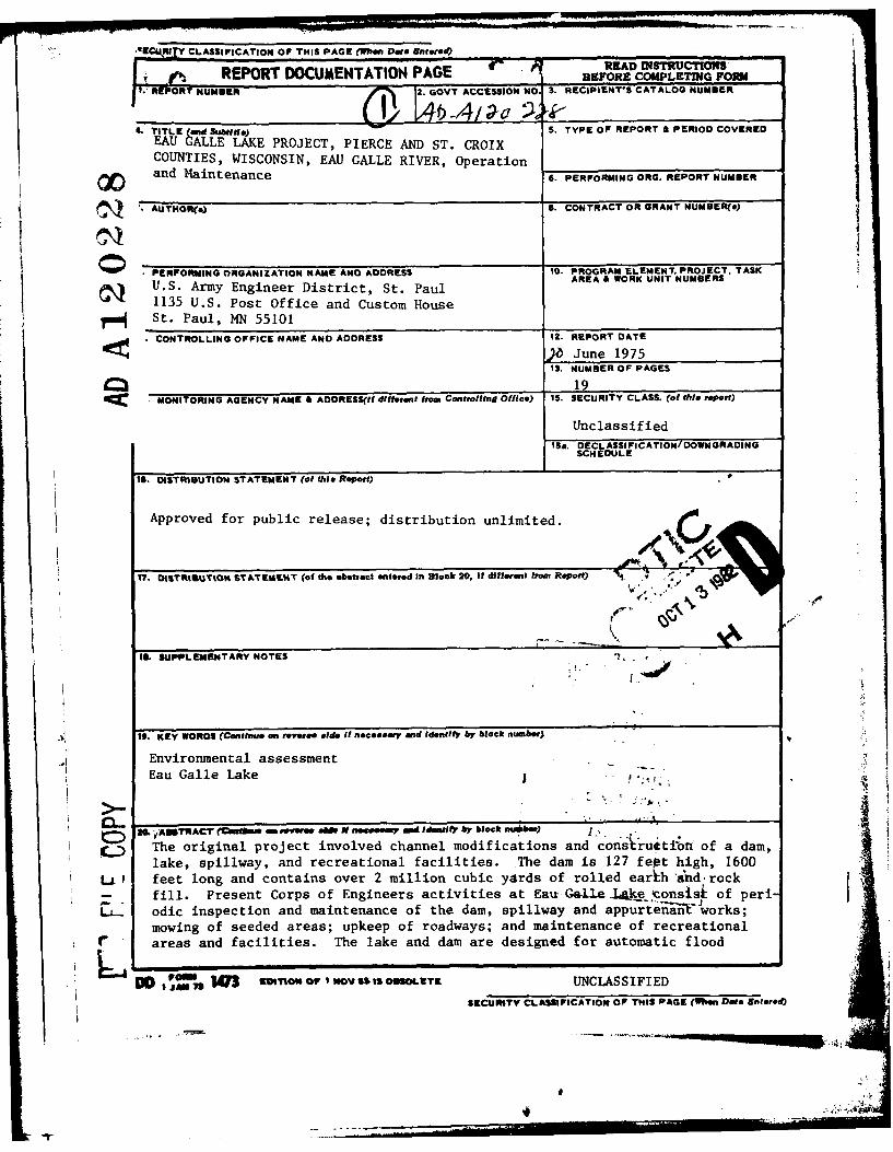
REPORT DOCUMENTATION PAGE BERED CMPTDRUC-Nf~k RBTFORE COMPLETING FORM
I.REPORT UMBER 3. ROVTACCES.,ON .. ECIPIENT'S CATALOG NUMBER
L TITLE (and Subtitle) v 5. TYPE OF REPORT & PERIOD COVEREDEAU GALLE LAKE PROJECT, PIERCE AND ST. CROIXCOUNTIES, WISCONSIN, EAU GALLE RIVER, Operation
and Maintenance 6. PERFORMING ORG. REPORT NUMBER
S AUTHOR() S. CONTRACT OR GRANT NUMBER(s)
0 PERFORMING ORGANIZATION NAME AND ADDRESS 10. PROGRAM ELEMENT, PROJECT, TASK
U.S. Army Engineer District, St. Paul AREA& WORK UNIT NUMUERS1135 U.S. Post Office and Custom House
rmf St. Paul, MN 55101
CONTROLLING OFFICE NAME AND ADDRESS 12. REPORT DATEge XJune 1975
13. NUMBER OF PAGES
19MCC MONITORING AGENCY NAME & ADDRESS(If dliforet from Controlflng Office) IS. SECURITY CLASS. (of tlls report)
Unclassified
ISa. DECLASSI FI CATION/ DOWNGRADINGSCH EDULE
IS. DISTRIBUTION STATEMENT (of this Report)
Approved for public release; distribution unlimited.
17. DISTRIOUTION ST ATEMFNT (of the abal.ct entered In Block 2 i, If different from Report)
IS. SUPPLEMENTARY NOTES
IS. KEY WORDS (Contflu* an reverse side if necessay and Identify by block ntunbr)
Environmental assessment
Eau Galle Lake
1 ASTRACT' ( u ,s m ere-h N ne .oemp a tdil by block ,' .- -" •
The original project involved channel modifications and construetilon of a dam,
lake, spillway, and recreational facilities. The dam is 127 fept high, 1600
LL.f feet long and contains over 2 million cubic yards of rolled earkh and,rock
-- fill. Present Corps of Engineers activities at Eau-Galle-Lke..onsisk of peri-L.. odic inspection and maintenance of the dam, spillway and appurteinnaWworks;
mowing of seeded areas; upkeep of roadways; and maintenance of recreationalr areas and facilities. The lake and dam are designed for automatic flood
D 43 smvMow oN WOV SSI OSOLETE UNCLASSIFIED A
SIECI liTY CLASSIFICATION OF THIS PAGE (When Date Entered)
4
UNCLASSIFIED
SECURITY CLASSIFICATION OF THIS PAOE(h AN"
-,ontrol operation. A campgroun is proposed for the area on the north side dS
Eau Galle Lake.
"or
A~~lab~tYCodes
valil and/orM .- Special
SECURITY CLASSIFICAION OF THIS PAG mn Date sa tm- --
.- ._._ __ .--- ---- --.
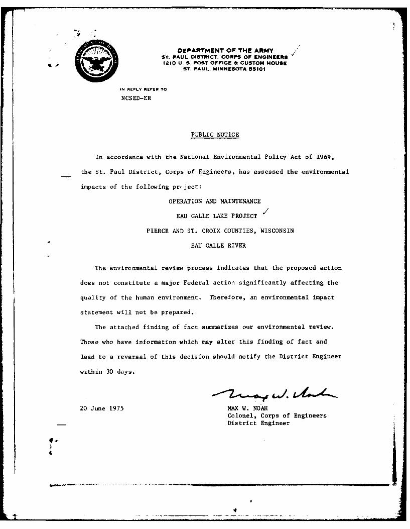
DEPARTMENT OF THE ARMYST. PAUL DISTRICT. CORPS OF ENGINEERS1210 U. S. POST OFFICE II CUSTOM HOUSE
ST. PAUL. MINNESOTA 55101
IN REPLY REFER TO
NCSED-ER
PUBLIC NOTICE
In accordance with the National Environmental Policy Act of 1969,
the St. Paul District, Corps of Engineers, has assessed the environmental
impacts of the following prject:
OPERATION AND MAINTENANCE
EAU GALLE LAKE PROJECT
PIERCE AND ST. CROIX COUNTIES, WISCONSIN
EAU GALLE RIVER
The environmental review process indicates that the proposed action
does not constitute a major Federal action significantly affecting the
quality of the human environment. Therefore, an environmental impact
statement will not be prepared.
The attached finding of fact summarizes our environmental review.
Those who have information which may alter this finding of fact and
lead to a reversal of this decision should notify the District Engineer
within 30 days.
20 June 1975 MAX W. NOAHColonel, Corps of EngineersDistrict EngineerU,-
4I
%L
FINDING OF FACTCONCERNING THE ENVIRONMENTAL ASPECTS OF
OPERATION AND MAINTENANCEAT EAU GALLE LAKE PROJECT
PIERCE AND ST. CROIX COUNTIES, WISCONSINEAU GALLE RIVER
DEPARTMENT OF THE ARMYST. PAUL DISTRICT, CORPS OF ENGINEERS
1135 U.S. POST OFFICE AND CUSTOM HOUSEST. PAUL, MINNESOTA 55101
JUNE 1975
• I
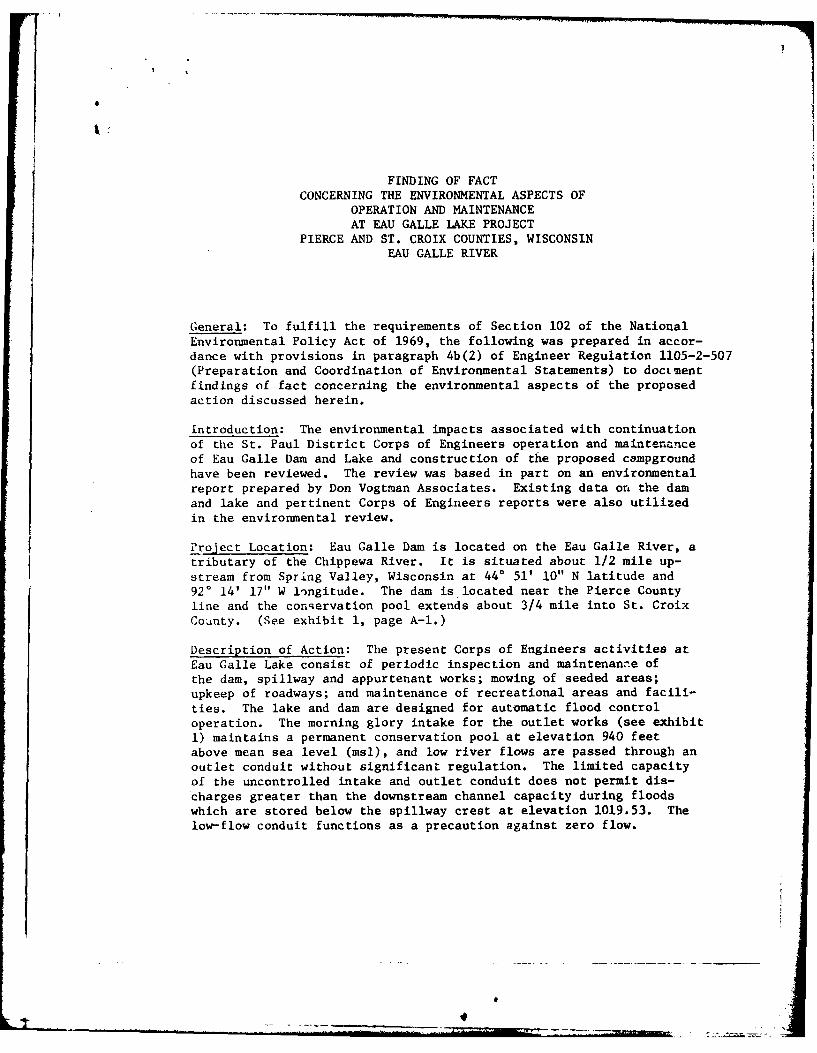
FINDING OF FACTCONCERNING THE ENVIRONMENTAL ASPECTS OF
OPERATION AND MAINTENANCEAT EAU GALLE LAKE PROJECT
PIERCE AND ST. CROIX COUNTIES, WISCONSIN
EAU GALLE RIVER
General: To fulfill the requirements of Section 102 of the National
Environmental Policy Act of 1969, the following was prepared in accor-dance with provisions in paragraph 4b(2) of Engineer Regulation 1105-2-507(Preparation and Coordination of Environmental Statements) to doctment
findings of fact concerning the environmental aspects of the proposed
action discussed herein.
Introduction: The environmental impacts associated with continuation
of the St. Paul District Corps of Engineers operation and maintenanceof Eau Galle Dam and Lake and construction of the proposed campground
have been reviewed. The review was based in part on an environmentalreport prepared by Don Vogtman Associates. Existing data on the dam
and lake and pertinent Corps of Engineers reports were also utilizedin the environmental review.
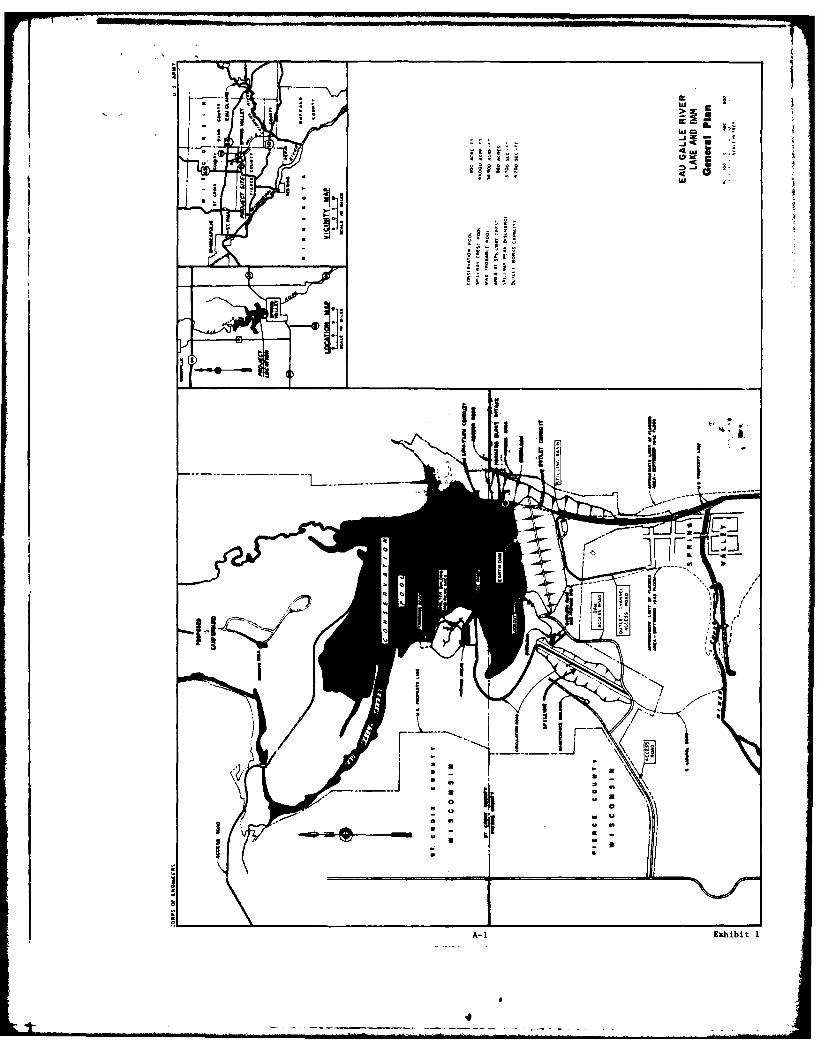
Project Location: Eau Galle Dam is located on the Eau Galle River, atributary of the Chippewa River. It is situated about 1/2 mile up-stream from Spring Valley, Wisconsin at 440 51' 10" N latitude and
920 14' 17" W longitude. The dam is located near the Pierce Countyline and the conqervation pool extends about 3/4 mile into St. CroixCounty. (See exhibit 1, page A-1.)
Description of Action: The present Corps of Engineers activities atEau Galle Lake consist of periodic inspection and maintenanae of
the dam, spillway and appurtenant works; mowing of seeded areas;upkeep of roadways; and maintenance of recreational areas and facili-ties. The lake and dam are designed for automatic flood controloperation. The morning glory intake for the outlet works (see exhibit
1) maintains a permanent conservation pool at elevation 940 feetabove mean sea level (msl), and low river flows are passed through anoutlet conduit without significanL regulation. The limited capacityof the uncontrolled intake and outlet conduit does not permit dis-
charges greater than the downstream channel capacity during floodswhich are stored below the spillway crest at elevation 1019.53. The
low-flow conduit functions as a precaution against zero flow.
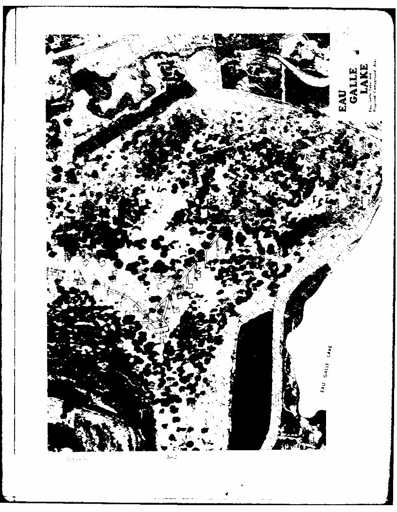
A campground is proposed for the area on the north side of Eau GalleLake (see exhibit 2). Alternative lake operations involving poolraises of 5 or 10 feet have also been proposed; however, there are noplans at present for raising the pool level. Should consideration begiven to a pool level raise, a detailed environmental assessment reportwould be prepared to assess the resultant impacts.
The original project involved channel modifications and construction ofa dam, lake, spillway, and recreational facilities. The dam is 127 feethigh, 1,600 feet long and contains over 2 million cubic yards of rolledearth and rock fill. At conservation pool elevation, 940.0 feet msl,the lake covers approximately 150 surface acres. It has an averagedepth of 10 feet and a maximum depth of 35 feet; its shoreline totalsabout 5 1/2 miles. The morning glory intake structure to the dam hasa weir diameter of 25 feet and maintains the lake near the 940.0 feetmsl weir crest elevation throughout most of the year. There is anuncontrolled spillway, and a chute about 1,930 feet long. It is exca-vated 650 feet west of the dam's right abutment throughout most of itslength in dolomite bedrock. A 100-foot long weir, comprised of a 5 by5-foot concrete cross section, embedded in dolomite, forms the spillwaycrest. Spillway discharge is contained by the rock cut for a totaldistance of about 1,500 feet before being released into the Mines Creekwatershed at a point about 2,000 feet southeast of the dam. Channelmodifications include a 2,000-foot discharge channel from the outletworks to the mainstream Eau Galle River and a 1,300-foot connectingchannel from the spillway to the river. In adcltion, Mines Creek, atributary entering the Eau Galle River at Spring Valley, is channelizedand straightened in the 1,450-foot sector adjacent to its mouth, anda 1,200-foot section is straightened 1,300 feet farther upstream froma point beginning at the Chicago and Northwestern Railway Bridge.The Eau Galle Lake project covers a land area of 562 acres. There ispermanent flowage (flooding easements) on an additional 500 acres.
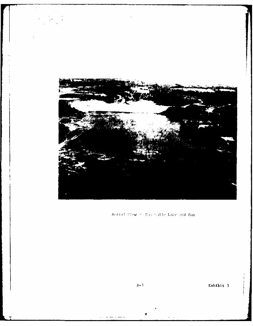
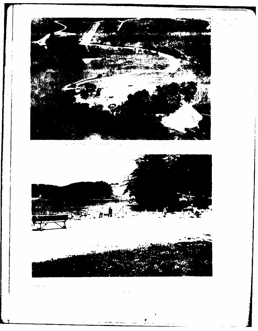
The existing recreational facilities include a day-use recreation areawhich provides a swimming beach, boat launch ramp and picnic area; anature trail; and a scenic overlook. The campground proposed for thenorth end of Eau Galle Lake would be composed of 28 camping spurs withsupporting water and sanitary facilities. Access to the campgroundwould be via a hard-surfaced, double-lane road for vehicles (seeexhibits 1, 2, and 3, pages A-I - A-4).
Construction of the project began in 1965 and was completed in 1969.The project has been in operation since 1969. Operating statisticsare given in exhibit 4, page A-5.
Potential Impacts of the Action: The following parameters relating topotential impacts of continued operation and maintenance activitieshave been reviewed and considered in arriving at the finding detailedbelow:
2
Name of Parameter Considered
Natural Parameters
a. Existing Vegetationb. Fishery Habitatc. Wildlife Habitatd. Soil Erosione. Air Qualityf. Surface Waterg. Groundwaterh. Floodplain Encroachmenti. Endangered SpeciesJ. Unique Natural Feature(s)k. Lake Levels
Cultural Parameters
a. Existing/Potential Land Useb. Historic. Valuesc. Recreation Opportunitiesd. Aesthetic Valuese. Economic Developmentf. Sociological Developmentg. Residential Patternsh. Archaeological Valuesi. Noise Levelsj. Flood Controlk. Controversies Concerning the Project
Discussion of Potential Impacts: Unless discussed below, the environmentaleffects on the parameters evaluated above are considered to be minimaland could not be lessened by an alternative action, or the alternativeaction would result in other adverse environmental impacts.
Existing Vegetation: The completed project has resulted in the lossof about 150 acres in the conservation pool. The lake project has gen-erated a substantial influx of off-road vehicles, including all-terrainvehicles, trail bikes, motorcycles and snowmobiles which further destroyand damage terrestrial vegetation. Snowmobiles are not permitted inthe Eau Galle project area, however due to the lack of year-round person-nel, unauthorized use does take place. The St. Paul District is con-ducting discussions with local snowmobile groups in order to reach asolution to the problem. Summer use by all-terrain vehicals is also pro-hibited and is controlled by a citation program whereby warnings andtickets can be issued for damaging government property. No trespassingsigns have been placed near the dam and brochures are published explain-ing public use regulations.
3I.I
The 60-acre area under consideration for the campground contains excel-lent ruffed grouse and white-tail deer habitat as well as a dense
shrubby undergrowth and a variety of herbaceous vegetation. With this
in mind the Corps has modified the original campground specificationsto minimize adverse environmental impacts. An estimated 4 acres ofland would be lost for the 7,500 feet of roadway necessary for thecampground.
Fishery Habitat: Prior to the project, the Eau Galle River supported
a high quality trout fishery, but warmwater fishes now appear to be slowly
displacing the trout in the lake. There is, however, still a good trout,
bass and panfish fishery in the lake and upstream and downstream on the
Eau Galle River. Construction of a campground would have no effects onfishery habitat.
Wildlife Habitat: In winter, snowmobiles compress the snow reducingits insulating qualities dnd negatively influencing the small mammalpopulations. However efforts are being made to reduce snowmobile-related adverse impacts (see Existing Vegetation, above). Campgroundconstruction would reduce mammal populations found in dense shrub under-story, and the carrying capacity of the wildlife habitat in the projectarea would be reduced. The lake has provided improved waterfowl habitat.
Soil Erosion: The damage to vegetation by snowmobiles and all-terrain vehicles is leading to some soil erosion, especially on thesteeper terrain. The affected areas are filled and reseeded to preventlong term adverse effects. Temporary problems of erosion would occurwith construction of the campground road which would be located on a
steep hill.
Surface Water: The water of Eau Galle Lake is of good quality forwater sports, fishing, and is also classified as potable. Use of motor-ized boats is prohibited, except for electric trolling motors. By pro-
viding minimum flows during dry periods, the dam helps alleviate potentialproblems involved with sewage treatment operations in Spring Valley. The
low-flow conduit, by passing colder water from the lake bottom into theriver downstream, serves to improve the downstream temperature for troutfishing. Water quality data are on file in the St. Paul District office.
Endangered Species: The osprey, officially listed as an endangeredspecies, has been sighted in the project area. (A pair of osprey nestednear the Eau Galle Lake headwaters in 1974, and fledgliigs were observed.)
Though not officially designated rare or endangered, seven plant speciesfound in the project area are considered rare or unusual in their dis-
tribution. The milk snake, also found in the project area, is likewiseconsidered very uncommon, at least in this part of Wisconsin. Thesespecies may experience minor negative impacts from the proximity of theproposed campground.
4

Unique Natural Features: The access road to the campground wouldpass through a stand of climax maple, a very unusual forest type inthis part of Wisconsin. Though the road would be routed around the trees,this area would suffer minor adverse effects from its proximity to theproposed campground.
Existing and Potential Land Use: The uegative economic impactresulting from elimination of the several farming operations in theproject area has been more than offset by the positive impact of theproject in downstream areas, notably in Spring Valley. The relationshipof this project to land use plans for the general area lies principallyin the context of the project's impact on flooding of downstream agri-cultural lands and urban properties.
Recreation Opportunities: The conservation pool and the recreationfacilities for public use along its margin afford excellent recreationalopportunities. Public use at the project area was 6,000 in 1972, 60,300in 1973, and 101,200 in 1974. The principal benefit of the proposedcampground relates mainly to the expanded potential of the project toaccommodate additional recreationists. Using the estimated 22 percentincrease and using $1.50 per recreation day for a net benefit, a calcu-lated $36,000 per year gross economic benefit would be assignable to theproposed campground.
Economic Development: Extensive renovation and expansion of busi-ness resulted after construction of the lake and dam. Moderate furthergrowth is anticipated, assuming a long period of static conditions.Significant economic benefits are accruing to the Spring Valley com-munity in the form of increased business from fishermen, boaters,sightseers and other outdoor recreationists attracted to the lake. Thebenefit-cost ratio of the project was determined to be 1.8 to 1. It isestimated that the lake would prevent urban flood damages at SpringValley of about $3,280,000 if there were a recurrence of the September1942 flood, which was the greatest flood of record.
Sociological Values: Enriched sociological values have resultedfor over 1,000 people from the increased safety from flooding.
Archaeological Values (Cultural Resources) - During 1962 and 1964,archaeological surveys were conducted in the Eau Galle Lake area.Several archaeological sites were discovered and some of these are nowunder water. Additional surveys were conducted in the area proposedfor the campground in June 1975, and no sites were identified. Theupland areas around the lake, and some sites within the flood pool bound-ary, which have not been inundated, require further investigation. Furthersurveys will be conducted and sites will be determined for their eligi-bility for the National Register of Historic Places.
5
Controversies Concerning the Project: Operation and maintenanceactivities by the Corps of Engineers at Eau Galle Dam and Lake andconstruction of a proposed campground have not generated any controversy.
Conclusions: I conclude that the continued operation and maintenanceof the Eau Galle project is important to the health, safety, and socialwell-being of the residents of the local area and other persons utilizingthe Eau Galle Dam and Lake. Adverse impacts of campground constructionare generally short-term in nature and the social benefits resulting fromthe project outweigh these short-term effects. Construction of theproposed campground will be done so as not to result in the loss of any
known cultural, natural, historic or archaeological resources. Thecontinued operation and maintenance activities by the Corps of Engineerswill not result in the displacement of any persons or in the furtherloss of any known cultural, natural, historic or archaeological resources.
Finding: From the foregoing considerations, I find that the proposedaction will not significantly affect the quality of the human environ-ment. As a consequence, I have determined that an environmental impactstatement is not required by the provisions of Section 102 of the Nation-al Environmental Policy Act, Public Law 91-190, and applicable Corps ofEngineers regulations and guidance.
20 June 1975 MAX W. NOAhColonel, Corps of EngineersDistrict Engineer
6#
w
a La
* - ----------
A-1 Exhbi I
~op
IL)
* -!
A(,ir i :t ~ I l Vio '11 111o o.~< :d Damn
A- 3 Exhibi t 3
h ~ ~ ~ 4 Agom '~*-
lowI
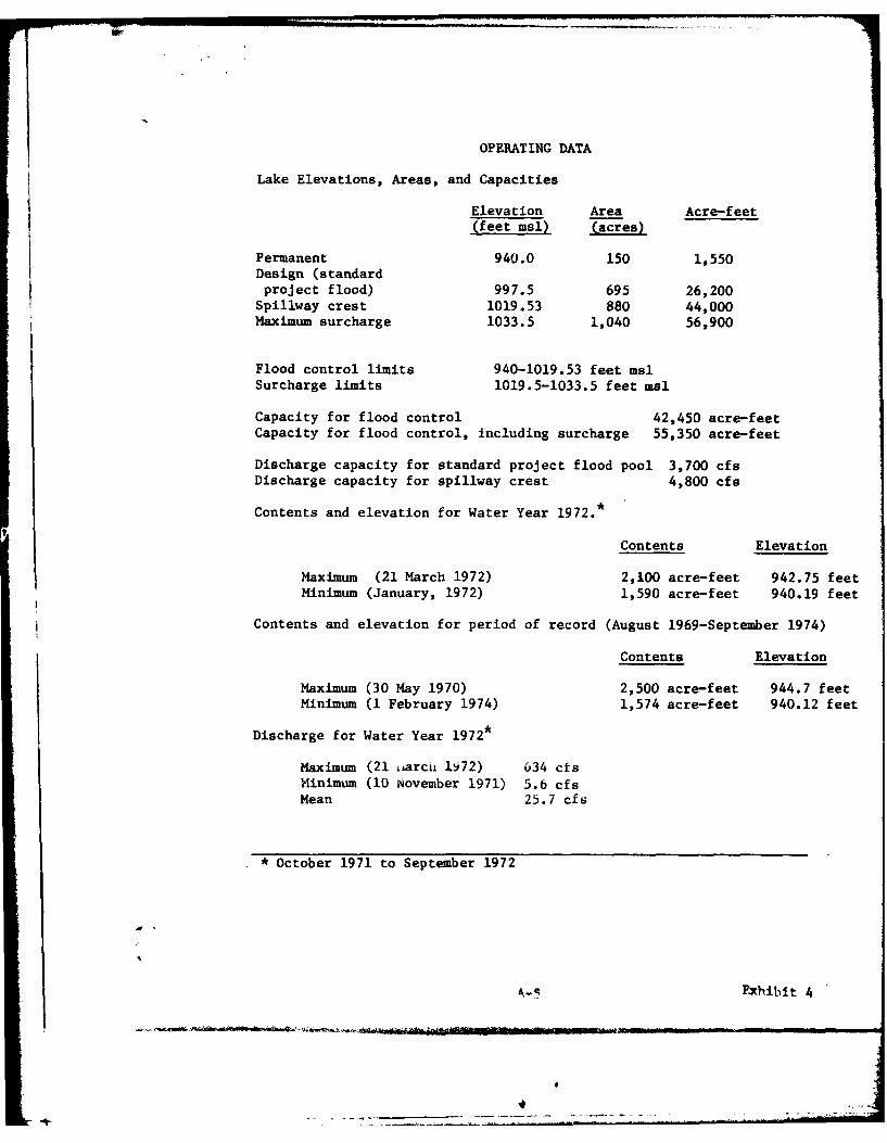
OPERATING DATA
Lake Elevations, Areas, and Capacities
Elevation Area Acre-feet(feet msl) -acres)
Permanent 940.0 150 1,550Design (standardproject flood) 997.5 695 26,200
Spillway crest 1019.53 880 44,000Maximum surcharge 1033.5 1,040 56,900
Flood control limits 940-1019.53 feet ms1Surcharge limits 1019.5-1033.5 feet as1
Capacity for flood control 42,450 acre-feetCapacity for flood control, including surcharge 55,350 acre-feet
Discharge capacity for standard project flood pool 3,700 cfsDischarge capacity for spillway crest 4,800 cfs
Contents and elevation for Water Year 1972.*
Contents Elevation
Maximum (21 March 1972) 2,100 acre-feet 942.75 feet
Minimum (January, 1972) 1,590 acre-feet 940.19 feet
Contents and elevation for period of record (August 1969-September 1974)
Contents Elevation
Maximum (30 May 1970) 2,500 acre-feet 944.7 feetMinimum (1 February 1974) 1,574 acre-feet 940.12 feet
Discharge for Water Year 1972*
Maximum (21 iiarci 1i72) 634 cfsMinimum (10 November 1971) 5.6 cfsMean 25.7 cfs
* October 1971 to September 1972
fxhibit 4
4
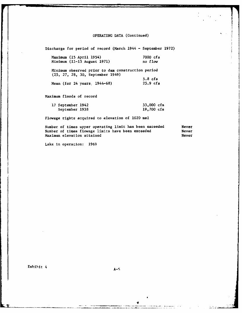
OPERATING DATA (Continued)
Discharge for period of record (March 1944 - September 1972)
Maximum (15 April 1954) 7000 cfsMinimum (11-15 August 1971) no flow
Minimum observed prior to dam construction period(25, 27, 28, 30, September 1949)
5.8 cfsMean (for 24 years: 1944-68) 25.9 cfs
Maximum floods of record
17 September 1942 33,000 cfsSeptember 1938 19,700 cfs
Flowage rights acquired to elevation of 1020 msl
Number of times upper operating limit has been exceeded NeverNumber of times flowage limits have been exceeded NeverMaximum elevation attained Never
Lake in operation: 1969
Exhibit 4 A-S
July 16, 1974
Dr. Joan E. FreemanState ArchaeologistState Historical Society of Wisccnsin816 State StreetMadison, Wisconsin 53706
Dear Dr. Freeman:
My firm is under contract with St. Paul District, Corps of Engineers,to conduct investigations leading to an Environmental Inpact Assess-ment of the Eau Galle Reservoir Project in Pierce & St. Croix Coun-ties, Wisonsin.
I need an official statement from your office regarding the histori-cal and archaeological aspects of the project. I understand that youroffice has already conducted rather extensive studies of the area.
Would you please provide me with a summary paragraph of your findings,including the significance impoundment activities and inundation mayhave had upon the project area? Your assistance in this matter willbe gratefully appreciated. If satisfactory to you, I would preferto quote your input verbatim. Thank you kindly.
Sincerely yours,
Donald B. Vogtmanfor DON %VGBN ASSOCIATES
A-7 Exibit 5
THE STATE HISTORICALSOCIETY OF WISCONSIN
916 STATE STREET IA wTON 5S:A! 2A E$ ORTO f TH, DIRECTOR
The Museum
July 17, 1974
Mr. Donald B. VogtmanDon Vogtman Associates6309 France Avenue SouthEdina, Minnesota 55410
Dear Mr. Vogtman:
Archeological crews from the State Historical Society of Wisconsinworked in the Eau Galle Reservoir area in 1962, 1964, and 1965. Writtenreports of the findings have been made and are on file at the NationalPark Service, here at the Historical Society, and presumably with theSt. Paul office of the Corps of Engineers. It seems to me that thesereports should be included in your impact assessment. It would bedifficult if not impossible to summarize all the work that has beendone, including a list of sites found and now innundated, withoutreference to these reports.
I have no idea of what type of report you are preparing, nor can Iquite understand why an assessment is being made of a project alreadycompleted. Is the Corps planning further work? At any rate, a fullimpact assessment should include all the written reports. I can sendyou copies of the reports, one is printed in the Wisconsin Archeologist,the other two are manuscript reports. We would have to charge you forthe duplication of the two manuscript reports - about 100 pages thatwould be xeroxed. I can send a copy of the published report. I canthen write a letter referring to these reports as the comment that youwish. Actually the letter would have to be signed by the Director ofthe Historical Society who is State Preservation Officer.
I would appreciate hearing from you on the above comments beforeI proceed with any statement.
Sincerely,
oan E. FreemanState Archeologist
JEF/cas
Exhibit 5 A-8
4
July 26, 1974
Dr.* Joan E. Freem~anState ArchaeologistState Historical Society of Wisconsin816 State StreetMadison, Wisconsin 53706
Dear Dr. Freeman:
Thank you for your July 17 letter regarding my recent request for informa-tion regarding Eau Galle Reservoir Project. My assessment is being preparedto provide the Corps with background information they need to develop theirEnvironm ntal Impact Statement on this project next fall. The project isessentially complete, except for possible raises in the operating level ofthe conservation pool and some anticipated expansion of recreational facili-ties. Most completed Corps projects now require preparation of an EIS, gen-erally with special attention to the operation and maintenance aspects.
Pressures are strong at Eau Galle for expanded recreational facilities andfor an enlarged reservoir. A pool raise of ten feet (to elev. 950 nsl) to-gether with an extensive camping area on project lands along the hilltopjust East of the reservoir are both being considered. Proposed campsite areais in NhSF) of S.31, R.28,T.15. From the reference Archaeological Survey ofthe Eau Galle Reservoir, Spring Valley Wisconsin which you provided Mr. Vernlang, Corps of Engineers, last May 19, 1972 it appears that several Indiancampsites are situated in this area. The Corps has loaned me the cited ref-erence, plus Archaeology of the Eau Galle River Valley, Dam Salvage Projectby Hank Kerr which you also furnished Mr. Lang. If these are the two manu-script reports you referred to, I will not need to bother you for additionalcopies. However, I would appreciate a copy of the report from WisconsinArchaeologist which you mentioned as being published.
If there are any over-riding reasons why the pool raise or expanded recreationalfacility should be dropped for archaeological or historical reasons I wouldgreatly appreciate a position statent from your agency with the reasons foryour position. Lacking such a statement from your agency I will assume thatthe conclusion reached by the National Park Service in their 1962 officialreport to St. Paul District, Corps of Engineers, is still valid regardingEau Galle Reservoir Project. Thank you kindly for your assistance.
Sincerely yours,
Donald B. Wgtmnfor DON VOG @H ASSOCIAES
A-9 Exhibit 5
LA> -- ~ -
THE STATE HISTORICAL
SOCIETY O)F WviISCONSI-N816 ,TATE TREET MA 1A N. .ISCON51N 'Z706 / JAMES MORTON SMITH, DIRECTOR
August 19, 1974
Mr. Donald B. VogtmanDon Vogtman Associates6309 France Avenue SouthEdina, Minnesota 55410
Dear Mr. Vogtman:
This is in reply to your July 26, 1974 letter to Dr. Joan Freeman
concerning the Eau Galle Reservoir Project.
Archaeological surveys of the Eau Galle Reservoir were conducted in1962 and 1964 by personnel from the State Historical Society of Wisconsinunder contract with the National Park Service. Surveys were limitedto the flood pool area which in 1962 was stated to be at a maximumelevation of 1028.0 feet. Surveys were not conducted in the uplandareas now used or proposed to be used for recreational purposes.
Reports of the surveys were filed with the National Park Service andthe St. Paul District Corps of Engineers office. ArchaeologicalSurvey of the Eau Galle Reservoir, Spring Valley, Wisconsin covers the1962 survey and Archaeology of the Eau Galle River Valley, Dam SalvageProject by Hank Kerr covers the 1964 survey and site testing. Iunderstand that you have copies of these two reports which list all
sites located and tested during these two field seasons. "Excavationsat the Lamb 5 Site" by Jay Brandon in The Wisconsin Archaeologist,Vol. 49, No. 1, March 1968 is the report of excavation of one site
within the reservor. This report is included for your information.
The Lamb 5 site was the only prehistoric site within the reservoirwhich was excavated. Time did not permit testing or excavatingother sites prior to flooding of the area even though other sitesappeared to be worthy of such work. A number of sites located in1962 and 1964 are now under water.
In your letter of July 26, 1974 you mentioned proposed recreationaluse in the N1/2, SEl/4, Section 31, T28N, Rl5W. Six archaeologicalsites were located in this area, specifically sites SC 14, SC 15,SC 20, SC 21, SC 23, and SC 28. All except SC 23 were recommendedfor further work which could not be done prior to flooding. All ofthese sites were located within the 1028 foot maximum flood pool.
Exhibit 5 A-10
- - -.- ____ __ I
Mr. Donald B. Vogtman - 2 August 19, 197'
Certainly before the pool is raised 10 feet to 950 feetand before any recreational development is started, funds foradditional survey and testing sites should be provided. Only withthis additional work can we evaluate accurately the importance ofarcheological remains and suggest ways of avoiding adverse effectsupon the cultural environment of the area.
Sincerely,
James Morton SmithState Historic Preservation Officer
JMS :owmc
Enclosurecc: Mrs. Hugh F. Gwin, President
St. Croix County Historical Society
Mrs. Ursula Peterson, PresidentPierce County Historical Society
1
| A-II1 Exhibit 5
.DEPARTMENT OF THE ARMYST. PAUL DISTRICT. CORPS OF ENGINEERS1135 U. S. POST OFFICE & CUSTOM HOUSE
ST. PAUL. MINNESOTA 55101
IN REPLY REFER TO
NCSED-ER 4 June 1975
Mr. Kenneth KrabbenhoftRegional DirectorMidwest Region, National Park Service1709 Jackson StreetOmaha, iebraska 68102
Dear Mr. Krabbenhoft:
We are now in the process of assessing the environmental effects ofcontinued operation and maintenance activities at the Eau Galle Lakeflood control project on the Eau Galle River in Pierce and St. CroixCounties, Wisconsin.
The Corps of Engineers operates and maintains the Eau Galle projectwhich consists of a dam, Eau Galle Lake, a spillway and appurtenantfacilities. Construction of the project was completed in 1959 andinvolved necessary channel modification on the Eau Galle River andMines Creek, a tributary to the Eau Galle River. In addition, acampground is proposed for the area just north of Eau Galle Lake.
During 1962 and 1964, surveys for historical and cultural resourceswere conducted in the Eau Galle Lake area. These were restrictedto the pool area and to date no survey has been made in the uplandarea in which the proposed campground would be located. Severalarchaeological sites were discovered in the pool area, and a numberof these sites are now under water. There are six known archaeo-logical sites in the upland area and a survey of the site of theproposed campground is being made in June 1975.
In compliance with section 106 of the- ational Historic PreservationAct of 1966 and Executive Order 11593, we are requesting your comnentsconcerning the existence of any further historical, archaeologicaland paleontological resources in the Eau Galle project area.
The environmental review for this project is scheduled for comple-tion in June 1975. You will be informed of the results of thisrev i ew.
Exhibit 5 A-12
NCSED-ER 4 June 1975Mr. Kenneth Krabbenhoft
If you have any questions, please do not hesitate to contact thisoffice.
Sincerely yours,
1 Incl 4iW.Project flap Colonel, Corps of Engineers
District Engineer
I
A-13 Exhibit 5
7,,7-,