Embed Size (px)
Citation preview
Contrail software is the visualization tool of choice when managing and controlling access to your environmental data is critical. Contrail supports the real-time data collection, processing, archiving and dissemination of your hydrological, meteorological and other environmental data in one place.
Total Control of Your Environmental Network Data and Information Distribution
Contrail®
Contrail collects, validates, processes for alarming and notification, displays on maps, graphs and tables, archives, exports and disseminates hydro-meteorological data and information, including gauge-adjusted radar rainfall and inundation maps. Encompassed are tools and reports for sensor management, rainfall and stream-related reporting, maintenance, and custom alarm and notification features. OneRain’s solutions enable management of and quick access to water-related emergency action plan (EAP) content, links to any outside resources, webcam video feeds from difficult sites, and many other web-hosted tools.
Makes Decision-Critical Support Data Highly AvailableContrail is used for operational decision support and emergency operations, post-event analysis, model calibration and planning in hydrology and flood early warning, dam safety and reservoir operations, water resource management, road weather, and environmental monitoring applications.
The Contrail application is configurable to suit specific user needs, for multiple user groups and different types of users simultaneously. The user interface is a common Web browser—all recent browsers are supported. Real-time data exchange with other applications is also Web/https-based, making firewall issues less problematic when exchanging data among agencies. Contrail’s smart interface is adaptive and responsive with optimized performance for Web-enabled mobile devices.
Scalable and Reliable Software ArchitectureRunning on Linux™ and using a MySQL® database engine, Contrail can receive data from any number of sources, sensors and sensor types, and serve any number of different uses. Most implementations operate at least two servers, a primary and secondary, that are geographically separated, with automated real-time replication of the databases between the two providing redundancy. The database is not limited in size and can grow across multiple servers and disks.
HIGHLIGHTS � Seamless integration of data from
many sensor types and 35+ source types (e.g., ALERT2, SCADA, Modbus, and many others)
� Complete data management and automated archiving
� Unlimited number of users–desktop and mobile Web-accessible (no special app to install except on the hosting servers)
� Advanced multi-sensor alarm rules and notification management
� Historical and real-time data � Ingests information such as USGS,
HADS, Tides and METAR, as well as neighboring systems
OPTIONAL � 24/7 system health monitoring � Automated problem notification � Data backup and recovery � Redundant, replicated databases � Multi-tenant options to support
different departments and sub-clients � Remote troubleshooting and technical
support
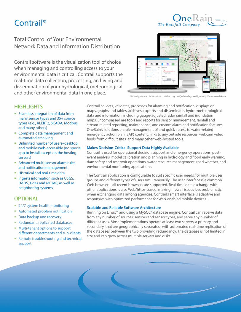
Contrail gives users instant access to what they need, when they need it, on any Web-enabled device.
Multiple Data Exchange OptionsMultiple formats are available for automated exchange of data with other systems. Contrail’s application programming interface (API) can enable many output data formats for use by other systems such as XML, Standard Hydrologic Exchange Format (SHEF), Delft-FEWS, Hydstra, AQUARIUS, , ASCII text, Excel. There’s also a standard data exchange interface that can be accessed by authorized processes using scripts (e.g., Python, Perl, Java, VB.NET, etc.) on other platforms that wish to retrieve data from or offer data to Contrail.
Contrail includes Data Collectors and Data Agents. Data Collectors receive real-time ALERT, ALERT2™, satellite, cellular and TCP/IP data. Data Agents actively retrieve, automatically and periodically, Web-resident data sources such as USGS, NWIS,METAR, HADS, TIDES, RWIS and other sites of interest.
You Control Who Sees Your DataThe database architecture is multi-tenant, which means it can be configured forprivacy of data within secured user domains. Each user domain is completely under the control of its own administrator(s), who in turn control user access (username/ password secured, public “guest”) and user privileges. Different privilegescan be assigned as appropriate to individual users (viewing data only, alarms viewing, alarms creation, maintenance of sensor and site data, website content editing, style and colors, fonts, display icons used, etc.).
Easily Configurable for Diverse UsersContrail is designed to meet the needs of many and different users. With optional multi-tenant configuration, additional websites can easily be created to support other deparments or divisions, each with its own branding, logos, content, user accounts, maps, alarms and specific views of data.
Any data view can be for authorized users only, presented to the public, or instantiated as one of each. Within each website, different user privileges control who sees what. For example, perhaps one website is for tracking wastewater pump station activities and flow meters along with rainfall from multiple sources including gauge-adjusted radar rainfall; another serves dam operators with dam-related information including inflow, lake levels, gate positions, power production and generator operations, and/or dam safety parameters such as seismic and internal water pressure information; yet another one serves staff who have water quality responsibilities with rainfall, water temperature, dissolved O2, pH, turbidity and other data points.
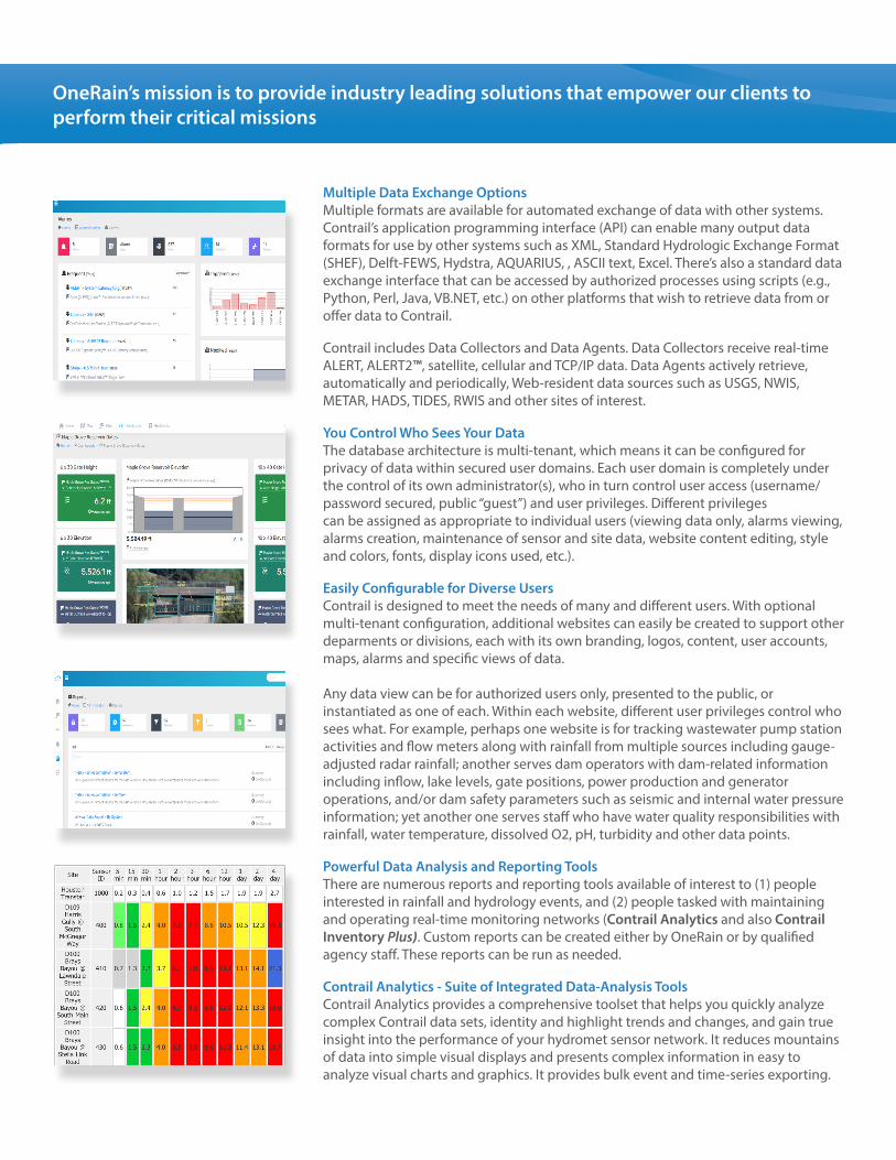
Powerful Data Analysis and Reporting ToolsThere are numerous reports and reporting tools available of interest to (1) peopleinterested in rainfall and hydrology events, and (2) people tasked with maintaining and operating real-time monitoring networks (Contrail Analytics and also Contrail Inventory Plus). Custom reports can be created either by OneRain or by qualified agency staff. These reports can be run as needed.
Contrail Analytics - Suite of Integrated Data-Analysis ToolsContrail Analytics provides a comprehensive toolset that helps you quickly analyze complex Contrail data sets, identity and highlight trends and changes, and gain true insight into the performance of your hydromet sensor network. It reduces mountains of data into simple visual displays and presents complex information in easy to analyze visual charts and graphics. It provides bulk event and time-series exporting.
OneRain’s mission is to provide industry leading solutions that empower our clients to perform their critical missions
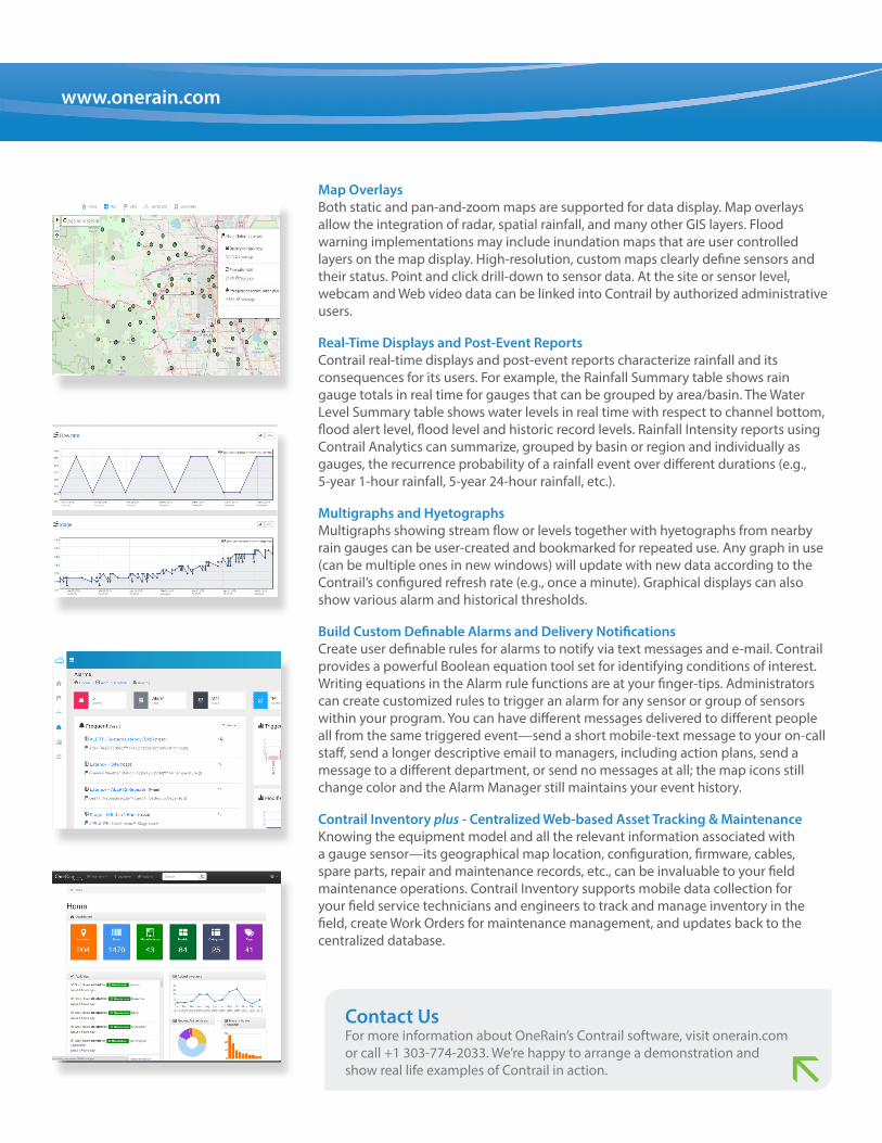
Map OverlaysBoth static and pan-and-zoom maps are supported for data display. Map overlays allow the integration of radar, spatial rainfall, and many other GIS layers. Flood warning implementations may include inundation maps that are user controlled layers on the map display. High-resolution, custom maps clearly define sensors and their status. Point and click drill-down to sensor data. At the site or sensor level, webcam and Web video data can be linked into Contrail by authorized administrative users.
Real-Time Displays and Post-Event ReportsContrail real-time displays and post-event reports characterize rainfall and its consequences for its users. For example, the Rainfall Summary table shows rain gauge totals in real time for gauges that can be grouped by area/basin. The Water Level Summary table shows water levels in real time with respect to channel bottom, flood alert level, flood level and historic record levels. Rainfall Intensity reports using Contrail Analytics can summarize, grouped by basin or region and individually as gauges, the recurrence probability of a rainfall event over different durations (e.g., 5-year 1-hour rainfall, 5-year 24-hour rainfall, etc.).
Multigraphs and HyetographsMultigraphs showing stream flow or levels together with hyetographs from nearby rain gauges can be user-created and bookmarked for repeated use. Any graph in use (can be multiple ones in new windows) will update with new data according to the Contrail’s configured refresh rate (e.g., once a minute). Graphical displays can also show various alarm and historical thresholds.
Build Custom Definable Alarms and Delivery NotificationsCreate user definable rules for alarms to notify via text messages and e-mail. Contrail provides a powerful Boolean equation tool set for identifying conditions of interest. Writing equations in the Alarm rule functions are at your finger-tips. Administrators can create customized rules to trigger an alarm for any sensor or group of sensors within your program. You can have different messages delivered to different people all from the same triggered event—send a short mobile-text message to your on-call staff, send a longer descriptive email to managers, including action plans, send a message to a different department, or send no messages at all; the map icons still change color and the Alarm Manager still maintains your event history.
Contrail Inventory plus - Centralized Web-based Asset Tracking & MaintenanceKnowing the equipment model and all the relevant information associated with a gauge sensor—its geographical map location, configuration, firmware, cables, spare parts, repair and maintenance records, etc., can be invaluable to your field maintenance operations. Contrail Inventory supports mobile data collection for your field service technicians and engineers to track and manage inventory in the field, create Work Orders for maintenance management, and updates back to the centralized database.
Contact UsFor more information about OneRain’s Contrail software, visit onerain.com or call +1 303-774-2033. We’re happy to arrange a demonstration andshow real life examples of Contrail in action.
www.onerain.com
Contrail® Features• Enterprise software application deployed either on your organization’s network for
Intranet / Internet browser-based access, or on OneRain cloud-hosted and managed dedicated virtual server resource
• Responsive and Adaptive design for optimal use across a wide range of devices such as desktops, laptops, tablets, mobile phones
• Unlimited number of Users with role-based privileges and security settings
• Web Content Management
• Web Styling and Branding - customizable theme colors and logo
• Public website(s) options
• Highly scalable, Linux®-based running a MySQL enterprise database
• Read Only Server Option
• Redundant Server Replication
• Multi-tenant options (additional fees apply)
• Administrator Managed Database Backups
• Custom Configured Data Services
• Custom Defined Cache and Refresh Controls
• Reload Metadata - Sync Configuration
• Data Collectors / Control: Serial or TCP/IP Connection options, Two-way ALERT (Flasher and Repeater Control), ALERT2™, StormLink® Cellular, StormLink® IP (logging / queuing), StormLink® Satellite, RWIS / NTCIP, Modbus, Custom Collector Programming, …
• Data Agents / Data Exchange: USGS, METAR, HADS, CDEC, LRGS /GOES, NOAA Tides, RAWS, Rugid (EVENTS), Davis, FTS, Lambrecht Meteo, Campbell Scientific, HOBOlink, ORBCOMM, GoData, Custom Data Agent, SHEF .A, SHEF .E, Tabular, XML, Hydstra, Delft-FEWS, …
• Unlimited Online Data File and Image Management
• Advanced Alarm Management: Boolean / Expert Equation toolset
• Flexible Alarm Delivery Notifications: Contacts and Groups management for user definable alarms notify via pager, cell phone, and e-mail
• Value to text translations - define translation tables to map numeric values to text strings for Contrail data display. Useful for intrusion sensors on doors, float switches, road way sensors
• Online Reports: standard built-in on-demand reports and custom online reports
• Map View: Static and Pan-and-Zoom with map overlay options
• Custom Dashboards and Real-time Widgets
• Graphing: real time graphs that keep data on the graphs current with new data. Graphs auto refresh automatically at timed intervals. Easy to use Date Range buttons. Style thresholds with different lines, colors, and markers.
• Bookmarks: save links to your favorite graphs or any other Contrail web pages for easy access in the future
• File Export / Sensor Data Export (MS Excel / CSV)
• Data Editing (with audit trail)
• Data Revalidation (with audit trail)
• Services: scheduled reports via email, database backups, Data Exchange API
• Contrail Analytics: Network Performance, Rainfall Intensity Analysis, Mass Balance Rainfall Analysis, Sensor Network Monitoring, Time Series Export, Event Data Bulk Export
• Contrail Inventory plus: Field maintenance operations and inventory management (optional - additional fees may apply)
• Contrail TDMA Manager: ALERT/ALERT2™ network design and provisioning (optional - additional fees may apply)
• Contrail Camera: Image collection and hosting (optional feature - additional fees apply)
System RequirementsOn-premise Minimum Physical Server Requirements*:
• CPU: Dual Core 2.0 GHz
• RAM: 4 GB DDR-2
• Optical Drive: DVD-ROM
• Disk Configuration: RAID 1 Hardware (mirroring)
• Data Storage: 100 GB
• Operating System: Oracle Linux (free open source version of Red Hat 8) 64-bit Linux
• Incoming Network Ports: Some open network ports are required as follows:
80 Web Access to Contrail Web on the server
8080 Contrail Data Exchange interface
8181 Contrail Inventory application
3306 MySQL access
22 Default ssh port (sometimes moved to an off port for security)
60001 - 60010 Reserved for StormLink® IP (logging queuing ALERT data collection)
60011 - 60020 Reserved for ALERT2 (feed from decoder to base station, usually via a serial to IP conversion)
60021 - 60030 Reserved for ALERT data collection (usually via a serial to IP converter)
60031 - 60040 Reserved
60041 - 60050 Reserved for StormLink cellular data collection
60051 - 60060 Reserved for StormLink Satellite (IDP) collection
60061 - 60070 Reserved for ALERT two-way service
• Outgoing Network Ports: Outgoing ports to support data feeds and software updates:
25 SMTP (Simple Mail Transfer Protocol). Required for Contrail to send emails and text messages from alarms. Also used to send reports and notifications of system events.
80 and 8080 Allows data agents to bring in data like USGS, METAR, or FFG
IP Outgoing Access / 443:
Required for software updates: Redhat (or CentOS), and OneRain (handled by allowing IP outgoing access to specific IP or ranges of IP addresses)
• Supported Web Browsers: Microsoft Internet Explorer, Mozilla Firefox, Apple Safari, or Google Chrome (latest versions).
* OneRain recommends installing the Contrail software on a virtual machine within a larger IT system if proper infrastructure and support is available. Contact us for virutal server recommendations.
Copyright © 2021, OneRain Incorporated. All rights reserved. This document is provided for information purposes only and the contents hereof are subject to change without notice. Rev 2.7 T: +1 303-774-2033
U.S.Toll Free: 800-758-RAIN (7246)Email: [email protected]
www.onerain.com
Experts measuring rainfall and its consequences™