Embed Size (px)
Citation preview
CONTINUED RESERVOIR TRIGGERED SEISMICITY AT KOYNA, INDIA
Harsh K GuptaMember, Atomic Energy Regulatory Board
Immediate Past President, International Union of Geodesy and Geophysics
National Geophysical Research Institute
Council of Scientific and Industrial Research
Hyderabad-500007
The first scientifically proven site of
triggered earthquakes was Lake Mead,
USA during 1930s.
Globally, there are over 120 Artificial
Water Reservoir sites where triggered
earthquakes have occurred.
Majority of the sites where triggered
earthquakes of M ≥ 5 occurred are in
SCR.
Damaging earthquakes exceedingmagnitude 6 have occurred at:
• Hsingkengfiang (China)
• Kariba (Zambia-Zimbabwe border)
• Kremasta (Greece)
• Koyna (India)
Dec 10, 1967; M 6.3 earthquakeat Koyna is so far the largestaccepted artificial waterreservoir triggered earthquake.
• Lives lost 200
• Koyna township destroyed
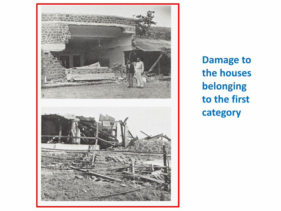
Damage to the houses belonging to the first category
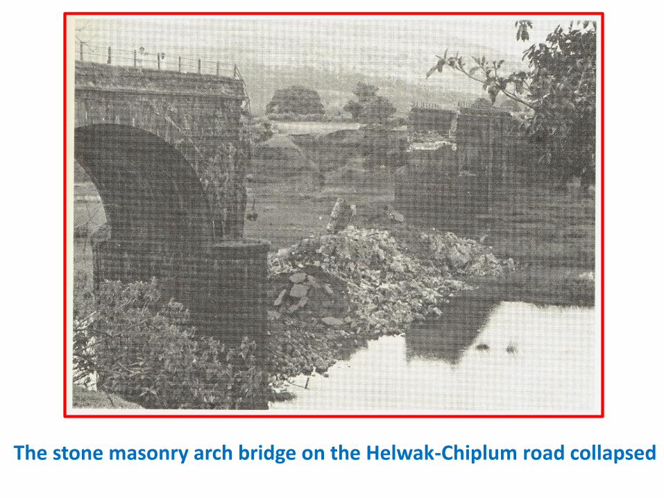
The stone masonry arch bridge on the Helwak-Chiplum road collapsed
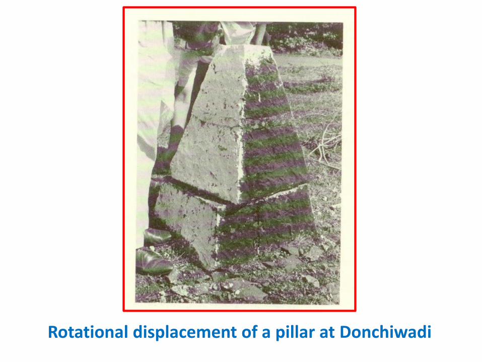
Rotational displacement of a pillar at Donchiwadi
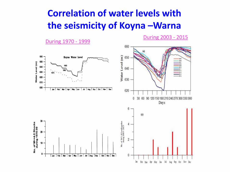
Correlation of water levels with the seismicity of Koyna –Warna
During 2003 - 2015During 1970 - 1999
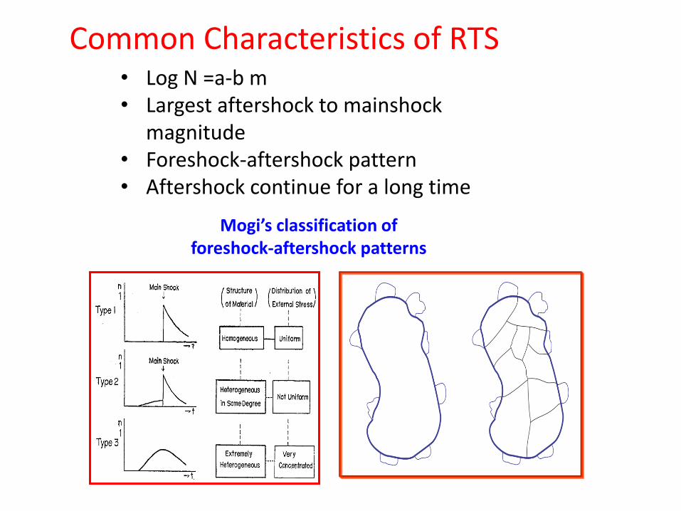
Mogi’s classification of foreshock-aftershock patterns
• Log N =a-b m• Largest aftershock to mainshock
magnitude• Foreshock-aftershock pattern• Aftershock continue for a long time
Common Characteristics of RTS
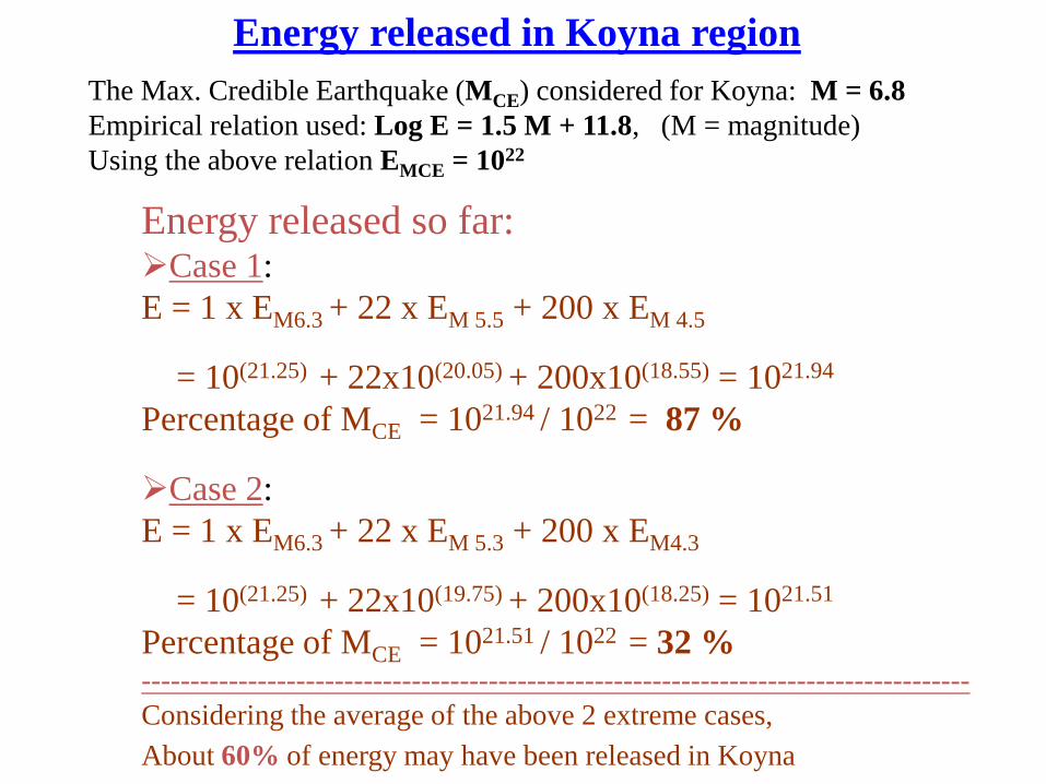
Energy released in Koyna region
The Max. Credible Earthquake (MCE) considered for Koyna: M = 6.8
Empirical relation used: Log E = 1.5 M + 11.8, (M = magnitude)
Using the above relation EMCE = 1022
Energy released so far:Case 1:
E = 1 x EM6.3 + 22 x EM 5.5 + 200 x EM 4.5
= 10(21.25) + 22x10(20.05) + 200x10(18.55) = 1021.94
Percentage of MCE = 1021.94 / 1022 = 87 %
Case 2:
E = 1 x EM6.3 + 22 x EM 5.3 + 200 x EM4.3
= 10(21.25) + 22x10(19.75) + 200x10(18.25) = 1021.51
Percentage of MCE = 1021.51 / 1022 = 32 %--------------------------------------------------------------------------------------
Considering the average of the above 2 extreme cases,
About 60% of energy may have been released in Koyna
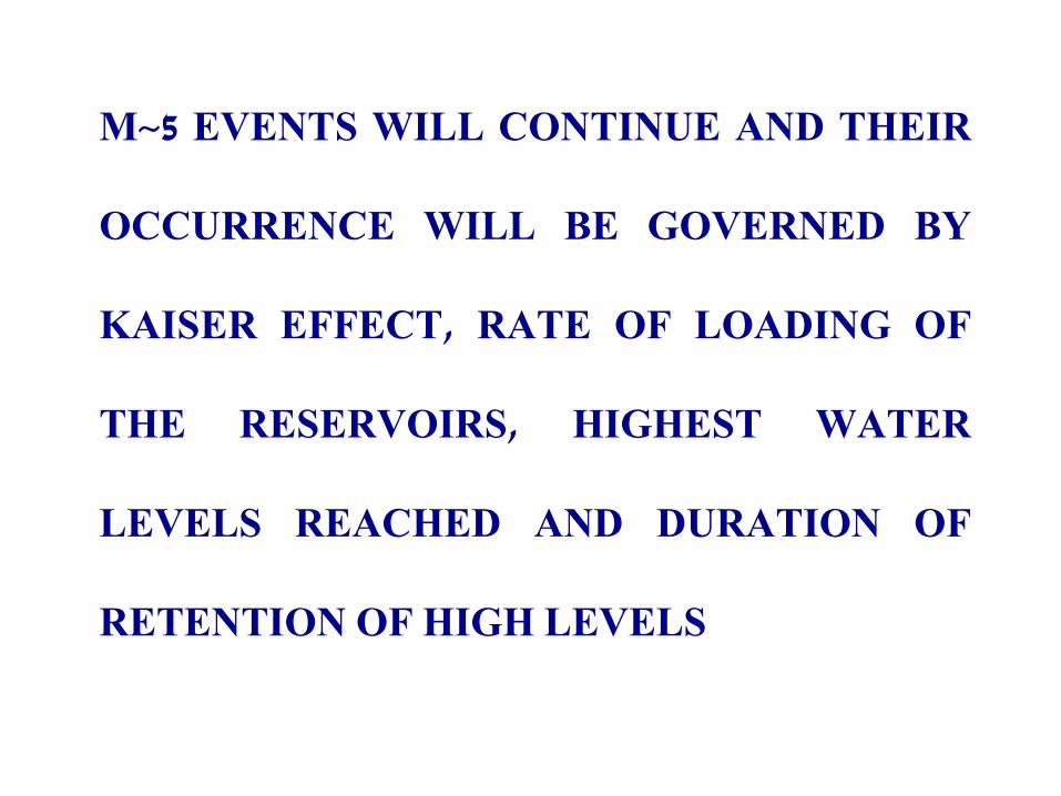
M~5 EVENTS WILL CONTINUE AND THEIR
OCCURRENCE WILL BE GOVERNED BY
KAISER EFFECT, RATE OF LOADING OF
THE RESERVOIRS, HIGHEST WATER
LEVELS REACHED AND DURATION OF
RETENTION OF HIGH LEVELS
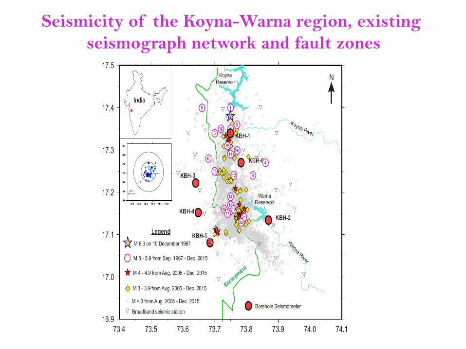
Seismicity of the Koyna-Warna region, existing
seismograph network and fault zones
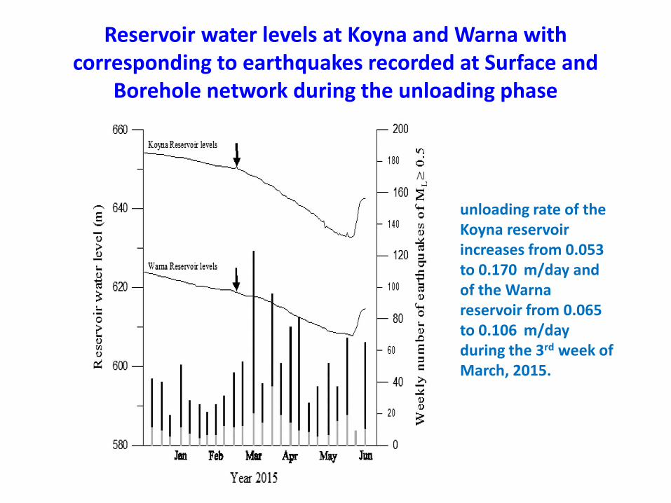
Reservoir water levels at Koyna and Warna with corresponding to earthquakes recorded at Surface and
Borehole network during the unloading phase
unloading rate of the Koyna reservoir increases from 0.053 to 0.170 m/day and of the Warna reservoir from 0.065 to 0.106 m/day during the 3rd week of March, 2015.
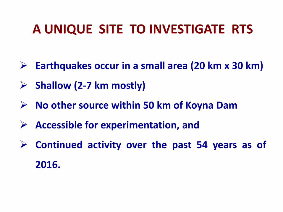
A UNIQUE SITE TO INVESTIGATE RTS
Earthquakes occur in a small area (20 km x 30 km)
Shallow (2-7 km mostly)
No other source within 50 km of Koyna Dam
Accessible for experimentation, and
Continued activity over the past 54 years as of
2016.
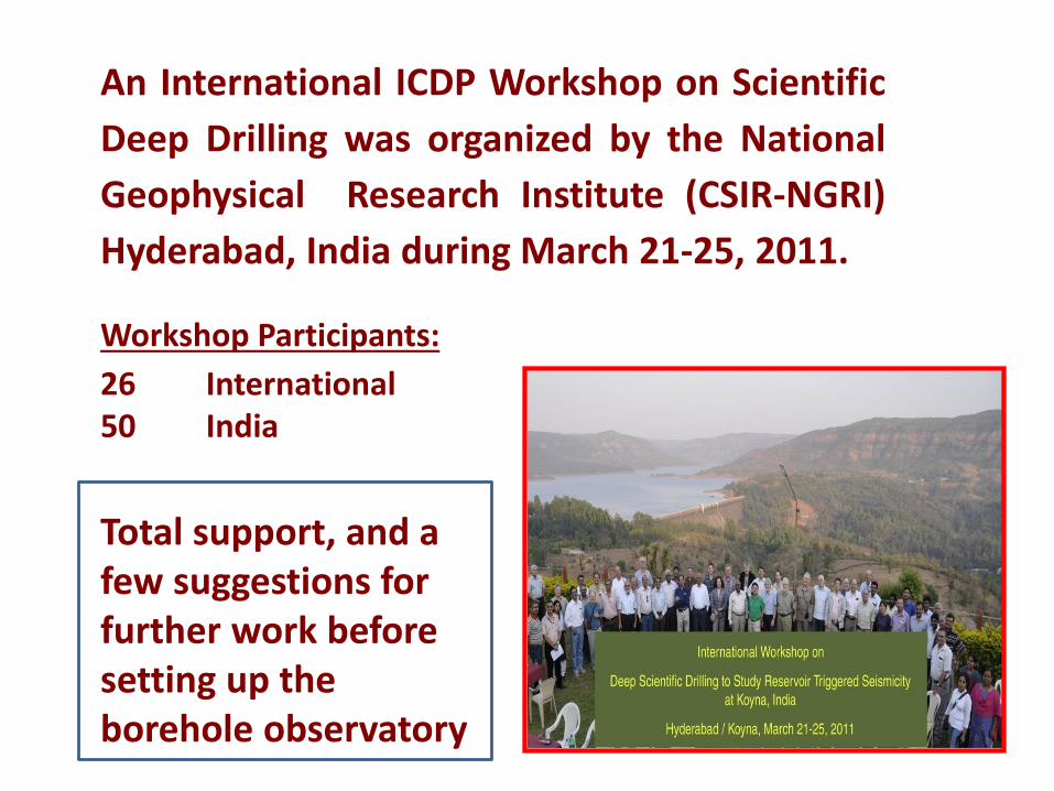
An International ICDP Workshop on Scientific
Deep Drilling was organized by the National
Geophysical Research Institute (CSIR-NGRI)
Hyderabad, India during March 21-25, 2011.
Workshop Participants:
26 International50 India
Total support, and a few suggestions for further work before setting up the borehole observatory
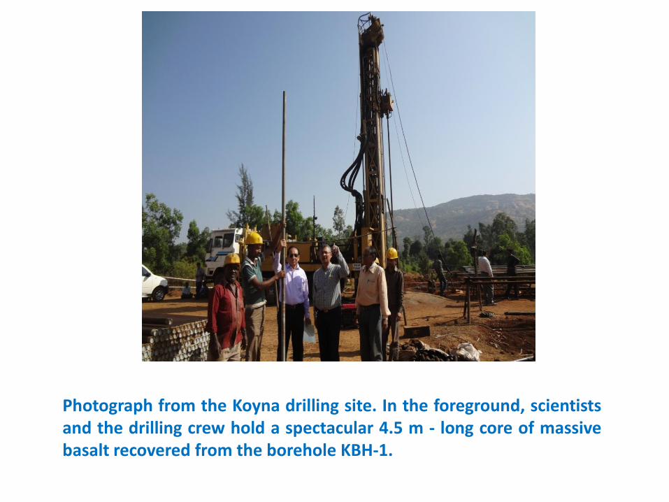
Photograph from the Koyna drilling site. In the foreground, scientistsand the drilling crew hold a spectacular 4.5 m - long core of massivebasalt recovered from the borehole KBH-1.
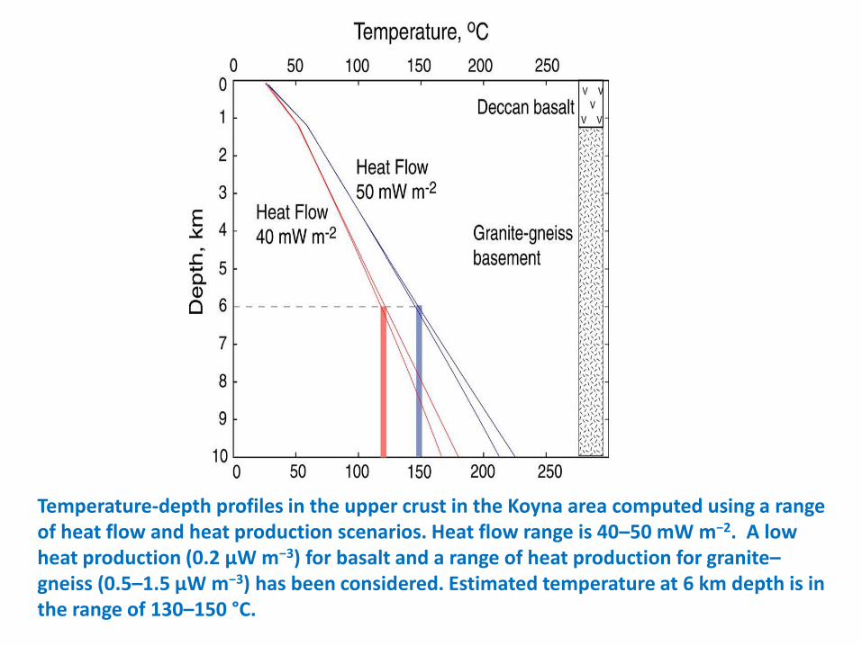
Temperature-depth profiles in the upper crust in the Koyna area computed using a range of heat flow and heat production scenarios. Heat flow range is 40–50 mW m−2. A low heat production (0.2 μW m−3) for basalt and a range of heat production for granite–gneiss (0.5–1.5 μW m−3) has been considered. Estimated temperature at 6 km depth is in the range of 130–150 °C.
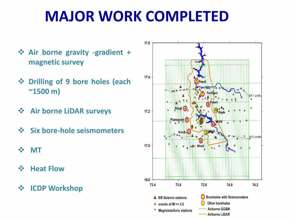
MAJOR WORK COMPLETED
Air borne gravity -gradient +magnetic survey
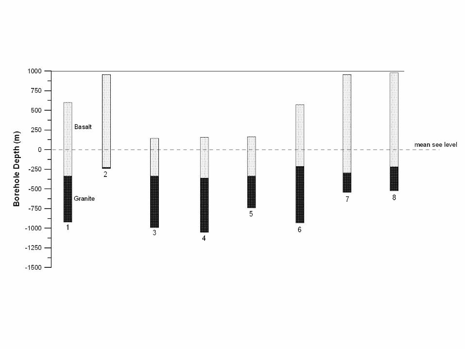
Drilling of 9 bore holes (each~1500 m)
Air borne LiDAR surveys
Six bore-hole seismometers
MT
Heat Flow
ICDP Workshop
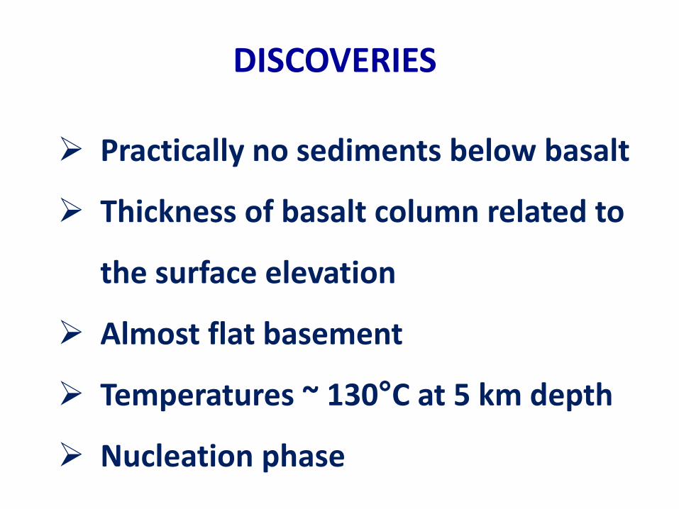
DISCOVERIES
Practically no sediments below basalt
Thickness of basalt column related to
the surface elevation
Almost flat basement
Temperatures ~ 130°C at 5 km depth
Nucleation phase
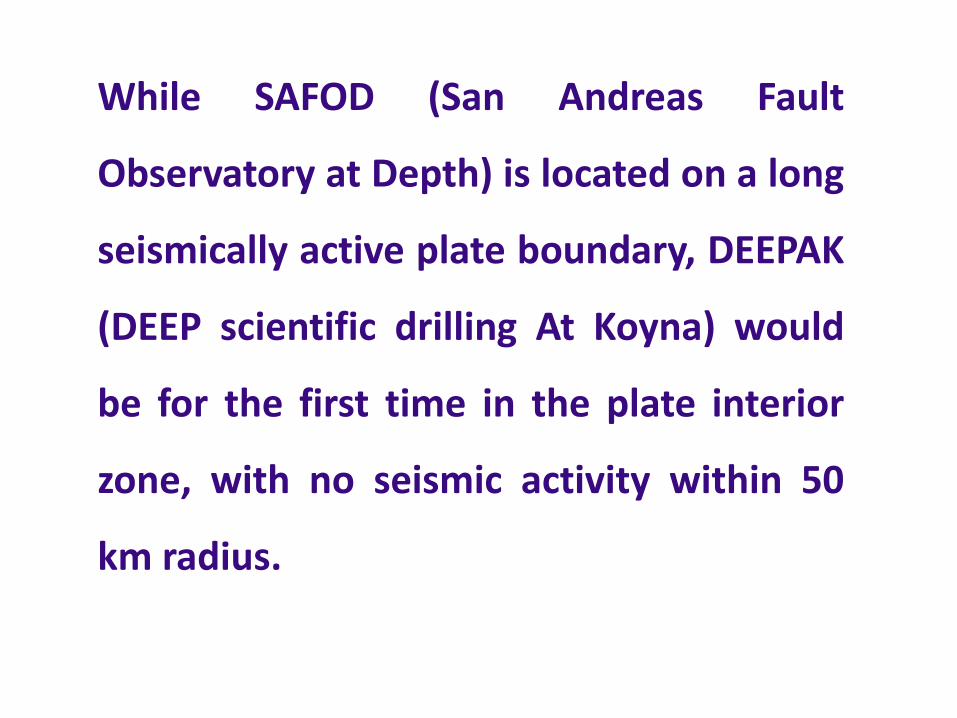
While SAFOD (San Andreas Fault
Observatory at Depth) is located on a long
seismically active plate boundary, DEEPAK
(DEEP scientific drilling At Koyna) would
be for the first time in the plate interior
zone, with no seismic activity within 50
km radius.
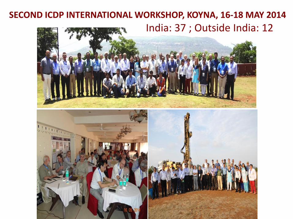
SECOND ICDP INTERNATIONAL WORKSHOP, KOYNA, 16-18 MAY 2014
India: 37 ; Outside India: 12
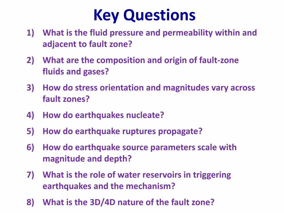
Key Questions1) What is the fluid pressure and permeability within and
adjacent to fault zone?
2) What are the composition and origin of fault-zone fluids and gases?
3) How do stress orientation and magnitudes vary across fault zones?
4) How do earthquakes nucleate?
5) How do earthquake ruptures propagate?
6) How do earthquake source parameters scale with magnitude and depth?
7) What is the role of water reservoirs in triggering earthquakes and the mechanism?
8) What is the 3D/4D nature of the fault zone?
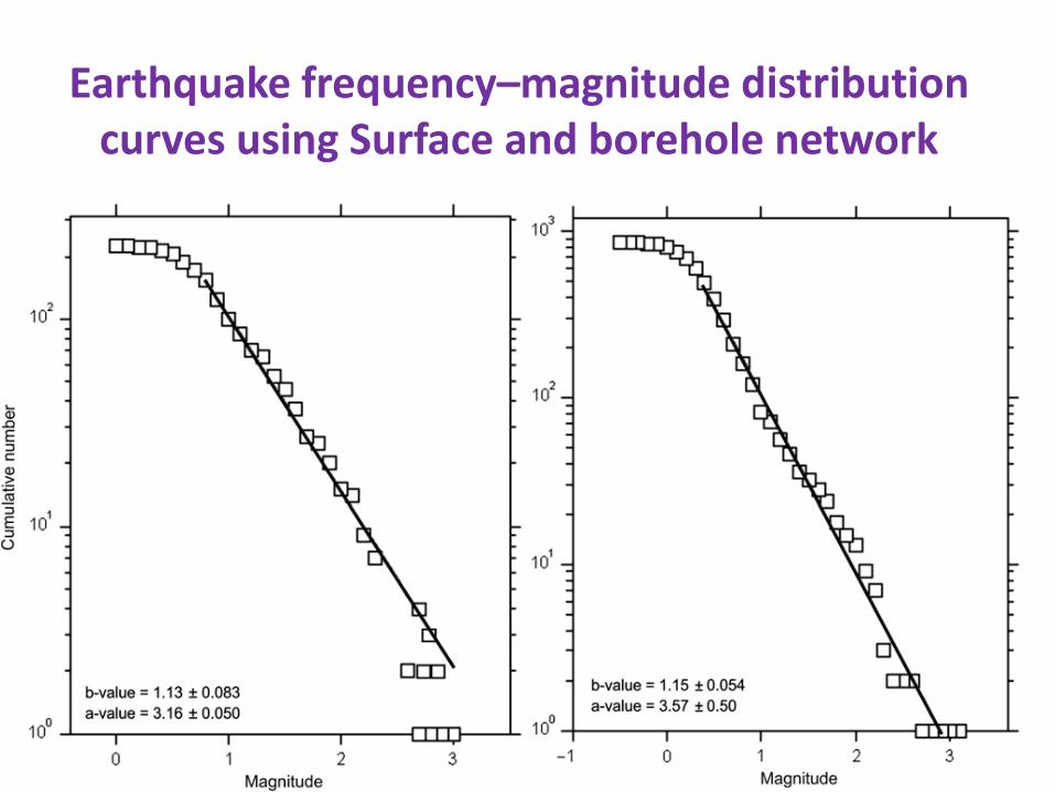
Earthquake frequency–magnitude distribution curves using Surface and borehole network
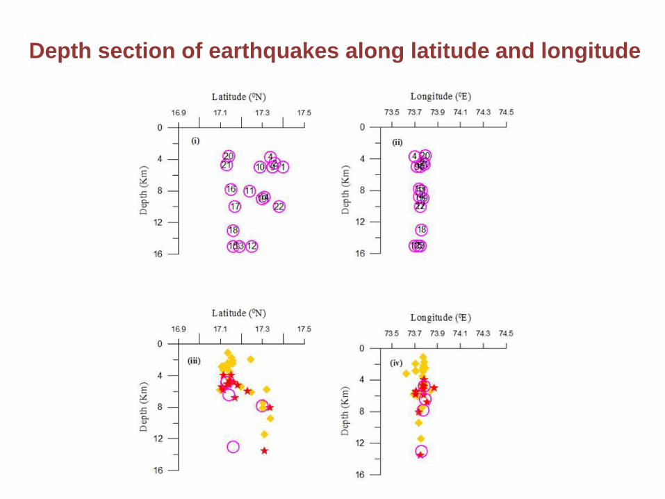
Depth section of earthquakes along latitude and longitude
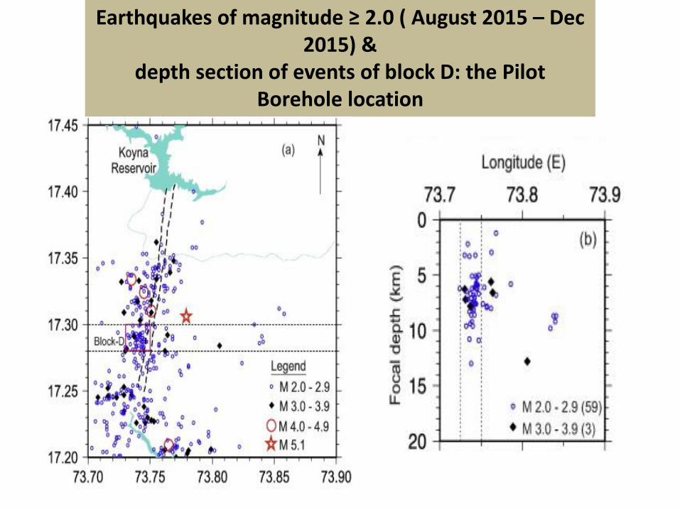
Earthquakes of magnitude ≥ 2.0 ( August 2015 – Dec 2015) &
depth section of events of block D: the Pilot Borehole location
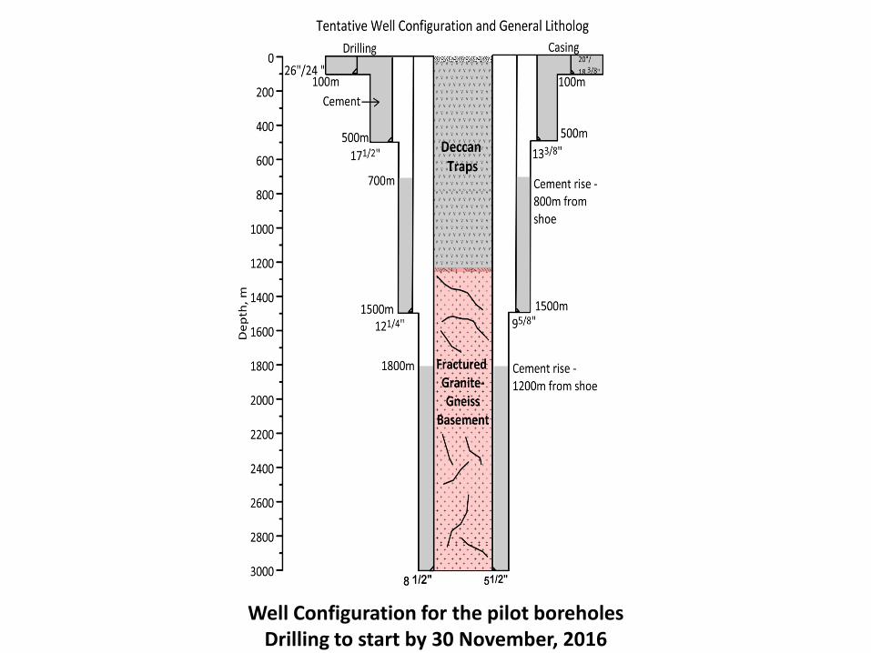
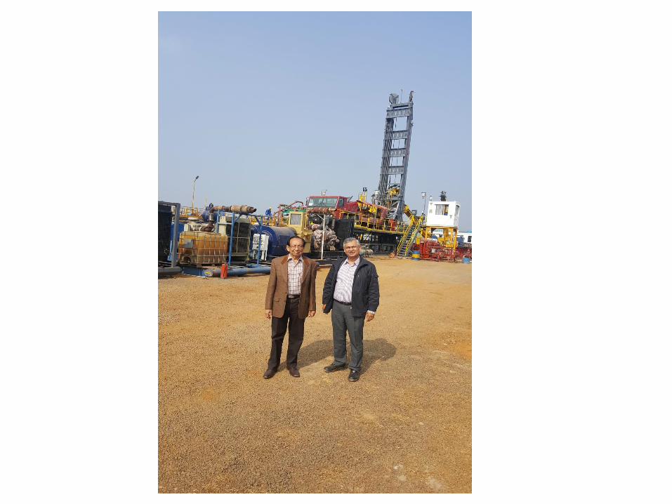
Well Configuration for the pilot boreholes Drilling to start by 30 November, 2016
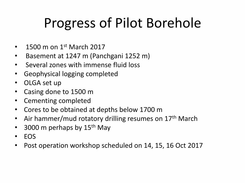
Progress of Pilot Borehole
• 1500 m on 1st March 2017• Basement at 1247 m (Panchgani 1252 m)• Several zones with immense fluid loss• Geophysical logging completed• OLGA set up• Casing done to 1500 m• Cementing completed• Cores to be obtained at depths below 1700 m• Air hammer/mud rotatory drilling resumes on 17th March• 3000 m perhaps by 15th May• EOS • Post operation workshop scheduled on 14, 15, 16 Oct 2017
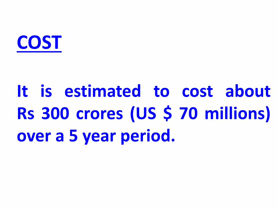
COST
It is estimated to cost aboutRs 300 crores (US $ 70 millions)over a 5 year period.
Acknowledgements:Shailesh Nayak, Brijesh Bansal, Rajeevan, Sukanta Roy….. (MoES)V. P. Dimri, Mrinal Sen, Bhaskar Rao, P C Rao, V. M. Tiwari………….(NGRI)
Rolf Emmermann, Uli Harms, Brian Horsfield, Thomas Weisberg, Jochem Kueck, Carola Knebel….(ICDP)
Jim Mori, Bill Ellsworth, Hans Joachim Kuempel, Marco Bohnhoff ……(International)
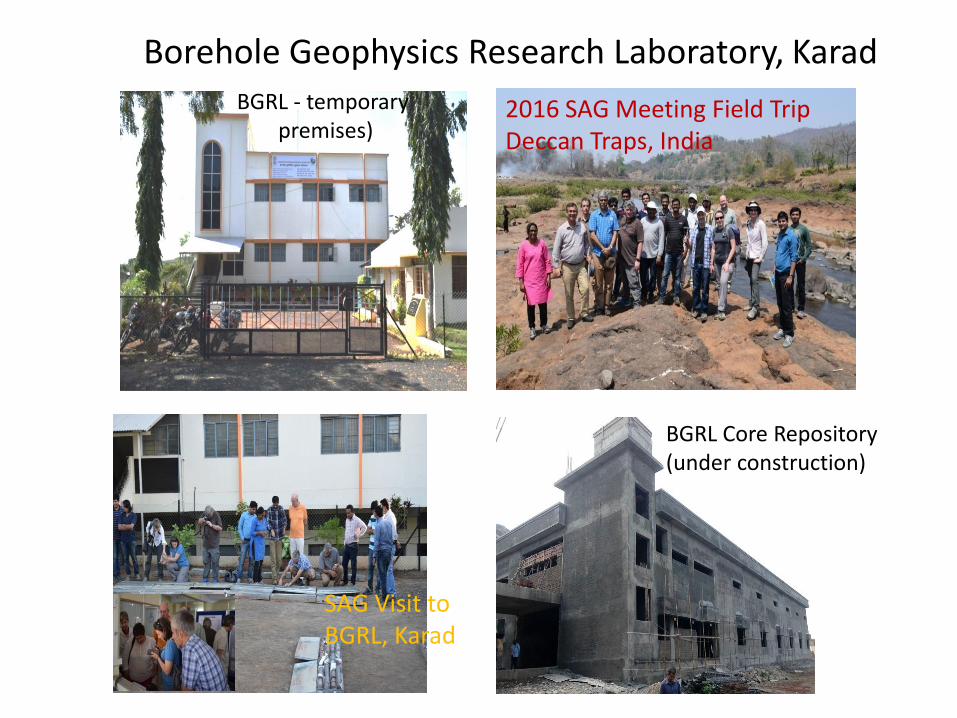
2016 SAG Meeting Field TripDeccan Traps, India
SAG Visit toBGRL, Karad
BGRL Core Repository(under construction)
BGRL - temporary premises)
Borehole Geophysics Research Laboratory, Karad
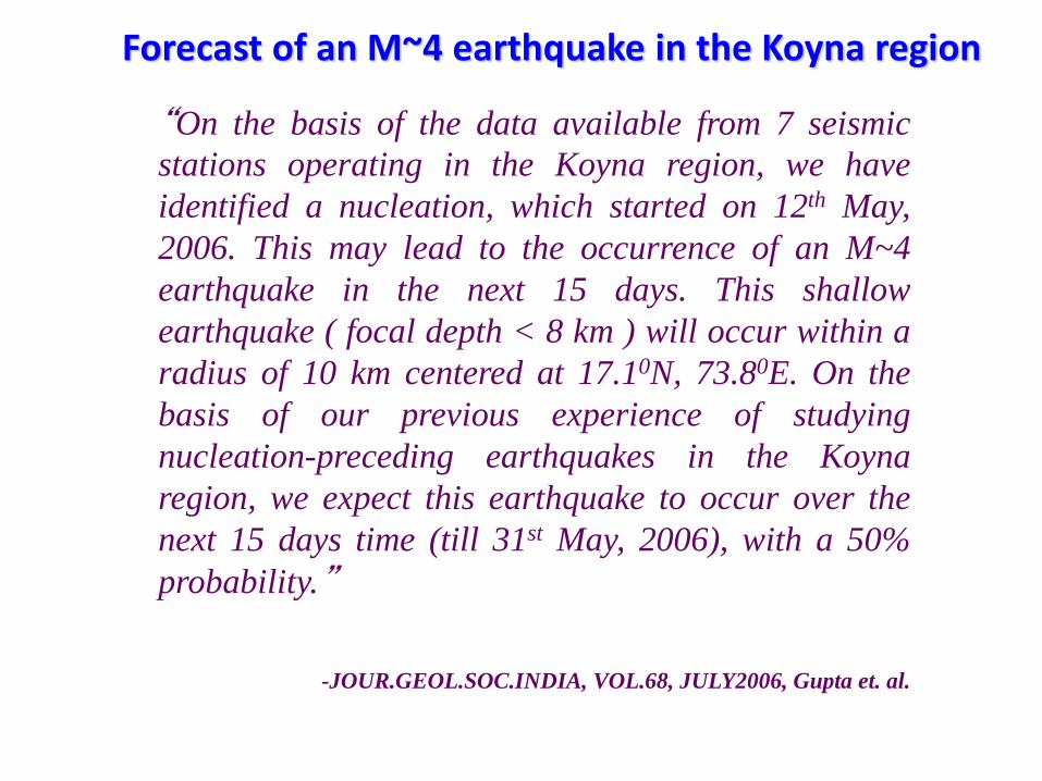
Forecast of an M~4 earthquake in the Koyna region
“On the basis of the data available from 7 seismic
stations operating in the Koyna region, we have
identified a nucleation, which started on 12th May,
2006. This may lead to the occurrence of an M~4
earthquake in the next 15 days. This shallow
earthquake ( focal depth < 8 km ) will occur within a
radius of 10 km centered at 17.10N, 73.80E. On the
basis of our previous experience of studying
nucleation-preceding earthquakes in the Koyna
region, we expect this earthquake to occur over the
next 15 days time (till 31st May, 2006), with a 50%
probability.”
-JOUR.GEOL.SOC.INDIA, VOL.68, JULY2006, Gupta et. al.
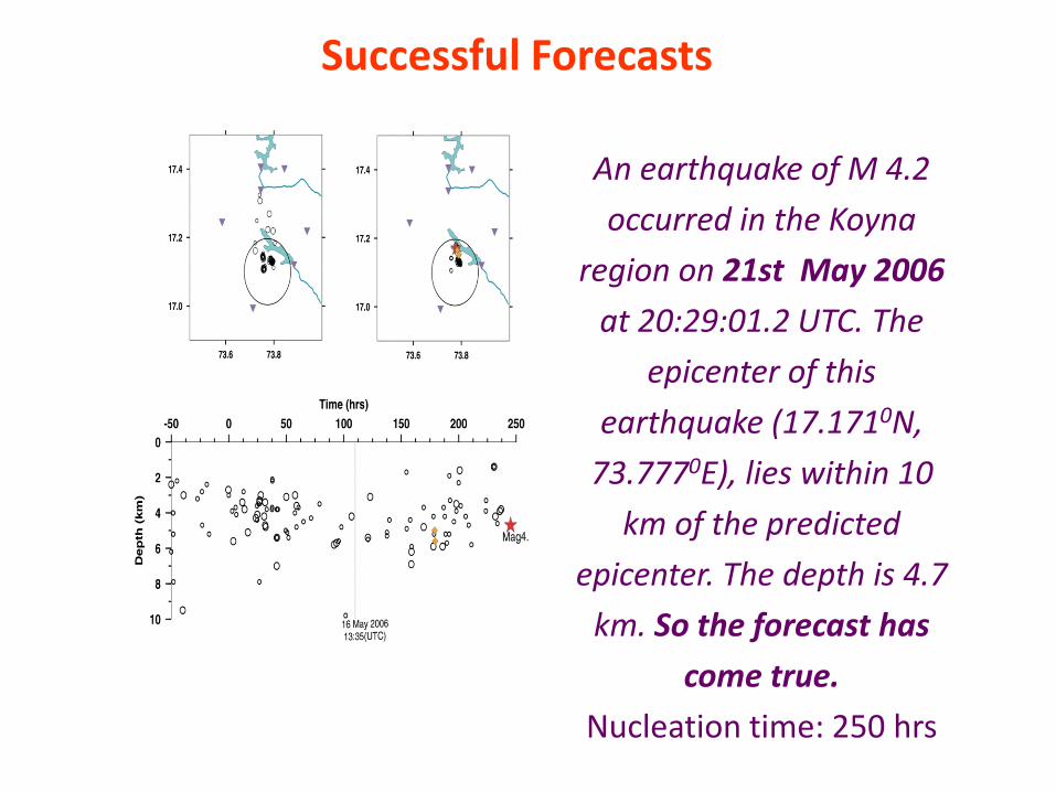
Successful Forecasts
An earthquake of M 4.2
occurred in the Koyna
region on 21st May 2006
at 20:29:01.2 UTC. The
epicenter of this
earthquake (17.1710N,
73.7770E), lies within 10
km of the predicted
epicenter. The depth is 4.7
km. So the forecast has
come true.
Nucleation time: 250 hrs
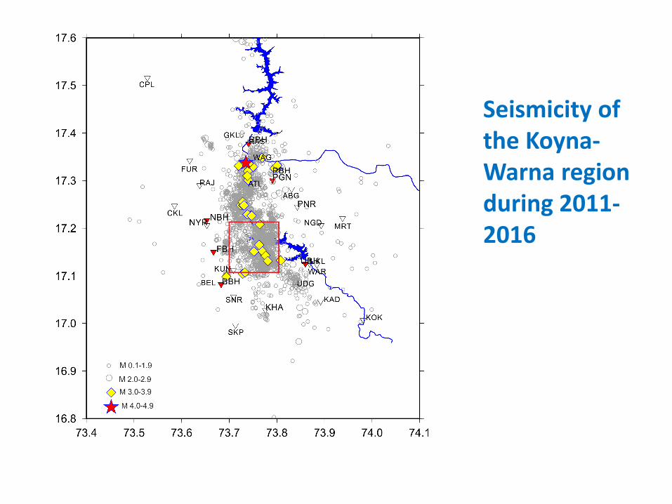
Seismicity of the Koyna-Warna region during 2011-2016
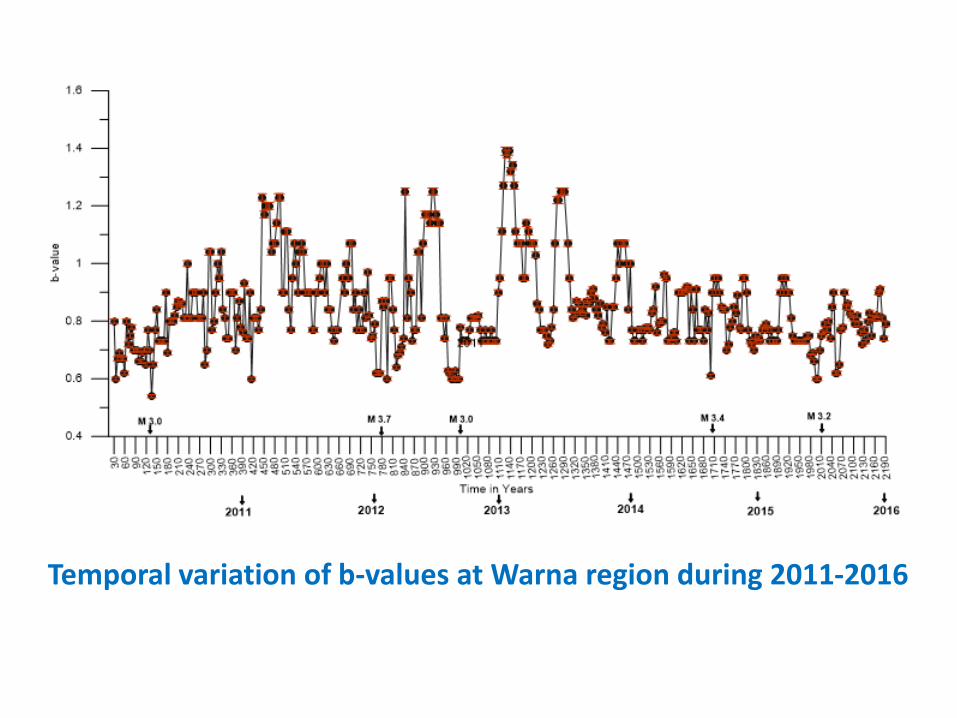
Temporal variation of b-values at Warna region during 2011-2016
M 7.9 May 12, 2008 Wenchuanearthquake, China was triggeredby 156 m deep Zipingpu dam onMin river located about 21kmaway from the epicenter?
Flooding of river near San Andreasfault, California may havetriggered two M~6 earthquakes inthe past (Dalton, 2010)
Advertisement in EOS
• Advertisement in EOS
• Post operation workshop scheduled on
We know precious little about the
composition of the fault at depth, the
state of in-situ stresses or pore pressure
within the fault zone, how the fault
zone fluids originate, the fault zone
processes and their dependence on
time.